
I first came upon this walk while perusing my well-used Pathfinder guide to Fort William and Glen Coe, and was immediately sold by the phrase, ‘one of the country’s most scenic waterfalls’. While the book also describes the path as ‘short and easy’, we soon discovered that while the waterfall description was accurate – and this walk remains one of the most stunning I have taken in the Highlands – the ‘easy’ part was less so.
While not particularly long in the first instance, the path does take one up and down some steep sections that are rocky and not suitable for anyone without a touch of fitness. Once through the gorge, the path is comparatively easy and comfortable. But, I am forever reminded of the August 2021 occasion on which I saw numerous walkers, drawn by the promise of a waterfall, attempting the hike in flipflops, some even with crutches and canes. Unfortunately, I imagine most of them were not able to continue to the best viewpoints.
But I get ahead of myself. Our first challenge, as is often the case in more obscure walks, was to find the car park mentioned in the book. Starting in Fort William, one follows the signs for Glen Nevis and indeed for Ben Nevis itself, as the drive takes you past the most common starting point for hikers attempting the highest peak in the UK. Glen Nevis itself is stunning, and it is almost impossible not to stop a few times along the way.
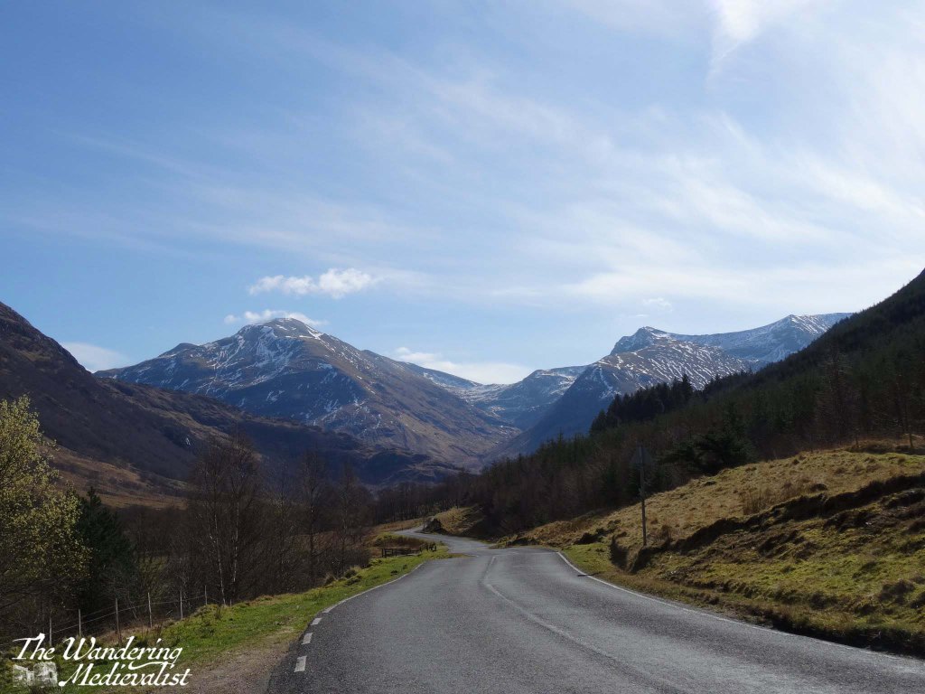
Gradually the road narrows and passes a number of burns and wayerfalls, and on our first trip we thought we had found the car park when we reached the Lower Falls.
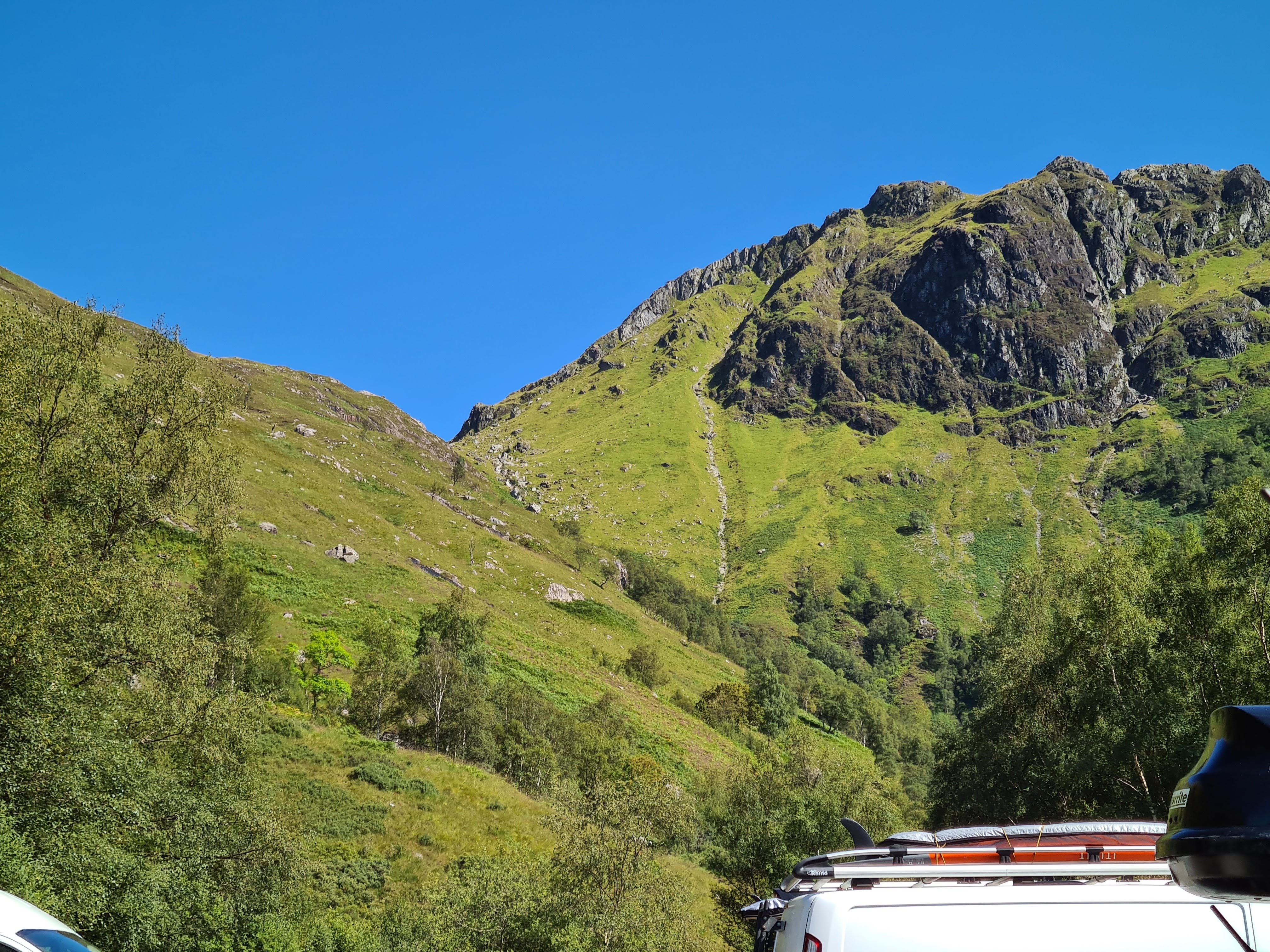
After a few more moments with the map though, we determined that we still had a way to go, and indeed the start of the Nevis Gorge walk, the Upper Glen Nevis Car Park, is another 1.6 miles along the single-track road. Once there, it is clear that it is the end of travel for vehicles. There is a good-sized car park, though when we visited in 2021 it had filled up completely by mid-morning. This may have been anomalous due to the higher than normal number of visitors that summer, but I have a feeling it is quite standard.
There are lovely views even from the car park, and I could not resist snapping a pic of the warning sign to send to the family – once we had returned safely of course.
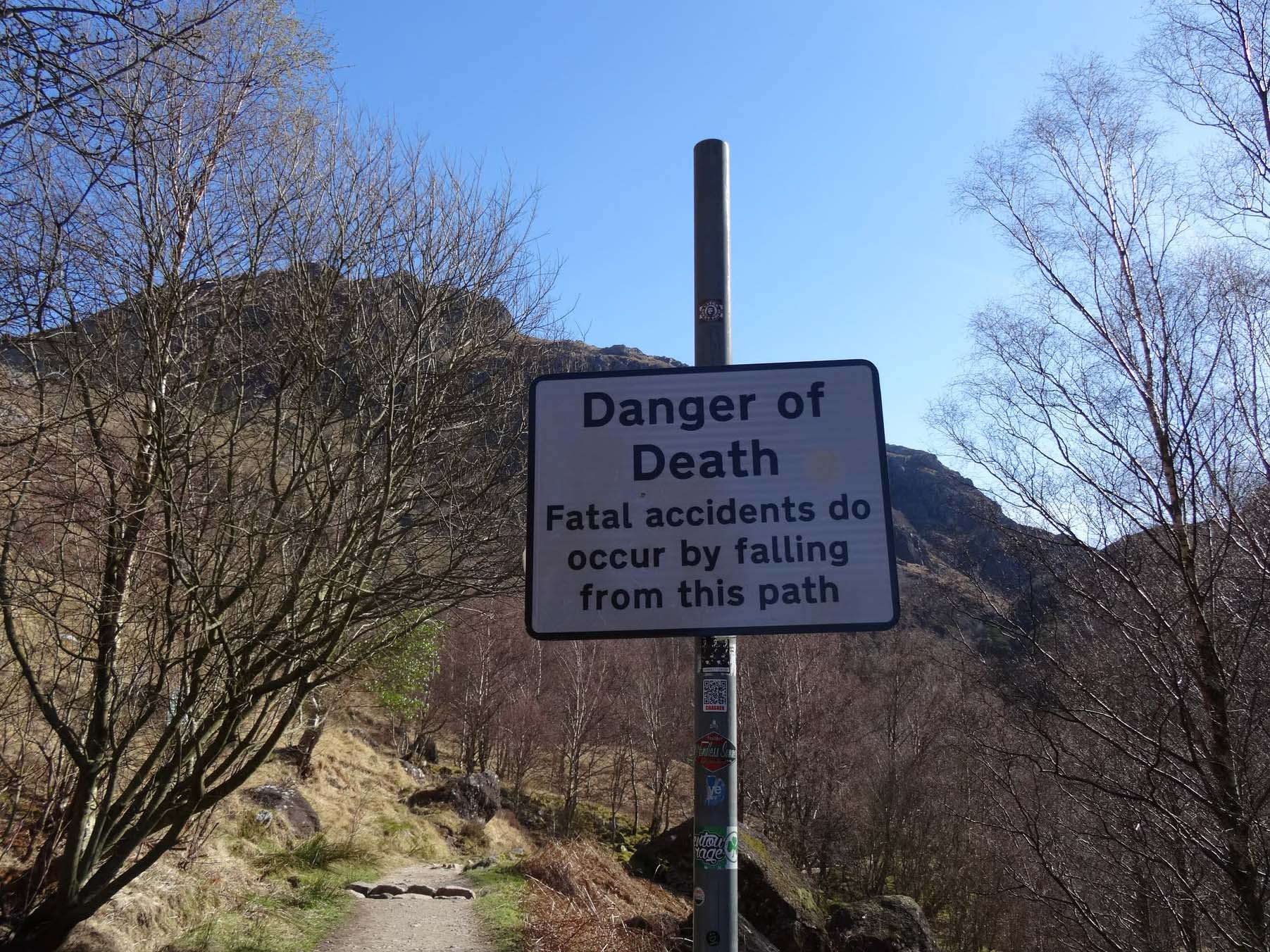
While initially we paid less attention to the warning, by the time we had climbed a bit further and discovered the steeper areas of the trail, we realised how easy it would be to slip into the gorge – especially when mesmerised by the view.
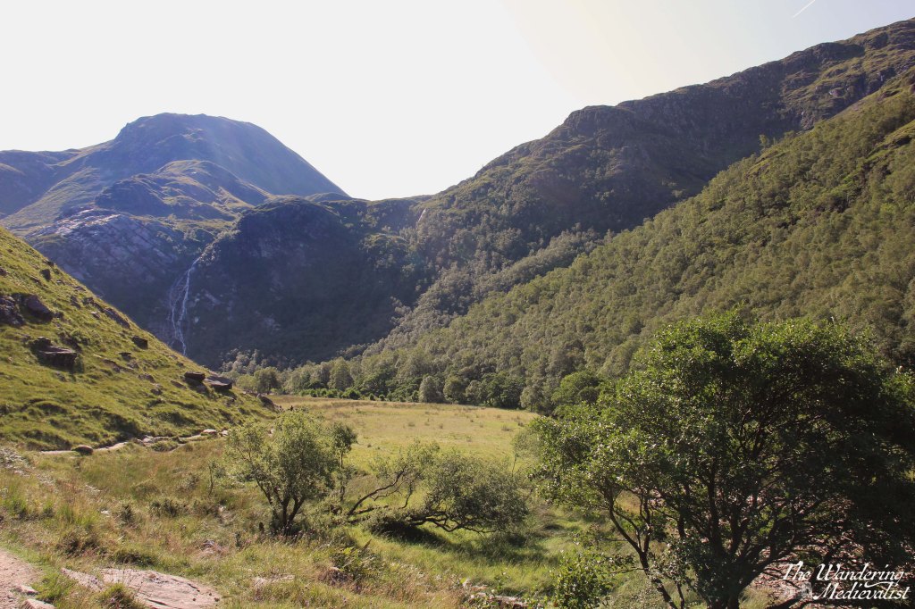
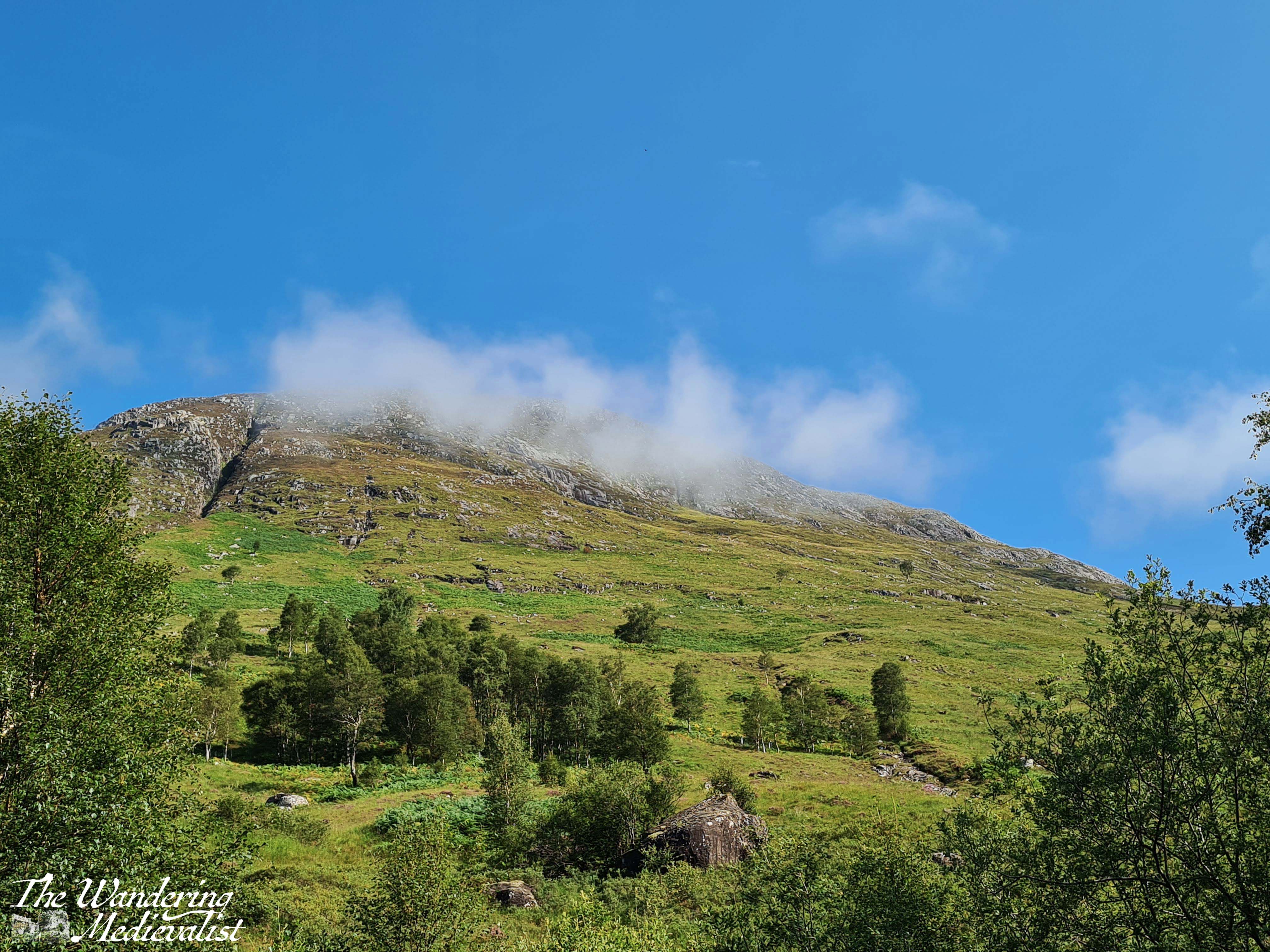
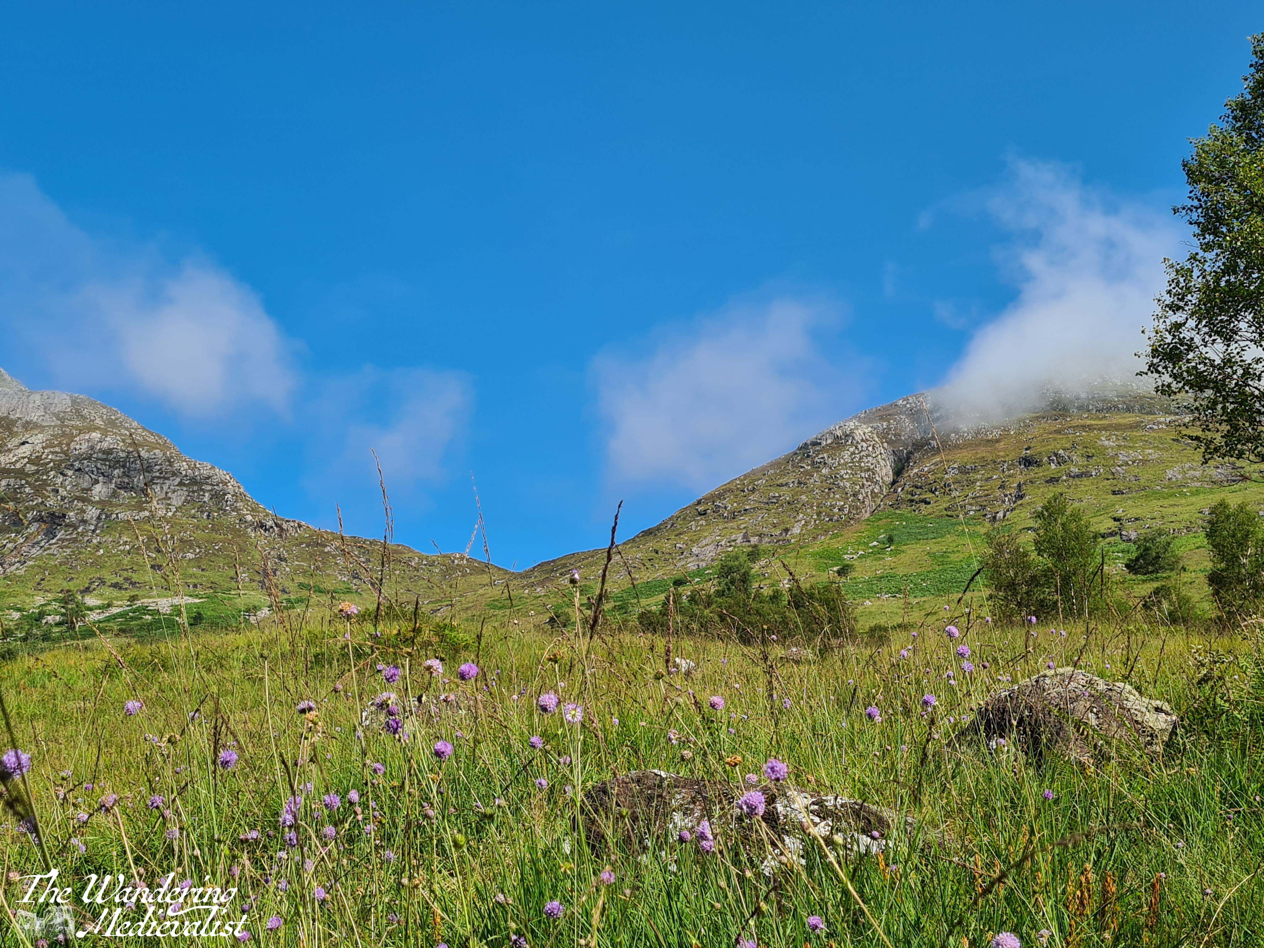
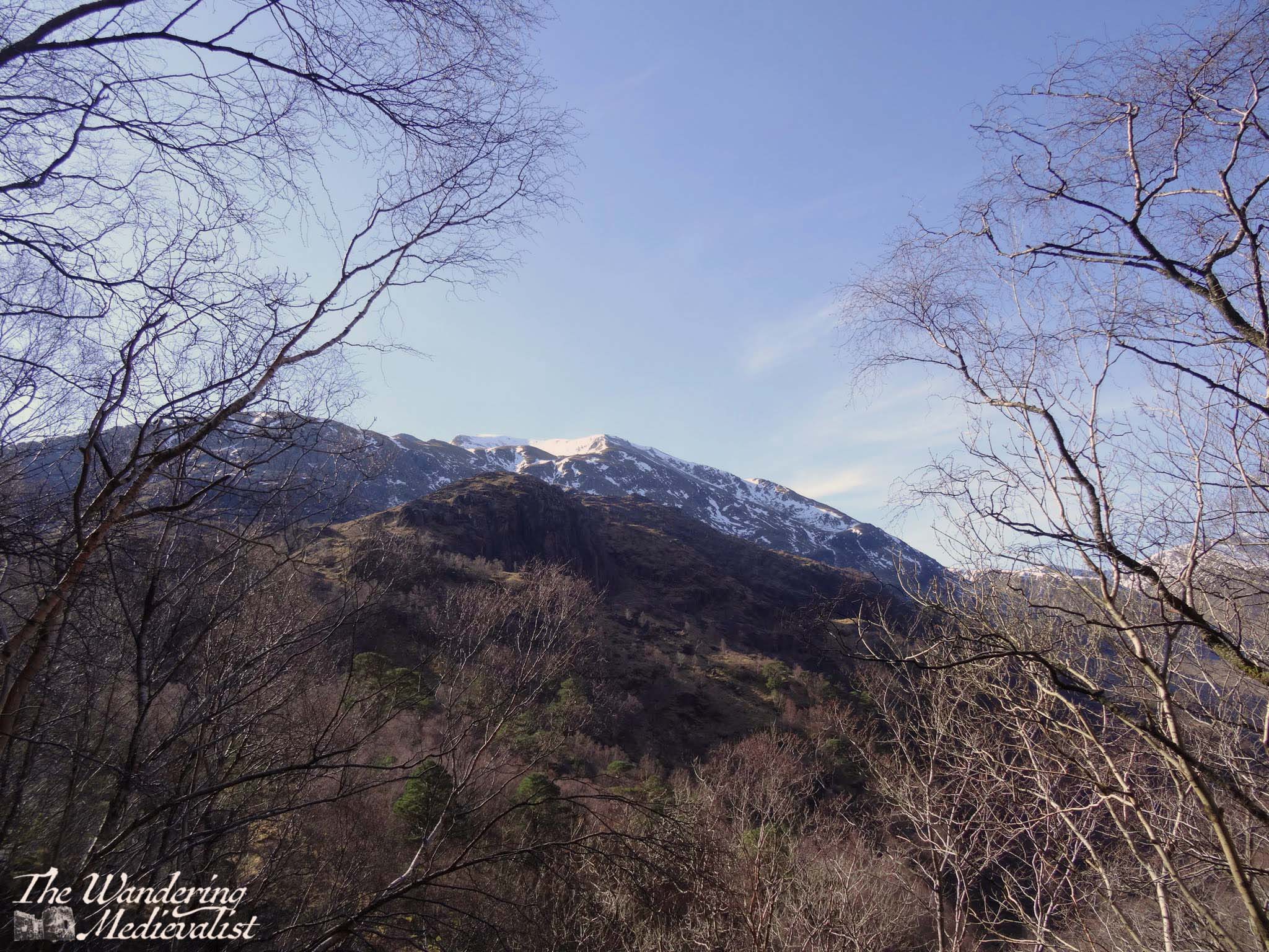
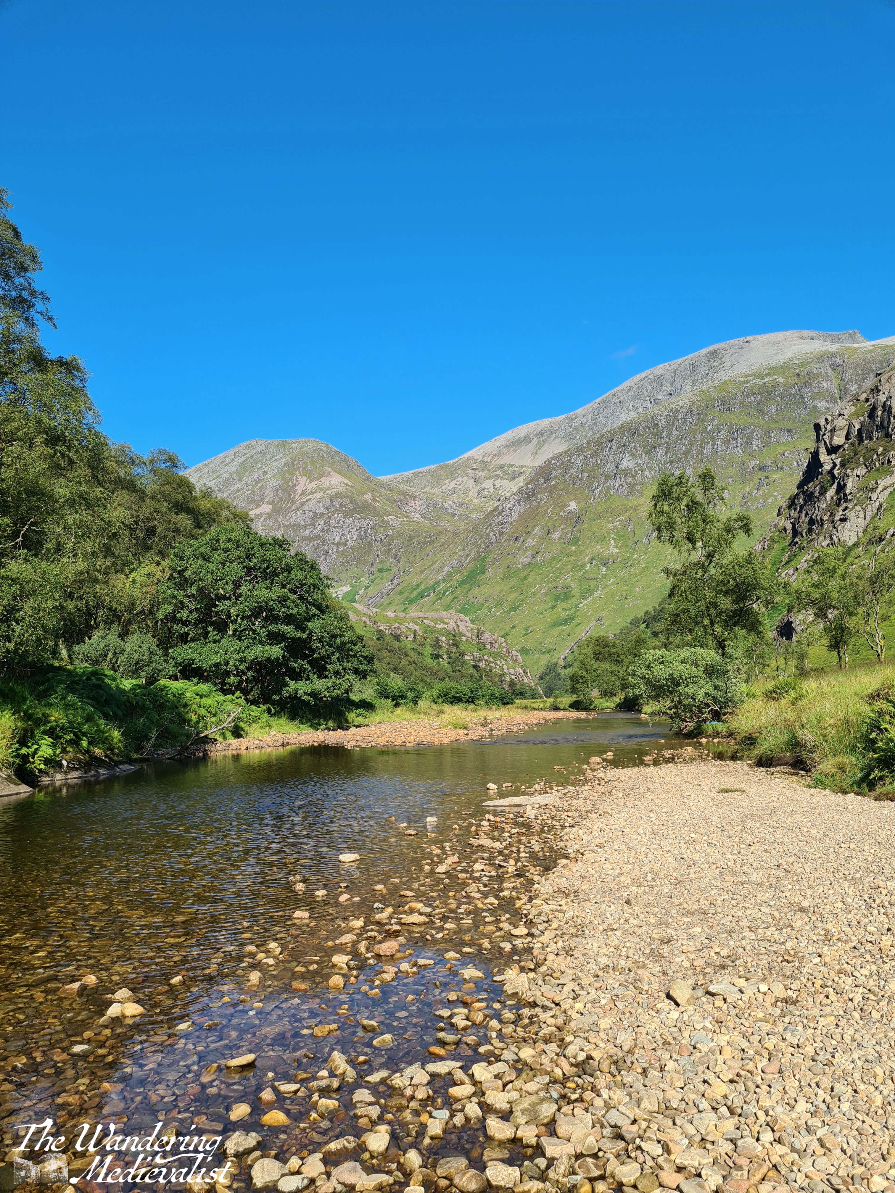
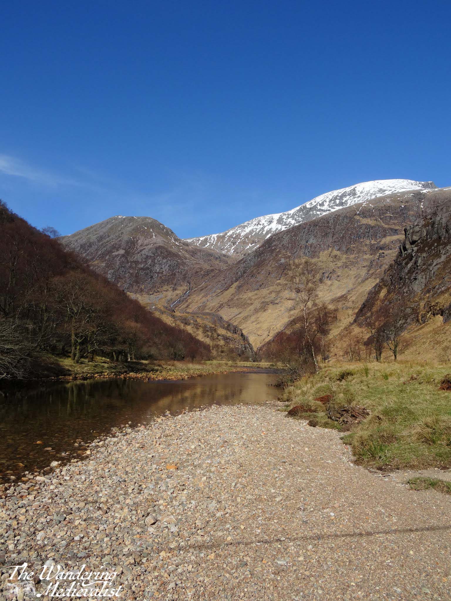
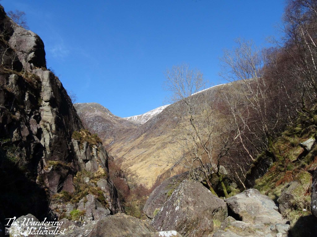
The path starts out quite innocuously through a lovely stand of birch, with some small streams and impressive glimpses through the trees up the hillside and down into the valley where you can hear – if not always see – the Water of Nevis. Before long, though, the trail runs into the side of the hill and begins to curve around to the right, at the same time that it starts to gain height. It narrows and becomes a bit more difficult to traverse, as it is clear that hikers are moving up and through the gorge. Warnings notwithstanding, it is impossible not to stop at a few points to enjoy the view over the glen – below you will see an early spring and late summer version of the view.

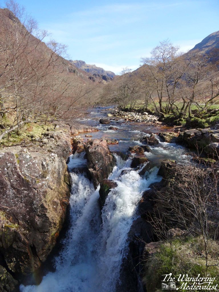
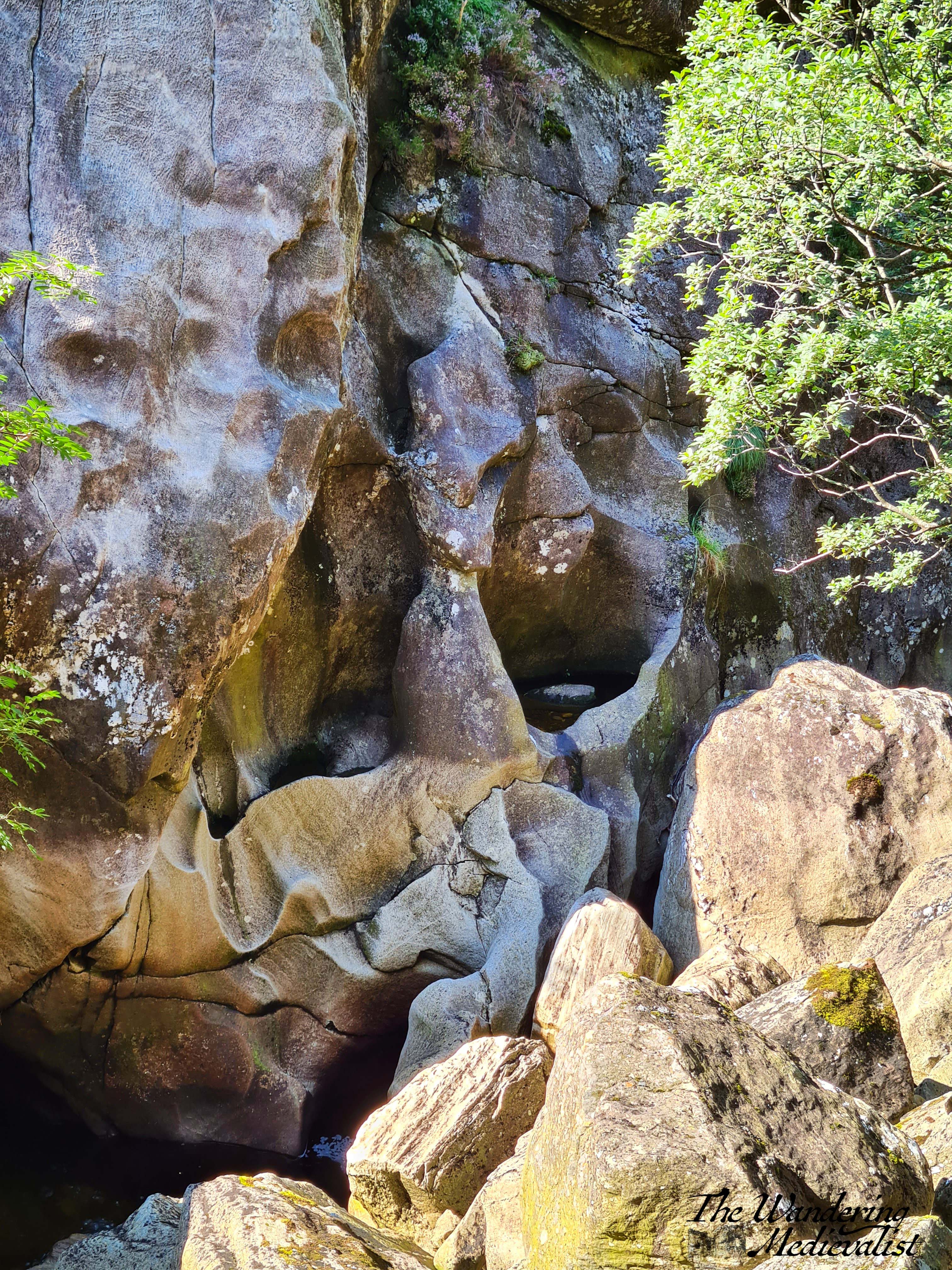
After a few sets of rocky stairs, the trail curves back around to the left and you know you are headed through the gorge. The rushing water below becomes more turbulent as it passes through the narrow gap, and while it is far enough below that you cannot often see it, the rock faces are sheer and carved by thousands of years of water.


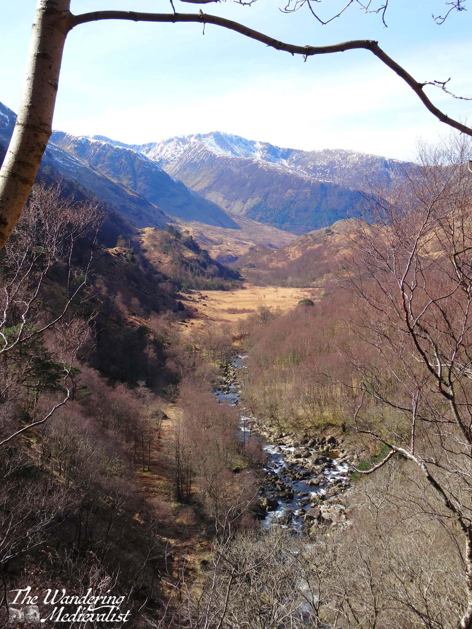
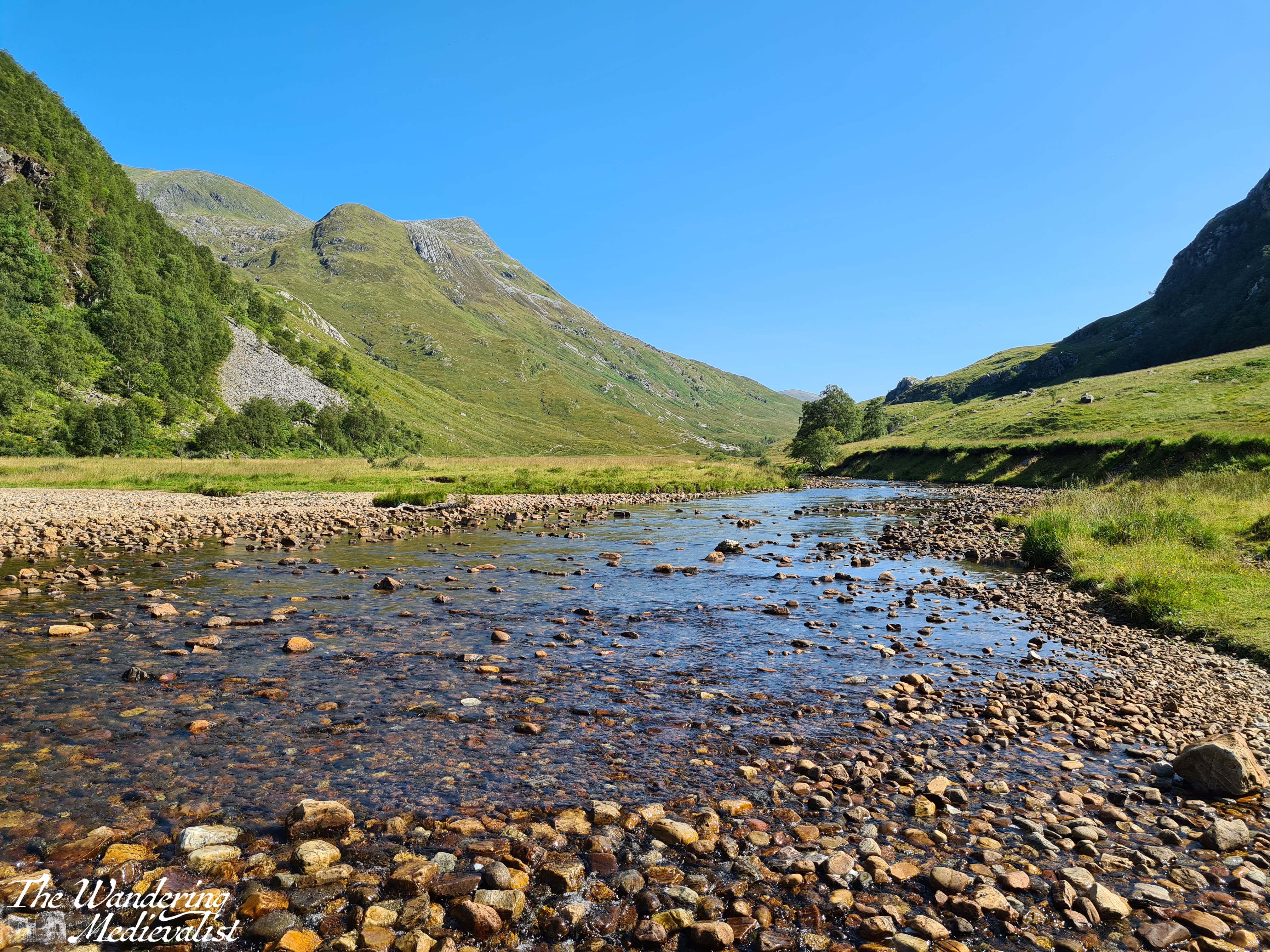
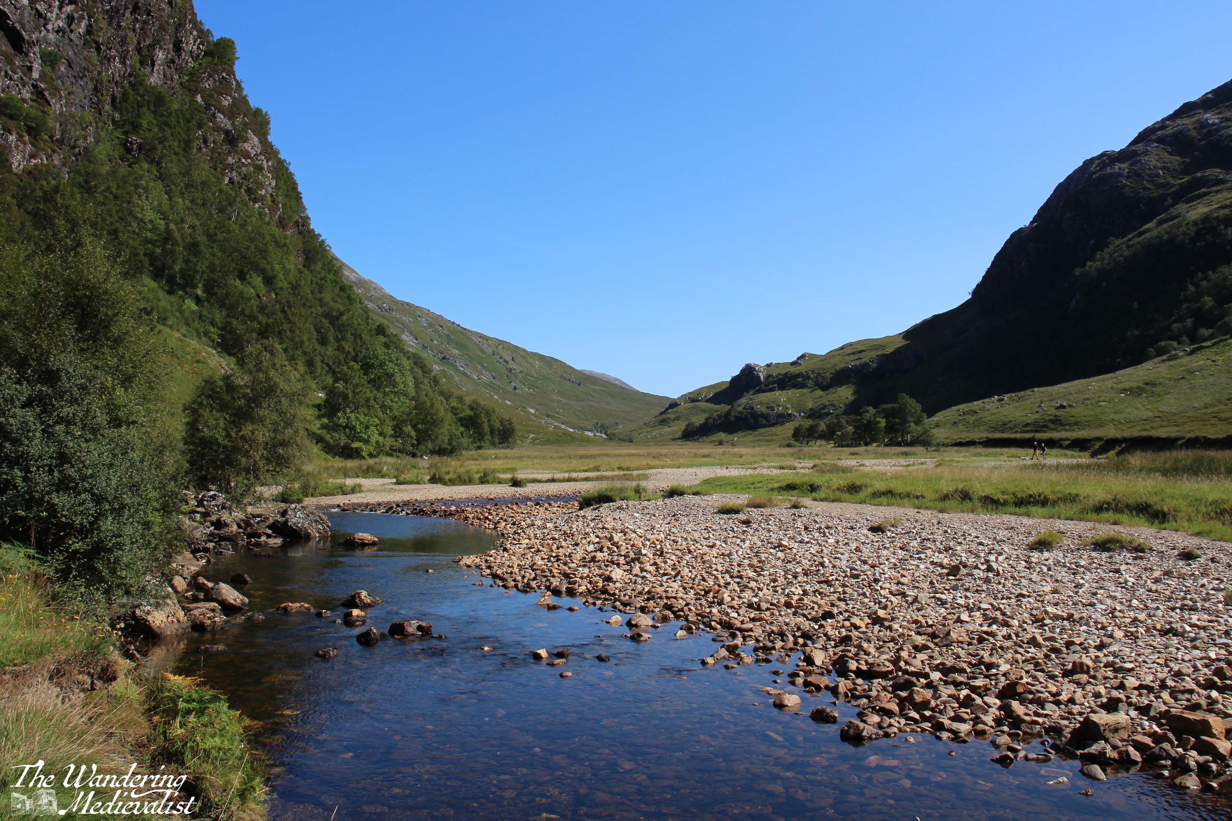
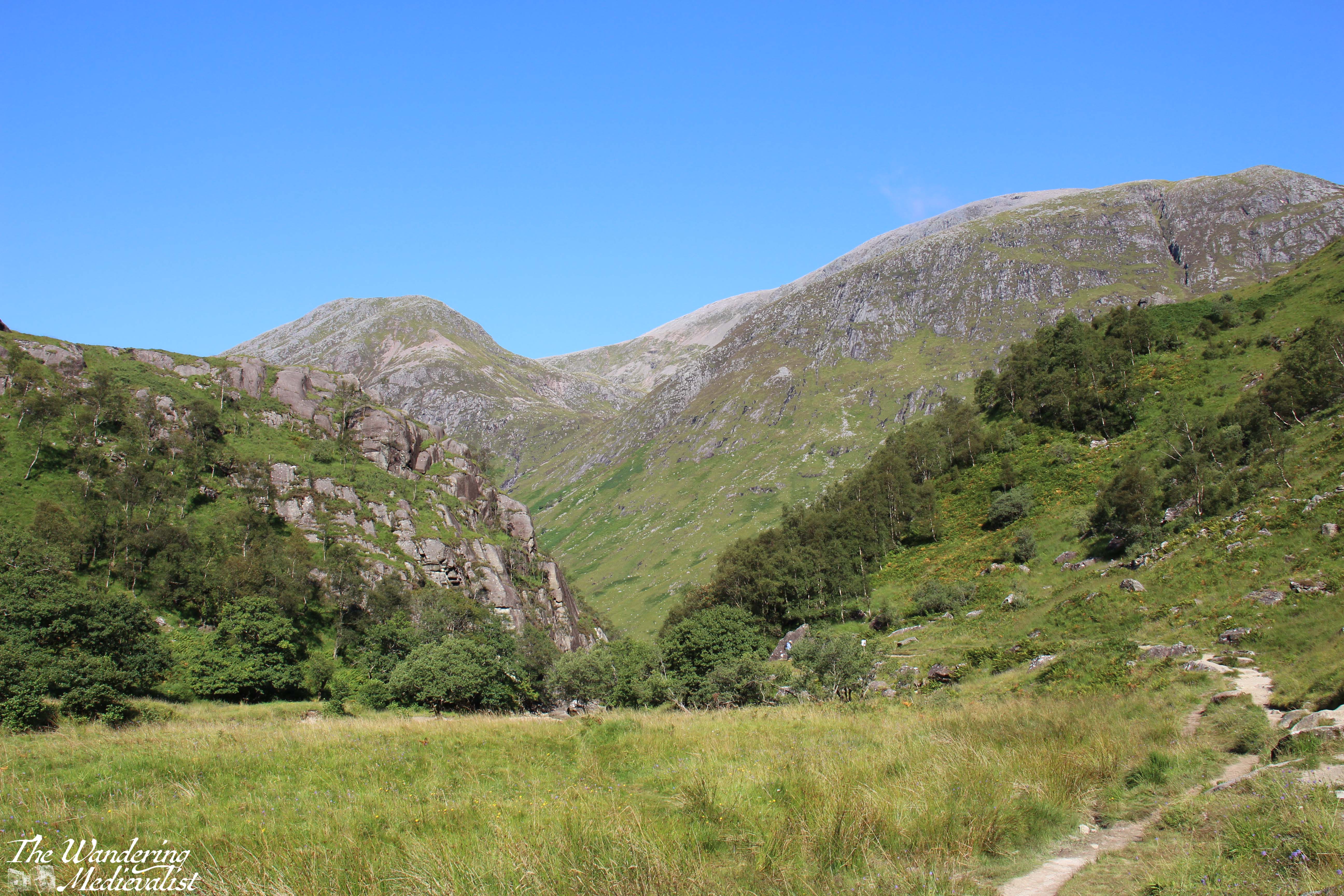
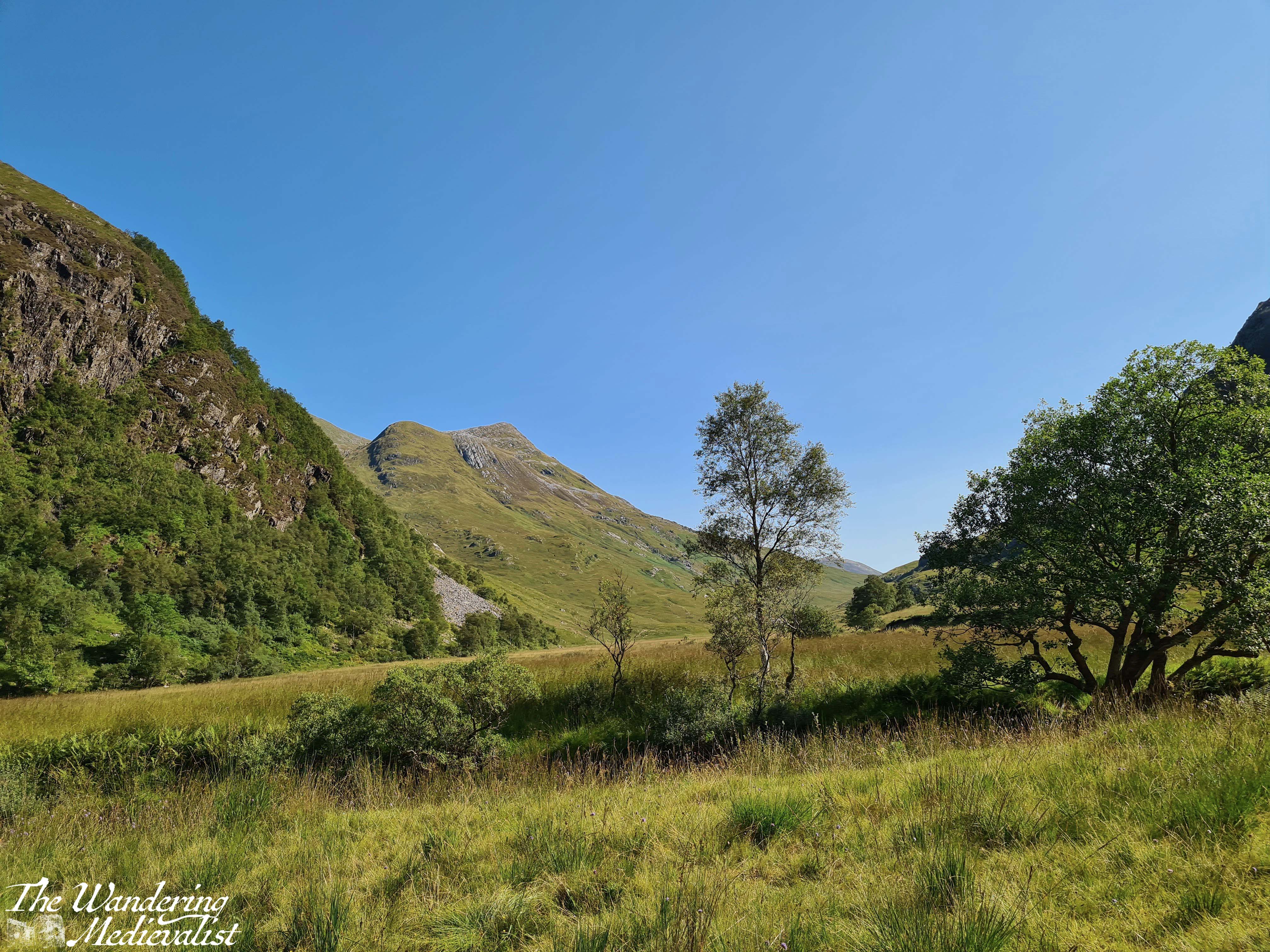
The trail eventually passes through to the other side of the gorge, and before you opens up a beautiful flat valley where the Water of Nevis cuts through the hills. Grassy flat land is dotted with stands of trees and rocks, and in the distance you can just see Steall Falls.


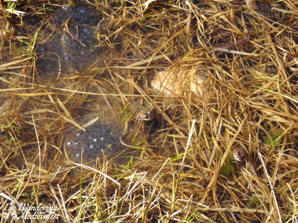
From here, the trail follows the curve of the valley, crossing some small streams and boggy ground; in March when we visited, it was absolutely full of frogs and frogspawn, glistening in the sun.
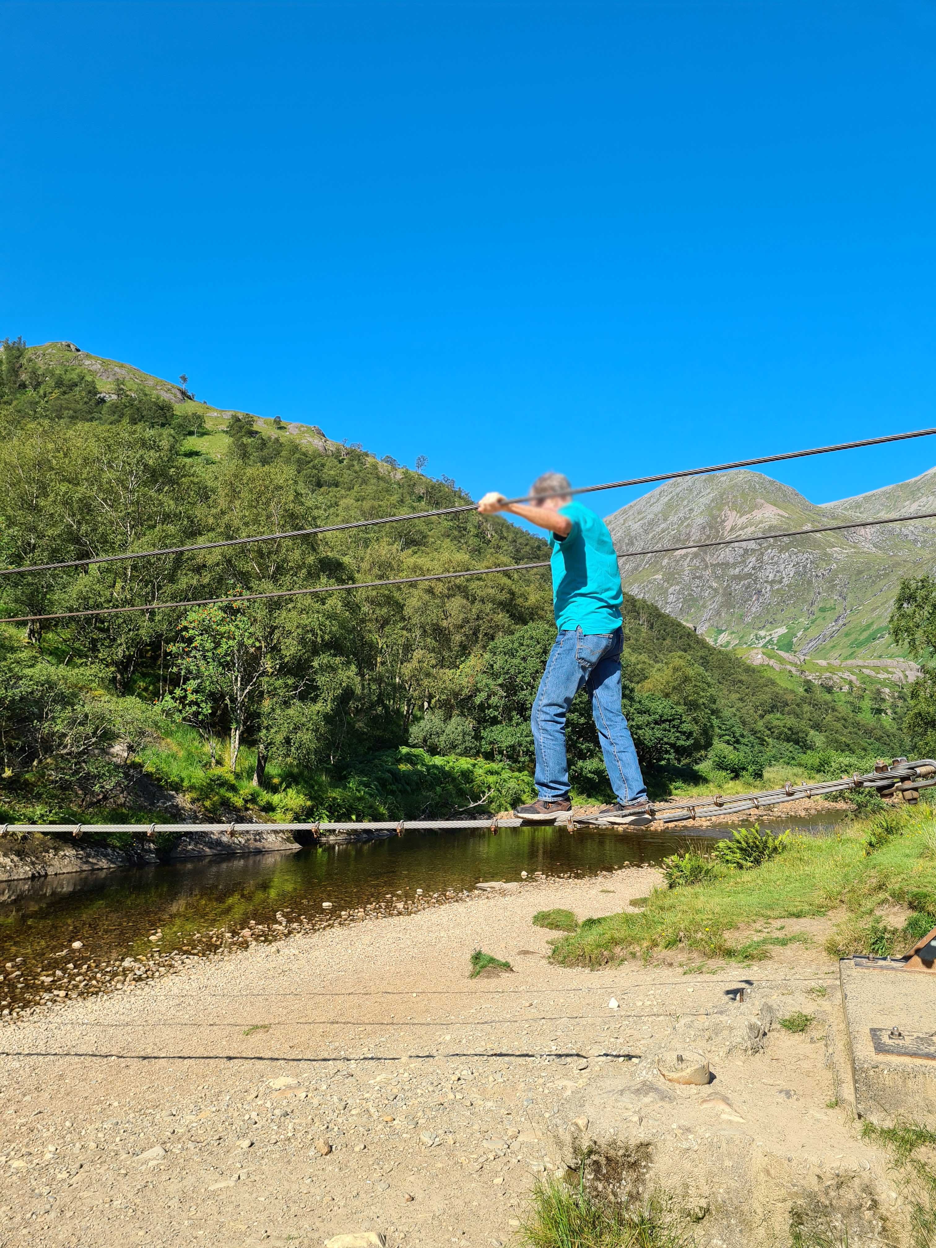
From this point you can continue along the valley up the back of Ben Nevis and eventually reach Spean Bridge or, if incredibly adventurous, the edges of Rannoch Moor. Or, if you are feeling adventurous in a different fashion, you can cross the river to approach the falls directly, though the trail is not as well-marked as one might hope (or wasn’t in the days just after the pandemic). On our first visit, the other half and I chose to just walk up the valley and find a spot on the riverbank for lunch. Dad on the other hand chose to cross the river. Not, as I did, on the rocks just poking above the surface that I crossed dry – unlike the hikers ahead of me – but instead on the wire bridge that spans the river. By wire bridge, I mean literally three heavy wires, one for your feet and two for your arms, which requires both height and upper body strength I do not have – I could not even reach the starting point. While at first the bridge is not far off the ground, by the time it stretches out over the water, it is high enough that one can imagine a fall into the shallow river would not be without injury. After a few uncertain moments at the start, Dad managed it quite well, and then waited on the other side while I plotted my route.

Once safely across, we hiked up towards the falls and I experienced the true viciousness of midges in the Highlands – fortunately I had spray, but the closer I got to the falls, the more swarmed around me, getting caught in my hair and the spray on my arms. While they did not bite through the spray, I ended up looking more freckly than normal and they went out of their way to aim for ears, nose and eyes. I managed to pause long enough for a few pictures of the falls and the view from the rocks, but the bugs were intense enough to encourage us to keep moving.

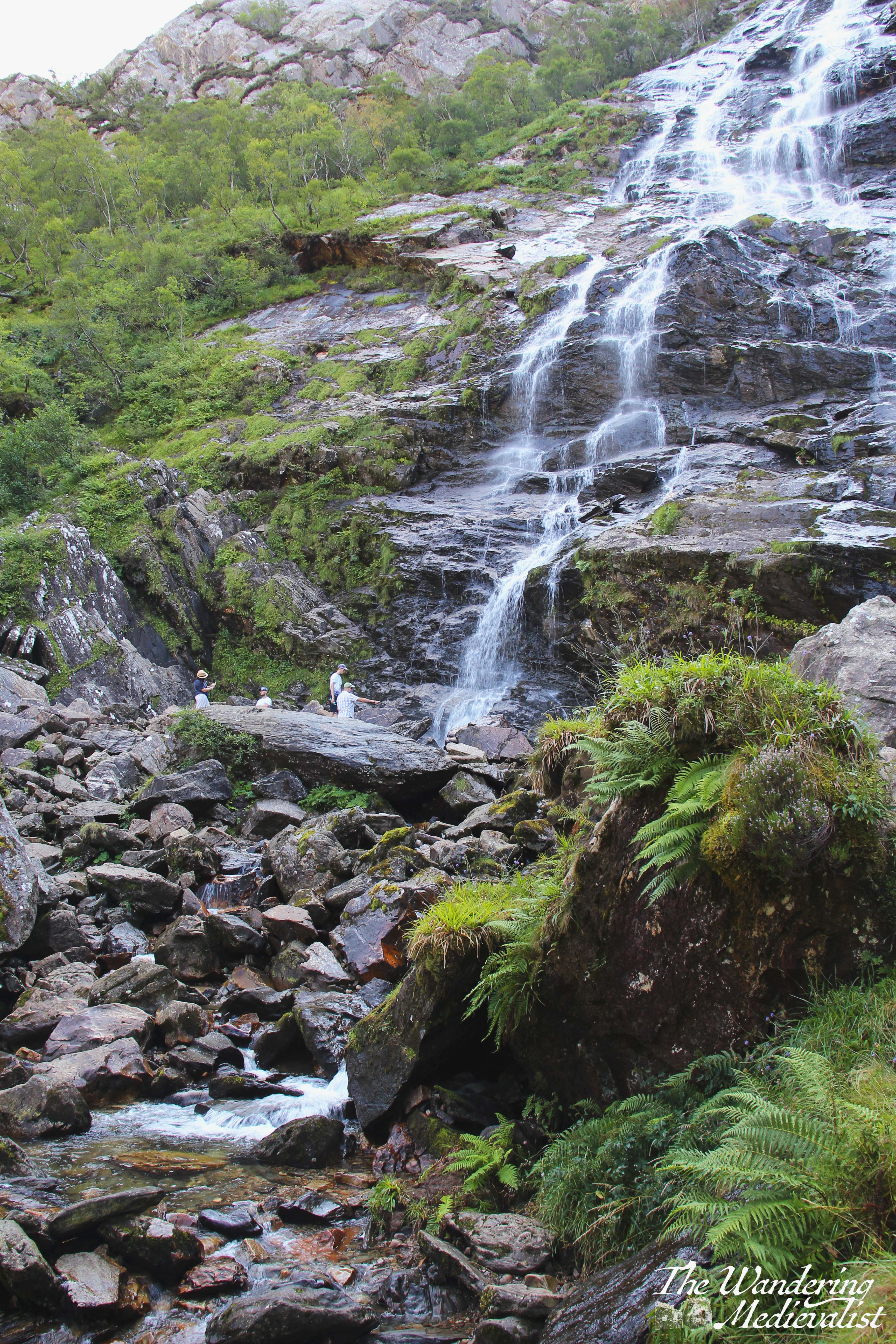
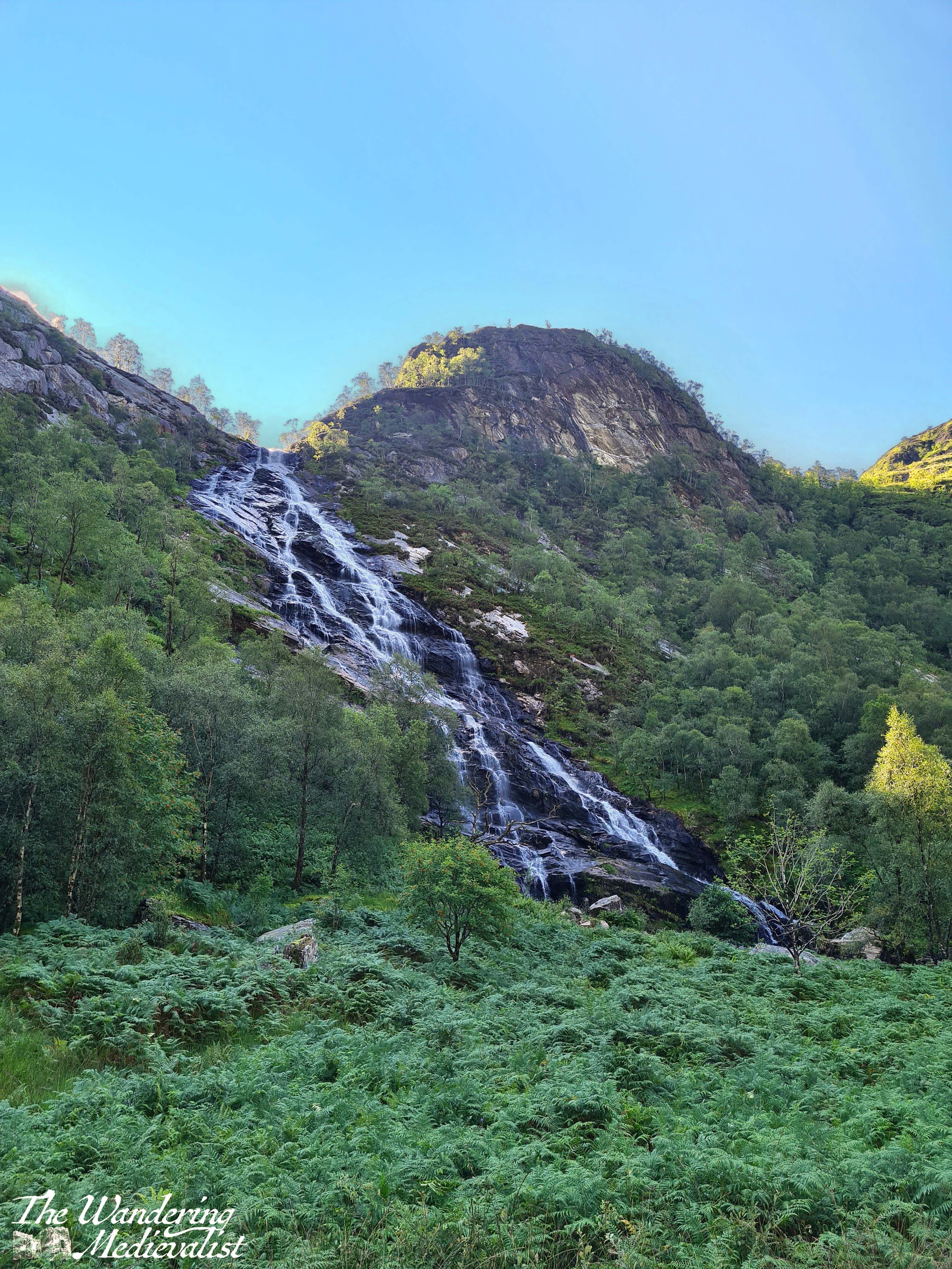
The falls are well worth the exploration – they are the second-highest falls in the UK, with a single drop of 120 metres (390 feet), and there are plenty of places for brave walkers to cross and climb up for a better view.
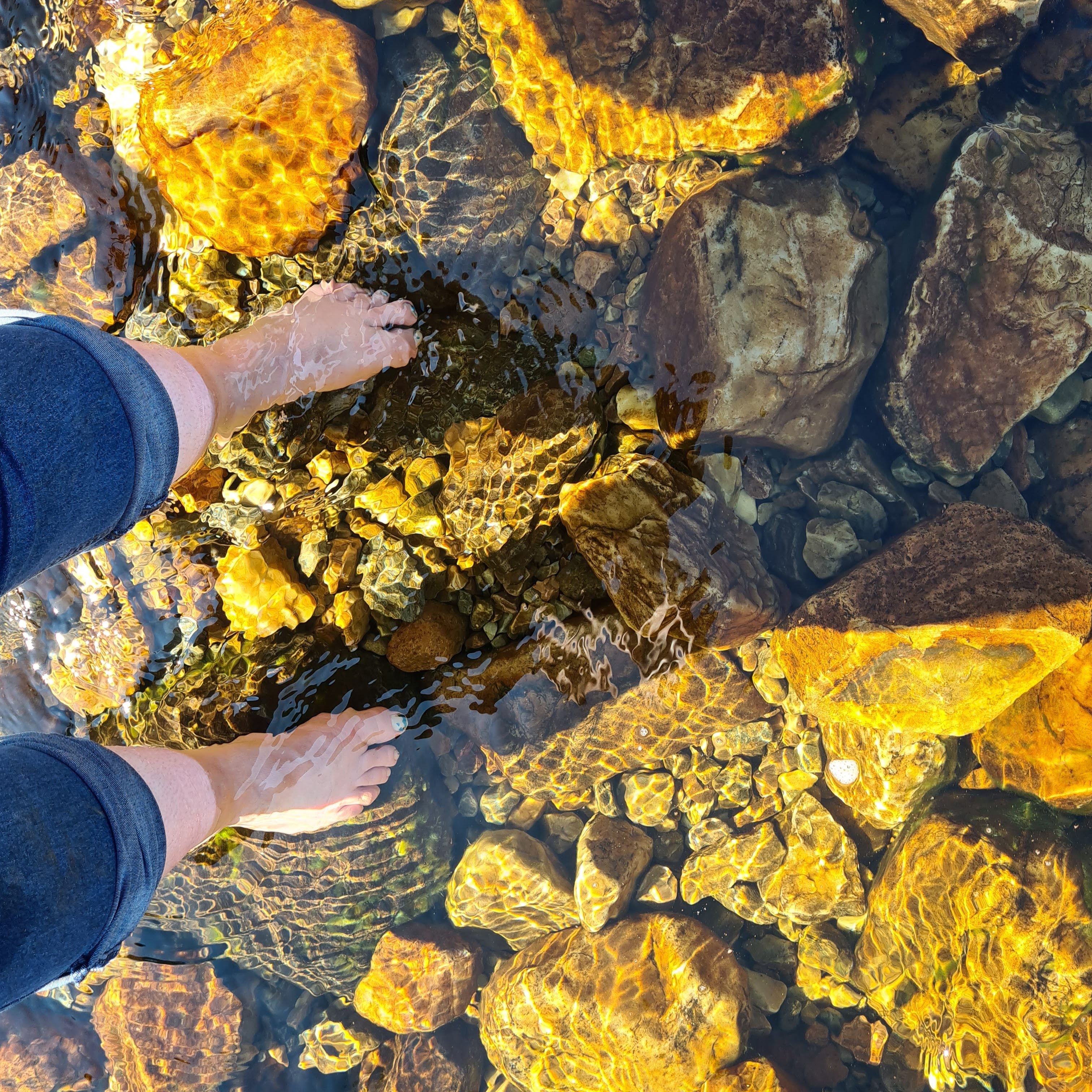
Dad and I tried to continue walking along the valley but found the path to essentially disappear into bog, so we headed back towards the wire bridge, looking for a place to cross. In the end, tired feet won out and I stripped off my boots to plunge into the icy water. It felt amazing and almost immediately numbed my toes to the rocks as I managed to just get across without falling. As we waited for our feet to dry, we sat on the riverbank and enjoyed the stunning view back towards the gorge.
The return trip is a touch less gruelling as it is more downhill than up, but the views are no less stunning and there is a great deal of truth in the fact that down becomes harder as one’s knees get older.
By the time we returned to the car I was very ready to take off my sturdy hiking boots and find some looser shoes to don for the drive back down the glen. I recall sitting in the car for a few moments just enjoying the car park view before finally heading back into town.
From here, Dad and I went on to the Commando Memorial, but even after our hikes on Ben Nevis and beyond, this remains one of the most stunning and magical trails I have found. The tranquillity of the valley around the Water of Nevis is breath-taking, and so quintessentially Scotland that it really should not be missed. That said, it is not a trek to take on lightly or unprepared; water, a snack, and sturdy shoes are an absolute must! And, if you are going in the summer, a strong midge repellent.

2 responses to “Nevis Gorge and Steall Falls walk”
Gorgeous scenery!! Glad you afely made the trip up and back!!
LikeLiked by 1 person
So happy to have read the danger sign after your hike!
LikeLike