Work has taken me back to southern California this month, and after a week of travel starting in Pasadena, heading out to Riverside and then finally down to Santa Ana, I was able to settle into one place for the rest of my time here. And so lucky I am, that the place is Orange County!
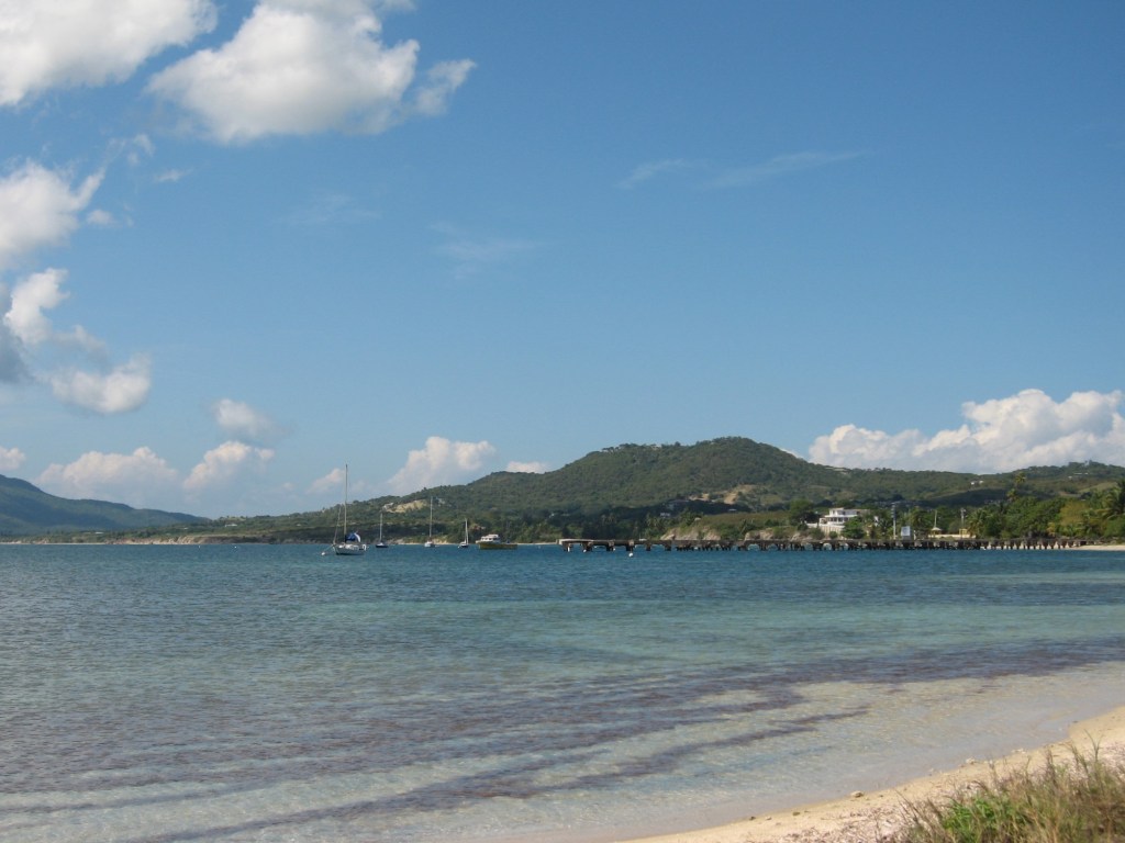
On Valentine’s Day – not because it was, but because it was a lovely day and my most likely day of rest during this trip – I decided to explore a new part of the coast. Recent rainfall meant that I could not hike in the hills as I hoped and so I did some investigation and eventually decide upon a parking spot along the coast, ten or so minutes from Laguna Beach, which I had so enjoyed visiting last year.
Fortunately the drive was only about 20 minutes, and so I got going relatively early in the day and was happy to find that there were plenty of spots available. The parking is run by the state, and so was even more pricey than my visit to Laguna Beach – $15, though this was for a day pass. The pay system is a very simple QR code scan and pay – much better than the cash boxes I’ve seen elsewhere (*cough* New England).
And, after all, this is Orange County.
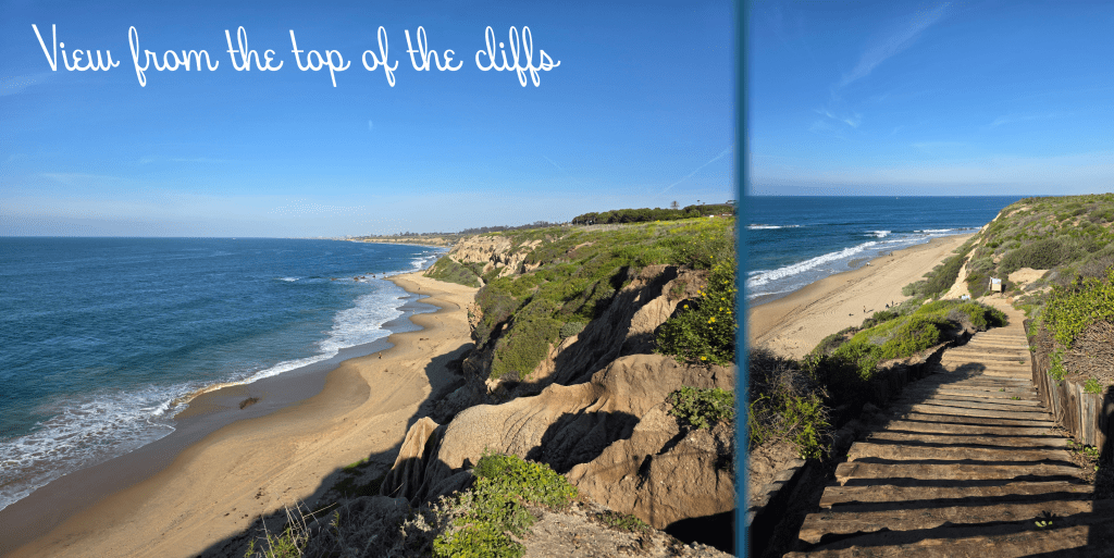
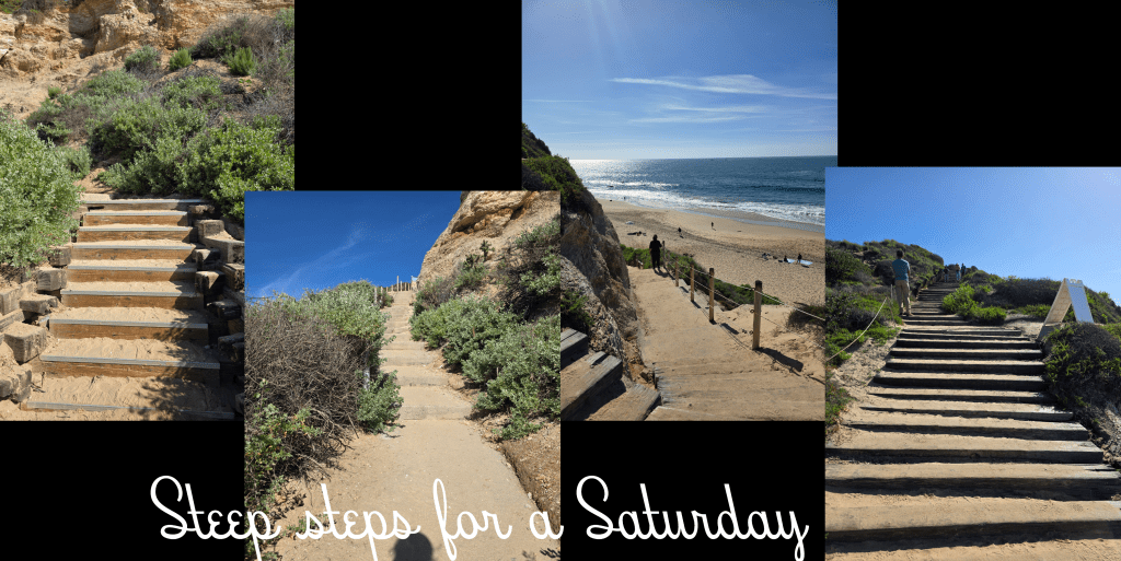
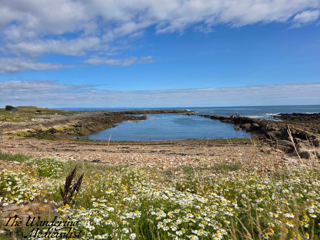
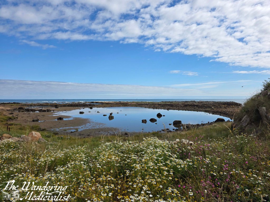
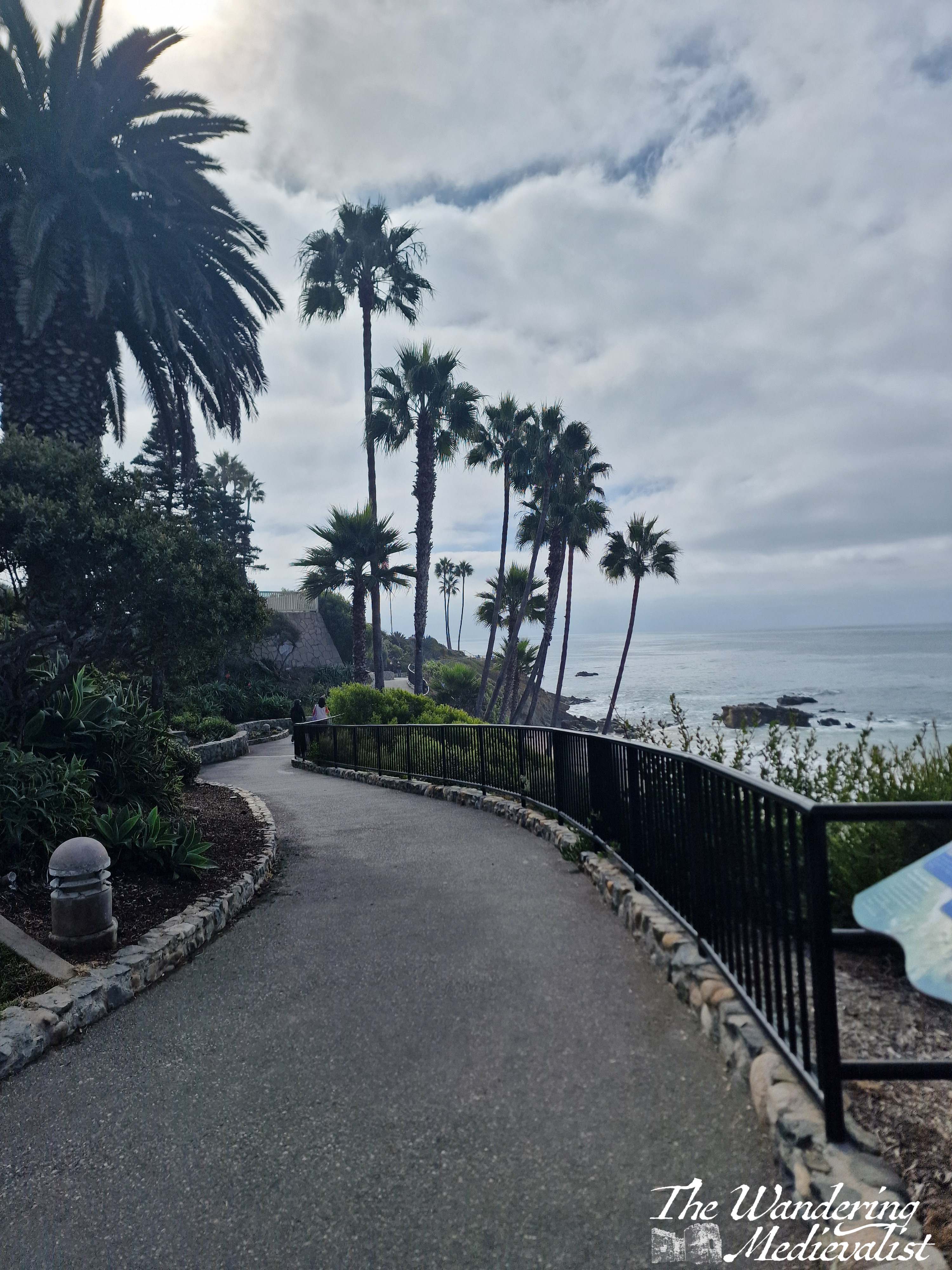
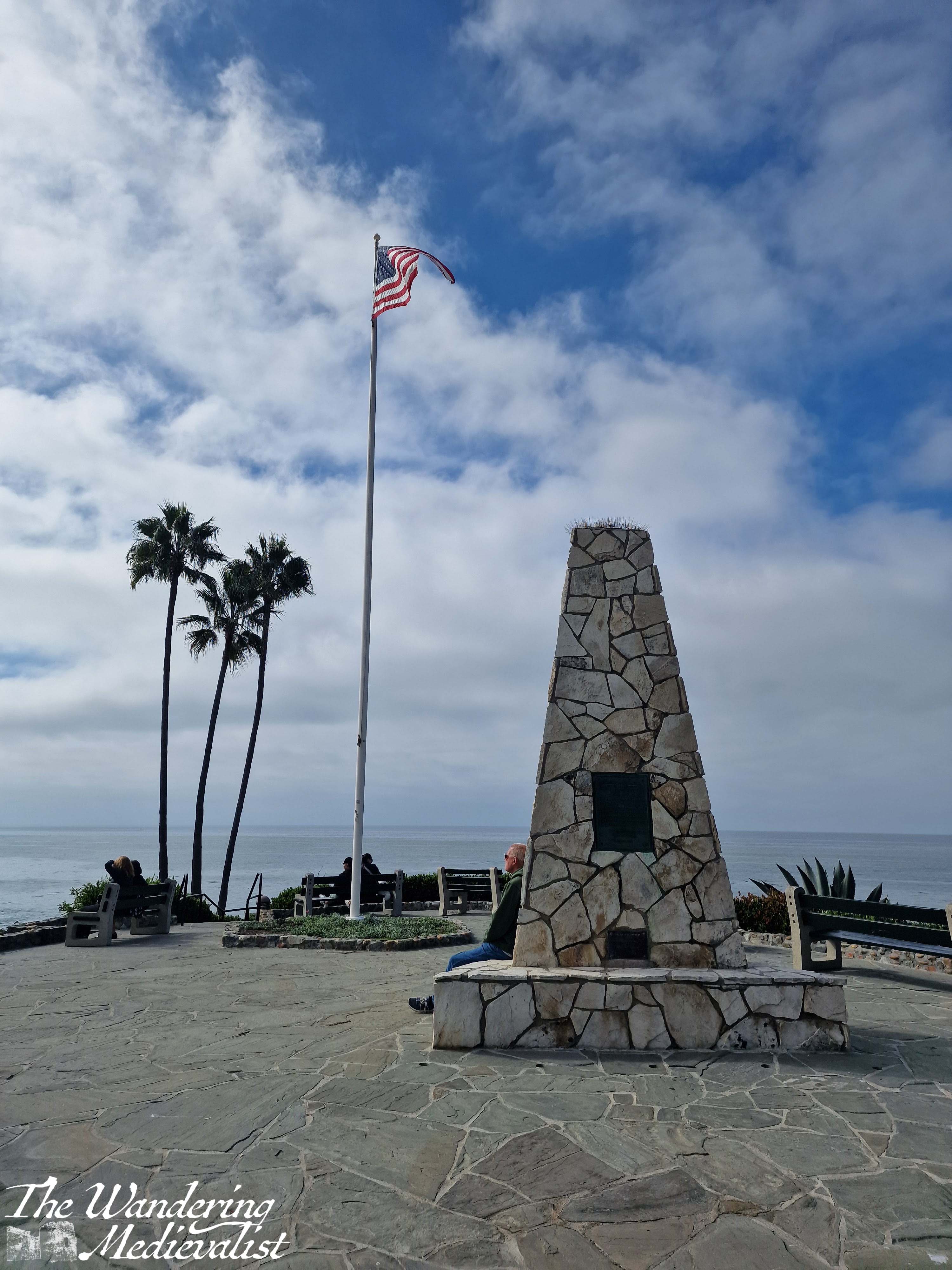
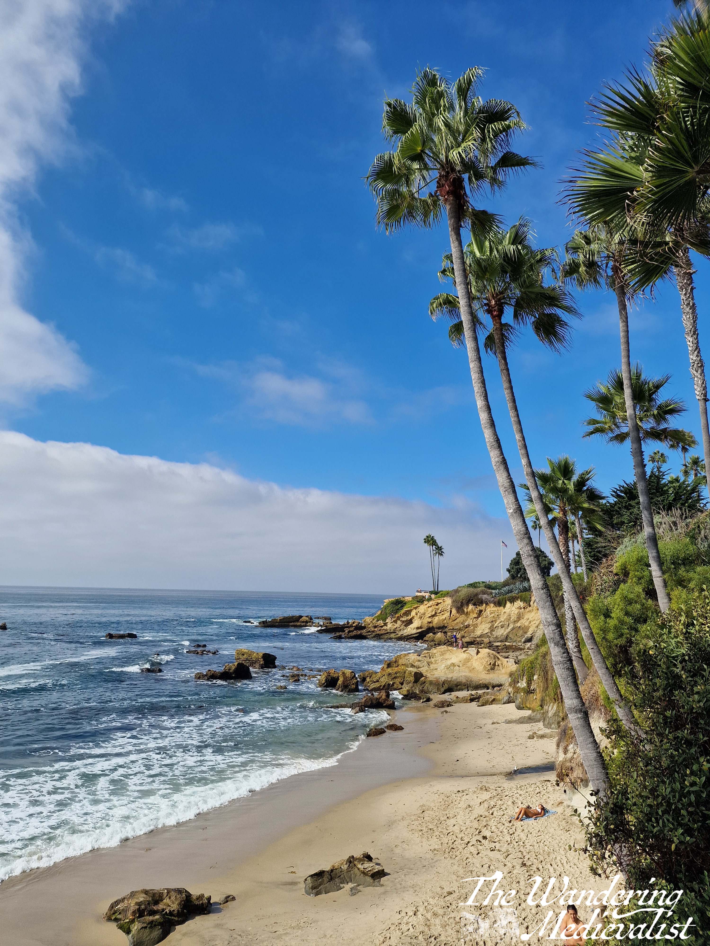
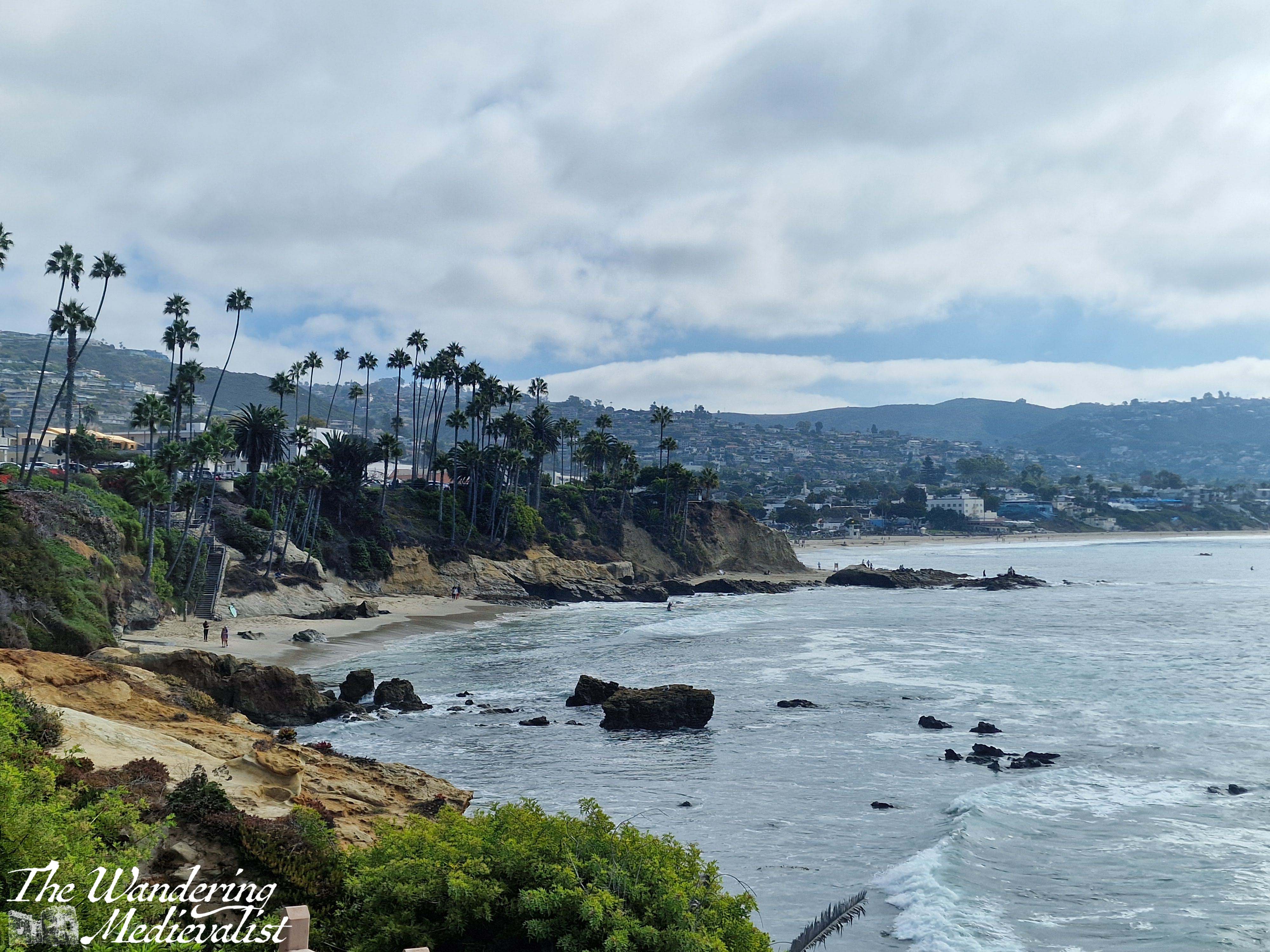
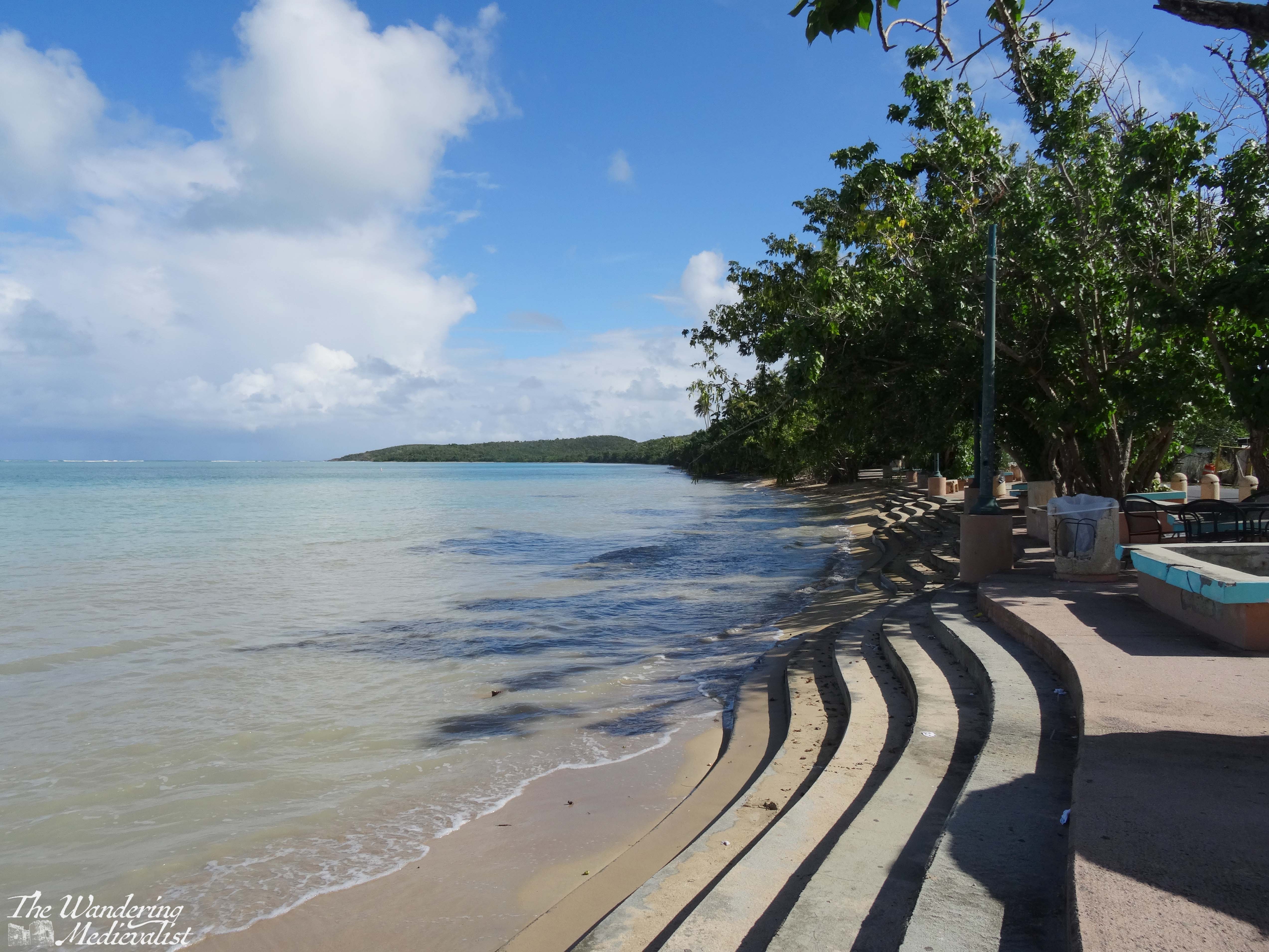
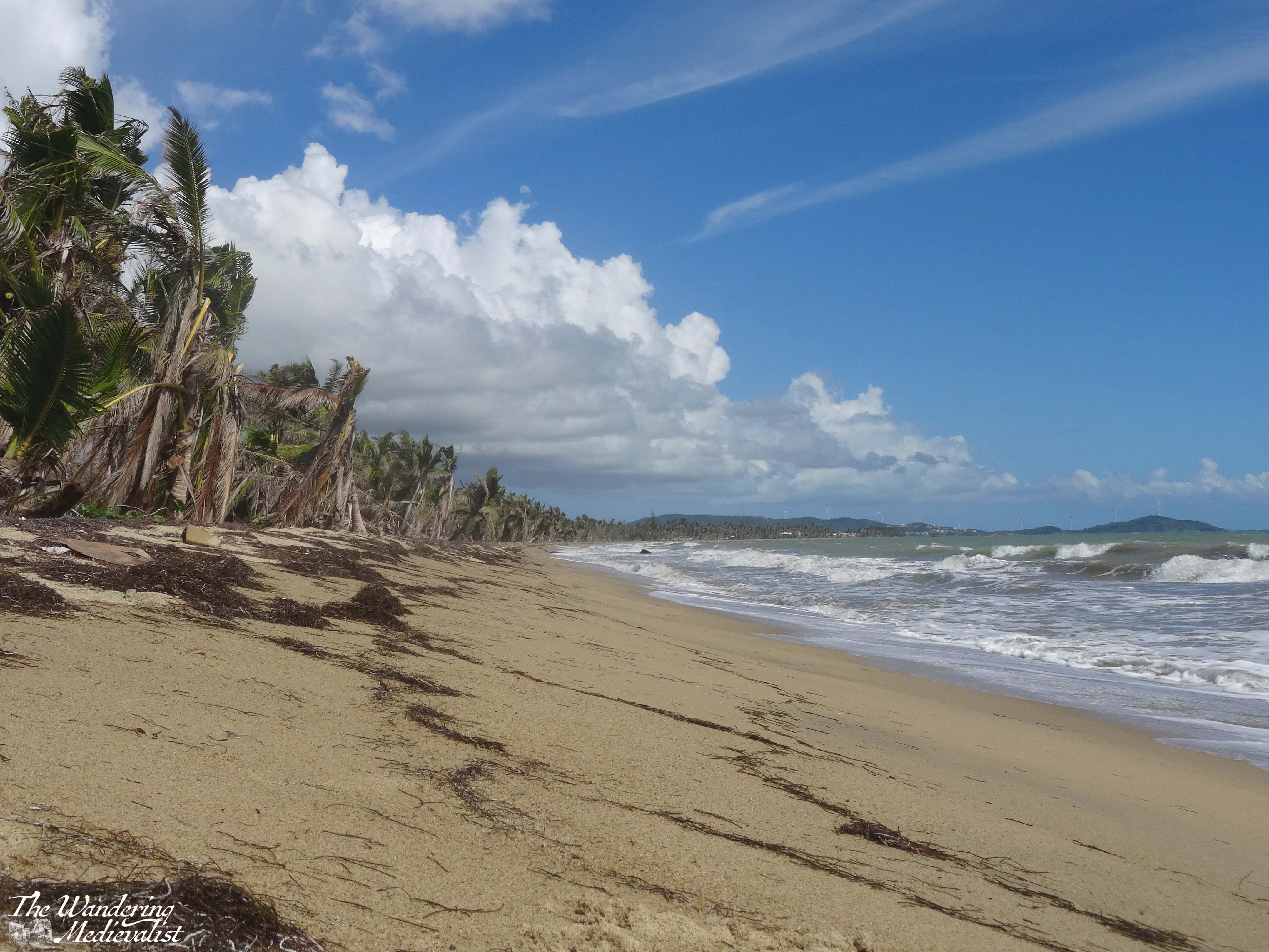
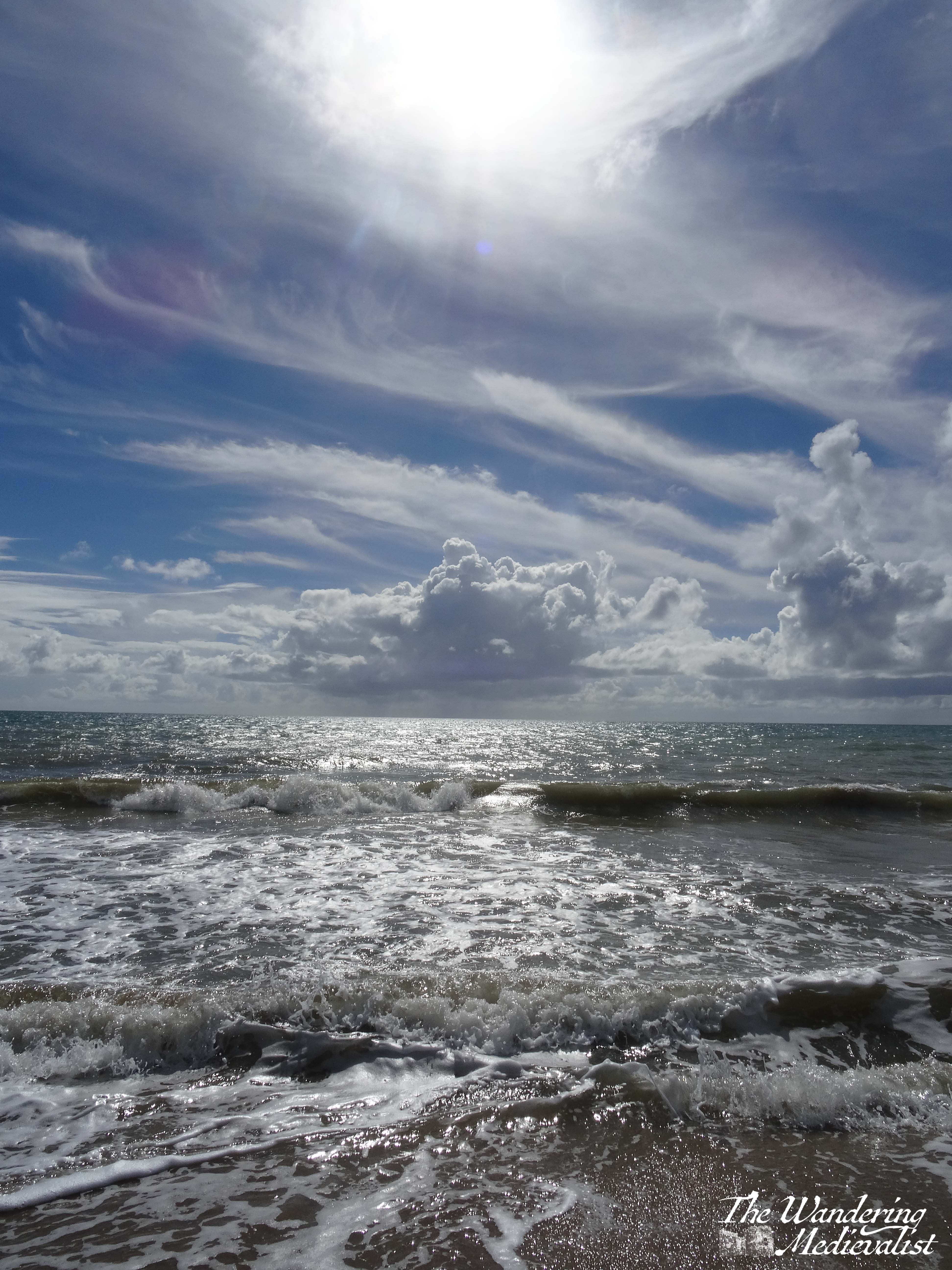
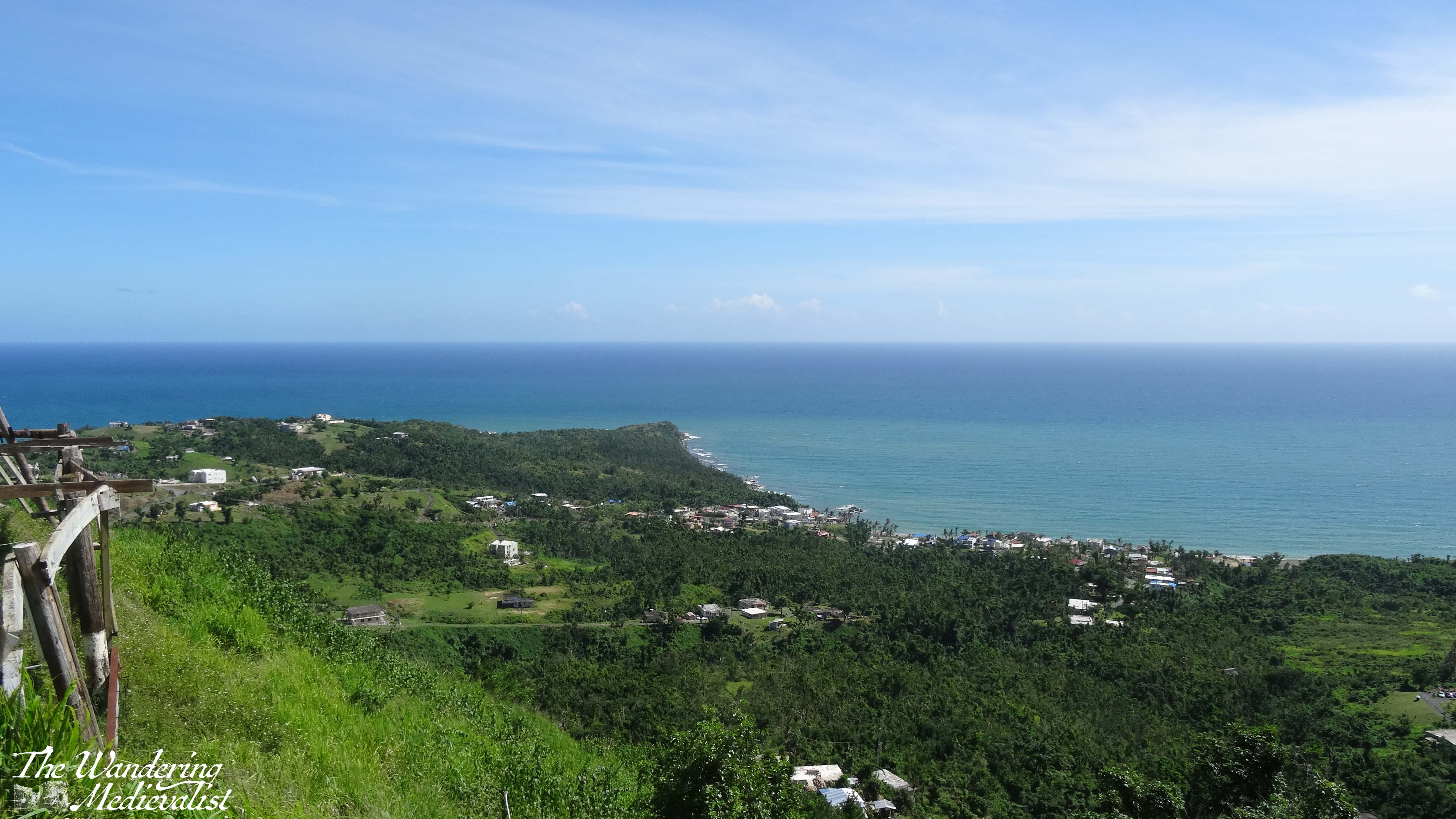
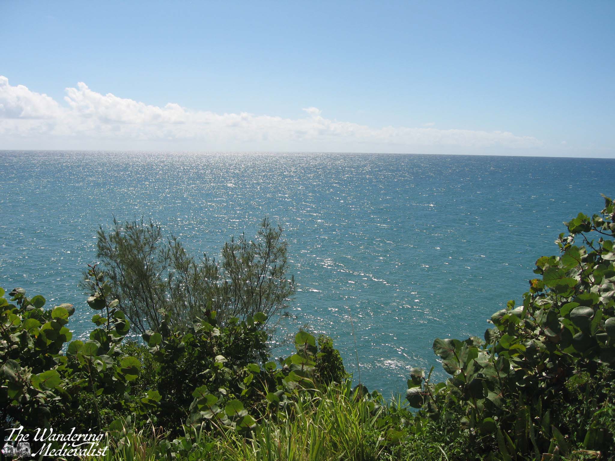
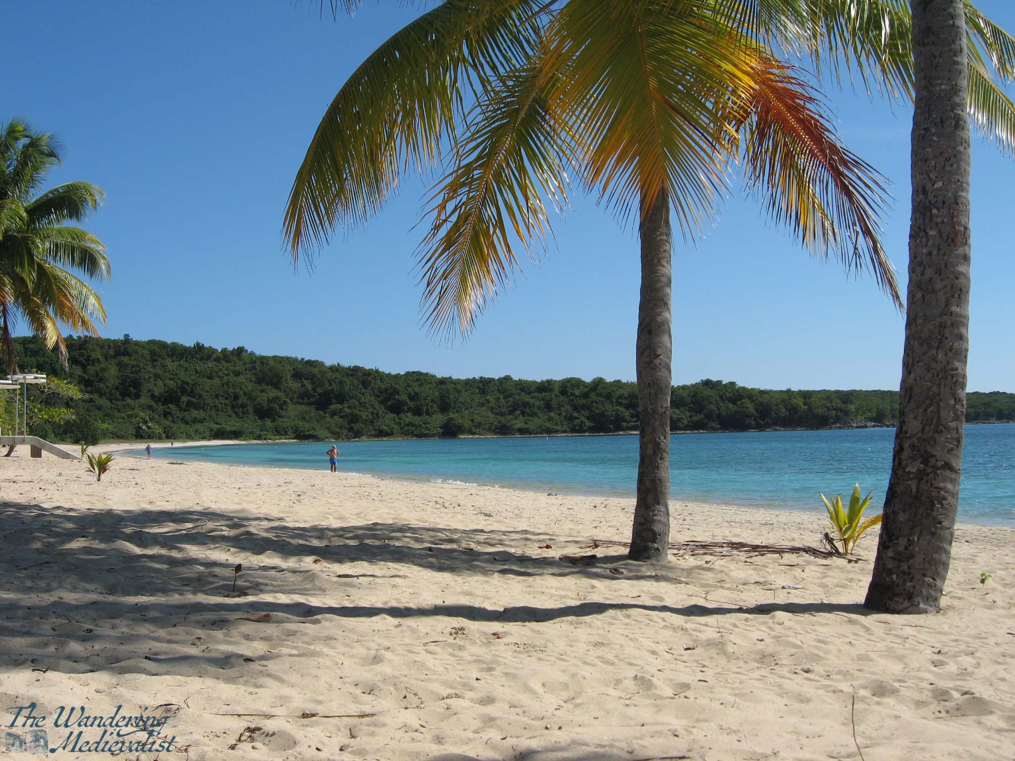
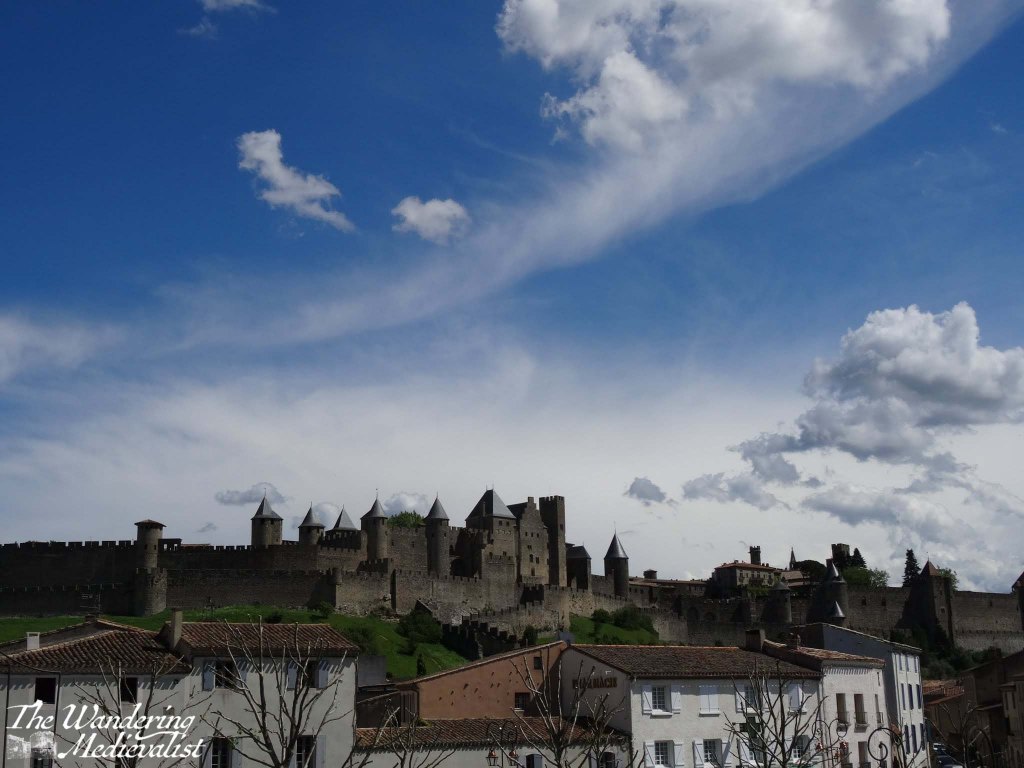
My first dilemma, after payment, was which way to go. My breath had been stolen while I drove by the day before by the stunning Abalone Point, but I was really curious to explore the area that was called ‘Historic’ Crystal Cove, which popped up top of my Google for short walks in Orange County. So, after a touch of meandering, I found myself at the top of the cliffs with a long flight of steps before me, leading down to the beach. The view behind me was hazy as it looked directly into the sun, but ahead of me was the stunning blue water and sky I had come to expect from this area.
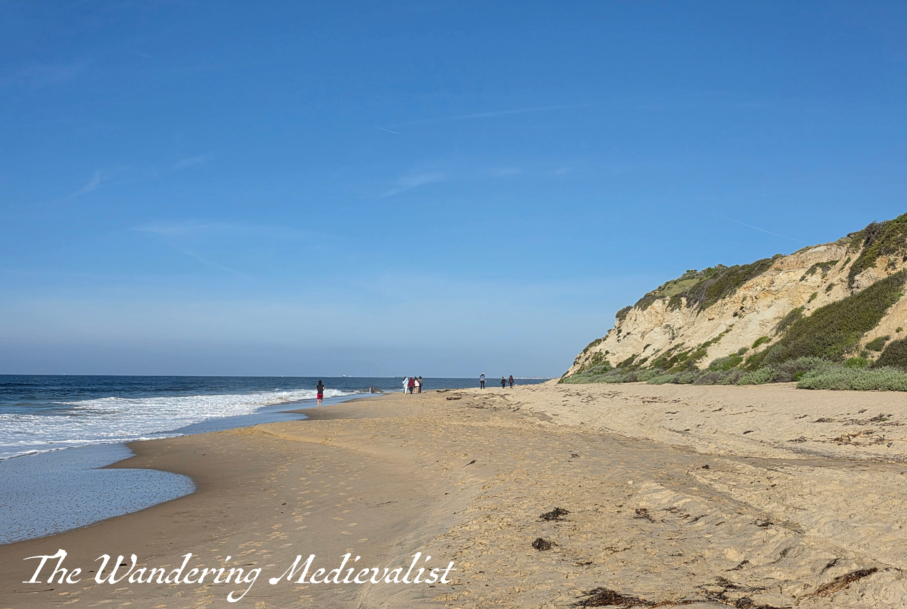
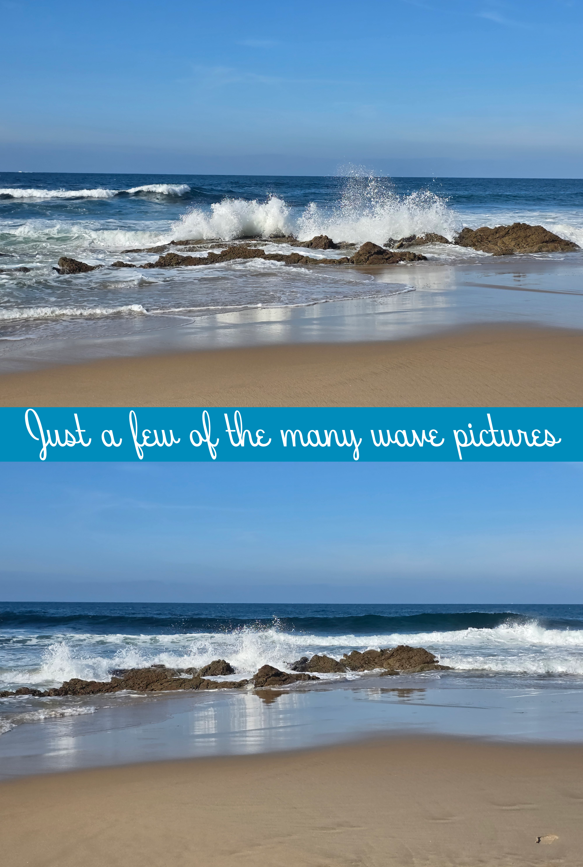
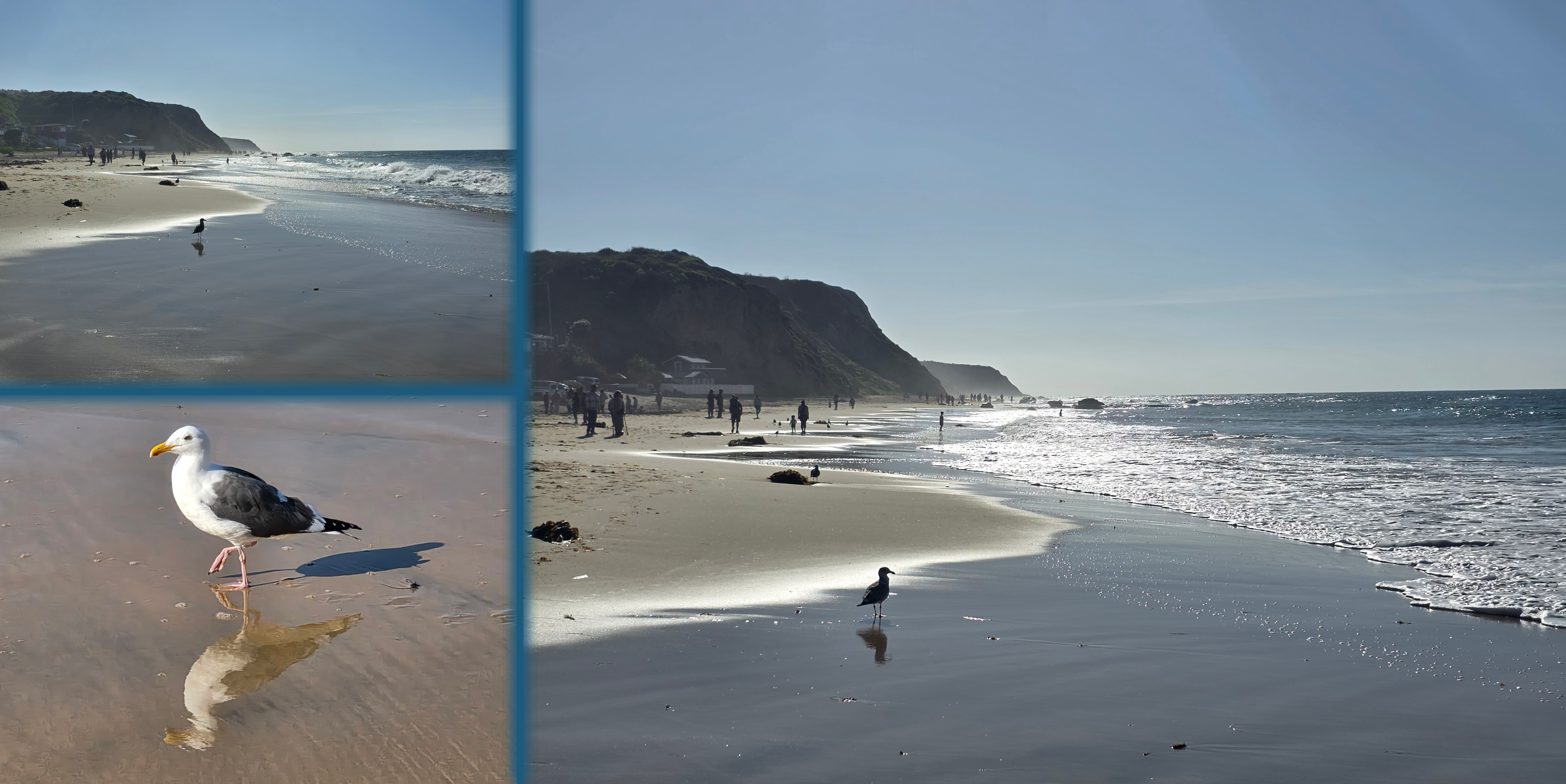
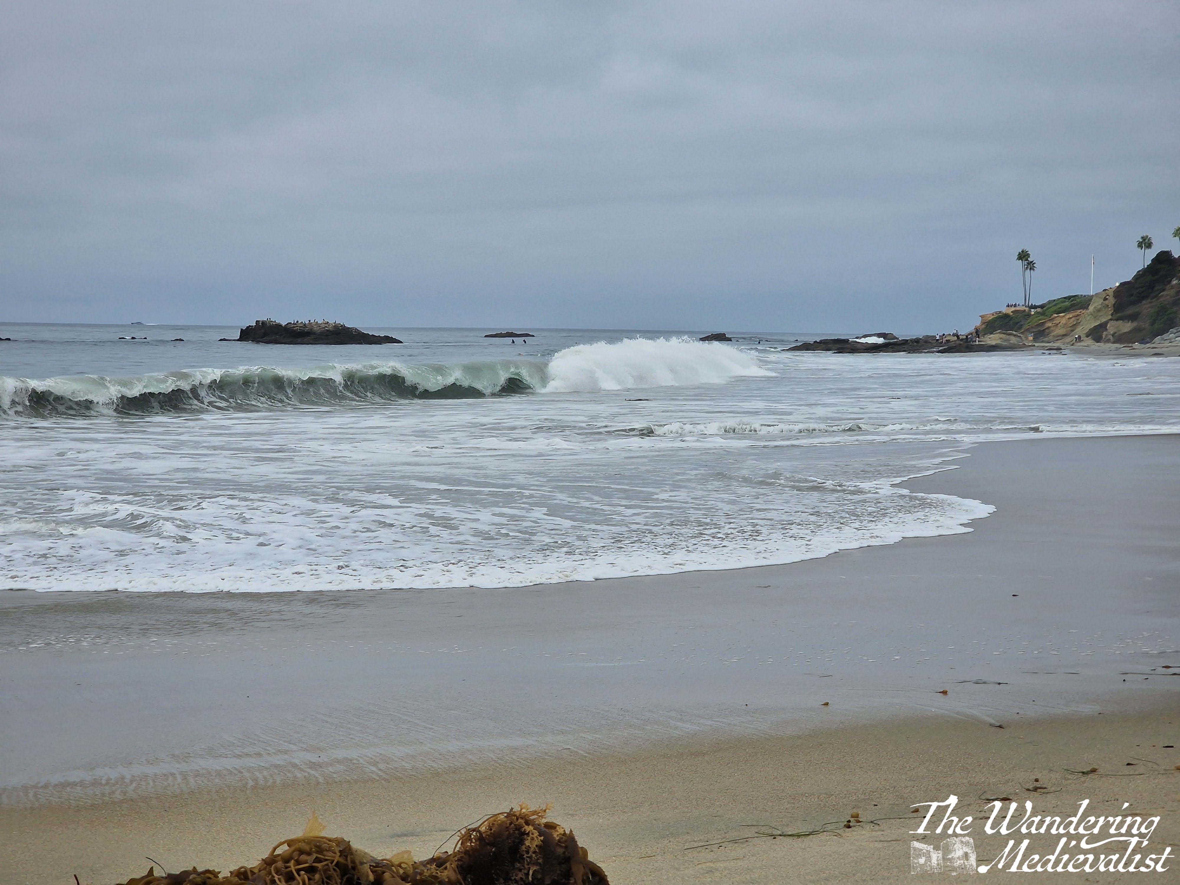
I imagine that we were at about mid-tide, perhaps on the high side, but there was plenty of firm wet sand to walk on, and the waves were constant but not too threatening. As always, I struggled against the urge to just sit and record the crashing surf, the stunning colours and shapes, the dramatic splash when a bigger wave hit the rocks.
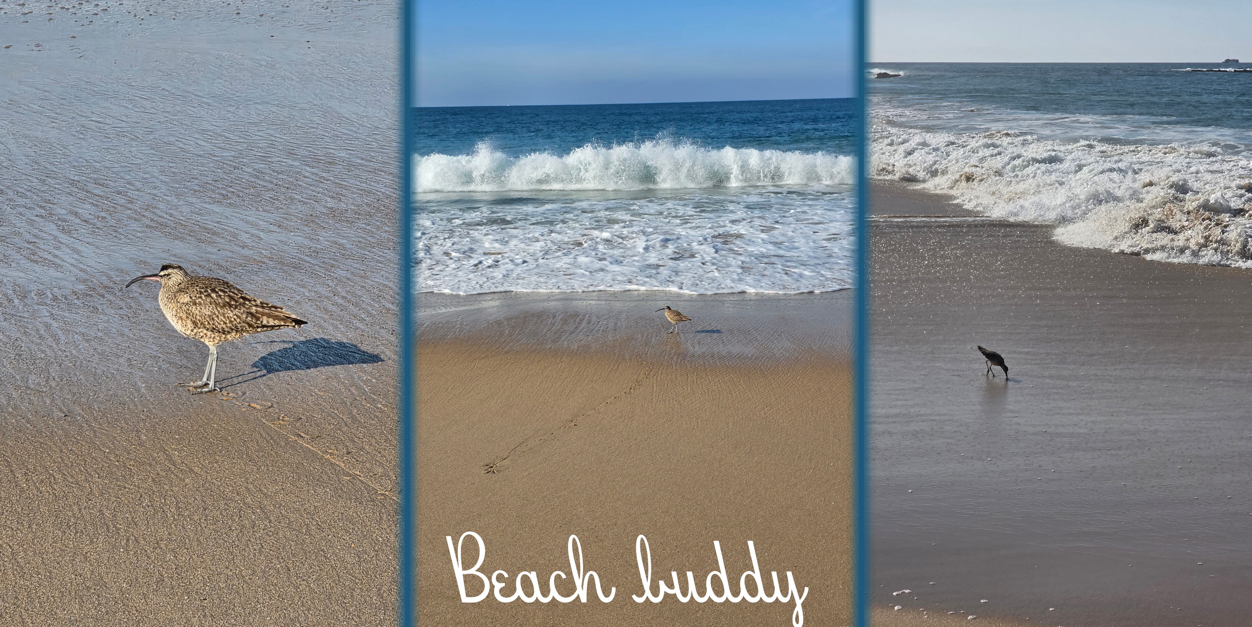
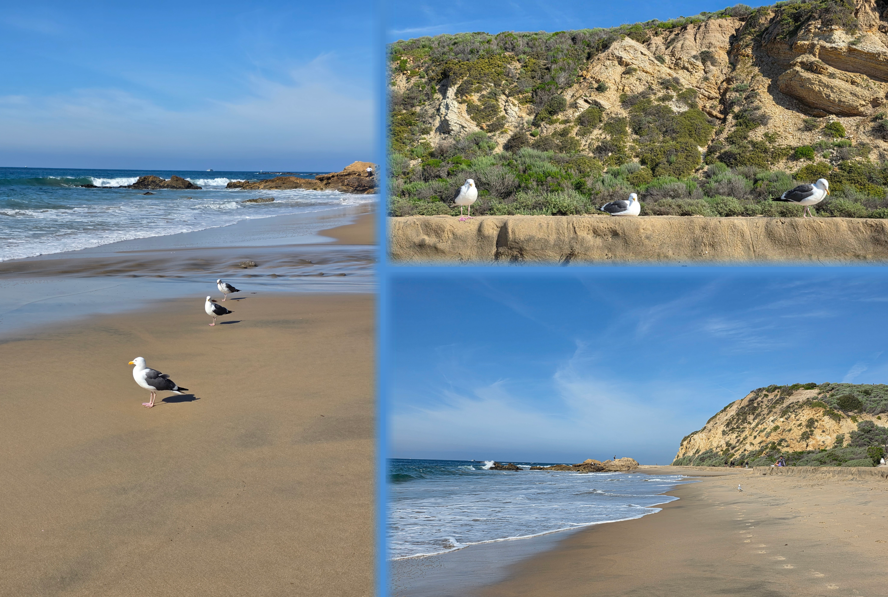
I did pause briefly when I met a few very brave sea birds, who were so unbothered by me that I could get quite close.
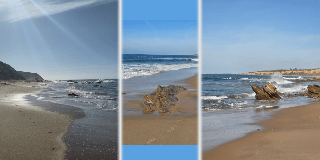
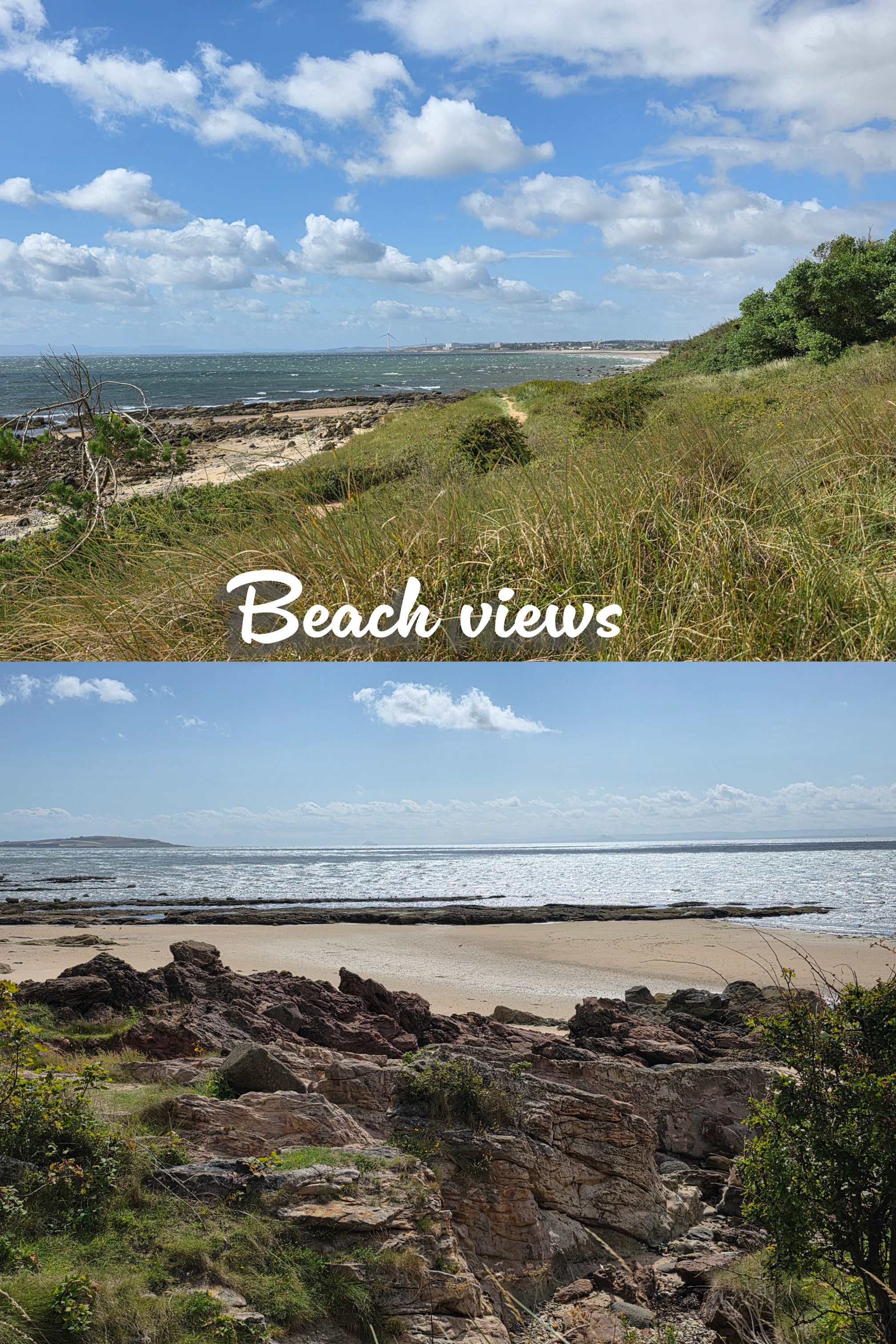
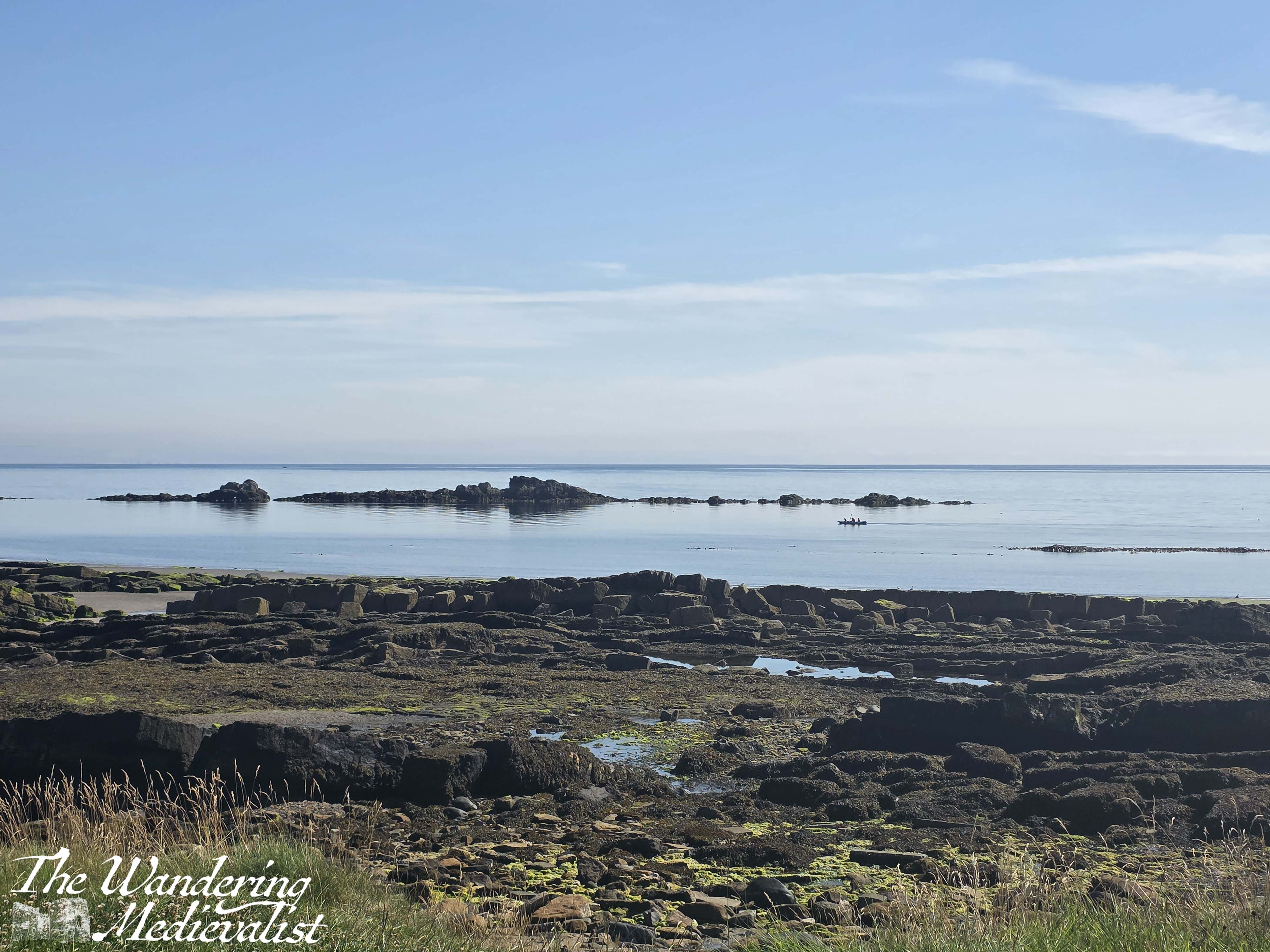
Like in parts of Fife, the sandy beach was broken in places by impressive rock formations, slicing upwards.
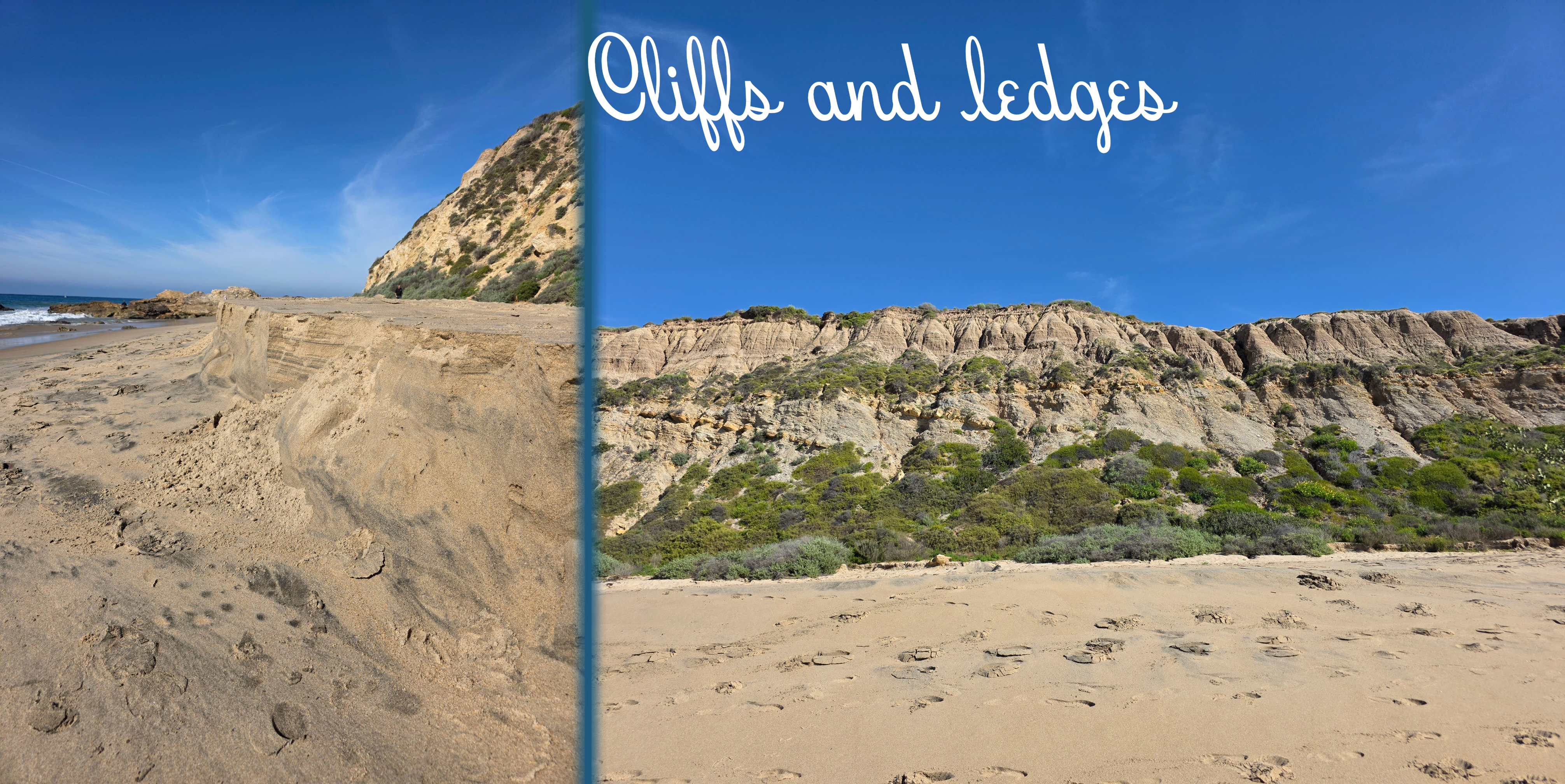
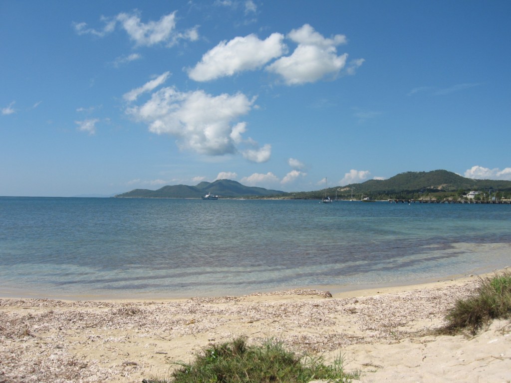
The towering cliffs above the beach were dotted with green but also showed layers of rock and sand – a geologist’s dream, I am sure. As I approached the Crystal Cove area, there was a larger formation of rocks where a few fishermen had parked themselves, accompanied by always-bold gulls. The sun had finally risen far enough that a picture back the way I had come was a touch clearer.
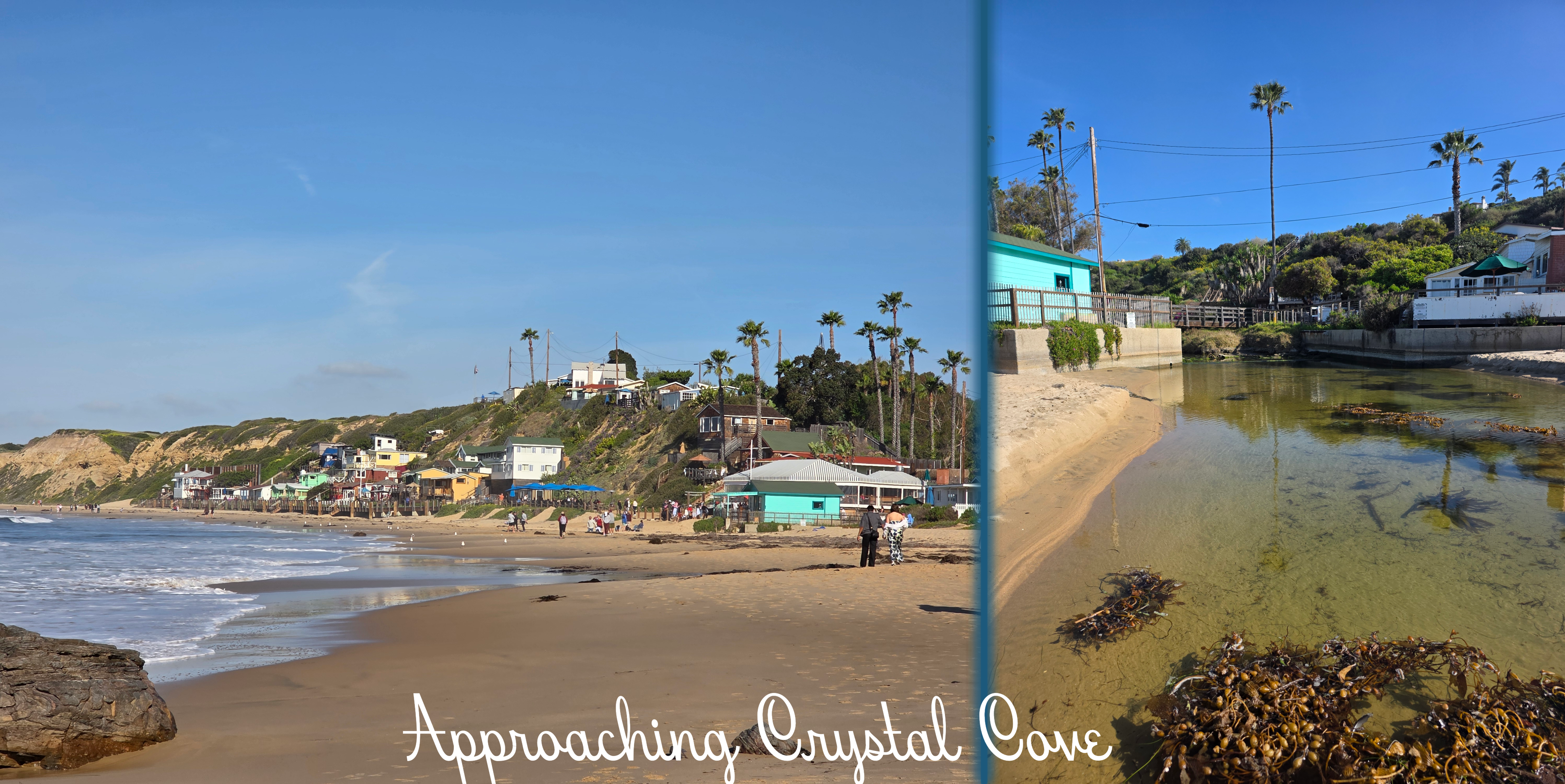
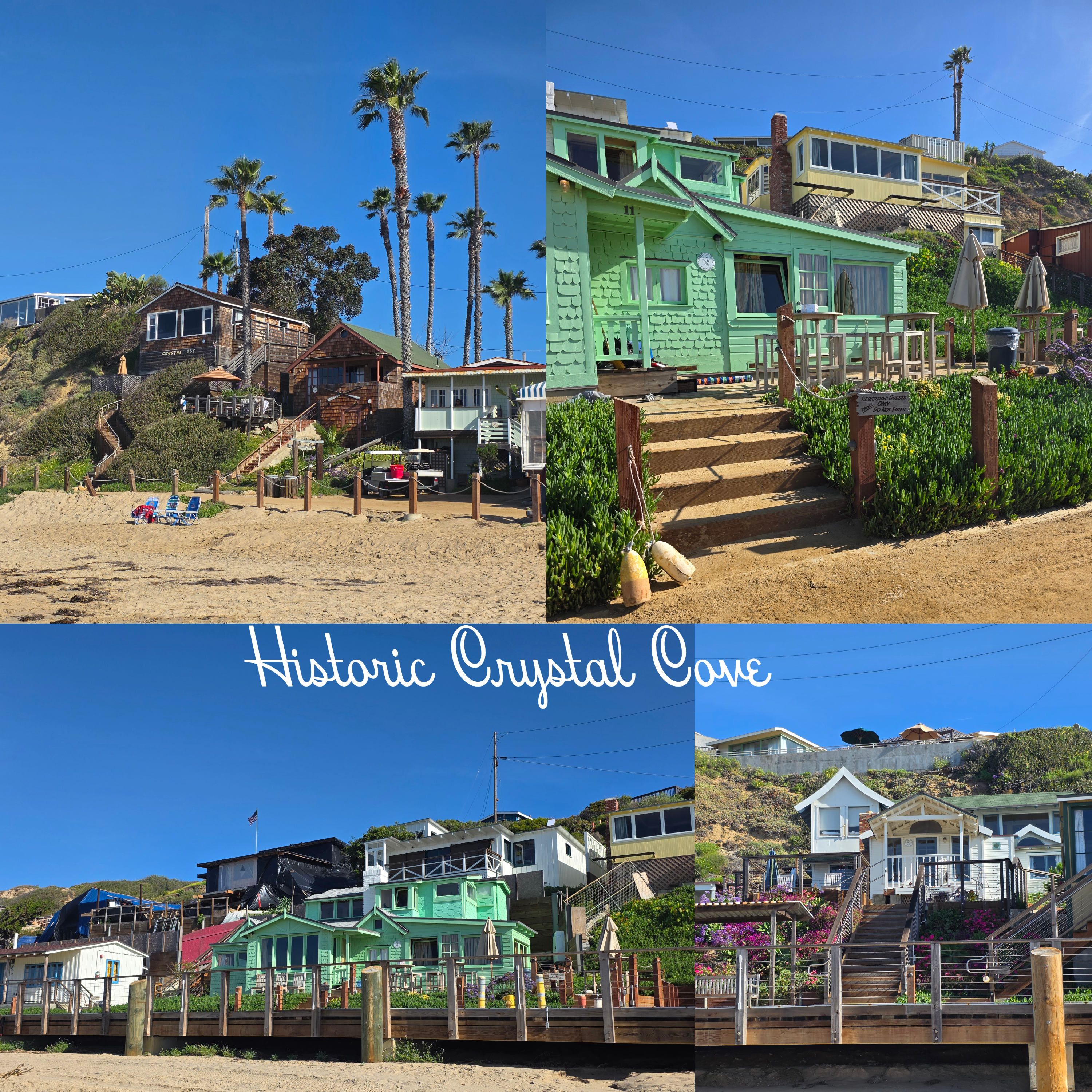
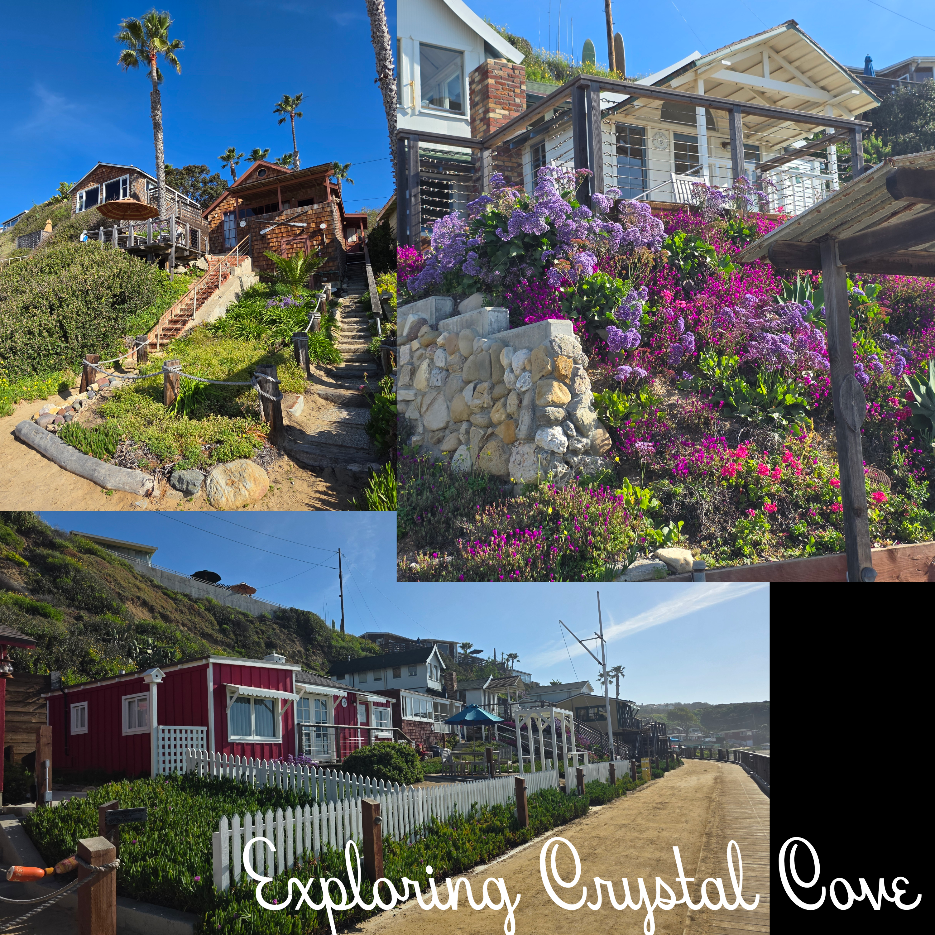
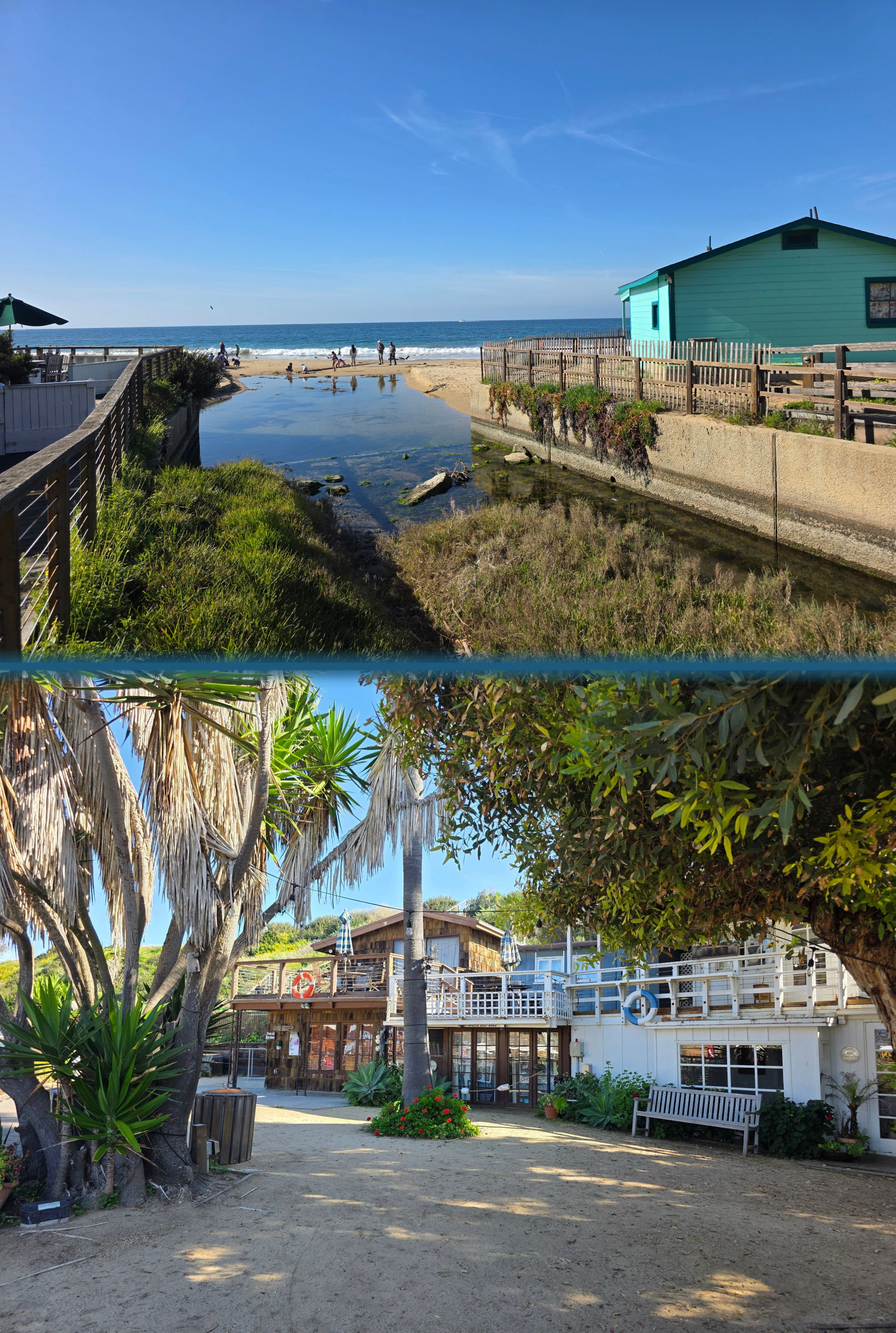
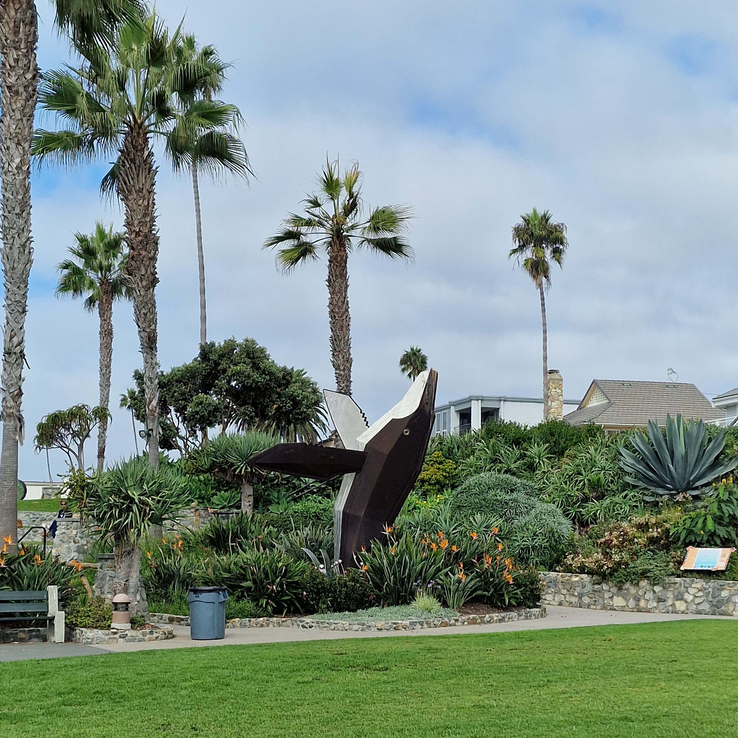
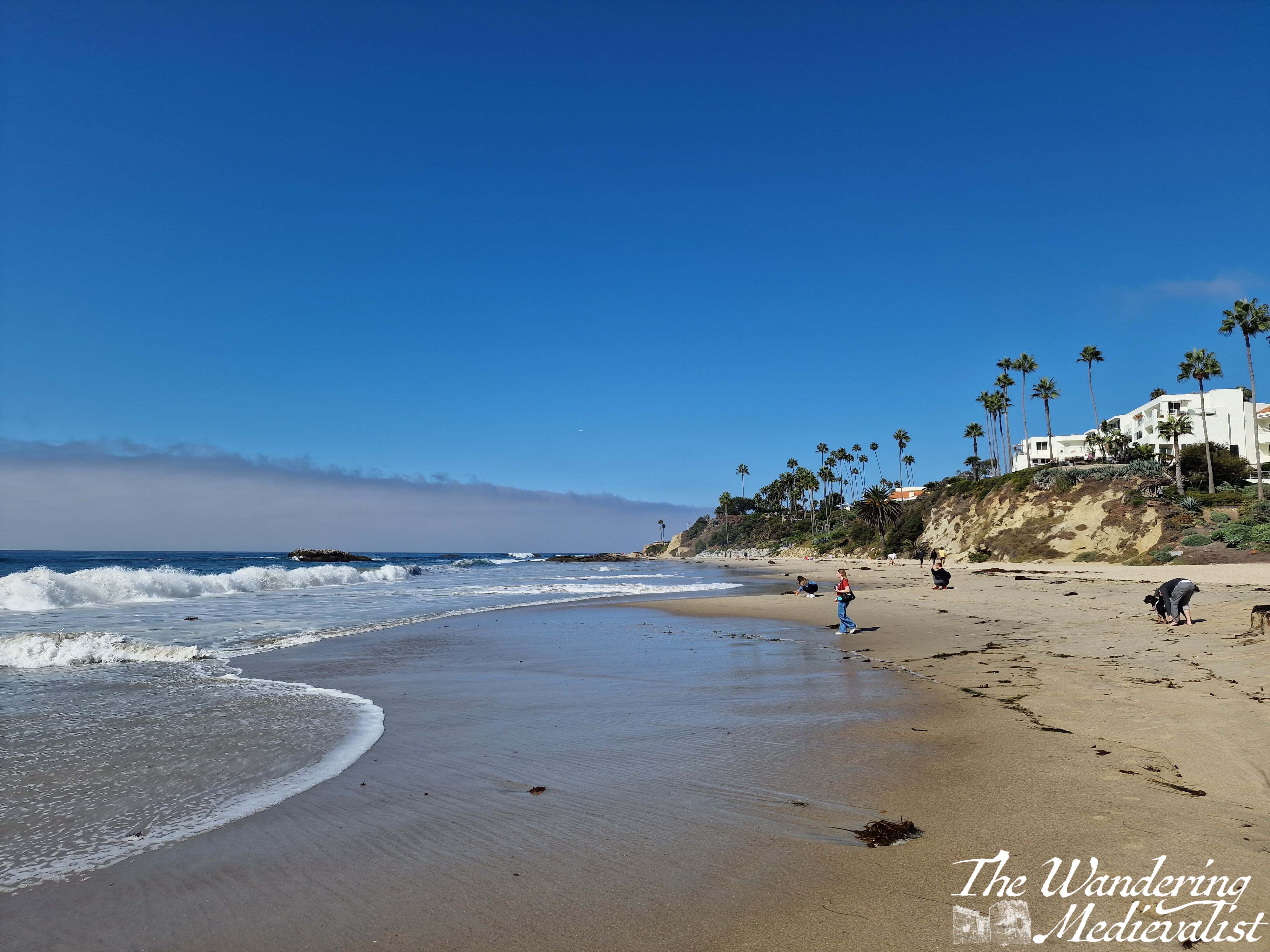
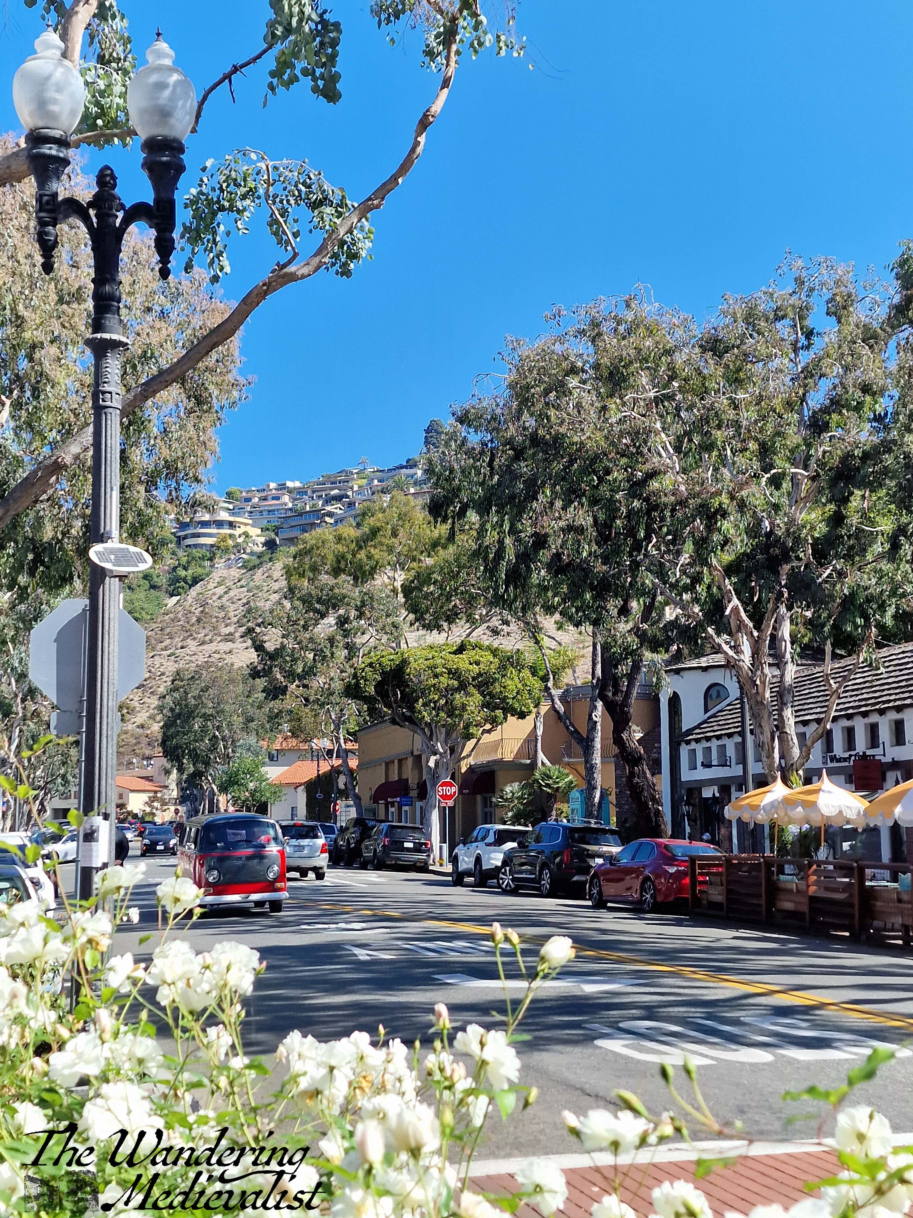
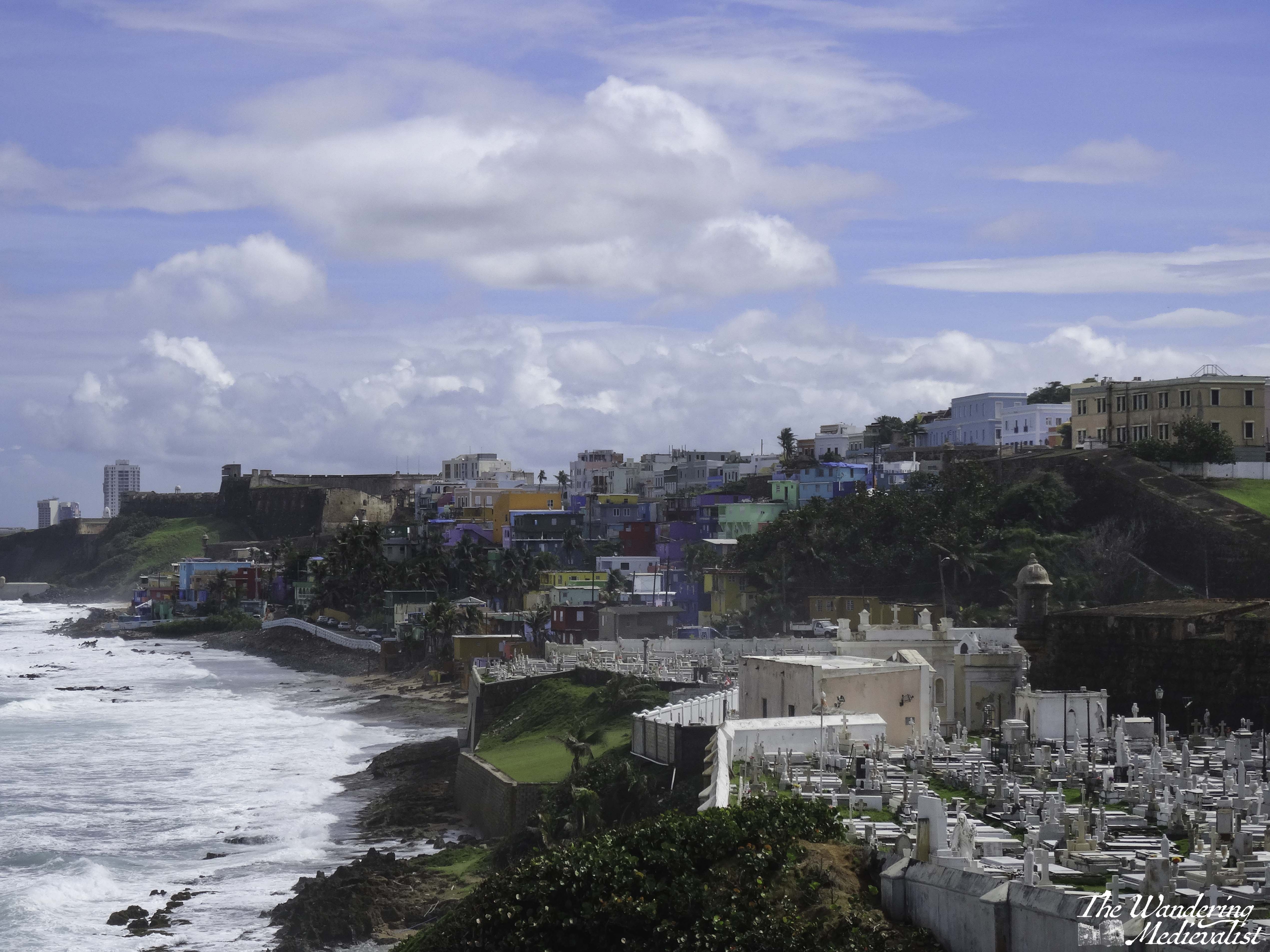
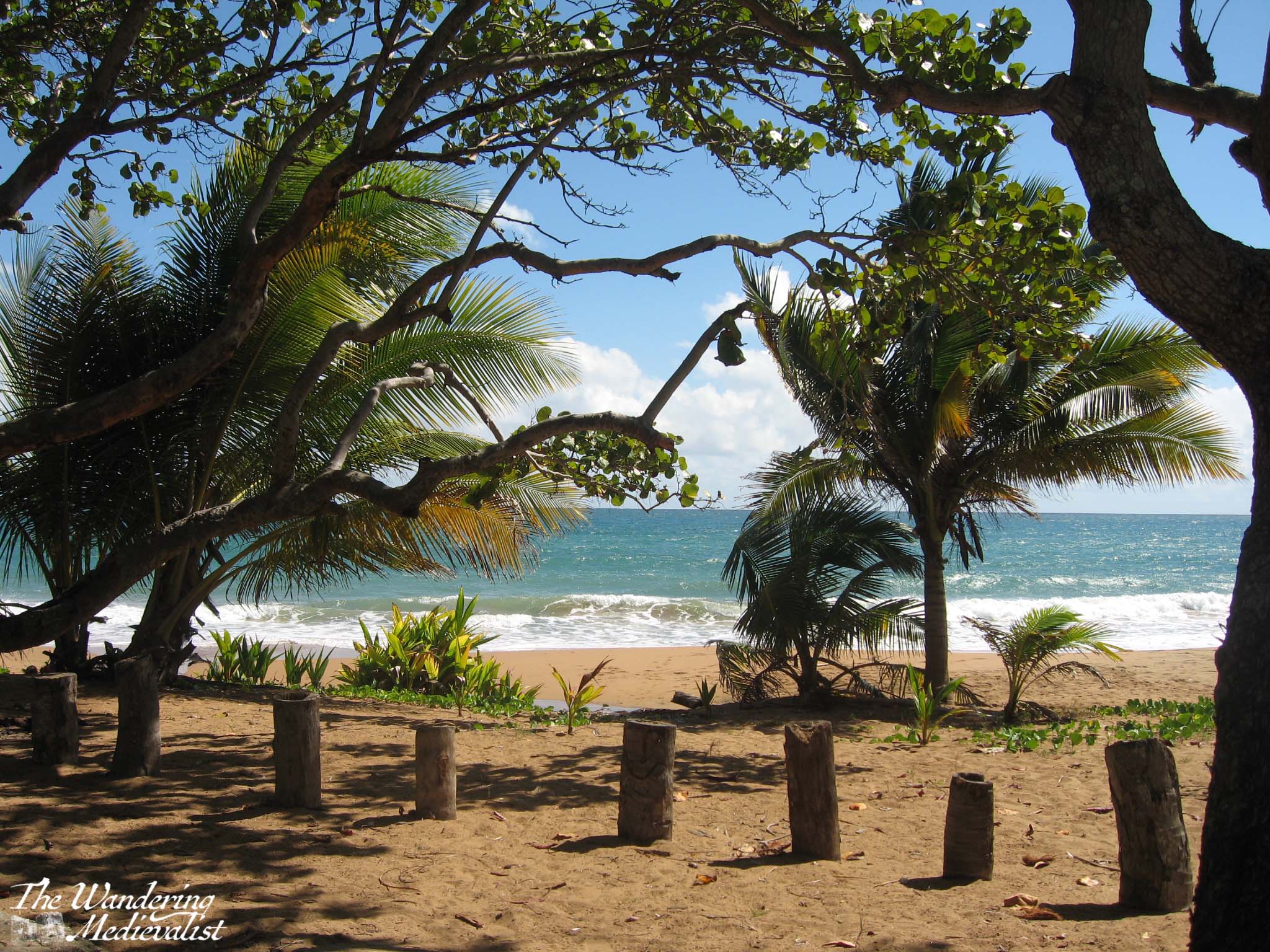
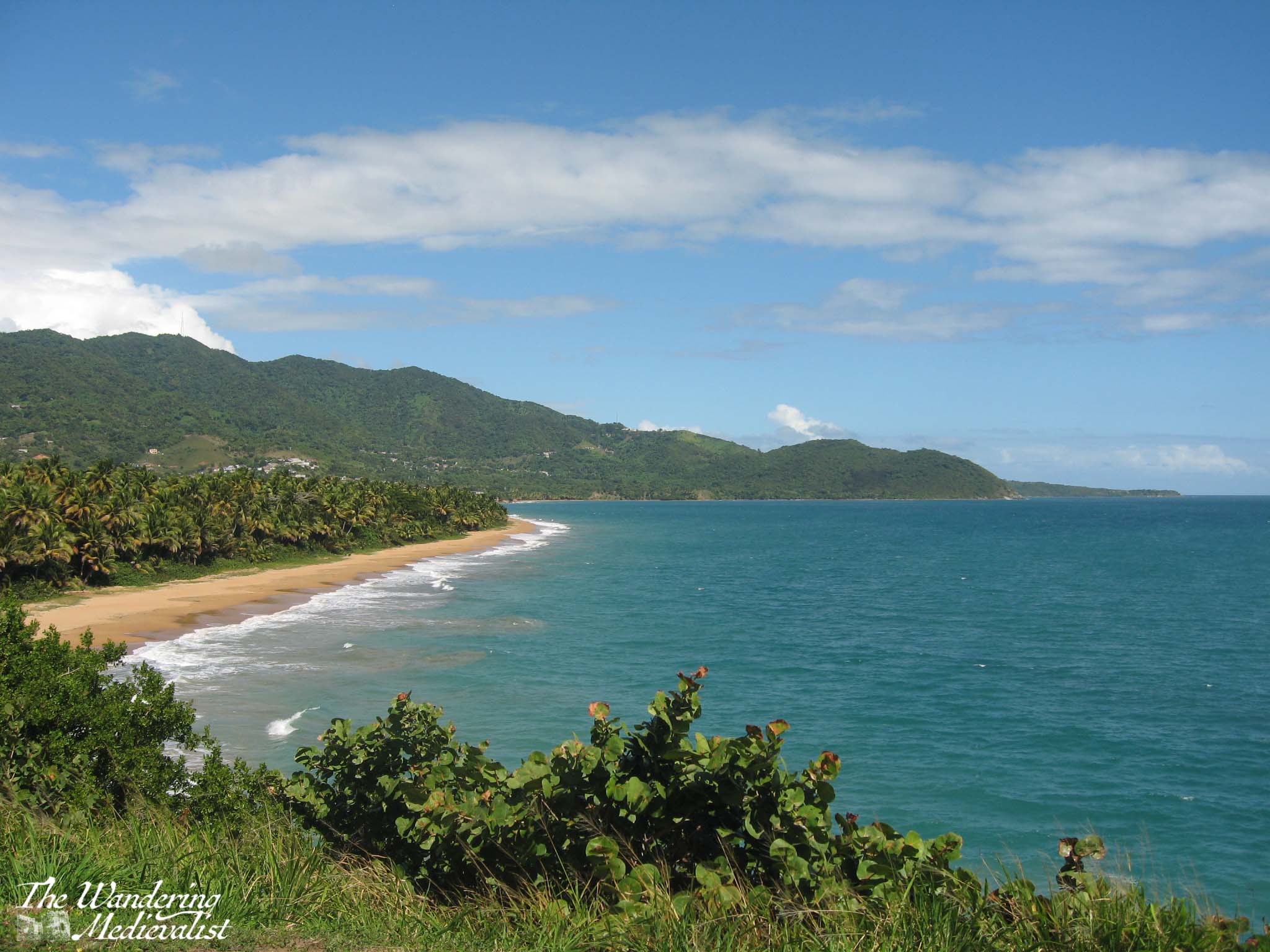
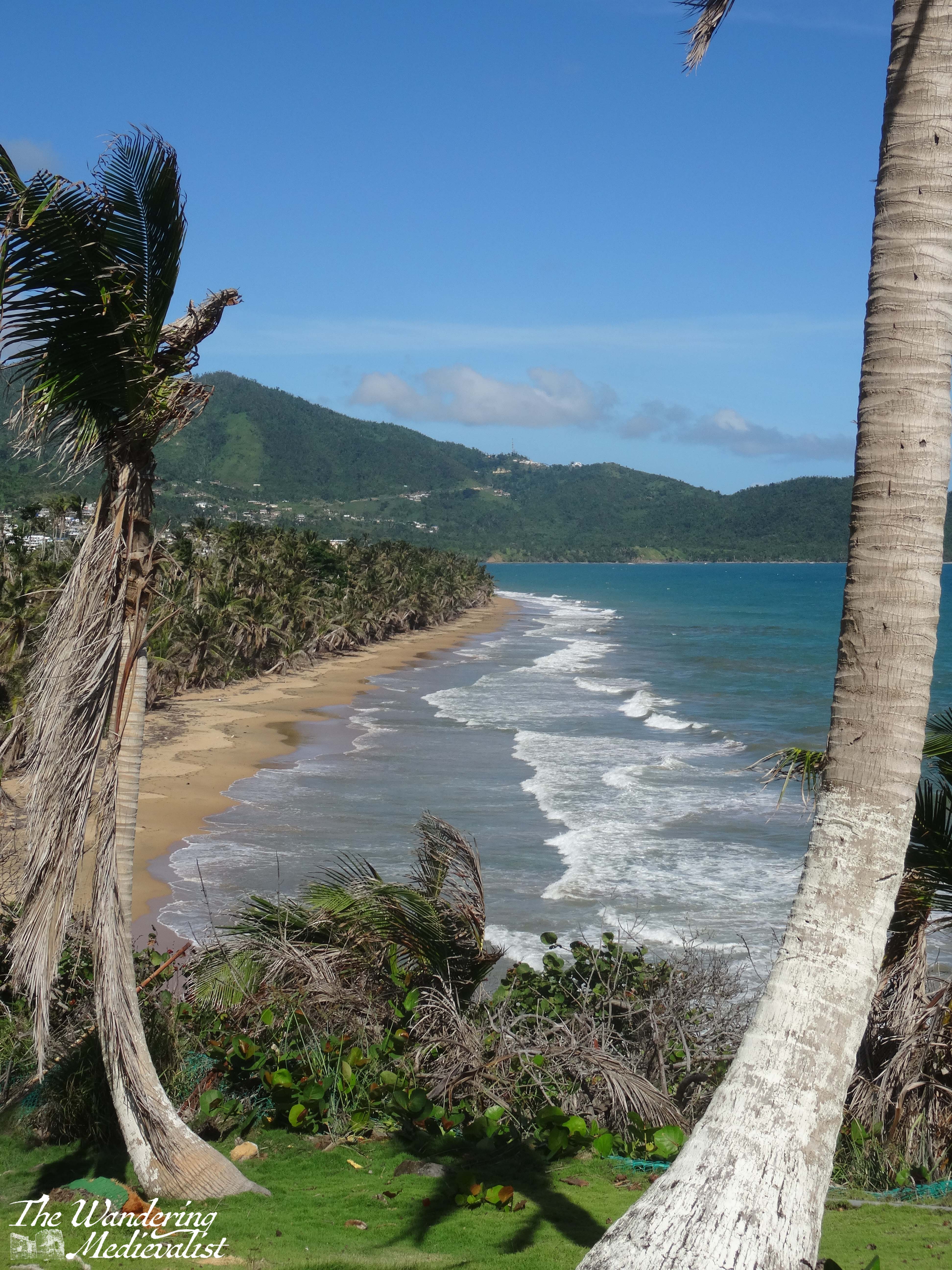
I did not really know what to expect of Crystal Cove, and as I approached it reminded me both of a Caribbean pirate’s lair and a coastal village on Cape Cod. The more I explored, the more the houses reminded me of lakeside ‘cottages’ built on Lake Sunapee in New Hampshire: thin wood, no insulation, designed as a shelter in warm and comfortable weather. Upon reading more, I learned that the Crystal Cove Historic District is a federally listed gathering of 46 vintage coastal cottages built in the 1930s and 40s. One of the last remaining examples of early 20th century coastal development, it has been preserved and the cottages transformed into rental properties. They are nestled around Los Trancos Creek, which is what made me think of the pirate hideout – aren’t there always creeks emptying into the ocean in a lair?
There is a boardwalk in front of the line of houses, so I walked all the way to the end and then back again, enjoying the haphazard, ramshackle nature of some of the cottages. Most were neat, simple constructions with plenty of window and balcony space, but one or two looked like a child had constructed them out of blocks – dormers, gables, windows, extra rooms tacked on in random places. These were, of course, my favourite (in particular the mint green one visible in the collage below).
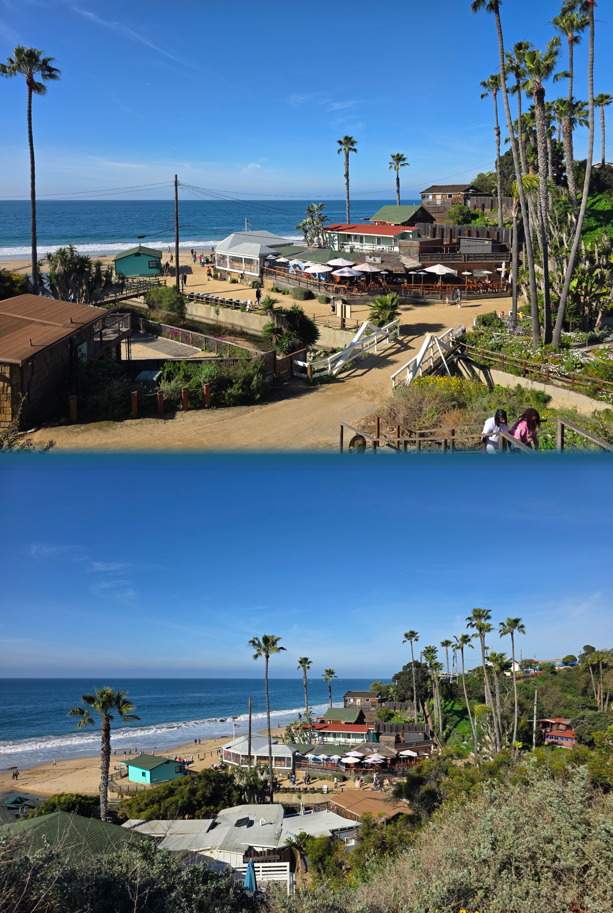
I walked past the Beachcomber restaurant, which seemed to be very busy, and found a clean public restroom just over the pedestrian bridge. From here, my route took me up a flight of steps back to the top of the cliff, where I could look down over the cove and out to sea.
As I moved away from the cluster of houses and past the very busy Shake Shack (this is when I recalled that it was Valentine’s Day, as they had all sorts of offers on), I realised that the cliff-top walk was not entirely dissimilar to parts of the Fife Coastal Path. The trail was paved and well-used by joggers and walkers, and the scrub-like flora dropped abruptly away to a view of the open sea.
really, this could almost be Fife
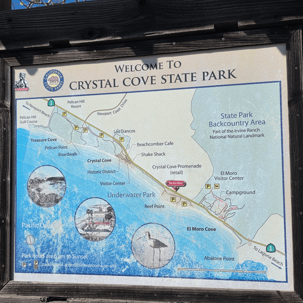
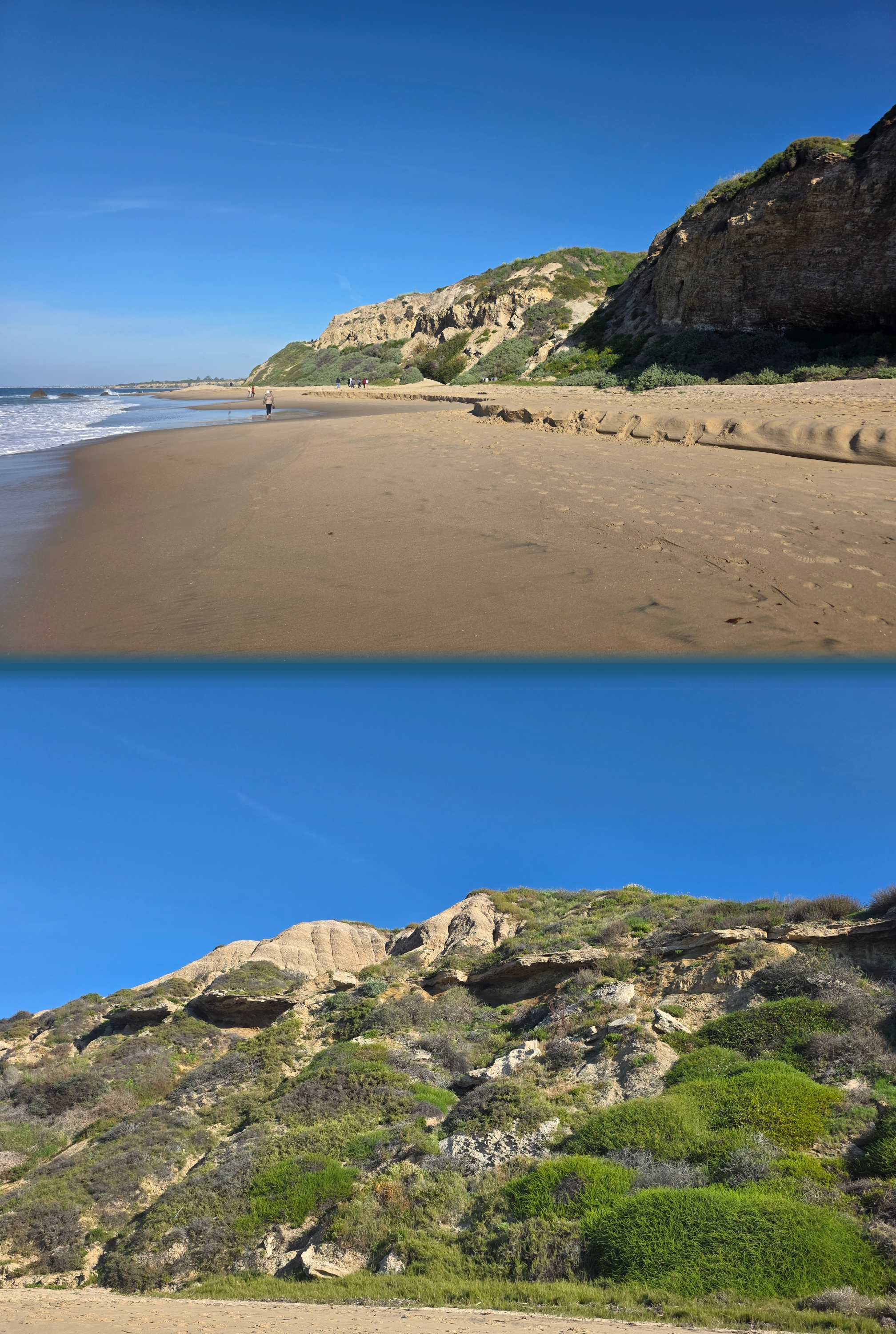
In time I reached the edge of the parking lot, but I really wanted to explore the other direction so I pushed on, passing the useful map you can see at the start of this post. There was also another clean restroom and a spot to fill up your water bottle.
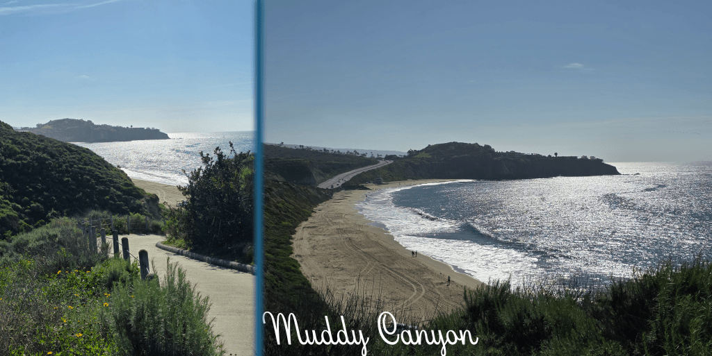
Beyond this hut was another car park, but finally at the end I reached a branch in the path. One direction led to a viewpoint over Muddy Canyon, where there were several benches to enjoy the view.
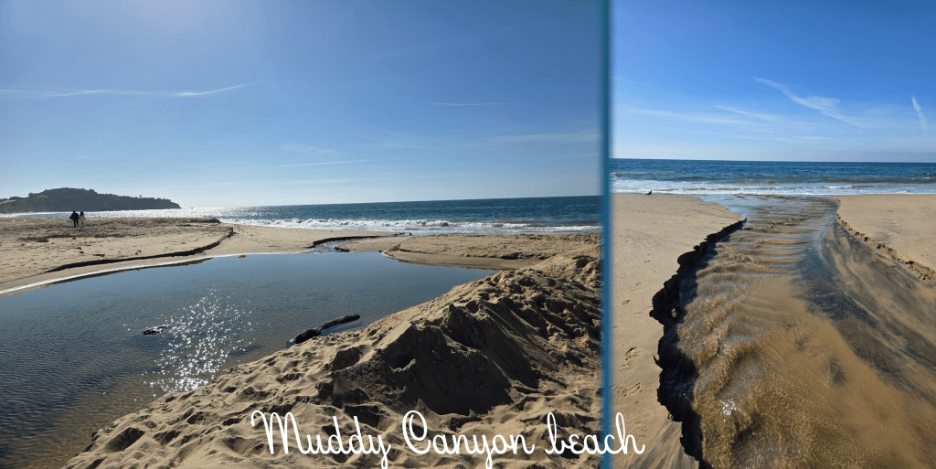
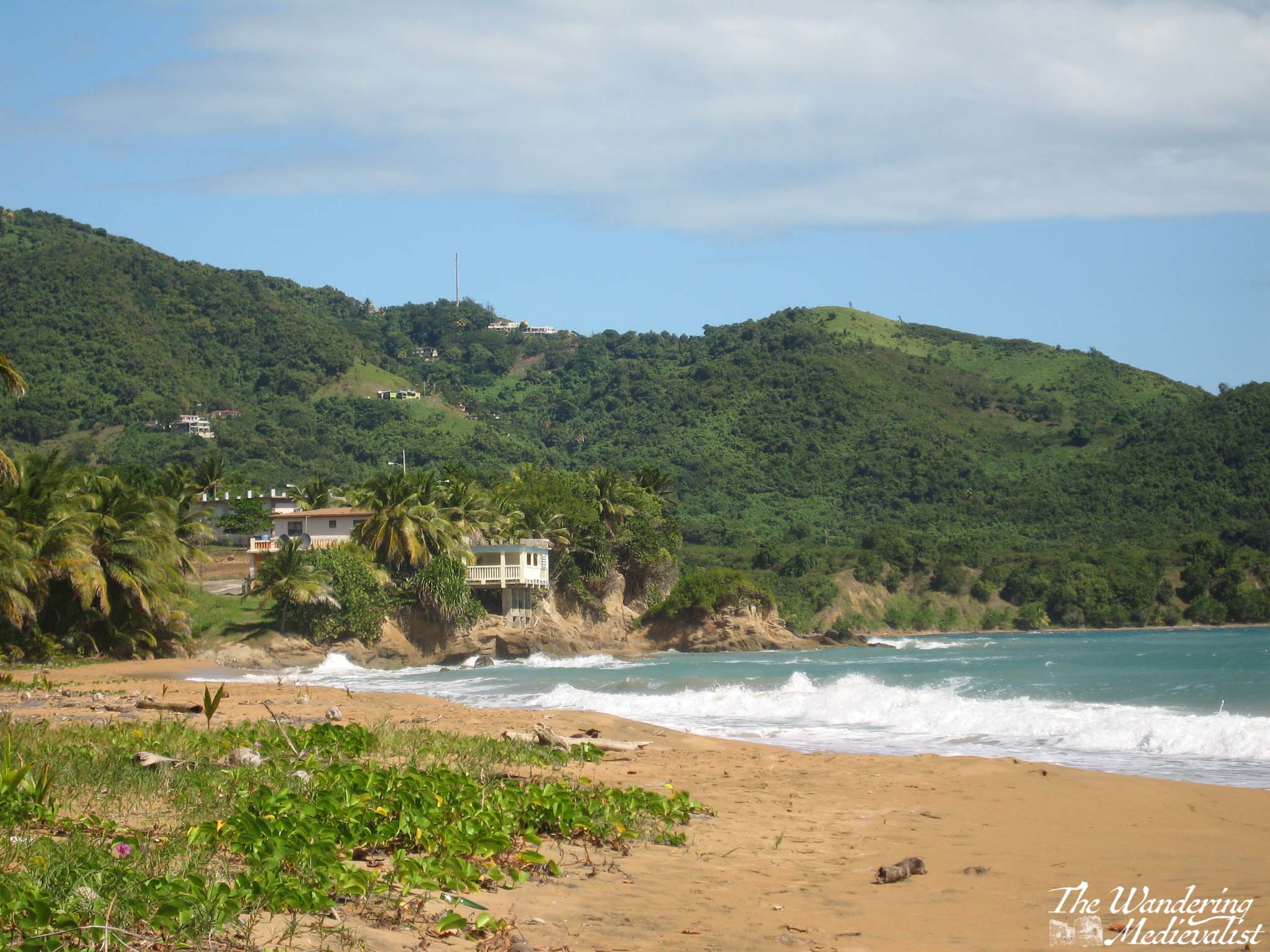
The other direction led to this winding downward ramp – quite steep and a bit slippery with sand. This portion of the path hugs the edge of the canyon, which has been sliced into the cliff by a creek down below. I began to question whether this was a good idea – I really did not want to climb back up the ramp. But, when I reached the bottom, I was greeted by a beautiful fresh breeze, a touch cool and the type that refreshes and rejuvenates. Perhaps it is my childhood by the sea, but I find few things smell better than this type of breeze, pinching your nostrils with a touch of salt.
Immediately to my left was a pond where the creek backed up a bit before emptying into the ocean. Fortunately, the outflow was narrow enough at one spot to leap over, and I managed to do so without falling or injuring myself. The seagulls were watching closely.
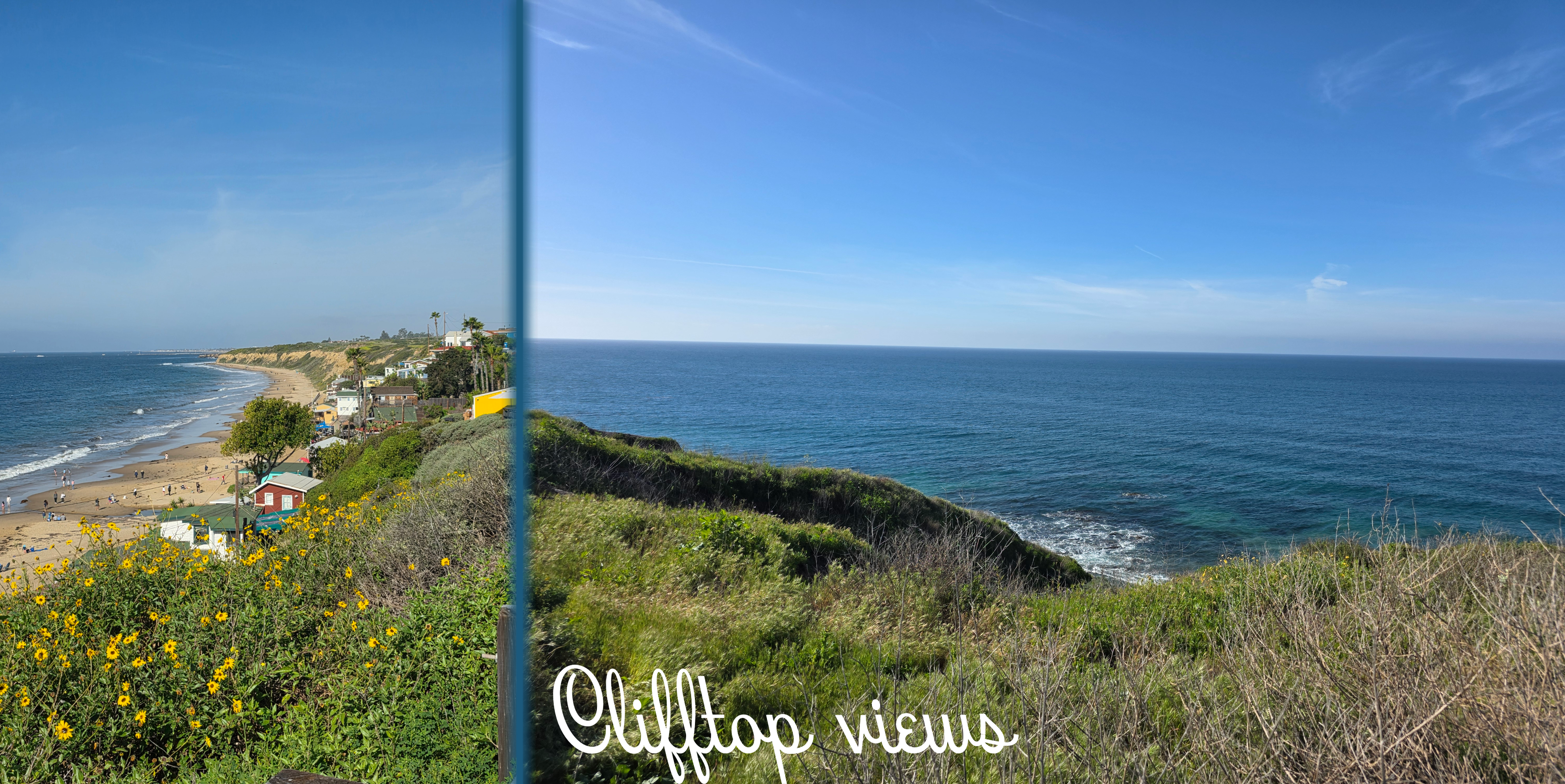
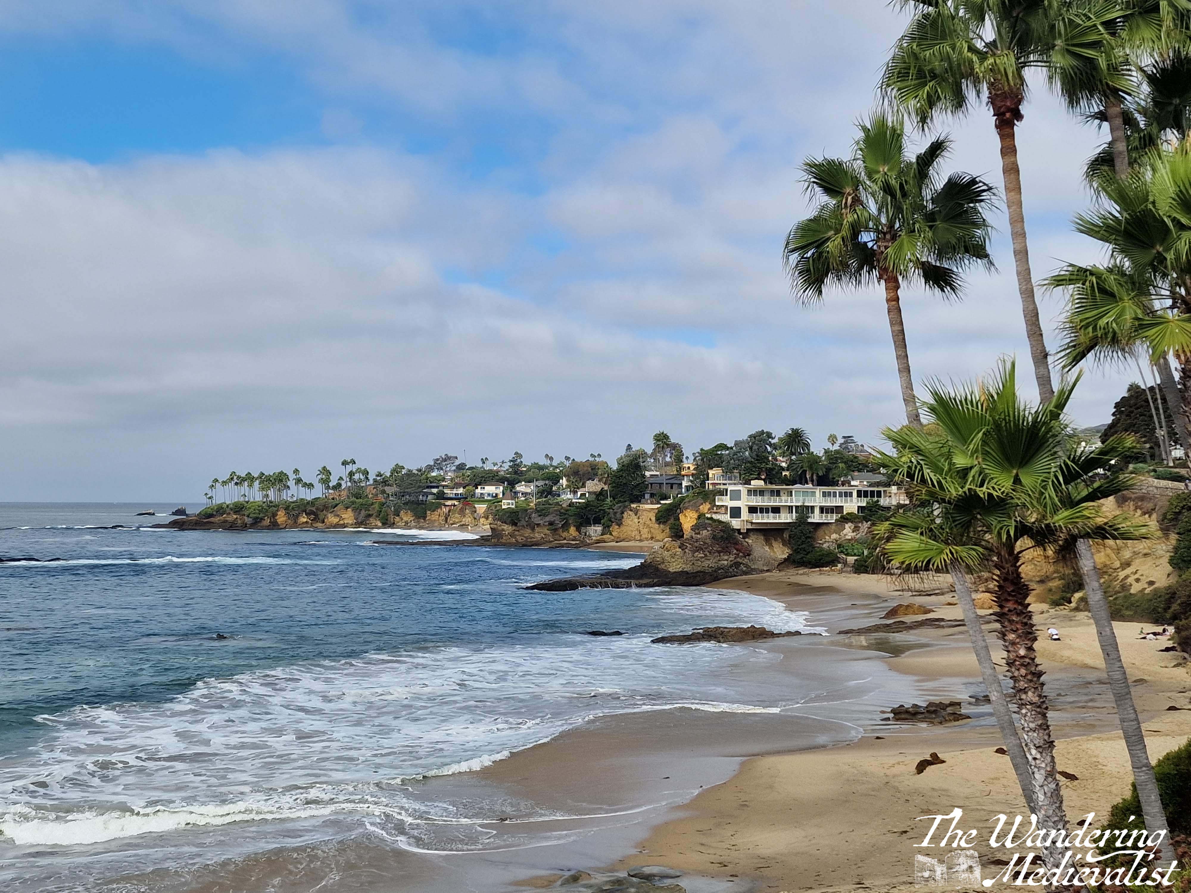
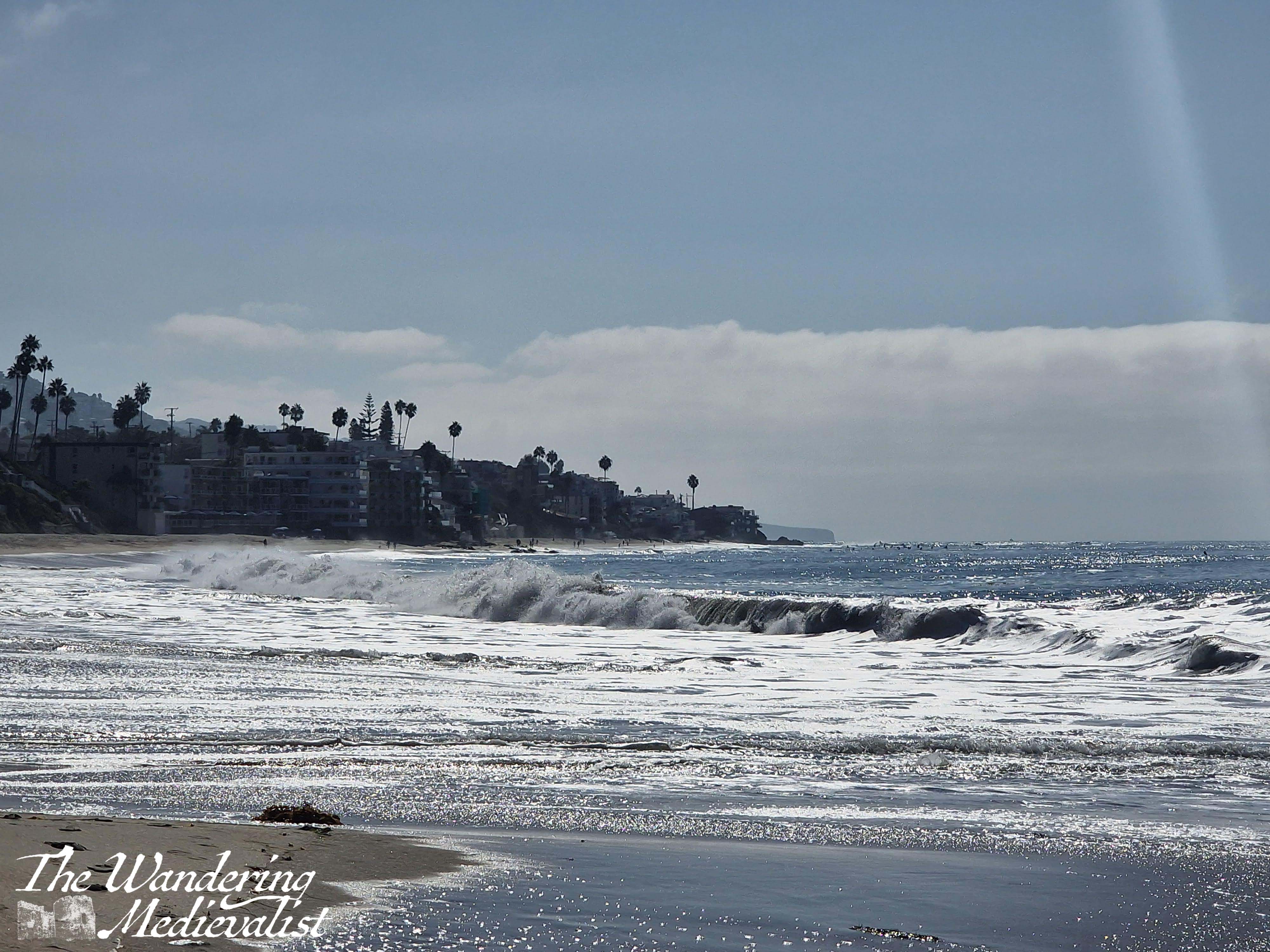
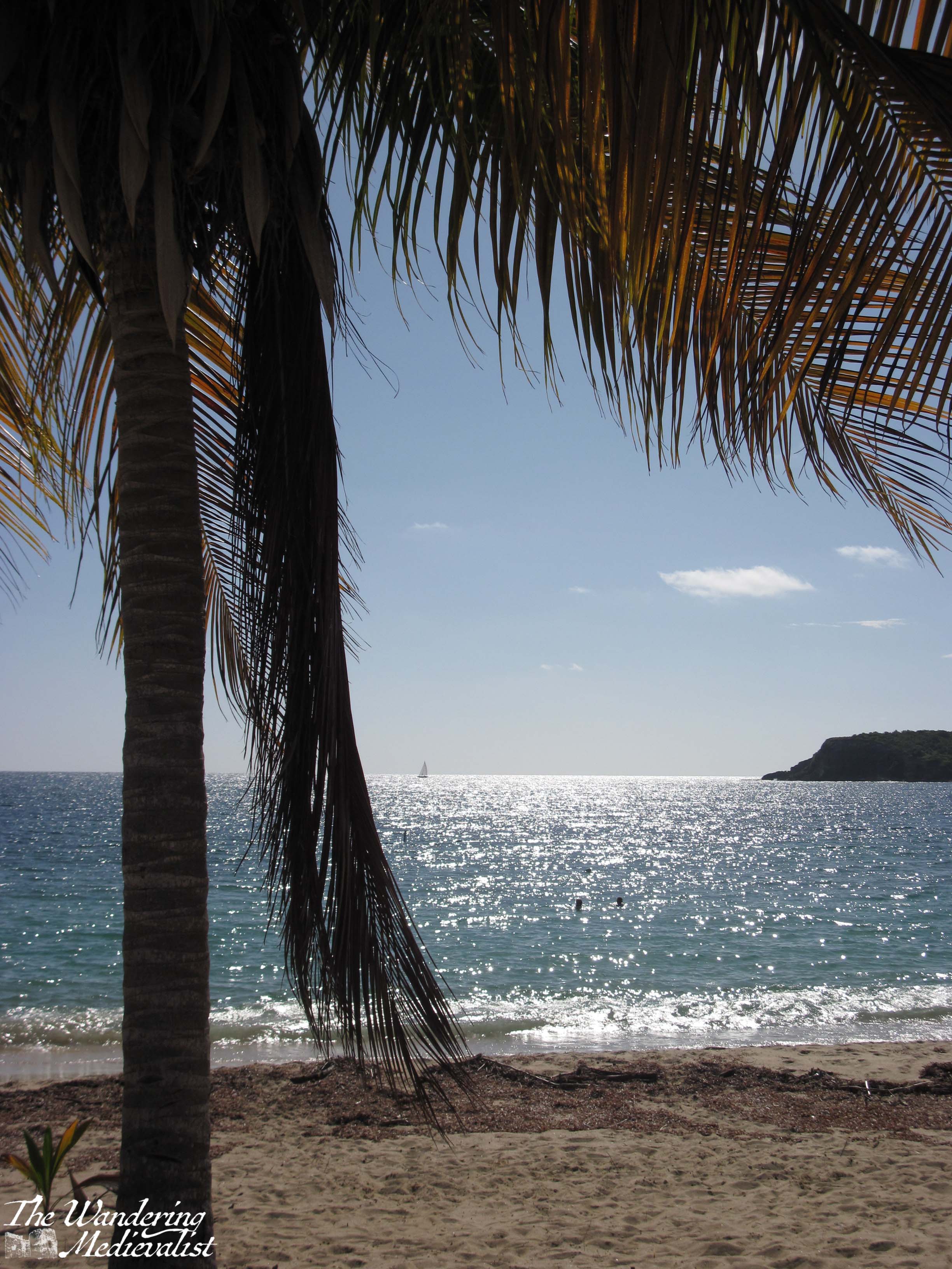
On the far side of the creek, the beach stretches out towards a headland, which is the edge of the town of Laguna Beach (I think). This part of the coast was quieter, so I walked along for a while, enjoying the dramatic cliffs and the wind. I considered a few times how far I wanted to walk, and realised in the end that I was setting myself up for a good long hike if I kept going. So, I turned around and leapt over the creek again. It then occurred to me that I did not need to go back up the ramp – my car was quite a bit further along and there was a set of steps between it and me. So, I stayed down on the beach for a bit longer before finding myself at the bottom of the stairs I had descended at the start of my walk.
They were a touch more daunting looking up than down. That said, they were mostly quite shallow so not too strenuous, and they switched back a few times, allowing for a pause and quick look at the view while I caught my breath.
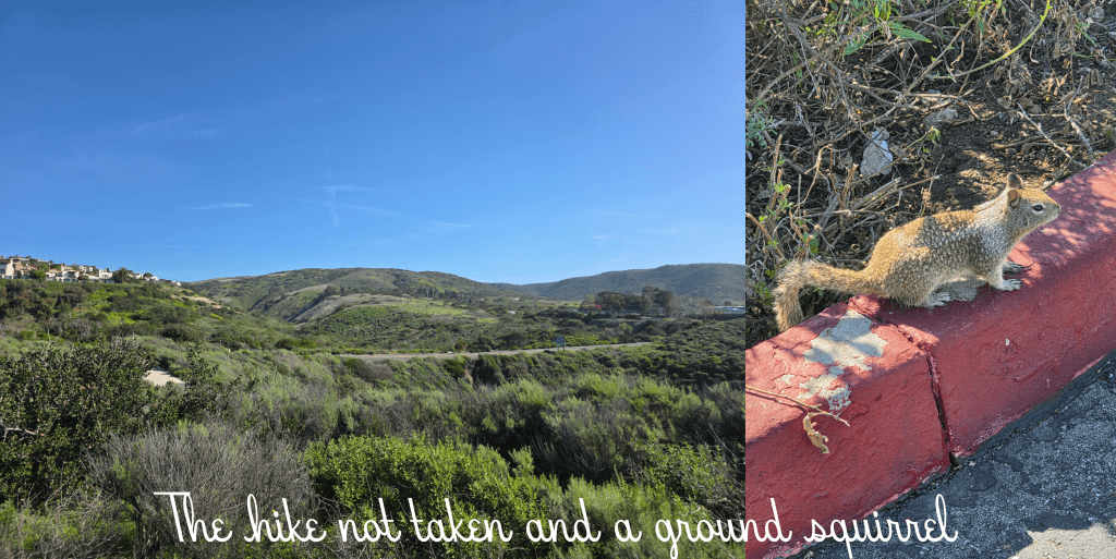
Once back at the top-of-cliff level, I found it to be a relatively short walk back to the car – about five minutes. Along the way I was able to capture a picture of hills I might have been hiking in, as well as this wee ground squirrel who posed very kindly for me. Or possibly froze in fear. Either way, he stayed still for quite some time. While I was heading home, increasing numbers of other people were appearing, particularly couples clearly visiting the beach for a Valentine’s Day picnic. I certainly saw more red mylar balloons that one might expect on a coastal walk, and girls slightly awkwardly clutching bouquets while they headed toward the sand.
In all my hike ended up being about 4 miles with two relatively steep climbs to get the blood pumping a bit. As seems to be the case with much of this area, the beach was stunning and I enjoyed exploring another new spot. The weather has tracked me from Scotland now, as this was the last bright sunny day, and rain has closed in on LA. It looks like I am not likely to get a chance to try another walk on this trip. Perhaps next time!
One last side note about adventuring in this part of Orange County: if you get a chance, stop in at a Pavilions supermarket. The fruit is phenomenal, the packaged salads and breads are delicious and in all it probably comes in around the same cost as a Whole Foods. A really pleasant shopping experience. I am a big fan.
Completing a circuit of the Coastal Path by January may no longer be a feasible goal but that doesn’t stop me from doing my best to try. So, last Saturday I planned another stretch, on the shorter side as I had family commitments to get back to in the afternoon. So, Leven to Lower Largo seemed a good option, and relatively easy to manage by bus.
The day started windy and with patches of rain, with water still in the breeze but sun promising a change in the distance. The storm earlier in the week cleared out the air a bit, and it was less stuffy and a few degrees cooler – perfect day for a walk. (Though, side note, the other half was devastated that the storm was mostly wind, as he was looking forward to a wet grey day. Instead we experienced fast-moving white fluffy clouds and wind, very little rain).
The bus I chose was the x58, which is a faster route south from St Andrews towards Upper and Lower Largo, bypassing most of the East Neuk. It was a nice ride, quick and interesting to see different villages for a change.
I reached Leven Bus Station in good time, and despite there being no visible signs for the Coastal Path, it was easy to see where to go.
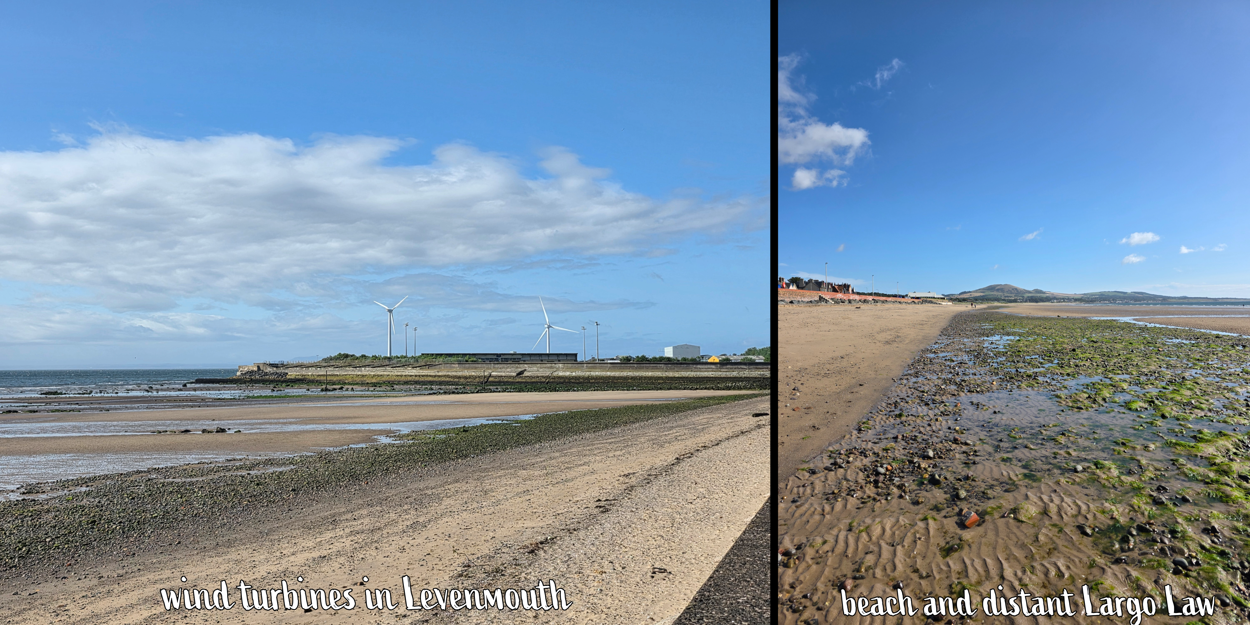
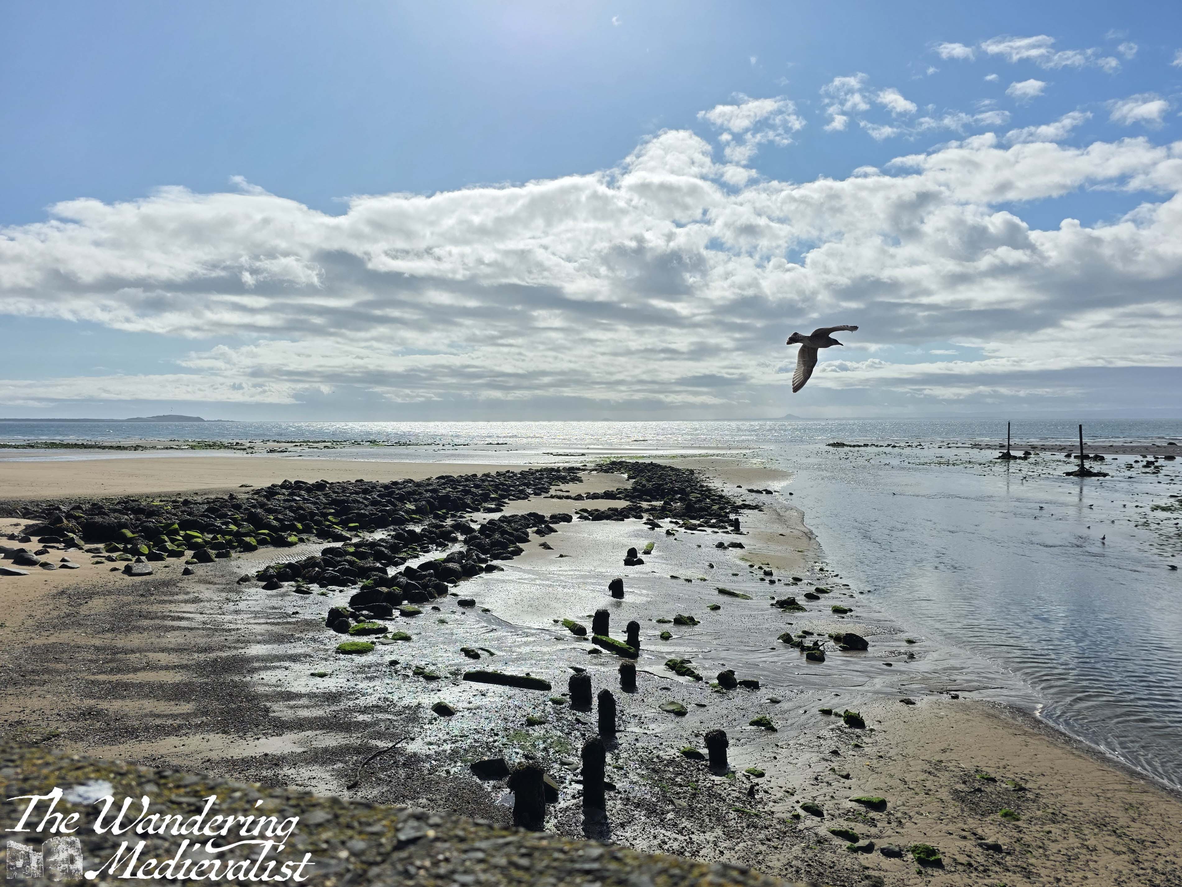
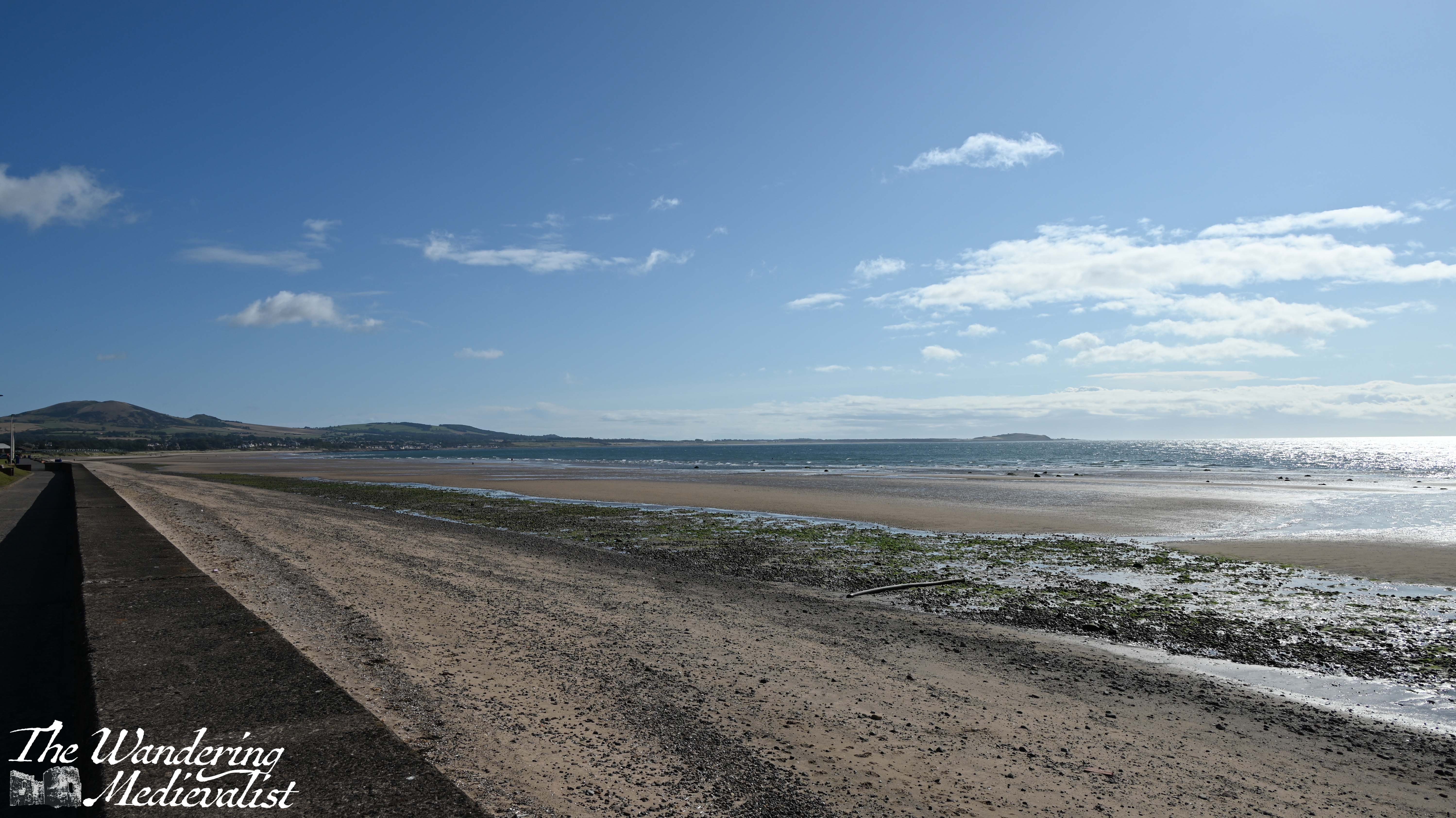
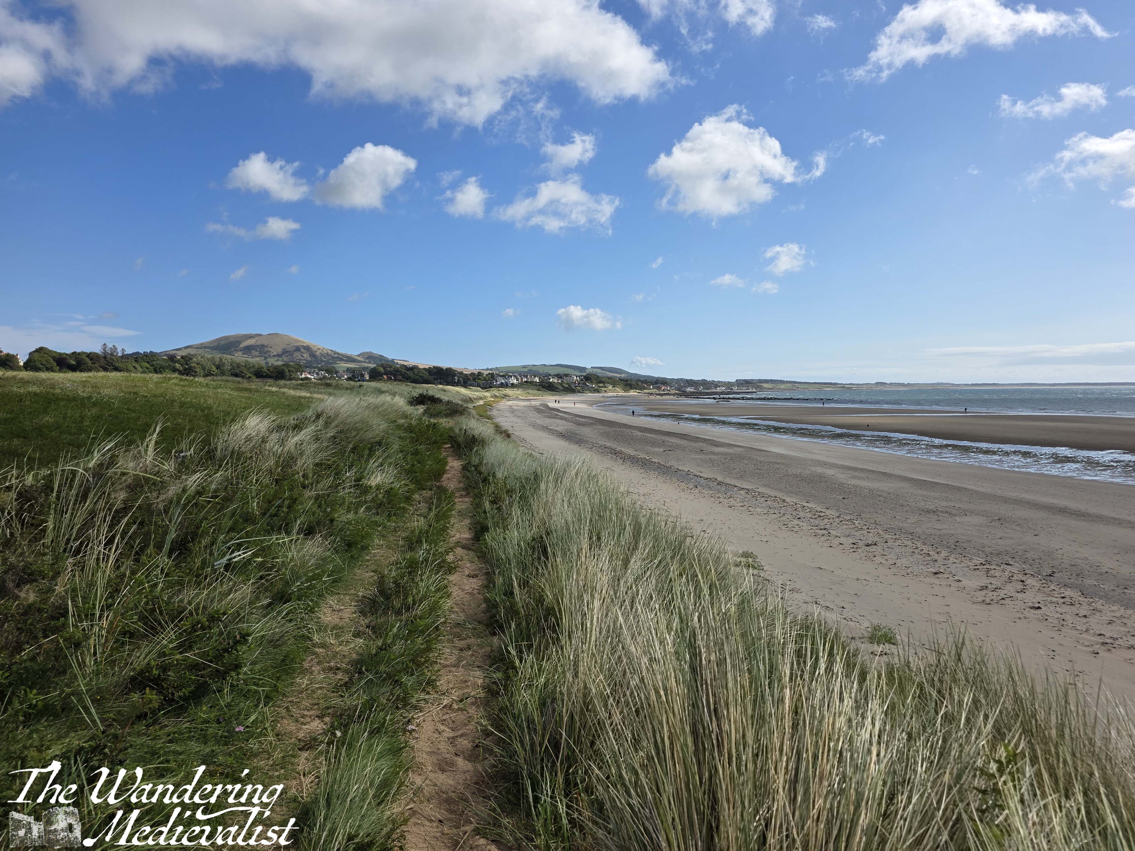
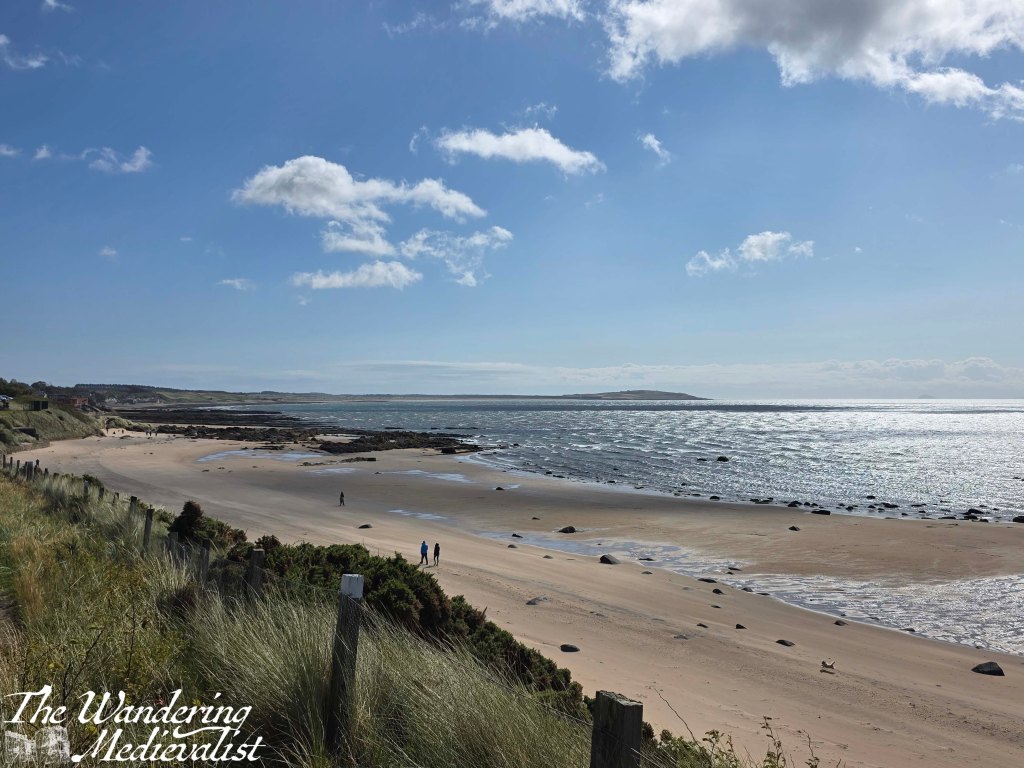
The bus station is very centrally located and only a road away from the coastline, just next to where the River Leven empties out across the beach into the ocean. There is a big car park here, and a promenade that is smaller than the one in Kirkcaldy but just as pleasant, with a wide sandy beach. While the Coastal Path proper runs along the road, I took a quick jaunt down to the sand to on several occasions.
Also similar to Kirkcaldy, this promenade provides a view of the whole bay, with coast stretching out for miles ahead up to the point where you would turn to go to Elie, and Largo Law – Largo hill – towering over the distant towns. It was a touch hazy, but became clearer as the day went on and the clouds were chased away by sunshine.
As I walked along the beach, I became aware of the excited screams and laughter of many children, who were playing in a large blow-up arcade with a massive slide and other amusements. This theme continued, as further down the coast was an older arcade-style building, a new skateboard park, playground equipment, a putting green and more.
At this point the Coastal Path signage is scarce, but there really isn’t any other option but to follow the road. On the side away from the beach, I eventually passed the Leven Golfing Society – a large red brick building – and enjoyed a nice vista across the golf course to the Victorian-era cottages beyond.
Unlike in other towns, the Coastal Path avoids going through Leven Beach Holiday Park, and there are two routes – a high tide route up behind the park, and a low tide route on the beach.
The sign that indicated these two routes was so faded from the sun that I could not capture it, but I figured that I would work it out when it was time to leave the beach.
I was also delighted to walk past a small group of pet owners taking part in a dog training class on the grassy area beside the beach. I passed more than a few dogs on the beach and this section of the trail – clearly it is a popular spot! Including one small white dog that continued to chew on its squeaky toy for a solid 10 minutes – at first I thought it might be a very odd bird, but soon realised my mistake.
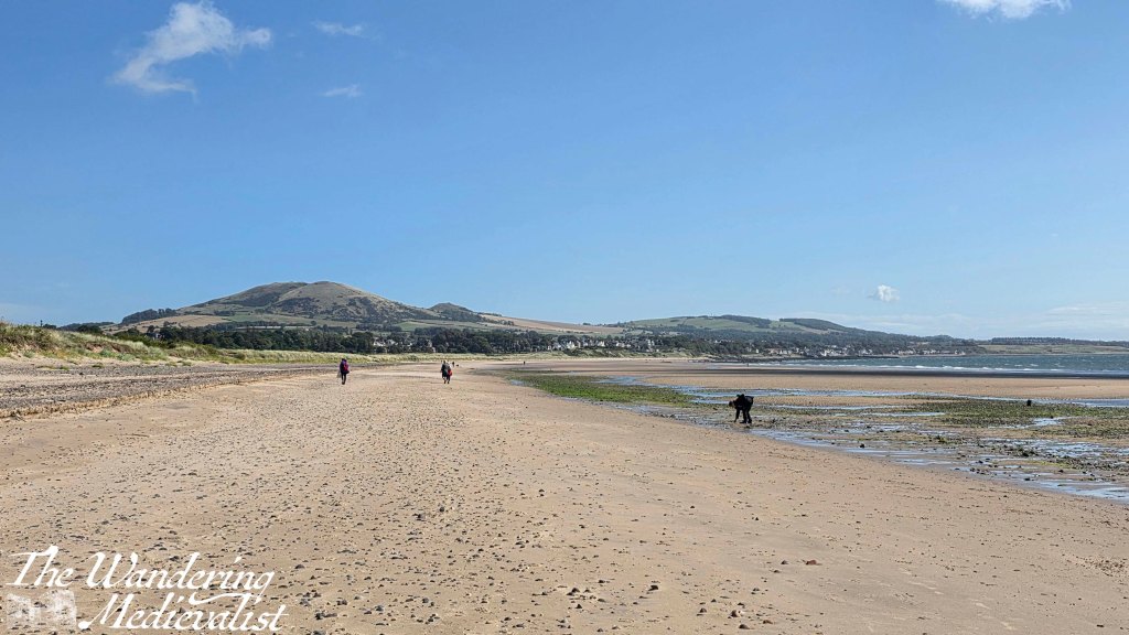
beach looking towards Largo Law
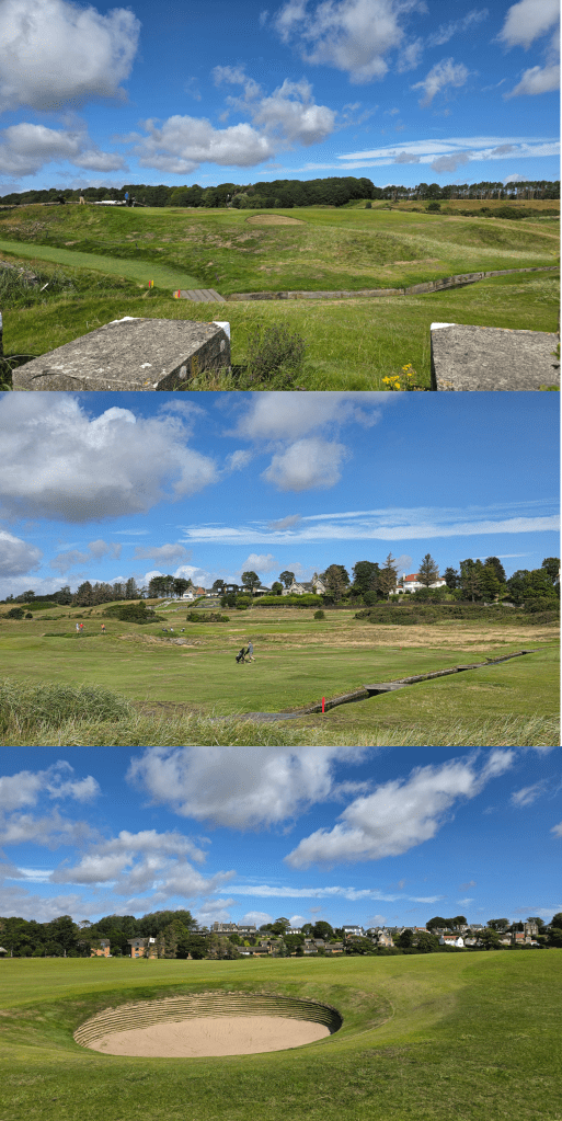
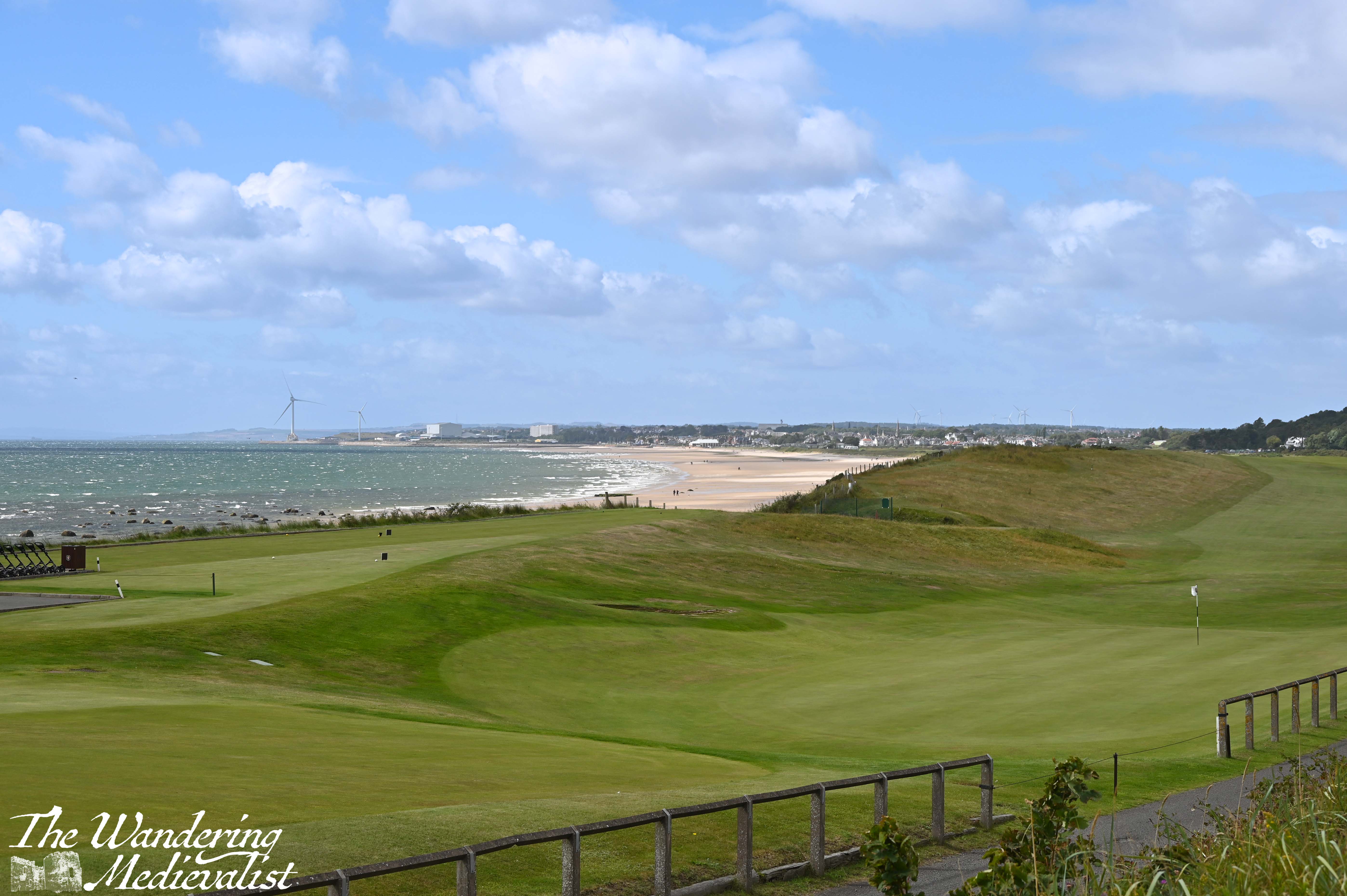
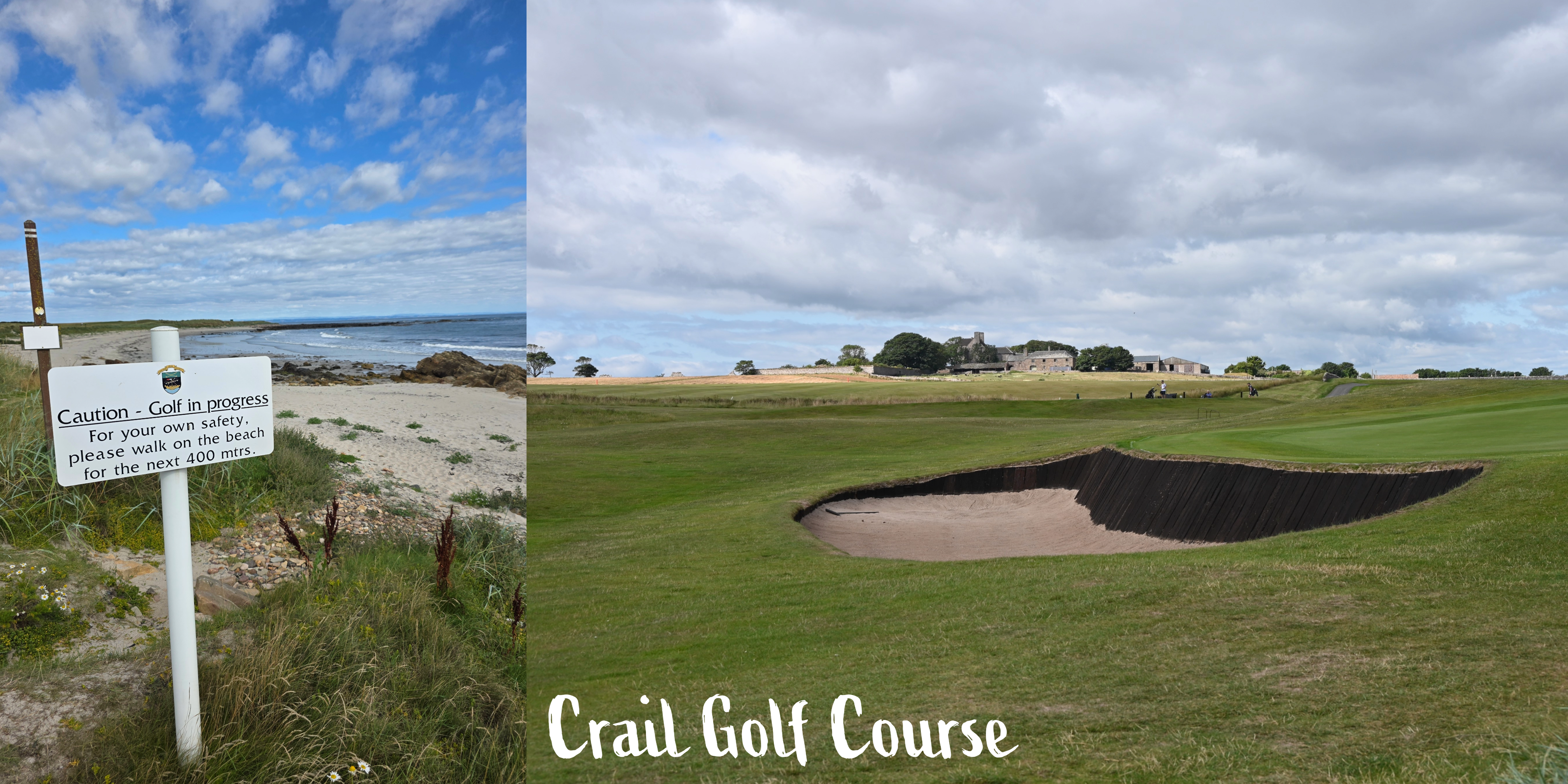
The sign indicating the spot to re-join the high tide route is easily visible from the beach, and so I climbed back up onto the verge between the golf course and the sand. Like so many large patches of the Coastal Path, this was the pattern for the next mile or so – beach and golf course, both providing good camera fodder. (I have an idea to do a calendar of Scottish golf courses, so this walk will be a great help)
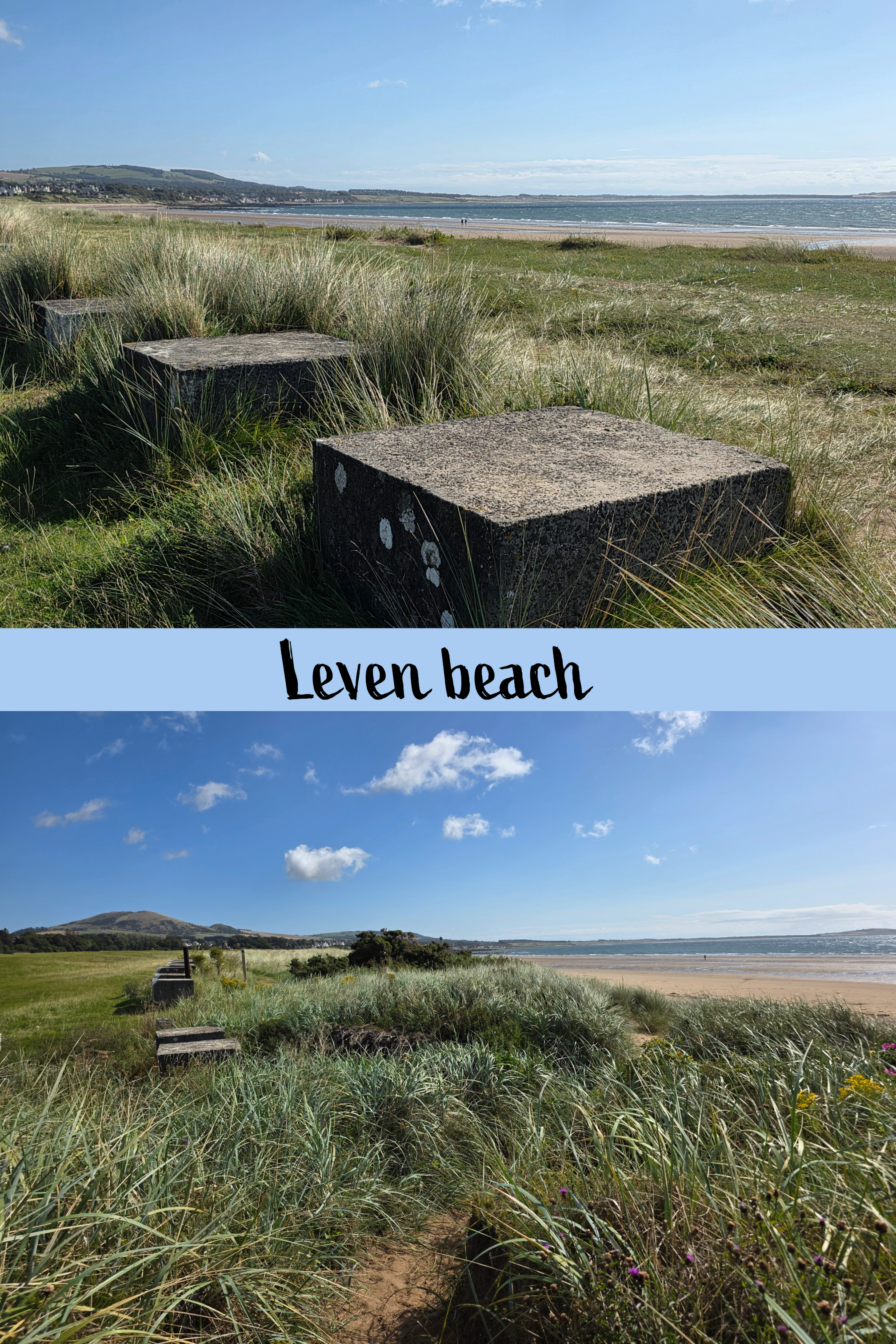
In very little time, the comment I made last week about not noticing WWII defenses this far down on the coast was entirely disregarded when a long line of concrete blocks appeared, essentially marking the border between golf and walking. The Coastal Path sign helpfully points right down the middle, so to some extent it is walker’s choice which side of the blocks you choose.
The track here is quite a bit softer, with deep sandy patches interspersed with grasses, making the going a little harder. I finally became warm enough to shed my cardigan (the wind was no laughing matter), and paused briefly at a bridge across a small burn. The burn cut through the dunes and was lined with sea roses and other wildflowers – really beautiful spot.
Some golf views…
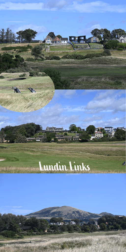
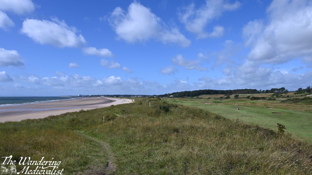
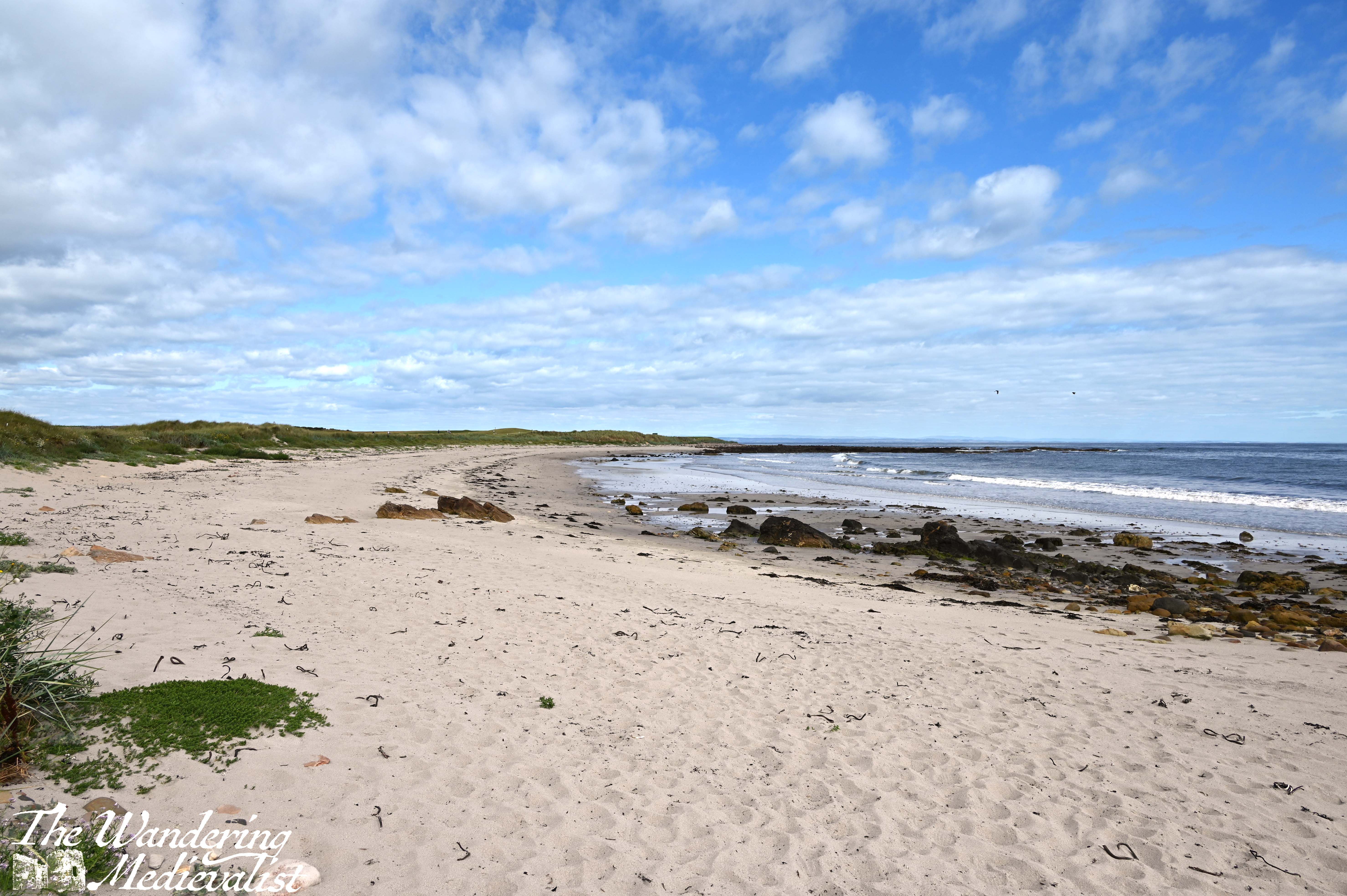
As the path moves around the bay, Largo Law shifts further to the left, and the well-kept houses of Lundin Links appear along the distant edge of the golf course. At some point this becomes Lundin Links rather than Leven, though I’m not sure where – probably at the stone wall that seems to cut a relatively even division down the grassy slopes. On the beach, the pristine sand slowly becomes rockier, first by the waterline and then gradually moving inland, with sand replaced by the rock shelves so common in Fife. With the dunes and long grass edging the beach, it is just a really beautiful few miles, and could probably mostly be done on the sand itself, should a walker prefer the beach.
half beach, half golf- epitome of the Coastal Path
While on the dunes there are several little trails breaking off, the Coastal Path itself is always well-marked and relatively easy to follow, or so I thought as I was walking.
About a third of a mile after the first burn, there is a second, beyond which the trail climbs slightly up a hill with excellent viewpoints in all directions. I walked for another third of a mile or so only to reach a fence and some rather threatening warning signs, indicating that walkers could cross the golf course at this point, at their own risk. The only other choice was to go down to the beach.
After a quick check of my new map and the internet – which was working for a change – I determined that I had made an error, and that the actual route of the Fife Coastal Path led off to the left back at the most recent burn. As the course was busy, I determined it wisest to go back, unfortunately meaning that I was now about 15 minutes behind my schedule which was again depending upon busses.
great view for a detour…
Sure enough, the sign for the Coastal Path clearly directed walkers across the course at the burn – I missed it entirely, probably too busy with the burn itself – which is considerably further from the fairway and so safer. Annoyed at myself, I crossed the green and joined a dirt track which soon led into the residential area. The homes here are lovely with abundant gardens, and there are stern signs warning that dog walking must not take place on the golf course.
In about five minutes, there is a right turn to keep following the edge of the course, and then a quick left along the road leading towards the golf club. There is also a dirt track that climbs up a hill beside the road, removing walkers from the traffic, which is ideal.
Some Lundin Links views
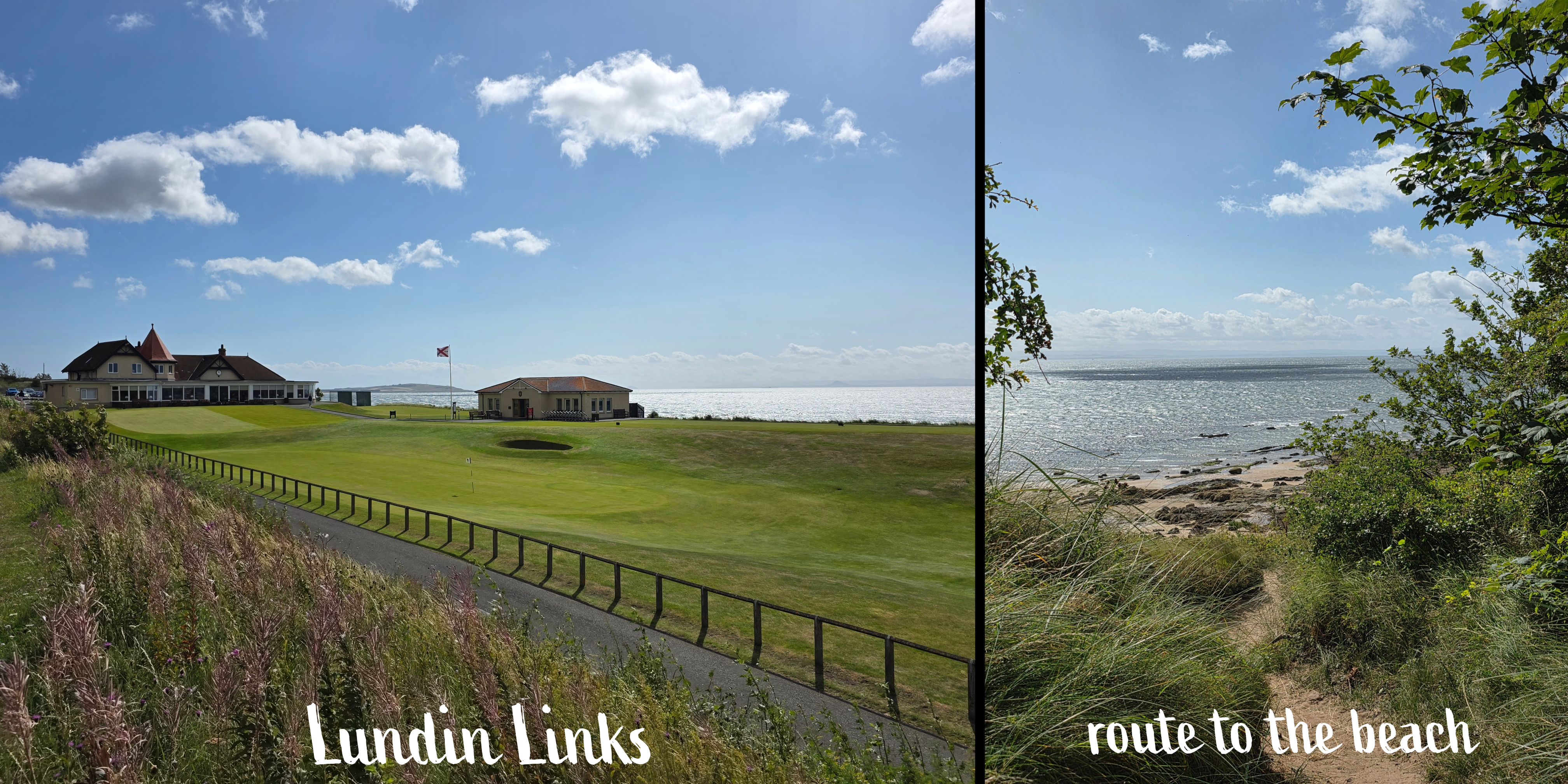
Passing through the golf club parking lot, I spotted the signs for the path ahead as well as a large gate, leading beyond. There is an almost immediate right turn (though a path also leads straight ahead), and suddenly I found myself emerging from the tree line to a stunning view over the coast. It reminded me ever so slightly of certain parts of Cape Cod, with beach-adjacent trees, long grass and rambling sea roses. The path wound down the hill, with sand and rock beyond; do be careful if you get too immersed in the view, though, as there are several deep steps that you might miss or – ahem – slip down if you are too busy looking up.
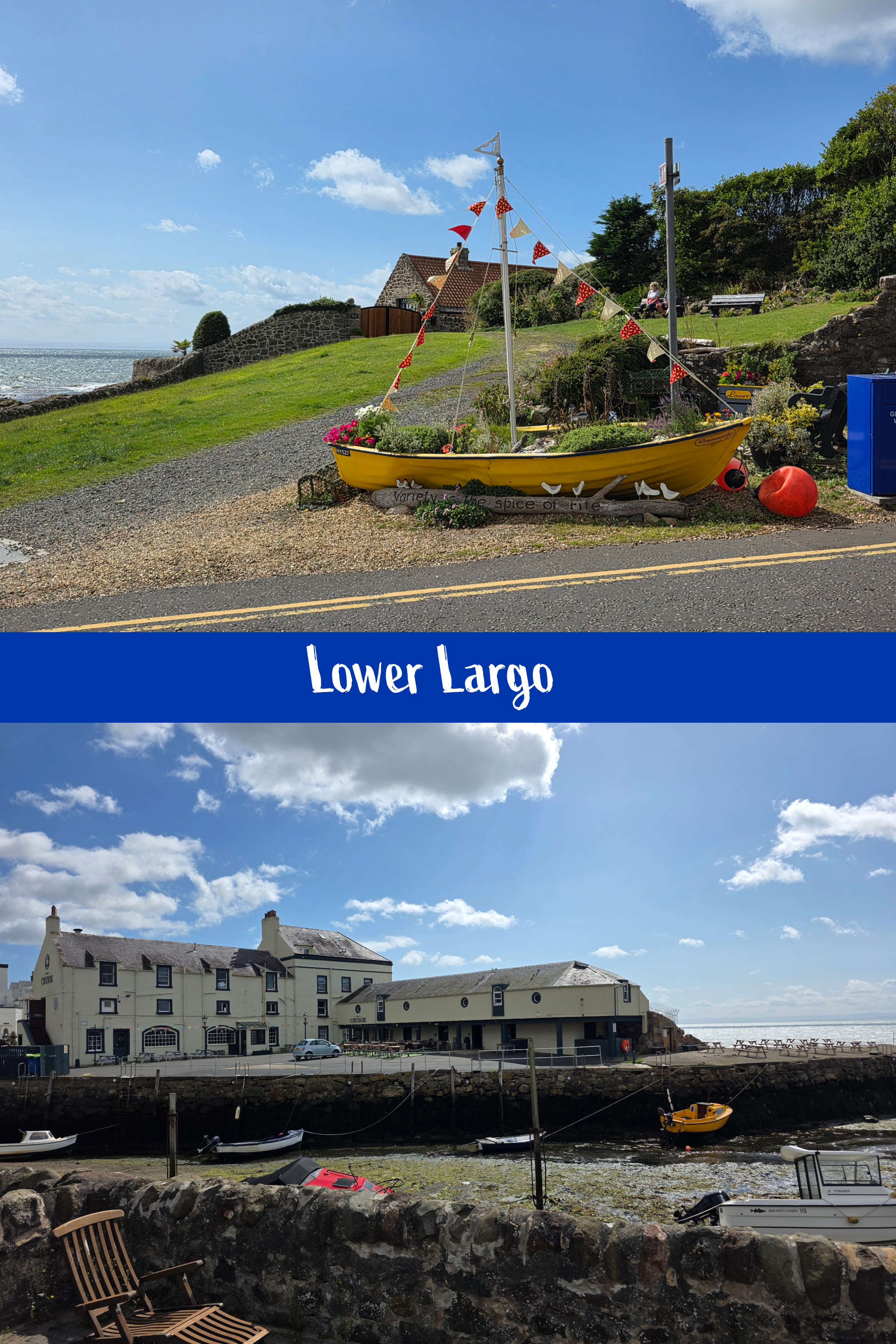
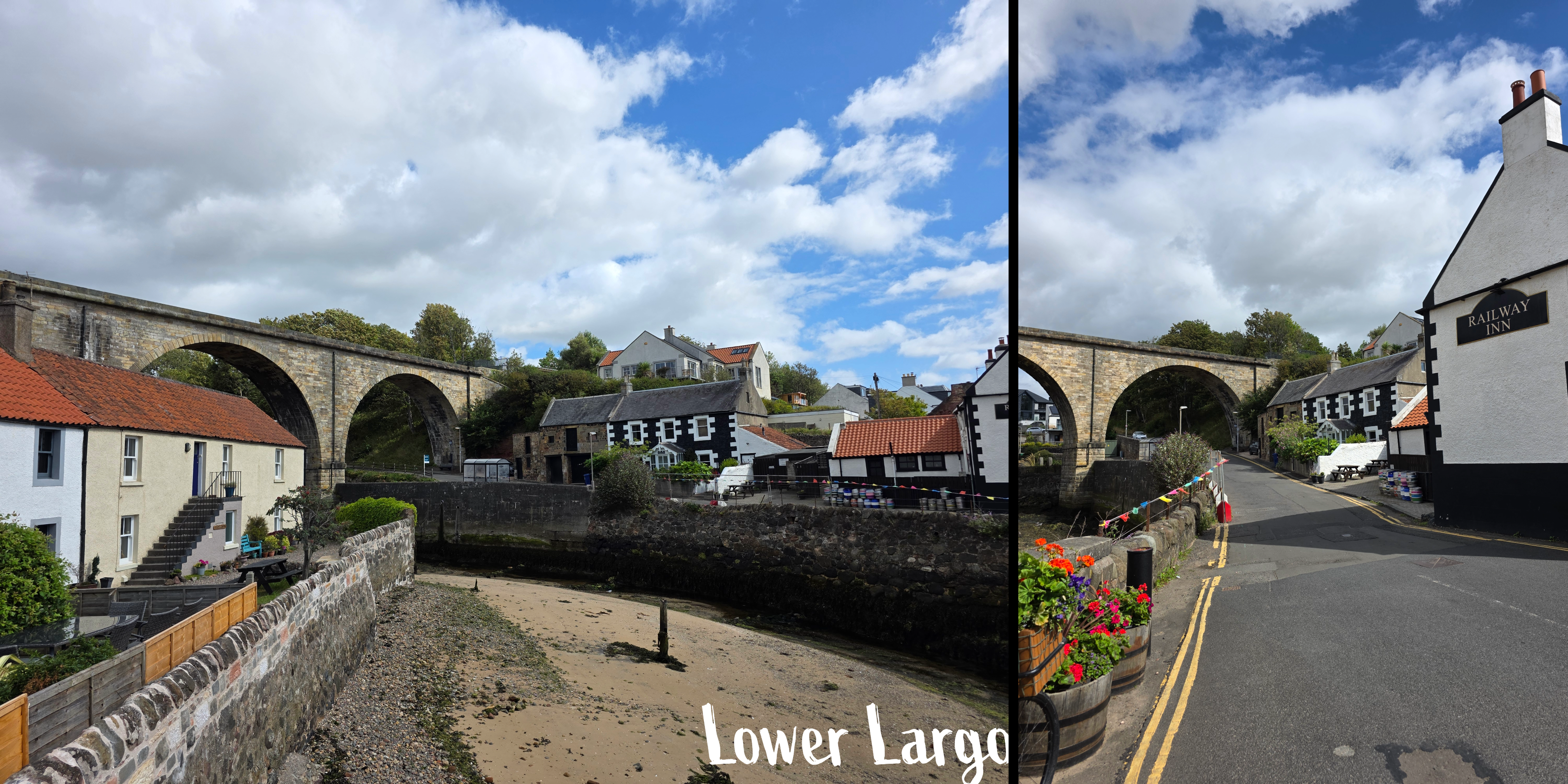
This was by far my favourite part of the walk, and the ocean colours were extraordinary, almost Caribbean in their blue-green quality. There are a few side-paths but keep going straight and you will be fine, eventually reaching a stand of trees and a gate, beyond which the trail enters the edge of Lower Largo. There is a large orange house between the path and the coast, and you are walking behind identical coastal cottages for a short while. The homes are mostly old fisherman’s houses that have been restored, and ahead is the viaduct that used to carry the train.
As the road winds down into the town, be careful as there is not always an obvious sidewalk; this feels much more like the towns of Anstruther and Crail, and shortly the road crosses a narrow bridge over the harbour. Ahead is the Crusoe, a popular local restaurant, and to the left a beautiful old mid-eighteenth century inn, the Railway Inn, offers bar snacks and a beer garden.
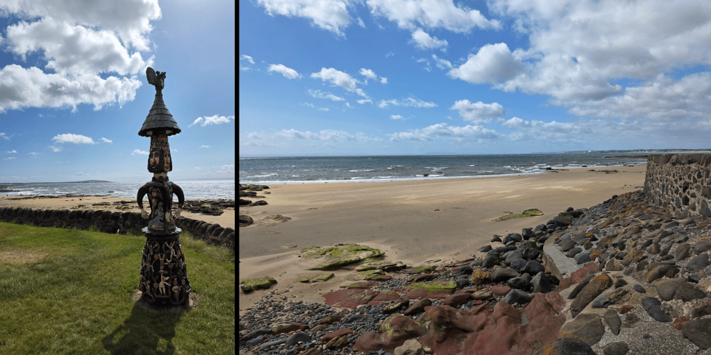
The Coastal Path continues with a brief jog to the left, then straight along Main Street. You will pass a small grassy area with a stone fence, and in the middle a sculpture by a local artists, Alan Faulds. There is more of his art further on – very unique stuff.
By this point, my walk was quickly coming to an end, so I decided to mark the close at the Aurrie, just next to a car park which should really have been called a boat yard. I took a quick moment to enjoy the view over the beach, then turned inland.
If you are also planning to finish a walk here, be warned that the street leading up the hill – Durham Wynd – is steep and without a pedestrian path for the first section at least.
Beyond that it was an easy five-minute trip to the bus stop and I caught the bus with a few minutes to spare, in the meantime keeping the company of a field of cows. One note about the bus trip back – I always forget about the great view of St Andrews as you come over the hill past Cairnsmill Caravan park. I just managed one today, though the bus was jerking about and bumpy.
Another note – one of the aspects of the Fife Coastal Path about which I am continually impressed is how you can turn a relatively unexciting-looking corner and suddenly be faced with a jaw-dropping vista. It has happened so many times now that I can’t even count, but I am always amazed. It really makes the heat, sweat, bugs, and bouncing around on public transport worth the effort. Large portions of the path are quiet, so I am often on my own, astounded by the peace and beauty, and counting myself lucky that I have the opportunity to pursue this goal.
My next walk is likely to be the last one I can manage before autumn travel, and I have planned a good one – 6 miles, at least one castle, and as usual phenomenal coastline. I hope the weather stays good, though wouldn’t mind if it cooled off a touch…
For whatever reason, this past Saturday morning sleep was not my friend and I woke early – the same time I do for work, which is early for a weekend – and got myself going to aim for a bus an hour earlier than I had intended. And good thing I did, as this stretch of the Coastal Path took me longer than expected, even with a few stops to test out my new camera. Yes, that is one exciting development this week: I finally managed to order and have delivered the fancy new camera that was a – cough – Christmas present from my father. Entirely my fault that it took me this long to get it sorted, as I was waffling about what to get. I settled on a switch of brand, moving from Canon to Nikon. I still need to spend some time working it out, but I’ll get there. And I digress. (still…new toy!)
Crail is a bit more limited than Anstruther in terms of public transport, but the 95 is always a good option and I got my favourite seat upstairs at the front. Also on the bus were a group of young caddies, probably about 21, who were on their way to Kingsbarns and discussing their job and how much they would make after a day of work. Blew my mind – I can definitely see the appeal! A lot of hard work to get there, I know, but still paid incredibly well especially for someone on a summer break from university.
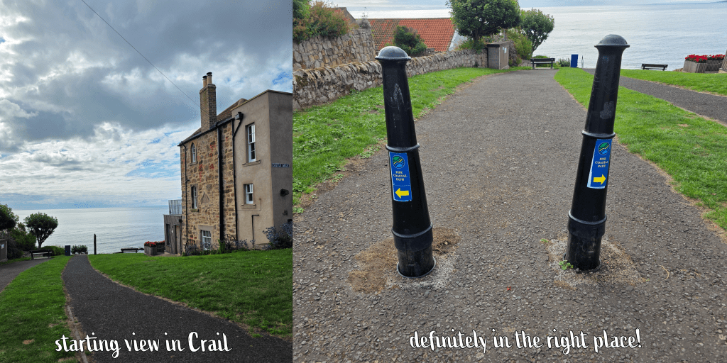
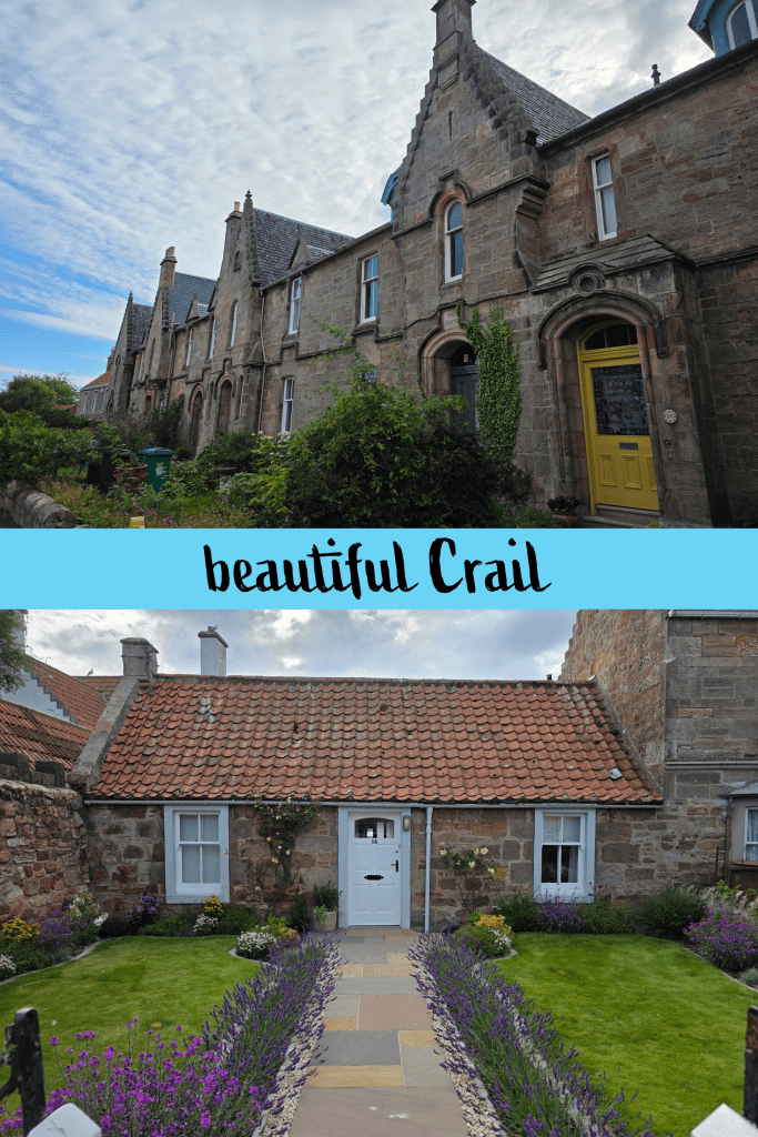
I arrived in Crail at 9am on the dot, alighting just before the roundabout where St Andrews Road turns into the High Street. It was a short walk of less than 5 minutes down Castle Street, then a slight veer to the left around the castle wall, to the spot where I had officially ended the walk to Crail from Anstruther a few weeks back.
The oath is clearly marked here, along the Nethergate heading north-east. This street is just an endless line of beautiful houses and well-kept gardens, which are really all-pervasive in Crail. Even the edge of town where the houses are ‘newer’ is a lovely winding neighbourhood with beautiful gardens. That said, the constant shrieking of the gulls (expected, still annoying) made me wonder if I really coveted one of these cottages.
In about a third of a mile, the Nethergate ends at a stone wall and large grassy area, and the path takes a steep turn town towards the beach; ahead is a line of Victorian-era houses with beautiful gardens (notice a pattern?), and the open sea beyond.
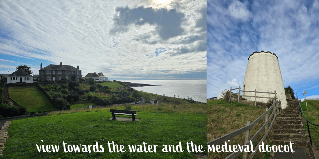
There are two paths here, one a straight shot down a steep hill along a wall, and one off to the left which is a touch more gradual. This is the official path, I think, though I chose the other way. Going along the wall eventually takes you past this late medieval doocot, which is still open (though I did not go in) and which includes a detailed explanation of what a doocot is. This one, built around 1550, housed pigeons until the mid-19th century, and is of a quite traditional round ‘beehive’ design, though there are plenty – for example one at Tantallon Castle – that are rectangular.
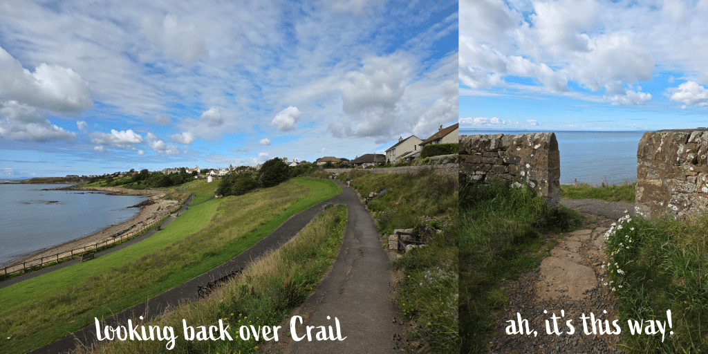
Beyond the doocot, I turned left along the shore, where there is a playpark next to the sea. The weather was mild but breezy, with a mix of sun and clouds that was the perfect opportunity to test my camera. The beach is rocky with small patches of sand, reminding me very much of the beaches at home. I was relieved to discover that there was also a toilet block, though it was far from clean or well-kept. Those in Crail had been at the other end of town, so this seemed a good opportunity, and potentially the last one on this walk. (Though if you ask very nicely, it may be possible to use the ones at the caravan park, I’m really not sure)
At the end of the bay, there is a flight of steps leading up to what I realised was the actual Coastal Path – oops – which had run along the top of the park. Either way is fine, I’m sure! This is of course a good spot to get a few pictures back over the beach towards the town. From here it was along the path for a short while, and a relatively fast right turn through a grassy field. There are several routes here, some leading off to the left that are clearly made by walkers, and the Coastal Path is not well-marked, but stick to the main trail heading straight for the water’s edge, and you will reach a gap in the stone wall. It may not seem the right way, but it is!
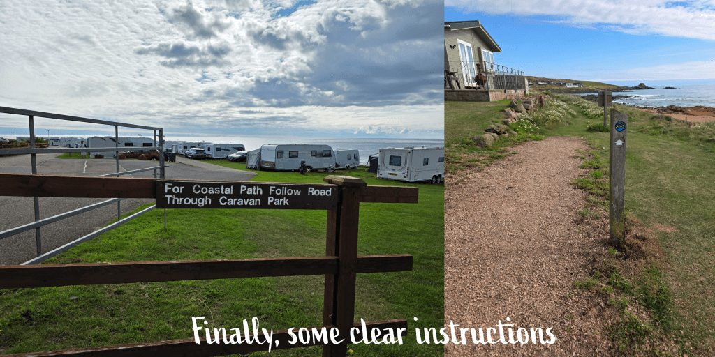
Once through the stone wall, you will see signs again and the entrance to the Sauchope Links Holiday Lodge and Caravan park. There is a clear direction here, sending walkers through the caravans on the main road. While it was early morning and the park was just waking up – some lucky souls sitting on their porch drinking coffee with a splendid view over the ocean – there were some vehicles too, keeping me on my toes.
I was really impressed with the holiday park which had a small but clean-looking pool and a good number of well-kept caravans. In time the caravan park merged into the holiday lodges, including a few glamping pods (I think) and then eventually some really lovely-looking lodges. The views were excellent, but I did have some doubt as to whether I’d want to be quite that close to the water here on the outermost edge of Fife – especially with Storm Floris expected in a few days. Eventually I discovered the style of house I liked best, up on the side of the hill a bit further back, with big patios and I am sure, a great view.
After about ten minutes or so of walking – it’s a big park! – I found a sign for the Coastal Peth taking me off the main road and down a sandy track towards the beach. The path runs between the lodges and the beach, alternately sandy, grassy, and occasionally rocky. It was an odd day where I couldn’t decide if I needed sunglasses or not, and it meant that the views were alternately bright and clear or a bit murky.
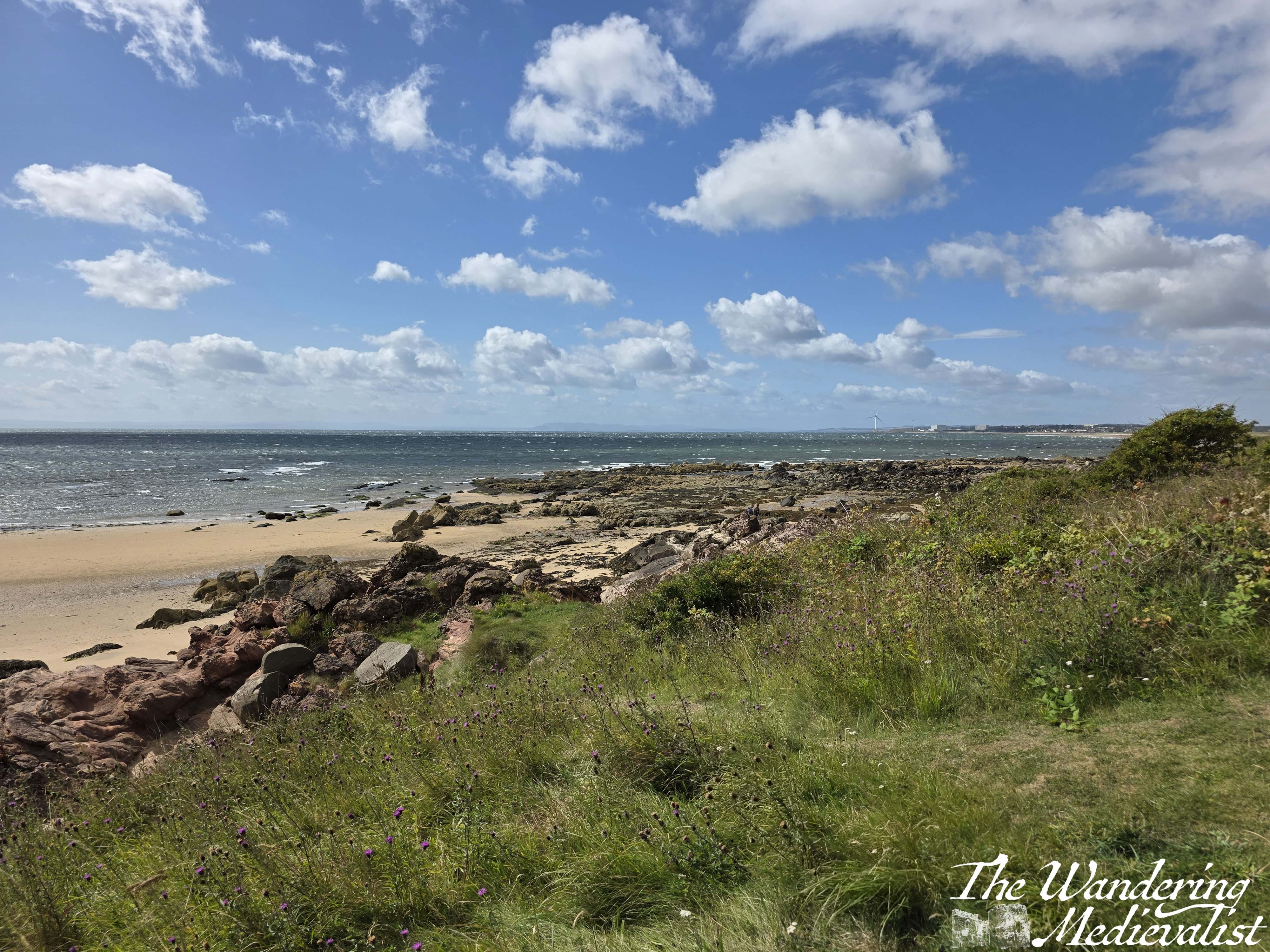
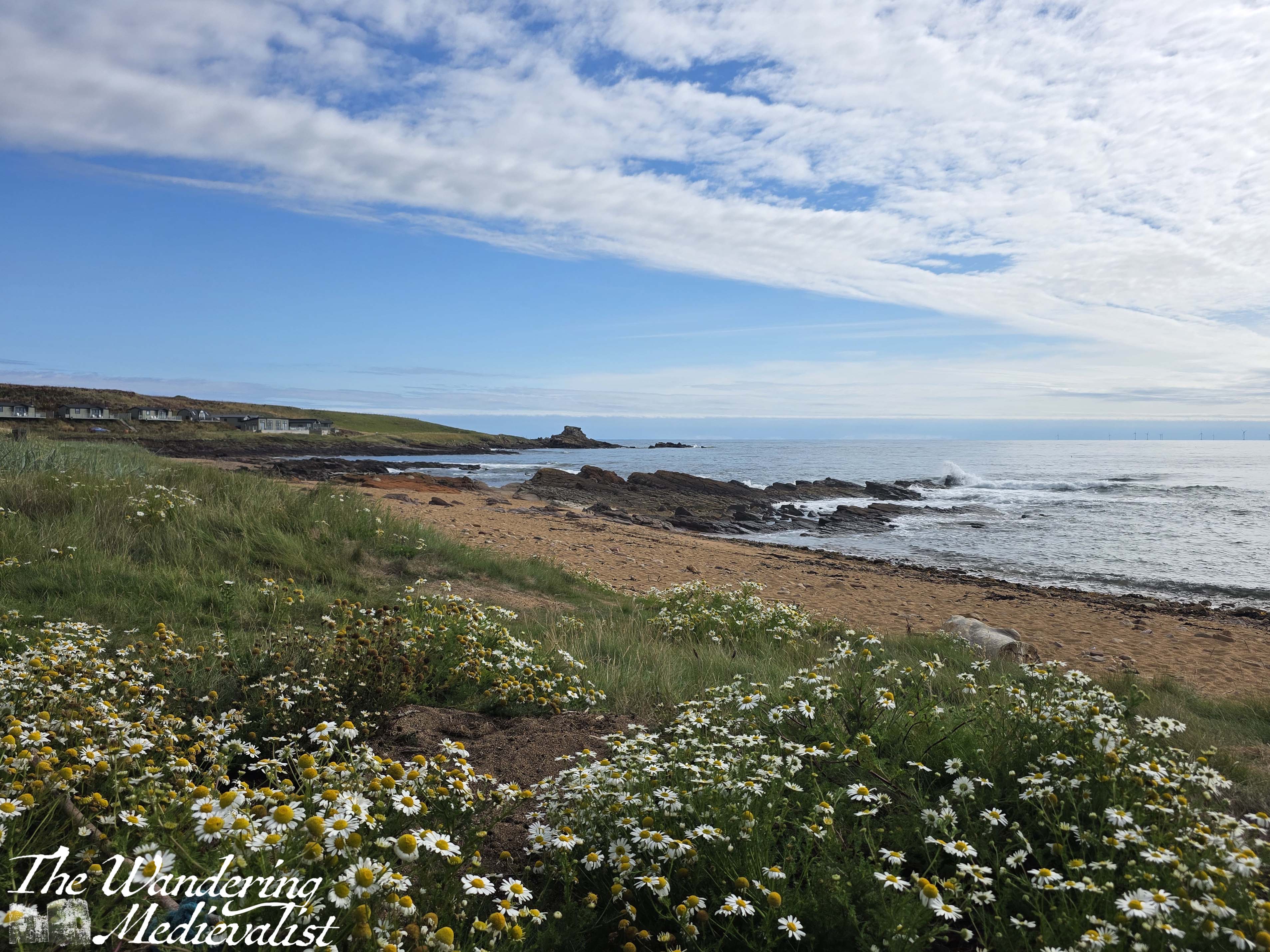
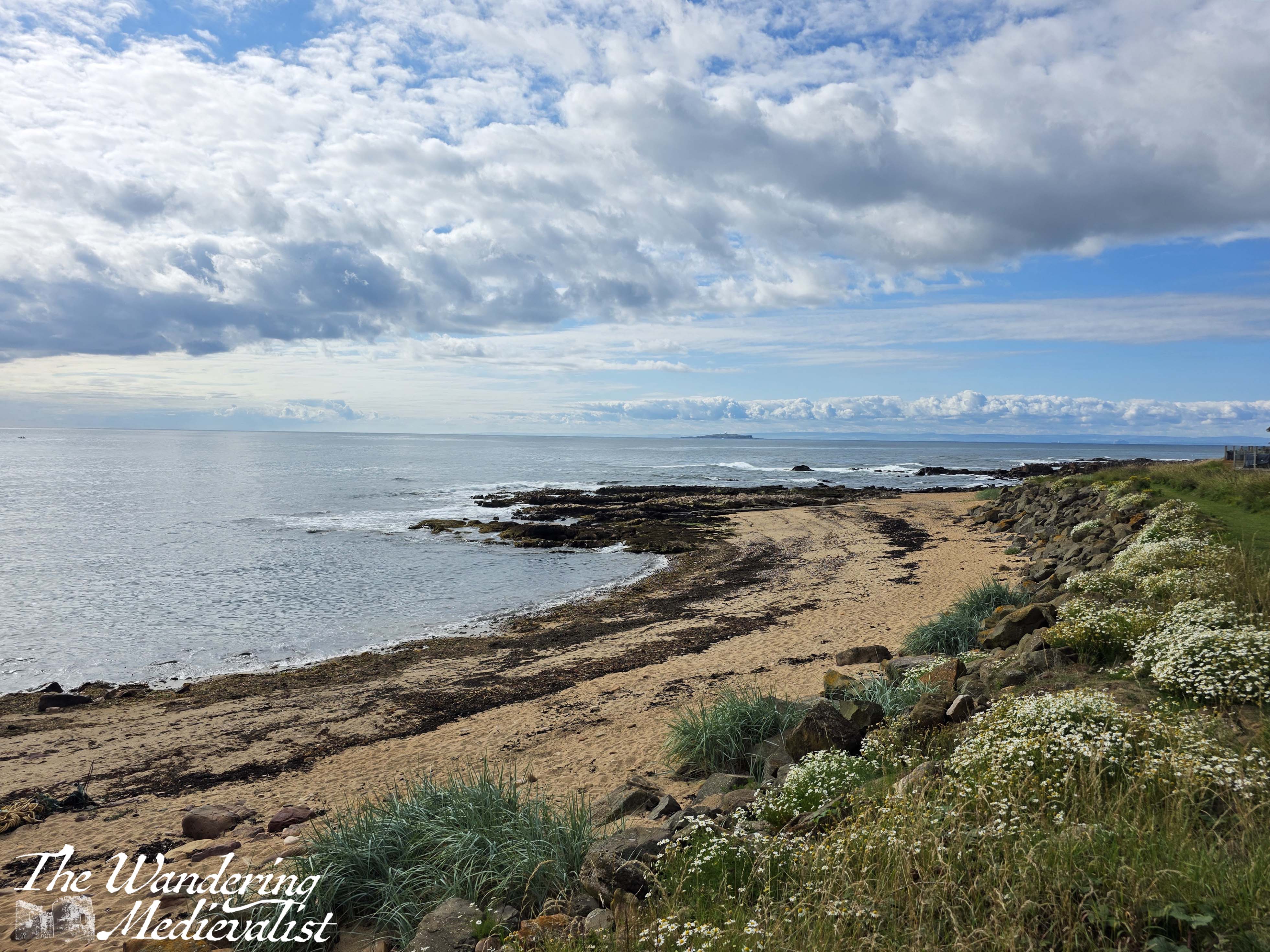
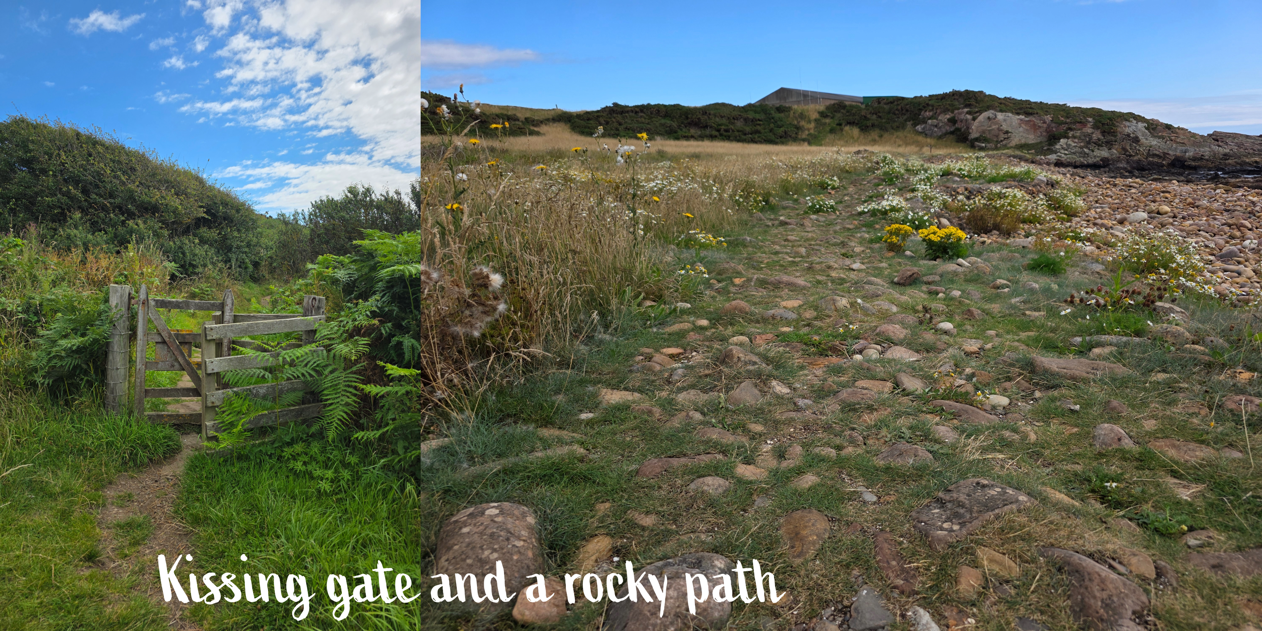
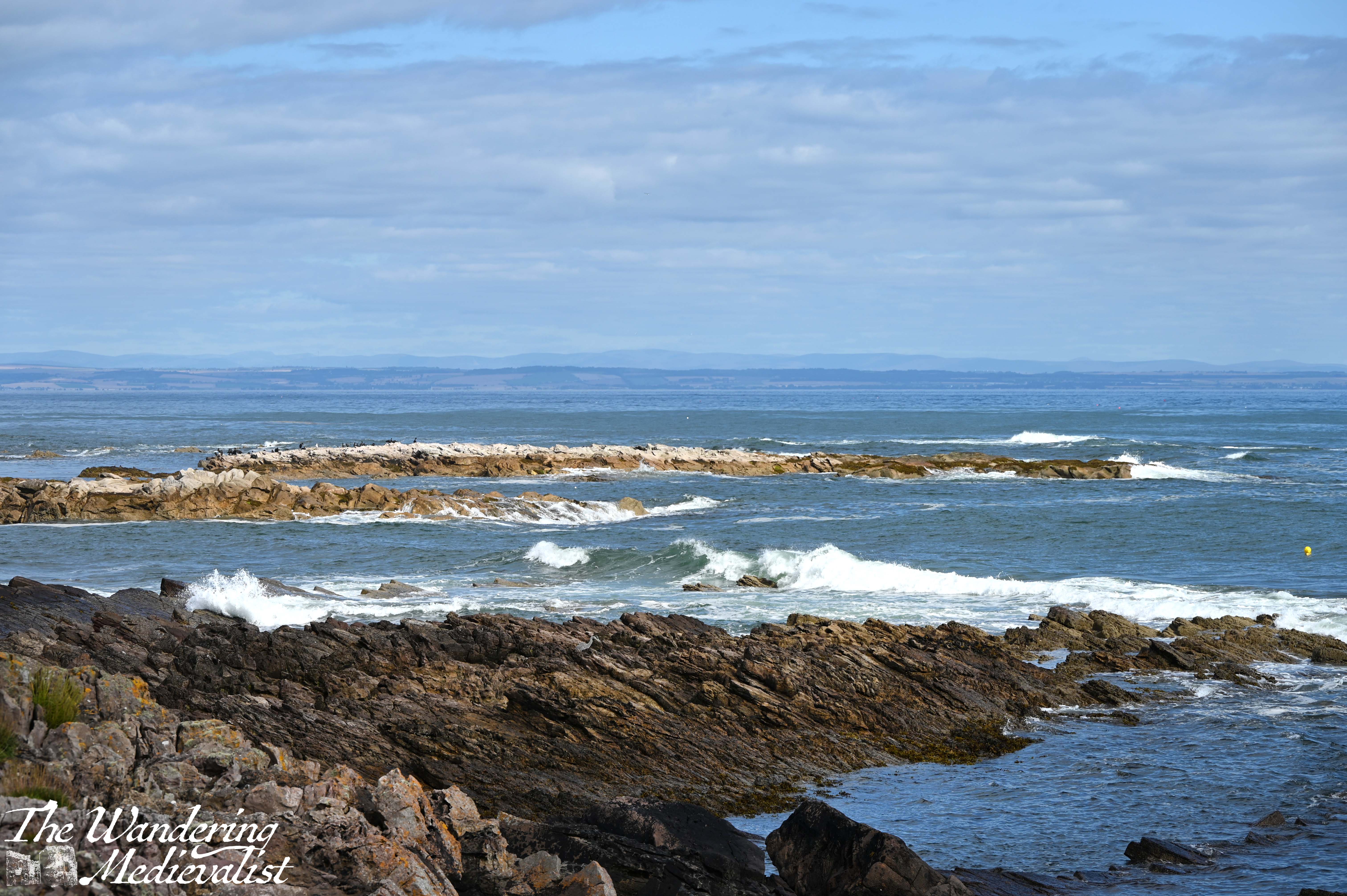
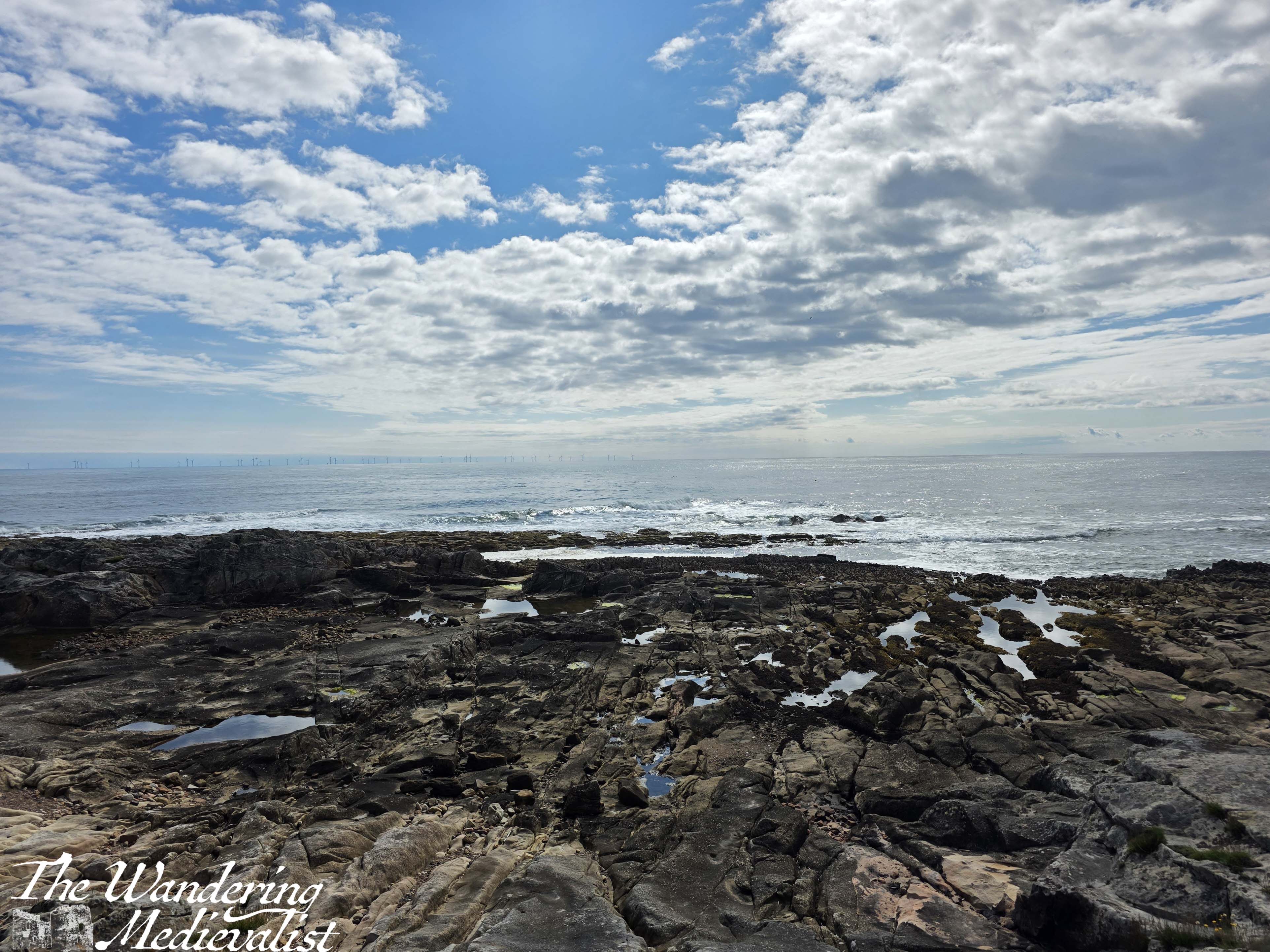
In time – longer than I expected – I reached the end of the park and went through a wooden kissing gate onto a more wild path, with high grass on both sides. There is a beautiful rock structure up ahead on the right, and a sign indicating that walkers are now entering the Kilminning Nature Reserve. Here are some great views looking back, particularly if there are waves crashing on the rocky promontories between beaches.
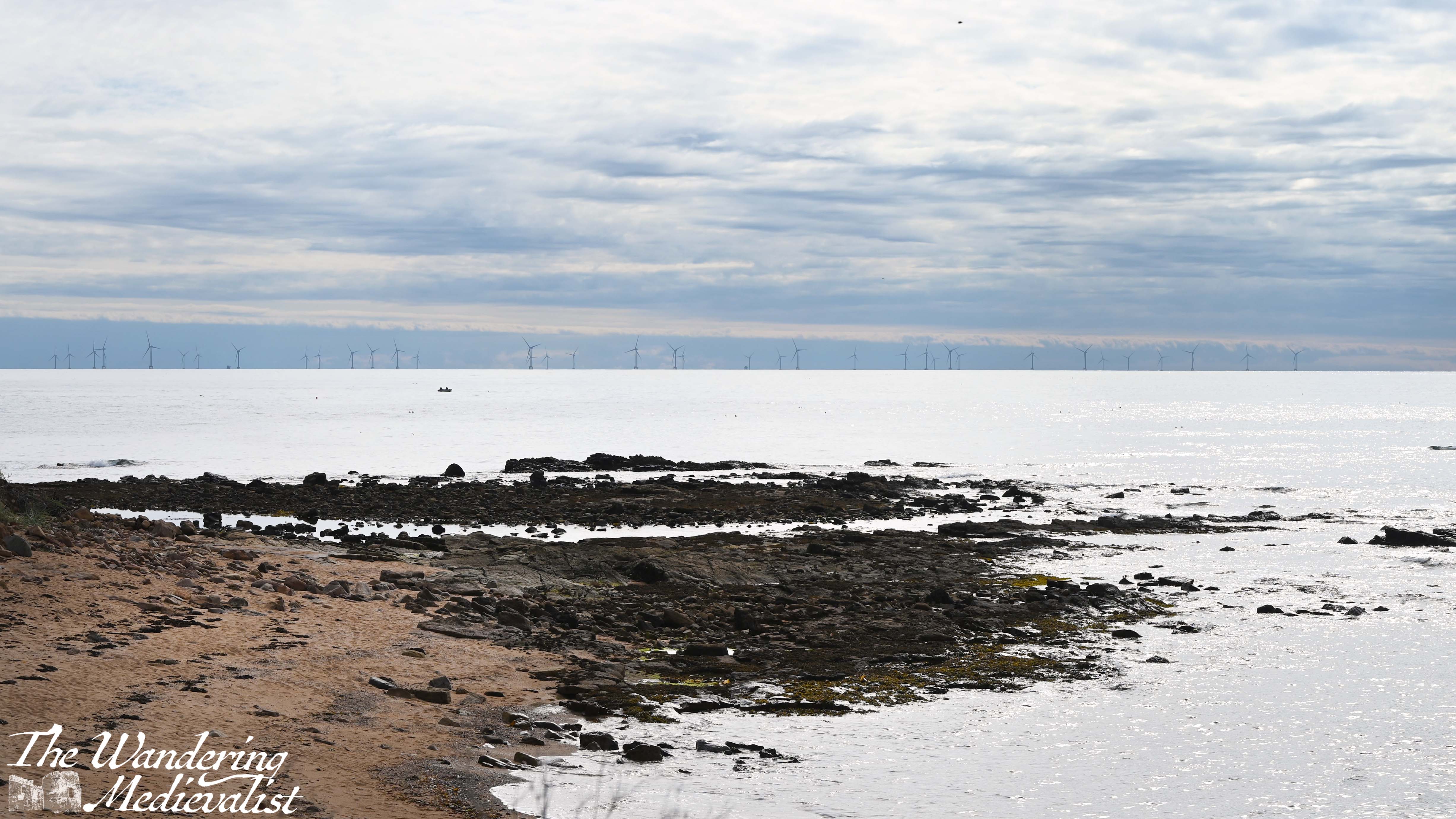
You will note in these pictures an enormous wind farm, with turbines all along the edge of the horizon. There is a lot of controversy over this wind farm, and the recent approval for what will be Europe’s largest wind farm; some object to the visual of them, but there are also environmental concerns. Personally I don’t think the optics are really an issue, and I don’t have knowledge to comment on the impact on sea birds.
From this point, the path rounds a corner into a relatively wide flat area, with long grass on either side and a rocky trail. There was one spot that was really muddy and required negotiation on stones, but overall it is pleasant, a touch flatter than much of the East Neuk trail. In a few places, you will notice entrances to bunkers along the coast; it was of course a perfect lookout spot during World War II.
This part of the trail is quiet and it might be tempting to look up at the view, but it is also quite uneven and I have in the past rolled an ankle pretty hard here. As you go past a viewing platform and through another kissing gate, the path becomes a bit more rolling, with some ups and downs on rocky stairs that can be steep.
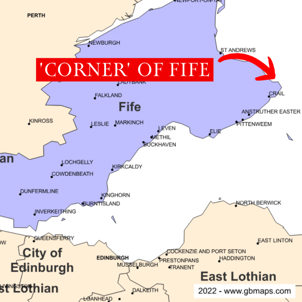
There are some great viewpoints, and eventually at the end of the bay you go up and down one more rise and discover a golf course on your left – this is Fife after all – and the ‘corner’ of Fife ahead. By corner, I mean the point of land that sticks out furthest in to the North Sea.
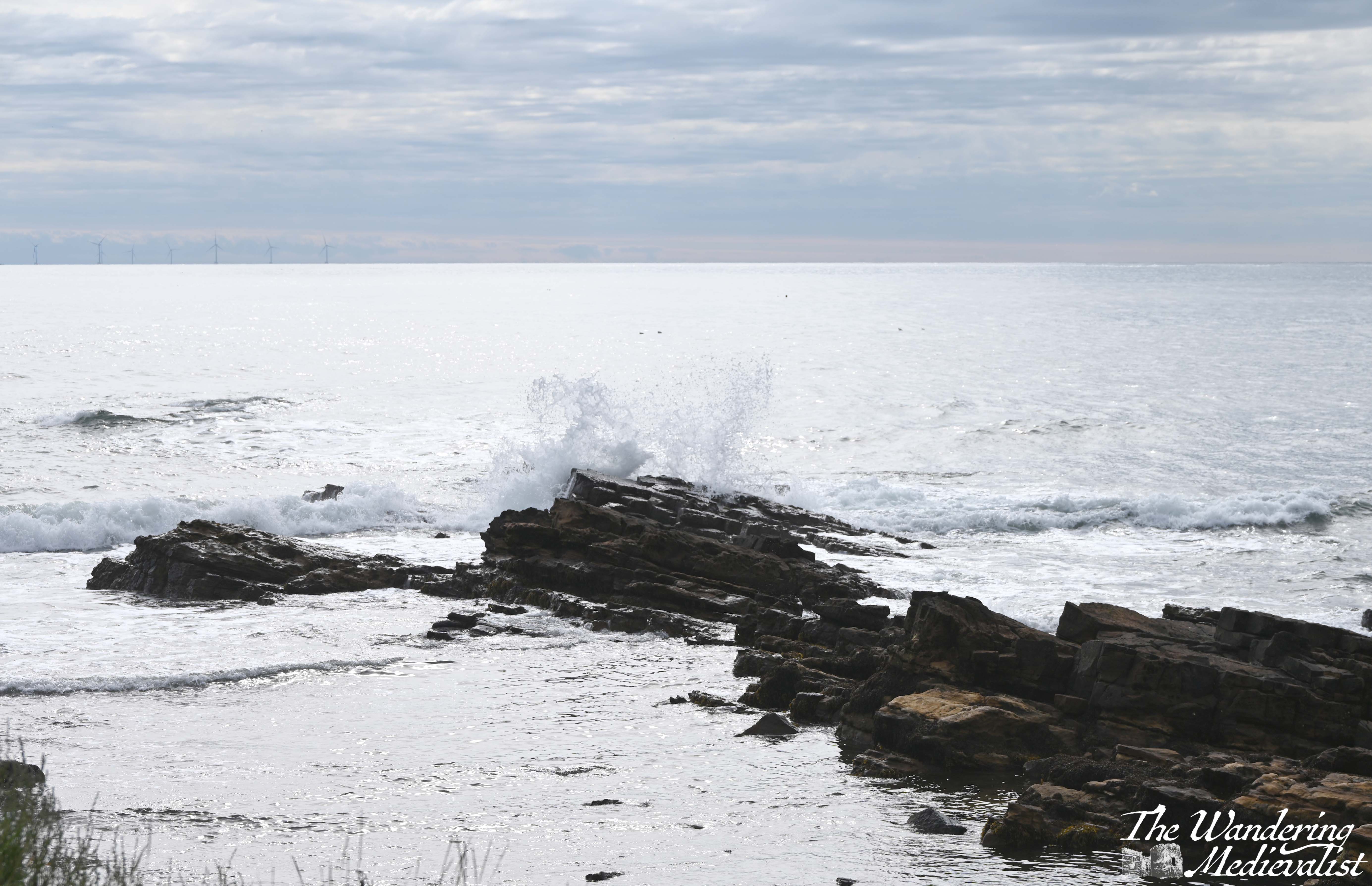
I found myself stopping here for several minutes, looking out over the crashing waves – it was a challenge really not to stay for hours, as I find them quite mesmerizing. Repetitive, yet always different.
I had a goal however and so pushed on. Right at the corner, the trail narrows slightly to pass between the Fife Ness Lighthouse above, and a bird blind and WWII pillbox, constructed in 1941 as part of the Crail airfield. Whereas you often see other evidence of WWII defenses further up the coast along West Sands and Tentsmuir, I had not noticed many or any in the East Neuk.
Once you turn the corner, you approach another small caravan park and the remains of Fife Ness harbour, first mentioned in the 1530s.
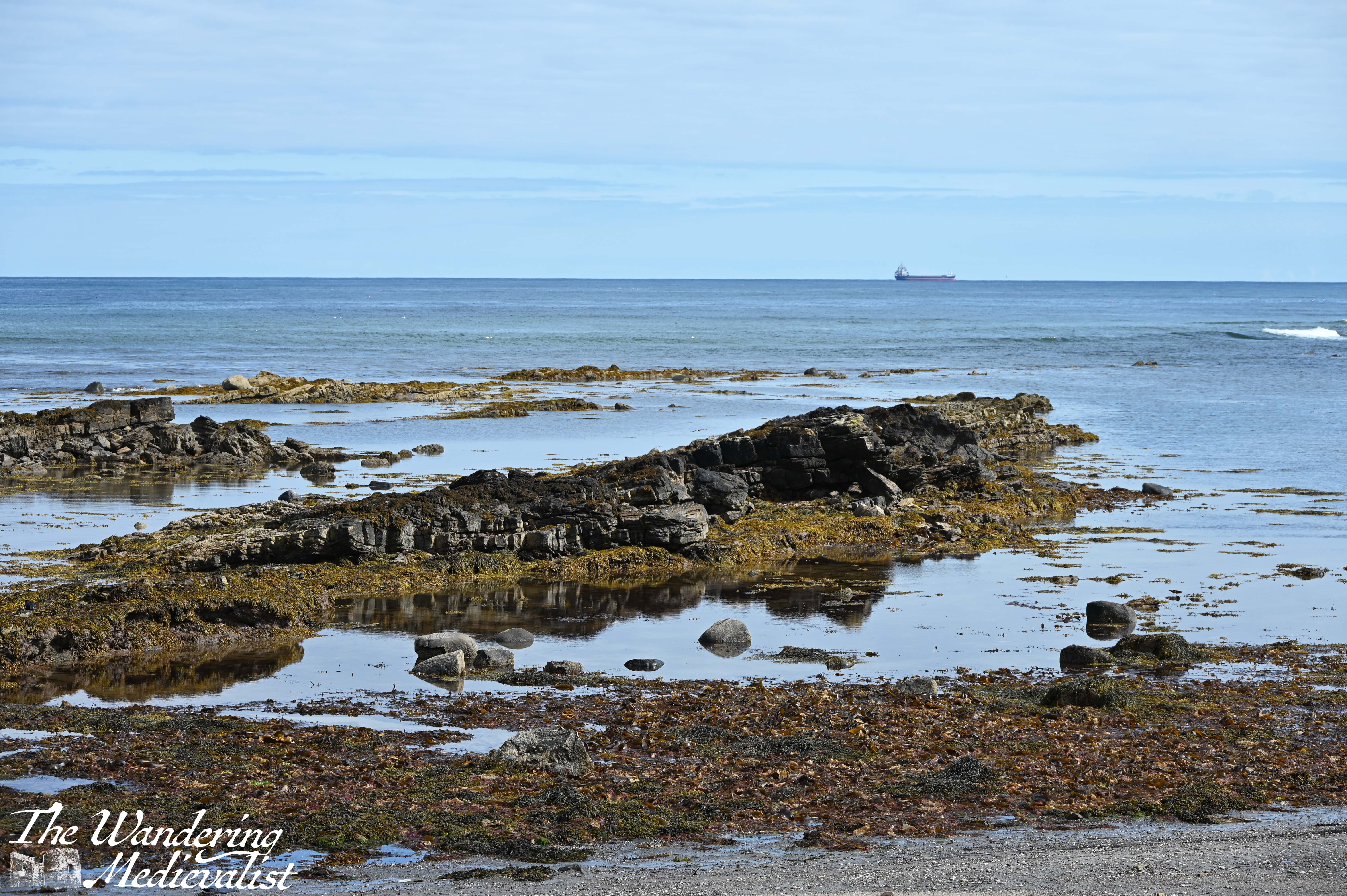
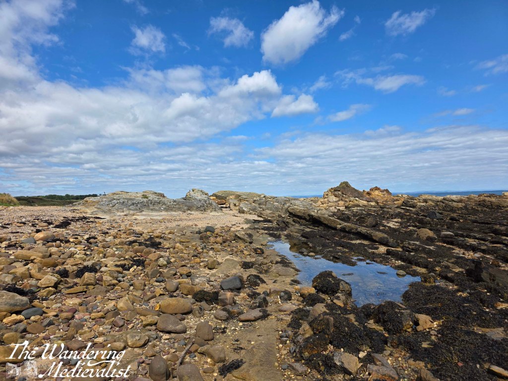
The harbour was used for fishing, as well as for shipping stone from nearby Craighead quarry – some of this fine stone was used to repair St Andrews Cathedral in the 1450s. The long lines of sharp rocks stretching into the waves make it clear why this point of Fife could be treacherous for boats; I was walking at about mid-tide, but the rocks clearly went much further under the waves.
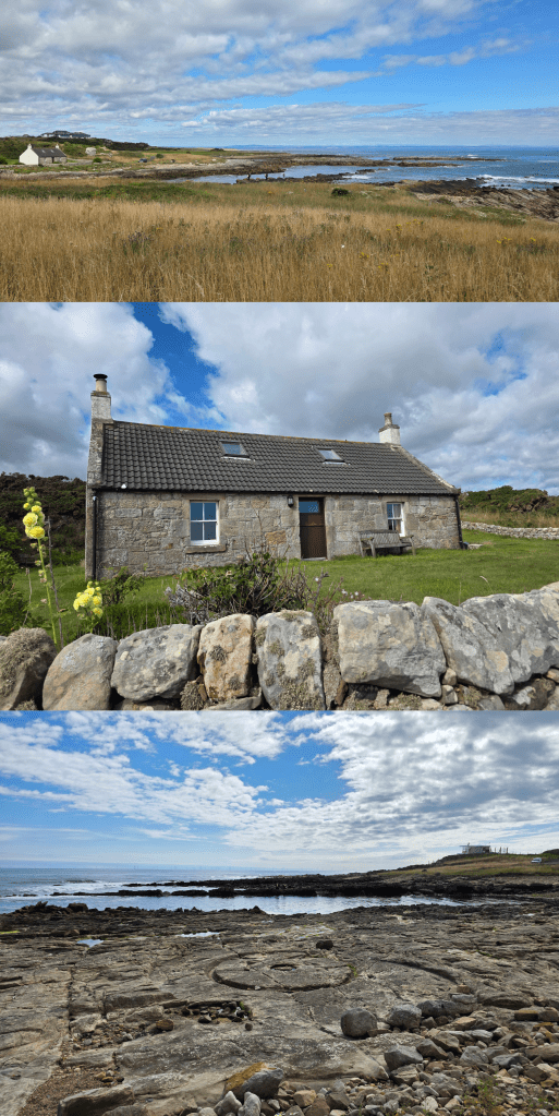
There is also a great example of a Scottish seaside cottage, well-kept of course with a small garden. I wasn’t really sure that I was going the right way here, but there was really no other obvious route, so as before I just kept walking.
The paved road soon looked as though it would be heading directly for Crail Golf Club, but sure enough as I reached the edge of the green, the Coastal Path signs returned and I headed off to the right on a path that ran along the edge of the green.
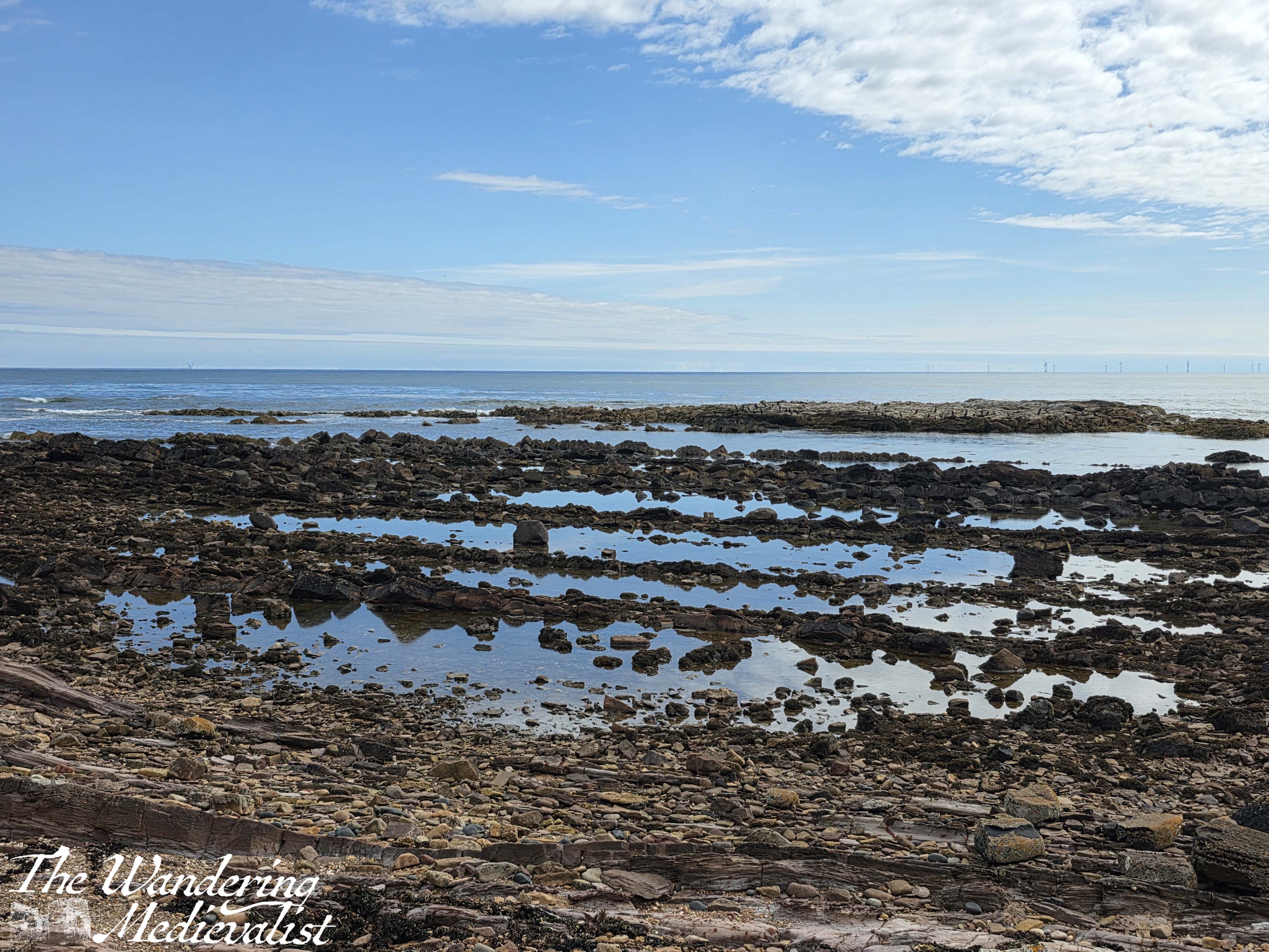
This is a really beautiful stretch, particularly in the sun as it was when I walked, with the ocean and multitude of wild flowers. It is hard not to be fascinated by the layers of stone and the pools of water between them, glistening in the sun. There are a few signs on poster boards for adult geology classes, and it is easy to see why this would be a good spot. The layers of stone and water erosion are very evident.
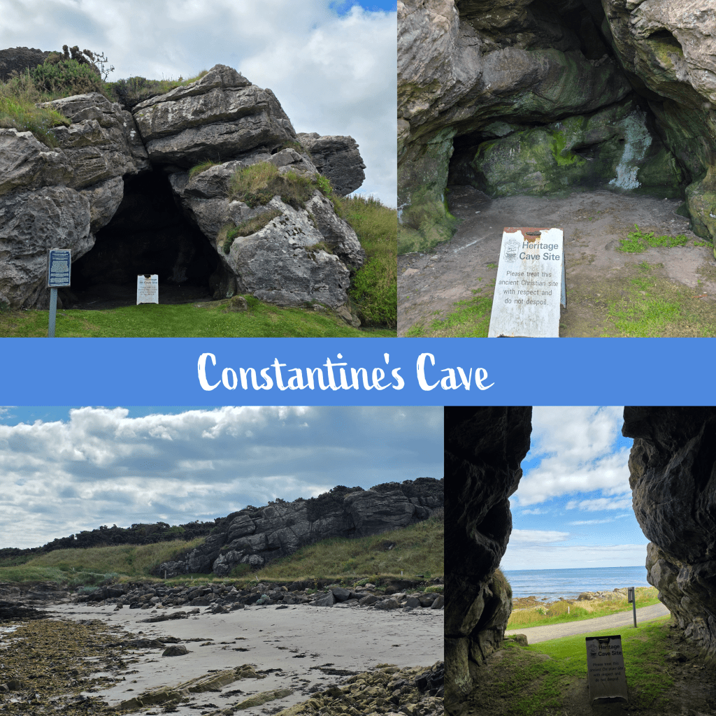
From here the path hugs the edge of the golf course, at times moving up to the walkways designed for golfers, but only for a short while. I stumbled across Constantine’s Cave quite by surprise, absolutely not expecting it to be in the middle of the golf course. Interestingly, the other half and I had planned to walk to the cave some years ago, joining the trail near the airfield, but gave up due to my rolling my ankle (see above). I’m quite pleased in the end that we didn’t go the whole way, as compared to the Caiplie Caves this one is a bit less dramatic.
While visually not as impressive, the cave does have an interesting history; excavation work has shown evidence of a stone wall across the entrance, protecting the interior space, and the earliest occupation layer was pre-Roman. The cave’s name comes from the local tradition that King Constantine III of Alba (903-943) was killed in a battle near the cave.
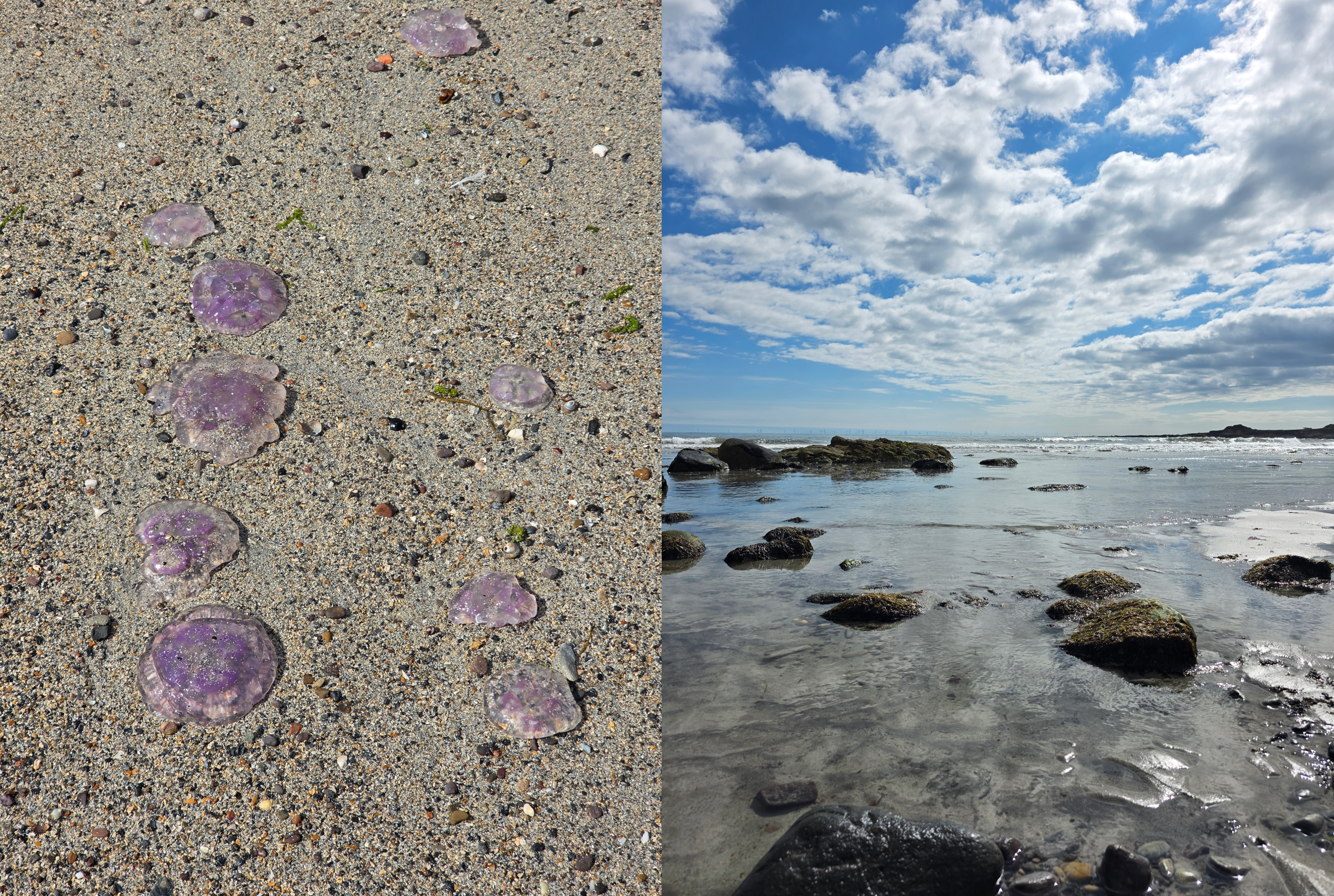
Not far beyond, walkers are directed to move down to the beautiful sandy beach below, to avoid interfering with the golf play. I was very happy to do so, enjoying my ramble in the sand, though it was somewhat hindered by what must have been hundreds of beached Moon jellyfish along the high waterline. Eventually I chose to move closer to the waves, where I could avoid stepping on them.
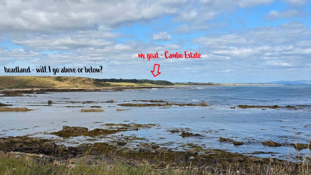
The sandy beach slowly becomes rocky, and the last few metres require some scrambling to return to the upper path, along the golf course. Soon after re-joining the grassy trail, another corner is turned and all at once I could see the tree line of Cambo Estate ahead, though still a distance away. It was a touch intimidating to see the coastline between there and where I stood, including a headland that I was not sure if I would pass over or under.
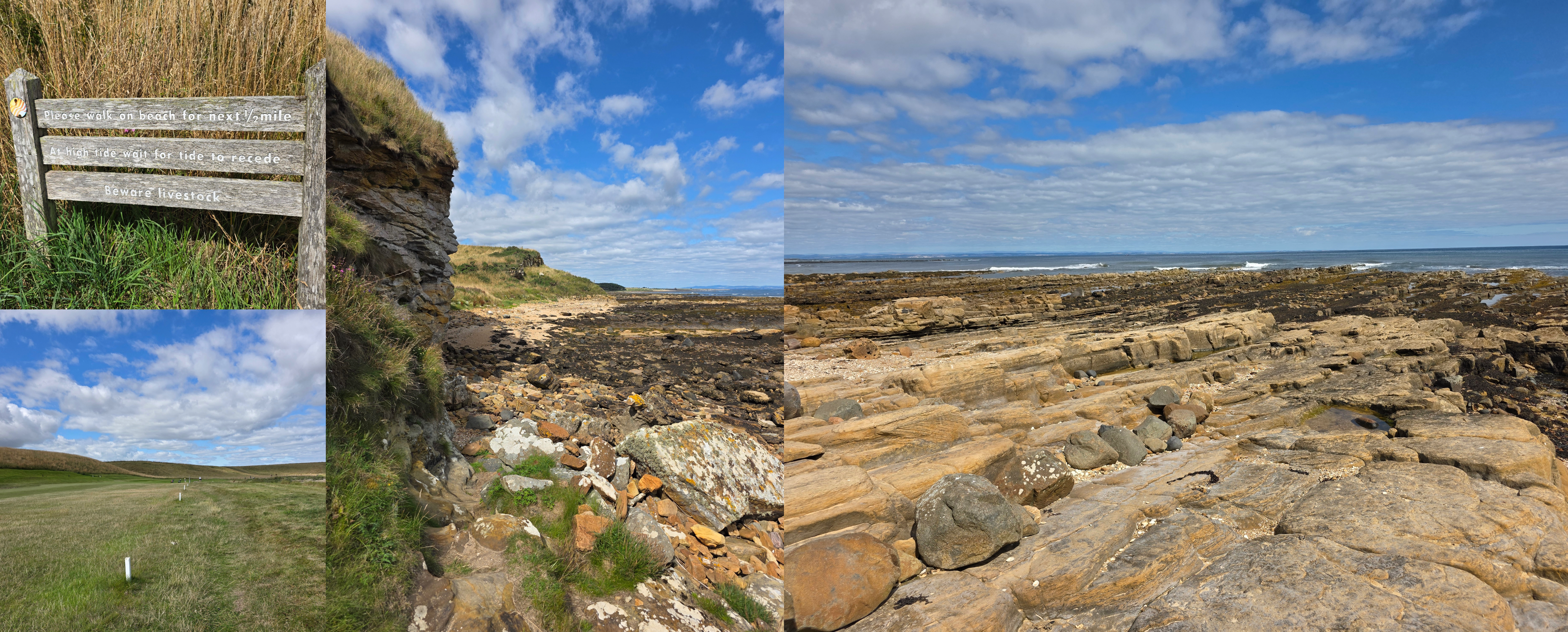
I should note that the official map of the Fife Coastal Path warns walkers that this section of the trail, between Crail and St Andrews, can be challenging and may not be passable at high tide. While I had neglected to check the tide – not a mistake I will make again – I was lucky to discover it was going out rather than in, so I had plenty of time. Absolutely be more sensible than I if you try this walk, and check well in advance – there are plenty of websites and apps available.
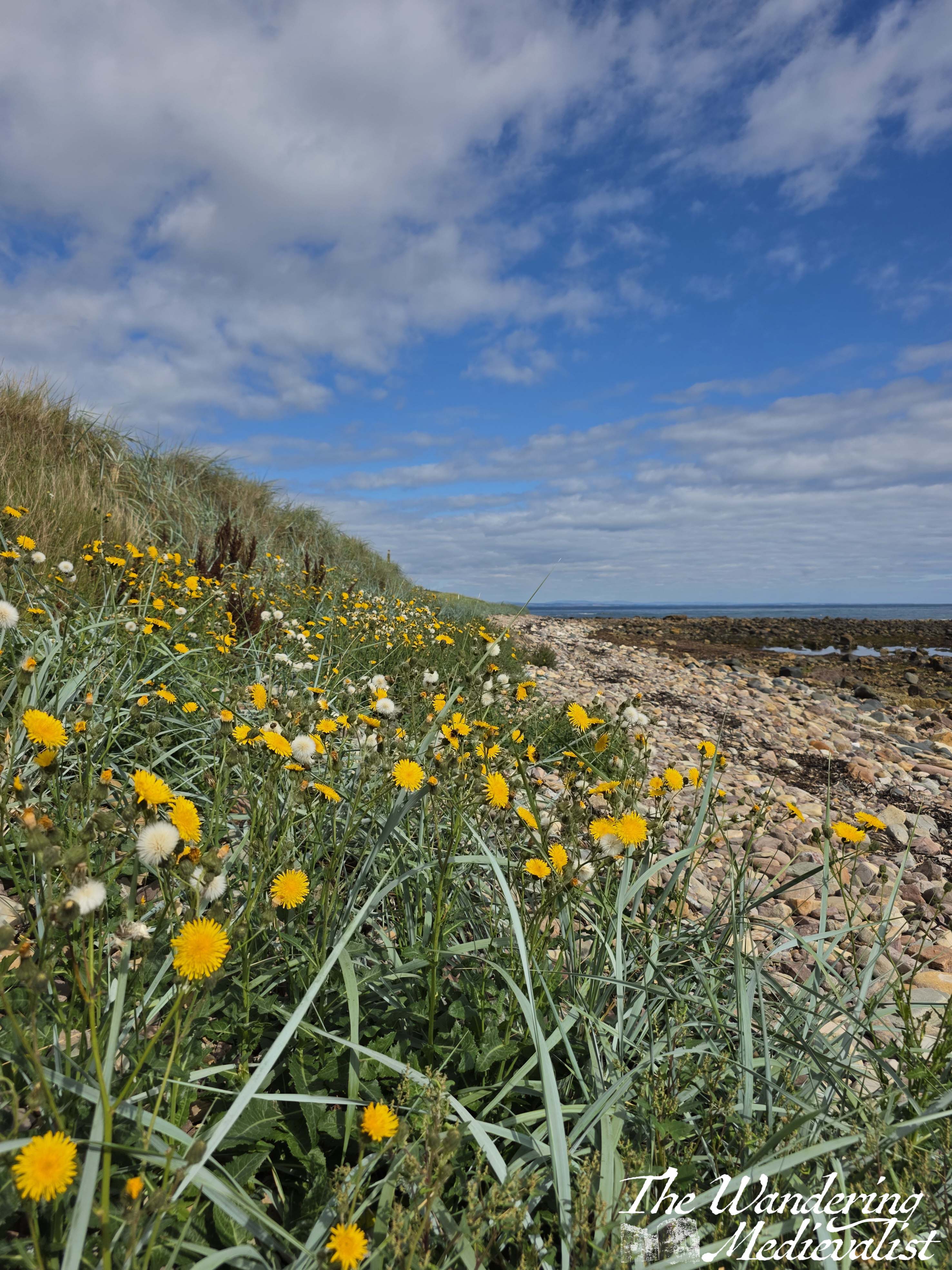
From here to the edge of Crail Golf Course, it can be on occasion difficult to tell if you should be on the beach or not. At least once I opted for the beach route, seeing a faint trail from other hikers, as it was nice to have a bit of variety. I was so fortunate to be walking on such a gorgeous day, and at a time of year when daisies and other wild flowers are everywhere. (I do not know names – must educate myself on wild flowers). There is a series of small white posts in the grass that seems to separate the well-manicured golf course from the trail, but those are not always clear.
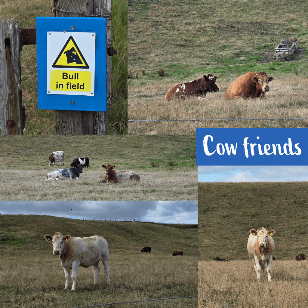
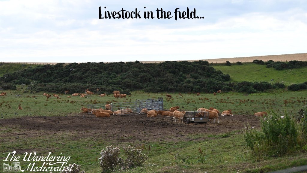
Eventually, after about 1.3 miles of edging along the golf course – with frequent reminders that golf is being played and you should be aware, and listen out for ‘fore’! – the course ends and there is a different kind of hazard, albeit short-term. The field of livestock was relatively calm, with one or two getting up as I passed. The white cow did keep a close eye on me, but never actually moved, just watched carefully that I would not be a problem.
At the far edge of the livestock pasture, the path leads steeply up hill – the headland I could see from a distance – then almost immediately back down again. There may have been an option to scramble along the beach here, rather than going up and down, but there was a great view at the top so worth the extra push. This may also be the only option at high tide.
Once down at beach level, the path cuts in front of a large cliff, onto the beach. There is a warning sign here to stay on the beach to avoid the fields of livestock, which are clearly open to the beach.
At first, the beach is not too difficult to manage, a combination of sandy and rocky but mostly rocky. I could see it as definitely being slippery if wet or if the tide had recently receded. As someone who grew up playing on beaches like this, I really enjoyed this section, especially with the view off to the right. The most challenging parts were soft sand and dodging the cow pats that were evidence of the open boundary between beach and meadow.
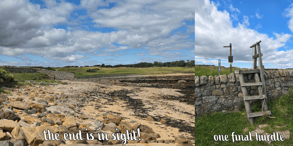
As I plodded along the beach, though, I realised that I was starting to run a bit short on time. It’s always a touch frustrating on a trip like this when your public travel options are limited, and you find yourself racing the clock. The farther I went, the rougher the terrain became, with rocks that were too small to completely stand on, but too large to step between, requiring a lot of attention and energy, slip sliding along. Progress slowed, and I was running low on energy. Finally, I caught sight of a stone wall – this was the end of the beach walk, though I was challenged in the end by a final obstacle – using a rope to haul myself up a wooden ladder to cross the wall.
It was at this point that I realised I needed to add two things to my hiking arsenal: one, a portable power bank, as my phone was beginning to run low (using it for pictures and voice notes) and I needed it for my return bus ticket. Two, an updated map of the coastal path; mine was from 2017, and it has become increasingly evident with each walk that changes have been made since then. While there is an online version, you are often out of range of data on these walks so it quickly becomes obsolete.
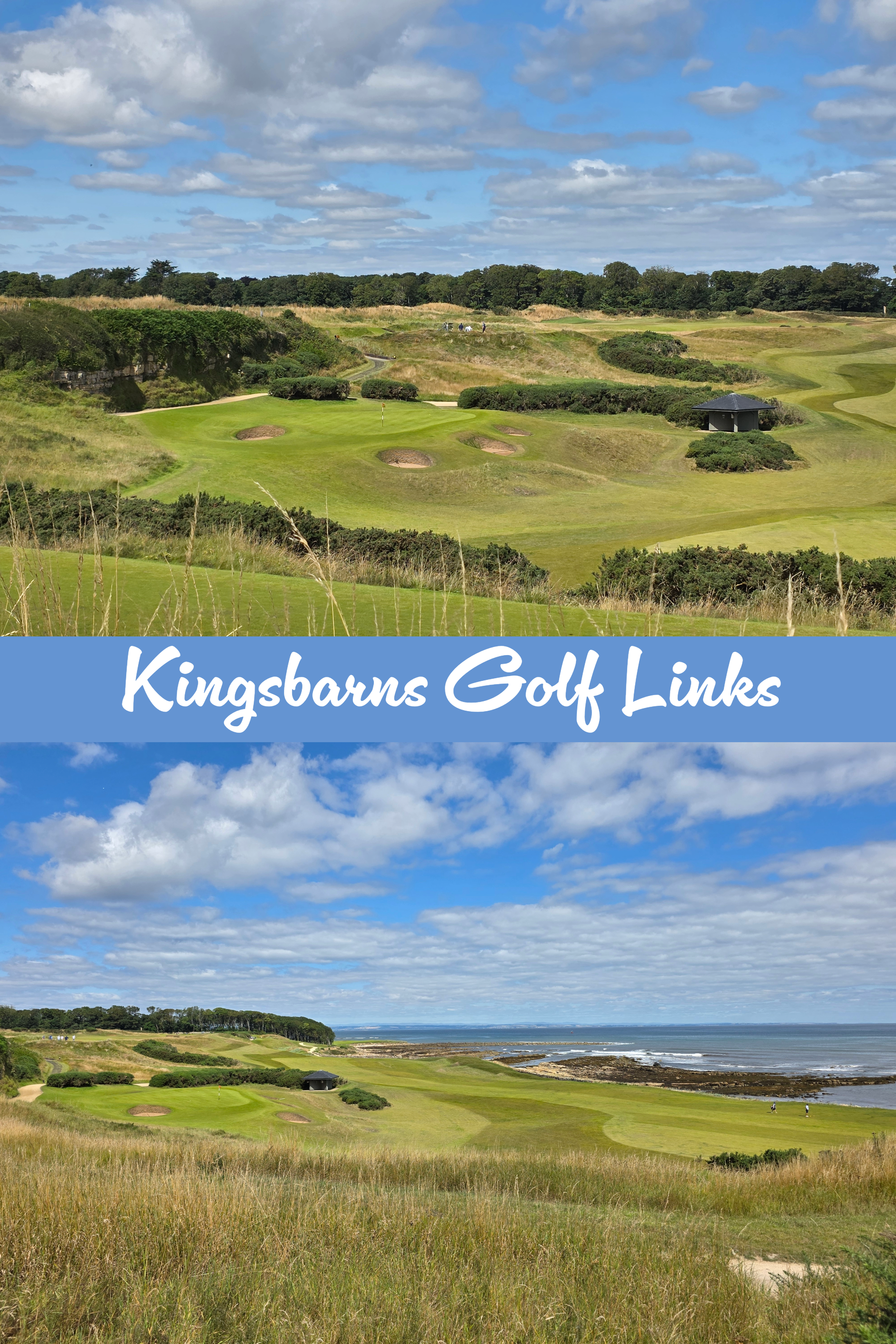
Carrying on past the wall, the path heads up a small hill, offering views of the livestock field on one side, and Kingsbarns Golf Course on the other. It was a busy day for golf with several large groups out, and to my amusement I identified more than a few American accents among them.
I thought that the path stayed by the coast at this point but instead it loops up above the golf course, which caused me a bit of confusion. My last efforts along the beach had driven me beyond the point of questioning, though, so I pushed on, enjoying the view over the course. It was also helpful to see the treeline of the Cambo Estate clearly ahead of me, knowing that was my goal.
The path is a touch unclear here, but I used my instinct and habit at this point to keep to the edge of the golf course – a brief turn left then almost immediately right again, between a few greens. The sun was bright and hot by this time, and up to the left I could see a few old estates including the roof of Kingsbarns Distillery.
The Coastal Path approaches the estate wall and is briefly forced around to the left, curving towards the water, before a small gap in the stone appears. There is a wooden gate and sign for the path – I was quite relieved, as I knew the end was near and I did not want to go all the way back down to the beach.
Through the gate, there is an immediate right-hand turn down some wooden stairs, and a view through the trees towards the beach, looking over the Cambo burn.
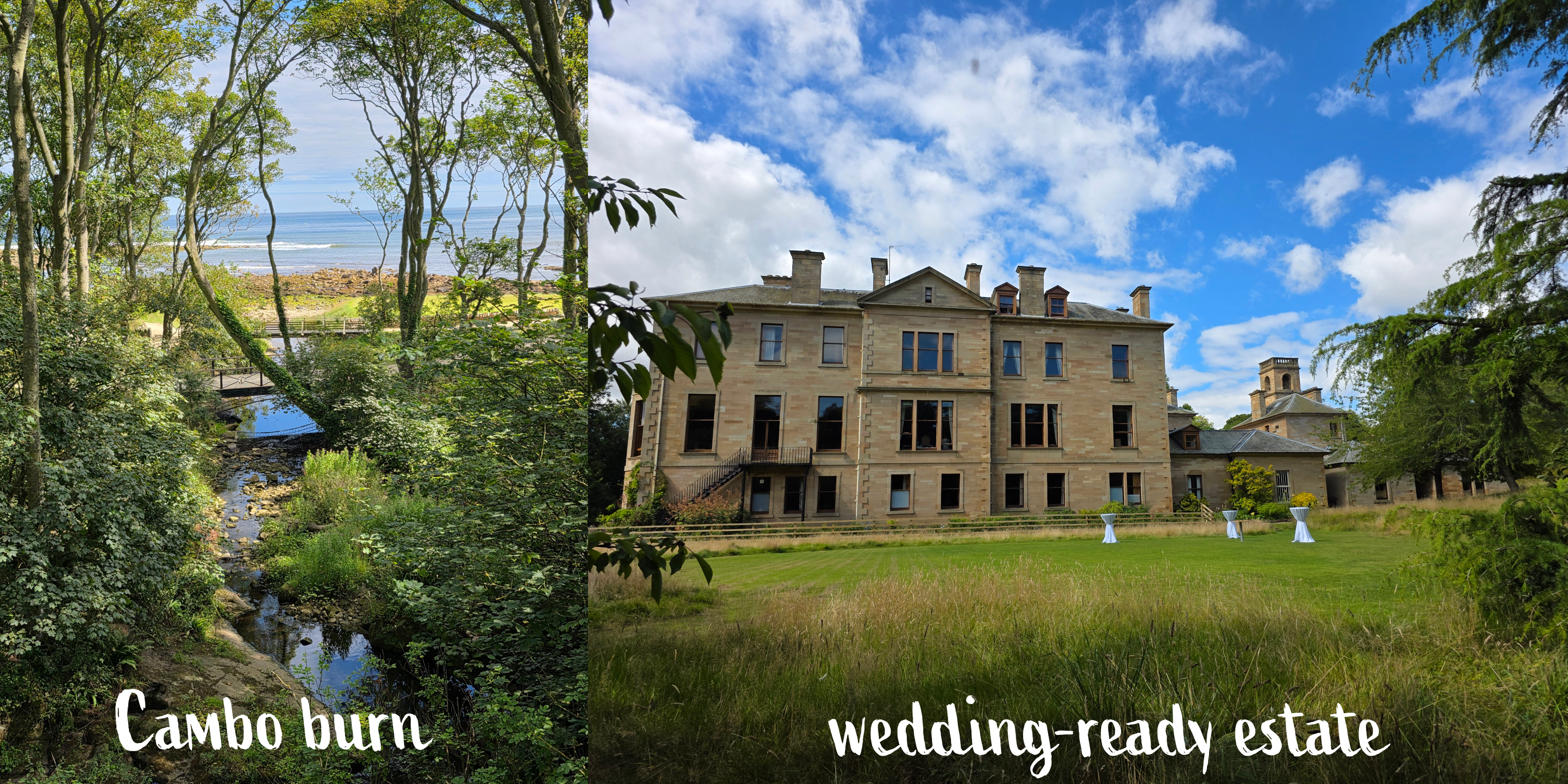
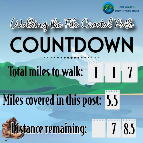
Once you go down the steps, the path sweeps towards the river, and on the other side splits into several directions. One leads down to the coast, one further along towards Kingsbarns, and one up towards the estate house and gardens. This was where I marked the end of my walk – 5.5 miles from where I started in Crail. But, I still had a way to go, walking up through the estate grounds.
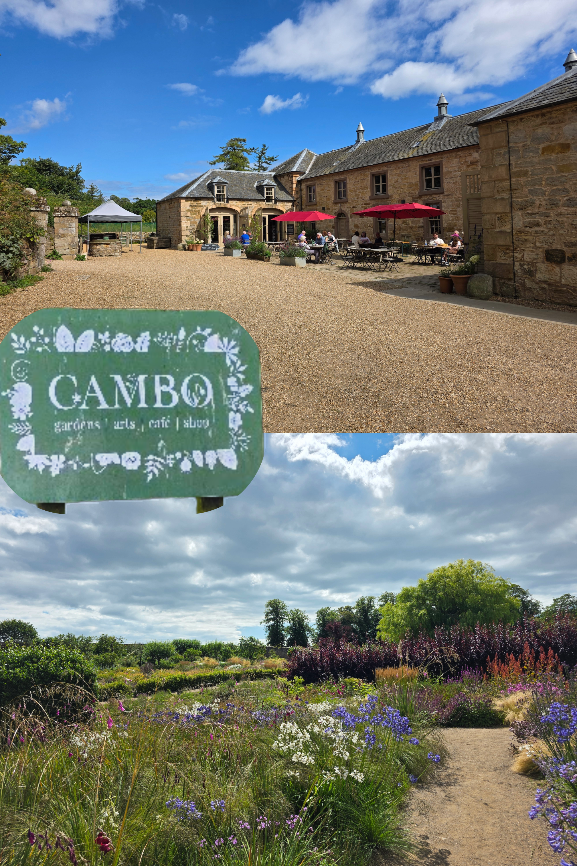
Cambo is a beautiful spot to visit, with a walled garden, excellent café, and plant shop. It is possible to walk up past the walled garden, through the car park, and along a path all the way to the road – for those hoping to make a bus, this is a solid mile. I tried, I really did, but I missed by about 10 minutes, having forgotten just how far it was. Fortunately, the other half took pity upon me and collected me from the bus stop where the only alternative was a 45-minute wait.
I did consider joining the groups of families and couples enjoying their lunch in the sun, but I was hot, sweaty, and a touch bedraggled. Home was the better option. Overall I found this a really pleasant walk, and not as difficult physically as I thought, meaning that my stamina is definitely improving.
I might try it the other way were I to do it again, with the rocky beach the first thing I tackled rather than the last. But I do seem to have developed a pattern of walking counter-clockwise around the edge of Fife, and I am now reluctant to change that. Public transport is possible for this route but a bit tricky, so worth just being aware of the limited options (one bus an hour to Cambo), and of course, check the tides!
Autumn travel approaches, but I hope I will manage at least one more section of the trail before I disappear overseas.
Scotland (and indeed the whole UK) was blessed last week with a stretch of sunny, hot weather that encouraged everyone to get outside. And then back inside, quickly, to get sun screen and water bottles. In England the temperatures hit the 30s (about 90°F), and in Scotland the high 20s which qualifies as a genuine heat wave.
I was eager to get back to my Coastal Path goal after several weeks of travel and then post-travel illness (I blame Charles de Gaulle airport, where I was re-routed after a flight delay), and this sunny spell was the perfect incentive to get out there. So, I chose a slightly shorter route than I had been doing in May, only 4 miles rather than 5, for while I’d kept up my walking during my travels, the cold/cough combo on my return meant I’d had two weeks for my stamina to unravel.
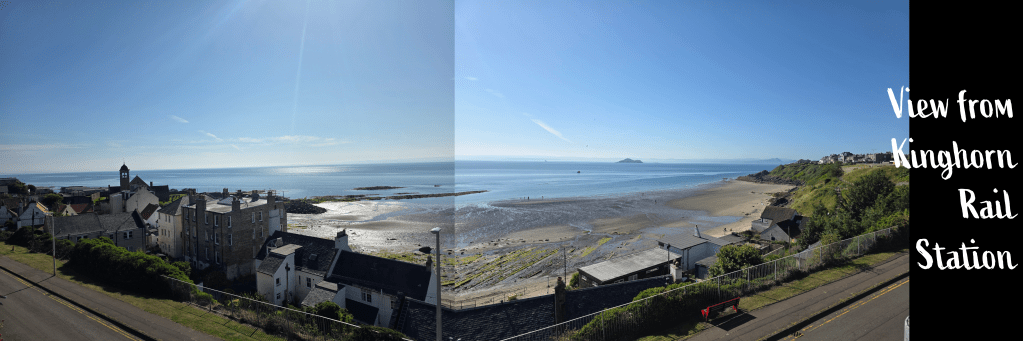
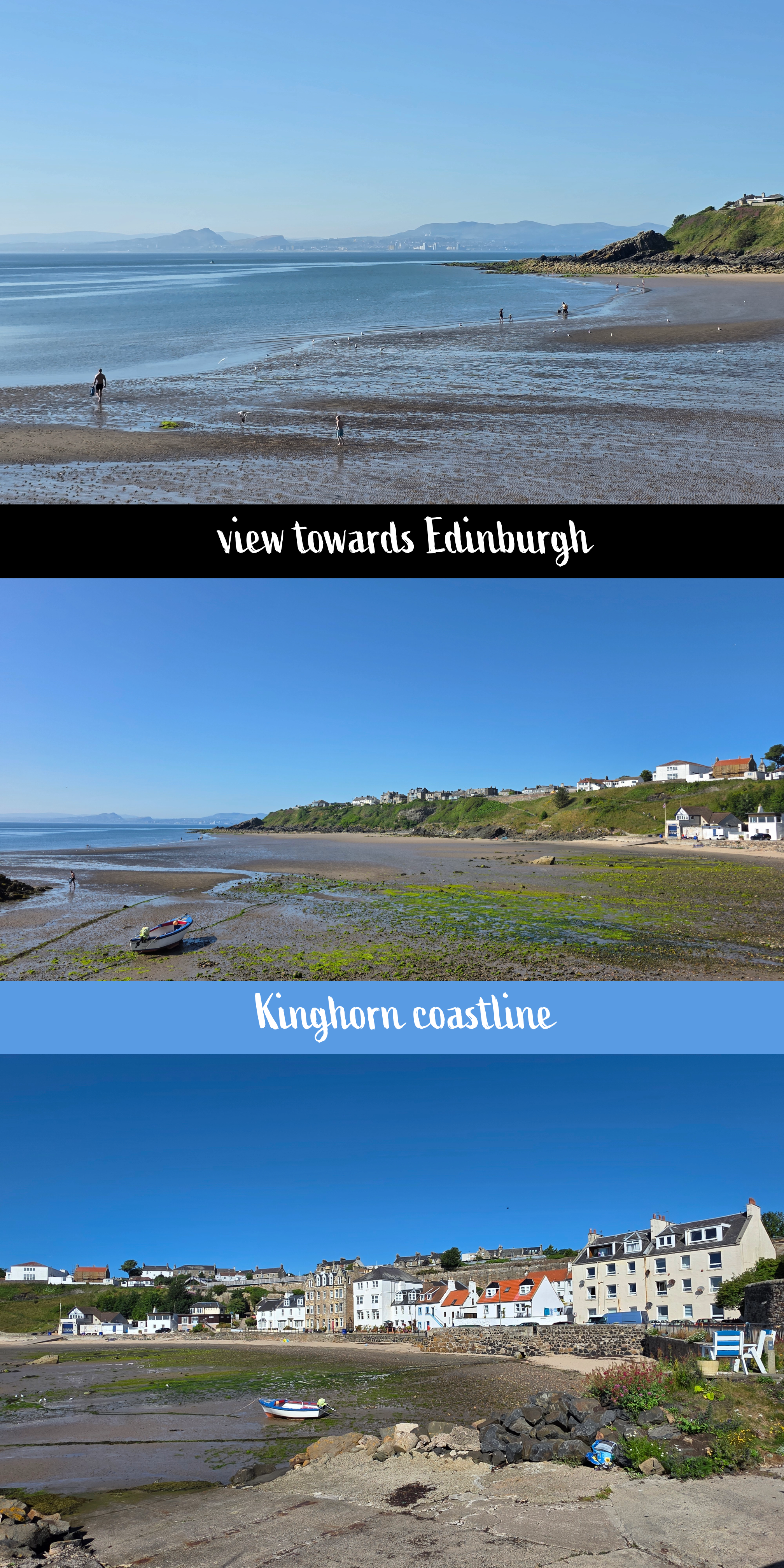
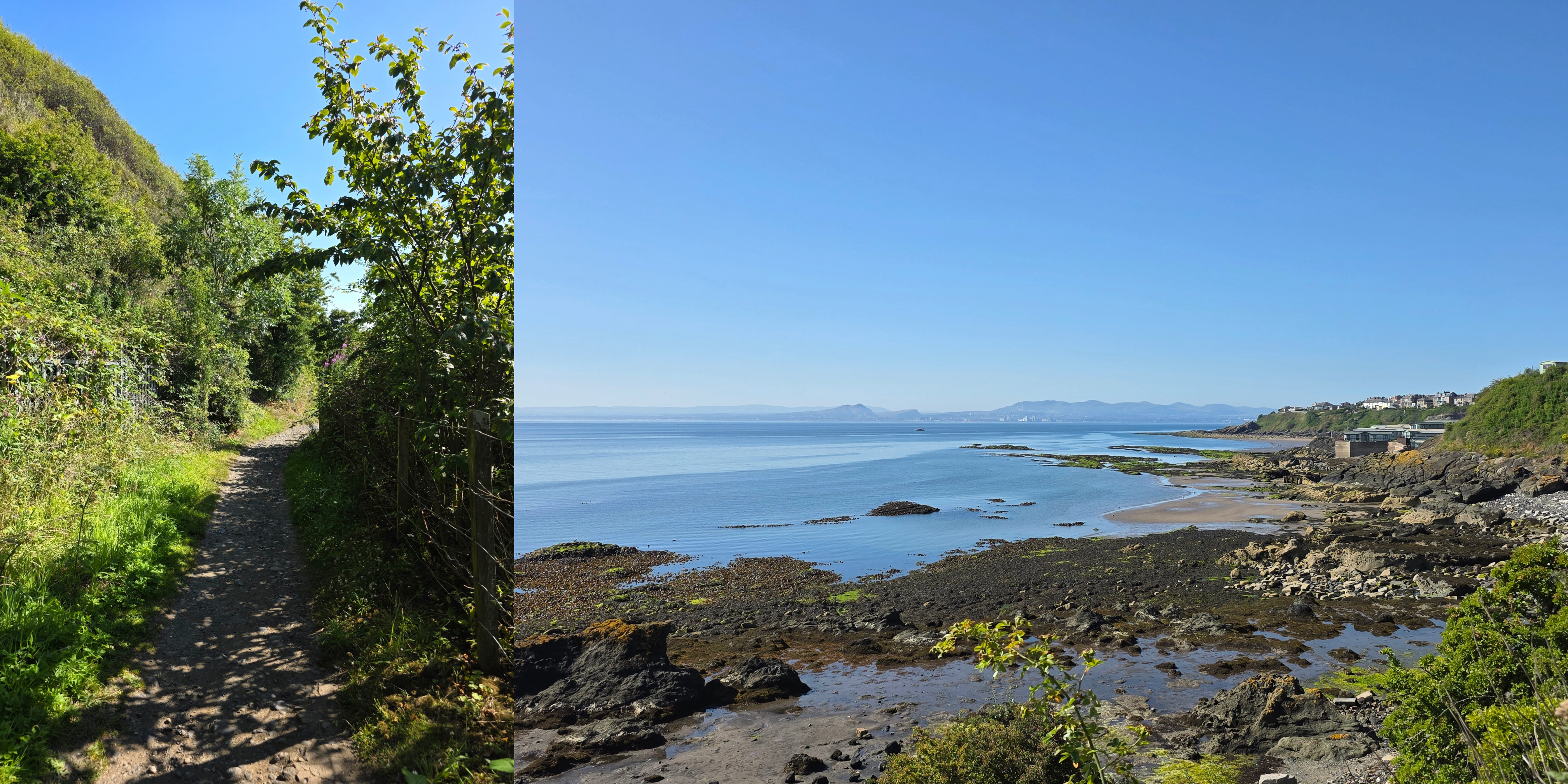
It was time, I decided, to tackle some of the south coast of Fife beyond the East Neuk, and so I planned the train trip to Kinghorn, where the rail station is almost immediately on the Coastal Path. Since the opening of the Leven Rail line, the trains from Edinburgh to Dundee no longer stop at these smaller stations, and so I was required to change trains in Kirkcaldy. Fortunately, the Leven train was only 5 minutes behind, so I was only slightly delayed; if coming from the Edinburgh direction, it would be easy to get on the direct Leven train.
The day was sunny and bright when I alighted in Kinghorn, which is a station I have always wanted to stop at due to the beautiful view from the train at this point. This section of the track is why I always encourage visitors to sit on the right-hand side of the train coming north.
I paused to take a few pictures and hoped to use the facilities in the small station, but found them out of order. So, I headed down the steep hill towards the coastline and beach.
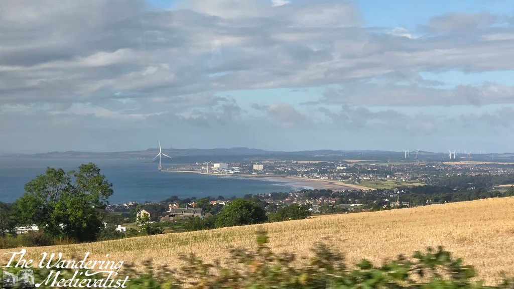
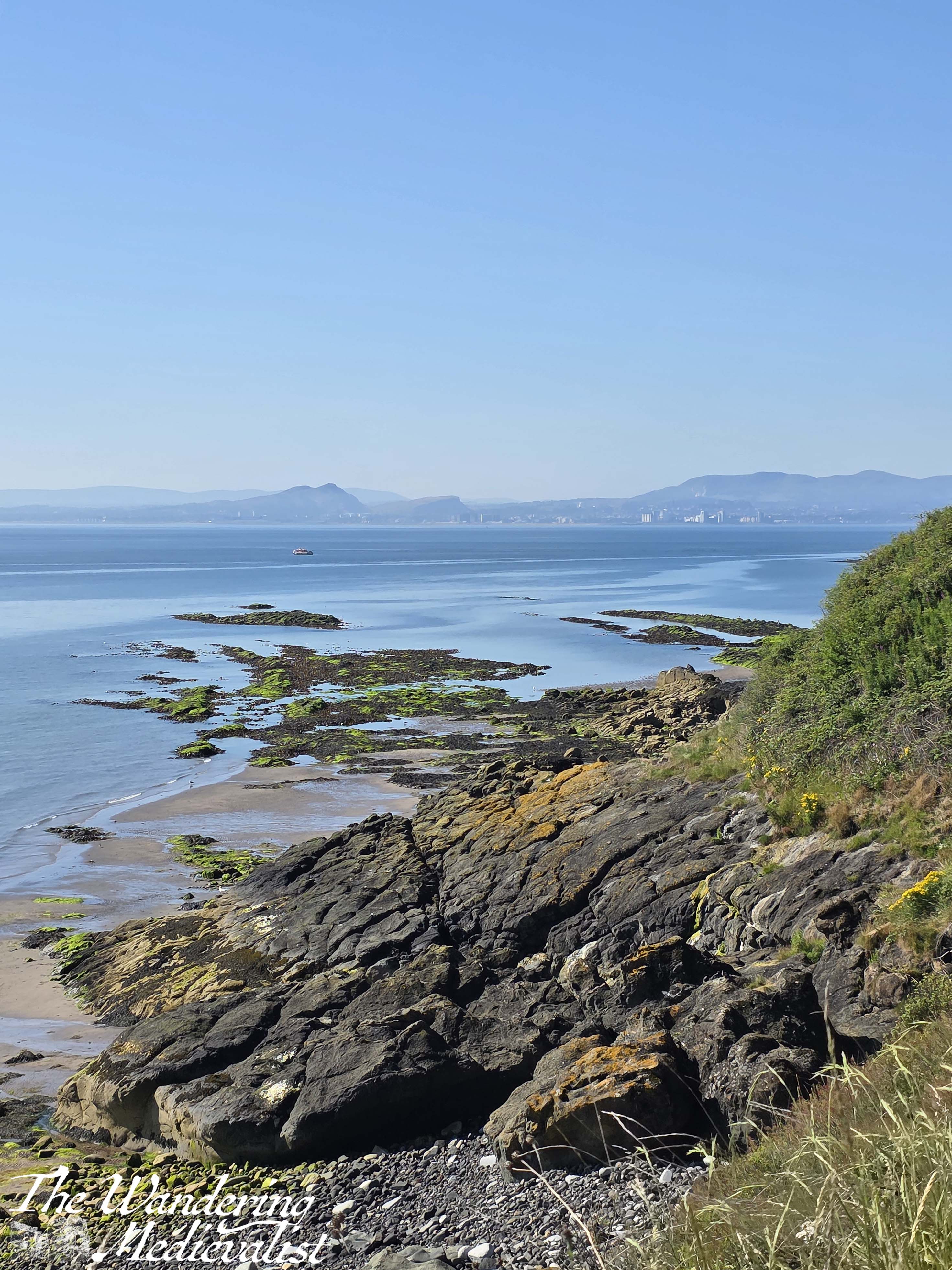
Kinghorn may not boast quite the same stunning nature as some of the East Neuk villages, but the beach is beautiful and there are regular views across the Firth of Forth towards Edinburgh. It was a clear day so that I could see the outline of Arthur’s seat and the coastal town of Leith clearly, while a gentle breeze kept the temperature comfortable and the bugs at bay.
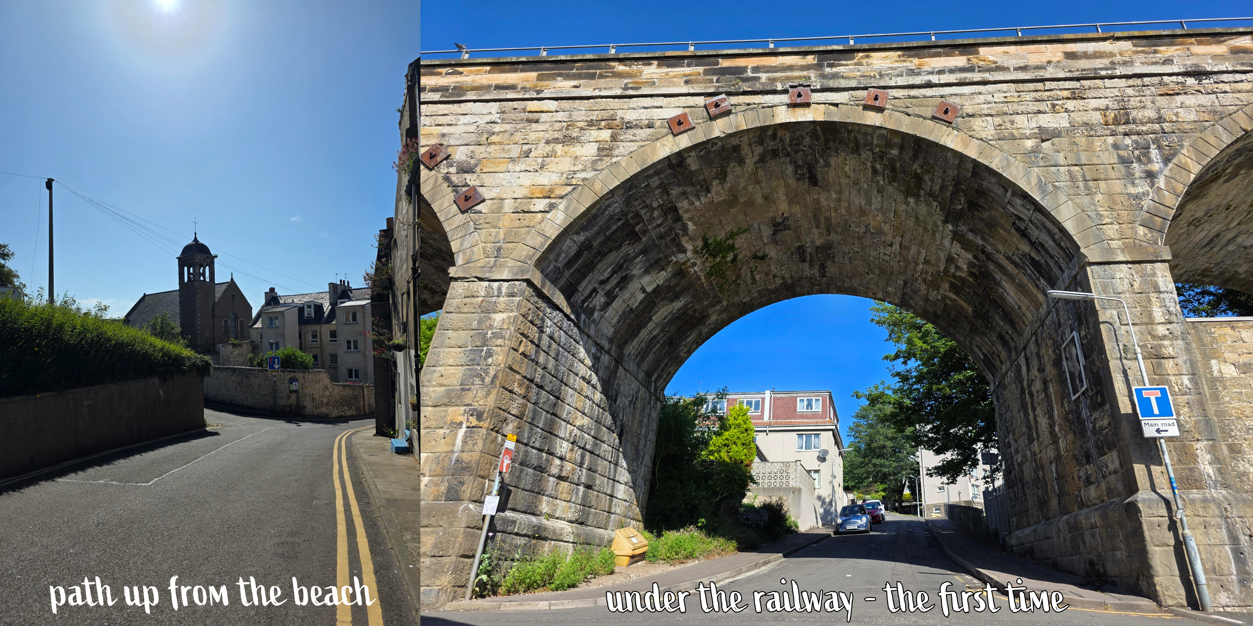
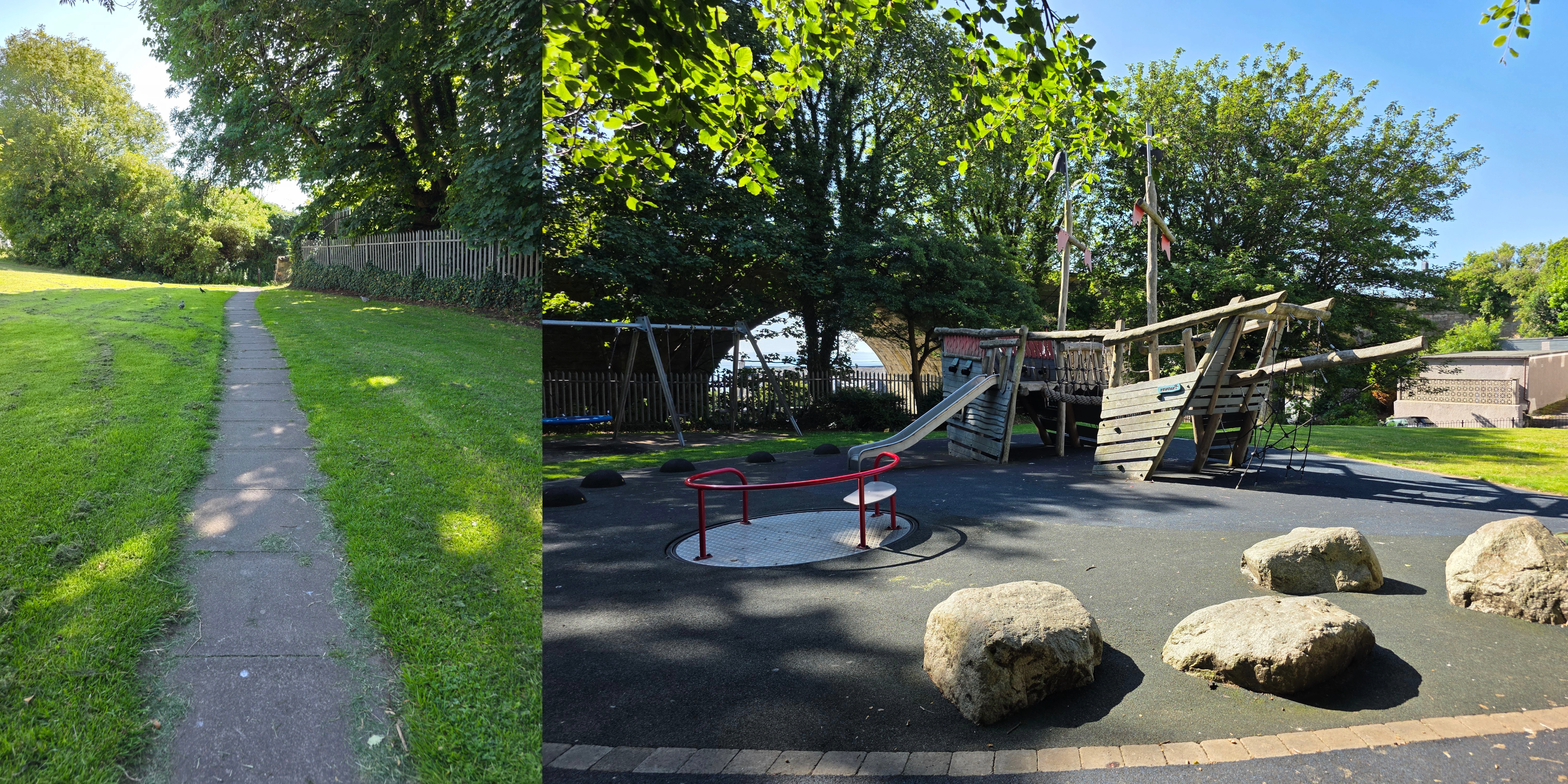
The path starts off along the coast then loops back up under the train track and through a fantastic pirate-themed play park.
Beyond the park, the route passes once again under the rails, then turns left along the back side of a caravan park. This portion of the trail is quite narrow, stuck between the fence for the park and the fence for the train line, so keep a look out here for other walkers/runners and cyclists. I should say, I did not pass many people at the Kinghorn end of the trail, but as I approached Kirkcaldy there were more and more people using the path for a Saturday morning jog or stroll with the dog.
I mentioned above the rail track, and it’s worth pointing out that this is a relatively busy line, so don’t be alarmed by a sudden, speedy train interrupting your peaceful walk. And peaceful it is, gently rising and falling along with the coast, a similar feel to other sections of the walk with the rocky beach on one side and a grassy slope on the other, dotted with bushes, wild flowers and the occasional tree.
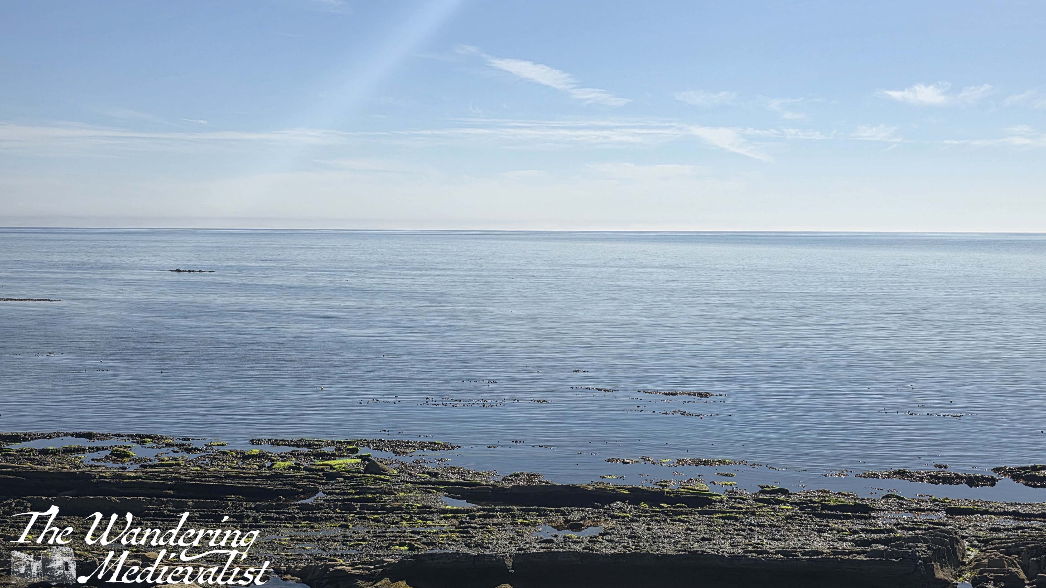
The ocean was incredibly still on the morning I walked, with only one or two fishing boats out; the gentle breeze I enjoyed was definitely not enough for sailing. It was difficult not to pause regularly to enjoy the view back to Edinburgh , and if my camera battery had not died 10 minutes in (my own fault for not checking it), there would be many more I am sure. Fortunately, my phone takes good pictures so I made up for the lack as best I could.
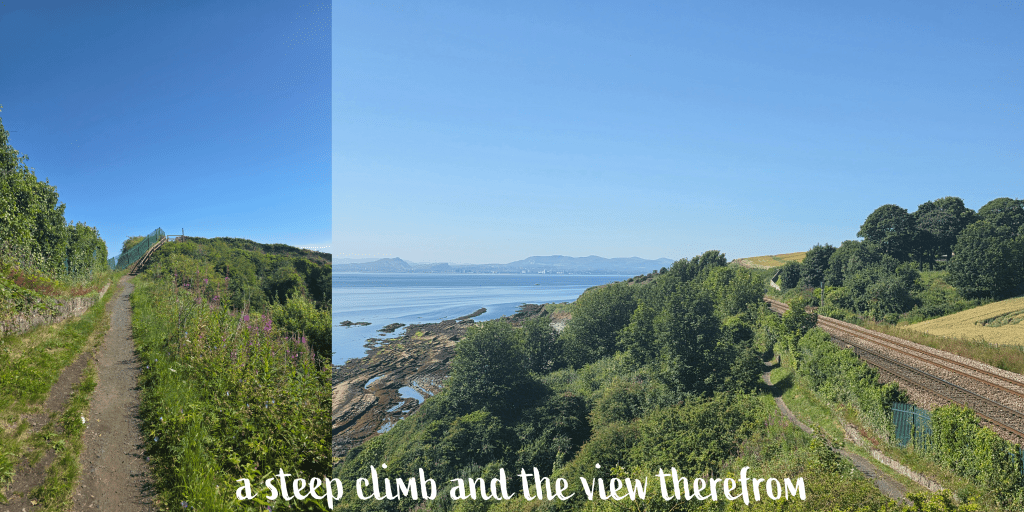
Gradually the path goes around a curve in the coast, and rises temporarily away from the beach on a sharp switch-back style path. The view from the top is even better, though it does not last long, with the trail gently descending over several stair cases. One advantage I noted of this portion of the path was that there was a fair amount of shade, relieving the heat of the sun for a short while. This is definitely not the case closer to Kirkcaldy.
Just over a mile out from Kinghorn, there is a steep climb up to the top of a hill, to a viewpoint at the top. This is one of the last really good views back towards Edinburgh and along the rail line, while ahead you can start to see the buildings of Kirkcaldy.
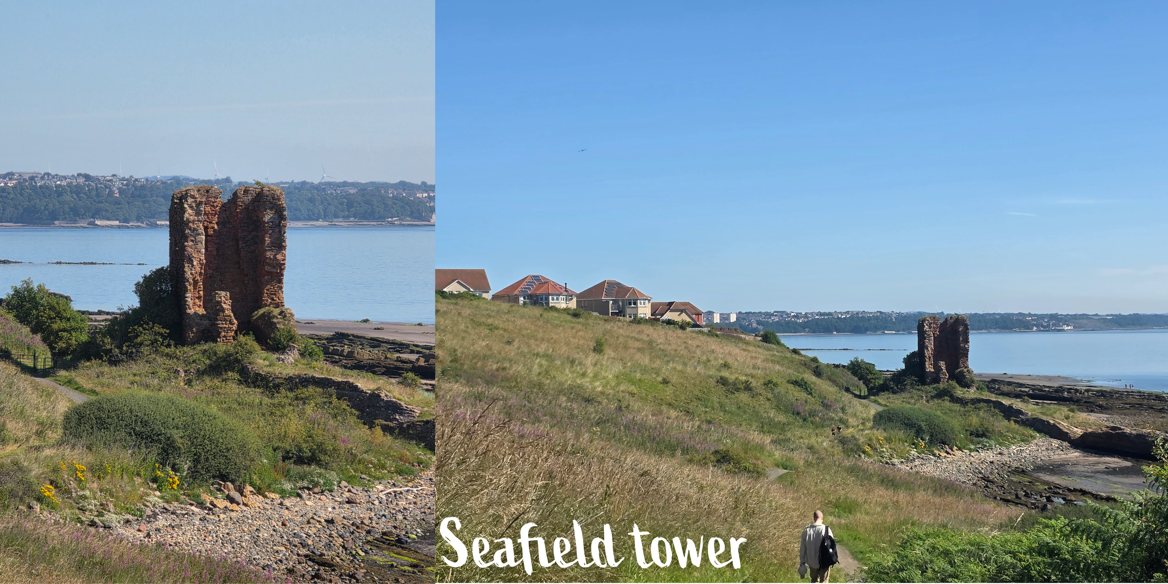
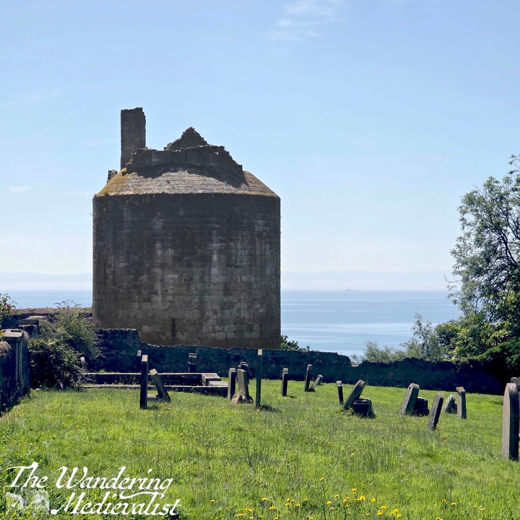
The path descends again towards the beach level, and around a corner the houses at the very edge of Kirkcaldy come into view, along with the ruined Seafield Tower.
Upon a bit of searching, I discovered later that this tower is all that remains of a late medieval (sixteenth-century) castle. It was sold to the Bishop of Glasgow in 1631 and after passing through several families was allowed to deteriorate to the state it is in today.
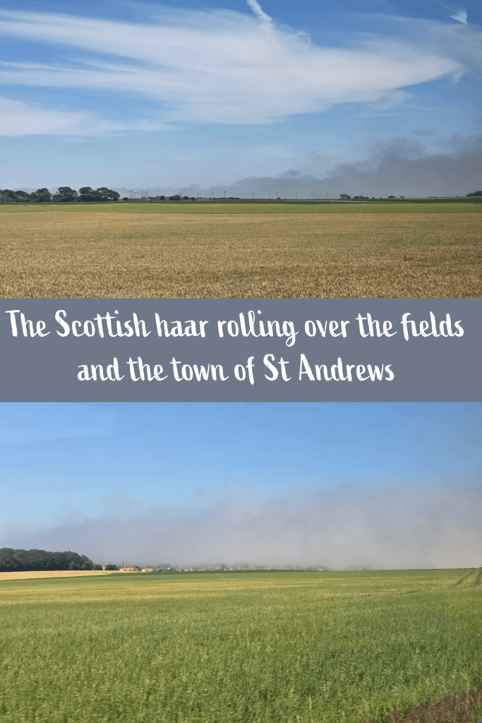
While the day was still clear and sunny, in the distance I could see that further north and east in Fife, the experience was not the same – instead, a thick haar (Scottish fog) was layered over the coastline from Elie around to Tayport.
From where I stood, I could just see Largo Law rising above the clouds.
And here I’ll take a break for a short opinion poll – let me know your answer in the comments!
Would you rather be able to see the end of your walk, even if it is several miles away, or would you rather have no idea how much longer you have to go?
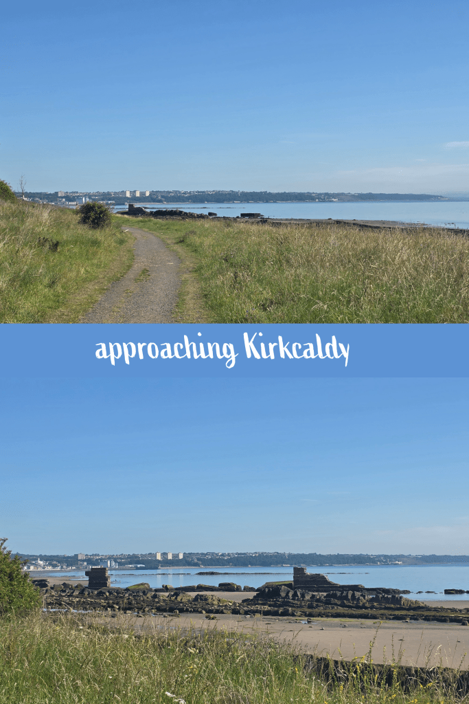
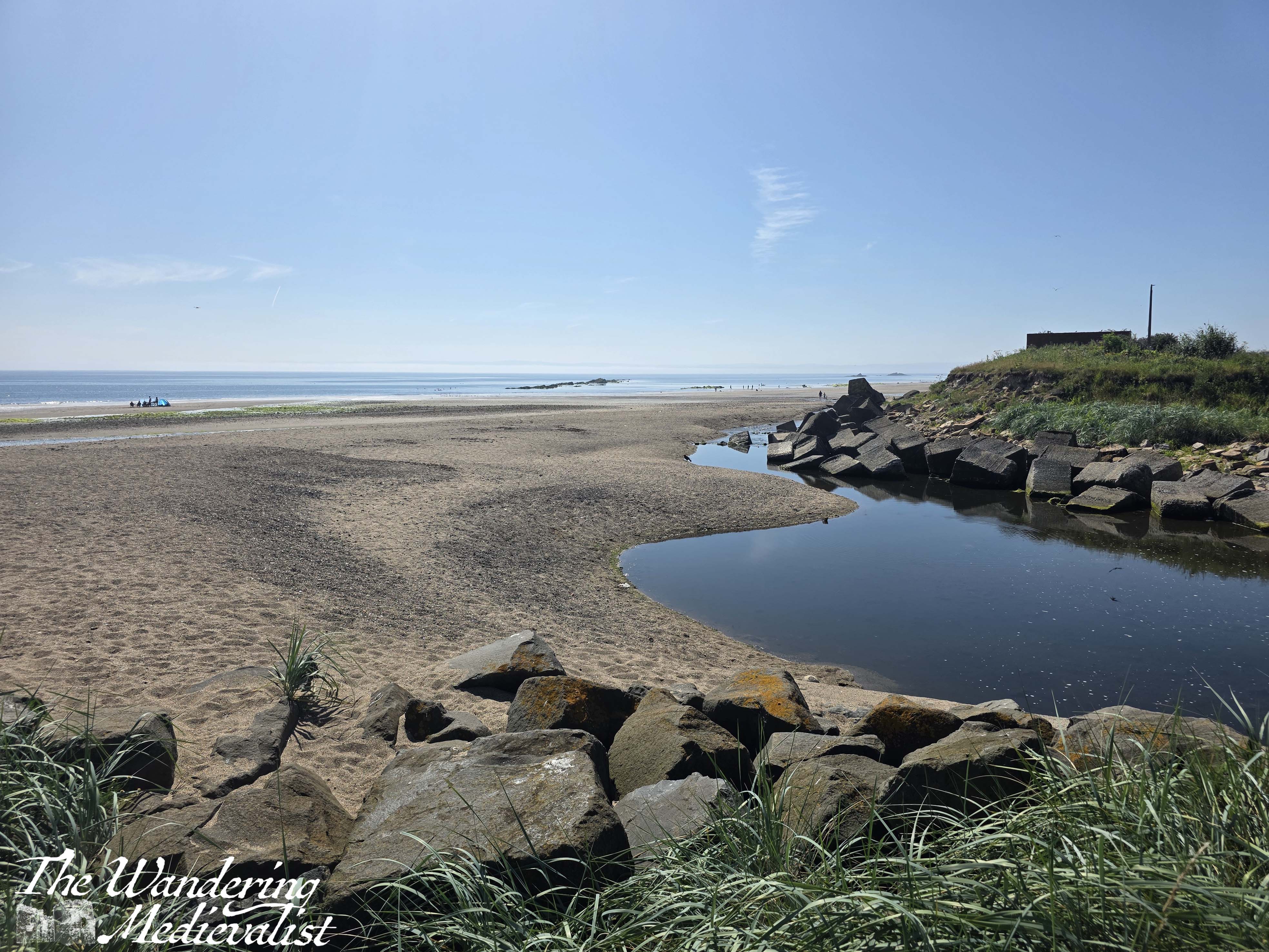
As I walked towards Kirkcaldy, I could see in the distance the faint outline of Ravenscraig Castle, and the much more prominent high-rises of the Ravenscraig flats, which I knew were my goal but still seemed a long way away. Fortunately, I was distracted by how lovely the beach and coast are. It was approaching low tide so there was an expanse of sand, interspersed with rocky outcroppings. The old sea wall is still present though large portions have been washed away, creating dramatic gaps through which to see the view. Above me on the top of the hill to the left were increasingly well-appointed houses, many with large balconies overlooking the ocean.
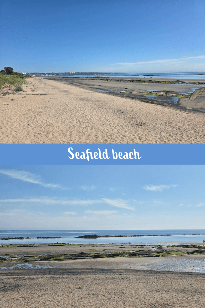
Once past the old sea wall, the path continues along the beach which is now completely sandy, and was already starting to become busier with poeple eager to enjoy the sun.
I found the coastal path to be less well sign-posted here, and eventually had to look up the proper route on my phone, as I walked along the grass at the edge of the beach, past the car park for Seafield beach. There is a large Morrisons here, and officially the coastal path leads up to the left and around the store and car park. This is a good spot to stop for a snack or cold drink, if you need it. There is also, I am relatively certain, a route that takes you between Morrisons and the beach – or you can walk on the beach of course – but I was doing my best to follow the ‘official’ trail that loops around and then follows the main road past a Lidl supermarket.
There is no need to cross the road – stay on the Morrisons side and follow the sidewalk (or pavement, for the Brits) around the edge of the car park – this is now the A921.
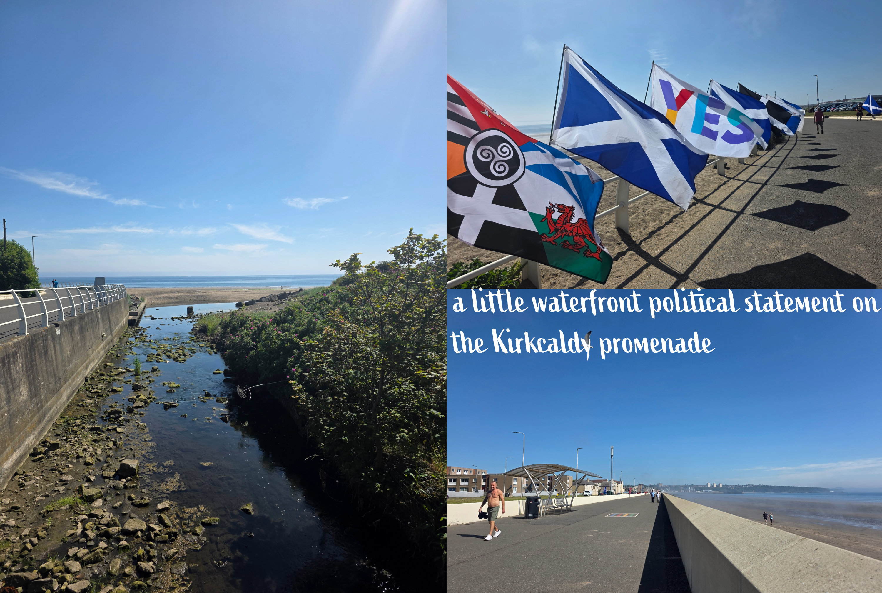
In short time, the road crosses a small burn – Tiel Burn – and here there are public restrooms should you need them. At this point, the path is not well-marked at all, but I determined that it made sense to swing to the right and follow the seawall at the edge of the beach, onto Kirkcaldy Esplanade.
I admit to being really impressed with how well-kept the esplanade is, especially as it was first built just over 100 years ago. Stretching for just about a mile, it is wide pedestrian route with a relatively new seawall separating it from the sandy beach. There are periodic breaks in the wall for paths down to the beach, and very recent additions to the pavement in the form of games to entertain children. There was a world map, several hopscotch outlines, suggestions of places to run, hop and skip, and much more, all brightly painted in clear colours.
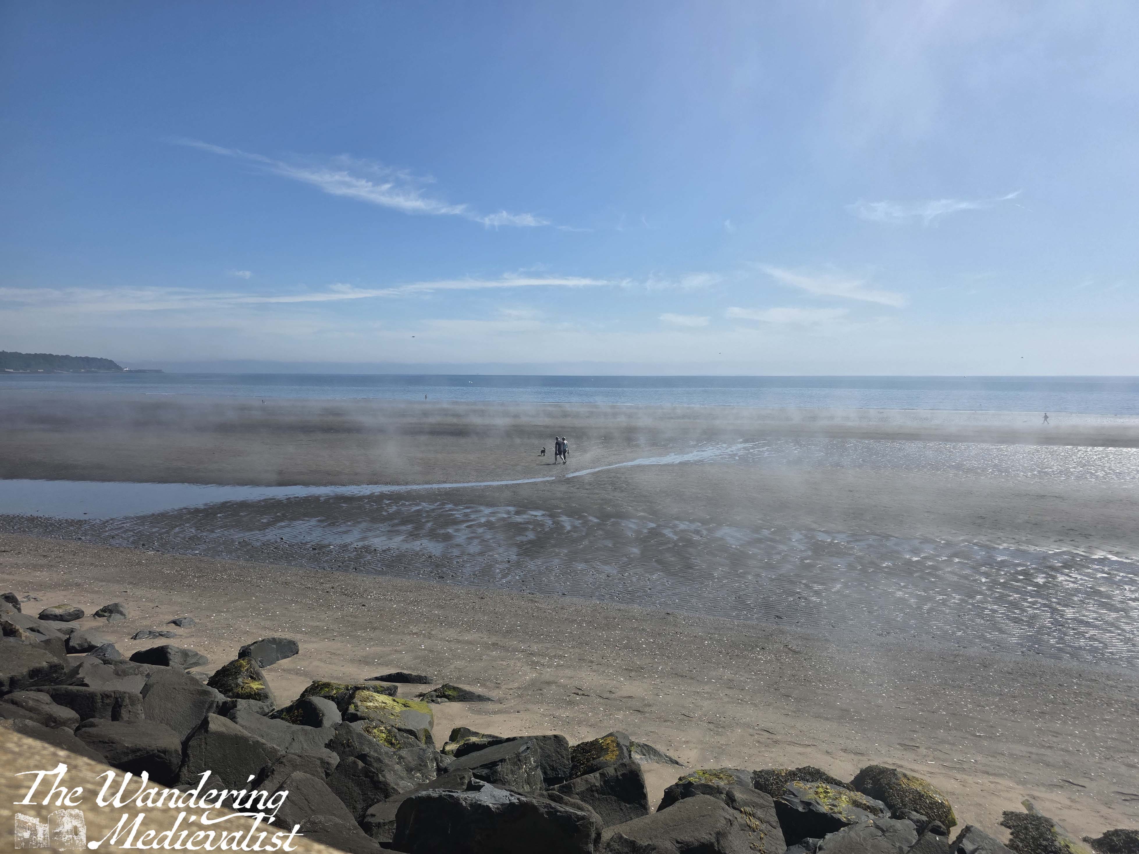
Beside the pedestrian area is the busy A921, and across the road a series of shops, parking areas, and some apartment blocks. As I walked along the coast, I began to notice wisps of mist blurring the view – while not a full-on haar, there were gentle clouds rising from the sand and hovering in the still air. While it did not come together into a total blockage of the sun, the mist was gathering more heavily, and as I reached the end of the esplanade, the sea wall at the far end of the beach was hard to see.
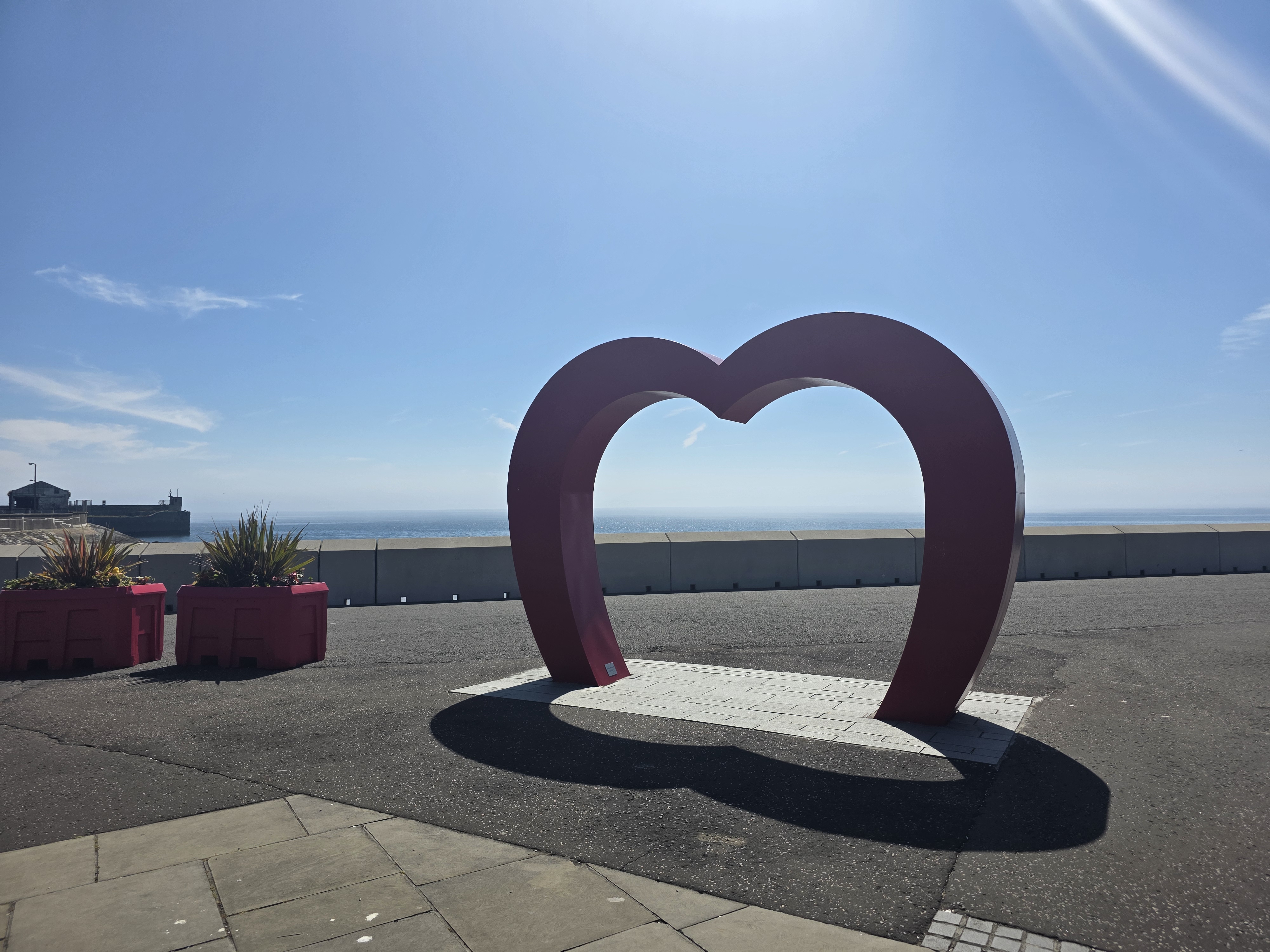
At the end of the esplanade is the Heart of Kirkcaldy, a famous art installation that is popular with selfie-takers, and here I started again seeing signs for the Coastal Path. Rather than following the coastline around to the right, the path crosses at the stoplight and heads straight along the A921. Here there is an odd mix of much older buildings on one side of the street – 17th and 18th century – and very new apartment blocks on the other, as all of Williamson’s Quay is much more modern accommodation.
About five minutes later, there are two onward alternatives, marked by a pedestrian crossing. One is to continue straight up the hill ahead, along the road. The other is to take a right and then almost immediate left past the Carr’s Flour plant, and along the coast. I have to admit to getting this bit wrong, as the Coastal Path signs seemed to point directly into the factory grounds, and were a touch vague. So, I deviated from the path and went straight up the hill which is quite steep and a good long climb, especially after walking for about 4 miles.
My goal for the end of this walk was Ravenscraig Castle, a mostly-ruined edifice at the edge of Ravenscraig park. I did just see it from the road, but realised as I planned my route to it that I had firstly lost the Fife Coastal Path but perhaps more importantly, was about to miss the only bus I could get in that hour. So, I took a quick picture from across the burial ground then legged it across the street to the bus shelter, where a kind woman assured me that the bus had not yet come.
On the rather long and winding bus trip back to St Andrews, I was able to see just how all-pervasive the hair had become in Fife, with heavy clouds of mist reaching over the land from the coast and settling into valleys.
Observations on this section of the path are that the first section, which reminded me of many others with rocky beach and grassy slope, was a much shorter part of the 4 miles than I realised; instead, at least half of the walk ran through Kirkcaldy, both the along the beach and then the Esplanade. It’s a less nature-focussed walk, but the views are impressive and it was a good way to get back into my habit of waking on a Saturday and getting moving.
So, I shall soon have to repeat this section of the walk and actually visit Ravenscraig Castle, then make my way along the coast towards East Wemyss – who knows, perhaps next weekend?
The last month has a been a whirlwind of work – adjusting to my new job and to the travel it requires has taken a toll on me, but as October moves into November I have been able to take time to rest and review. In doing so, this post formed in my mind.
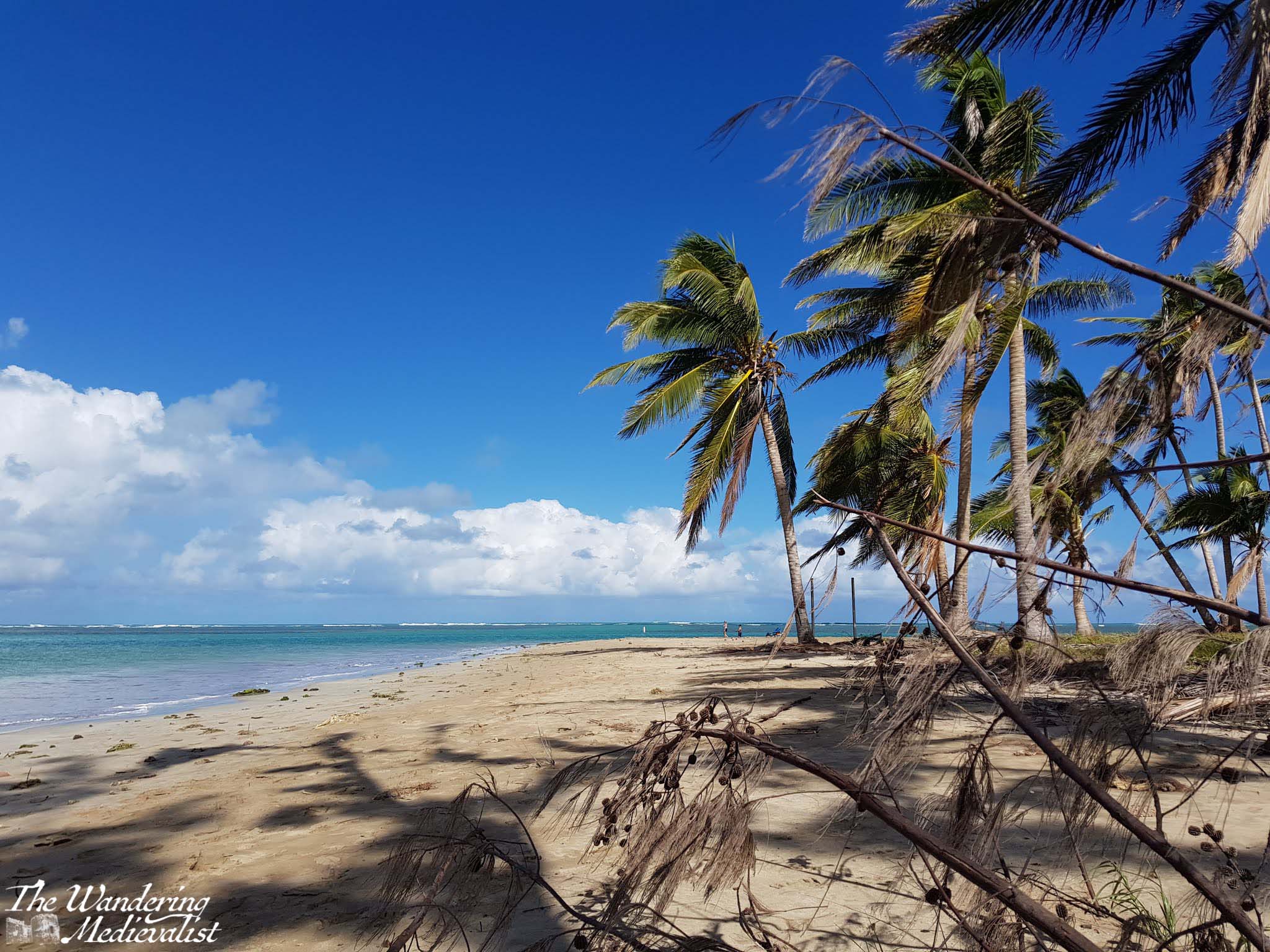
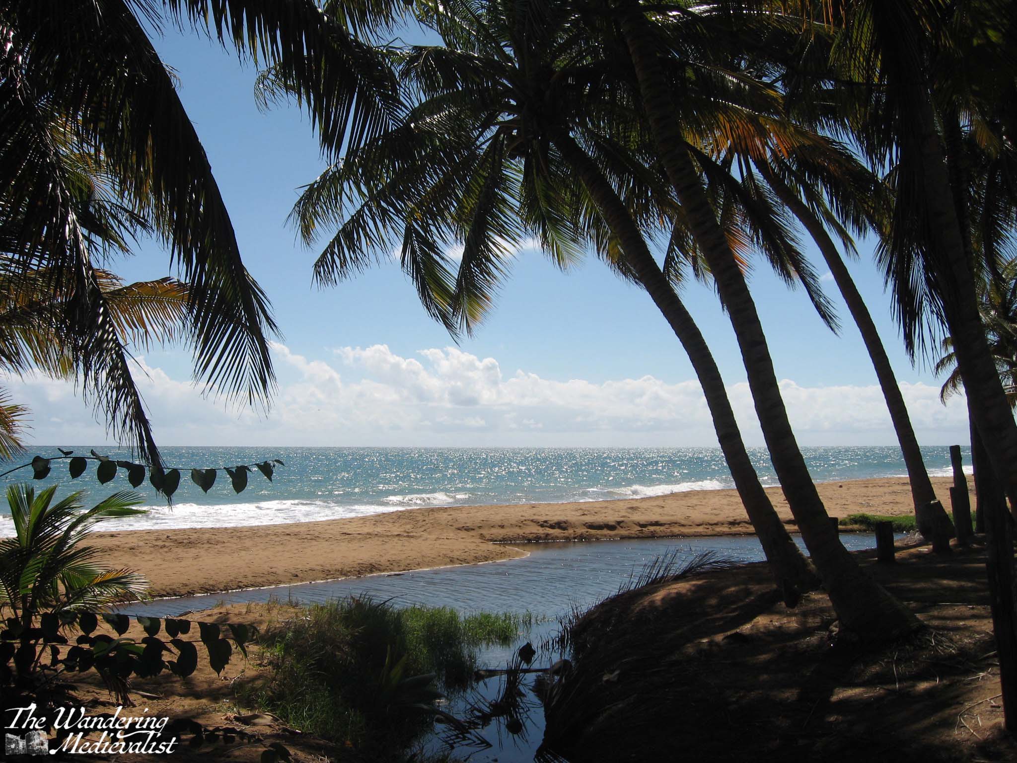
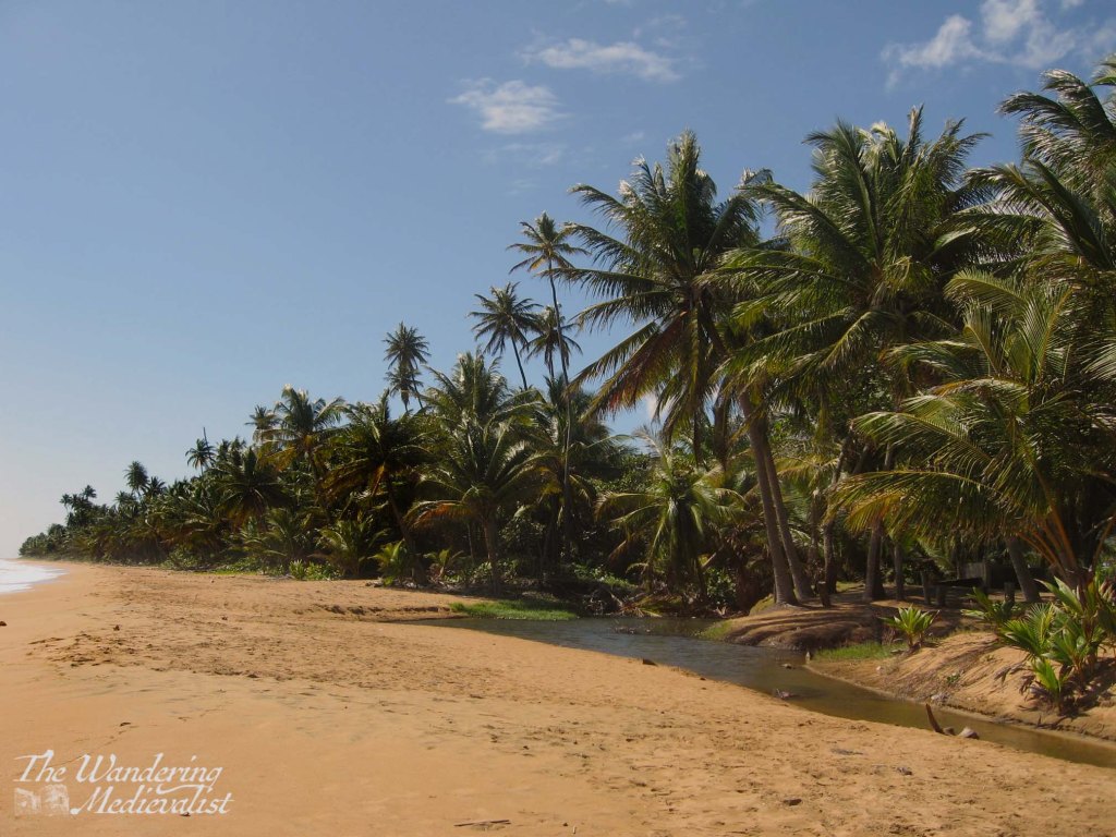
A few weeks past, in the midst of a busy work trip, I was lucky enough to find myself with a free weekend morning. Originally I had big plans for explorations of the Los Angeles area further north, but a week of traffic and driving did me in and I chose a closer option.
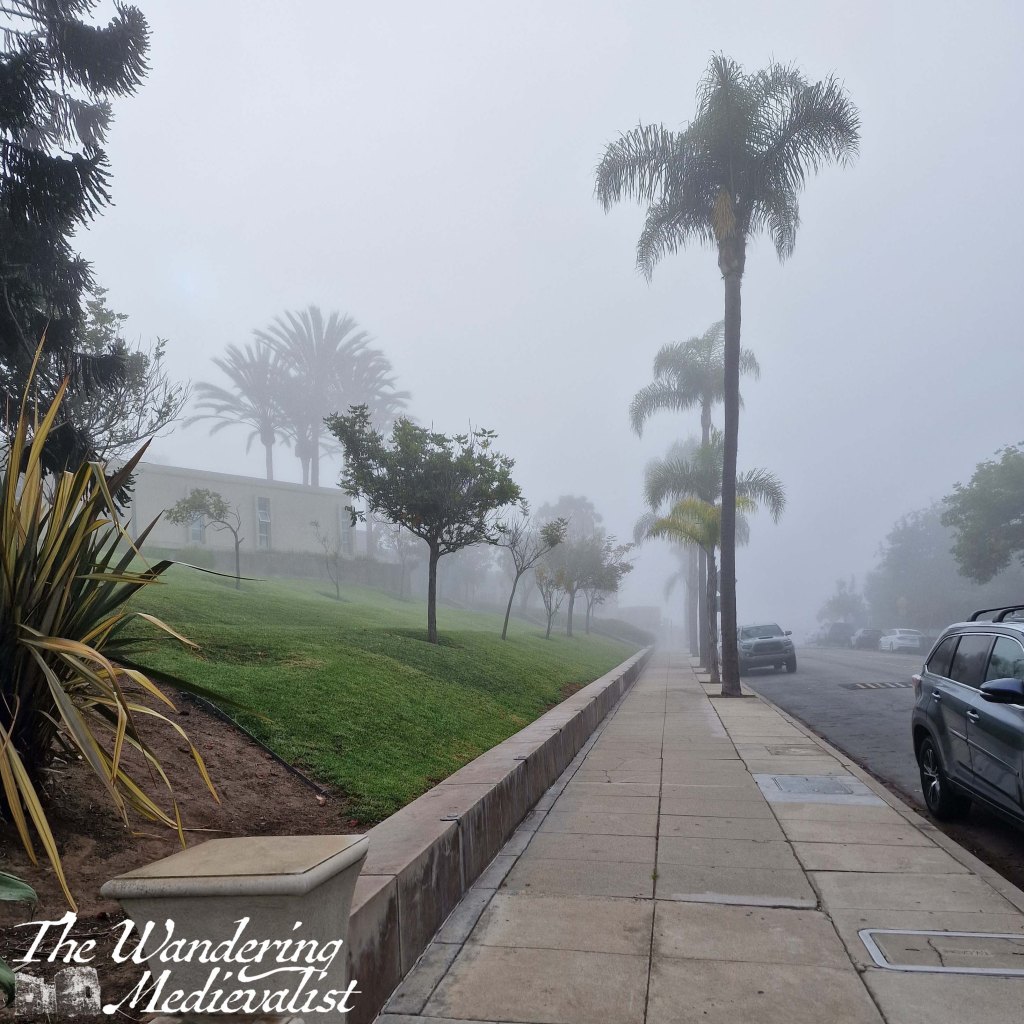
I was staying in Santa Ana and had visited Laguna Beach earlier in the week on a school visit; on that occasion it was swathed in thick fog, with buildings and palm trees just peeking out of the mist. There was a proper Pirates of the Caribbean vibe, with Spanish-inspired architecture a common site.
(side note, I was surprised to discover that almost every morning I was in Orange County was overcast or foggy, but apparently that was not unusual for the time of year).
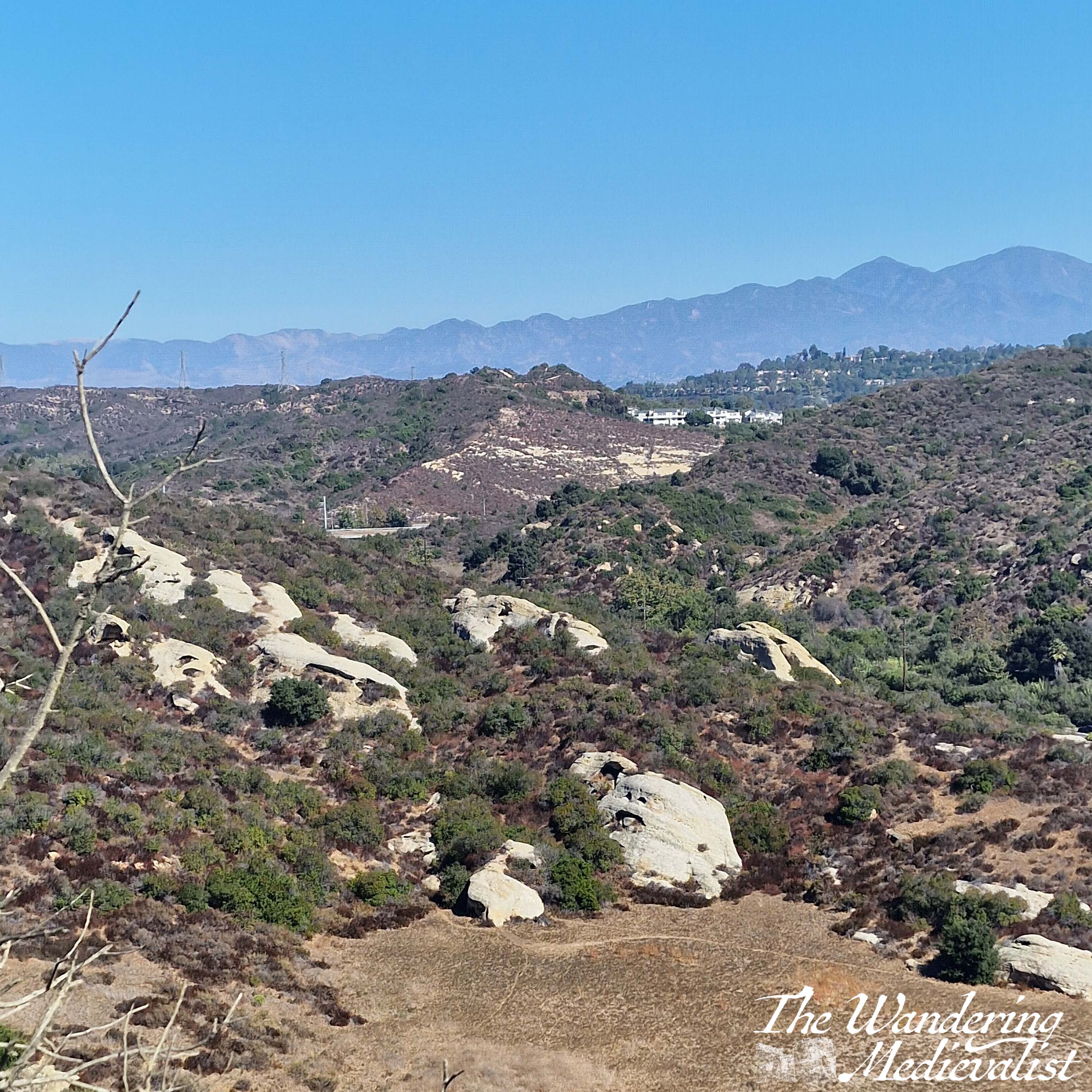
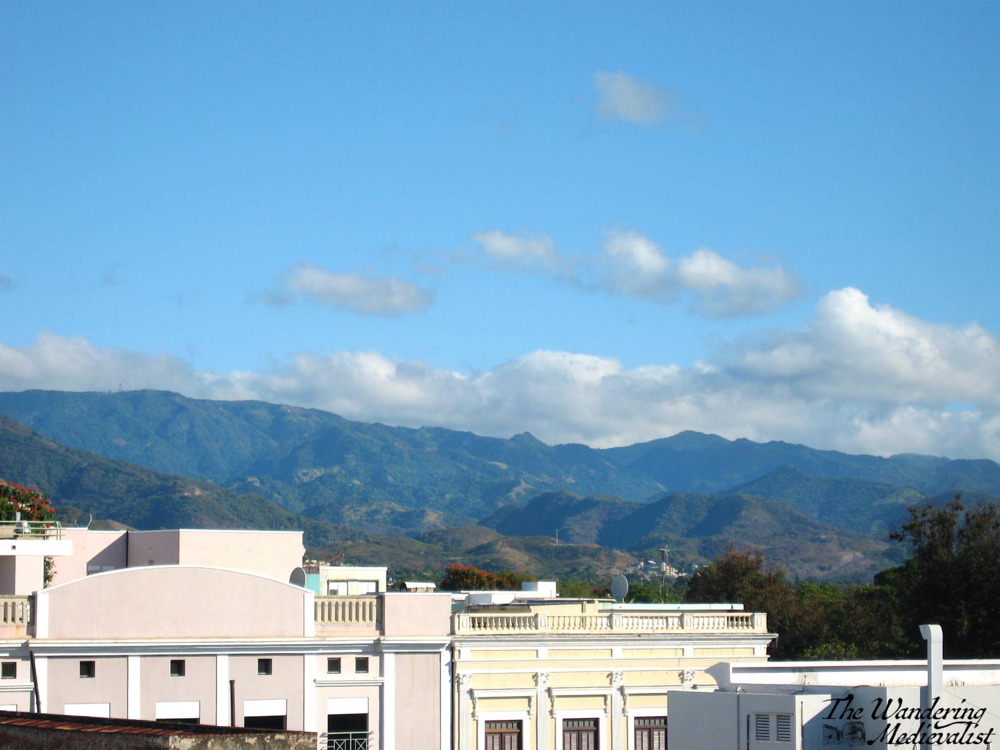
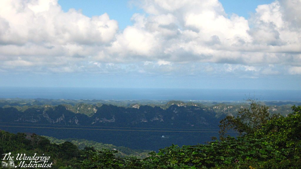
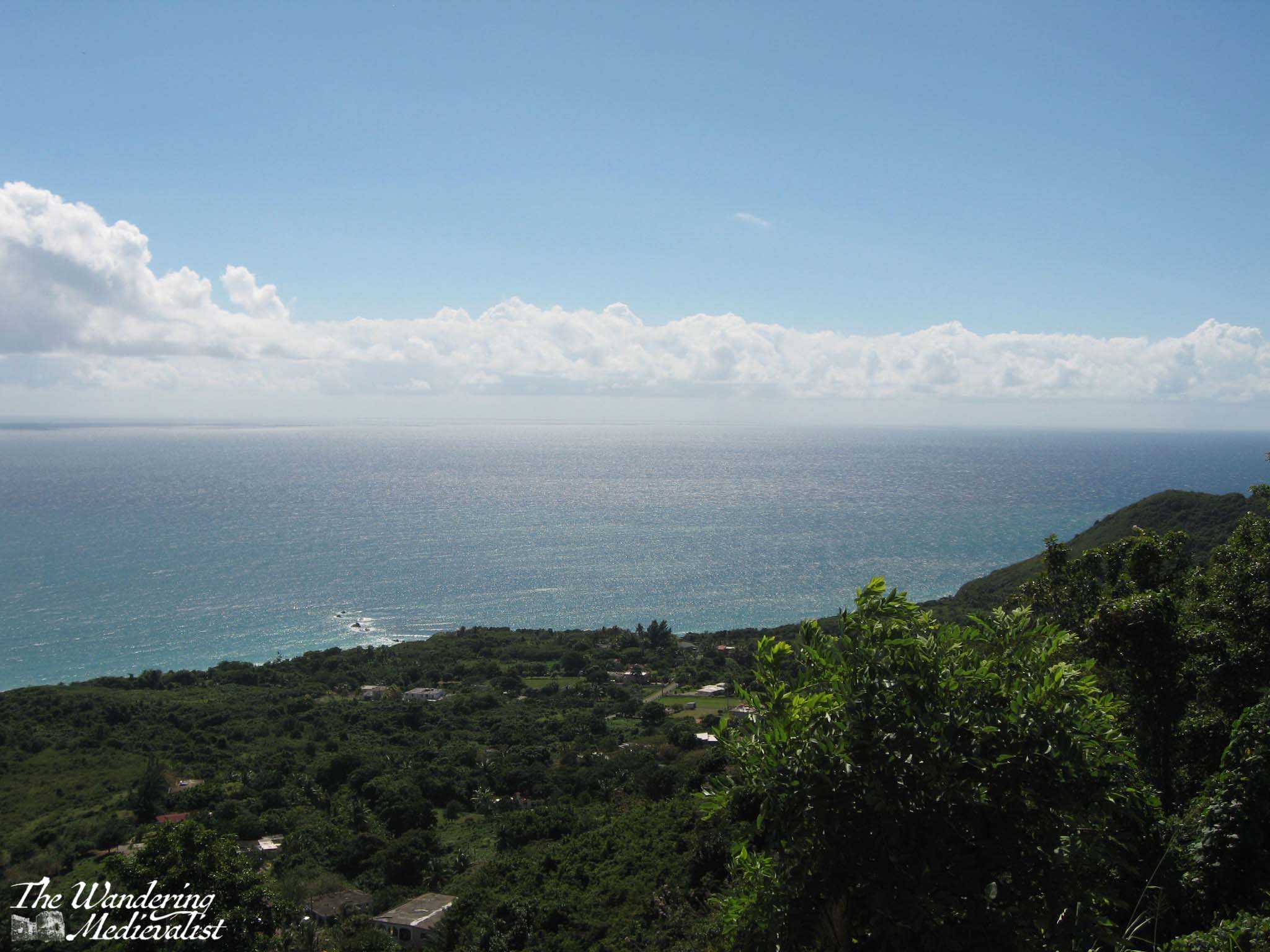
I had not had time to explore during my weekday visit, and so on Sunday I hopped in the car as soon as I got up and headed south. Even the drive is breath-taking, cutting through the California hills that are as stark as parts of the Scottish Highlands, but a very different colour. I had discovered earlier in the week that several California highways pass through the mountains, making me wish beyond anything that California offered the parking spots and pull-over options that you get in the UK and the White Mountains. My GPS took me along Rt 133, which approaches Laguna Beach from the North-East, the last few miles snaking through high ridges (another option takes you along the coast, but this was less direct). There are periodic parking lots along the 133 for hikers and the myriad of trails winding up into the hills.
Making a mental note to return to one of these trails, I headed into town and found a place to park at one of the several public lots, this one covered so that the car would not overheat. It was far from free – $9 for three hours – but I was not planning a long trip and it was a special day, so I was very happy to pay.
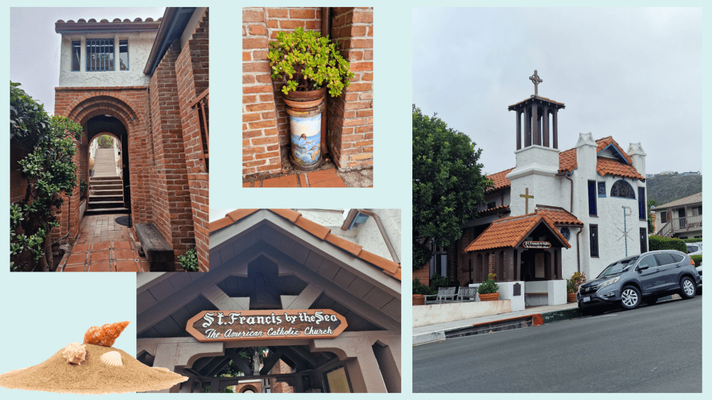
From the parking lot off Glenneyre Street I decided first to make my way up-hill to see St Francis by the Sea, a Catholic church apparently listed in the Guinness Book of World Records as the second smallest cathedral in the world. It was a really cute wee spot, but my exploration was curtailed by the fact that I could hear the service taking place inside as I walked by, so I took a few pictures before heading back downhill.
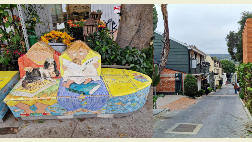
It was a short walk down to the water, passing the local library with very entertaining benches (see below) and several shops that were not yet open though looked appealing.
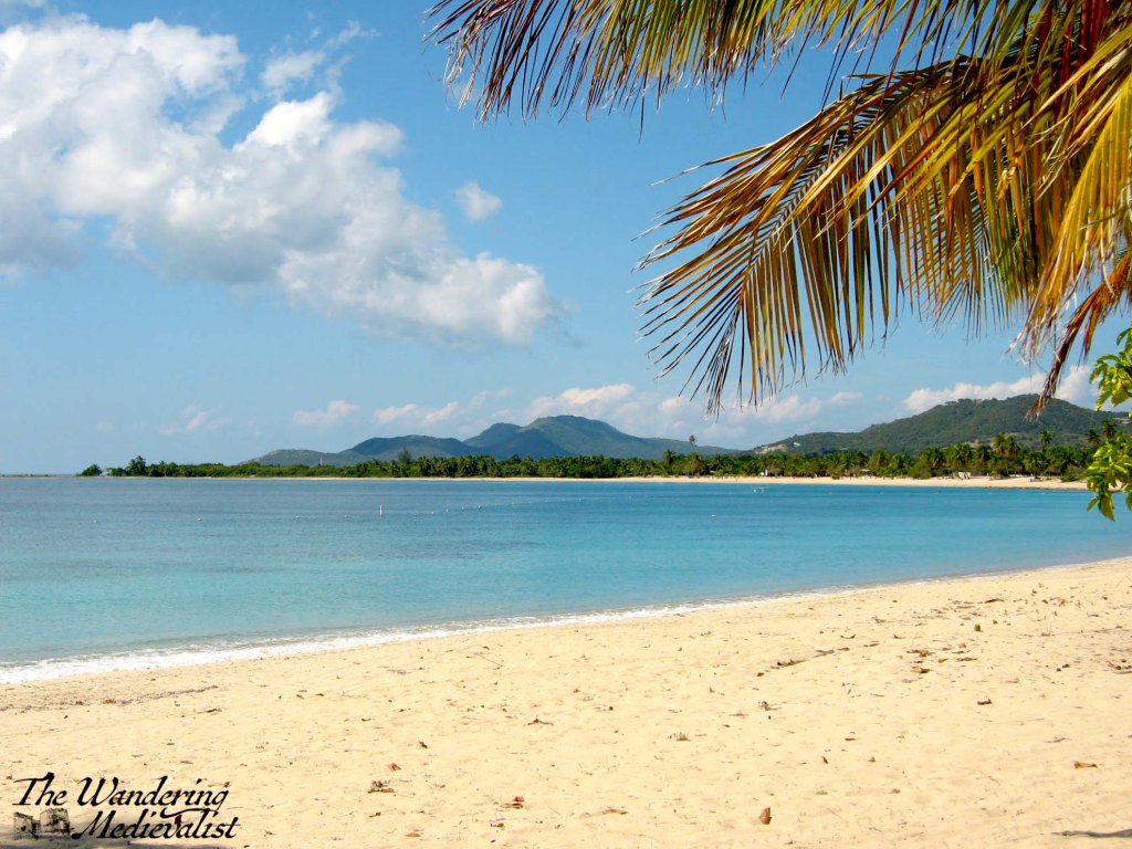
I reached the beach front in less than five minutes, and it was early enough in the day that the sky was still overcast. The sun was just thinking about peeking through the clouds, with lighter patches promising where it would first defeat the gloom, but in the meantime the cooler temperature allowed several teams of energetic folk to play volleyball in the sand. There was also, to my delight, a small market with local artists and a jewellery-maker who used sea glass in her art. I could not resist picking up a pair of earrings…or two. Behind the fair, the town stretched back towards the hill, which was layered in houses that I can only imagine have spectacular views over the coastline.
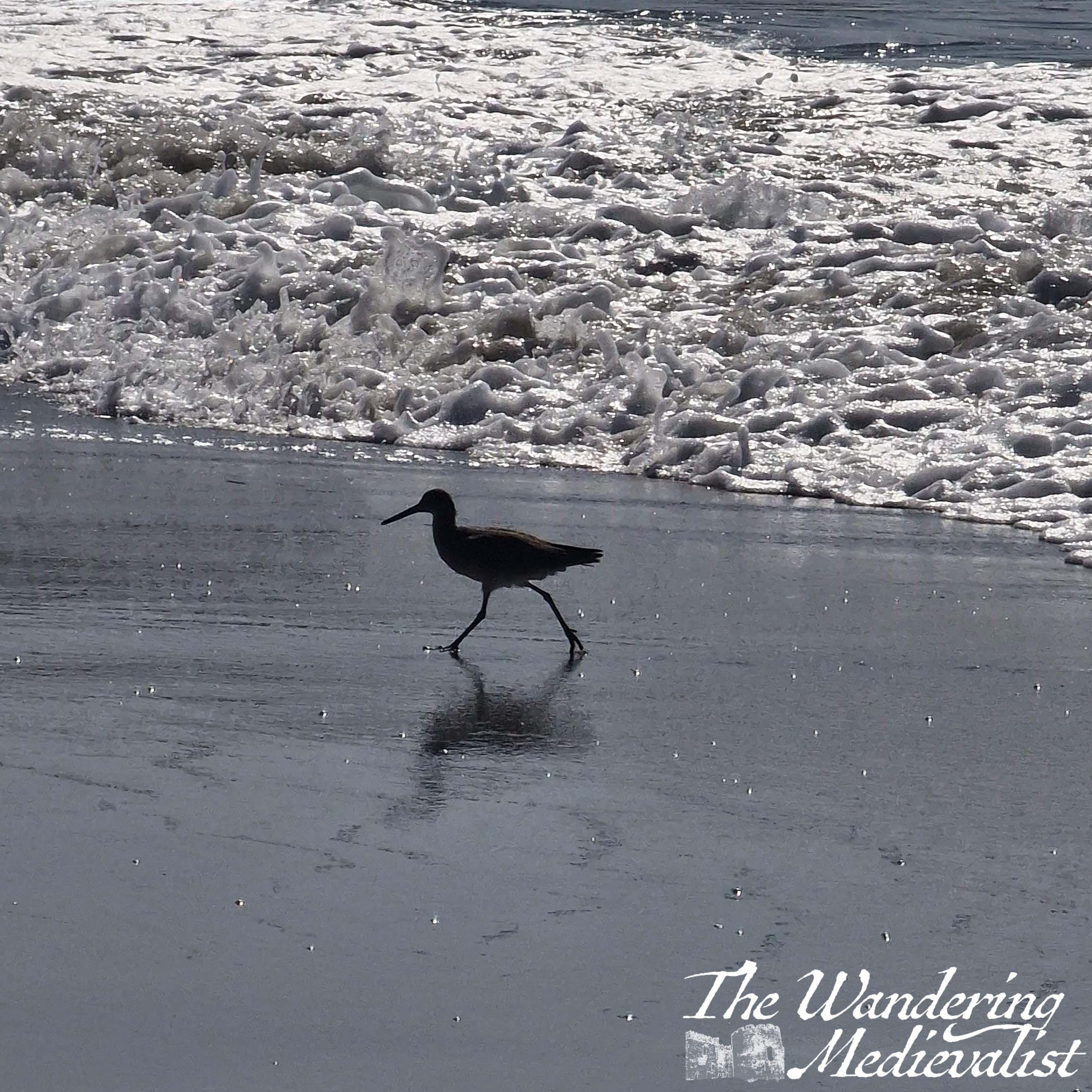
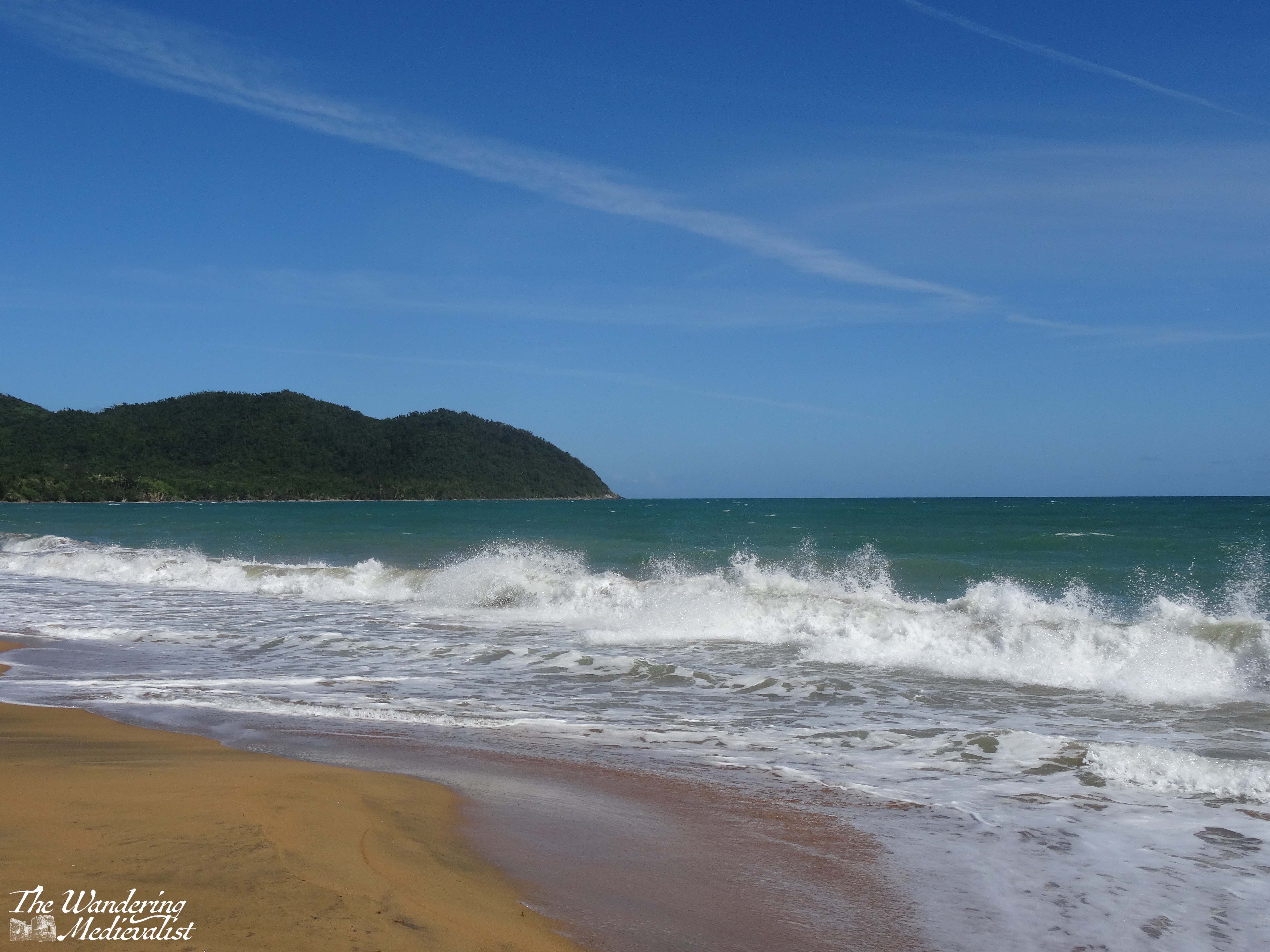
The scene by the beach was classic California – a wooden board walk lining the sandy beach with crashing waves where some brave souls were swimming and surfing. A huge range of people walked and sat on benches: young and old, all races and socioeconomic status. There were homeless people with their belongings, dog walkers and people-watchers, families with young children building sandcastles and playing in the surf, a group of young men working to get a jet-ski into the water, tourists like me, and well-muscled and bronzed lifeguards keeping an eye on everyone (yes this is cliché, but evidently for a good reason). We were all kept company by a group of what I think must have been sandpipers, alternately chasing waves and running back up to the dry sand.
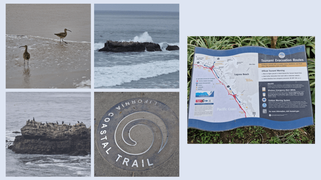
I made my way along the beach and up a set of steps that climbed to the top of the cliff and the California Coastal Trail. I was a touch surprised to see the tsunami evacuation route sign, but I suppose only for its novelty – it is not something we have on the East Coast!
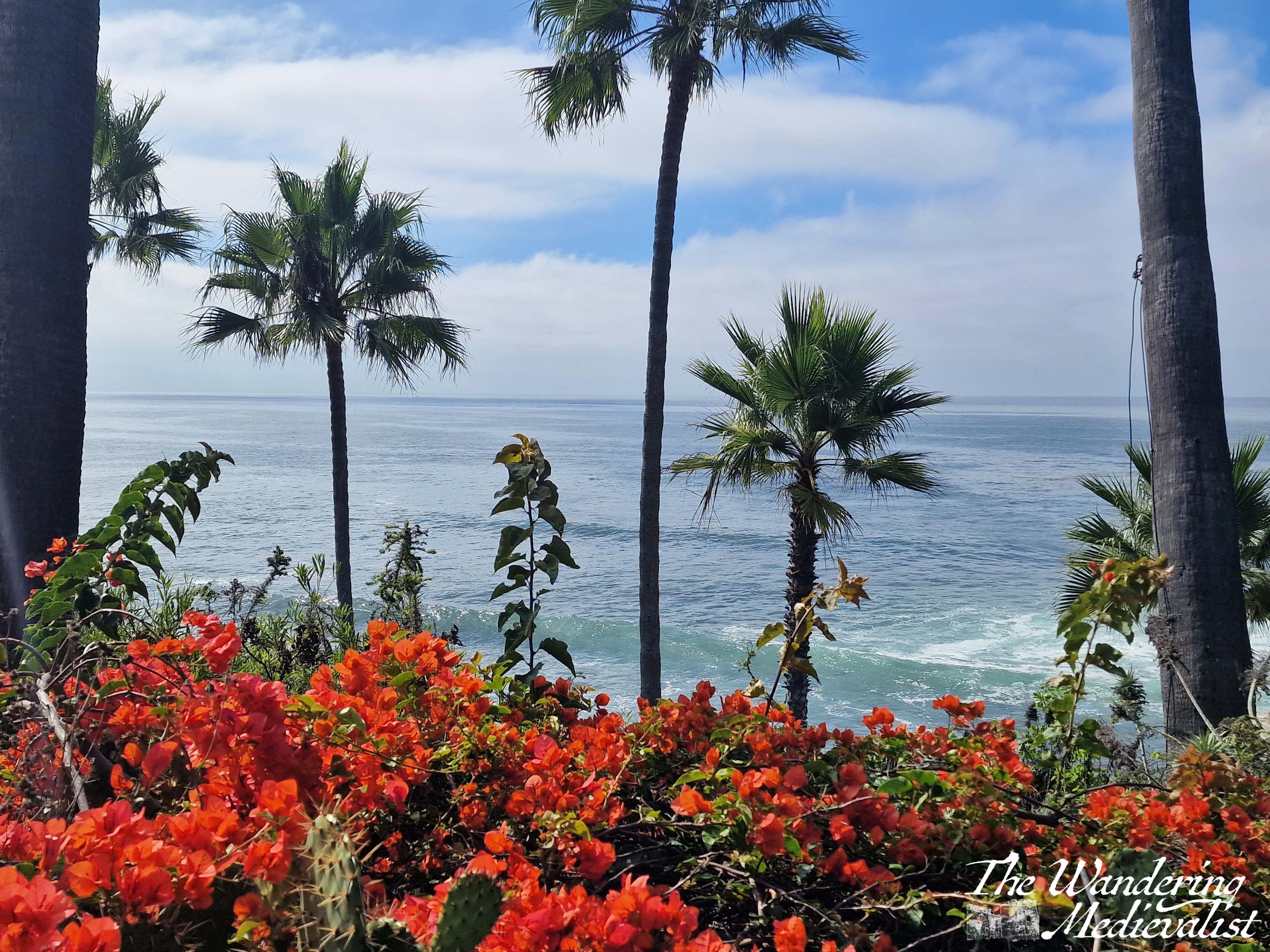
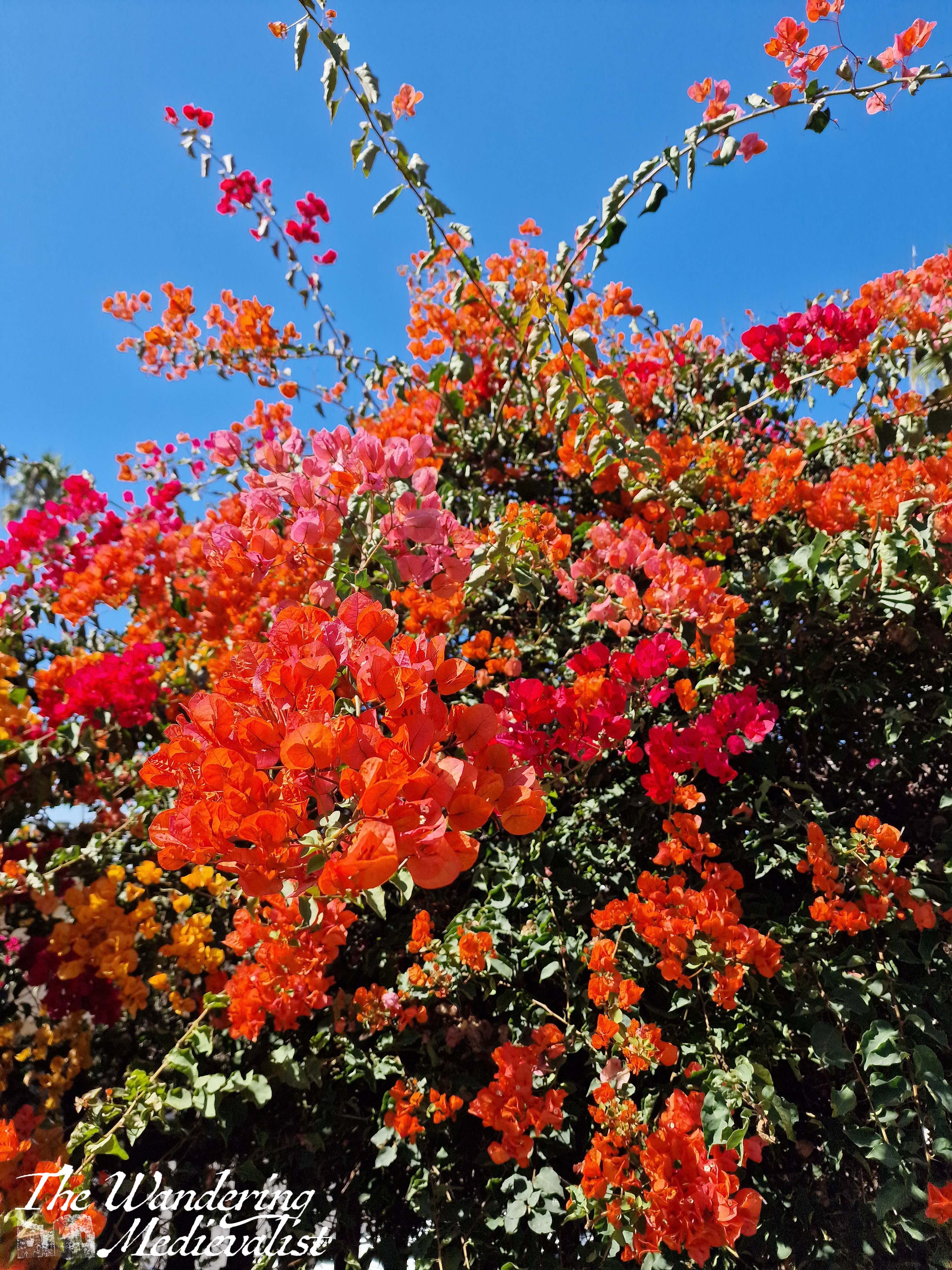
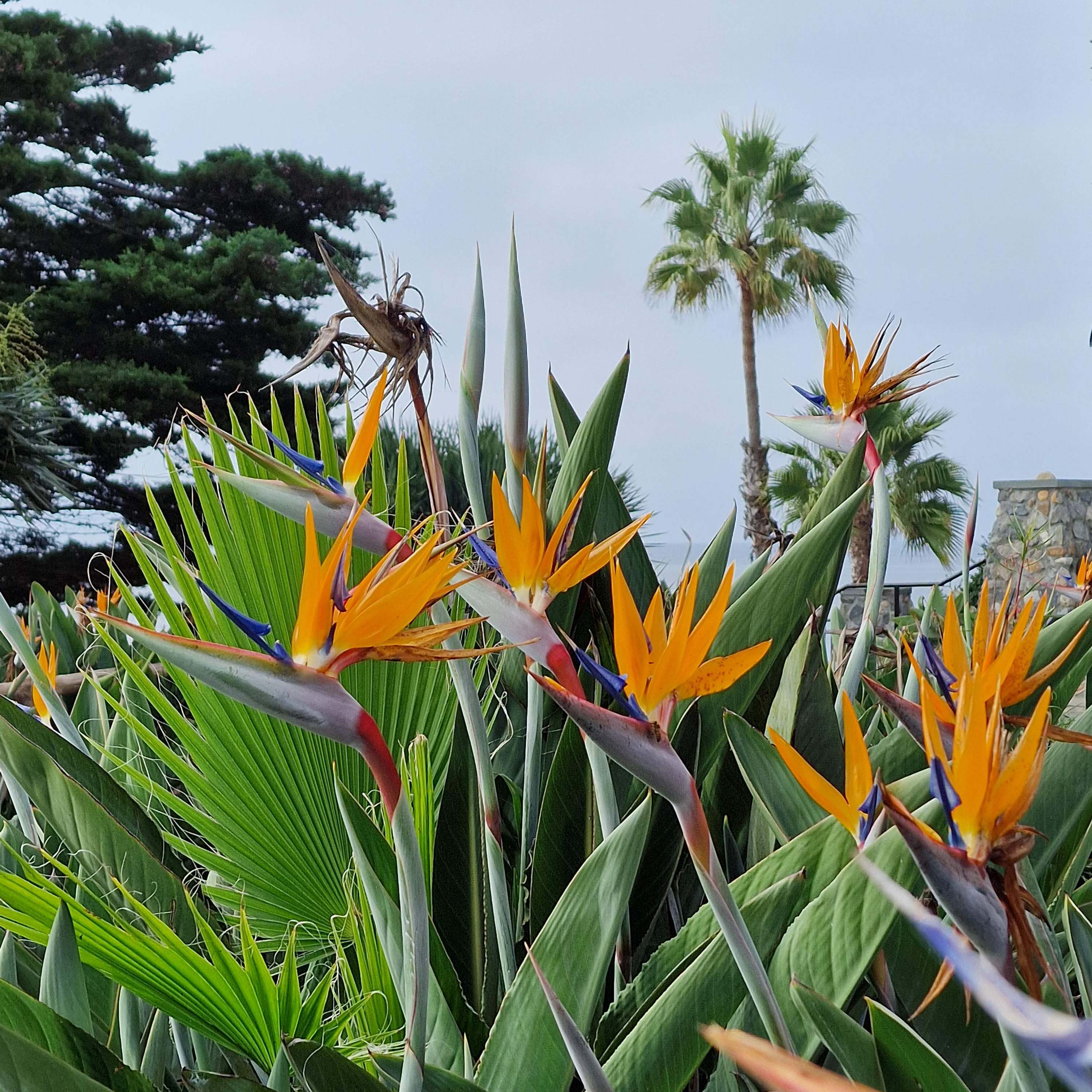
The path follows the cliff top for miles, with viewpoints and plenty of side-entertainments in the form of statues, a war memorial, tropical flowers, gorgeous palms and cacti. There is also a spectacular bird rock covered in what looked like cormorant (though may also be brown pelican) just off the coast – the waves crashed around it but never seemed it disrupt its occupants.
At times the path was built out away from the cliff and it was always well-kept, clean and free of any kind of litter. The further I walked, the sunnier it got and the busier the path became with walkers and tourists. I passed plenty of locals out for exercise – many with pets – birdwatchers and a few photoshoots being taken of special events – a wedding and a quinceañera I think – against the spectacular backdrop. Despite being very much in an urban setting, there was plenty of wildlife – mostly avian – to enjoy, and the scent of the sea was refreshing and omnipresent.
Eventually my need for a cold – and caffeinated – drink turned me back towards the town, but not before one last walk along the beach including a small and accidental dip in the waves. Yes, I was too busy filming to notice one coming a bit closer than expected…
The sun on the waves was just too beautiful to ignore, and the view of the town was excellent.
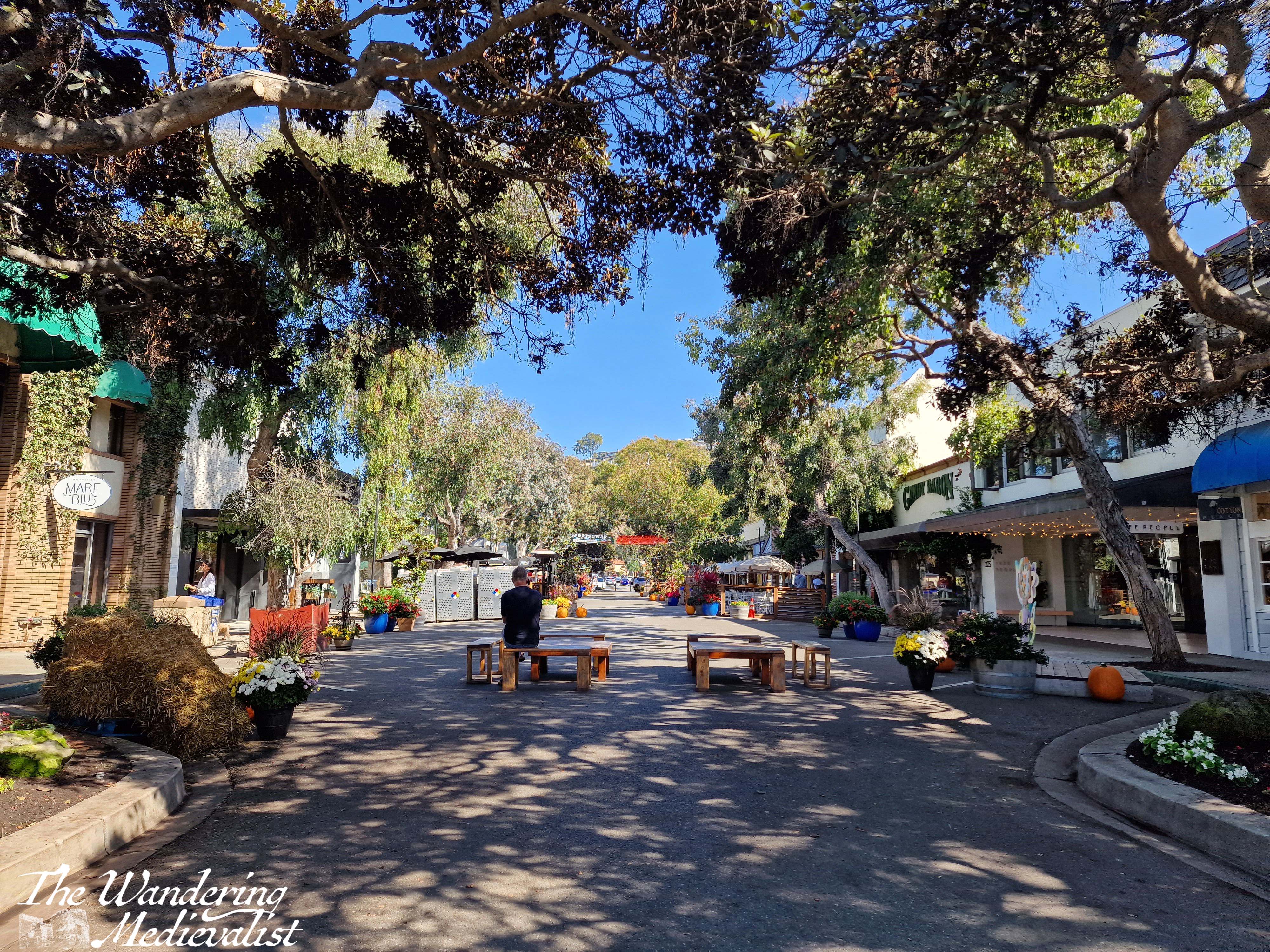
With slightly wet feet, I walked up the pedestrian Forest Ave where there are high-quality restaurants, bistros, and shops. I stopped for a break at a Parisian-style bakery called C’est la Vie – excellent coffee and an enormous pain au chocolat that I enjoyed with my dinner that night.
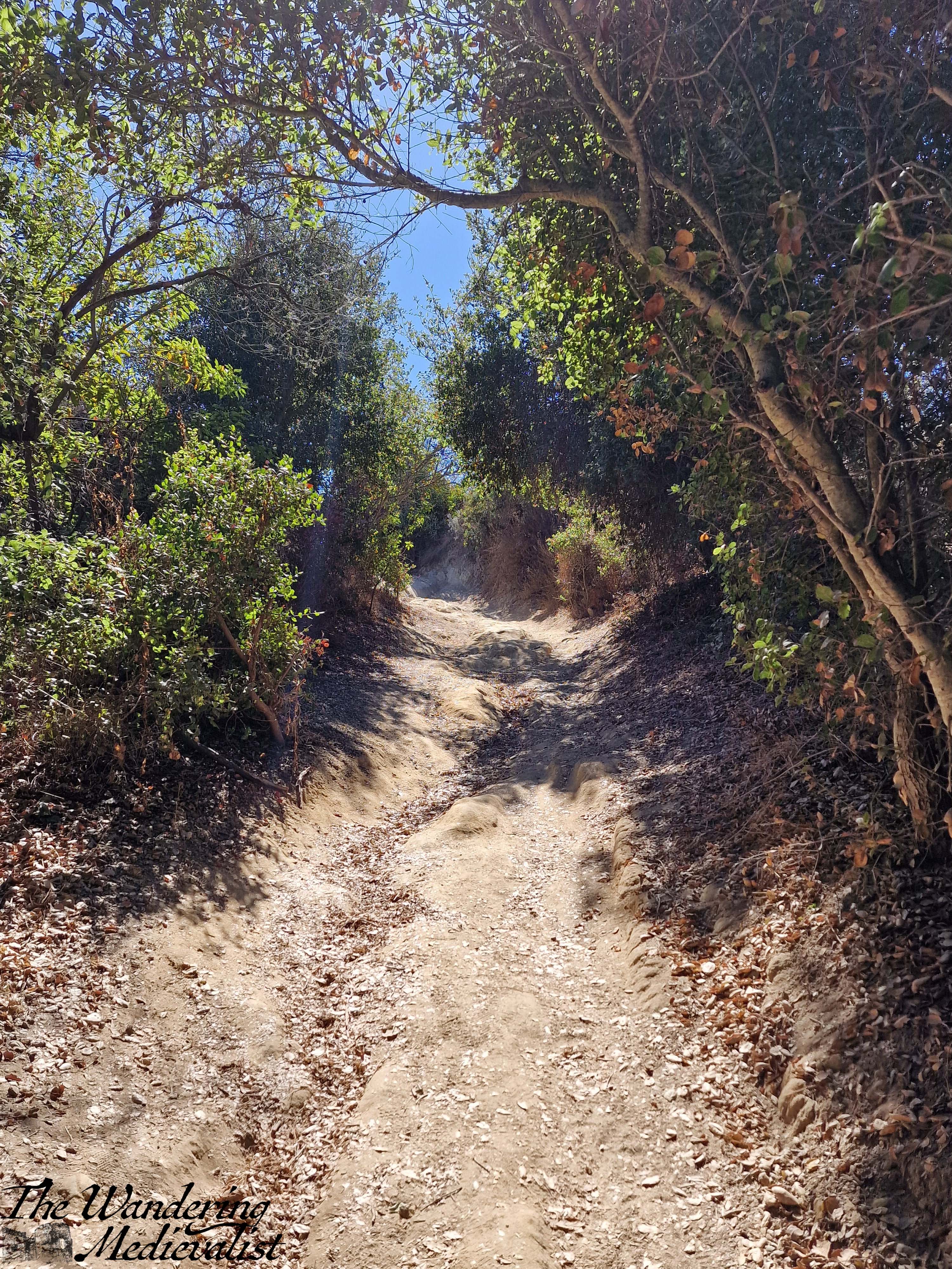
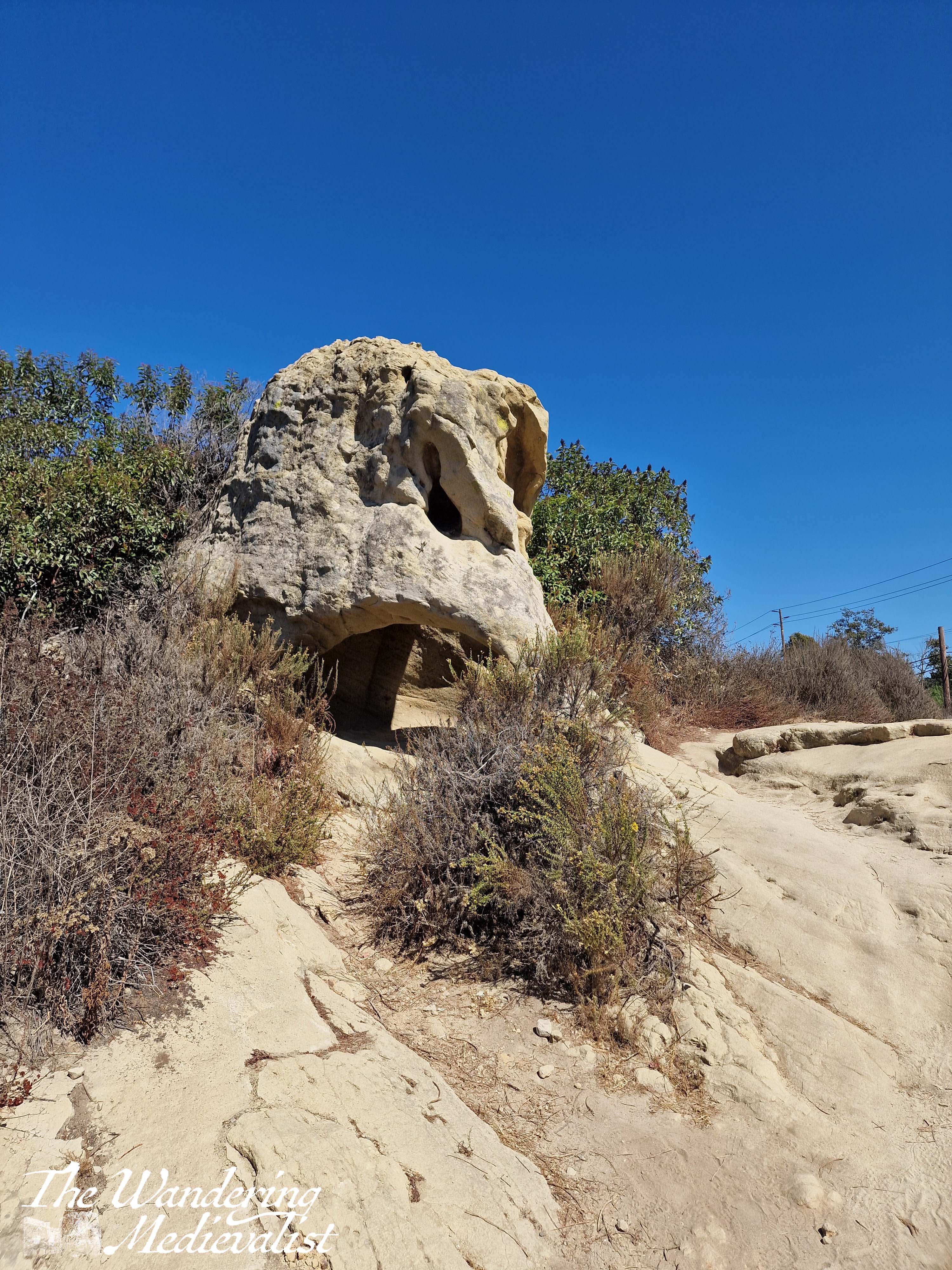
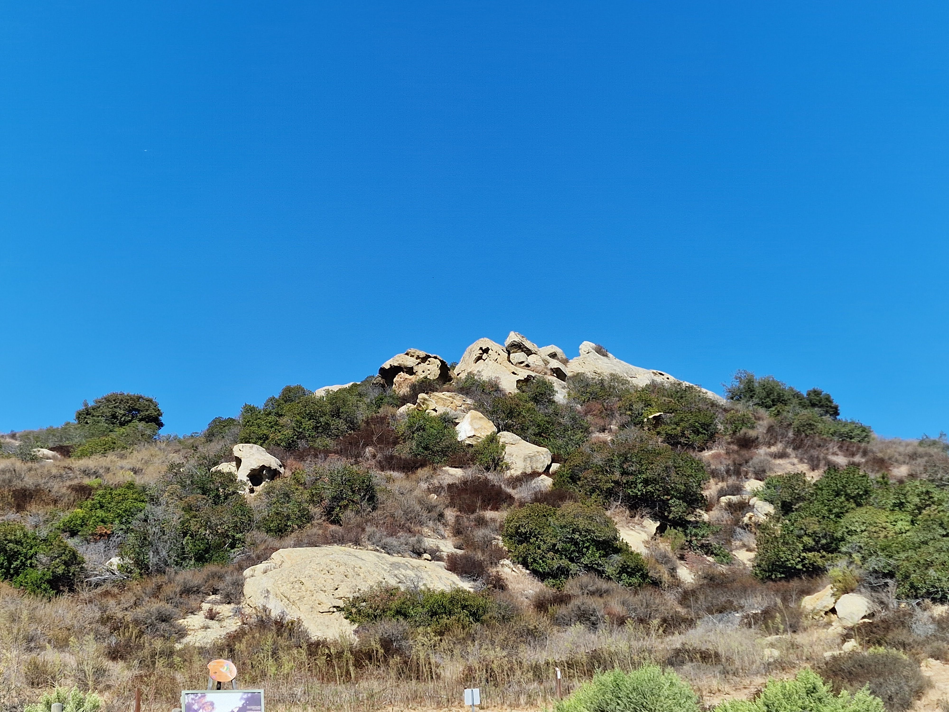
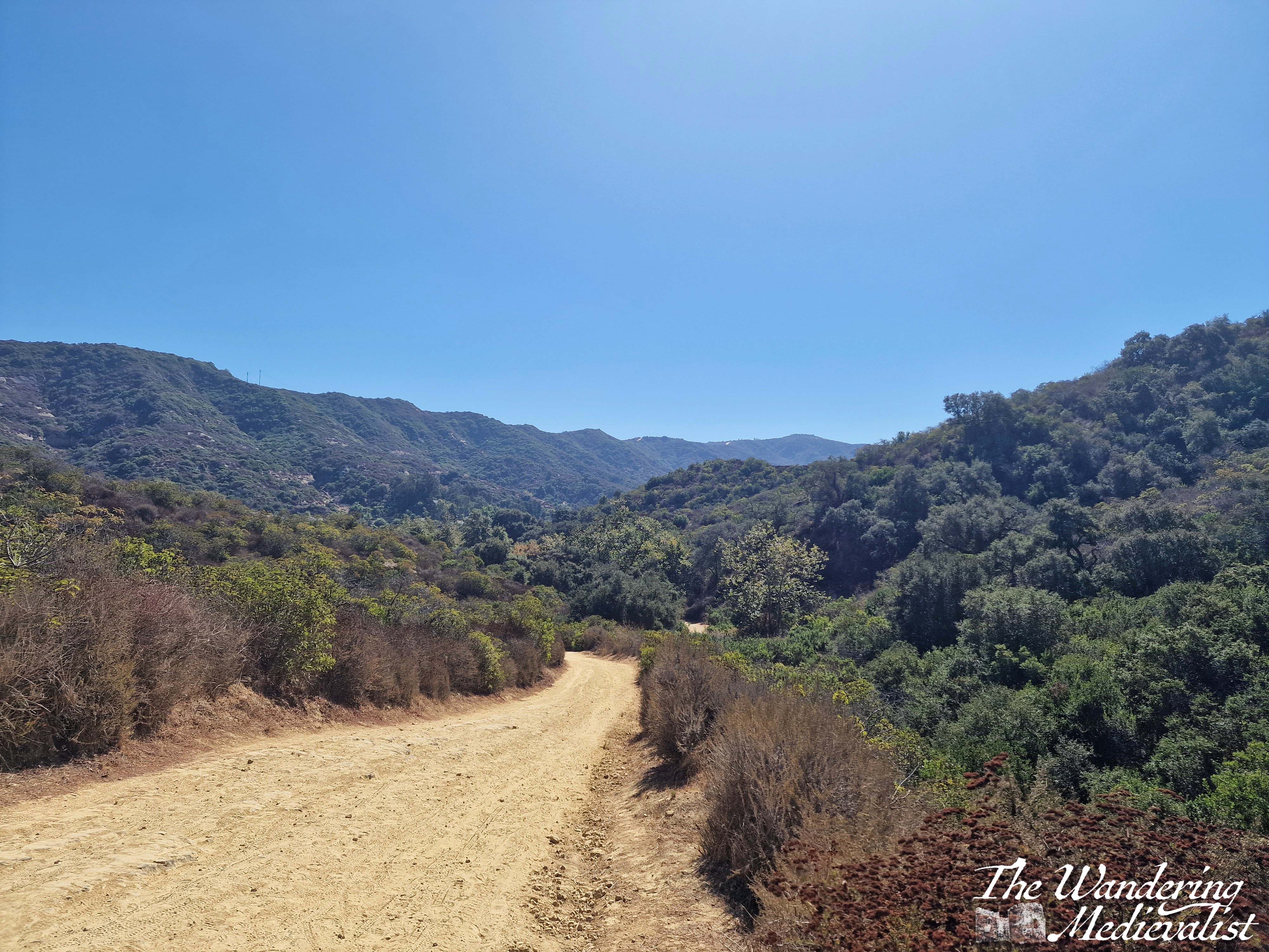
After a quick stop at a local shop to top up my dinner supplies, I headed back to the car and programmed in one of the ‘staging areas’ along Rt 133 that offers parking for the hiking trails. While it was a bit challenging to turn left across the traffic, I made it there in very little time and managed to pay for parking. In a massive shift of biomes, I found myself now in a desert scrub-type area, with the trail dry dust beneath my feet and the hills rising around me a mix of brown-green and just brown rock or dirt. But, I had sunscreen, water, and determination, so despite the sun beating down mercilessly, I set off on what I promised myself would be a short walk on the Willow Canyon trail. I just wanted a viewpoint, and I figured it could not be TOO far to reach one.
I said to the other half later that it felt very much like the start of a story where someone disappears – a hot sunny day, a hiking trail, and no one to miss me for hours if not days. My imagination ran away with me slightly, partly due to heat, but I was far from alone – I passed people every few minutes, so I knew that even if I were to slip and fall, someone would find me in good time. I also had a phone and full bottle of water, and I had no intention of walking more than a mile.
The trail started flat and in shade of some trees, with lovely rock formations off to the right that looked very TV-California.
In little time it curved off to the right and began to climb – a wide, dusty road that was clearly well-used by hikers, bikers, and horses. My fitness was not at tip-top by any stretch but I could see what I thought was a good place to turn around and see the view, ‘just up ahead’. So, I paused several times and availed myself of plenty of water, and kept pushing – up and up past my first ‘I’ll turn back there’ point, as every time I reached one I could see what looked like a viewpoint just ahead.
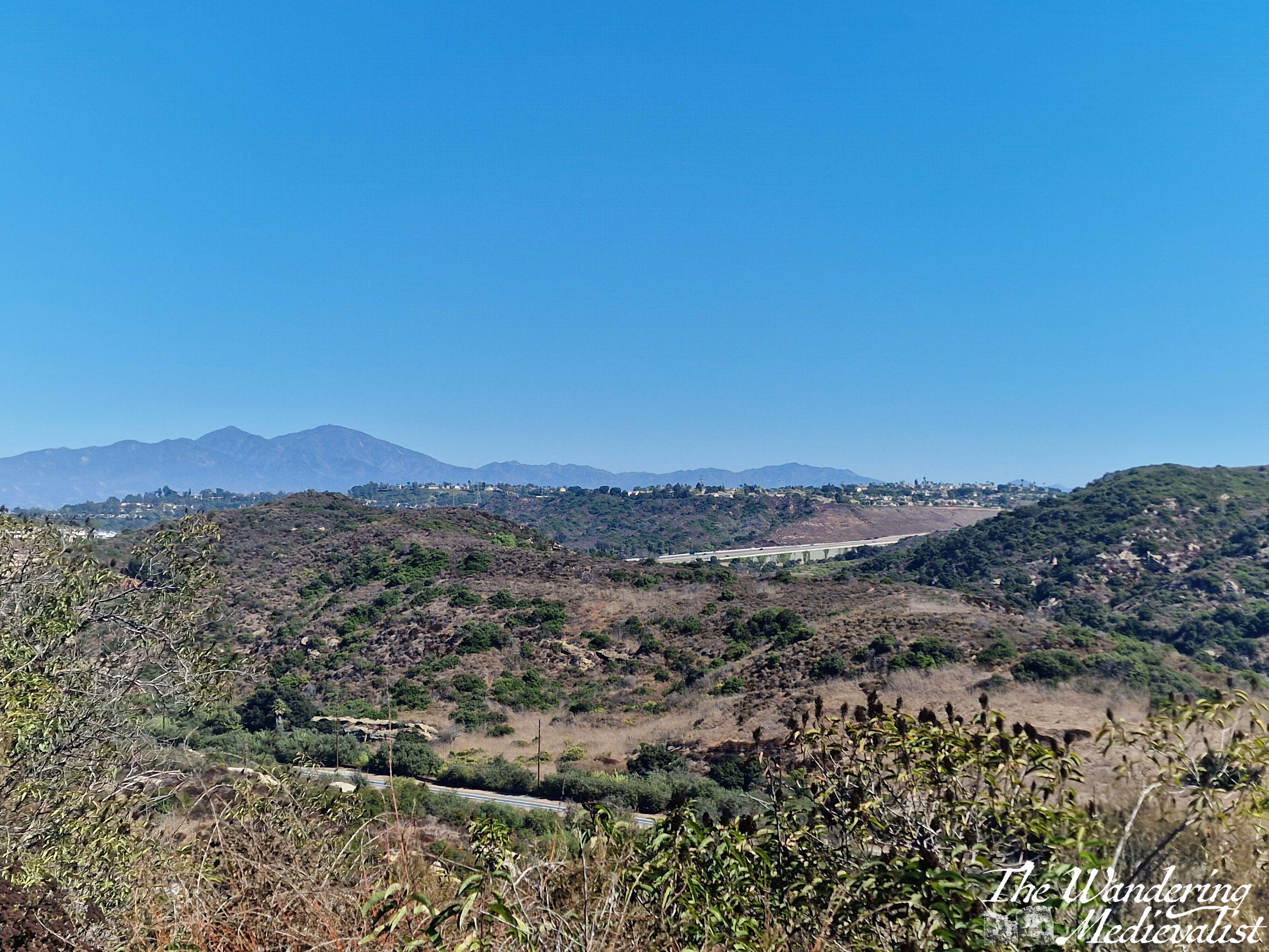
In all fairness, I do not think I hiked more than a mile and a half or so, but it was quite steep in places and the mid-day sun was sapping my strength quickly. I had nearly determined to turn around when I finally caught sight of a small sign indicating a viewpoint up ahead. I pushed a bit further and was far from disappointed when the trail swung around sharply to the left, leaving a stunning view across the valley in both directions. Behind were the hills leading towards the coast, and ahead the hills and valleys that eventually flattened out into the populated areas. In the distance, one can just make out what I think must be Rt 73, which I had driven south a few days before.
The hot, sweaty hike was very much worth the view from the top! And despite my knee injury acting up on my way down, I was so happy and proud of myself for the walk. Plus, there was an ice machine back at the hotel for sore joints…
All in all, it was a fantastic morning that allowed me to release some of my work stress and feel like I had a proper California experience. Travelling for work has its ups and downs for sure – it can be lonely, exhausting, jet-lag inducing, and hotels and hotel food can be depressing. But, it can also open the door for experiences like this one, and another I had in Thailand a few weeks later. A subject for my next post!
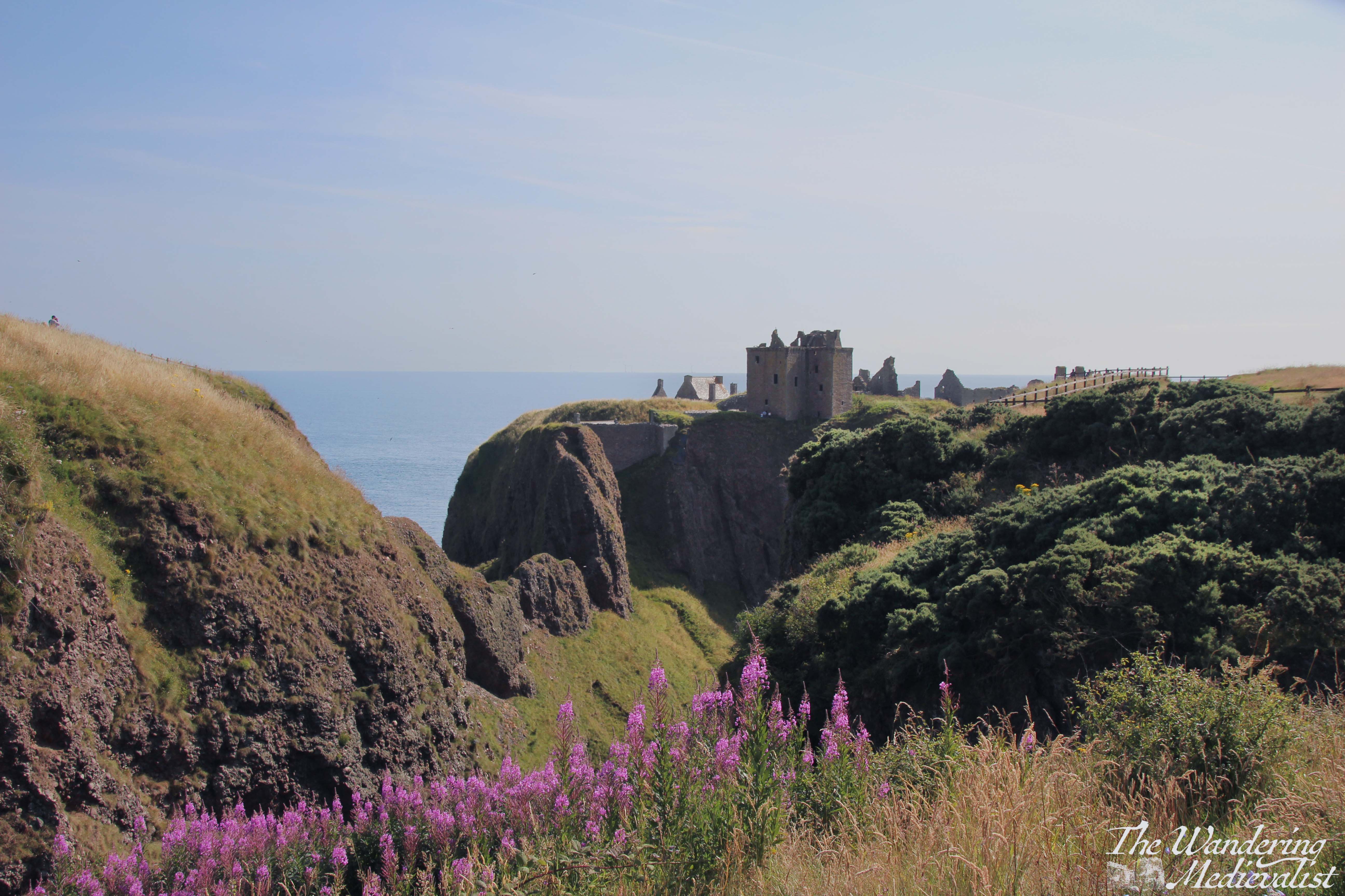
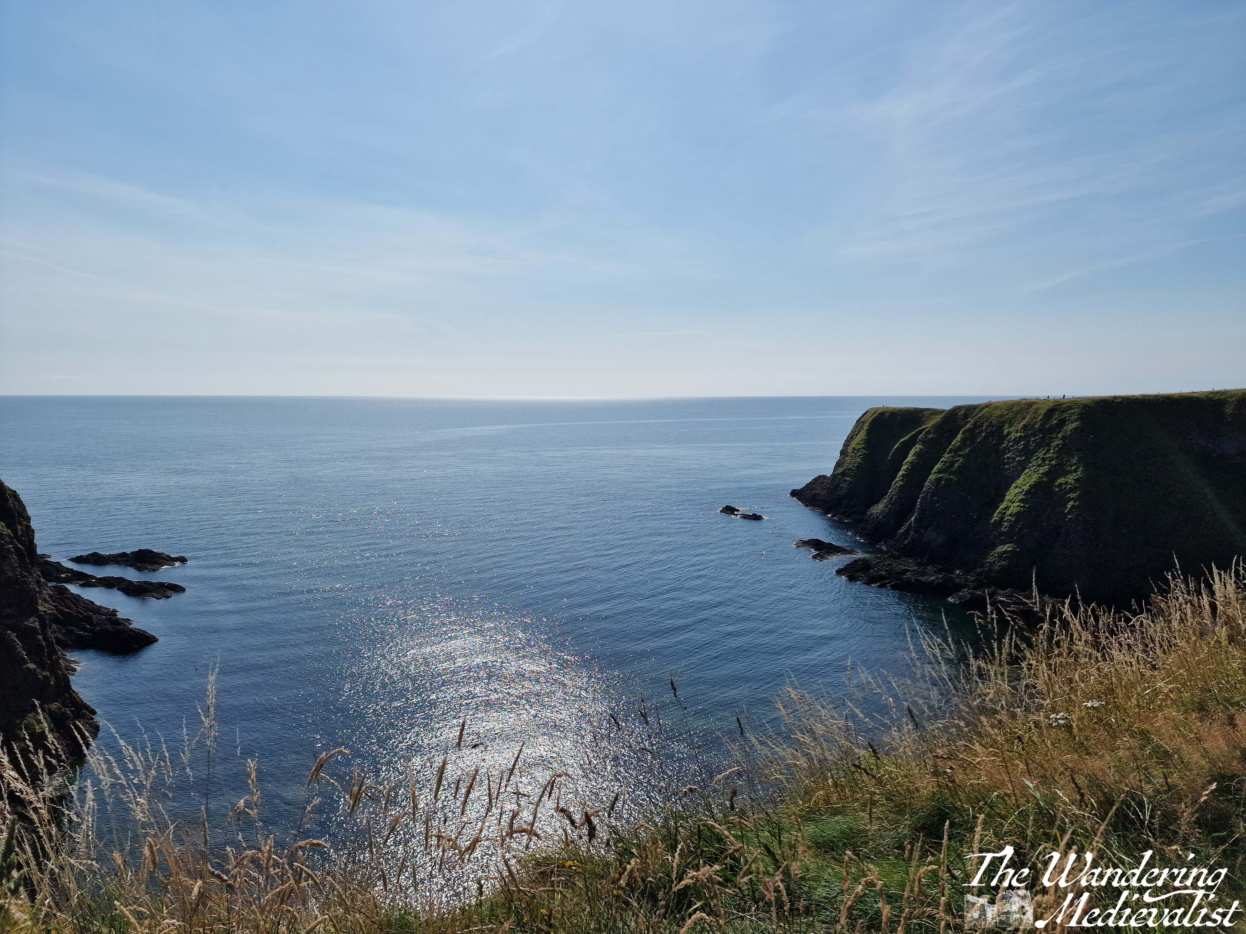
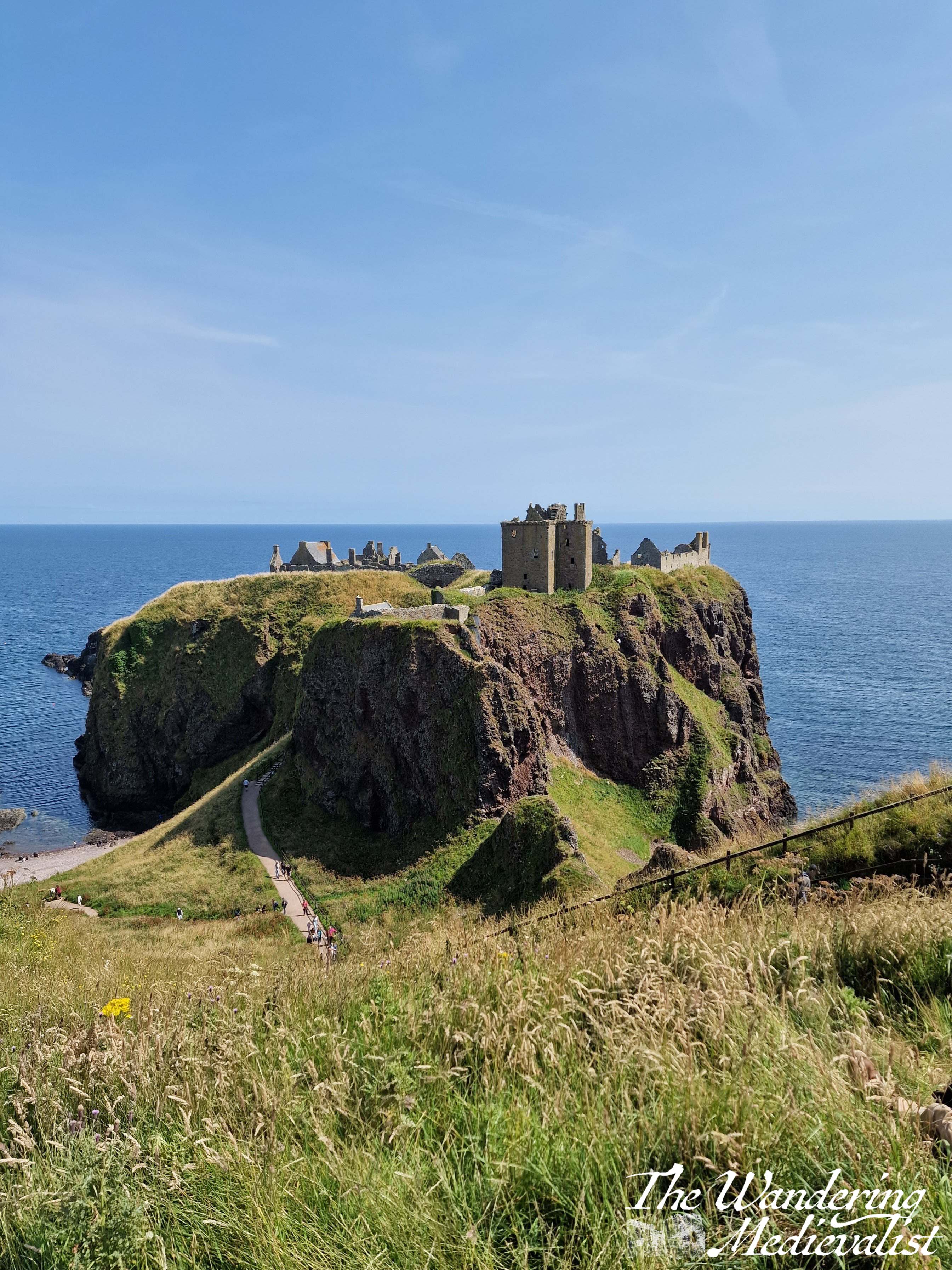
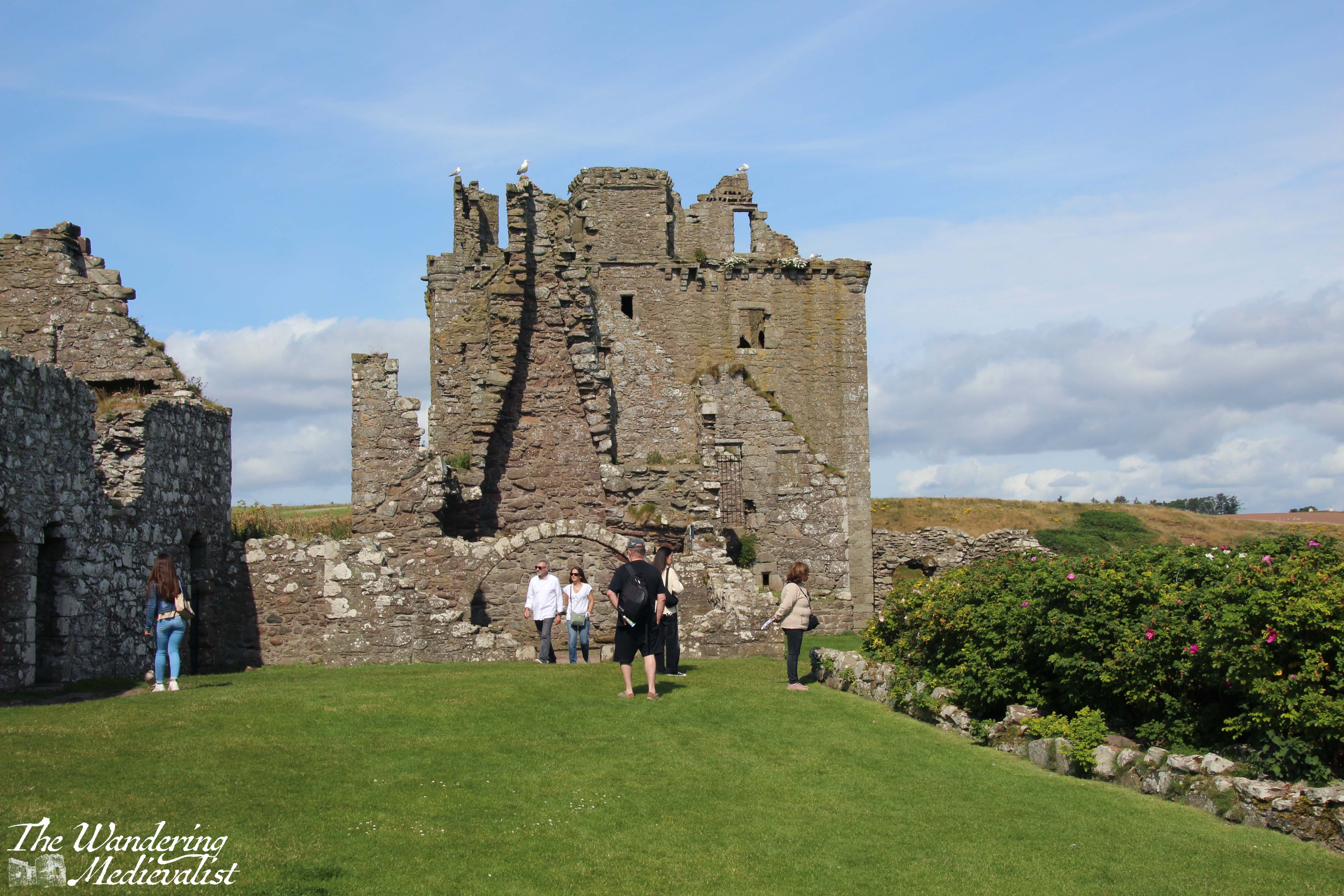
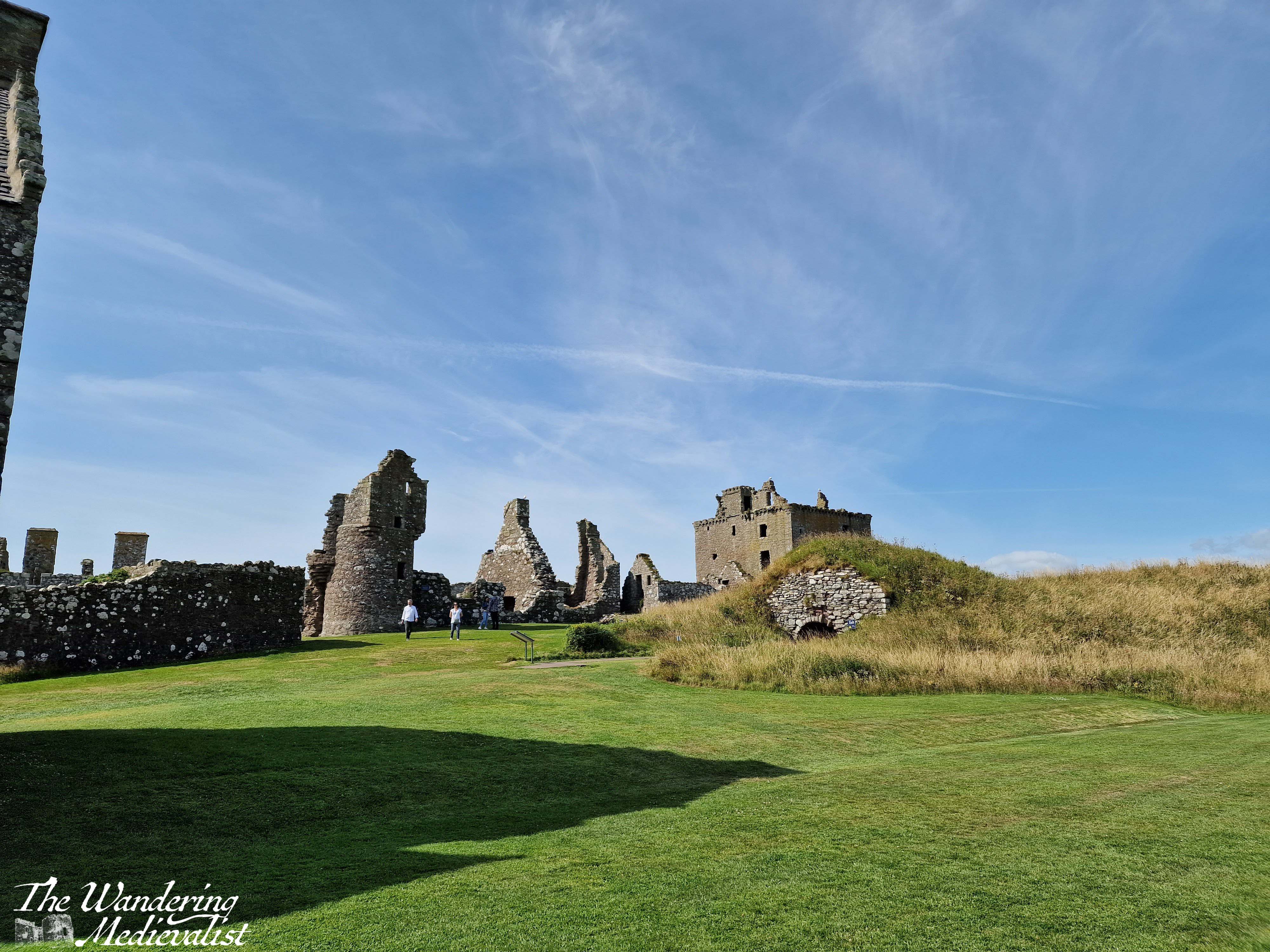
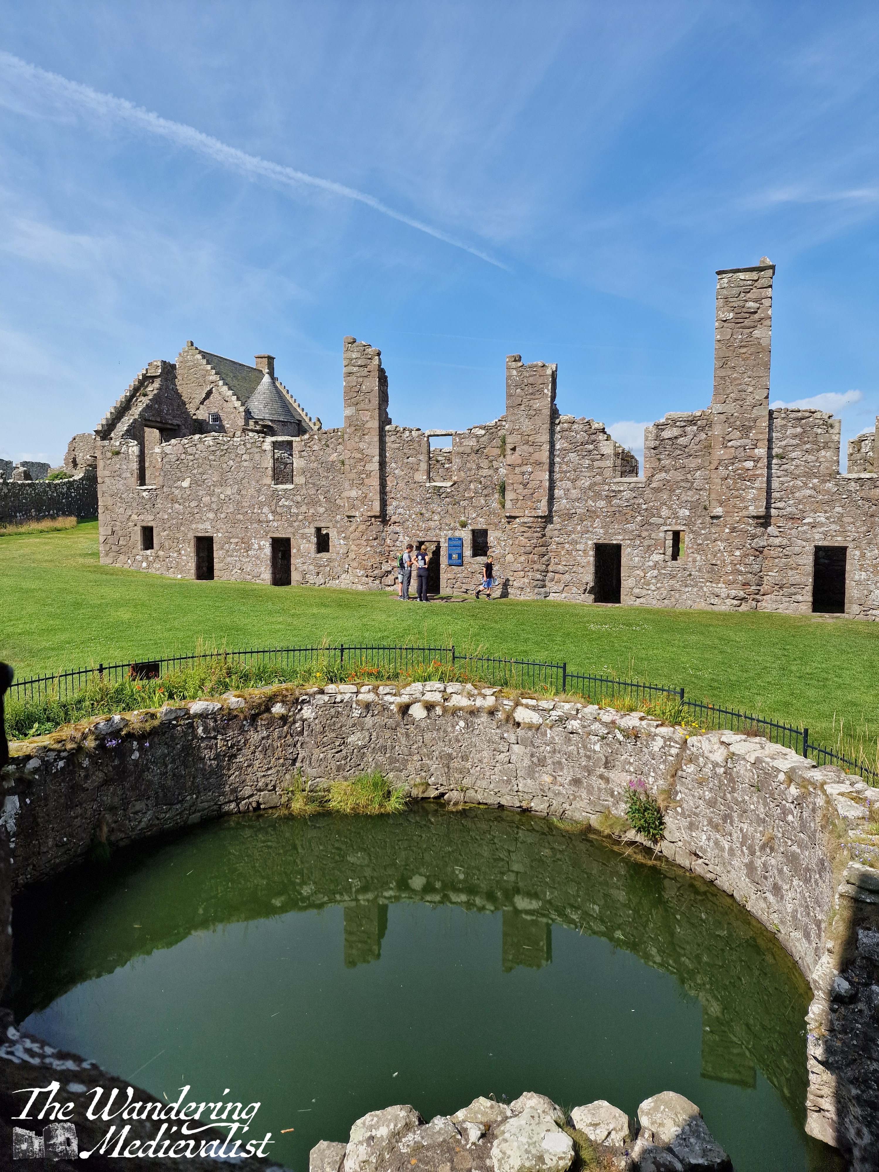
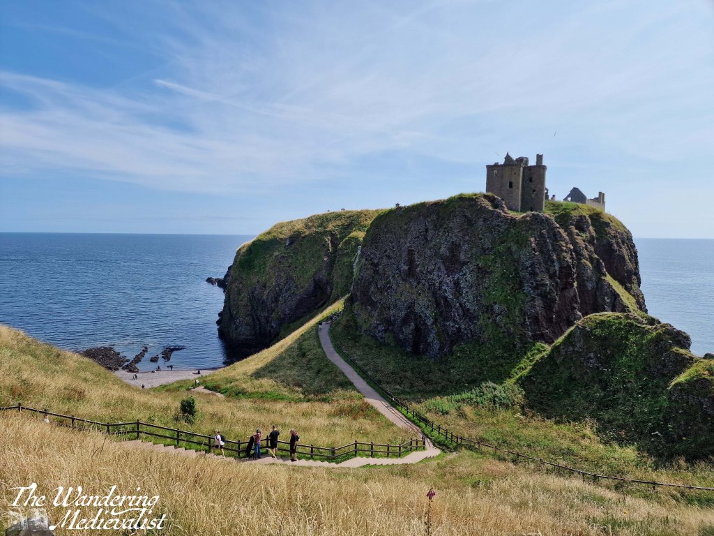
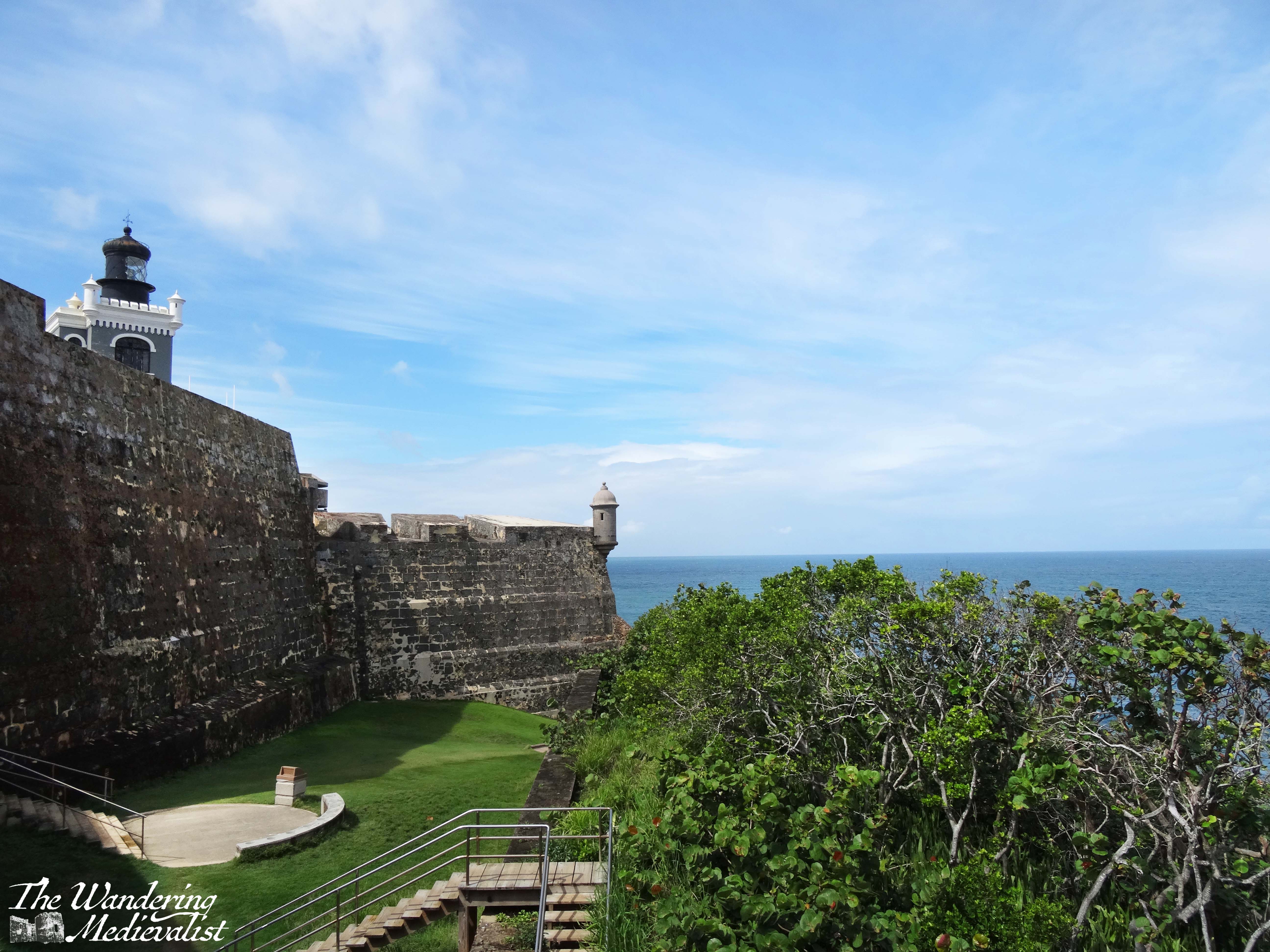
Dunnottar Castle, sitting on the east coast of Scotland on a headland, is one of the most photographed castles in the UK; if you get a standard Scotland calendar, it’s as likely as not to contain one picture of this castle. And for good reason – the partially-ruined castle sits on its own rock surrounded by the sea, silhouetted against the sky and Aberdeenshire cliffs. Like Edinburgh, it is a castle through which one can see the passage of time, the periods of history in which it was used and built. The keep and entrance are thoroughly medieval, but the North, East and West ranges are all varying degrees of late medieval and modern.
Dunnottar is most easily accessed by car, but if you are trying a carbon-friendly tour of Scotland, you are still in luck. You can either walk up the seacoast from nearby Stonehaven, about 1.5 miles – though prepare for a few good climbs and wear sturdy shoes – or you can get a local bus to the end of the road, about half a mile. I am not sure how often these busses run, however, so definitely keep an eye on the schedules. My mother and I first visited more than ten years ago, though I cannot recall how we actually reached the castle as we were definitely without a car; I have a feeling we actually took a taxi from Stonehaven train station, so that may be another option.
Tickets for the castle are purchased once you make it inside the fortress, so in theory one could visit and walk along the coast to see the castle from a distance, but for free. The opening hours vary by time of year, but are up to date on the castle website, where you can also buy tickets in advance.
There is a good-sized car park with a porta-loo and a very good catering van that sells drinks, ice cream, chips and rolls with bacon, burgers, hot dogs, or haggis. There may have been a vegetarian option, but I am not positive.
The adjacent picnic benches are visited regularly by scores of sparrows living nearby, and they are quite tame, hopping right up to you for a few crumbs or a piece of roll.
From the car park, visitors start off down a wide path lined with thistle and wild roses, with the castle slowly rising on the horizon ahead.
One has an option to go left along the coast, right across a few small bridges to a viewpoint, or immediately to the castle. I recommend, to get warmed up, a jaunt along to the right first, where you will go down and up a few sets of stairs and path as to move along the cliff. This path is also lined with Scottish fireweed (purple flowers) and gorse, and there are several excellent places to pause for a picture.
The viewpoint itself allows for gorgeous pictures – as one would expect – of the rock on which the castle sits, the coast, and the sea. From here you can also get a good feel for the staircase awaiting you to access the castle.
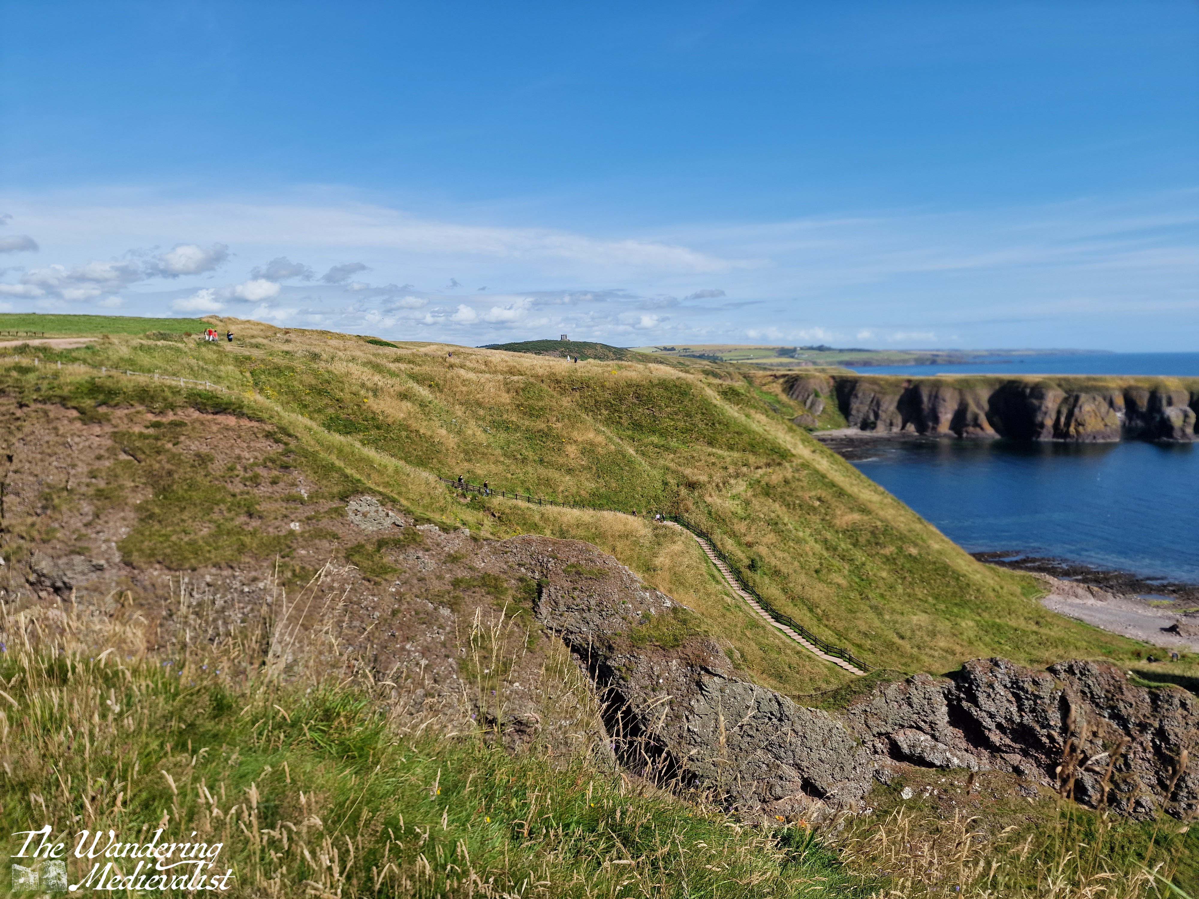
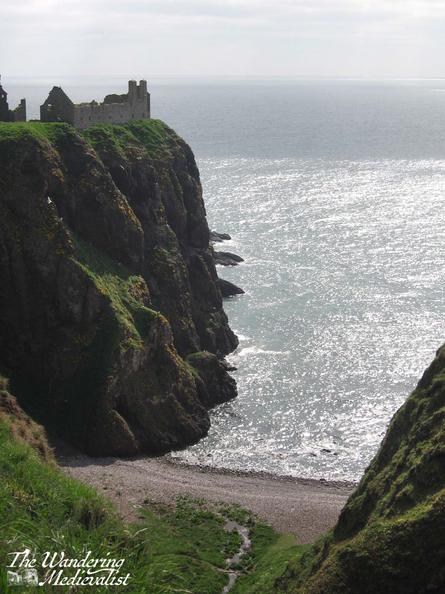
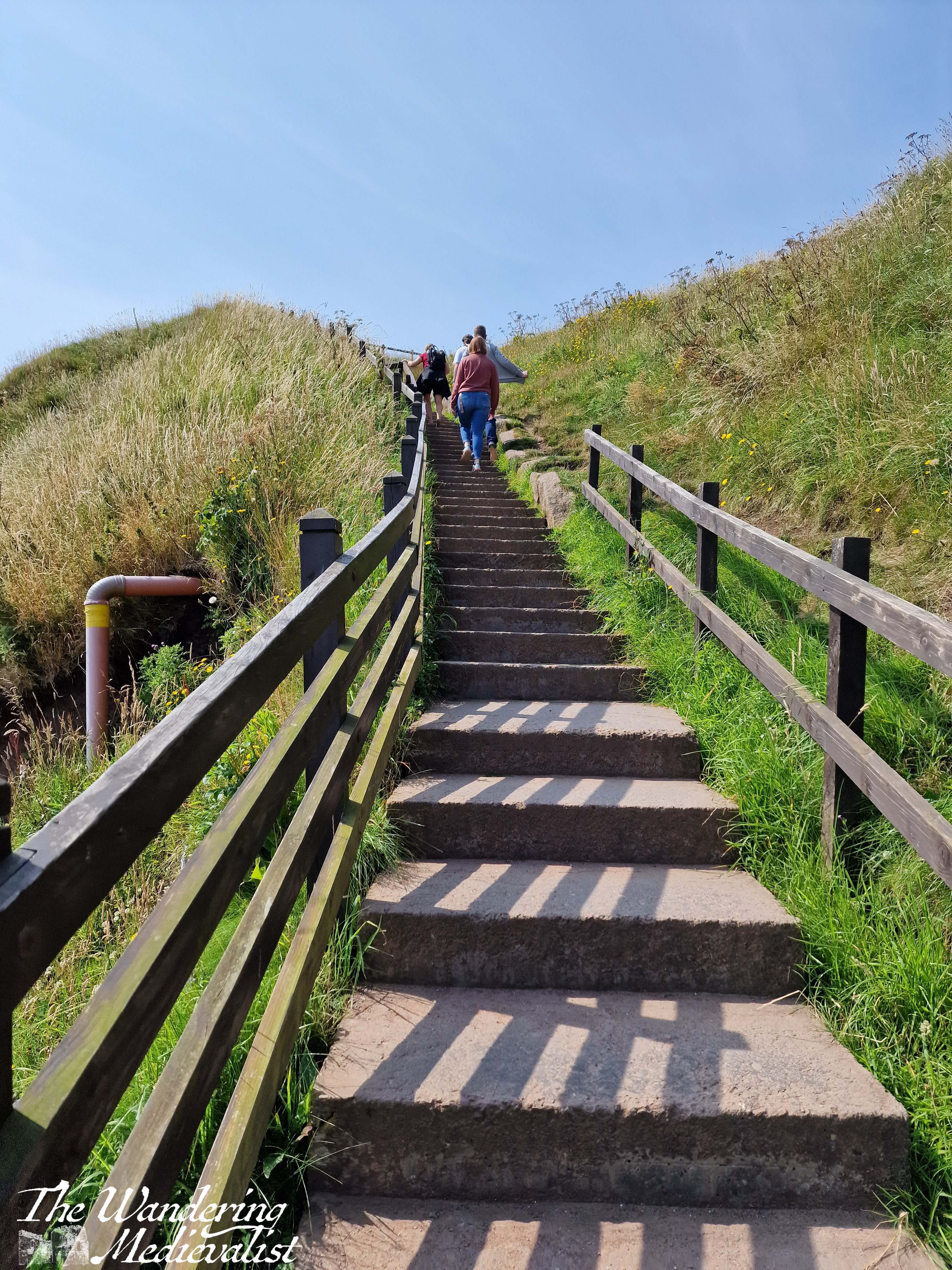
Once you have had your fill of this particular view, you can continue along the coast quite a bit further, or you can head back down and up to the point you started, looking over the castle and bay. From here, you must descend what must be around 100 steps, zig-zagging down the steep hillside towards the beach. The stairs are wide enough for two to pass and have a solid railing, plus at least one bench at which one can take a breath. This route also offers some excellent views, though it’s hard to stop for long when there is a queue of people behind you waiting to get down, or up.
The bottom of the staircase offers again two options – you can scamper off left to explore the beach, or go straight ahead to the castle. Here one finds another set of stairs, though first you have a good view of the rock on which the castle is built, including a gated cave and the land bridge that once connected the castle to the coastline but was eroded for security.
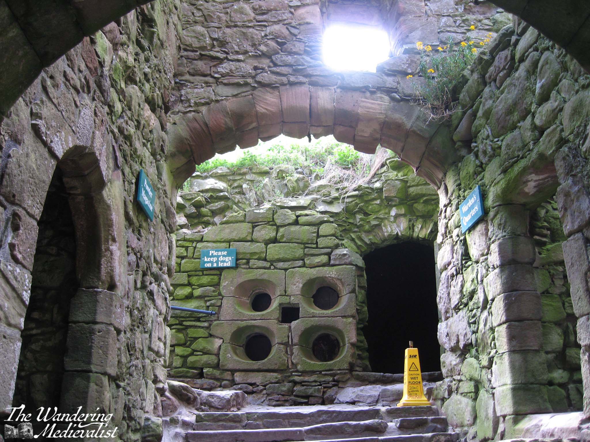
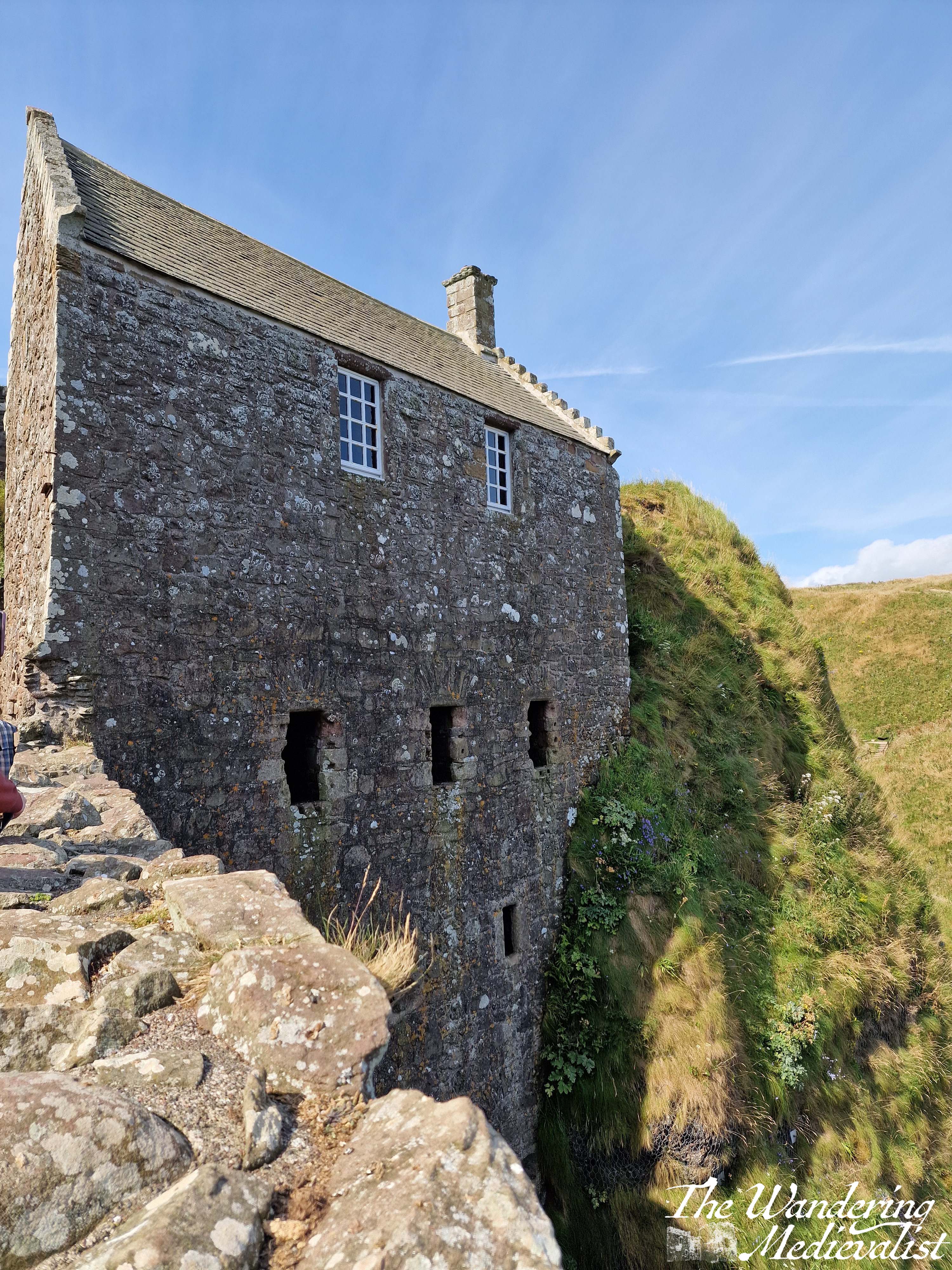
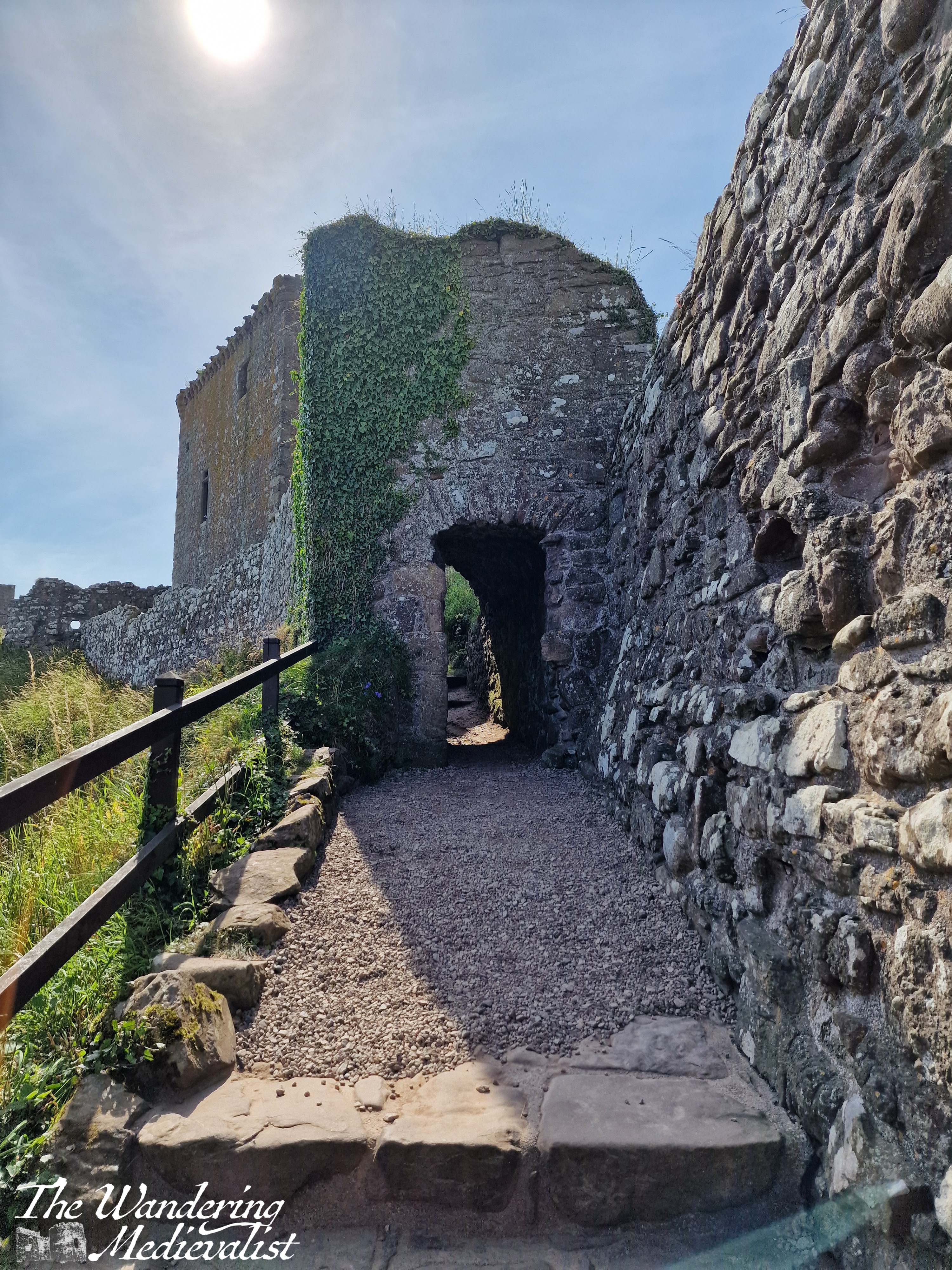
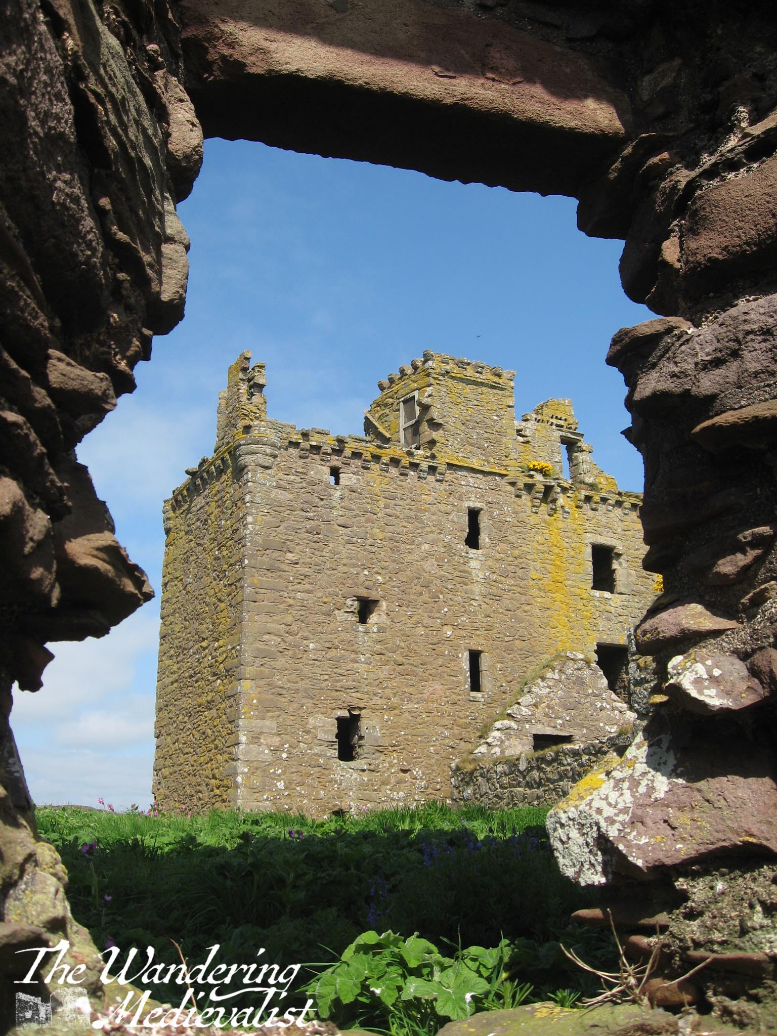
Stairs take you in a postern gate type of entrance, and then up through the gatehouse to where you buy or show your tickets. From the ticket office, there is a well-marked route climbing up through the castle, past Benholm’s Lodging, a structure clinging to the edge of the rock. The top floor is a comfortable enough room, while the lower levels are all designed to aide in defence of the castle with numerous arrow loops.
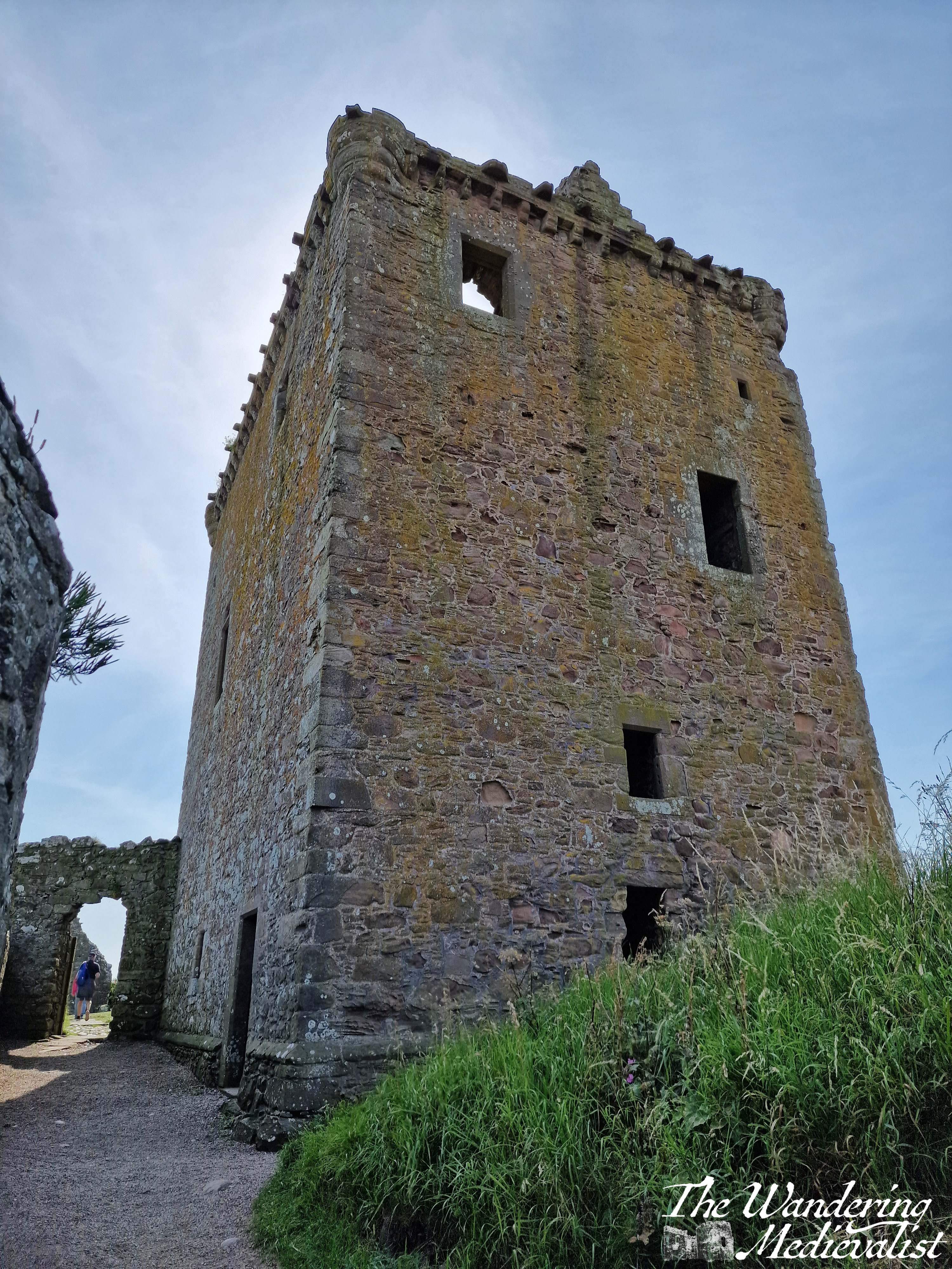
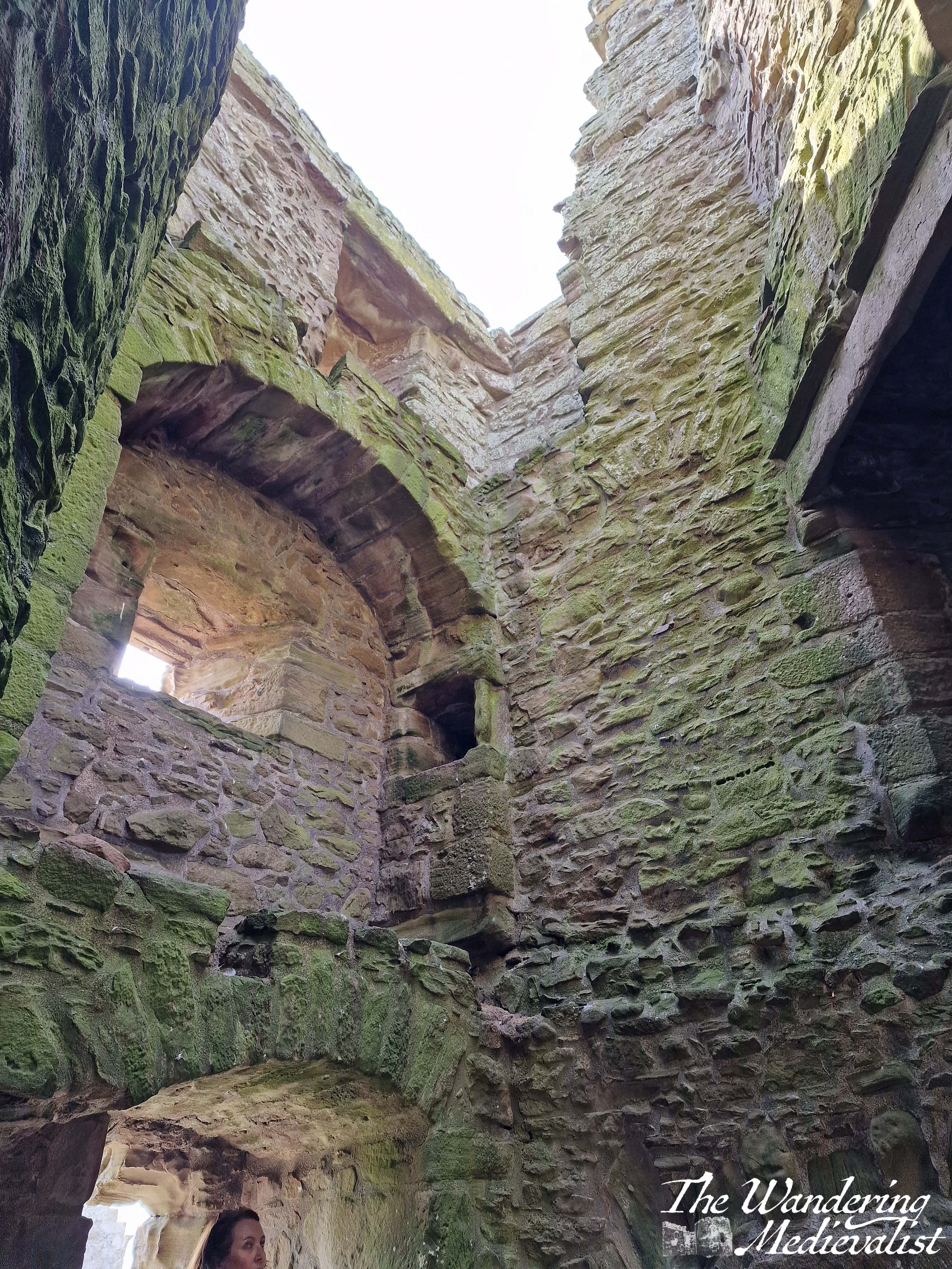
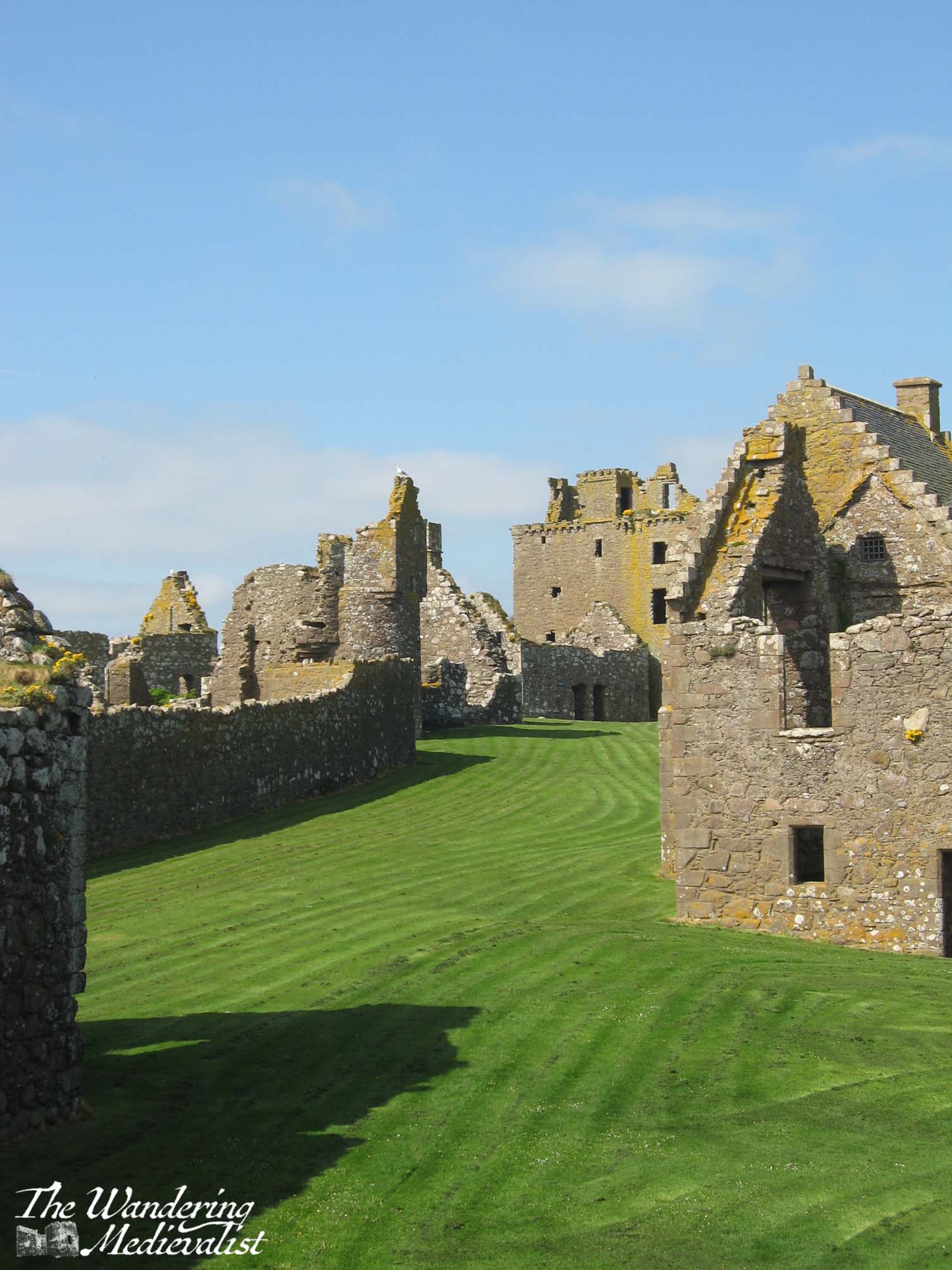
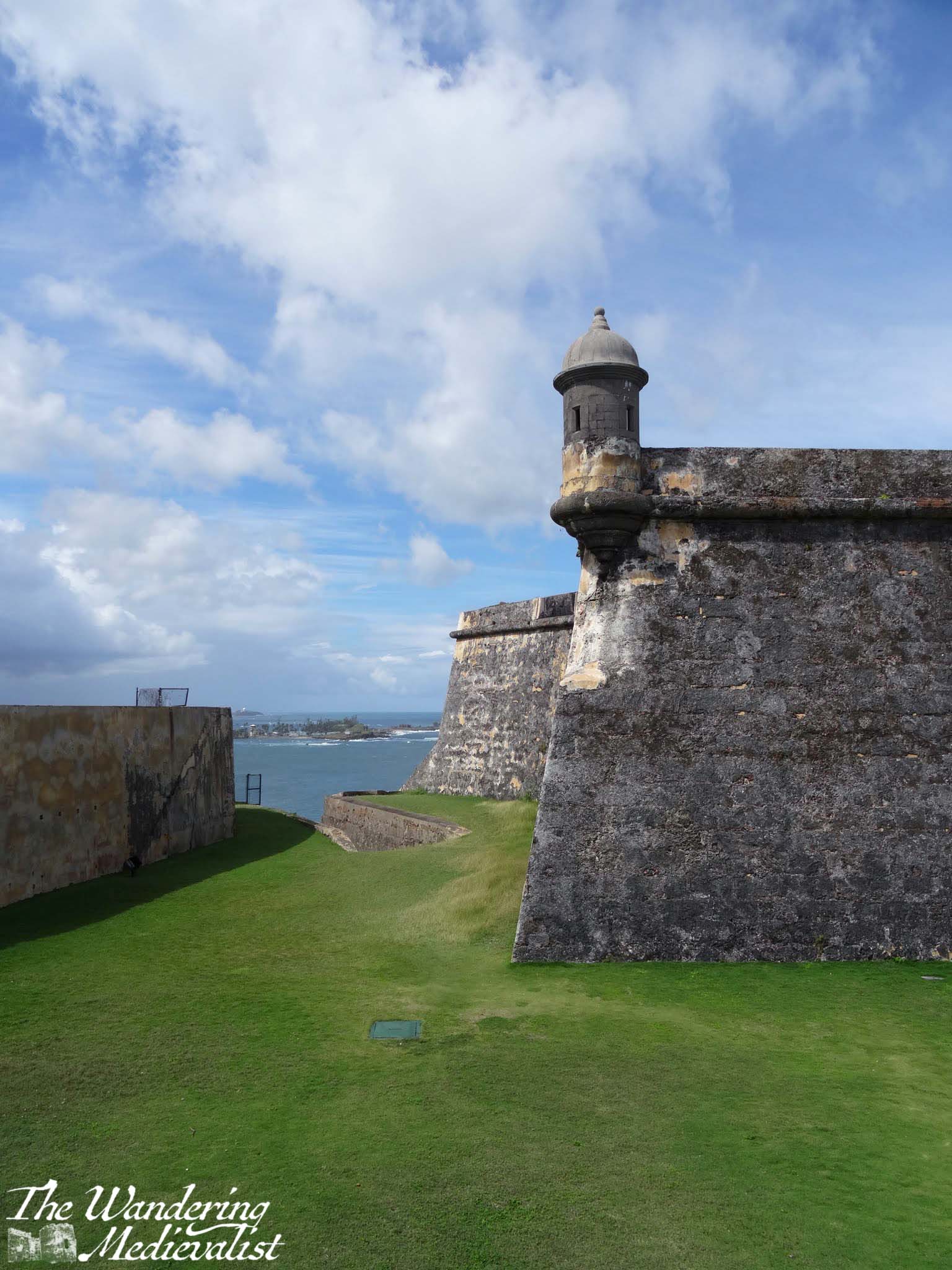
Another short climb through a pends – covered passage that make you very pleased you are not storming the castle – and finally in front of you rises the medieval keep, strong and square and emblematic of high medieval Scottish construction. The keep was constructed in the 1390s by Sir William Keith, Great Marischal of Scotland, a hereditary post held by his family and one of great importance to the governing of the kingdom. Quite well preserved, the keep hosts a large kitchen hearth on the bottom floor and a rare straight stone staircase leading to the second floor. Here you can look out over the rest of the castle or the beaches beyond.
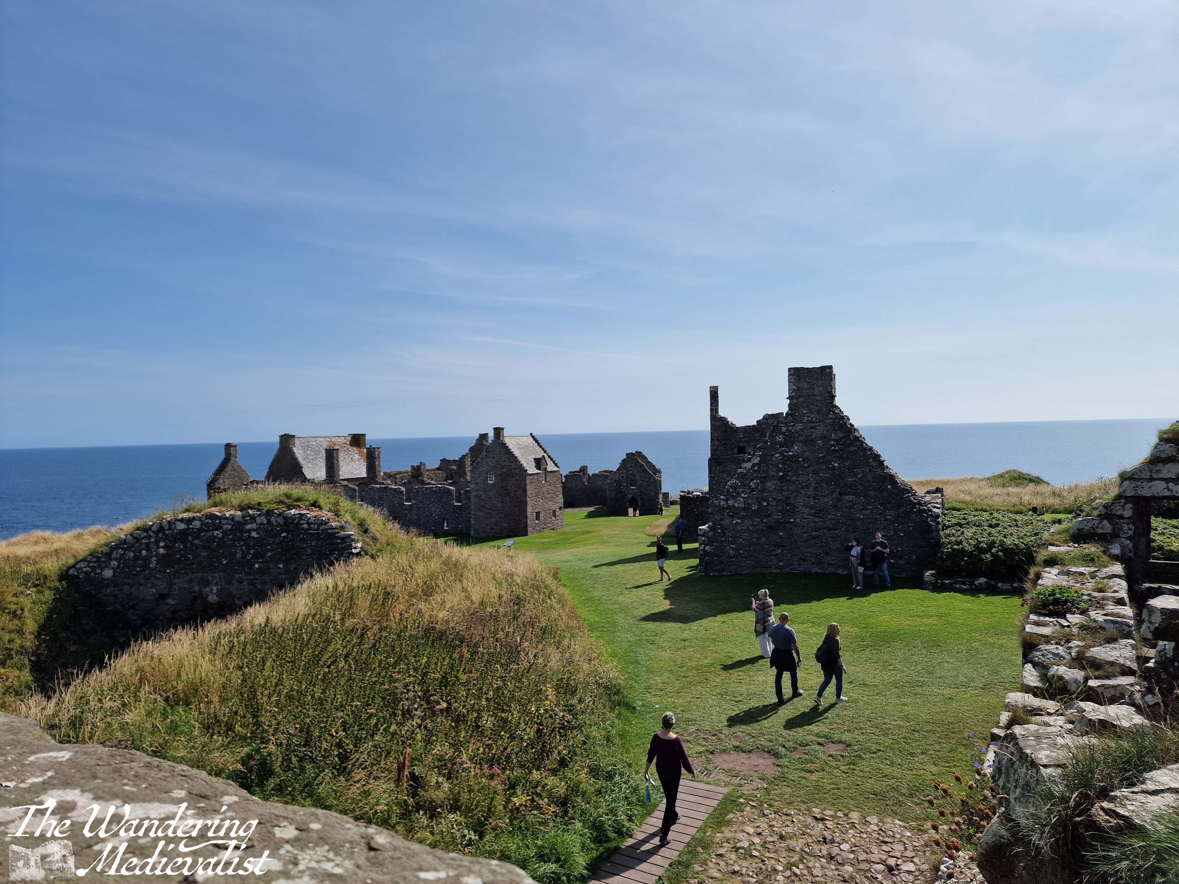
Once you have fully explored the keep, you will find countless other structures in various states of ruin from the storeroom and stables to the increasingly less-medieval ranges built through the early modern period. There is a cistern for water and probably fish, several residence blocks and the old chapel.
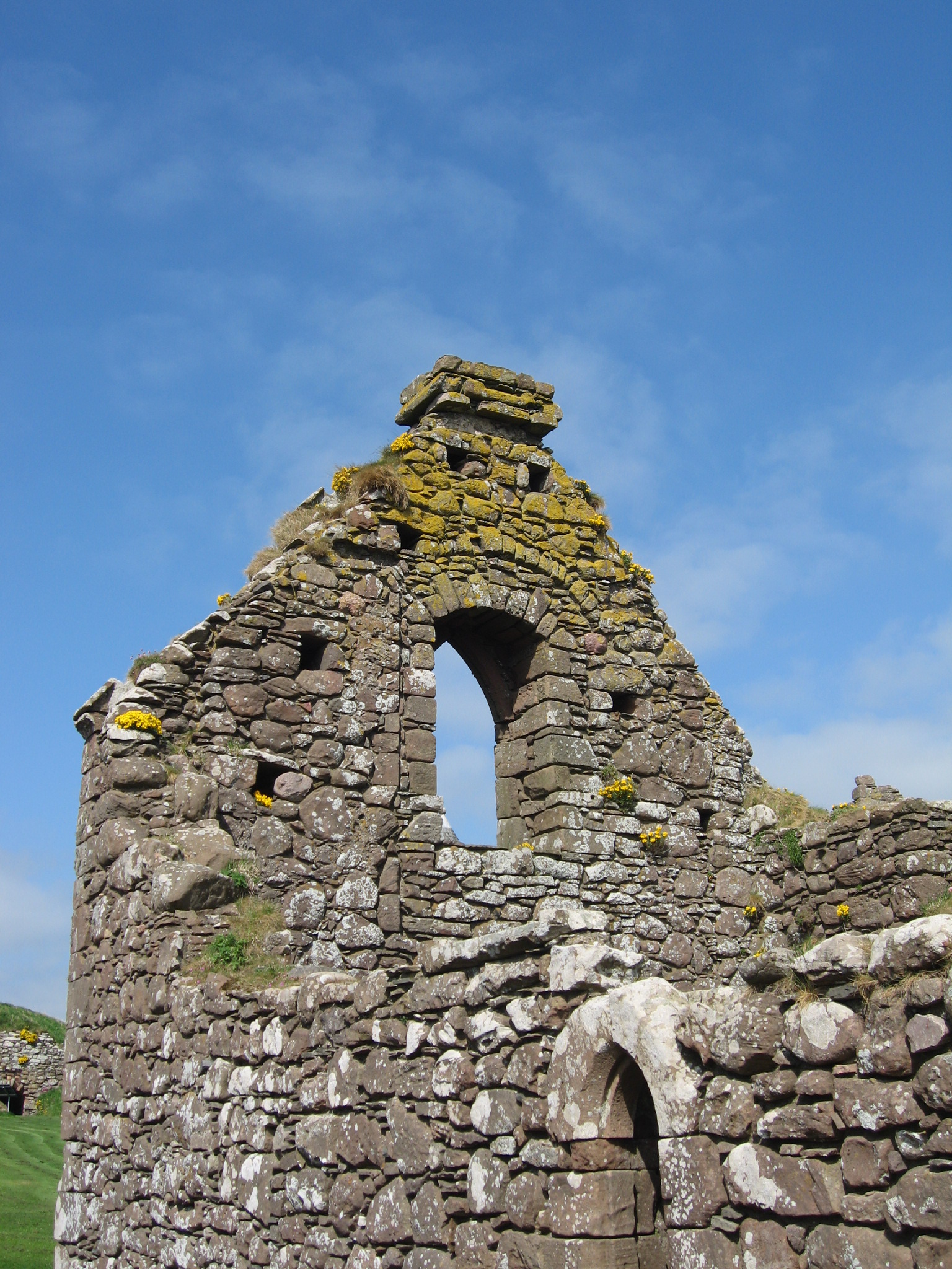
The chapel is key to note, as it is one of the oldest structures; consecrated in 1276 by William Wishart, the Bishop of St Andrews, it probably replaced a much earlier chapel to St Ninian, a missionary saint who is very popular in Scotland. The site of Dunnottar itself was likely inhabited as early as the fifth century by the Picts, and it was a religious site in the early Middle Ages, meaning that the construction of a defensive castle caused some upset. The pope even became involved in the dispute. Poignantly, the land that was graveyard is now mostly grass, with only one marker remaining.
The chapel may have been the site of a massacre of the English by William Wallace in 1297. Blind Harry, Wallace’s often unreliable biographer, relates that English soldiers had fled to Dunnottar for sanctuary – validating the site as a religious one – but that Wallace set fire to the chapel, burning many soldiers alive. The survivors were run off the edge of the cliff. The brutal story may not be completely true, but the may have gotten the gist of things.
A more complete history and many details can be found on the very helpful website for the castle.
A few highlights include a stay by Mary Queen of Scots – where didn’t she stay in Scotland? – and the protection of the Honours of Scotland (the royal regalia) during the invasion by Cromwell in the 1650s. One can spend a very pleasant time just sitting on one of the many benches and enjoying the view, over the sea or the castle grounds, which are impeccably well-kept.
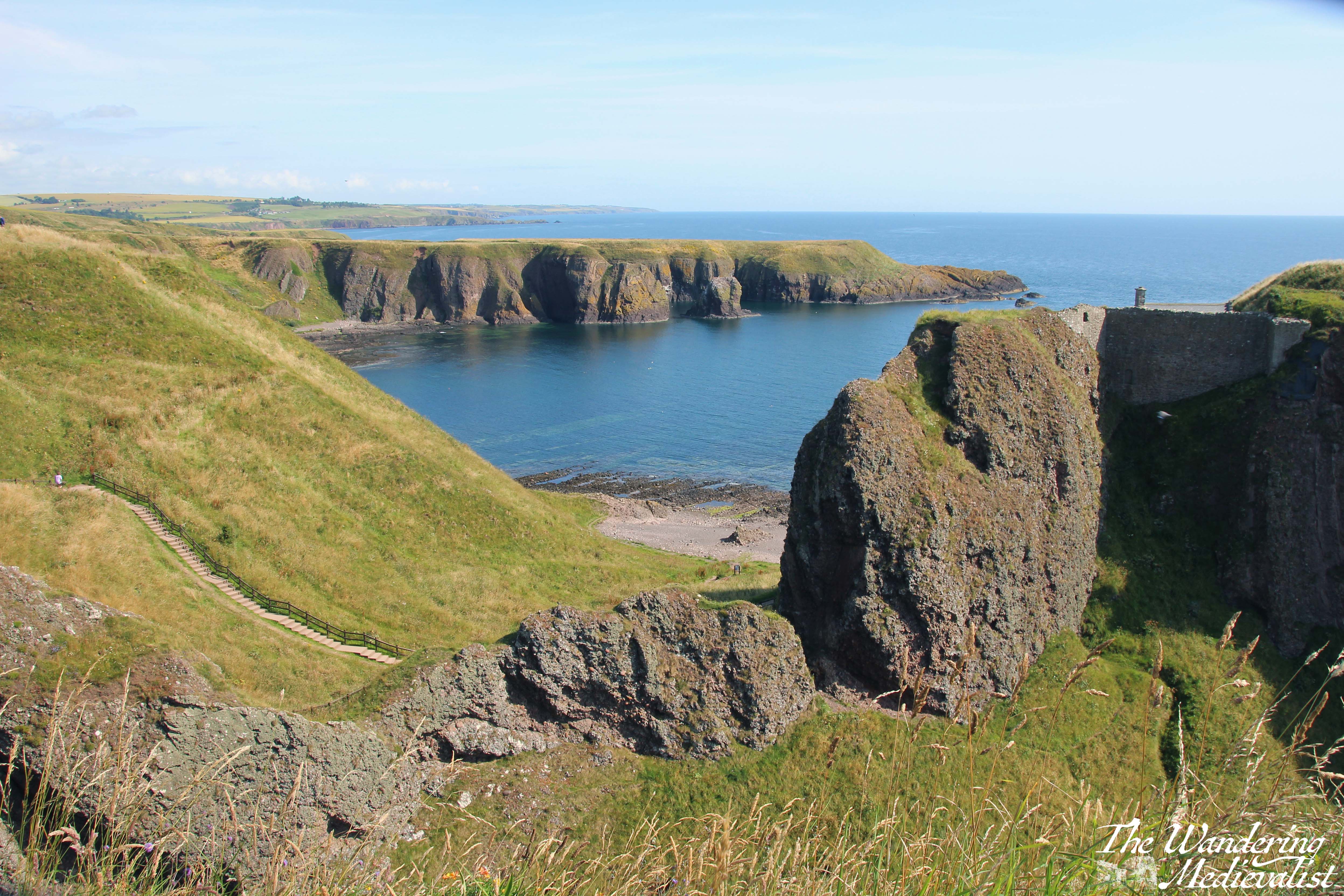
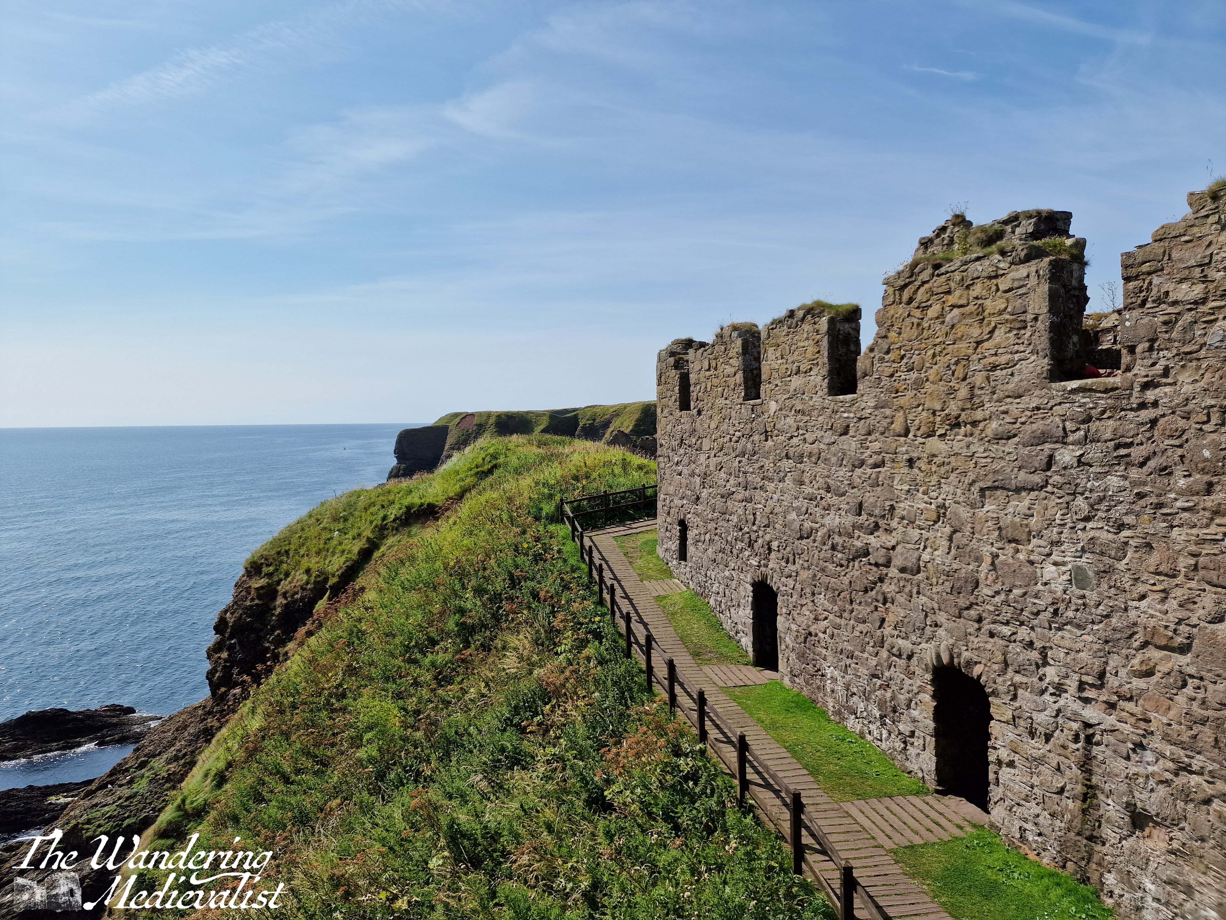
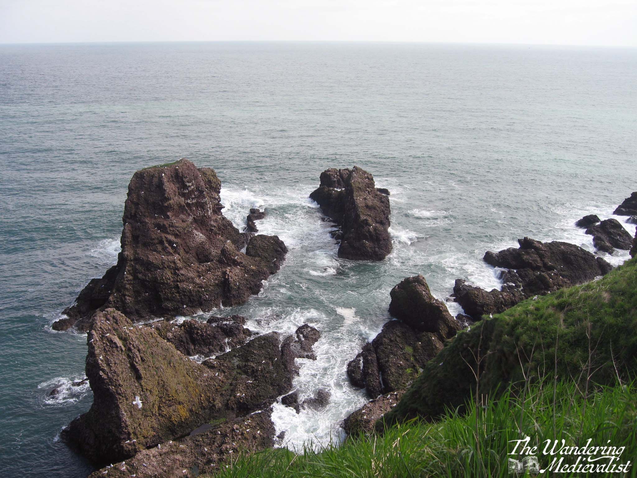
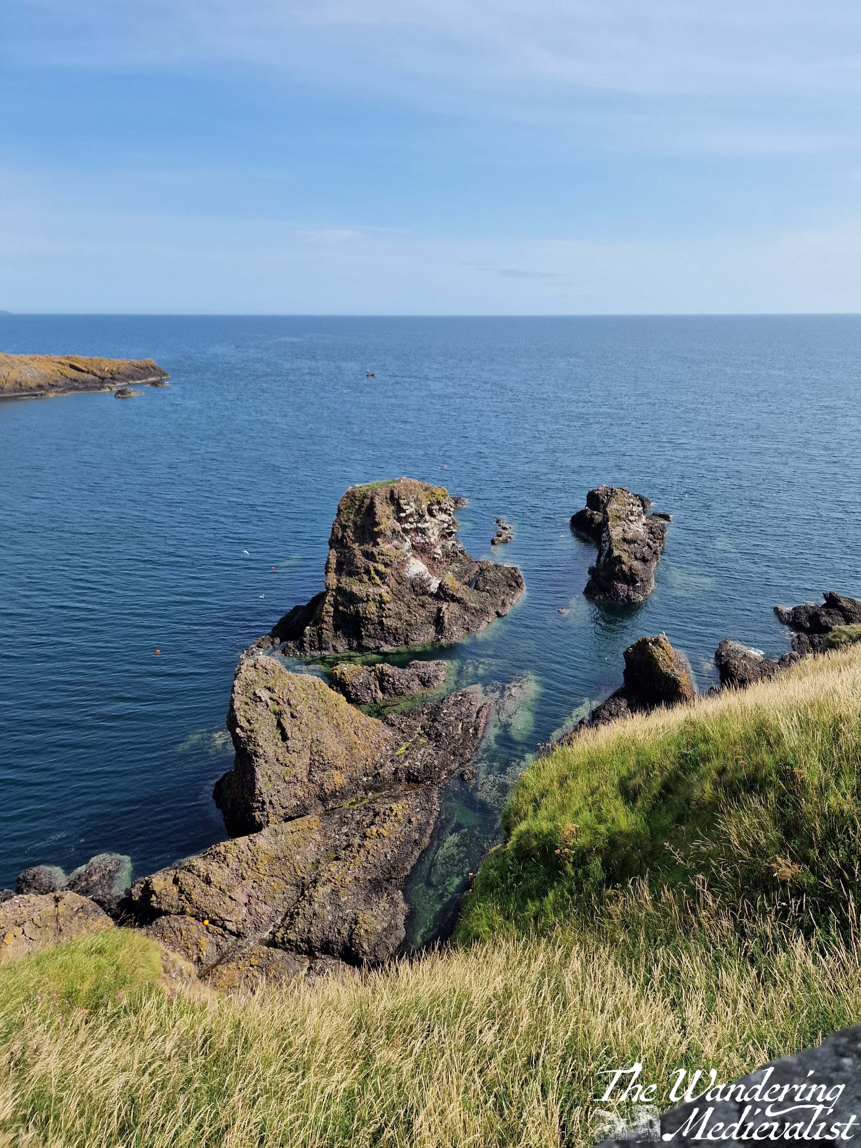
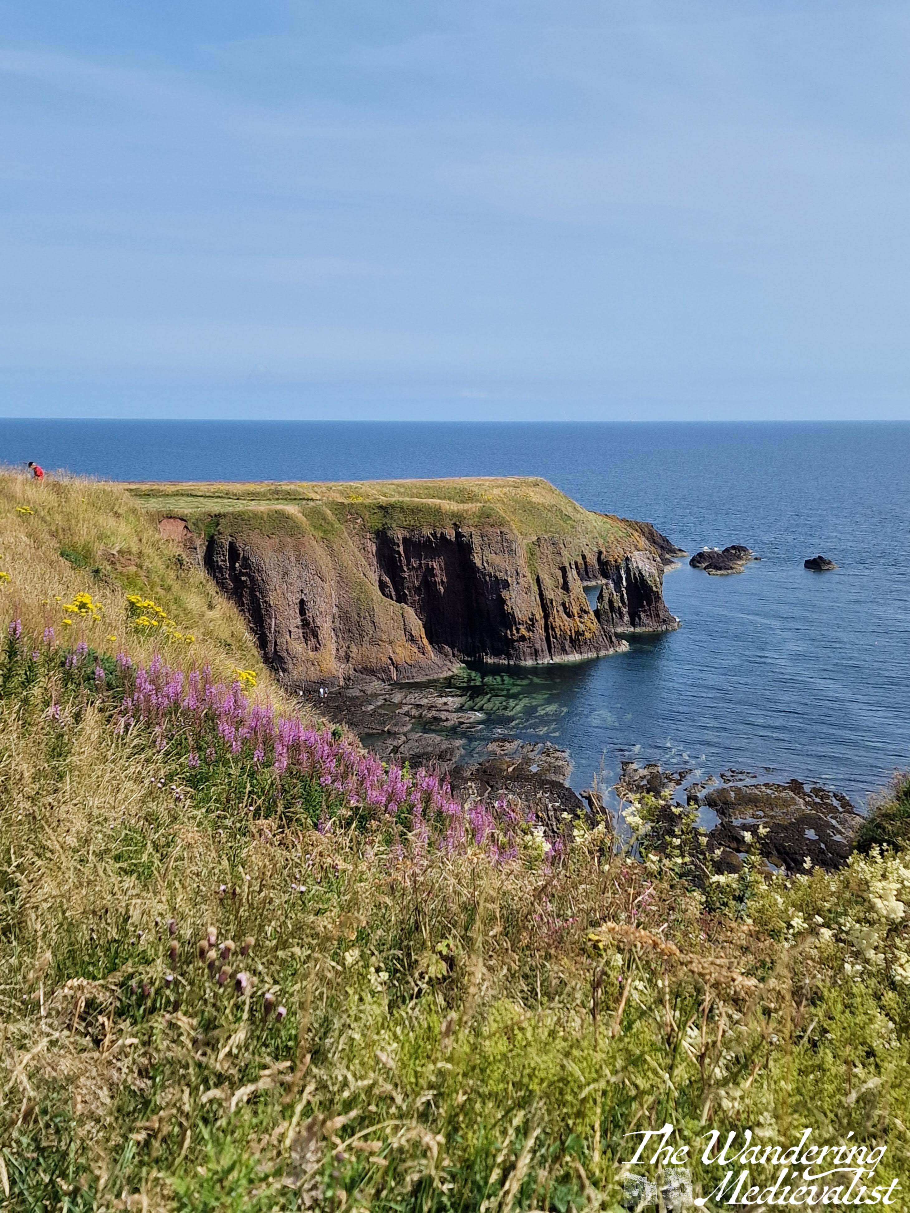
Another option is to walk essentially around the edge of the rock, where you can enjoy the views down over a tremendous rock formation, and along the headland.
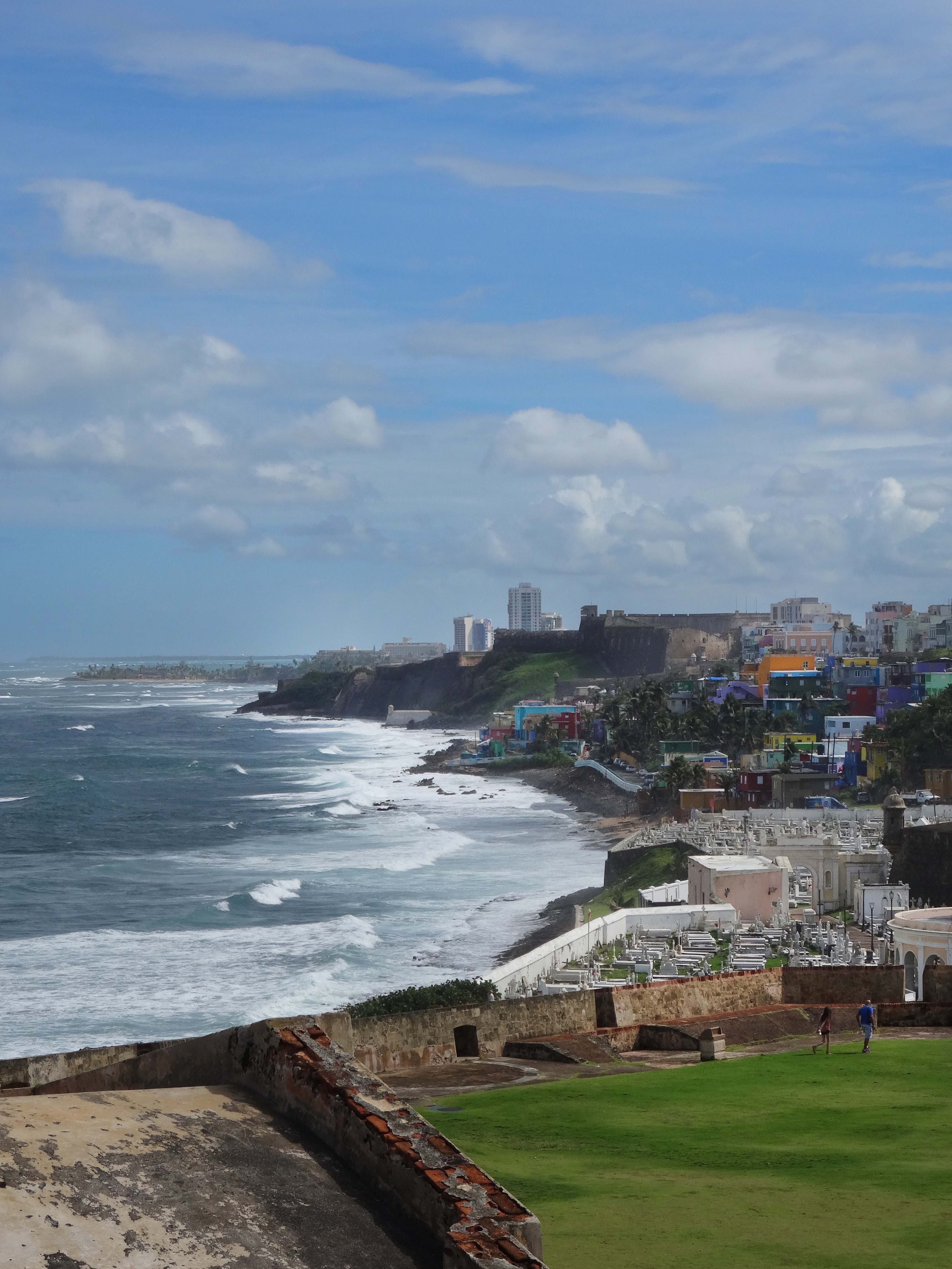
In all, you could easily spend several hours exploring the many nooks and crannies. The group I was with scattered to all corners of the castle, and it was lovely to sit in the sun and gradually wait for them all to drift back again, with various stories of things they had seen. Once we had traversed the stairs once more, we chose to walk along the cliff in the Stonehaven direction for about a mile, with the ocean and views of castle on one side and fields of cattle on the other.
This view really shows you the path down and back up to the castle, as well as the eroded natural land bridge..
There are a few caveats to visiting this castle – caveats may really be too strong a word, more things to be aware of when planning:
Firstly, as you have doubtless gathered, it is not particularly accessible. There are lots of steep steps just to get to the castle, and more inside as you ascend through the pends. Secondly, any refreshments you may want in the castle itself must be brought by you. This is of course quite reasonable, but considering the physical effort to traverse the stairs, it is worth remembering a water bottle. That said, the toilet facilities are limited, with only two stalls for the women and one for the men, I believe. At several points there was a bit of a queue – not a problem at all if you are prepared, but definitely worth knowing ahead of time. The one final disappointment to castle aficionados is that there is no shop selling merchandise, postcards, etc., though this is no doubt because the castle is owned and managed privately. Guide books are available at the ticket office at a very reasonable price.
Overall I’d say that the castle is not quite as suited for an onslaught of tourists as some others I have seen, but it is absolutely worth making the effort, especially if you are prepared!
We have had a rough few weeks here in the Wandering Medievalist house, but I am excited to get back to writing, not in part as a catharsis and way of moving forward.
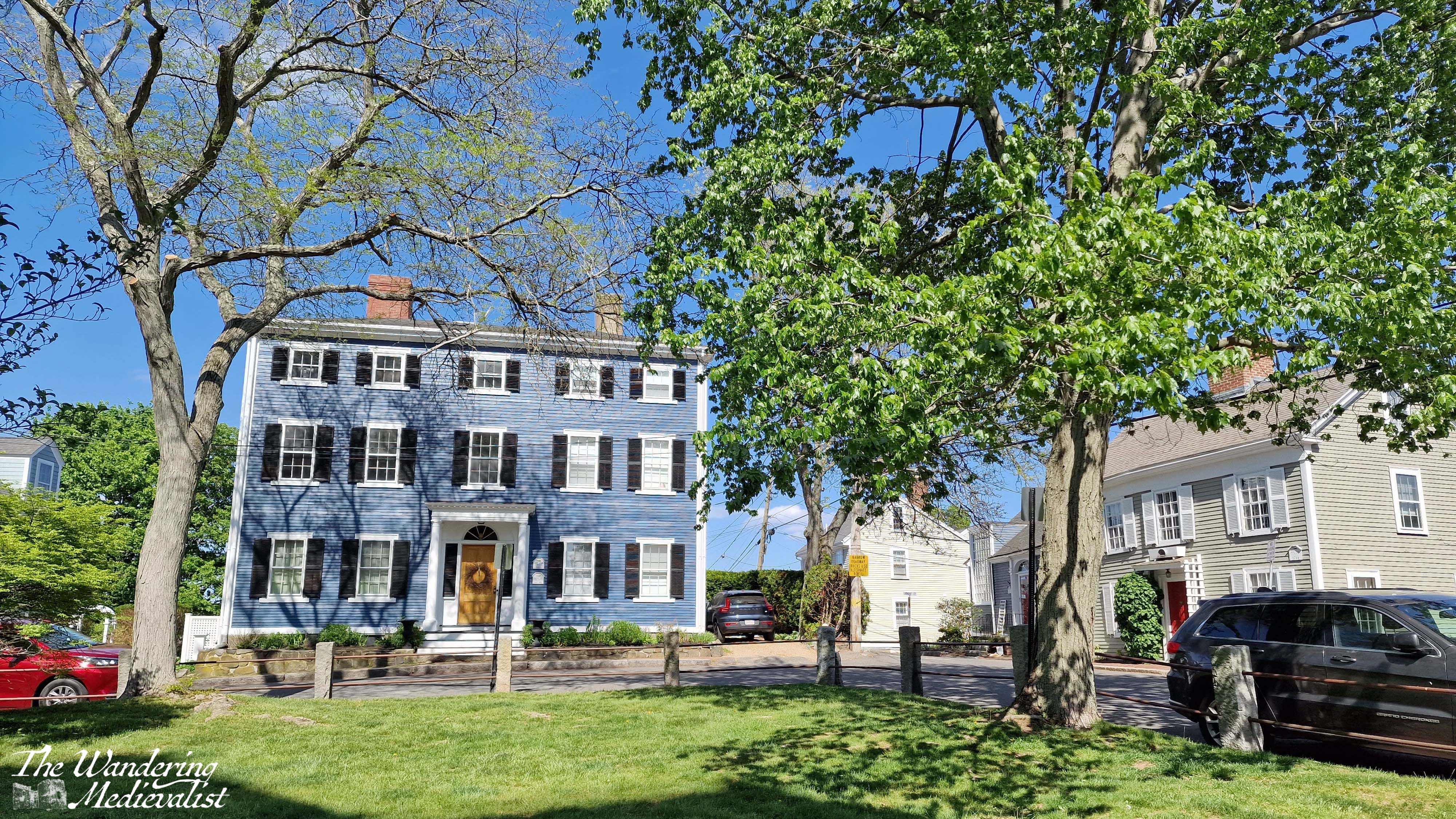
I have been trying for some time to work out the best way to showcase Marblehead. Should I write a series of posts on specific locations, or try to share a bit of everything? I’m sure I will do the former at some point, but in the meantime I’m focussing on the latter, sharing a few of my favourite viewpoints in Marblehead, where you can get some excellent views and photos, and a real understanding for the flavour of the town. These spots are my go-to locations whenever I visit, and I have dozens of pictures of each. Here are a few of my favourites.
I’m sure there are Marbleheaders who will disagree with me, but so be it. 😁
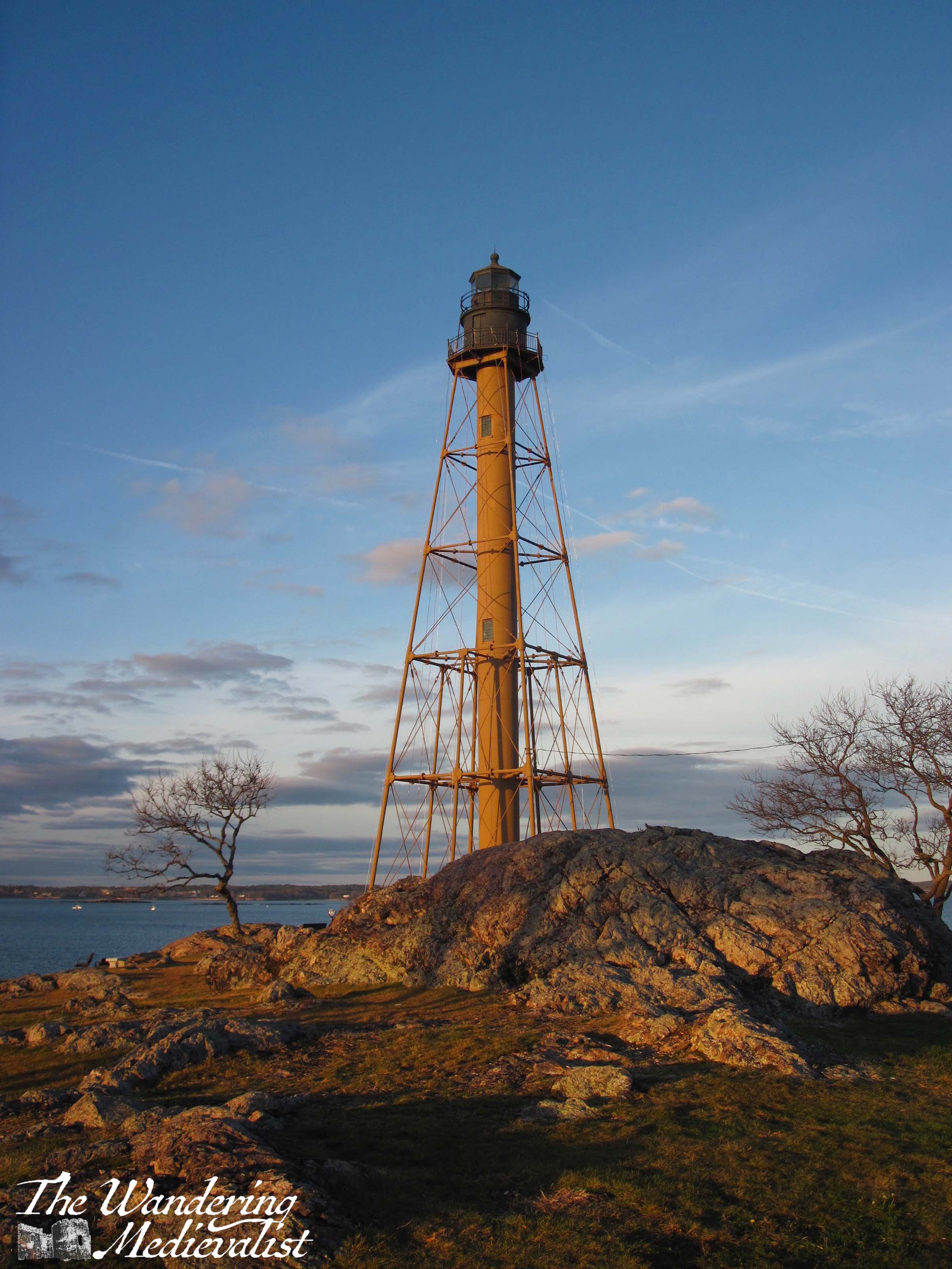
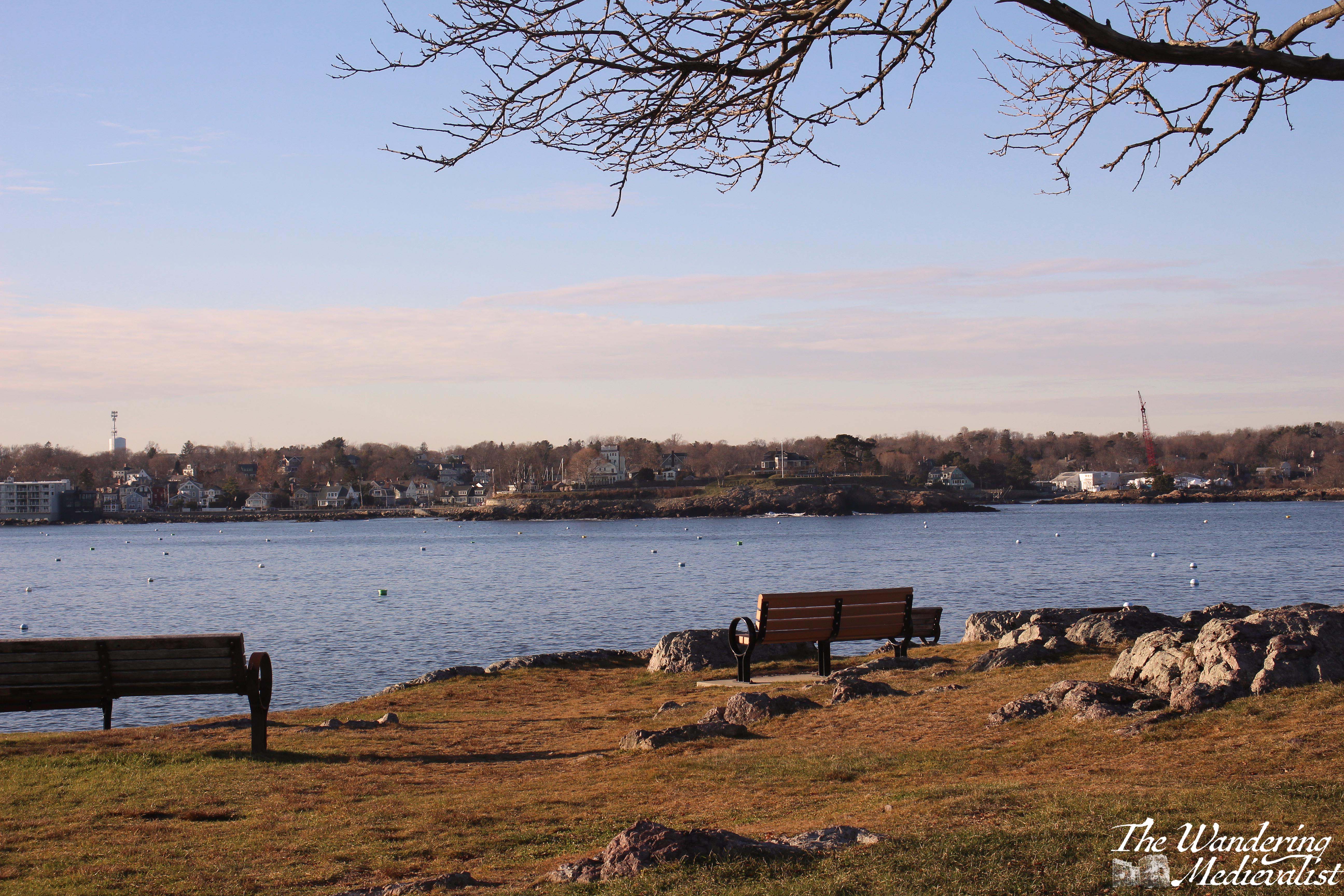
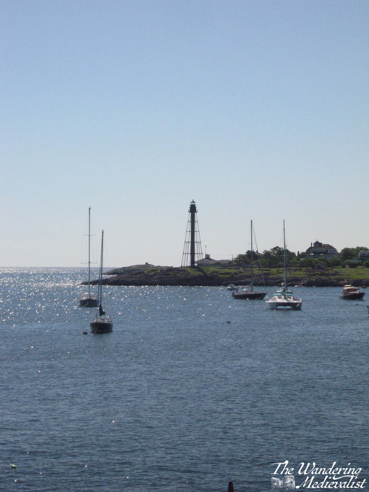
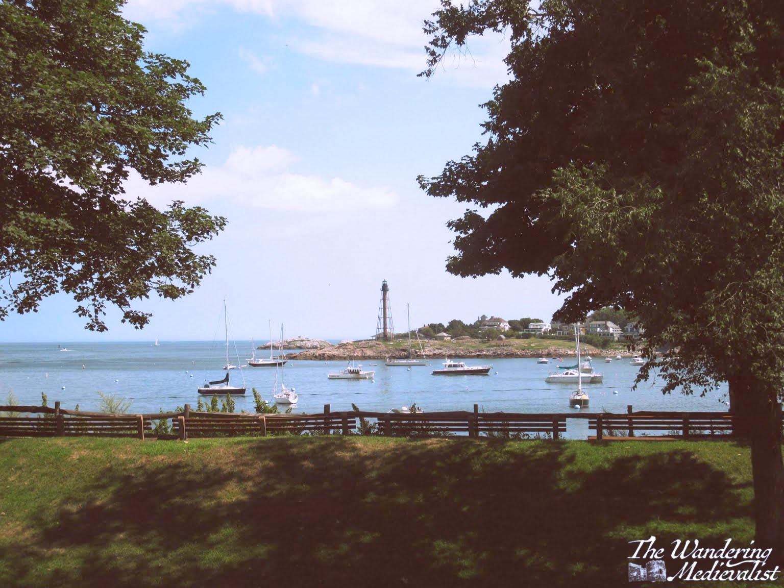
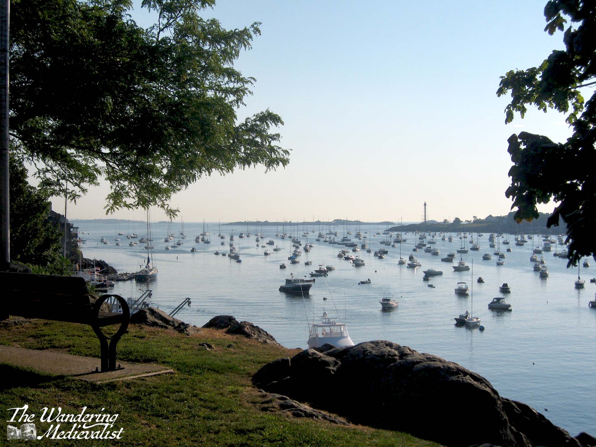
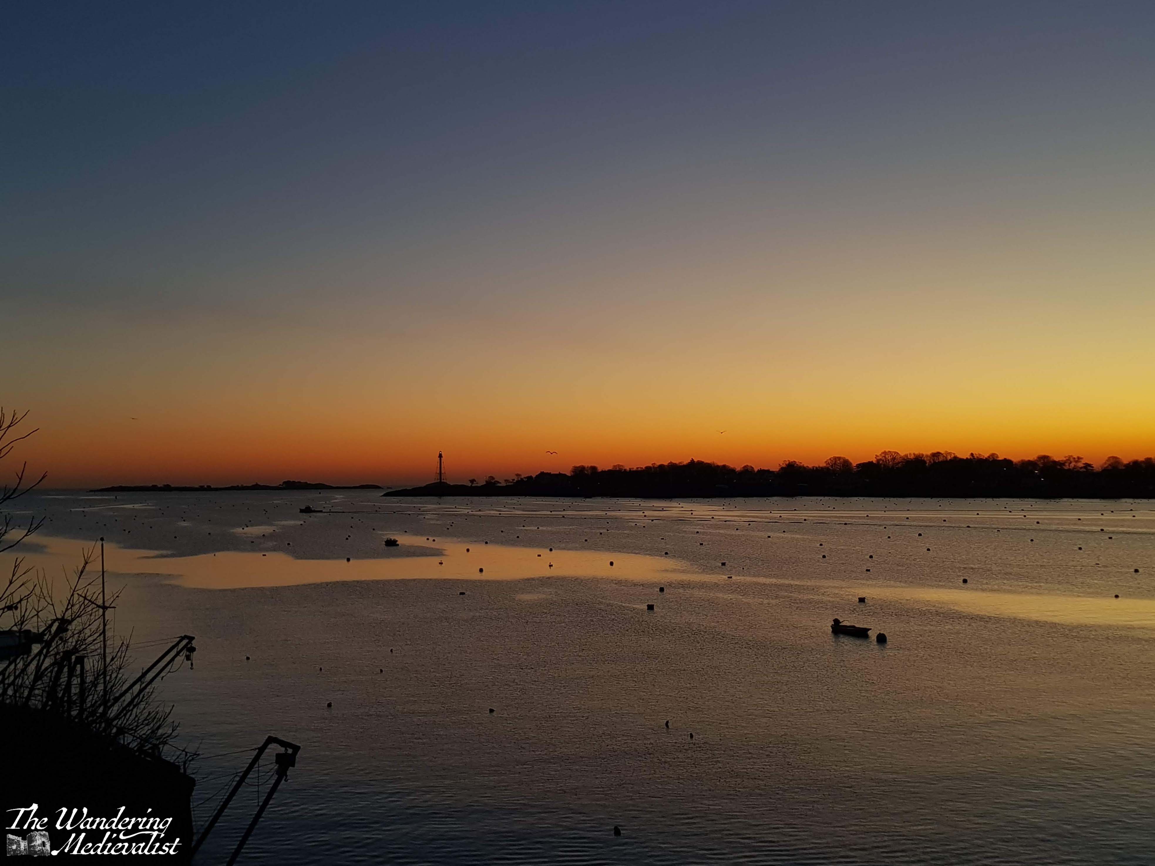
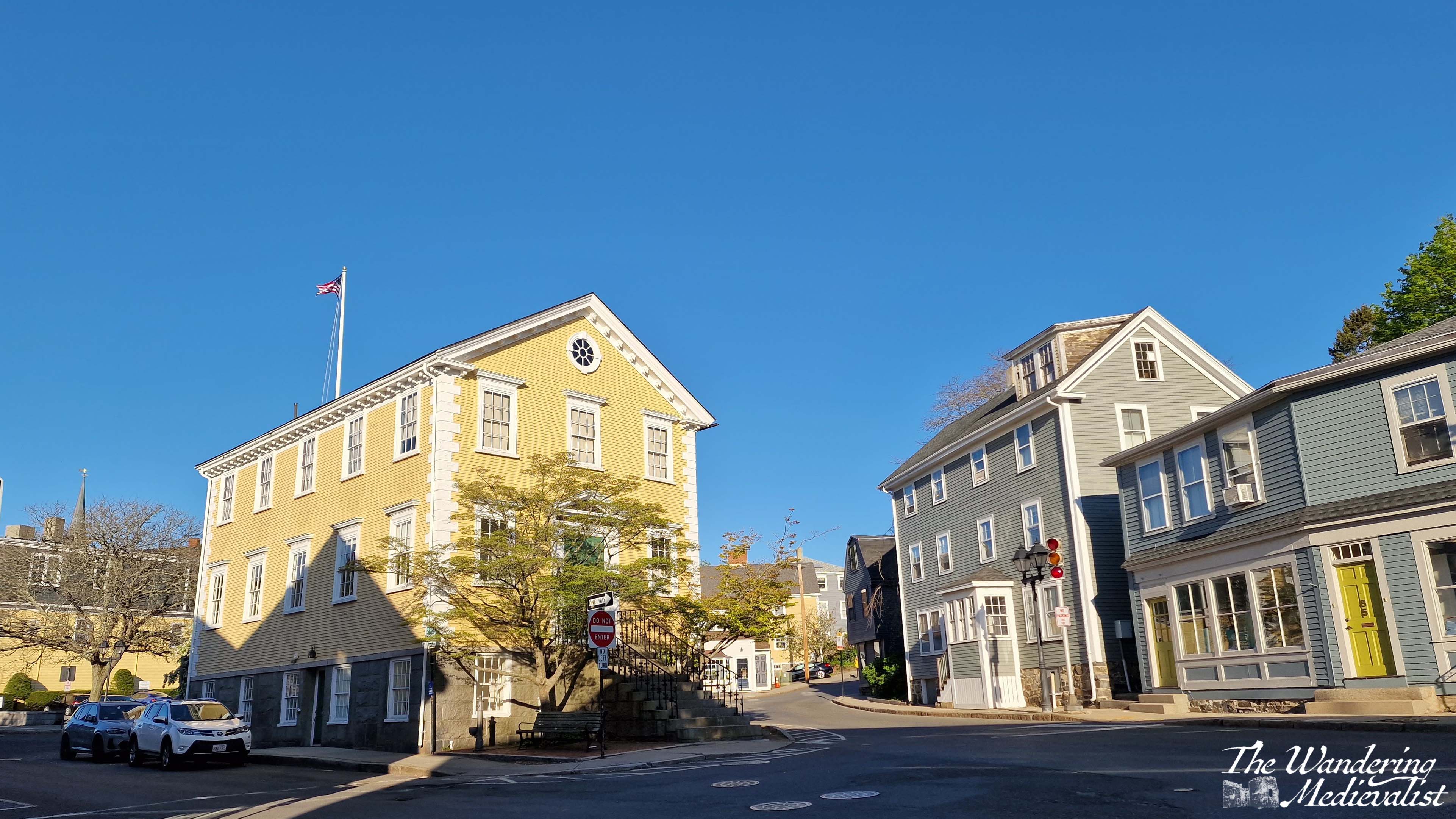
1. Marblehead Lighthouse and Chandler Hovey Park
Marblehead Lighthouse is iconic and appears on all Marblehead memorabilia as well as ‘famous lighthouse’ lists. It isn’t the traditional style lighthouse, but was built as a skeletal metal structure – replacing the more conventional version – in 1895. It isn’t to everyone’s taste necessarily, but it is the only one of its type in New England.
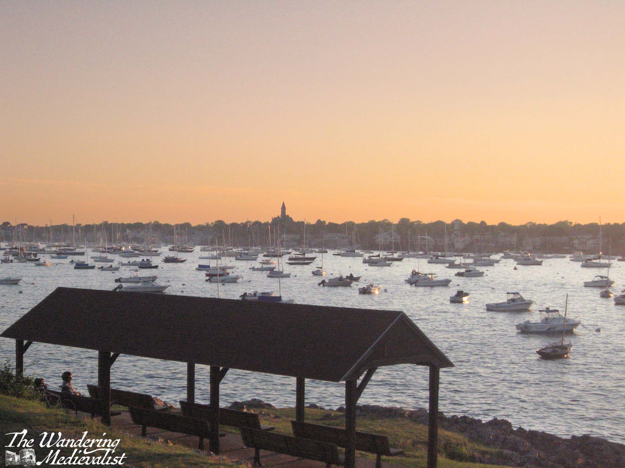
The area around the lighthouse, Chandler Hovey Park, is popular for many uses – picnics, summertime church services, games, and much more. It also commands a spectacular view down the harbor, across to Fort Sewall, and of course out to sea. It is the perfect place to watch the busy comings and goings of pleasure and fishing boats, to view boat races, or to watch the sunset.
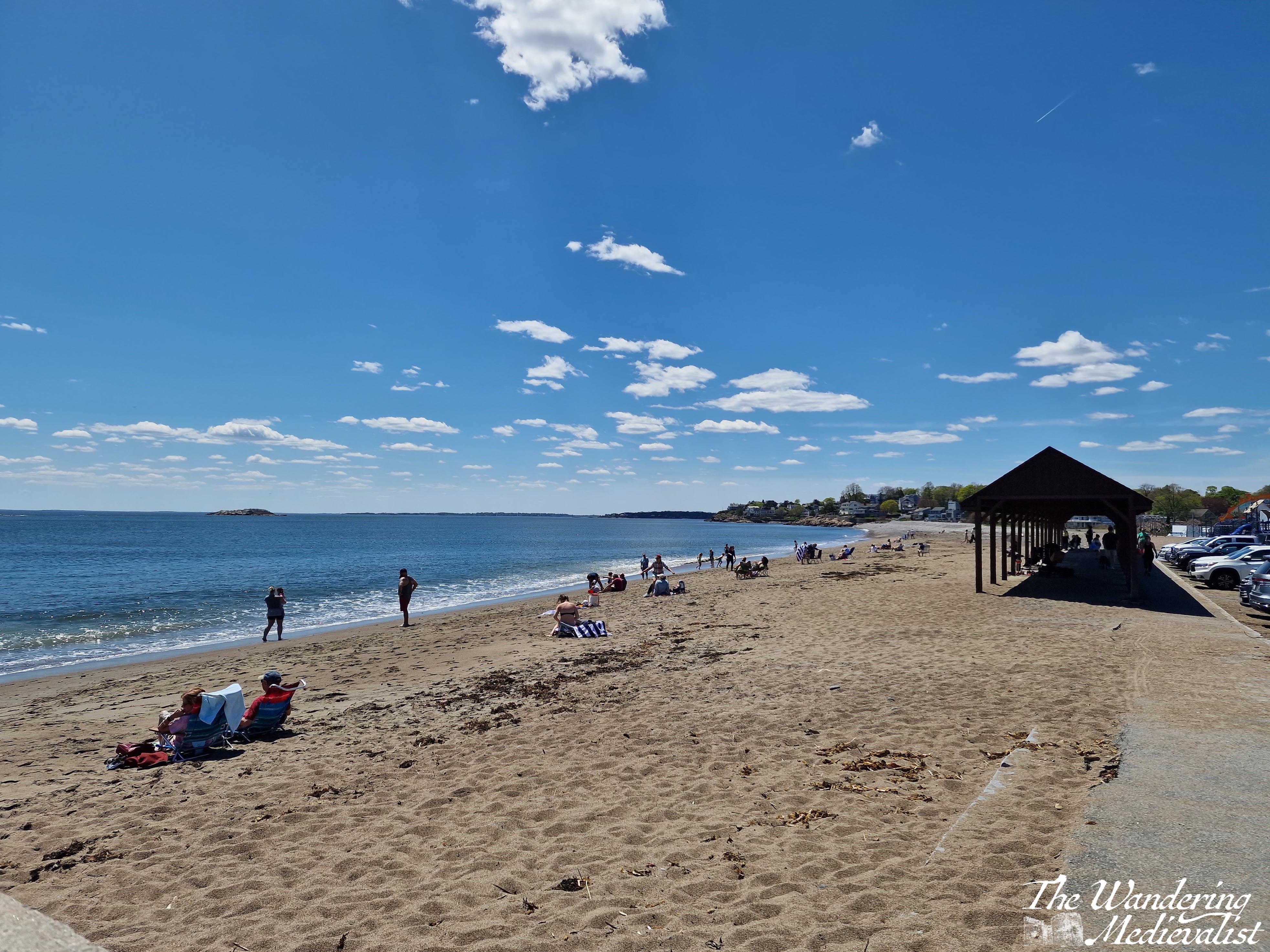
2. Devereux Beach and the causeway
Most beaches in Marblehead are rocky with only small patches of sand, if they have any at all. Many are also hedged in by rock cliffs that divide them from the next beach or cove (Gas House Beach, Fort Sewall Beach, Grace Oliver Beach – few are the sandy havens you picture when you hear the word ‘beach’).
The exception is Devereux Beach, a long sandy expanse created by the causeway that connects the Neck to Marblehead proper. Like Revere and Lynn beaches further down the coast and many more further north, Devereux is ideal for building sandcastles and enjoying the sun, and sometimes even waves. Parking is free for Marblehead residents with a sticker, and there are public restrooms open in-season. You can even rent a kayak to explore the inner harbour.
The beach’s popularity is evident in the shaded bench area and seasonal concession stand that has changed hands numerous times. On a clear day you can view the Boston skyline in the distance, or cross the road for views of Old Town and up the harbor.
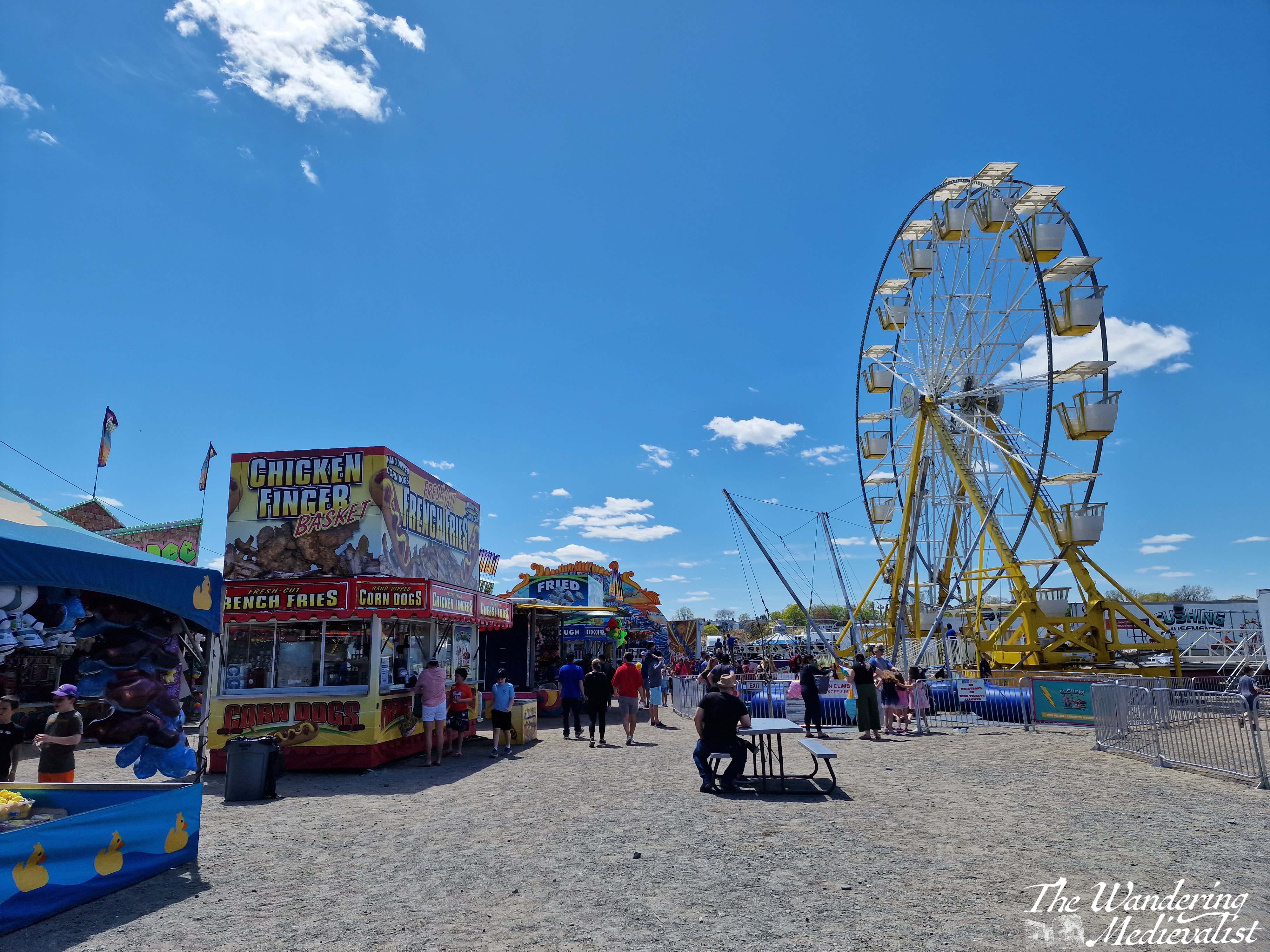
Devereux is also famous for hosting the annual Marblehead High School Junior Carnival, where the rising seniors put on a fun fair to raise money for their final year. It is a highlight of spring and really marked the start of summer for all students in Marblehead.
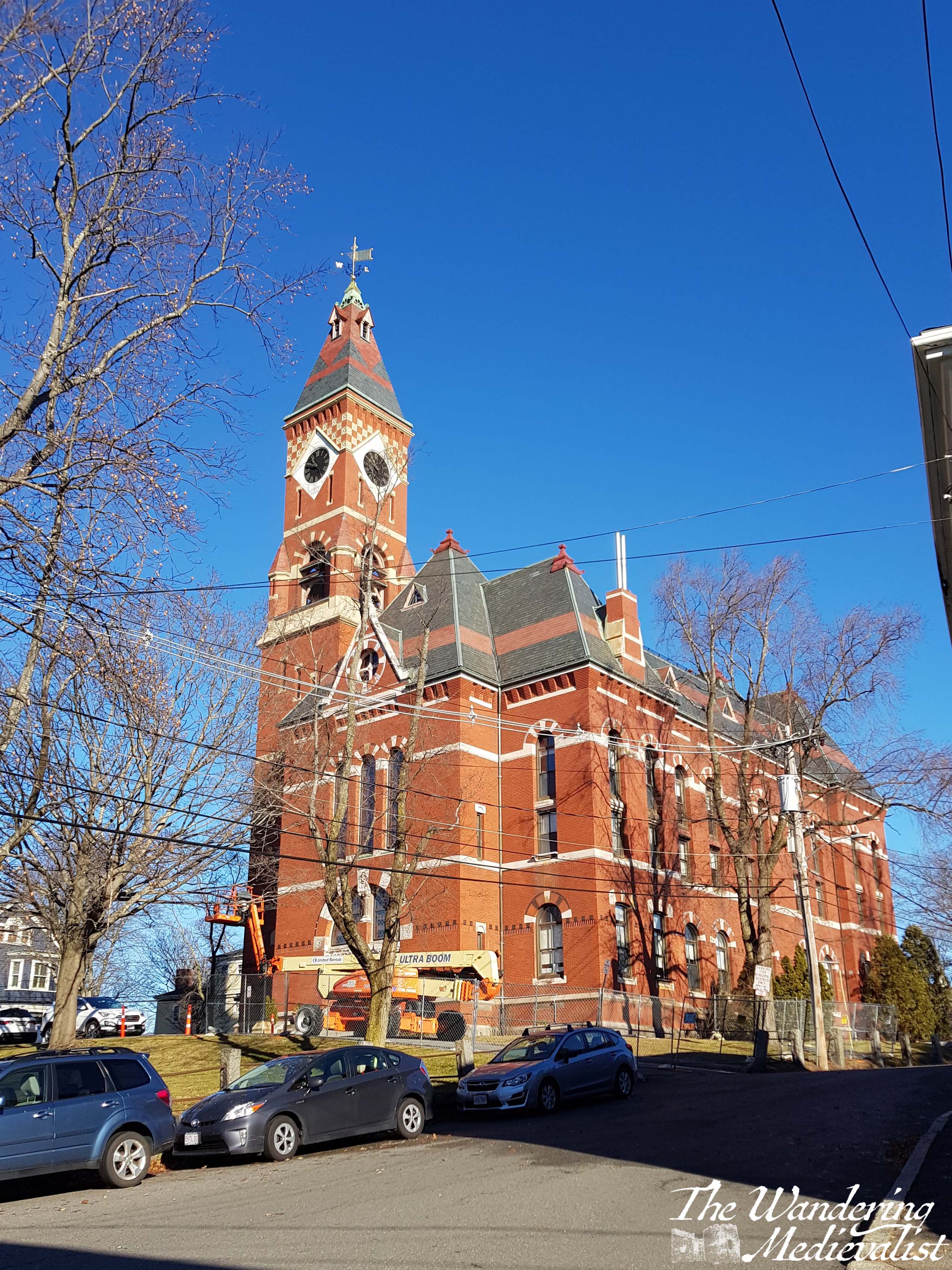
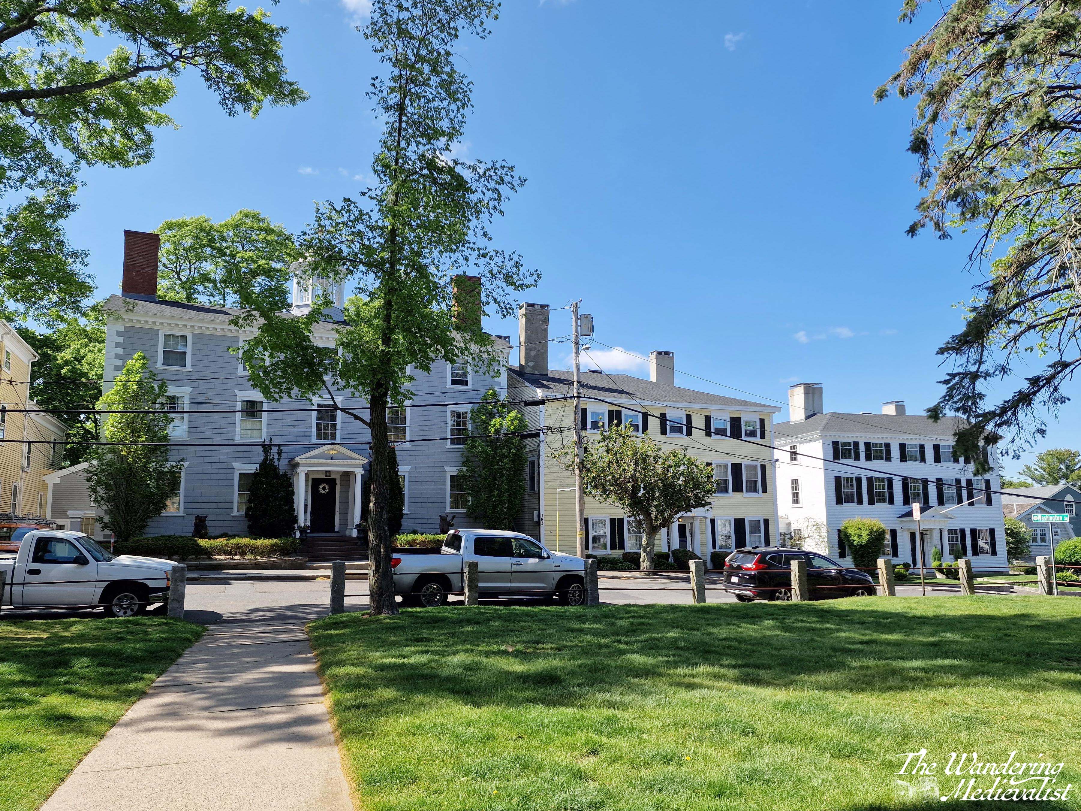
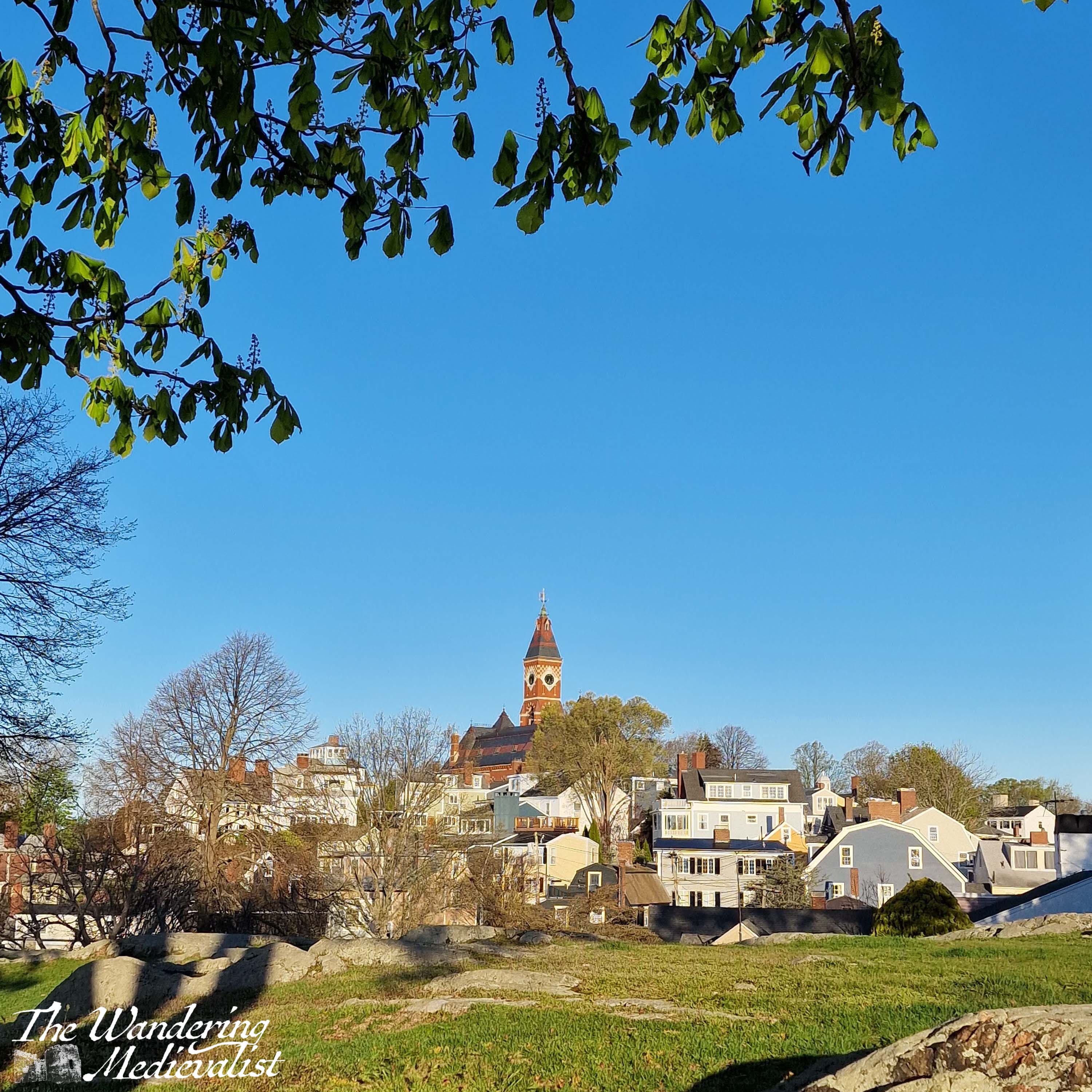
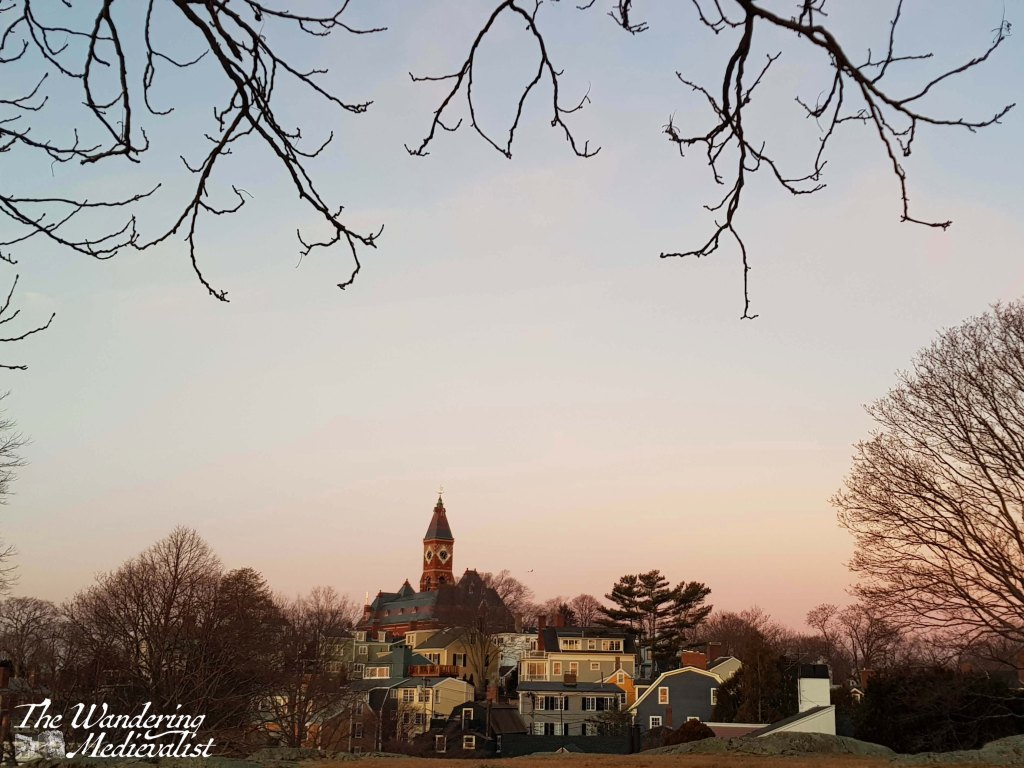
3. Abbot Hall and Washington Square
Built in 1876 to replace the Old Town House, Abbot Hall is the current town hall for Marblehead, seat of the local government and also a museum. The clock tower is the pinnacle of the skyline, visible from many of the viewpoints on this list as the highest point in the old town. The original ‘Spirit of ’76‘ painting is housed here, depicting a fife and drum player against an early American flag, and ‘Spirit of ’76’ was a long-time bookstore in Marblehead until its untimely closure. During the Marblehead Arts Festival in July, there are often arts and crafts taking place in the grassy park, and an auditorium inside is a well-used recital or concert venue for local schools.
The red brick Romanesque hall itself is a stunning picture, but Washington Square, which runs along three sides of the hall (Washington Street makes up the 4th) is equally beautiful, lined with well-kept colonial houses from old sea captain’s houses to some of the oldest in Marblehead. It is reminiscent of some parts of Salem, and the square will be recognisable to anyone who has seen ‘Hocus Pocus’ as doubling for the larger town. Washington Street continues down to the Old Town House, one of the main arteries of old Marblehead, and the walk from Abbot Hall down to the centre of old town is a must for visitors.
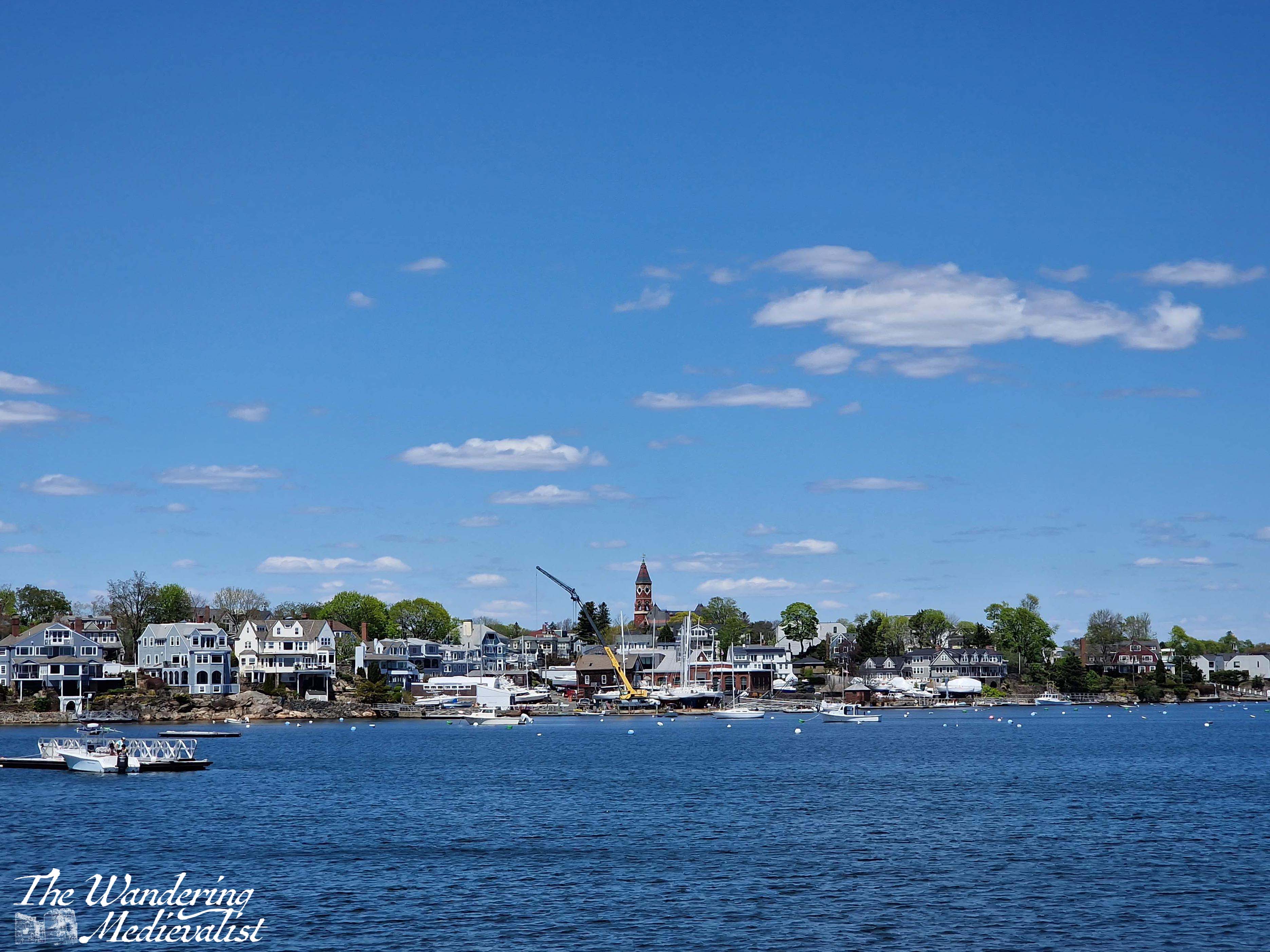
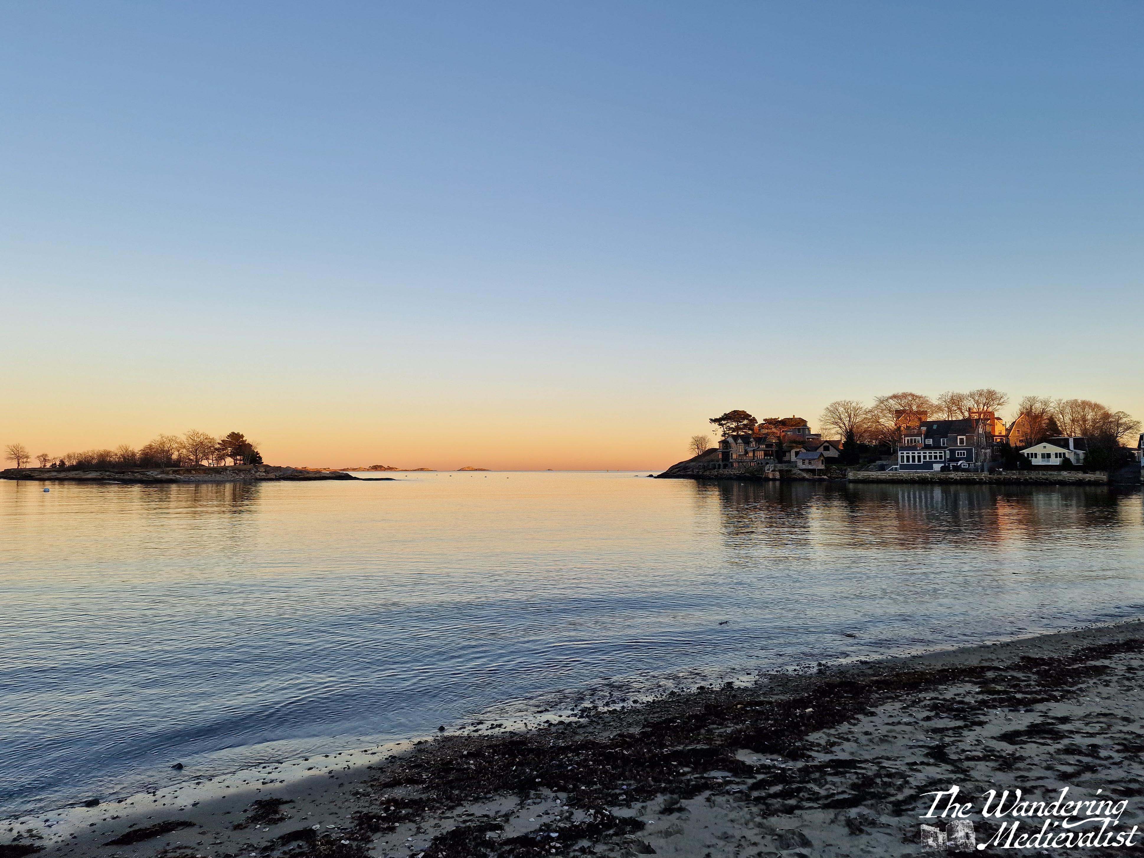
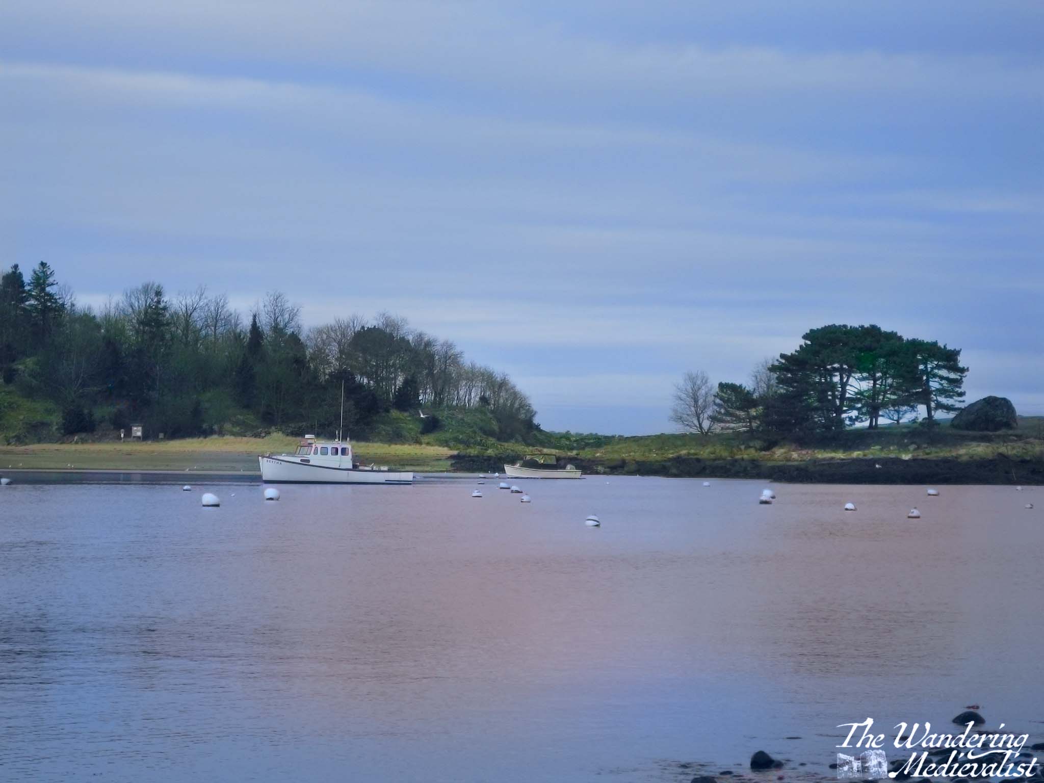
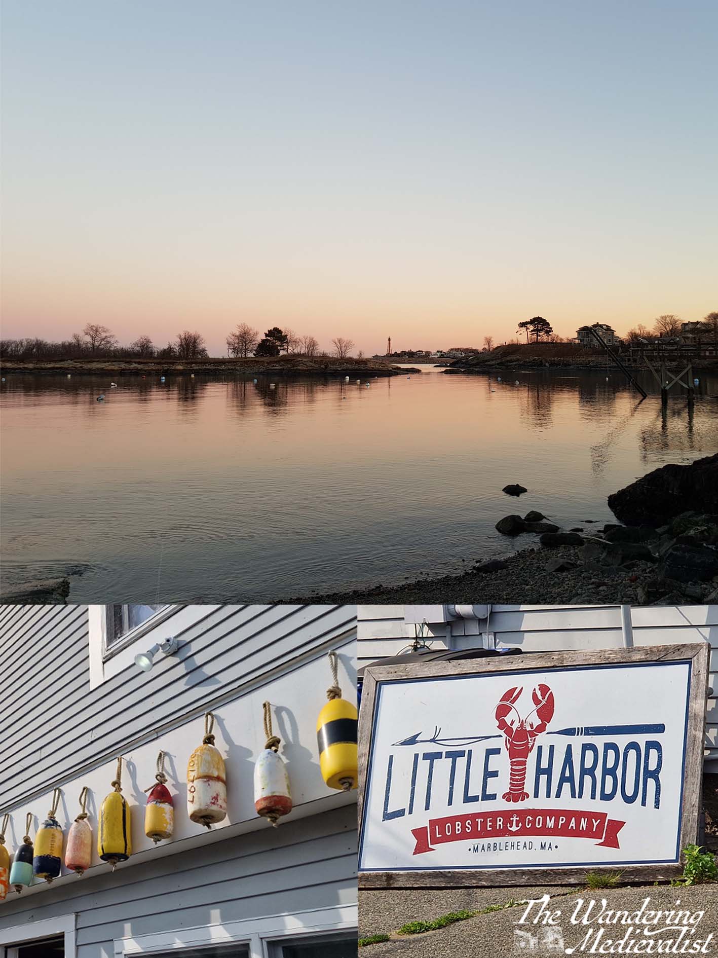
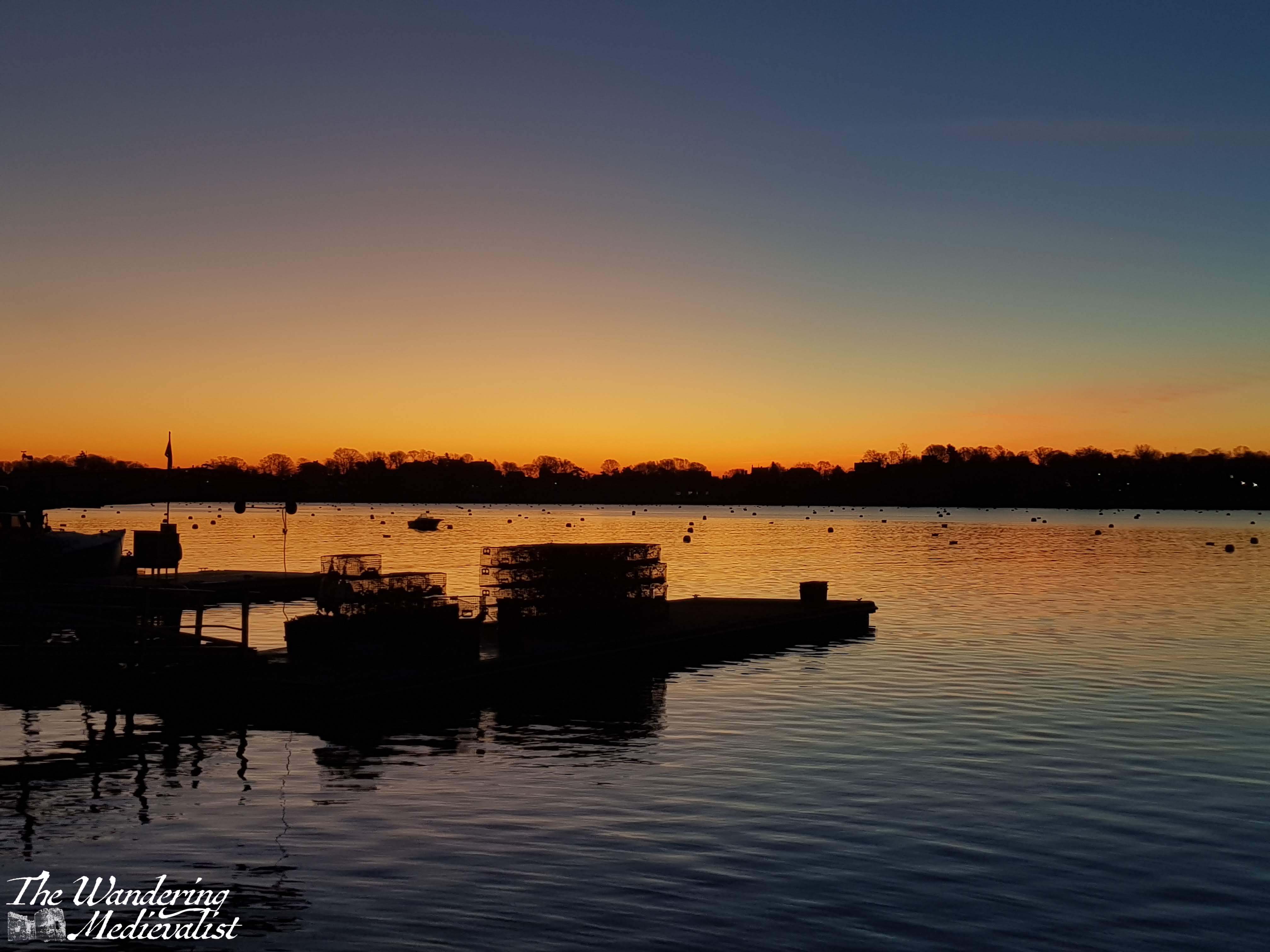
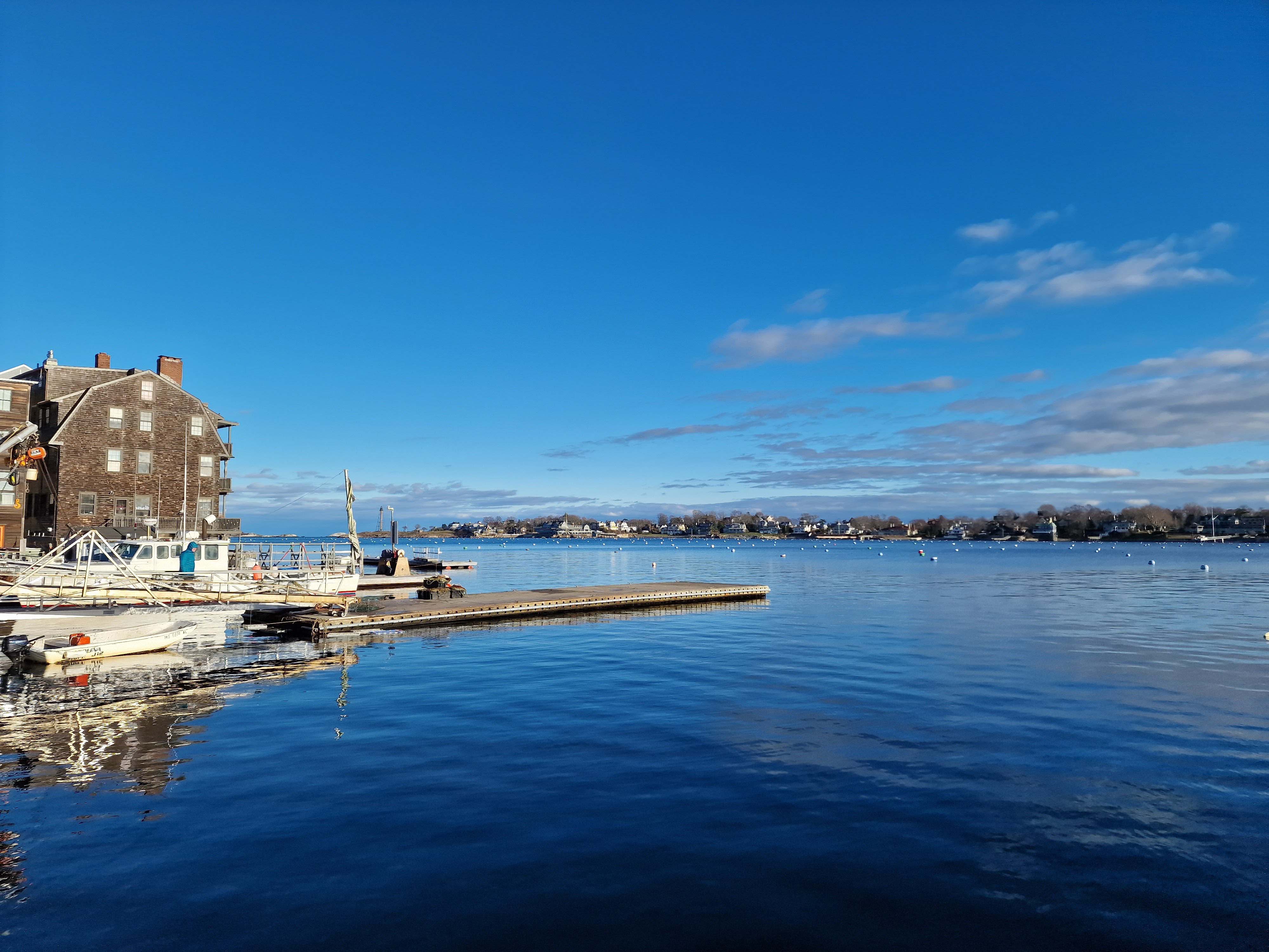
4. Little Harbor
Little Harbor lies just around the Fort Sewall point from the main harbor and is protected by Gerry Island, which is accessible at low tide. At high tide the water is deep enough for a full sailboat, and several of the town’s boat yards, where sailboats dry dock during the winter, are accessed through Little Harbor. Most of the permanent ‘residents’ are fishing or lobster boats, and you can buy that day’s fresh seafood and lobsters of all sizes, either cooked or still kicking, at the Little Harbor Lobster Company.
Little Harbor is also the location of Gas House beach, my childhood playground. The beach is protected from the waves by Gerry Island and so the water is often warm, though at low tide it can be a bit mucky.
I have always loved the view from Gas House beach at sunrise or sunset, when the edge of the horizon turns orange and pink while the sky stays blue, but it is equally lovely on a blue summer day. At Christmas, one of Marblehead’s icons sits in Little Harbor – a white dingy bearing a Christmas tree decorated with starfish and other oceanic decorations.
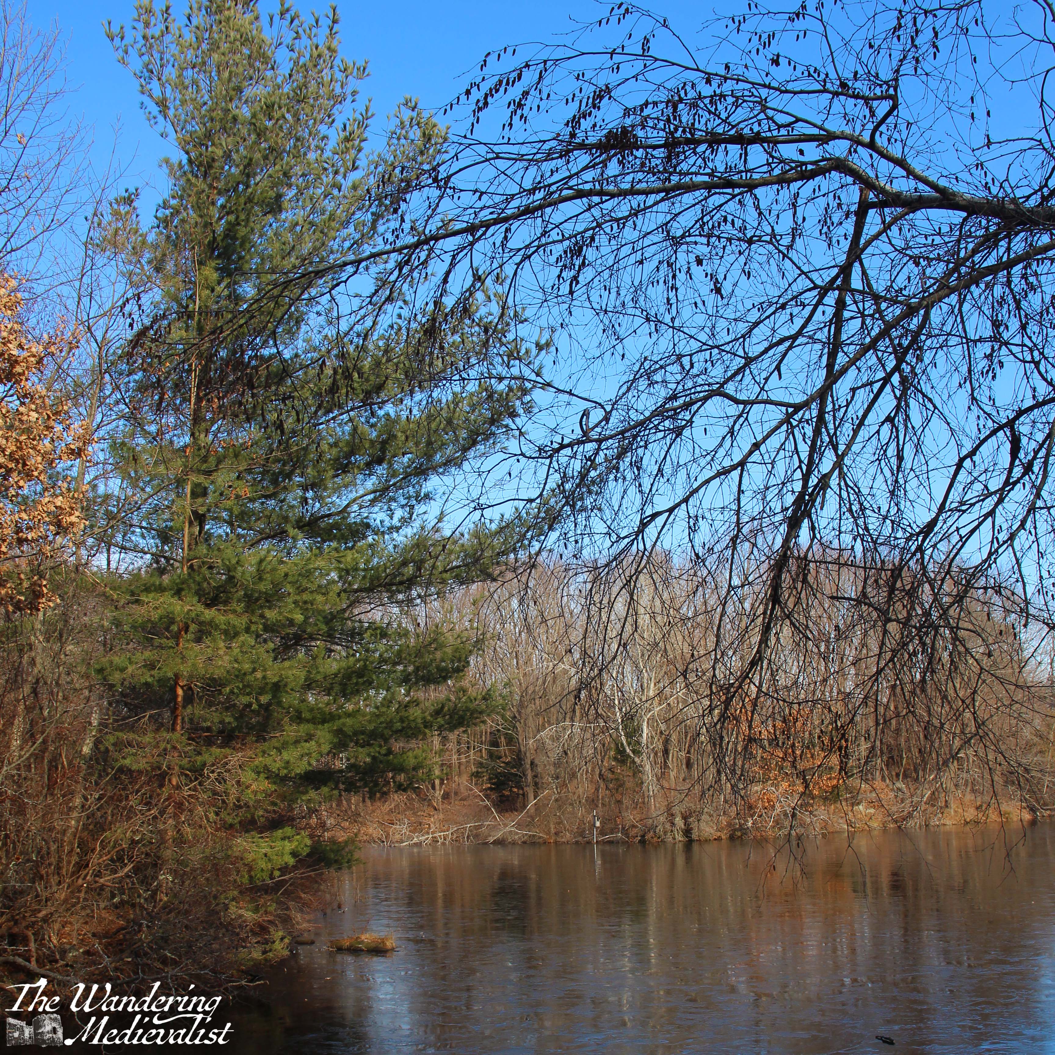
5. Joe Brown’s Pond and Steer Swamp
For a relatively small town, Marblehead has its fair share of ‘wild’ spaces, including the Steer Swamp Conservation land that is most easily accessible from Gingerbread Hill, and the network of streets behind Redd’s Pond. I recall spending many weekends walking our dog here when I was young, exploring all of the many winding paths. While named a ‘Swamp’, much of the land is plenty dry to explore, but there are definitely some low bits that can be unpleasantly buggy or wet.
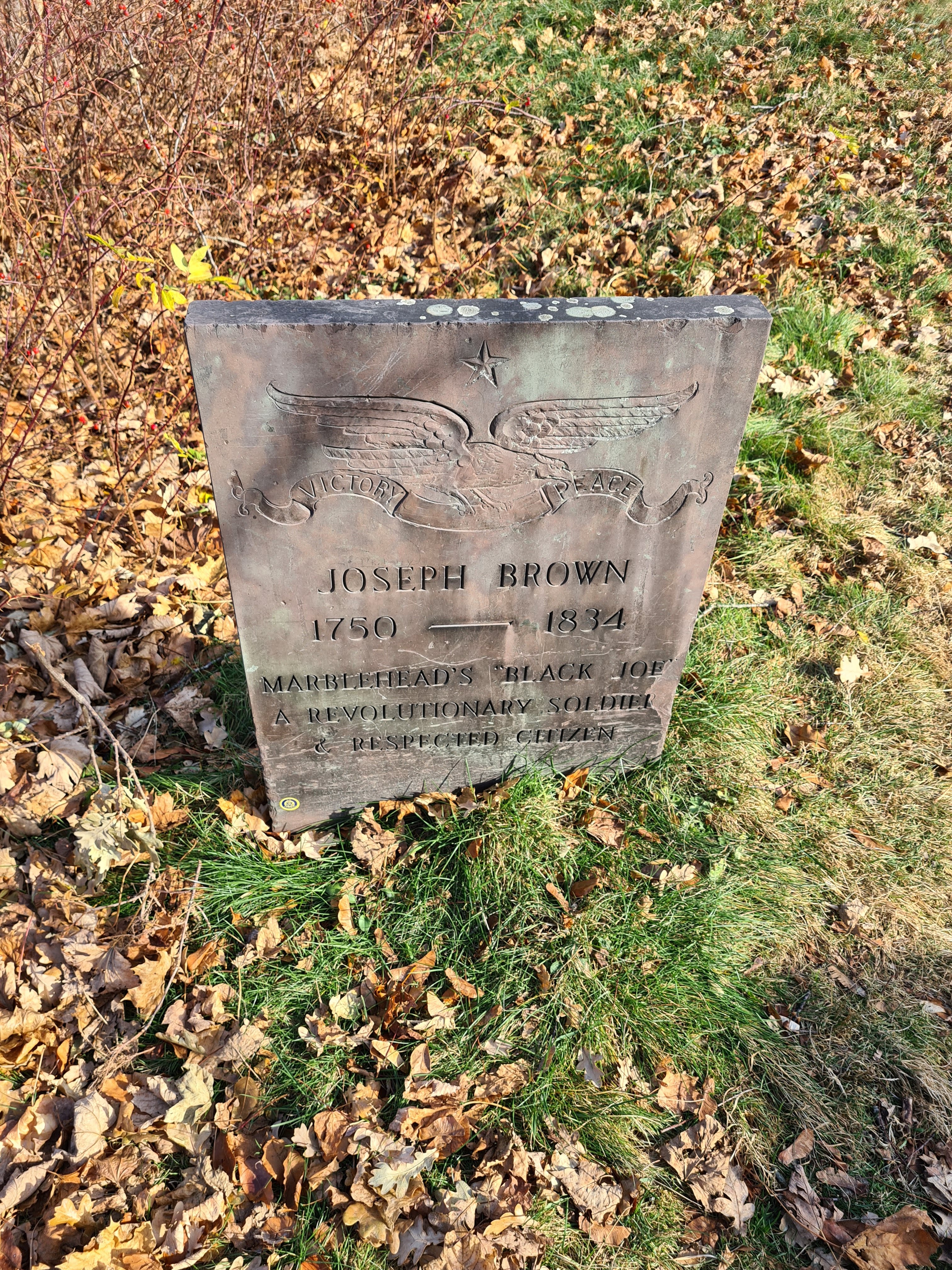
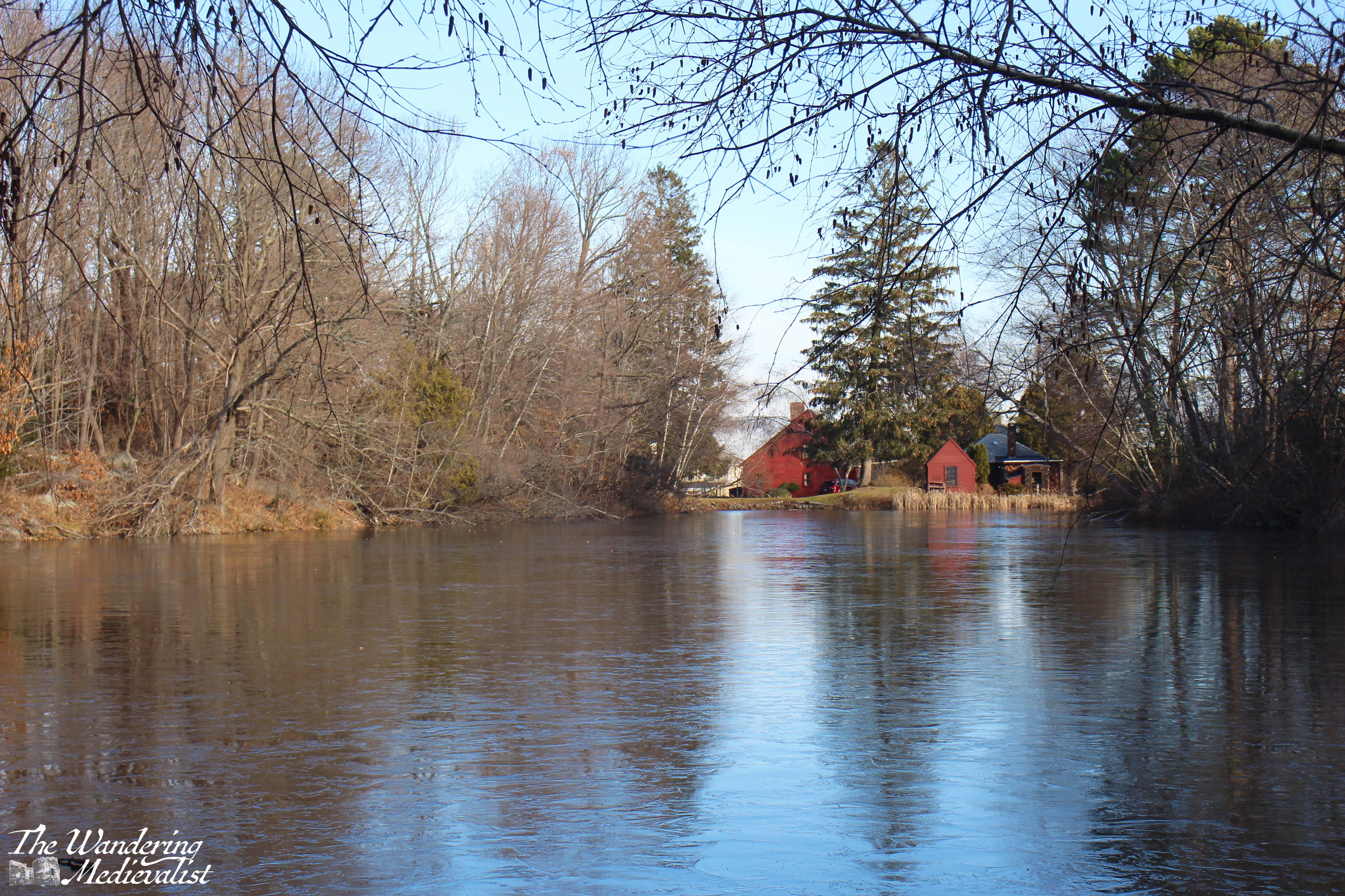
At the edge of the conservation land lies what was known in my childhood as Black Joe’s Pond, a body of water that has received attention recently for its insensitive name. ‘Black’ Joe is a famous Marblehead resident – his grave is well-marked at Old Burial Hill – who was a former slave, Revolutionary War veteran and opened a tavern near the pond with his wife, Lucretia. Joe Froggers, a famous local cookie made with molasses, were originally created and sold by Lucretia, and the recipe lives in most Marblehead cookbooks and stores.
The tavern still stands, well-preserved as so many old Marblehead buildings are, and the pond was a good place for skating and hockey playing when I was young. Slightly less popular than nearby Redd’s Pond, this pond is a bit more traditional, surrounded mostly by woodland.
In 2021 the town re-named the pond and conservation area to the ‘Joseph Brown Conservation Area’, though I believe the tavern sign may still refer to ‘Black” Joe and his wife.
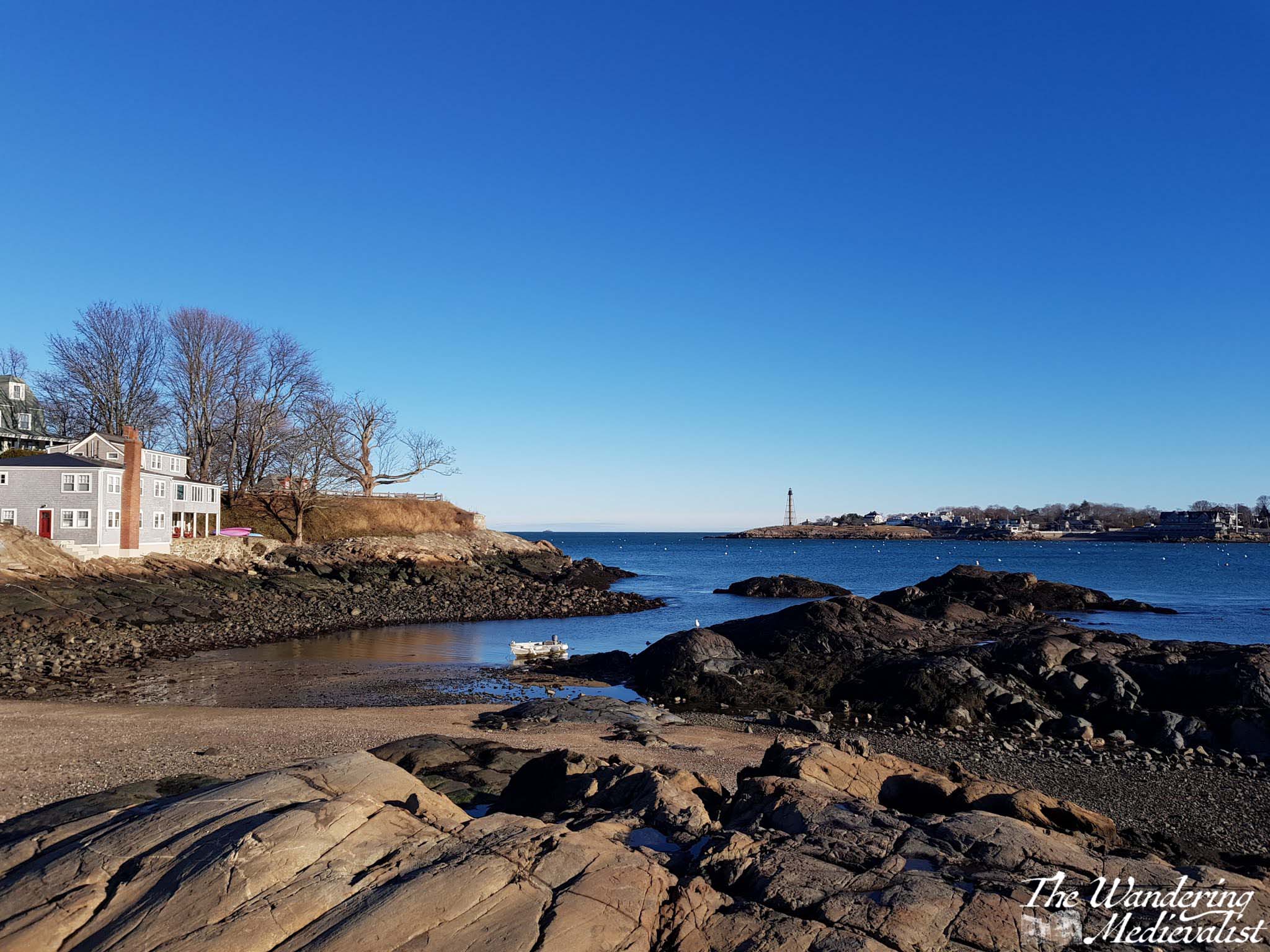
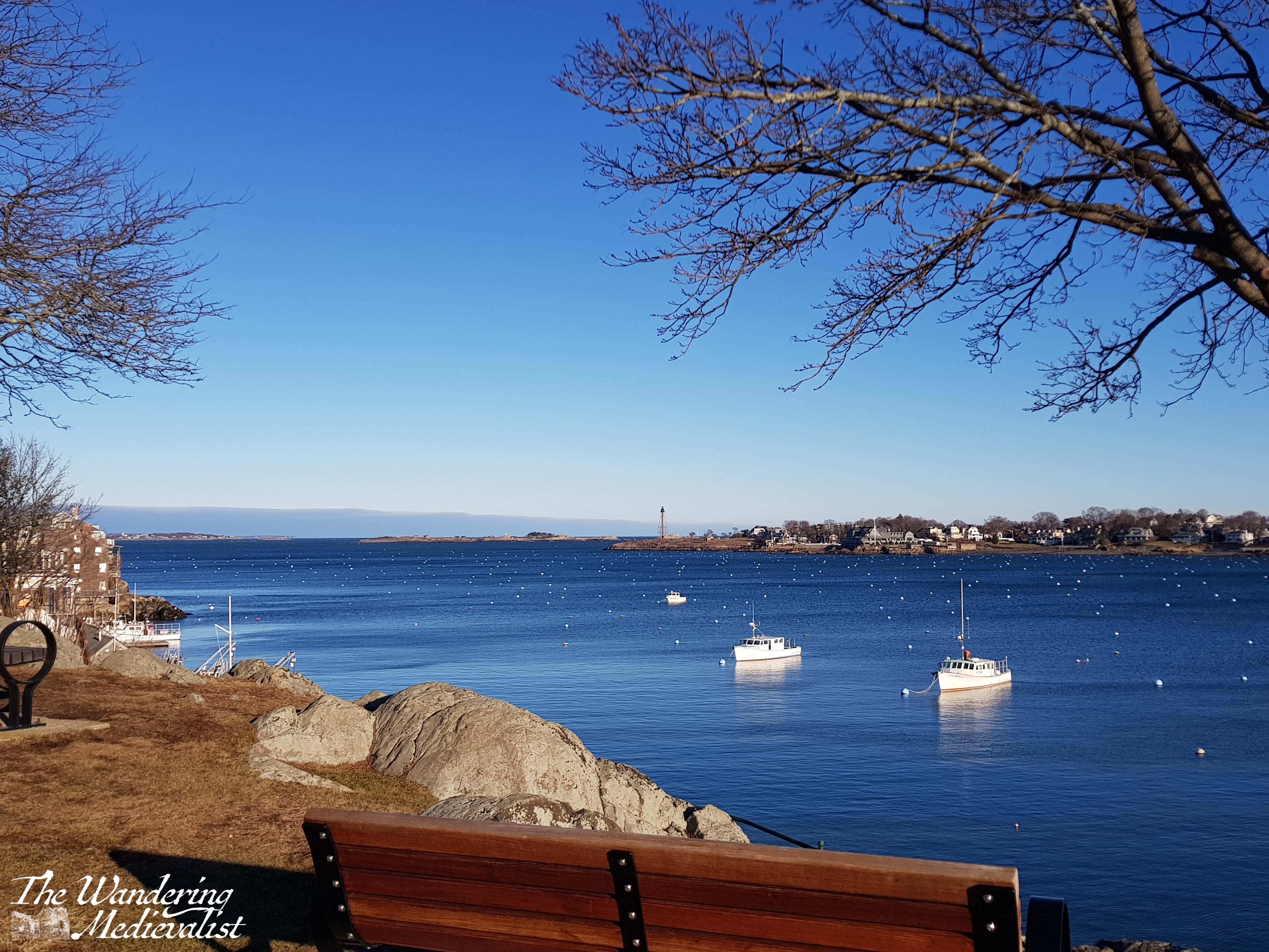
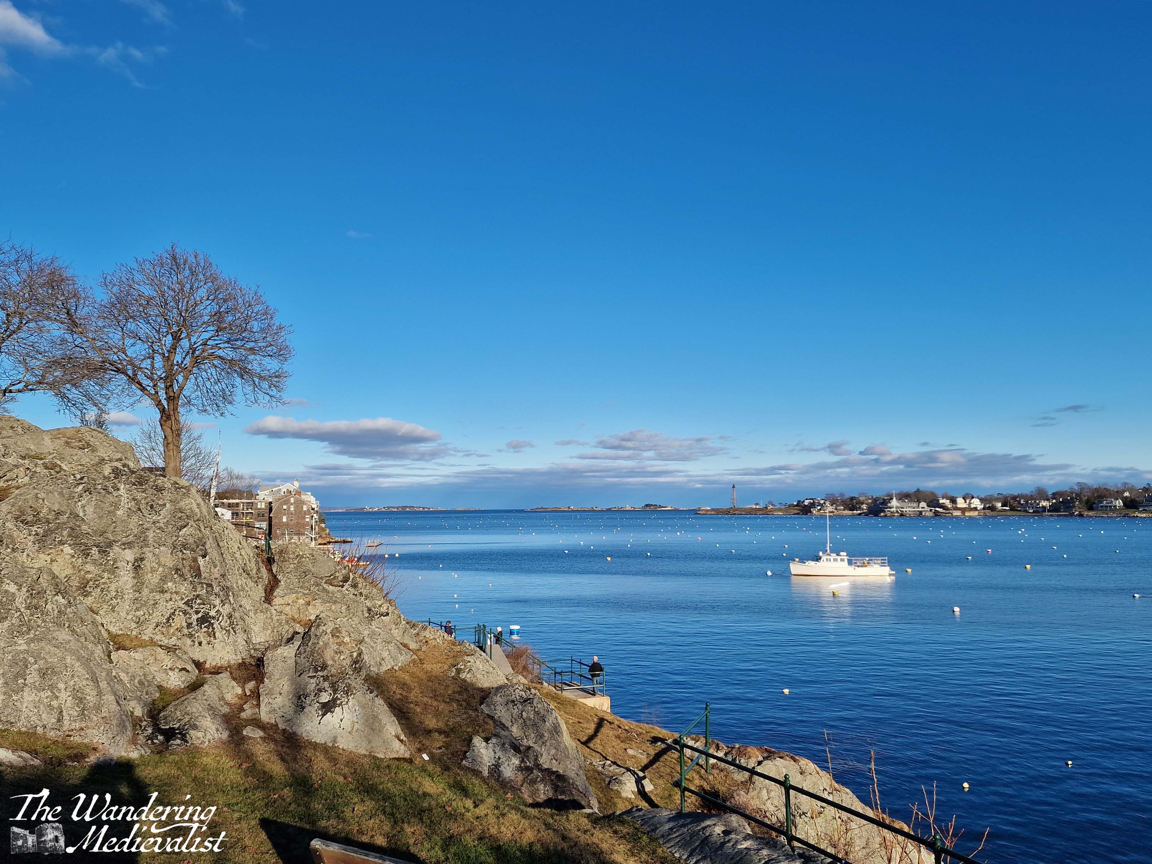
6. Fort Sewall and Fort Sewall Beach
Fort Sewall is iconic in Marblehead for so many reasons. Steeped in history, it overlooks the entrance to the deep harbor, and the architecture of the fort is still present in the barracks with barred windows dug into the hill. The promontory known as Gale’s Head was first fortified in 1634, and rebuilt as a fort during the Revolutionary War, where it was garrisoned by Colonel John Glover’s regiment. Marbleheaders were not present at some of the earliest battles of the Revolution, but were responsible for ferrying George Washington across the Delaware River in 1776, a famous turning point in the war. In a moment recreated in the 90s, Fort Sewall protected the USS Constitution as it took shelter in Marblehead harbor during the War of 1812, and the fort was re-named in 1814 for Samuel Sewall, Chief Justice of the Supreme Court.
Incredibly popular at all times of year, the fort is where you to go walk, to ride your bike, to view both the little and great harbors. In the summer it has been known to host Festival of Arts activities and Shakespeare in the Park, and at Halloween the dungeons used to be opened for trick-or-treaters – if you dared. In views that mirror Chandler Hovey park across the water, Fort Sewall allows you to look down the harbor or out to sea, and it is a perfect spot for sunrise. The harbor channel, a path free of moorings, starts just off the fort, so sitting here will allow you to watch all of the sea traffic going in and out. It does not take much to see why this point would have been selected for defence of the town and harbor!
7. Crocker Park
Another famous viewpoint, Crocker Park is located about halfway down the harbor and, like Fort Sewall or Marblehead Light, a good spot for pictures of the harbor at sunrise and sunset. Just off Front Street, the park is a great detour, and is often busy with dog walkers or children playing on the rocks. There are plenty of sheltered seats, a pergola, public toilets, and a large grassy area that is used for weddings, concerts and more in the summer. The park can also be used for swimming, as in the summer the town will float docks for those willing to take a dip in the busy harbor. Even in the winter it is easy to see why Marblehead is such a good harbour; the rocks fall sharply to the waterline and continue 20 – 30 feet below.
Crocker Park is unique in offering a perfect view of old town; if you stand under the chestnut tree, you get an ideal picture of the old houses, piled on top of one another, climbing up the hill to the pinnacle of Abbot Hall.
8. The Landing
Just around the corner and down the harbor coast from Crocker Park is the Landing, the public town dock of Marblehead. In an old sail loft building now lives the Landing Restaurant, while on the other side of the car park is the Driftwood, the Marblehead institution known for serving good breakfasts from early in the morning. One will often find mariners at the counter chatting with the servers, and when I was young it was a popular spot for Dads and kids on a Saturday morning. There is often a queue out the door after 7am or so, and they only accept cash.
The area of the landing lives in my mind as a key part of childhood. For many years there was a popular ice cream shop – Nancy’s Incredible Edibles – often visited on a summer evening, and the boat to Children’s Island – a summer camp – left from the dock. Perhaps most important of all childhood memories is that on the first weekend of December, also known as Marblehead Christmas Walk weekend, all of the children gather at the landing to watch Santa arrive on a lobster boat. He and Mrs Claus step onto the landing dock and pass out candy canes as they move through the crowd, then disappear until the tree lighting ceremony that evening. There are more than a few pictures of me as a child all wrapped up and waiting to see Santa.
Finally, the Landing offers plenty of bench space where you can sit with a morning cup of coffee – or an ice cream – and watch the comings and goings. The sunrise is beautiful over the Neck, and in early mornings it is one of the most peaceful spots in town.
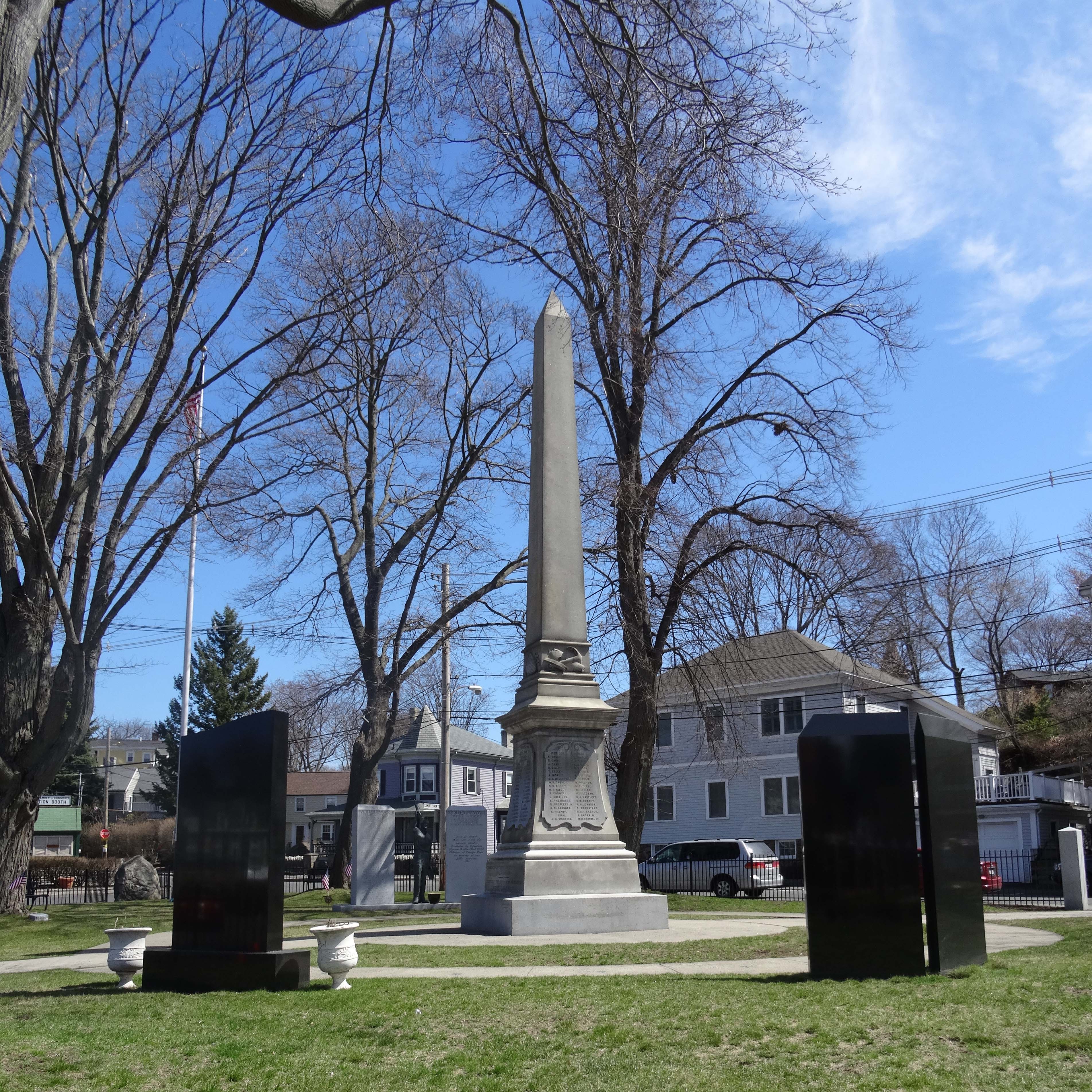
9. Old Burial Hill and Redd’s Pond
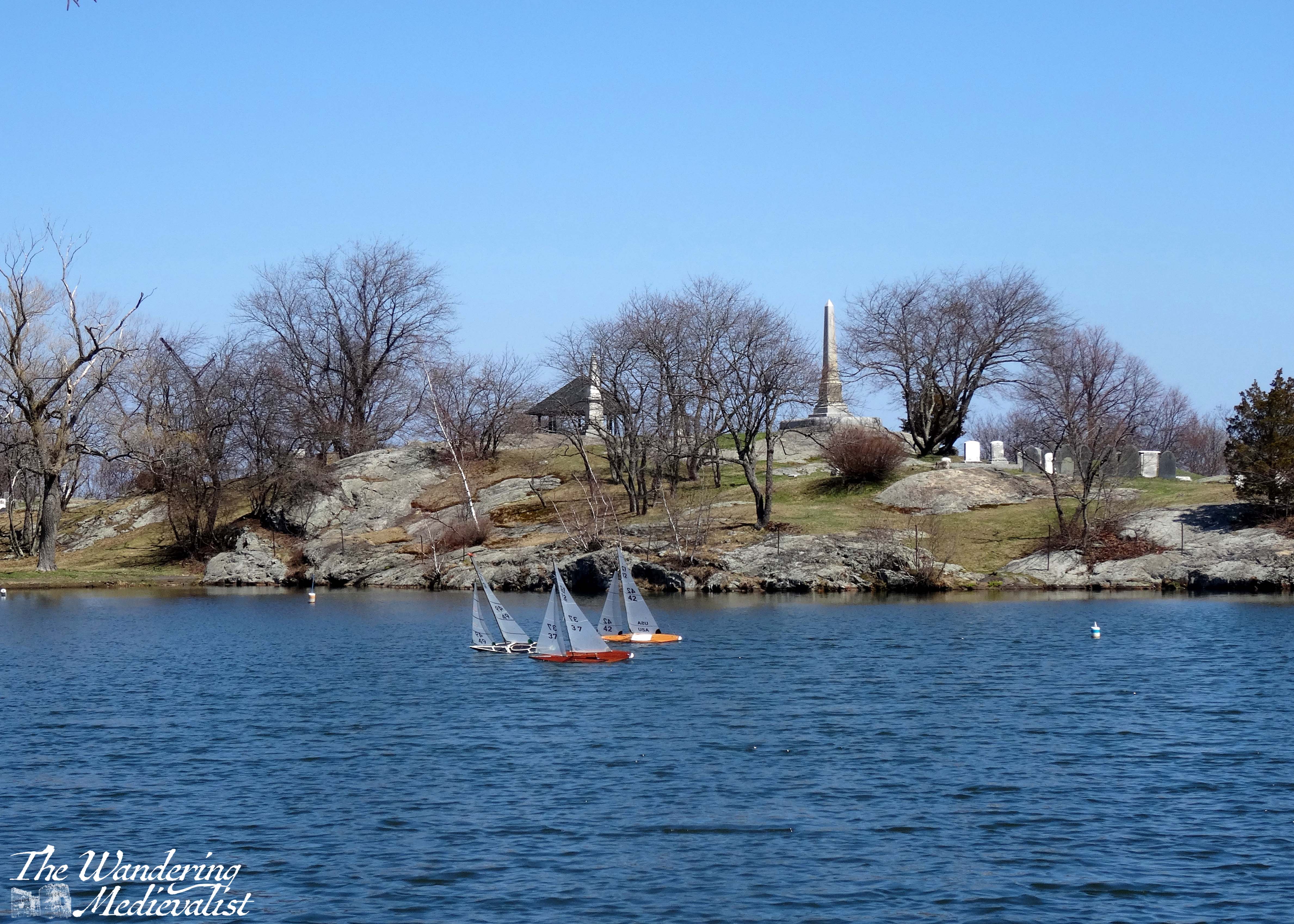
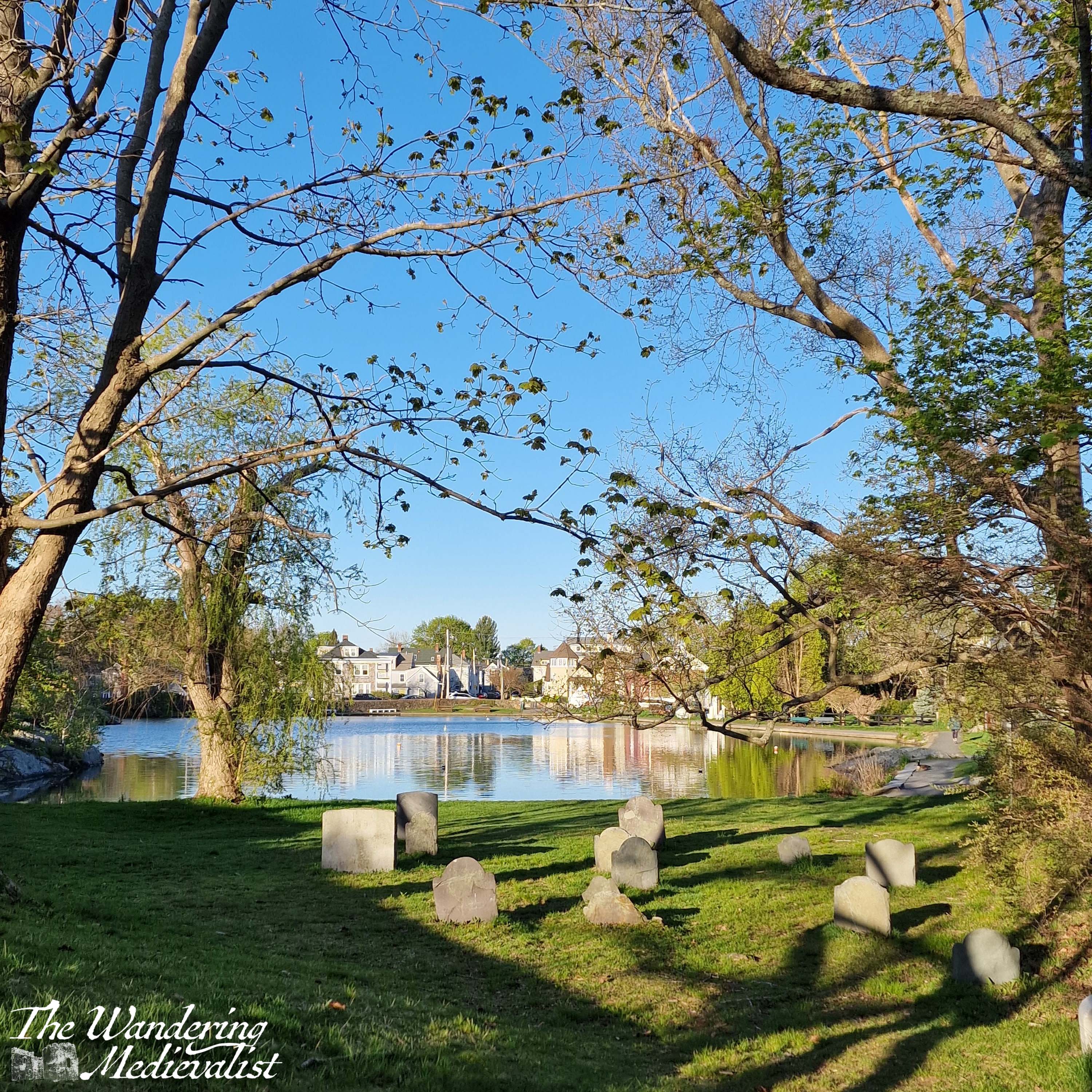
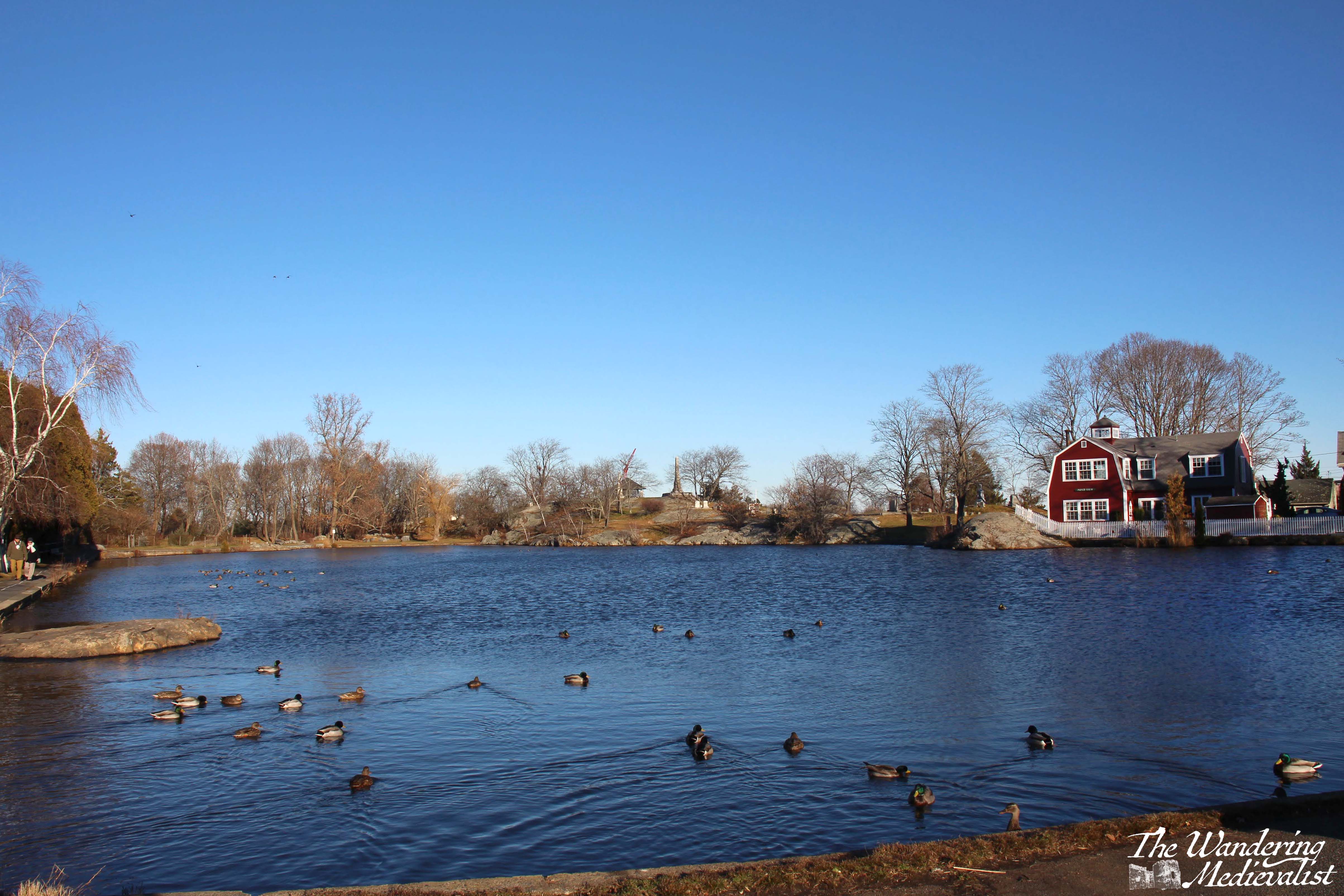
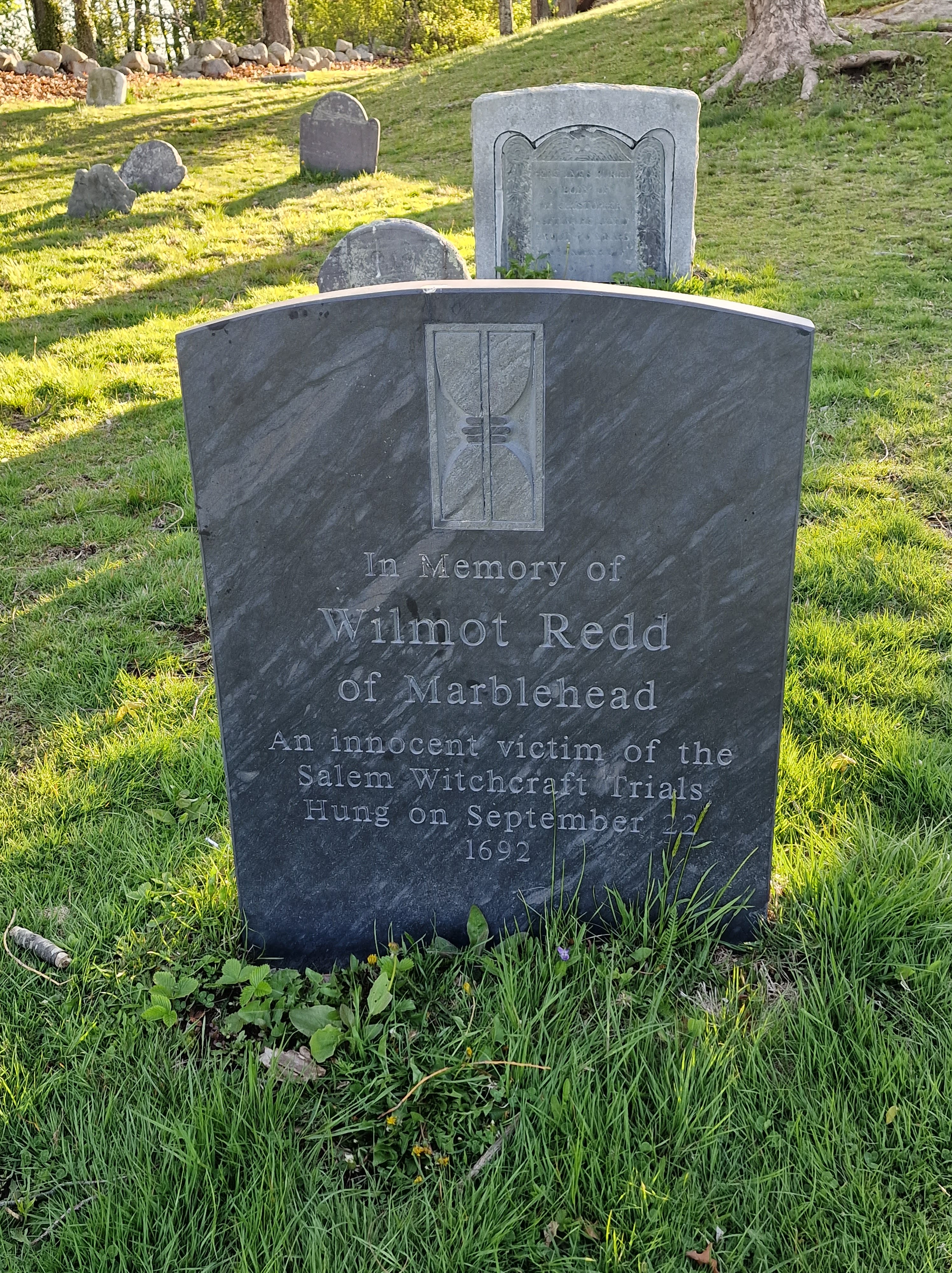
Redd’s Pond was named for Wilmot ‘Mammie’ Redd, who was one of the only non-Salem residents taken as a victim of the famous Witch Trials of 1692. The pond must play a part in most if not all Marblehead childhoods, whether through memories of feeding the ducks and geese, racing toy boats, ice skating or sledding on the nearby hill. I am relatively certain that the pond does not freeze hard enough for skating as often as it did when I was young, nor is there as much snow. The path around the pond invites peaceful contemplation, and offers beautiful views up towards Old Burial Hill, with its monuments standing out against the sky.
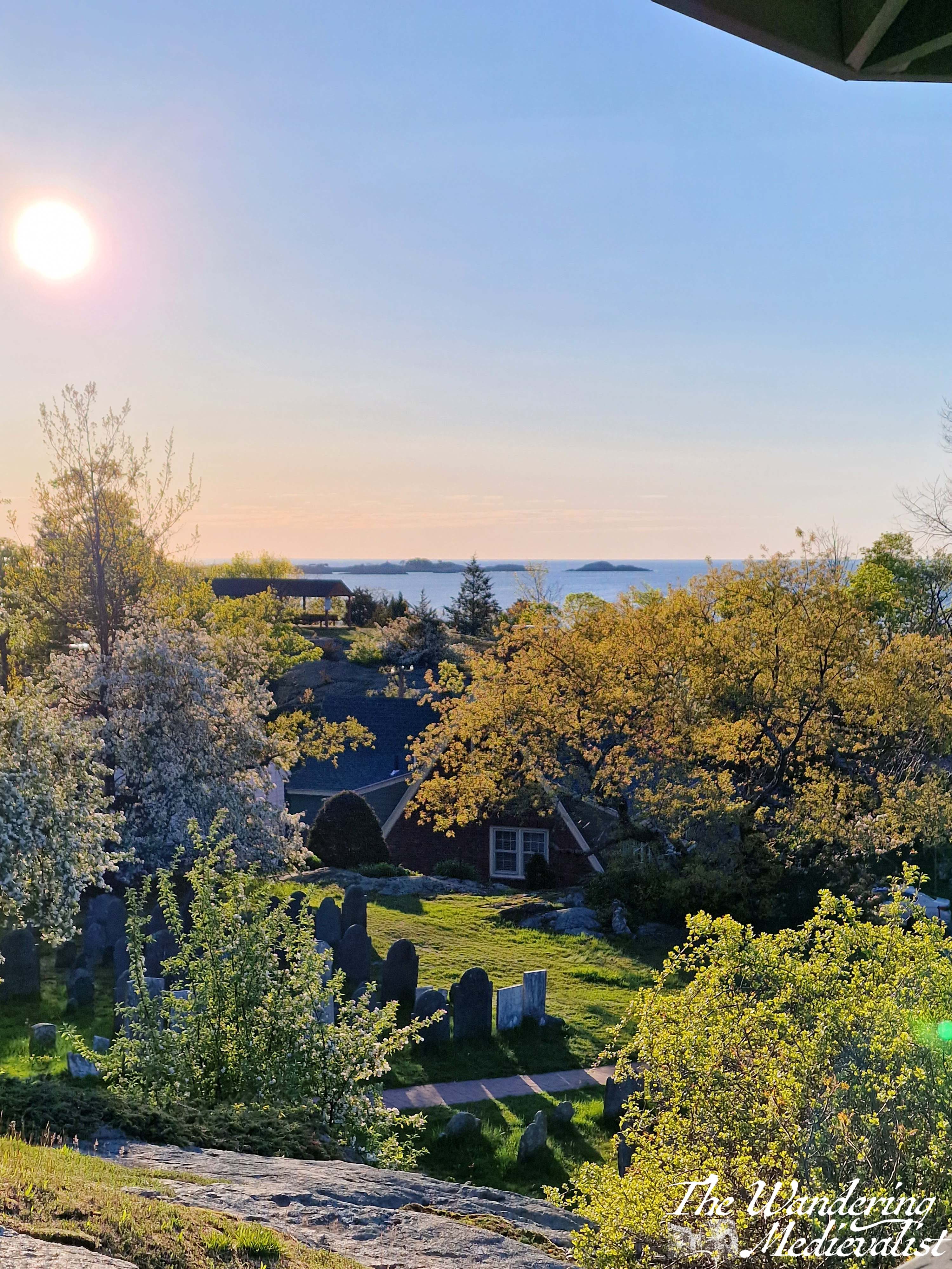
The Burial Hill was established in 1638 and is one of the oldest in New England; it is one of the highest points in town and offers clear views out to sea, over the pond, and over the harbor. I have written a great deal more about Burial Hill, but suffice it to say, it is one of the best places in town for pictures, with nothing but vistas in every direction.
10. Old Town House and State Street
The Old Town House was constructed in the 1720s as a replacement for the even older meeting house on Franklin Street, with the meeting space upstairs and space for a market downstairs. It was then supplanted by Abbot Hall in the 1870s, though it is still used actively as a town hall, polling place and Police Museum. During the Arts Festival in July, it is also used as an exhibition space, as are most public buildings in town. Its location in the middle of Washington Street makes it perfectly placed to grace many photos of old town, and it is as iconic as Abbot Hall.
Standing at the corner of Washington and State Streets, just across from the Old Town House, is another of my favourite spots in Marblehead – looking down State Street towards the Landing. Old Town Marblehead has no shortage of charming houses and crooked streets, almost all of them well-kept up and decorated for whatever the current season may be. State Street is one of the loveliest, I think, with each house painted a proper Colonial shade and most bearing a plaque telling passers by about the original owner or builder.
Honourable mention to: Memorial Park
This might seem a bit of an odd one, but I’ve included it for several reasons. Firstly, Memorial Park is where the former YMCA building stood – the site of many swimming lessons and swimming birthdays – as well as the enormous pine tree that was used for the Christmas tree lighting until both were removed in 2011.
Secondly, it is another good place for people watching, as some of the busiest streets in Marblehead intersect. The park is only steps from the Marblehead Grand Bank, the bus stop, and Starbucks.
Thirdly and most importantly, Memorial Park has an annual role to play during the Memorial Day Parade, which I marched in many times as a Girl Scout. Often under meltingly hot May sun, the parade is held every year to commemorate the loss of Marbleheaders from the Revolutionary war onwards. The primary memorial in the park centre is devoted to those who died in the Revolution, War of 1812, and Civil War, then there are additional stone slabs for each subsequent conflict. This includes, below, the memorial to those who died on 11 September 2001, of which several were from Marblehead. Two of the planes that day took off from Boston, and I recall walking through town that afternoon, when everything was quiet and flags suddenly appeared as they often do on the 4th of July. As many Americans – and doubtless those around the world – experienced, it felt very personal. Our small town, like so many, was touched by that horror. And would continue to be as the years went on.
I hope you have enjoyed this brief trip around Marblehead, and that if you ever visit yourself, you can stop by some or all of these points to experience some of the best views in town. I am personally fond of an early morning – often jet lag-fuelled – walk through Crocker Park, along Front Street to Fort Sewall, and then back over the Old Burial Hill. But I am sure all Marbleheaders have their favourite routes.
Loving these pics of Marblehead? Get one for your wall from my online shop!
For a good part of my tween and teen years, I spent several weeks each year visiting my father in Puerto Rico. So much of the island is stunningly beautiful, with sunny beaches and tree-covered mountains of a rugged nature unlike those we have in New England and Scotland. The flowers are bright yellows, pinks, oranges and clear whites, the greens varying from almost yellow to dark rich near-black hues. The architecture is modern and also historic, with cities like San Juan and Ponce demonstrating their European connections. But there is also striking damage from numerous hurricanes and generations of poverty. I recall vividly driving through the mountains past corrugated metal houses, and coming across a road that had been washed away by Hurricane Maria’s rainfall. I could spend a great deal more time discussing the economy of Puerto Rico, but this is a photo blog and not a political one; I will likely return to the topic when I post about Vieques. The many sides of Puerto Rico mystified me when I was young, and it is only during my last few visits as an adult that I have truly come to appreciate the unique nature of the place, and realise how lucky I have been to see it change over the past 30 years. I have been trying to work out the best way for me to share my favourite places for some time, so I’ve settled on my highlights of Puerto Rico, starting off with the city of Ponce, on the south coast.
Ponce
I really enjoyed our short trip down to Ponce a few years ago, and was struck by its clear European roots – the architecture is very Spanish Caribbean. Newer buildings offer views up towards the mountains that form the spine of the island. The second-largest city on the island, Ponce was founded by the Spanish in 1692. It boasts a beautiful fountain in the square and the extraordinary Rincón Argentino, serving mouth-watering steaks.
In the mountains above Ponce is Hacienda Buena Vista, an old coffee plantation run on water power. It is beautiful and fascinating, with several enormous water wheels and a series of tunnels and rivulets carrying water all over the plantation.
Hacienda Gripiñas
Further into the mountains near the town of Jayuya is Hacienda Gripiñas, another old plantation that has been transformed into an inn. Dad took me here many years ago and it stood out in my mind for its stunning beauty in the mountains, and the fried plantains we had with breakfast. The accommodation is basic, but the food was classic Puerto Rican and the surroundings quiet and peaceful.
Mountains of Puerto Rico
As is quite common in the Caribbean, Puerto Rico boasts a coastline of beautiful beaches and interior of lush, craggy mountains. Unlike northern mountains that were smoothed by glaciers, these have lots of sharp edges and cliffs. One of the only crops that grows at altitude and on such steep hillsides is coffee, and Puerto Rican coffee is some of the best I have ever tasted (costing about $1.50 from a roadside caravan).
El Morro, Old San Juan
Castillo San Felipe del Morro is arguably Puerto Rico’s most famous building; the iconic garitas (overhanging, wall-mounted turret or sentry box) are a symbol of the island throughout the USA. Construction started in the 16th century and continued for more than 100 years, until it reached its current state in the late 1700s. While we did not manage to get inside the fortress, we did explore the outer walls and I was able to capture some of the stunning views along the north coast of San Juan, as well as one photogenic local.
Luquillo Beach
Moving eastward along the north coast of the island, one reaches the famous beach of Luquillo. At certain times of year, it is crowded with tourists and locals, taking advantage of the numerous kioskos offering food and drink refreshments like seafood, burgers, chicken, beer and cocktails. It is also a stunning beach with plenty of palms and warm clear water. We visited on our last day and wished we had never gone anywhere else! Though we were also lucky enough to have it all to ourselves…
Seven Seas Beach, Fajardo
Our ‘local’ beach when visiting, Seven Seas is not as spacious as Luquillo but it is a great beach for a walk and a swim; the water is warm and relatively shallow, and its location makes it easy to reach. And, if you walk far enough, you can see through the trees into Laguna Grande, one of Puerto Rico’s eco-masterpieces, a bioluminescent bay. I was lucky enough to take a boat ride in a bio bay on Vieques years ago, and it is a truly unique experience.
Punta Puerca and the Vieques sound
Not a small part of Puerto Rican history is a complex and often troublesome relationship with the US government. This was embodied by the US Naval occupation of more than half of Vieques island, and the enormous Navy base at Roosevelt Roads, near Ceiba. The base has been inactive since 2004, replaced by a large area of abandoned military buildings and the Jose Aponte de la Torre Airport. The hills of Punta Puerca offer lovely views back towards Fajardo and across the sound to Vieques. I plan to write more about Vieques in the near future.
Balneario de Humacao
I cannot really recall how we ended up at this beach, other than my father must have recommended it. When we visited it was completely abandoned, and the recent hit by Hurricane Maria was evident in severely damaged palms and other foliage. The waves were a bit high for swimming and the beach quite narrow, but we were graced by a visit from the local gang of wild perros puertorriqueños. We didn’t have any food for them, so they watched us for a bit and trotted off down the beach.
El Nuevo Horizonte
One of the most stunning drives in Puerto Rico – and harrowing at times due to narrow, steep and winding path – is route 901 that runs through the community of El Negro and up along the coast before plunging down the hills into Emajagua and Maunabo.
At the apex of the road, as it tops the hills, is Restaurant El Nuevo Horizonte, where one can find amazing views and very tasty frozen piña coladas, both with and without rum.
Playa Larga
After visiting this beach for the first time, I routinely referred to it as ‘paradise beach’ (not partly because I didn’t know its real name). It is simply one of the most stunning beaches I have ever seen, lined with palm trees and with a small river that emerges from the palms to meander down towards the water. I have also taken some of my favourite pictures of all time at this beach. Yup, it’s one of the best.
Faro de Punta Tuna
First built in the 1890s, Punta Tuna lighthouse is a close sister in style to the lighthouse looking over Isabela Segunda harbor on Vieques. It sits high on a promontory with my paradise beach on one side and Puerto Maunabo on the other. When we visited in 2018 it was also one of the clearest spots to observe the hurricane damage wrought by Maria, only a few months previous (check out the scars on the palm trees in the view overlooking the beach).
Puerto Maunabo
Last but not least, La Cueva del Mar, a spot in Fajardo overlooking the marina, where you can get fantastic fish tacos and of course, piña colada 🍹.
I have been wanting to do a Puerto Rico post for some time but was a bit flummoxed on where to start. There are so many beautiful beaches and views that I could not decide if I wanted to choose one, or just highlight some of my favourites. In the end, the former won out, as I looked through my many pictures and realised that if there was anywhere in Puerto Rico that stands out, it is Sun Bay.
A bit of background – my father moved to Vieques when I was a tween, and until I moved to Scotland, I would spend several weeks there every year, usually around Christmas, my March break, and a week or two in the summer – sometimes a bit longer. My father very much used Sun Bay as a kind of wild gym, going there almost every day to walk and swim, and I always joined him. I have to admit that I have not visited this beach now in more than ten years, but I knew it very well. I gather that there have been many changes since I was last there, some caused by man and some by weather. I can attest that it is not only stunningly beautiful, but also the perfect spot for a long walk or swim.
Sun Bay is, as it sounds, a beautiful crescent-shaped beach facing south, with plenty of gorgeous sand and lined with palms and sea grapes. The palms often take a beating during hurricanes and you can never be sure how many will be there. The beach is deep enough that you can usually find a place in the shade or in the sun, and all within a few steps of the usually clear water. There used to be a swimming area marked out, with a line of buoys stretching along the length of the beach that made it very easy to swim along and stay in deep water; this also protects swimmers from boats of course. Behind the beach is a relatively well-kept road that allows you to drive the length of the shore and back to find the perfect spot for you, or continue on to Media Luna, the next beach along that was well-known for having good surf.
This road is also where I had my first-ever driving lesson, on a quiet day one January, and the parking lots adjacent to the beach were where I first practiced manoeuvring into spots and learning how hard to step on the brake and gas.
While Sun Bay is a great place for swimming it is not necessarily for snorkelling; there used to be a spot to the far left that you could swim out to, but it was not as well-developed as most of the beaches on the former Navy Base. Also, it was quite a decent swim just to get there and the waves were often strong enough to make any real enjoyment of the fish quite difficult. Even in swimming closer to the beach, though, I have seen a variety of creatures over the years including turtles, an enormous ray, barracuda, and of course plenty of fish. Out of the water, one can often spy groups of wild horses that roam the island, but seem often to congregate near the beach.
My fondest memories of the beach are the hours we would spend here alternately sitting in the sun, swimming, and taking long walks from one end of the beach to the other. As one walks towards the right – facing the water – or to the west, one finds that there are spots where the rock shelves have emerged from the sand. If ambitious, one can also cross the spit of land and look back towards Esperanza, and the often impressive boats moored there – often a mix of yachts and sailboats.
These long walks often included deep discussions of the state of the world, my life, my future, and any number of other topics; then when we had fixed our lives, or the world – in theory at least – we could cool off by diving into the waves. Or, depending upon the time of year, at least dive in – in summer months and early autumn, the sea is often so warm that it feels like bath water.
I hope that in time I will be able to dig out my older pictures of other beaches – Vieques has no shortage of stunning beaches, and many of them were prevented from development by the long occupation of the island by the US Navy. In the early years of my visiting, a good portion of the island was still being used for bombing and other training, and the impact on the local population was extreme – and a discussion for another time.
I understand that in recent years, Vieques has become an increasingly popular place for visitors, as gradually access to the island has improved and recovery from various storms has been achieved – Hurricane Maria in 2017 was particularly damaging, as it was for so much of Puerto Rico. If you do manage to visit, Sun Bay is an absolute must!
There are so many beautiful views in the world, many I have seen and many I have on my list of wishes. This list, then, is of a few that I love more than others – some of these please I have visited and photographed over and over in different seasons and lights. Some of them I have visited only once, but remain in my memory as special, unique. These are views that make me smile, take a deep breath, and feel at peace.
Unsurprisingly, quite a few of these now grace the walls of our house, as canvas prints or collages.
I hope that they bring you the same smile and peace of mind.
Boston, Massachusetts – Quincy Market
Bruar, Scotland – lower Falls of Bruar
Carcassonne, France – the medieval city of Carcassonne from the Pont Vieux
Edinburgh, Scotland – the castle from the Grassmarket
Fort William, Scotland – Glen Nevis
Fort William, Scotland – view of Loch Linnhe and Loch Eil from Meall Beag viewpoint
Glenrothes, Scotland – view from East Lomond looking west
Guardbridge, Scotland – looking across the Eden Estuary to St Andrews
Lyme, New Hampshire – Post Pond
Marblehead, Massachusetts – Fort Sewall and the harbor from Fort Sewall beach
Marblehead, Massachusetts – view of Abbot Hall and Old Town from Crocker Park
Maunabo, Puerto Rico – Punta Tuna Beach
St Andrews, Scotland – view of the castle from the Scores