For many people, January is the worst month of the year. In the northern hemisphere anyway it can be cold and dark, one is often short of money after the holiday season, early January means back to work (if you have been fortunate enough to have the season off) and there is a societal pressure to better or reinvent yourself.
But, I think January has some good aspects, too: you are getting back to a routine after an often hectic holiday period (hey, I like routine); days are getting longer so that by the end of the month you can really see that it is lighter; I like winter snow when it comes, but most of all, the LIGHT.
There can be some truly gorgeous light in late December and January, either on a crisp cold blue winter day or when the long shadows of the golden hour last for two or three. I have often been fortunate enough to get a chunk of time off in January, which is another perk.
This January has not been a particular exciting month and there have not been any huge adventures, but I have managed a few lovely day trips. I was pleasantly surprised, when looking through my camera, that I have managed to capture some really beautiful scenes that I wanted to share, if nothing else to cheer up this January which for many has been even harder than others.
New Years Day
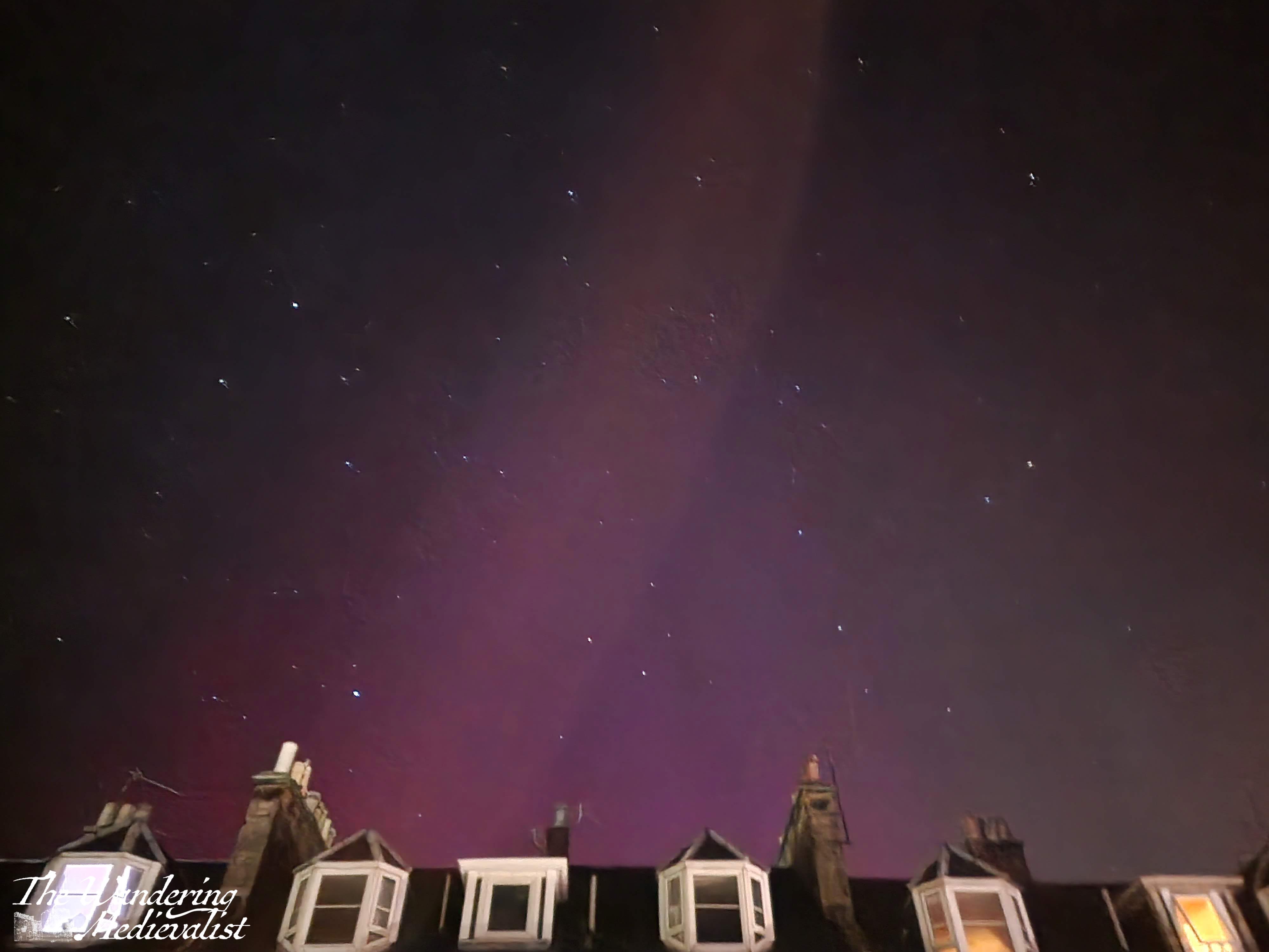
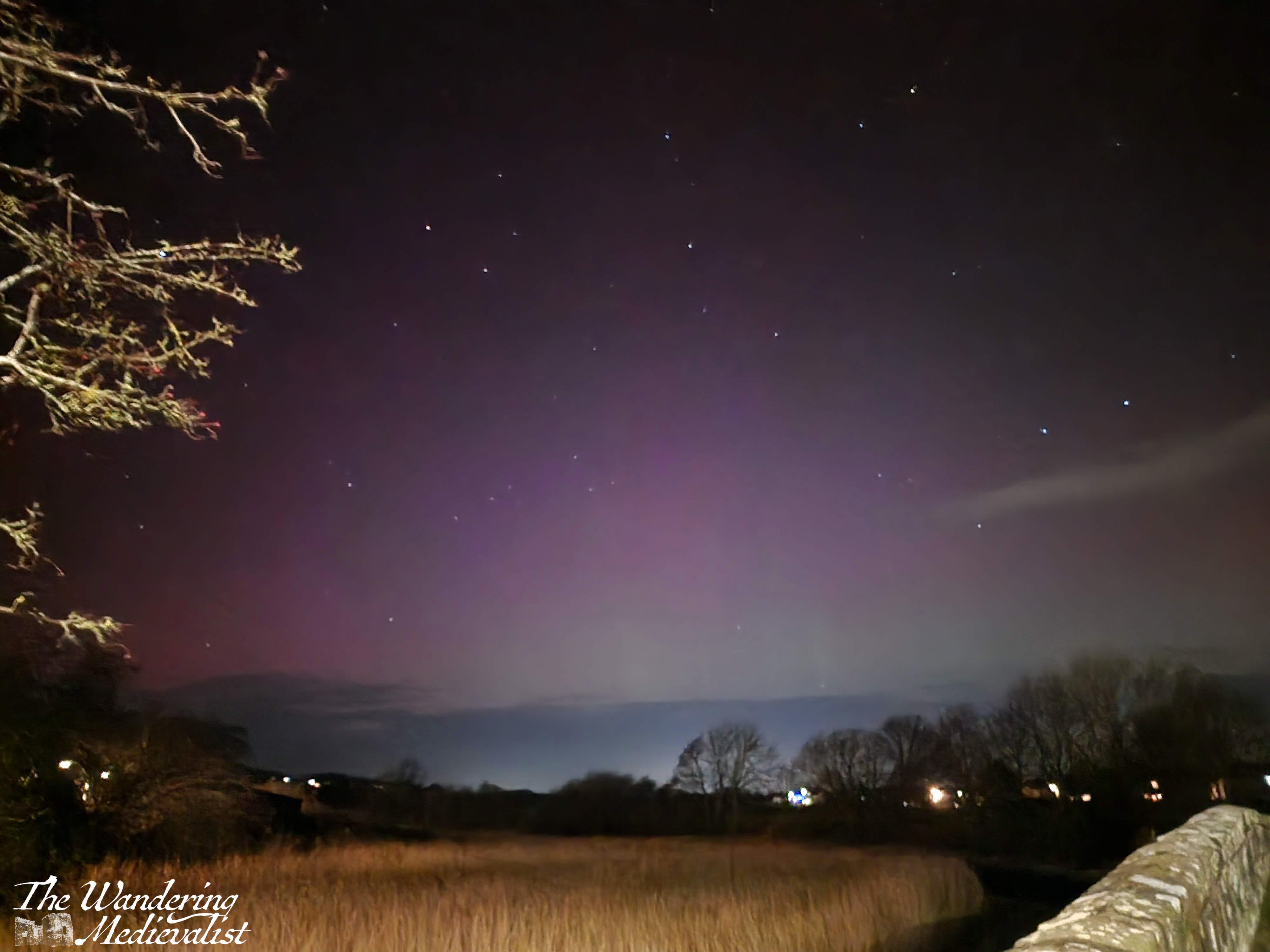
We were fortunate enough to spend New Years Eve with some good friends, and on New Years Day we had a lazy, quiet day playing games. By dinner time we were all in pyjamas or slouchy clothes, and there was a comedic scramble for coats when a WhatsApp came in stating that the aurora had been seen nearby. Sure enough, the reliable aurora tracker website was high red, and so we dashed outdoors to see what we could see. We were unfortunately a touch late for the best of the colour, but I managed a few good images (this has been my dream ever since we missed the extreme colours back in May). The rumour is that there will be lots of opportunity to see the aurora this year, and I will be consistently on high alert!
House of Bruar trip
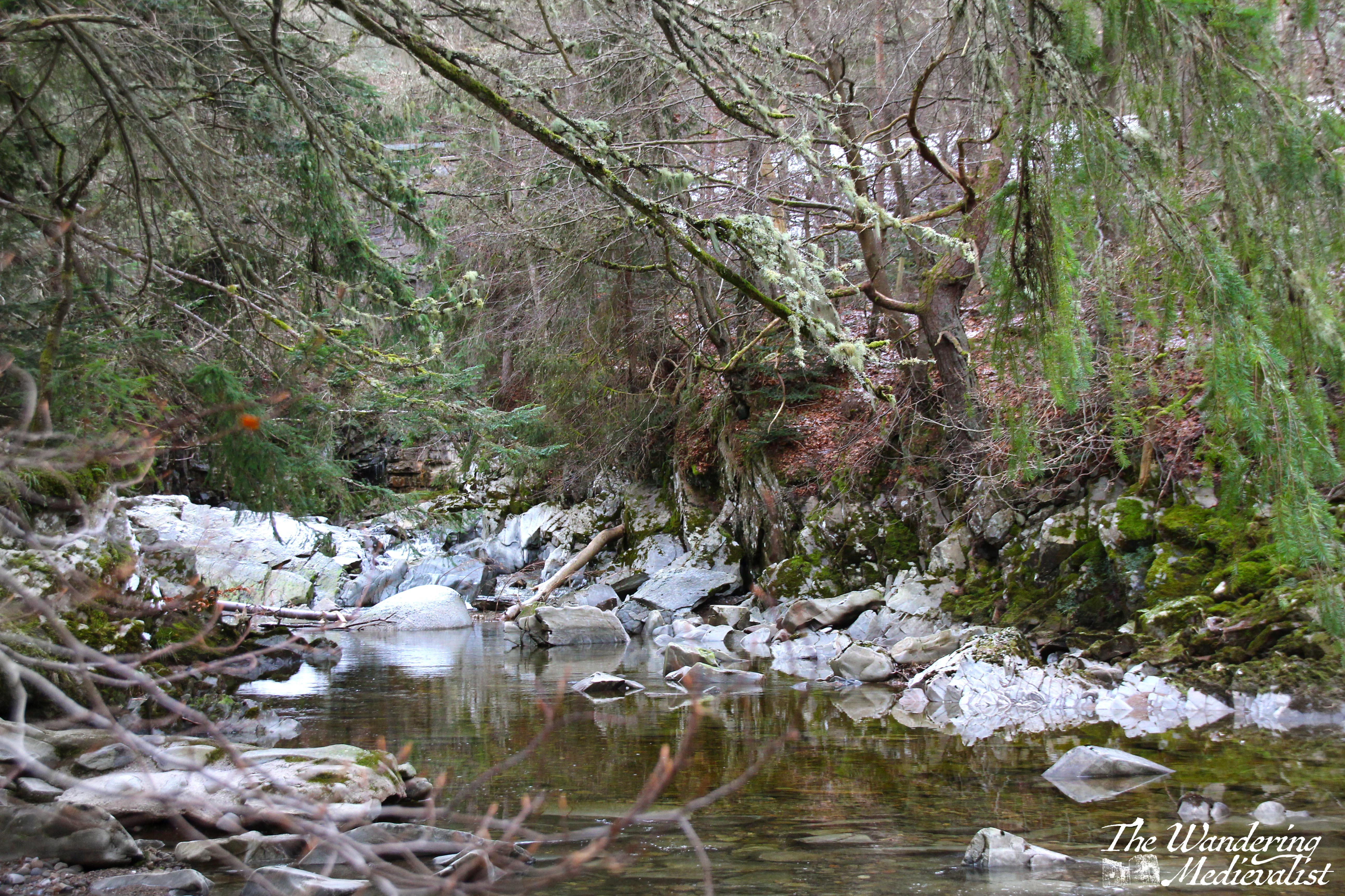
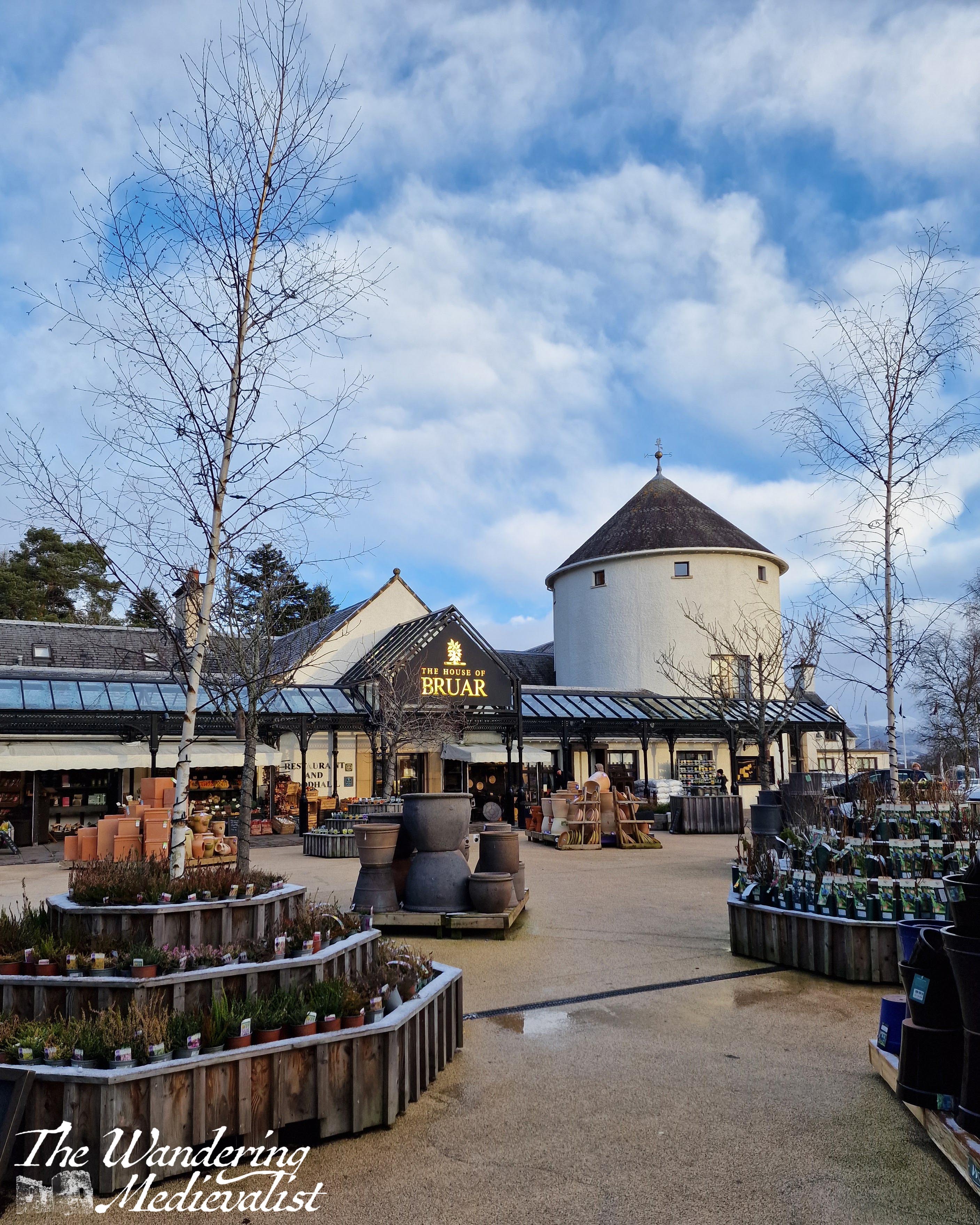
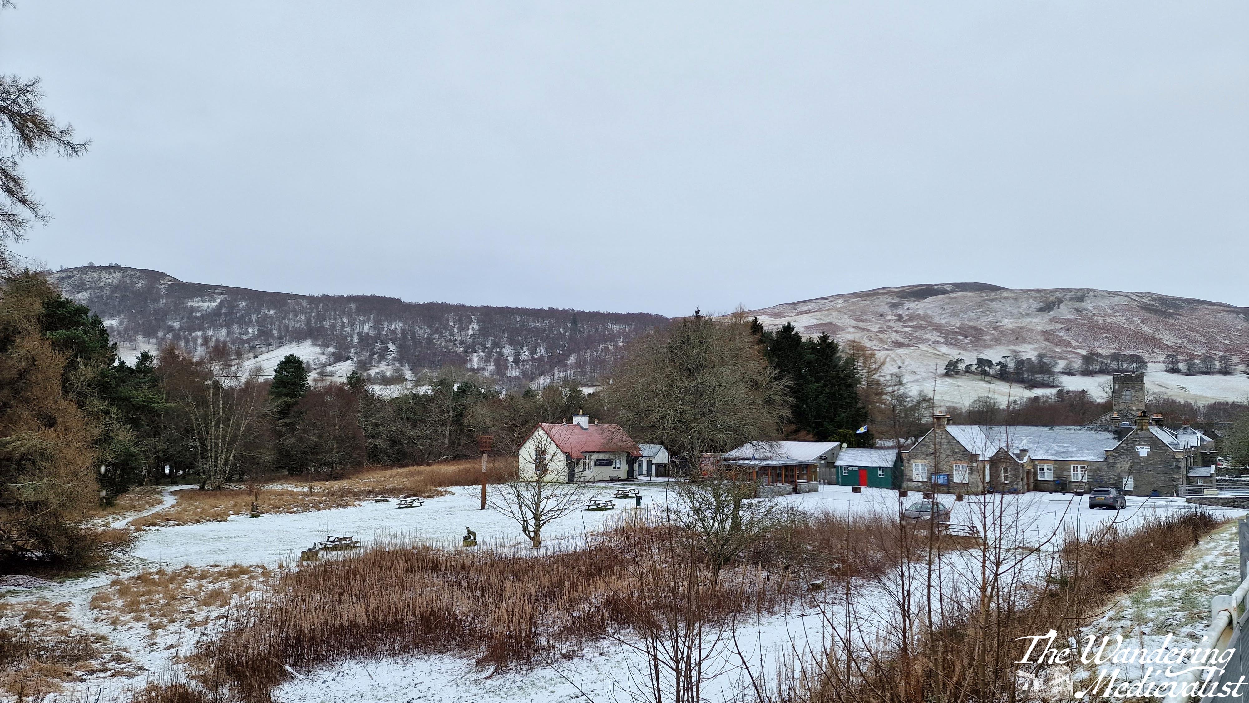
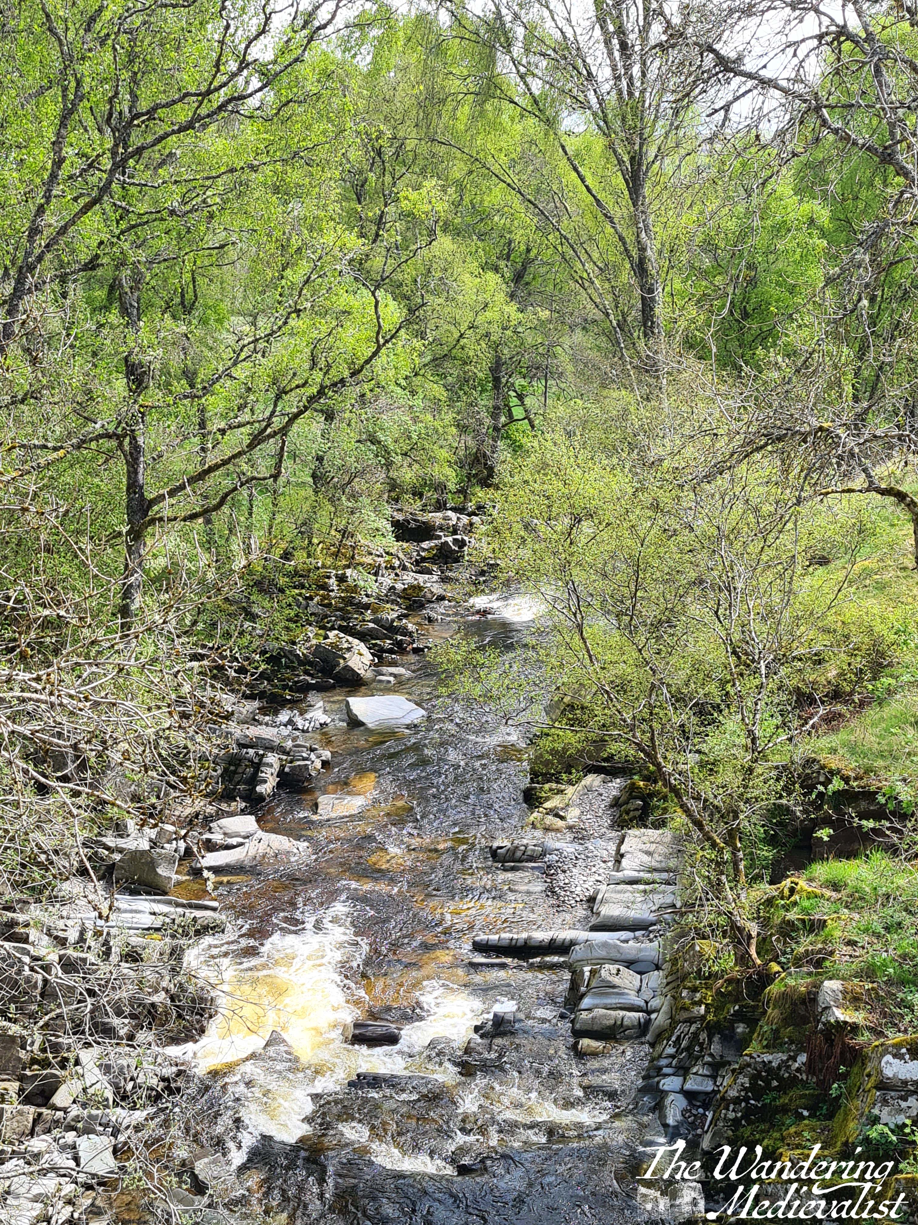
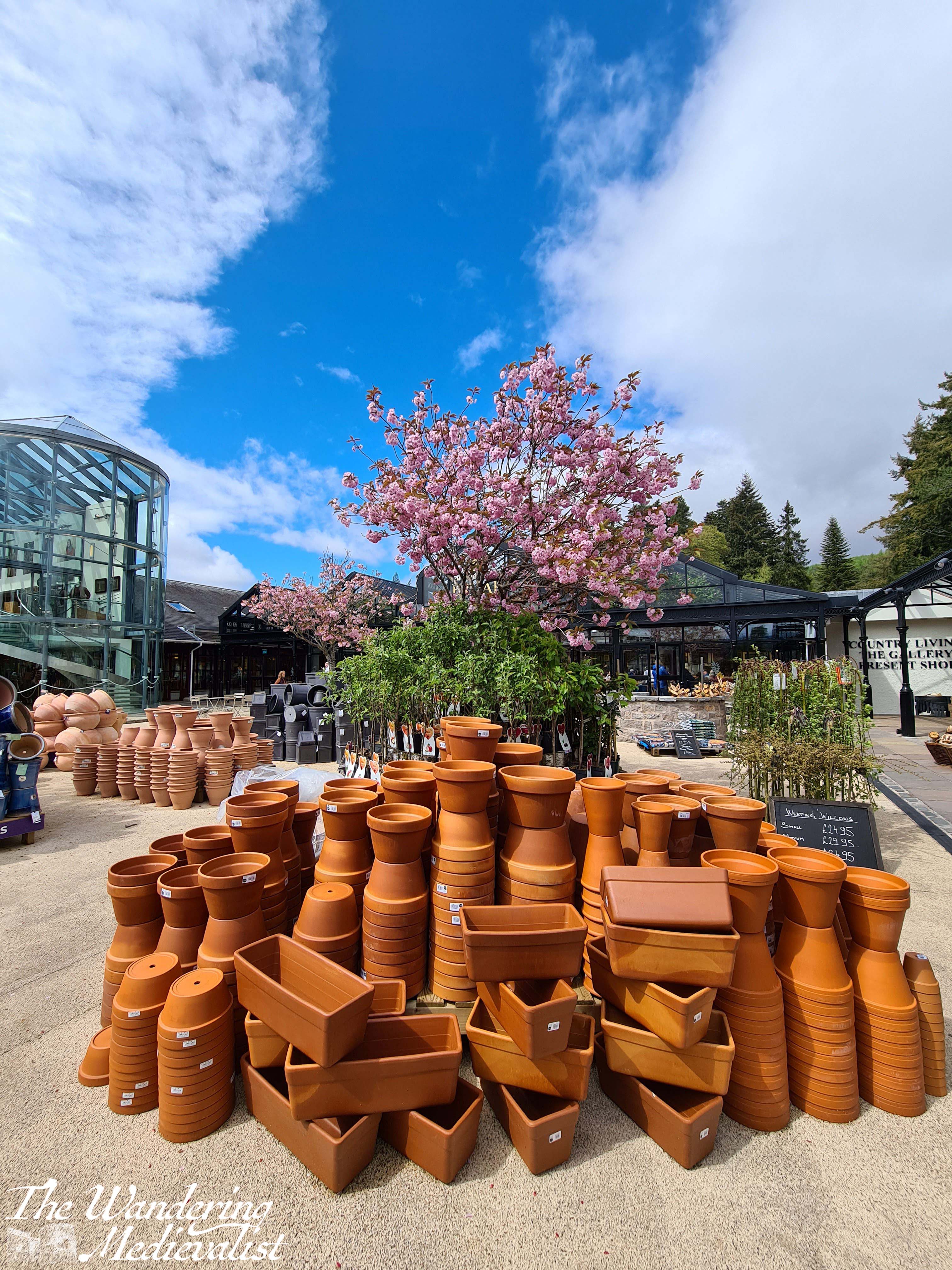
Whenever Mum visits, we must make the time to visit the House of Bruar. We managed to visit on a cold quiet day when the food hall and shops were even quieter than normal. While Mum browsed the woollens, I took a short walk around the edge of the grounds.
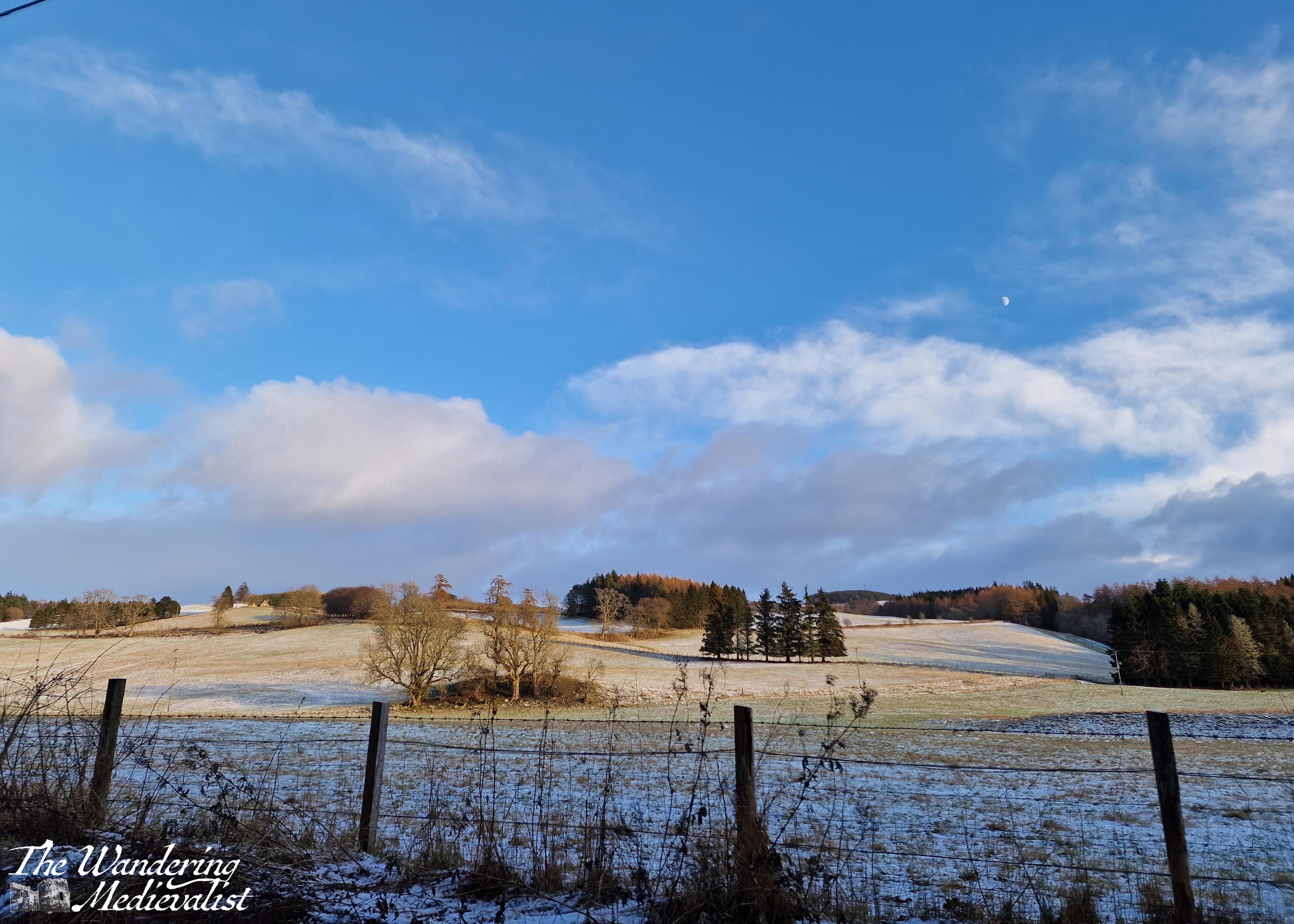
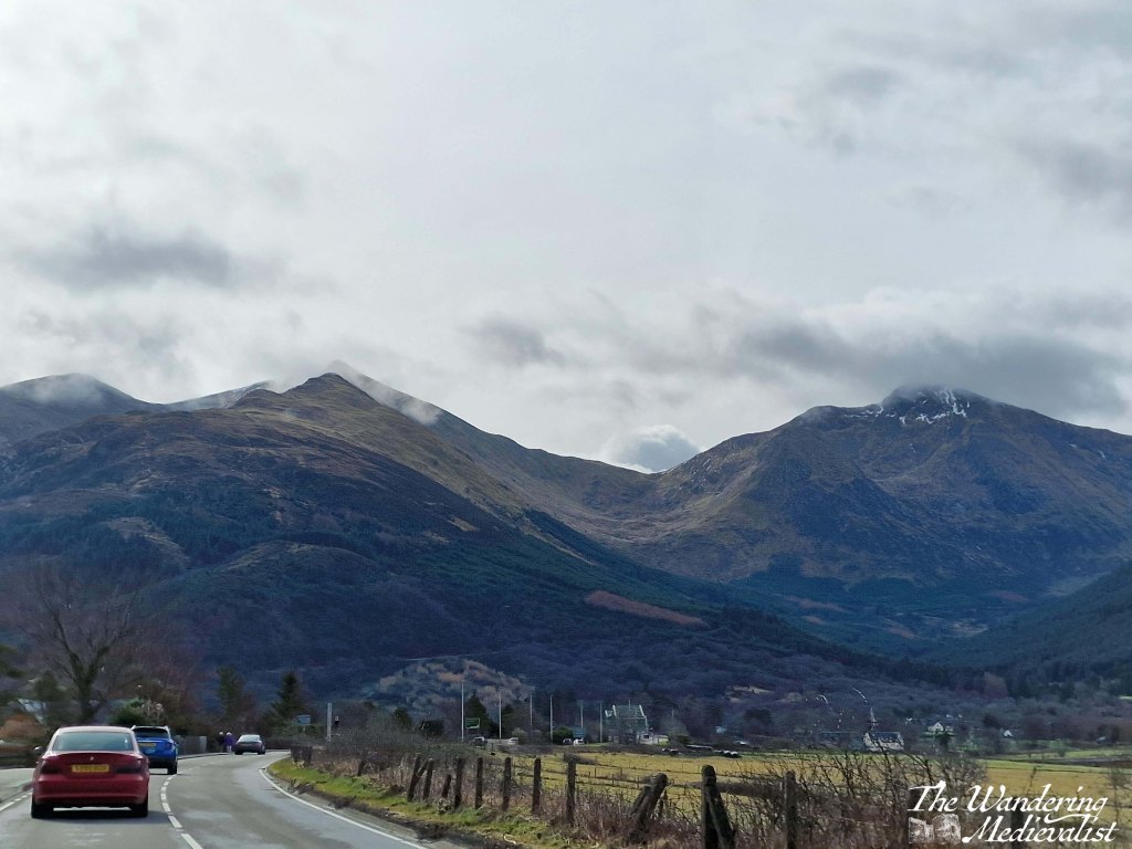
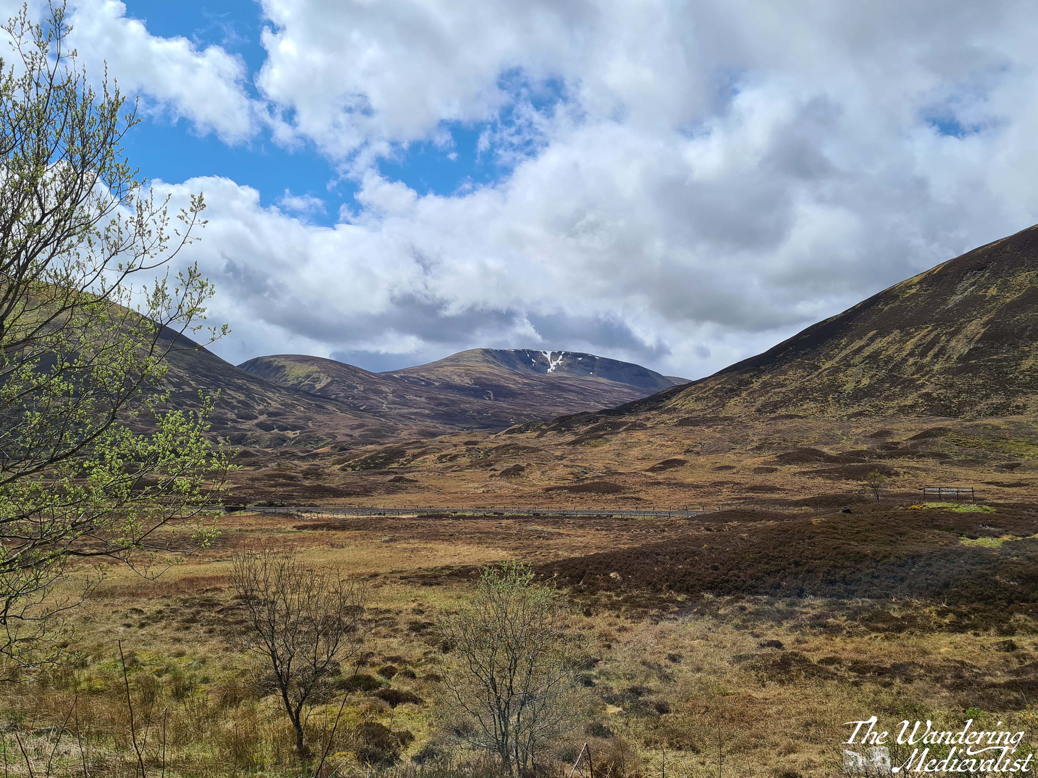
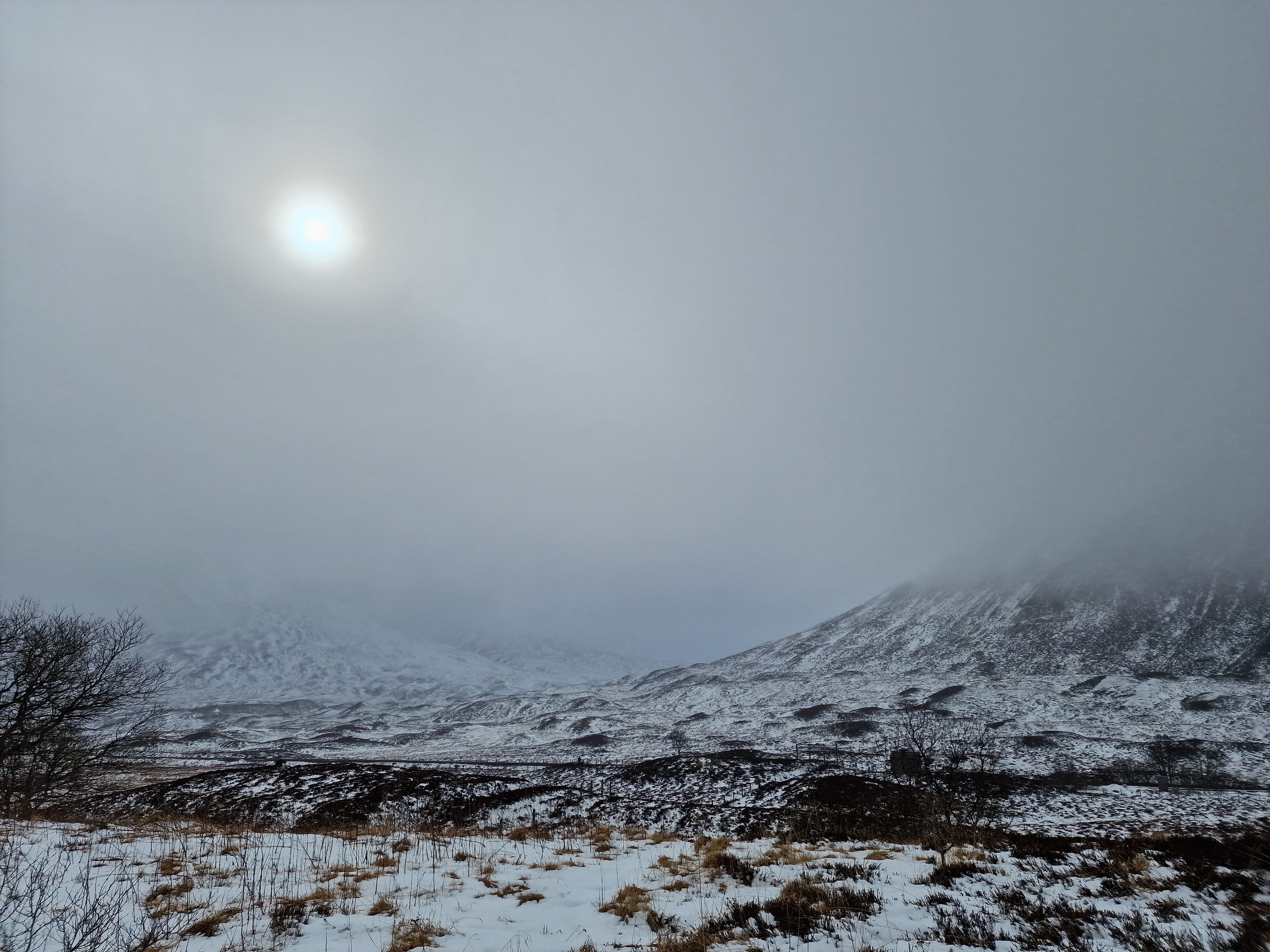
On our way home, I took us the back route through Blair Atholl, where we experienced a proper Scottish winter day – a dusting of snow, and beautiful blue sky.
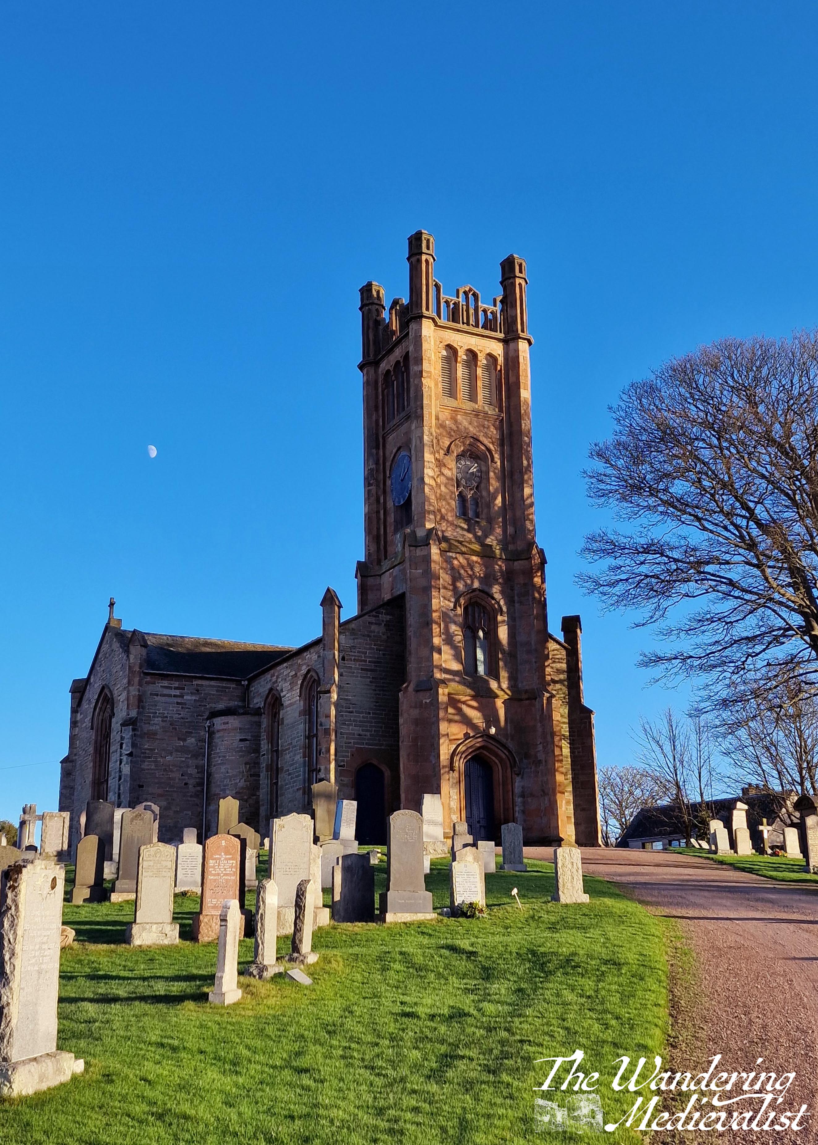
Kilconquhar
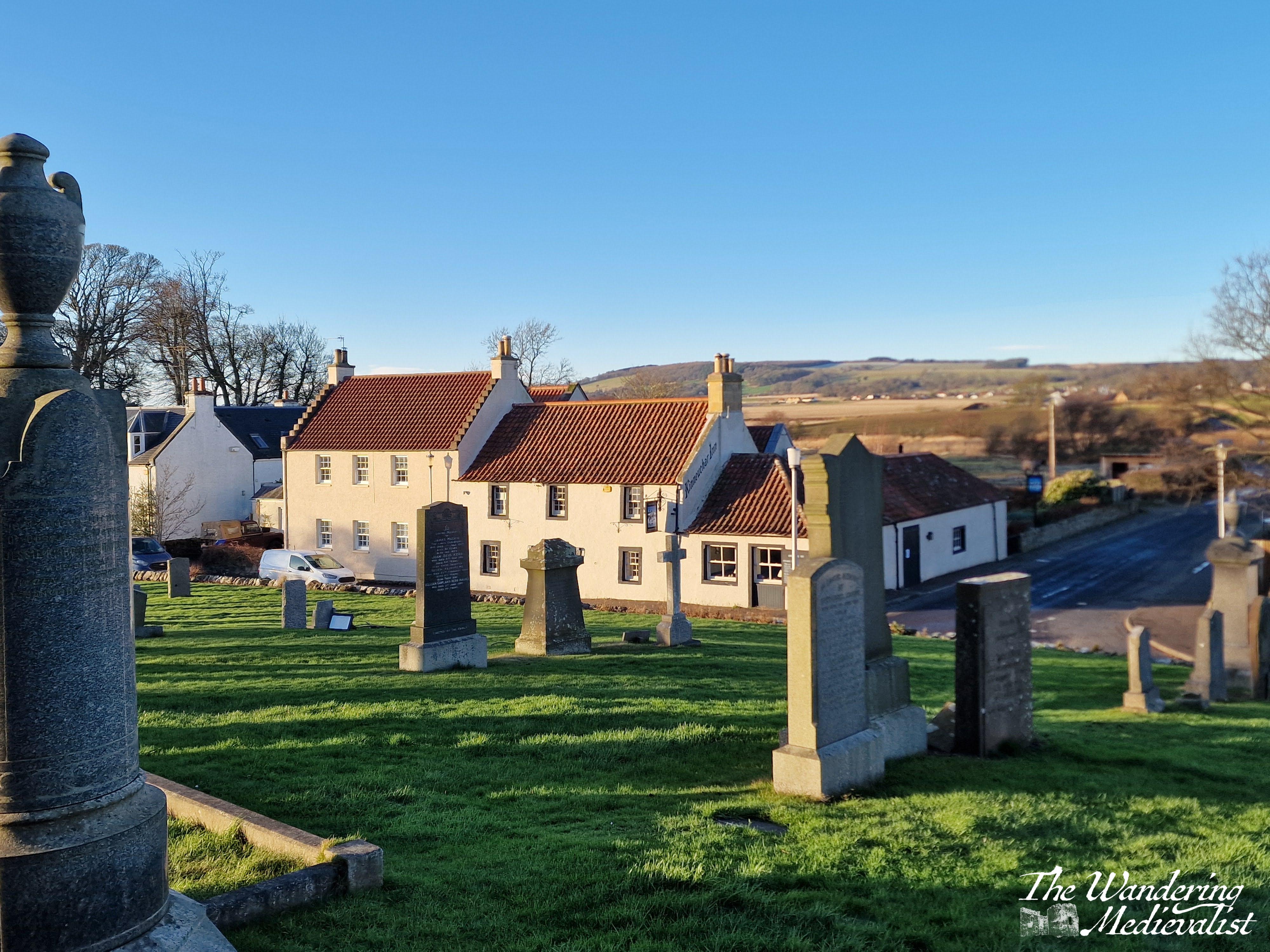
A glorious Scottish name, this village is pronounced locally as ‘Kinucker’, with the soft ‘ch’ sound rather than a hard ‘ck’, and a short ‘u’ like in luck. It is a town I love to drive through while taking visitors on a loop down through the East Neuk of Fife, visiting Elie, St Monans, Pittenweem, Anstruther and Crail. On this trip we paused briefly to explore the lovely local parish church which sits on a hill at the edge of the village. This current church is about 200 years old, but behind it are the ruins of the medieval version.
As is often the case this close to the solstice, the moon was out during the day, highlighted against the blue sky.
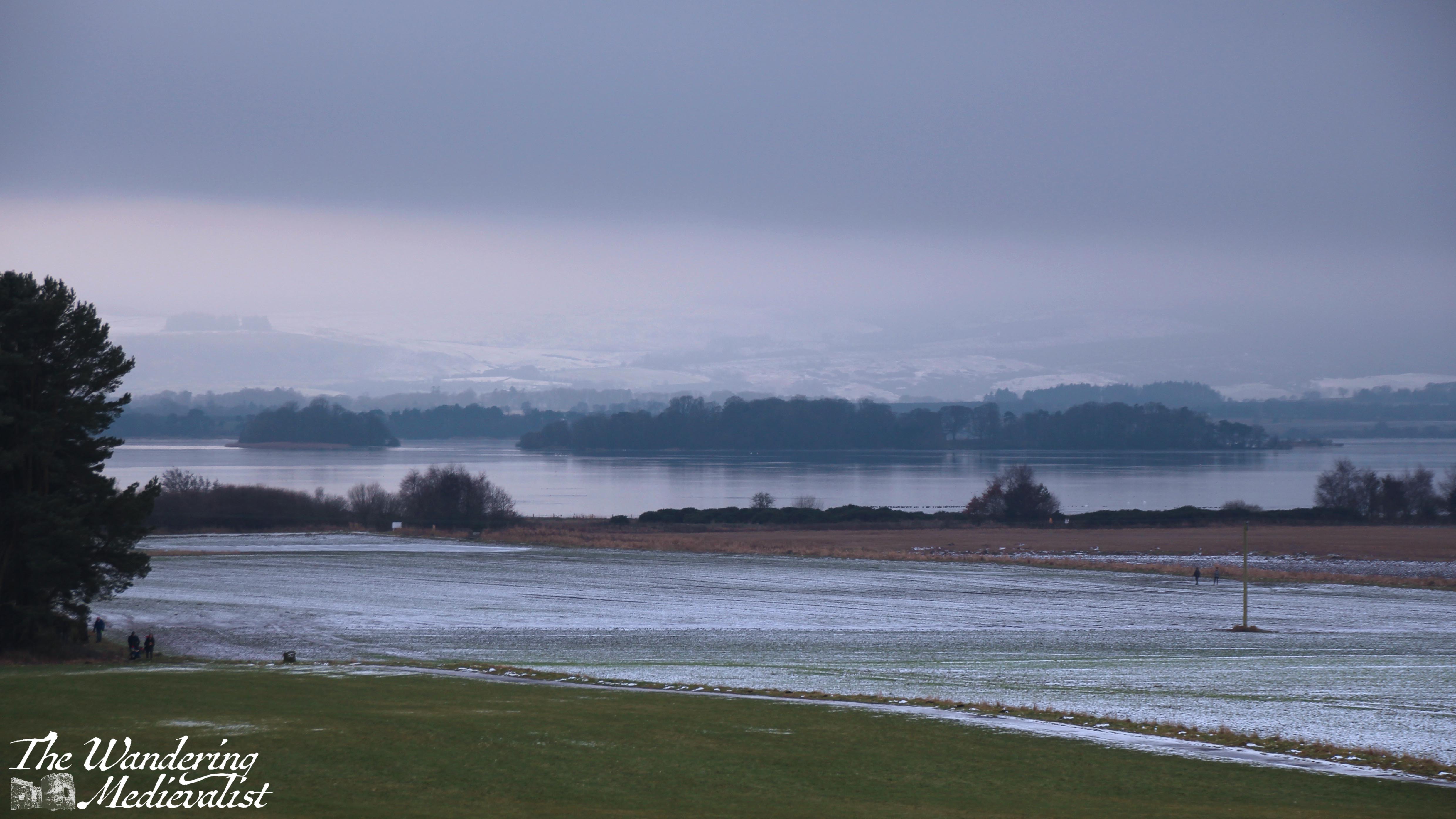
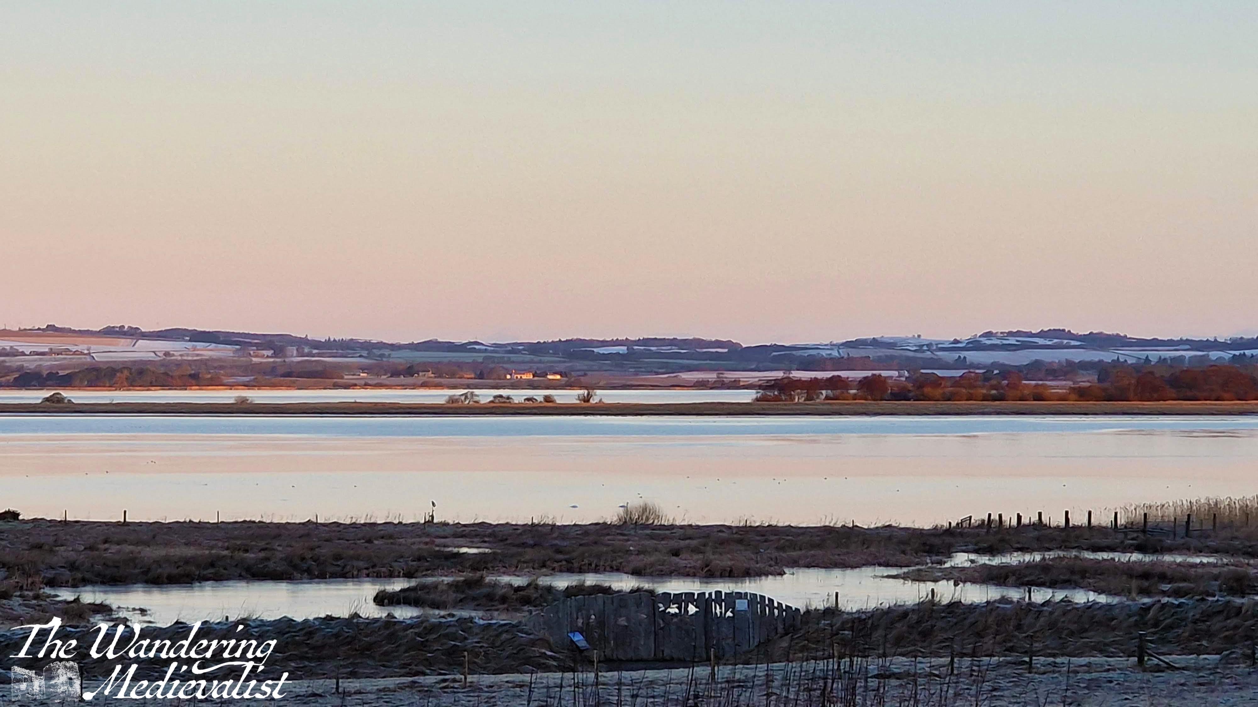
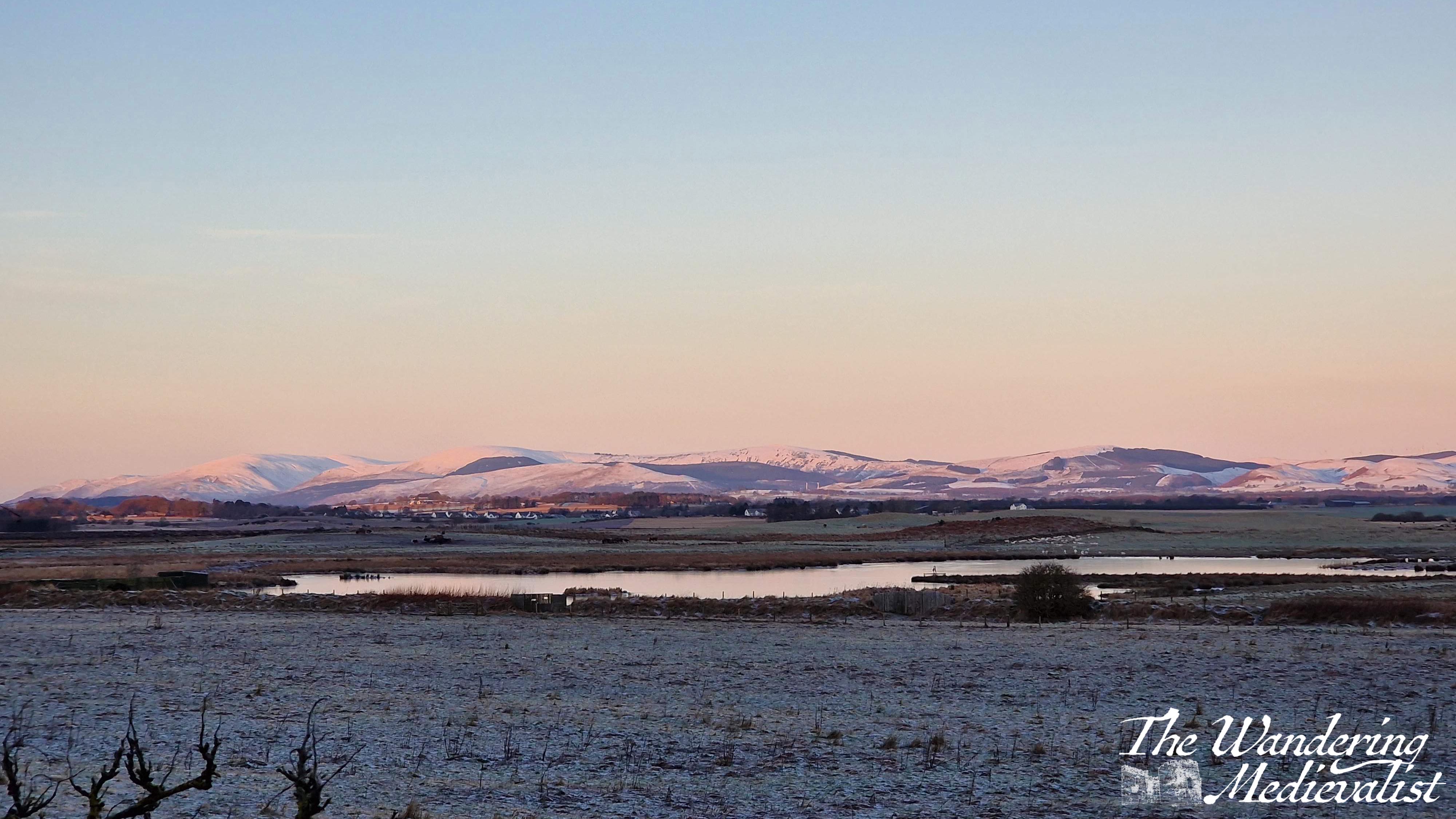
Loch Leven
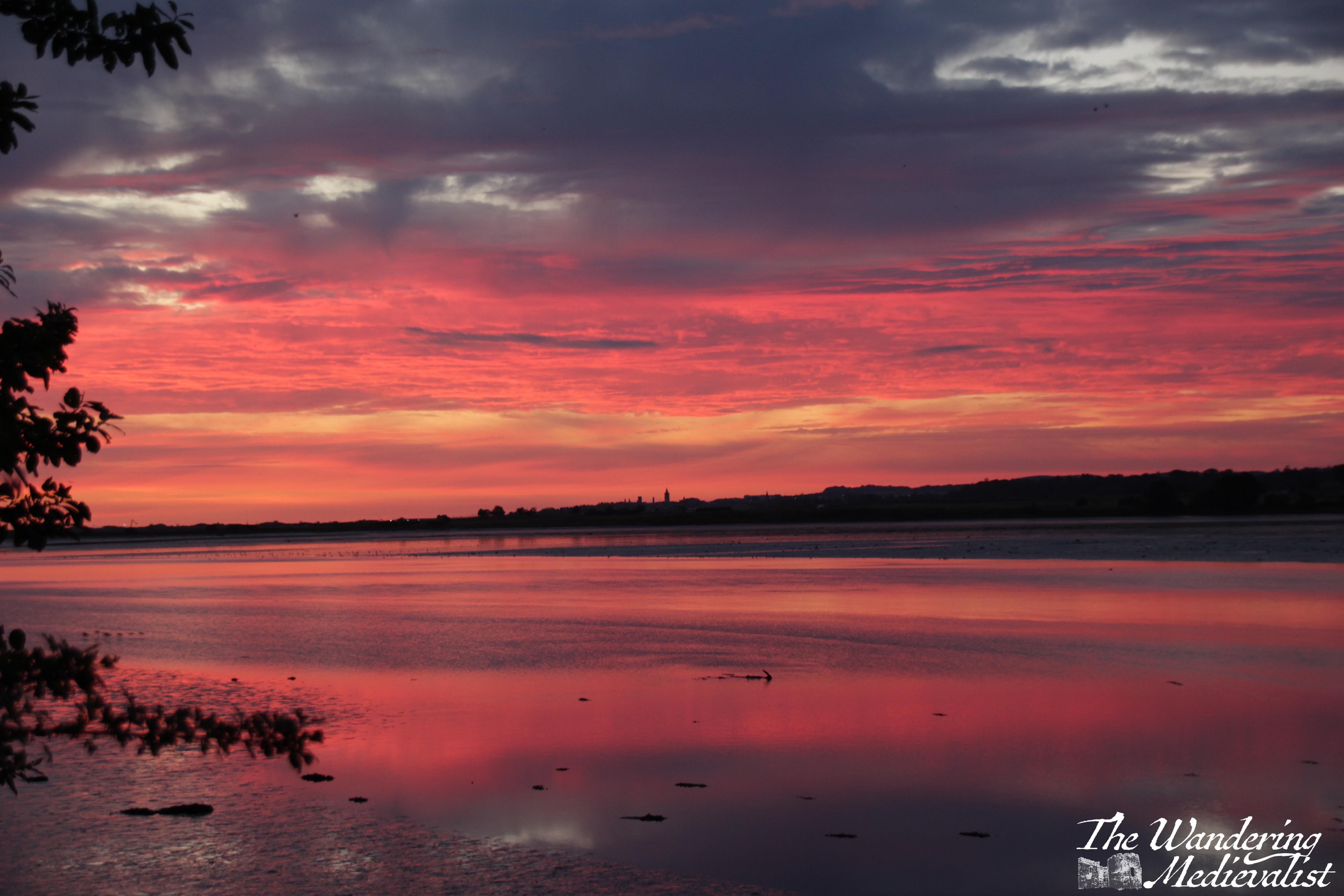
There are two primary routes that one can take from east Fife to Edinburgh. For whatever reason, I have always preferred to go straight west across the A91, driving through the villages of Auchtermuchty and Gateside before joining the motorway south. Many opt instead to go through Glenrothes on the larger A92, but according to Google, there is very little difference in time. And, my route is more aesthetically pleasing, taking in the Fife countryside as well as a view out over Loch Leven. After dropping Mum for her early morning flight, I found myself returning home on a very cold (-6°C) morning with a gorgeous pink sunrise. I could not help stopping alongside the loch for a picture or two, and made the other half come back with me that weekend for a frosty, foggy walk at Loch Leven’s Larder.
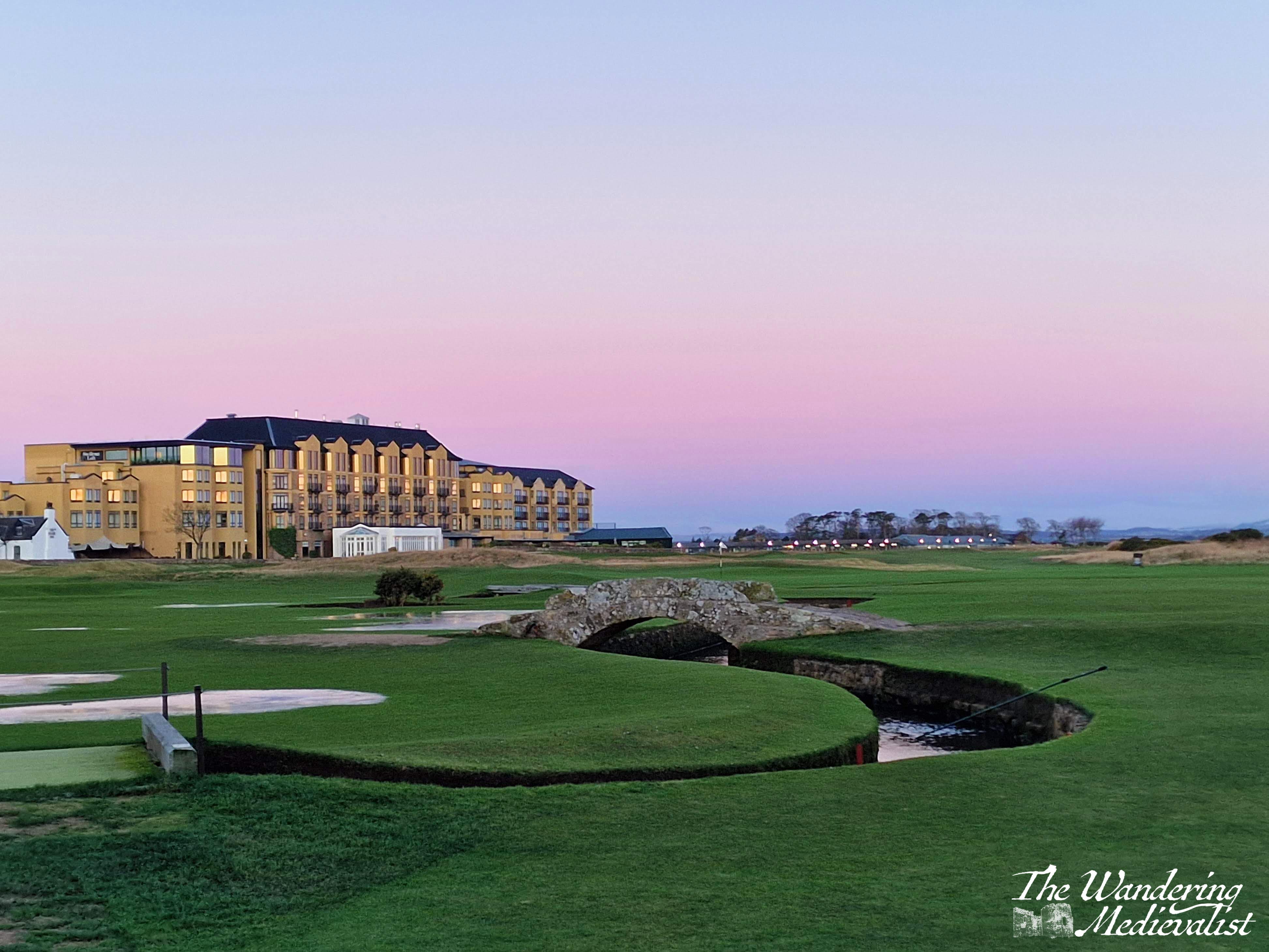
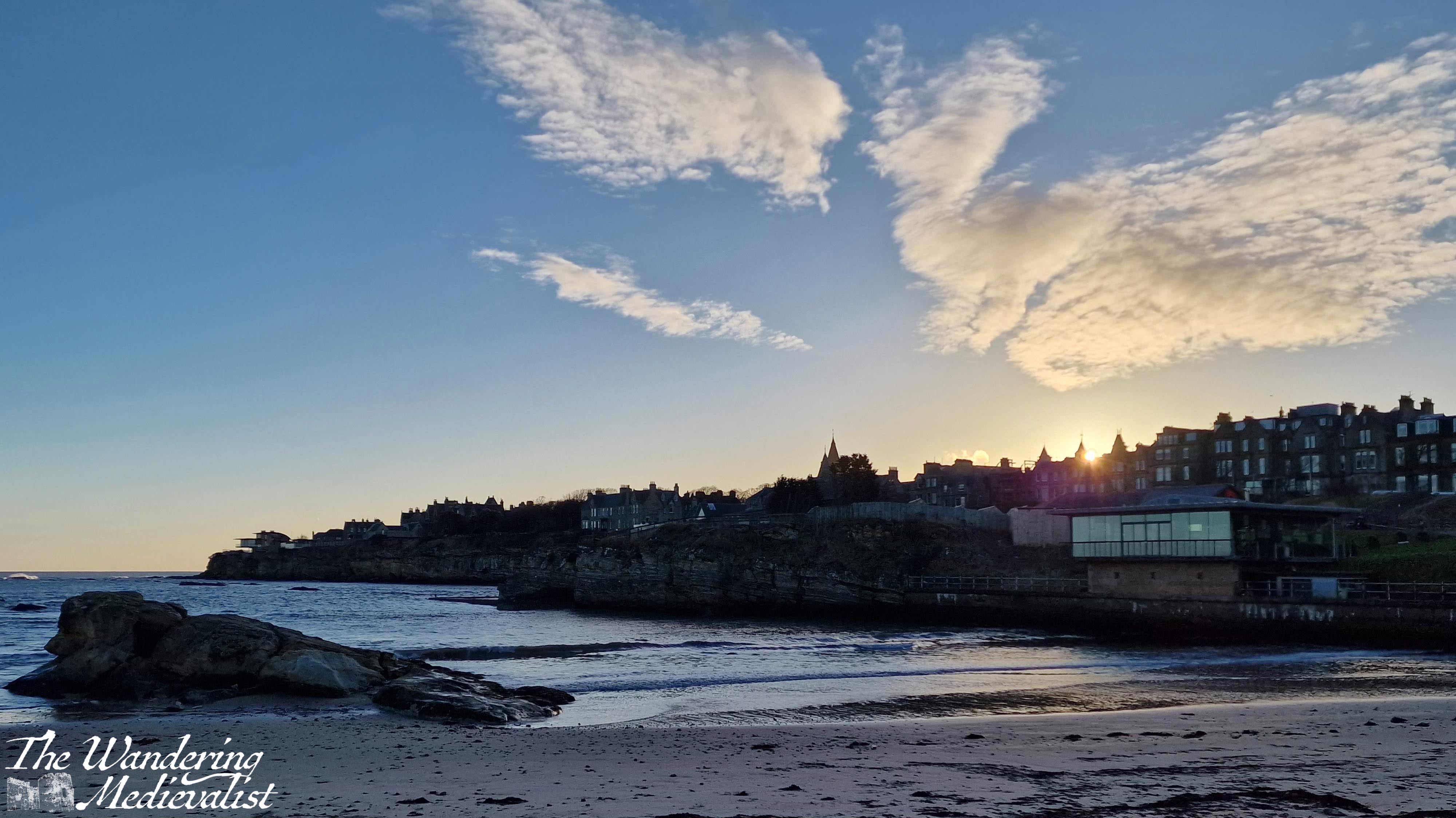
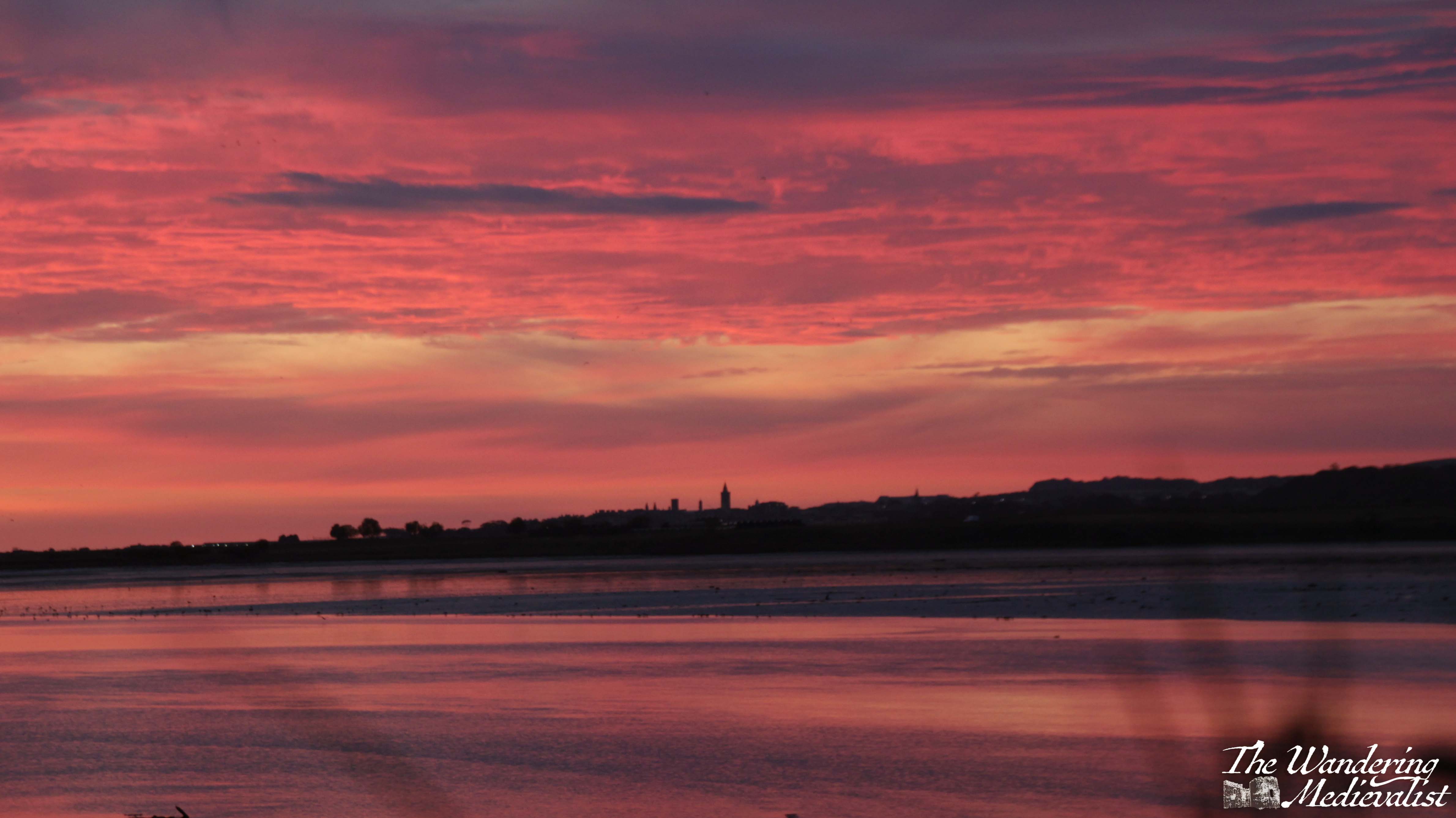
St Andrews morning walk
A few weeks ago I had an early morning appointment in St Andrews, and used the opportunity to take in some of my favourite haunts in that beautiful time of the morning when the sun is just up and casting a pink and later golden glow.
Back to work – Dundee
Getting back to work in January after a few weeks away inevitably brings on a touch of excitement and a touch of anxiety – what will the new year bring? What have I missed during my weeks off?
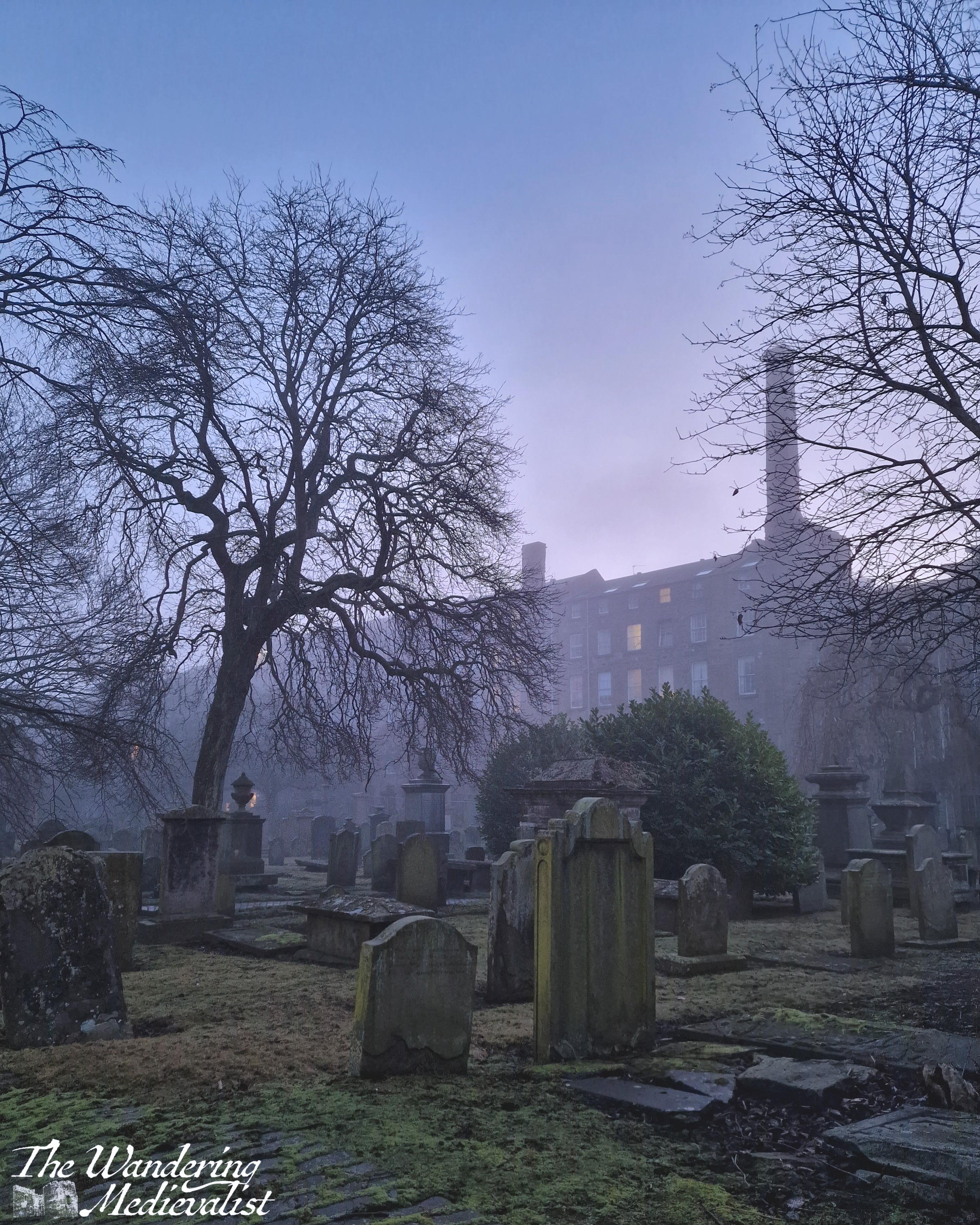
Dundee isn’t always top of the list when one is considering photography options, but as with any location, being there every day means you can capture the light – or lack of it – at just the right time and really appreciate its beauty. The sunny picture is taken just outside the Overgate mall, and the two foggy early morning shots are from the Houff, a burial ground once part of the Grey Friars Monastery destroyed during the Reformation. On this morning it reminded me more of Dickensian London and I half expected the Ghost of Christmas Yet to Come to drift across the grass.
Morning walk
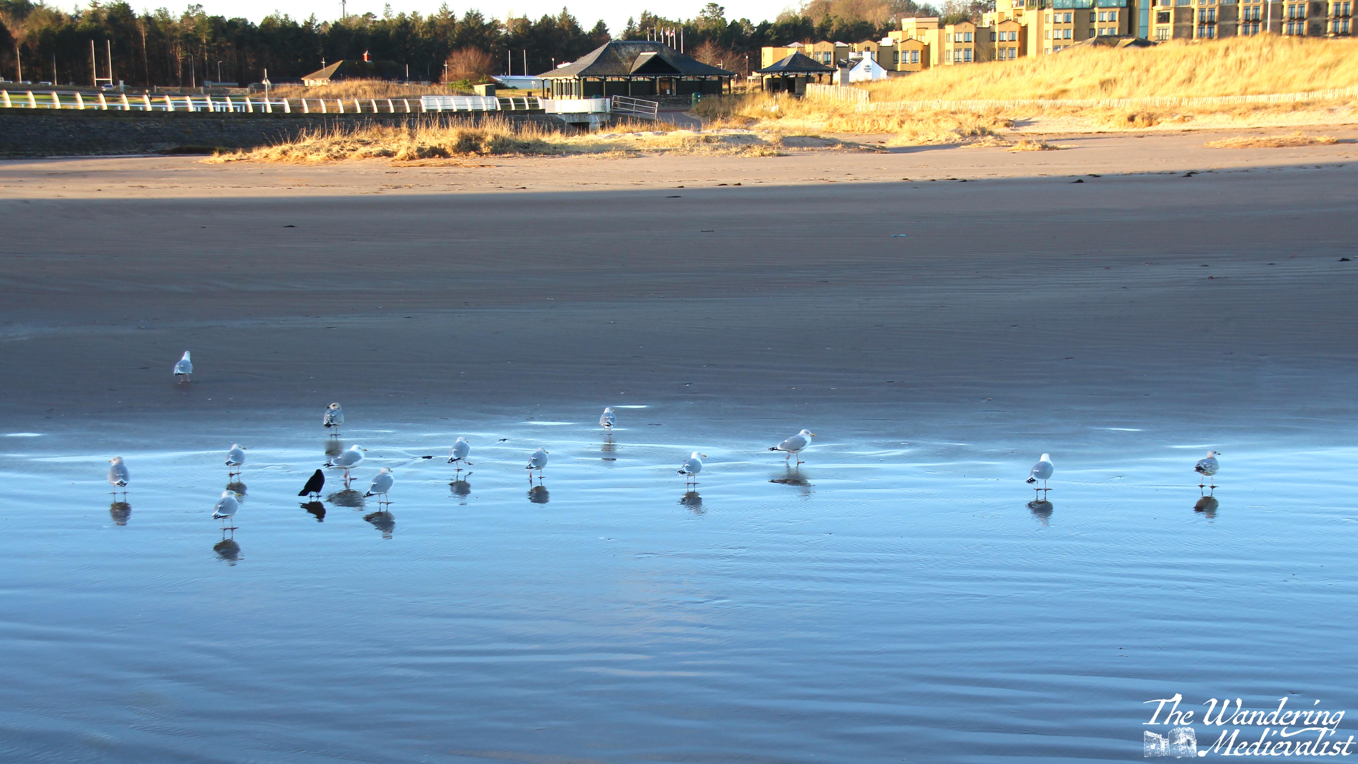
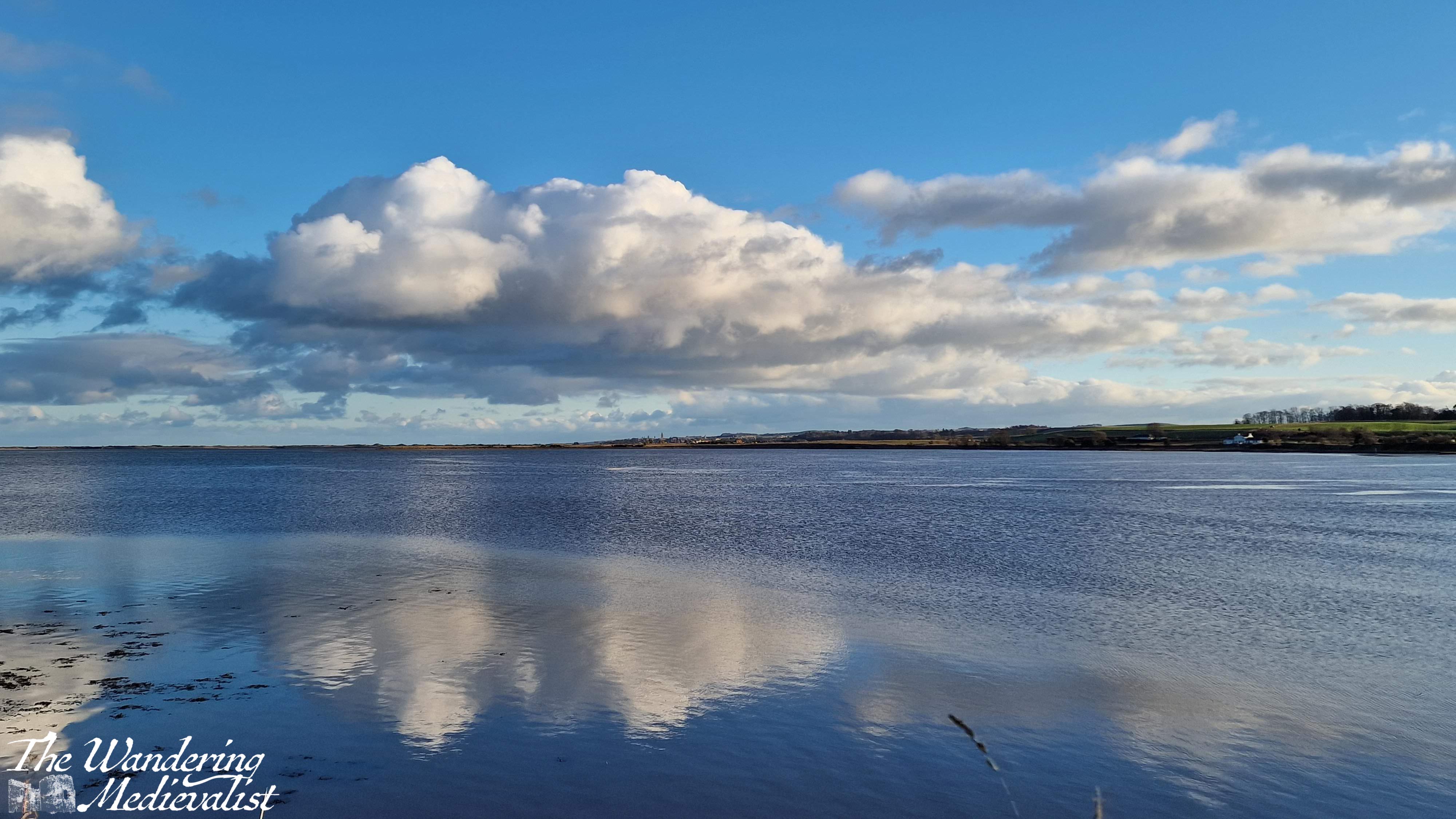
Back to work means back to the morning walk routine, and I was lucky enough to catch a few stunning winter sunrises. Dark mornings sometimes mean a lunch rather than pre-work walk, but the view across to St Andrews is just as stunning in the daylight.
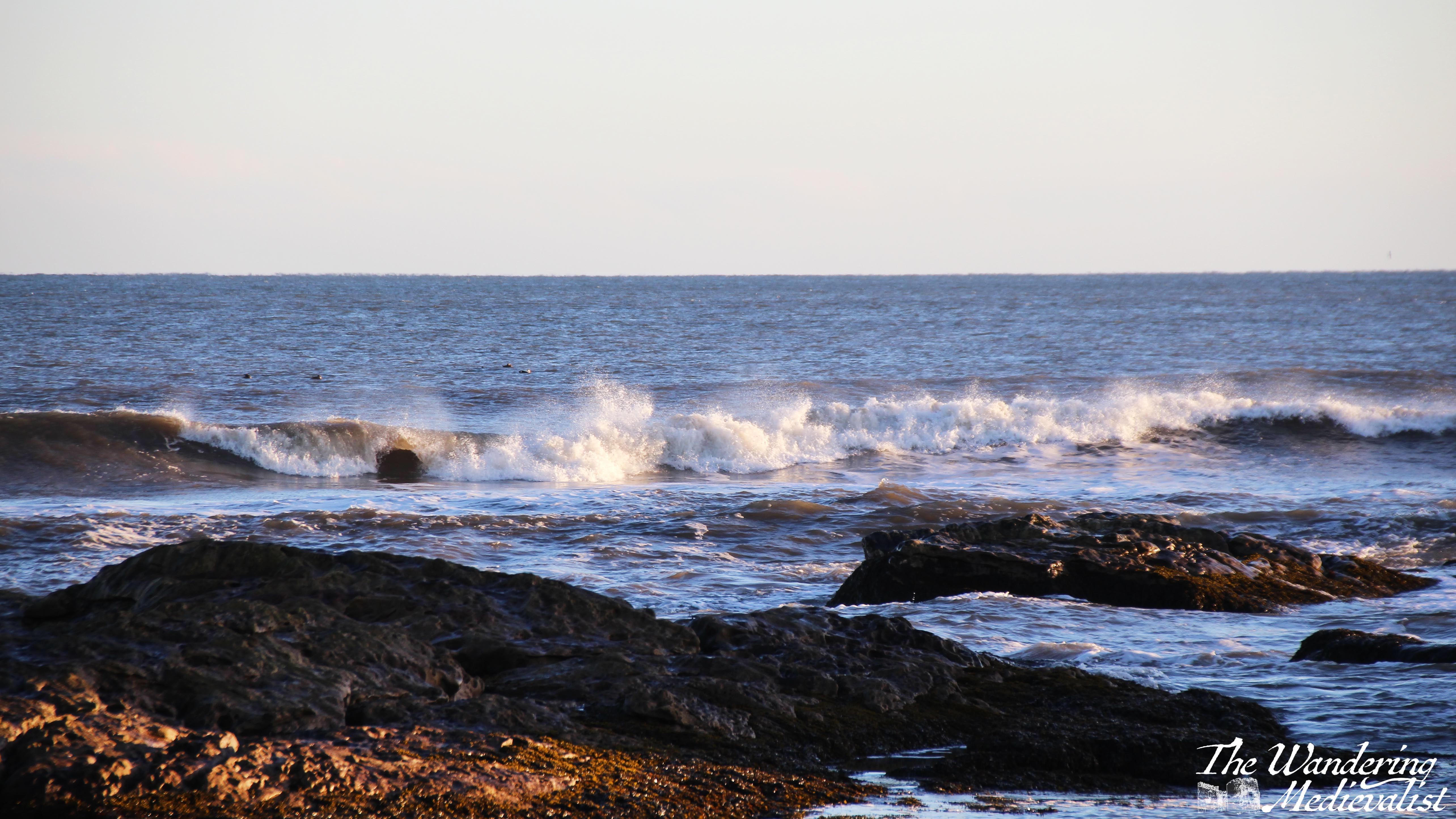
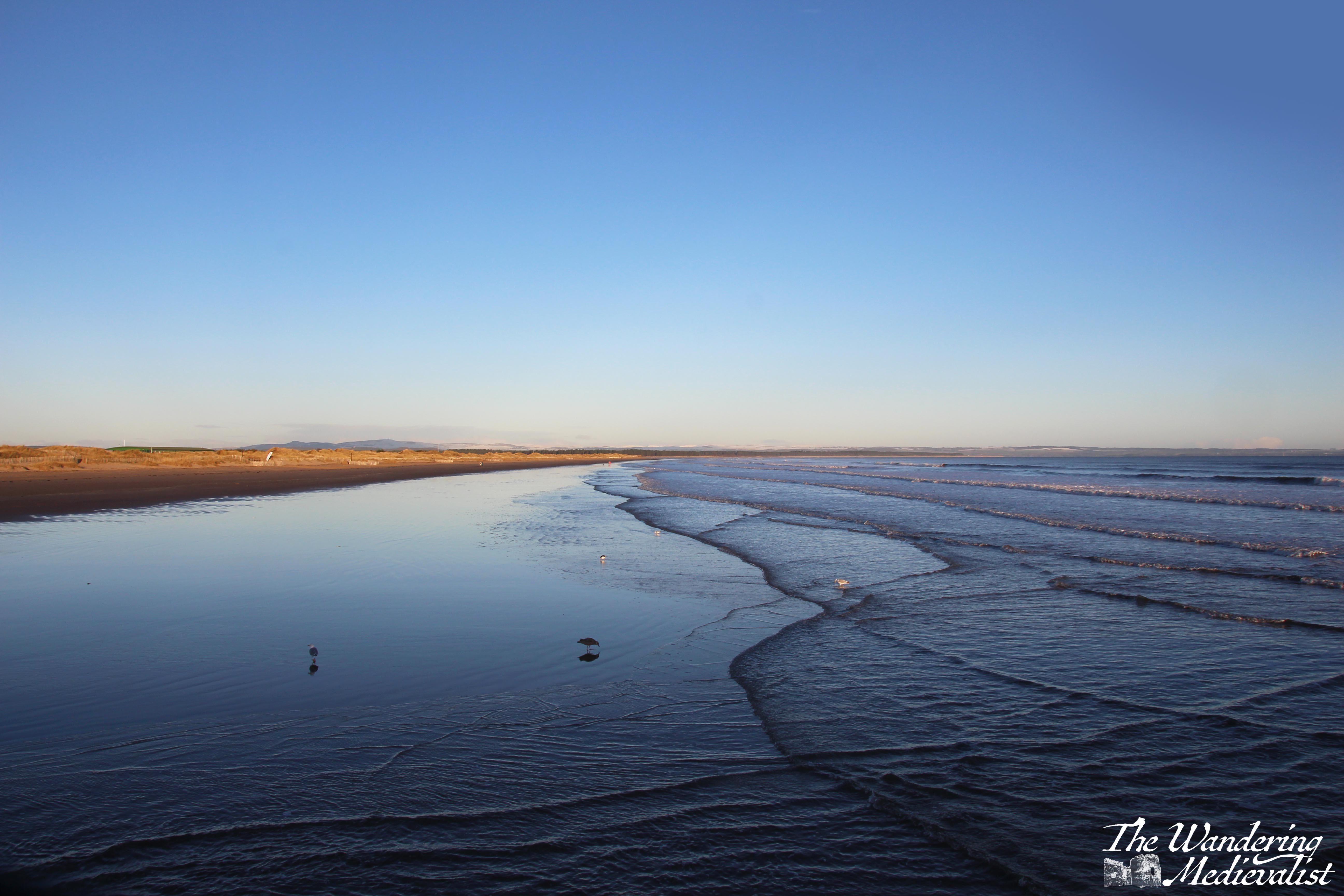
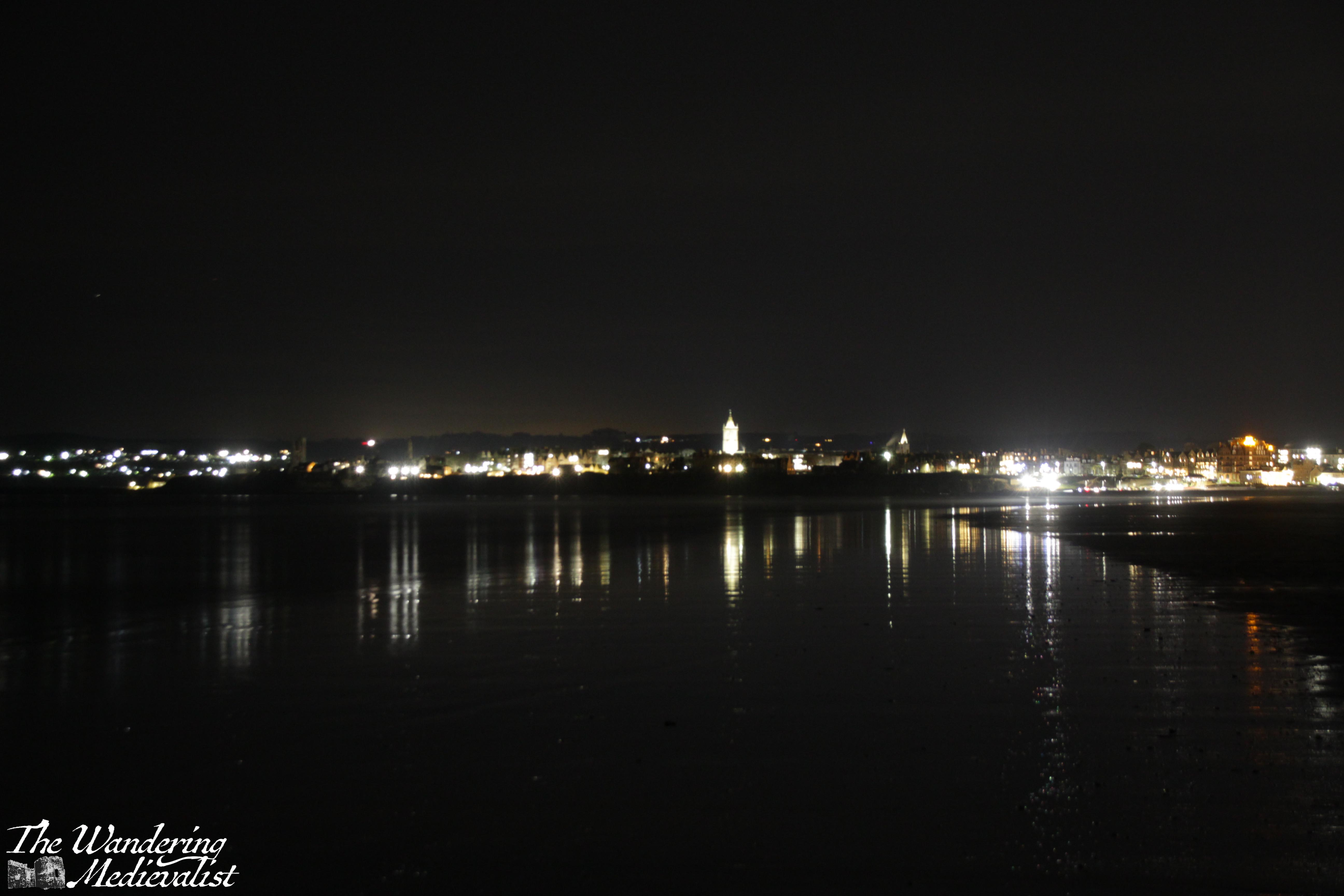
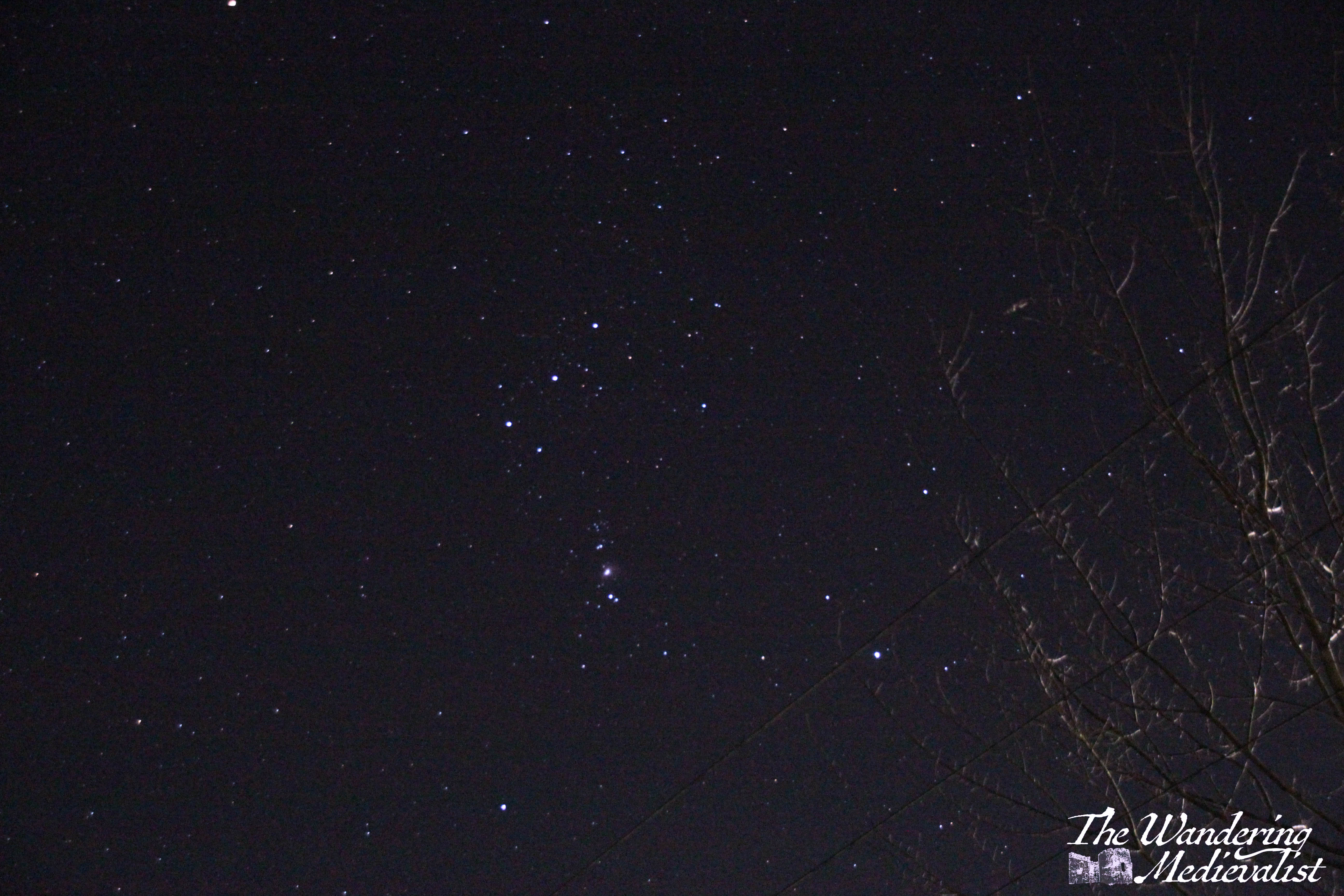
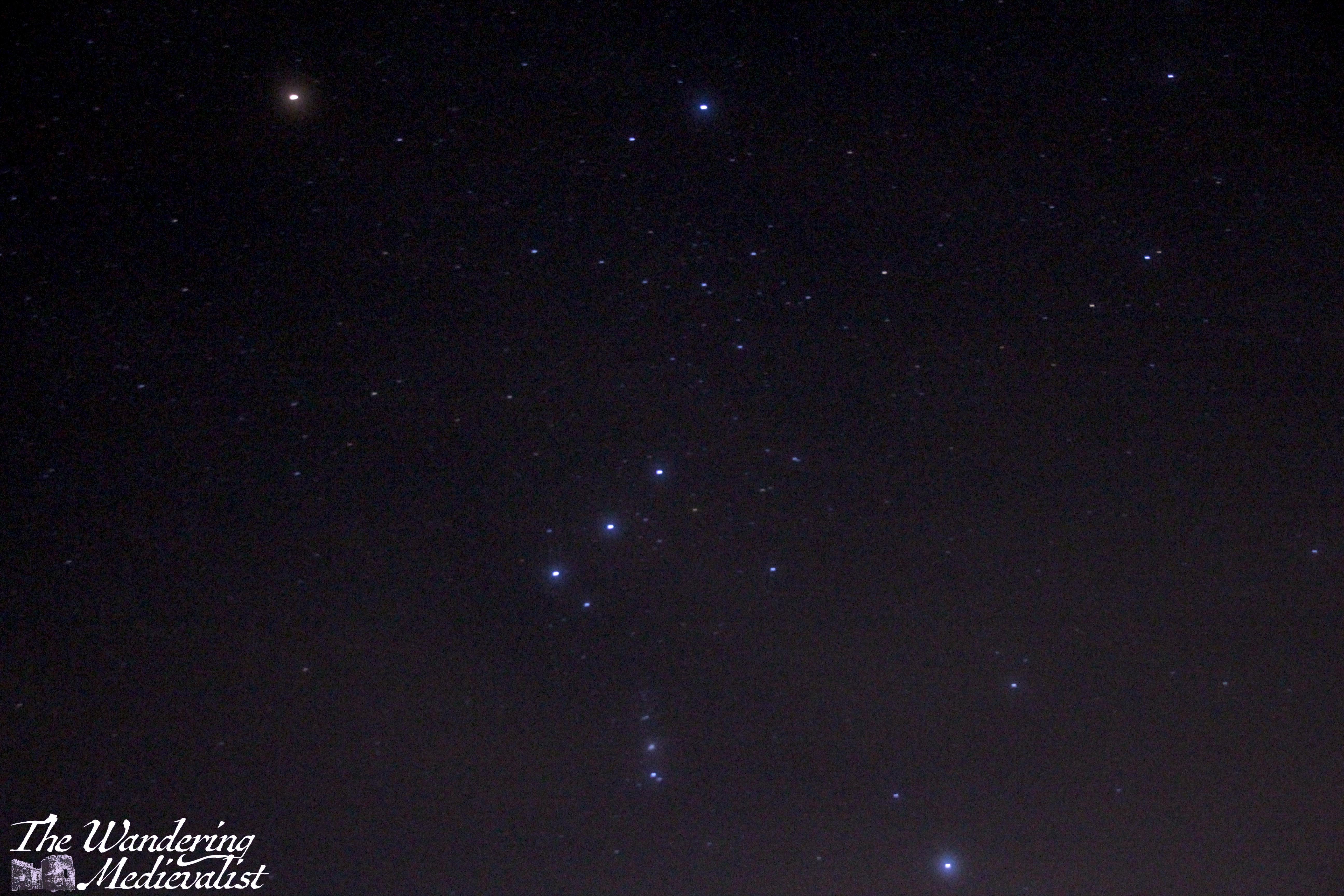
And finally, stargazing
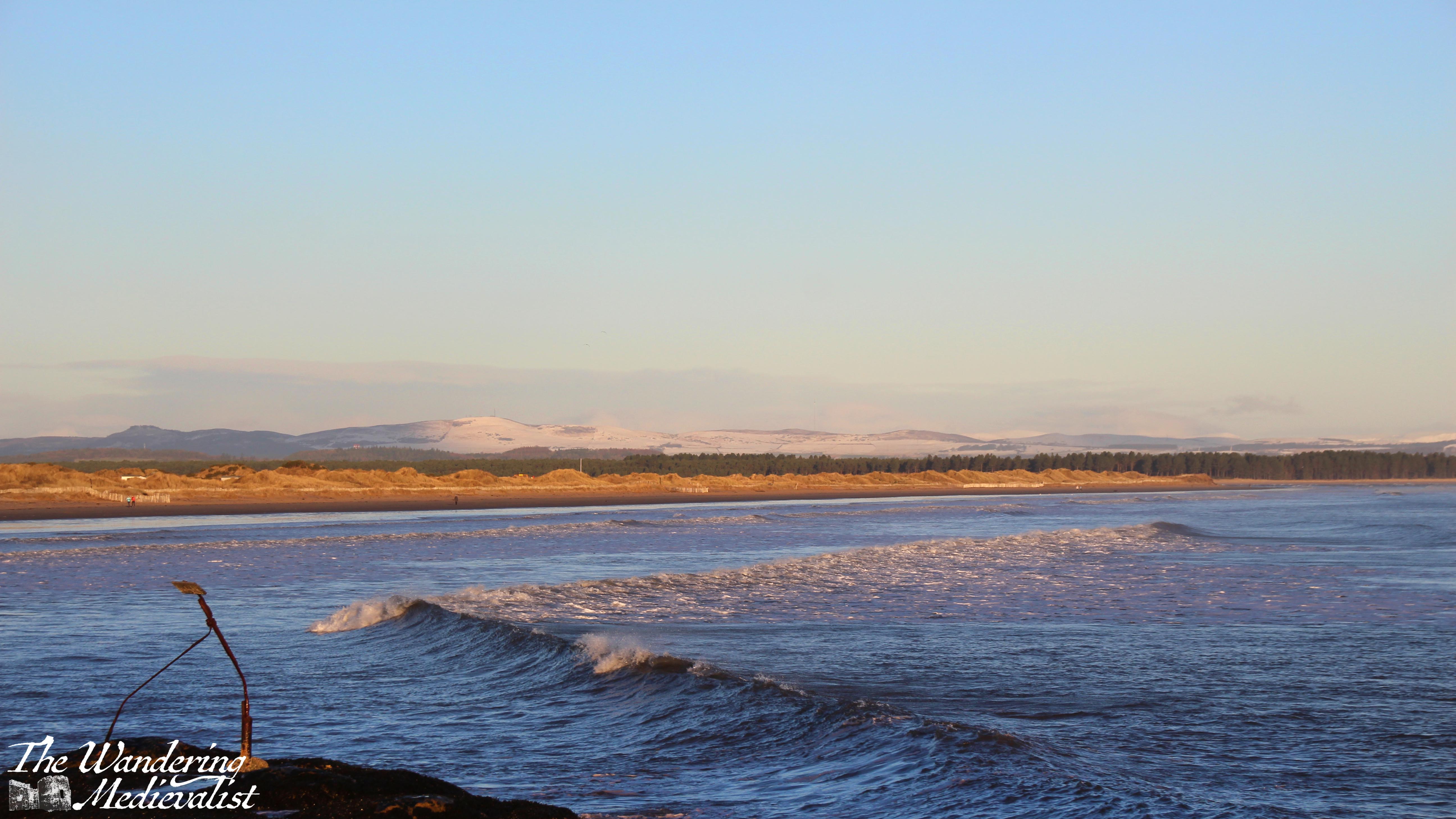
About two years ago when I had some time off work, I became fascinated with photographing the night sky, as previous posts have shown. Fortunately, I have been blessed with both friends and my other half, who are willing to brave cold nights and uneven ground to find the dark views. Towards the end of the month, we went out several times to try to view the planetary alignment that was all over the news – we didn’t have a great deal of luck photographing them but did get some great views of the stars from West Sands, as well as of St Andrews at night.
Another perk of January is putting plans in place for the rest of your year (if you like planning, which I of course do). While I have only gotten to about June, I have trips of both work and family nature planned in the Highlands, USA and Caribbean – an exciting mix of places to photograph and explore!
Enjoying my pictures? Why not claim one for your own project or wall space through my online shop:
The stretch of road just south of Fort William leading through Glencoe and across Rannoch Moor is hands down one of my favourite driving routes in the world. No matter the weather, I cannot help but smile at the approach – even on the days when the rain is pouring sideways and the wind is trying to blow the car off the narrow road, as it did on one occasion which felt like driving through a hurricane. In good weather, it is simply breath-taking. In bad weather, it is atmosphere, dramatic, and a touch frightening. Either way, one should only attempt the drive when rested, confident, and possessing a full tank of petrol. Or at least a car that can make it at least 100 miles on the tank it has.
Sometimes the road is relatively clear, but most of the time it is on the crowded side, with visitors, tour busses, delivery lorries and of course locals just trying to make their way from point A to point B all crowding up the narrow highway. If stuck behind a lorry or bus, you can find your speed significantly diminished, and some will take risks to overtake. Needless to say, do this only if you feel comfortable and safe. Otherwise you just have to suck it up and enjoy the scenery – darn.
So here we are, a step-by-step of the drive, stopping at all of my favourite viewpoints.
Part 1: Fort William to Onich – 10 miles
The A82 route from Fort William to Onich is about 10 miles, and hugs the edge of Loch Linnhe. For most of the route, the trees block the view of the water, but there are a few gaps and parking spots where you can pull over – in particular the Linnhe Picnic Area, about 7 miles along, which is a spit of land sticking out into the loch and providing views in both directions.
This stretch of road is winding, no question, with few straight bits. My advice? Pay attention if the signs warn you of a sharp turn.
We have never stopped properly in Onich but it seems a nice little town with a few hotels, guesthouses and B&Bs taking advantage of the proximity of Fort William and Glencoe.
Part 2: Onich to Ballachulish – 4.5 miles
From Onich, it is a simple matter of following the A82 across the Ballachulish Bridge, which spans Loch Leven. Once across you can head straight south towards Oban, and this is also a beautiful drive along the water, but my route will take you left towards Glencoe.
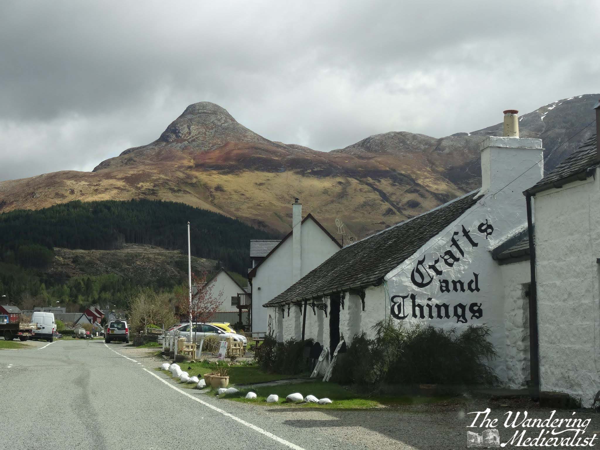
Almost as soon as you turn you will be heading immediately for a distinctive sharp peak called the Pap of Glencoe, and beyond it ridges of mountains leading east. On our first ever long weekend away together, the other half and I found a deal at the Isles of Glencoe Hotel in Ballachulish, which sits on a promontory in the loch. The views are just spectacular, especially at sunset. If you can, pull over at the parking area along the loch just after the hotel, or even turn into the village and get a coffee or snack at Crafts and Things. It was more than 10 years ago that we visited, but the other half still fondly remembers sitting in the April sun, looking over the loch with a cuppa and a tiffin.
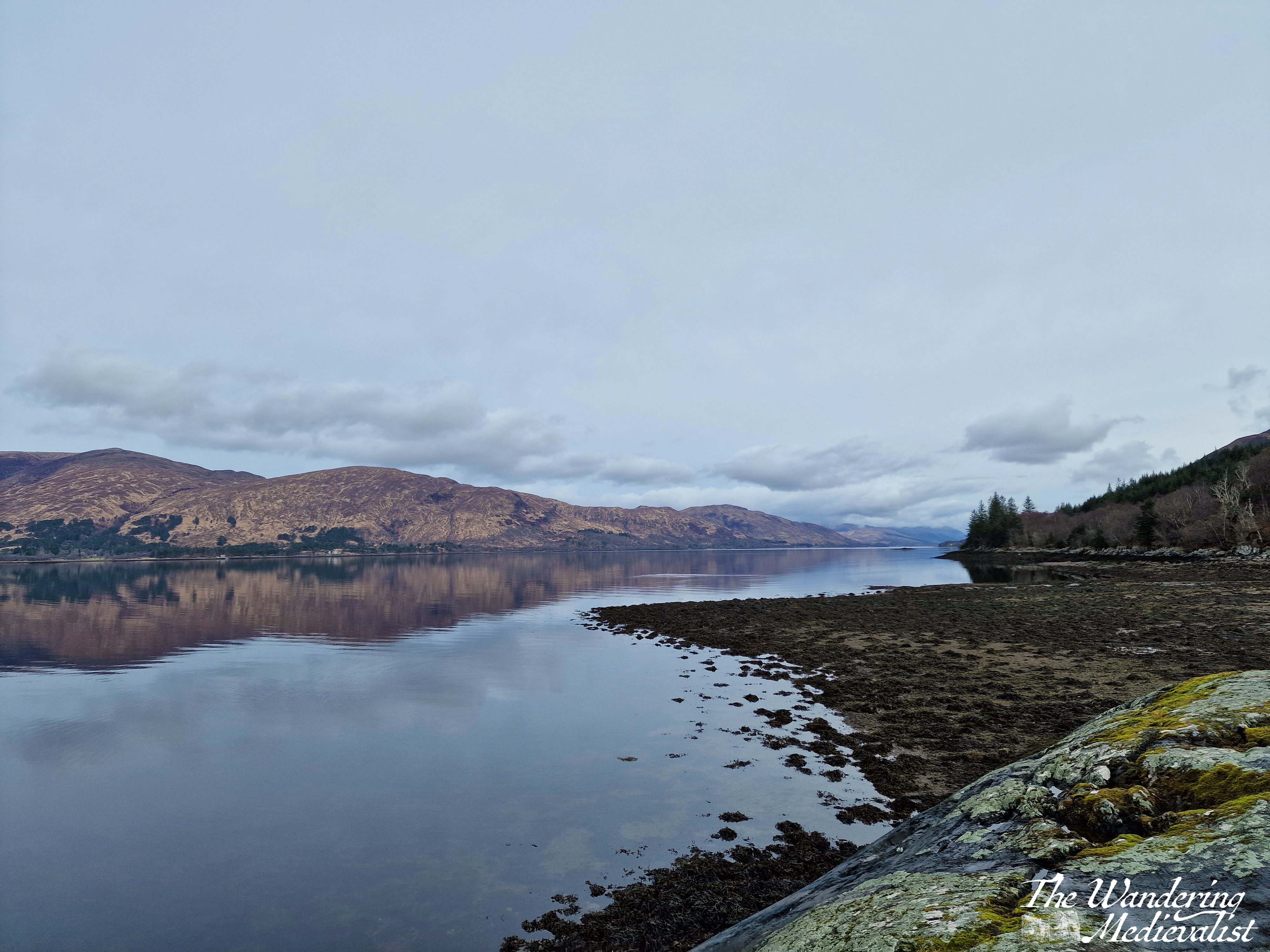
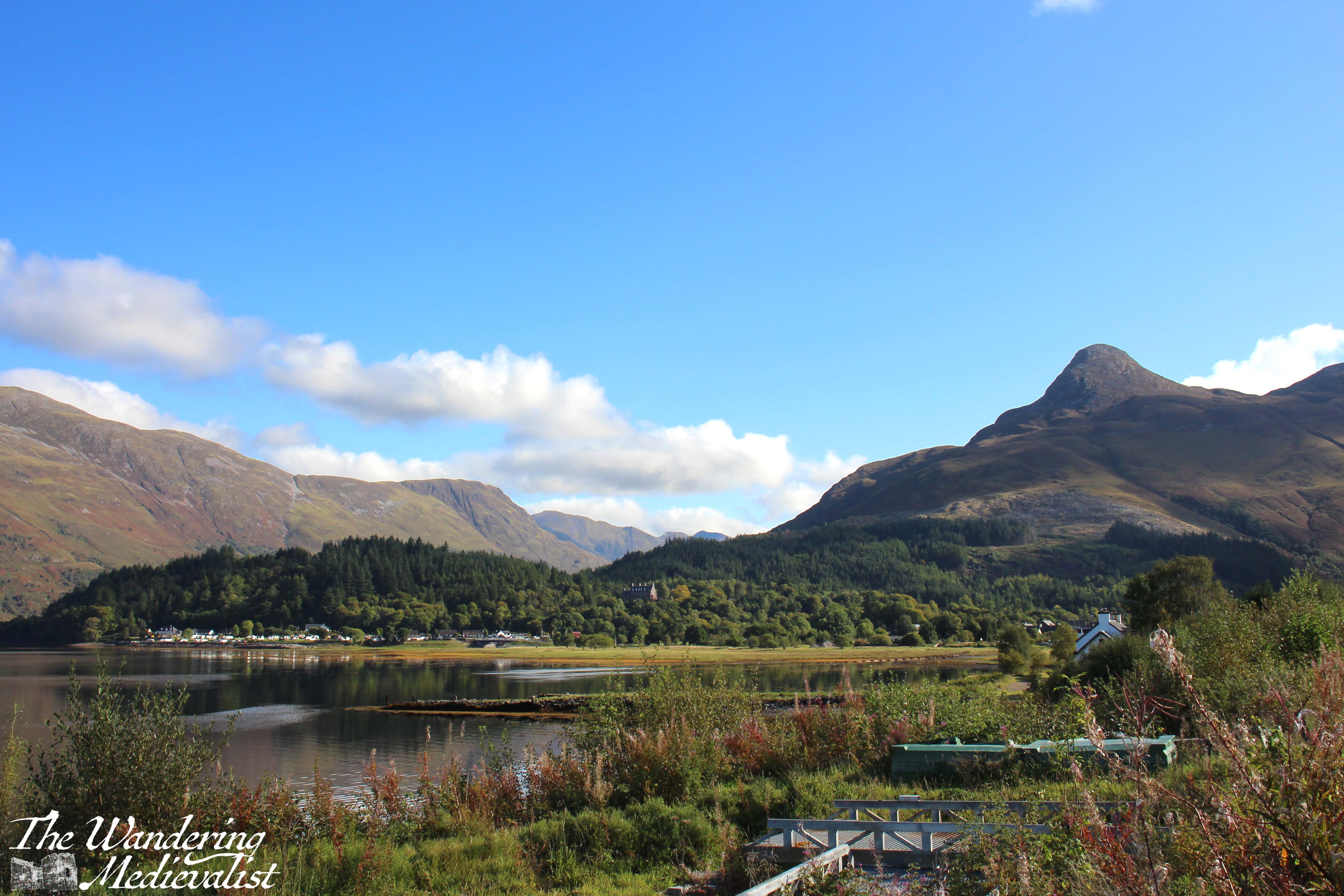
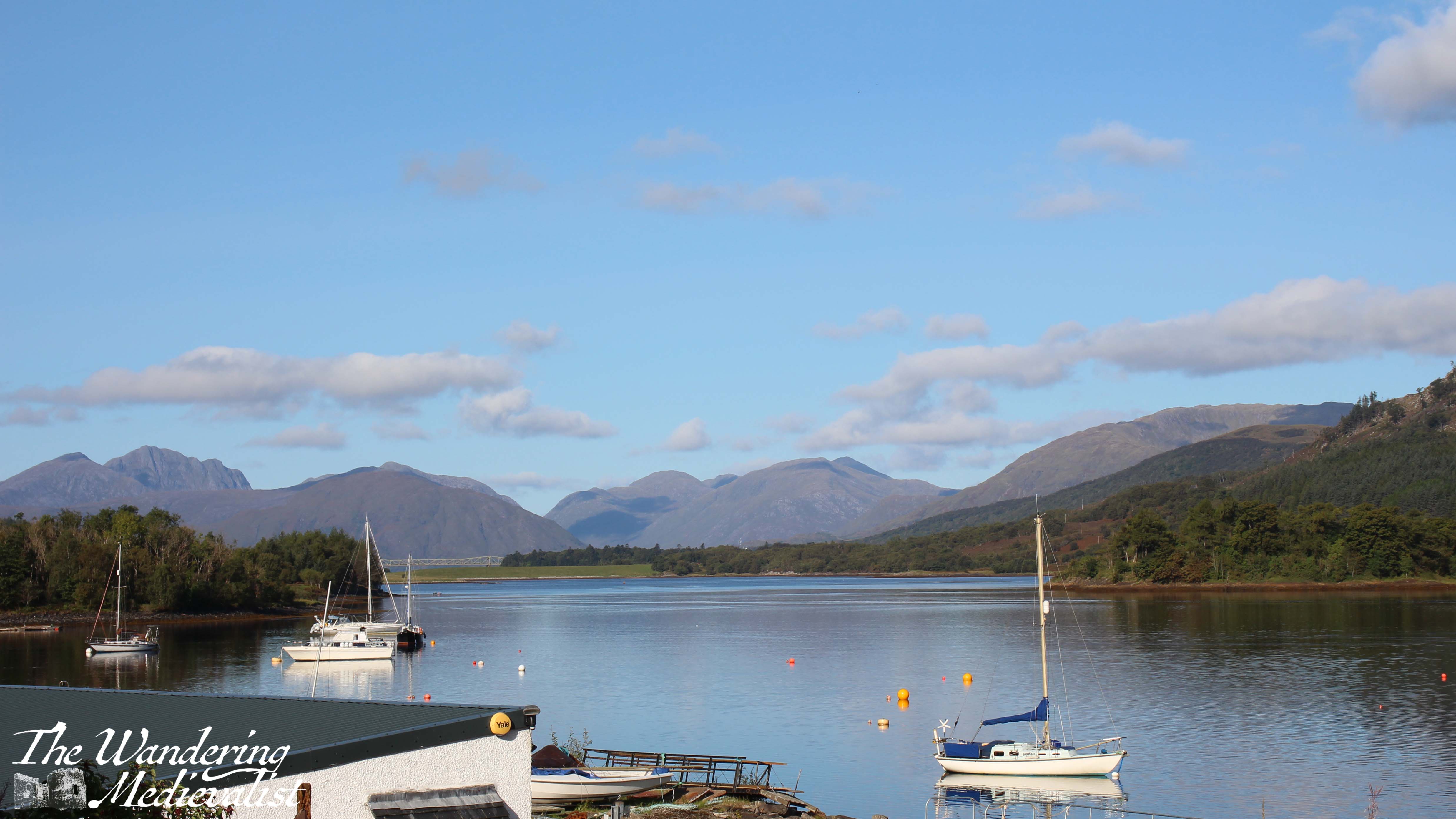
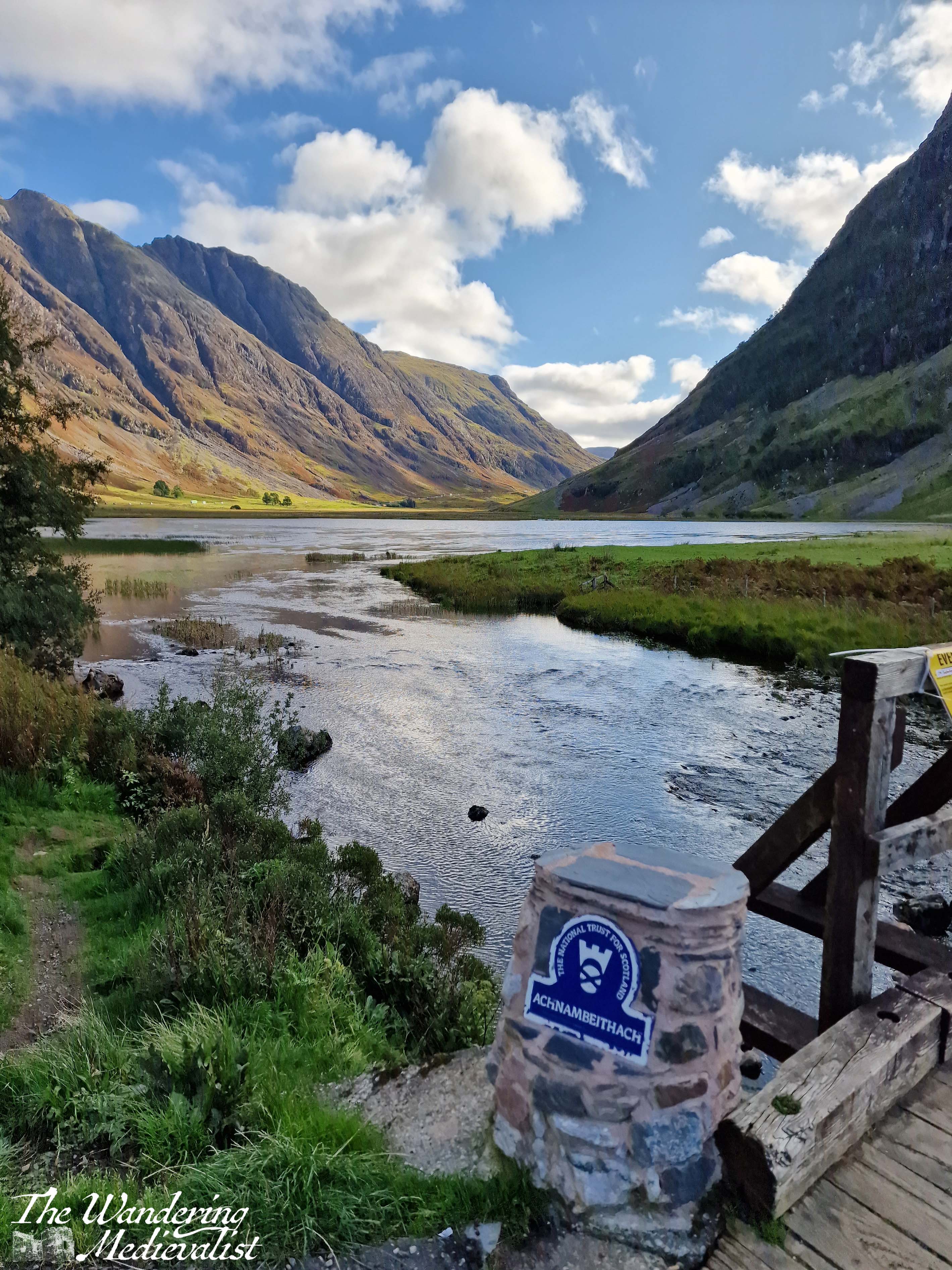
You can also take a quick detour left into the Loch Leven viewpoint (above), which as it suggests provides a view down the loch towards the bridge, at this point obscured by islands. Mountains rise in the distance and give you a preview of what is to come. This is also the route to the Glencoe Lochan walks.
Part 3: Ballachulish to Loch Achtriochtan – 5.5 miles
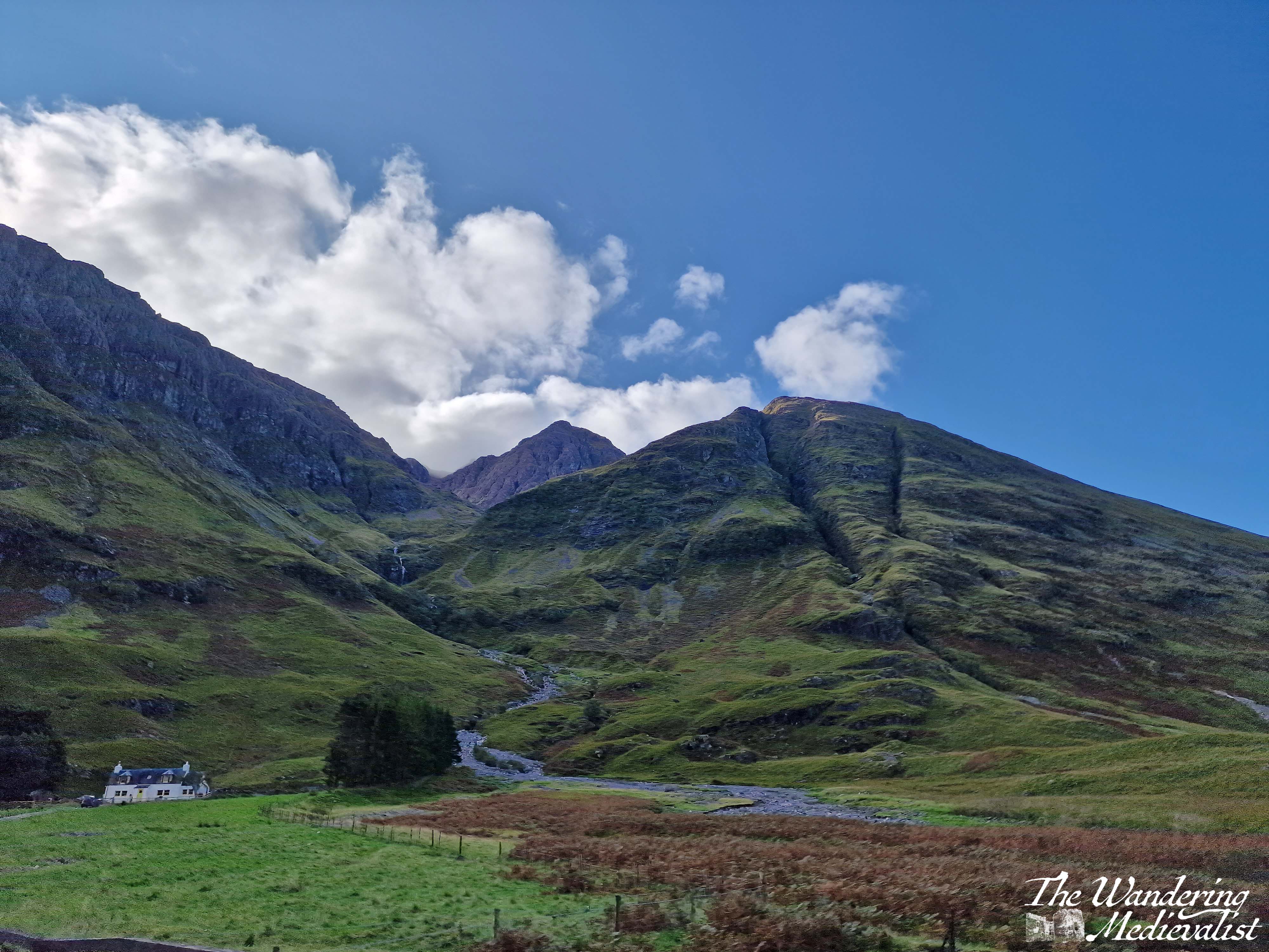
After Ballachulish the road turns inland away from the loch, and enters Glen Coe proper. Only 2 miles along on the right is the Glencoe Visitor Centre, where you can learn about the region and the famous massacre of 1692.
Mountains are rising on both sides of the road and ahead, often a combination of brown-grey scree and stone with lighter green patches of heather and ferns, and darker green foliage. The road here is in relatively good shape with a few potholes, and many drivers slow down both due to the sharp turns and the views. Enjoy the width of the lane while you can!
Another mile or so south, the road swings more sharply east to continue along the glen. Ahead of you the A82 stretches along the valley and then begins to climb, and ahead to the right is Loch Achtriochtan.
It can be a very busy and treacherous stretch of road, with drivers going faster than they should and plenty of tour busses and caravans, so I recommend pulling into the Loch Achtriochtan car park. Here you can either pause at the bridge, or cross to make friends with some sheep and approach the waterside. This spot allows you to capture the gorgeous hillsides and loch.
There is also apparently a turn-off around here to view Hagrid’s hut from the Harry Potter films, though I have never done so.
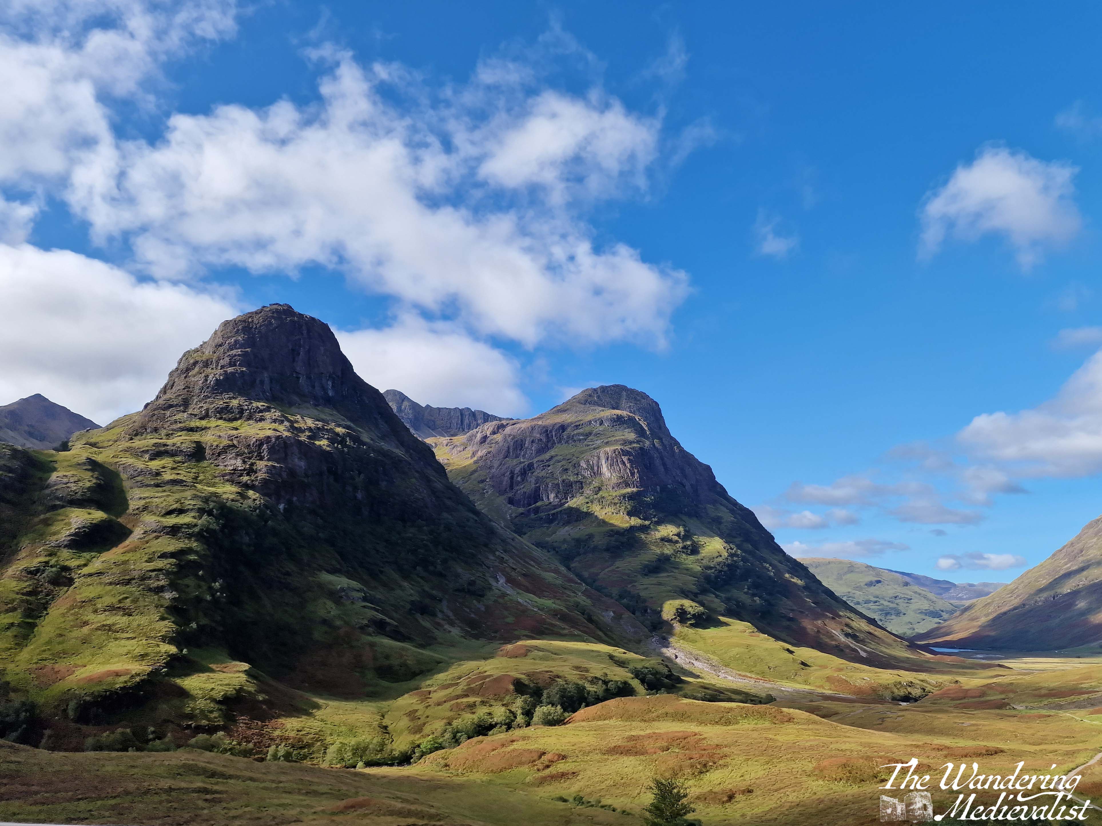
Part 4: Loch Achtriochtan to the Three Sisters viewpoint – 2 miles
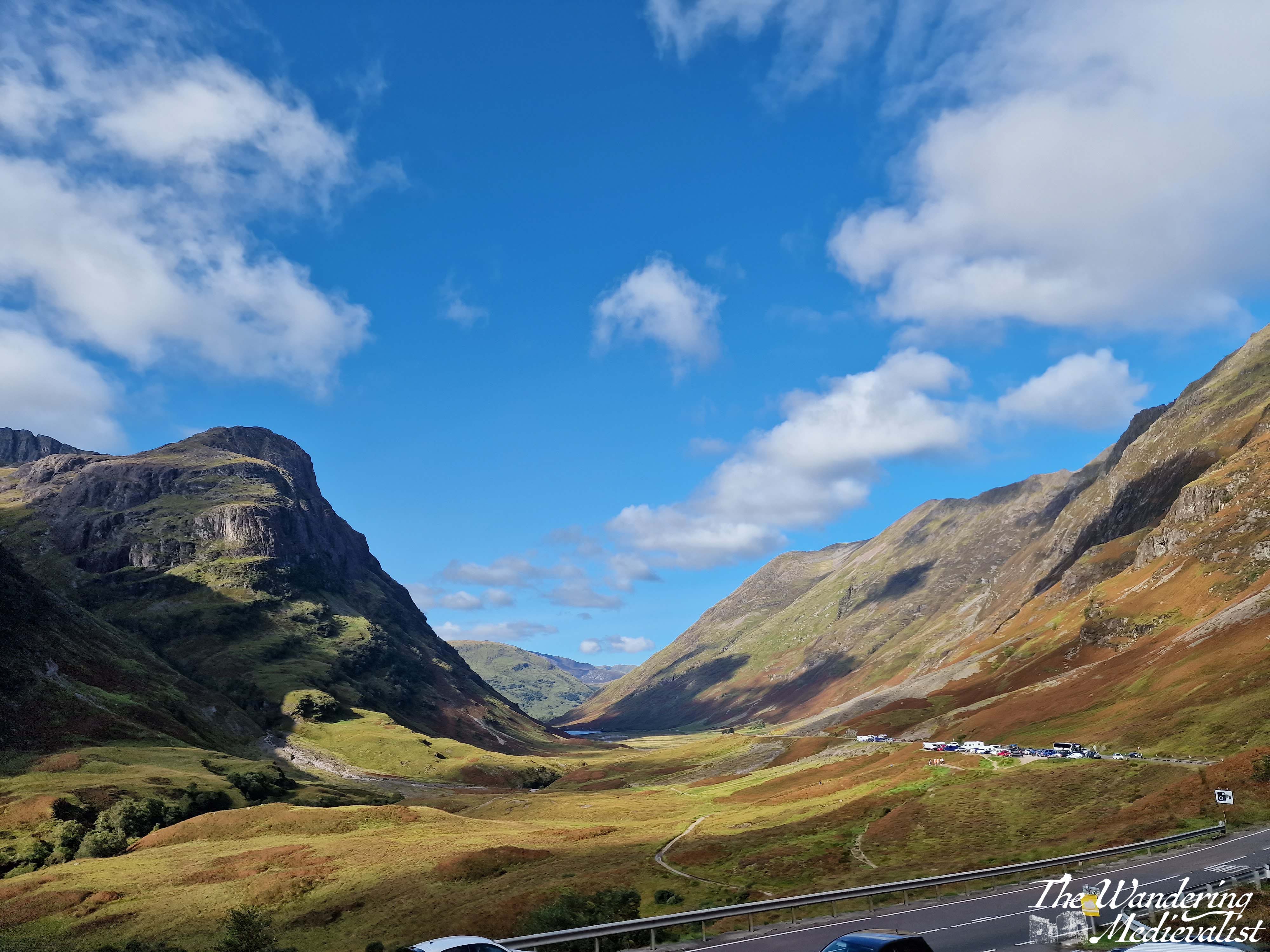
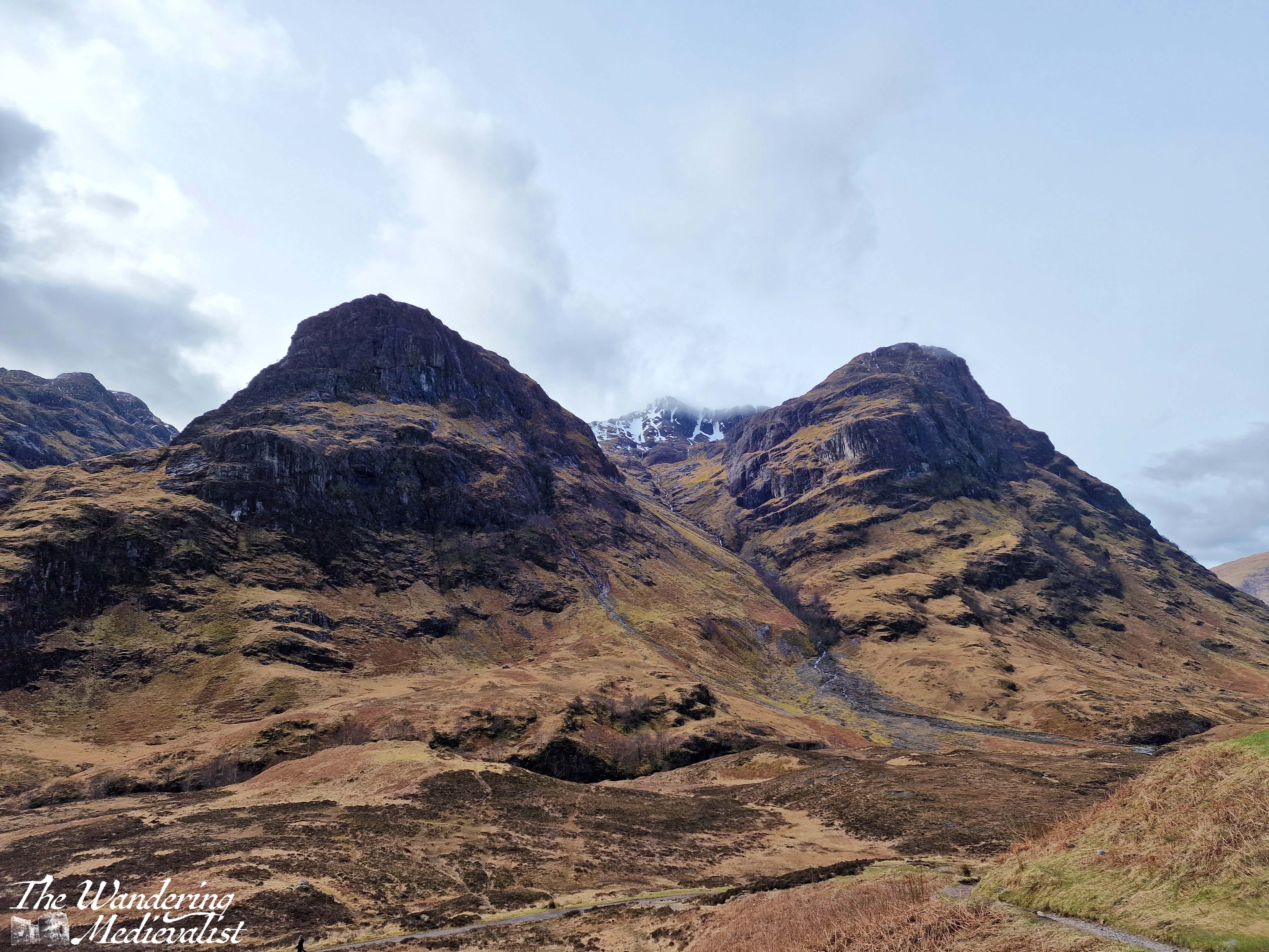
Once you have dragged yourself away form the the loch, it is two miles further to the pièce de résistance of this drive – the view of the Three Sisters of Glencoe. Until quite recently, there were several places you could turn off and you were often taking your life in your hands trying to park and find a safe place to get back onto the road. In the last year or two however they have built a proper car park – and another one for tour busses – to allow the many visitors to safely park and explore. There are a few parking spots slightly further up the road too, and there are paths leading down into the valley or up the hillsides.
The Three Sisters of Glencoe is one of the most photographed spots in Scotland and only a visit need tell you why. I have countless pictures from different times of year and I can never decide which one I prefer. Some day soon I hope to do some of the walk down into the valley and across the bridge, though I know I do not have the fitness or skills needed to venture too much further up into the hills at this point. Aonach Eagach Car Park is another good option but often too busy to find a space. It is at the trailhead for the Lost Valley trail and provides a slightly different view of the valley.
Side note: if it seems at this point as if you are just driving a few miles and then stopping again, you’re not wrong, but I promise the stops are worth it. If you get bored, skip one! But if this is your only trip to Scotland, I’d take advantage of them all.
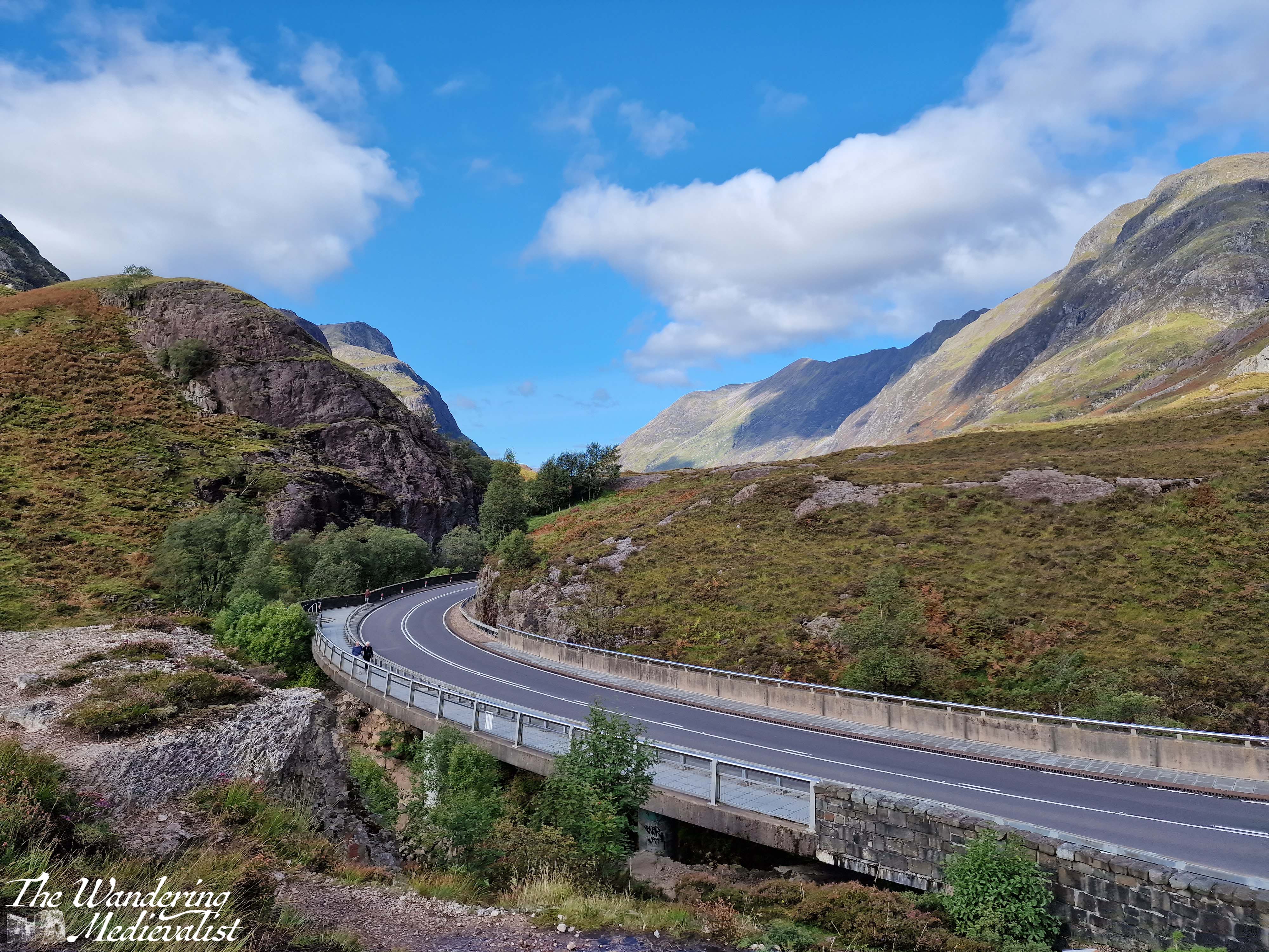
Part 5 – Three Sisters Viewpoint to Meeting of the Three Waters viewpoint – less than 1 mile
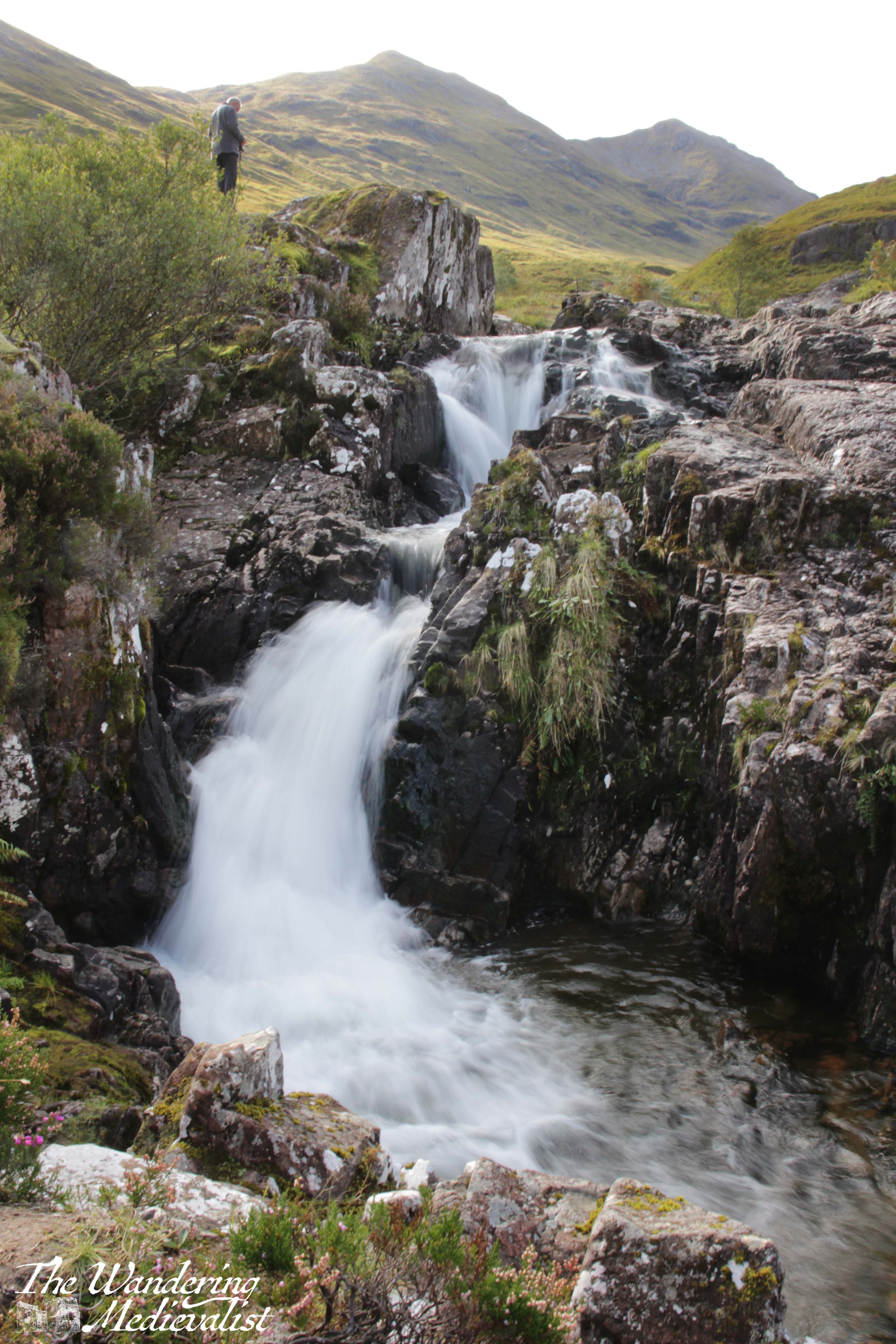
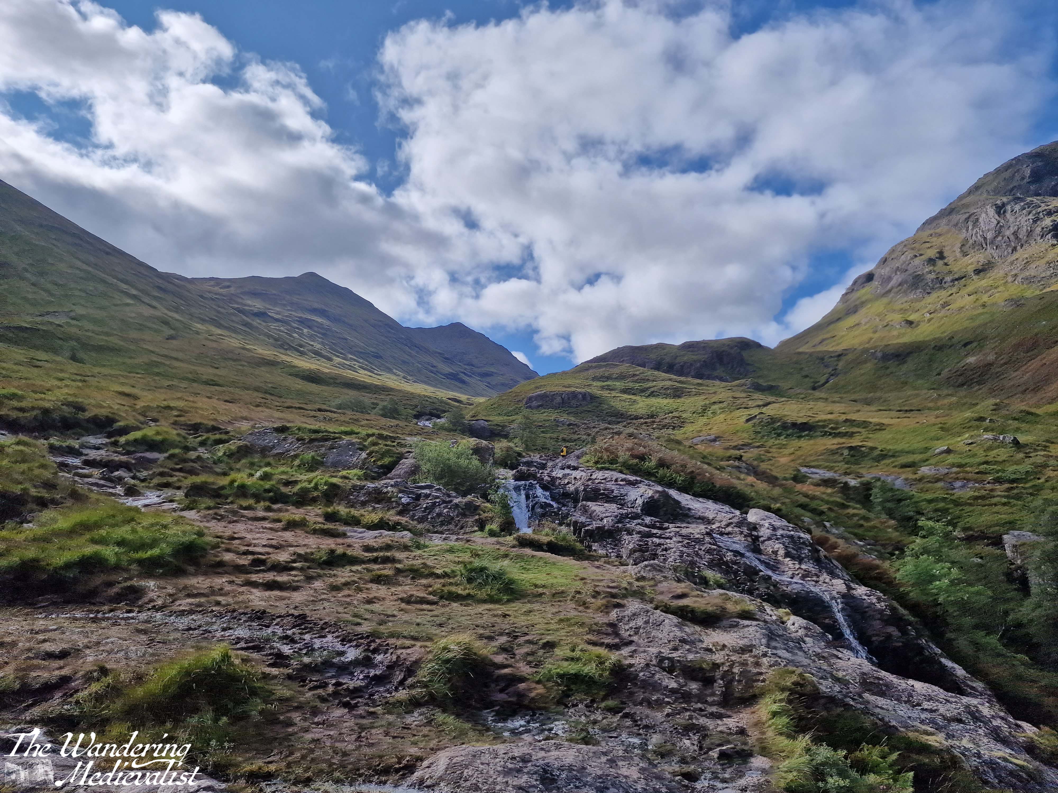
Yes, this is a short drive. I had passed it by many times before I made myself actually stop on one beautiful autumn day. The waters are, as it sounds, three separate rivers (Allt Coire Gabhail, Allt Doire-bheith and the River Coe) that meet here at a pool and series of waterfalls, before continuing down the glen towards the lochs.
There is a short climb from the car park that takes you up the rocks and over the waterfall, and the start of the climb is a bit ropey. But, once you have clambered up the hill, you reach a stunning viewpoint that shows you the newly built road, the falls, and the burn heading up into the mountains. There is a pool where I have seen people swimming – brave souls – and of course a trail that follows the burn. I dragged my octogenerian father up to see the view and I think even he was impressed. It is easy to see here the old military road, which was in modern times replaced by the route of the A82.
One point I should make is that in that .7 miles between the two spots, you are driving along a narrow road.
At one point, the highway cuts through the hillside, with solid rock towering on either side, and leaving very little room for error. Not that anyone would err…
It can be a bit harrowing even after several goes, so take it slow and easy.
It is very easy to miss the parking spot for the Meeting of the Three Waters
and this is not an easy place to turn around, so definitely use your Google/Applemaps or whatever Satnav system you prefer to warn you.
Part 6 – Meeting of the Three Waters to the Kingshouse Hotel – 5 miles
Beyond this parking spot are plenty more viewpoints and places where you can pull over, and it’s really about deciding how often you want to stop, and how busy they are. Sometimes there are so many cars parked in a small spot that you really cannot safely get off of the road. Once you have had your fill of waterfalls, you can make a bit of headway as the road opens up a bit with mountains on either side. Eventually the road will hug the edge of Rannoch Moor, and this is where in bad weather you can really start to feel the car being blown about.
The Kingshouse Hotel is a popular stopping place though they are strict about people coming in just for the view. I would love to stay and know friends who were married here during the pandemic – this area is famous for the amazing views of the mountain, Buachaille Etive Mór. You can also take a detour here and drive part of the way down Loch Etive, though as yet I have not done so. Some trip, one day!
Part 7 – Kingshouse Hotel to the Loch Ba viewpoint – 5 miles
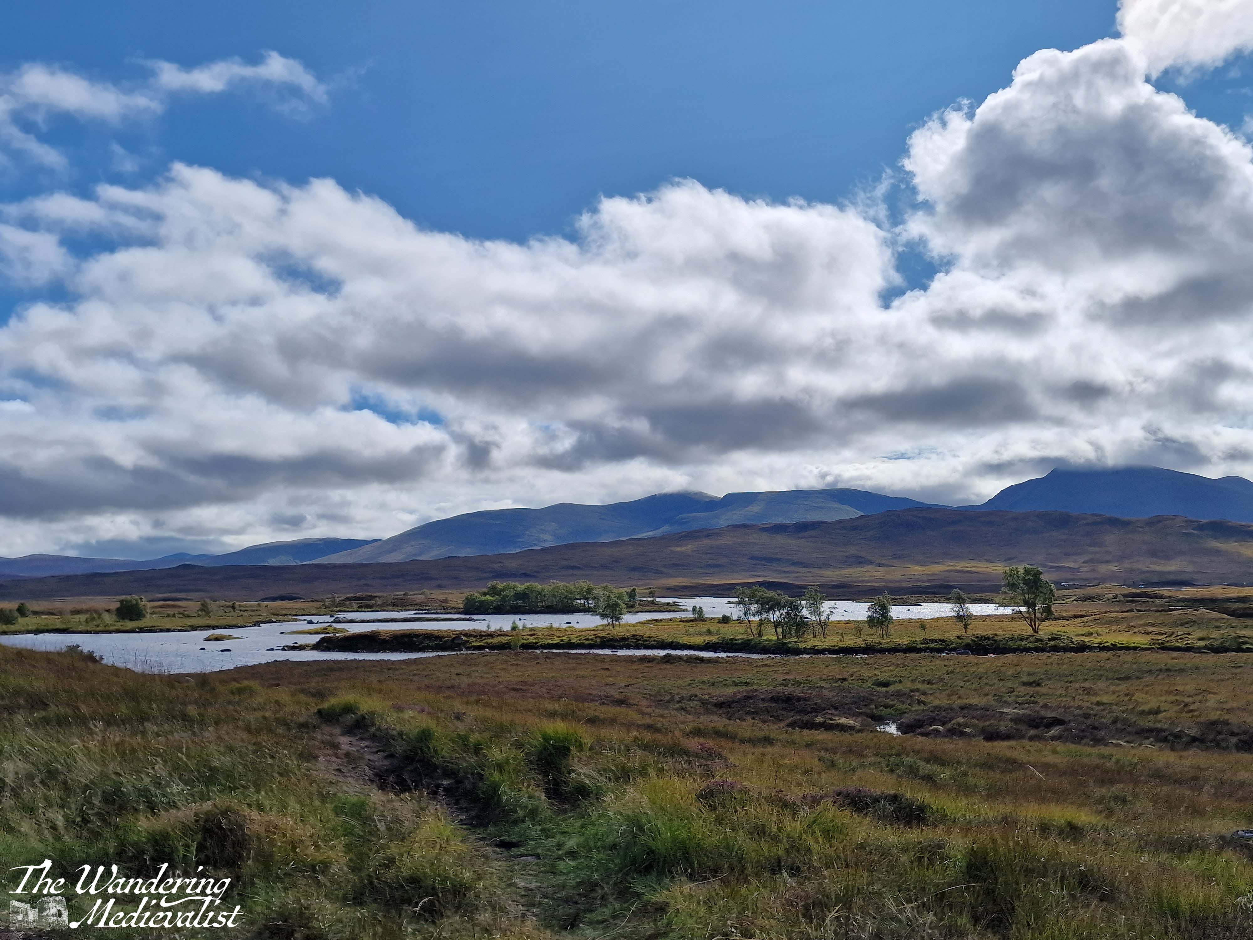
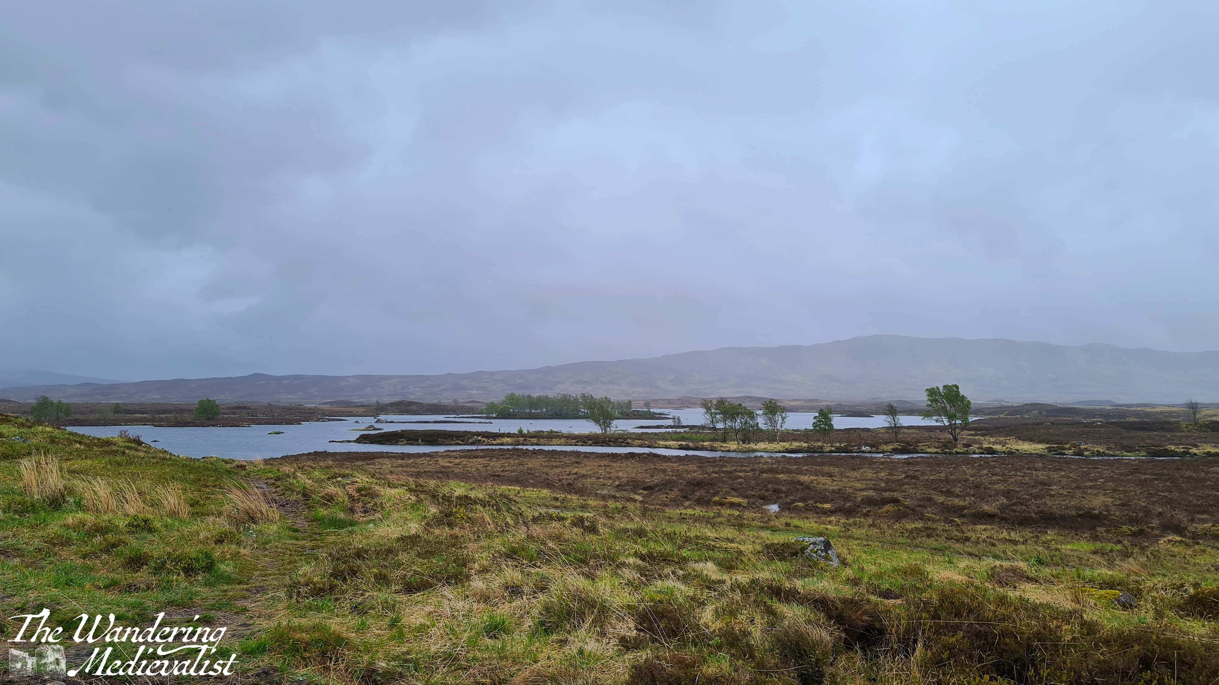
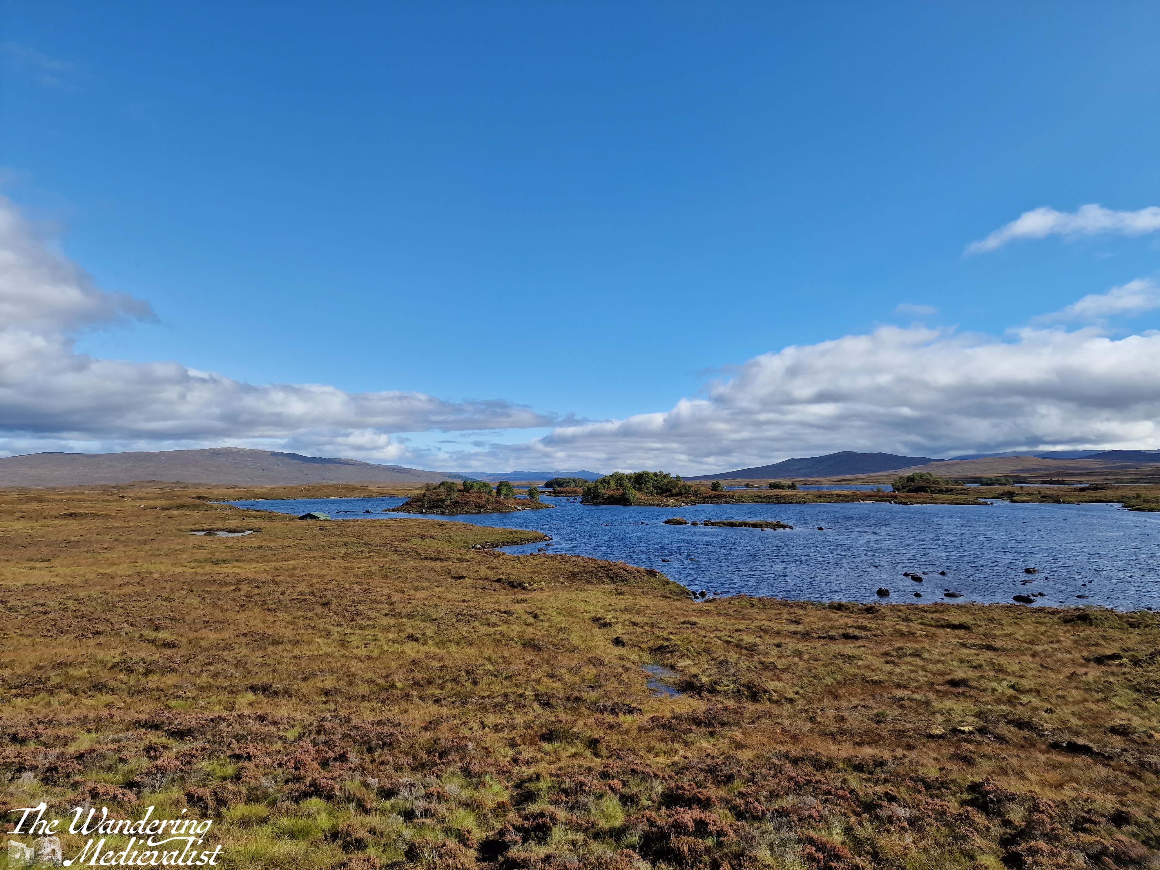
Just after the hotel you will pass the turn-off to the Glencoe Ski resort – the trails are evident – and the mountains stay a bit closer on the right though they start to fall away on the left, as the moor creeps closer. This is quintessential Scotland, in my mind – boggy moor with mountains in the distance, countless little burns falling over rocks and carving their way down from hills and across the landscape. Rocks poke through either on their own or in clusters and chunks, covered in lichen and reminding one just how thin the soil is here. There are a few lone trees, but most of the landscape is relatively barren.
The final place that I cannot resist stopping is the Loch Ba viewpoint. There is usually plenty of space to pull over, and it is easy to see coming due to the lump of land that marks the view. Climbing this short hillock allows for 360 views, though it is the one almost due east that I love the most – glistening loch with plenty of small islands, leading away into the wilderness.
Behind you are the peaks of Glencoe, and ahead just the road, leading towards the next hills in the distance. I can understand why some might assess it as stark, but I think it is gorgeous.
Part 8 – Loch Ba viewpoint to Crianlarich – 19 miles
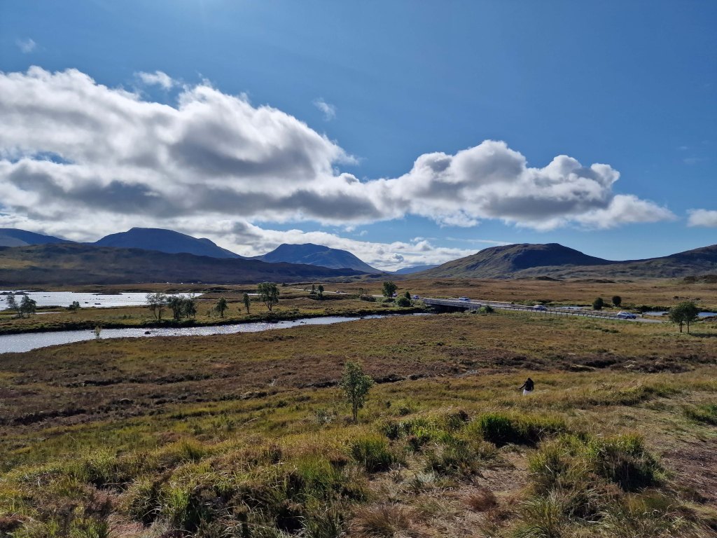
About three miles beyond the Loch Ba viewpoint, you realise how high the road still is when it suddenly, dramatically, begins to fall. There is a sharp descent through an s-bend that can challenge lorries and busses coming the other direction, though there is also a large parking area to pull over in if needed. From here, the road is a bit less dramatic though still stunning, crossing the Loch Tulla bridge and winding its way across the valley floor before climbing again.
One of your last views of the lochs and lowland of the edge of the moor comes at the far side of Loch Tulla, where there is a small parking area, but the views are better in person than in pictures. From here, the A82 is heading almost due south, passing through a number of villages and meeting up with the rail line that runs from Glasgow to Fort William. Bridge of Orchy and Tyndrum stand out as the two larger towns, with Tyndrum in particular possessing several hotels, petrol stations – if you can get in – and the Green Welly stop which has always been so busy that we haven’t been able to get in. For some reason there always seems to be a large gathering of motorcycles here.
Tyndrum is also where the highway branches off towards Oban, and from here south can get busier. The remainder of the drive to Crianlarich is following the River Fillian and its many small tributaries; mountains continue to dominate on both sides though they are slightly less dramatic than further north.
Crianlarich is another smallish town that has become significant for those heading to the Highlands. Firstly, it is where the road branches either to continue south towards Loch Lomond and Glasgow as the A82, or east to Loch Earn and Perth as the A85. Secondly, it is where the rail line divides. As I mentioned in my exploring Scotland by public transport post, the train from Glasgow north can go either to Fort William or Oban, and Crianlarich is where it stops long enough for the train to either split in two, or be re-joined. There is also a significant hiking peak, Ben More, not far from town, and plenty of places to stop for the night.
Part 9 – Crianlarich to Lochearnhead – 16 miles
The 16 miles from Crianlarich to Lochearnhead is highlighted by a bit wider road, and slightly lower mountains, though still offers glimpses of lochs off to the left. Just over half-way is the turn-off to Killin, where one can view the Falls of Dochart. There is also what I will always refer to as my emergency petrol station – on my last drive back with Dad, I misjudged how much petrol we had and could not see a place to stop in Crianlarich, so was running on fumes by the time we reached this spot. I was considering just going into Killin where I knew there was petrol, but this station saved us and allowed us to continue without a detour.
After the emergency petrol station, the road climbs and winds again through what is clearly planned woodland. One of the most dramatic parts of the drive is as this path falls again, with the road hugging the mountainside and a sharp drop on one side. Ahead, though, is Perthshire and in what feels like no time at all, you enter Lochearnhead, and take a left to stay on the A85. While there is not a huge amount here, there is a safe and relatively clean public toilet that can be a godsend if you have not stopped anywhere except viewpoints since Fort William.
Part 10 – Lochearnhead to Crieff – 19 miles
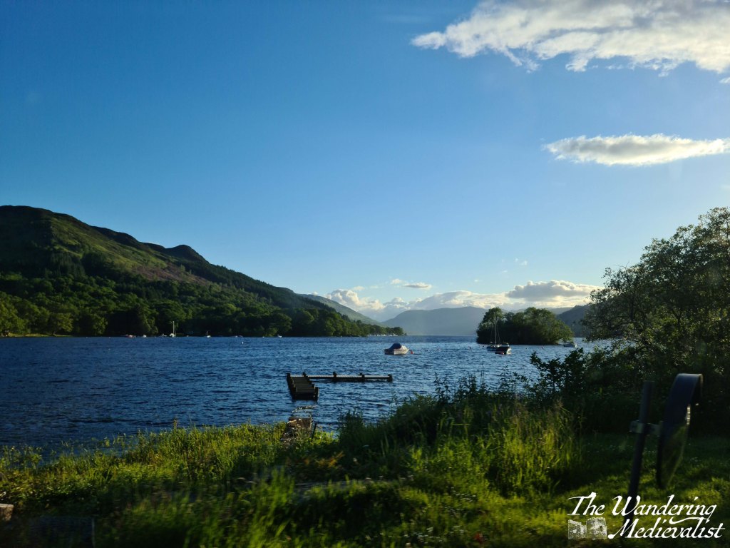
The drive along Loch Earn is beautiful. The loch itself is long and narrow, with plenty of well-to-do houses along the edge and water sports galore: paddleboarding, sailing, swimming and fishing are all advertised. Especially on a sunny day, the glimpses of glistening water through the trees make you want to stop and find a boat of your own.
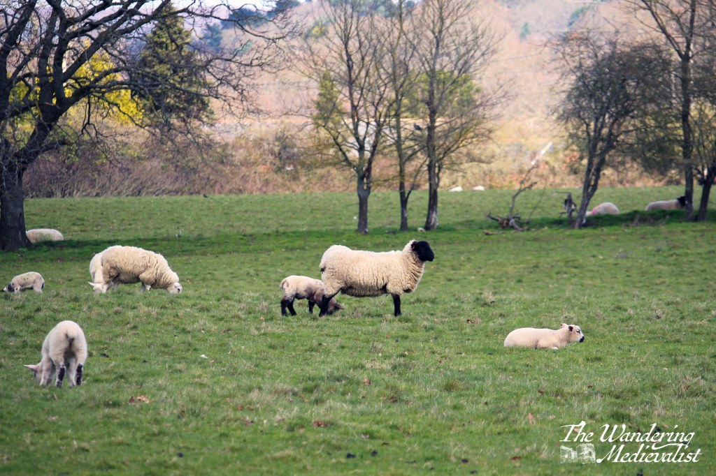
The drive from one end to the other is about 7 miles, and the town at the far end – St Fillians – is a charming village with plenty of Victorian-era gingerbread-style houses and lovely gardens. After St Fillians, the driving is much more lowland, with farms on either side, sheep fields and stunning stone farmhouses dotted between stands of trees and hills.
Crieff itself is an excellent spot to stop for a snack if you need, or you can push on through towards Perth – another 15 miles. This road offers a more Fife and lowland feel. Fields stretch off into the disttance over rolling hills, and the distant Ochils on the horizon. I have never liked this stretch but I think it’s at least partly because I know I’m heading away from the mountains, and that never ceases to make me a bit sad.
Once you have done the circular drive from Perth to Fort William and back again, you will quickly decide which leg you prefer and where you like to stop. I’m fond of both routes really, though I find myself often preferring the northerly loop as it can be a touch faster, traffic depending. I am looking forward to trying it again…tomorrow!
It has been a hectic few weeks at work, which has meant I have not had time to devote to anything but getting through the day. But the busy time is unlikely to pass, and so I have to make time to focus on my real love – my blog and pictures, and anything Fort William-focussed. And so, I bring you this account of a drive I will happily do at any time of year, and with any companions: the drive to Fort William.
East Scotland – the Dundee area, Fife, southern Perth and Kinross – is quite similar in terms of geography: rolling hills, plenty of farmland, coastlines, and dotted with regular towns of good size. Not far north of Perth on the A9, though, pine trees close in around the road and the landscape begins to change. More dramatic, jagged hills rise and all at once I relax. A feeling of joy comes over me, and I cannot help but smile, knowing that I am headed north. I cannot really explain why my mood changes. It may be the hills, heading to mountains; it may be the many happy memories I have of locations to the north; it may be just that the stretch of Scotland north of Perth is some of the most beautiful countryside I have ever seen. Whether continuing to Fort William or just planning a day trip, I just love this stretch of road, and beyond.
And so, in this post I’ll take you on the first half of a circular journey to Fort William, a drive I have done many times. Once I managed it all in one day though I would not recommend it.
There is an issue with the A9 – where this drive begins – that must be addressed, and one that I have confidence will remain an issue for years to come despite all efforts of the Scottish government. That issue is that, for the last eight+ years, Transport Scotland has been working on a project to make the entire road from Perth to Inverness dual carriageway. For Americans, this means that there is a strip of land separating the traffic going in opposite directions, like many US highways. As the A9 is the main road north through the Highlands with increasing traffic and plenty of freight, this seems a no-brainer – it is just taking a touch longer than hoped (doing my best not to make a Big Dig comparison). There are also significant engineering challenges to many stretches of the road. This means, more often than not, areas of slower traffic and roadworks can hold you up, but anyone stuck behind a lorry on a stretch of two-lane road will understand the necessity of this work.
Back to the drive.
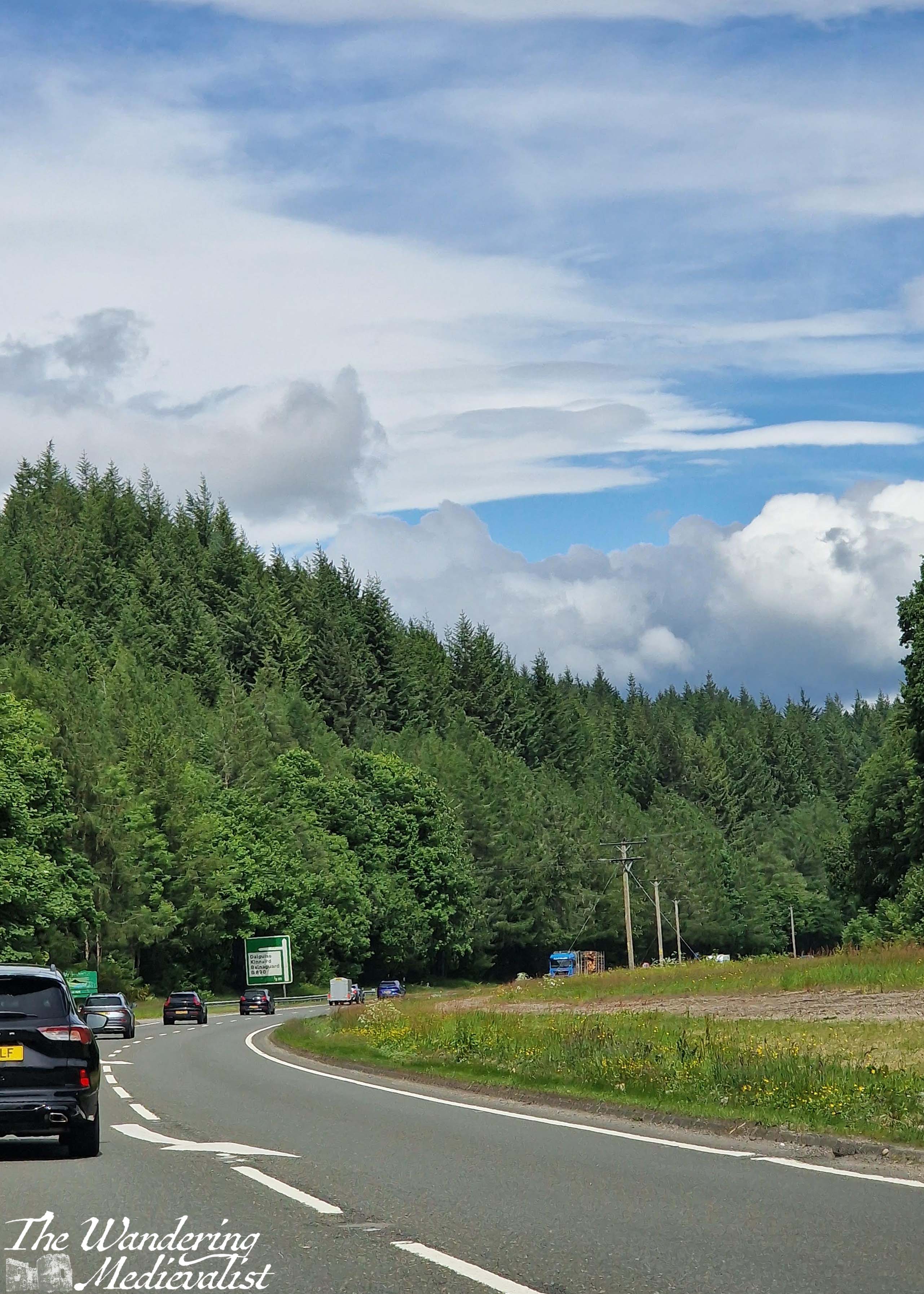
The road pictured above is where the A9 curves, just before reaching the towns of Dunkeld and Birnam, and the Hermitage woodland walk. All three are worthy of their own posts in time, but generally when driving north we do not stop until a bit further on. The road cuts through a set of hills here, with sheep fields on both sides between patches of trees. The highway runs near the River Tay and parallel to the train line that runs from Perth to Inverness. While the track disappears on occasion, it is not uncommon to spy a train.
The next way marker is the widening of the valley in anticipation of reaching Pitlochry. Pitlochry is a small town that holds a place in my heart as where the other half and I went for our first weekend away together, but also for its quaint touristy feel.
Just past Pitlochry is Killiecrankie, famous location of the Soldier’s Leap, and another great place to stop for a walk. Beyond the turn-off to Loch Tummel and the Queen’s View, the highway starts to rise up and along the side of a hill, and there is a gorgeous view of the mountains and the valley along to the left – it never comes through on pictures, though.
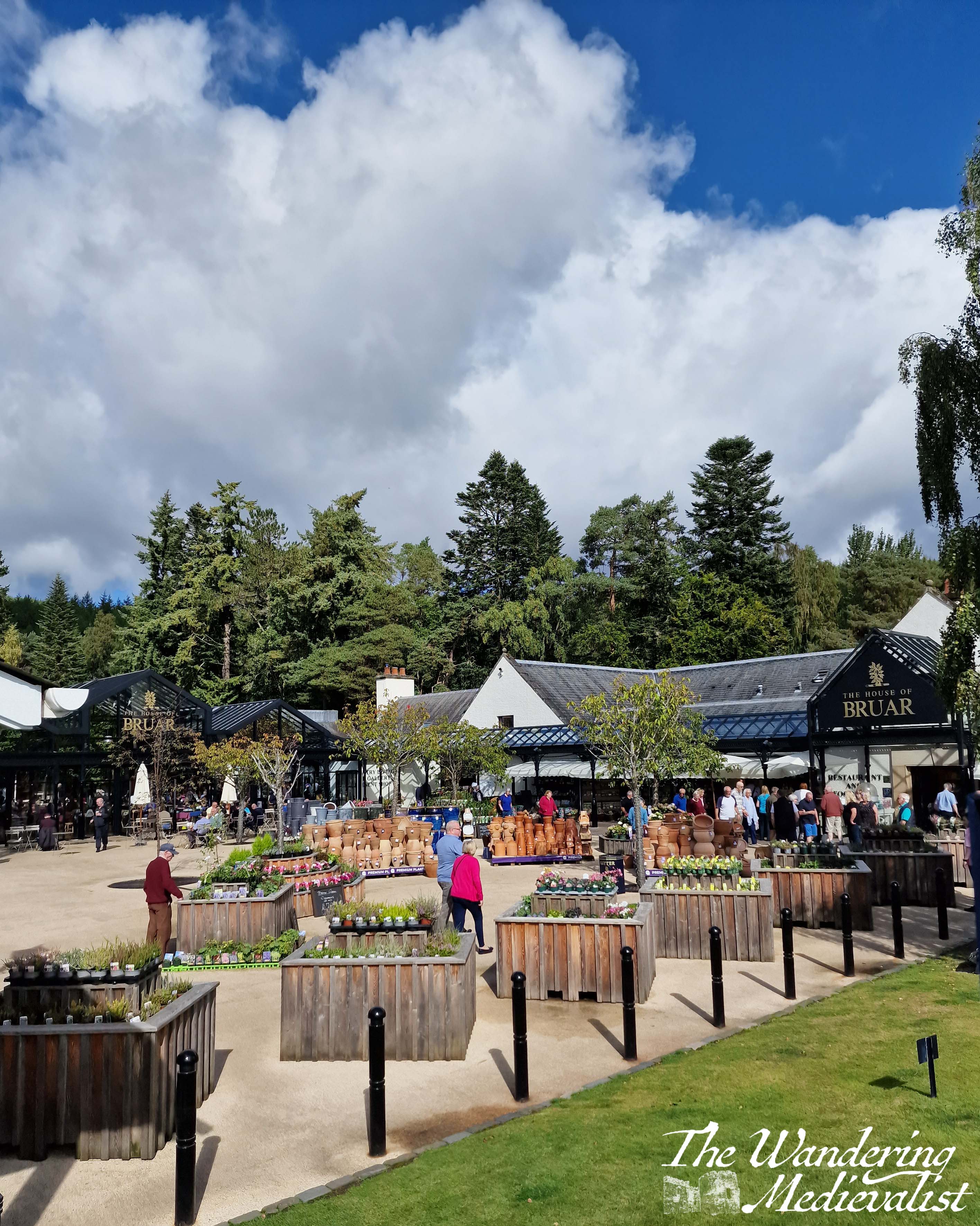
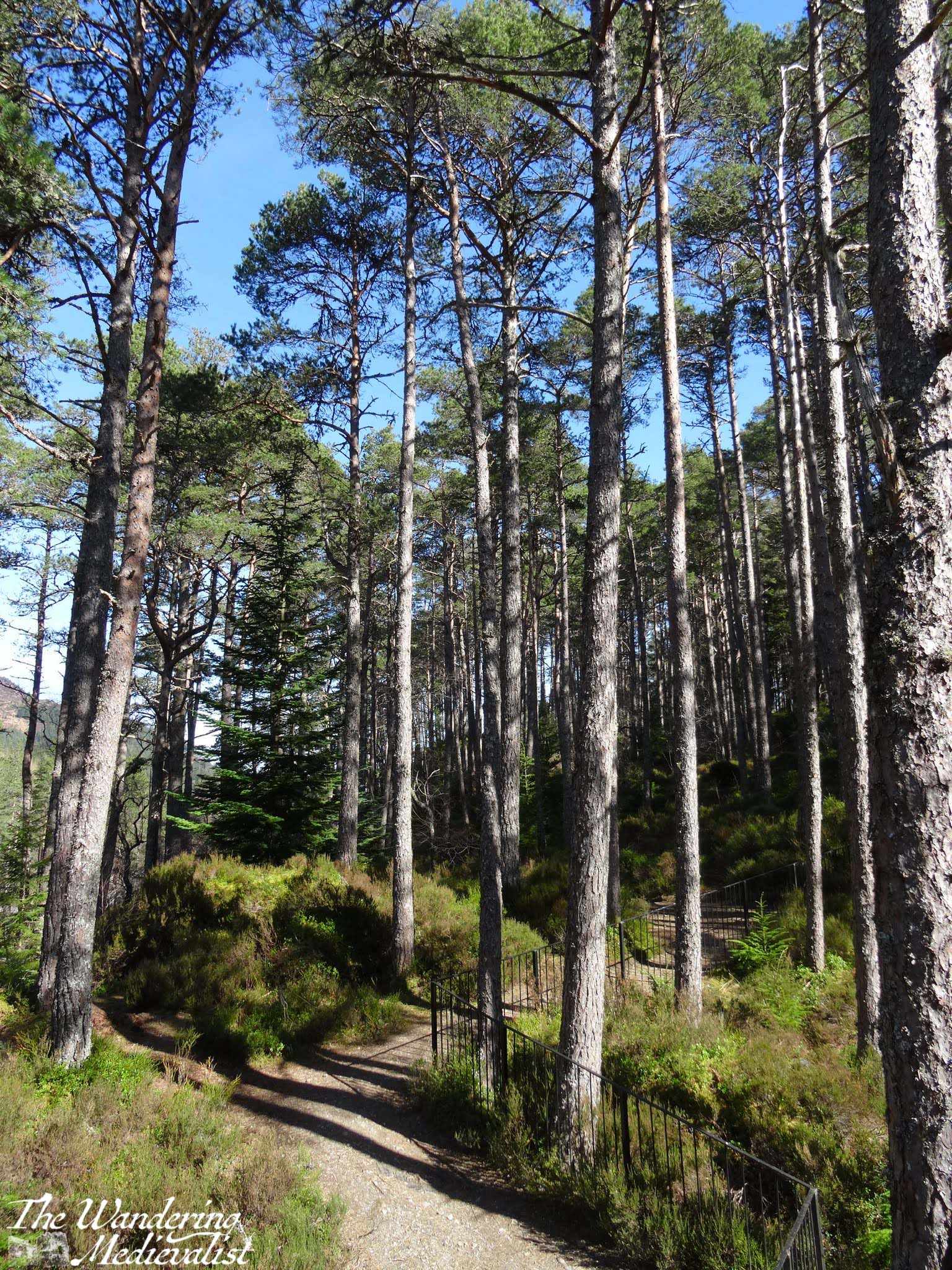
At this point in the drive there is a touch of anticipatory excitement, as I know what is coming. Almost never do we manage to get this far north without stopping at our favourite money trap: the House of Bruar, a high-end shop that sells textiles, outdoor equipment, kitchen accessories, toys, Scottish souvenirs and art of all kinds, and boasts an impressive fine food hall with every type of jam, jelly, cracker, cheese or fine meat that you can imagine. The butcher is fabulous, and the cafe is just as good for a scone or soup, sandwich and snack. Even better is the fantastic walk in the woods behind – again a post for another time, though I have several pictures of the Falls of Bruar in my ‘winter wonderland’ post.
House of Bruar represents another key marker on this drive – a bit less than half way (if you have started in central Scotland), and one of the last places until you reach Fort William that you can easily stop for a restroom break (there are a few other options, but they are not always available).
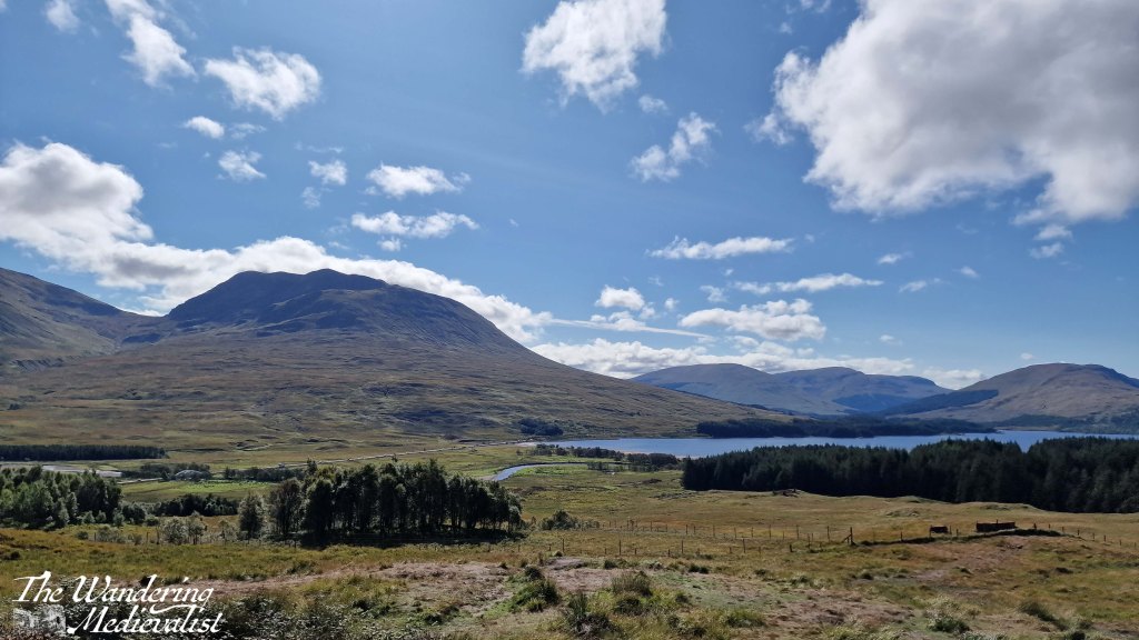
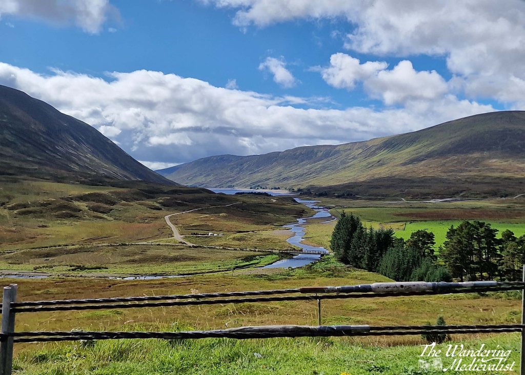
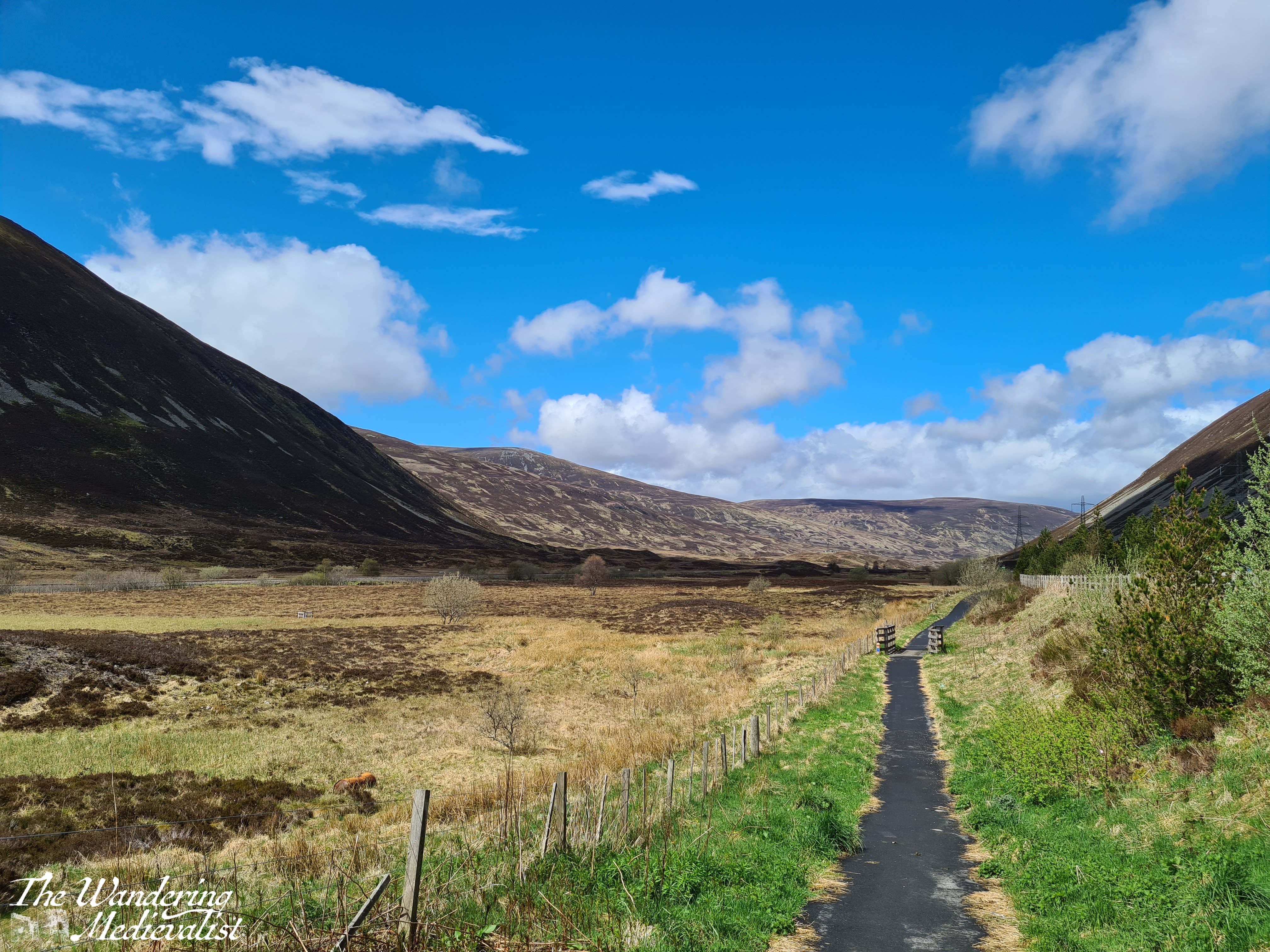
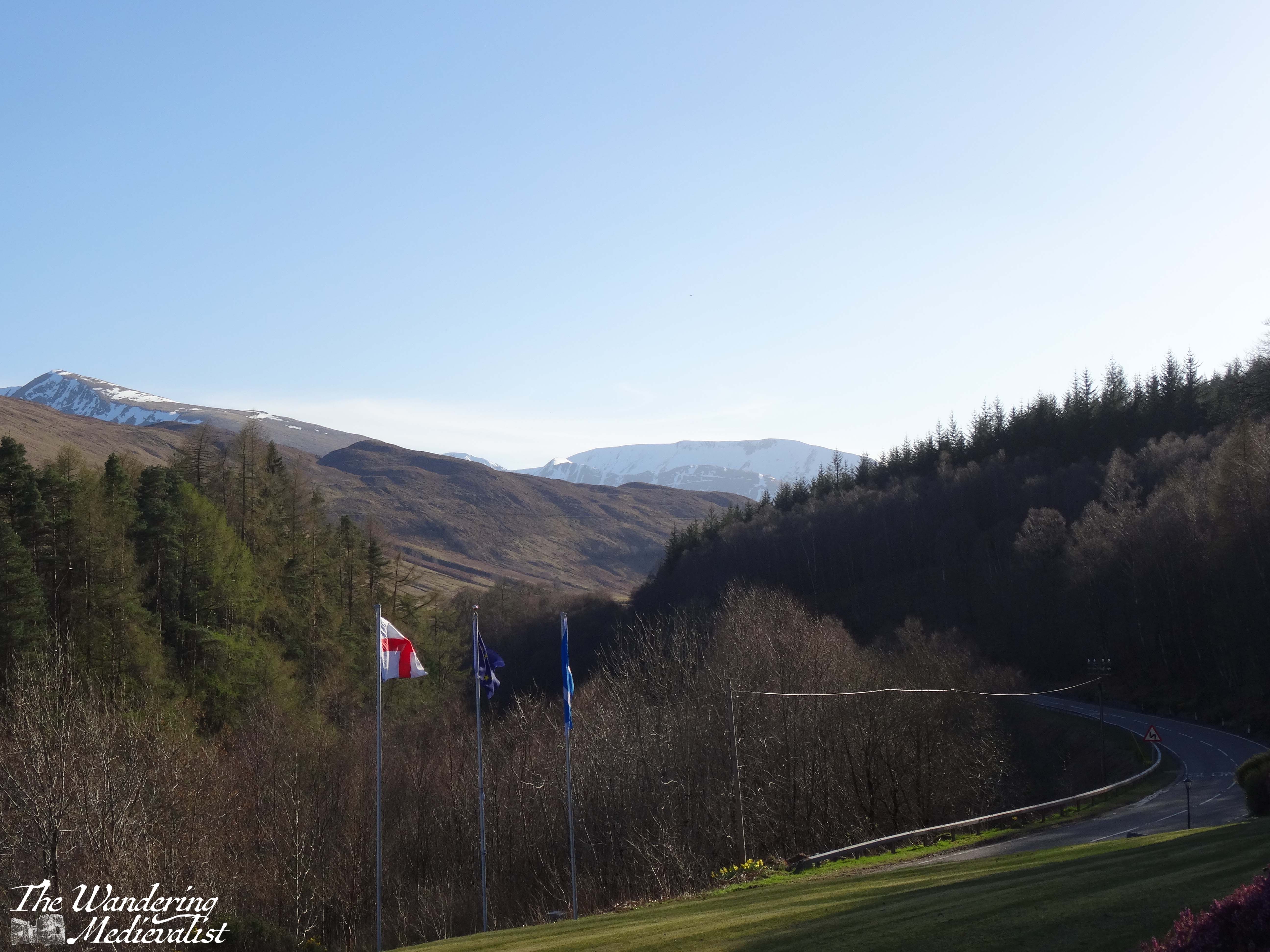
Beyond Bruar, one really enters the Highlands, with hills on both sides as the A9 follows the River Garry. While it is not always easy to tell, you are climbing at this point, and to the left in particular you can catch glimpses of lochs and glens cutting south. One of my favourites is the Dalnaspidal viewpoint, with a lovely river leading from Loch Garry:
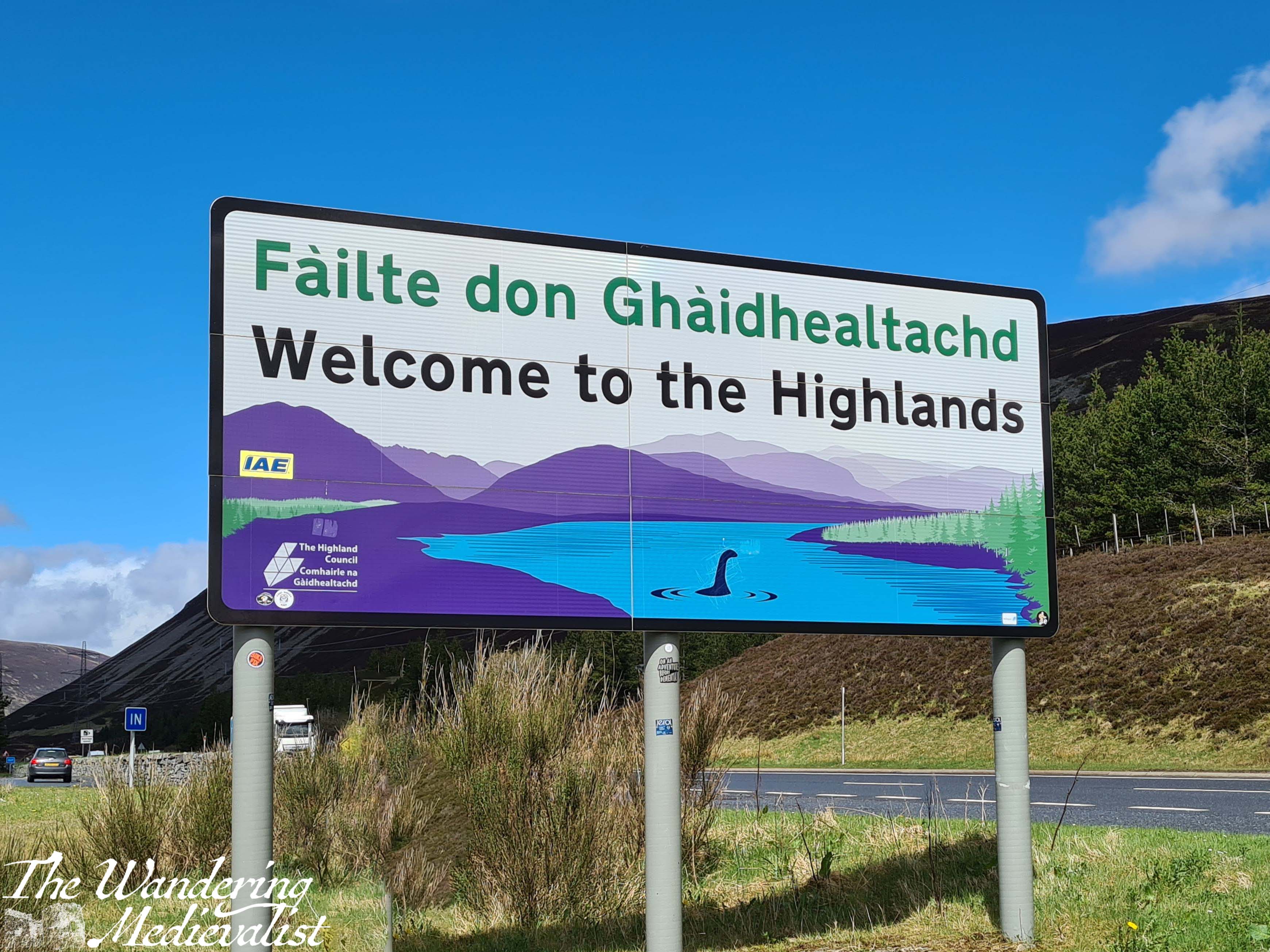
It is not always feasible to stop here, but the next point is a must. At Dalnaspidal you are only a few minutes away from the Pass of Drumochter, the highest point on the A9 and the rail network, and the only gap in the Grampians suitable for road traffic for 100 km. The weather is quite frequently dramatically different here, sometimes raining or snowing when Bruar was sunny and warm. There is a good-sized lay-by, and it boasts one of the happiest signs in Scotland: ‘Welcome to the Highlands’.
There are countless walks that one can take up into the hills here, and I have made it a habit to get out and stretch my legs, particularly if we have not stopped long at Bruar.
Drumochter is only a few miles from the next important milestone: the turn off of the A9. If one has examined a map, one notices that the A9 heads north and then curves east again slightly as it approaches Aviemore. To head west and then a touch south to Fort William, one must take the exit at Dalwhinnie, where there is a small town and a large distillery where they make, surprisingly enough, Dalwhinnie whisky. Tours are available at certain times of year.
The road in fact circles up around the distillery, and it is important to take care here as the lanes are narrow and large lorries and trucks are regular sights. From this point you will by requirement drive a bit slower; from Dalwhinnie north the road is winding and often roller-coaster like as it sinks and rises through the hills. The views are stunning though, back over the valley and town, and to the east where the Cairngorms are stretching out away from the road. To the left is relatively new forest, immediately to the right are fields, usually with sheep, and ahead rises a sharp peak of which I have not yet worked out the name. The road here is actually following the route of General Wade’s Military Road, constructed in the mid-1700s to help bring Scotland to order.
In several miles the road falls away and curves around to the west, with dramatic craggy peaks up to the left. When driving, one must be paying close attention as the route is both narrow and winding; passengers can enjoy the view. There is a touch of relief when you reach a T-junction with the A86. Here one turns left, following signs for Kinloch Laggan, Spean Bridge and Fort William. Note, turning right will eventually take you back to the A9 via Kingussie.
The road now is a touch wider, and in a few miles meets up with the River Pattack. There is a trail and small picnic area so that you can climb up to view Pattack Falls – well worth a stop if you need to stretch your legs or take a break from the roads.
Several miles beyond Pattack, the trees open up for a fraction of a moment to allow you a stunning view down Loch Laggan; I have seldom been able to properly pause here, but if you can find a viewpoint along the loch that is not blocked by trees, it is definitely recommended to stop briefly.
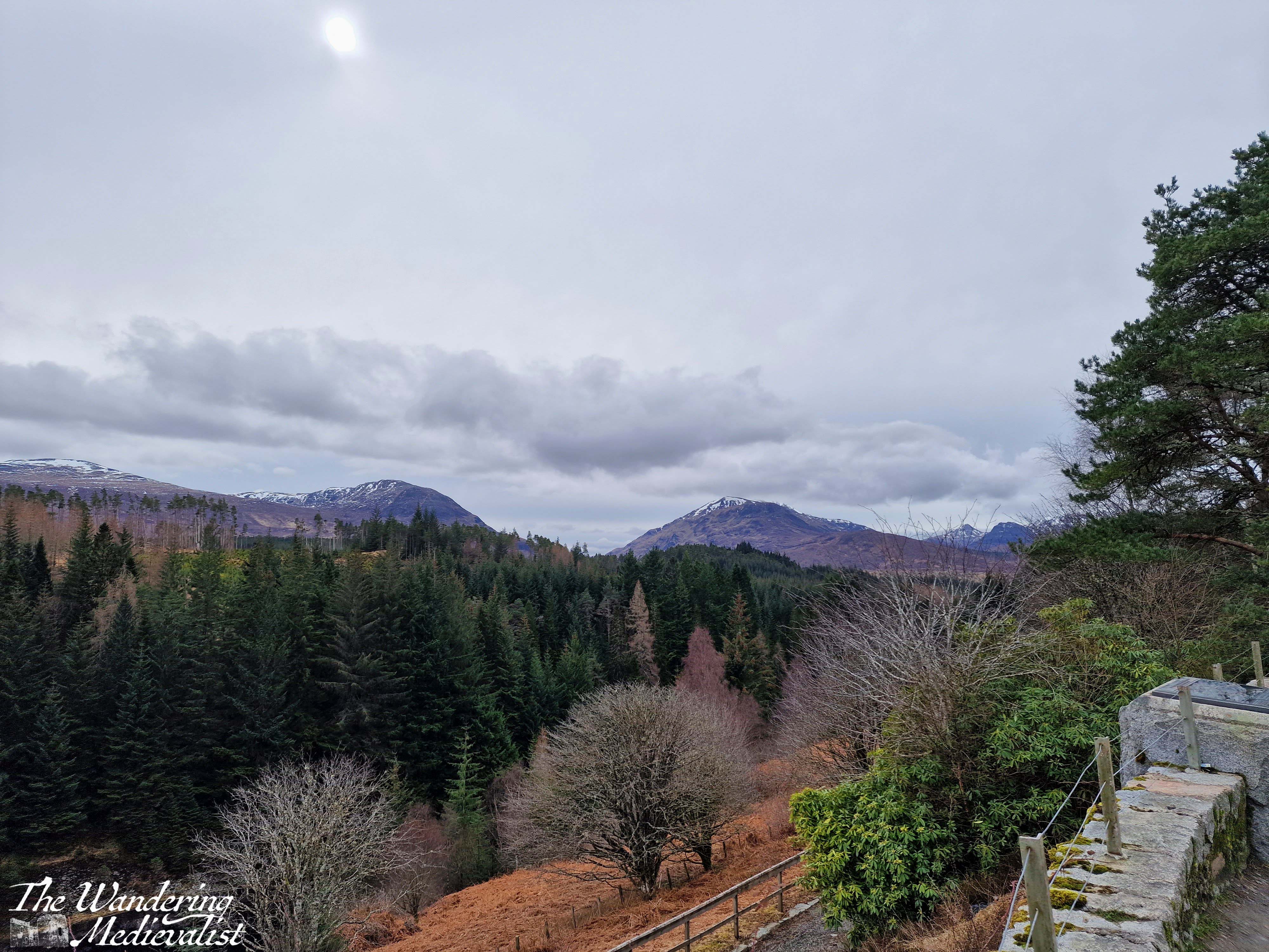
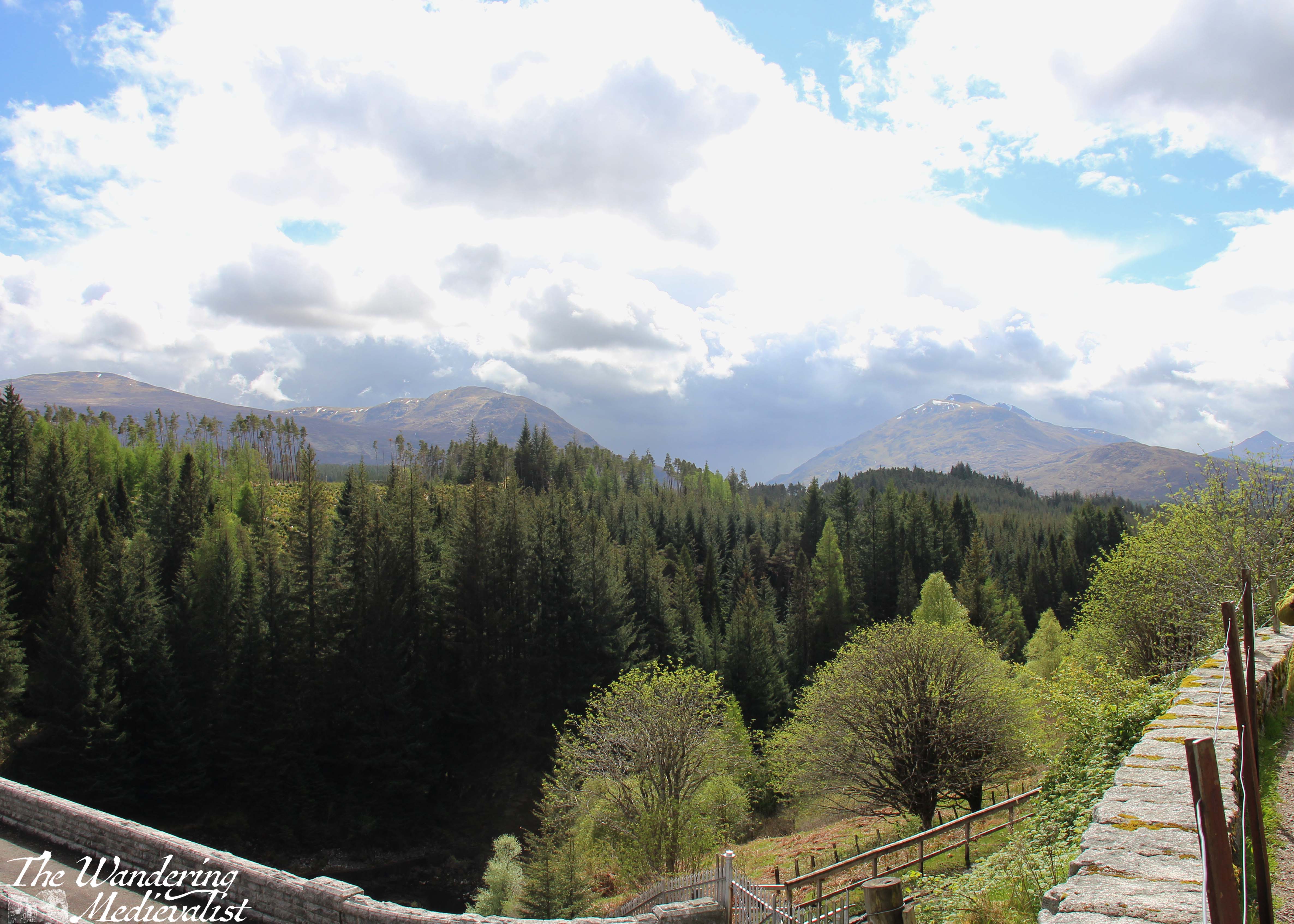
I always manage to confuse myself, thinking we are almost at the Laggan Dam, but in fact it is a solid 12 miles further as it does not sit at the end of the loch as one might expect. Approaching the the dam are more views over the mountains and the waterway down to the left, while to the right is the forest and hillside.
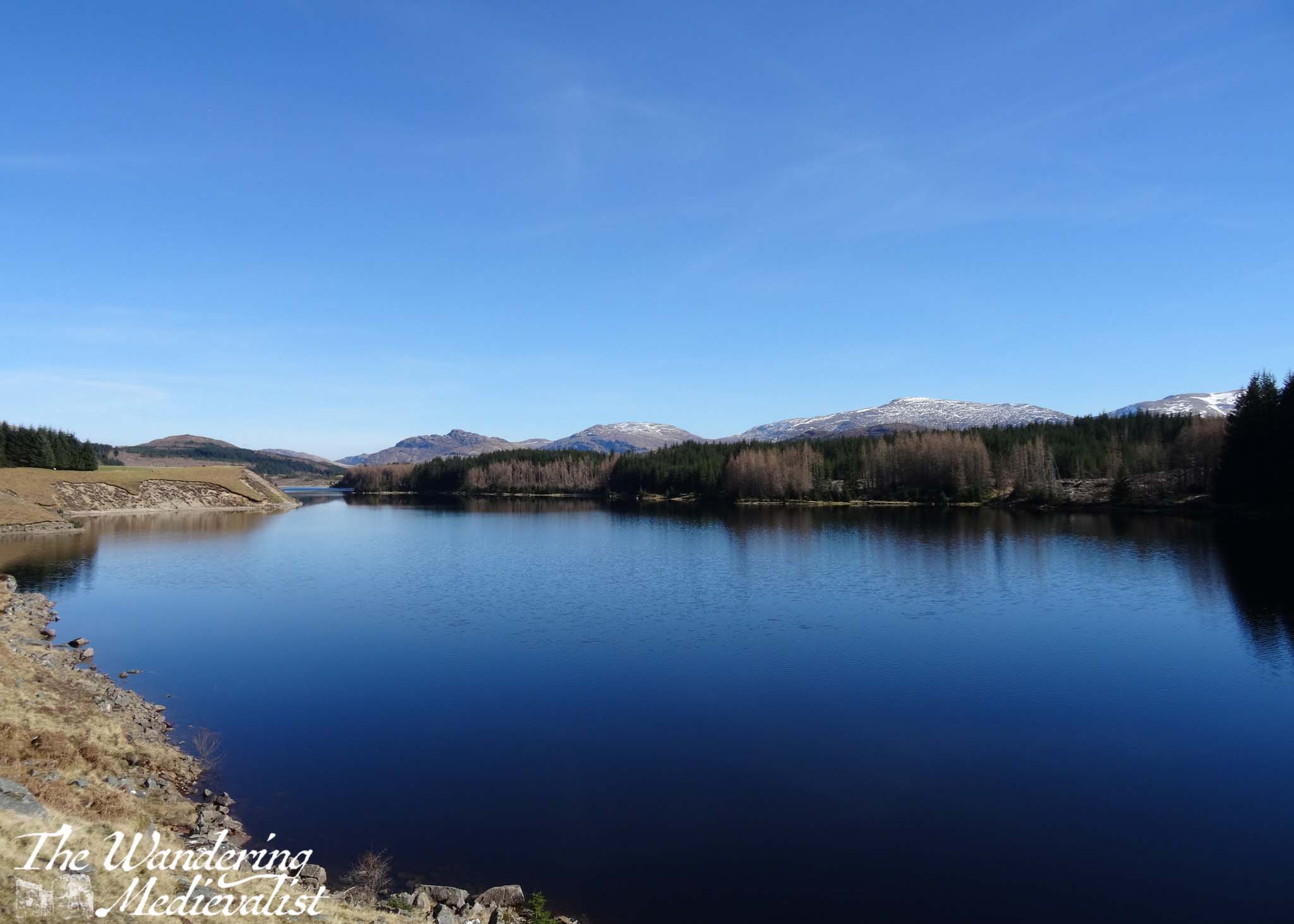
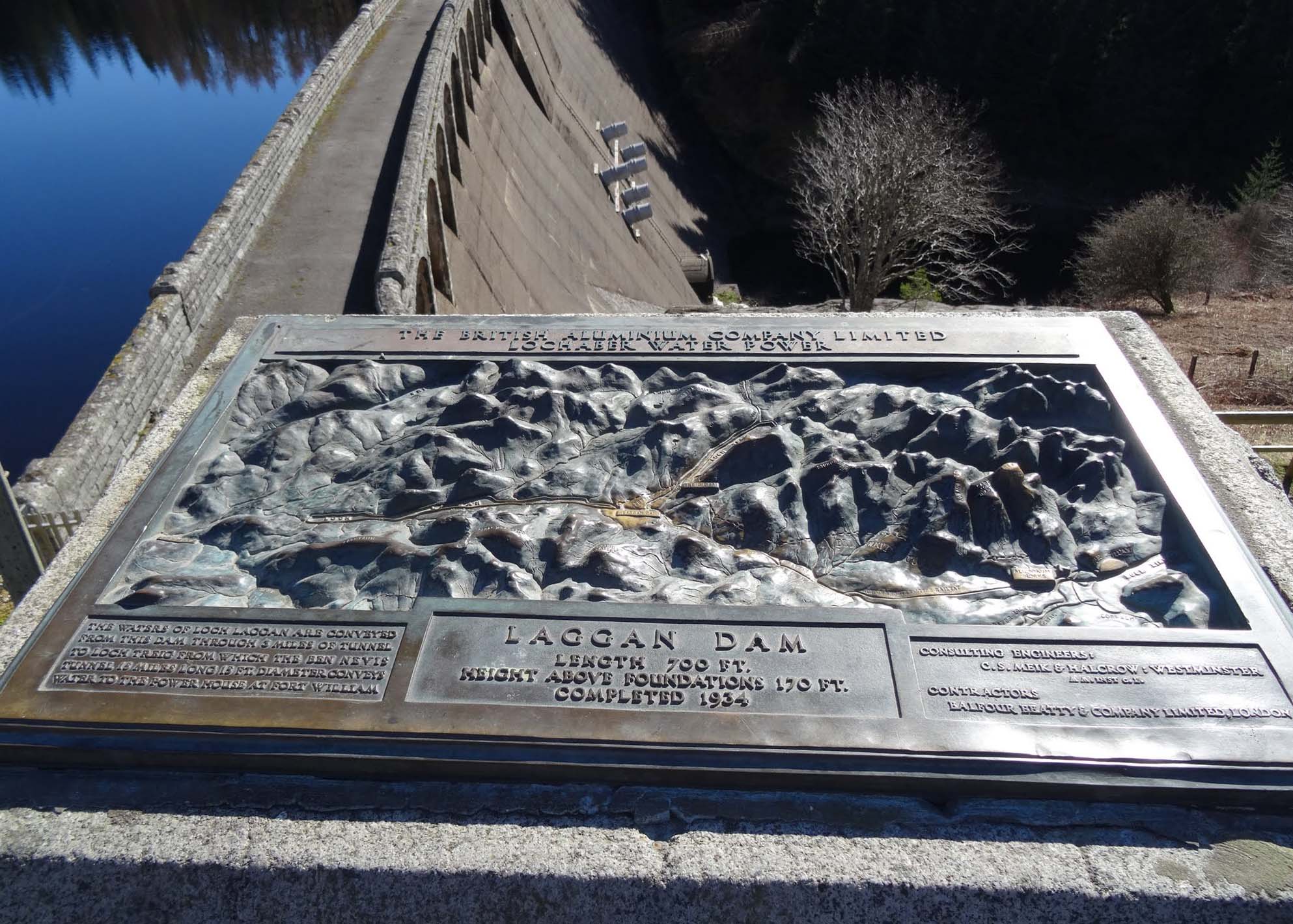
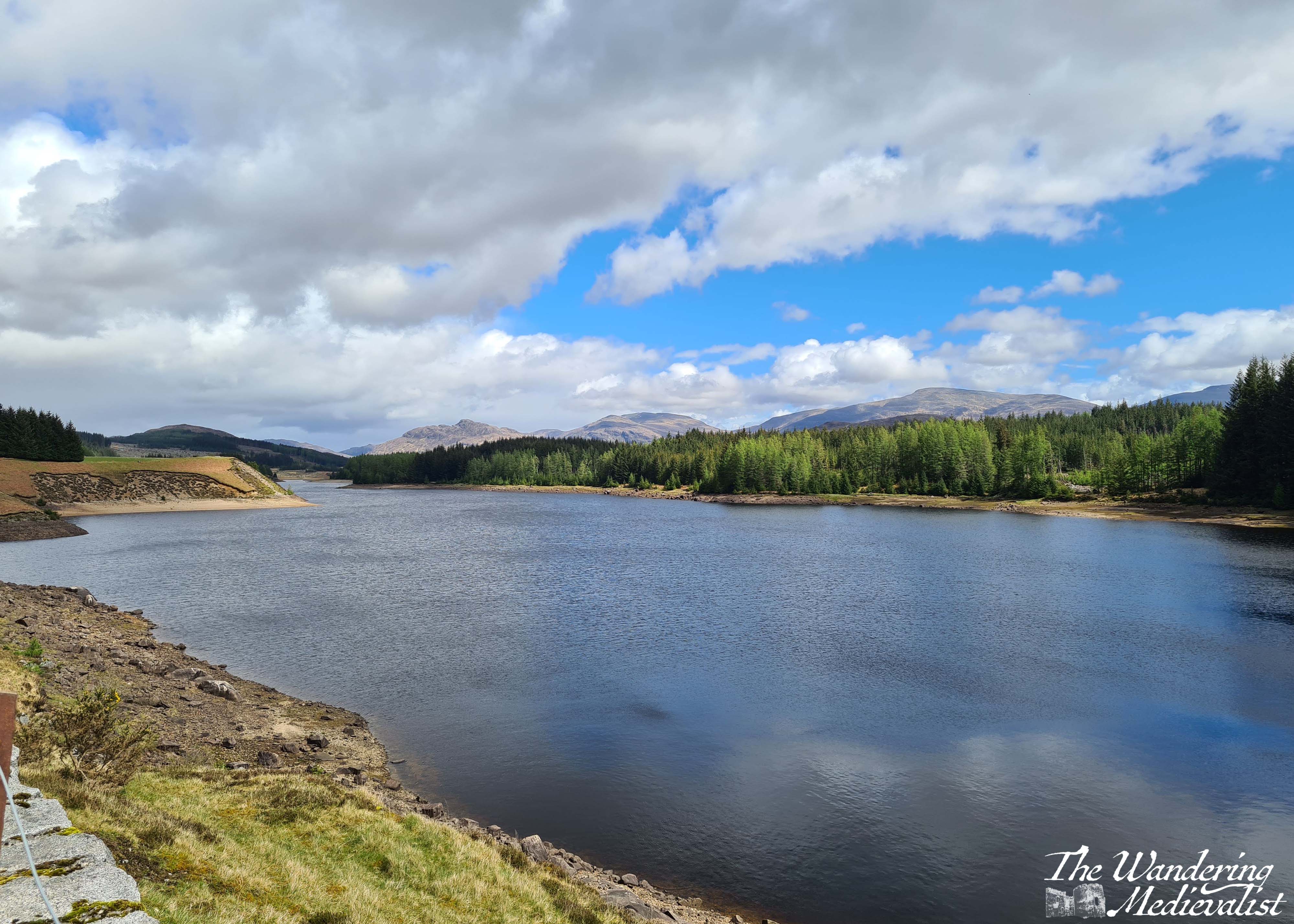
If you have managed the whole stretch from Dalwhinnie without stopping, you will absolutely want to stop at Laggan Dam, both for the view and to stretch your legs – you’re still about 30 minutes or so from Fort William. Directly south, behind the range of hills, is Rannoch Moor, and if you look at a map you will see you have just done a big loop up and around some impenetrable hills.
Constructed in the early 1930s, the dam is part of the Lochaber hydroelectric scheme, designed post-World War I to provide electricity for aluminium production. Now, you are able to stand at the edge of the dam and see the reservoir formed by the River Spean, and also the sharp peaks that form the eastern end of the Nevis Range.
Starting off from Laggan again you are in the home stretch, but also some of the more challenging part of the drive – this portion of the A86 is regularly considered one of the more dangerous roads in Scotland. You will quickly see why; it is winding with sharp bends, narrow turns, and drivers who often go far too fast. In the rain it can be prone to slippage from the steep hill above, and there is an equally steep drop off to the other side, into the gorge of the River Spean. I should say, I have never had any issues here, but I am also on the cautious side here.
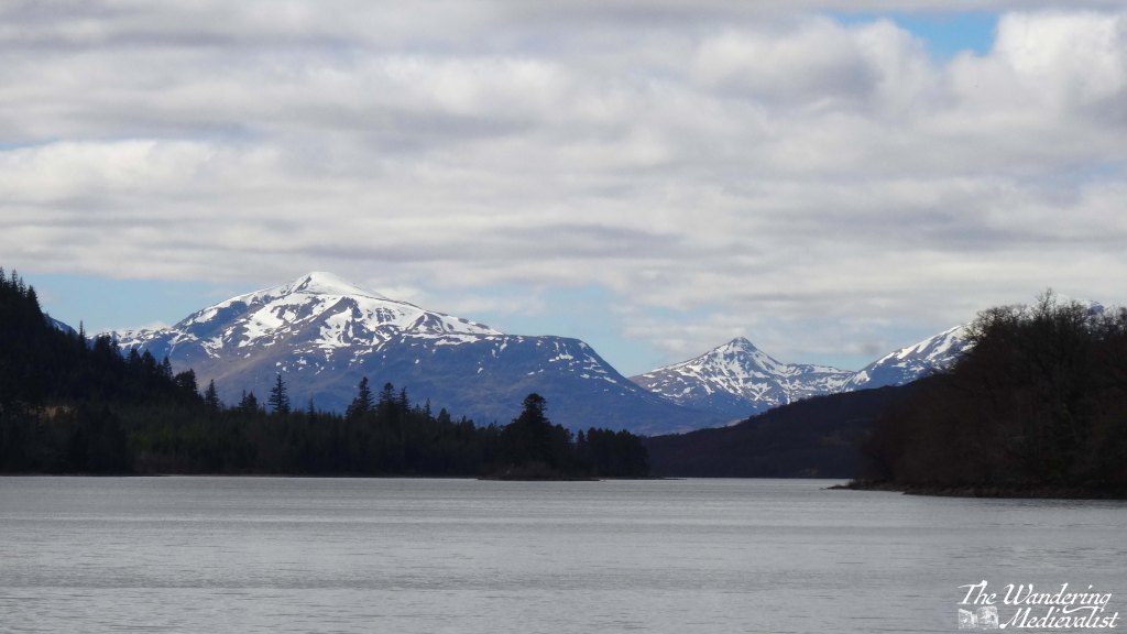
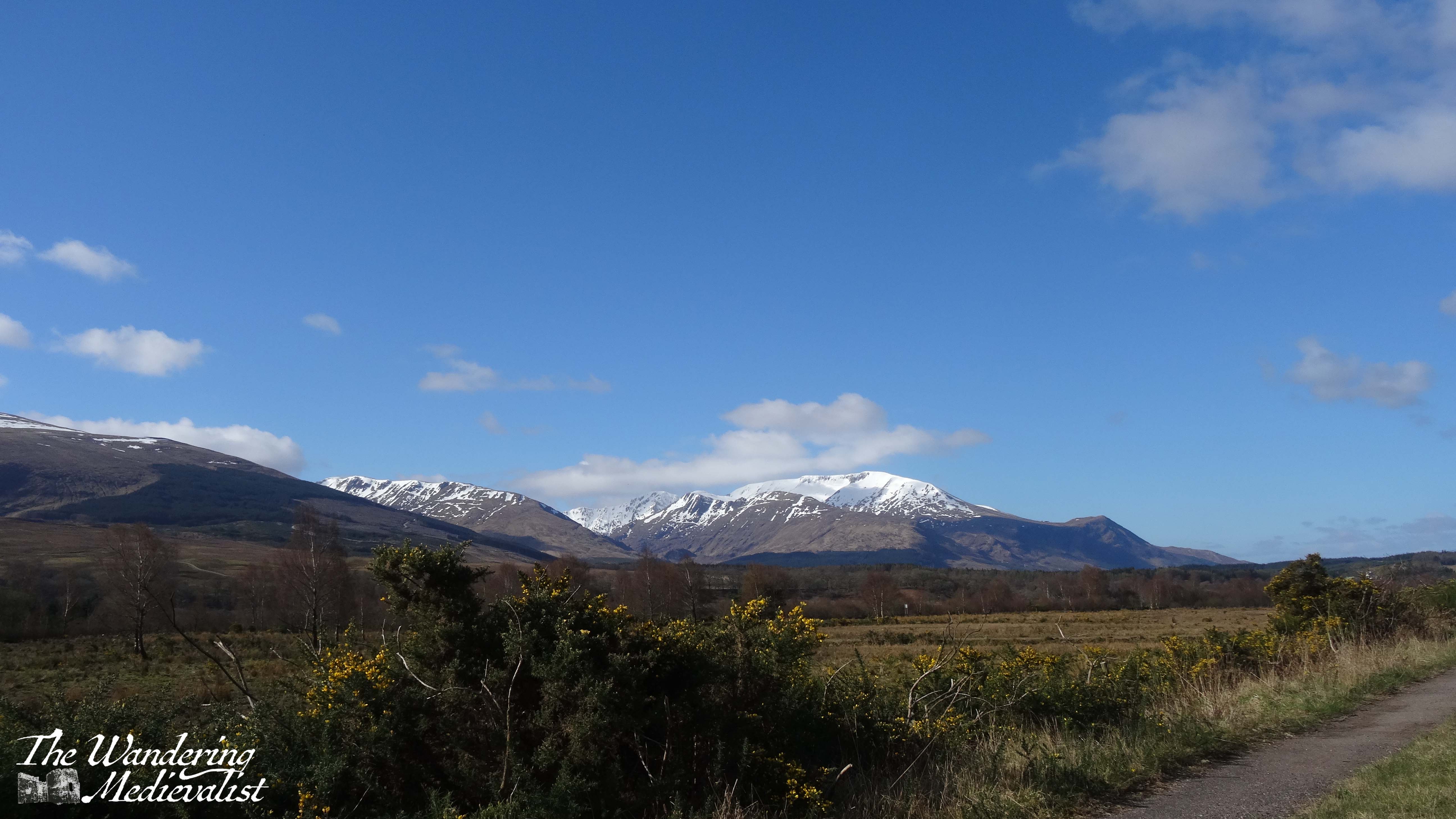
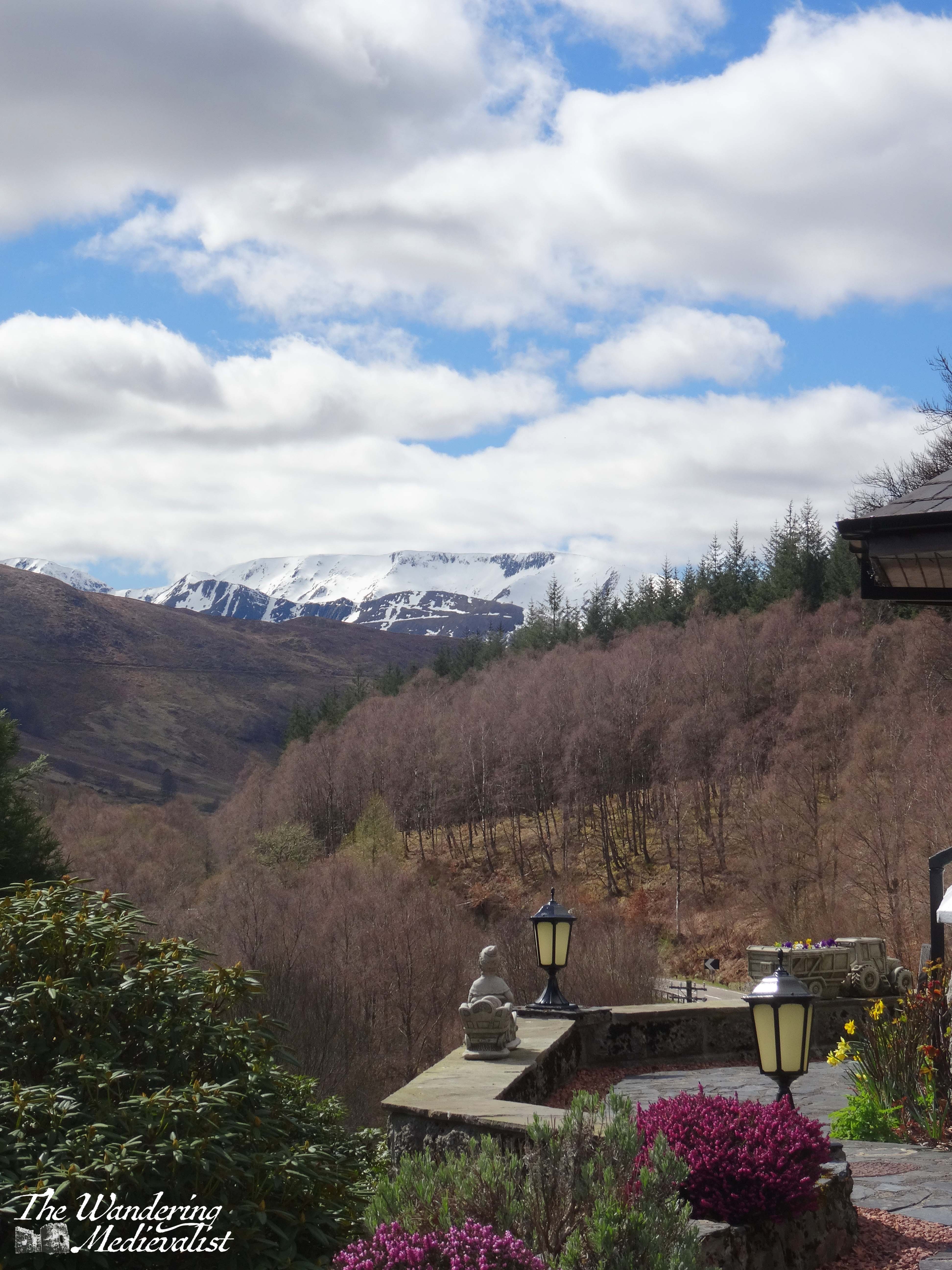
It is a beautiful route through a series of towns and villages where there are B&Bs and small hotels abounding. Some of the towns are also served by the rail line from Fort William to Glasgow. We stayed several times in a lovely hotel near Roybridge that provided excellent views up Glen Spean to the Nevis Range, but also showed how winding the road could be. Between Roybridge and Spean Bridge there are a few wide open fields where you can see up to Ben Nevis – the UK’s highest peak – often still snow-capped in April.
Spean Bridge is slightly larger than Roybridge, and there you can find several hotels and a woollen mill that provides refreshments (mostly to bus tours) as well as wide-ranging Scottish souvenirs. As expected, the River Spean passes under the road here, before carving its way through the landscape to join the River Lochy. This is also where the A86 joins the A82, offering an option to turn north towards Inverness or continue west to Fort William.
The drive into Fort William from here includes some spectacular scenery on both sides, with the Nevis Range rising to the left and farm and more mountains to the right. A few miles out from the town, you pass the Nevis Range mountain resort, where you can take the gondola up Aonach Mor.
The approach into Fort William passes some very familiar modern sights such as a large Aldi, M&S Food Hall, KFC, Costa Coffee, and Pound Stretcher. You will also go through the roundabout where the road from Glenfinnan and Mallaig intersects the A82 – believe it or not, I have been stuck at this roundabout in long queues of traffic. One does not often imagine finding a traffic jam in the Highlands!
Nevertheless, I always find myself smiling as whatever vehicle I am in makes its way past the turn off to Ben Nevis, then the many guest houses and B&Bs, and eventually into the town centre of Fort William.
A few items to note if you intend to try this drive:
As mentioned above, there are not many places to stop for refreshments or comfort breaks between Dalwhinnie and Spean Bridge, so plan both carefully.
Likewise, petrol is scarce between these points, but if you have filled up in Perth you should be able to reach Fort William without any danger of running low – transport depending of course.
Roads will be slippery and potentially even closed in poor weather (particularly in the winter). Drive carefully and always check the route on Google Maps or your preferred method before leaving. Roadworks and diversions may pop up without much warning!
If you intend to stay in Fort William, make a reservation. It is frequently busy, even when you think it might not be…
I will write soon I am sure about the town of Fort William itself, places to eat and stay, as well as the drive back south again via Glencoe and Rannoch Moor. Until then, I hope some of my pictures have persuaded you to give this journey a go!
We knew that the second day of our time on Syke was going to be wet – it was predicted to start raining at about noon, so we got on our way relatively quickly in the morning for the hour-long journey to Dunvegan Castle. It was the one and only castle I insisted upon visiting, and I hoped we could get a bit of a visit before the rain closed in.
I’ve written an account of our visit to the castle, during which the rain started at least two hours earlier than it was meant to – but that is standard in the Highlands. So, we headed back towards Uig, passing through alternating heavy storms and light drizzle. I realised as I drove that by the time we reached our cottage we would not want to leave again, and so my mind was also on foraging for dinner. With luck, we found a café that included the word ‘deli’ and I pulled in for a coffee and exploration.
The Dunvegan was the perfect spot for what I needed – they had cakes, crackers, cheeses and some venison salami that I felt should be tried. I wish I could remember the name of the cheese I bought which the girl said was local, and was amazingly creamy and delicious, but no amount of googling seems to find it. In any case, I stocked up and ran back to the car where the family had decided to camp out.
As we pulled out of the Dunvegan town, we passed the view of the Two Churches, which is actually the start of what appears to be a circular walk – must try it next time.
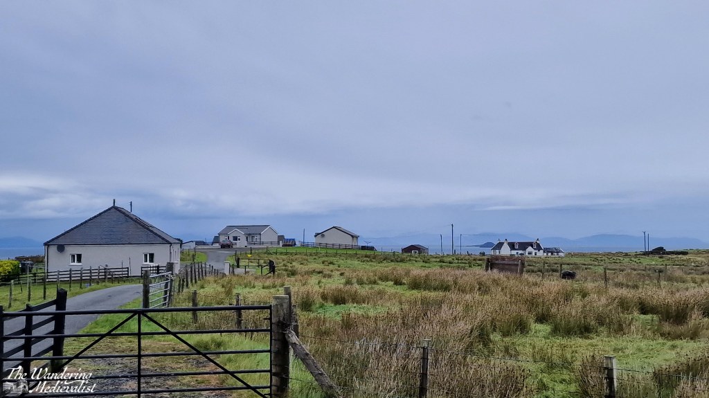
From here we headed home to our cottage which, as I have mentioned in previous posts, was called the Homer. It was part of a set of 2 or 3 cottages rented by one family and the owners were very friendly and attentive, stopping by once a day to check that all was well. The house was incredibly well-equipped with top-of-the-range stove, fridge, washing machine and dishwasher. The kitchen had every utensil you might need, and previous tenants had left behind bits and pieces – tea, rice, salt, pepper. The beds were comfortable and rooms warm, and the instructions and advice provided were detailed and very helpful.
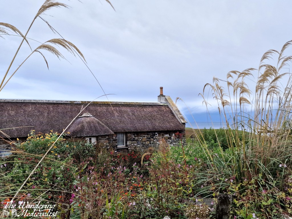
We spent the rest of the day hunkered down in the cottage, for the most part – the wind and rain were intense at times, but the living room remained toasty warm and tightly battened down against the weather. The TV had every channel we could possibly want – had we been able to agree on something to watch. At one point, Dad got restless and suggested we go for a short walk, which we did – to the entrance of the property and down a side road that led to a charming house built in the old island style of stone walls and thatched roof.
After this detour we headed home and all read and relaxed until it was time to break out our foraged dinner. Cheese, salami and crackers made a good accompaniment to some veggies and snacks I had from Marks and Spencer – not the fanciest of meals but tasty enough! It was a good night to head to bed early, and prepare for the next day of exploration.
I thought this might also be a good time to make a few recommendations based upon my one-time visit, and reflect on a few things I wish to explore in more depth upon inevitable return.
Recommendations
Accommodation: going self-catered is a great option, especially at super-busy times of year, and it’s an option the other half and I have preferred more and more wherever we go. It makes everything more flexible and often saves you money. On Skye in particular, there are cottages everywhere that will probably provide better views than a hotel. But plan ahead. Highly recommended to bring a cooler or ice box and prepare to buy your food in Broadford, Portree, or before you cross to Skye (we bought most of our supplies in Fort William).
If you opt for a hotel/B&B, ask them when you book if you need to make a dinner reservation. We tried a few days out and one place did not have any tables – for the rest of the month.
Weather – well duh, but make sure you have something to do on a rainy day.
Walking – bring a change of sneakers/hiking boots/whatever you like to wear. There are boggy paths and your feet will get wet almost inevitably.
Drivers – prepare yourself for the roads. They are windy, narrow, and you are often out-weighed by the massive busses that negotiate the twists and turns so easily. Needless to say, watch your petrol level and be aware of hidden pot-holes. Make sure someone in the car knows how to change a tire! (We came so close…)
Beer – check out the Isle of Skye Brewing Co for some excellent and really reasonably-priced beers. Particulary recommended is the Syke Red, if you like red ale. I may be disowned by certain friends for admitting I did not try the gin…
Food – we didn’t eat anywhere (see above recommendation on reservations) but we did stop for supplies at the The Dunvegan, an inn, restaurant, coffee shop and deli. Their cakes were spectacular and they had local cheese…well worth a visit!
On my list for next time
Over and above all, more time for hiking and walking!
Hike the Quiraing. Views can only get better.
Hike the Old Man of Storr trail.
Try the Two Churches walk – even in the pouring rain looked like something out of Wuthering Heights.
Check out the Skye Museum of Island Life – it was literally minutes from where we stayed, and looks like it has some fascinating examples of cottages and more.
Visit Monkstadt – looks gorgeous and would be tempted to try to stay here if I had the time and money.
Explore the other coasts – clearly to adequately cover any portion of Skye you need a lot longer than we had, and we missed the whole south/west.
The only thing stopping me from making plans to return is the distance. It is perfectly possible to get to Skye in one day but it is a bit of a trek, and neither of us are keen to do it in one go. This means inevitably breaking the drive somewhere – Fort William was perfect really – and making a long weekend less feasible. But I will be keeping an eye out for the opportunity.
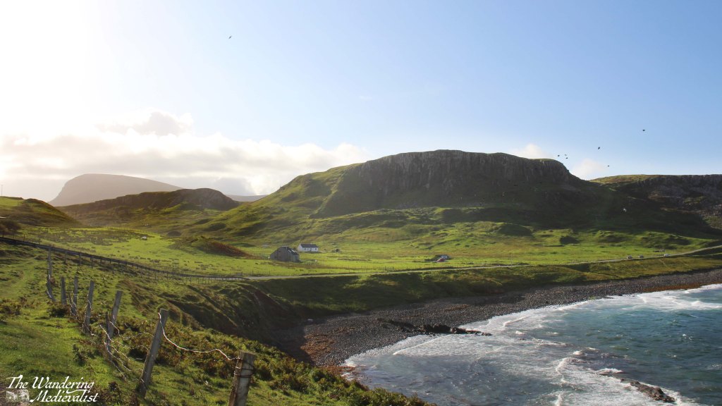
Hunglader is one of those place names that erases any question that the Norse settled in Skye. It was our home for most of the week, and our final morning dawned bright and blue as we packed up and tidied up the Homer. Before finally leaving the north, we ventured down to the local beach, passing on the way some picturesque old Skye-style houses with white walls and thatched roofs.
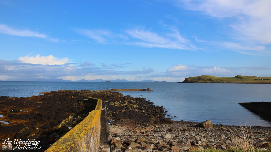
The beach area offered a decent-sized parking area where two couples in a camper van were just finishing their morning fire. The cliffs towered over the beach and sheltered it somewhat, though the wind was not nearly as strong as we had experienced the day before.
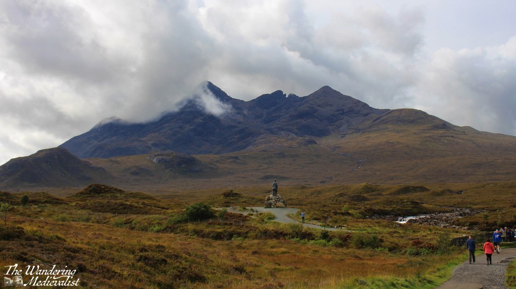
On the way out of town we had one more stop at a ruined church, then we headed south. I was quite keen to make sure we filled up on petrol before leaving Skye, and recalled a number of long queues, so we ended up stopping in Portree and topping up before our final Skye-specific stop, the Sligachan Old Bridge. It was one of several stopping points I had noted on the way north, and it is a gorgeous spot with stunning views up the glen. But it was also midge-infested, so we walked quickly and not as far as I might have hoped.
It is definitely a place to return, with paths heading up towards the Cuillin Mountains. The statue, I should mention, is not some distant historical figure like Bonnie Prince Charlie, but is perhaps more poignantly dedicated to two men who pioneered mountain-climbing on Skye, Norman Collie and John MacKenzie.
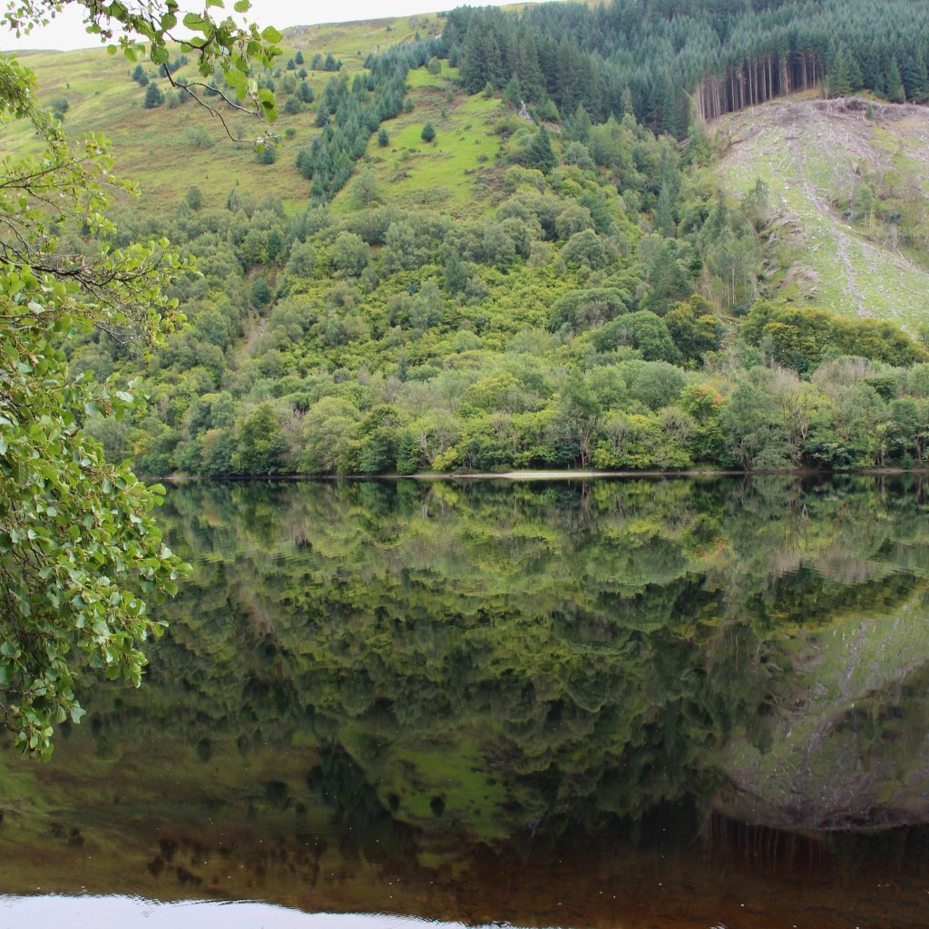
Sligachan was our last stop in Skye, and it was a relief to find the wind had stayed calm as we continued over the bridge and back to the mainland. By this view of Loch Duich it was so still that the waters were almost literally glass-like.
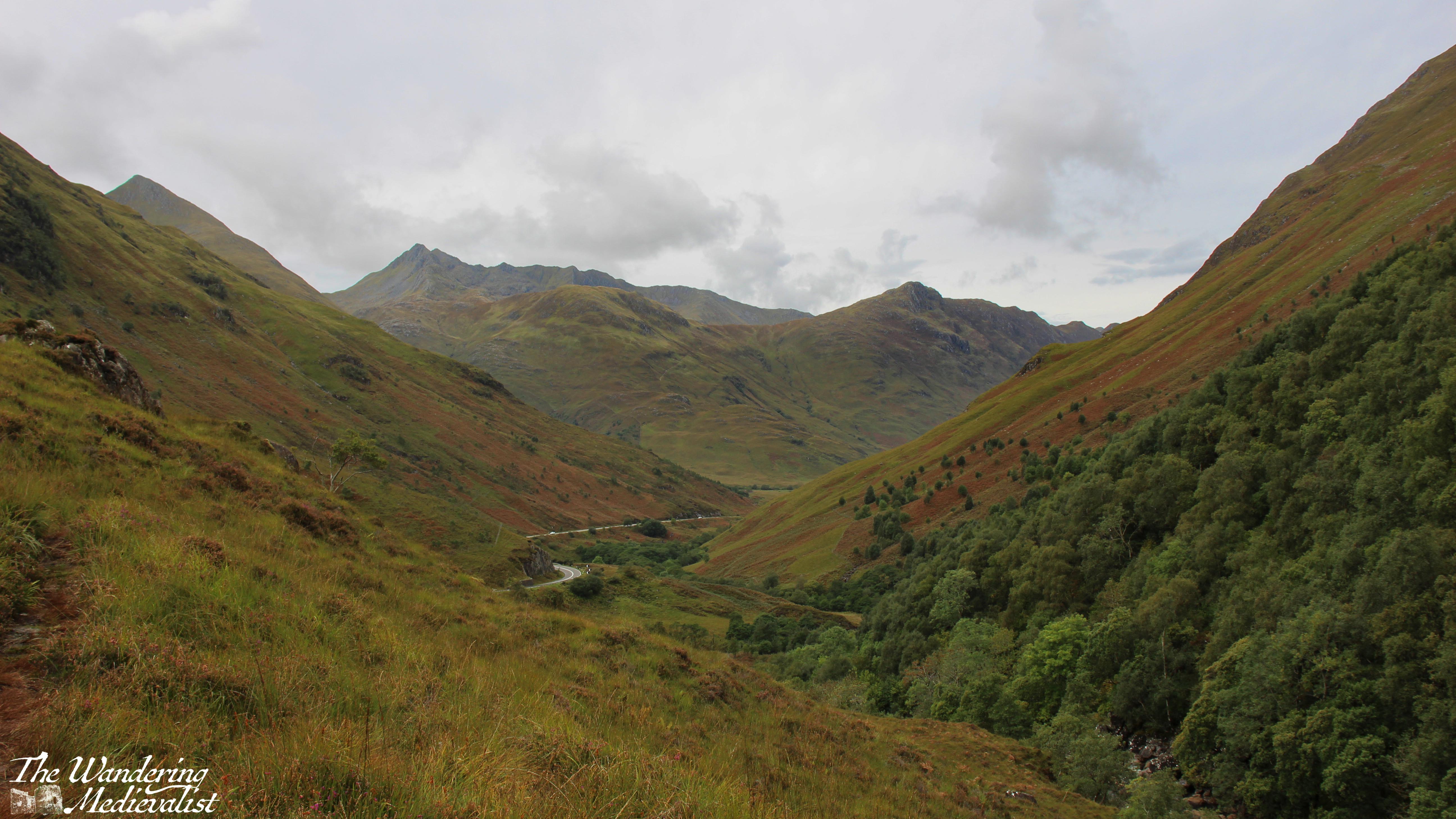
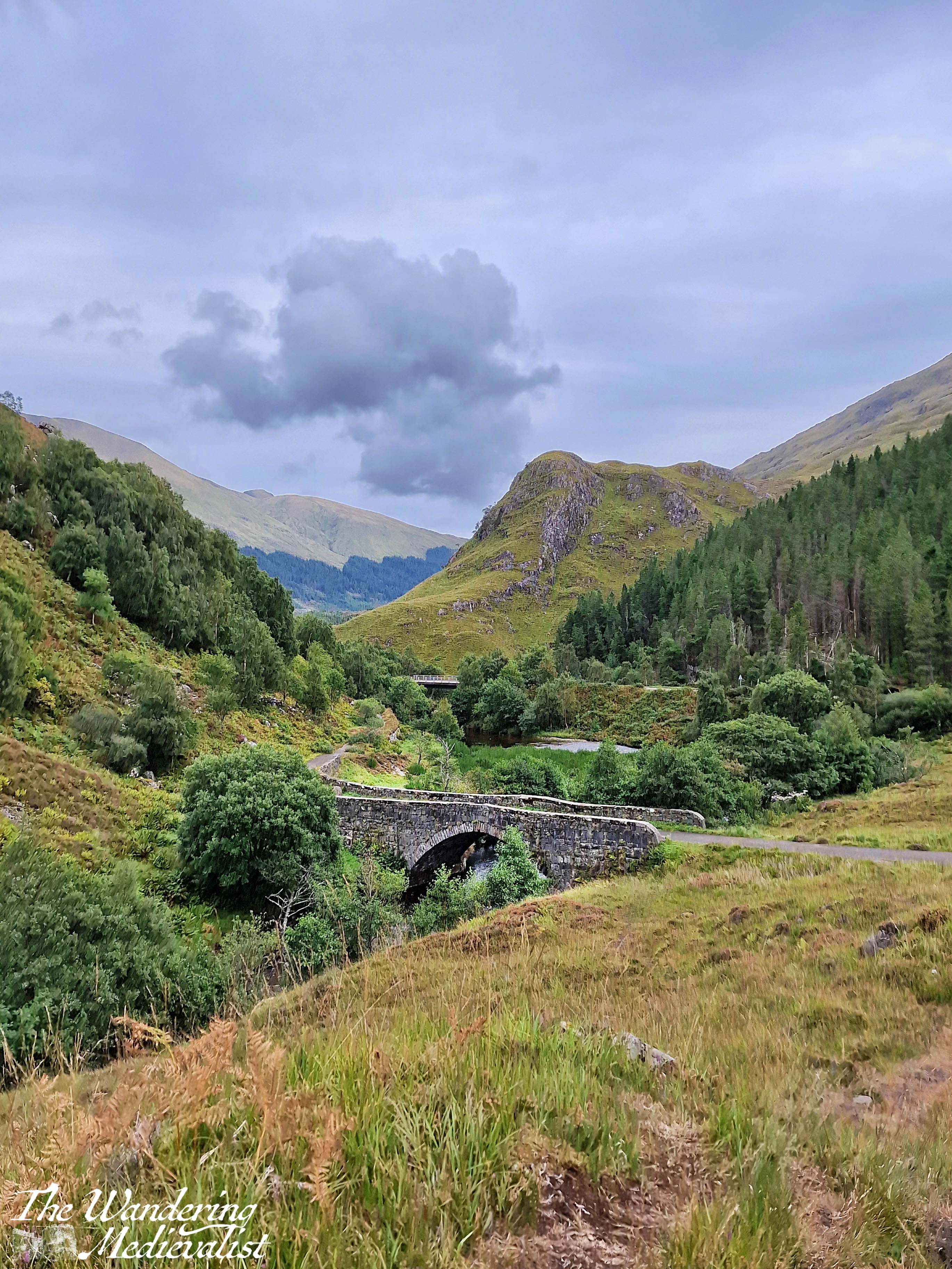
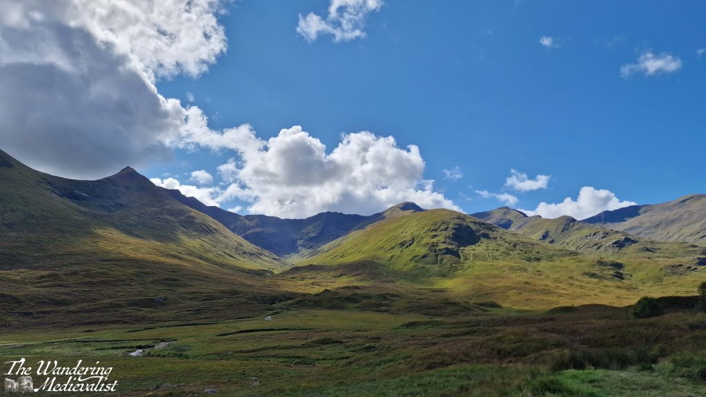
The clouds were drifting in as we pushed south into the mountains, following the road between Loch Duich and Loch Cluanie. I had made a careful note to explore Glen Shiel, where a stone bridge marks the point of a battle in 1719 between the Jacobites and Spanish on one side, and the English and Dutch on the other, evidence of religious and political divides across Europe in the early 18th century. Standing on the modern road, it was possible to track the historic route that armies would have needed to take, and the sharp angle of the hills makes it clear why this might be a treacherous battle spot. While most of the Jacobite commanders escaped, the battle is considered an English victory.
With our many pauses, the day was ticking on, and I think we all had enough of views and pictures and were ready to get to Fort William, still a fair distance away. We considered stopping at the Commando Memorial but there was little appetite amongst the passengers, while I was getting tired of winding roads.
This was taken on the banks of Loch Oich, right before the locks of the Caledonian Canal, and I love how perfect the reflection is. It was our final break to stretch before making the last push.
The hotel we stayed at in Fort William, while clearly designed for coach parties, offered surprisingly good food and local beer – have determined that we must stop at the Glen Spean Brewing Company the next time we are up. We all headed to bed early, contemplative of the end of our time on Skye and what the following day would bring as we drove across Rannoch Moor and home.
I’ve skipped ahead in my story-telling to the third day we spent on Skye – the second was standard Highlands rainy, and we visited Dunvegan Castle before eventually retreating to our cottage for the afternoon. Thursday dawned clear and bright but increasingly windy as the day went on; the car was buffeted about and on one or two excursions it was difficult to walk. We think the gusts were well into hurricane-force, but even with whipping hair biting into my face like knives, I was so excited for our journey.
I had spent most of the afternoon before plotting out the route and places I knew we needed to stop, then entering it all into Google maps so I could know exactly where we were meant to go. There was a question as to whether we might go all the way to Portree and do a loop back, but in the end it was an out-and-back trip, allowing us the opportunity to stop at a few points we missed. Once again, I have chosen a few highlights for this page, but most of my pictures are in the video at the bottom.
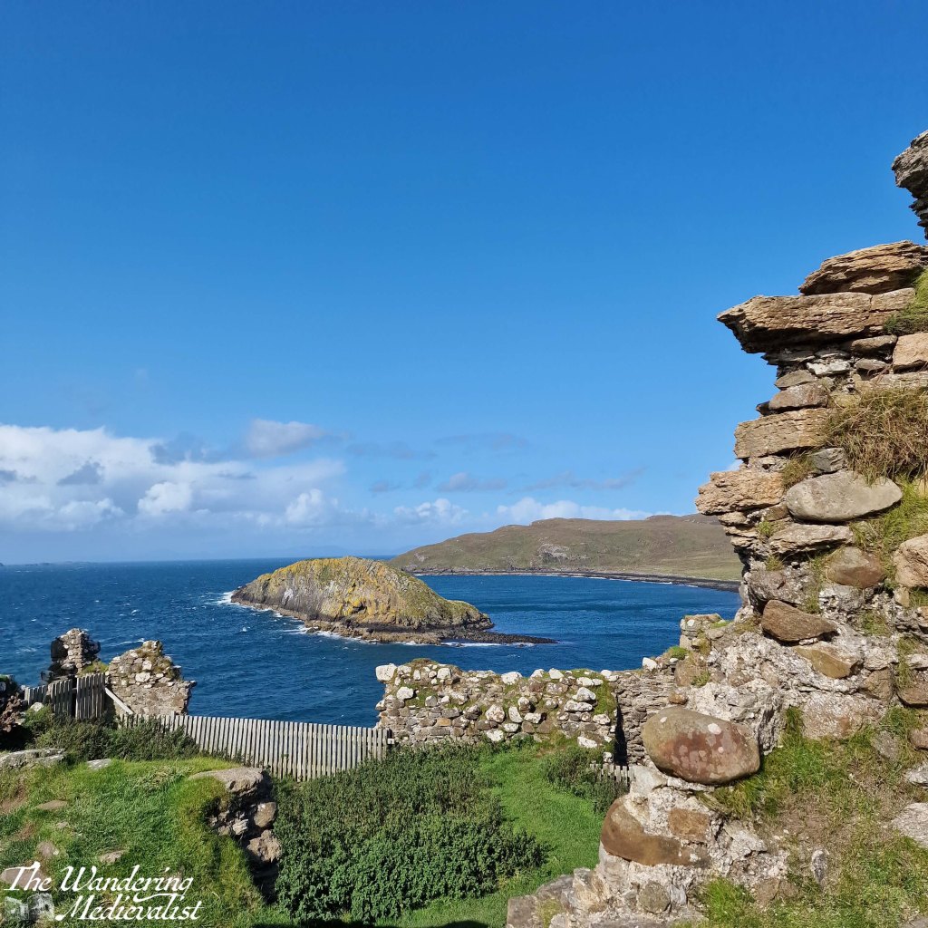
First stop was Duntulm, less than ten minutes north of where we stayed – it is an almost entirely ruined castle on a promontory with gorgeous views back over the hills and coastline.
I was the only one who hopped out of the car on this first stop so I made it quick, eager to see what the rest of the day would hold.
The A855, which is the main road that runs along the north edge of Skye, runs through some breath-taking landscape. Even when one cannot see the ocean, one can enjoy the distant mountains and vistas across green fields dotted with heather, sheep, and outcroppings of rock. Several times I stopped just to enjoy that view, and also to calm my nerves as driver.
Because, while it is the main route along this coast, the A855 is also a single-track road with relatively frequent passing places, but equally frequent blind corners and hills that cause the occasional near-miss with other more confident or less cautious drivers. I would certainly not recommend the route for tourists unused to Highland driving, beauty notwithstanding.
As the road cuts across the top of Skye it leaves the coastline to re-join a few miles later, opening up views across the glistening water to small islands and the distant mainland. We stopped a few times, though as the wind grew stronger, Dad started to doubt whether he wanted to go on much of a hike – one of the plans for the day. Knowing that one of our party would be confined to the car either way meant that cancelling a longer hike made good sense.
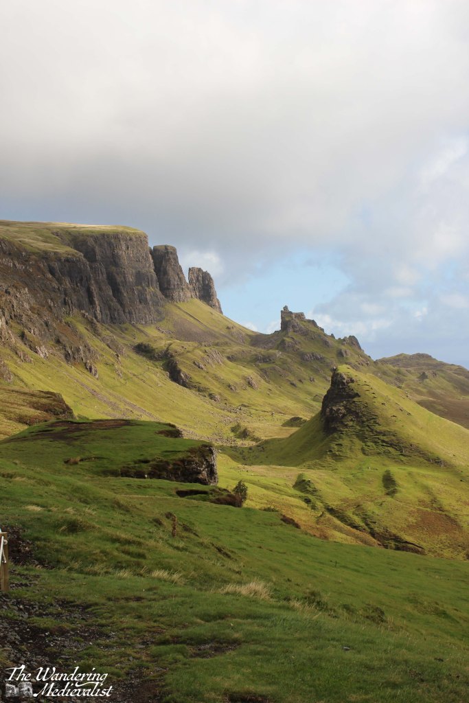
One location we knew we could not miss was the Quiraing, and so we turned inland along an even narrower road and made our way towards the line of cliff-like mountains ahead of us. Despite the size of the road it was quite busy, with cars and vans going to and fro. As we approached the parking area, the road started to climb sharply, weaving up the side of the mountain with hairpin turns that reminded me of scenes in To Catch a Thief – though I drove considerably slower than Grace Kelly or Cary Grant. I am not a great one for heights so kept my eyes firmly on the road as I negotiated the turns, breathing again I think only when we reached the top and found a large car park for hikers and visitors.
There are a number of path options at this point, including one that is wide and gentle enough that – I think – it is wheelchair accessible. It is certainly easy enough for most to try, and if you ever find yourself here with an elderly or less mobile companion, I would encourage you to encourage them to give it a go, even with wind as strong as it was when we visited – strong enough to take your feet from under you. This sight of the Quiraing, the view across towards the ocean, lochs and hills in between, is one of the most stunning I have ever seen. Top ten in my life, no question. The stunning scenery of the Quiraing is caused in part by a series of landslips, and the sunlight plays dramatically off sharp pinnacles, grassy slopes, and sheer rock faces.
As Dad and I made the short loop, we could see to the right a rain storm coming our way. I knew there was not enough time to reach the car so while Dad made a dash for it anyway, I continued on my way, hoping to reach the next knoll. I tucked my camera inside my sweatshirt and waited to get wet. I have absolutely no regrets.
Yes, I got soaked, and the much better-equipped hikers passing me looked at me questioning my sanity, but I stayed and filmed the storm.
The rain passed in minutes and the sun returned, allowing me to watch the storm as it moved towards the sea. There is no question I need to return here and take the time to do at least some of the hike. We saw quite a few spectacular sights on this day, and on the trip as a whole, but this was definitely the top of the list. Eventually I steeled myself to drive back down the winding road and was delighted to discover that the road south was back to two lanes.
The next stop was Kilt Rock, which was very busy so that everyone was vying for the best photo spot. My companions had been before, so we continued on quickly, to Lealt Falls.
This is where, as we parked the car, we realised just how powerful the wind had become. It must have topped 70 MPH, so strong that it was a challenge to walk and loose hair whipped my face like needles.
The colour of the hills and water were stunning so Dad and I braved a short walk to a viewpoint, though I recall passing two small dogs that I worried would be blown away. The falls themselves are visible from a sturdy viewing gallery that stretches out over the chasm, and in the distance one can see the range of mountains that includes the Old Man of Storr.
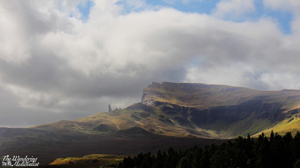
Another famous Skye destination, the Old Man of Storr should not be missed. The picture below is taken from a treacherous parking area called the Rigg Viewpoint – treacherous due to its narrow spots, large busses and larger potholes.
But the view is stunning. From here, we continued on to the actual parking lot for the Old Man, and while my companions waited in the car I scampered up the first half mile or so of the trail, to a point where I could see over Loch Leathan and up to the rock face. Again, this is clearly a spot that must be viewed on foot from the hiking trail, and next trip I will be certain to conserve the time and energy to do so.
The day was creeping by, however, and so after a brief discussion of our options, we decided to return on the route we had come rather than continuing on to Portree. We did not really need to go that far and the A855 was so beautiful it was worth another look.
We did not stop as often on the return but Duntulm required another look; I parked more securely – again dodging enormous potholes – and Dad and I took the short walk out to the ruins. Here once more the wind was battling us, and at times it was a struggle both to walk and to hold the camera steady.
The castle here had been built in the 14th and 15th centuries, the seat of the Clan MacDonald of Sleat – rivals of the MacLeods who held land further south. Despite its strong defensive position, the site was abandoned in the 1700s and the stone was taken to help build Monkstadt House, several miles south. Monkstadt, incidentally, is now a luxury inn and restaurant that we looked at very briefly before realising it was a bit too luxury for our needs at the time – we resorted to pesto pasta.
Once we had our fill of the castle ruins – or I did, more accurately – we returned to our cottage. It was mid-afternoon and the wind was battering the building and bushes outside, the perfect time to sit in the living room with a cuppa and enjoy the sunshine, a book, and the view. The Homer is so well-built that were it not for the noise, you would never know it was windy; not a single breath of air disturbed us. While we had not had a partiuclarly long day, it was an exhausting and even emotional one and we were all, I think, ready for a rest and time to process and review all we had seen. For me, it was a chance to start planning my return…
The Isle of Skye is a destination that everyone tells you is a must-see. First off, everyone is correct. But for any number of reasons – the distance, time, work – I have never managed to get there, even when most of my family have done so, usually as an add-on to a visit with me.
Finally, earlier this month, I was able to reach the almost mythic isle and was incredibly lucky to experience three out of four days of beautiful weather (one day included hurricane-force winds, but it was clear). Even if we had not had lovely sun for most of our visit, I feel I would be affirming that Skye is, indeed, a place that one really should see, particularly if one has any kind of affection for rugged dramatic mountains and scenery that is quite literally breath-taking.
In fact, I took so many pictures that I have had to turn them into videos, and split my posts into days, so as not to overwhelm – I’ll link it at the bottom of the post. There were a few views that I missed as I was the designated driver on this adventure, but they will remain imprinted on my brain and I did my best to channel what the other half reminds me, ‘Sometimes it’s ok to just enjoy the view and not take a picture.’
Even just the experience of driving over the Skye bridge and following traffic as the road gradually lifts over the mountains was enough to make me long for the time to do it again.
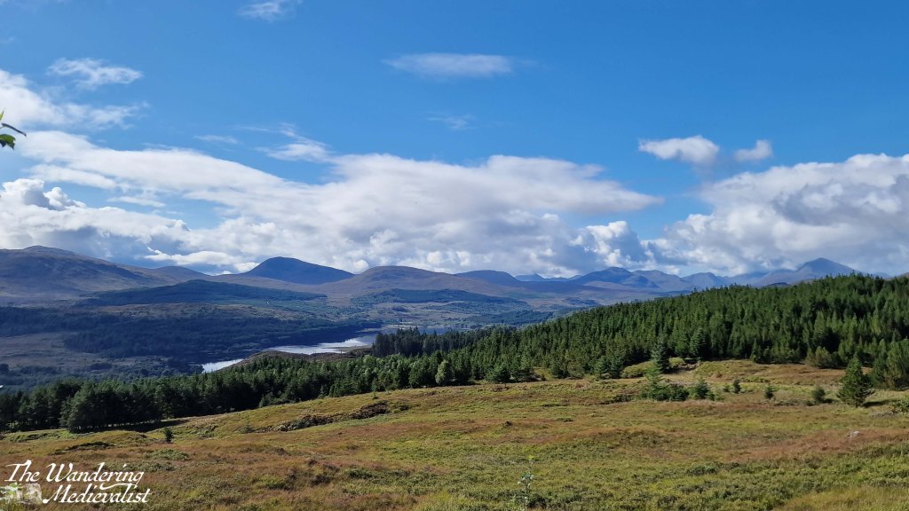
But I get ahead of myself. The first day – really only half on Skye – started with us leaving Fort William at around noon and heading north along the A82 past the Commando Memorial and Loch Lochy towards Inverness. Then at Invergarry, we took a dramatic turn west to follow the A87 towards Kyle of Lochalsh and Skye (and in fact, we would stay on the A87 all the way to Uig). I had scheduled in a number of viewpoints which I thought may be worth pausing to explore – I was acting as tour guide for visiting family – and the first was Loch Garry.
Unfortunately trees had grown up in front of the main viewpoint so high that it was difficult to even see the water, but a bit further along we were rewarded with this vista toward the end of the loch and the mountains beyond.
The road remained high above the lochs for the next few miles and we stopped long enough at the Loch Loyne viewpoint to take a video, then continued on to Loch Cluanie. For some reason this loch had stayed in my mind as I recalled a stop, many years before, at the Cluanie Inn. At the time it had been a much smaller place – it now boasts a bakehouse and fuel pump – but I recall a charming old spot with excellent soup. We did not stop on this trip despite this memory, and instead continued on away from the loch and into the gorgeous mountains.
This drive along the A87 is just stunning – the further north you get, the more rugged the mountains and flora get, verging on bleak but falling just short especially in the sun.
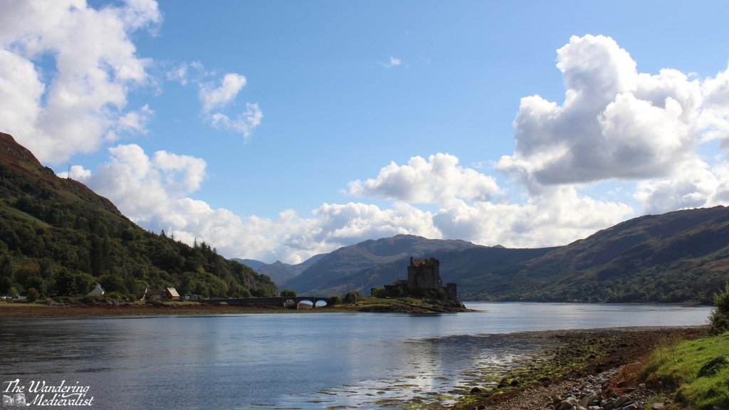
We could have stopped in many more places – some I made a note to try on the way back – but the day was passing and I knew we still had a significant amount of ground to cover. So, I pushed on until we reached Loch Duich and the most photographed castle in Scotland, Eilean Donan. We pulled into the massive busy car park and took a few distant pictures, but upon crossing the bridge into Dornie discovered an arguably even better view from the small town hall and public toilets.
Despite a continuation of stunning scenery, I kept my foot down after this stop and pushed on through Kyle of Lochalsh to the famous Skye bridge, an eye-catching steep arch of a bridge that was a touch unsettling at first, or is to one with a wariness of heights.
Once onto Skye the road is in good condition, quickly reaching Broadford, one of the larger towns on Skye were there are some good-sized grocery stores as well as plenty of places to stay – hotels, B&Bs, and self-catered.
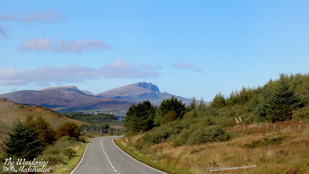
Continuing north, the road wove back and forth a few times and began to climb, with stunning mountains and valleys to the left and water to the right. We passed Sligachan with a note to stop on the return, and as the road topped a hill, before us was suddenly visible the distant shape of the Old Man of Storr, unmistakable against the blue.
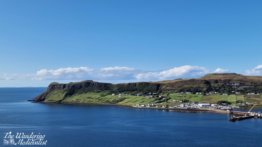
From here we touched the edge of Portree and continued pushing north, across another stretch of mountains and valleys populated mostly with sheep and a few distant farms. Our penultimate stop for the day came at a well-populated parking place perched on the hill above Uig harbour, dominated by a headland and ferry pier.
From here the road descended quickly into the village, passing several hotels and shops. Our route was further north and so we branched off to the A855 which I knew, from previous research, was also the start of the single-track roads with passing places. Indeed, while the distance from Uig to our cottage was relatively short, it was a solid 20 minutes in the car, requiring relatively regular stops to make room for passing cars and busses. Almost as if in an effort to test drivers, the A855 lifts out of town on a narrow cliff-side road that makes a hair-raising hairpin turn. This turn and the very visible drop off the road made me very happy not to be driving one of the many bulky motorhomes we passed.
After a long day of driving, I was quite ready to reach our destination, and the narrow road was not hugely helpful in alleviating my exhaustion, though the afternoon sun glinting off the water promised a lovely evening. Finally, more than four hours after leaving Fort William, we reached the cottage that was to be our home for the rest of the week. Dad had reserved the place and it was a fully-equipped cottage with two bedrooms, a lovely kitchen that I would happily have traded with my own, comfortable warm living room and perhaps most importantly, 360⁰ views of the sea, mountains, and countryside. After unpacking the car, we had a quick pasta dinner and sat outside with a glass of wine and my trusty camera tripod to watch the sun set. It was a perfect way to end the day.
Easter may be the most important holiday in the Christian religious calendar, but my experience has involved mostly flowers (and flowery dresses as a child), jelly beans, chocolate, and family. I must admit also to a weakness for Handel’s Messiah, which I find to be supremely beautiful music, especially when echoing in a church.
This year, Easter quickly became the one weekend this spring during which we and some of our closest friends could all manage a few days off, and it was our turn to make the journey from Scotland to southern England – about 8 1/2 driving hours total. Granted, this is nothing in the US, but is substantial nonetheless, and required since the mid-pandemic collapse of FlyBe means flights are astronomical. We had never done a drive this long together before – the Midlands was as far as we had managed – but this time I was able to drive as well. So we packed far more than needed (the joy/danger of not having to squeeze things into a carry-on bag) created a new 7-hour driving playlist on Spotify, and reserved a hotel for just north of Birmingham, around 3 hours north – we hoped – of our final destination.
I started off, more confident driving in Scotland, and we made it almost all the way to the border before swapping over. I think my other half was antsy to get some motorway driving in, and our speed definitely picked up a bit as we headed south. At the border, our route turned from the A74 into the M6, one of the largest roads in the UK.
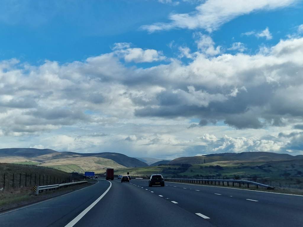
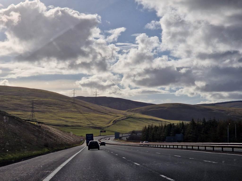
It had been a number of years since our last venture down the M6, but I quickly remembered how stunning the northern part is – after the Scottish borders the hills become those of the Peak District, perhaps less dramatic than the Highlands but still lovely.
As the M6 winds south, though, the differences between England and Scotland quickly became clear. The fields were flatter and greener, and the housing areas along the side of the road were red brick. The sun shone in a way that reminded me of the American midwest.
We had plenty of opportunity to enjoy the view, too – traffic quickly backed up and it took us almost two hours longer than we expected to reach Stafford. On wise advice from our friends, the next day we took the toll road around Birmingham – gloriously empty – but ran into issues again as we re-joined the main road and turned south towards Oxford. By this point I really felt the Englishness of the countryside – there were great estates and castles at every exit (though my interest in stopping was overruled by a wish to see our friends) and the houses on the estates were larger and, generally, a bit better kept than the ones we tend to see in Scotland. England is just so clearly designed for more people, and that change in population is almost palpable.
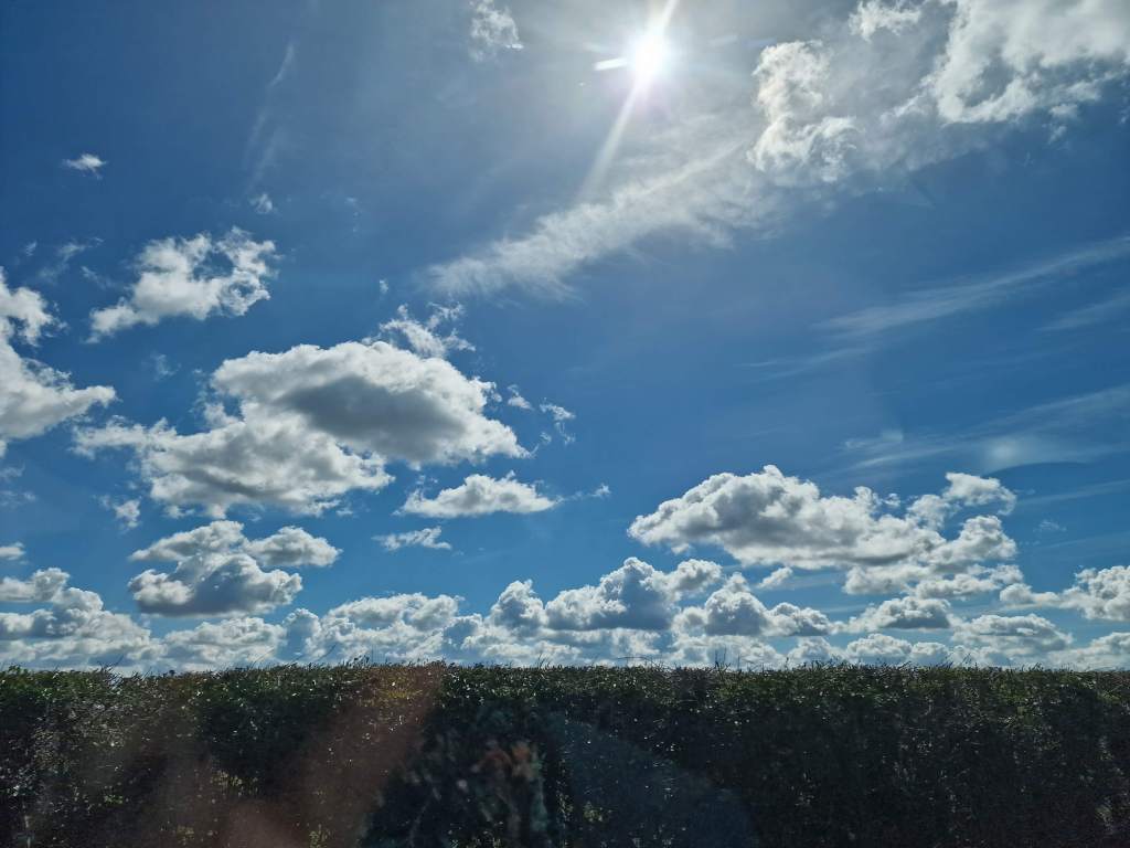
Another thing that of course abounds in southern England is stunning, quaint villages with meandering rivers, thatched rooves, and dramatic gardens. Some of the stunning summer flowers of a previous visit will, I am sure, make for another post at some point in the near future.
Advice of both friends and the Google maps lady meant that we managed to bypass Winchester and Southampton traffic, and enabled us to stop in Stockbridge for a short snack before completing our trek to Romsey.
Romsey and the surrounding area will more than complete another post; it is an absolutely gorgeous area and we had a fantastic weekend with our friends. But instead of going into detail, I will fast-forward a few days to our eventual trip home, a drive we decided we would do all in one day. Almost immediately, the change was obvious. As soon as we passed Birmingham we found the roads much clearer and had almost no hold-ups (which cannot be said for M6 south, a parking lot). I cannot decide if it was the speed we were able to travel – normal speed that is – or the fact that we did the trip in one day, or that we were heading home, but for whatever reason we both enjoyed the drive north considerably more. I especially found myself feeling almost relieved as the hills started to rise around us. We were able to stop at the famous Tebay services – missed on the way down – and I have to admit, it is a magical spot with everything that you would hope to find in a high-quality farm shop plus a lot more.
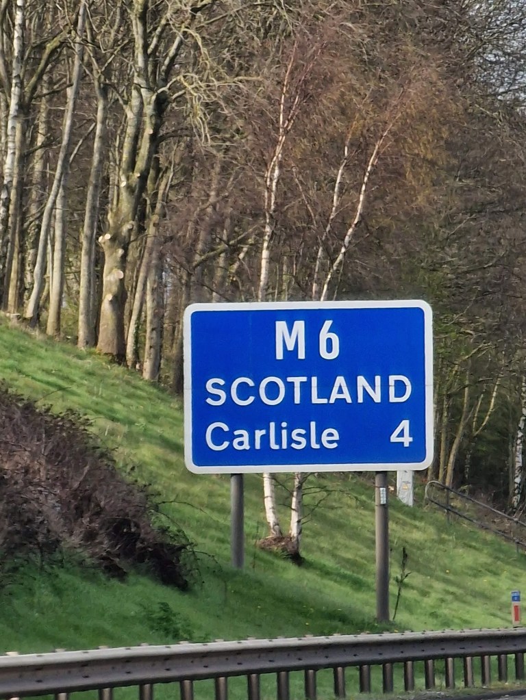
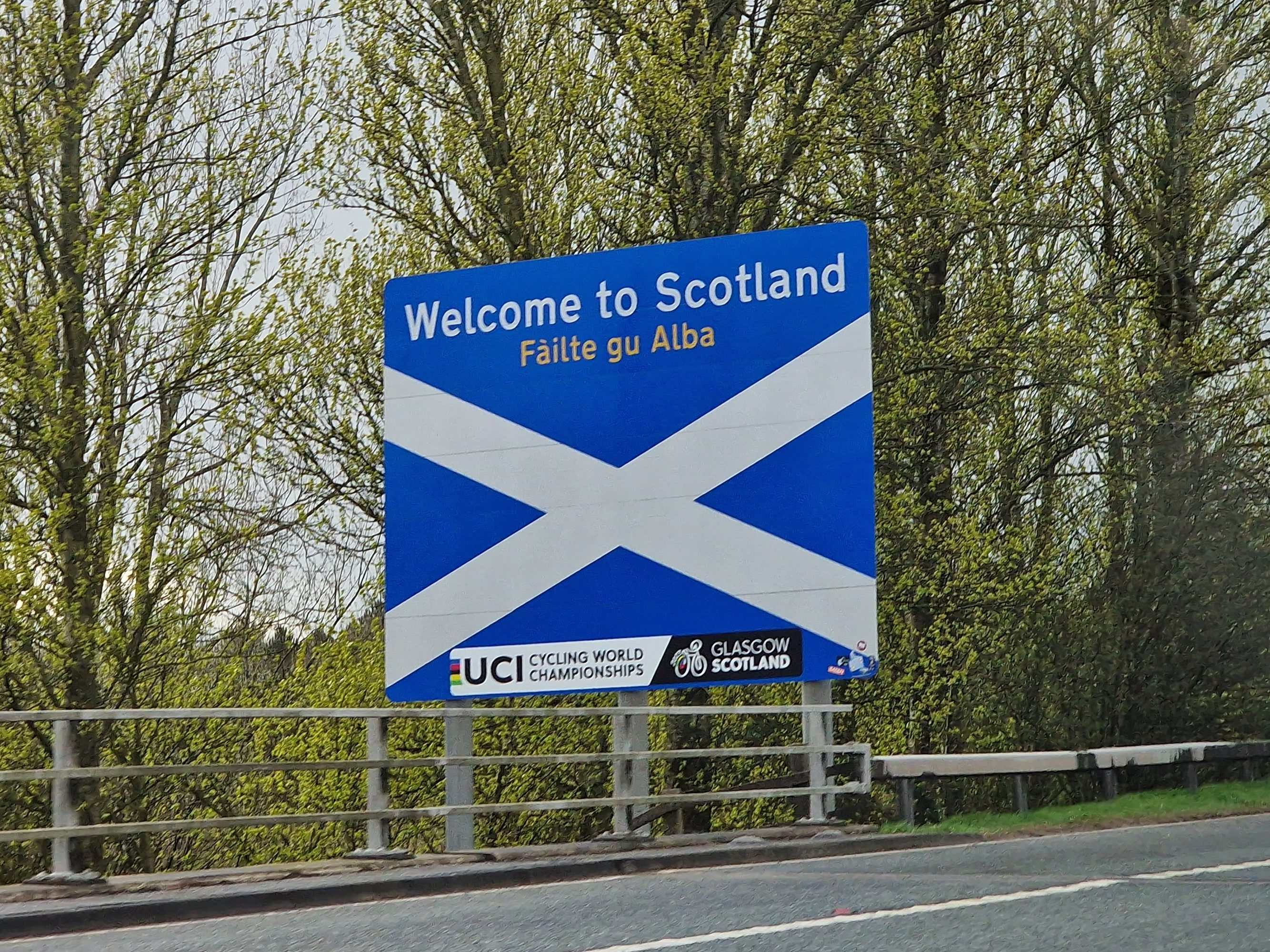
Not too long after Tebay, we started to see signs like this. An aside here as an American who finds British road signs hilarious; depending on where you are, you will often find that they list towns and then, ‘the SOUTH’ or ‘the NORTH’, and one on this trip, ‘the MIDLANDS’. It says so much about how the country defines itself, really – but makes me chuckle.
As for this sign, it and along with a number of others felt to me as though they were almost warning us – you DO know what lies ahead? SCOTLAND? Are you SURE? (I jest of course)
The road through the borders was positively stunning – the sun came out after a series of incredibly hard rainstorms in England, and I found myself smiling as we sped north. We almost could not believe our luck; I was following Google closely, looking for signs of hold-ups, but all the orange and red spots cleared and by the time we reached the borders of Fife, the last of the evening sun was glinting off the Ochil hills as if welcoming us home.
What did I learn from this trip? A number of things:
driving in England is terrifying (but I know I’d manage if I had to)
driving south is just busier, or at least it is for a holiday weekend
the UK is a gorgeous country, even in the rain – fields, villages, rivers, castles, even tower blocks can be lovely in the right light
I enjoy visiting England, but my heart is definitely north of the border
and finally, having adventures and visiting friends is one of the best ways to spend a weekend, especially when you are then welcomed home with a view.