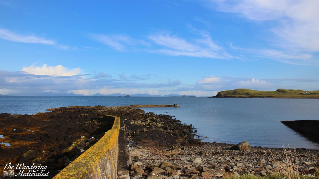
Hunglader is one of those place names that erases any question that the Norse settled in Skye. It was our home for most of the week, and our final morning dawned bright and blue as we packed up and tidied up the Homer. Before finally leaving the north, we ventured down to the local beach, passing on the way some picturesque old Skye-style houses with white walls and thatched roofs.
The beach area offered a decent-sized parking area where two couples in a camper van were just finishing their morning fire. The cliffs towered over the beach and sheltered it somewhat, though the wind was not nearly as strong as we had experienced the day before.
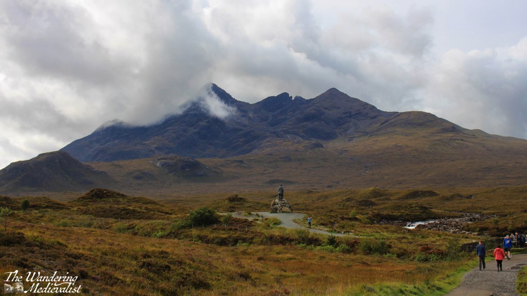
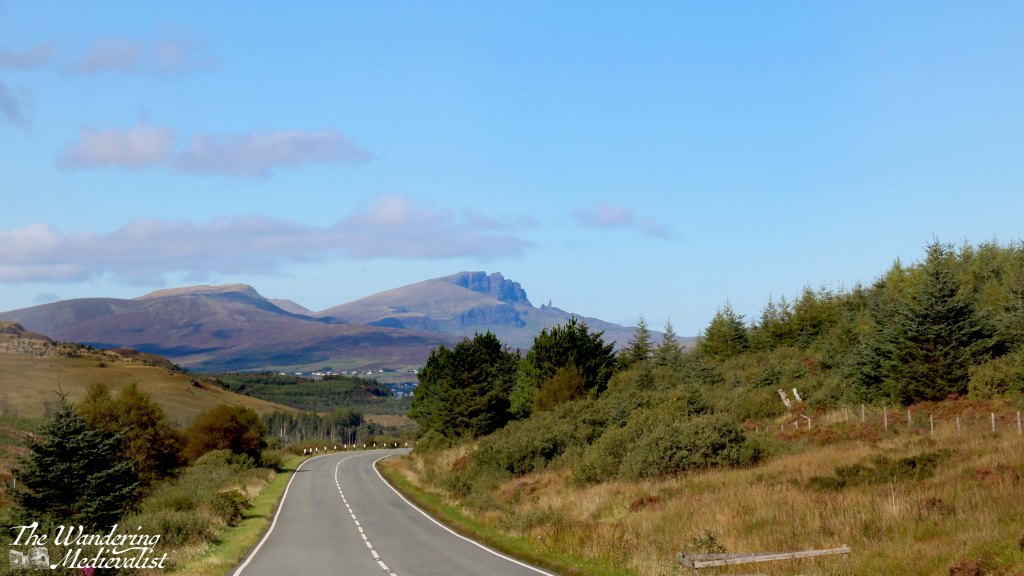
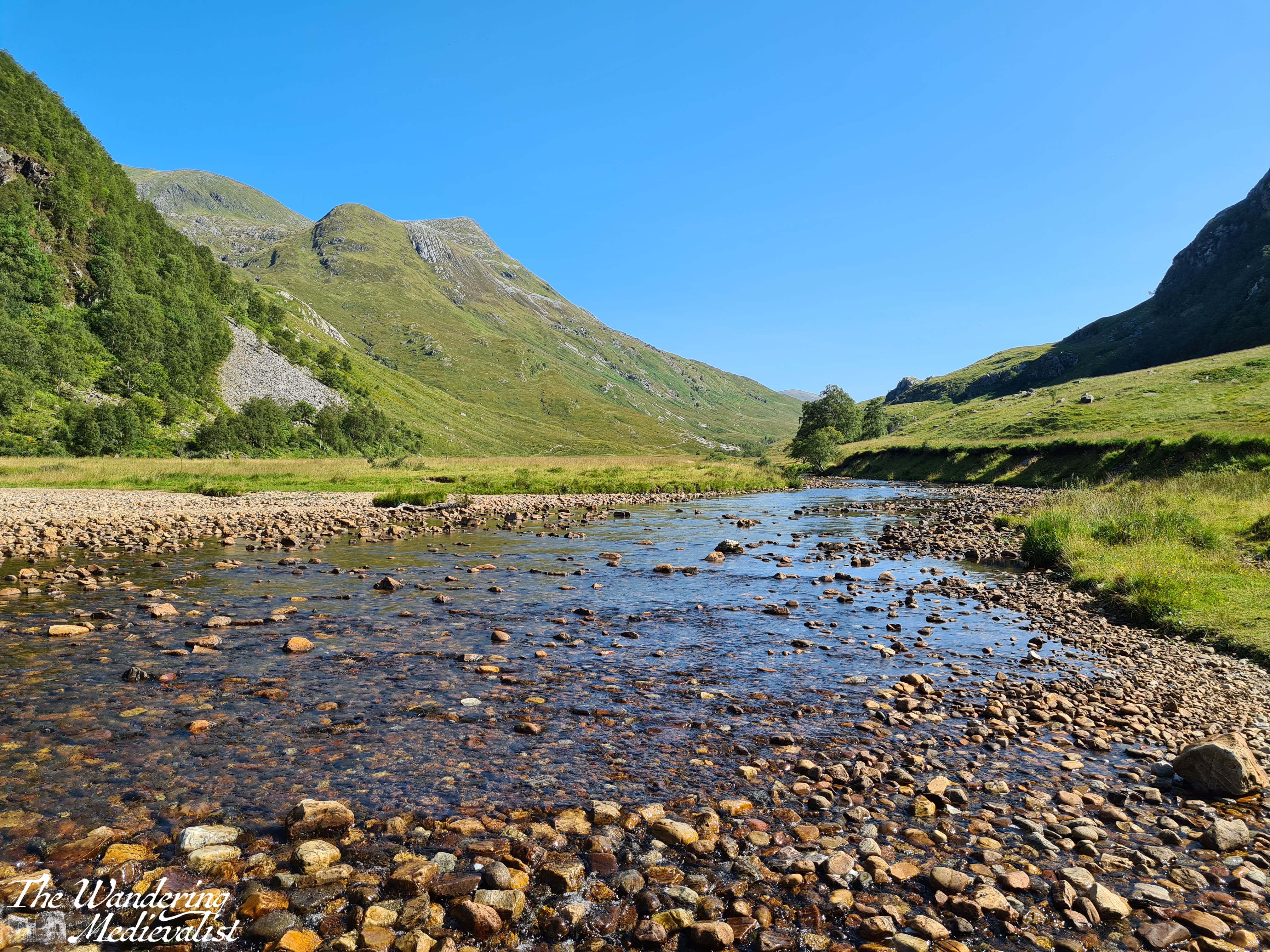
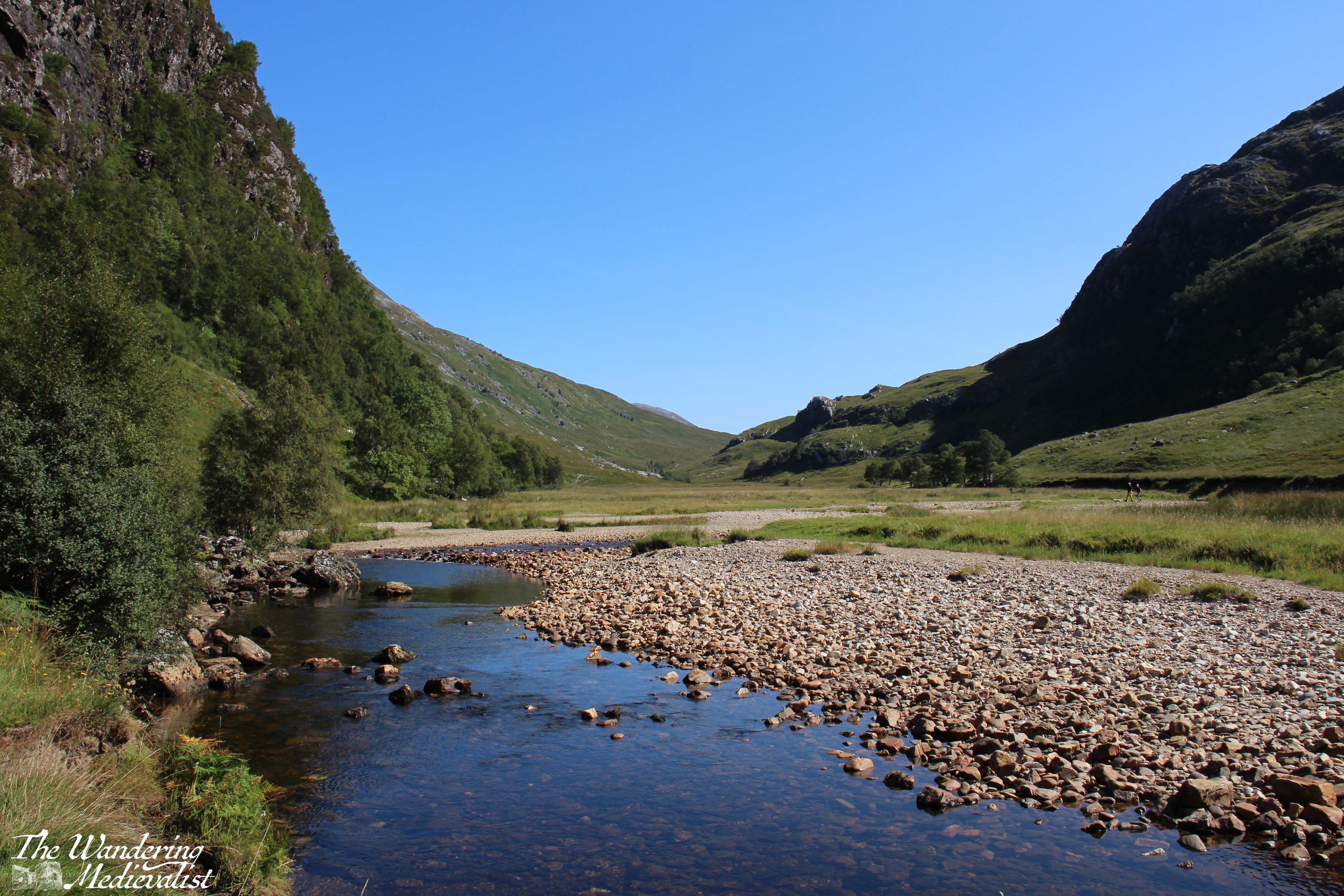
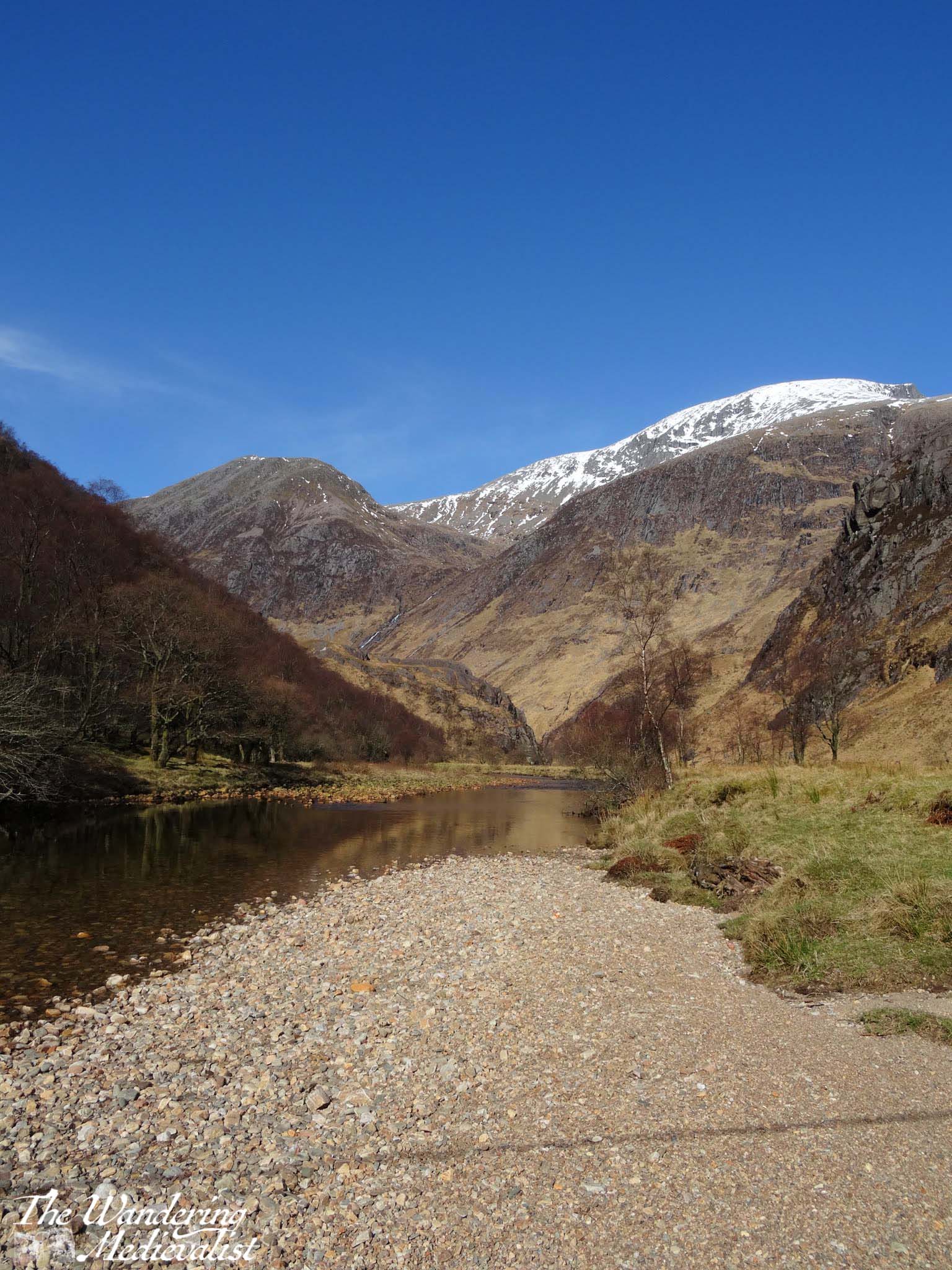
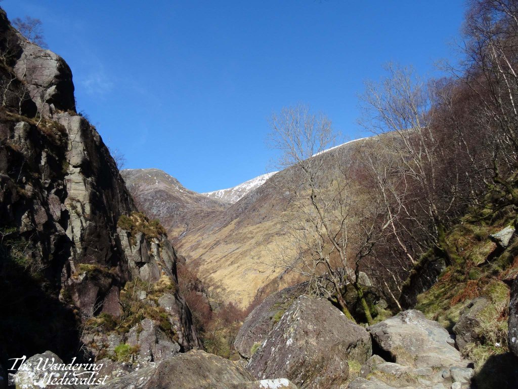
On the way out of town we had one more stop at a ruined church, then we headed south. I was quite keen to make sure we filled up on petrol before leaving Skye, and recalled a number of long queues, so we ended up stopping in Portree and topping up before our final Skye-specific stop, the Sligachan Old Bridge. It was one of several stopping points I had noted on the way north, and it is a gorgeous spot with stunning views up the glen. But it was also midge-infested, so we walked quickly and not as far as I might have hoped.
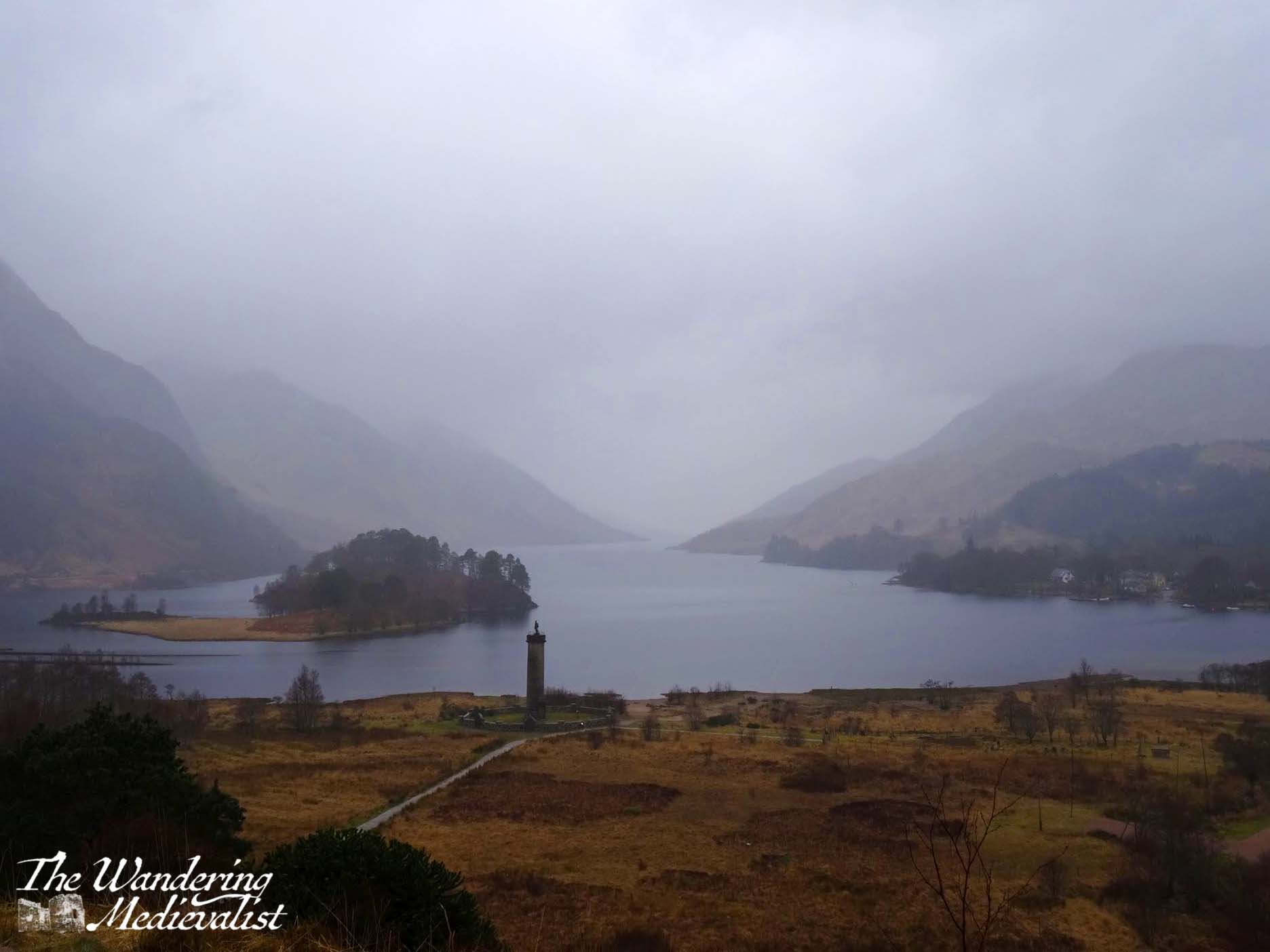
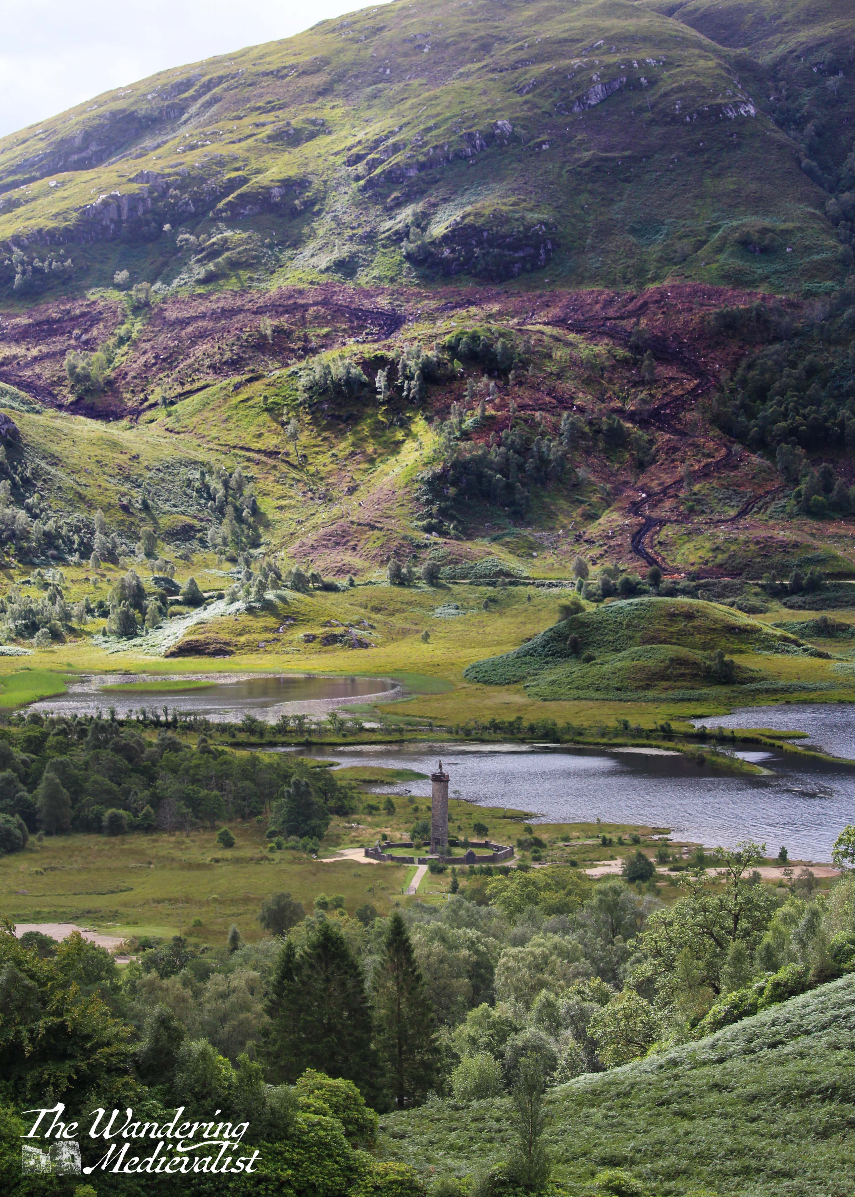
It is definitely a place to return, with paths heading up towards the Cuillin Mountains. The statue, I should mention, is not some distant historical figure like Bonnie Prince Charlie, but is perhaps more poignantly dedicated to two men who pioneered mountain-climbing on Skye, Norman Collie and John MacKenzie.
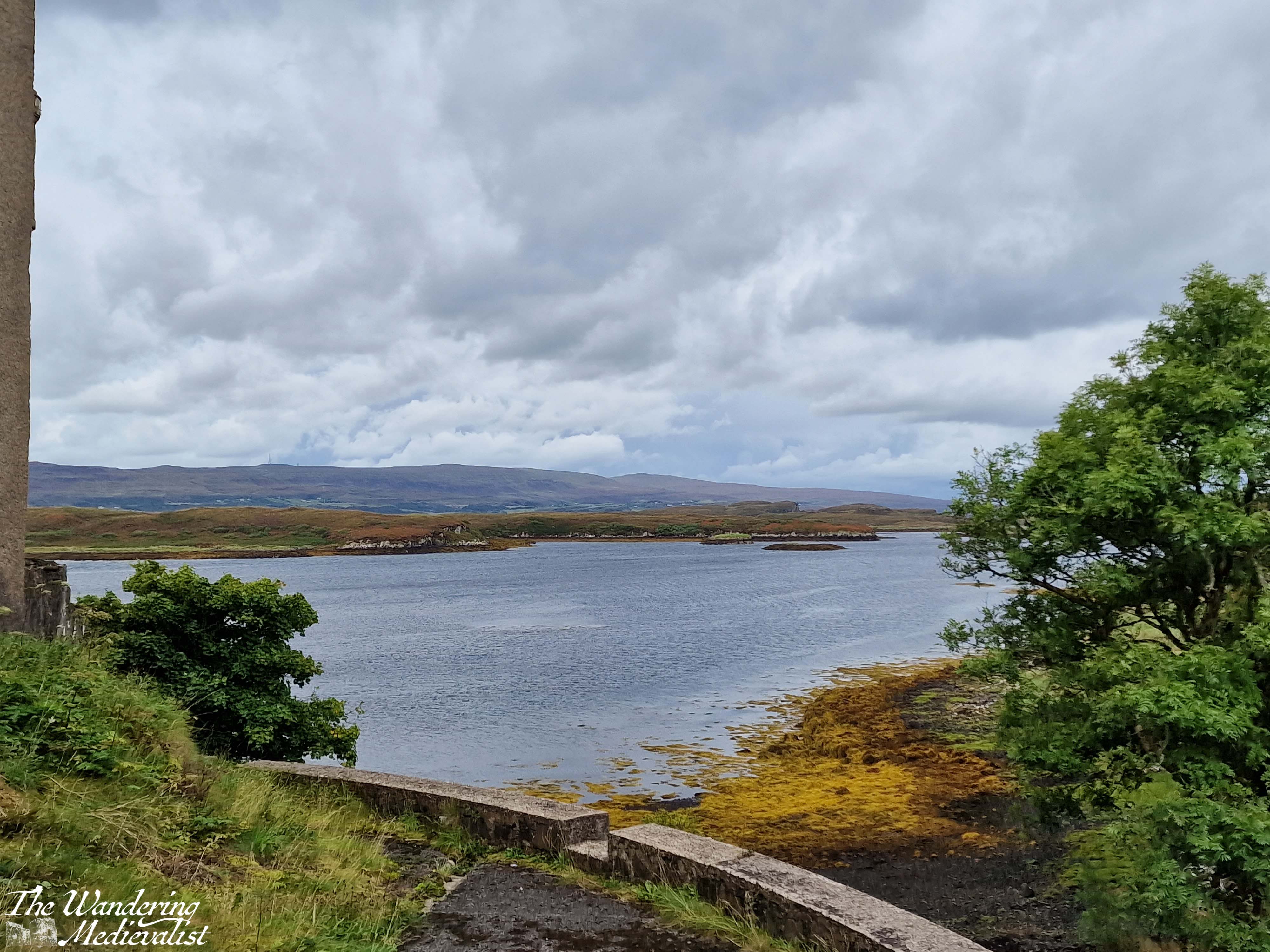
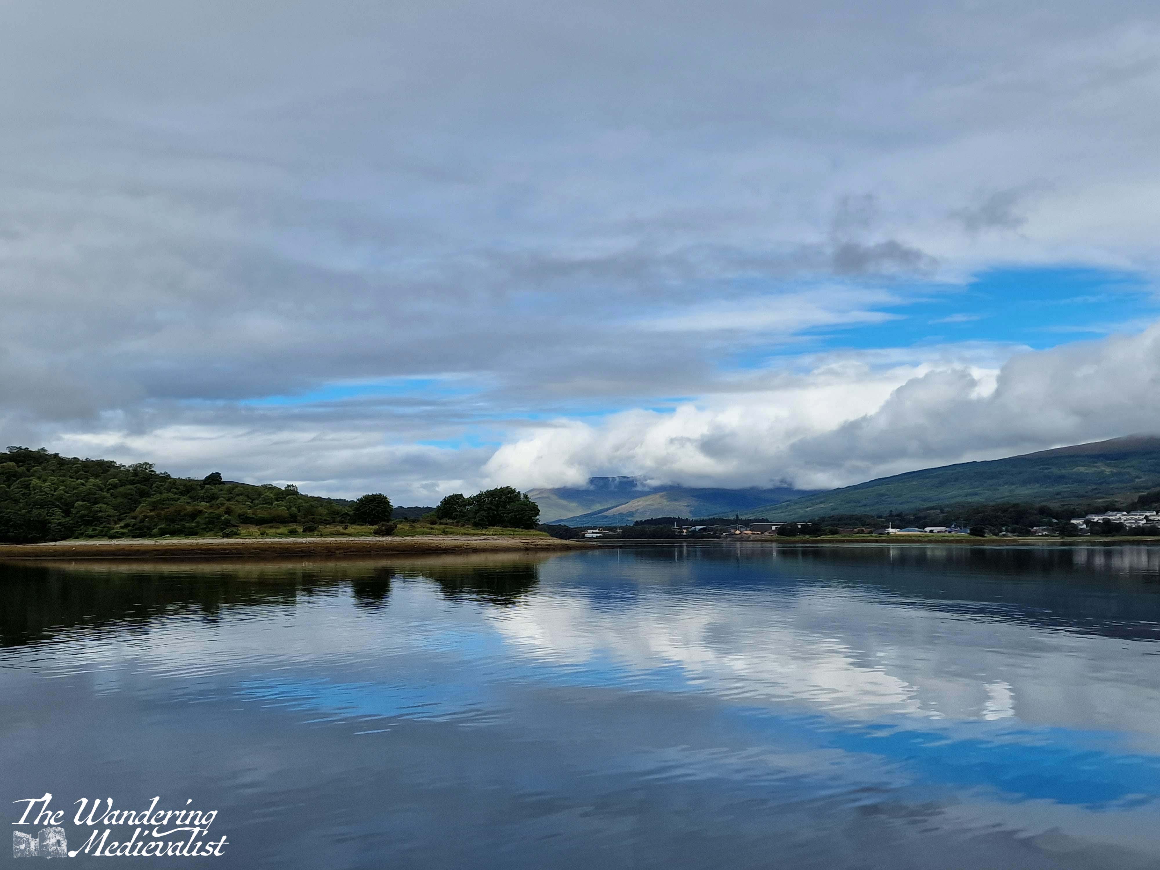
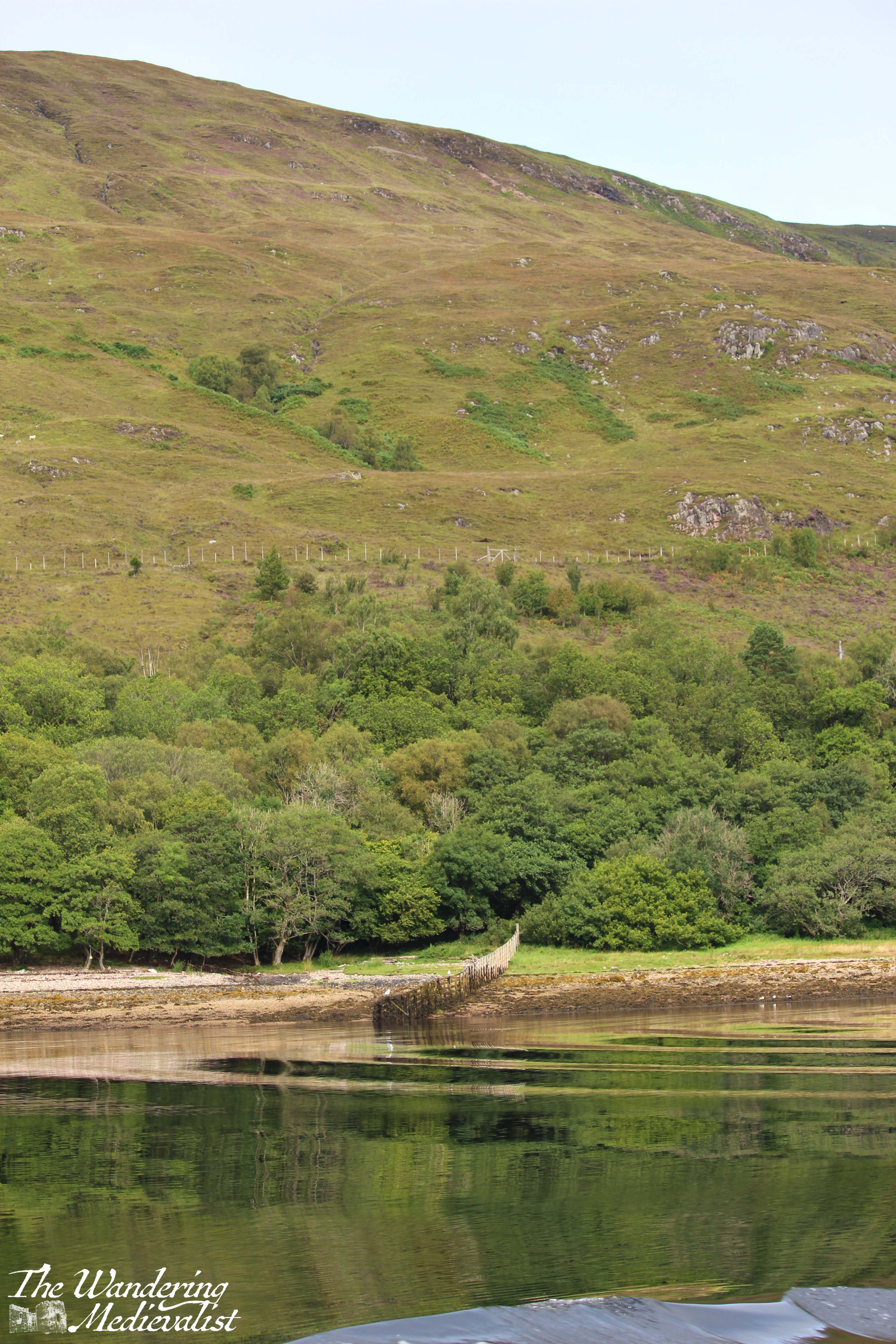
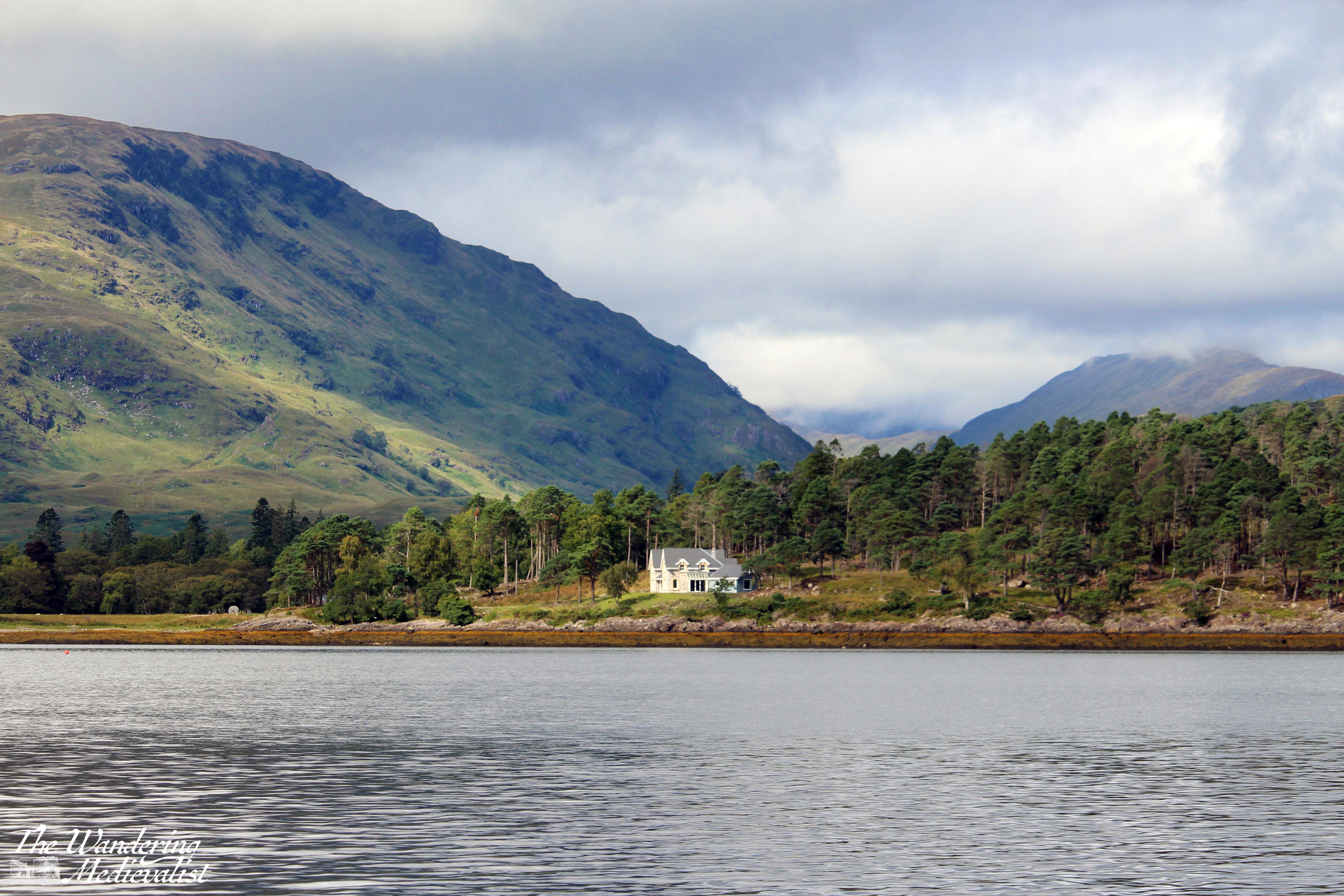
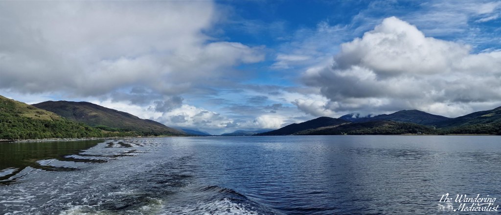
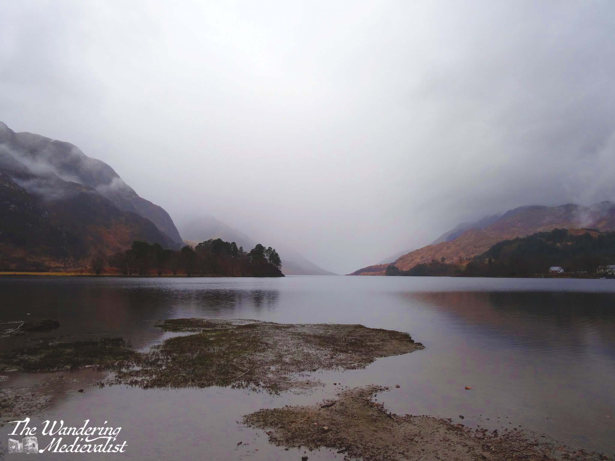
Sligachan was our last stop in Skye, and it was a relief to find the wind had stayed calm as we continued over the bridge and back to the mainland. By this view of Loch Duich it was so still that the waters were almost literally glass-like.
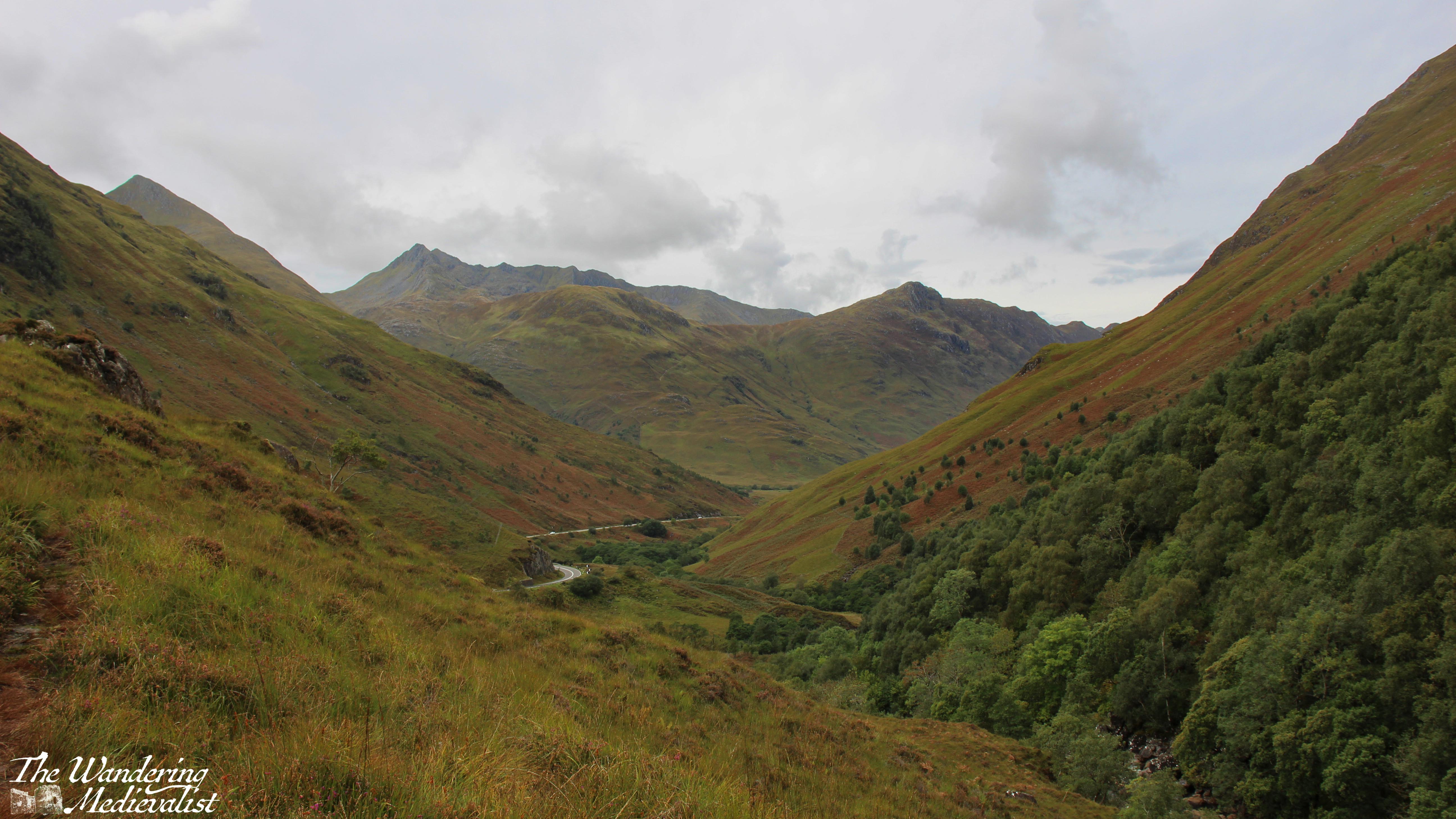
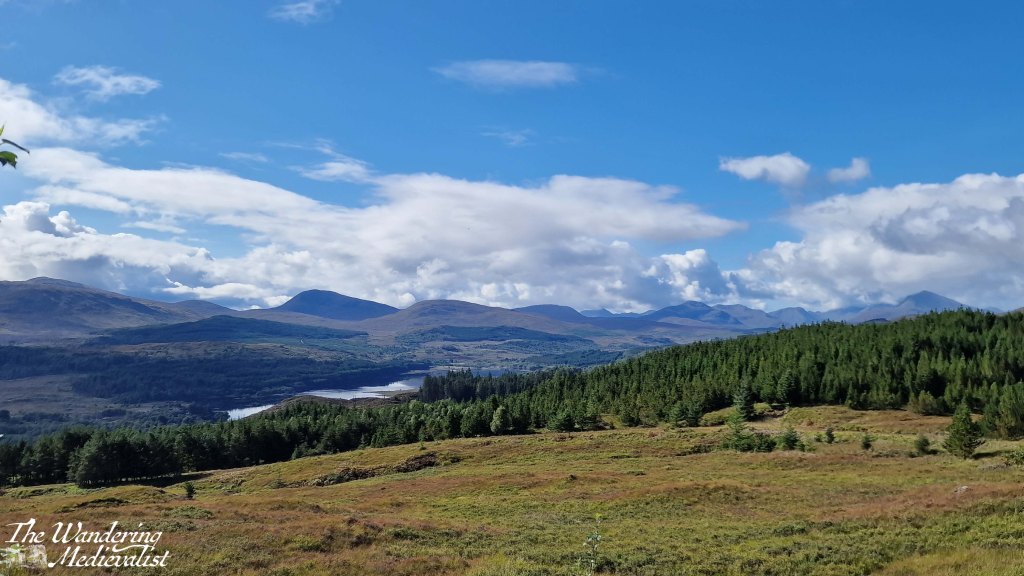
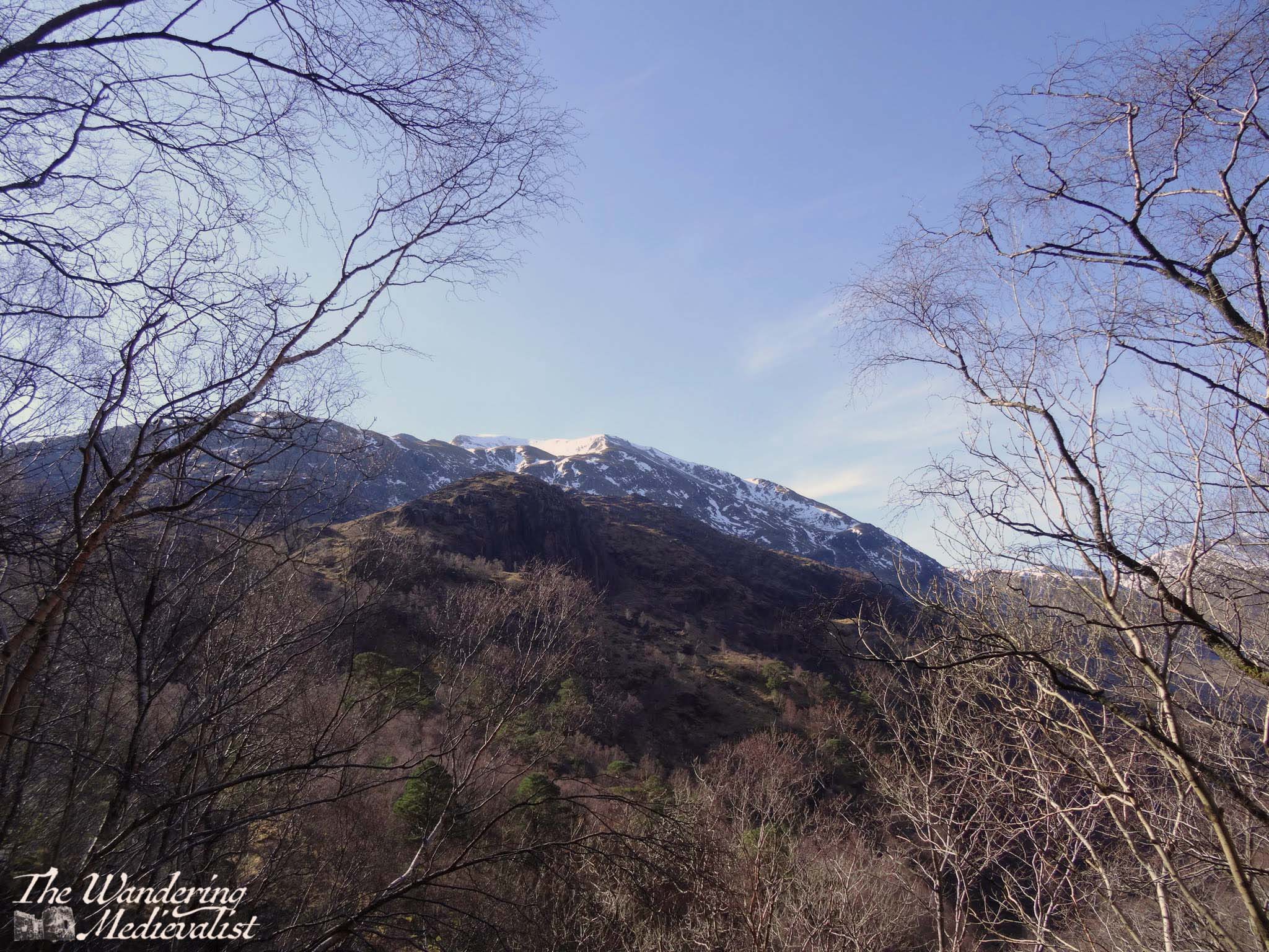
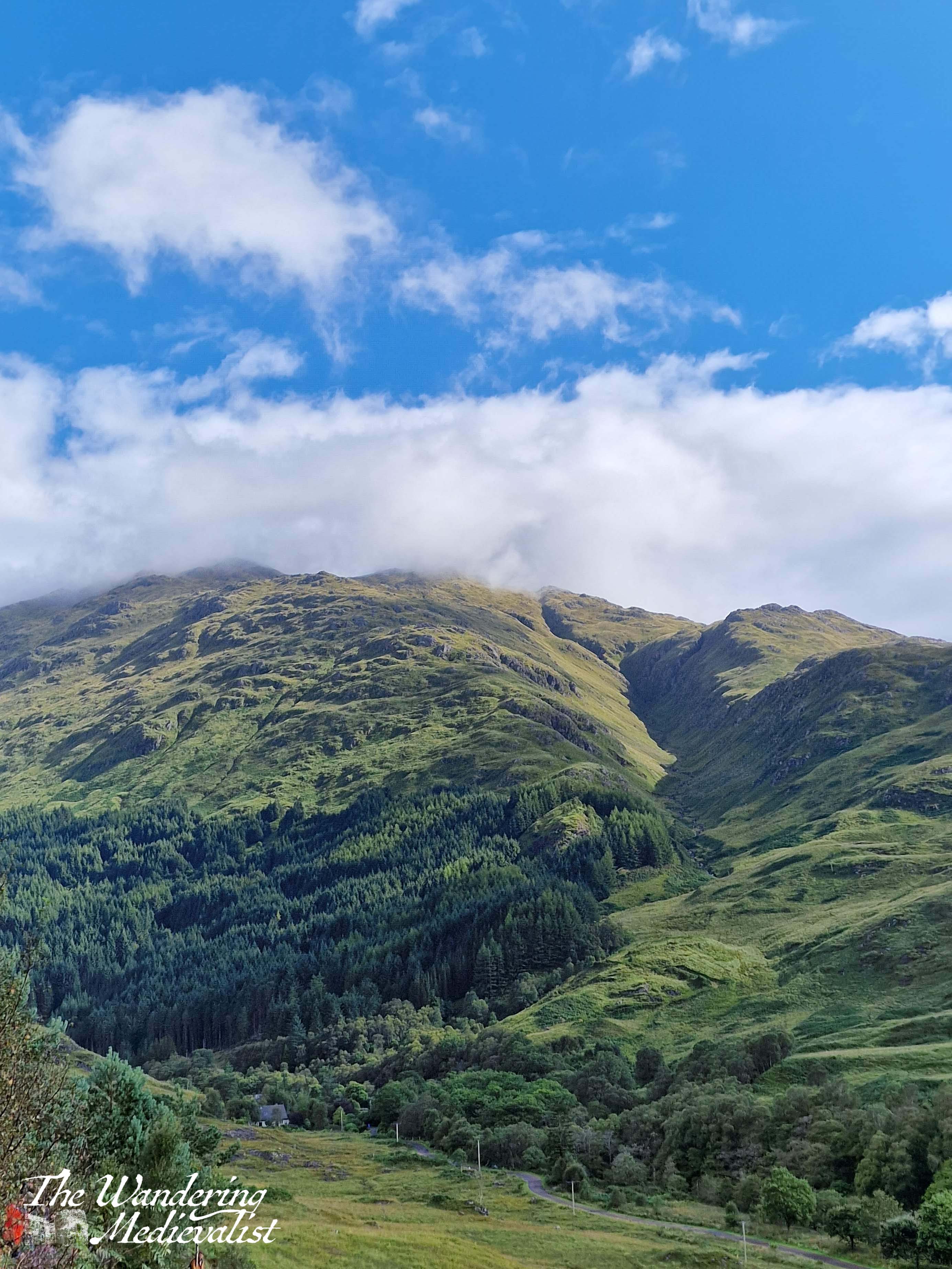
The clouds were drifting in as we pushed south into the mountains, following the road between Loch Duich and Loch Cluanie. I had made a careful note to explore Glen Shiel, where a stone bridge marks the point of a battle in 1719 between the Jacobites and Spanish on one side, and the English and Dutch on the other, evidence of religious and political divides across Europe in the early 18th century. Standing on the modern road, it was possible to track the historic route that armies would have needed to take, and the sharp angle of the hills makes it clear why this might be a treacherous battle spot. While most of the Jacobite commanders escaped, the battle is considered an English victory.
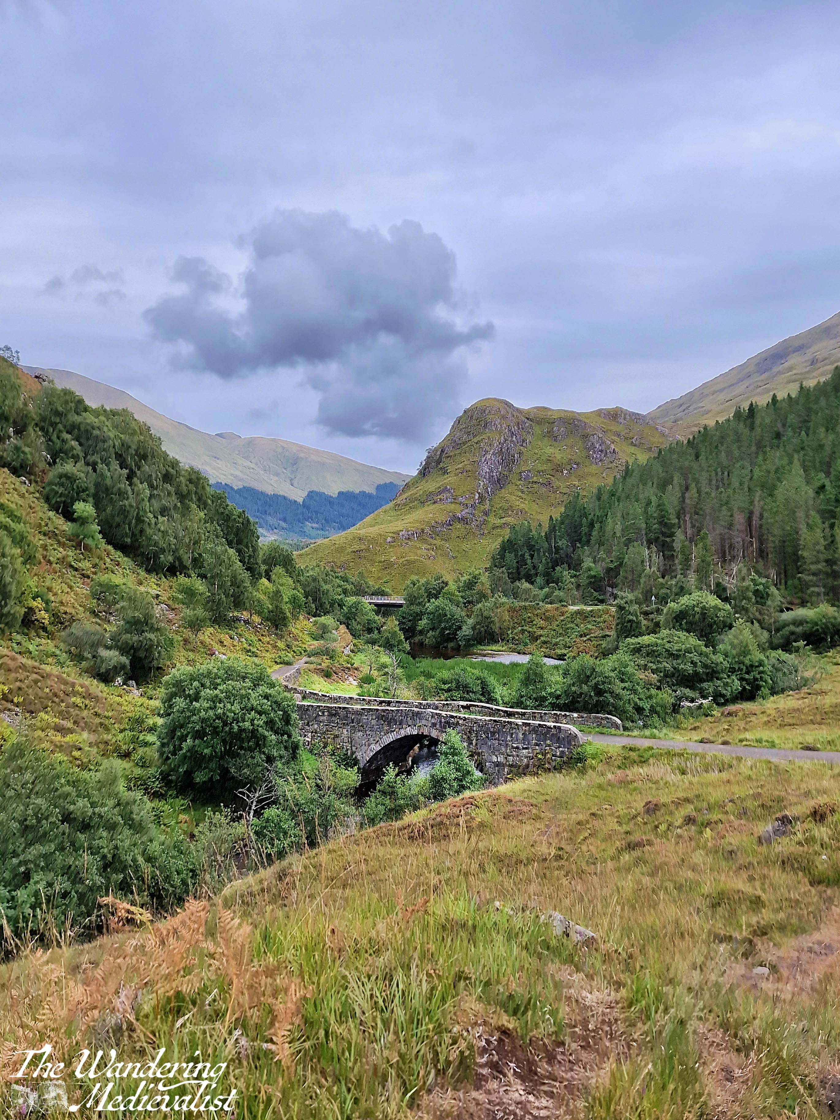
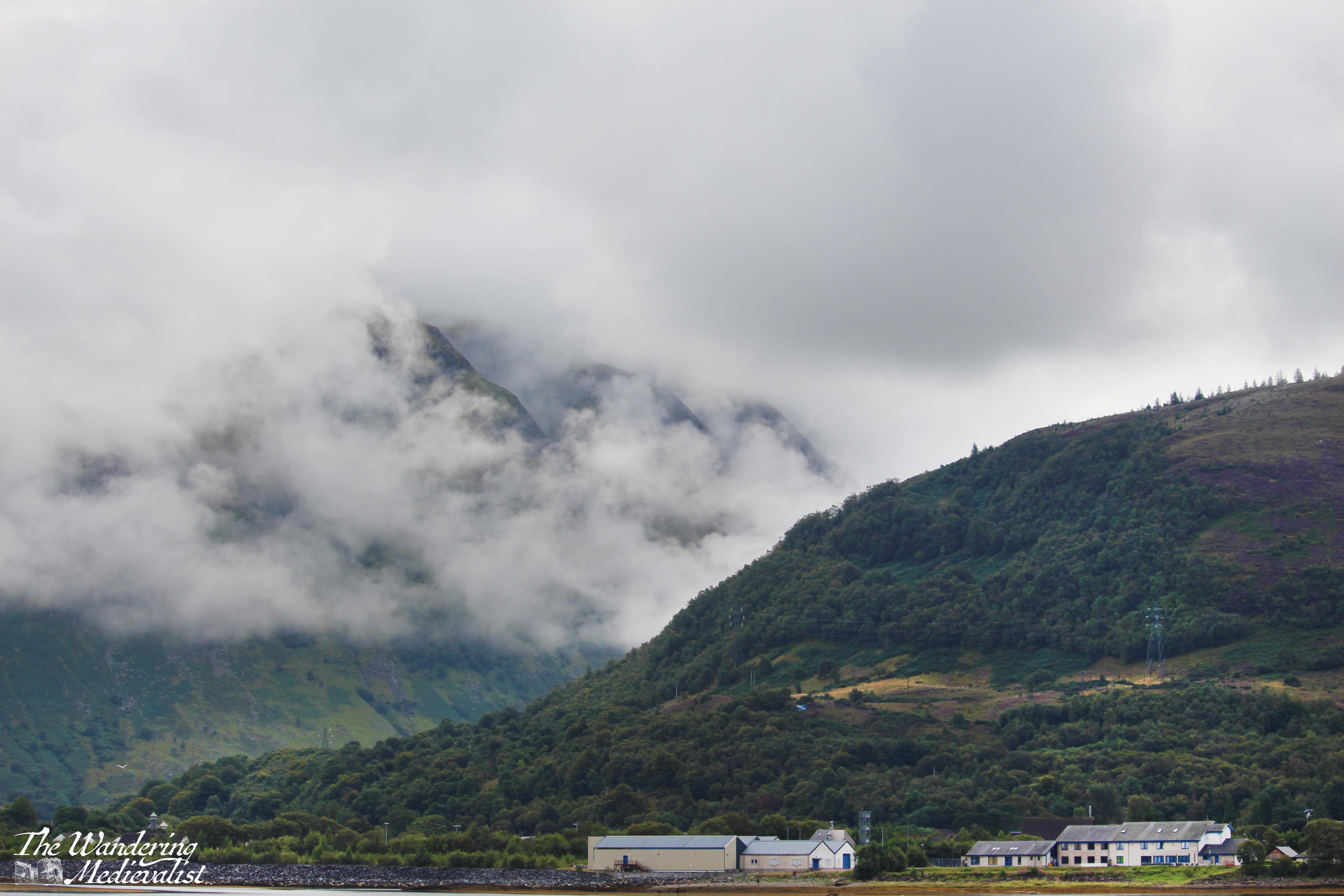
With our many pauses, the day was ticking on, and I think we all had enough of views and pictures and were ready to get to Fort William, still a fair distance away. We considered stopping at the Commando Memorial but there was little appetite amongst the passengers, while I was getting tired of winding roads.
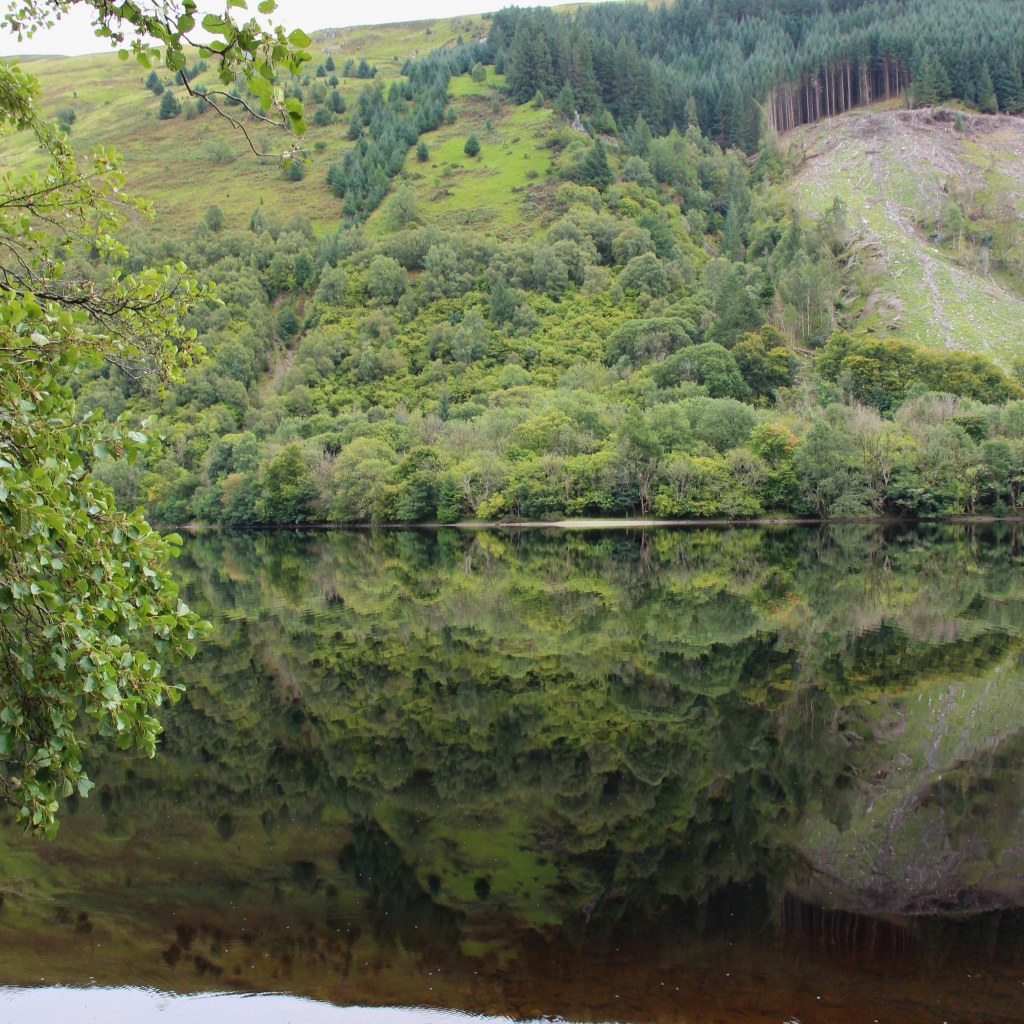
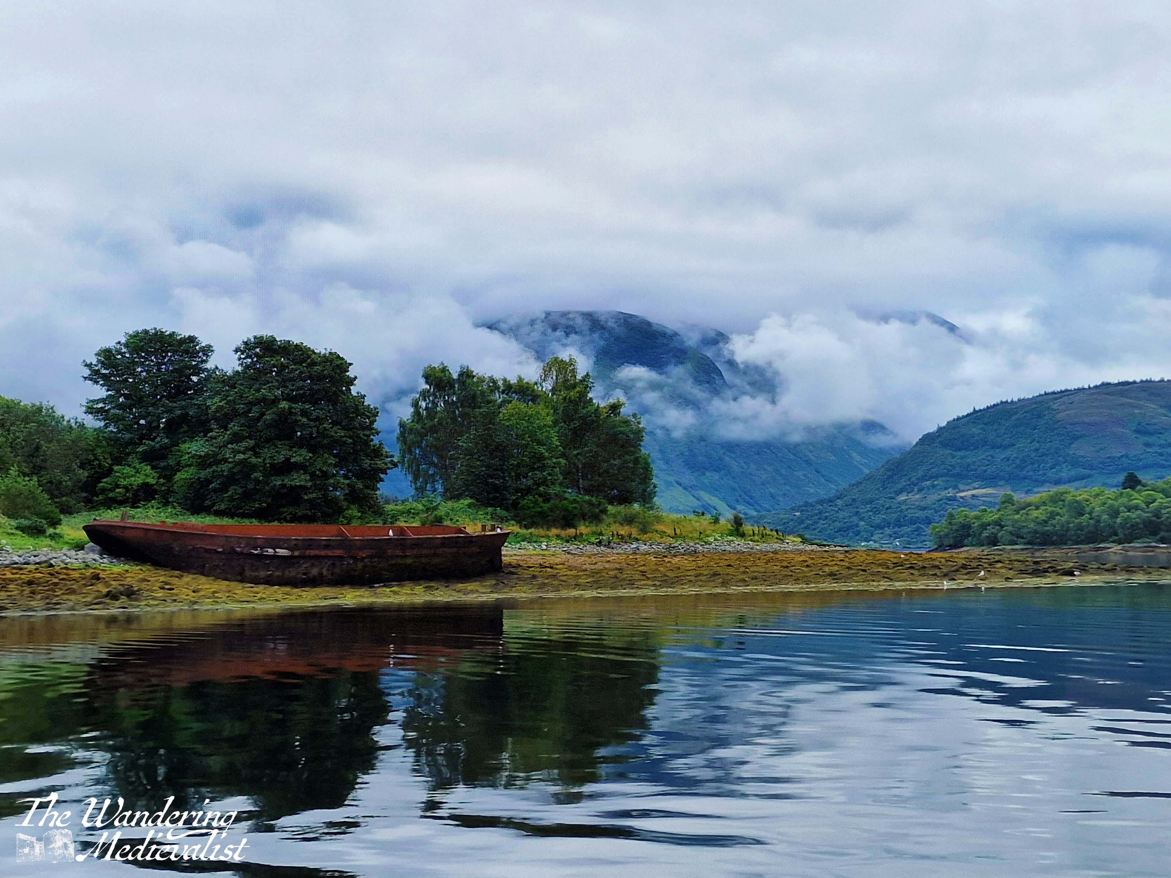
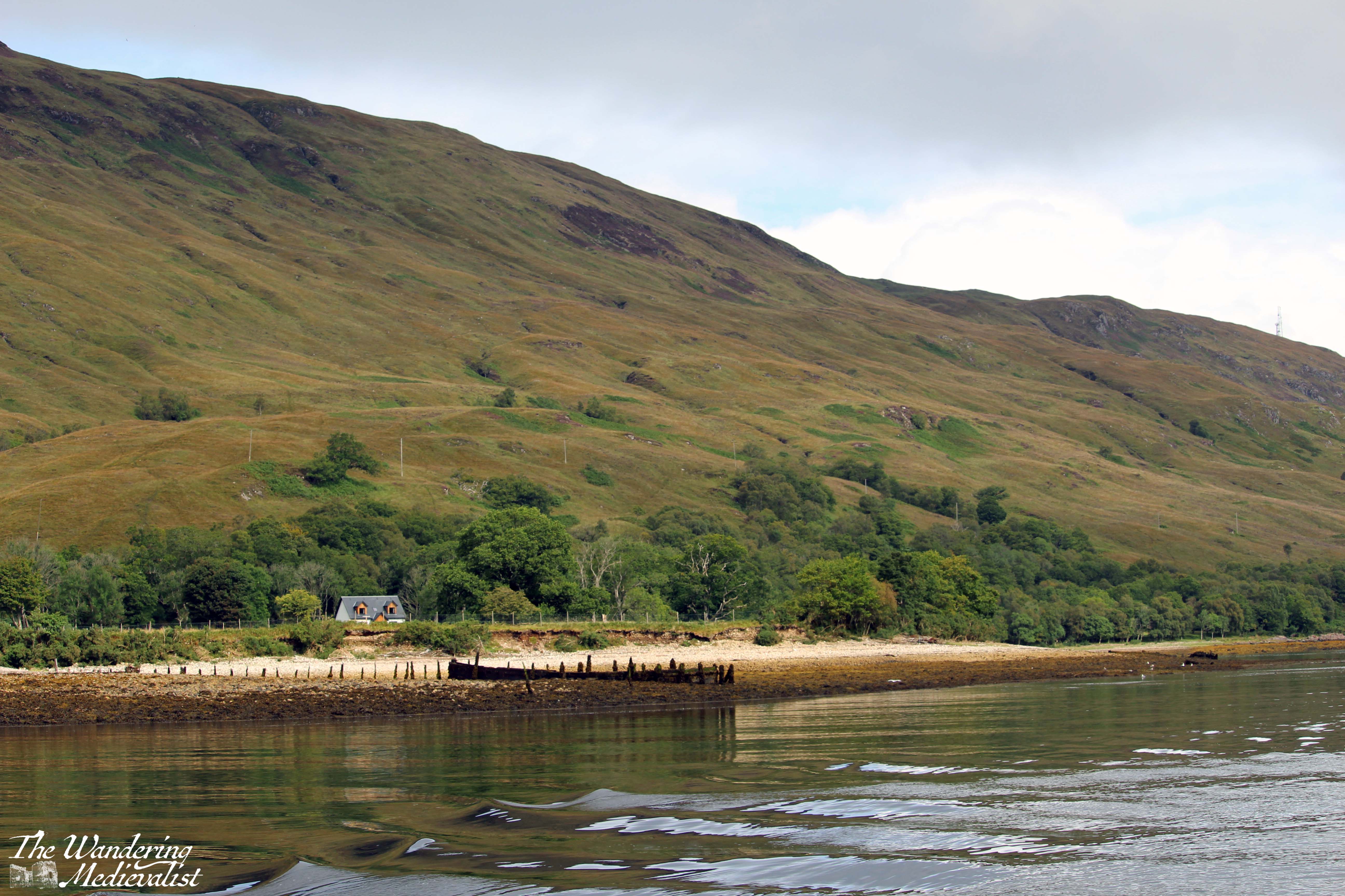
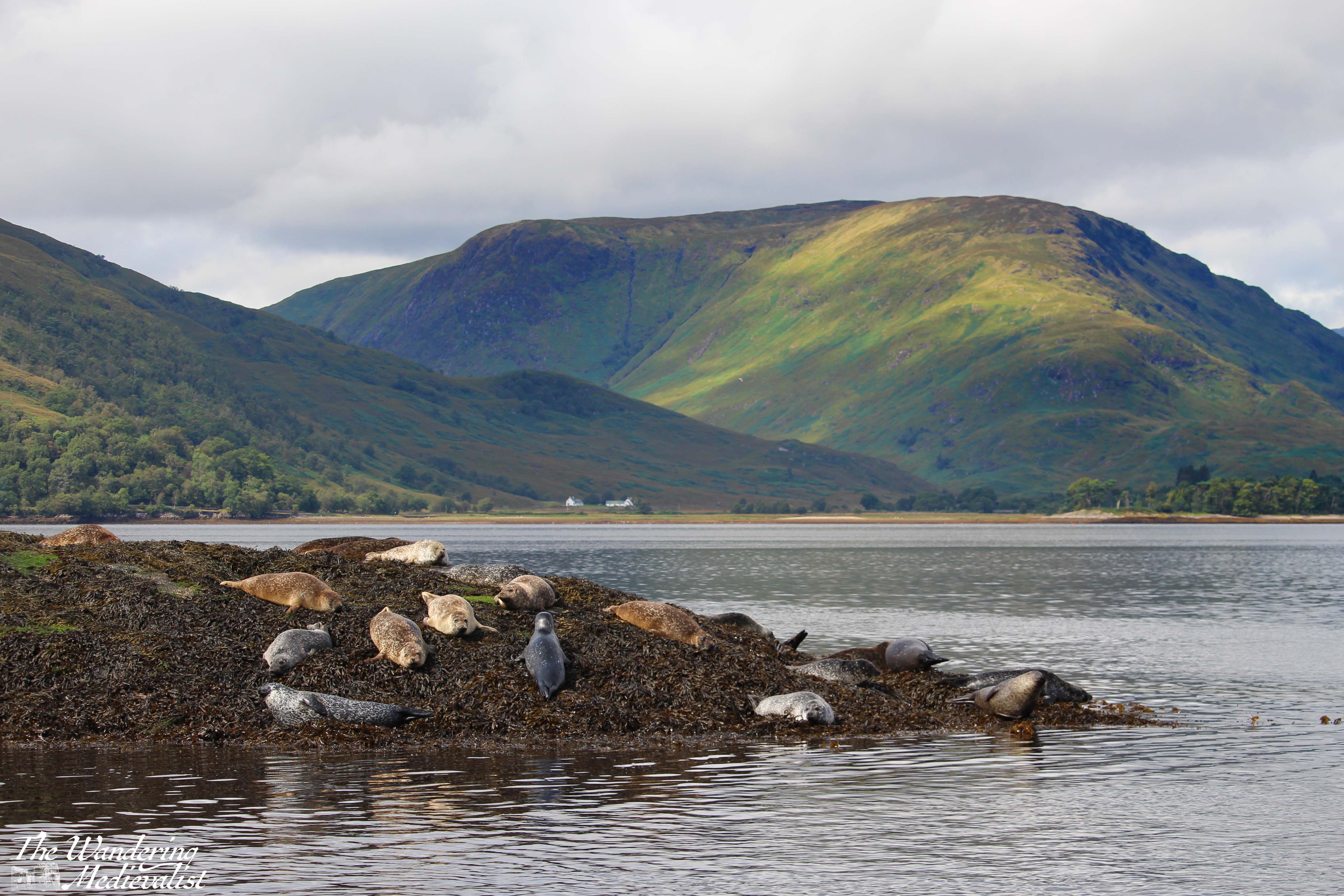
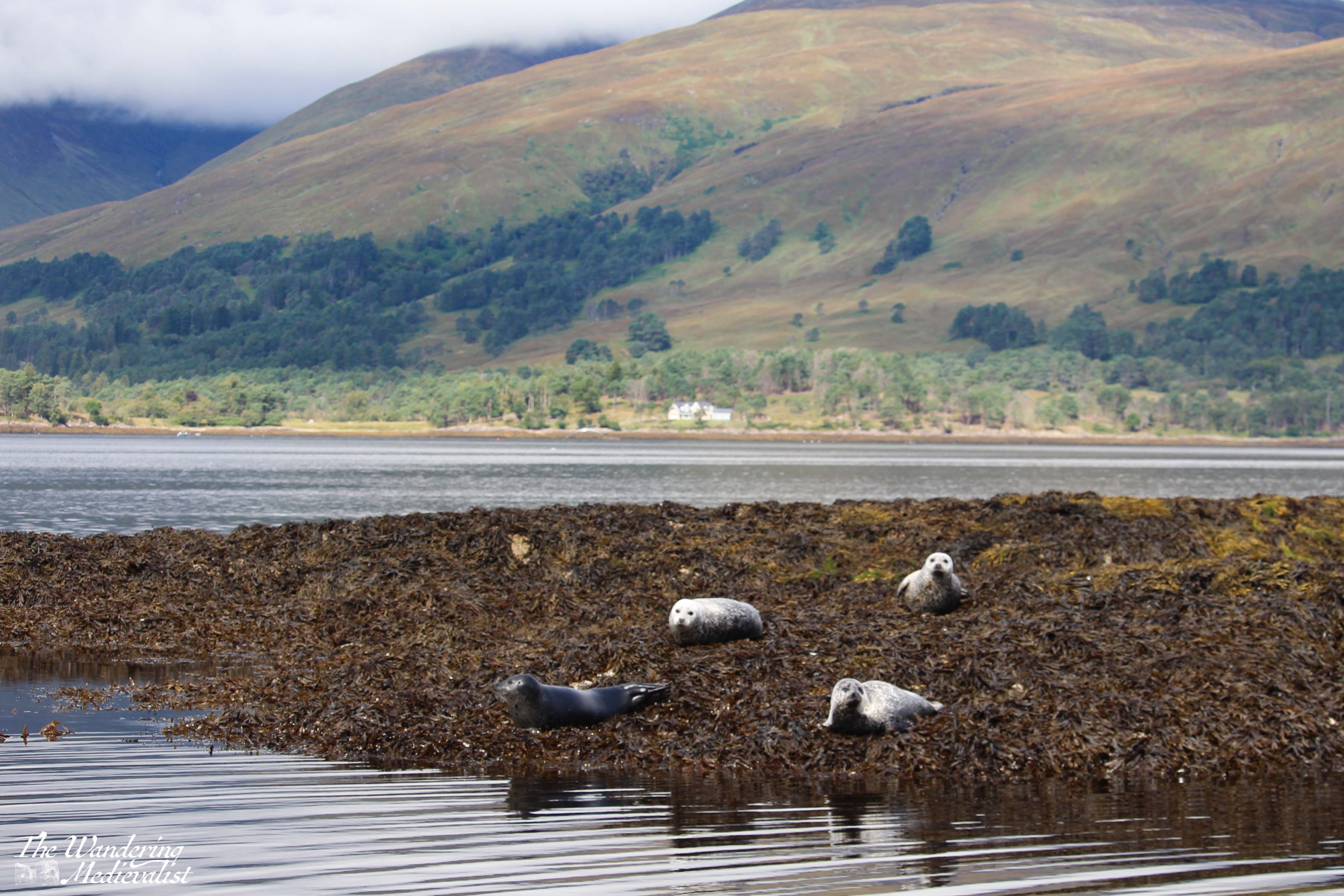
This was taken on the banks of Loch Oich, right before the locks of the Caledonian Canal, and I love how perfect the reflection is. It was our final break to stretch before making the last push.
The hotel we stayed at in Fort William, while clearly designed for coach parties, offered surprisingly good food and local beer – have determined that we must stop at the Glen Spean Brewing Company the next time we are up. We all headed to bed early, contemplative of the end of our time on Skye and what the following day would bring as we drove across Rannoch Moor and home.
I’ve skipped ahead in my story-telling to the third day we spent on Skye – the second was standard Highlands rainy, and we visited Dunvegan Castle before eventually retreating to our cottage for the afternoon. Thursday dawned clear and bright but increasingly windy as the day went on; the car was buffeted about and on one or two excursions it was difficult to walk. We think the gusts were well into hurricane-force, but even with whipping hair biting into my face like knives, I was so excited for our journey.
I had spent most of the afternoon before plotting out the route and places I knew we needed to stop, then entering it all into Google maps so I could know exactly where we were meant to go. There was a question as to whether we might go all the way to Portree and do a loop back, but in the end it was an out-and-back trip, allowing us the opportunity to stop at a few points we missed. Once again, I have chosen a few highlights for this page, but most of my pictures are in the video at the bottom.
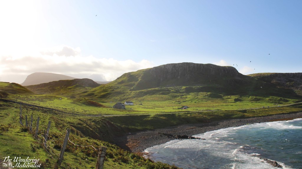
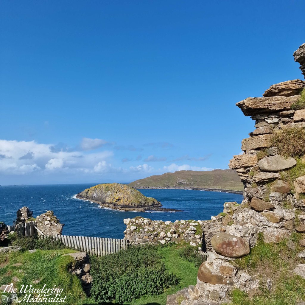
First stop was Duntulm, less than ten minutes north of where we stayed – it is an almost entirely ruined castle on a promontory with gorgeous views back over the hills and coastline.
I was the only one who hopped out of the car on this first stop so I made it quick, eager to see what the rest of the day would hold.
The A855, which is the main road that runs along the north edge of Skye, runs through some breath-taking landscape. Even when one cannot see the ocean, one can enjoy the distant mountains and vistas across green fields dotted with heather, sheep, and outcroppings of rock. Several times I stopped just to enjoy that view, and also to calm my nerves as driver.
Because, while it is the main route along this coast, the A855 is also a single-track road with relatively frequent passing places, but equally frequent blind corners and hills that cause the occasional near-miss with other more confident or less cautious drivers. I would certainly not recommend the route for tourists unused to Highland driving, beauty notwithstanding.
As the road cuts across the top of Skye it leaves the coastline to re-join a few miles later, opening up views across the glistening water to small islands and the distant mainland. We stopped a few times, though as the wind grew stronger, Dad started to doubt whether he wanted to go on much of a hike – one of the plans for the day. Knowing that one of our party would be confined to the car either way meant that cancelling a longer hike made good sense.
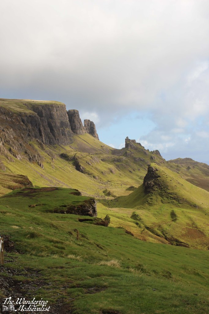
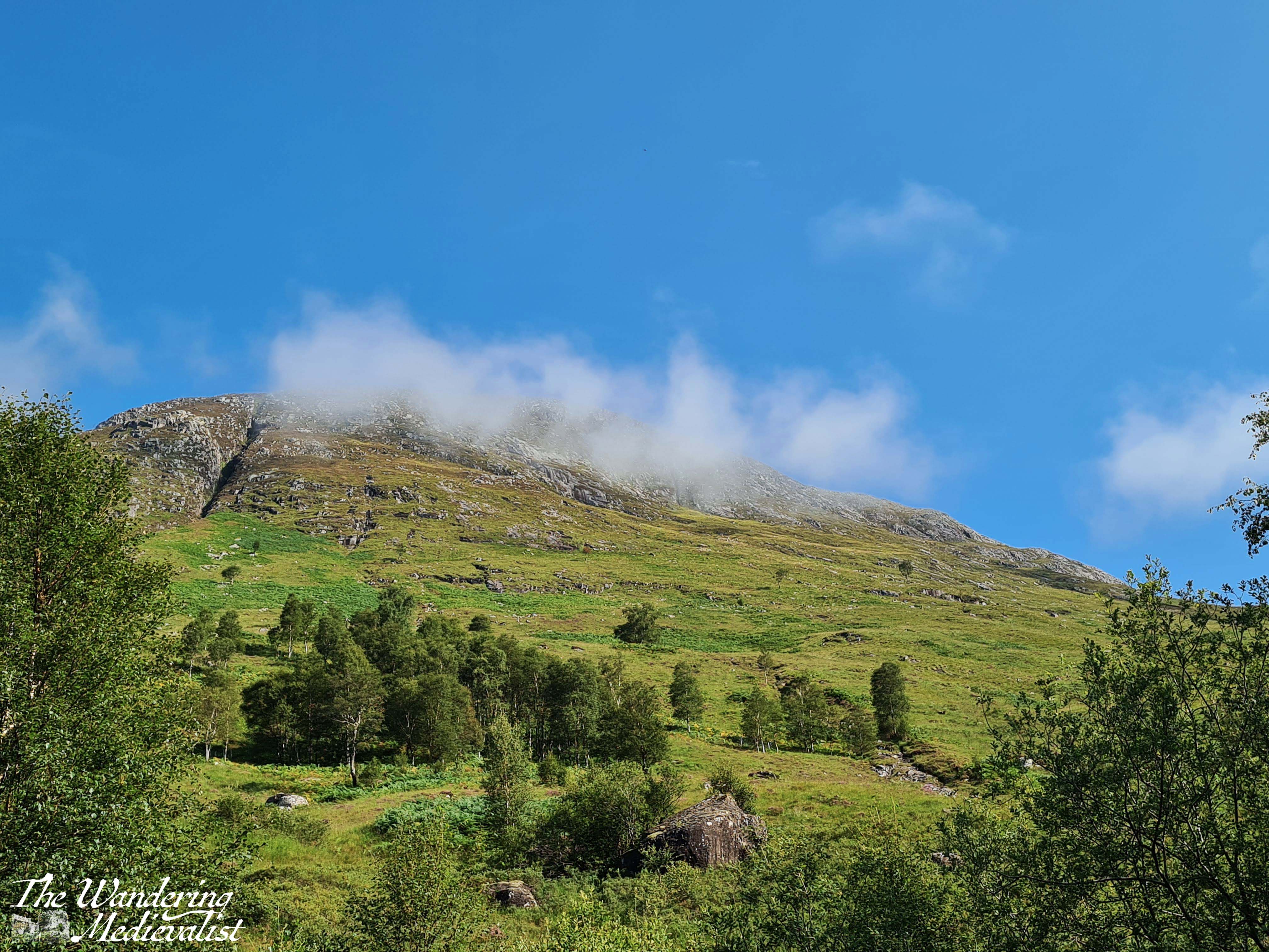
One location we knew we could not miss was the Quiraing, and so we turned inland along an even narrower road and made our way towards the line of cliff-like mountains ahead of us. Despite the size of the road it was quite busy, with cars and vans going to and fro. As we approached the parking area, the road started to climb sharply, weaving up the side of the mountain with hairpin turns that reminded me of scenes in To Catch a Thief – though I drove considerably slower than Grace Kelly or Cary Grant. I am not a great one for heights so kept my eyes firmly on the road as I negotiated the turns, breathing again I think only when we reached the top and found a large car park for hikers and visitors.
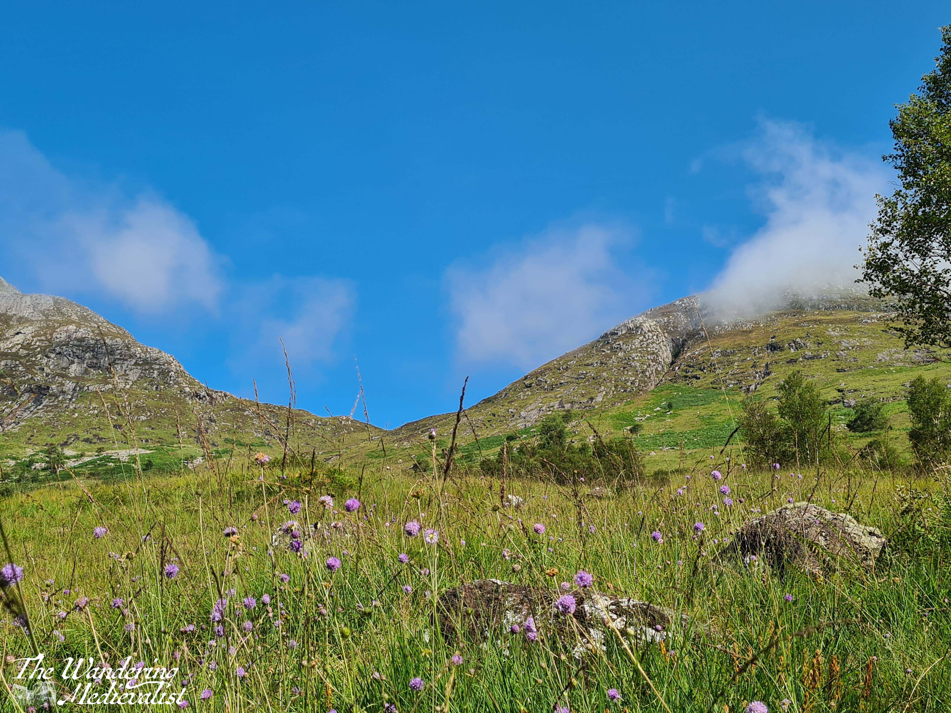
There are a number of path options at this point, including one that is wide and gentle enough that – I think – it is wheelchair accessible. It is certainly easy enough for most to try, and if you ever find yourself here with an elderly or less mobile companion, I would encourage you to encourage them to give it a go, even with wind as strong as it was when we visited – strong enough to take your feet from under you. This sight of the Quiraing, the view across towards the ocean, lochs and hills in between, is one of the most stunning I have ever seen. Top ten in my life, no question. The stunning scenery of the Quiraing is caused in part by a series of landslips, and the sunlight plays dramatically off sharp pinnacles, grassy slopes, and sheer rock faces.
As Dad and I made the short loop, we could see to the right a rain storm coming our way. I knew there was not enough time to reach the car so while Dad made a dash for it anyway, I continued on my way, hoping to reach the next knoll. I tucked my camera inside my sweatshirt and waited to get wet. I have absolutely no regrets.
Yes, I got soaked, and the much better-equipped hikers passing me looked at me questioning my sanity, but I stayed and filmed the storm.
The rain passed in minutes and the sun returned, allowing me to watch the storm as it moved towards the sea. There is no question I need to return here and take the time to do at least some of the hike. We saw quite a few spectacular sights on this day, and on the trip as a whole, but this was definitely the top of the list. Eventually I steeled myself to drive back down the winding road and was delighted to discover that the road south was back to two lanes.
The next stop was Kilt Rock, which was very busy so that everyone was vying for the best photo spot. My companions had been before, so we continued on quickly, to Lealt Falls.
This is where, as we parked the car, we realised just how powerful the wind had become. It must have topped 70 MPH, so strong that it was a challenge to walk and loose hair whipped my face like needles.
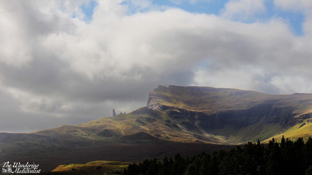
The colour of the hills and water were stunning so Dad and I braved a short walk to a viewpoint, though I recall passing two small dogs that I worried would be blown away. The falls themselves are visible from a sturdy viewing gallery that stretches out over the chasm, and in the distance one can see the range of mountains that includes the Old Man of Storr.
Another famous Skye destination, the Old Man of Storr should not be missed. The picture below is taken from a treacherous parking area called the Rigg Viewpoint – treacherous due to its narrow spots, large busses and larger potholes.
But the view is stunning. From here, we continued on to the actual parking lot for the Old Man, and while my companions waited in the car I scampered up the first half mile or so of the trail, to a point where I could see over Loch Leathan and up to the rock face. Again, this is clearly a spot that must be viewed on foot from the hiking trail, and next trip I will be certain to conserve the time and energy to do so.
The day was creeping by, however, and so after a brief discussion of our options, we decided to return on the route we had come rather than continuing on to Portree. We did not really need to go that far and the A855 was so beautiful it was worth another look.
We did not stop as often on the return but Duntulm required another look; I parked more securely – again dodging enormous potholes – and Dad and I took the short walk out to the ruins. Here once more the wind was battling us, and at times it was a struggle both to walk and to hold the camera steady.
The castle here had been built in the 14th and 15th centuries, the seat of the Clan MacDonald of Sleat – rivals of the MacLeods who held land further south. Despite its strong defensive position, the site was abandoned in the 1700s and the stone was taken to help build Monkstadt House, several miles south. Monkstadt, incidentally, is now a luxury inn and restaurant that we looked at very briefly before realising it was a bit too luxury for our needs at the time – we resorted to pesto pasta.
Once we had our fill of the castle ruins – or I did, more accurately – we returned to our cottage. It was mid-afternoon and the wind was battering the building and bushes outside, the perfect time to sit in the living room with a cuppa and enjoy the sunshine, a book, and the view. The Homer is so well-built that were it not for the noise, you would never know it was windy; not a single breath of air disturbed us. While we had not had a partiuclarly long day, it was an exhausting and even emotional one and we were all, I think, ready for a rest and time to process and review all we had seen. For me, it was a chance to start planning my return…
The Isle of Skye is a destination that everyone tells you is a must-see. First off, everyone is correct. But for any number of reasons – the distance, time, work – I have never managed to get there, even when most of my family have done so, usually as an add-on to a visit with me.
Finally, earlier this month, I was able to reach the almost mythic isle and was incredibly lucky to experience three out of four days of beautiful weather (one day included hurricane-force winds, but it was clear). Even if we had not had lovely sun for most of our visit, I feel I would be affirming that Skye is, indeed, a place that one really should see, particularly if one has any kind of affection for rugged dramatic mountains and scenery that is quite literally breath-taking.
In fact, I took so many pictures that I have had to turn them into videos, and split my posts into days, so as not to overwhelm – I’ll link it at the bottom of the post. There were a few views that I missed as I was the designated driver on this adventure, but they will remain imprinted on my brain and I did my best to channel what the other half reminds me, ‘Sometimes it’s ok to just enjoy the view and not take a picture.’
Even just the experience of driving over the Skye bridge and following traffic as the road gradually lifts over the mountains was enough to make me long for the time to do it again.
But I get ahead of myself. The first day – really only half on Skye – started with us leaving Fort William at around noon and heading north along the A82 past the Commando Memorial and Loch Lochy towards Inverness. Then at Invergarry, we took a dramatic turn west to follow the A87 towards Kyle of Lochalsh and Skye (and in fact, we would stay on the A87 all the way to Uig). I had scheduled in a number of viewpoints which I thought may be worth pausing to explore – I was acting as tour guide for visiting family – and the first was Loch Garry.
Unfortunately trees had grown up in front of the main viewpoint so high that it was difficult to even see the water, but a bit further along we were rewarded with this vista toward the end of the loch and the mountains beyond.
The road remained high above the lochs for the next few miles and we stopped long enough at the Loch Loyne viewpoint to take a video, then continued on to Loch Cluanie. For some reason this loch had stayed in my mind as I recalled a stop, many years before, at the Cluanie Inn. At the time it had been a much smaller place – it now boasts a bakehouse and fuel pump – but I recall a charming old spot with excellent soup. We did not stop on this trip despite this memory, and instead continued on away from the loch and into the gorgeous mountains.
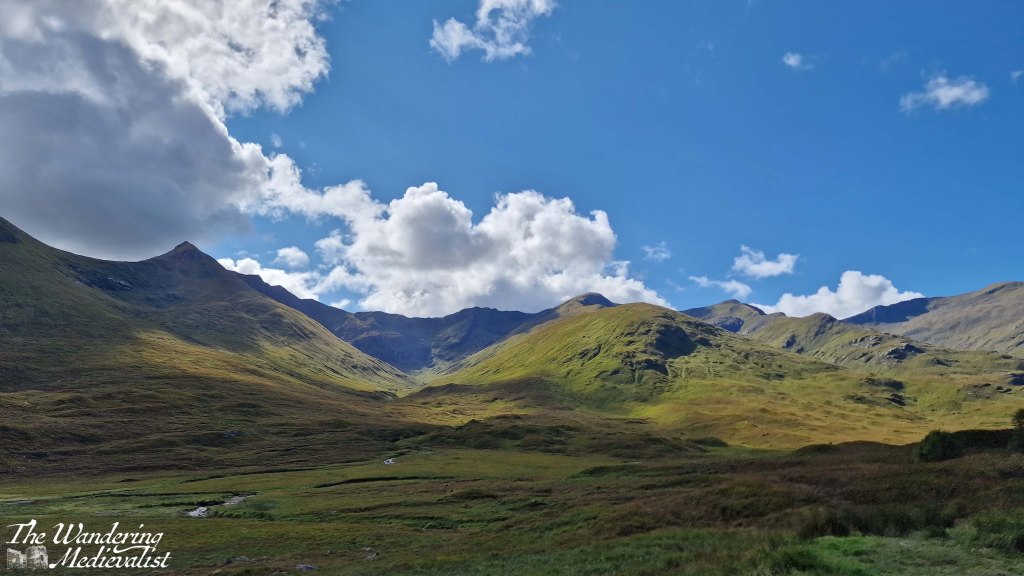
This drive along the A87 is just stunning – the further north you get, the more rugged the mountains and flora get, verging on bleak but falling just short especially in the sun.
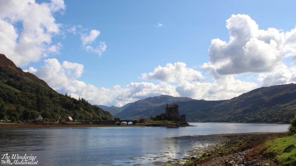
We could have stopped in many more places – some I made a note to try on the way back – but the day was passing and I knew we still had a significant amount of ground to cover. So, I pushed on until we reached Loch Duich and the most photographed castle in Scotland, Eilean Donan. We pulled into the massive busy car park and took a few distant pictures, but upon crossing the bridge into Dornie discovered an arguably even better view from the small town hall and public toilets.
Despite a continuation of stunning scenery, I kept my foot down after this stop and pushed on through Kyle of Lochalsh to the famous Skye bridge, an eye-catching steep arch of a bridge that was a touch unsettling at first, or is to one with a wariness of heights.
Once onto Skye the road is in good condition, quickly reaching Broadford, one of the larger towns on Skye were there are some good-sized grocery stores as well as plenty of places to stay – hotels, B&Bs, and self-catered.
Continuing north, the road wove back and forth a few times and began to climb, with stunning mountains and valleys to the left and water to the right. We passed Sligachan with a note to stop on the return, and as the road topped a hill, before us was suddenly visible the distant shape of the Old Man of Storr, unmistakable against the blue.
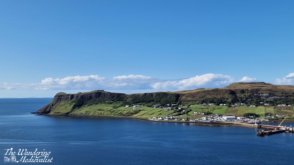
From here we touched the edge of Portree and continued pushing north, across another stretch of mountains and valleys populated mostly with sheep and a few distant farms. Our penultimate stop for the day came at a well-populated parking place perched on the hill above Uig harbour, dominated by a headland and ferry pier.
From here the road descended quickly into the village, passing several hotels and shops. Our route was further north and so we branched off to the A855 which I knew, from previous research, was also the start of the single-track roads with passing places. Indeed, while the distance from Uig to our cottage was relatively short, it was a solid 20 minutes in the car, requiring relatively regular stops to make room for passing cars and busses. Almost as if in an effort to test drivers, the A855 lifts out of town on a narrow cliff-side road that makes a hair-raising hairpin turn. This turn and the very visible drop off the road made me very happy not to be driving one of the many bulky motorhomes we passed.
After a long day of driving, I was quite ready to reach our destination, and the narrow road was not hugely helpful in alleviating my exhaustion, though the afternoon sun glinting off the water promised a lovely evening. Finally, more than four hours after leaving Fort William, we reached the cottage that was to be our home for the rest of the week. Dad had reserved the place and it was a fully-equipped cottage with two bedrooms, a lovely kitchen that I would happily have traded with my own, comfortable warm living room and perhaps most importantly, 360⁰ views of the sea, mountains, and countryside. After unpacking the car, we had a quick pasta dinner and sat outside with a glass of wine and my trusty camera tripod to watch the sun set. It was a perfect way to end the day.
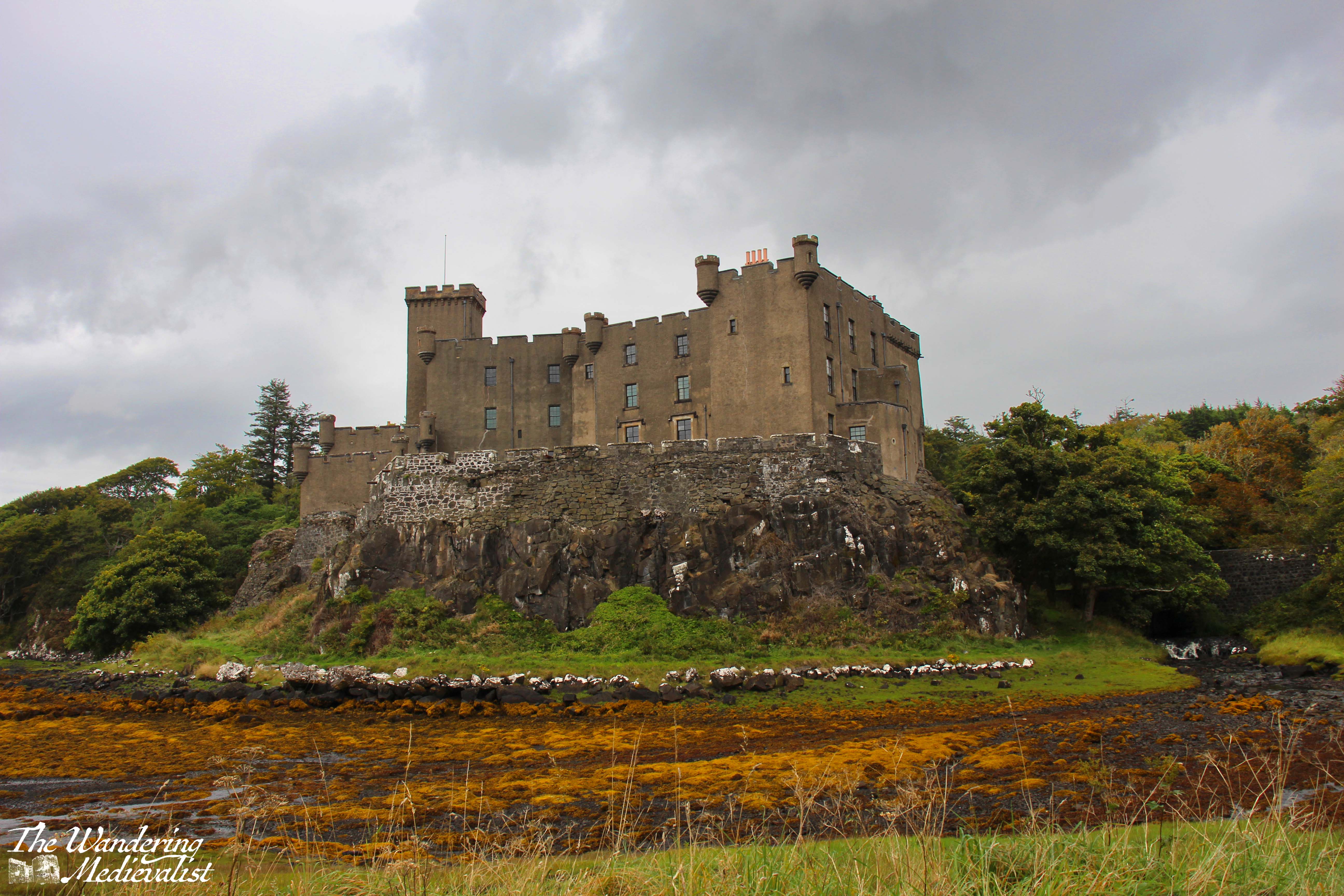
It has been longer than usual since my last post, but for the very happy reason that I have been on holiday with family. We went to Skye for my first time ever, and it was absolutely extraordinary, even on the rainy day we had when we chose to visit Dunvegan Castle. (and please be assured, many posts on Skye will be coming as soon as I can sort through the mountain of pictures I took)
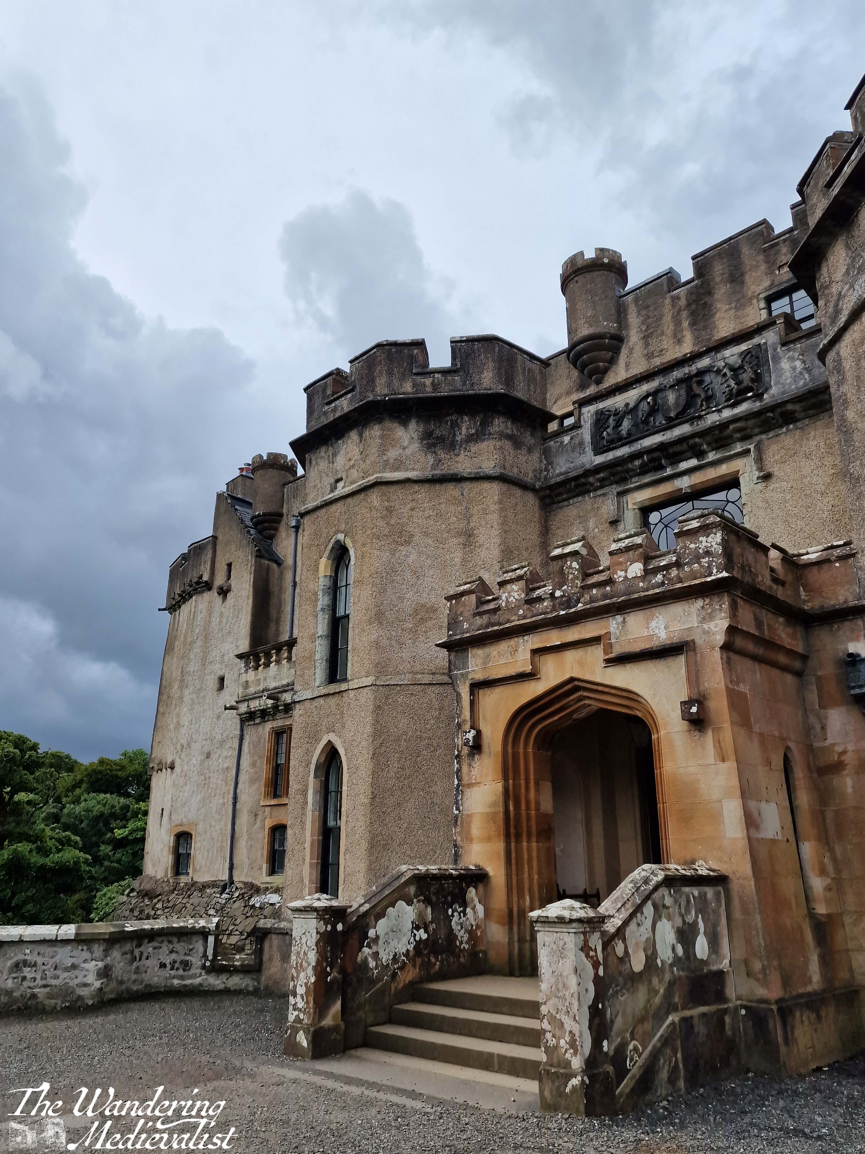
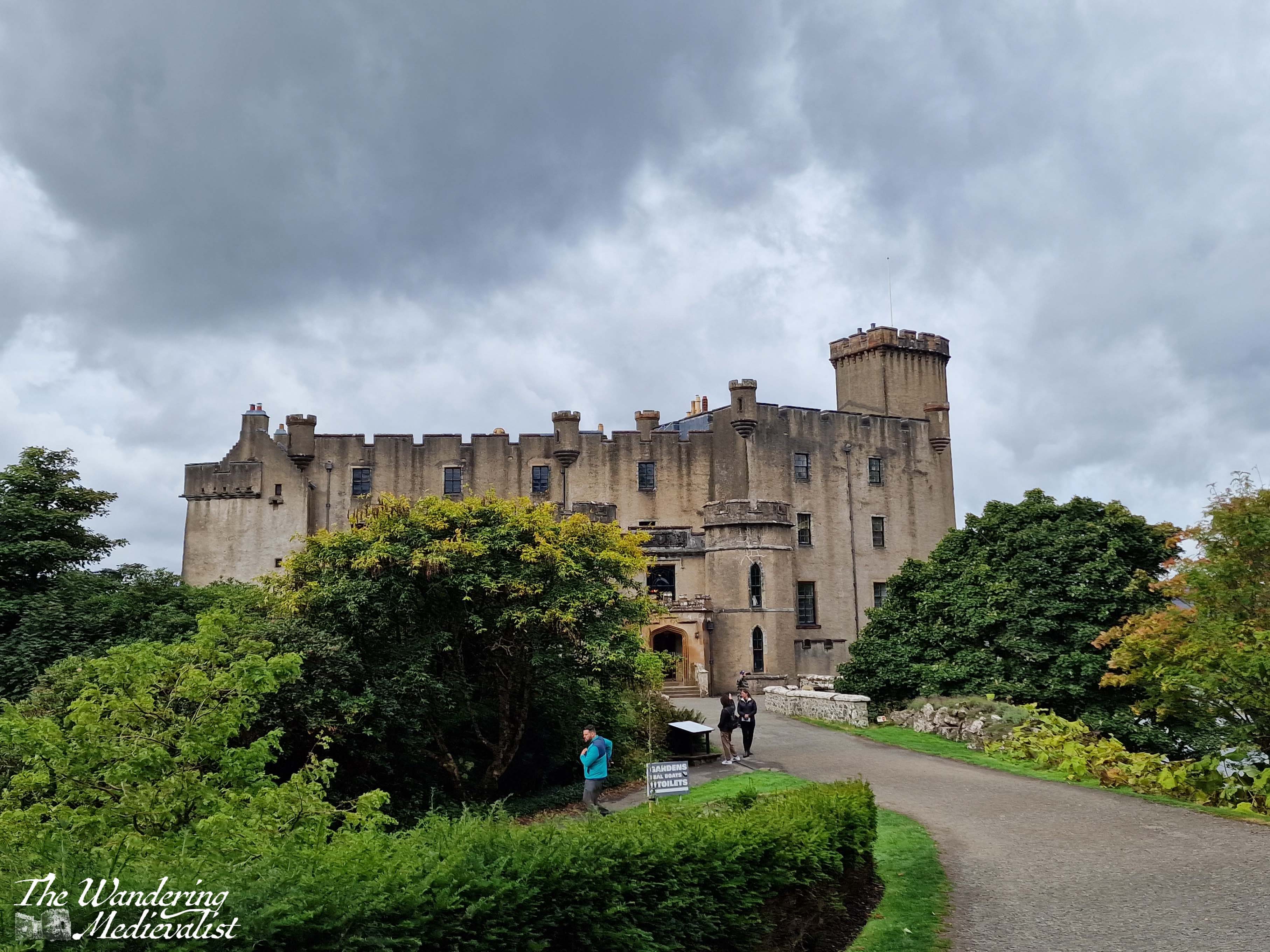
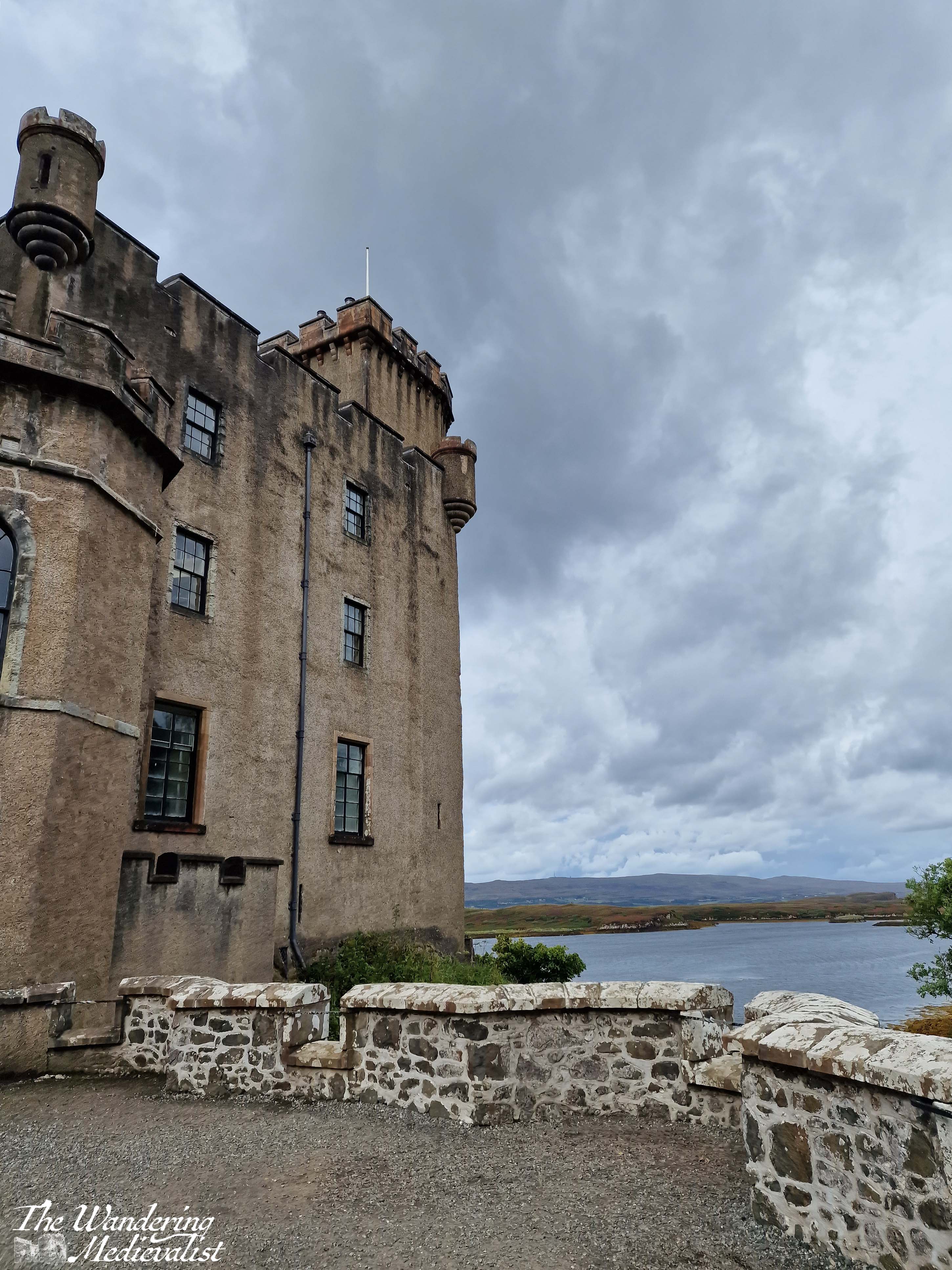
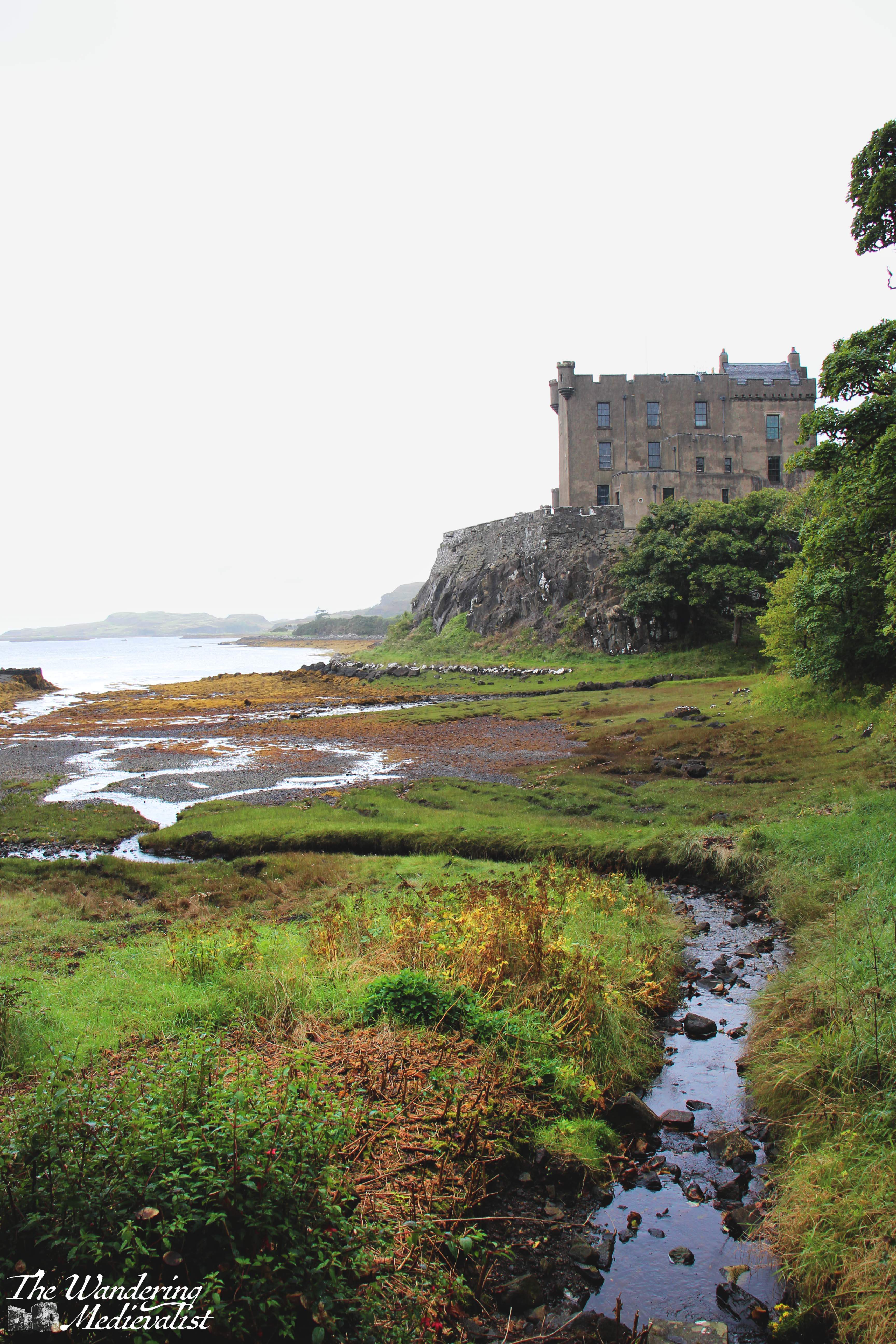
Now I have to admit, it doesn’t often happen that I am underwhelmed by a castle, but Dunvegan is on the list. It may be due to the rain – though that doesn’t usually hold me back – or the fact that I did not go inside to tour the castle proper, which does look impressive in pictures. But, the excitement I had felt preparing to see this famous spot did not quite measure up. It may also be that it has been remodelled in a mock-medieval style, or that the original stones have been coated with concrete to provide a smooth exterior (most likely I imagine for preservation). I have made my preference clear for older-style castles, even crumbling ones, to those still used as baronial residences or palaces.
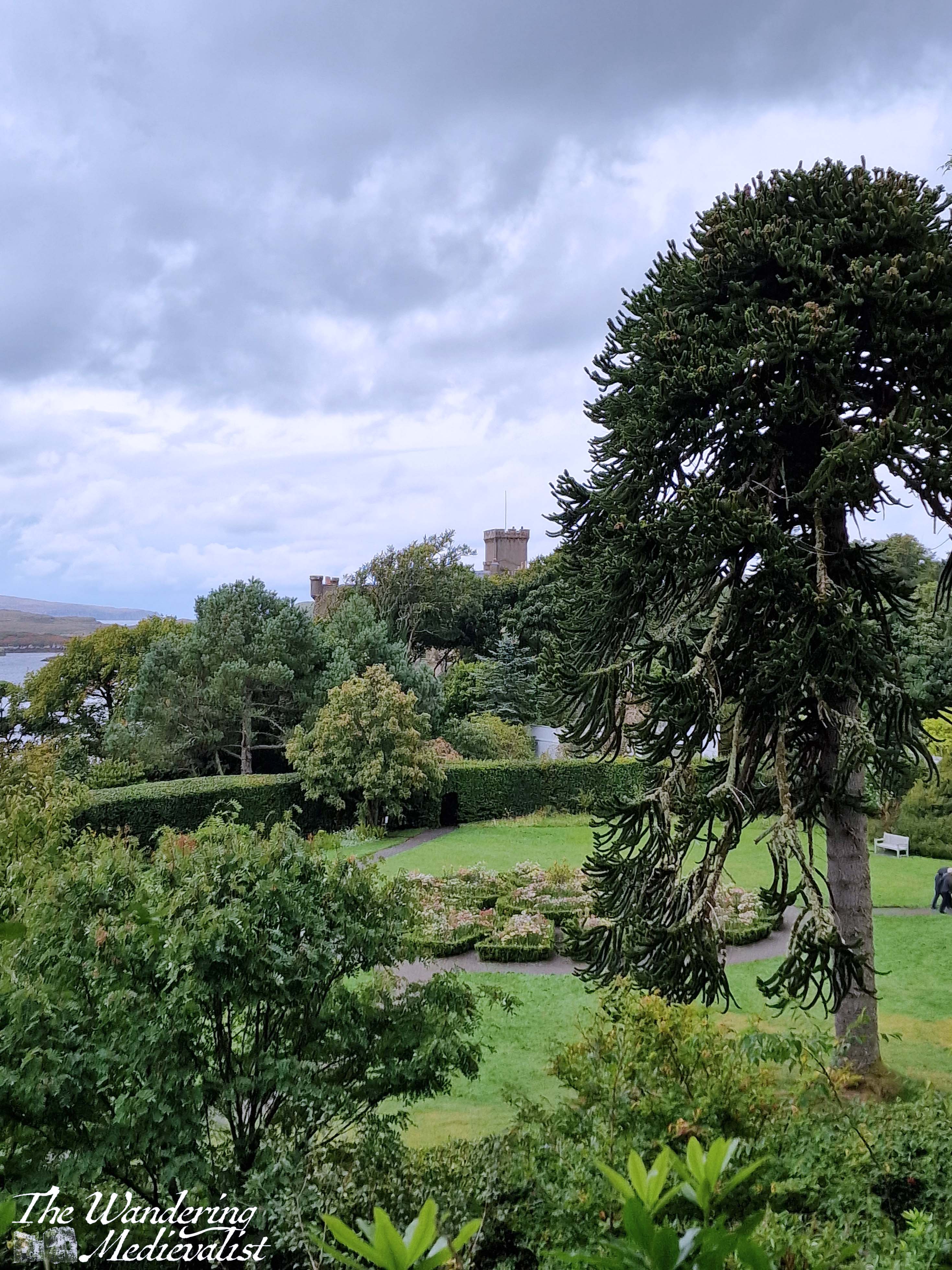
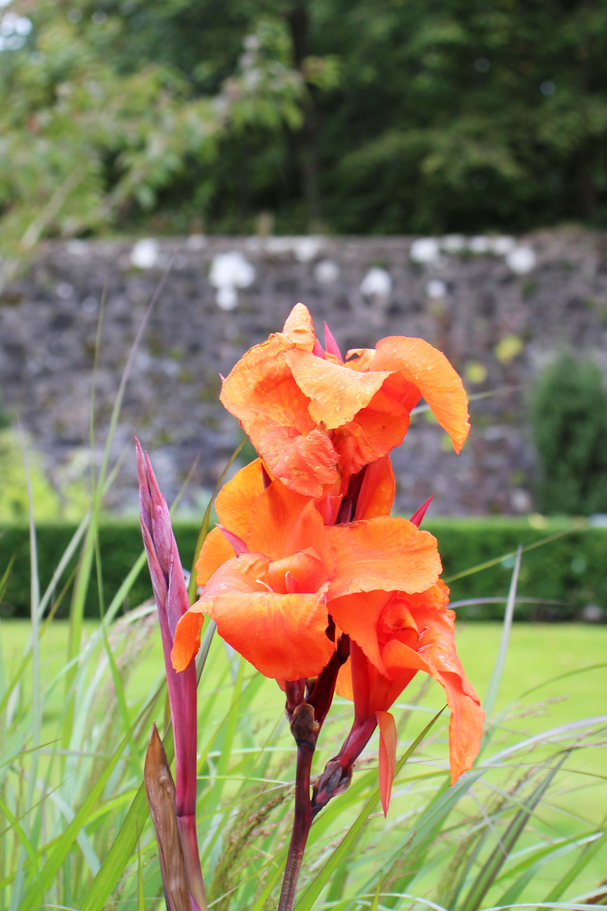
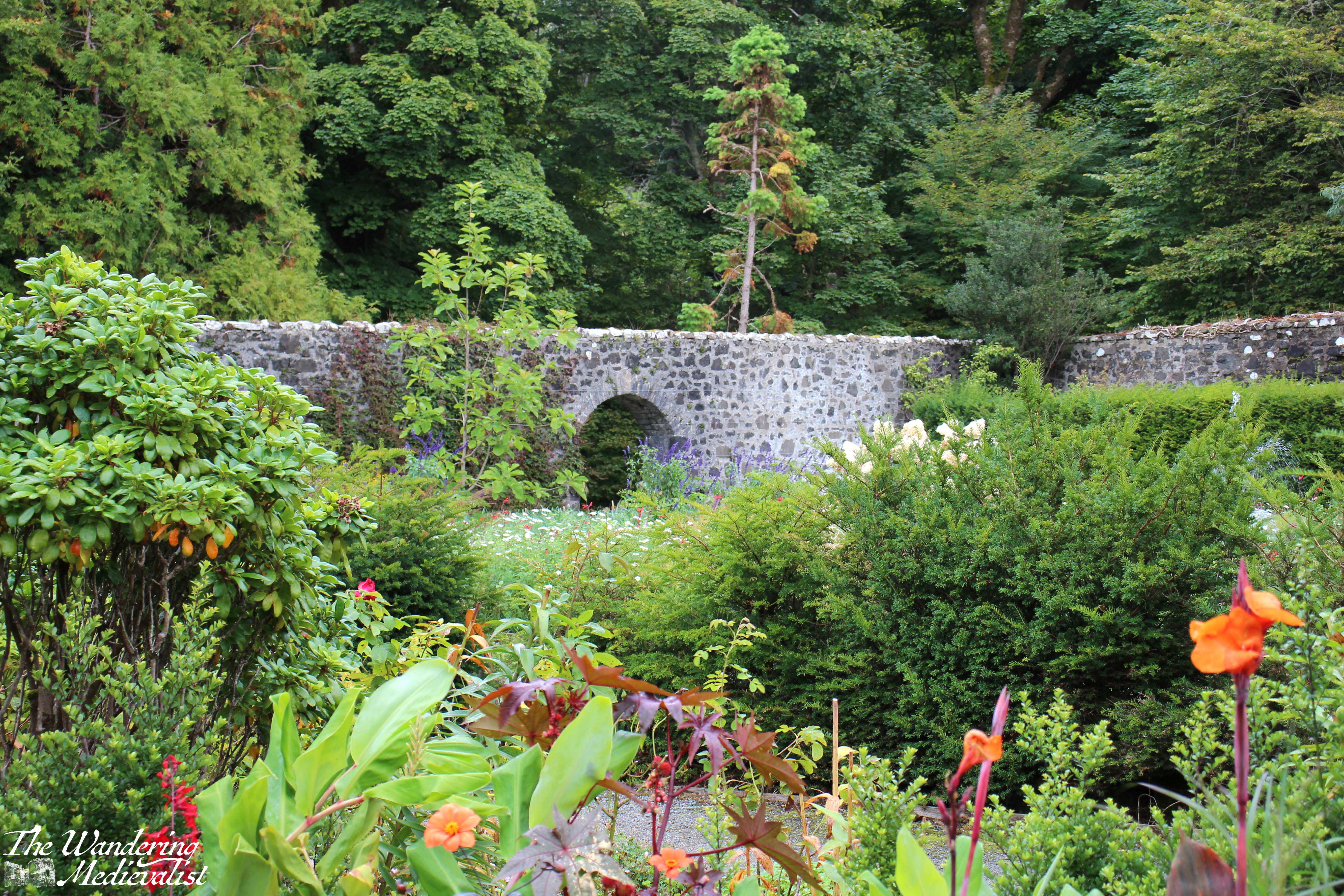
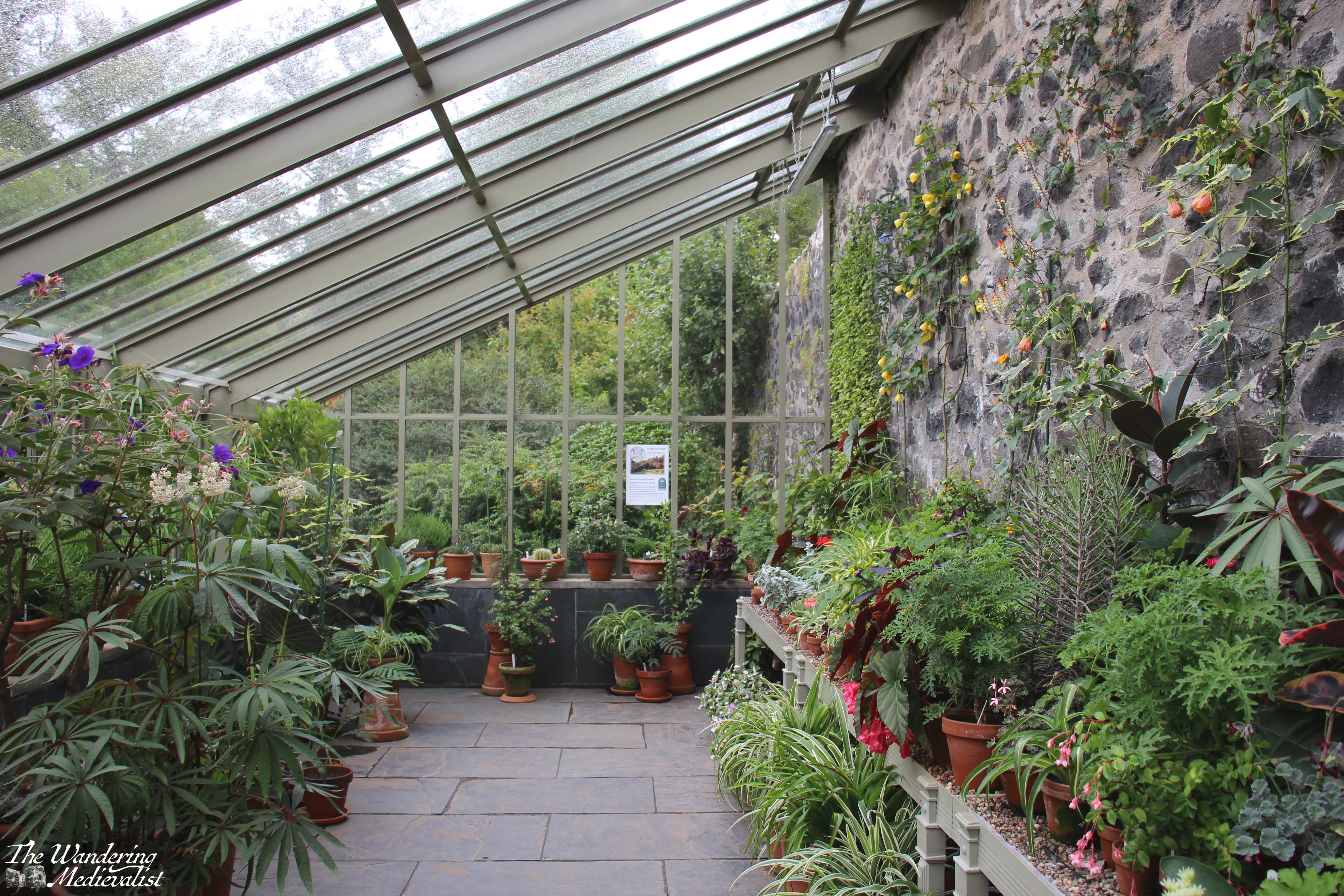
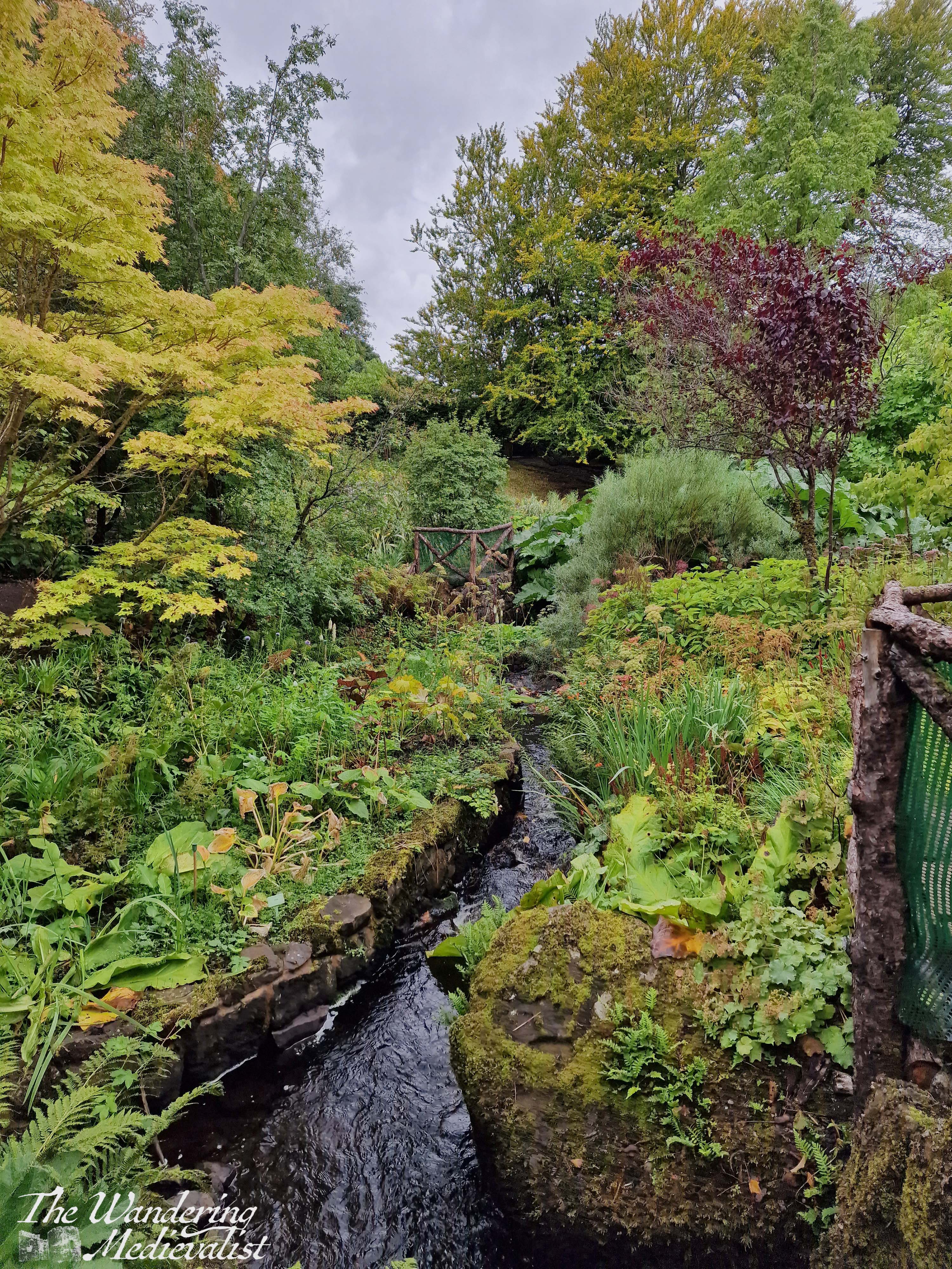
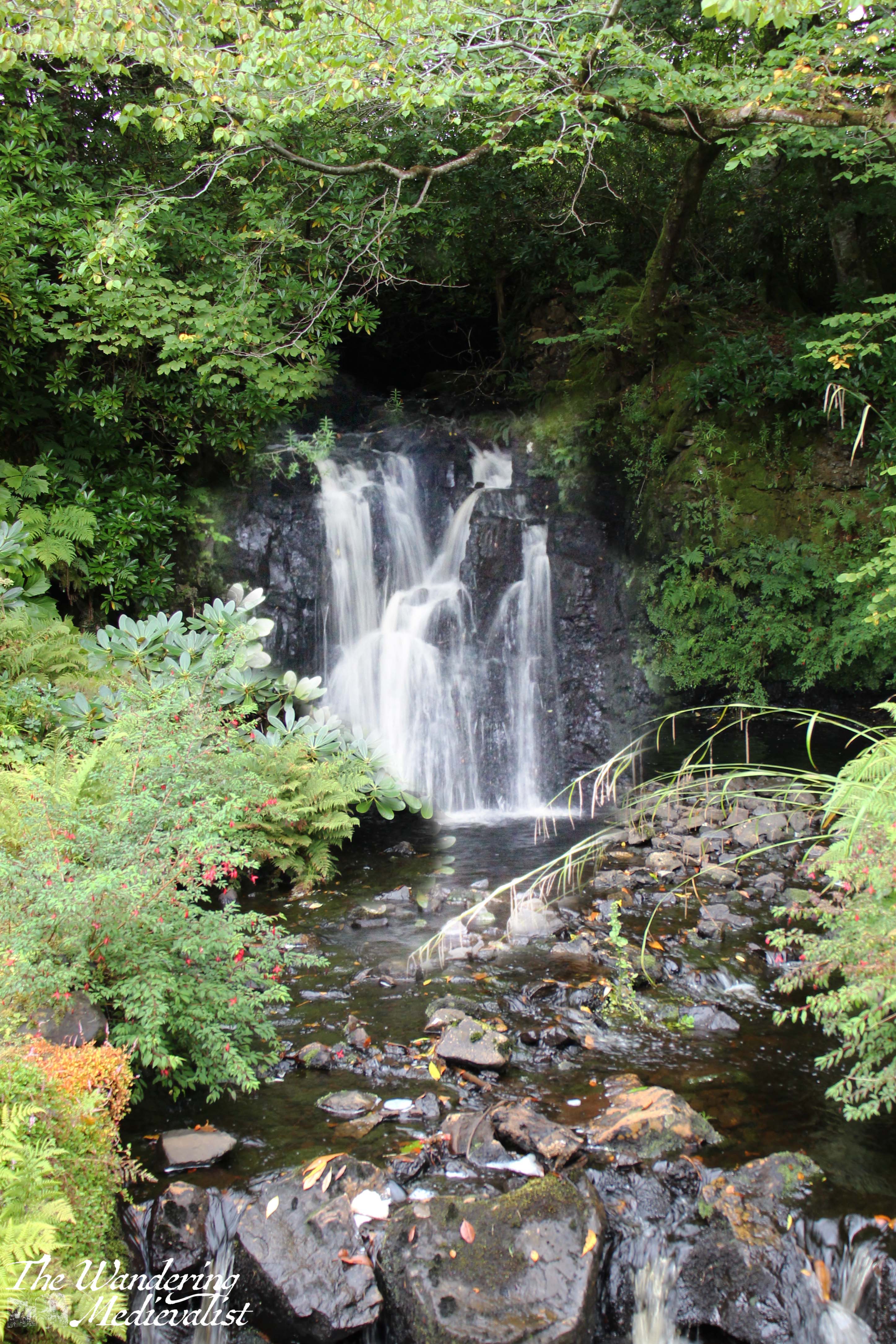
I do not mean to say that the castle is not incredibly impressive – by all means, the sight of it towering over the bay, commanding views and a romantic atmosphere even in the rain, demonstrates the significance of the location and why there was a fortress here for hundreds of years. The castle is the seat of the MacLeod of MacLeod, chief of the Clan MacLeod, and it is surrounded by a beautiful garden with water features, a walled formal garden, and more natural forest spaces. On the day we visited, the gardens were more our style and were the focus of our time. Even in the rain and after the height of the summer blooms, it was very easy to see how stunning the place would be on a sunny day in the right season. One amusing story here is that I had declined to bring my tripod with me due to the poor weather, but as I was resting my camera on a railing to keep it steady, a kind German man offered me use of his so that I could properly capture the waterfall. I think I did ok with out it, though!
We made a circuit that ended with the walled garden and greenhouse, then ventured down towards the pier where they were advertising seal cruises. It is hard to imagine the cruise could beat the one we went on in Fort William, and even if we had been tempted, this is when the rain hit in honest, turning from a gentle pitter-patter to a downpour. I managed to get my brolly up in time to take a few pictures of the castle from the water side before we made our way swiftly back towards the car. From this angle it is even more evident why the spot would be chosen – more than 50 feet above the low tide, the castle would be incredibly difficult to attack from the sea.
One of the most striking aspects of Dunvegan really falls in its ownership, which is still held by the Chief of Clan MacLeod. This family line can be traced back to the thirteenth century, when Skye and many outer islands were still ruled by the Norse; Norse influence on Skye is evident in many place names. Despite living in Scotland and professing a love of Medieval history, I have never delved too deeply into the lore of Highland Clans, but more visits to castles like this one would be a good way to pique my interest. Certainly, if I were to visit again, I would hope to do so at a time of year when the flowers were properly in bloom and with someone who might have the patience to tour the castle itself.
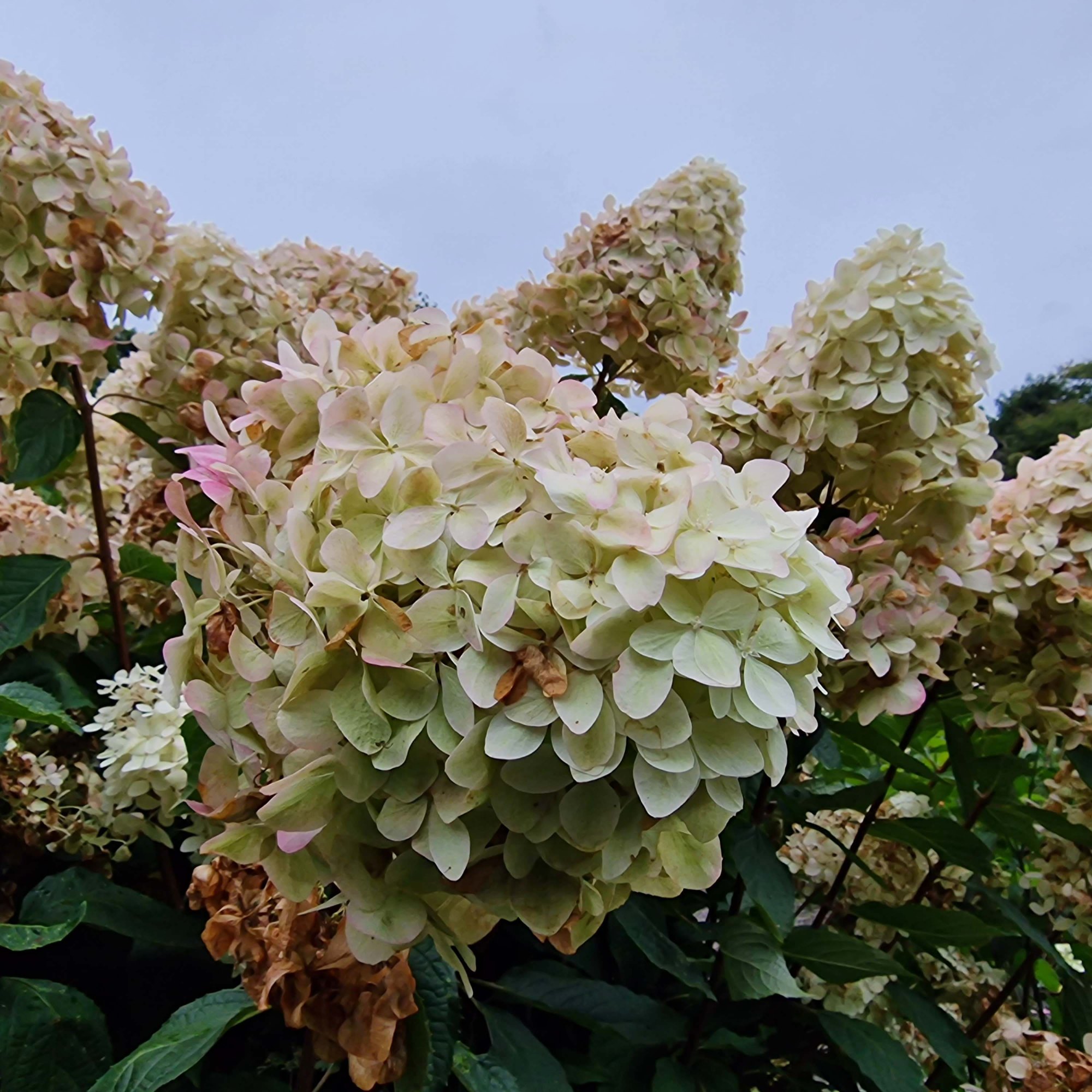
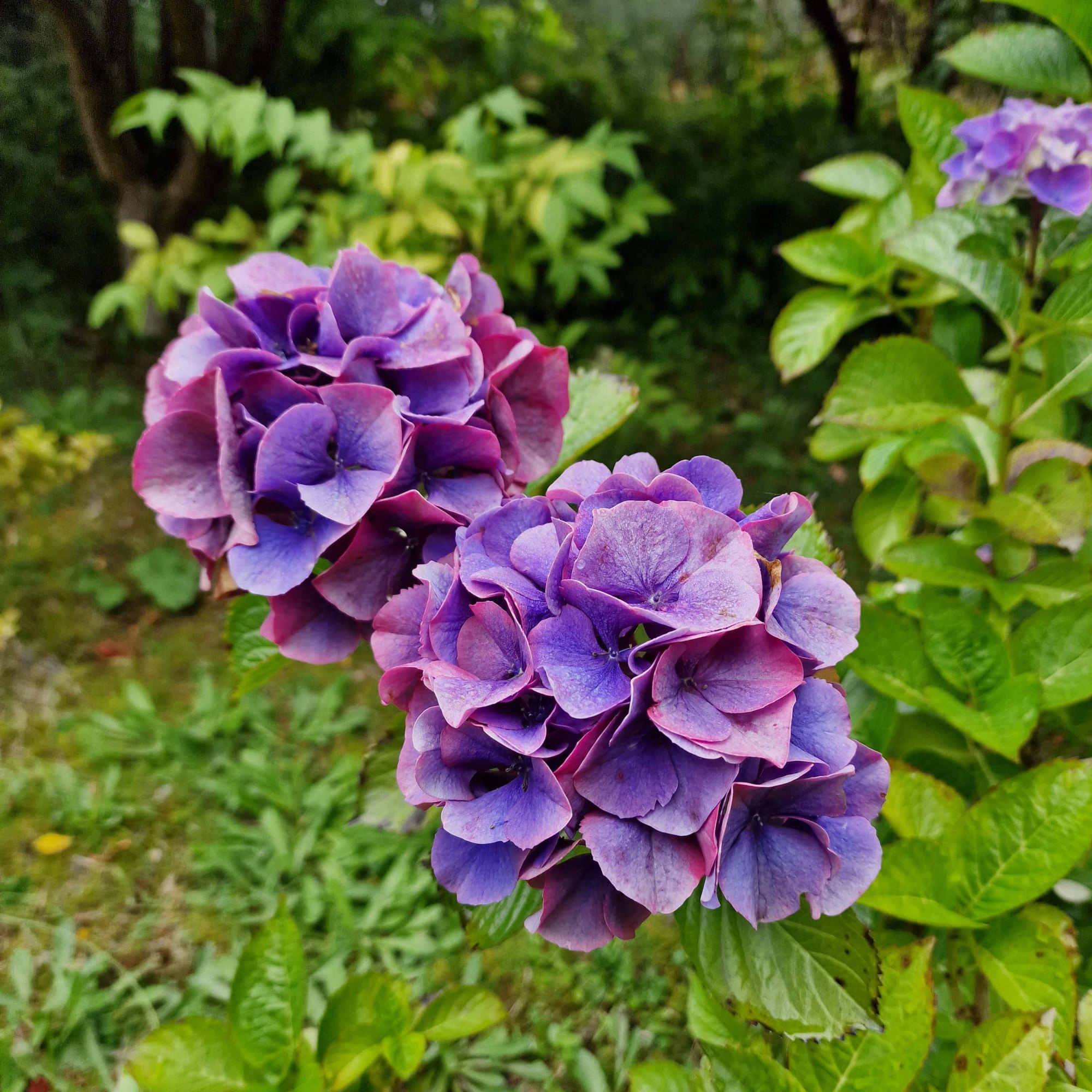
As an end note, here are some of the lovely variants of hydrangea blooming throughout the gardens:
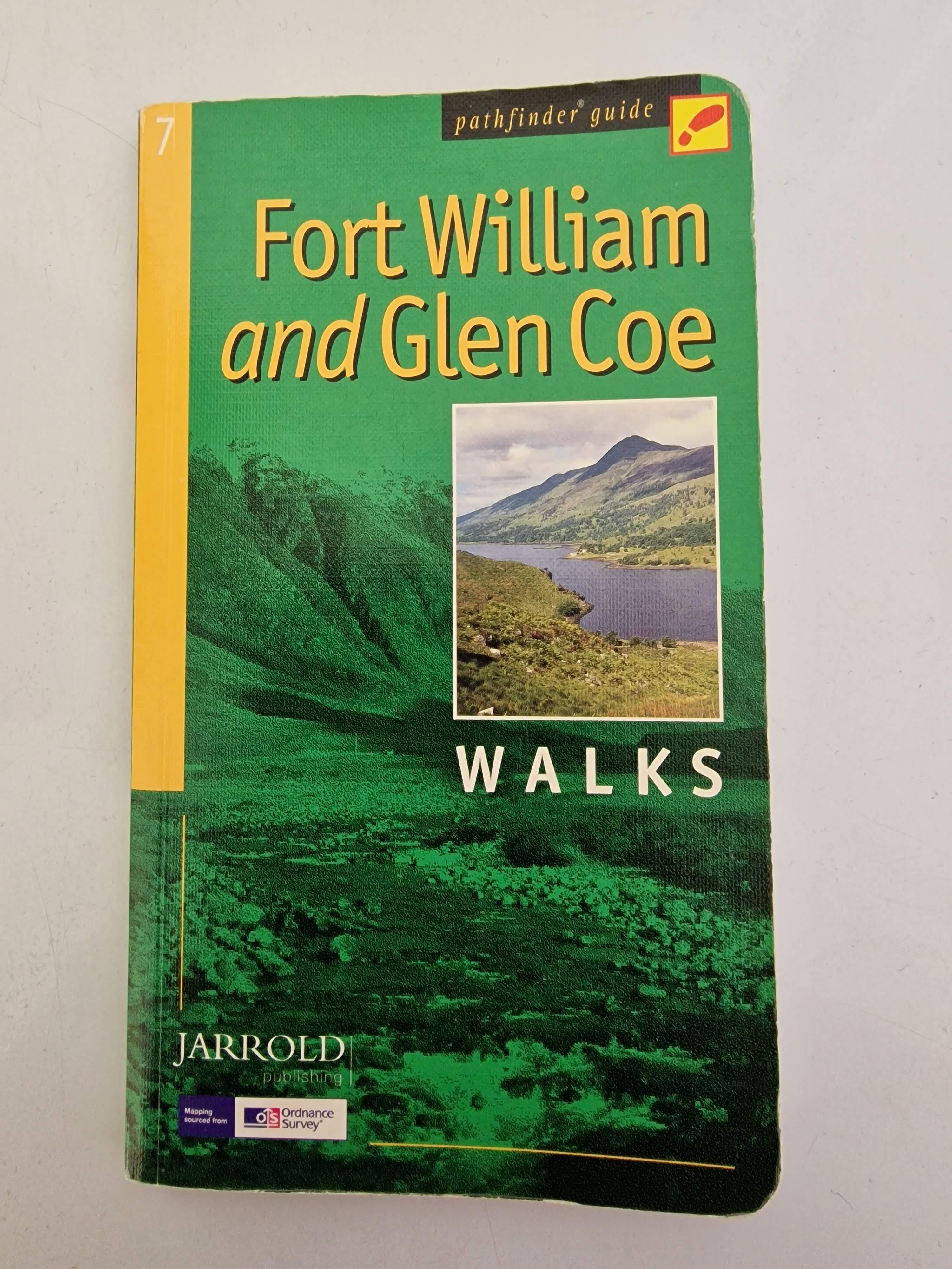
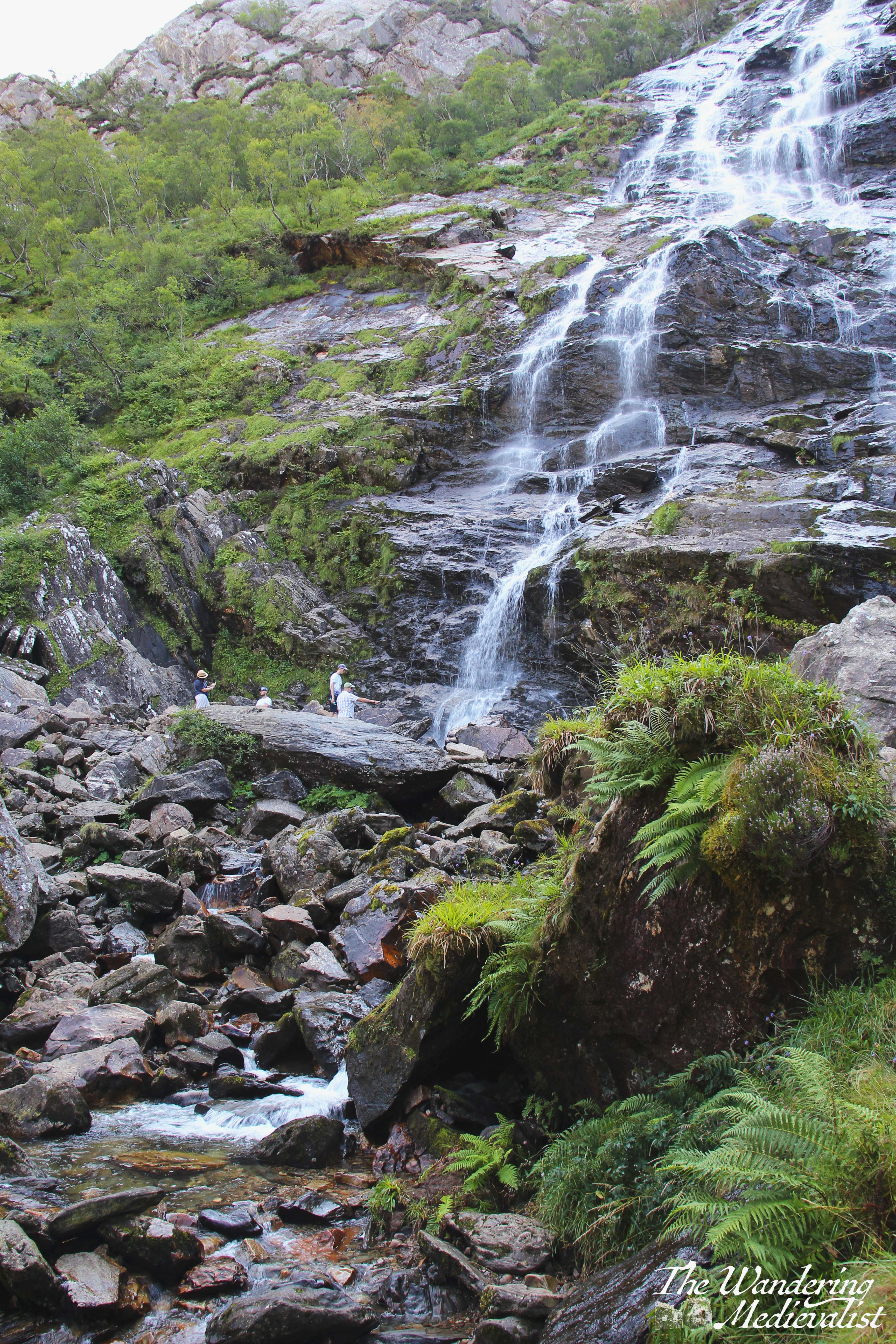
I first came upon this walk while perusing my well-used Pathfinder guide to Fort William and Glen Coe, and was immediately sold by the phrase, ‘one of the country’s most scenic waterfalls’. While the book also describes the path as ‘short and easy’, we soon discovered that while the waterfall description was accurate – and this walk remains one of the most stunning I have taken in the Highlands – the ‘easy’ part was less so.
While not particularly long in the first instance, the path does take one up and down some steep sections that are rocky and not suitable for anyone without a touch of fitness. Once through the gorge, the path is comparatively easy and comfortable. But, I am forever reminded of the August 2021 occasion on which I saw numerous walkers, drawn by the promise of a waterfall, attempting the hike in flipflops, some even with crutches and canes. Unfortunately, I imagine most of them were not able to continue to the best viewpoints.
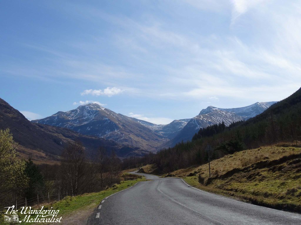
But I get ahead of myself. Our first challenge, as is often the case in more obscure walks, was to find the car park mentioned in the book. Starting in Fort William, one follows the signs for Glen Nevis and indeed for Ben Nevis itself, as the drive takes you past the most common starting point for hikers attempting the highest peak in the UK. Glen Nevis itself is stunning, and it is almost impossible not to stop a few times along the way.
Gradually the road narrows and passes a number of burns and wayerfalls, and on our first trip we thought we had found the car park when we reached the Lower Falls.
After a few more moments with the map though, we determined that we still had a way to go, and indeed the start of the Nevis Gorge walk, the Upper Glen Nevis Car Park, is another 1.6 miles along the single-track road. Once there, it is clear that it is the end of travel for vehicles. There is a good-sized car park, though when we visited in 2021 it had filled up completely by mid-morning. This may have been anomalous due to the higher than normal number of visitors that summer, but I have a feeling it is quite standard.
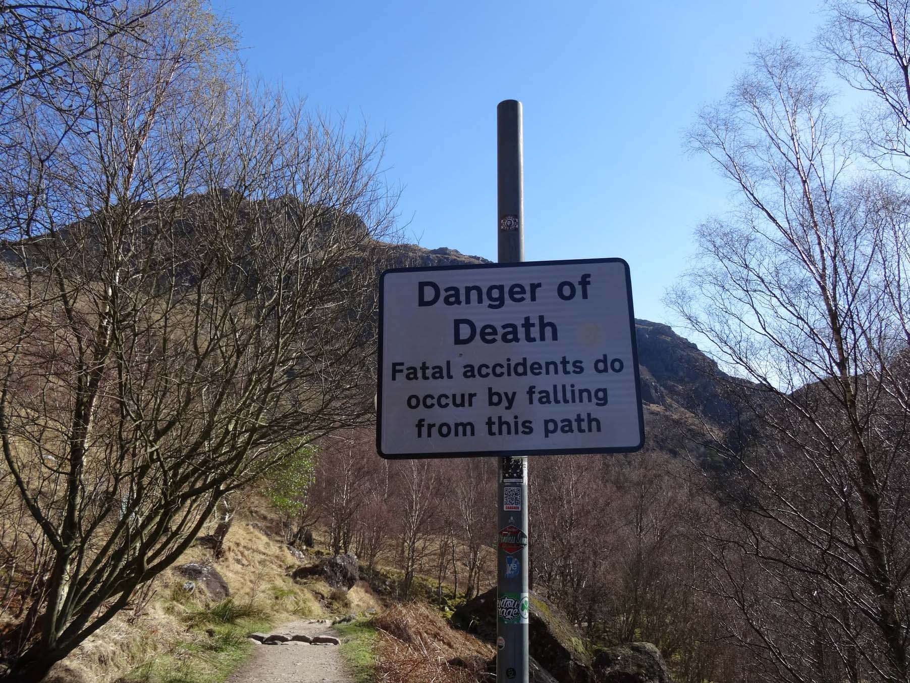
There are lovely views even from the car park, and I could not resist snapping a pic of the warning sign to send to the family – once we had returned safely of course.
While initially we paid less attention to the warning, by the time we had climbed a bit further and discovered the steeper areas of the trail, we realised how easy it would be to slip into the gorge – especially when mesmerised by the view.
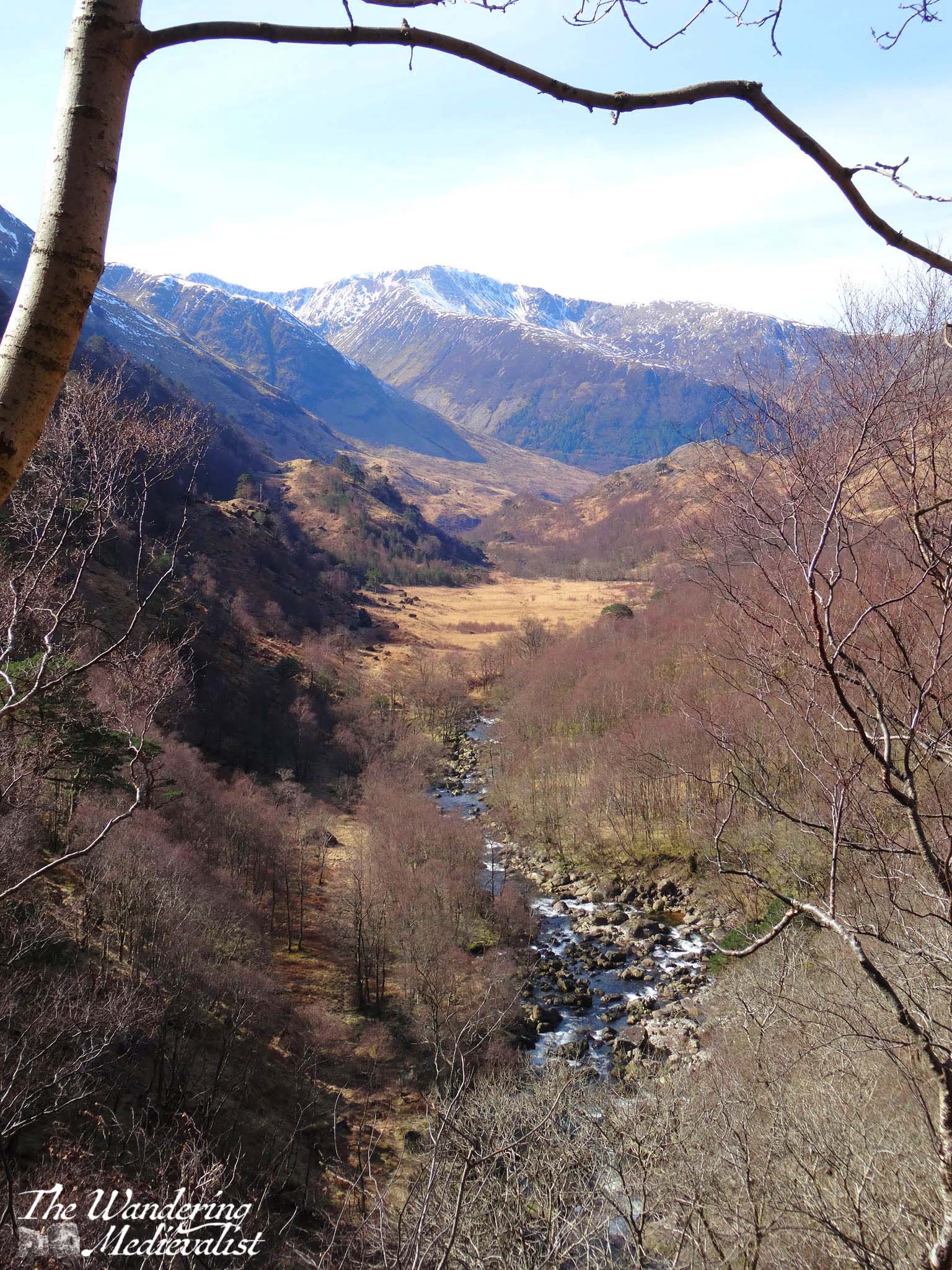
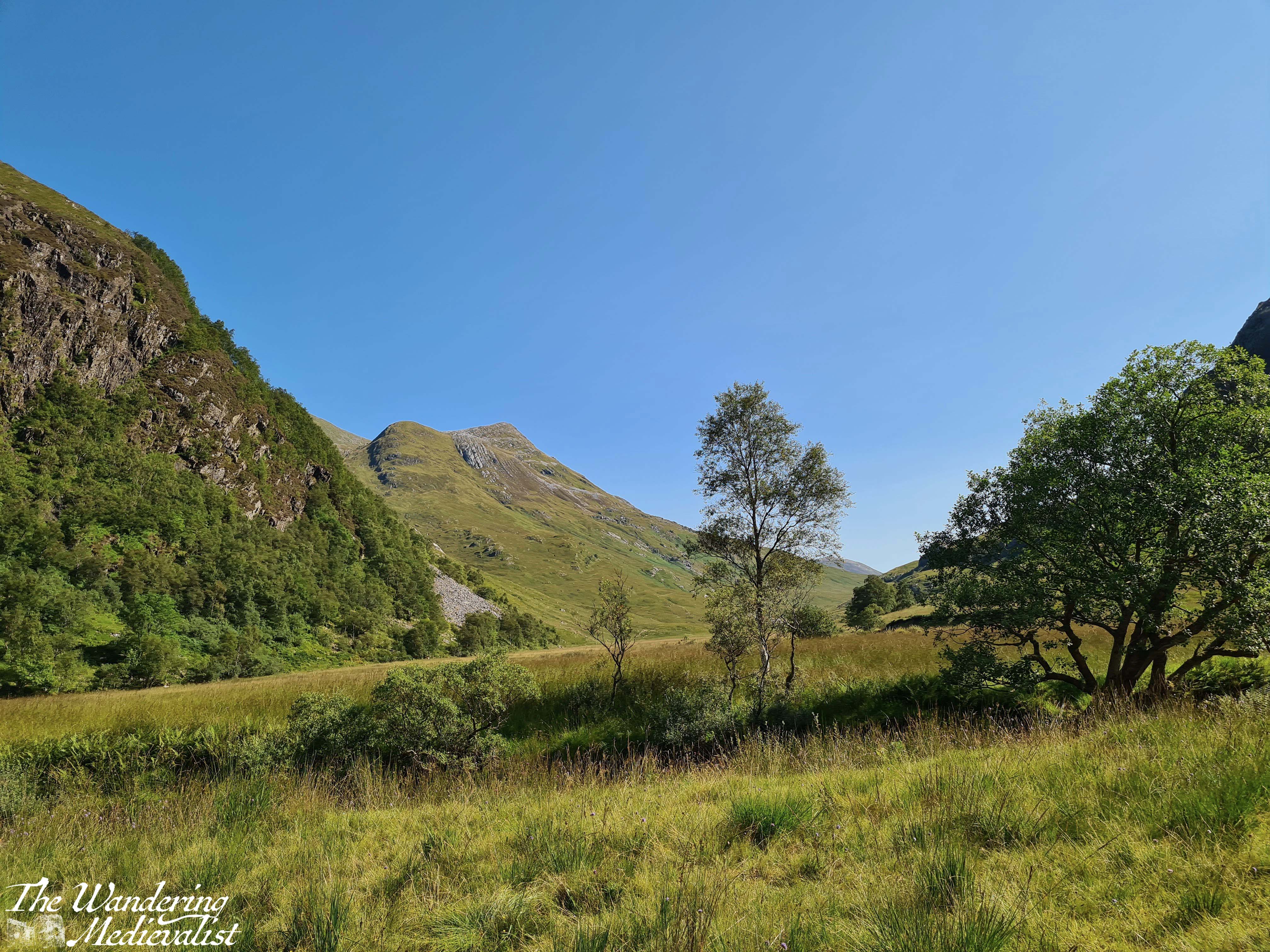
The path starts out quite innocuously through a lovely stand of birch, with some small streams and impressive glimpses through the trees up the hillside and down into the valley where you can hear – if not always see – the Water of Nevis. Before long, though, the trail runs into the side of the hill and begins to curve around to the right, at the same time that it starts to gain height. It narrows and becomes a bit more difficult to traverse, as it is clear that hikers are moving up and through the gorge. Warnings notwithstanding, it is impossible not to stop at a few points to enjoy the view over the glen – below you will see an early spring and late summer version of the view.
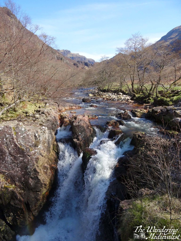
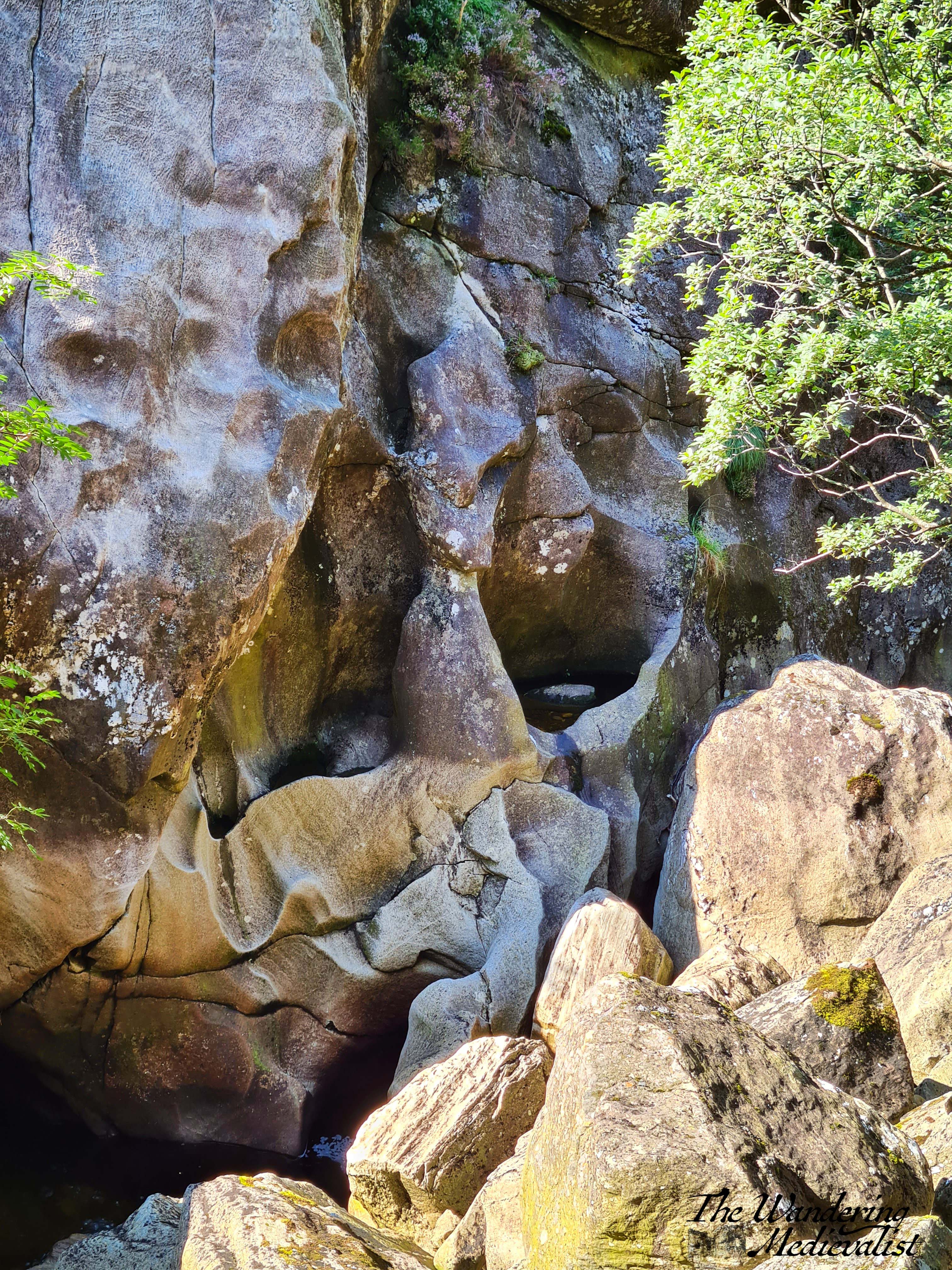
After a few sets of rocky stairs, the trail curves back around to the left and you know you are headed through the gorge. The rushing water below becomes more turbulent as it passes through the narrow gap, and while it is far enough below that you cannot often see it, the rock faces are sheer and carved by thousands of years of water.
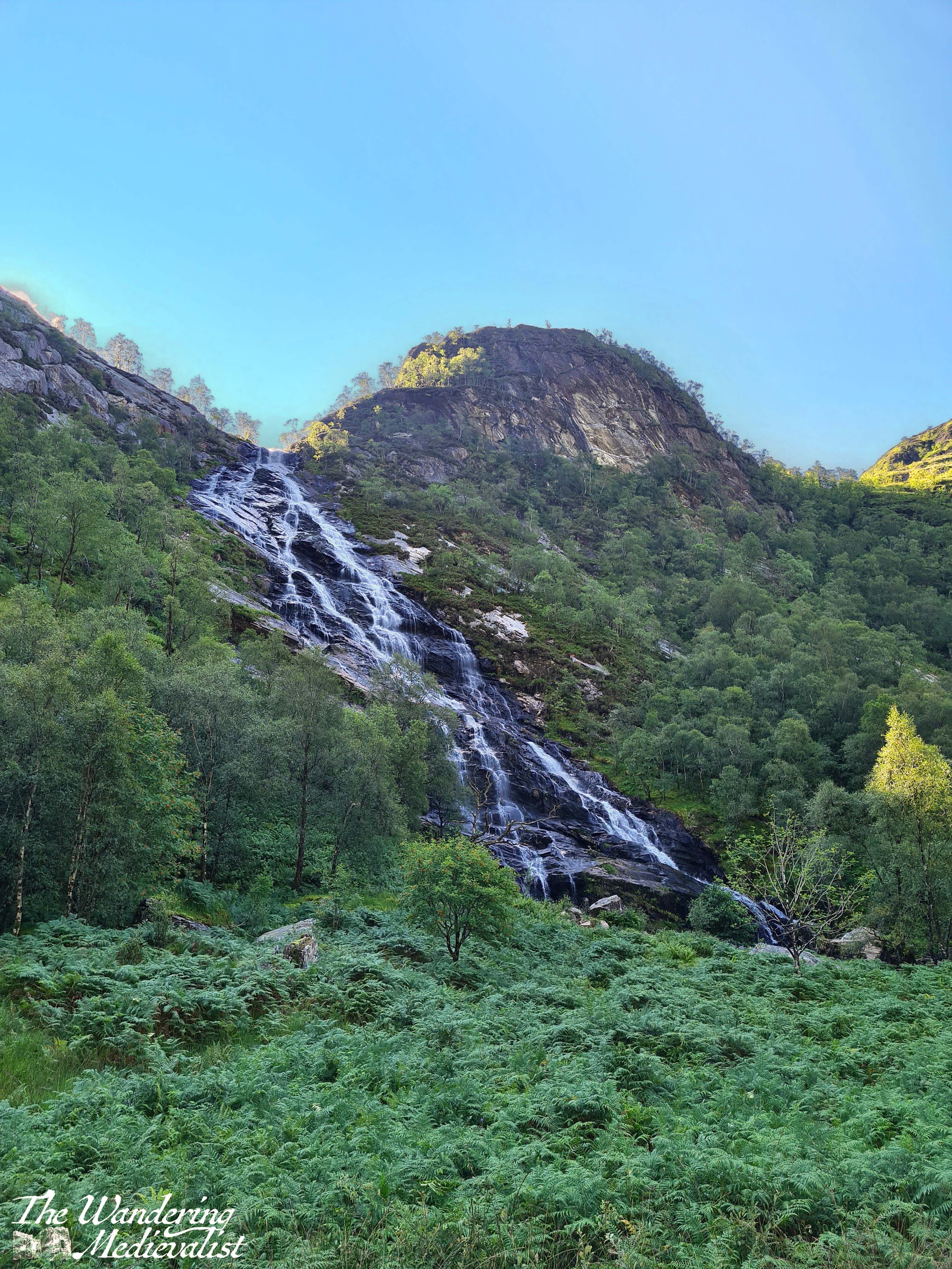
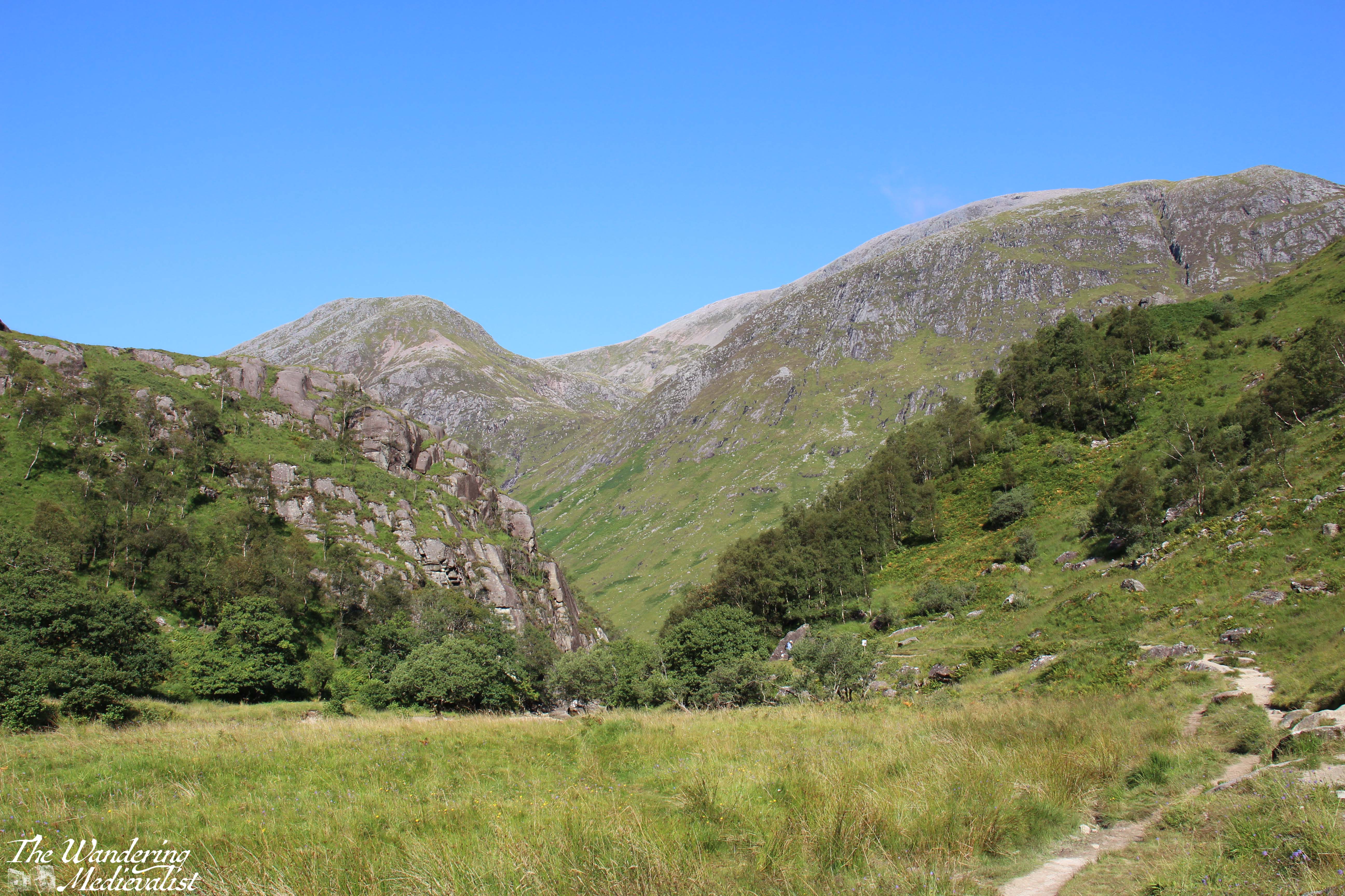
The trail eventually passes through to the other side of the gorge, and before you opens up a beautiful flat valley where the Water of Nevis cuts through the hills. Grassy flat land is dotted with stands of trees and rocks, and in the distance you can just see Steall Falls.
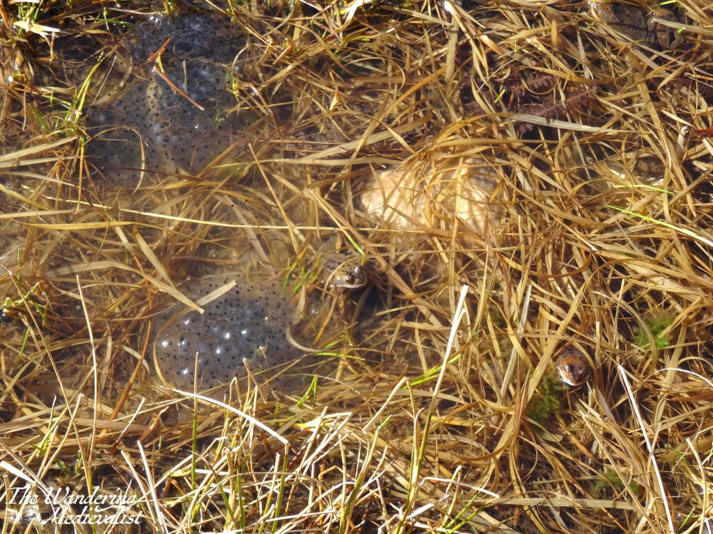
From here, the trail follows the curve of the valley, crossing some small streams and boggy ground; in March when we visited, it was absolutely full of frogs and frogspawn, glistening in the sun.
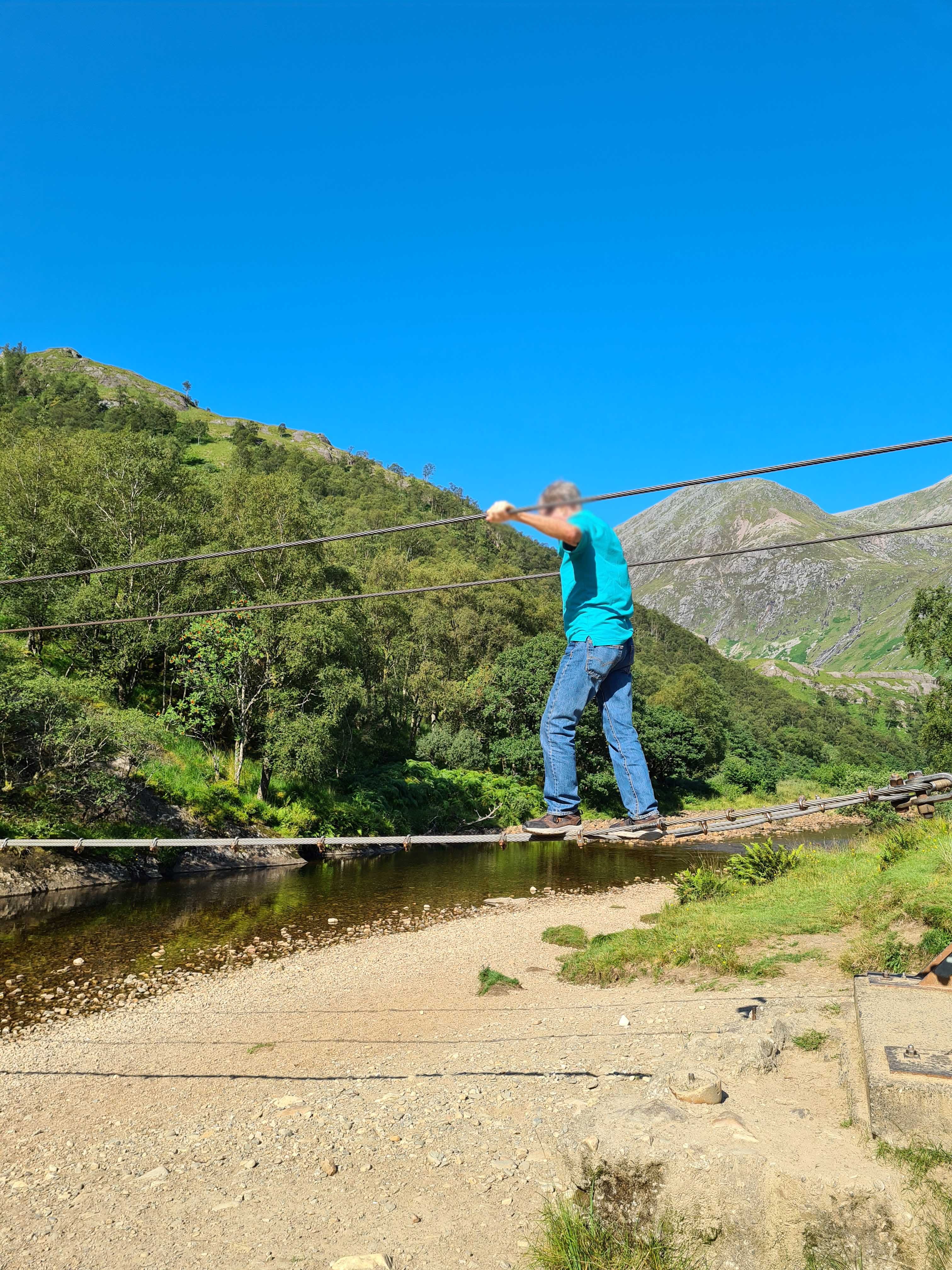
From this point you can continue along the valley up the back of Ben Nevis and eventually reach Spean Bridge or, if incredibly adventurous, the edges of Rannoch Moor. Or, if you are feeling adventurous in a different fashion, you can cross the river to approach the falls directly, though the trail is not as well-marked as one might hope (or wasn’t in the days just after the pandemic). On our first visit, the other half and I chose to just walk up the valley and find a spot on the riverbank for lunch. Dad on the other hand chose to cross the river. Not, as I did, on the rocks just poking above the surface that I crossed dry – unlike the hikers ahead of me – but instead on the wire bridge that spans the river. By wire bridge, I mean literally three heavy wires, one for your feet and two for your arms, which requires both height and upper body strength I do not have – I could not even reach the starting point. While at first the bridge is not far off the ground, by the time it stretches out over the water, it is high enough that one can imagine a fall into the shallow river would not be without injury. After a few uncertain moments at the start, Dad managed it quite well, and then waited on the other side while I plotted my route.
Once safely across, we hiked up towards the falls and I experienced the true viciousness of midges in the Highlands – fortunately I had spray, but the closer I got to the falls, the more swarmed around me, getting caught in my hair and the spray on my arms. While they did not bite through the spray, I ended up looking more freckly than normal and they went out of their way to aim for ears, nose and eyes. I managed to pause long enough for a few pictures of the falls and the view from the rocks, but the bugs were intense enough to encourage us to keep moving.
The falls are well worth the exploration – they are the second-highest falls in the UK, with a single drop of 120 metres (390 feet), and there are plenty of places for brave walkers to cross and climb up for a better view.
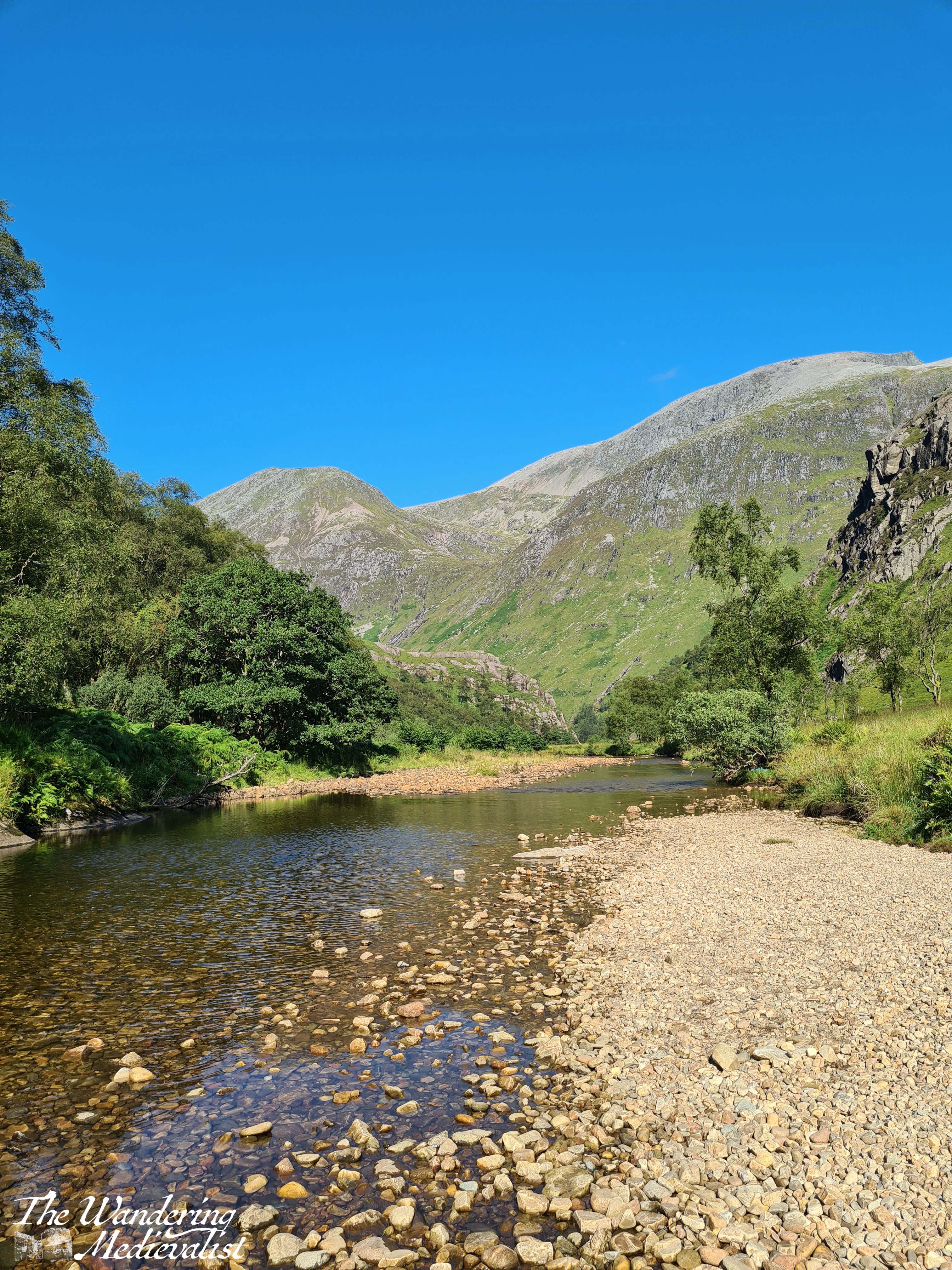
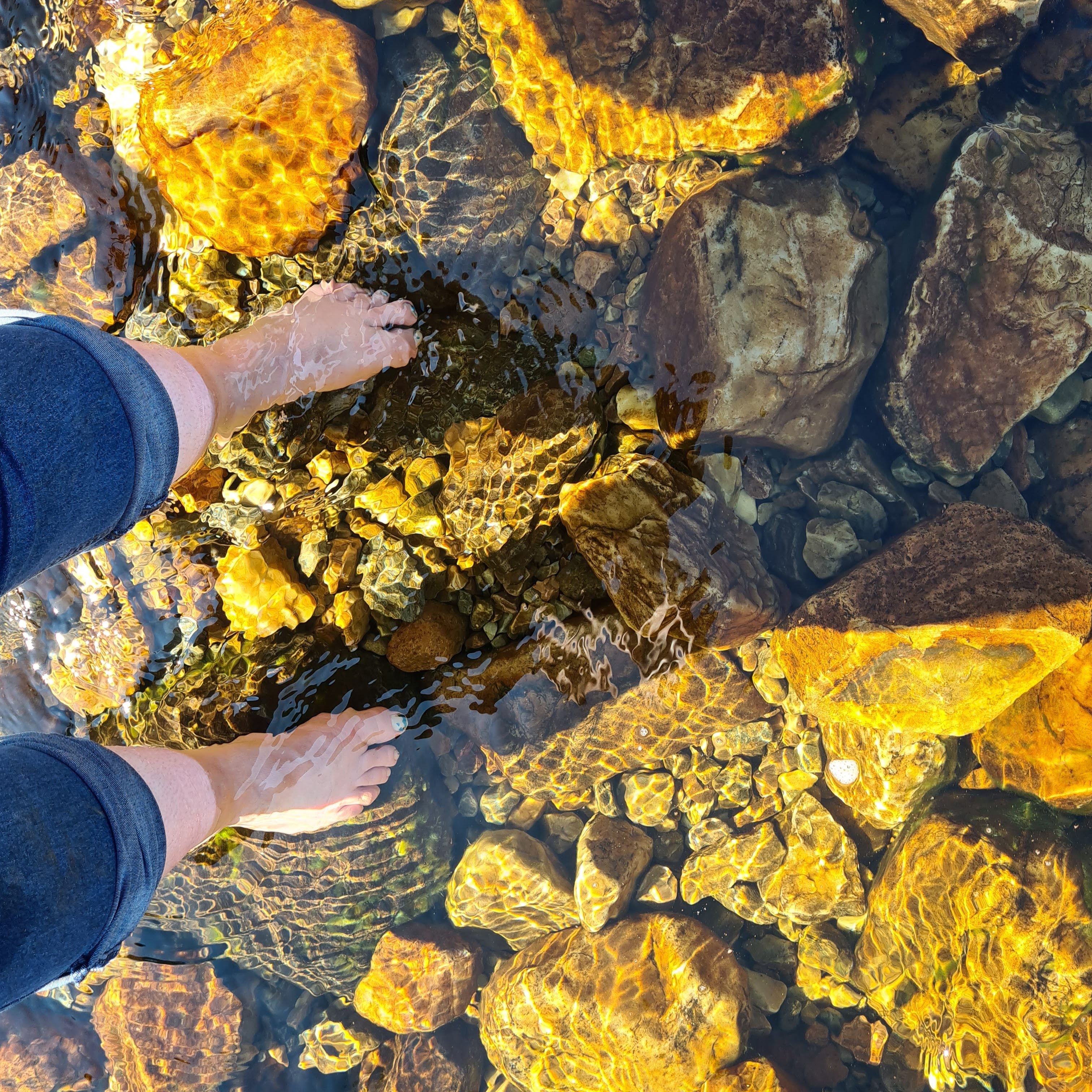
Dad and I tried to continue walking along the valley but found the path to essentially disappear into bog, so we headed back towards the wire bridge, looking for a place to cross. In the end, tired feet won out and I stripped off my boots to plunge into the icy water. It felt amazing and almost immediately numbed my toes to the rocks as I managed to just get across without falling. As we waited for our feet to dry, we sat on the riverbank and enjoyed the stunning view back towards the gorge.
The return trip is a touch less gruelling as it is more downhill than up, but the views are no less stunning and there is a great deal of truth in the fact that down becomes harder as one’s knees get older.
By the time we returned to the car I was very ready to take off my sturdy hiking boots and find some looser shoes to don for the drive back down the glen. I recall sitting in the car for a few moments just enjoying the car park view before finally heading back into town.
From here, Dad and I went on to the Commando Memorial, but even after our hikes on Ben Nevis and beyond, this remains one of the most stunning and magical trails I have found. The tranquillity of the valley around the Water of Nevis is breath-taking, and so quintessentially Scotland that it really should not be missed. That said, it is not a trek to take on lightly or unprepared; water, a snack, and sturdy shoes are an absolute must! And, if you are going in the summer, a strong midge repellent.
As anyone who has read my two posts on the Nevis Range may have guessed, Fort William – and the surrounding Lochaber – is one of my favourite places in Scotland. One of my favourite features of Lochaber is the way in which the mountains and hills sweep down right to the lochs and sea, creating spectacular vistas that are so typical of the Highlands. It is such a different feel from the east coast, where we have cliffs and beaches, and of course the east coast of the US which tends to be much flatter, except perhaps up in the far north of Maine.
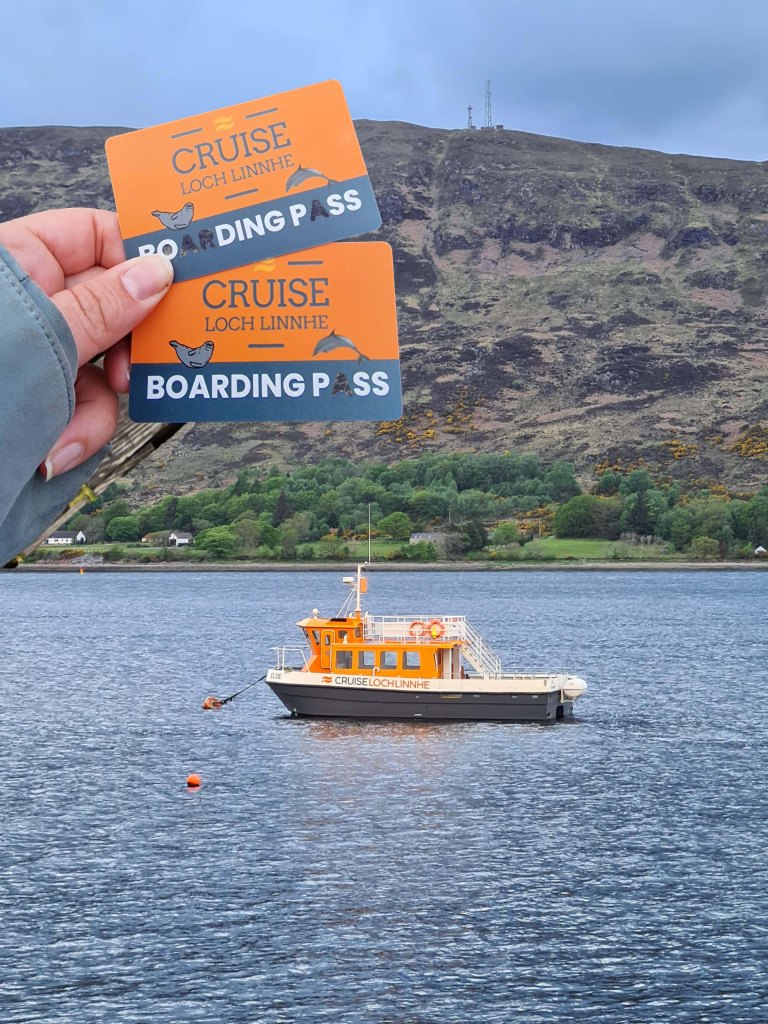
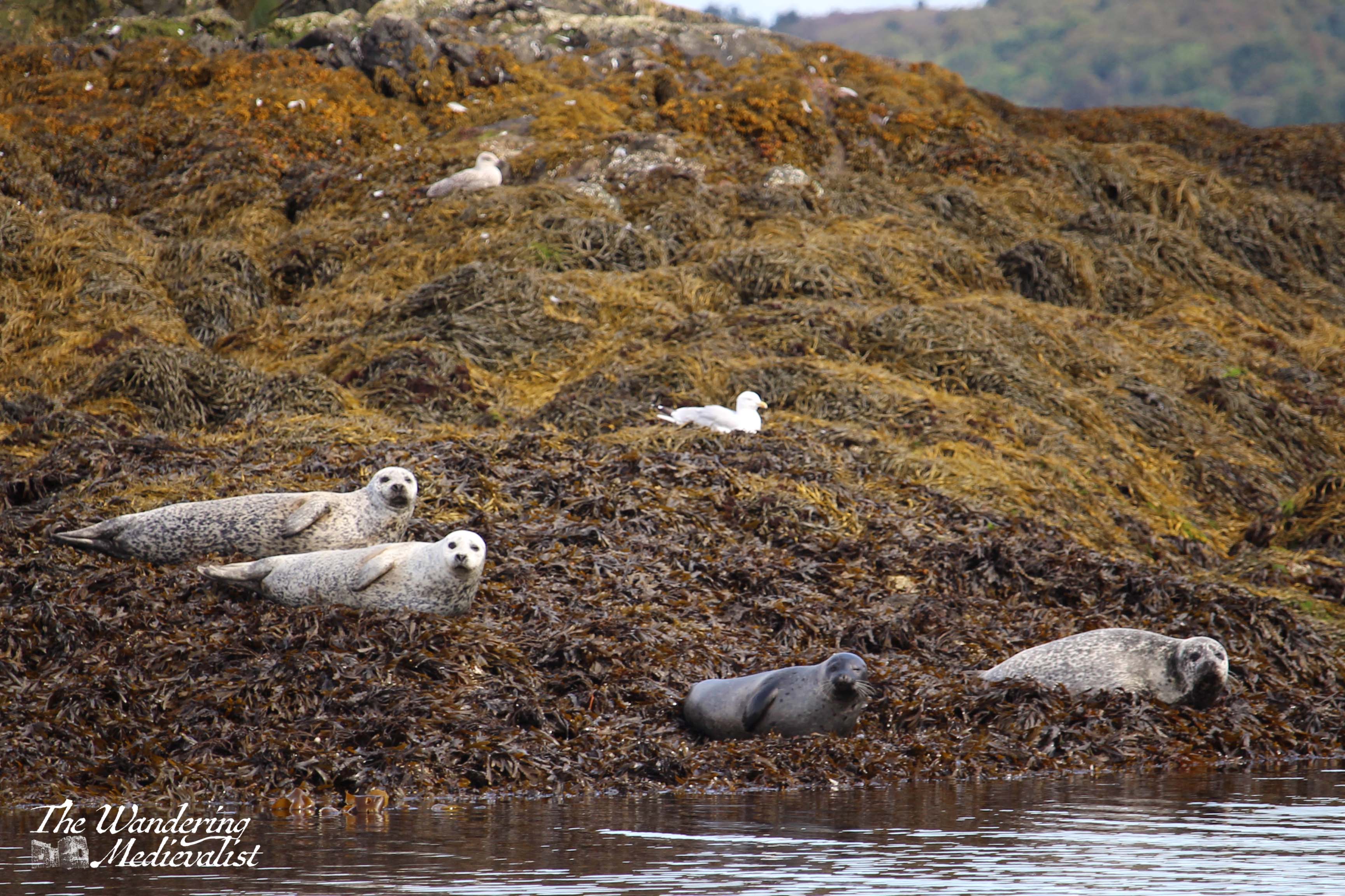
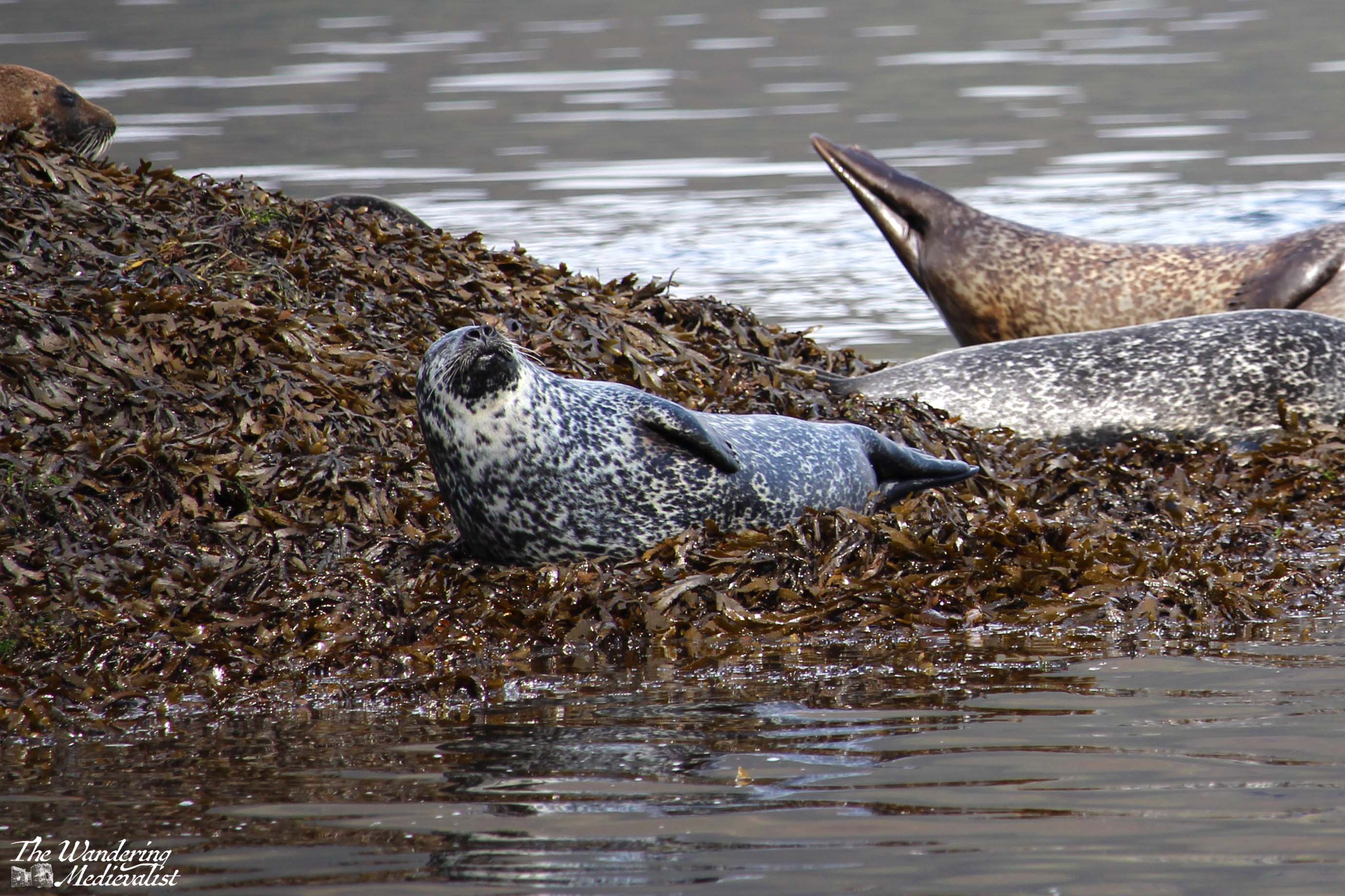
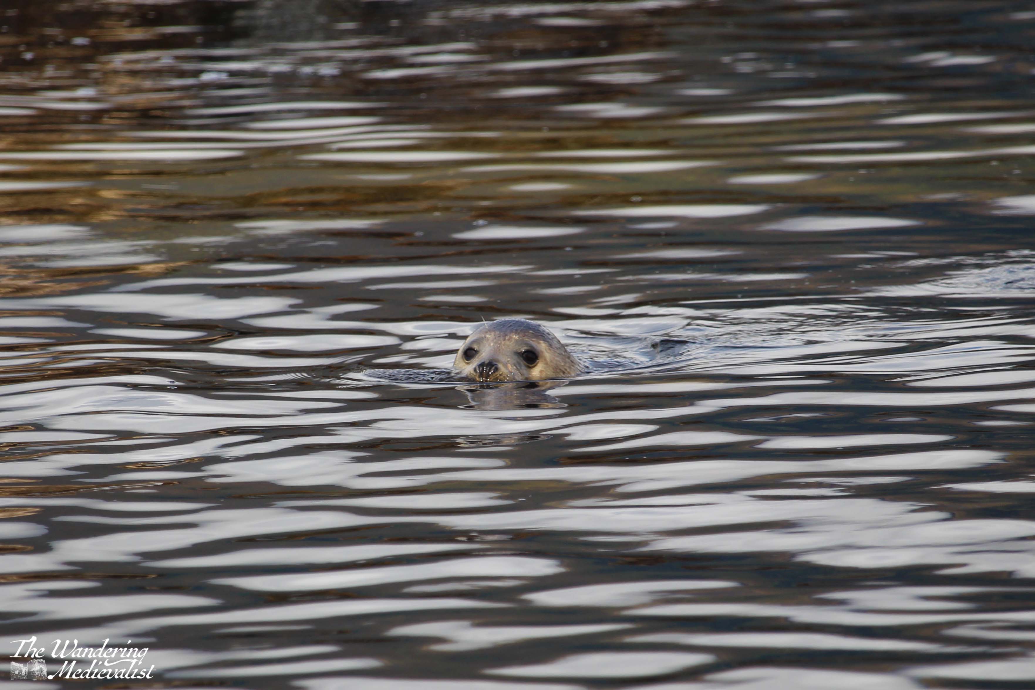
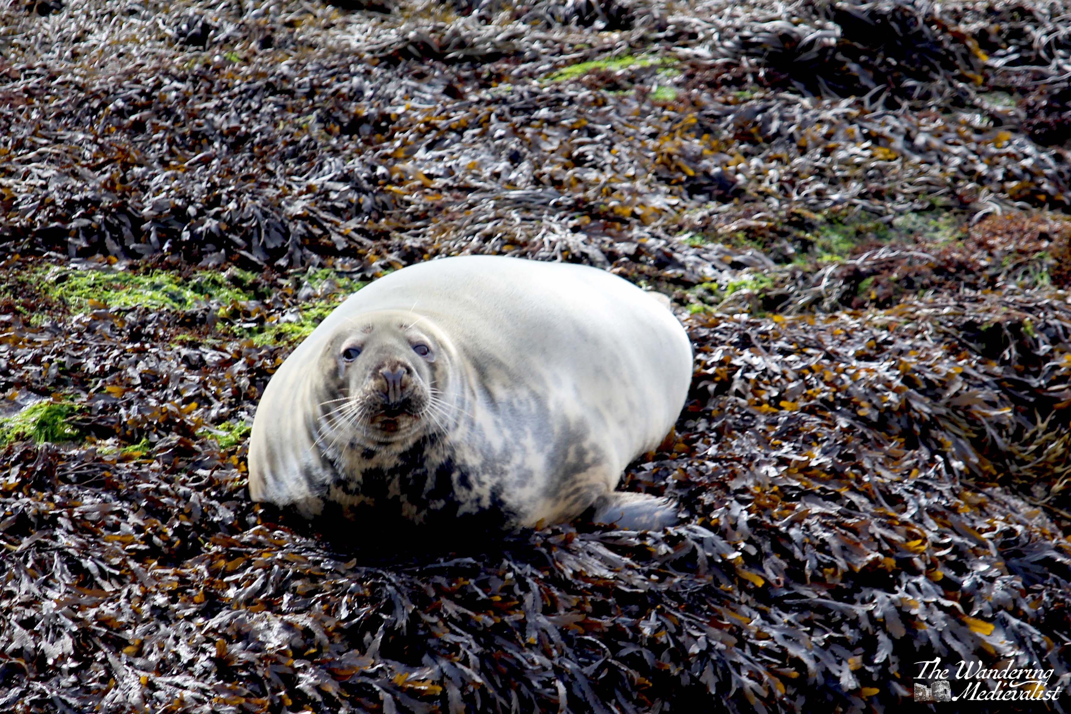
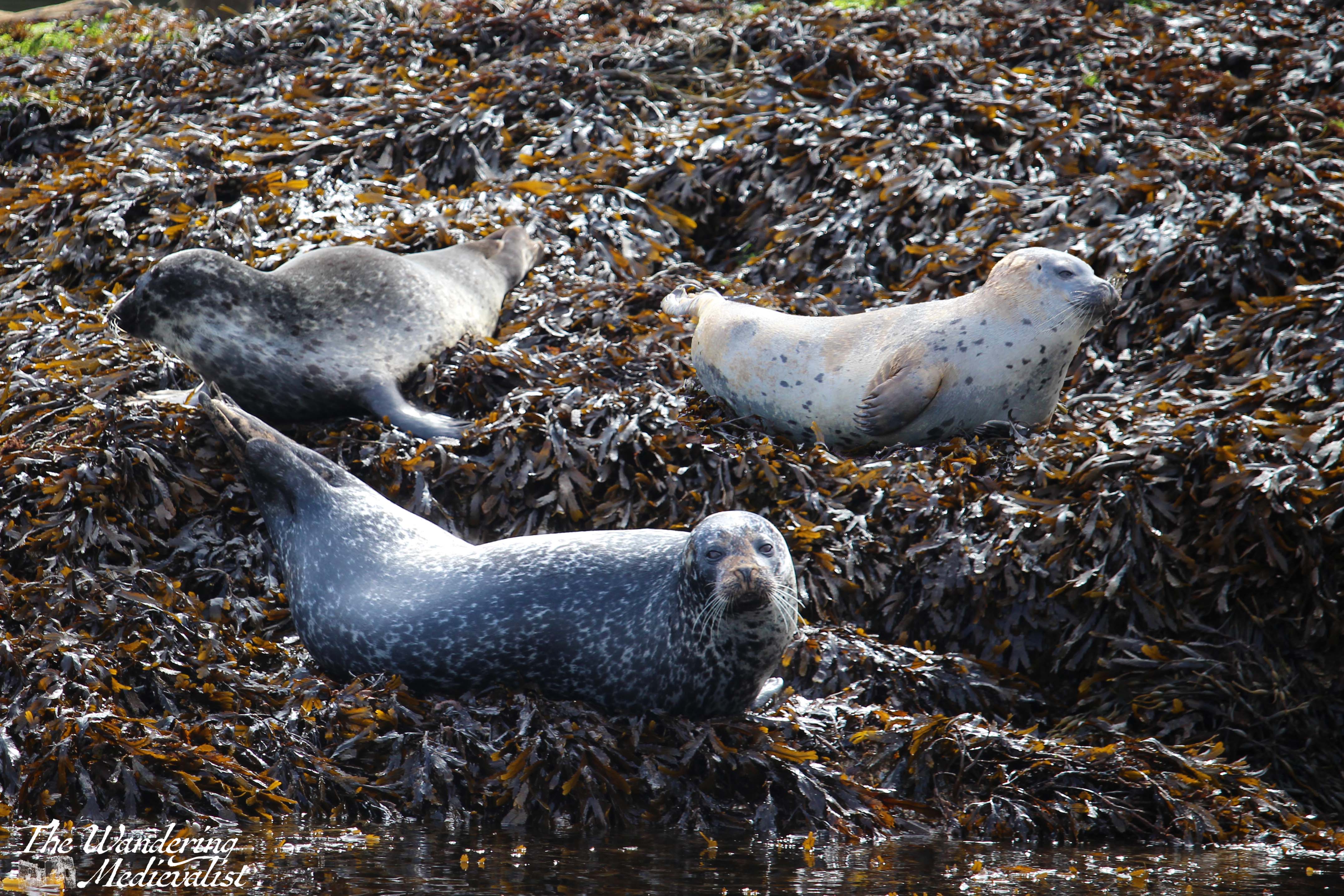
One of the best ways to truly appreciate and experience the views is, as we discovered, to explore the loch with Cruise Loch Linnhe, a tour company that runs a series of cruises from Fort William. They offer evening cruises and even private charters, but also the cruise I have now taken twice: the ‘seal’ cruise, which covers a good portion of the loch and allows one to see not just seals but heron, swans, dolphins, and many other kinds of wildlife.
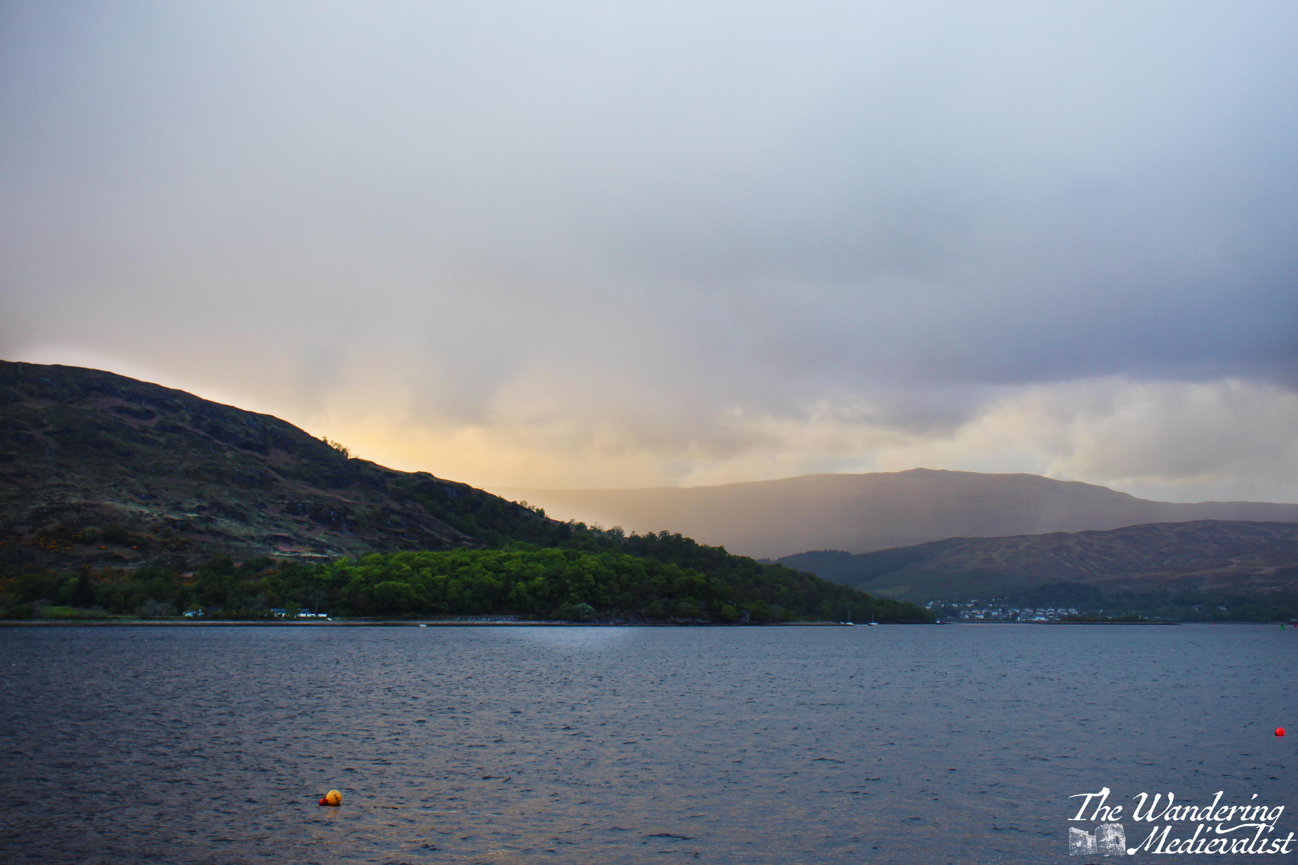
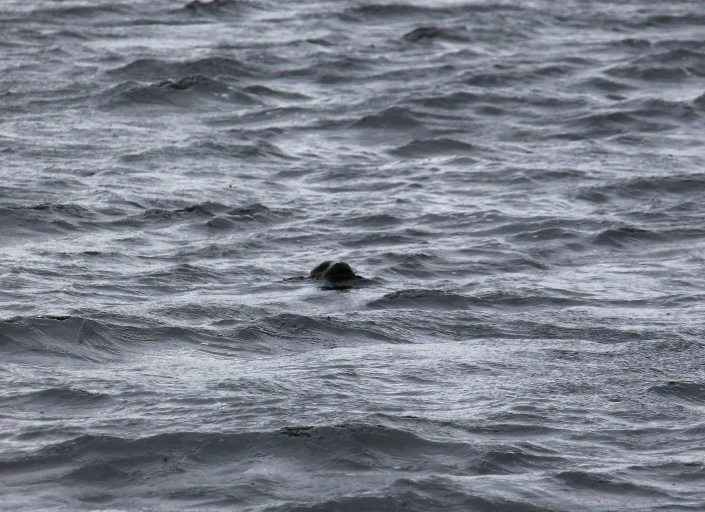
The first time I took the cruise was with Mum in May of last year, and we were not at all lucky when it came to the weather – it poured rain almost the entire time we were on the boat, and we saw only one seal, its head just poking out of the water. Below are the two pictures from May – the night before the cruise, with the rain clouds closing in, and the only seal we saw.
Rain notwithstanding, it was a very nice cruise; the boat is comfortable with plenty of amenities including hot tea and coffee, snacks, and even a whisky or two if you’re interested. I stood just outside the door for a while and tried to get some pictures of the view, but the ones later in the year were so much better I have not bothered to post them here. As I experienced later on, the skippers on these cruises are very experienced and offer a running commentary of information about the area surrounding the loch as well as the wildlife, so it is a good lesson in all things Scottish! My father has always had an interest in boats, and so I determinedly re-booked for later in the summer when he was visiting, and on the second attempt I was rewarded with a much clearer trip.
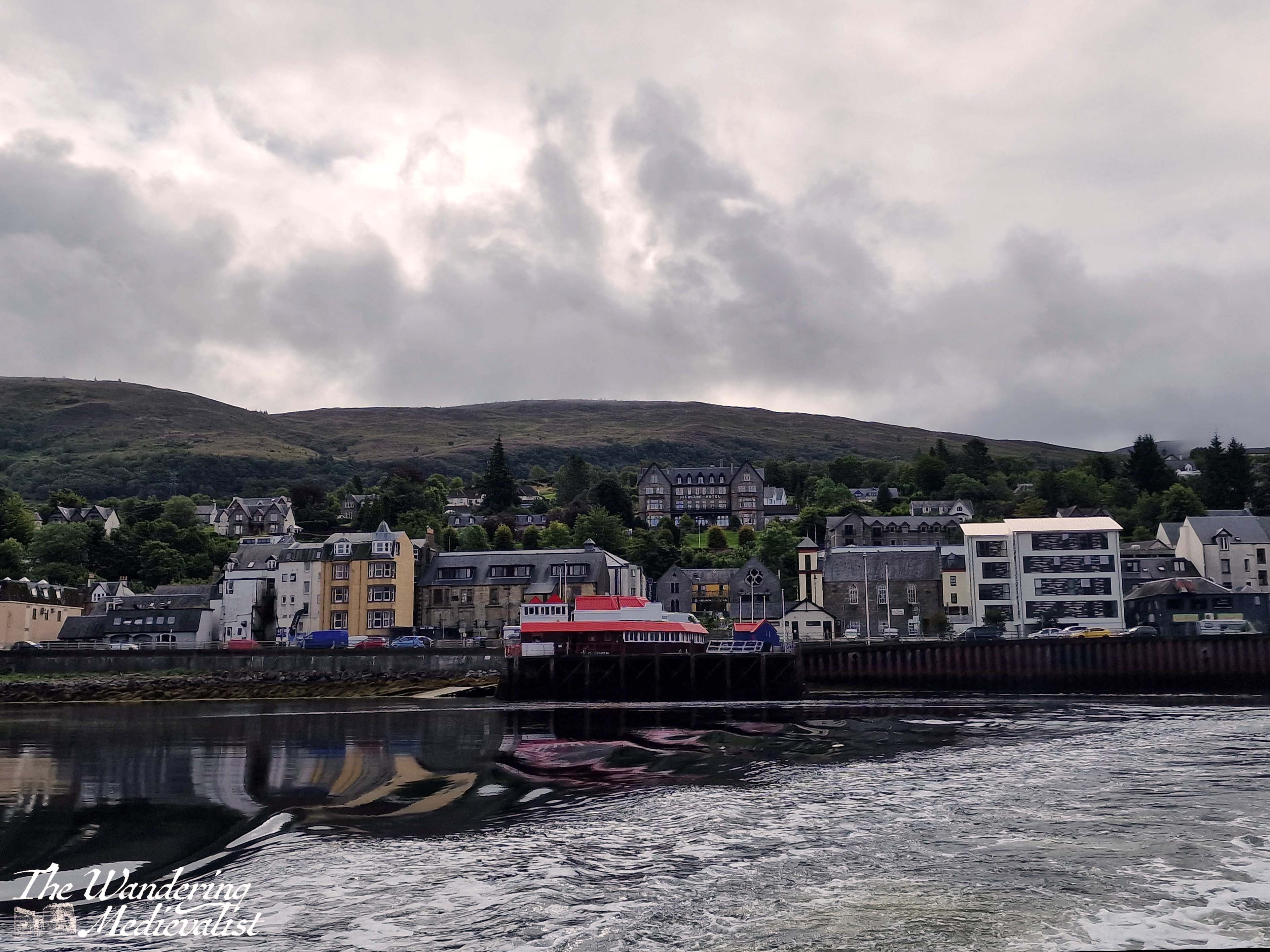
The boat leaves from just next to the Crannog Restaurant, not far from the large car park in Fort William. I insisted upon being first in the queue – or almost first – to board so that I could get the seat I wanted, right at the back of the boat where no one could block my view.
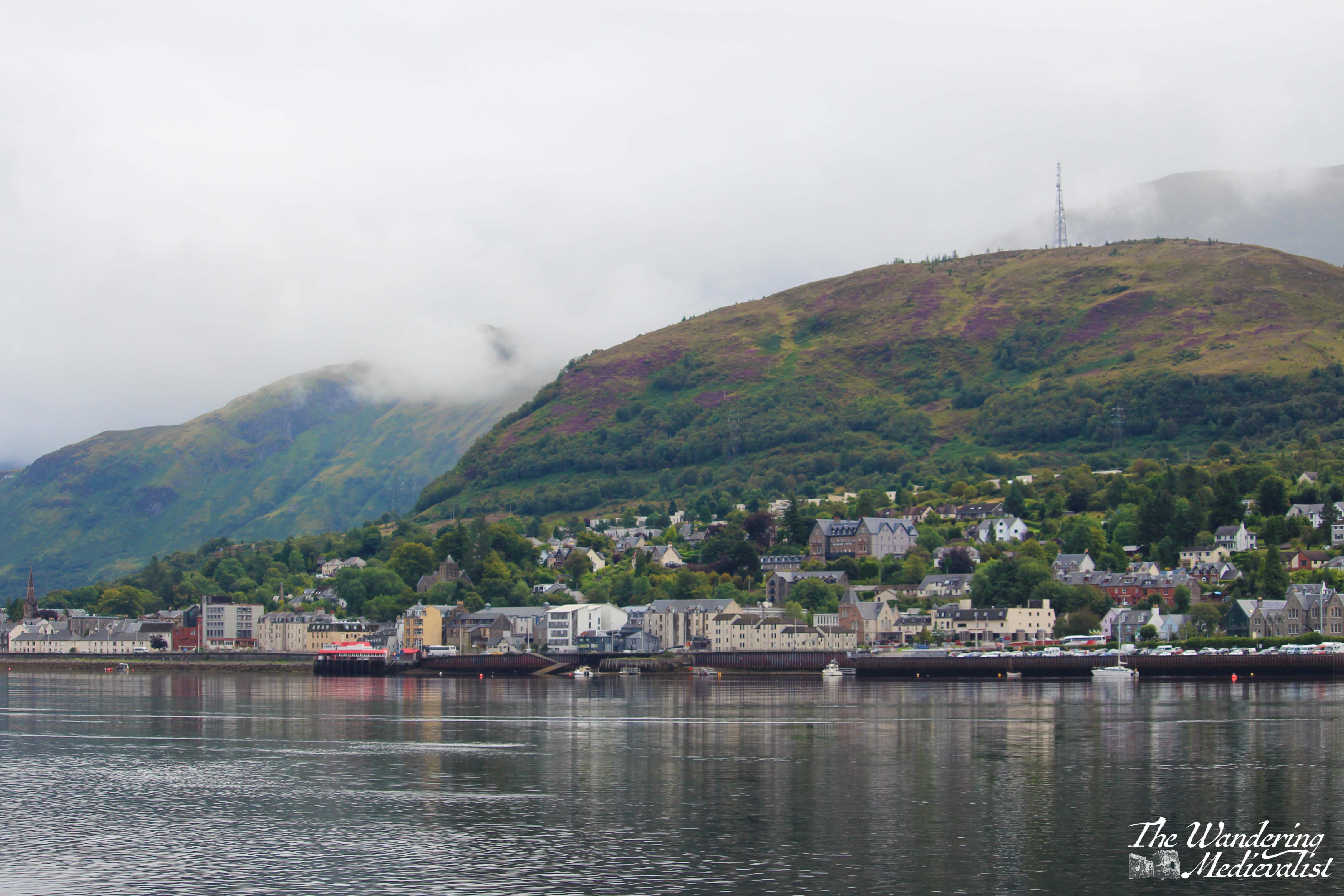
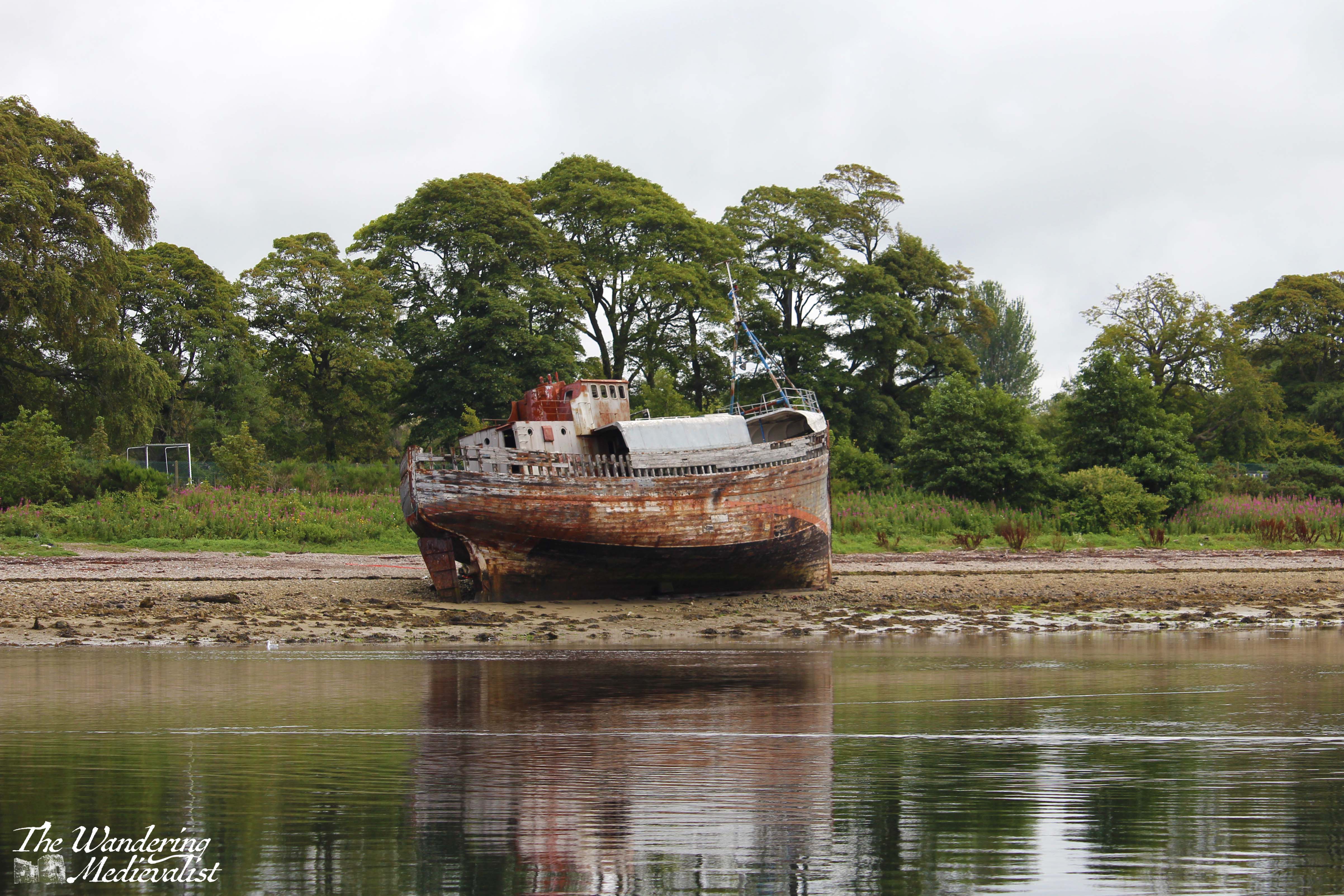
At first, the route of the cruise takes you right away from the quay, roughly north towards Caol, a village almost immediately outside Fort William. Right away you are rewarded with views back towards the town and Ben Nevis, if it is clear; from there the cruise passes Caol and the locks at the start of the Caledonian Canal, as well as the Old Boat of Caol, a shipwrecked fishing boat.
The cruise goes north and west a bit to pass the timber yards which I learned are some of the largest in Europe; it was also on this cruise that I learned that most of the timber grown in Scotland is not high enough quality to use for building, because it grows too fast. So, it is turned into biomass pellets, while the good building timber is shipped in from Scandinavia, where the cold forces the trees to grow more slowly.
Gradually the boat circles back towards the wider loch, passing some lovely homes on one side, and bird-covered small islands on the other – the clouds started to clear slightly so I was able to see the start of Glen Nevis.
From here, the cruise hugs the west side of the loch across from Fort William, where there is a series of small farms – including one with alpaca – as well as salmon and mussel fisheries. Side note, it was during a trip to Fort William that I had some of the best mussels of my life, and this is from a New England girl!
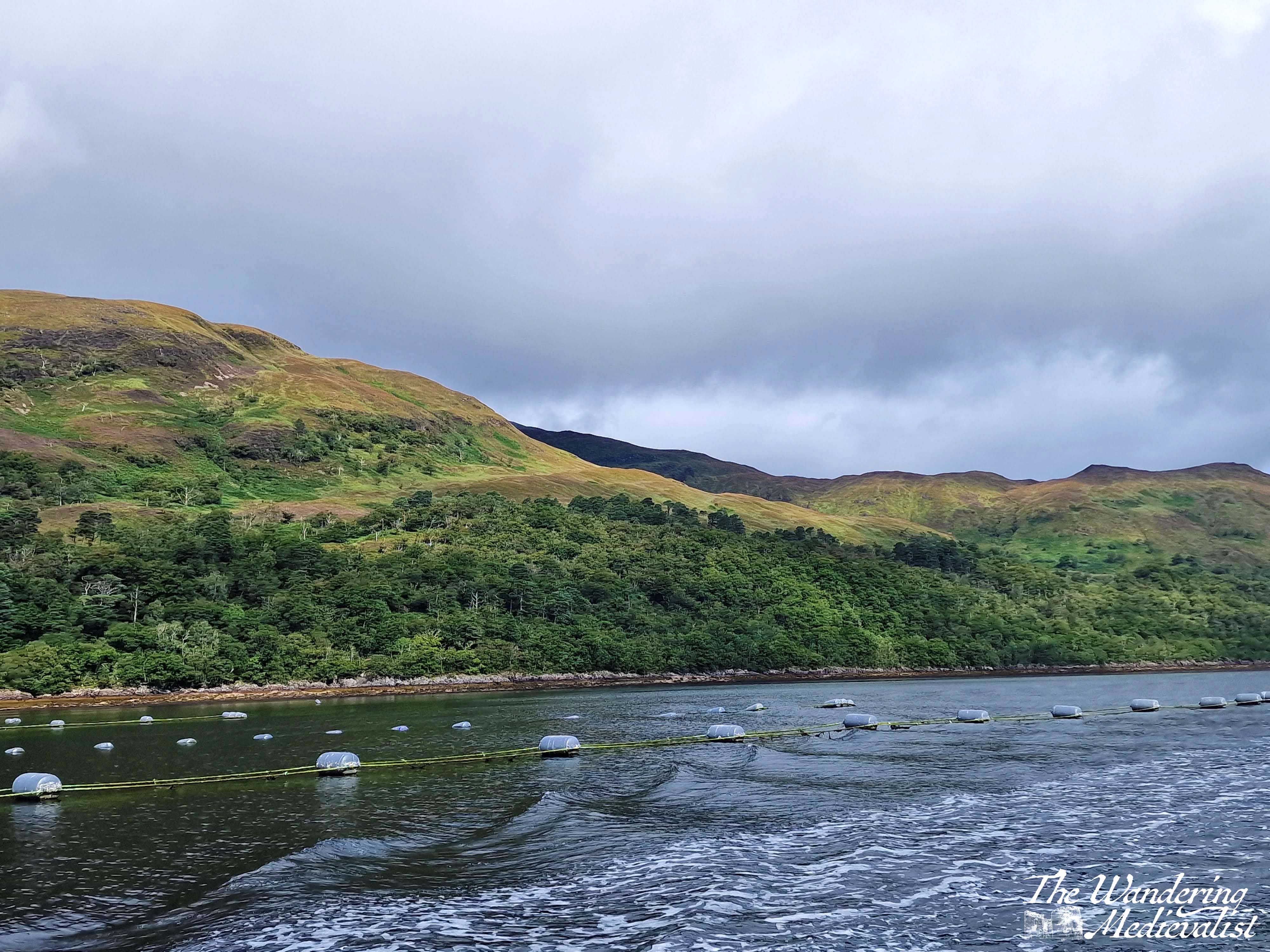
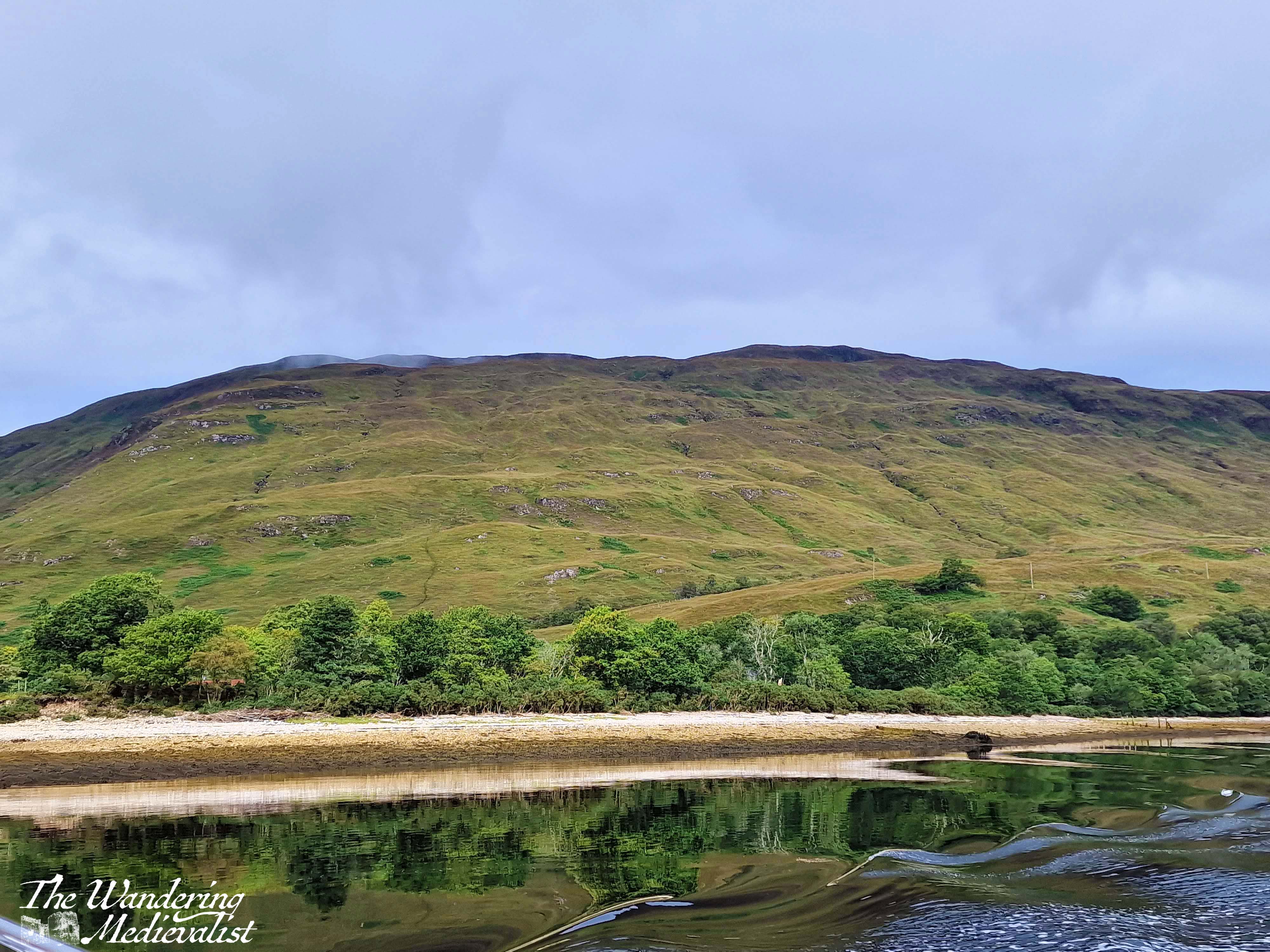
I became fascinated by the way the hills are split by crevices in which streams must flow downhill, and eventually meet the loch – very dramatic. We also learned a great deal about the ecological problems with salmon farming, and the impact it was having on the loch (this article linked here is very staunchly anti-farms, but then after hearing the skipper talk, so was I).
As we headed south, the boat moved more into the middle of the loch, allowing for stunning views westward along the glens and mountains that are sparsely-populated and quite difficult to access without the use of the Corran ferry.
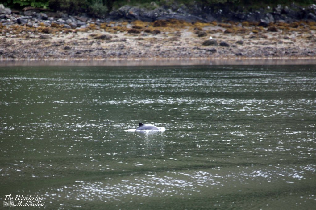
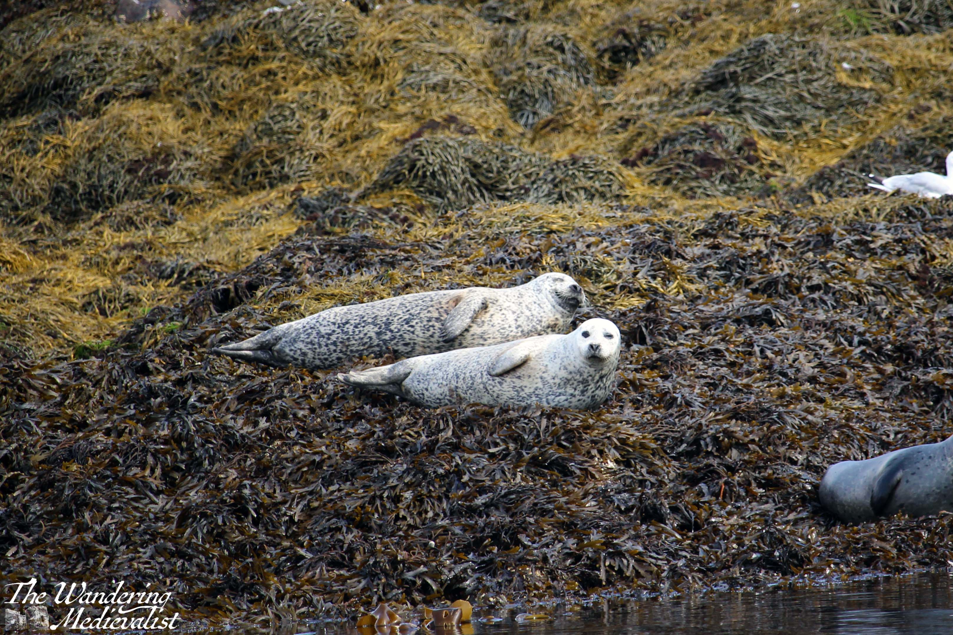
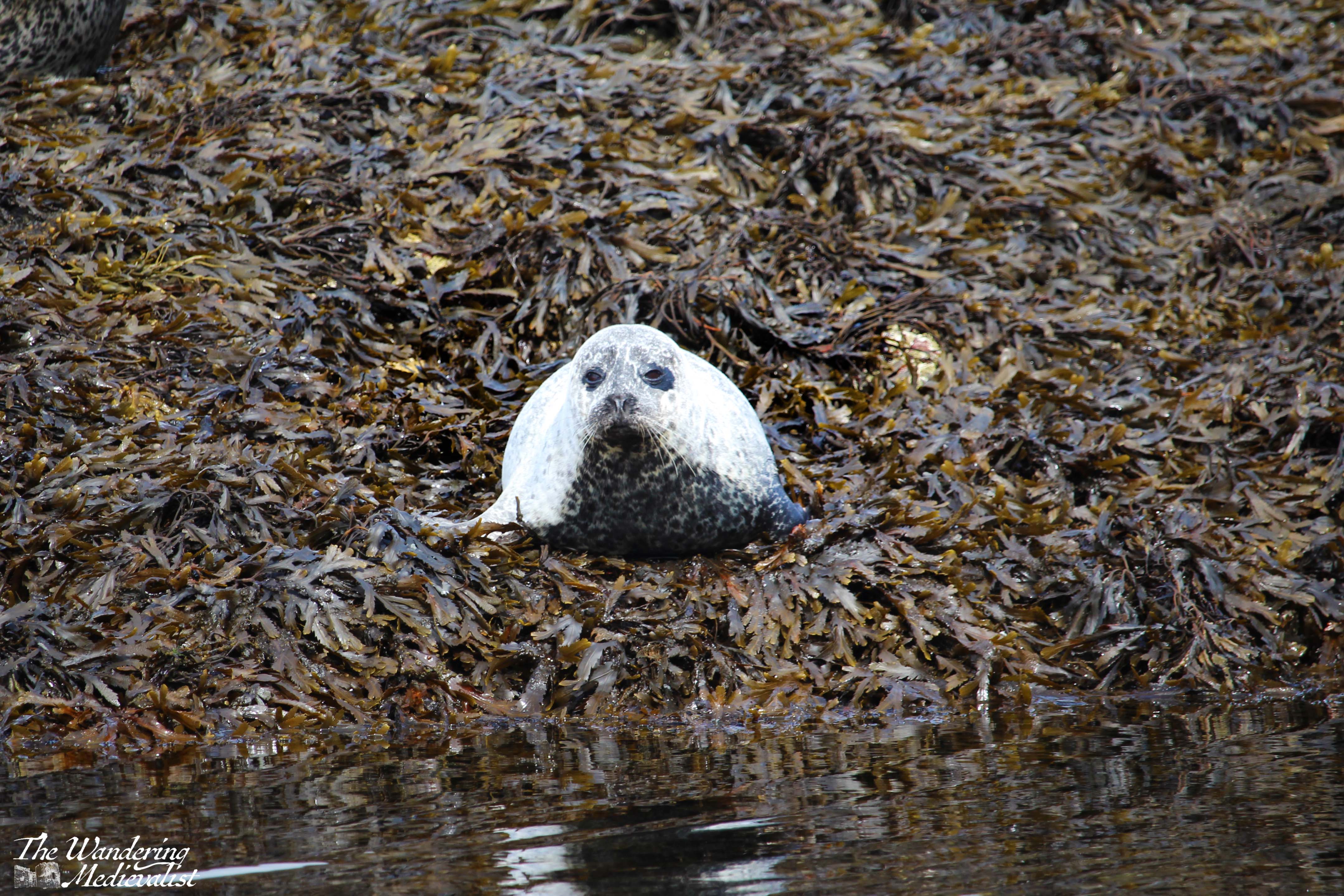
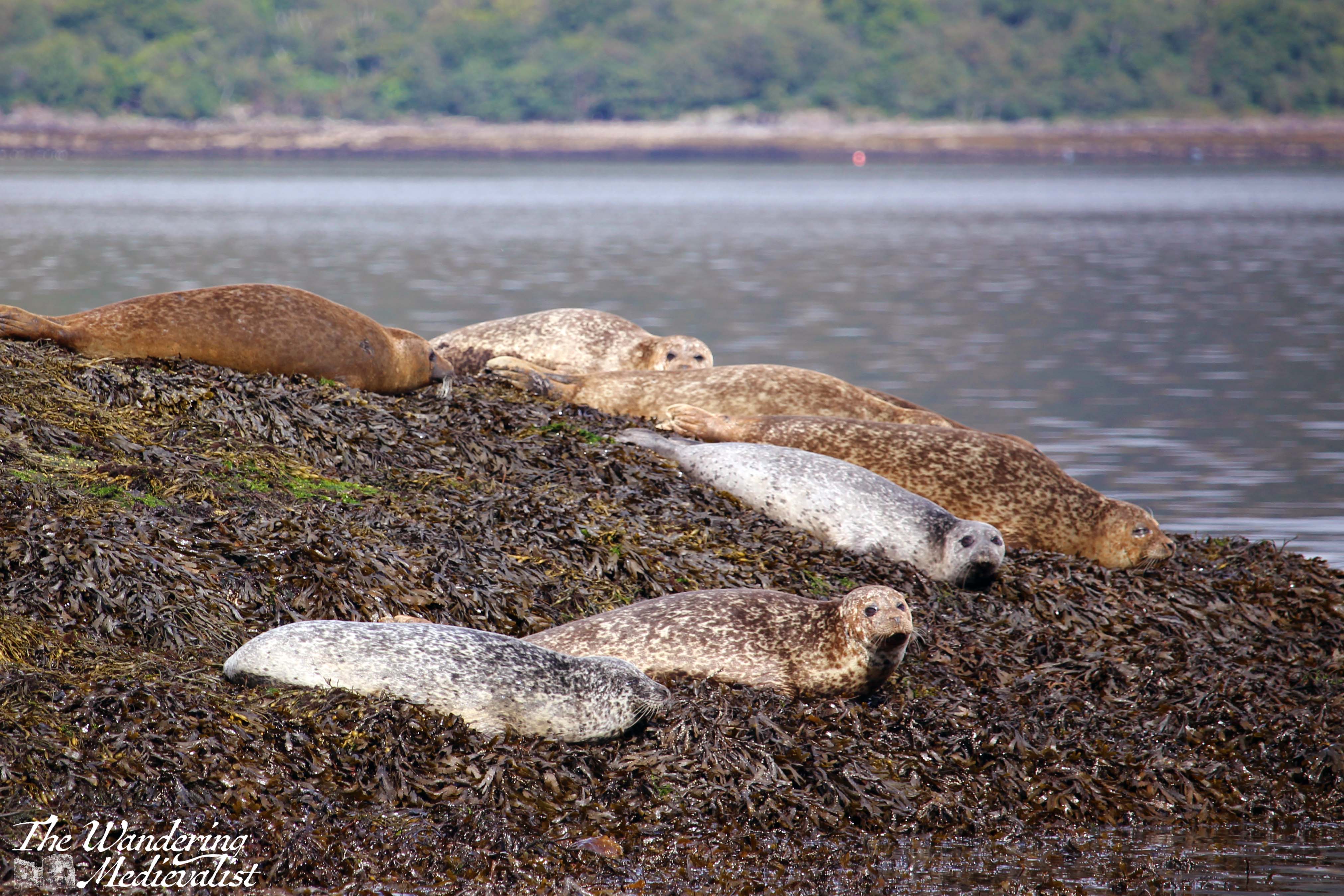
Then we circled around towards the other side of the loch, passing a small pod of dolphins – this was the only clear picture I got – and heading towards the tidal rock where the seals rest – the pièce de résistance.
We were given very strict and serious instruction about how to behave. Clearly incredibly experienced, the skipper lectured us on remaining quiet and still, as if we scared a young seal pup it might get lost and end up separated from its mother permanently. With the horror of potentially causing young seals to suffer fresh in our minds, the whole boat full of people prepared with cameras at the ready and children sufficiently chastised. The skipper turned the motor down and allowed the current to push us closer and closer, circling the seal rock.
Even if I had been allowed to speak I do not think I could have – it was positively breath-taking to be so close and see the faces of the animals as they watched us pass by. I took more than 200 photos but here are the best – there were smiles, frowns, and general showing off by the amazing array of common and Atlantic grey seals.
The hush that had fallen over the boat remained as the skipper slowly moved us away, back north towards Fort William, and I managed few more spectacular views of the seal rock and the loch behind it.
After this kind of experience, it was a bit of a let-down to return to dry land. But, it made me that much more determined to try the cruise again with Mum the next time she is here, and to go with the other half some time as it really is a spectacular way to see the loch. There are currently plans to go again in a few weeks, and I am looking forward to another exciting trip. Finally, here is the view from the back of the boat as we headed south – Ben Nevis is just topped with cloud on the right:
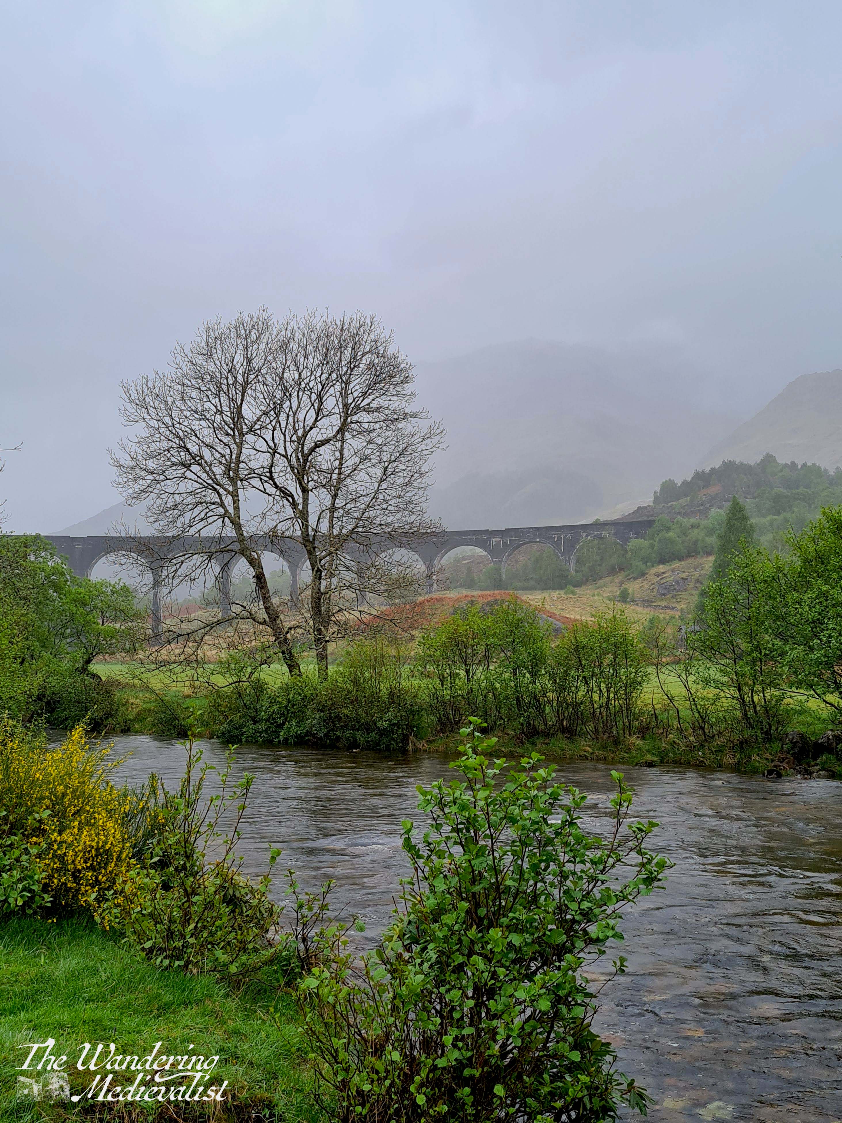
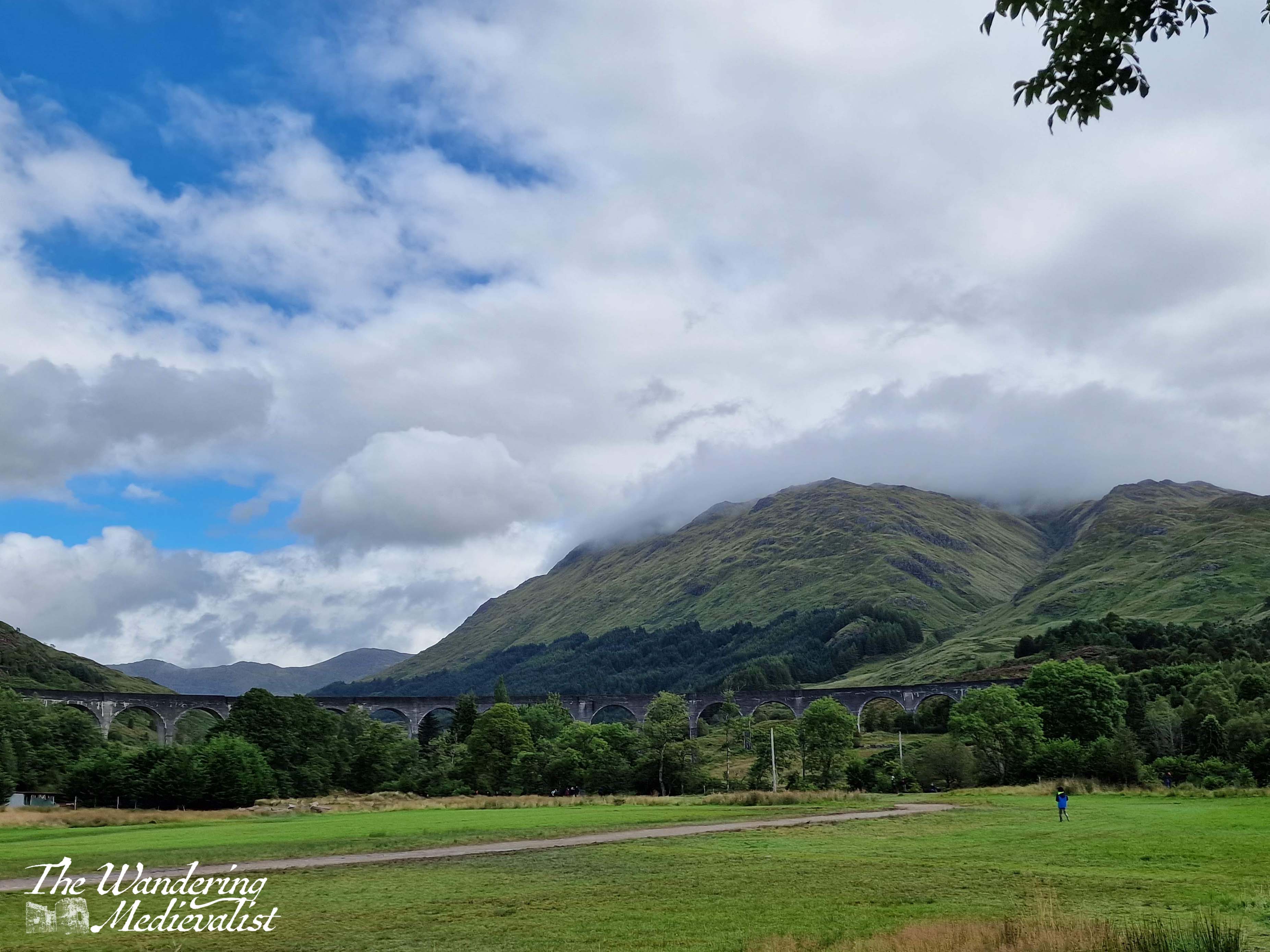
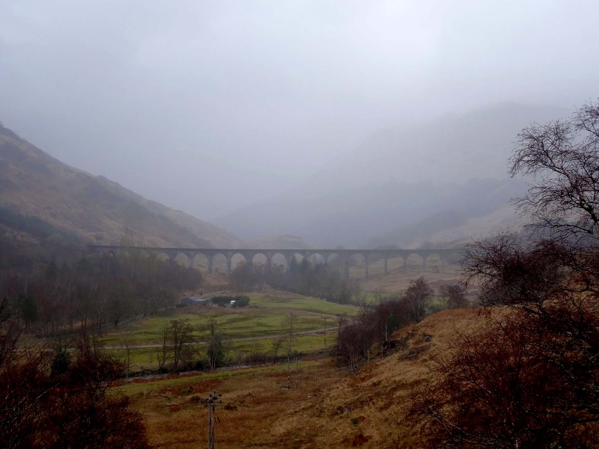
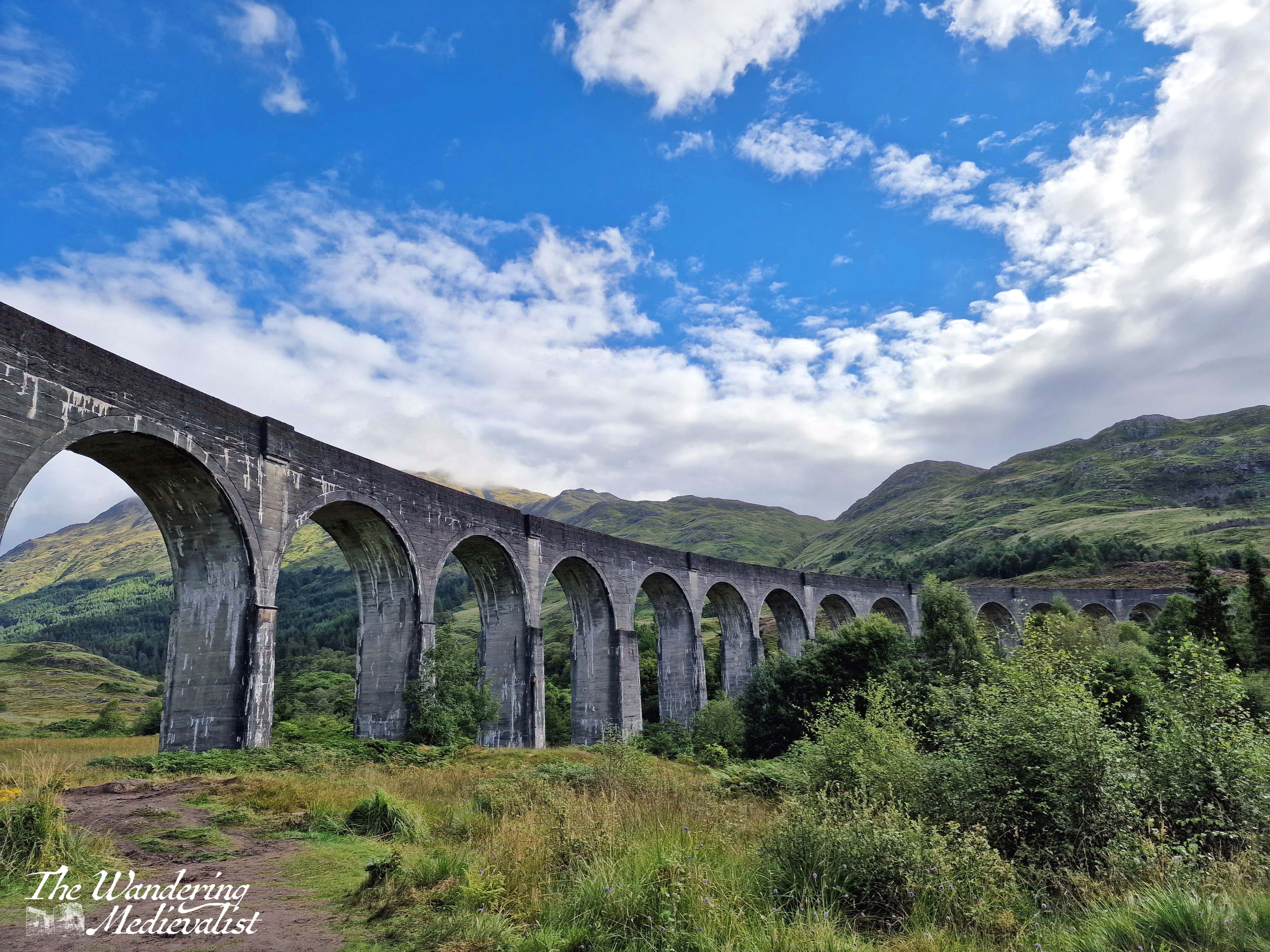
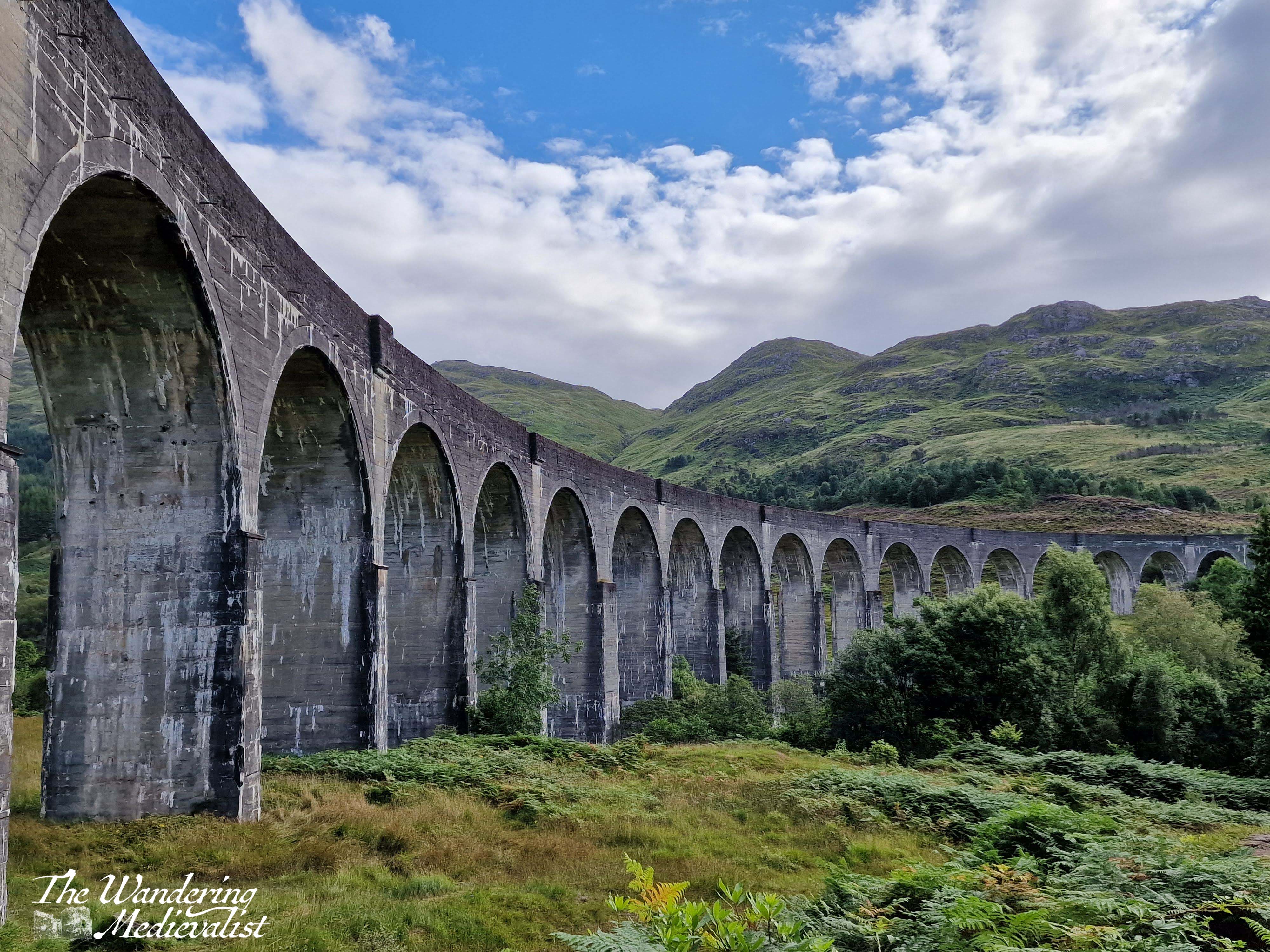
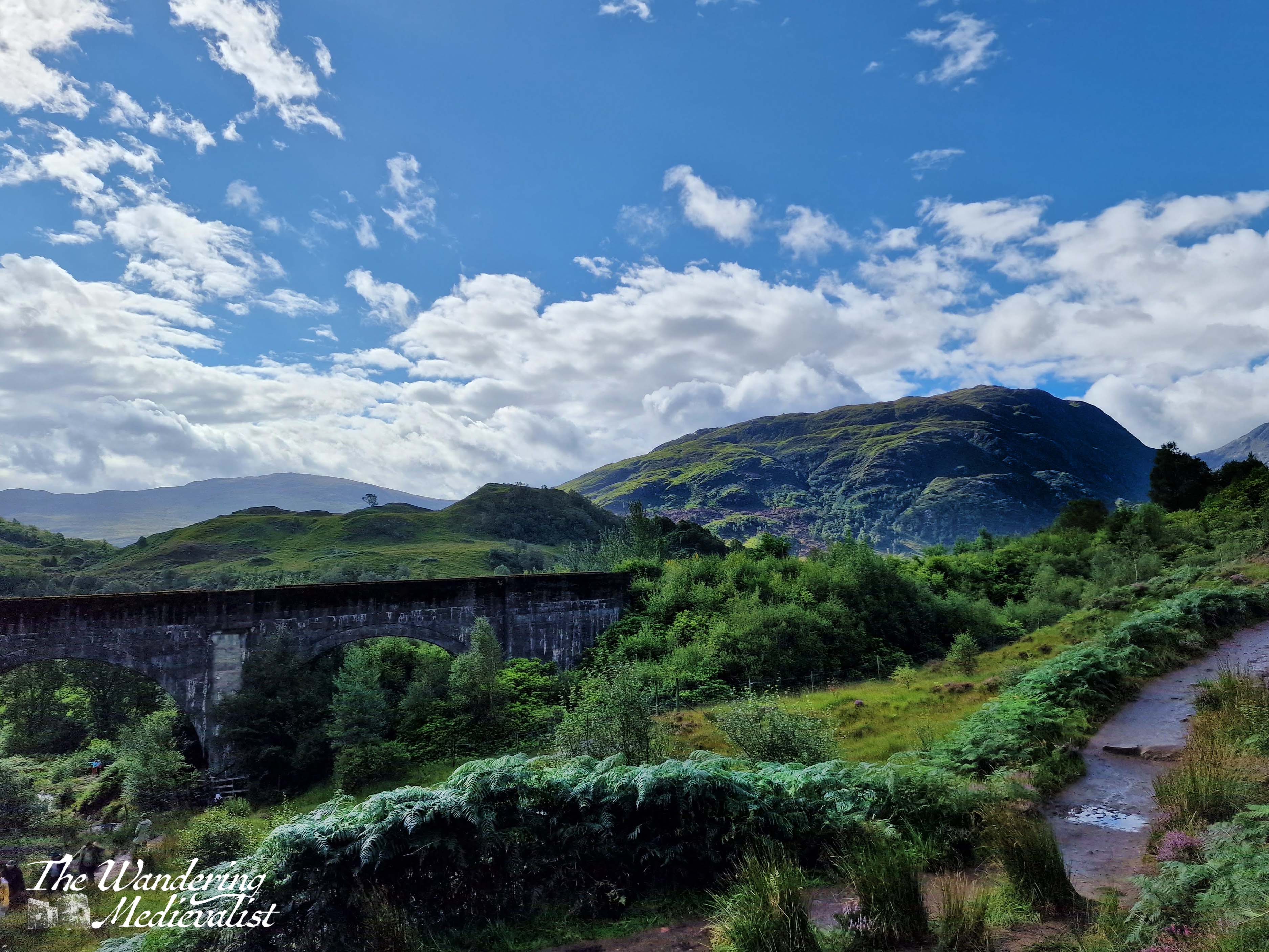
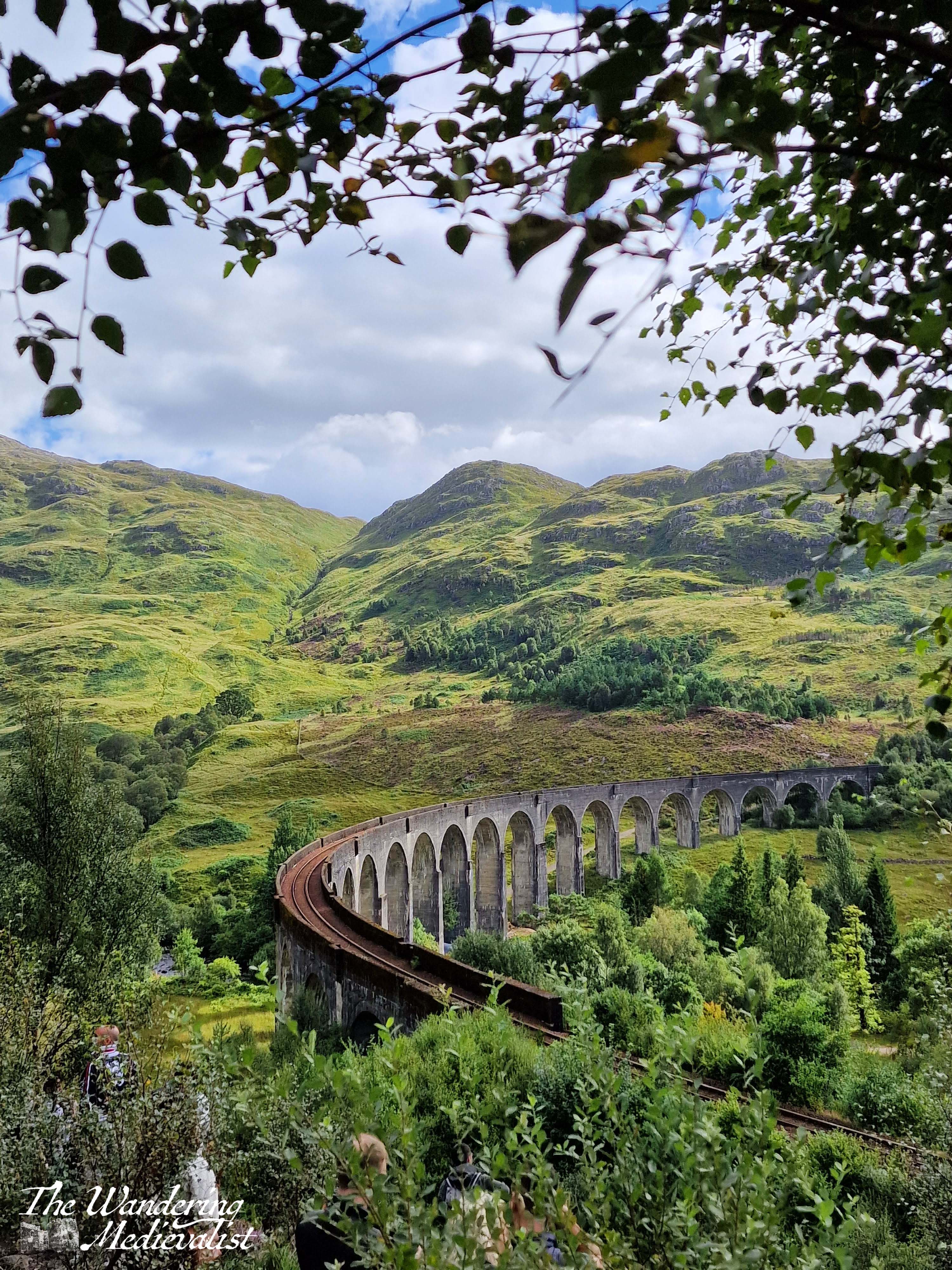
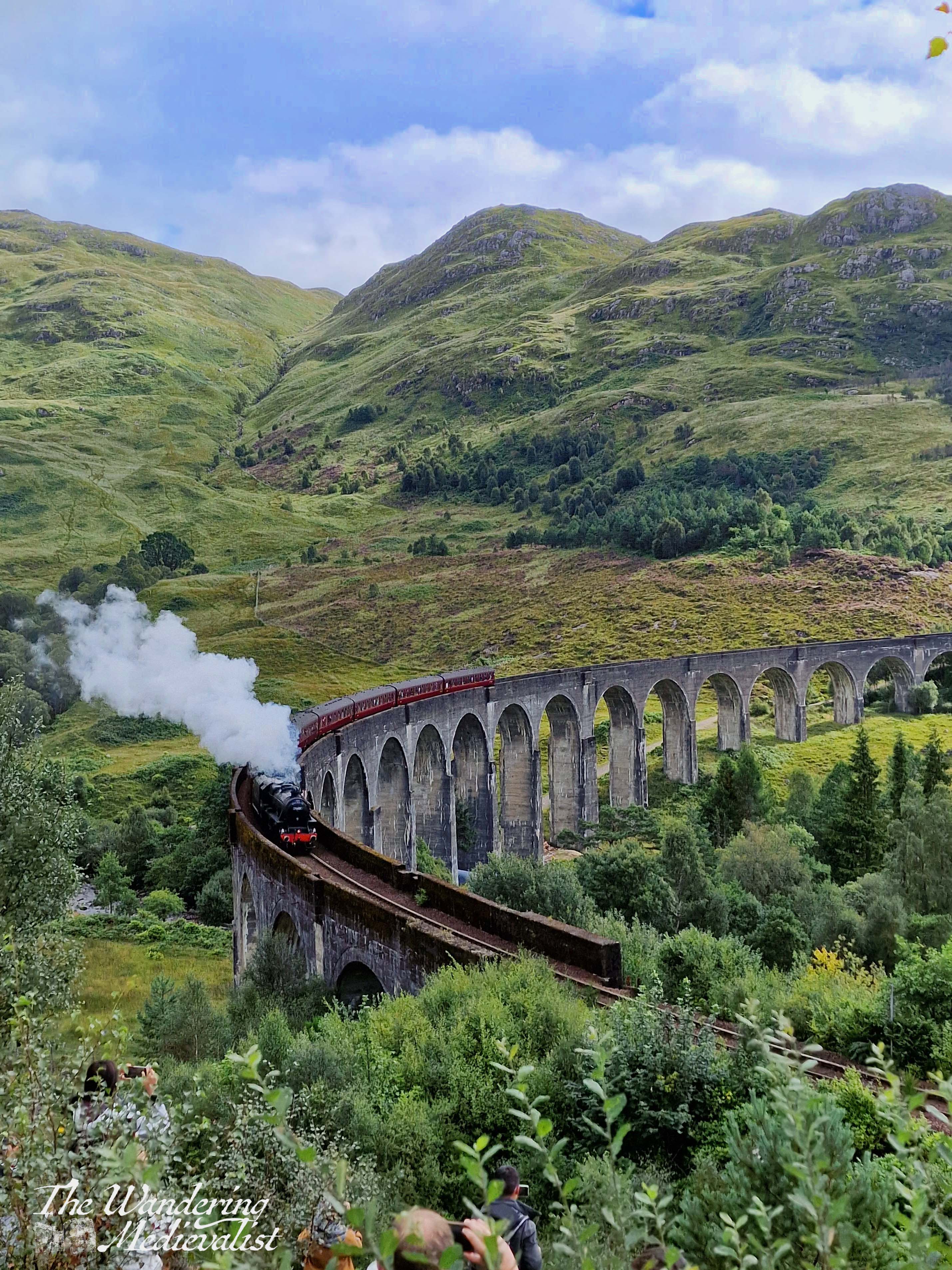
Whether you are a lover of Harry Potter, Jacobite history, or Scottish hills and lochs, this trail that starts off under the famous Glenfinnan viaduct and skirts the edge of the hills to come down alongside Loch Shiel is not to be missed. Even on a dreary rainy day, the stunning viaduct cutting across the valley is atmospheric and impressive, while in the sun and awaiting the famous Jacobite Steam Train, it is breath-taking.
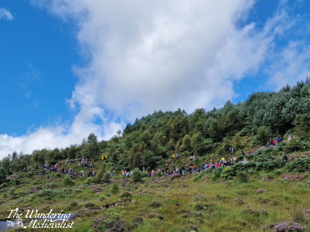
My most memorable visit to Glenfinnan came last summer, when my father and I were spending a few nights in Fort William and I managed to convince him that this walk would have good views. We honestly did not even check the train schedule before leaving, but managed to arrive at the parking lot about twenty minutes before a train was due. We joined in the masses of people excitedly scurrying up the hillside – many very unprepared for such a climb – to get a good view of the famous train.
But I get ahead of myself – firstly, I should point out that the size of the car park here has expanded significantly since my first visit in 2017 and now is no longer free (£3.50 as of writing except for National Trust members). There is a substantial gift shop and café, catering to the bus-loads of tourists who stop here on their way to Mallaig. There are also two viewpoints; one, which we took in the pouring rain in 2017, is much shorter but provides a good view both over the viaduct and the Glenfinnan Monument and Loch Shiel. This is a good option if you are in a hurry.
The period of the Jacobite Rebellion is a touch too modern for my tastes – it is all relative – but one can hardly study Scottish History and live in this country without picking up pieces of the story. It has echoes of the American Revolutionary War tales you hear everywhere in the Boston area – hearty, brave rebels fighting against the evil English. The truth of the history is, as always, much less black and white, but that is not the purpose of this post.
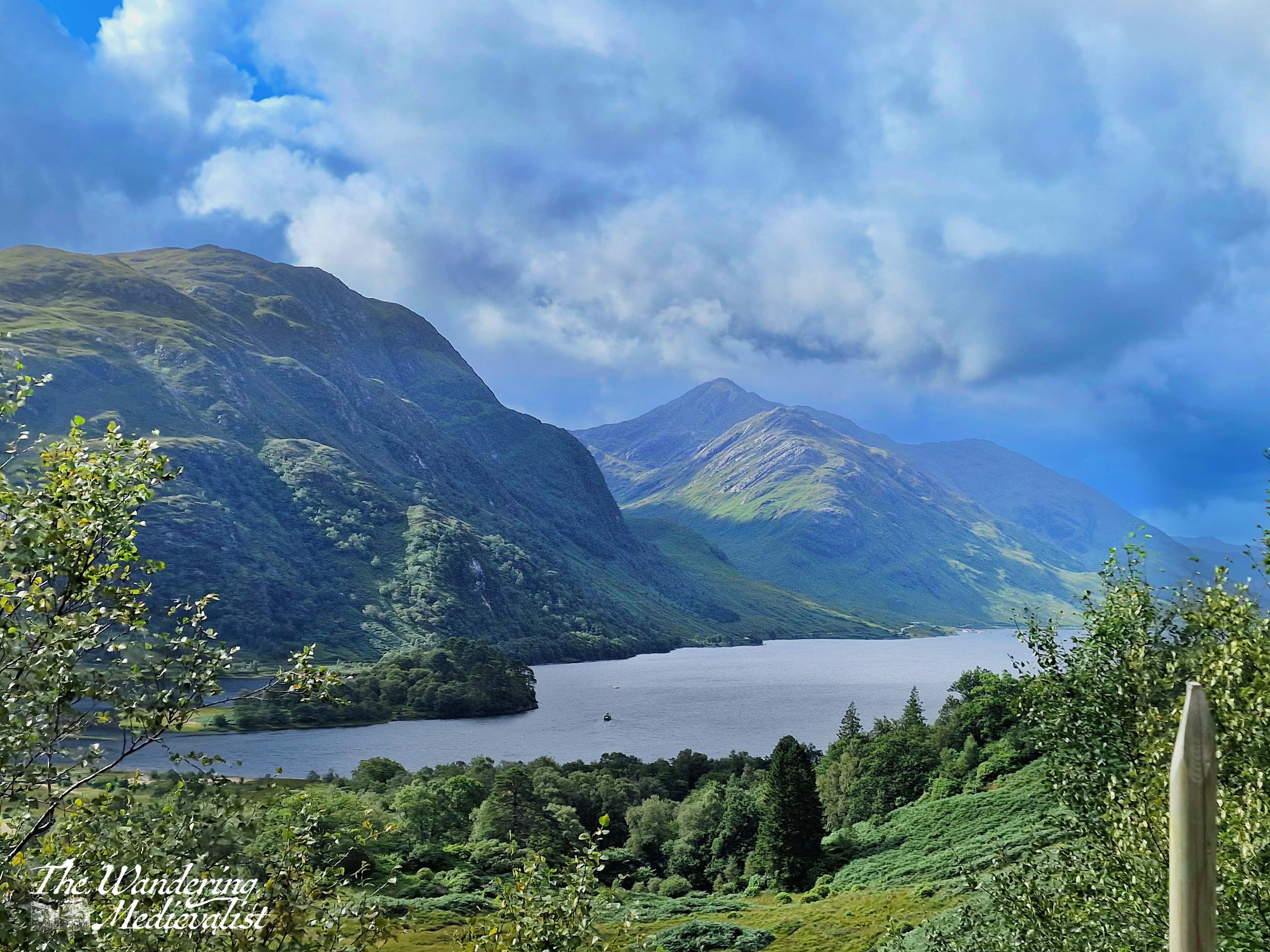
The Monument itself – a viewpoint and tourist attraction long before the viaduct appeared in Harry Potter – marks the location where Prince Charles Edward Stuart (Bonnie Prince Charlie) first raised his standard in 1745. It was the start of the doomed eight-month campaign that would come to a catastrophic end on Culloden Moor in April 1746, so one can understand why this area would hold a special place in Scottish history. The scenery is certainly evocative, with deep valleys cutting through rugged mountains that plummet straight down into the loch.
The second viewpoint is harder to access but also falls along the viaduct trail. Once parked, visitors can follow a well-kept path, skirting the edge of a burn, and moving slowly closer to and eventually under the massive viaduct. It was built between 1897 and 1901, to complete the extension of the West Highland Railway from Fort William to Mallaig. Side note, Mum and I rode this train some years back, but crossing the viaduct on the train is nowhere near as fun as walking beneath.
On the day Dad and I climbed, I quickly realised a train must be due, as I had never seen so many people crowded on the side of a hill in the Highlands before. The path is quite steep in places as it climbs the side of the hill, and I was impressed by the number of determined tourists in sandals, dragging young children behind them.
I convinced Dad to stop and wait, and sure enough, about ten minutes later, we could hear the distant train whistle, while the excitement in the crowd became palpable – and noisy. The first sign of the train was the steam, then it came creeping around the corner, blowing its whistle. The view was second to none, really, and I managed both still pictures and a bit of video, which I will post at the end. Frustratingly I missed the small child sitting on his father’s shoulders shouting out, “Avada Kedavra!” at the train. Not sure if the excitement got the better of him and he mixed up his spells, or if he is just a very dark child…
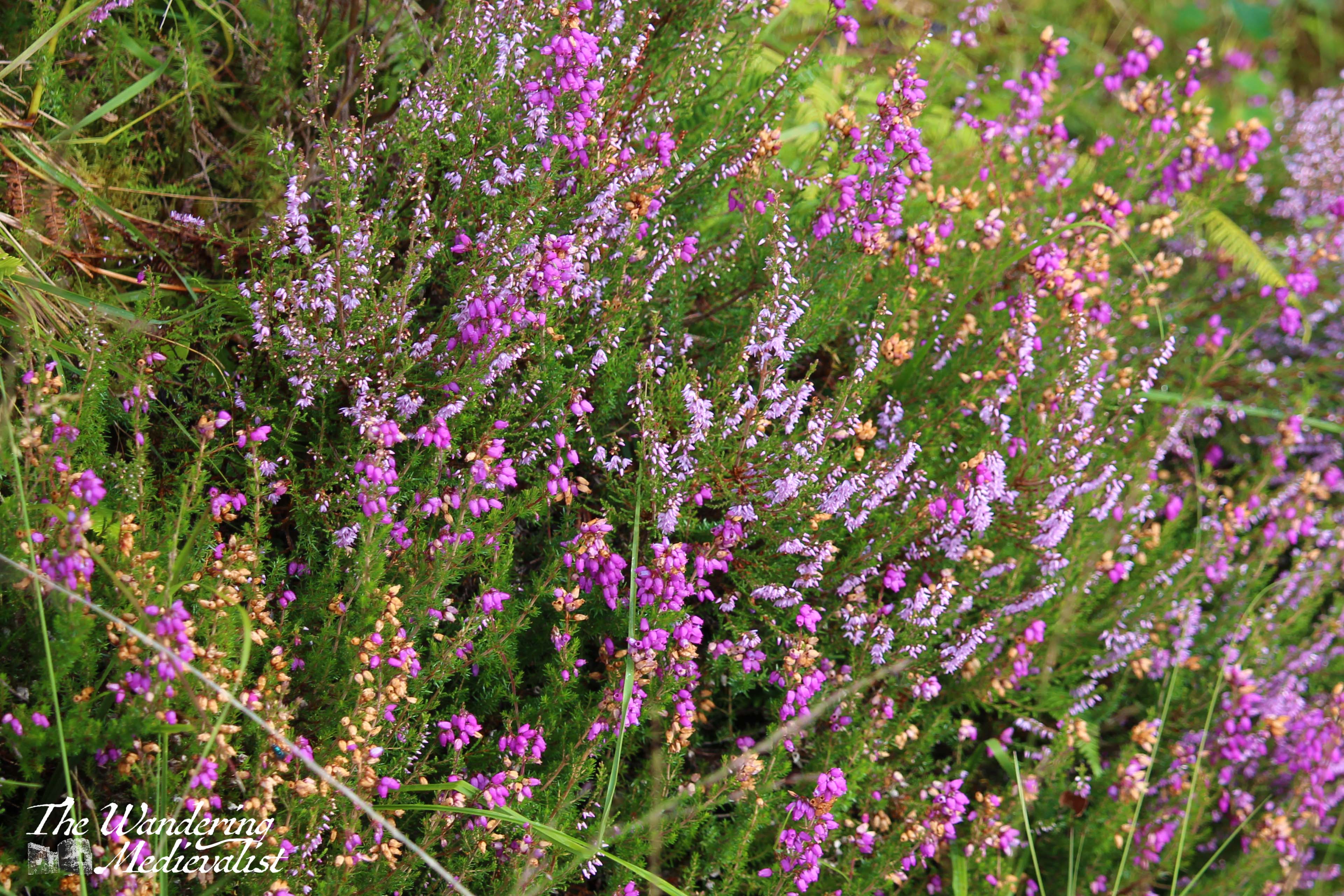
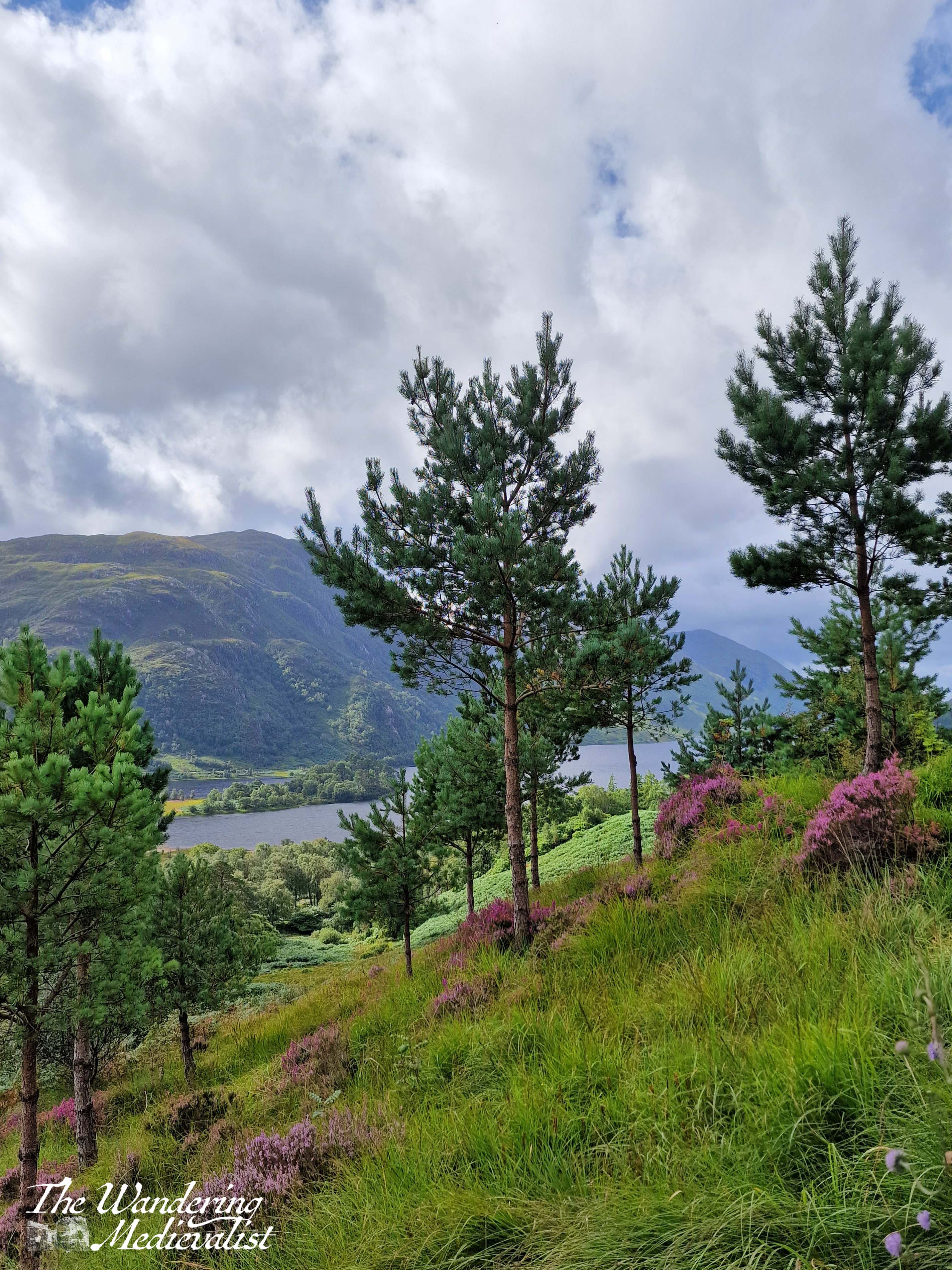
In any case, as the train moved on we moved against the foot traffic, further up the hill and following the path around the corner. For the most part the trail continues along the hillside with a few ups and downs, but with excellent views back to the viaduct, down to the Monument, and along Loch Shiel. It was a relatively busy path and narrow in places, forcing us to move to the side into the heather and ferns at the side of the path; I found myself grumbling slightly about proper hiking etiquette – or even just general courtesy – but only after being poked by some thistles as I allowed a large group of foreign tourists to pass.
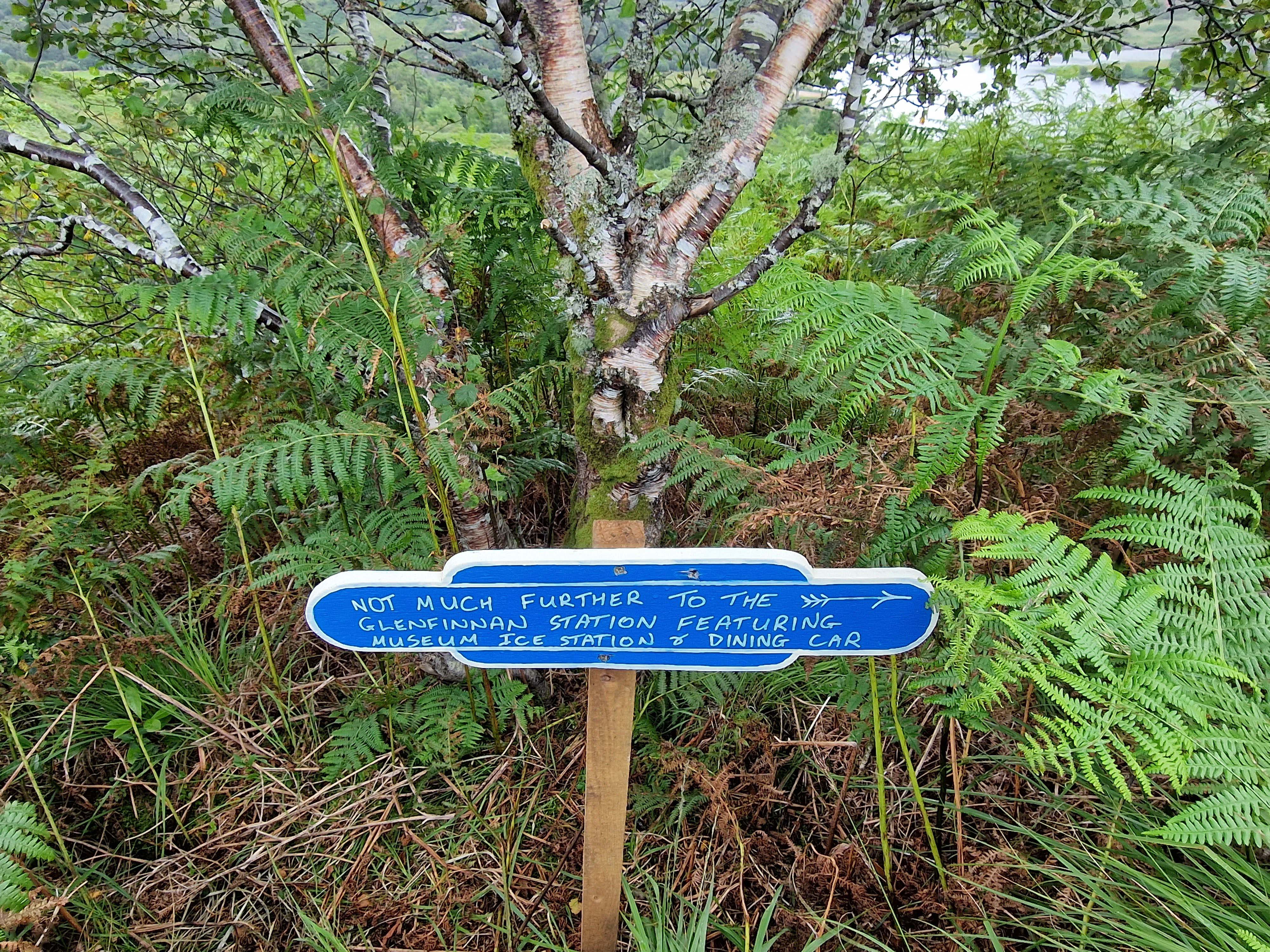
There are several more truly impressive viewpoints before the trail turns left and starts descending into the trees and back towards the loch shore. After a relatively short time, the path reaches Glenfinnan Station where there is a Museum and, as we learned, an option to purchase ice cream, at least in the summer. We took a short rest on the benches, enjoying the atmosphere of the station, before continuing on our way.
From here, most of the walk is on quiet roads, but there are a few excellent points to view the loch before one finally returns to the Monument and gift shop. I recall stopping in for a coffee and a truly excellent piece of millionaire’s shortbread before getting back into the car. It is worth observing that the times of the trains crossing the viaduct are posted both in the car park and online, so if this is the goal for your trip, it is well worth checking and positioning yourself in a good spot. I was lucky to visit on a spectacular sunny day as well as in the rain, and even without a particular affinity for Harry Potter or Jacobites, I found it a rewarding and even moving place to visit. If at all possible, though, avoid the height of summer unless you enjoy fighting your way through crowds of tourists woefully unprepared for a climb.
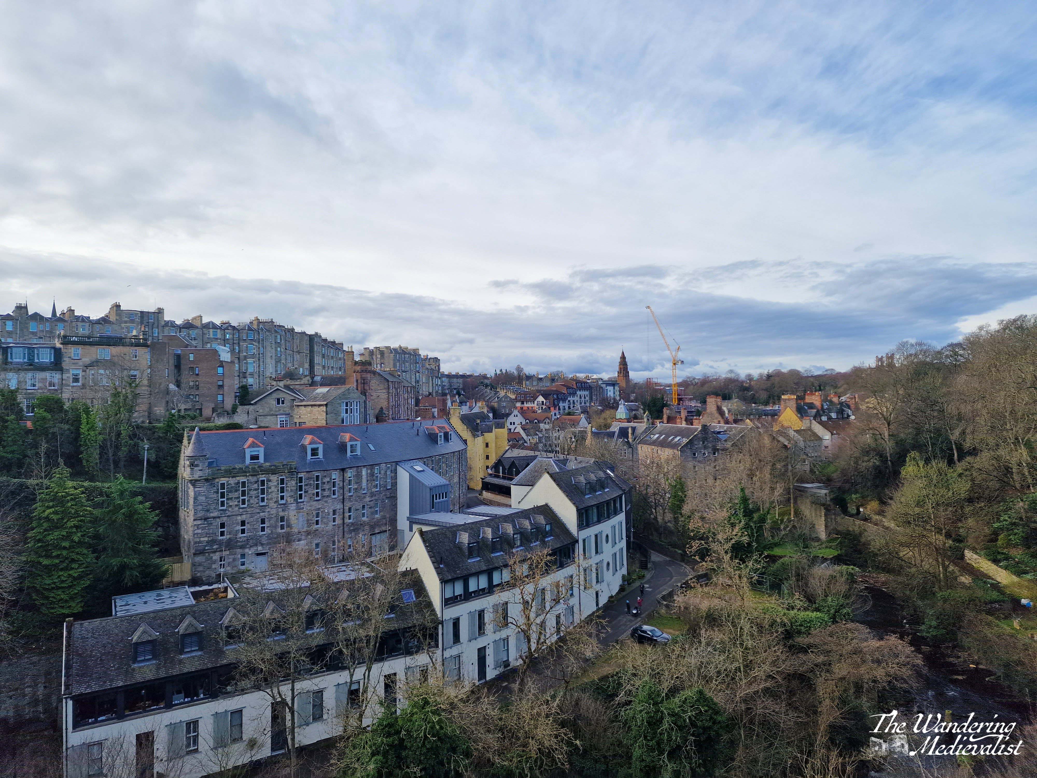
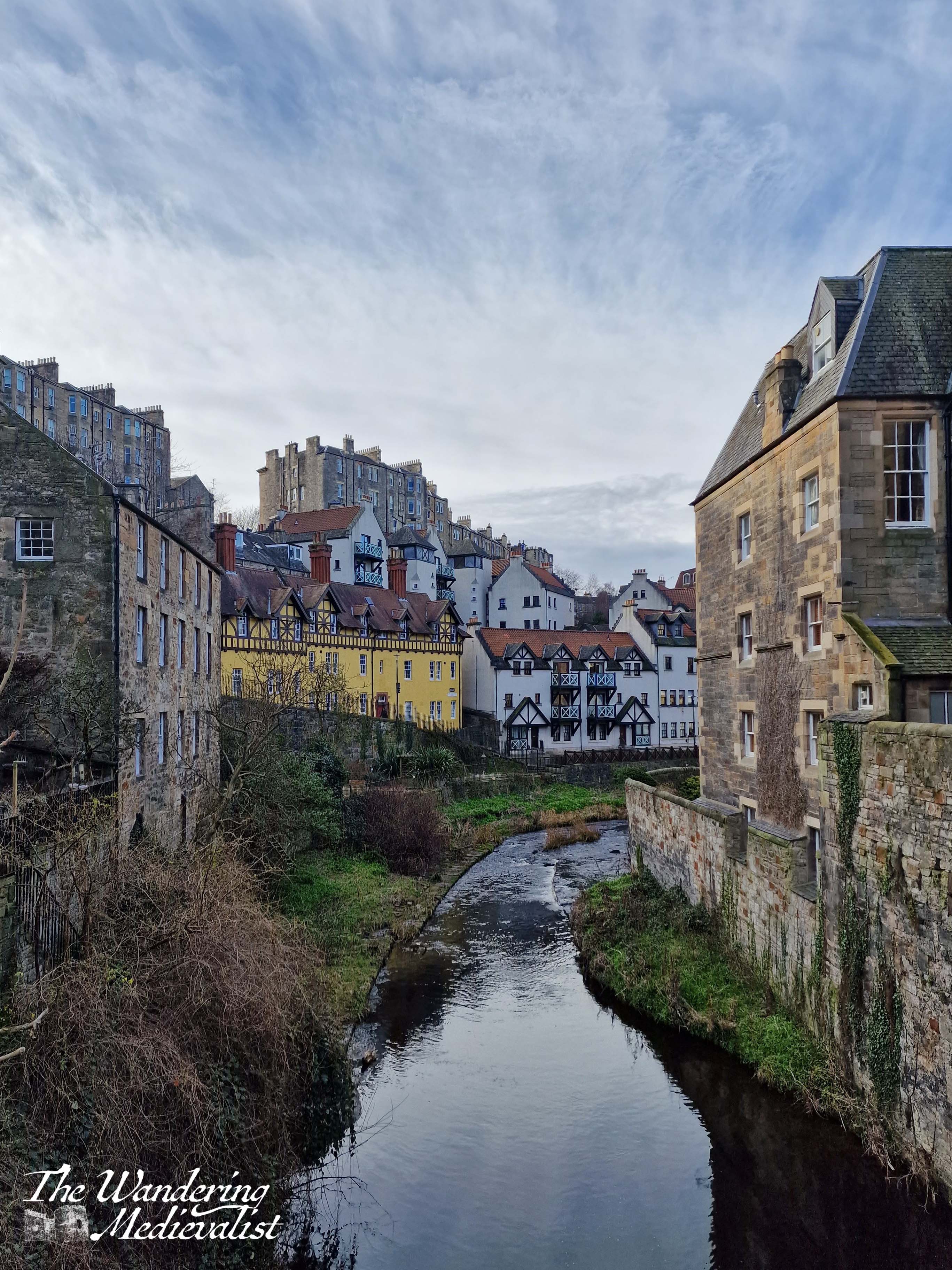
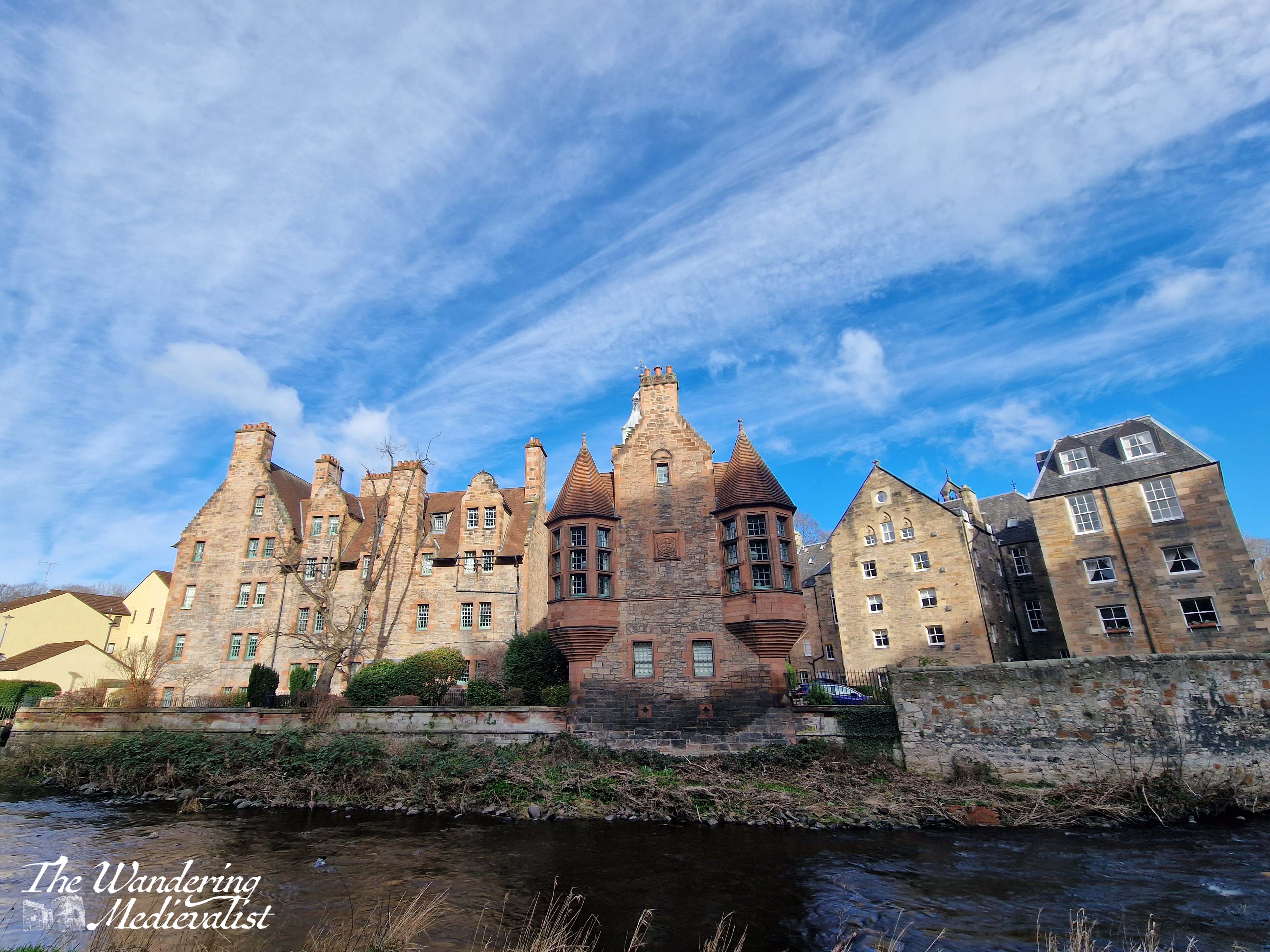
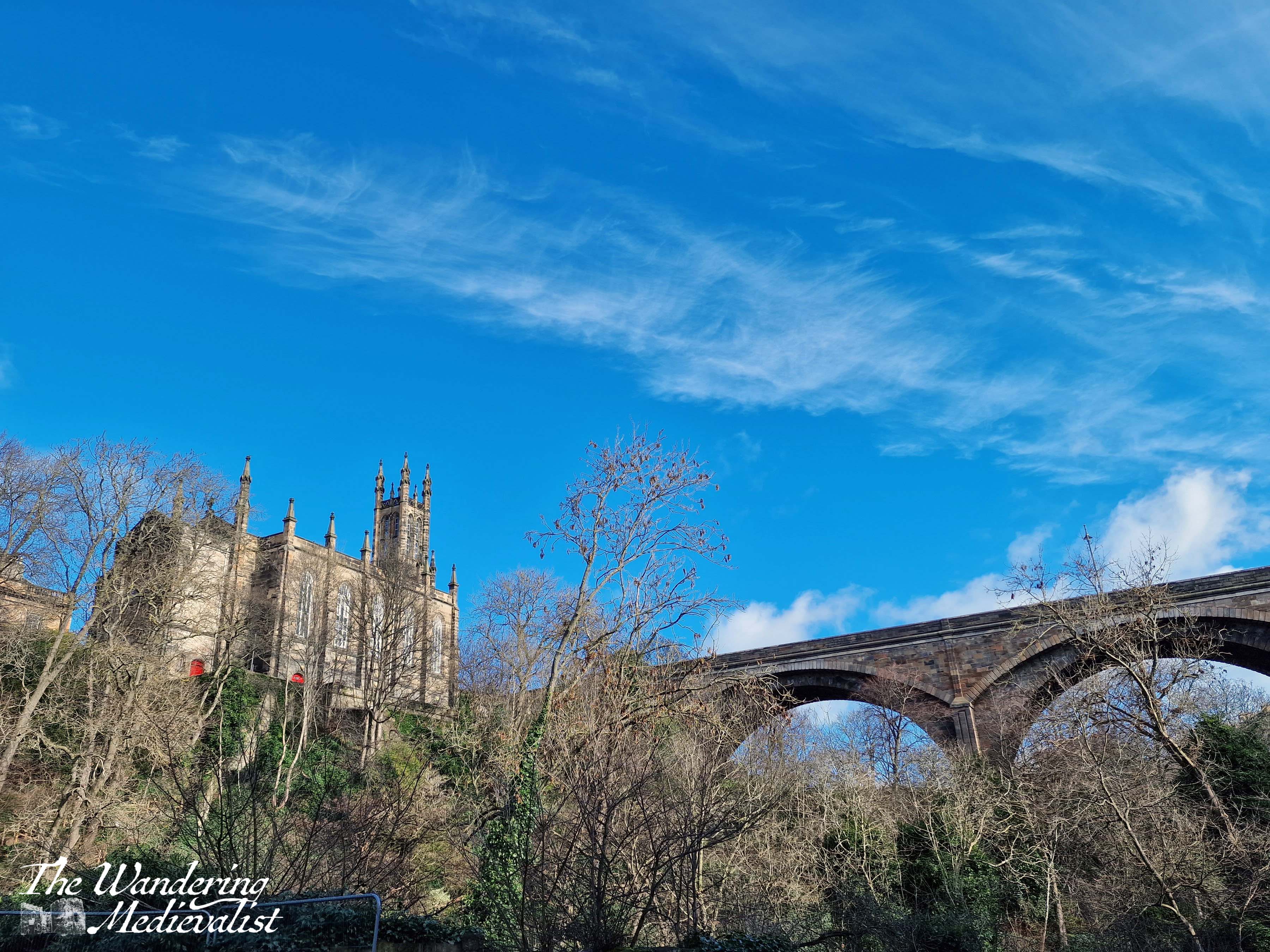
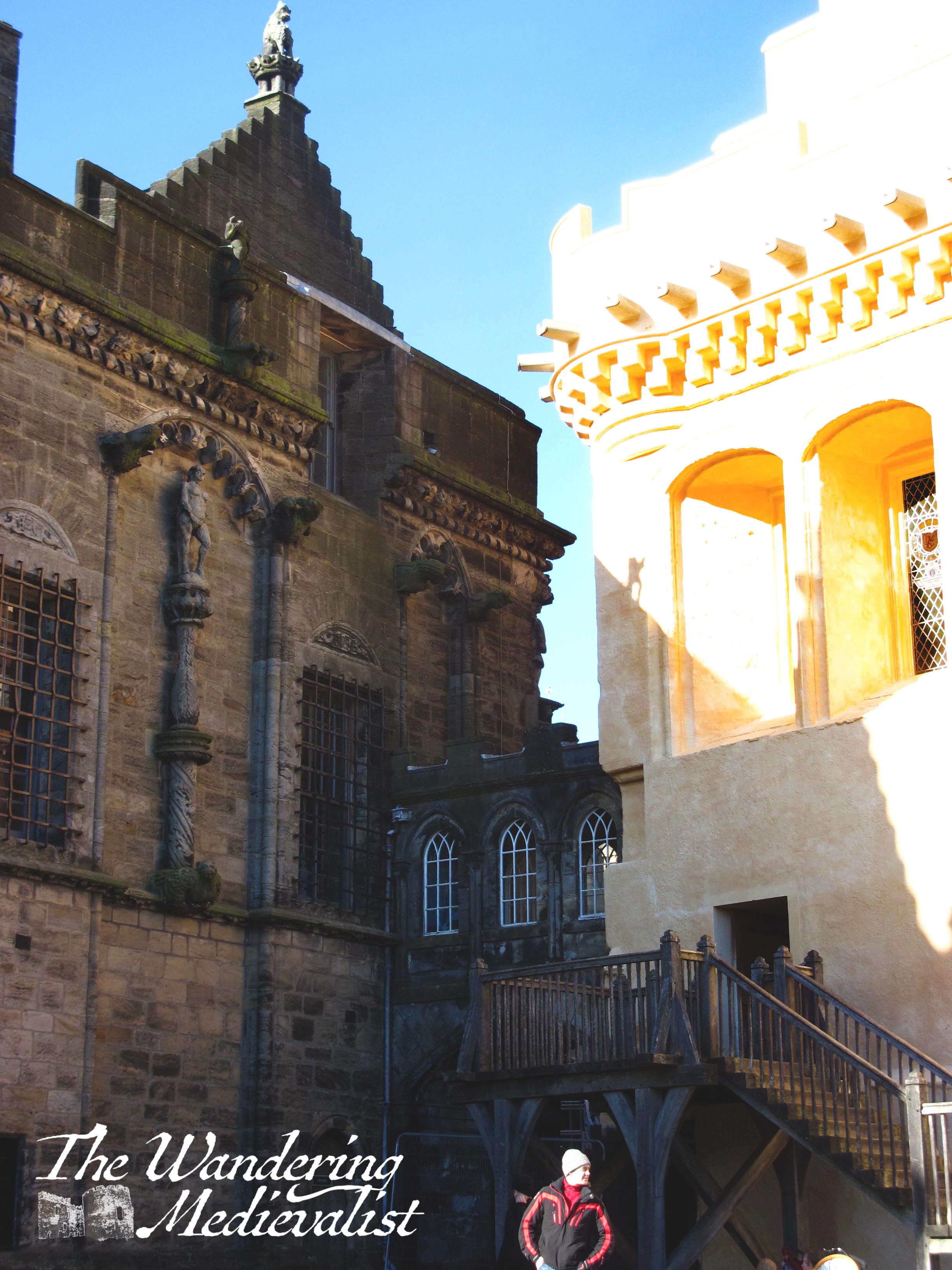
Dean Village is one of those amazing spots I have seen pictures of for years but never managed to visit as – despite it being so close – I do not spend as much time in Edinburgh as I would like. In March, though, I spent two nights there on my own and decided that it was time to finally explore this beautiful corner of the city. It most definitely belongs on a list of tourist attractions that does not disappoint.
I was staying in the Grassmarket and decided, rather than climbing up and over the Royal Mile, to circle around Edinburgh Castle on King Stables Road. From there I was surprised by how quick and easy it was to cross Princes Street and walk the perhaps five minutes along to the Dean Bridge and the views over Dean Gorge. The walk passed through some lovely parts of the West End, and I am always reminded how much I enjoy walking around Edinburgh.
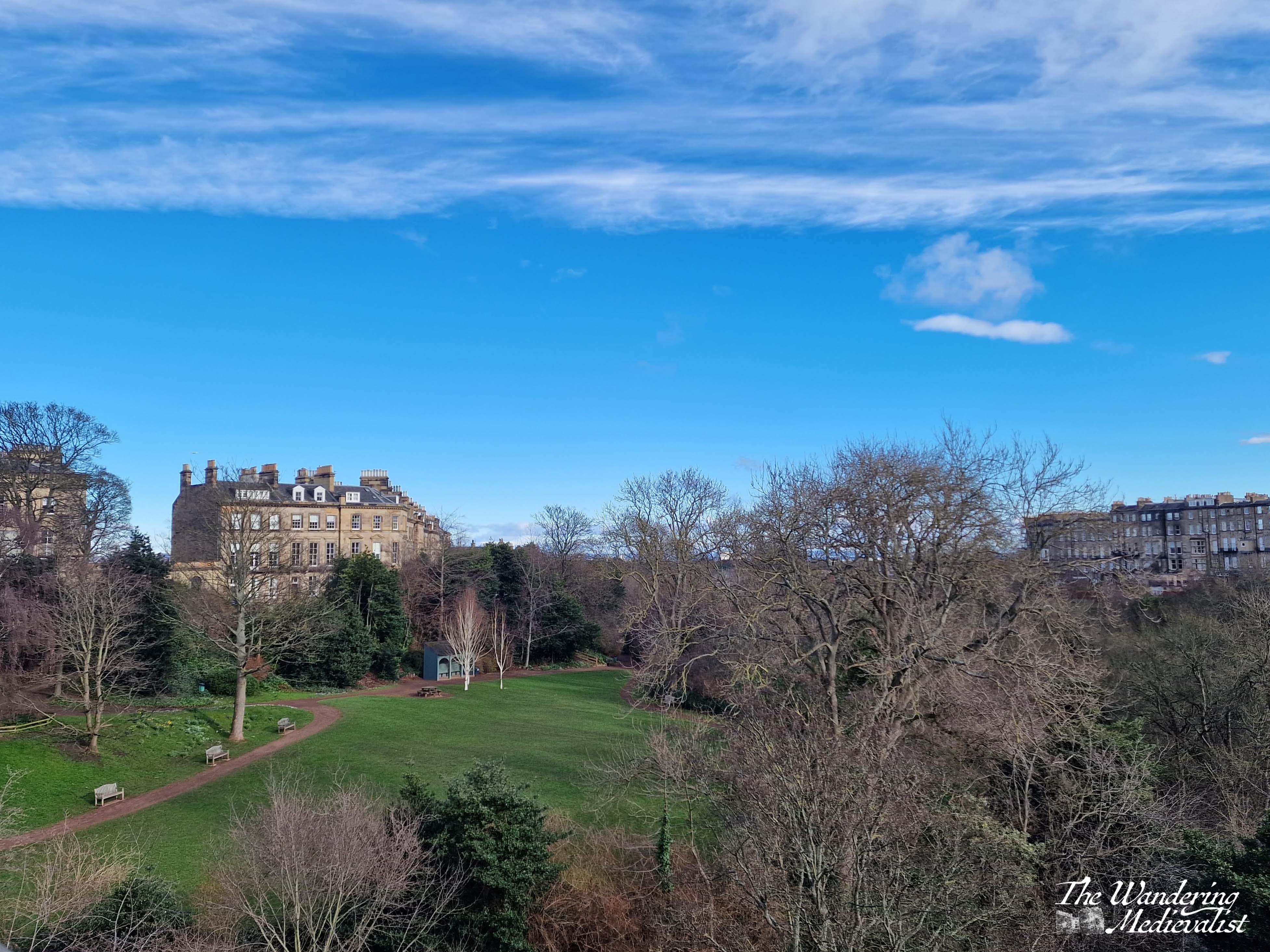
The first time I became aware of the spectacular view from Dean Bridge was while riding a Fife to Edinburgh Stagecoach bus, probably twenty years ago, which boasted seats high enough to see over the walls and along the spectacular rows of Georgian buildings. Finally, on this trip, I walked and found the view no less fantastic than I did when jet-lagged on public transportation. Below, the left-hand view is west over Dean Village, while the right-hand view is east towards Leith and Edinburgh’s New Town.
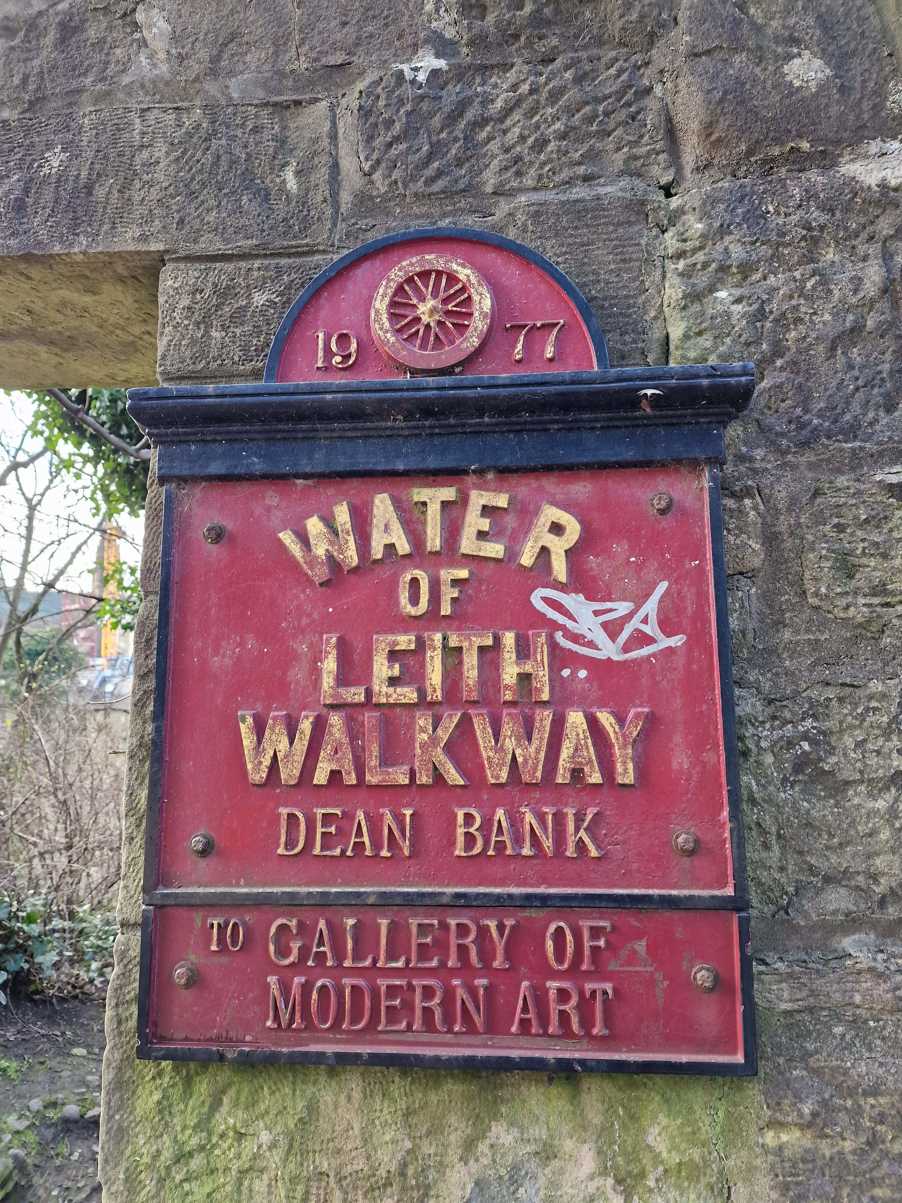
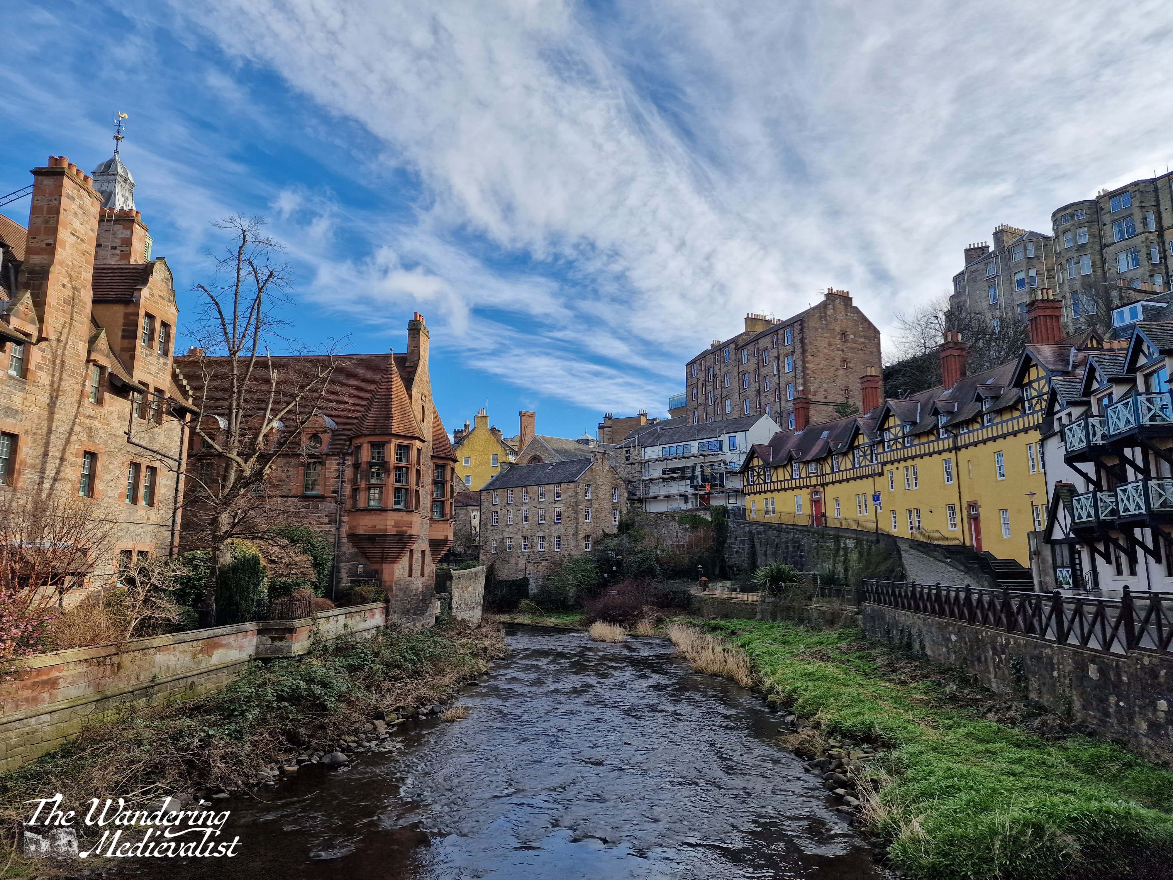
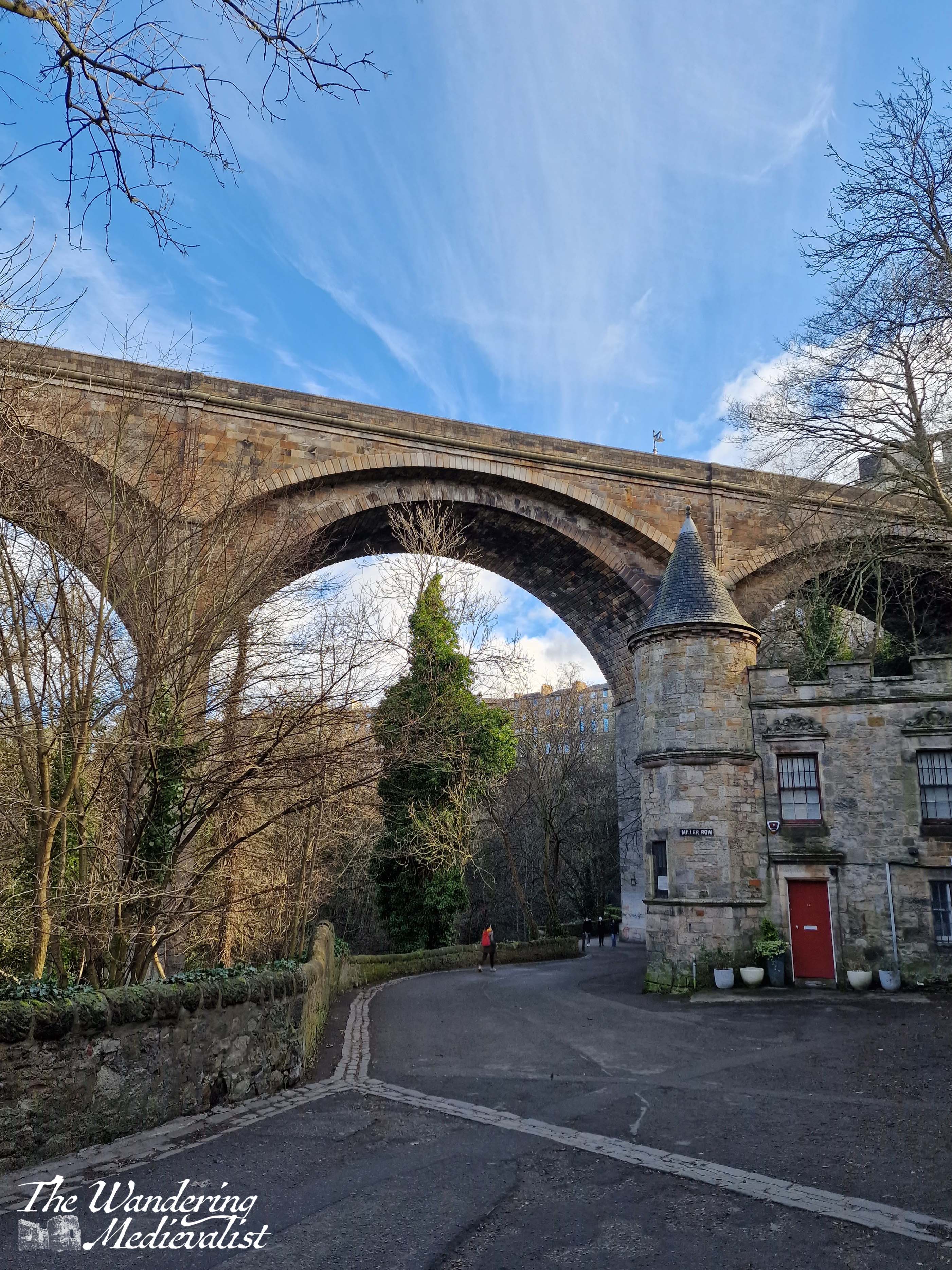
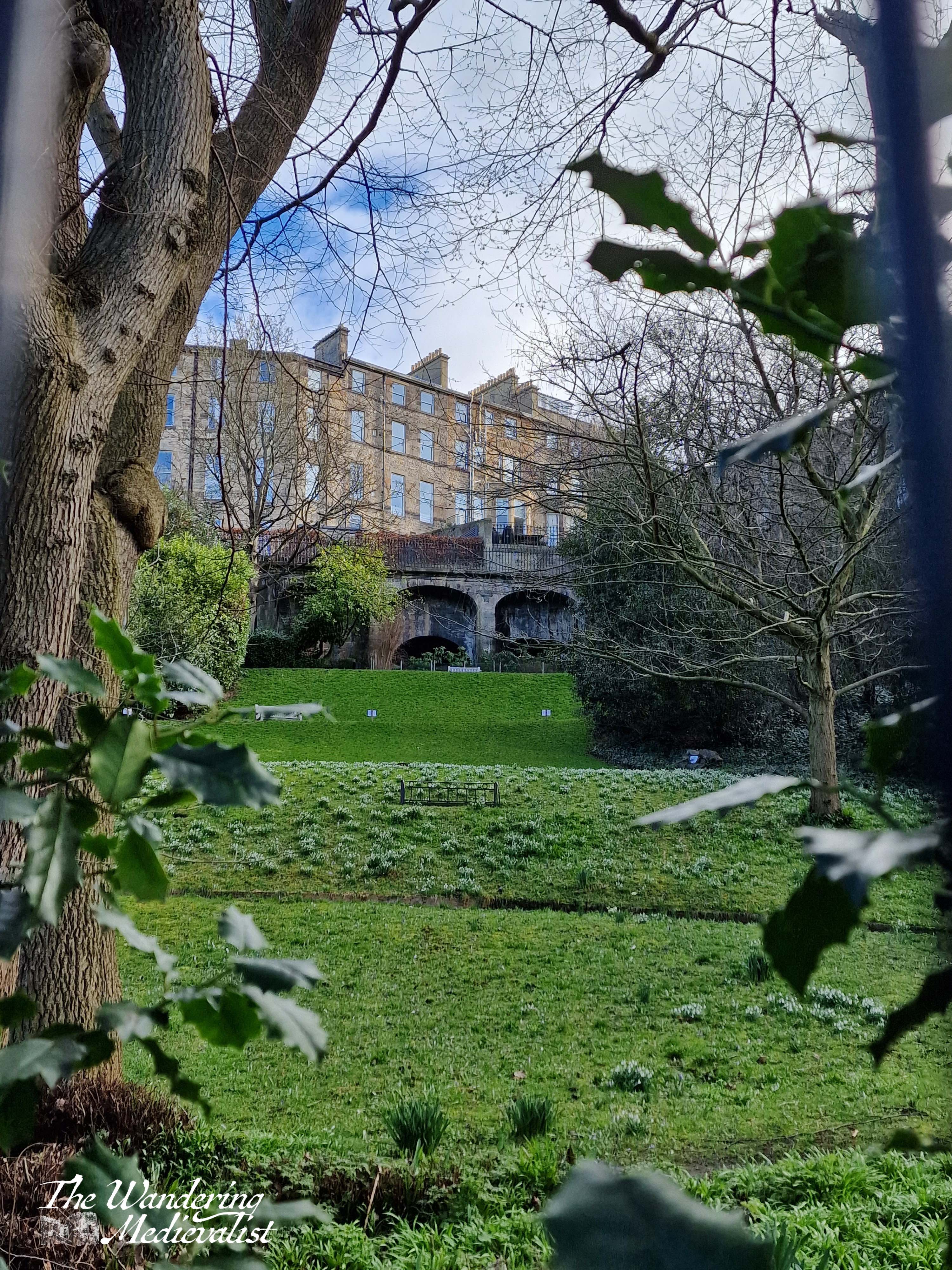
A historical note about the bridge on which I was standing at this point – it is, from Edinburgh’s perspective anyway, a quite new bridge, built in the 1830s to allow easier access across the gorge, from central Edinburgh towards Cramond and, one would assume, the Forth bridges and Queensferry. The village itself is at least medieval in origin, having been a grain milling area for hundreds of years, driven by the Water of Leith – the main river that starts in the Pentland Hills and runs through Edinburgh to join the sea at Leith.
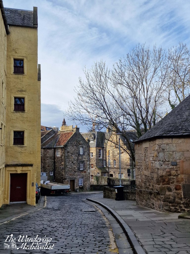
From this comparatively modern street level, visitors traverse down the steep, cobbled Bell’s Brae towards the village itself. I was impressed to see a Sainsburys van also manoeuvring this hill, with some skill.
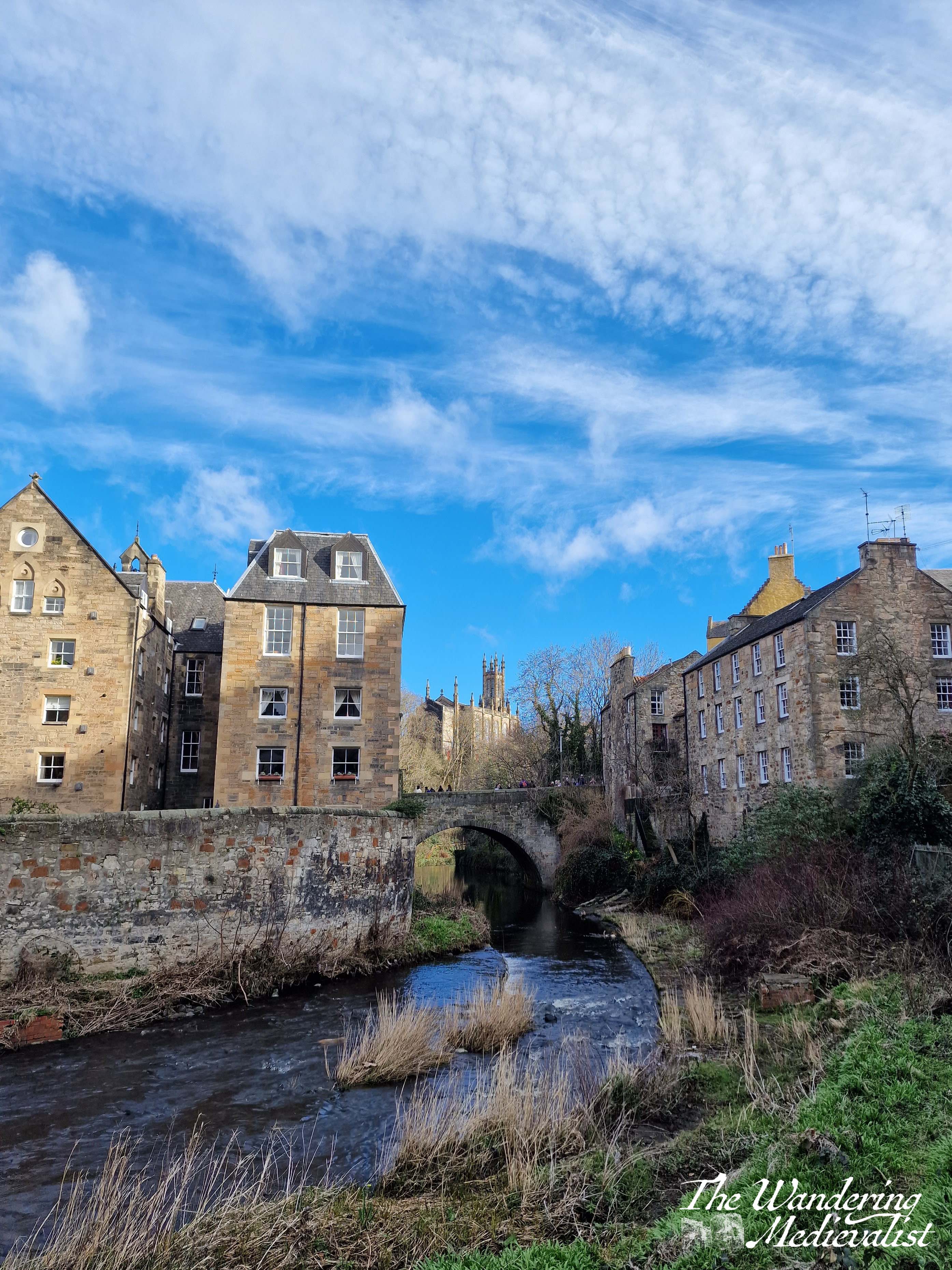
There is no question that most visitors will start on Bell’s Brae Bridge, which affords phenomenal views in both directions – one towards the Dean Bridge, and the other up the Water of Leith through the village (left and right respectively).
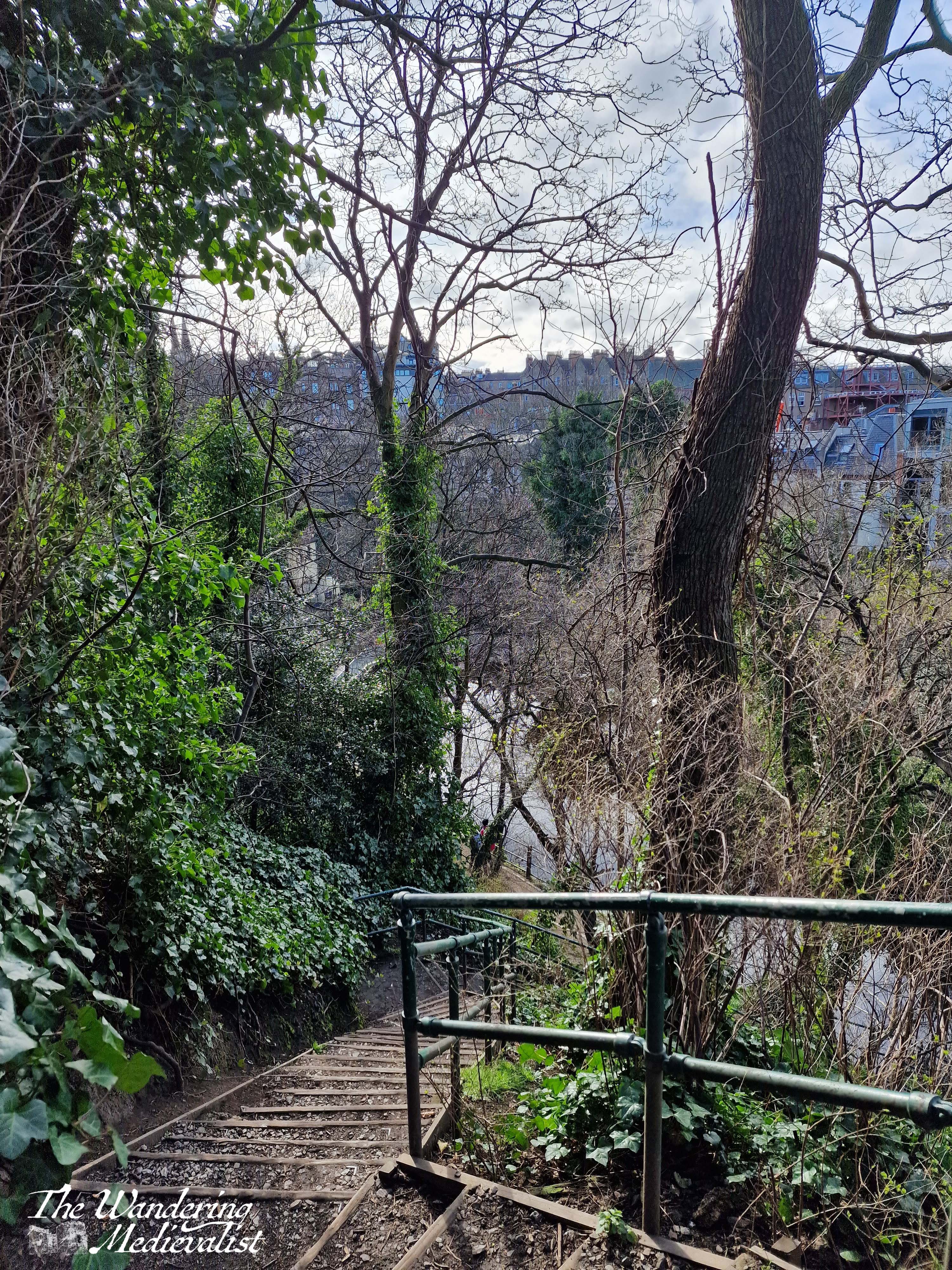
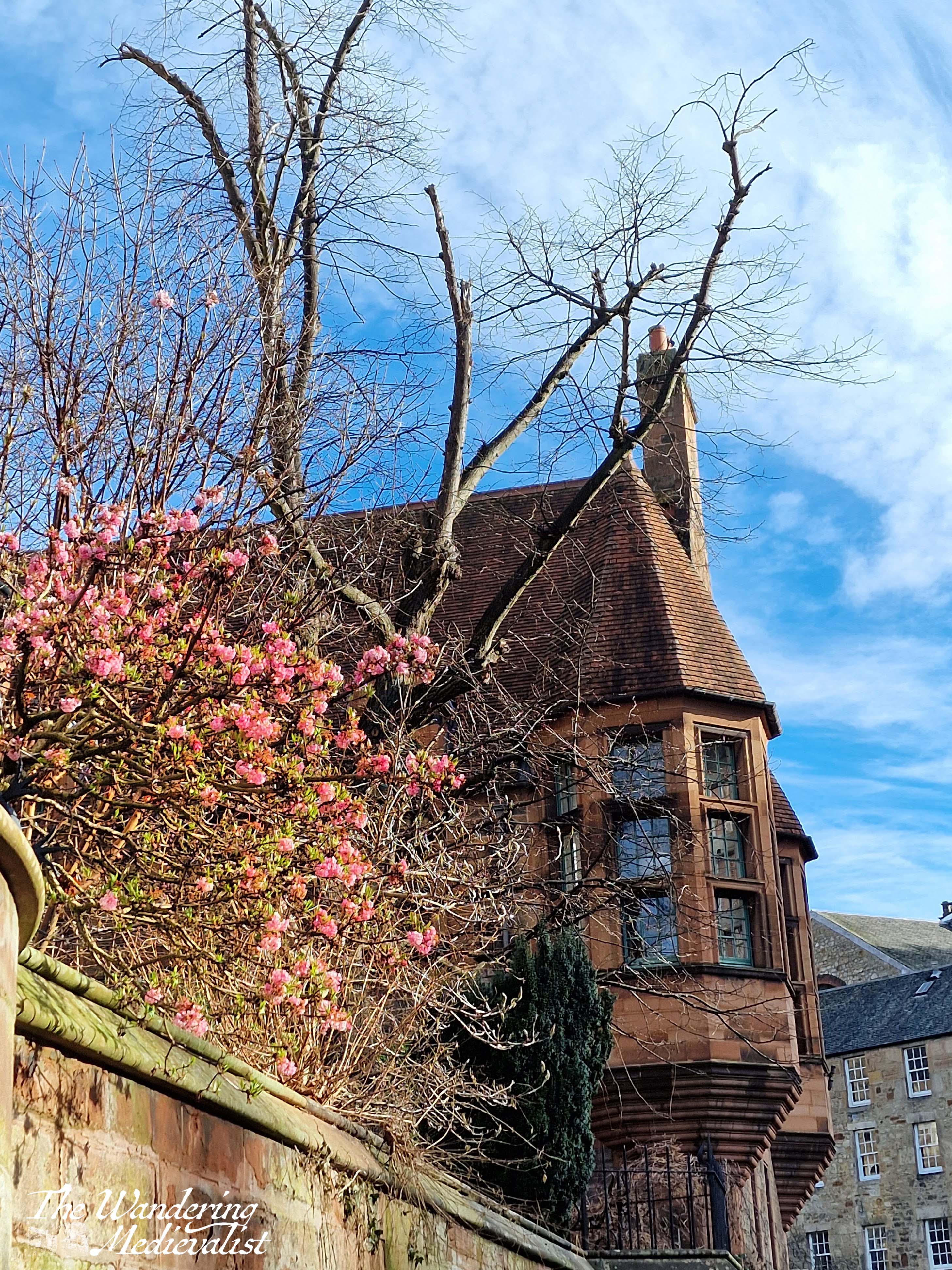
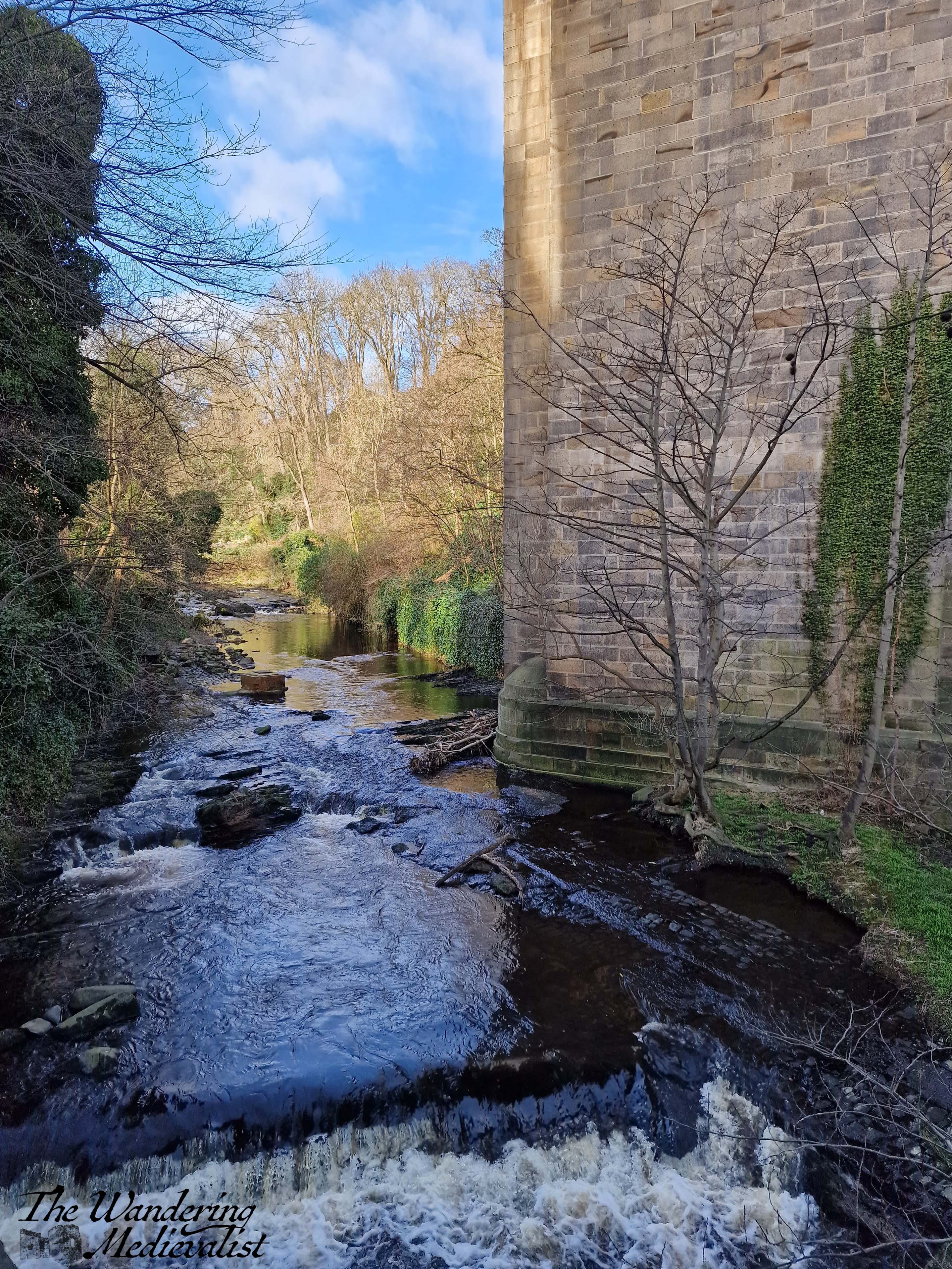
After crossing Bell’s Brae Bridge, I headed up Dean Path, a winding street that climbs up out of the gorge, and reminded me in places of some of the steep hills I recall in New England – the houses were the same style if built of stone rather than clapboards. I managed to get myself a bit lost trying to get into a garden that turns out to be private, but then headed back along the Water of Leith walkway, as I knew there was still plenty to be seen. Firstly, I tested my knees on the steep steps leading down to the water.
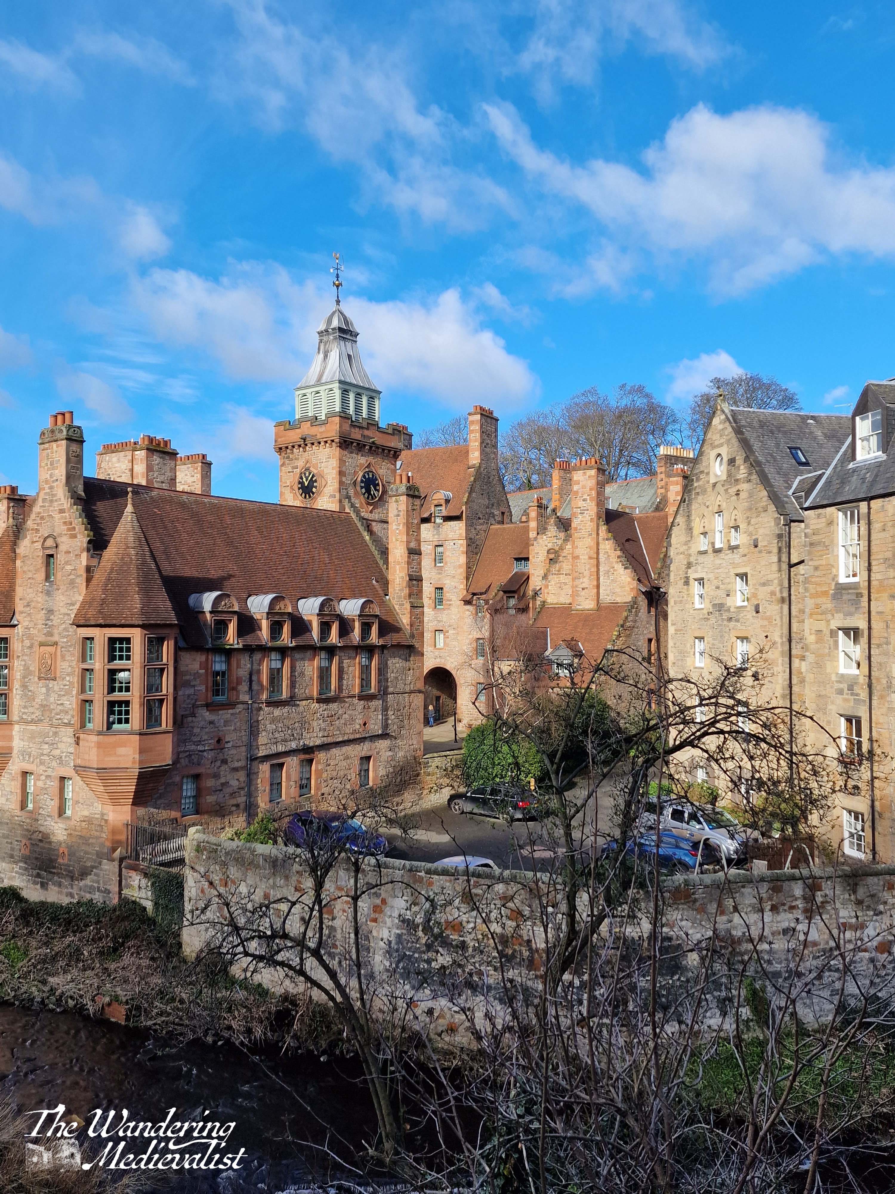
I passed the Water of Leith weir, getting properly wet from the spray, and re-joined the village at the crossing of a small footbridge. Unsurprisingly, from this bridge yet more amazing views could be had, particularly of the buildings which are apparently Dean Village Apartments and Well Court, a series of buildings designed to house local workers. They look, to me, almost like they could have been a very posh school, and apparently were extensively repaired in the early 2000s.
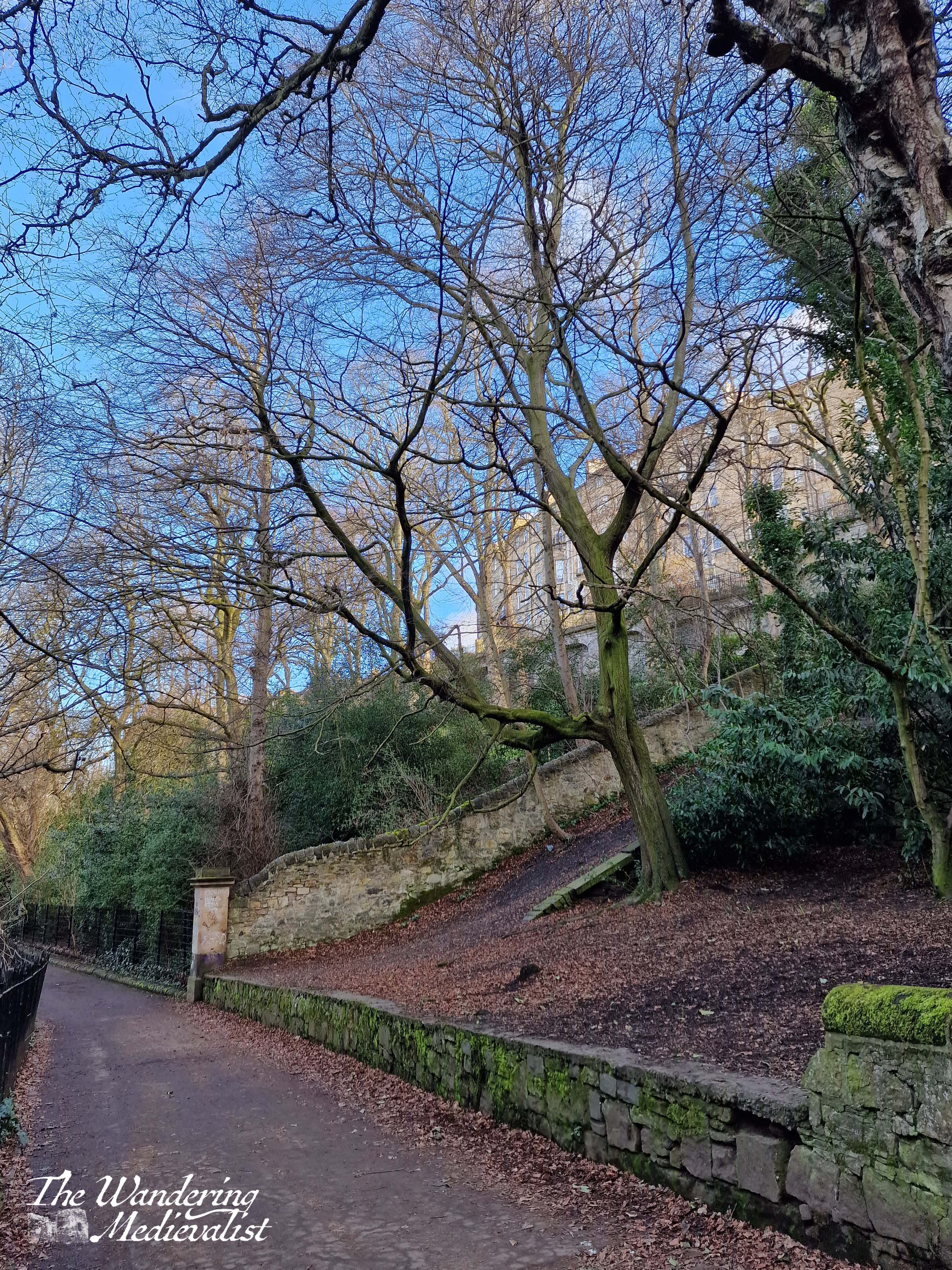
I could have stood all day and taken pictures as the light changed, but instead I decided to take a detour back along the Water of Leith Walkway, which stretches all the way to the port but would, I hoped, offer a few opportunities to cut back up towards George Street and the city centre.
Like the village, the path did not disappoint, showing me a side of Edinburgh I had never seen – the backs of stately houses, steep lawns, and of course the river itself.
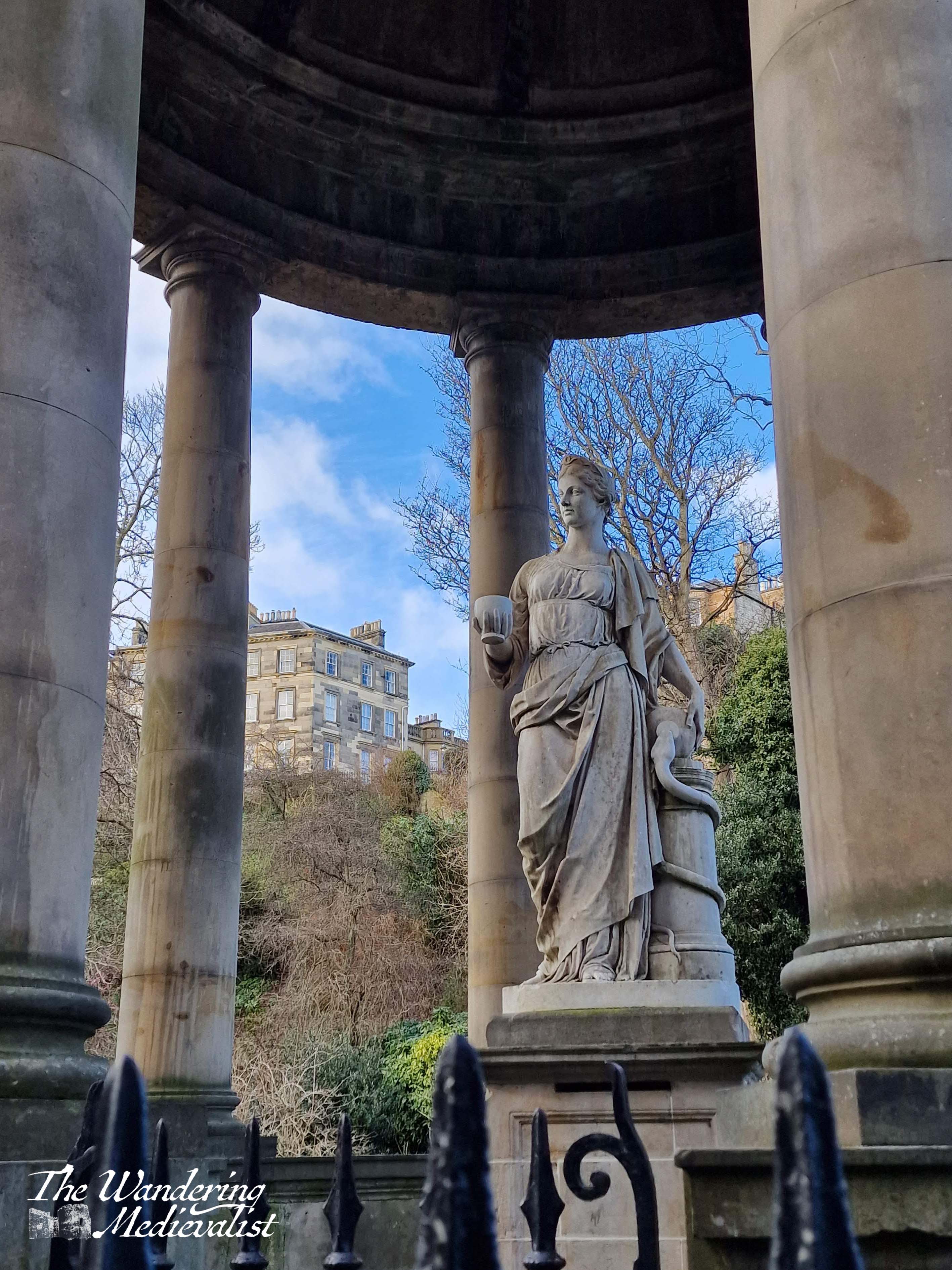
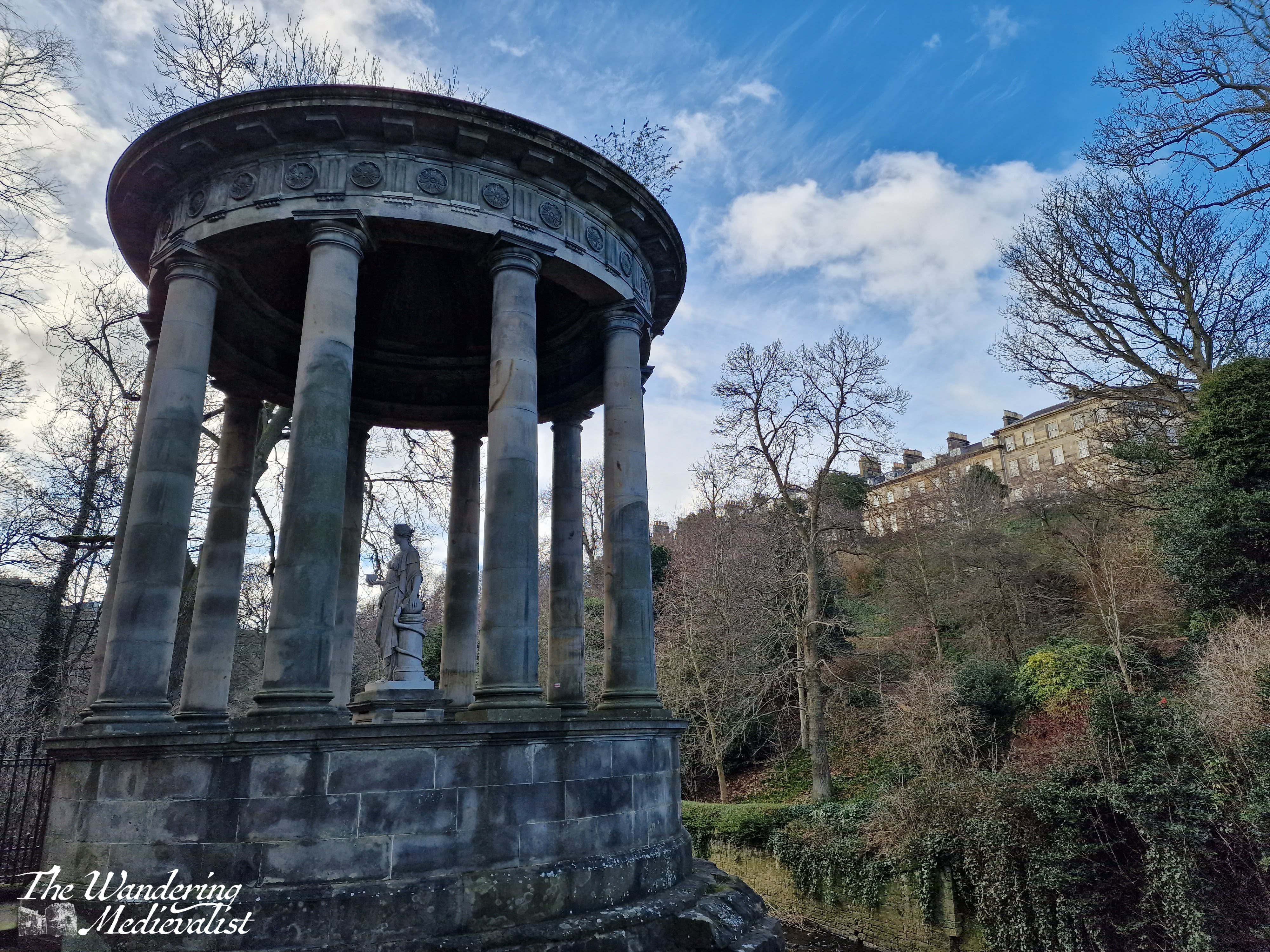
I would most likely have walked all the way to Leith were I not, by this point, getting quite hungry for lunch. So, I made it as far as St Bernard’s Well, a monument designed in 1789 and recently restored, marking the location of a natural spring that was rumoured to have healing powers.
Having reached St Bernard’s Bridge, I chose to head up into town at this point. Thanks to Google maps I was able to navigate up through the New Town and eventually to the St James Centre at the far end of George Street. It was well worth every step and I can very much see why this area of Edinburgh is so regularly visited, and photographed. Even on a week-day in March, Dean Village was busy with visitors taking advantage of the sunny weather. Absolutely a must-see area of the city and I cannot believe it has taken me this long!
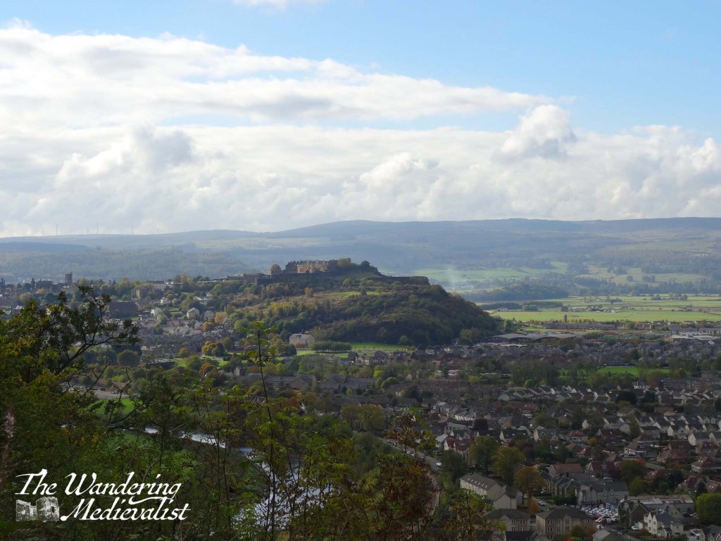
Stirling is the castle I recommend above all others if someone is in Scotland for only a short time and has limited options or time; you can reach it using only public transport from both Edinburgh and Glasgow, and even – with a bit of effort – St Andrews. It is positively steeped in history and, in my opinion, is more medieval than Edinburgh, which has been re-built and added to so many times.
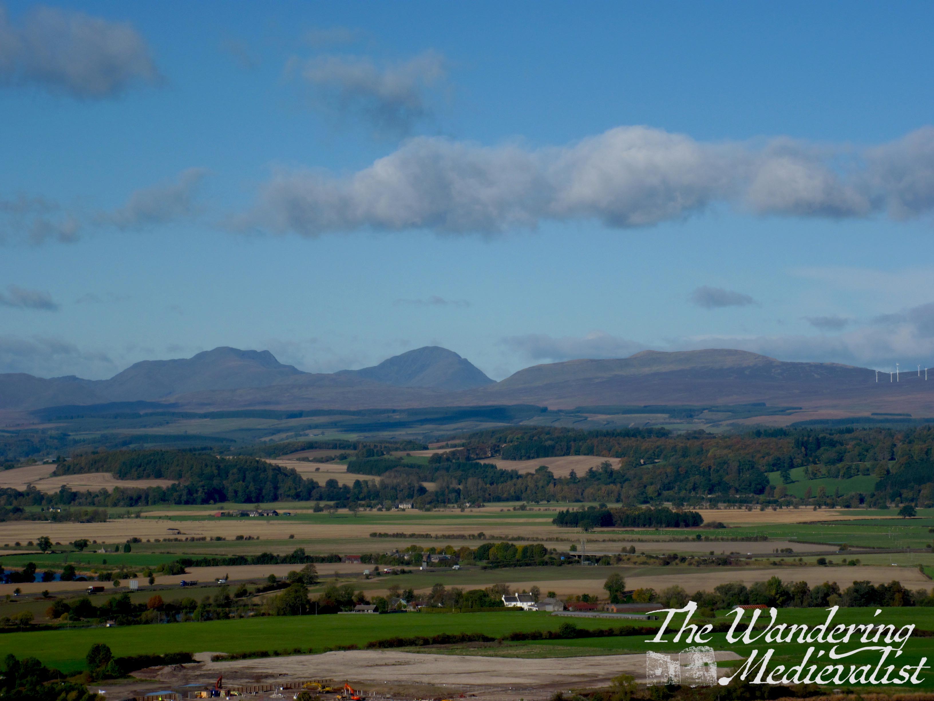
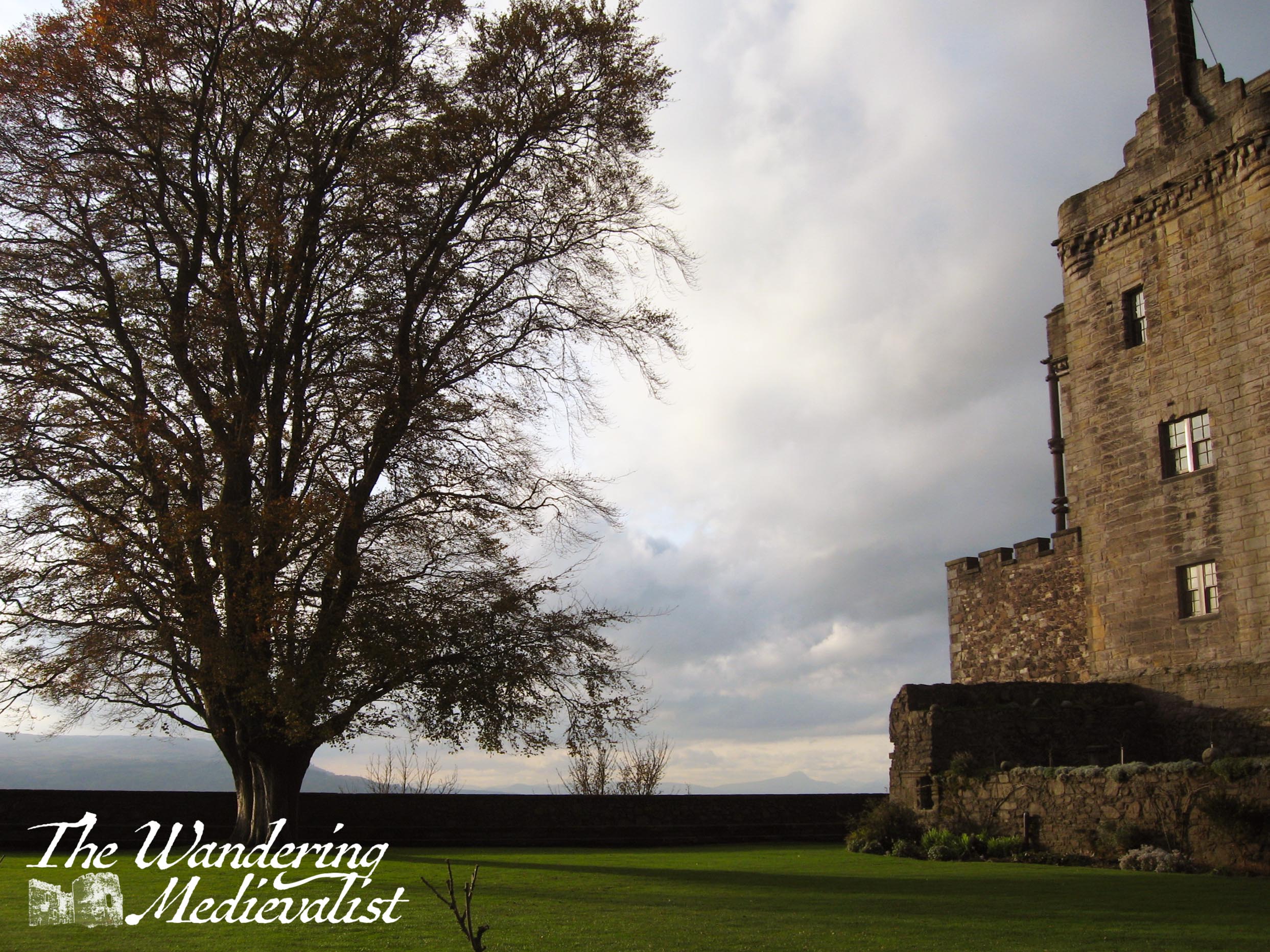
Like Edinburgh Castle, Stirling sits on a massive volcanic outcrop high above the surrounding plain, and from its walls you can see into Fife, the incredible winding River Forth, along the Ochils, and right to the edge of the Highlands. On the surrounding plains were fought at least two iconic battles of the Scottish Wars of Independence: Stirling Bridge (1297) and Bannockburn (1314).
Stirling was, for most of history, the furthest downstream crossing of the river that becomes the Firth of Forth, and a fortress here was a natural protector of the way to the Highlands and all of northern Scotland.
The historical significance of this castle really cannot be understated – it was fought over constantly during the Wars of Independence and changed hands regularly. Several times it played the role of haven for widowed Scottish queens – starting with Queen Joan Beaufort and her son after the murder of James I – and Mary, Queen of Scots was crowned here in 1542. There is first mention of a castle here in the 12th century, though most of the buildings date from considerably later, the 15th and 16th centuries, at which point the castle became more of a residence than a fortress. Even without an understanding of Scottish history, one must only stand on the castle walls and look north to understand the significance of the location.
I first visited Stirling in the final year of my undergraduate degree, while everyone else was busy studying for and taking exams. I had turned in my dissertation and had no exams, so took the long bus trip from St Andrews winding through Fife and Clackmannan to Stirling. It was more that two hours and passed through so many little towns I had never heard of but now know well – Dollar and Tillicoultry being the two I remember the most. It was my first glimpse of the Ochils, and the town of Stirling.
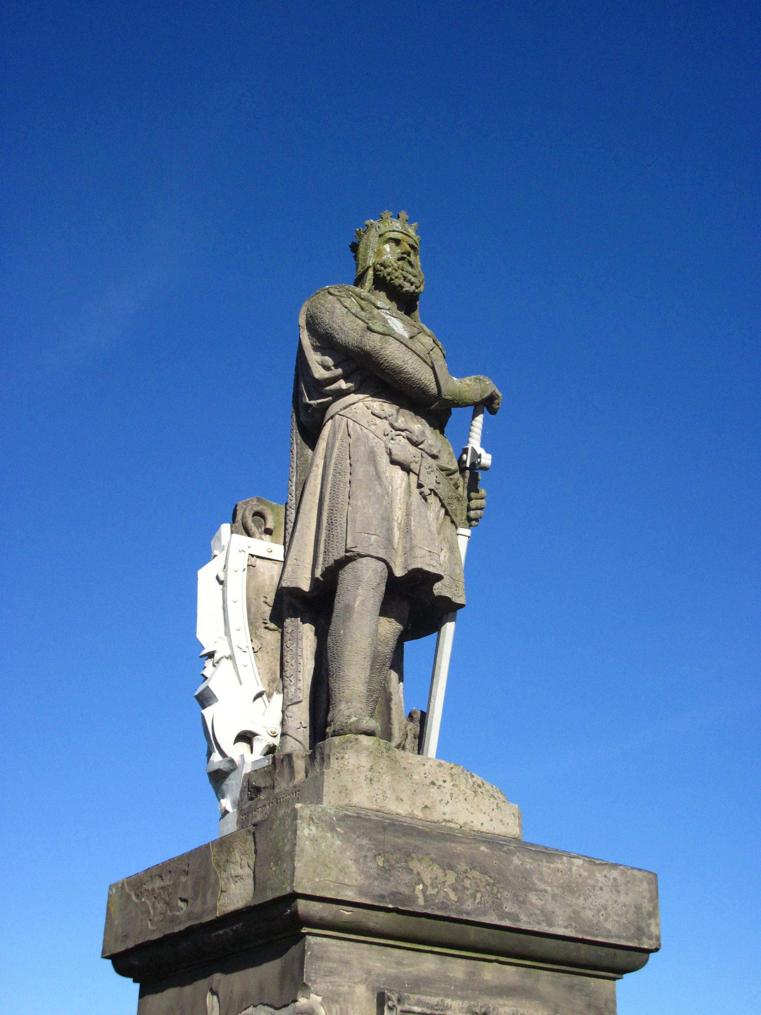
From the bus or train station in Stirling, one is met with an up-hill climb through the historic and picturesque town. Many old Scottish towns have the odd juxtaposition of beautiful old stone houses, contrasting with much newer housing and shops that always stand out. And then, before the castle, one is met by who else but Scotland’s national hero, King Robert I the Bruce (r. 1306 – 1329).
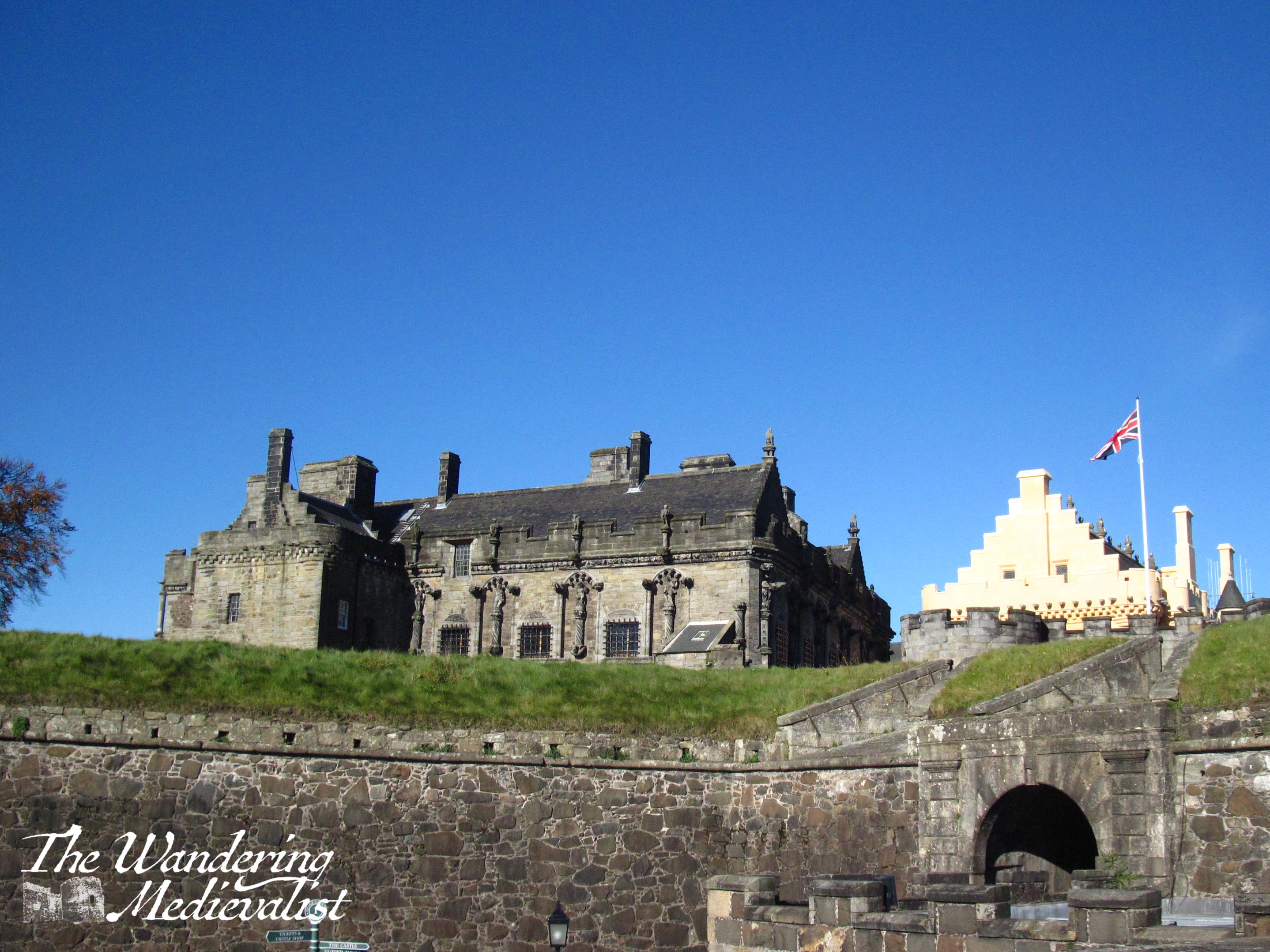
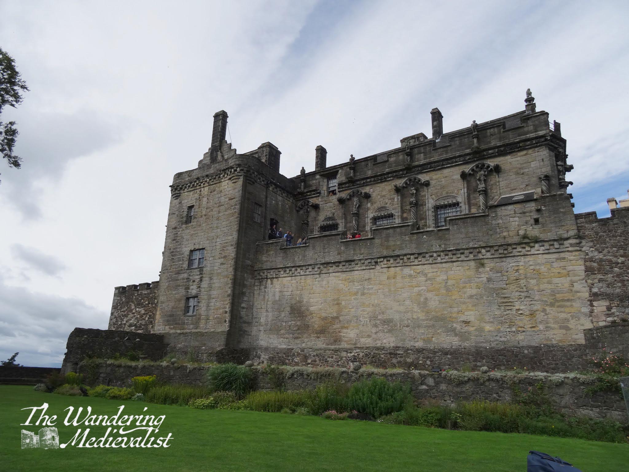
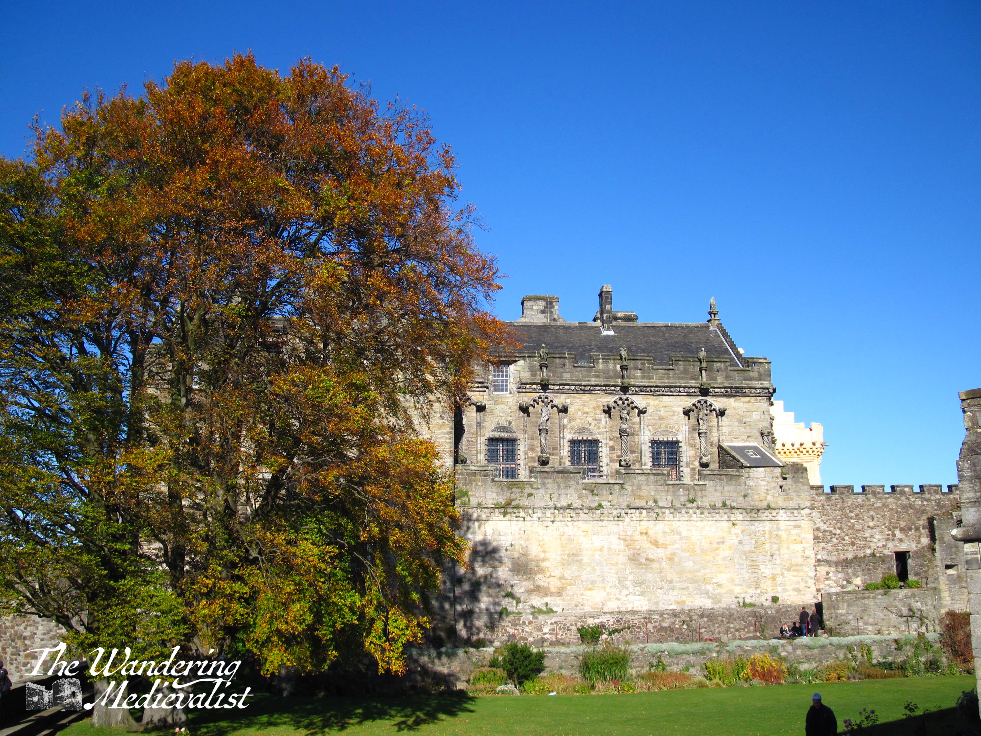
Visitors enter the castle through the main gate, across the drawbridge and under the portcullis. Past the guard room, the path leads up into the Bowling Green Gardens, where you can explore some of the rooms where soldiers lived. The green offers more stunning views over what is left of the formal gardens, and also up towards the palace area.
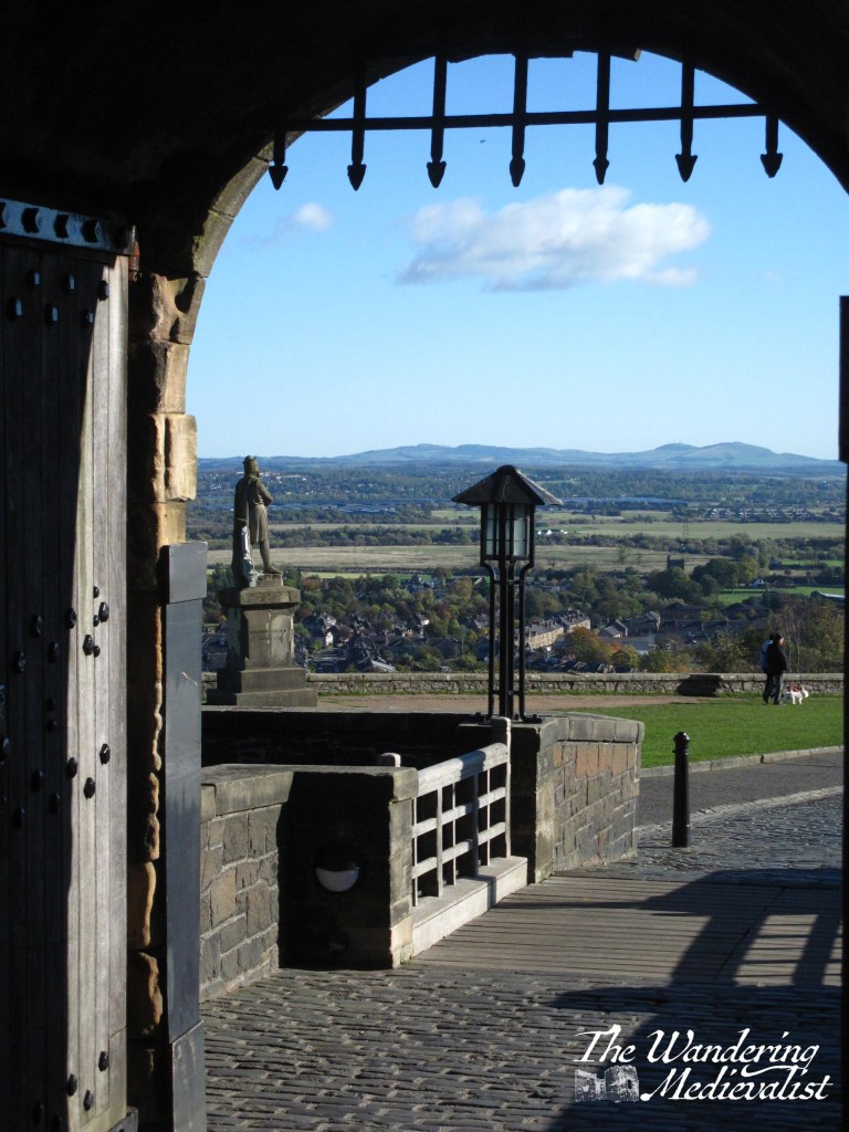
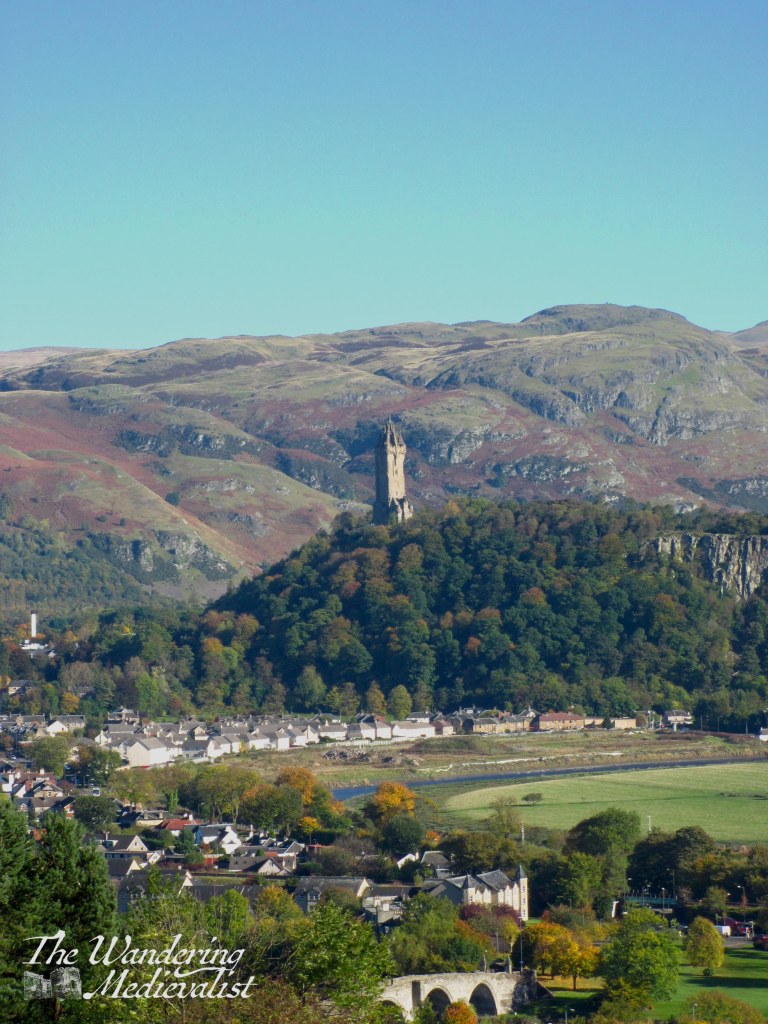
While at times I think I could just stay here, there is plenty more to see, including ramparts with enormous black cannon – great fun for kids to climb on – and gun loops that provide views over the town towards Stirling Bridge , the Wallace Monument and Ochils.
From these ramparts, one can visit the extensive gift shop, or move up into the palace and Inner Close. A great deal of work has been done over the past 20 years to renovate some of the palace spaces, in particular the Great Hall.
Once visitors have finished exploring the palace area, I recommend continuing beyond the chapel to the small garden that appears to be the ‘bow’ of the castle, were it a ship – this is where the views north are at their best.
It occurs to me as I write that it has been a number of years since I have visited Stirling, and I may be about due for a return trip – the only down side to this castle is that it is one of the more expensive to visit in Scotland. But well worth it!
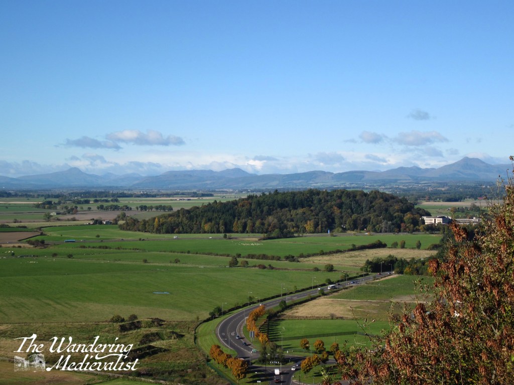
I honestly cannot recall the first time that I noticed the tower on Kinnoull Hill, standing out quite clearly as it does on the main road from Dundee to Perth. But, I do know that I have wanted to visit it and hike up to it for at least a decade and finally, last weekend, we did!
It came about strangely – we planned to go for a coastal walk in Tayport, but the roadworks on the Tay Bridge meant that we could not get down to Tayport at the normal exit. I suggested Broughty Ferry, but very soon we decided to try Perth, and this walk I have been planning for so long. I am quite pleased to report that, despite our parking in the wrong place, the hike did not disappoint.
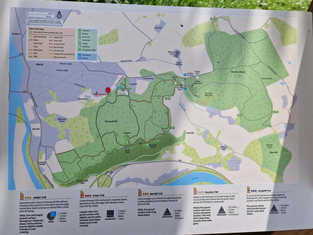
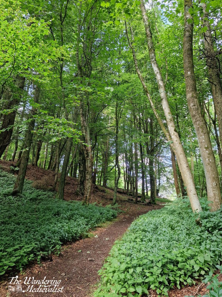
Like many locations in Scotland, Kinnoull Hill has a series of well-kept and relatively easy to follow paths, criss-crossing the ancient volcano.
We parked at the location marked on this map but later realised that the Jubilee Car Park further along would probably be a better option; we were following Google and while she is usually quite reliable, she clearly was not aware of the parking situation here.
The start of the hike was relatively standard as we made our way up at a comfortable pace – the trail is clearly going uphill but it is not overly strenuous. With maps like the one above you never really know what you’re getting into in terms of distance, but we reached the view point in about 20 minutes or so, passing through some pleasant forest with patches of birch, lovely old beech trees and carved wooden animal sculptures along the way.
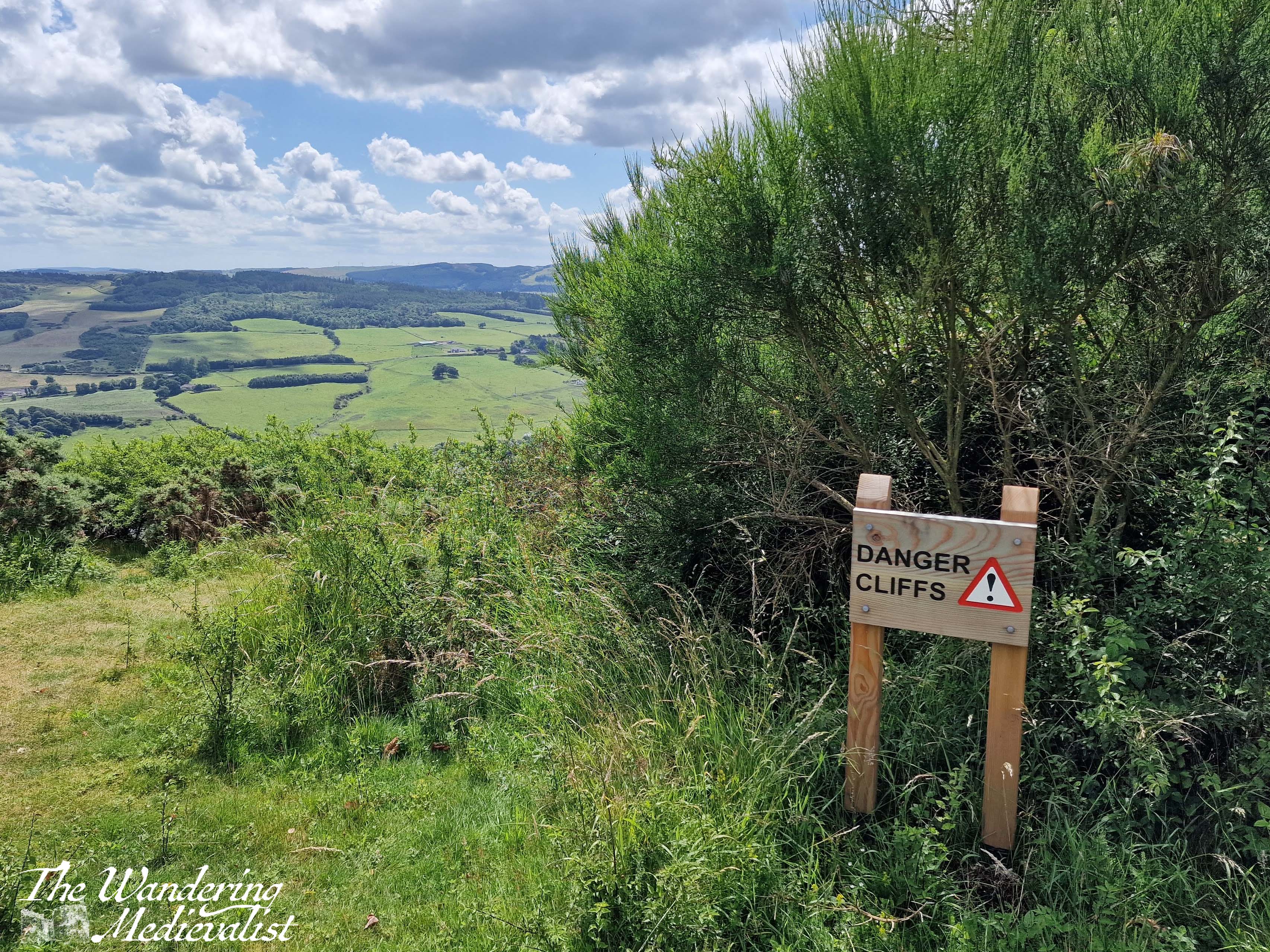
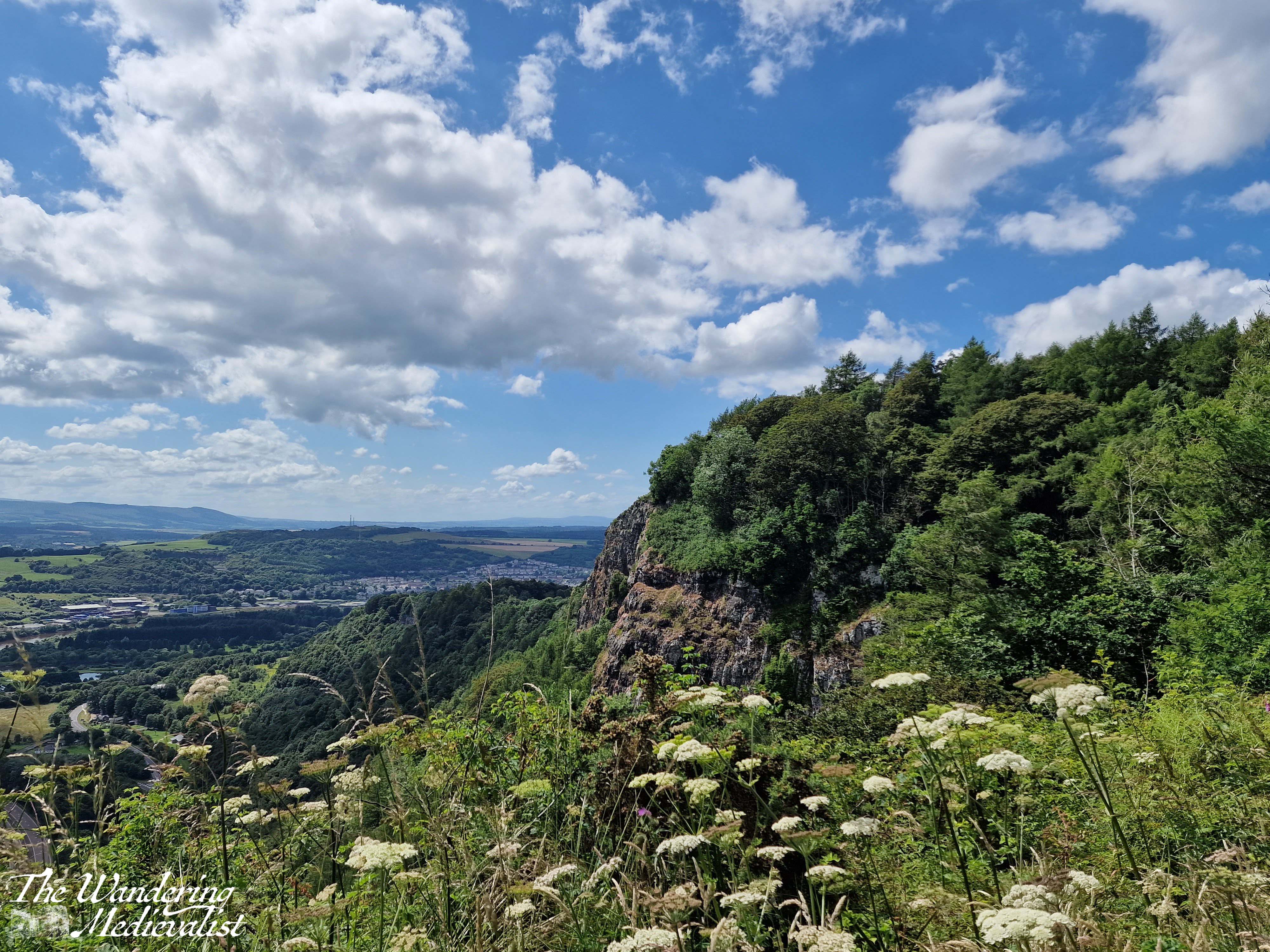
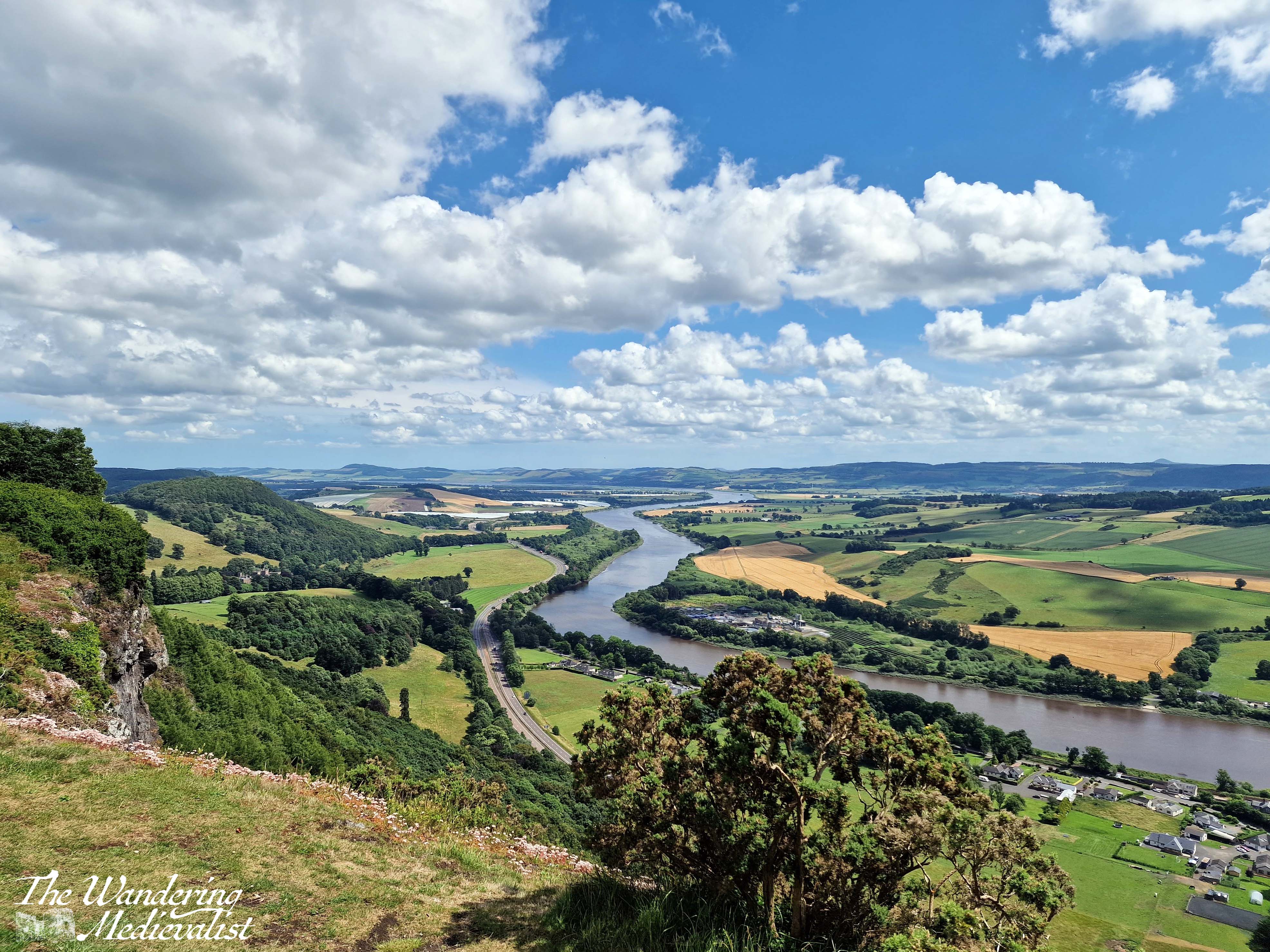
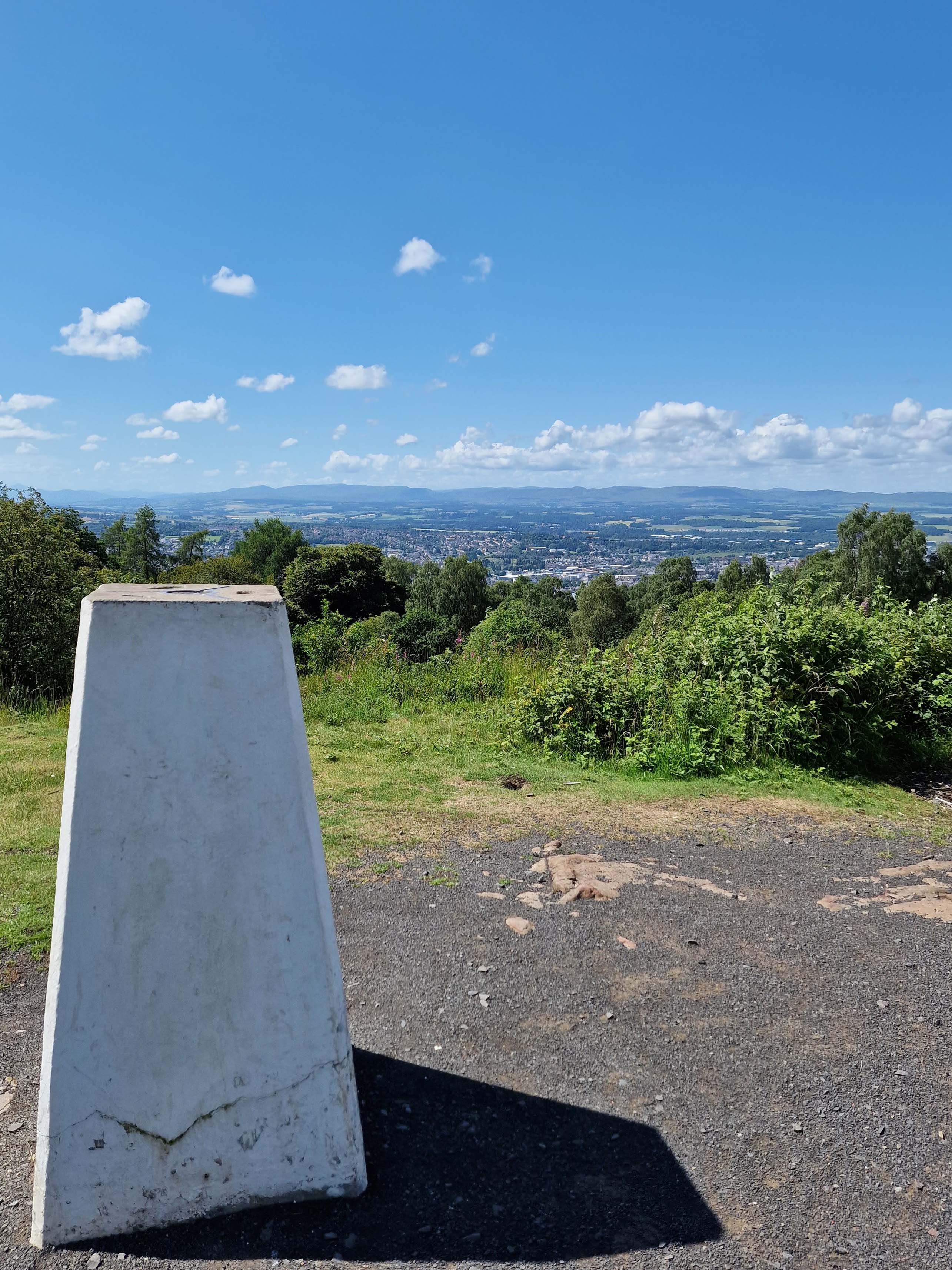
The view from the ‘Stone Table’ is absolutely fantastic, and boasts one of the most needless warning signs I’ve ever seen about the cliffs. You can see 180 degrees from impressive cliffs and the edge of Perth on the right to the hills of Fife and a hint of the tower to the far left.
There was no way we could be this close and not see the tower, so we headed off on the path that followed the cliffs – this one is quite steep in places with quite a bit of up and down, though there are viewpoints periodically along the way that are worth the extra energy required.
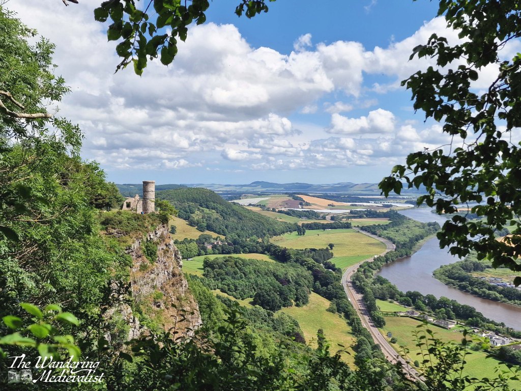
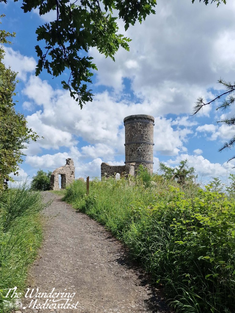
Then finally, we reached the tower which in and of itself is not particularly exciting, though the view is excellent. As one who is not overly fond of heights I struggled to follow the path that wraps around to the front of the tower, where there were groups of people resting and taking pictures, but I managed briefly before scurrying back to the safety of the path.
Once we had finished at the tower, we hiked back to the Stone Table viewpoint and sat for a while enjoying the view. Upon examining the map again we chose to continue the blue loop, which first took us to the summit of the hill.
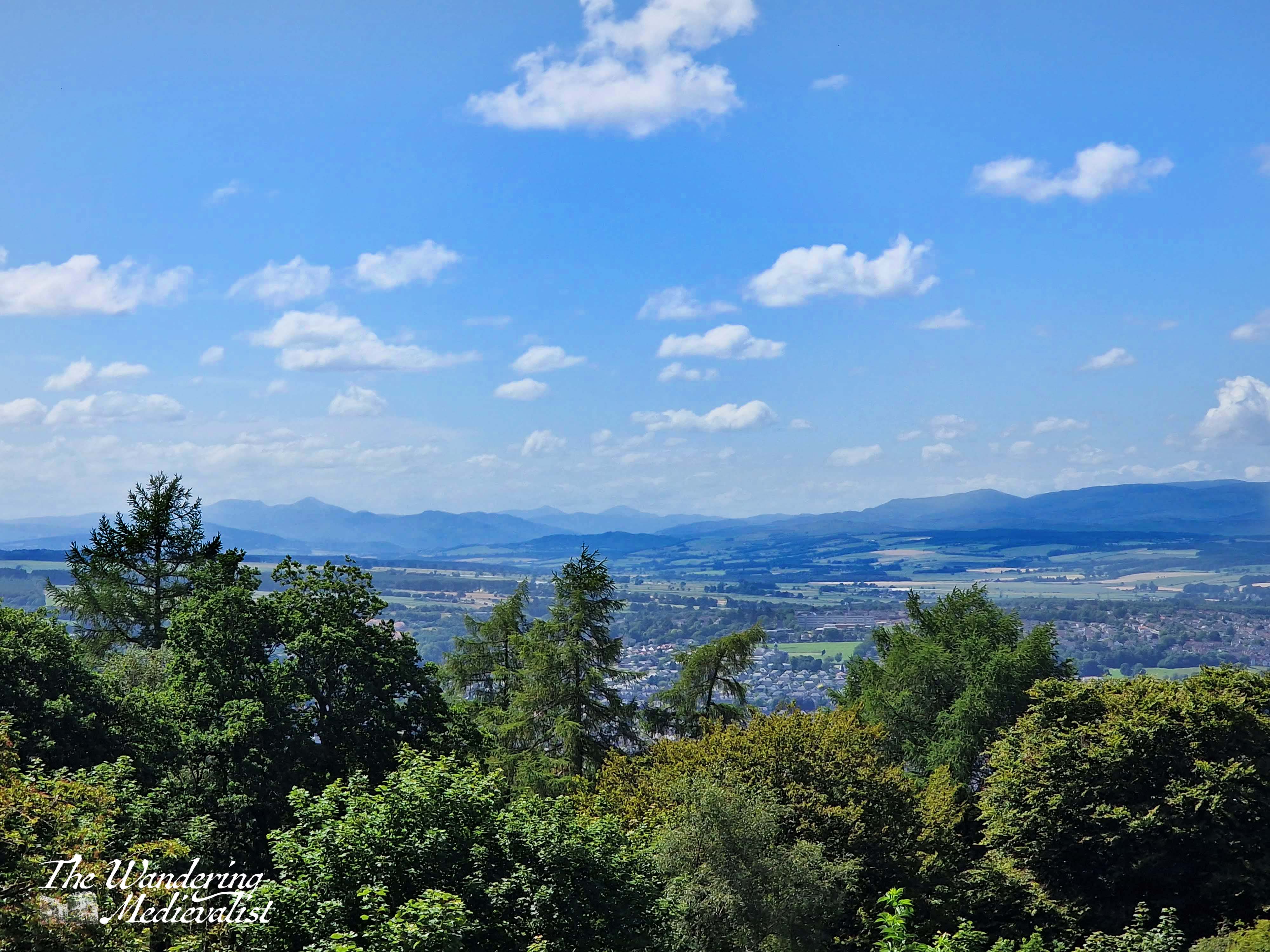
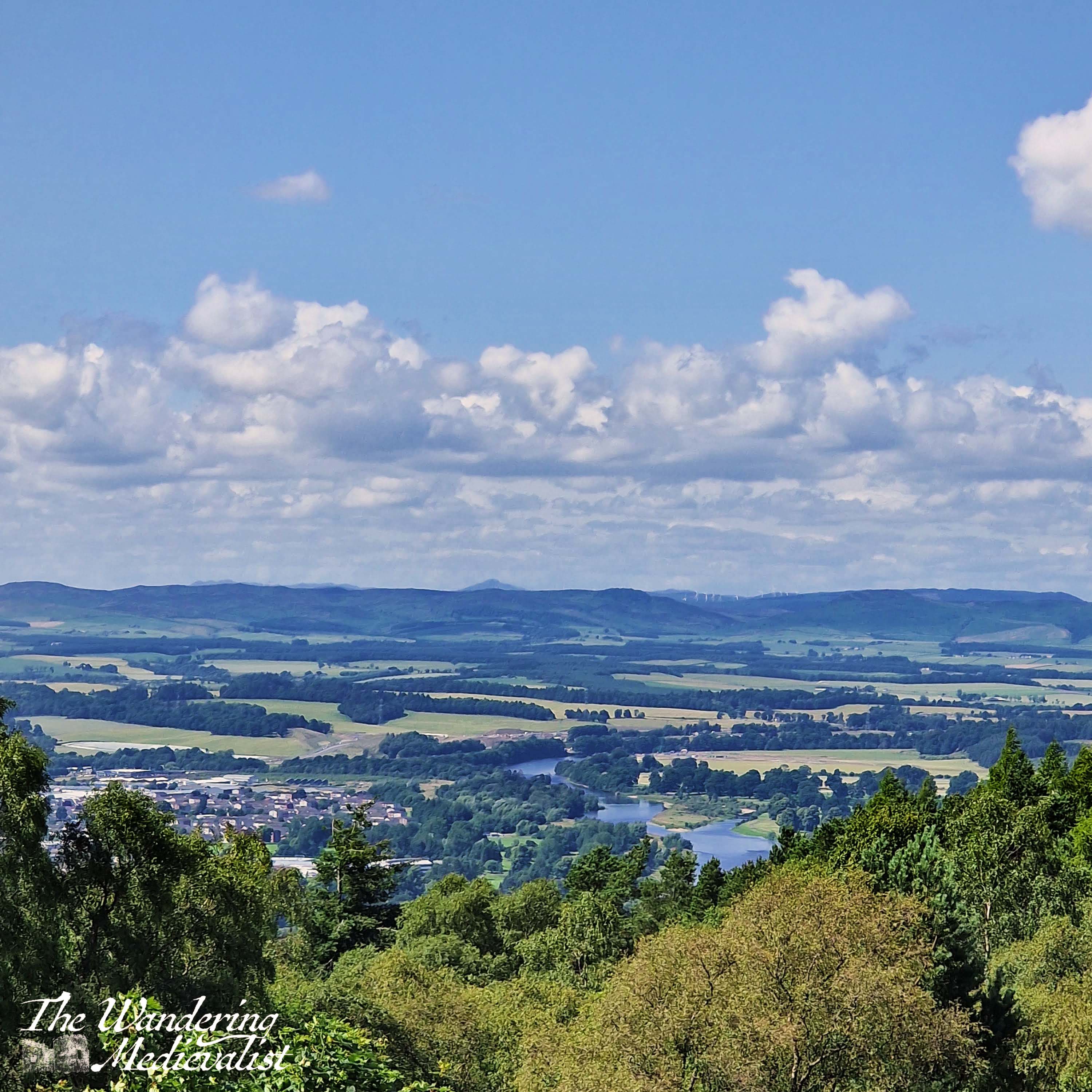
I have to admit, I was really surprised by the view from the summit – I had assumed, for no valid reason at all really, that the best of the view was to the south. On the contrary, the top of Kinnoull Hill offers just as impressive views north, with the jagged peaks of the Highlands easily identifiable.
The faint hint of the mountains further north made me suddenly yearn desperately to be back up amongst them, so I hope I can plan a day trip before my next planned excursion in September.
The path back down to the car was sigificantly more pleasant in terms of surroundings – a bit more open, so fewer bugs, and more of a view into the trees and surrounding woodland. In the future, I would definitely park further along and take the red Tower Trail, which I imagine you could stretch to two hours if you wanted.
I am so pleased we ended up on this walk, and I will definitely be back to explore it again.