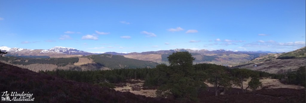
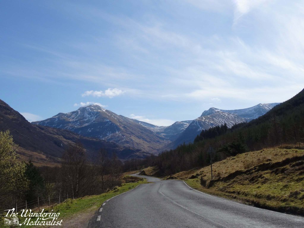
Several years back, for reasons I cannot really recall, we decided to deviate from our traditional Lochaber-based holidays and try out the eastern side of the Highlands around Aviemore. Due to its popularity in winter sport season, there are plenty of places to stay and eat, and it is a slightly shorter drive.
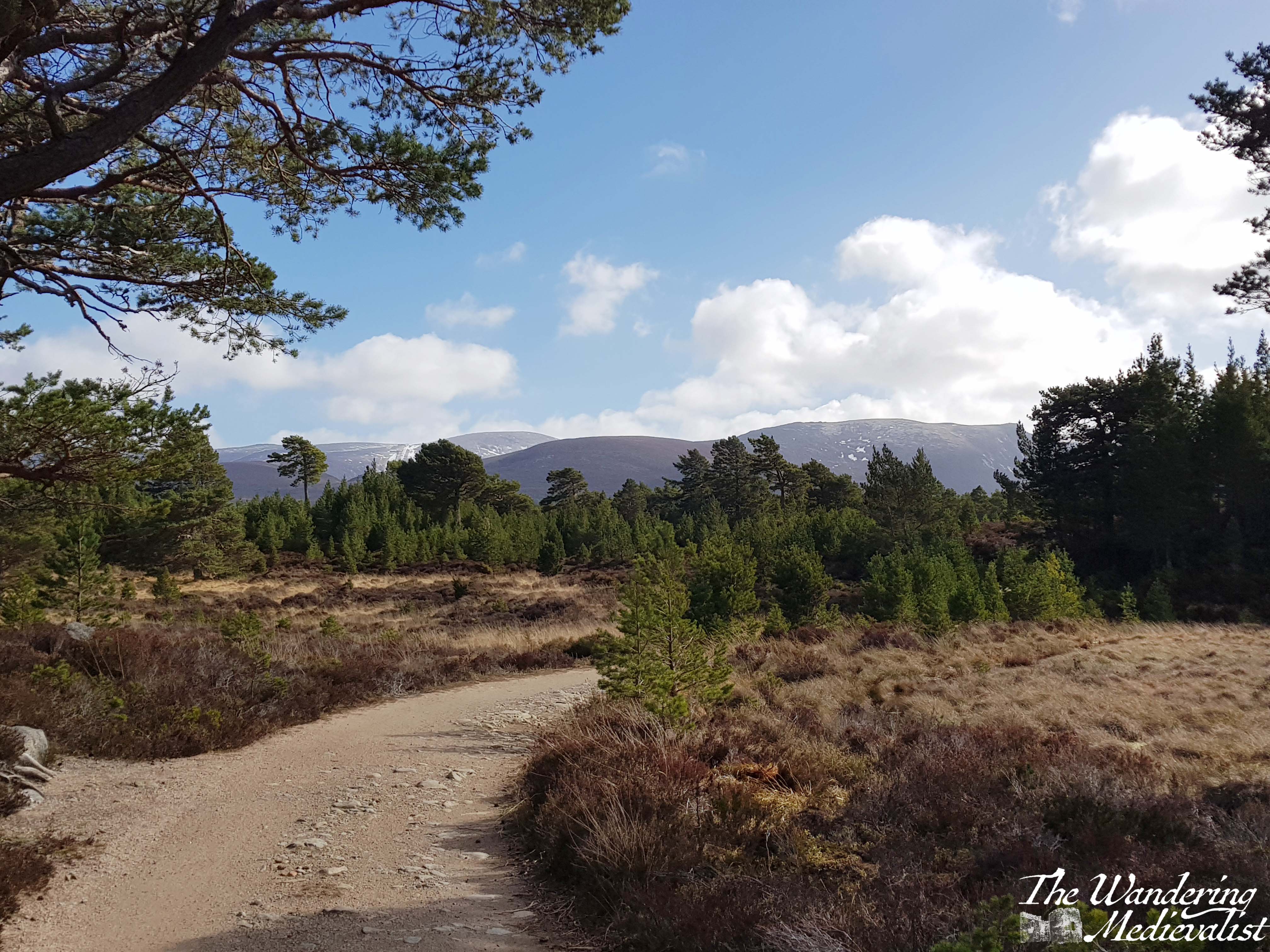
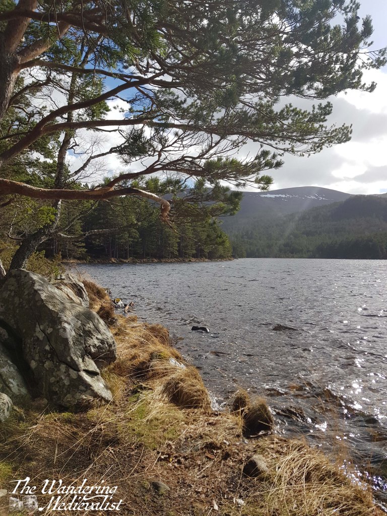
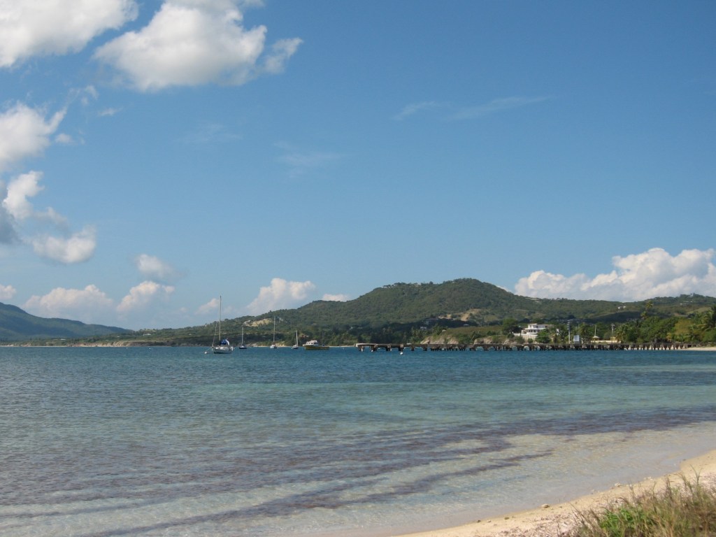
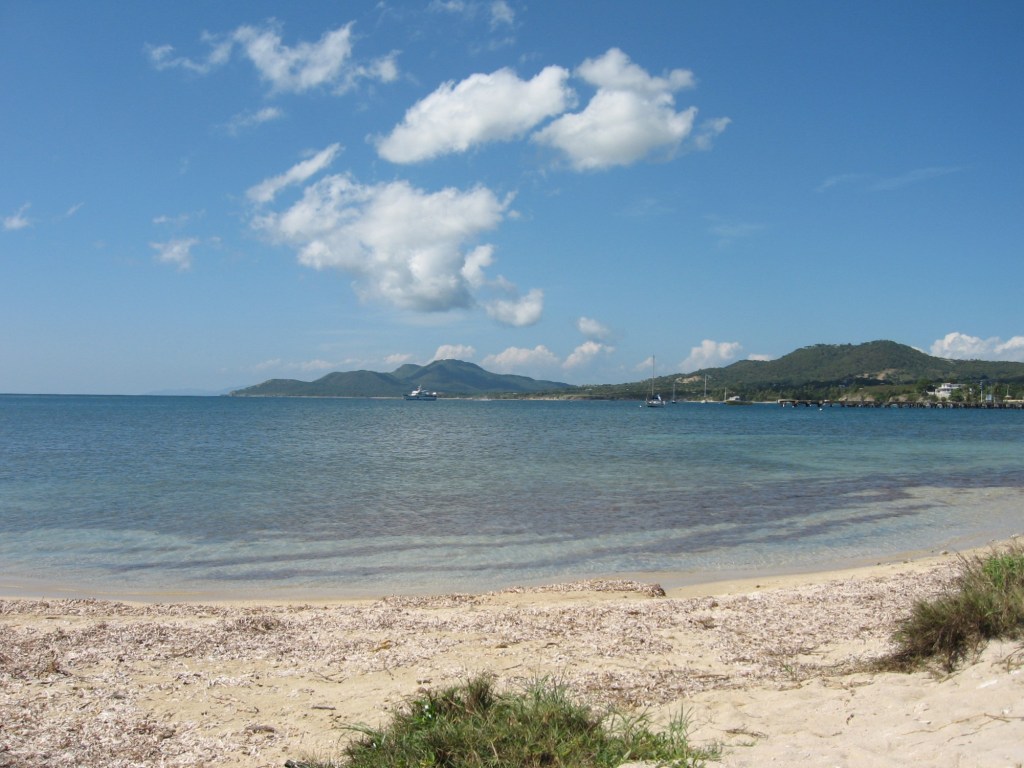
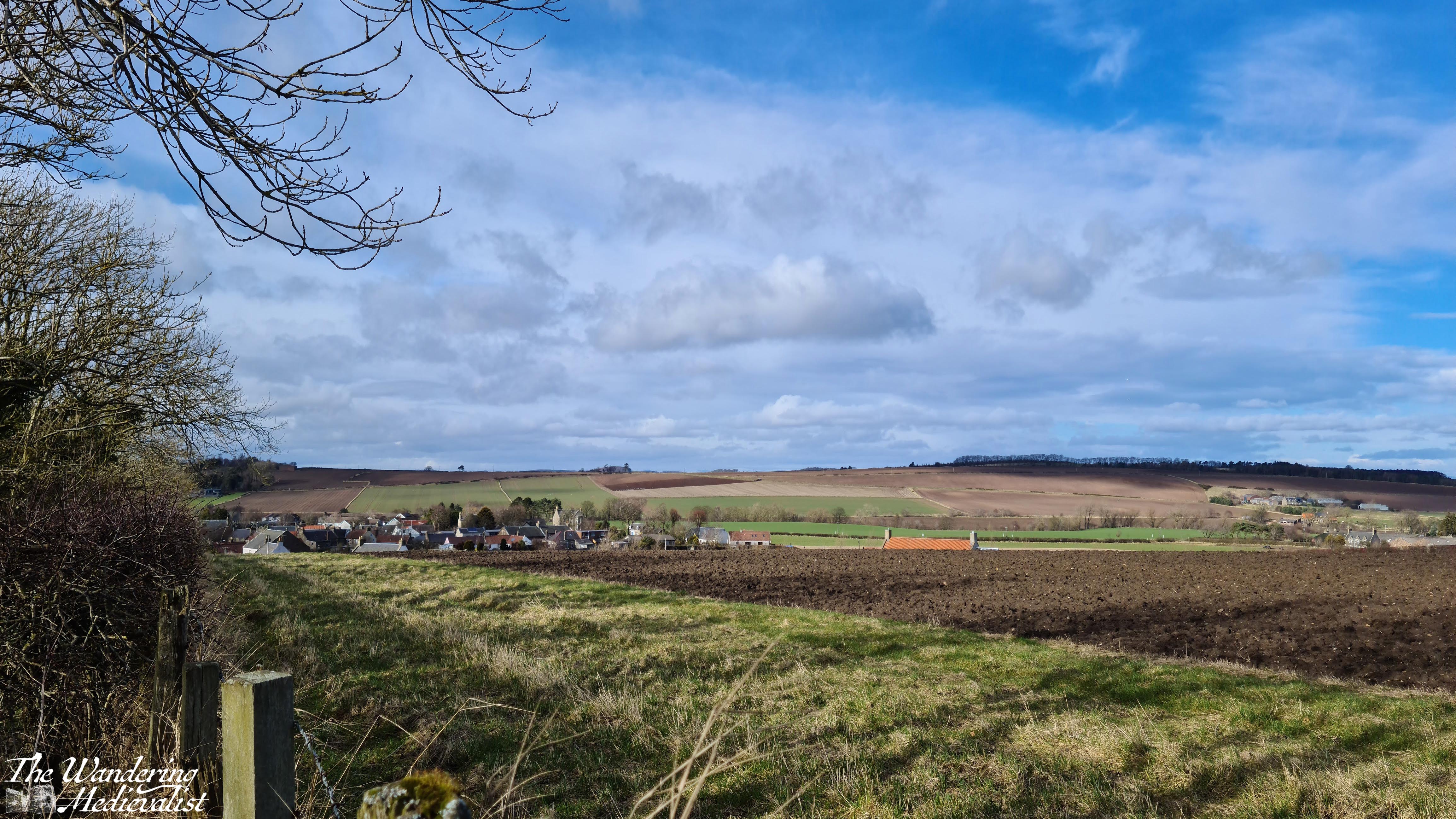
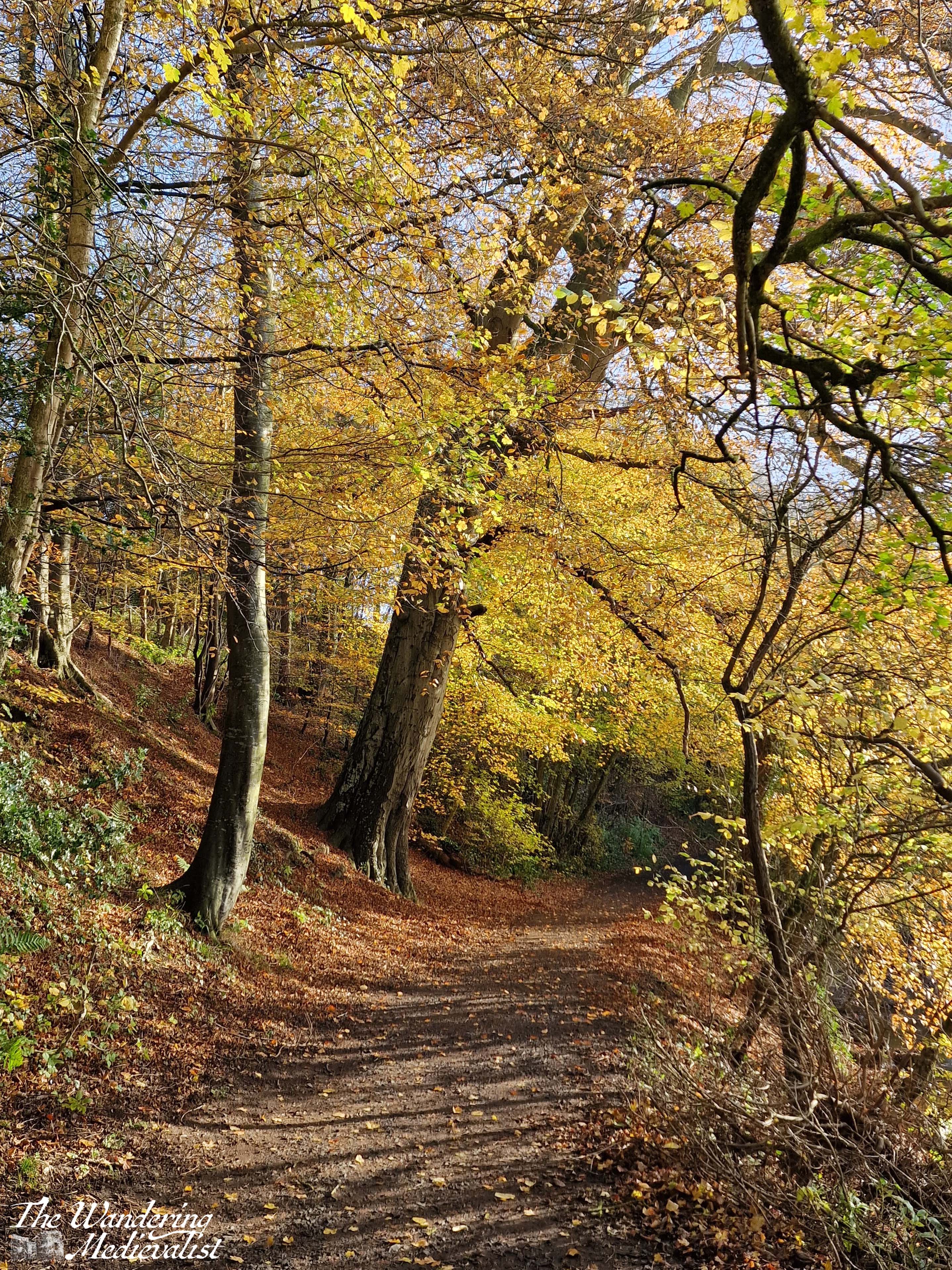
On our first day we took an epic long walk around Loch Morlich in the rain, and so on the next day we opted for a slightly more gentle trek, starting at Loch an Eilein and heading almost due east towards the Cairngorm Club footbridge, about 4 miles round trip. There is quite generously-sized car park at Loch an Eilein which in and of itself has some lovely views, including a typical highland-style stone croft.
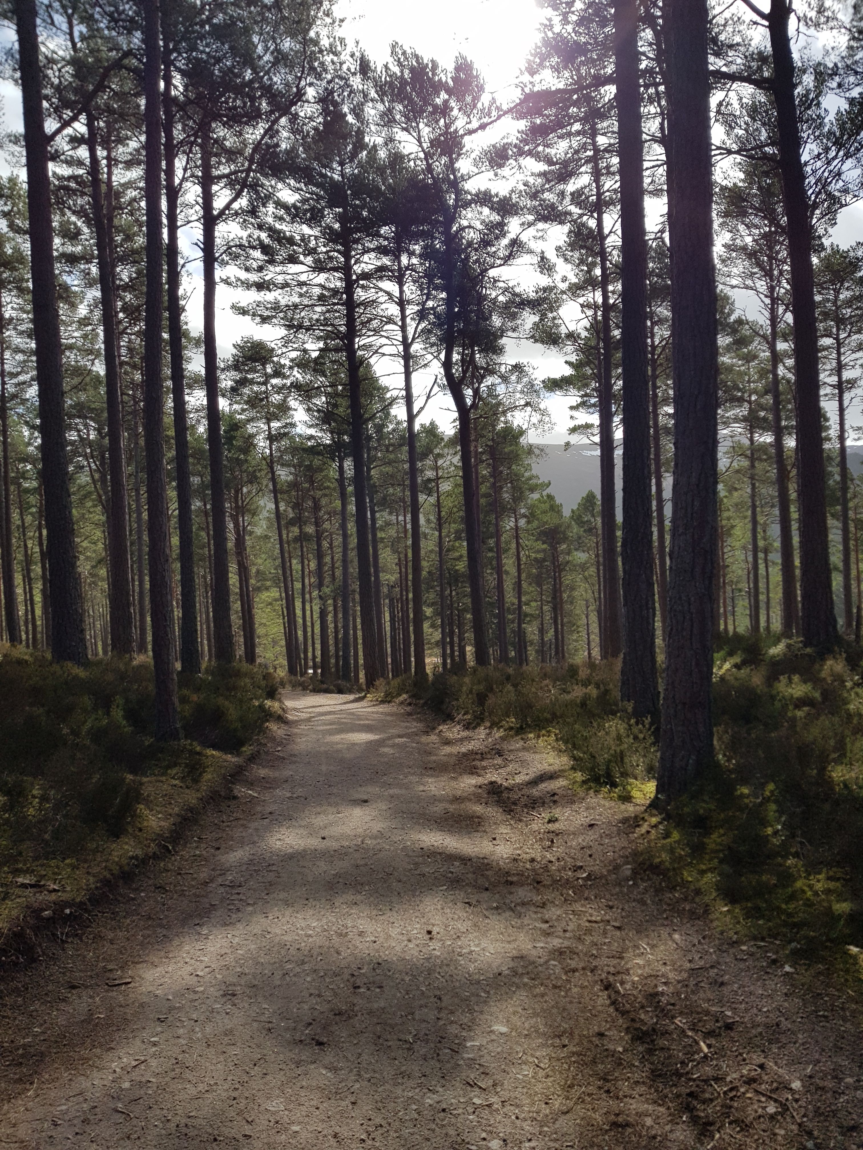
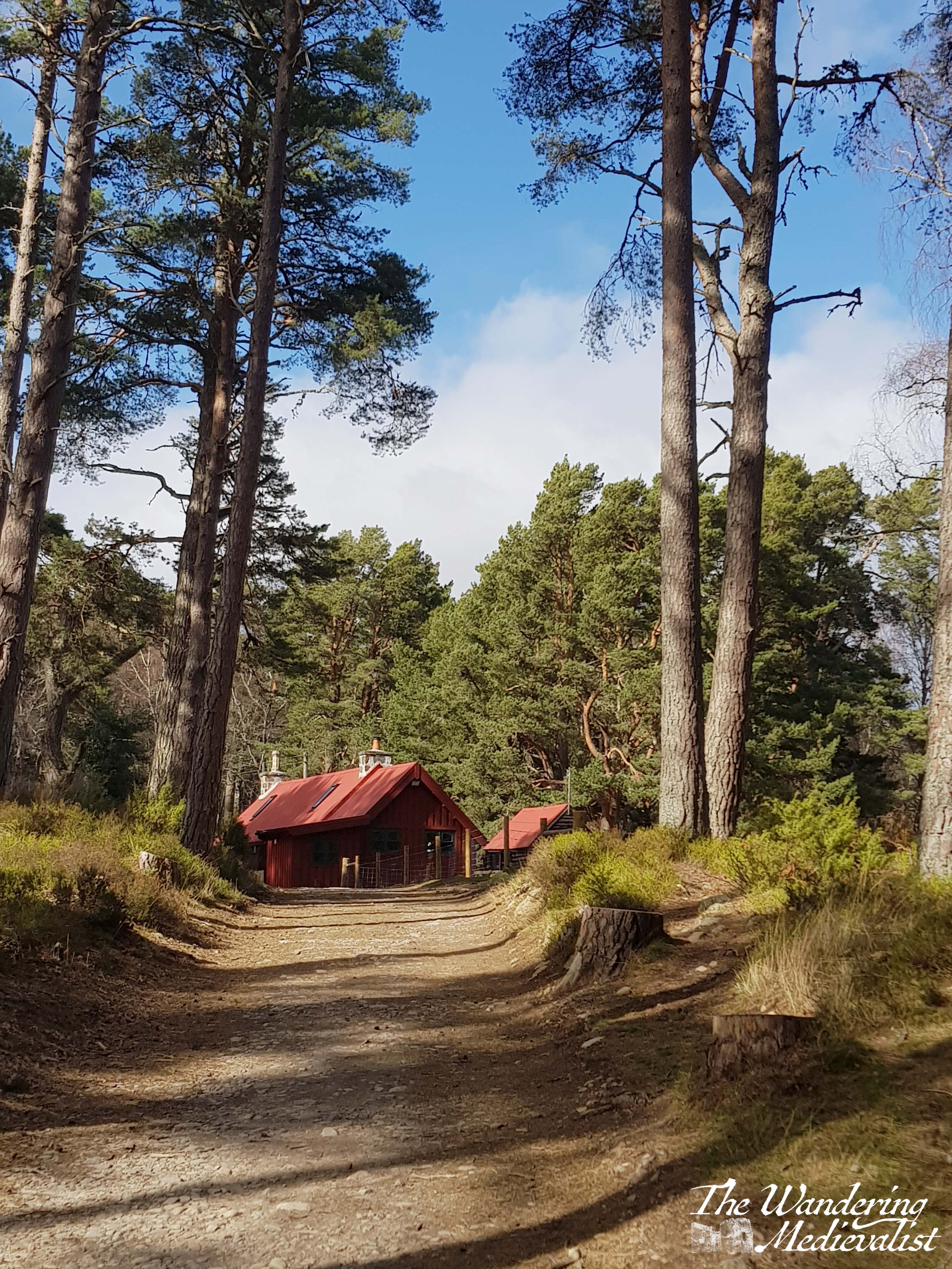
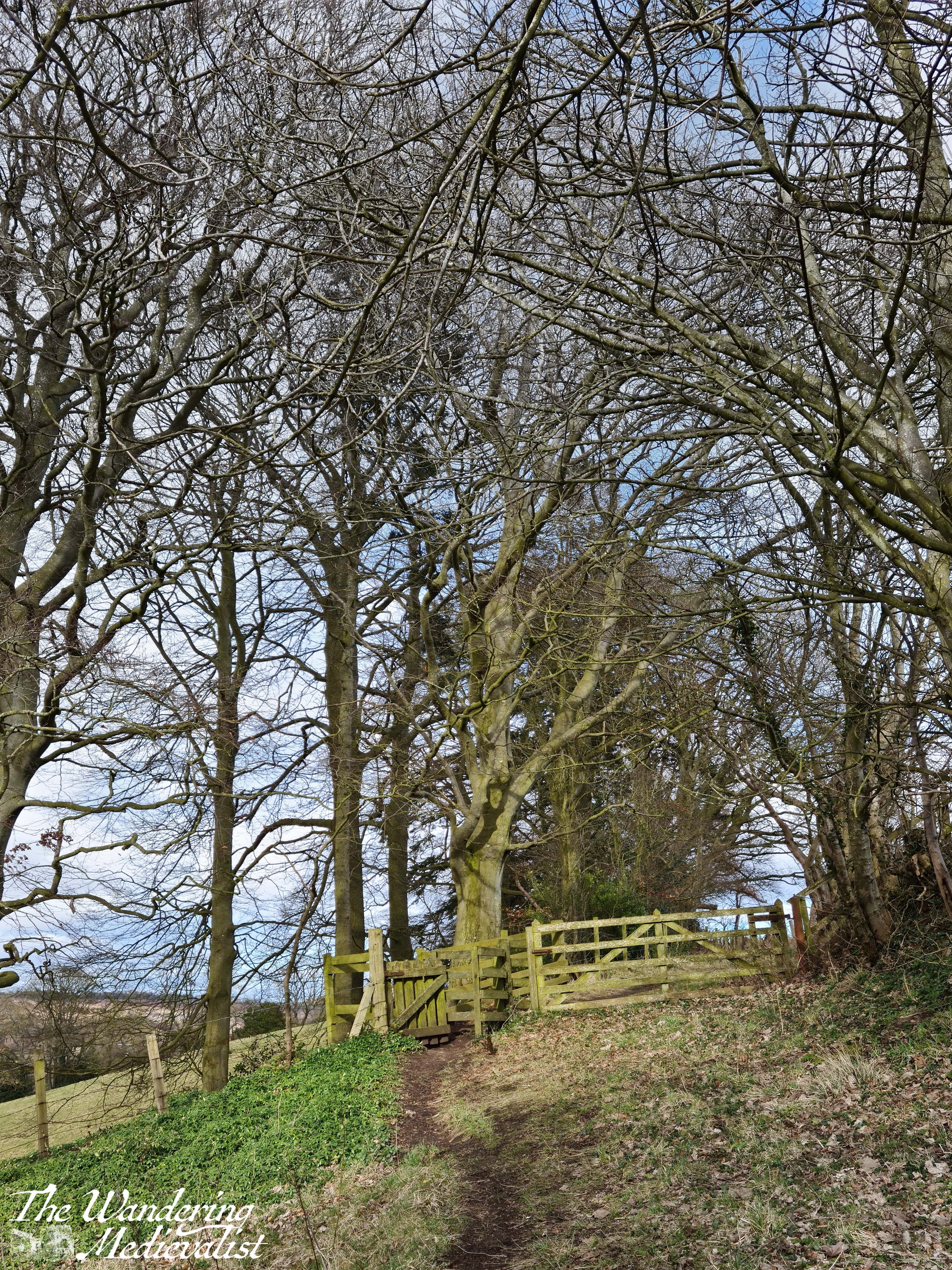
The paths in this area are very well-marked, and we started off along an access road, skirting the edge of the loch. At first, the route was surrounded by beautiful tall pines that allowed tempting glimpses of the water, as well as this stunning Bob Ross-style view of a small forest cottage.
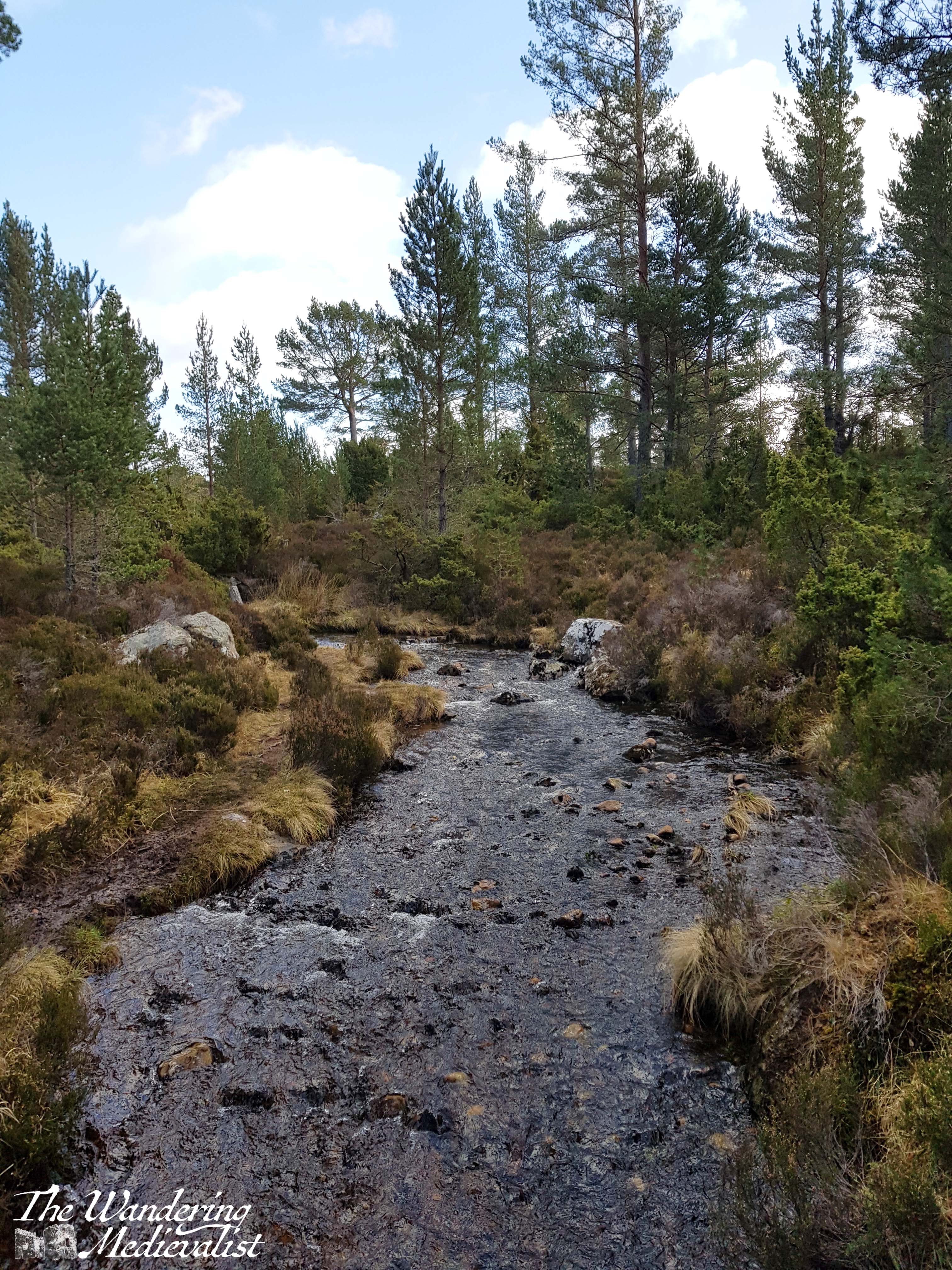
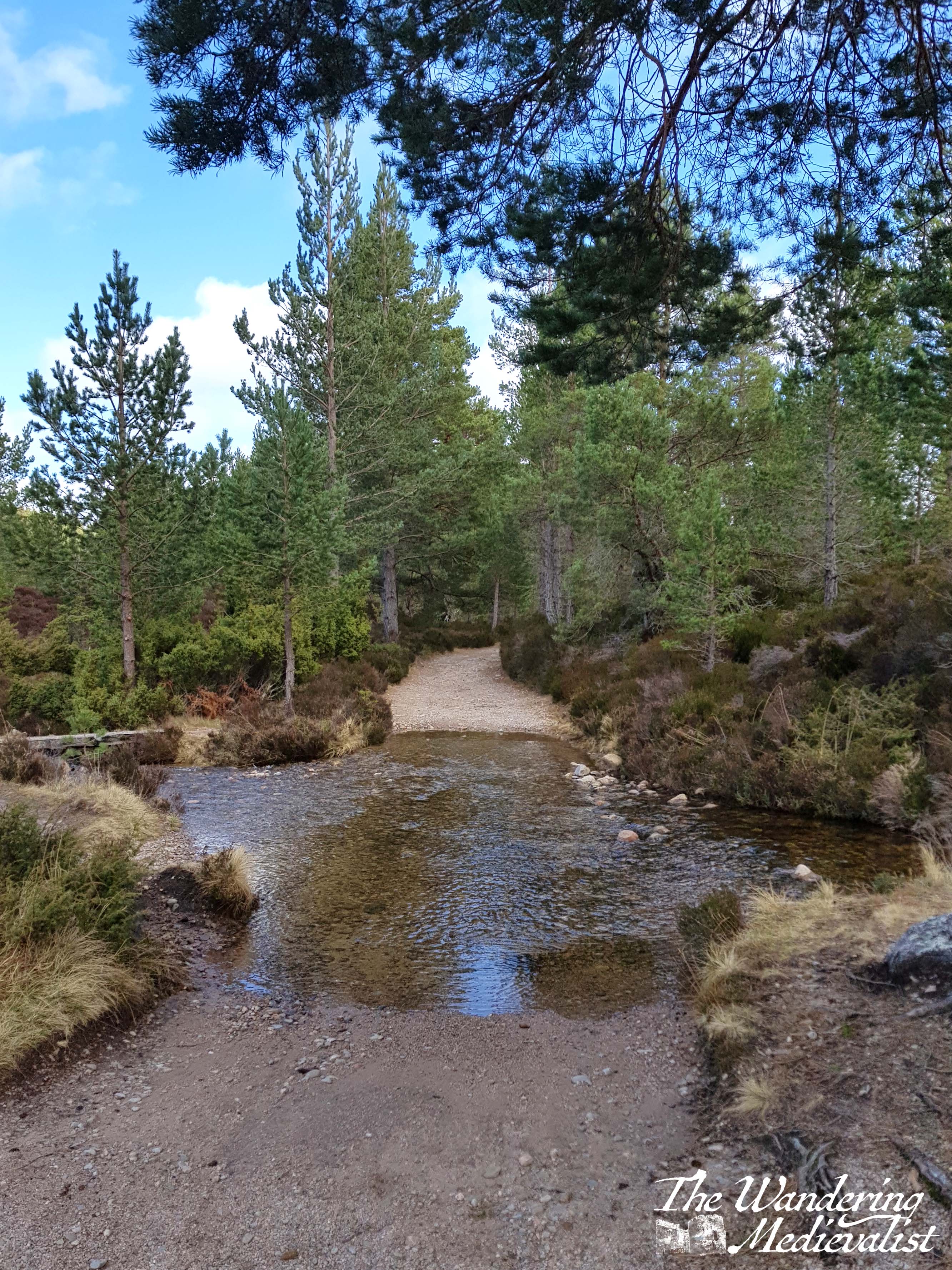
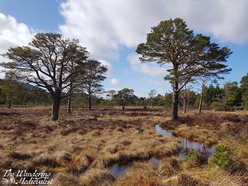
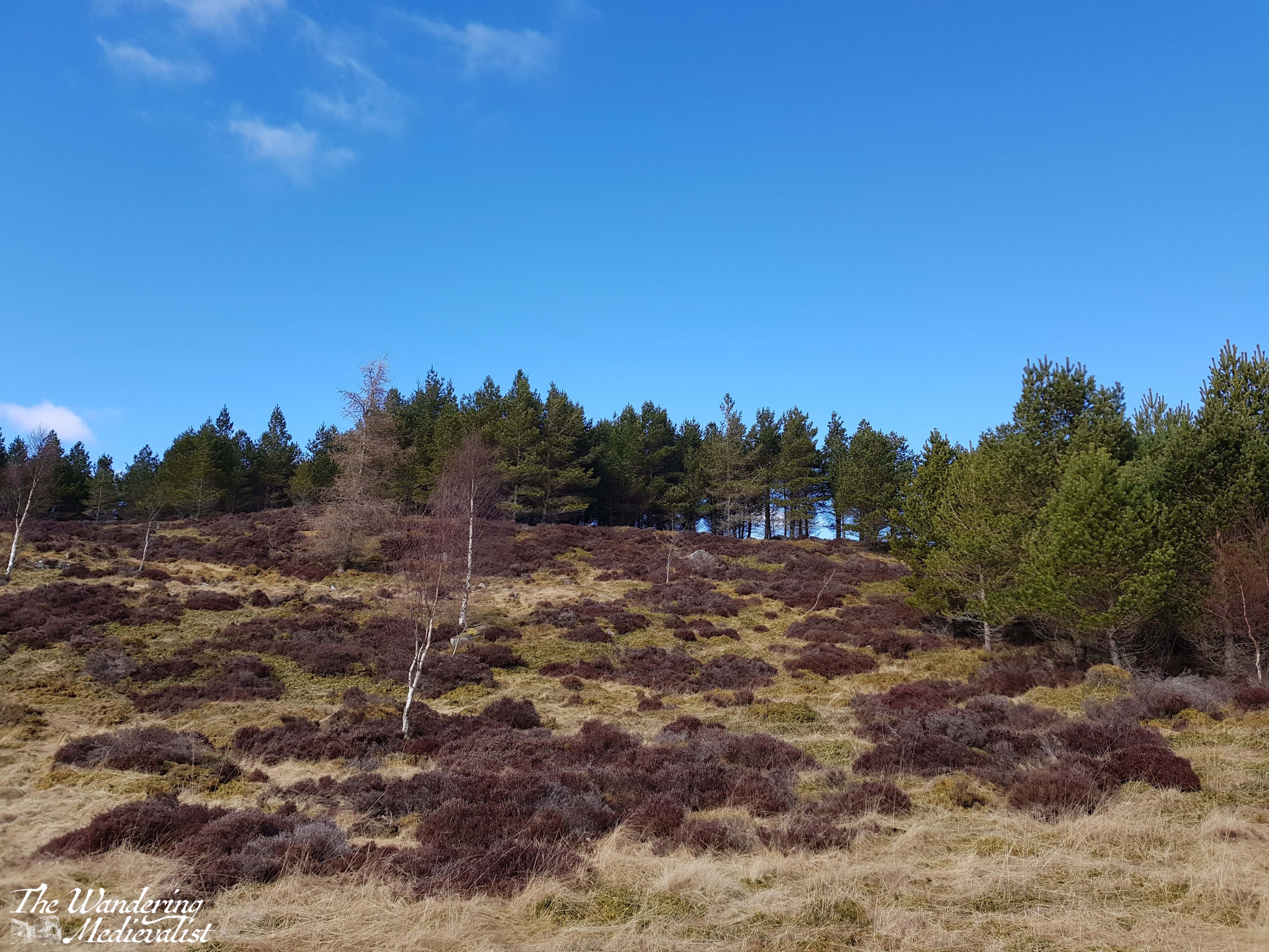
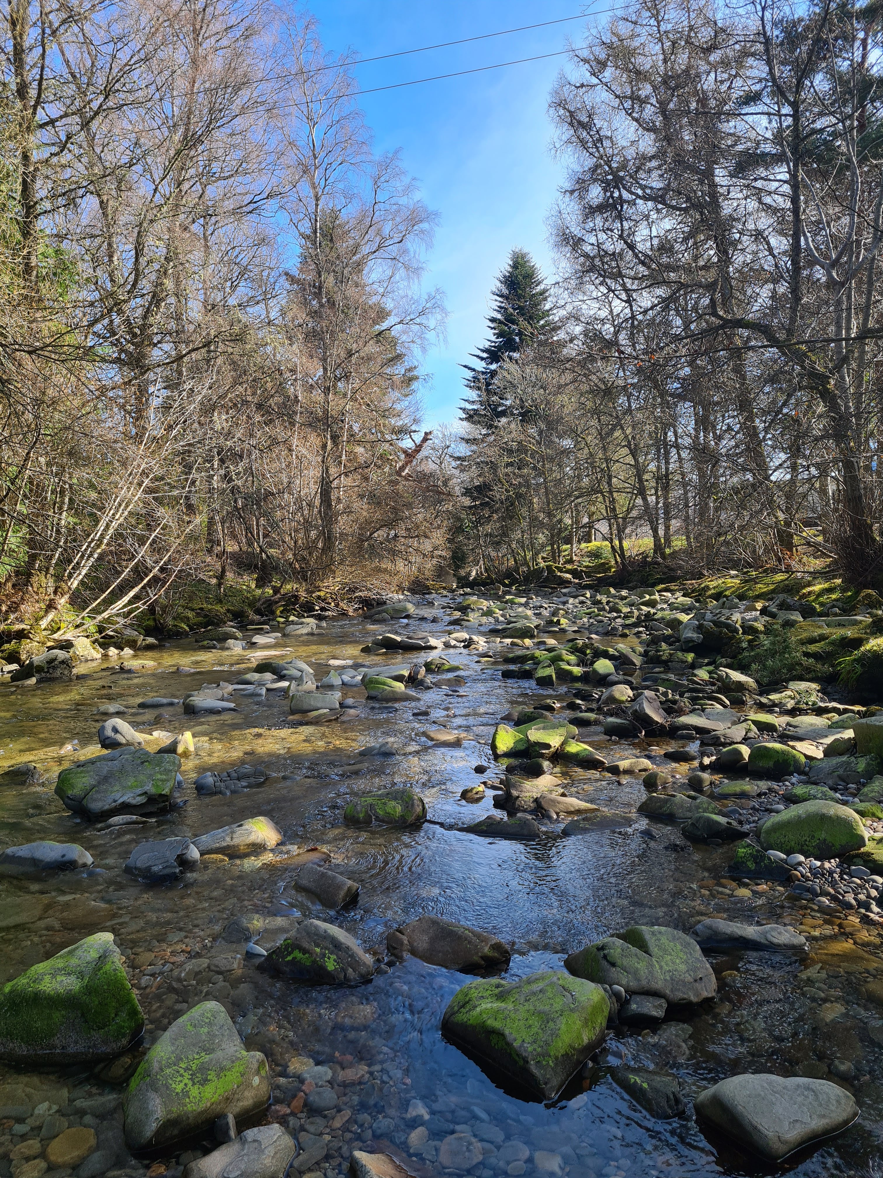
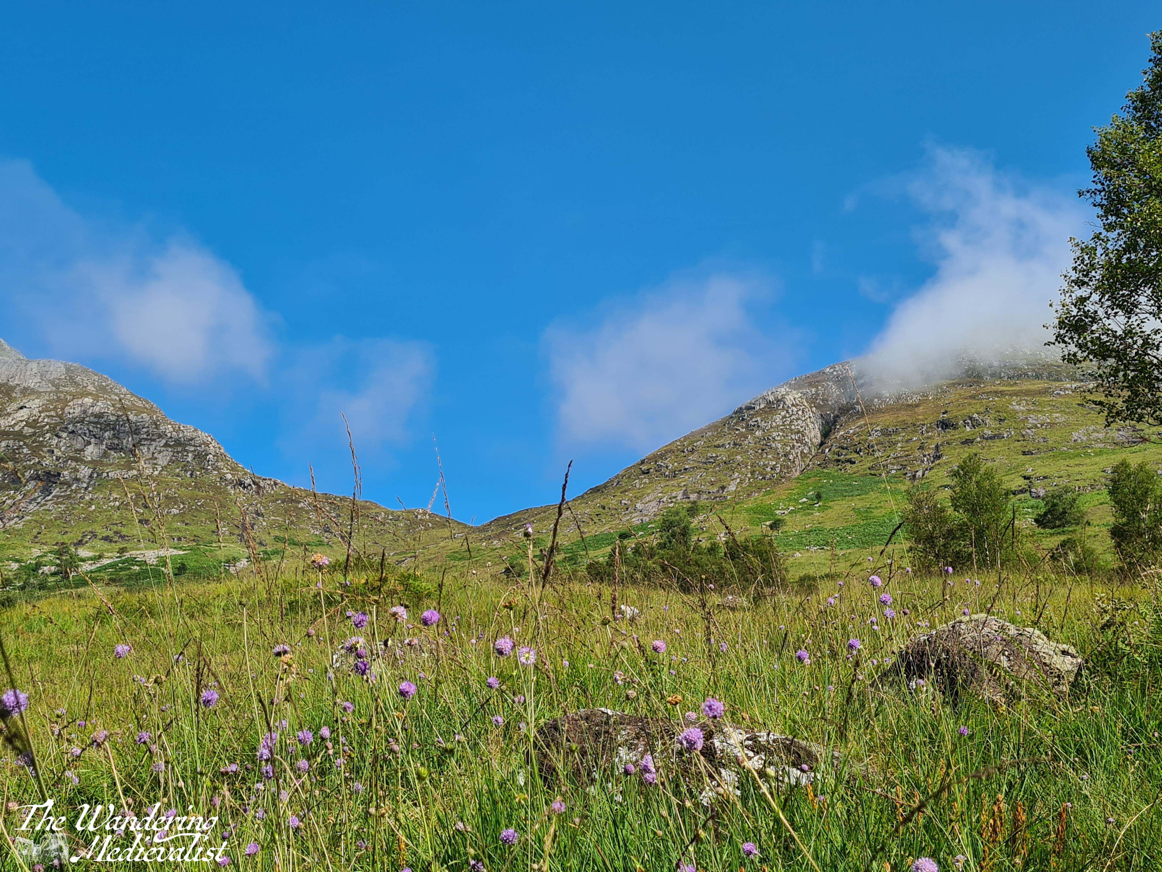
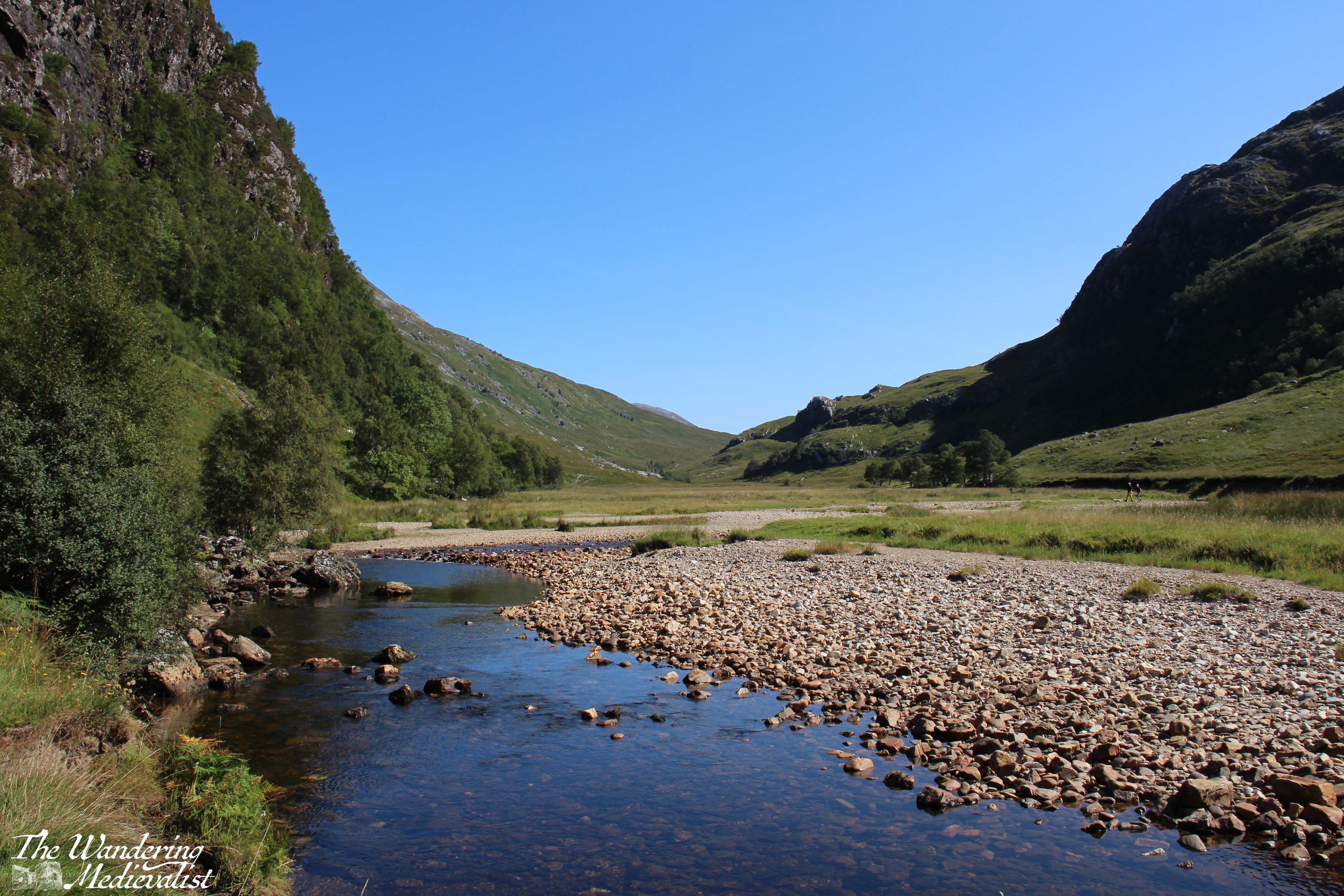
Before long, the path we wished to follow turned east away from the loch. We passed several burns and even crossed one before moving out of the trees and into a flat, more open area with brush on all sides. Much of the open area was quite boggy but the path itself was dry and, for the most part, flat and easy to follow (excepting of course the shallow ford below, which required a bit of careful manoeuvring.)
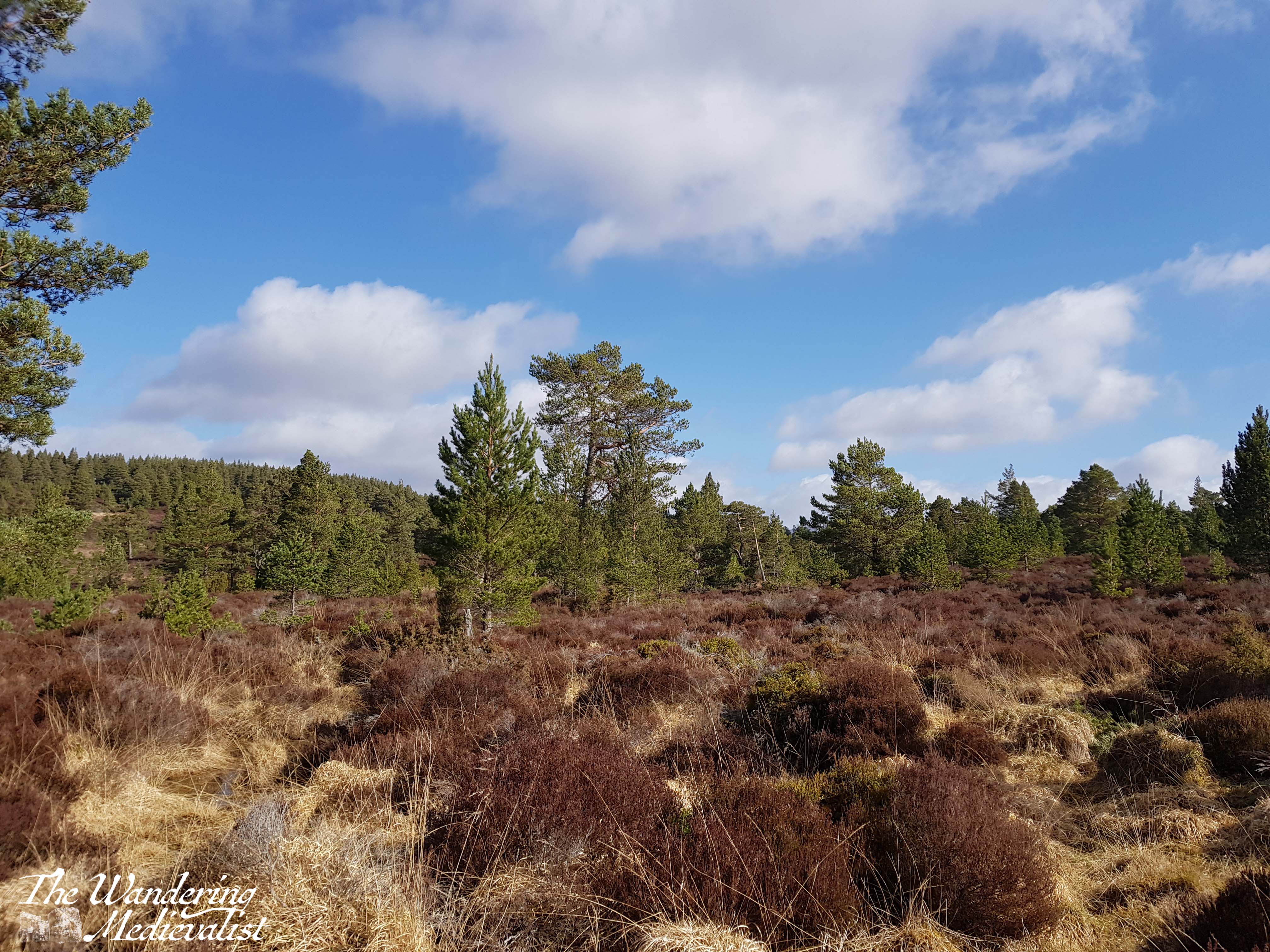
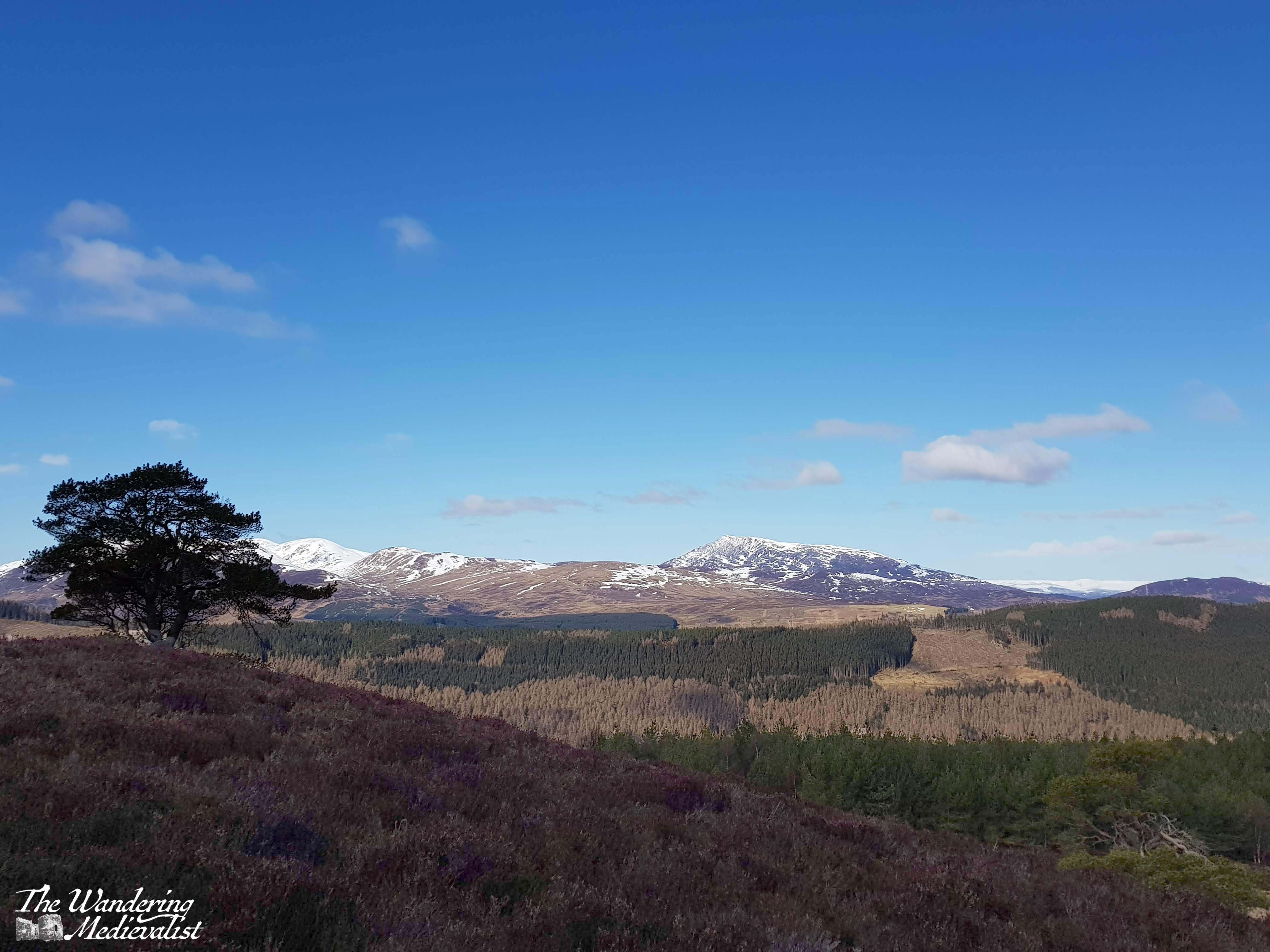
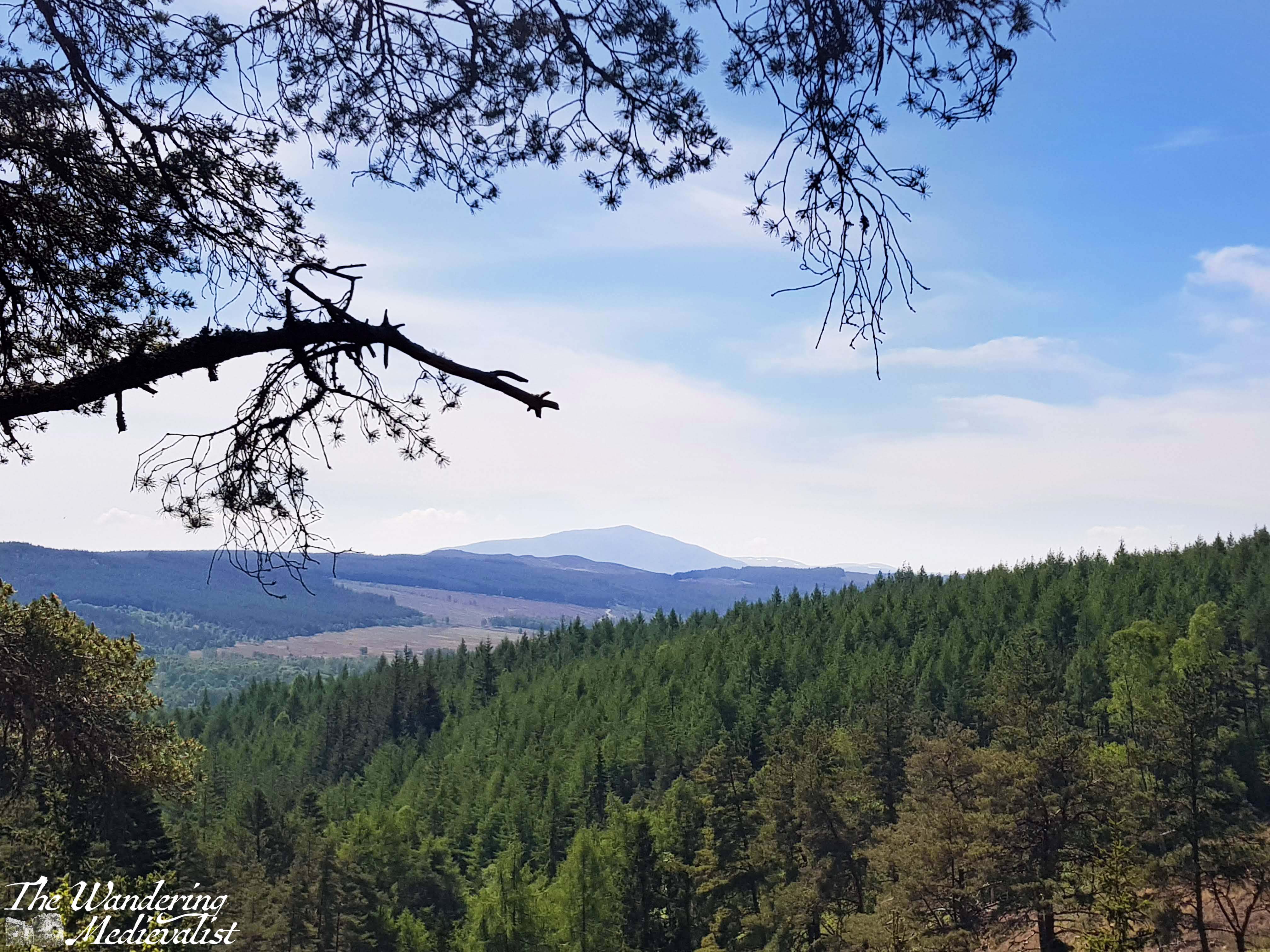
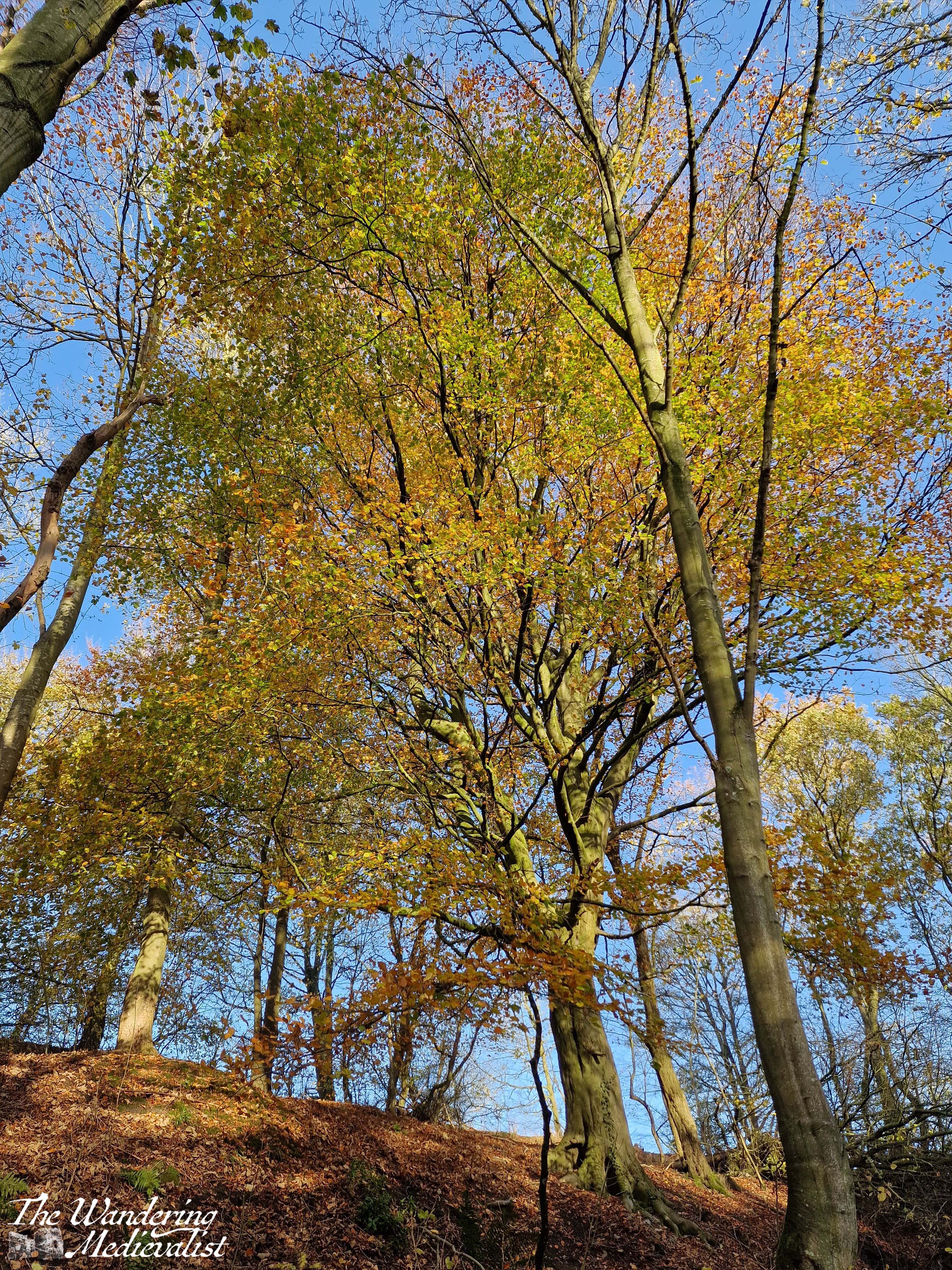
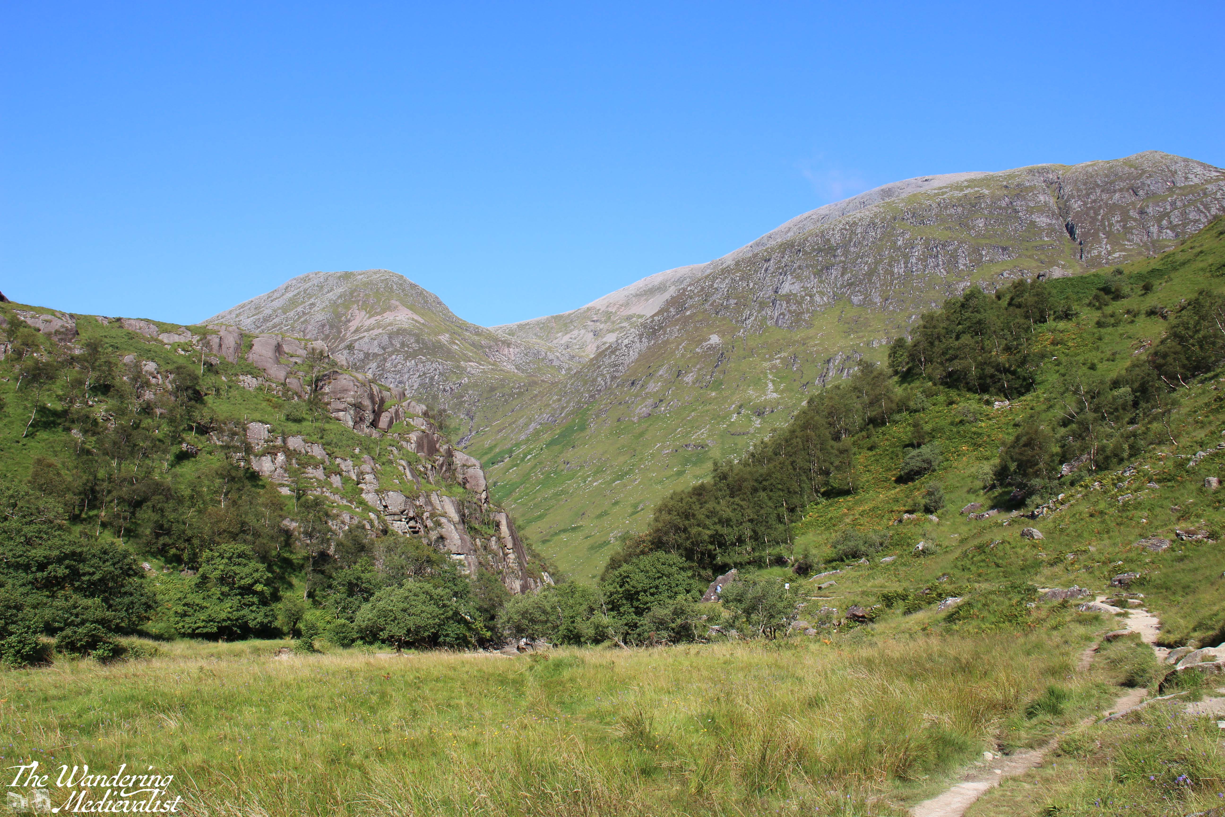
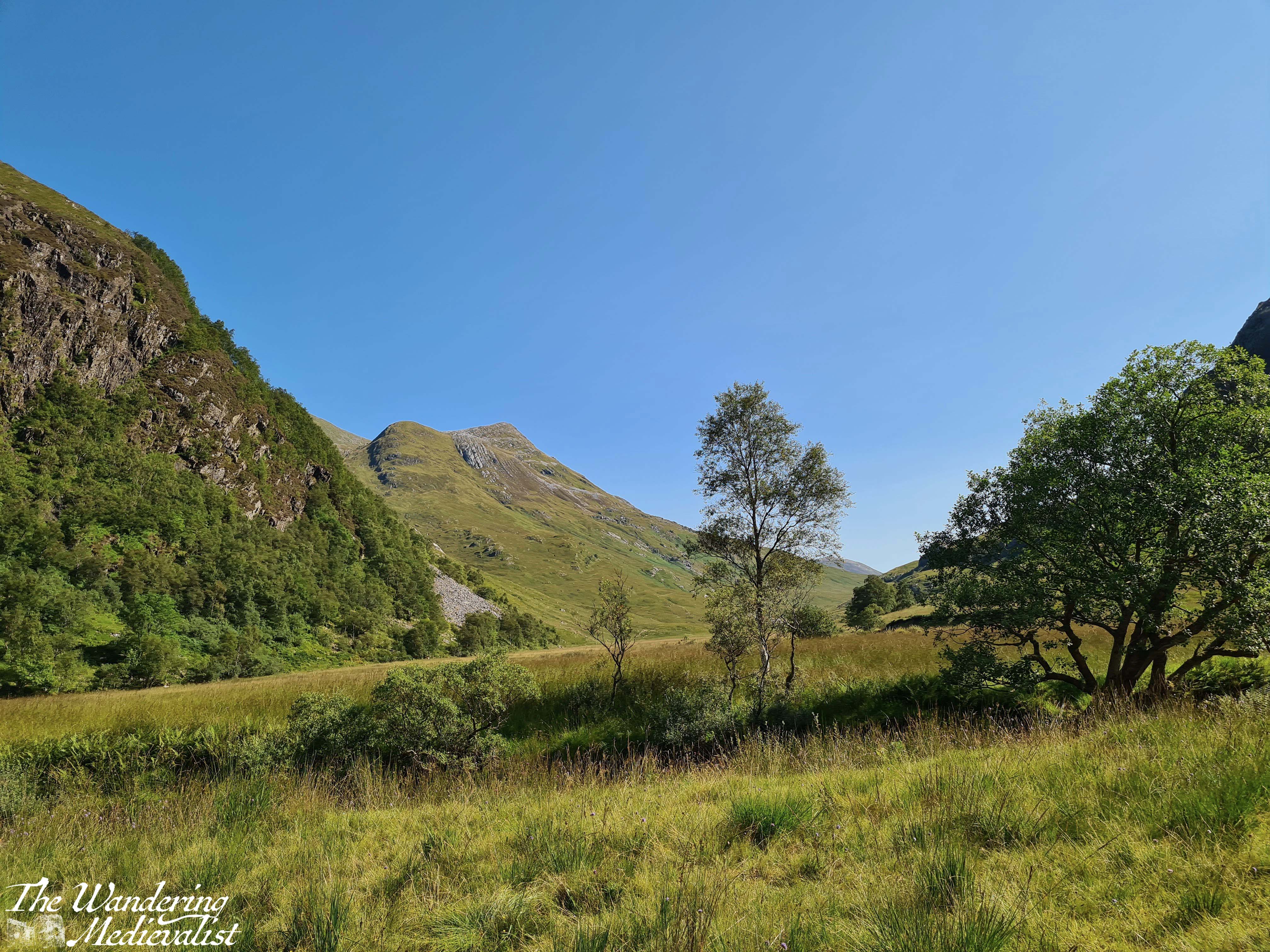
I quickly fell in love with this particular trail, which offered views of the mountains in the distance, but also stunning single or small groups of trees that stood out against the open space. There were lochans dotted amongst stands of trees, shining in the sunlight, and it felt like something out of Lord of the Rings or some other fantasy.
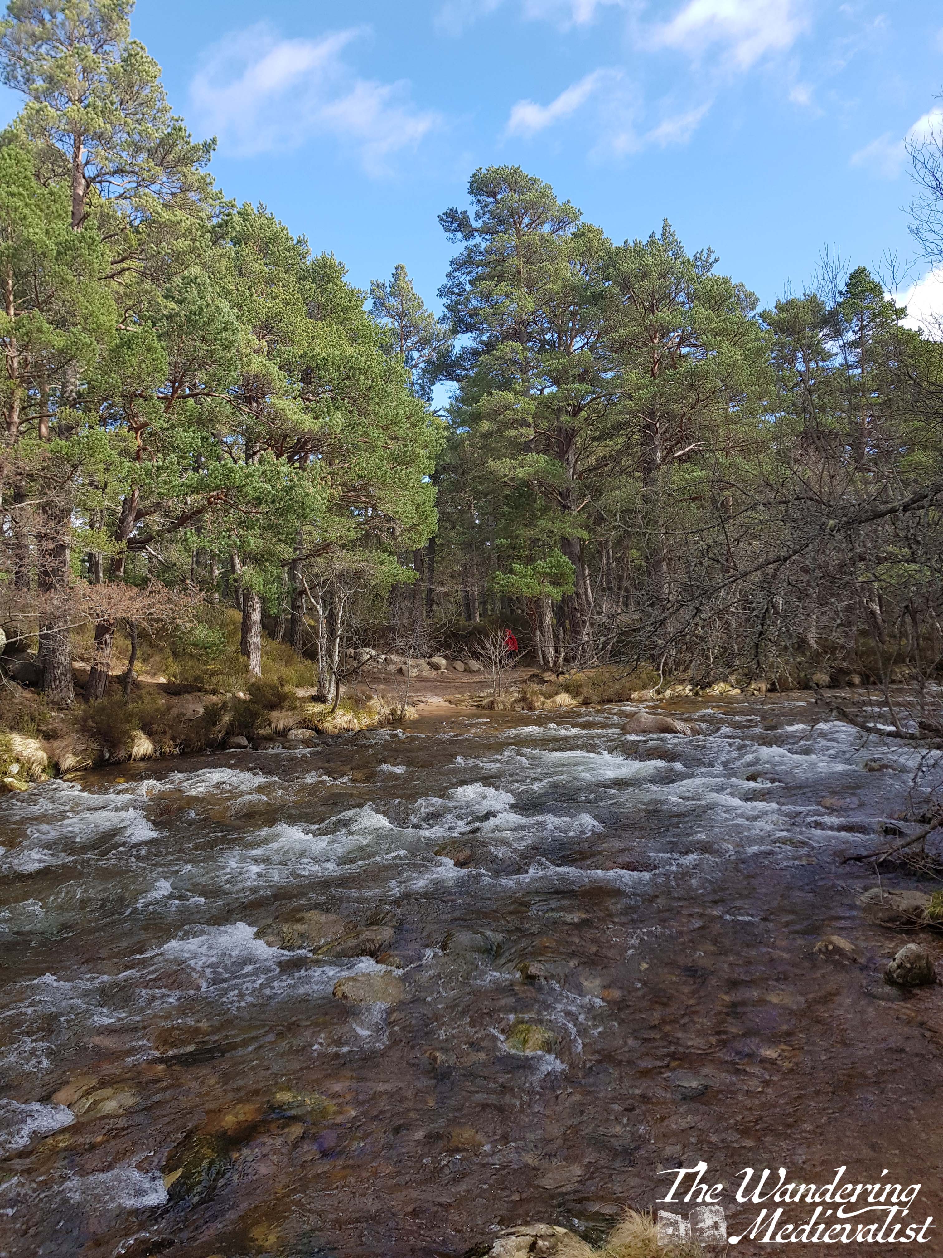
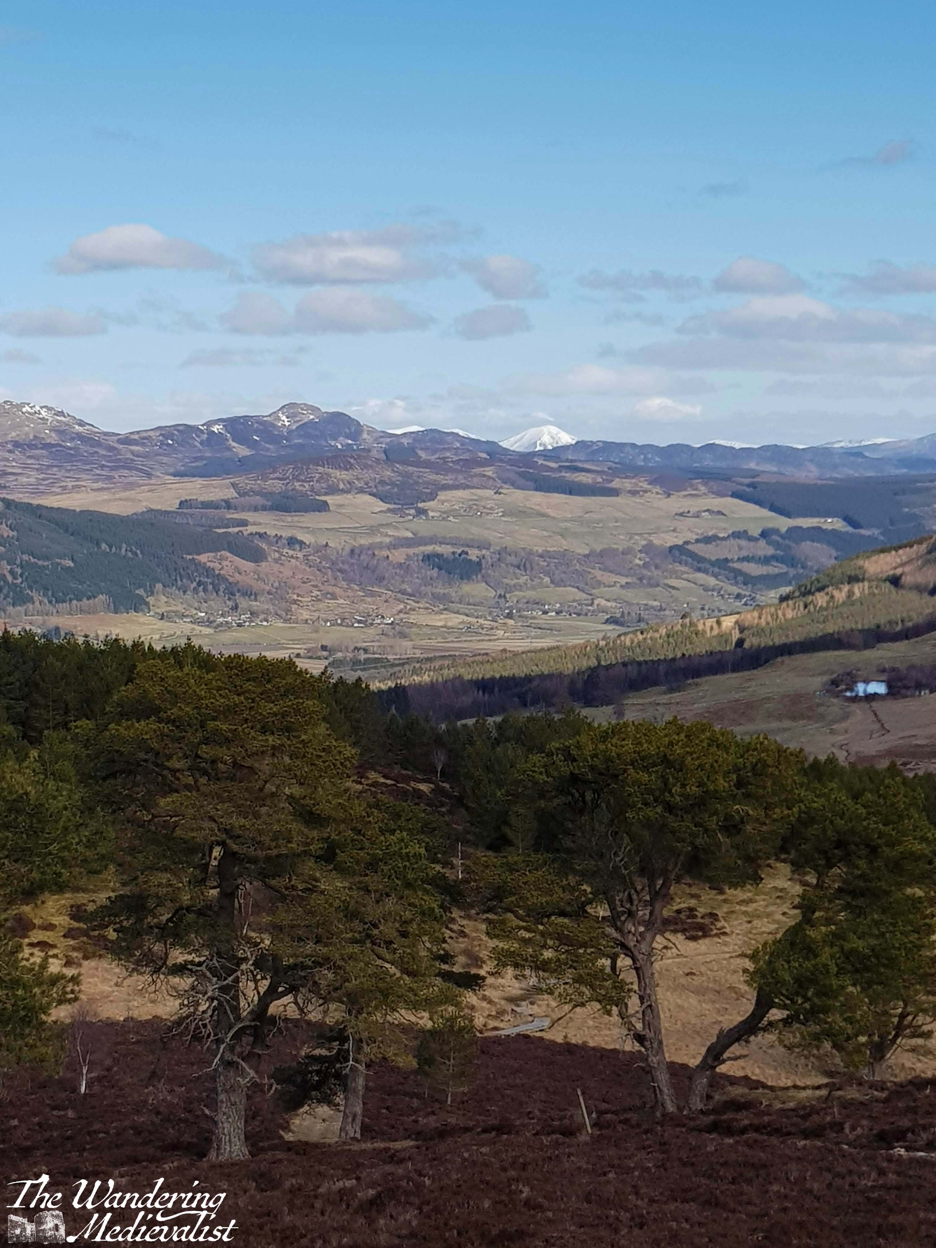
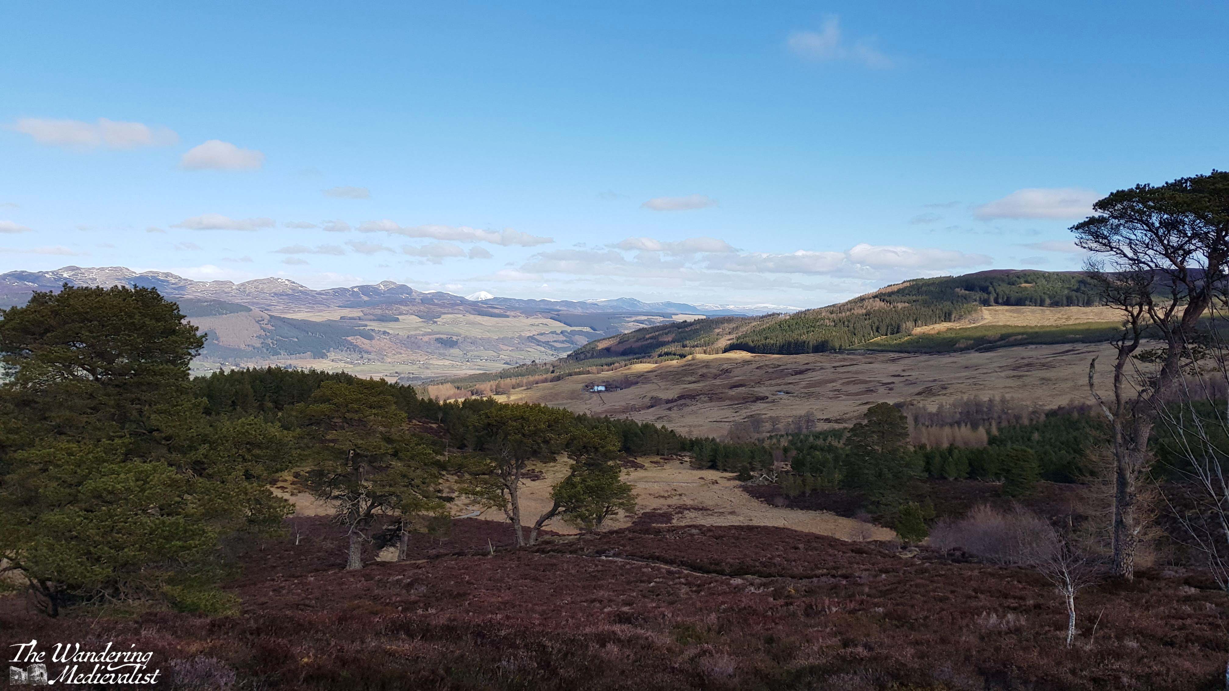
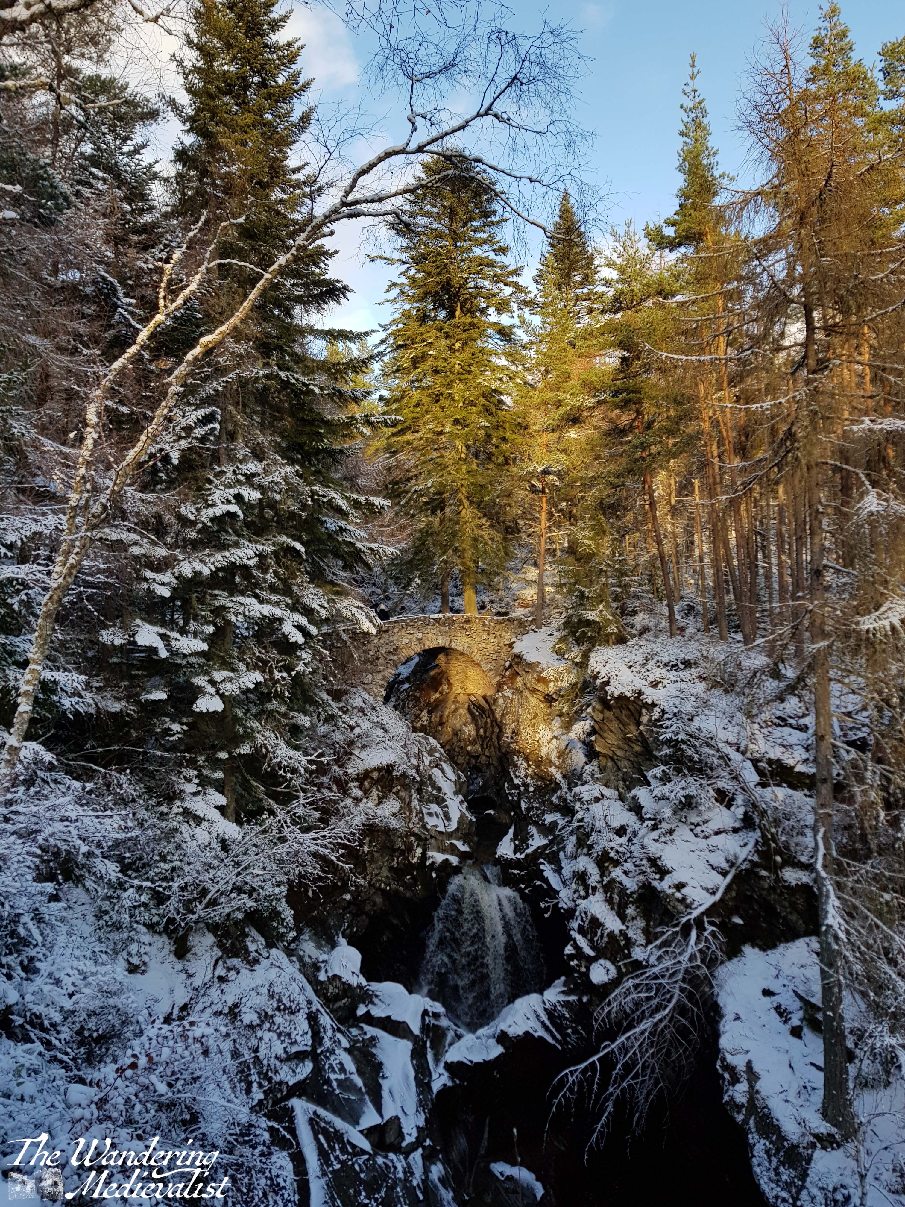
The walk was dampened only by the fact that we were both a bit stiff and sore from our intense hike the previous day, and I found myself easily exhausted (not in part due to a bout of food poisoning the night before). I am nothing if not stubborn, however, and so we continued on towards Am Beanaidh, the river that was our goal. We did have a few moments of worry that we had taken the wrong path – we had a good map, but as is not uncommon in the highlands there were routes not on the map that led close to where we wanted to go – but in time we re-entered the forest and began to hear the sounds of the river.
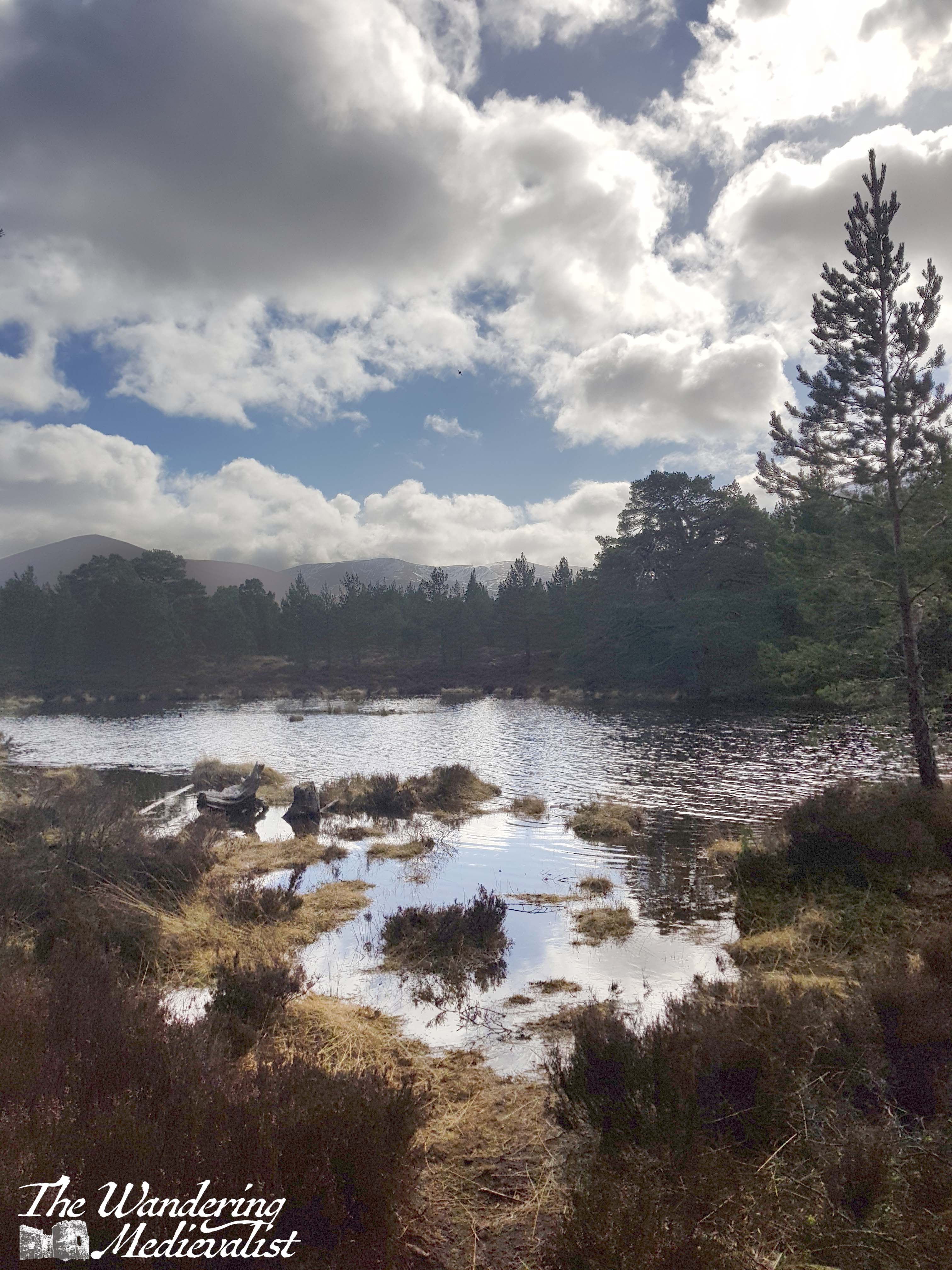
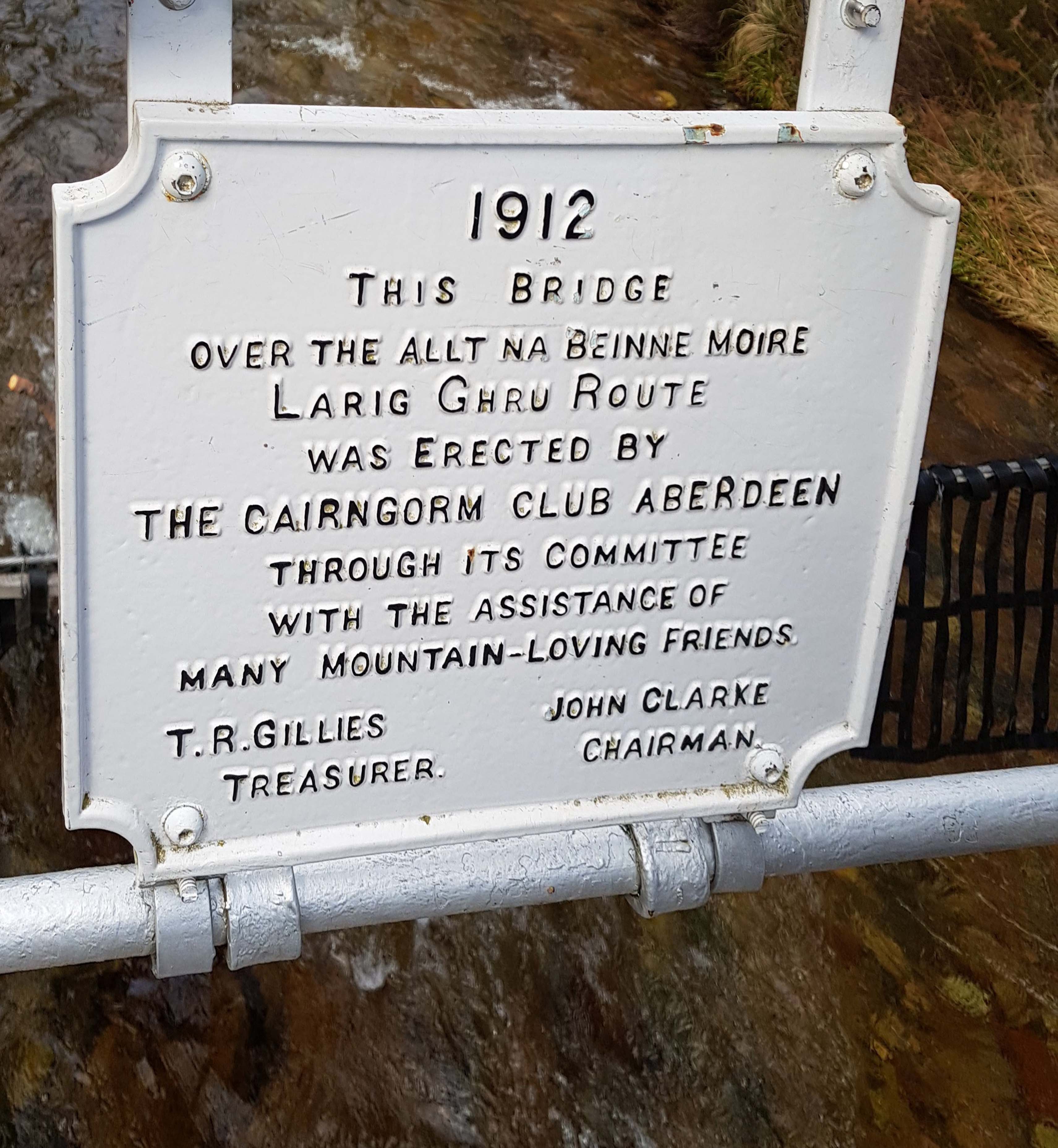
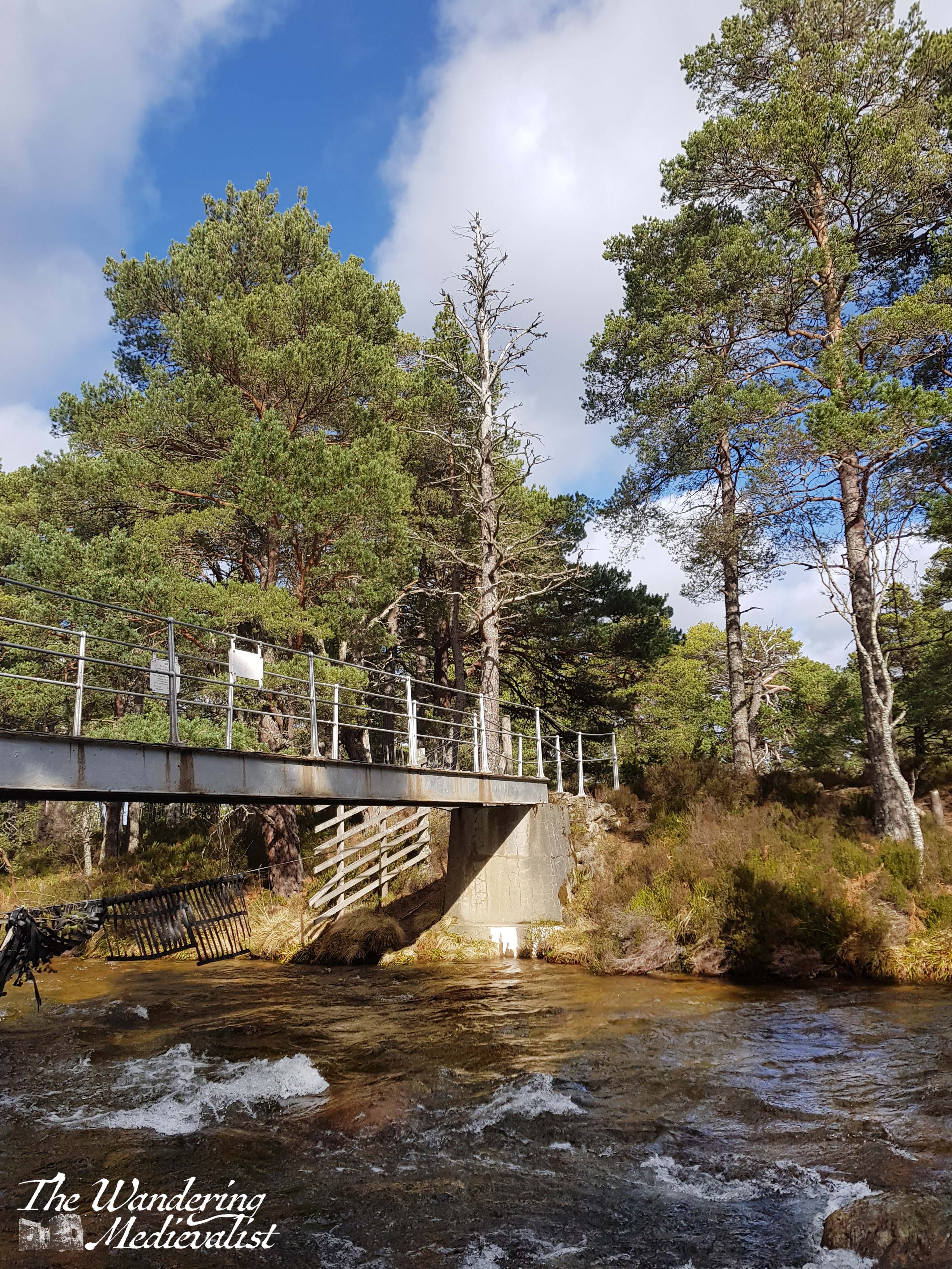
Our goal and our lunch spot for the day was the iron footbridge which spans the river and was constructed by the Cairngorm Club in 1912. It boasts several sturdy plaques memorialising the building of the bridge, and a good viewpoint to look up or down the river. It was the perfect stop to fuel up and take a few selfies to prove we had managed a hike that day.
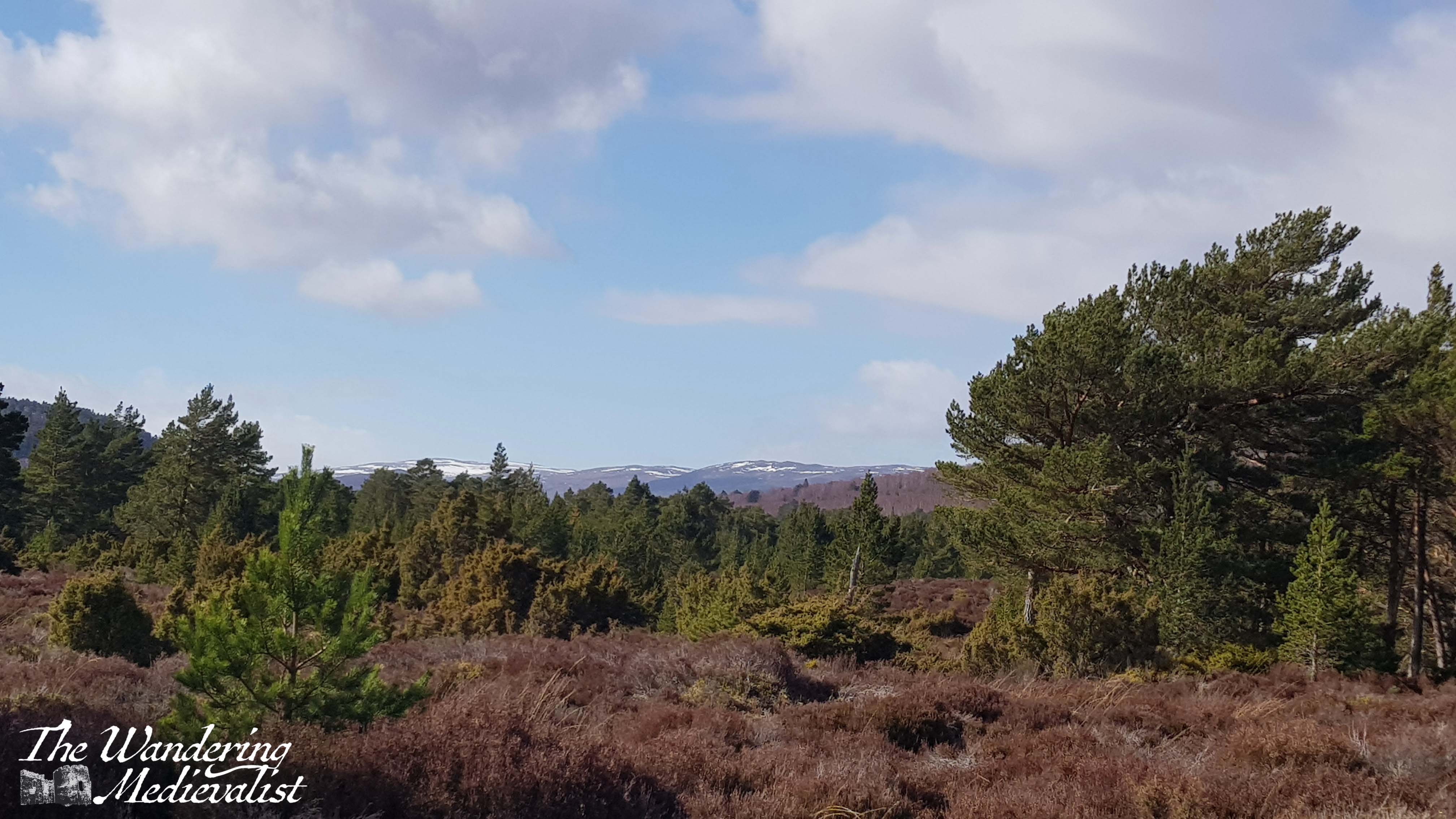
Considering the dreadful weather we had the day before, we were so lucky to have mostly blue skies and a comfortable temperature, perfect for walking. This trail is flat for the most part, as well, with a few rises and falls but no strenuous climbs. It was absolutely the right choice for a morning walk before driving home in the afternoon, and it could be both shortened or lengthened quite easily by adding in an extra loop or simply crossing the bridge and/or following the path along the river.
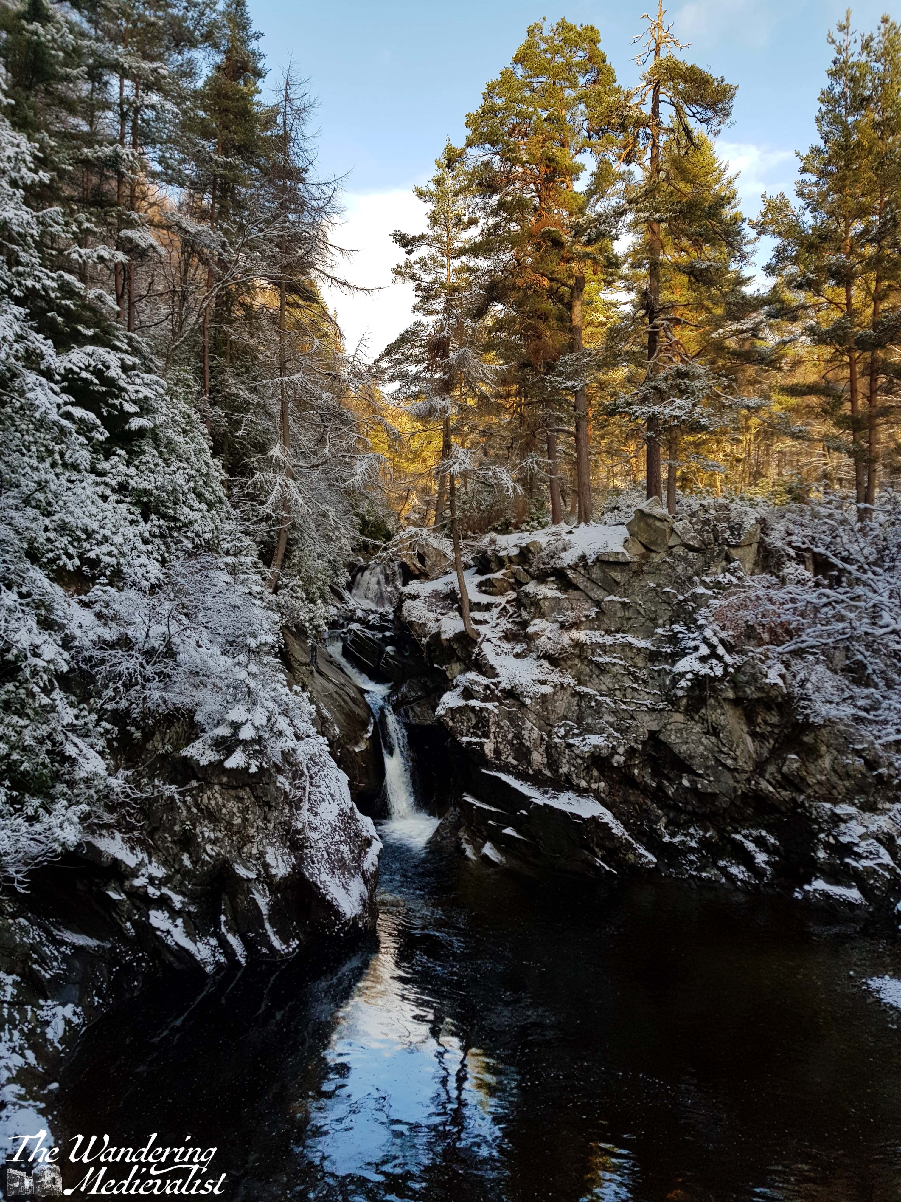
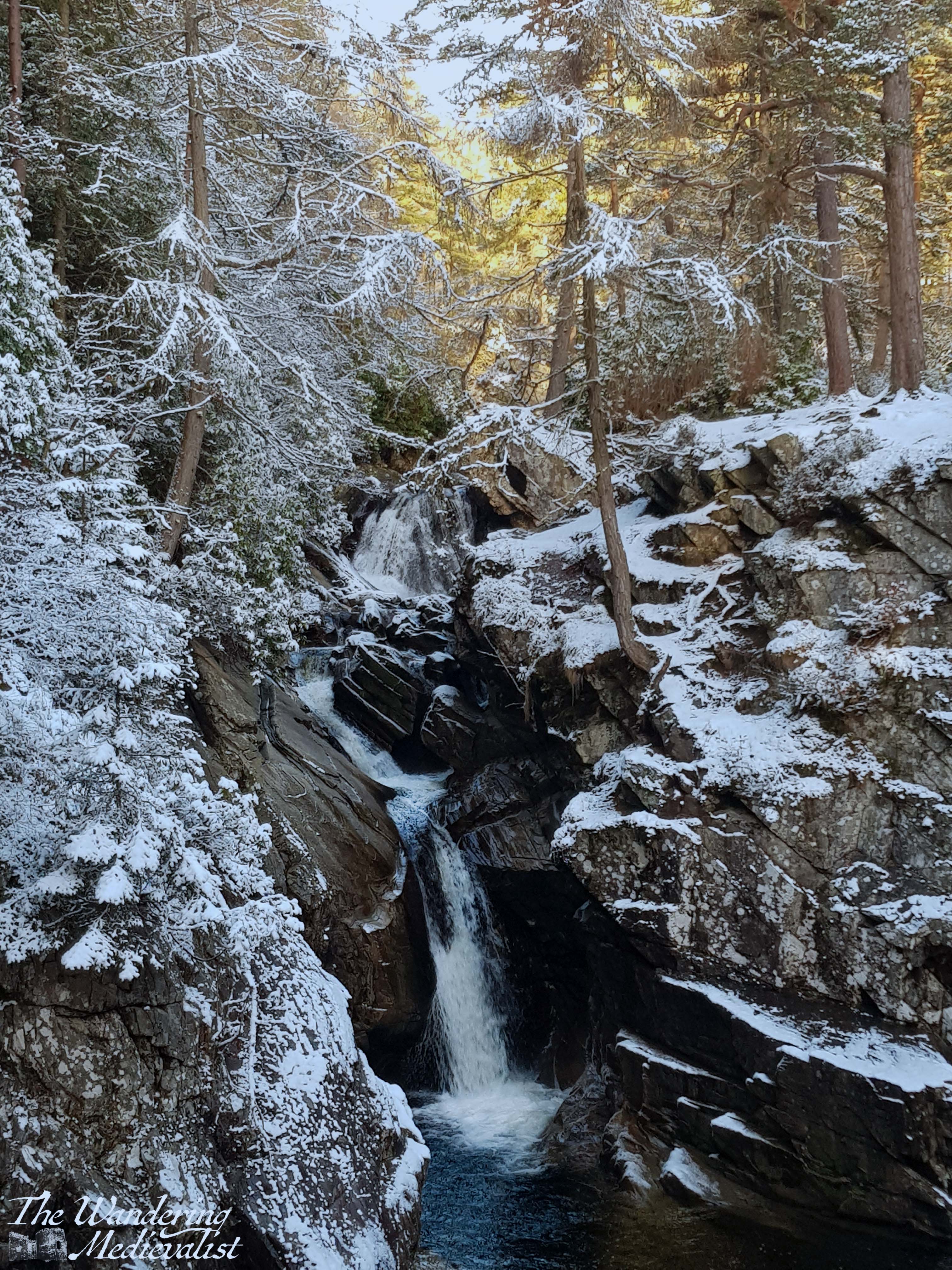
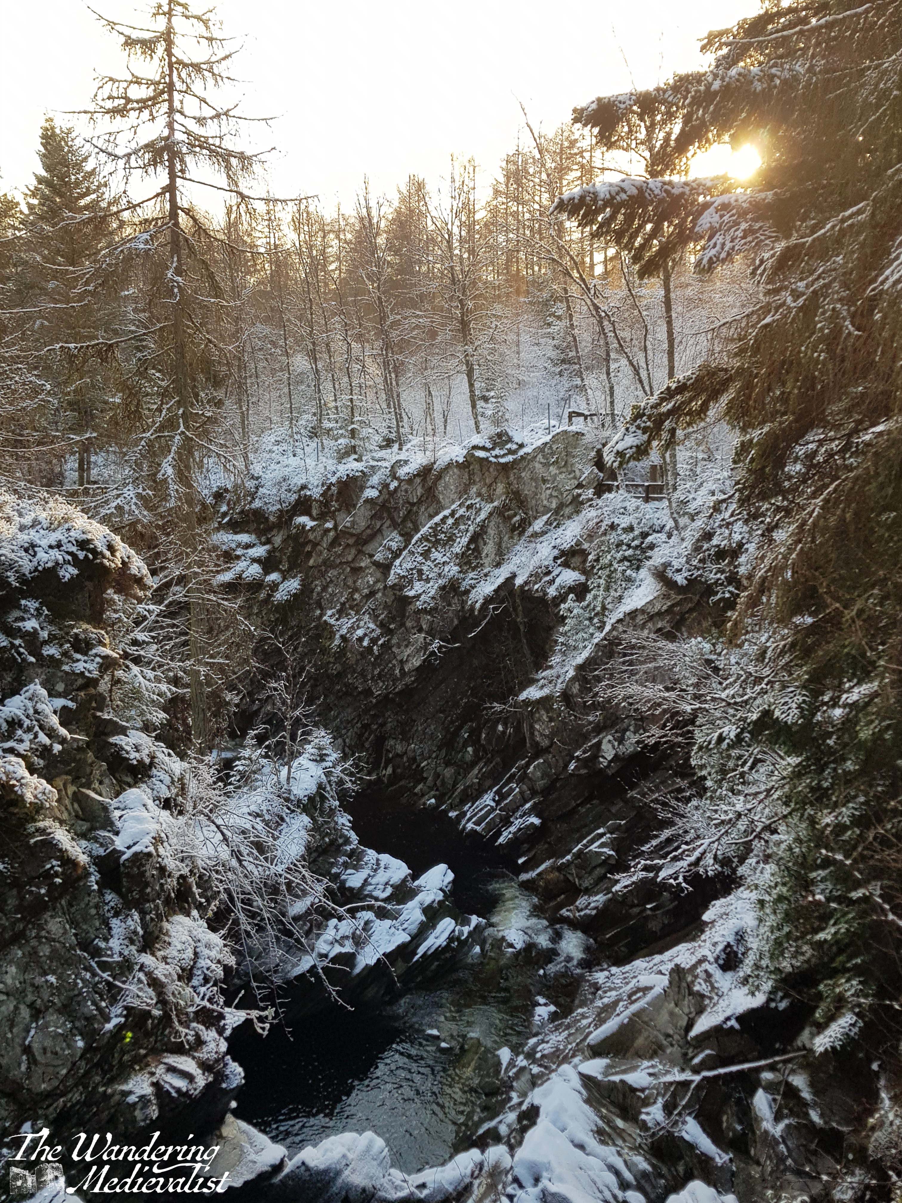
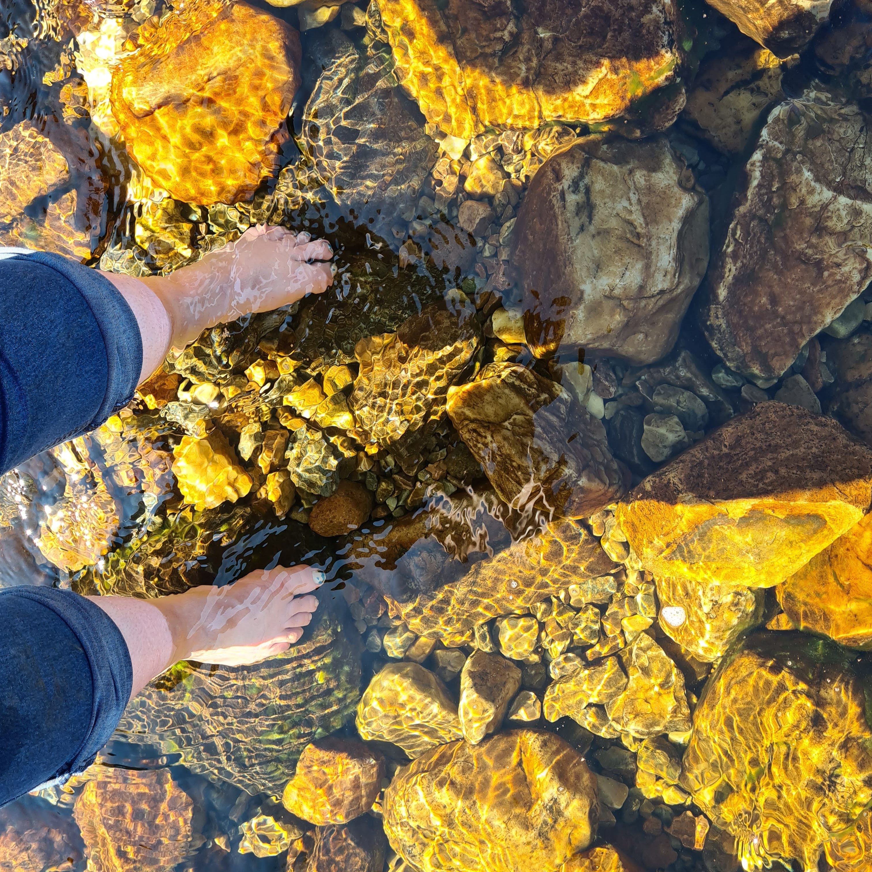
On our return, we took the time to follow one of the several side-trails down to the loch side, and I was lucky enough to take the below shot of sunlight glistening off the water. It remains one of my favourite shots, not in part because it reminds me so much of where we used to spend summers when I was young. The Aviemore area was not as evocative for me as the mountains further west, but there is no question that there are some beautiful trails and lochs.
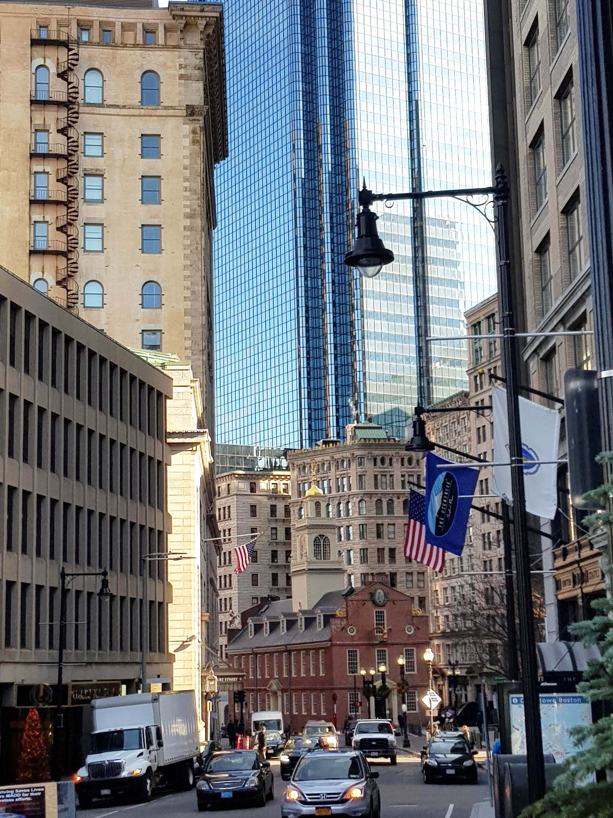
I am picking up my favourite walk through Boston at the corner of Boston Common across from the State House.
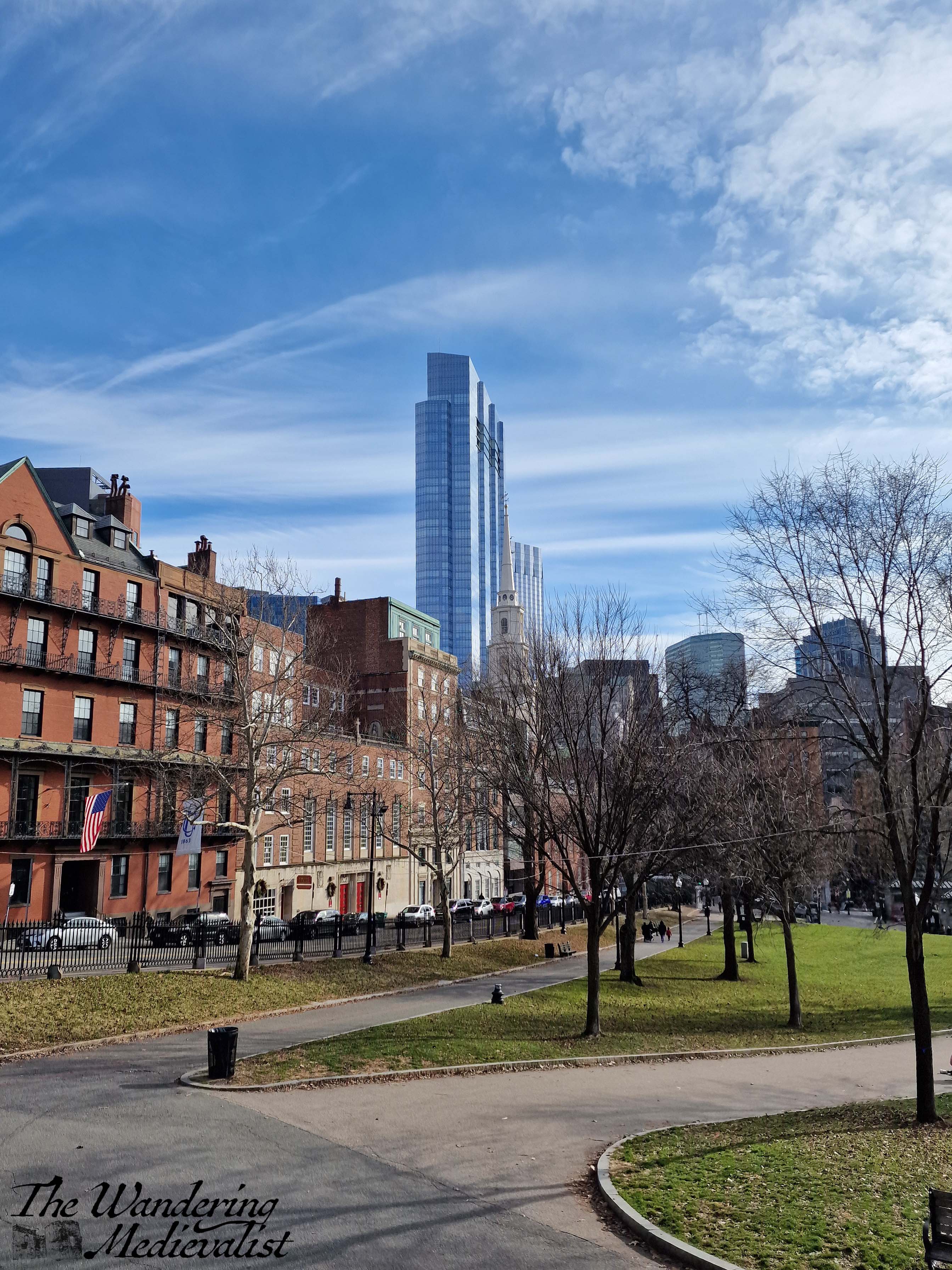
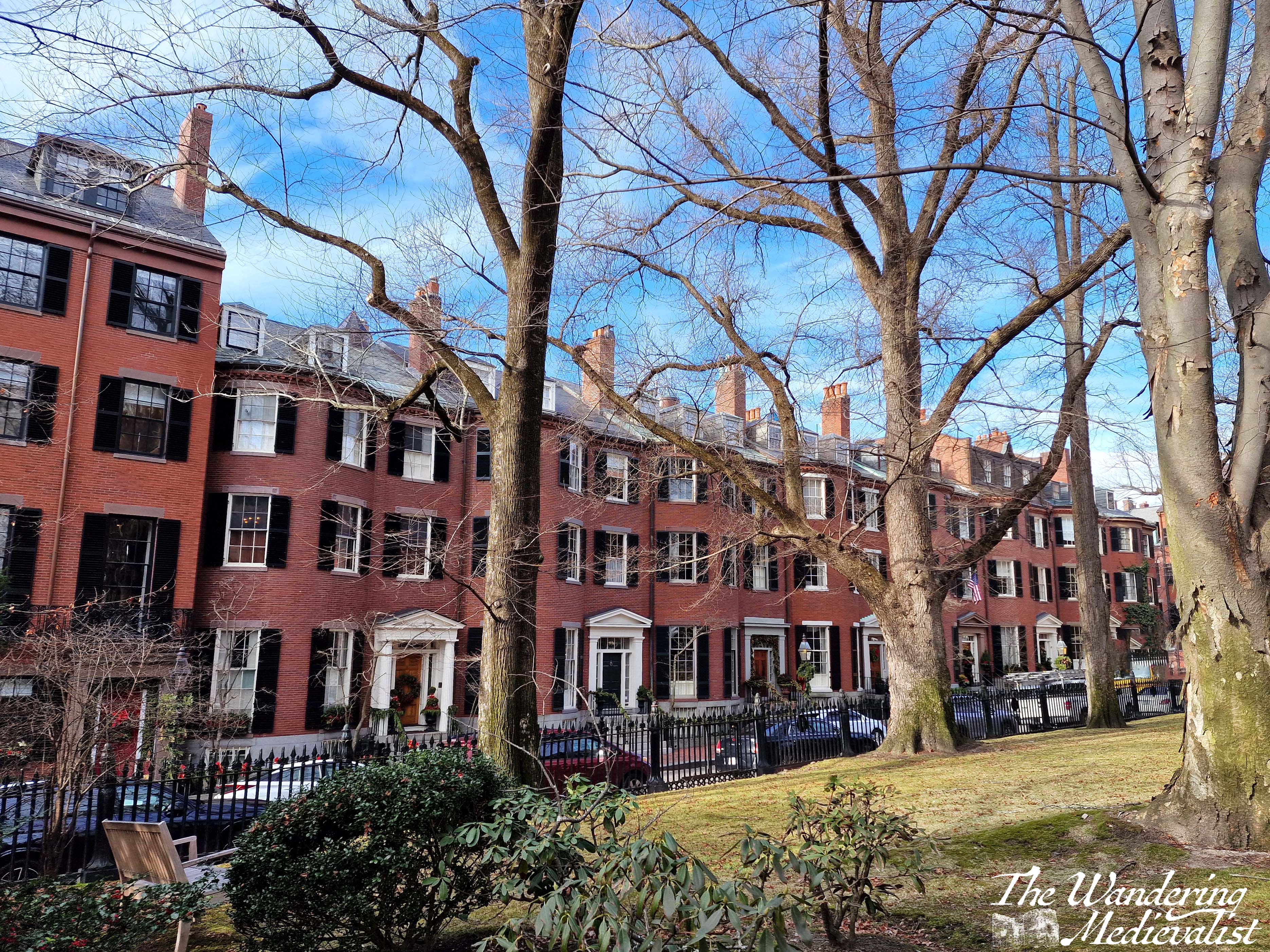
If you have chosen to visit the Shaw and 54th Memorial, my advice here is to follow the edge of the Common for a block or so and then cross Beacon Street when you find it convenient. You are spoiled for a view here – to your left is the Common, and to your right the start of the beautiful stately architecture that edges Beacon Hill, still one of the most desirable areas of the city.
If you enjoy looking at older and expensive real estate, by all means choose either Walnut Street or Spruce Street to turn right and head up-hill. I would recommend continuing to Mt Vernon Street where you can get a glimpse of Louisburg Square, one of the most picturesque areas of the city that evokes parts of London. Head down Mt Vernon Street to the left/west, parallel to Beacon Street.
In no time at all, you will again reach Charles Street where you can turn left and follow it back towards the Common. There are some charming shops in this area to explore, if you have time. Also, the original Cheers bar is just a bit further along Beacon Street to the right, though remember that the interior of the bar itself does not look like it did on TV. The replica in Quincy Market closed in 2020.
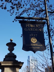
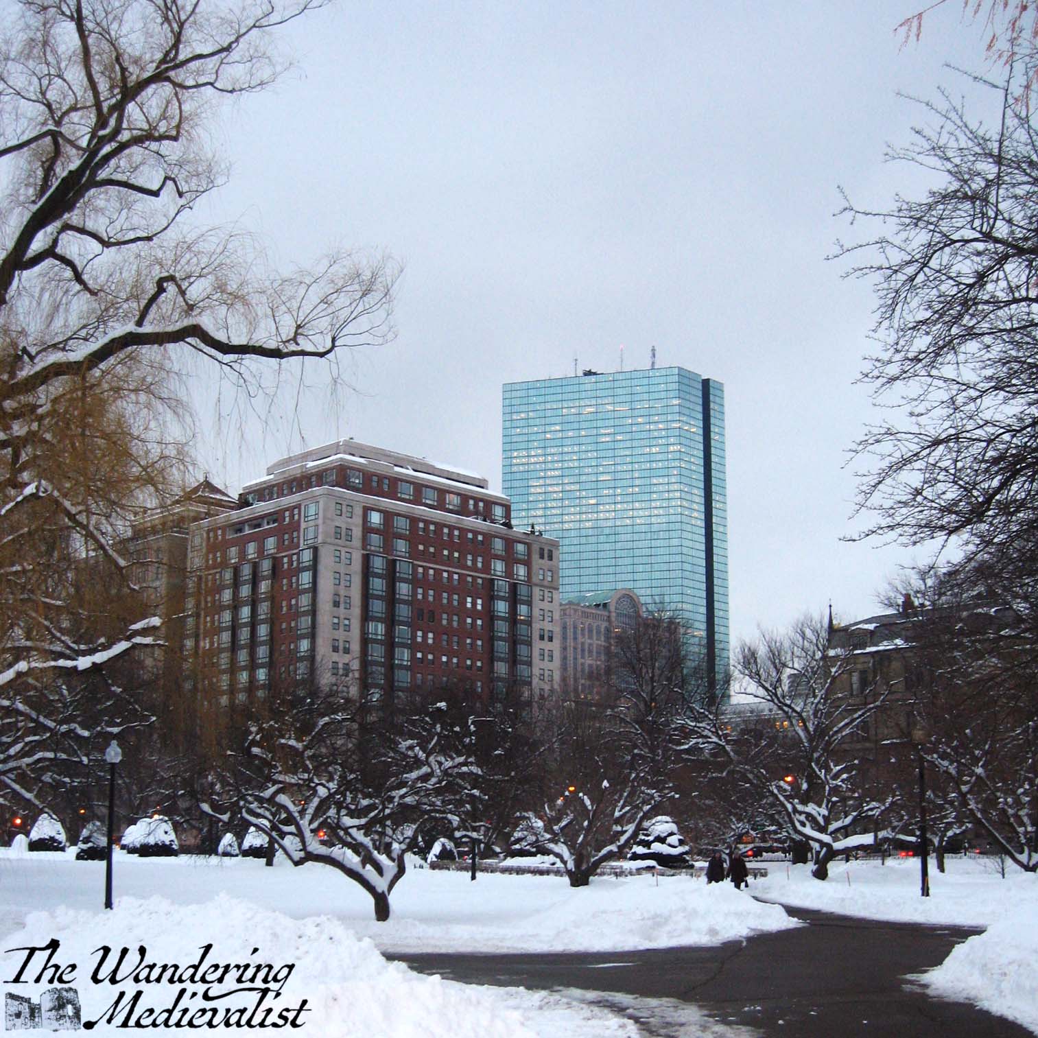
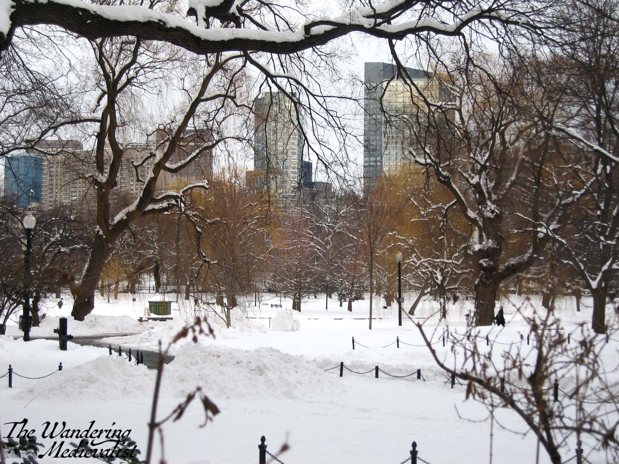
Crossing Beacon Street, you will find yourself with Boston Common on the left, and Boston Public Garden on your right. The land here was originally mudflat, and filled in to create the Garden – and much of the Back Bay – in the early 1800s. If you have any interest in the evolution of the land mass of Boston from peninsula to modern city, I highly recommend the book Mapping Boston.
Stop 5 – Make Way for Ducklings
Most Boston children, at some point I imagine, have read the famous book by Robert McCloskey, Make Way for Ducklings, a lovely story about two ducks looking for a place to raise their family. (Incidentally, McCloskey also wrote two of my other favourite children’s books, Blueberries for Sal and One Morning in Maine).
This book was the inspiration for one of the most famous statues – or series of statues, more accurately – in Boston, which are at various times of year dressed in Sports gear, Santa hats, and other such things.
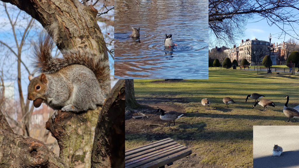
As you walk away from the ducklings and towards the bridge – resist the urge here to go around the end of the pond – you will almost inevitably meet well-fed geese, ducks and squirrels.
The path follows the edge of the water, allowing for excellent views across the pond where swans and swan boats busy the water in summer months.
Stop 6 – Swan Boats and Footbridge
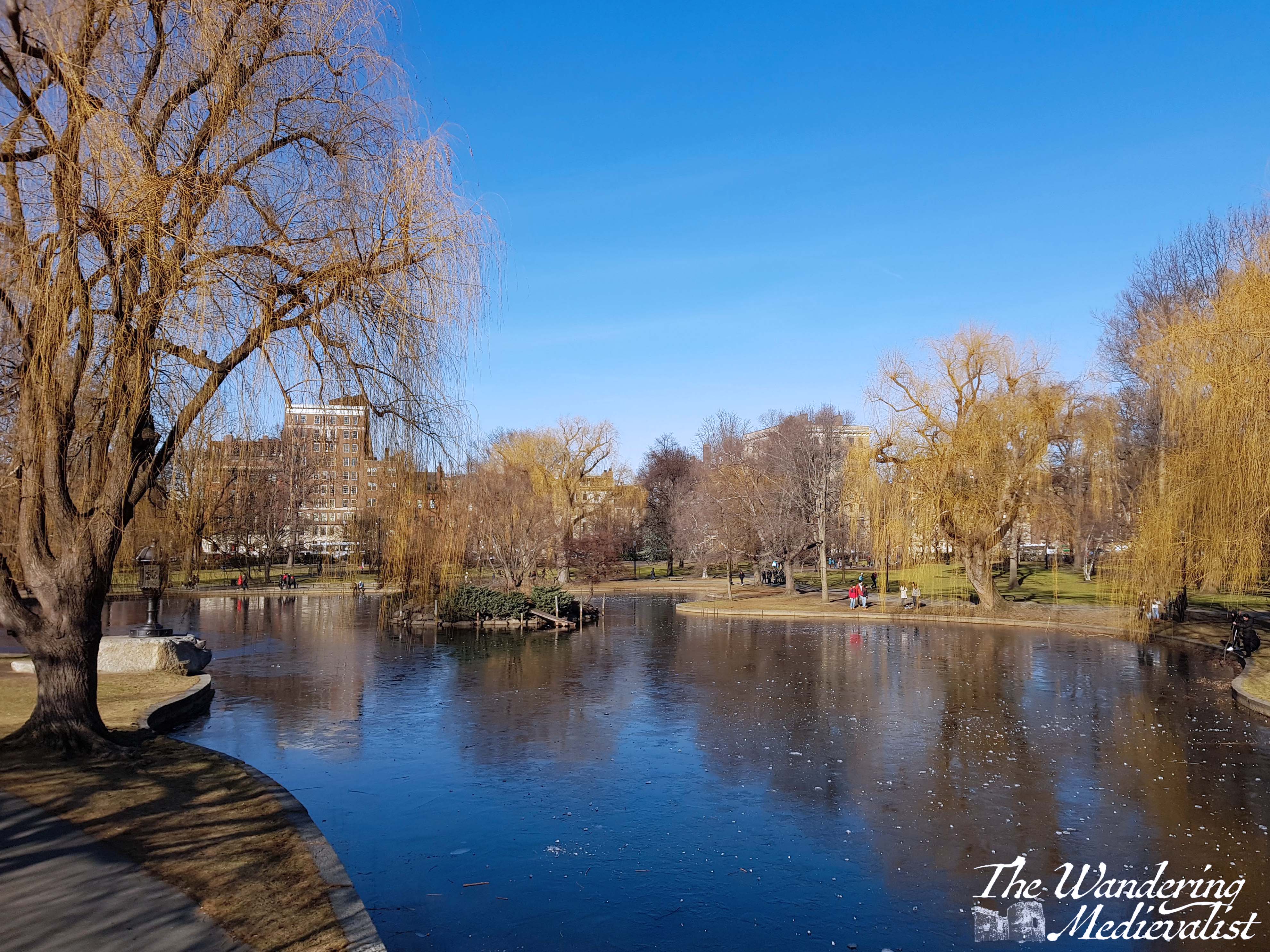
In very little time, you will find yourself at the suspension foot-bridge that spans the pond, and from which there are excellent views of the Garden and city beyond.
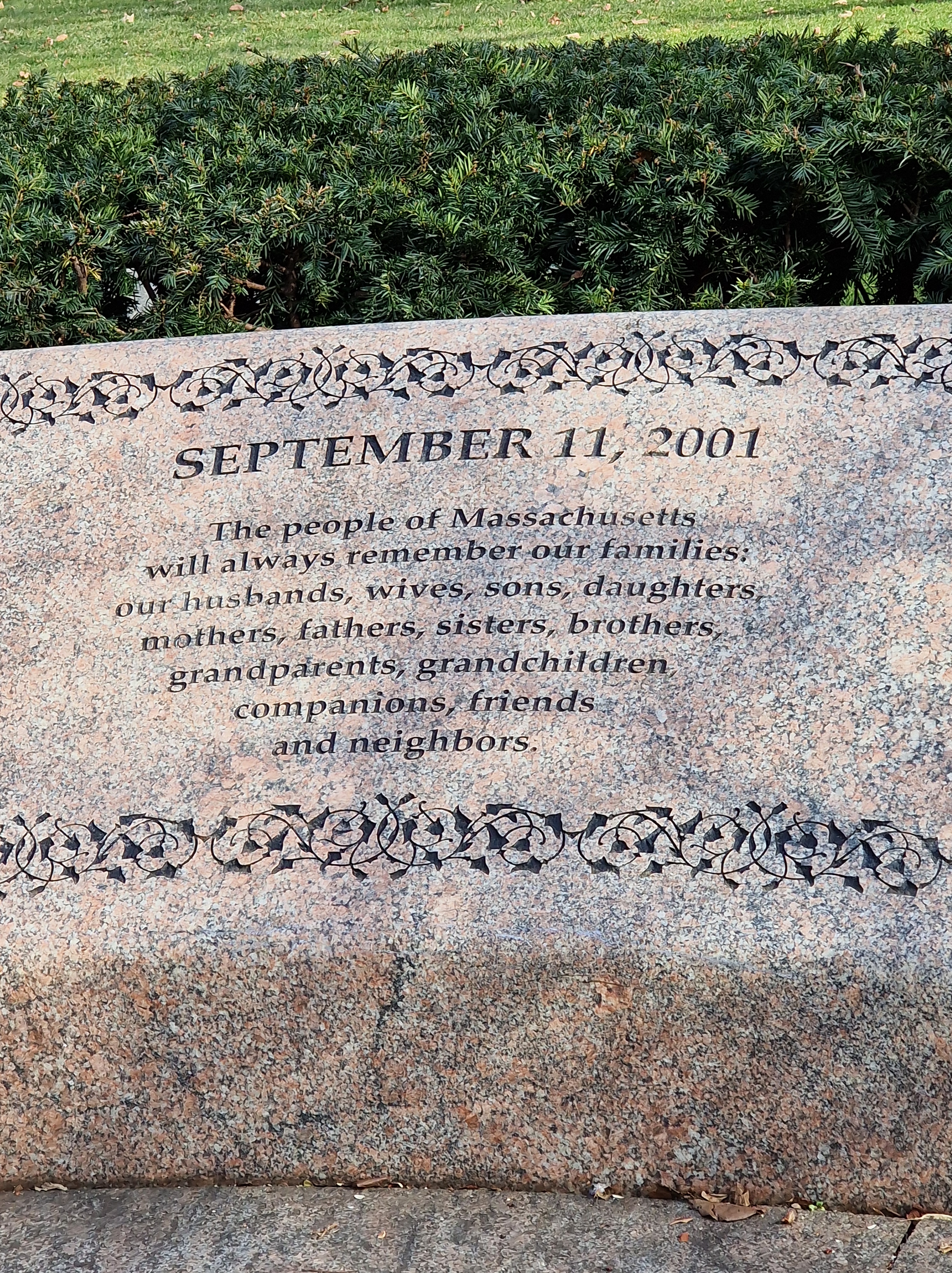
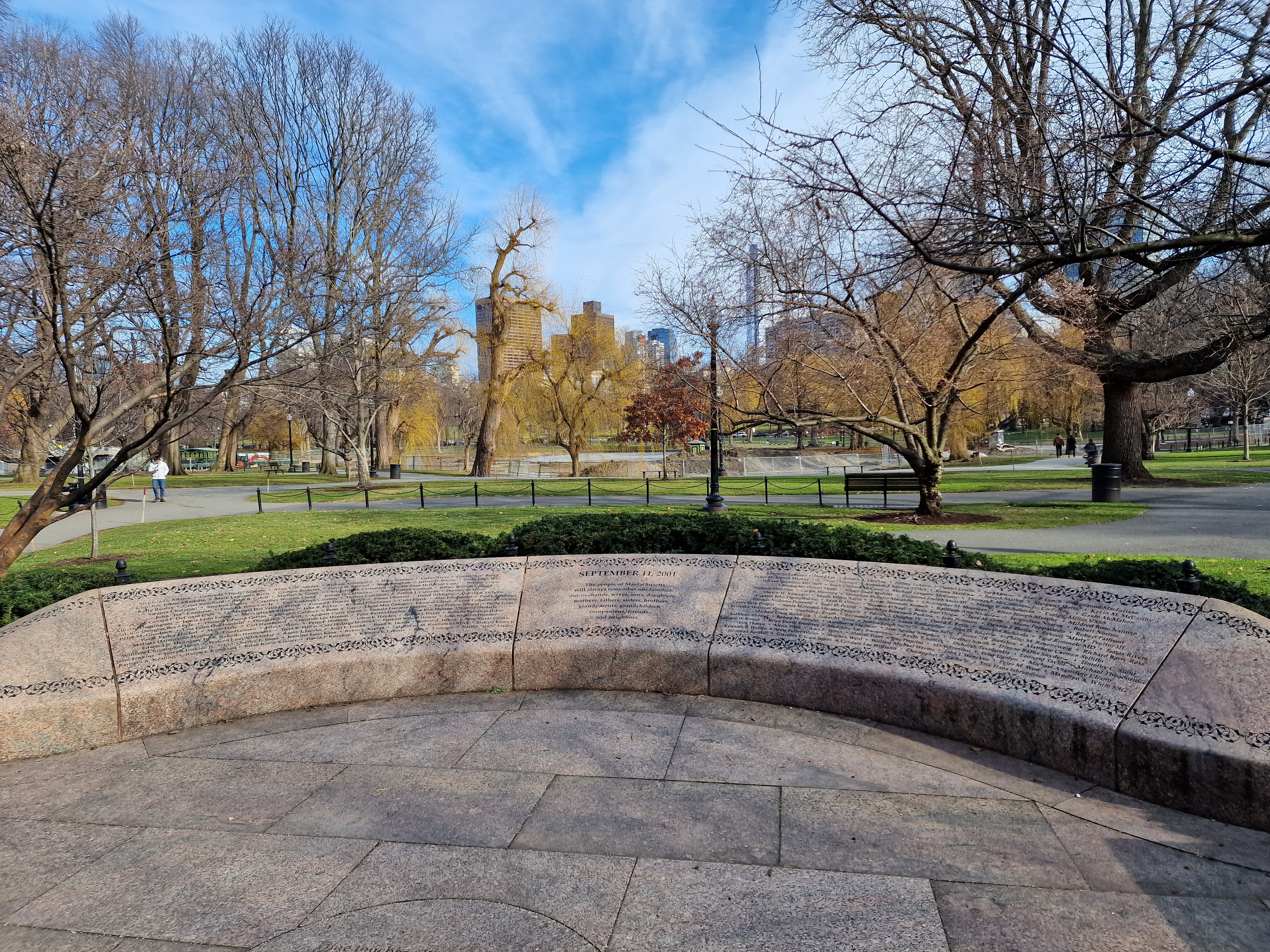
Cross the footbridge, and turn left to head towards the far corner of the Garden, where Boylston and Arlington Streets meet. Before leaving the park, you may wish to make a visit to the 9/11 Memorial and Garden of Remembrance. Two of the four planes that were hijacked that day left from Boston Logan Airport, and the memorial is a moving spot, listing the names of those lost from Massachusetts and New England.
Stop 7 – Arlington Street subway station
You can exit the Public Garden immediately next to the memorial, or continue to the corner. Either way, you will find yourself roughly in front of Arlington Street Church and with a final choice to make. I generally prefer to walk straight up Boylston Street towards Copley Square, but if you wish to do a bit of shopping you may prefer to detour one block over to Newbury Street. If you’re feeling like you’ve had enough exploration, you can always hop on the Green line at Arlington Station and take it back a few stops to return to Government Centre or Haymarket.
Though not as famous in Boston as Newbury Street, Boylston has plenty of shops and restaurants as well, and it’s only about two more blocks to reach the Trinity Church and Copley Square.
Stop 8 – Copley Square
The walk continues through the square and into the Westin, however before you reach that hotel you will pass several points of interest.
First, the church itself, constructed in the 1870s though the parish had existed for 150 years previous and suffered several fires.
Second (again a bit of a detour) if you continue up Boylston for about half a block, you will find the finish line of the Boston Marathon, painted in blue and yellow across the street. Immediately beyond is the memorial to the victims of the Marathon Bombing in 2013.
Third, the stunning Boston Public Library, which to my surprise was opened in the early 1970s but has the feel of a much older building. Inside are stunning murals and grand staircases, as well as one of the largest collections in the US.
It may seem a touch strange, but trust me when I say that to continue on this route, you enter the Copley Westin and go up the escalator. If you walk straight across and do not enter the hotel, there is a pedestrian bridge across the road into Copley Plaza proper. In the plaza are any number of high-end shopping choices such as Neiman Marcus, Jimmy Choo, Dior and Versace. Needless to say we did not shop here as teens, but there was a cinema at Copley as well, which I have discovered closed in the early 2000s.
If you continue straight through the plaza, you will find signs for the pedestrian bridge to the Prudential Center, for additional shopping and one of my high school friends’ favourite spots, California Pizza Kitchen.
The Pru, as it is sometimes known, is another stop on the Green line, and so you can also do this walk in reverse if you are so inclined. It is worth pointing out, however, that Copley is the last stop on the Green line before it splits into multiple branches, so picking up the subway there can be a bit faster.
And that is it! My favourite walk through the city – not particularly long or challenging, but passes some great spots and brings back plenty of memories. I am sure I will go into more detail about some areas of Boston in the future.
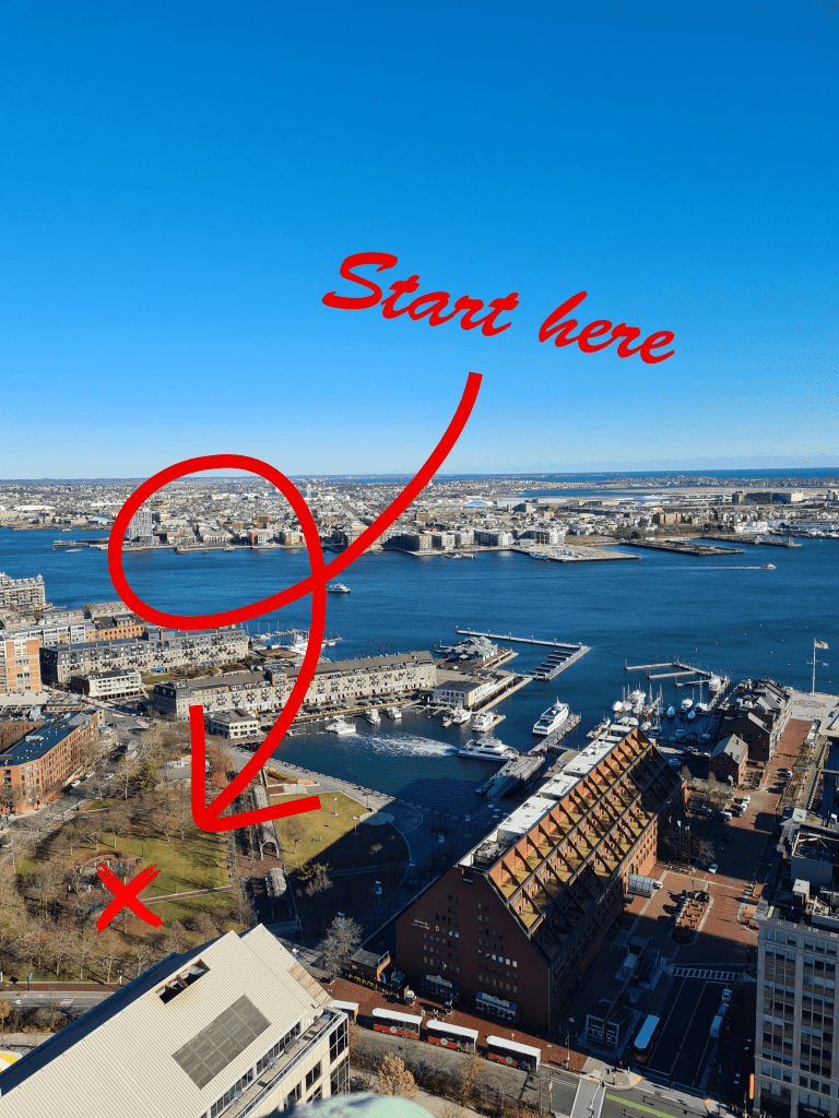
if you are in the city and want to try the route yourself, check out this route map:
Boston is, without doubt, my favourite city (though Edinburgh is a close second). I am incredibly biased of course; the feel of the city is part of the bias, but more poignant are the memories evoked almost everywhere I go.
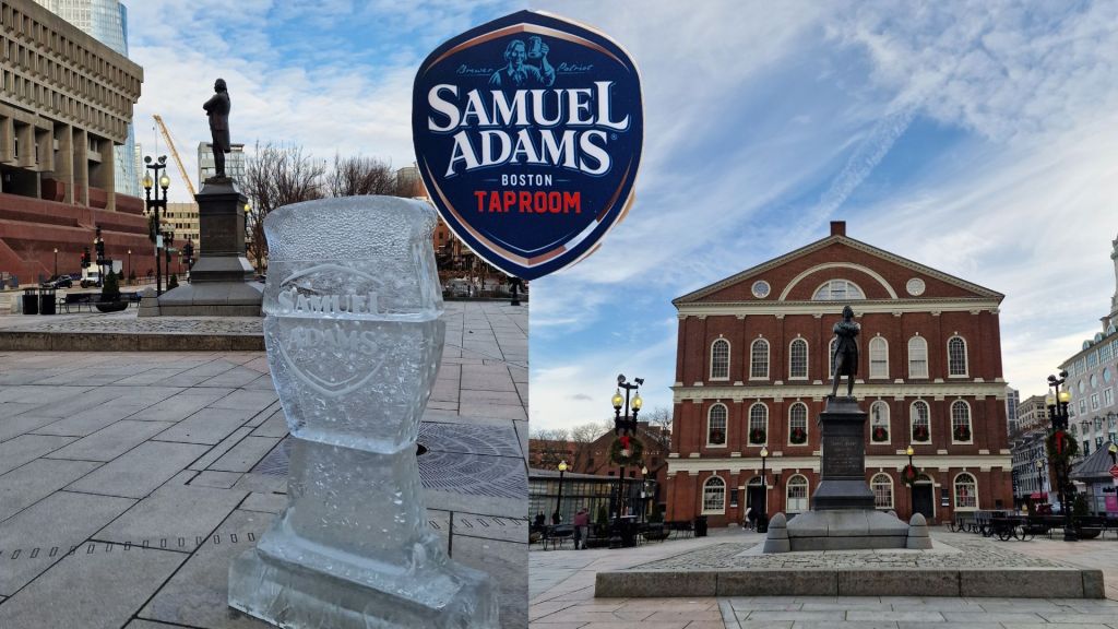
When I was in high school, the city was our playground (to paraphrase Madonna). Almost every weekend we would hop on the Red line into town to roam Quincy Market, Copley Plaza, Harvard Square or Downtown Crossing. My favourite spot is Faneuil Hall, and in particular the Samuel Adams statue out front, which was our standard meeting place for years. I have spent hours there, as in my teenage years there were no cell phones (gasp!); if you were meeting someone, you just had to wait until they appeared or give up and go home.
The sense of freedom, of knowing I could go anywhere in the city, was one of the things that truly gave me confidence as as teenager. I prided myself on being able to walk from Marriot Long Wharf to the Prudential Centre without looking at a map – and that walk is the one described below, passing some of my favourite spots in the city.
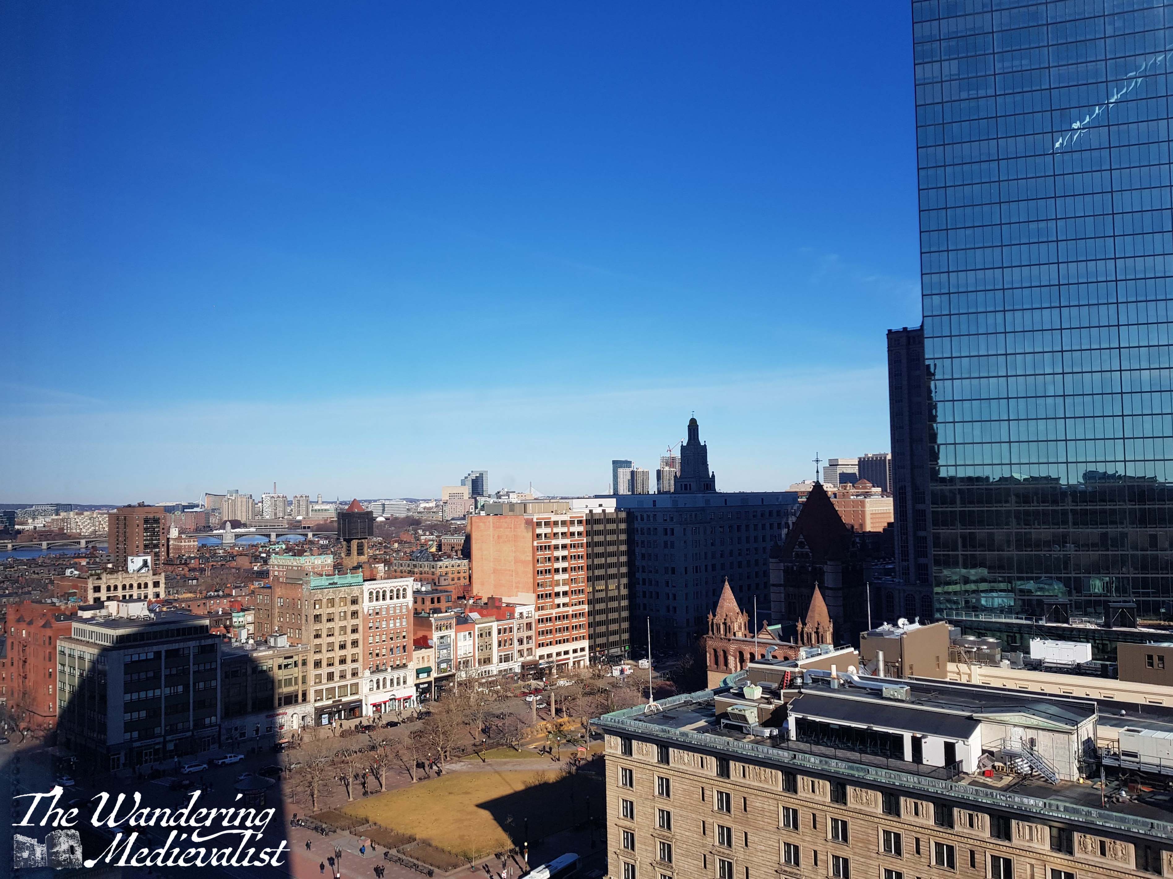
The first photo below, incidentally, was taken from the top of the Custom House – official title Marriott Vacation Club Pulse at Custom House – where we stayed for a recent significant birthday. We got a good deal, and it was a stunning location.
Start of the walk – Long Wharf
The walk starts just outside Marriott Long Wharf, in the park immediately adjacent: Christopher Columbus Waterfront Park. Ignoring the political mess of actually naming a park after Columbus, I would point out that the park is quite lovely and only steps from the Blue line stop at Aquarium.
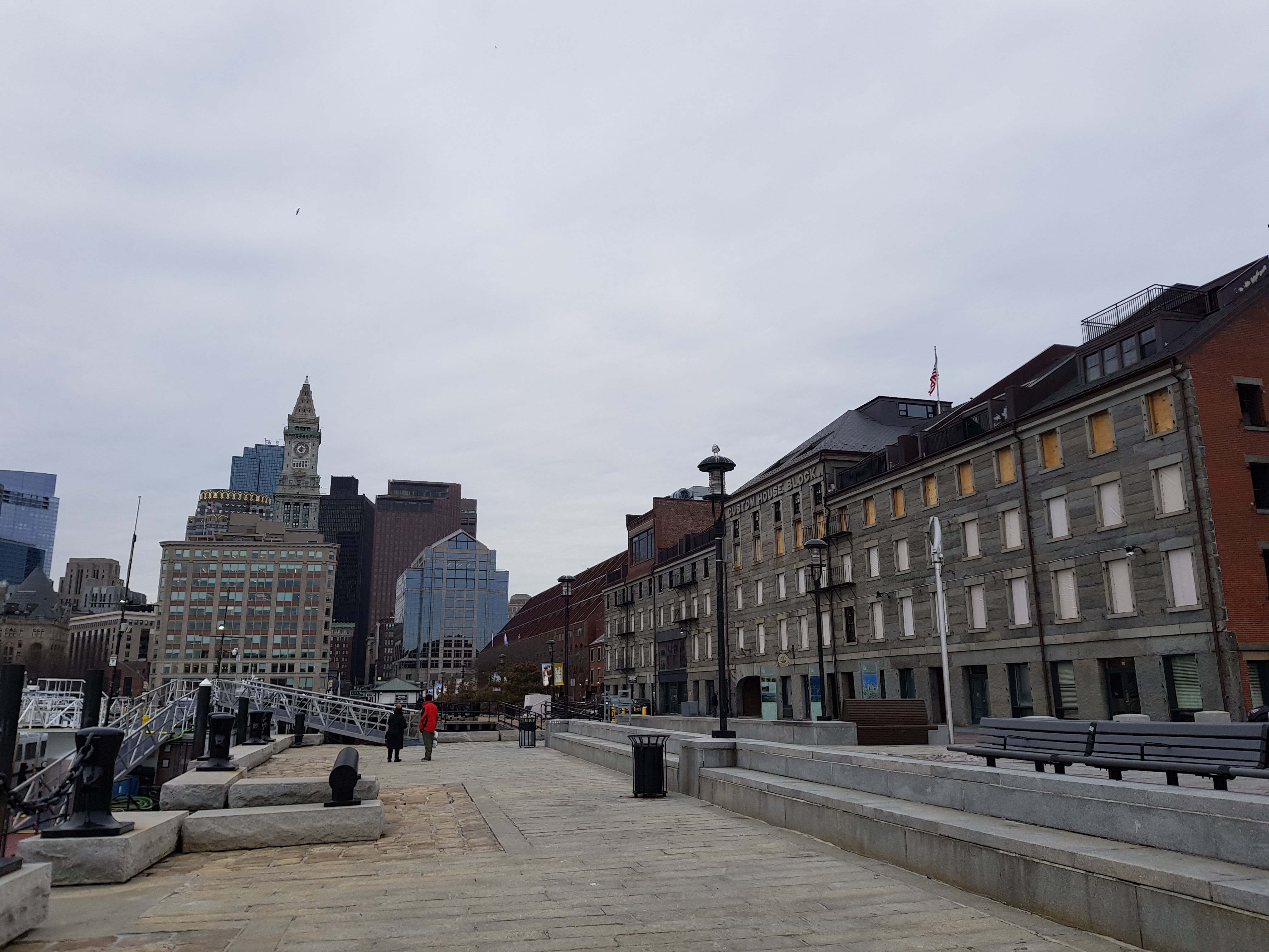
If you have time, it is worth taking a detour to the end of Long Wharf past the former colonial-era counting house, to enjoy views across Boston Harbour towards the airport.
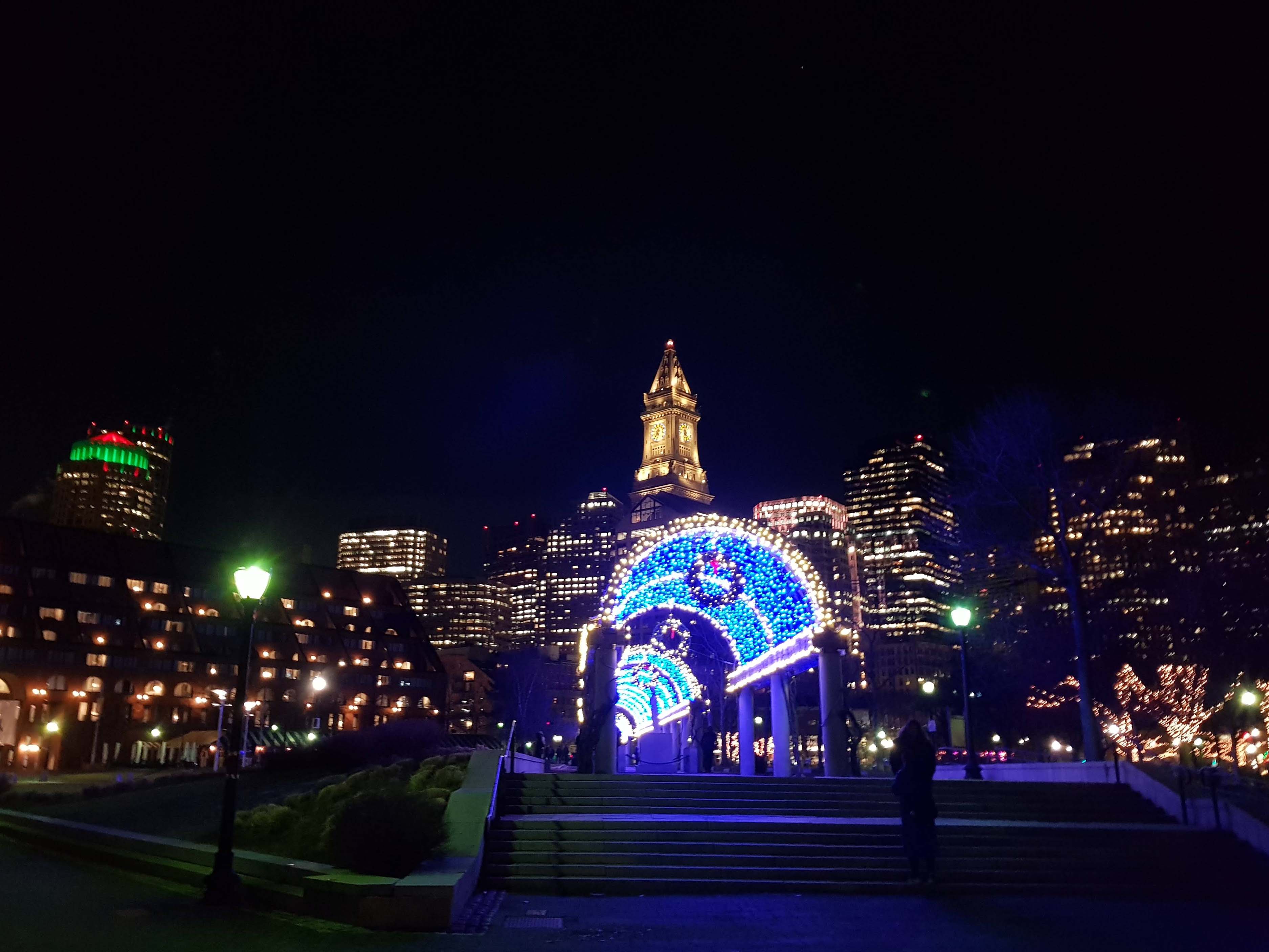
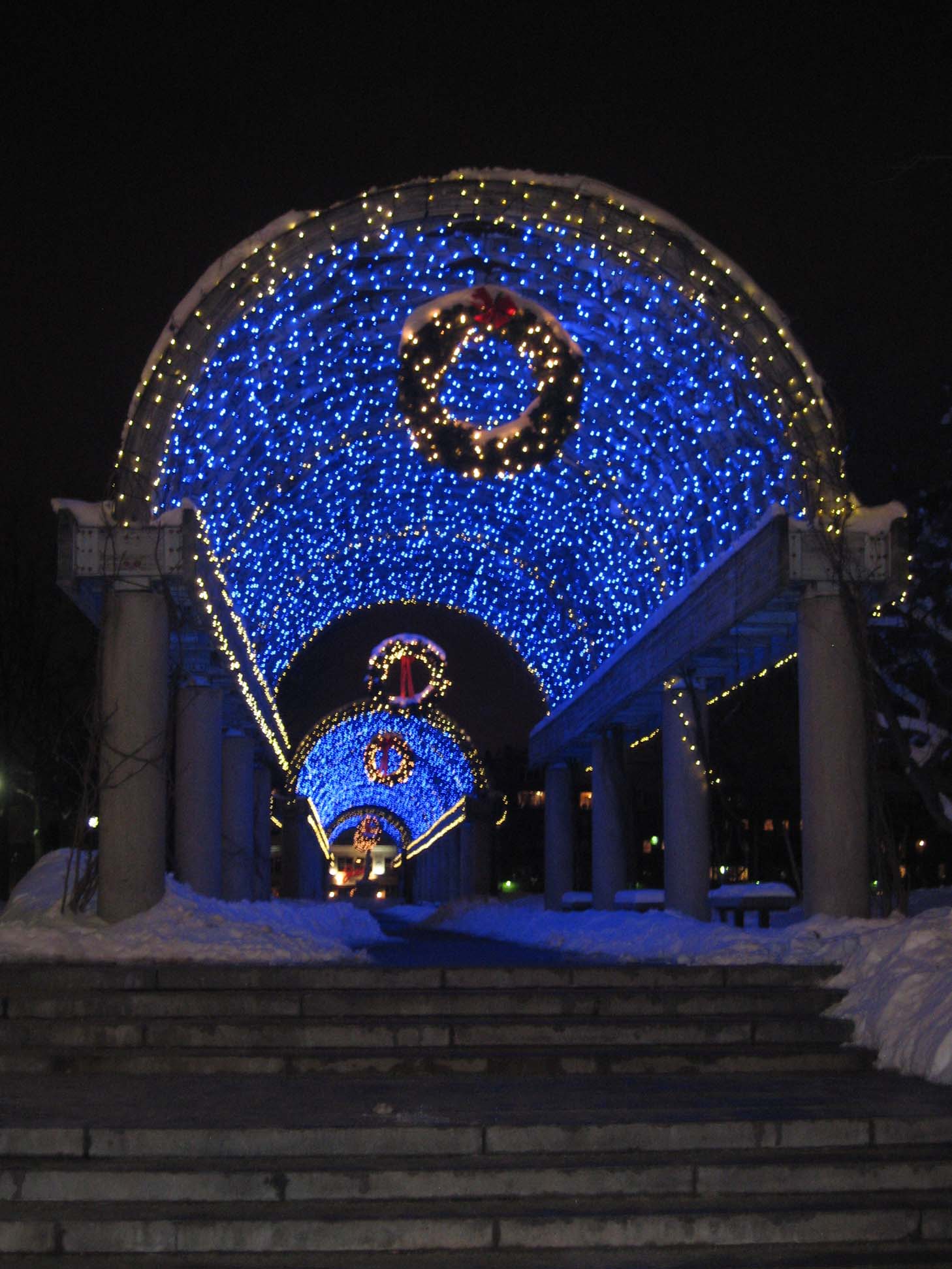
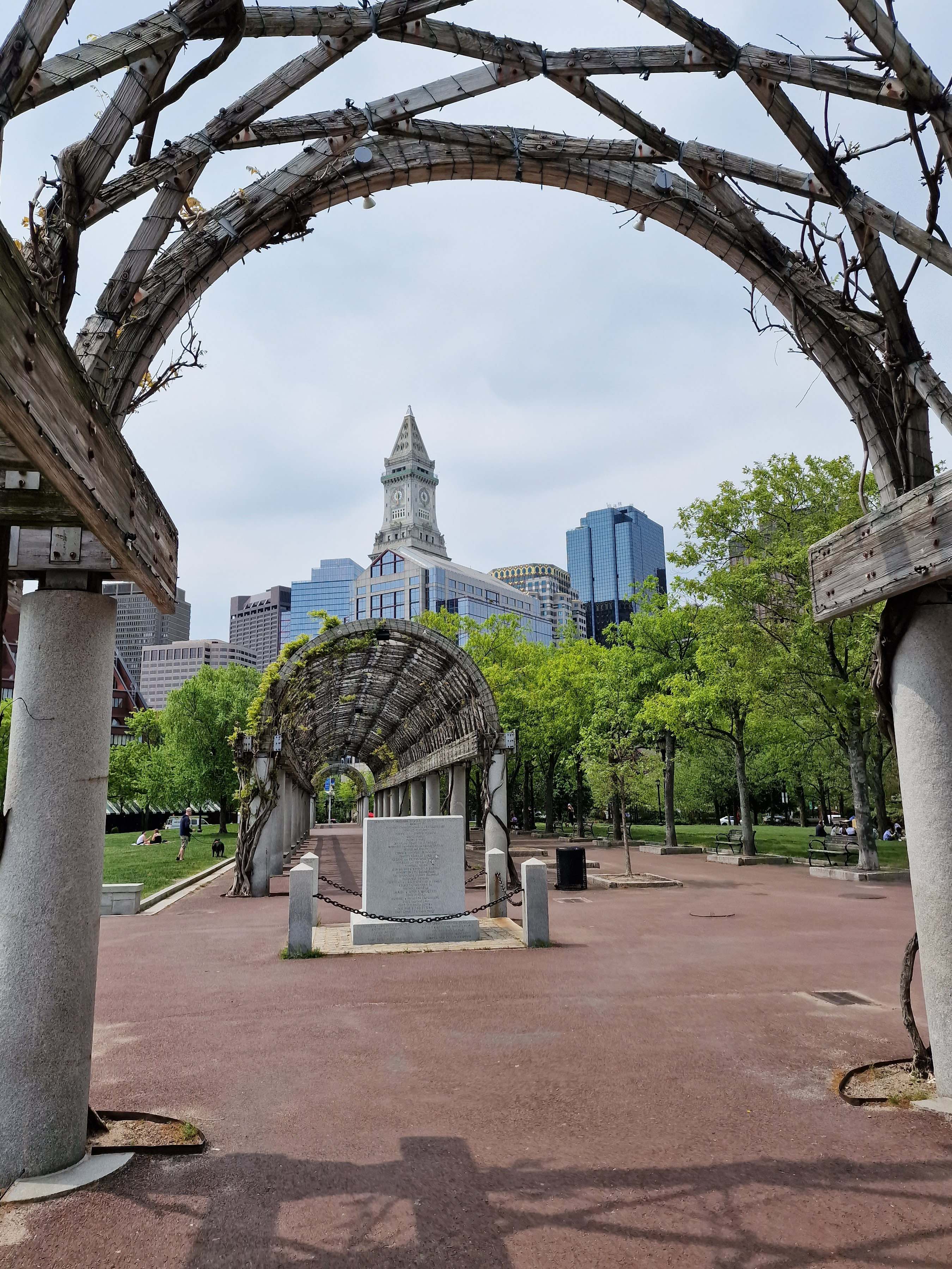
Below are views of the park at night in the winter, and then in the spring, as well as the view from Long Wharf back towards the Custom House.
From here, it is only a short walk across Atlantic Avenue to Quincy Market – word of advice, in Boston always use the crosswalk! Under the park area you traverse between the wharf and the market is of course the tunnel that was built during the infamous Big Dig, to take I93 from a raised highway to a sunken one. On my first few trips visiting Boston after the completion of the Big Dig in 2007, I found myself routinely discombobulated by the absence of the raised highway that had been there for as long as I could remember.
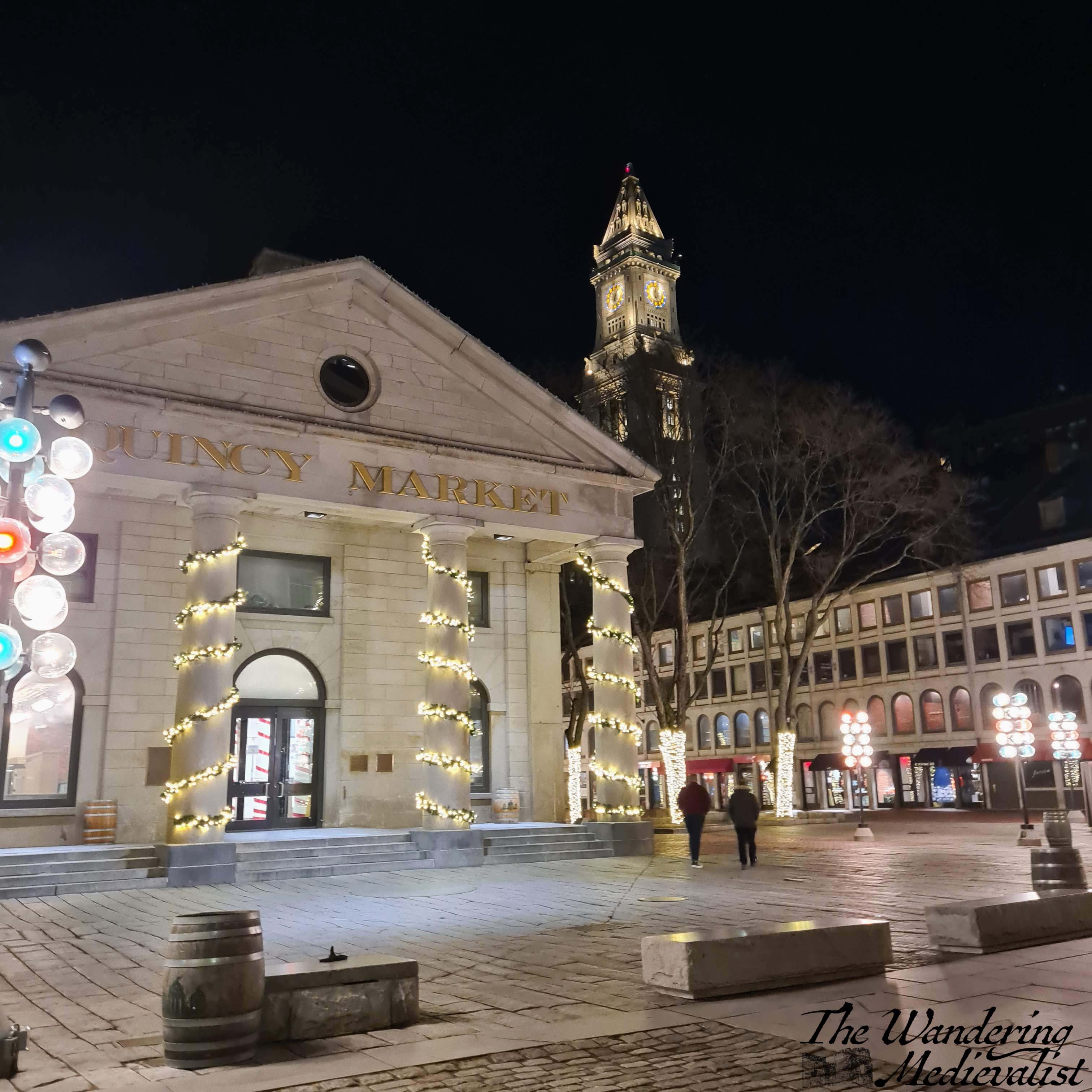
Stop 1 – Quincy Market and Faneuil Hall
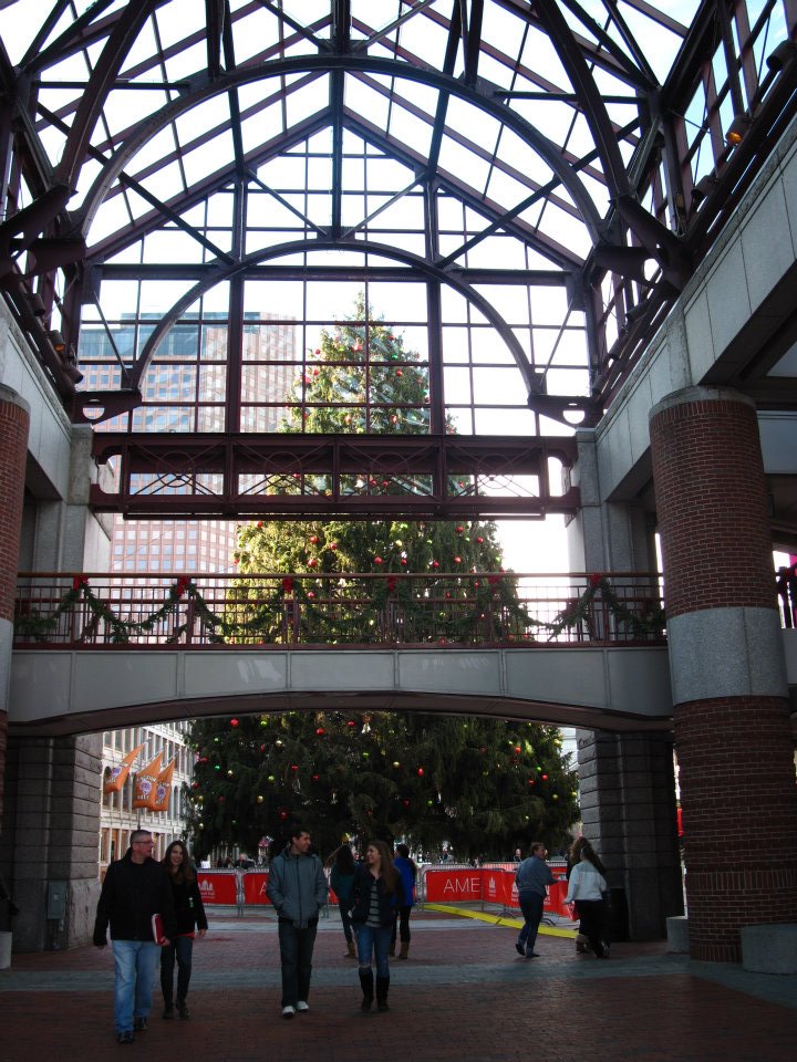
Once across Atlantic Avenue, you will hopefully find yourself immediately before a concrete and metal beam constructed covered walkway, that leads to the market. At Christmas time, there will be a gigantic tree immediately in front of you inside.
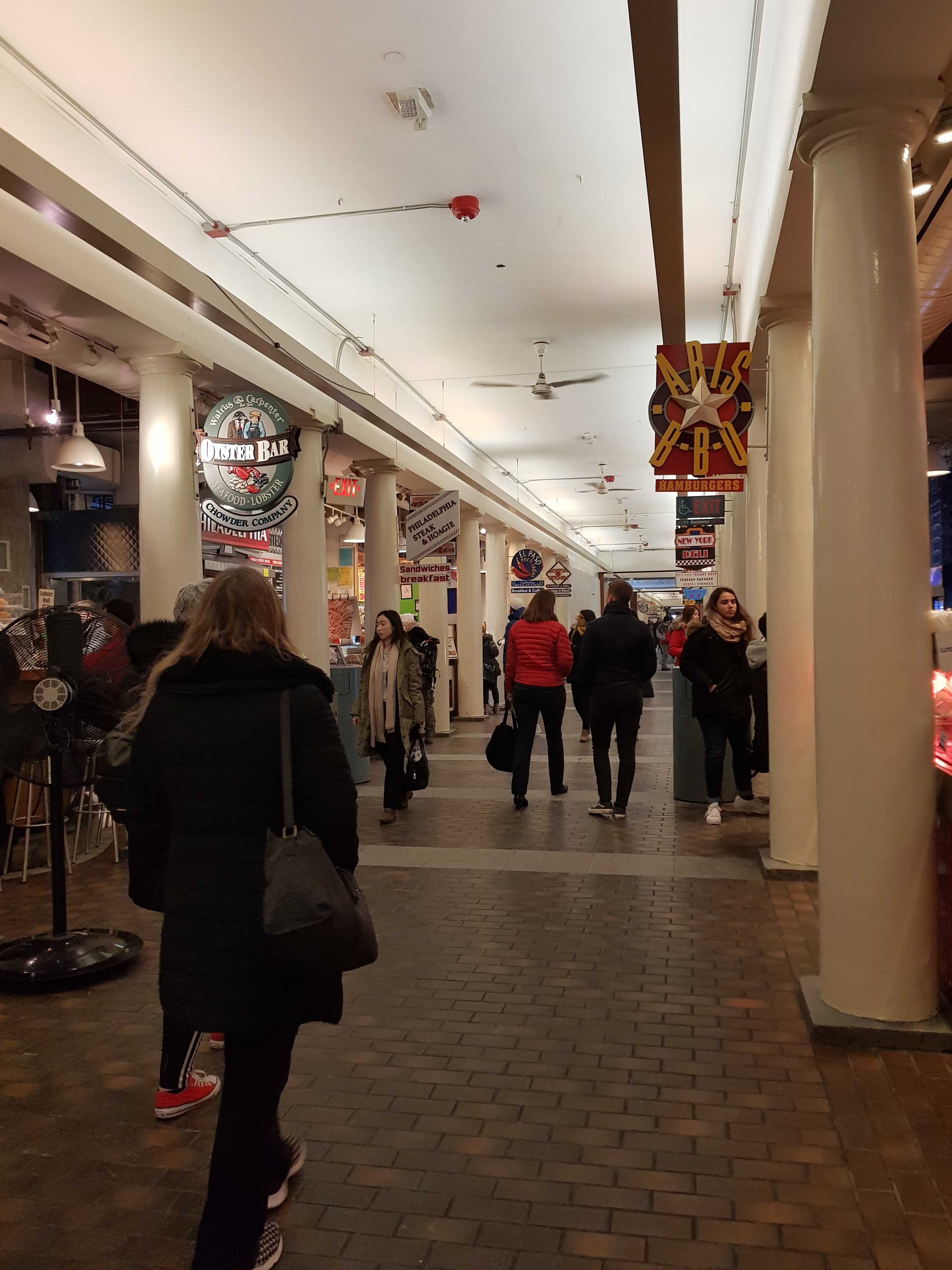
While it has become more and more a tourist trap over the years – despite the closure of the famous Cheers bar – Quincy Market is always worth at least a quick stop whenever I visit; I can’t help but love the Boston memorabilia peddled out of carts, and the long corridor of food stalls boasting everything from bagels, sandwiches and seafood to Asian and Mexican cuisine. Special shout-out to the North End Bakery, which has the best chocolate-peanut butter brownie.
I love Quincy Market at Christmas in particular, when everything is done up with lights and pine garlands or wreaths.
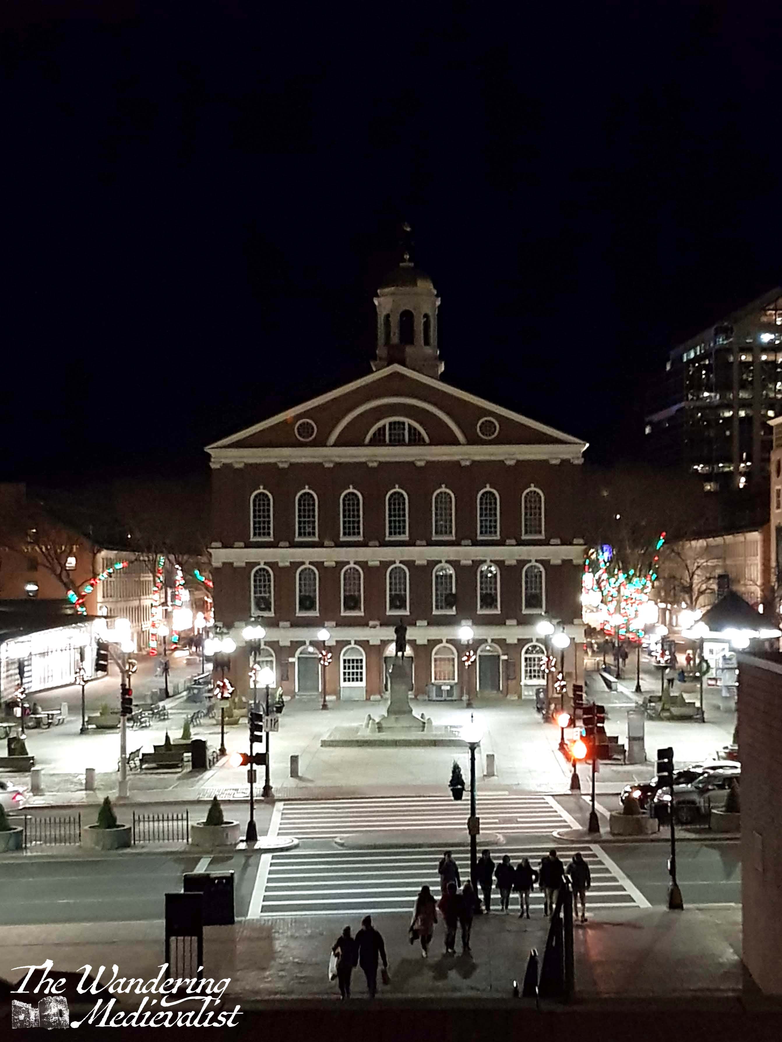
If you are hungry, by all means detour through the food hall, but if you’d rather keep your pace up, stay outside the long covered market and continue towards Faneuil Hall, the colonial brick building with golden dome just visible at the far end of the market. Opened in 1742, the hall was also a market (and still is, there are more Boston-themed stalls inside) and the spot of several speeches by figures such as Samuel Adams, the famous patriot. To my amusement, the statue of Samuel Adams that was our frequent meeting point has now been augmented by the opening of the Sam Adams Taproom, immediately beside.
Highly recommended, it has a great brewery feel with huge vats of beer just behind the bar and long tables with benches, and of course offers Sam Adams Brick Red, my favourite beer and only available in Boston.
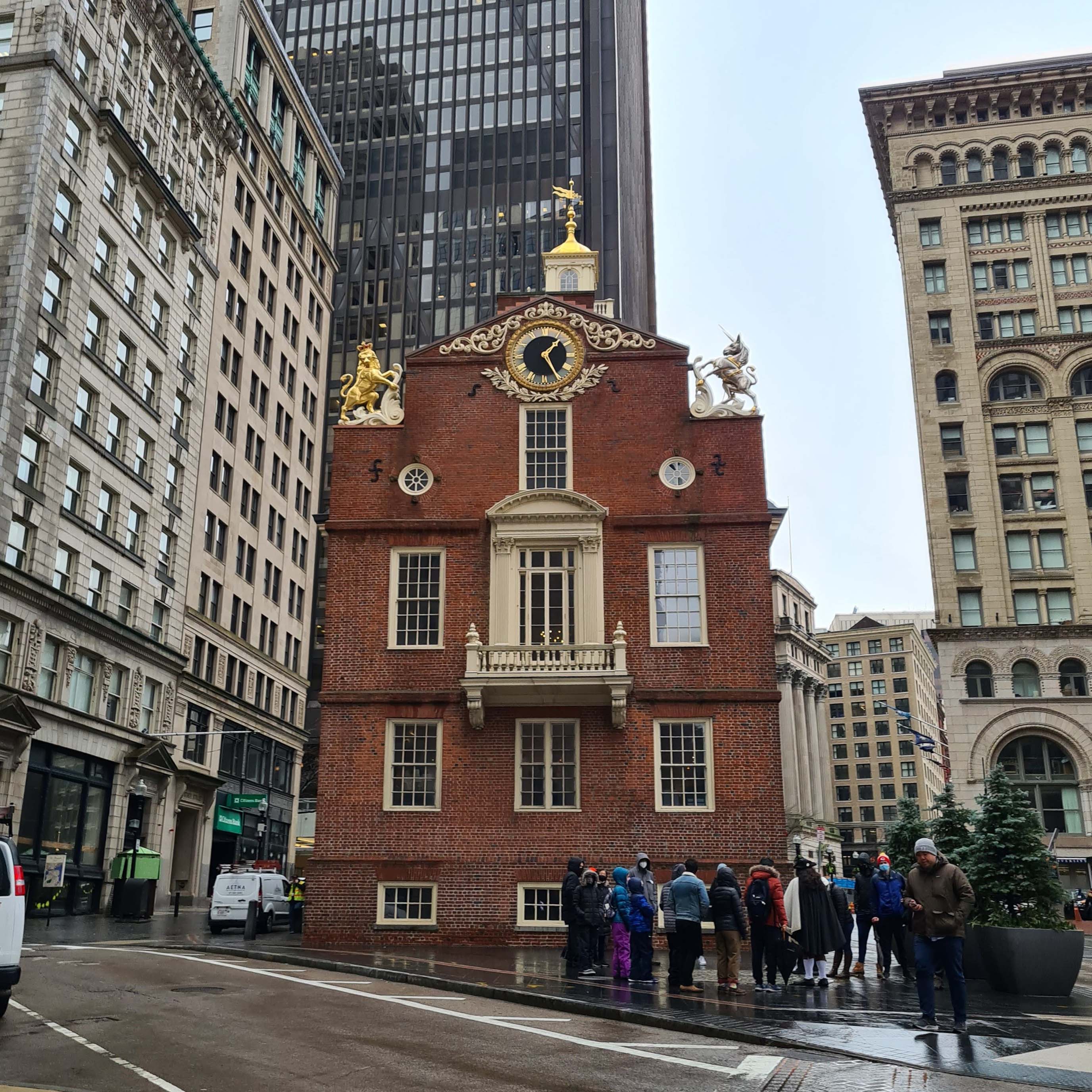
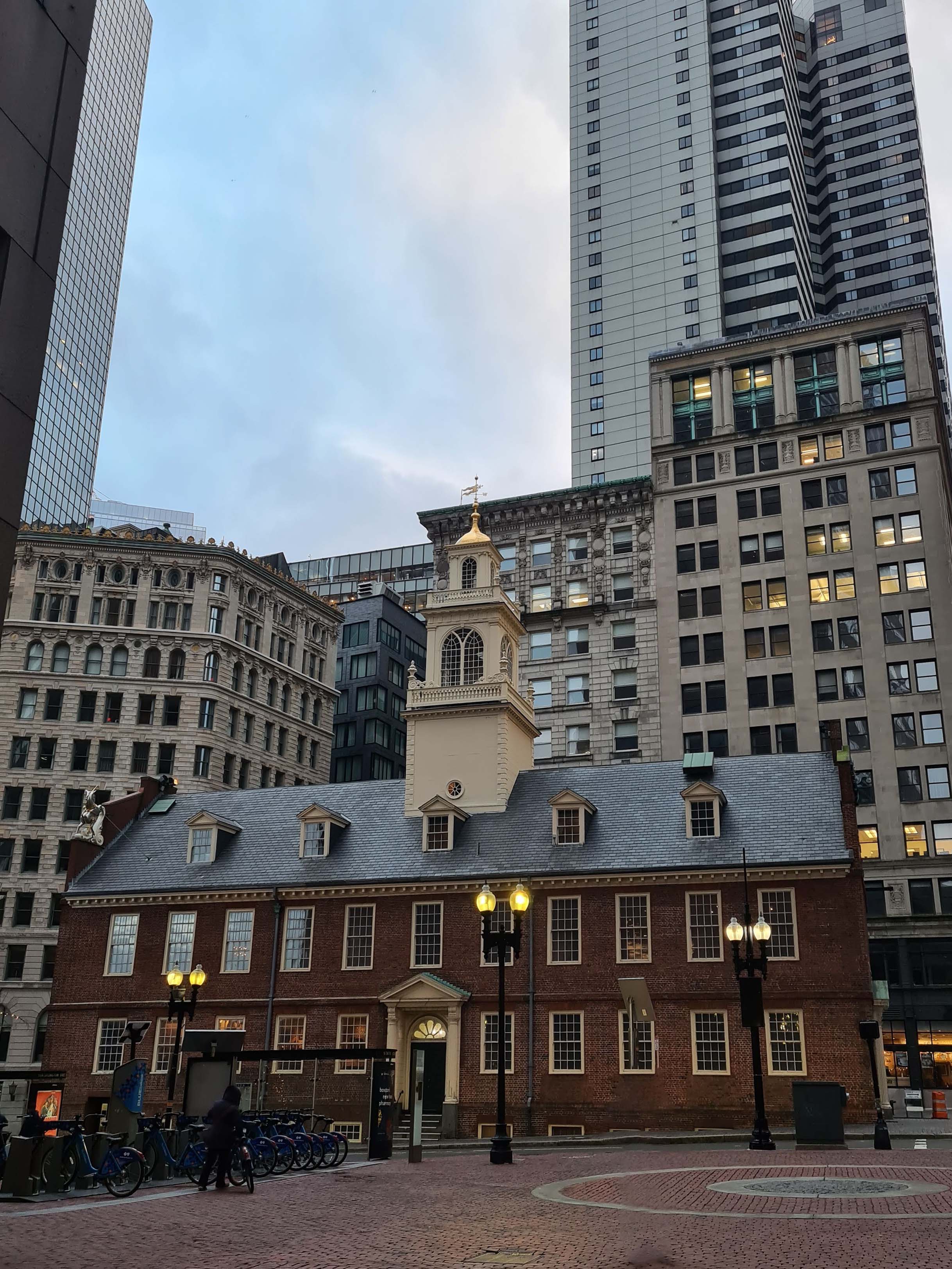
From here, you can either start up the steps immediately across the street, or if you are in for a more historical tour, turn left and detour up past the Old State House.
Stop 2 -The Old State House or Government Centre
Route 1: The Old State House
History buffs may prefer this route past the Old State House – home of a museum as well as the State Street T station, intersection of the Blue and Orange lines.
Just outside the building is the location of the Boston Massacre in 1770, and this excellent plaque which I noticed throughout the city.
Unfortunately I managed to miss the plaque for the Freedom Trail, another great way to explore the city.
From the State House you can turn immediately left to go along Washington St to Downtown Crossing, but I recommend continuing up Court Street.
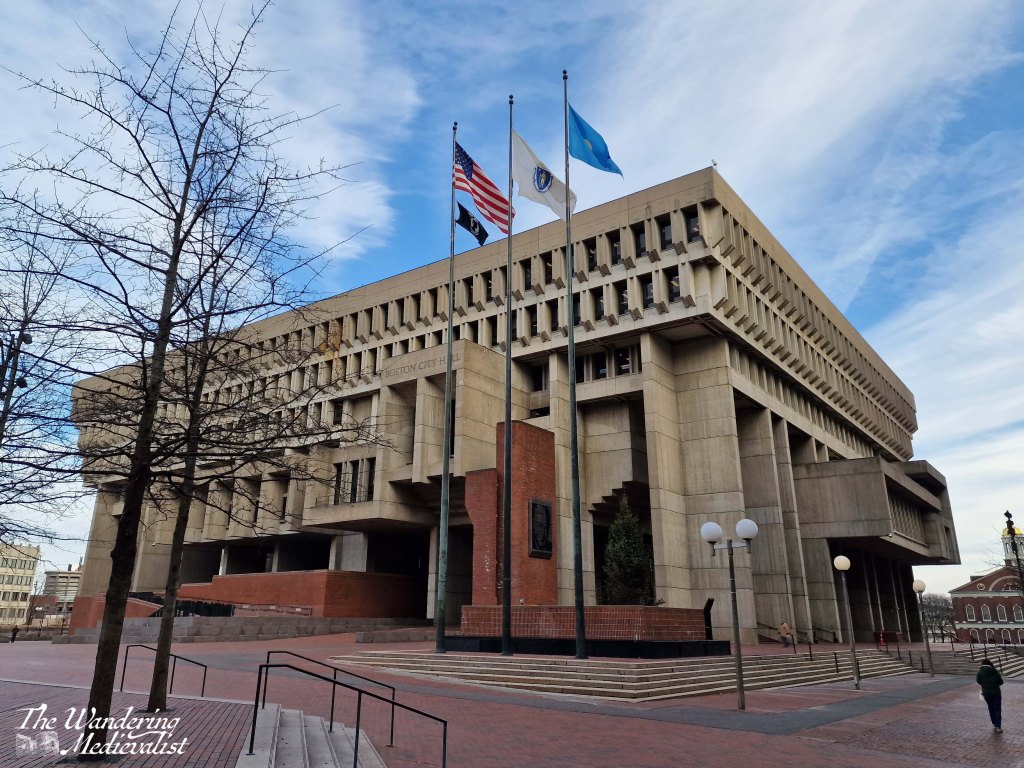
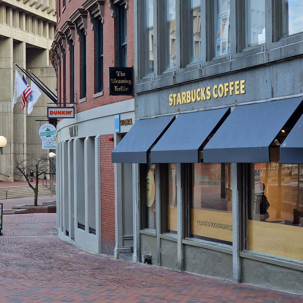
Route 2: Government Centre Cross Congress Street and head up the steps with Boston City Hall on your right (unfortunately frequently voted one of the ugliest buildings in the US).
This is also a great spot to see a Dunkin Donuts and Starbucks immediately next to one another – a Boston quirk. You are never far from a Dunkin.
Just outside the coffee shop of your choice is Government Centre, the T stop where the Green and Blue lines intersect, and the third-oldest subway station in Boston. As of January 2024, it is closed for renovation.
Which ever route you chose, your goal is Tremont Street; take a left to head towards Boston Common (roughly south-west).
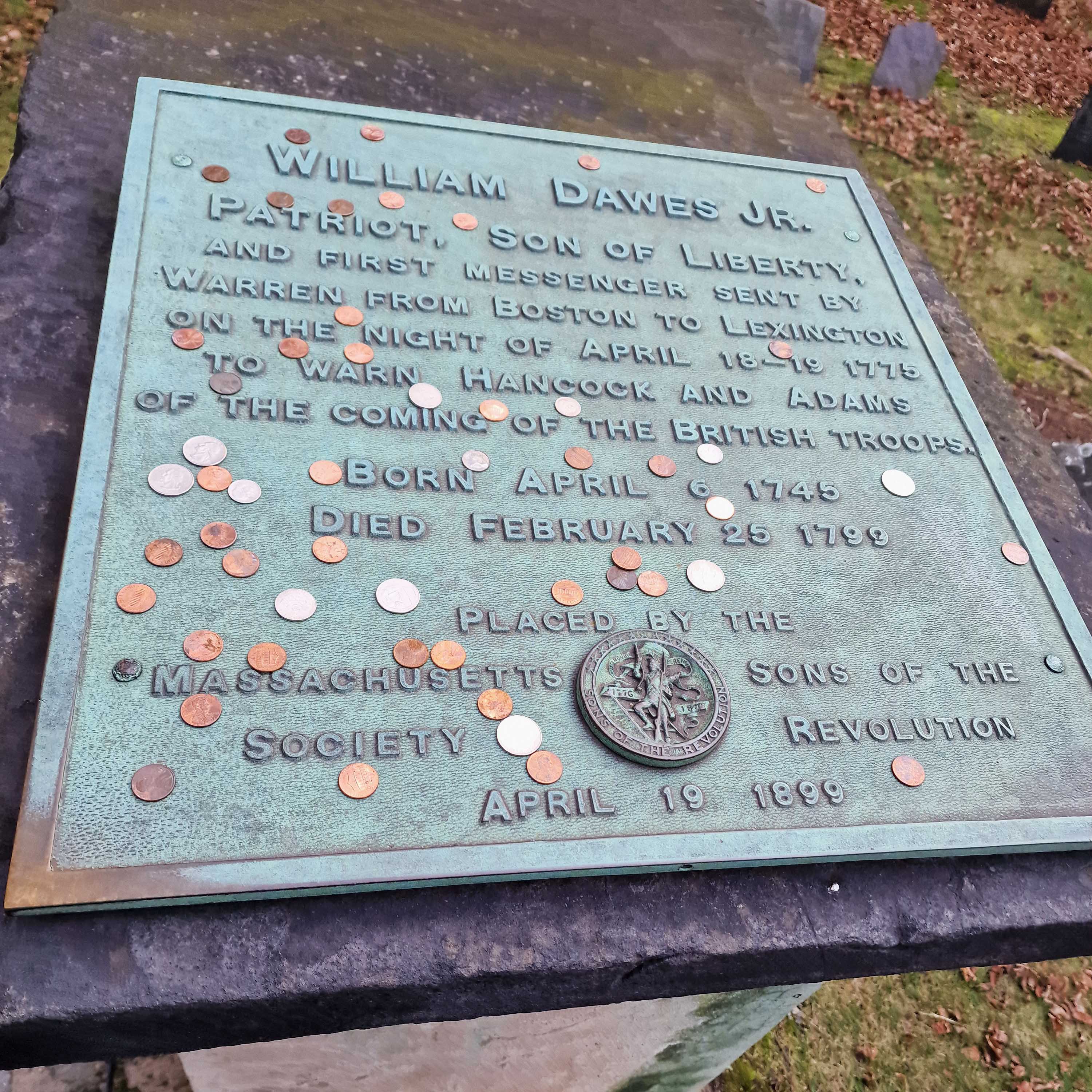
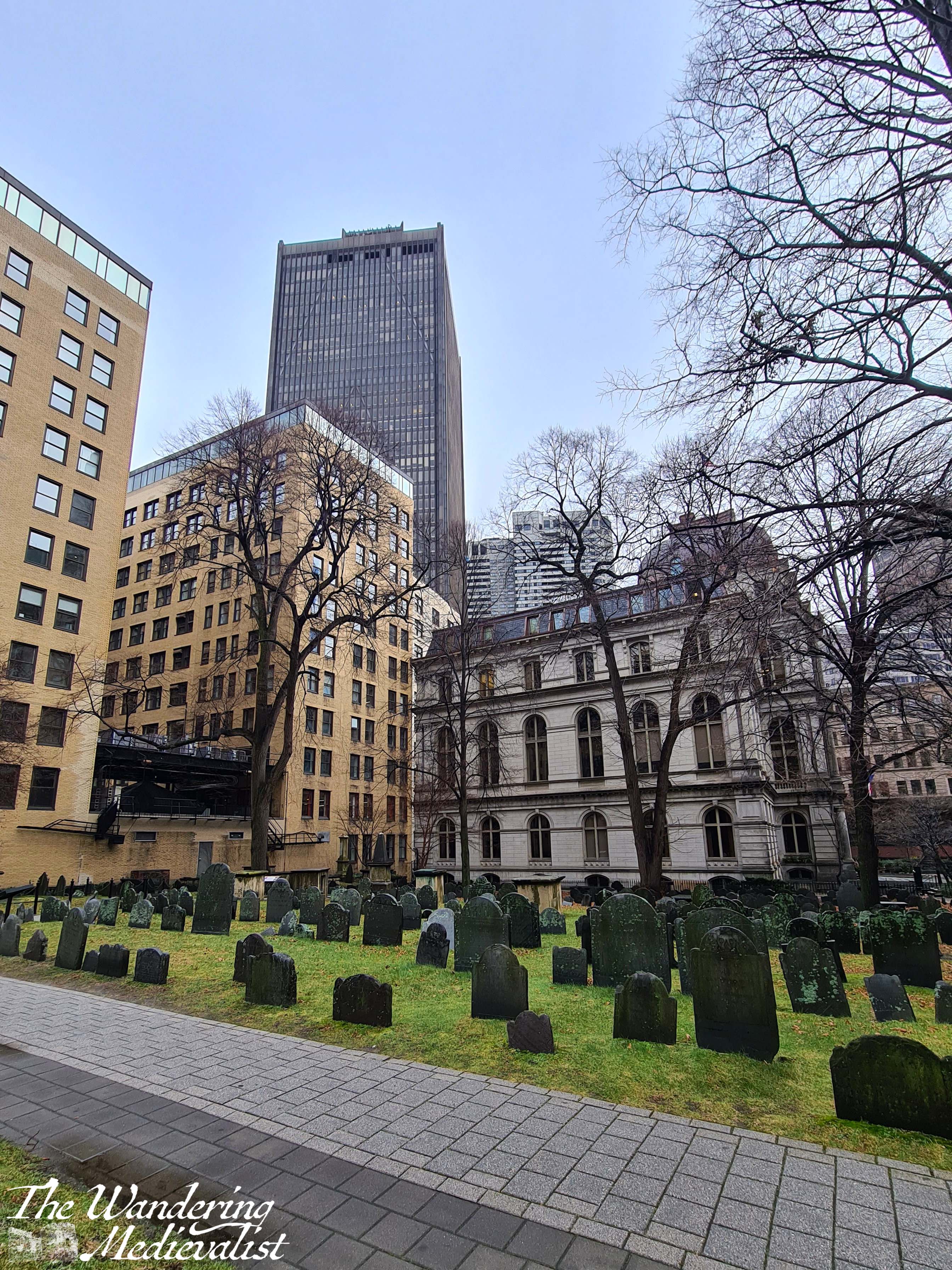
Half a block along Tremont Street, you will find one of those Boston sights that reminds you the city is several hundred years’ old: a graveyard, nestled between the high-rise buildings. King’s Chapel Burying Ground is not particularly large but is the oldest graveyard in the city, founded 1630, and boasts some beautiful old gravestones. Burials include William Dawes, the second rider to Paul Revere on the infamous night in April 1775; Mary Chilton, a passenger on the Mayflower; and Elizabeth Pain, who may have been an inspiration for the character of Hester Prynne.
Continuing beyond King’s Chapel along Tremont Street, you will pass the famous Omni Parker House, home of the Boston Cream Pie. One night a few years back we did go in and order one – along with a cocktail – and it was as beautiful as on the sign.
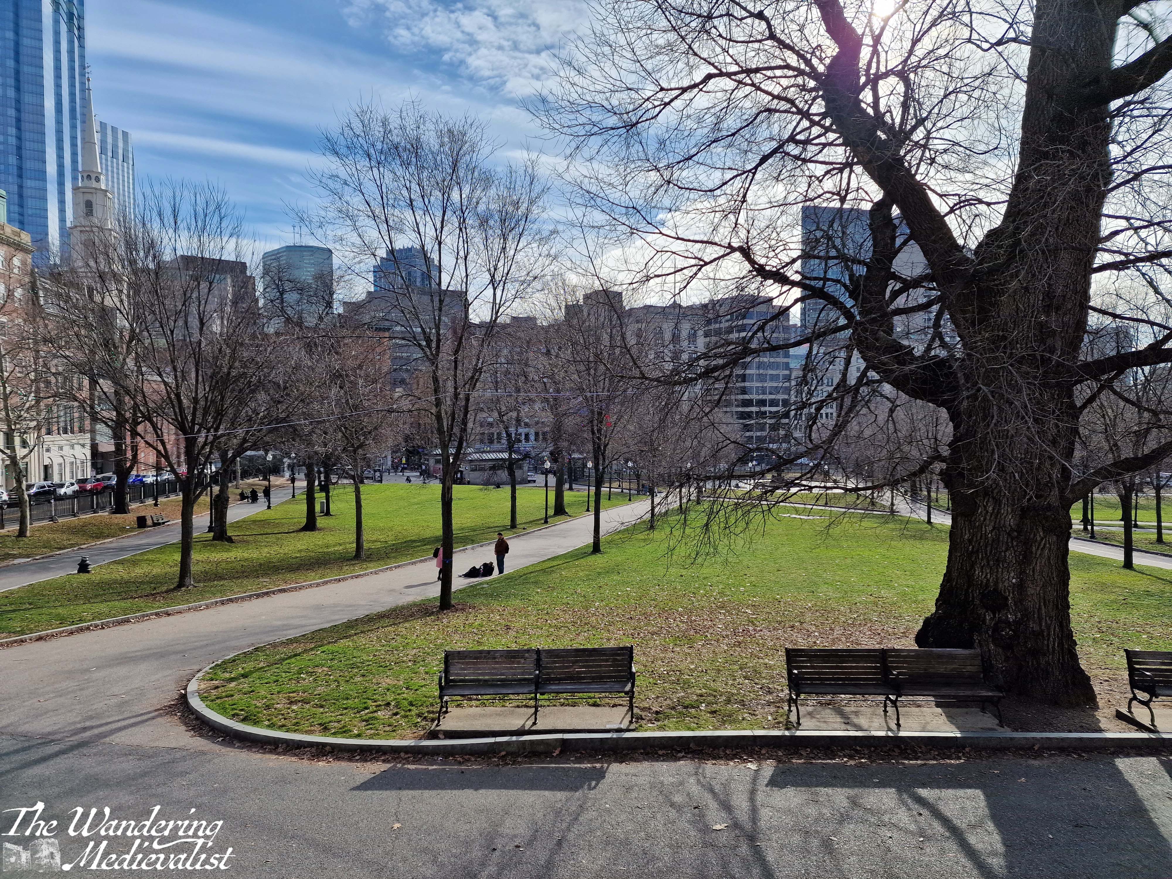
Ahead of you, you will start to notice the trees and open area of Boston Common, and the covered entrance to Park Street station, one of the two oldest subway stations in Boston, and the intersection of the Red and Green lines. Before you reach the Common, you will pass Granary Burying Ground, the burial place of numerous patriots of the Revolutionary War including Samuel Adams, John Hancock, Thomas Paine and Crispus Attucks. Frustratingly it has been closed on my last two visits, for maintenance.
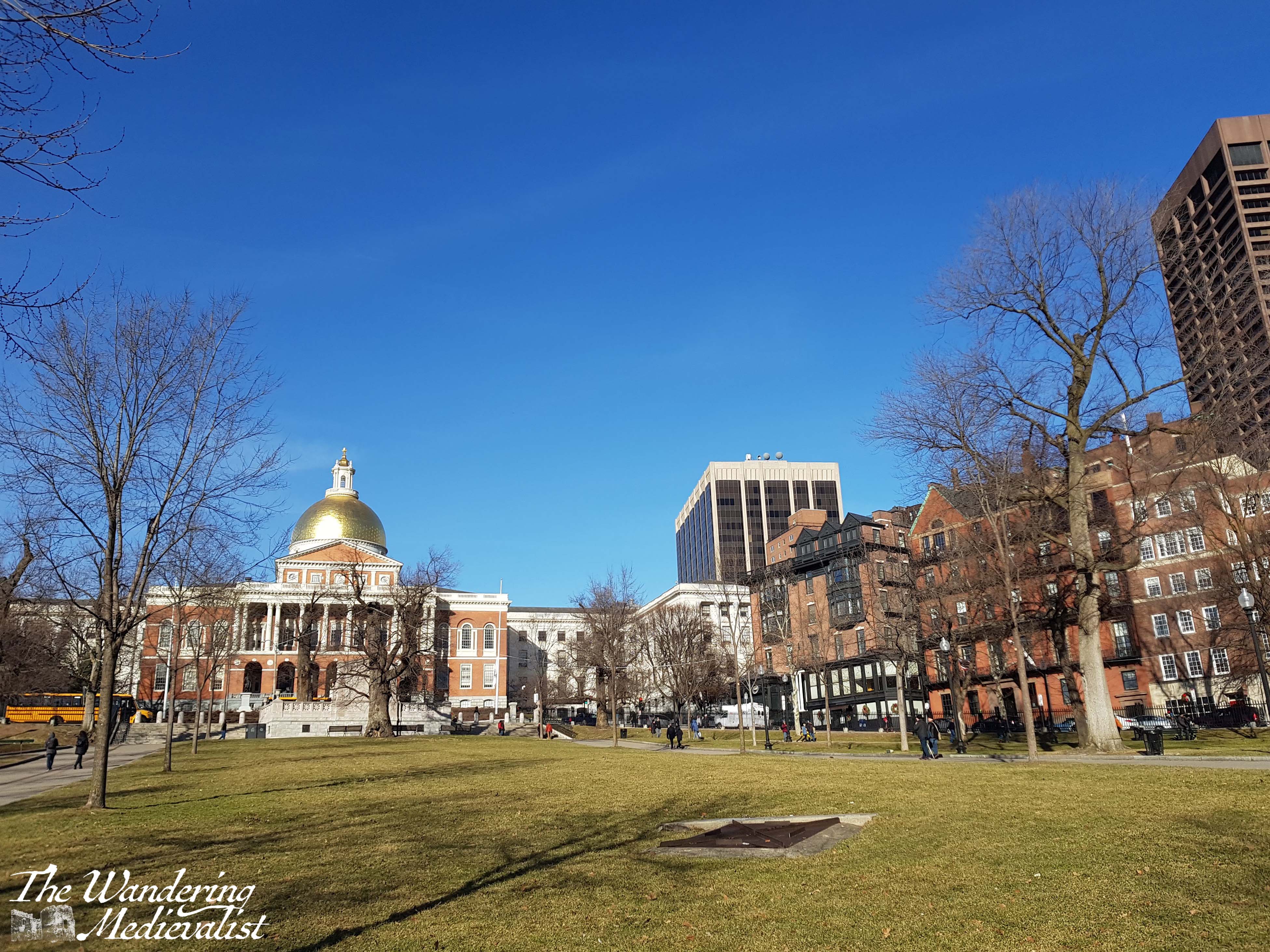
Stop 3 – Boston Common at Park Street
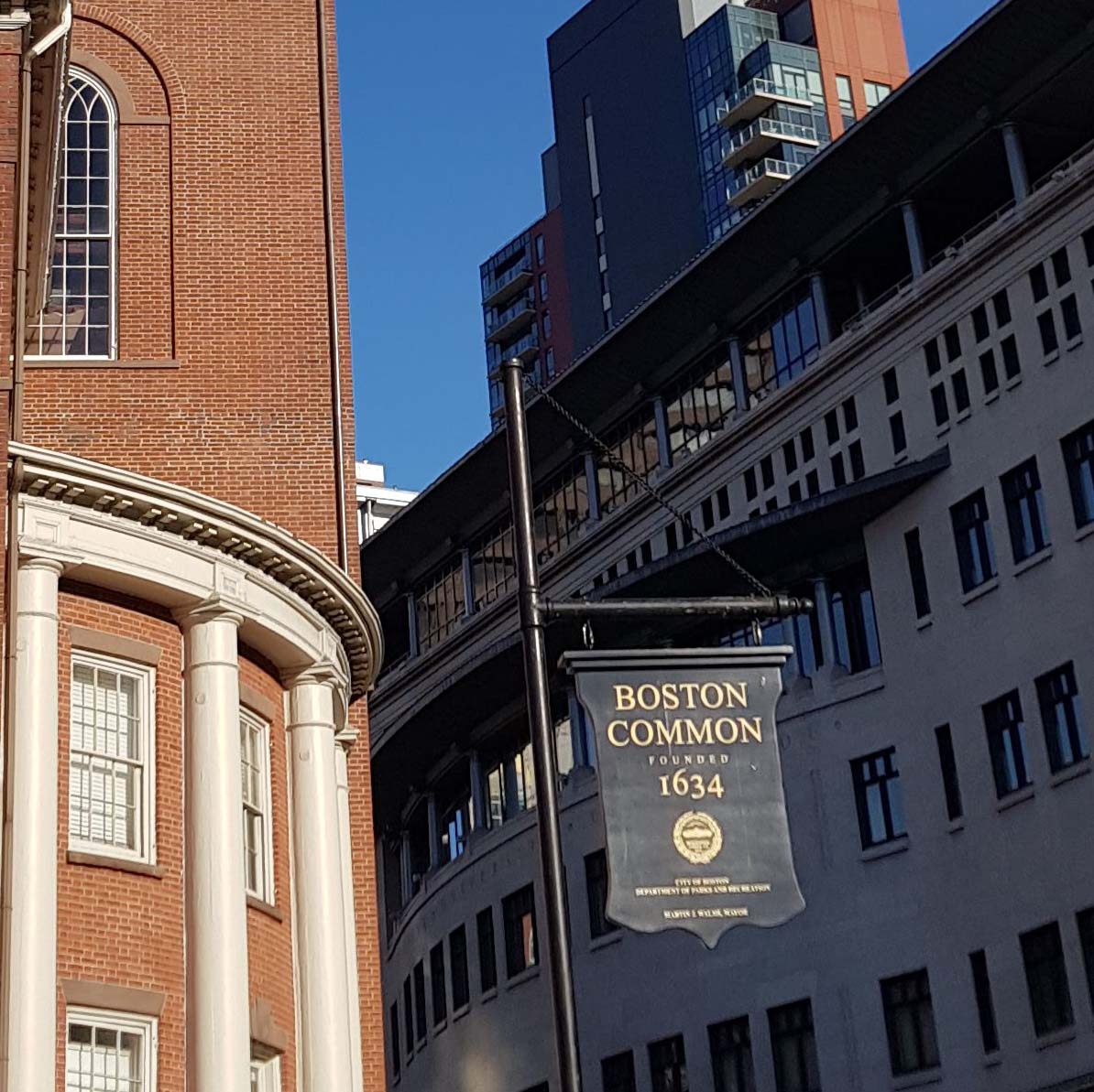
Immediately beyond the Park Street Church is Park Street Station and the entrance to Boston Common. I love looking at the Common on a map, as it somehow manages to have 5 (almost) right angled corners, due to curves in Boylston and Tremont Streets. The oldest city park in the US, the Common was used, as the name indicates, at various times for meetings, pasture, executions and military exercises. Now, it is an open park that is beautiful both when the trees are covered in leaves and when they are not, and it boasts several spots of interest including a bandstand, baseball field, and the Frog Pond where visitors can ice skate in the winter. Around the holidays, all the trees are covered in lights.
Really, there two routes are available again at this point. The first is to head immediately across the Common, following the numerous pathways until you reach the far side, where Charles Street separates the Common from the Public Garden.
The second option is to turn right and head up the gentle hill towards the gleaming gold roof of the Massachusetts State House, home of the State Legislature. Anyone who has watched the recent hit TV series The Last of Us may recognise this building.
Immediately across from the State House is the Robert Gould Shaw and 54th Regiment Memorial, commemorating one of the country’s first all-Black regiments during the Civil War (memorialised also in the movie Glory (1989), for better or worse).
I realised as I was writing that at this point I have really bitten off too much to fit into one post, and so if I have caught your interest, I will continue the walk in A walk through Boston – part 2! Coming soon…
I have had every intention of publishing this post almost every day for the past two weeks, but a combination of leaving work and a bout of Covid continued to set me back.
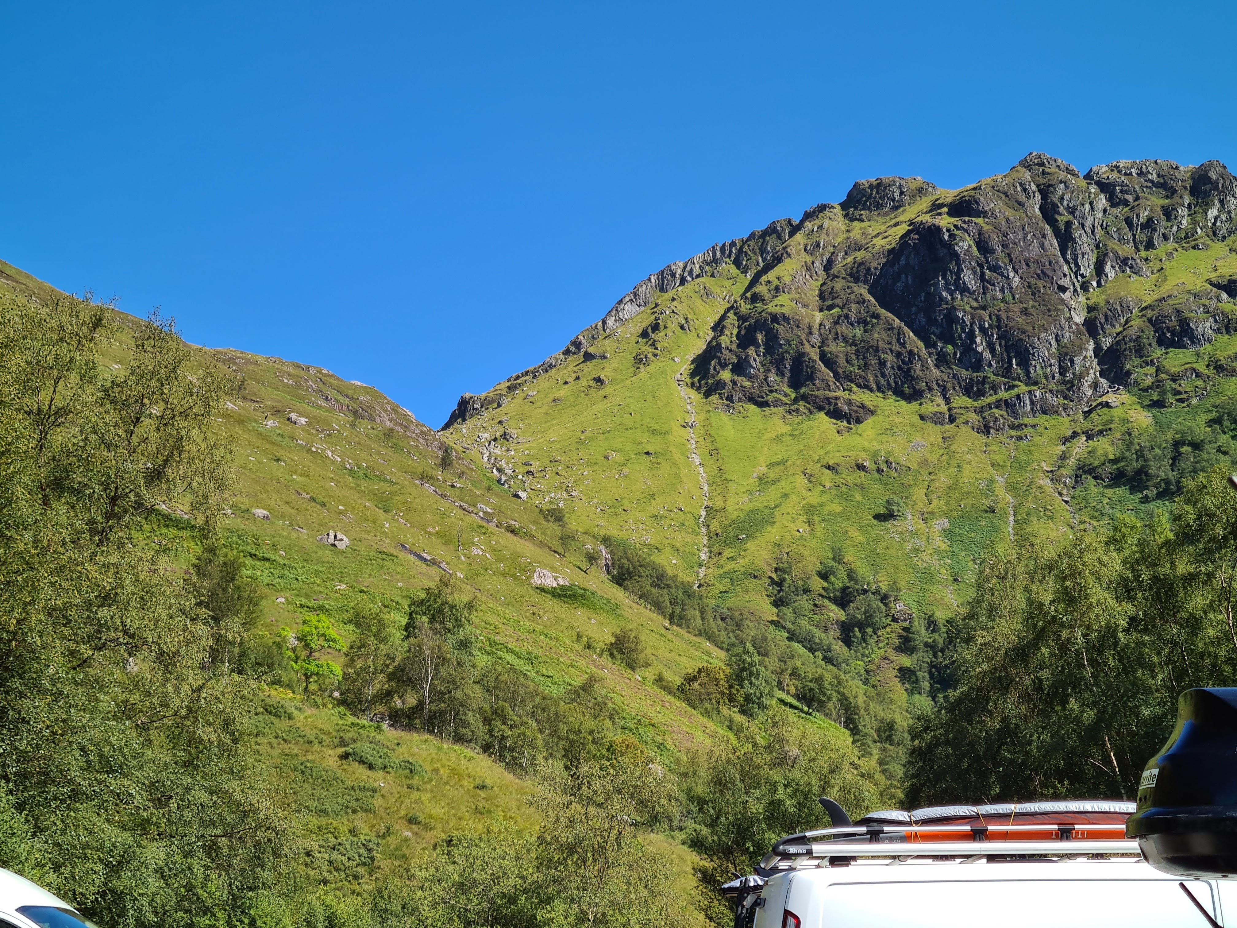
The Scottish Highlands are legendary for their stunning hills, lochs, and the hikes and paths that allow you to view them in a way you can only do by foot. Not long before the start of lockdown, we spent a weekend at a self-catered cottage in Aberfeldy, allowing us plenty of time to explore the surrounding hills. This walk, on Kenmore Hill above Loch Tay, was both stunning and a touch disastrous.
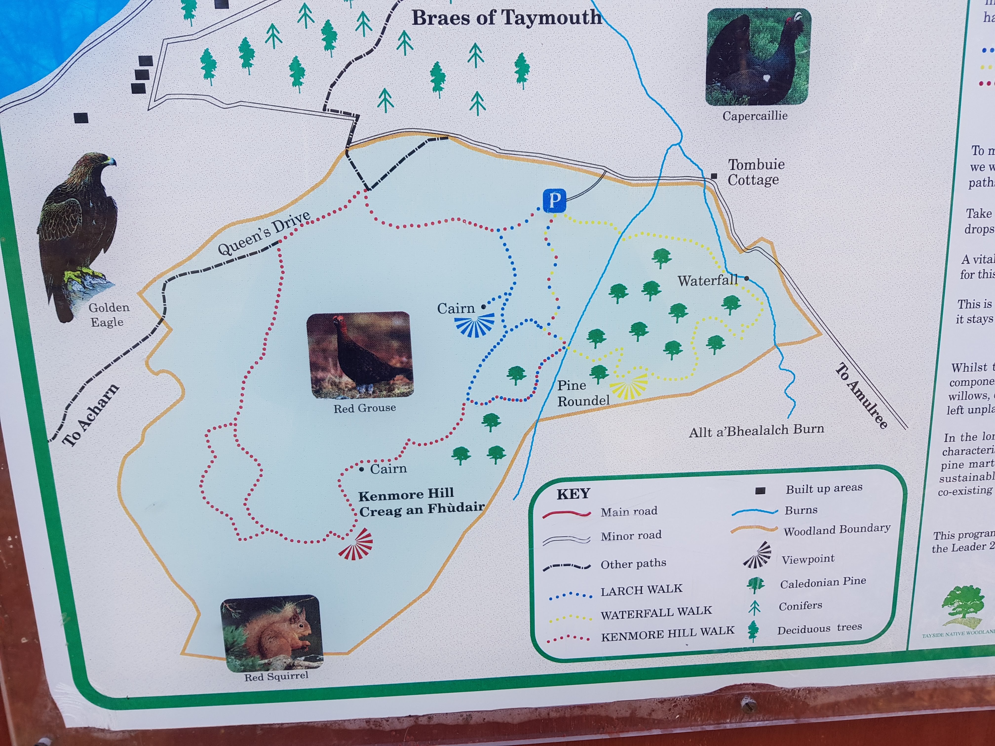
Why was the walk a touch disastrous? It started with the car park which, at the time we visited, was inaccessible without a 4×4 (I do have hopes that it has been re-done since then!). We ended up having to stow our car just off the road and the end of the drive up to the car park, but fortunately our car at the time was tiny and we managed relatively well.
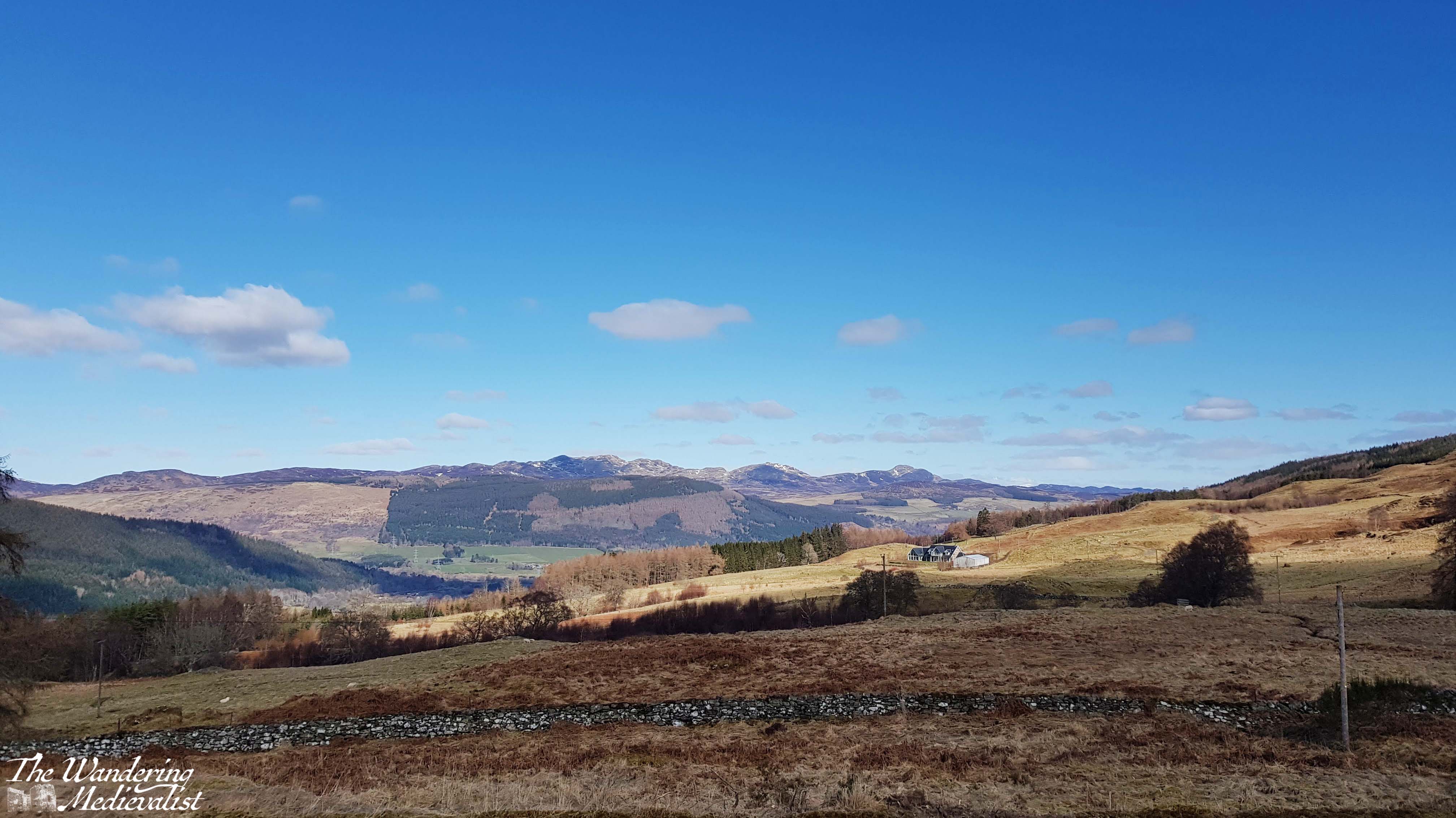
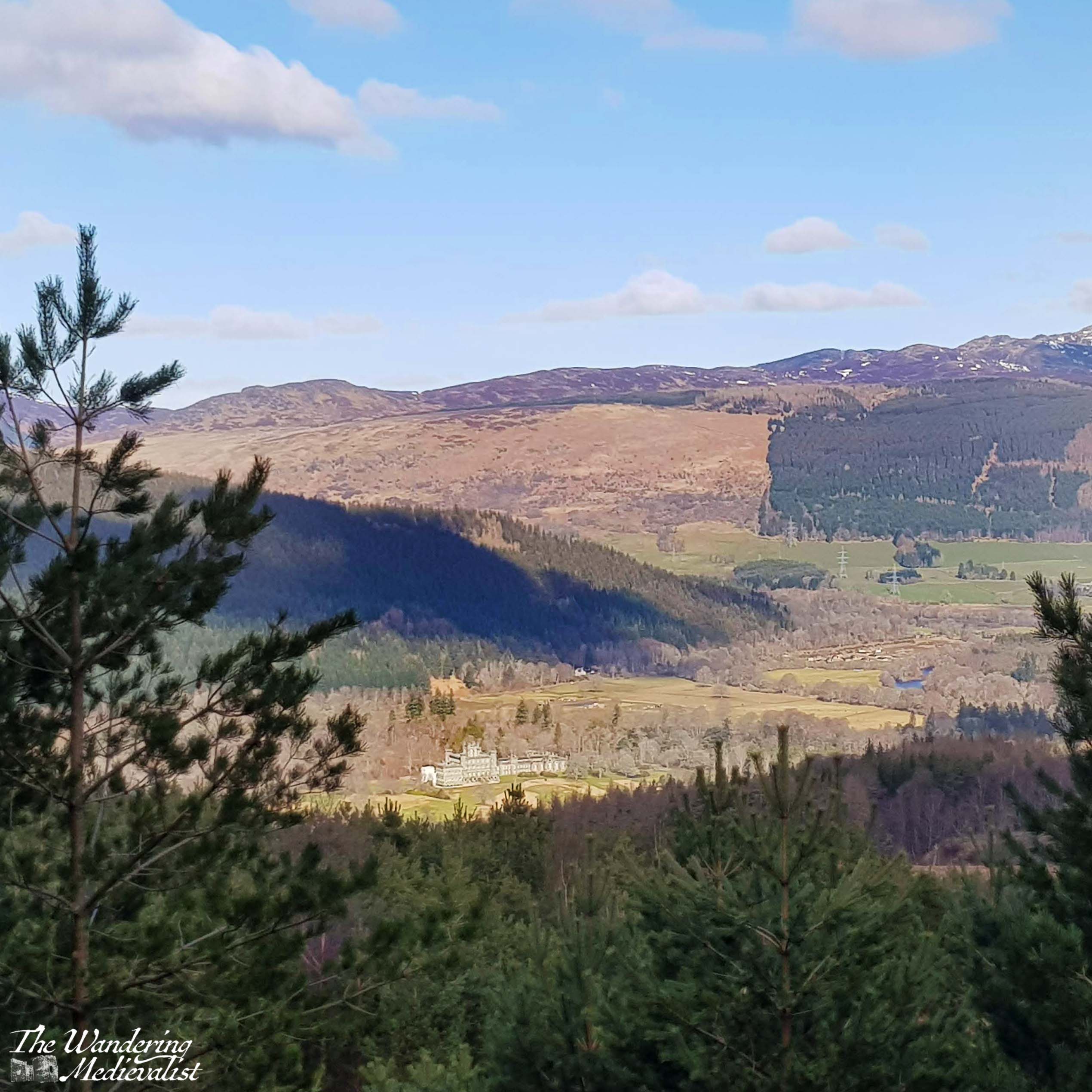
From the edge of the road we walked up through the car park and almost immediately enjoyed splendid views back over the valley, particularly down towards Taymouth Castle and estate.
The sign in the car park offered three routes, and the one most clearly described by Walkhighlands was the red route; all three started in roughly the same place so we headed upwards, beginning a steady climb up the hill on a path that reminded me of a ski path without snow – rocky and lined with trees.
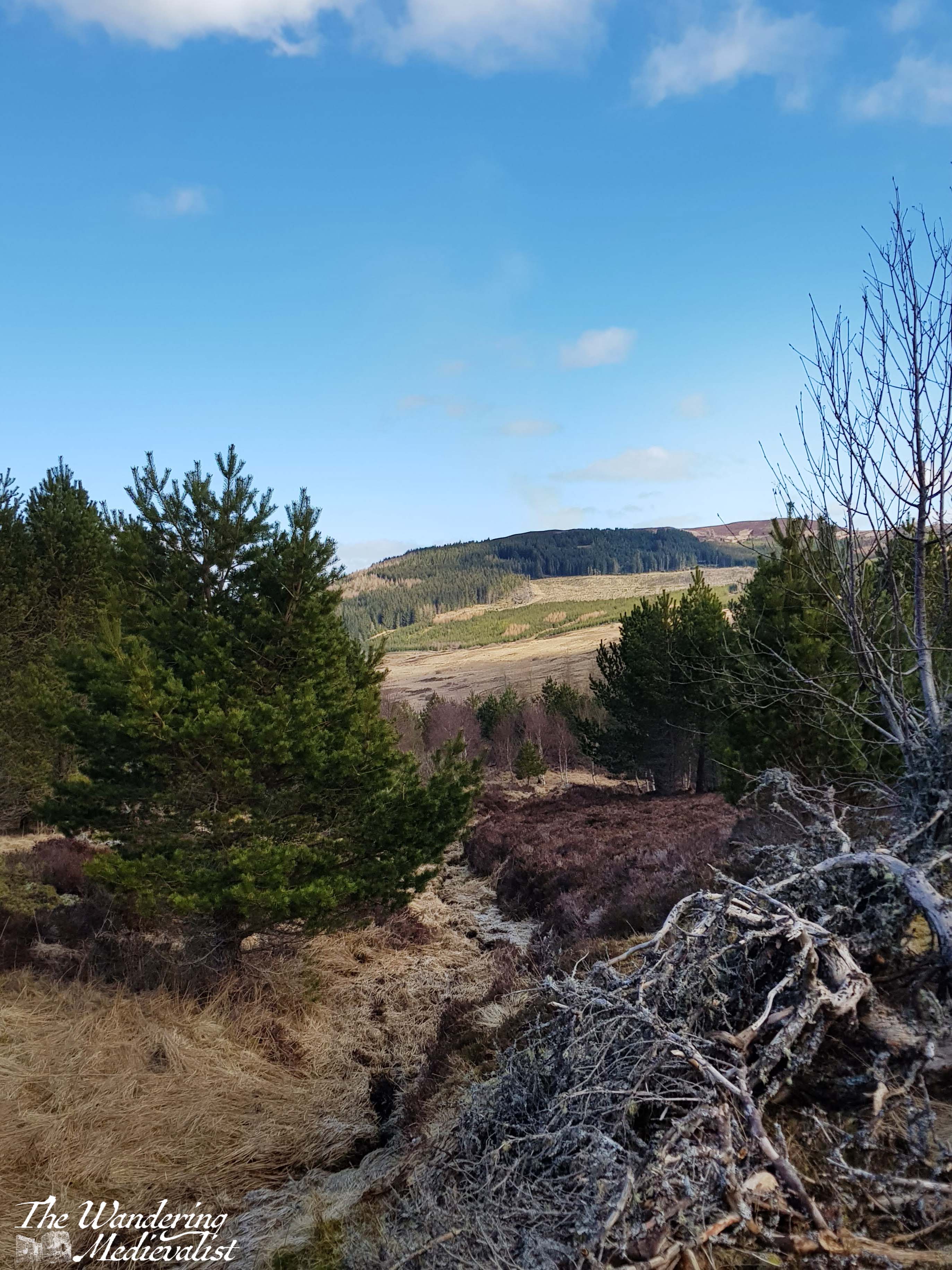
Eventually signs for the red path turned us right and we emerged from the trees, finding ourselves on a grassy area with a treeline on the ridge above and promises of views over the valley.
We were hampered a bit at this point by the fact that we had, the day before, done the Birks of Aberfeldy walk, which had been steeper and with more stairs than expected. The other half was suffering a bit with his knee from an old injury, and as we climbed up the hill towards the ridge – a relatively steep walk – he found it becoming more and more difficult.
We reached the top of the ridge in time and the views were indeed spectacular – the snow-topped peaks in the distance stood out beautifully against the blue sky, and we planned to continue the red loop towards the final cairn, where I know you can see down towards the other end of Loch Tay.
The discovery that we had forgotten a knee brace meant that we really could not continue to potentially cause even more damage, and so we agreed to return to the blue loop, and follow it back to the car.
Here, of course, is where slight disaster struck. We did as planned, found the blue path and intended to allow a quick run up to the marked viewpoint. Instead, as we followed the blue markers and the gap in the trees, we gradually realised that we had not seen a marker in a while, and that any sign of a trail had vanished. Both of us are relatively experienced hill walkers who had been paying attention, and yet could not determine a place where we could have deviated from the trail; we had two versions of a map and the picture of the trail, but found ourselves completely lost. We back-tracked a bit, and still could not confidently identify a marker. Standing at one of the last clear points, we established where the path should be, and where the road was, and decided that as long as we headed down and towards the road, we would reach it eventually, as it loops around the hill.
What followed was a rather steep and haphazard descent through brush, heather, and the occasional small trickle of water. I would not normally condone leaving a trail like this as it can cause damage to the wildlife, but we really did not have much of an option. We decided the trail lost us as much as the other way around. It was similar to a hike I had once done with my father, when we realised a touch too late that the trail we were following was in fact a dry creek bed – on that day, like on Kenmore Hill, eventually common sense and perseverance (perhaps even stubbornness) won out and we found our way to a clearly marked path.
On Kenmore Hill, this ended up being the last loop of the red trail, though we still cannot work out we managed to get there. Relieved, we found our way back to the car park and our car, the beacon we had just made out from higher up. While it was certainly not the most comfortable climb, I have every intention of making my way back and completing the red loop at some point, as I have seen from other hikers that the views from the other side of the hill are spectacular. It also seems to be the perfect length of hike – about two hours, with enough climb to get some proper views and the heartrate up a touch. I also have hope that in the years since the pandemic, the path has been kept up and perhaps improved, though a peek at Google Maps indicates that the road to the car park may still be in questionable shape.
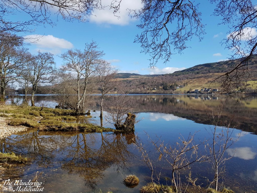
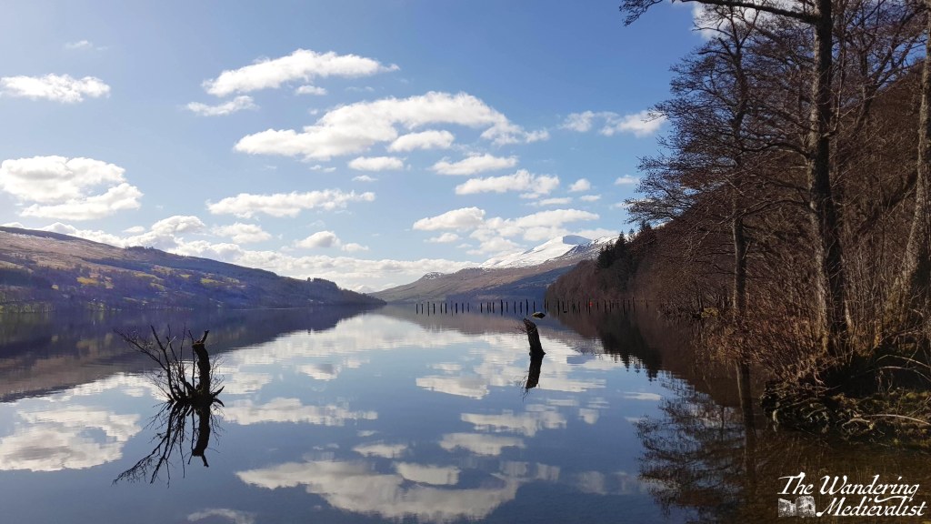
After our slightly chaotic hike, we decided to take a drive down the loch as it was a beautiful day, and below are a few of the pictures I took along the way; Loch Tay really is a beautiful spot and while the mountains are less dramatic than further north, they are no less impressive. We in fact drove all the way to Killin and stopped at an Inn by the Falls of Dochart – a post for another time.
I look forward to an opportunity to try to this hike again!
It has been a long few weeks with the holidays approaching and Thanksgiving zipping past. At a very family-centric time of year, my mind often returns to New England and particularly New Hampshire, where I spent so much time growing up.
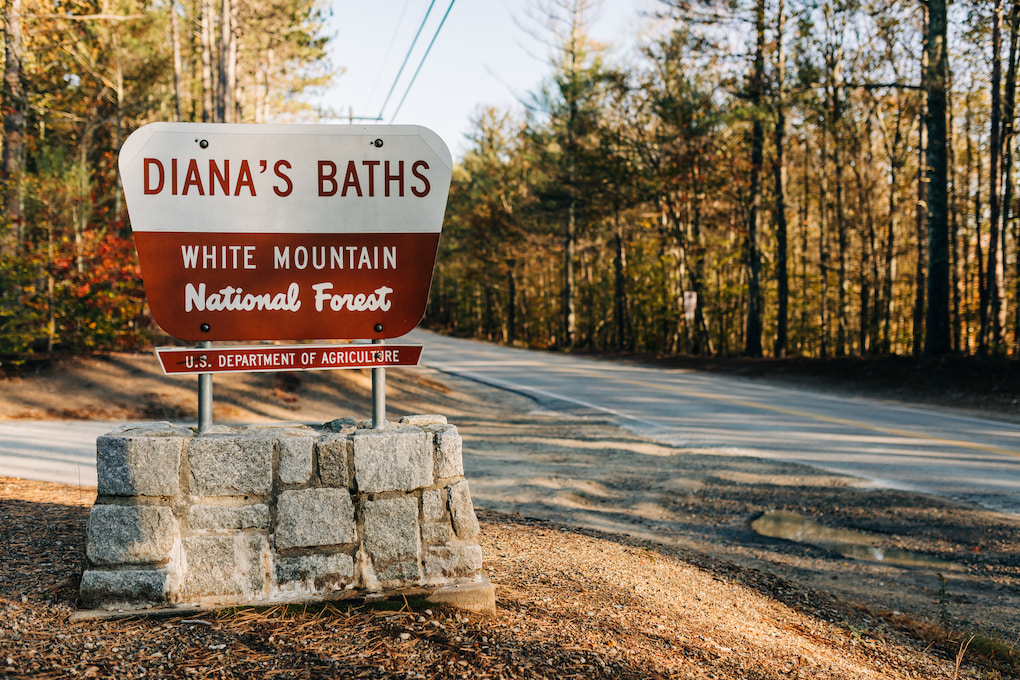
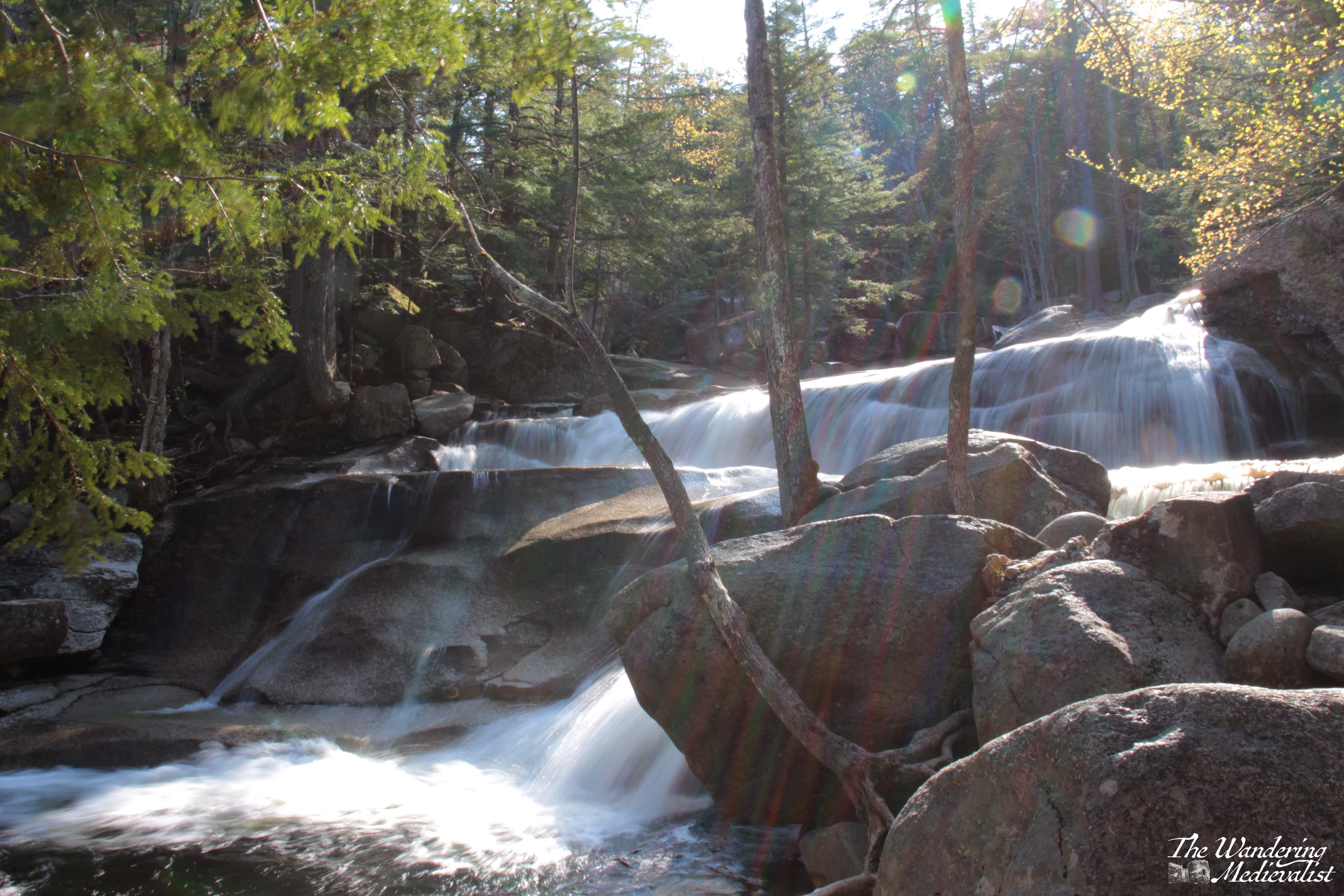
Casting my mind back to May, I recalled that our whirlwind trip to the White Mountains did not allow us a lot of time for long walks, and we were delighted to discover that there were more than a few short jaunts where the views were still excellent. The trial to Diana’s Baths was one of those – easily accessed and yet in no way lacking in terms of waterfall.
We chose this walk as we knew it was close by – less than ten minutes by car from our hotel – and it had great reviews. One aspect of travelling in the White Mountains that I had forgotten about was that some trails require a fee to pay in the car park. This is entirely foreign to those of us who hike in Scotland, and we found ourselves digging around for cash at several sites. Now of course if I had read ahead I would have realised this, but I didn’t. And most of my memories of the White Mountains come from childhood, when I would not most likely have noticed any payments being made. What I had remembered about the area though was the large, clear trailhead signs for most sites, which helpfully confirmed we were in the correct place even when Google faltered a bit.
On the day we visited, we had been driving most of the day, and so were keen on something quick to stretch out a bit. We had trusted Google maps to take us on an epic drive from Freeport, Maine almost due north – though there is no road due north – towards Bethel. From there we cut across the top of the White Mountains and then south along Route 16. This route cuts south from Gorham, NH and passes so many remembered locations – Dolly Copp Campground, the Great Gulf Wilderness trails, Glen Ellis Falls, and of course the Pinkham Notch visitor centre where we several times started a trek up Mount Washington.
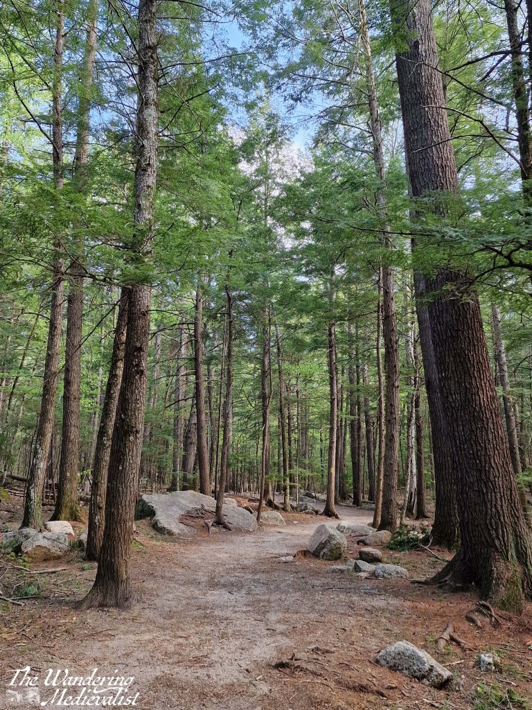
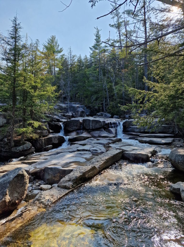
Fortunately, the Diana’s Bath trail is no where near as strenuous as climbing one of the Presidentials, or even some of the shorter peaks we favoured. Quite the opposite, it is just about one mile round trip and so perfect for families. The path itself is well-kept and pleasant, cutting through the forest of tall pine trees. The day we visited was warm and sunny, a great day to be walking in the woods.
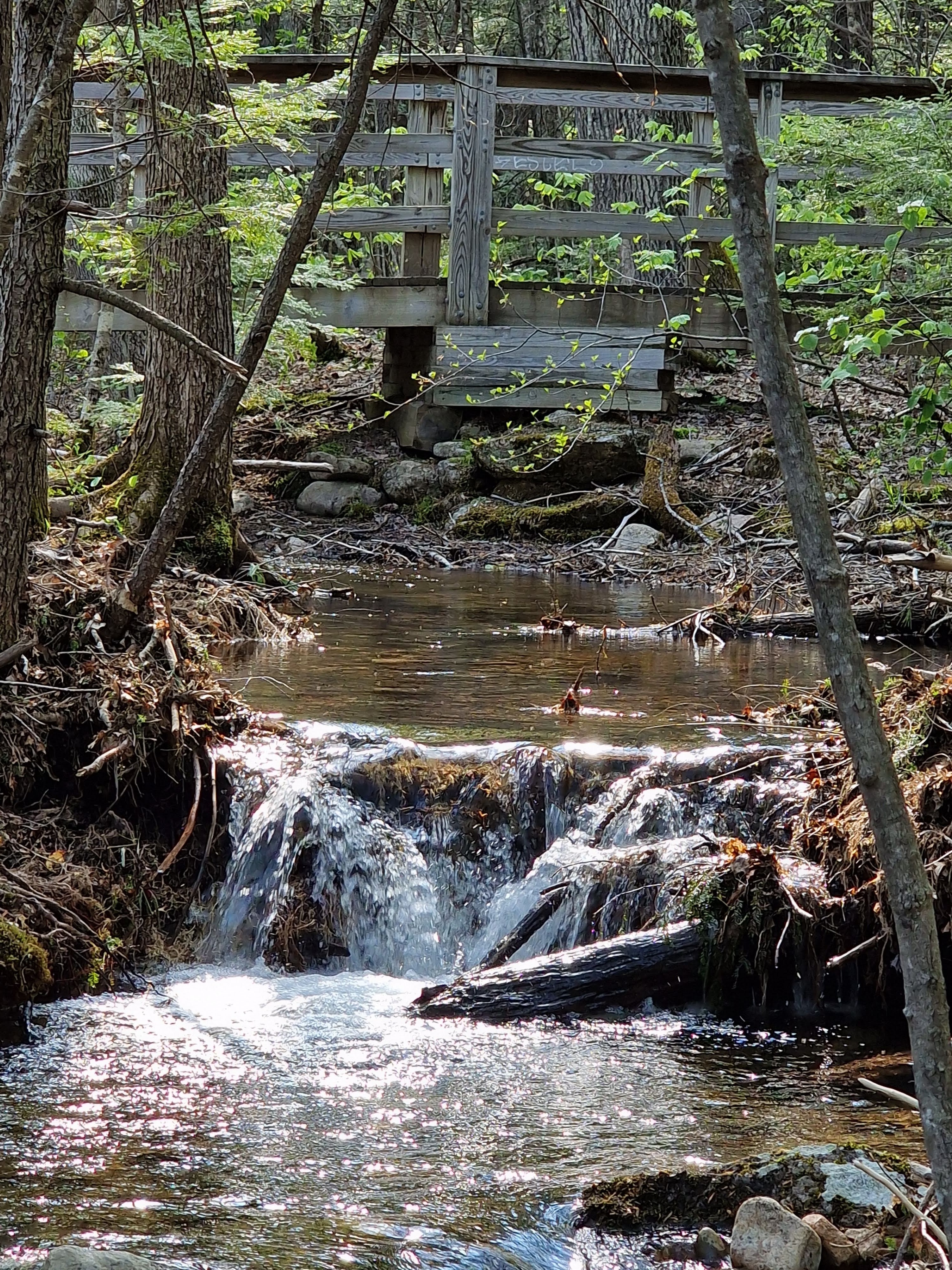
There is a small creek running alongside the path in places, but it is quickly overshadowed by the first hint of the falls – the sound of rushing water, seeping through the trees.
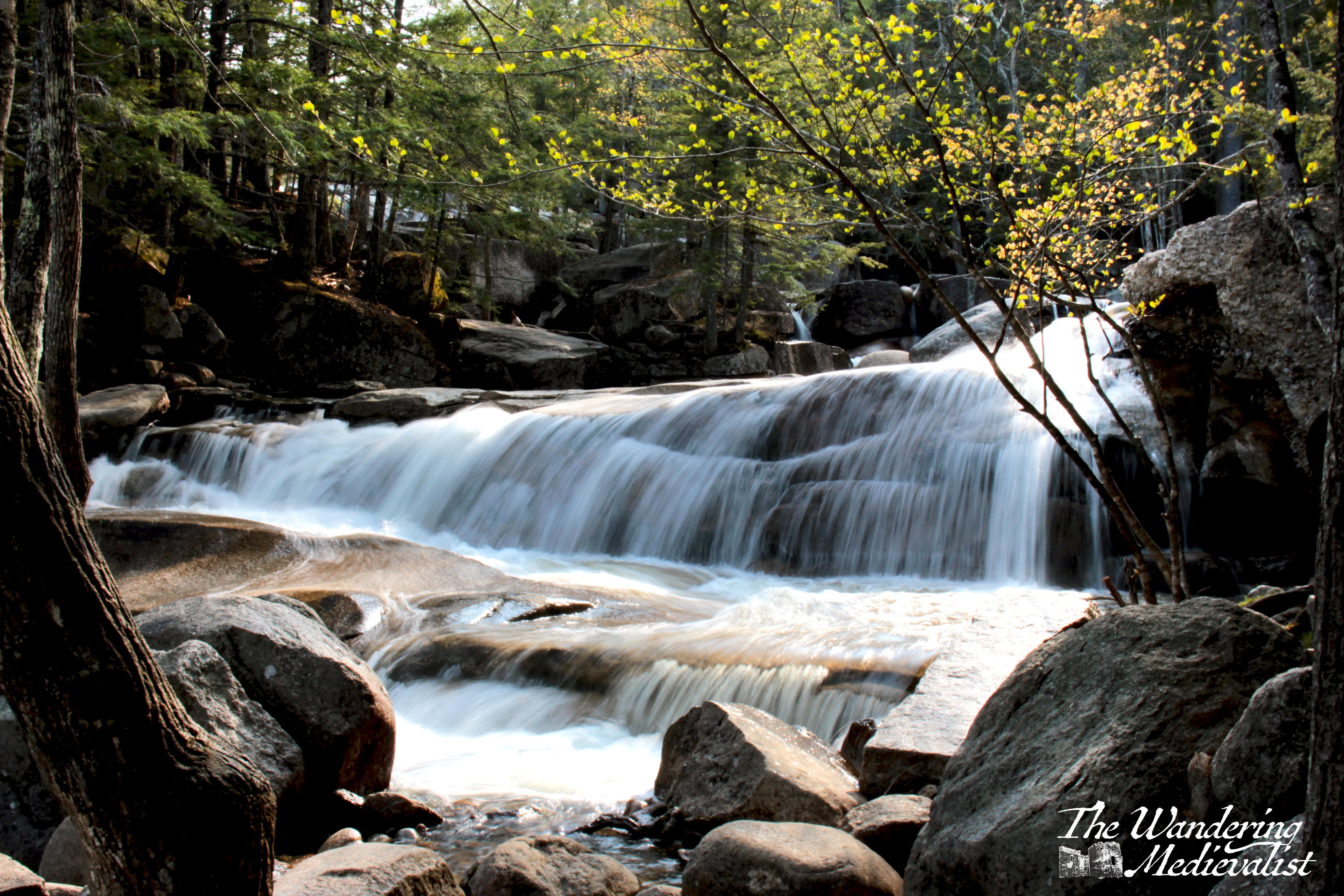
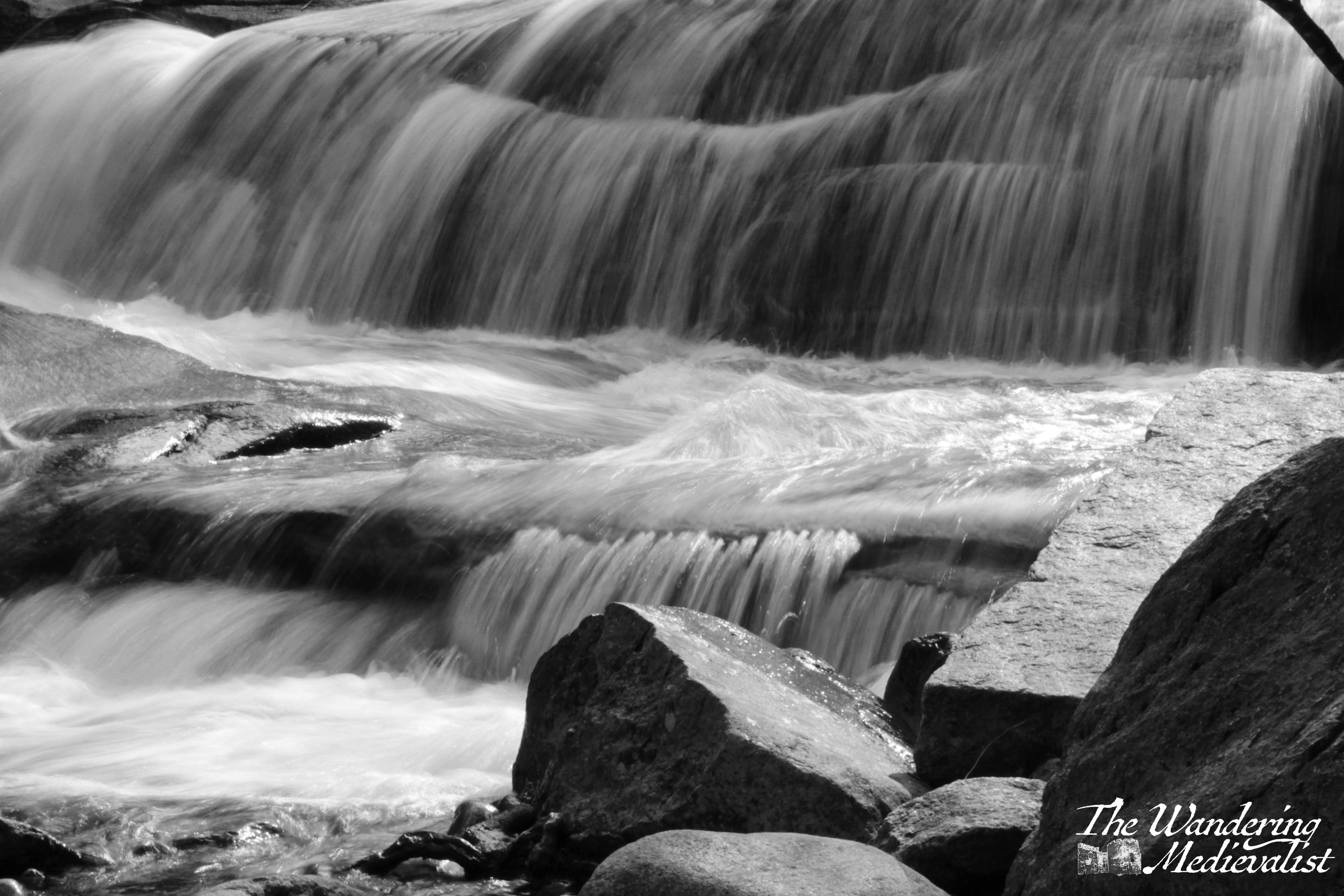
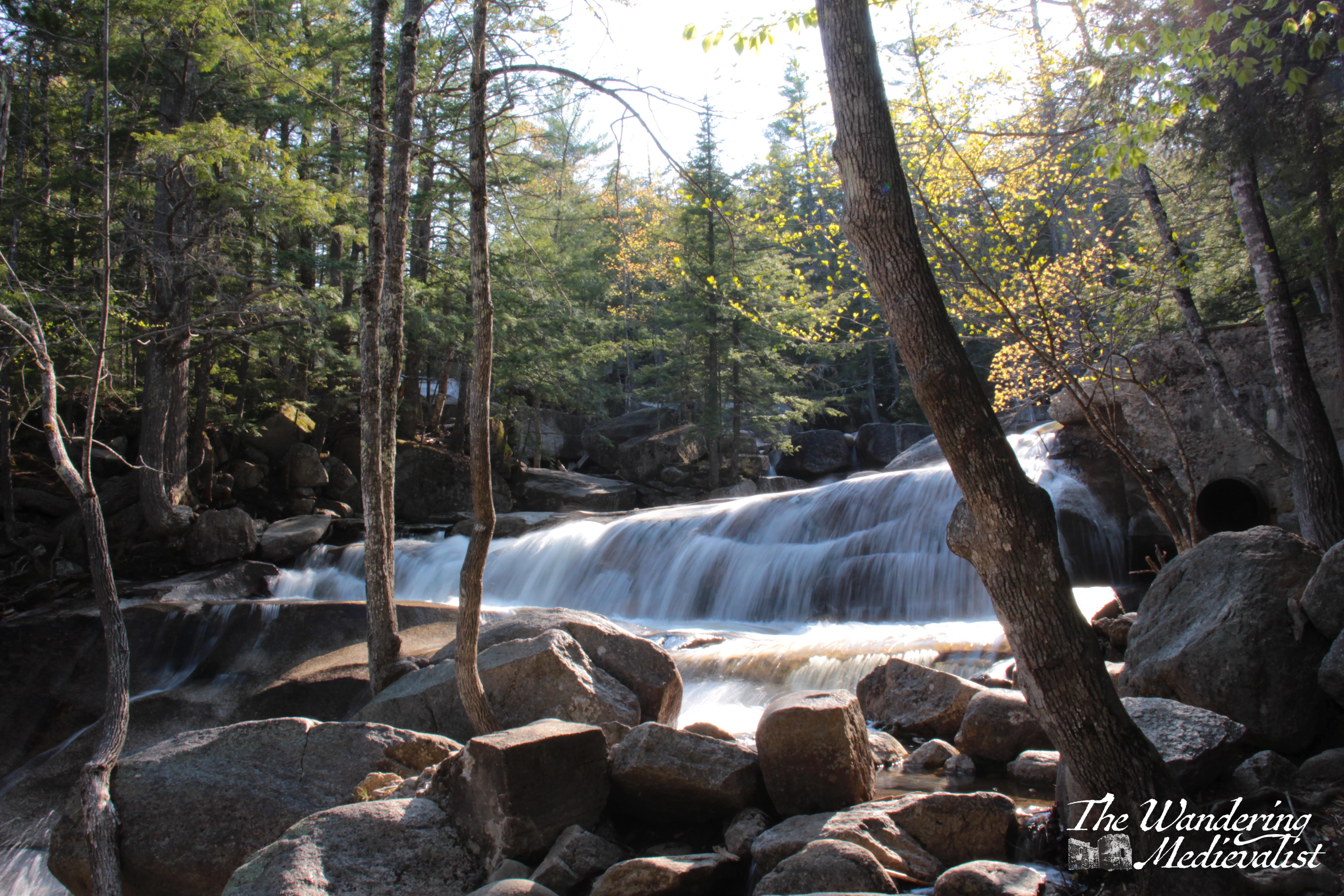
I immediately got excited, as I had brought my tripod with me and had every intention of practicing some rushing water shots. And indeed, once you reach the falls, there are plenty of opportunities. There are, as I discovered to be standard, detailed plaques teaching visitors about the falls, why they are there and their history – the rushing water was used to power a sawmill before being recognised as a tourist attraction in the early 20th century.
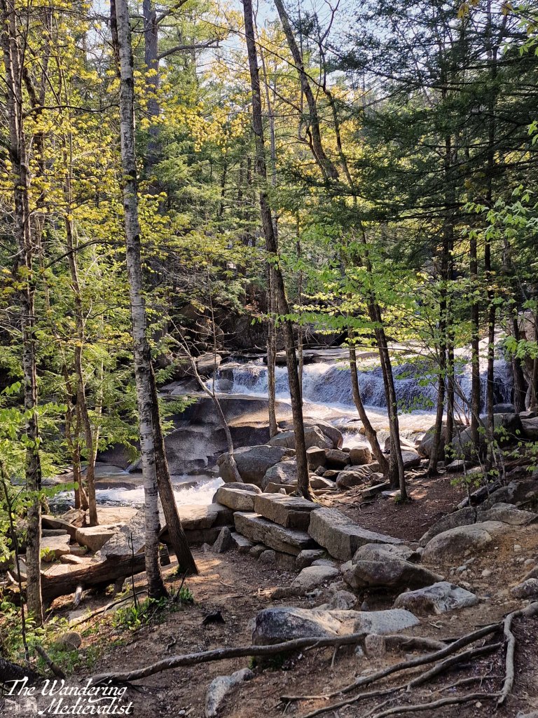
When you first approach the bottom end of the falls, you get a splendid view up the river; the trail then follows along with several paths where you can move through the trees to the edge. Even better, there are viewpoints set up with benches and plenty of space to rest – and set up a tripod. One thing we did notice was that, near the river, the biting bugs returned, and I paid for several of the below pictures with mosquito bites!
If it were not for the mosquitos there may have been more pictures, but they were getting quite vicious and we had not prepared properly. So, we quickly climbed to the top viewpoint which looks up the falls, before returning to the woods. Only minutes away from the water, the bugs disappeared again and we enjoyed a pleasant walk back.
Anyone visiting the North Conway area and looking for a short walk, or one that is more accessible for children and those with limited mobility, this is an excellent option.
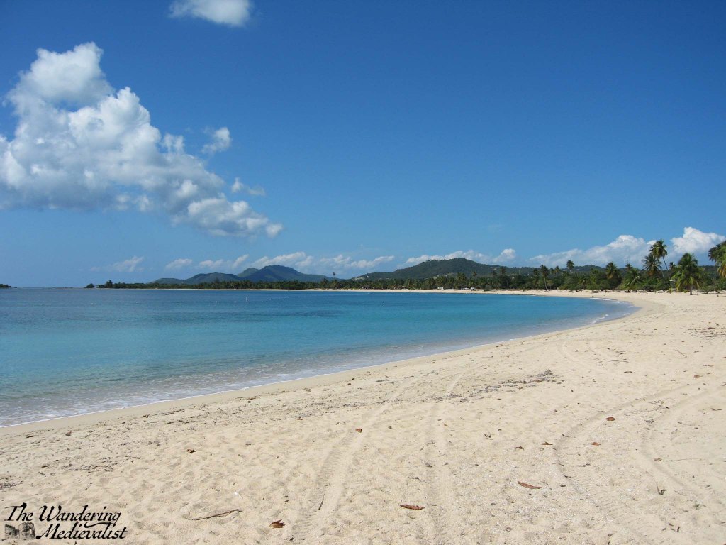
I have been wanting to do a Puerto Rico post for some time but was a bit flummoxed on where to start. There are so many beautiful beaches and views that I could not decide if I wanted to choose one, or just highlight some of my favourites. In the end, the former won out, as I looked through my many pictures and realised that if there was anywhere in Puerto Rico that stands out, it is Sun Bay.
A bit of background – my father moved to Vieques when I was a tween, and until I moved to Scotland, I would spend several weeks there every year, usually around Christmas, my March break, and a week or two in the summer – sometimes a bit longer. My father very much used Sun Bay as a kind of wild gym, going there almost every day to walk and swim, and I always joined him. I have to admit that I have not visited this beach now in more than ten years, but I knew it very well. I gather that there have been many changes since I was last there, some caused by man and some by weather. I can attest that it is not only stunningly beautiful, but also the perfect spot for a long walk or swim.
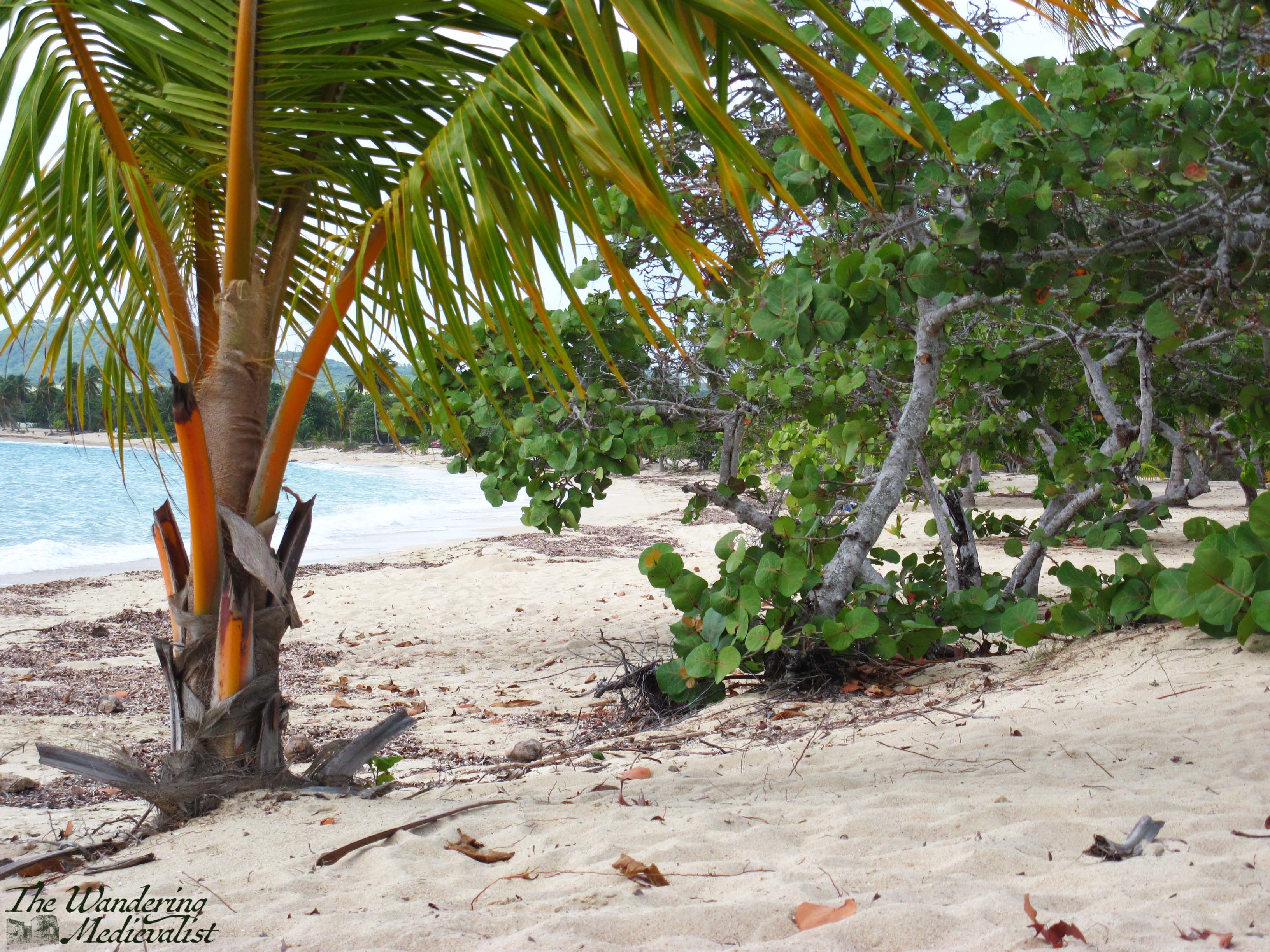
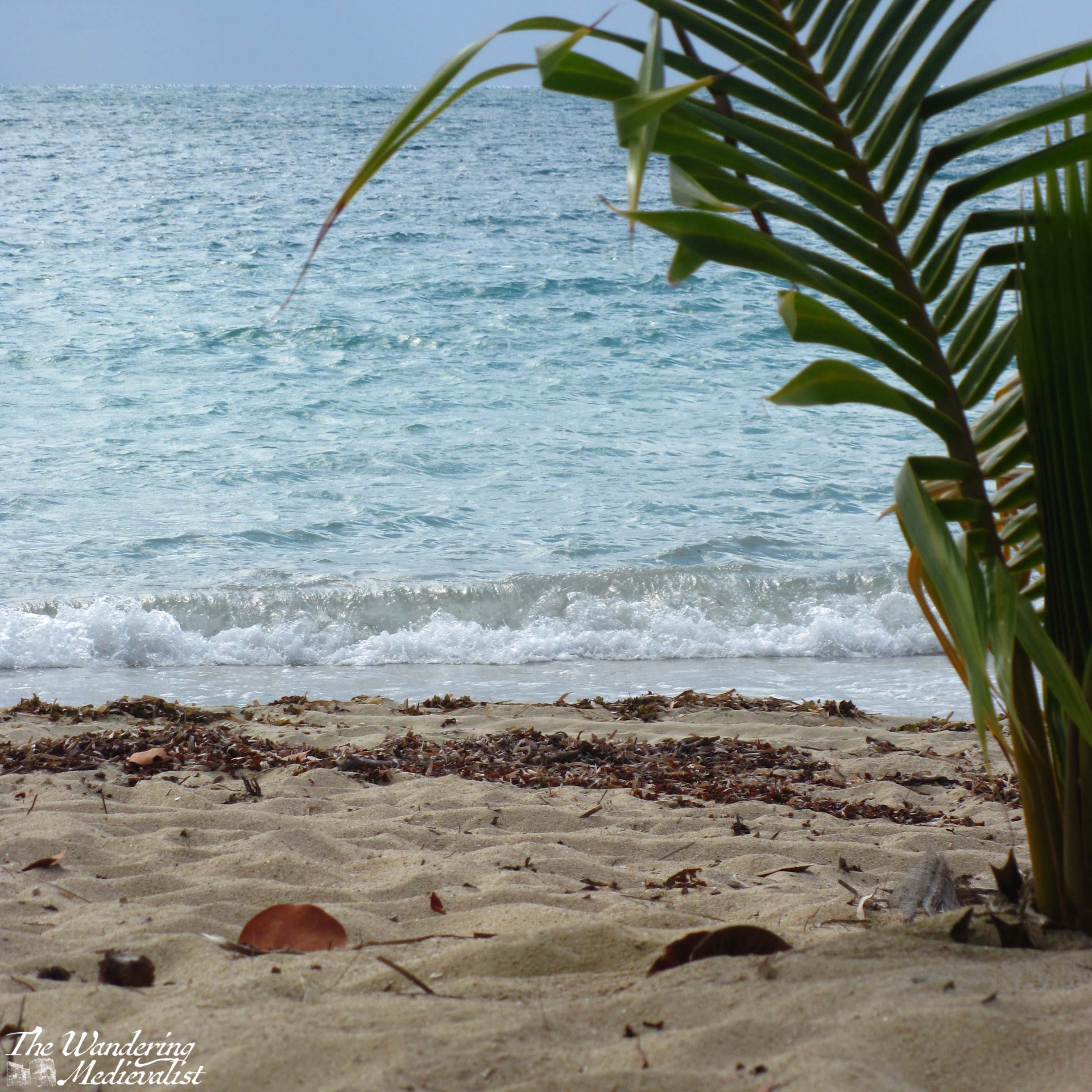
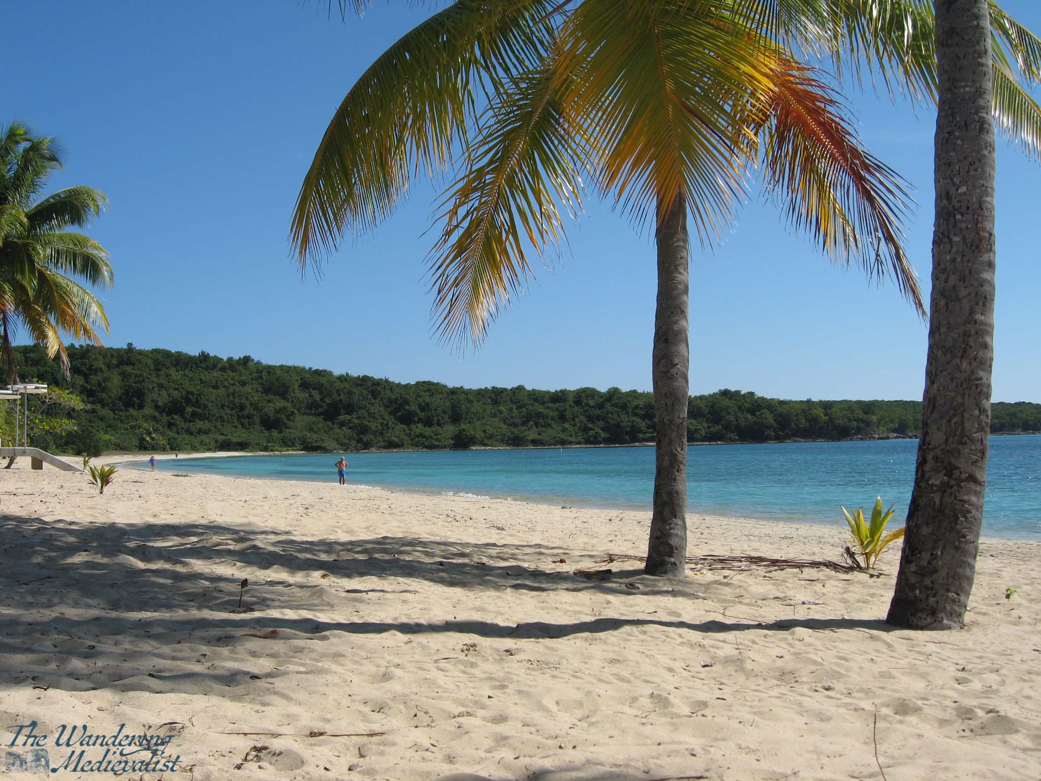
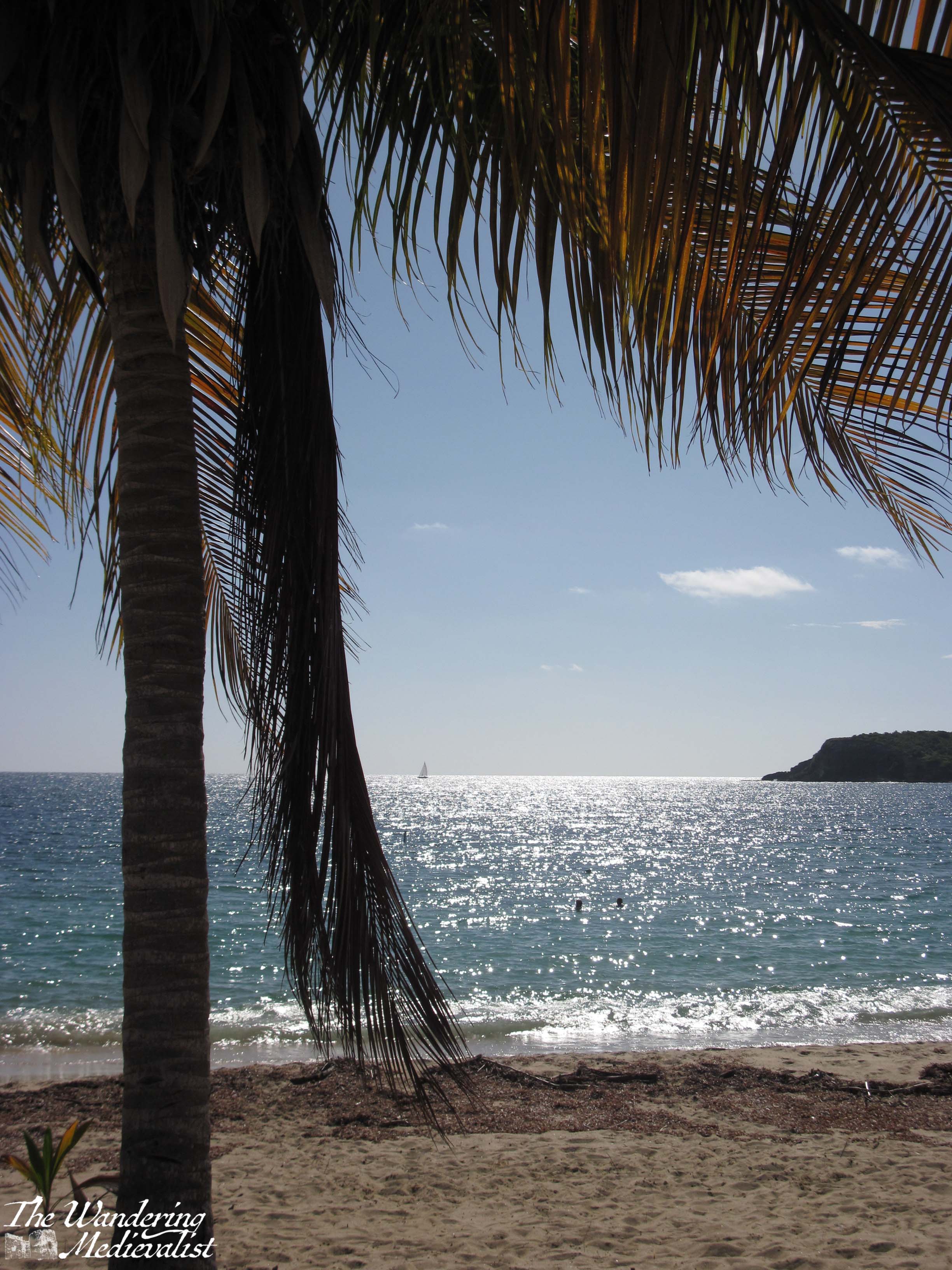
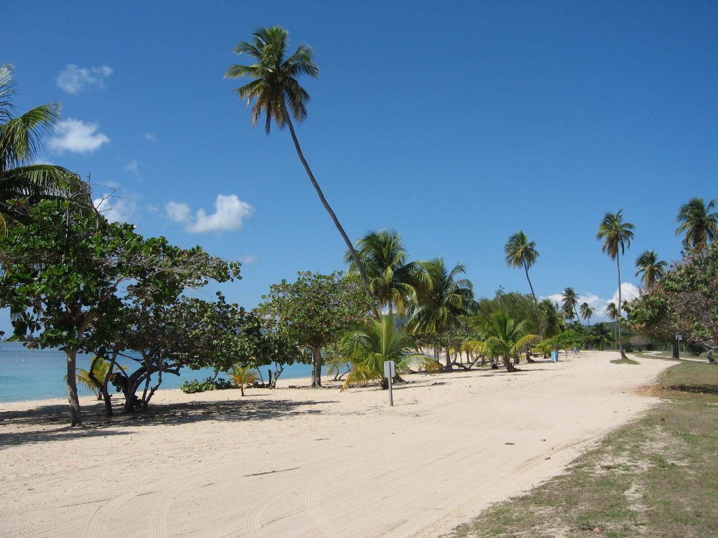
Sun Bay is, as it sounds, a beautiful crescent-shaped beach facing south, with plenty of gorgeous sand and lined with palms and sea grapes. The palms often take a beating during hurricanes and you can never be sure how many will be there. The beach is deep enough that you can usually find a place in the shade or in the sun, and all within a few steps of the usually clear water. There used to be a swimming area marked out, with a line of buoys stretching along the length of the beach that made it very easy to swim along and stay in deep water; this also protects swimmers from boats of course. Behind the beach is a relatively well-kept road that allows you to drive the length of the shore and back to find the perfect spot for you, or continue on to Media Luna, the next beach along that was well-known for having good surf.
This road is also where I had my first-ever driving lesson, on a quiet day one January, and the parking lots adjacent to the beach were where I first practiced manoeuvring into spots and learning how hard to step on the brake and gas.
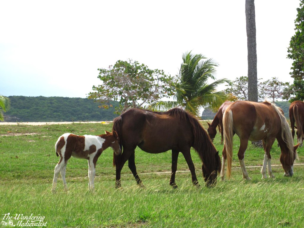
While Sun Bay is a great place for swimming it is not necessarily for snorkelling; there used to be a spot to the far left that you could swim out to, but it was not as well-developed as most of the beaches on the former Navy Base. Also, it was quite a decent swim just to get there and the waves were often strong enough to make any real enjoyment of the fish quite difficult. Even in swimming closer to the beach, though, I have seen a variety of creatures over the years including turtles, an enormous ray, barracuda, and of course plenty of fish. Out of the water, one can often spy groups of wild horses that roam the island, but seem often to congregate near the beach.
My fondest memories of the beach are the hours we would spend here alternately sitting in the sun, swimming, and taking long walks from one end of the beach to the other. As one walks towards the right – facing the water – or to the west, one finds that there are spots where the rock shelves have emerged from the sand. If ambitious, one can also cross the spit of land and look back towards Esperanza, and the often impressive boats moored there – often a mix of yachts and sailboats.
These long walks often included deep discussions of the state of the world, my life, my future, and any number of other topics; then when we had fixed our lives, or the world – in theory at least – we could cool off by diving into the waves. Or, depending upon the time of year, at least dive in – in summer months and early autumn, the sea is often so warm that it feels like bath water.
I hope that in time I will be able to dig out my older pictures of other beaches – Vieques has no shortage of stunning beaches, and many of them were prevented from development by the long occupation of the island by the US Navy. In the early years of my visiting, a good portion of the island was still being used for bombing and other training, and the impact on the local population was extreme – and a discussion for another time.
I understand that in recent years, Vieques has become an increasingly popular place for visitors, as gradually access to the island has improved and recovery from various storms has been achieved – Hurricane Maria in 2017 was particularly damaging, as it was for so much of Puerto Rico. If you do manage to visit, Sun Bay is an absolute must!
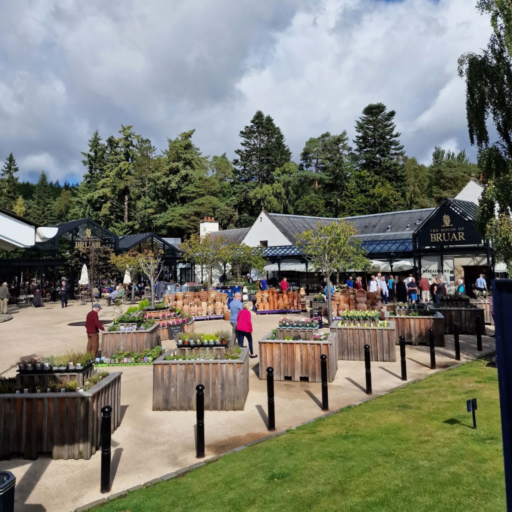
A weekend visit or mid-road trip stop at the House of Bruar is an absolute guilty pleasure, and on a wet and rainy day like today, I often find myself thinking about the next time I can manage to escape north.
The House of Bruar is a bit difficult to explain – it is a luxury goods store that sells everything from fishing tackle to fine cashmere, country styles and deer stalking outfits, fresh produce and plants, and also fine kitchen supplies, Scottish gifts, and much more. There is an extensive fine food hall with Scottish goodies like shortbread, oat cakes, Dundee cake, fine chocolates, sweets and pastries of all kinds, preserves, honey, crackers, cheeses, bread, and a fresh deli with an excellent butcher.
The sausages obtained from this butcher are often reserved for a special occasion and are offered in a great range of flavours. There is also a generous liquor section selling local gin, whisky, beer, liqueurs and soft drinks.
Not pictured: enormous scone
If this was not enough to draw you north of Perth, there is a large café selling fresh-made soups, sandwiches, cakes and indeed whole Sunday roasts; essential to any stop is a coffee and a scone in the covered canteen, where often you can find birds hopping around between the tables.
In short, it is the perfect place for a day out, as long as you set yourself a budget ahead of time. To help with this, there is a sale hall where you can find older styles of clothing and discounted wool and cashmere sweaters and scarves – a must around Christmas time.
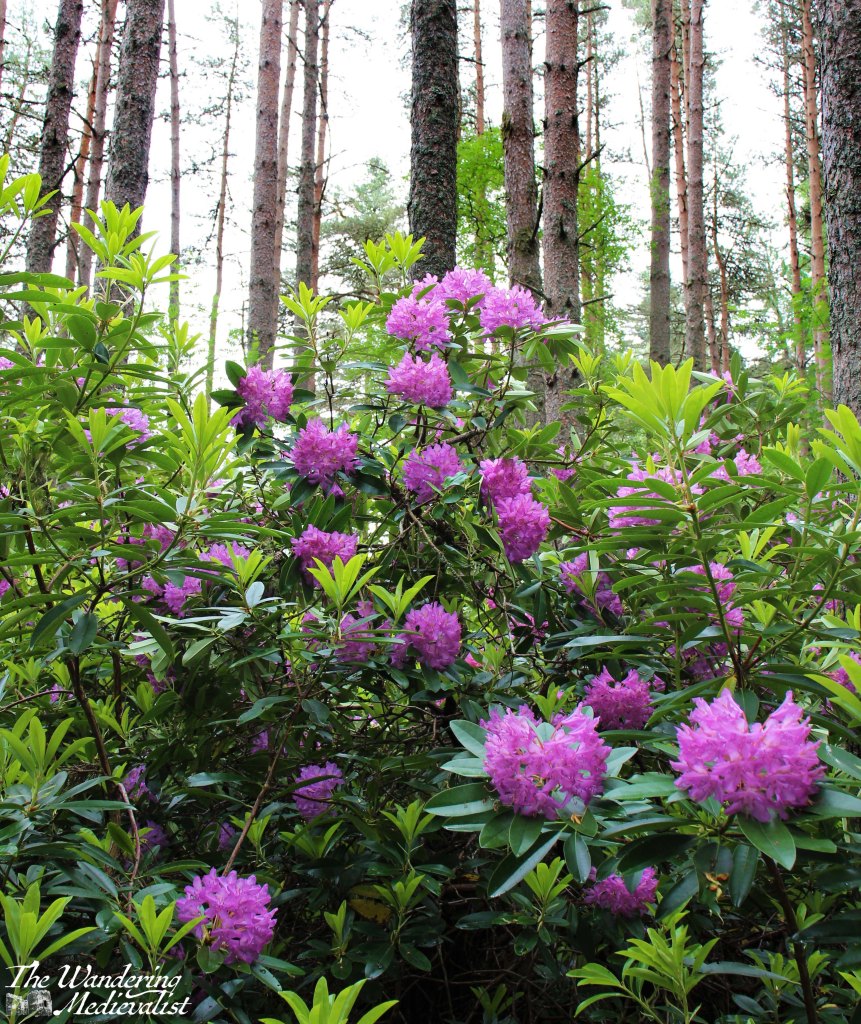
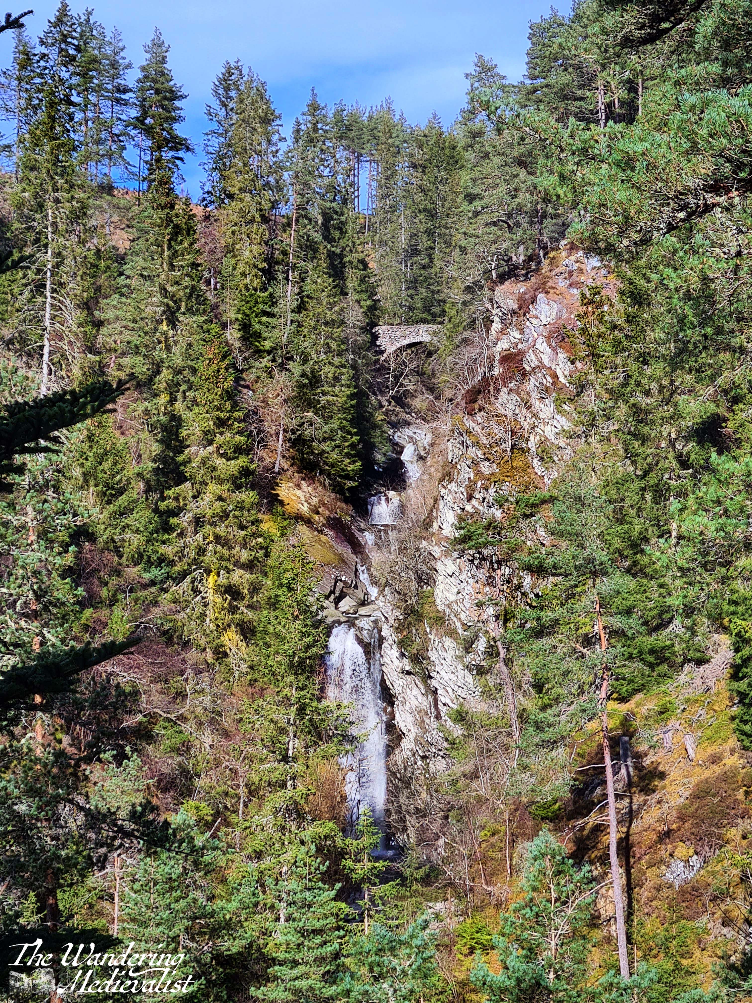
Shopping is not the only goal of a trip to Bruar though, for if you bring your sturdy shoes, you can follow the path around to the back of the complex and up into the forest towards the two falls – falls that were immortalized in words by none other than Robbie Burns.
The Lower Falls is a short walk up a relatively easy trail that still enables you to experience the beauty of the woods. It is probably just short of wheelchair accessible, but I have seen plenty of prams and casually-shod walkers attempt it – with varying levels of success.
The path starts along the edge of the river then passes under the train track through a short dark tunnel.
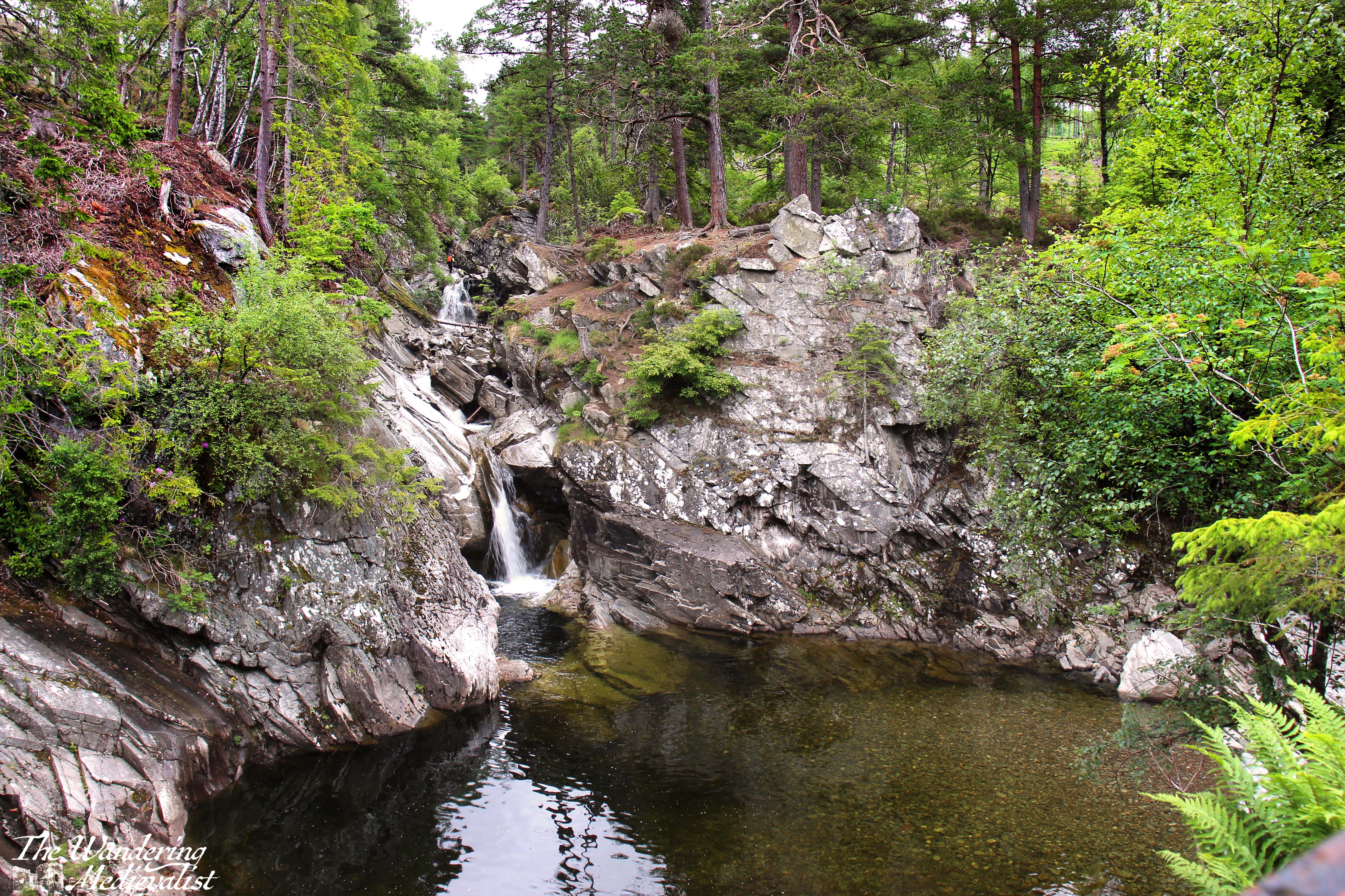
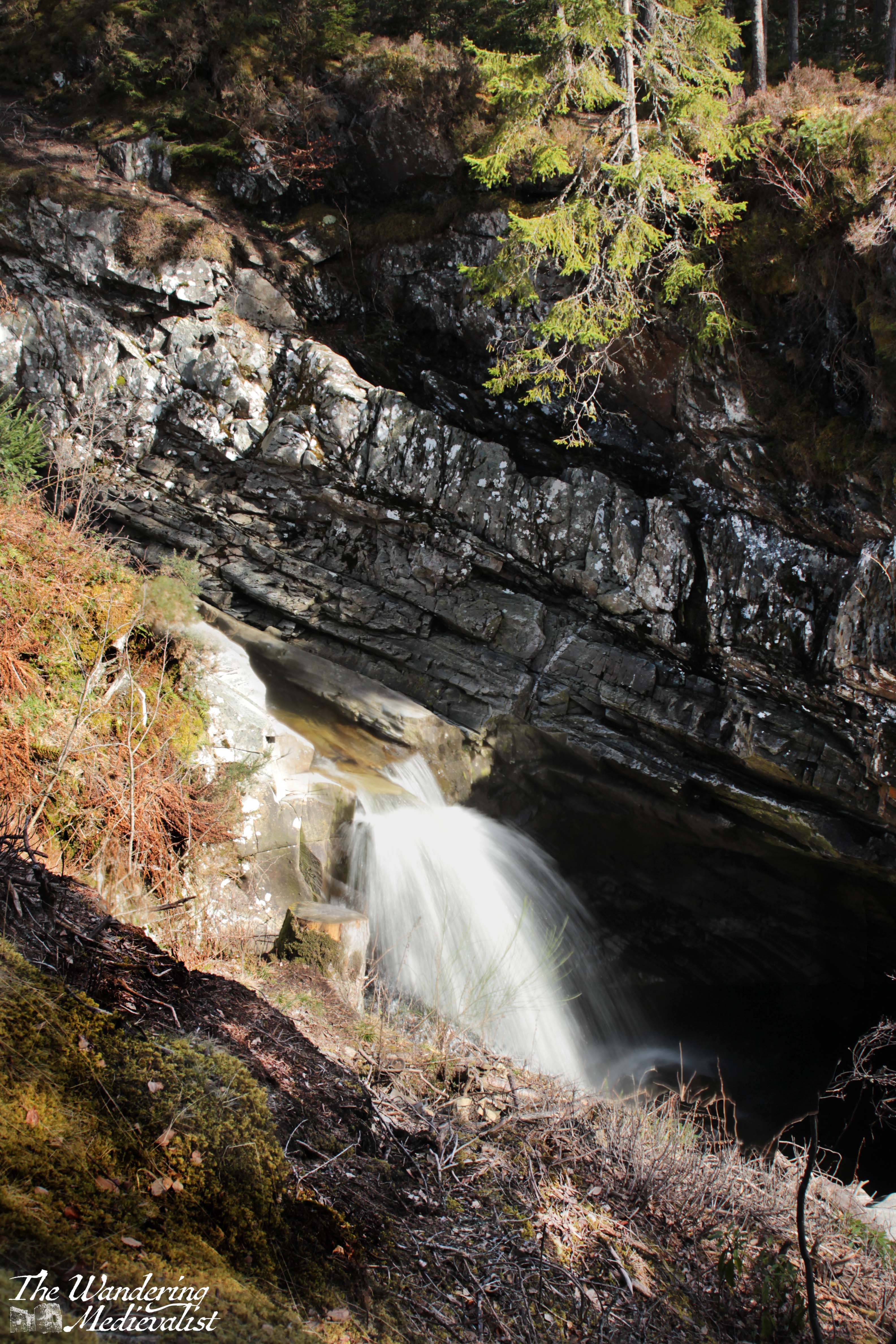
Beyond the tunnel, the trees are tall and straight, the ground gently mossy or covered in pine needles, with stands of rhododendron scattered about, stunningly purple in the summer. Walkers weave gently uphill with the river audible to the right, deep in a gorge that has been carved through the rock. The first viewpoint is just before the bridge and allows for the picture below of the water pouring through the gorge under the stone arch. Just a bit further up one finds the remains of a Victorian view house, which is best spot for the lower falls themselves. Here one often finds children and dogs scrambling around the rocks, and there is a wide, rocky pool, though swimming is not advised. From the bridge you can see the falls or down the river to a spectacular gorge – pictures in the snowy bit below.
For those wishing a bit more of a hike, the path continues up the hill towards the upper falls. It’s a longer walk – around 45 minutes – and quite steep in places, but there are a few benches where one can pause and enjoy the view back over the valley.
I remember very clearly the first time we took this walk, more than fifteen years ago, and many of the trees that graced the hillside have since been cut down due to disease, creating patches of bald earth, particularly on what is the left-hand side of the river, facing uphill – the western side. The story is that it was Robert Burns himself who requested that the Duke of Atholl plant the forest around the Bruar Water, and so while it was required that diseased trees be removed, new ones have been planted to replace them.
A few strong wind storms damaged the path through the pandemic years, bringing down some enormous trees that must have been hundreds of years old. On our first post-pandemic visit we were not able to go as far as we had planned, as the path was completely blocked.
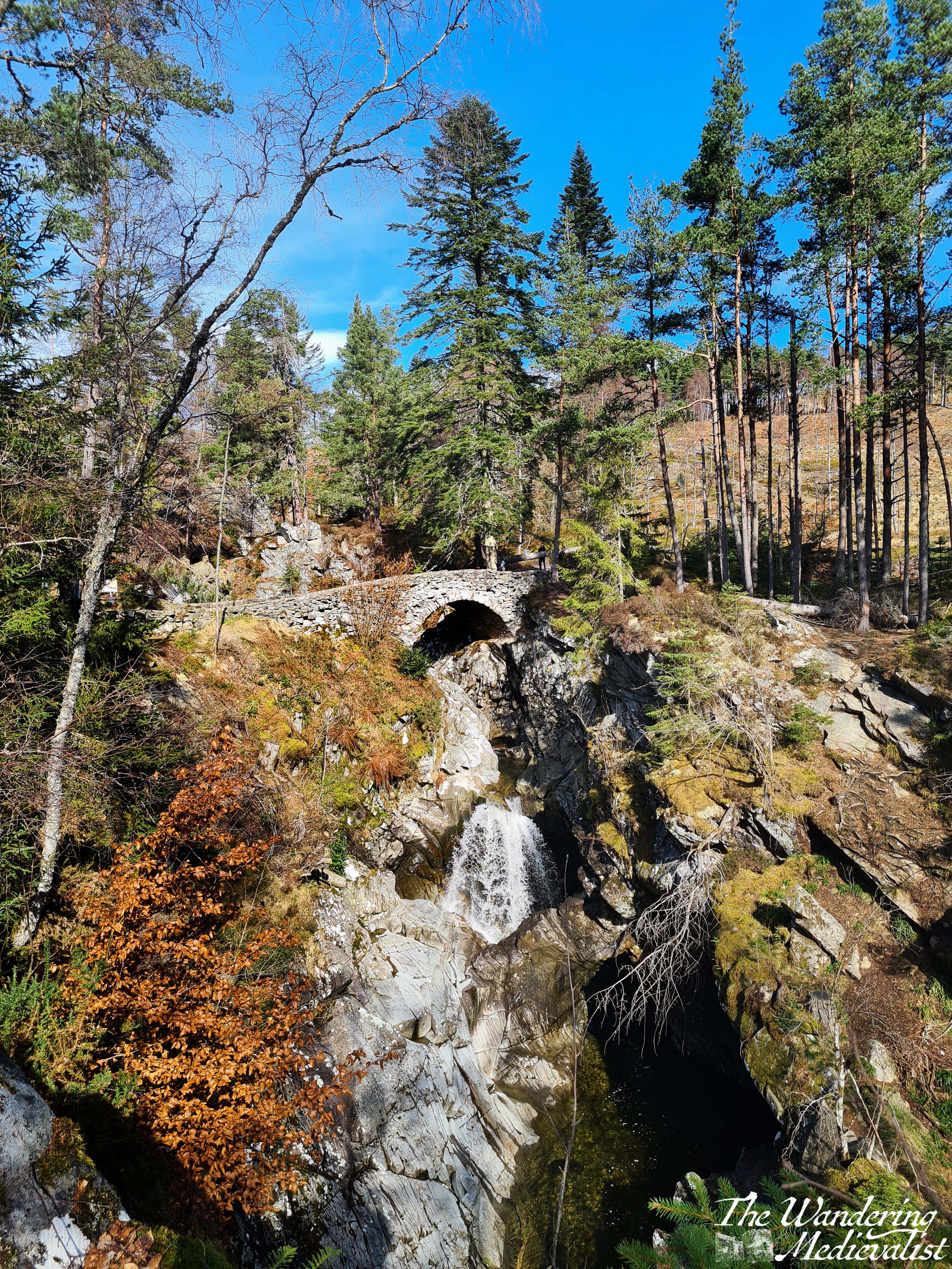
Continuing up the hill is well worth it when safe. As one climbs, glimpses of the upper bridge are visible through the trees, while the gorge cuts away sharply below. Eventually, the path circles down again towards the river and reaches the bridge, where the views are, again, lovely across the forest and valley beyond.
From this point, the path either continues along the far side of the river and eventually completes the loop at the lower bridge, or you can choose to return on the eastern path which is a bit more picturesque as the western slopes were those most dramatically cleared of trees.
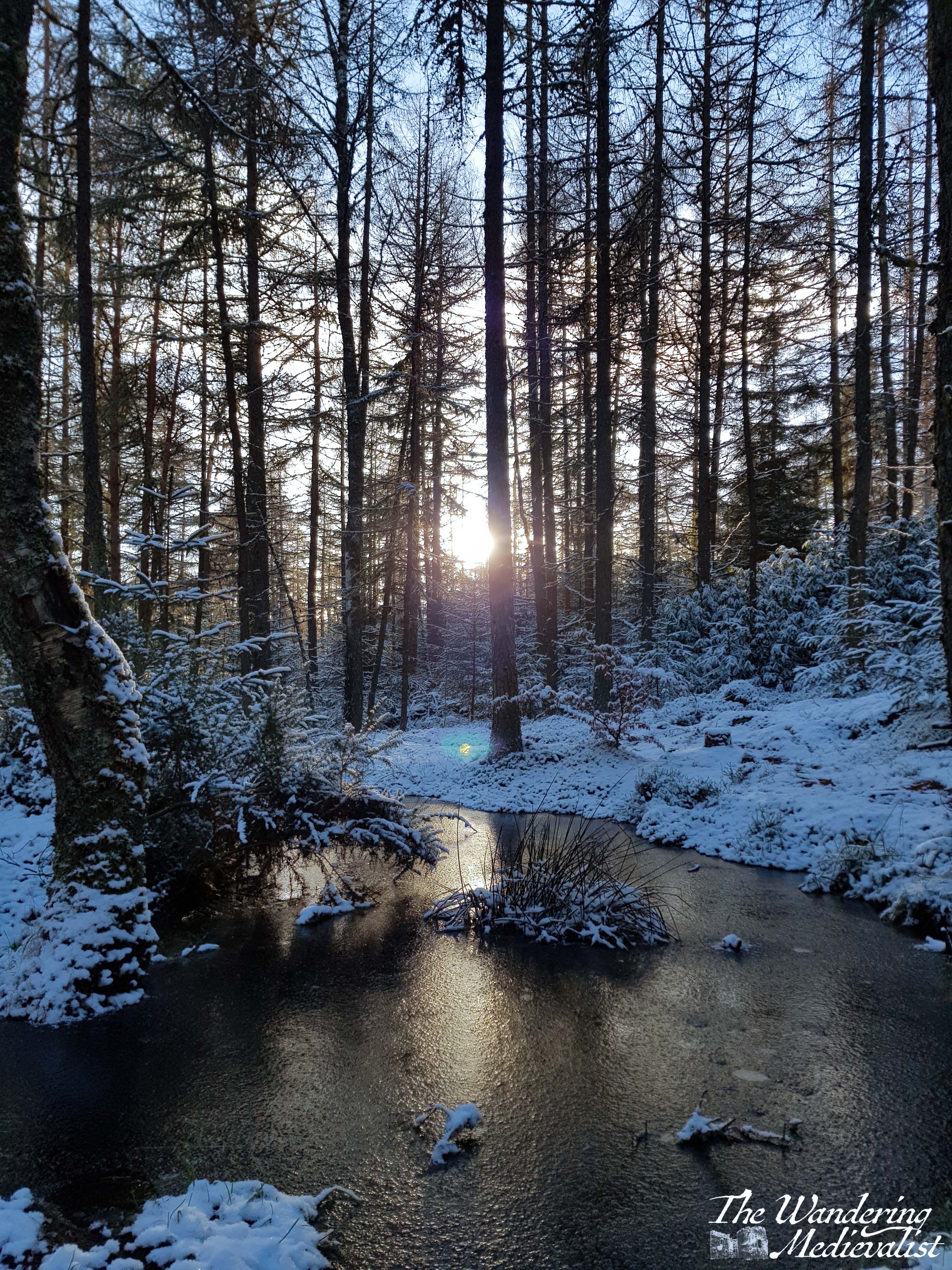
In the autumn the few deciduous trees tend to turn orange-yellow to match the golden larch. In warm months, the greenery is lush and often colourful, but by far the most beautiful visit we ever had to the Falls of Bruar was in December. It was a completely unplanned trip that came into our heads one Saturday morning when we realised we wanted to get a new Christmas ornament for our tree, and quite fancied some nice sausages from the butcher. While Fife did not have any snow, we discovered as we drove up the A9 that the area north of Perth had experienced a dusting. We had planned to at least walk up to the Lower Falls – we almost always do – but thought we might run out of light before we could go further.
After a short tour through the food hall, we stowed our purchases in the car and headed up the path into a winter wonderland. The snow and afternoon sunlight – in December the sun sets not long after 3.30pm – made for an absolutely breath-taking walk, with so many stunning views that I can never decide which I like best.
It was with real regret that I eventually agreed to return to the food hall for a coffee and scone, delicious though both were. I have always desperately hoped that I might have a repeat of this snowy visit, but even in December 2022, when snow blanketed the whole country, I missed it here by about 12 hours.
There are a few caveats to visiting the House of Bruar: firstly, you may well run into coach trips full of tourists, or large groups of well-off visitors with very little consideration of those around them. Secondly, it is frequently very busy, meaning that even a mid-trip stop to use the facilities and pick up a snack can eat up 20 minutes. And thirdly, it is expensive – one has to be realistic about what one intends to spend, and realise that even a bottle of water is likely to cost double what it might elsewhere (though the quality of what you buy here often equals the cost).
Like so many places in Scotland, Bruar holds a connection for me that is both one of beauty and one of memory; the other half and I visited the House of Bruar on our first ever weekend away together to Pitlochry and I stop here at almost every chance I get, certainly on any trip along the A9. Even if I do not have the time to manage the full climb to the upper falls, a trip to Bruar is the highlight of any weekend or week. I am already planning a return visit closer to Christmas!
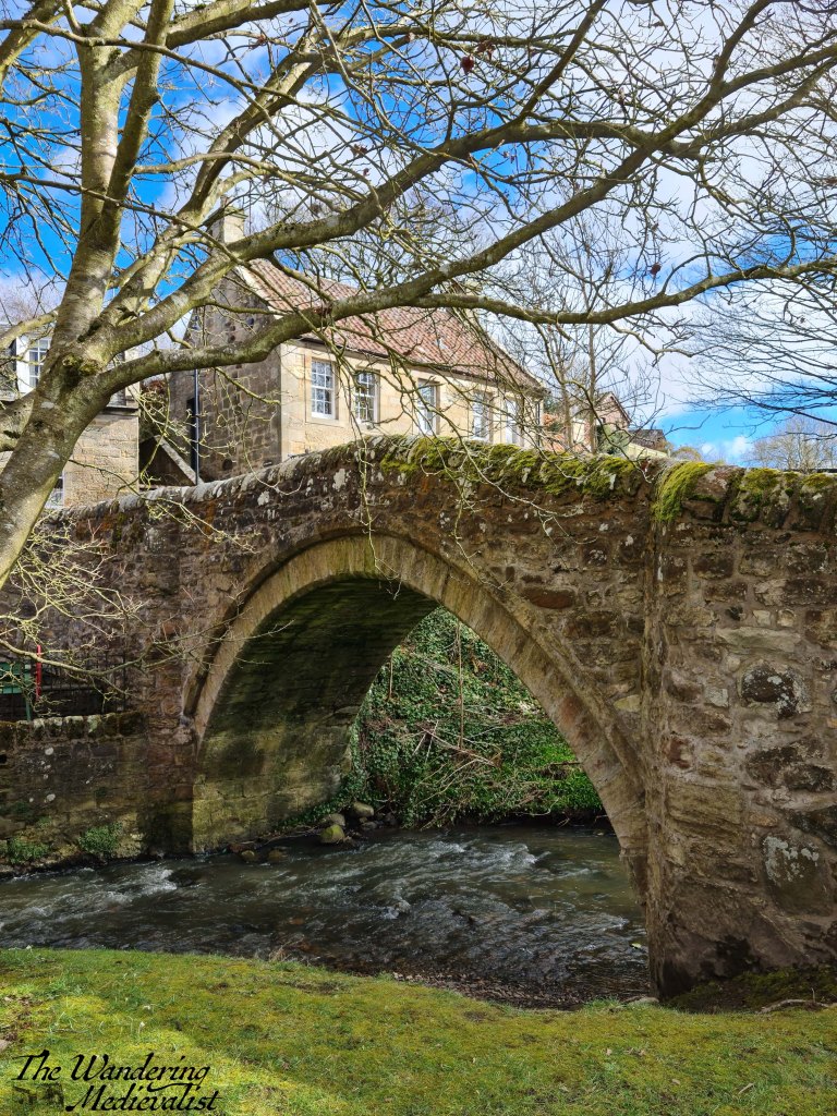
In Scotland, a den is a narrow, often wooded valley, usually following a small burn or rivulet. Craighall Den, the subject of this post, is hidden on the outskirts of the town of Ceres in Fife, and it offers a gentle walk through some woodland, ending at the ruins of an old limekiln. It is quite popular, and very seldom have I visited without running into at least a few other walkers and, often, horseback riders.
I discovered the walk through the den in the midst of lockdown in March 2021, when we were desperate for outdoor adventures but could not leave Fife, and so I consulted my favourite walking site, Walkhighlands, which despite its name details walks throughout Scotland. The route suggested involved parking in the town centre and walking up what turned out to be an abominably muddy farm track, to join the den almost at its furthest point.
I have never tried this circular again, instead have several times parked in Ceres and walked an extra few hundred yards up the road to join the path. This adds a few steps that pass some lovely farm houses and an old mill that I secretly covet (or not so secretly to anyone with whom I have walked this route).
Ceres itself is a picturesque village full of historic stone houses and bridges, complete with an old tavern and a town green – the Bow Butts, where archery would have been practiced. It will likely earn itself a post of its own, but for now, here is the bridge next to the central car park, where one starts the route up the hill.
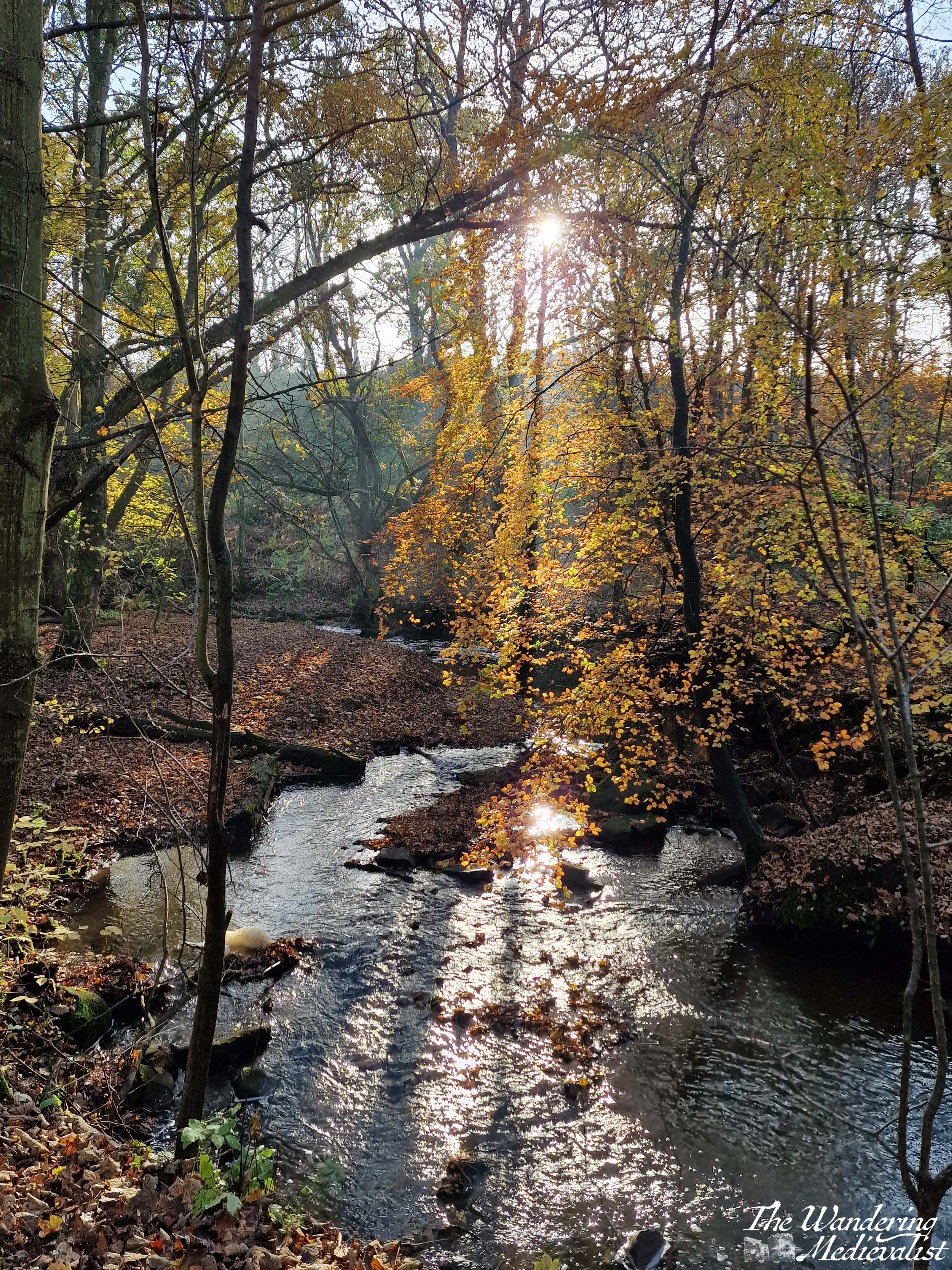
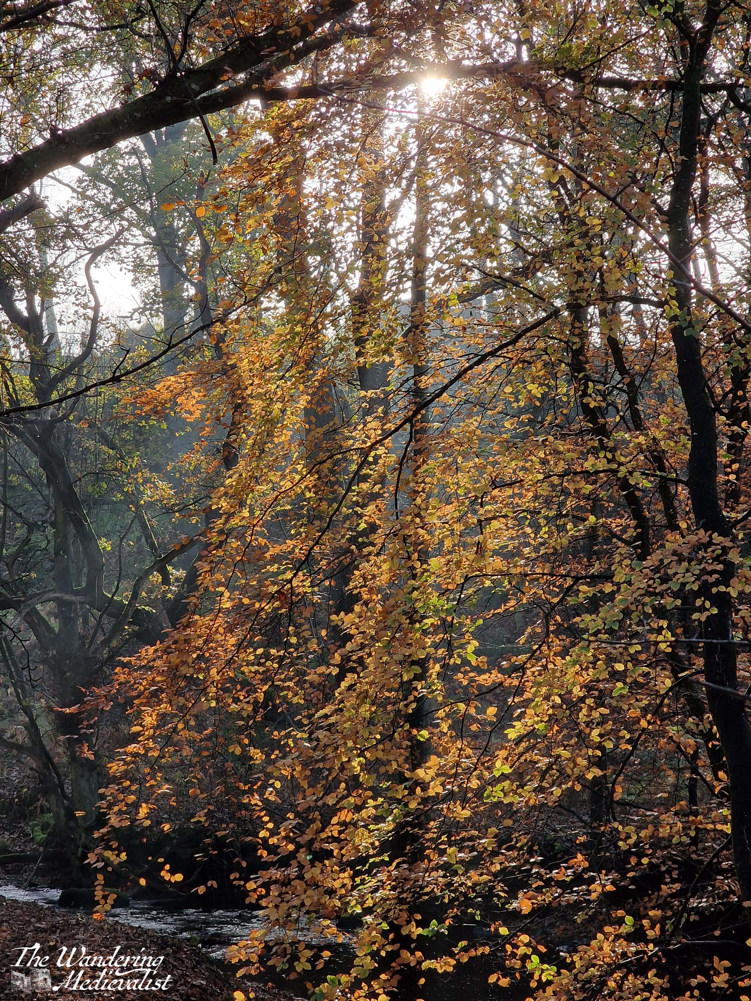
The day that inspires this post however was one that came about entirely by chance – I had been to Cupar shopping and there were major roadworks that encouraged me to take the long way home. It was an atmospheric autumnal day with heavy fog everywhere except Ceres, where sun broke through as I entered the town limits. Almost without thinking, I turned right and up towards the den, deciding a short walk might be nice. As I parked in the small lot at the road end of the walk, I quickly discovered what a good choice I had made. November colours of yellow, gold and amber were perfectly highlighted against the sun and peeking blue sky, and I found myself in a perfect autumn paradise.
Despite wearing shoes entirely inappropriate for walking, I was encouraged by the colours to do the whole walk – about 30 mins in total so not hugely challenging. The path stays close to the burn before eventually climbing up to the ridge above as the valley sides grow steeper; on the left is a steading and farm with an old stone farmhouse. Eventually one reaches the endpoint of the walk, which as mentioned above is an old lime kiln. Below you see the grassy path leading up to it, as well as a picture I took one summer as we took this walk.
At this point, there is a rock face to the left through the trees and on the right one can either walk out on top of the kiln or follow the path down the hill and around it. There has been occasional evidence here of local teens using it as a place to hang out, and once remnants of a fire, but there are active farms on all sides so I cannot imagine there is much secrecy.
It seemed a shame to head back to the car, but I had shopping to get home and my other half to collect from work, so I enjoyed the sun glinting through the trees onto the burn on my return walk.
For reference, here is how the burn normally looks…I’ve tried to catch it many times but have never been particularly happy with it. As anyone who has read this blog is aware I have an affection for burns and rivers, but this one has often eluded me in that the light is often more grey than blue or, as on this autumn day, yellow.
There is no shortage of charming dens in Scotland and even in Fife, but this one holds a particular place in my mind, not least because of the stunning autumn walk. In the spring it is graced by carpets of crocus and snowdrops, and I am constantly struck by how peaceful and quiet the path always is, even when comparatively busy with walkers. I look forward to a return visit in the near future.
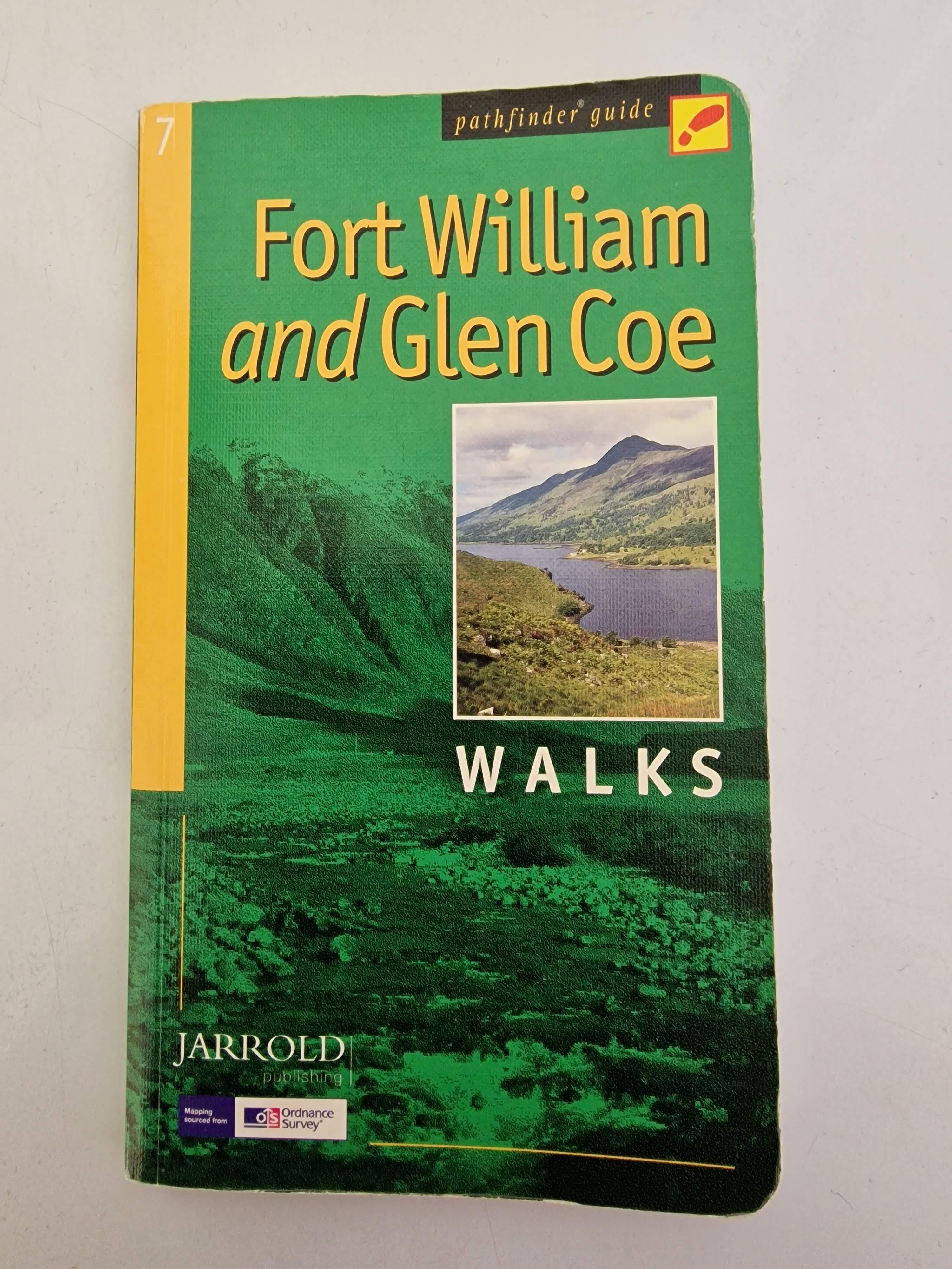
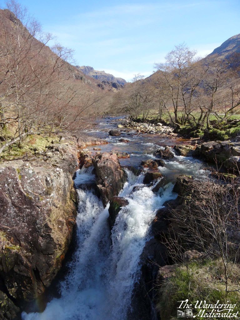
I first came upon this walk while perusing my well-used Pathfinder guide to Fort William and Glen Coe, and was immediately sold by the phrase, ‘one of the country’s most scenic waterfalls’. While the book also describes the path as ‘short and easy’, we soon discovered that while the waterfall description was accurate – and this walk remains one of the most stunning I have taken in the Highlands – the ‘easy’ part was less so.
While not particularly long in the first instance, the path does take one up and down some steep sections that are rocky and not suitable for anyone without a touch of fitness. Once through the gorge, the path is comparatively easy and comfortable. But, I am forever reminded of the August 2021 occasion on which I saw numerous walkers, drawn by the promise of a waterfall, attempting the hike in flipflops, some even with crutches and canes. Unfortunately, I imagine most of them were not able to continue to the best viewpoints.
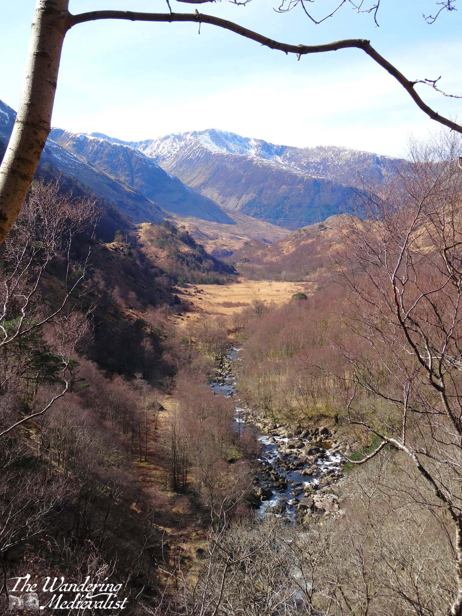
But I get ahead of myself. Our first challenge, as is often the case in more obscure walks, was to find the car park mentioned in the book. Starting in Fort William, one follows the signs for Glen Nevis and indeed for Ben Nevis itself, as the drive takes you past the most common starting point for hikers attempting the highest peak in the UK. Glen Nevis itself is stunning, and it is almost impossible not to stop a few times along the way.
Gradually the road narrows and passes a number of burns and wayerfalls, and on our first trip we thought we had found the car park when we reached the Lower Falls.
After a few more moments with the map though, we determined that we still had a way to go, and indeed the start of the Nevis Gorge walk, the Upper Glen Nevis Car Park, is another 1.6 miles along the single-track road. Once there, it is clear that it is the end of travel for vehicles. There is a good-sized car park, though when we visited in 2021 it had filled up completely by mid-morning. This may have been anomalous due to the higher than normal number of visitors that summer, but I have a feeling it is quite standard.
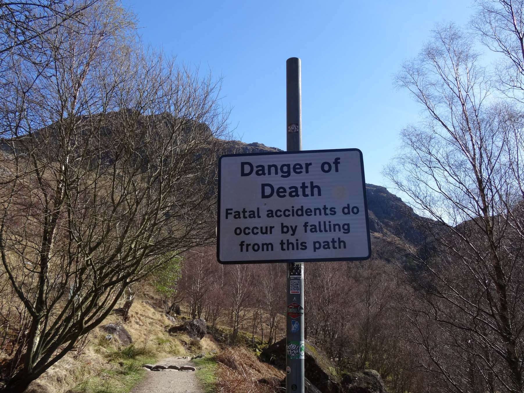
There are lovely views even from the car park, and I could not resist snapping a pic of the warning sign to send to the family – once we had returned safely of course.
While initially we paid less attention to the warning, by the time we had climbed a bit further and discovered the steeper areas of the trail, we realised how easy it would be to slip into the gorge – especially when mesmerised by the view.
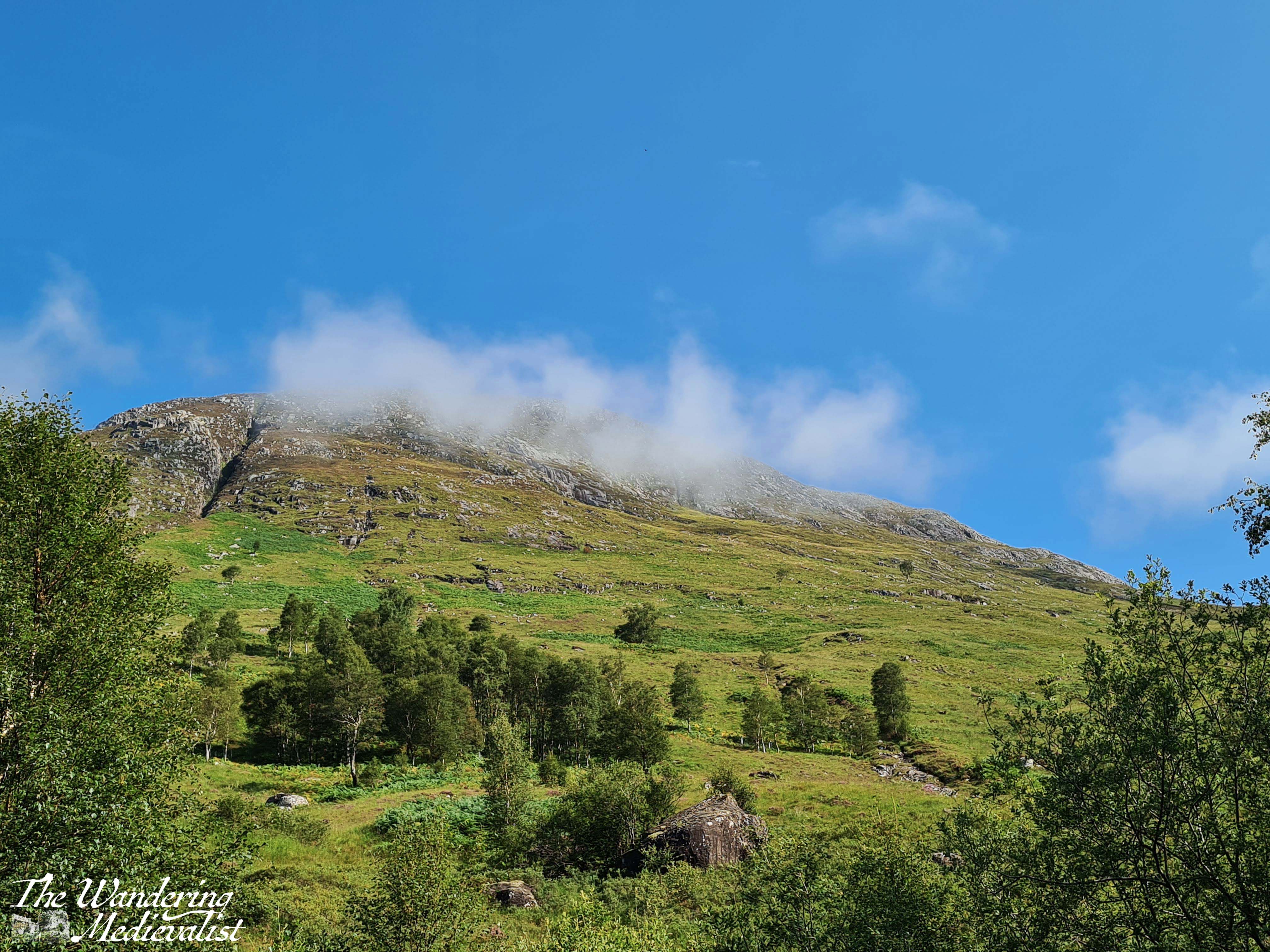
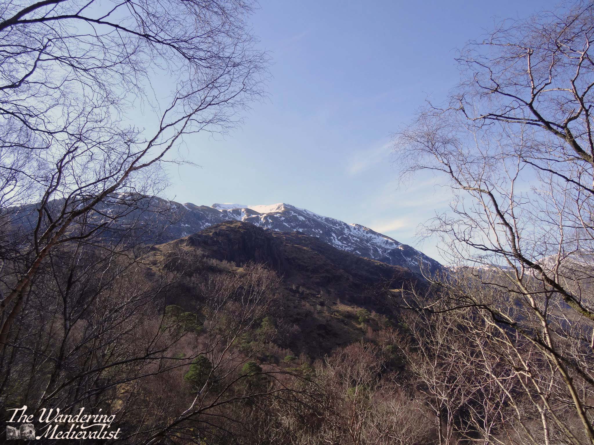
The path starts out quite innocuously through a lovely stand of birch, with some small streams and impressive glimpses through the trees up the hillside and down into the valley where you can hear – if not always see – the Water of Nevis. Before long, though, the trail runs into the side of the hill and begins to curve around to the right, at the same time that it starts to gain height. It narrows and becomes a bit more difficult to traverse, as it is clear that hikers are moving up and through the gorge. Warnings notwithstanding, it is impossible not to stop at a few points to enjoy the view over the glen – below you will see an early spring and late summer version of the view.
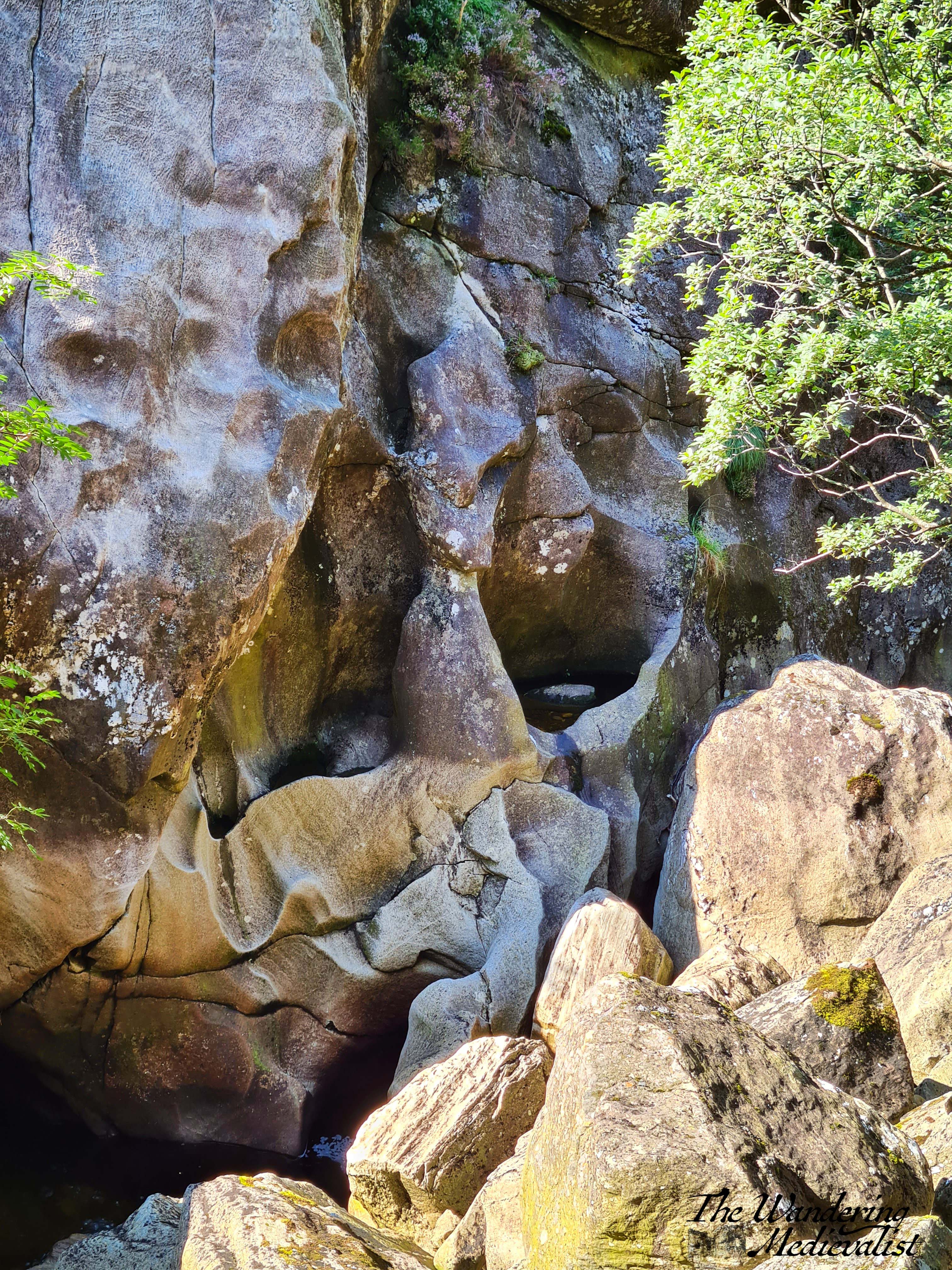
After a few sets of rocky stairs, the trail curves back around to the left and you know you are headed through the gorge. The rushing water below becomes more turbulent as it passes through the narrow gap, and while it is far enough below that you cannot often see it, the rock faces are sheer and carved by thousands of years of water.
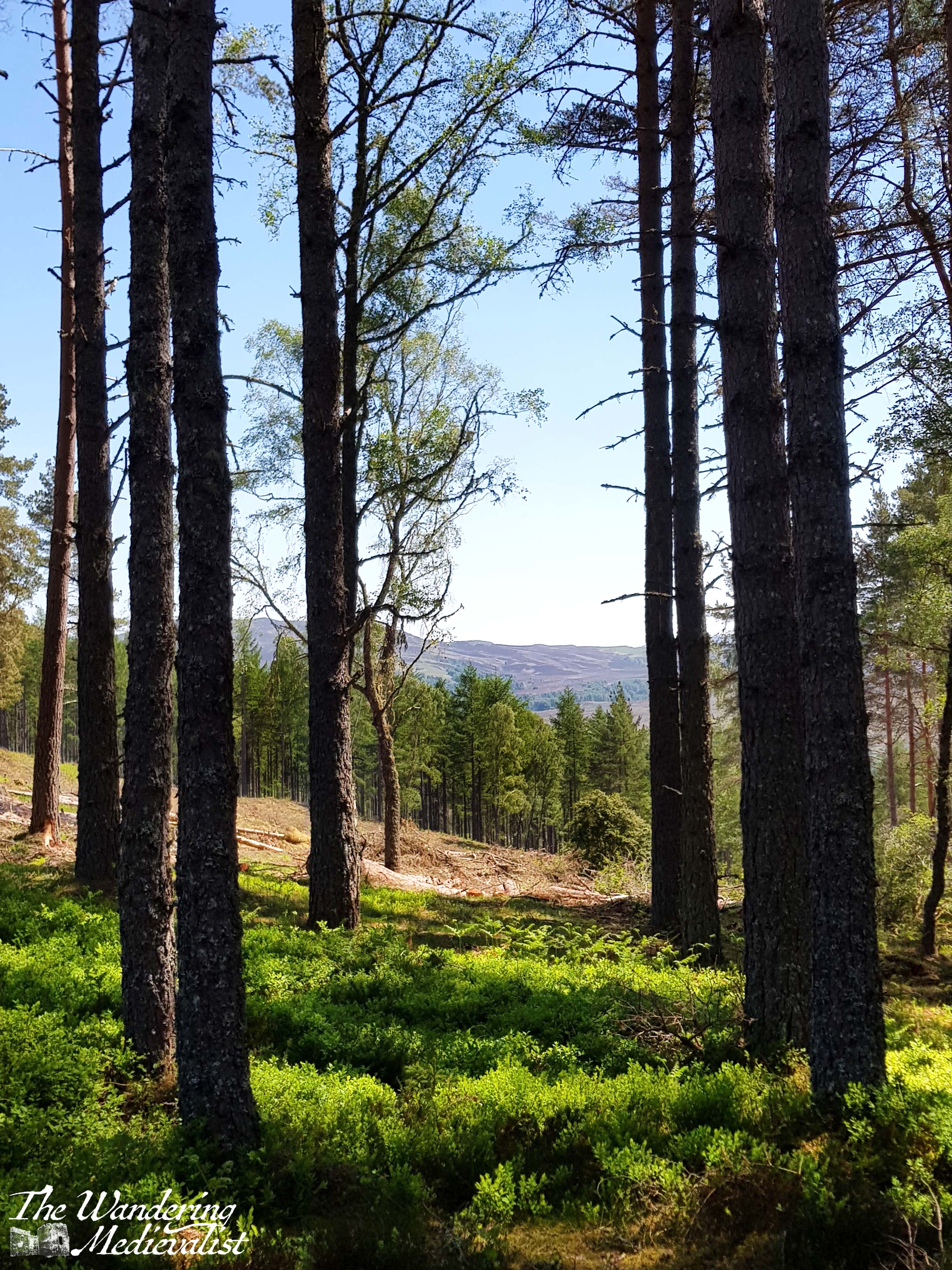
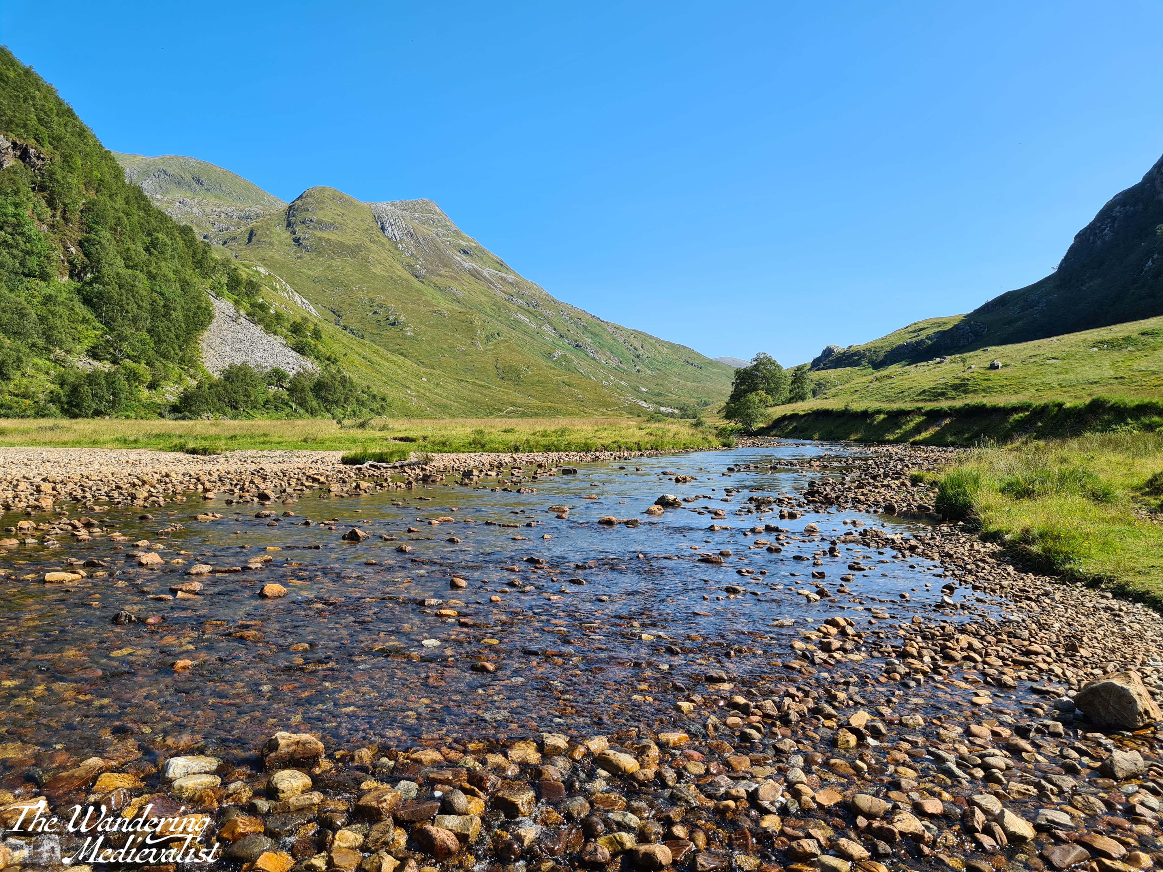
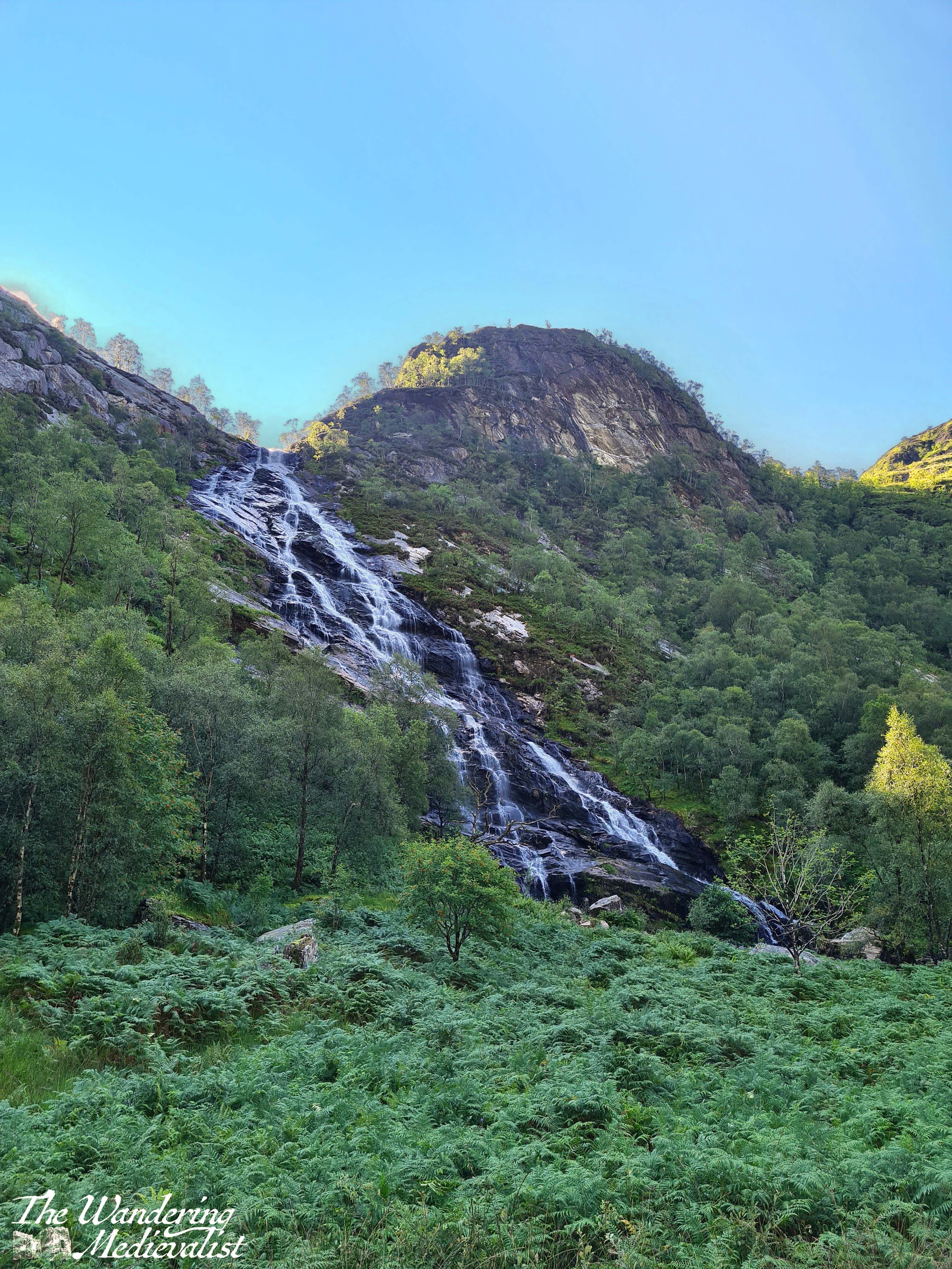
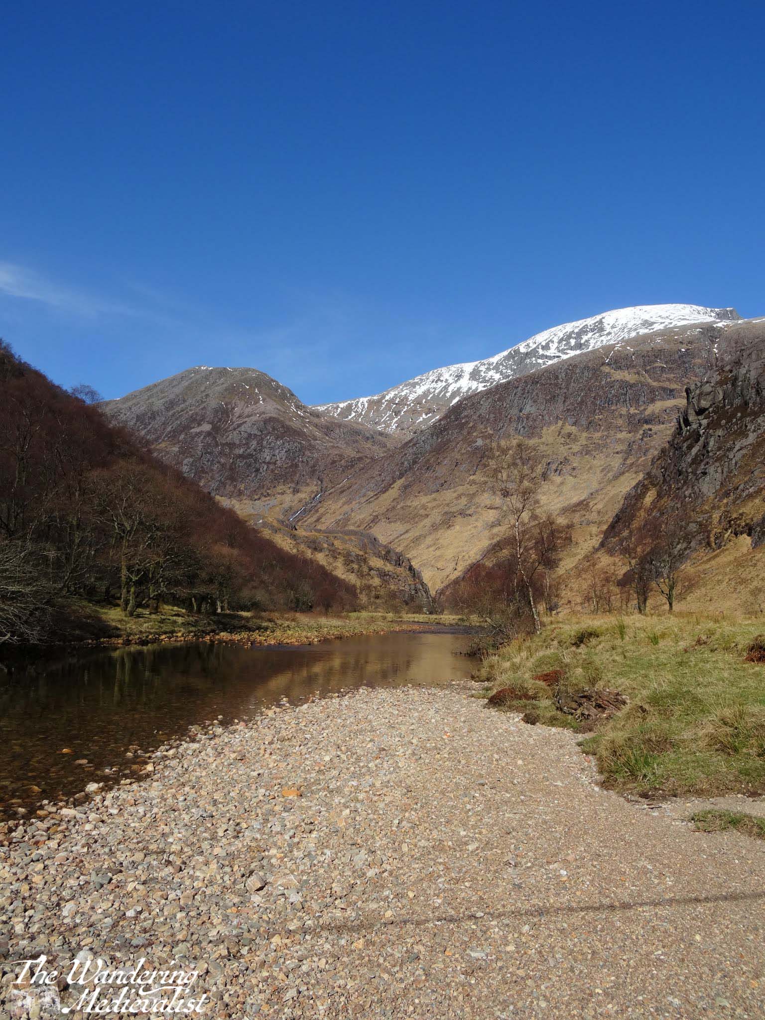
The trail eventually passes through to the other side of the gorge, and before you opens up a beautiful flat valley where the Water of Nevis cuts through the hills. Grassy flat land is dotted with stands of trees and rocks, and in the distance you can just see Steall Falls.
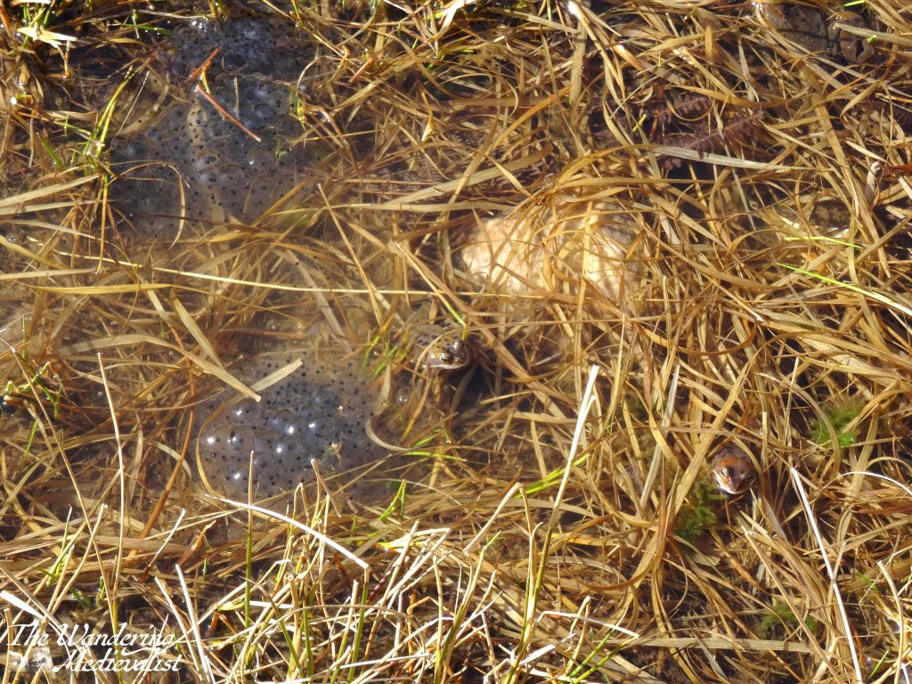
From here, the trail follows the curve of the valley, crossing some small streams and boggy ground; in March when we visited, it was absolutely full of frogs and frogspawn, glistening in the sun.
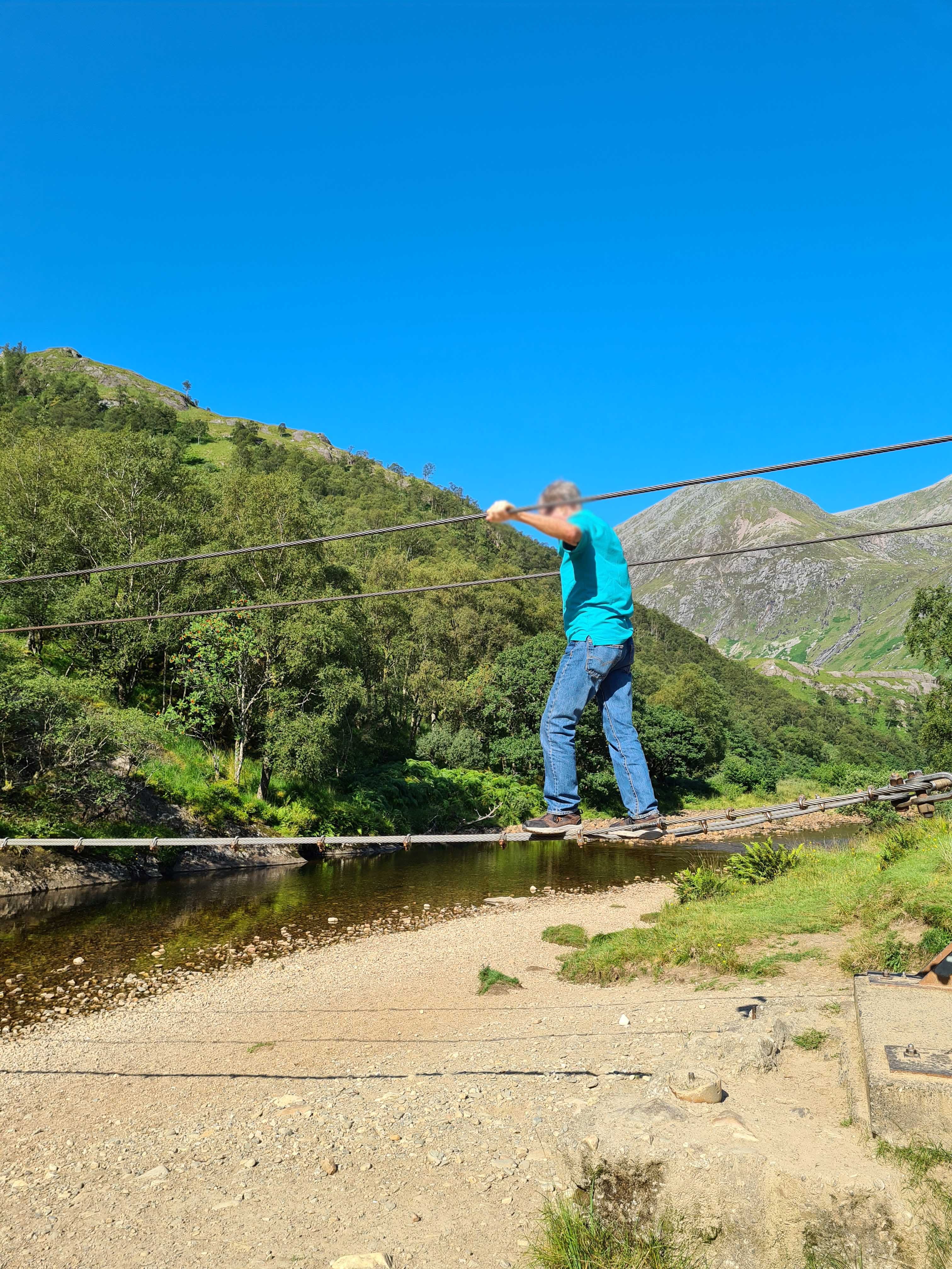
From this point you can continue along the valley up the back of Ben Nevis and eventually reach Spean Bridge or, if incredibly adventurous, the edges of Rannoch Moor. Or, if you are feeling adventurous in a different fashion, you can cross the river to approach the falls directly, though the trail is not as well-marked as one might hope (or wasn’t in the days just after the pandemic). On our first visit, the other half and I chose to just walk up the valley and find a spot on the riverbank for lunch. Dad on the other hand chose to cross the river. Not, as I did, on the rocks just poking above the surface that I crossed dry – unlike the hikers ahead of me – but instead on the wire bridge that spans the river. By wire bridge, I mean literally three heavy wires, one for your feet and two for your arms, which requires both height and upper body strength I do not have – I could not even reach the starting point. While at first the bridge is not far off the ground, by the time it stretches out over the water, it is high enough that one can imagine a fall into the shallow river would not be without injury. After a few uncertain moments at the start, Dad managed it quite well, and then waited on the other side while I plotted my route.
Once safely across, we hiked up towards the falls and I experienced the true viciousness of midges in the Highlands – fortunately I had spray, but the closer I got to the falls, the more swarmed around me, getting caught in my hair and the spray on my arms. While they did not bite through the spray, I ended up looking more freckly than normal and they went out of their way to aim for ears, nose and eyes. I managed to pause long enough for a few pictures of the falls and the view from the rocks, but the bugs were intense enough to encourage us to keep moving.
The falls are well worth the exploration – they are the second-highest falls in the UK, with a single drop of 120 metres (390 feet), and there are plenty of places for brave walkers to cross and climb up for a better view.
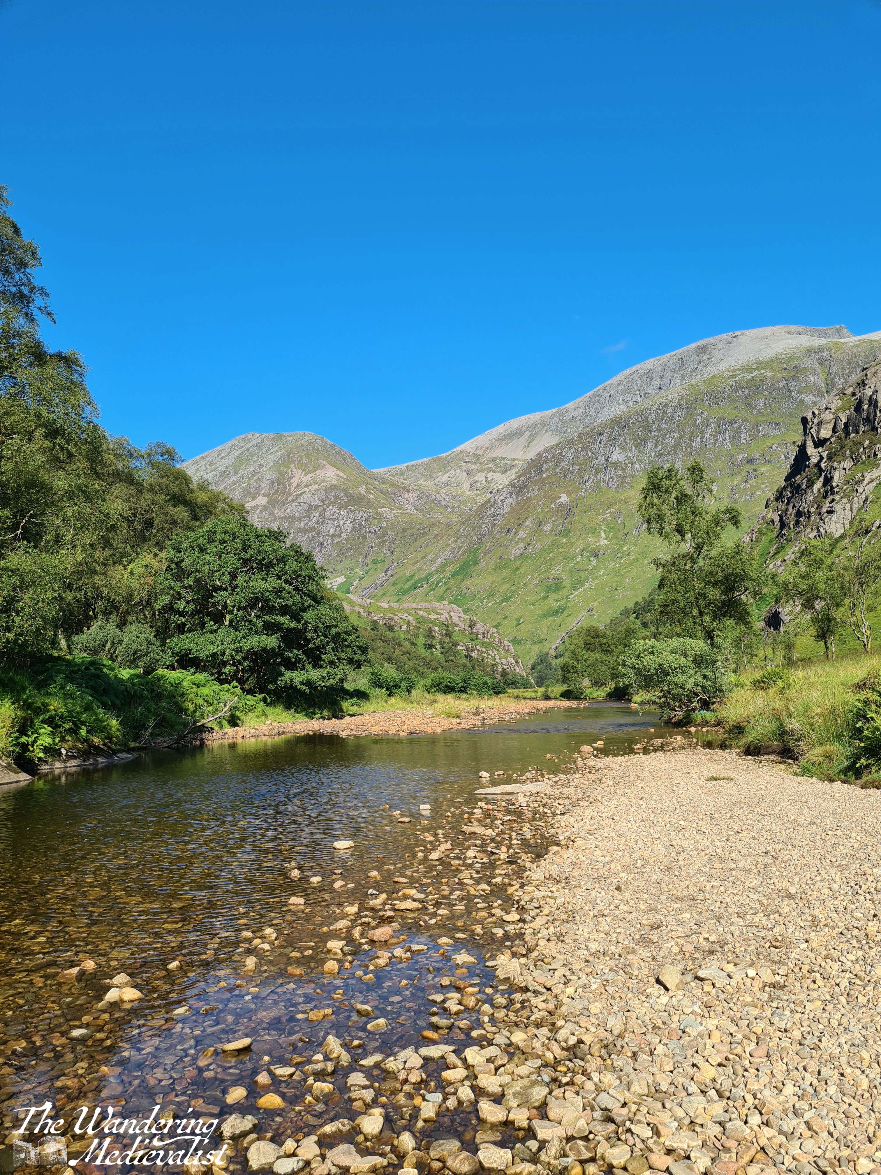
Dad and I tried to continue walking along the valley but found the path to essentially disappear into bog, so we headed back towards the wire bridge, looking for a place to cross. In the end, tired feet won out and I stripped off my boots to plunge into the icy water. It felt amazing and almost immediately numbed my toes to the rocks as I managed to just get across without falling. As we waited for our feet to dry, we sat on the riverbank and enjoyed the stunning view back towards the gorge.
The return trip is a touch less gruelling as it is more downhill than up, but the views are no less stunning and there is a great deal of truth in the fact that down becomes harder as one’s knees get older.
By the time we returned to the car I was very ready to take off my sturdy hiking boots and find some looser shoes to don for the drive back down the glen. I recall sitting in the car for a few moments just enjoying the car park view before finally heading back into town.
From here, Dad and I went on to the Commando Memorial, but even after our hikes on Ben Nevis and beyond, this remains one of the most stunning and magical trails I have found. The tranquillity of the valley around the Water of Nevis is breath-taking, and so quintessentially Scotland that it really should not be missed. That said, it is not a trek to take on lightly or unprepared; water, a snack, and sturdy shoes are an absolute must! And, if you are going in the summer, a strong midge repellent.
I have been racking my brain for some time as to where to start with my first post about Marblehead, and finally I decided to start with one of my favourite places in town, one where I spent many hours as a child. Not, I feel I should clarify, because I was obsessed with death or darkness, but because it was the closest area to my house that could be classed as something resembling a park. It also boasted the best sledding hill in walking distance.
Old Burial Hill (or Old Bury-old as I thought it was called for years) always makes me think of the Madonna lyrics, ‘this used to be my playgound’. My friend who lived across the street and I spent exploring the hill and grave stones, sledding, skating on the pond, and generally running about.
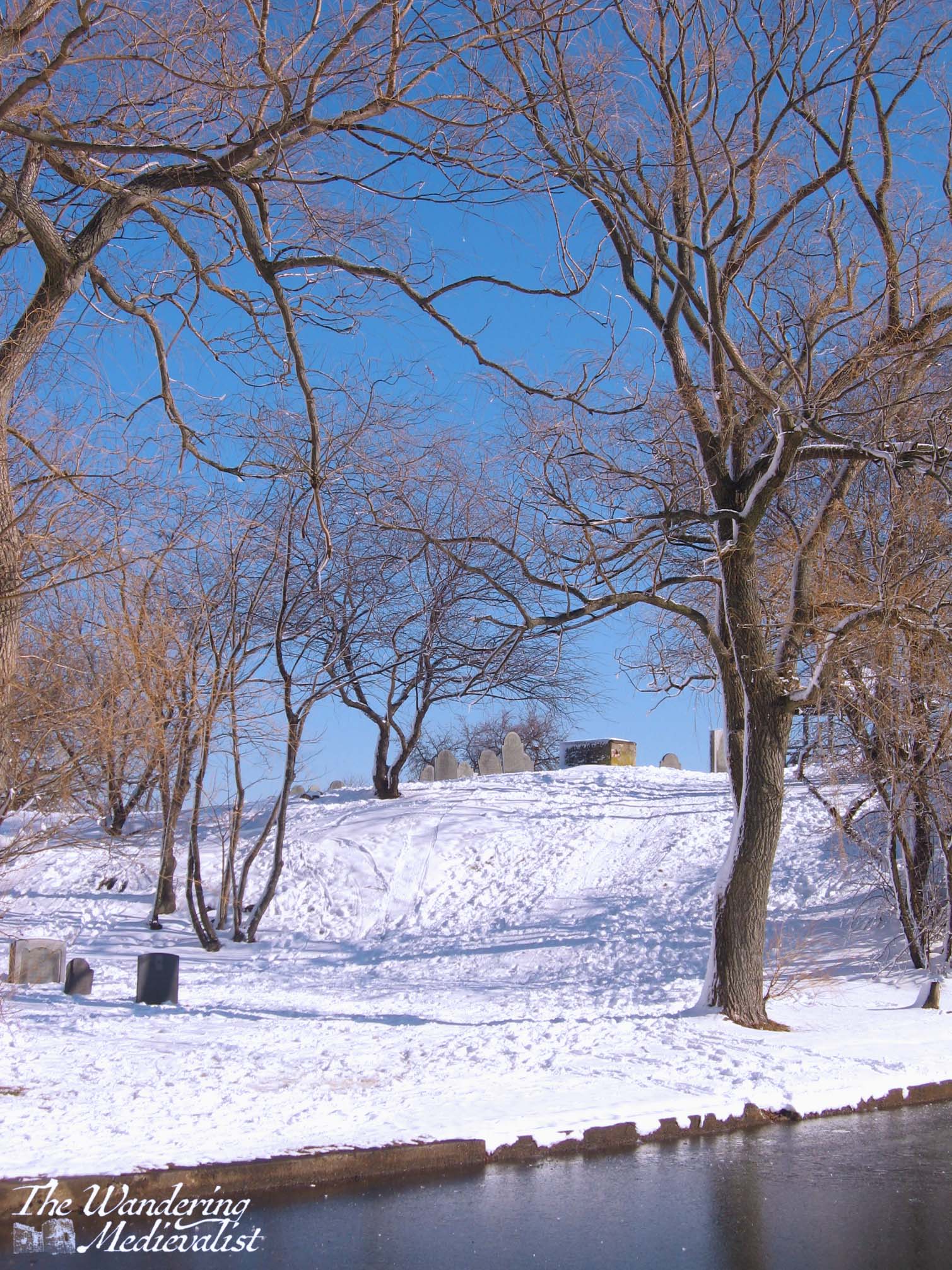
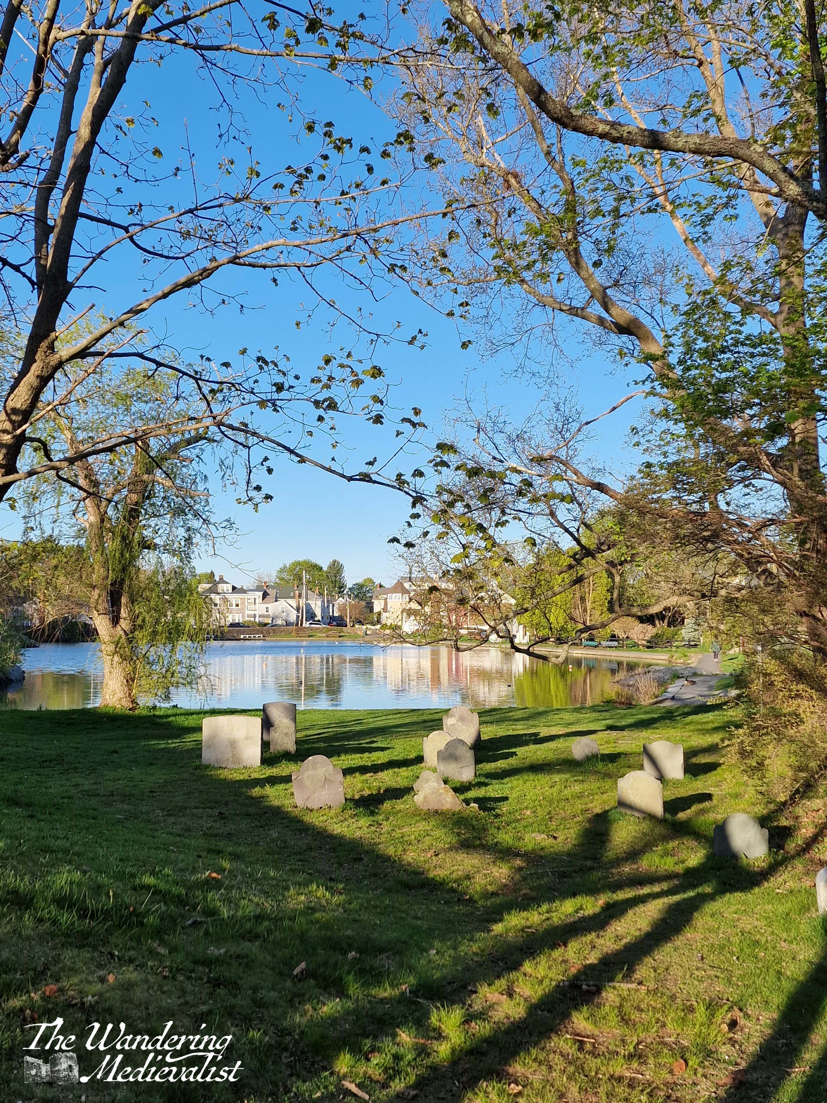
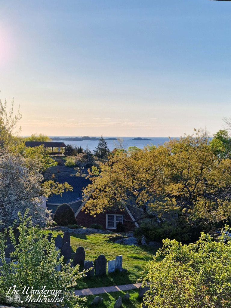
Harbor view in winter and summer
I feel I should observe that just because it was our playground did not mean that we did not respect the sanctity of the spot; rather, we also used to spend long minutes staring at the headstones, remembering the names, admiring the artwork, and making up tales about the people resting there. One of the first stories I ever wrote was a ghost story about the Wizard of Orne Hill – a Marblehead legend. Most of the information I gleaned from a slightly ragged book I became obsessed with, The Wizard of Orne Hill and other stories, by Dorothy Miles.
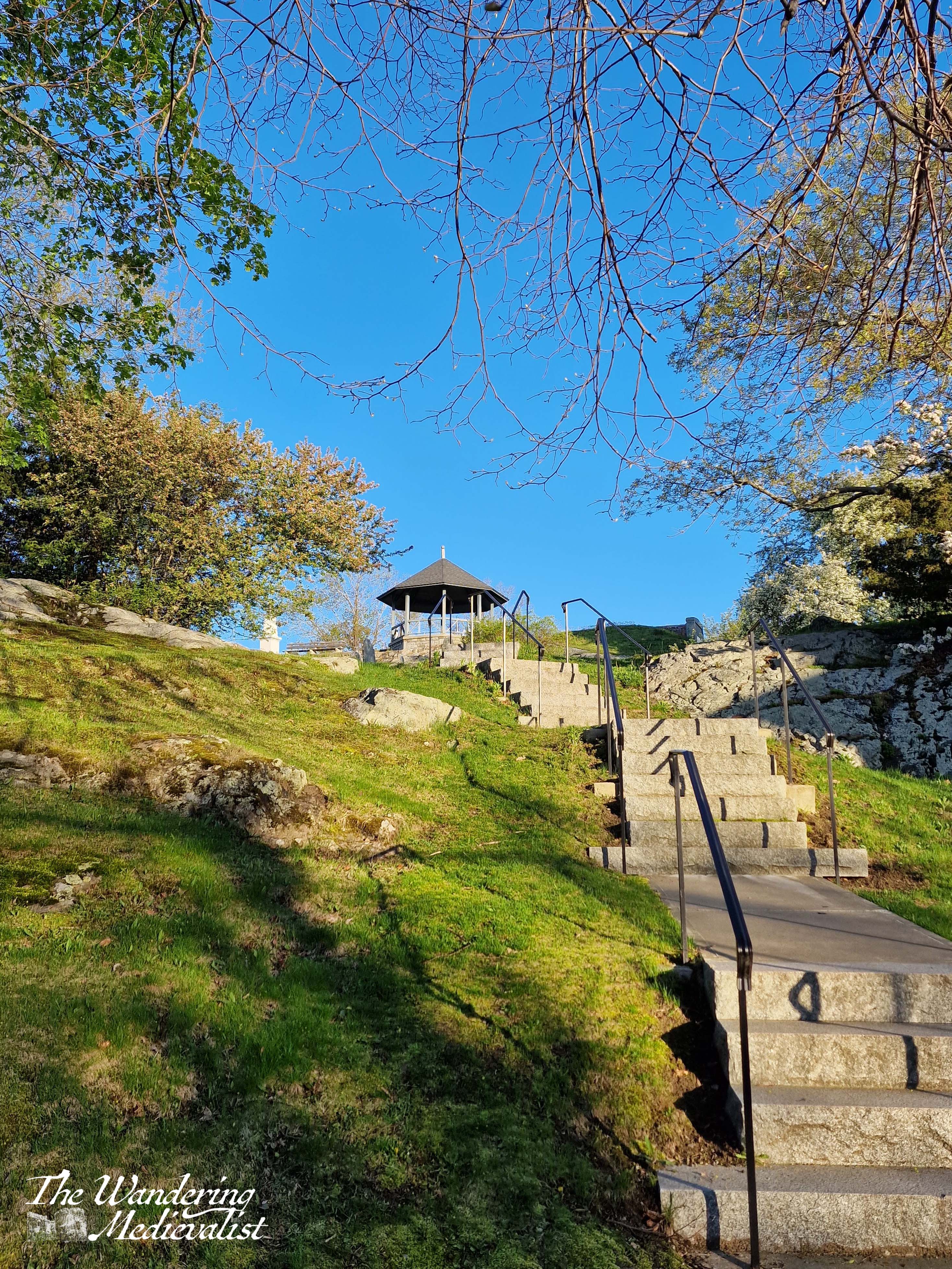
The top of the hill is a breath-taking spot, with the highest point at a gazebo where the local Old North Church used to hold sunrise services in the spring, around Easter (though now they are held at the lighthouse on the Neck). There are also two monuments, which I will discuss shortly.
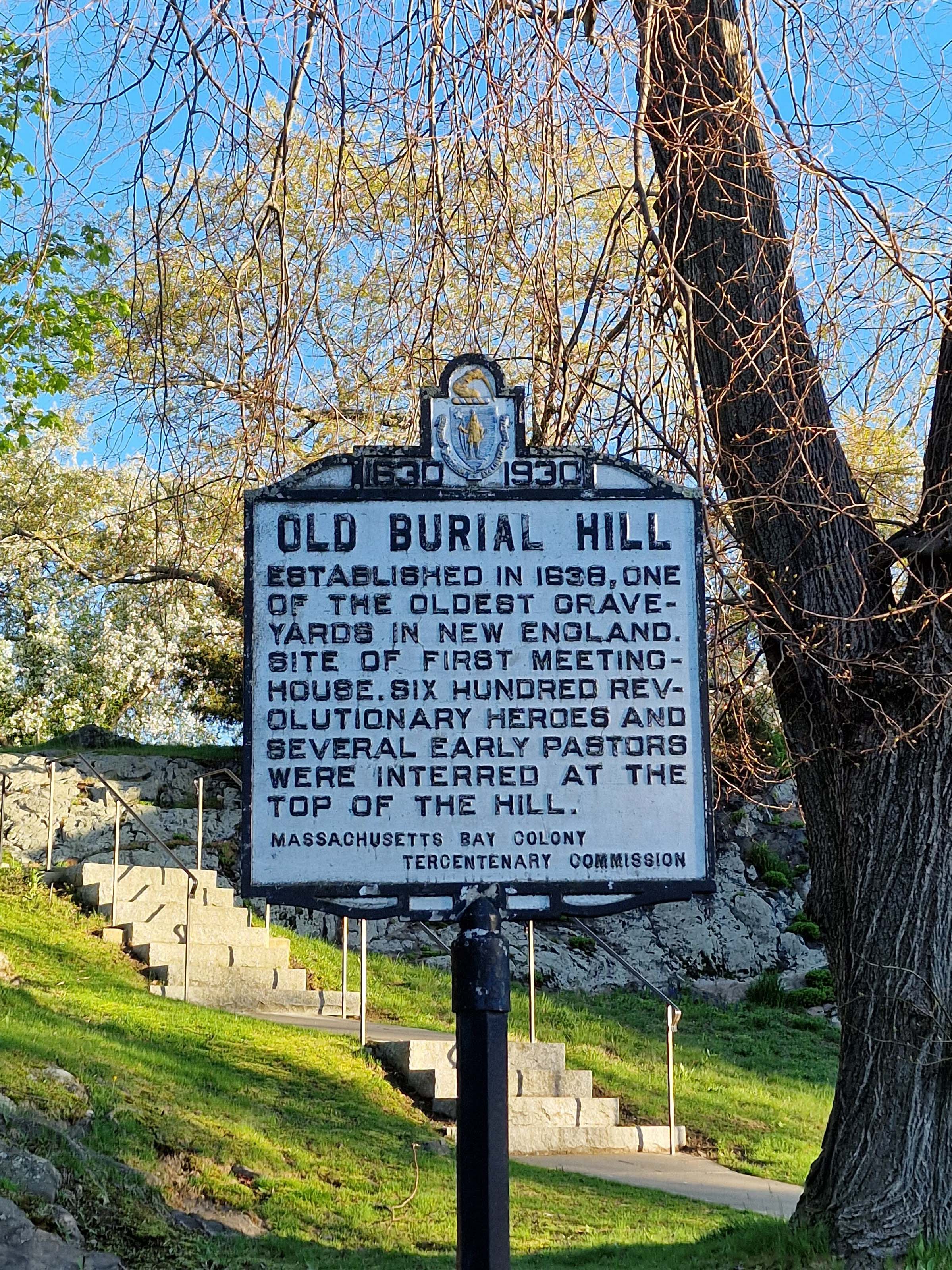
Along with our respect for the land as a place of rest for many local people, my friend and I were awed by the history of the hill. I am not certain when the last soul was buried there, but it must be at least 100 years ago. Most of the graves are considerably older, some so worn that they are no longer legible – the oldest is from 1681. It was a delight to see, on my last visit, that some of the stones are being restored, particularly those of two of the most famous inhabitants: Mammy Redd and Black Joe. But more on that later.
The burial ground was first established in 1638, at the site of one of the earliest meeting houses – history buffs among you will recall this is less than twenty years after the founding of New Plymouth (modern spelling) by those who arrived on the Mayflower.
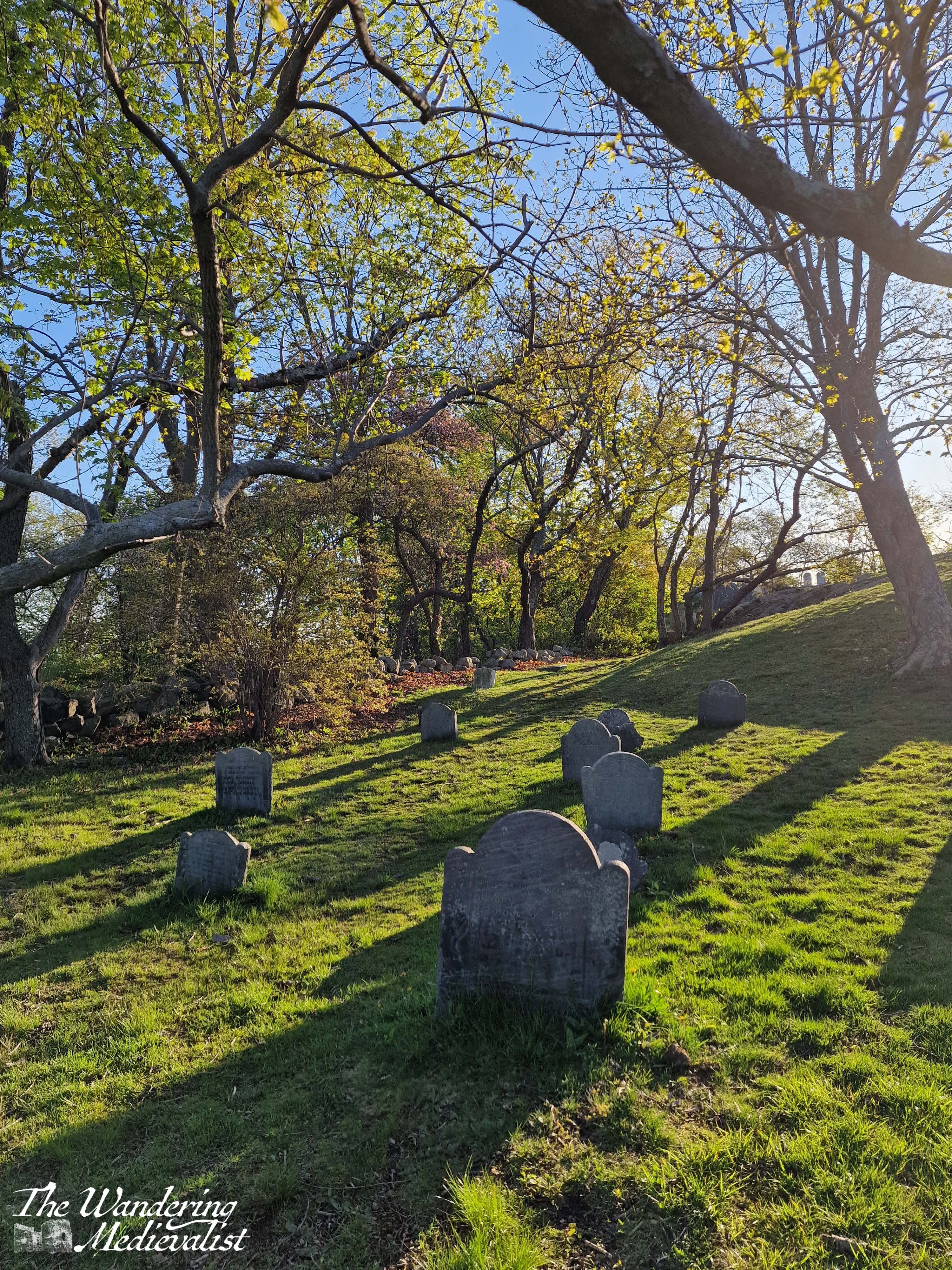
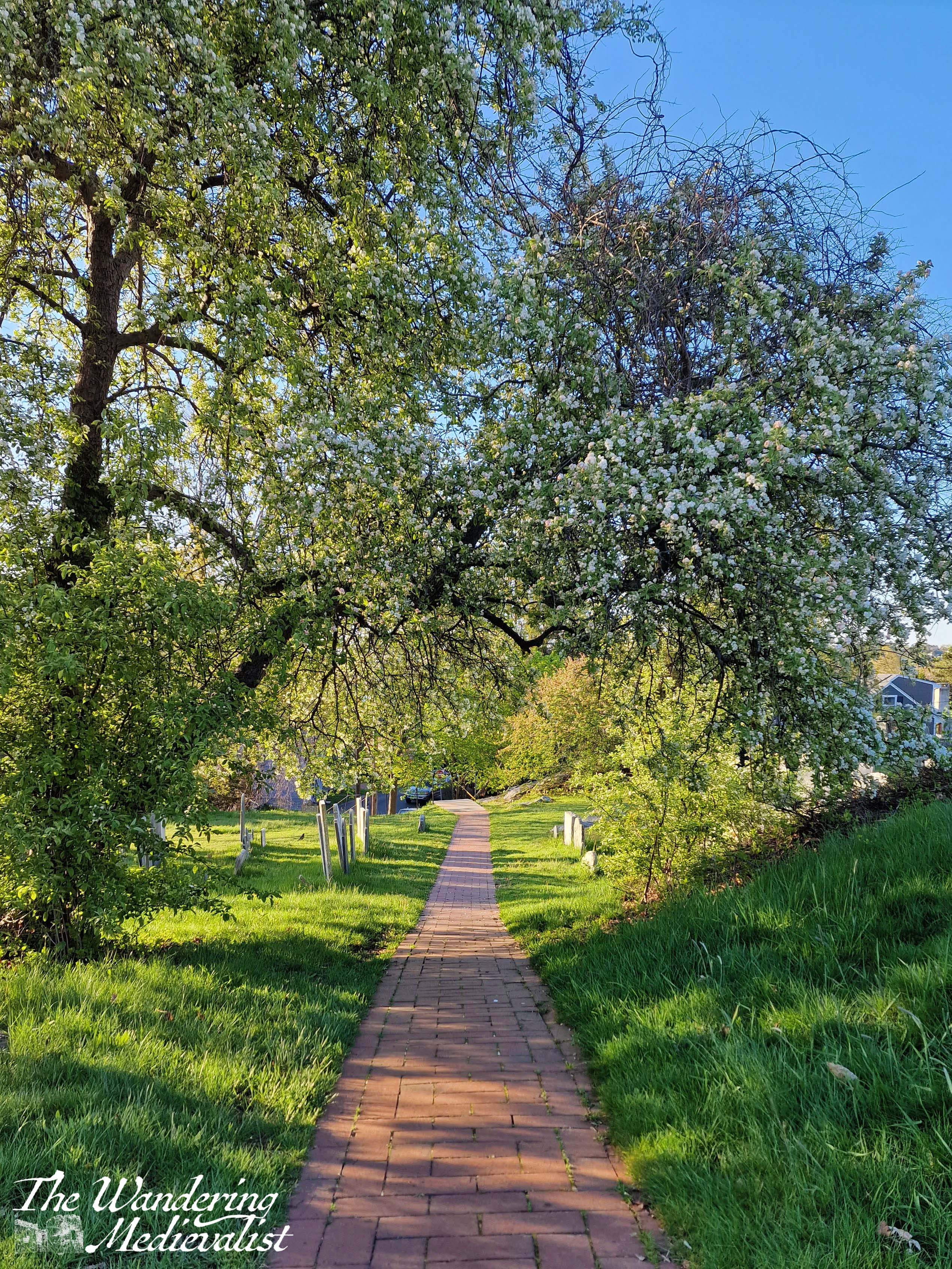
The hill can be easily accessed from two directions: either by following the path that runs beside Redd’s Pond, or by a slightly rickety stone staircase from the top of Orne Street Hill. The former provides a more gentle route and involves either meandering around the back of the hill, or just climbing straight up our former sledding hill (the goal was of course to stop before you went into the pond).
The stairs are probably the more official entrance, with a formal sign and information about the burial ground, and leading directly onto a brick path that takes you through the heart of some of the oldest headstones. For those of you who may be more interested in the actual graves and who was buried here, I discovered this excellent tour of the Burial Hill online, created by a local historian. He also details the meaning of some of the more intricate carvings on the headstones.
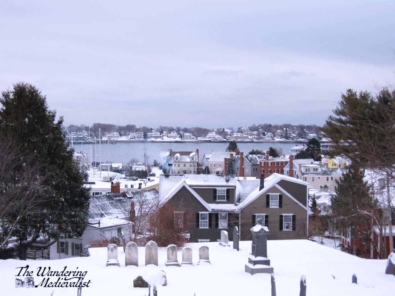
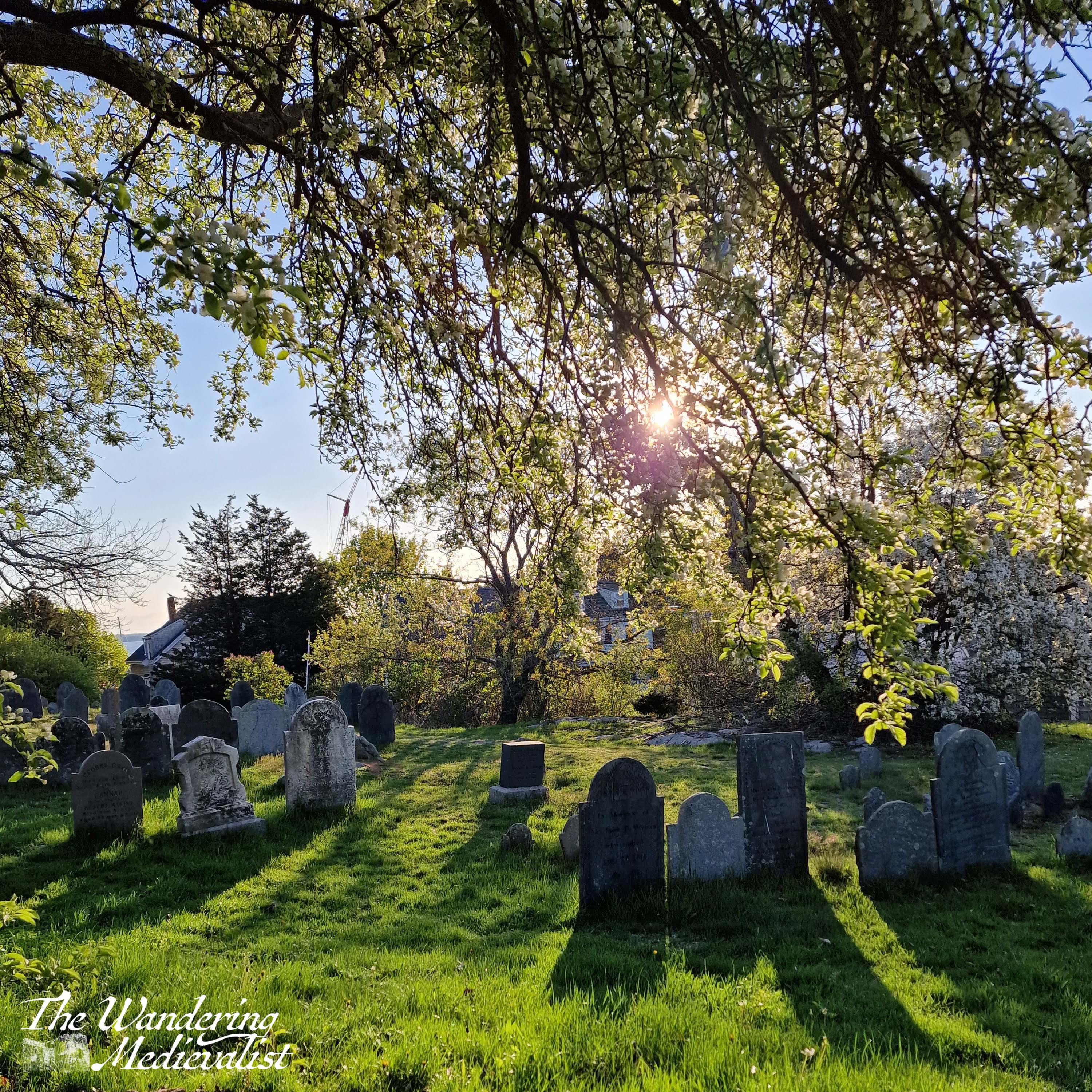
Other than exploring headstones, the main goal of any visit is almost certainly the gazebo at the top, where one finds the best views across the graveyard and the town (see above winter and summer view), including out to sea. Just visible in this picture is Children’s Island, where children attend a camp in the summer, leaving and returning each day from a local wharf. Attending this camp is a right of passage for Marblehead children, and most – myself not included – love it.
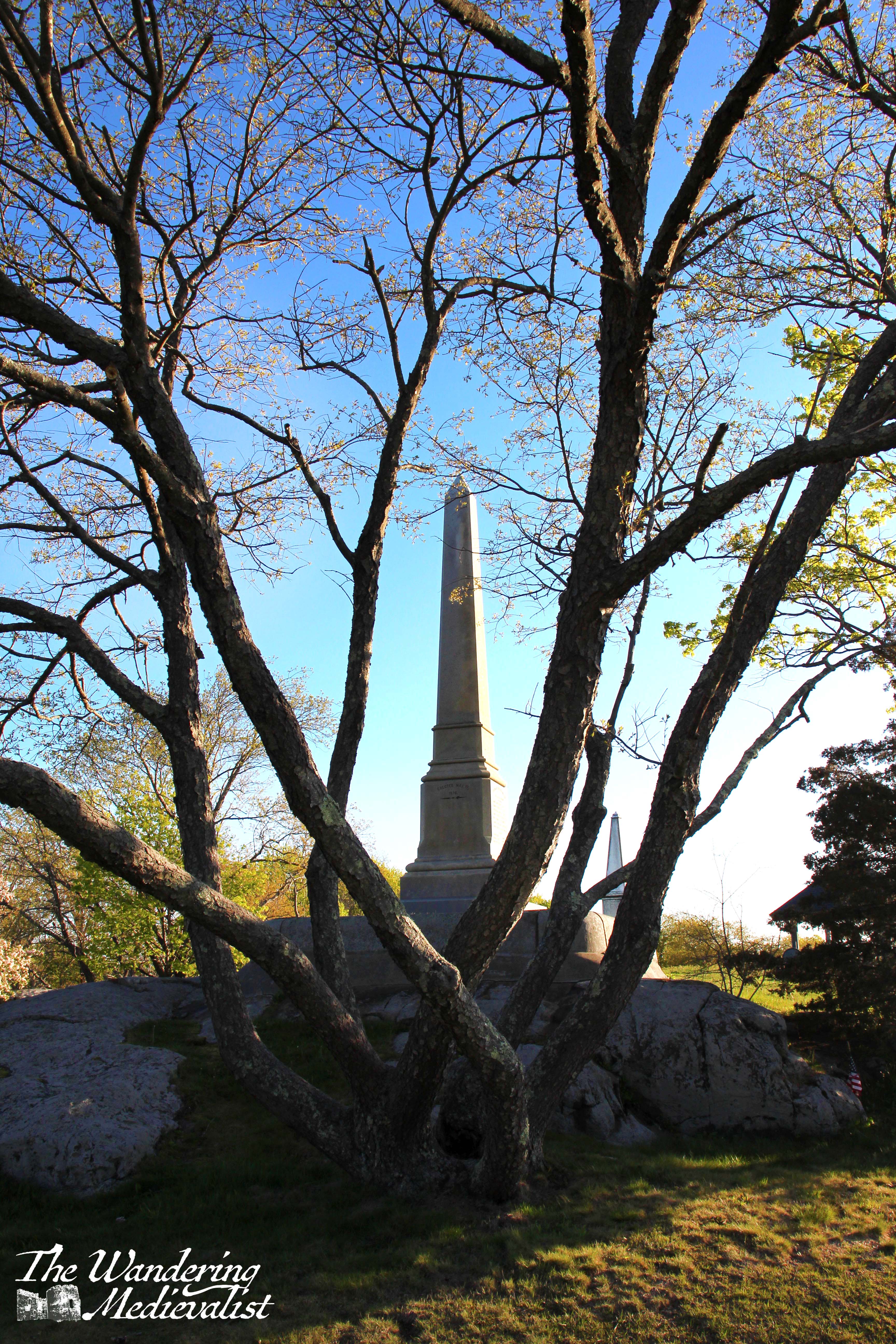
The hilltop is a fitting place also for several memorials to the many ships worth of men who were lost at sea over the centuries; Marblehead is, first and foremost, a fishing village. The Fishermen’s Monument was erected specifically to recall the loss of most of Marblehead’s fishing fleet during a hurricane on George’s Banks in September 1846. The second obselisk commemorates Captain James Mugford, who with his crew captured a British vessel carrying 1500 tons gunpowder, during the Revolutionary War.
While it doesn’t seem a huge area, the graveyard can be explored in both directions, and runs up against houses in one direction, the edge of the rocky hill in the other. The area is beautifully manicured with flowering trees and relatively frequently-cut grass.
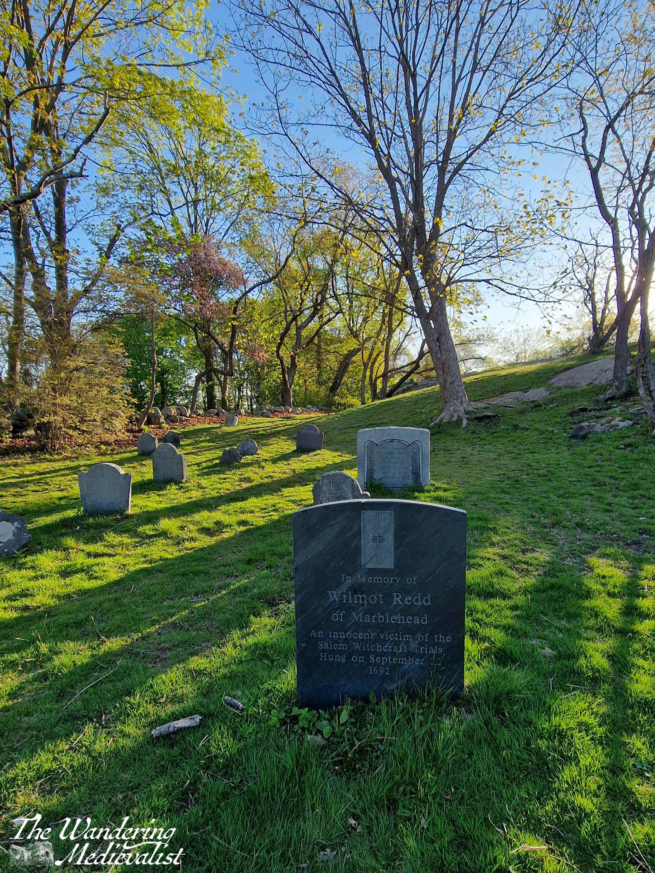
Historians will also appreciate some of the more ancient grave stones (well, ancient for New England). One of the most famous belongs to a victim of the 1692 Salem Witch trials, after whom the nearby pond is named – Wilmont ‘Mammy’ Redd. When I was young, her stone was crumbling and difficult to read, but in recent years it has been renewed.
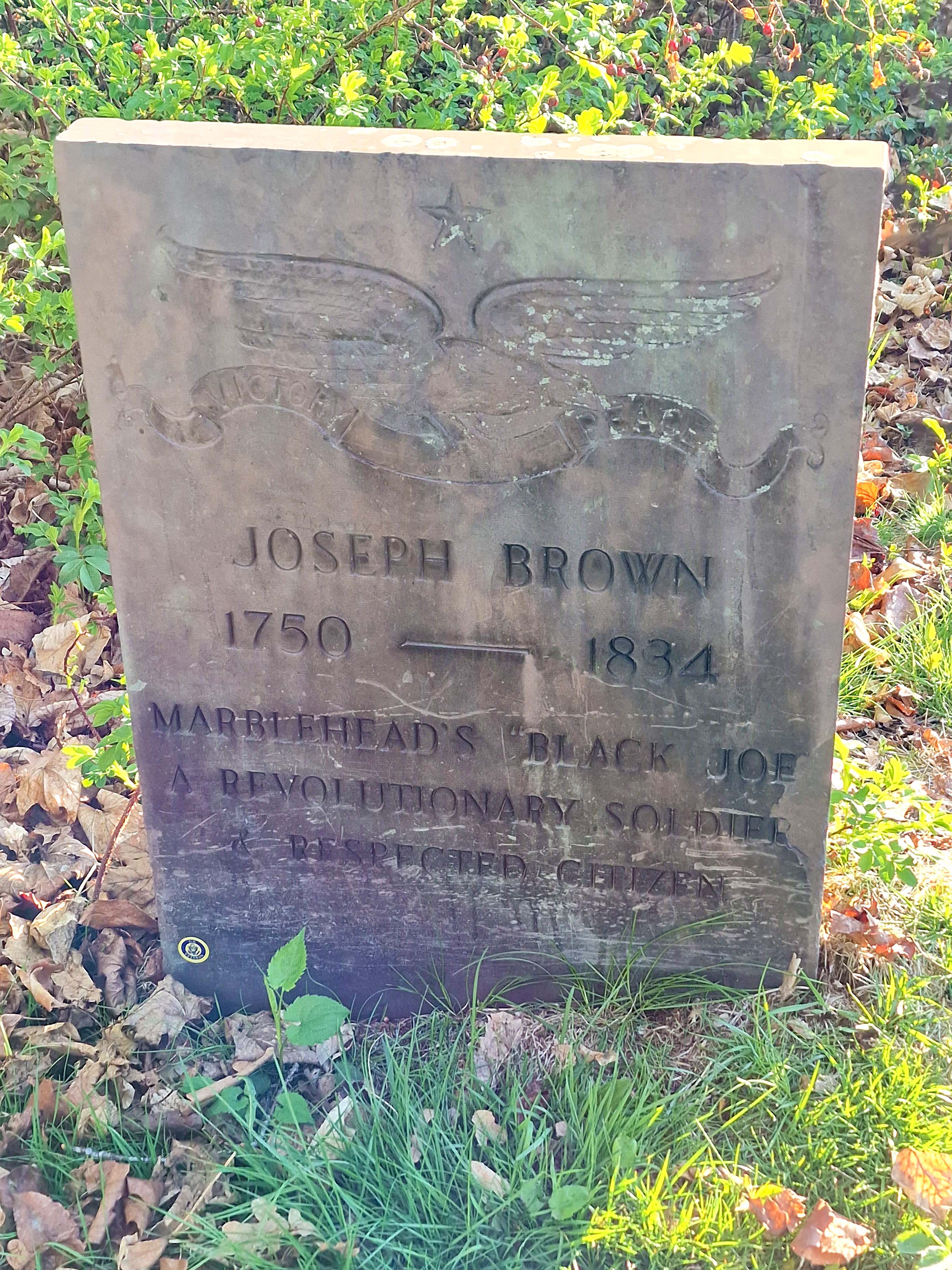
Also recently restored is the headstone for Joseph ‘Black Joe’ Brown, a freed slave who had fought in the Revolution and ran a tavern nearby, next to the eponymous Black Joe’s Pond.
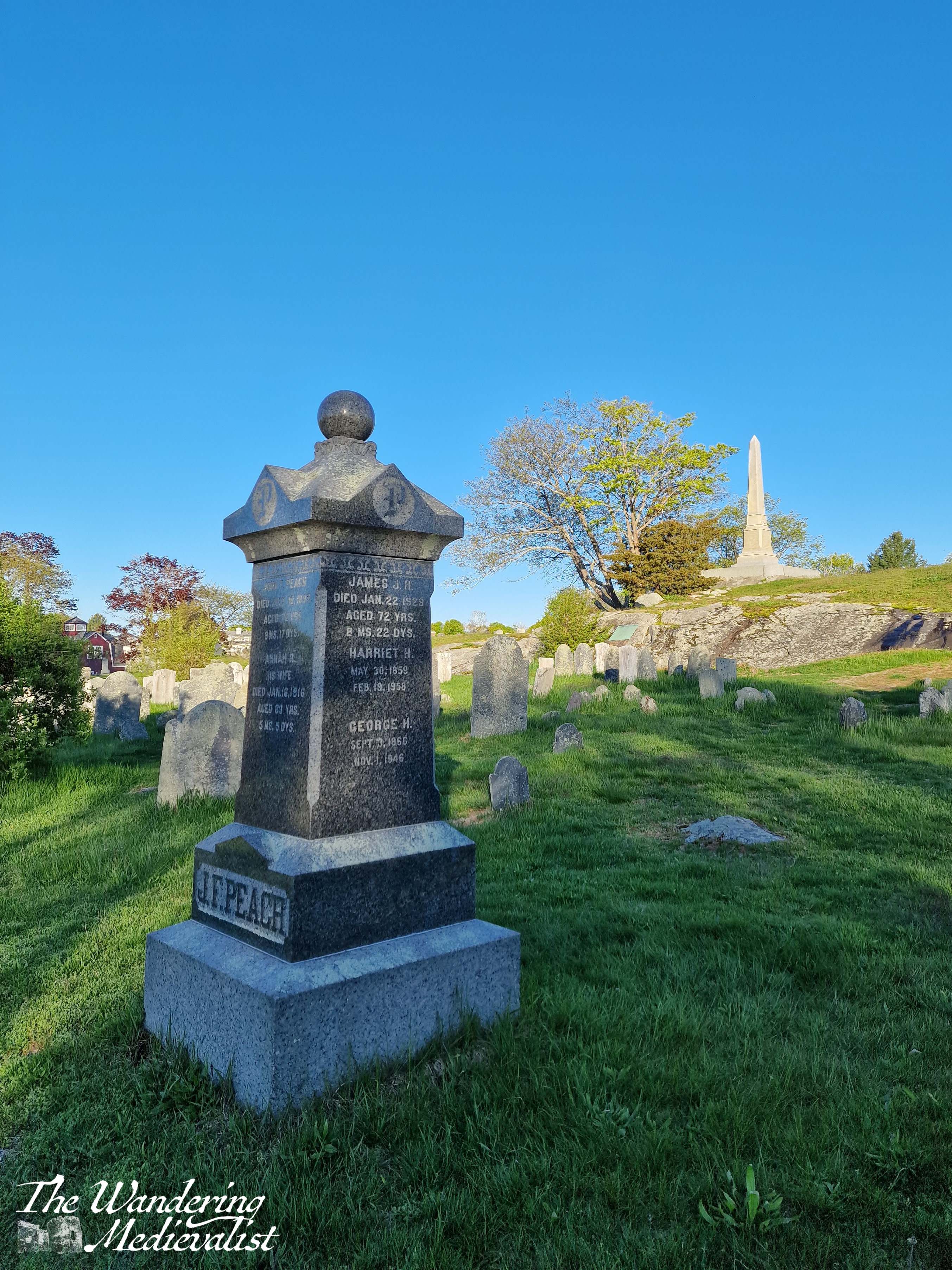
Both of these headstones are close to the pond, and if you follow the line of stones in the left-land picture above and move up the hill, you reach the brick memorial for General John Glover, another of Marblehead’s Revolutionary War heroes. Many other old Marblehead families have representatives – or generations – buried here including the Orne and Peach families.
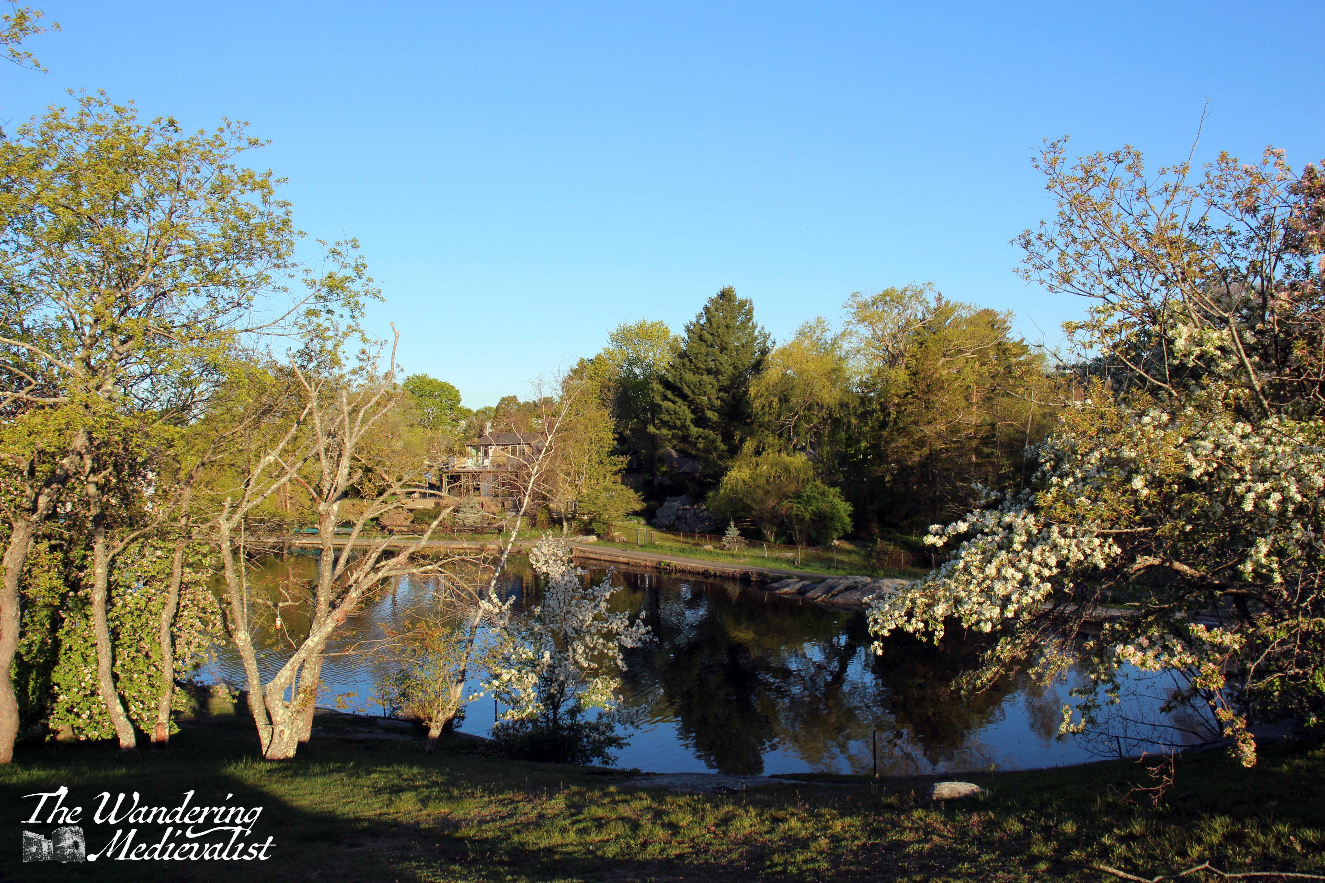
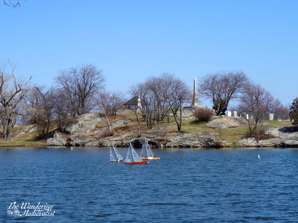
Finally, a bit about the pond, where we used to skate in the winter and feed ducks in the summer. I’m not sure it gets properly cold for long enough to skate on these days – or perhaps I’m visiting at the wrong times of winter. I do know that it is still the location of the local Tower School fifth-grade regatta, wherein students craft their own wooden sailboats in Woodworking class, and race them on the pond in the spring. I have fond memories of doing so myself, and still have the boat I made, though I am not certain that it would still sail.
Old Burial Hill and Redd’s Pond are firmly in my memory as ‘proper’ Marblehead of my childhood, and no visit home would be complete without a wander here. Just whatever you do, don’t fall in the pond, and don’t visit at night – or the ghosts may get you (or so I believed).