In case you are concerned that my last few posts have indicated a Scotland far sunnier than you have been led to believe is possible, please allow this post to alleviate that concern. The beautiful weather we enjoyed for most of May has passed into days a bit more standard, with clouds and drizzle driven along by strong wind, allowing for sunny patches amongst the grey.
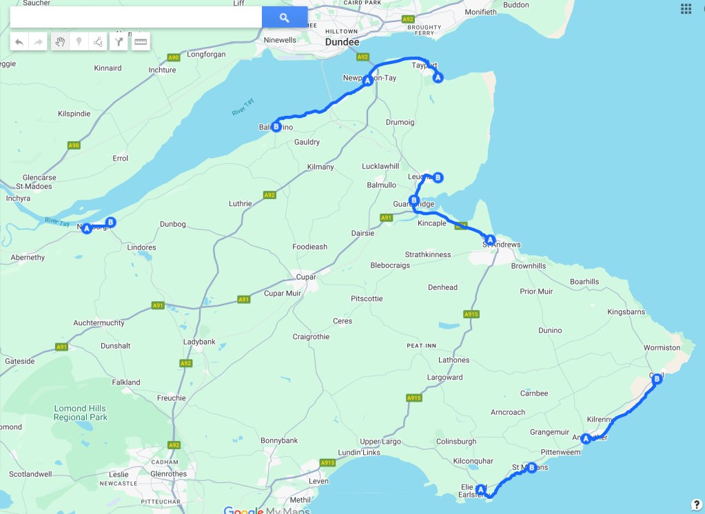
This route from Newport to Balmerino enters the realm of walks that are a bit harder to access. Busses to Newport are less frequent, and as far as I have been able to work out, there is no regular public transport to Balmerino. There is also considerably more ‘out in the countryside’ to this walk than some of the others, with the trail taking you through fields and a forested area. But as usual, I am getting ahead of myself.
After a long and winding route on the 77A bus from St Andrews, I alighted in Newport, only a few hundred yards from where I had marked the end of my walk from Tayport. To keep myself honest, I back-tracked slightly to that spot, and set my Fitbit walk timer to go from there.
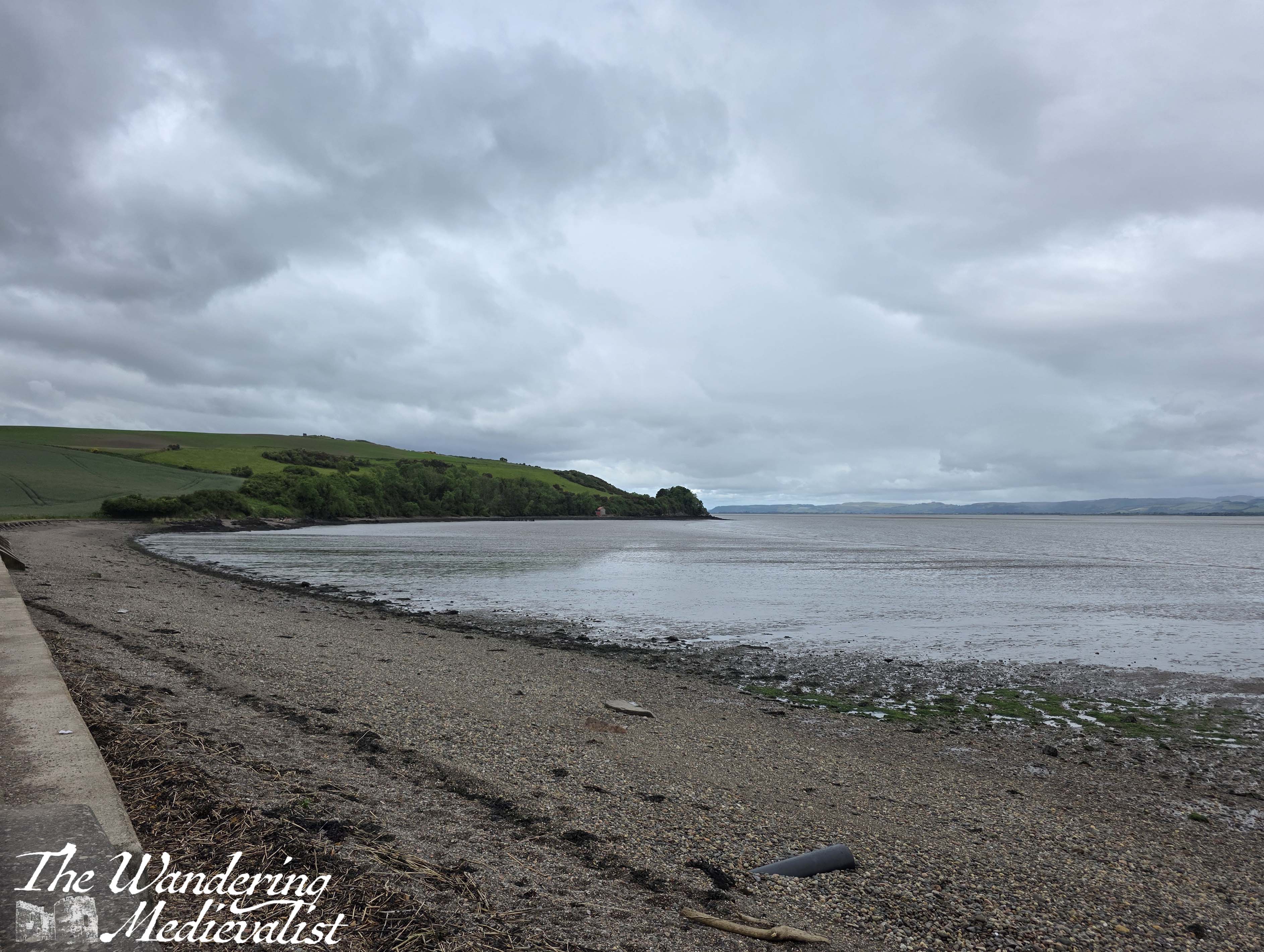
Heading away from Newport town centre takes you south-west, and at the end of the high street the road splits with outgoing traffic taking the higher route and incoming traffic the lower – the coastal path takes the right fork, hugging the edge of the Tay. On one side of the road is a stone wall above the rocky beach, on the other side a series of apartment blocks, a coffee shop and a pub.
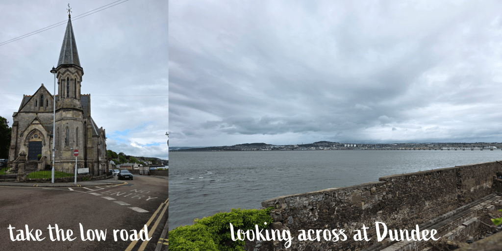
You can already tell from these pictures that the day was much less pleasant, overcast though quite mild. Only a gentle breeze – or sometimes less than gentle – kept it from being muggy. Boat Road is a great spot to look over towards Dundee, and try to identify various neighbourhoods and buildings.
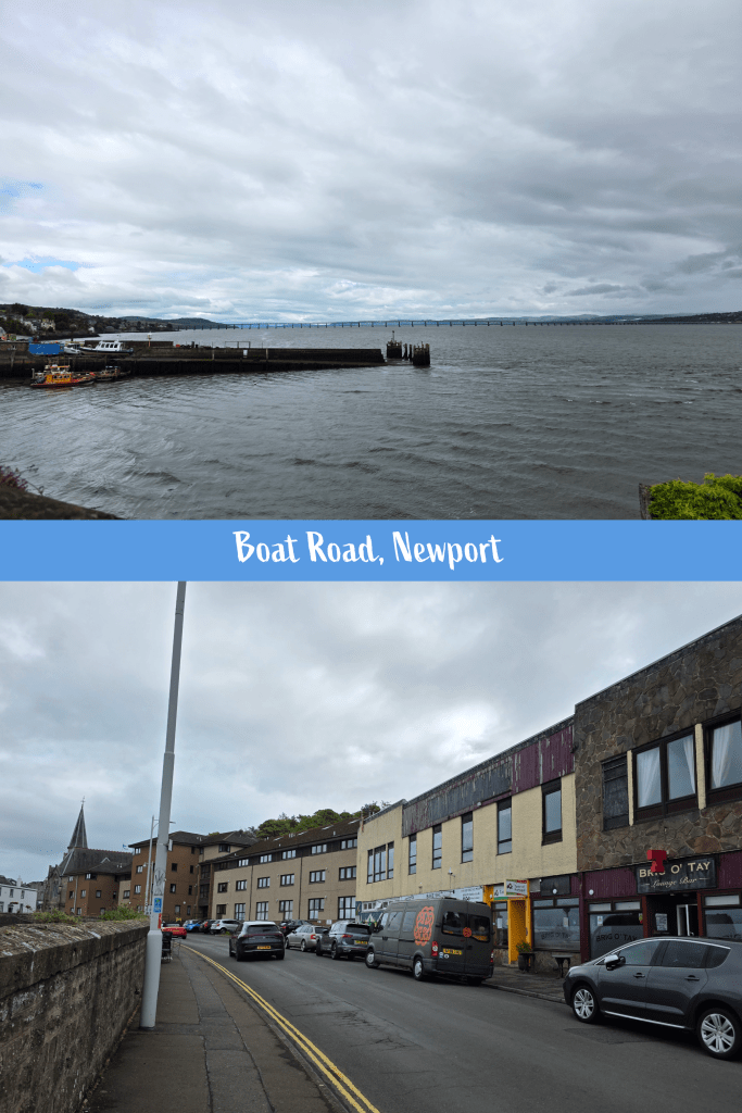
At the end of this stretch there is a marine warehouse and wharf, and immediately beyond a restaurant building. Here the path starts moving up to join the high road, with a retaining wall rising up on the far side of the road.
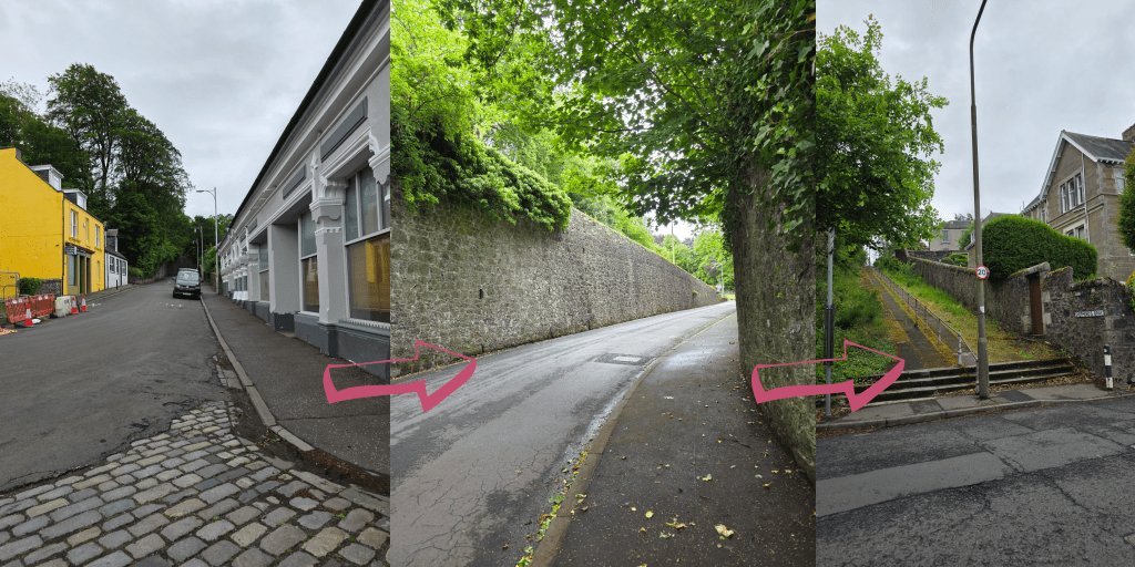
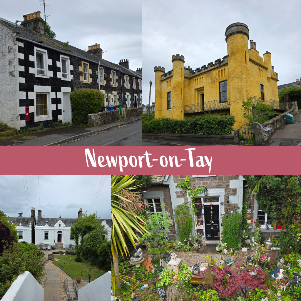
At the top of the hill the path continues through the edge of Newport, the houses a fascinating combination of old, stately and quite modern. There are stretches of row cottages similar to what you might see in Tayport, and overall one gets the feeling that there was definitely money here, as the wealthy Dundonians built homes across the river.
There are some really quirky houses here, including this yellow faux castle, and a house with a garden absolutely packed with statues and carvings. Lanterns, fountains, cupids, birds, animals – all of it nestled into the verdant garden. I particularly like the houses where one has to go down a flight of stairs and along the garden path to get to the front door. Here and there are wide driveways winding away from the street toward old estates.
About 3/4 of a mile from the starting point, the walk crosses the line from Newport into Wormit. This is about when it began misting heavily – not quite raining – though it lasted only a few minutes.
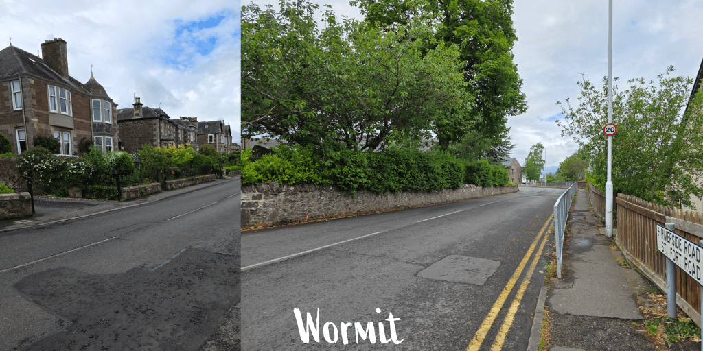
The edge of Wormit is a bit more modern in construction though it isn’t long before the houses return to the traditional Victorian style. There are glimpses through the bushes and gardens of the water, just enough to remind you that you are still on the coast, and you find yourself closer and closer to the rail bridge with each viewpoint.
I have to admit to finding this portion of the walk a bit less invigorating. It may just be that it was one town that was very similar to the next, though the gardens were lovely. Wormit is long and narrow, and the road passes the Primary School, where a class was out playing football, as well as the parish church and plenty of lovely cottages. The poppies were passing by – just – and the rhododendron blooming, with some early roses out though most were still only showing promise of what they would become.
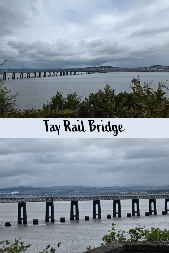
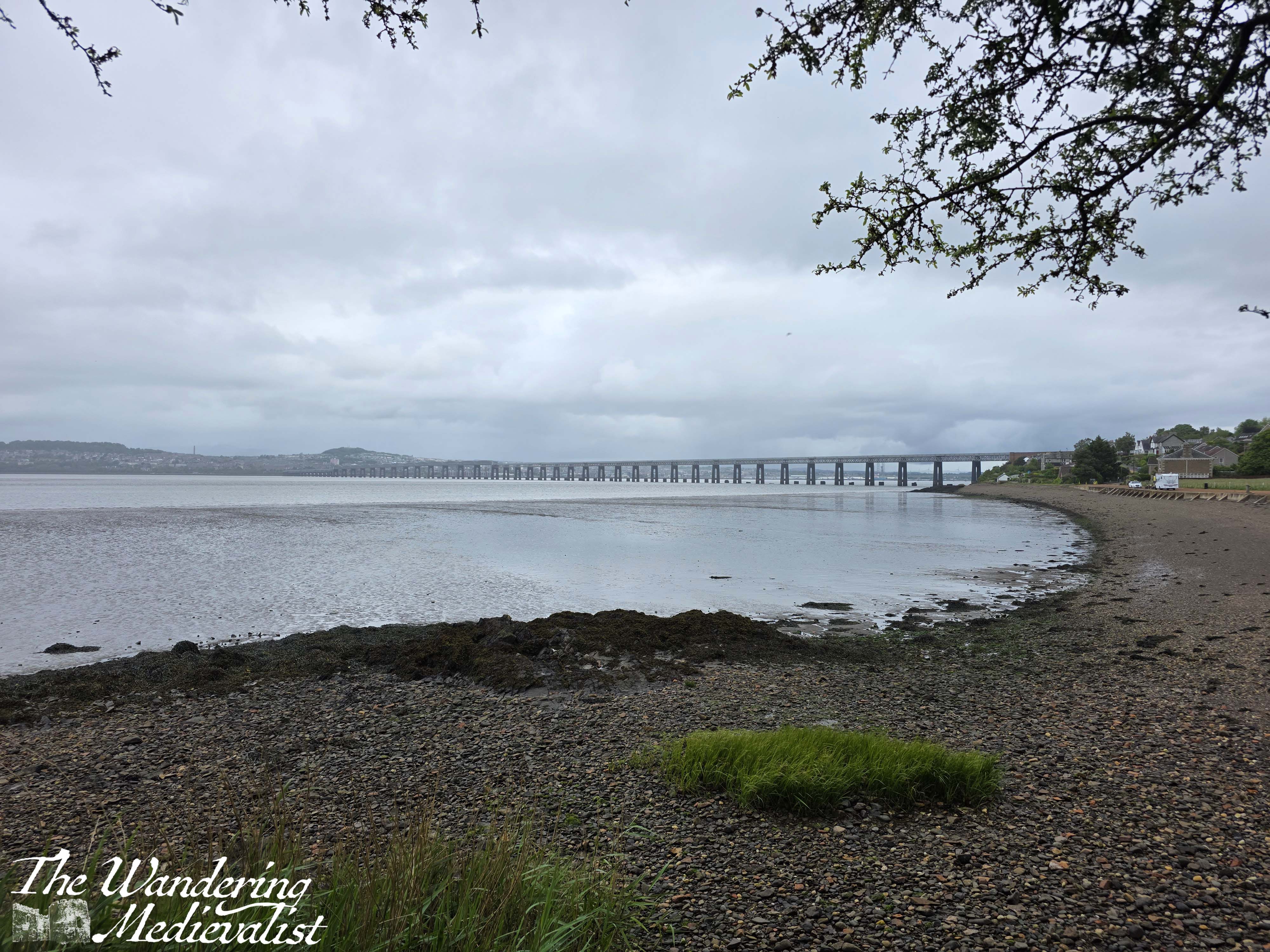
Eventually, almost two miles from where I started, I found that the path branches off from the main road, heading down a hill and towards the shoreline. Here are some excellent views of the rail bridge, and a line of lovely little cottages so typical of the late 19th century.
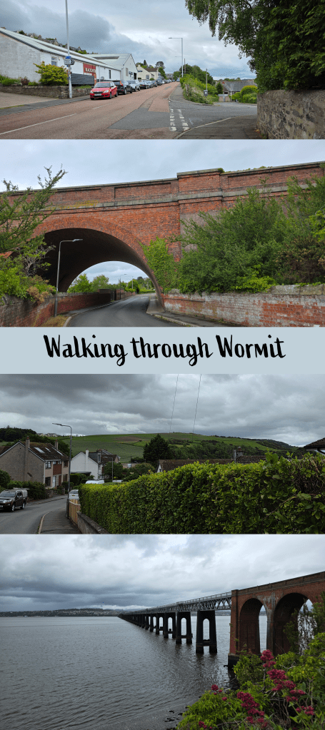
What I imagine is the older, brick portion of the bridge stretches out over the road to meet the newer section, and in time the path goes right under the bridge, with glimpses of the water and structure through the foliage.
Once under the bridge, the coast side opens up again briefly, and the coastal path continues through the neighbourhoods, varying between newer constructions and older homes. As the path descends, it suddenly becomes apparent that you are reaching the edge of town, with hills covered in fields rising ahead.
Very suddenly, the town ends at Wormit Bay, a relatively un-sheltered beach primarily of rock. There are parking spots for camper vans and mobile homes, a few benches, and would likely be a lovely spot on a nicer day.
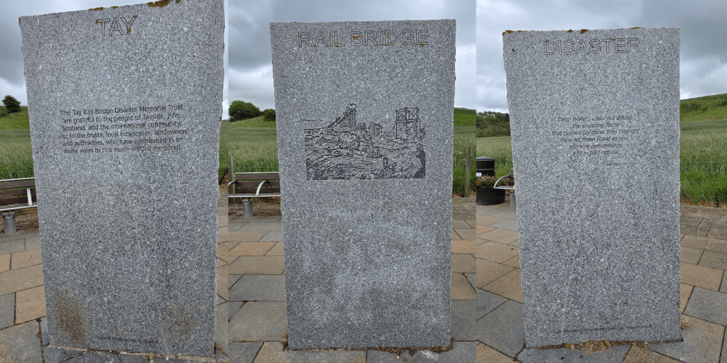
At the far end of the bay are three stone slabs, a memorial to the Tay Rail Bridge disaster of 1879. On 28 December of that year, during a violent windstorm, the first Tay Rail Bridge collapsed just as a passenger train from Burntisland to Dundee was crossing. There were no survivors, and the pylons from the first bridge are still visible below the new bridge.
Just beyond the memorial, the path goes past a Coastal Path marker and carved stone seal, then climbs relatively swiftly away from the beach. Here it becomes a proper hiking trail, narrower and rocky, a nice change from the village road. I could hear a primary school class exploring the beach below with buckets and spades, and flashes of brightly-coloured raincoats and excited shouting indicated they were having a great time.
Unlike the East Neuk trails, this portion of the path is clearly less used, and while it is well-marked, I did not pass a single person from Wormit onwards (though I was also walking on a weekday, rather than weekend).
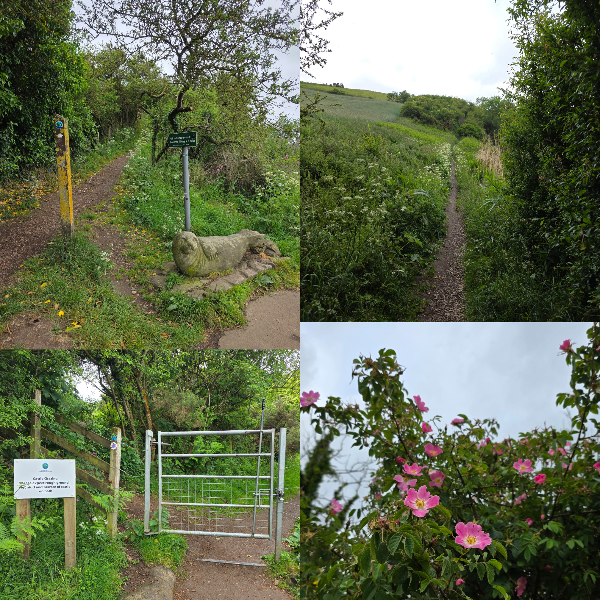
Shortly after leaving Wormit Bay, the trail goes through a metal gate, and there are warning signs for cows – while I did not see any immediately I could certainly smell and hear them, as well as sheep and the occasional rabbit, so any dogs on this trail should definitely be kept on a lead. Cow pats are plentiful even if cows aren’t, and I found myself watching my feet a bit more as I hiked up and out of the tree line.
This portion of the trail is one I have determined I must try again on a nicer day, as the views over the river were lovely. The tide was incredibly low, with large stretches of sand bank visible, reminding me that the Tay has silted up since the Middle Ages. Closer to Balmerino, I could just see a wrecked ship through the trees, and more stretches of sand.
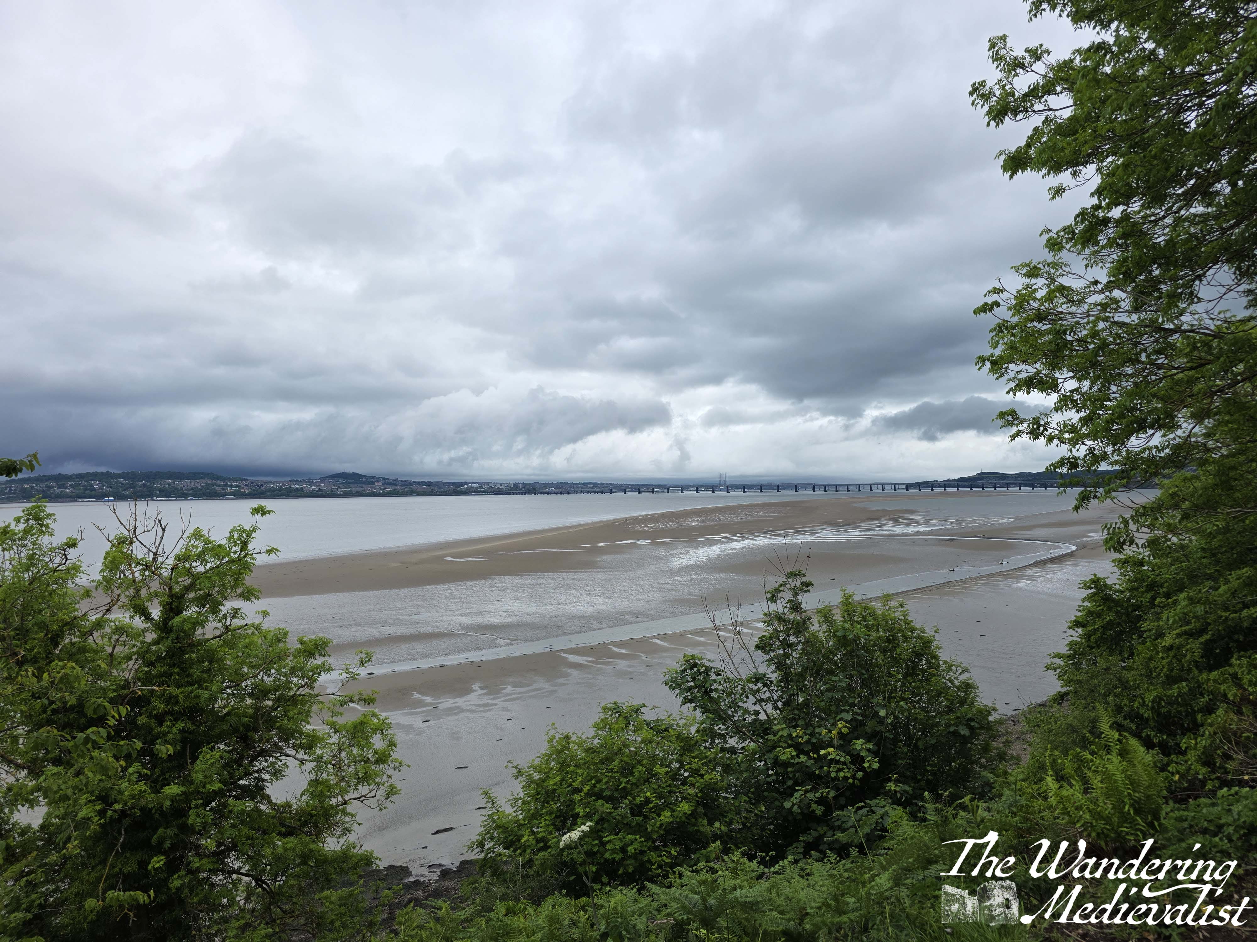

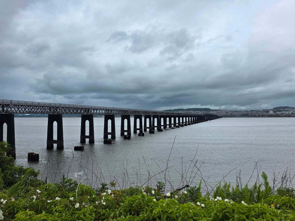
The most spectacular view, though, was when I paused for a moment at the top of a ridge to catch my breath, and looked back over Wormit. Even in the dull grey and framed with faded yellow gorse, the village and rail bridge were clear, and showed how quickly the town disappeared into the hills.

I took many versions of this picture, and I hope that on a sunnier day I can do even better. Eventually I did have to hide my camera from the spitting rain, but the exertion of climbing the hill meant I did not mind a bit of dampness. I could see different weather ahead and even a patch of sunshine on the far bank, though it did not last and the blue skies I was glimpsing never quite reached me.
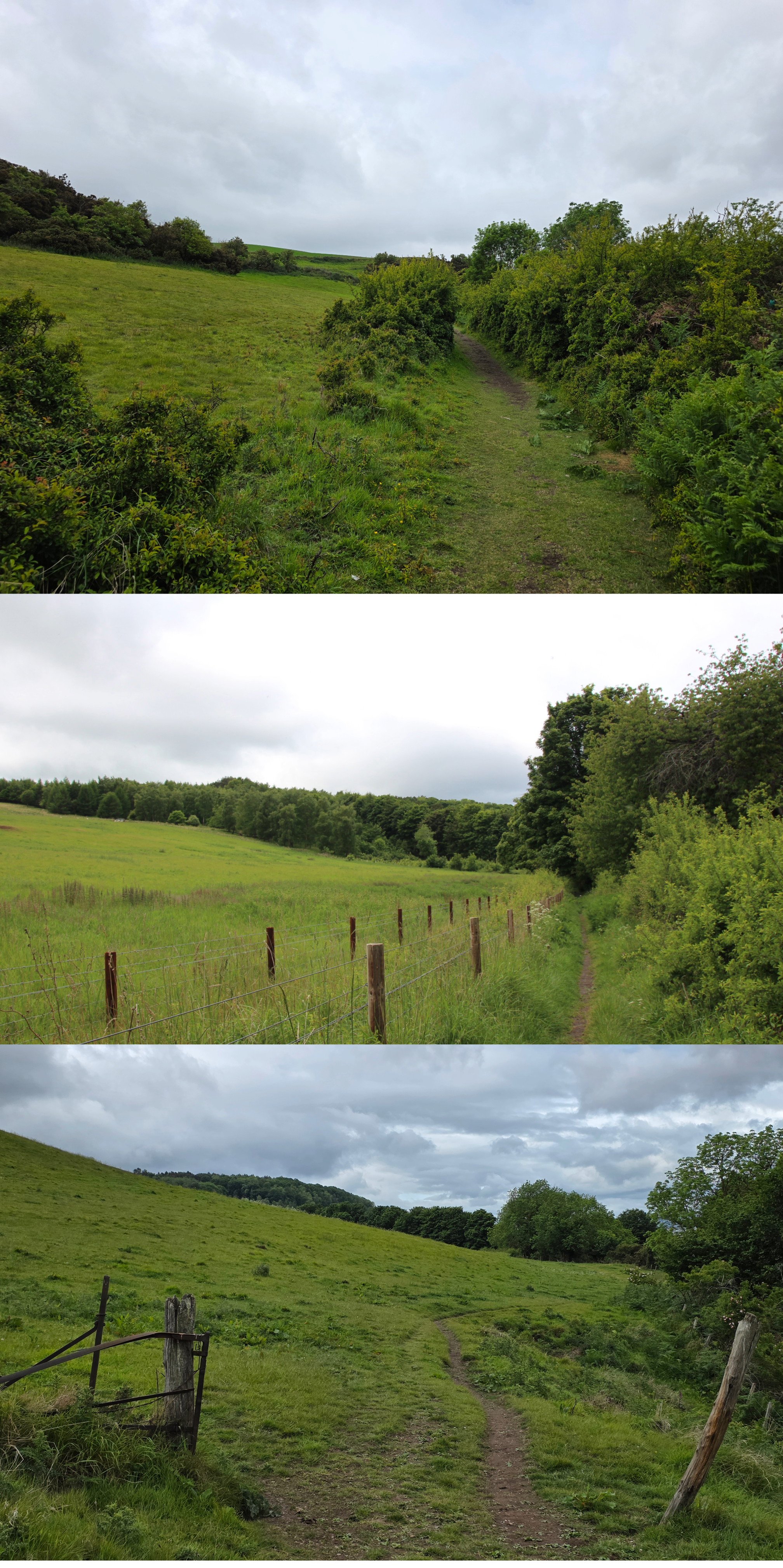
I was also a bit disappointed not to come across any coos, despite the signs. Evidence was everywhere and the trail here is quite uneven, so I definitely had to keep an eye on my feet to avoid turning an ankle or slipping into the grass. There is no question that this is proper countryside, as all evidence of other people fades, and the path rises and falls through several fields and another gate or two.
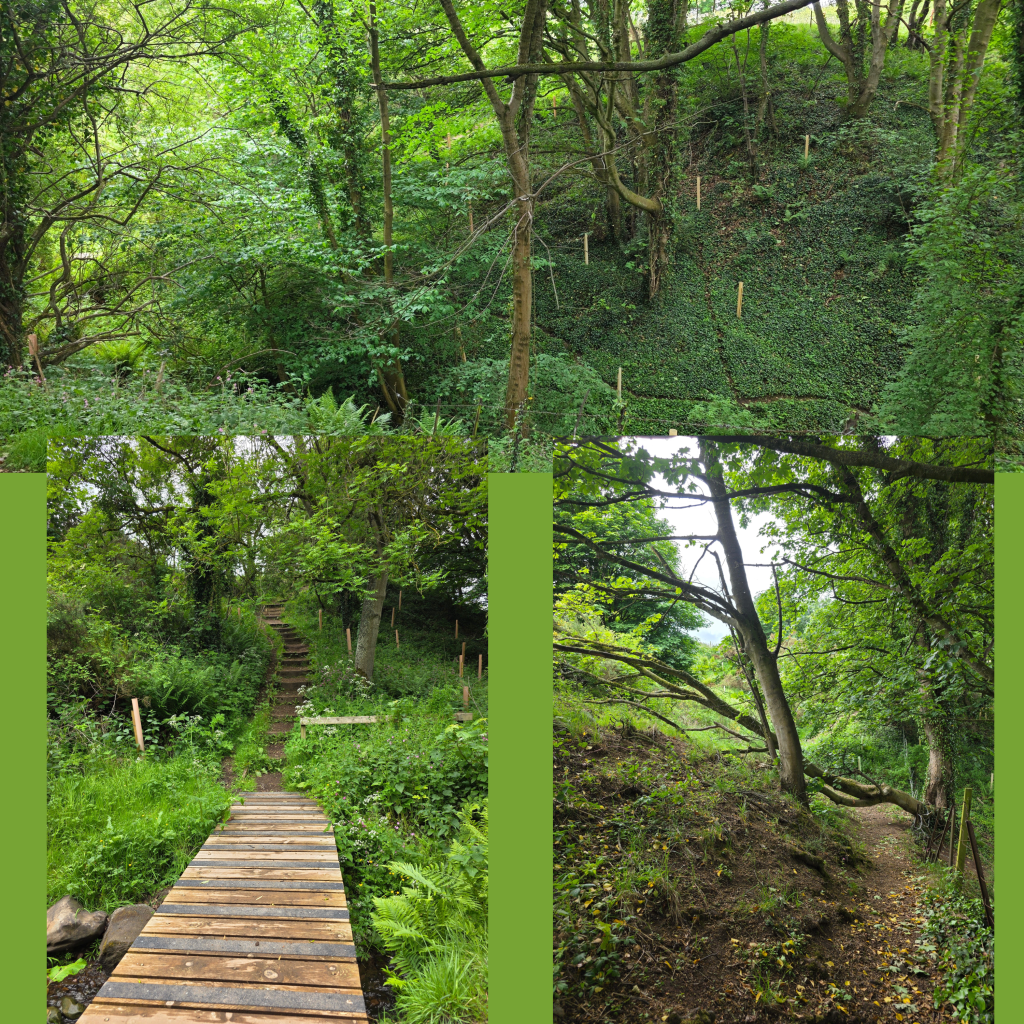
A burn cutting through the fields must have over millennia carved into the hillside, creating a tree-filled valley that the path dips down into. The way was barred by a fallen tree – more evidence that this part of the walk is not quite as popular – but I was able to make my way over the branches and then climb up out the other side on a set of stairs.
While perhaps not as well tended, I can assure walkers that this portion of the walk is well-defined, with regular way markers that were often a bit less obvious in town. That said, there are very few places where you can go anywhere but along the path. From here on it is single-file only (if you are walking in a group), with grass and nettles grown up on both sides of the trail. The fields on the left disappear into trees after some time, and it was incredibly quiet.
Side note, I was asked recently if I listen to podcasts or music while I walk, and actually, I tend not to. Firstly, because I have never really gotten into podcasts though I am regularly told that I should. Secondly, and really more importantly, because I like to listen to the peace and quiet. The sounds of the trees, the wind, the water.
That said, this stretch of trail went on for quite a bit longer than I had thought, (it’s about .75 miles) or perhaps I was just more tired, as it took me longer than I expected. On both sides of the trail is a sharp barbed wire fence – deterring walkers from wandering I suppose, or from going too close to the steep cliffs.
I felt myself starting to flag a bit, especially when a break in the fence and job up to the left meant entering an enormous open area that looked newly ploughed by the several tractors abandoned nearby. Roots and bits of tree indicated that it might have once have been fully overgrown, but all that was left was soft dirt and vehicle tracks. I found this terrain quite difficult to traverse, with my boots sinking into the soil and caught on the roots.
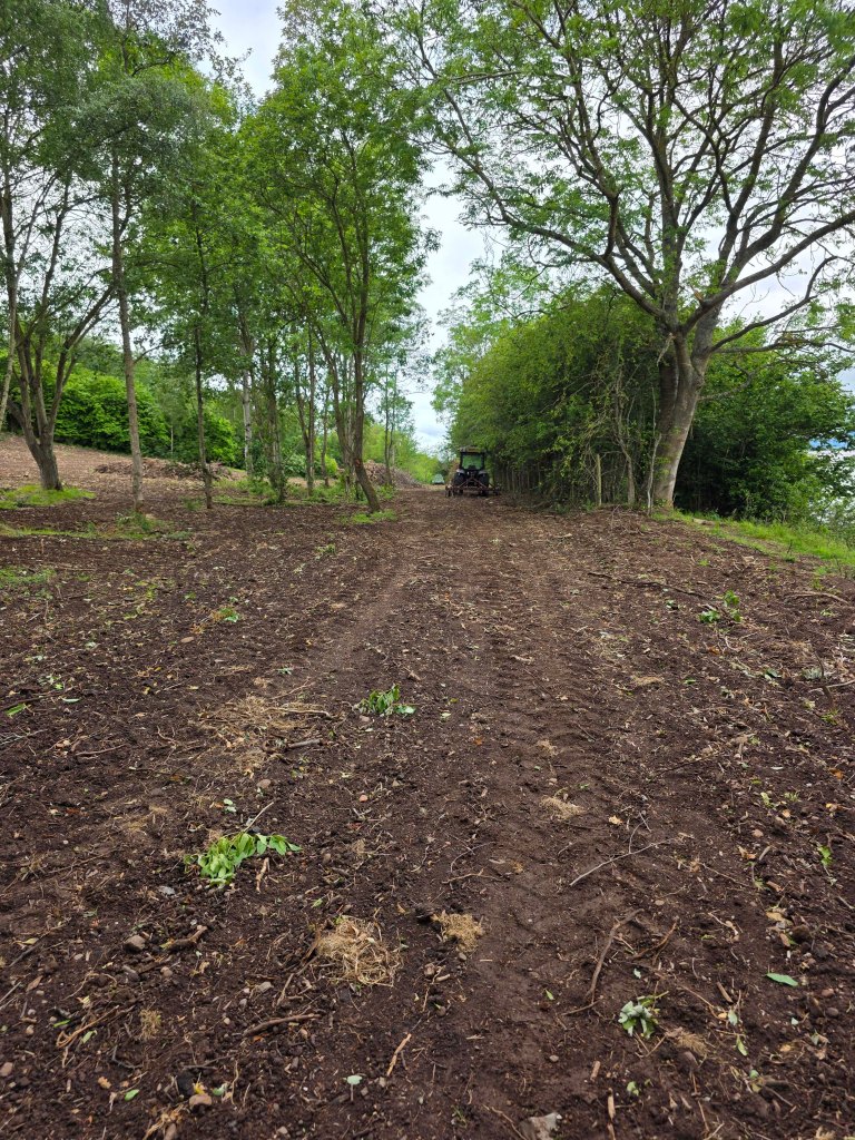
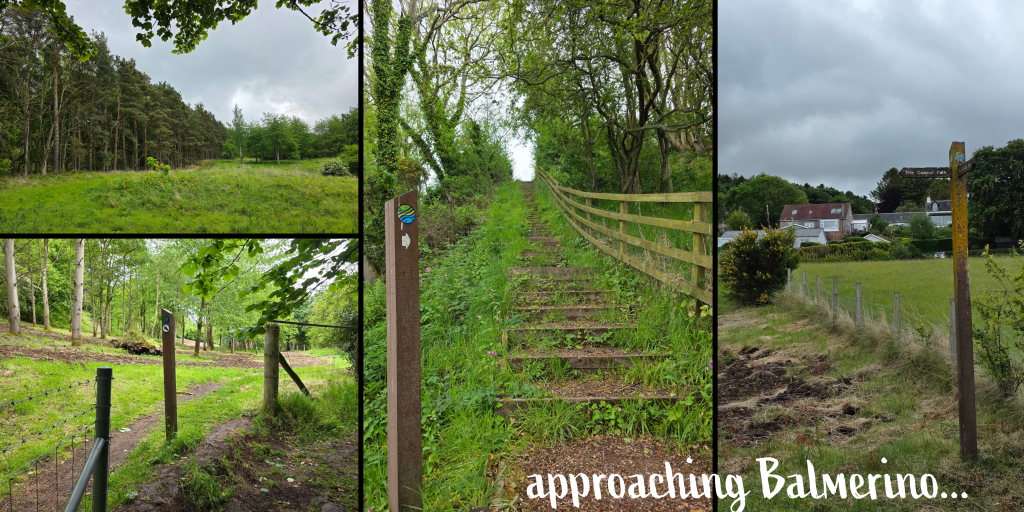
I was starting to wonder if I would ever reach Balmerino, when I crested one last rise and realised that houses were visible above me on the hillside. Finally.
A steep flight of stairs leads the path down to the level of the coastline and beach, and while I was getting tired I knew this was a good thing, and that the Coastal Path at Balmerino was level with the beach front. Sure enough, a narrow path and signs indicated the way between the seawall and several white houses. These homes are clearly old, their style indicating perhaps several hundred years, but they are all well-kept, freshly painted and maintained.
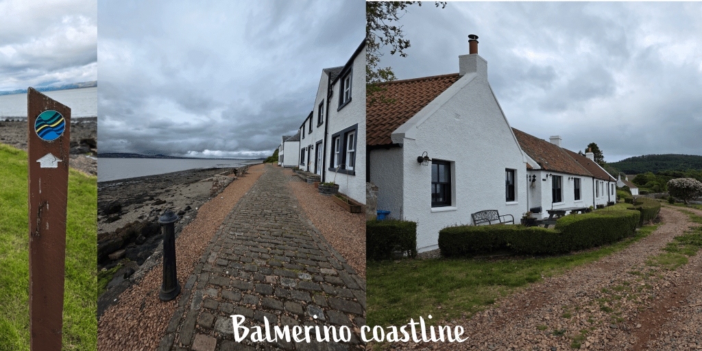
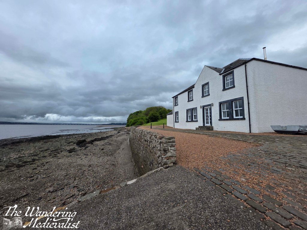
While the coastline itself has turned south slightly and so is more protected than in Newport and Tayport, there is still a strong wind here, smelling of seaweed and salt. It felt excellent after so much traipsing through fields, and I enjoyed walking slowly along the beachfront, which reminds me a bit of the beaches of Marblehead – rocky and not hugely welcoming.
Finally, I ended my walk at another set of wooden seal statues, on a small grassy promontory. I have not yet worked out how I will get back to Balmerino to continue the walk, as there really is not anywhere to park, but that can be a problem for later in the year.
Balmerino itself is a small village, with one narrow road leading up the hill from the coastal path, with most of the homes from the 18th or 19th century.
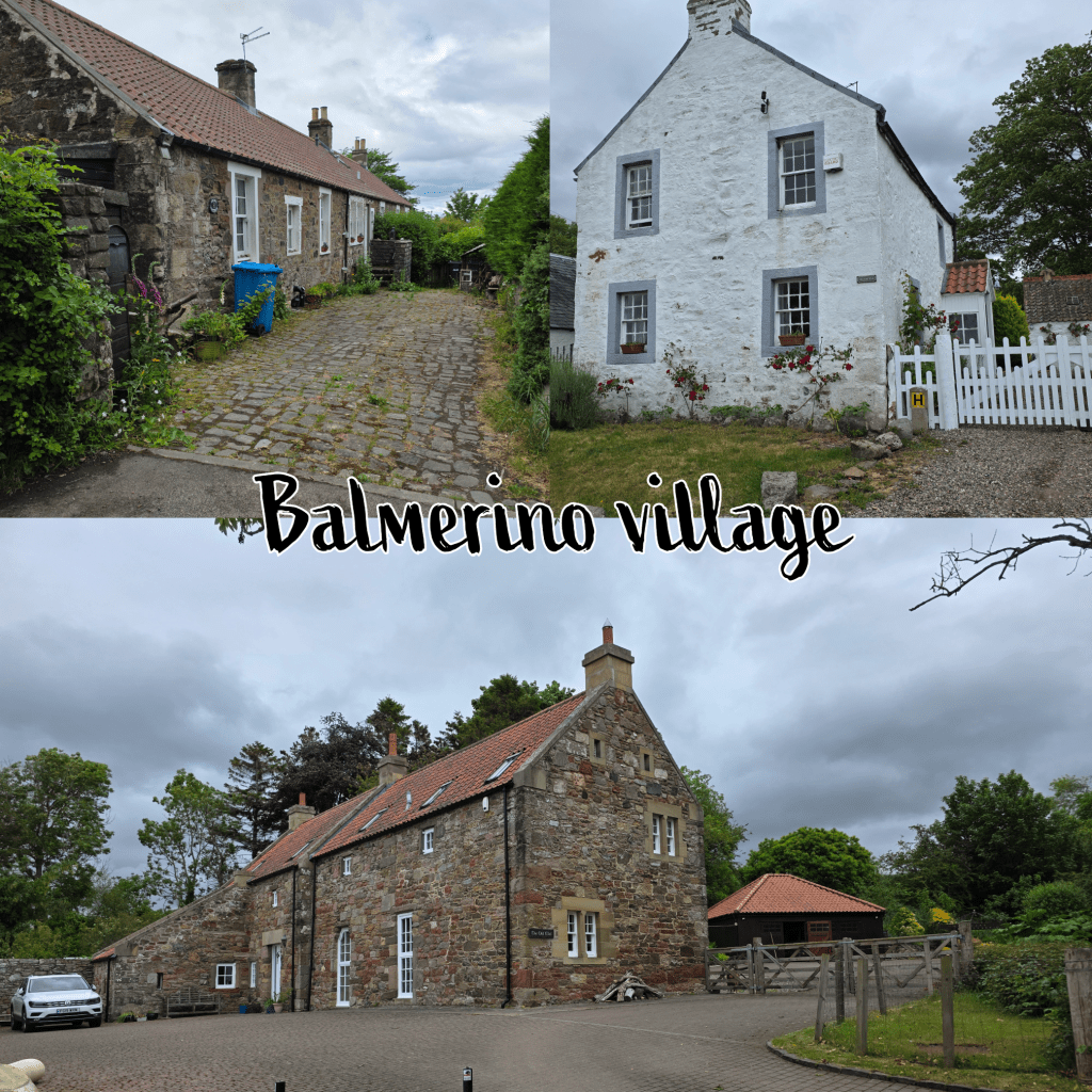
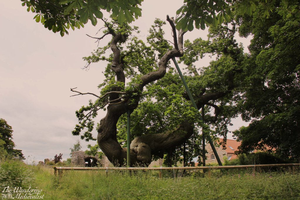
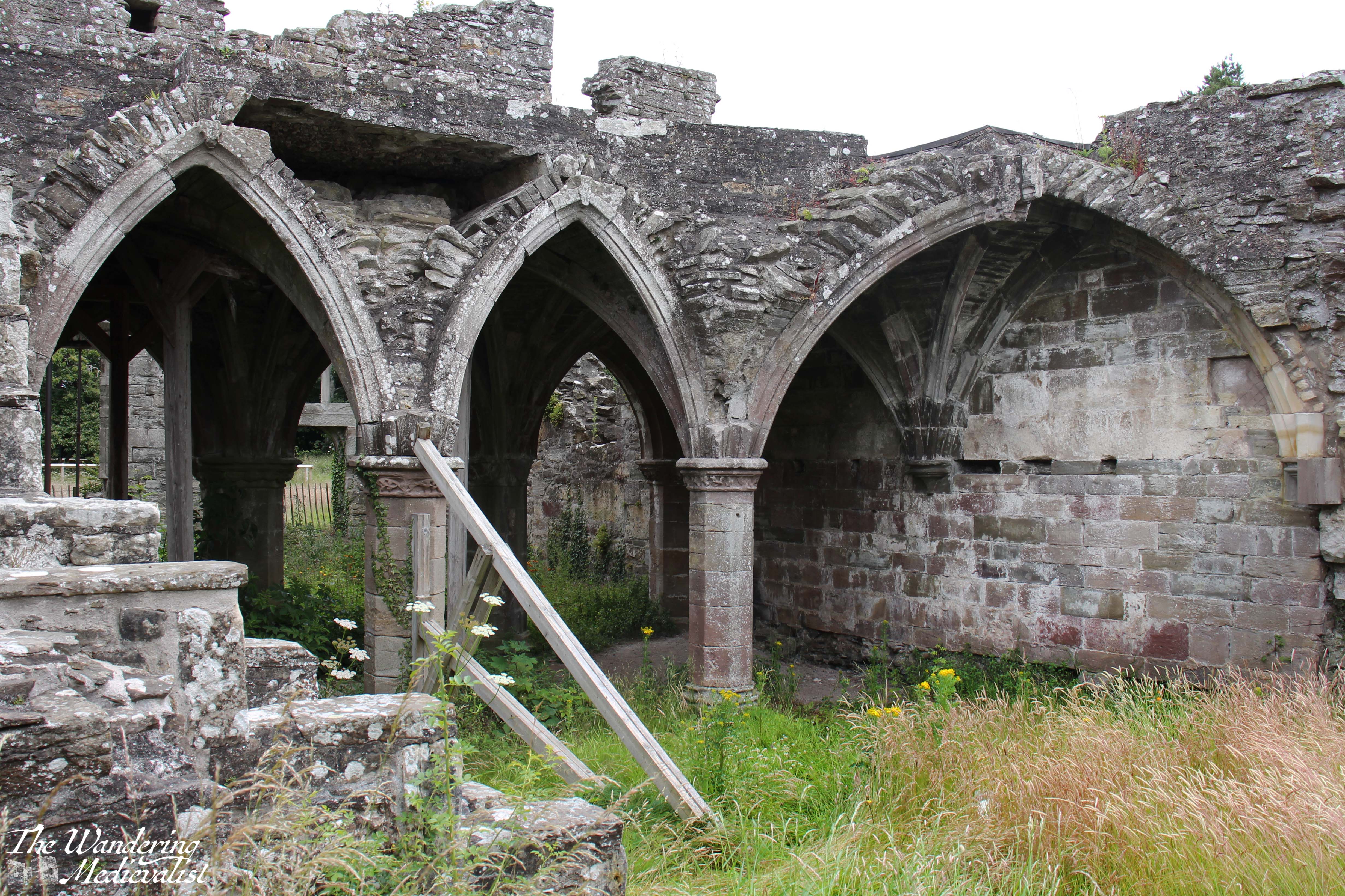
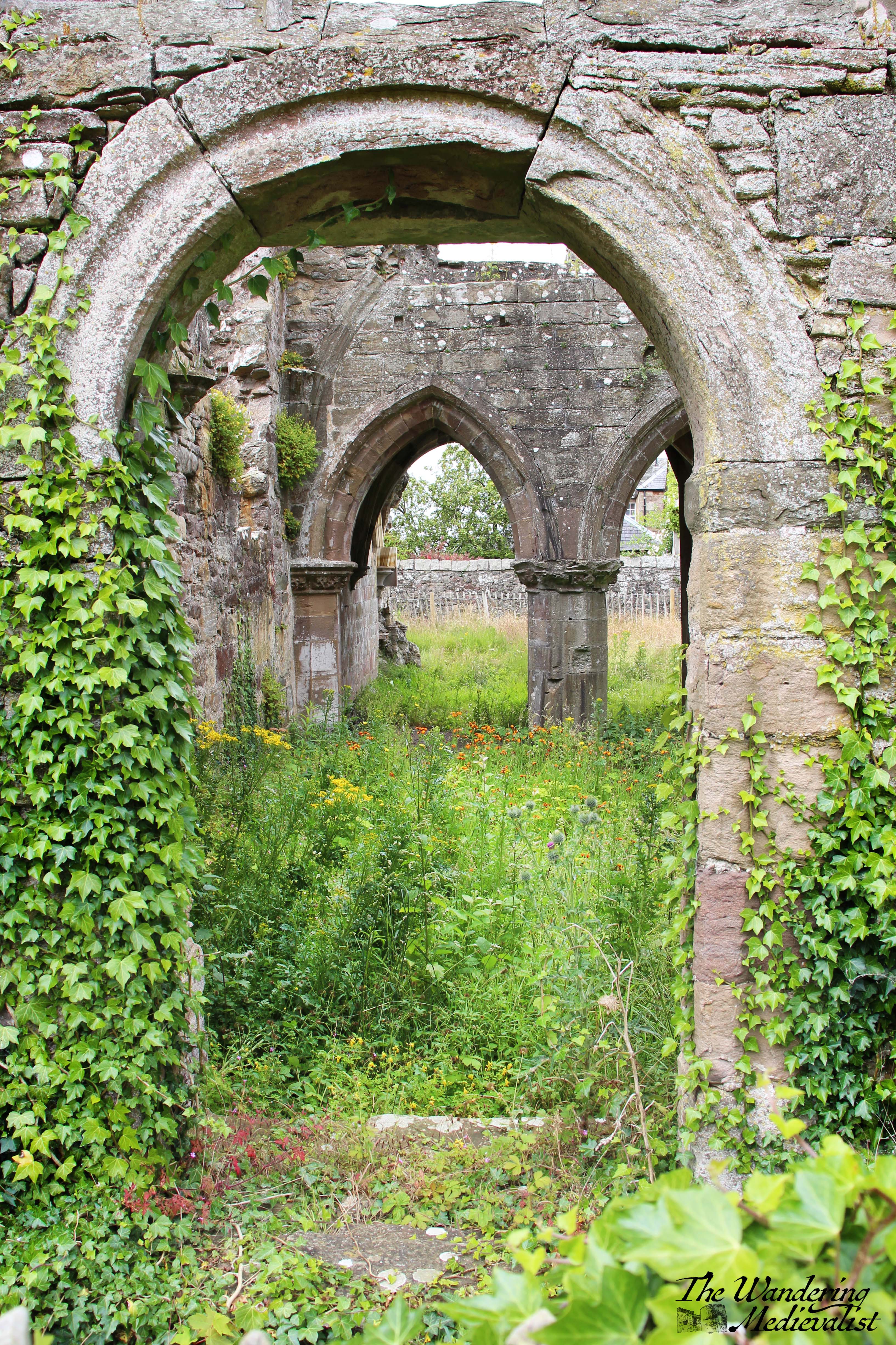
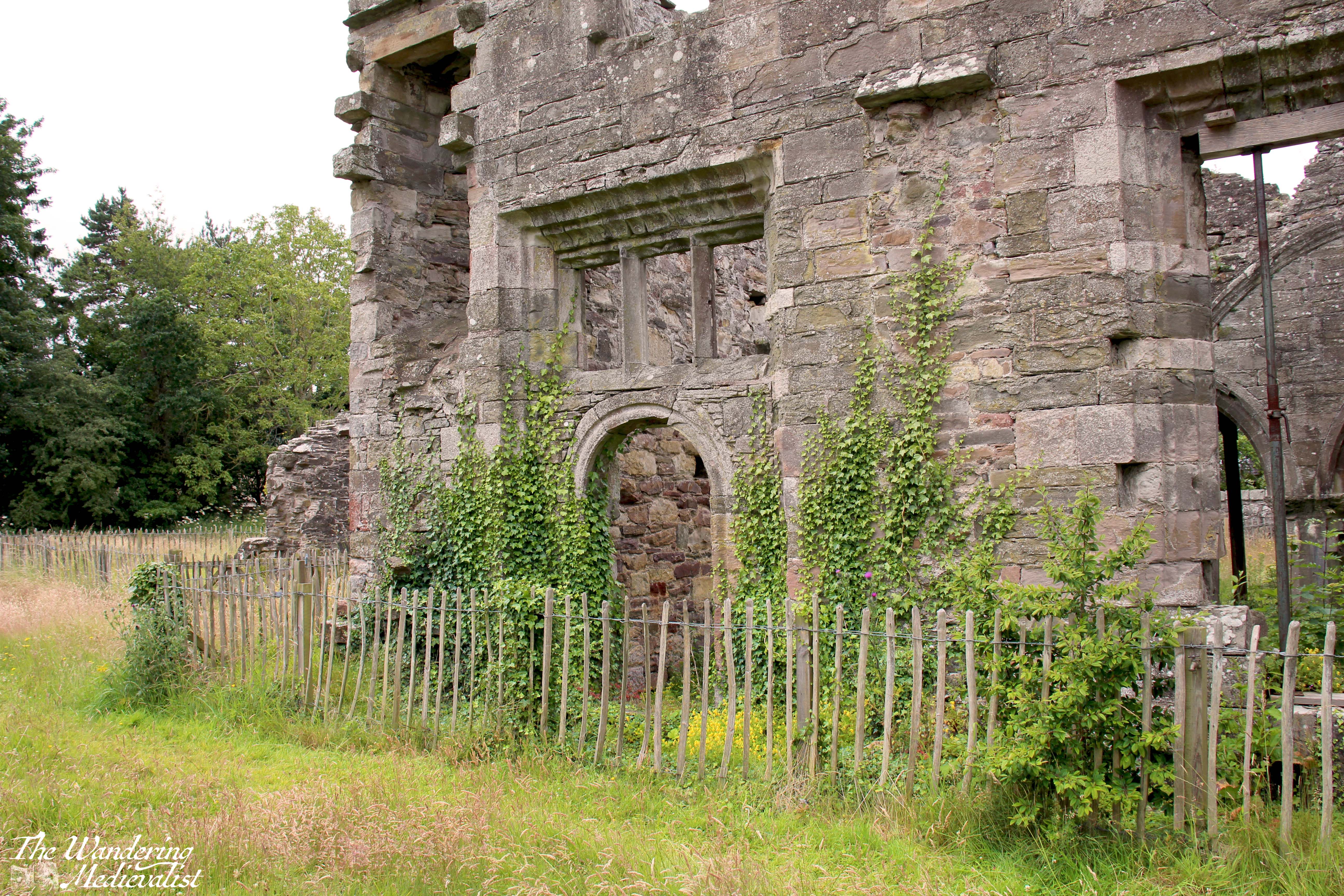
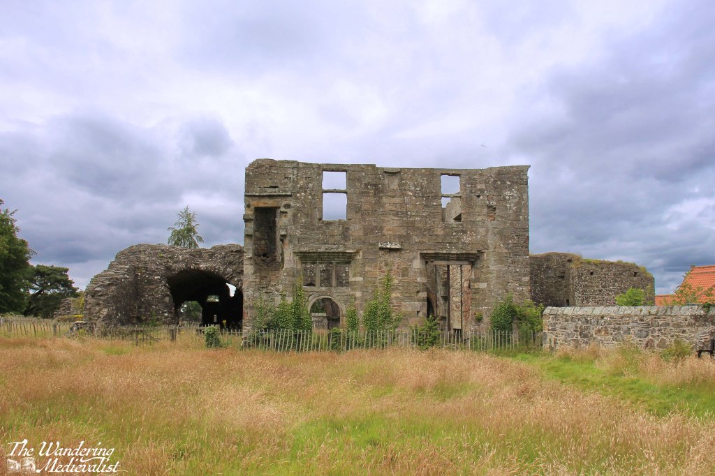
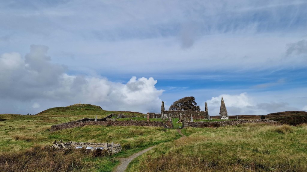
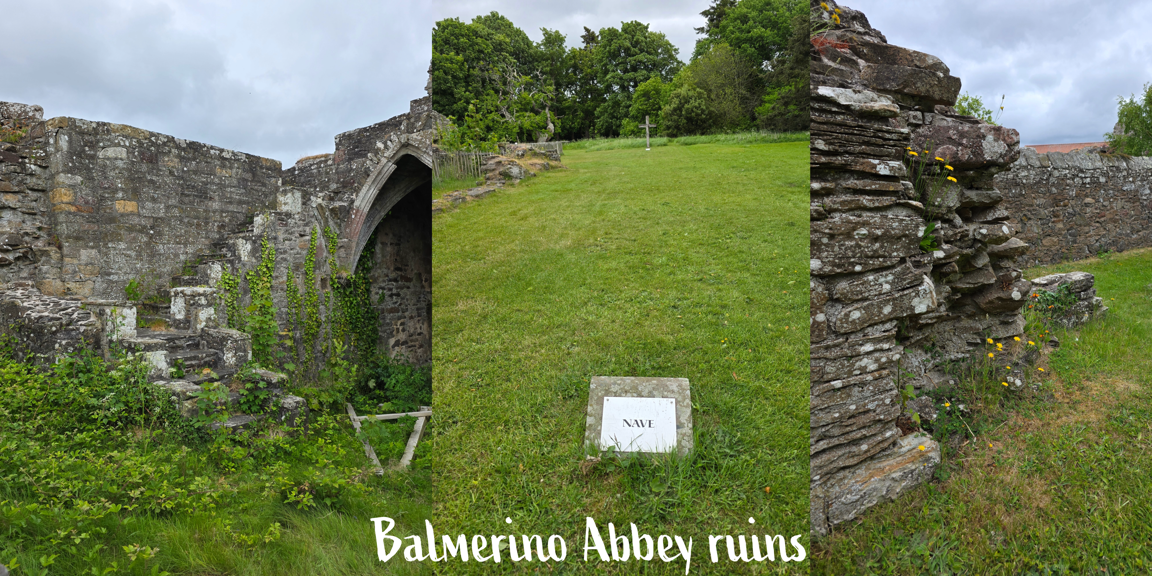
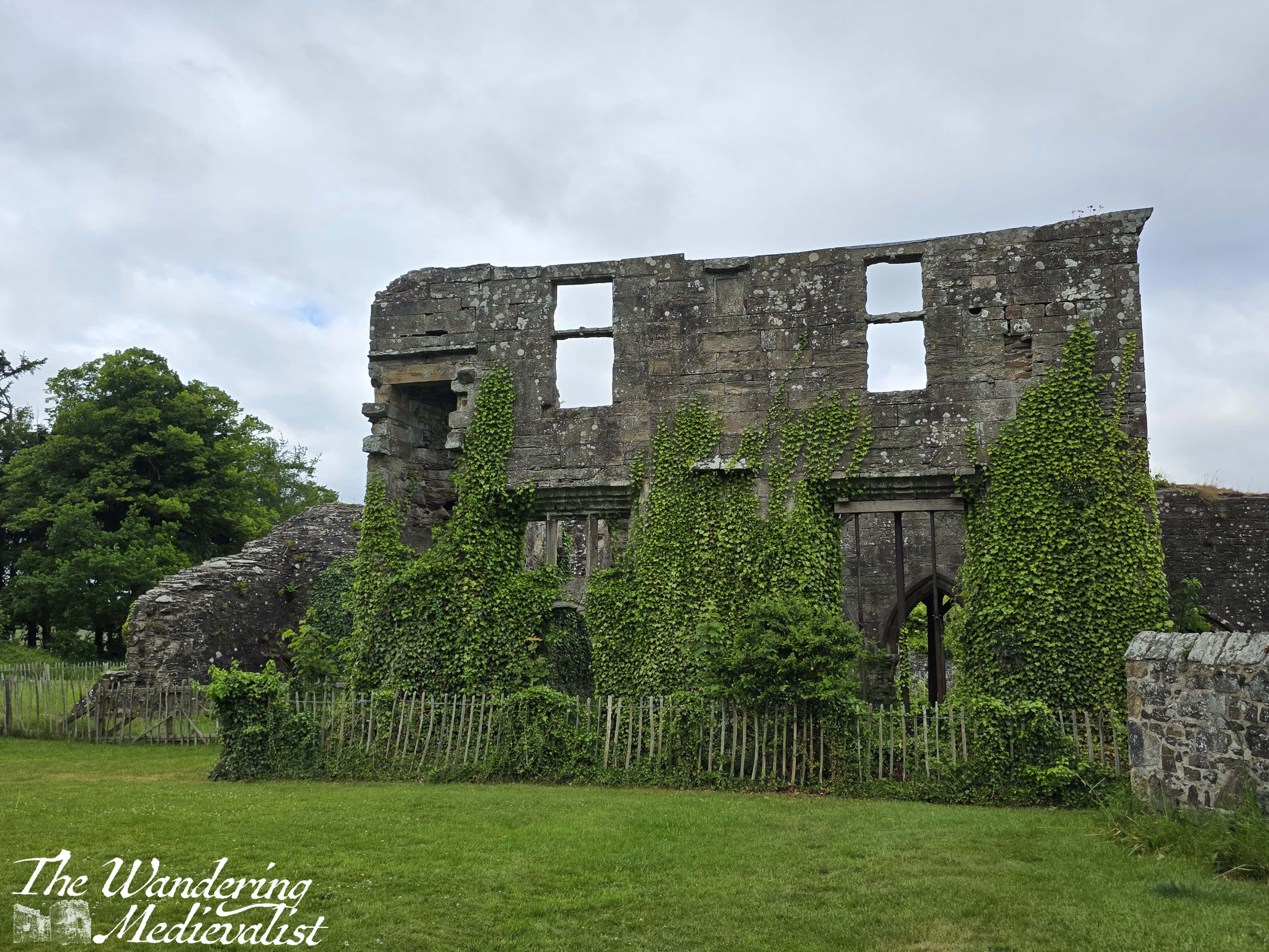
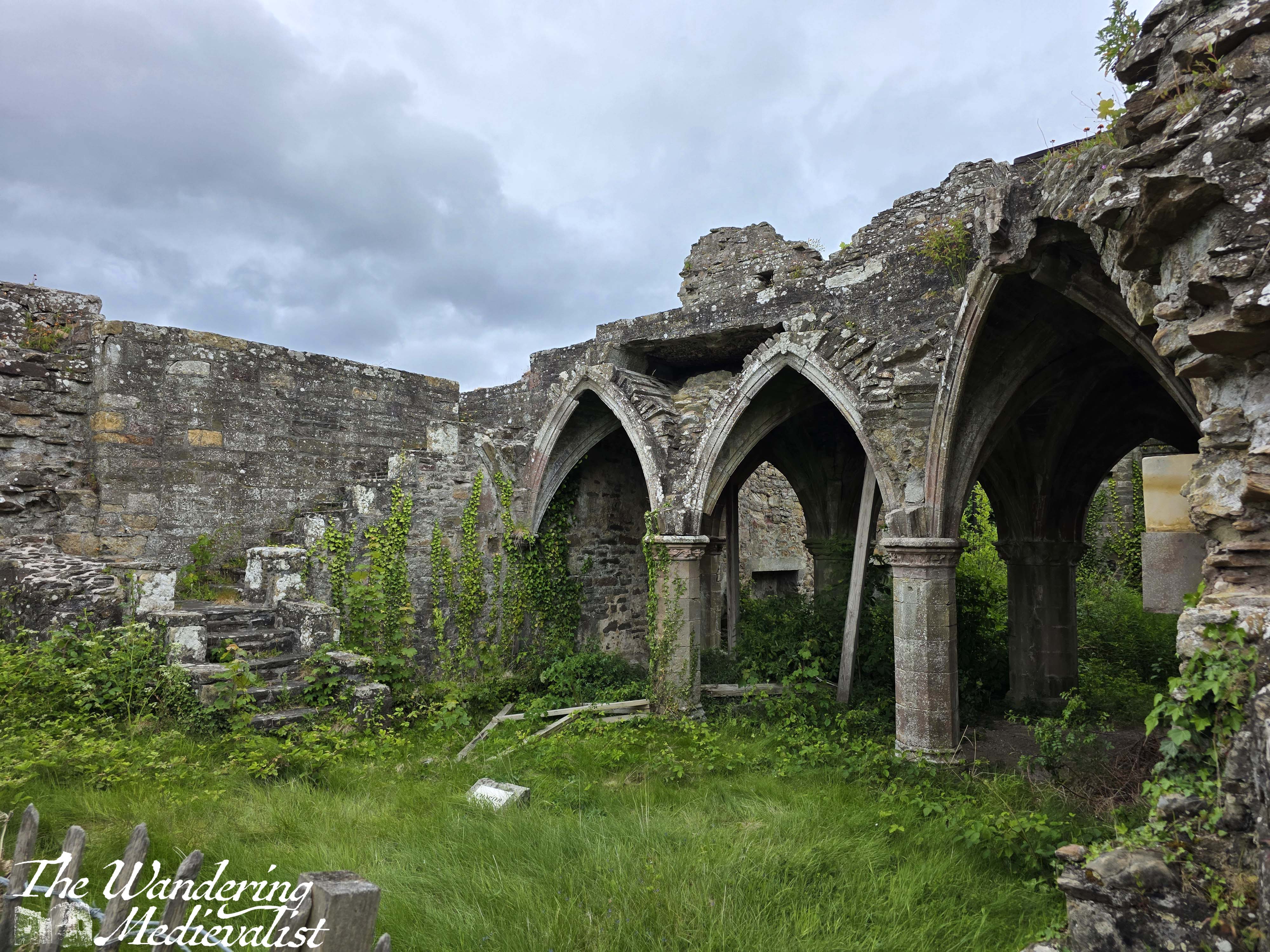
It is a relatively short climb up to the ruined Medieval abbey, which is where I had agreed to meet the other half. Fortunately, I had just enough time to wander through the ruins before sitting down to peel off my boots. I had first visited the abbey several years ago, on one of my first ever solo adventures, and it was very little changed: haunting, I think, is the best term.
Weather notwithstanding, I enjoyed this stretch of the coastal path though it is perhaps less stunning than further south. It is certainly a good mix of town and countryside, and I hope to do parts of it in sunshine on another date. Recommendations are definitely sturdy boots – probably not even sneakers – and some bug spray, plus layers! Though none of that is really new advice.
Unfortunately travel means I will not be able to complete any more walks until the end of June, but I’ll do my best to keep my fitness up!
Slowly making progress: