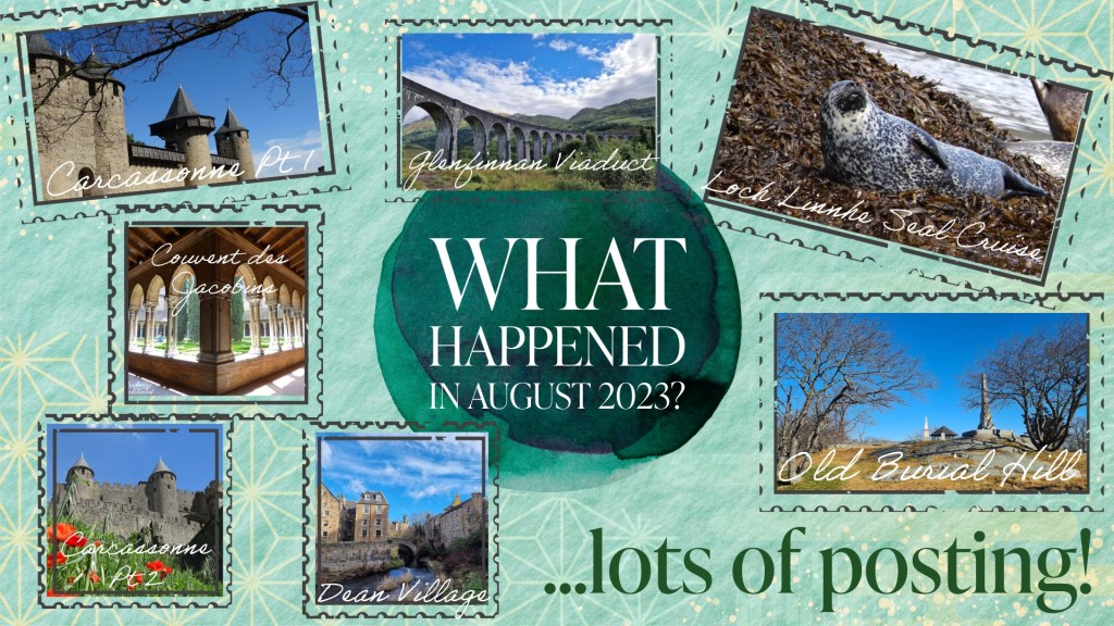
It has been a shockingly long time since I have managed to sit down and focus on a blog post. What can I say? Life got in the way – I’ve been back and forth to the US twice in two months, run a conference at work, and been inundated with life admin that needed to be done. All of this and jet lag meant that since finding time in my hotel room to write about my visit to Crystal Cove, I have really struggled to find the motivation, time and energy to be creative. But, while work continues to be busy and my travel schedule is no less intense, I had to make some time to write. I have never gone this long without posting before, I don’t think, and it feels wrong.
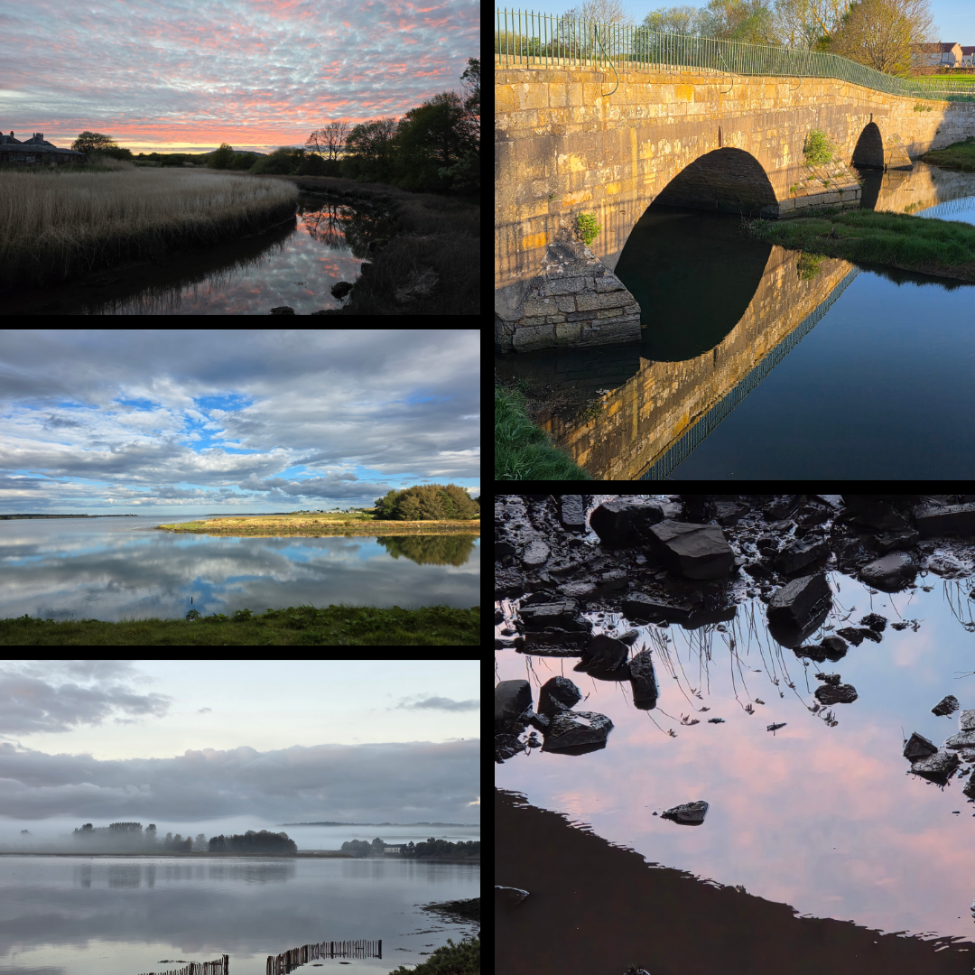
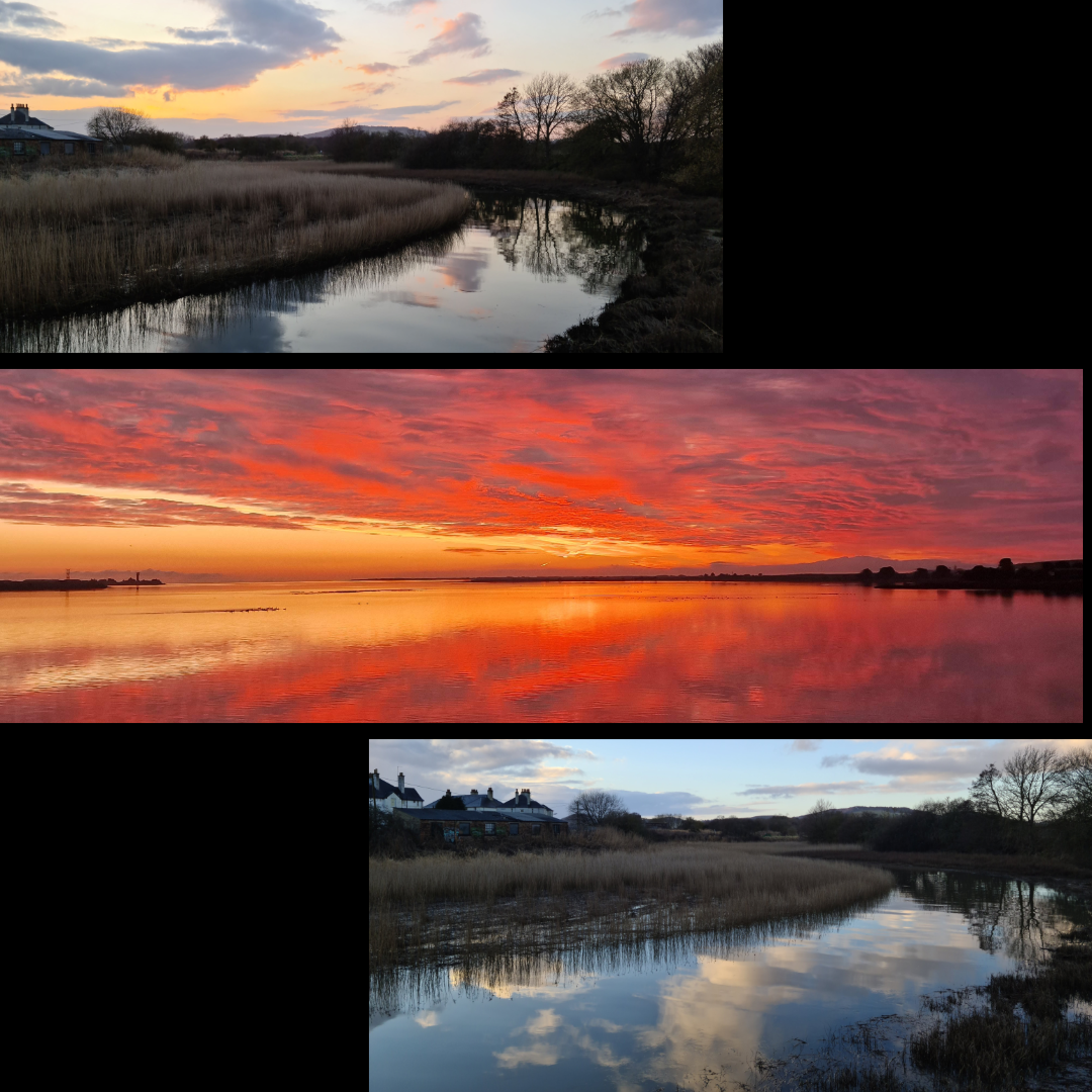
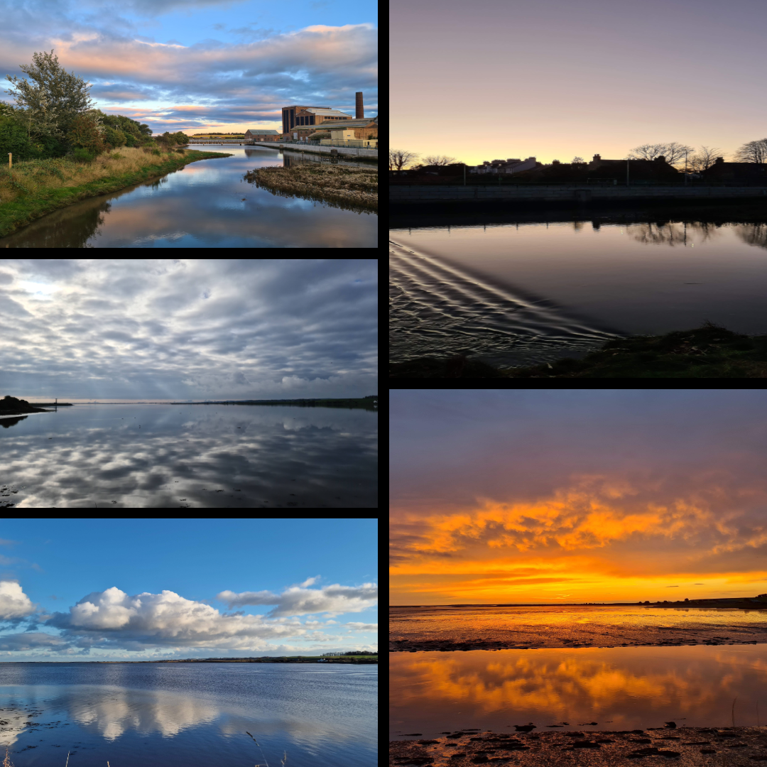
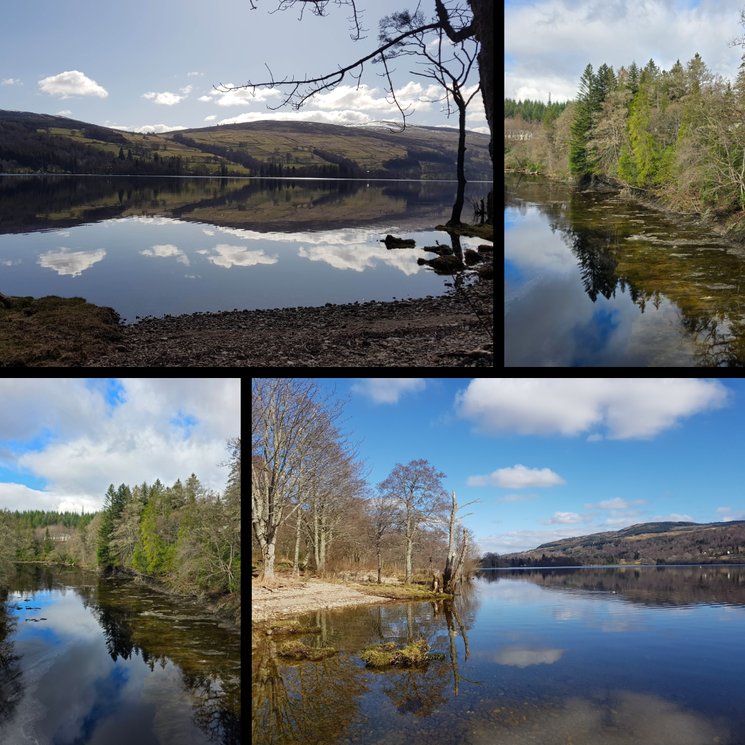
I started pulling the basis of this post together some time ago, when I was submitting pictures for a contest and realised just now many shots I have of reflections. So many hint at this theme, some more effectively than others, but it’s a motif I have always leaned towards. Perhaps because a reflection is so often the embodiment of a moment of calm – an early morning, evening, quiet time when the world is still for just a short second. And because water has a magical way of capturing what is happening in the world and giving it back to you in an image sometimes identical, but often slightly altered.
Here are some shots that I love, and wished to share.
Themes
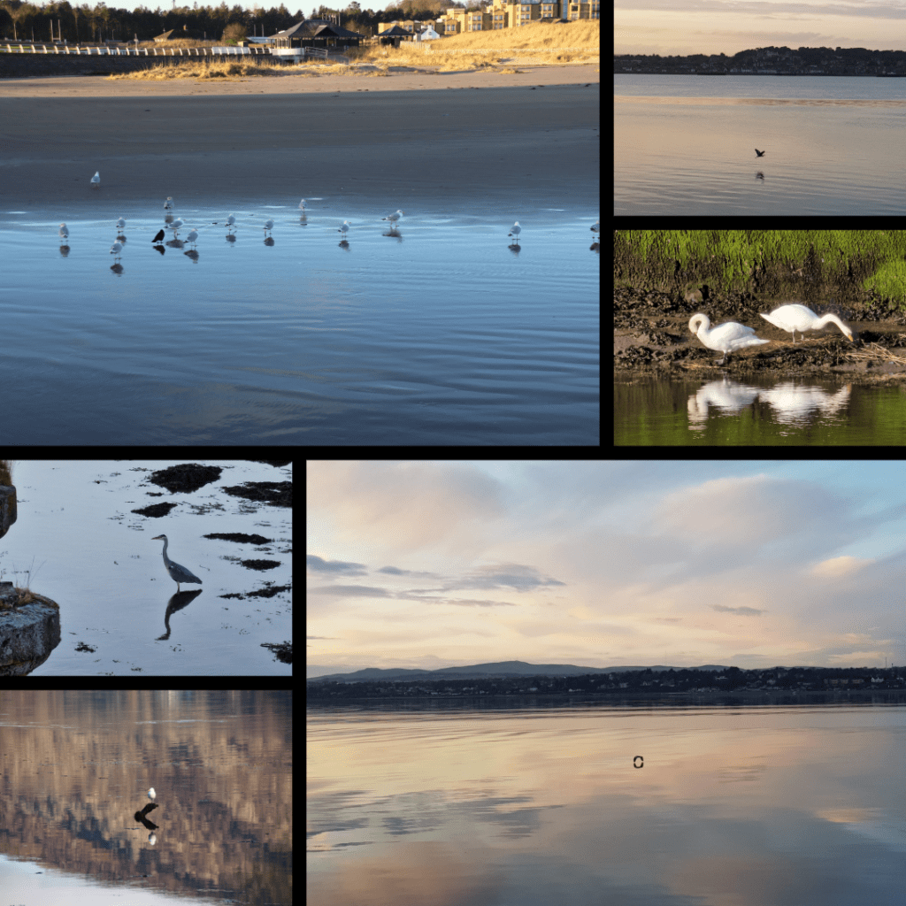
This series focusses specifically on bird reflections, taken across a variety of locations including West Sands in St Andrews, the Tay River, Loch Leven near Ballachulish, and the Eden Estuary.
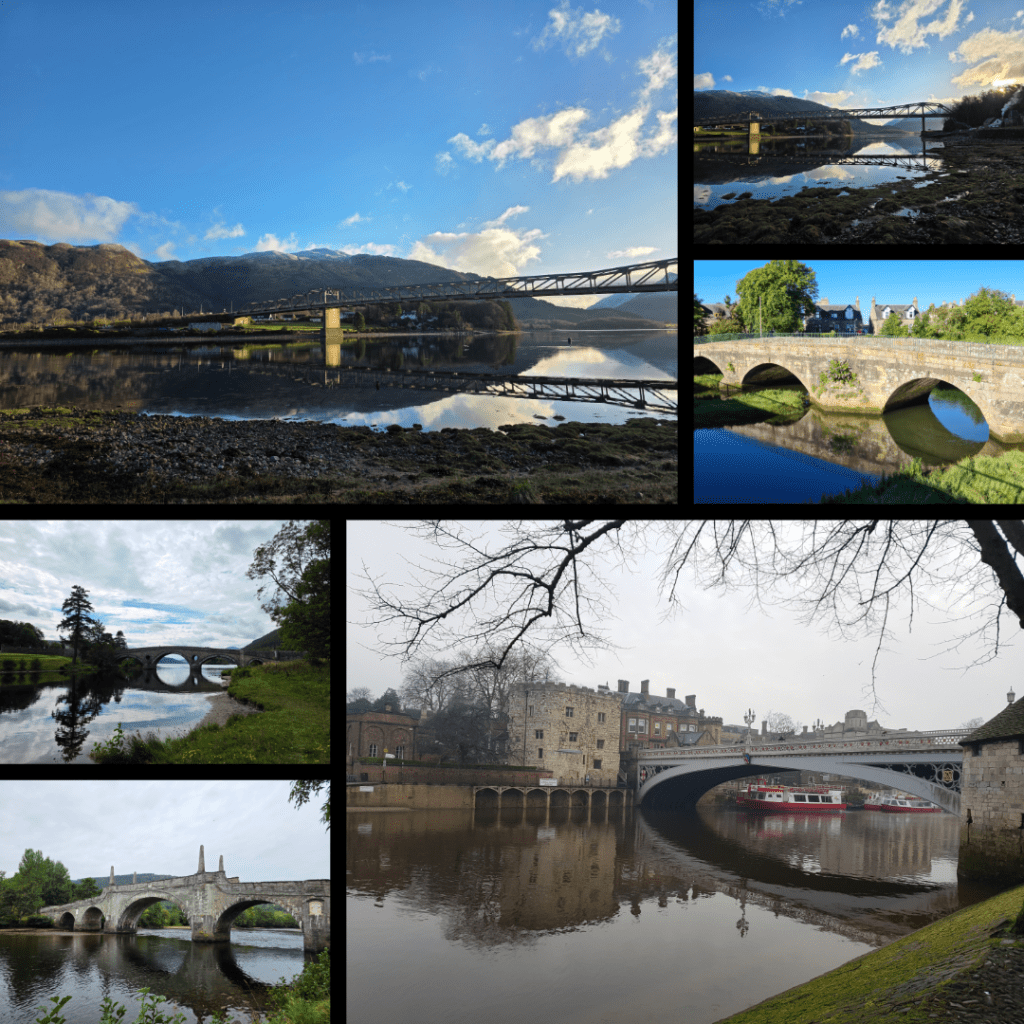
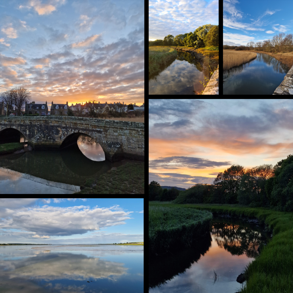
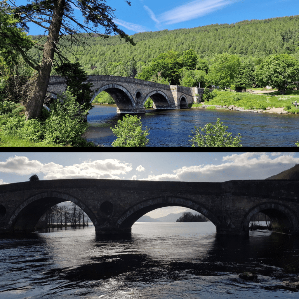
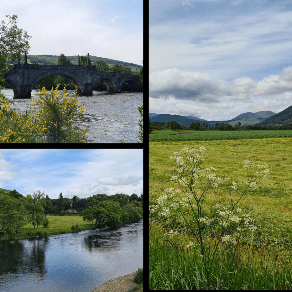
Another series, this time on bridges. I have always loved photographing bridges, not in the least due to their symmetry. These bridges include the Ballachulish Bridge, Kenmore Bridge, Guardbridge, Wade’s Bridge in Aberfeldy, and the Historic River Bridge in York.
Tayport
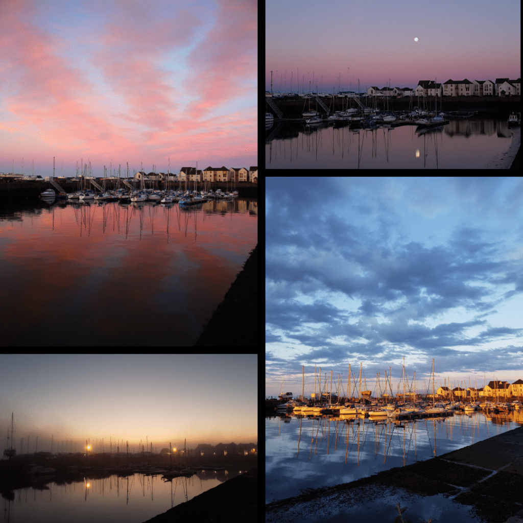
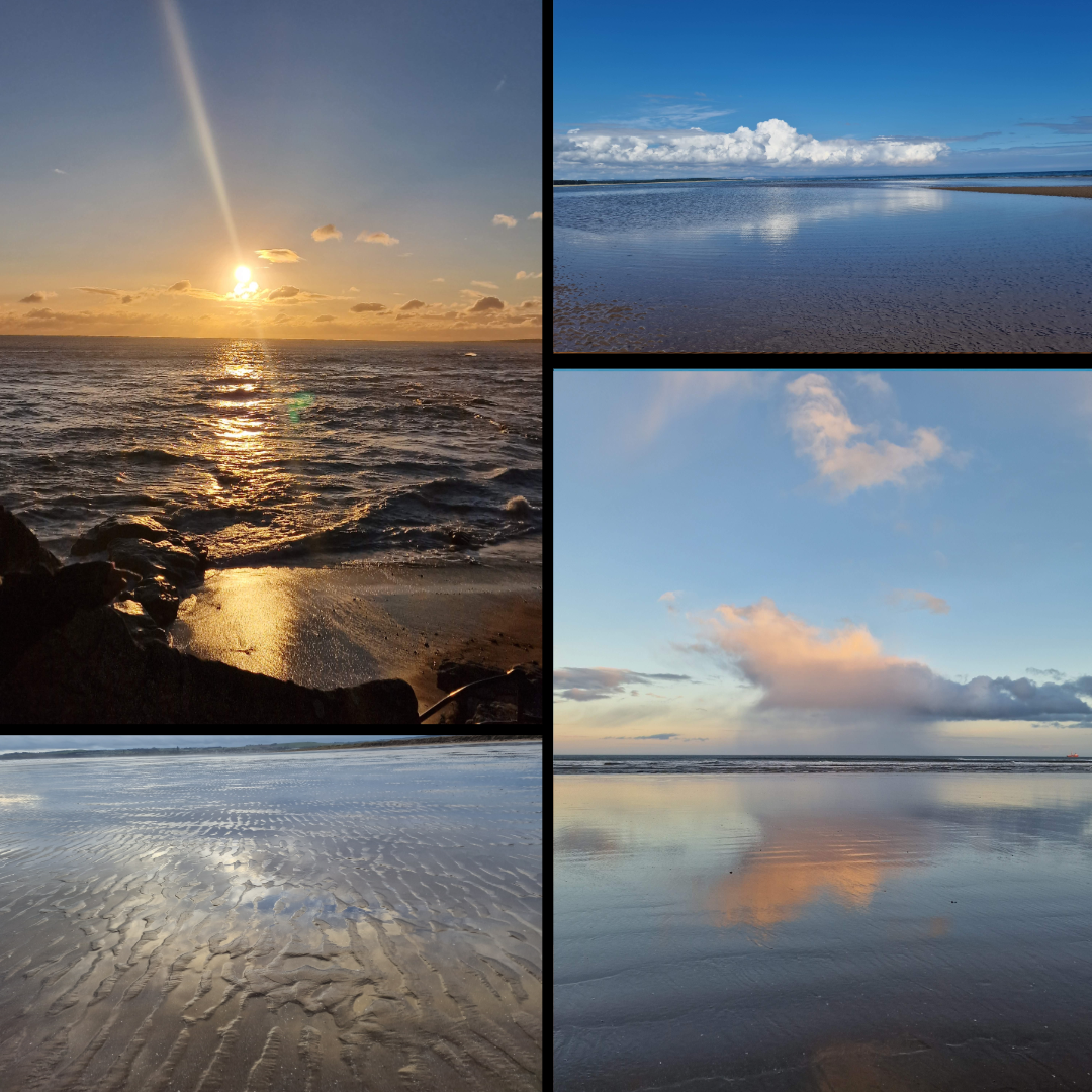
For the relatively short time we lived in Tayport, I was able to really take advantage of the seaside location to capture reflections at all times of day. The harbour was my favourite spot, as you can see – sunrise, sunset and even with a full moon.
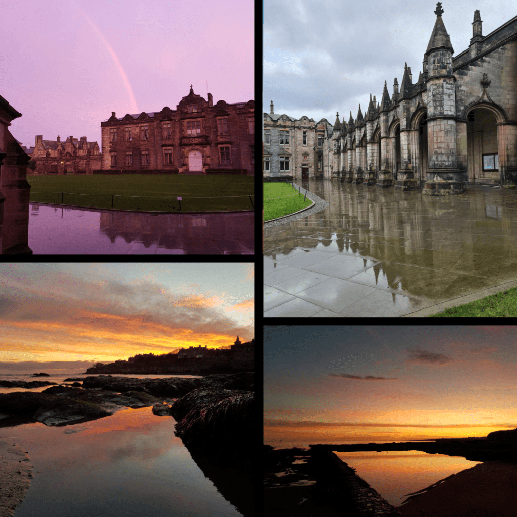
St Andrews
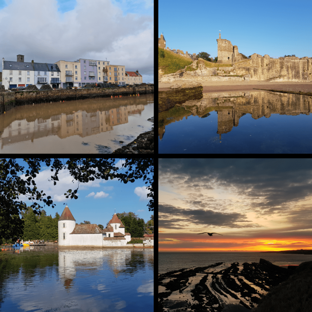
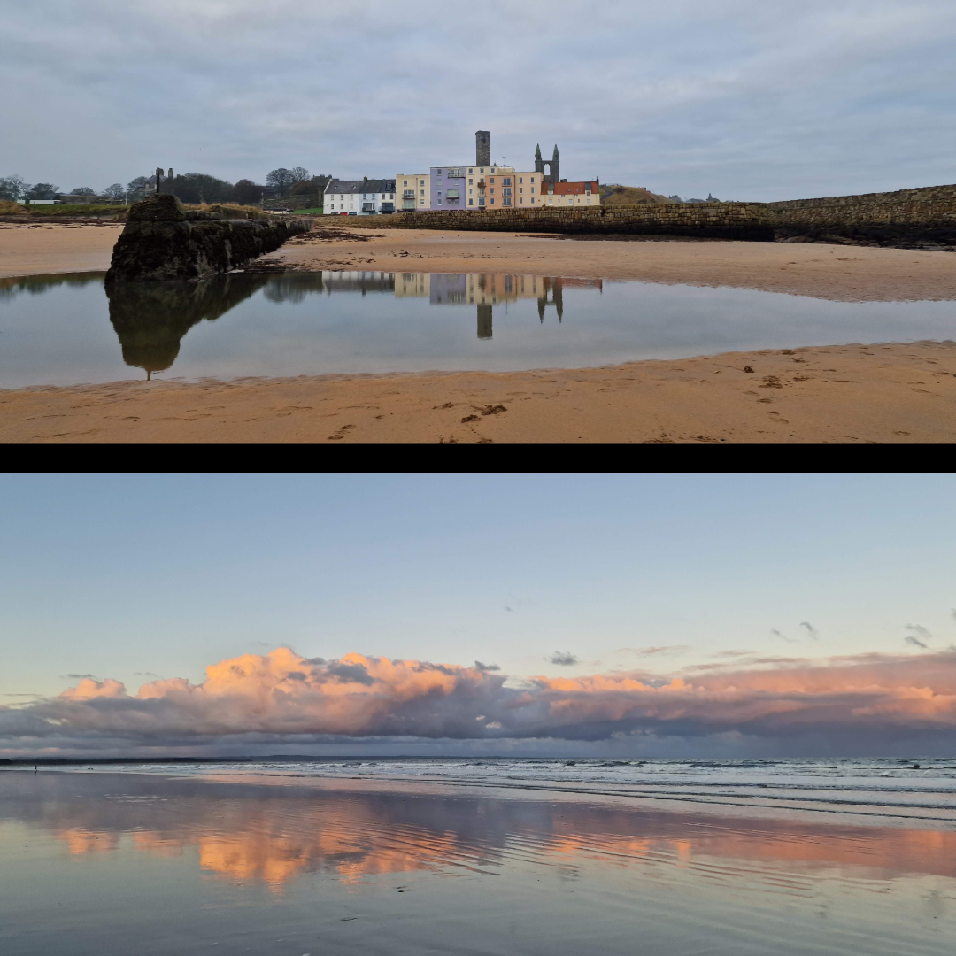
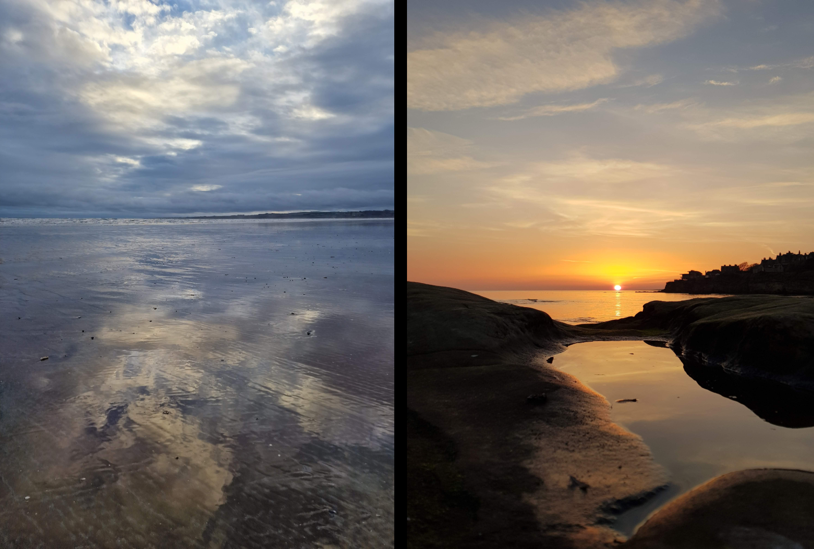
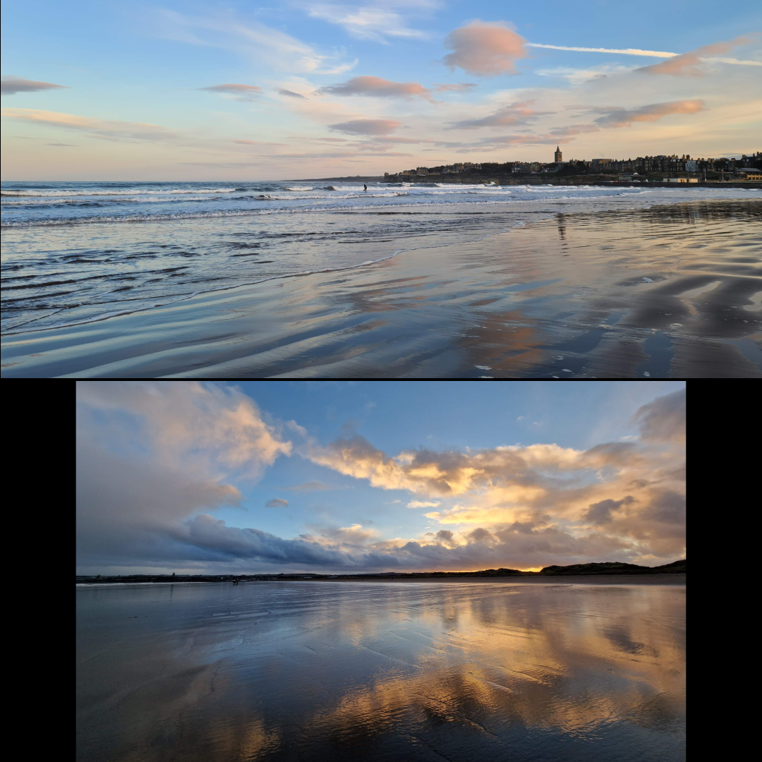
The many years I have spent in St Andrews have allowed for plenty of reflections, be it harbour, castle, sunrise, or Craigtoun Park.
St Salvator’s Quad, in the centre of town, was renovated some years ago to include these beautiful slabs of stone that reflect perfectly in the rain (and can be treacherously slippery when wet). Many early morning walks around town enabled these views.
I have said it before, that St Andrews is one of the most photogenic places I know, and the groupings below show just how stunningly beautiful it can be – and how well the clouds and distinctive skyline reflect on the surrounding beaches. West Sands in particular stretching out for miles and – at low tide – what feels like miles wide provides some of the most amazing reflections I have ever captured.
Guardbridge
Morning walks along the Eden Estuary have provided spectacular views, in particular this one taken from the University’s Eden Campus.
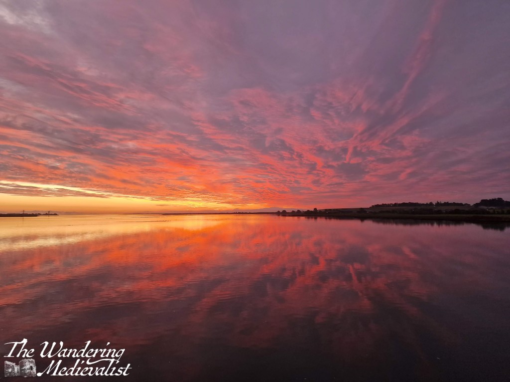
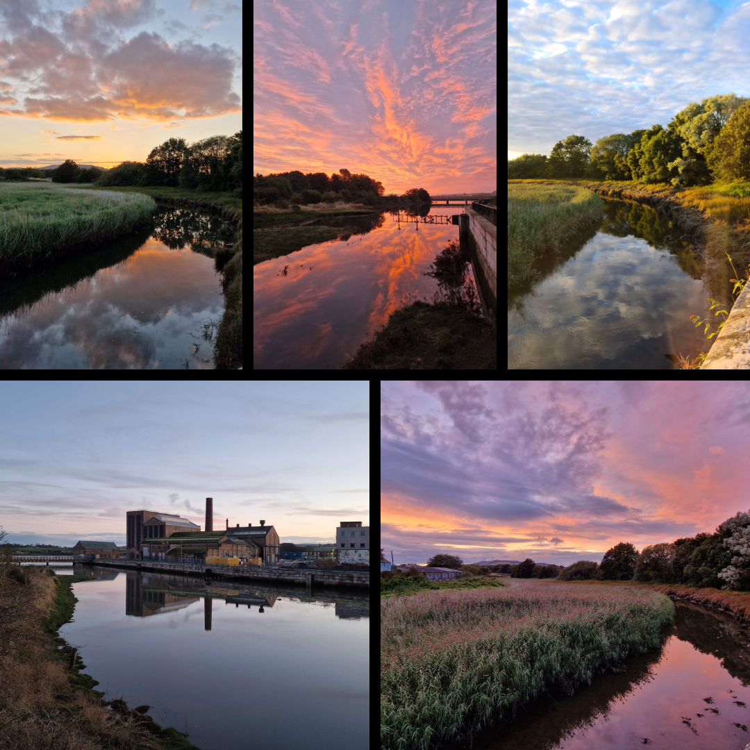
The view from the old bridge in Guardbridge is one of my favourites, allowing the sunset or blue sky to reflect off the water at high tide. I have literally 100s of this view – there are more below.
In fact, there were so many of Guardbridge that I could not narrow them down any further than this massive grouping. Living here through the pandemic years meant a daily walk was essential, and capturing the glory of the Eden was inevitable, at all times of day. Even the old mill, which is not particularly attractive but adds something to the scenery.
Scottish Highlands
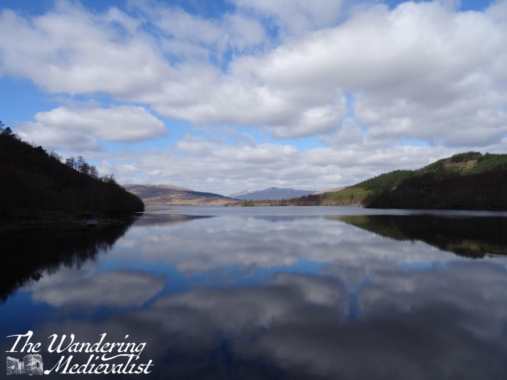
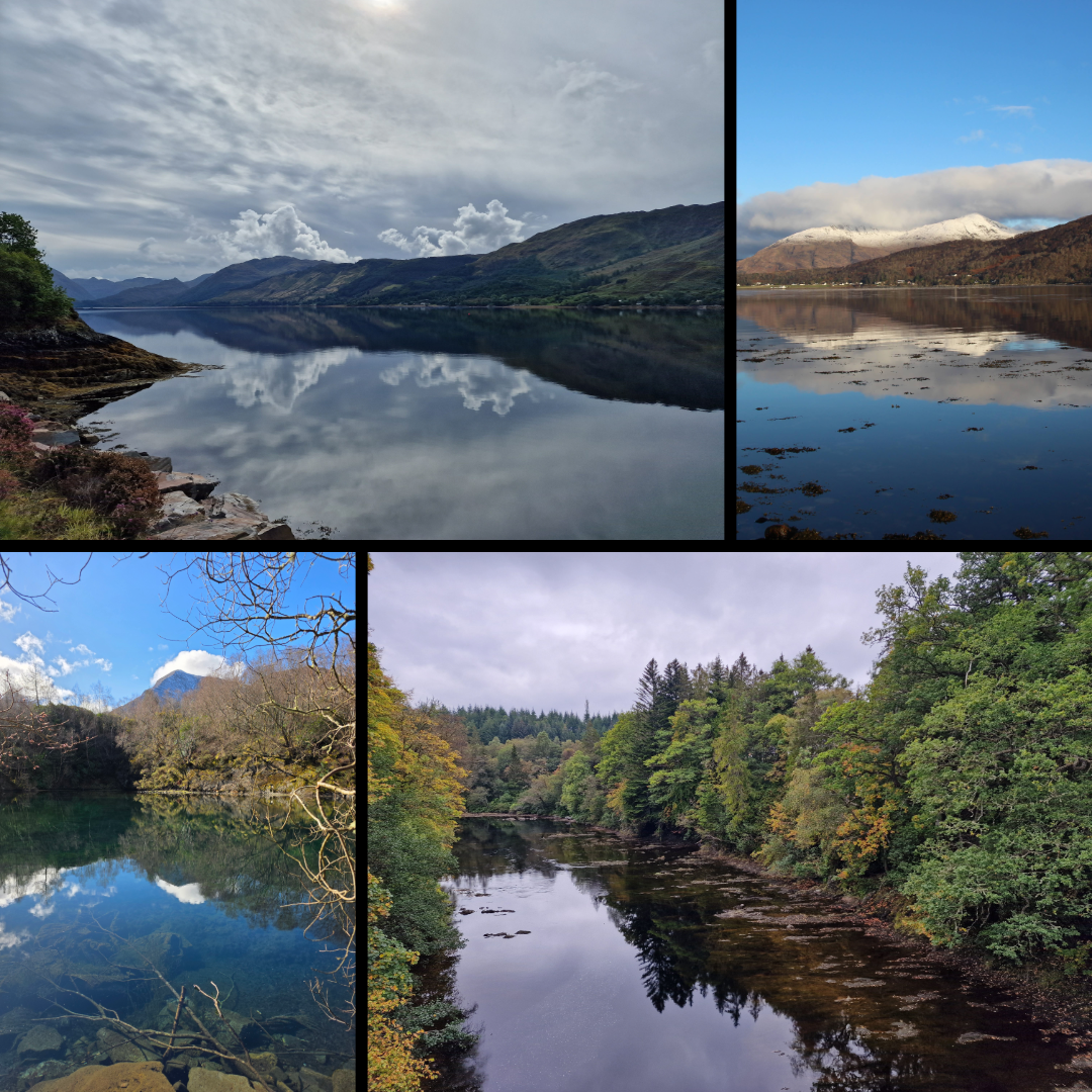
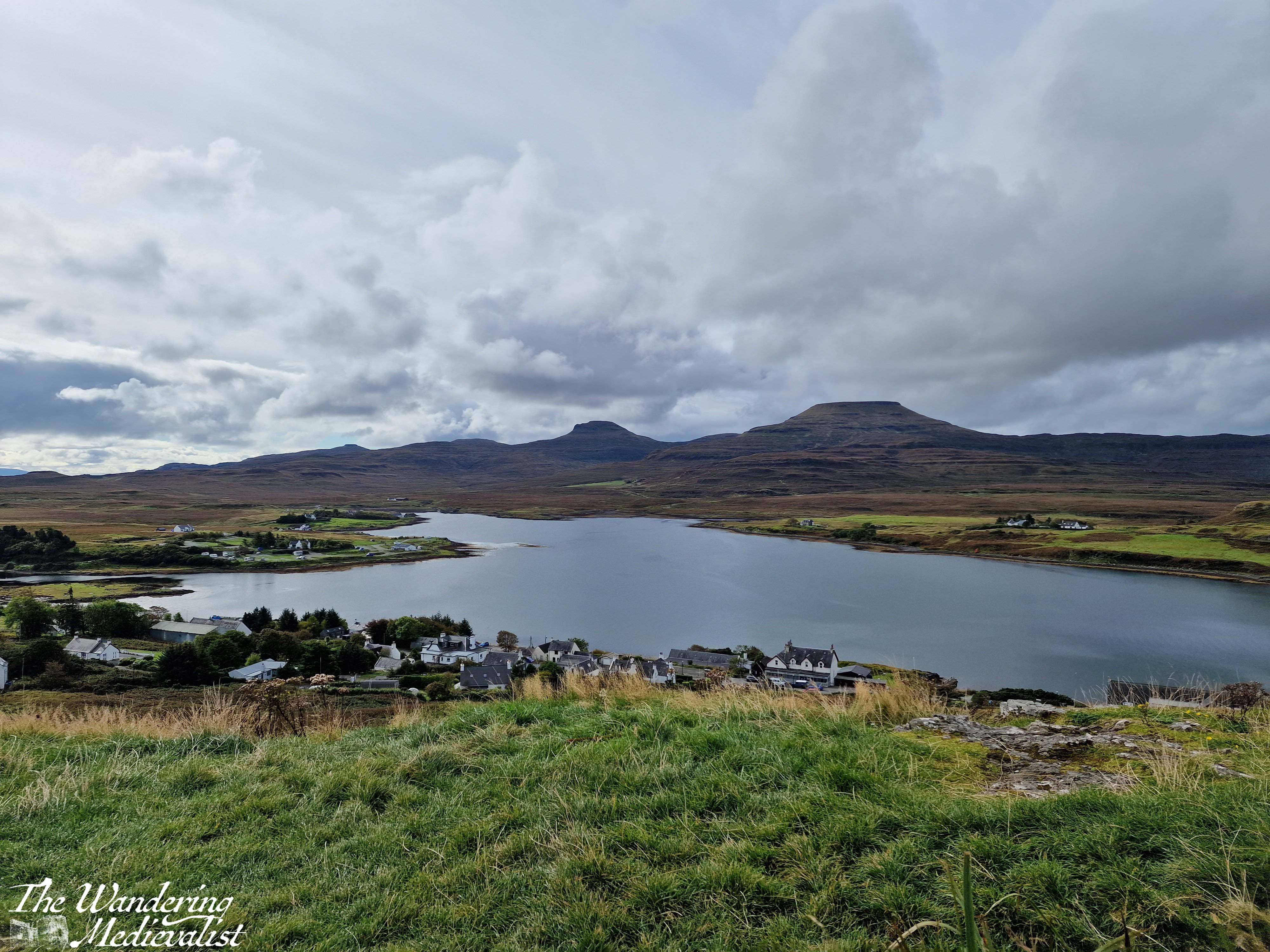
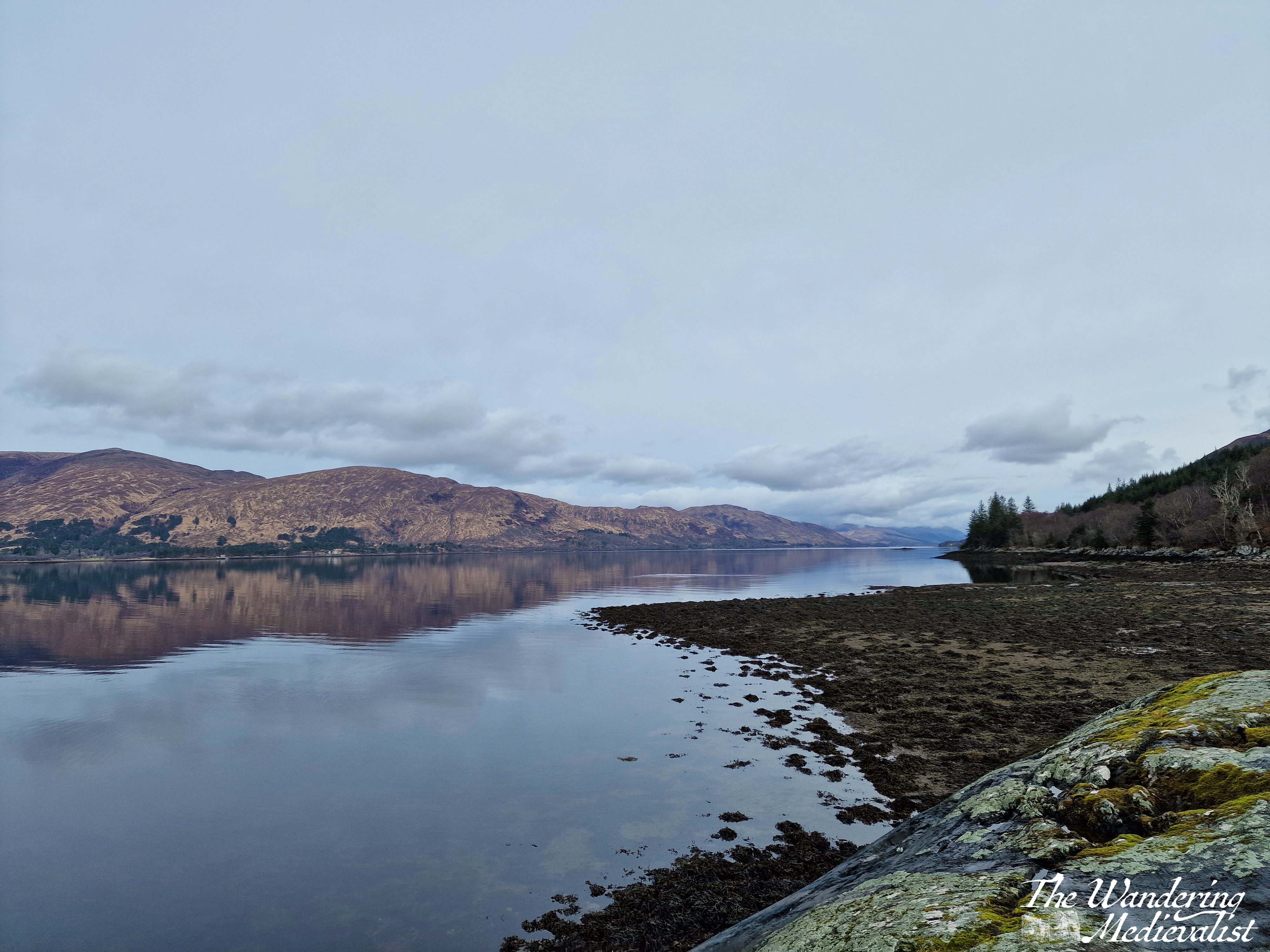
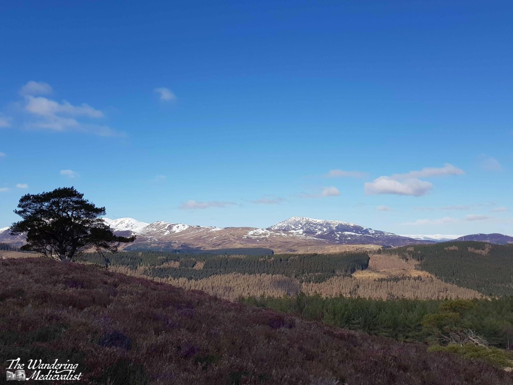
As anyone who has read my blog thus far is aware, the Highlands (or anything north of Perth really) is an almost sacred area for me. The stunning serene beauty that can be found in the lochs and mountains is almost unmatched in my experience.
The lochs in particular provide ideal opportunities for capturing reflections, at those rare times when the wind dies down and everything is calm and still.
To start with, Loch Katrine, and the almost mirror image of fluffy clouds and blue sky.
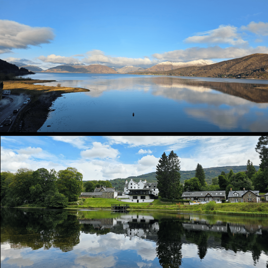
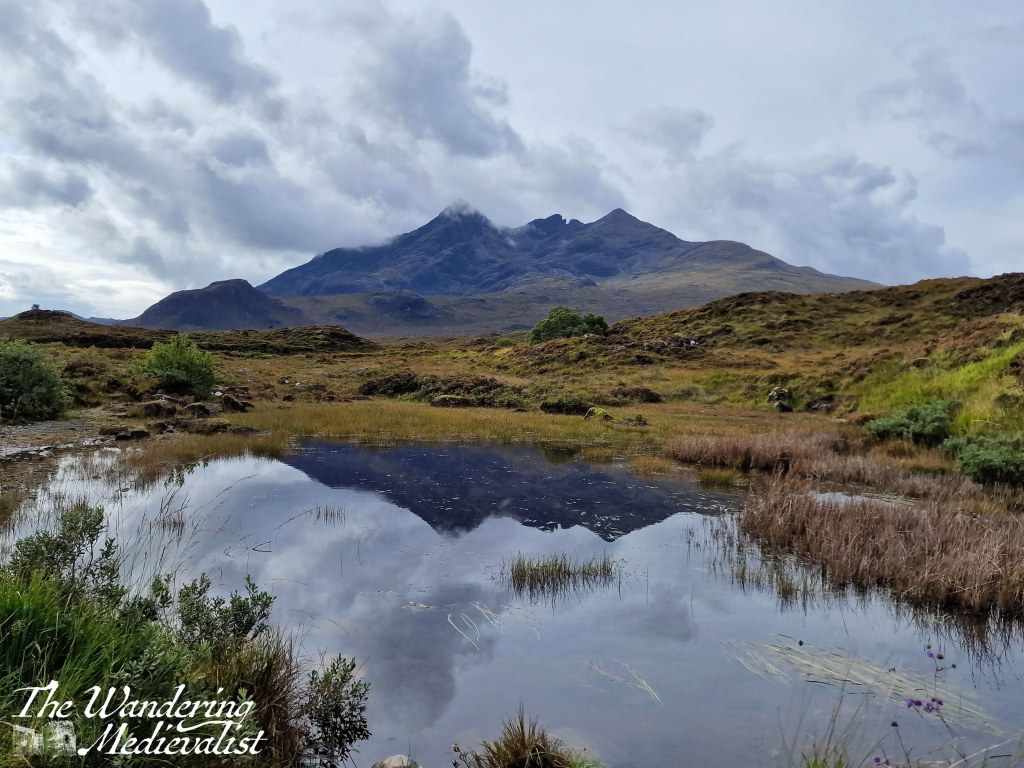
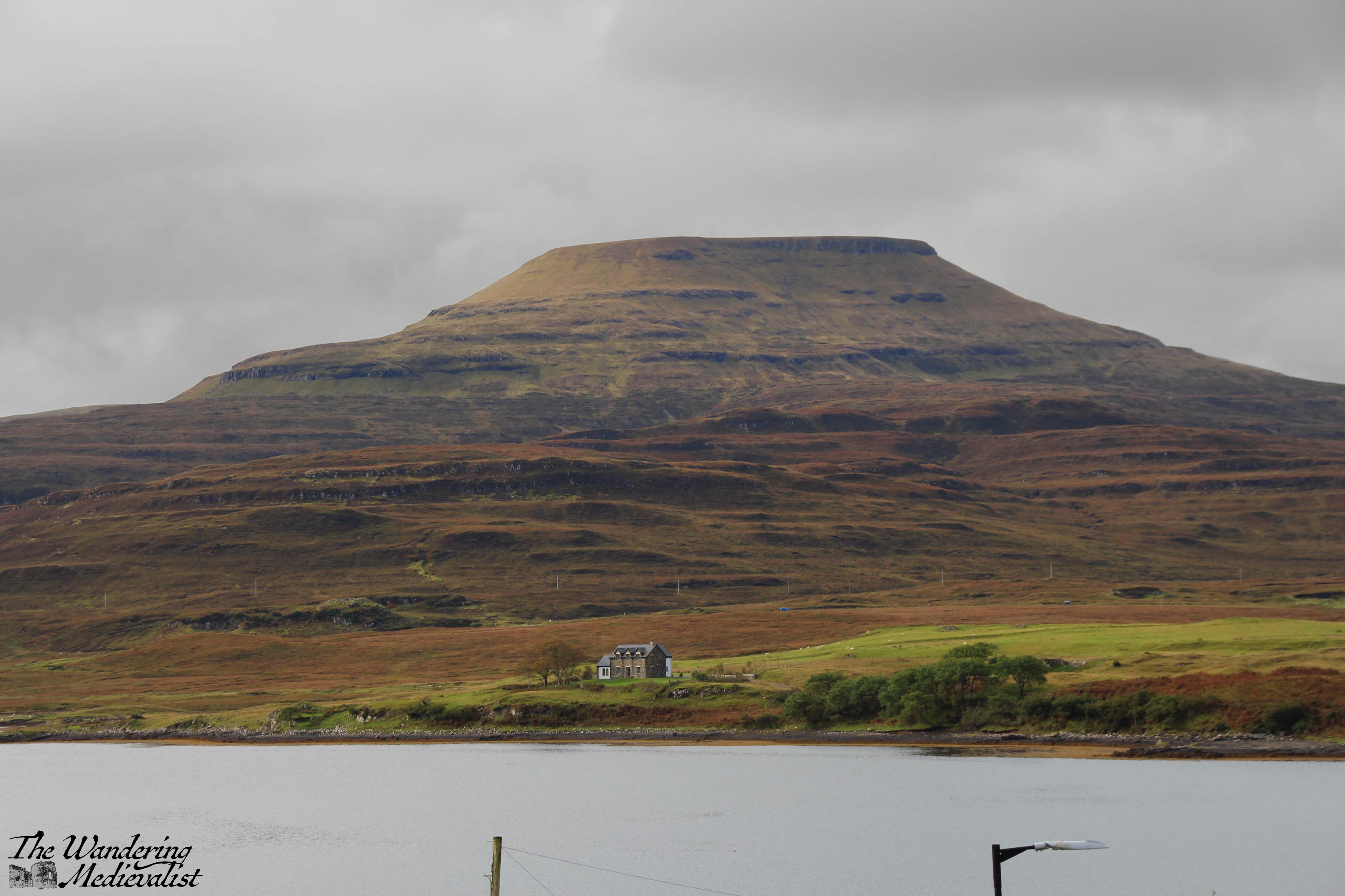
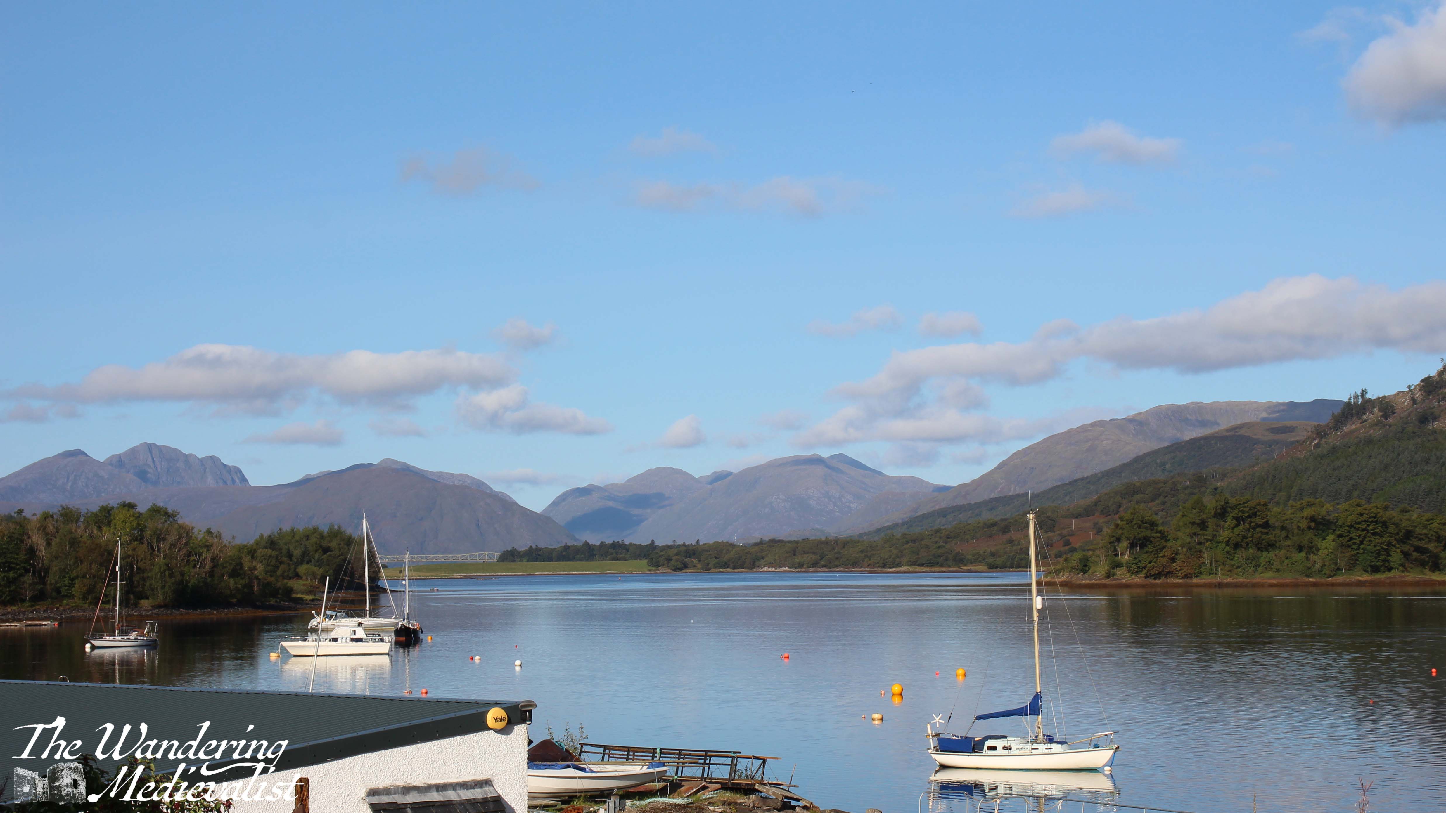
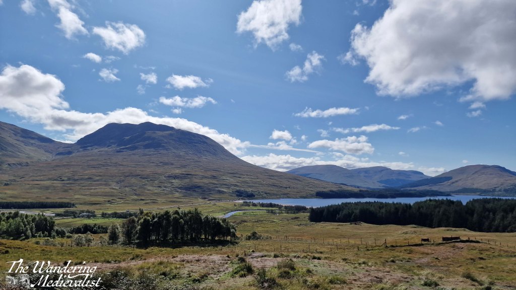
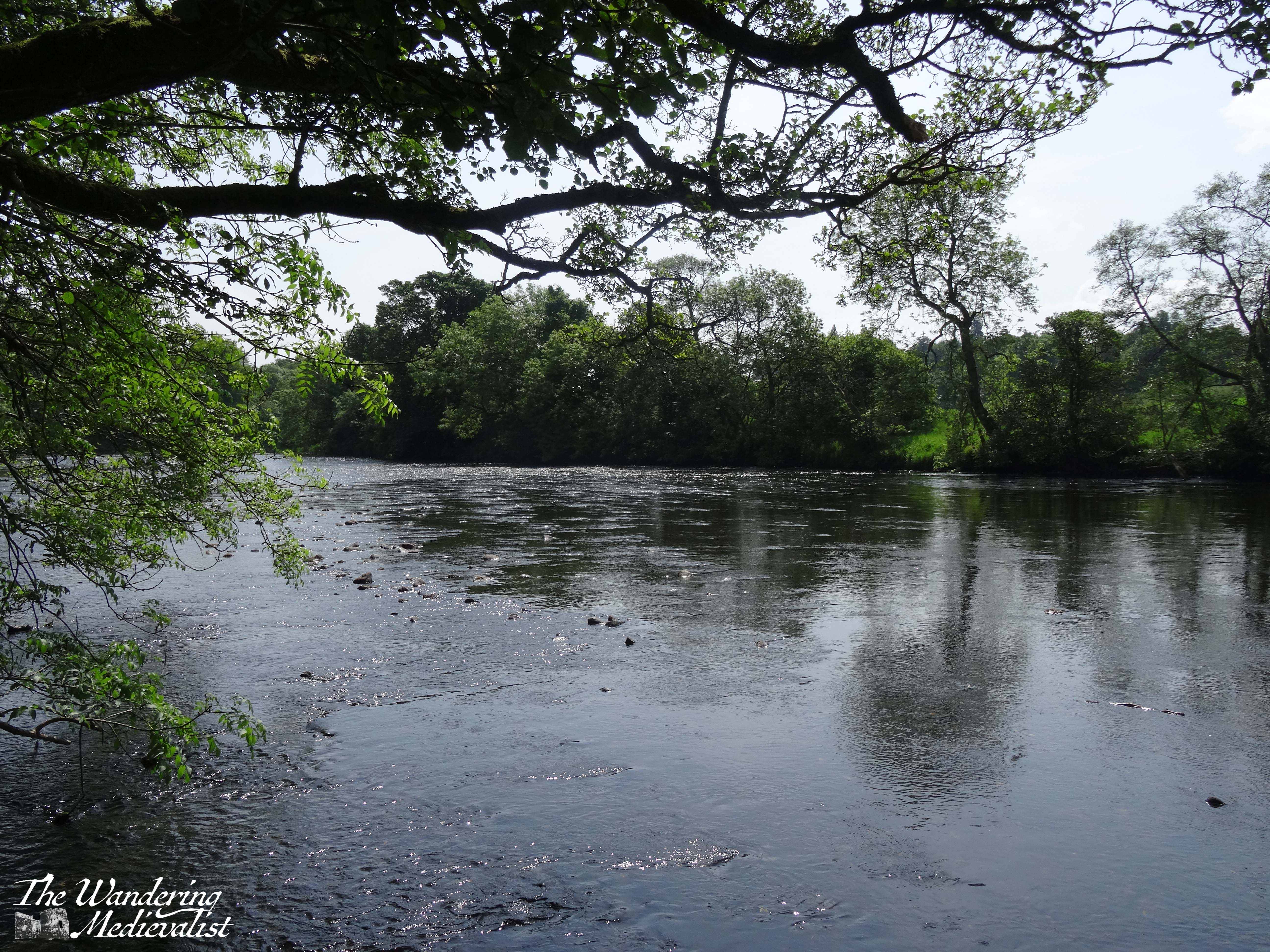
These two collections are some of my favourite loch pictures, and include: the view off Spean Bridge (not a loch, but gloriously still), Loch Tay at several points, Loch Linnhe from the Ballachulish bridge, Loch Duich not far from Eilean Donan castle, and the loch at Ballachulish quarry, reflecting the snow-capped Sgorr Dhearg.
These views were captured from Ballachulish bridge, and from across the River Tay looking back at the Kenmore Hotel. Only moments later, the river in the below shot was caught by the wind, and the reflection erased. For the top shot, the water was still for close to thirty minutes, early in the morning before the breeze picked up or the tide shifted.
Last but not least, a vague reflection of the Cuillin Hills just above Sligachan Old Bridge, Skye.
Marblehead
Finally, I have been lucky enough to spend a decent amount of time in my home town in the last year or so – more than I have for more than a decade – and I have captured what I consider to be some lovely views of my favourite places in town.
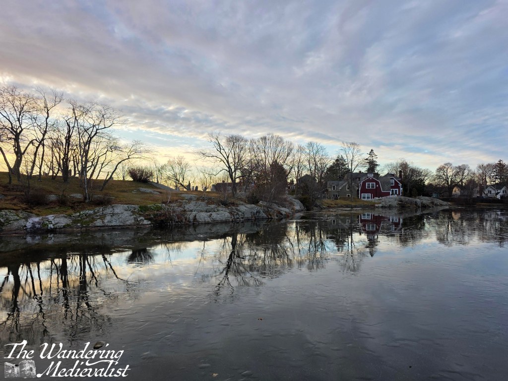
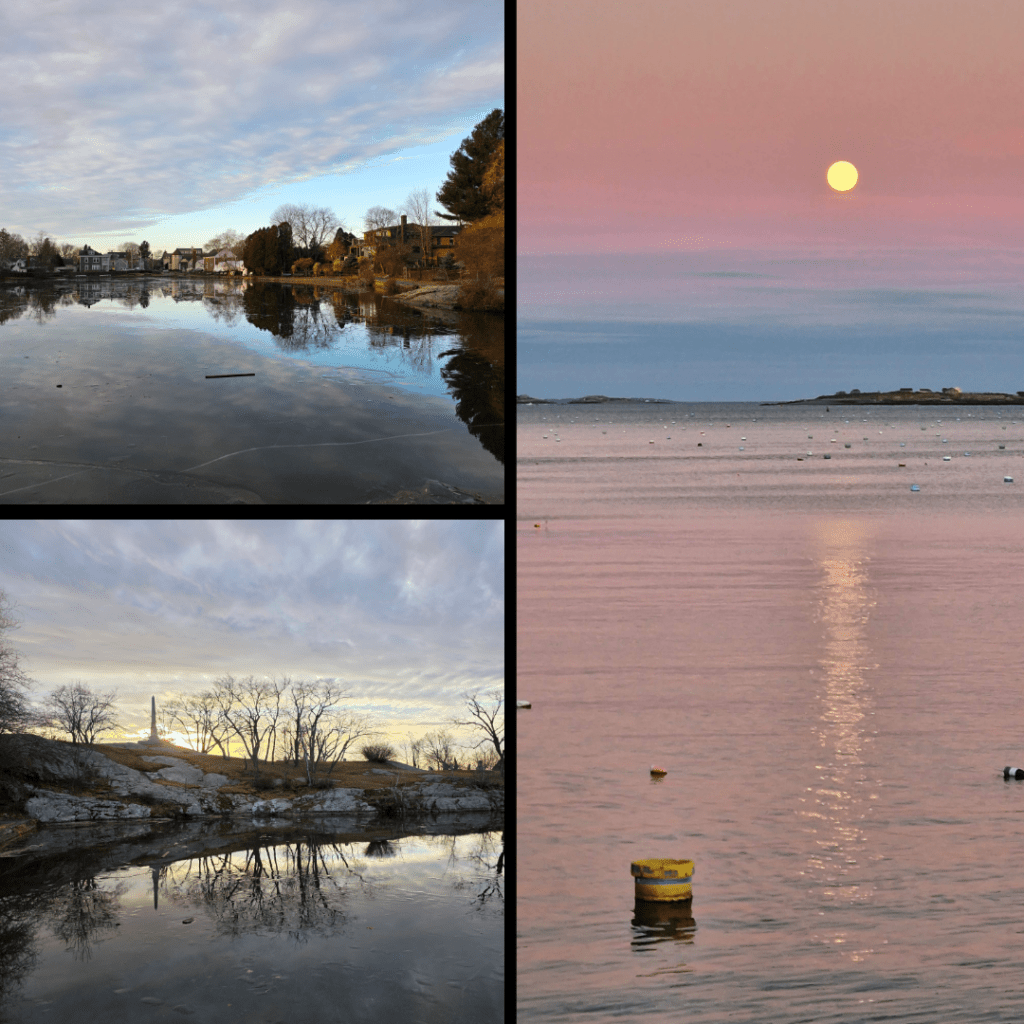
Starting of course with Redd’s Pond and Old Burial Hill, which I have written about at length. This was a cold morning with the ice just hanging beneath a layer of water on the pond.
Two more shots taken on the same day as the one above, I felt I had to include them anyway, as one captured the monument to sailors of the town. The moonrise was a perfect calm evening last November, and I waited by the harbour for close to an hour for the moon to rise above the clouds.
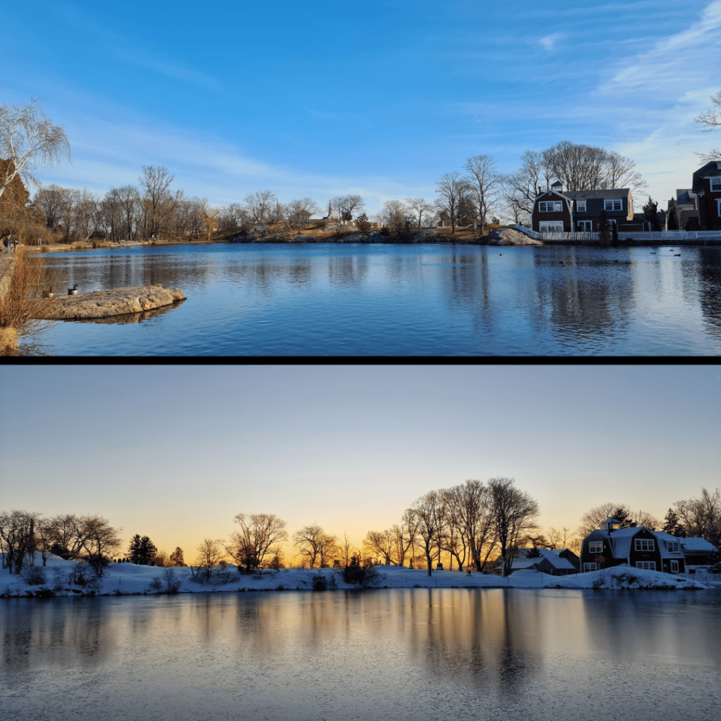
More Redd’s Pond, but how could I resist? One in late winter, the other in mid-winter at sunrise, on a magical morning that a wrote a whole post about. The reflections here are hazy rather than crisp, but equally lovely.
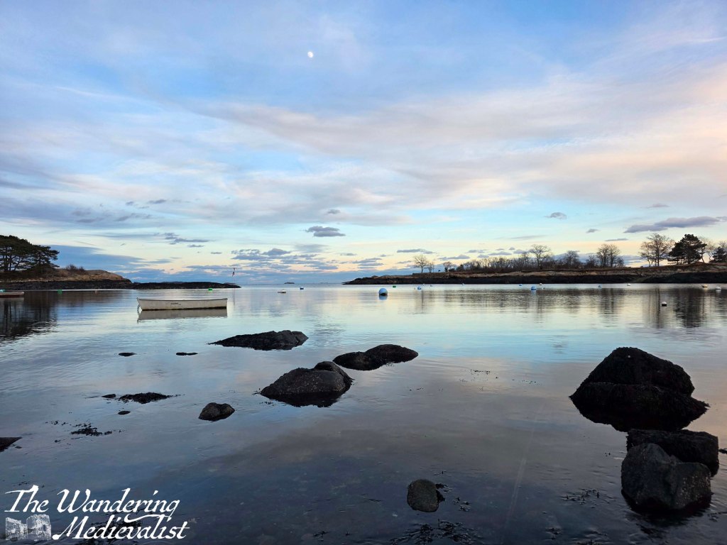
And last but not least, a picture taken on New Year’s Eve 2025, when I went down to the Marblehead Lobster Company (as it was) to pick up a special dinner for my mother. I and a few other photographers had noticed the not-quite-full moon and the still water that reflected the changing colours in the sky. It was incredibly quiet with only a gentle lap of waves on the shore, and no birds to disturb the surface.
Do you have a favourite one of the images I’ve shared? Let me know, I would love to hear your feedback! I hope you have enjoyed this short trip into a thematic project that has mirrored several others in recent past such as cloudy skies, or sunrise/sunset. I hope to get back to the Coastal Path soon, or at least visit a castle! I’ve also got a few good ideas for posts that I developed while walking around Marblehead this last week – keep an eye out!
Enjoying my pictures? Why not claim one for your own project or wall space through my online shop:
Is there one on this post that you’d like to own? Just comment below!
It’s been a while since I posted about something purely medieval, and so today seemed a good opportunity to do so, talking about one of my favourite English towns.
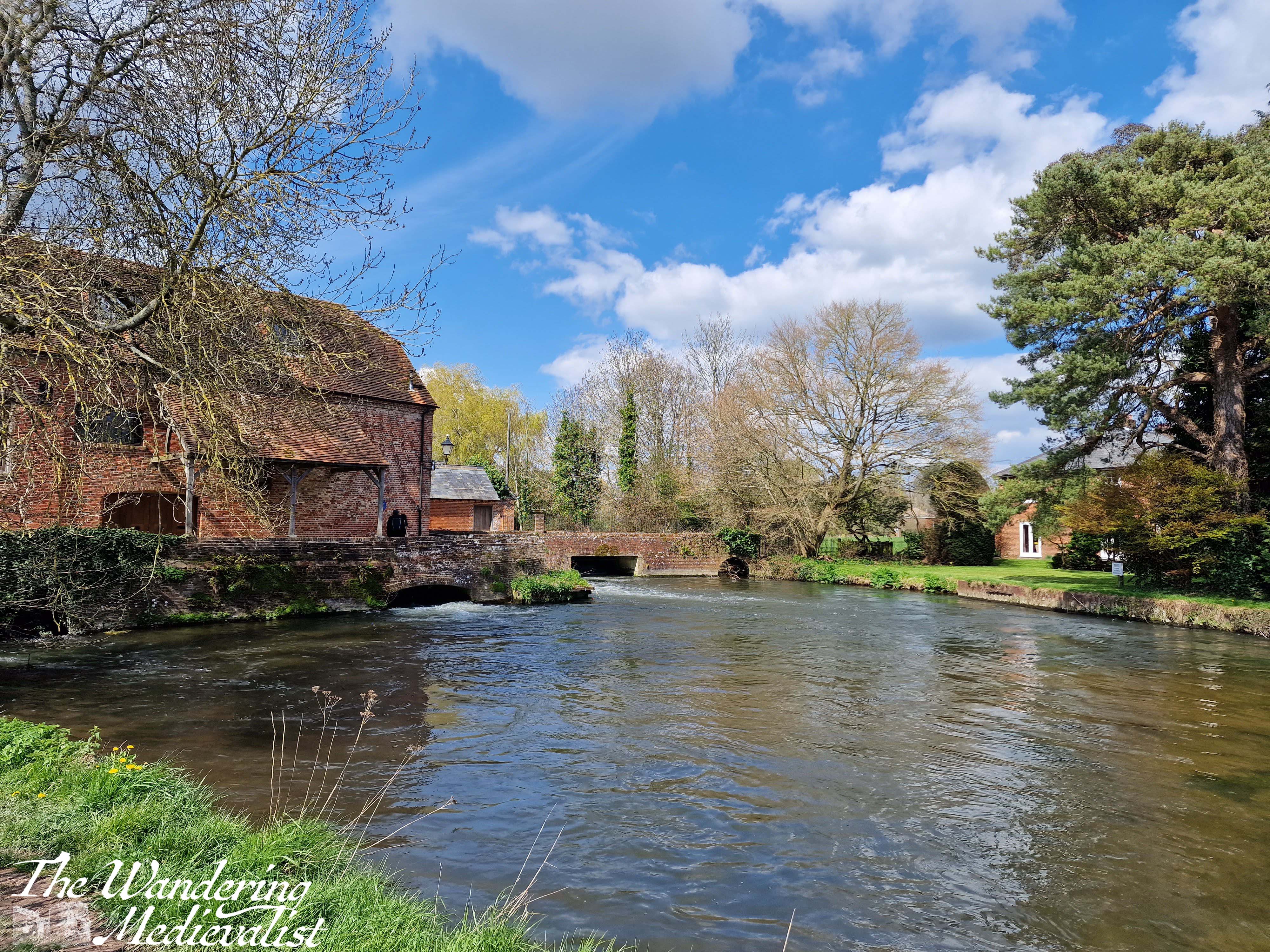
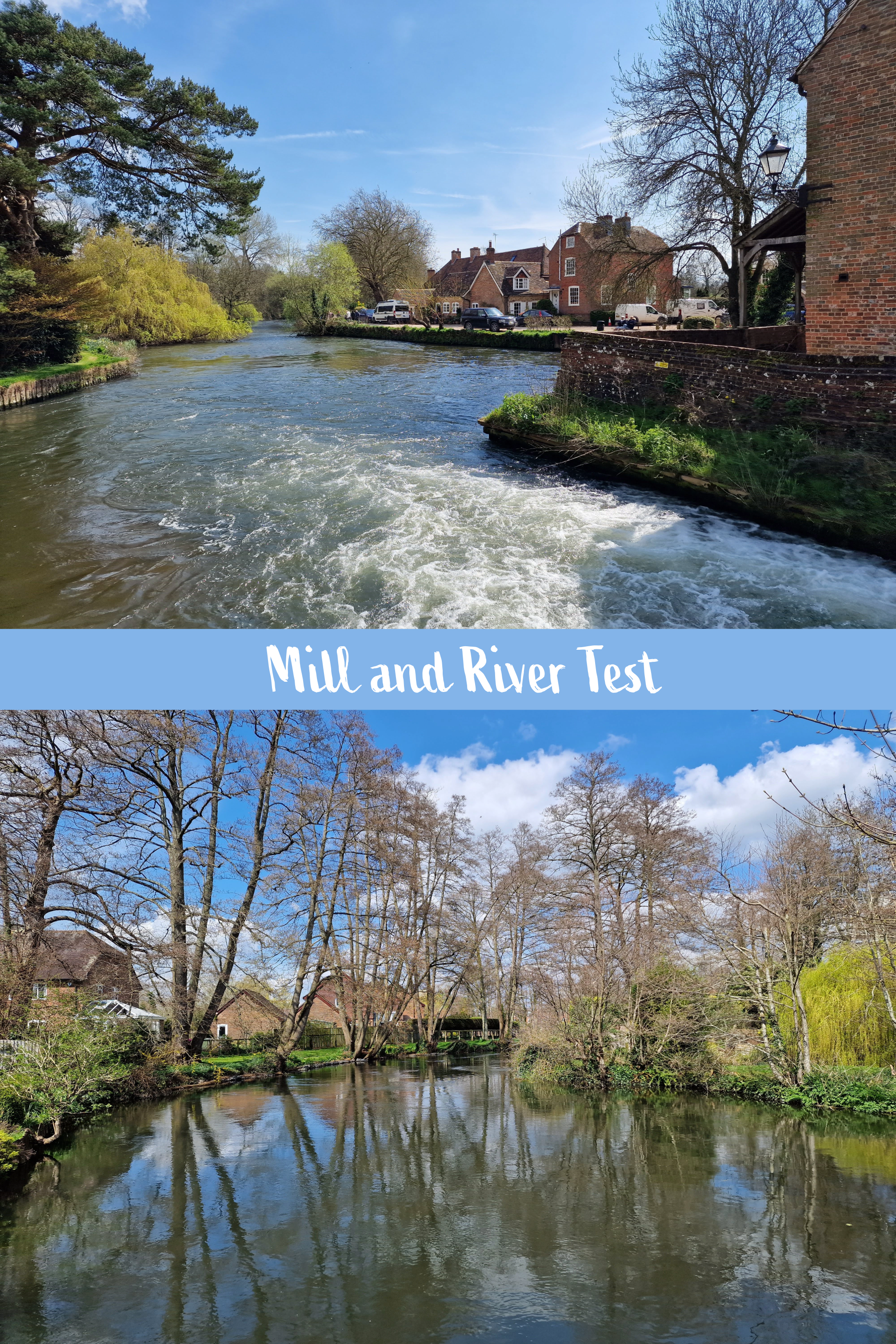
Romsey is a charming, well-to-do town about 7 miles from Southampton Airport, in the south of England. The town centre offers a mix of lovely shops, restaurants and pubs on winding streets and lined with Tudor-style frontages. The River Test flows through the community and some stunning parks, and past a picturesque old mill. The history in the town is more than evident; founded as far back as the 8th century, Romsey was a medieval market town that grew around the founding of the first church by King Edward the Elder in 907 CE.
Our connection to Romsey comes through some close friends who settled there some time ago, and who we try to visit at least once a year. The abbey is a required detour on our walks through the town, and I recall one relaxing morning in particular sitting under the trees with a cinnamon bun and coffee, enjoying the view.
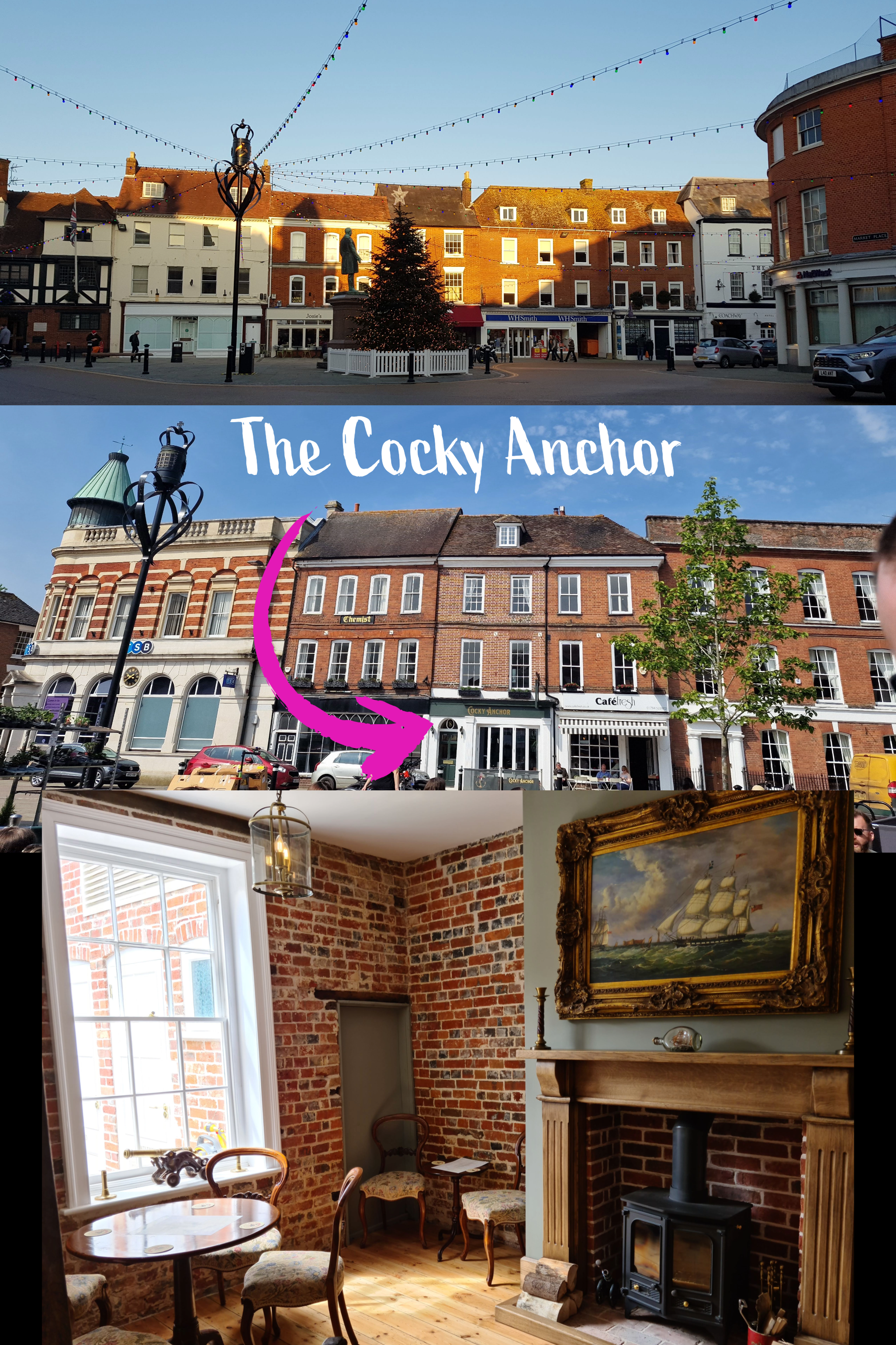
I also have fond memories of visiting the nearby pub the Cocky Anchor in summer 2021 – my first holiday after the end of lockdown – where the back beer garden offered great views of the abbey church.
The pub is just off the nearby market square, from which you have easy access to the abbey, along Church Street and down Church place.
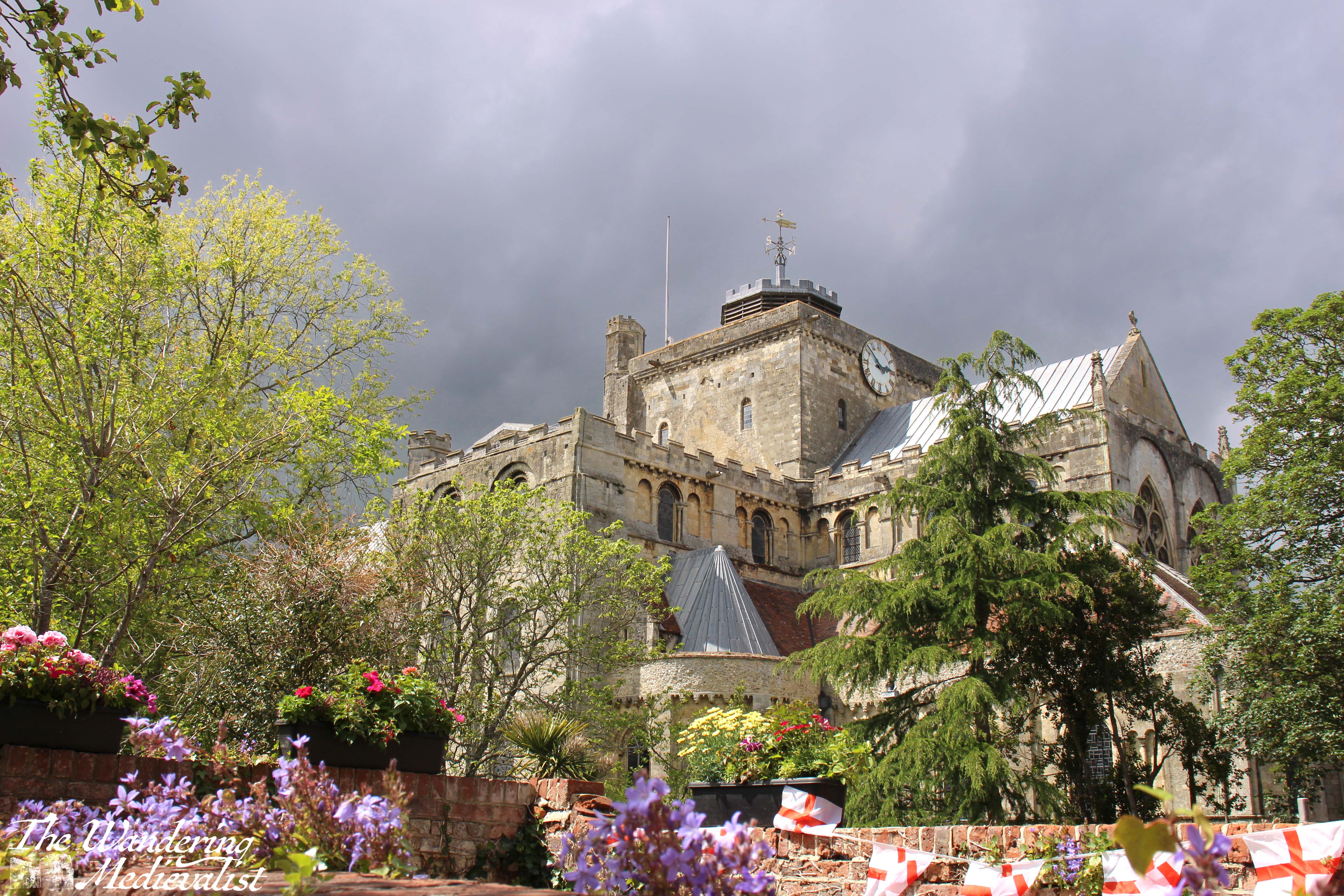
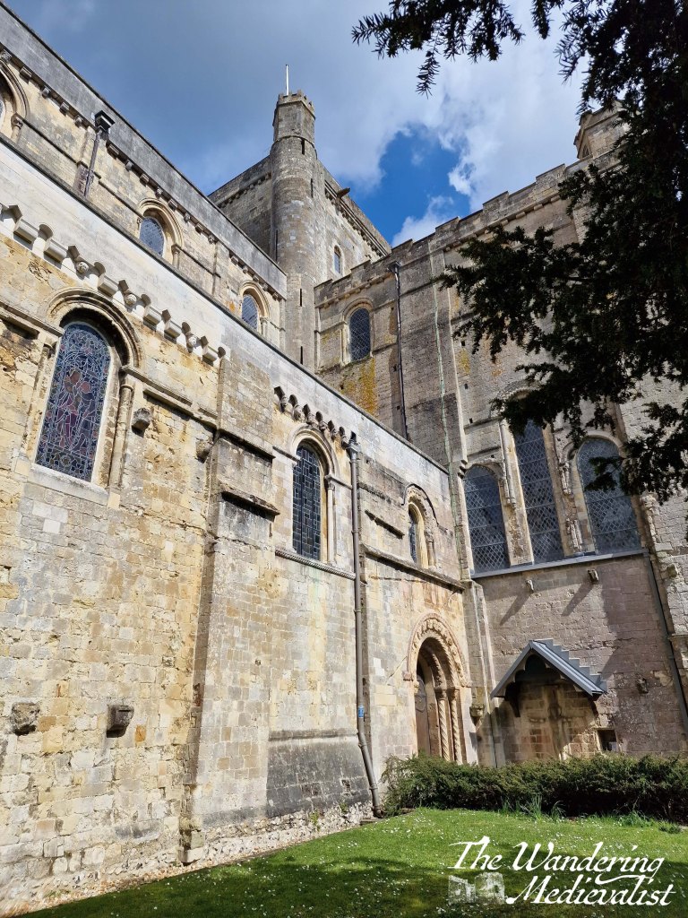
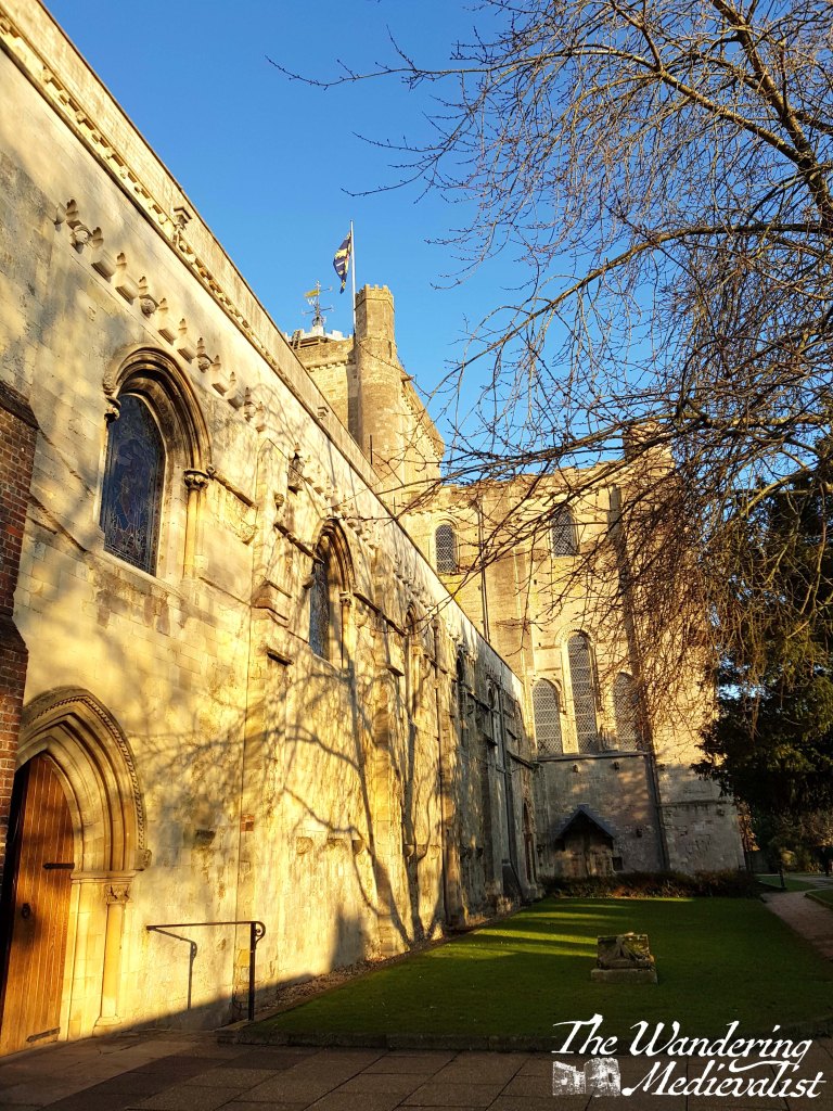
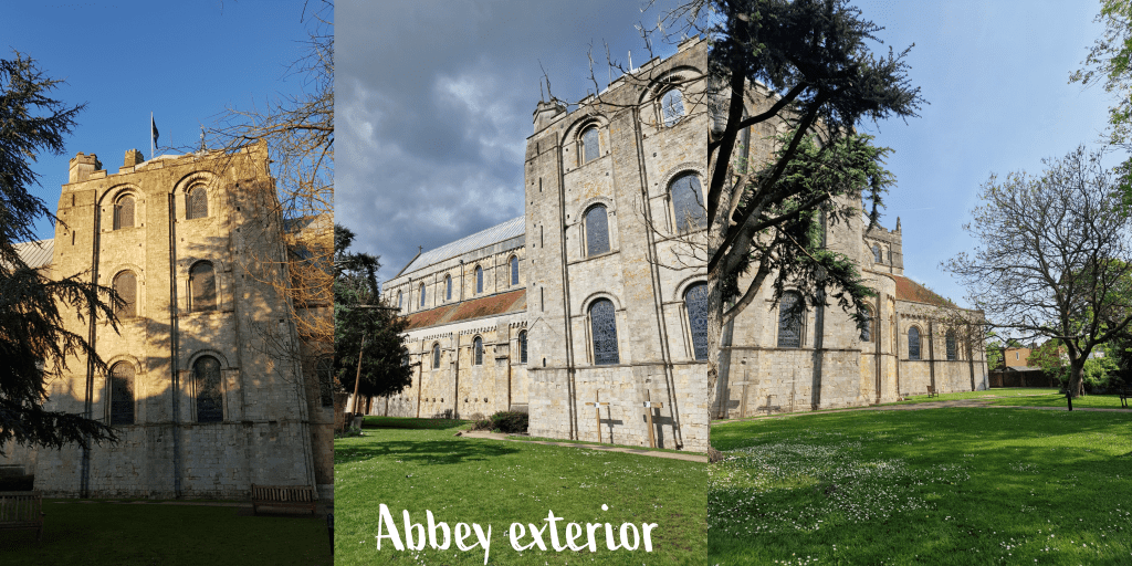
A visit to the abbey does not take particularly long, as you can walk around the outside in less than 5 minutes, unless like me you enjoy a much slower wander to take in the view. We always start off heading down Church Place, where the first view you see is this one, the east end of the church.
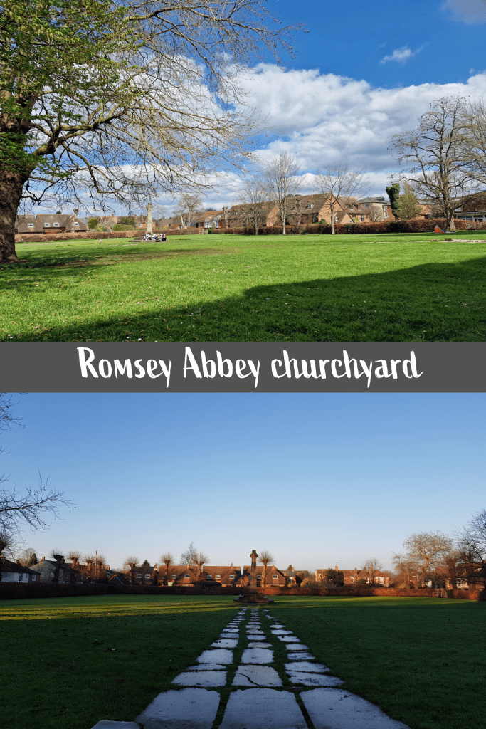
To the right of the path is the churchyard, which was the burial ground attached to the abbey. There are several memorials including a large cross and a Waterloo memorial, though the majority of the monuments were removed when the yard was cleared and levelled in the 1940s. The reasons for this appears to be safety-related, as the area had become very uneven and dangerous to traverse, and many of the stones were re-purposed to create a path.
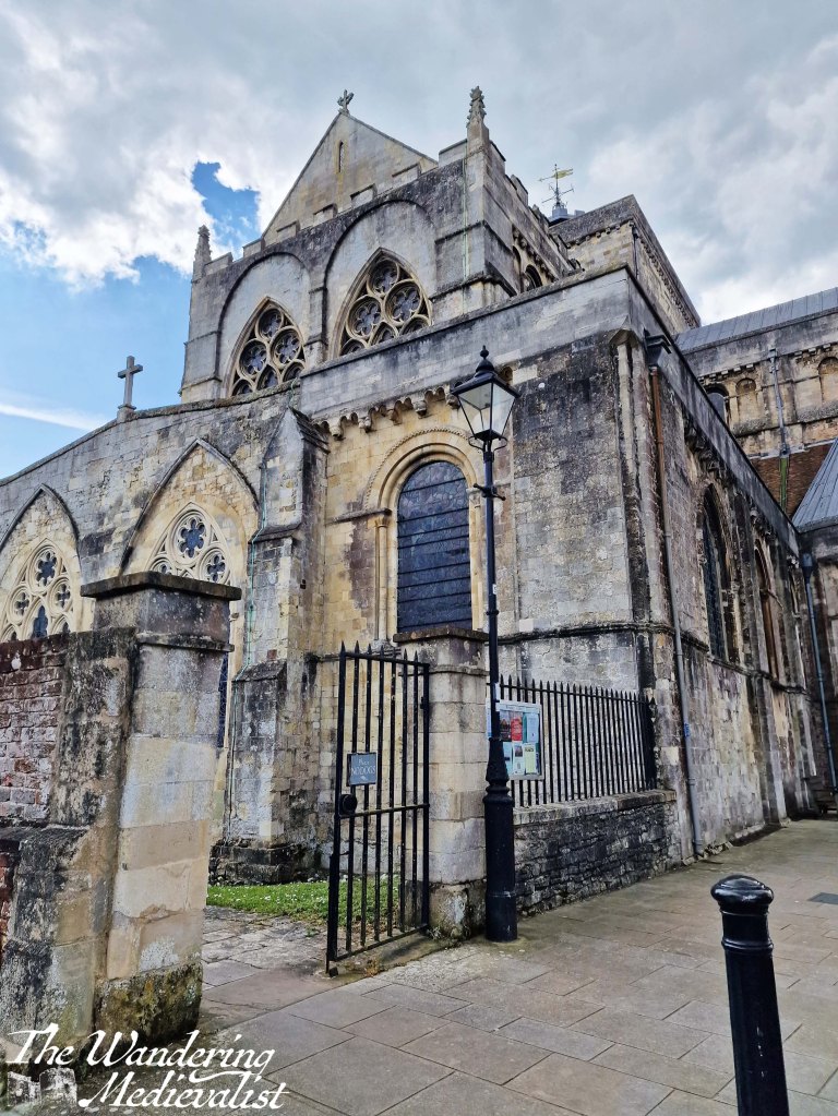
North side of the abbey church
Ahead at the edge of the churchyard is Folly House, the former vicarage, now a beautiful residence. From here you could go in either direction down Church Lane or a street creatively called ‘the Abbey’ to enjoy more of the stunning houses and gardens of Romsey’s town centre.
Folly House, former vicarage
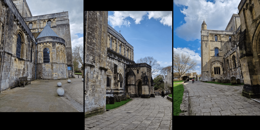
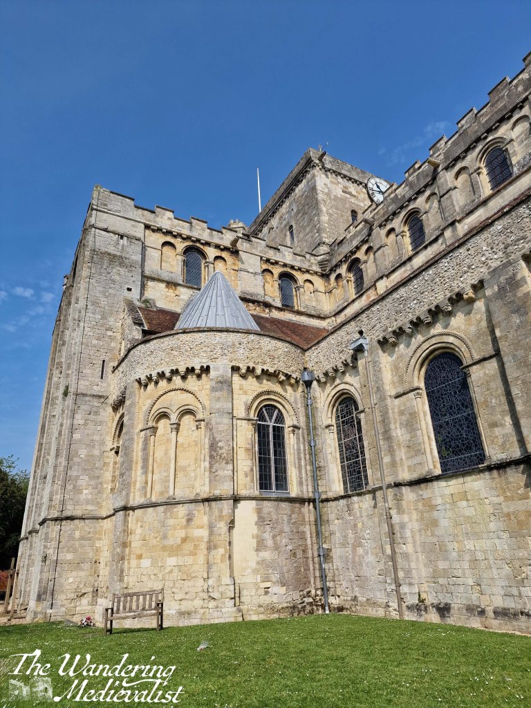
Continuing counter-clockwise around the church takes you to one of my favourite views, looking along the outside wall and up to the central tower – in all fairness, this diagonal view looking from the base of a church up to the tower is my favourite view of any ecclesiastical building. We come this way almost every time we visit Romsey, yet I find it impossible not to get another version, in different light of course…
On this south side of the church is a small park with shady trees, where we enjoyed the breakfast mentioned above.
This seems a good time to go into a bit more detail about the history of the abbey. As mentioned above, it was founded in 907 and Elflaeda, the daughter of the king, was put in charge of the community, beginning a long line of royal abbesses and nuns. In 967, the abbey was re-founded in the Benedictine order by King Edgar, also known as Edgar the Peacemaker or Peaceable. The first stone nunnery and church were built around the turn of the millennium, and the abbey flourished as a place of education and safety particularly for noble and royal daughters.
The abbey was sacked in 1003 by the Danes, likely in retaliation for the St Brice’s Day Massacre. This massacre had taken place on 13 November 1002, when King Æthelred (often referred to as the Unready) had ordered the killing of all the Danes living in England at the time. The chronicles of the time indicate that it was retaliation for an assassination attempt, though it may also have been retaliation for the years of raids by Danish forces.
Following the sacking of the abbey, in the 1120s work began on the current building. This was during the reign of King Henry I and work continued under the supervision of Henry of Blois. Blois was the brother of Henry I’s successor, Stephen, whose daughter Marie was elected abbess in 1155.
Marie’s story is one of those tragic female tales of the Middle Ages that make one realise that royal women had it just as hard – if not sometimes harder – than others.
Her father King Stephen died in 1154 and then her last living brother, William, passed in 1159. On his death, she became suo jure Countess of Boulogne (essentially, countess in her own right, meaning the title was hers by birth and not marriage). Despite her position as abbess, Marie was abducted by the son of the Count of Flanders and forced into marriage. Eventually, after giving birth to several daughters, she found her marriage annulled and was permitted to return to the cloister for the last years of her life – though not to Romsey. I wish this was an unusual tale to find in the Middle Ages, but it goes without saying that it was a difficult time to be a woman, at any level of society.
Back to the abbey. The last three arches of the church, designed in an early English style, were added in the 1230s, by which time over 100 nuns were part of the community. The abbey would continue to prosper until the decimation of the population by the Black Death in the late 1340s; 80% of the nuns are reported to have died, including the Abbess, and from this point on the number of nuns remained much smaller – less than 30. Nevertheless, the abbey remained an important part of local life, functioning as a center of prayer and charity.
Unlike some less fortunate establishments, the abbey survived the dissolution of the monasteries under Henry VIII due to the petition of four Guardians, who purchased the abbey for £100. The nuns were dispersed, but the community continued to worship in the surviving buildings.
It is still a working church to this day, with Sunday services.
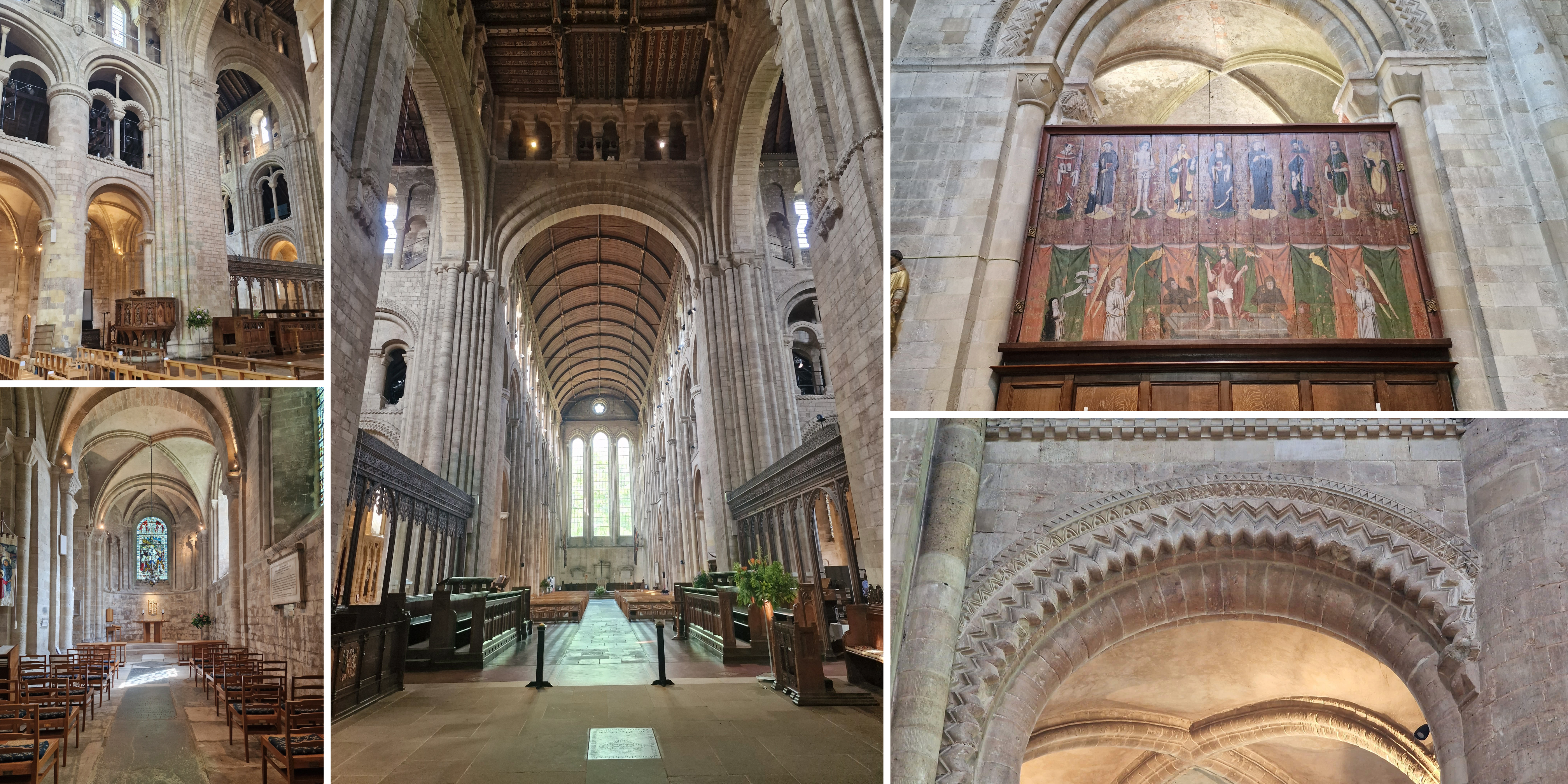
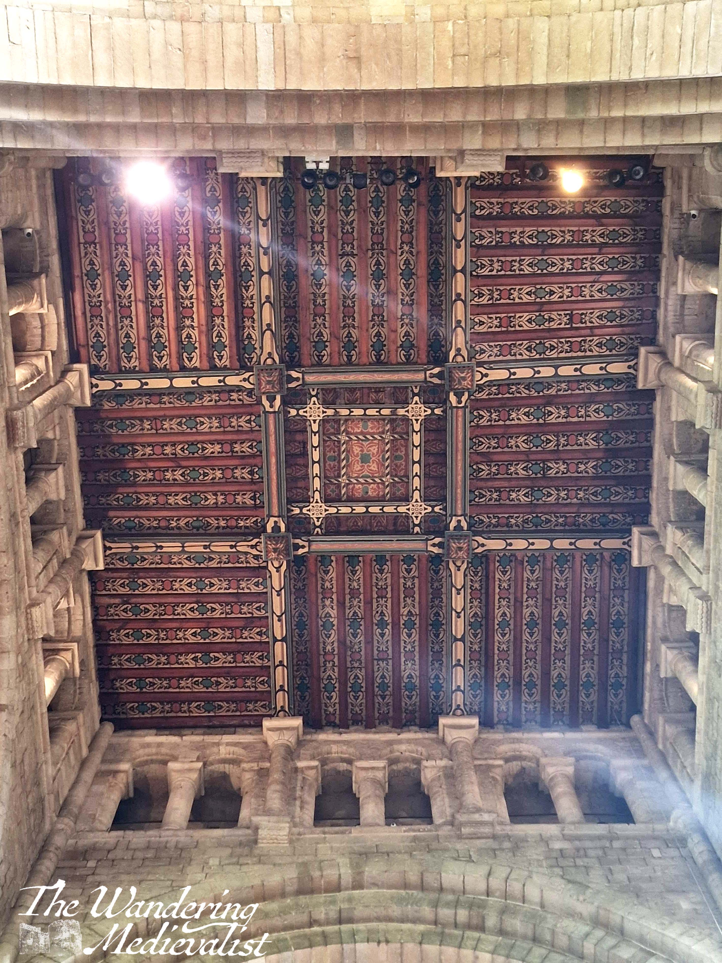
On our last visit, we were finally able to get inside of the church, which has several fine examples of medieval art as well as Norman carving that echoes that seen in Durham Cathedral.
Visiting an abbey like that at Romsey is a unique opportunity to experience an ecclesiastic community that has existed for hundreds of years, both changing and evolving with the times as well as maintaining its medieval roots. The protection Romsey enjoyed after the creation of the Church of England means that it allows the full immersive experience that you cannot get at ruined abbeys like those at Jedburgh, Dryburgh, and so many more that did not survive the dissolution of monasteries in the sixteenth century. It’s also just a beautiful building, set in a lovely English town that provides the best of what the countryside has to offer. I highly recommend a journey!
October has been a whirlwind of work travel and so I have not had time to sit down and write as I hope to do each week. I started this post a few weeks back, when my memory of the walk was fresh, but now have finally been able to finish.
On our recent return to Skye, Dad and I chose a more challenging hike for our first day, and so by day two were looking for something gentle to keep us moving but not over-tire.
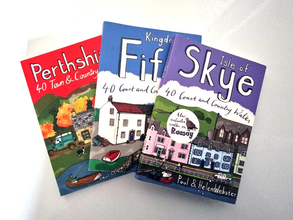
The solution was to dig out my Isle of Skye walks book, one of a series that I have been collecting. While there are plenty of walking books out there including the Ordinance Survey series – excellent options that tend towards longer trails – I have found these smaller books to be a wealth of knowledge for shorter strolls.
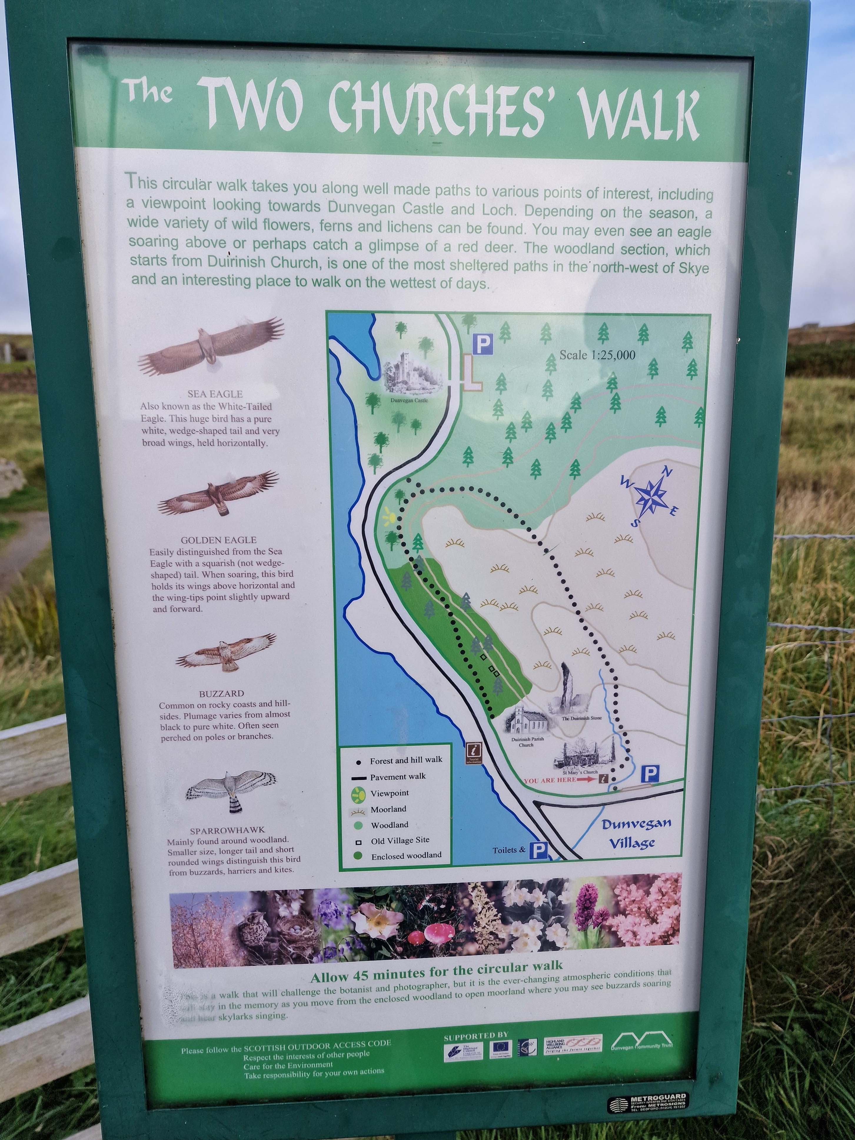
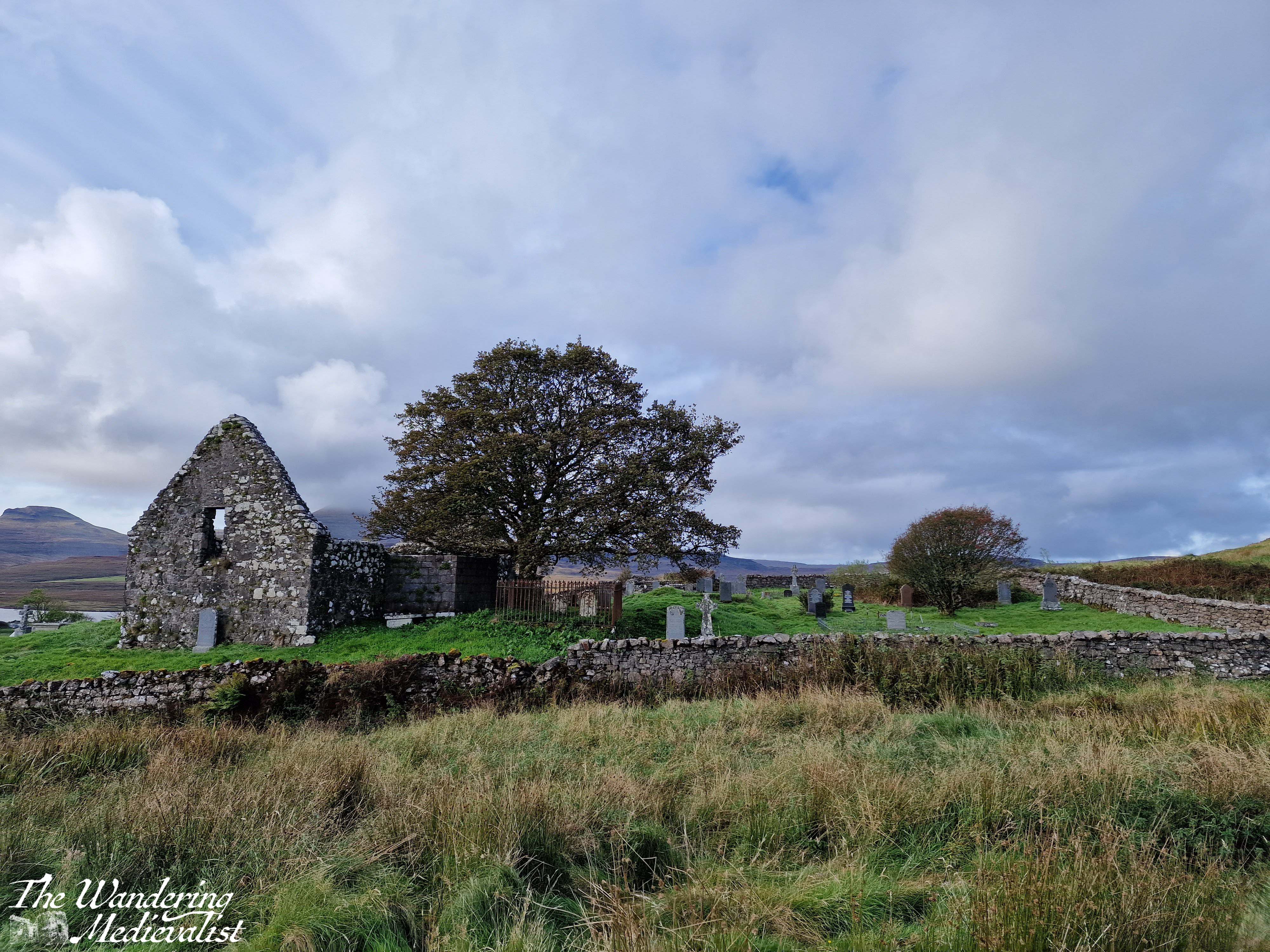
It took us only a few minutes to decide upon the Two Churches walk, an option I had noted for future exploration on our last visit, and helpfully located only about fifteen minutes away.
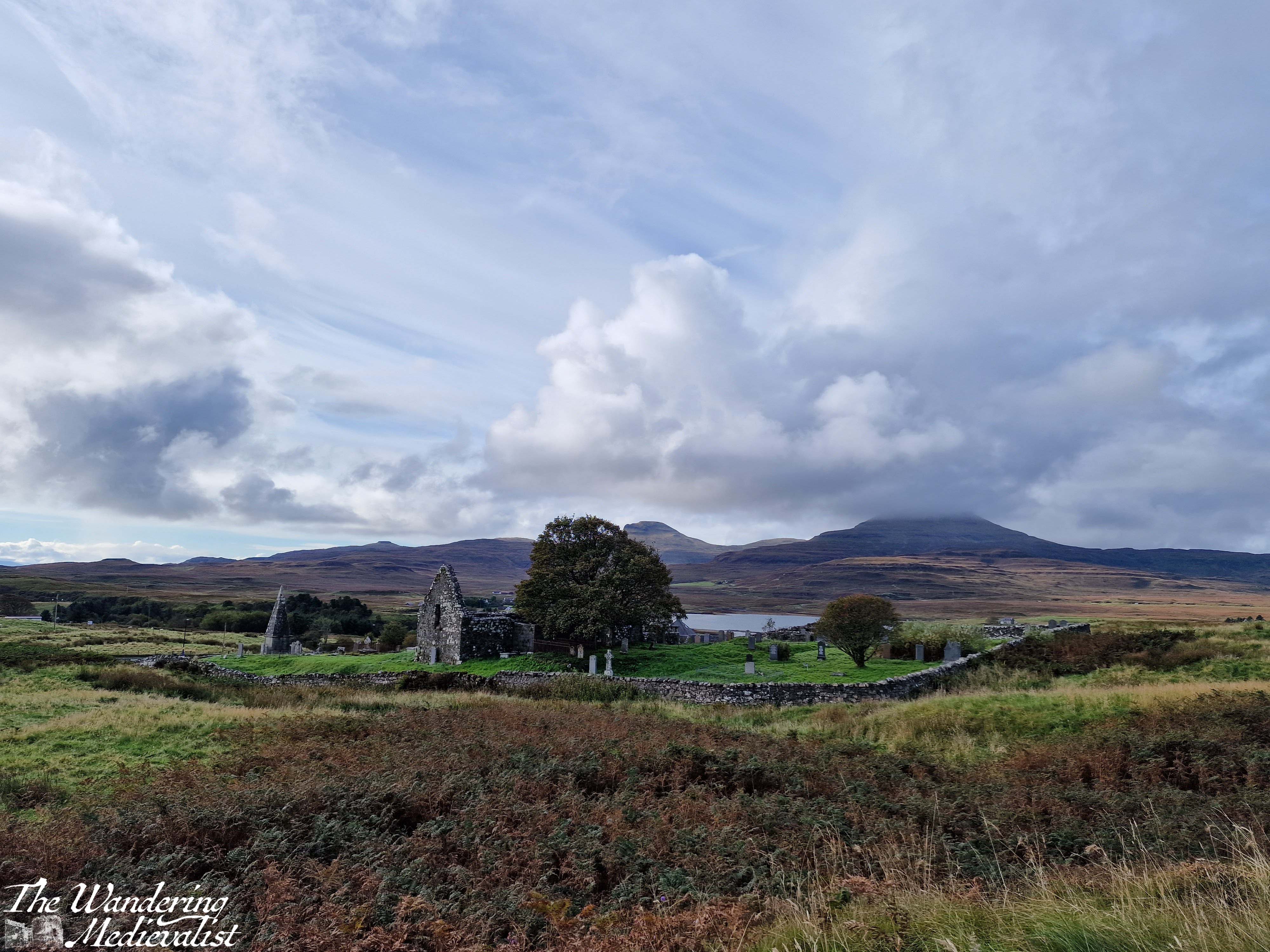
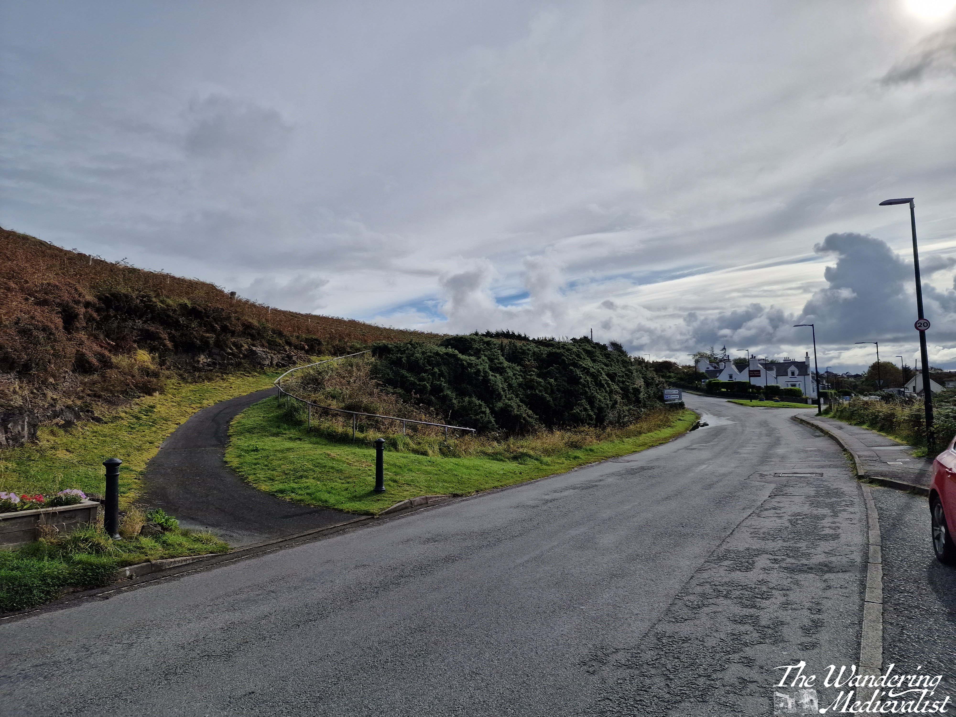
The Two Churches walk is about 3km long, a relatively flat loop with a combination of well-kept moorland paths, forest trail, and a short section on the roadside. It leaves from a well-signed lay-by with enough parking for between 5-10 vehicles; we found it almost empty, as many of our fellow walkers were clearly locals.
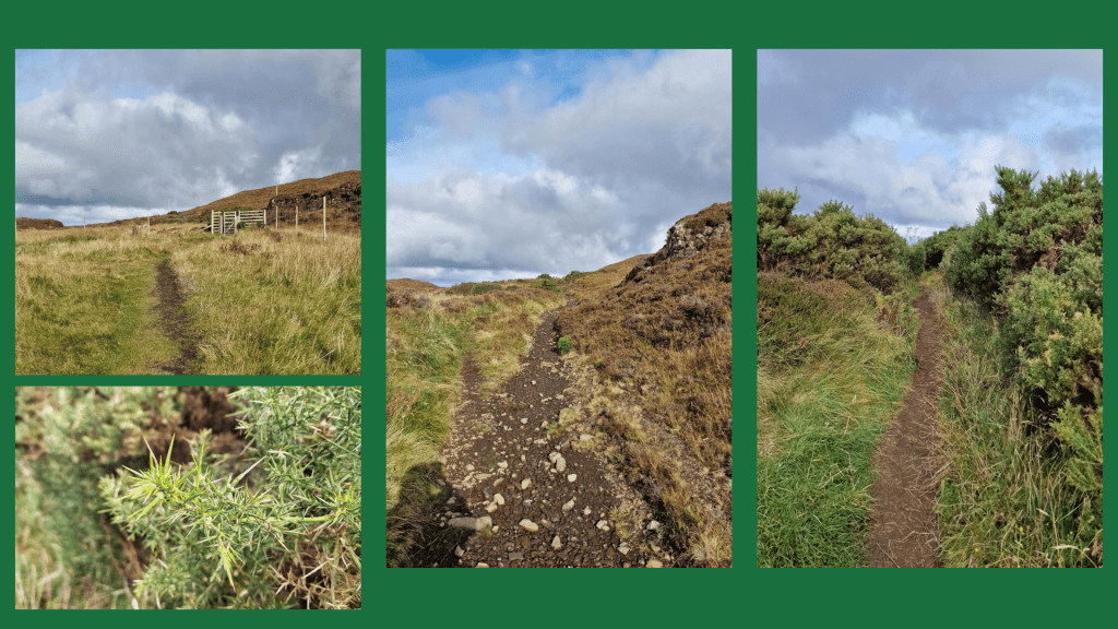
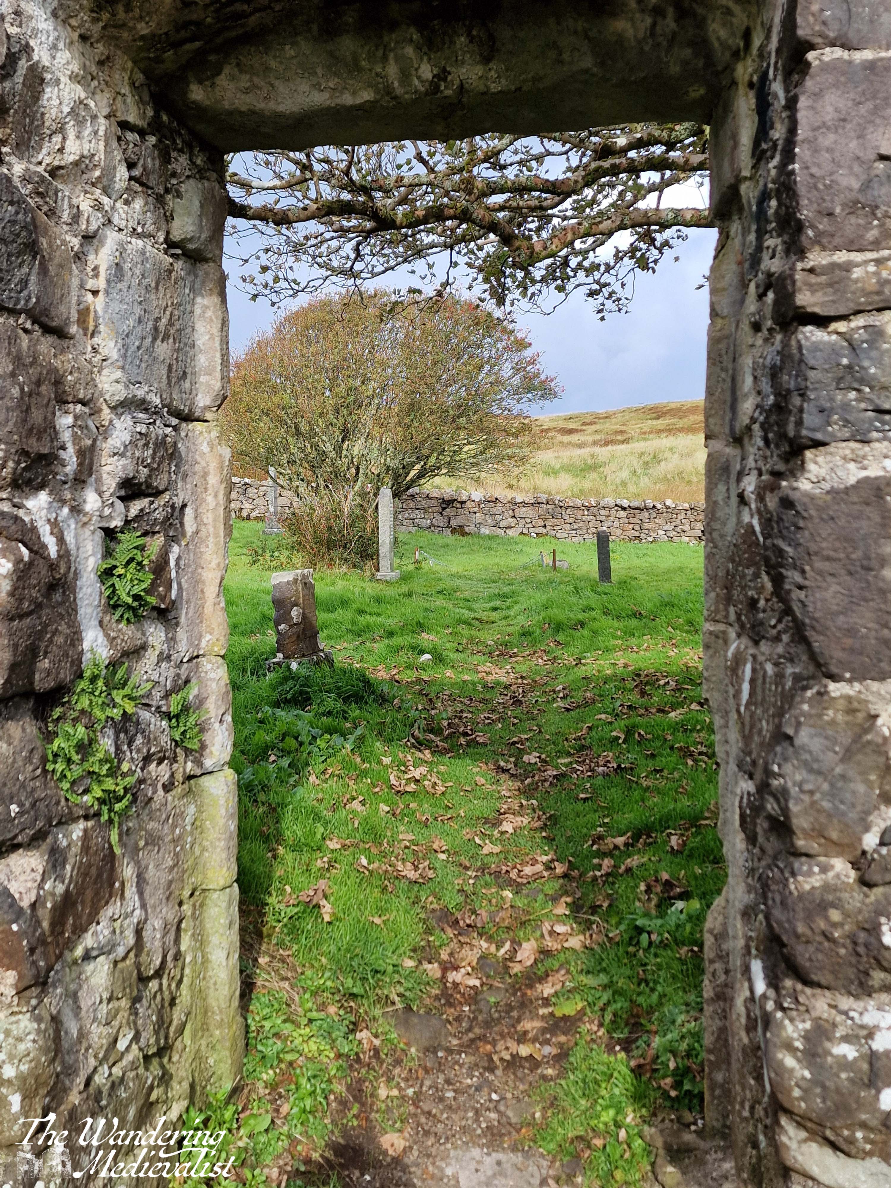
The path starts just to the right of the ruins of St Mary’s Church. It is a well-kept trail with a slow incline. There is a plaque with details about the walk and its route, as well as some of the birds you may see along the way (though we did not). You get nice views back towards the churchyard, with grassland on both sides. On the day we visited it was mostly dry though I imagine it would be muddy at times, and once the path turns rockier a bit further on, it could be slippery in the wet. I would definitely recommend good sneakers or walking boots to traipse through the puddles.
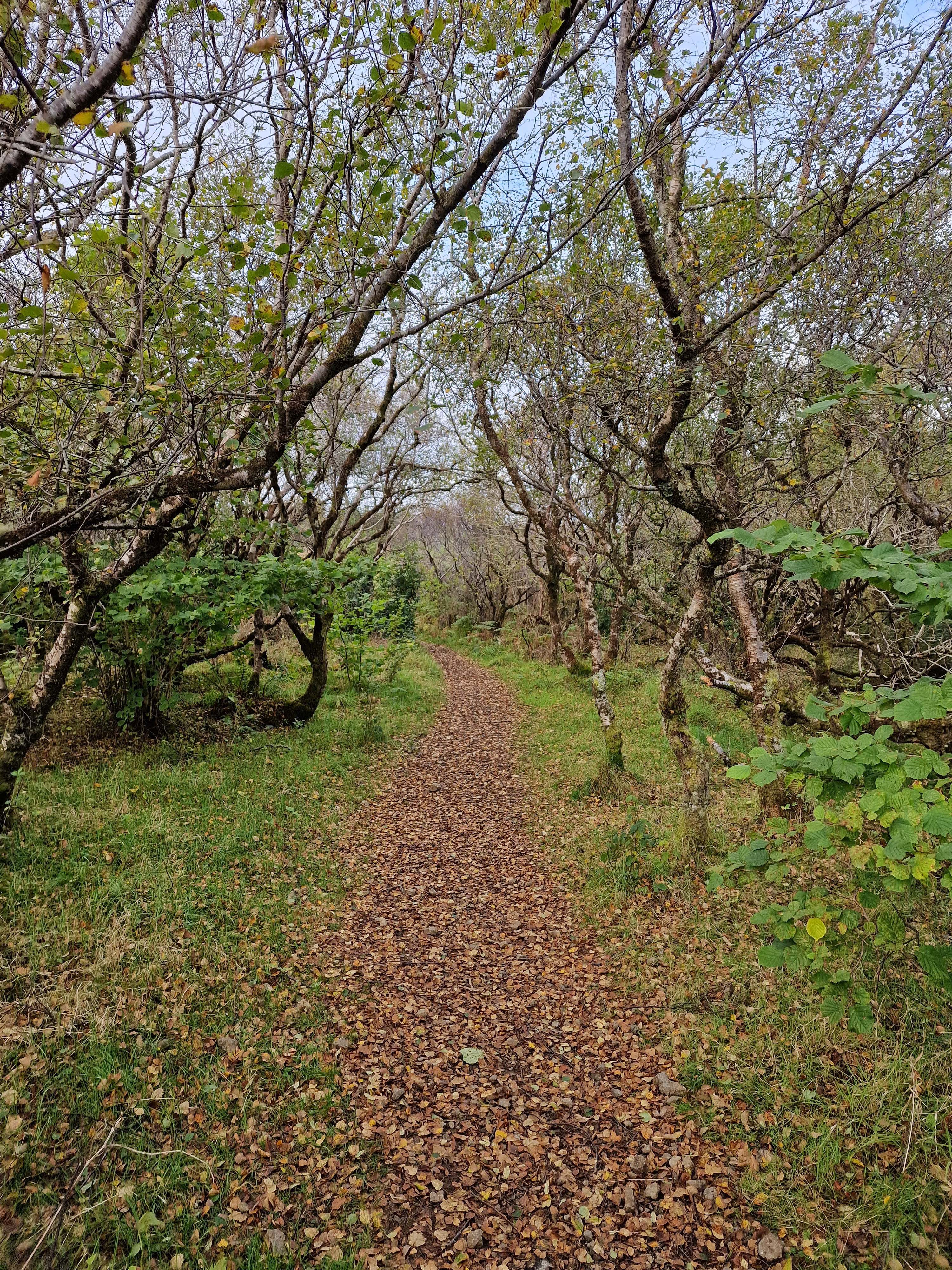
The walk passes through a farm gate, and continues through patches of gorse and other prickly plants. In spring and summer it would be gorgeous and yellow, though I am quite allergic to gorse so was pleased that the blooms had passed. Only a few minutes in, the path enters a light forest, and going through another gate finds you walking through trees and ferns. It reminded me in many ways of trails in the White Mountains, though the flora was slightly different of course. As the path swings around to the left, the deciduous trees turn mostly to pines, and the trail is surrounded by great tall trees, all very straight in the manner of a planned forest. I had learned that on some estates these tall pines were planted for ship-building, but by the time they grew the industry had moved past using wood. Great expanses of pines in the Highlands were therefore left, though the acidity in falling needles meant little could grow beneath. (This information came mostly from a fantastic series I watched years ago called ‘Making Scotland’s Landscape‘ presented by a Scottish professor of Geoscience.)
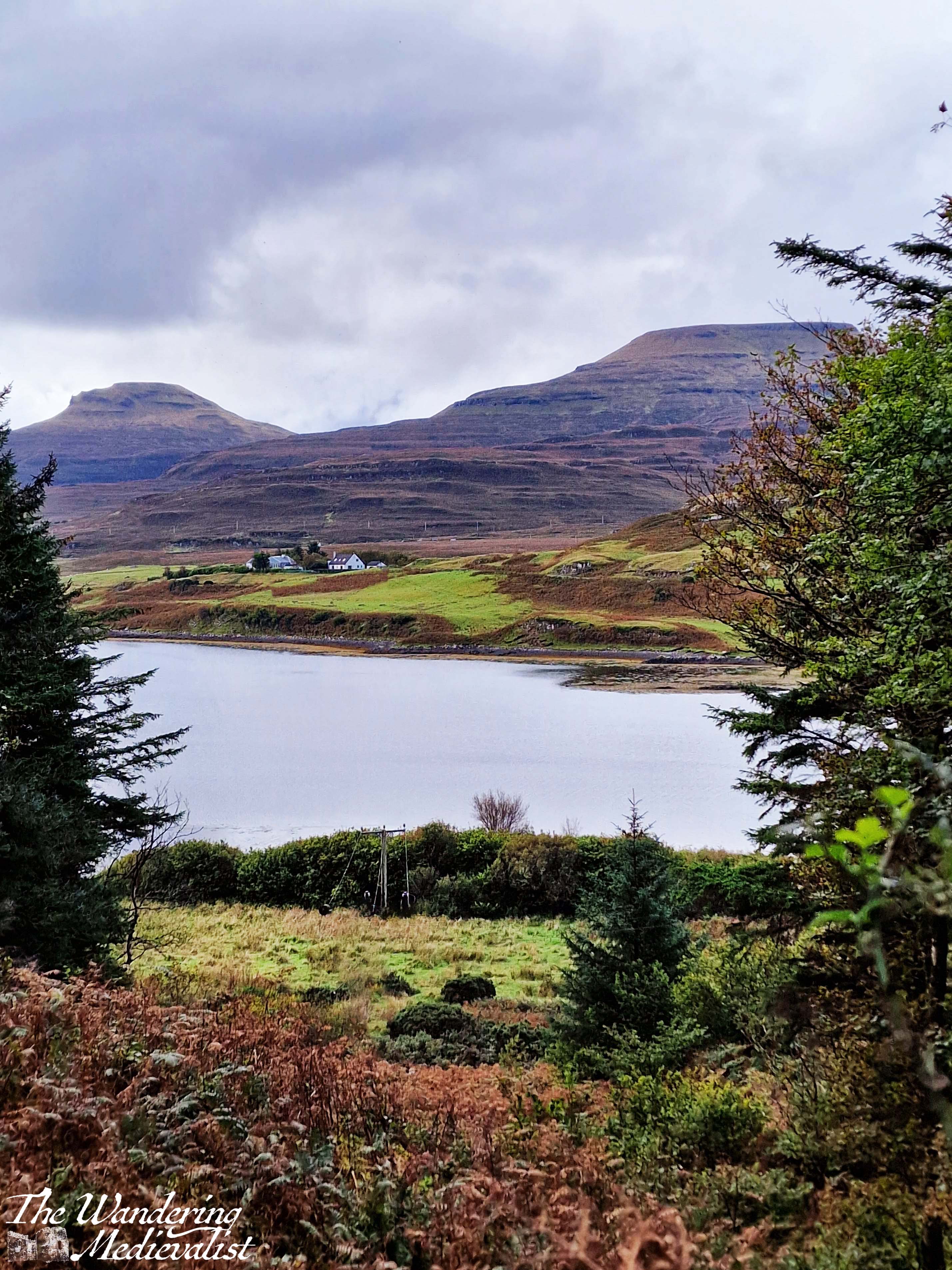
It is a lovely peaceful walk with not too much up and down – though there are a few climbs and dips to be had – and we passed several sets of joggers and plenty of dog-walkers, showing the path is clearly popular with locals. There is not much to be seen beyond forest in this stretch, though as the path continues to circle around there is one open viewpoint through which the power cable runs, and through which you can see the loch and the house and mountains on the far side.
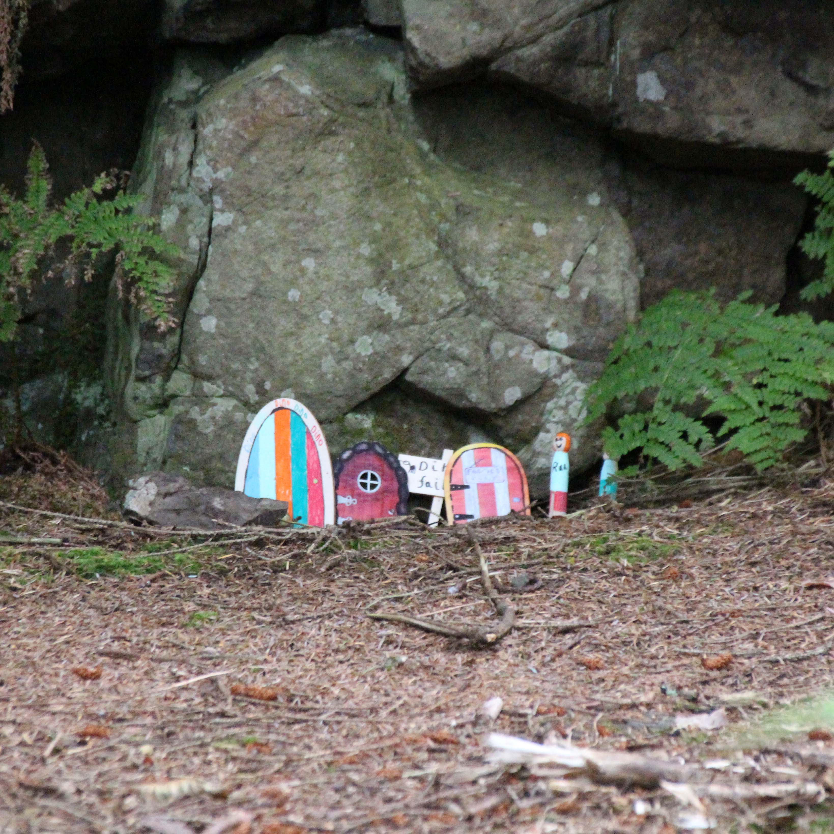
After the viewpoint you can hear and at times see the road below the path to the right, and as you approach the end of the forested section, we discovered that the local school had designed fairy houses in the trees and rocks. They were a charming combination of modern and very old-fashioned in design, with a little village at the bottom of a small cliff.
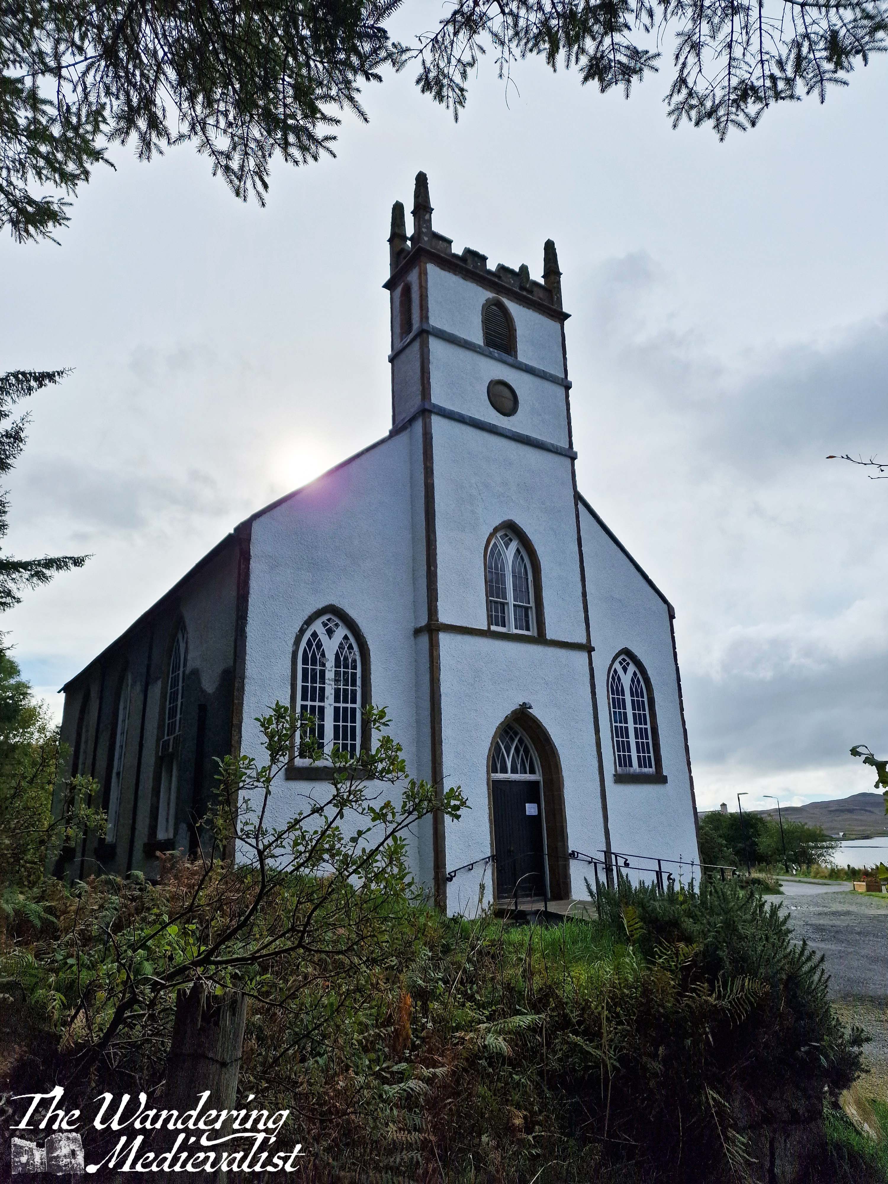
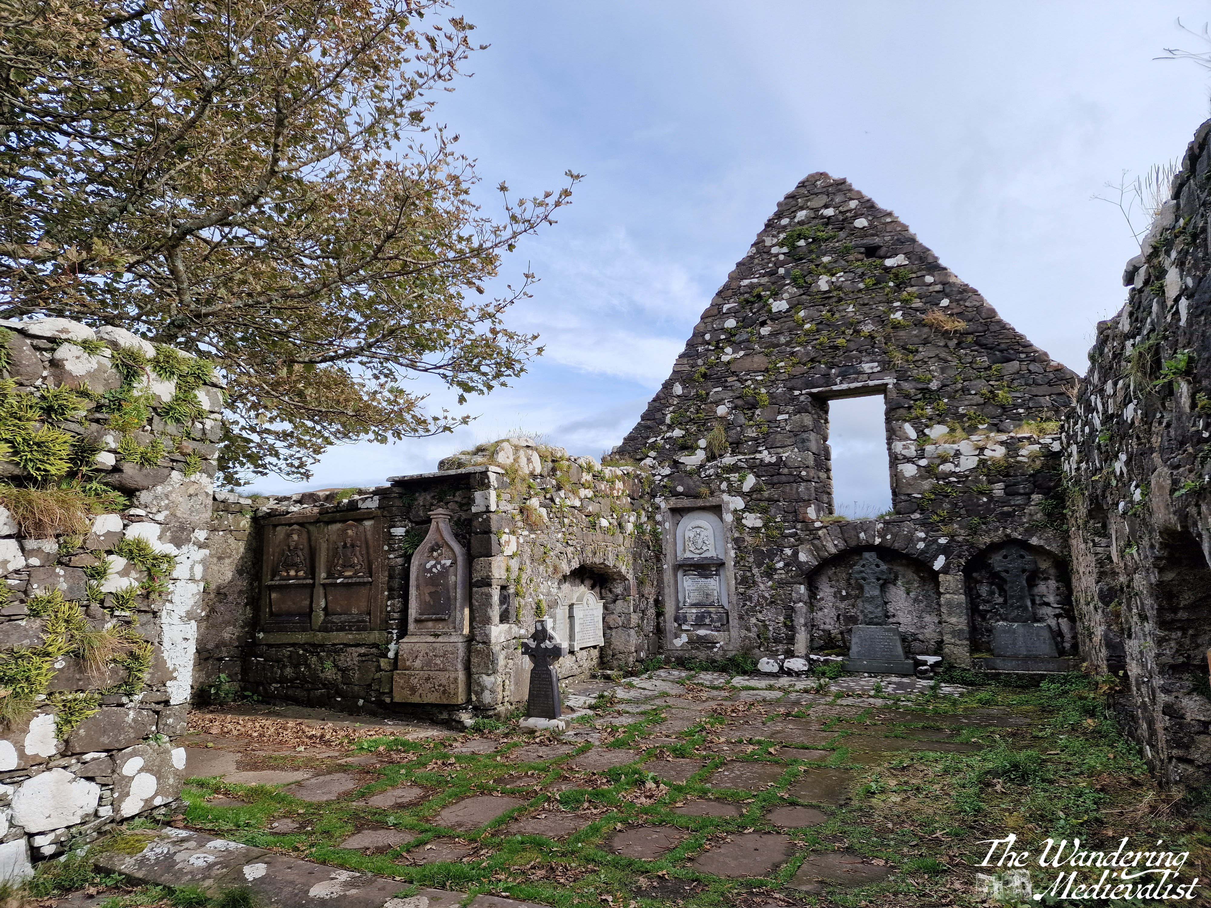
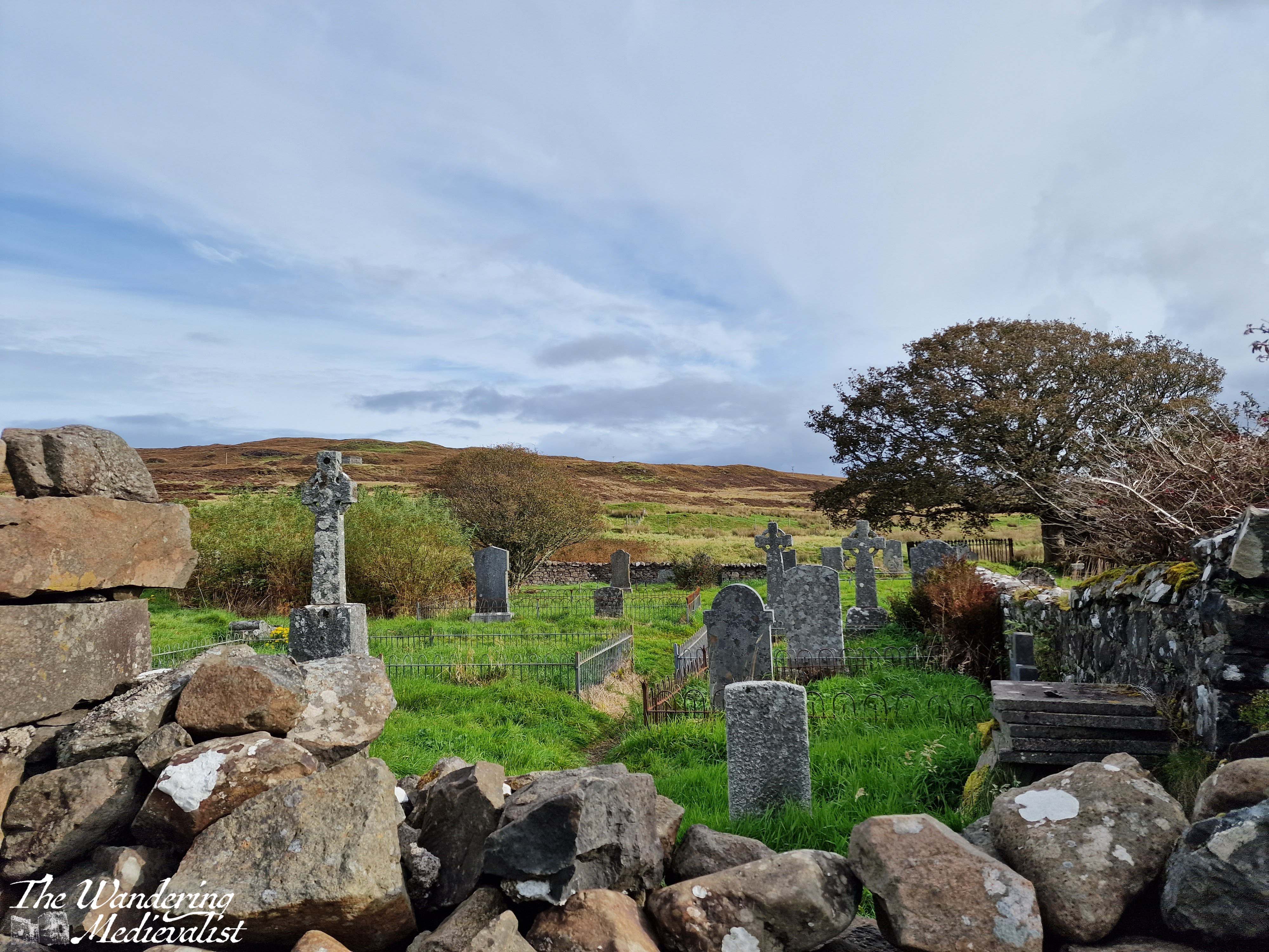
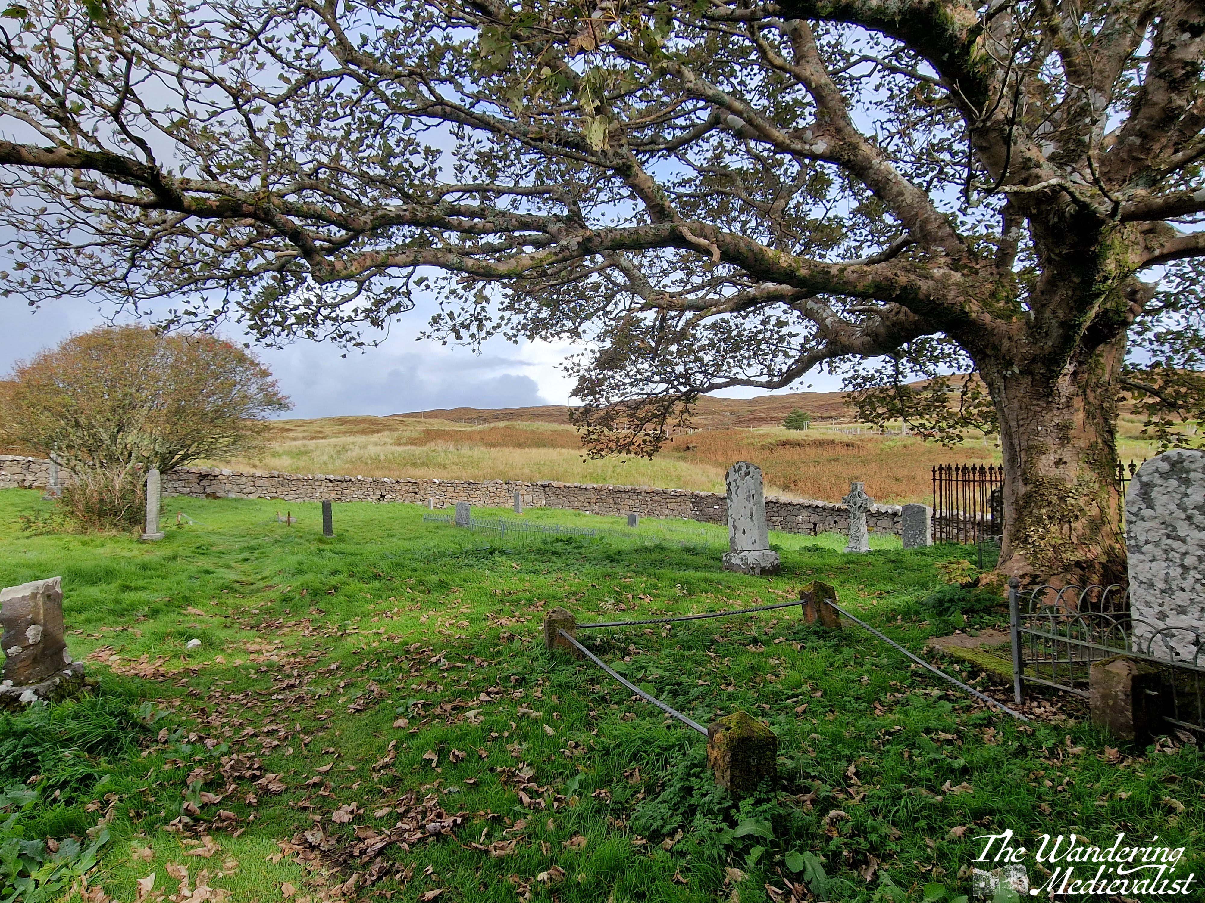
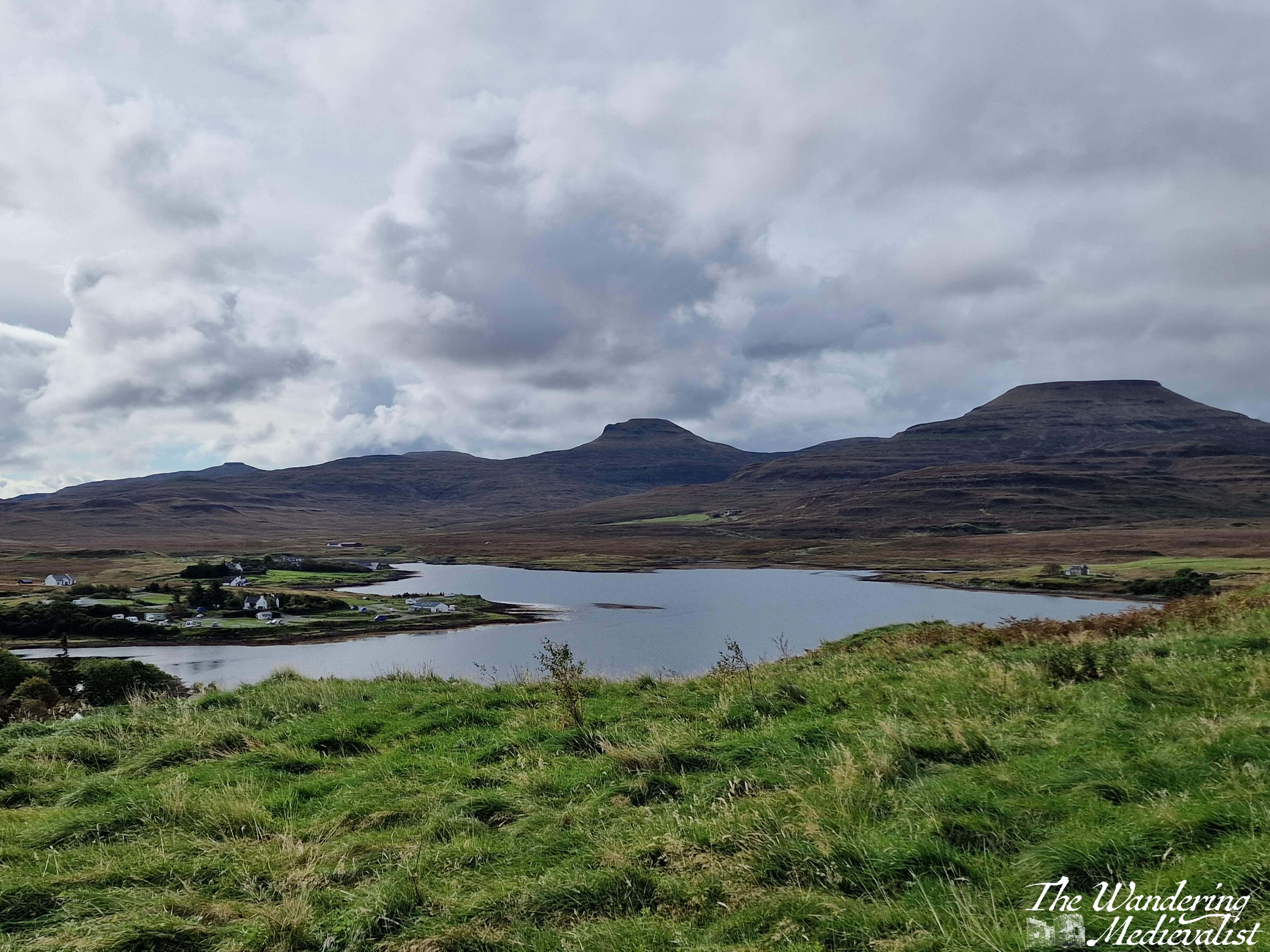
As you leave the fairy town behind, you soon come to the second of the two churches, the Duirinish Parish Church, which unlike St Mary’s is still very much in use. Here the path meets the road, and there is a short stretch of shops and buildings. There is an option for a short detour up to a memorial for those lost in battle, and the site overlooks the town and loch with lovely views.
The trail follows the road up and around the corner to the left, returning to the lay-by. At this point, Dad and I decided we still wished to explore the church ruins and the standing stone on the top of the hill. We started in the church, which was likely to have been founded in the Middle Ages due to its alignment, though the parish dates to the post-reformation period. The stone enclosure of the site dates from the 1730s, and the church was the burial site for some Chiefs of Clan MacLeod as well as their hereditary pipers, the MacCrimmons. It is a beautiful ruin with lovely carvings in the nave, trees overlooking the now roof-less church, and graves of varying ages dotted around the property. It reminded me in some way of Old Burial Hill in Marblehead, though again that may just be my affinity for graveyards!
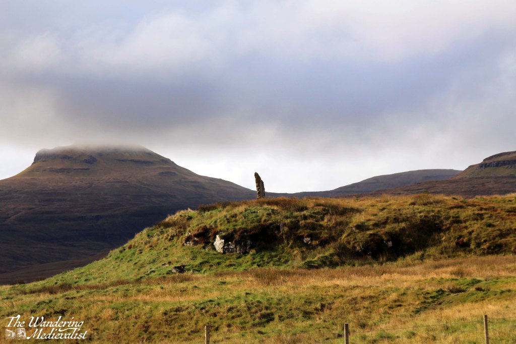
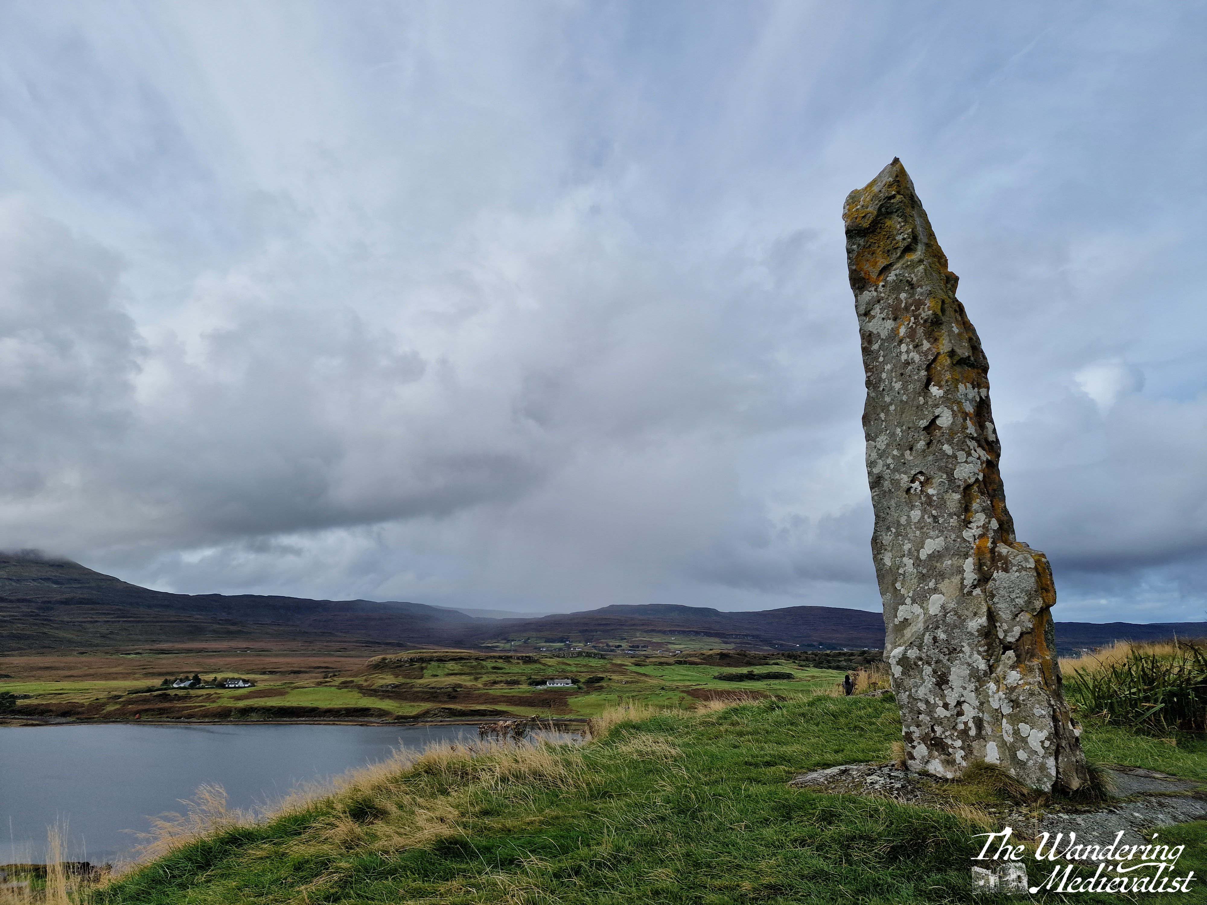
After exploring the church we felt it was still required that we climb to the top of the nearby hill, where the local community had raised a standing stone referred to as the ‘Duirinish Stone’.
I was a touch disappointed to discover that it was modern and not authentically ancient, but not disappointed enough to miss a visit. The stone was raised on the event of the Millennium as a marker in time, and to celebrate the memory of the ancient settlers of the area. It was found on a beach in the south of the island, and it was erected using ancient methods – hand and rope – an impressive feat! So not ancient, but actually authentic.
In order to reach the path, one has to exit the churchyard completely and then follow the edge of the wall until the trail branches off to the left through the grass. It is not a long walk in any way though the top is quite steep and requires a bit of scrambling. There is a detour about half-way up where hikers have clearly discovered a good viewpoint.
The top of the hill is larger than it looks from a distance – and I imagine there is a less steep path than mine – and the views are spectacular. We could see some rain coming in the distance so did not loiter long, but I got my fill of pictures while Dad wandered a bit.
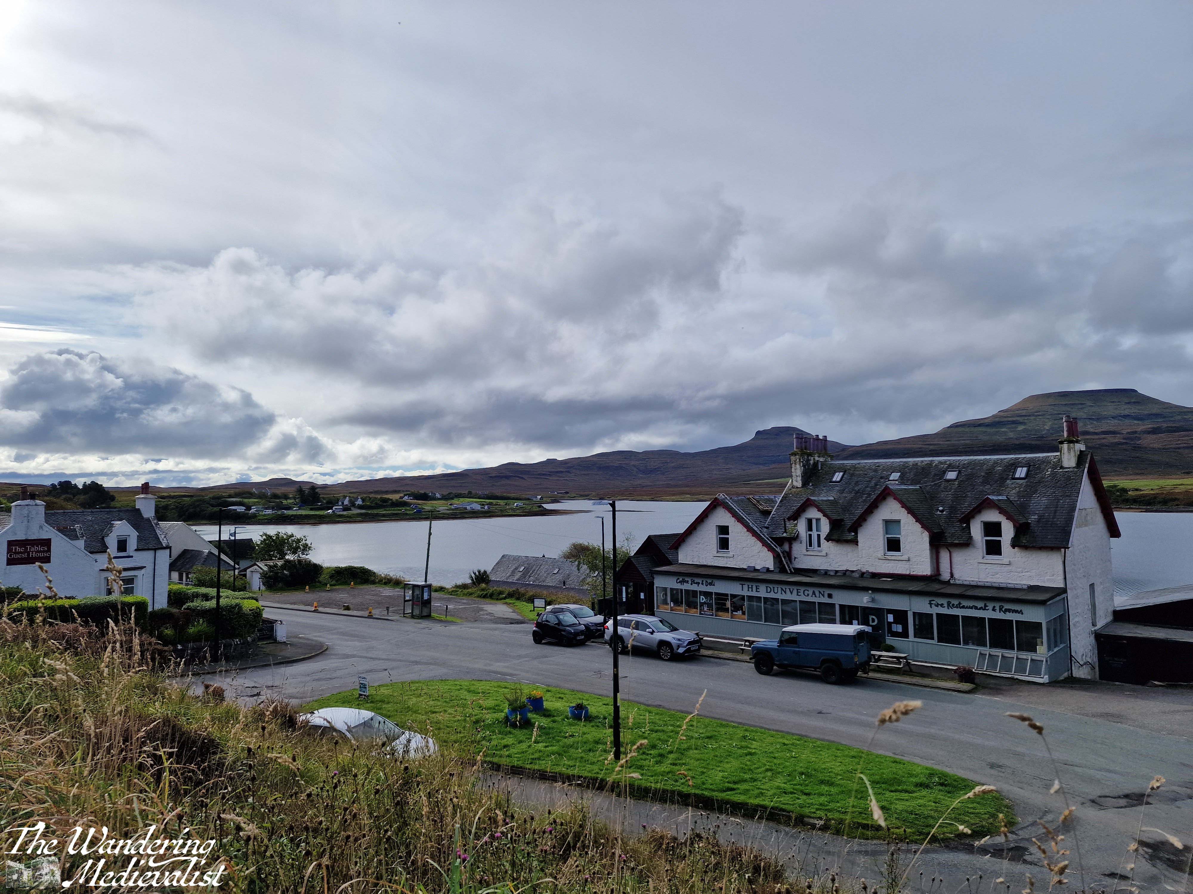
Upon returning to the car, we both felt the need of refreshment after our roughly two-hour walk and exploration of the church and hill. Fortunately, the town has several options for food and we stopped into the Dunvegan Deli and Café, where I had purchased a few extra snacks on our previous visit. The café does not offer lunch but does sell coffee, tea and an impressive array of excellent cakes. The tables overlook the loch, and it was a very pleasant place to sit with a cuppa to relax. It was also the perfect spot to pick up some dinner supplies: pasta, sauce, and a delicious local cheese, plus of course another cake for dessert. Their range of food includes crackers, jams and jellies, Highland honey, cheese and some cured meats, local ale, and much more!
This is a very pleasant walk for a morning or afternoon, long enough to work out sore muscles from the day before but not enough to add to exhaustion. The views of the loch and mountains are lovely, and this could easily be combined with a visit to Dunvegan Castle which is only a mile or two further along the road. And definitely, if you have time, stop into the Dunvegan Café for a snack!
Check out my online shop for more Highland pictures!
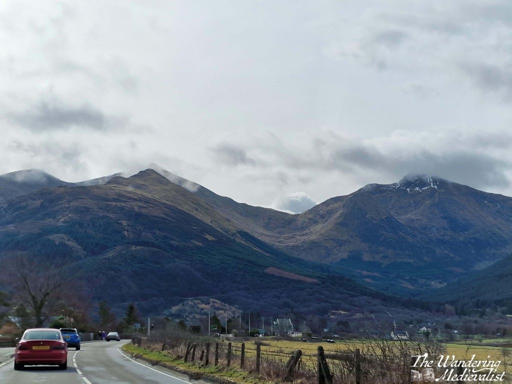
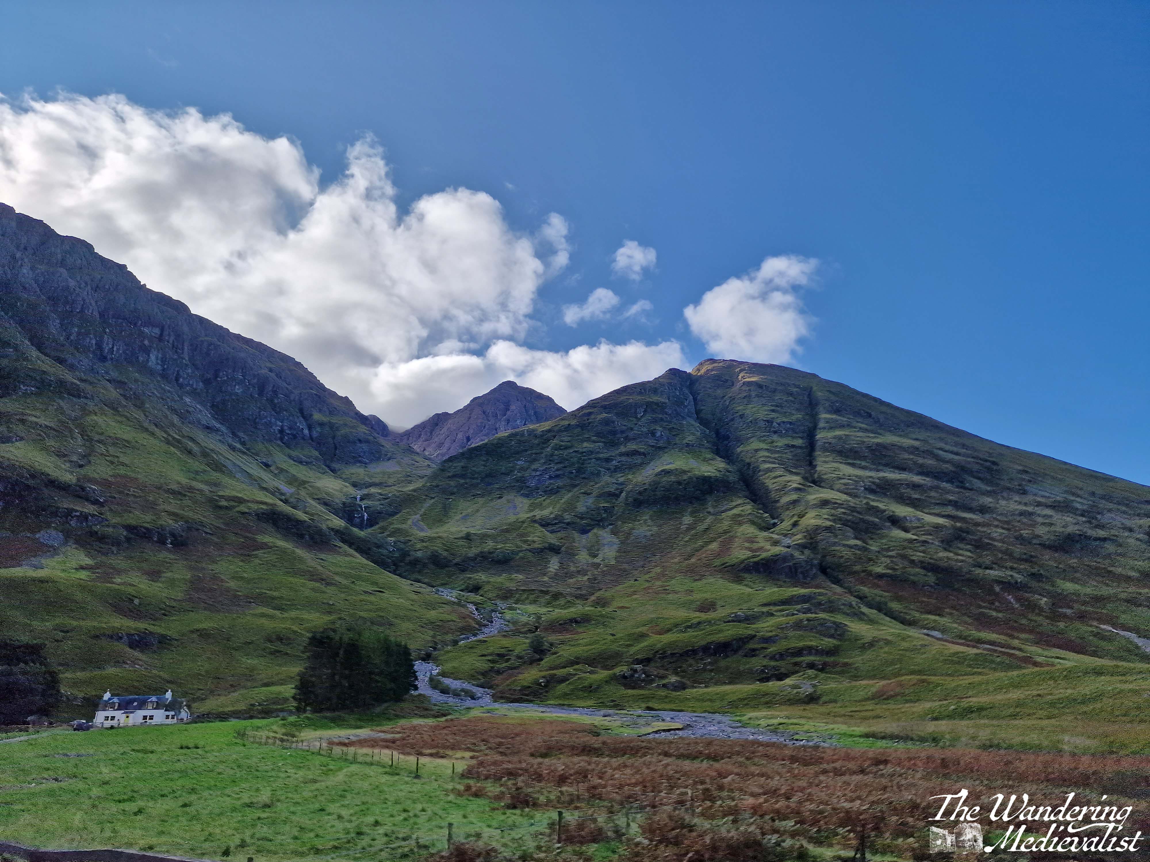
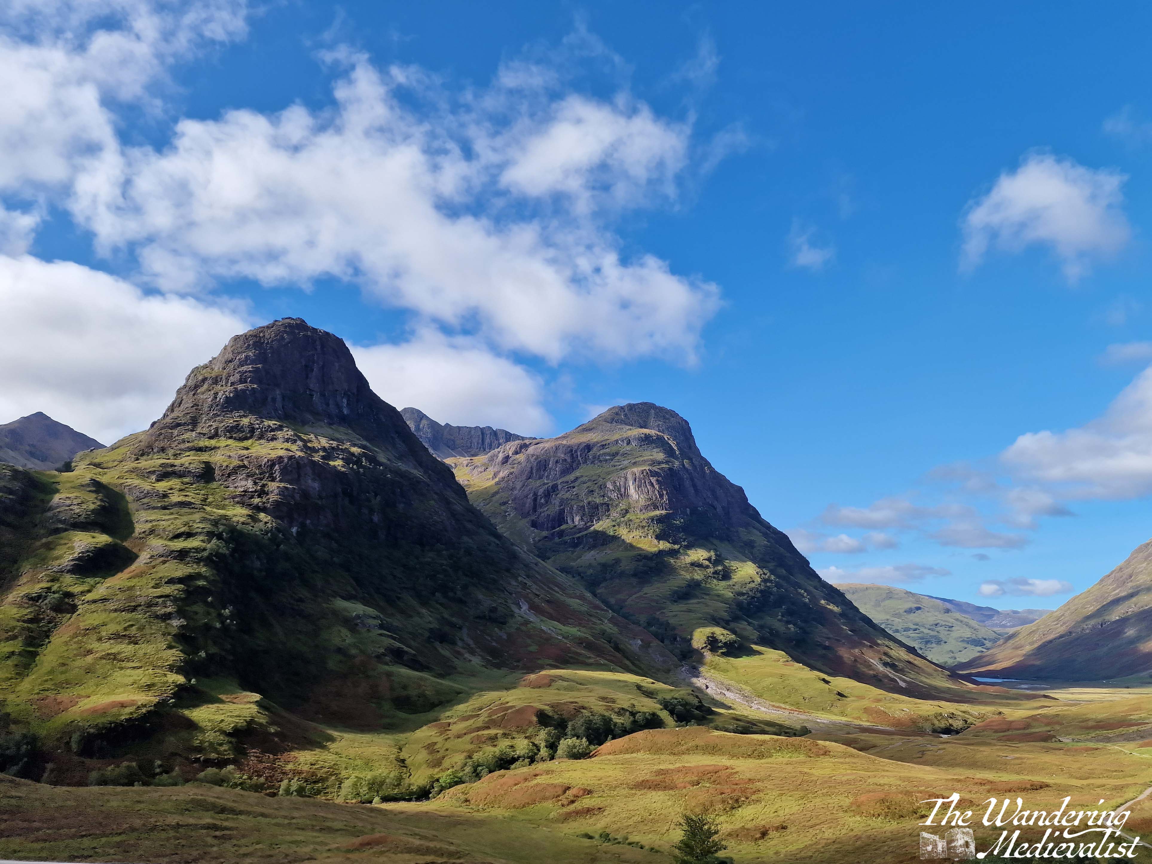
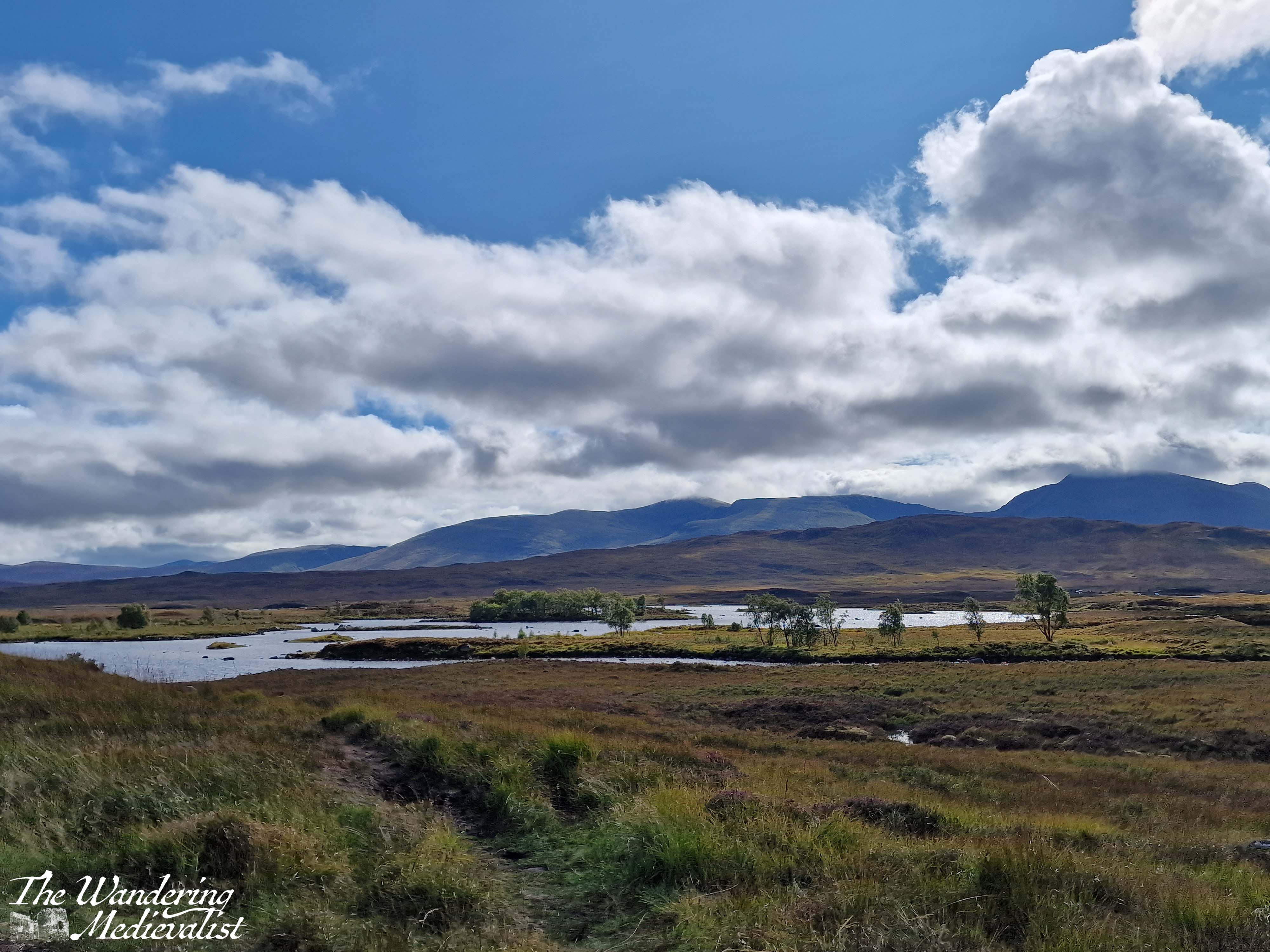
The stretch of road just south of Fort William leading through Glencoe and across Rannoch Moor is hands down one of my favourite driving routes in the world. No matter the weather, I cannot help but smile at the approach – even on the days when the rain is pouring sideways and the wind is trying to blow the car off the narrow road, as it did on one occasion which felt like driving through a hurricane. In good weather, it is simply breath-taking. In bad weather, it is atmosphere, dramatic, and a touch frightening. Either way, one should only attempt the drive when rested, confident, and possessing a full tank of petrol. Or at least a car that can make it at least 100 miles on the tank it has.
Sometimes the road is relatively clear, but most of the time it is on the crowded side, with visitors, tour busses, delivery lorries and of course locals just trying to make their way from point A to point B all crowding up the narrow highway. If stuck behind a lorry or bus, you can find your speed significantly diminished, and some will take risks to overtake. Needless to say, do this only if you feel comfortable and safe. Otherwise you just have to suck it up and enjoy the scenery – darn.
So here we are, a step-by-step of the drive, stopping at all of my favourite viewpoints.
Part 1: Fort William to Onich – 10 miles
The A82 route from Fort William to Onich is about 10 miles, and hugs the edge of Loch Linnhe. For most of the route, the trees block the view of the water, but there are a few gaps and parking spots where you can pull over – in particular the Linnhe Picnic Area, about 7 miles along, which is a spit of land sticking out into the loch and providing views in both directions.
This stretch of road is winding, no question, with few straight bits. My advice? Pay attention if the signs warn you of a sharp turn.
We have never stopped properly in Onich but it seems a nice little town with a few hotels, guesthouses and B&Bs taking advantage of the proximity of Fort William and Glencoe.
Part 2: Onich to Ballachulish – 4.5 miles
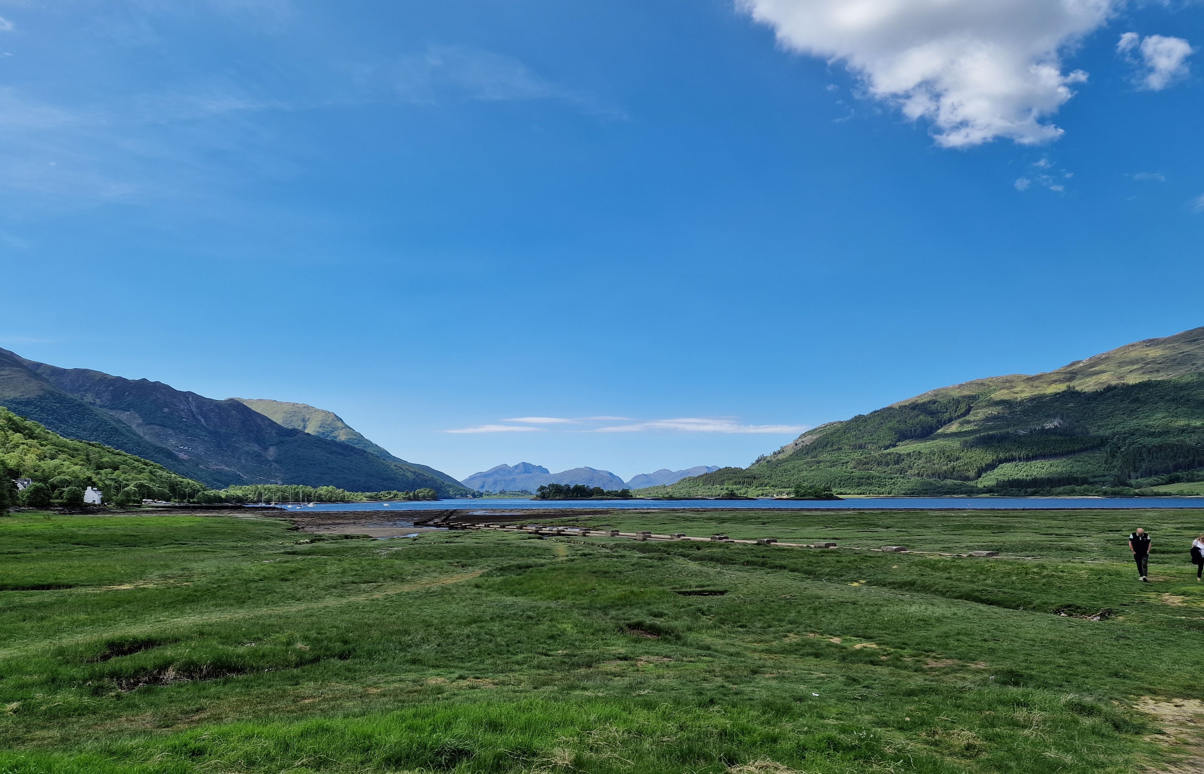
From Onich, it is a simple matter of following the A82 across the Ballachulish Bridge, which spans Loch Leven. Once across you can head straight south towards Oban, and this is also a beautiful drive along the water, but my route will take you left towards Glencoe.
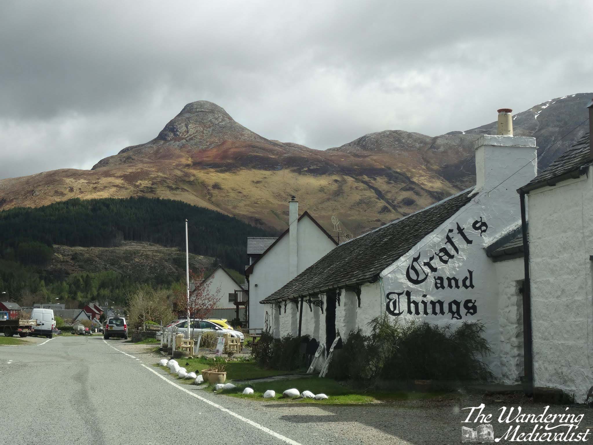
Almost as soon as you turn you will be heading immediately for a distinctive sharp peak called the Pap of Glencoe, and beyond it ridges of mountains leading east. On our first ever long weekend away together, the other half and I found a deal at the Isles of Glencoe Hotel in Ballachulish, which sits on a promontory in the loch. The views are just spectacular, especially at sunset. If you can, pull over at the parking area along the loch just after the hotel, or even turn into the village and get a coffee or snack at Crafts and Things. It was more than 10 years ago that we visited, but the other half still fondly remembers sitting in the April sun, looking over the loch with a cuppa and a tiffin.
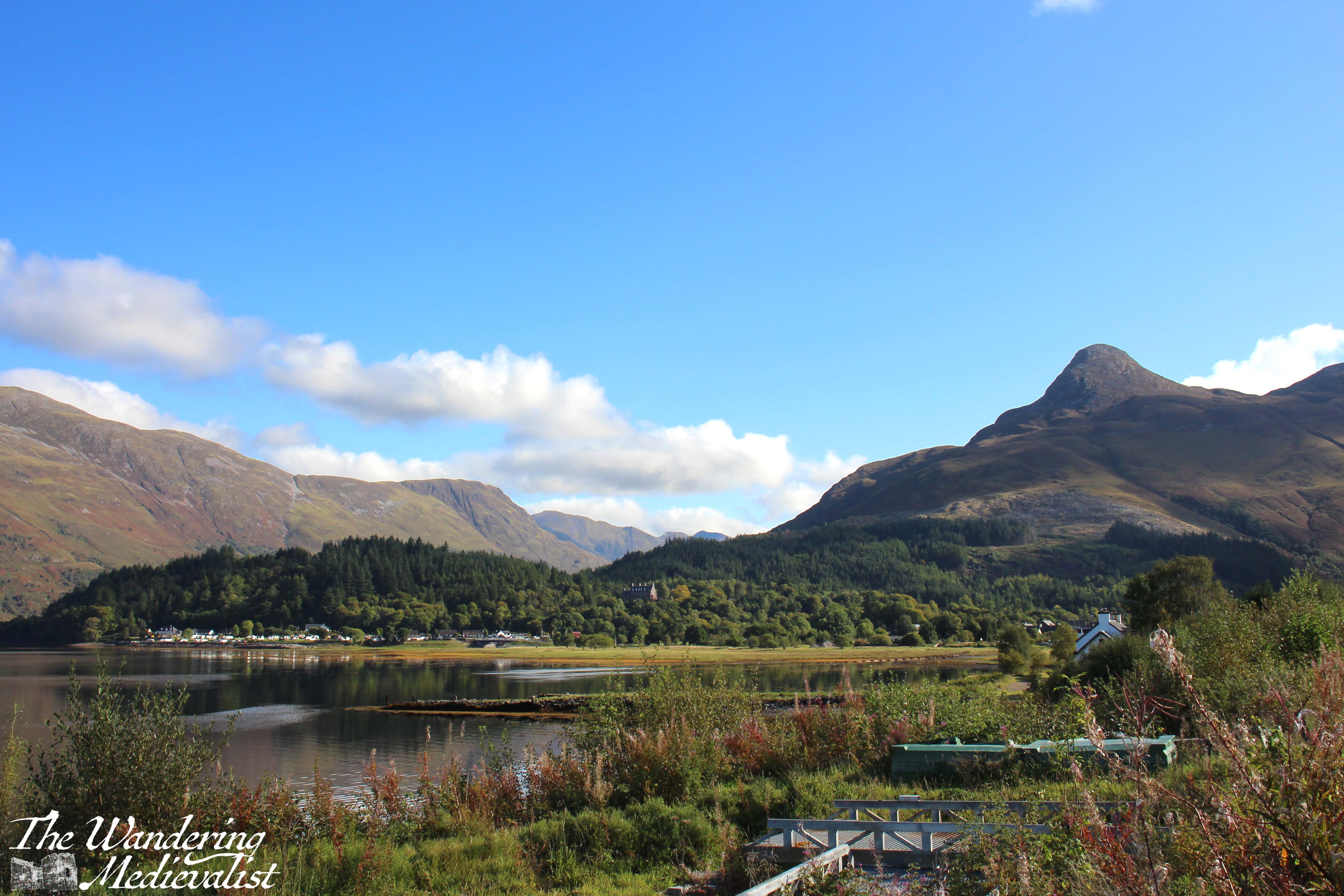
You can also take a quick detour left into the Loch Leven viewpoint (above), which as it suggests provides a view down the loch towards the bridge, at this point obscured by islands. Mountains rise in the distance and give you a preview of what is to come. This is also the route to the Glencoe Lochan walks.
Part 3: Ballachulish to Loch Achtriochtan – 5.5 miles
After Ballachulish the road turns inland away from the loch, and enters Glen Coe proper. Only 2 miles along on the right is the Glencoe Visitor Centre, where you can learn about the region and the famous massacre of 1692.
Mountains are rising on both sides of the road and ahead, often a combination of brown-grey scree and stone with lighter green patches of heather and ferns, and darker green foliage. The road here is in relatively good shape with a few potholes, and many drivers slow down both due to the sharp turns and the views. Enjoy the width of the lane while you can!
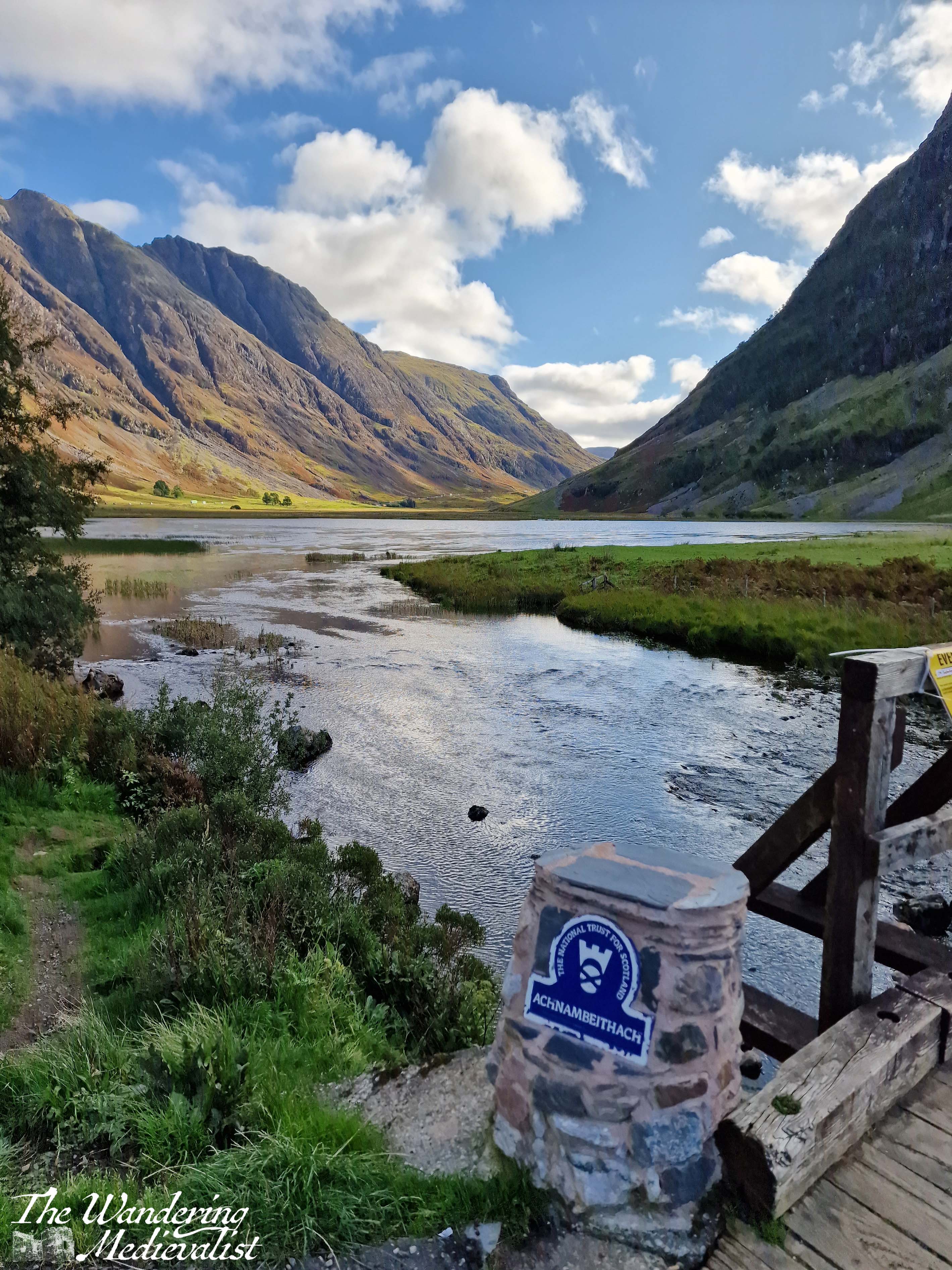
Another mile or so south, the road swings more sharply east to continue along the glen. Ahead of you the A82 stretches along the valley and then begins to climb, and ahead to the right is Loch Achtriochtan.
It can be a very busy and treacherous stretch of road, with drivers going faster than they should and plenty of tour busses and caravans, so I recommend pulling into the Loch Achtriochtan car park. Here you can either pause at the bridge, or cross to make friends with some sheep and approach the waterside. This spot allows you to capture the gorgeous hillsides and loch.
There is also apparently a turn-off around here to view Hagrid’s hut from the Harry Potter films, though I have never done so.
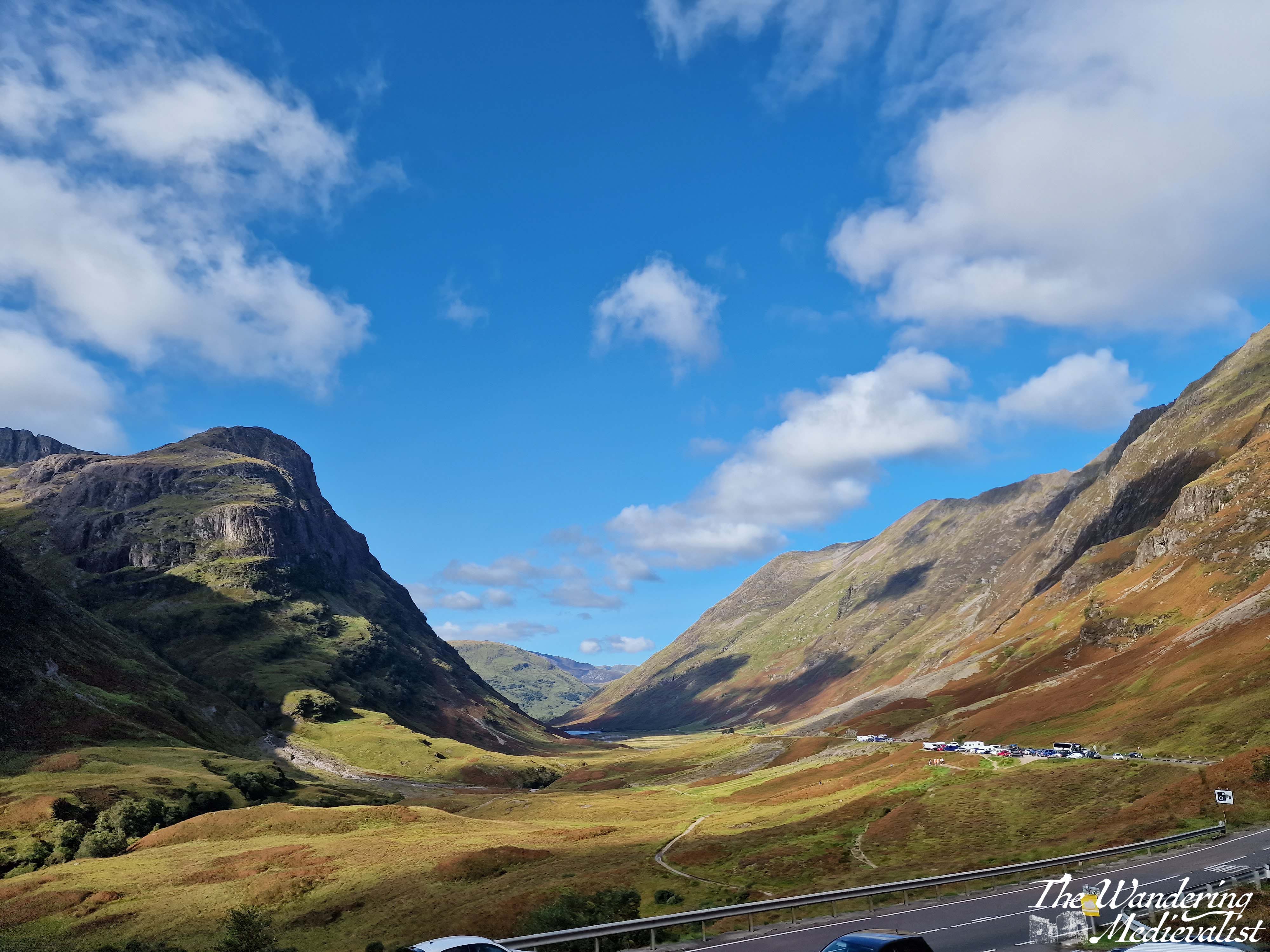
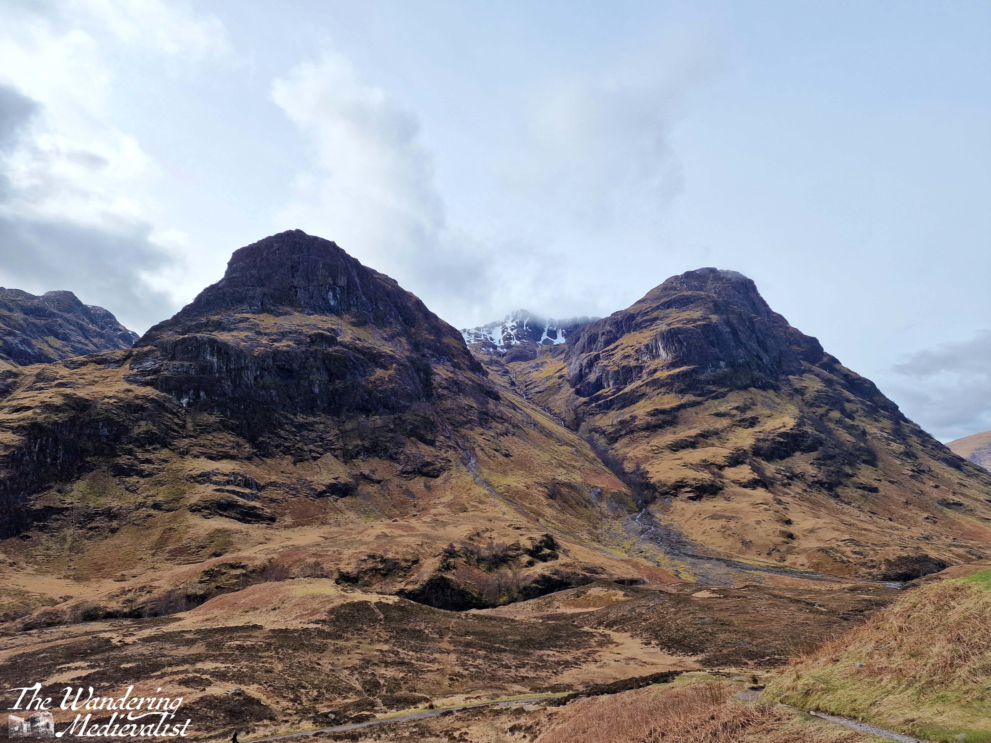
Part 4: Loch Achtriochtan to the Three Sisters viewpoint – 2 miles
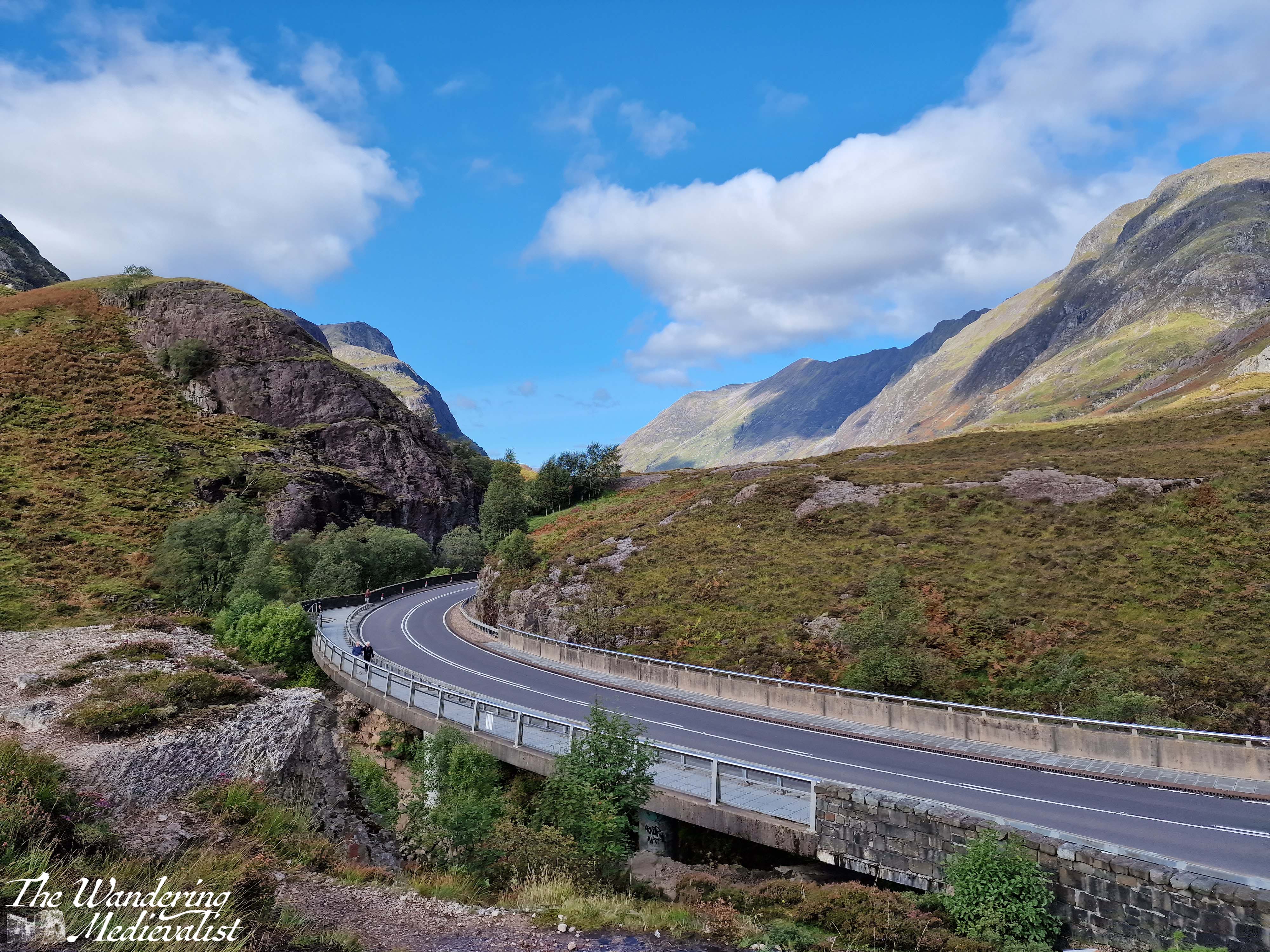
Once you have dragged yourself away form the the loch, it is two miles further to the pièce de résistance of this drive – the view of the Three Sisters of Glencoe. Until quite recently, there were several places you could turn off and you were often taking your life in your hands trying to park and find a safe place to get back onto the road. In the last year or two however they have built a proper car park – and another one for tour busses – to allow the many visitors to safely park and explore. There are a few parking spots slightly further up the road too, and there are paths leading down into the valley or up the hillsides.
The Three Sisters of Glencoe is one of the most photographed spots in Scotland and only a visit need tell you why. I have countless pictures from different times of year and I can never decide which one I prefer. Some day soon I hope to do some of the walk down into the valley and across the bridge, though I know I do not have the fitness or skills needed to venture too much further up into the hills at this point. Aonach Eagach Car Park is another good option but often too busy to find a space. It is at the trailhead for the Lost Valley trail and provides a slightly different view of the valley.
Side note: if it seems at this point as if you are just driving a few miles and then stopping again, you’re not wrong, but I promise the stops are worth it. If you get bored, skip one! But if this is your only trip to Scotland, I’d take advantage of them all.
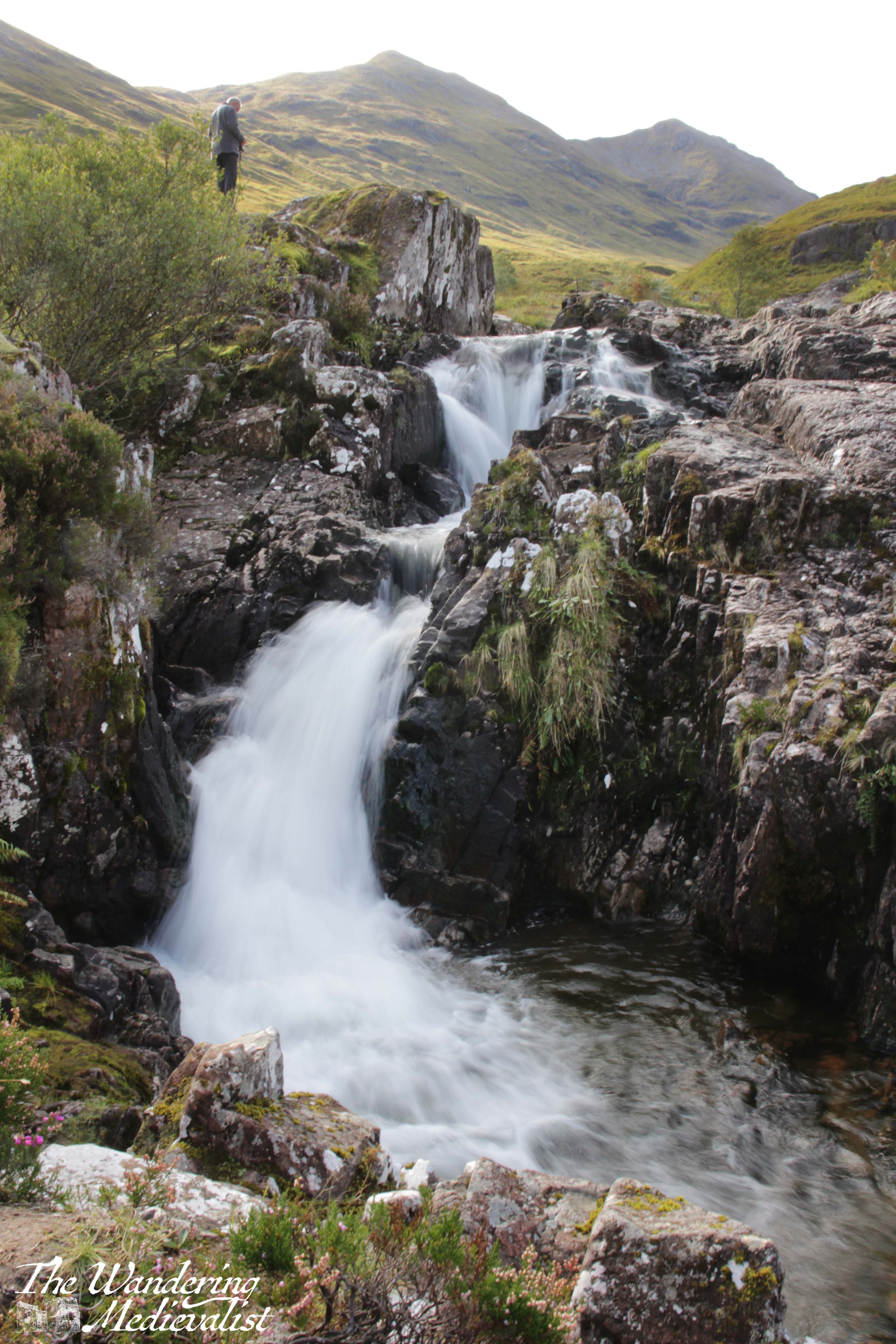
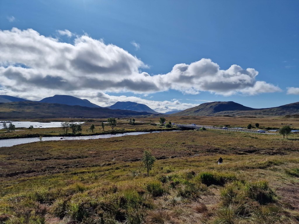
Part 5 – Three Sisters Viewpoint to Meeting of the Three Waters viewpoint – less than 1 mile
Yes, this is a short drive. I had passed it by many times before I made myself actually stop on one beautiful autumn day. The waters are, as it sounds, three separate rivers (Allt Coire Gabhail, Allt Doire-bheith and the River Coe) that meet here at a pool and series of waterfalls, before continuing down the glen towards the lochs.
There is a short climb from the car park that takes you up the rocks and over the waterfall, and the start of the climb is a bit ropey. But, once you have clambered up the hill, you reach a stunning viewpoint that shows you the newly built road, the falls, and the burn heading up into the mountains. There is a pool where I have seen people swimming – brave souls – and of course a trail that follows the burn. I dragged my octogenerian father up to see the view and I think even he was impressed. It is easy to see here the old military road, which was in modern times replaced by the route of the A82.
One point I should make is that in that .7 miles between the two spots, you are driving along a narrow road.
At one point, the highway cuts through the hillside, with solid rock towering on either side, and leaving very little room for error. Not that anyone would err…
It can be a bit harrowing even after several goes, so take it slow and easy.
It is very easy to miss the parking spot for the Meeting of the Three Waters
and this is not an easy place to turn around, so definitely use your Google/Applemaps or whatever Satnav system you prefer to warn you.
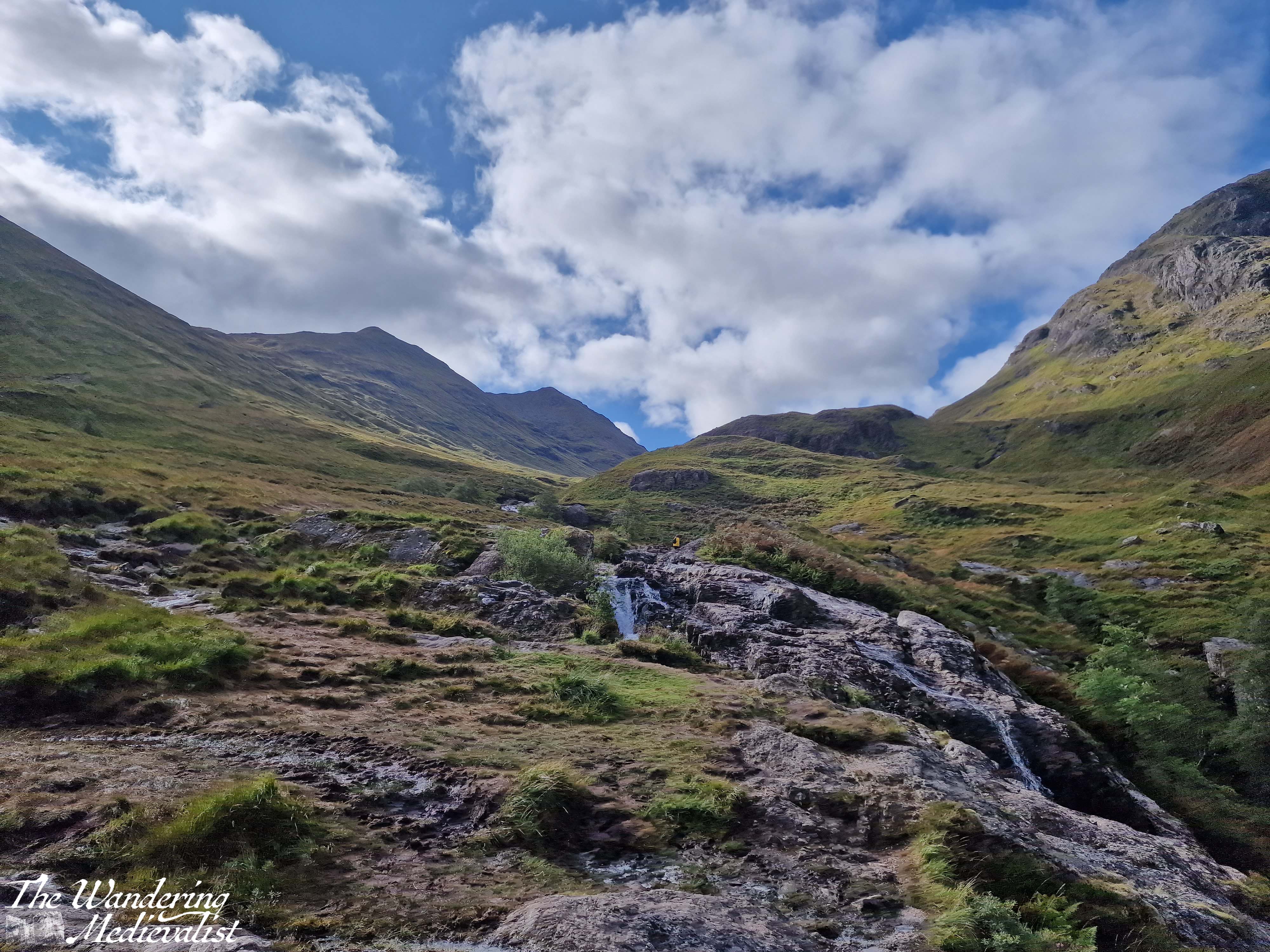
Part 6 – Meeting of the Three Waters to the Kingshouse Hotel – 5 miles
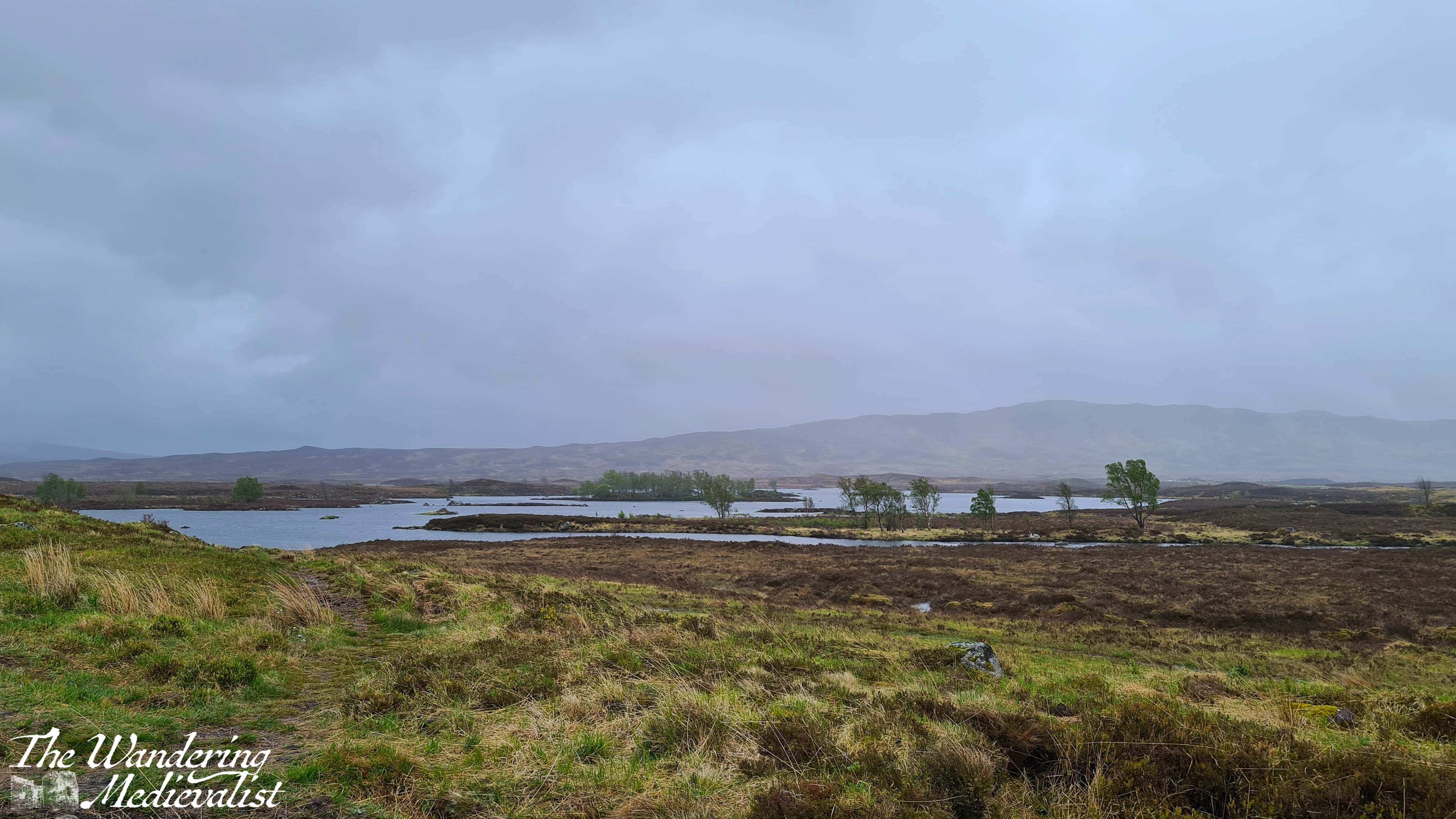
Beyond this parking spot are plenty more viewpoints and places where you can pull over, and it’s really about deciding how often you want to stop, and how busy they are. Sometimes there are so many cars parked in a small spot that you really cannot safely get off of the road. Once you have had your fill of waterfalls, you can make a bit of headway as the road opens up a bit with mountains on either side. Eventually the road will hug the edge of Rannoch Moor, and this is where in bad weather you can really start to feel the car being blown about.
The Kingshouse Hotel is a popular stopping place though they are strict about people coming in just for the view. I would love to stay and know friends who were married here during the pandemic – this area is famous for the amazing views of the mountain, Buachaille Etive Mór. You can also take a detour here and drive part of the way down Loch Etive, though as yet I have not done so. Some trip, one day!
Part 7 – Kingshouse Hotel to the Loch Ba viewpoint – 5 miles
Just after the hotel you will pass the turn-off to the Glencoe Ski resort – the trails are evident – and the mountains stay a bit closer on the right though they start to fall away on the left, as the moor creeps closer. This is quintessential Scotland, in my mind – boggy moor with mountains in the distance, countless little burns falling over rocks and carving their way down from hills and across the landscape. Rocks poke through either on their own or in clusters and chunks, covered in lichen and reminding one just how thin the soil is here. There are a few lone trees, but most of the landscape is relatively barren.
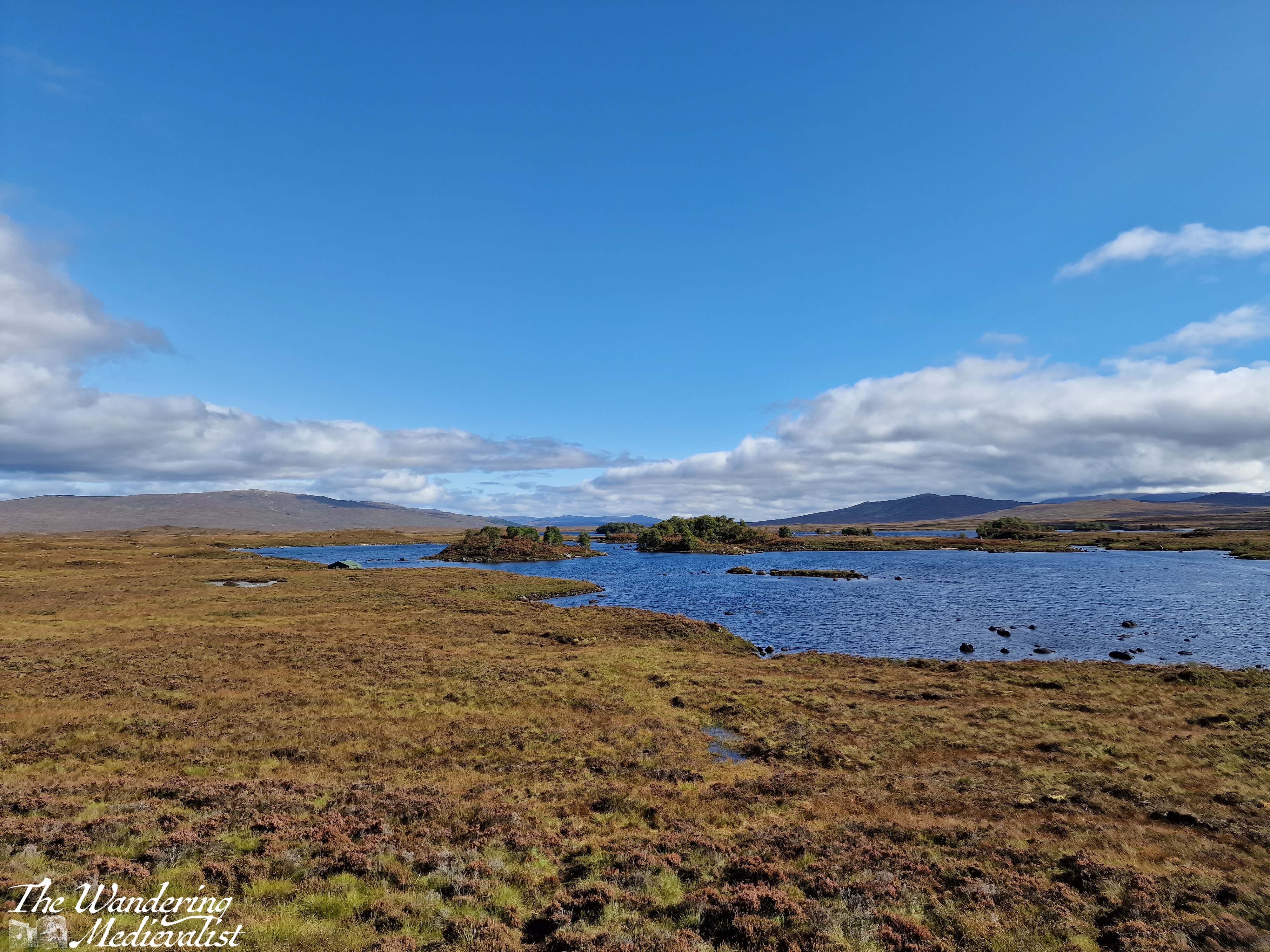
The final place that I cannot resist stopping is the Loch Ba viewpoint. There is usually plenty of space to pull over, and it is easy to see coming due to the lump of land that marks the view. Climbing this short hillock allows for 360 views, though it is the one almost due east that I love the most – glistening loch with plenty of small islands, leading away into the wilderness.
Behind you are the peaks of Glencoe, and ahead just the road, leading towards the next hills in the distance. I can understand why some might assess it as stark, but I think it is gorgeous.
Part 8 – Loch Ba viewpoint to Crianlarich – 19 miles
About three miles beyond the Loch Ba viewpoint, you realise how high the road still is when it suddenly, dramatically, begins to fall. There is a sharp descent through an s-bend that can challenge lorries and busses coming the other direction, though there is also a large parking area to pull over in if needed. From here, the road is a bit less dramatic though still stunning, crossing the Loch Tulla bridge and winding its way across the valley floor before climbing again.
One of your last views of the lochs and lowland of the edge of the moor comes at the far side of Loch Tulla, where there is a small parking area, but the views are better in person than in pictures. From here, the A82 is heading almost due south, passing through a number of villages and meeting up with the rail line that runs from Glasgow to Fort William. Bridge of Orchy and Tyndrum stand out as the two larger towns, with Tyndrum in particular possessing several hotels, petrol stations – if you can get in – and the Green Welly stop which has always been so busy that we haven’t been able to get in. For some reason there always seems to be a large gathering of motorcycles here.
Tyndrum is also where the highway branches off towards Oban, and from here south can get busier. The remainder of the drive to Crianlarich is following the River Fillian and its many small tributaries; mountains continue to dominate on both sides though they are slightly less dramatic than further north.
Crianlarich is another smallish town that has become significant for those heading to the Highlands. Firstly, it is where the road branches either to continue south towards Loch Lomond and Glasgow as the A82, or east to Loch Earn and Perth as the A85. Secondly, it is where the rail line divides. As I mentioned in my exploring Scotland by public transport post, the train from Glasgow north can go either to Fort William or Oban, and Crianlarich is where it stops long enough for the train to either split in two, or be re-joined. There is also a significant hiking peak, Ben More, not far from town, and plenty of places to stop for the night.
Part 9 – Crianlarich to Lochearnhead – 16 miles
The 16 miles from Crianlarich to Lochearnhead is highlighted by a bit wider road, and slightly lower mountains, though still offers glimpses of lochs off to the left. Just over half-way is the turn-off to Killin, where one can view the Falls of Dochart. There is also what I will always refer to as my emergency petrol station – on my last drive back with Dad, I misjudged how much petrol we had and could not see a place to stop in Crianlarich, so was running on fumes by the time we reached this spot. I was considering just going into Killin where I knew there was petrol, but this station saved us and allowed us to continue without a detour.
After the emergency petrol station, the road climbs and winds again through what is clearly planned woodland. One of the most dramatic parts of the drive is as this path falls again, with the road hugging the mountainside and a sharp drop on one side. Ahead, though, is Perthshire and in what feels like no time at all, you enter Lochearnhead, and take a left to stay on the A85. While there is not a huge amount here, there is a safe and relatively clean public toilet that can be a godsend if you have not stopped anywhere except viewpoints since Fort William.
Part 10 – Lochearnhead to Crieff – 19 miles
The drive along Loch Earn is beautiful. The loch itself is long and narrow, with plenty of well-to-do houses along the edge and water sports galore: paddleboarding, sailing, swimming and fishing are all advertised. Especially on a sunny day, the glimpses of glistening water through the trees make you want to stop and find a boat of your own.
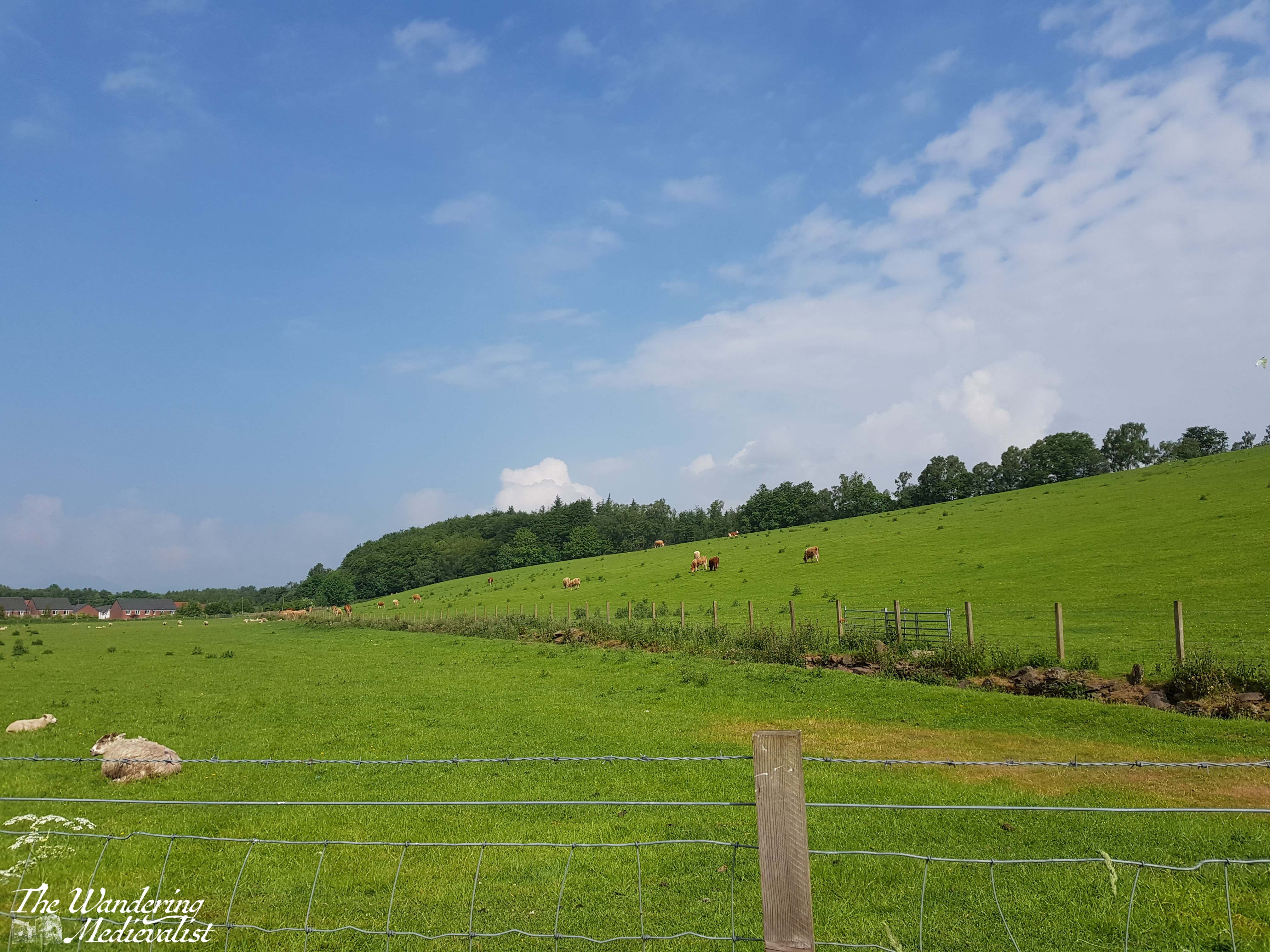
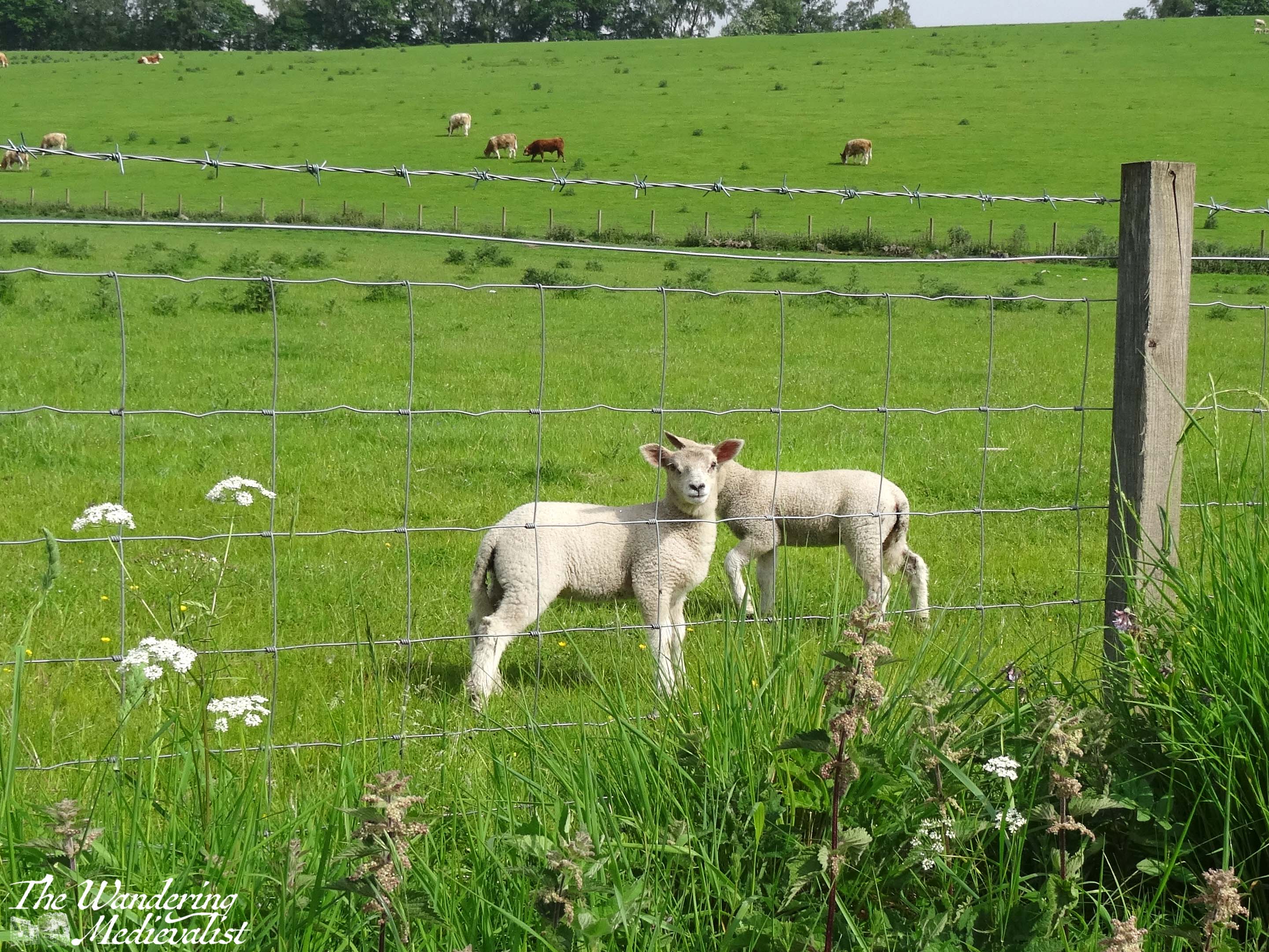
The drive from one end to the other is about 7 miles, and the town at the far end – St Fillians – is a charming village with plenty of Victorian-era gingerbread-style houses and lovely gardens. After St Fillians, the driving is much more lowland, with farms on either side, sheep fields and stunning stone farmhouses dotted between stands of trees and hills.
Crieff itself is an excellent spot to stop for a snack if you need, or you can push on through towards Perth – another 15 miles. This road offers a more Fife and lowland feel. Fields stretch off into the disttance over rolling hills, and the distant Ochils on the horizon. I have never liked this stretch but I think it’s at least partly because I know I’m heading away from the mountains, and that never ceases to make me a bit sad.
Once you have done the circular drive from Perth to Fort William and back again, you will quickly decide which leg you prefer and where you like to stop. I’m fond of both routes really, though I find myself often preferring the northerly loop as it can be a touch faster, traffic depending. I am looking forward to trying it again…tomorrow!
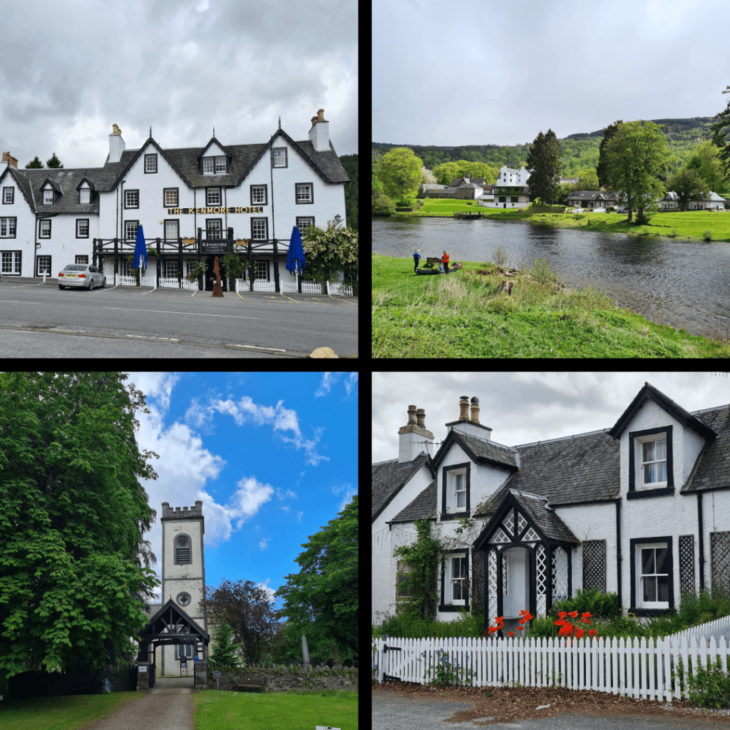
I honestly cannot remember why we chose Aberfeldy for our March 2020 weekend away; it may have been that it was closer than our usual Fort William destination. It may have been that it was somewhere new. Whatever the motivation, we reserved a self-catered cottage for ourselves for a long weekend. It ended up being one of the last ‘free’ weekends for quite some time, for as anyone living in the UK knows, the pandemic lockdown started in mid-March 2020. We were in fact sitting in a pub in Aberfeldy when it was announced that pubs, restaurants and cafés were closing – it was a somber moment, and the only thing we could do was order another pint to drink with the other patrons.
In recent years, the Aberfeldy area has become a favourite of ours for day trips and long weekends, and with each visit I appreciate more just how beautiful it is. There are elements that remind me of lake holiday culture in New England – self-catered holiday cabins, weekend ‘cottage’ escapes and water sports galore – but the hills and stone buildings define it as quintessentially Scottish. Many years ago, visiting family had been gifted a few nights in Kenmore and I went up to stay with them, though there were more than ten years between that visit and our more recent stay. Nevertheless, I recalled the area as being stunningly picturesque.
Below I will highlight a few of my favourite places around Aberfeldy and Kenmore for a wander, and show why it is a really good option for a night or weekend away. With no further ado, here are my exploration recommendations:
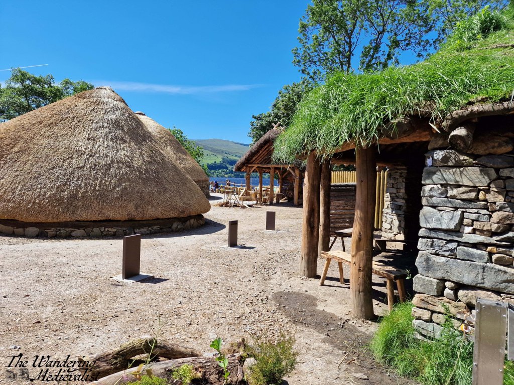
1) Visit the Scottish Crannog Centre. I’ve recently posted about the centre and highly recommend a visit – definitely good for families. A friend recently followed my advice and loved his visit! I think even the most un-history-oriented would find the Crannog story fascinating. Very reasonable entry cost too.
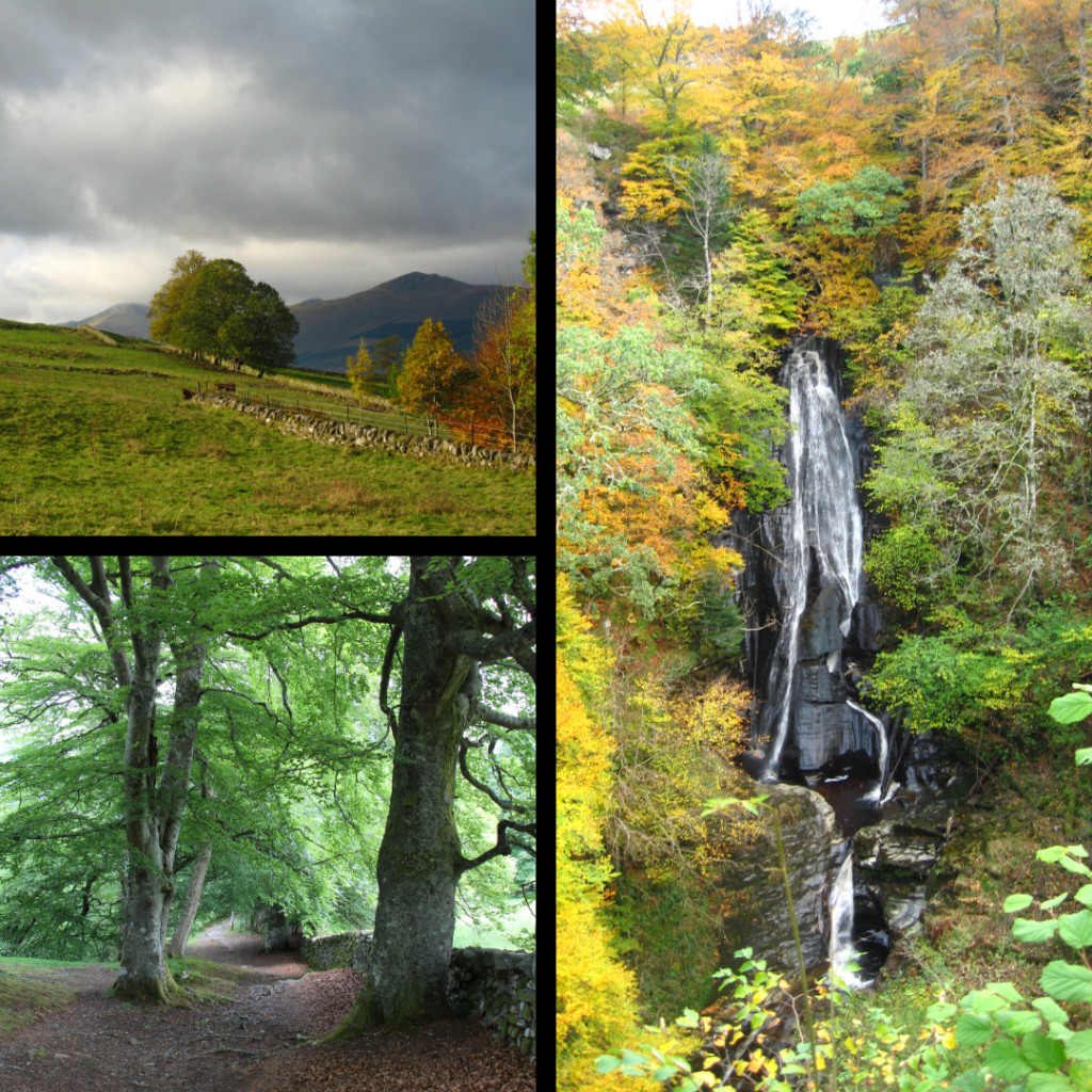
2) The Birks of Aberfeldy walk. This path starts in the heart of Aberfeldy or at a generous parking lot, and climbs into the glen and hills beyond. Wear solid shoes and prepare your knees for plenty of steps. Worth the pain, just ask the Bard himself.
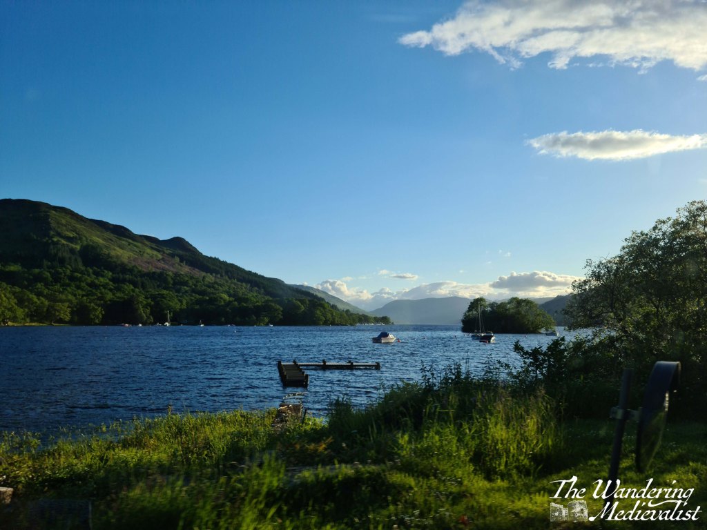
3) The Acharn Falls walk. Parking for this walk is about two miles along the south side of Loch Tay from Kenmore. It’s a bit of steep climb at first but the views are beautiful across the loch and of the falls. We did this back when my cousins were very small, and again recently on our own, and both times it was worth the effort.
4) Explore the town of Kenmore. Kenmore is very small – though ever expanding on the Taymouth Estate – and boasts rows of charming houses, a traditional church and picturesque inn. There is a small car park near the rocky beach at the end of the loch, and this is a great spot from which to explore the town.
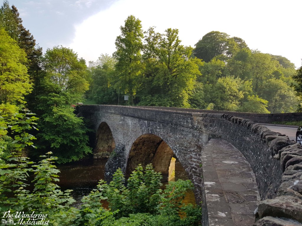
5) Walk across the Kenmore bridge. As anyone who reads my blog is aware, I have a thing for bridges, and the bridge in Kenmore – dating from the 1770s – is one of my favourites. If you walk or drive across from Kenmore, you are greeted with views back over the river and Inn or along the loch towards Ben Lawyers. Walk if you can – there is a narrow pedestrian strip – for the best experience. A few minutes more brings you to the next stop…
6) Browse the Mains of Taymouth shop and restaurant. The shop includes a lot of the standard luxury foodstuffs you might expect – cheese, crackers, Scottish sweets and biscuits, jams, whisky and gin, and souvenirs. It also sells local fresh produce. The café is quite nice and offers seating outside as well as inside, where there is a large fireplace. Across the road is a complex of cottages for short-term let, and a marina.
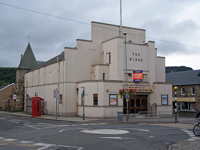
7) Visit the Aberfeldy Cinema. I must admit we have not yet gone to a film here, as we have been blessed with good weather, but their selection seemed to be a mix of classics and new films. The café is excellent, with fresh-made soups, panini and sweets. A great stop for a rainy day, or lunch on any other.
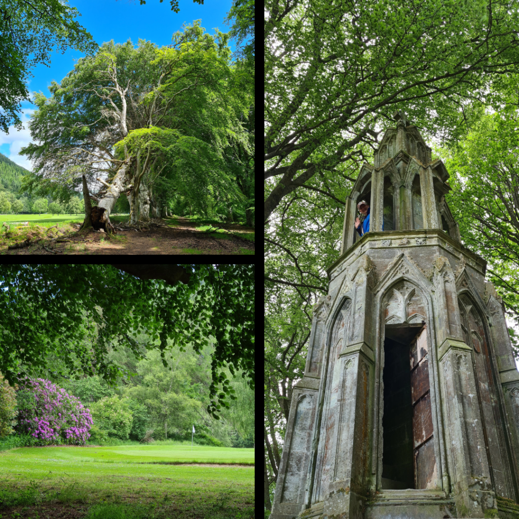
8) Tay River walk – Kenmore. This walk begins roughly at the Kenmore Bridge and follows the river through woods and along the edge of Kenmore golf course. Our plan was to circle across a Japanese-style bridge onto the Mains of Taymouth Estate, but when we walked it was closed. Lots of lovely foliage and rhododendron to be seen, plus an ‘Eleanor cross’ temple constructed in 1831.
9) Kenmore Hill circuit, which I have written about. A caveat to this walk is that the drive to get to the parking is harrowing – very steep and a winding, single-track road. The parking lot appears to have been done up since 2021 and the views from the summit are breath-taking.
10) Tay River walk – Aberfeldy Starting at another bridge, this time Wade’s bridge, the path follows the river to reach a pedestrian suspension bridge. There, we chose to cross and skirted along the edge of the golf course (this is Scotland after all). The trail continues on the far side of the river and bridge, with views of the distant hills and eventually – I believe – reaching Kenmore. The section we did is short and easy, and could certainly be done with kiddies.
Honourable mention for this region must also go to the Falls of Dochart, at the far end of Loch Tay from Kenmore, about half an hour by car. There is a great inn just next to the falls offering ice cream and coffee, and the rocks are great fun to explore!
I have not yet done any walking or hiking on Ben Lawyers, the high peak visible from the banks of Loch Tay, but I hope to on my next visit.
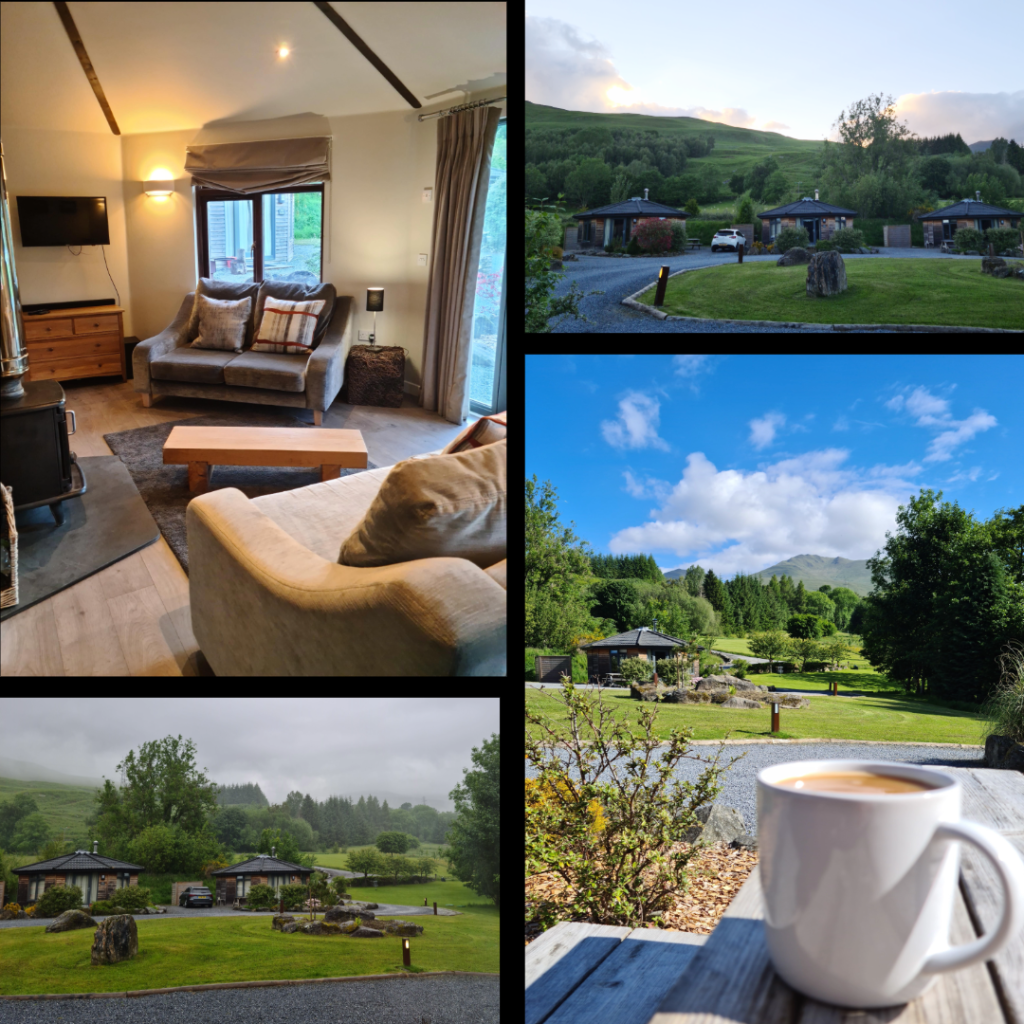
Finally, a note on accommodation. We have not yet stayed in any of the B&Bs or hotels in Kenmore/Aberfeldy, of which there are a great many, but instead we have reserved self-catered accommodation. Twice we have stayed at Moness Resort, which is in Aberfeldy, and once at Loch Tay Highland Lodges, which is situated about three-quarters of the way along Loch Tay, starting from Kenmore.
Loch Tay Highland Lodges offer an array of choice including glamping pods, larger houses for groups, and cottages that sleep 2/3 people, with or without a hot tub. The cottages themselves (which we chose) are very well equipped and well kept, with adequate kitchen supplies and a charming interior with wood-burning stoves, as well as a picnic table outside for BBQs or morning coffee. The views were stunning.
There were a few cons in that we were required to bring our own bedding and towels, which was a bit of a pain and does rule out those travelling from further abroad, though this could very well have changed since the end of the pandemic. Another con was that the walk down to the restaurant was quite steep, but there was no other option for evening meals in walking distance if you wanted a night off from cooking. Driving would have been a possibility of course, but we both quite fancied a drink.
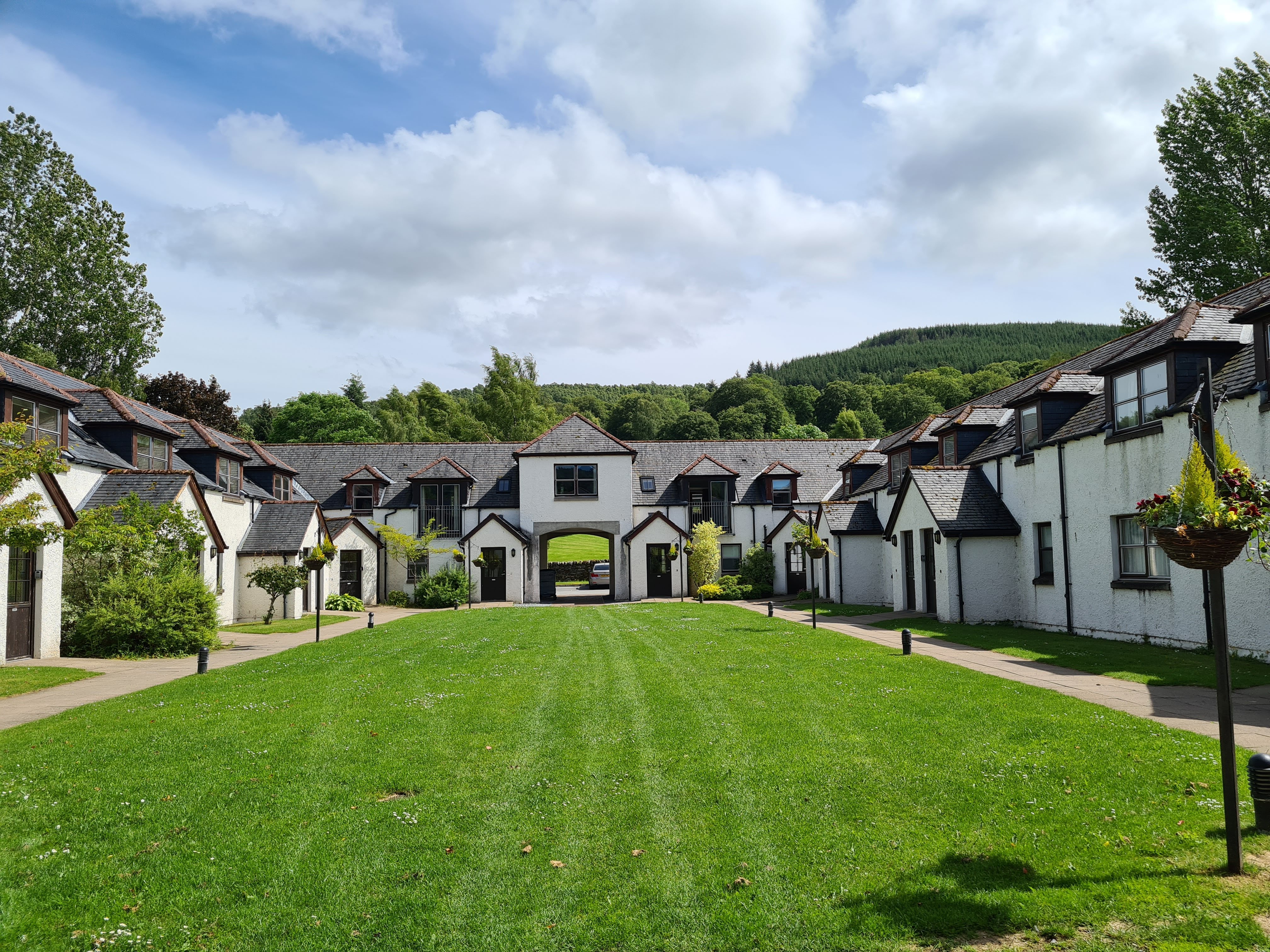
Moness Resort, on the other hand, is in easy walking distance of Aberfeldy town centre and offers excellent food in their own restaurant. The cottages come fully-equipped but are not quite as charming as LTHL. The resort is clearly designed for families and larger groups, with plenty of out-door space.
Each cottage and villa has its own picnic table, there is a pool and a big play park for kids – definitely ideal for larger family groups, weddings, etc. Being able to walk into the town means you can easily find a pub or check out one of the many restaurants and takeout spots. Bonus for there being two routes – one through the trees and along the Moness Burn, and the other along the road. The high street offers some more basic needs shops (pharmacy, convenience store, even a factory outlet store with clothing and toiletries) and also some aimed at tourists. A wee bit further on is the Co-op for any groceries you may need.
While staying in a hotel also has perks, the ability to cook for yourself can provide a bit of extra flexibility – we never manage to make it to scheduled breakfast when on holiday.
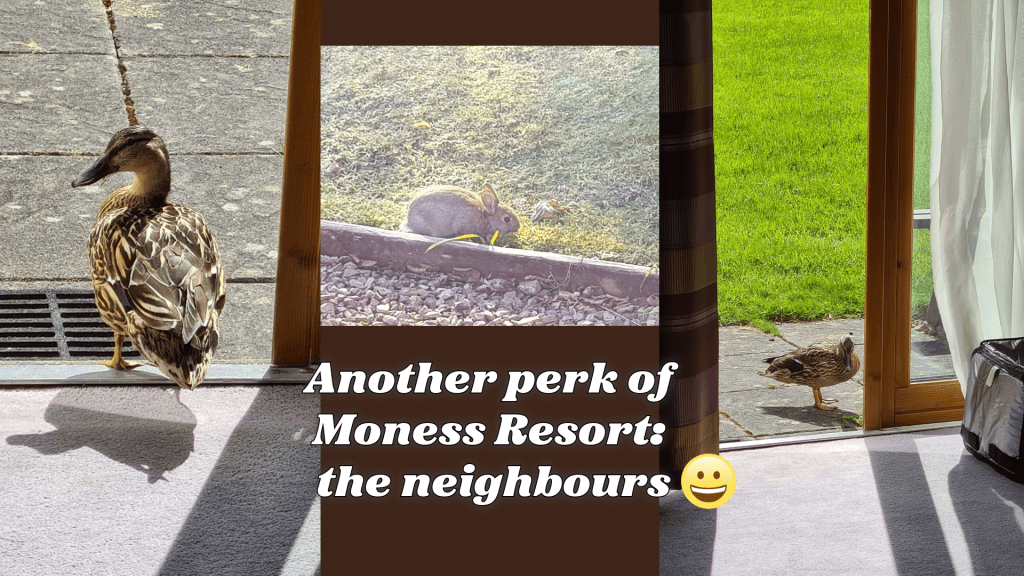
Though there were ducks at Loch Tay lodges, too.
I hope this helps you start to plan your visit to the Aberfeldy/Kenmore area! Am always happy to answer questions, just comment below if you have one.
The Highlands and Isles are a tempting destination, but sometimes you want something a bit closer to home, where you can still relax and enjoy the scenery.
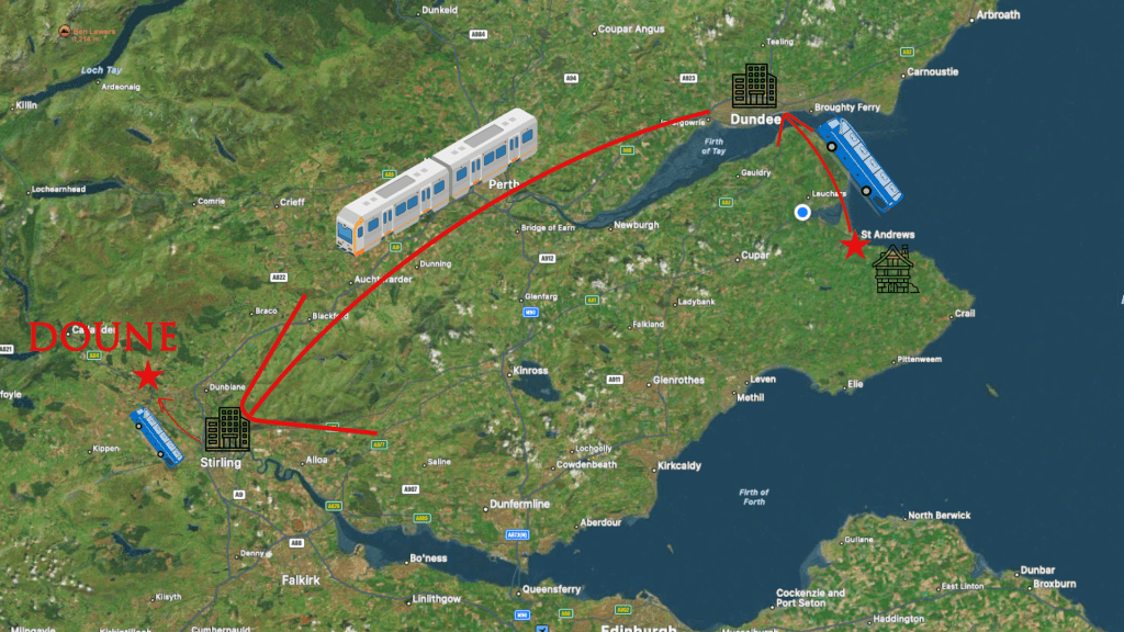
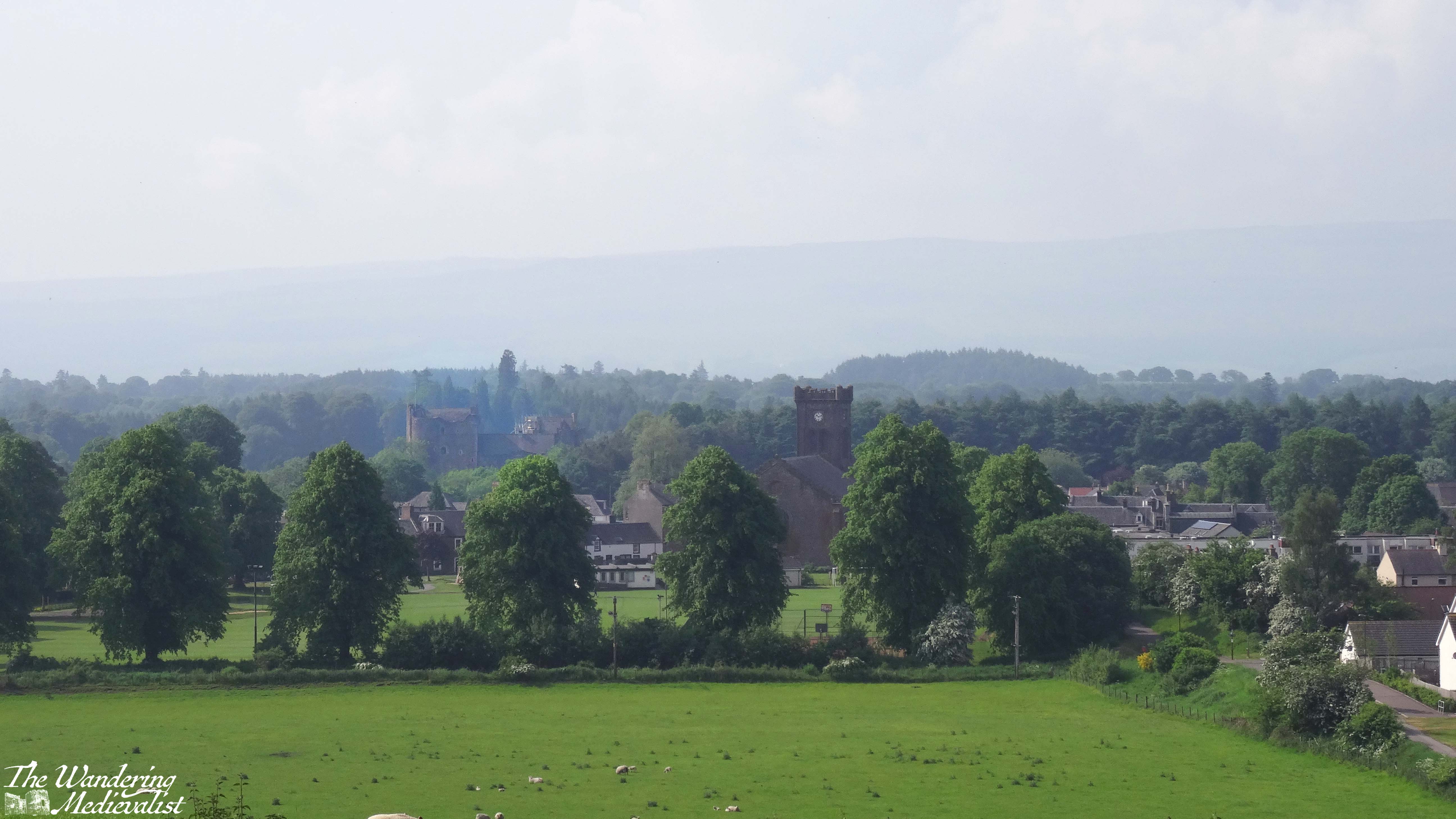
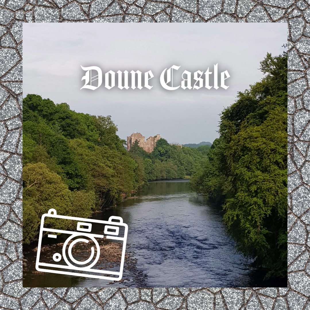
Several years ago, I took myself away for a few nights on a mini writing retreat. I chose as my destination somewhere out of the way and yet relatively easy to reach by public transport (though not on a Sunday as I had forgotten): Doune. I had opted for the same destination in January of my final year of university, when everyone else had exams and I did not. I’ve already written about my exploration of the fabulous castle, but as I discovered, Doune has plenty more to offer in the way of countryside walks and a charming village with lovely gardens.
My journey from St Andrews to Doune involved a bus to Dundee train station, train to Stirling, and then transfer to another local bus to Doune.
I reserved myself a nice room with a bathtub and plenty of space to spread out and write. The hotel was the same I had stayed at more than ten years before and was a touch more run down than I remembered (the food also not quite as good) but it was in easy walking distance of the bus stop. Aside from one evening when we were treated to a typical Scottish summer downpour, the weather was excellent – sunny and hot, at least for Scotland in summer.
Rather than race for the castle, which was undergoing renovations, I planned myself a long walk which essentially circumnavigated the town centre, starting at Doune Ponds on the north-west edge of town. I was advised by the kind woman at the hotel reception to make sure I had midge spray (something we don’t often have to bother with by the coast) and so I made my way via the pharmacy in town. The reliable spray they said was the outrageously-priced ‘Smidge’ brand, but was worth the spend.
I cannot for the life of me recall where I got the instructions for my walk, which were to start at the conservation land area of the ponds, where there are numerous paths to take.
I attempted to follow the poorly-worded route for my walk and managed to find one of several paths up out of the pond area, through large gatherings of gorse bushes. I have a love-hate relationship with gorse, which is a beautiful bright yellow harbinger of spring, but to which I am quite allergic. So I climbed quickly up to where my route joined a farm road. I have been unable to re-create the route I took at this point though I believe I may have ended up partly on the Commonty Walk. The path and my instructions were a bit haphazard, but it was a beautiful warm day and I had water and snacks so I just kept walking. There was a lovely section of the trail through a wooded area with sheep fields to my right, and looking down over the town.
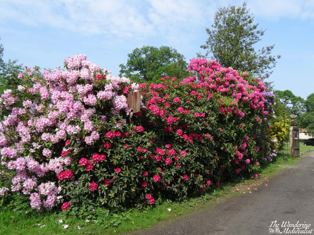
More than a few times I was sure I was lost, but eventually I ended up on the far side of the town, following my walk instructions which took me to the entrance of an old estate, recognisable from the gate cottage and of course the towering rhododendron bushes in full bloom. In fact, the flowers are what stand out to me most from this trip and this walk – everywhere I looked were gorgeous colours, in particular the rhododendron going from purple and white to bright red and coral pinks, and even a buttery yellow.
As I made my way down the path, I was met by a woman asking if I needed help, as the area I was heading into was closed to public access. I explained that I was trying to follow a trail, and trying to get to the castle, and when she realised (I assume) that I was simply a slightly lost walker, she immediately offered to guide me through the estate. It was my second experience in Doune of the joy of travelling on your own and being relatively happy to chat to almost anyone.
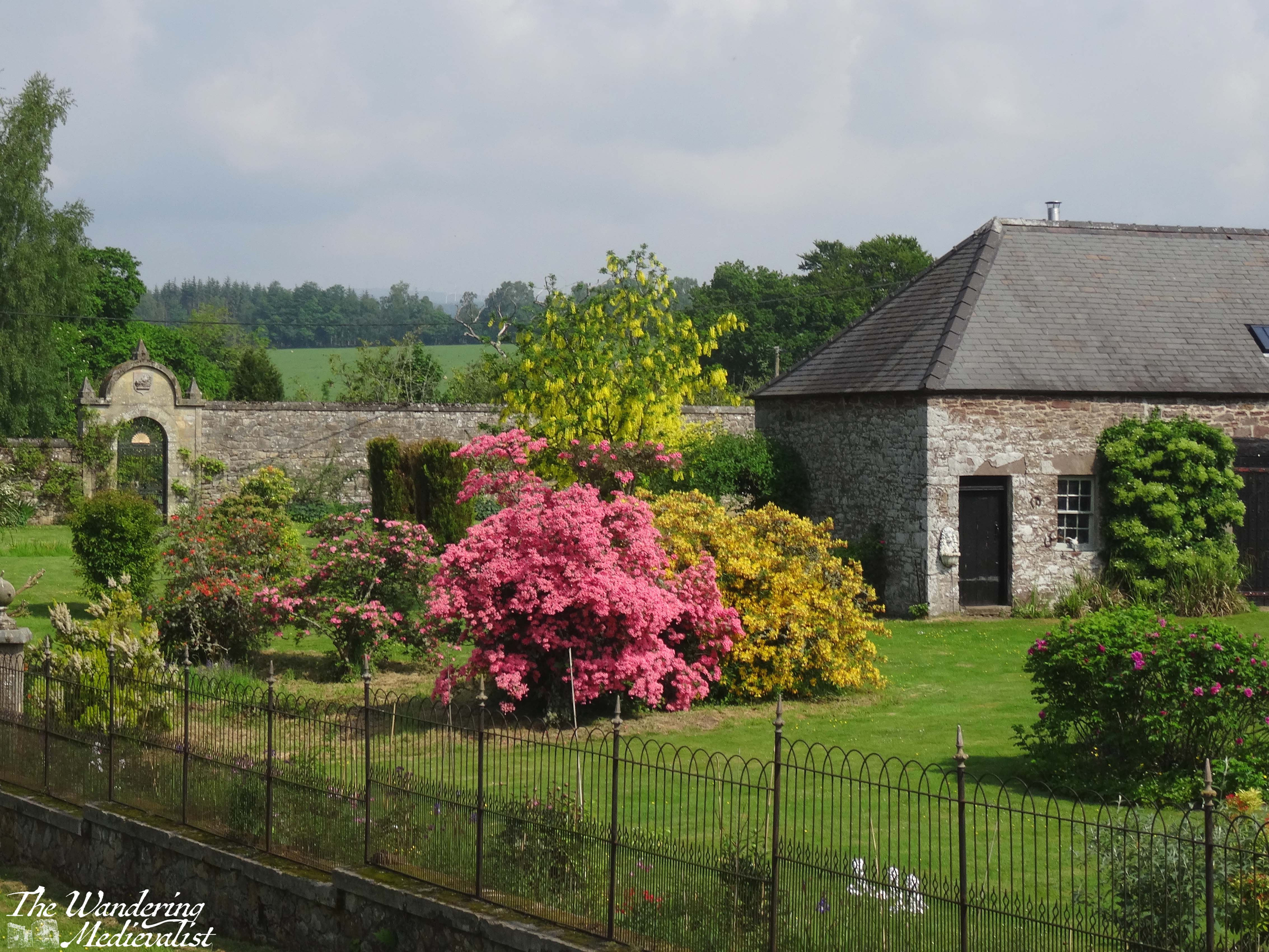
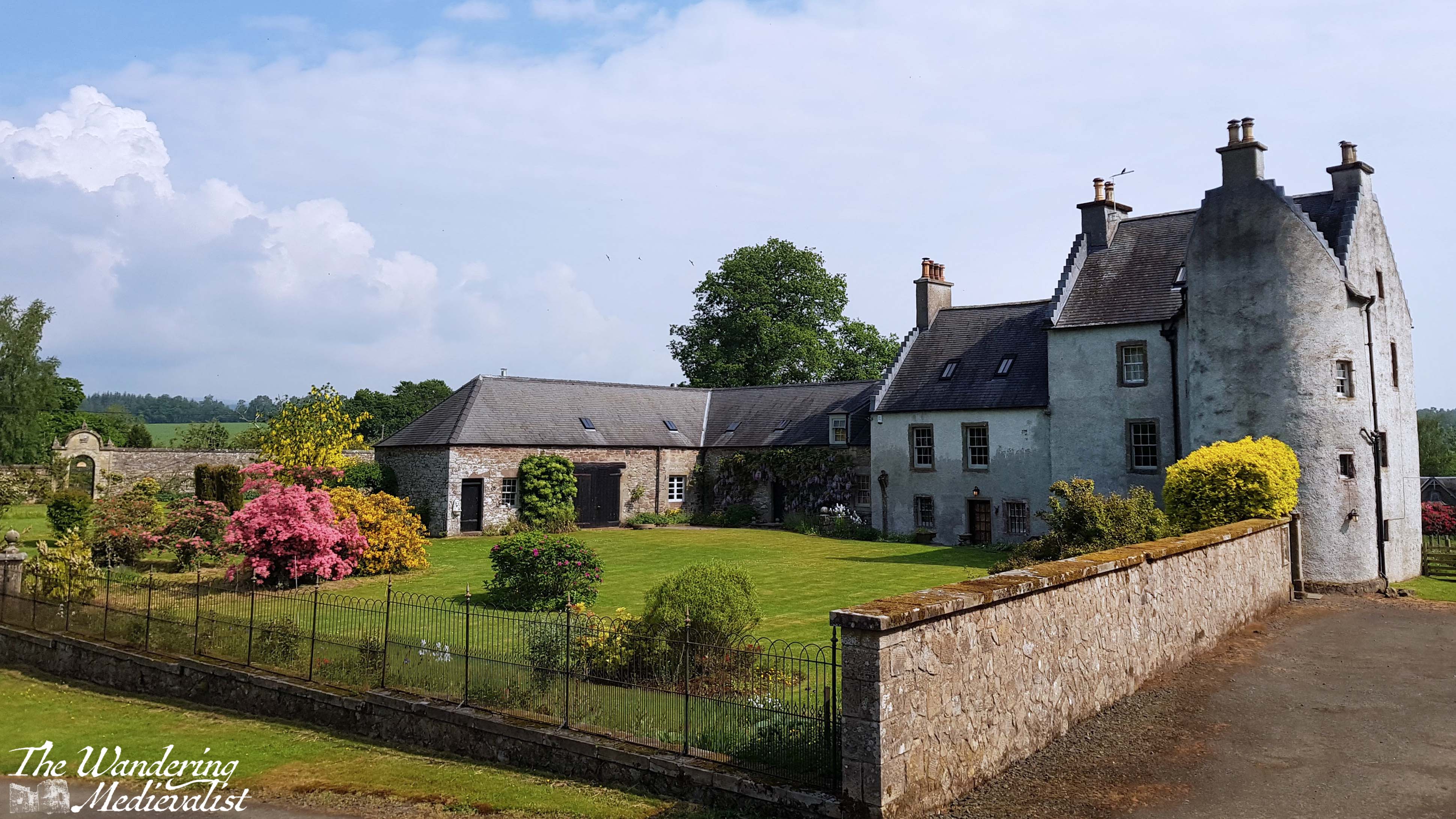
The estate where I ended up is called Old Newton of Doune, part of the Inverardoch Estate, and not long before the cast and crew of Outlander had been staying there while filming – to think I was only a few days off! The caretaker told me a bit about the area and allowed me to walk around the edge of the old estate house, which is stunningly landscaped and kept up. Built in the 16th-century, the castle-house was designed primarily for defence and only used for more domestic purposes several centuries later; now it is used as a group holiday rental. Though I was not allowed to go inside the gate, I was able to get plenty of pictures from the nearby hillside and path.
It was going to be hard to top my visit to Old Newton!
I passed out of the estate on a back access road lined with yet more rhododendron (so common on Scottish estates) and pines, to meet Castle Road. From here, I bypassed the castle and several gorgeous old stone houses, and followed signs for the riverside walk. As it was still a hot and sunny day, I was quite happy to be down by the gently meandering river, where there was a touch of breeze to keep away the worst of the bugs.
The path was well-kept and lined with trees, while the back fences and gates of the gardens of Doune offered hints at some beautiful landscaping. The route ended just before the bridge and cut up a set of stairs towards the road, where it would curve back up into the village proper. The bridge offers a stunning view back along the river towards the castle, but can be a bit hazardous. The sidewalk is there, but very narrow, so caution is essential.
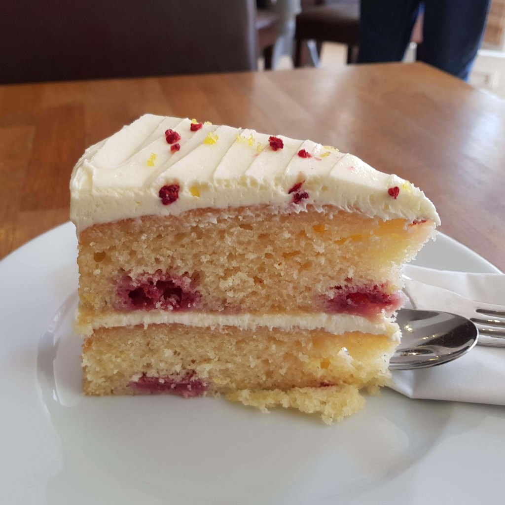
Back in the town centre, I found myself a table at the fantastic Buttercup Cafe, which had finished their lunch menu but still offered coffee and cake. I decided that my long walk deserved a bit of a reward, and so ordered a delicious raspberry and white chocolate confection along with my Americano. Highly recommended!
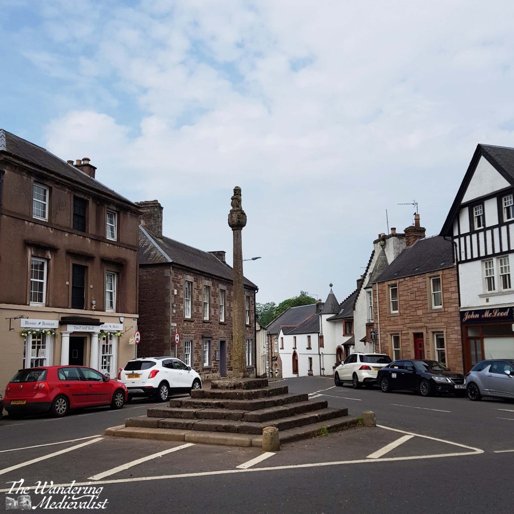
Mercat cross, Doune
my delicious treat at the Buttercup Cafe
I am sure that if I had more time, I could have found plenty more fascinating walks and trails to take, but I was determined to get a chapter or two of my book edited and re-written, so I headed back to my hotel for a shower and a few hours of writing. While I cannot say I’ll be rushing back to Doune in the near future – I feel like I’ve seen a good bit of it – there is no question that it is a lovely little town with residents well-enough off to keep some gorgeous gardens.
The 14th-century castle and evidence of a Roman fort demonstrate that the site of the town has been inhabited for potentially 1000s of years. In the 17th century, the town became famous for the pistols crafted by the Caddell family, Flemish gunsmiths. The pistols were often sold in pairs, and the Caddells had developed methods of ornamentation that made the weapons highly sought-after. Interestingly, this claim to fame ties back to the Boston area in that it is likely Doune pistols were used during the American Revolution and even, perhaps, at the early battles of Lexington and Concord. Now who says history isn’t fascinating?
Happy Anniversary to me and to you, my readers! 🎉🏆
It has been one year since I started this blog (though the idea had been percolating in my mind for some time before that) and I want to take a moment to say thank you for reading, liking, commenting, and most importantly loving all things medieval.
In honour of this anniversary, let’s look at some of the highs and lows of my last year:
Do you remember what my first post was about?
Maybe you weren’t following me then, or maybe it’s just a bit too long ago 😉
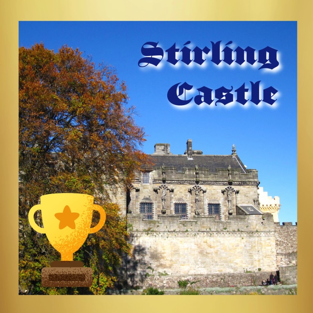
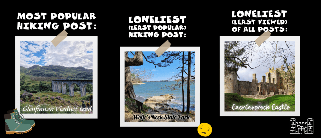
My most viewed castle post happens to be about the castle that I recommend first to all visitors to the area – better than Edinburgh in my humble opinion.
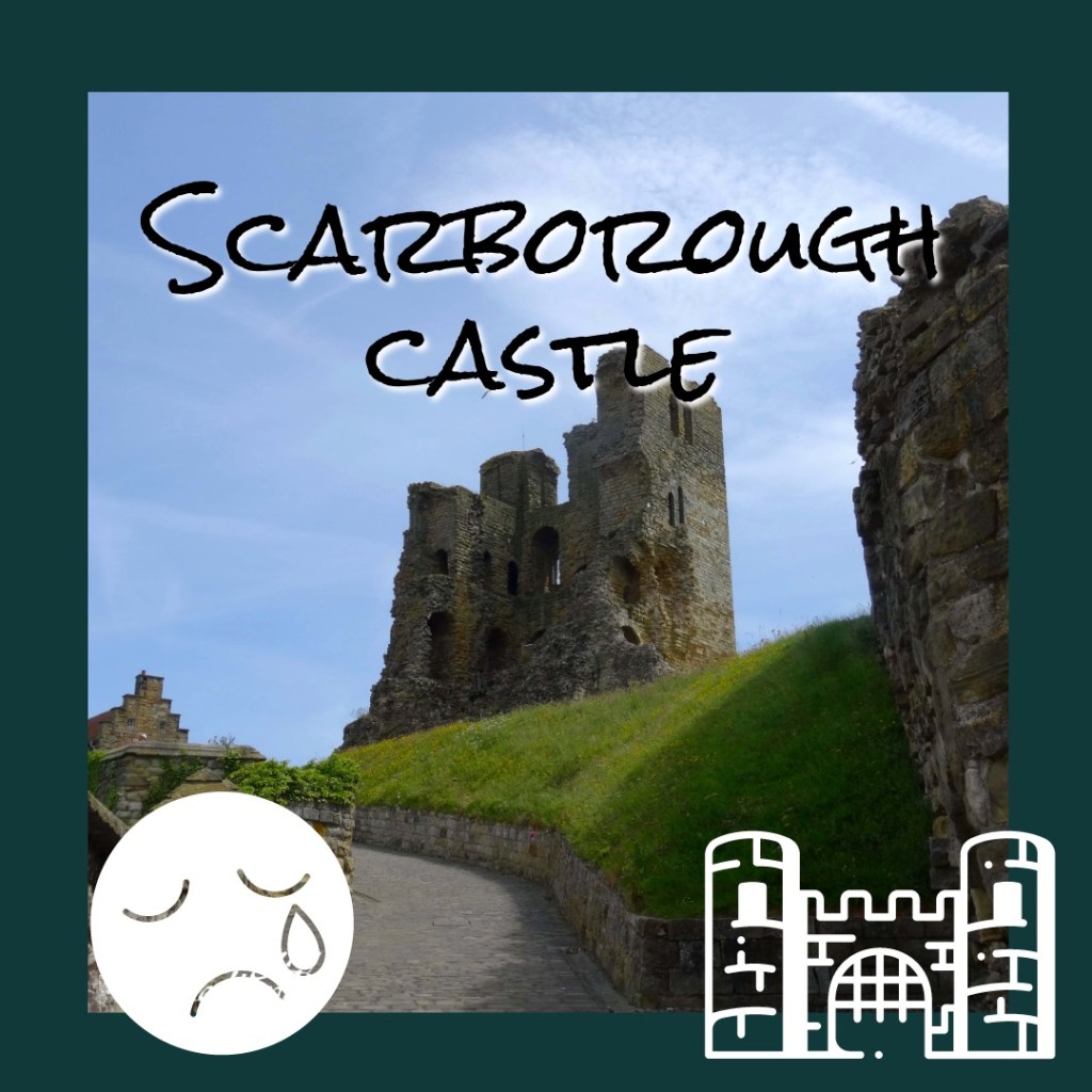
The least viewed castle post was poor Scarborough – maybe you missed it? Built largely by Henry II, it is well worth a look.
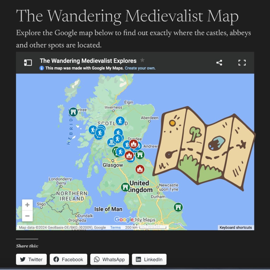
My most viewed page overall was the Wandering Medievalist Map – I’m glad to see it’s of interest! I do have a bit of a thing for maps…
Most of my readers come from the US or UK, which is no real surprise. Please do keep sharing with anyone interested in hiking, history, or my unique thoughts.
I mention my thoughts, because I was somewhat surprised to see that my most popular post of the year was not a Highland Hike or a Crumbling Castle or even an Ancient Abbey. Instead, it was a post simply about my opinion on a topic I could talk about for some time (and have)…
Have you read my take on Mel Gibson, Kevin Costner, Charlton Heston and other giants of the movie world?
Your interest in this post has motivated me to look at writing some more specific reviews, particularly of those movies who have most inspired my love of the Middle Ages. Perhaps I will even share some of my more academic writings about movies, in time.
A few reflections…
The idea for a blog came to me in the depths of pandemic lockdown in 2020, and it took me almost three years to find the time and headspace to get it up and running. In that time I had countless ideas for posts and opinions I wanted to share, and I’ve made a small dent in the long list I made.
Overall, it has been a fantastically fun experience. I have learned so much and perhaps more importantly allowed myself the time to learn about editing, photography, and how to put together a post that is not too long and not too short (though there may be a few of those). I’ve been exploring with page design, spending lots of time playing with Adobe, and I am much less afraid of the ‘manual’ setting on my camera. I have been more thoughtful about books I’ve read and movies I’ve watched, considering if they are something I might want to share, and I’ve been learning a bit about self-promotion (not my strong point).
Most of all, it is incredibly rewarding for me to have a creative outlet, to have a place to share my thoughts and pictures and hope that you will enjoy them. I have even been encouraged to turn back to my first love of creativity – writing. In time, I may even work up the confidence to share some of it with my audience.
In the meantime, I am excited to see my readership slowly growing, and hope it will continue to do so. I have plans that the next year will allow me to focus more on creative than I have for many years – even decades – and I cannot wait to see what will come of it. Creative has been missing in my life for too long, and I am welcoming it back with open arms, and remembering the value it adds to my life.
What else is next for the Wandering Medievalist?
I’ve got a few posts already planned, and hopefully some day trips to add to my collection. Look out for:
Balvaird Castle
Castle Campbell
Glencoe and Fort William
Highlights of Puerto Rico
My favourite drive in Scotland
Film review of Disney’s Sleeping Beauty
a visit to the newly-reopened Crannog Centre on Loch Tay
and much more!
News Alert! And perhaps most exciting, look out for the Wandering Medievalist online shop, launching in May! You will be able to buy prints of my pictures, request prints that may not yet be available, and in time additional products too (calendar? mug? photo book?)
Is there something you would like me to write to about? Complete this form to send me your thoughts:
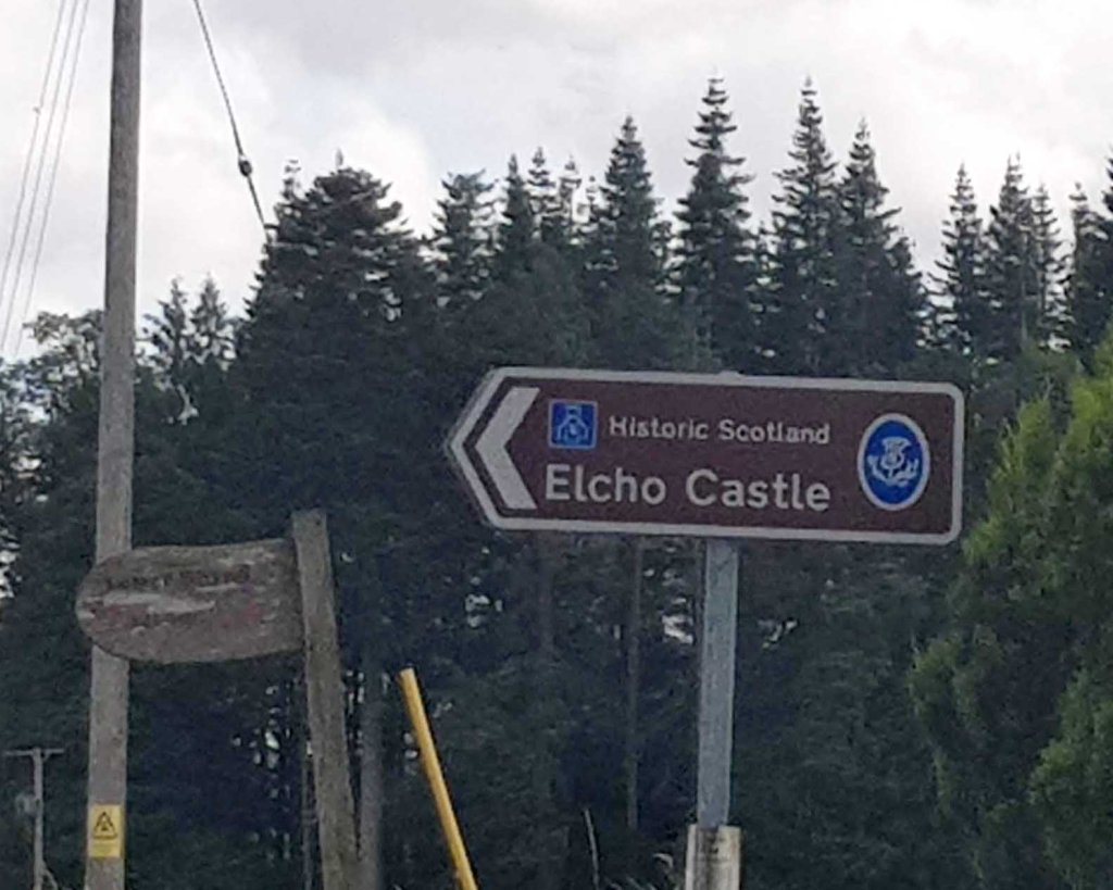
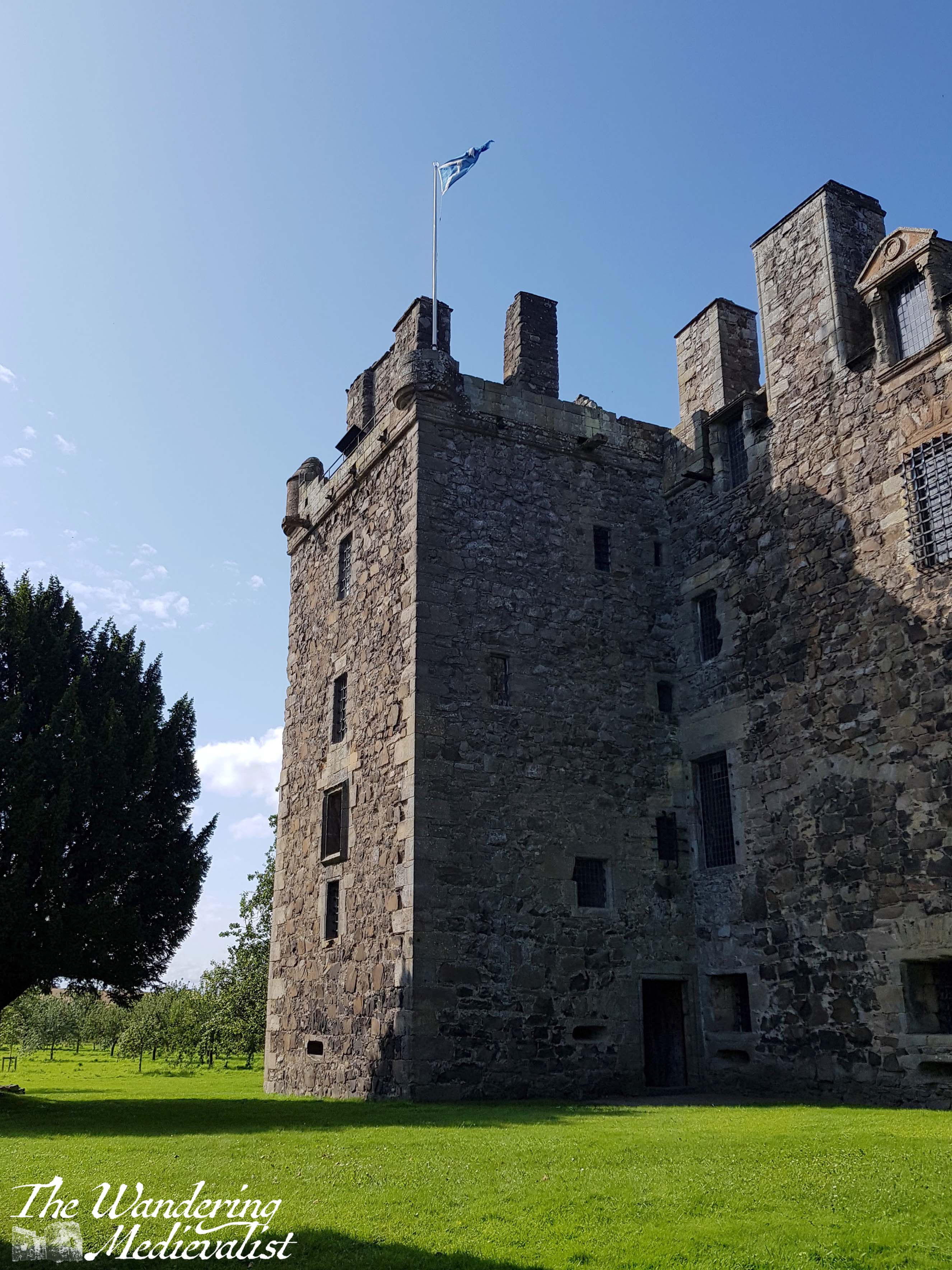
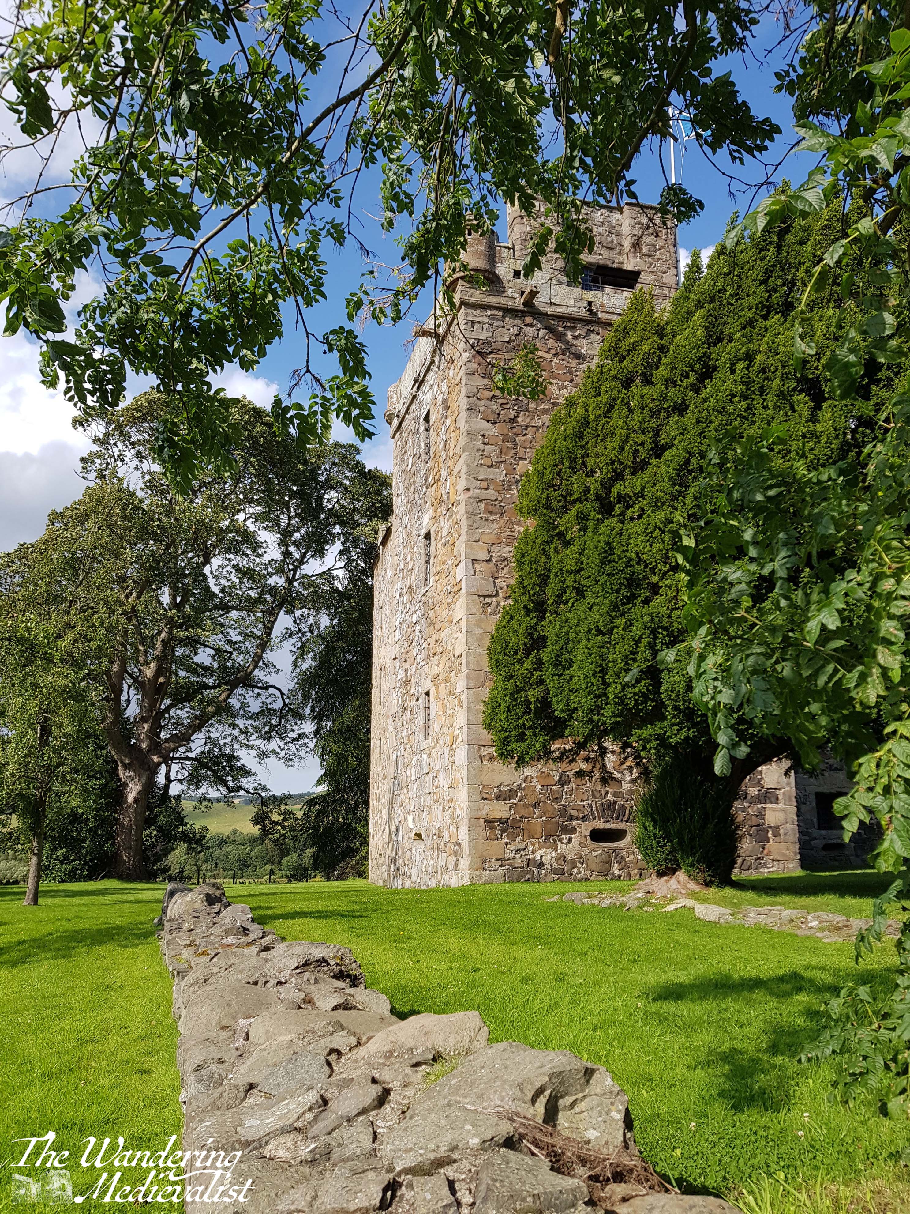
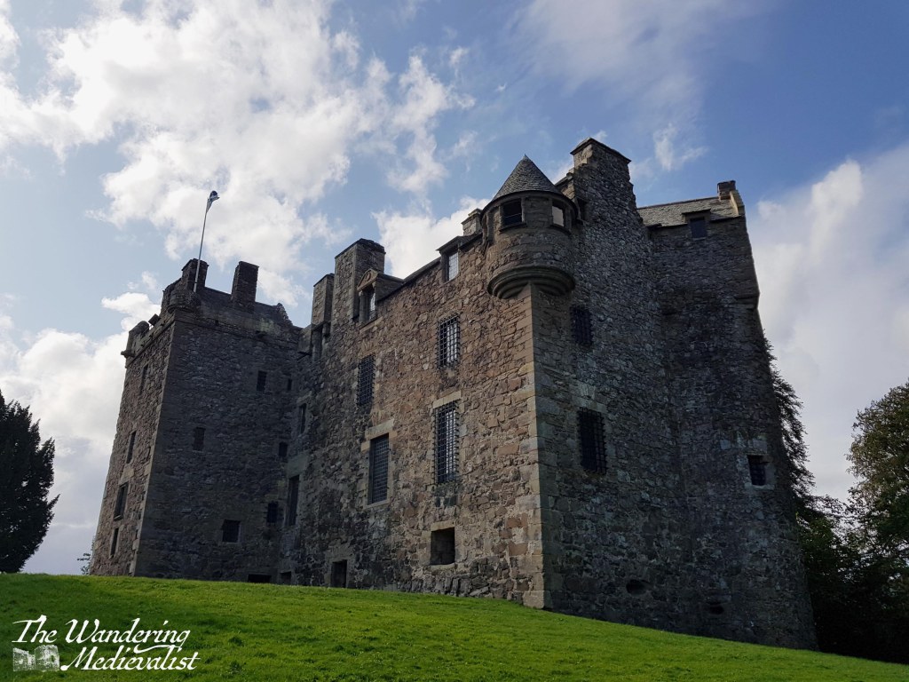
Our excursion to Elcho Castle was part of a late summer weekend during which we met a friend – and fellow medievalist – in Perth for lunch and decided to explore this heretofore unknown castle. I had identified it on one of my many castle maps of Scotland, and the Historic Scotland website confirmed it to be a well-preserved example of a late medieval Scottish tower-house. I note that as of writing, the castle is one of the many currently closed while masonry inspections are undertaken.
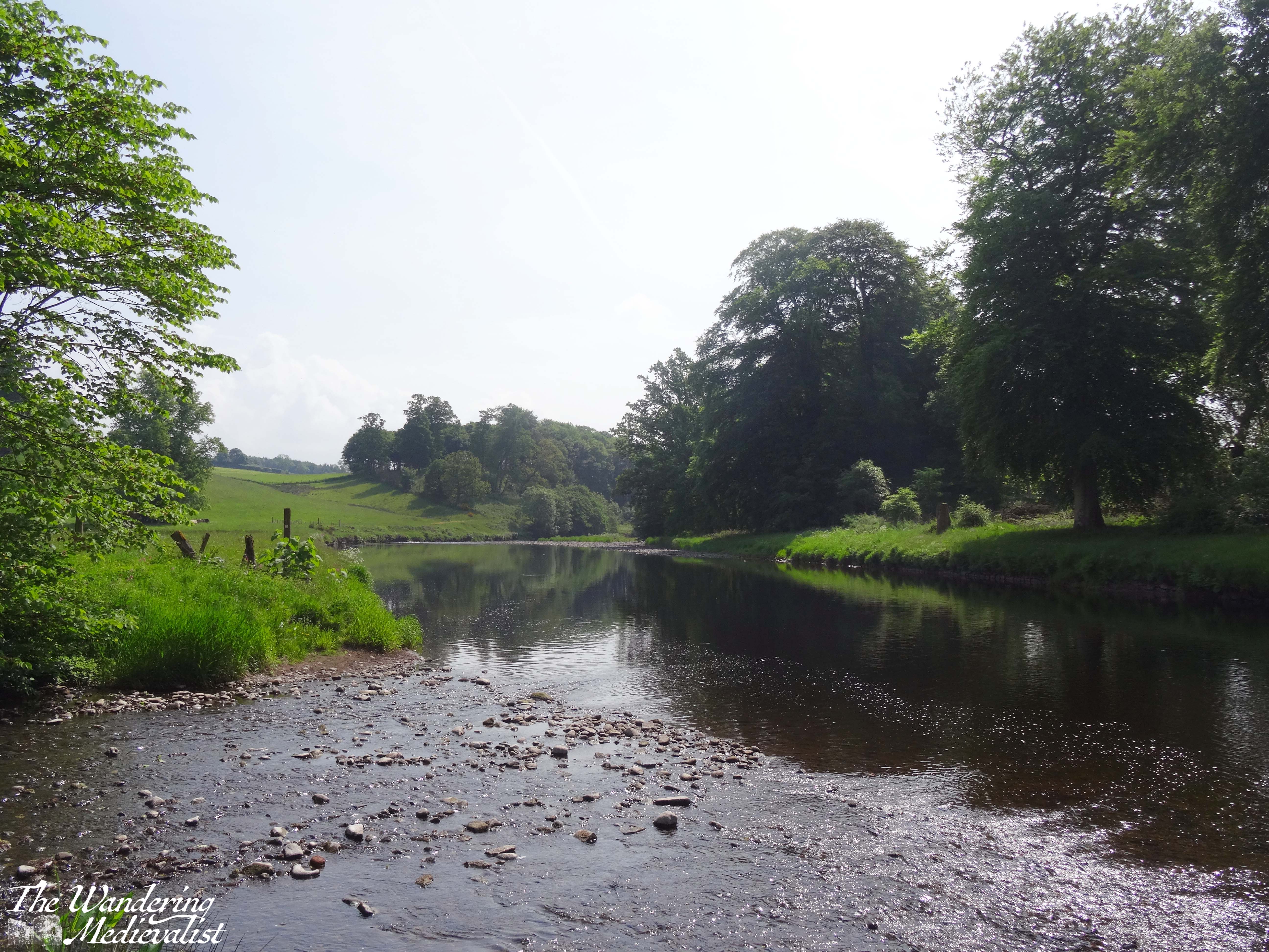
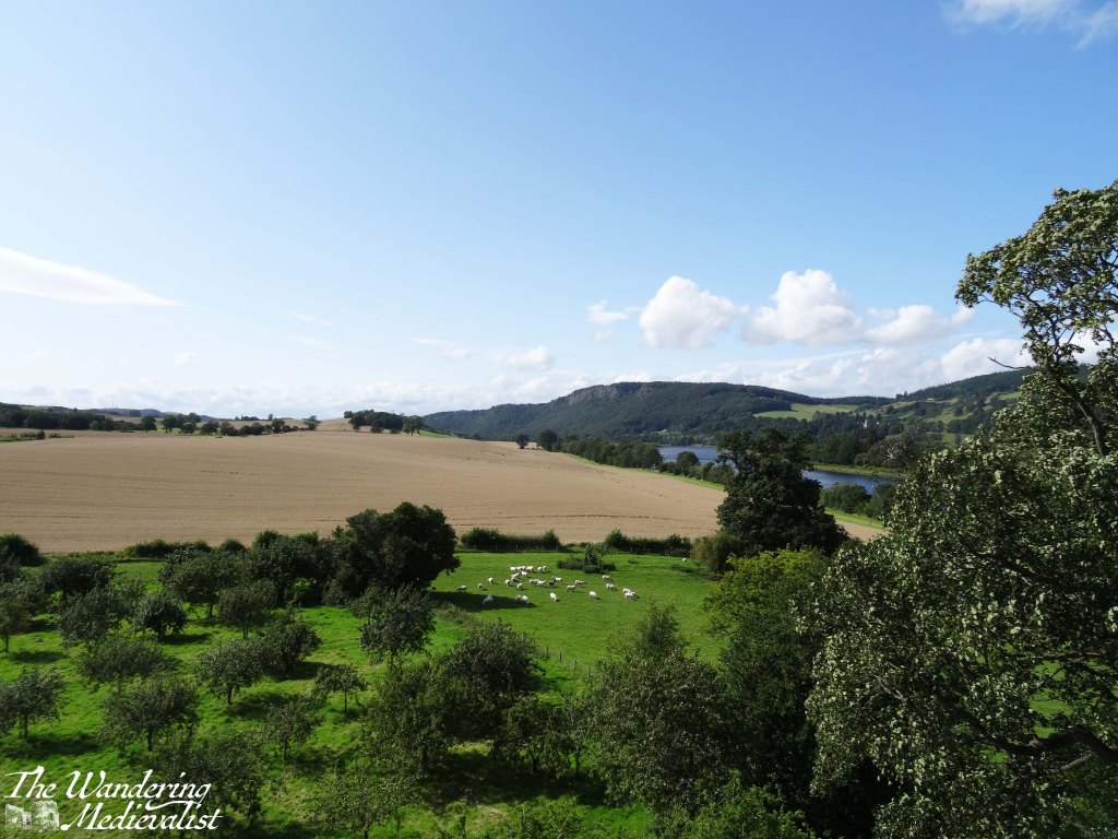
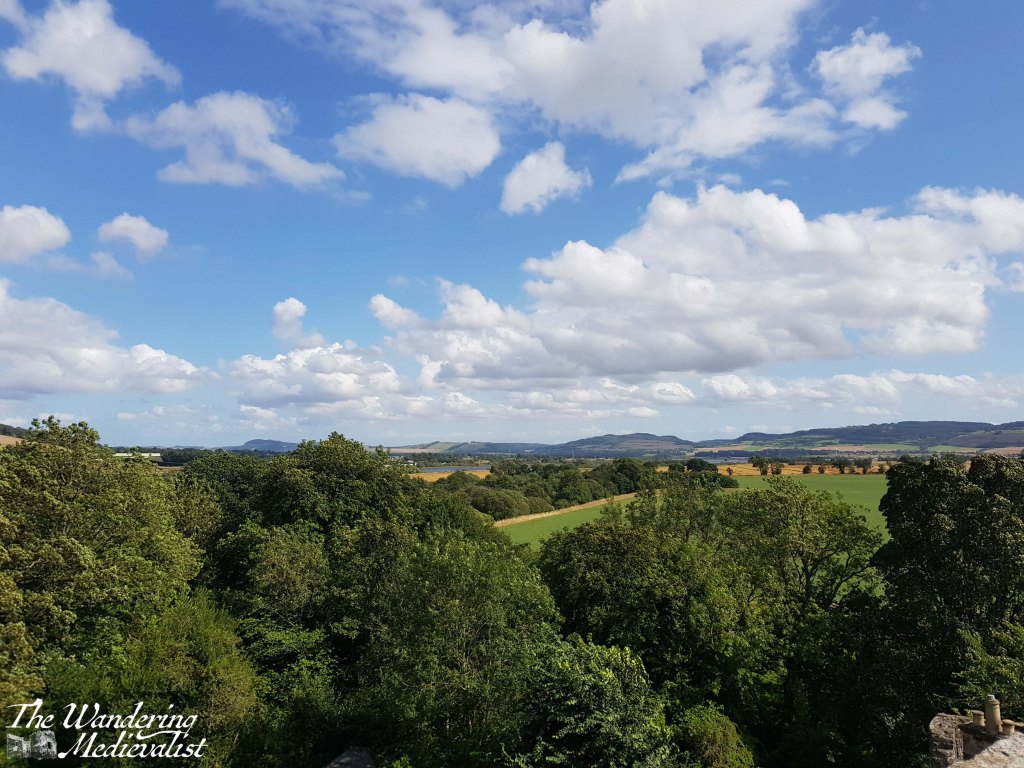
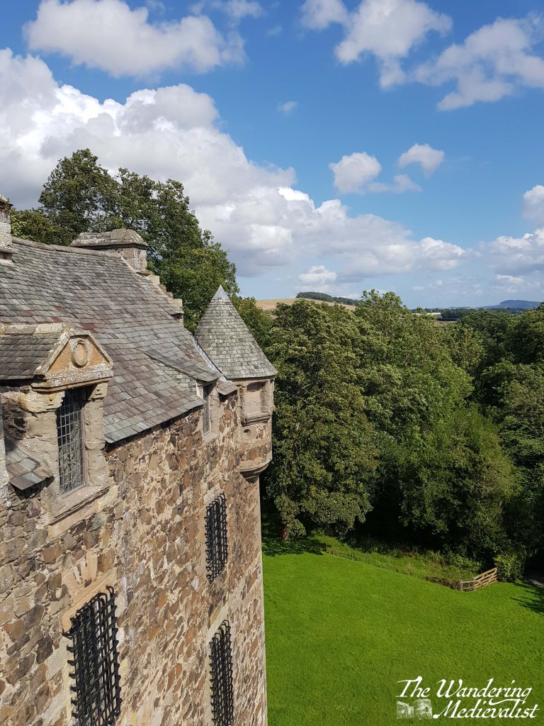
Only four miles from Perth, Elcho is accessed by narrow back roads that eventually lead to a small car park, the castle, and the nearby listed cottage. It was built by the family of Wemyss of that Ilk, around 1560, and is an interesting example of a comfortable country manor residence that was also defensive. It has both guest rooms and gun ports. As one can see from the view from the castle walls, it was happily situated beside the River Tay, amidst fields for crops and sheep, as well as an orchard. In the distance one can just make out the cliffs of Kinnoull Hill.
The view to the west is towards Perth, just out of sight beyond the rise, and to the east along the river in the direction of Dundee and Fife.
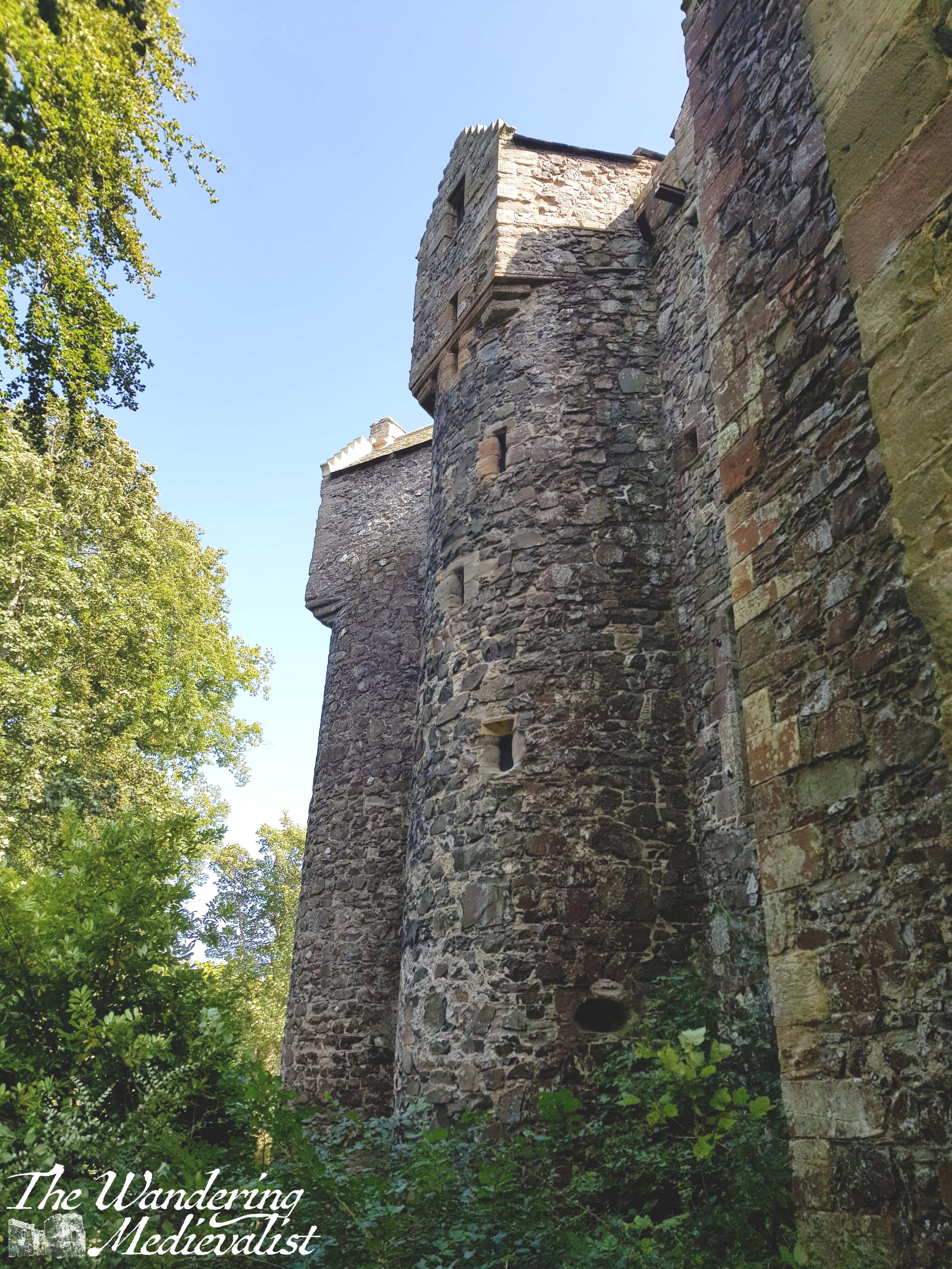
It is just about possible to walk around the outside of the castle, though the river side is well-treed and the view of the walls is obscured somewhat. There is evidence of a formerly walled courtyard and at the edge of the orchard are some well-placed picnic tables.
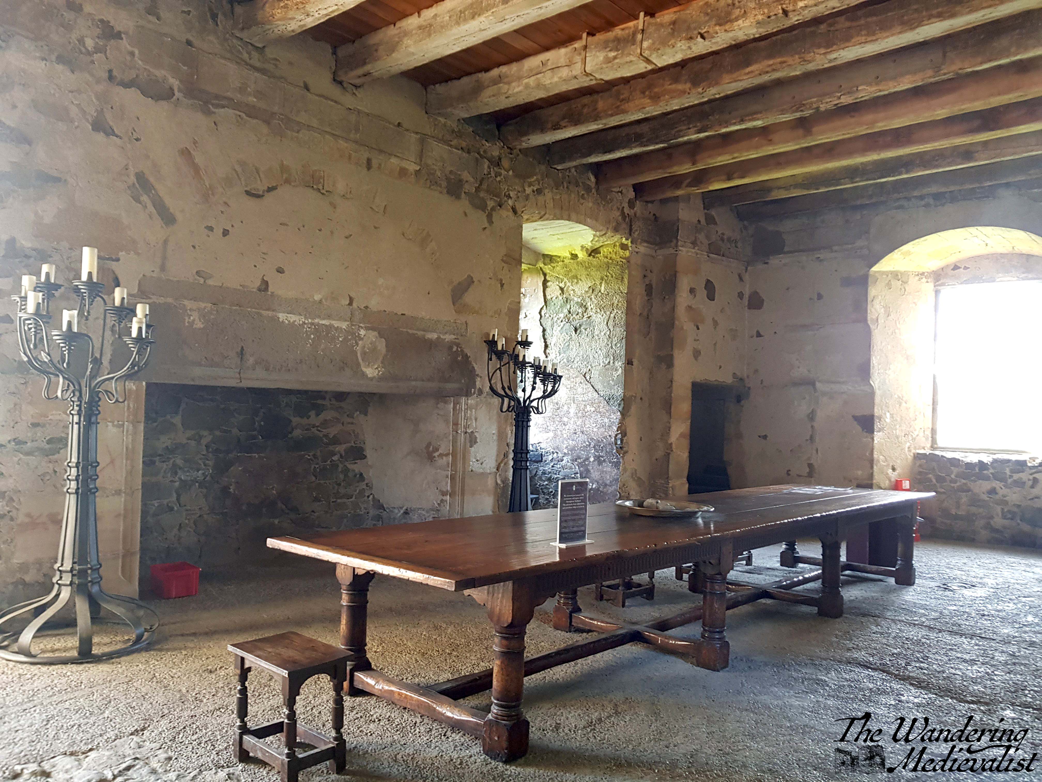
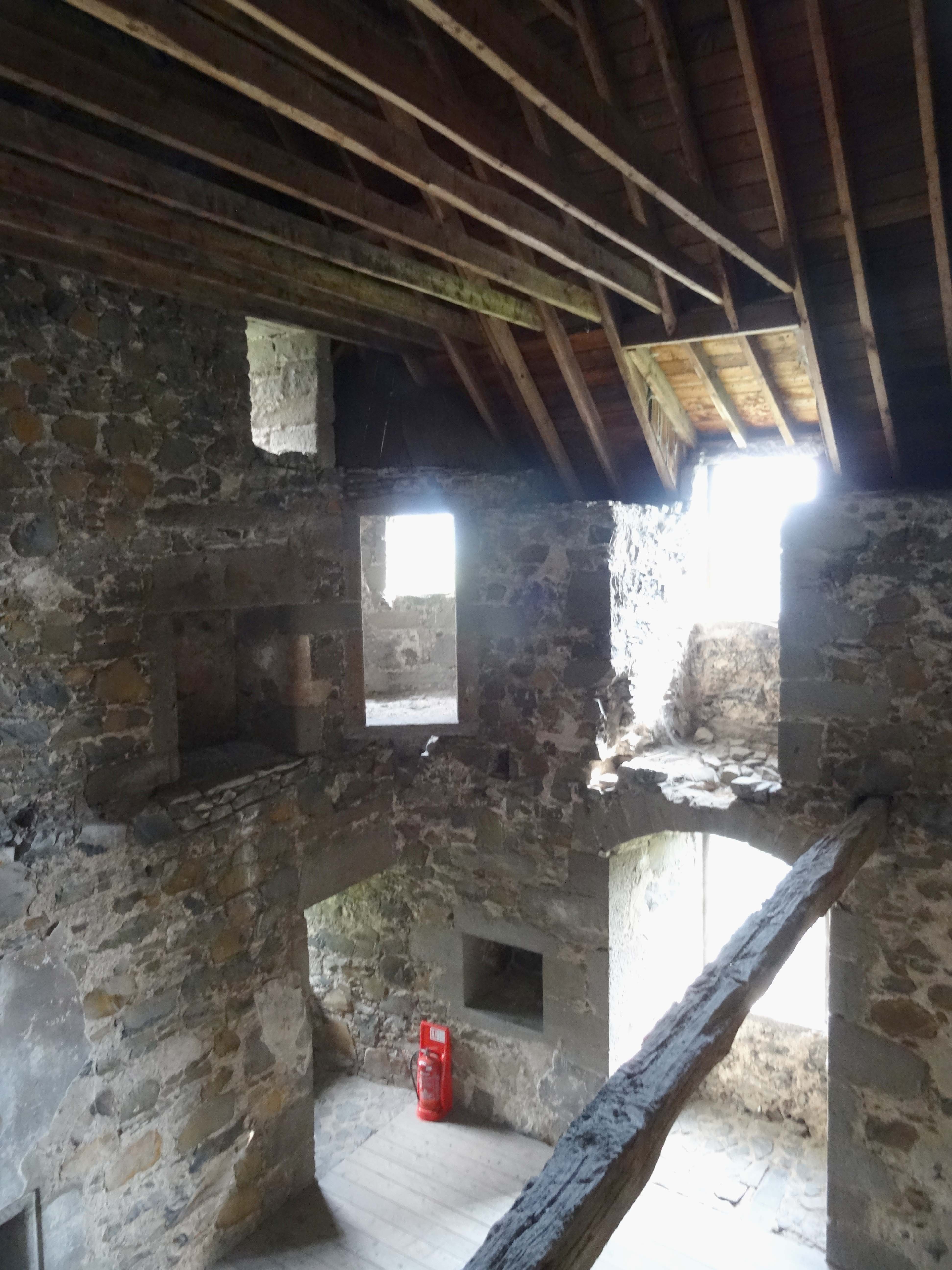
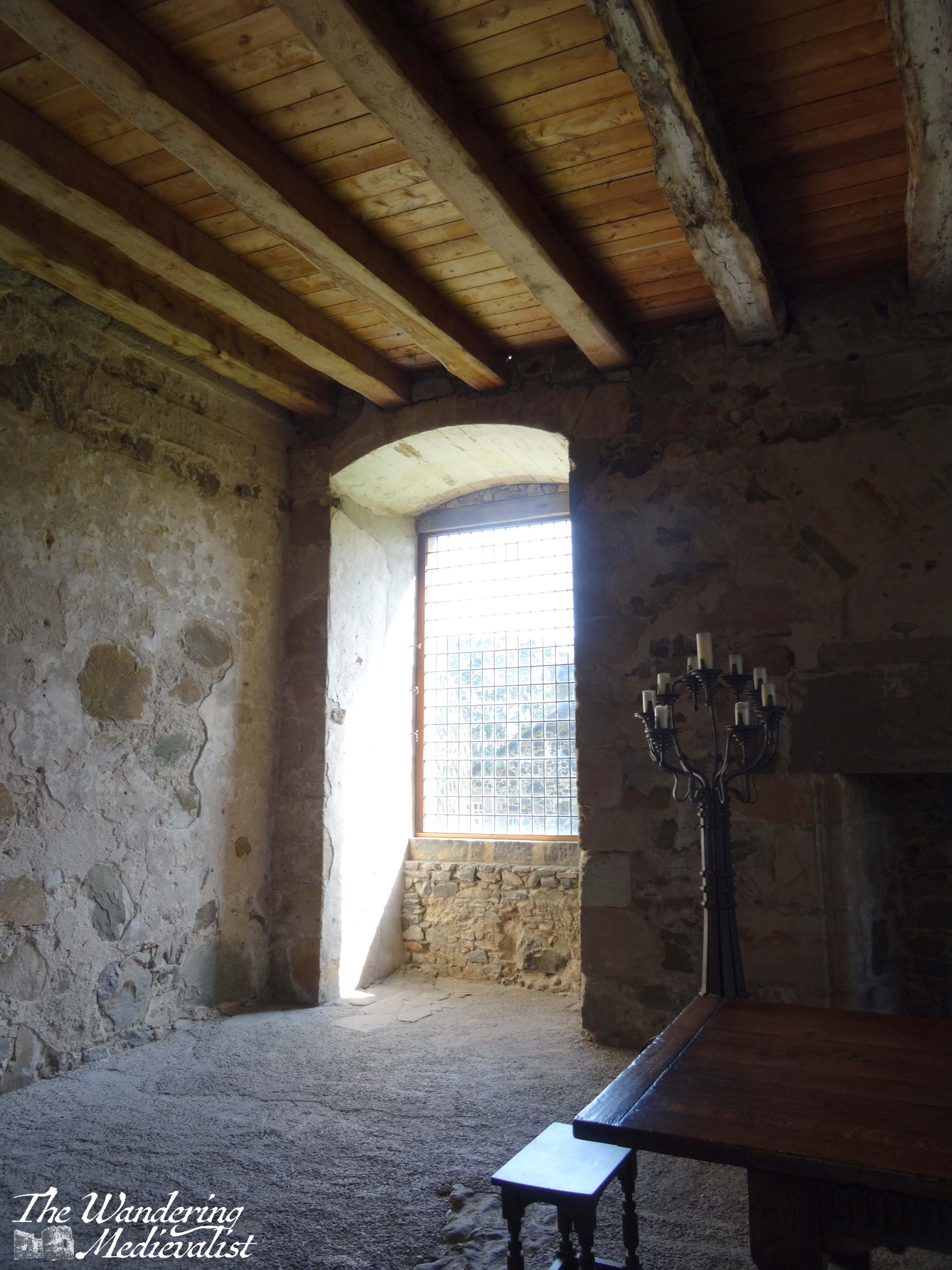
The true joy for a castle lover, though, comes inside, where the main hall, vaulted pantry and cellars, and numerous floors are all visible. Deep kitchen hearths and ovens can be explored, and there is a combination of restored rooms, but also open space where you can look up the walls to see where additional floors and fireplaces would have been.
And of course, one can climb to the top of the castle walls to see the views above, and examine the turrets and roof that was replaced in the 19th century.
It is quite easy to see, while wandering through these rooms and the nearby land, how this could be a comfortable spot to live. The surrounding fields are plentiful, the river is close by for fish and transport, and while the orchard is clearly young, one can imagine there may also have been one in the 16th century.
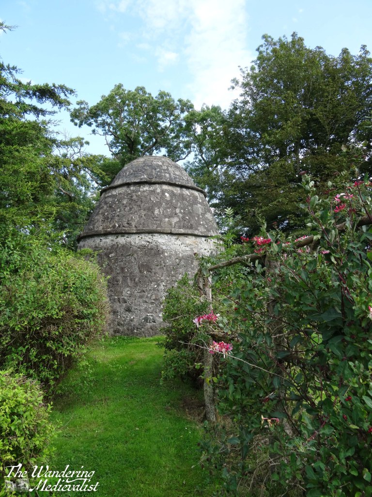
Also on the grounds is a well-preserved doocot (Scots for dovecote), surrounded by a small garden. This doocot would have provided valuable food for the castle through the winter months, both from the birds living within and their eggs.
We did not spend a great deal of time at Elcho but it was the perfect castle for an afternoon jaunt; photogenic and well cared-for, it also boasts a small gift shop which, to our delight, sold ice cream. We happily enjoyed our treat, which also kept the other half patient while I scurried around taking pictures of the castle exterior. Though it does not necessarily hold a dramatic place in history, Elcho is an excellent window into the past, demonstrating how comfortable life might be for a lord living in the late 1500s. It is also an excellent castle to explore, and once it has opened again I could see it as a good spot for children, with lots of rooms to get lost in. Furthermore, it is an easy day trip from Perth, Dundee or anywhere in Fife, the perfect spot for a picnic!