
For whatever reason, this past Saturday morning sleep was not my friend and I woke early – the same time I do for work, which is early for a weekend – and got myself going to aim for a bus an hour earlier than I had intended. And good thing I did, as this stretch of the Coastal Path took me longer than expected, even with a few stops to test out my new camera. Yes, that is one exciting development this week: I finally managed to order and have delivered the fancy new camera that was a – cough – Christmas present from my father. Entirely my fault that it took me this long to get it sorted, as I was waffling about what to get. I settled on a switch of brand, moving from Canon to Nikon. I still need to spend some time working it out, but I’ll get there. And I digress. (still…new toy!)
Crail is a bit more limited than Anstruther in terms of public transport, but the 95 is always a good option and I got my favourite seat upstairs at the front. Also on the bus were a group of young caddies, probably about 21, who were on their way to Kingsbarns and discussing their job and how much they would make after a day of work. Blew my mind – I can definitely see the appeal! A lot of hard work to get there, I know, but still paid incredibly well especially for someone on a summer break from university.
I arrived in Crail at 9am on the dot, alighting just before the roundabout where St Andrews Road turns into the High Street. It was a short walk of less than 5 minutes down Castle Street, then a slight veer to the left around the castle wall, to the spot where I had officially ended the walk to Crail from Anstruther a few weeks back.
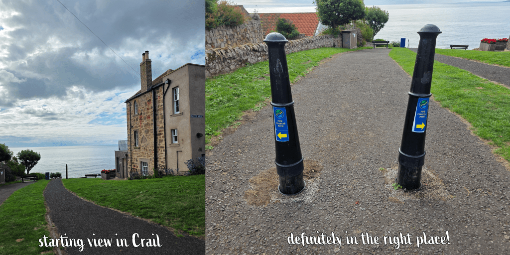
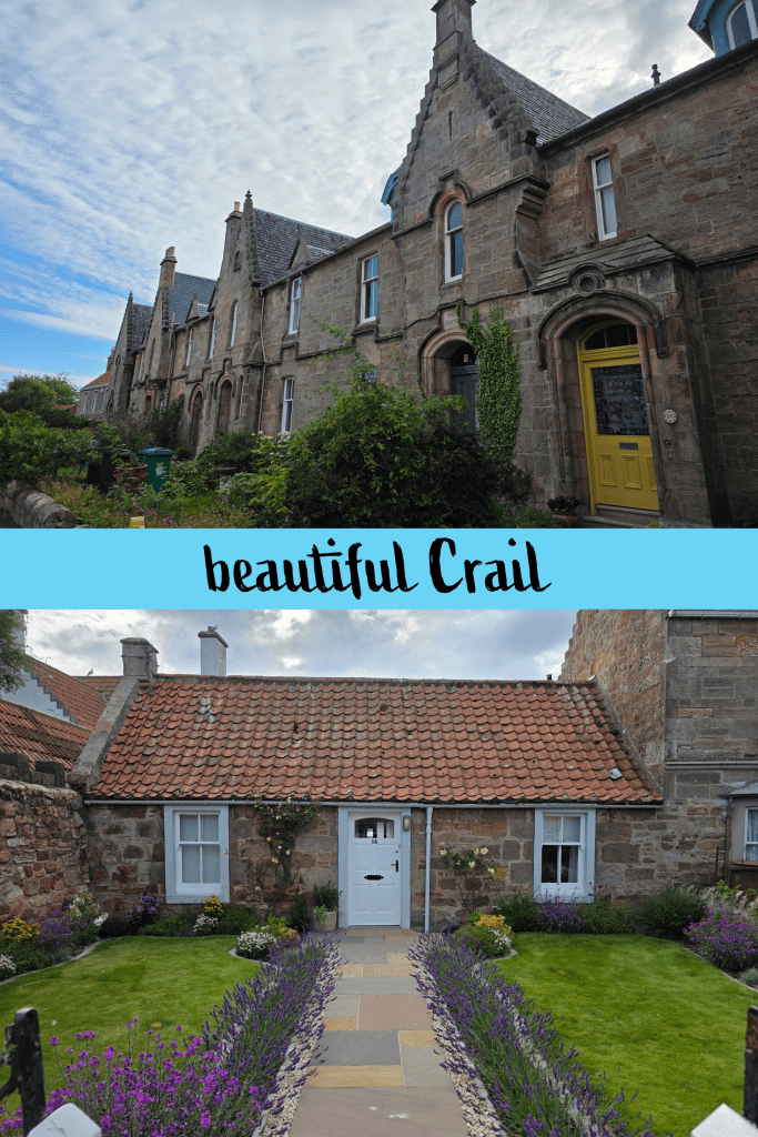
The oath is clearly marked here, along the Nethergate heading north-east. This street is just an endless line of beautiful houses and well-kept gardens, which are really all-pervasive in Crail. Even the edge of town where the houses are ‘newer’ is a lovely winding neighbourhood with beautiful gardens. That said, the constant shrieking of the gulls (expected, still annoying) made me wonder if I really coveted one of these cottages.
In about a third of a mile, the Nethergate ends at a stone wall and large grassy area, and the path takes a steep turn town towards the beach; ahead is a line of Victorian-era houses with beautiful gardens (notice a pattern?), and the open sea beyond.
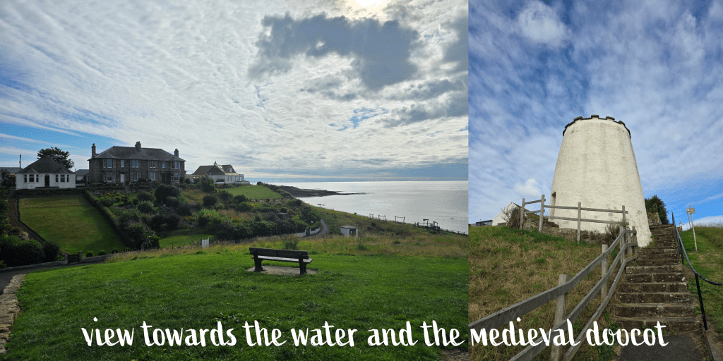
There are two paths here, one a straight shot down a steep hill along a wall, and one off to the left which is a touch more gradual. This is the official path, I think, though I chose the other way. Going along the wall eventually takes you past this late medieval doocot, which is still open (though I did not go in) and which includes a detailed explanation of what a doocot is. This one, built around 1550, housed pigeons until the mid-19th century, and is of a quite traditional round ‘beehive’ design, though there are plenty – for example one at Tantallon Castle – that are rectangular.
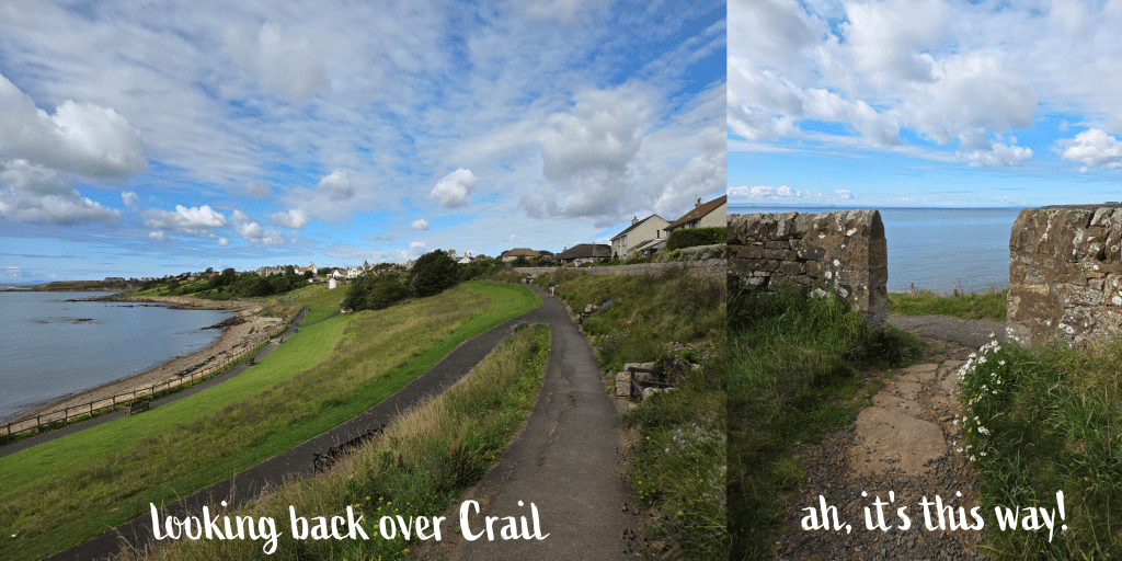
Beyond the doocot, I turned left along the shore, where there is a playpark next to the sea. The weather was mild but breezy, with a mix of sun and clouds that was the perfect opportunity to test my camera. The beach is rocky with small patches of sand, reminding me very much of the beaches at home. I was relieved to discover that there was also a toilet block, though it was far from clean or well-kept. Those in Crail had been at the other end of town, so this seemed a good opportunity, and potentially the last one on this walk. (Though if you ask very nicely, it may be possible to use the ones at the caravan park, I’m really not sure)
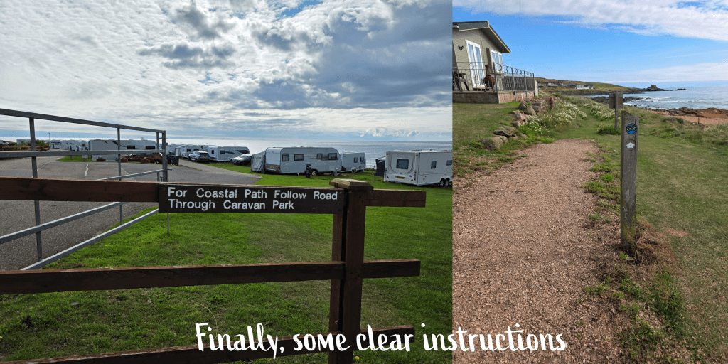
At the end of the bay, there is a flight of steps leading up to what I realised was the actual Coastal Path – oops – which had run along the top of the park. Either way is fine, I’m sure! This is of course a good spot to get a few pictures back over the beach towards the town. From here it was along the path for a short while, and a relatively fast right turn through a grassy field. There are several routes here, some leading off to the left that are clearly made by walkers, and the Coastal Path is not well-marked, but stick to the main trail heading straight for the water’s edge, and you will reach a gap in the stone wall. It may not seem the right way, but it is!
Once through the stone wall, you will see signs again and the entrance to the Sauchope Links Holiday Lodge and Caravan park. There is a clear direction here, sending walkers through the caravans on the main road. While it was early morning and the park was just waking up – some lucky souls sitting on their porch drinking coffee with a splendid view over the ocean – there were some vehicles too, keeping me on my toes.
I was really impressed with the holiday park which had a small but clean-looking pool and a good number of well-kept caravans. In time the caravan park merged into the holiday lodges, including a few glamping pods (I think) and then eventually some really lovely-looking lodges. The views were excellent, but I did have some doubt as to whether I’d want to be quite that close to the water here on the outermost edge of Fife – especially with Storm Floris expected in a few days. Eventually I discovered the style of house I liked best, up on the side of the hill a bit further back, with big patios and I am sure, a great view.
After about ten minutes or so of walking – it’s a big park! – I found a sign for the Coastal Peth taking me off the main road and down a sandy track towards the beach. The path runs between the lodges and the beach, alternately sandy, grassy, and occasionally rocky. It was an odd day where I couldn’t decide if I needed sunglasses or not, and it meant that the views were alternately bright and clear or a bit murky.
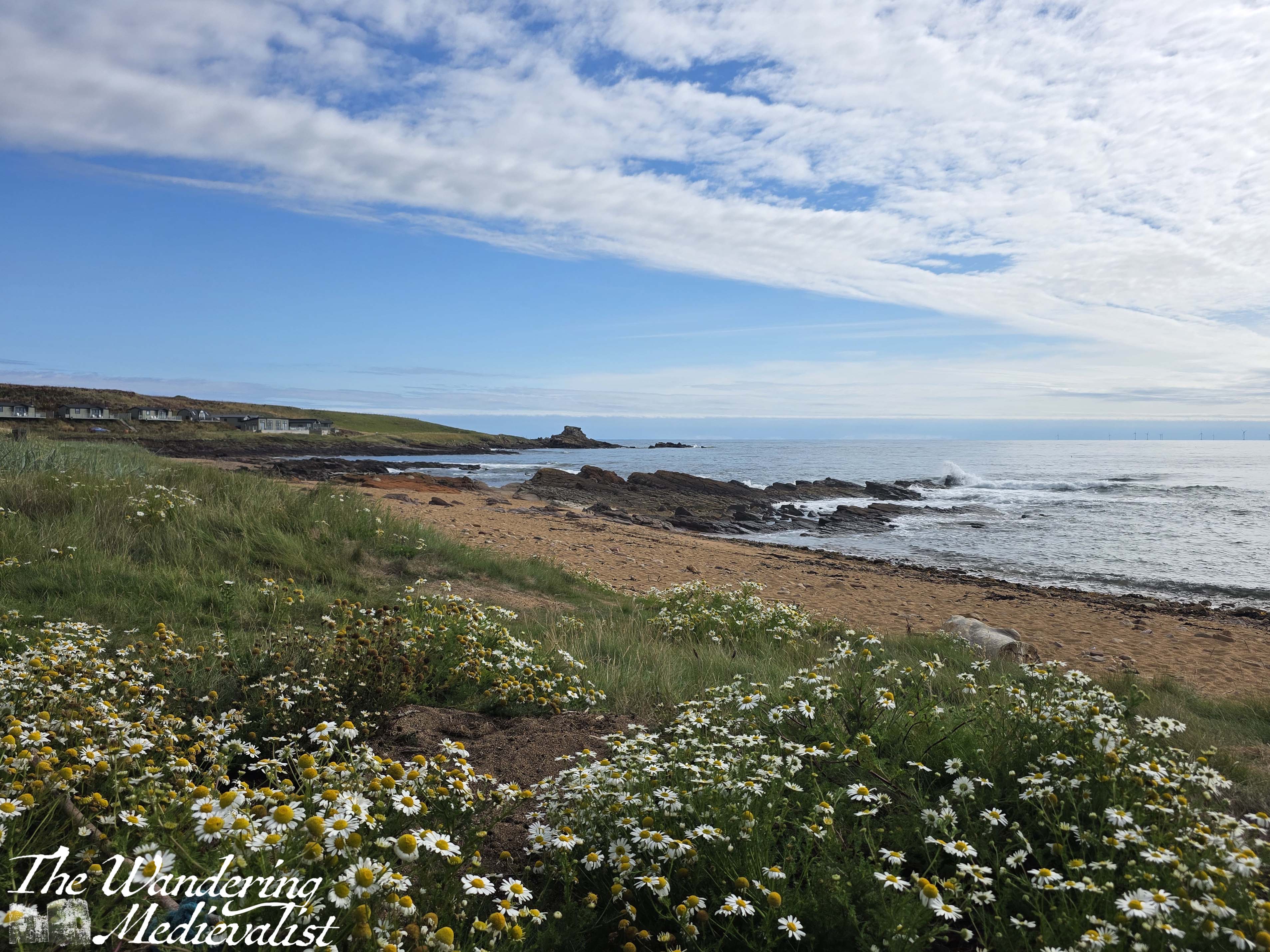
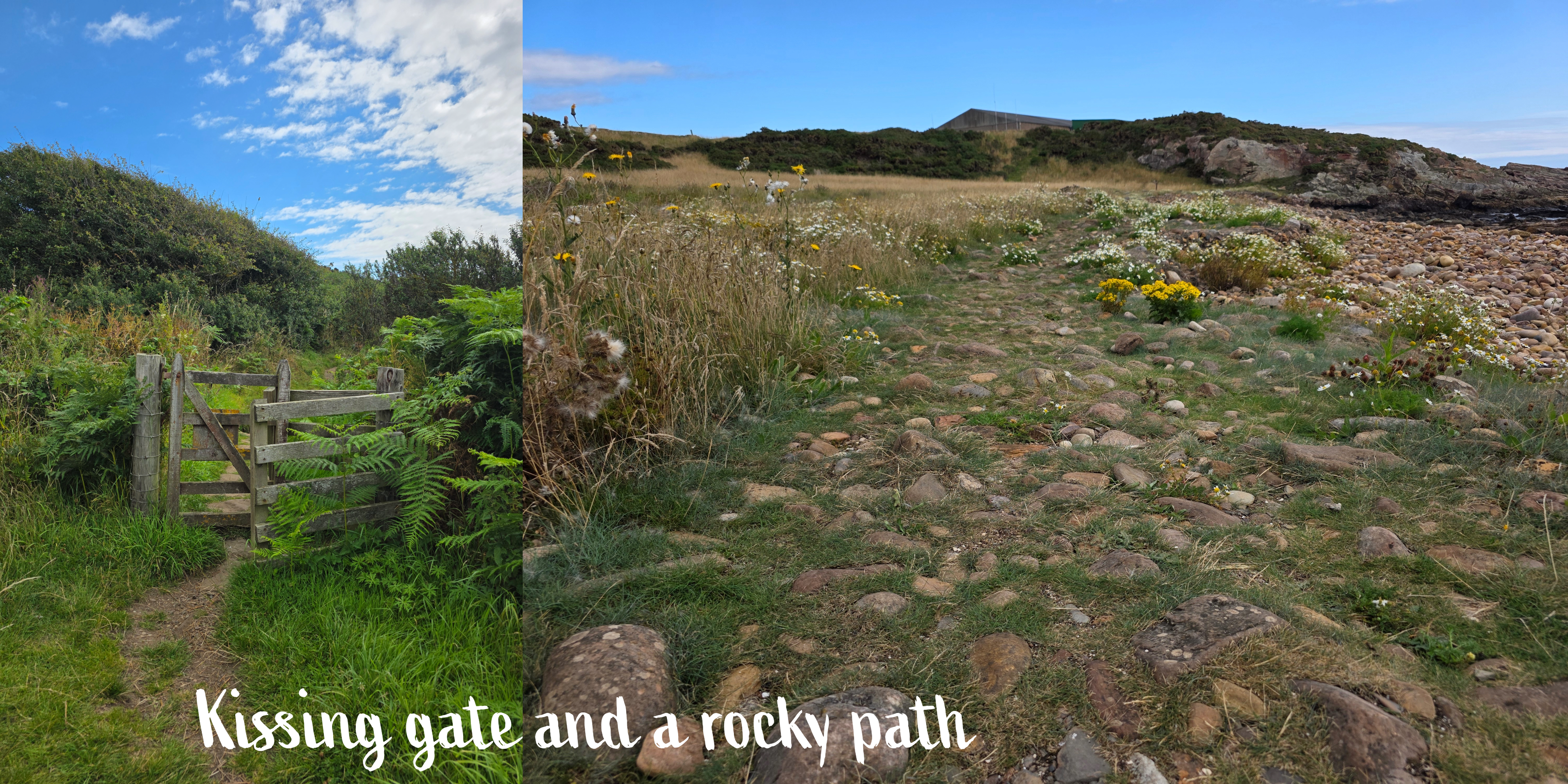
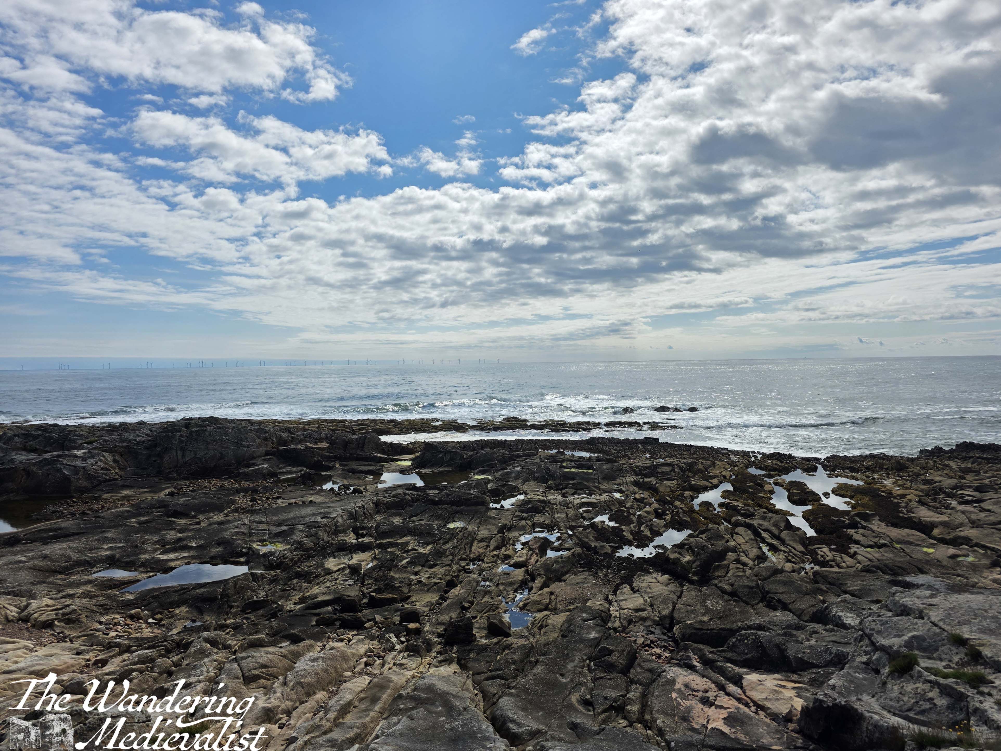
In time – longer than I expected – I reached the end of the park and went through a wooden kissing gate onto a more wild path, with high grass on both sides. There is a beautiful rock structure up ahead on the right, and a sign indicating that walkers are now entering the Kilminning Nature Reserve. Here are some great views looking back, particularly if there are waves crashing on the rocky promontories between beaches.
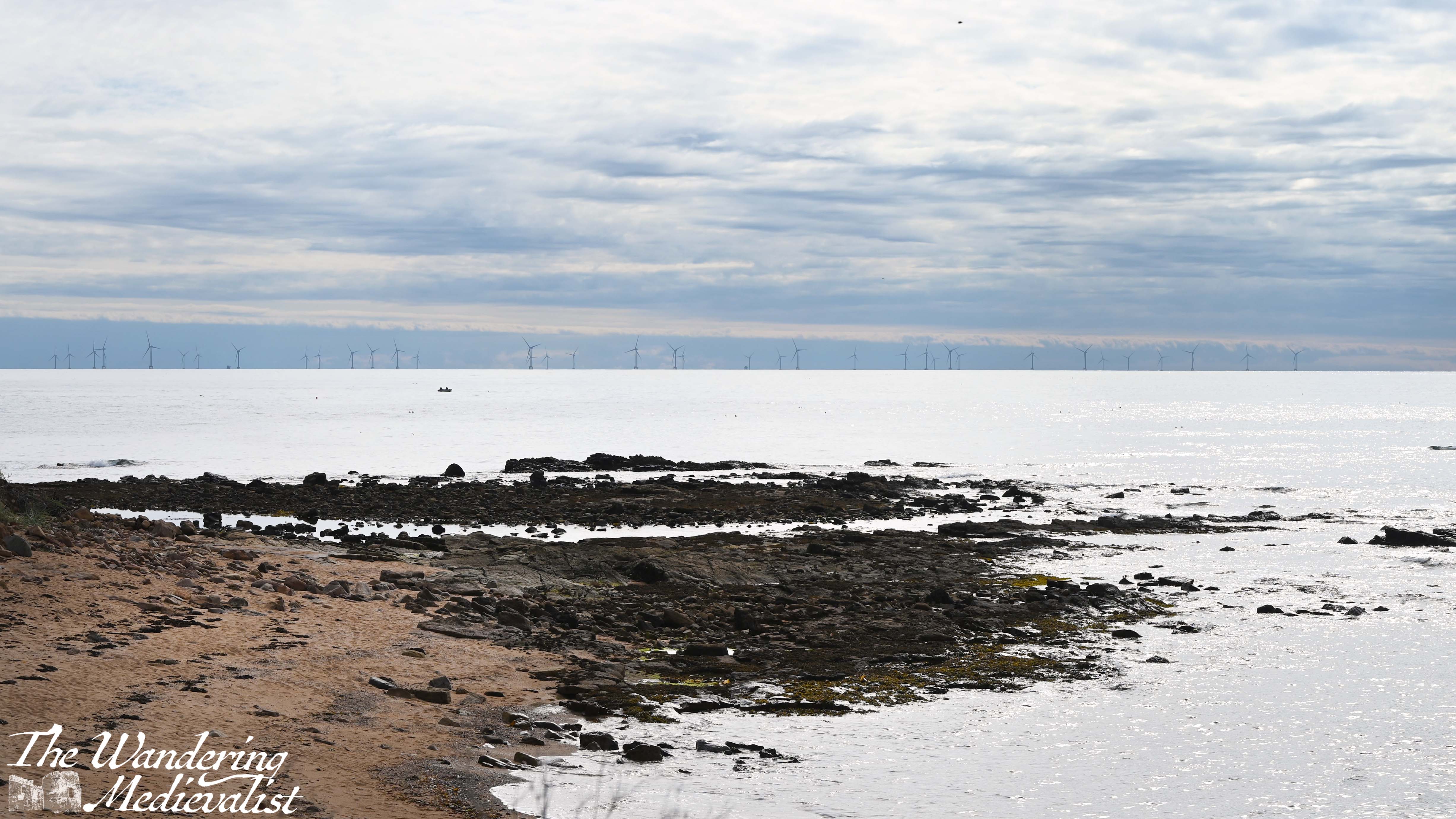
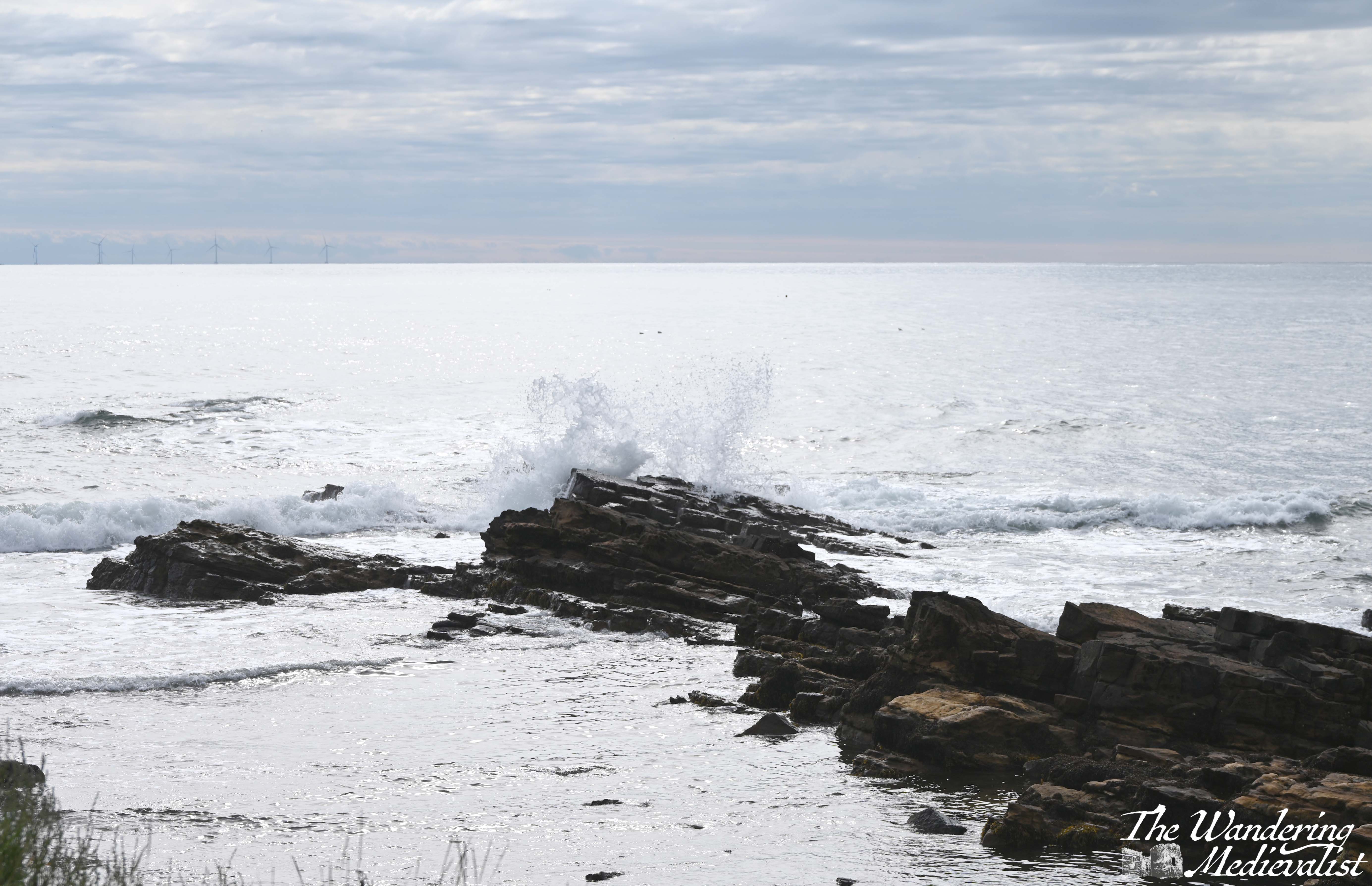
You will note in these pictures an enormous wind farm, with turbines all along the edge of the horizon. There is a lot of controversy over this wind farm, and the recent approval for what will be Europe’s largest wind farm; some object to the visual of them, but there are also environmental concerns. Personally I don’t think the optics are really an issue, and I don’t have knowledge to comment on the impact on sea birds.
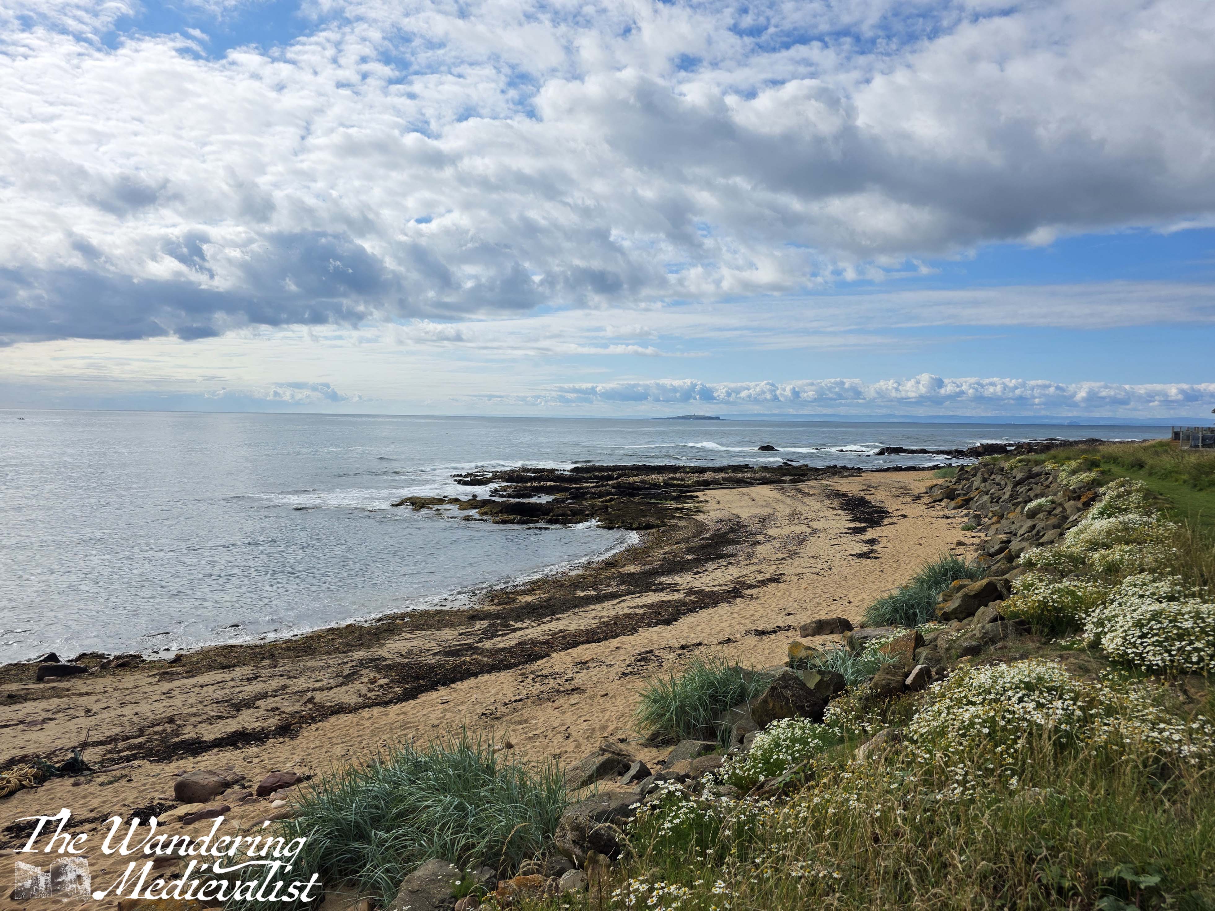
From this point, the path rounds a corner into a relatively wide flat area, with long grass on either side and a rocky trail. There was one spot that was really muddy and required negotiation on stones, but overall it is pleasant, a touch flatter than much of the East Neuk trail. In a few places, you will notice entrances to bunkers along the coast; it was of course a perfect lookout spot during World War II.
This part of the trail is quiet and it might be tempting to look up at the view, but it is also quite uneven and I have in the past rolled an ankle pretty hard here. As you go past a viewing platform and through another kissing gate, the path becomes a bit more rolling, with some ups and downs on rocky stairs that can be steep.
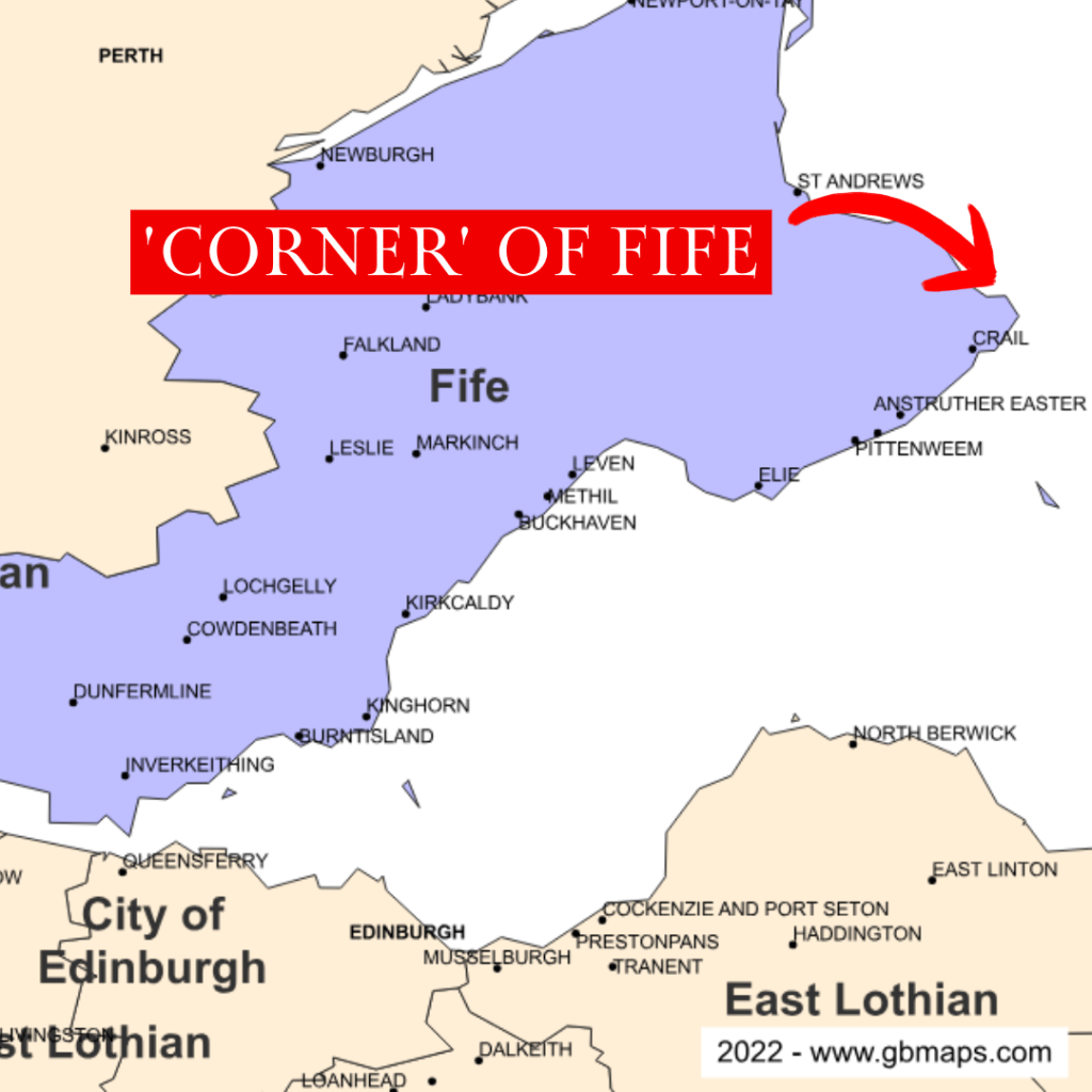
There are some great viewpoints, and eventually at the end of the bay you go up and down one more rise and discover a golf course on your left – this is Fife after all – and the ‘corner’ of Fife ahead. By corner, I mean the point of land that sticks out furthest in to the North Sea.
I found myself stopping here for several minutes, looking out over the crashing waves – it was a challenge really not to stay for hours, as I find them quite mesmerizing. Repetitive, yet always different.

I had a goal however and so pushed on. Right at the corner, the trail narrows slightly to pass between the Fife Ness Lighthouse above, and a bird blind and WWII pillbox, constructed in 1941 as part of the Crail airfield. Whereas you often see other evidence of WWII defenses further up the coast along West Sands and Tentsmuir, I had not noticed many or any in the East Neuk.

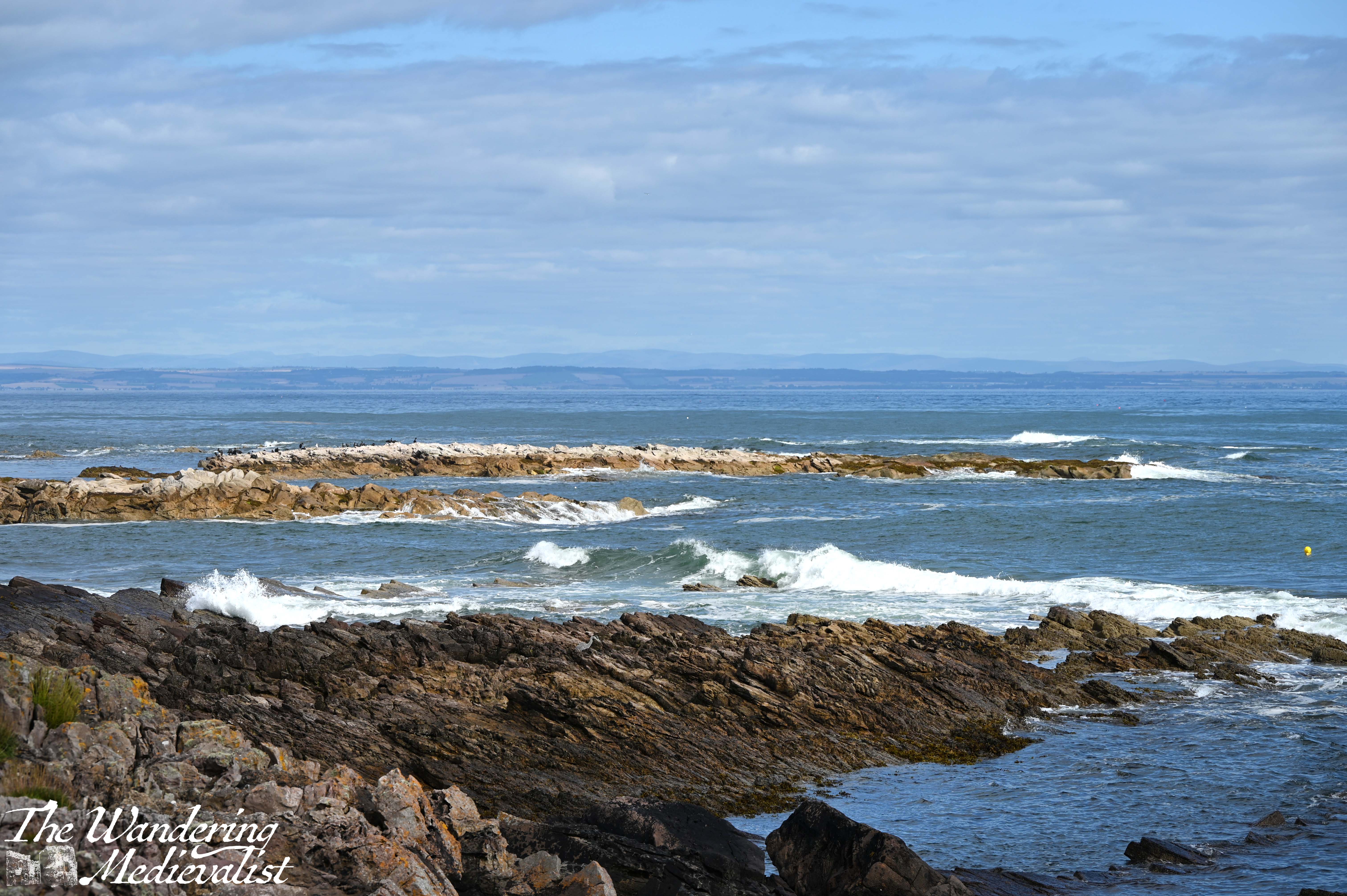
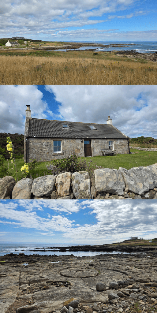
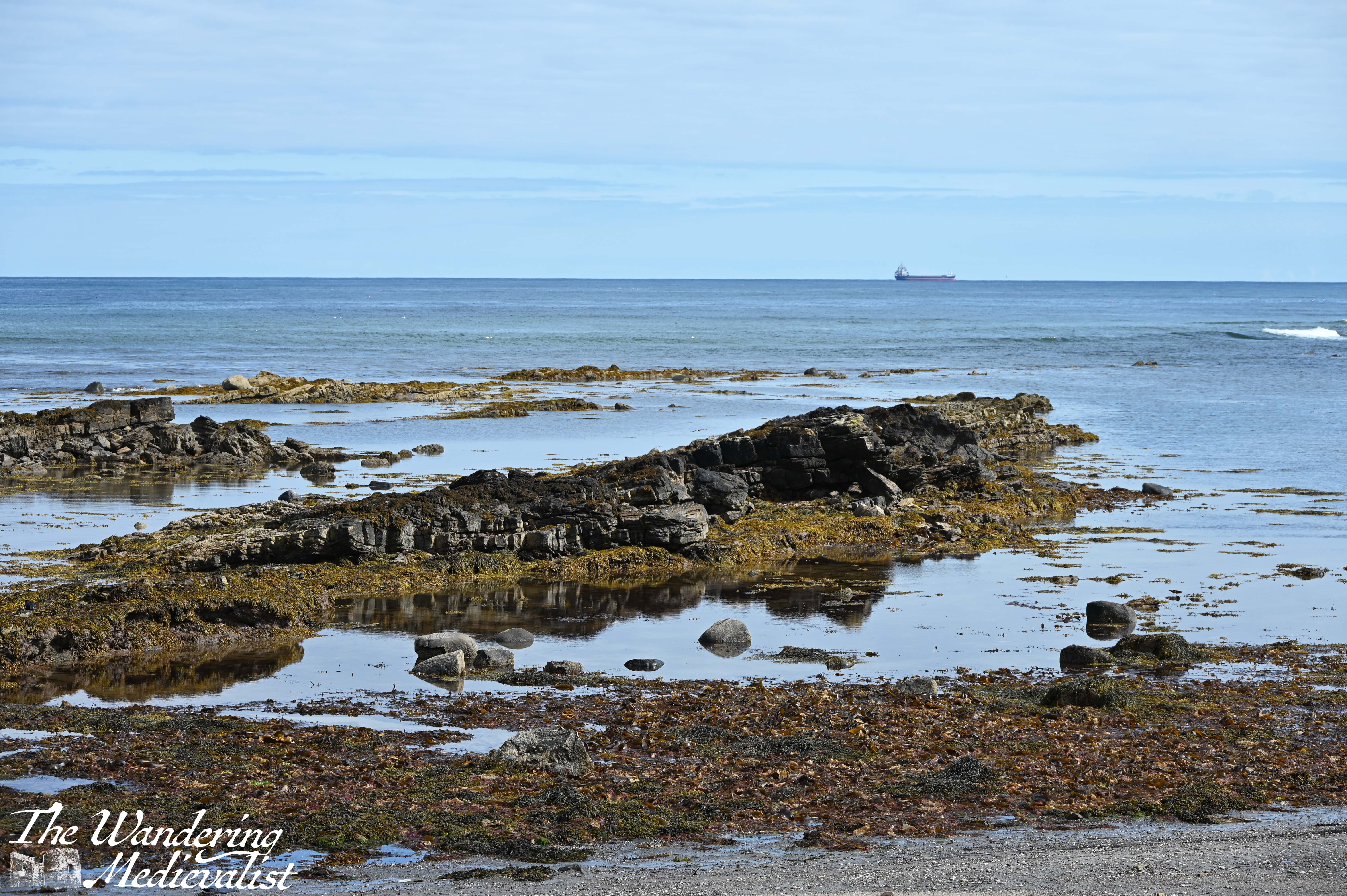
Once you turn the corner, you approach another small caravan park and the remains of Fife Ness harbour, first mentioned in the 1530s.
The harbour was used for fishing, as well as for shipping stone from nearby Craighead quarry – some of this fine stone was used to repair St Andrews Cathedral in the 1450s. The long lines of sharp rocks stretching into the waves make it clear why this point of Fife could be treacherous for boats; I was walking at about mid-tide, but the rocks clearly went much further under the waves.
There is also a great example of a Scottish seaside cottage, well-kept of course with a small garden. I wasn’t really sure that I was going the right way here, but there was really no other obvious route, so as before I just kept walking.
The paved road soon looked as though it would be heading directly for Crail Golf Club, but sure enough as I reached the edge of the green, the Coastal Path signs returned and I headed off to the right on a path that ran along the edge of the green.
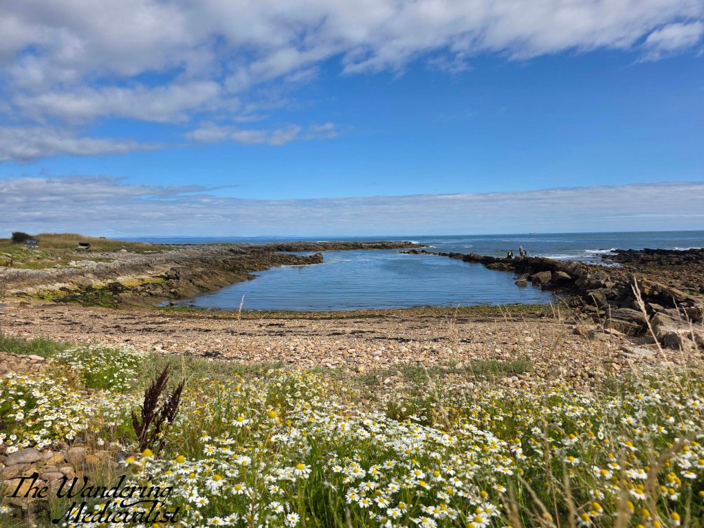
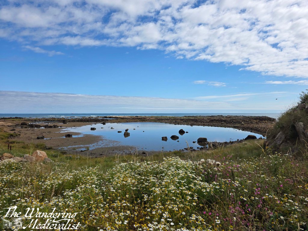
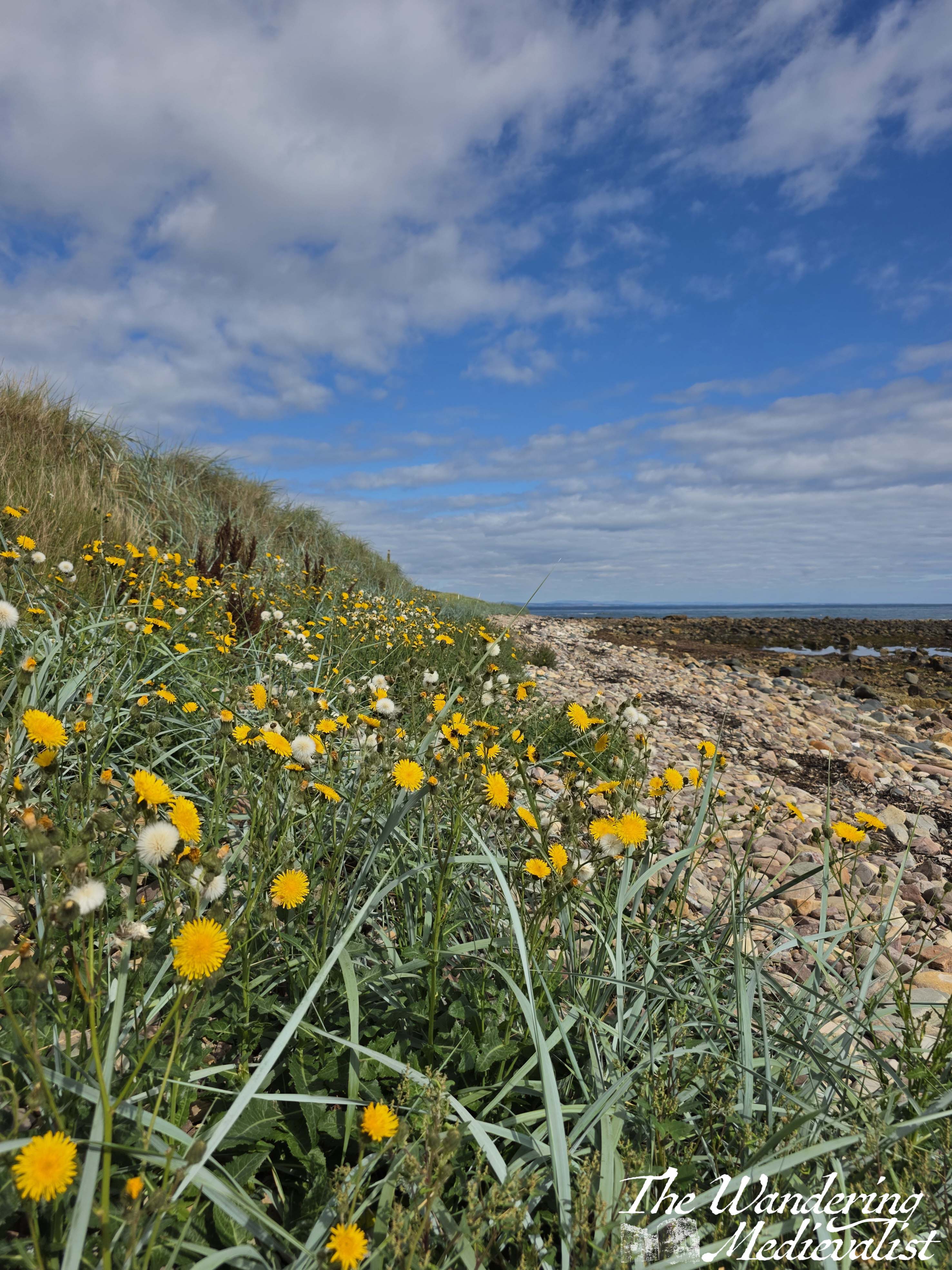
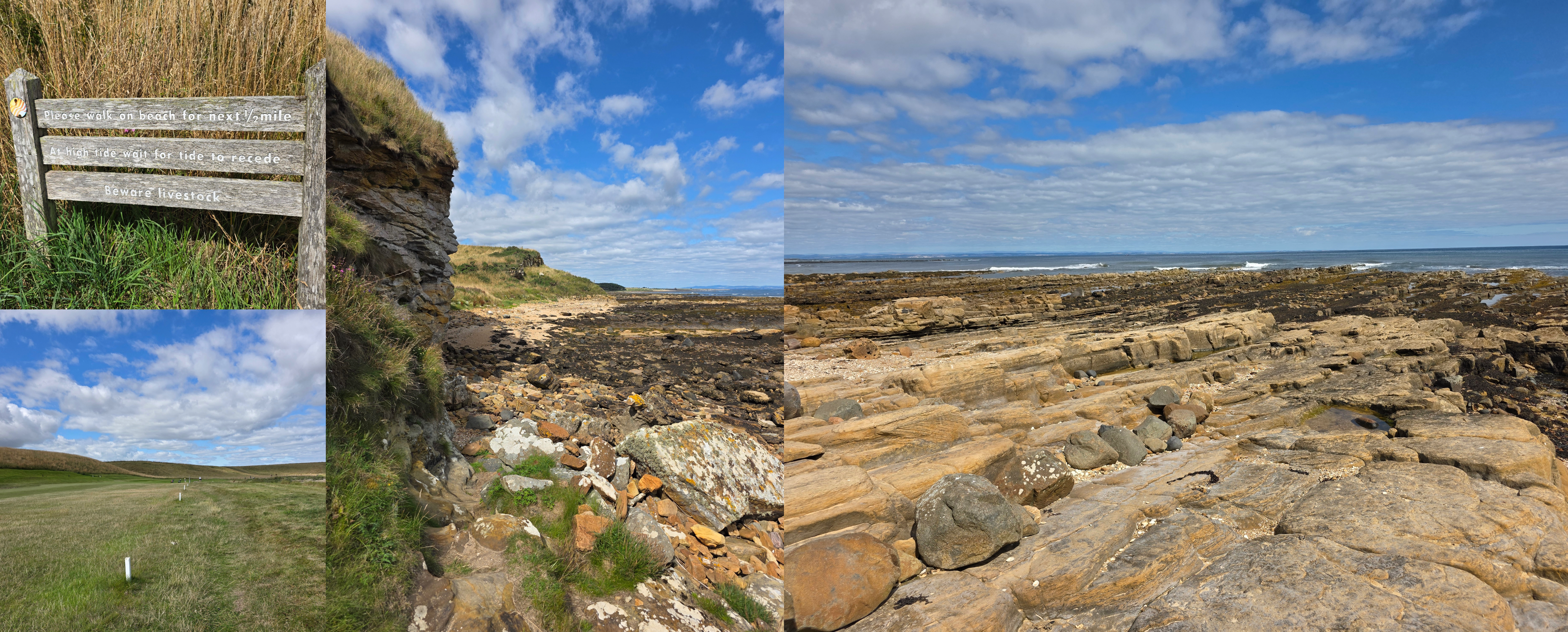
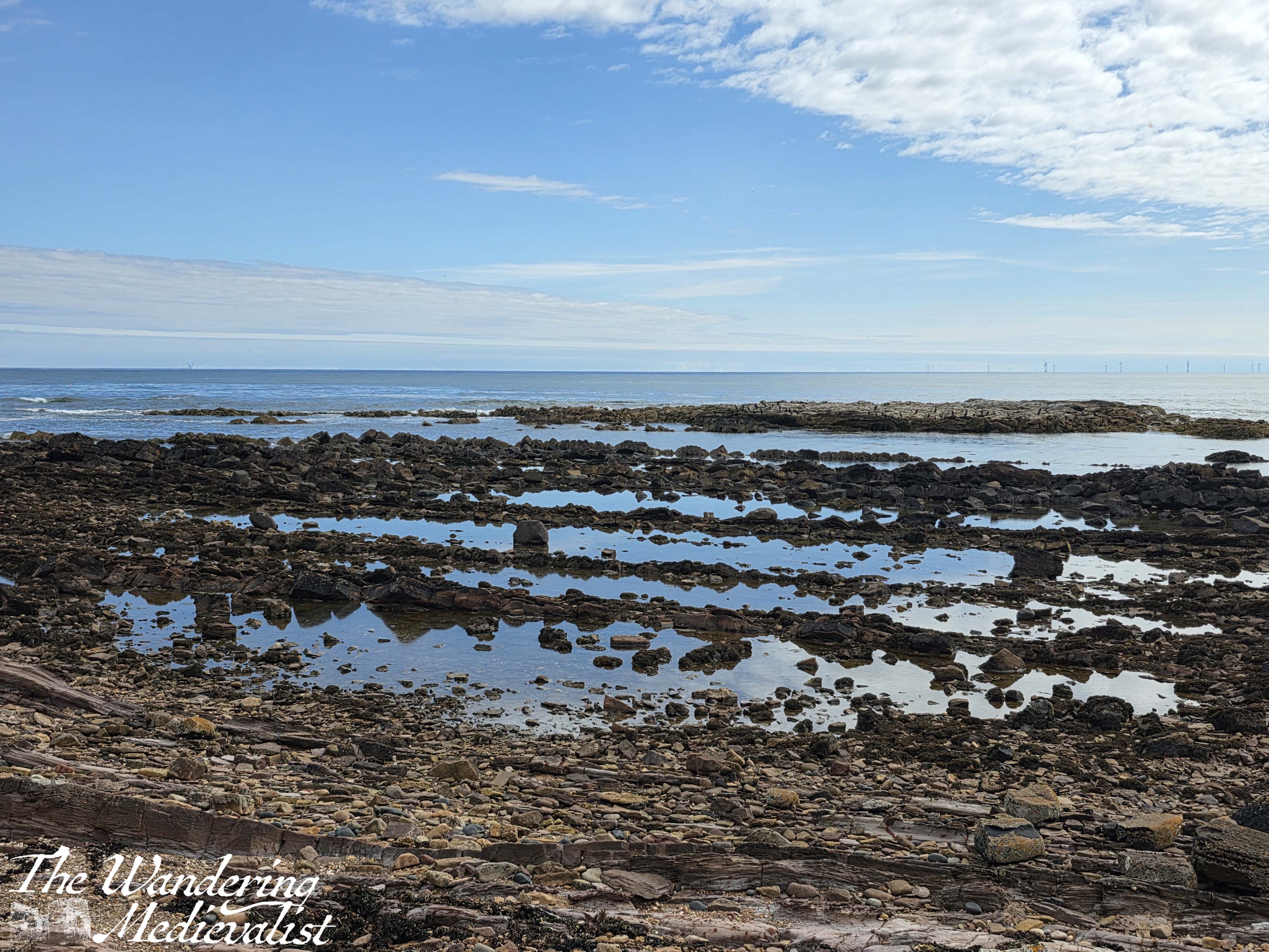
This is a really beautiful stretch, particularly in the sun as it was when I walked, with the ocean and multitude of wild flowers. It is hard not to be fascinated by the layers of stone and the pools of water between them, glistening in the sun. There are a few signs on poster boards for adult geology classes, and it is easy to see why this would be a good spot. The layers of stone and water erosion are very evident.
From here the path hugs the edge of the golf course, at times moving up to the walkways designed for golfers, but only for a short while. I stumbled across Constantine’s Cave quite by surprise, absolutely not expecting it to be in the middle of the golf course. Interestingly, the other half and I had planned to walk to the cave some years ago, joining the trail near the airfield, but gave up due to my rolling my ankle (see above). I’m quite pleased in the end that we didn’t go the whole way, as compared to the Caiplie Caves this one is a bit less dramatic.
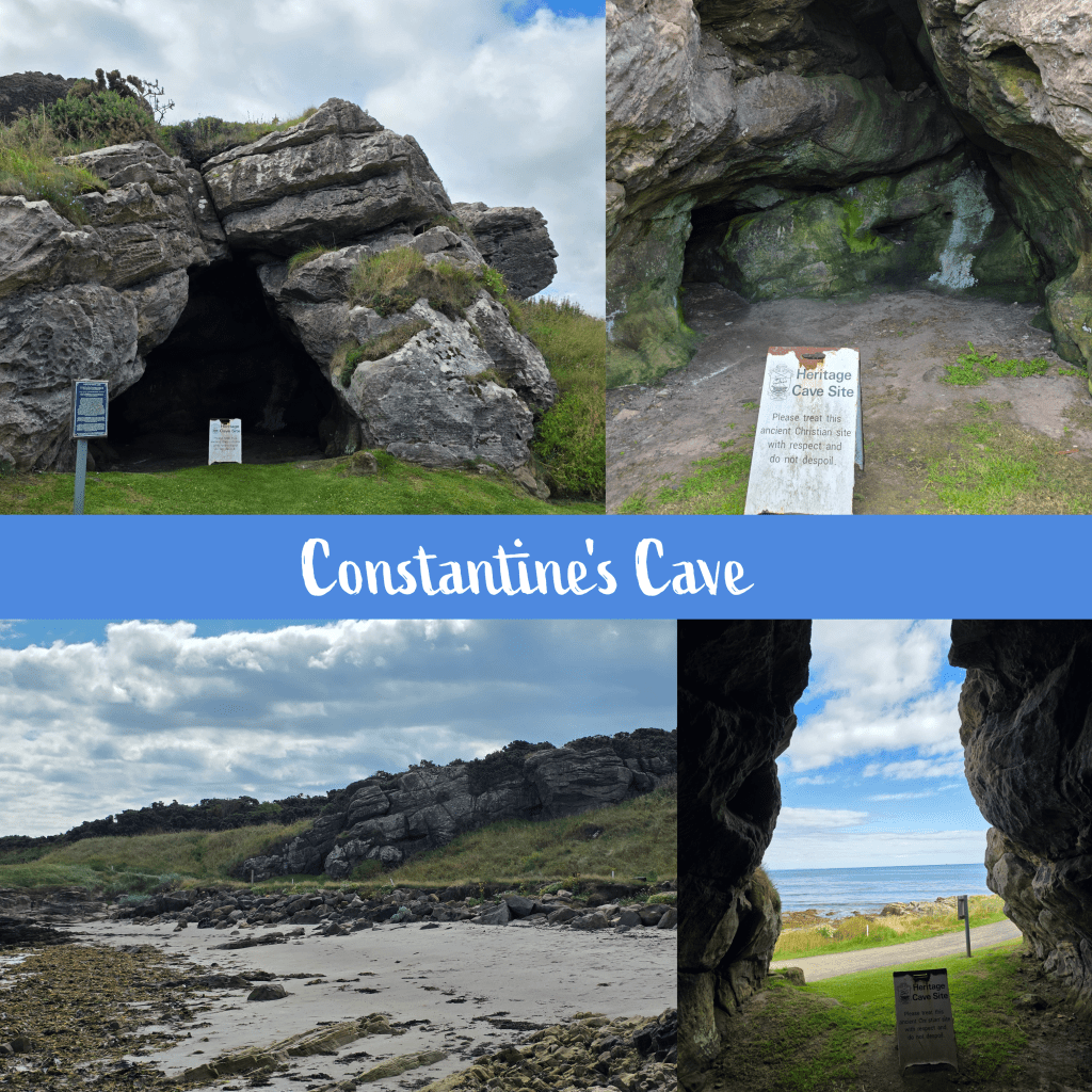
While visually not as impressive, the cave does have an interesting history; excavation work has shown evidence of a stone wall across the entrance, protecting the interior space, and the earliest occupation layer was pre-Roman. The cave’s name comes from the local tradition that King Constantine III of Alba (903-943) was killed in a battle near the cave.
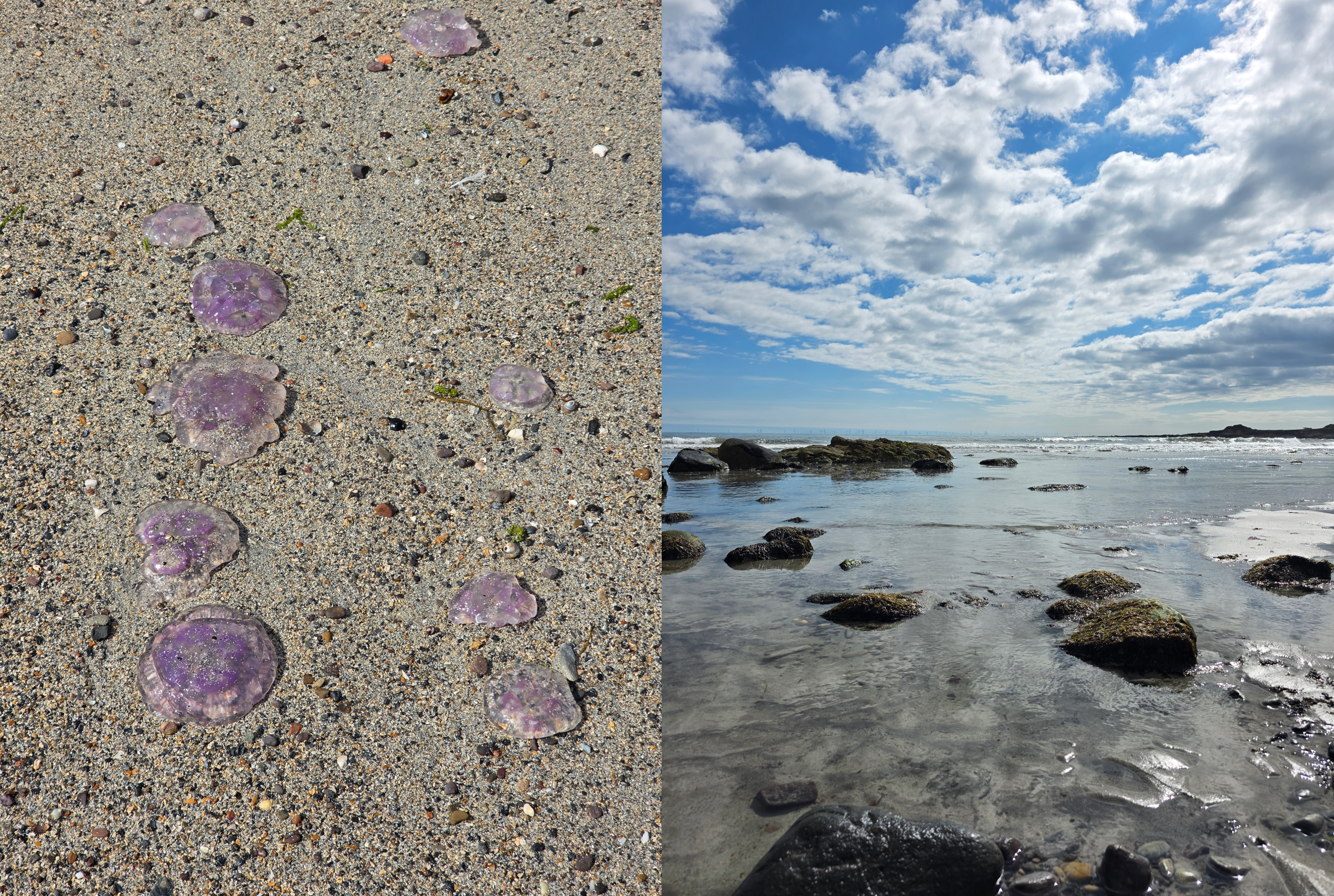
Not far beyond, walkers are directed to move down to the beautiful sandy beach below, to avoid interfering with the golf play. I was very happy to do so, enjoying my ramble in the sand, though it was somewhat hindered by what must have been hundreds of beached Moon jellyfish along the high waterline. Eventually I chose to move closer to the waves, where I could avoid stepping on them.
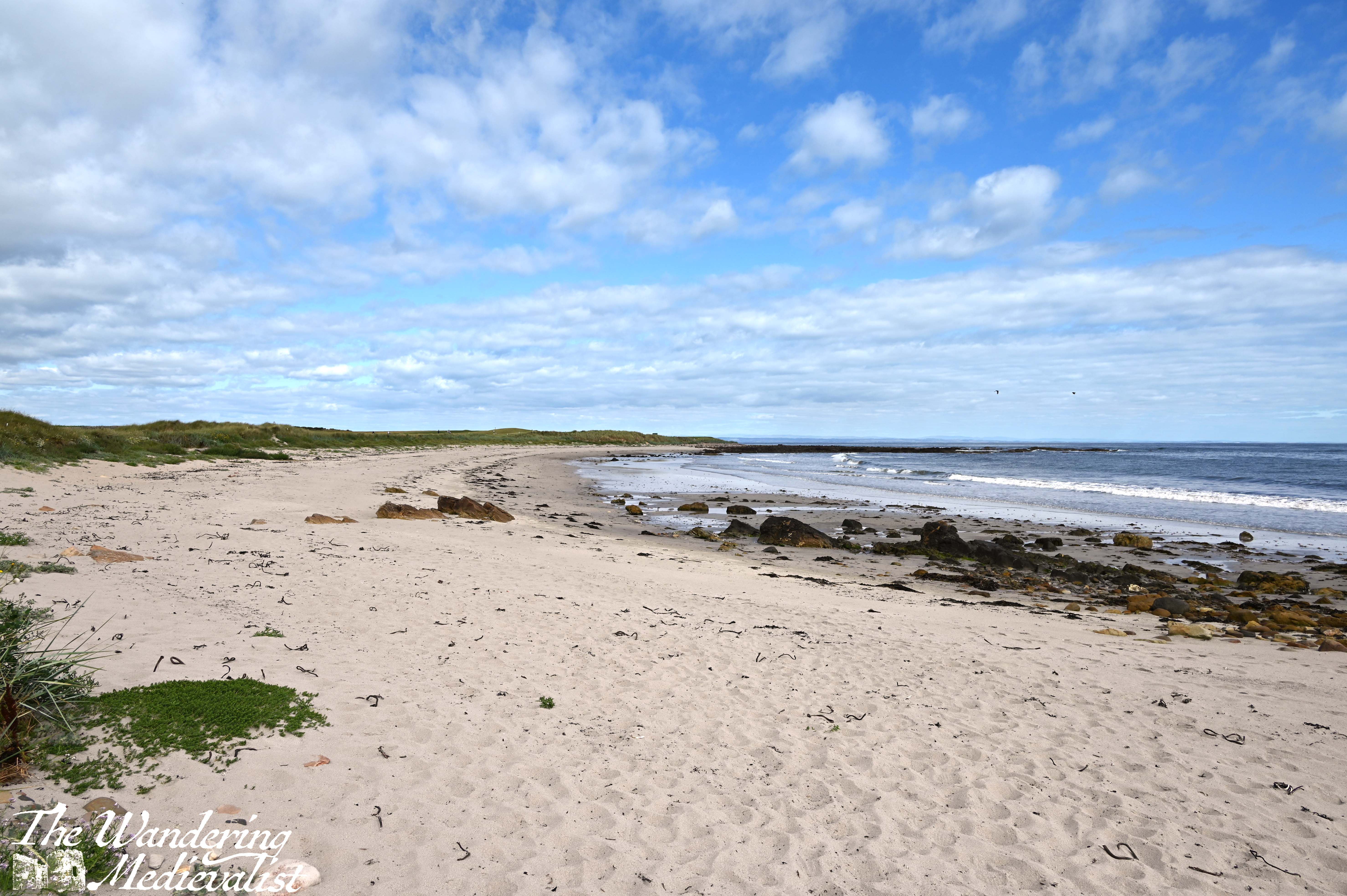

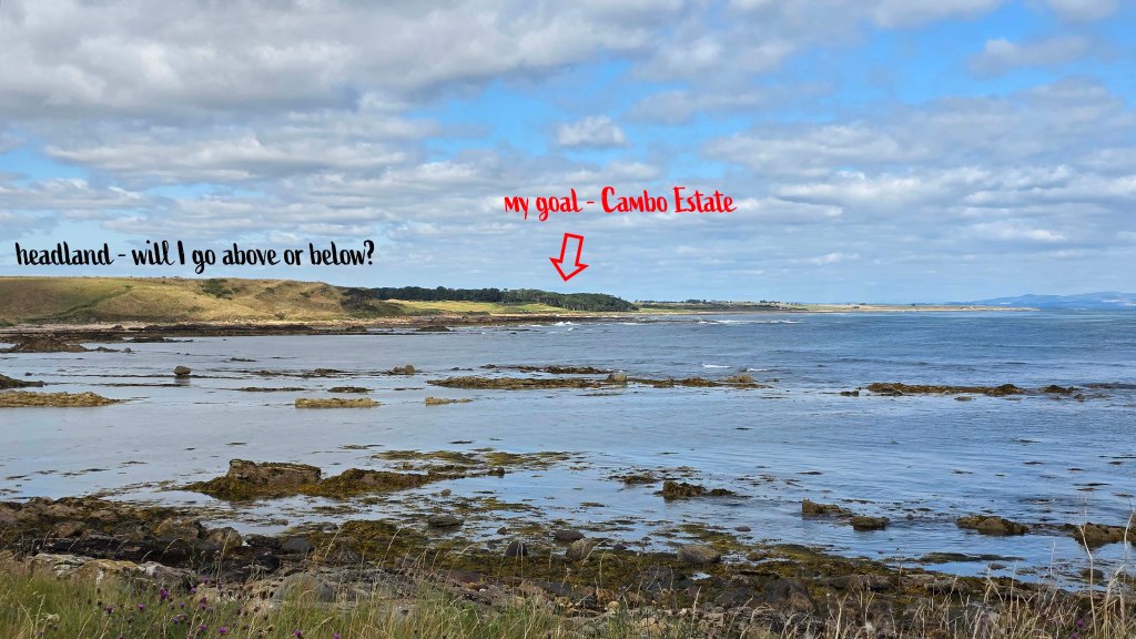
The sandy beach slowly becomes rocky, and the last few metres require some scrambling to return to the upper path, along the golf course. Soon after re-joining the grassy trail, another corner is turned and all at once I could see the tree line of Cambo Estate ahead, though still a distance away. It was a touch intimidating to see the coastline between there and where I stood, including a headland that I was not sure if I would pass over or under.
I should note that the official map of the Fife Coastal Path warns walkers that this section of the trail, between Crail and St Andrews, can be challenging and may not be passable at high tide. While I had neglected to check the tide – not a mistake I will make again – I was lucky to discover it was going out rather than in, so I had plenty of time. Absolutely be more sensible than I if you try this walk, and check well in advance – there are plenty of websites and apps available.
From here to the edge of Crail Golf Course, it can be on occasion difficult to tell if you should be on the beach or not. At least once I opted for the beach route, seeing a faint trail from other hikers, as it was nice to have a bit of variety. I was so fortunate to be walking on such a gorgeous day, and at a time of year when daisies and other wild flowers are everywhere. (I do not know names – must educate myself on wild flowers). There is a series of small white posts in the grass that seems to separate the well-manicured golf course from the trail, but those are not always clear.
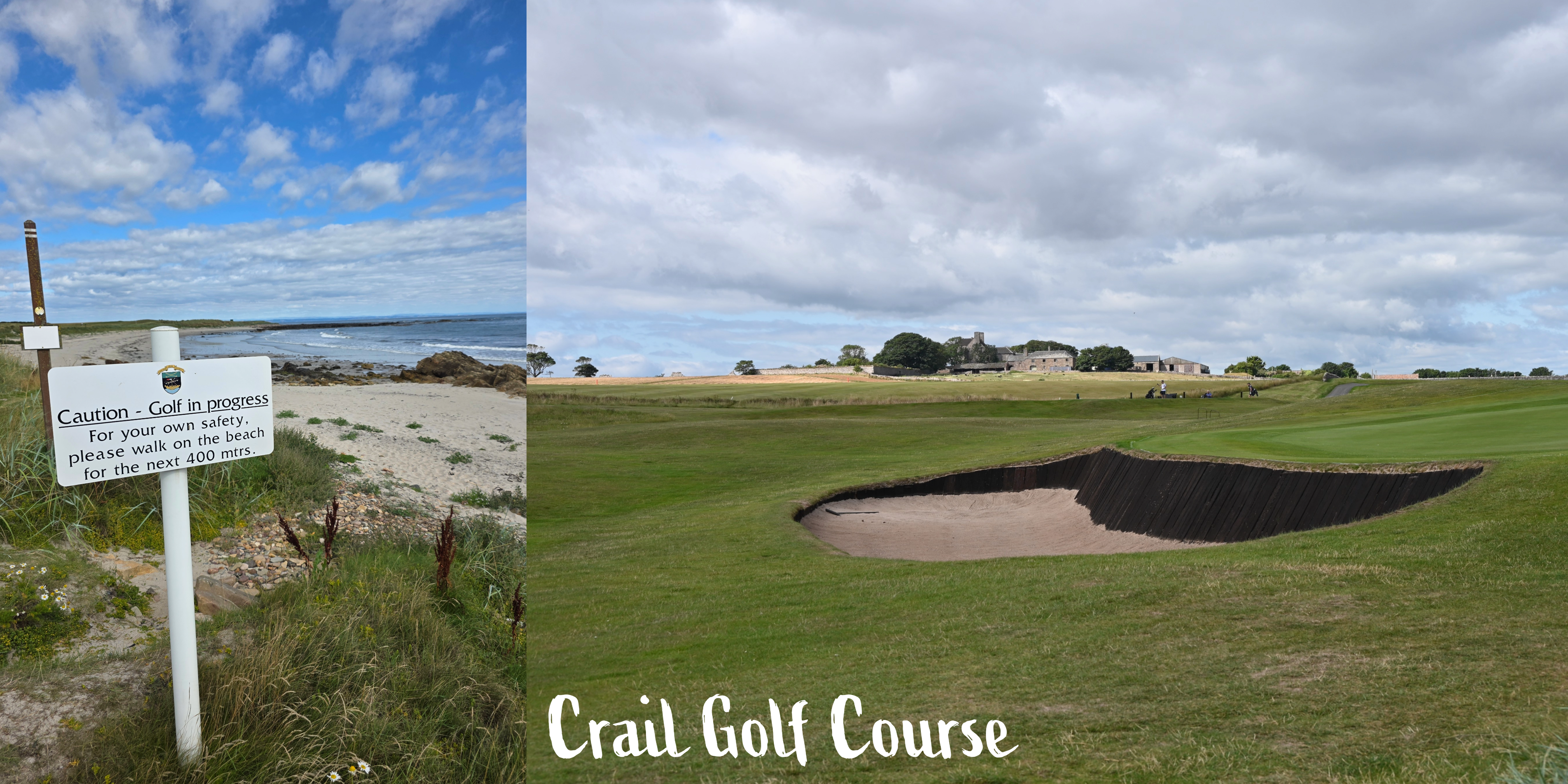
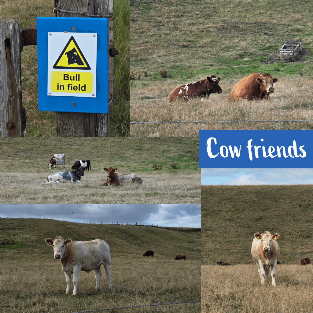
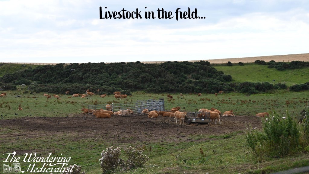
Eventually, after about 1.3 miles of edging along the golf course – with frequent reminders that golf is being played and you should be aware, and listen out for ‘fore’! – the course ends and there is a different kind of hazard, albeit short-term. The field of livestock was relatively calm, with one or two getting up as I passed. The white cow did keep a close eye on me, but never actually moved, just watched carefully that I would not be a problem.
At the far edge of the livestock pasture, the path leads steeply up hill – the headland I could see from a distance – then almost immediately back down again. There may have been an option to scramble along the beach here, rather than going up and down, but there was a great view at the top so worth the extra push. This may also be the only option at high tide.

Once down at beach level, the path cuts in front of a large cliff, onto the beach. There is a warning sign here to stay on the beach to avoid the fields of livestock, which are clearly open to the beach.
At first, the beach is not too difficult to manage, a combination of sandy and rocky but mostly rocky. I could see it as definitely being slippery if wet or if the tide had recently receded. As someone who grew up playing on beaches like this, I really enjoyed this section, especially with the view off to the right. The most challenging parts were soft sand and dodging the cow pats that were evidence of the open boundary between beach and meadow.
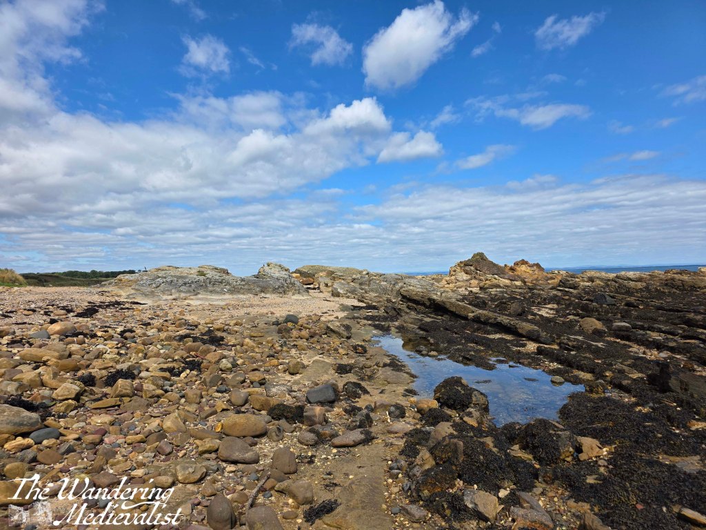
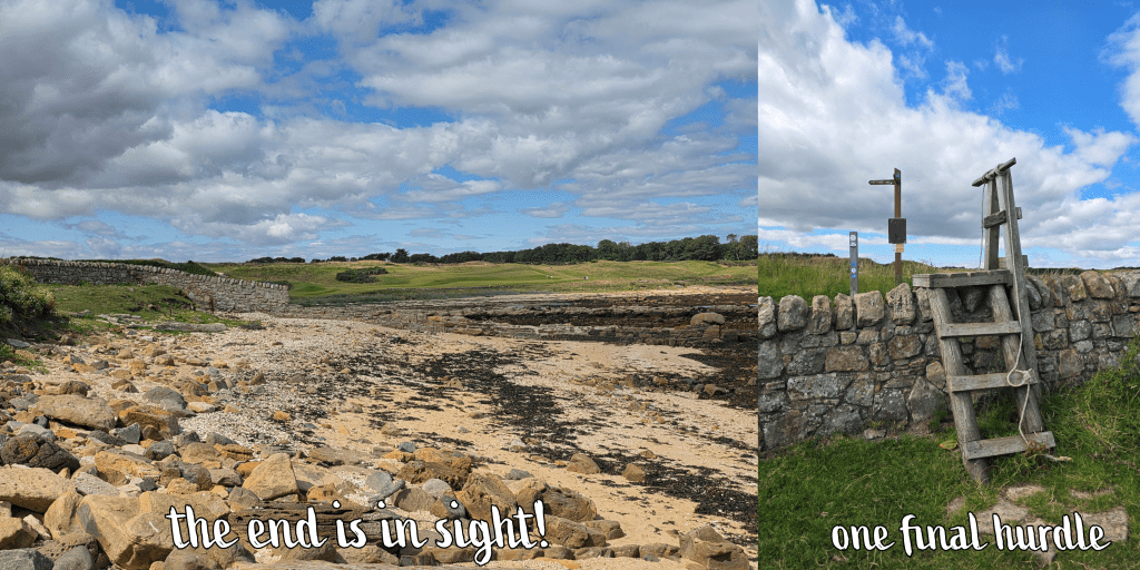
As I plodded along the beach, though, I realised that I was starting to run a bit short on time. It’s always a touch frustrating on a trip like this when your public travel options are limited, and you find yourself racing the clock. The farther I went, the rougher the terrain became, with rocks that were too small to completely stand on, but too large to step between, requiring a lot of attention and energy, slip sliding along. Progress slowed, and I was running low on energy. Finally, I caught sight of a stone wall – this was the end of the beach walk, though I was challenged in the end by a final obstacle – using a rope to haul myself up a wooden ladder to cross the wall.
It was at this point that I realised I needed to add two things to my hiking arsenal: one, a portable power bank, as my phone was beginning to run low (using it for pictures and voice notes) and I needed it for my return bus ticket. Two, an updated map of the coastal path; mine was from 2017, and it has become increasingly evident with each walk that changes have been made since then. While there is an online version, you are often out of range of data on these walks so it quickly becomes obsolete.
Carrying on past the wall, the path heads up a small hill, offering views of the livestock field on one side, and Kingsbarns Golf Course on the other. It was a busy day for golf with several large groups out, and to my amusement I identified more than a few American accents among them.
I thought that the path stayed by the coast at this point but instead it loops up above the golf course, which caused me a bit of confusion. My last efforts along the beach had driven me beyond the point of questioning, though, so I pushed on, enjoying the view over the course. It was also helpful to see the treeline of the Cambo Estate clearly ahead of me, knowing that was my goal.

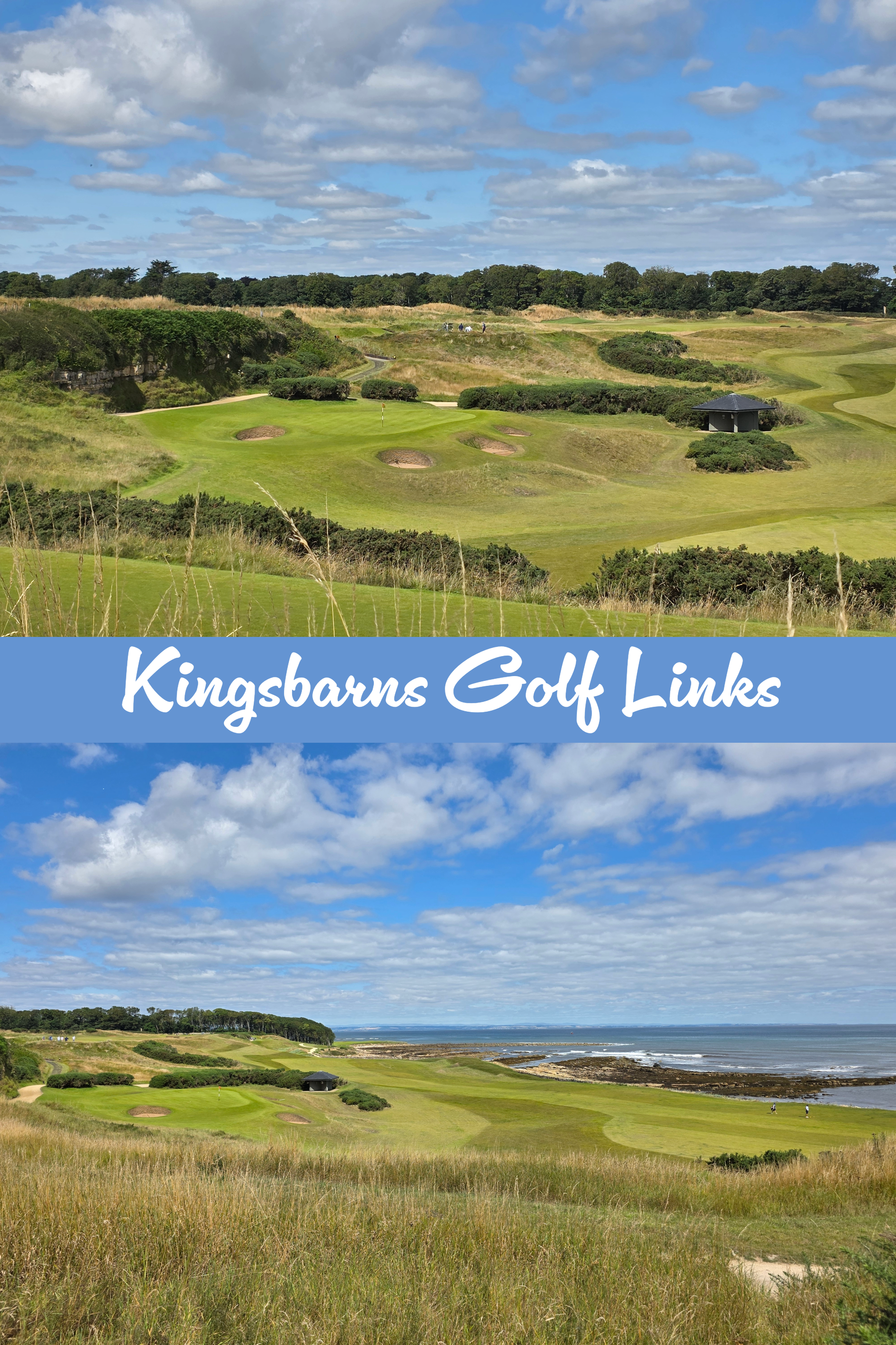
The path is a touch unclear here, but I used my instinct and habit at this point to keep to the edge of the golf course – a brief turn left then almost immediately right again, between a few greens. The sun was bright and hot by this time, and up to the left I could see a few old estates including the roof of Kingsbarns Distillery.
The Coastal Path approaches the estate wall and is briefly forced around to the left, curving towards the water, before a small gap in the stone appears. There is a wooden gate and sign for the path – I was quite relieved, as I knew the end was near and I did not want to go all the way back down to the beach.
Through the gate, there is an immediate right-hand turn down some wooden stairs, and a view through the trees towards the beach, looking over the Cambo burn.

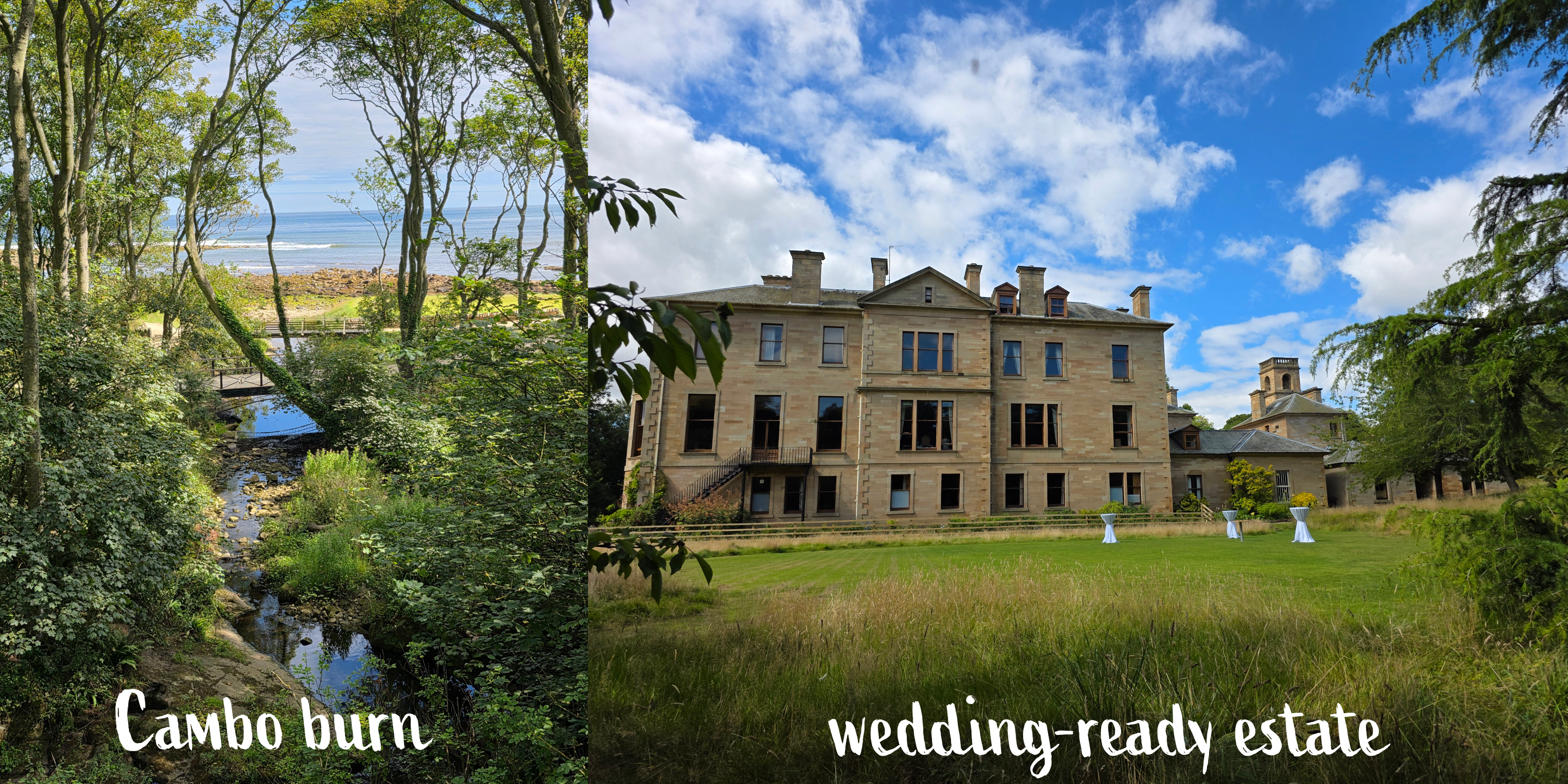
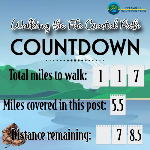
Once you go down the steps, the path sweeps towards the river, and on the other side splits into several directions. One leads down to the coast, one further along towards Kingsbarns, and one up towards the estate house and gardens. This was where I marked the end of my walk – 5.5 miles from where I started in Crail. But, I still had a way to go, walking up through the estate grounds.
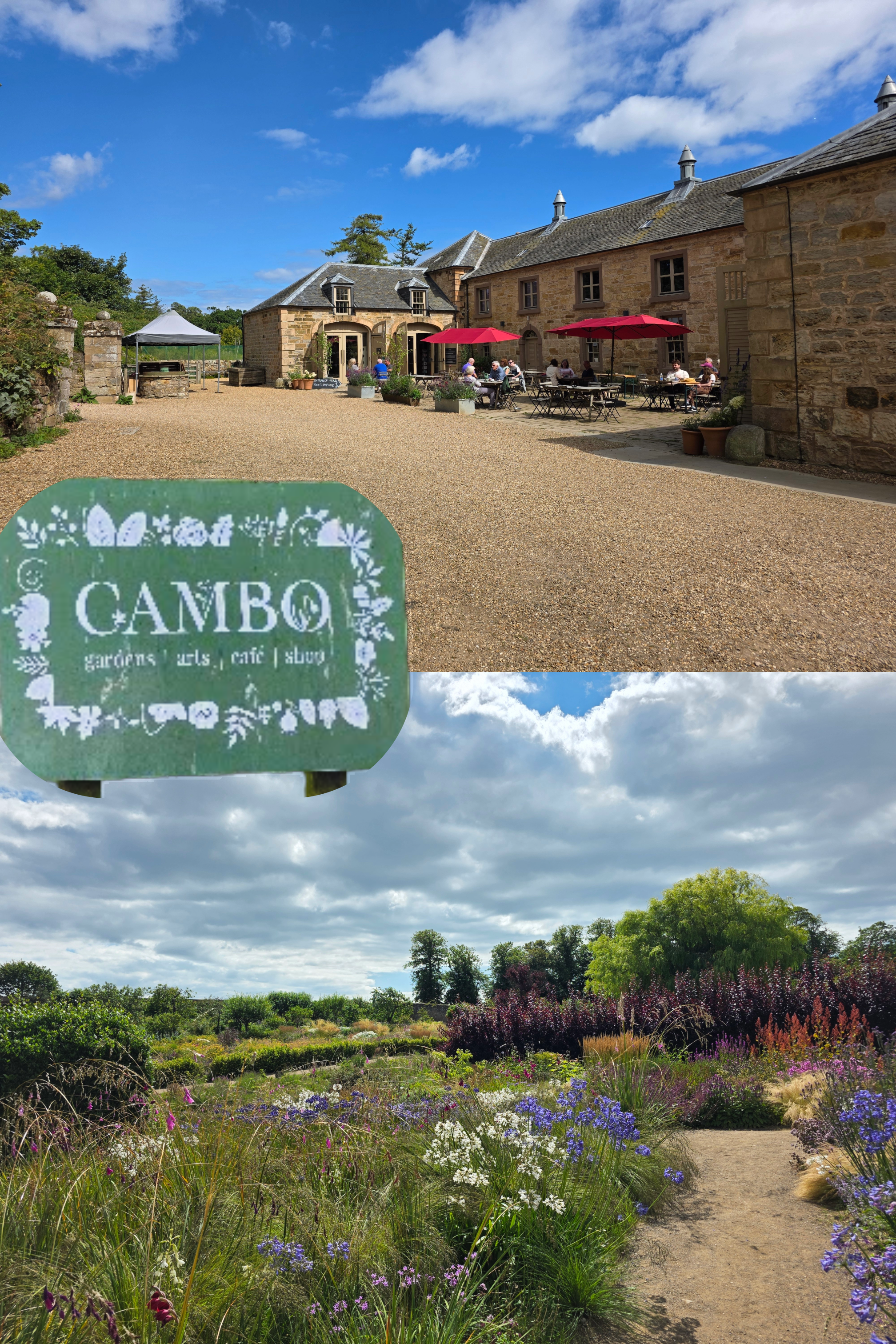
Cambo is a beautiful spot to visit, with a walled garden, excellent café, and plant shop. It is possible to walk up past the walled garden, through the car park, and along a path all the way to the road – for those hoping to make a bus, this is a solid mile. I tried, I really did, but I missed by about 10 minutes, having forgotten just how far it was. Fortunately, the other half took pity upon me and collected me from the bus stop where the only alternative was a 45-minute wait.
I did consider joining the groups of families and couples enjoying their lunch in the sun, but I was hot, sweaty, and a touch bedraggled. Home was the better option. Overall I found this a really pleasant walk, and not as difficult physically as I thought, meaning that my stamina is definitely improving.
I might try it the other way were I to do it again, with the rocky beach the first thing I tackled rather than the last. But I do seem to have developed a pattern of walking counter-clockwise around the edge of Fife, and I am now reluctant to change that. Public transport is possible for this route but a bit tricky, so worth just being aware of the limited options (one bus an hour to Cambo), and of course, check the tides!
Autumn travel approaches, but I hope I will manage at least one more section of the trail before I disappear overseas.
