October has been a whirlwind of work travel and so I have not had time to sit down and write as I hope to do each week. I started this post a few weeks back, when my memory of the walk was fresh, but now have finally been able to finish.
On our recent return to Skye, Dad and I chose a more challenging hike for our first day, and so by day two were looking for something gentle to keep us moving but not over-tire.
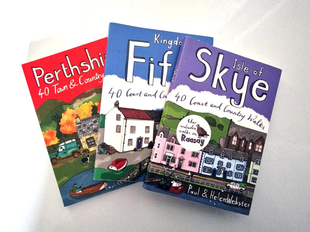
The solution was to dig out my Isle of Skye walks book, one of a series that I have been collecting. While there are plenty of walking books out there including the Ordinance Survey series – excellent options that tend towards longer trails – I have found these smaller books to be a wealth of knowledge for shorter strolls.
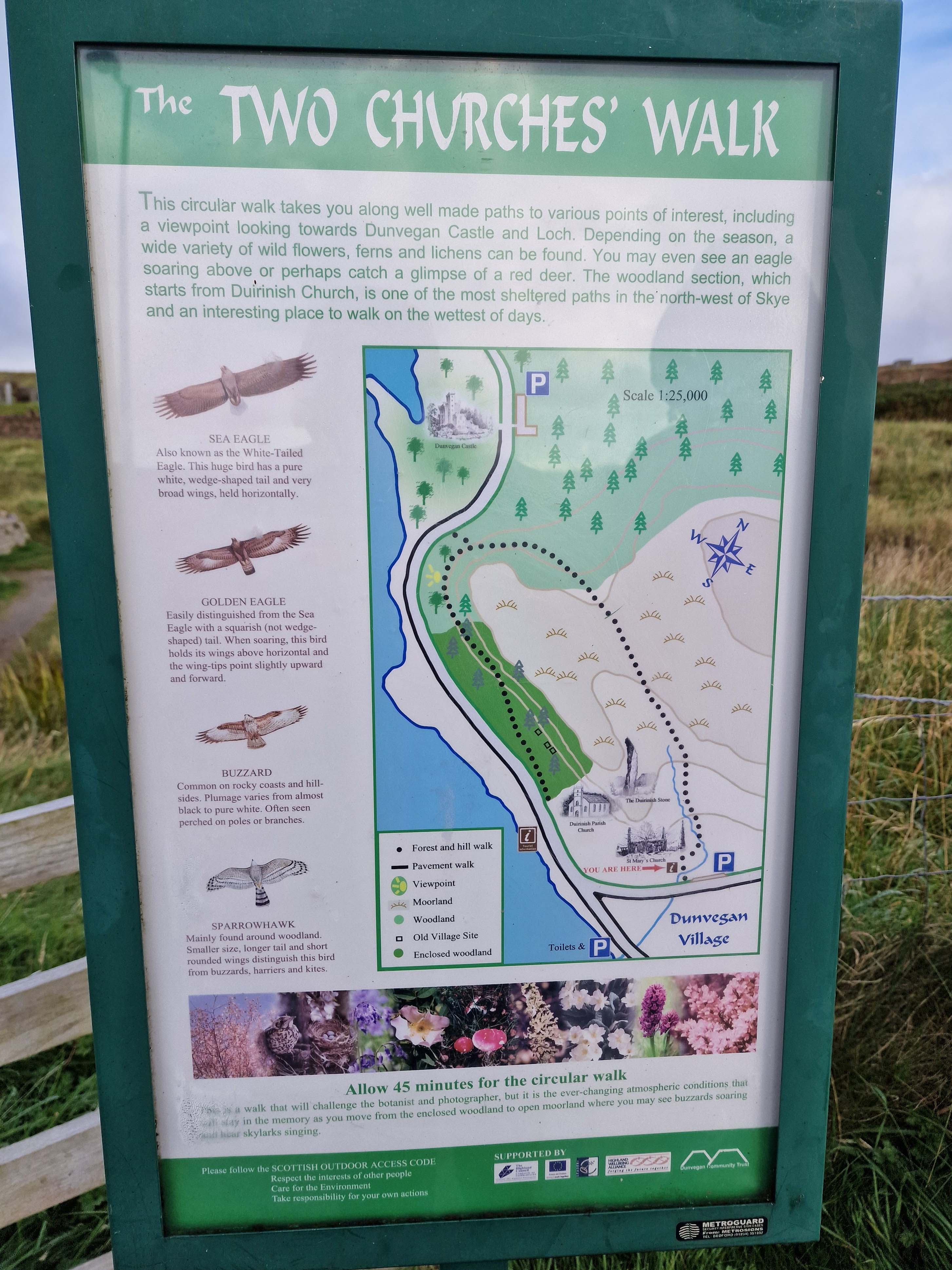
It took us only a few minutes to decide upon the Two Churches walk, an option I had noted for future exploration on our last visit, and helpfully located only about fifteen minutes away.
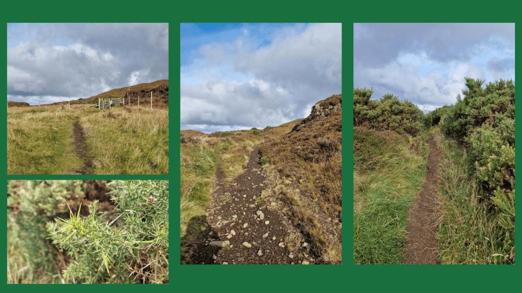
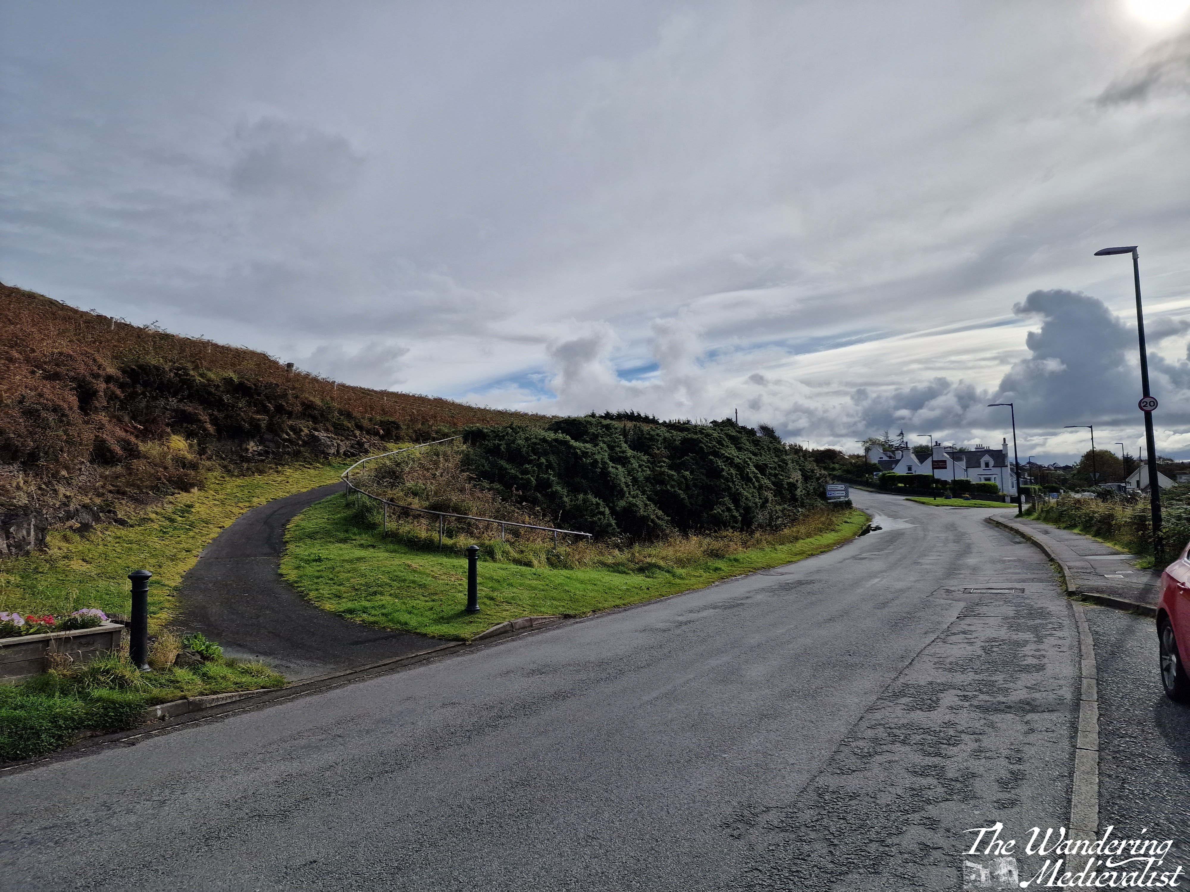
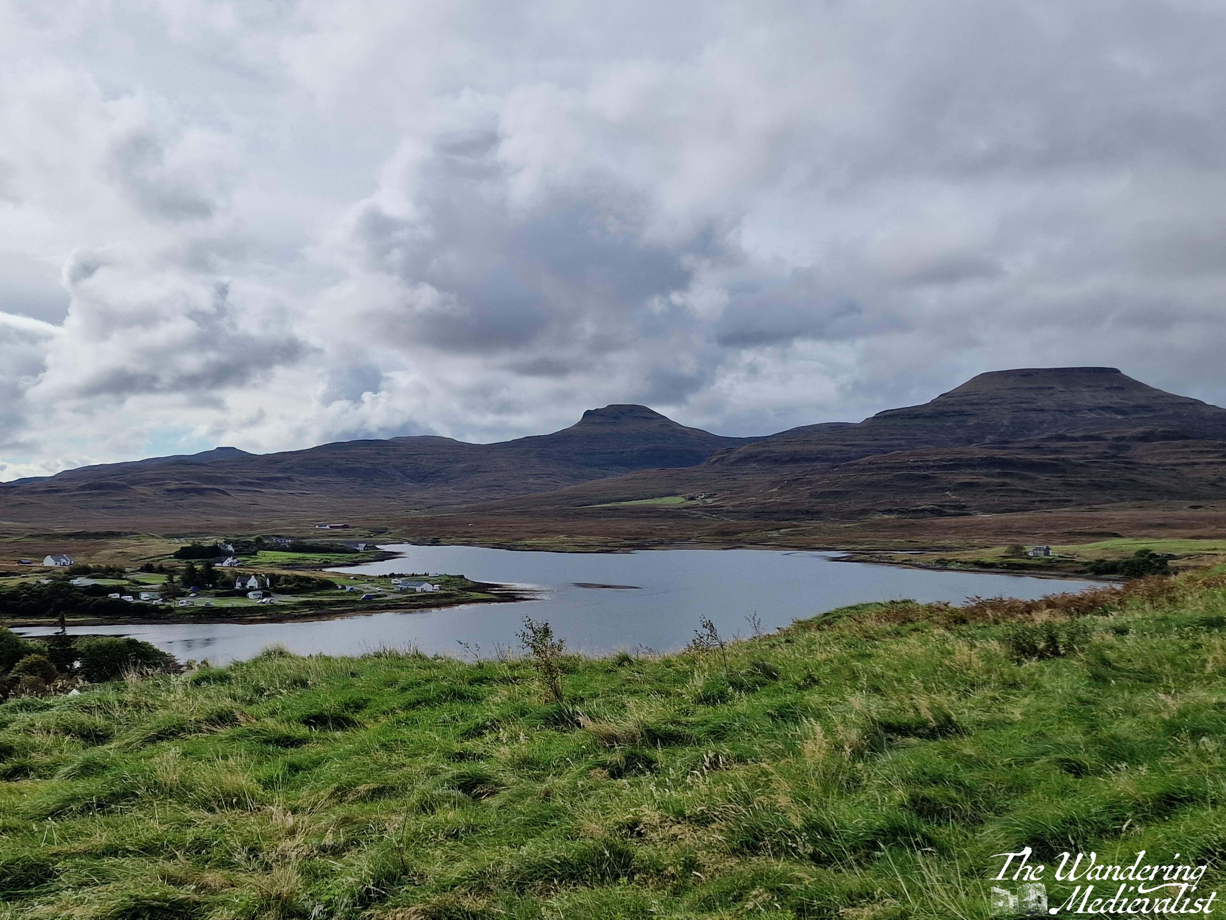
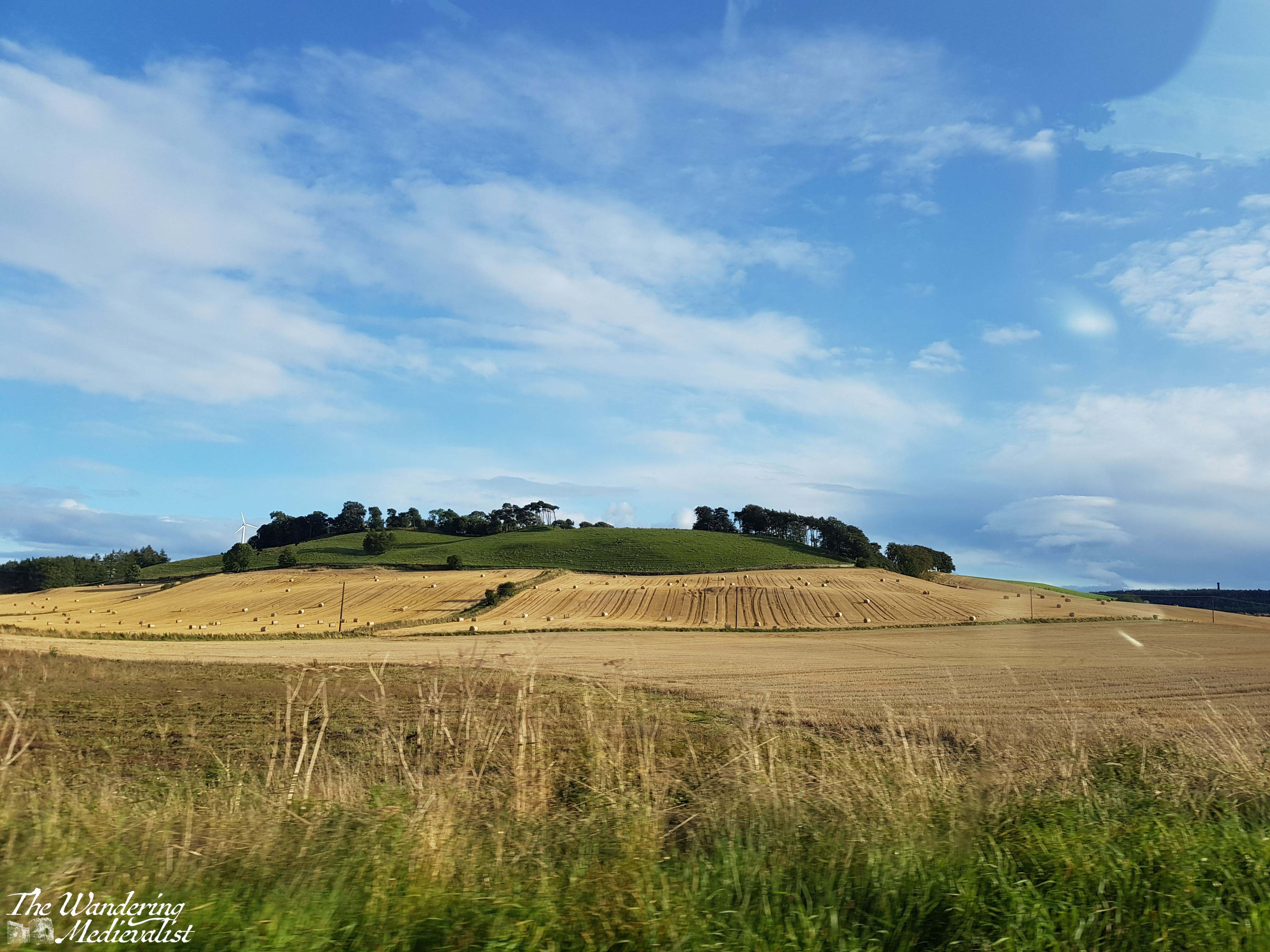
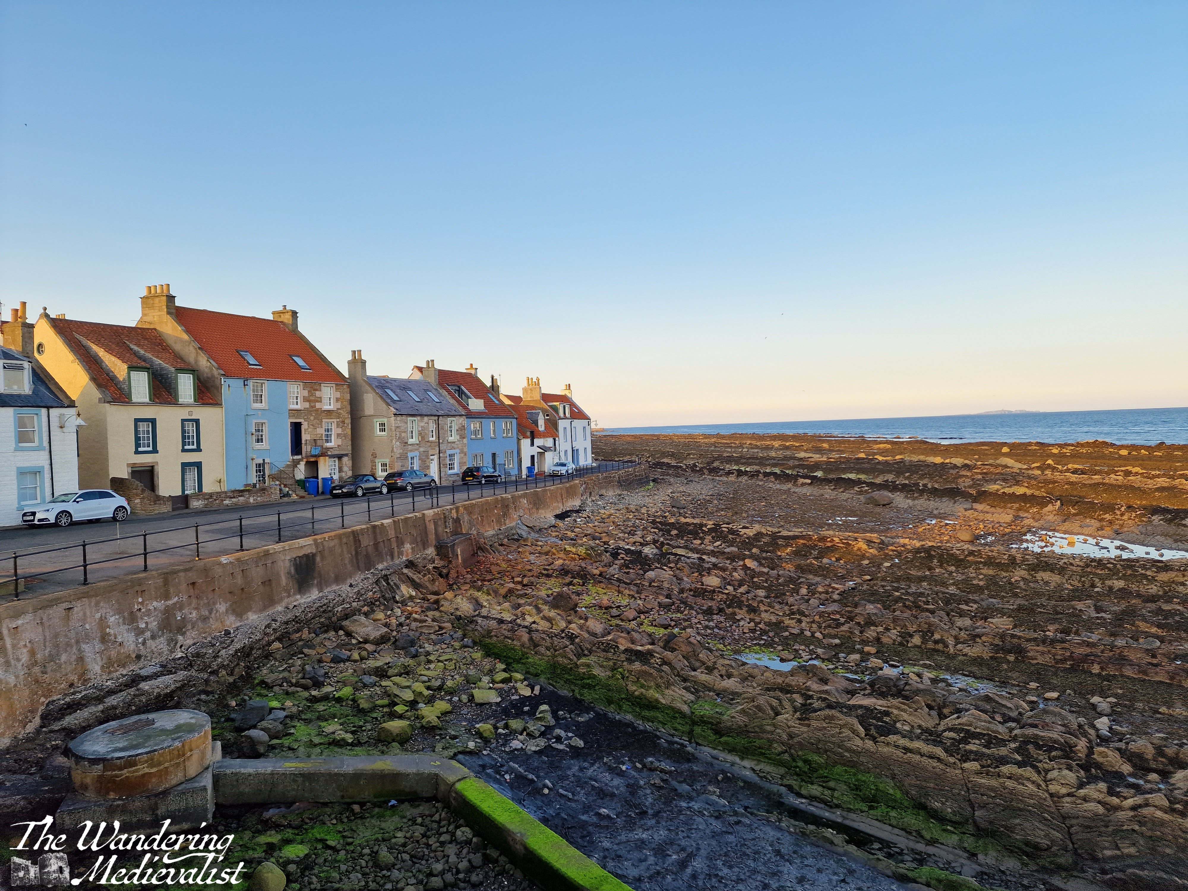
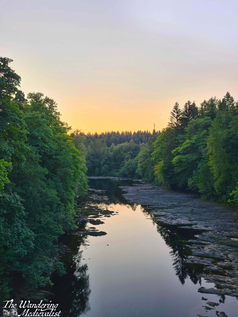
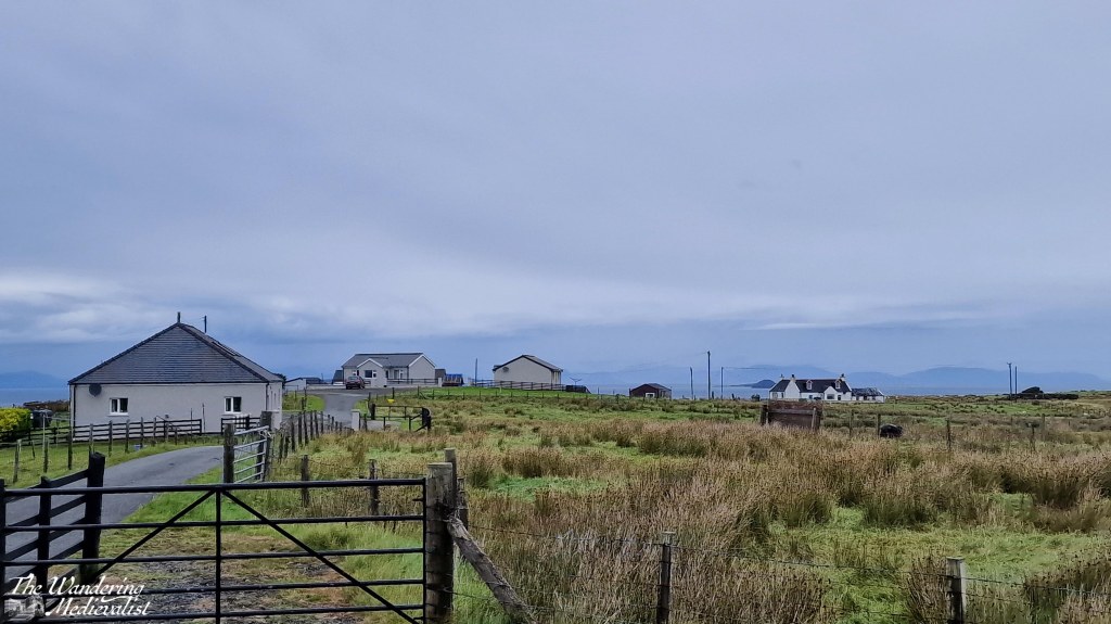
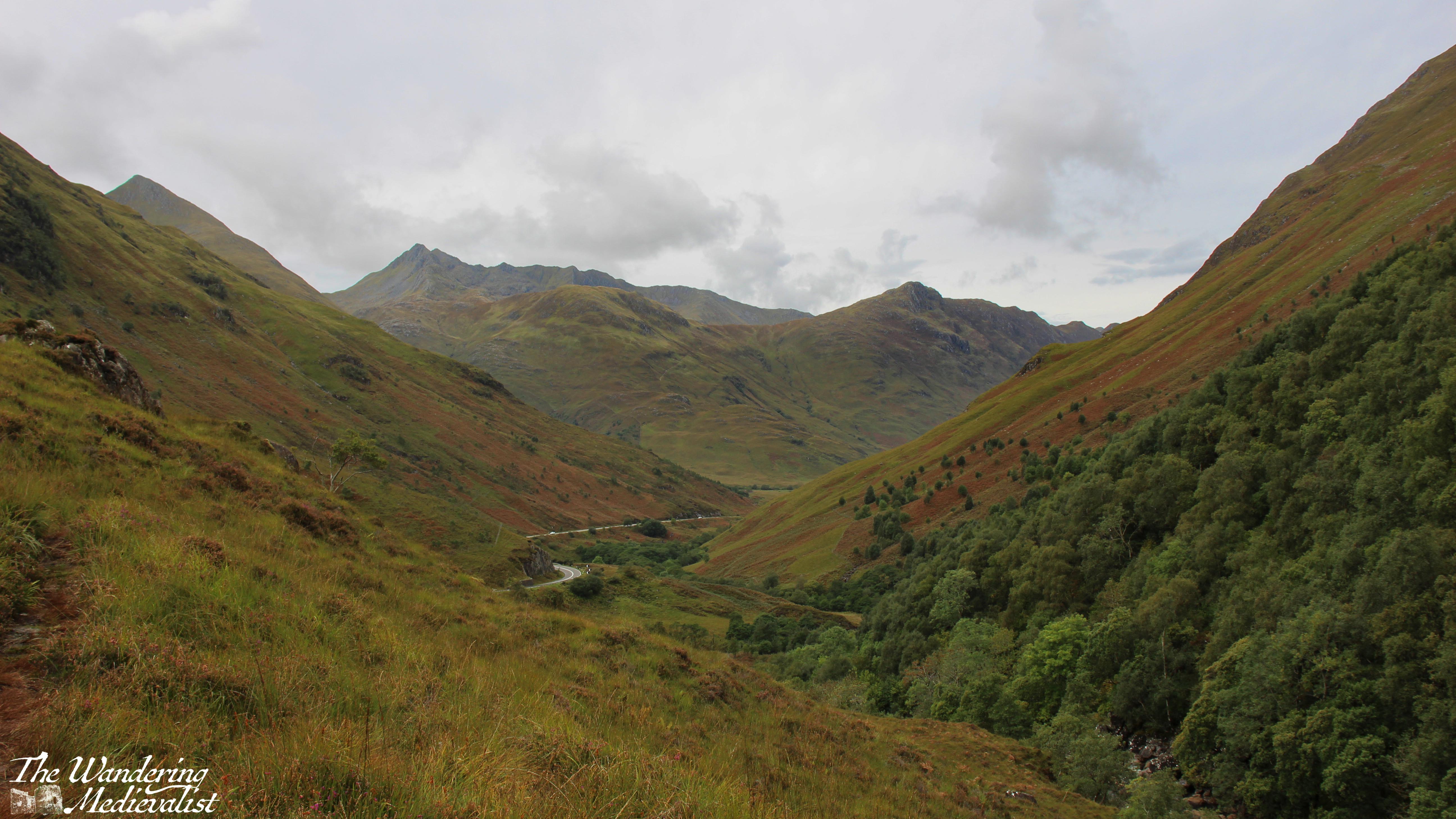
The Two Churches walk is about 3km long, a relatively flat loop with a combination of well-kept moorland paths, forest trail, and a short section on the roadside. It leaves from a well-signed lay-by with enough parking for between 5-10 vehicles; we found it almost empty, as many of our fellow walkers were clearly locals.
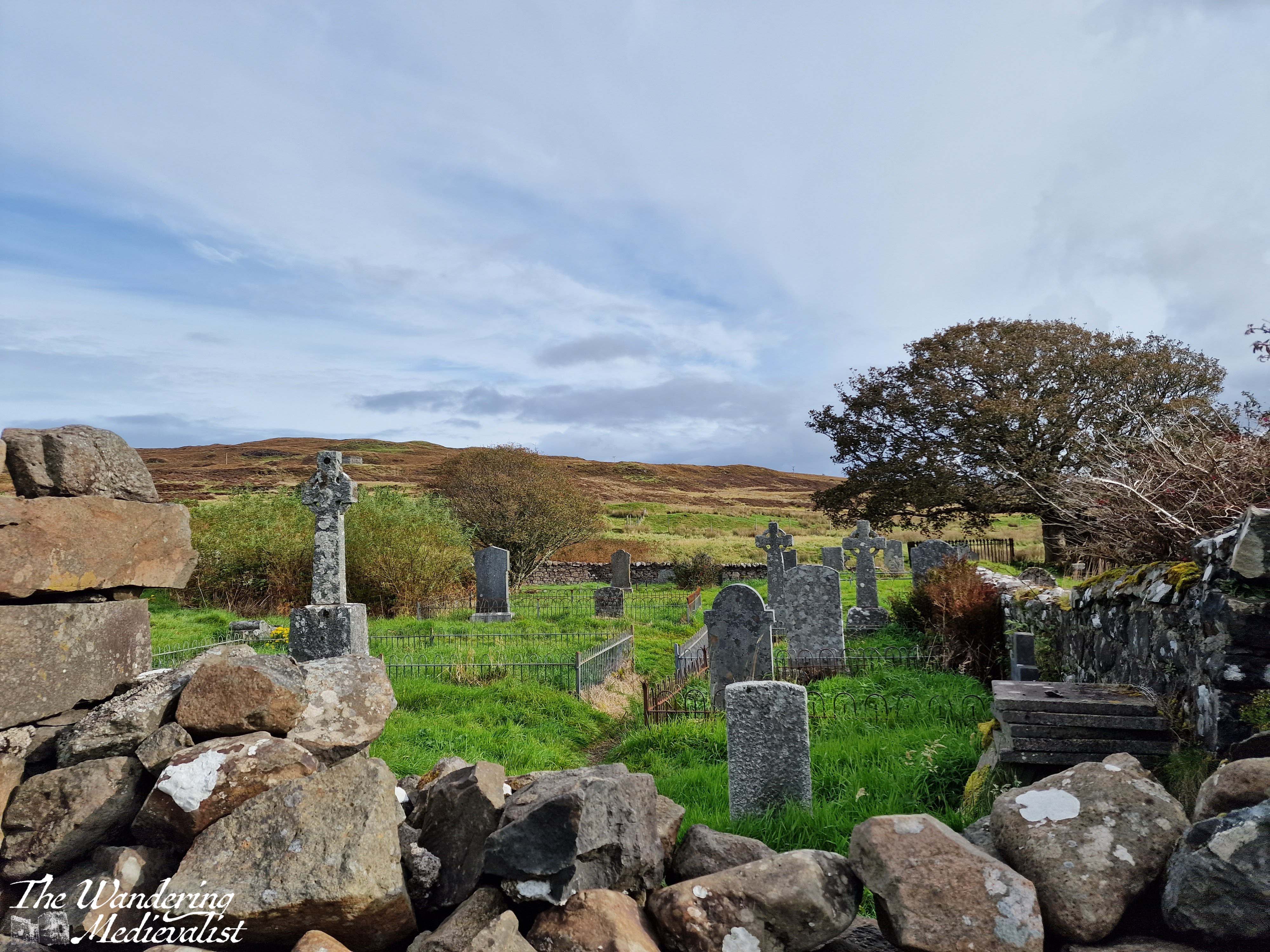
The path starts just to the right of the ruins of St Mary’s Church. It is a well-kept trail with a slow incline. There is a plaque with details about the walk and its route, as well as some of the birds you may see along the way (though we did not). You get nice views back towards the churchyard, with grassland on both sides. On the day we visited it was mostly dry though I imagine it would be muddy at times, and once the path turns rockier a bit further on, it could be slippery in the wet. I would definitely recommend good sneakers or walking boots to traipse through the puddles.
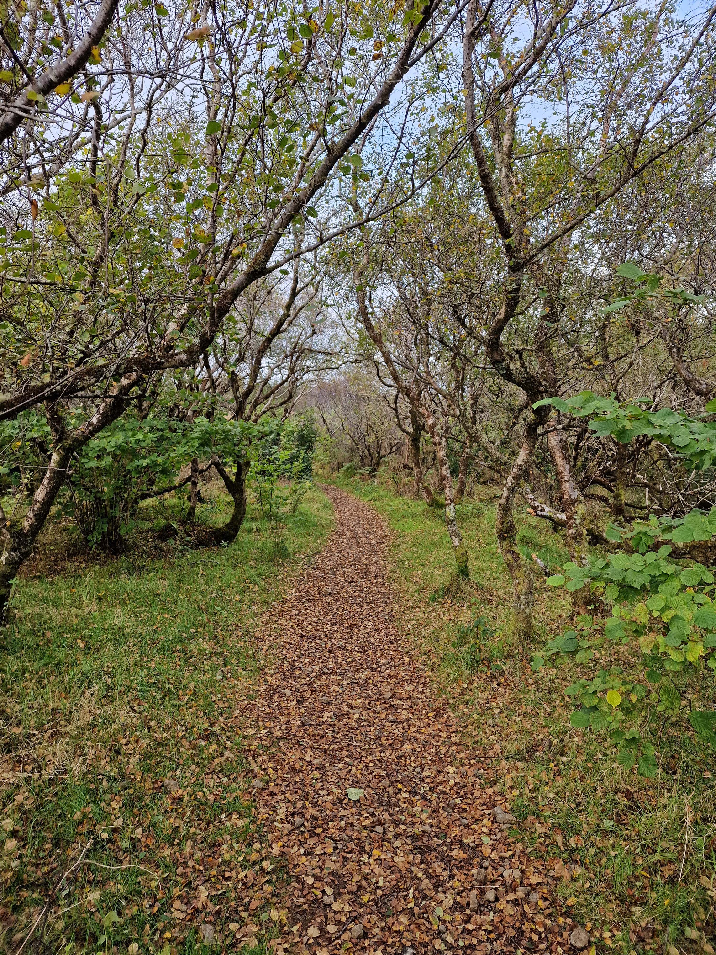
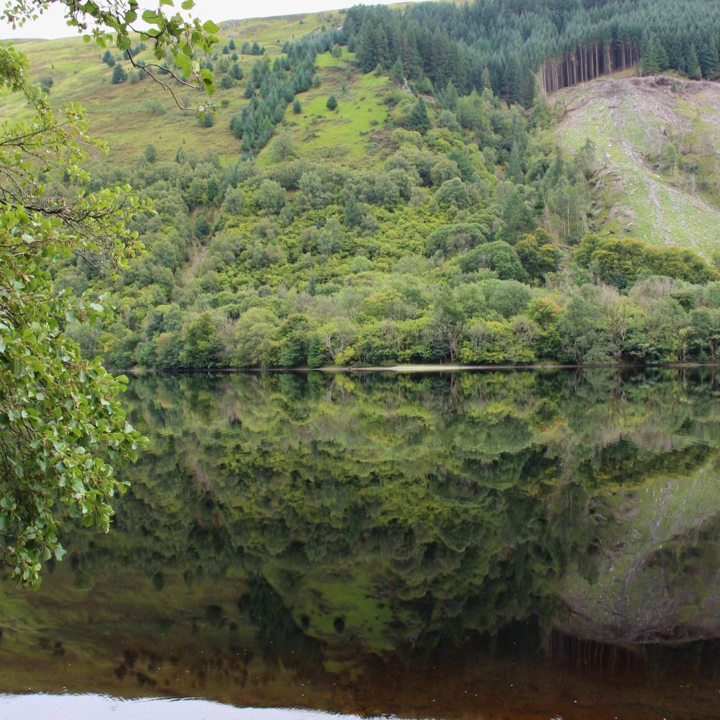
The walk passes through a farm gate, and continues through patches of gorse and other prickly plants. In spring and summer it would be gorgeous and yellow, though I am quite allergic to gorse so was pleased that the blooms had passed. Only a few minutes in, the path enters a light forest, and going through another gate finds you walking through trees and ferns. It reminded me in many ways of trails in the White Mountains, though the flora was slightly different of course. As the path swings around to the left, the deciduous trees turn mostly to pines, and the trail is surrounded by great tall trees, all very straight in the manner of a planned forest. I had learned that on some estates these tall pines were planted for ship-building, but by the time they grew the industry had moved past using wood. Great expanses of pines in the Highlands were therefore left, though the acidity in falling needles meant little could grow beneath. (This information came mostly from a fantastic series I watched years ago called ‘Making Scotland’s Landscape‘ presented by a Scottish professor of Geoscience.)
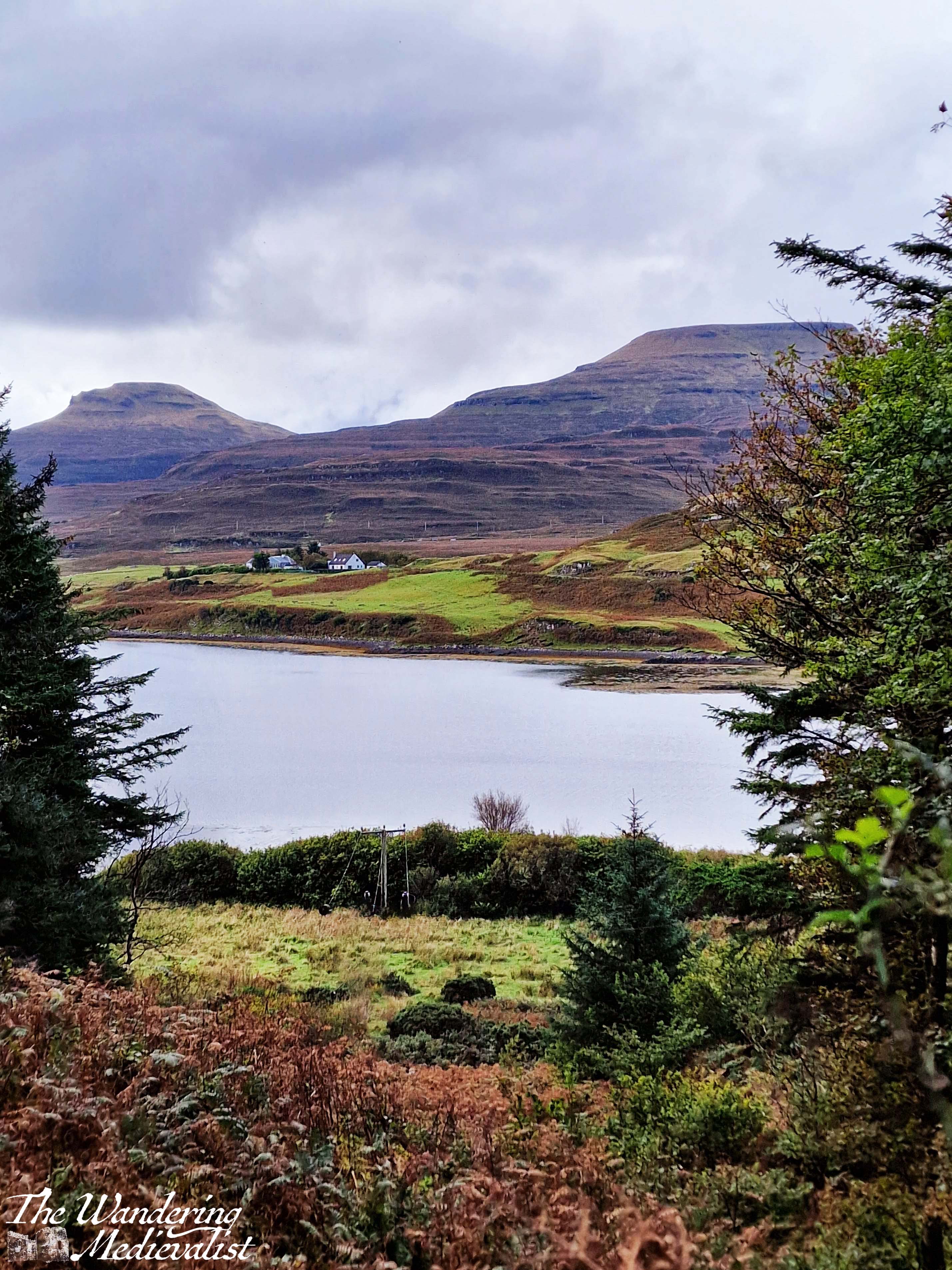
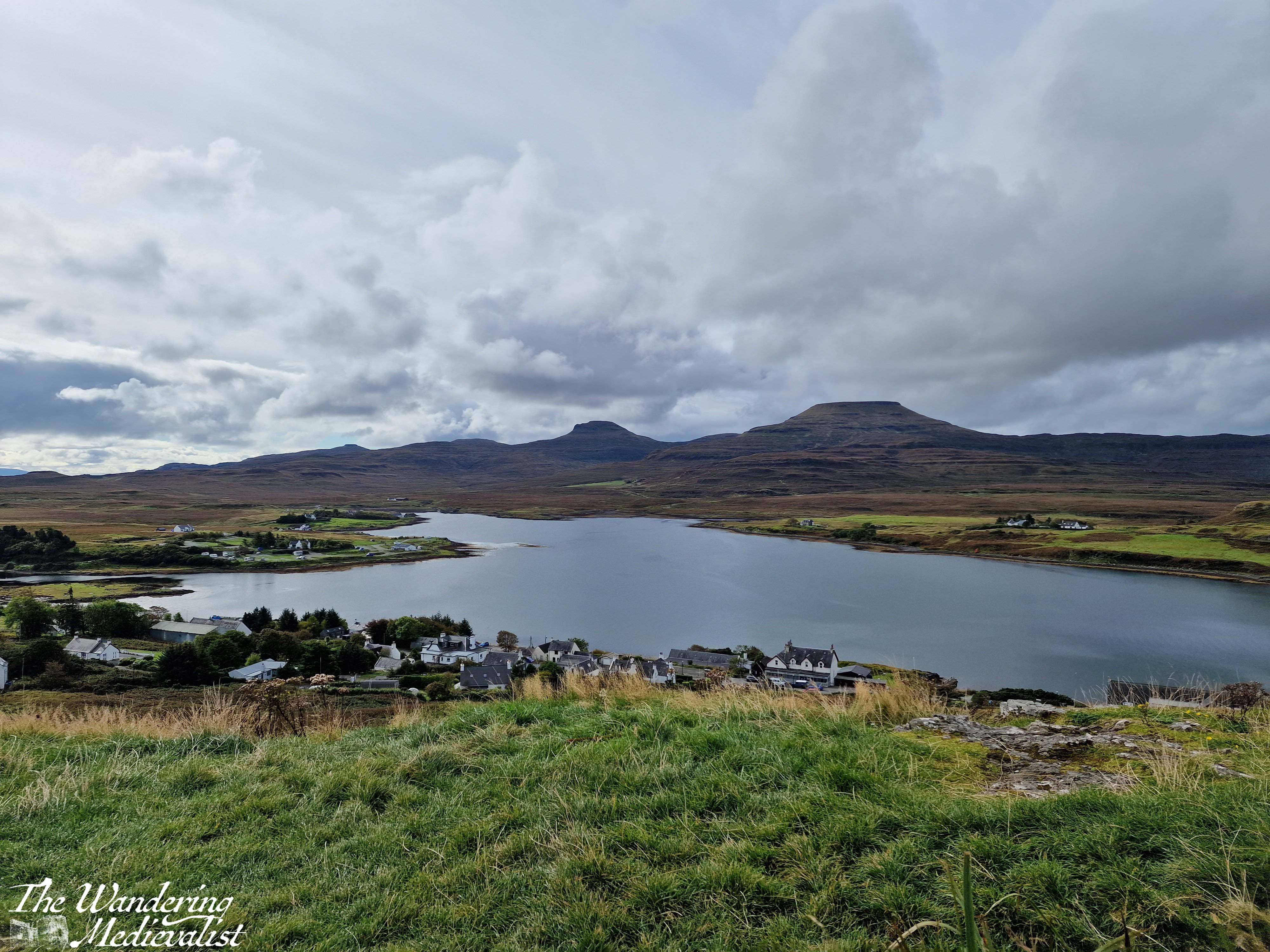
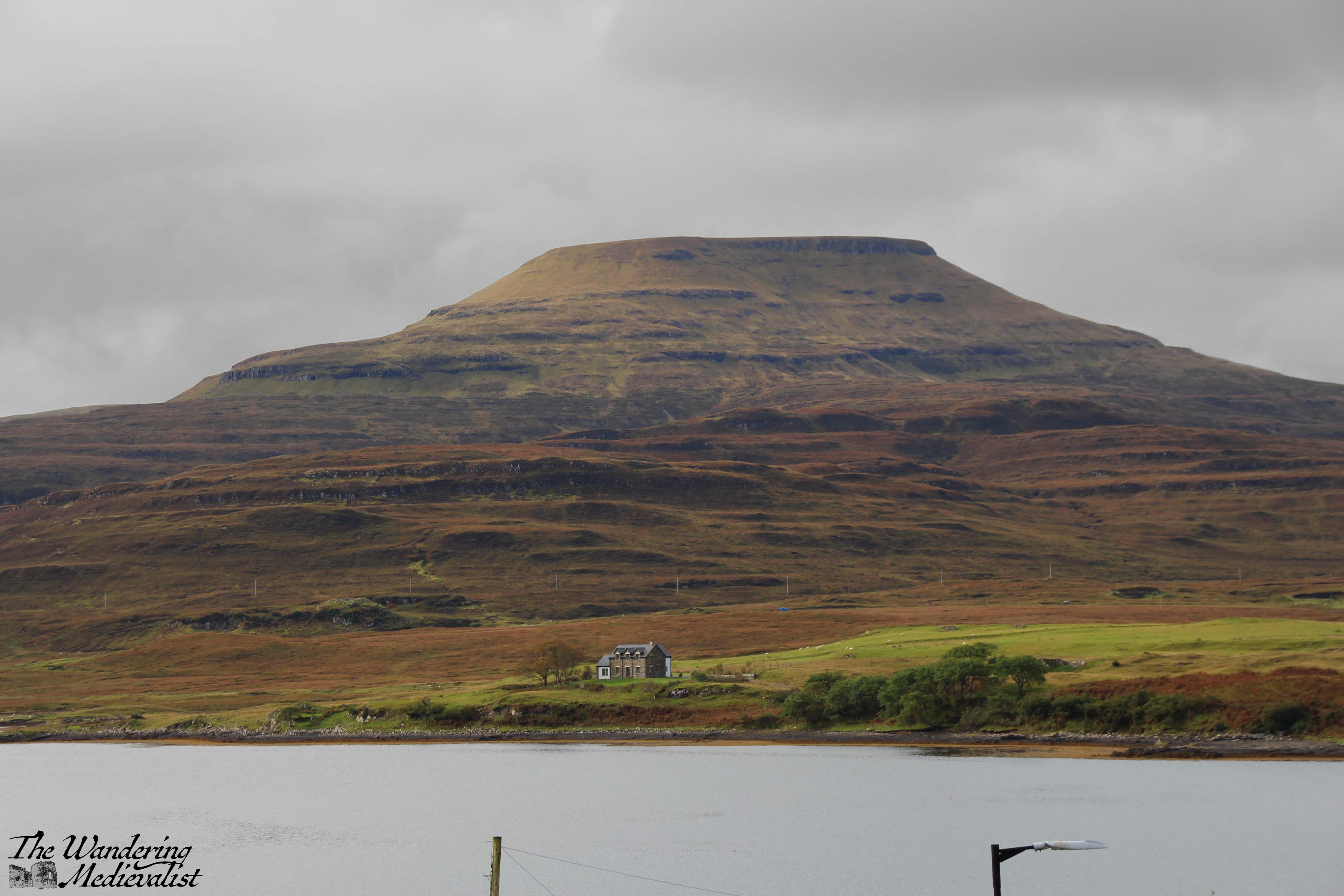
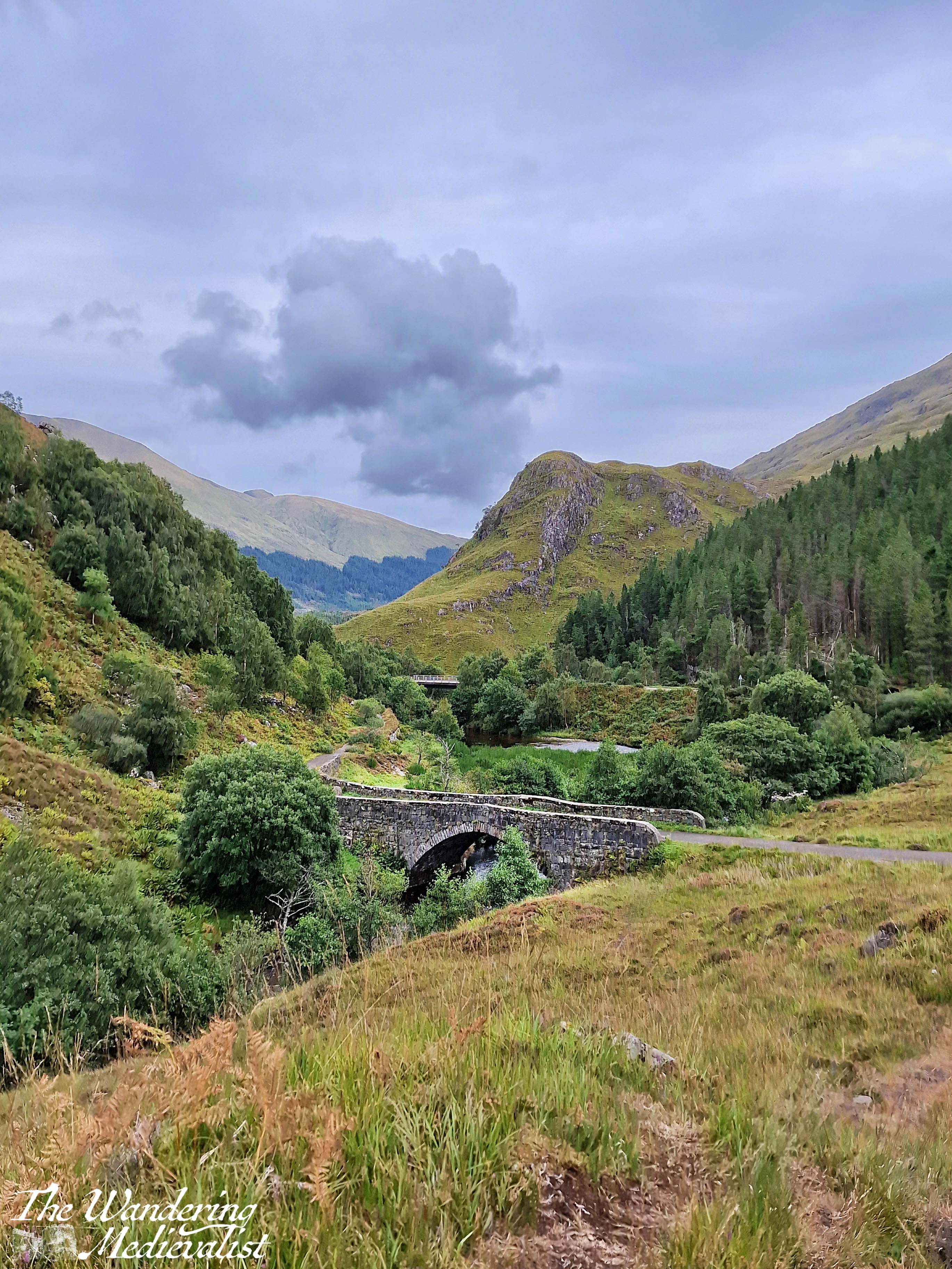
It is a lovely peaceful walk with not too much up and down – though there are a few climbs and dips to be had – and we passed several sets of joggers and plenty of dog-walkers, showing the path is clearly popular with locals. There is not much to be seen beyond forest in this stretch, though as the path continues to circle around there is one open viewpoint through which the power cable runs, and through which you can see the loch and the house and mountains on the far side.
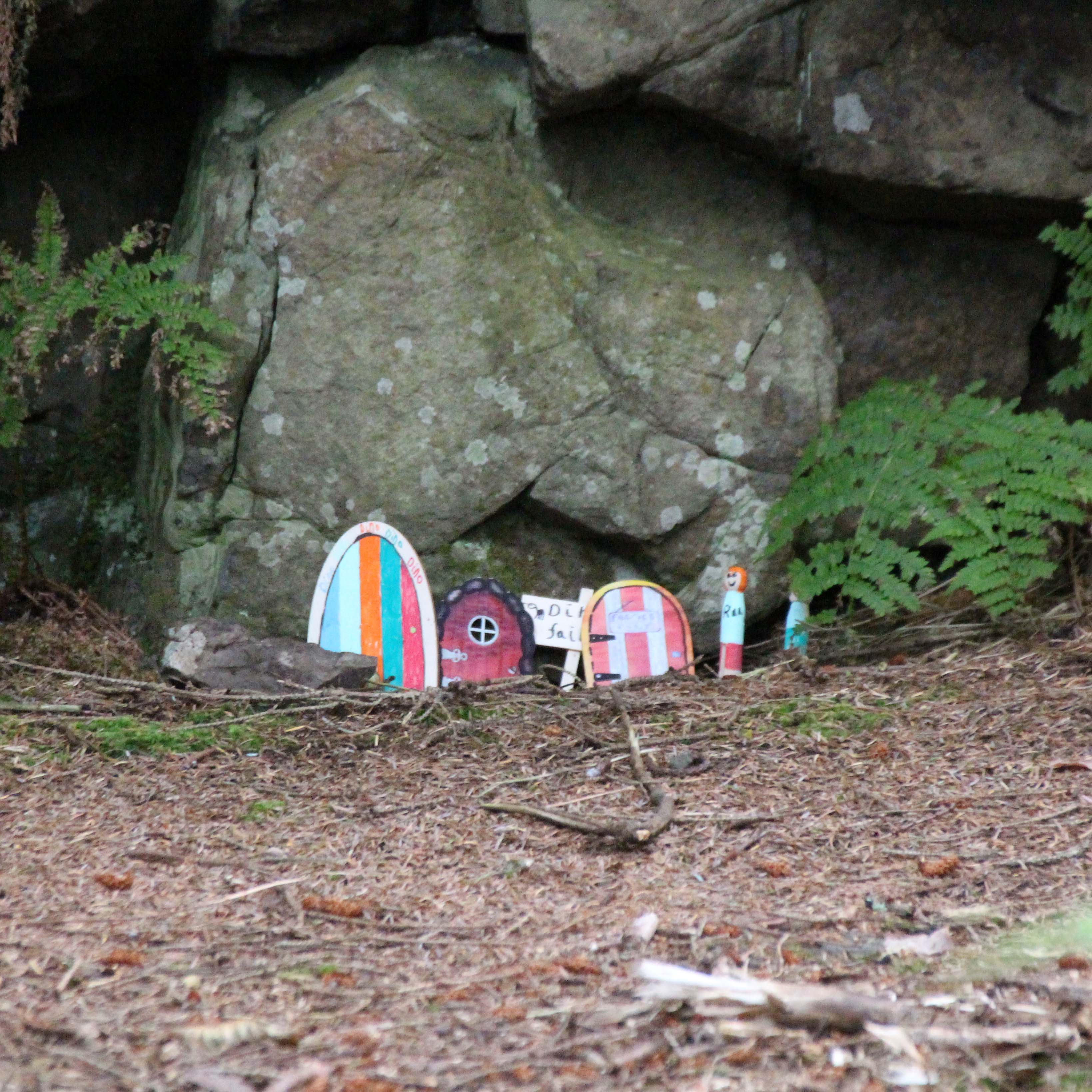
After the viewpoint you can hear and at times see the road below the path to the right, and as you approach the end of the forested section, we discovered that the local school had designed fairy houses in the trees and rocks. They were a charming combination of modern and very old-fashioned in design, with a little village at the bottom of a small cliff.
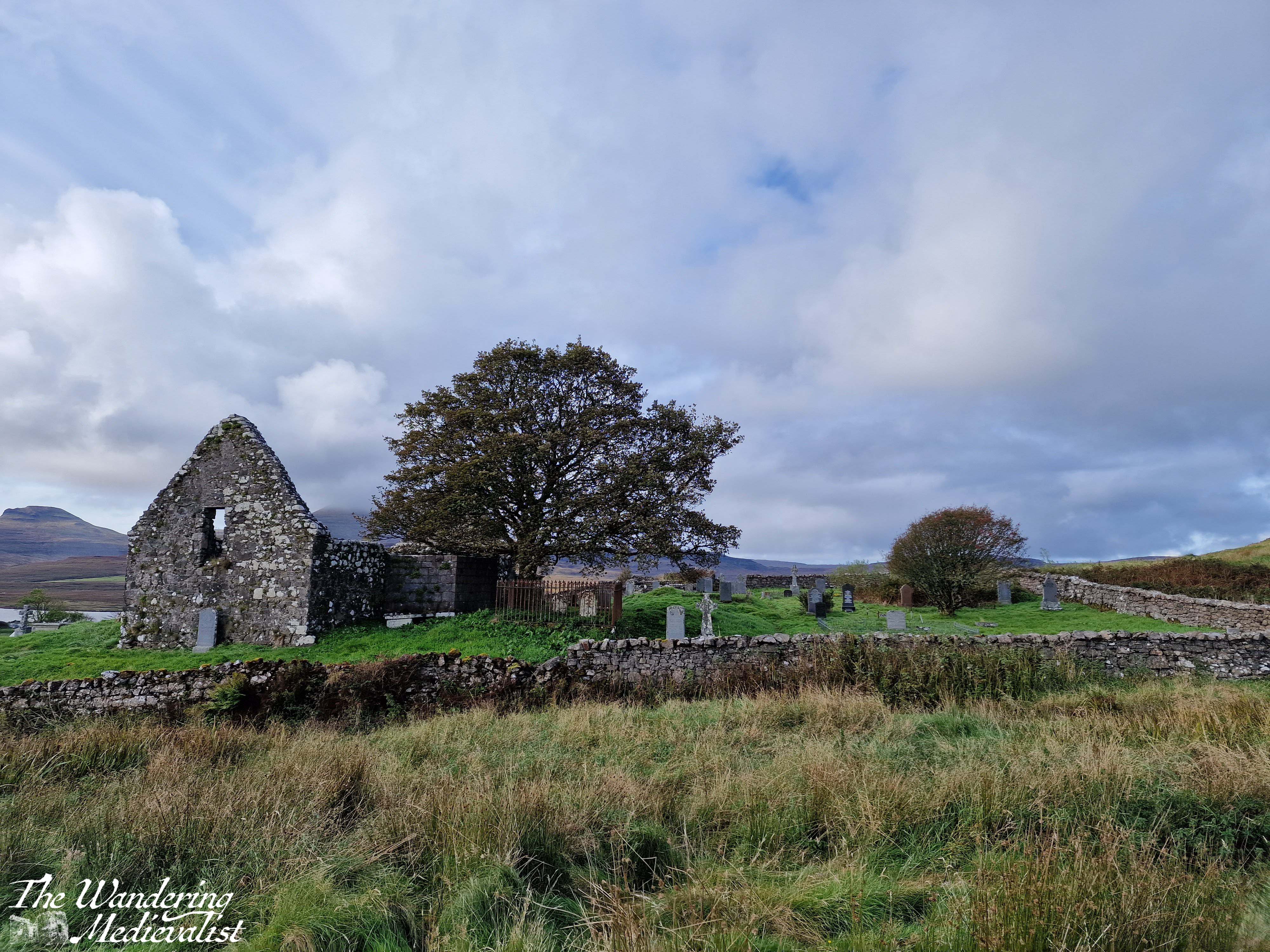
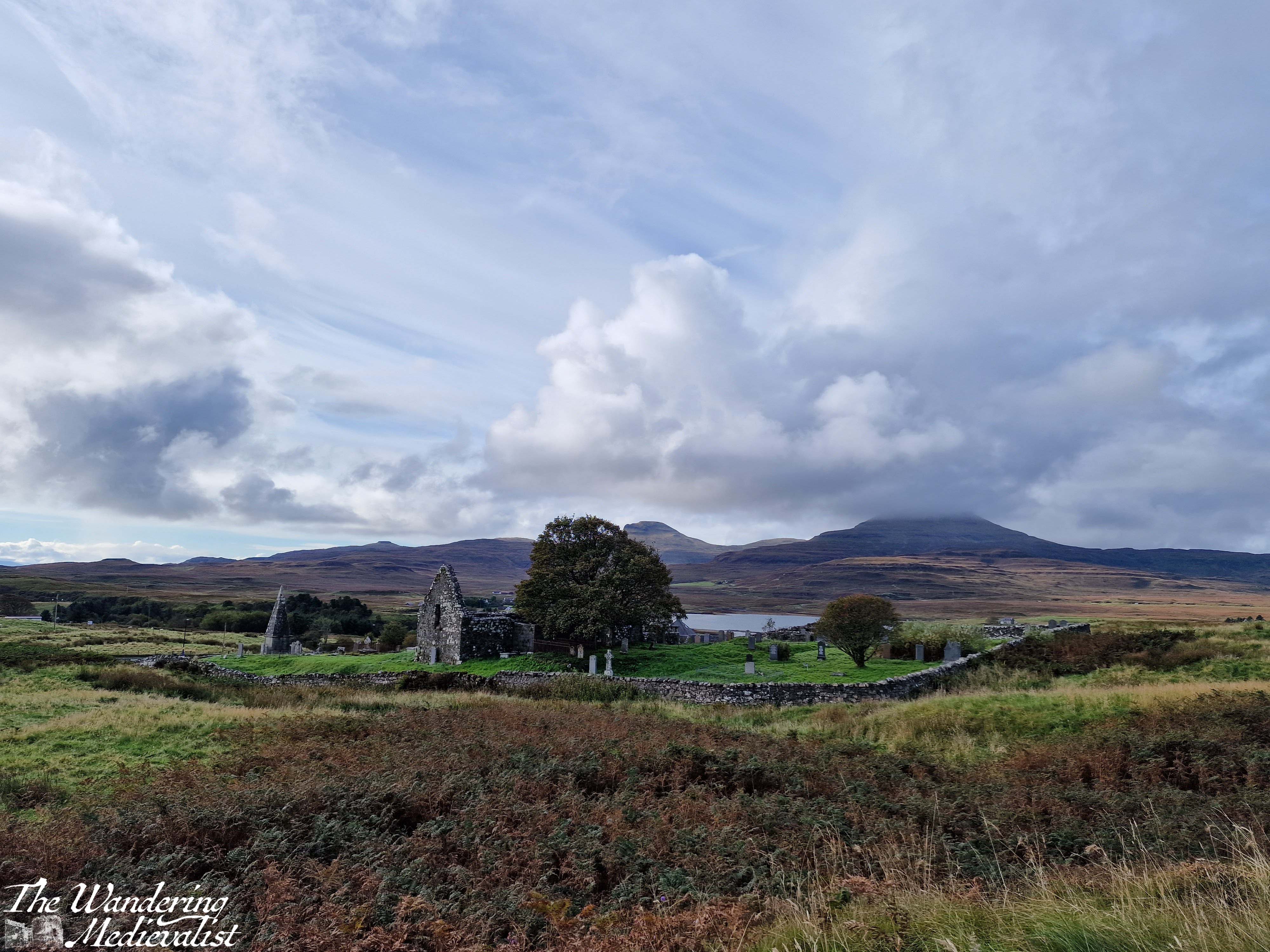
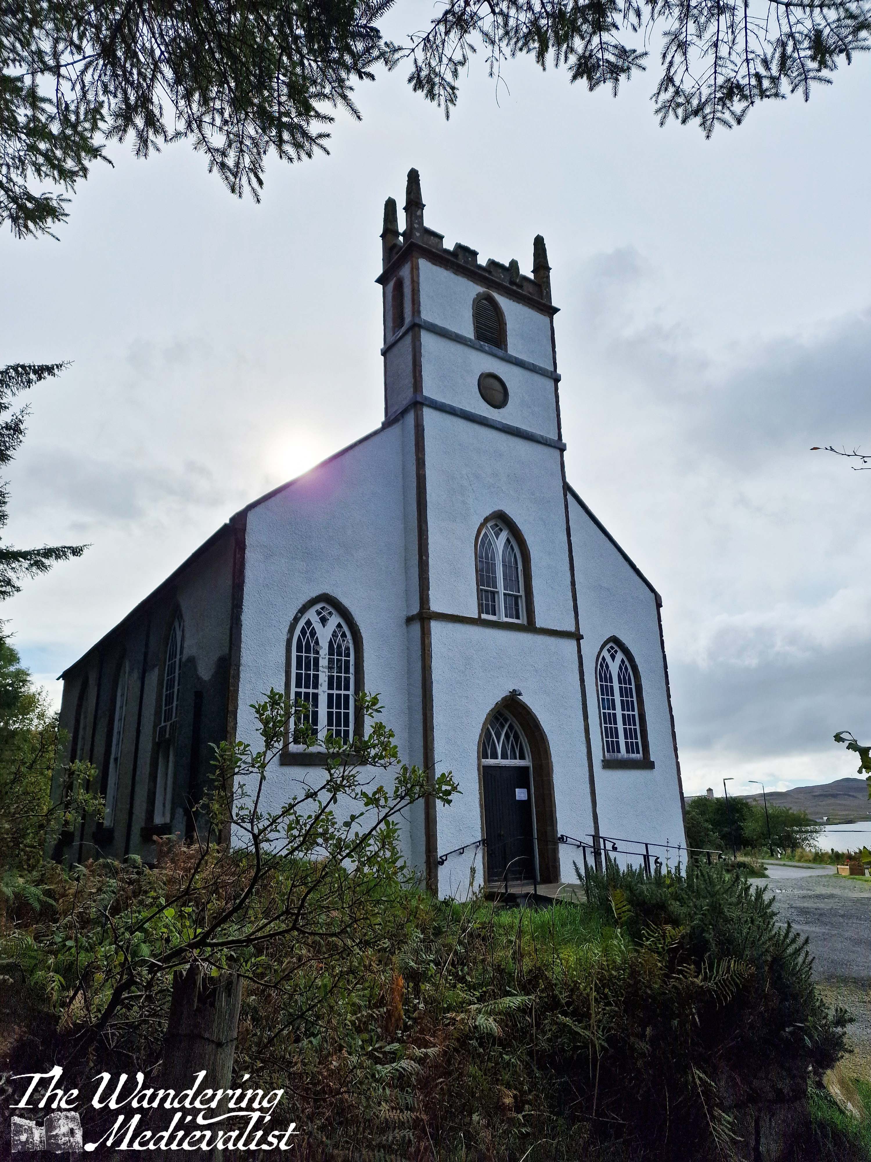
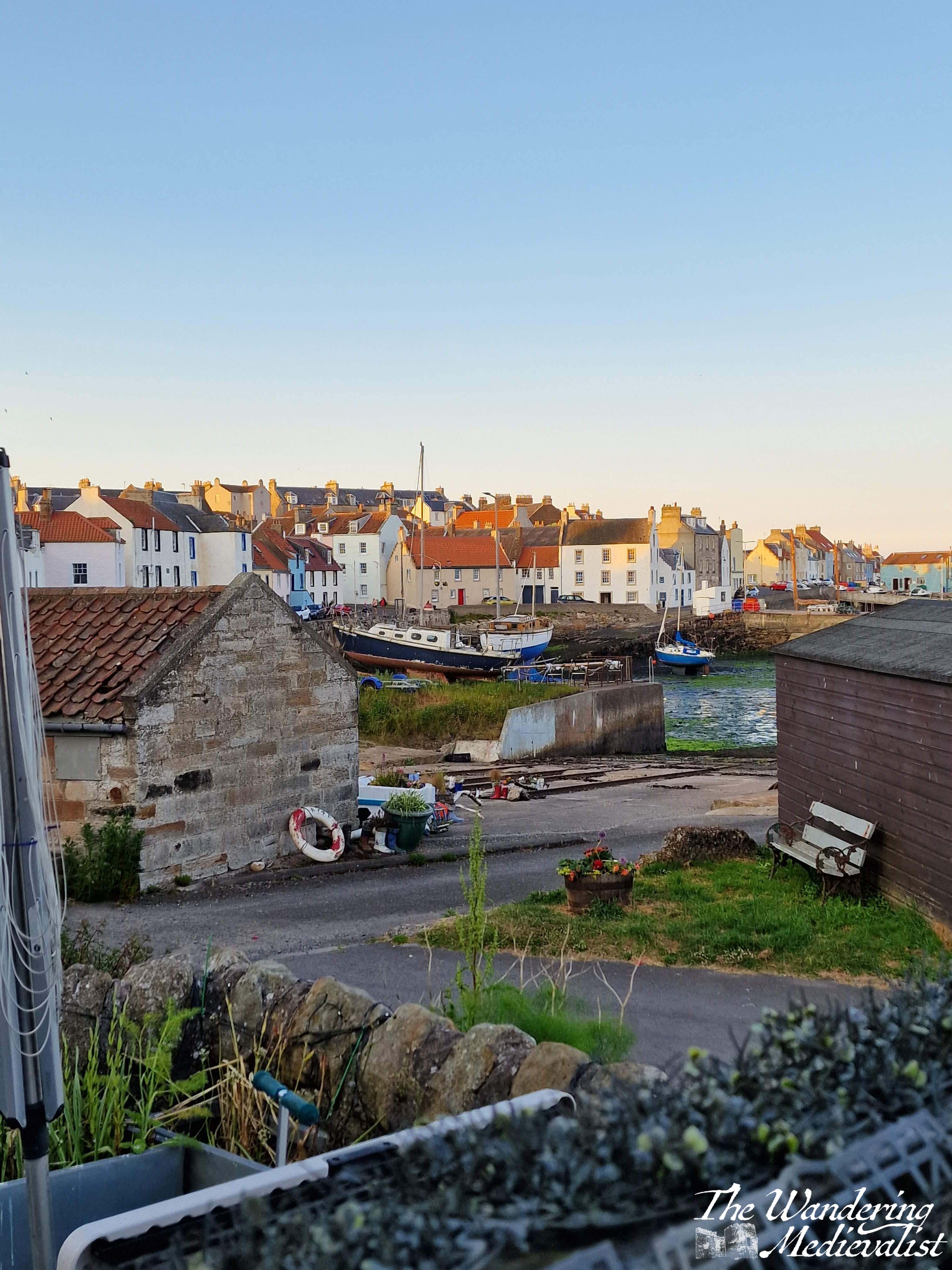
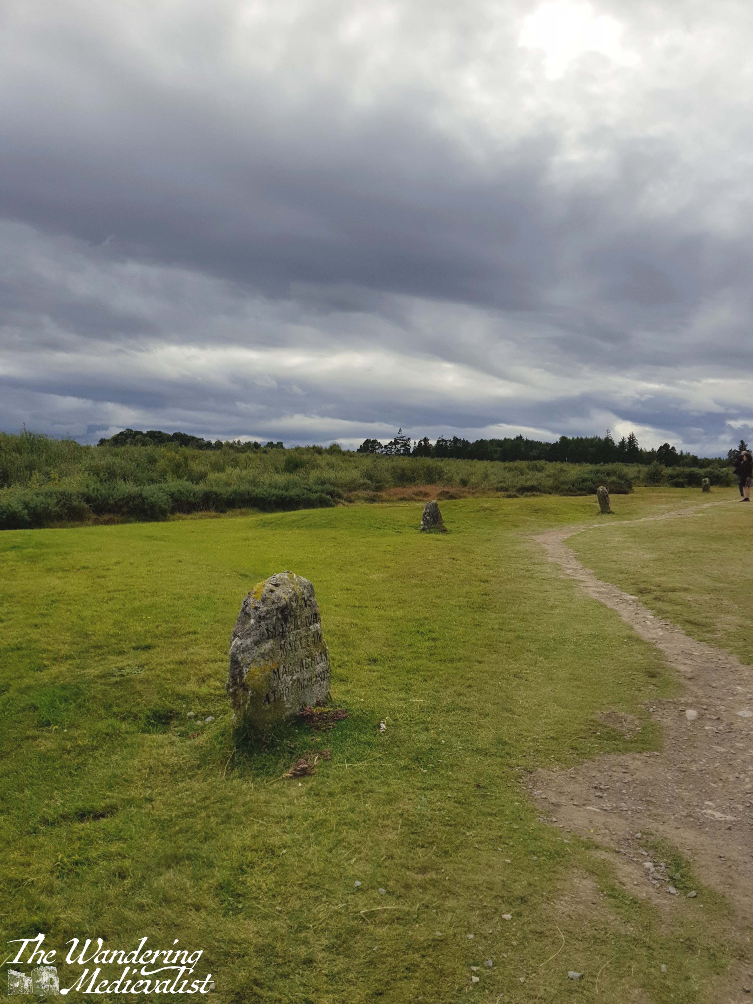
As you leave the fairy town behind, you soon come to the second of the two churches, the Duirinish Parish Church, which unlike St Mary’s is still very much in use. Here the path meets the road, and there is a short stretch of shops and buildings. There is an option for a short detour up to a memorial for those lost in battle, and the site overlooks the town and loch with lovely views.
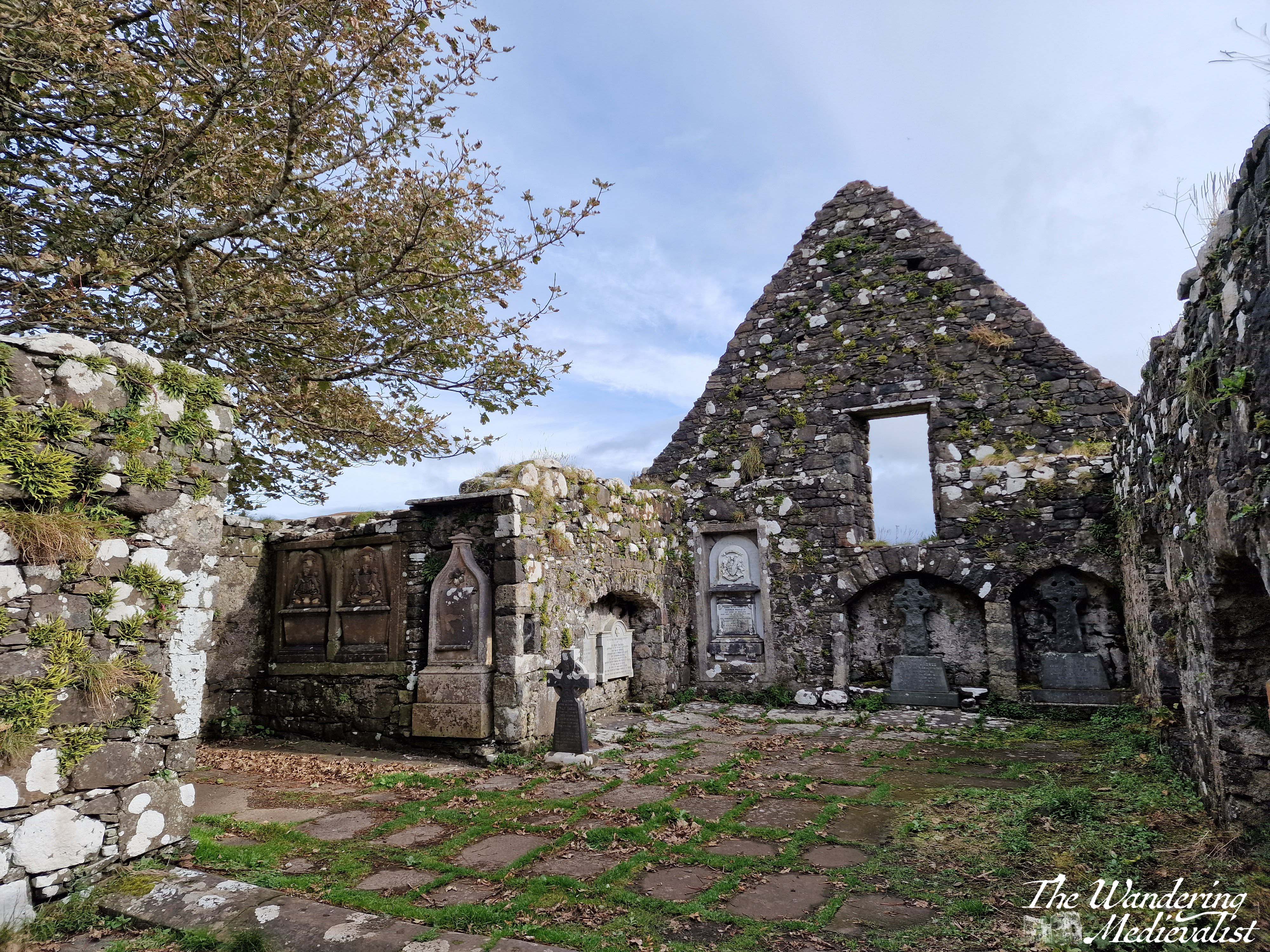
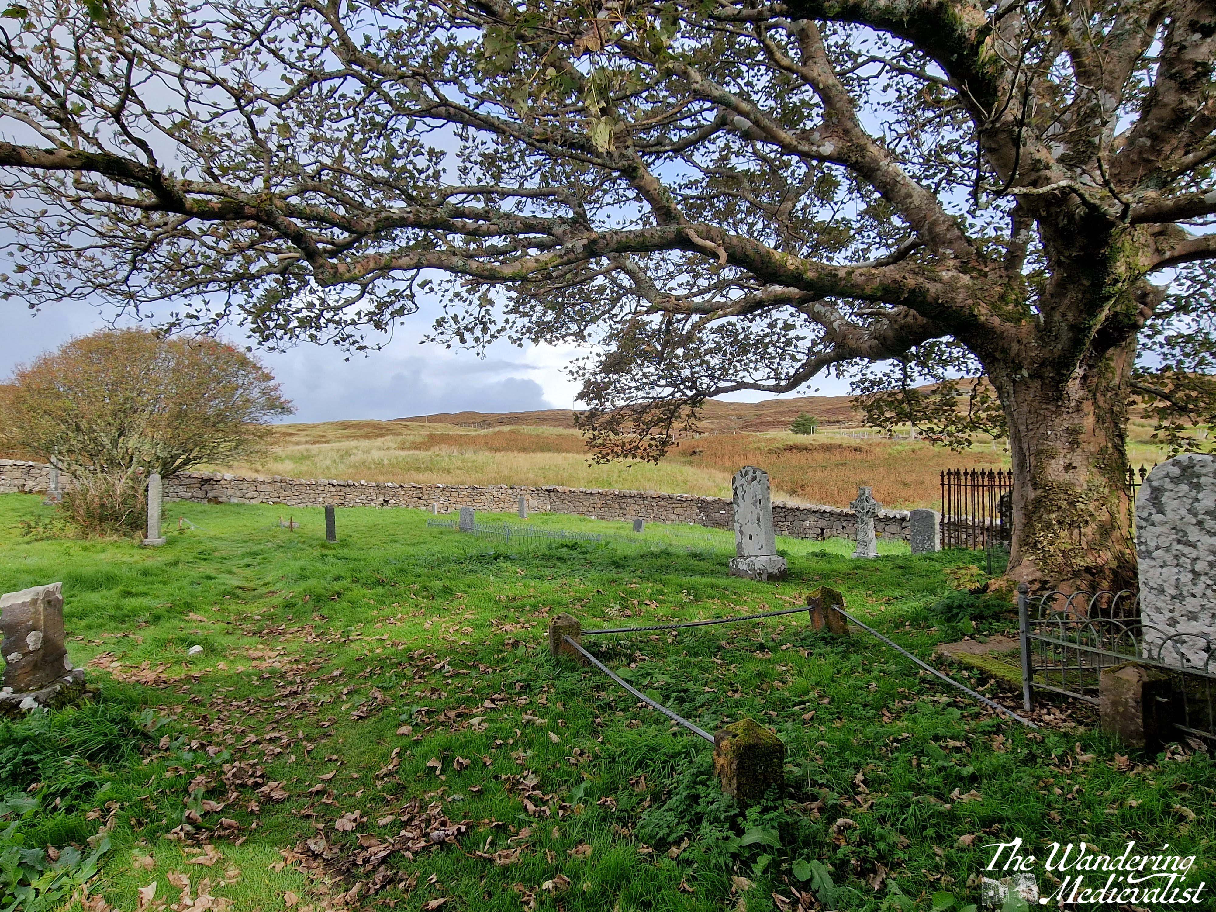
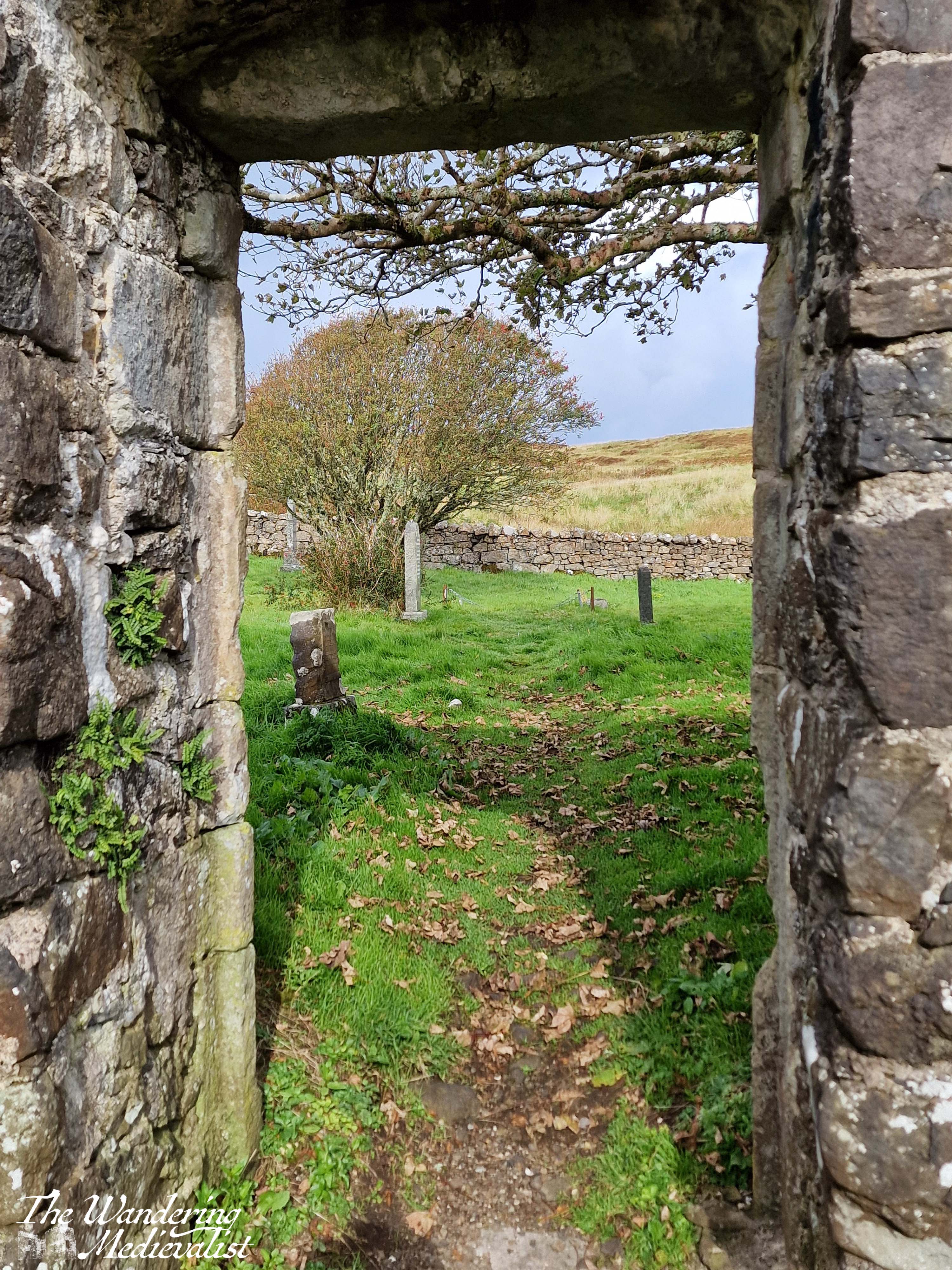
The trail follows the road up and around the corner to the left, returning to the lay-by. At this point, Dad and I decided we still wished to explore the church ruins and the standing stone on the top of the hill. We started in the church, which was likely to have been founded in the Middle Ages due to its alignment, though the parish dates to the post-reformation period. The stone enclosure of the site dates from the 1730s, and the church was the burial site for some Chiefs of Clan MacLeod as well as their hereditary pipers, the MacCrimmons. It is a beautiful ruin with lovely carvings in the nave, trees overlooking the now roof-less church, and graves of varying ages dotted around the property. It reminded me in some way of Old Burial Hill in Marblehead, though again that may just be my affinity for graveyards!
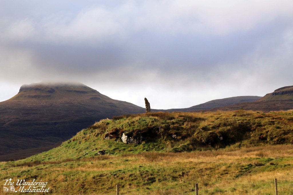
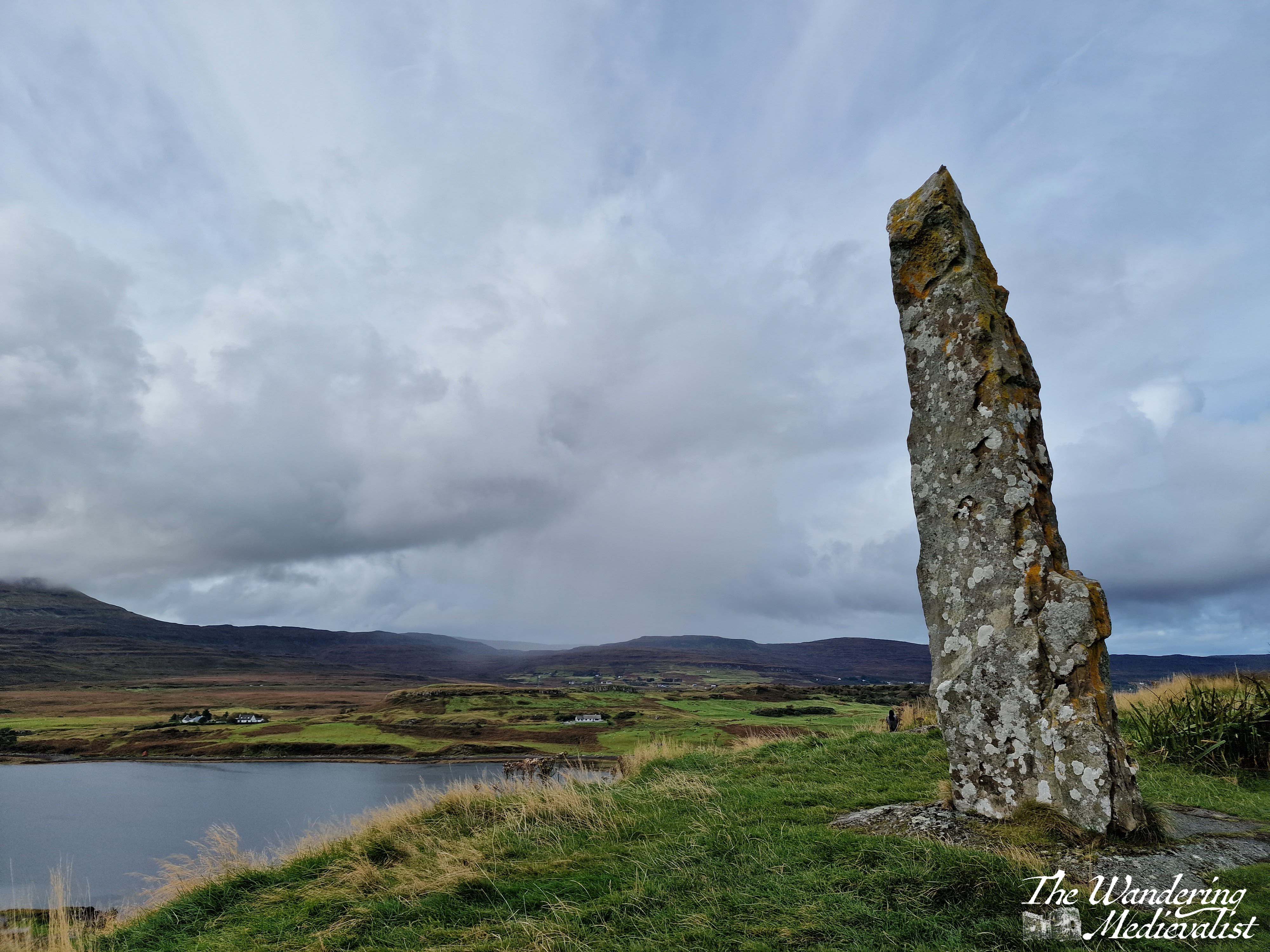
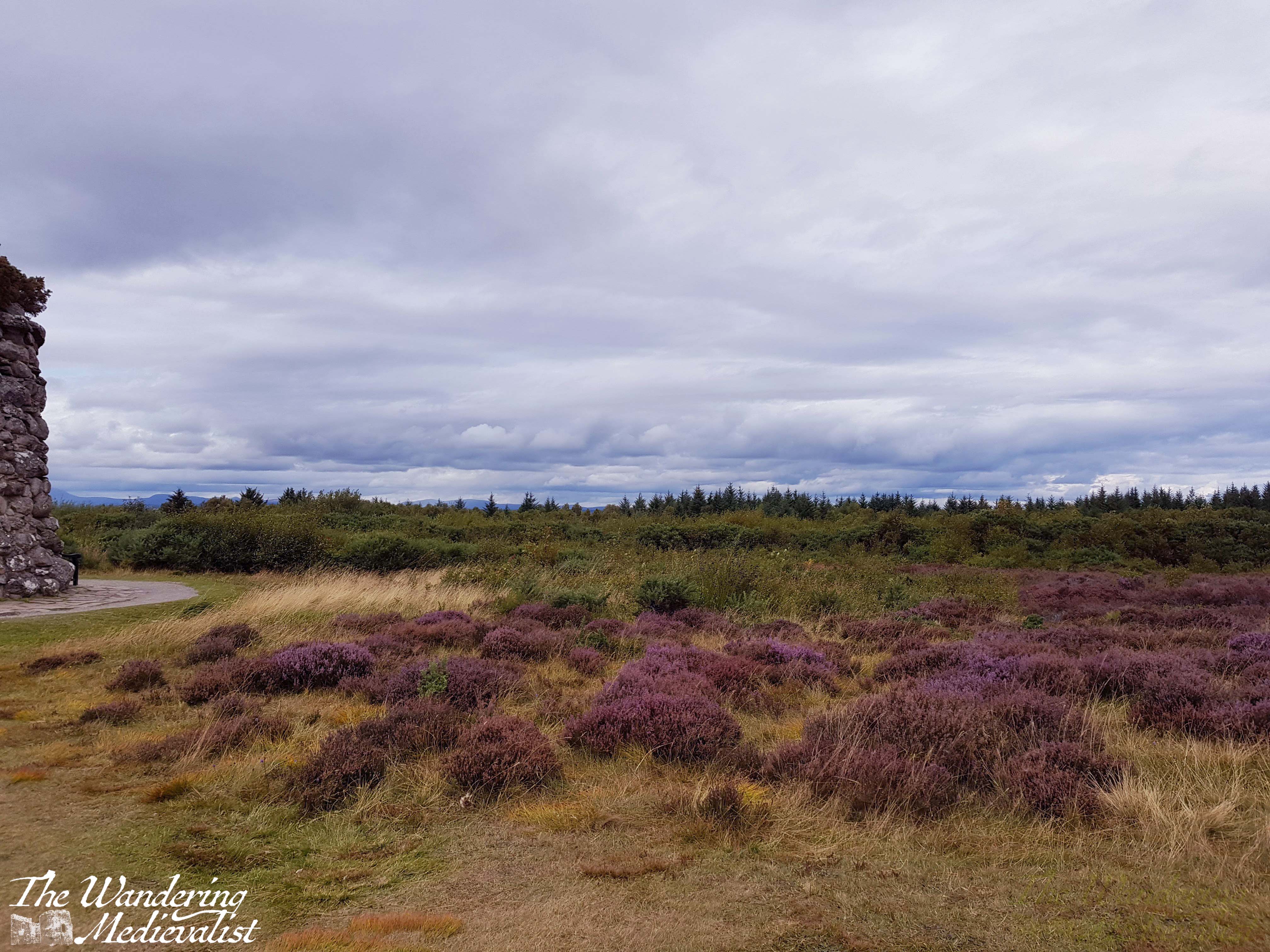
After exploring the church we felt it was still required that we climb to the top of the nearby hill, where the local community had raised a standing stone referred to as the ‘Duirinish Stone’.
I was a touch disappointed to discover that it was modern and not authentically ancient, but not disappointed enough to miss a visit. The stone was raised on the event of the Millennium as a marker in time, and to celebrate the memory of the ancient settlers of the area. It was found on a beach in the south of the island, and it was erected using ancient methods – hand and rope – an impressive feat! So not ancient, but actually authentic.
In order to reach the path, one has to exit the churchyard completely and then follow the edge of the wall until the trail branches off to the left through the grass. It is not a long walk in any way though the top is quite steep and requires a bit of scrambling. There is a detour about half-way up where hikers have clearly discovered a good viewpoint.
The top of the hill is larger than it looks from a distance – and I imagine there is a less steep path than mine – and the views are spectacular. We could see some rain coming in the distance so did not loiter long, but I got my fill of pictures while Dad wandered a bit.
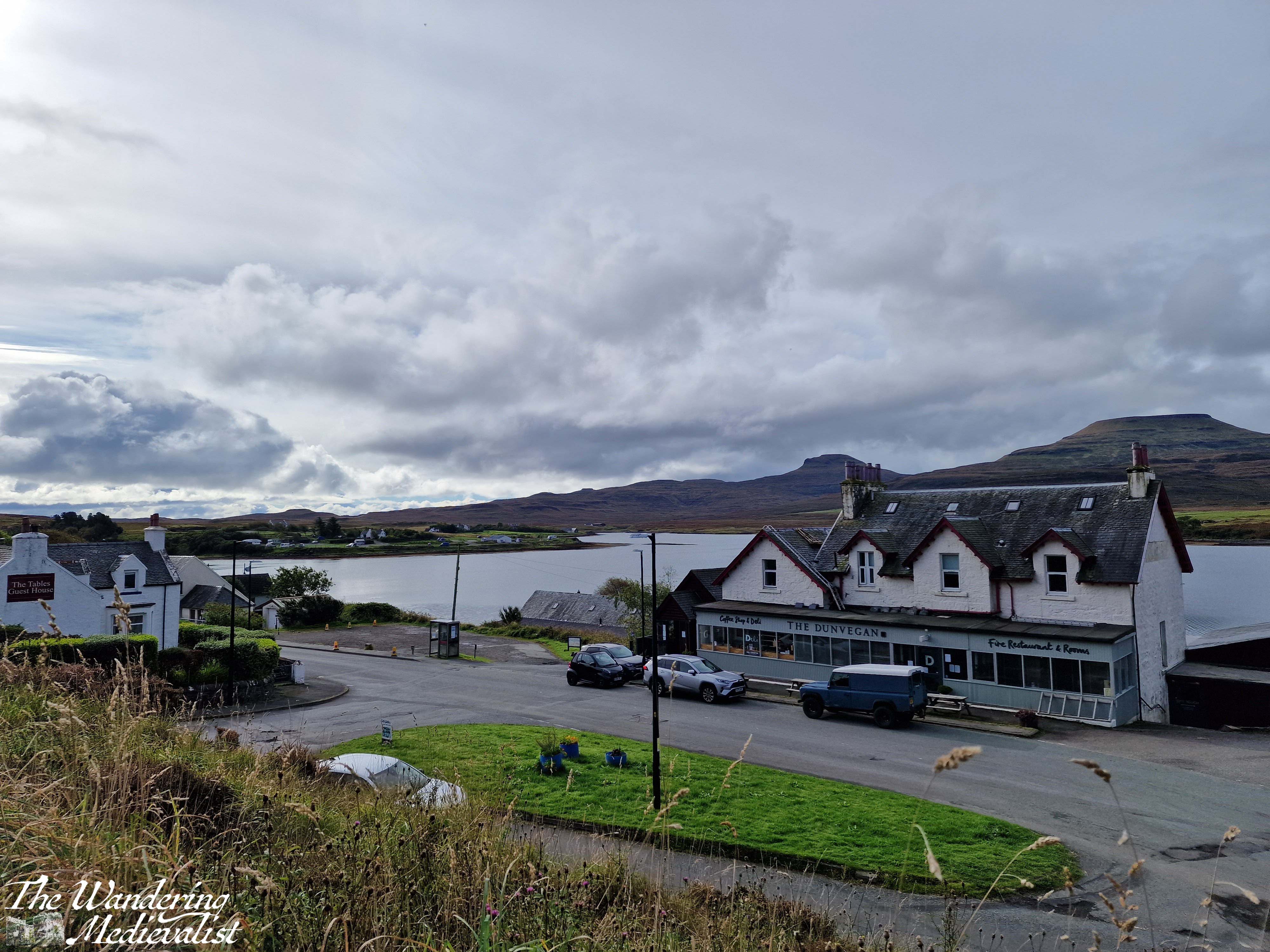
Upon returning to the car, we both felt the need of refreshment after our roughly two-hour walk and exploration of the church and hill. Fortunately, the town has several options for food and we stopped into the Dunvegan Deli and Café, where I had purchased a few extra snacks on our previous visit. The café does not offer lunch but does sell coffee, tea and an impressive array of excellent cakes. The tables overlook the loch, and it was a very pleasant place to sit with a cuppa to relax. It was also the perfect spot to pick up some dinner supplies: pasta, sauce, and a delicious local cheese, plus of course another cake for dessert. Their range of food includes crackers, jams and jellies, Highland honey, cheese and some cured meats, local ale, and much more!
This is a very pleasant walk for a morning or afternoon, long enough to work out sore muscles from the day before but not enough to add to exhaustion. The views of the loch and mountains are lovely, and this could easily be combined with a visit to Dunvegan Castle which is only a mile or two further along the road. And definitely, if you have time, stop into the Dunvegan Café for a snack!
Check out my online shop for more Highland pictures!
Are you travelling in Scotland but not willing to rent a car? Maybe you’re from overseas, and don’t fancy driving on the other side? Perhaps you’re looking for a more carbon-friendly option?
Fortunately, Scotland has a really robust public transport network and you can see a large part of the country just using busses and trains. I was lucky enough to have experienced excellent public transport where I lived for so much of my life that I didn’t learn to drive until quite late. This means I also became well-acquainted with British public transport and both its pros and cons. I have done several of these trips with family who have more limited mobility, but I have always been there to help with luggage; once you get off of trains and major busses, I would imagine the routes are more challenging if you are not able to carry your own luggage and traverse coach stairs easily.
First, a few tips if you plan to attempt a tour of Scotland using trains and busses:
Pack light. Most busses have little to no room for luggage.
Have a book or alternative method of entertainment. You will be doing a bit of waiting.
Always have a plan B. Most of the time, public transport works pretty well, but aiming for the first or last transport of the day can be a bit risky and sometimes there are last-minute cancellations.
Always expect a delay and be pleasantly surprised if there isn’t one. If you’re needing to catch a plane or train at a specific time, give yourself plenty of extra wiggle room.
Don’t rely on the internet; depending on how far north you go, you may find that reception drops, so make sure you have a backup payment method as well as the basic timetable.
Take a bit of time to get used to the way the timetables look, and how to read them.
A note on cost
I have not estimated or stated cost for any of the journeys below, as they change regularly. You may find the best rates if you purchase online ahead of time, and there may also be group or family rates, as well as rail card discounts. Contactless payment should be available on all transport, and if you wish to pay with cash, be aware that operators will expect the exact change.
The routes
Below you will find a suggestion of some great trips you can take and a rough loop that will cover most of my favourite bits of Scotland. This is only the tip of the iceberg though – Scotland’s transport network allows you to explore even the far reaches of Mull, Skye or the North Coast without once setting foot in a rental car. I’ve popped links to all the major travel websites you may need at the end of this post.
Route 1 – Edinburgh Airport to Edinburgh City Centre
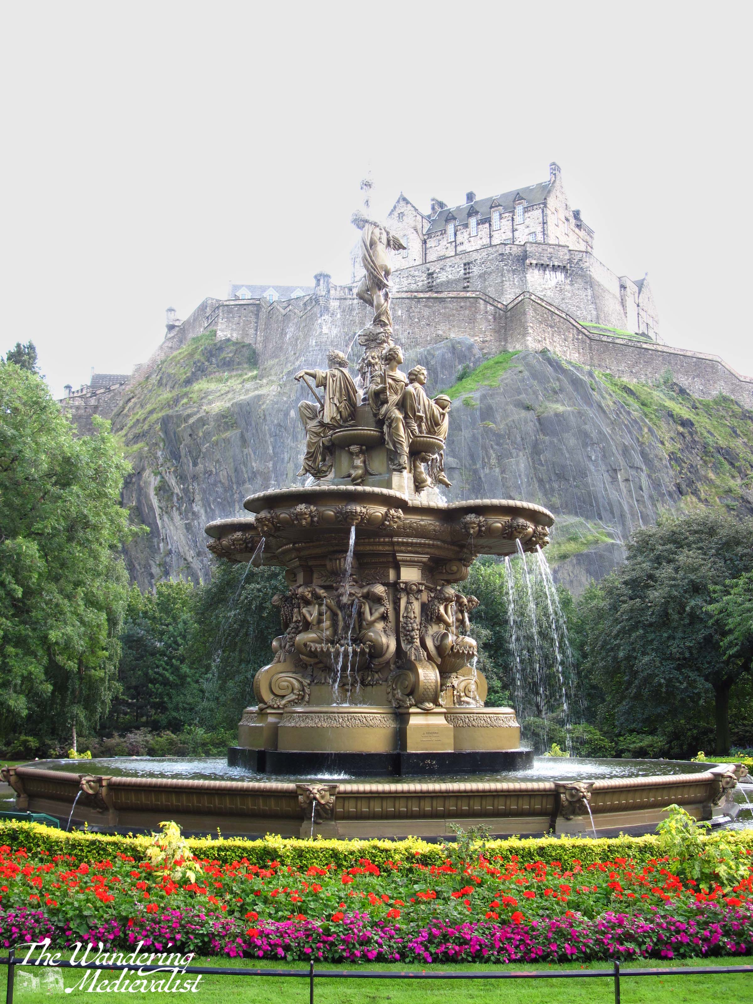
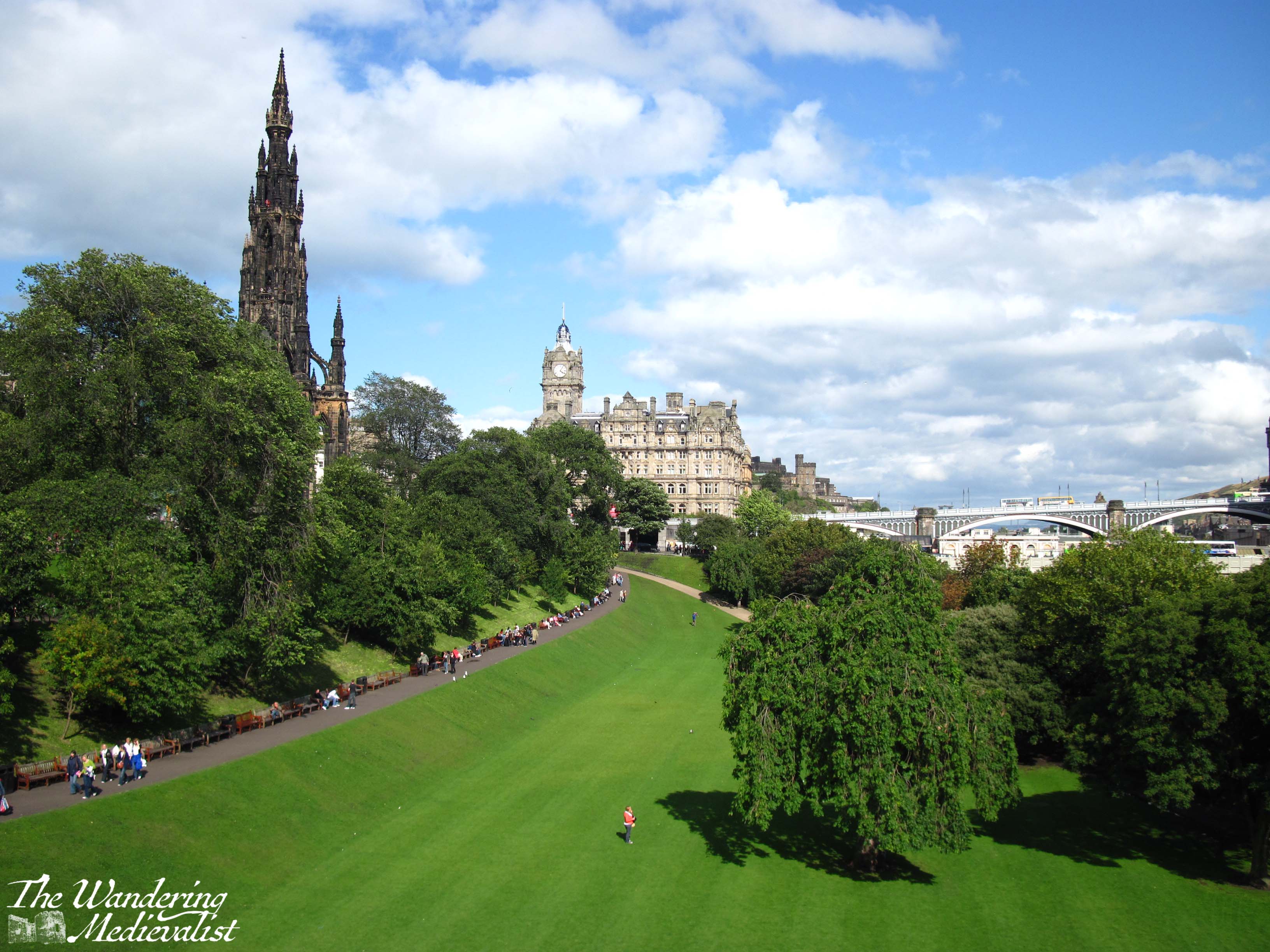
There are two options here: tram or bus. The tram is a nice calm modern choice, as the line is only ten years old – it opened in May 2014. But I actually prefer the bus, particularly the Airlink 100. The route into the city passes through some lovely neighbourhoods, the West End, and kisses the end of Princes Street, providing excellent views of the castle and Princes Street Gardens. It then cuts up to George Street, providing a peek down the side streets towards the water. Definitely sit upstairs if you can.
There are a few bus options with varying prices, but the 100 drops you right at Waverley Bridge, which is a perfect spot from which to explore the rest of the city. If you want to continue exploring by bus, you can pick up a hop-on, hop-off tour of the city from Waverley Bridge, too.
Boarding the airport bus was my favourite part of journeying back to St Andrews after time at home as a student. I was almost always half asleep after an overnight flight, but sitting back to watch the streets of Edinburgh speed by and then the majestic castle rising over Princes Street Gardens rejuvenated me long enough to stay awake for the train ride north.
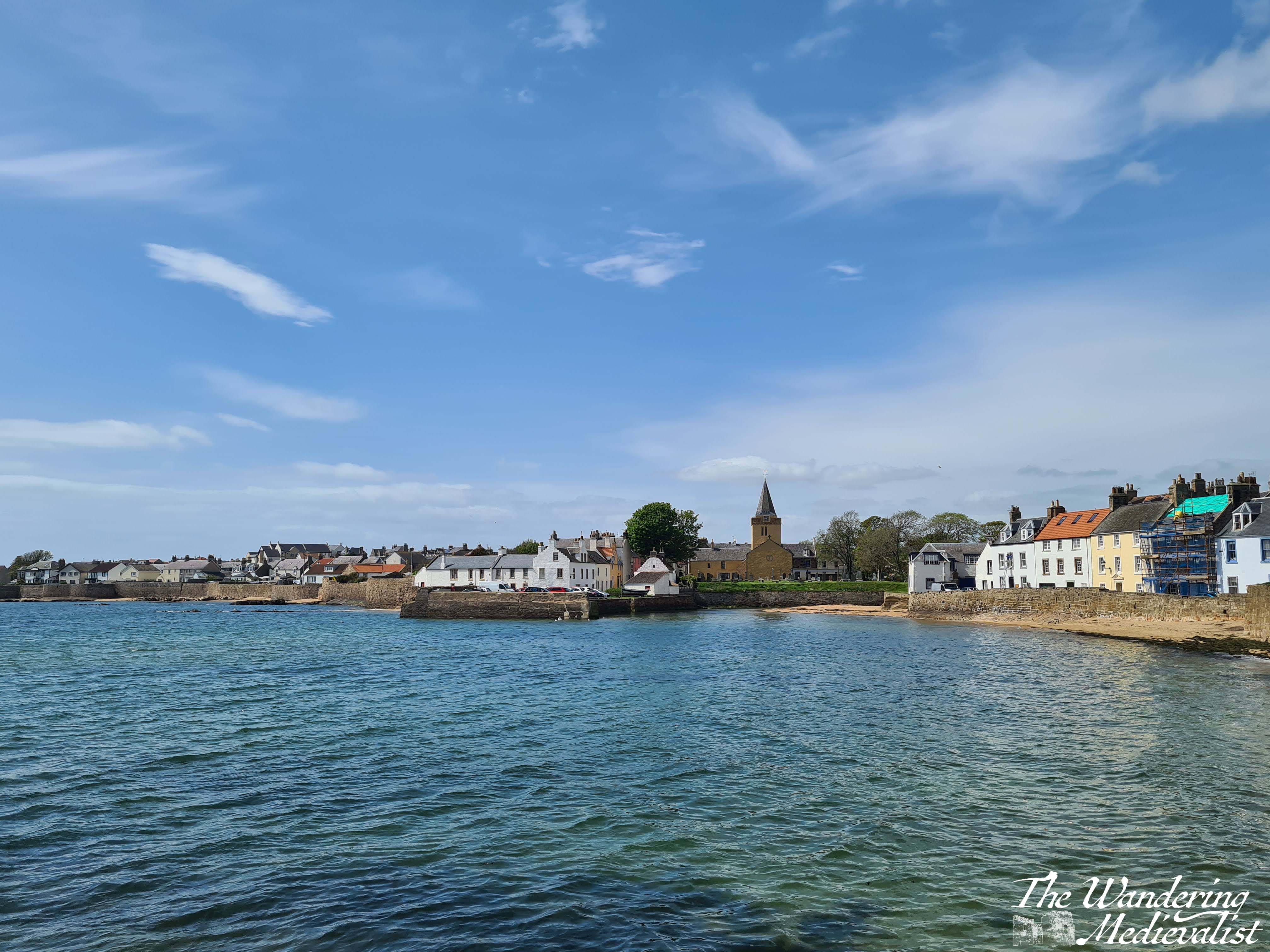
Route 2 – Edinburgh City Centre to St Andrews
There is a bus that leaves from Edinburgh City Centre (confusingly, from St Andrews Bus Station) and takes you directly to St Andrews (St Andrews Bus Station, Fife), but I recommend the train. You’re looking for a route that stops at Leuchars, which is the local St Andrews station. Any train heading to Dundee or Aberdeen will stop there. If you can, start your journey at Waverley – you’re more likely to get a seat – and sit on the right-hand side of the train. This journey can take anywhere from 60 to 90 minutes depending upon the route and train operator – some trains go almost directly to Leuchars but some will stop at every small village along the way.
Once you pull out of Haymarket station (which often smells faintly of yeast from the local brewery), you start to get some great views of Edinburgh: you’ll pass Murrayfield Stadium and go right past the end of the airport runway, then out across the historic Forth Rail Bridge.
My video of trips across the rail bridge:
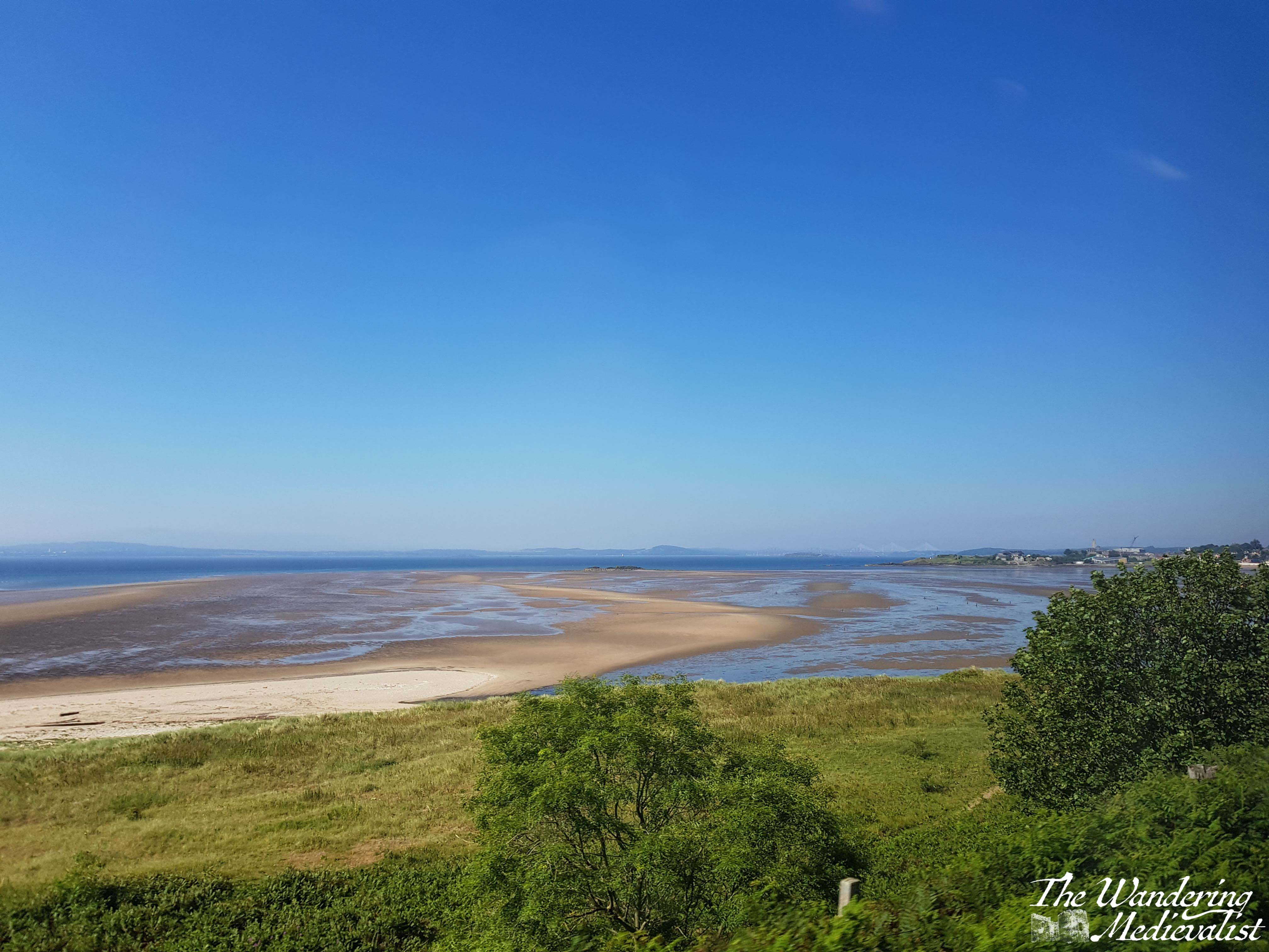
From the bridge you can see down the Firth of Forth in either direction, either west towards Stirling or east towards the islands and North Sea.
As you pass into Fife, the train line continues to hug the coast and offers some spectacular views of the beaches, Bass Rock, and Edinburgh itself across the water. Once the train cuts inland, you get a great feel for the farmland and rolling hills of Fife. You will know you are approaching Leuchars if you catch sight of the chimney of Guardbridge Paper Mill (now a biomass plant).
From the station in Leuchars, it’s easy to grab a taxi or one of the very regular busses into St Andrews. In total, the journey should take no longer than 2 hours.
One small warning – phone signal is very patchy along this route, and if you find yourself having to make a phone call or trying to check your email, you may be scuppered. The stretch between Inverkeithing and Kirkcaldy is particularly bad, but the hills of Fife seem to block signal quite effectively no matter where on the line you are.
Route 3 – St Andrews to Elie
Several years back I happily discovered this route while exploring with my father. We hoped to walk some of the Fife Coastal Path, but were without a car.
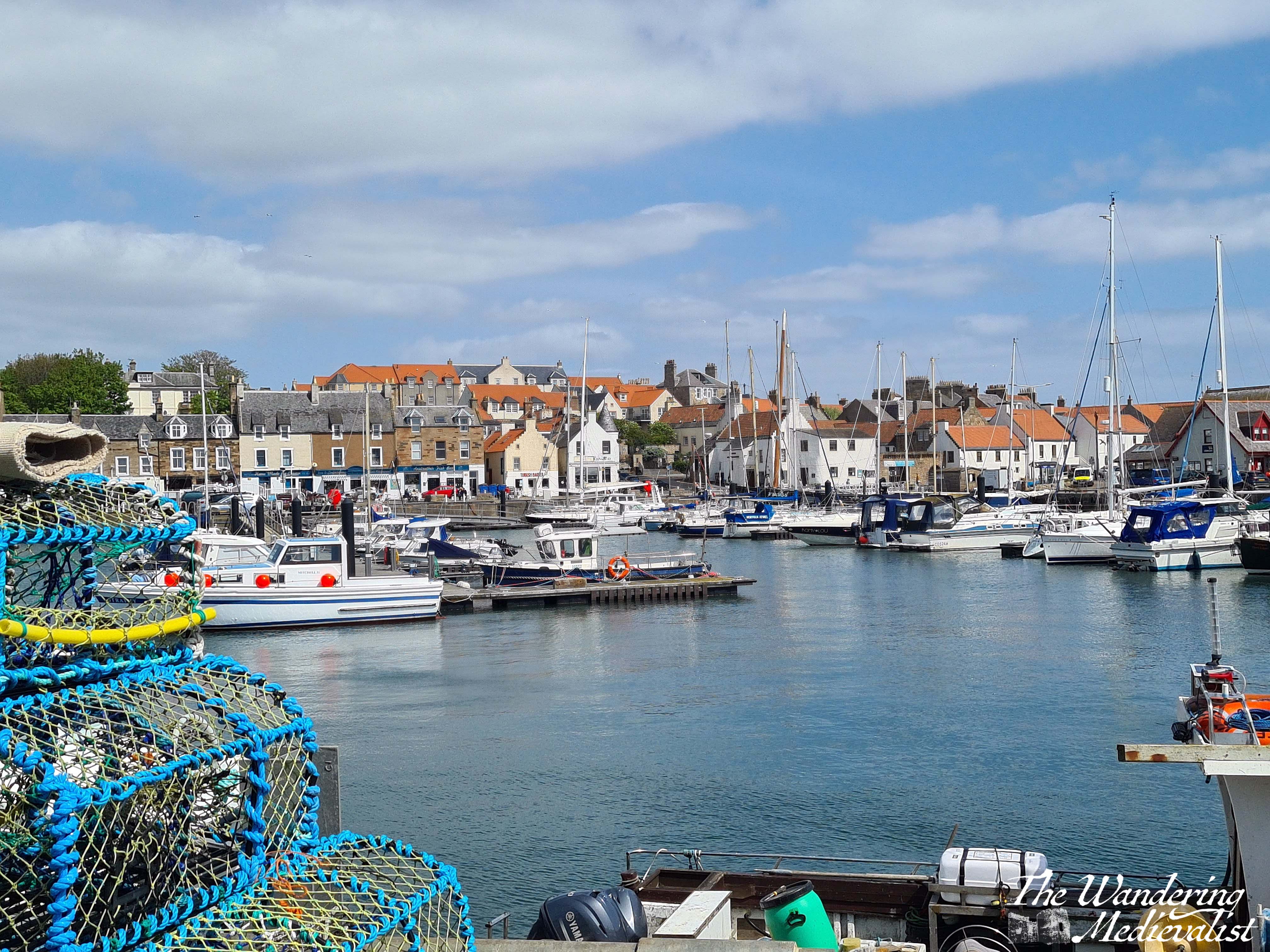
The Stagecoach 95 route runs from St Andrews to Leven and passes through all of the charming wee towns of the East Neuk, which is the area of Fife south of St Andrews. The 95 stops in Kingsbarns, Crail, Anstruther, St Monans, and eventually cuts inland at Elie to pass through Kilconquhar and Colinsburgh.
If you can, get on at St Andrews and go up to the top level – this bus is almost always a double-decker. The views are awesome, and it’s a great way to see Fife. If you tend towards travel sickness, however, be careful up there – the road is narrow and quite winding, while the bus drivers seldom slow for the corners.
You can hop on and hop off using a North-East Fife dayrider ticket, or even get off and walk along the Fife Coastal Path to the next town, as we did (Elie to St Monans, for the record). Just keep an eye on the timetable, as the bus only runs about once an hour.
All of these villages will have places for you to get refreshments, often a charming little pub or chippy. Anstruther is famous for having award-winning Fish and Chips!
The whole route from St Andrews to Leven is about 90 minutes.
Route 4 – St Andrews (or Edinburgh) to Inverness
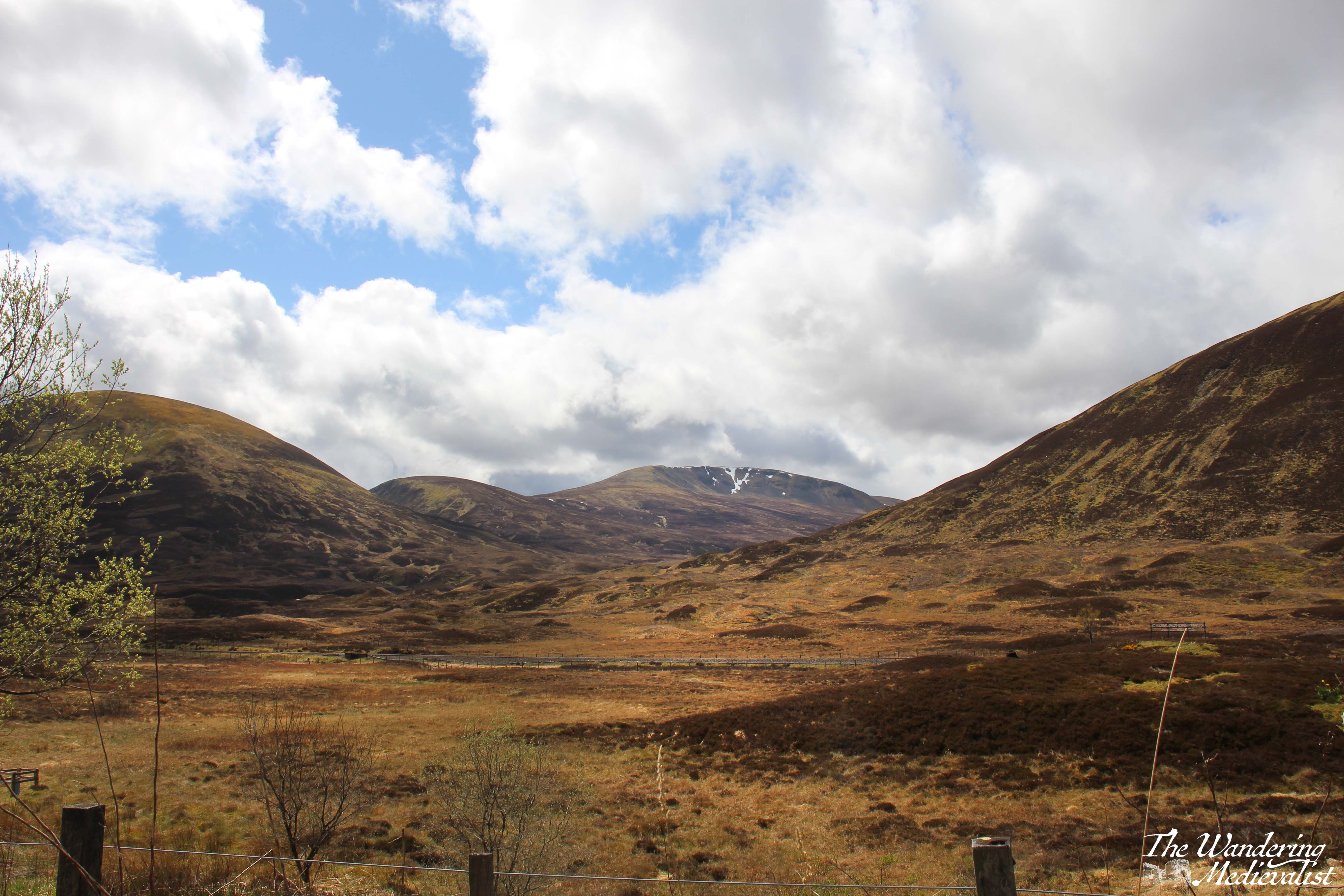
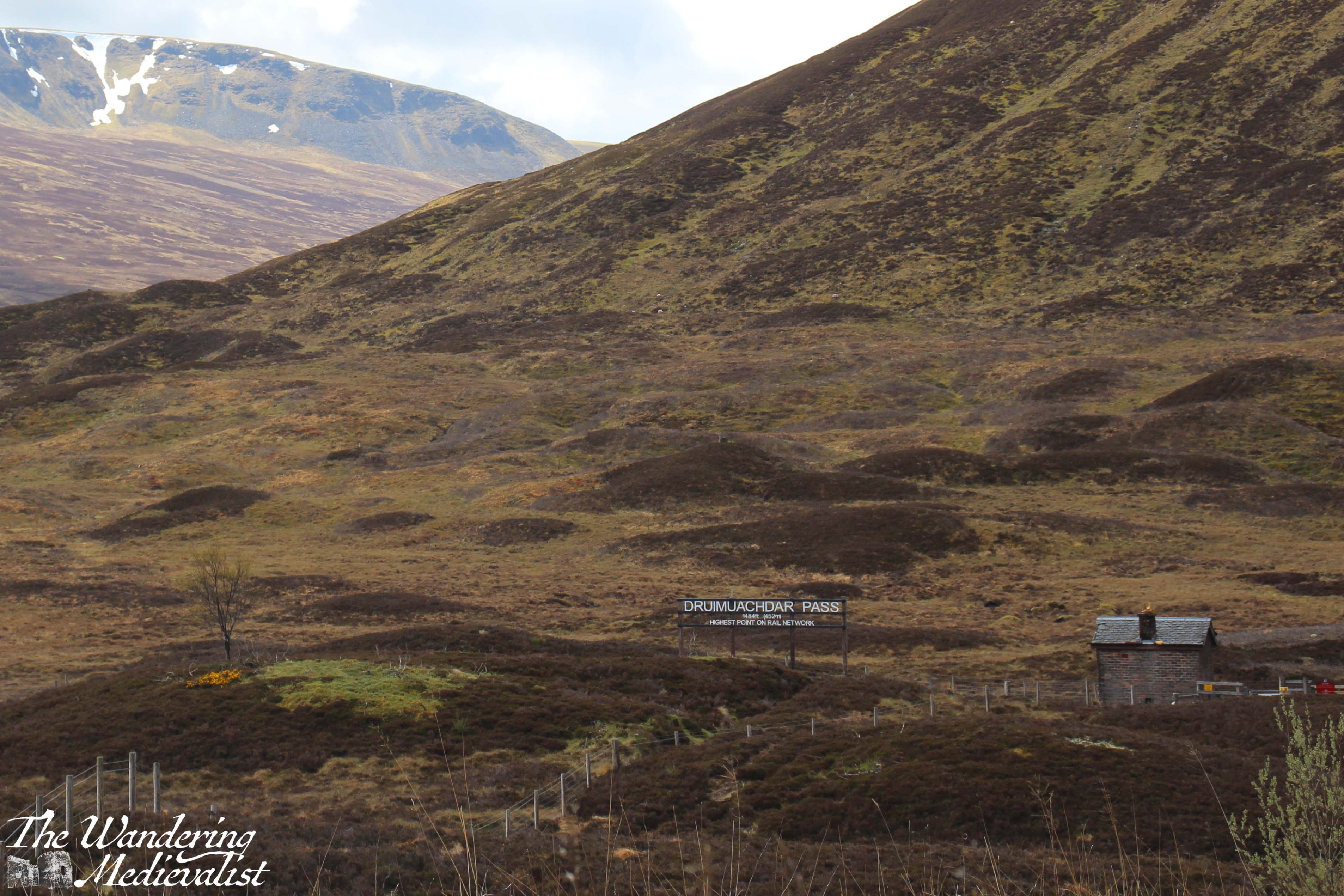
There is no direct train from Leuchars or Dundee to Inverness, and so my recommendation for this next leg is – if starting from St Andrews – that you take the 99 bus to Dundee Rail Station (it stops there immediately after crossing the bridge). From Dundee you get a train to Perth, where you switch to the Inverness train. If you can, book in advance and make sure you have a seat reserved on that train, which is often busy. These trains come from Edinburgh, so you can also get on there if you prefer to spend more time in the city.
The train from Perth to Inverness stops in some fantastic places such as Dunkeld, Pitlochry, Blair Atholl, and Aviemore. There are stunning views as the train passes through the forests of Perthshire and then the Highlands; my favourite spot is the Drumochter Pass, which is the highest point in the pass between the north and south. Often the weather is very different here than only a few miles in each direction, with snow common in the winter.
As the train winds down out of the mountains you start to see villages and then the town of Inverness.
The journey from Perth to Inverness is just over two hours.
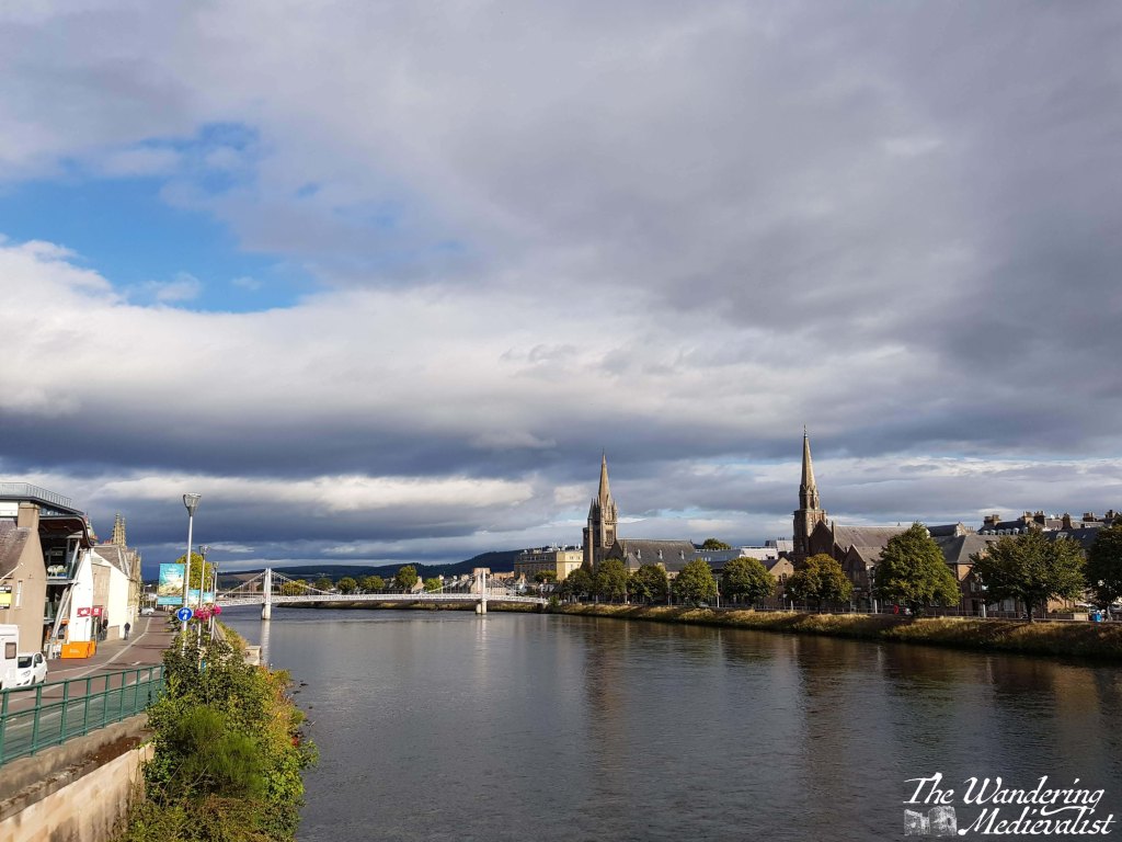
Route 5 – Inverness to Culloden Battlefield
Inverness is a lovely little city to walk around, with paths along the river and over bridges, and of course it has its own castle. It is a popular destination for coach trips and tours, partly for its size and the plentiful hospitality options, but partly for its proximity to one of the most famous battlefields in the UK, if not beyond: Culloden.
Whether you are a Scottish history fiend, a military history fan, a fan of Outlander, a Scot, someone descended from Scots, or someone who is looking for the most popular spots to visit in Scotland, you will have come across Culloden. It is of course the famous field where, in April 1746, Bonnie Prince Charlie and his Jacobites lost their fight against the forces of King George II, and where many Highland clansmen lost their lives. A major turning point in Scottish history, Culloden marked the beginning of the end for Highland culture, and the battlefield site has been preserved well. The visitor centre has some fascinating displays that immerse you in the battle, and provides a solid historical understanding. The battlefield itself is incredibly moving, with stone cairns marking the burial places of the clans.
Fortunately, Culloden is easily accessible via bus from Inverness city centre. Absolutely a must-visit, and only about 20 minutes away.
Route 6 – Inverness to Fort William
Before I go too far in describing this route, one small caveat – I have never actually done it by bus. But, I know it can be done by hopping on a Citylink bus at Inverness bus station – sit on the left if you want the best views for the first half of the journey. The route follows the Great Glen down Loch Ness, Loch Oich, Loch Lochy, and then through Spean Bridge to Fort William. This alone is a spectacular route, but the Citylink stops along the way at several points that may be of interest to you, if you have time.
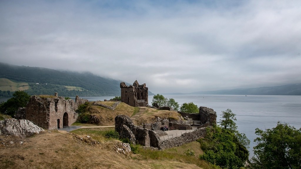
The first is Urquhart Castle, which is one of the most picturesque castles in Scotland and a perfect place to look out for Nessie.
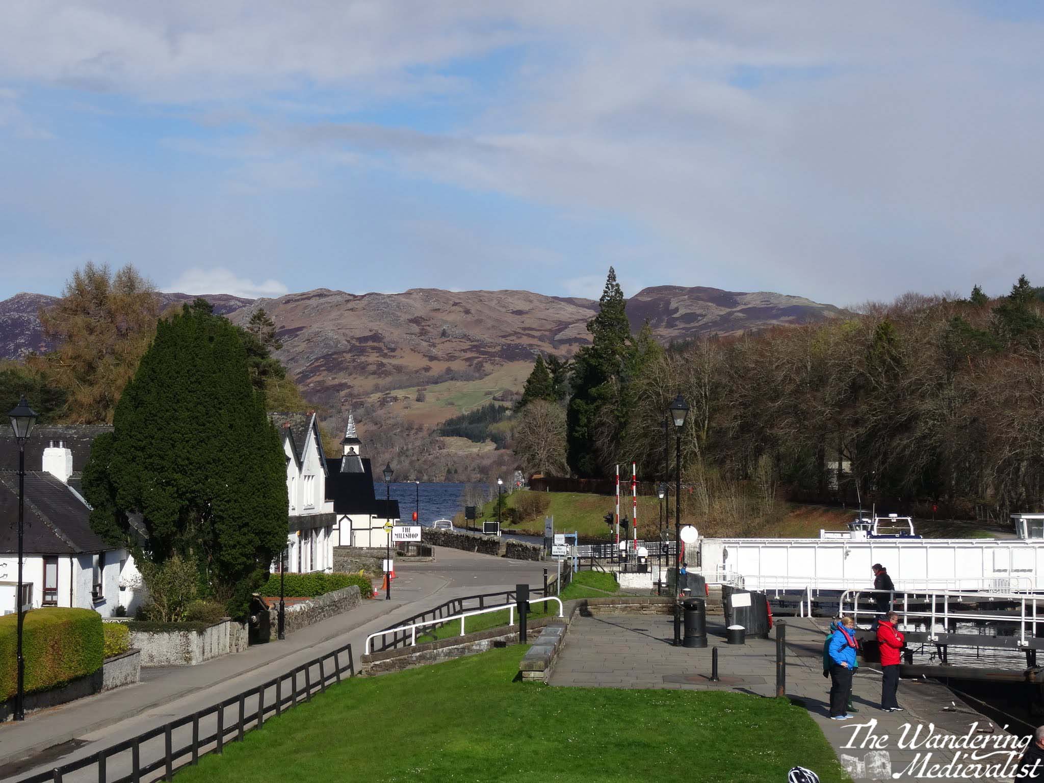
The next is Fort Augustus, the town at the far end of Loch Ness from Inverness, where you can grab lunch and watch ships navigating the locks of the Caledonian Canal.
After Fort Augustus, the bus will continue to Invergarry and eventually cross to the other side of the glen to hug the coast of Loch Lochy. Here the A82 lifts away from the water and climbs over the rise on which the Commando Memorial stands – you may just catch sight of it before the road drops again into the town of Spean Bridge.
There are a few hotels and B&Bs here which are sometimes a bit less pricey that Fort William, though you are still 20 minutes away. The road between here and Fort William is quite pretty, with the Nevis Range ahead and rolling hills off to the right.
The whole route takes about two hours if you do not get off at all, and runs relatively regularly – hourly during the summer though less often in colder months.
River Spean at Spean Bridge
Route 7 – Fort William to Nevis Range
Fort William has plenty to keep you busy with hikes of all different lengths from a short wander to climbing Ben Nevis, the UK’s highest peak.
If you are less inclined to hiking, I would definitely recommend trying one of the Loch Linnhe Seal Cruises, which you can book ahead even if it is just the day before. There is also a small cinema, plenty of pubs and restaurants to explore, and numerous places to stay. That said, definitely book your accommodation well in advance, as Fort William is almost always busy.
Fort William and Loch Linnhe from the Old Fort
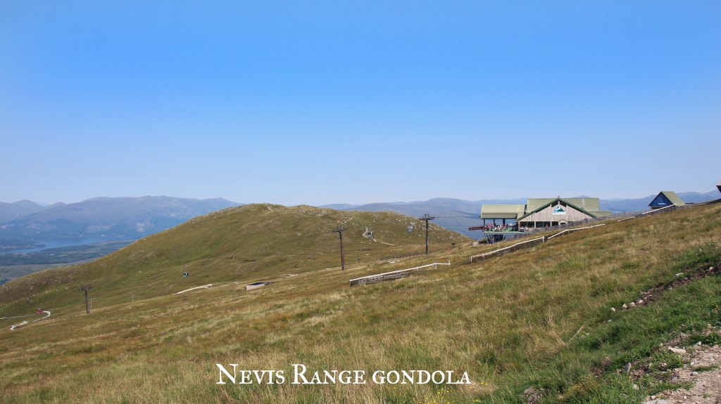
Another fantastic option for the Fort William area is to take a bus out to Nevis Range, where you can find more walks in the woods and the gondola up Aonach Mor. The gondola can be taken by those of all abilities and ages, and at the top you can enjoy the cafe or walk along the side of the mountain to two viewpoints: Meall Beag and Sgurr Finnisg-aig. The gondola ride alone is worth trying, even if you do not wish to hike.
The way to get to Nevis Range is to pick up a Shiel bus from one of the bus stops just outside Morrisons, on MacFarlane way. As of writing it is the N41 route you want, and it runs frequently enough that you can get out and back in a day. But, as always, keep a close eye on the timetables. The route is only about 20 minutes.
Should you miss the return bus, you may need to order a taxi, and those can take some time – I’d recommend making note of a local taxi number, as Uber has not yet reached Fort William.
Route 8 – Fort William to Glasgow
If the train route from Glasgow to Fort William does not make it on to some list of one of the world’s most beautiful, someone goofed. Whether you are boarding in Glasgow, Fort William, or one of the several stops in between, I do recommend booking in advance if you can, and selecting a seat. I cannot really recommend a side of the train though – both offer stunning views.
If you are travelling the whole distance, you may want to bring your own snacks and refreshments, as the train trolley can be pricey. The trip is about 4 hours, but delays around Crianlarich are not uncommon, so it is best to be prepared for a longer ride.
Any delay is 100% worth it, though. For one thing, it often allows you a few minutes to get out of the train and walk around on the platform, and get some fresh air. It is also just a fact – you will be stopped in Crianlarich for a short while even without delays, as that is where they split the train (or join it together again), with one half going to Oban and the other to Fort William. This is another good reason to book your ticket – it guarantees you are sitting in the correct part of the train.
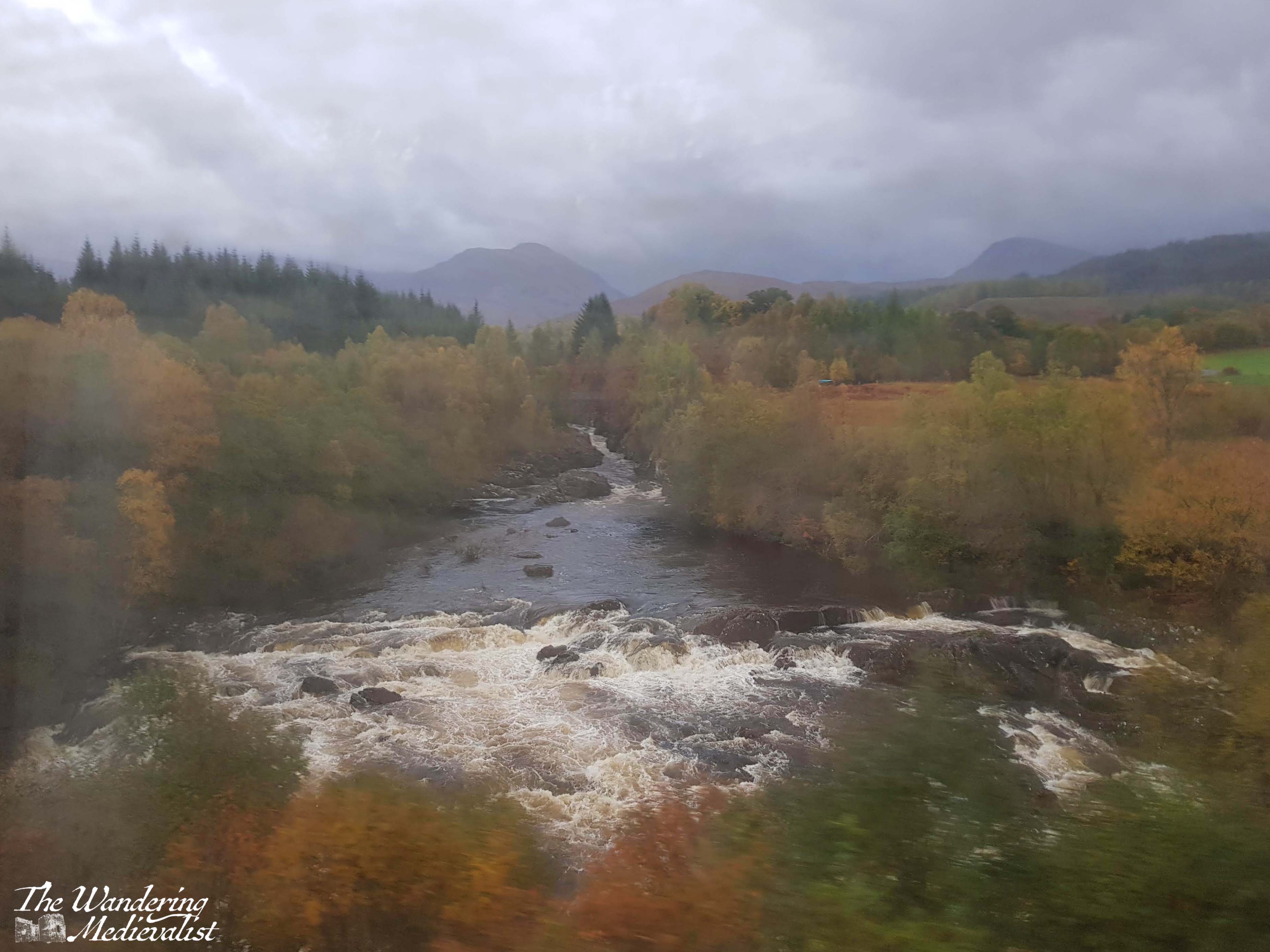
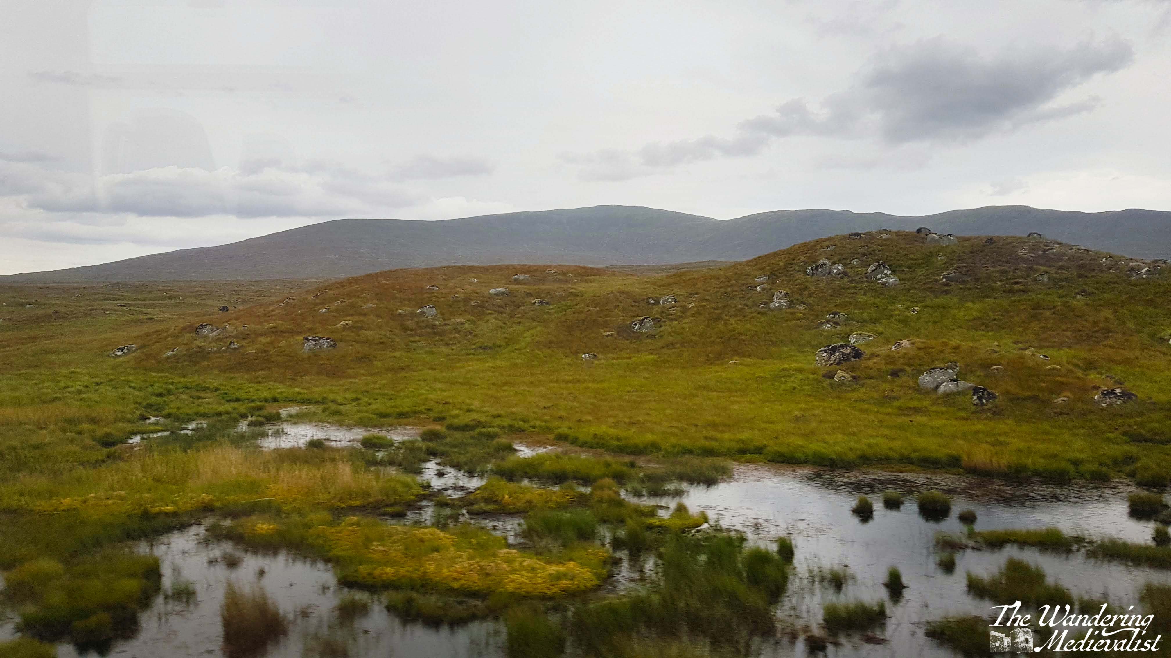
If you board in Fort William, you will find that the train passes out of the town almost immediately and follows the River Spean through the towns of Roybridge and Spean Bridge. The line hugs the side of a gorge and then at Tulloch cuts south to head across Rannoch Moor.
The moor is a stretch of land composed of bogs, lochs, rivers and rocky soil that is one of the last great wildernesses in Europe. The train offers a unique opportunity to see it, as the only other way to experience this part of the Moor is on foot – the roads go around in either direction. Corrour Station, one of the stops in the middle of the Moor, is more than 10 miles from the nearest road. The train runs just frequently enough that you could take a train in the morning, have a hike, and then catch one of the trains back again to Fort William, but be warned – as mentioned above, trains on this line are not 100% reliable and accommodation is very limited.
Barren, rocky, boggy, and breathtaking, the Moor alone is – in my opinion – worth the train trip. You may even catch sight of a deer or other Highland fauna.
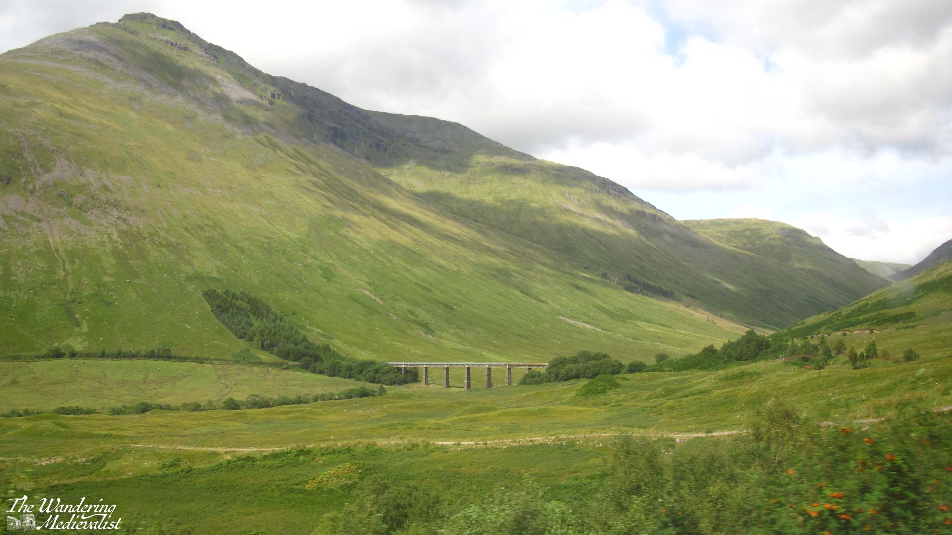
Once across the Moor, the train line cuts through mountains and valleys, eventually re-discovering the A82 highway not far north of Tyndrum. Just beyond Tyndrum, the train line loops west to cross the viaduct seen in the picture above, hugging the hills as it heads south.
After stopping at Crianlarich, the line touches the north shores of Loch Lomond before cutting over to Loch Long at Arrochar and Tarbet. From there, beautiful views down the loch and of the distant mountains will keep you glued to the windows all the way to Helensburgh, only a few minutes from Glasgow.
If you take the train in reverse, the scenery becomes more stunning the further north you travel, and I always find it a touch disappointing when you finally reach Fort William. Once we did continue on the line all the way to Mallaig, and while doing so will give you a good feel for the barren nature of the coastal Highlands, nothing is quite like crossing the Moor.
Give yourself most of the day for this journey of at least four hours, and cross your fingers for a rain-free trip. I have never yet had one, but rain makes the pictures more genuine!
Travel from Glasgow back to Edinburgh is incredibly easy, with regular trains and busses from Buchanan and Queen Street stations.
Other options:
The loop I have suggested above is just one of the many options available to you. Want to try a truly epic journey? Citylink offers busses from Glasgow to Uig on Skye. It’s a long trek but crosses some stunning scenery, and Skye can be explored on foot if you’re ready for it.
Here are a few more suggestions:
Hop on the train from Fort William to Glenfinnan, crossing the famous viaduct. There is a hike from the train station back towards the parking lot with spectacular views over Loch Shiel and the viaduct itself.
Take the train from Dundee to Aberdeen, along the stunning coastline.
Take a bus or train to Stirling and walk up to the castle and old town.
Take a bus to Doune and explore the castle and town.
Hop a bus from Glenrothes to Falkland and visit the Palace and Gardens, or climb up East Lomond Hill.
Board a bus in Aberdeen to take you to Crathes and Drum castles.
For a truly epic journey, you can take a train or bus to Oban, a ferry to Mull, another bus from Craignure to Fionnphort, and a ferry to Iona! Lots of coordination required, but entirely possible.
The bottom line is, busses go almost anywhere you want. Be aware of travelling on Sundays as things are always less flexible, and make sure you have the most up to date timetables.
Here are some useful links to help you plan your adventure:
We knew that the second day of our time on Syke was going to be wet – it was predicted to start raining at about noon, so we got on our way relatively quickly in the morning for the hour-long journey to Dunvegan Castle. It was the one and only castle I insisted upon visiting, and I hoped we could get a bit of a visit before the rain closed in.
I’ve written an account of our visit to the castle, during which the rain started at least two hours earlier than it was meant to – but that is standard in the Highlands. So, we headed back towards Uig, passing through alternating heavy storms and light drizzle. I realised as I drove that by the time we reached our cottage we would not want to leave again, and so my mind was also on foraging for dinner. With luck, we found a café that included the word ‘deli’ and I pulled in for a coffee and exploration.
The Dunvegan was the perfect spot for what I needed – they had cakes, crackers, cheeses and some venison salami that I felt should be tried. I wish I could remember the name of the cheese I bought which the girl said was local, and was amazingly creamy and delicious, but no amount of googling seems to find it. In any case, I stocked up and ran back to the car where the family had decided to camp out.
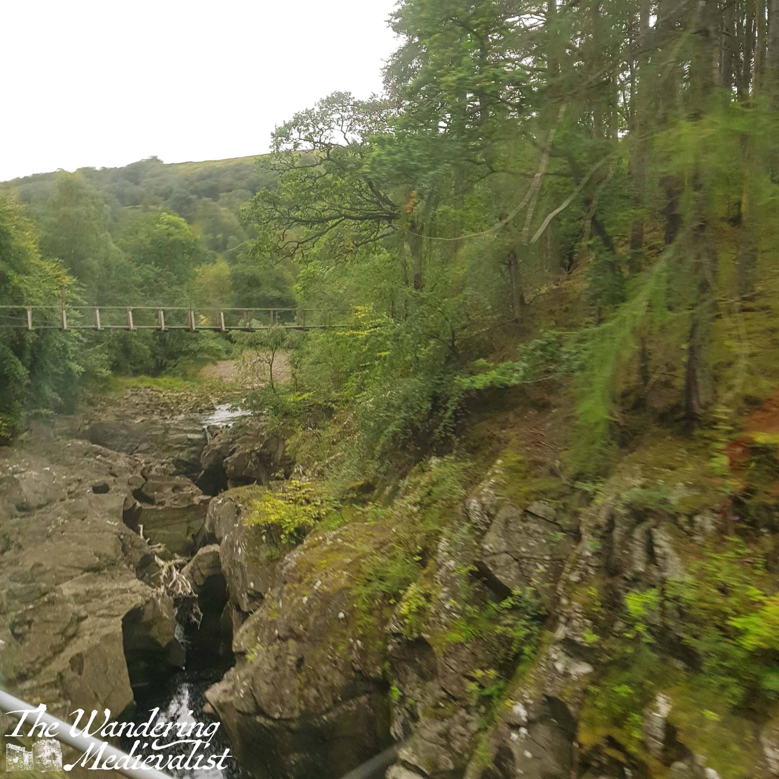
As we pulled out of the Dunvegan town, we passed the view of the Two Churches, which is actually the start of what appears to be a circular walk – must try it next time.
From here we headed home to our cottage which, as I have mentioned in previous posts, was called the Homer. It was part of a set of 2 or 3 cottages rented by one family and the owners were very friendly and attentive, stopping by once a day to check that all was well. The house was incredibly well-equipped with top-of-the-range stove, fridge, washing machine and dishwasher. The kitchen had every utensil you might need, and previous tenants had left behind bits and pieces – tea, rice, salt, pepper. The beds were comfortable and rooms warm, and the instructions and advice provided were detailed and very helpful.
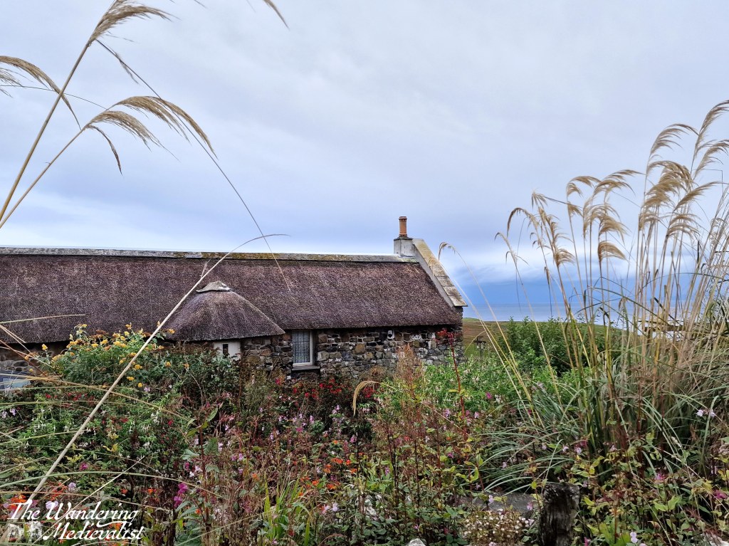
We spent the rest of the day hunkered down in the cottage, for the most part – the wind and rain were intense at times, but the living room remained toasty warm and tightly battened down against the weather. The TV had every channel we could possibly want – had we been able to agree on something to watch. At one point, Dad got restless and suggested we go for a short walk, which we did – to the entrance of the property and down a side road that led to a charming house built in the old island style of stone walls and thatched roof.
After this detour we headed home and all read and relaxed until it was time to break out our foraged dinner. Cheese, salami and crackers made a good accompaniment to some veggies and snacks I had from Marks and Spencer – not the fanciest of meals but tasty enough! It was a good night to head to bed early, and prepare for the next day of exploration.
I thought this might also be a good time to make a few recommendations based upon my one-time visit, and reflect on a few things I wish to explore in more depth upon inevitable return.
Recommendations
Accommodation: going self-catered is a great option, especially at super-busy times of year, and it’s an option the other half and I have preferred more and more wherever we go. It makes everything more flexible and often saves you money. On Skye in particular, there are cottages everywhere that will probably provide better views than a hotel. But plan ahead. Highly recommended to bring a cooler or ice box and prepare to buy your food in Broadford, Portree, or before you cross to Skye (we bought most of our supplies in Fort William).
If you opt for a hotel/B&B, ask them when you book if you need to make a dinner reservation. We tried a few days out and one place did not have any tables – for the rest of the month.
Weather – well duh, but make sure you have something to do on a rainy day.
Walking – bring a change of sneakers/hiking boots/whatever you like to wear. There are boggy paths and your feet will get wet almost inevitably.
Drivers – prepare yourself for the roads. They are windy, narrow, and you are often out-weighed by the massive busses that negotiate the twists and turns so easily. Needless to say, watch your petrol level and be aware of hidden pot-holes. Make sure someone in the car knows how to change a tire! (We came so close…)
Beer – check out the Isle of Skye Brewing Co for some excellent and really reasonably-priced beers. Particulary recommended is the Syke Red, if you like red ale. I may be disowned by certain friends for admitting I did not try the gin…
Food – we didn’t eat anywhere (see above recommendation on reservations) but we did stop for supplies at the The Dunvegan, an inn, restaurant, coffee shop and deli. Their cakes were spectacular and they had local cheese…well worth a visit!
On my list for next time
Over and above all, more time for hiking and walking!
Hike the Quiraing. Views can only get better.
Hike the Old Man of Storr trail.
Try the Two Churches walk – even in the pouring rain looked like something out of Wuthering Heights.
Check out the Skye Museum of Island Life – it was literally minutes from where we stayed, and looks like it has some fascinating examples of cottages and more.
Visit Monkstadt – looks gorgeous and would be tempted to try to stay here if I had the time and money.
Explore the other coasts – clearly to adequately cover any portion of Skye you need a lot longer than we had, and we missed the whole south/west.
The only thing stopping me from making plans to return is the distance. It is perfectly possible to get to Skye in one day but it is a bit of a trek, and neither of us are keen to do it in one go. This means inevitably breaking the drive somewhere – Fort William was perfect really – and making a long weekend less feasible. But I will be keeping an eye out for the opportunity.
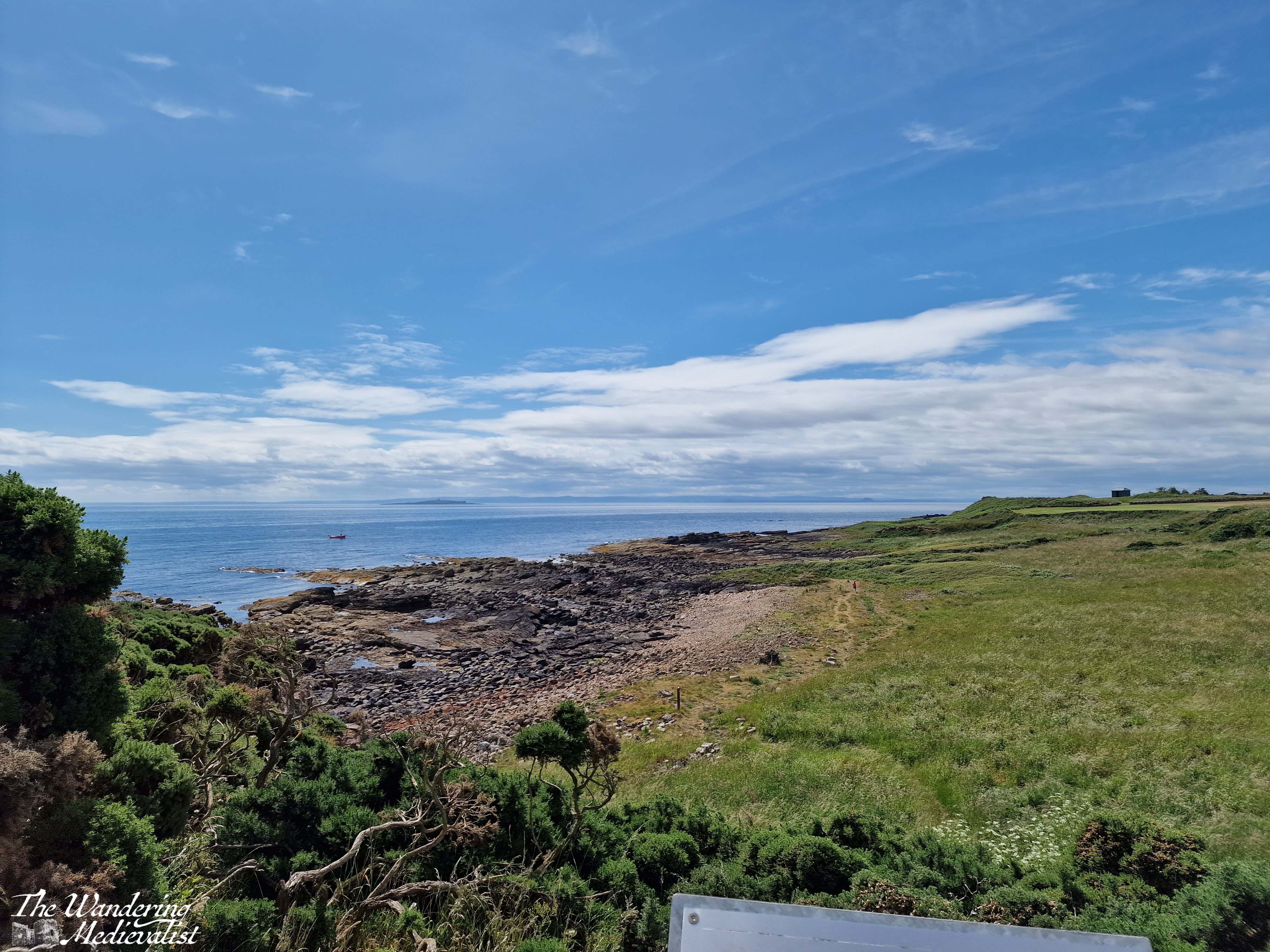
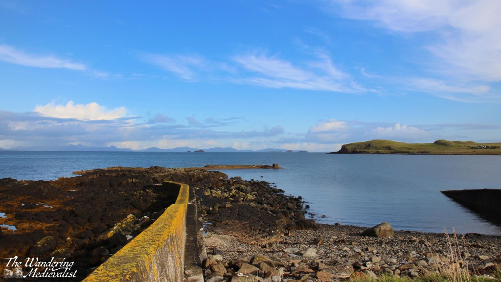
Hunglader is one of those place names that erases any question that the Norse settled in Skye. It was our home for most of the week, and our final morning dawned bright and blue as we packed up and tidied up the Homer. Before finally leaving the north, we ventured down to the local beach, passing on the way some picturesque old Skye-style houses with white walls and thatched roofs.
The beach area offered a decent-sized parking area where two couples in a camper van were just finishing their morning fire. The cliffs towered over the beach and sheltered it somewhat, though the wind was not nearly as strong as we had experienced the day before.
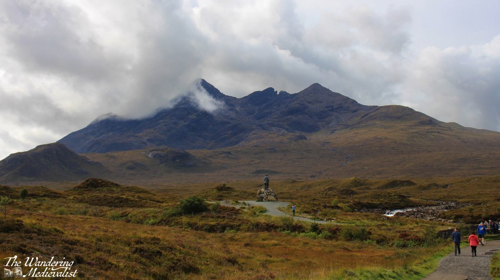
On the way out of town we had one more stop at a ruined church, then we headed south. I was quite keen to make sure we filled up on petrol before leaving Skye, and recalled a number of long queues, so we ended up stopping in Portree and topping up before our final Skye-specific stop, the Sligachan Old Bridge. It was one of several stopping points I had noted on the way north, and it is a gorgeous spot with stunning views up the glen. But it was also midge-infested, so we walked quickly and not as far as I might have hoped.
It is definitely a place to return, with paths heading up towards the Cuillin Mountains. The statue, I should mention, is not some distant historical figure like Bonnie Prince Charlie, but is perhaps more poignantly dedicated to two men who pioneered mountain-climbing on Skye, Norman Collie and John MacKenzie.
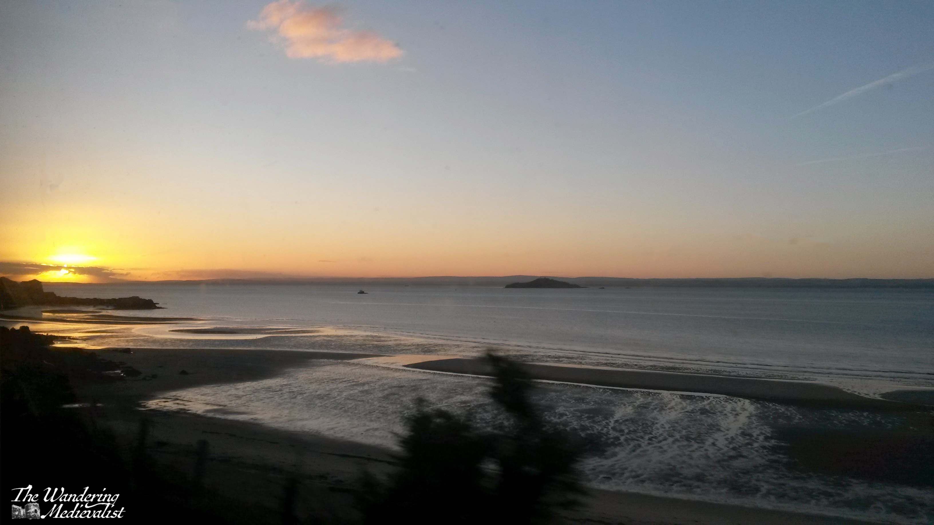
Sligachan was our last stop in Skye, and it was a relief to find the wind had stayed calm as we continued over the bridge and back to the mainland. By this view of Loch Duich it was so still that the waters were almost literally glass-like.
The clouds were drifting in as we pushed south into the mountains, following the road between Loch Duich and Loch Cluanie. I had made a careful note to explore Glen Shiel, where a stone bridge marks the point of a battle in 1719 between the Jacobites and Spanish on one side, and the English and Dutch on the other, evidence of religious and political divides across Europe in the early 18th century. Standing on the modern road, it was possible to track the historic route that armies would have needed to take, and the sharp angle of the hills makes it clear why this might be a treacherous battle spot. While most of the Jacobite commanders escaped, the battle is considered an English victory.
With our many pauses, the day was ticking on, and I think we all had enough of views and pictures and were ready to get to Fort William, still a fair distance away. We considered stopping at the Commando Memorial but there was little appetite amongst the passengers, while I was getting tired of winding roads.
This was taken on the banks of Loch Oich, right before the locks of the Caledonian Canal, and I love how perfect the reflection is. It was our final break to stretch before making the last push.
The hotel we stayed at in Fort William, while clearly designed for coach parties, offered surprisingly good food and local beer – have determined that we must stop at the Glen Spean Brewing Company the next time we are up. We all headed to bed early, contemplative of the end of our time on Skye and what the following day would bring as we drove across Rannoch Moor and home.
I’ve skipped ahead in my story-telling to the third day we spent on Skye – the second was standard Highlands rainy, and we visited Dunvegan Castle before eventually retreating to our cottage for the afternoon. Thursday dawned clear and bright but increasingly windy as the day went on; the car was buffeted about and on one or two excursions it was difficult to walk. We think the gusts were well into hurricane-force, but even with whipping hair biting into my face like knives, I was so excited for our journey.
I had spent most of the afternoon before plotting out the route and places I knew we needed to stop, then entering it all into Google maps so I could know exactly where we were meant to go. There was a question as to whether we might go all the way to Portree and do a loop back, but in the end it was an out-and-back trip, allowing us the opportunity to stop at a few points we missed. Once again, I have chosen a few highlights for this page, but most of my pictures are in the video at the bottom.
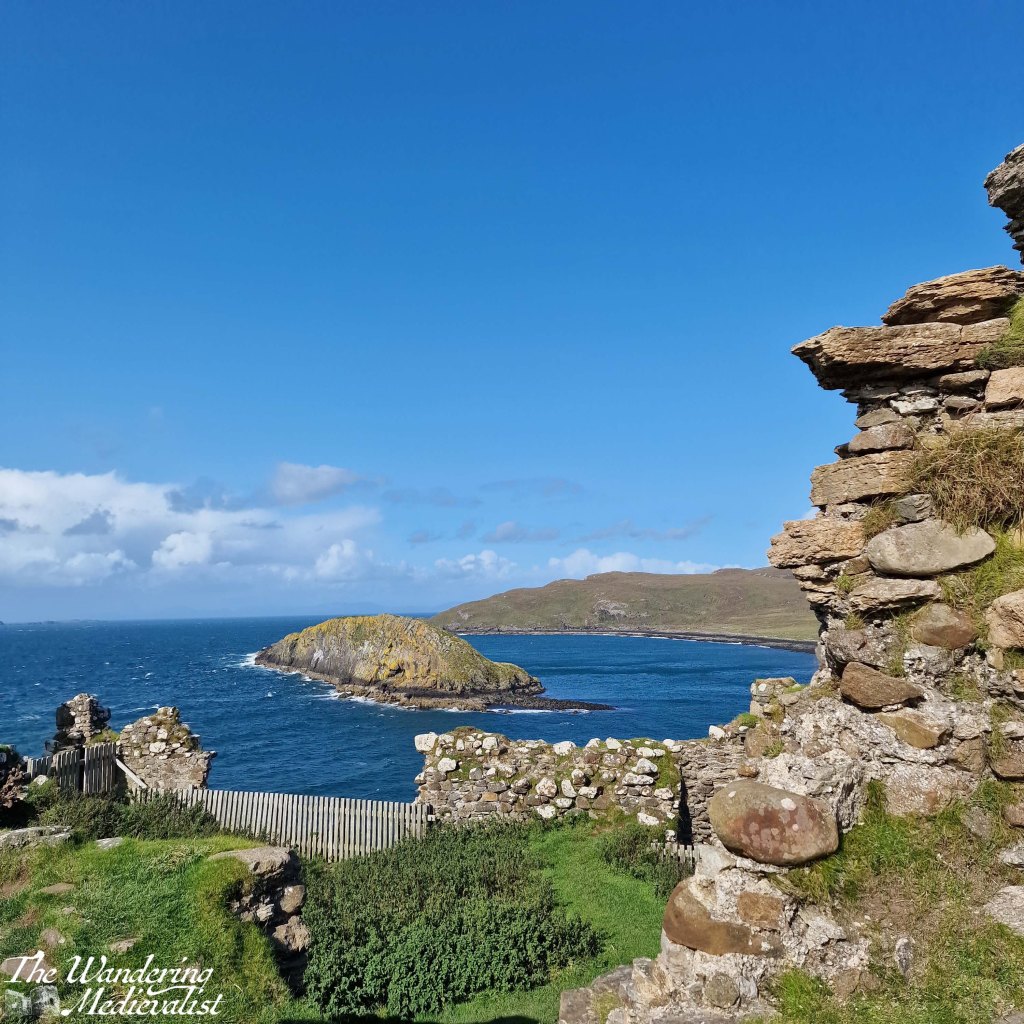
First stop was Duntulm, less than ten minutes north of where we stayed – it is an almost entirely ruined castle on a promontory with gorgeous views back over the hills and coastline.
I was the only one who hopped out of the car on this first stop so I made it quick, eager to see what the rest of the day would hold.
The A855, which is the main road that runs along the north edge of Skye, runs through some breath-taking landscape. Even when one cannot see the ocean, one can enjoy the distant mountains and vistas across green fields dotted with heather, sheep, and outcroppings of rock. Several times I stopped just to enjoy that view, and also to calm my nerves as driver.
Because, while it is the main route along this coast, the A855 is also a single-track road with relatively frequent passing places, but equally frequent blind corners and hills that cause the occasional near-miss with other more confident or less cautious drivers. I would certainly not recommend the route for tourists unused to Highland driving, beauty notwithstanding.
As the road cuts across the top of Skye it leaves the coastline to re-join a few miles later, opening up views across the glistening water to small islands and the distant mainland. We stopped a few times, though as the wind grew stronger, Dad started to doubt whether he wanted to go on much of a hike – one of the plans for the day. Knowing that one of our party would be confined to the car either way meant that cancelling a longer hike made good sense.
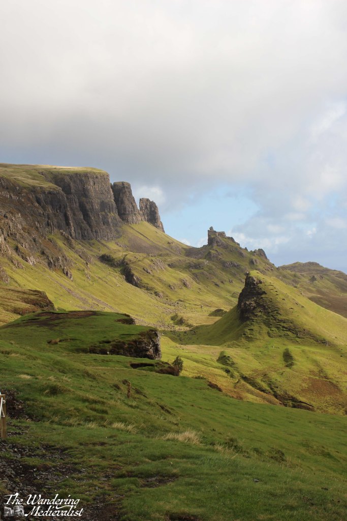
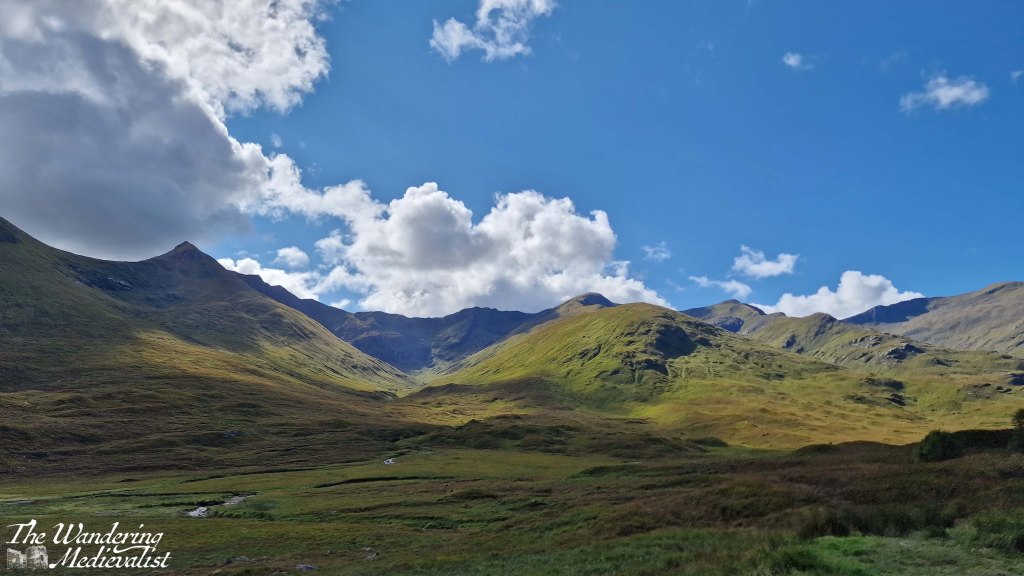
One location we knew we could not miss was the Quiraing, and so we turned inland along an even narrower road and made our way towards the line of cliff-like mountains ahead of us. Despite the size of the road it was quite busy, with cars and vans going to and fro. As we approached the parking area, the road started to climb sharply, weaving up the side of the mountain with hairpin turns that reminded me of scenes in To Catch a Thief – though I drove considerably slower than Grace Kelly or Cary Grant. I am not a great one for heights so kept my eyes firmly on the road as I negotiated the turns, breathing again I think only when we reached the top and found a large car park for hikers and visitors.
There are a number of path options at this point, including one that is wide and gentle enough that – I think – it is wheelchair accessible. It is certainly easy enough for most to try, and if you ever find yourself here with an elderly or less mobile companion, I would encourage you to encourage them to give it a go, even with wind as strong as it was when we visited – strong enough to take your feet from under you. This sight of the Quiraing, the view across towards the ocean, lochs and hills in between, is one of the most stunning I have ever seen. Top ten in my life, no question. The stunning scenery of the Quiraing is caused in part by a series of landslips, and the sunlight plays dramatically off sharp pinnacles, grassy slopes, and sheer rock faces.
As Dad and I made the short loop, we could see to the right a rain storm coming our way. I knew there was not enough time to reach the car so while Dad made a dash for it anyway, I continued on my way, hoping to reach the next knoll. I tucked my camera inside my sweatshirt and waited to get wet. I have absolutely no regrets.
Yes, I got soaked, and the much better-equipped hikers passing me looked at me questioning my sanity, but I stayed and filmed the storm.
The rain passed in minutes and the sun returned, allowing me to watch the storm as it moved towards the sea. There is no question I need to return here and take the time to do at least some of the hike. We saw quite a few spectacular sights on this day, and on the trip as a whole, but this was definitely the top of the list. Eventually I steeled myself to drive back down the winding road and was delighted to discover that the road south was back to two lanes.
The next stop was Kilt Rock, which was very busy so that everyone was vying for the best photo spot. My companions had been before, so we continued on quickly, to Lealt Falls.
This is where, as we parked the car, we realised just how powerful the wind had become. It must have topped 70 MPH, so strong that it was a challenge to walk and loose hair whipped my face like needles.
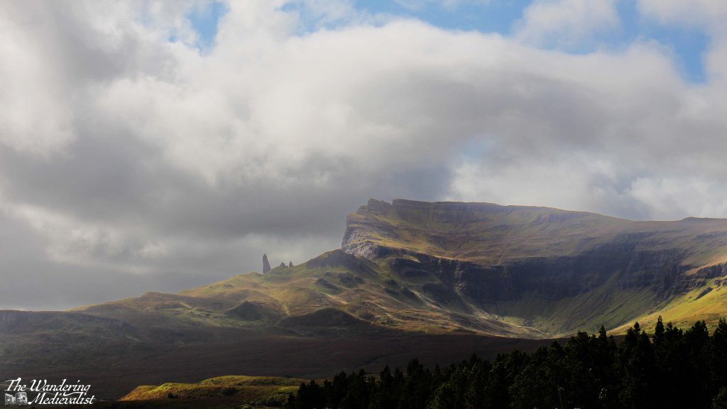
The colour of the hills and water were stunning so Dad and I braved a short walk to a viewpoint, though I recall passing two small dogs that I worried would be blown away. The falls themselves are visible from a sturdy viewing gallery that stretches out over the chasm, and in the distance one can see the range of mountains that includes the Old Man of Storr.
Another famous Skye destination, the Old Man of Storr should not be missed. The picture below is taken from a treacherous parking area called the Rigg Viewpoint – treacherous due to its narrow spots, large busses and larger potholes.
But the view is stunning. From here, we continued on to the actual parking lot for the Old Man, and while my companions waited in the car I scampered up the first half mile or so of the trail, to a point where I could see over Loch Leathan and up to the rock face. Again, this is clearly a spot that must be viewed on foot from the hiking trail, and next trip I will be certain to conserve the time and energy to do so.
The day was creeping by, however, and so after a brief discussion of our options, we decided to return on the route we had come rather than continuing on to Portree. We did not really need to go that far and the A855 was so beautiful it was worth another look.
We did not stop as often on the return but Duntulm required another look; I parked more securely – again dodging enormous potholes – and Dad and I took the short walk out to the ruins. Here once more the wind was battling us, and at times it was a struggle both to walk and to hold the camera steady.
The castle here had been built in the 14th and 15th centuries, the seat of the Clan MacDonald of Sleat – rivals of the MacLeods who held land further south. Despite its strong defensive position, the site was abandoned in the 1700s and the stone was taken to help build Monkstadt House, several miles south. Monkstadt, incidentally, is now a luxury inn and restaurant that we looked at very briefly before realising it was a bit too luxury for our needs at the time – we resorted to pesto pasta.
Once we had our fill of the castle ruins – or I did, more accurately – we returned to our cottage. It was mid-afternoon and the wind was battering the building and bushes outside, the perfect time to sit in the living room with a cuppa and enjoy the sunshine, a book, and the view. The Homer is so well-built that were it not for the noise, you would never know it was windy; not a single breath of air disturbed us. While we had not had a partiuclarly long day, it was an exhausting and even emotional one and we were all, I think, ready for a rest and time to process and review all we had seen. For me, it was a chance to start planning my return…
The Isle of Skye is a destination that everyone tells you is a must-see. First off, everyone is correct. But for any number of reasons – the distance, time, work – I have never managed to get there, even when most of my family have done so, usually as an add-on to a visit with me.
Finally, earlier this month, I was able to reach the almost mythic isle and was incredibly lucky to experience three out of four days of beautiful weather (one day included hurricane-force winds, but it was clear). Even if we had not had lovely sun for most of our visit, I feel I would be affirming that Skye is, indeed, a place that one really should see, particularly if one has any kind of affection for rugged dramatic mountains and scenery that is quite literally breath-taking.
In fact, I took so many pictures that I have had to turn them into videos, and split my posts into days, so as not to overwhelm – I’ll link it at the bottom of the post. There were a few views that I missed as I was the designated driver on this adventure, but they will remain imprinted on my brain and I did my best to channel what the other half reminds me, ‘Sometimes it’s ok to just enjoy the view and not take a picture.’
Even just the experience of driving over the Skye bridge and following traffic as the road gradually lifts over the mountains was enough to make me long for the time to do it again.
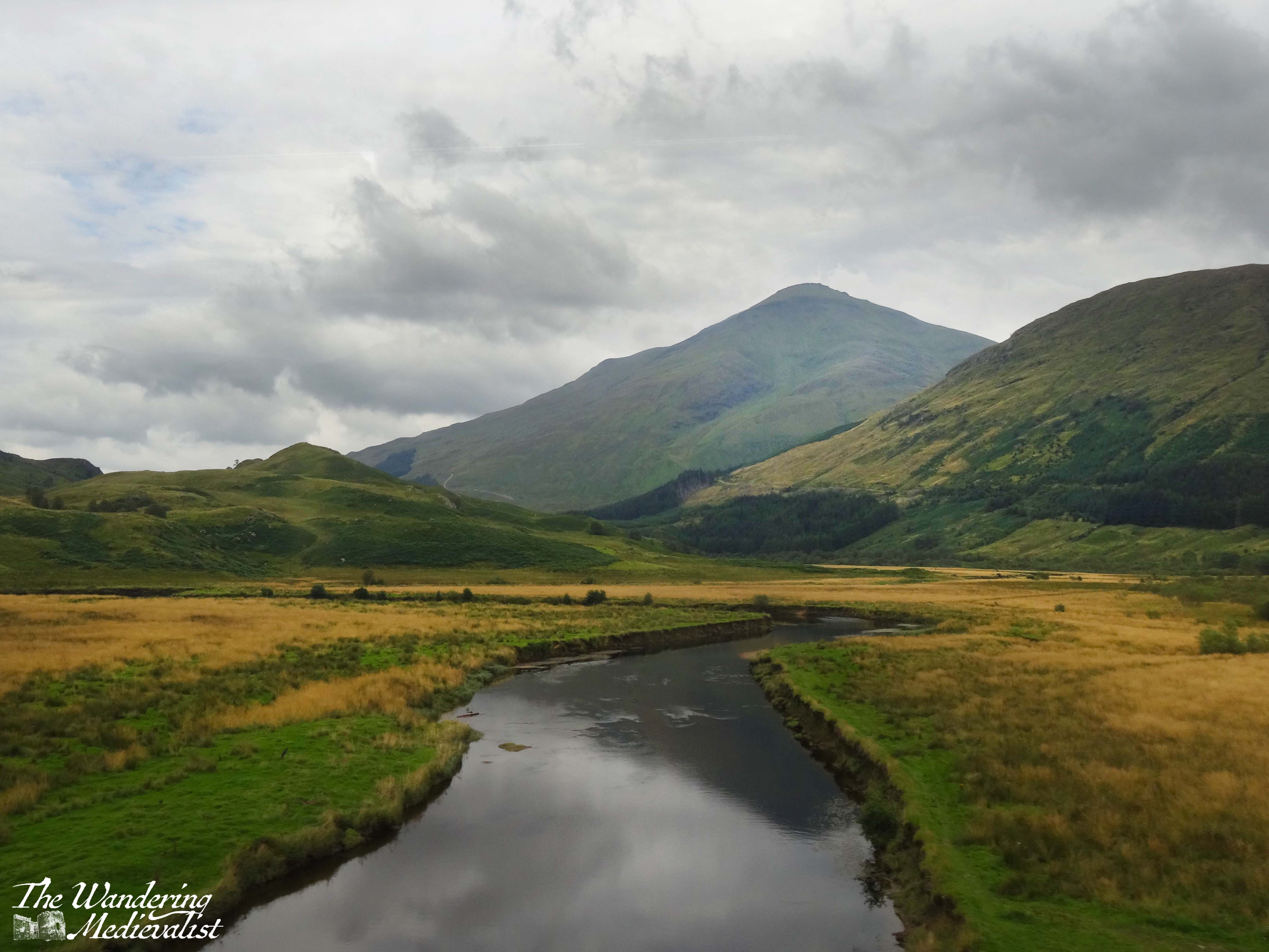
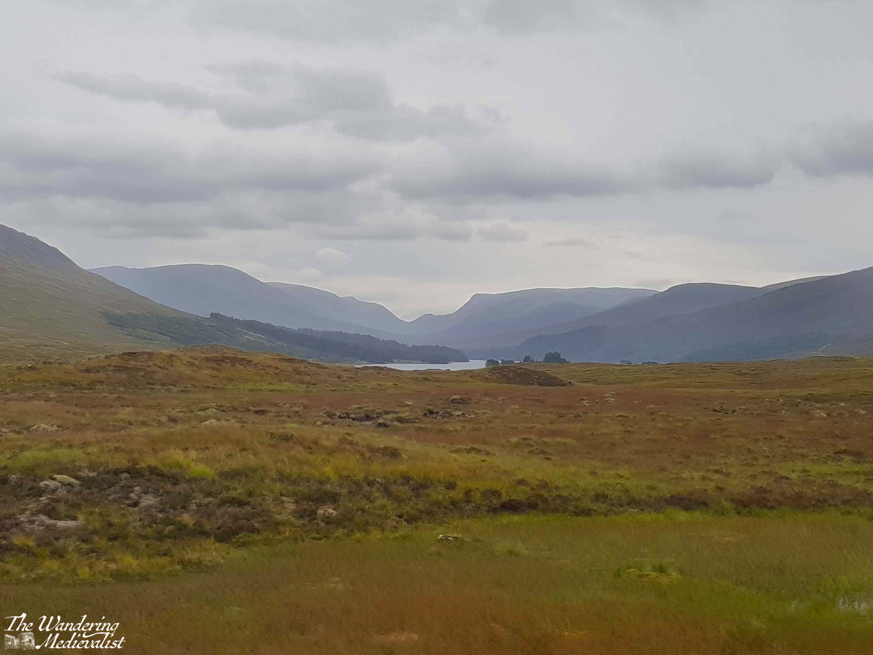
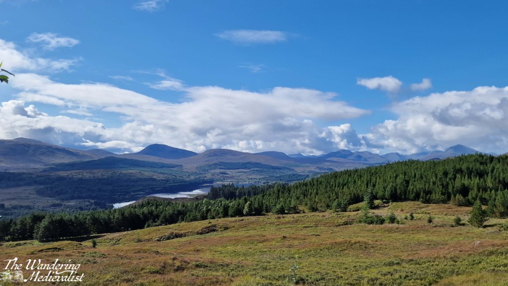
But I get ahead of myself. The first day – really only half on Skye – started with us leaving Fort William at around noon and heading north along the A82 past the Commando Memorial and Loch Lochy towards Inverness. Then at Invergarry, we took a dramatic turn west to follow the A87 towards Kyle of Lochalsh and Skye (and in fact, we would stay on the A87 all the way to Uig). I had scheduled in a number of viewpoints which I thought may be worth pausing to explore – I was acting as tour guide for visiting family – and the first was Loch Garry.
Unfortunately trees had grown up in front of the main viewpoint so high that it was difficult to even see the water, but a bit further along we were rewarded with this vista toward the end of the loch and the mountains beyond.
The road remained high above the lochs for the next few miles and we stopped long enough at the Loch Loyne viewpoint to take a video, then continued on to Loch Cluanie. For some reason this loch had stayed in my mind as I recalled a stop, many years before, at the Cluanie Inn. At the time it had been a much smaller place – it now boasts a bakehouse and fuel pump – but I recall a charming old spot with excellent soup. We did not stop on this trip despite this memory, and instead continued on away from the loch and into the gorgeous mountains.
This drive along the A87 is just stunning – the further north you get, the more rugged the mountains and flora get, verging on bleak but falling just short especially in the sun.
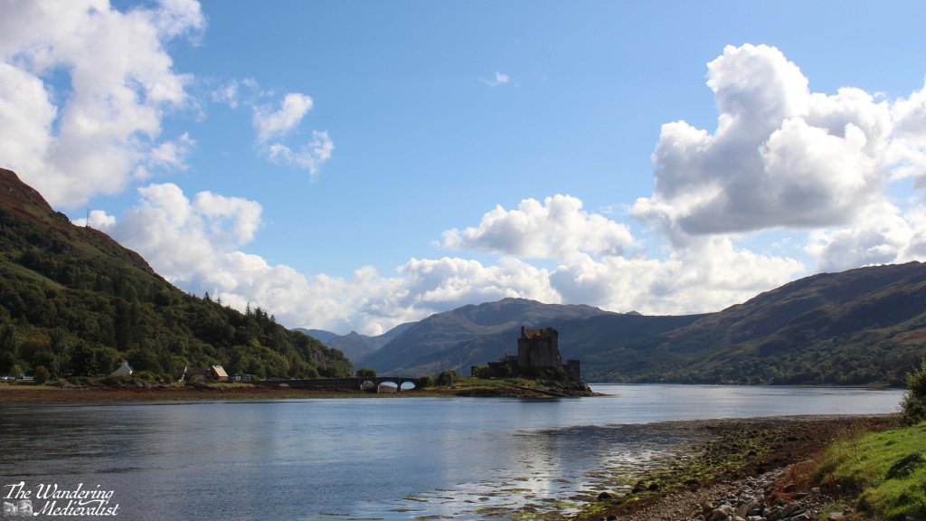
We could have stopped in many more places – some I made a note to try on the way back – but the day was passing and I knew we still had a significant amount of ground to cover. So, I pushed on until we reached Loch Duich and the most photographed castle in Scotland, Eilean Donan. We pulled into the massive busy car park and took a few distant pictures, but upon crossing the bridge into Dornie discovered an arguably even better view from the small town hall and public toilets.
Despite a continuation of stunning scenery, I kept my foot down after this stop and pushed on through Kyle of Lochalsh to the famous Skye bridge, an eye-catching steep arch of a bridge that was a touch unsettling at first, or is to one with a wariness of heights.
Once onto Skye the road is in good condition, quickly reaching Broadford, one of the larger towns on Skye were there are some good-sized grocery stores as well as plenty of places to stay – hotels, B&Bs, and self-catered.
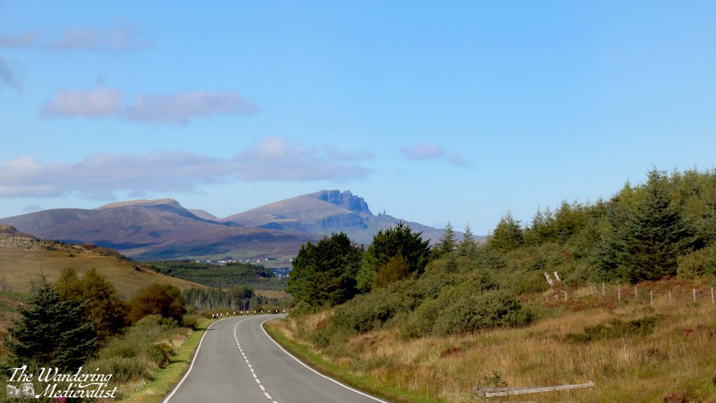
Continuing north, the road wove back and forth a few times and began to climb, with stunning mountains and valleys to the left and water to the right. We passed Sligachan with a note to stop on the return, and as the road topped a hill, before us was suddenly visible the distant shape of the Old Man of Storr, unmistakable against the blue.
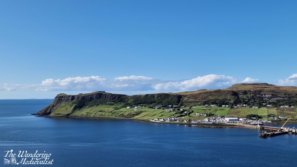
From here we touched the edge of Portree and continued pushing north, across another stretch of mountains and valleys populated mostly with sheep and a few distant farms. Our penultimate stop for the day came at a well-populated parking place perched on the hill above Uig harbour, dominated by a headland and ferry pier.
From here the road descended quickly into the village, passing several hotels and shops. Our route was further north and so we branched off to the A855 which I knew, from previous research, was also the start of the single-track roads with passing places. Indeed, while the distance from Uig to our cottage was relatively short, it was a solid 20 minutes in the car, requiring relatively regular stops to make room for passing cars and busses. Almost as if in an effort to test drivers, the A855 lifts out of town on a narrow cliff-side road that makes a hair-raising hairpin turn. This turn and the very visible drop off the road made me very happy not to be driving one of the many bulky motorhomes we passed.
After a long day of driving, I was quite ready to reach our destination, and the narrow road was not hugely helpful in alleviating my exhaustion, though the afternoon sun glinting off the water promised a lovely evening. Finally, more than four hours after leaving Fort William, we reached the cottage that was to be our home for the rest of the week. Dad had reserved the place and it was a fully-equipped cottage with two bedrooms, a lovely kitchen that I would happily have traded with my own, comfortable warm living room and perhaps most importantly, 360⁰ views of the sea, mountains, and countryside. After unpacking the car, we had a quick pasta dinner and sat outside with a glass of wine and my trusty camera tripod to watch the sun set. It was a perfect way to end the day.
It has been longer than usual since my last post, but for the very happy reason that I have been on holiday with family. We went to Skye for my first time ever, and it was absolutely extraordinary, even on the rainy day we had when we chose to visit Dunvegan Castle. (and please be assured, many posts on Skye will be coming as soon as I can sort through the mountain of pictures I took)
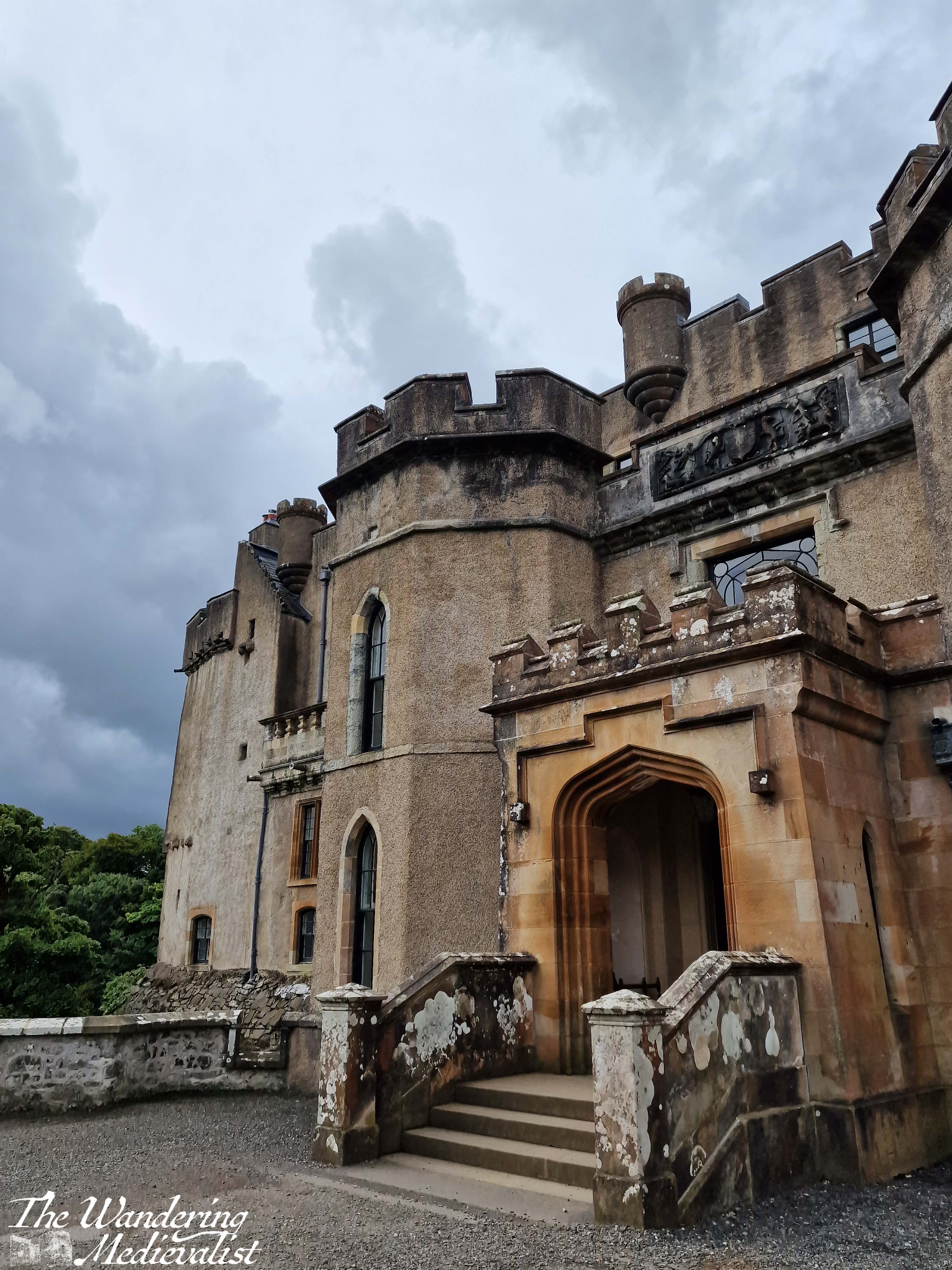
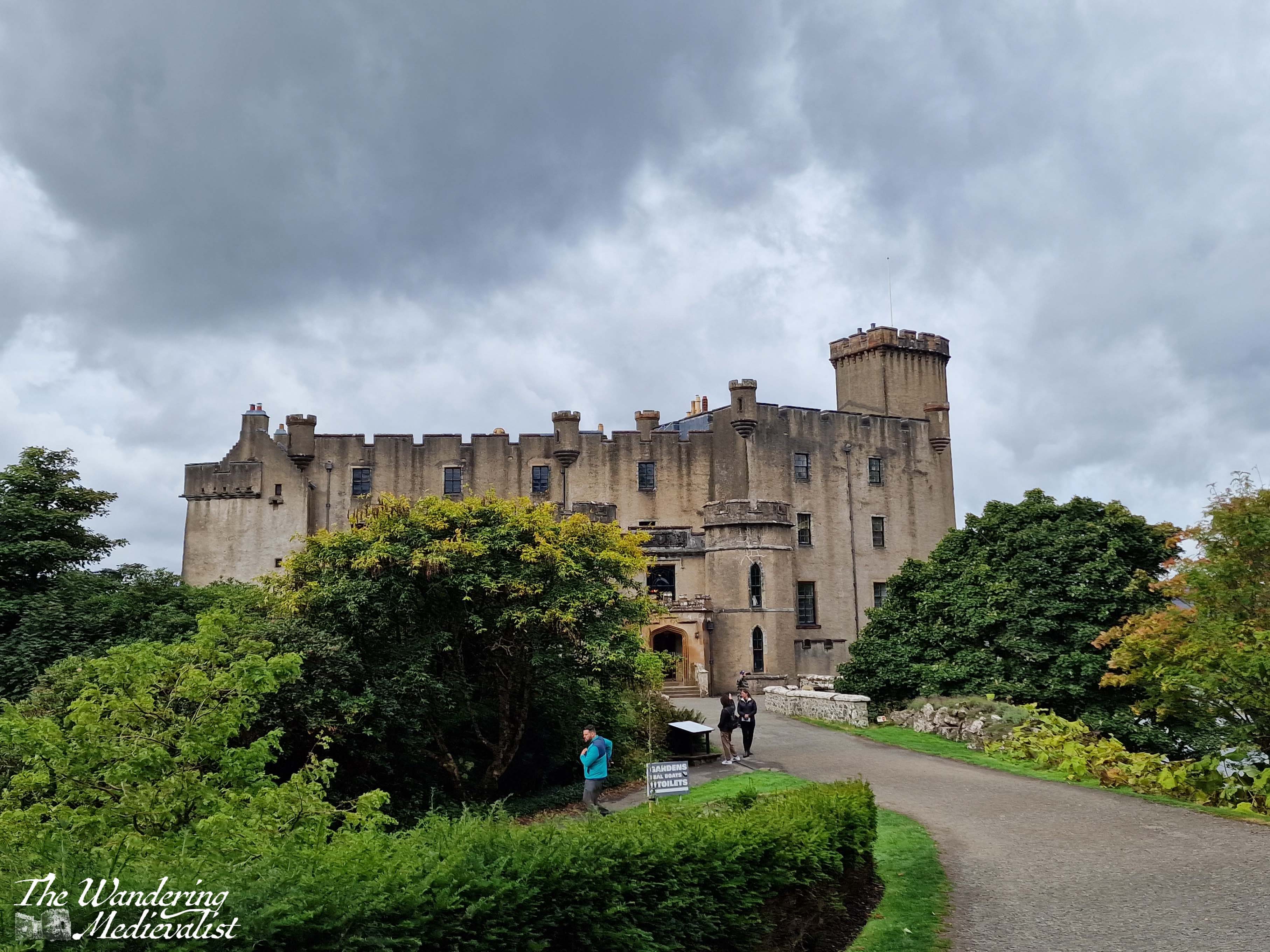
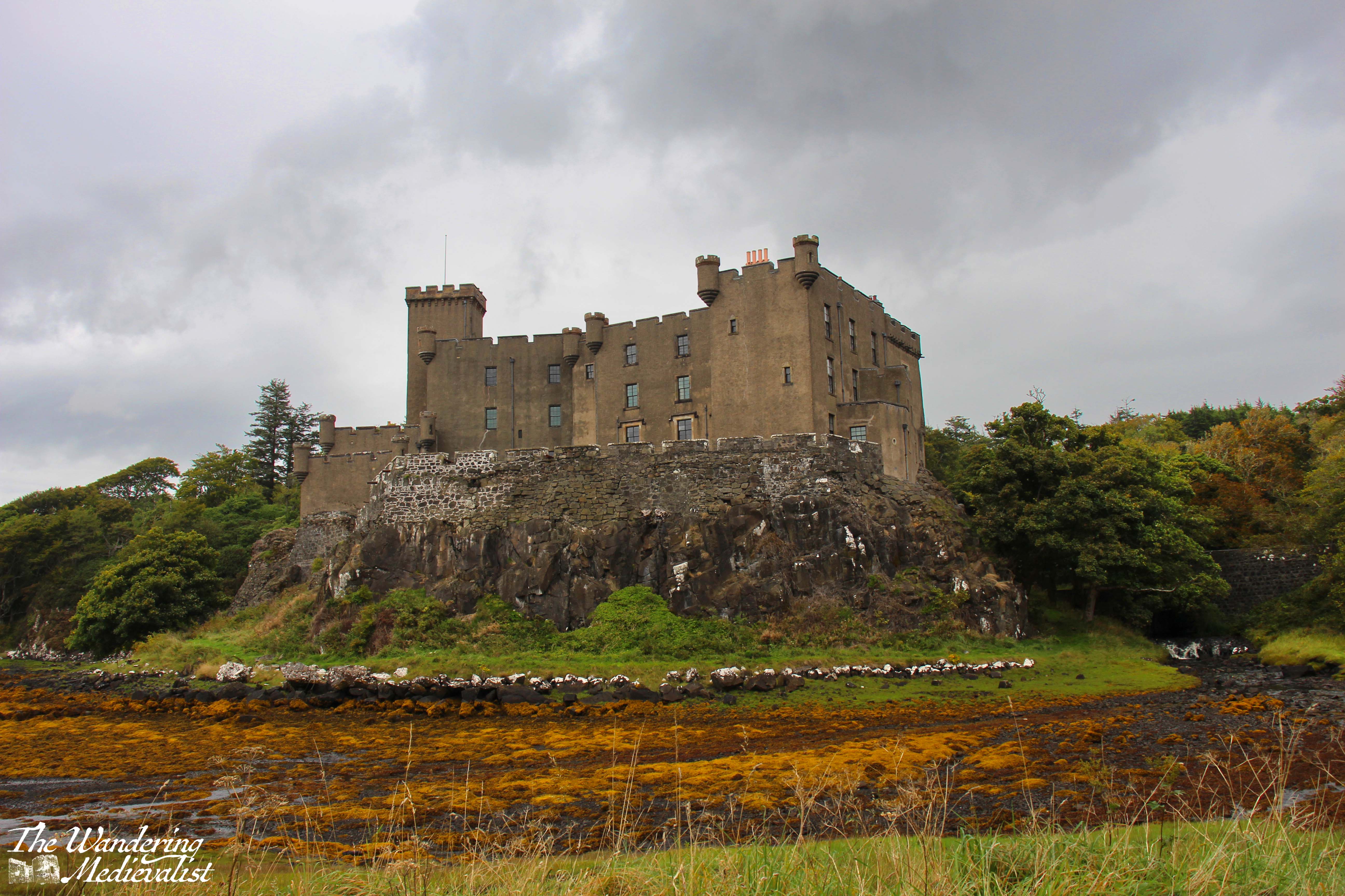
Now I have to admit, it doesn’t often happen that I am underwhelmed by a castle, but Dunvegan is on the list. It may be due to the rain – though that doesn’t usually hold me back – or the fact that I did not go inside to tour the castle proper, which does look impressive in pictures. But, the excitement I had felt preparing to see this famous spot did not quite measure up. It may also be that it has been remodelled in a mock-medieval style, or that the original stones have been coated with concrete to provide a smooth exterior (most likely I imagine for preservation). I have made my preference clear for older-style castles, even crumbling ones, to those still used as baronial residences or palaces.
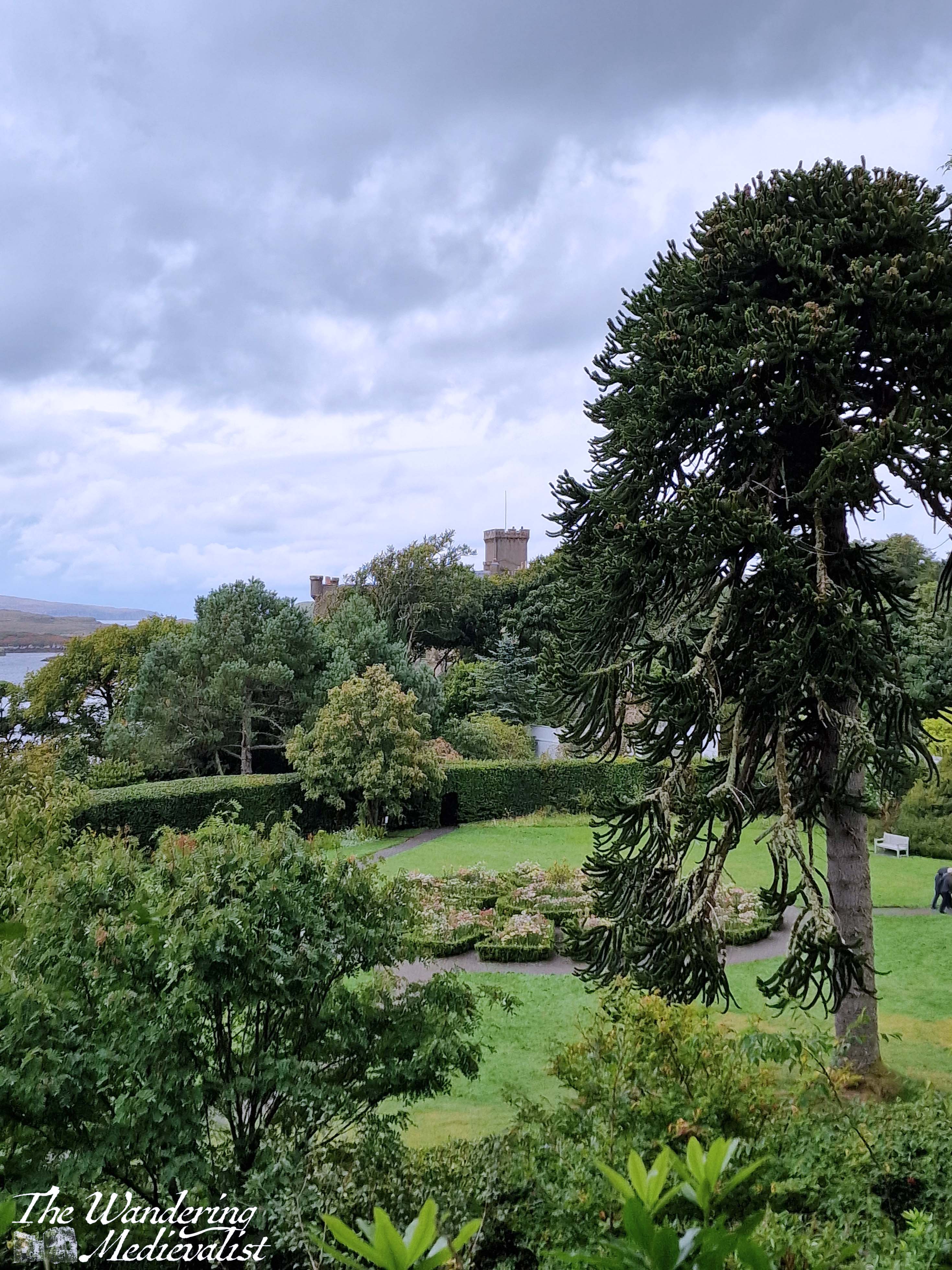
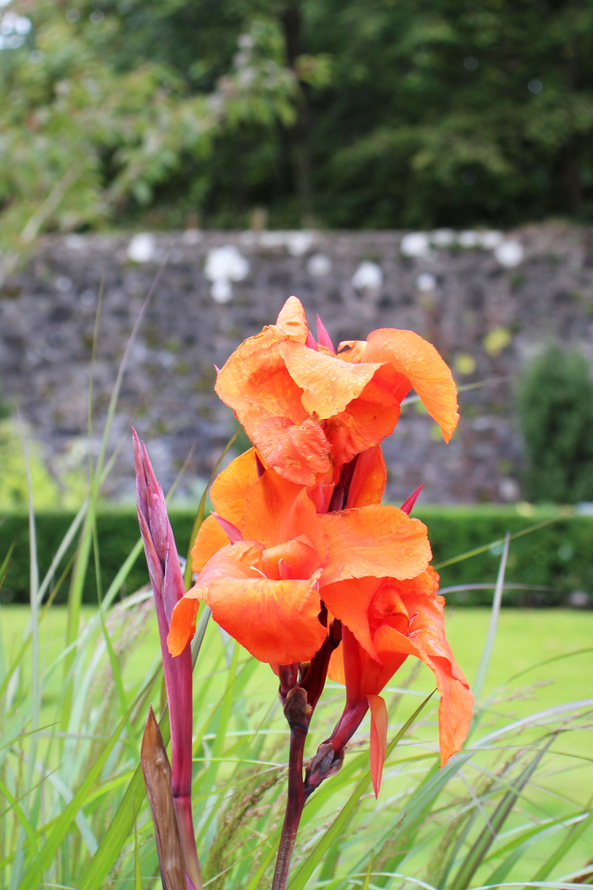
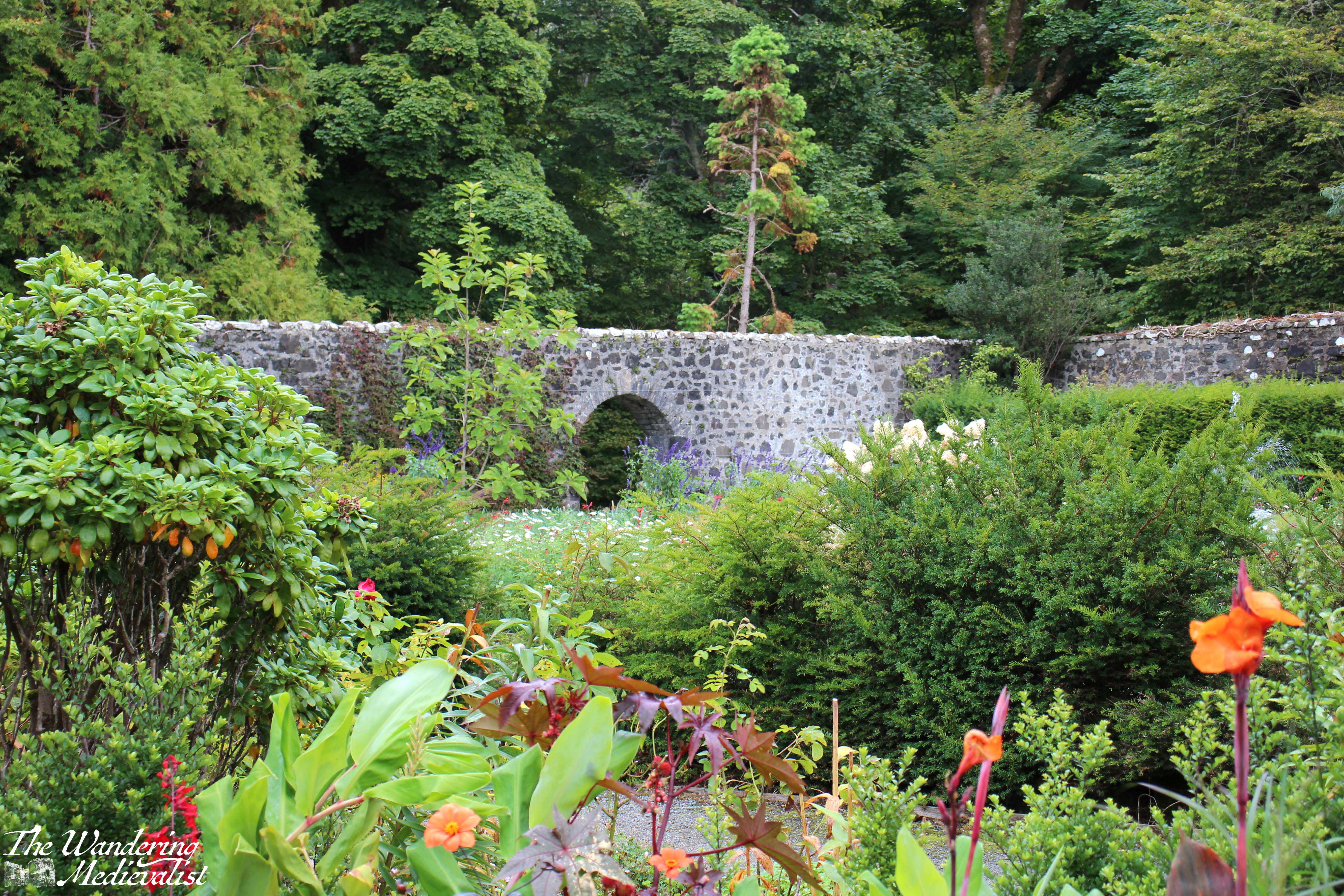
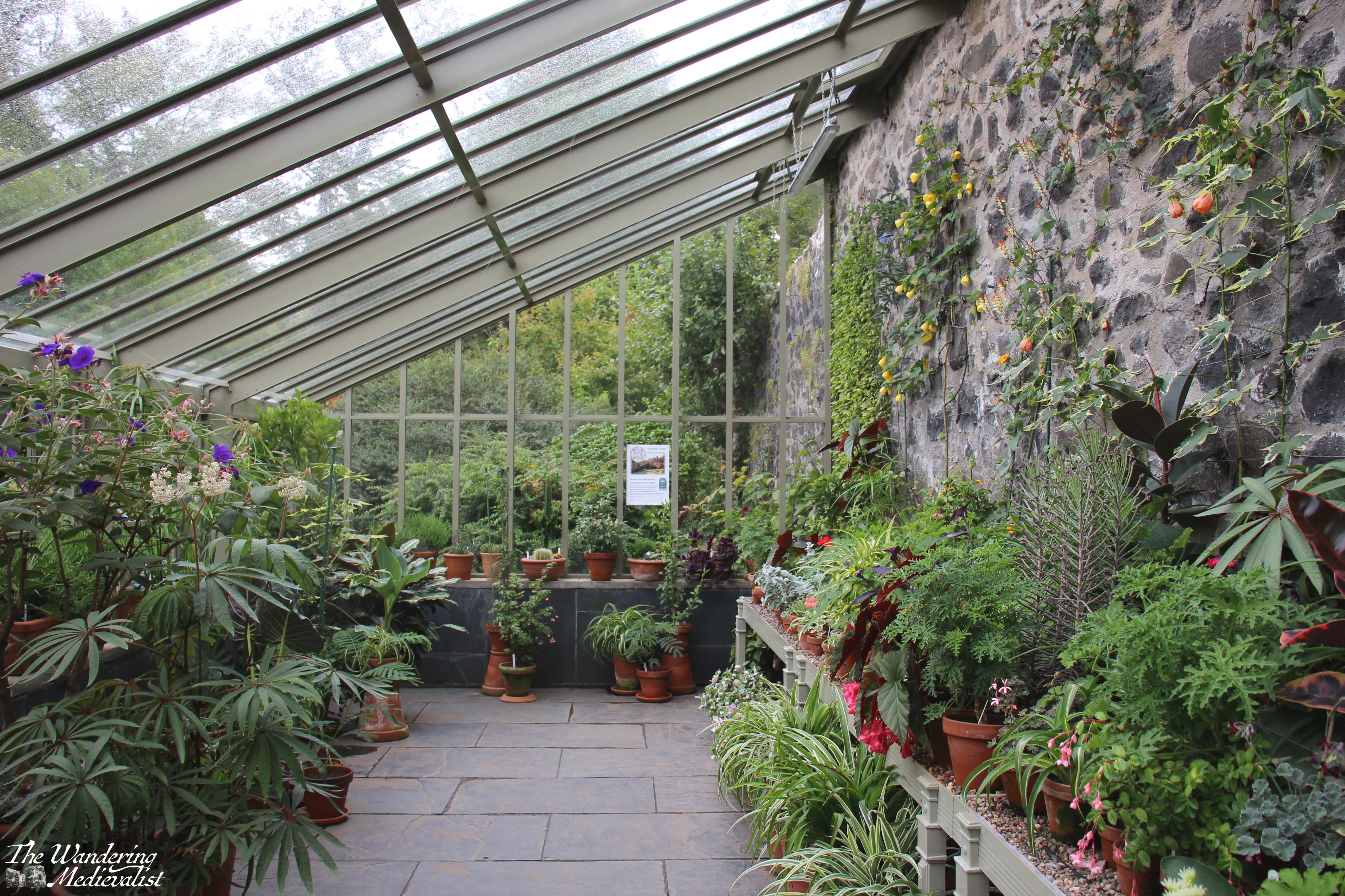
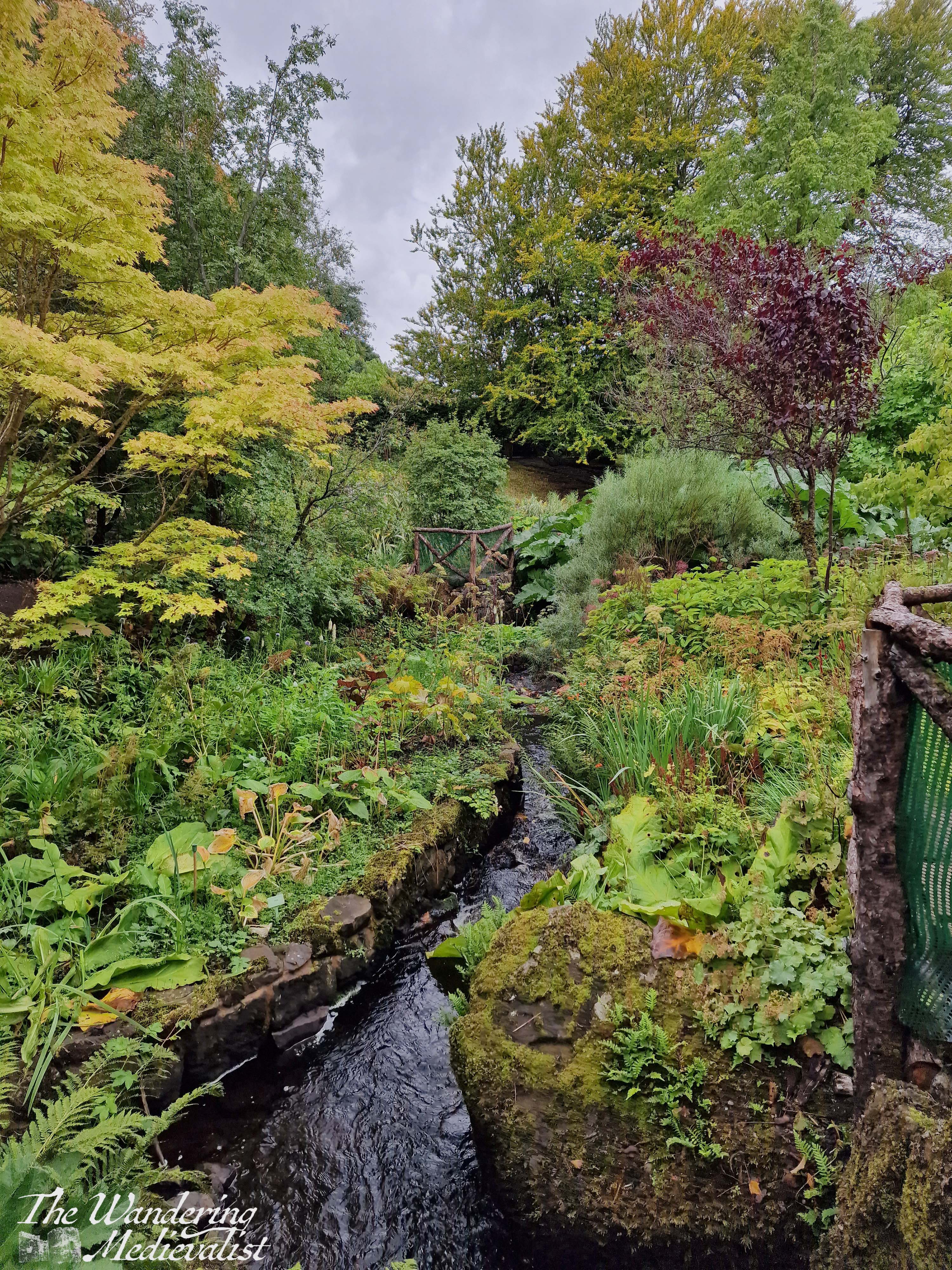
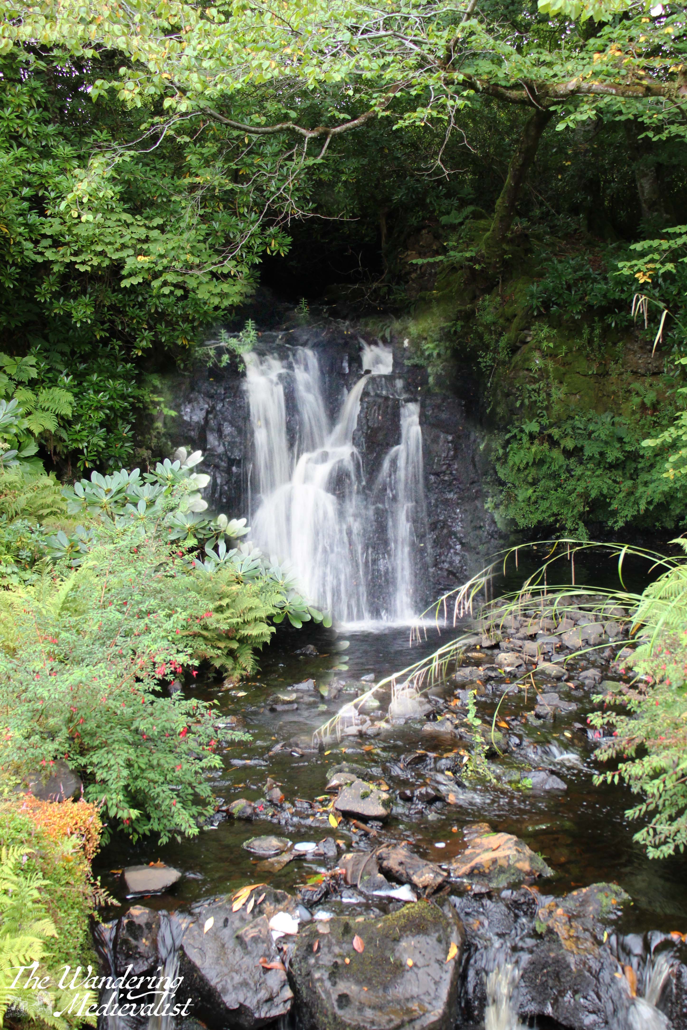
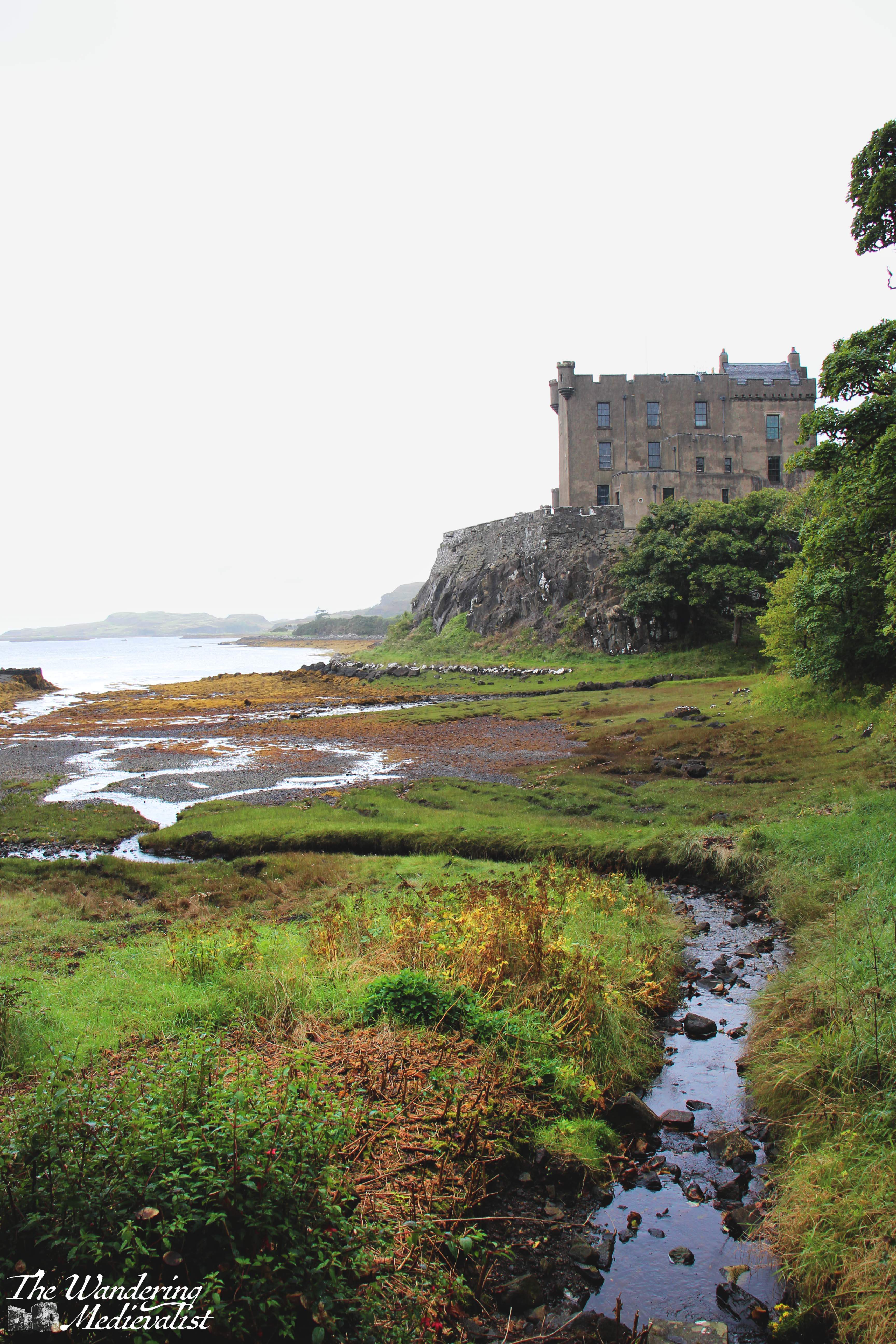
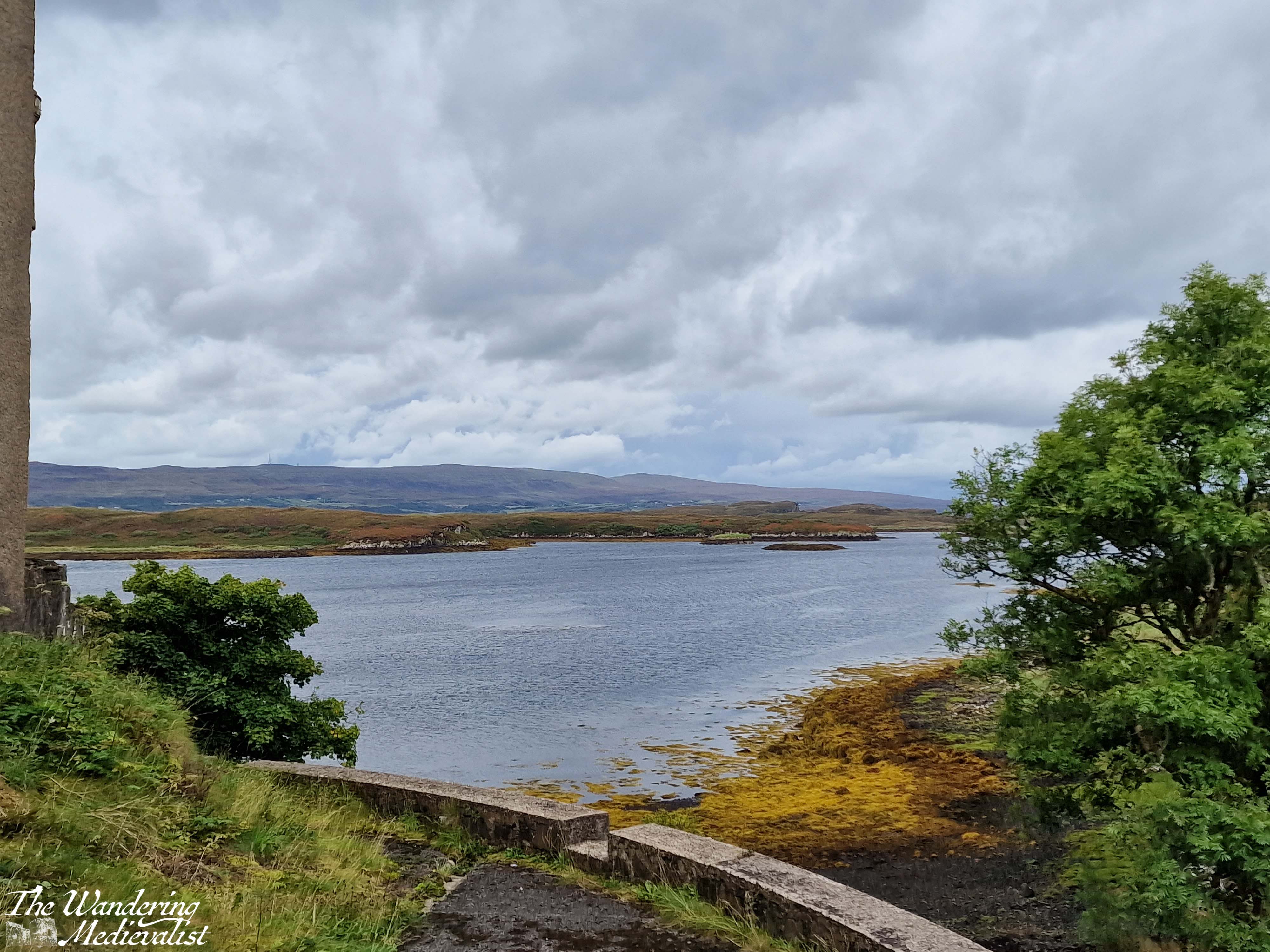
I do not mean to say that the castle is not incredibly impressive – by all means, the sight of it towering over the bay, commanding views and a romantic atmosphere even in the rain, demonstrates the significance of the location and why there was a fortress here for hundreds of years. The castle is the seat of the MacLeod of MacLeod, chief of the Clan MacLeod, and it is surrounded by a beautiful garden with water features, a walled formal garden, and more natural forest spaces. On the day we visited, the gardens were more our style and were the focus of our time. Even in the rain and after the height of the summer blooms, it was very easy to see how stunning the place would be on a sunny day in the right season. One amusing story here is that I had declined to bring my tripod with me due to the poor weather, but as I was resting my camera on a railing to keep it steady, a kind German man offered me use of his so that I could properly capture the waterfall. I think I did ok with out it, though!
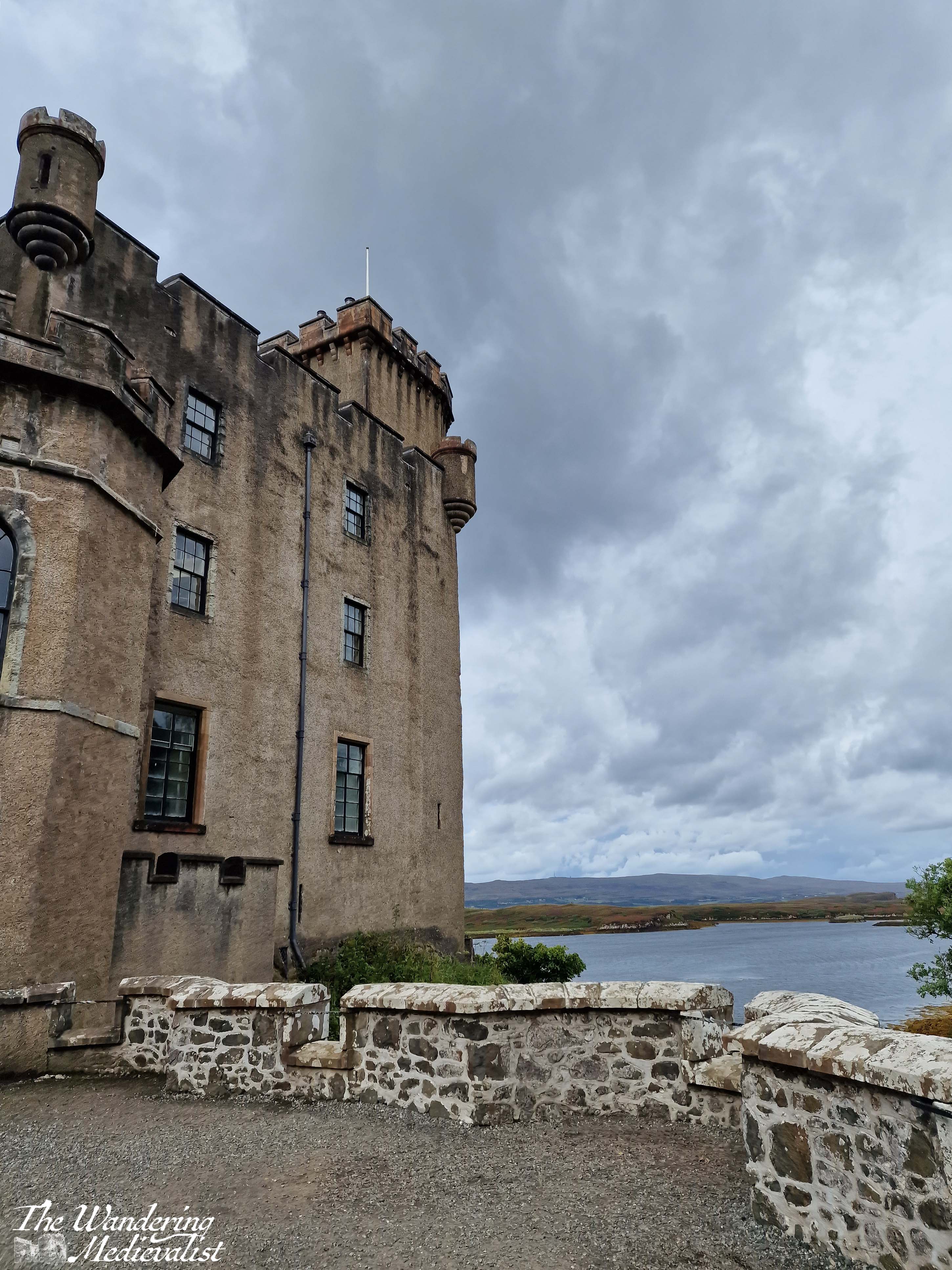
We made a circuit that ended with the walled garden and greenhouse, then ventured down towards the pier where they were advertising seal cruises. It is hard to imagine the cruise could beat the one we went on in Fort William, and even if we had been tempted, this is when the rain hit in honest, turning from a gentle pitter-patter to a downpour. I managed to get my brolly up in time to take a few pictures of the castle from the water side before we made our way swiftly back towards the car. From this angle it is even more evident why the spot would be chosen – more than 50 feet above the low tide, the castle would be incredibly difficult to attack from the sea.
One of the most striking aspects of Dunvegan really falls in its ownership, which is still held by the Chief of Clan MacLeod. This family line can be traced back to the thirteenth century, when Skye and many outer islands were still ruled by the Norse; Norse influence on Skye is evident in many place names. Despite living in Scotland and professing a love of Medieval history, I have never delved too deeply into the lore of Highland Clans, but more visits to castles like this one would be a good way to pique my interest. Certainly, if I were to visit again, I would hope to do so at a time of year when the flowers were properly in bloom and with someone who might have the patience to tour the castle itself.
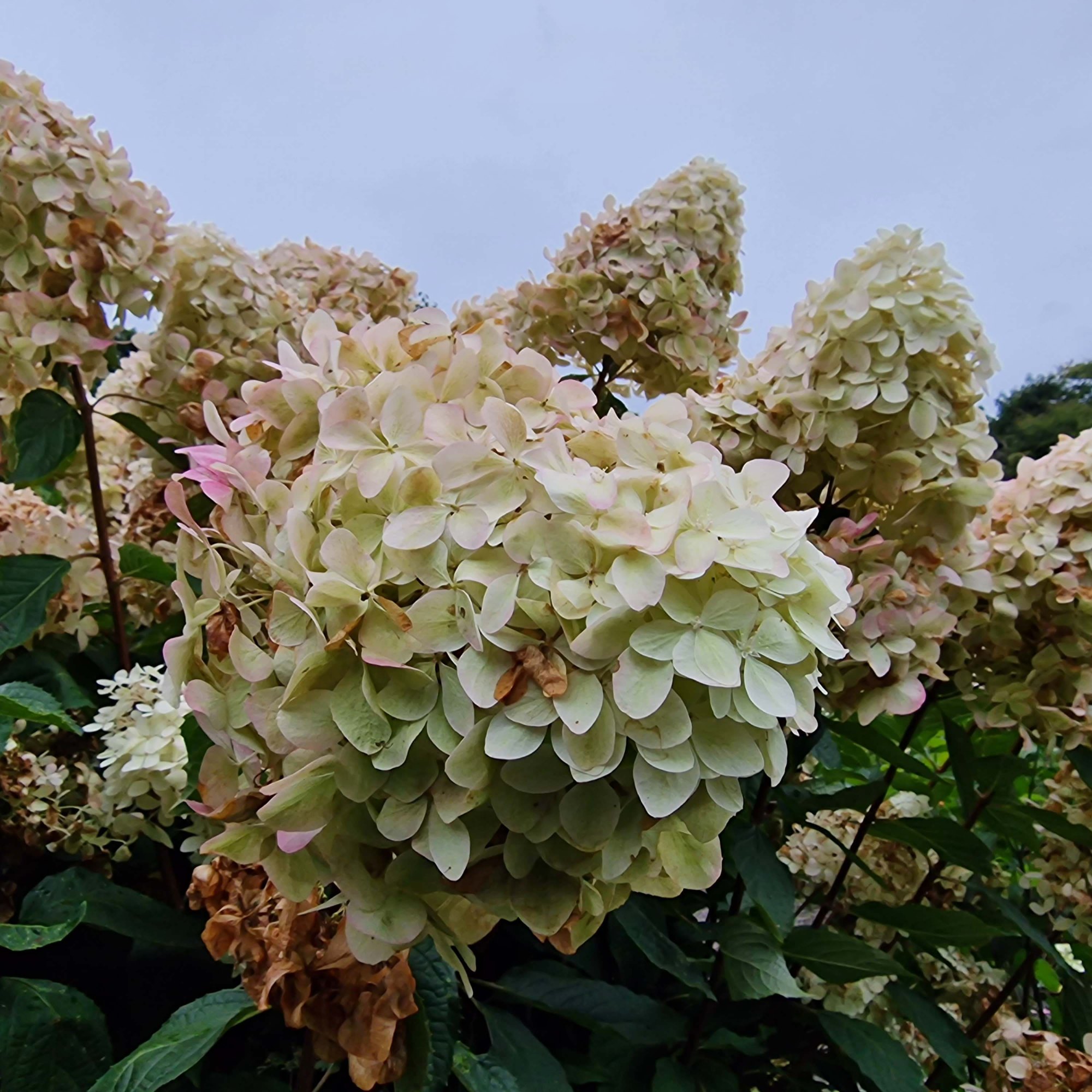
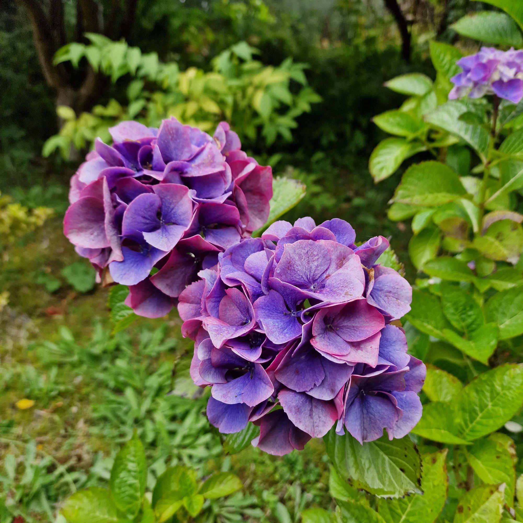
As an end note, here are some of the lovely variants of hydrangea blooming throughout the gardens: