It’s been a while since I posted about something purely medieval, and so today seemed a good opportunity to do so, talking about one of my favourite English towns.
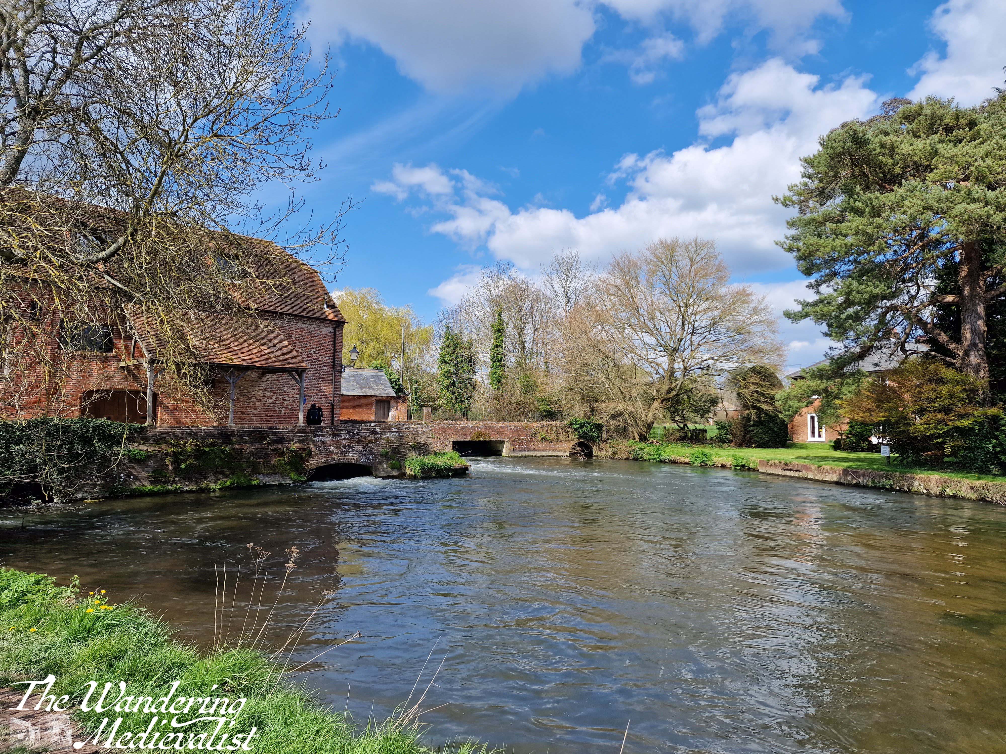
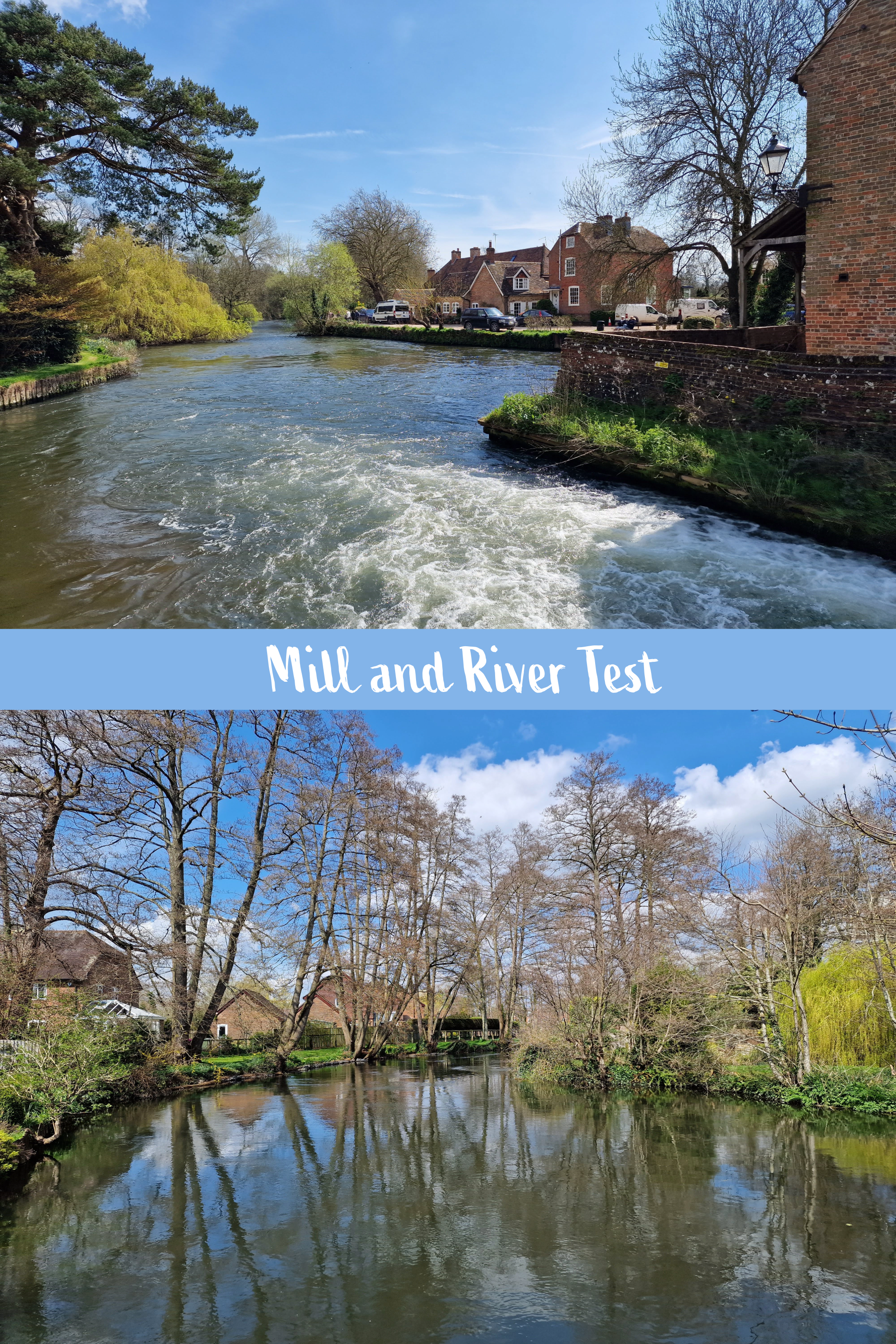
Romsey is a charming, well-to-do town about 7 miles from Southampton Airport, in the south of England. The town centre offers a mix of lovely shops, restaurants and pubs on winding streets and lined with Tudor-style frontages. The River Test flows through the community and some stunning parks, and past a picturesque old mill. The history in the town is more than evident; founded as far back as the 8th century, Romsey was a medieval market town that grew around the founding of the first church by King Edward the Elder in 907 CE.
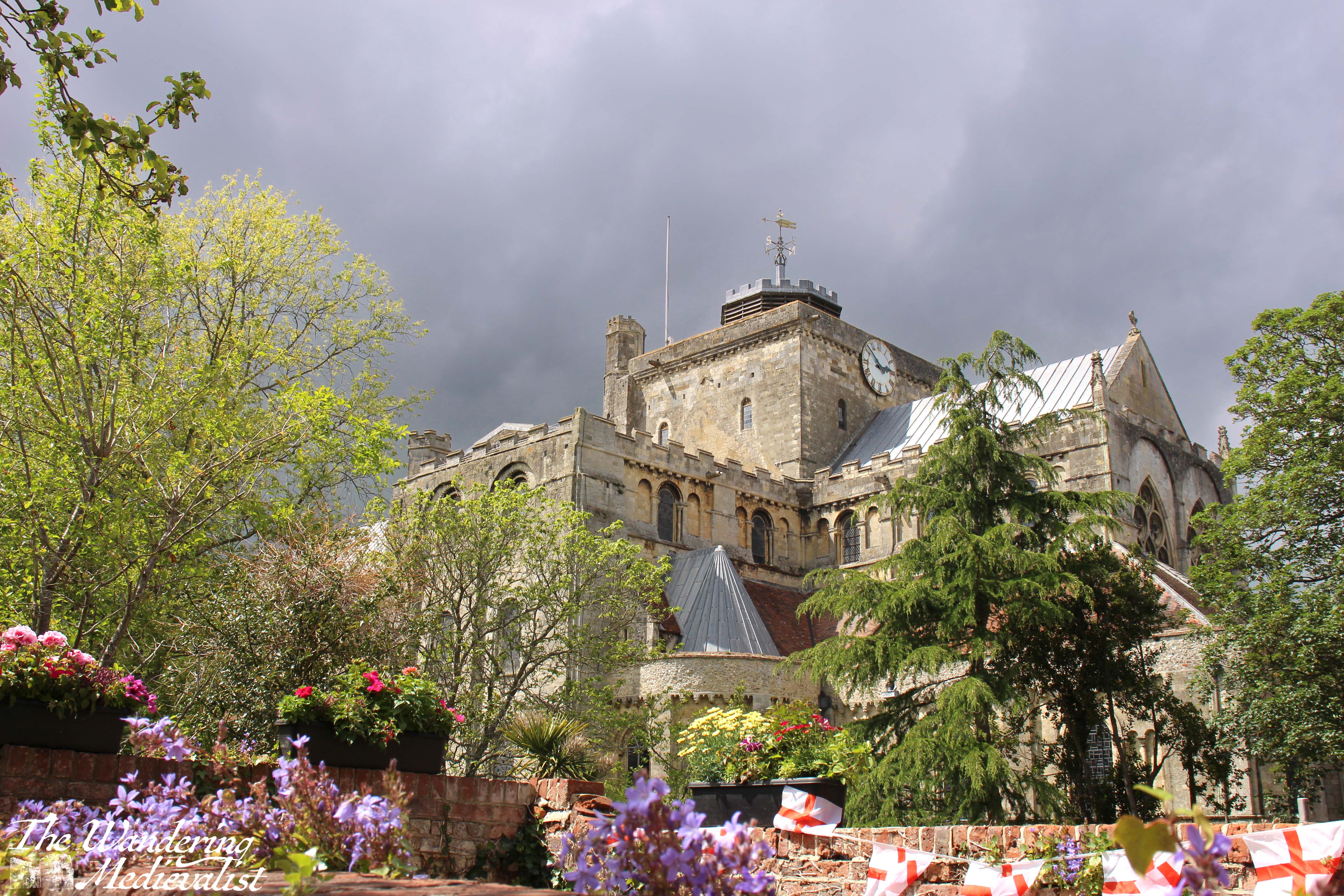
Our connection to Romsey comes through some close friends who settled there some time ago, and who we try to visit at least once a year. The abbey is a required detour on our walks through the town, and I recall one relaxing morning in particular sitting under the trees with a cinnamon bun and coffee, enjoying the view.
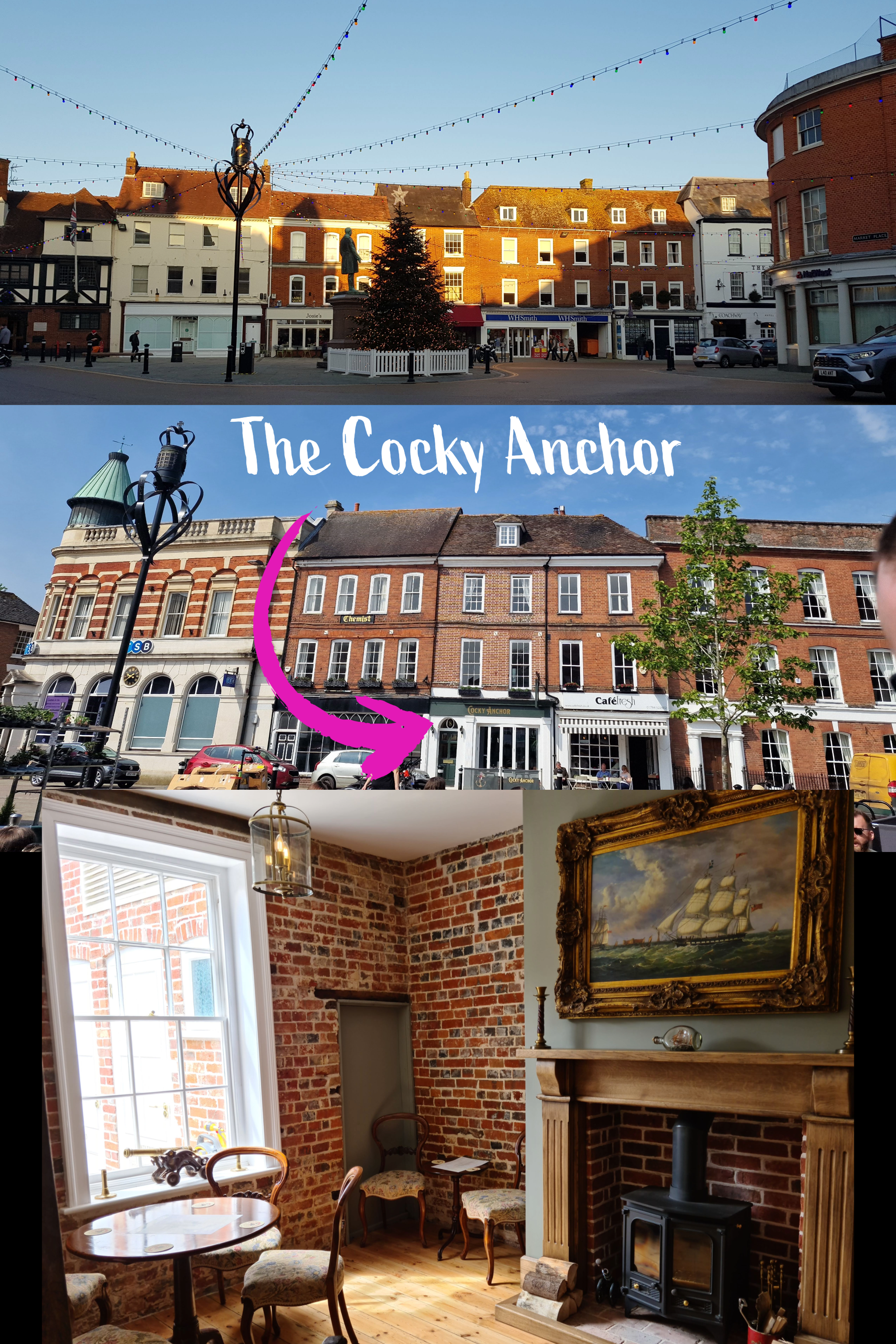
I also have fond memories of visiting the nearby pub the Cocky Anchor in summer 2021 – my first holiday after the end of lockdown – where the back beer garden offered great views of the abbey church.
The pub is just off the nearby market square, from which you have easy access to the abbey, along Church Street and down Church place.
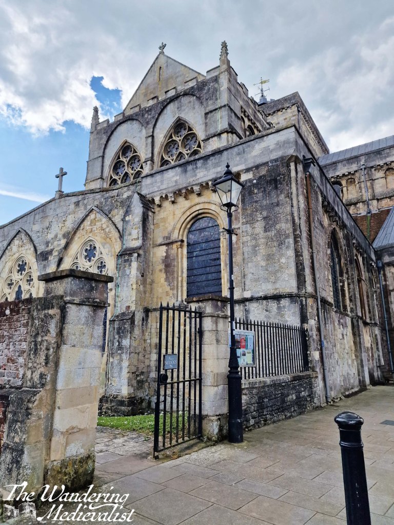
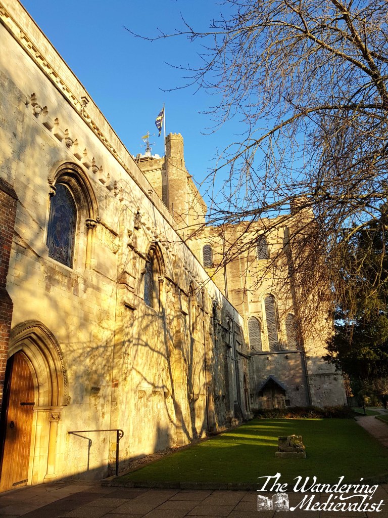
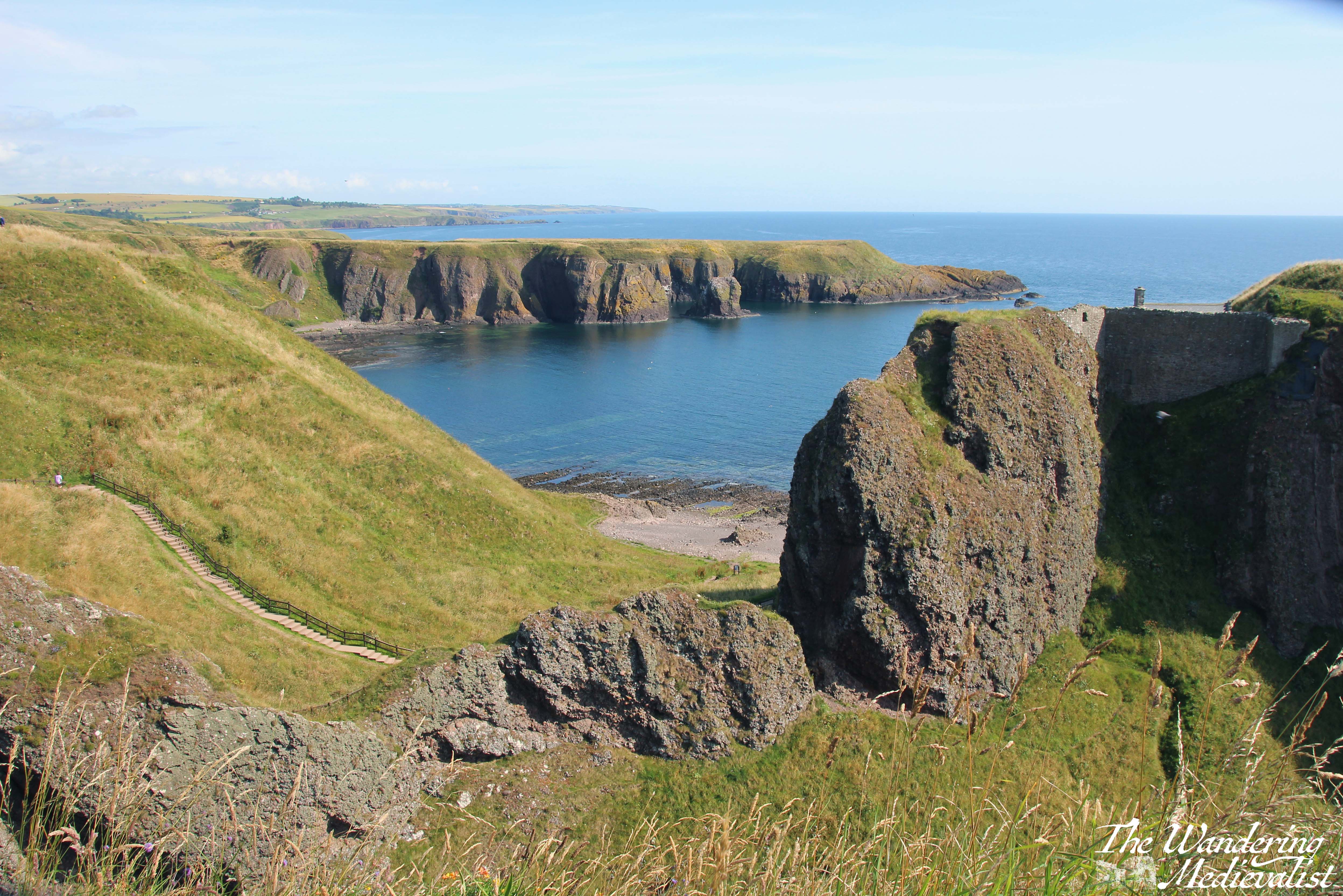
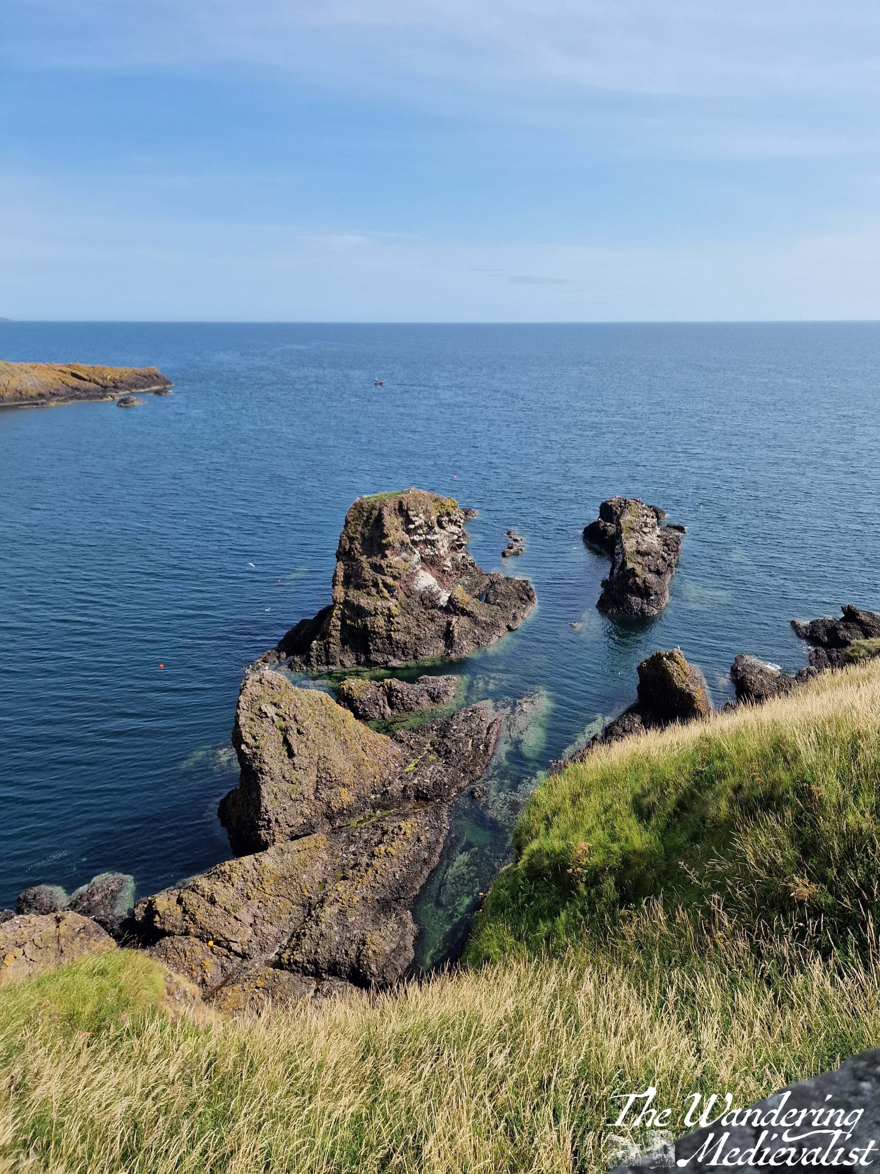
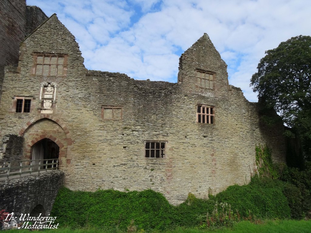
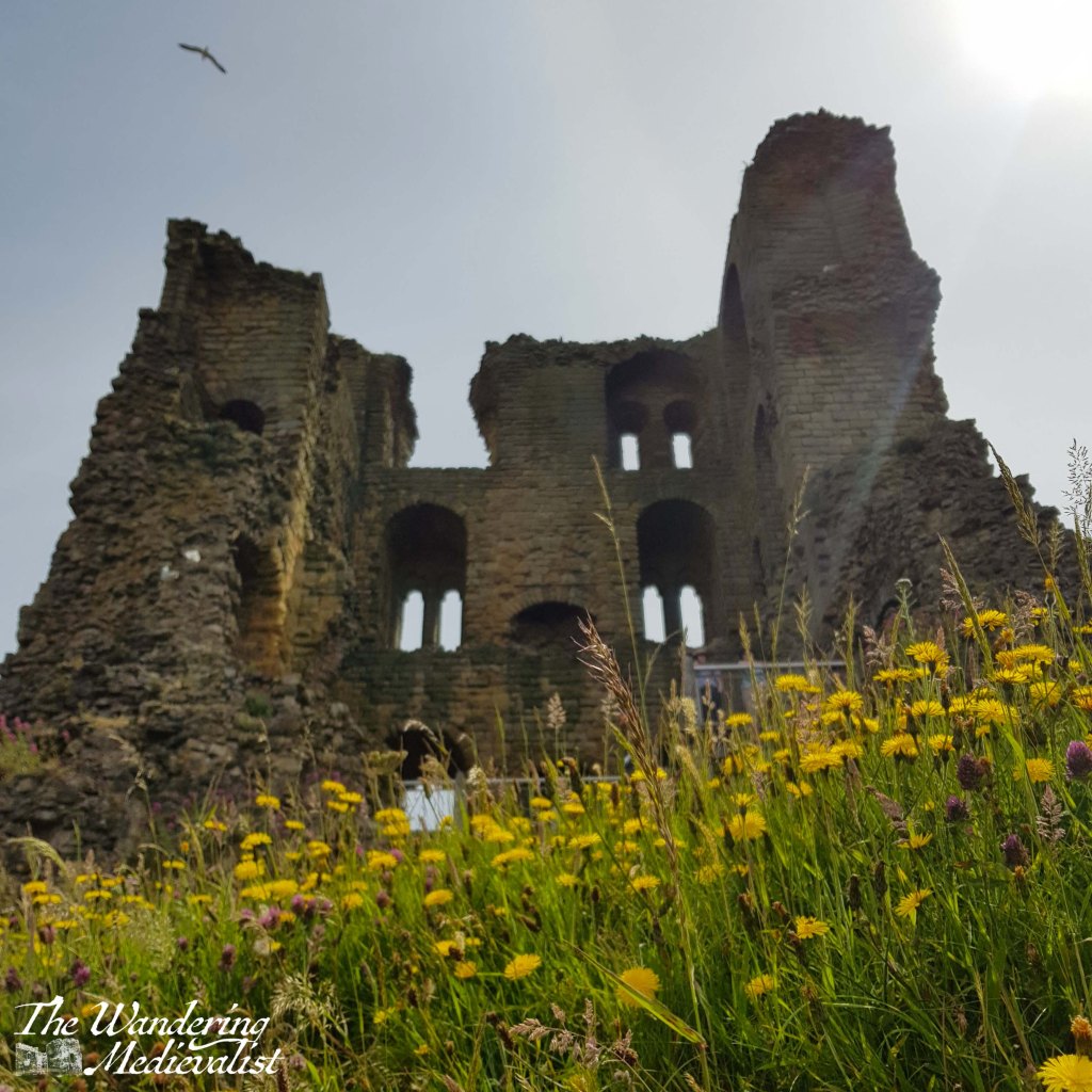
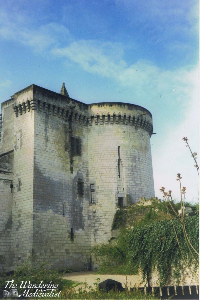
A visit to the abbey does not take particularly long, as you can walk around the outside in less than 5 minutes, unless like me you enjoy a much slower wander to take in the view. We always start off heading down Church Place, where the first view you see is this one, the east end of the church.
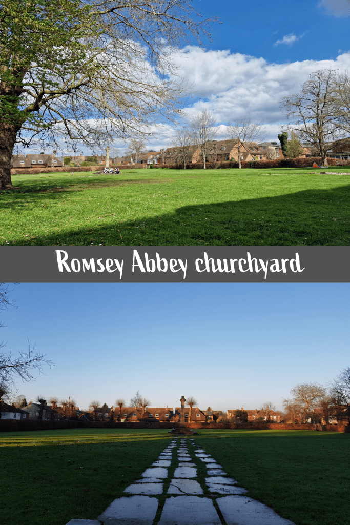
To the right of the path is the churchyard, which was the burial ground attached to the abbey. There are several memorials including a large cross and a Waterloo memorial, though the majority of the monuments were removed when the yard was cleared and levelled in the 1940s. The reasons for this appears to be safety-related, as the area had become very uneven and dangerous to traverse, and many of the stones were re-purposed to create a path.
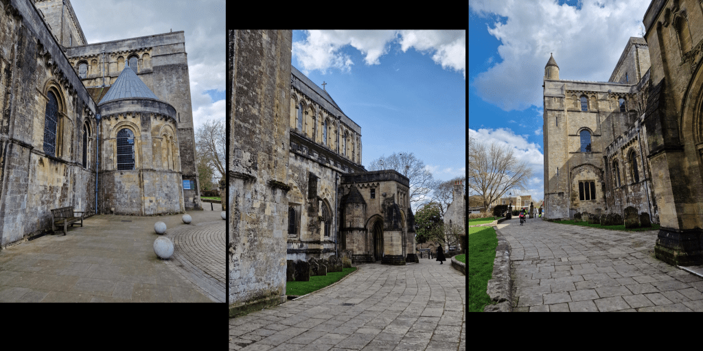
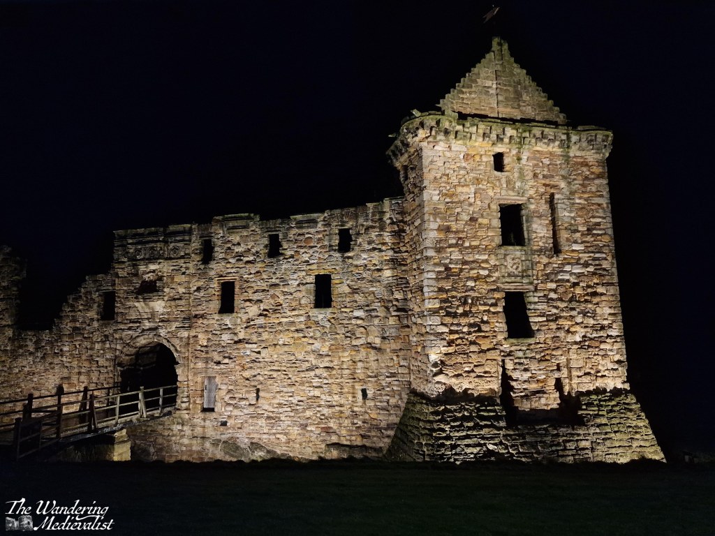
North side of the abbey church
Ahead at the edge of the churchyard is Folly House, the former vicarage, now a beautiful residence. From here you could go in either direction down Church Lane or a street creatively called ‘the Abbey’ to enjoy more of the stunning houses and gardens of Romsey’s town centre.
Folly House, former vicarage
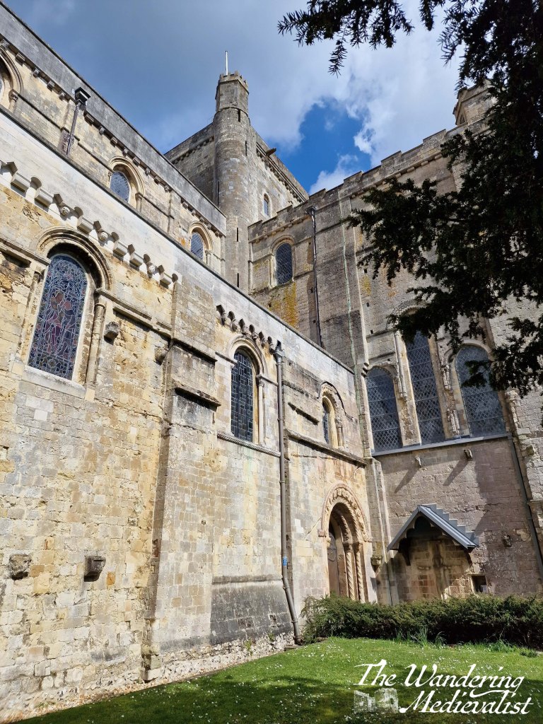
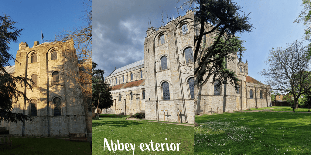
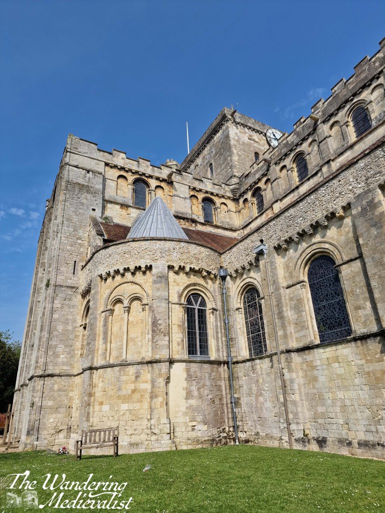
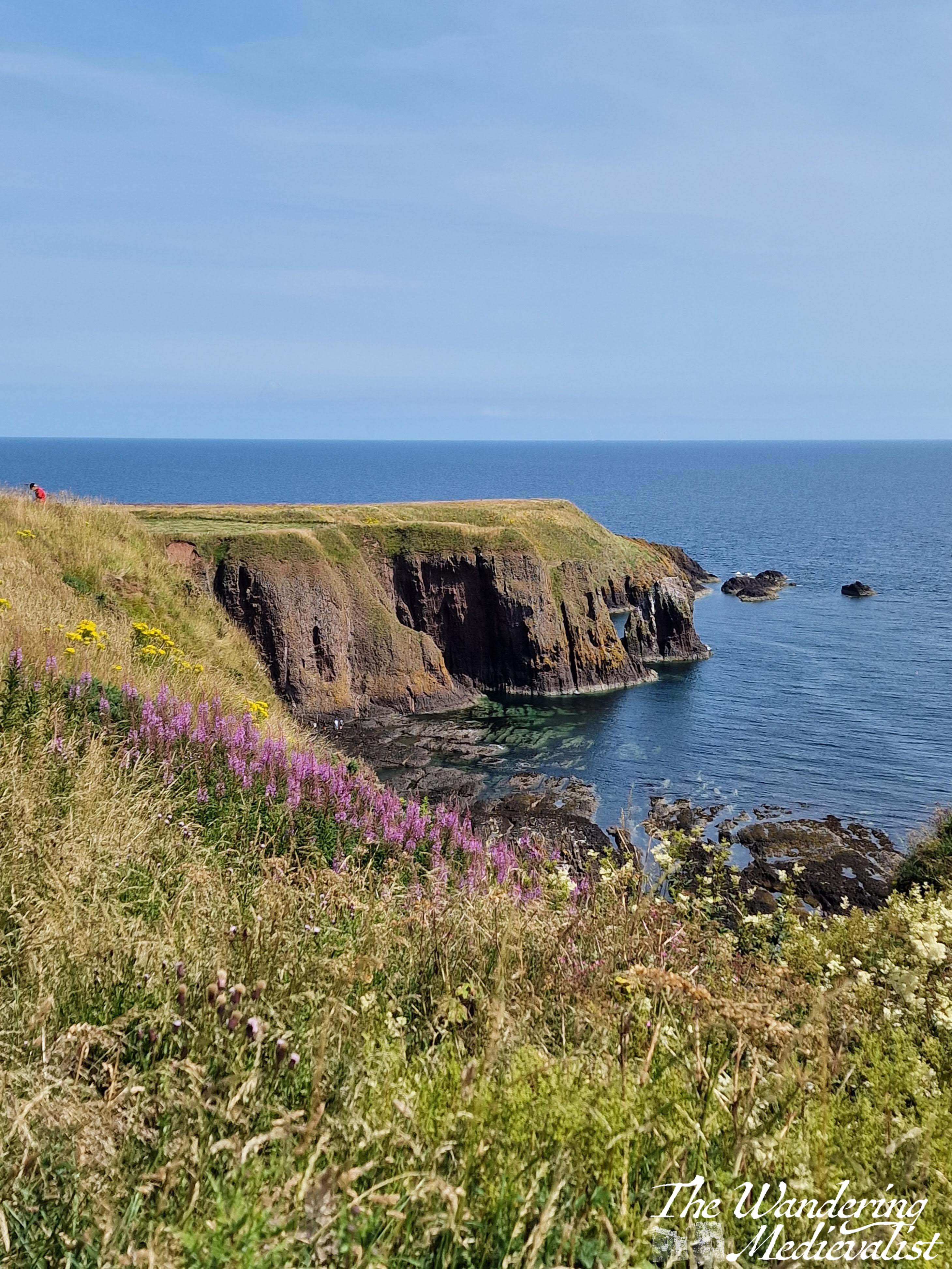
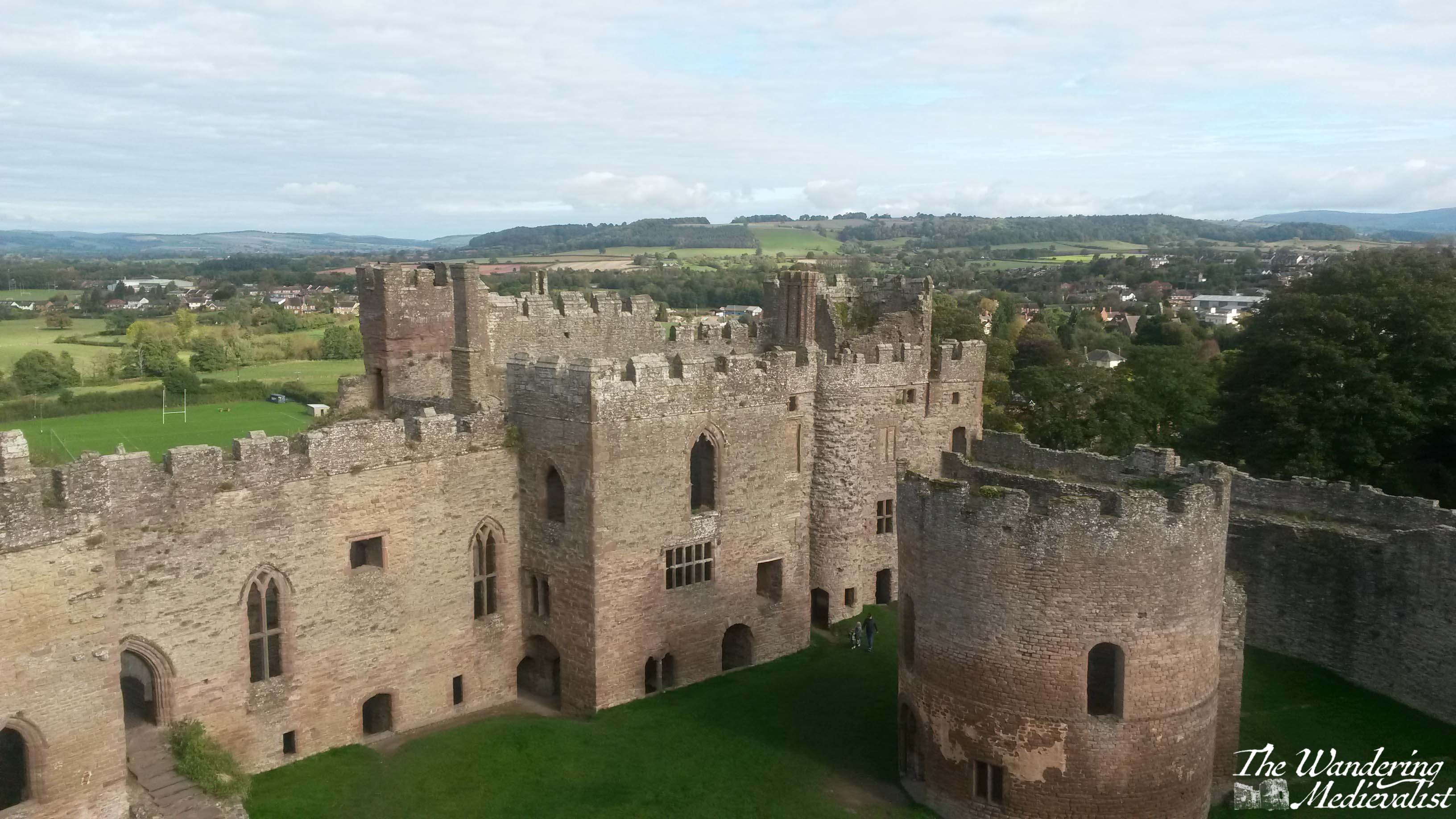
Continuing counter-clockwise around the church takes you to one of my favourite views, looking along the outside wall and up to the central tower – in all fairness, this diagonal view looking from the base of a church up to the tower is my favourite view of any ecclesiastical building. We come this way almost every time we visit Romsey, yet I find it impossible not to get another version, in different light of course…
On this south side of the church is a small park with shady trees, where we enjoyed the breakfast mentioned above.
This seems a good time to go into a bit more detail about the history of the abbey. As mentioned above, it was founded in 907 and Elflaeda, the daughter of the king, was put in charge of the community, beginning a long line of royal abbesses and nuns. In 967, the abbey was re-founded in the Benedictine order by King Edgar, also known as Edgar the Peacemaker or Peaceable. The first stone nunnery and church were built around the turn of the millennium, and the abbey flourished as a place of education and safety particularly for noble and royal daughters.
The abbey was sacked in 1003 by the Danes, likely in retaliation for the St Brice’s Day Massacre. This massacre had taken place on 13 November 1002, when King Æthelred (often referred to as the Unready) had ordered the killing of all the Danes living in England at the time. The chronicles of the time indicate that it was retaliation for an assassination attempt, though it may also have been retaliation for the years of raids by Danish forces.
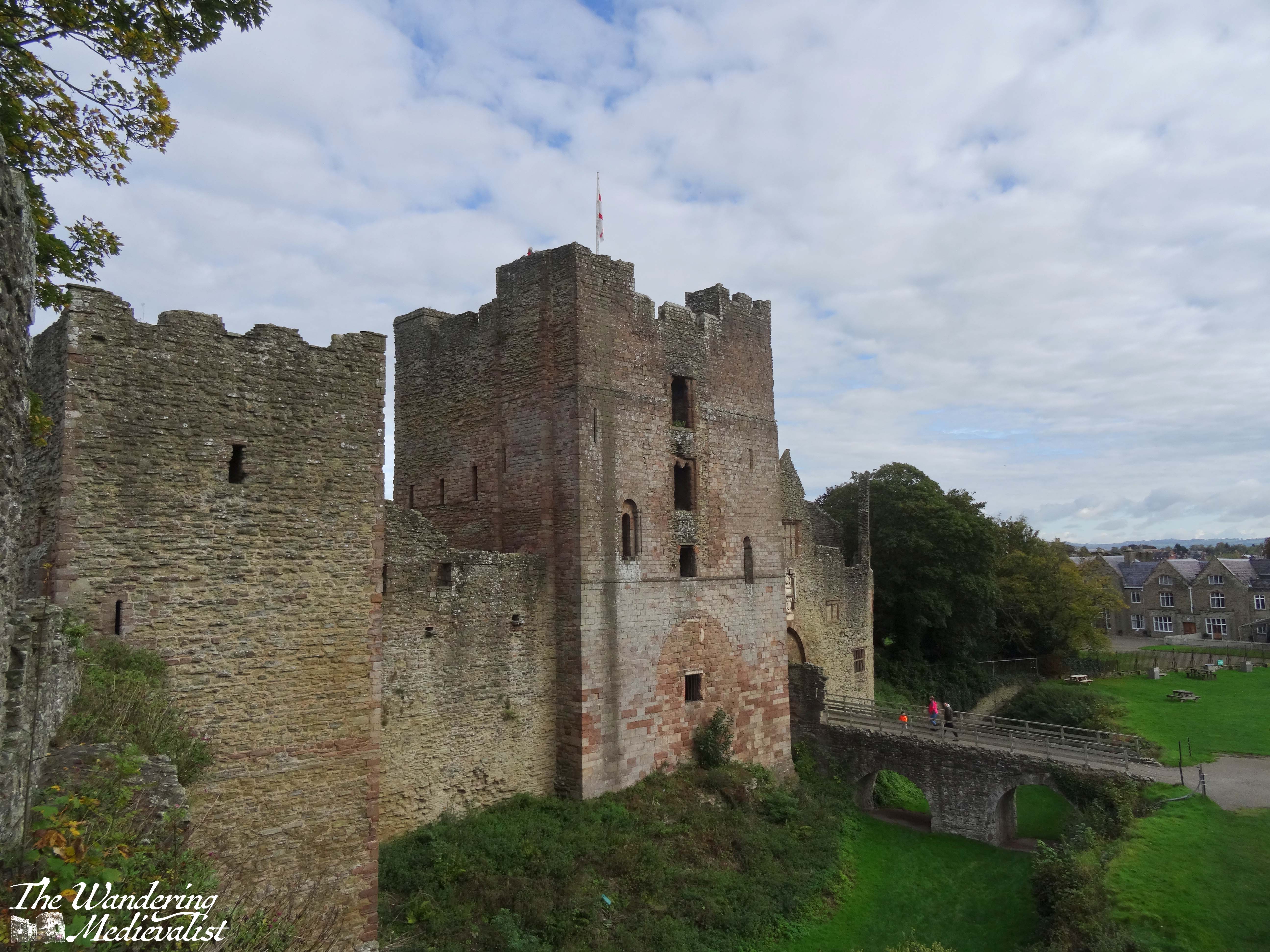
Following the sacking of the abbey, in the 1120s work began on the current building. This was during the reign of King Henry I and work continued under the supervision of Henry of Blois. Blois was the brother of Henry I’s successor, Stephen, whose daughter Marie was elected abbess in 1155.
Marie’s story is one of those tragic female tales of the Middle Ages that make one realise that royal women had it just as hard – if not sometimes harder – than others.
Her father King Stephen died in 1154 and then her last living brother, William, passed in 1159. On his death, she became suo jure Countess of Boulogne (essentially, countess in her own right, meaning the title was hers by birth and not marriage). Despite her position as abbess, Marie was abducted by the son of the Count of Flanders and forced into marriage. Eventually, after giving birth to several daughters, she found her marriage annulled and was permitted to return to the cloister for the last years of her life – though not to Romsey. I wish this was an unusual tale to find in the Middle Ages, but it goes without saying that it was a difficult time to be a woman, at any level of society.
Back to the abbey. The last three arches of the church, designed in an early English style, were added in the 1230s, by which time over 100 nuns were part of the community. The abbey would continue to prosper until the decimation of the population by the Black Death in the late 1340s; 80% of the nuns are reported to have died, including the Abbess, and from this point on the number of nuns remained much smaller – less than 30. Nevertheless, the abbey remained an important part of local life, functioning as a center of prayer and charity.
Unlike some less fortunate establishments, the abbey survived the dissolution of the monasteries under Henry VIII due to the petition of four Guardians, who purchased the abbey for £100. The nuns were dispersed, but the community continued to worship in the surviving buildings.
It is still a working church to this day, with Sunday services.
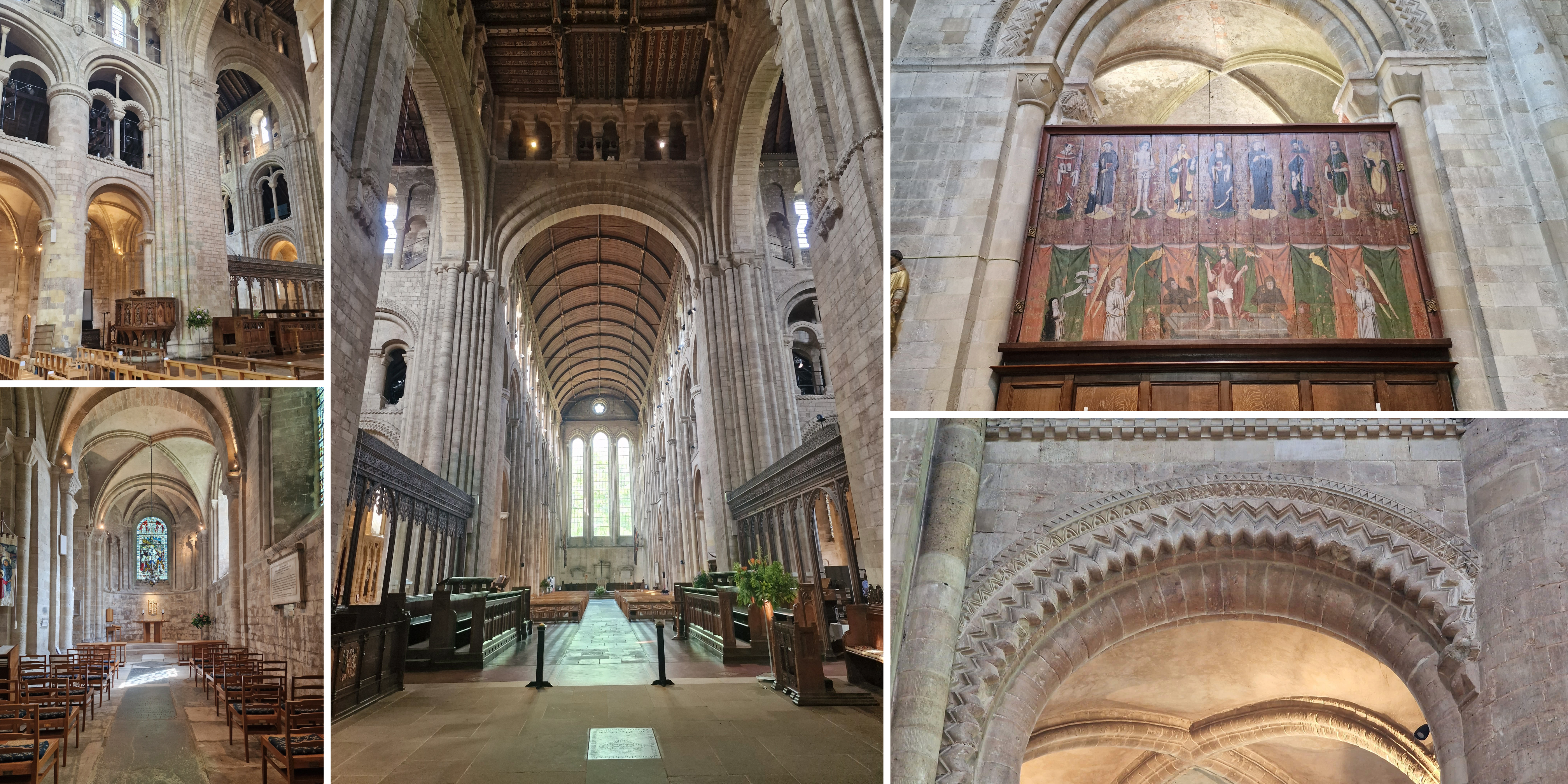
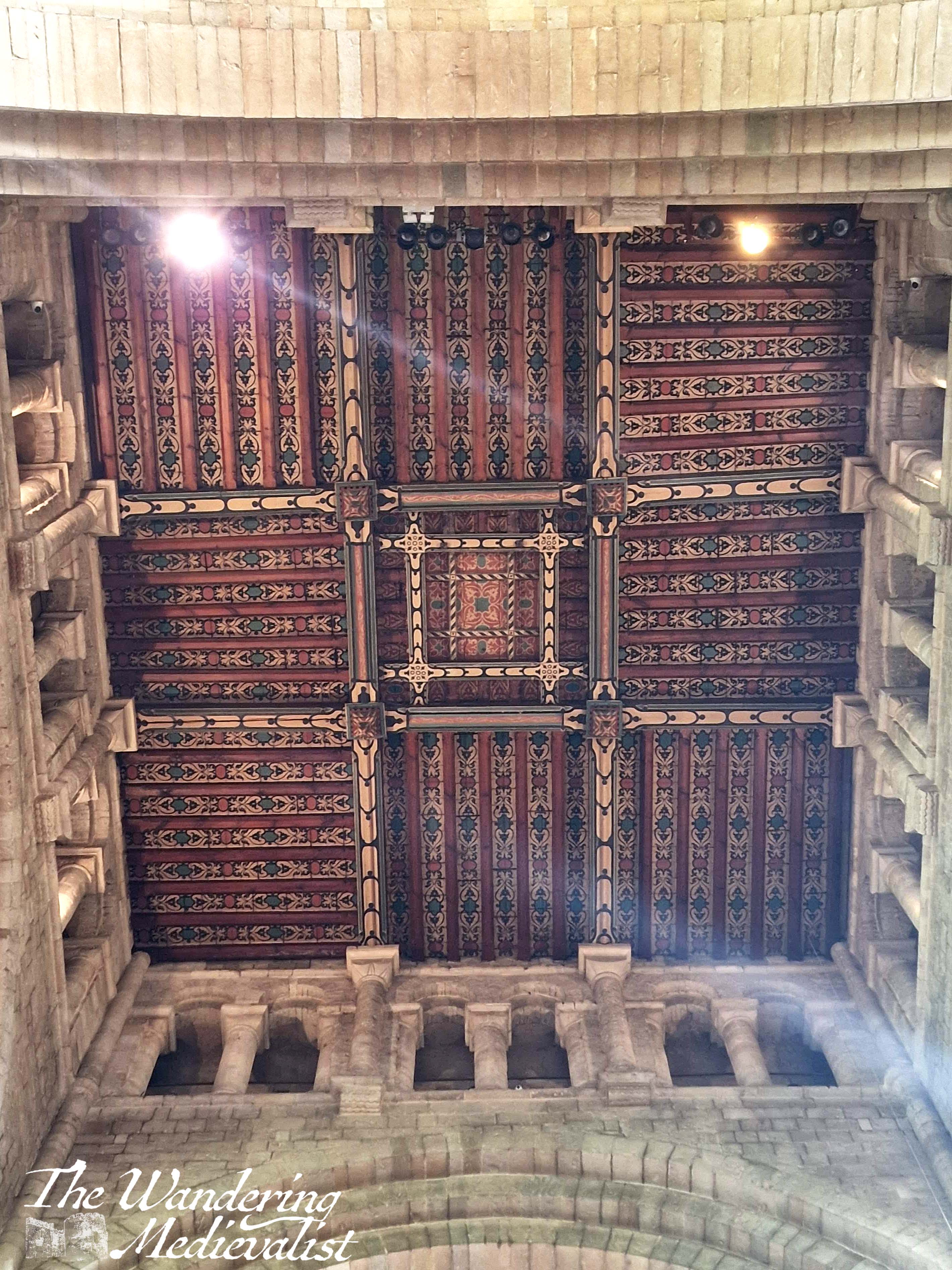
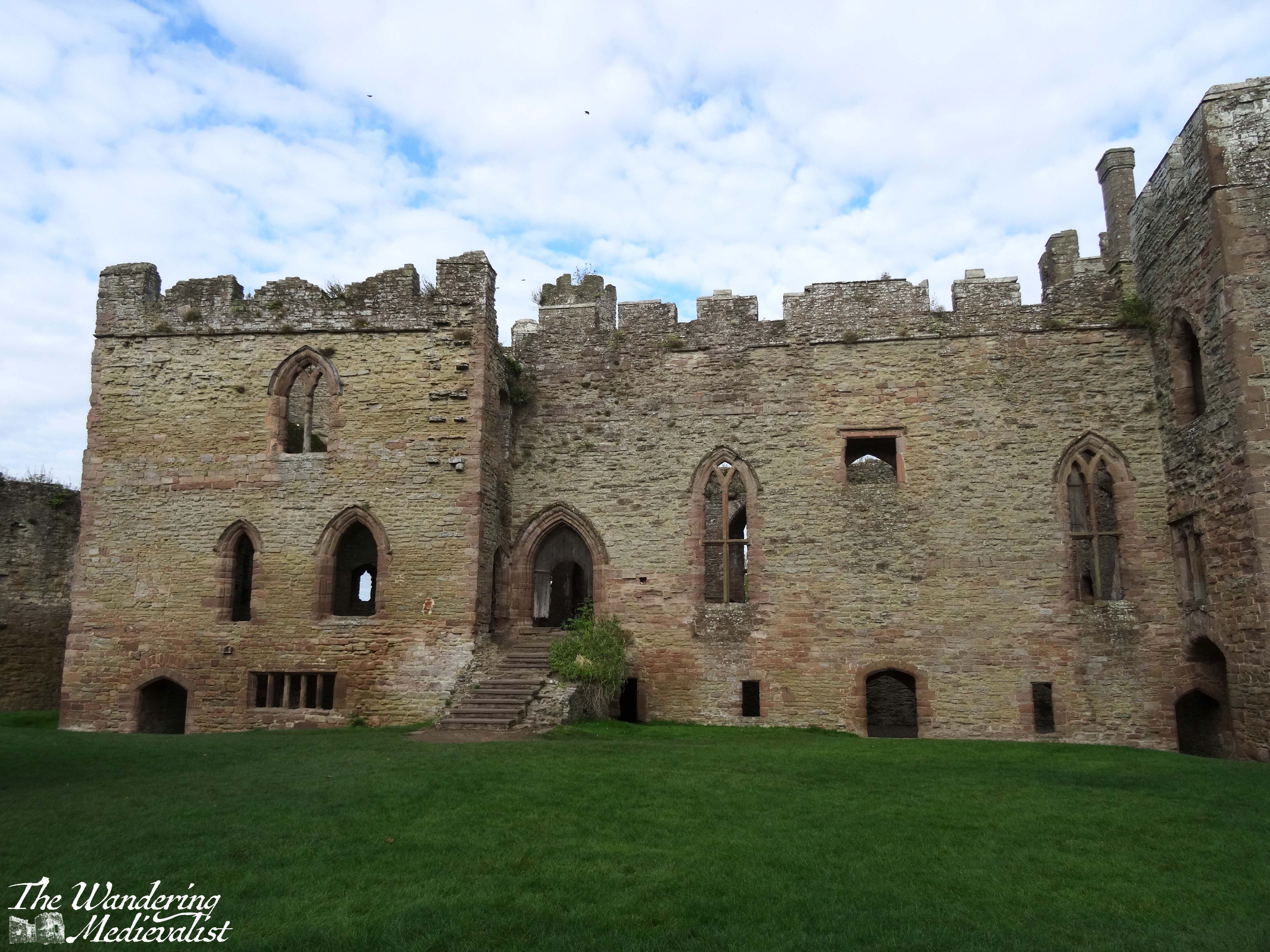
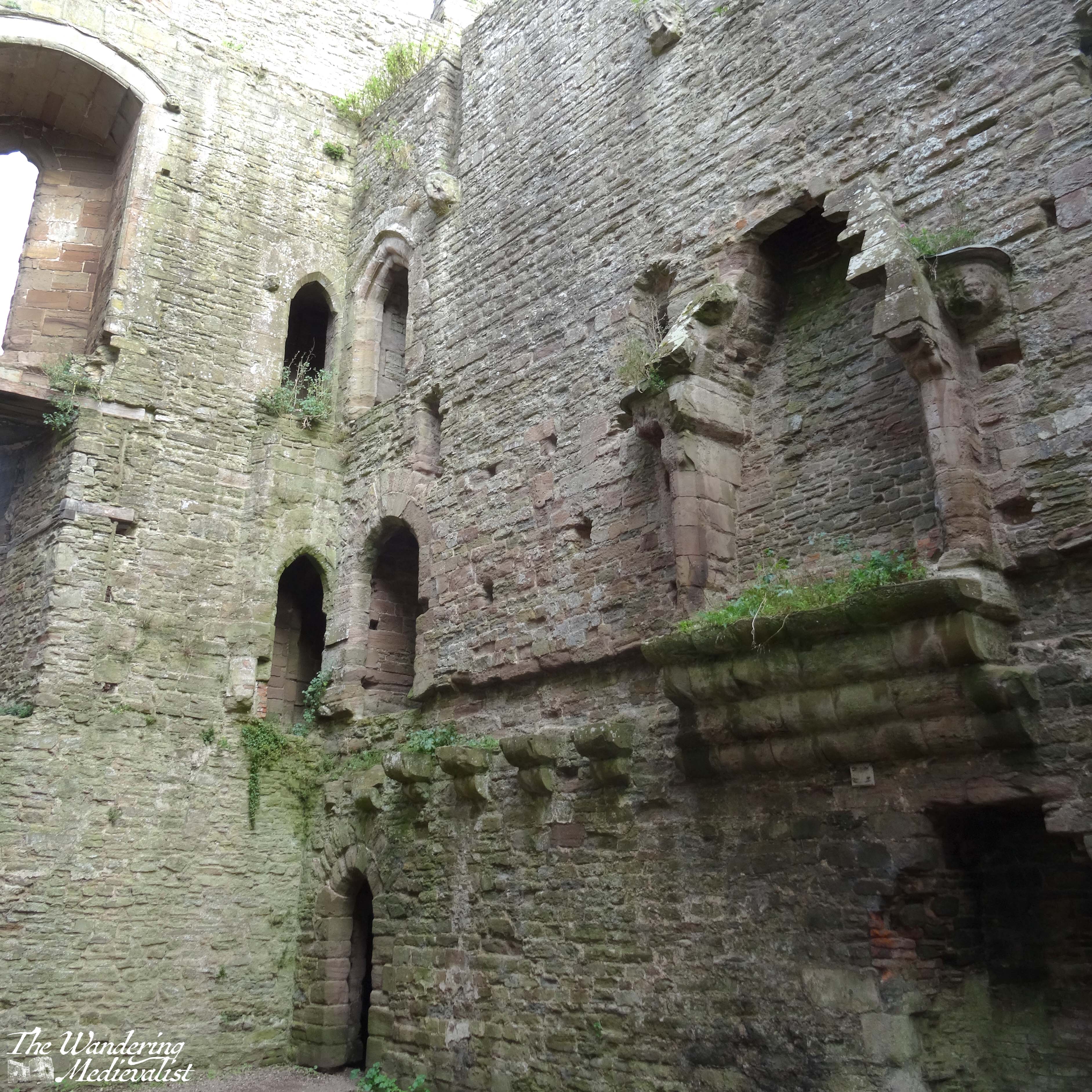
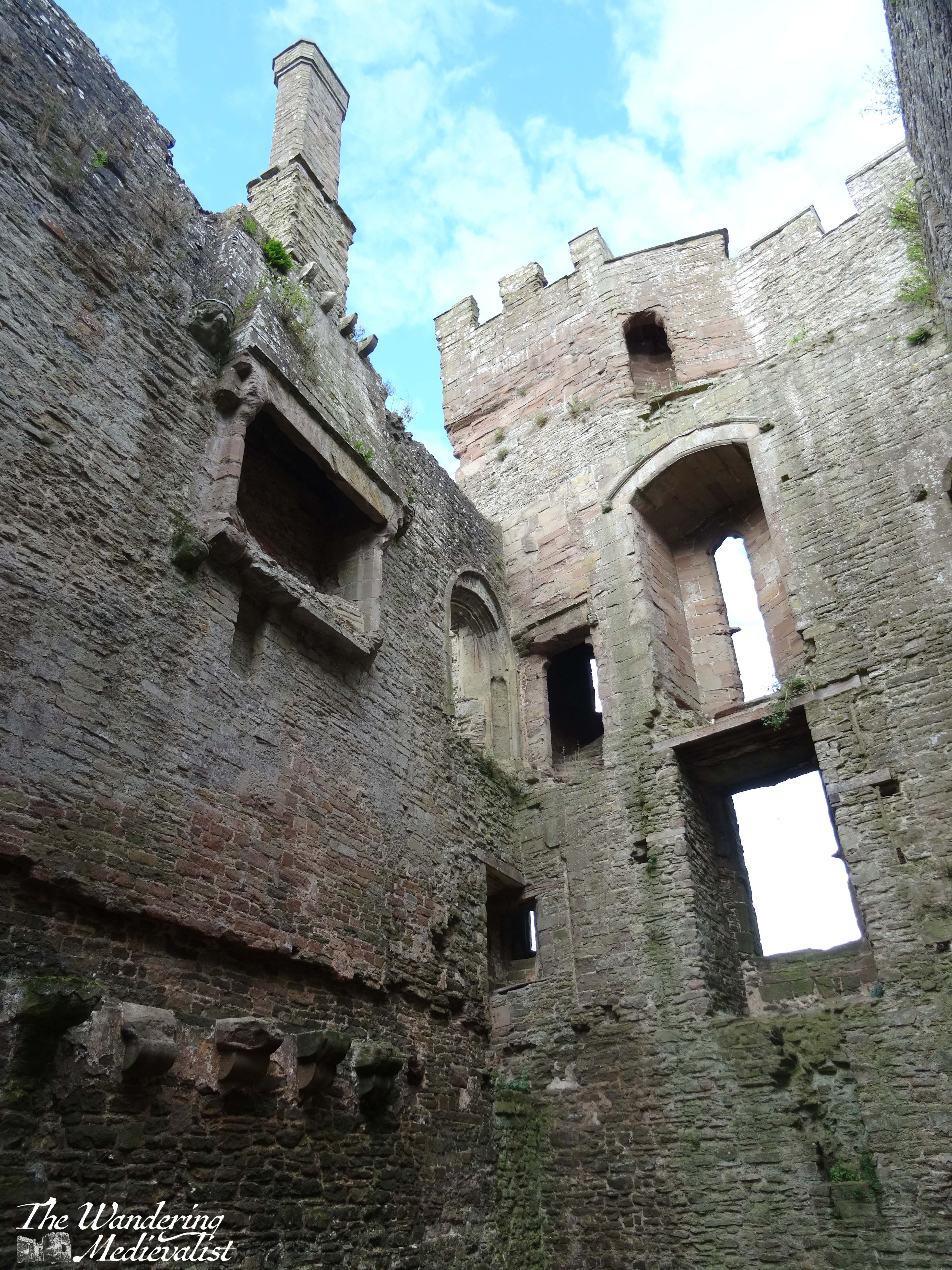
On our last visit, we were finally able to get inside of the church, which has several fine examples of medieval art as well as Norman carving that echoes that seen in Durham Cathedral.
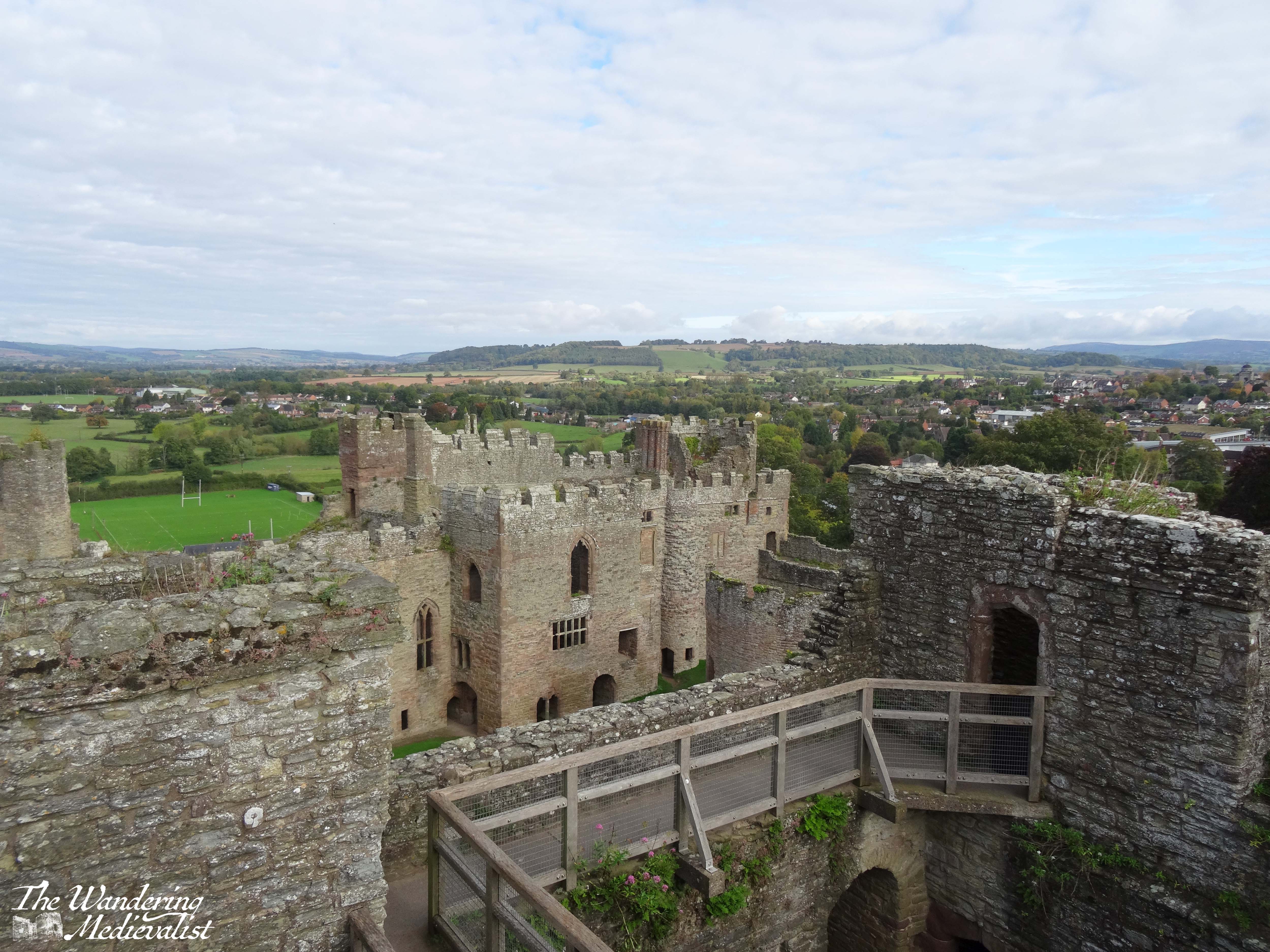
Visiting an abbey like that at Romsey is a unique opportunity to experience an ecclesiastic community that has existed for hundreds of years, both changing and evolving with the times as well as maintaining its medieval roots. The protection Romsey enjoyed after the creation of the Church of England means that it allows the full immersive experience that you cannot get at ruined abbeys like those at Jedburgh, Dryburgh, and so many more that did not survive the dissolution of monasteries in the sixteenth century. It’s also just a beautiful building, set in a lovely English town that provides the best of what the countryside has to offer. I highly recommend a journey!
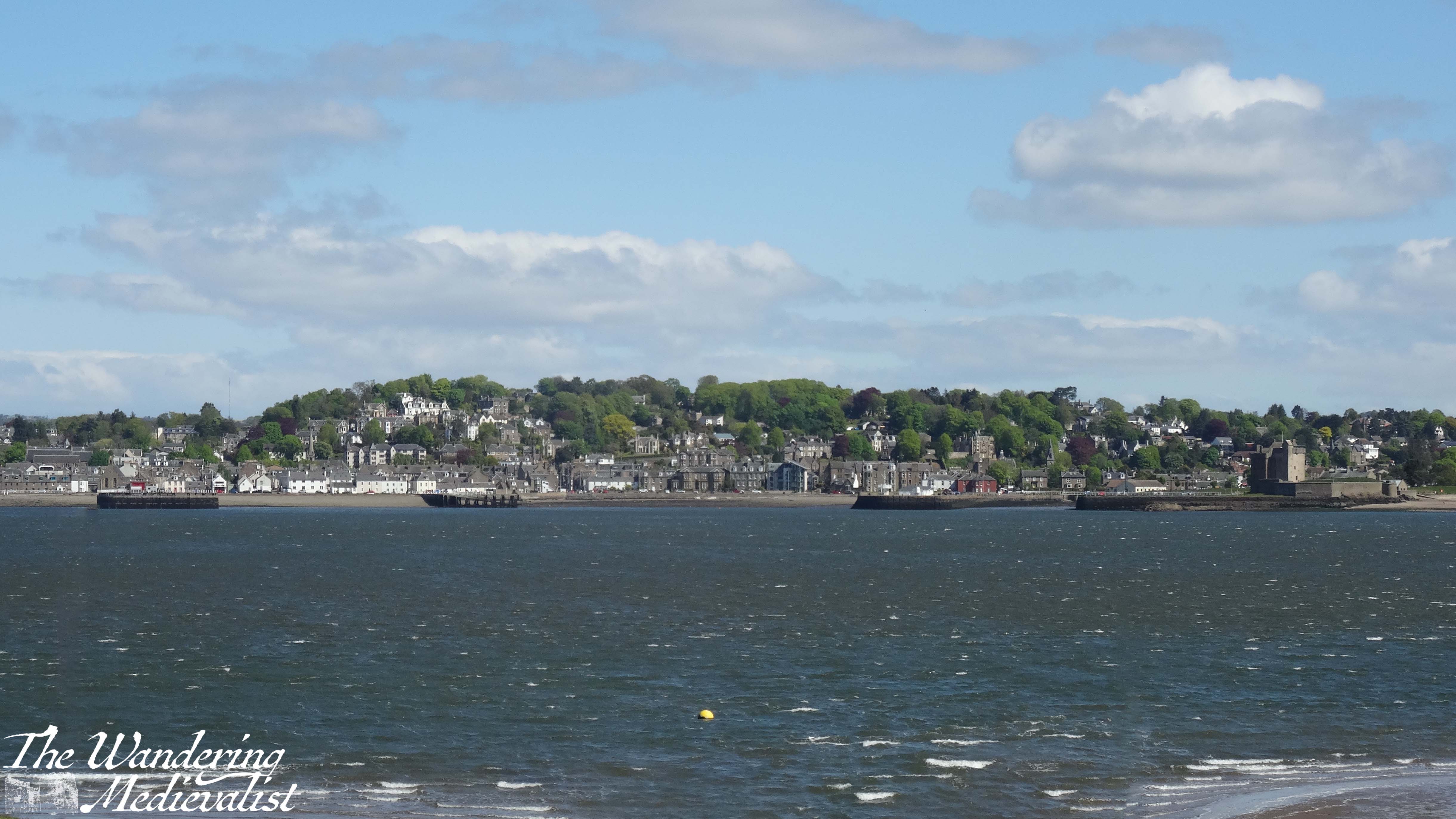
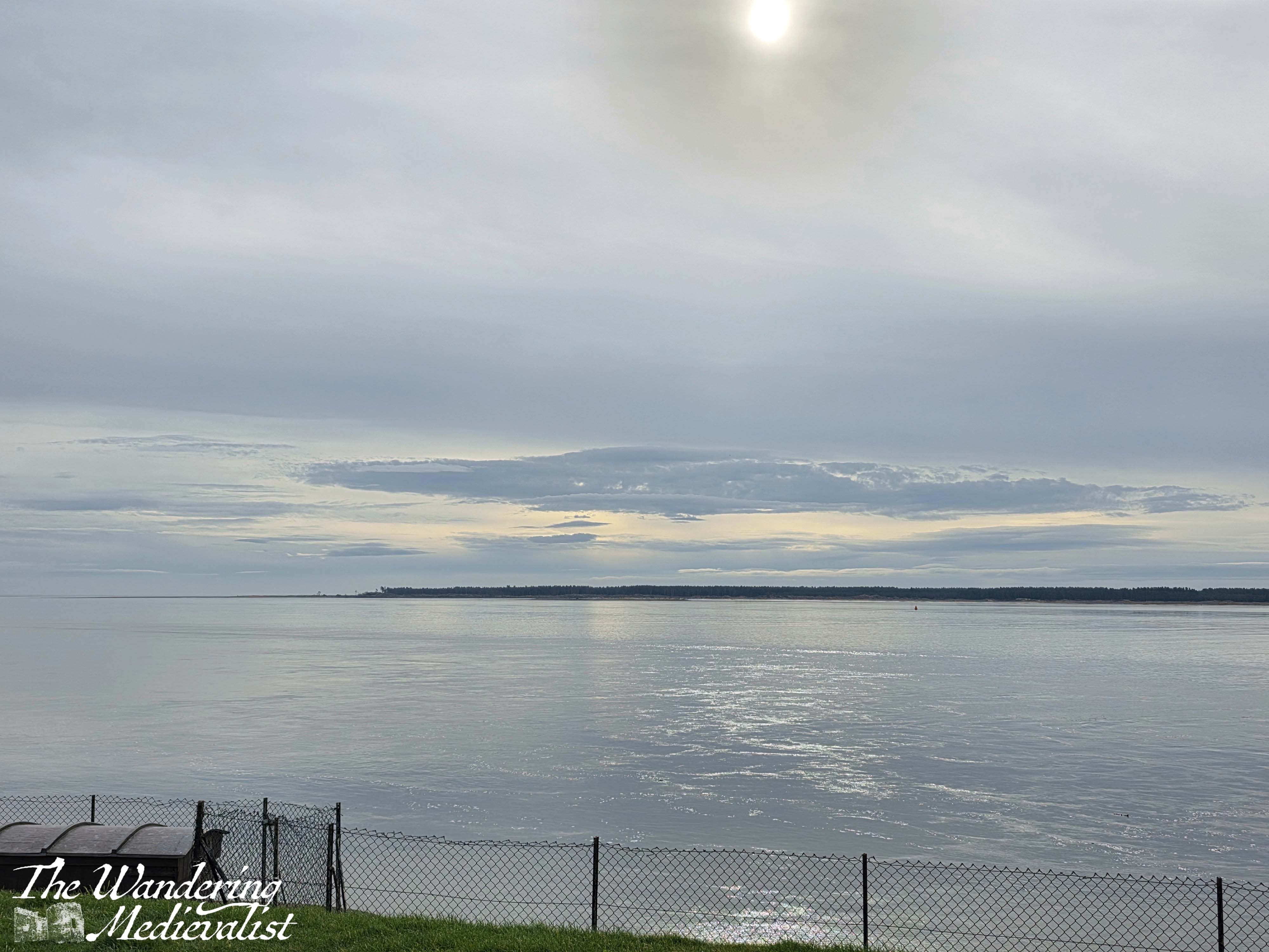
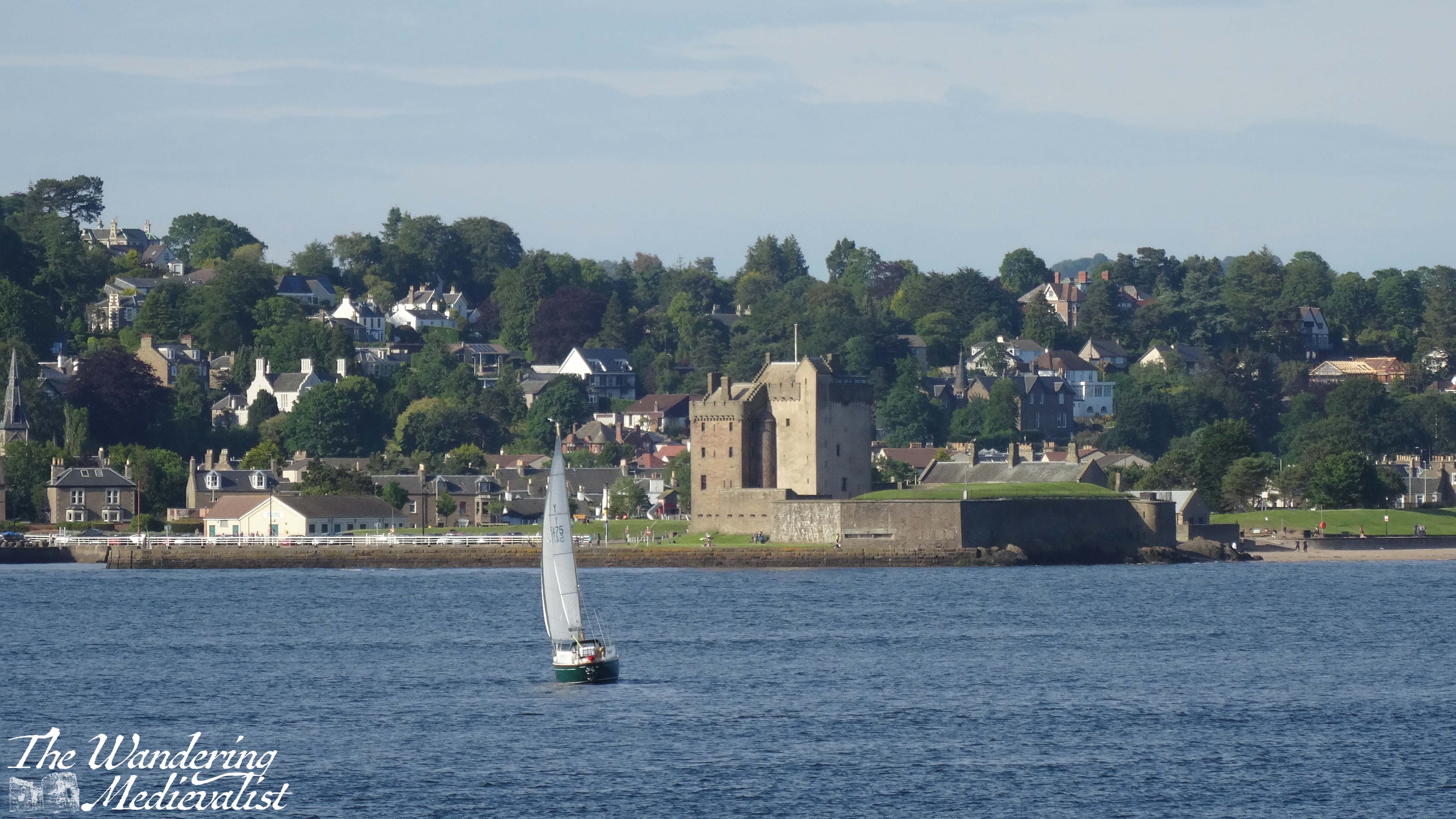
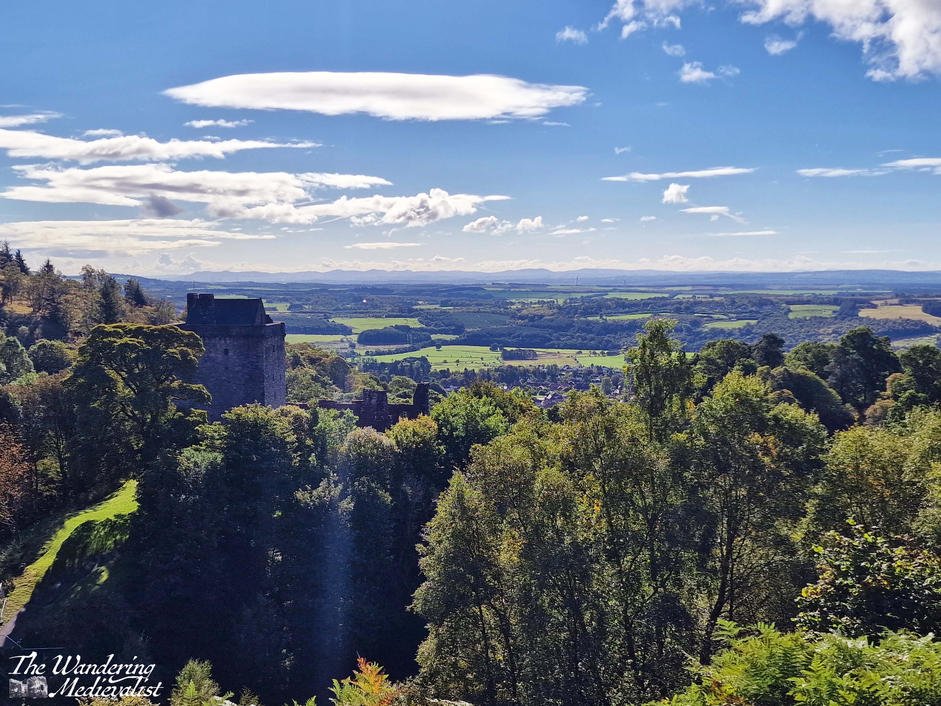
As I have doubtless mentioned before, we lived in Tayport, Fife during the first six months of the Covid pandemic in 2020, and for about a year before that. One of the main reasons I loved our flat there was that the view was spectacular – right out over the Firth of Tay, where I could watch the busy boat traffic and the currents changing. Sometimes there were dolphins, but more often it was just the view I loved – the changing weather and light as I looked across to Broughty Ferry and its castle.
For years I saw the castle only through the zoom lens of my camera, but was determined to eventually see it up close. Finally, as part of a work event that included a bit of regional exploration, I have been able to do so!
Location and History
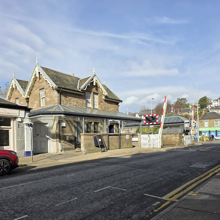
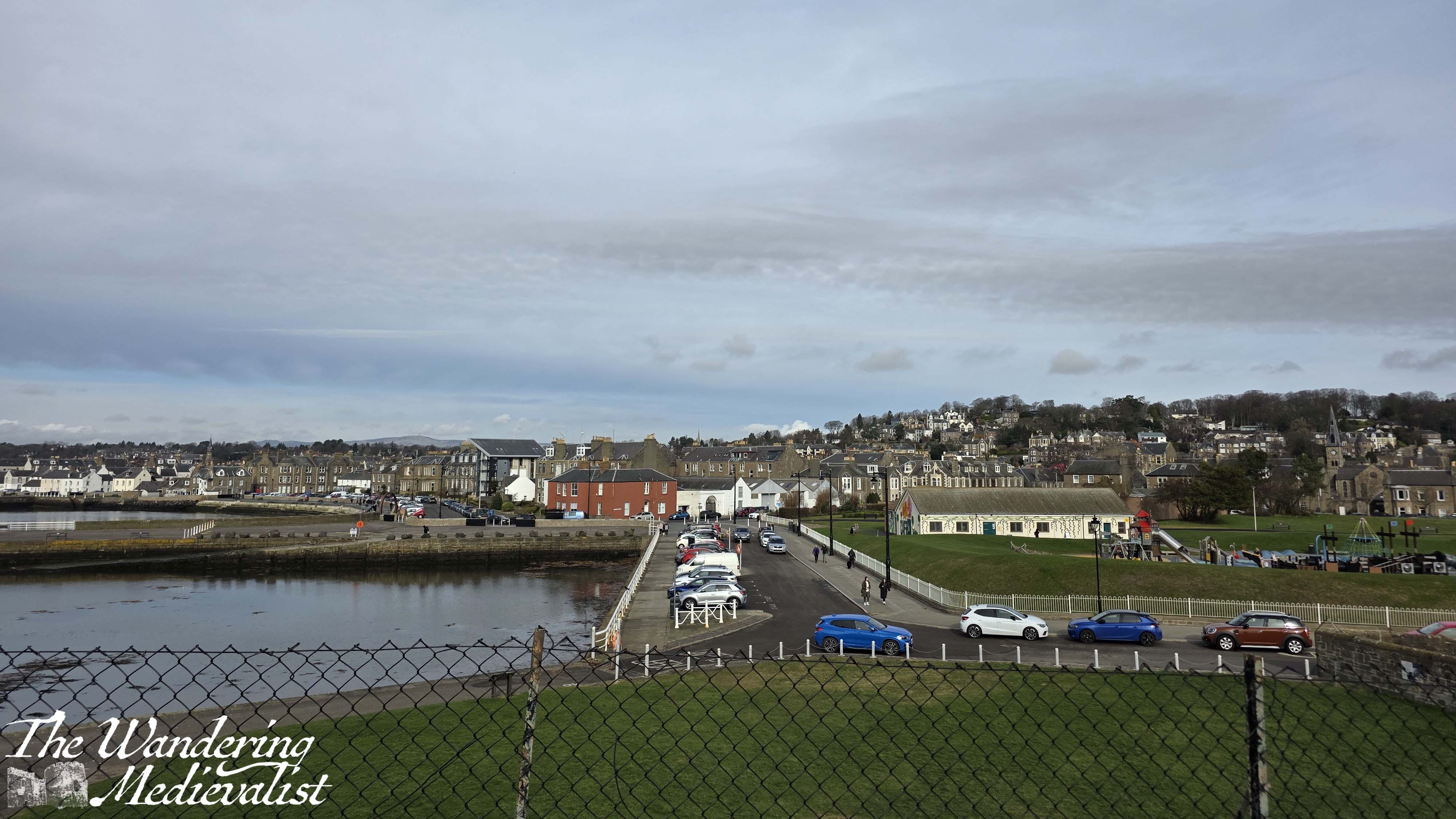
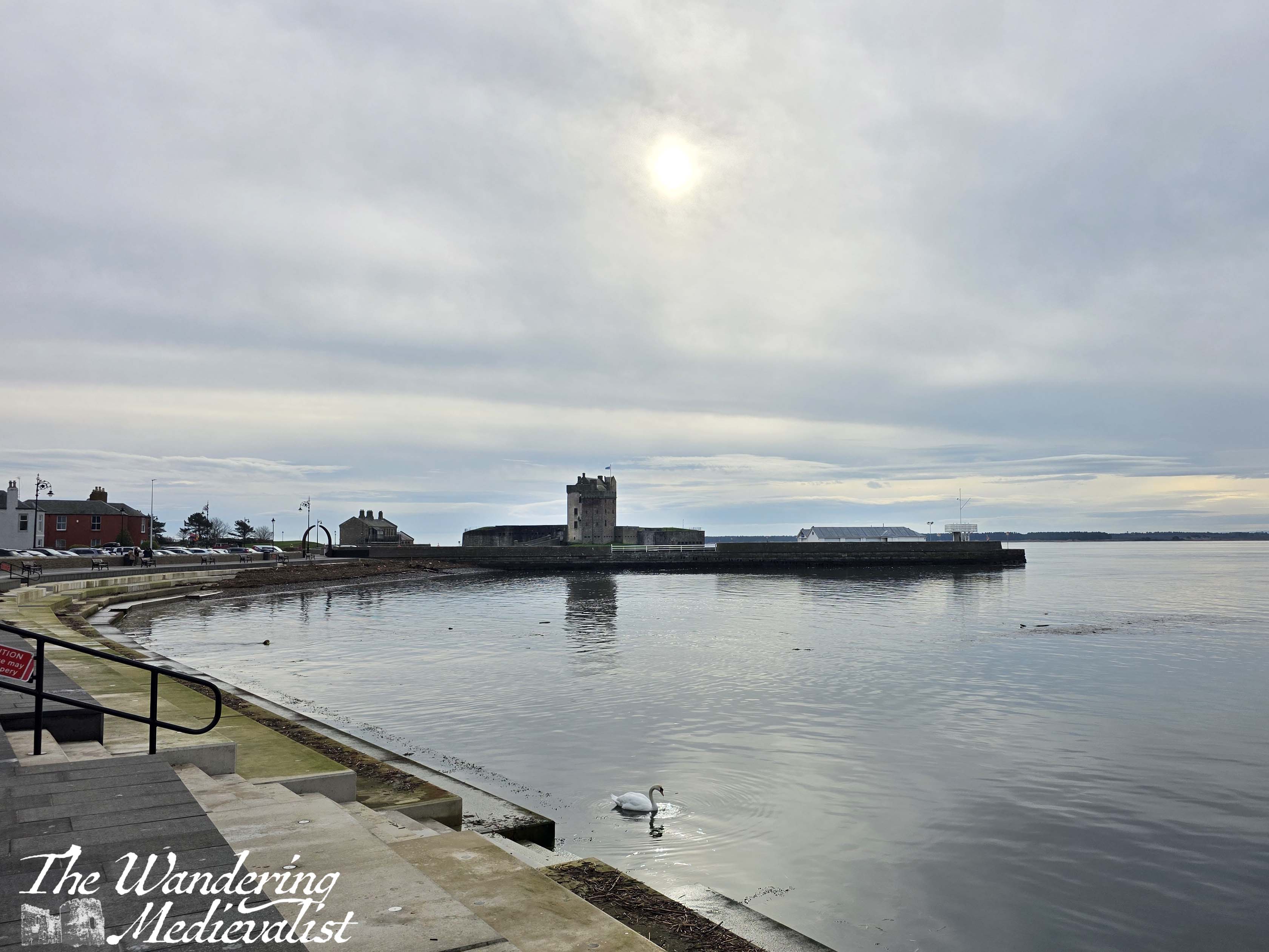
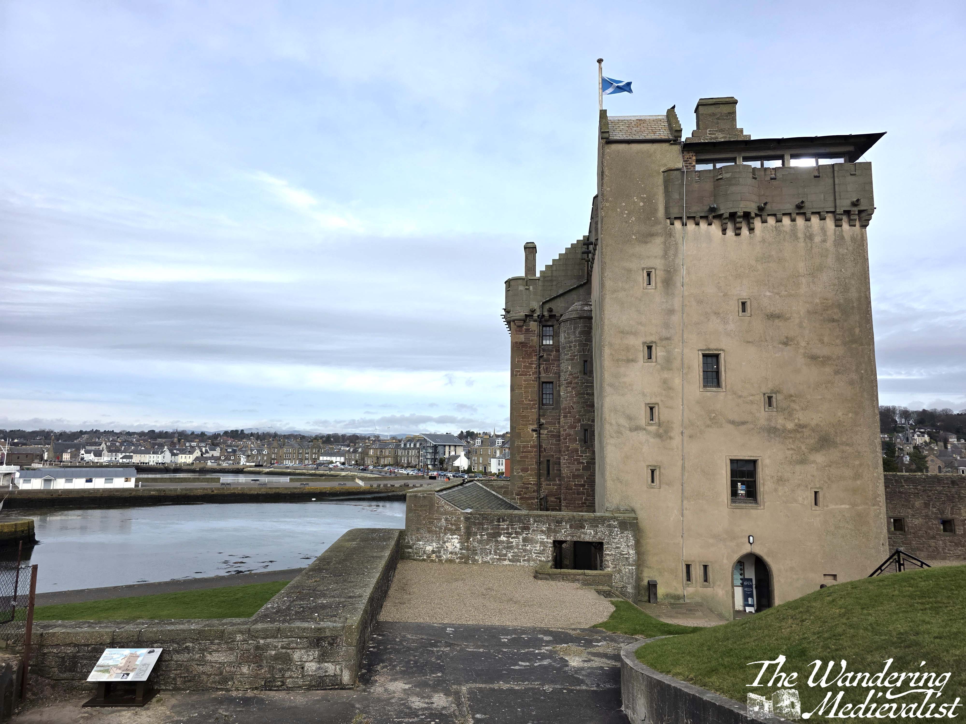
Broughty Castle is located at a prominent point on the northern edge of the Firth of Tay, about 5 miles east of the centre of Dundee, with a sandy beach on one side and sheltered harbour on the other. It is easily accessed by public transport, with busses running regularly and trains taking only 5 minutes from Dundee. From the Victorian-era train station, the walk to the waterfront is less than 10 minutes.
Broughty Ferry rail station
Broughty Ferry itself is a charming coastal town with plenty of unique shops, cafés, restaurants and pubs; it is easy to see why students and staff from Dundee might wish to live here or visit on weekends. Formerly a prosperous fishing village, in the nineteenth century the town became a key location for the wealthy jute barons of Dundee to build their villas and estates.
Even before this, Broughty Ferry was important as one end of the ferry that carried rail cars across the Tay on the line running from Aberdeen to Edinburgh. The other side was of course in Tayport, which previously was known as Ferryport-on-Tay (and in fact a sign bearing this name still exists at the edge of town). The enormous ramps leading into the water, wide enough for the rail cars, are both still visible today; the construction of the first Tay Rail Bridge in the 1870s rendered this ferry moot, though there is a reconstruction of it in the castle museum.
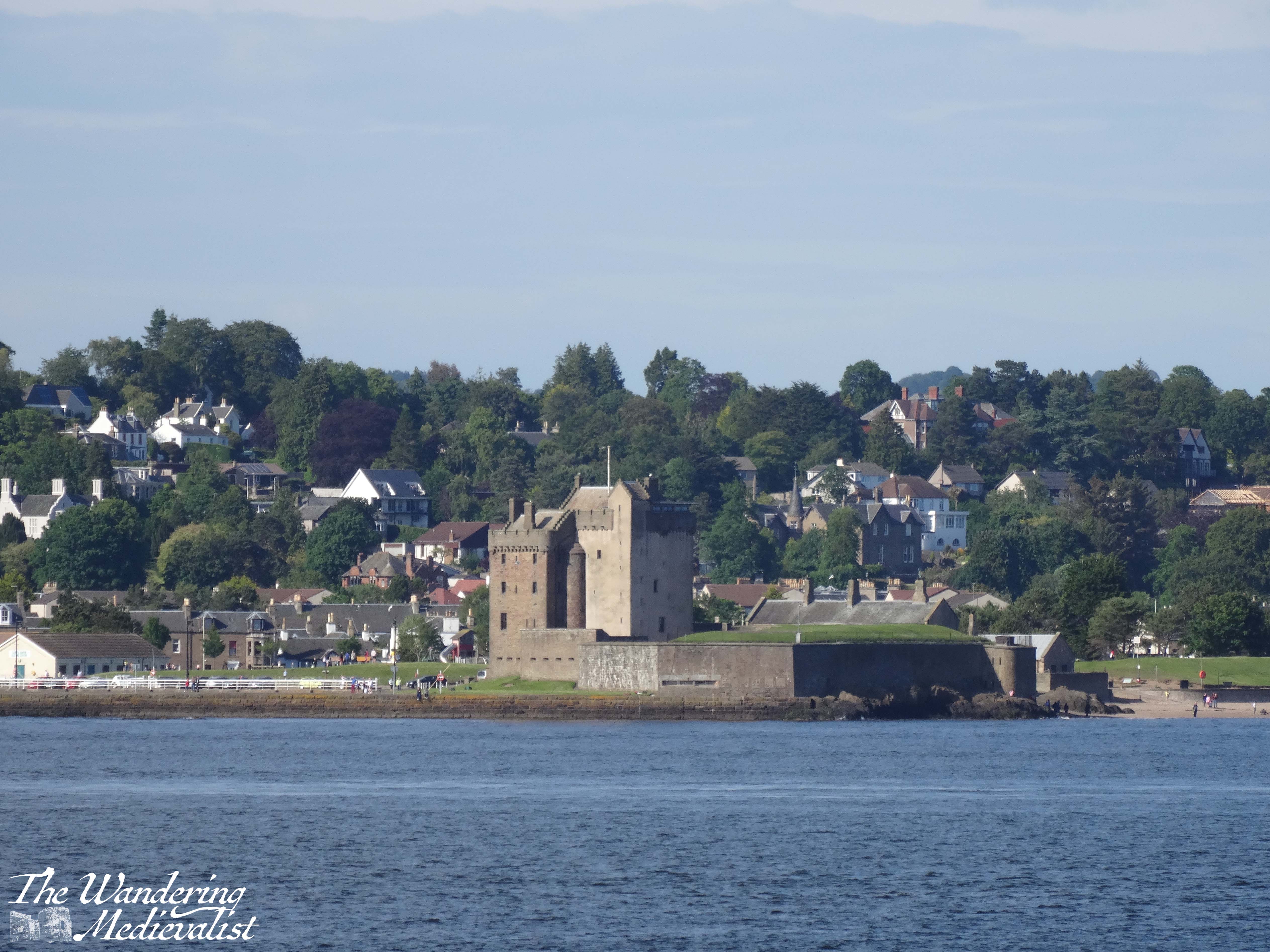
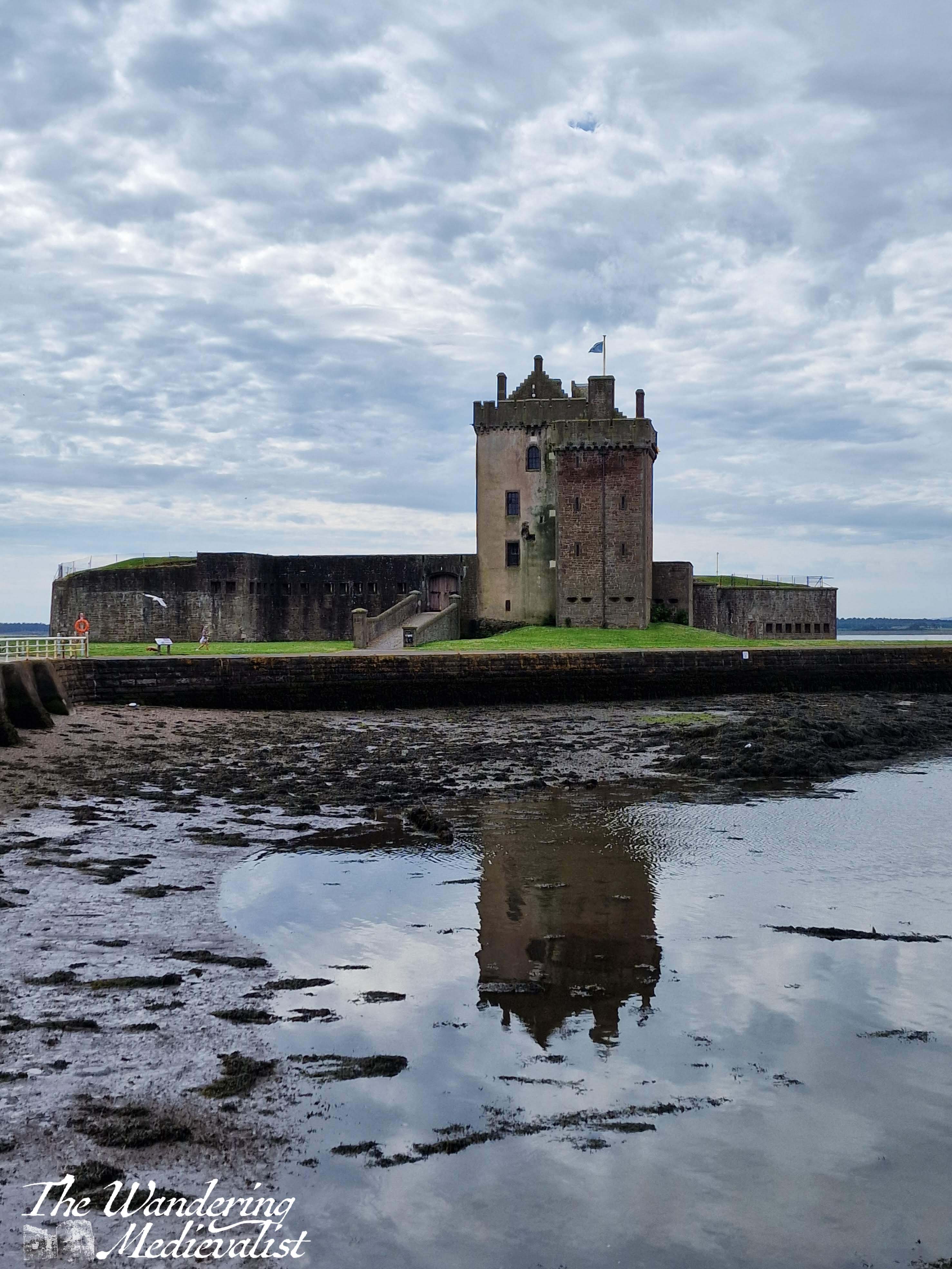
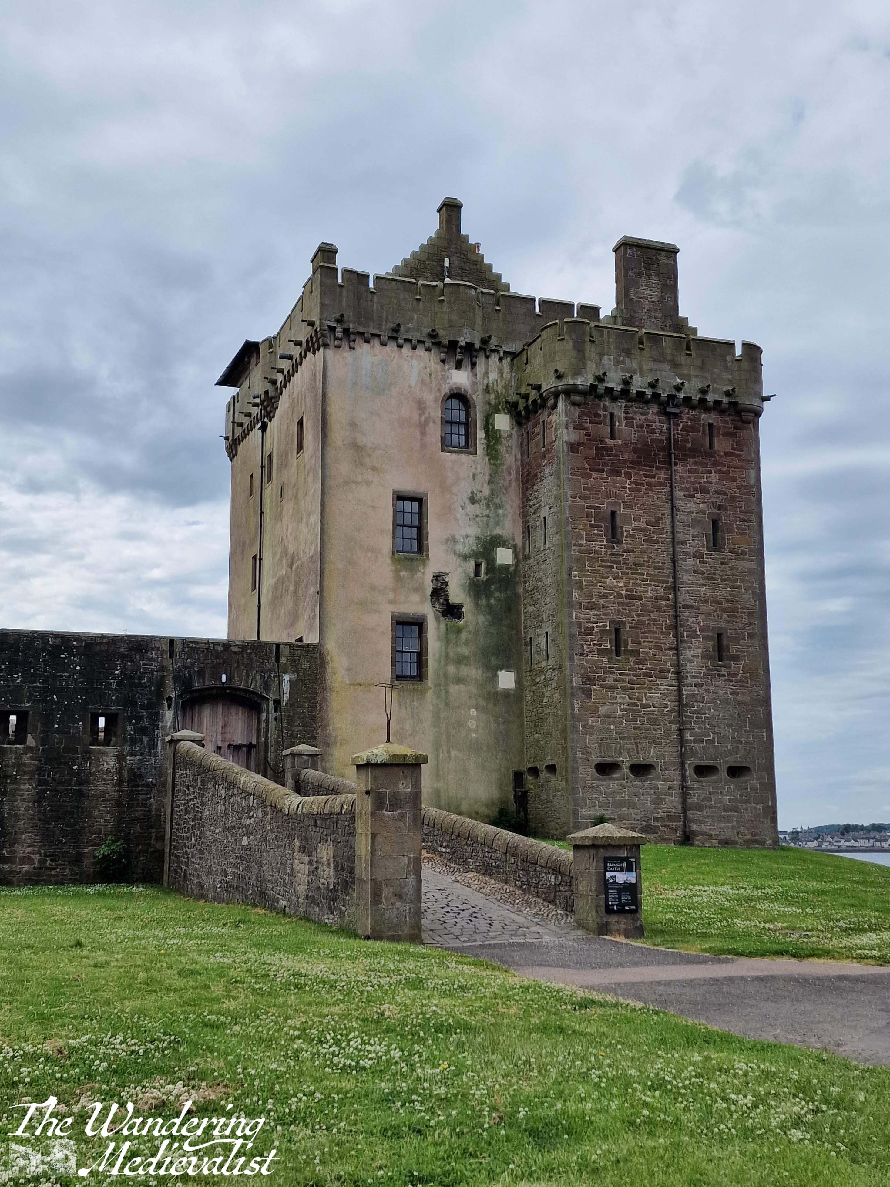
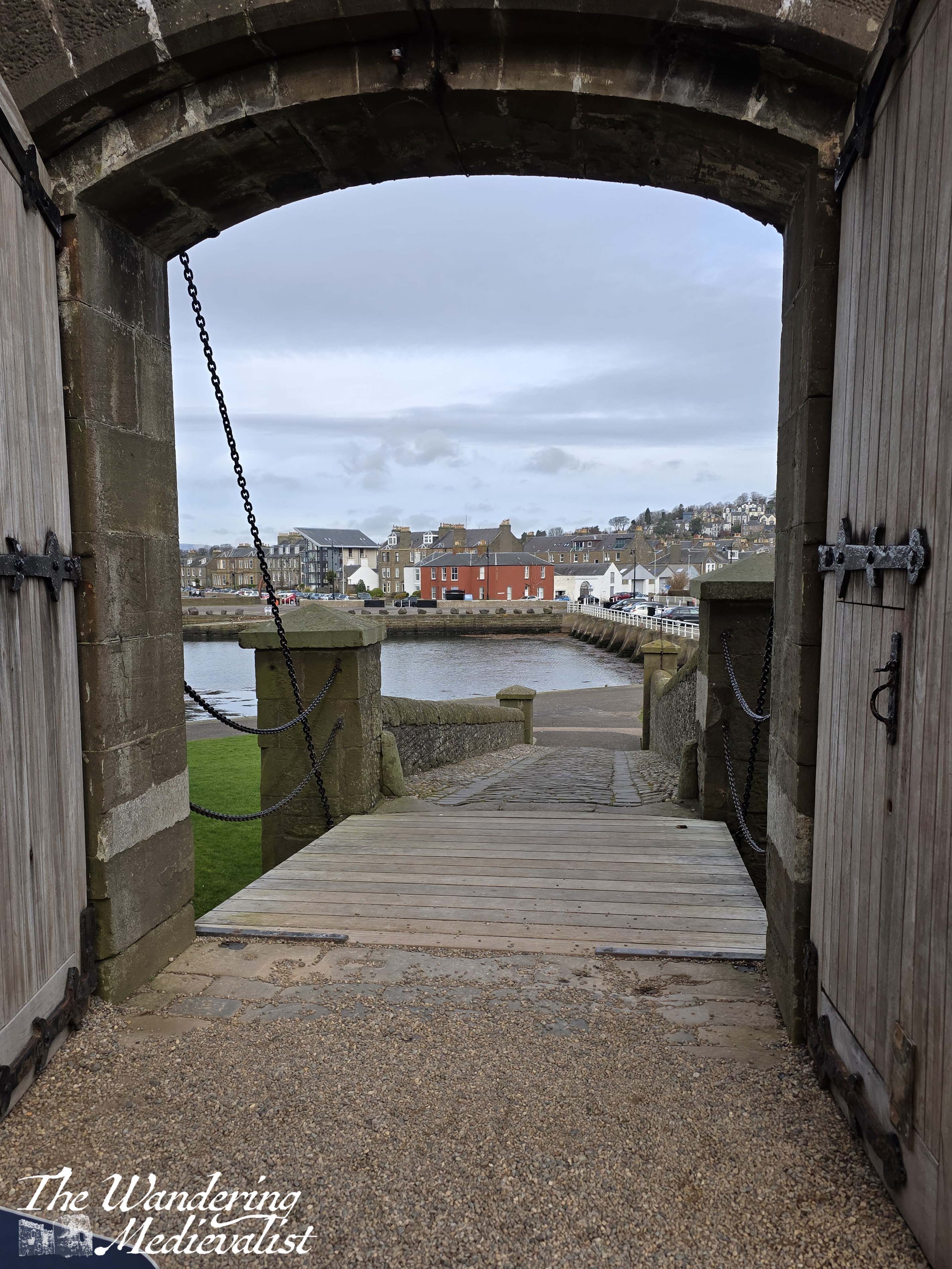
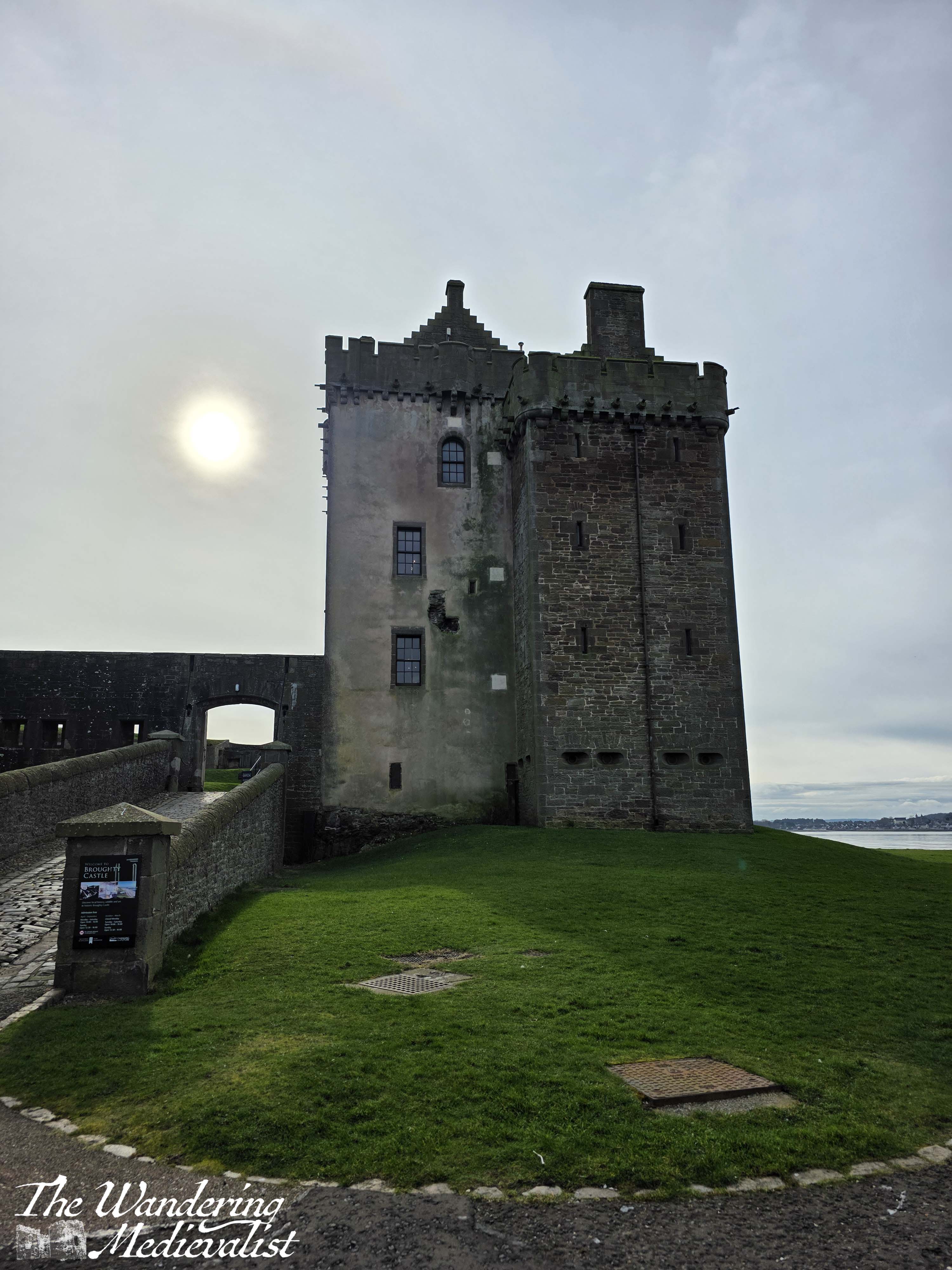
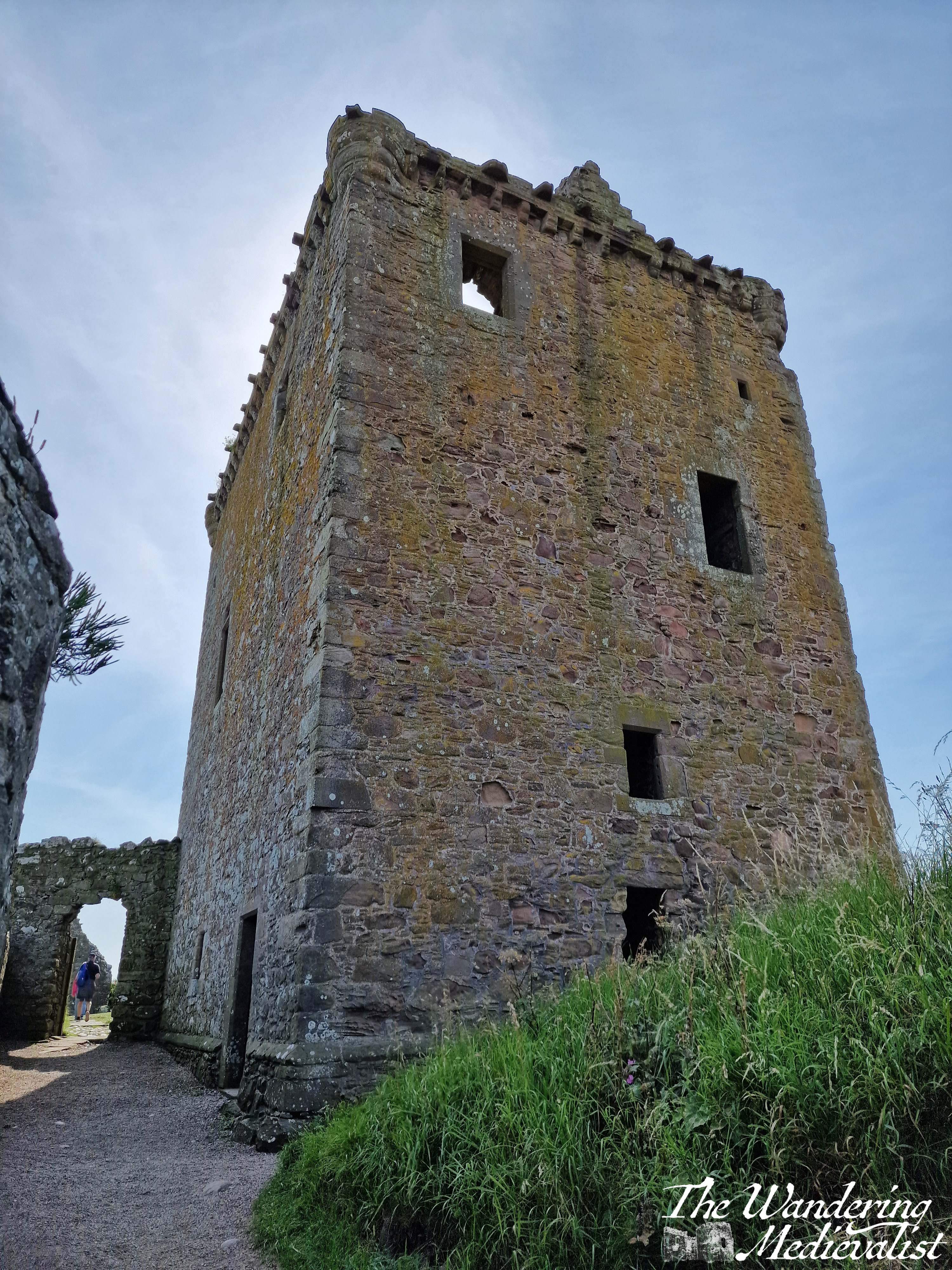
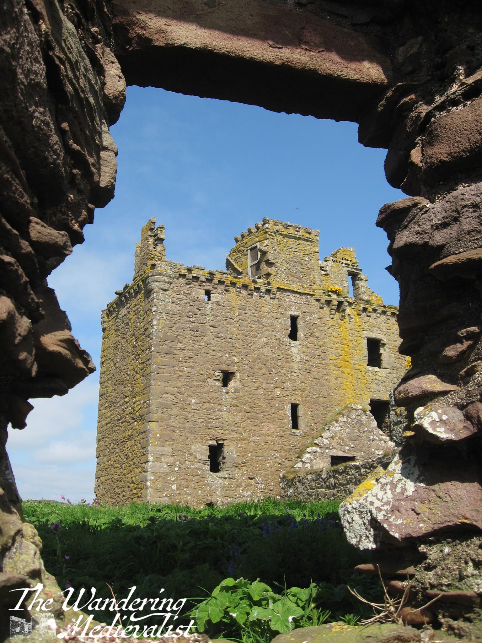
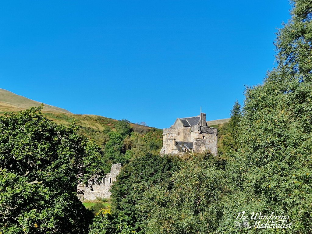
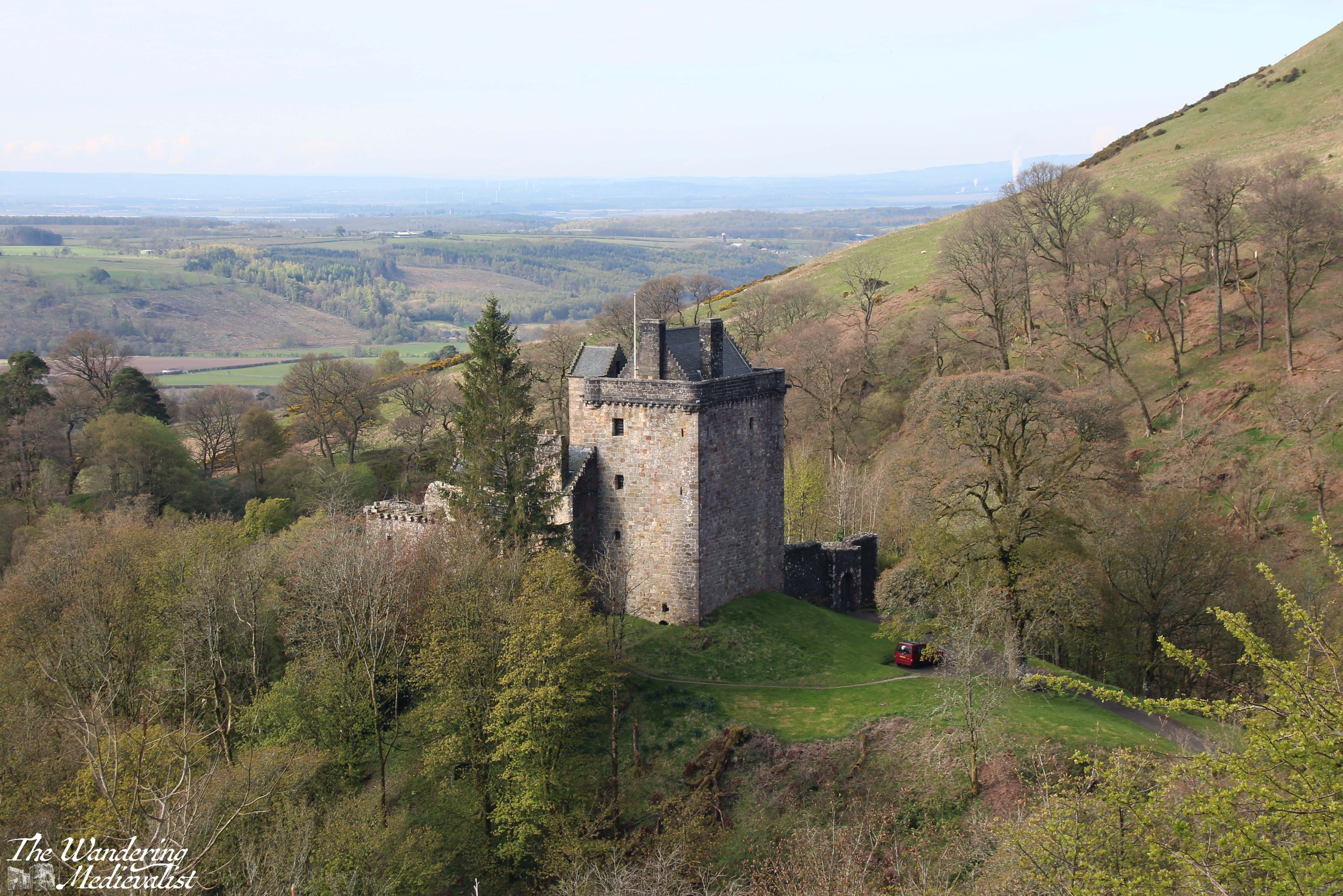
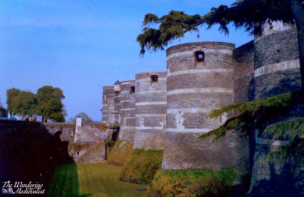
Relatively ‘new’ for Scotland, Broughty Castle was constructed in the 1490s; the strategic location is clear as you have an almost 360°view of the estuary, coastline and ocean beyond. There had been fortifications here for several decades, and a number of English ships were captured off the coast in the late fifteenth century.
The castle did go through a period of decline in the eighteenth century, but it was purchased in 1846 by the Edinburgh and Northern Railway, which built the harbour for the rail ferry. Ownership was passed to the War Office in 1855, and so it came back into military use.
The castle would remain in use as a defensive structure through the Second World War, when a defence post and lookout platform were placed in the main tower.
My visit
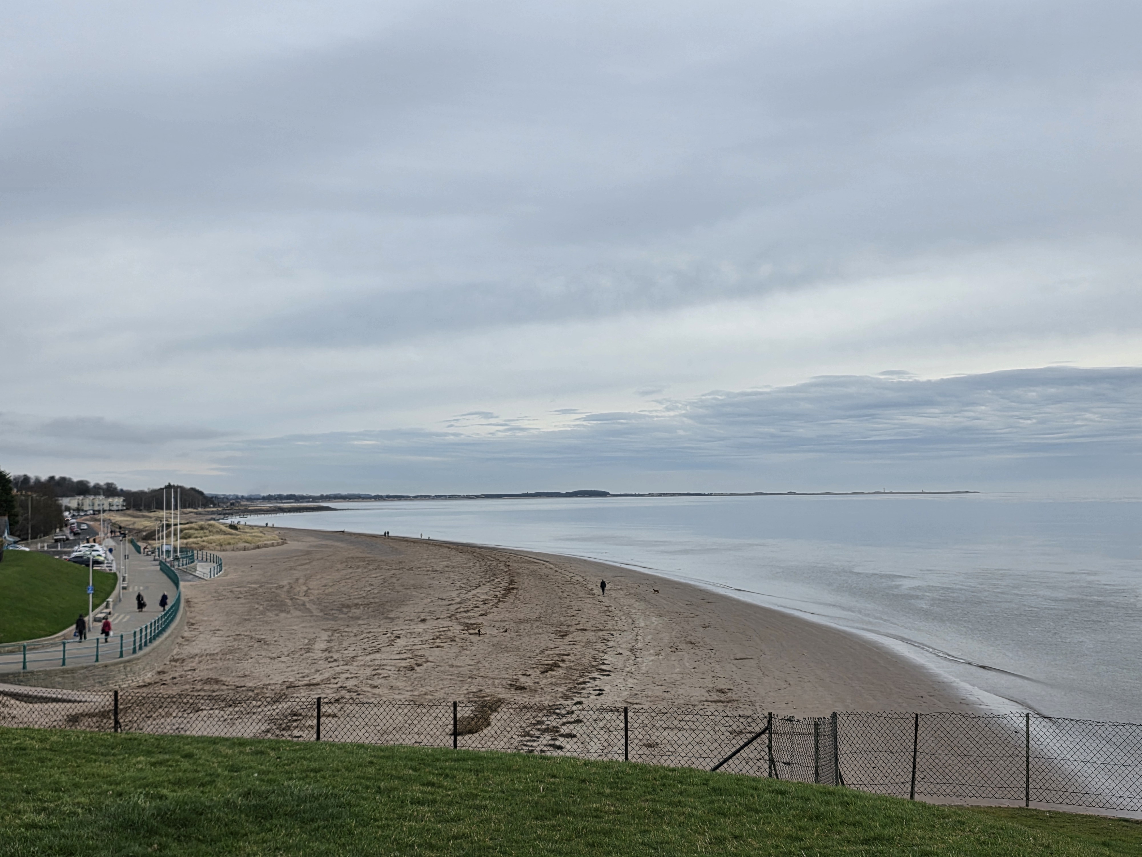
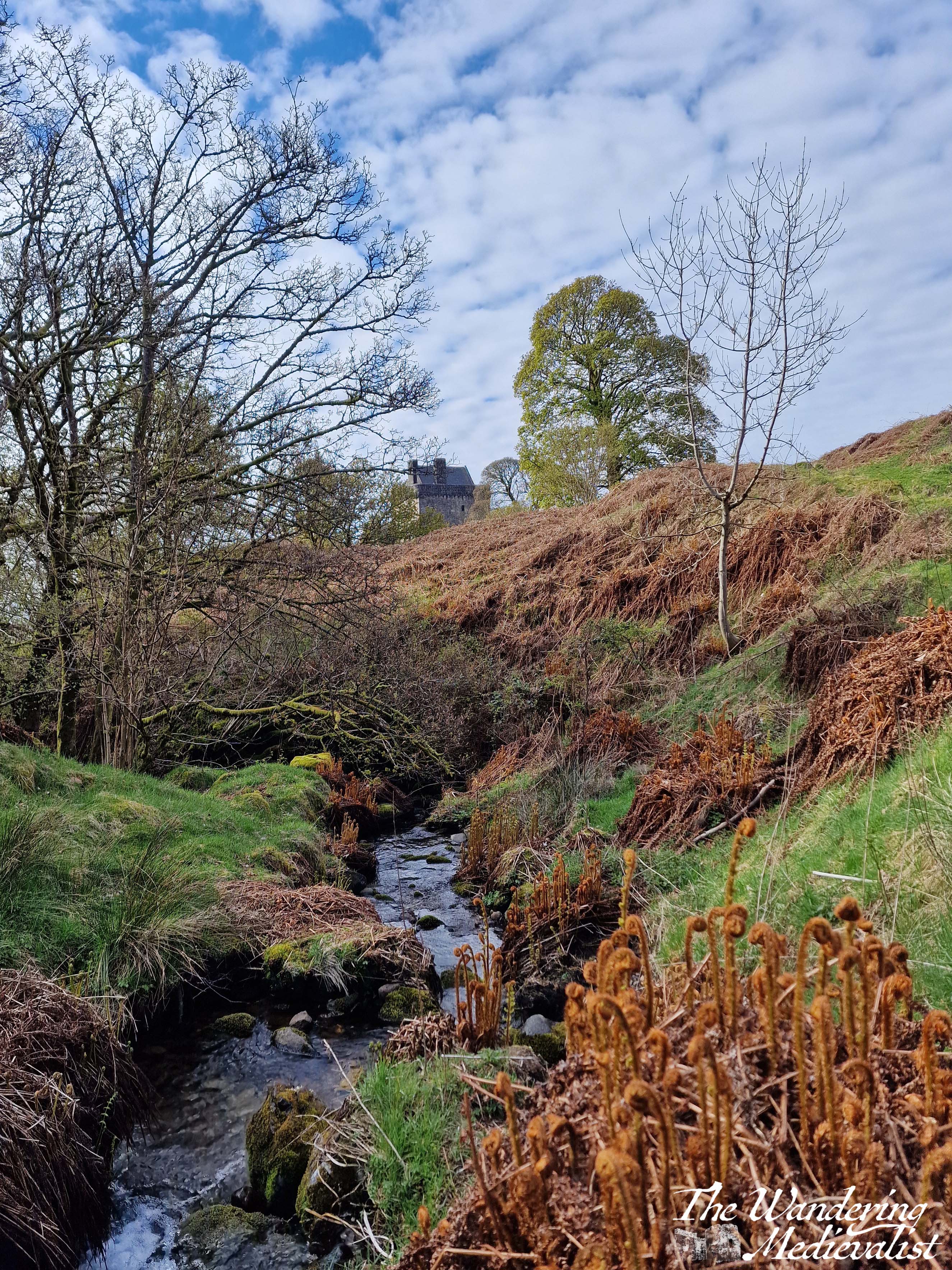
The castle is located at the end of a promenade along the coastline, where at low tide a touch of beach is visible. This portion of coast is very popular with walkers and cyclists, and in theory I think you could walk here from Dundee though I’m not familiar with the state of the path.
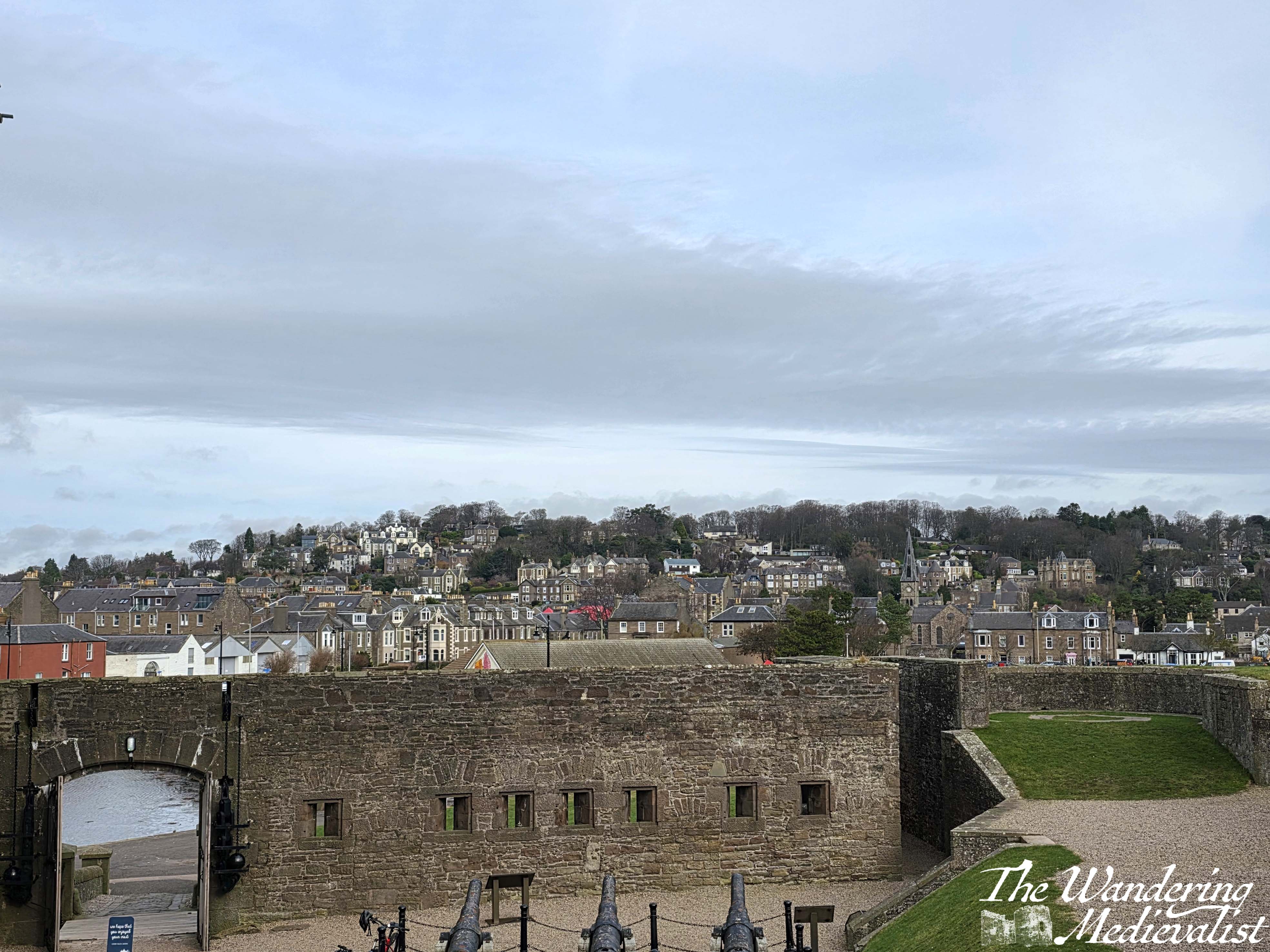
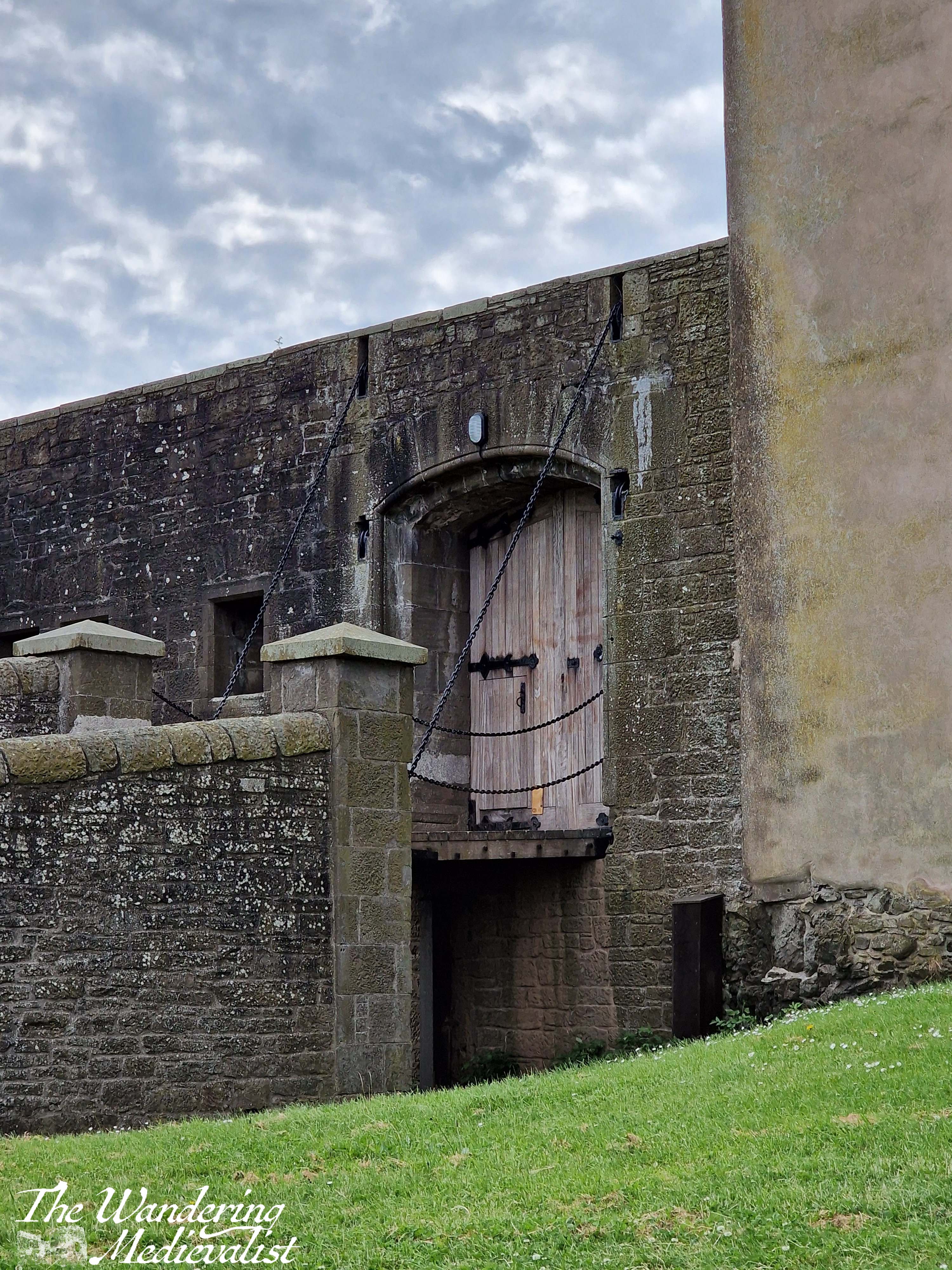
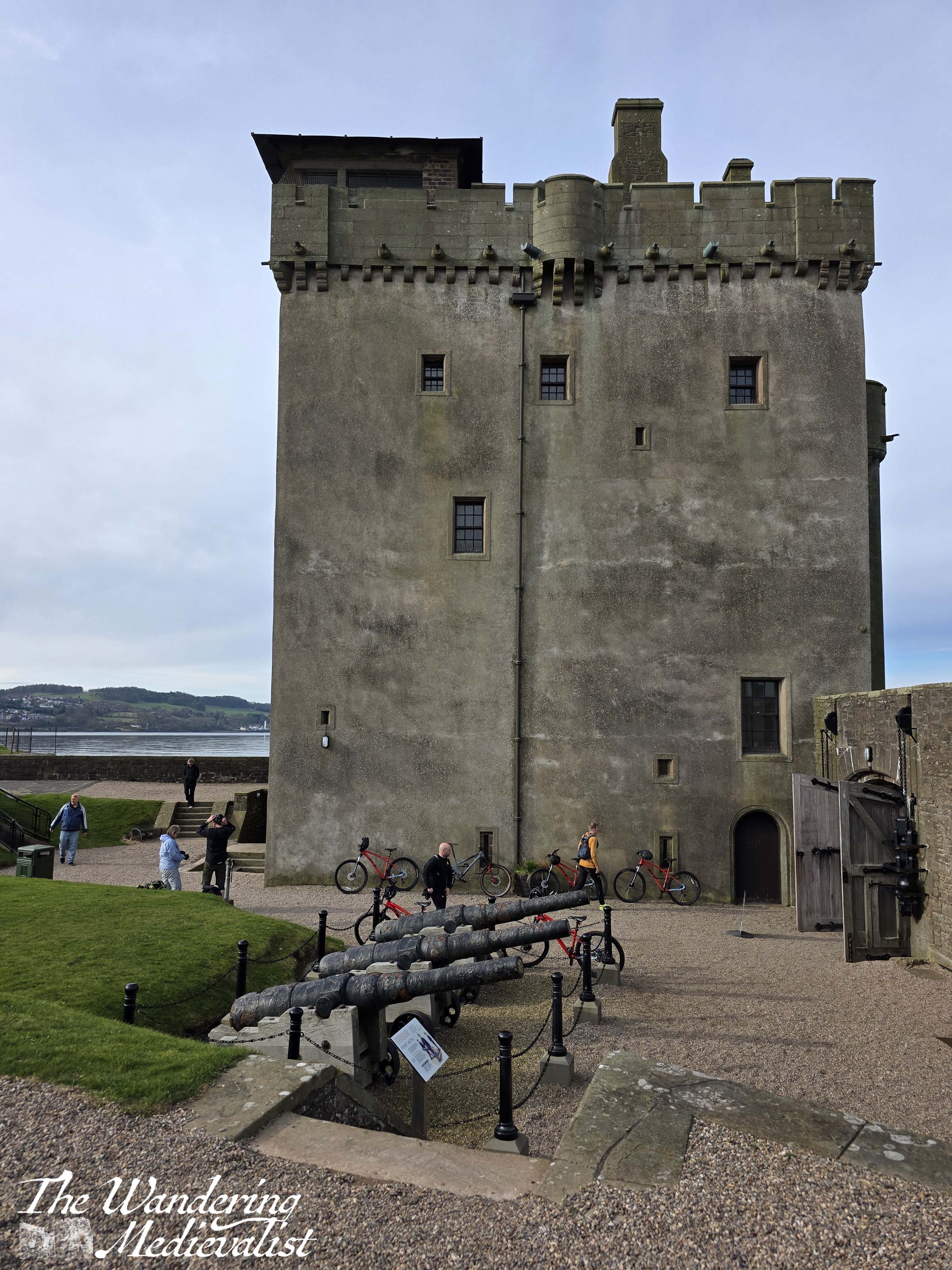
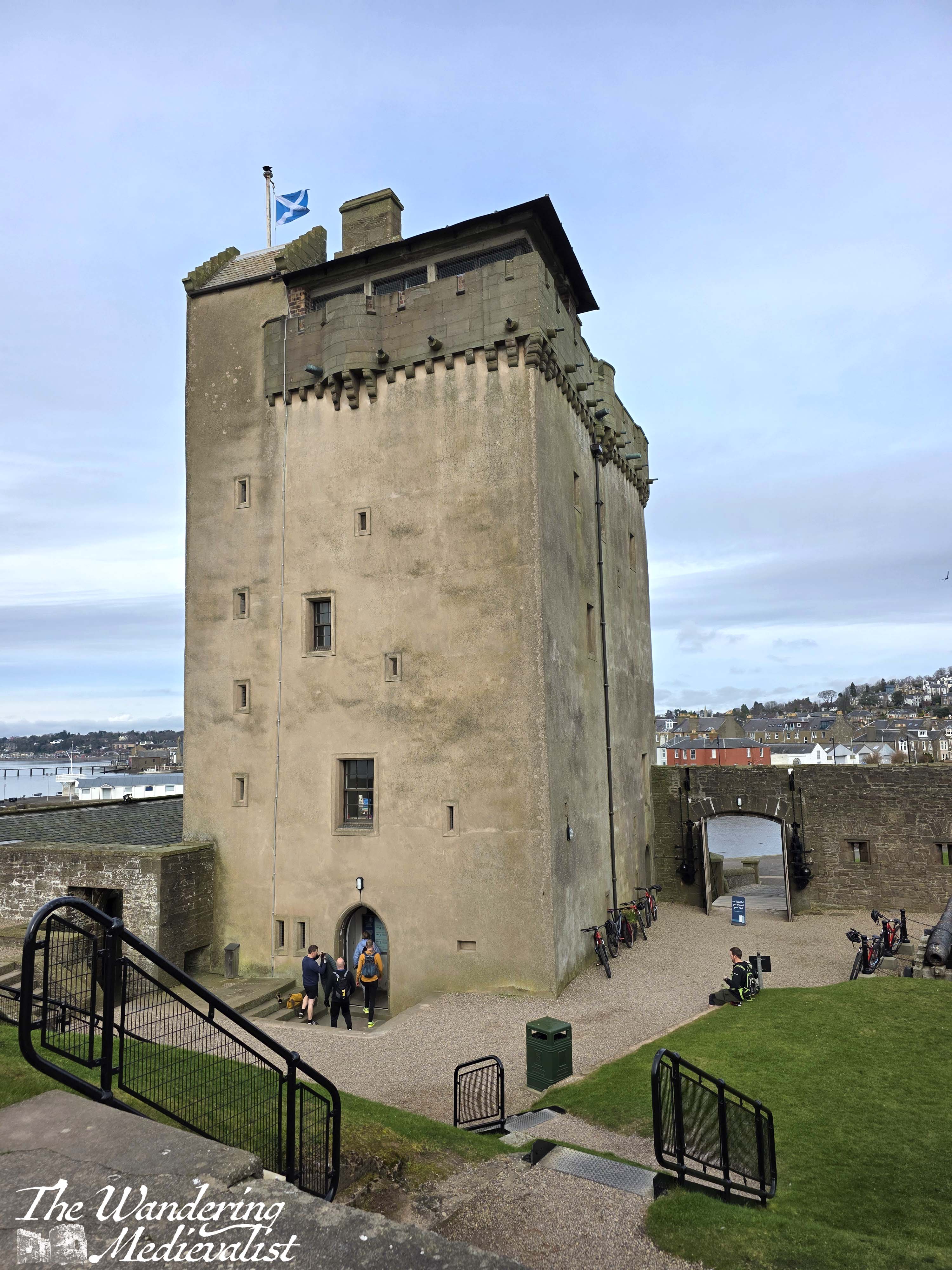
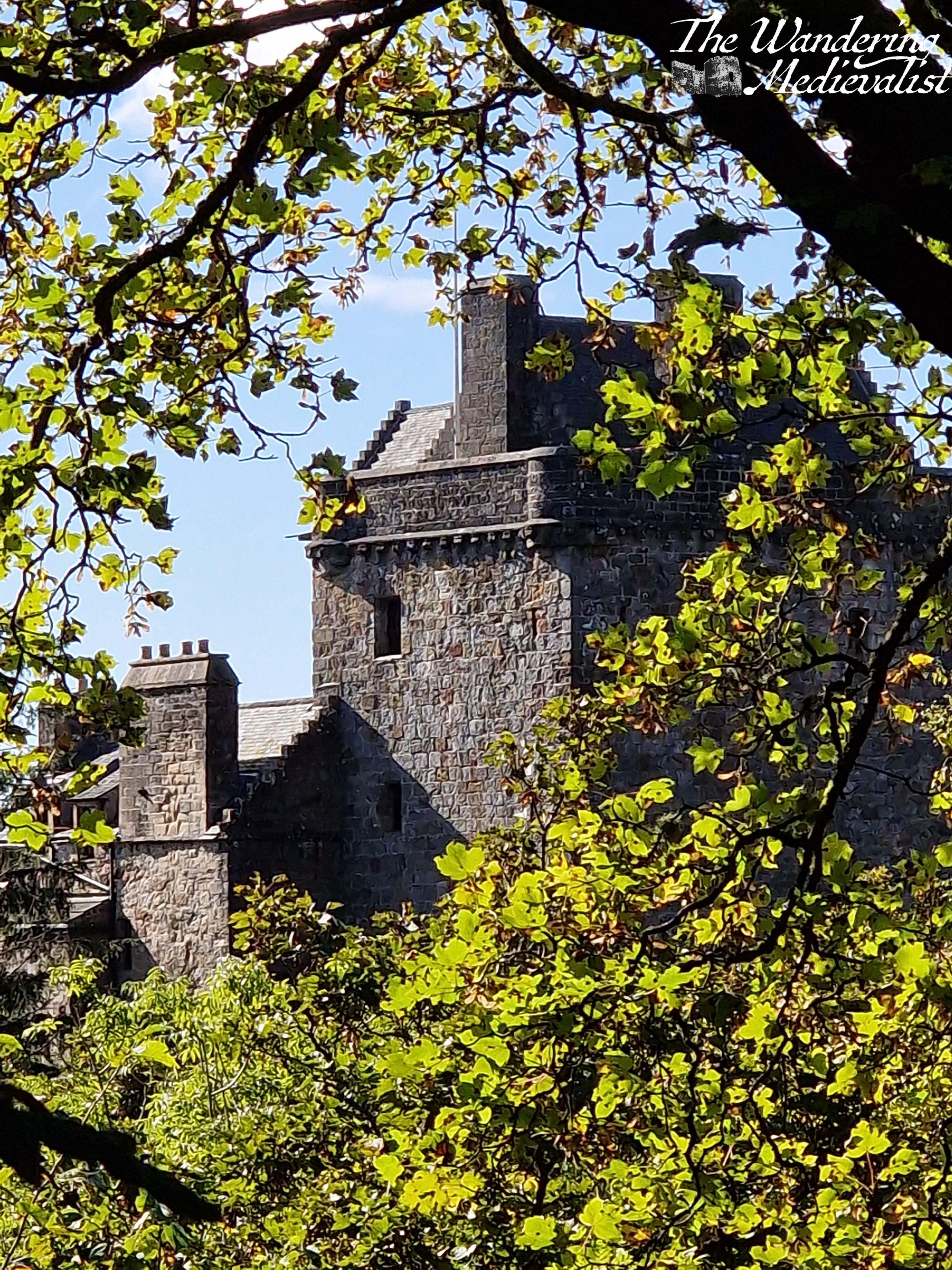
The shape of the tower is very familiar to anyone who likes Scottish castles; you will see the similar square(ish) tower at Castle Campbell, Balvaird, Doune, Hill of Tarvit, and many more. Perhaps less usually, the medieval tower is surrounded by much more modern fortifications reminiscent of the era of regular cannon (there are several lovely cannon specimens within the grounds). Earthen banks with concrete walls surround the castle on three sides, with the approach only still through a medieval gate.
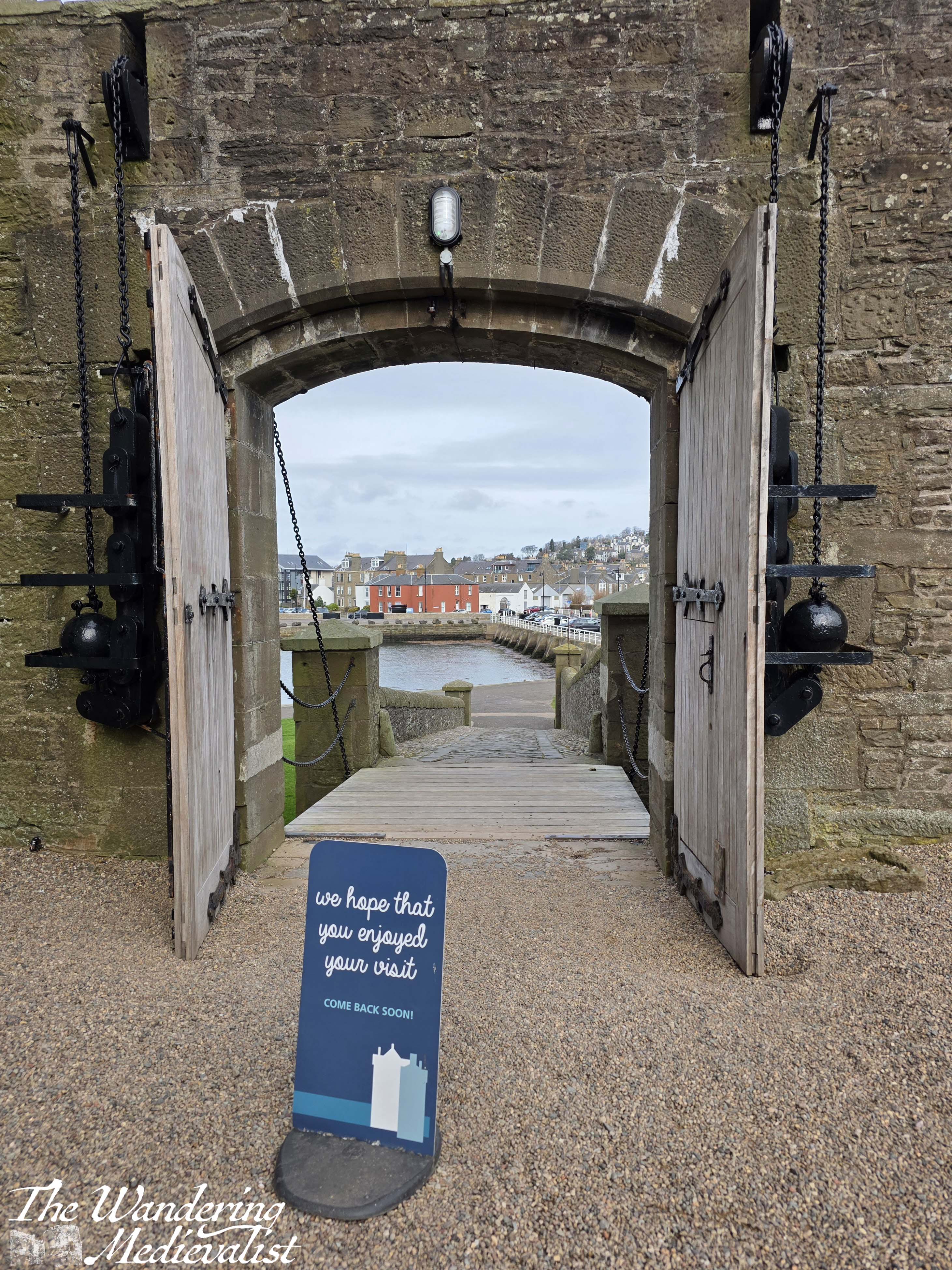
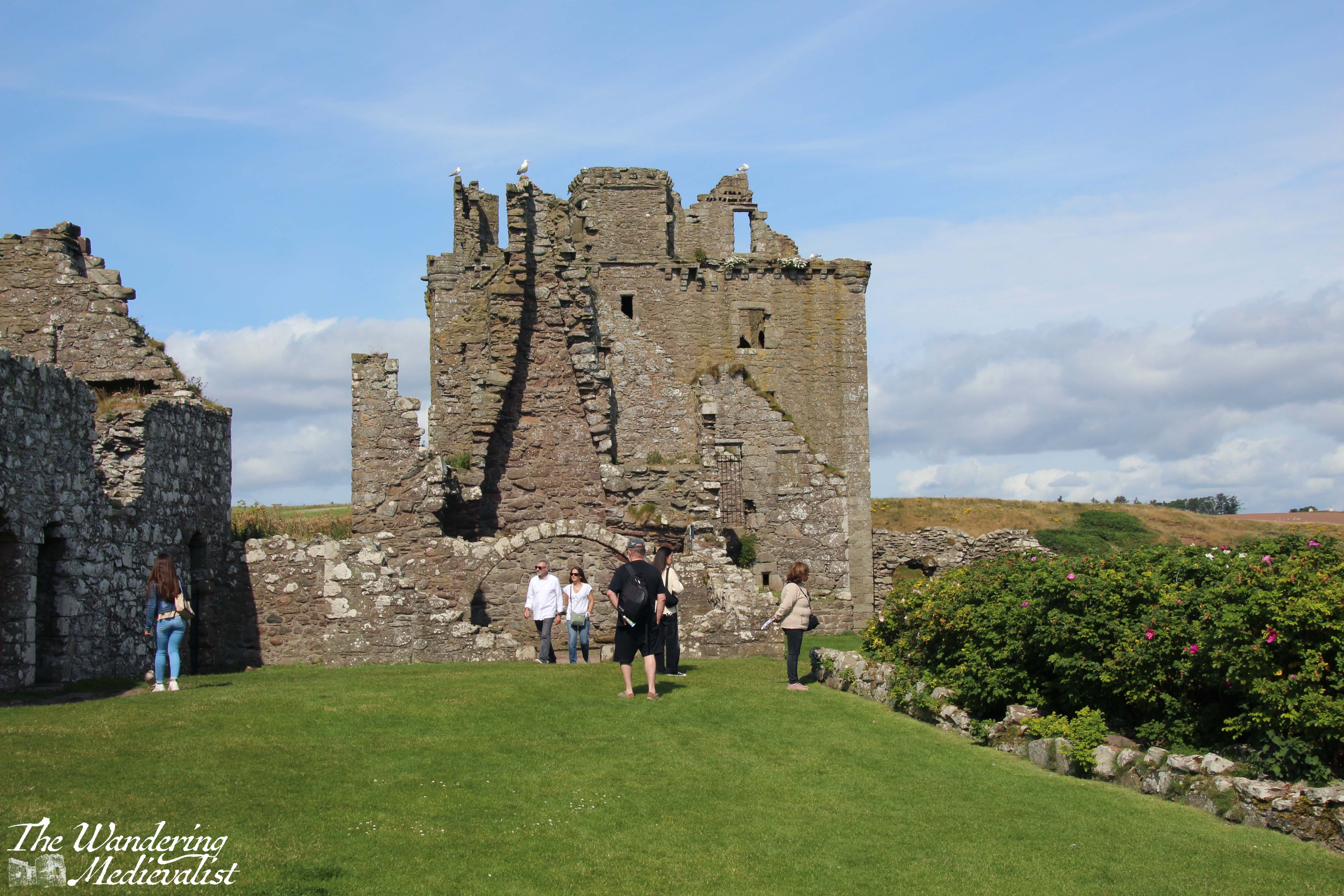
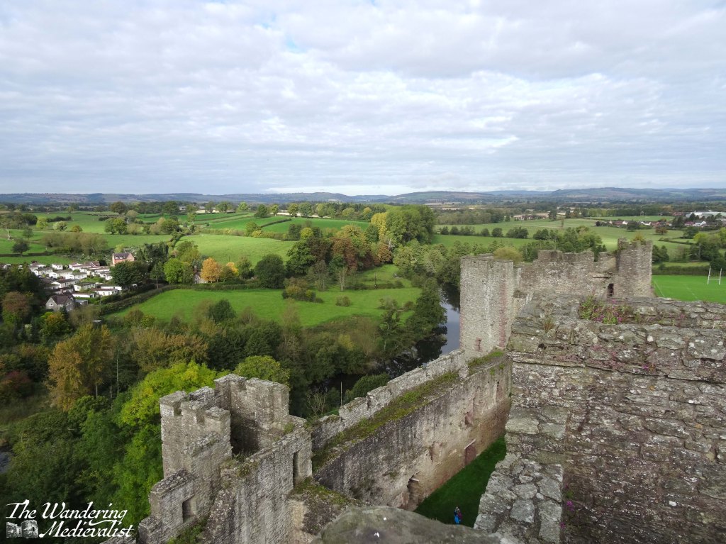
Excitingly for us on the day we visited, the castle is free to enter; hours are seasonal, so it is worth checking ahead of time. Once through the gate, one is met immediately with a courtyard, where visitors can either enter the castle proper or explore the ramparts. We chose the second option to start, climbing up concrete steps to viewpoints where the shadows of large WWII guns are still evident, in rings indicating bolted-down machinery. The view really is fantastic, looking up the Tay towards Dundee (and the Tay Road and Rail Bridges), across to Tentsmuir, out to sea or up the coast towards Carnoustie.
I particularly, for some reason, enjoyed the view back out the main gate, where the town of Broughty Ferry was visible in the near distance. Also enjoyable were the lovely old gate mechanisms, with enormous metal weights ready to hold the doors open or keep them closed.
While I could – and did – have stood for a long time watching the water and the Tay traffic, it was time eventually to explore the interior of the castle.
Now, if visitors are looking for ornately-decorated living quarters with medieval panelling, as you can find at some castles, they will be disappointed. Instead, this tower is still very much in modern use with each layer dedicated to a different part of the museum.
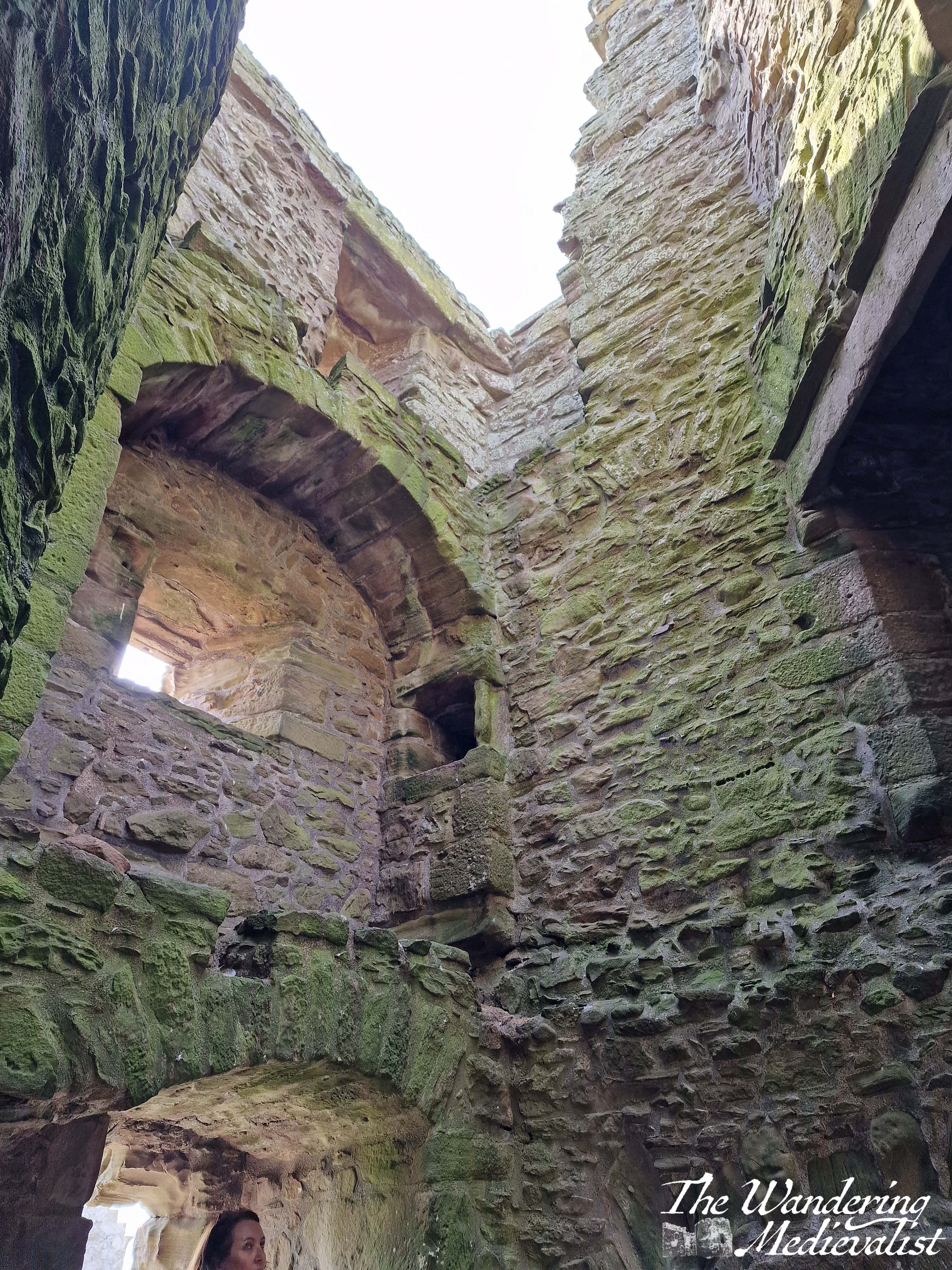
Access to the tower and upper floors of the museum is by a series of narrow stone steps, so some strength of joints is required – the stairs are certainly authentic, with dips in the stone where many feet have travelled, though nothing as dramatic as one often finds in old church towers. Nevertheless, the stairwells are narrow and winding.
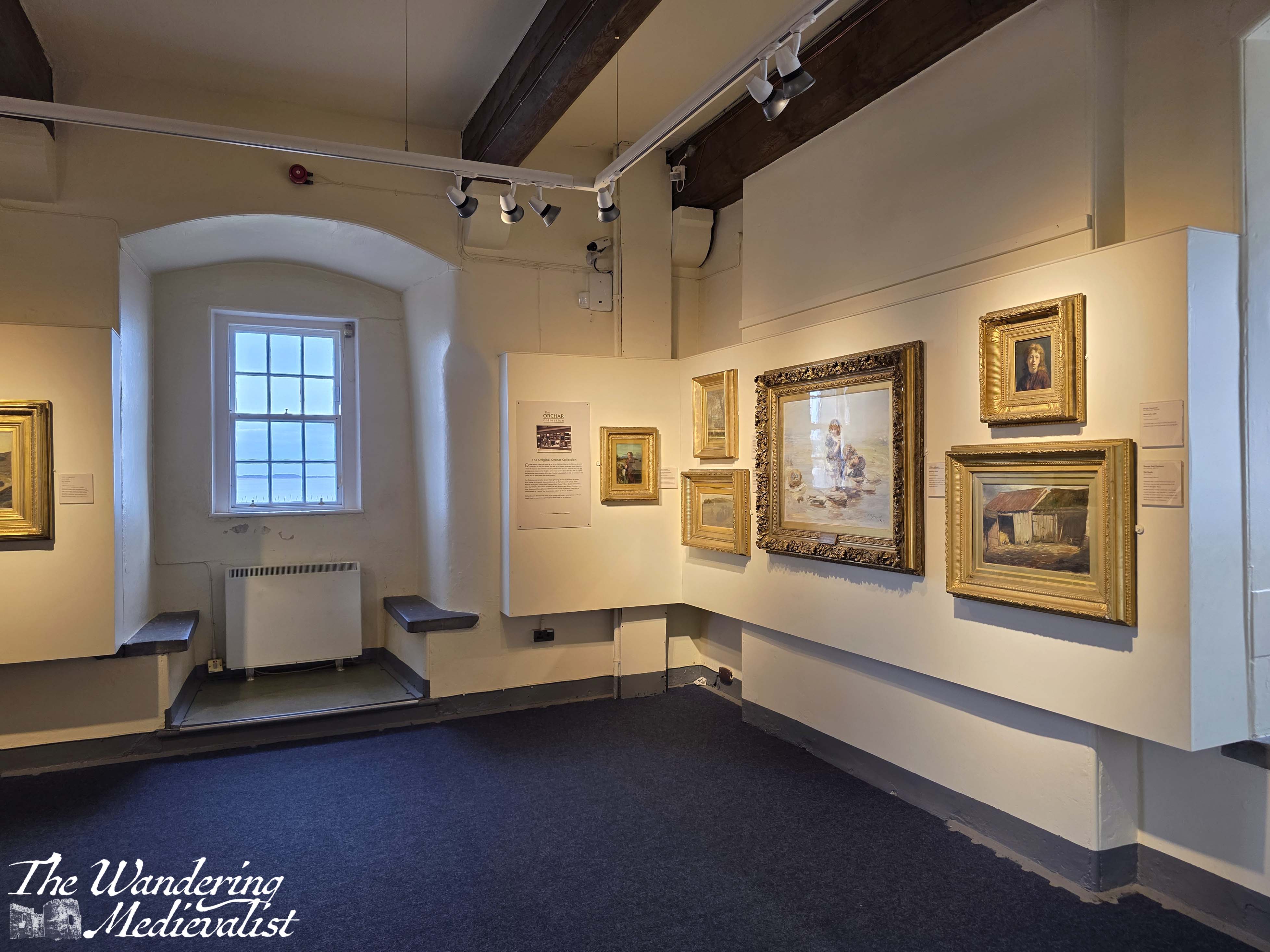
The first floor – up a short flight of stairs – is the museum shop and some displays including the one on the rail ferry. There are very helpful print-outs on the history of the castle and some gifts, postcards, and memorabilia. One floor up from that is the gallery, with some local artist impressions of the castle, Broughty Ferry, and some of the inhabitants.
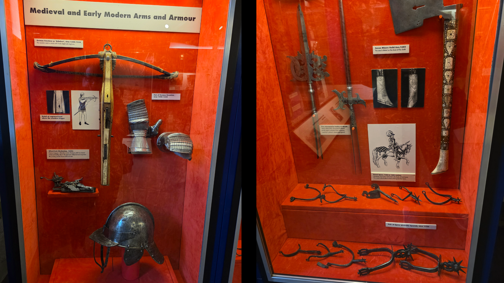
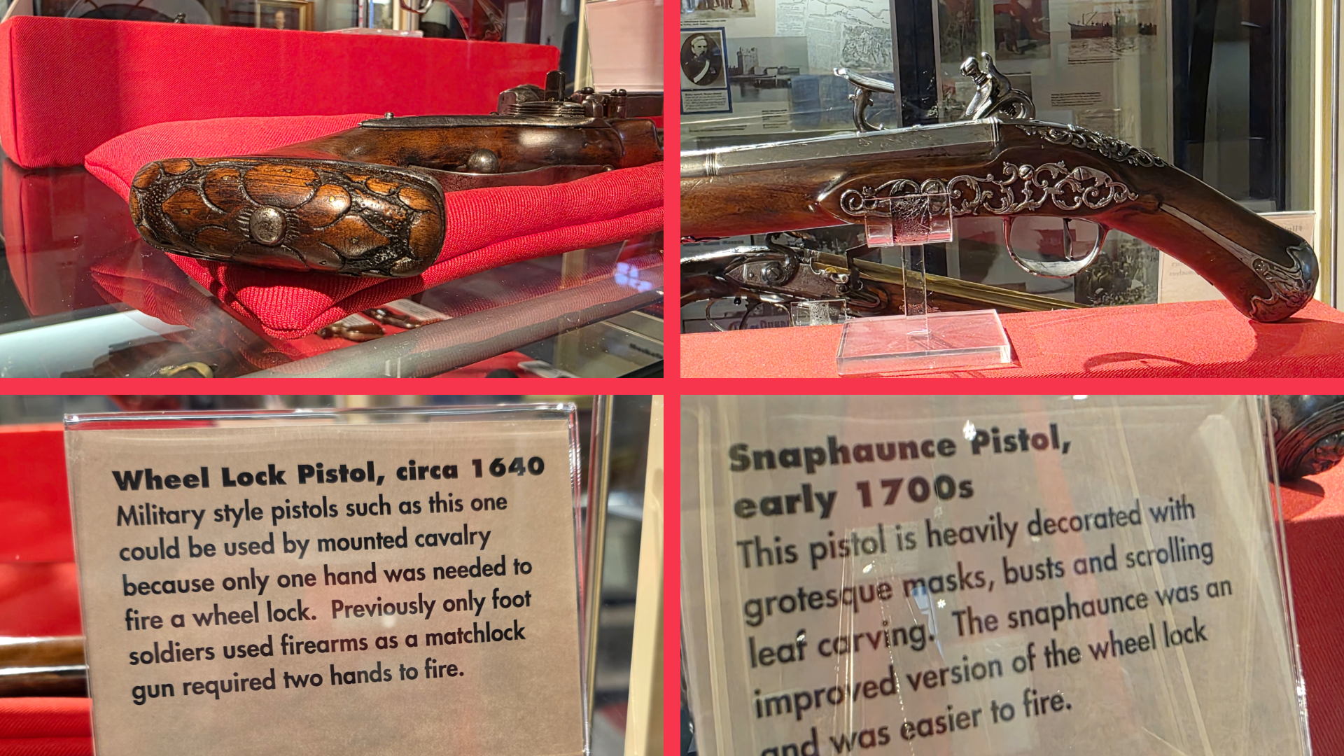
Above this floor is one aimed mostly at children with some dress-up and more learning-based exhibits. I have to admit that when there is a tower like this I am always anxious and eager to get to the top, choosing to explore as I work my way down, and this visit was no different. Continuing upwards, I came across the castle’s collection of medieval and early modern weaponry, including some armour, beautifully-decorated early firearms, flintlock rifles (very ‘Last of the Mohicans’ in feel) and more. Any weapon enthusiast will, I am sure, find it fascinating – one rifle even came from Japan and showed more typically eastern attention to fine decoration detail.
Finally, just off the display room was a few extra steps up to what is now an observation deck for wildlife such as birds, seals and dolphins. There is some information there about what you might see, and also the view before you. Unfortunately, the more aggressive avian visitors have forced the castle to put up a net around the deck, so pictures from this height are a bit difficult.
While not a castle that you may plan to spend a whole day visiting, Broughty Castle is positively crammed with historical information about the many eras in which this coastal defence was used. There are displays about the Tay lifeboat crews, about submarine miners in the late 1800s, the ‘Rough Wooing’ of Henry VIII, and more. Definitely a good option for families and those visiting Broughty Ferry for the day, the castle is educational and provides excellent views (I suppose a caveat here for family visitors – there is no fence around the edge of the ramparts, so youngsters will need to be watched!).
Plus, there are more than a few excellent spots nearby to stop for coffee, ice cream and cake. Our choice for the day was the Braw Tea Café, a not for profit enterprise providing on-the-job training and personal development to support disadvantaged women. While not open every day, when it is the café has excellent cakes and an outdoor seating area perfect for a sunny afternoon.
So if you are thinking about a visit to this lovely town, definitely do not miss out the castle!
I have been thinking for some time that it would be nice to share here some of the research I have done over my years as a medievalist. While I have not formally studied for some time, I am always fascinated by how new views can be found on events that took place hundreds of years ago. So in this post, I will share with you a version of a piece of work which I put together for the International Medieval Congress in 2019.
I’ve tried to make it accessible, and I hope you will find it as interesting a topic as I did. It touches on some of my favourite characters in history, and the subject upon which I focussed for so long: medieval marriage.
But really, it’s a story – a story of the people involved in the negotiations, of their personalities, their strengths and weaknesses, and their priorities.
The title of the paper was, ‘An Unexpected Proposal: the suggestion of a marriage between Joanna of Sicily and al-Adil during the Third Crusade’.
Setting the scene…
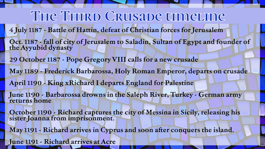
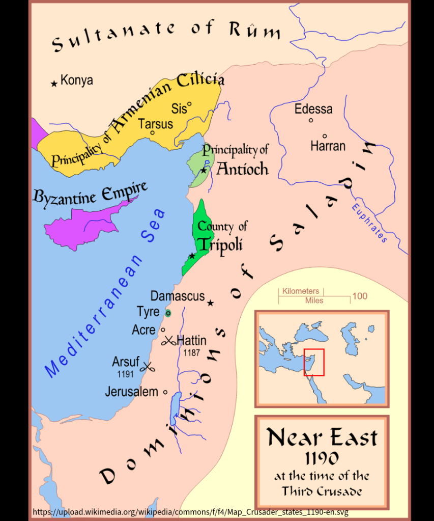
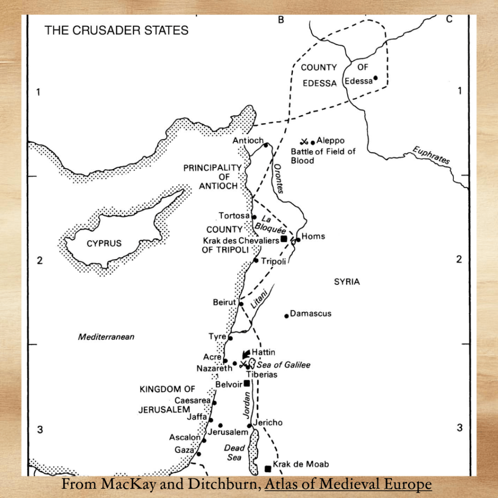
The tale begins in the midst of the Third Crusade, which was called in 1187 by Pope Gregory VIII after the fall of Jerusalem to the Muslim forces led by Salah al-Din, the sultan of Egypt (for the purposes of this paper, I will refer to him as Saladin, as do most western historians). Jerusalem had been captured by the Christian armies of the First Crusade in 1099, establishing the Frankish Kingdom of Jerusalem, so the loss of the city less than a century later caused most of the leaders of Europe to take notice. The Holy Roman Emperor Frederick Barbarossa was the first to set off, but he drowned while crossing a river in Turkey, and his troops disbanded. This left the kings of England and France to lead the second wave of the crusade, and both Richard I of England and Philip II of France departed Europe in 1190.
Arrival in the Holy Land
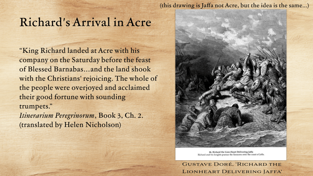
In June 1191, Richard I, king of England – known in later years as the Lionheart – arrived in the Holy Land after a number of delays, to take his role as leader of the Third Crusade. He had left England some months previously but was held up first in Sicily – where his sister Joanna was the dowager queen – and then in Cyprus – where he was ‘forced’ to intervene when the Byzantine ruler, Isaac Komnenos, seized his supplies and belongings after a shipwreck. (it’s an interesting story, but not the point of this paper…)
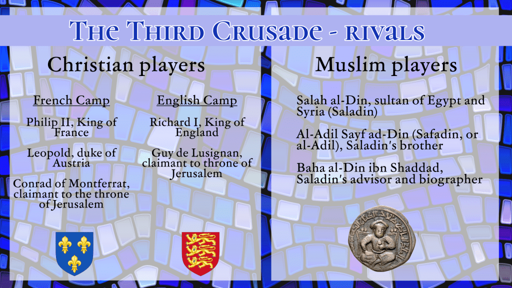
There were plenty of other high-level nobles and kings present upon his arrival, including his now arch-enemy King Philip II of France, (they had fallen out in Sicily) and two candidates for the throne of Jerusalem: Guy de Lusignan and Conrad of Montferrat. But, almost from his arrival to dramatically lift the siege of Acre, Richard’s secured his position as the foremost warrior and hero.
The Itinerarium Peregrinorum (long title Itinerarium Peregrinorum et Gesta Regis Ricardi), a Latin prose account of the Third Crusade that is likely to have been written from first-hand experience, tells us:
Even the enemy had a view on his arrival with one chronicler stating,
“He was wise and experienced in warfare, and his coming had a dread and frightening effect on the hearts of the Muslims.”1
Richard’s first few months were very successful; Acre, the maritime foothold of the Kingdom of Jerusalem, was captured, though the surrender was marred by the controversial decision to execute the Muslim garrison, probably more than 2,600 men. The motives for this action have been debated at great length, and you can read more in Gillingham and Spencer.2
However, the incident does give us insight as to Richard’s negotiating strategy. The treaty he had made with the enemy forces upon the fall of Acre were for Saladin to hand over a fragment of the True Cross and to release 1,500 Christian prisoners in exchange for the lives of the garrison and their families.3 When the terms were not upheld by Saladin, Richard followed through on his threat, without compunction.
Negotiations
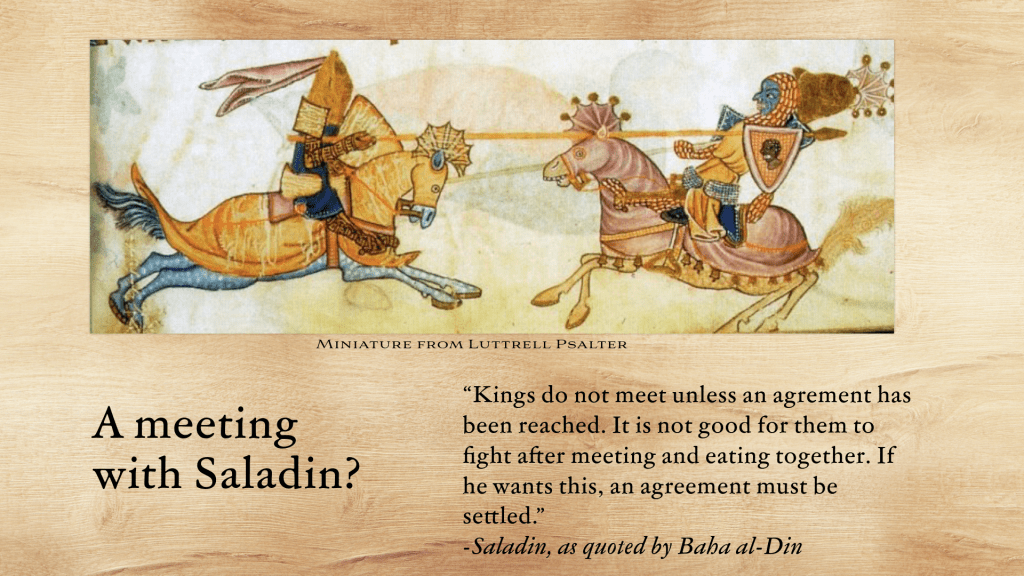
The military aspects of the crusade have been the stuff of numerous articles and discussion, and the diplomatic negotiations were also an integral part of the relationship between the Christian and Muslim armies, as well as between Richard and Saladin. These negotiations have been examined thoroughly by Thomas Asbridge,4 but this paper looks in more depth at one particular part of these negotiations: a series of exchanges that took place in Autumn 1192, during which Richard suggested that the battle for Jerusalem could be ended by a marriage between his sister Joanna, the widowed queen of Sicily, and Saladin’s brother, al-Adil, often called Saphadin by European sources of the time.
Curiously, eastern sources discuss this proposal in some depth and are our primary evidence for it, while western sources are completely silent. This silence has always intrigued me. Many historians have focussed on the likelihood that the whole thing was just a joke, if it took place at all, but I believe it to be quite clear from reliable sources close to Saladin that the proposal was indeed made and considered in seriousness, at least at first.
Here I will make an effort to come to terms with why western sources leave the incident out, and I hope to answer some of the questions surrounding the event, which has been called ‘implausible’5, ‘extraordinary’,6 ‘remarkable’7 and ‘curious’.8
The proposal was not the first step in this round of negotiations. Rather, Richard had requested personal meetings with Saladin from the time of his arrival at Acre, but Saladin always refused.
For that reason, Saladin’s trusted general and brother, al-Adil, was his stand-in, and he met Richard in person on several occasions. They developed a rapport and traded regularly both food and gifts, and shared many meals.
In autumn 1192, Richard’s first offer, an opening gambit if you will, was one Saladin could never possibly accept. Baha al-Din, one of Saladin’s most trusted personal secretaries – and the writer from whom we get the most detailed account of these events – recorded Richard’s letter.
Saladin’s response, unsurprisingly, was a much wordier version of ‘no’.
He also reminded Richard that Jerusalem was as holy for Muslims as it was for Christians, and that the land had of course been theirs originally, before the First Crusade of the 1090s.
There was another player in these negotiations who was influencing Richard’s position. This was Conrad of Montferrat, one of two rivals to the crown of Jerusalem. Conrad was attempting to make his own agreement with Saladin, wherein the Muslim leader would confirm his possession of lands in Sidon and Tyre in exchange for Conrad’s attack on Acre, now garrisoned by Richard’s men.
Fortunately for Richard, the majority of Saladin’s advisors favoured a deal with the English king over one with Conrad. So, with his opening offer refused, Richard moved on to the second. There are three accounts of this incident, and I will look at each in turn.
Three Accounts
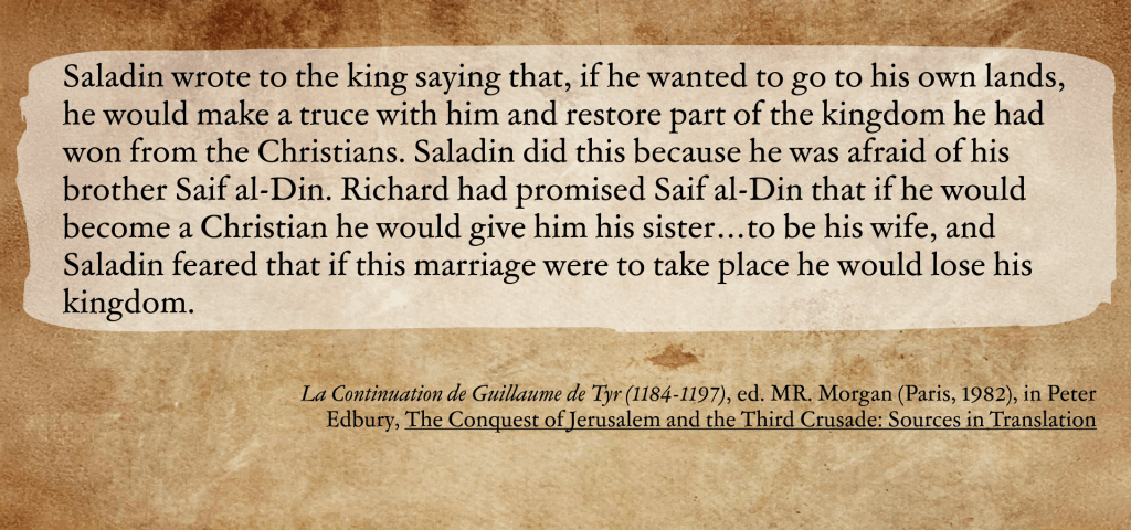
1. Old French Continuation of William of Tyre
This is the only surviving Christian source to mention the incident, and the source is often hostile to Richard. The writer states that Saladin was the initiator – the only source to suggest this, almost certainly in error. Further, the passage supports the belief held by some historians that Saladin was afraid of his brother. Certainly strife between two brothers is a common trope, but there is no real evidence of it, rather the sultan appears to have trusted and depended upon his brother. The overall accuracy of this version is therefore questionable.
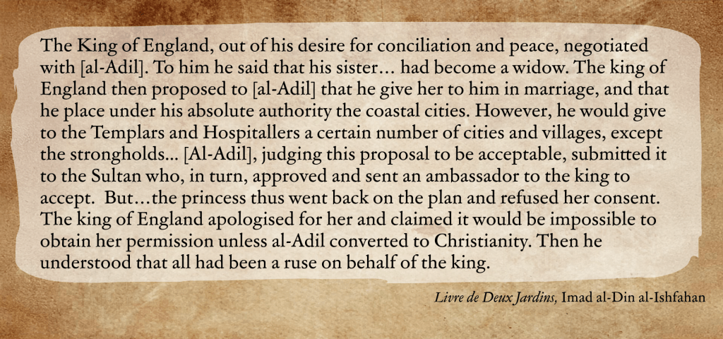
2.Les Livres de Deux Jardins, an account heavily based upon the writings of Imad al-Din al-Ishfahan, a Persian scholar who worked as a secretary to Saladin and was personally involved in many of the political machinations at court.
Clearly, this account is far more in-depth and indicates the more likely scenario that Richard initiated the proposal, directly to al-Adil, who passed the terms to Saladin. It was not a secret.
Furthermore, this account brings in a fact left out by the Continuation, that it was Joanna herself who was the spanner in the works, refusing to marry a man not of her religion. I’ll come back to this.
3. Baha al-Din, The Rare and Excellent History of Saladin. As mentioned, Baha al-Din was one of Saladin’s personal secretaries and a writer who is considered one of the most reliable for this period due to his first-hand knowledge of Saladin’s inner circle. His account is most comprehensive, covering Richard’s opening gambit, Saladin’s subsequent refusal, and Richard’s regroup to approach a second time. The delicate nature of the terms is made clear in that al-Adil required both Saladin’s trusted emissary, Baha al-Din himself, and a number of emirs to be present when they were announced.
Al-Din asserts that he himself was given the task of bringing the message to Saladin and bore witness to the reply. There were to be no secret negotiations between Richard and al-Adil, rather al-Adil was cautious, acting in self-preservation – Saladin may have not reacted well to hearing about the offer second-hand.
Echoing Imad al-Din’s account but with more detail, the story goes on. Saladin immediately approved the terms, ‘believing that the king of England would not agree to them at all and that it was intended to mock and deceive.’9
Baha al-Din also confirms Joanna’s involvement, stating that she was very displeased, ‘How could she possibly allow a Muslim to have carnal knowledge of her!’ instead asking al-Adil to convert. (remember of course that she was Catholic and this was the Middle Ages – it was entirely unheard of to marry a non-Christian). With regard to this refusal of Joanna’s, I do have my doubts about whether Richard would have allowed the prospect of peace in the Middle East to be ruined by his sister’s temper tantrum. The fact that the story is repeated by both Muslim writers makes it more likely that Richard used her as an excuse to get out of a proposal with which he never intended to follow through.
What does it all mean?
What the sources indicate, then, is a diplomatic suggestion that, joke or not, was also quite daring. Al-Adil considered it so noteworthy that, rather than continue his personal tête-à-tête with Richard, he wrote immediately to his brother. If the brothers were aware, as Baha al-Din relates, that the proposal was a joke, they certainly reacted in a serious fashion. They may also have wished to call Richard’s bluff.
So one has to ask of Richard – why? Was the proposal merely a distraction? Did he do it just to see what Saladin and al-Adil would do? It could have been a test of al-Adil, a way of assessing his loyalty to his brother – certainly Richard himself had no reason to believe in brotherly bonds and knew how precarious the relationship could be, so perhaps he hoped that al-Adil would leap on the suggestion to gain power over his brother.
Seal of Richard I
Or perhaps he hoped that Saladin would grow to view his brother as a threat. Either way, Richard would be causing dissension in the ranks, which could only be to his advantage.
One can understand the Muslim writers’ assertions that Richard never intended for the proposal to be taken seriously when one looks at the rest of the tale. When Saladin accepted the offer, Richard was forced to scramble for a reason why Joanna could not, in fact, be married: he would have to ask the pope (dowager queens in Europe could not remarry without his permission), and that could take months. Richard suggested the al-Adil could have his niece instead, of course she was in Europe so again another delay…this is not the sign of a well-constructed plan. Richard may even have fibbed, saying that his Christian colleagues objected to the idea – but if the Christians had been asked, surely one chronicle somewhere would have mentioned it?
Finally, if this was a real proposal, part of a long-term strategy to end the warfare and allow Richard to return to Europe where the king of France was chipping away at his empire with the help of his brother John, why is it not in the Itinerarium Peregrinorum?
Because this period of negotiation IS there:
I feel this section to be a bit harsh on Richard. He was more than experienced at the art of war and negotiation, and would never have allowed himself to be distracted. Rather he would have been perfectly aware that a period of negotiation did not mean cessation of hostilities – frequently the opposite. Instead this indicates that the writer, whoever he was, had no knowledge of the more delicate negotiations taking place in the background, or if he did, he left them out. Which was it?
We cannot know for certain, but the only reasonable answer for either the writer leaving the story out or for Richard keeping the proposal a secret lies in Richard’s reputation. A little later, the writer of the Itinerarium alludes to the problem:
One has to remember that just because Richard was leading the crusaders did not mean that he was supported by all of them. In fact there were French factions – and others – who were seriously adverse to Richard’s strategies, particularly what they saw as his reticence to march directly upon Jerusalem- a true strategist, Richard was hoping to establish a solid base from which to attack the city, rather than attack directly.
A French source tells us that Richard had been overruled in his wish to approach Ascalon, a strategically vital city: whoever controlled Ascalon also controlled access to Egypt, Saladin’s home base. Its significance is evident in that Saladin himself had made it a priority to re-capture Ascalon in 1187 prior to his march on Jerusalem – this tactic was one Richard hoped to emulate, but could not convince the other Christians. They remained focused, inexorably, on relieving the Holy City.
Richard would have been considered even more suspect and likely found himself in danger had the majority of the crusading host discovered that he was offering his sister to a Muslim, rather than fight the infidels courageously for Jerusalem.
And it is here, I believe, that an answer may be found.
I have no doubt that Richard made the proposal, as suggested by two reliable Muslim sources, both very close to Saladin. It is possible that Richard’s closest advisors knew of the proposal and objected, but he mostly ignored them. However, the lack of inclusion in Christian sources such as the Itinerarium, which was unlikely to have been written by someone with the level of access to Richard that Baha al-Din had to Saladin, indicates a lack of widespread knowledge of the proposal. It is quite reasonable that there would have been a lot of detailed negotiation taking place which a member of the general crusading force would not know about, but which Saladin’s personal secretary would. An every-day crusader would also be more aware of the threats to Richard’s reputation that his close relationship with al-Adil caused.
The Muslim sources go into more depth about the gifts and offer a more detailed timeline than the Christian sources, and are generally better informed about the relationship between Richard and al-Adil. Richard was a bold strategist, and his life shows numerous examples of the willingness to make extreme choices in order to get what he wanted – he took part in several rebellions against his own father, beginning in his teenage years; he alienated the king of France by refusing to marry his sister and choosing another wife; he regularly led his armies into battle even when his life was in serious danger.
So, I do not see it as uncharacteristic for him to have made a proposal, almost off-the-cuff, just to see what kind of reaction he would get. But he would have been aware of the danger involved: his strategies were often questioned, he was frequently ill while in the East, and his kingdom was in serious peril during his absence. His reputation was not so strong that it could have suffered the kind of serious outrage which would have arisen had a French crusader heard of the proposal.
Muslim sources tell us what happened, but the details in the Christian sources actually hint more clearly at why the incident was omitted, or kept secret – it had to be.
As for the incident being implausible, I personally am not surprised by anything Richard did – he was bold, intelligent, witty, arrogant, and not above extreme negotiation. This time, he was up against an equally skilled strategist who called his bluff.
But Richard had some good luck. The proposal was refused by his own sister, and the counter-proposals that al-Adil convert or wed Richard’s niece, were passed over.
So, Richard never had to face a council of European and French nobles to explain that the Crusade was over because his sister was going to marry a Muslim prince. But it is intriguing to wonder what might have happened if he had…
Thomas Asbridge, ‘Talking to the enemy: the role and purpose of negotiations between Saladin and Richard the Lionheart during the Third Crusade,’ in Journal of Medieval History. ↩︎
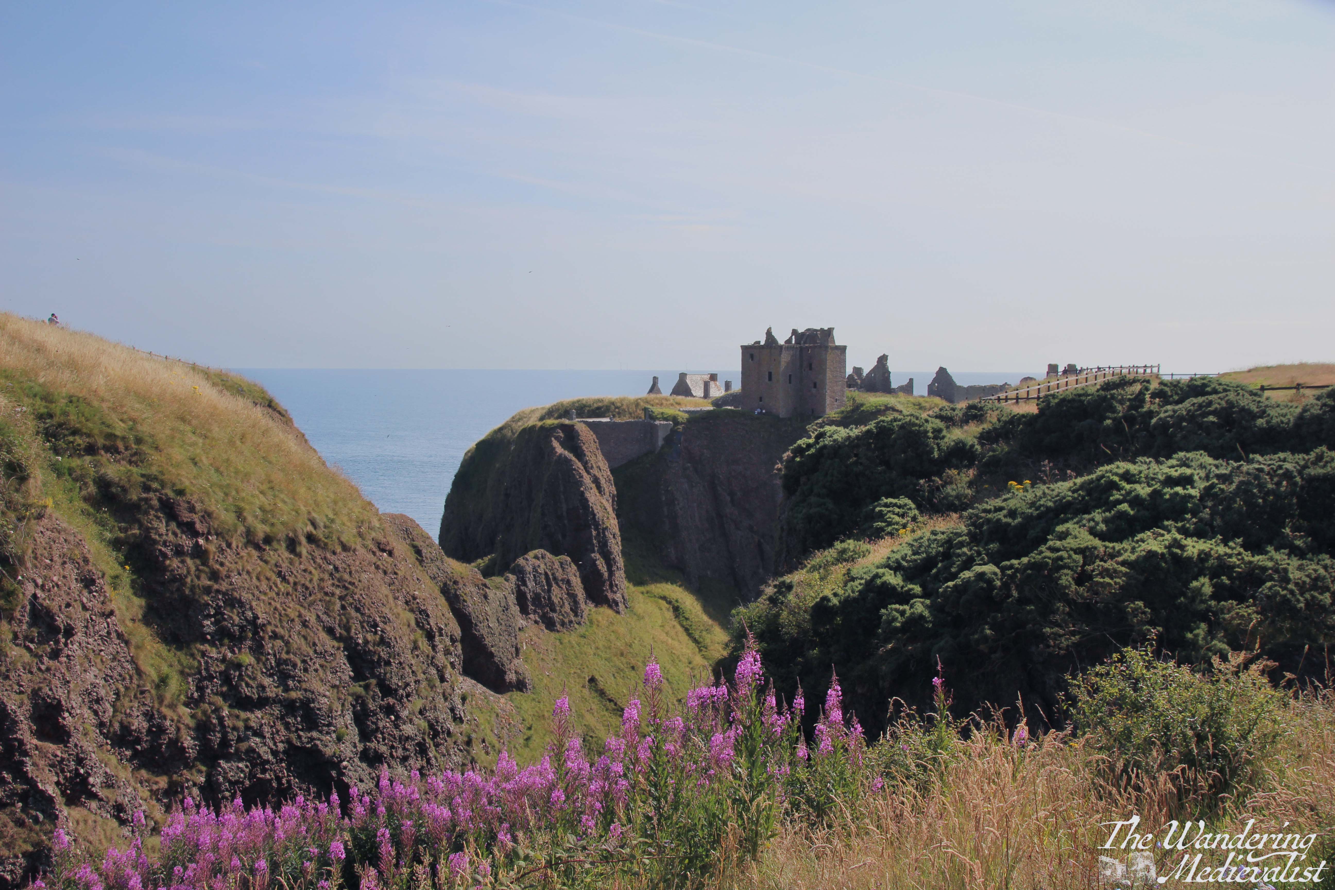
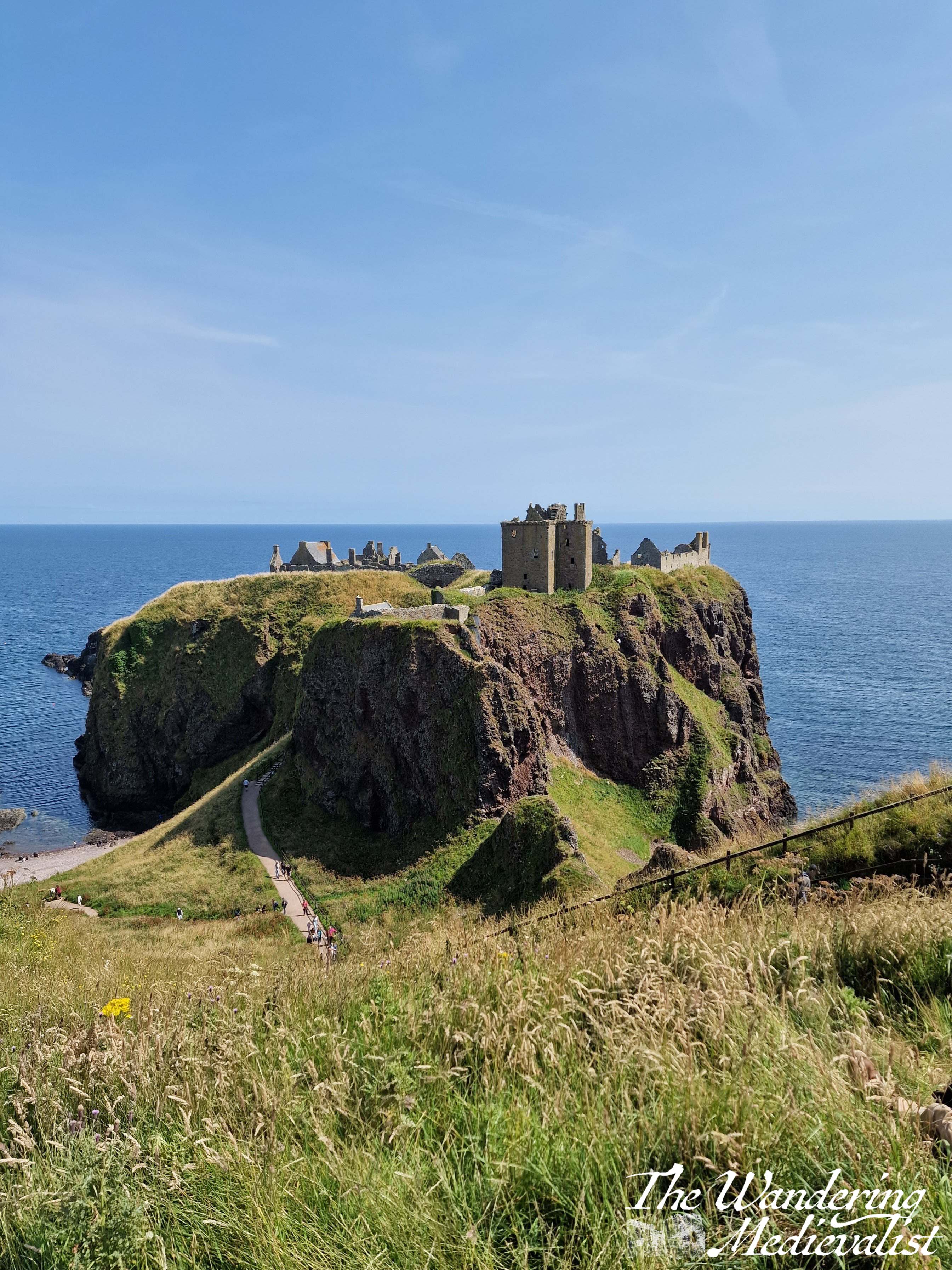
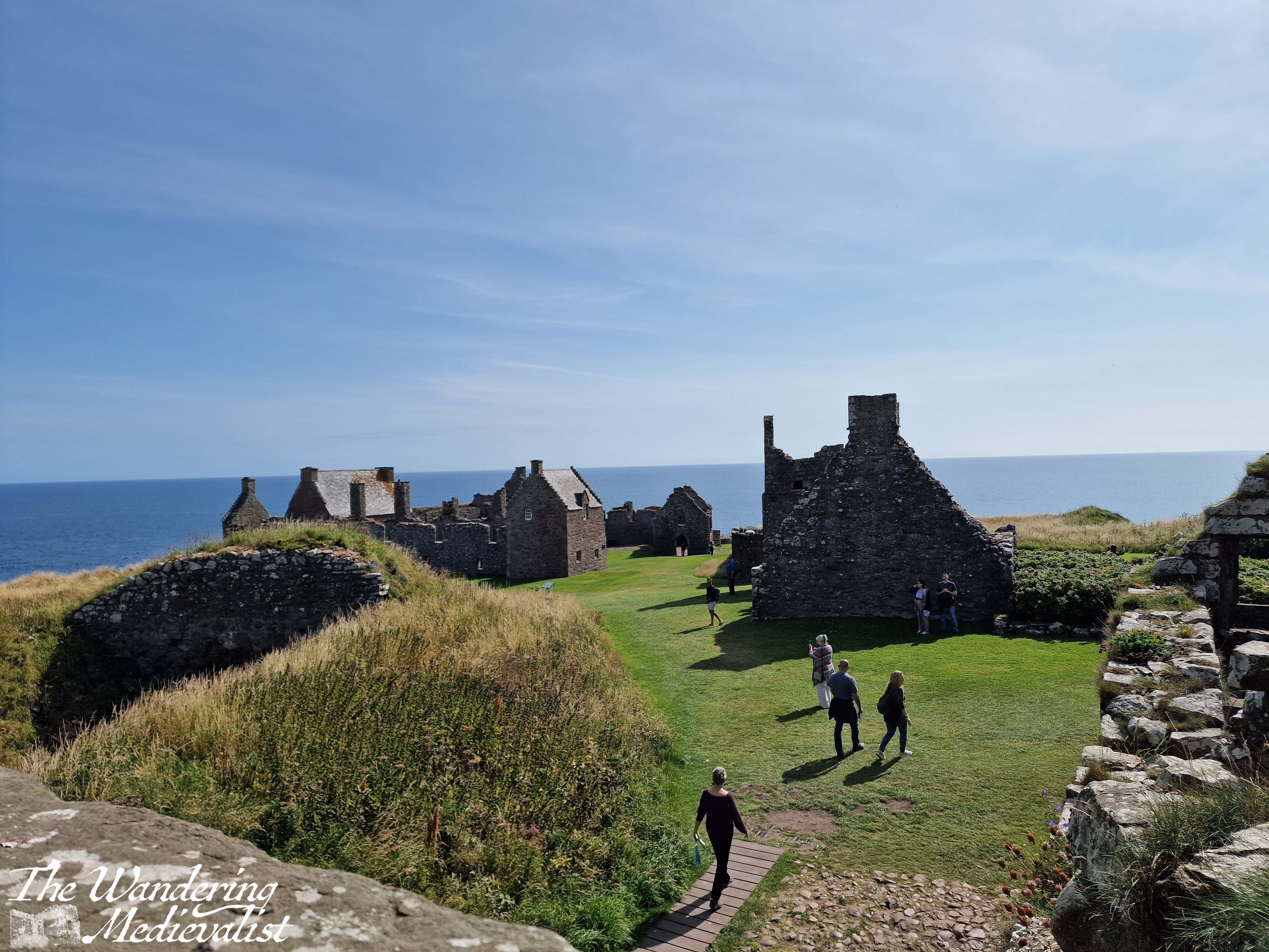
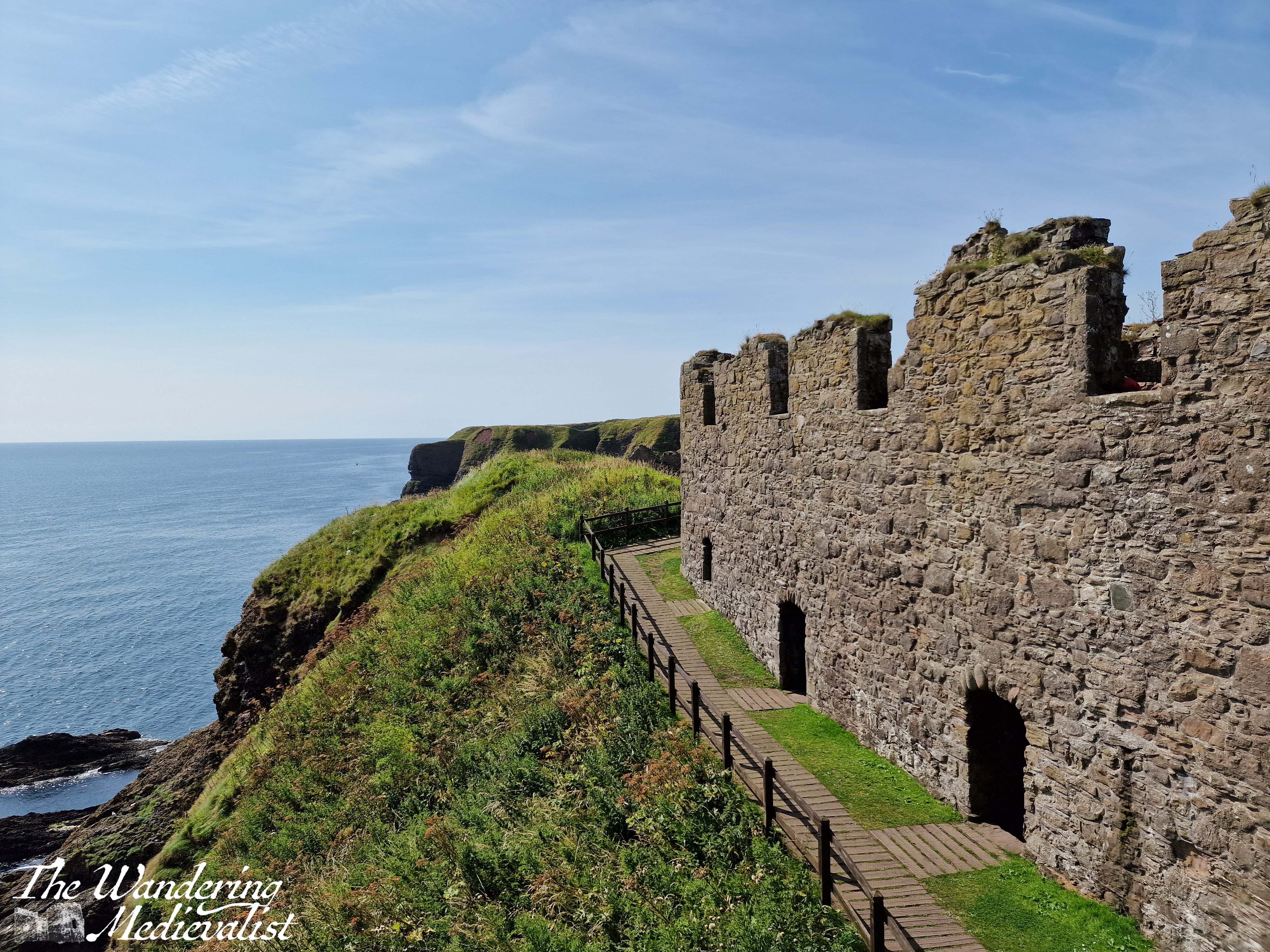
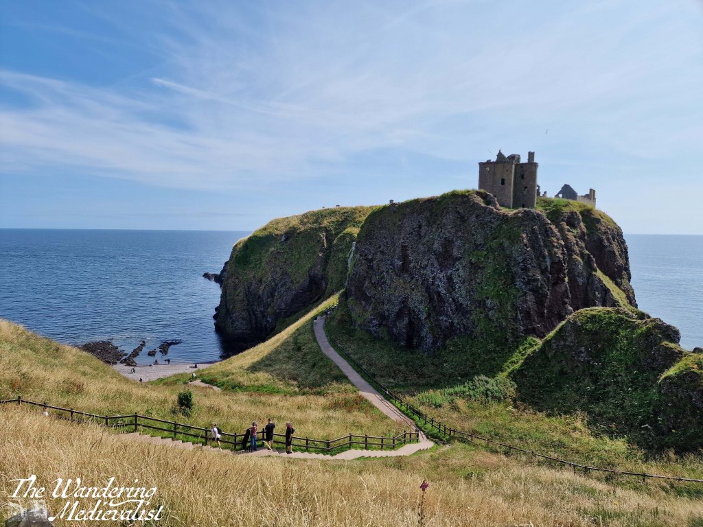
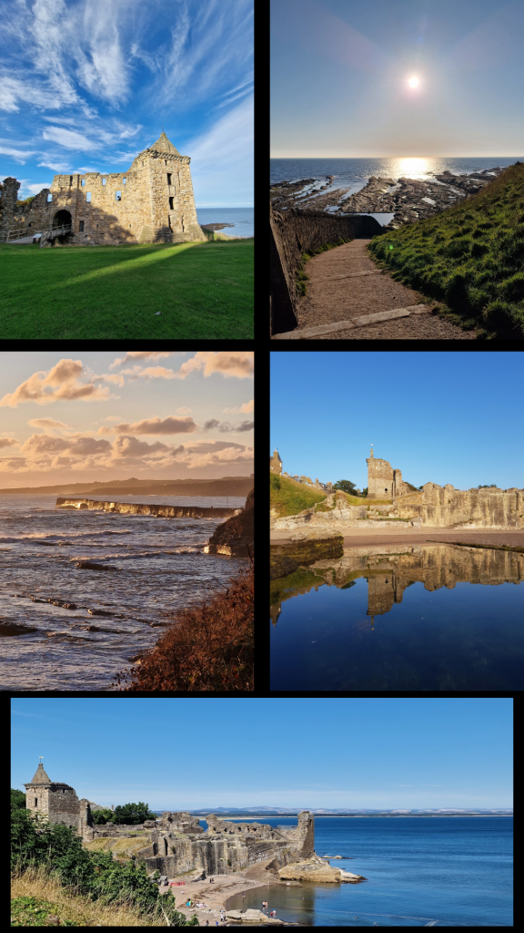
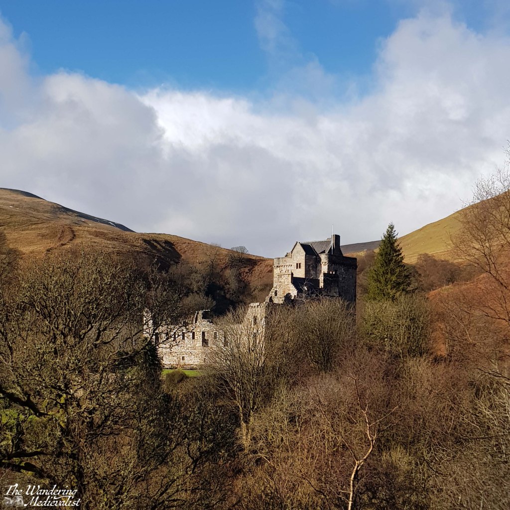
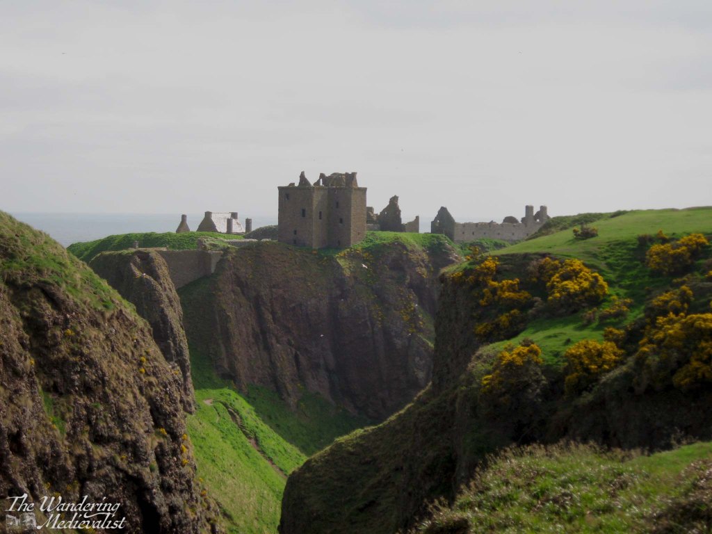
Dunnottar Castle, sitting on the east coast of Scotland on a headland, is one of the most photographed castles in the UK; if you get a standard Scotland calendar, it’s as likely as not to contain one picture of this castle. And for good reason – the partially-ruined castle sits on its own rock surrounded by the sea, silhouetted against the sky and Aberdeenshire cliffs. Like Edinburgh, it is a castle through which one can see the passage of time, the periods of history in which it was used and built. The keep and entrance are thoroughly medieval, but the North, East and West ranges are all varying degrees of late medieval and modern.
Dunnottar is most easily accessed by car, but if you are trying a carbon-friendly tour of Scotland, you are still in luck. You can either walk up the seacoast from nearby Stonehaven, about 1.5 miles – though prepare for a few good climbs and wear sturdy shoes – or you can get a local bus to the end of the road, about half a mile. I am not sure how often these busses run, however, so definitely keep an eye on the schedules. My mother and I first visited more than ten years ago, though I cannot recall how we actually reached the castle as we were definitely without a car; I have a feeling we actually took a taxi from Stonehaven train station, so that may be another option.
Tickets for the castle are purchased once you make it inside the fortress, so in theory one could visit and walk along the coast to see the castle from a distance, but for free. The opening hours vary by time of year, but are up to date on the castle website, where you can also buy tickets in advance.
There is a good-sized car park with a porta-loo and a very good catering van that sells drinks, ice cream, chips and rolls with bacon, burgers, hot dogs, or haggis. There may have been a vegetarian option, but I am not positive.
The adjacent picnic benches are visited regularly by scores of sparrows living nearby, and they are quite tame, hopping right up to you for a few crumbs or a piece of roll.
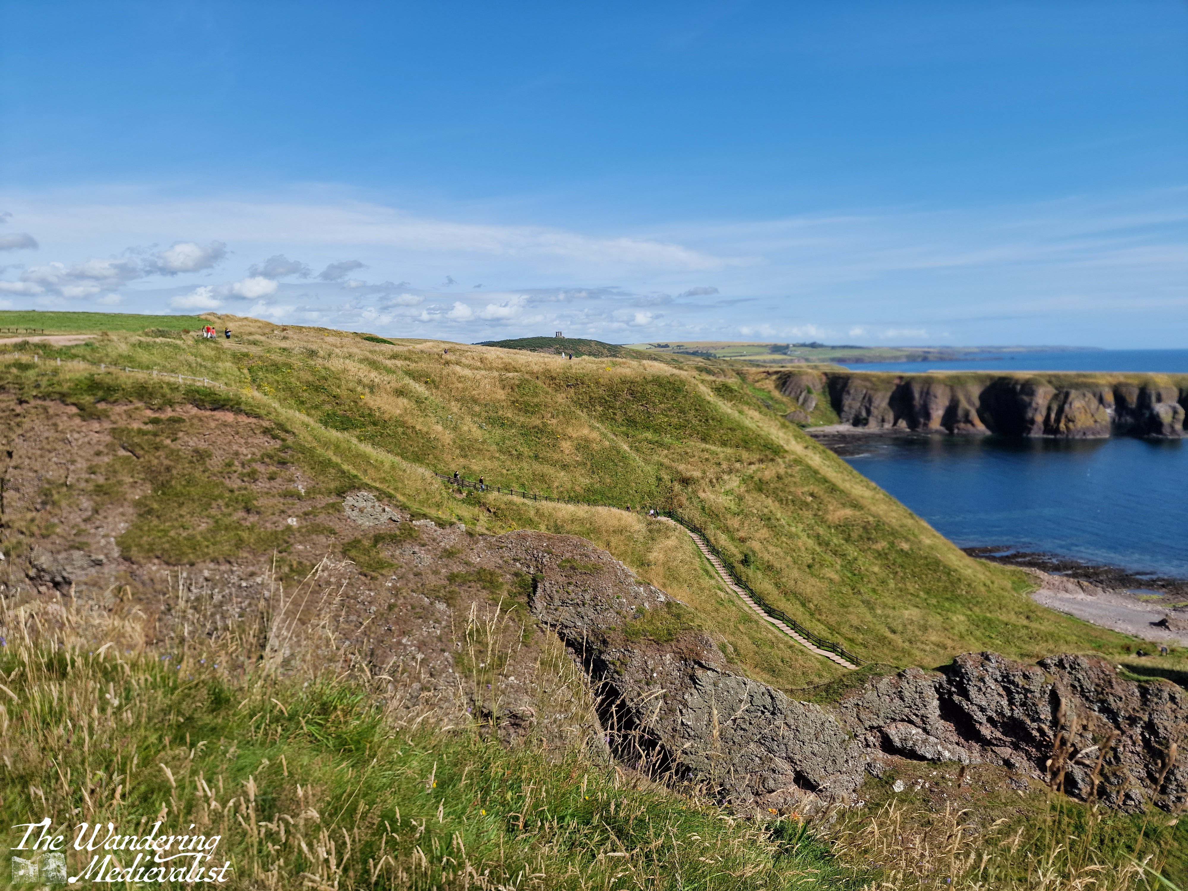
From the car park, visitors start off down a wide path lined with thistle and wild roses, with the castle slowly rising on the horizon ahead.
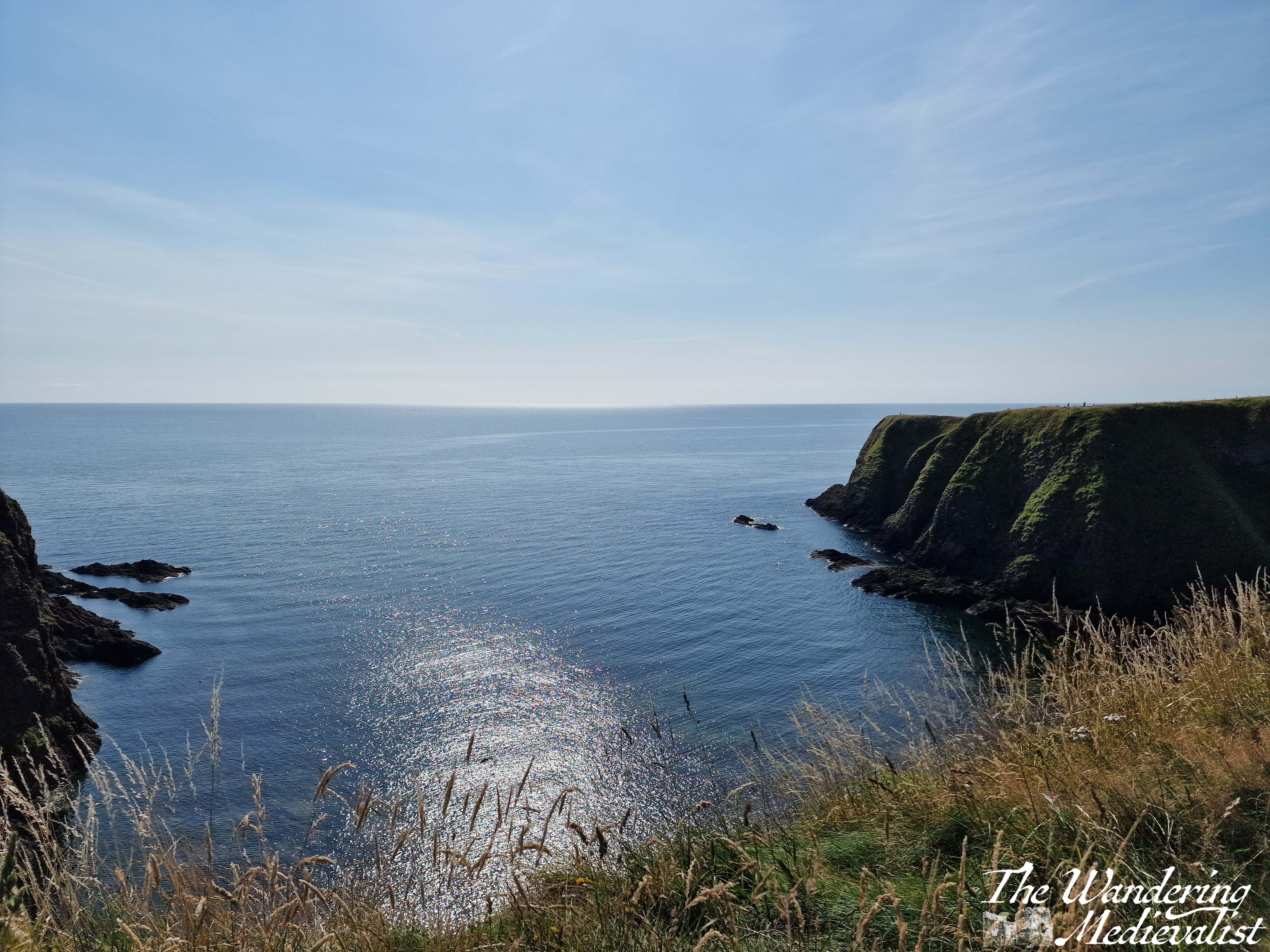
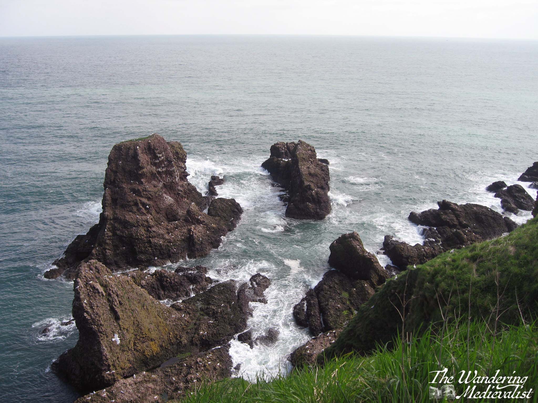
One has an option to go left along the coast, right across a few small bridges to a viewpoint, or immediately to the castle. I recommend, to get warmed up, a jaunt along to the right first, where you will go down and up a few sets of stairs and path as to move along the cliff. This path is also lined with Scottish fireweed (purple flowers) and gorse, and there are several excellent places to pause for a picture.
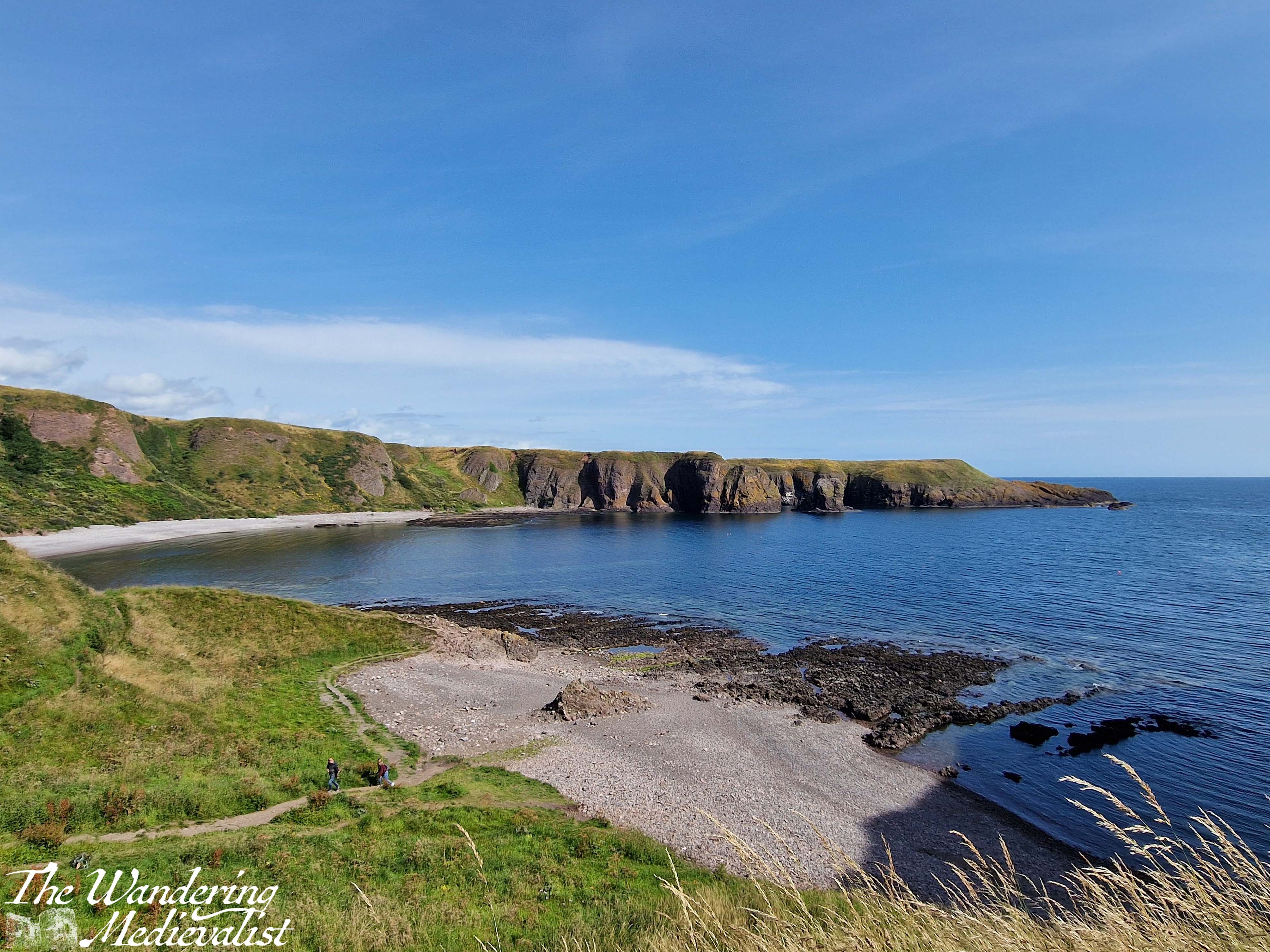
The viewpoint itself allows for gorgeous pictures – as one would expect – of the rock on which the castle sits, the coast, and the sea. From here you can also get a good feel for the staircase awaiting you to access the castle.
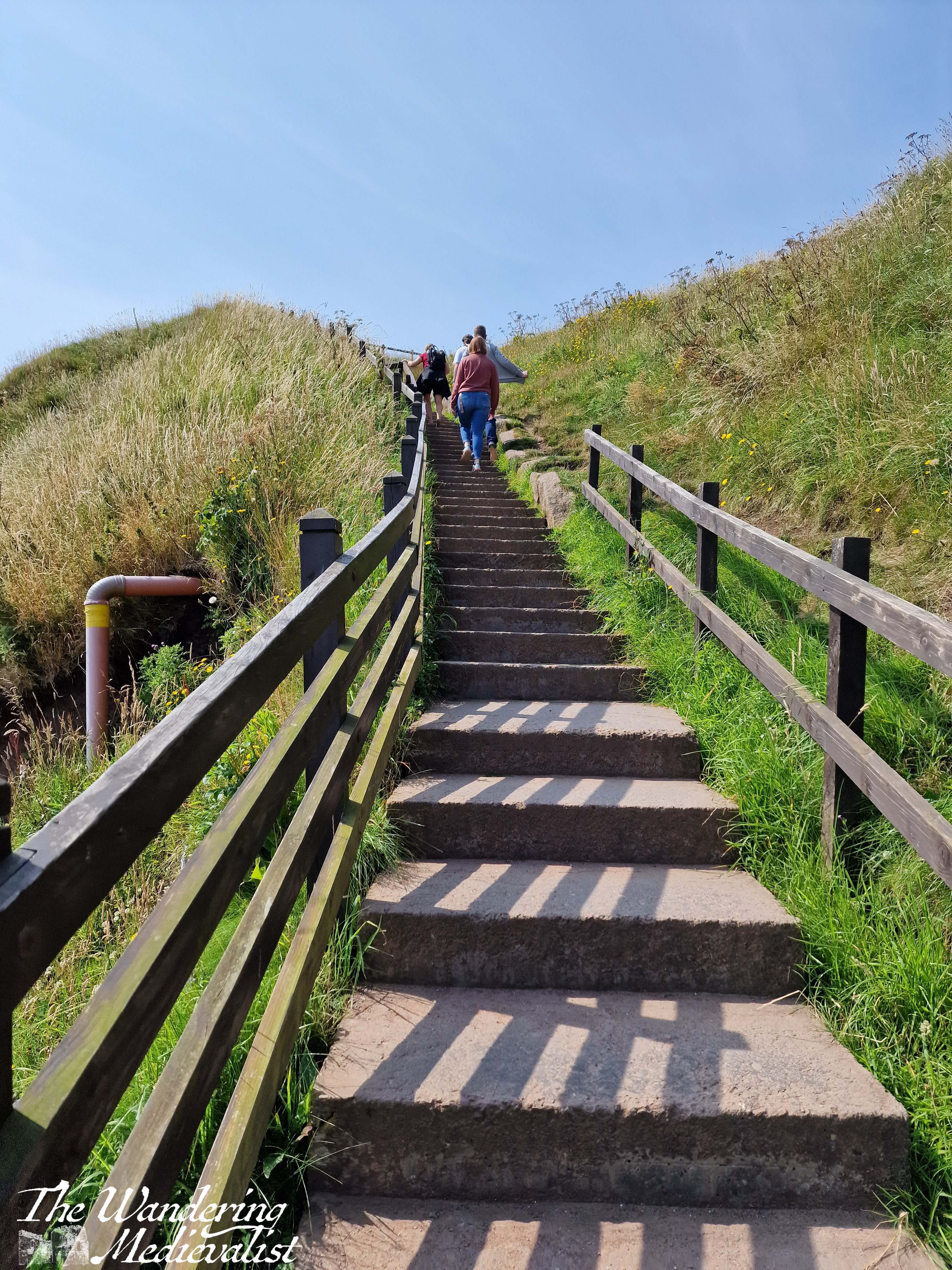
Once you have had your fill of this particular view, you can continue along the coast quite a bit further, or you can head back down and up to the point you started, looking over the castle and bay. From here, you must descend what must be around 100 steps, zig-zagging down the steep hillside towards the beach. The stairs are wide enough for two to pass and have a solid railing, plus at least one bench at which one can take a breath. This route also offers some excellent views, though it’s hard to stop for long when there is a queue of people behind you waiting to get down, or up.
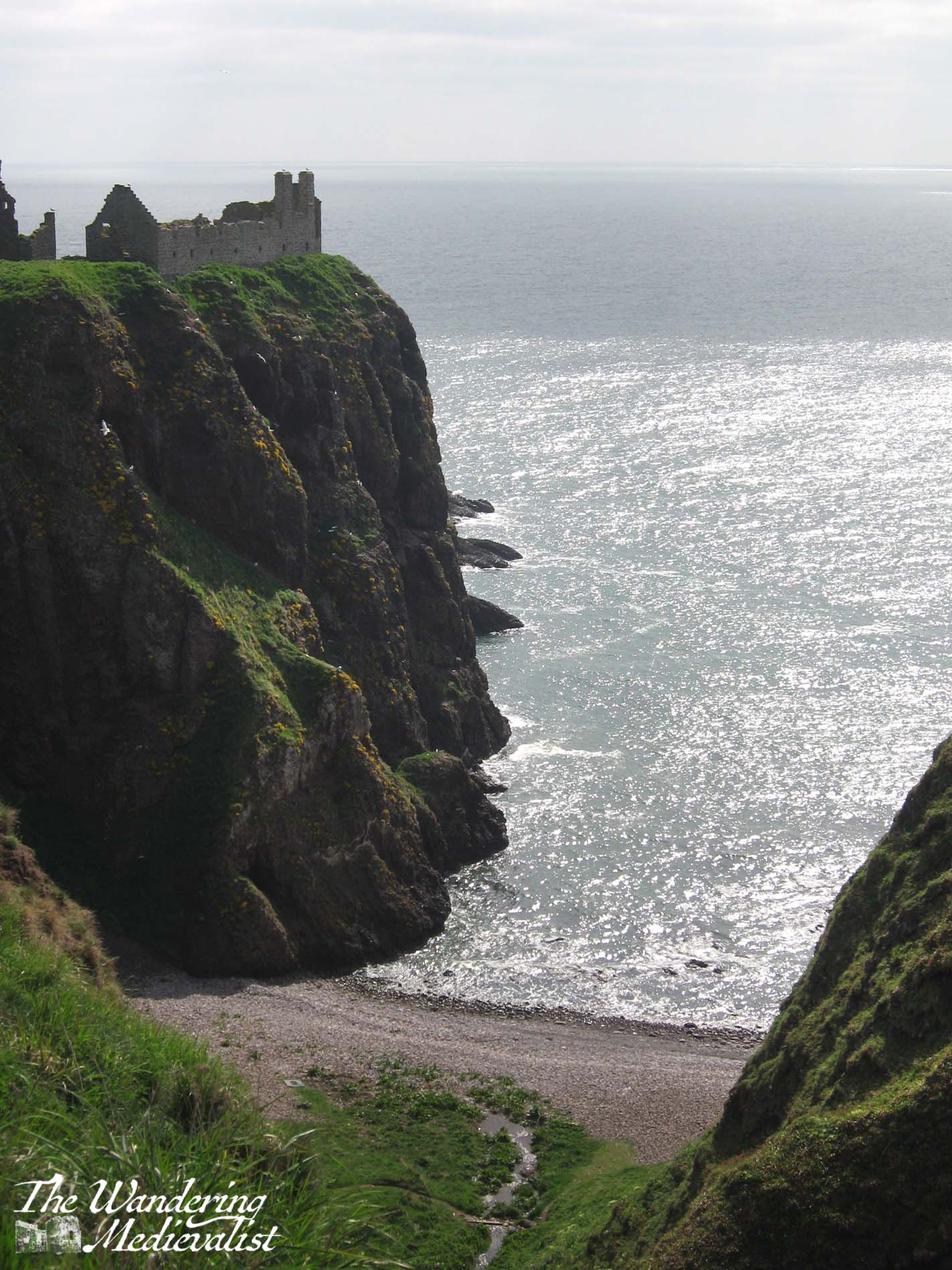
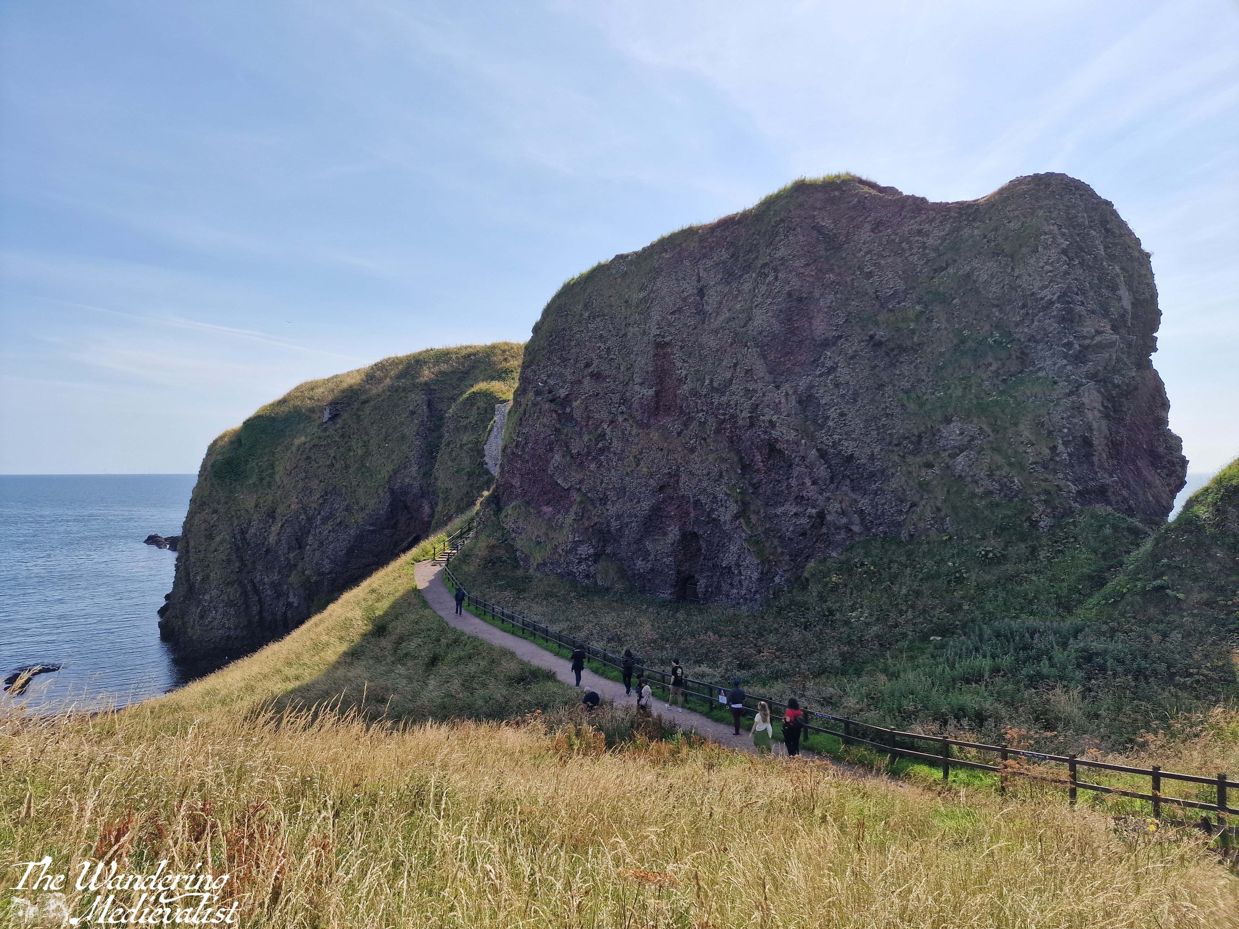
The bottom of the staircase offers again two options – you can scamper off left to explore the beach, or go straight ahead to the castle. Here one finds another set of stairs, though first you have a good view of the rock on which the castle is built, including a gated cave and the land bridge that once connected the castle to the coastline but was eroded for security.
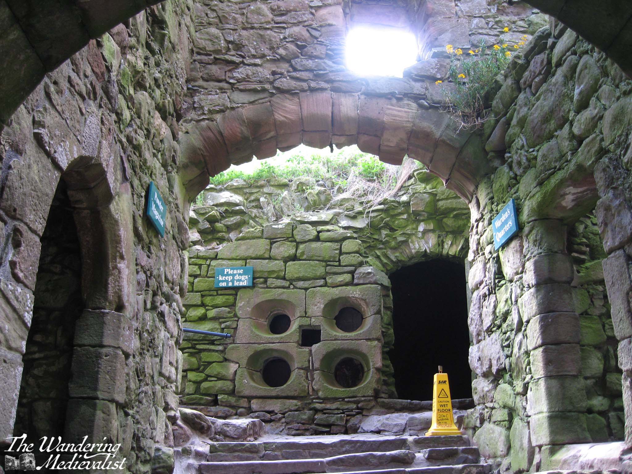
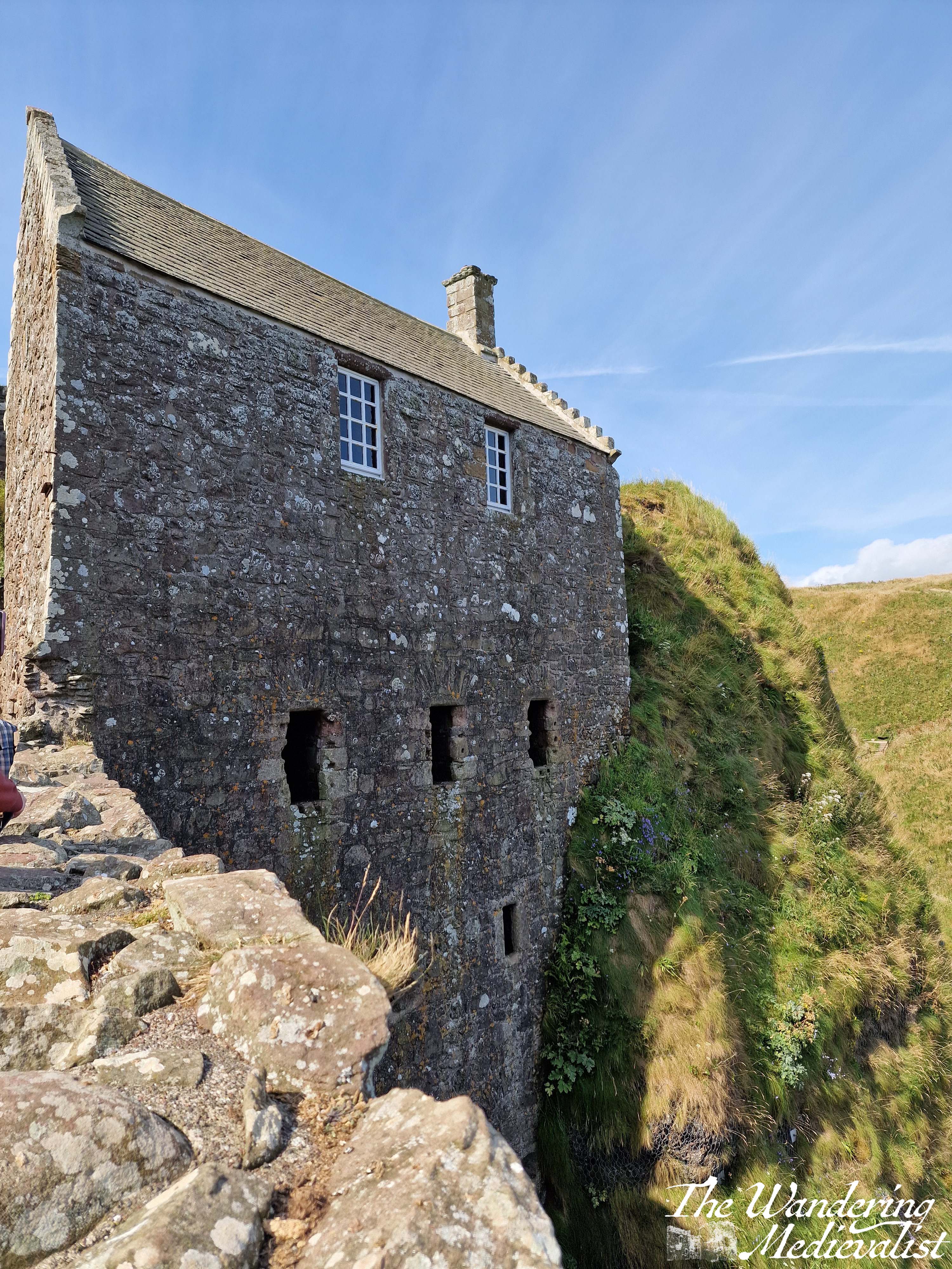
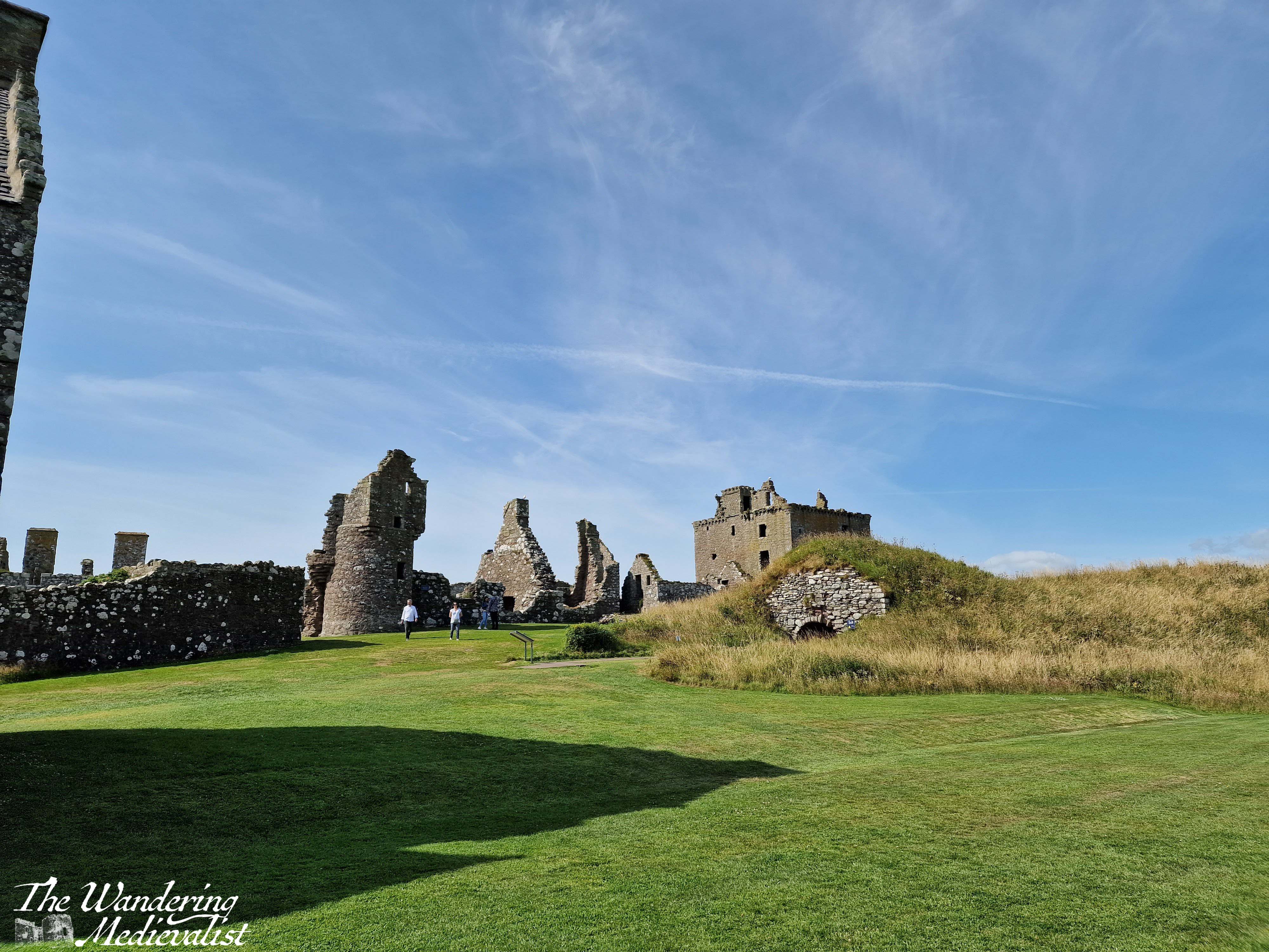
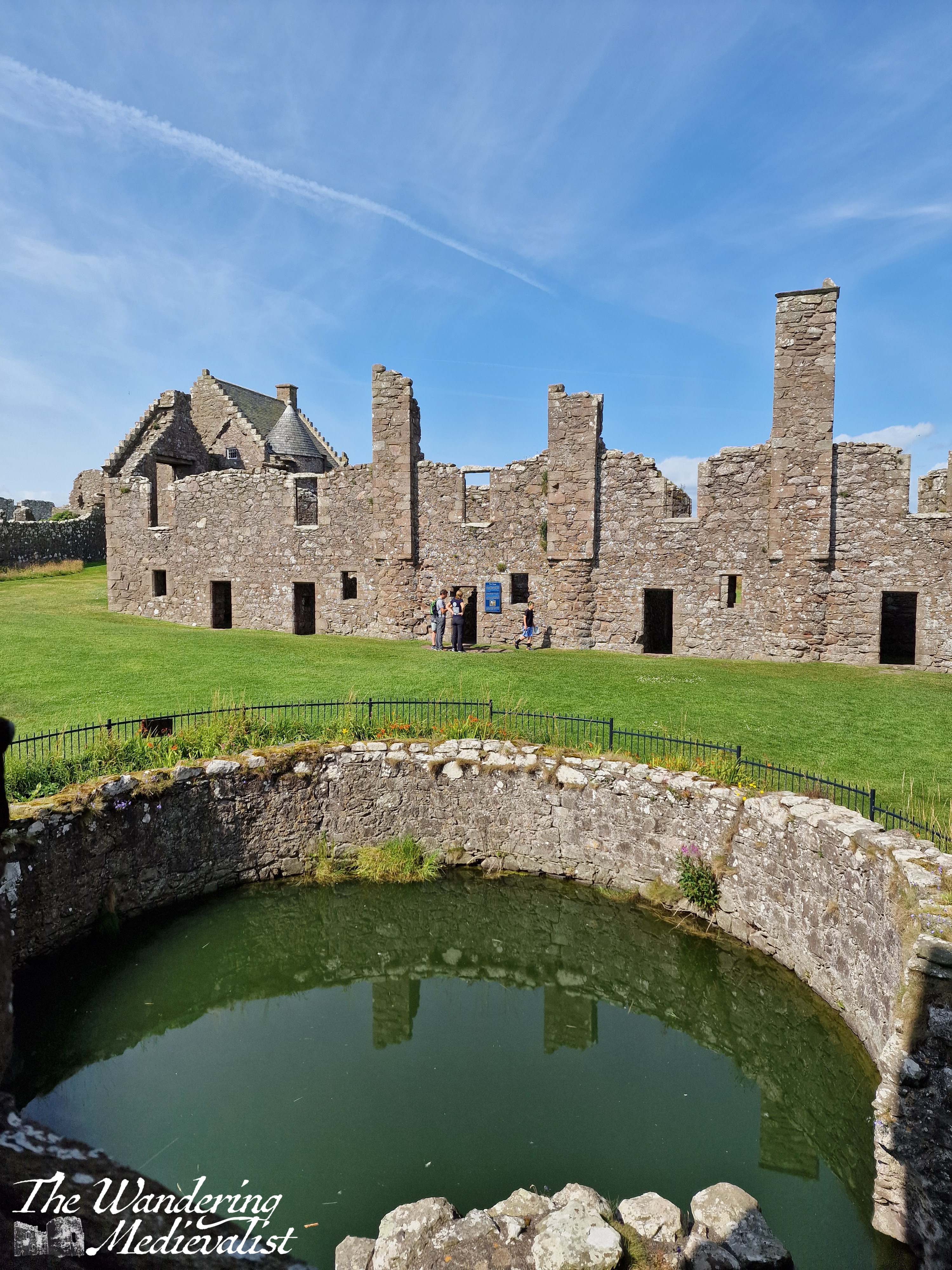
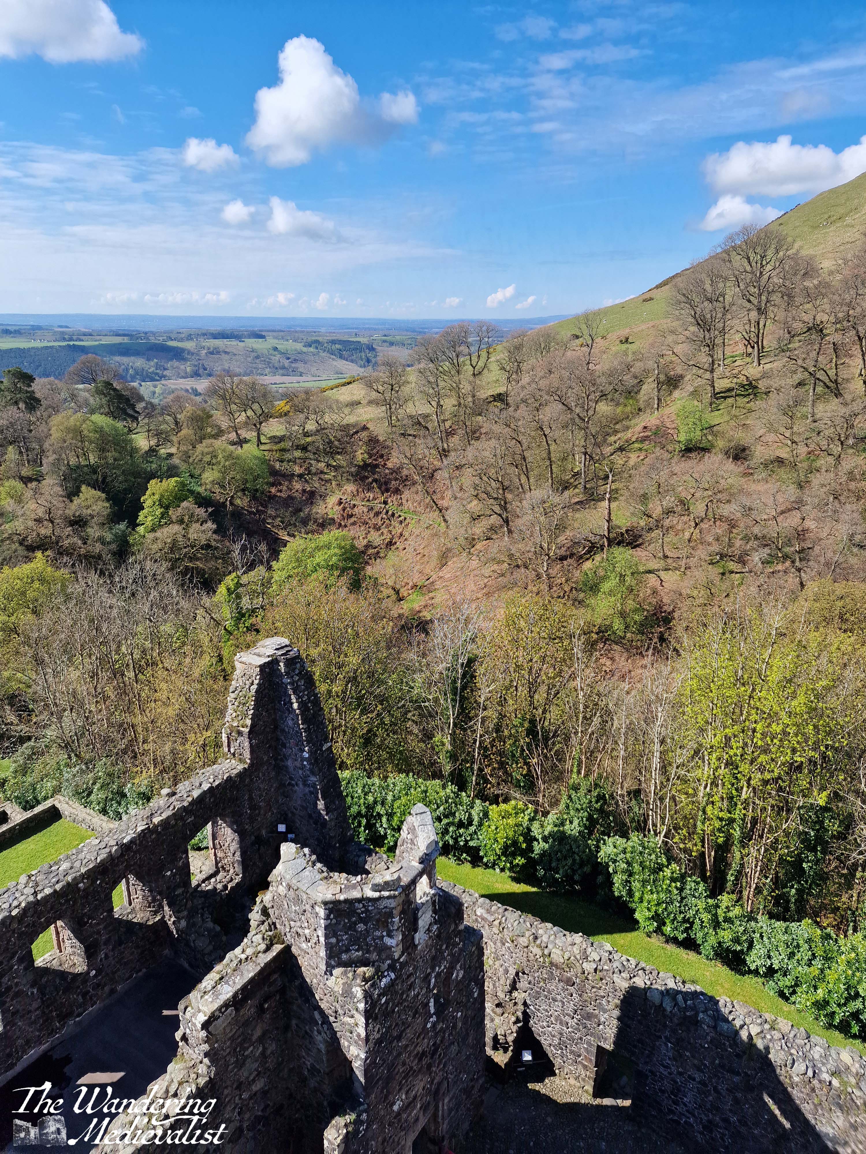
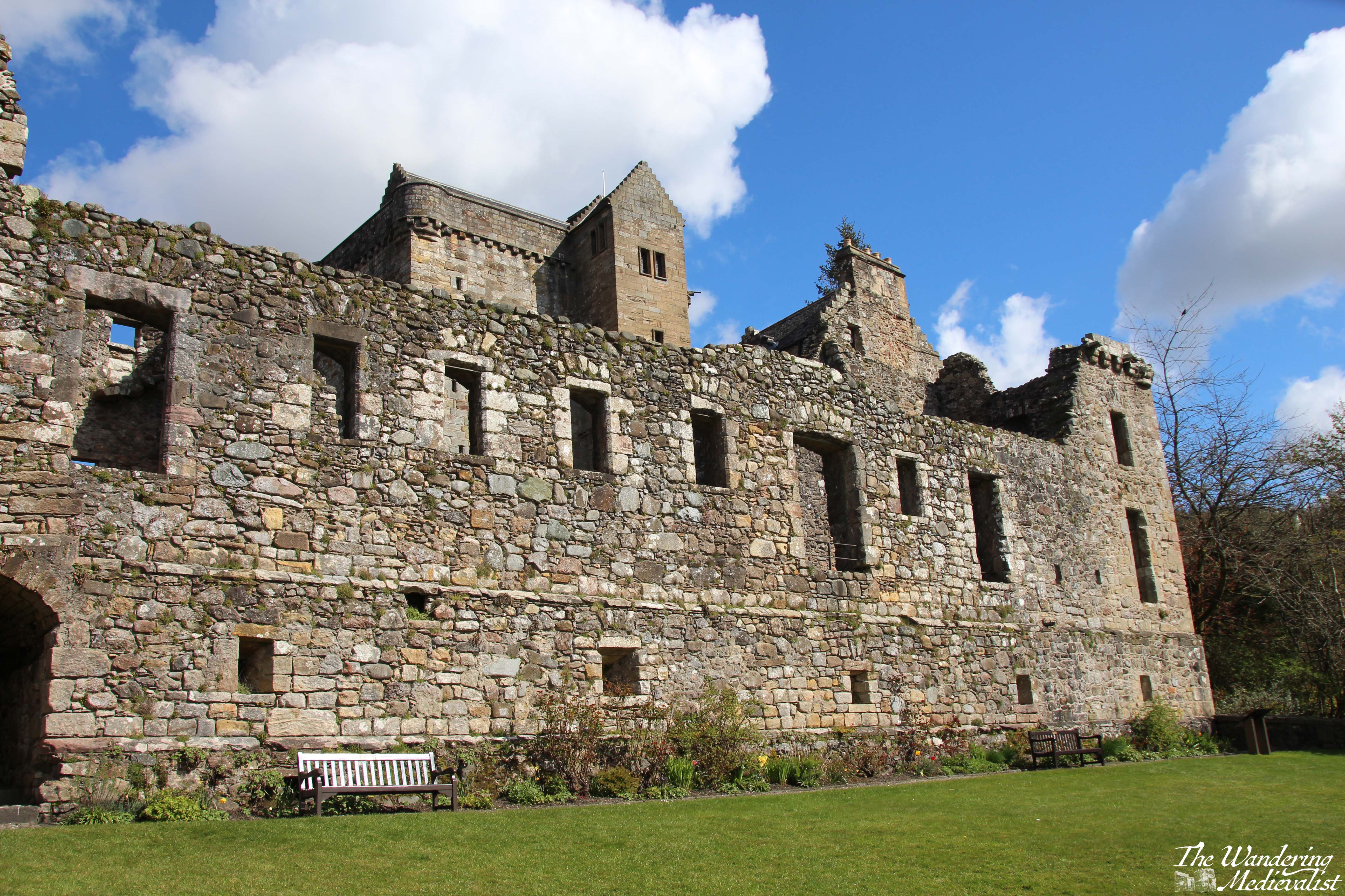
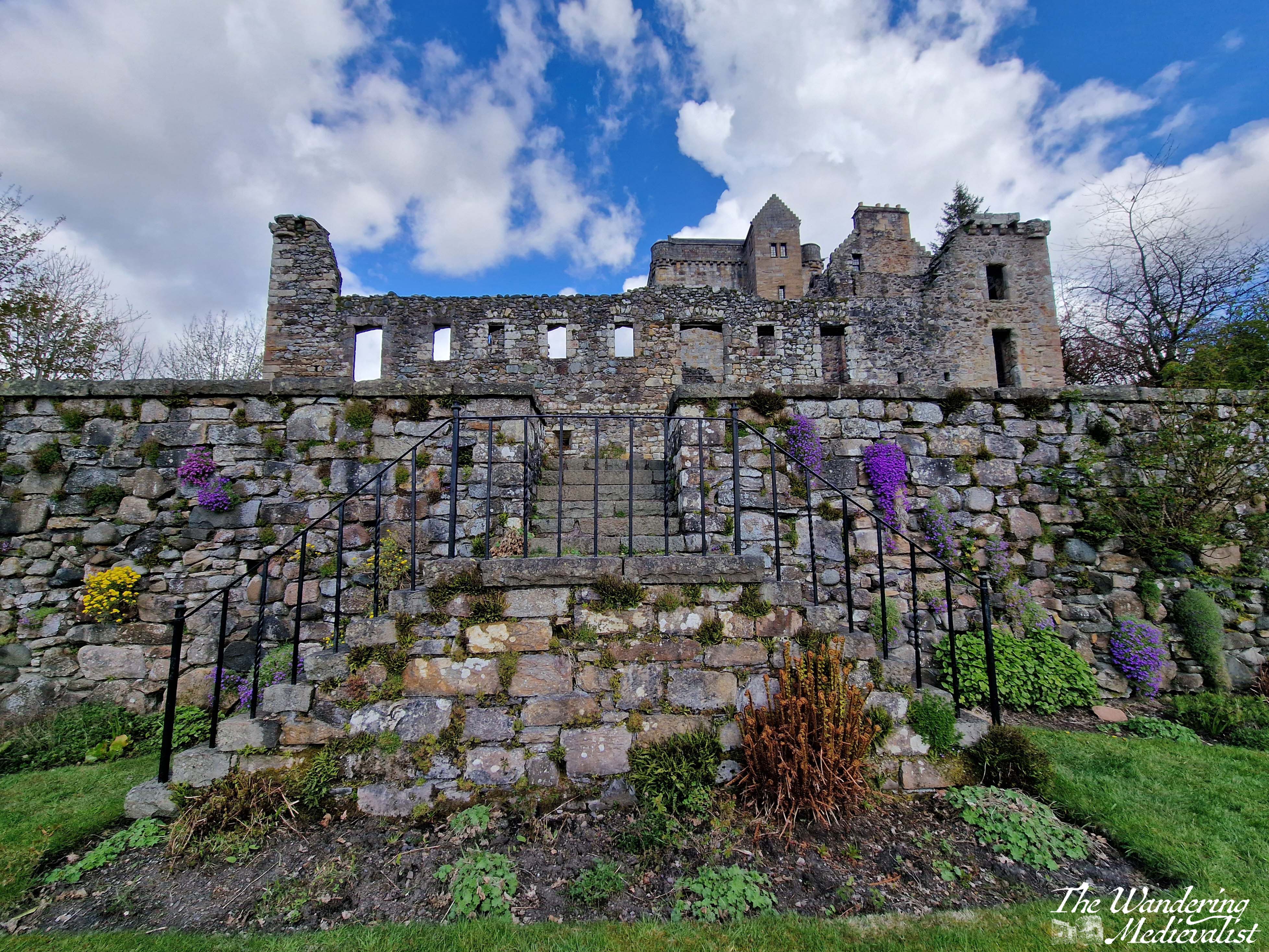
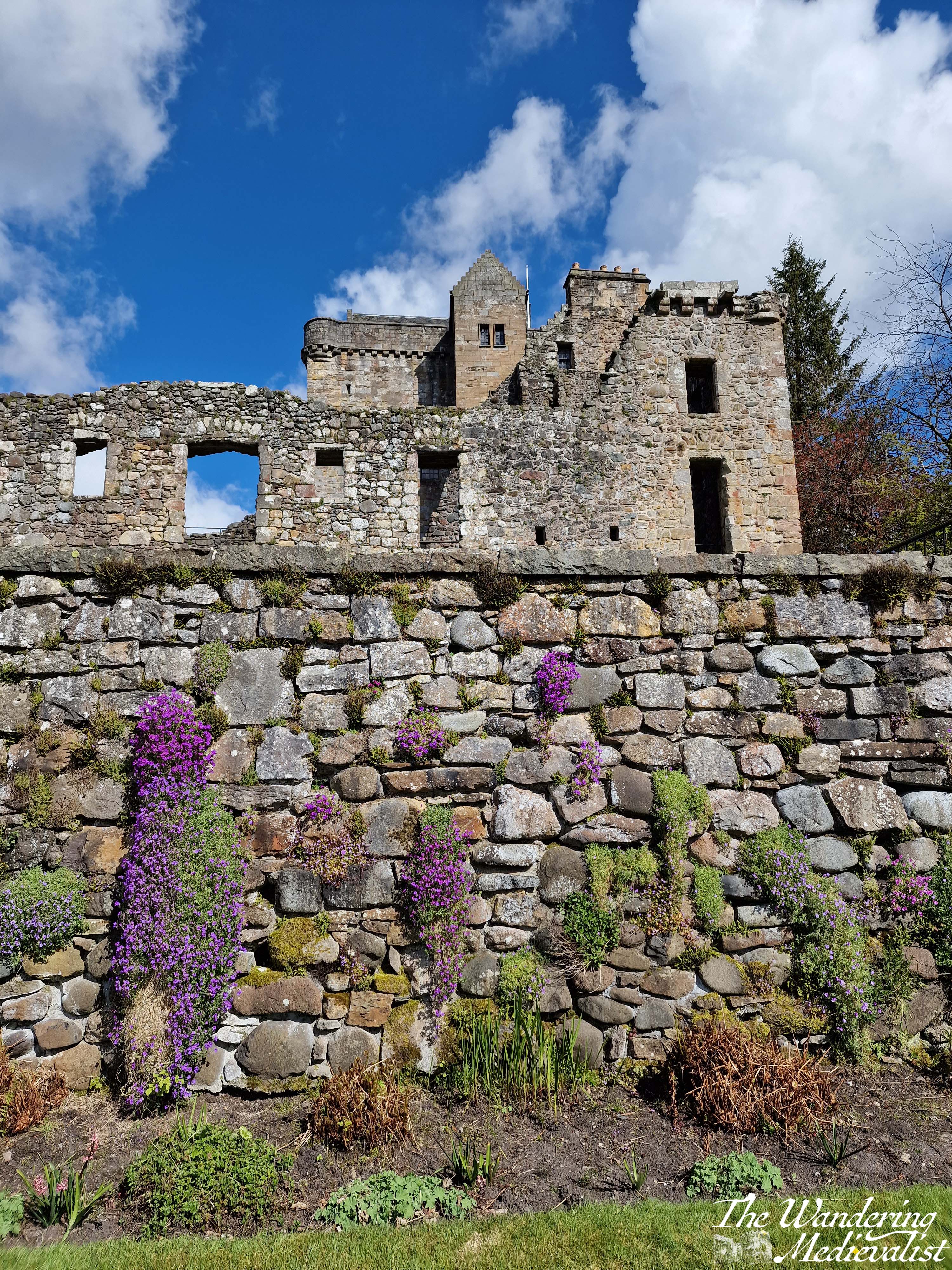
Stairs take you in a postern gate type of entrance, and then up through the gatehouse to where you buy or show your tickets. From the ticket office, there is a well-marked route climbing up through the castle, past Benholm’s Lodging, a structure clinging to the edge of the rock. The top floor is a comfortable enough room, while the lower levels are all designed to aide in defence of the castle with numerous arrow loops.
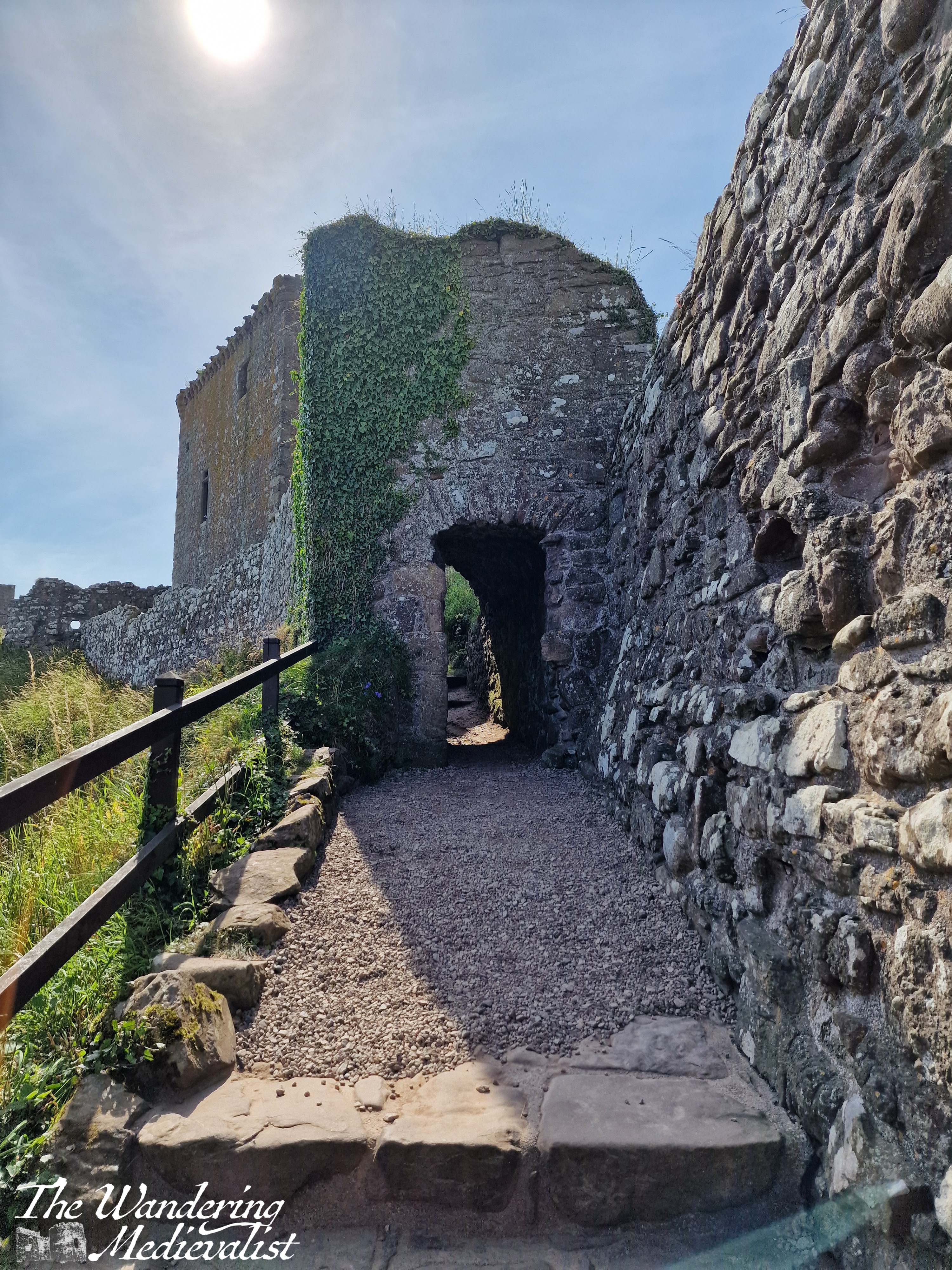
Another short climb through a pends – covered passage that make you very pleased you are not storming the castle – and finally in front of you rises the medieval keep, strong and square and emblematic of high medieval Scottish construction. The keep was constructed in the 1390s by Sir William Keith, Great Marischal of Scotland, a hereditary post held by his family and one of great importance to the governing of the kingdom. Quite well preserved, the keep hosts a large kitchen hearth on the bottom floor and a rare straight stone staircase leading to the second floor. Here you can look out over the rest of the castle or the beaches beyond.
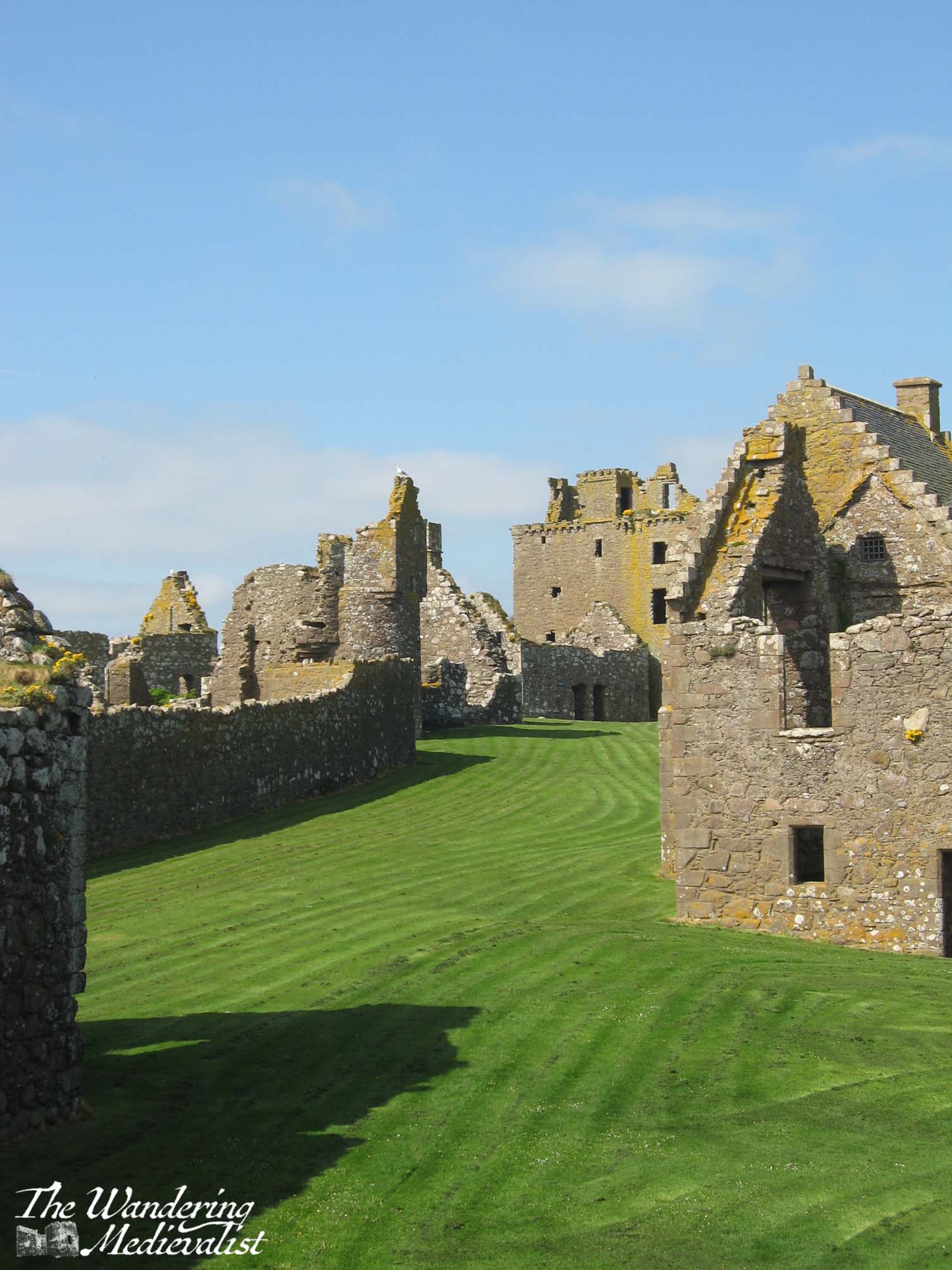
Once you have fully explored the keep, you will find countless other structures in various states of ruin from the storeroom and stables to the increasingly less-medieval ranges built through the early modern period. There is a cistern for water and probably fish, several residence blocks and the old chapel.
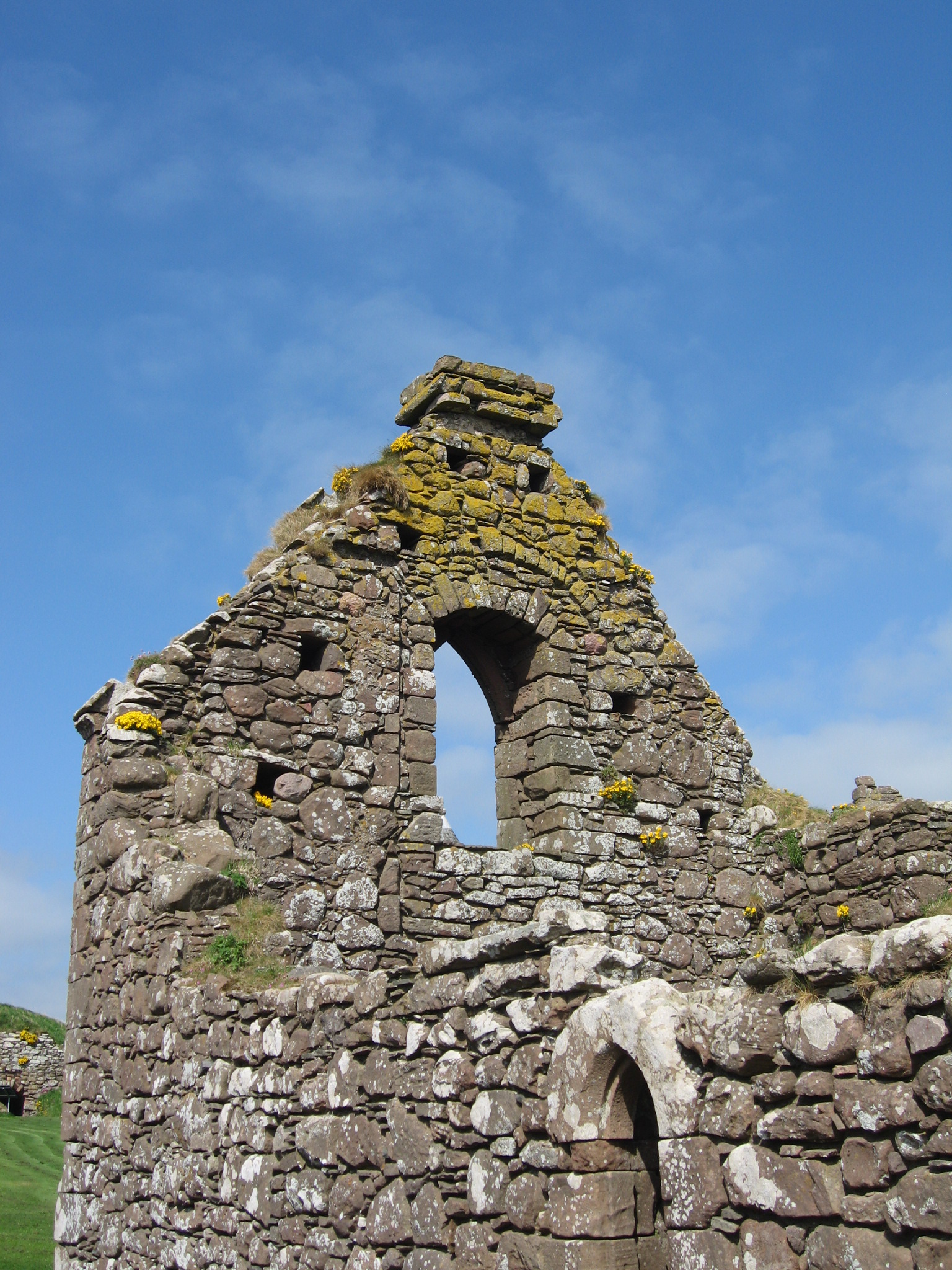
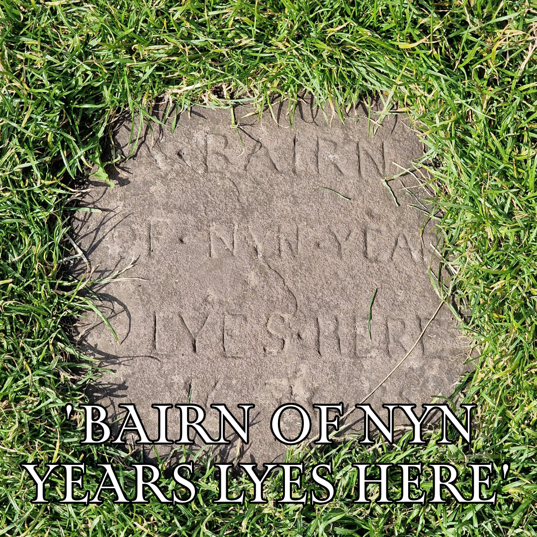
The chapel is key to note, as it is one of the oldest structures; consecrated in 1276 by William Wishart, the Bishop of St Andrews, it probably replaced a much earlier chapel to St Ninian, a missionary saint who is very popular in Scotland. The site of Dunnottar itself was likely inhabited as early as the fifth century by the Picts, and it was a religious site in the early Middle Ages, meaning that the construction of a defensive castle caused some upset. The pope even became involved in the dispute. Poignantly, the land that was graveyard is now mostly grass, with only one marker remaining.
The chapel may have been the site of a massacre of the English by William Wallace in 1297. Blind Harry, Wallace’s often unreliable biographer, relates that English soldiers had fled to Dunnottar for sanctuary – validating the site as a religious one – but that Wallace set fire to the chapel, burning many soldiers alive. The survivors were run off the edge of the cliff. The brutal story may not be completely true, but the may have gotten the gist of things.
A more complete history and many details can be found on the very helpful website for the castle.
A few highlights include a stay by Mary Queen of Scots – where didn’t she stay in Scotland? – and the protection of the Honours of Scotland (the royal regalia) during the invasion by Cromwell in the 1650s. One can spend a very pleasant time just sitting on one of the many benches and enjoying the view, over the sea or the castle grounds, which are impeccably well-kept.
Another option is to walk essentially around the edge of the rock, where you can enjoy the views down over a tremendous rock formation, and along the headland.
In all, you could easily spend several hours exploring the many nooks and crannies. The group I was with scattered to all corners of the castle, and it was lovely to sit in the sun and gradually wait for them all to drift back again, with various stories of things they had seen. Once we had traversed the stairs once more, we chose to walk along the cliff in the Stonehaven direction for about a mile, with the ocean and views of castle on one side and fields of cattle on the other.
This view really shows you the path down and back up to the castle, as well as the eroded natural land bridge..
There are a few caveats to visiting this castle – caveats may really be too strong a word, more things to be aware of when planning:
Firstly, as you have doubtless gathered, it is not particularly accessible. There are lots of steep steps just to get to the castle, and more inside as you ascend through the pends. Secondly, any refreshments you may want in the castle itself must be brought by you. This is of course quite reasonable, but considering the physical effort to traverse the stairs, it is worth remembering a water bottle. That said, the toilet facilities are limited, with only two stalls for the women and one for the men, I believe. At several points there was a bit of a queue – not a problem at all if you are prepared, but definitely worth knowing ahead of time. The one final disappointment to castle aficionados is that there is no shop selling merchandise, postcards, etc., though this is no doubt because the castle is owned and managed privately. Guide books are available at the ticket office at a very reasonable price.
Overall I’d say that the castle is not quite as suited for an onslaught of tourists as some others I have seen, but it is absolutely worth making the effort, especially if you are prepared!
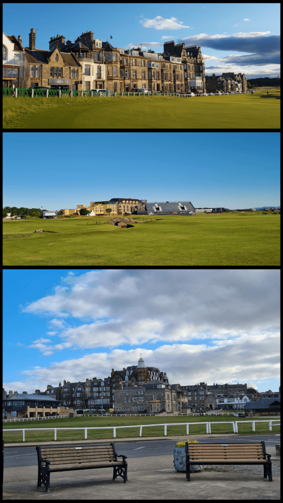
Are you visiting Scotland on a whirlwind visit but only have a few hours in each location? Maybe you’re staying in Edinburgh but want to visit St Andrews for the day? This short walking tour of around one hour takes you past all of my favourite parts of St Andrews. Allow yourself a bit of extra time to pop into some shops and take some pictures, and I’ve added in a few detours if you do have a bit longer to explore.
St Andrews is an easy town to walk around and there are numerous places along this tour where you can pause for a rest or refreshment, but weather can also change quickly so make sure you are prepared. Only a month ago I was in town with my mother when the beautiful sunny view was overtaken in less than 10 minutes by the haar – Scottish fog. But as they say, wait a few minutes, and the weather will likely change.
One caveat is that while you will see portions of the University on this tour, it will not show you everything. The University does not have a campus, but is spread out around the town, so you will see the crest on many random buildings where you may not expect it.
This tour route assumes you are arriving for the day from the train or bus, so start at St Andrews Bus Station (if you are using a travel app, make sure not to confuse this with St Andrews Bus Station in Edinburgh!)
Part 1 – St Andrews Bus Station to the Westport
Start your walk at the zebra crossing just outside the bus station and continue along to the roundabout – do not cross at the first set of lights you reach. At the roundabout, cross Doubledykes Road and then use the pedestrian crossing at the next set of lights you come to. Continue along City Road heading south, and soon you will come to the Westport, one of the last vestiges of the St Andrews town wall, dating from the 1580s. If you want to cross the road here for a better picture, just be careful of the traffic!
the roundabout near the bus stationWest Port, St Andrews
Part 2 – The Westport to Blackfriars Priory
Go through the Westport, and I would recommend staying on the left side of the street; there are several nice shops and the St Andrews Brewing Company, a fantastic local brewery should you already be in need of some refreshment (I particularly like the Yippee IPA). When you reach the next intersection, cross to see the ruins of Blackfriars Priory. Built in 1520 to add to the Dominican Friary, the chapel was destroyed soon after in the Reformation. Behind Blackfriars is Madras College, formerly a secondary school for St Andrews but more recently purchased by the University as it continues to expand its property portfolio and teaching aspirations. Extensive renovation is now underway, though the Victorian-era facade will remain.
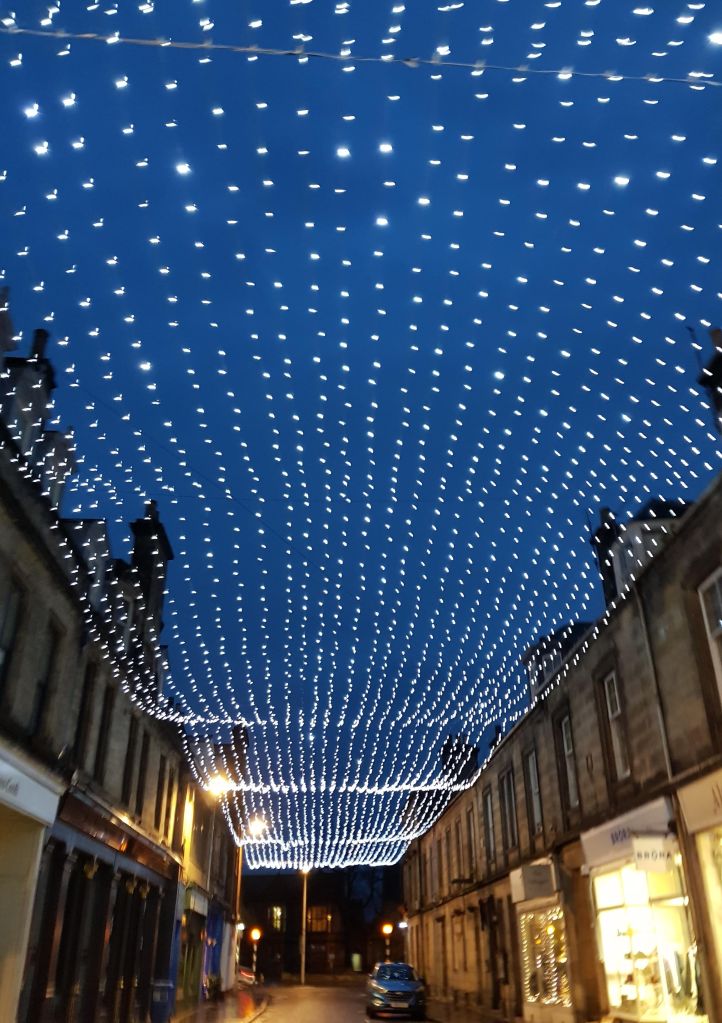
Part 3 – Bell Street
Cross back towards the BrewDog pub and continue almost straight along Bell Street. You’re entering St Andrews’ shopping district here, and you will find plenty of cafés and shops to keep you busy. Sheila Fleet at the end of the shop does some beautiful Scottish jewellery, and the Taste of Scotland shop on the corner offers a massive range of whisky, gin and other spirits.
Bell Street is also where you are likely to find a taxi later in the evening, as well as St Andrews’ most infamous late-opening pub, Aikman’s. It has not changed in more than 20 years, for better or worse, and is still popular with students.
Bell Street with Christmas lights
Optional detour: at the end of Bell Street, continue straight across to Greyfriar’s Gardens, where you can glimpse some lovely gardens and visit the famous Topping & Co. bookstore.
Part 4 – Market Street
Once you reach the end of Bell Street, along to the left you will see the St Andrews University Students’ Association, a large building completely clad in glass. It is the spot to get university merchandise, should you want some, and has a great café. I recommend however taking a right up Market Street, the main shopping street for St Andrews. You will find tourist shops, coffee shops, pharmacies, clothing stores, and two small supermarkets. Most of the brand stores are here including Pret A Manger, Starbucks, Black Sheep, and Costa.
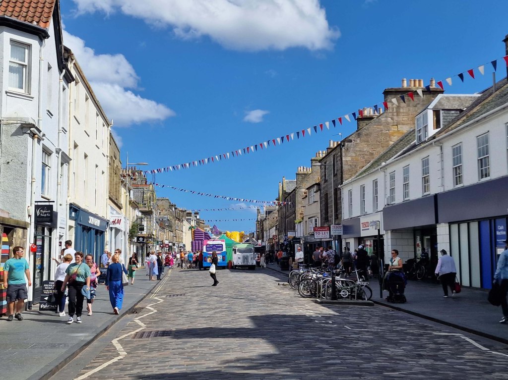
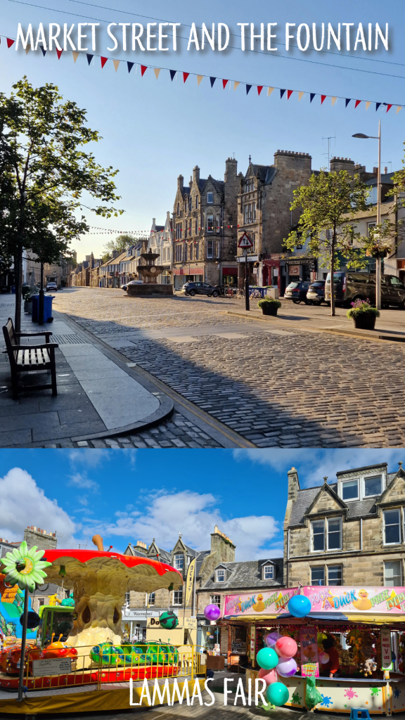
Mitchell’s Deli about halfway along is a great spot for lunch, and Forgan’s offers a Friday night ceilidh. Market Street is always done up with Christmas lights in the winter, and hosts the Lammas Market for one weekend every August.
As the cobbled street widens, you will catch sight of the Whyte-Melville Memorial fountain, constructed in 1880. A massive re-paving and widening of the sidewalks was done in 2010/11, but they can still feel crowded at certain times of day or year.
Market Street – bottom end
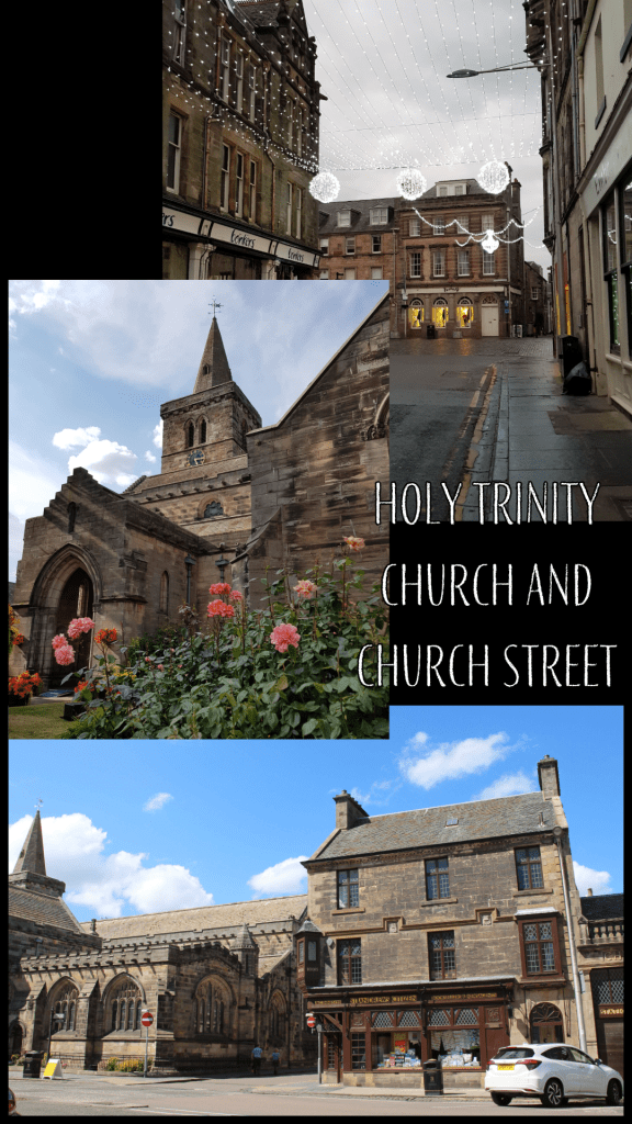
Part 5 – Church Street
Once you reach the fountain, take a right onto Church Street, named for the medieval Holy Trinity Church that dominates the far end. Church Street is also home to one of St Andrews’ most famous family-run shops, Fisher and Donaldson – make sure to stop in for a yum yum, fudge donut, or other delectable treat.
At the end of Church Street is the now-closed J&G Innes shop (also known locally as the Citizen office), which has some truly stunning decorative carvings on the listed stone.
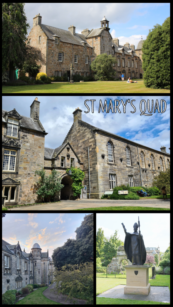
Part 6 – St Mary’s Quad and South Street
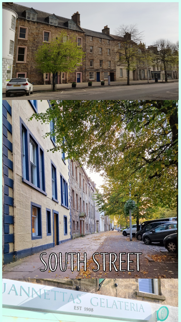
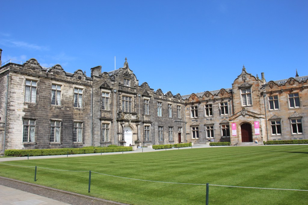
At the corner, turn left onto South Street, or take a quick jog to the right to enjoy the Church Square first. Cross the street across from the Criterion pub, and you will find a gated archway leading to St Mary’s Quad. This is the location of the School of Divinity and Parliament Hall, where the Scottish Parliament met to escape the plague in 1645. Take a short loop around the tree in the centre of the quad and you will see a statue of Bishop Henry Wardlaw, and the end of the new Music Centre that opened in 2021. In term time you will often find students relaxing on the grass or eating lunch here, and the King James Library offers study space and additional books.
Once you’ve enjoyed the quad, leave through the arch and turn right to continue along South Street. You will pass beautiful old stately homes, dating from the 17th and 18th centuries. At the far end, you will find Jannetta’s Gelateria, another famous St Andrews treat destination where the queue will snake down the street on a sunny day. Founded in 1908, Jannetta’s offers more than 50 flavours, not including the sorbet! Go on, treat yourself…
Optional detour: Across from Jannetta’s, go down Abbey Walk and make your way along the beautiful stone wall of St Leonard’s School until you reach the harbour. You can either walk along the inner harbour road or detour out to East Sands, then circle back up to the Cathedral.
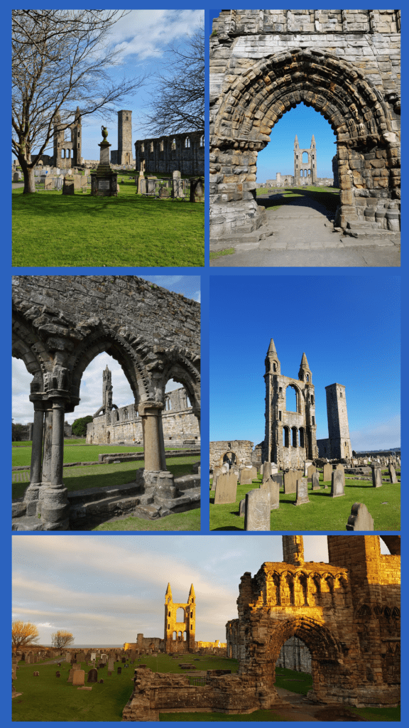
Part 7 – St Andrews Cathedral
Continuing up South Street from Jannetta’s will take you in very little time to the ruins of St Andrews Cathedral. Originally constructed in the 12th century, the cathedral was the ecclesiastical capital of Scotland through out the Middle Ages, and the bishop (later archbishop) was powerful enough to build the nearby castle as his residence. The Cathedral fell into ruin through the Reformation, and the story goes that you can find stones from the great structure in buildings throughout the town.
Though not open in 2024 due to masonry repairs, St Rule’s Tower offers a fantastic view over the whole town if you can scale the narrow staircase. The graves in the cathedral grounds date from the last several hundred years and include the great golfer Old Tom Morris.
Enter the Cathedral through the gate and walk through the grounds, then exit through the door in the far wall. In front of you will be the North Sea!
Optional detour: Turn right along the outside of the cathedral wall and walk to the promontory where several large cannon look out over the ocean. From here you can see down to St Andrews Harbour, East Sands, and the pier.
Part 8 – The Upper Scores and St Andrews Castle
Turn left out of the Cathedral grounds and hug the coast to climb up a rise looking over the sea. This is one of the best views in town, along the coast, into the Cathedral grounds, and to the Castle. Below and to the right, you will see St Andrews pier, which is famous for its use during University processions. Unfortunately it was seriously damaged during Storm Babet in October 2023, so while it looks perfectly sound from above, it is not open to the public. There are several benches here where you can enjoy the view, and this is my favourite path in town.
Continue along the coast, following the metal railing and heading towards St Andrews Castle.
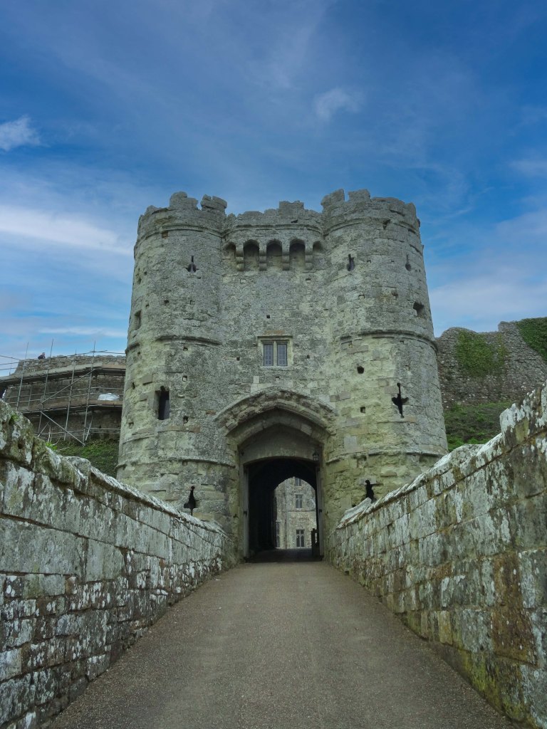
The castle was constructed starting in the 13th century and contains a bottle dungeon and siege tunnels – well worth the time to explore if you have it!
Part 9 – The Scores to the Golf Course
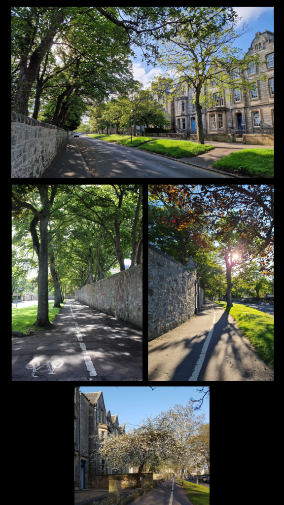
Once you have explored the castle to your heart’s content, continue down the Scores, the road that runs along the edge of the cliffs. Here you are entering the University proper and will pass the Principal’s house, St Salvator’s Hall (a student residence where Prince William lived in his first year), the Schools of English, Classics, Economics and Philosophy, the University Museum, and the Admissions/Student Recruitment office. You will also pass some of the most expensive real estate in Scotland – houses on the Scores are regularly valued at well over £1 million.
If you have some extra time, take a walk up Butts Wynd and peek into St Salvator’s Quad, the real heart of the University.
Eventually you will reach St James’ Catholic Church, the last building on the right; you can either follow the path down to the Bruce Embankment car park or stay on the left-hand side of the Scores. The monument is in memory of the religious Martyrs of St Andrews – of which there were many. Immediately in front of you is the Royal and Ancient Golf Club, and the Old Course.
St Salvator’s QuadMartyr Monument and the R&A
Part 10 – The Old Course and West Sands
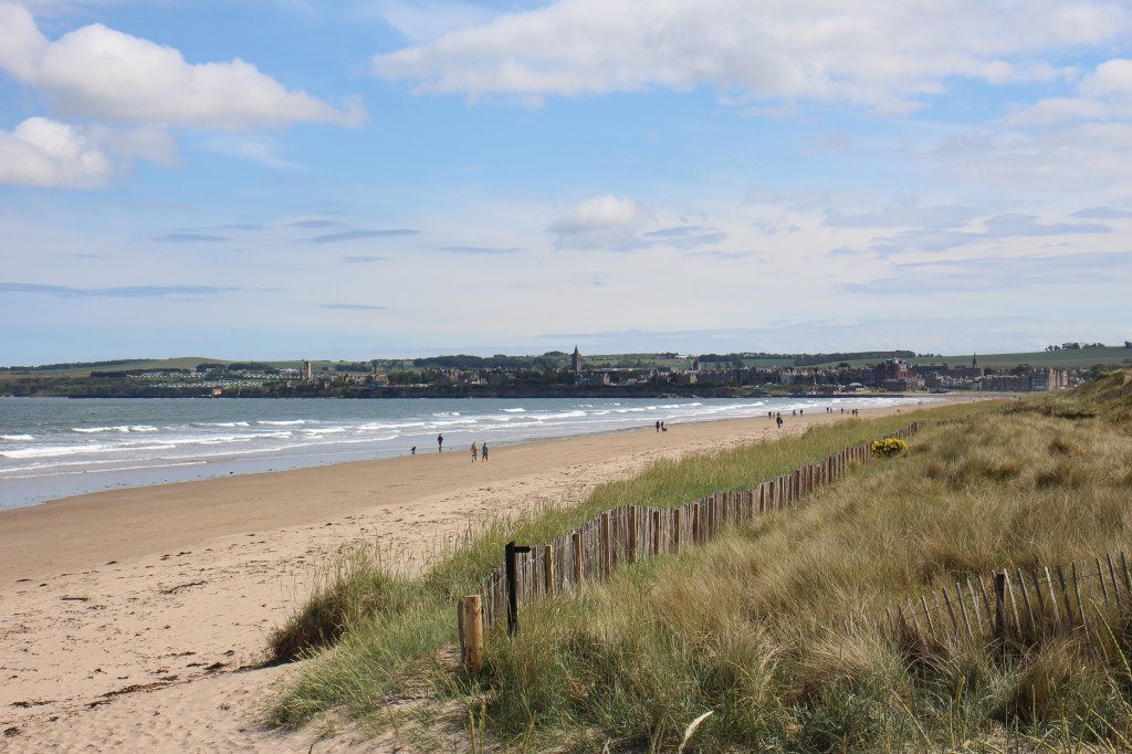
The famous Old Course, where the UK Open Championship is played every five years or so, marks the end of this walking tour. Golf enthusiasts will want to continue around the edge of the course along the Links and take a picture on the Swilcan Bridge.
Non-golfers may want to follow the coastal wall towards West Sands, the long sandy beach where locals walk, run, play sports, swim and surf.
If you’re running short on time, follow Golf Place to North street. The safest thing to do at this point is take a short detour along to the right to where you will find a traffic light and pedestrian crossing. If you are very careful, you may be able to cross before this, but a warning: traffic comes quickly along this road and roundabout, and foreign visitors in particular should take care.
Walk up the hill and you will find yourself back at St Andrews bus station.
view from West Sands towards town
This route may take a bit longer than 60 minutes, and in fact you could probably stretch it to at least two hours if you include the detours. It does not cover all of the amazing parts of St Andrews, but it makes a good start. I hope you have time to give it a go!
If you enjoyed these pics, check out more of St Andrews at my online shop:
Whenever a parent, family member or friend comes to visit, I try to plan an adventure – to be a tourist in my own home, but also to share it, its beauty and wonder.
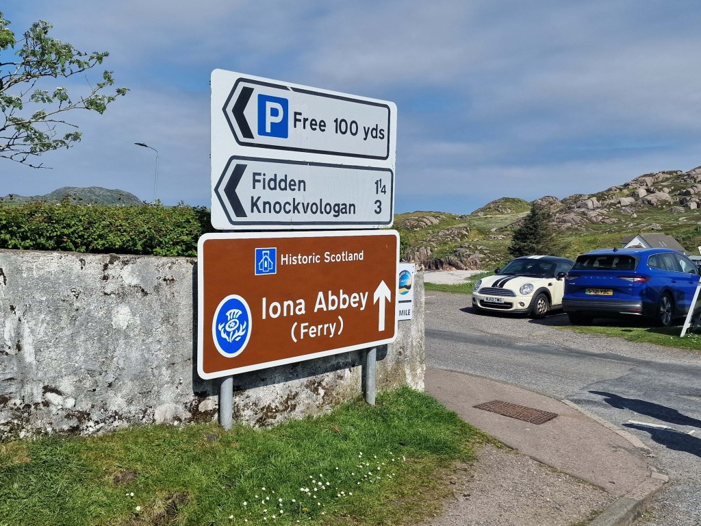
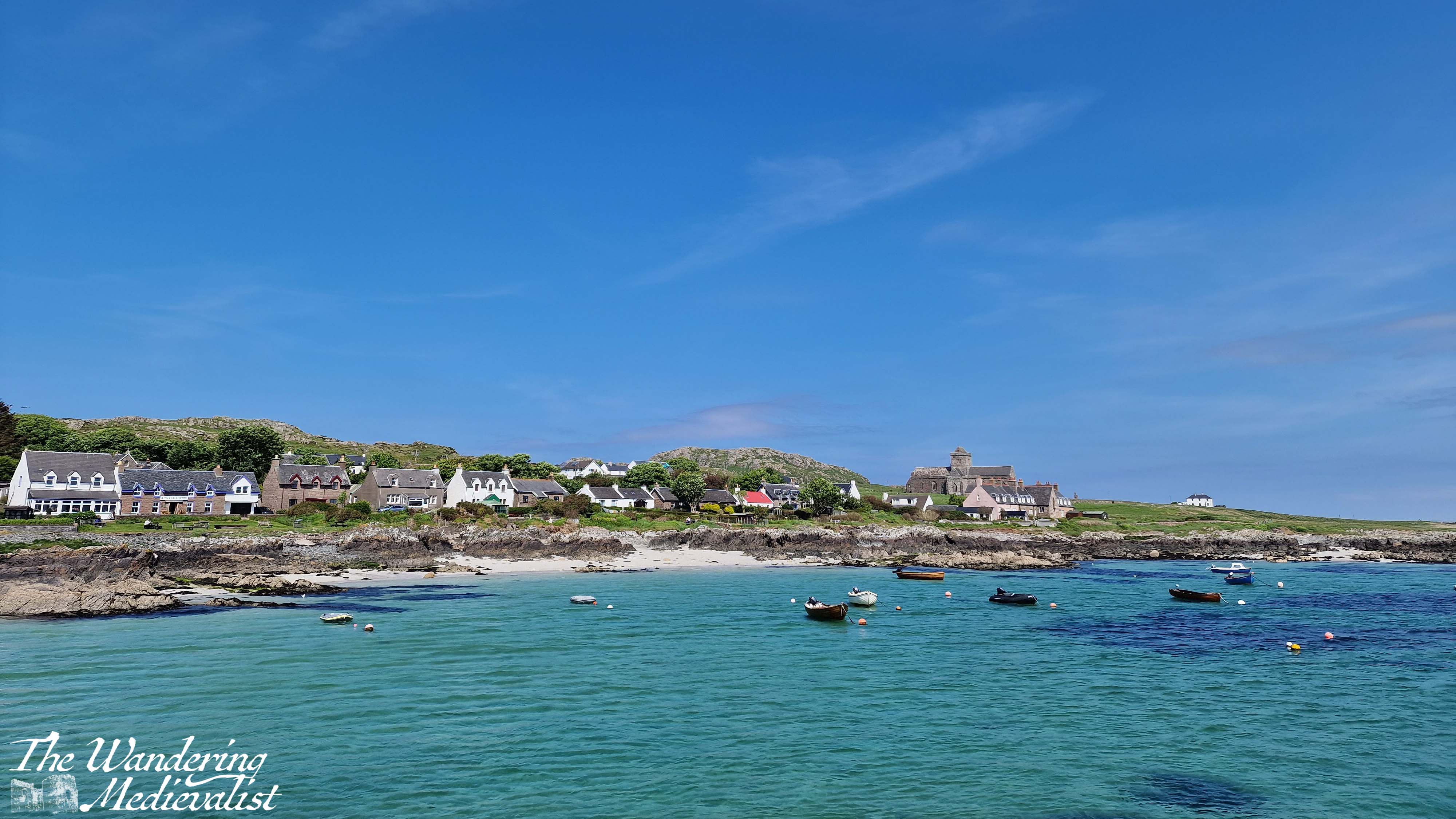
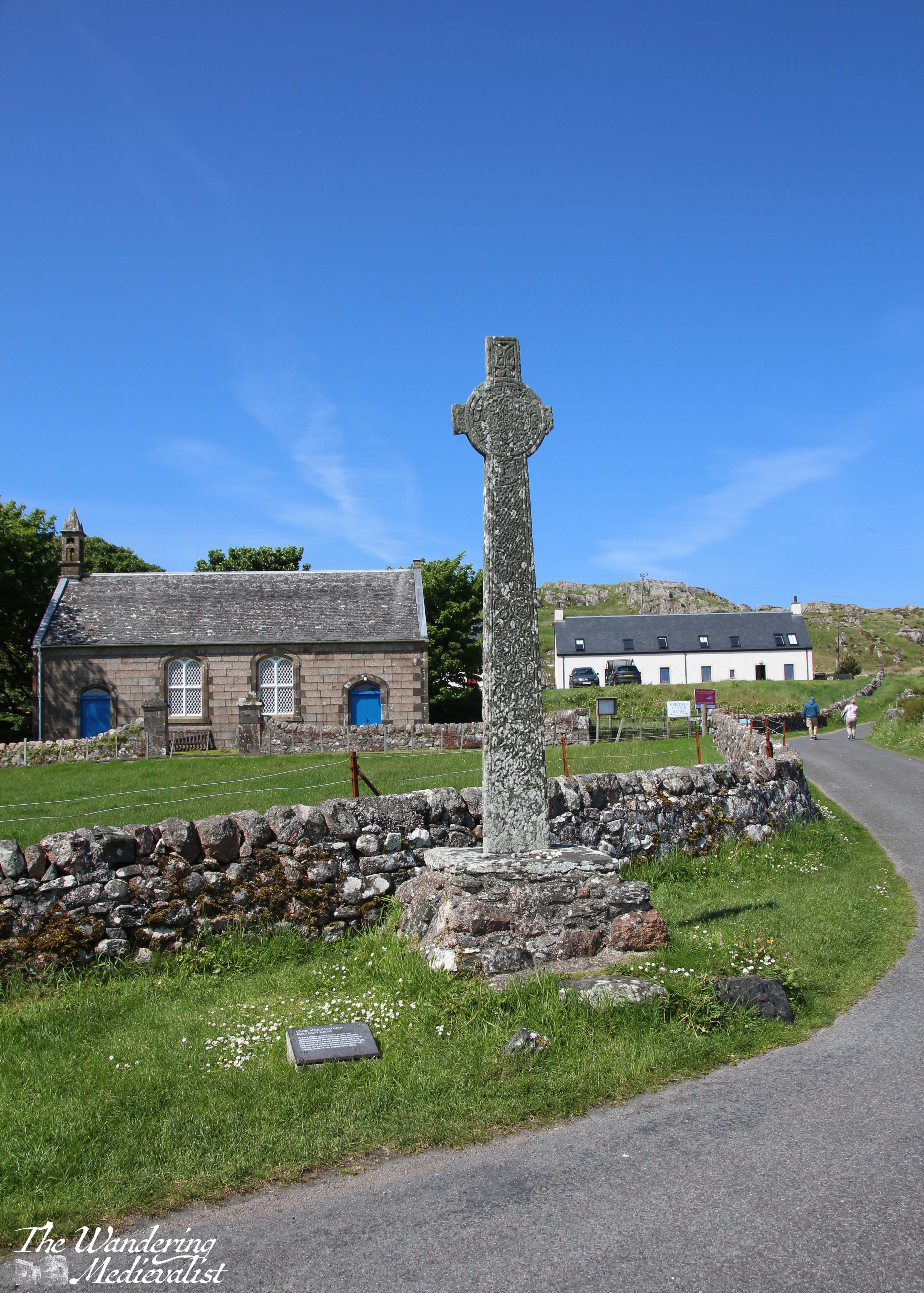
This year, my mother gave me a challenge: she wanted to visit Iona. She had heard of it from friends in her church, and I knew of it from its vast historic context. I also knew that it was not the easiest place to access.
Sure enough, reaching Iona would involve a drive to Oban, a car ferry to Mull, driving across Mull, then another passenger ferry to Iona, and a walk from the ferry landing to the abbey. Certainly doable, but not without considerable planning required. Fortunately, this is my specialty, and so I studied maps, studied the routes, booked ferries and hotels and away we went. We were fortunate enough to have three gorgeous days of clear weather, and if there was ever a place to add to the ‘does not disappoint’ list, Iona is it.
History of Iona
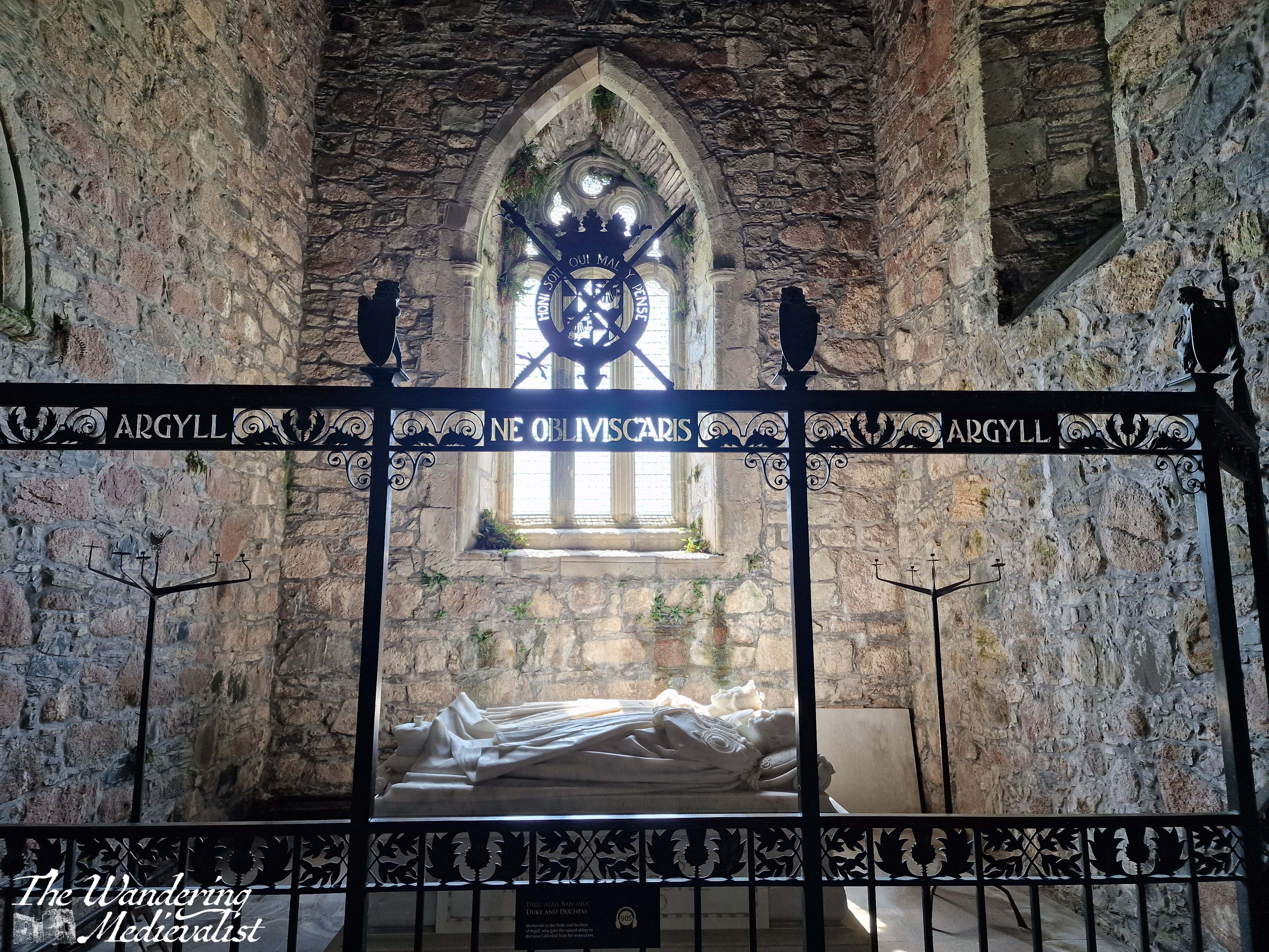
The Isle of Iona has been a holy spot since the Irish St Columba (originally Colum Cille, ‘Dove of the Church’) landed there in AD 563 and founded the monastery with his band of twelve followers. At the time, the area of Argyll and its islands were part of Dál Riata, a kingdom founded by men who still held land in Ireland, and whose various descendants would in time spread across most of Scotland (Scotia was in fact the Roman term for Ireland).
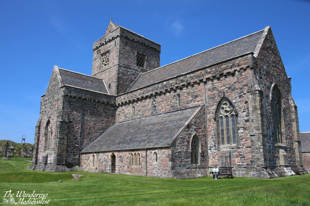
Renowned as a centre of learning and art – particularly manuscript illumination – Iona survived repeated attacks by Vikings. In 1200, a Benedictine monastery and Augustinian nunnery were founded, restoring Iona’s importance as a sacred destination for pilgrimage. The church was finished quickly but underwent almost constant renovations, demonstrating its popularity. Like many monastic sites, the abbey fell into ruin after the Reformation of 1560, but was restored in the 20th century and is now home to the Iona Community, an ecumenical group that welcomes Christians of all denominations.
The journey to Iona
The ferry to Iona leaves from the tiny Mull town of Fionnphort, which is about 60-90 minutes by car from the Oban ferry landing at Craignure. The route is absolutely stunning, climbing through hills and following the dramatic coastline, though it is also single-track with passing places, a type of road that not all are comfortable with. It certainly takes a great deal of focus.
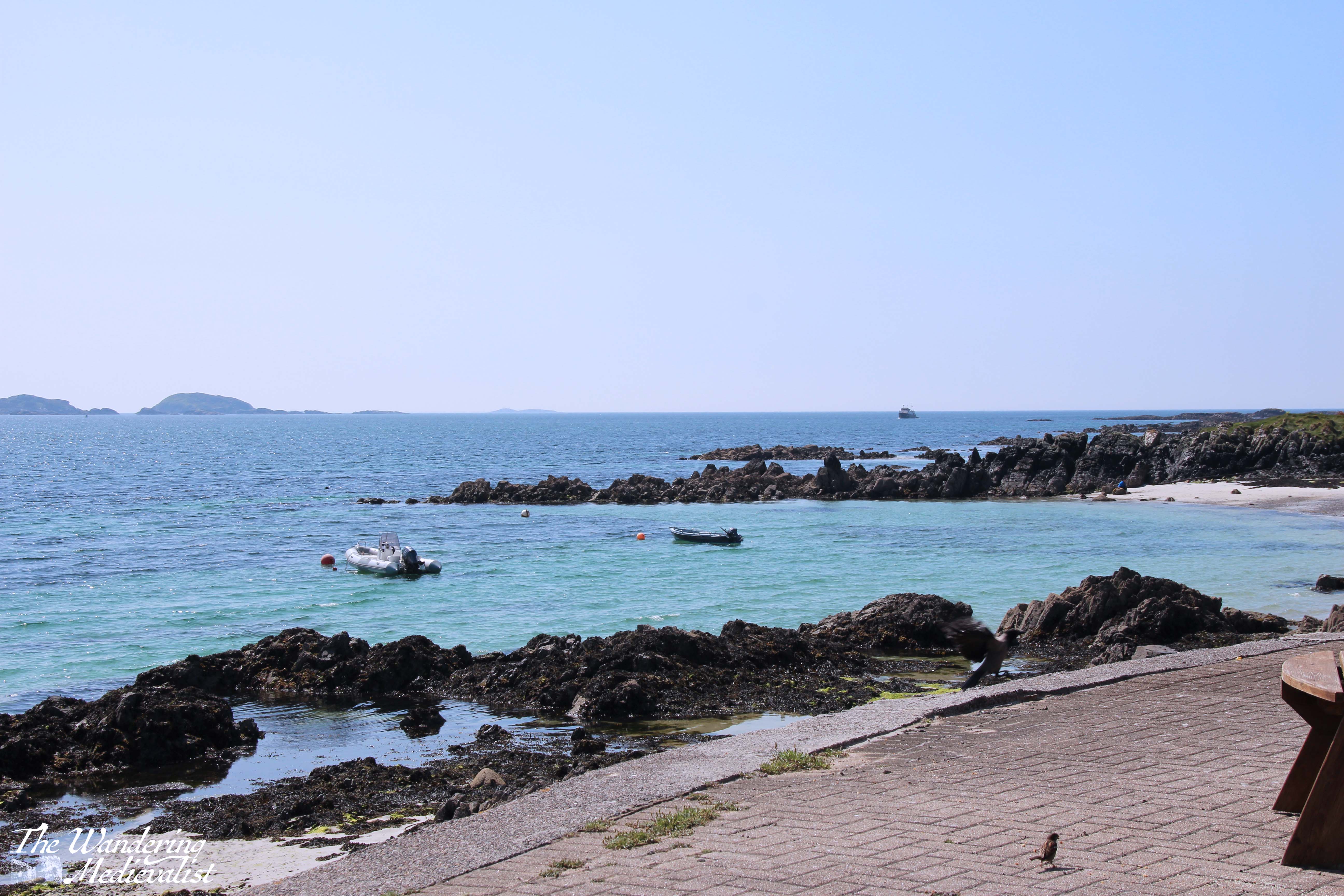
Despite its size, Fionnphort offers plenty of parking – evidence of Iona’s popularity – including paid spaces closer to the ferry, or a large free lot a few minutes away. The walk from the car park passes a number of restaurants and pubs where visitors can find refreshments. At the ferry landing there is a very small café, attached to the ticket office.
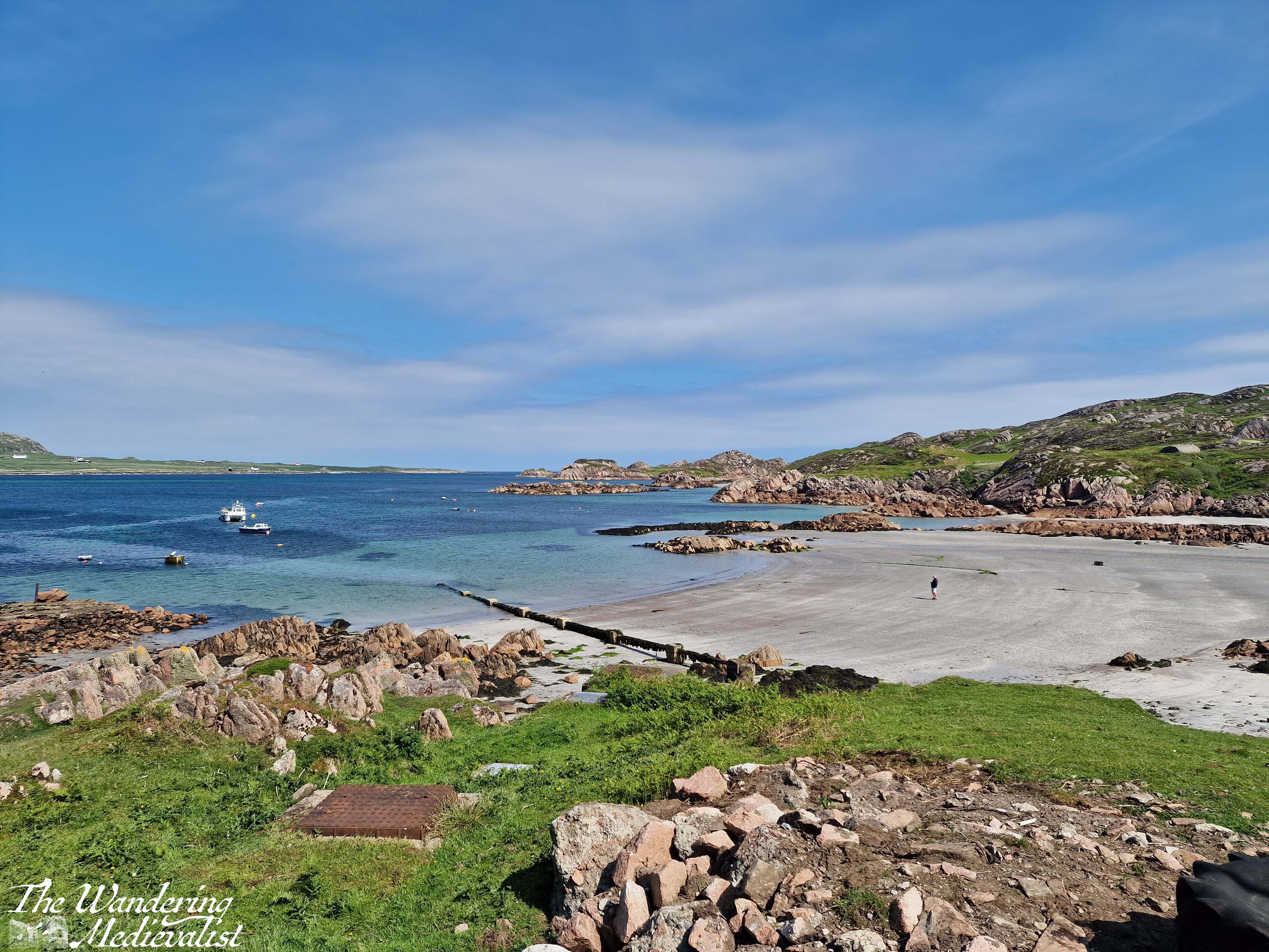
This café offers snacks, coffee and, most importantly, a gorgeous view of the beach and the Sound of Iona. As we had arrived about 20 minutes before the next ferry would start to load, and our tickets were bought well in advance and safe on my phone, we made ourselves comfortable and I found myself entranced by the beach and rocks around it, to which greenery clings where it can.
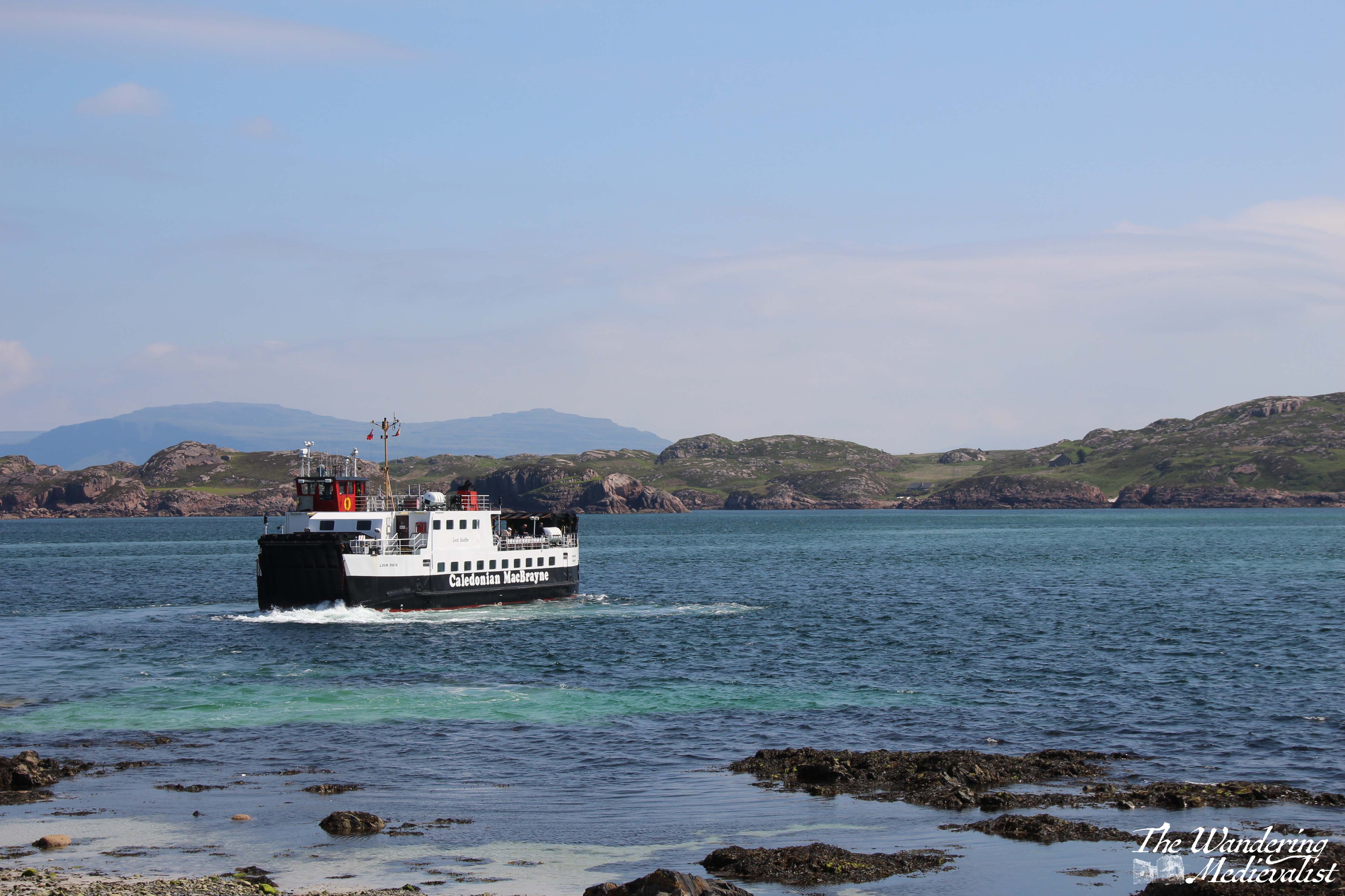
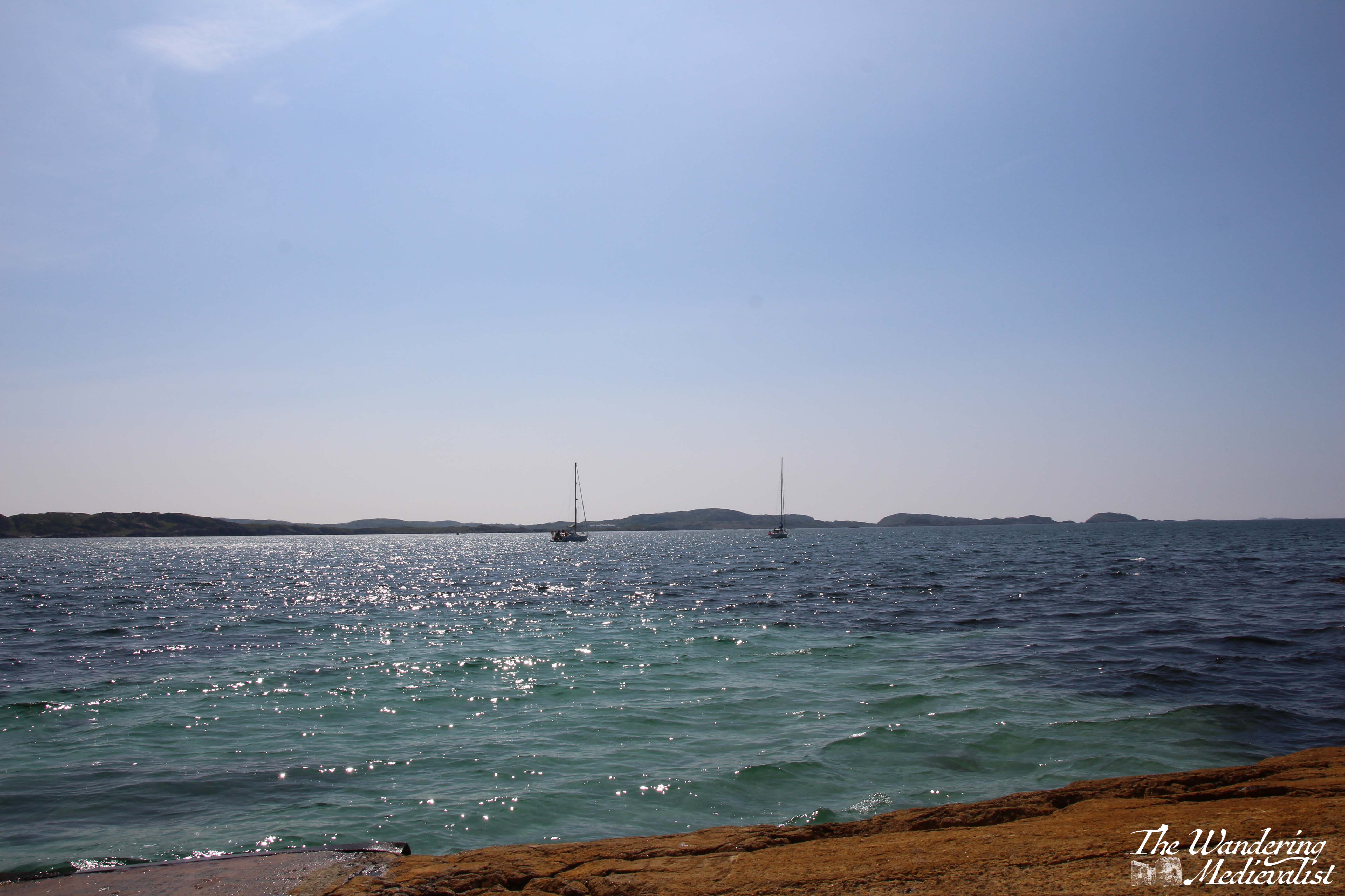
The ferry to Iona (see below) is large enough for some vehicles, though only locals are allowed to drive on; everyone else, including a number of cyclists, lines up to board and climb to the upper deck for the short ride across the sound – about 10 minutes. There is barely enough time to register that you are on the water before you are docking again, though I was lucky enough to have a seat that afforded a perfect view of the harbour as we arrived.
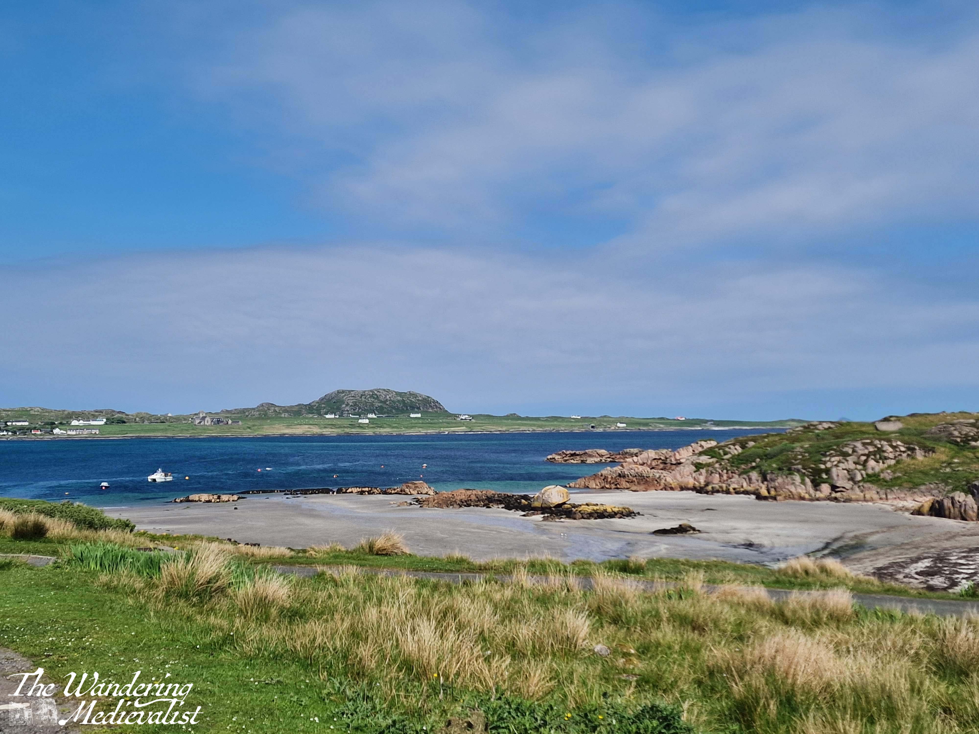
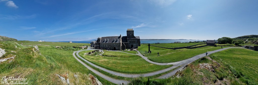
The town on Iona is small and picturesque, like so many Highland towns, consisting of only two or three streets with a few small shops, houses and places to stay, all nestled right up against the beach. Beyond the town you can just make out the abbey, if you are not too distracted by the Caribbean turquoise of the harbour water.
We had spent so much time and energy that morning rushing to get from Oban to Mull to Iona that once we finally set foot on the island, we decided it was most important to find some lunch and perhaps another cup of coffee (always paramount on our travels). Fortunately, the Martyr’s Bay Restaurant was just what we wanted: only steps from the ferry and providing an excellent array of drinks, snacks, sandwiches and of course home baking. They also sell Iona whisky and gin, as well as numerous other souvenirs. We took our lunch outside to sit in the sun and enjoy the view over the Sound. Side note, I had remembered to slather myself with suntan lotion that morning, much to my later relief. Anyone who says sunscreen is not required in Scotland is…well…just wrong.
Our lunch view:
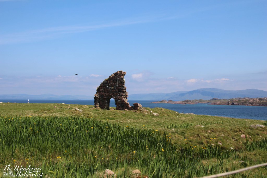
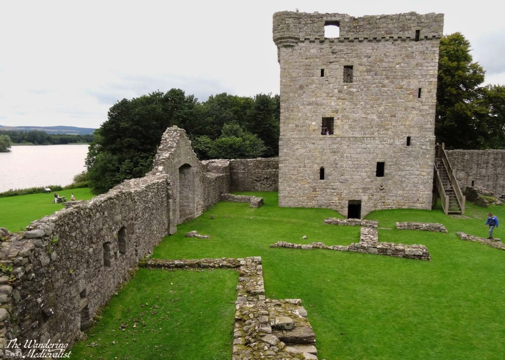
Fortified by sandwiches and a scone, we began our walk to the abbey, following in the footsteps of hundreds of years’ worth of pilgrims and tourists. At first, the path proceeds along the main road, leading in only a few minutes out of the modern dwellings and past the ruins of the Augustine nunnery. The nunnery was founded around 1200 by Ranald, King of the Isles, and while mostly ruined it is still one of the best preserved medieval nunneries in Britain.
You can opt at this point either to walk through or around the nunnery grounds, and we chose the former, passing as we did the medieval St Ronan’s Chapel, which was the parish church for the island community until the Reformation.
At this point, the road is about one car wide and lined on both sides by waist-high stone walls, providing a clear path for pilgrims as they wind their way towards the abbey. On the right are the organic gardens for several hotels and restaurants, demonstrating the need for islanders to grow at least some of their own produce – the closest Tesco, I would imagine, is several ferry rides away.
A short walk beyond the nunnery walls is the next step on the pilgrim way – MacLean’s cross. Erected around 1500, it marks the point where the track from the pier met the Sràid nam Marbh, the ‘road of the dead’, leading to the abbey. The cross was a focal point for pilgrims to stop and pray, and was carved on Iona from a single slab of stone. There is a more detailed view of the cross in the video at the end of this post.
MacLean’s cross and the pilgrim trail across Iona
After resting at the cross, we continued up the gentle incline where in these modern times, one finds several artisan shops and the St Columba Hotel and larder, where more refreshments can be found. We powered along, determined to reach the abbey despite the undoubtedly pleasant garden in which several tourists were enjoying a G&T.
As we approached the abbey, the hill rose beside the road to the left, with cliffs of rock and rough earth reminding us of the nature of the island.
Reilig Odhrain
The first break in the wall to the right allows entrance to the Reilig Odhrain, the land consecrated as a monastic burial ground from the time of St Columba. The burial ground is free to enter, and does allow views of the abbey from a distance, as well as a wander through burial markers both old and quite new.
Legend said that this burial ground was the final resting place for many early Scottish kings including Macbeth and his grandfather Malcolm II, though a lack of written or archaeological evidence has cast doubt upon the theory. The Kings of the Isles were certainly buried here, which may have created some of the confusion.
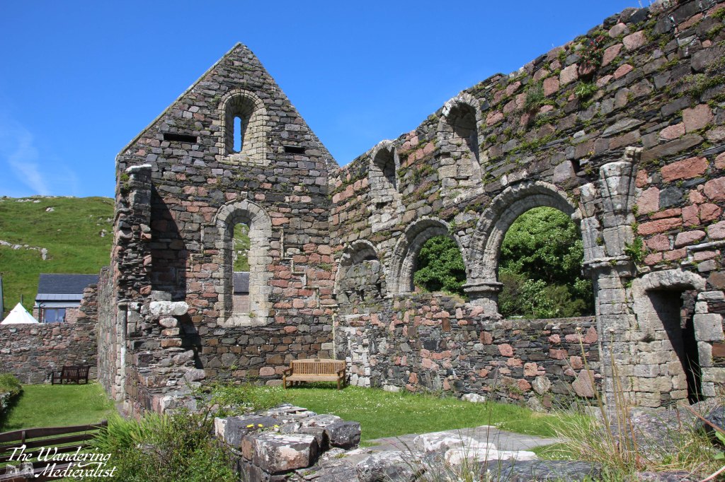
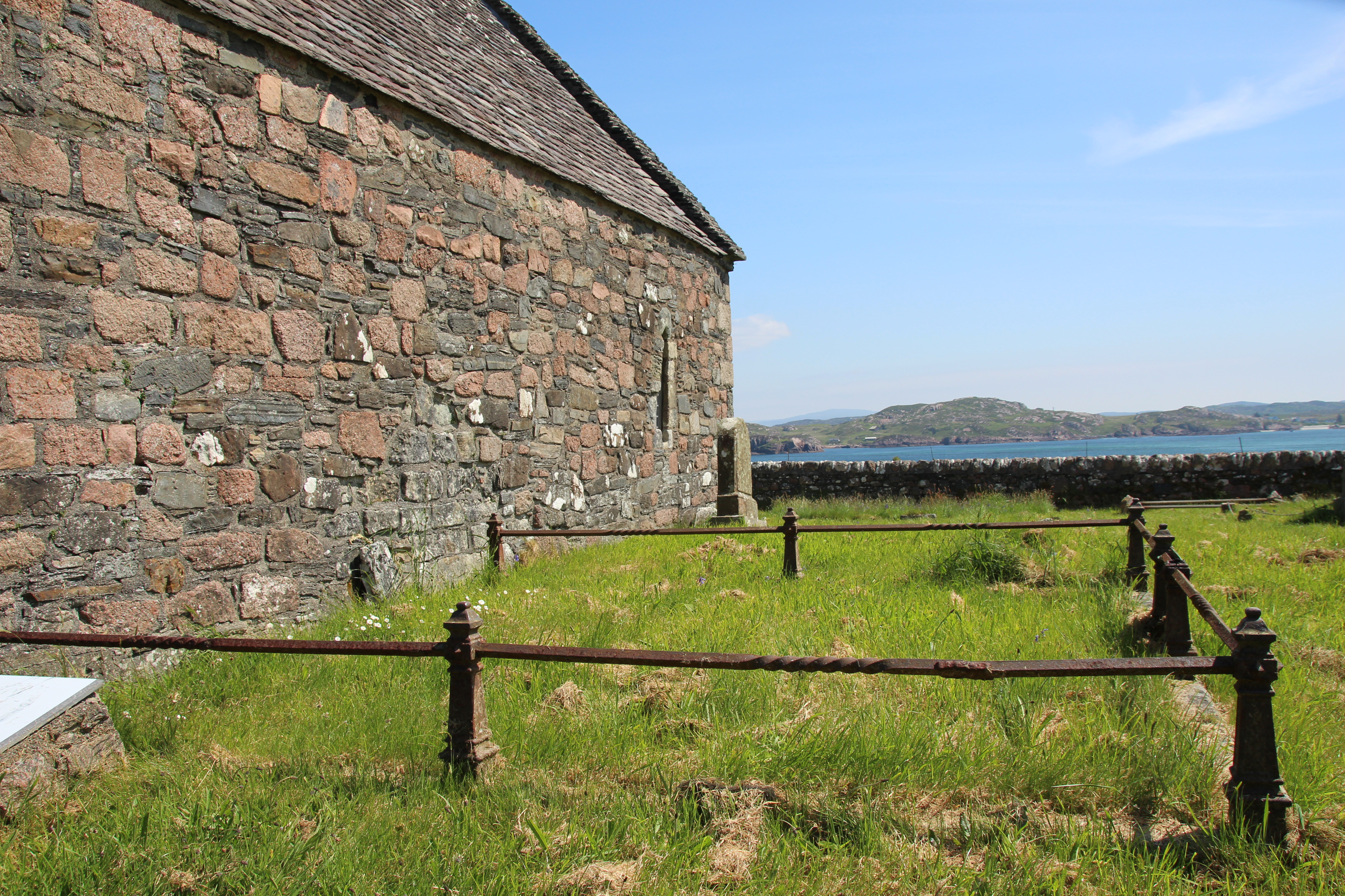
In the centre of the graveyard is St Oram’s Chapel, dating from the 1100s, and the oldest intact structure on the island. Inside the chapel one can view a number of beautiful old stone carved slabs.
St Oram’s chapel and the view from the burial ground:
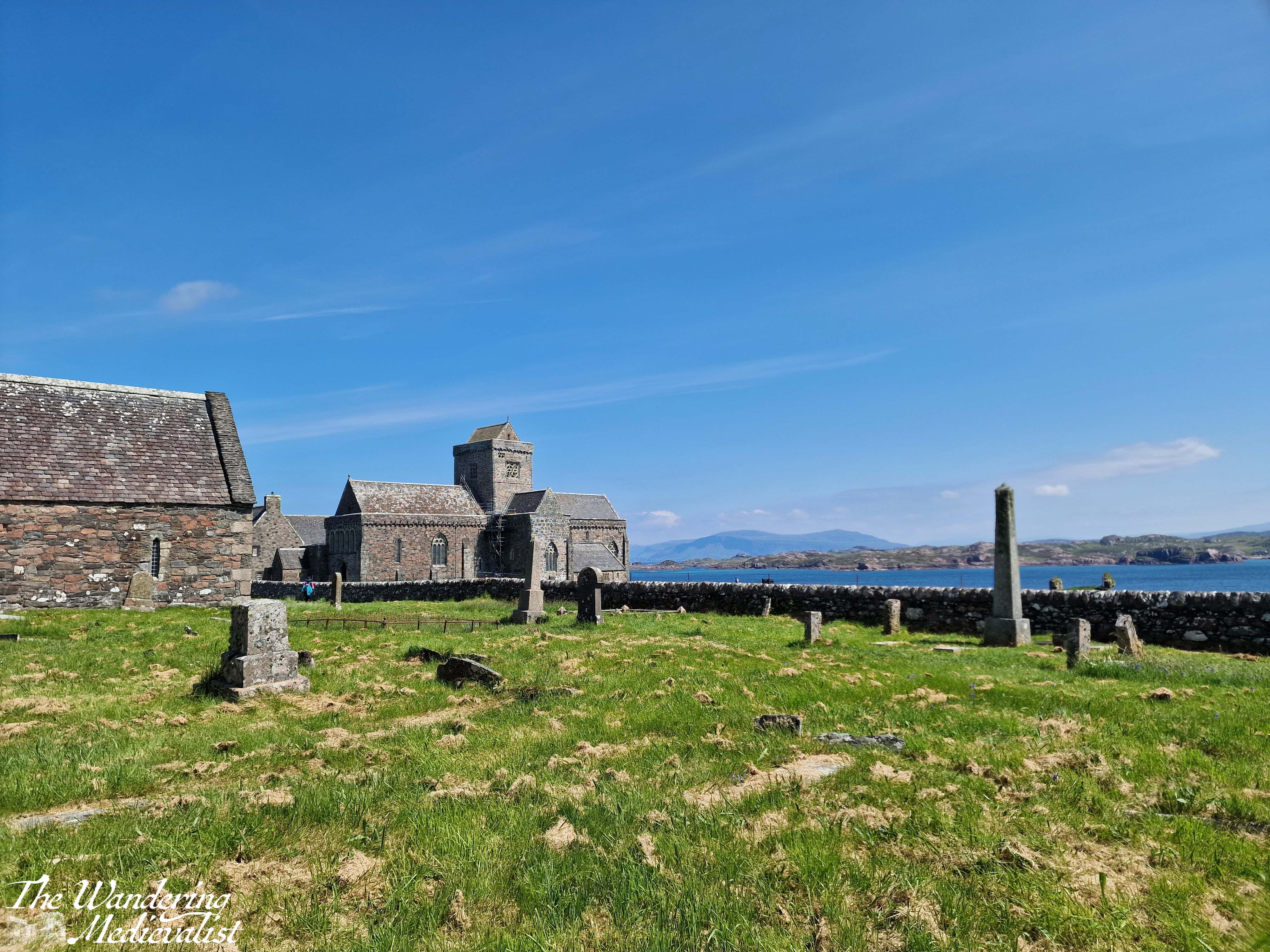
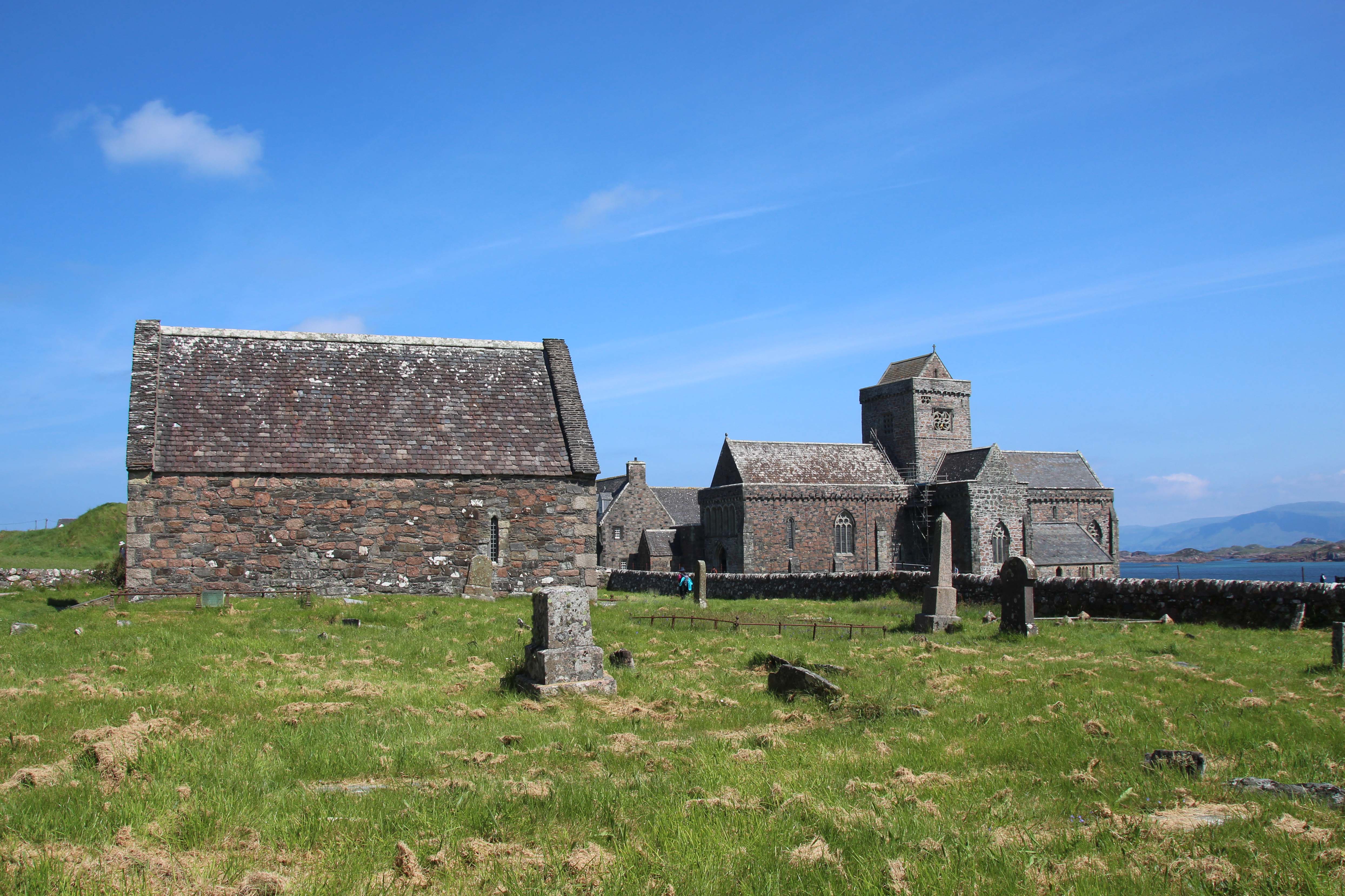
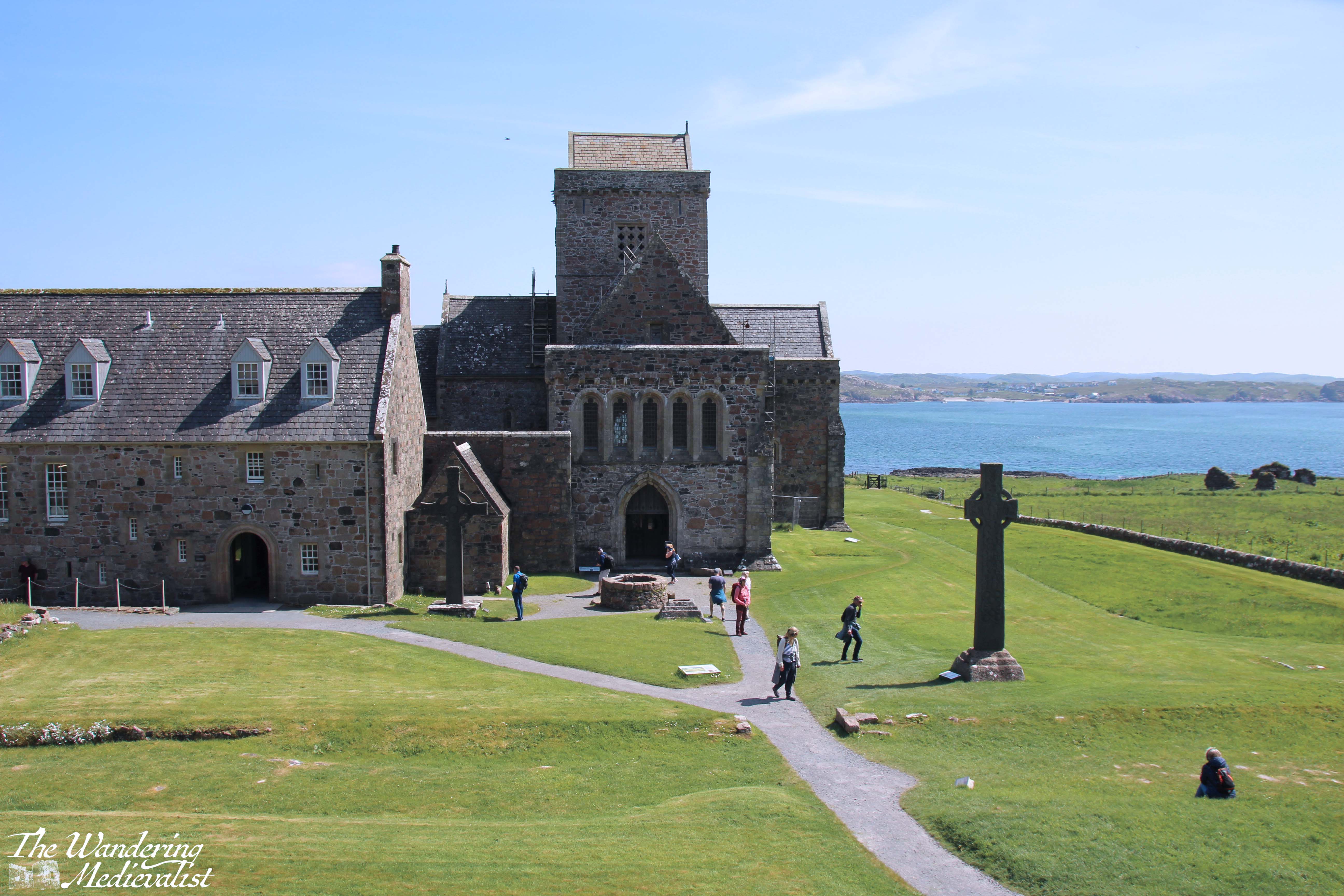
The Abbey
Beyond the burial ground, the main entrance to the abbey is made through the visitor centre, where you can also pick up an audio tour guide and printed guide to the site. It was my first opportunity to use my new Historic Environment Scotland membership!
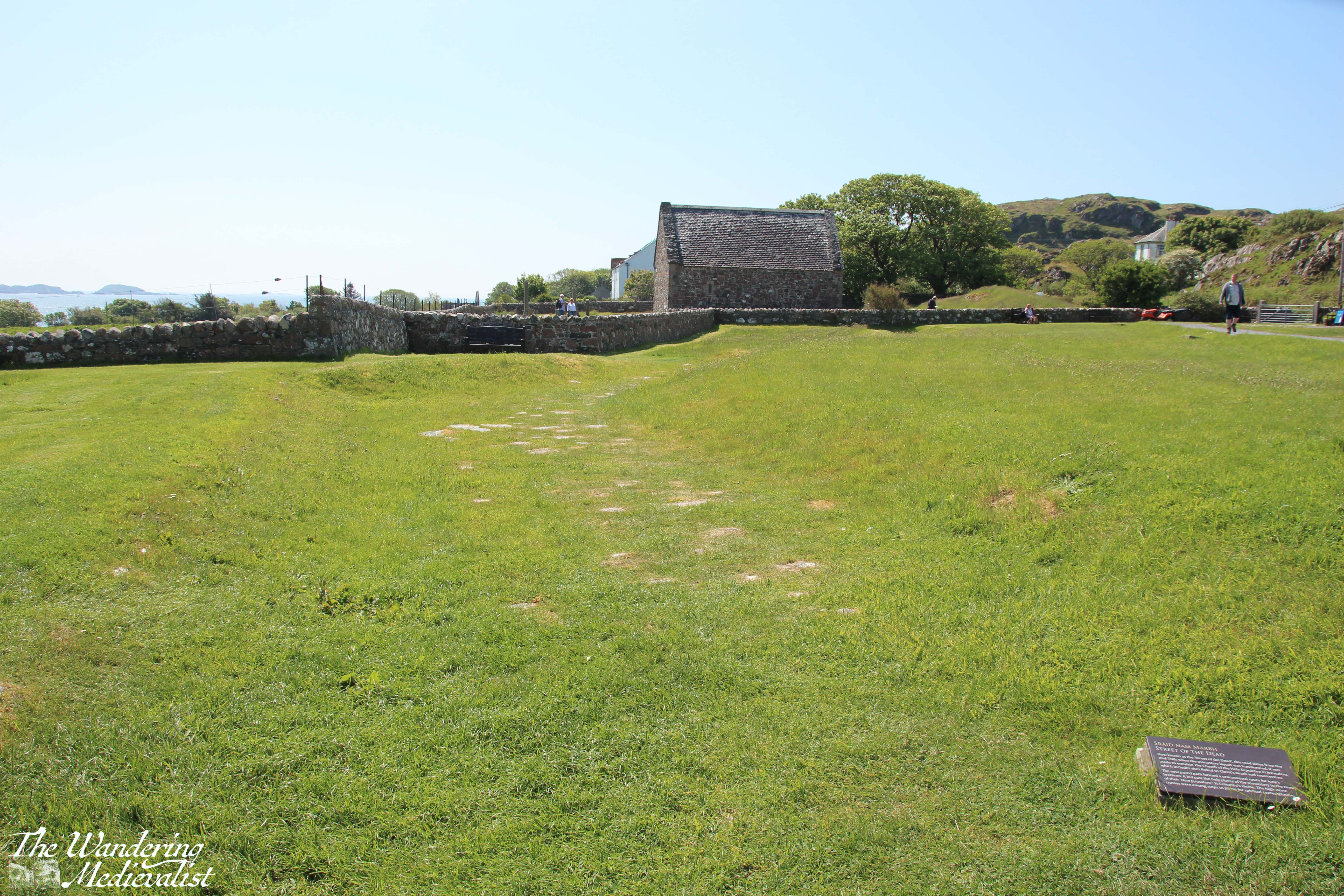
Almost immediately upon entering the abbey grounds, we found plaques with information telling us about the road we were on and much more. To the left, the Tòrr an aba, ‘hill of the abbot’ was irresistible to climb, and I found that it did indeed offer excellent views over the abbey complex, the Sound, and the island. The hill may well have been the site of St Columba’s writing hut. Again, there is more of the view in the video below.
A faint dent in the grass leading towards the burial ground is in fact evidence of the pilgrim trail and processional way, the Sràid nam Marbh, ‘road of the dead’, which dates from the 8th century and was designed to emulate the Church of the Holy Sepulchre in Jerusalem. Most of the paving stones are lost or hidden, but particularly from the hill, one can easily envision the path.
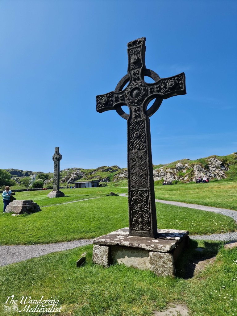
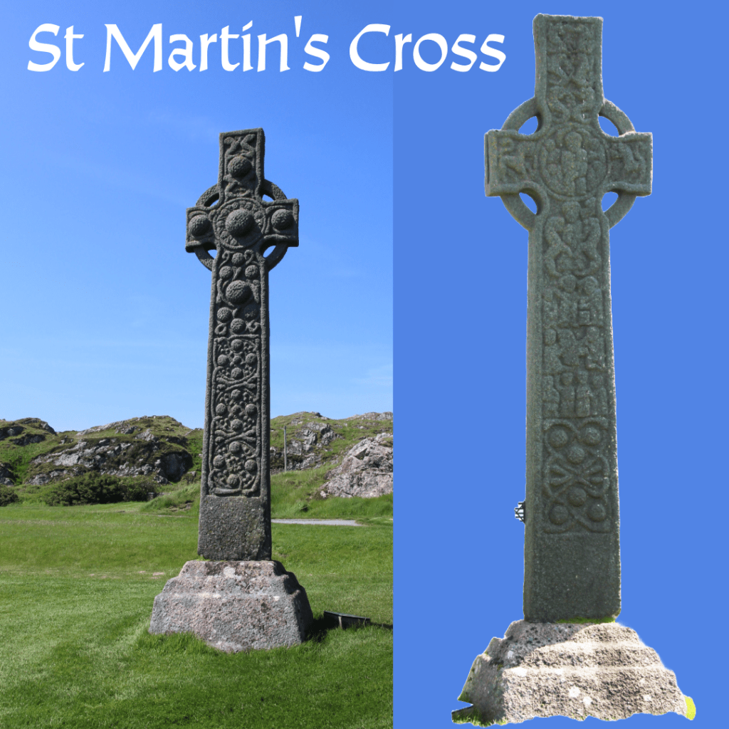
The hill also allows a good view of the original locations of the several high crosses that would have marked the path to the abbey. These date from the 700s and 800s, and while most live in the abbey museum, the cross of St Martin is still proudly in place, as it has been for more than 12 centuries. It is carved from a single block of stone, with one face bearing biblical scenes and the other snakes and Celtic bosses. At one point there were likely many more crosses.
When standing before a cross that has – for lack of a less dramatic term – witnessed so much history, one must be moved. I affirmed recently to a friend that it does not matter what religion or belief system you adhere to – or indeed do not – it is impossible not to find Iona a spiritual place. It is so peaceful, quiet, and out of the way, there is no question why it would have been chosen for monastic retreat.
replica cross of St John in foreground, St Martin’s cross in background
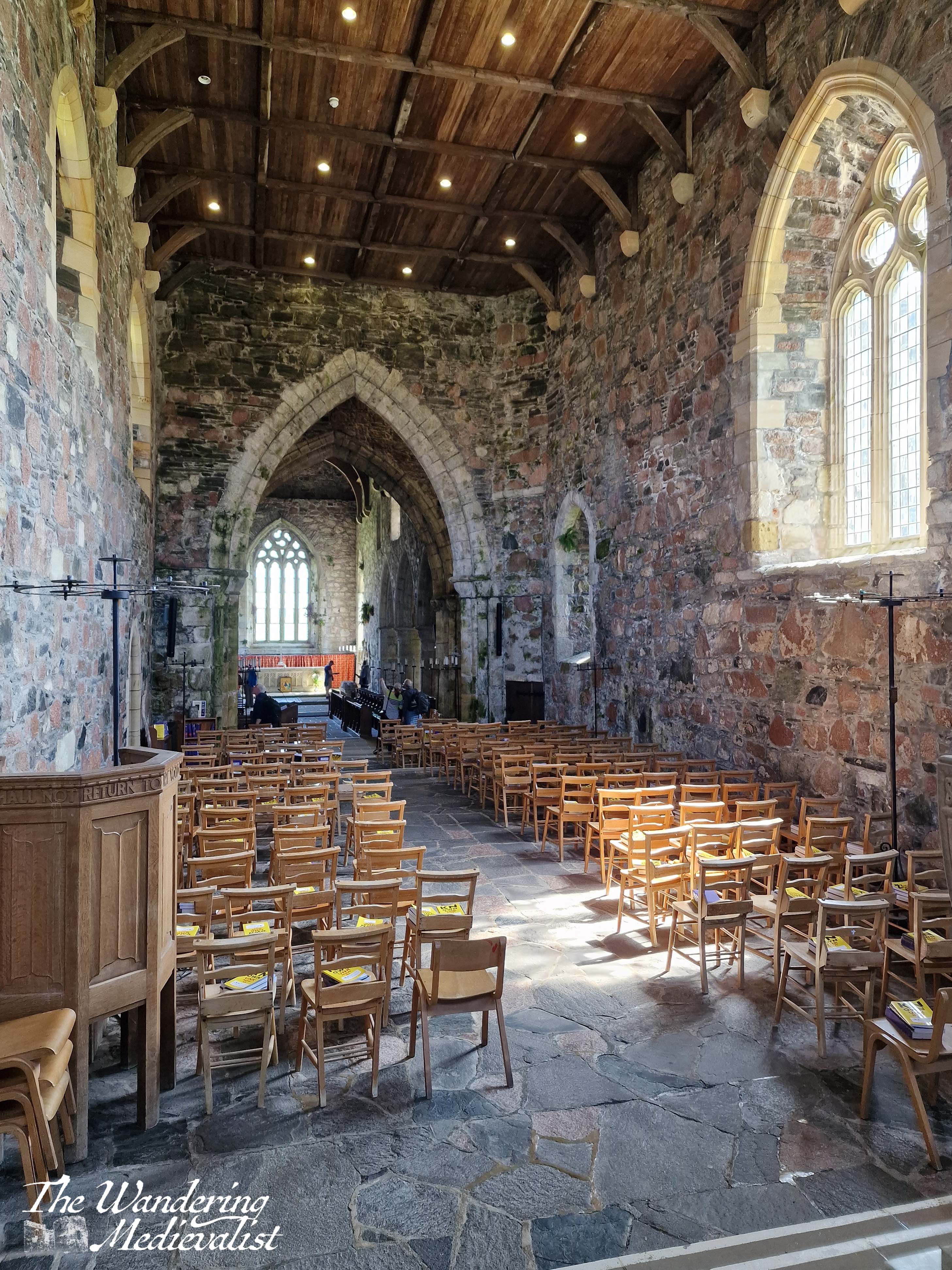
The Abbey Church
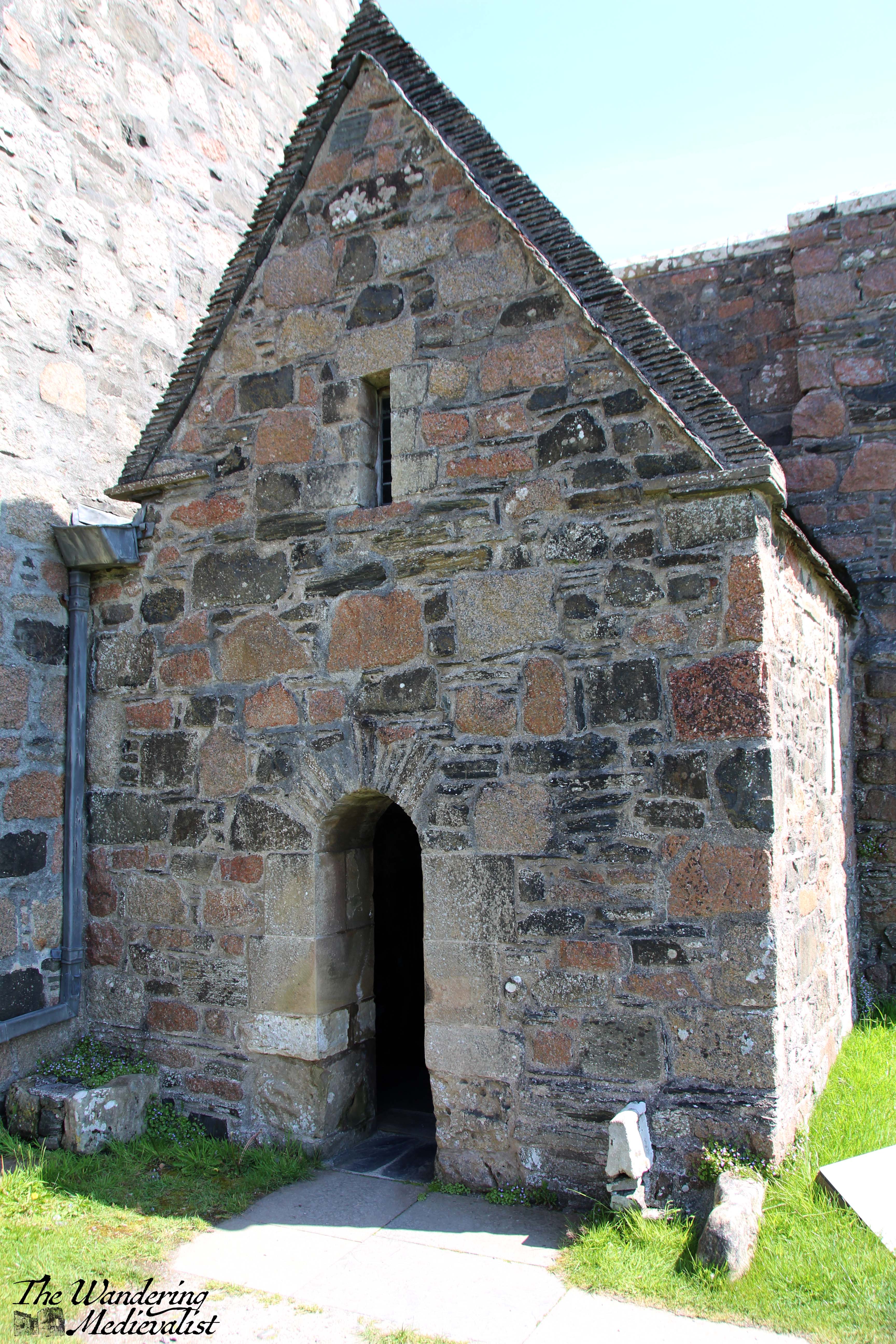
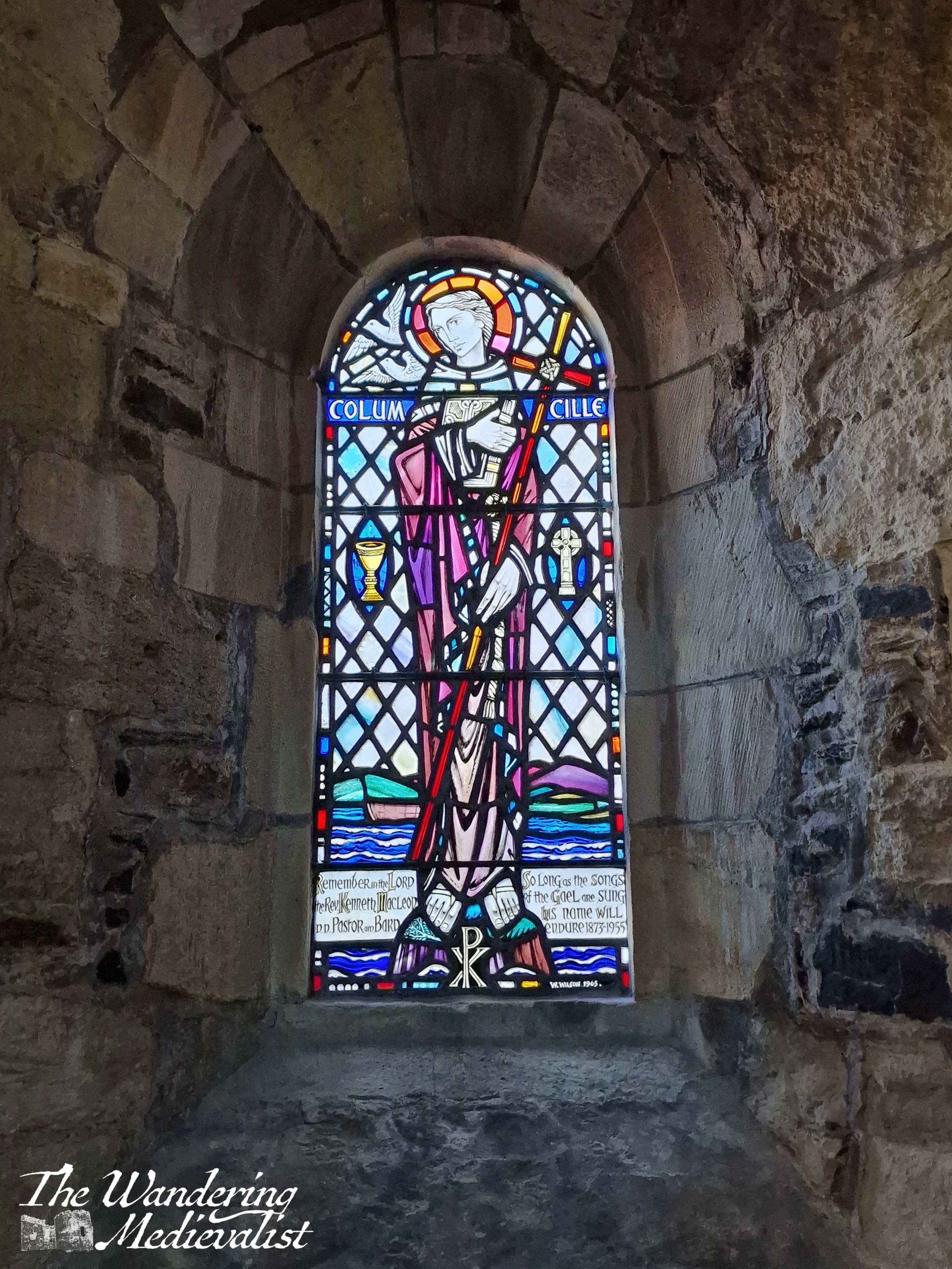
Once we had enough of viewing the crosses, I took a moment to duck inside the small chapel constructed just beside the entrance to the main church. This is St Columba’s chapel, likely built to house the most valuable relics the abbey possessed – the bones of the saint.
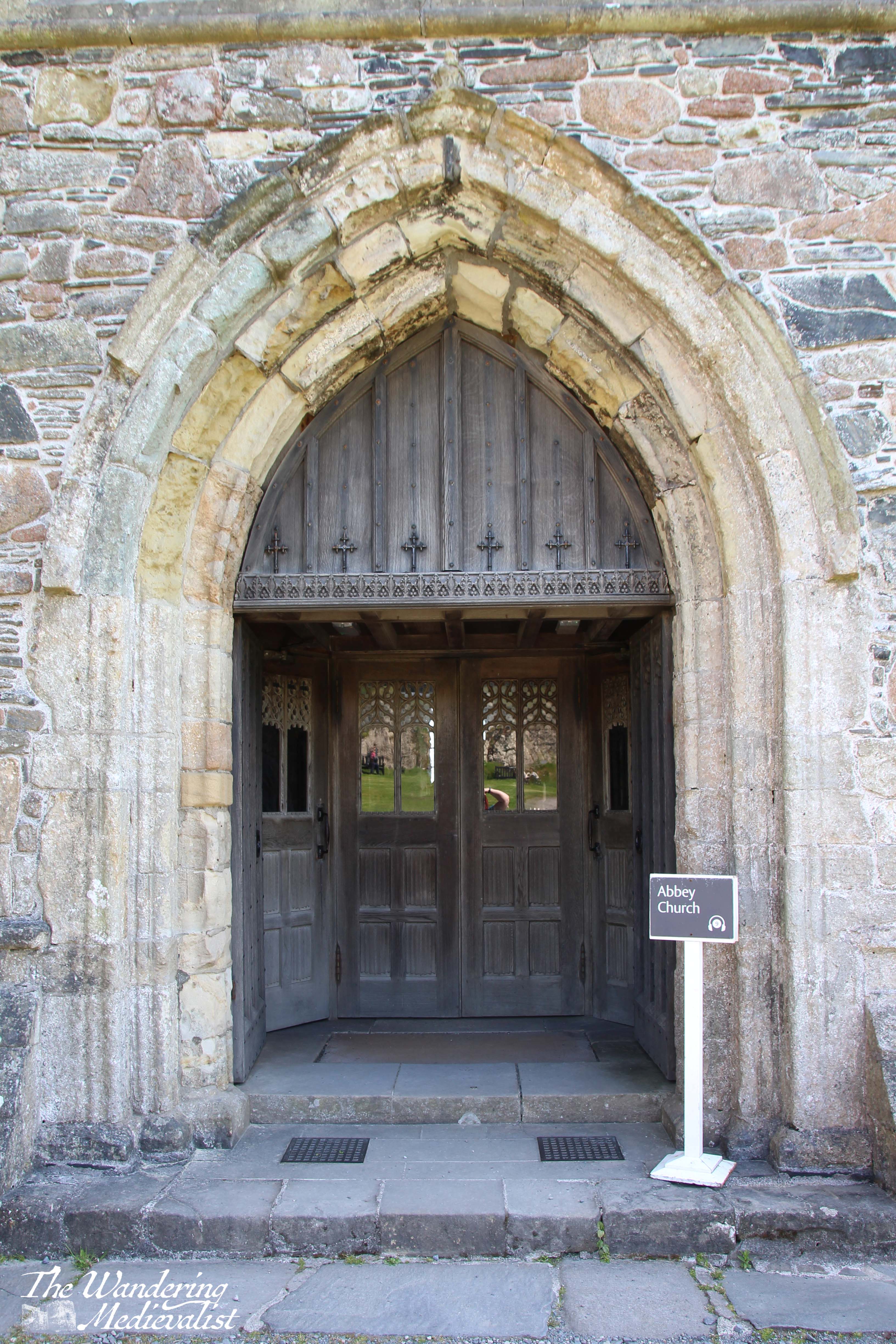
Any carvings that may have graced the main door have eroded, but a wooden screen has been constructed to provide access to the church, including traditional wooden doors that one finds in many British churches.
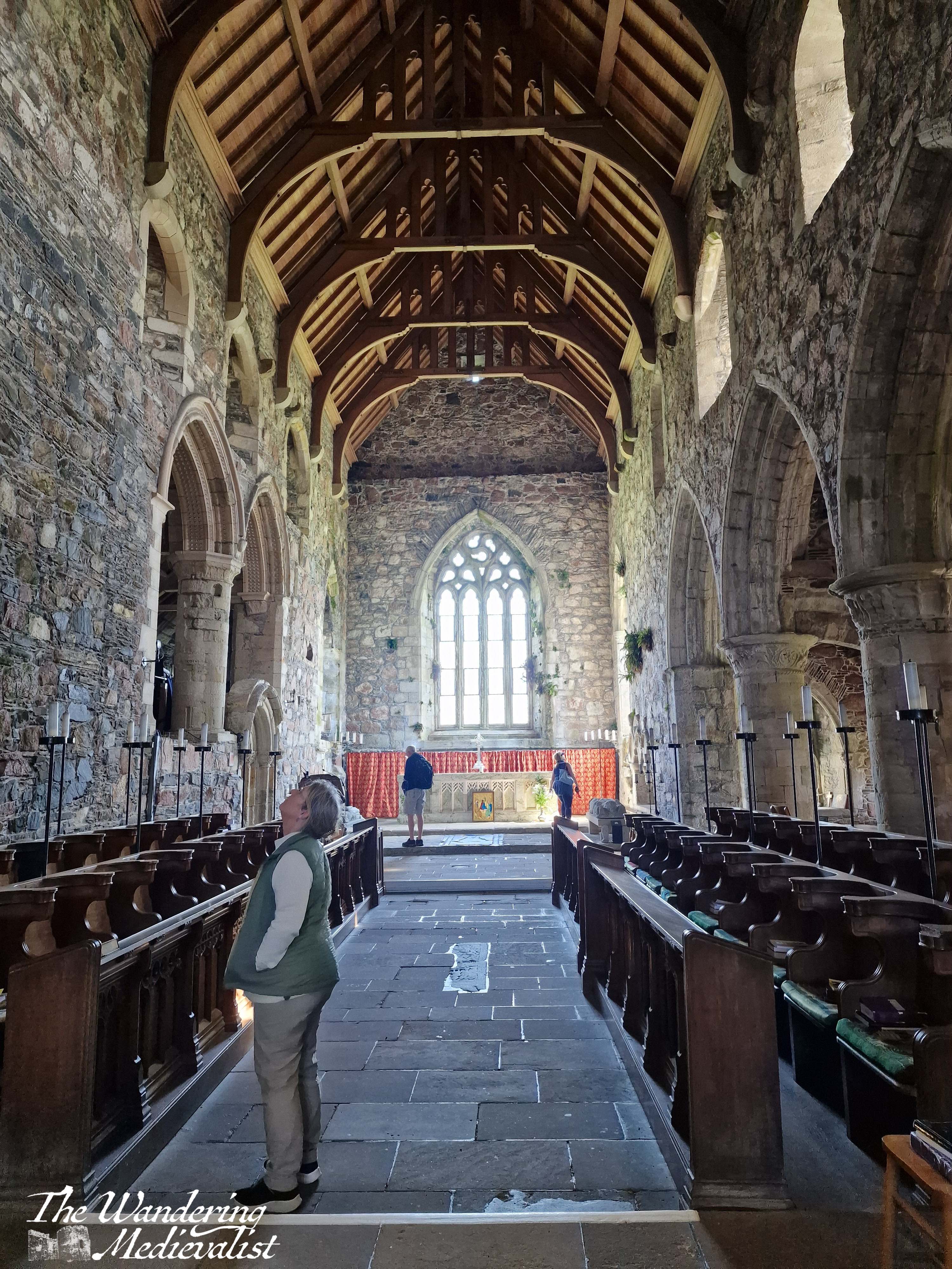
Inside, there is a beautiful reconstructed font, and a display of carved slabs that were grave markers. (again, more of this is visible in the video below) Many of the abbey buildings contain these slabs that showed off the skill of the Highland stone carvers of the high and late Middle Ages, and commemorated the chiefs of many nearby clans: MacKinnons, Macleods, MacLeans and of course the MacDonalds.
The church is positively breath-taking – it is still used for services, and has been reconstructed both for modern use and to teach visitors of its significance. Alcoves and chapels display information about the saint, the important visitors to the island, and more. One chapel is a stunning modern memorial to the 8th Duke of Argyll and his wife, who initiated the abbey reconstruction in the early 1900s.
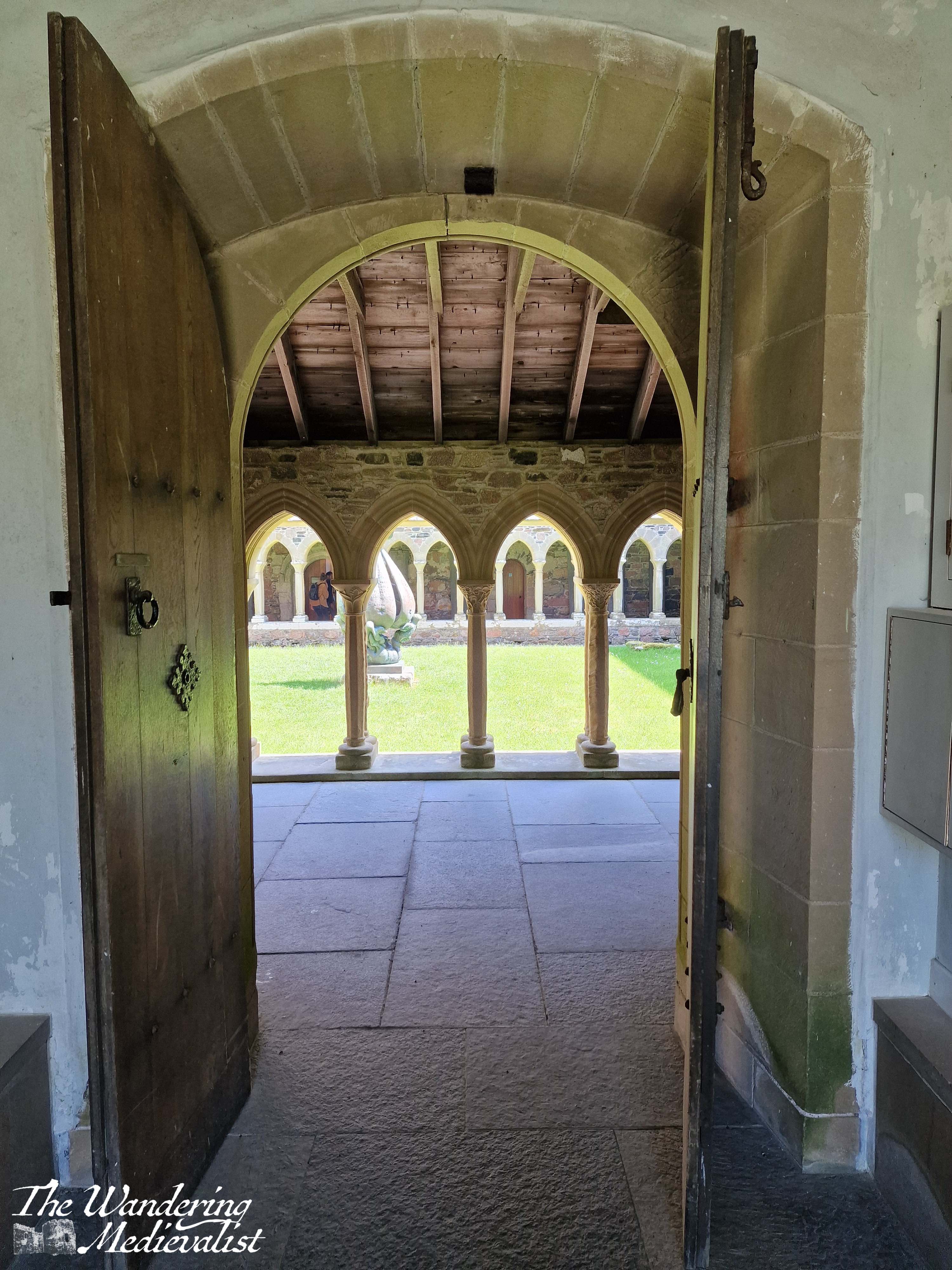
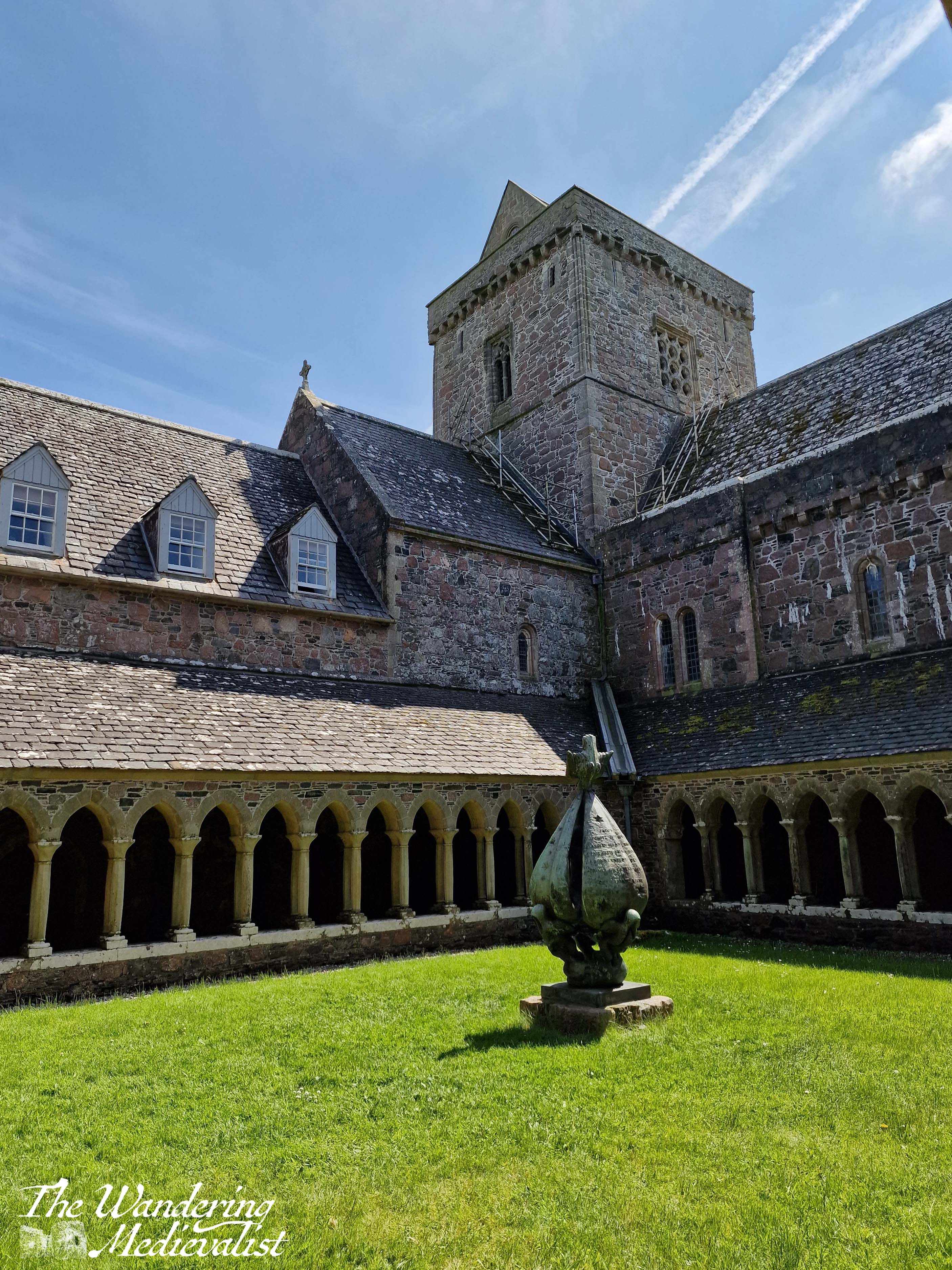
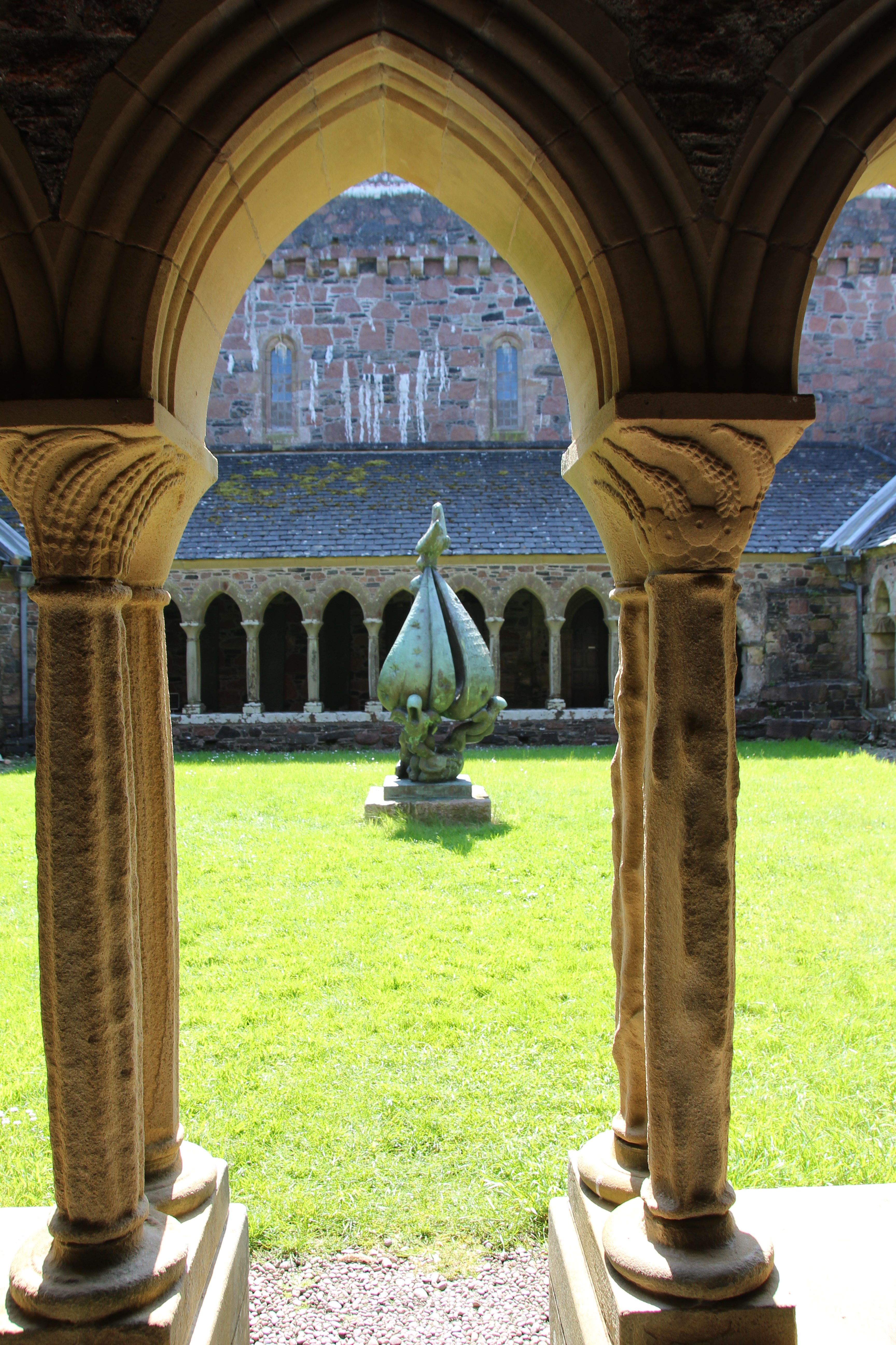
I have a love for cloisters, their symmetry and geometric shapes, and I was delighted to discover that Iona’s cloisters were reconstructed in the 1950s. Often one will find gardens, mazes, or other flora in the middle of a cloister, a fountain or a ‘tree of life’ symbolising the greatness of God in the centre. On Iona, the cloister bears a sculpture originally the work of a Lithuanian Jewish artist, who fled the Nazis during World War II. It is called ‘Descent of the Spirit’ and is inscribed in French indicating that the artist hoped for a better understanding of the human spirit.
After visiting the cloisters, we made our way outside into the brilliant sunshine. I had a bit of a wander around while Mum rested on a bench. What struck me, as mentioned above, was the absolute peace of the abbey; all visitors seemed by agreement to speak quietly or remain silent, and while there was of course wind and noise from sea birds, there was so little sound that I could almost imagine myself to be alone at times.
Eventually, slowly and with a touch of reluctance, we made our way back towards the ferry. We had one last visit to the Martyr’s Bay restaurant for a cold drink and a few souvenirs, and a short rest out of the sun.
The island was busy with visitors, both to the abbey and to the many walks and beaches. There is no question that one could easily spend several days exploring, either on foot or on a bike. Alternatively, Iona is an easy day trip if you are staying on Mull and looking for an adventure; I think it would be rough to try to get over and back to Oban in one day, but it can be done at least in the summer when the light is late and the ferries are reliable.
As for us, I arranged for us to stay on Mull for the night, but I hope very much to return for longer. Skye is the island on which so much time and energy is spent – for good reason – but Mull has plenty of its own wonders.
By the time our return ferry reached Fionnphort, we were both tired – it had been a long day, an early start, and the excitement and wonder of visiting Iona took a lot of energy. My final delight of the day was to see, on the beach, a trio of highland coos relaxing on the sand and munching on the abundant seaweed.
Check out this video for more pictures of Iona:
Find pictures of Iona and other abbeys at my online shop:
Castle Campbell holds great appeal to me not only for its location but for the memories it evokes. My first visit took place almost entirely by accident. I was staying in Doune in January, in a tiny hotel that had very few guests in the off-season. In the breakfast room one morning, I struck up a conversation with a nearby couple upon realising that they, too, were American. The woman had been involved in a writing course in the Highlands and she and her husband were exploring Scotland a bit before heading back to the US.
As the conversation continued, I was offered a lift back to St Andrews, on the promise that I would provide a personalised tour of the town when we arrived. Along the way, they planned to stop at Castle Campbell – if I wasn’t already convinced, this tipped the scale. Now I suppose there could have been an element of concern here; was this a safe option for a single girl travelling on her own? But something in my gut told me it was just too odd to be anything other than a happy coincidence. A castle-loving American couple chose to stay at the same tiny hotel in Doune, in January?
Fortunately, my gut was correct. They were a lovely couple and we had a great day exploring first Castle Campbell and then St Andrews. And so my first visit to the castle was exterior only, and in the snow. I still recall the drive up the narrow road that eventually reaches a car park – that road has not changed, except that there is likely more traffic on it now.
The approach to the castle is nearly as stunning, meandering through the back roads of Dollar, which is a well-to-do little town with enough old stone houses and charming gardens to make anyone drool. The road is single-track with passing places, and if one is lucky, one can make it most of the way up before encountering another vehicle. With a hill on one side and the gorge of Dollar Glen on the other, the road is harrowing to say the least. I would certainly recommend going either on a week day out of school holidays, or first thing on a Saturday, before the tourists have found their way there (locals, I find, tend to walk up through the glen).
If you can make it up past the larger car park to the one at the top of the road, and if you are lucky enough to find a parking spot, it is worth every moment of wheel-clenching fear. (Note, if you can’t manage a spot there, the larger car park is still a good option though requires hiking the last quarter mile or so up the hill along the road. Great view!)
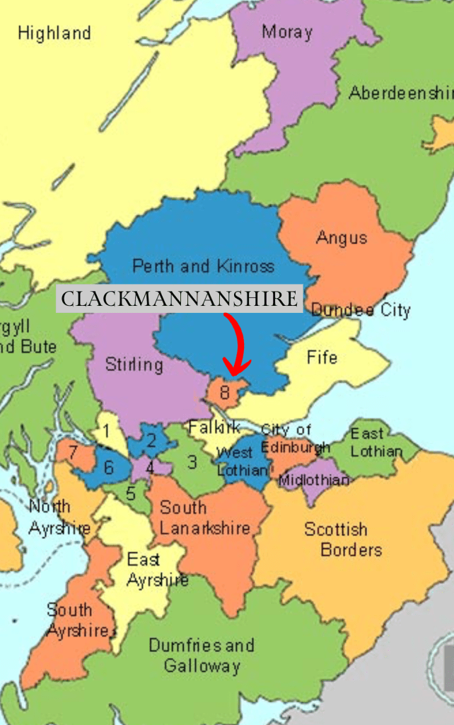
Once you have parked in the upper lot, you are still a good 5 to 10 minutes on foot from the castle, though there are tantalising glimpses of it through the trees. There is a metal farm gate that keeps the sheep inside, and on the other side you will find a sign informing you of the castle history, as well as that of the nearby Tower Trail of medieval tower houses throughout Clackmannanshire.
Here the path diverges – one branch leads straight ahead of you, heading steeply down-hill, while another leads up to the right. I would recommend, in the first instance, making your way up the hill a few hundred feet or so until you can look back over the castle, glen, and the flat land beyond. You can then head back to the main track, which is a steep decline until you reach the burn below.
At the burn you can really see the castle rising out of the foliage, and so it gives one the energy to keep moving. Another up and down brings you to the main castle gate, which was closed for much of lockdown and only re-opened in April 2024. If you are feeling energetic, you can hike up behind the castle and follow a path into the hills, which I did just long enough to get another excellent picture or two; this is also the path to take if you wish to climb to the top of Bank Hill.
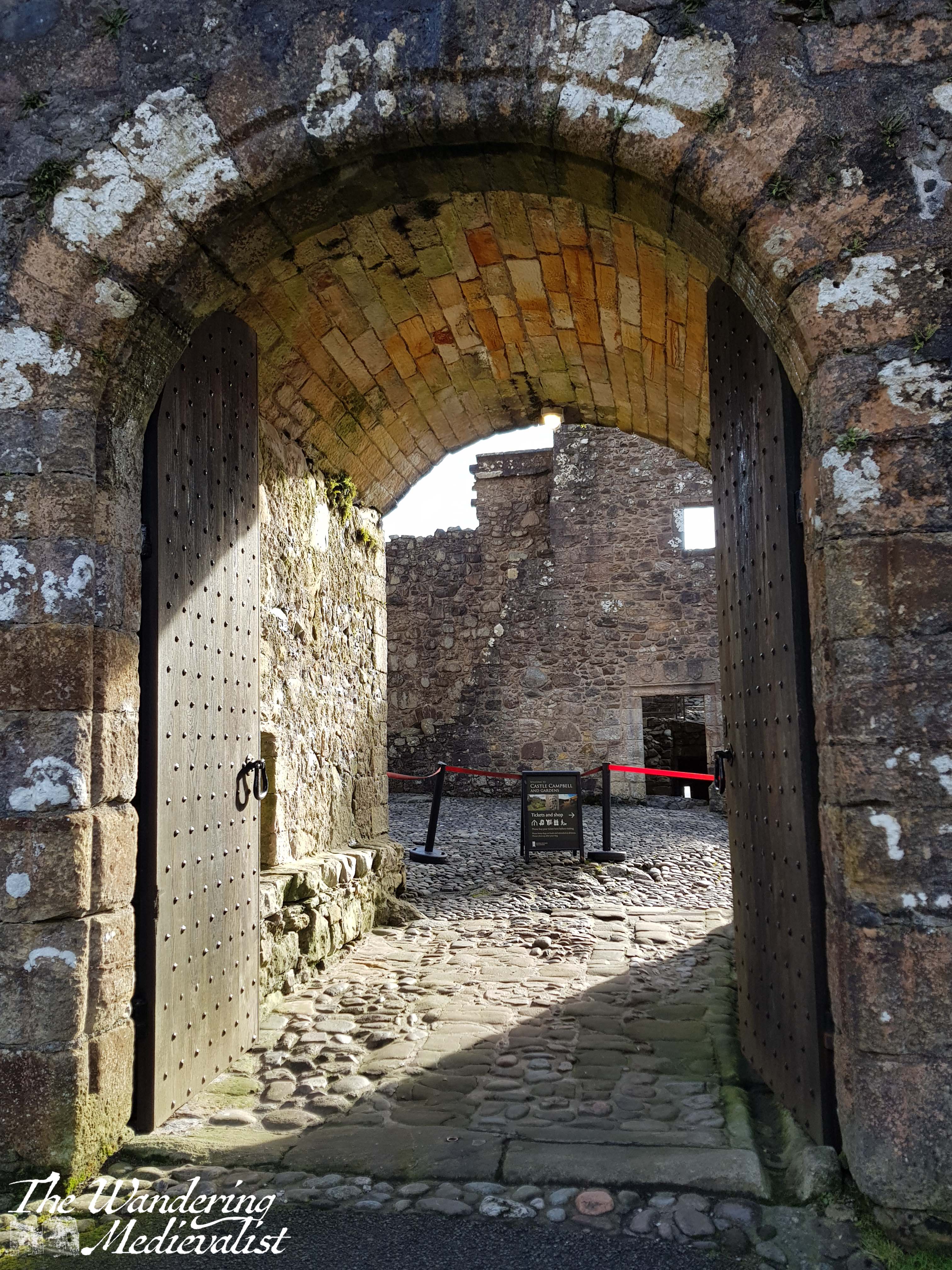
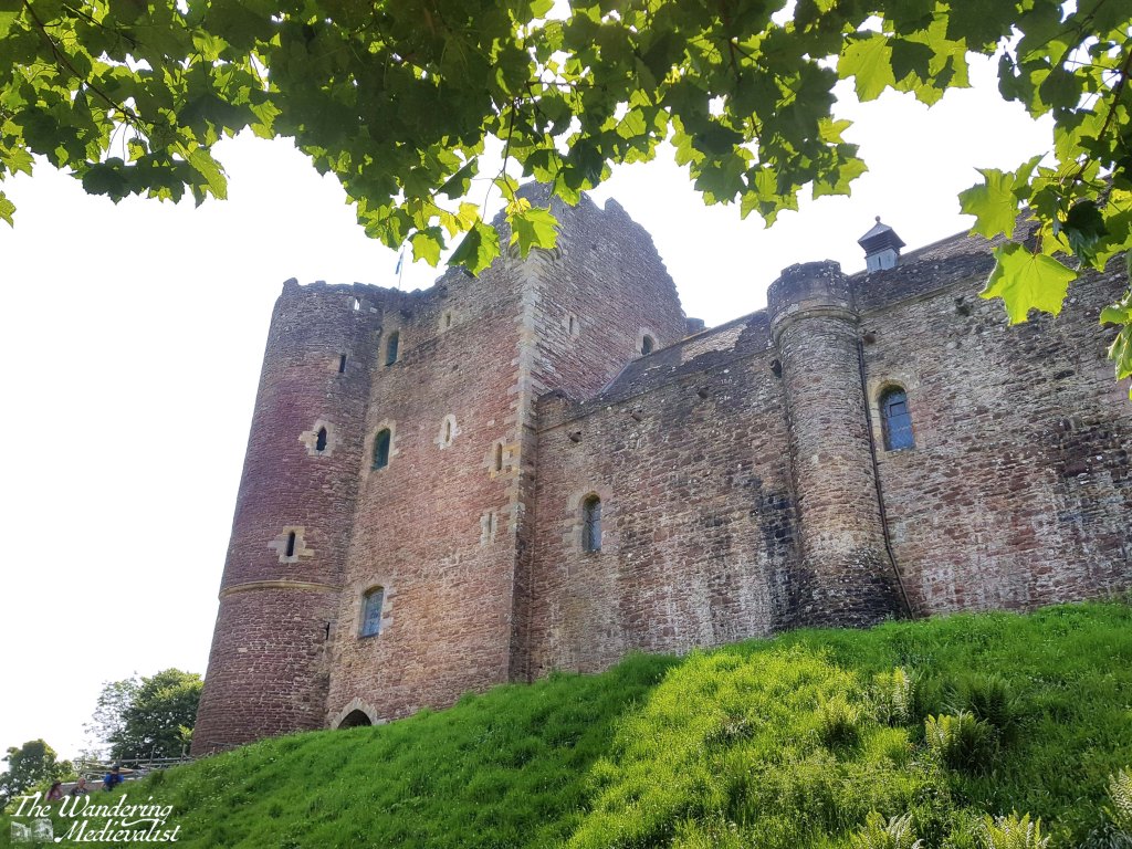
If your goal, like mine, includes seeing inside the castle, you need only climb one more short path to reach the main gate, which is set into the castle curtain wall, next to the imposing tower keep. The beautiful tree standing immediately outside makes for a stunning backdrop to pictures, too.
When I last visited, I was the second person through the gate when they opened in the morning, after an equally eager Eastern European tourist. As they so often are, the two gents running the castle for the day were friendly, helpful and knowledgeable, and I had a good long chat to them both about medieval history in general. There is no question that castle stewards appreciate a visiting medievalist!
Castle Campbell, or Castle Gloom as it was known at its inception, dates from the early 1400s, though the benefits of its strategic location suggest it may have been fortified well before that time. One needs only observe the steep hills and deep ravines on either side – in one runs the Burn of Sorrow, the other the Burn of Care – to realise that it would not have been attacked without serious effort, and of course the views make it ideal for watching movements across the flat land below.
First built for the Stewarts of Lorn, the castle transferred to the 1st Earl of Campbell in the late 15th century, and much of it was rebuilt at this time after it suffered a fire and destruction by the Stewarts. By the late Middle Ages, the Campbells had risen to become one of the most powerful clans in the western Highlands, not in part due to their allying with Robert the Bruce during the Wars of Independence.
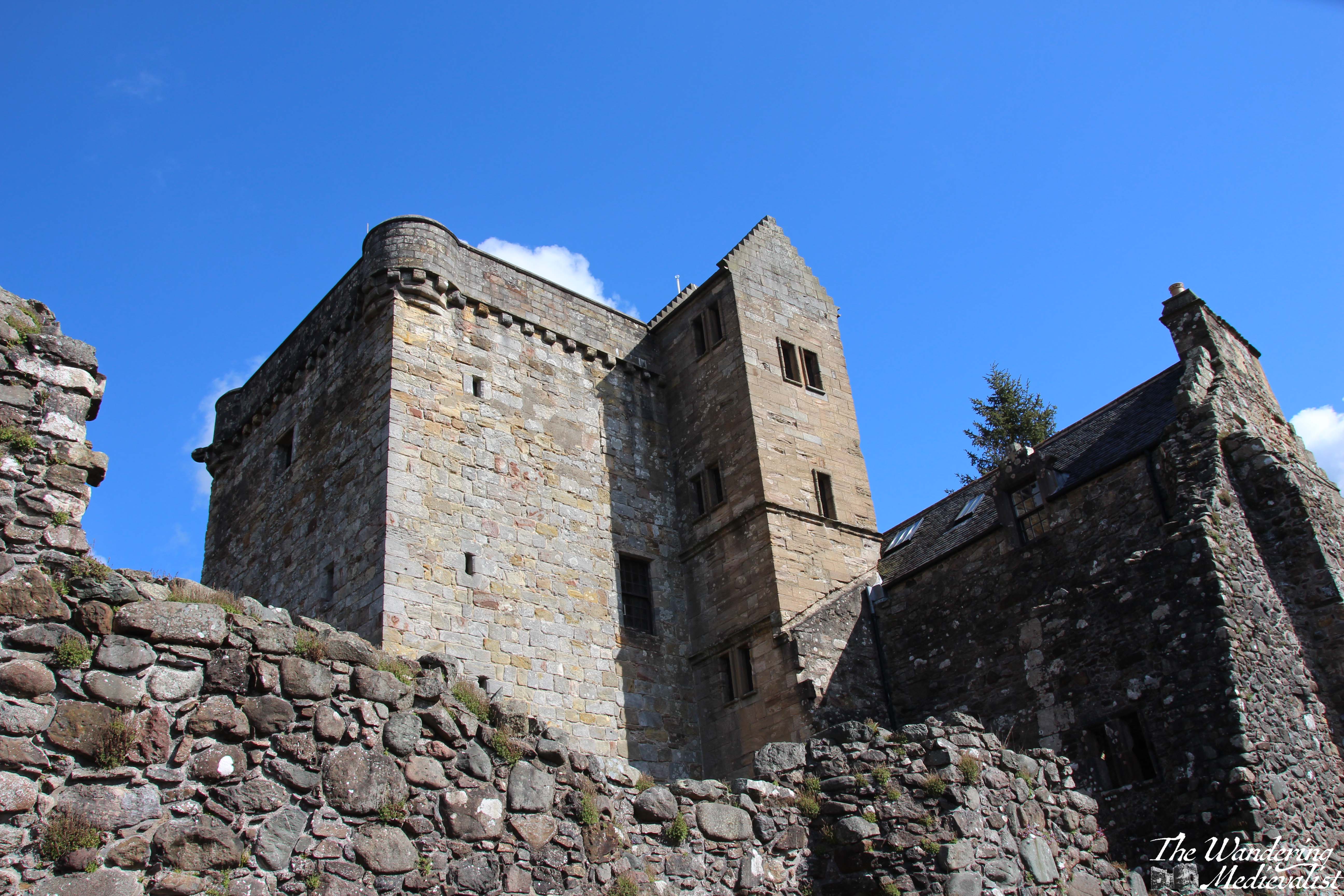
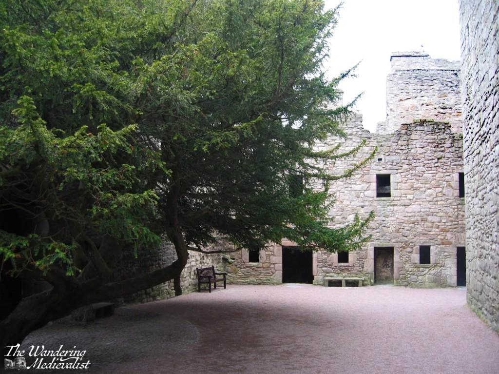
The keep and inner courtyard are still in excellent condition, and the keep is fully enclosed and can be explored by several spiral staircases. Some unique features include the loggia below, several latrines, a prison, and the well-restored chambers with window alcoves and fireplaces evident. On the first floor of the tower, there is a display on the castle and a diorama of what it may have looked like in its heyday, complete with formal gardens.
It was the second earl who built the south range of apartments – now mostly ruined – as well as the terraced garden below the castle. There is evidence of the architectural style being influenced by the royal castle at Stirling – certainly the castle was designed to demonstrate the wealth and power of the Campbells. In the 1450s and 60s, the earls were a vital part of the royal court, and used Castle Gloom as a stronghold and residence. In 1488, the earl petitioned King James IV to change the name of the castle to Campbell. Not long after, the earl would die alongside his king at Flodden, in 1513.
The loggia which can be seen in the pictures above – beautiful carved columns that stand out as unusual in Scottish castles – was likely added in the late 16th century, mirroring a style seen at the Bishop of St Andrews’ castle. Indeed, while Castle Campbell does not cover a great deal of ground, it includes all the features of castles – intact or partially ruined – that one might expect to see. There are bed chambers, the great hall, foot-worn spiral staircases, cellars for storage, and great recessed windows cut into the walls with which I am always fascinated.
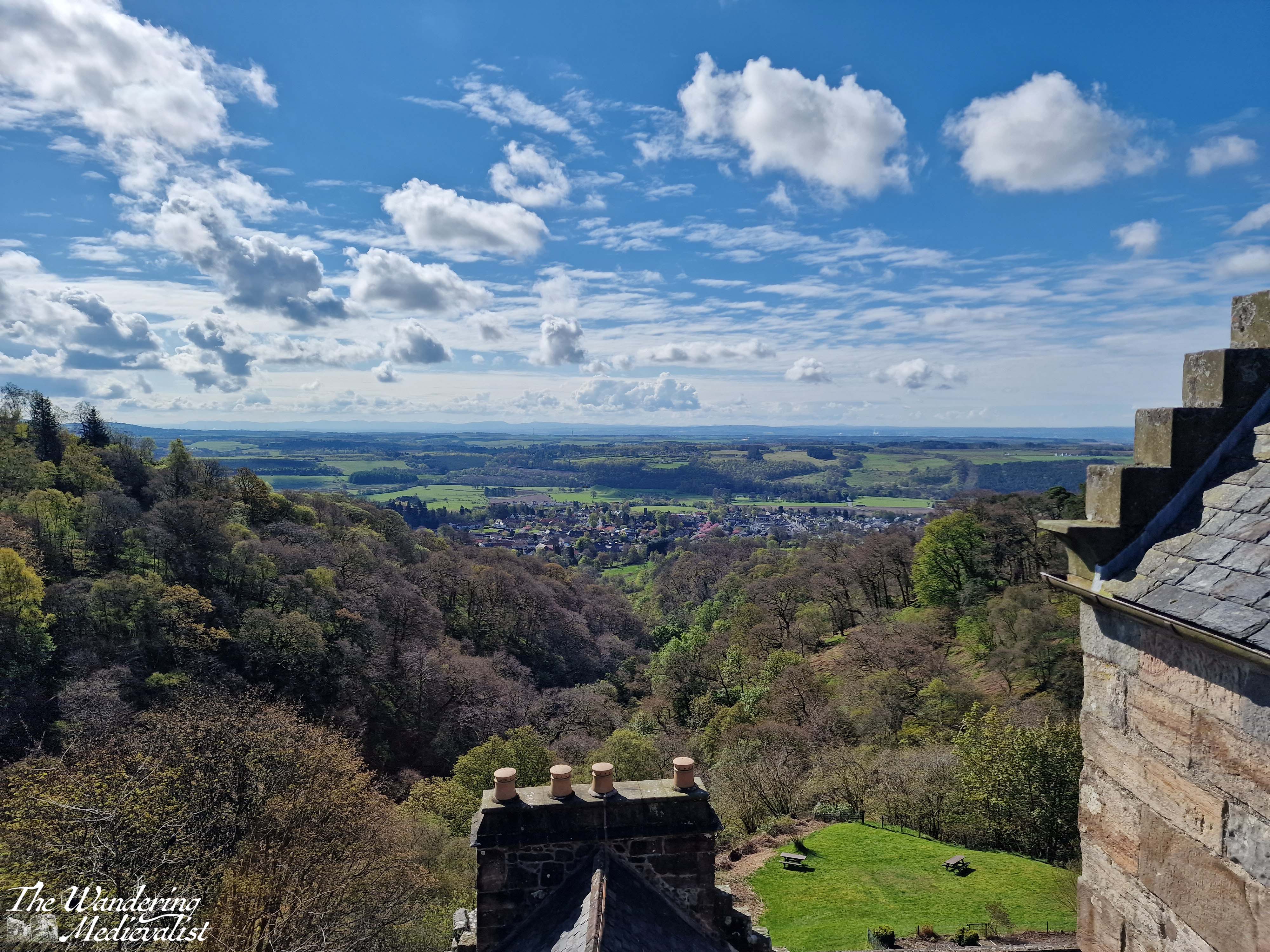
You can climb to the very top of the castle to look out over the countryside, and enjoy the slightly dizzying view down towards the gardens. As one not overly fond of heights, I required a few deep breaths before I ventured to the edge of the parapet. The views are incredible; if you look north the hills disappear into the skyline, if you look south you can see all the way to the edge of the Firth of Forth and the industrial smoke stacks.
The newer parts of the castle, which are also those most in ruin, include two ways to get to the garden; one is out the side door, but the other is through a stone tunnel that emerges onto a grassy bank. The lower garden wall was all in purple when I last visited, and boasted views back up towards the main facade of the great hall, and the tower.
It is easy to imagine well-dressed lords and ladies parading around this terrace, perhaps playing a lawn game, enjoying the flowers and the views. According to the records, the castle saw several important visitors in its day, including (of course) Mary Queen of Scots, who stayed at Castle Campbell in January 1563, and the Protestant reformer, John Knox, who was favoured by the earls.
The Protestant leanings of the earls would lead to the eventual abandonment of the castle; Campbell had crowned King Charles II at Scone, but abruptly switched sides after Oliver Cromwell’s defeat of the Scots at Dunbar in 1650. The castle was used to garrison English soldiers in the early 1650s, and it was badly damaged and burned by the Scots in July 1654. The return of Charles II to the throne in 1661 saw the eldest Campbell executed for treason; his son was restored to the earldom but chose to reside in Stirling and built a house for himself beside Stirling Castle – Argyll’s Lodging.
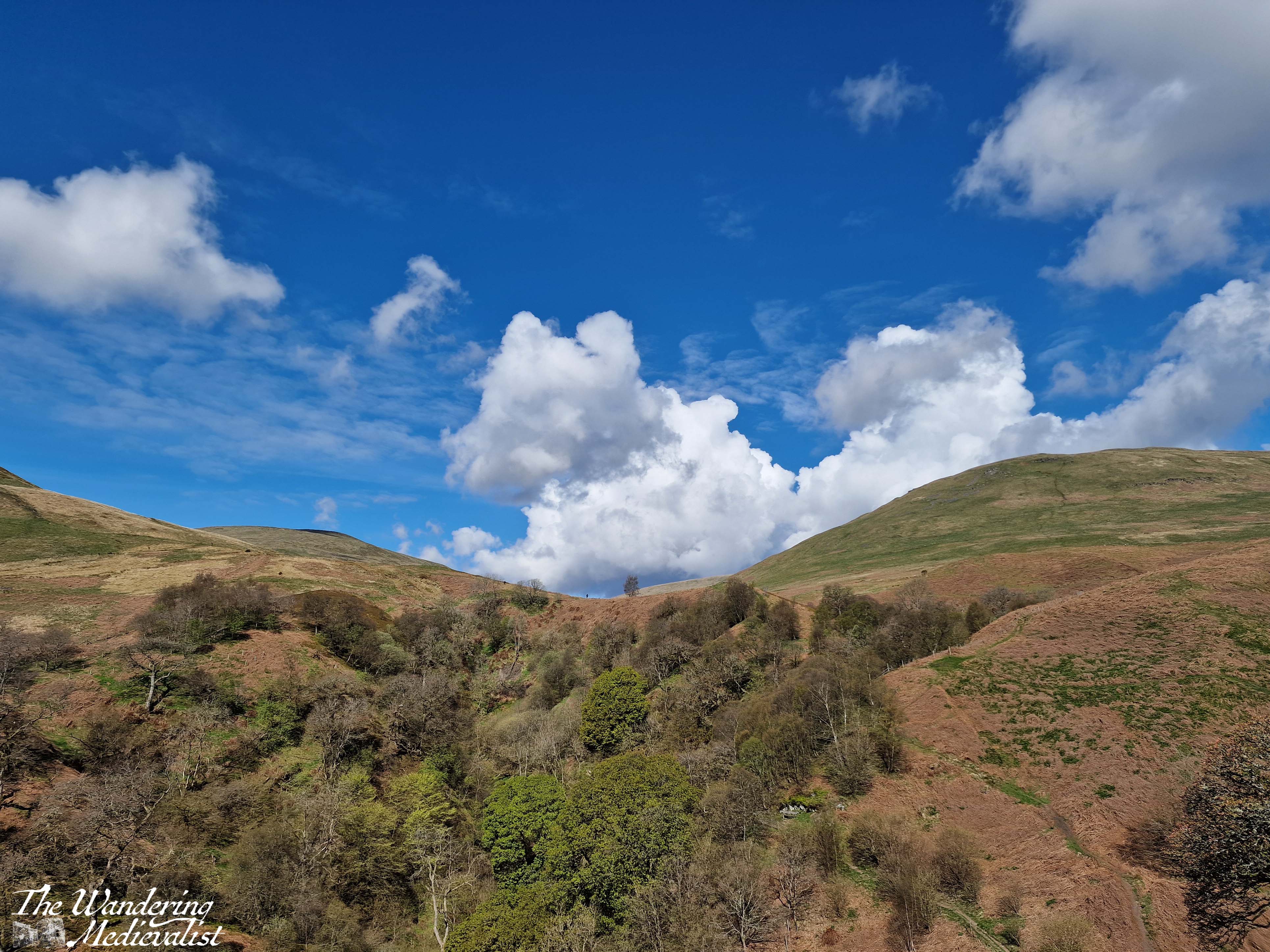
Over the subsequent few centuries, the area around Dollar became well-known for its beauty, and there is to this day a gorgeous – if at times challenging – trail that can lead you from the town of Dollar, up one side of the glen to the castle, and down the other side (though the top part of the Burn of Care side has been closed for some time due to trail damage). The hike is steep in places, but offers yet more unique views back towards the castle.
I am sure I will write more about the walk in Dollar Glen at another point, but suffice it to say, there is something moving about the castle ruin and the nearby hills.
While Clackmannanshire (Britain’s smallest county) is very much not the Highlands, it offers a very small taste of what one will see further north: sheep, hillsides covered in grass and gorse and heather, steep-sided ravines through which rivers rush and create waterfalls and gorges. Even though I have visited several times, it is a castle and an area I can never get tired of seeing, whether it is to roam the halls or find adventure in the hills and trails behind it.
It has been an absolutely hectic few weeks at work, and I am so relieved to finally get back to my blog and share a few more medieval sites with you. It’s been a while since I’ve written about an abbey, so here goes!
As I have doubtless mentioned before, I am not a particularly religious person, nor was I particularly interested in ecclesiastical history when I studied the Middle Ages (in fact tended to avoid it as much as possible). However, I must admit to having a curiosity about the architecture of abbeys and cathedrals. The symmetry, the arches, the mathematical nature of the buildings is fascinating and I find myself drawn to them and unable to resist capturing the lines and arches on camera.
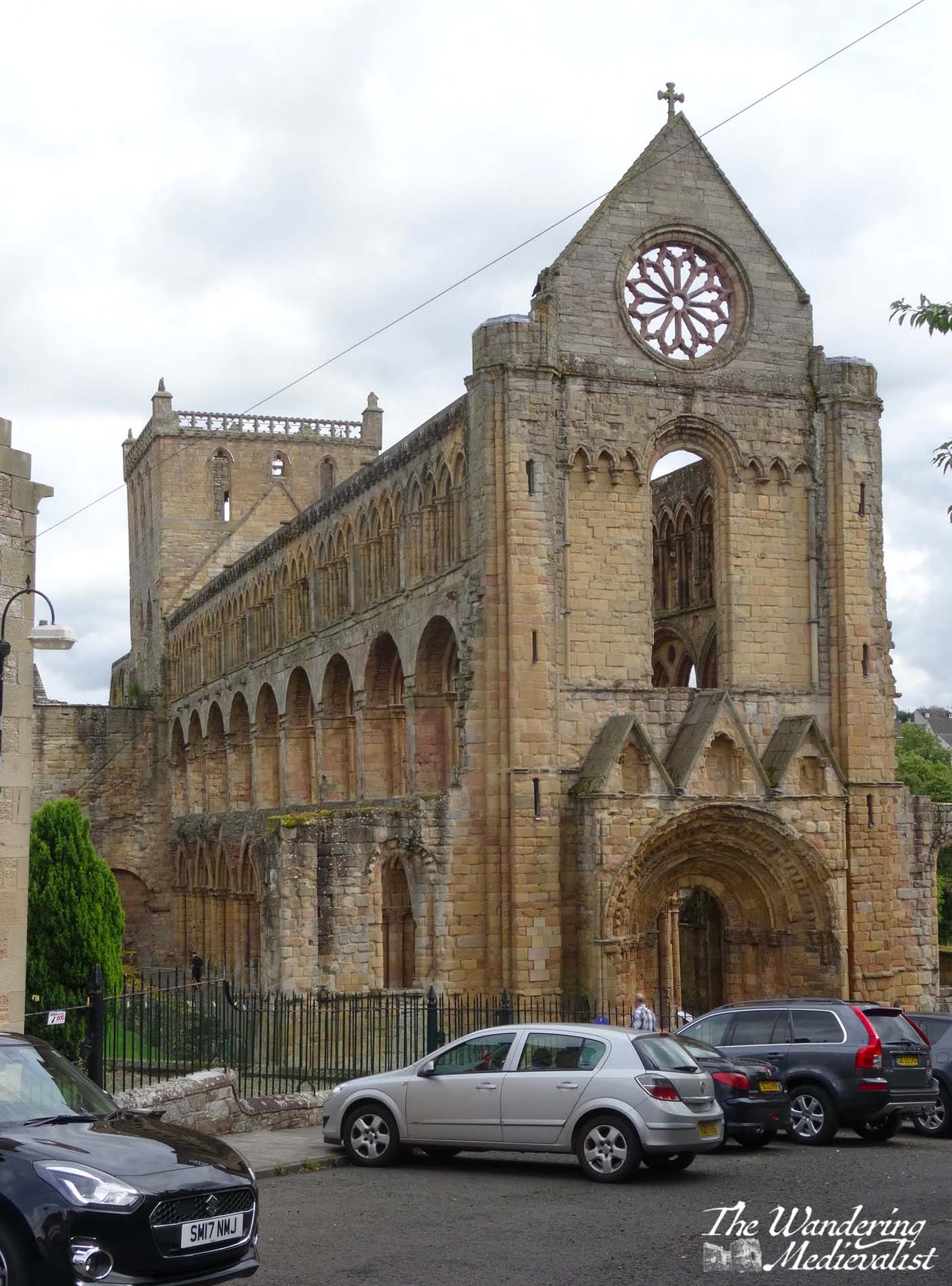
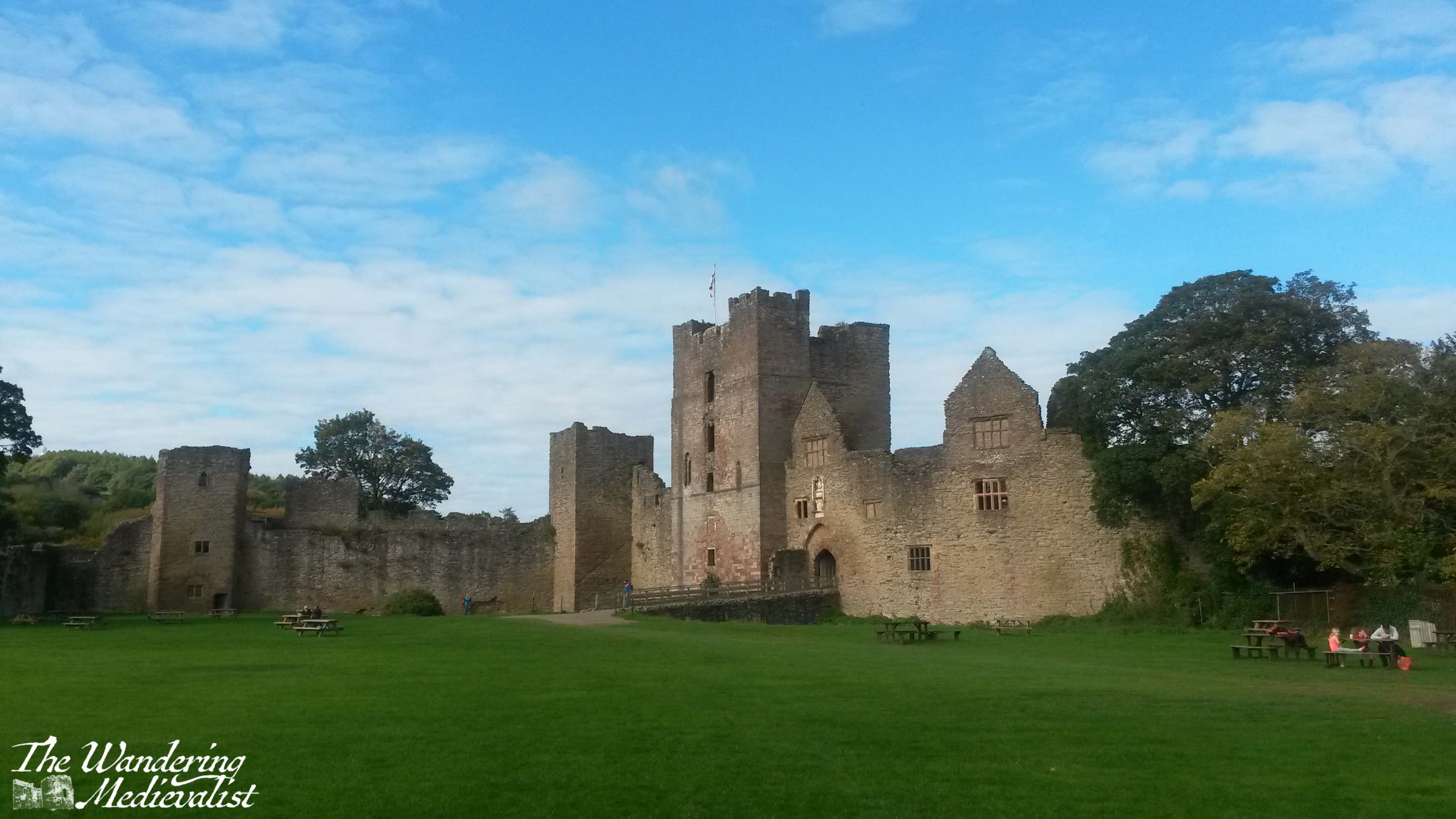
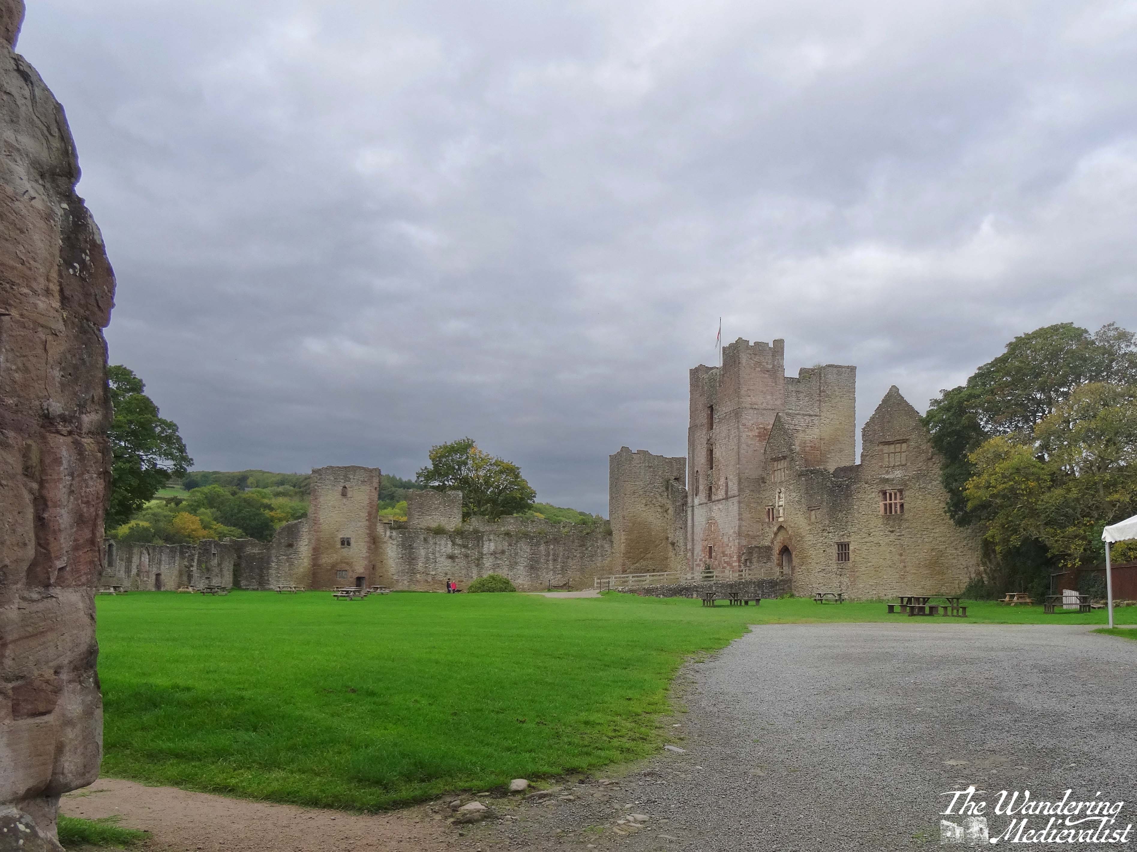
Jedburgh (named for its place along the Jed Water, a tributary of the River Teviot) was a location we chose quite at random when planning a special long weekend away, and looking for somewhere different than our normal jaunts north. Our two requirements were not too long of a drive (2 hours max) and nothing too expensive. So, we looked south and discovered a lovely boutique hotel in the ancient border town where the first church had been founded in the 9th century. The town is mentioned frequently in border disputes throughout the Middle Ages and beyond, boasts a beautiful old Mercat Cross and plenty of lovely shops along the old high street.
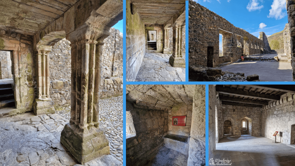
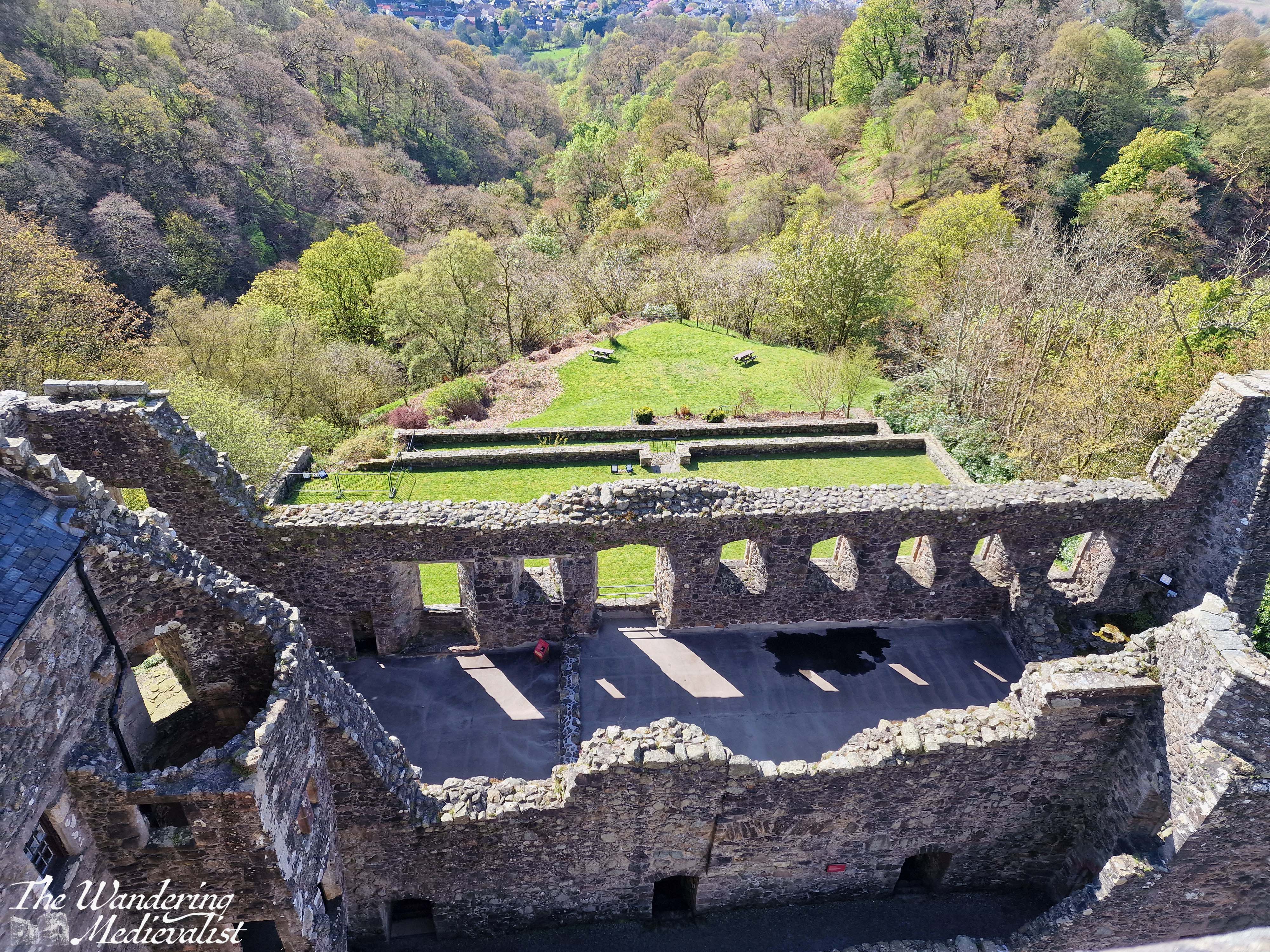
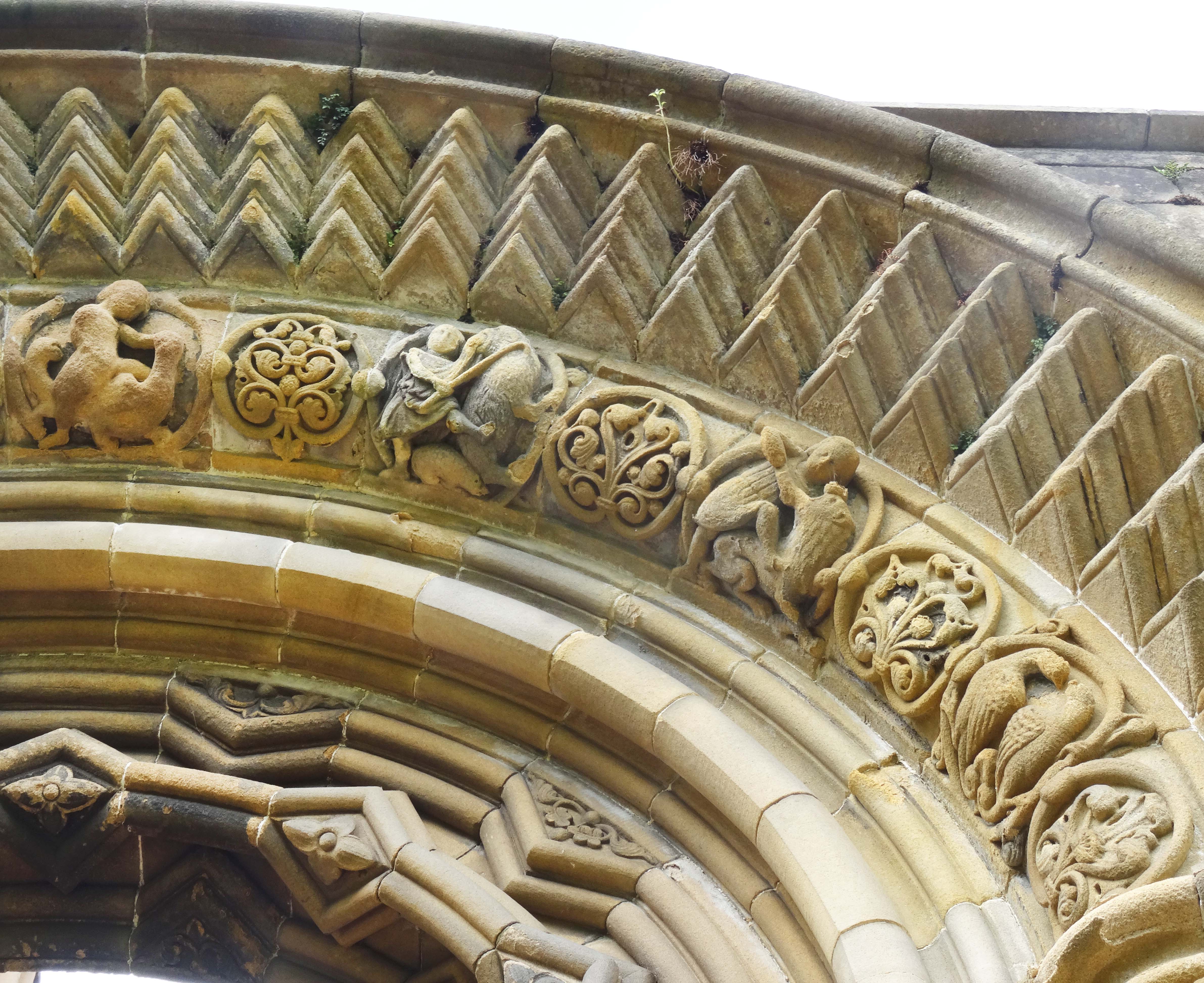
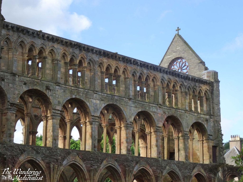
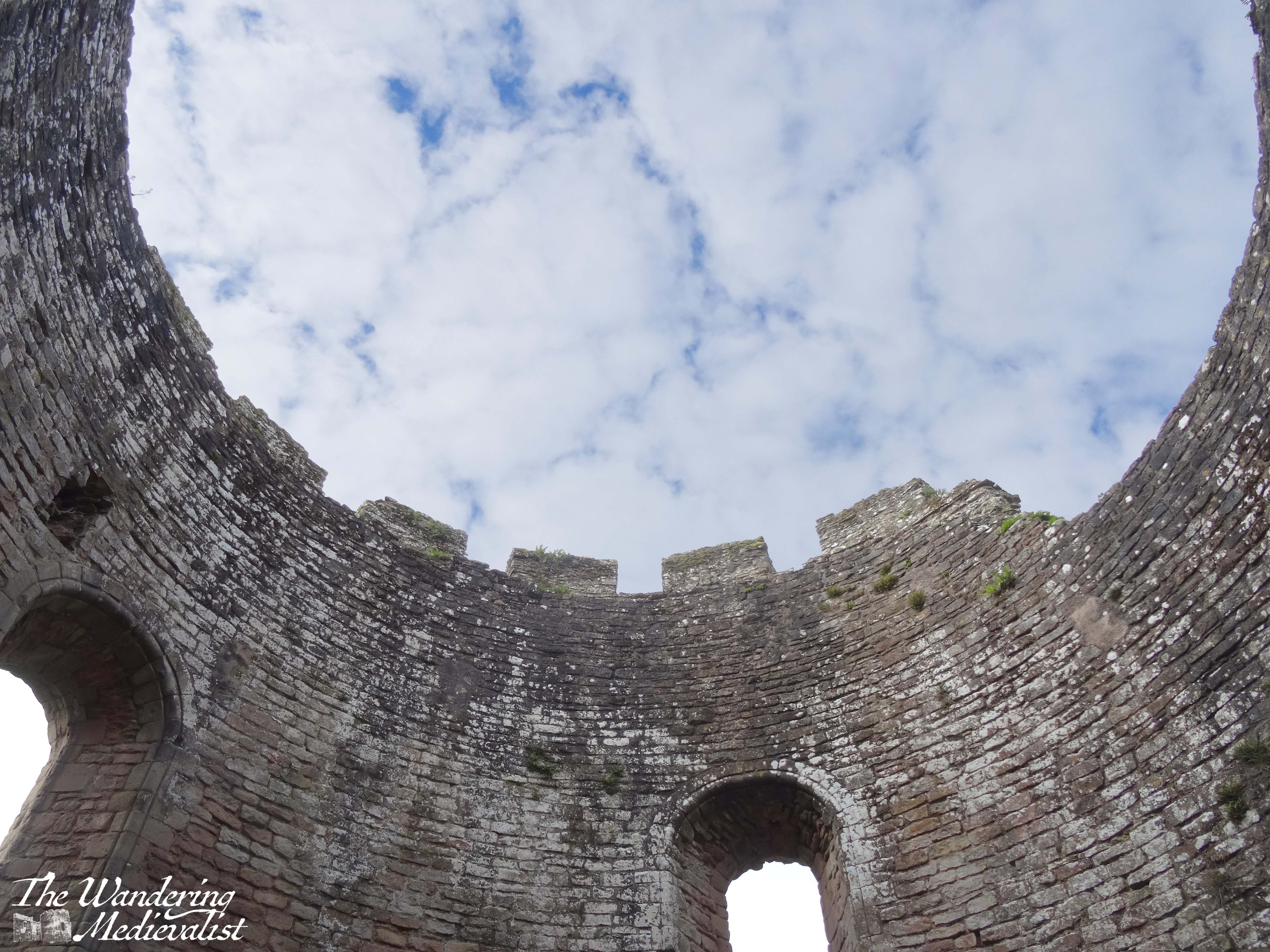
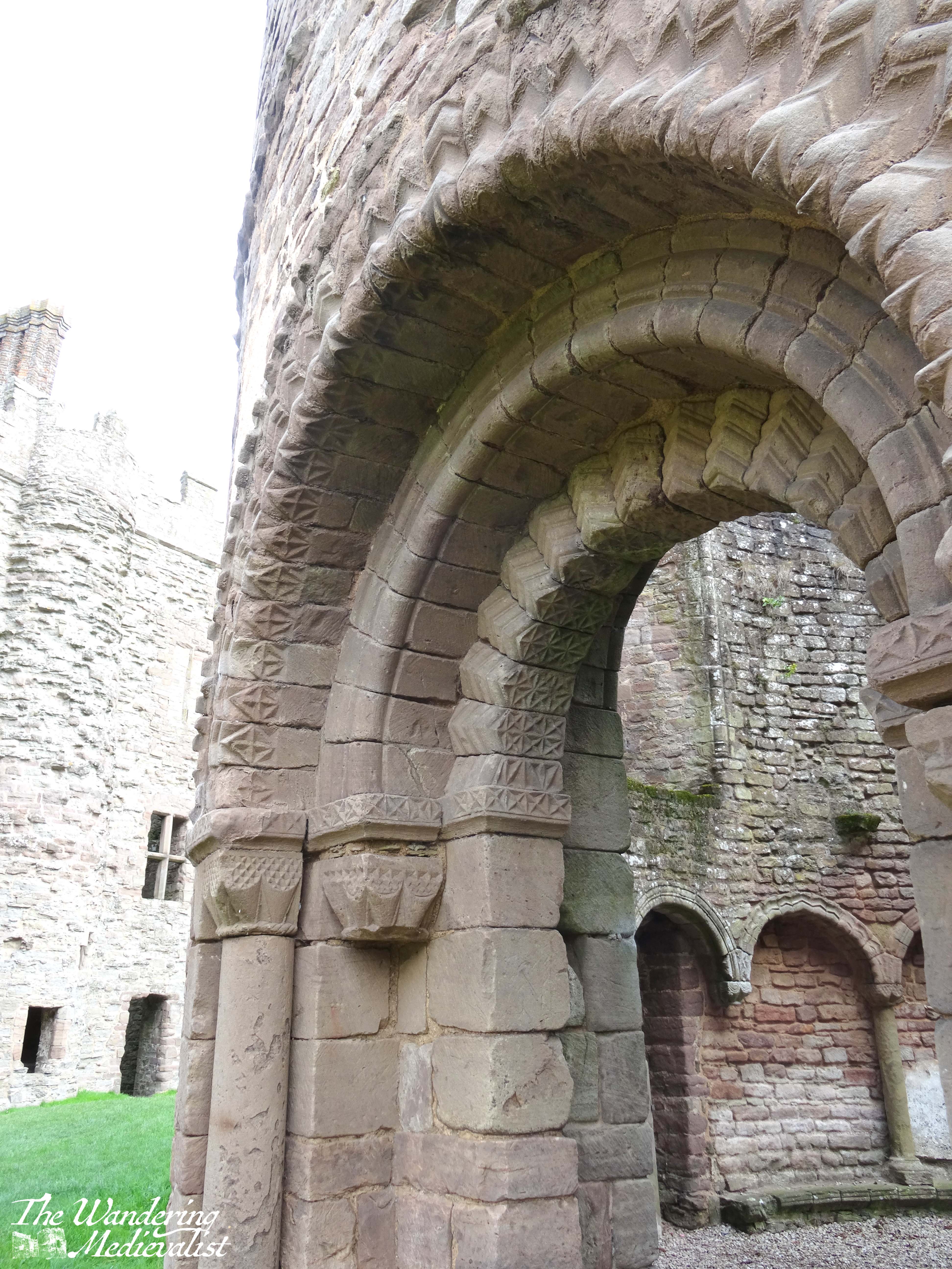
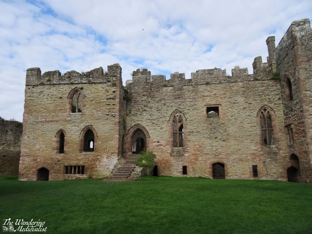
The community of friars at Jedburgh was initially established by Prince and later King David I in the 12th century, with the church gaining full abbey status around 1147. Unlike many of the border abbeys, which sit in secluded glens or fields, Jedburgh Abbey is situated in the centre of the town, and various portions of the structure were added across several hundred years. It was said to contain some of the finest Norman architecture and carving, and even in its ruined state, one can see the beauty of the workmanship that went into the construction. The plaque at the site tells us that the medieval master mason ‘used the church to experiment and to push the boundaries of what was possible both artistically and technically.’
As occurred with many church institutions, the abbey gained control over great parcels of land in the borders, and during the Wars of Independence in 1296 sided with King Edward I. The abbey was subsequently pillaged by the English as punishment after the Battle of Stirling Bridge in 1297, and then re-built and patronised by King Robert I the Bruce.
Unfortunately the location in the borders meant that Jedburgh – both the abbey and the town – suffered regularly in wars between the English and Scots, and in 1523 both were burned by the rampaging Earl of Surrey. As with most ecclesiastical institutions in Scotland, Jedburgh’s preeminence ended during the Reformation of the later 16th century.
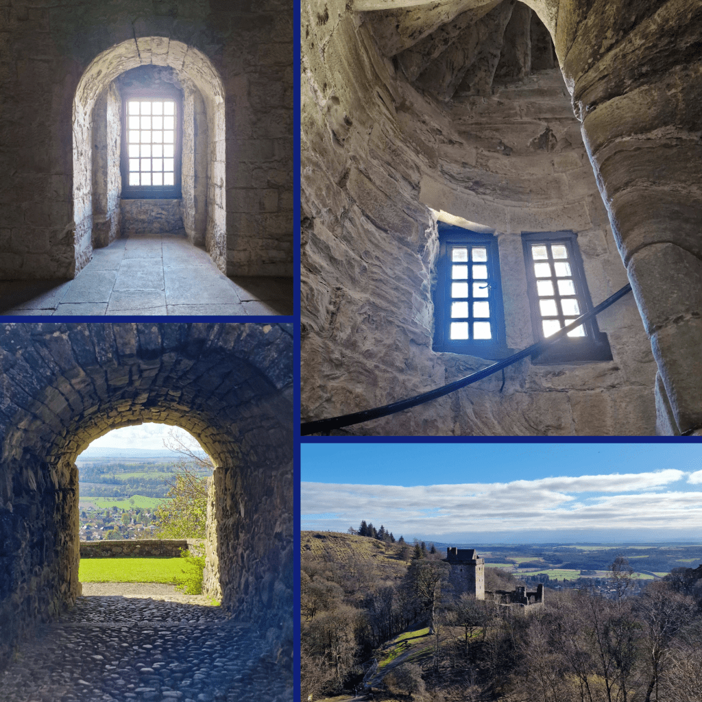
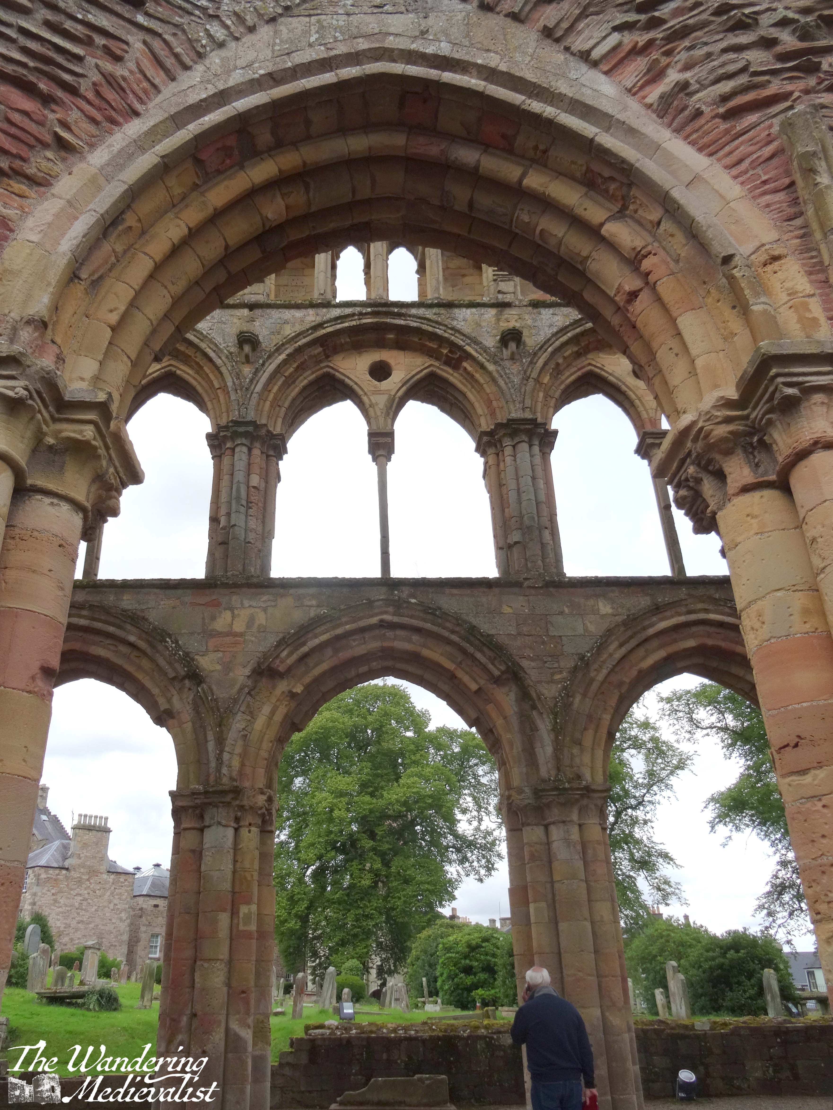
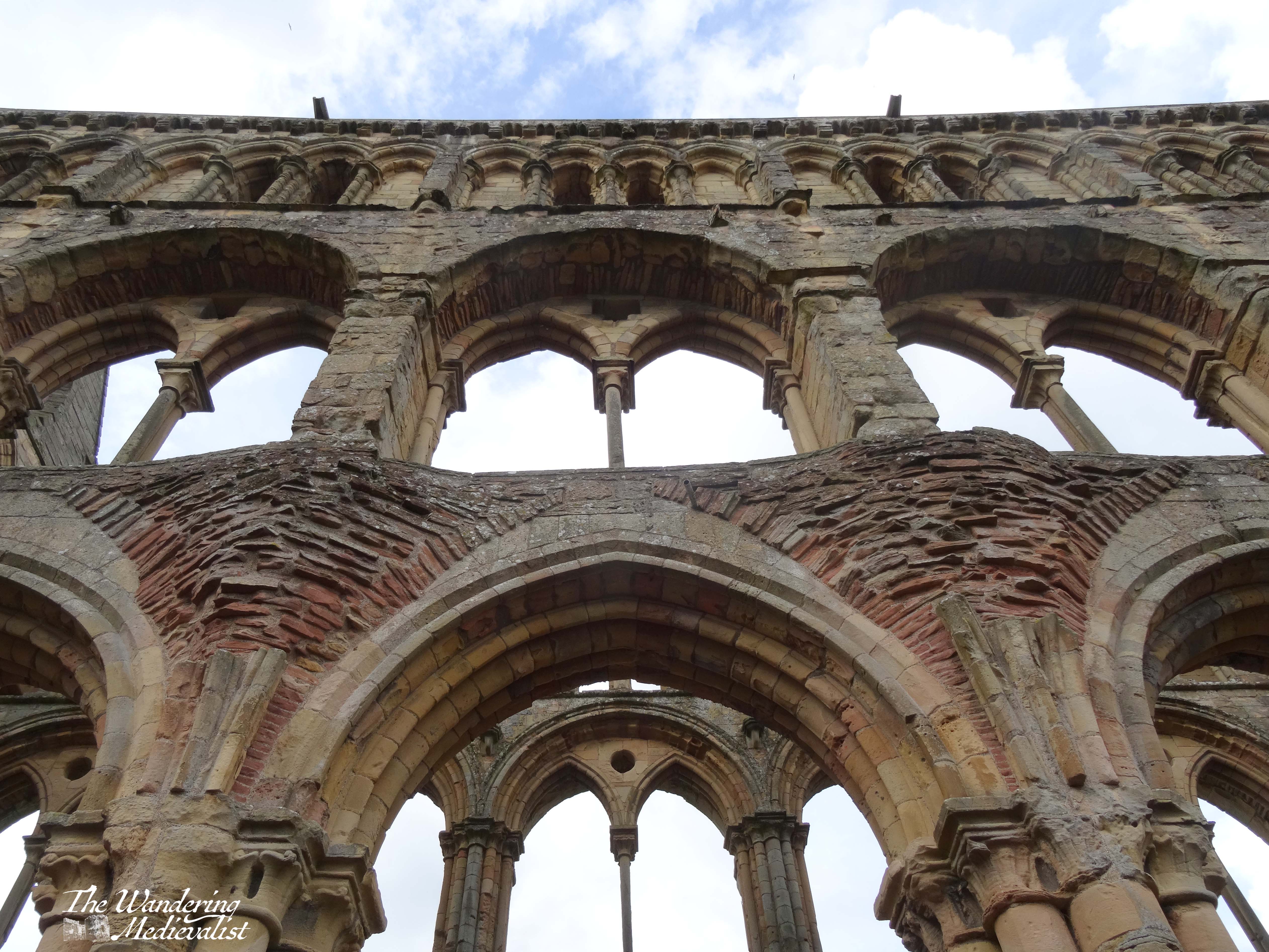
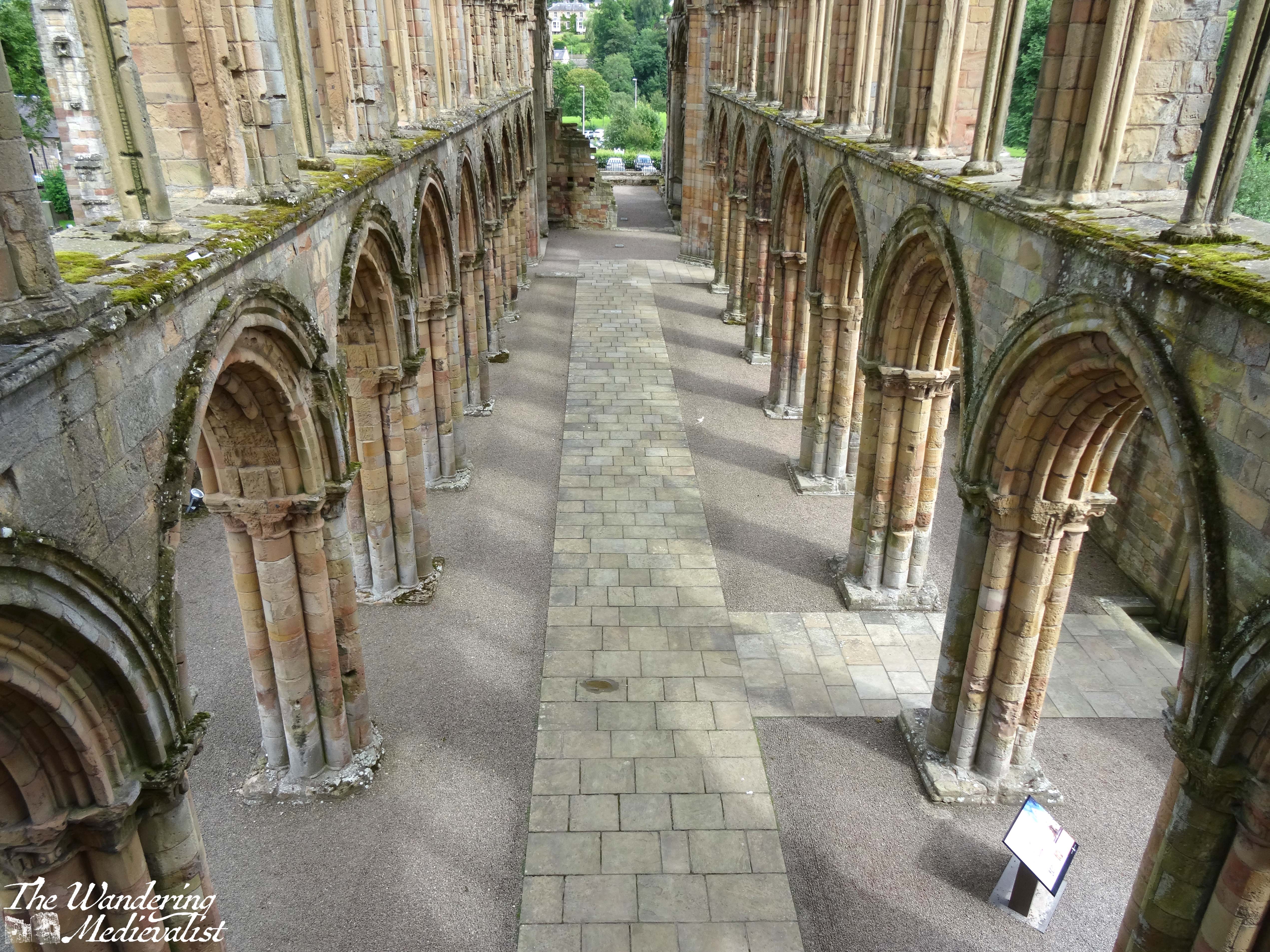
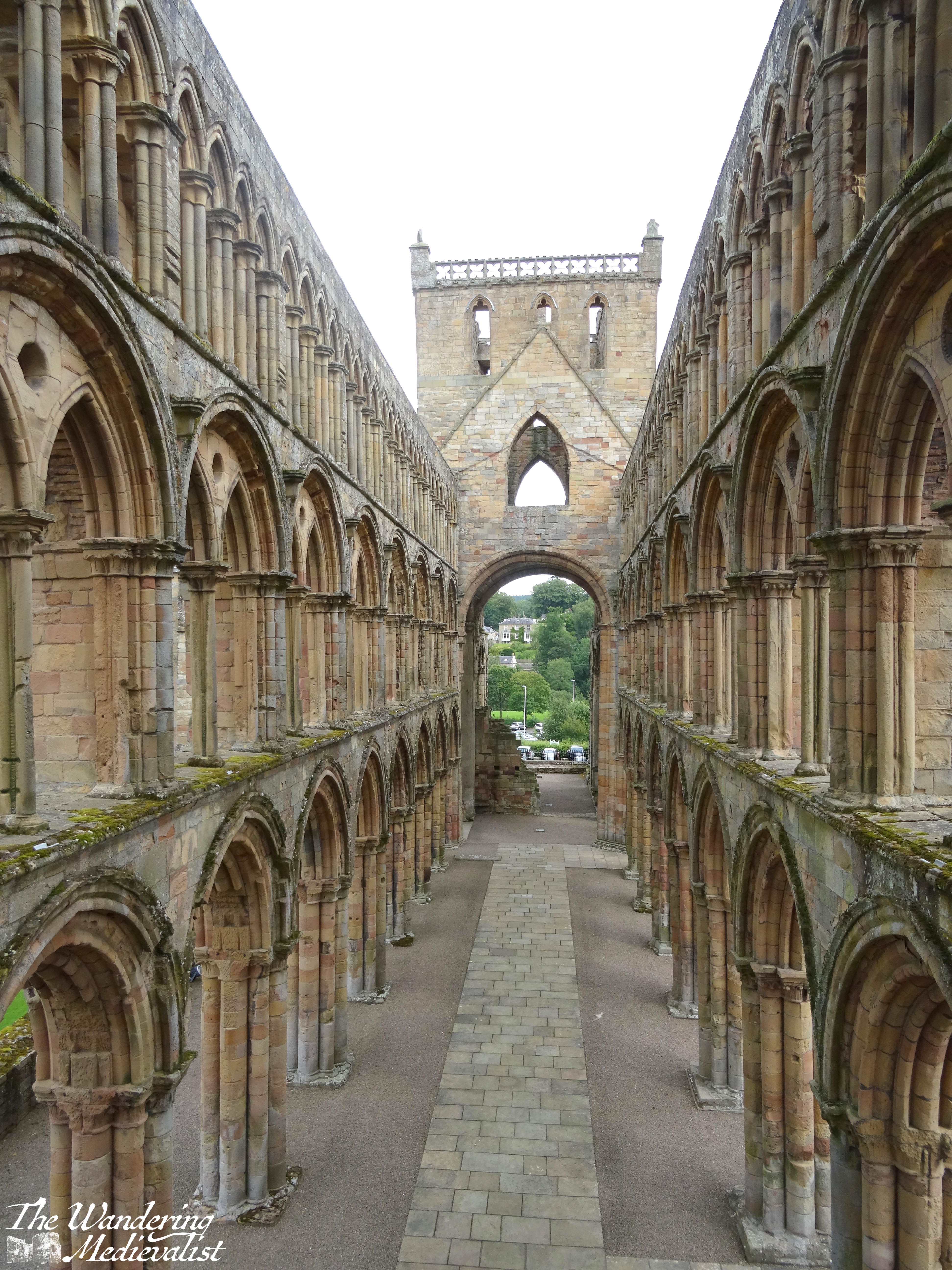
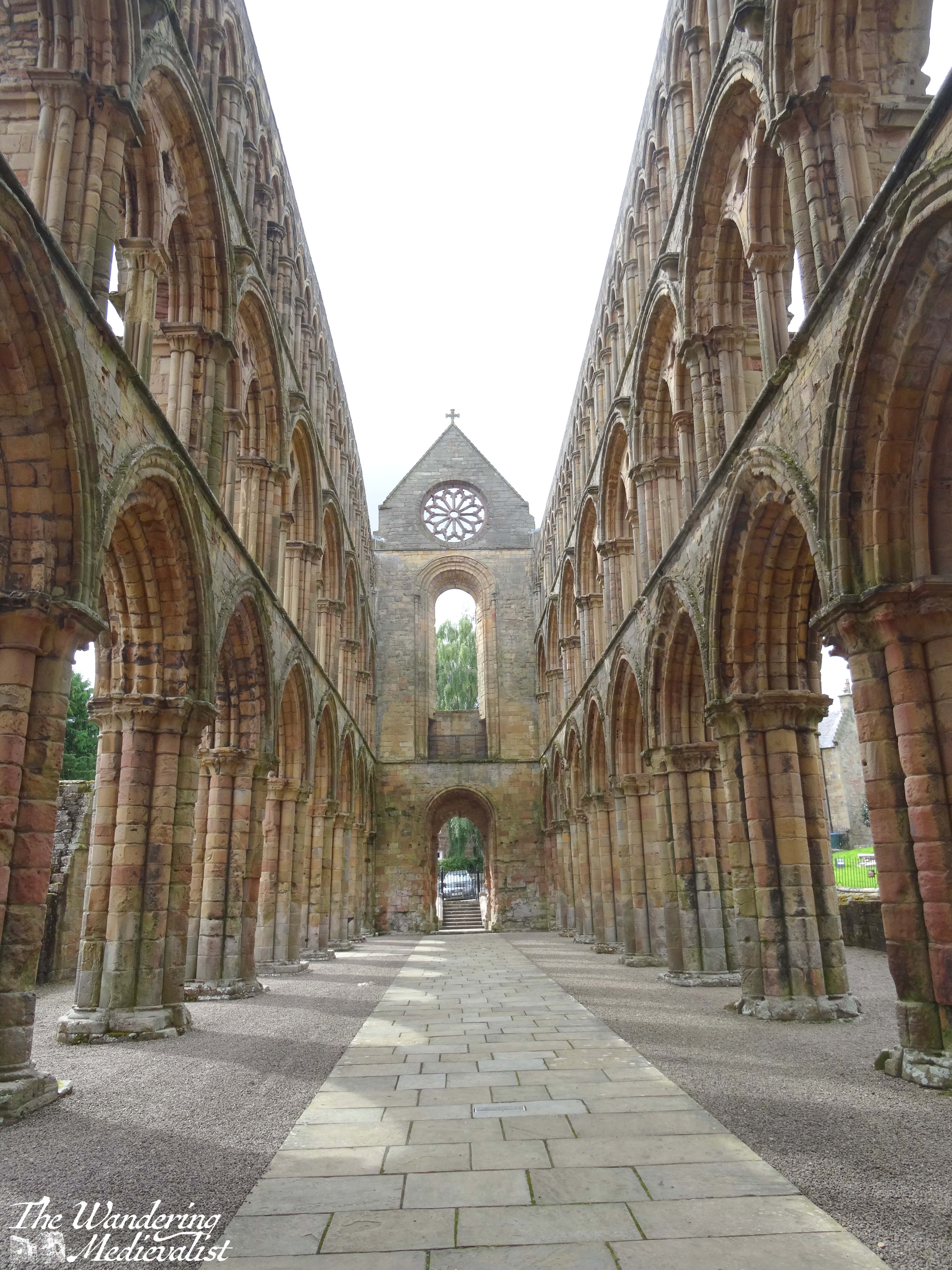
The abbey’s position in the town centre means that it is possible to enjoy views from roughly the level of the first balcony at one end, and to explore at ground level from the opposite end.
I love this series of views down the main aisle of the church, looking either towards the rose window or the grand processional entrance.
I was intrigued while reading about Jedburgh to discover that it had been founded by David I, who is known to have been a king who brought many ‘English’ innovations to Scotland. He had spent significant time in England in his early years, first in exile after the accession of his uncle, and later he became part of the royal family when his sister Matilda married King Henry I1. David himself was named Earl of Huntingdon by marriage to the heiress, and thereby granted a large parcel of lands scattered throughout England; he brought these with him when he became King of Scotland, complicating the nature of his feudal and personal relationships with Henry and future English rulers.2
David took advantage of the chaos in England during the period of the civil war between Stephen and Matilda to consolidate his own power – foundation and support of religious institutions was an essential part of royal activity during this time period. The architecture of the abbey shows an intriguing mix of traditional Norman round arches with the lighter, pointed arches of later styles. The solid yet ornately-carved columns are reminiscent of Durham Cathedral, while the fine window supports are clearly of newer construction. One cannot help but agree with the writer of the many plaques around the site – it is a monument to medieval construction and architecture, with gorgeous carvings and innovative architecture visible even after 100s of years and multiple attacks. Jedburgh is perhaps less majestic than the more out-of-the-way abbeys like Melrose or Dryburgh, but it is no less beautiful.
A marriage of ingenious dynastic significance. By marrying Matilda, Henry combined his Norman ‘invader’s bloodline, the new bloodline of the English throne, with the ancient Anglo-Saxon bloodline that Matilda carried from her mother, Queen Margaret (formerly Margaret of Wessex). With one marriage, Henry legitimised his reign and guaranteed that his heirs would carry both English royal bloodlines. The success (or rather lack thereof) of this plan will be discussed at another time. ↩︎
As the English kings now owed homage to the Kings of France for Normandy, now the Scottish kings owed homage to the English kings for their lands. Always a recipe for trouble when a king owes sovereignty to another king…see the whole 12th and 13th centuries. ↩︎
This post has been very long in coming, due in part to a month of February that both sped by and was quite challenging. I was also very keen to include some history of this magnificent spot, and so even more research than normal was required.
Several years back, I was fortunate enough to be invited to speak at the Mortimer Historical Society autumn conference. A work colleague knew one of the conference organisers, who along with being passionate about the Mortimers was a knowledgable and kind host. My train ticket and accommodation were taken care of, and one afternoon before the conference I was able to visit the stunning castle. Ludlow is the type of castle I adore – ruined but only partially, with a solid feel for what it would have looked like in its heyday. I could happily have spent hours exploring the towers and keep, as well as the unique round chapel.
Ludlow – the town
Dating back to 1086, Ludlow was a planned town, built around the castle. Situated on the Welsh marches – border lands – the fortress was constructed to help subdue the local Anglo-Saxons and of course keep an eye on neighbouring Wales. For this reason, town walls were constructed in the 1230s, several stretches of which are well-preserved.
The plan of the town is evident. Before the castle is a large market square, and the streets lead away in what feels like a very un-medieval planned grid of sorts. There are reams of beautiful buildings from different styles and time periods, and I spent a good few hours wandering the streets and discovering unusual paths and construction. But the castle, of course, was the pièce de résistance.
Ludlow – the castle
Ludlow is one of those epic castles that has played a part in many points throughout history. The first phase of construction was begun by Walter de Lacy, one of many Normans who came to England with the conquest of 1066. Throughout the 11th, 12th and 13th centuries, the subsequent rulers of the castle were frequently at odds with the king, but that did not mean there was no time for construction.
The unusual round chapel of St Mary Magdalene was build in the early 12th century, likely modelled after the round churches of the Knights Templar, an order which the castle’s owner Gilbert de Lacy later joined.
Chapel of St Mary Magdalene
The Great Tower that dominates the outer bailey likely dates from the 1130s.
In the 13th century, the solar block was added, creating more comfortable living space for the family and enabling the lords to more adequately welcome guests. In 1223, Ludlow was the site of unsuccessful peace talks between King Henry III and his brother-in-law, the Welsh Prince Llywelyn ab Iowerth.
These buildings are more clearly viewed when you climb up the Great Tower, and look over the castle interior. Like in many ruined castles where the floors are long gone, you can look up the walls to see doorways, corbels to support the floors, fire places, and of course windows.
In the 1260s, the hapless Henry III lost most of his power during the Second Barons’ War, and his son Prince Edward was held captive for some time by the de Montfort cause. Upon his escape, Edward used Ludlow as a rallying point for supporters with whom he launched his campaign to re-take the throne. For Edward, Ludlow was considerably better luck than it was for his father – the Battle of Evesham was a resounding victory that created Edward de facto king, though his father would survive for some years more.
The Mortimers who inspired the creation of the society for whom I presented a paper gained control of the castle in 1301, when Roger de Mortimer married the heiress, Joan. Roger’s tenure included the addition of the Great Chamber block, another concerted effort to turn a defensive castle into a residential one.
Not the chamber block, but another view of the wall.
Mortimer was notorious in history for a much more prominent reason, however, in that in the 1320s he would be exiled to France, where he made an alliance with Queen Isabella, estranged wife of King Edward II. Together they returned to England in 1327 and seized power, imprisoning Edward II. Mortimer was named Earl of March, and Ludlow gradually became the Mortimer family’s most important property. Though Roger was eventually hanged, the castle stayed in Mortimer hands.
View from the castle walls across the countryside.
In the 1400s, the castle was inherited by Richard, Duke of York, a primary combatant in the Wars of the Roses and father to kings Edward IV and Richard III. He installed his family in the castle in the 1450s, and when Edward IV eventually gained the throne in 1461, he added Ludlow to the royal holdings. Edward evidently held great affection for the castle, visiting regularly and establishing his heirs – the Princes in the Tower – there in the 1470s. The boys would live there more or less until their father’s death and their fateful journey to London in 1483. (Side note, I will not discuss here my thoughts on Richard III’s capability in the deaths of the princes, though I may at another point.)
During the English Civil War and Interregnum in the 17th century, the castle fell into decline, and at one point there was even a suggestion that it should be totally dismantled. Fortunately it was leased from the crown by the Earl of Powis, whose family eventually bought the castle in the 1880s and maintain it to this day. The Trustees of the Powis Castle Estate manage it as a tourist attraction, allowing more than 100,000 visitors annually to explore the historic walls.
I count myself lucky to have been one of them! Ludlow is definitely one of those castles that appeals to castle nerds like me; you can see the evolution of the building style, from defensive structures like the Great Tower to more decorative buildings inside. And in a perk I always enjoy, you can still climb high enough on the walls and in the tower to see out across the grounds and the surrounding countryside. Not only is the view lovely, but it further supports the building of a castle in that spot; the hills and river made this an ideal location for a proper medieval fortress.
It is clear to everyone by now, I am sure, that I love castles. I have opinions on which types are best, of course, but really, I love them all. I love the aesthetics: the ruined ones, the restored ones, the mostly complete ones, and everything in between. Several years ago I decided it was prudent to set up a Google My Map of every castle I have seen, and all those I would like to see – I have barely scratched the surface of English castles, while Wales and most of mainland Europe are on the list of dreams. Needless to say, the list is…lengthy.
In this post are some of those I have visited – many of them multiple times – and found to be even more spectacular than others, or having historical significance that sticks in my mind. Some of these pictures are scans of those taken before digital technology (gasp!) so please bear with the quality. I hope you enjoy!
England
There are so incredibly many castles in England, and some of the most famous I have seen at a distance (Warwick for example). I have visited the Tower of London several times and – despite being chastised by a Beefeater for being overly excited – I experienced less emotional attachment than to some of these below.
Carisbrooke Castle
Located on the Isle of Wight, Carisbrooke is a fantastic example of a castle constructed across many generations and styles. Complete with an early motte-and-bailey that you can still climb, this gatehouse, and a perfect view across the countryside, the castle is an excellent spot for a day out and encompasses so many different ages of castle.
Ludlow Castle
Arguably one of the most stunningly ‘typical’ castles I have ever visited, Ludlow gained significance as a border castle, on the Welsh marches. It has been managed through the ages by some of the ‘biggest’ names in English medieval history including the Mortimers, de Lacys, and the Duke of York.
Scarborough Castle
Another link to King Henry II, Scarborough is mostly ruined but the views and remaining curtain wall are a ghostly example of what a high medieval castle could be.
France
The sheer variety of châteaux in France is world-famous – the Loire valley in particular boasts some of the most stunning in the world. As one who has spent a great deal of time studying French history, many of the locations inspire memories of a particular moment of battle or conflict, with castles at the crux of many arguments. There are so many I have yet to see, but Mum and I have managed a few.
Château d’Angers
Easily recognised by its stunning striped stonework, the Chateau d’Angers – or a version of it – has stood since the ninth century. The castle lent its name to the Angevin Kings of England, starting with Henry II.
Château de Carcassonne
I’ve written plenty about Carcassonne, one of the better examples of a modern restoration of a castle, complete with battlements.
Château de Chinon
Chinon is the setting of one of my favourite films, The Lion in Winter, and was a vital strategic fortress for Henry II. It is also where he passed away, betrayed by his last son. We visited in 2002.
Château de Loches
Though I did not know it in 2002, Loches is in fact twinned with St Andrews. The town itself is renowned for its medieval feel, but my recollection is mostly of the impressive square Norman keep that has remained in place despite all the construction around it. Another castle occupied by Henry II and Richard in their day.
Scotland
Needless to say, Scotland is rich with castles and I have done what I can to visit as many as possible – there are still many to go! A few stand out as favourites; many are of a similar style, with a central keep and walled courtyard of various sizes, known as a tower house. Most offer spectacular views over the ocean, shoreline, or countryside.
Caerlaverock Castle
Uniquely triangular in shape, Caerlaverock is another castle that has been partly destroyed and rebuilt over the years. Pieces of the walls are clearly medieval while the interior buildings are of a slightly newer style.
Castle Campbell
The location of Castle Campbell is half of its draw – nestled in Dollar Glen with walks on every side, every time I have visited has provided a different view. The tower itself is still relatively intact, and the views from the surrounding hills are breath-taking.
Craigmillar Castle
One of many castles most recently used for filming Outlander and other Scottish productions, Craigmillar is located on the outskirts of Edinburgh. The castle itself offers a great place to explore, and the views back towards the city are excellent.
Doune Castle
Another movie star castle, Doune is mostly intact with a central keep that offers plenty of staircases and rooms to explore. It tends to be busy year-round but is one of my favourites since my solo visit in January many years ago.
Dunnottar Castle
Constructed on a rocky headland, Dunnottar is the epitome of a defensive castle; even now, it requires a good bit of climbing to reach its main gate. Once inside, one finds plenty of buildings to explore and views of the Aberdeenshire cliffs.
Elcho Castle
Self-contained and still in quite good shape, Elcho was a castle we visited on a spur-of-the-moment trip and I really enjoyed. It is ‘new’ for a castle, but the rooms inside have a solidly medieval feel. Lovely views over the countryside and the nearby River Tay.
Lochleven Castle
Once upon a time, the other half planned a daily outing for us, ‘Castle Day’, which included a picnic and boat trip to Lochleven Castle. Perfect for defence, the castle takes up most of the small island on which it was built. It was also one of several places where Mary Queen of Scots was imprisoned.
Stirling Castle
Last but not least, Stirling has always been one of my favourite castles. Similar to Edinburgh in some ways, it is still more medieval in feel, and it offers some of the best views in Scotland.
Finally, honourable mention must go to the castle of which I have more photos than any other and which I walk past almost every day: St Andrews. A bishop’s castle, it boasts a bottle dungeon, some lovely carvings, and perhaps most unique, a preserved mine and counter-mine dug during a siege. I will never grow tired of the view walking up the Scores past the castle, enjoying the magnificent gatehouse and the often pounding waves of the North Sea. It is almost impossible to pass by without taking yet another picture. The one below is from Christmas Eve 2022, in the pouring rain; but still a picture that needed to be taken.