It has been a shockingly long time since I have managed to sit down and focus on a blog post. What can I say? Life got in the way – I’ve been back and forth to the US twice in two months, run a conference at work, and been inundated with life admin that needed to be done. All of this and jet lag meant that since finding time in my hotel room to write about my visit to Crystal Cove, I have really struggled to find the motivation, time and energy to be creative. But, while work continues to be busy and my travel schedule is no less intense, I had to make some time to write. I have never gone this long without posting before, I don’t think, and it feels wrong.
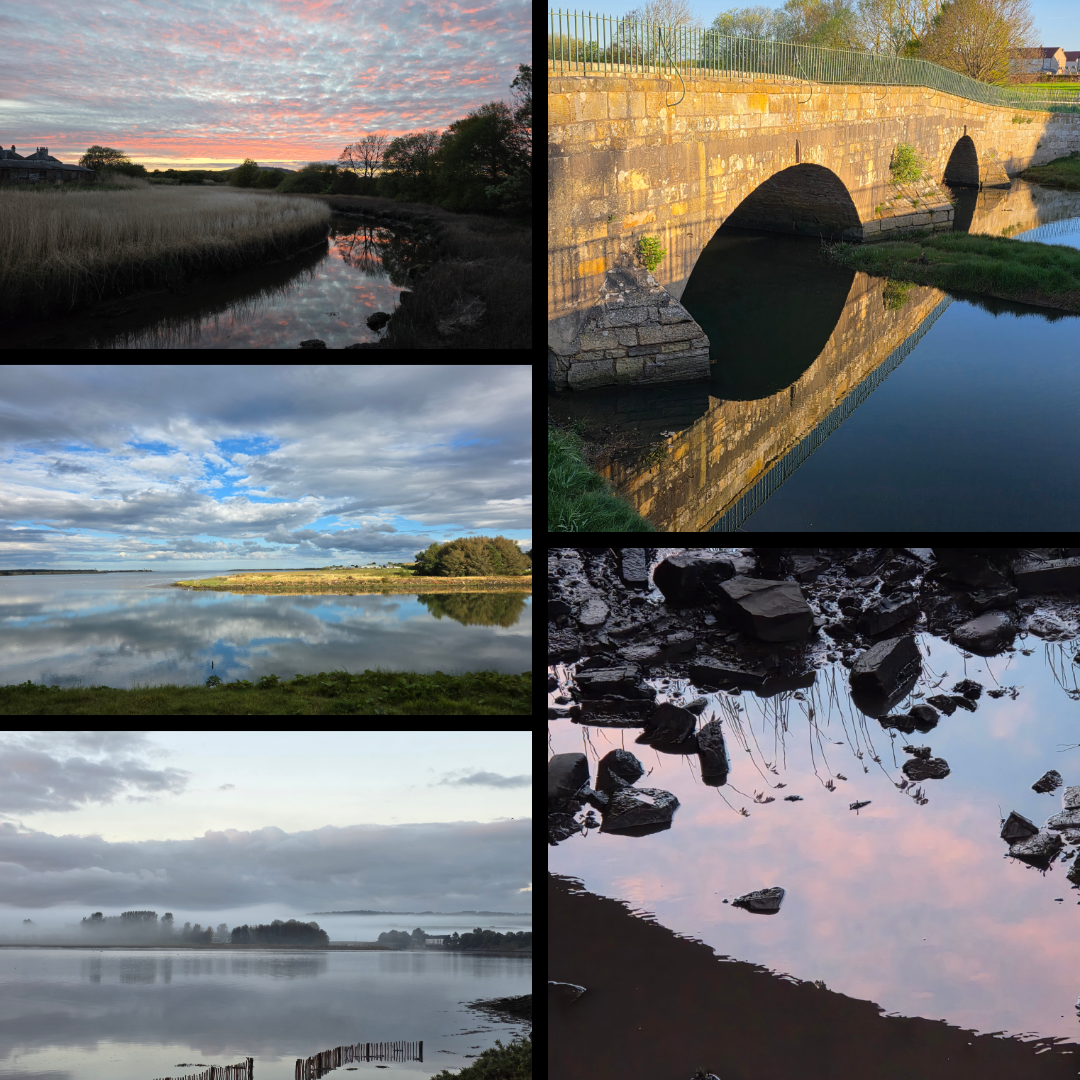
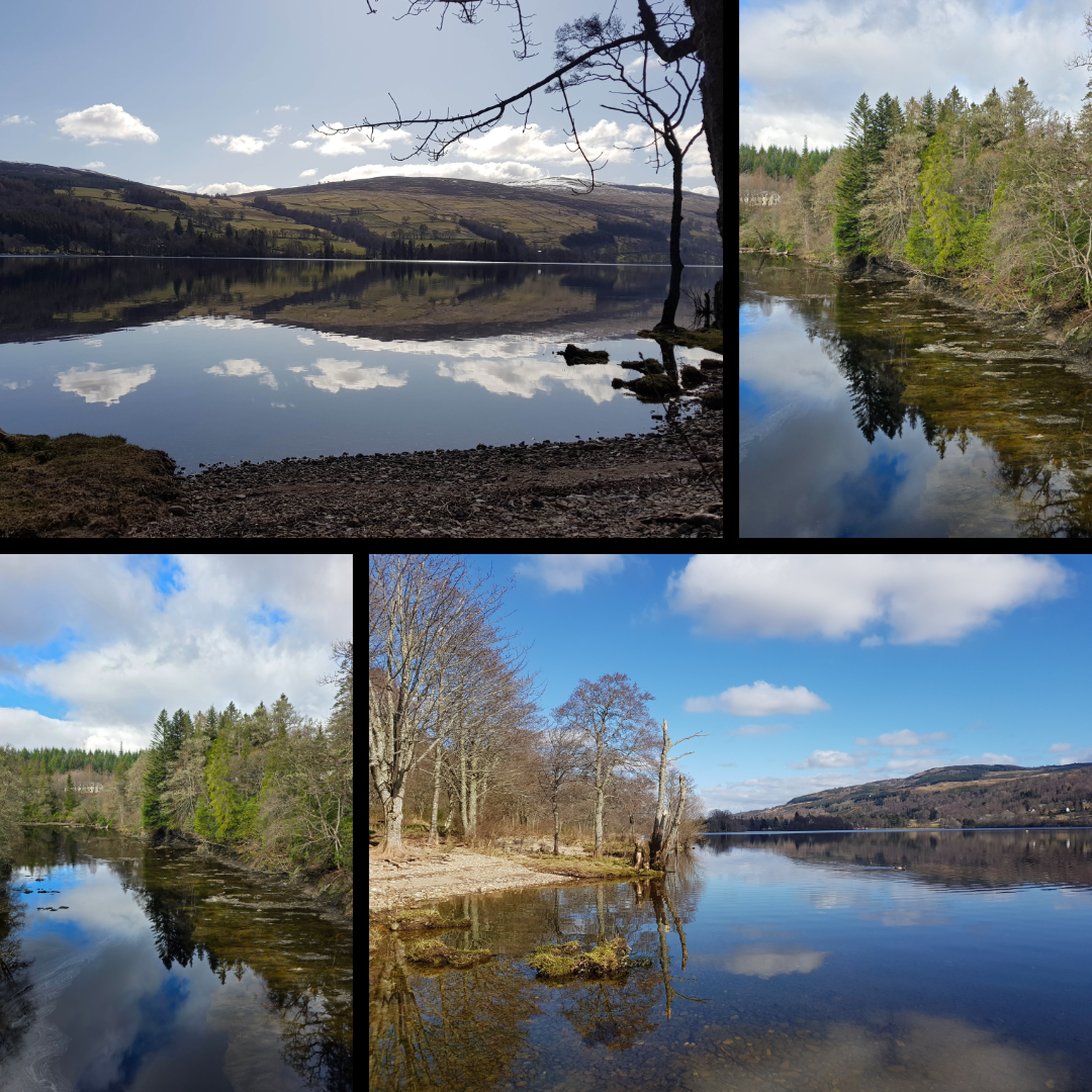
I started pulling the basis of this post together some time ago, when I was submitting pictures for a contest and realised just now many shots I have of reflections. So many hint at this theme, some more effectively than others, but it’s a motif I have always leaned towards. Perhaps because a reflection is so often the embodiment of a moment of calm – an early morning, evening, quiet time when the world is still for just a short second. And because water has a magical way of capturing what is happening in the world and giving it back to you in an image sometimes identical, but often slightly altered.
Here are some shots that I love, and wished to share.
Themes
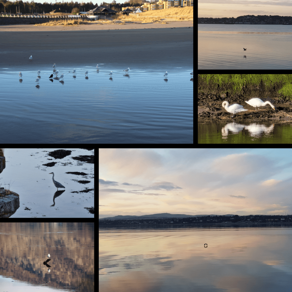
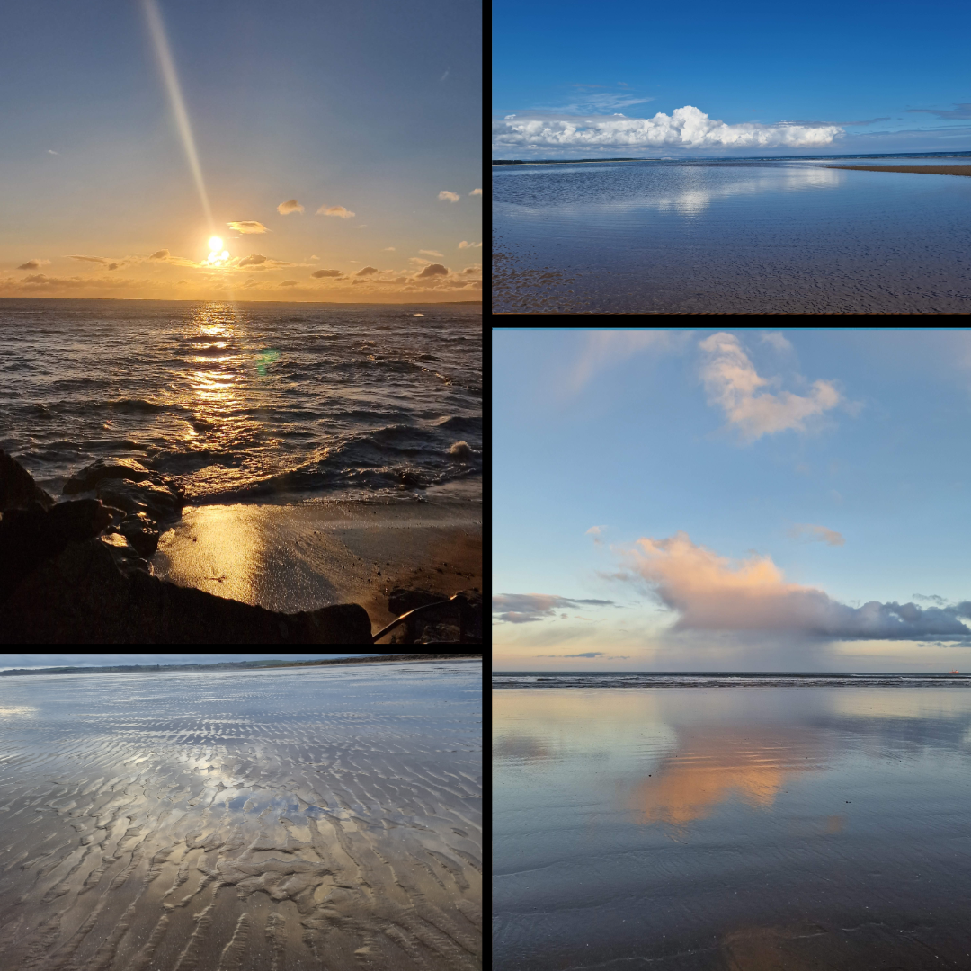
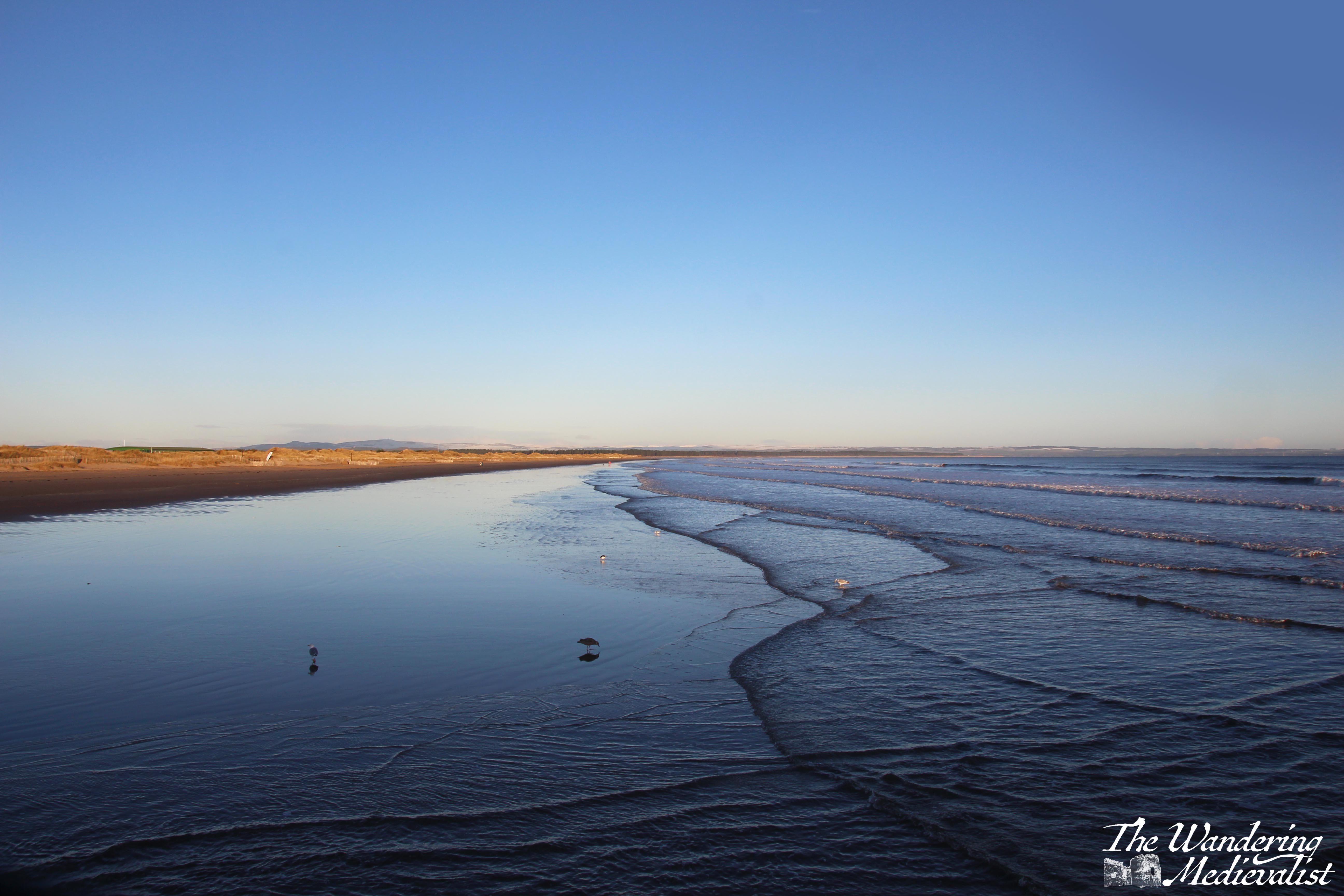
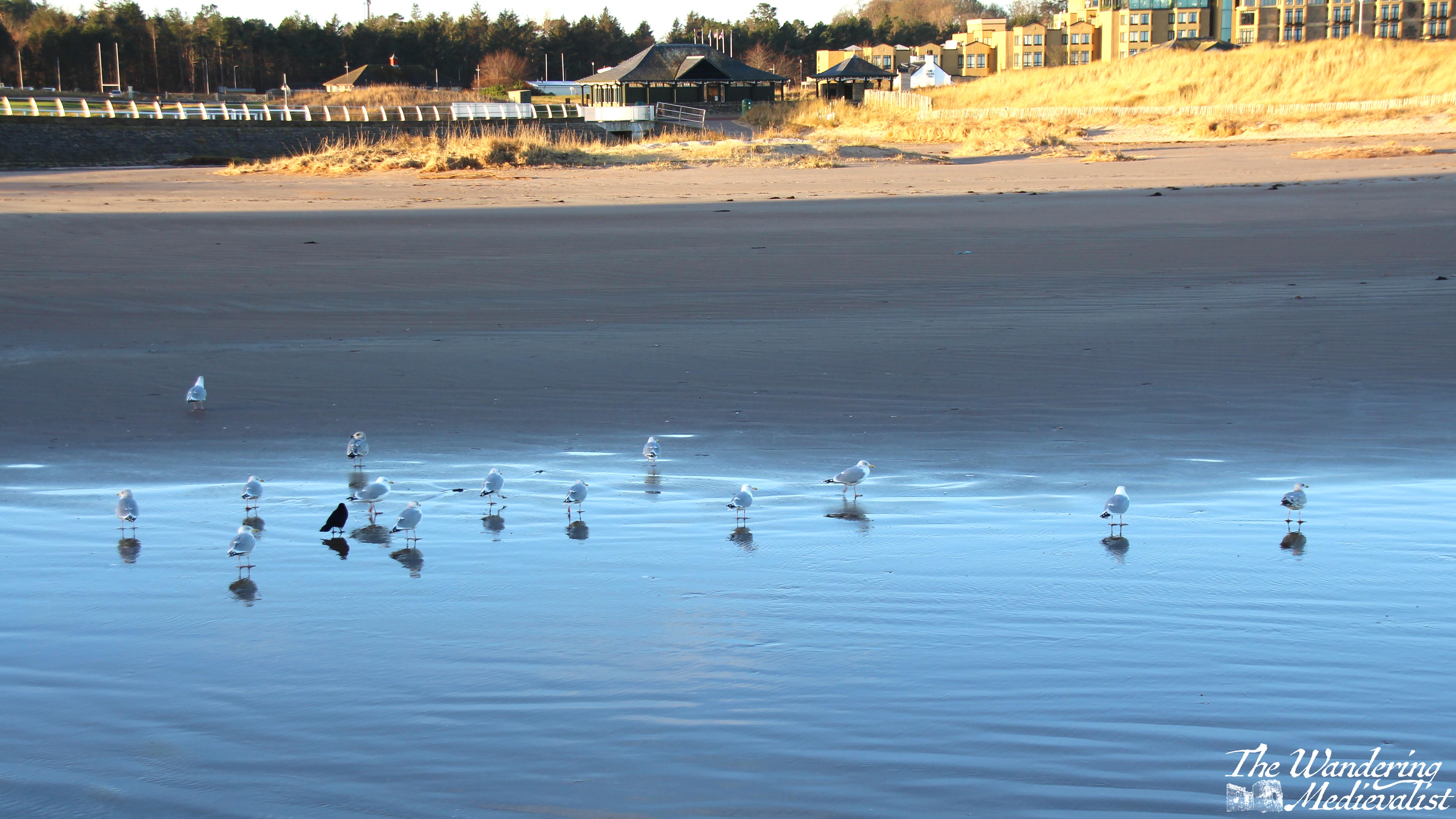
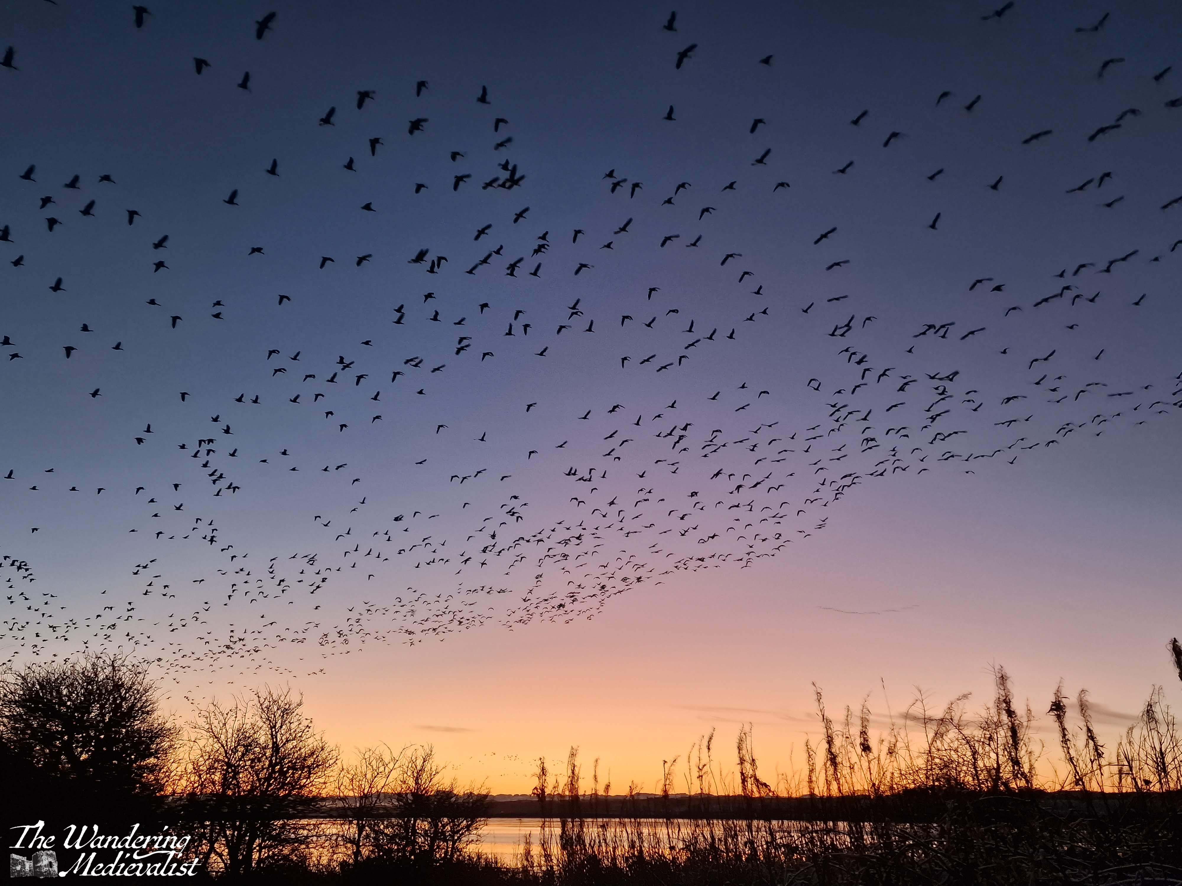
This series focusses specifically on bird reflections, taken across a variety of locations including West Sands in St Andrews, the Tay River, Loch Leven near Ballachulish, and the Eden Estuary.
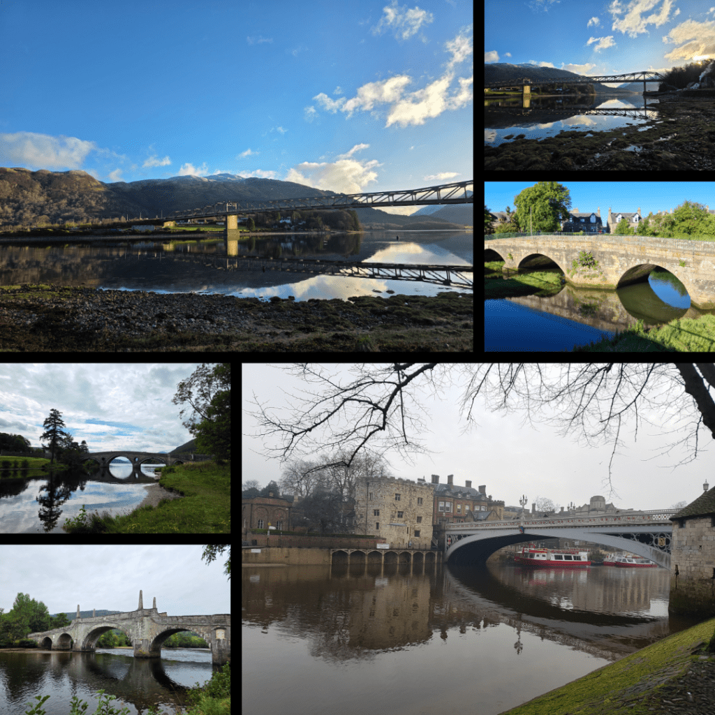
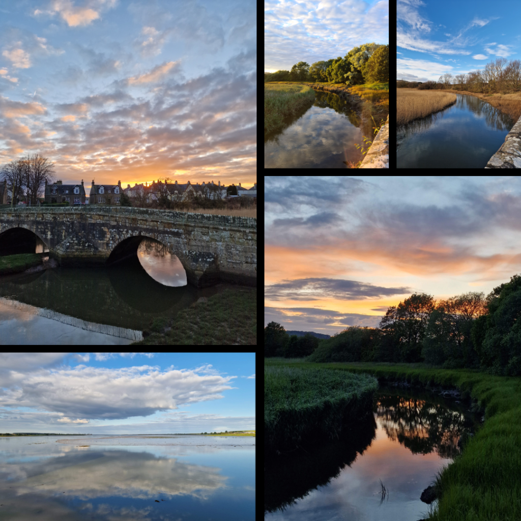
Another series, this time on bridges. I have always loved photographing bridges, not in the least due to their symmetry. These bridges include the Ballachulish Bridge, Kenmore Bridge, Guardbridge, Wade’s Bridge in Aberfeldy, and the Historic River Bridge in York.
Tayport
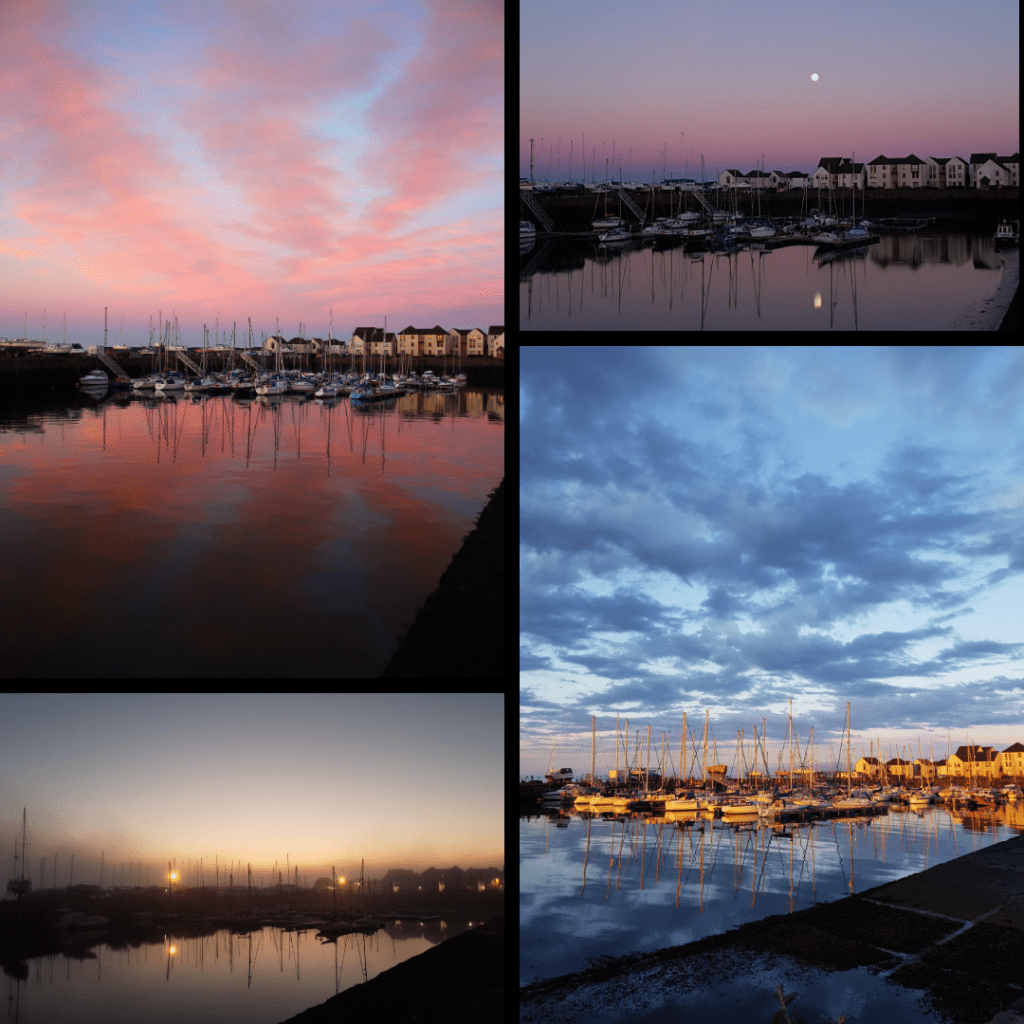
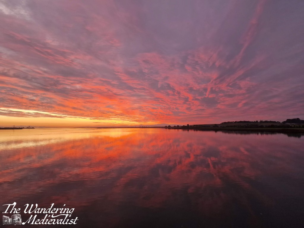
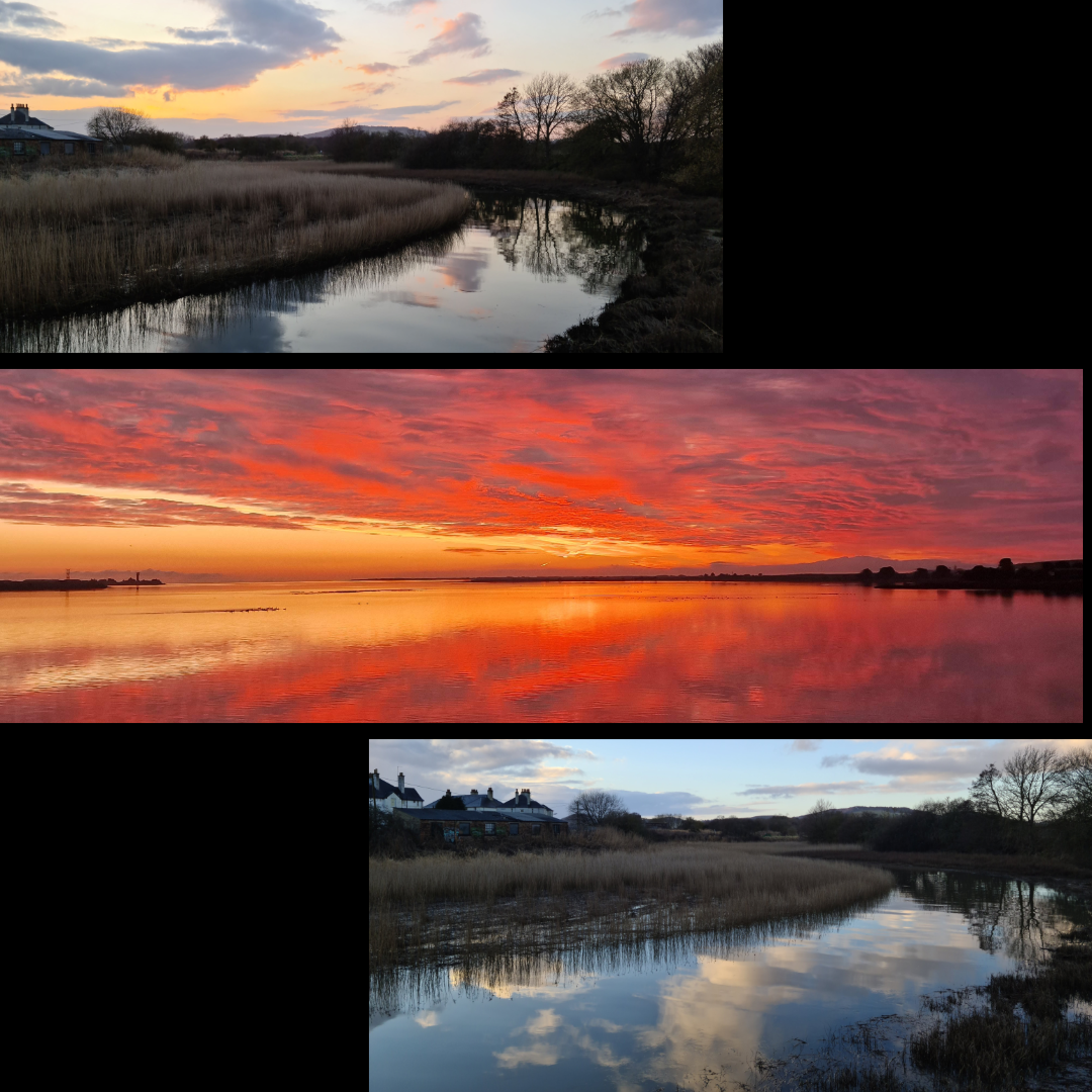
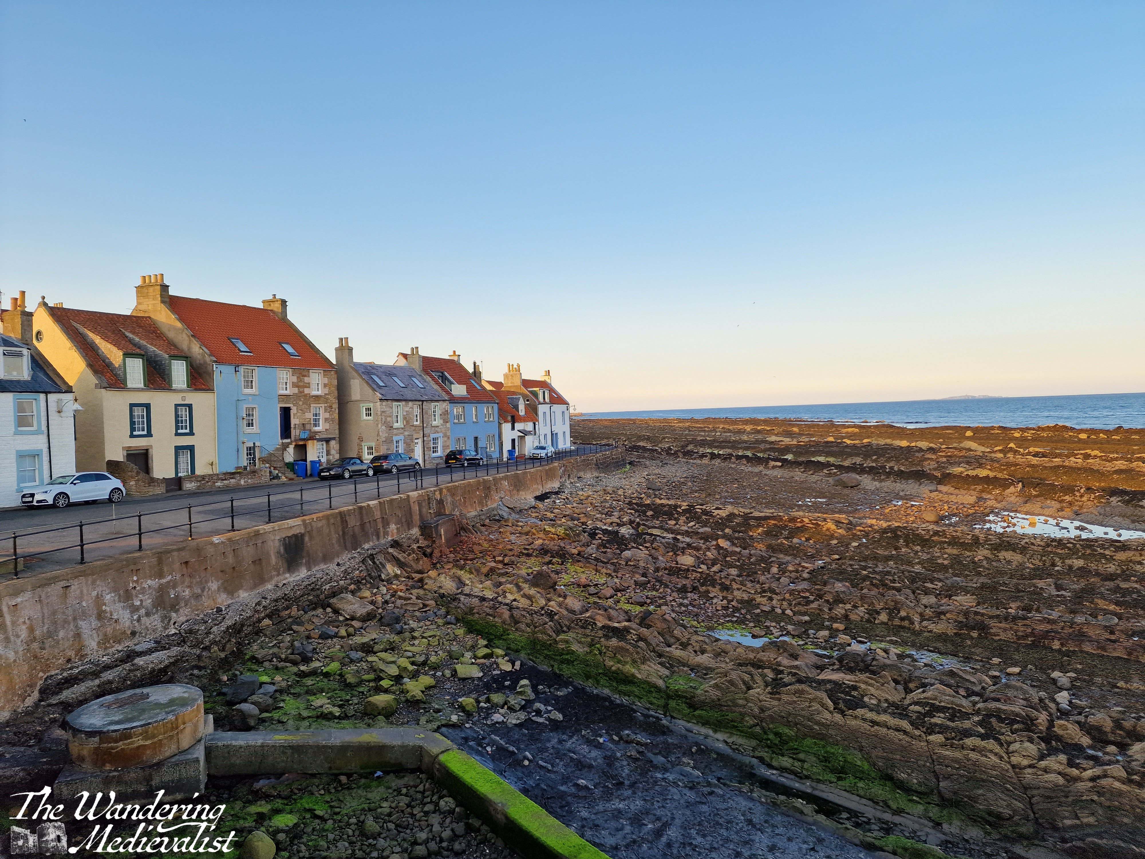
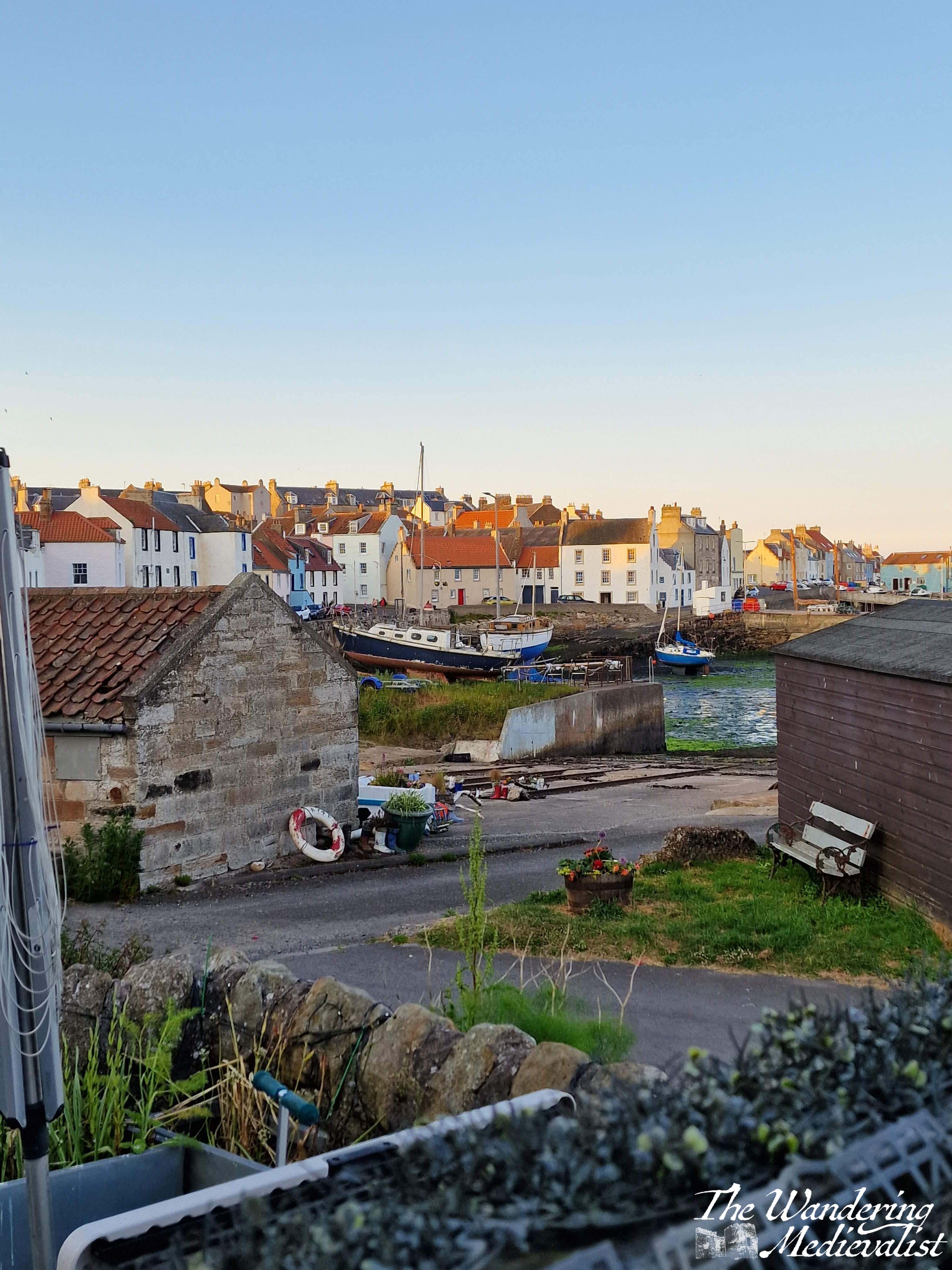
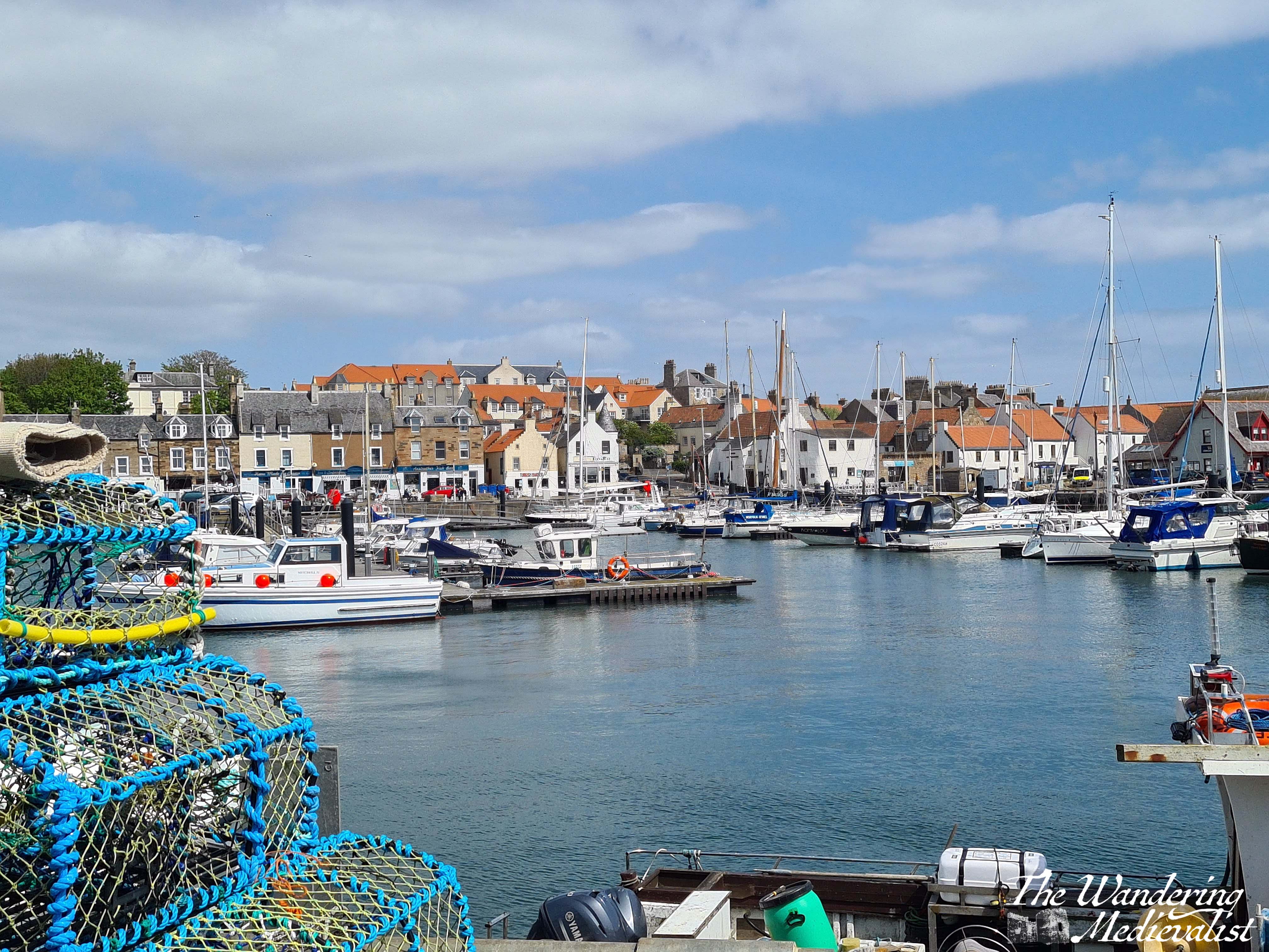
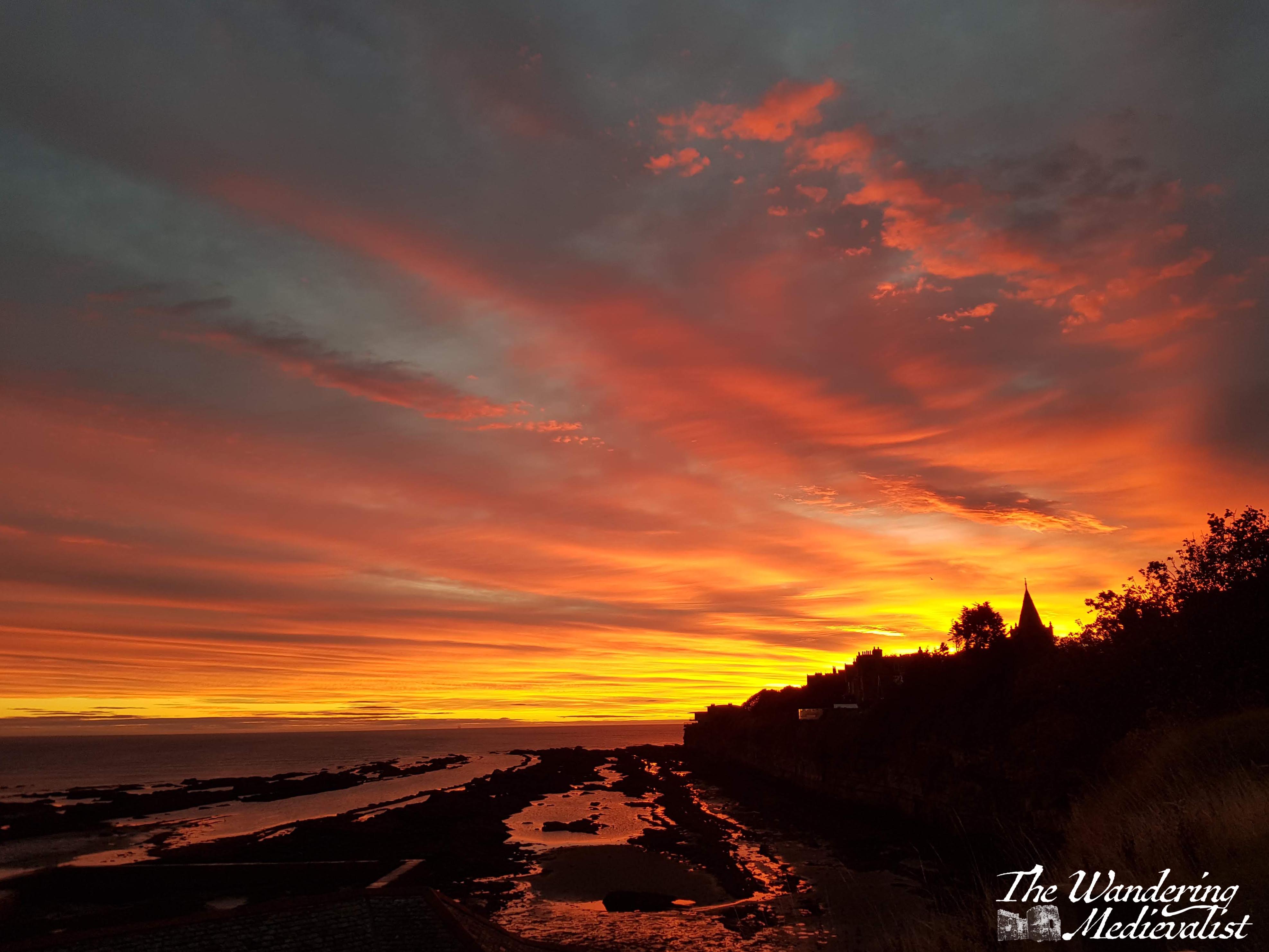
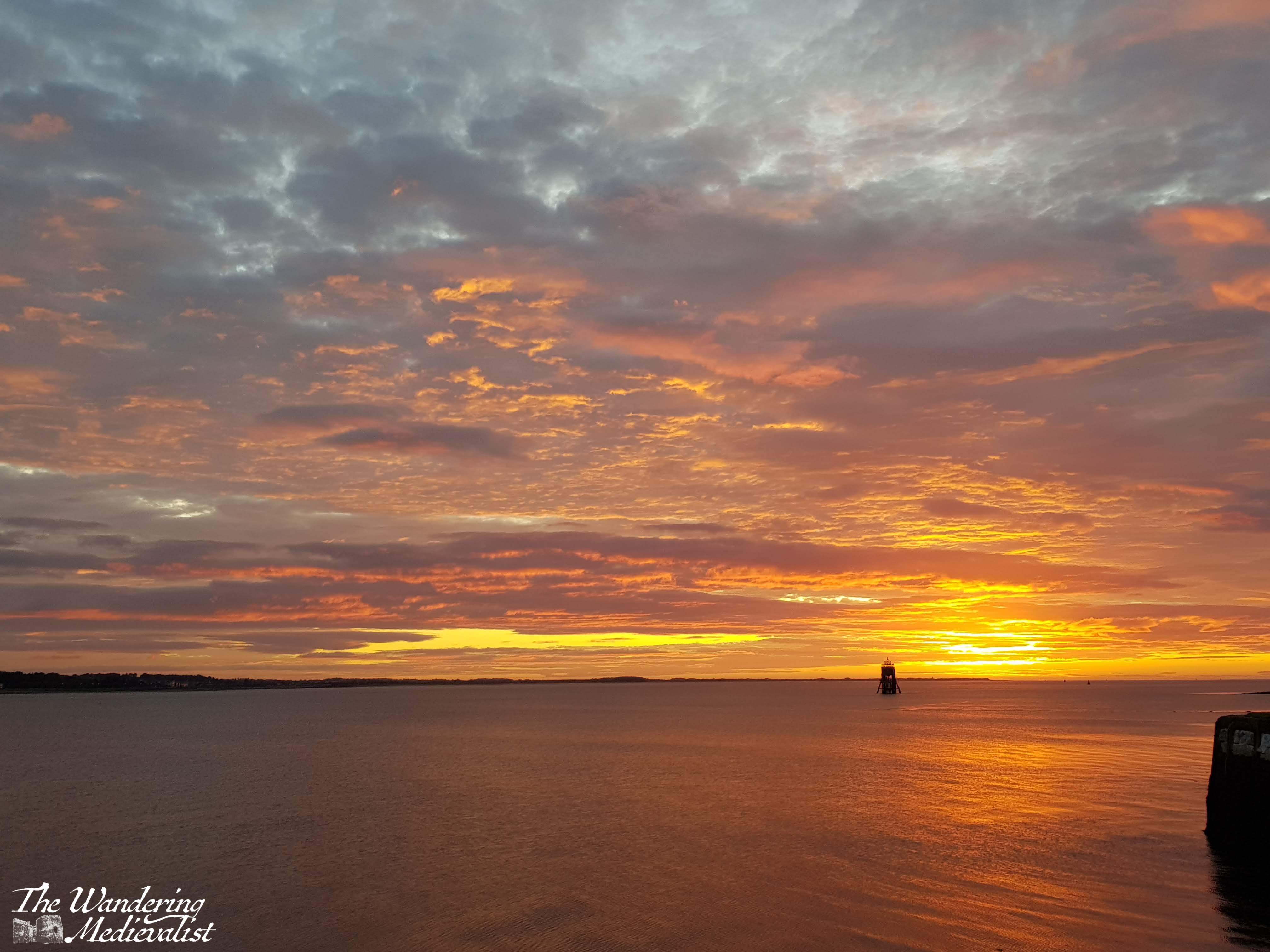
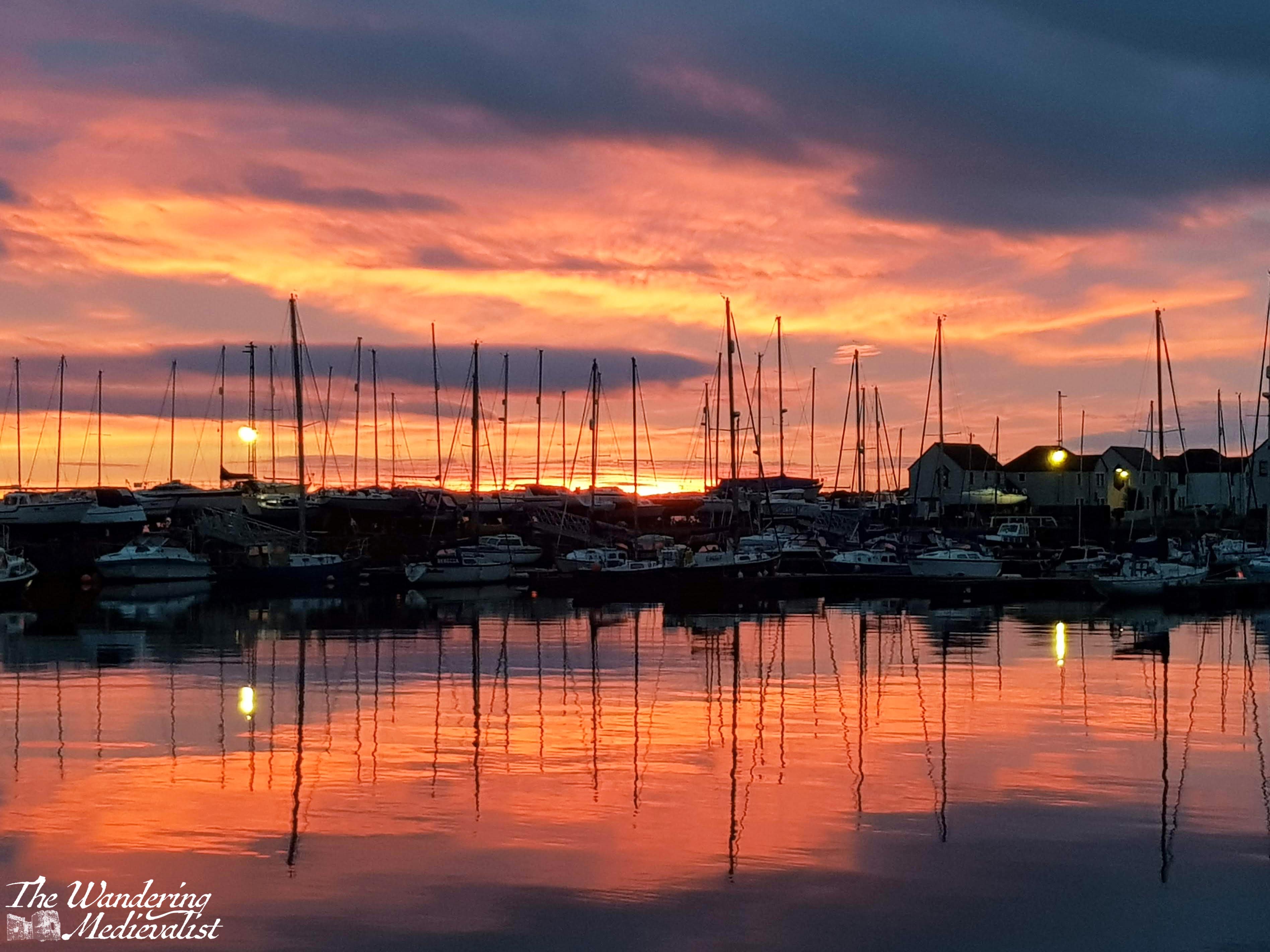
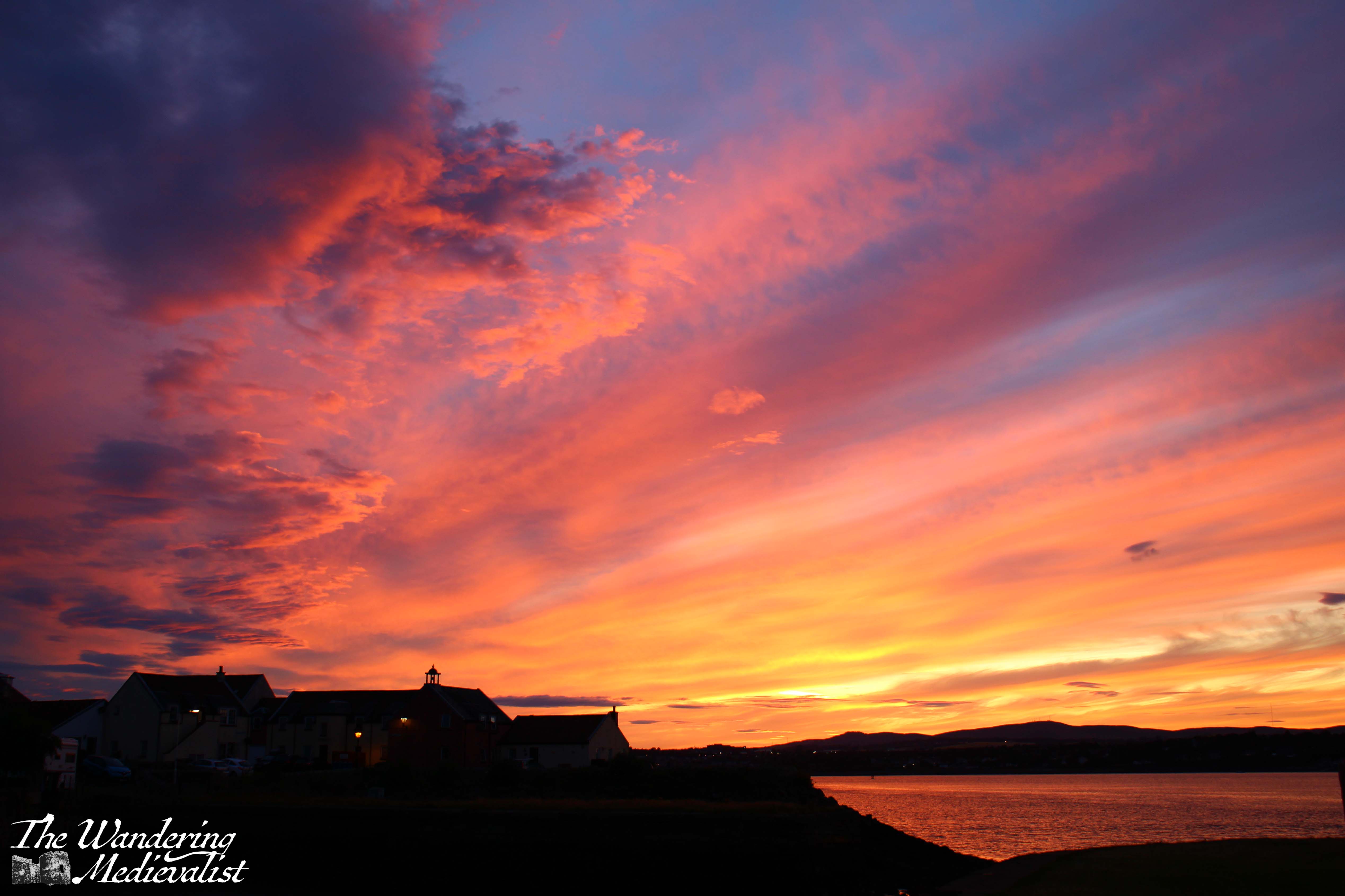
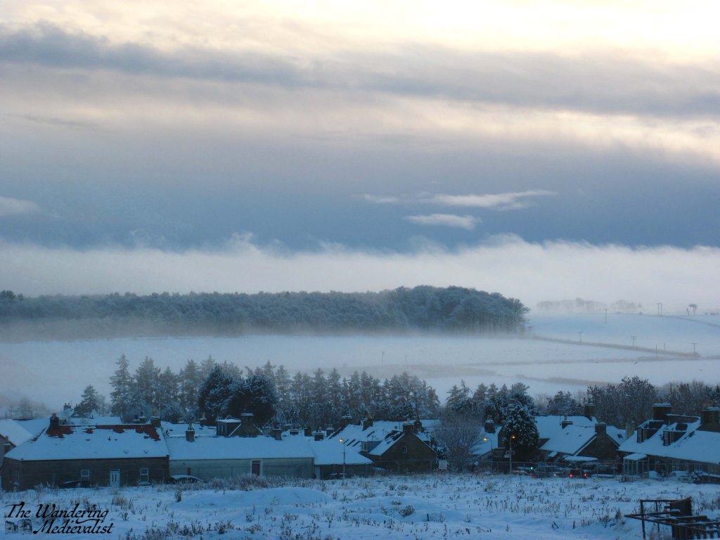
For the relatively short time we lived in Tayport, I was able to really take advantage of the seaside location to capture reflections at all times of day. The harbour was my favourite spot, as you can see – sunrise, sunset and even with a full moon.
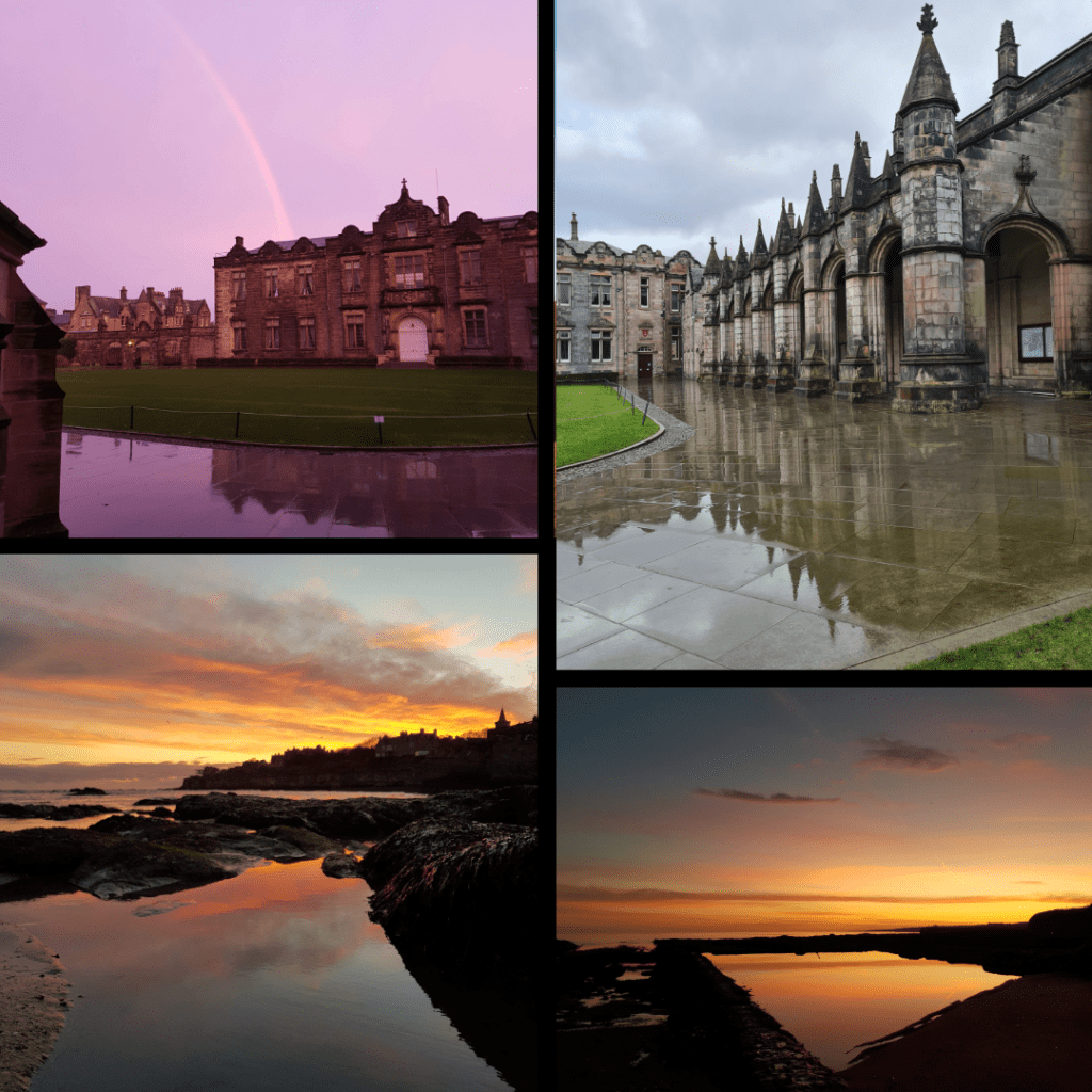
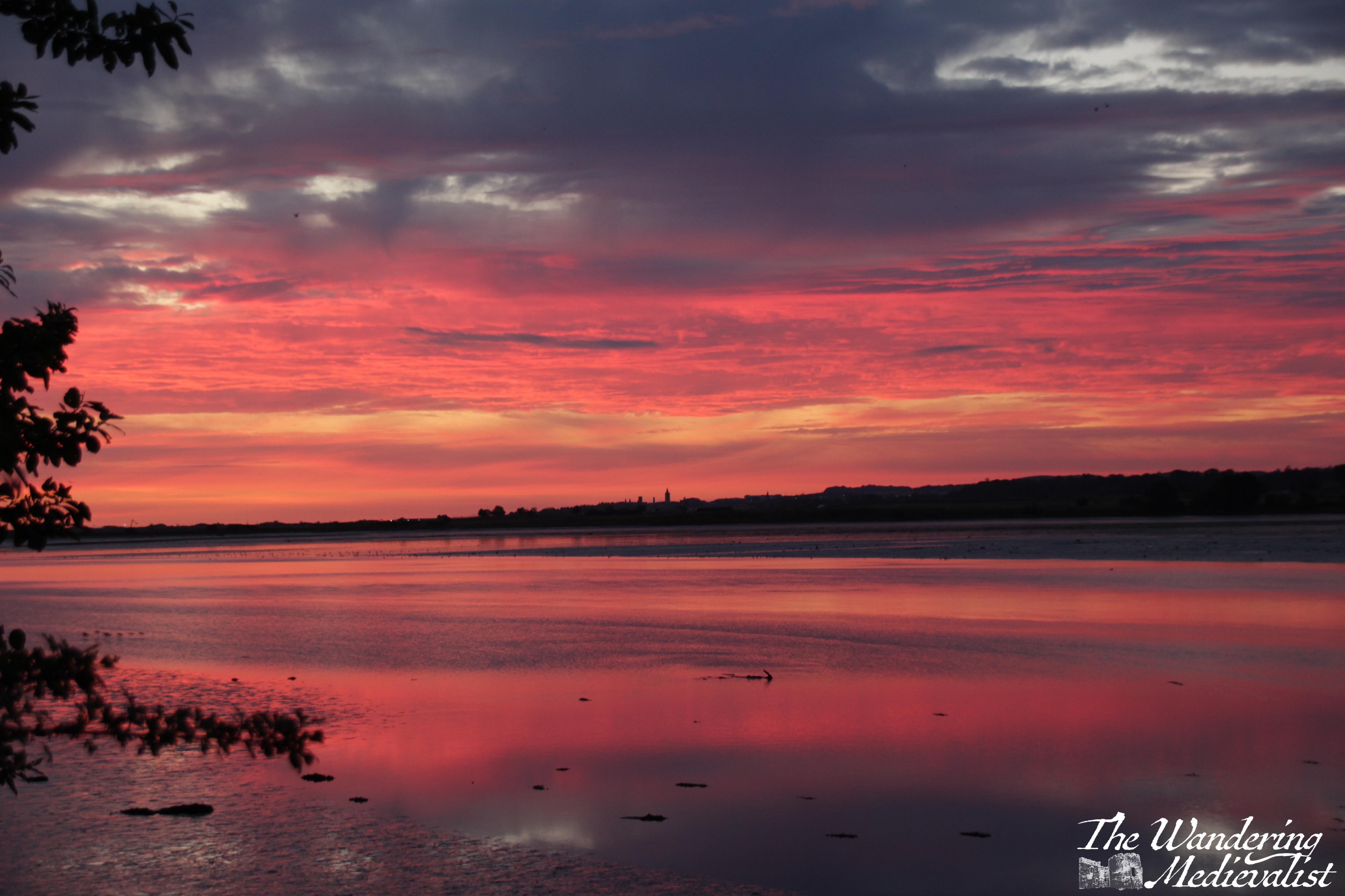
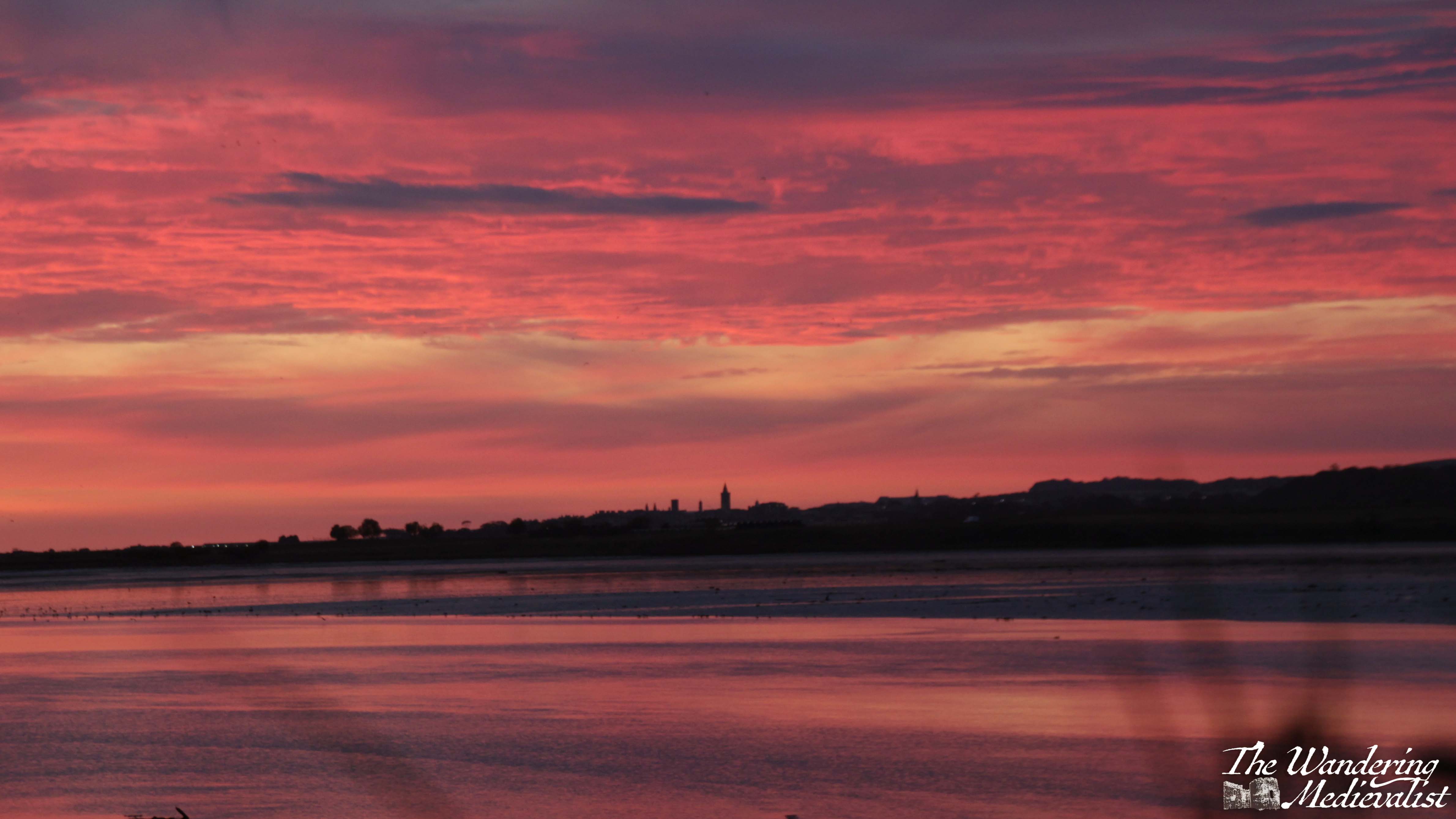
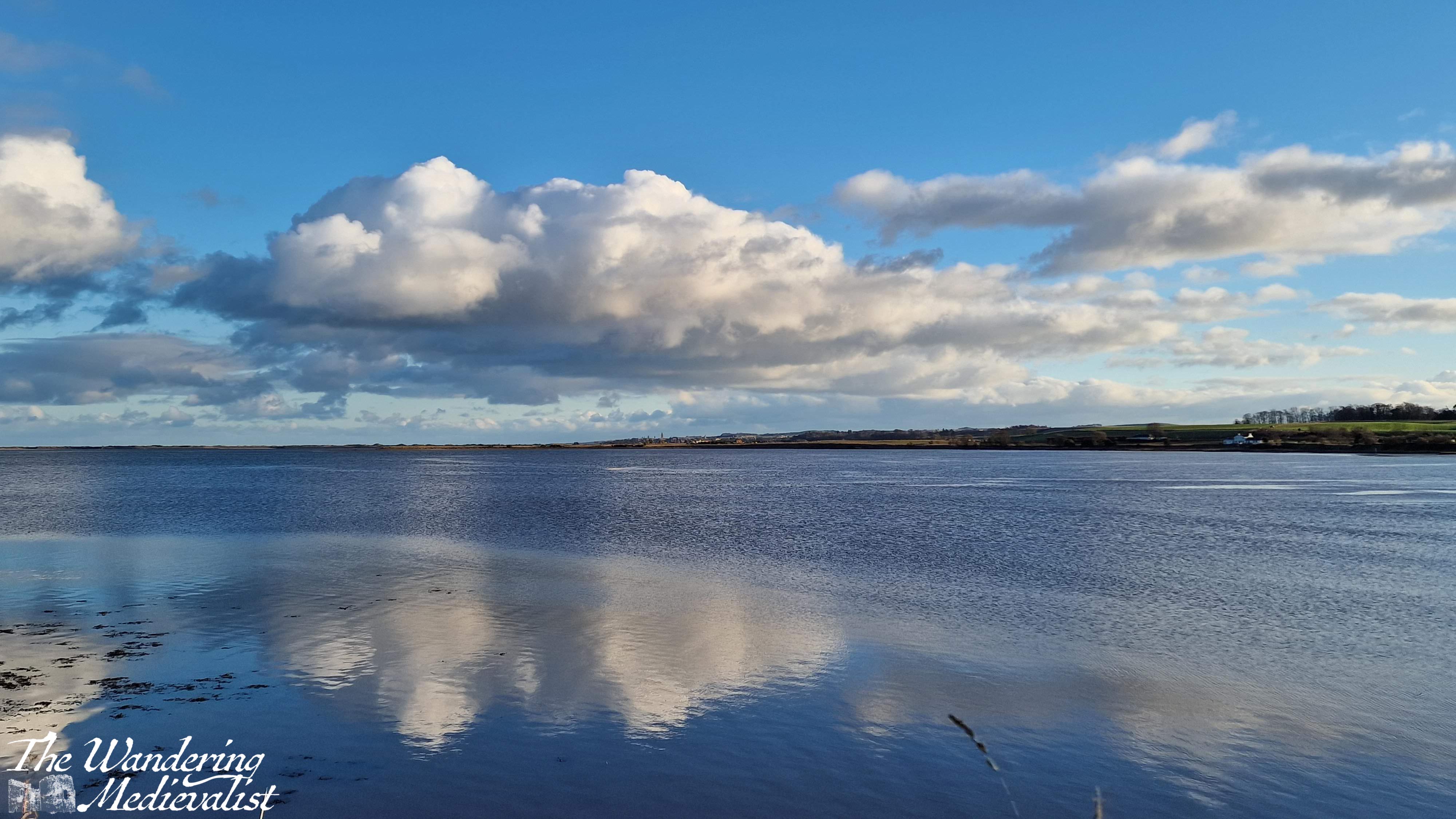
St Andrews
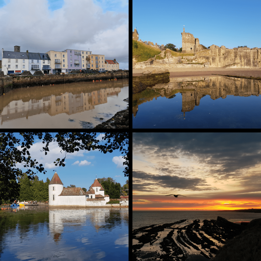
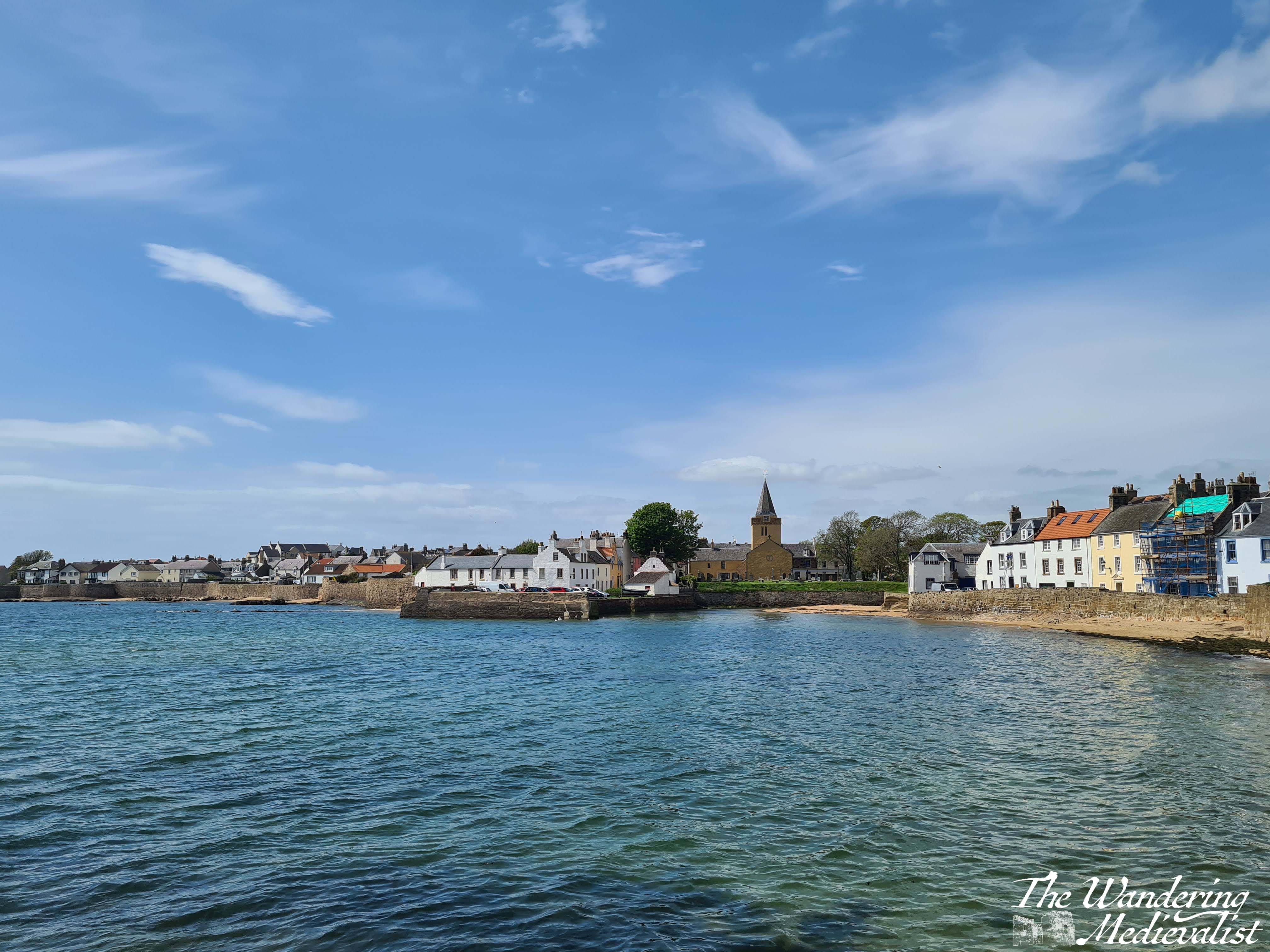
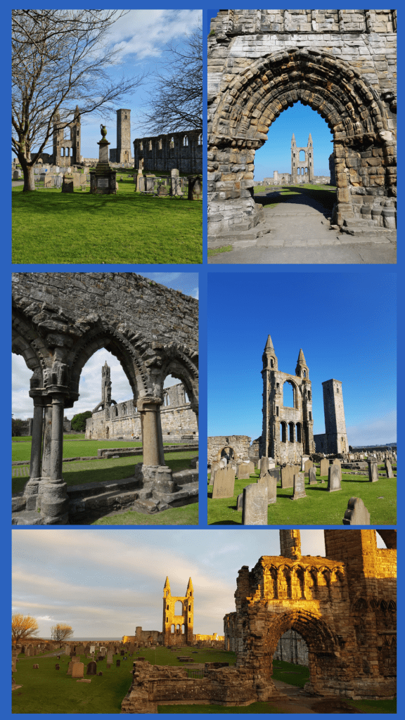
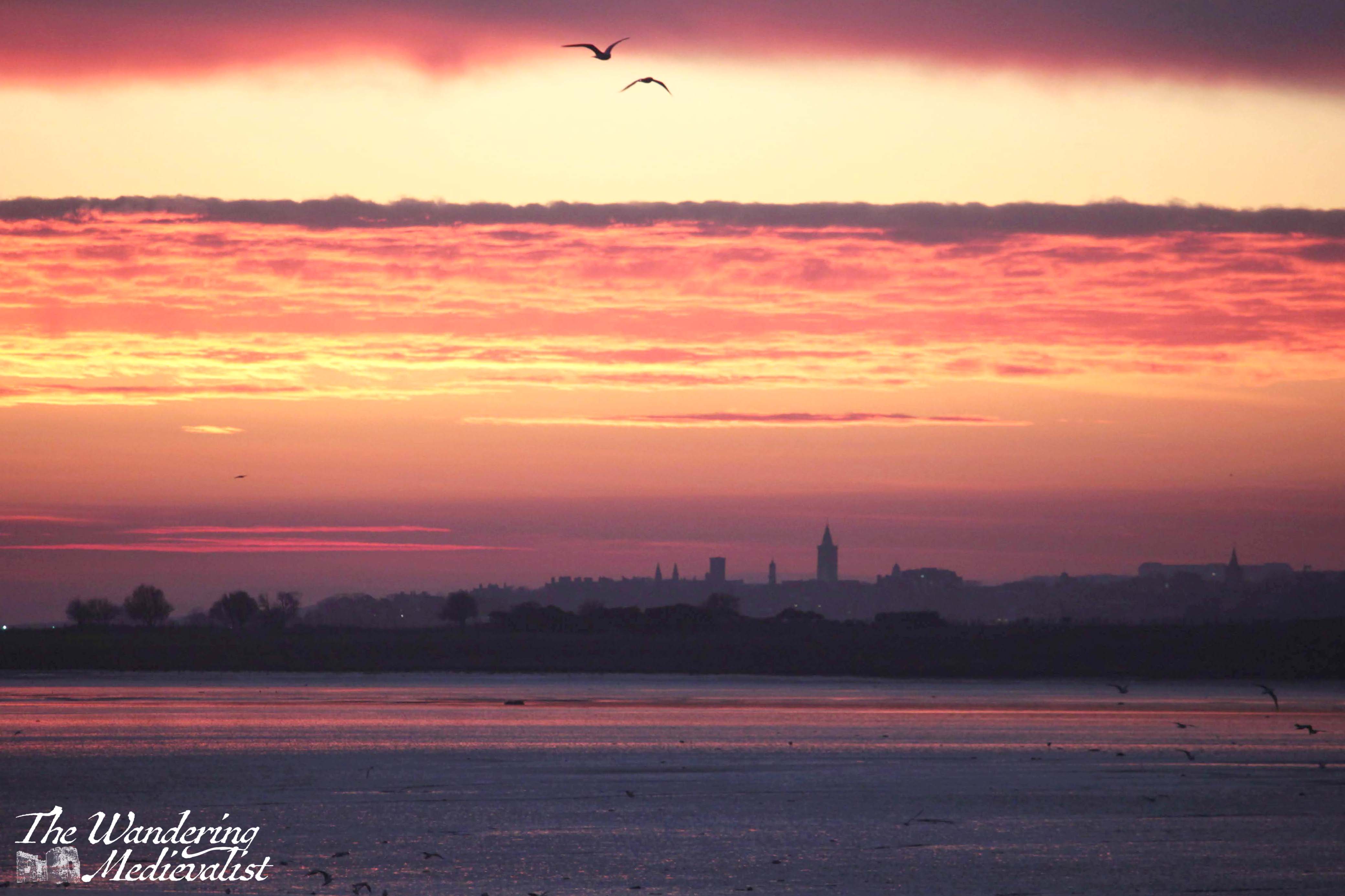
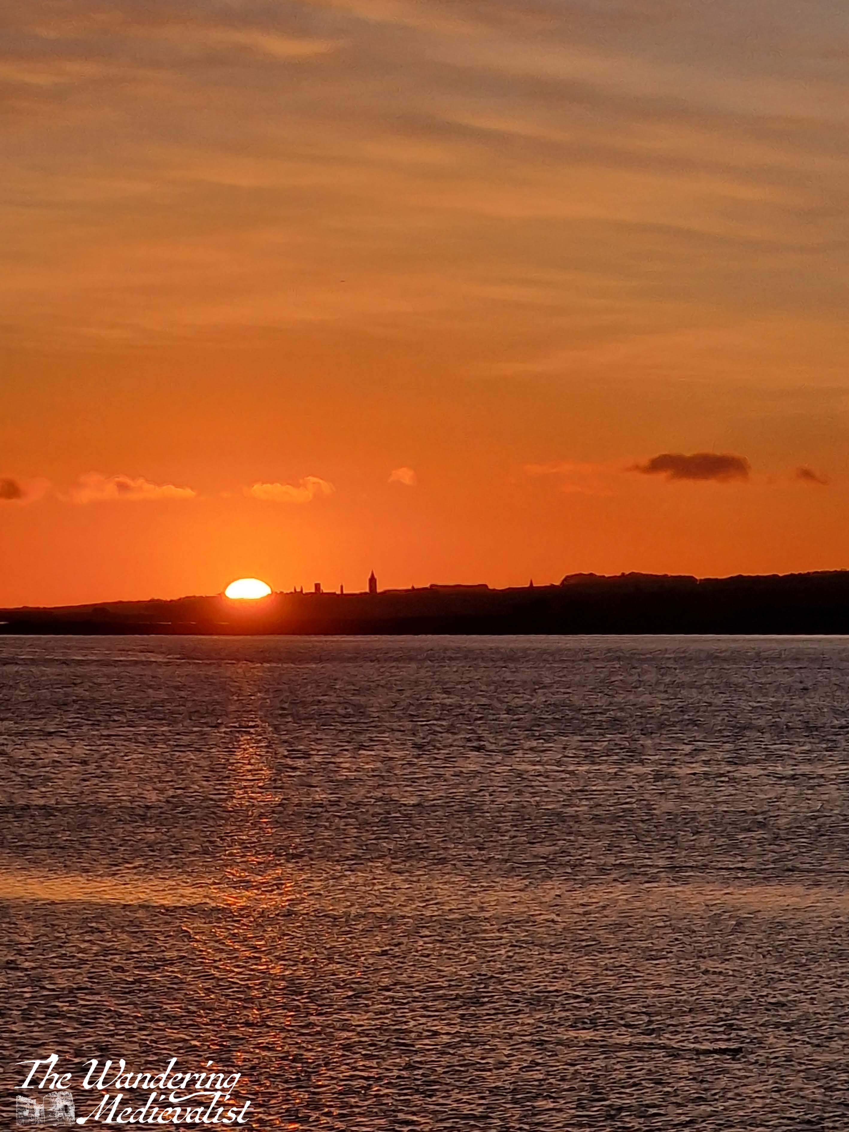
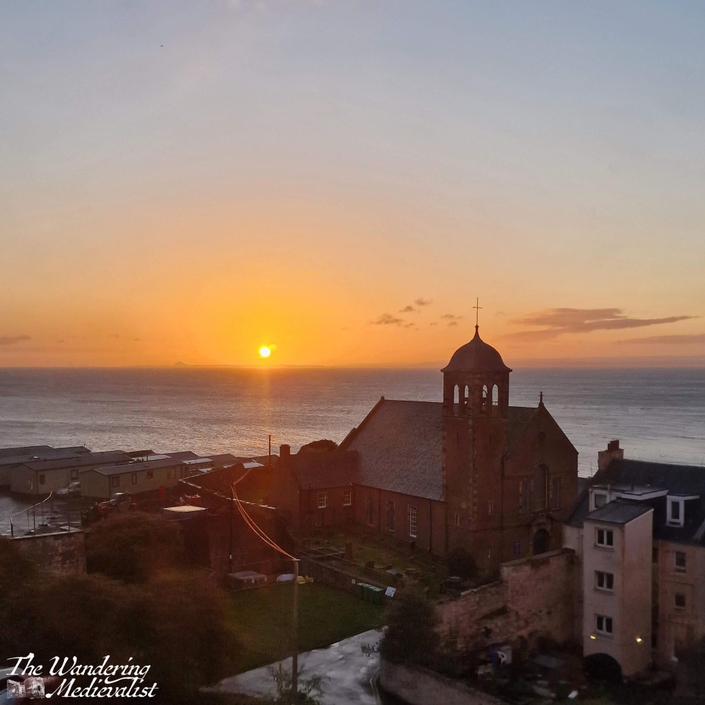
The many years I have spent in St Andrews have allowed for plenty of reflections, be it harbour, castle, sunrise, or Craigtoun Park.
St Salvator’s Quad, in the centre of town, was renovated some years ago to include these beautiful slabs of stone that reflect perfectly in the rain (and can be treacherously slippery when wet). Many early morning walks around town enabled these views.
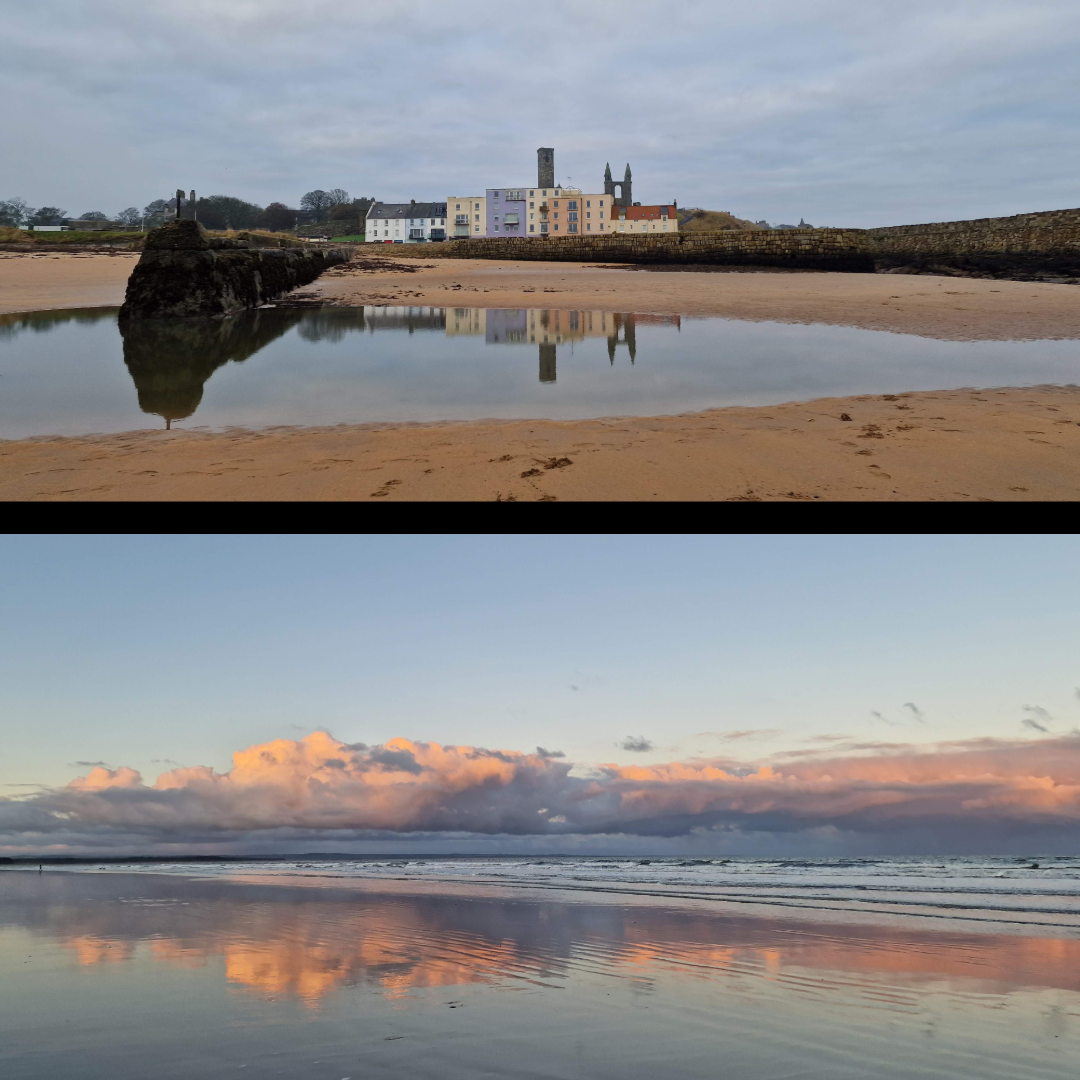
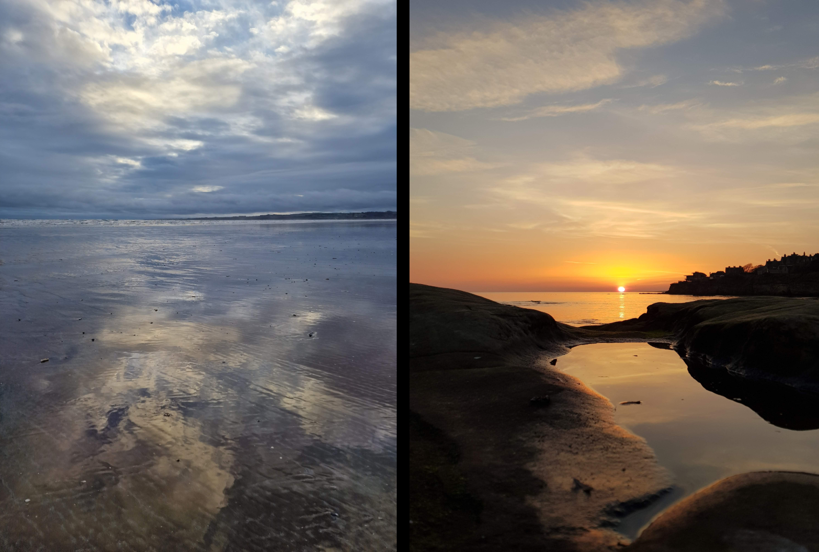
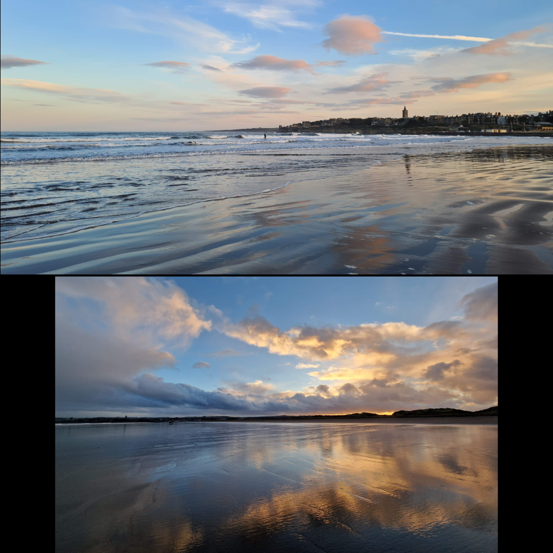
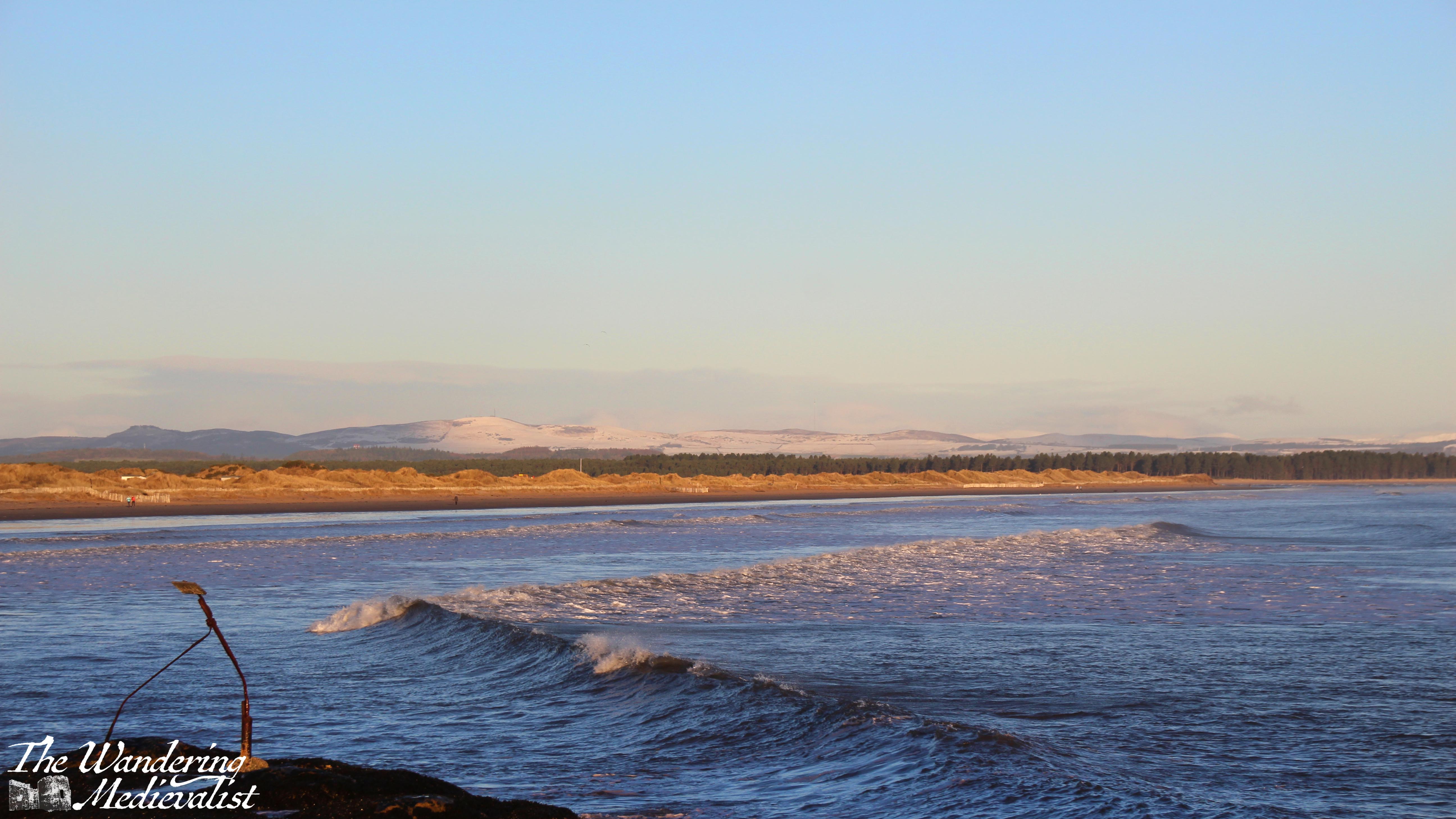
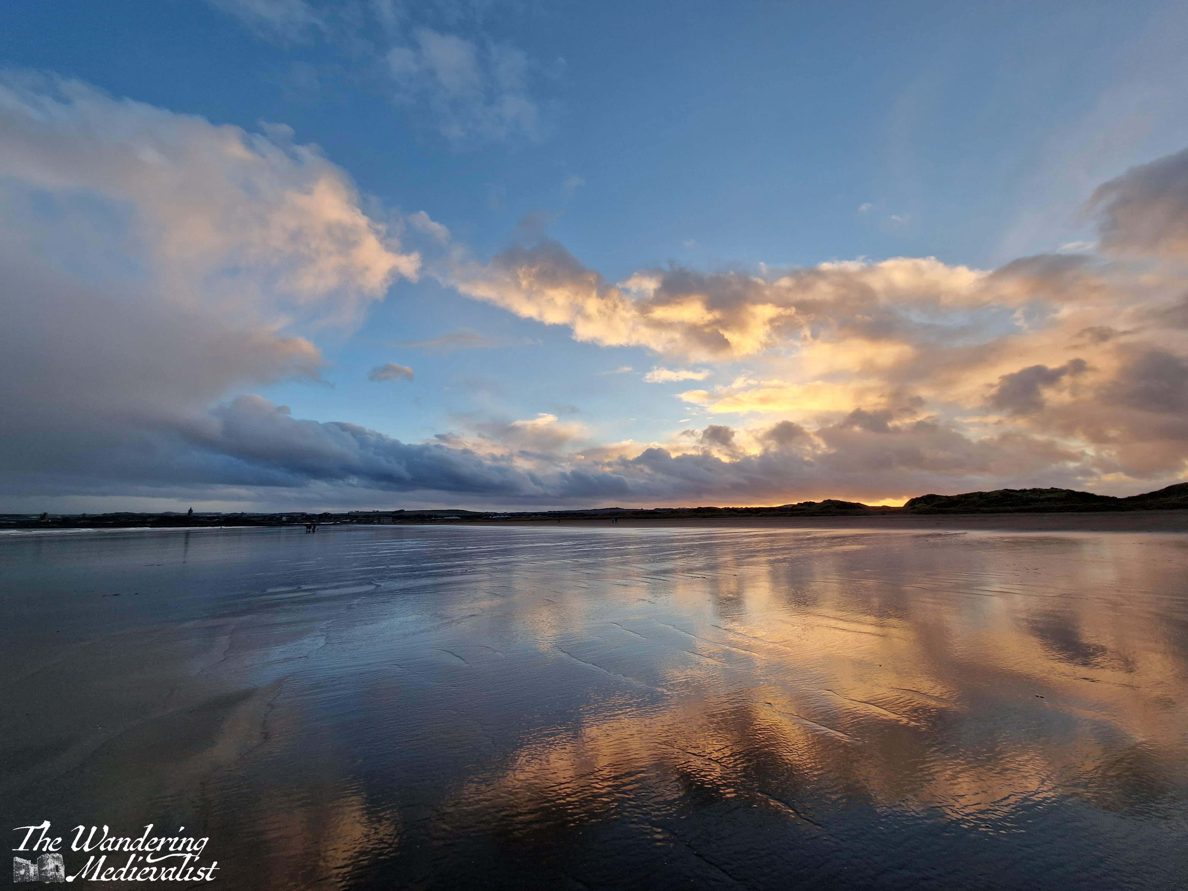
I have said it before, that St Andrews is one of the most photogenic places I know, and the groupings below show just how stunningly beautiful it can be – and how well the clouds and distinctive skyline reflect on the surrounding beaches. West Sands in particular stretching out for miles and – at low tide – what feels like miles wide provides some of the most amazing reflections I have ever captured.
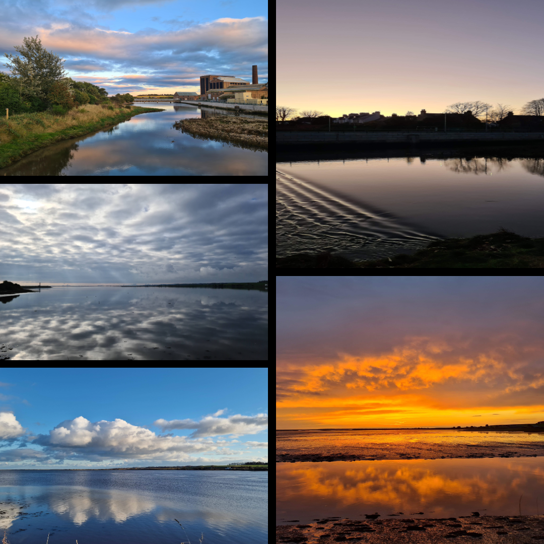
Guardbridge
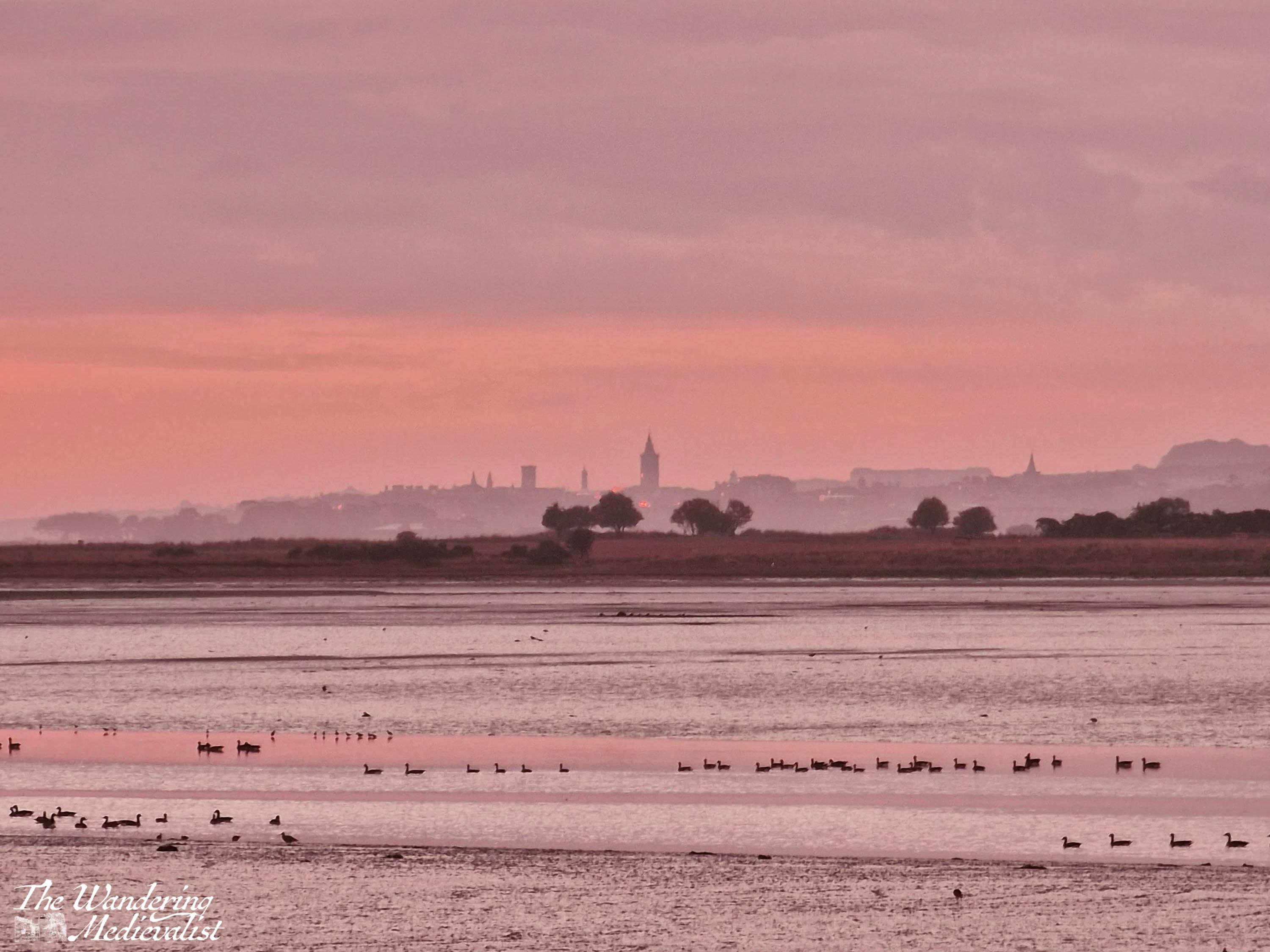
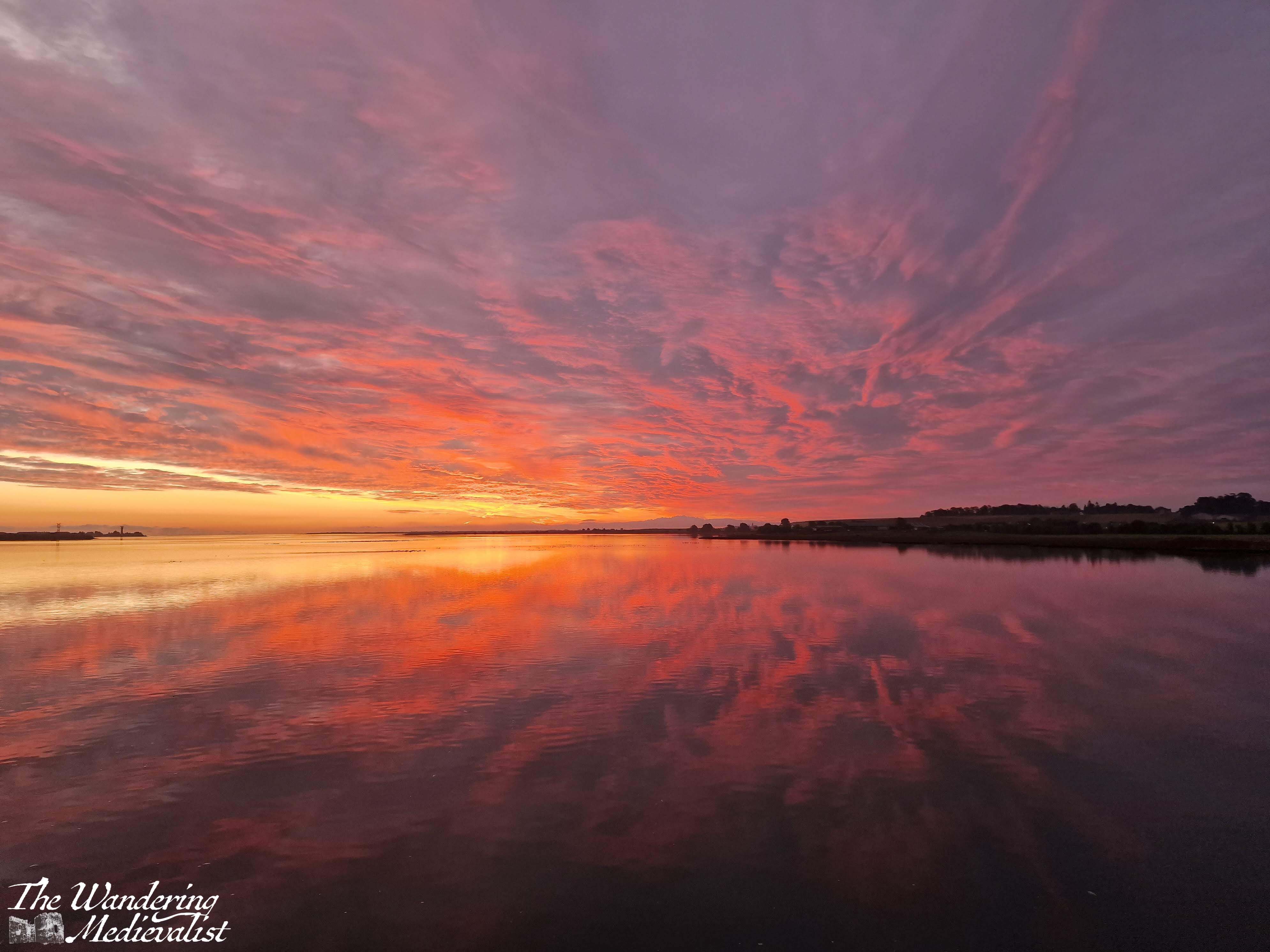
Morning walks along the Eden Estuary have provided spectacular views, in particular this one taken from the University’s Eden Campus.
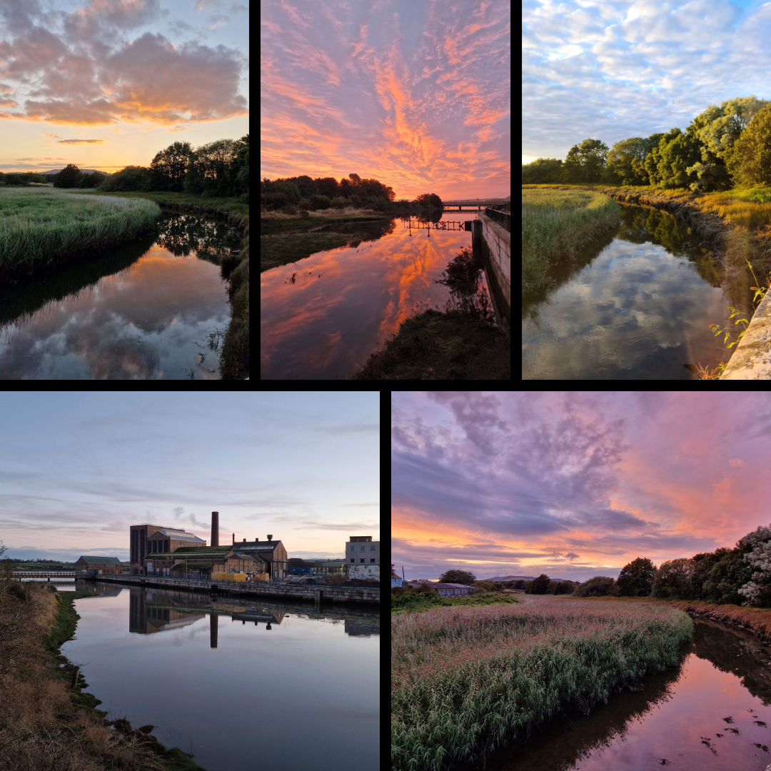
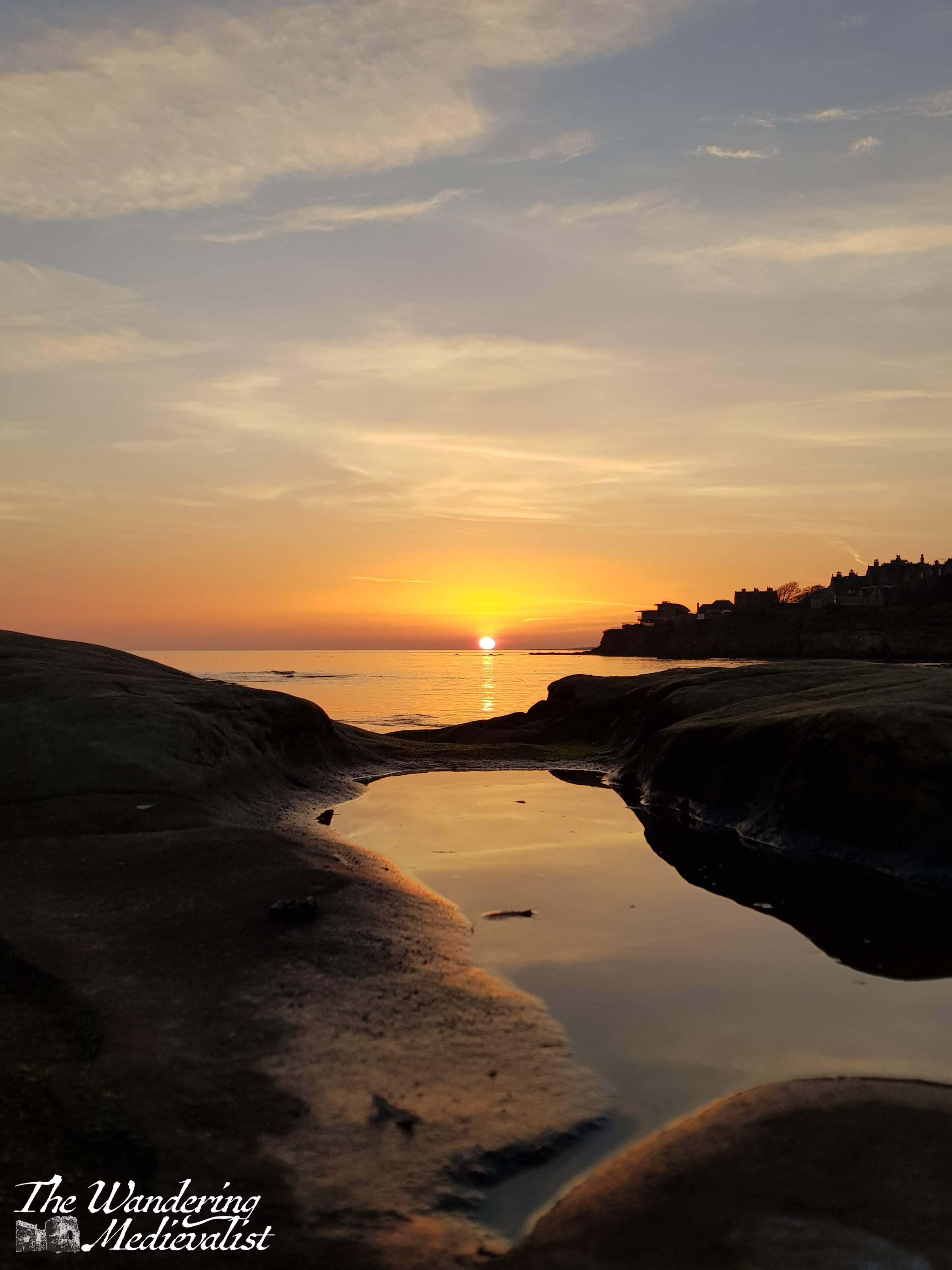
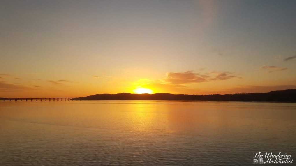
The view from the old bridge in Guardbridge is one of my favourites, allowing the sunset or blue sky to reflect off the water at high tide. I have literally 100s of this view – there are more below.
In fact, there were so many of Guardbridge that I could not narrow them down any further than this massive grouping. Living here through the pandemic years meant a daily walk was essential, and capturing the glory of the Eden was inevitable, at all times of day. Even the old mill, which is not particularly attractive but adds something to the scenery.
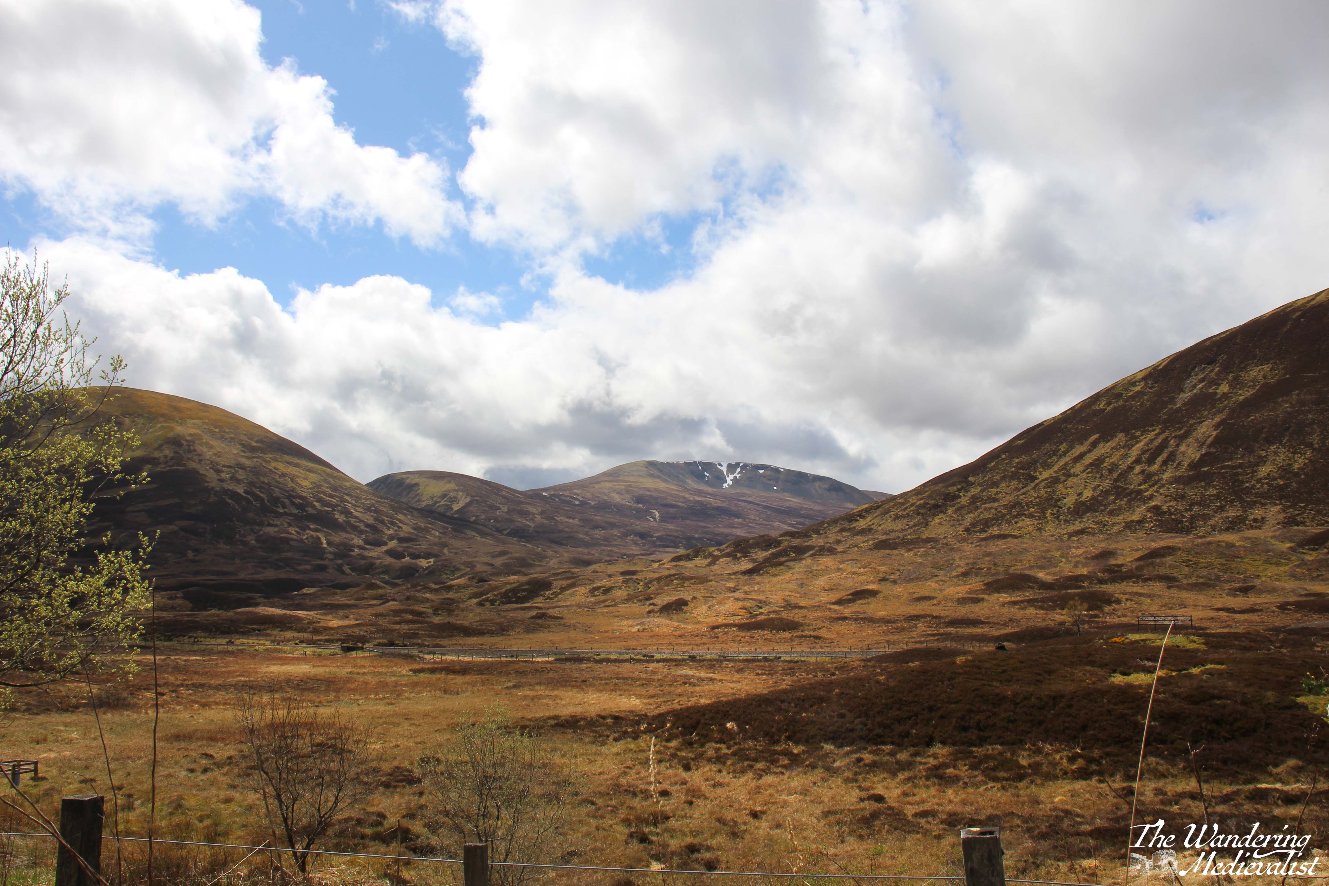
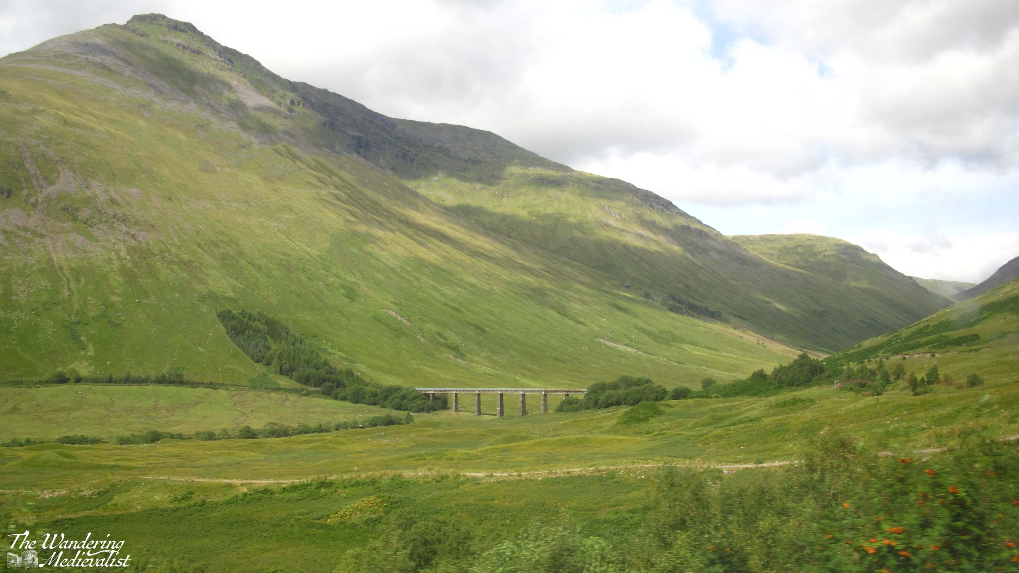
Scottish Highlands
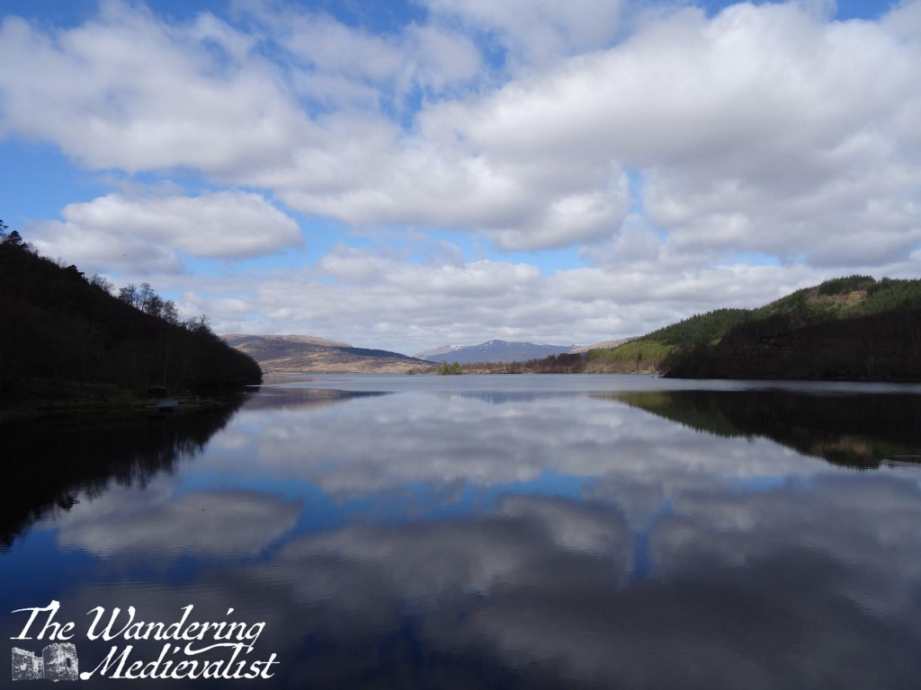
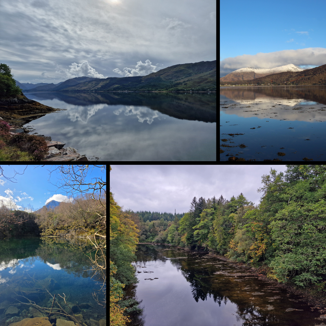
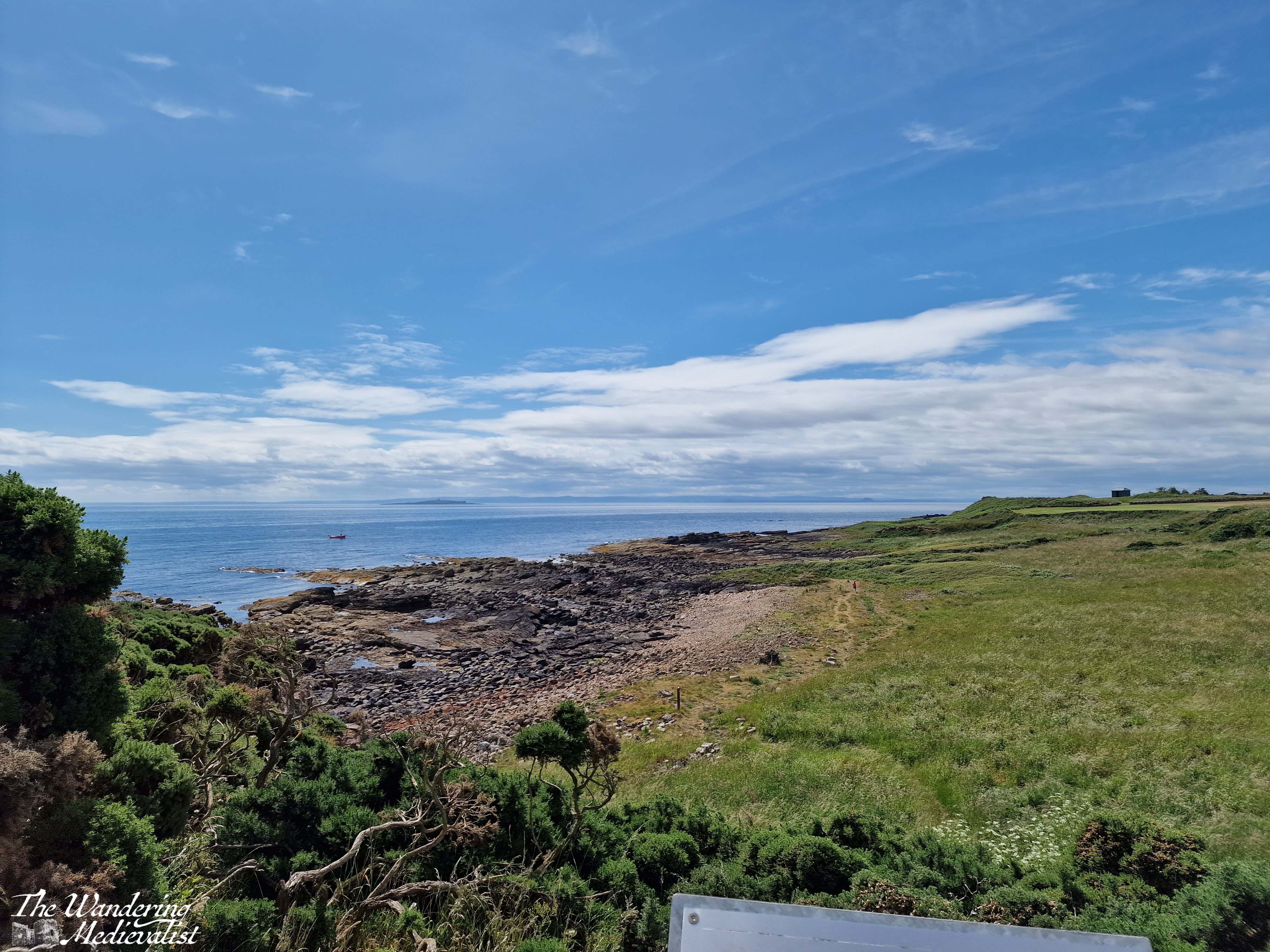
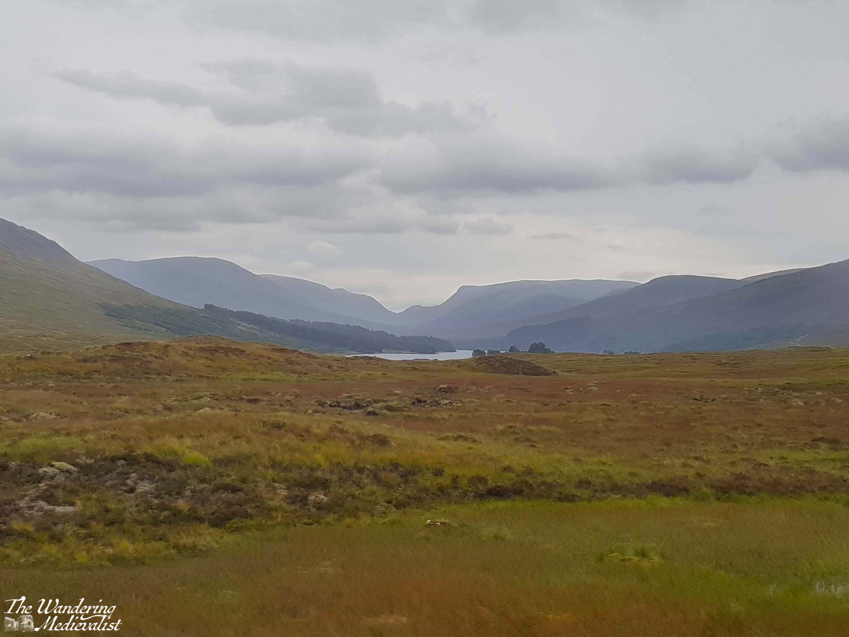
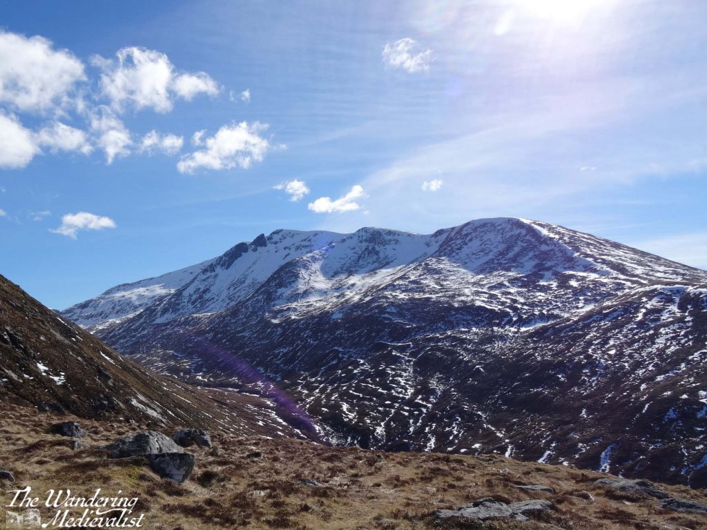
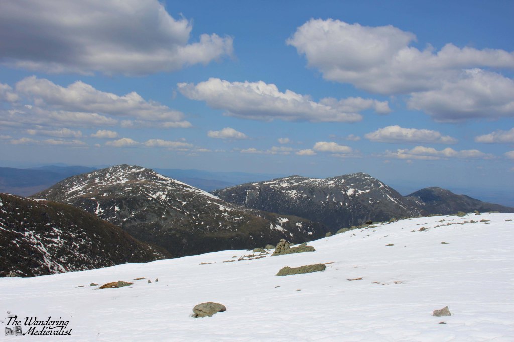
As anyone who has read my blog thus far is aware, the Highlands (or anything north of Perth really) is an almost sacred area for me. The stunning serene beauty that can be found in the lochs and mountains is almost unmatched in my experience.
The lochs in particular provide ideal opportunities for capturing reflections, at those rare times when the wind dies down and everything is calm and still.
To start with, Loch Katrine, and the almost mirror image of fluffy clouds and blue sky.
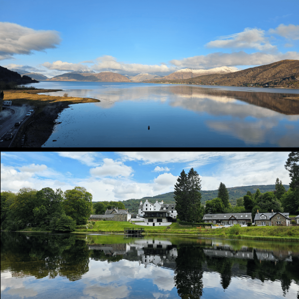
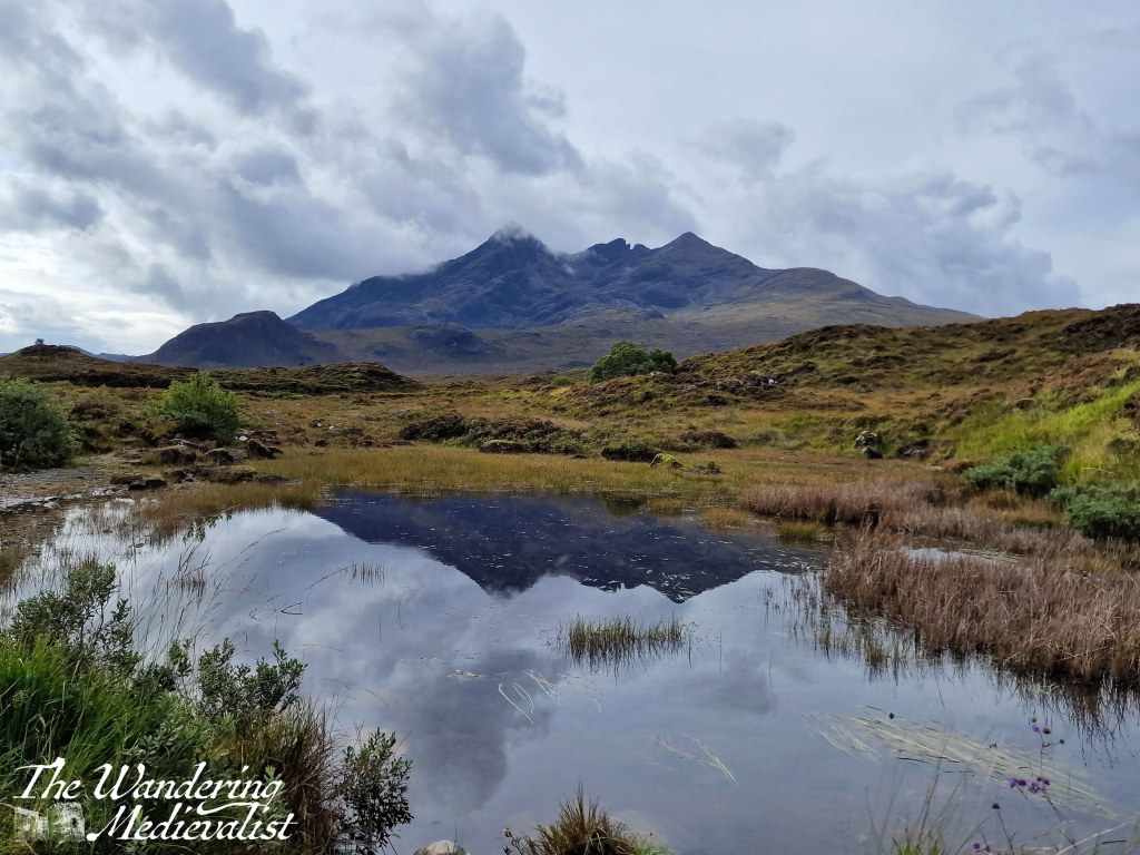
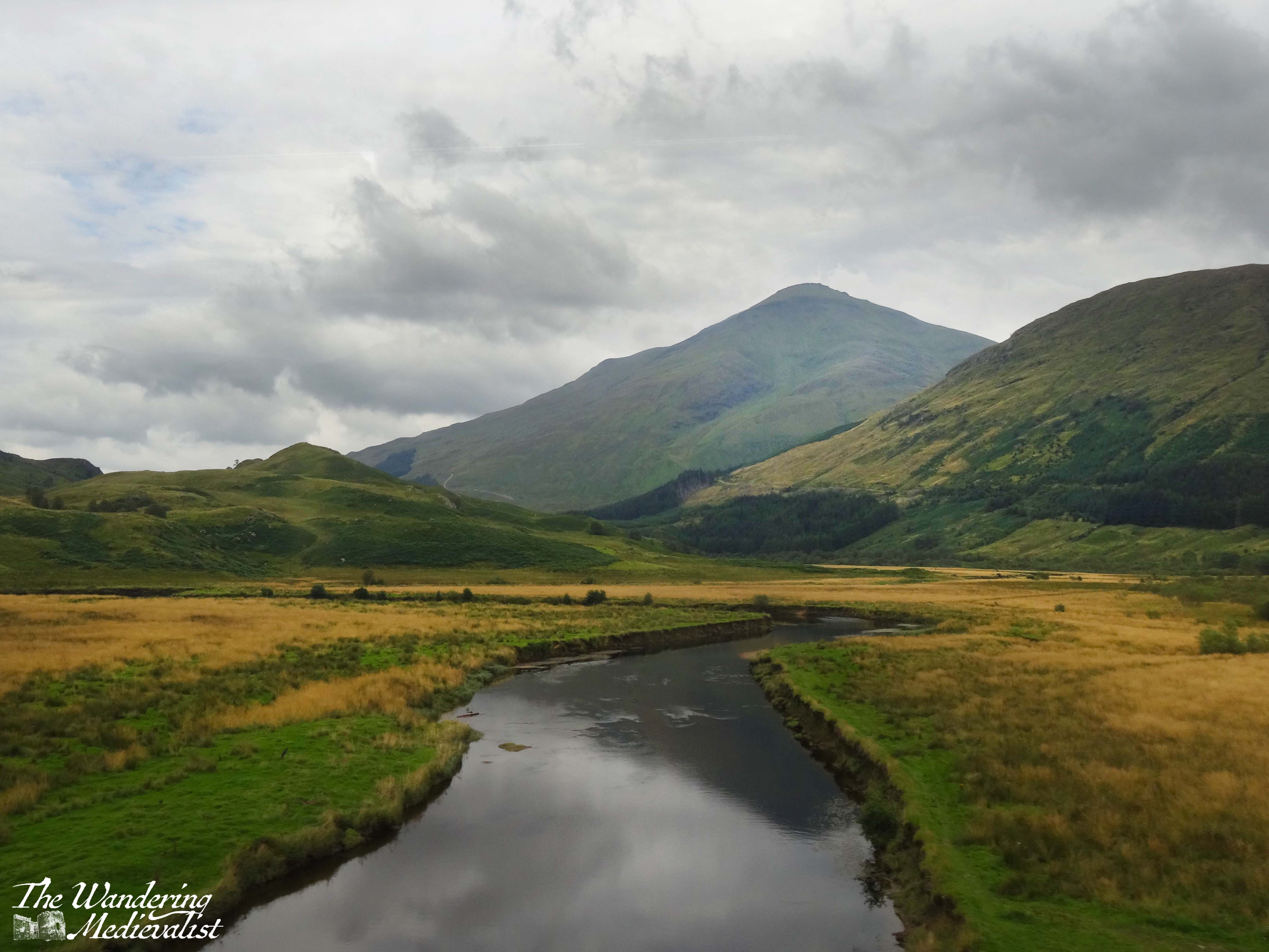
These two collections are some of my favourite loch pictures, and include: the view off Spean Bridge (not a loch, but gloriously still), Loch Tay at several points, Loch Linnhe from the Ballachulish bridge, Loch Duich not far from Eilean Donan castle, and the loch at Ballachulish quarry, reflecting the snow-capped Sgorr Dhearg.
These views were captured from Ballachulish bridge, and from across the River Tay looking back at the Kenmore Hotel. Only moments later, the river in the below shot was caught by the wind, and the reflection erased. For the top shot, the water was still for close to thirty minutes, early in the morning before the breeze picked up or the tide shifted.
Last but not least, a vague reflection of the Cuillin Hills just above Sligachan Old Bridge, Skye.
Marblehead
Finally, I have been lucky enough to spend a decent amount of time in my home town in the last year or so – more than I have for more than a decade – and I have captured what I consider to be some lovely views of my favourite places in town.
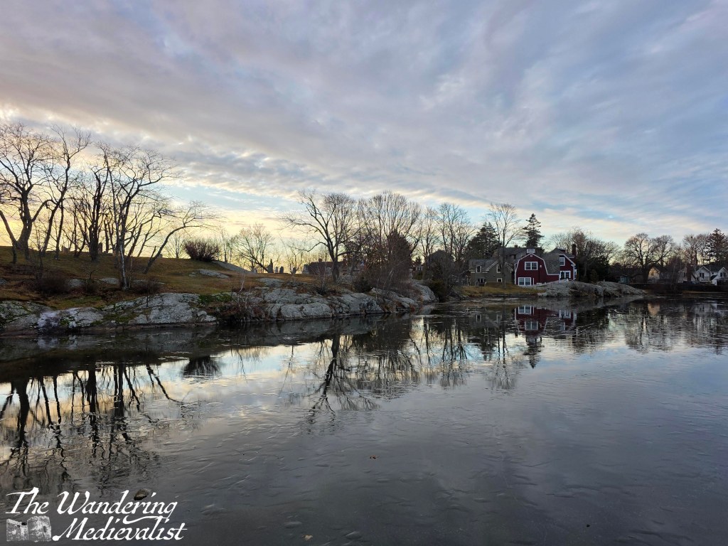
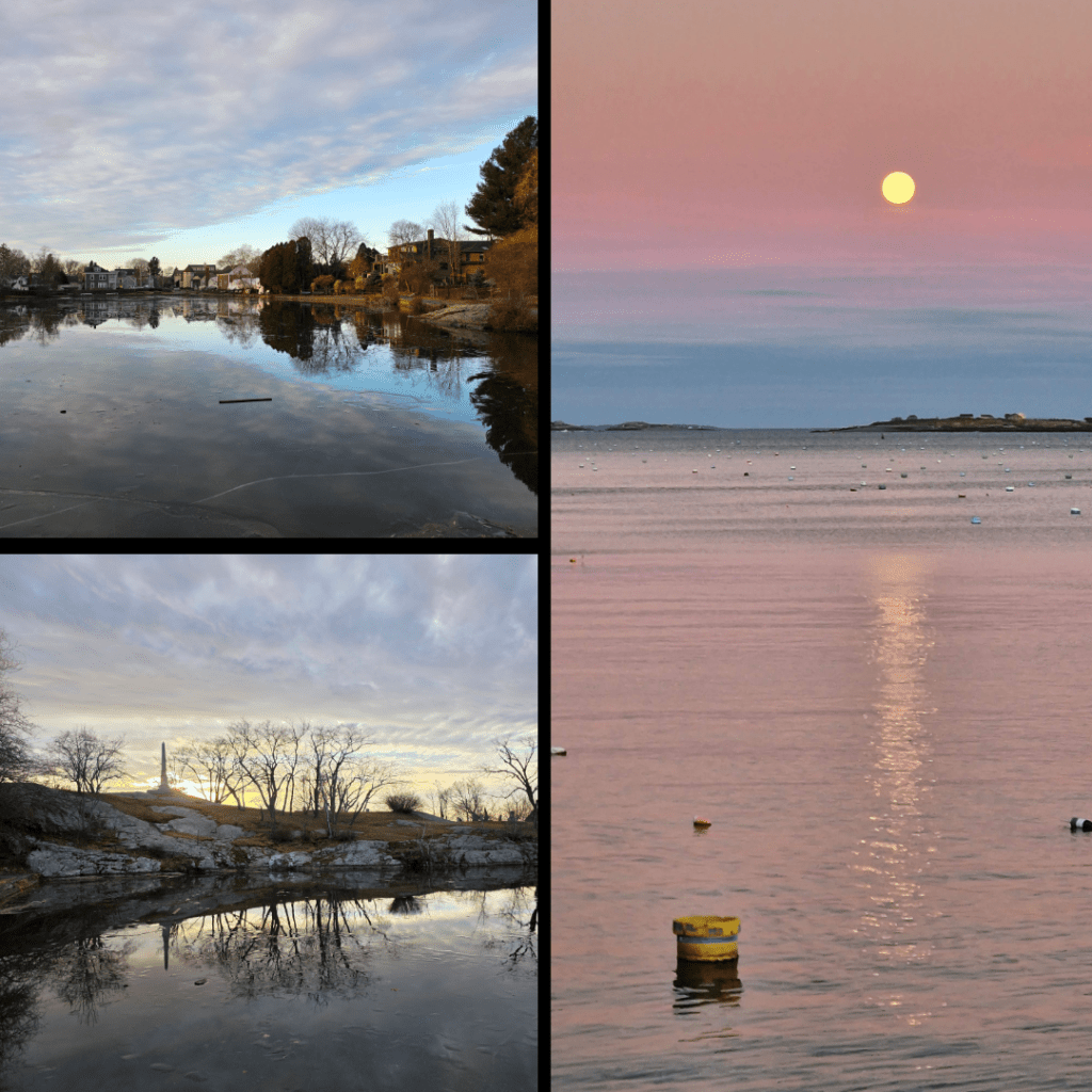
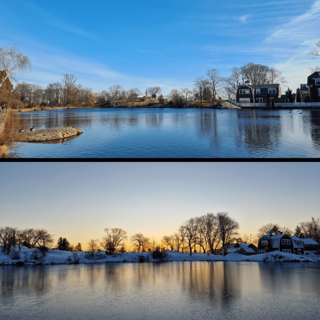
Starting of course with Redd’s Pond and Old Burial Hill, which I have written about at length. This was a cold morning with the ice just hanging beneath a layer of water on the pond.
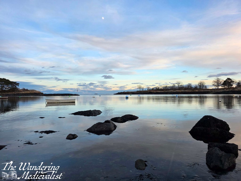
Two more shots taken on the same day as the one above, I felt I had to include them anyway, as one captured the monument to sailors of the town. The moonrise was a perfect calm evening last November, and I waited by the harbour for close to an hour for the moon to rise above the clouds.
More Redd’s Pond, but how could I resist? One in late winter, the other in mid-winter at sunrise, on a magical morning that a wrote a whole post about. The reflections here are hazy rather than crisp, but equally lovely.
And last but not least, a picture taken on New Year’s Eve 2025, when I went down to the Marblehead Lobster Company (as it was) to pick up a special dinner for my mother. I and a few other photographers had noticed the not-quite-full moon and the still water that reflected the changing colours in the sky. It was incredibly quiet with only a gentle lap of waves on the shore, and no birds to disturb the surface.
Do you have a favourite one of the images I’ve shared? Let me know, I would love to hear your feedback! I hope you have enjoyed this short trip into a thematic project that has mirrored several others in recent past such as cloudy skies, or sunrise/sunset. I hope to get back to the Coastal Path soon, or at least visit a castle! I’ve also got a few good ideas for posts that I developed while walking around Marblehead this last week – keep an eye out!
Enjoying my pictures? Why not claim one for your own project or wall space through my online shop:
Is there one on this post that you’d like to own? Just comment below!
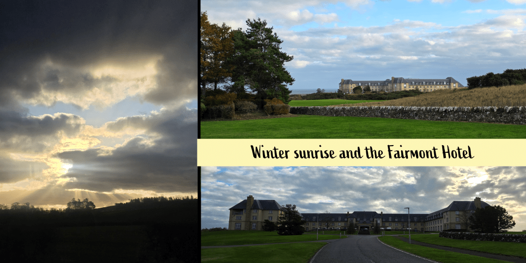
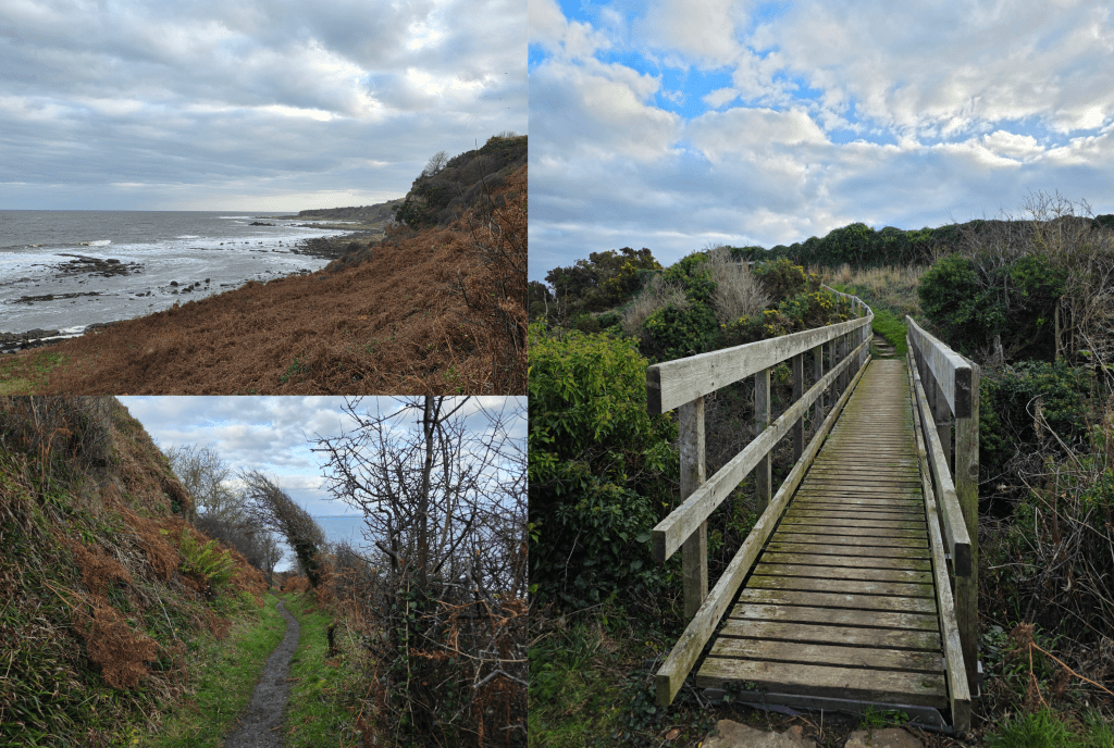
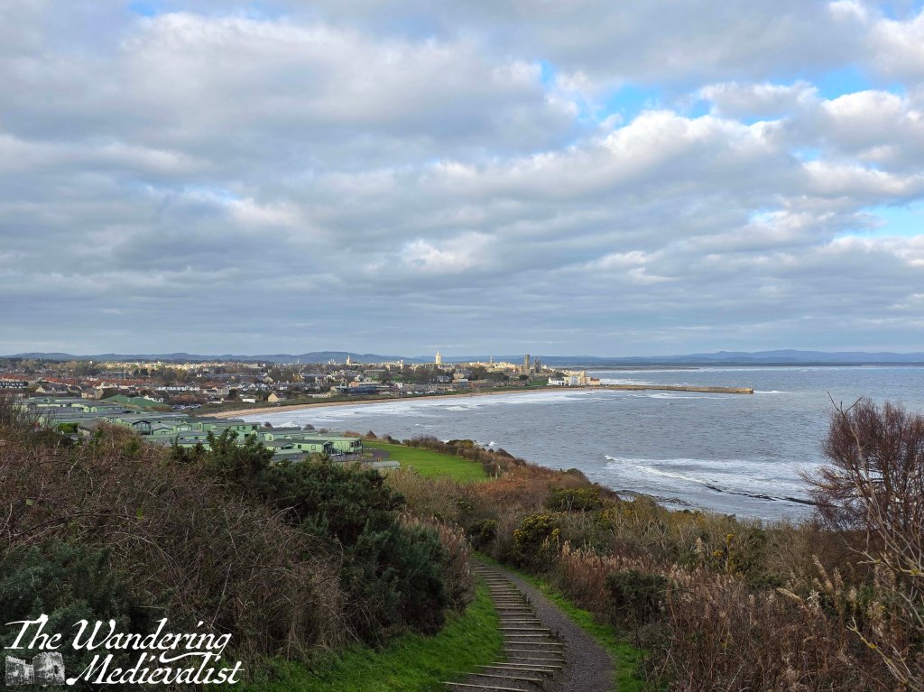
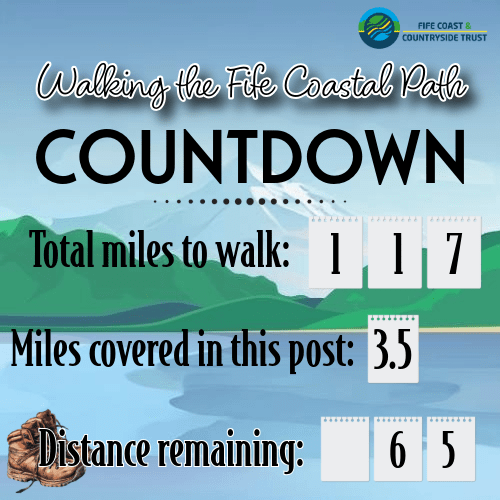
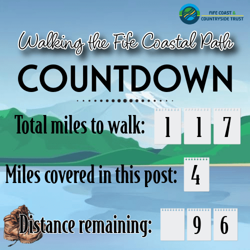
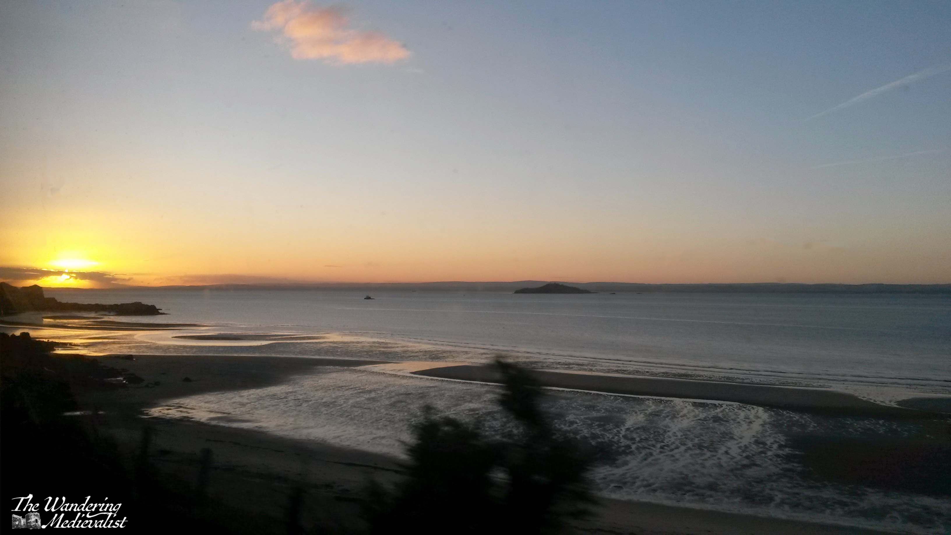
Finally after a long break, I determined last week that I would return to my Fife Coastal Path endeavour. The last month or so of travel has meant that my efforts to maintain fitness levels dragged a bit, and so I selected a portion of the walk that was not too long but still tested me a bit: starting at the Fairmont Hotel and walking through St Andrews to the Old Course Hotel, where I started my walk to Guardbridge many months ago. The first two miles are traditional Fife Coastal Path: rising and falling along the edge of the coastline with dramatic stretches of rocky shore and beaches. Then, the last mile and a bit is in St Andrews, along East Sands, up the Scores, and past the famous Old Course. This is a really pleasant walk, but the out of town section does require some stamina and sturdy shoes.
As would be expected in November, the morning was cool (8℃/46℉) with a cold wind and mostly cloudy with patches of blue sky. I wore my raincoat mostly as a windbreaker but also to guarantee against any stray rain showers – fortunately only needed for the wind. The bus trip was a short one – about 10 minutes – on the trusty 95 from St Andrews, and the stop is right on the road outside the entrance to the Fairmont estate. Fortunately there is a well-kept path running from the bus stop and along the access road up to the hotel. It is a gentle decline, allowing for a view over the North Sea as well as up to the hotel building, across the golf course.
I wasn’t 100% confident as to the route to actually get to the Coastal Path, but I knew that the walk from the hotel into town was done by guests, and so I figured it must be possible. There was no question that I was not there for the golf, as most others were – my attire was a bit different from the slick sporting outfits.
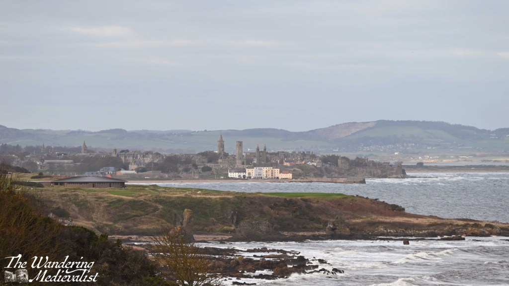
It took me about fifteen minutes from the road to wind towards the hotel the past, and down to the clubhouse for the Torrance. The views across the courses are beautiful even on an overcast day, and the outline of St Andrews is very clear; I really must come back here in the sun! This is clear evidence as to why the Fairmont used to be called the St Andrews Bay Hotel.
Distant St Andrews – with a powerful zoom lens
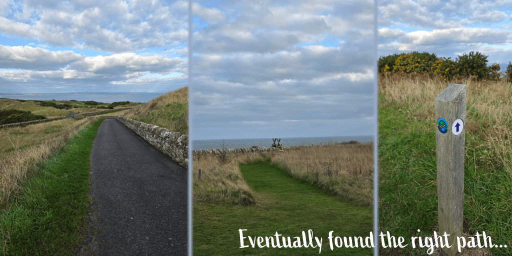
To get my bearings, I chose to walk down below the clubhouse and past the delivery parking, where I realised that I needed to backtrack slightly to an access road onto the course. From there, I turned right through a break in a stone wall and it was an easy walk to the second wall, dividing the course from the Coastal Path. I used a wooden ladder to scale the wall, though I think there was a break a bit further up for anyone less inclined to climb.
Finally at the starting point, I set my Fitbit to record and started on my way, enjoying immediately the return to a cliffside muddy track, along a stone wall, with waves crashing below. There were a few occasions where my eyes filled with water due to the wind, and I did have to wear my hideous winter hat, but I was warm enough once I got moving.
From here, the path eventually goes down some stone steps and across a bridge over a burn, after which it curves to the right and descends quite sharply towards the beach level. While my boots were not as comfortable as they once were, I was glad to have them here where the recent rain has made the small rivulets into rushing burns and even the grassy areas into mud.
The coastal views are great here in both directions, though the wind is definitely a force to be reckoned with – as ever in Scotland, layers are key. I spend a great deal of time at work explaining that it seldom gets as cold in Scotland as it does in parts of the US, but the wind is biting so it can feel much colder than it is. This was one of those days.
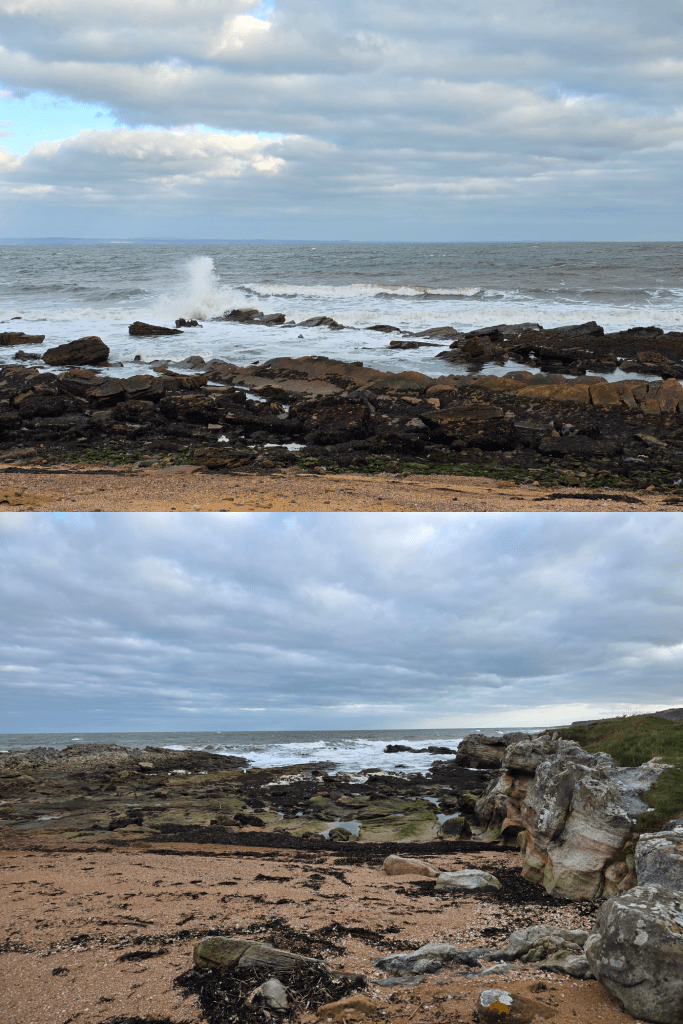
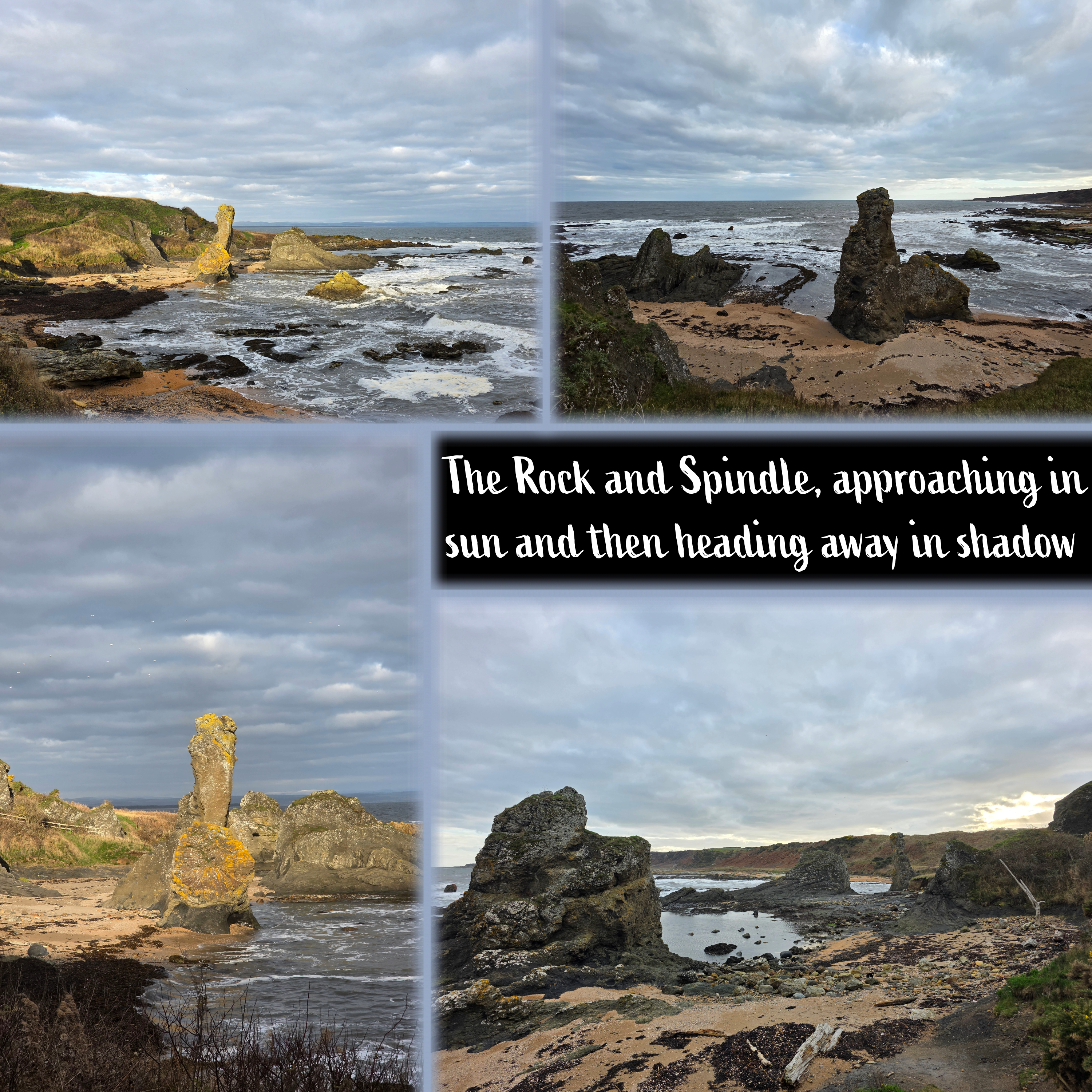
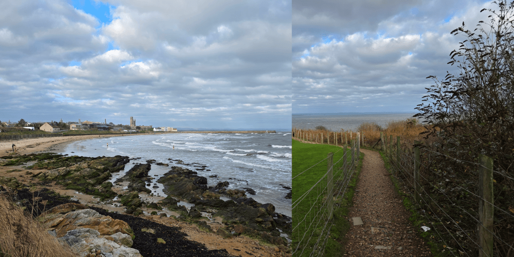
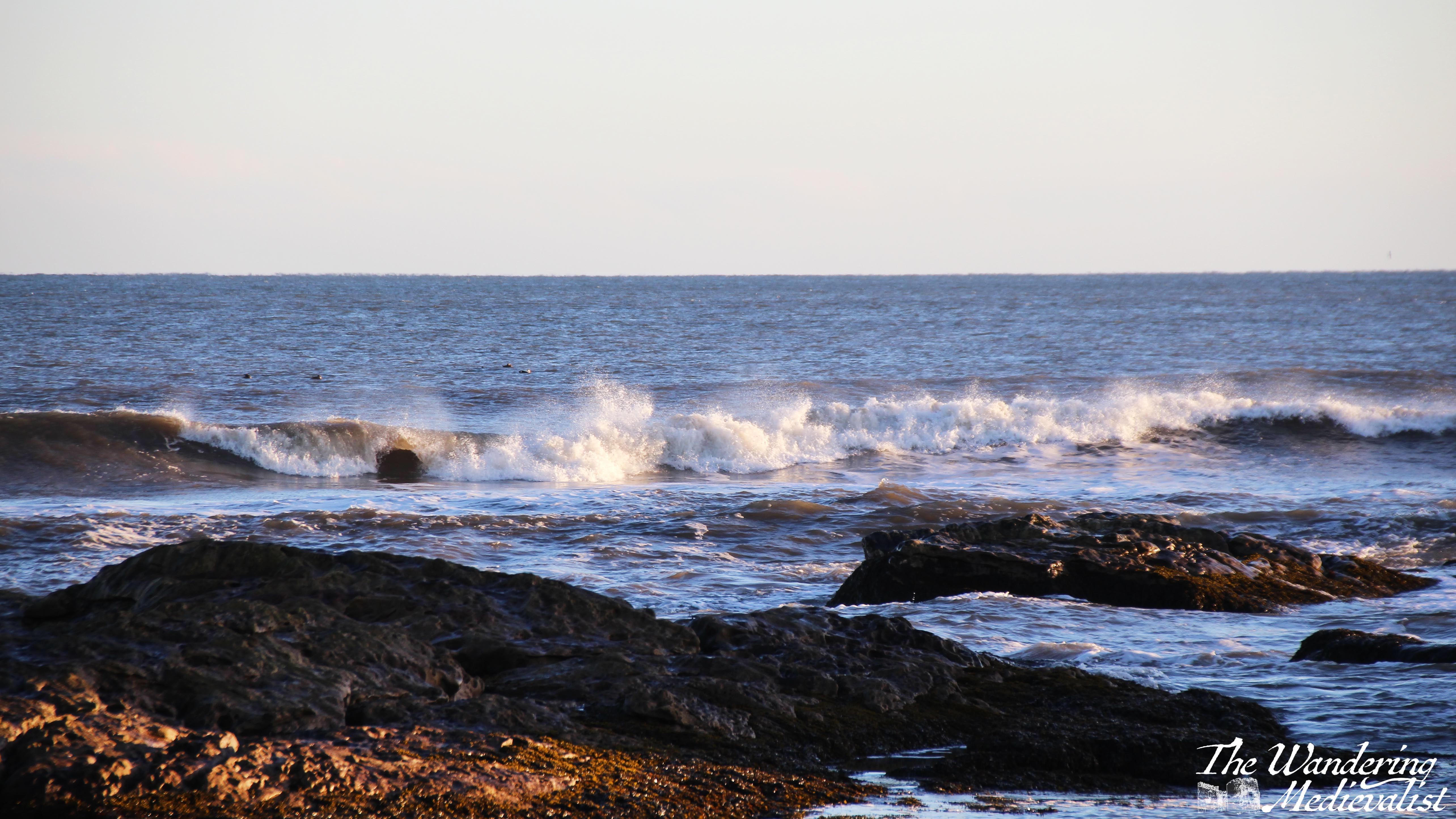
As the path descends it essentially passes through a hedgerow, and you can see the cliffs above you, mostly covered with plants though there are the occasional dramatic rocky outcroppings and circling birds. On the beach level, you can enjoy crashing waves, and ahead is the shape of the Rock and Spindle.
It was about here that I passed a couple who were clearly familiar with the path, and who observed that I had about 45 minutes until high tide, with a gentle warning in their tone.
Yes, I had once again forgotten to check the tide, though to be honest it was because I did not think it was an issue on this section. My error, clearly, and while I assured the couple that I would be fine, I decided that it was time to hustle a bit. So rather than pausing and taking many wave pictures (as I was tempted to do), I crossed the rocky beach and identified relatively quickly where my potential problem lay.
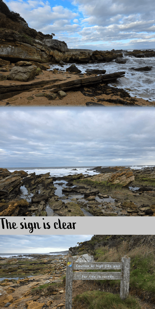
Specifically, it lay right about here, where the waves stretched inland along a rocky edge, threatening to very quickly cut me off from the path ahead. Like many of these small beaches, this cove was backed by a rock cliff and, as the sign clearly told me, if the tide was too high I would have no choice but to wait – there was no high tide route.
So, onwards I scrambled, and found myself looking at a rock face about 4 feet high with one foothold that was a bit higher than I thought my right leg might go. There is no picture, as I realised I did not have time to waste. So it wasn’t graceful or smooth, but I managed to get up the rocks and keep my feet dry – just barely. I probably had another 5 minutes before I would have had to stop. Good timing, then.
Beyond this pinch point, the rocky shore continued for another few minutes before I was able to rejoin the smoother path, and pass the sign in the photo above. I swear next time I will check more carefully.
Side note, I can see why Geology and Earth Science classes from the University would come out here for outings – there is a huge range of fascinating rock formations even for someone who knows nothing about them, and excellent examples of the ocean carving through stone over time.
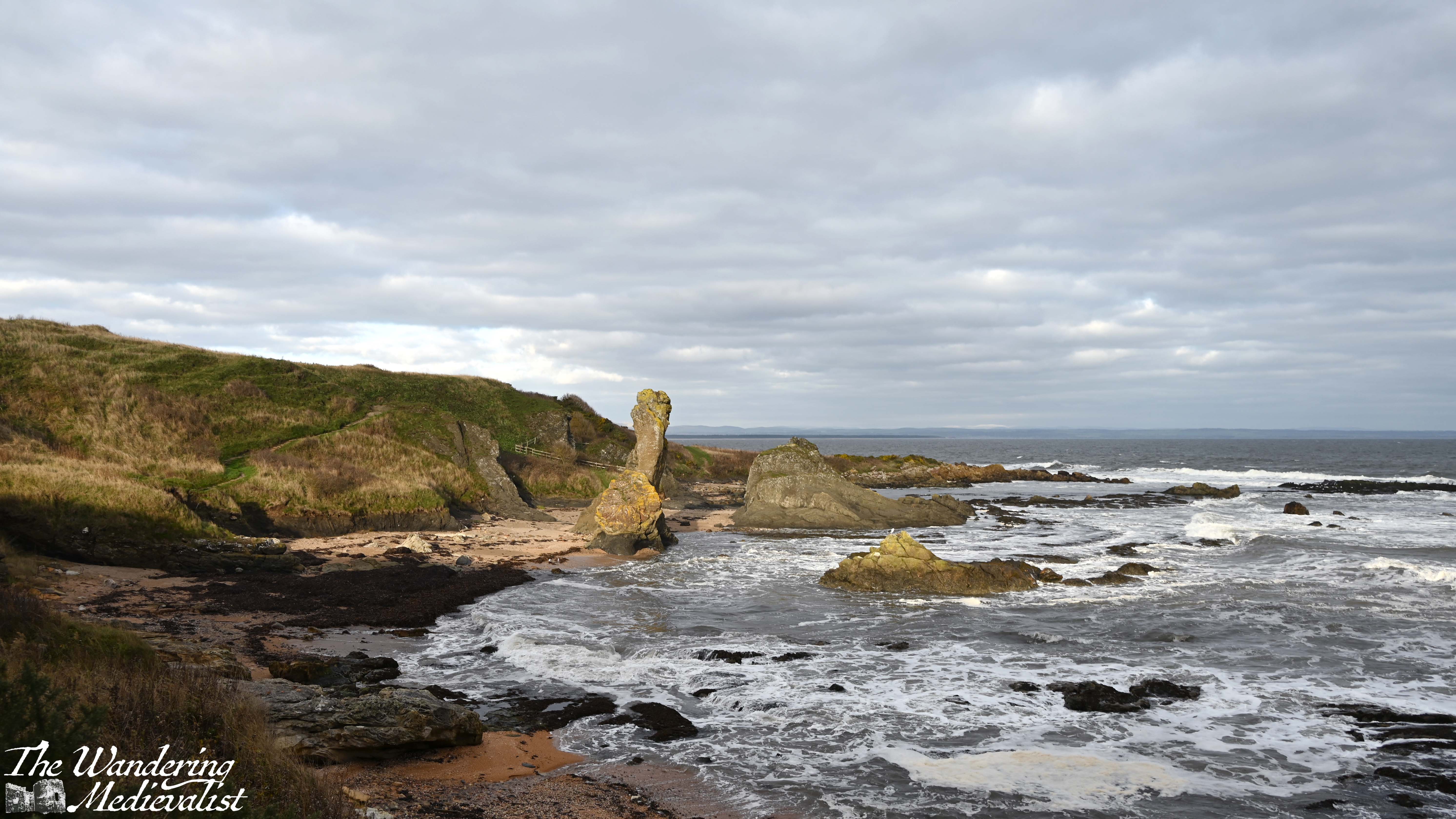
Ahead, in particular, is the Rock and Spindle, a famous formation that has been widely studied and photographed. According to some brief reading I did, the three stacks are made primarily of solidified volcanic ash, the remains of an ancient submarine volcano.
As I approached I was feeling uncertain that the sun would be helpful and actually break through the clouds, then as the path curved around to follow the shoreline, spectacularly the sun prevailed and provided some excellent contrast for my pictures.
A few words of caution if you are approaching from the direction I did – don’t get too caught up looking at the view, as the path here is crossed several times by burns. The rocks and grass are slippery and often wet, so it would be all too easy to fall.
There is also, I should note, a route above the rock formation which offers great views across the golf course and of the Castle Course clubhouse; Dad and I took this path when we walked out here many years ago (and of course I cannot find those pictures for reference). Alternatively, walkers can get down to the beach here to get closer to the rocks, but I was ready to make some progress and so passed through a wonky gate and continued on my way.
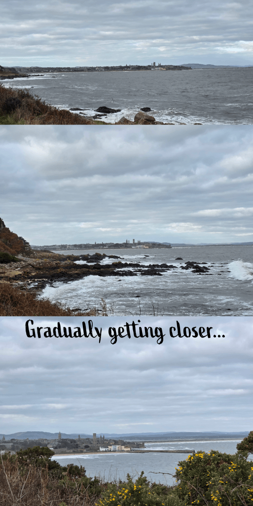
The path here becomes the more standard grassy path, and as I approached St Andrews I started to doubt whether the predicted sunshine would overcome what seemed to be pretty steady clouds. The overcast sky did not prevent me from taking plenty of different views of the town as I approached, of course – here are a few. Do I have sunny versions of these? Almost certainly. But there is something about this view of town that is impossible to resist.
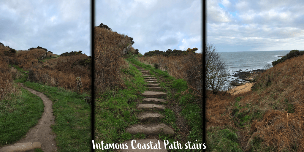
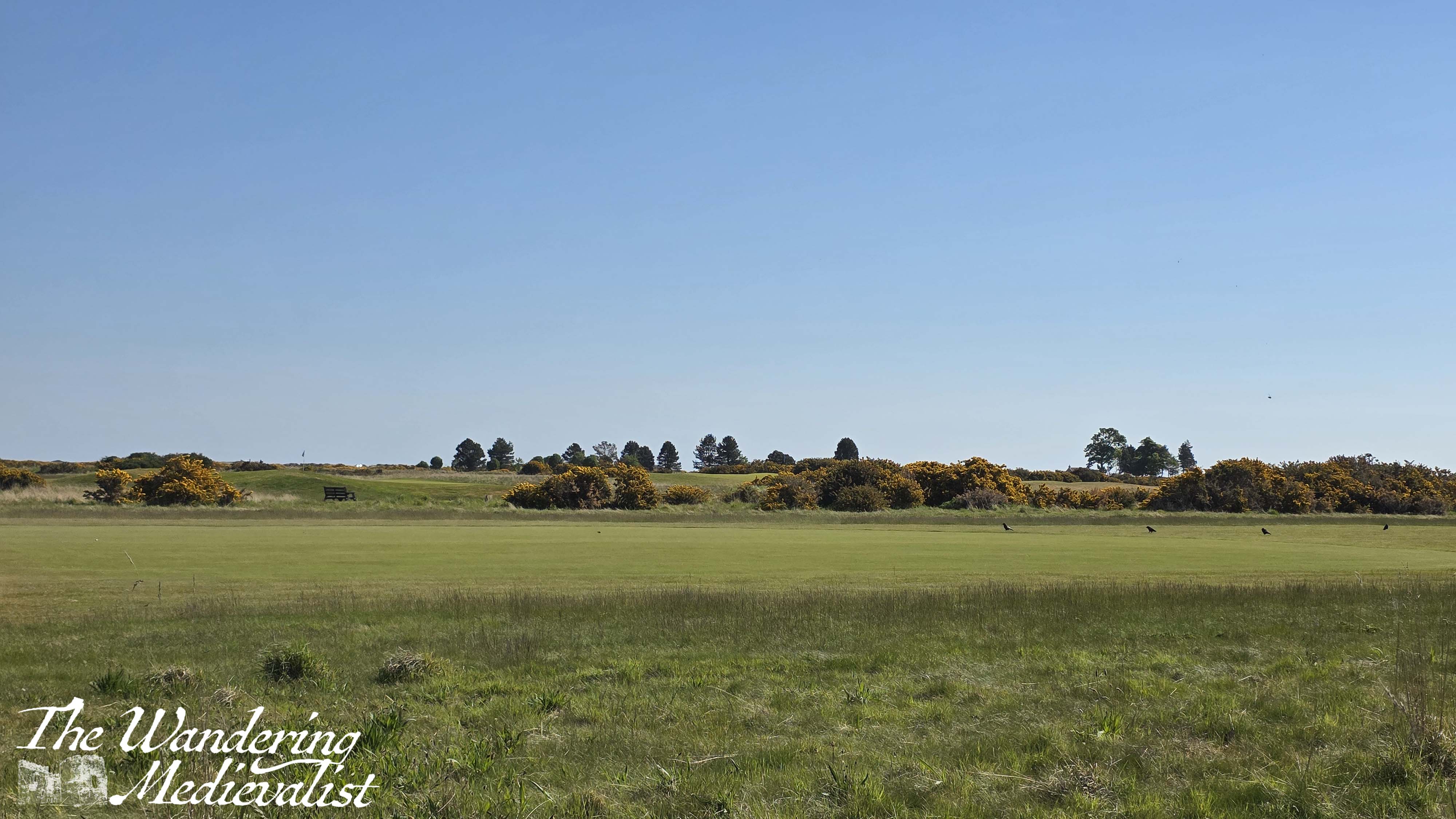
After ambling along at a good pace, enjoying being at the water level and the crashing waves, I realised that the cove I was in was quickly reaching its end, and there ahead of me was one of the Fife Coastal Path’s infamous – in my mind – stone staircases. The steps themselves are generally flat-ish rocks that have been layered into the hillside, and often wind back and forth as they climb steadily upwards. This is one of the longer sets that I have come across, and it definitely tested my endurance, which has declined since the summer. The view is of course excellent particularly if you have to stop and catch your breath.
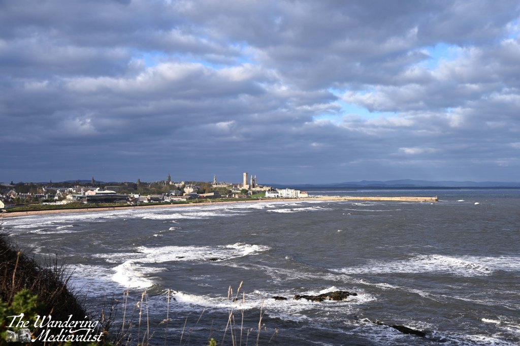
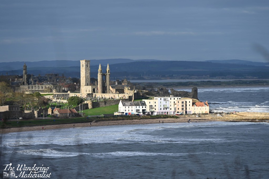
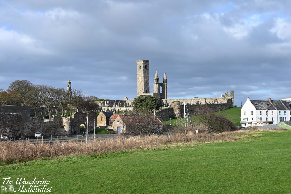
Once you make it to the top, however, the path is relatively level for some time, with only gentle ups and downs. The crest of the next hill provides a spectacular view over the bay and town – it is THE view, the one photographers will climb up here to capture. Even without sun, it is impressive. That said, as I made my way along the clifftop, the sun did make an appearance, highlighting the lighter stone of the cathedral ruins and harbour, bright against the turbulent waters of the bay.
The path here is wider and more regularly-used, with joggers and weekend walkers more common. It is easy to get distracted by the view on one side, while on the other the golf course rolls into the distance until it comes to an end at a line of tall pine trees. This marks the boundary between the Castle Course and St Andrews Holiday park, a large caravan site at the edge of town. Passing through a metal gate, you will notice a narrow path heading up to the road, so in theory you could begin a walk here as well, or do a loop up from town and back along the coast.
St Andrews and the bay
The view is just incredible, as gradually you move closer and closer to East Sands. Then in no time at all you are descending once more, along the edge of the caravan estate on a relatively steep set of stairs. There is a viewpoint off to the right, and then the path continues towards the beach.
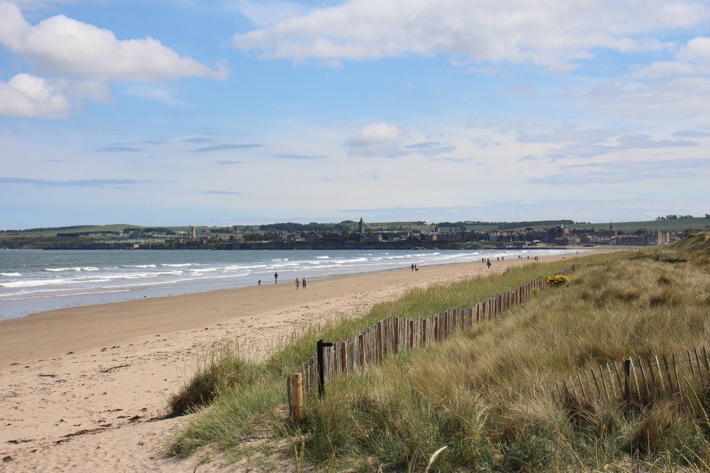
One last gentle hill leads down off of the Coastal Path proper and onto the walk along East Sands, the wide open beach of St Andrews edged by the cliff on one end and the pier on the other.
just because…
Those of us who have lived in St Andrews for any length of time will tell you that the weather there is different, golden in a way that cannot be matched anywhere in Scotland. It might be a blizzard in Cupar, raining in Guardbridge, but it is sunny in St Andrews. Not always, of course, but more often than not the town enjoys its own pocket of good weather, and this day was no exception.
As I passed this slightly tattered Saltire at the end of the beach, the sun fought its way through the last of the clouds, and the day opened up into beautiful sunshine. Was it sunny at the Fairmont? Who was to say.
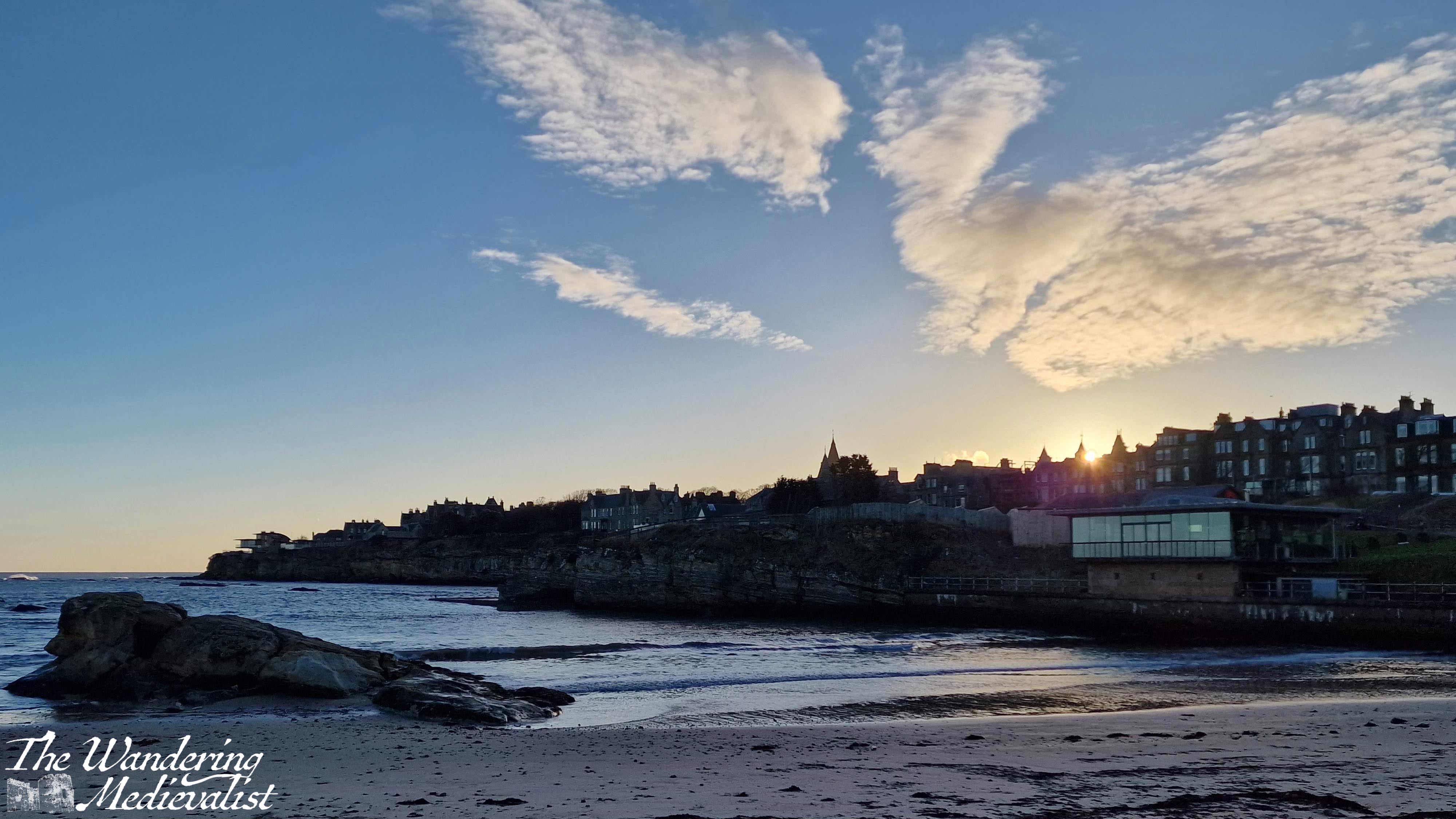
East Sands is always busy with walkers, dogs, swimmers, surfers, and sailors depending on the weather, and today was no different. Even in the cold weather and even colder water there were people out in wetsuits. And, some brave souls just in bathing suits, though I learned later that they were dashing up the beach to the newly-built sauna. This is the beach where students take part in the famous May Dip, and is a spectacular place for sunrise, as well as to catch the Northern Lights if you are lucky. The East Sands walk takes you past the University nursery, the East Sands Leisure Centre (town pool), the Scottish Oceans Institute and the famous Toastie Shack, perfect for a beach snack.
The edge of East Sands marks the start of the portion of the Coastal Path that I know like the back of my hand, have walked 100s of times over the years and love. But oddly, I was not confident as to the actual route of the path. My map told me to turn left at the Toastie shack, but the signs told me to continue strait.
As the straight-ahead route was arguably prettier, leading along the beach and over the harbour gate, I chose to follow the signs. Here, the path goes through the play park and along the edge of the beach, allowing for a great vista across the water and up to the Fairmont.
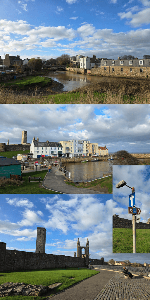
On the other side is a wide grassy bank that leads over to where the Kinness Burn enters the harbour. I wandered over to take a quick picture, but it is worth warning that this stretch of grass is full of holes, dips and – annoyingly – the occasional dog dropping, so best to keep looking down. Soon the path curves around to the left and down a short hill towards the harbour. Cross at the harbour gates and then swing right either in front of or behind the line of buildings. Officially, the path goes behind, but I don’t think it matters greatly. This is one of the most photographed parts of St Andrews, with the colourful buildings and the old harbour, and the entrance to the famous St Andrews pier.
If you have the time, I recommend a detour out to the end of the pier, as the view back is phenomenal. The pier had been closed for some time due to damage sustained during a storm in November 2023 – it is great to see it back open and so many people enjoying the walk. As often happens on a sunny day after a few of rain, the town was busy with students, visitors and locals all out enjoying the day.
Side note, I have several times on these walks had the weather improve as the day goes on, and wonder if I shouldn’t wait until later in the day to get going. But instead, I just keep heading out as early on a Saturday as I can manage. Maybe that will change as the winter closes in, but probably not.
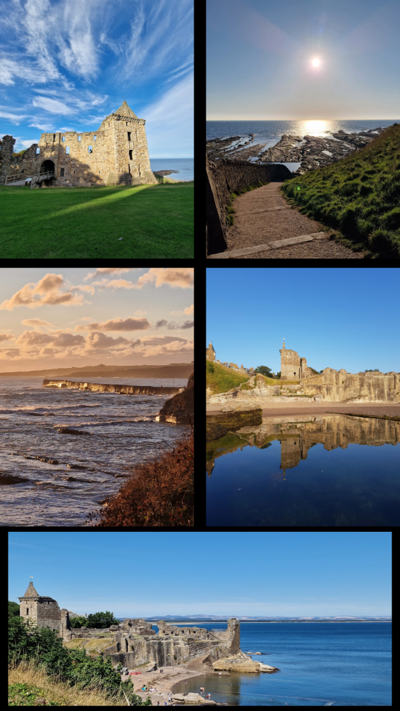
Whether you detour out the pier or not, you have two choices for climbing back up to cliff-top level; the first is a set of stairs, and the second is a hill so steep that cyclists are required to walk their bikes up or down. I opted for the hill, and either way you arrive at a great viewpoint over the town. There are the ruins here of St Mary on the Rock – a church outline – and several cannon aimed out to sea. The highlight is of course the view of the cathedral wall and remaining towers straight ahead.
The path is wide, with a stone wall along the edge of the cliff, though if you look down you will see familiar rocky coastline and birds nesting or bobbing in the water. Ahead there are two options, and neither is marked though I think the obvious choice is to hug the coastline and take the right-hand fork. The left leads you along the cathedral wall and towards North Street.
The fork I recommend is also the one that takes walkers along one of my most favourite stretches of path in St Andrews, and possibly all of Scotland: up a gentle hill between the cathedral and the castle, one of the best viewpoints in the area. You can see into the cathedral grounds, down to the pier, out to sea, and of course along the coast to the castle and distant West Sands. It is a place that is almost meditative for me – I have walked it more times than I would hope to count, even now seldom stopping to take pictures and only enjoying the view. A scattering of sea roses makes it the perfect spot in summer, and there are two benches ideally placed to rest and enjoy. Definitely take a few moments to do so, if you can.
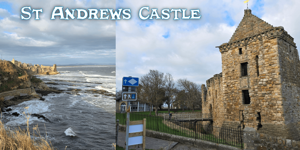
St Andrews Castle is of course directly ahead, its outline something I imagine I could draw with my eyes closed. I cannot pass without a picture, so on this occasion I included the Coastal Path sign – in one of them.
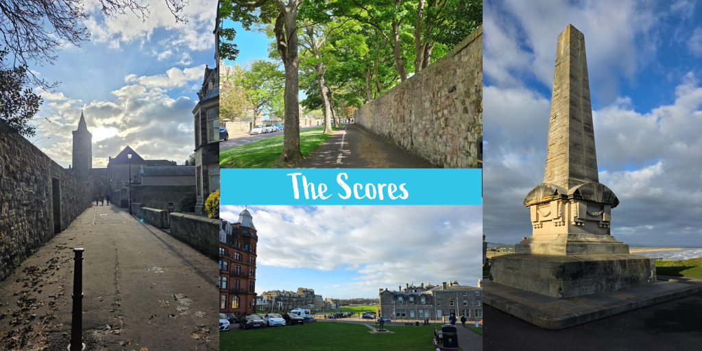
Once past the castle, the route continues along the Scores, one of the most beautiful streets in St Andrews and one of the most expensive in Scotland. The University owns a good portion of the buildings and you will pass, amongst others: the Schools of English, Economics, Philosophy, Classics, International Relations and History, the University Museum, St Salvator’s Hall and the back of St Salvator’s Quad, the Principal’s House, and the Admissions office. The buildings in between which are privately owned are large, some very old and some very new, all with phenomenal views. The Scores is lined at varying points by stone walls, and you can choose to walk on either side, though I always feel that the left going away from the castle is ever so slightly nicer. It is wider, and you do have to look out that you do not wander into the cycle lane.
About half way along on the left, Butts Wynd cuts up towards North Street, offering a stunning view of St Salvator’s Chapel.
It may be tempting to nip up to the quad and take a few pictures, so by all means do so here if this is your one trip through St Andrews. For golf enthusiasts, the best is yet to come.
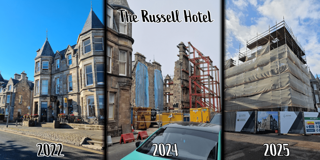
Continuing along the Scores, you will pass the Catholic Church, and ahead on the corner of Murray Park is what used to be the Russell Hotel, which was one of our favourite spots in town for excellent Scottish food. The couple who owned it eventually retired and the majority of the structure was torn down, so that all that remained was the listed frontispiece. As of writing, it is enshrouded in scaffolding and being rebuilt into what I understand will be flats.
At this point I recommend crossing the street and continuing roughly straight ahead. Along the cliff you will find a tall wrought iron fence with warning signs as to the sheer drop on the other side – this is due at least in part to the unfortunate tendency for students to wish to climb the fence, which has devastatingly led to fatal injury in the past.
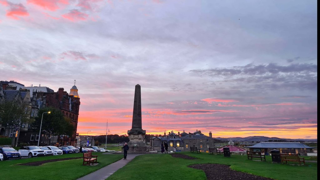
Avoid the temptation to turn right down the steps toward the Aquarium, and while there is no clear signage continue straight towards the towering Martyrs’ Monument, which was put in place to commemorate those killed during the Reformation. Beyond the Monument is the Royal and Ancient Golf Club of St Andrews and the famous Old Course. To the left, the buildings of the Scores including what used to be the Scores Hotel but is now Seton House, and the towering red Hamilton Grand, that incredible framing building to all pictures of the 18th hole. When I was a student it was still student housing, though has in intervening years been re-build into luxury condos.
Continue down the hill and cross the road, continuing up Golf Place towards North Street – do not head toward the beach, though there are public toilets in that direction should they be needed.
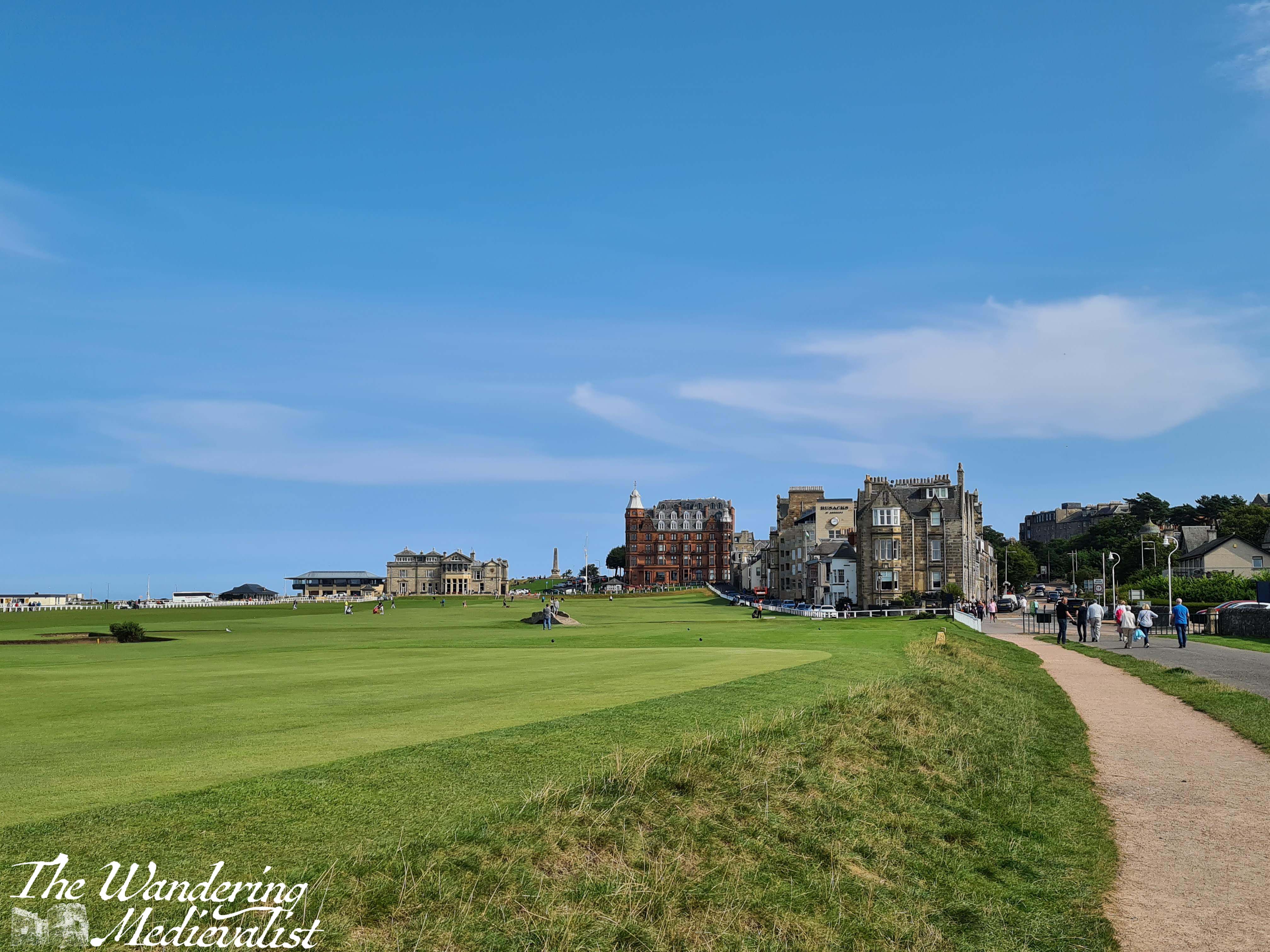
Continue to follow the golf course by turning right along the Links, which is a narrow road that runs between the Old Course and the buildings that include the famous Auchterlonies Golf Shop, the Rusacks Hotel, and the New Golf Club. There are regular signs reminding you of this, but golf is being played year-round, so pay attention for stray shots!
As you walk along the course, you will get some great views towards the Swilcan Bridge – where all golf competition winners have their pictures taken, as do many tourists.
Follow the white fence when it curves around the end of the buildings and keep moving towards the hotel, straight ahead through the car park. In only a few minutes, you arrive at the entrance to the hotel grounds, where there is a clear sign to mark the end of this section.
Overall, a comfortable walk with a few spots to challenge you and a few spots to just enjoy the view. The section through St Andrews is beautiful, but I still think I prefer the out in the wild paths such as the one from Crail to Cambo – for hiking, in any case.
A small calamity of this walk was the realisation that my walking boots, purchased in the spring, just aren’t cutting it anymore. They have worn down and are encouraging my ankles to roll in even more than they do naturally, so I am on the lookout for a replacement. Good thing Christmas is coming, as I hope I can request a new pair! Any recommendations on brand would be welcome.
I have to admit to rather dreading this section of the Coastal Path. I have walked it before, and compared to some of the East Neuk stretches, it is busy, noisy, and not as stunning. However, it is required and so I chose to walk it before it got too late into the summer and harvest season. The last time I walked this route, it was August and there were 1 million harvest flies, several tractors stirring up dust, and enough pollen to defeat any anti-histamine.
There are plenty of good points about this section, though: it is fully accessible by public transport, relatively flat, paved, and moderately busy (can be a plus or a minus depending on how you see it).
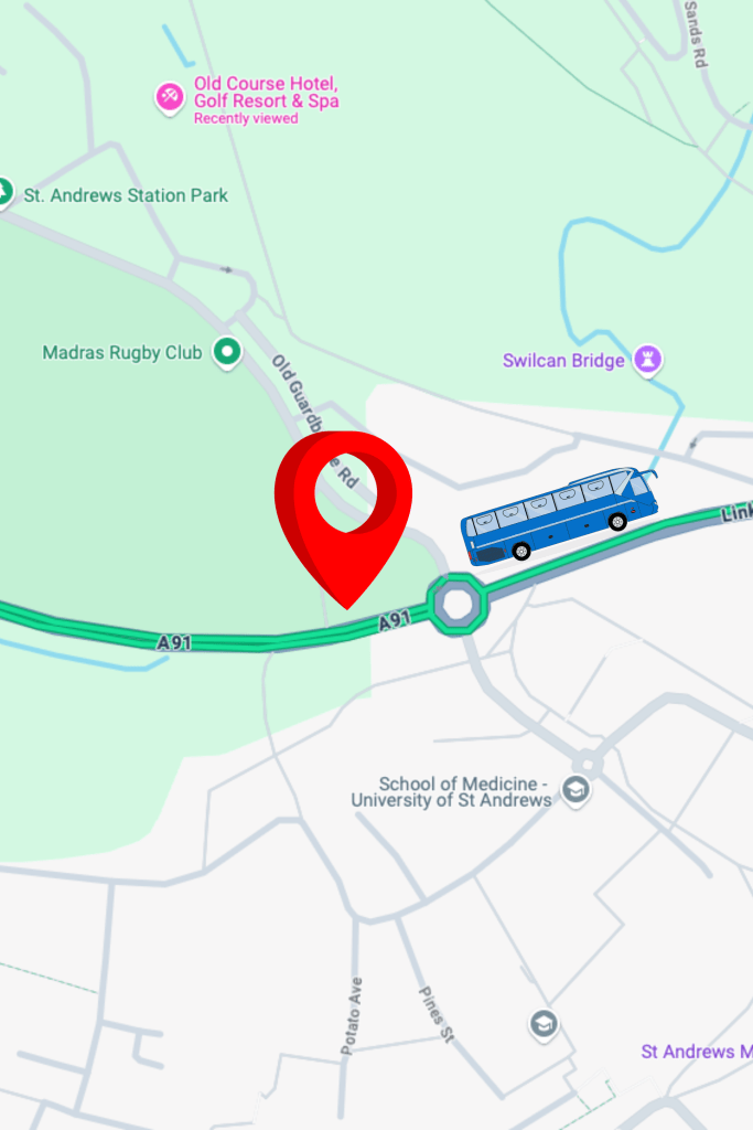
I started this part of my journey by getting off the bus at the Old Course Hotel bus stop, just opposite the Gateway Building. From here you follow the path directly behind the bus stop and very quickly come upon a car park, and your first signs for the Coastal Path.
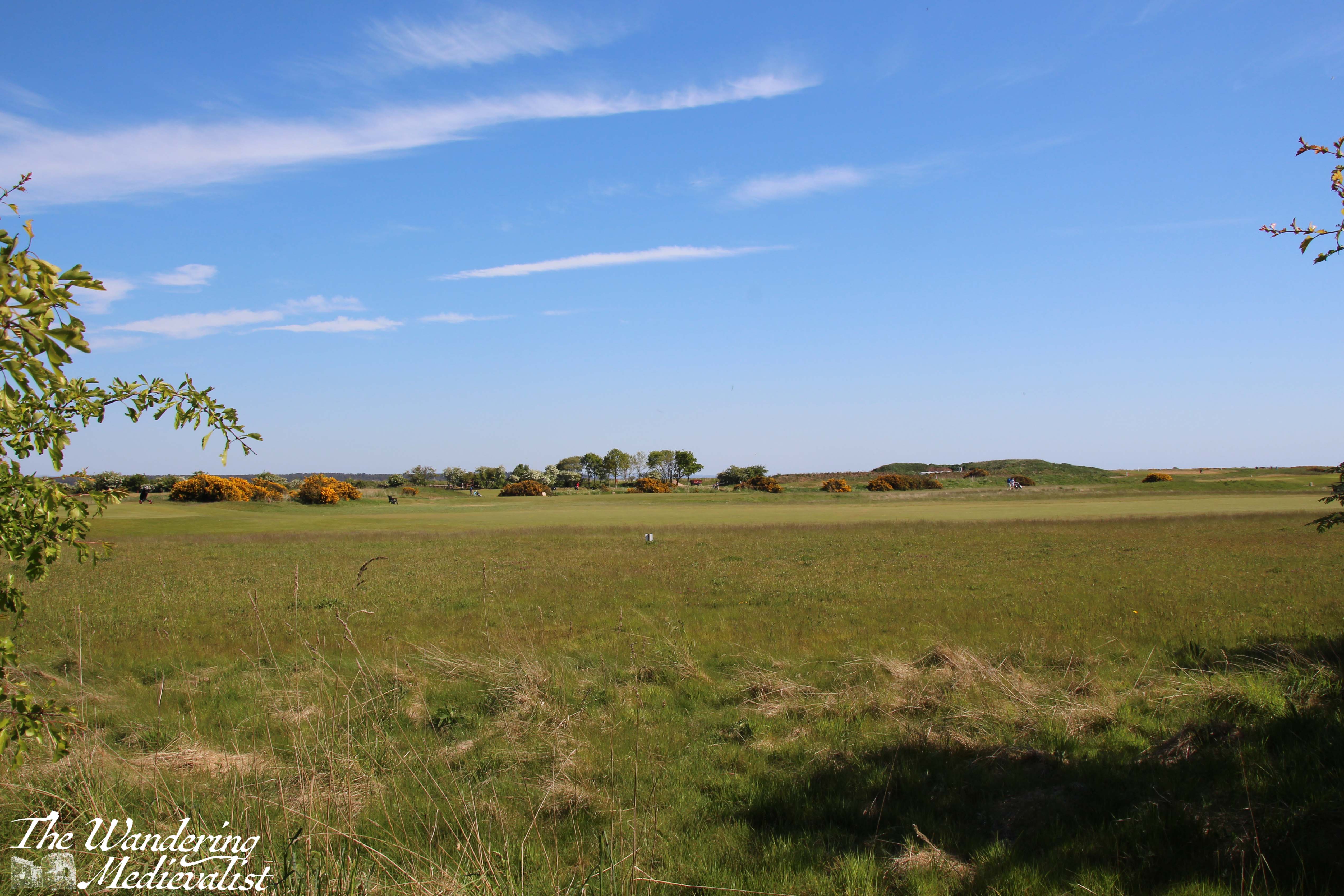
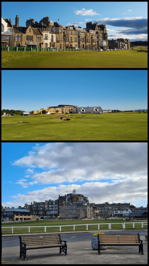
Golf enthusiasts will want to take a short detour here to go closer to the course, which here is the 17th Green of the famous St Andrews Old Course. Views looking back to the Royal and Ancient Golf Club, the 18th Green and the Hamilton Grand are stunning. You can tell that one of these pictures was taken several years ago when we had more rain than we have had this spring….
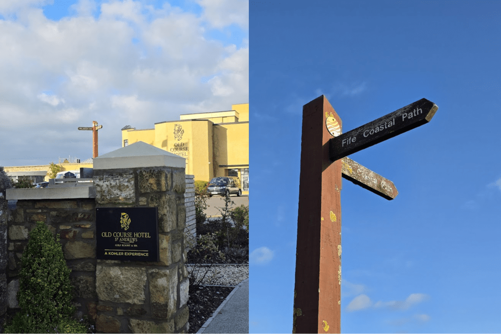
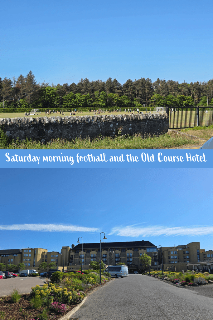
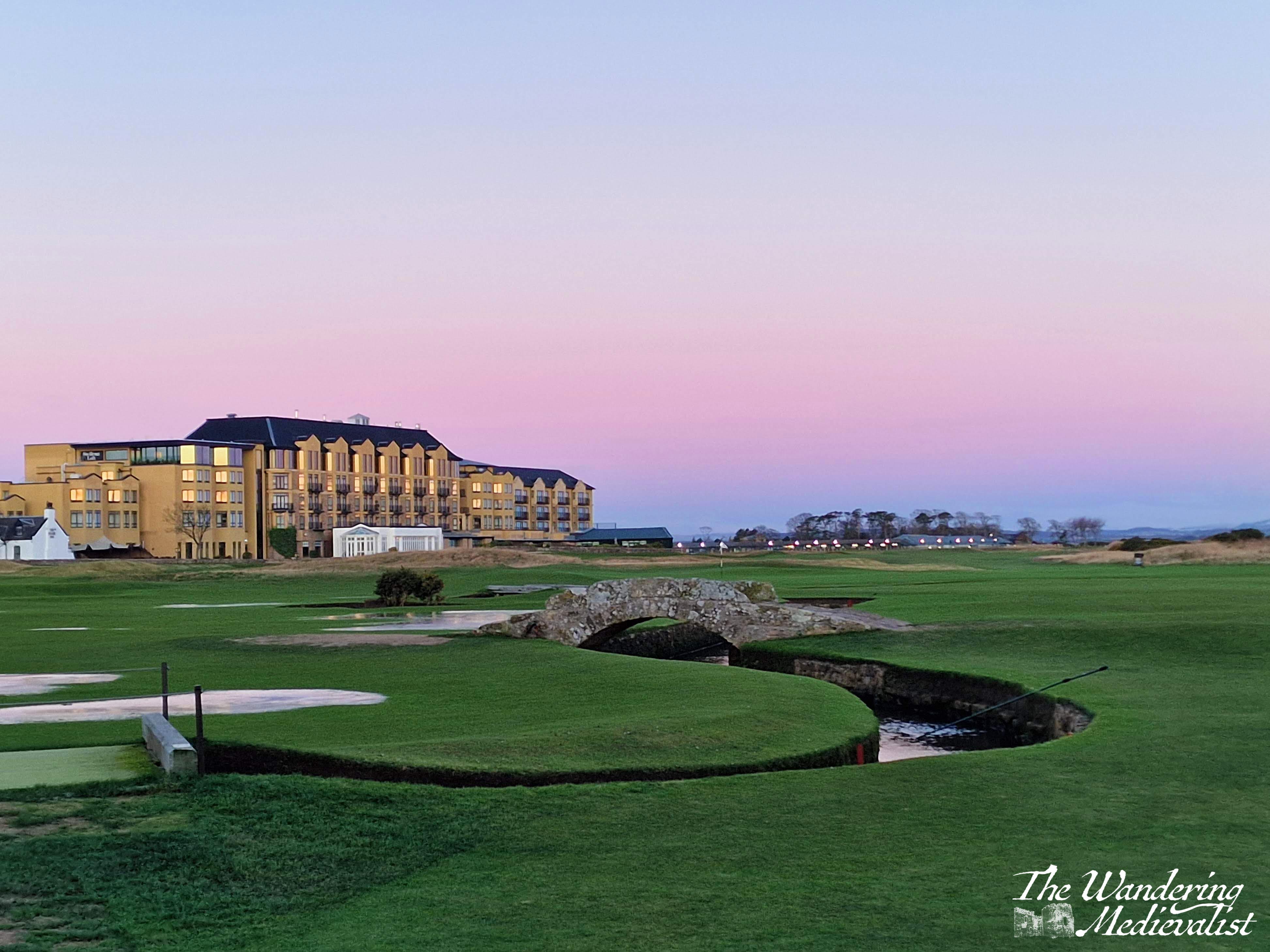
The official route of the coastal path leads here along Station Road to the left. The first buildings passed are the spa and the impressive Old Course Hotel, where most celebrities and famous golfers stay when they visit St Andrews (unless they rent a house of course). The menus are impressive and restaurants are beautiful, and they offer high tea with some of the best views in town, looking over the golf courses and beach.
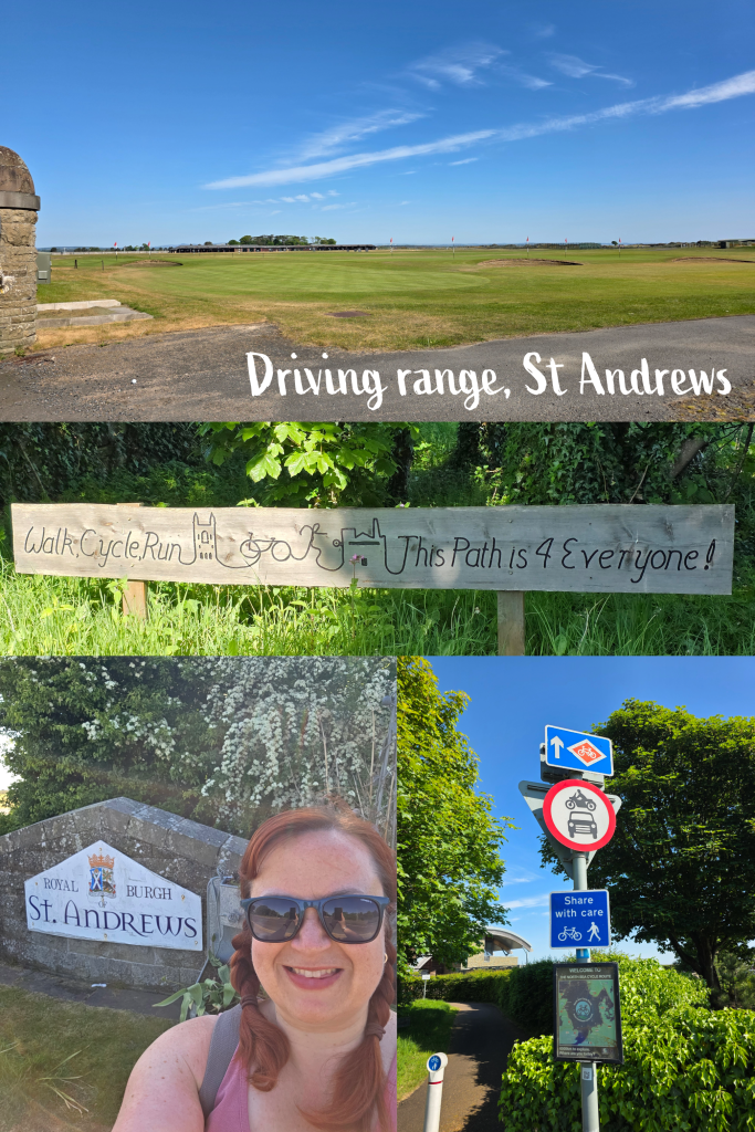
Beyond the hotel is the driving range, and across the road are a series of sports fields, which on the morning I walked were busy with Saturday football (soccer) games. This stretch of road is always lined with parked vehicles, both parents going to games and the luxury coaches of the golf tour operators. At the far end, the path crosses the road to the driving range, and continues off along to the right.
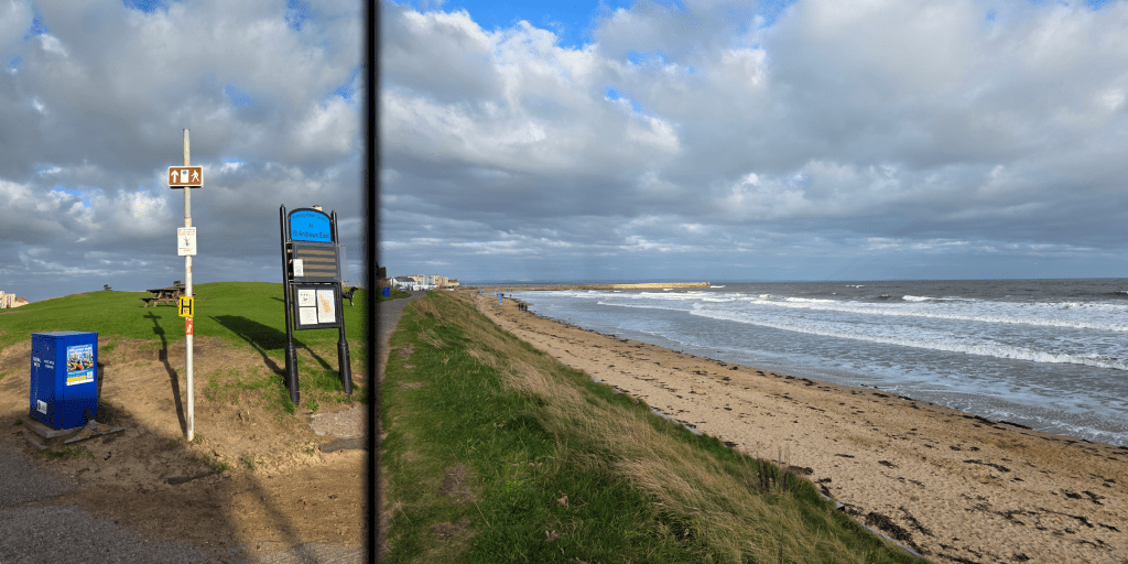
I took a quick detour to get a picture by the town sign before heading back to the path. The signs here are evidence of just how busy this stretch of path is – cyclists, often in groups, take advantage of the pavement while walkers and runners are regular users. I deviated from my normal no-earphones walking pattern, but I was careful to always look around before moving from one side of the path to the other.
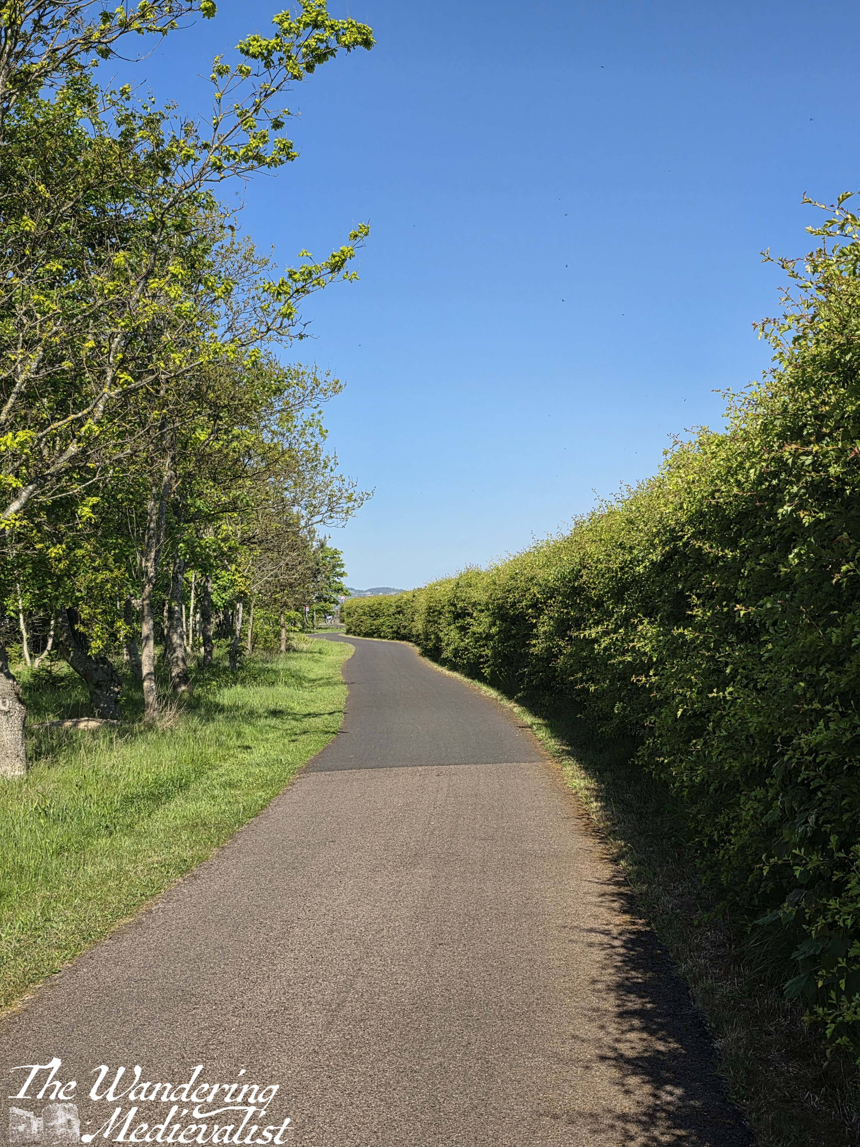
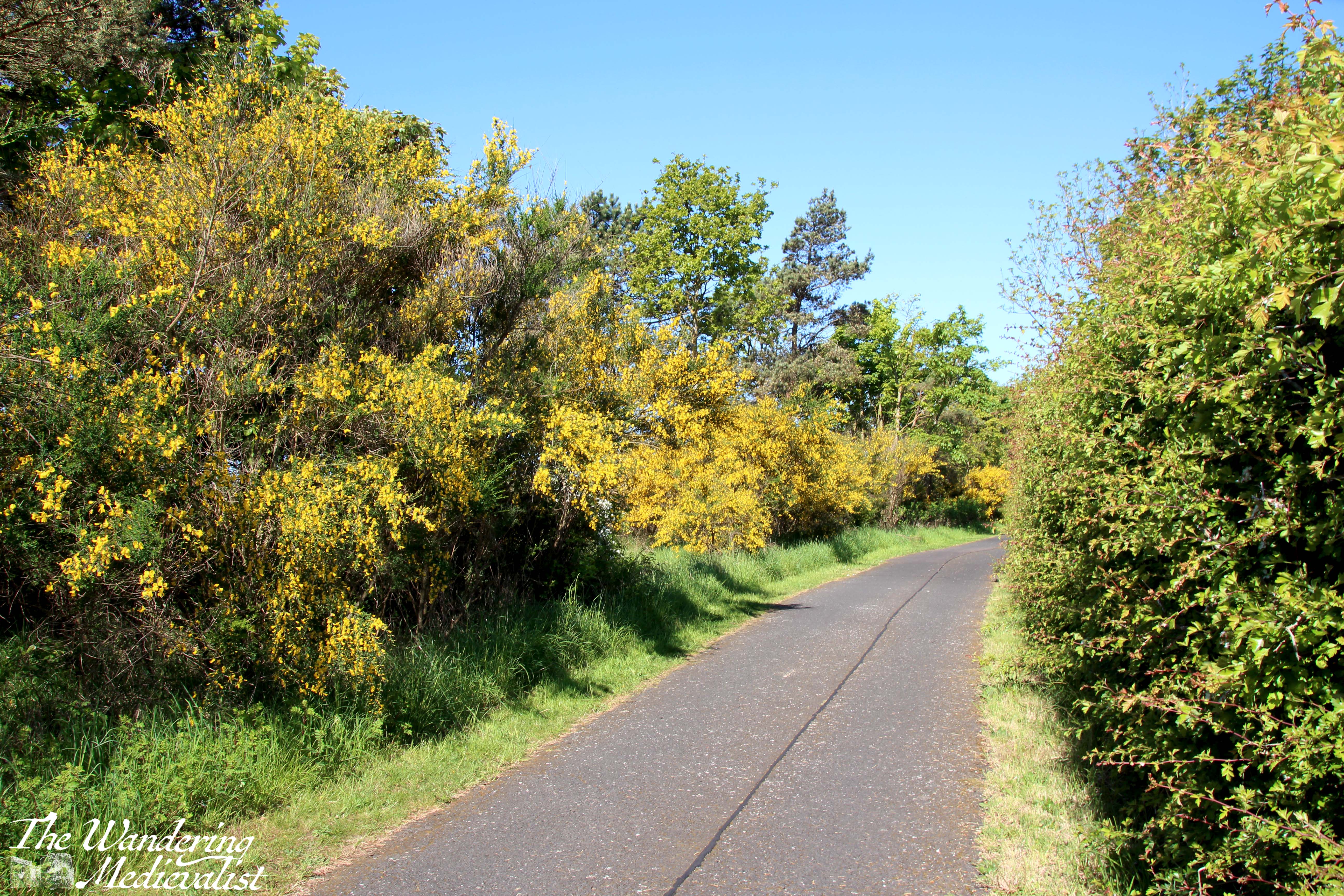
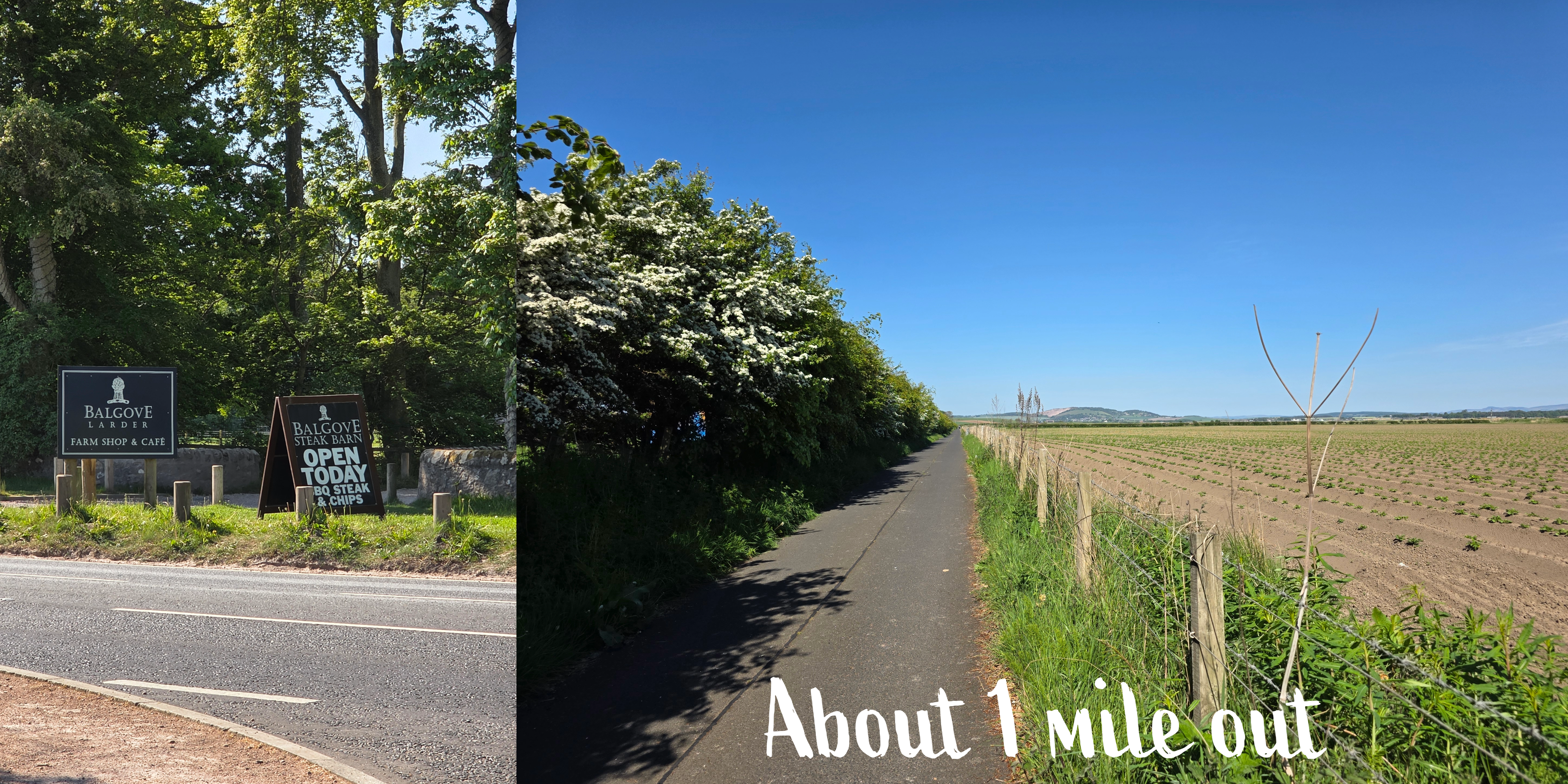
The first mile of this walk is quite pleasant, with trees for shade dotted along and the potential for lovely flowers – some roses, lots of yellow gorse and white flowering bushes. There are several breaks in the foliage for vehicle access, and the first one is very close to Balgove Larder, an upmarket farm shop that sells local produce, bread, cheese, meat, beer and liquor, and much more. It has a great café and a steak barn that is hugely popular.
Along the right-hand side of the path is a large hedgerow, separating the coastal path from the Balgove and Strathtyrum Golf Courses. Periodic breaks in the hedgerow offer good glimpses of the fairways.
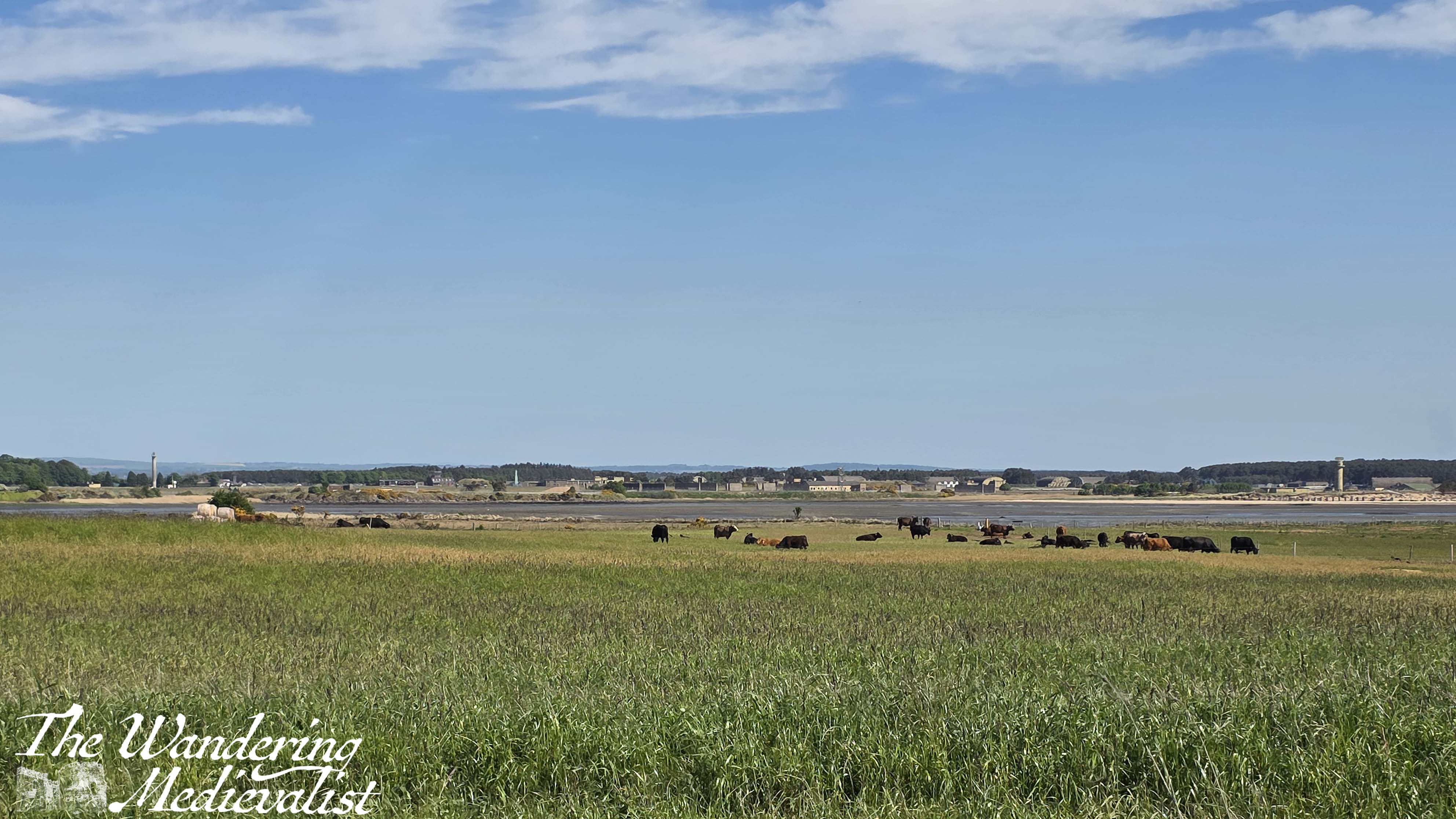
Then, about a mile and a quarter outside of town, the golf course abruptly stops, and the right-hand side of the path opens up to wide fields, those I am so eager to avoid later in the year. A hedge on the left continues to separate the coastal path from the busy A91. A short while longer – I confess I forgot to mark how much further, but probably 5-10 minutes walking – and the hedgerow disappears, replaced by only a stone wall separating walkers from the road.
While you can turn to look back at the town at several points along this path, I confess this is the part I like the least. It is very noisy with constant traffic, and there is not a huge amount to see. At the point where you can feel the path rising slightly and curving around to the right, it is a good time to look back at the steeples of St Andrews, just visible over the tree line. When driving, this is an iconic view of town, and one that even now makes me feel, just a touch, as though I am coming home.
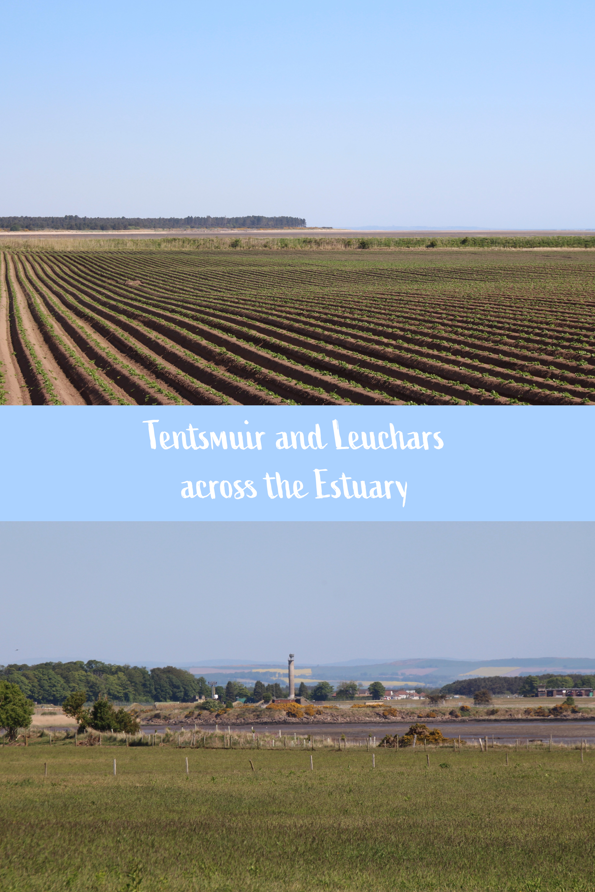
Then, about three miles from St Andrews, the stone wall separating the pavement from the road ends, and the Coastal Path becomes essentially what in the US we would refer to as a sidewalk, running along the road. The traffic on this road should be explained briefly in that this is the primary route into St Andrews from the north (Dundee), as well as traffic coming from further west in Fife, Edinburgh, Glasgow, etc. Busses run along this road to Leuchars station every ten minutes, plus large coaches going to the bigger cities, tourist coaches, and plenty of commuter traffic. When something stops traffic on this road, it takes very little time to build up for miles in all directions, bringing movement even in St Andrews town centre to a halt.
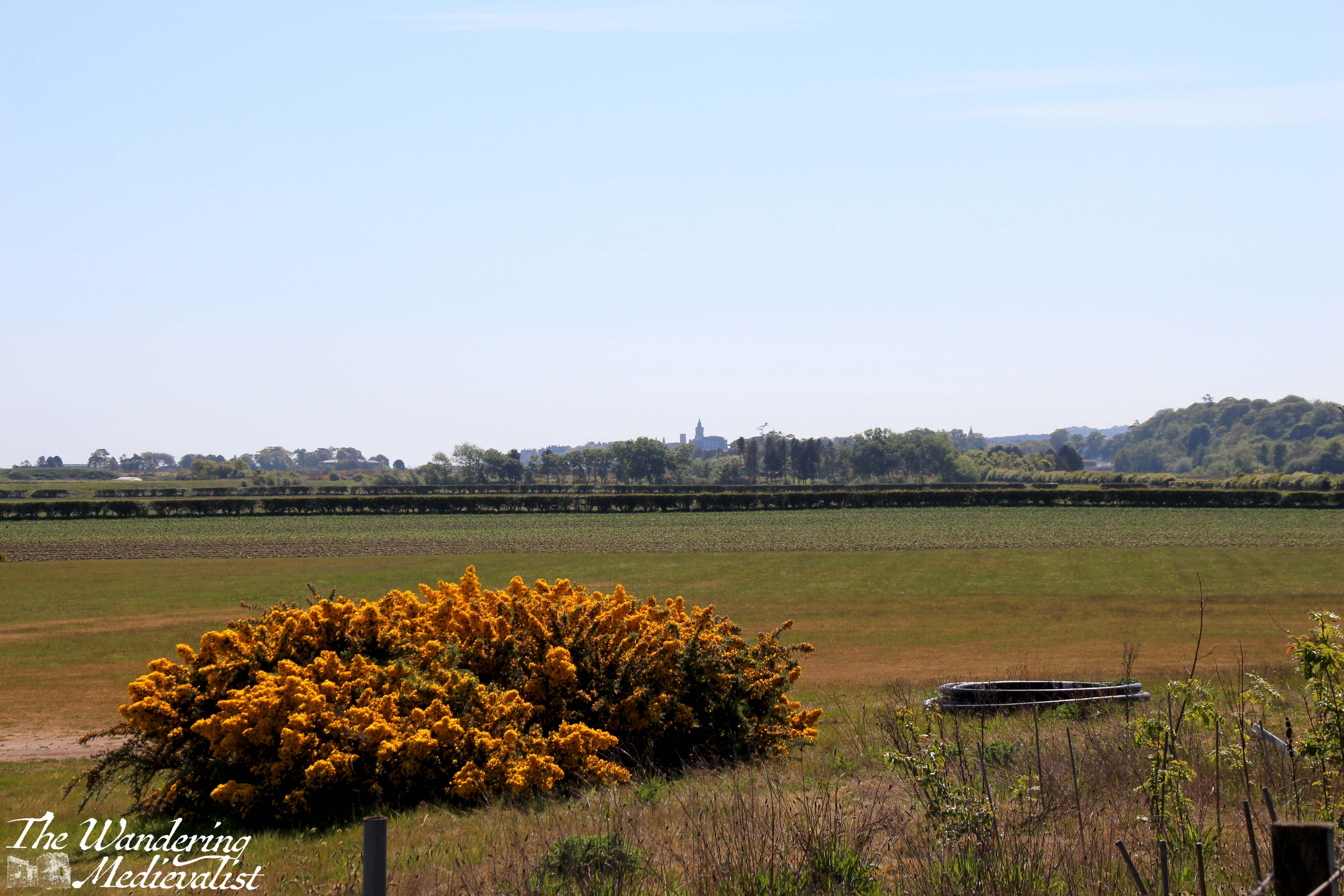
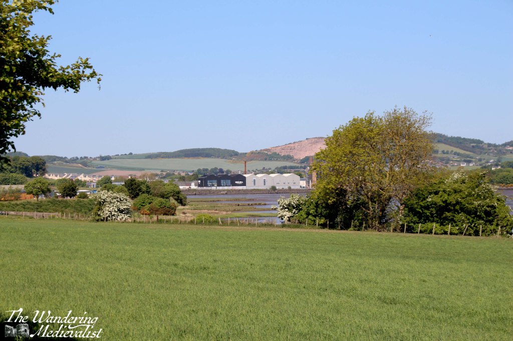
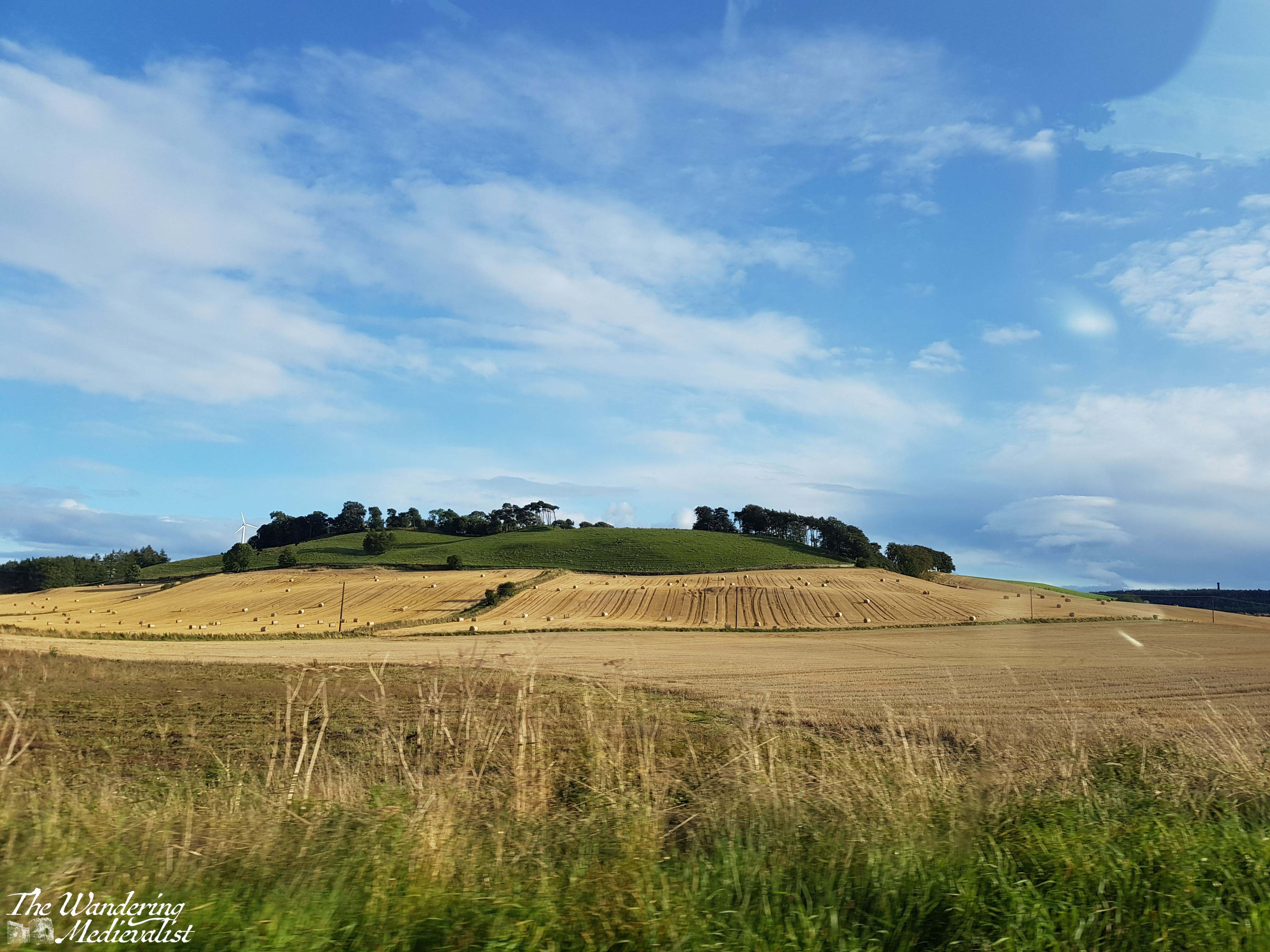
This is also where the view across the fields becomes a bit more interesting, as you can see to Tentsmuir forest and get a good feel for just how big Leuchars Air Base is. Just past the turn-off for Kincaple, you can also start to get a good view straight ahead, with the distant Guardbridge mill buildings just visible, and the lump of Balmullo Law against the horizon. The Law stands out from any other hill by the obvious scar of the Balmullo quarry, a stark brown against the sky.
The path is quite narrow at a few points here, and you have to hope you don’t meet any cyclists, but as the road curves again towards Guardbridge, fields open up to the right along the estuary, along with a few groupings of houses. The hedgerow to the right has a few gaps to allow views across to the mill buildings, now run by Eden Mill, a local distillery.
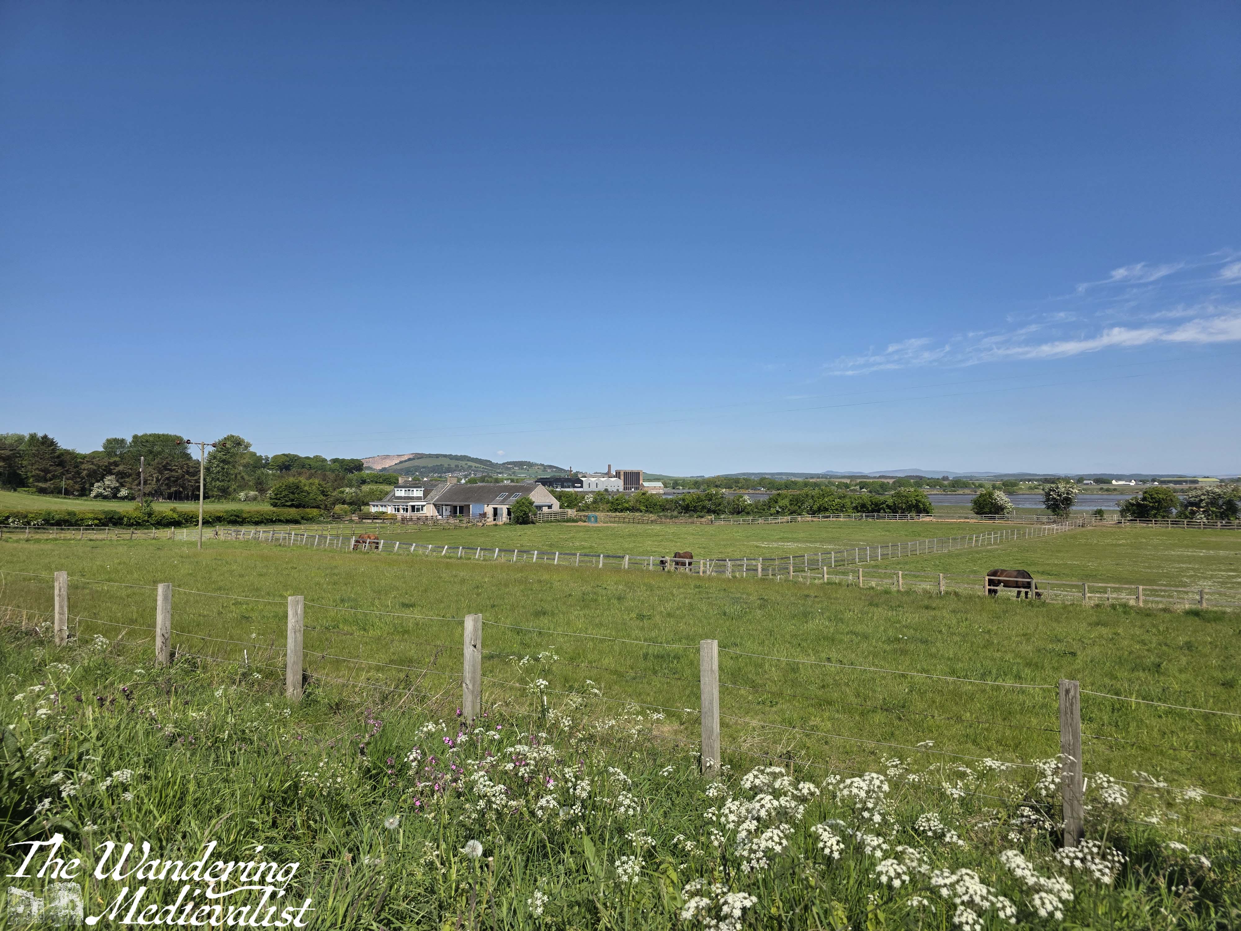
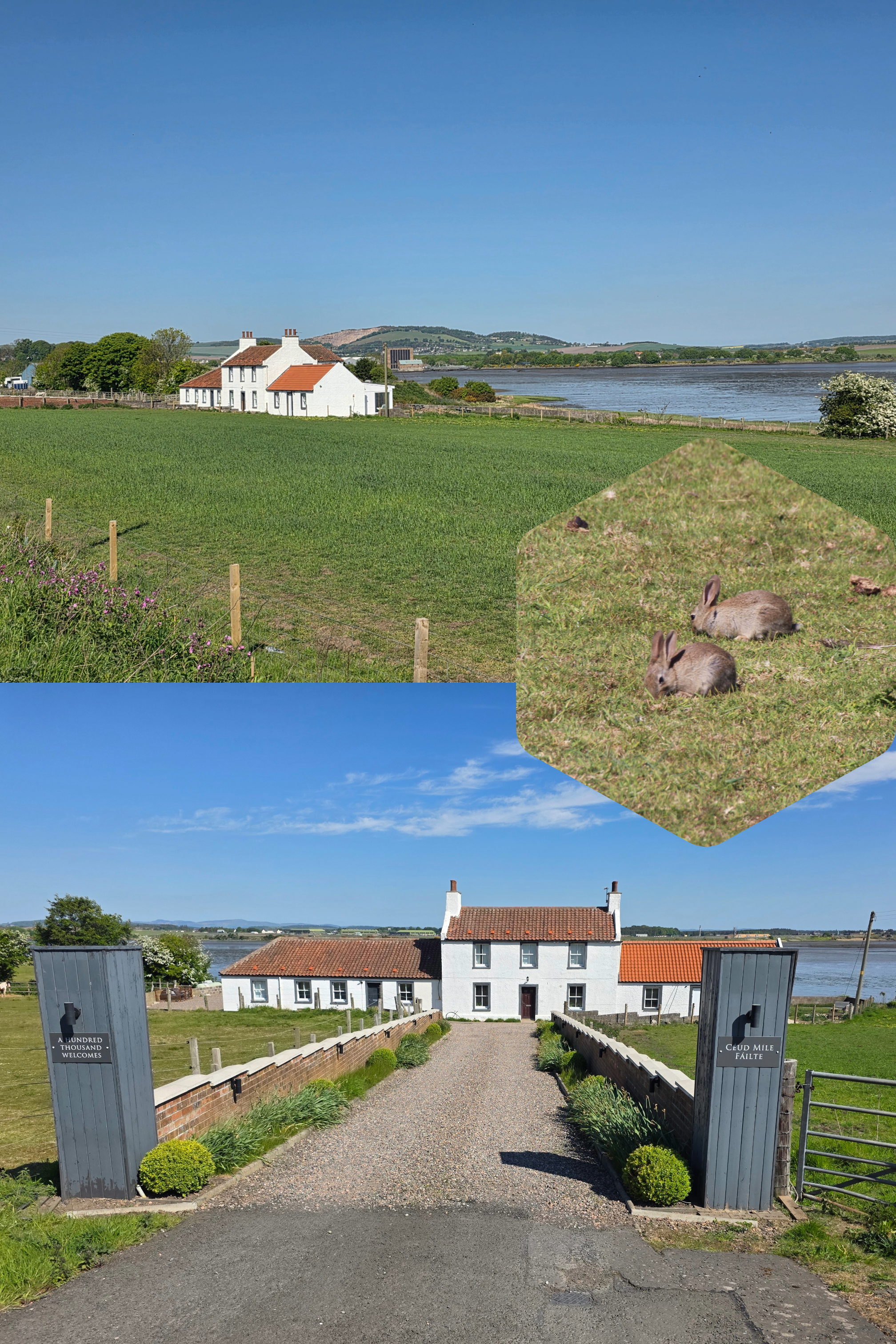
As you approach the village limits, the hedge also vanishes and the path to widens a bit. You will note a beautifully-kept white guest house surrounded by fields in which horses frolic away (and also the occasional bold rabbit).
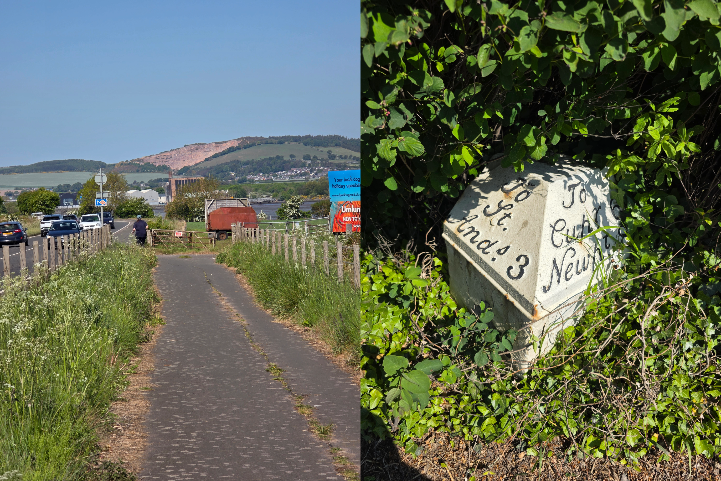
You know you are getting close when you pass Fast’n’Fresh across the road, a sandwich and refreshment spot that would be a good place for a break should you need one. A caveat though in that there is no pedestrian crossing, so you do have to make a bit of a run for it. You’ll also see the road up to Strathkinness here, and shortly after, the Guardbridge town marker.
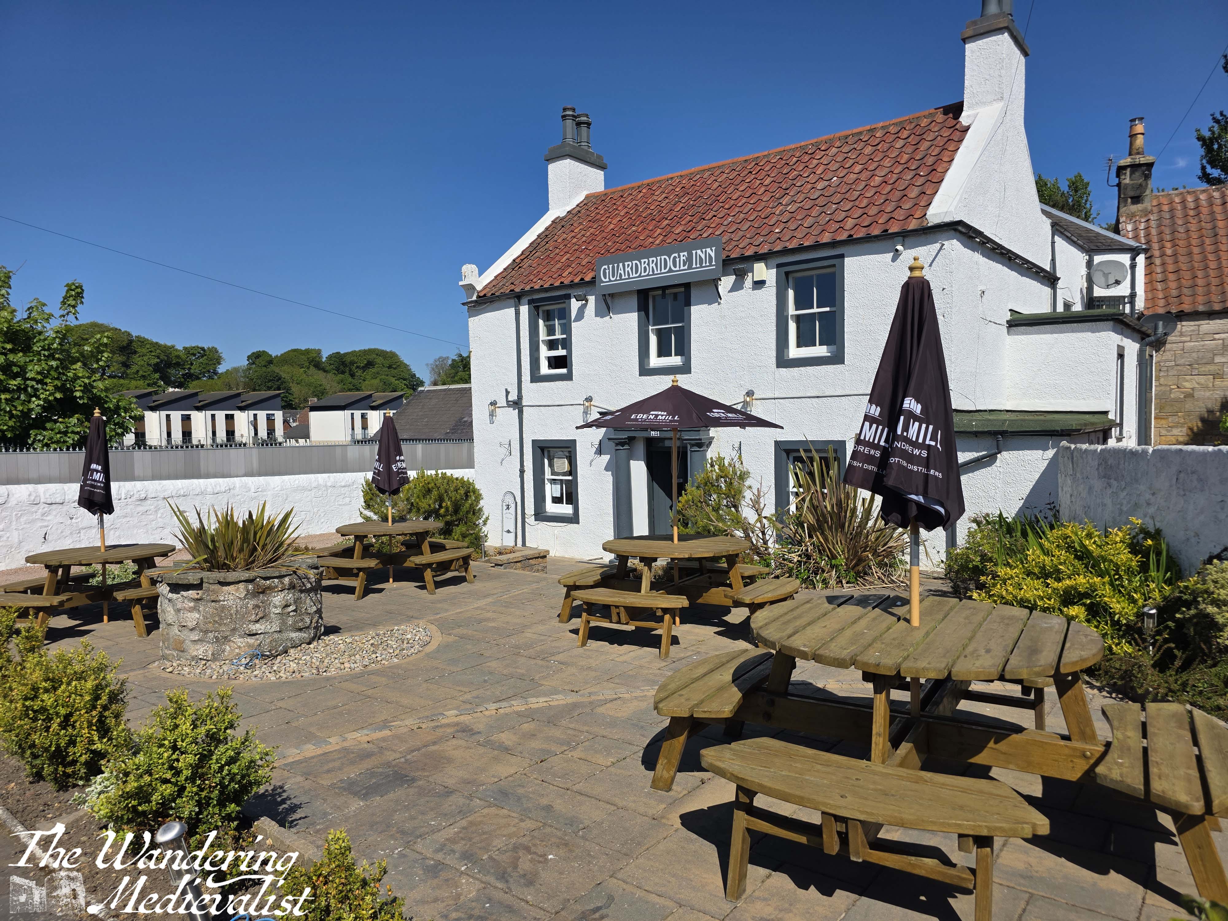
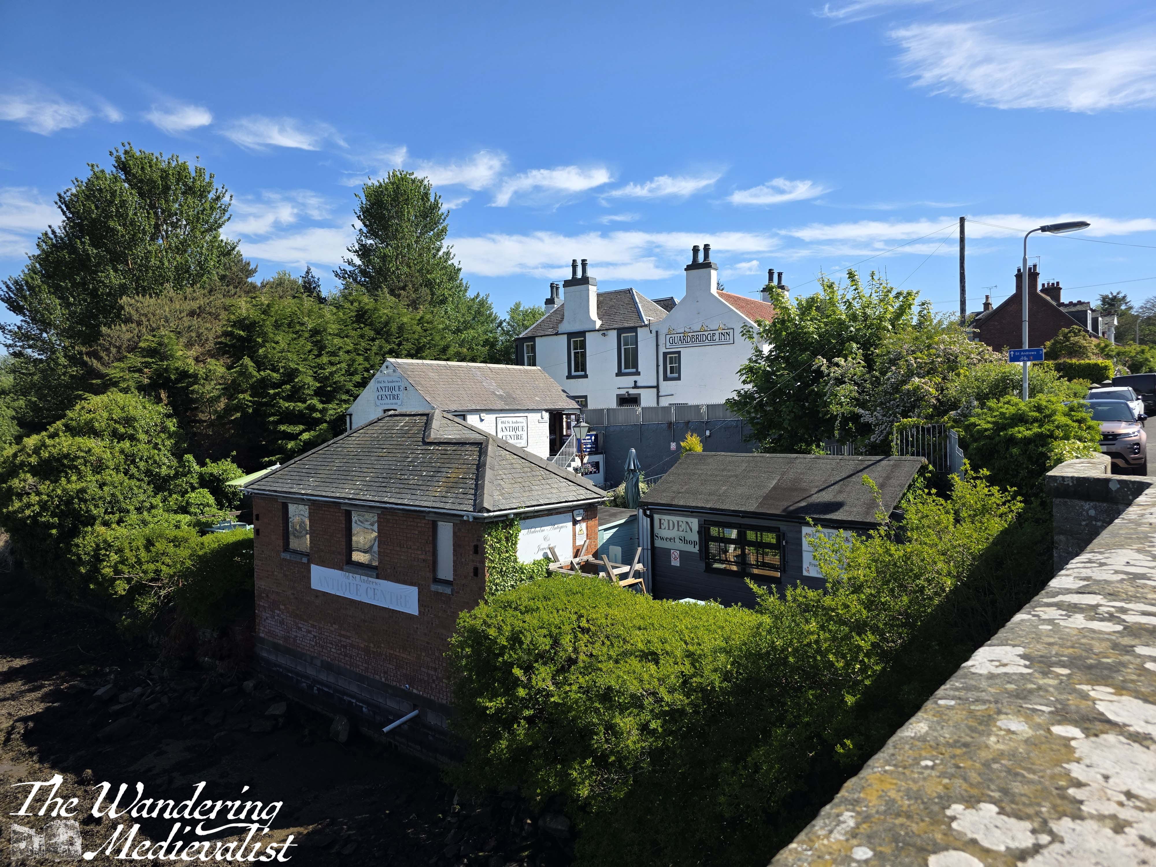
At the crest of the hill at the edge of town, the Coastal Path breaks off from the main pavement and branches right, onto Old St Andrews road. There are some large rubbish and recycling skips here, a few tables, and signs for the Guardbridge Inn.
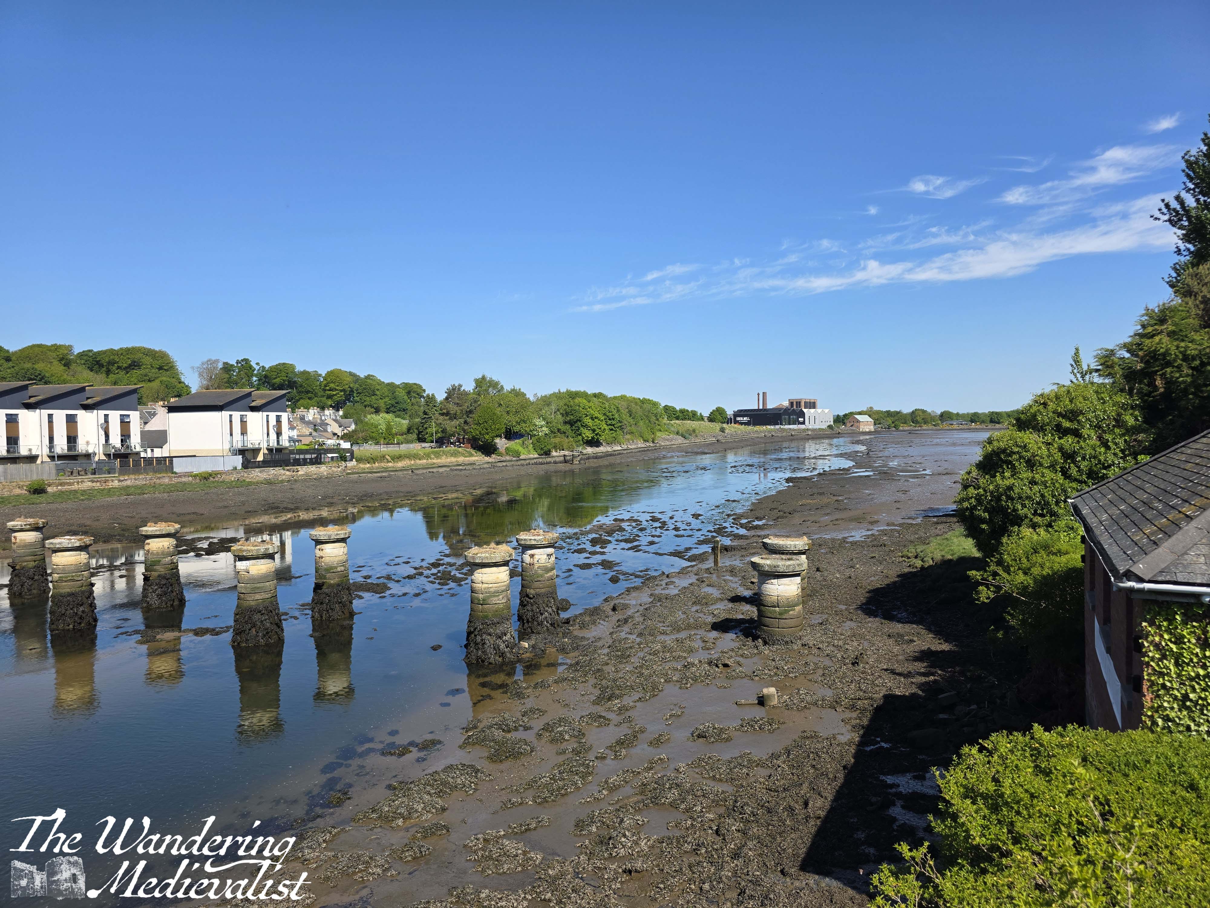
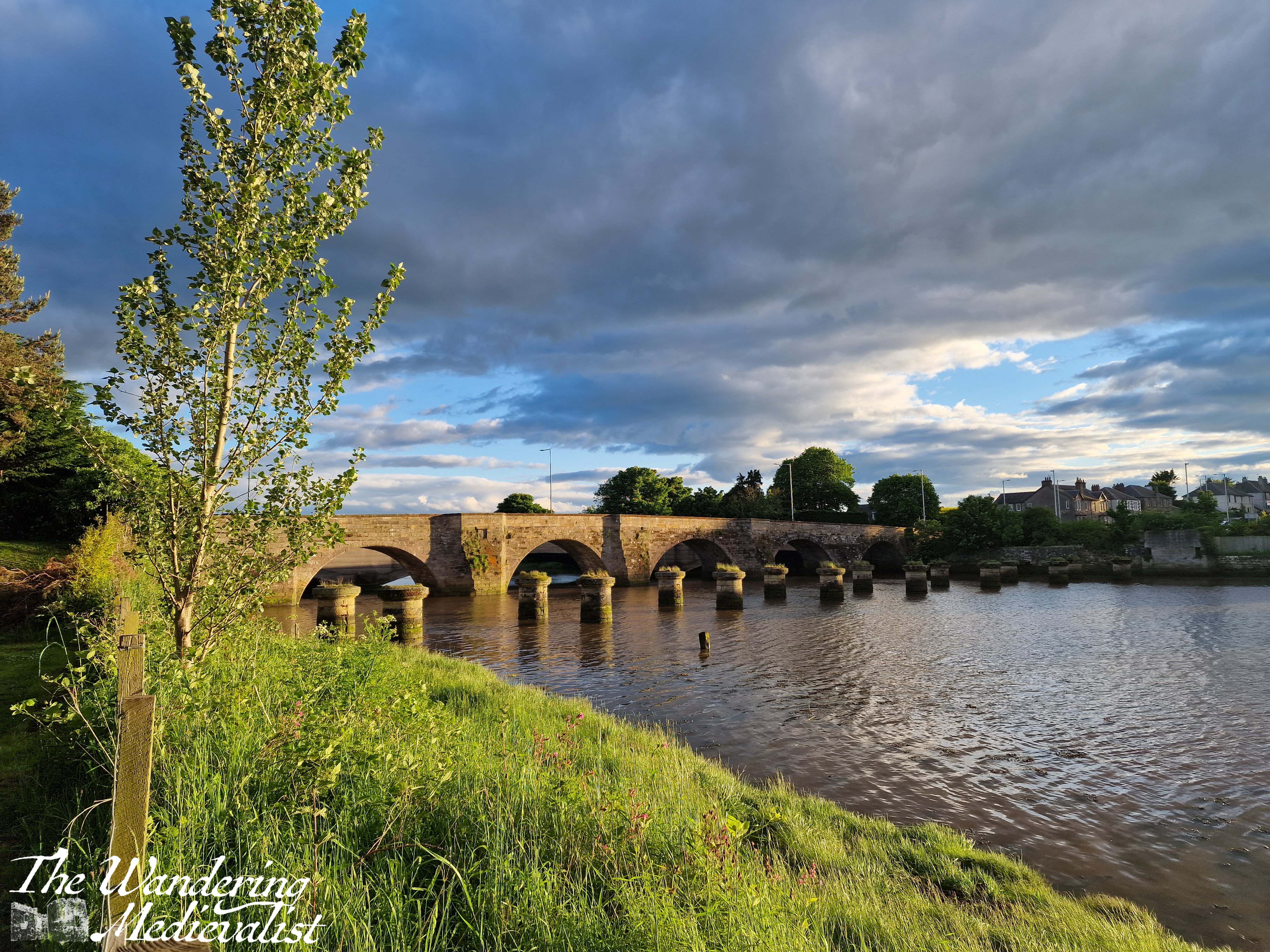
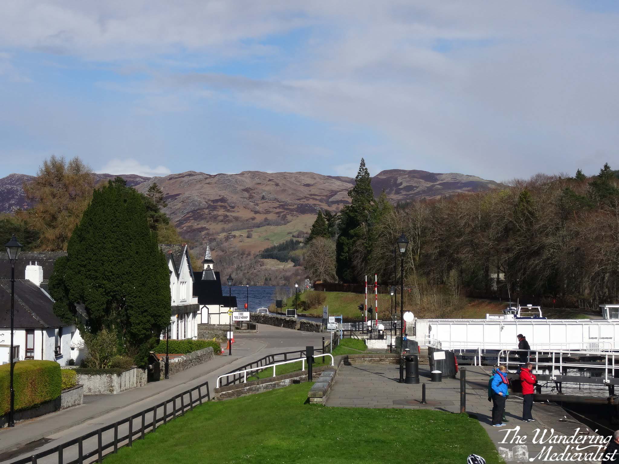
This is the edge of the residential part of Guardbridge, with houses appearing on both sides both quite new and clearly of an older era. At one point, you can look directly down the road, across the bridge, and up Cupar Road on the other side of town. It is worth observing at this point that this route follows what was once a train line into St Andrews. There is a small local element looking to reinstate the line – which closed in 1969 – but much of the route is now golf course and fields, also residential.
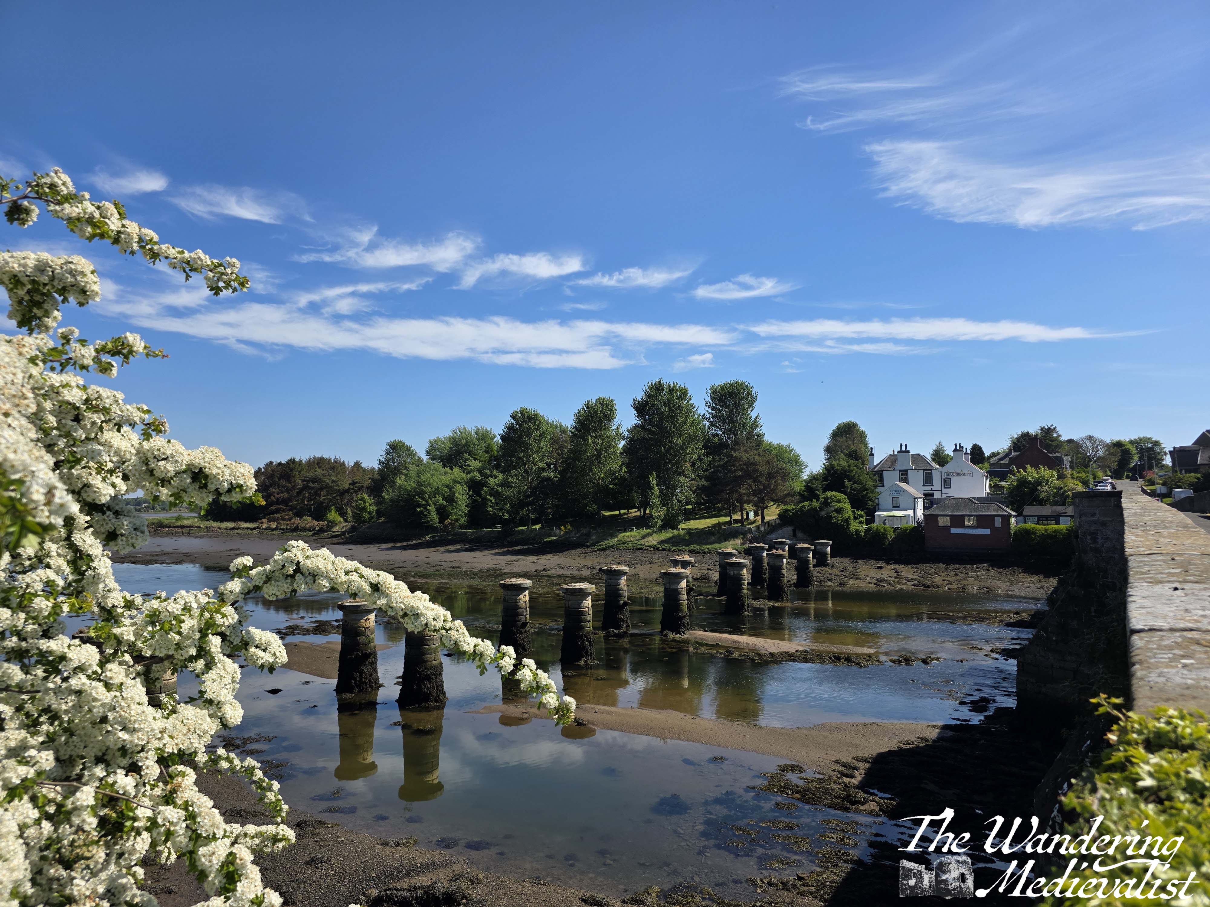
Both this bridge, the pylons in the Estuary, and the north bridge at the end of this walk are evidence of the former train line, and the required alternative bridges for road traffic. The bridge that pedestrians now cross on the Coastal Path is either or was once where there was a medieval bridge, build in the 1400s by Bishop Wardlaw of St Andrews.
At the bottom of the hill, just before the bridge, is the Guardbridge Inn, a fantastic place for dinner or just a few pints with friends. They offer tables out front as well as in a grassy area along the estuary at the back; this was one of the first places we enjoyed a drink after the pandemic lockdown, when we could all sit outside and enjoy the sun and social distancing. The chef is excellent and the building itself is lovely, though I am not sure of its age.
By all means, schedule a stop here if you can! Or, at the small coffee shop and antique store below, which I admit I have never frequented but about which I have heard good things.
Continuing on from the Inn, the coastal path crosses the old bridge, which I have always preferred at high tide, and which you can get an excellent feel of from the Inn, and from the far side of the bridge.
The bridges both end at the main Guardbridge roundabout – another popular spot to hold up traffic – which unfortunately you must cross at this point, heading for a break in houses on the far side of the road.
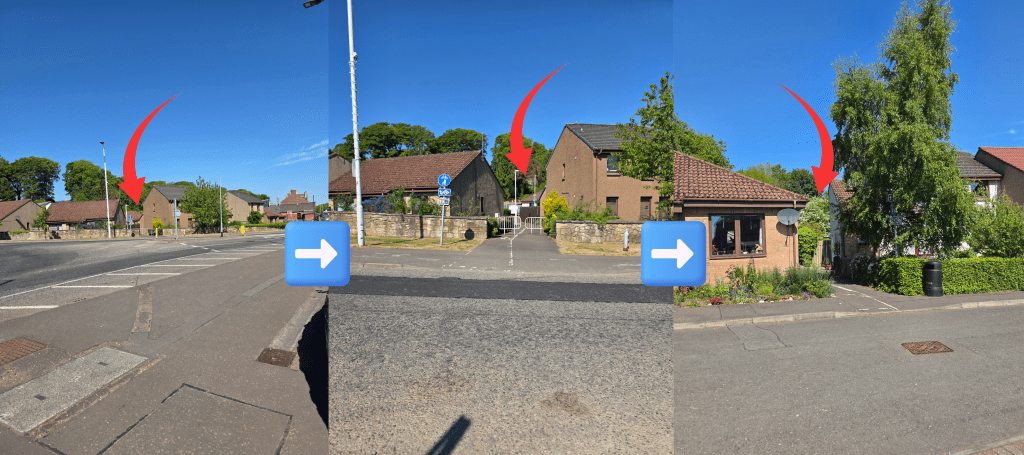
In theory at this point there are two paths through Guardbridge, one along the main road which allows you to get refreshment at Dan’s Goods (a small convenience store), detour through the park and even the University’s Eden Campus. But, the official Coastal Path takes a route behind the main residential section, with back gardens to the right and a hill leading up to the left. Once you cross at the roundabout, follow the signs between the houses, and then cross the small parking area to another gap between gardens. Here the path is again beneath the trees – a relief after a sunny stretch – following the former rail line; it is quite well-marked. On that hill stretching up to the left is the Seggie estate, which was a farm but is now a large housing estate that has been built over the past few years, adding several hundred homes to the village. For a longer walk, you could go up Cupar Road and walk through the estate, where there is a walking path through some tall trees allowing a view over the university campus and the estuary beyond.
About five minutes along the path, the houses disappear and there is a wide open space where a condemned rail storage building was torn down. It has been vacant for some time, and there is great supposition as to what might be constructed there.
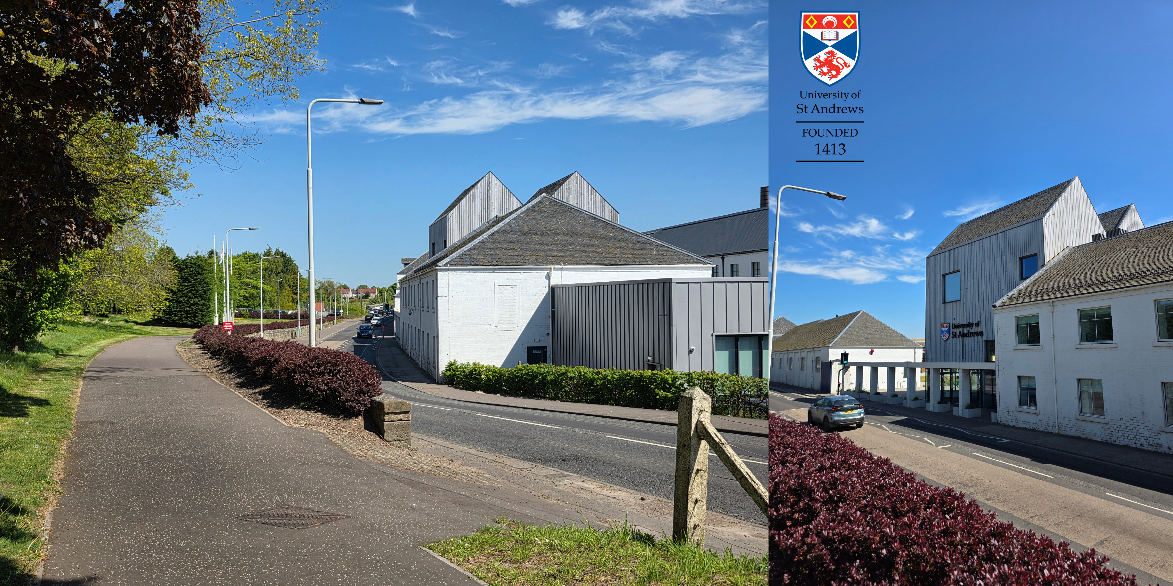
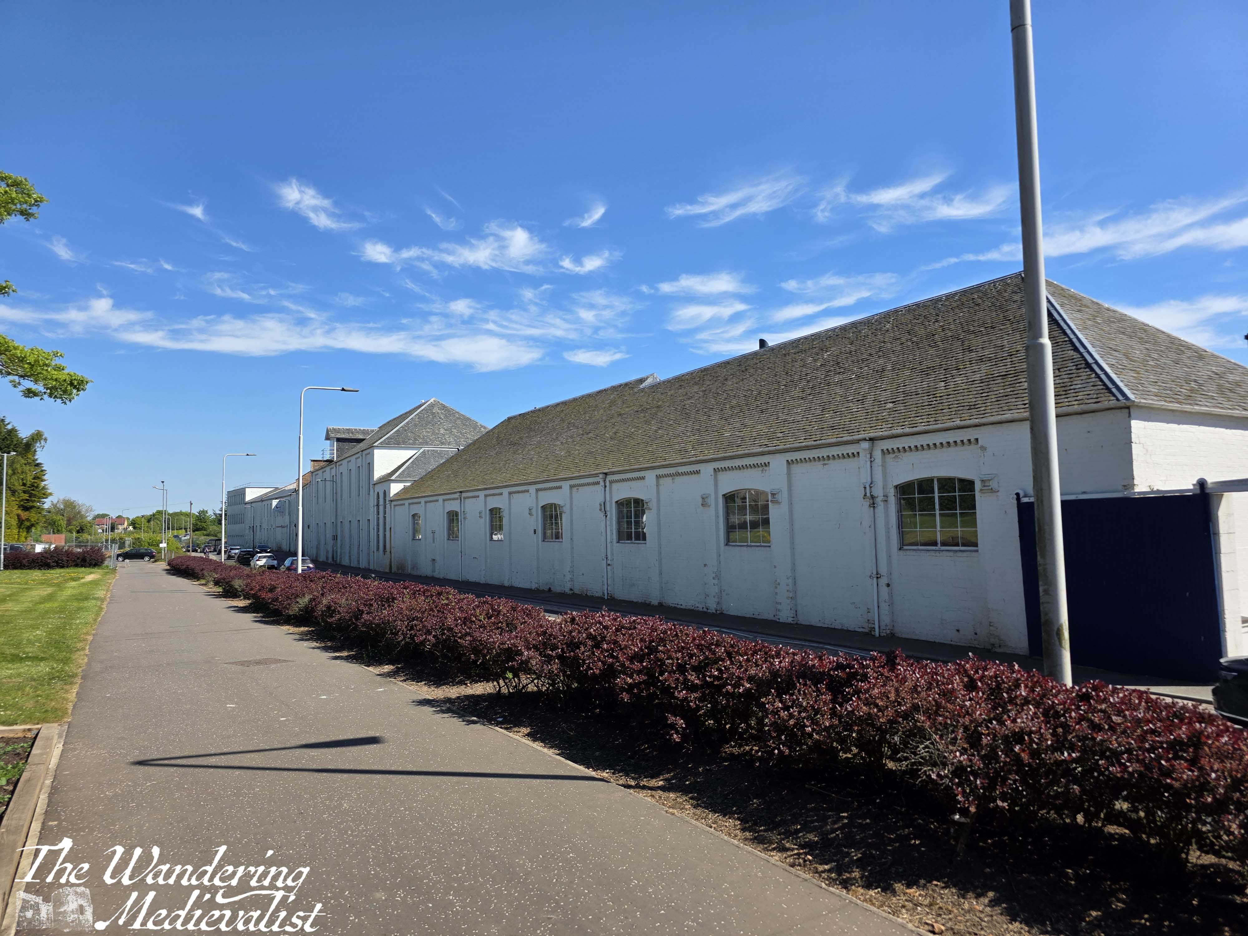
On the other side of the road from here until the end of this stretch is the Eden Campus, which was built by the University of St Andrews in the late 2010s and opened for staff use at the end of the pandemic. When I first arrived in St Andrews many years ago, the buildings still housed Curtis Fine Paper. They were originally built in the 1870s as the Guardbridge Paper Company. The town grew up around the mill, which employed more than 600 people in the 1950s. Many of the original elements of the mill remain today including what were wide doors for horse-drawn wagons to enter, and the Guardbridge clock that overhangs – almost – the road. The University was careful to maintain as much of the original feel of the mill as they could when they built Eden Campus, which is a wide open-plan area with an industrial feel to it. They have won several awards for their success.
Seggie Drive joins the main road just across from the University, and from here on the path is raised slightly away from the road, which is considerably safer. Again, though the speed limit is 30 MPH here, traffic is often moving quickly around an almost blind corner.
The end of this section of the walk is where I started a few months ago, at the north bridge in Guardbridge, the far end of town. As you can see there are some lovely spots that you pass on this walk, though it is also far less rustic than further south. It was the first walk where I really noticed a difference in my stamina, which I hope can continue! But I’m off on travels again soon, so we shall see.
For many people, January is the worst month of the year. In the northern hemisphere anyway it can be cold and dark, one is often short of money after the holiday season, early January means back to work (if you have been fortunate enough to have the season off) and there is a societal pressure to better or reinvent yourself.
But, I think January has some good aspects, too: you are getting back to a routine after an often hectic holiday period (hey, I like routine); days are getting longer so that by the end of the month you can really see that it is lighter; I like winter snow when it comes, but most of all, the LIGHT.
There can be some truly gorgeous light in late December and January, either on a crisp cold blue winter day or when the long shadows of the golden hour last for two or three. I have often been fortunate enough to get a chunk of time off in January, which is another perk.
This January has not been a particular exciting month and there have not been any huge adventures, but I have managed a few lovely day trips. I was pleasantly surprised, when looking through my camera, that I have managed to capture some really beautiful scenes that I wanted to share, if nothing else to cheer up this January which for many has been even harder than others.
New Years Day
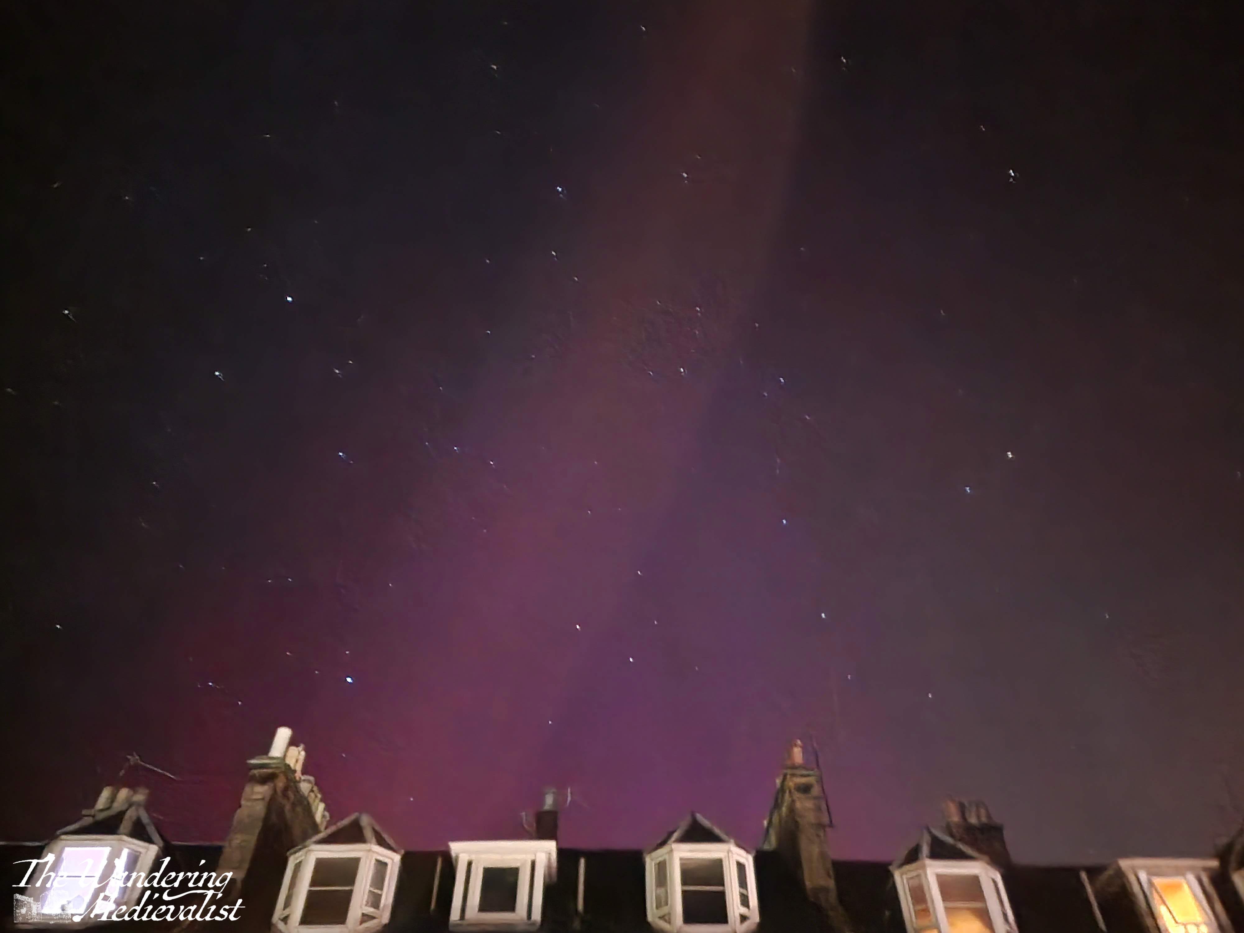
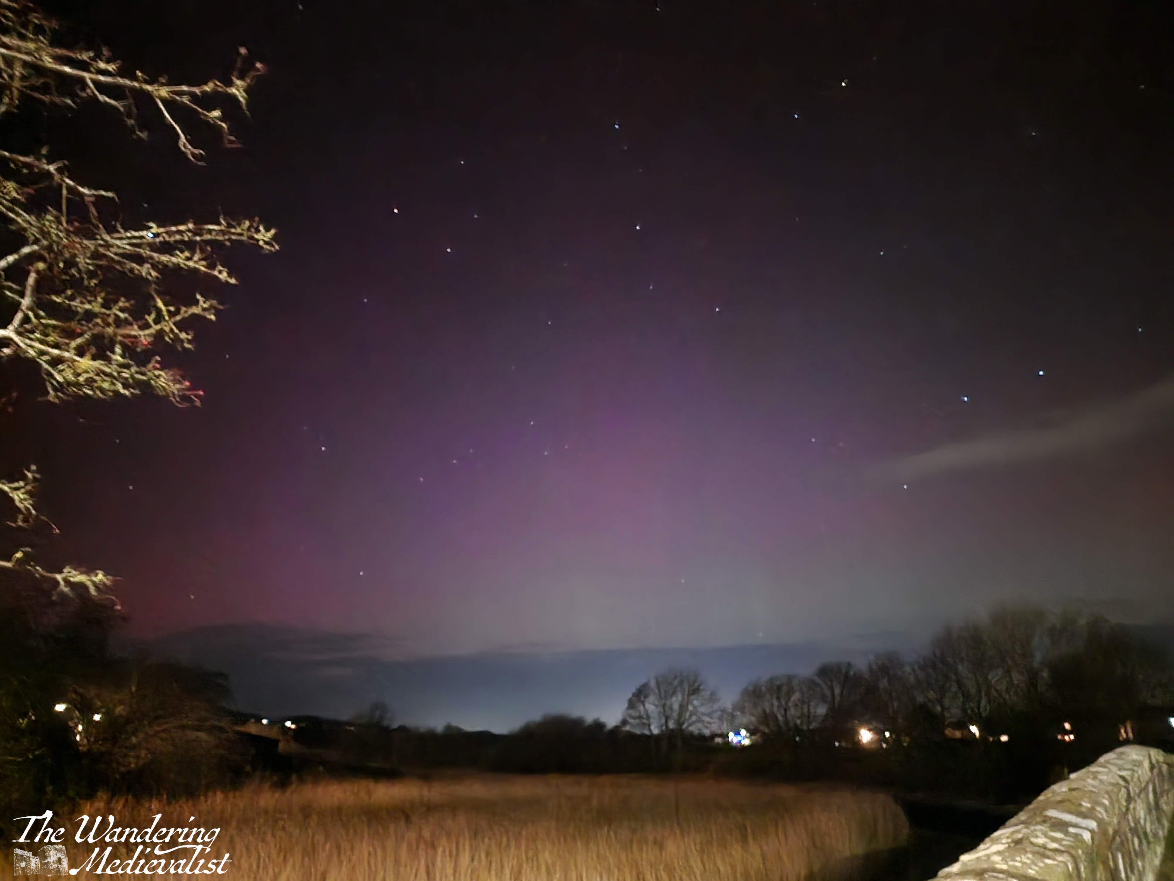
We were fortunate enough to spend New Years Eve with some good friends, and on New Years Day we had a lazy, quiet day playing games. By dinner time we were all in pyjamas or slouchy clothes, and there was a comedic scramble for coats when a WhatsApp came in stating that the aurora had been seen nearby. Sure enough, the reliable aurora tracker website was high red, and so we dashed outdoors to see what we could see. We were unfortunately a touch late for the best of the colour, but I managed a few good images (this has been my dream ever since we missed the extreme colours back in May). The rumour is that there will be lots of opportunity to see the aurora this year, and I will be consistently on high alert!
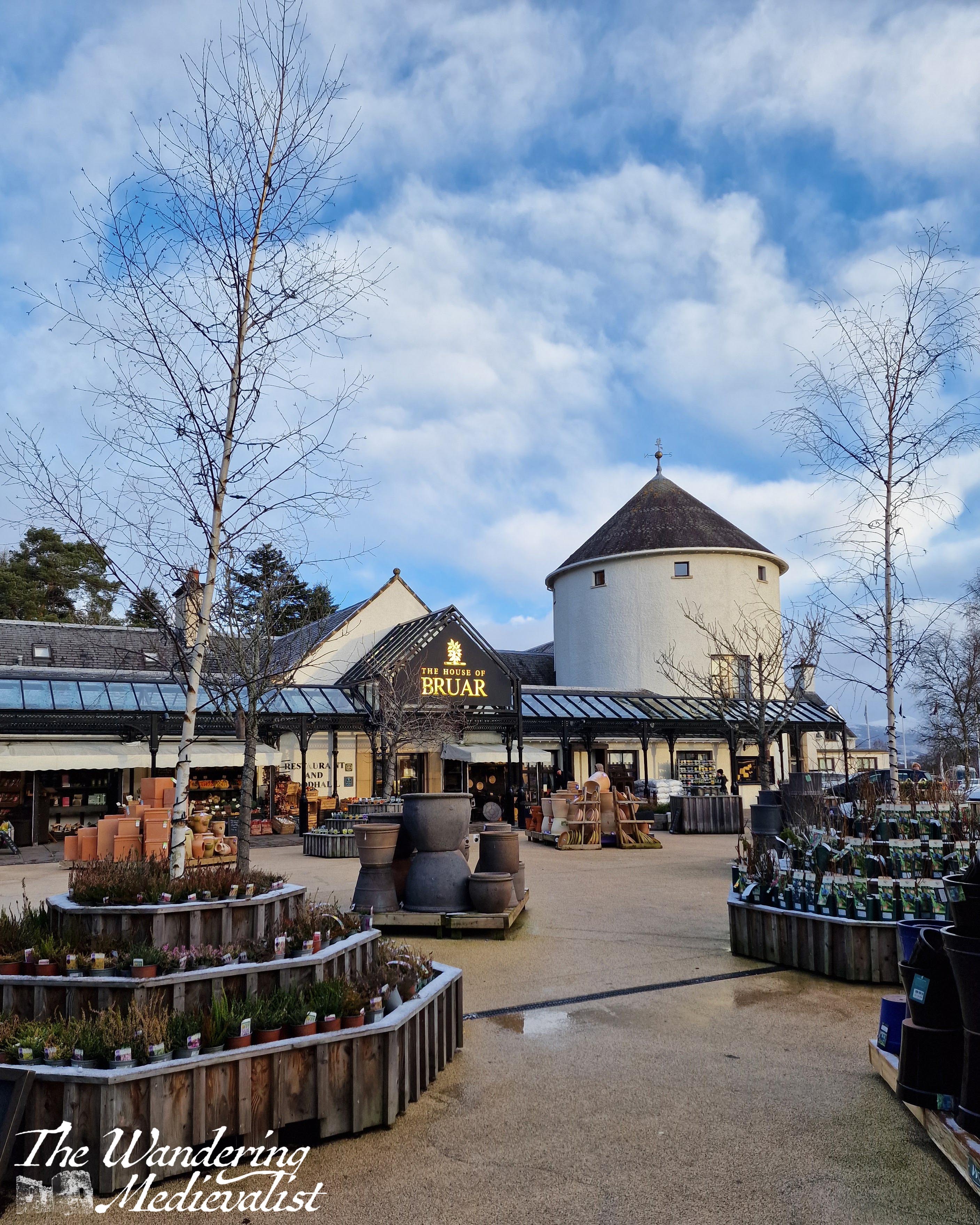
House of Bruar trip
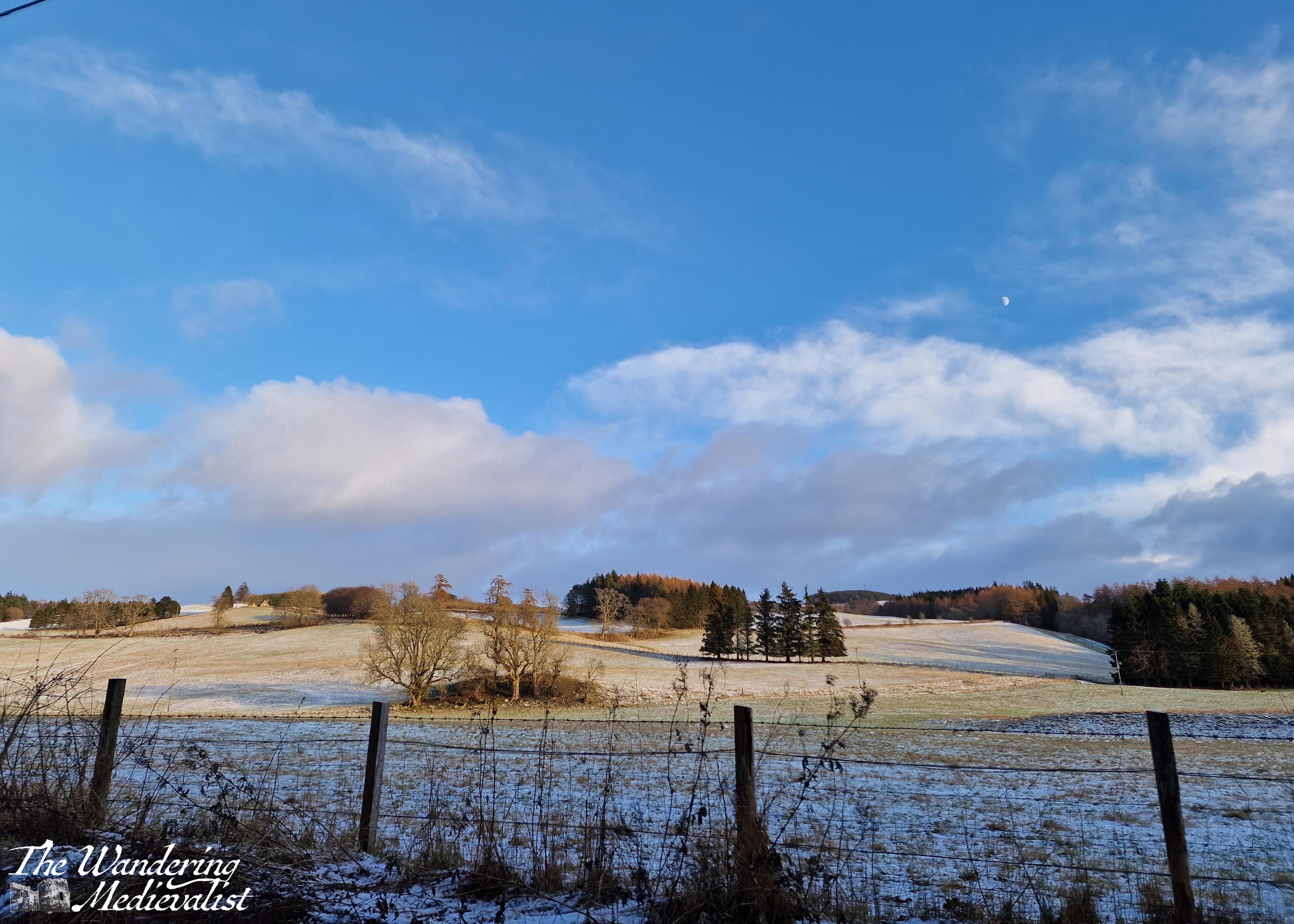
Whenever Mum visits, we must make the time to visit the House of Bruar. We managed to visit on a cold quiet day when the food hall and shops were even quieter than normal. While Mum browsed the woollens, I took a short walk around the edge of the grounds.
On our way home, I took us the back route through Blair Atholl, where we experienced a proper Scottish winter day – a dusting of snow, and beautiful blue sky.
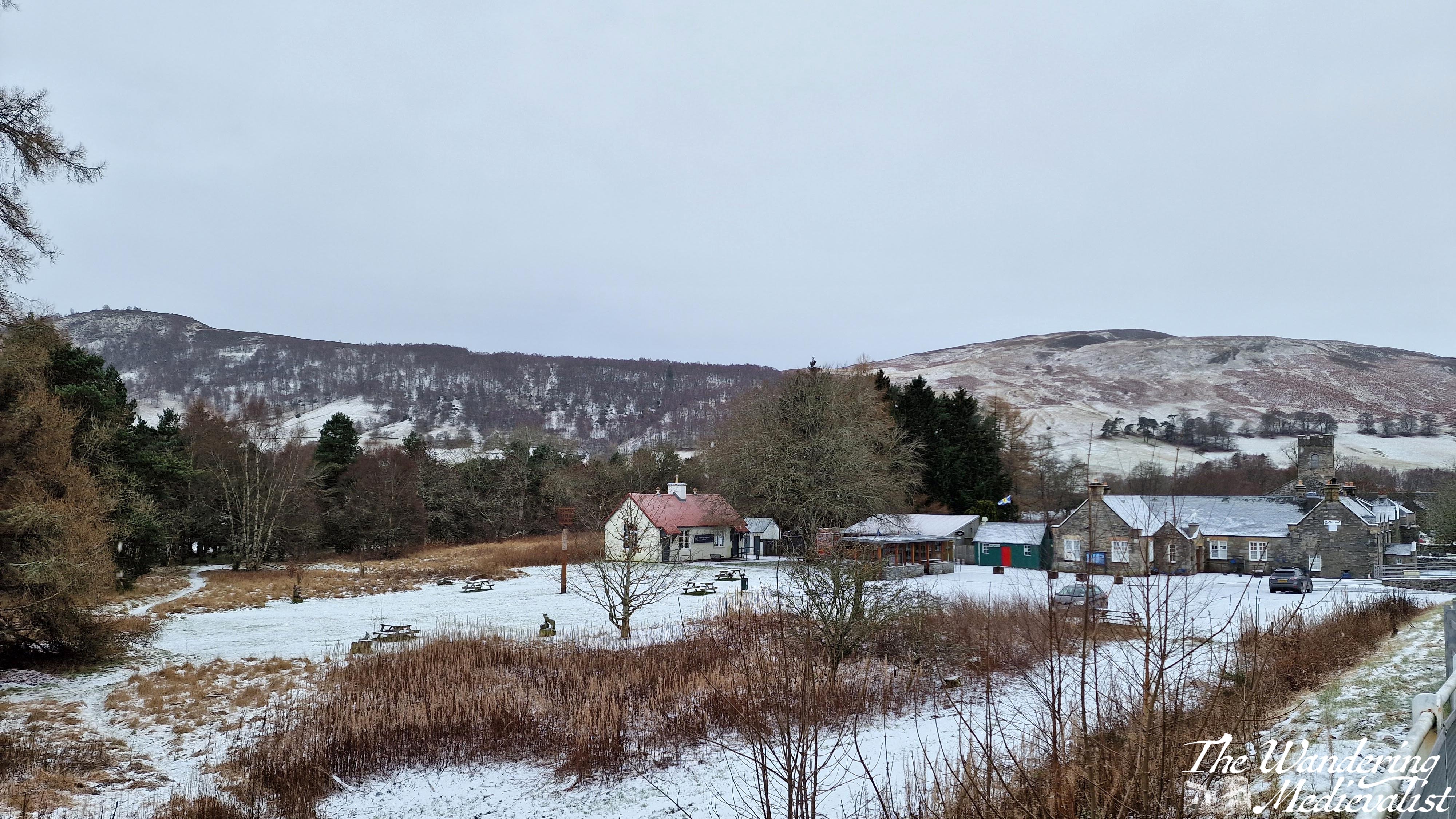
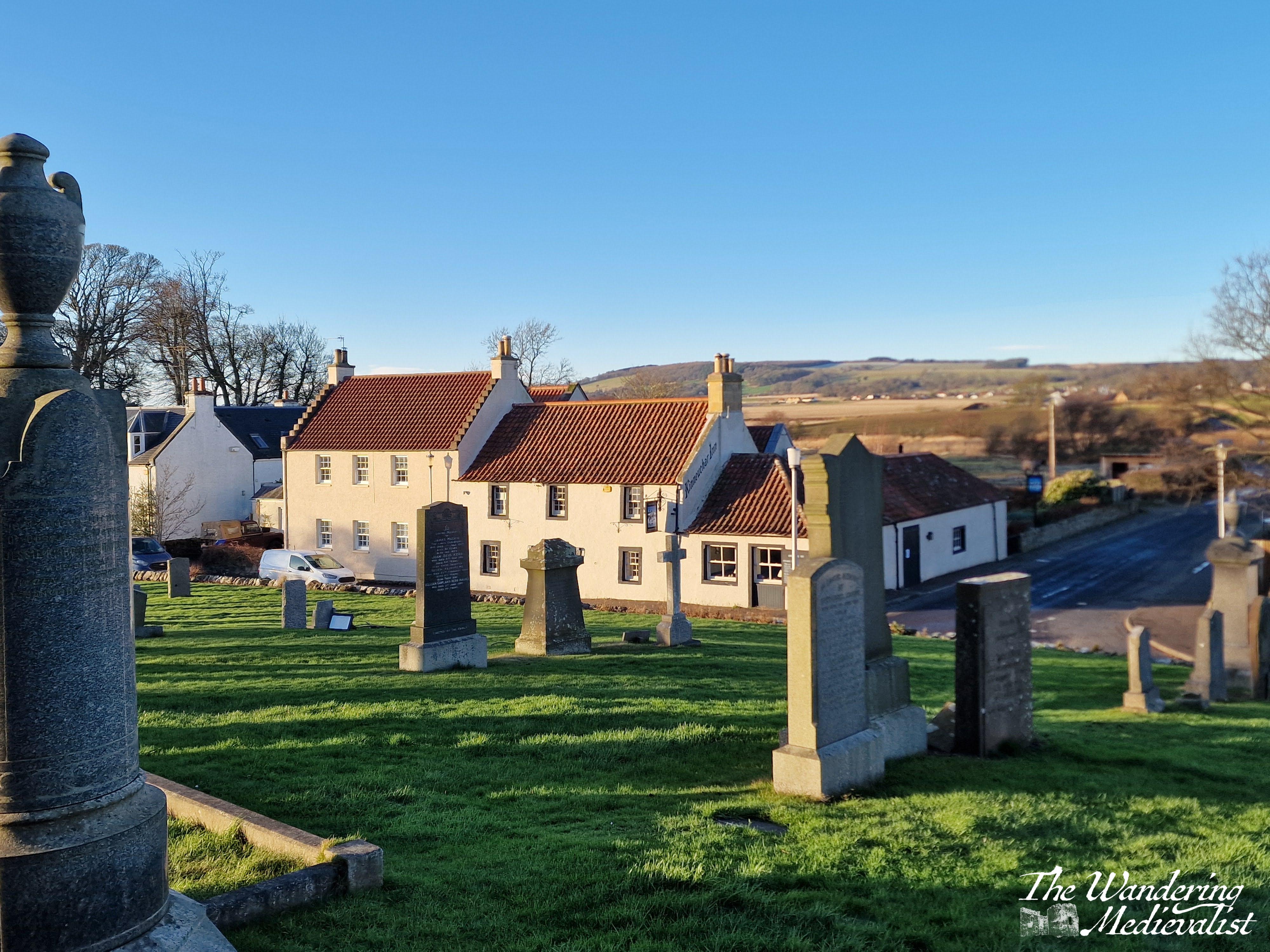
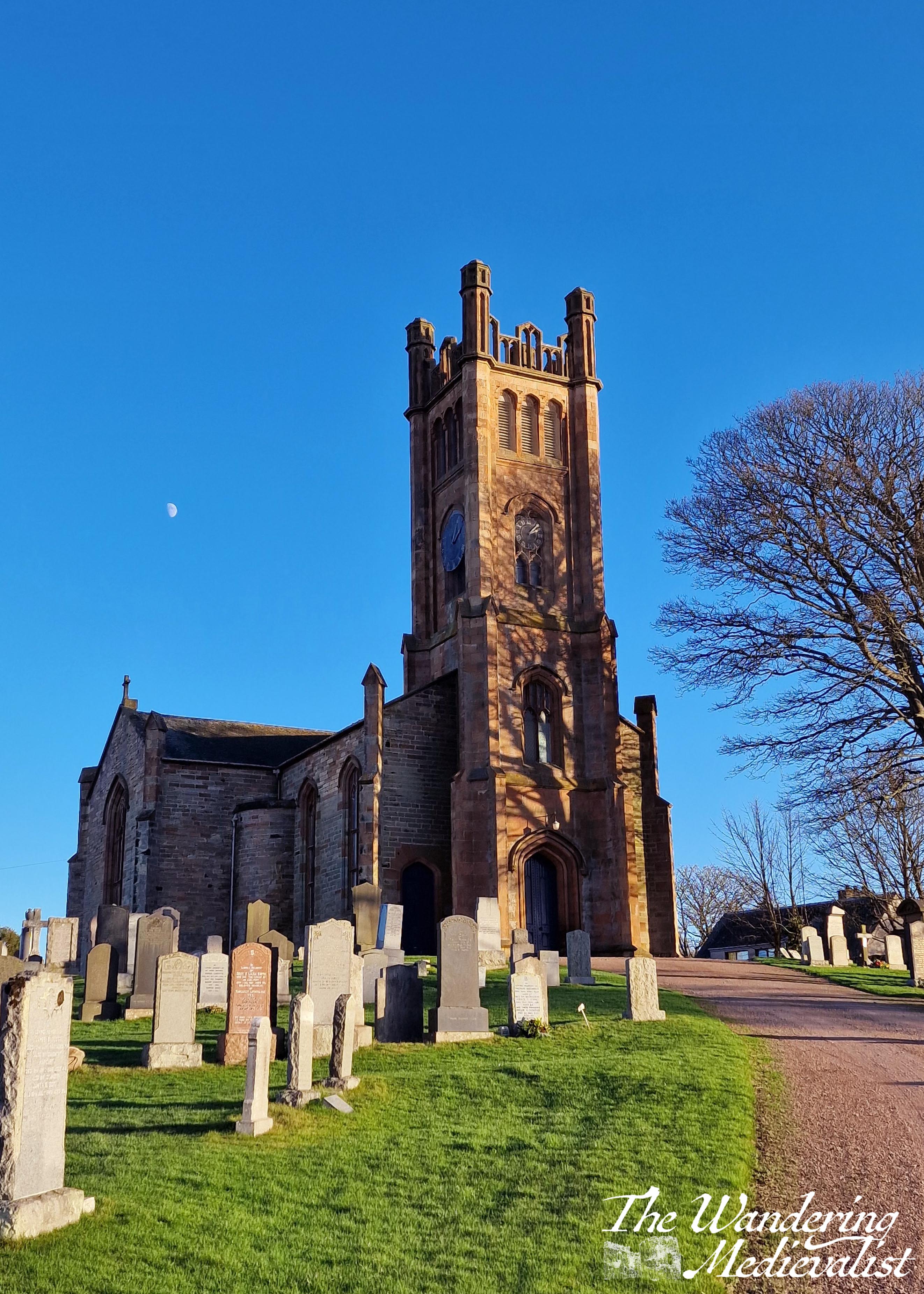
Kilconquhar
A glorious Scottish name, this village is pronounced locally as ‘Kinucker’, with the soft ‘ch’ sound rather than a hard ‘ck’, and a short ‘u’ like in luck. It is a town I love to drive through while taking visitors on a loop down through the East Neuk of Fife, visiting Elie, St Monans, Pittenweem, Anstruther and Crail. On this trip we paused briefly to explore the lovely local parish church which sits on a hill at the edge of the village. This current church is about 200 years old, but behind it are the ruins of the medieval version.
As is often the case this close to the solstice, the moon was out during the day, highlighted against the blue sky.
Loch Leven
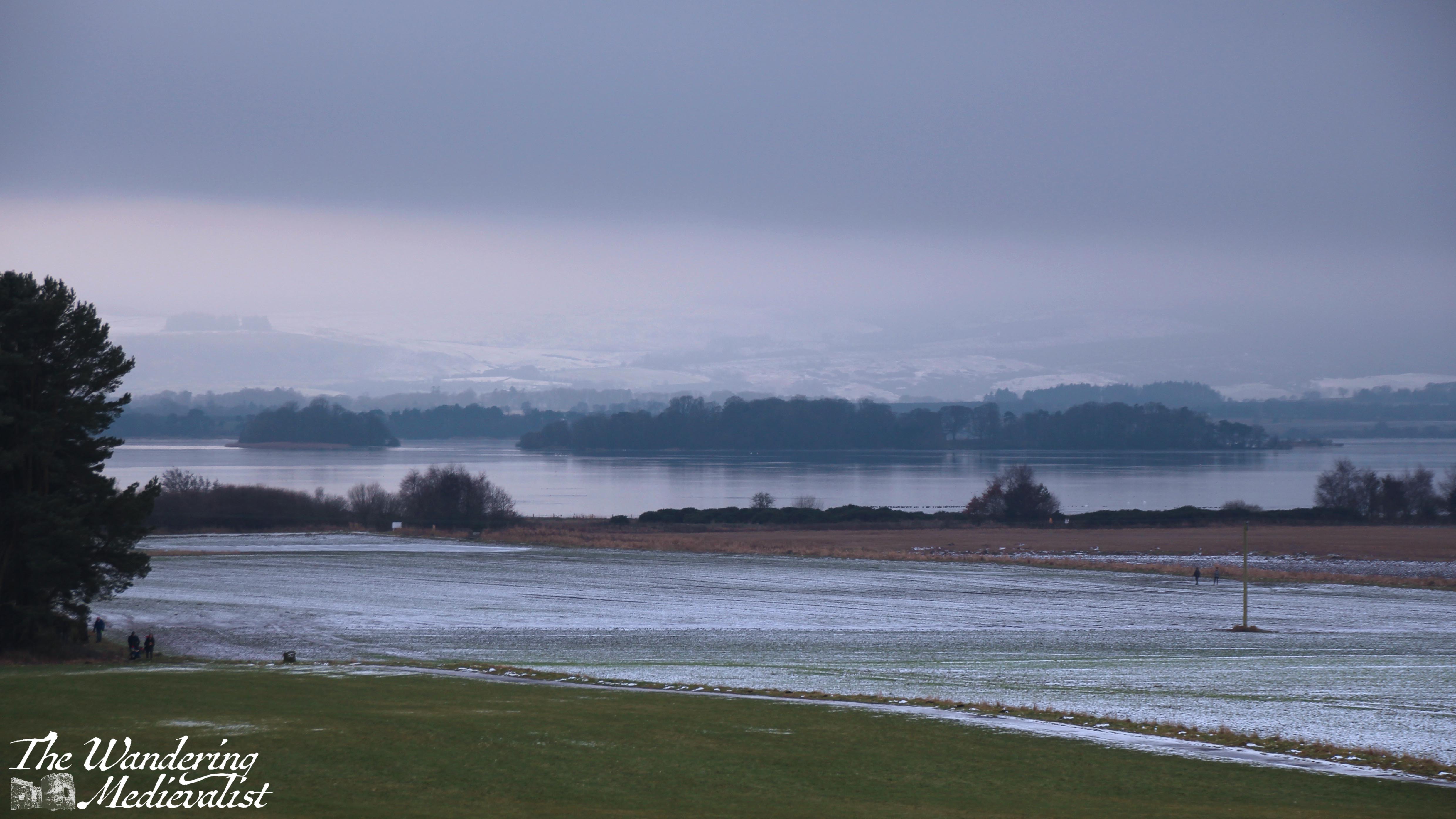
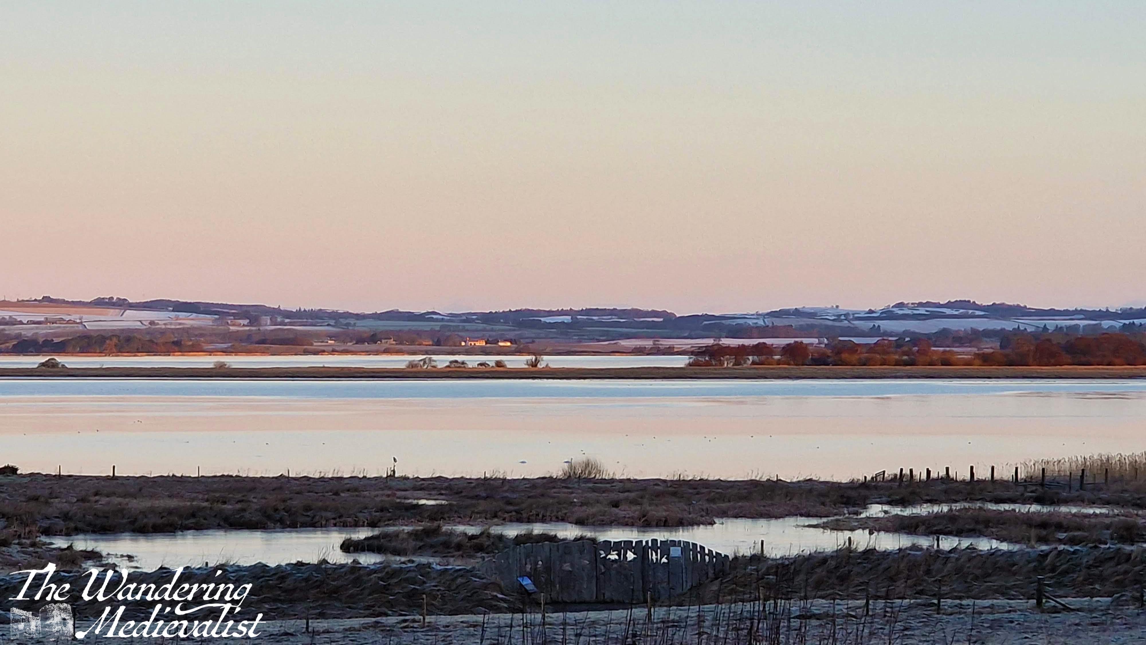
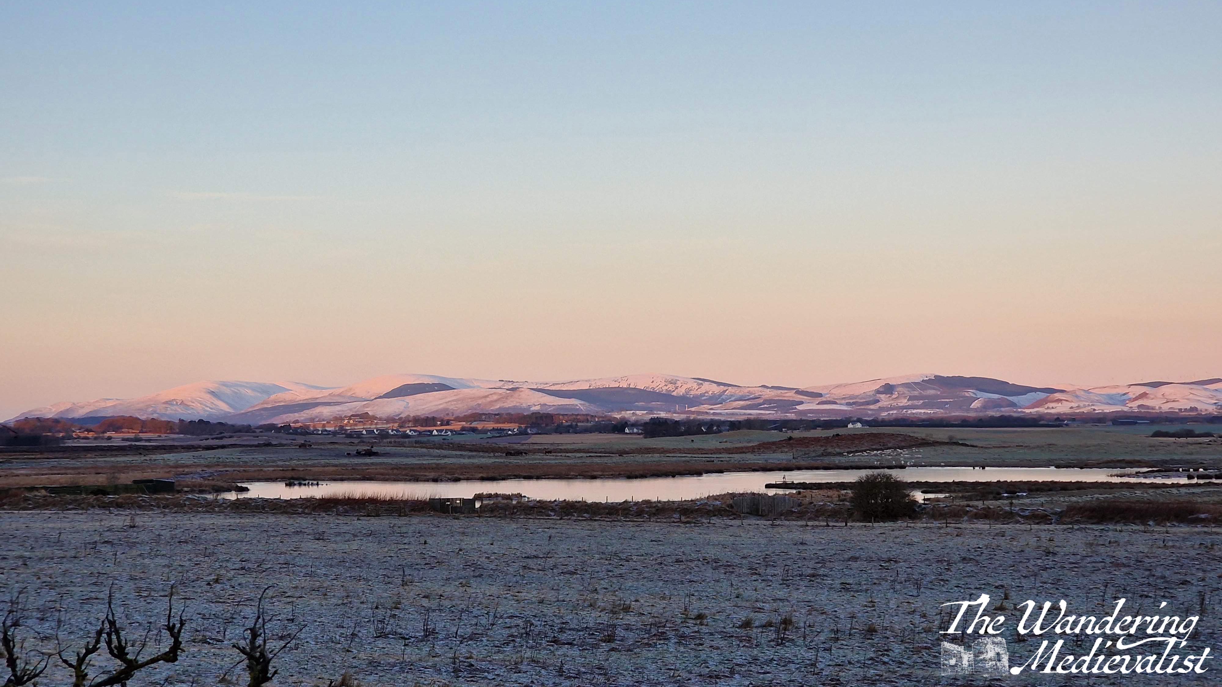
There are two primary routes that one can take from east Fife to Edinburgh. For whatever reason, I have always preferred to go straight west across the A91, driving through the villages of Auchtermuchty and Gateside before joining the motorway south. Many opt instead to go through Glenrothes on the larger A92, but according to Google, there is very little difference in time. And, my route is more aesthetically pleasing, taking in the Fife countryside as well as a view out over Loch Leven. After dropping Mum for her early morning flight, I found myself returning home on a very cold (-6°C) morning with a gorgeous pink sunrise. I could not help stopping alongside the loch for a picture or two, and made the other half come back with me that weekend for a frosty, foggy walk at Loch Leven’s Larder.
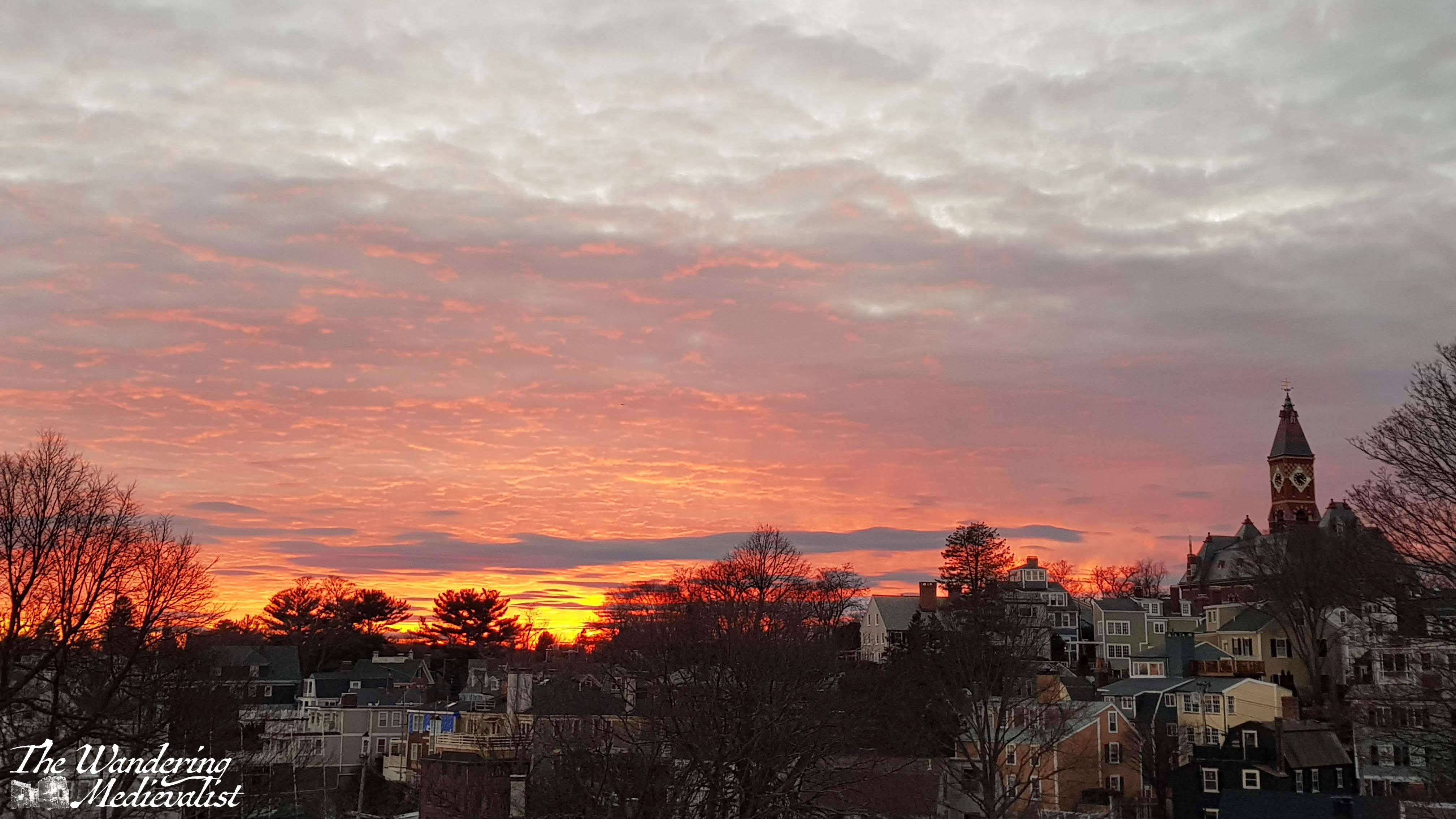
St Andrews morning walk
A few weeks ago I had an early morning appointment in St Andrews, and used the opportunity to take in some of my favourite haunts in that beautiful time of the morning when the sun is just up and casting a pink and later golden glow.
Back to work – Dundee
Getting back to work in January after a few weeks away inevitably brings on a touch of excitement and a touch of anxiety – what will the new year bring? What have I missed during my weeks off?
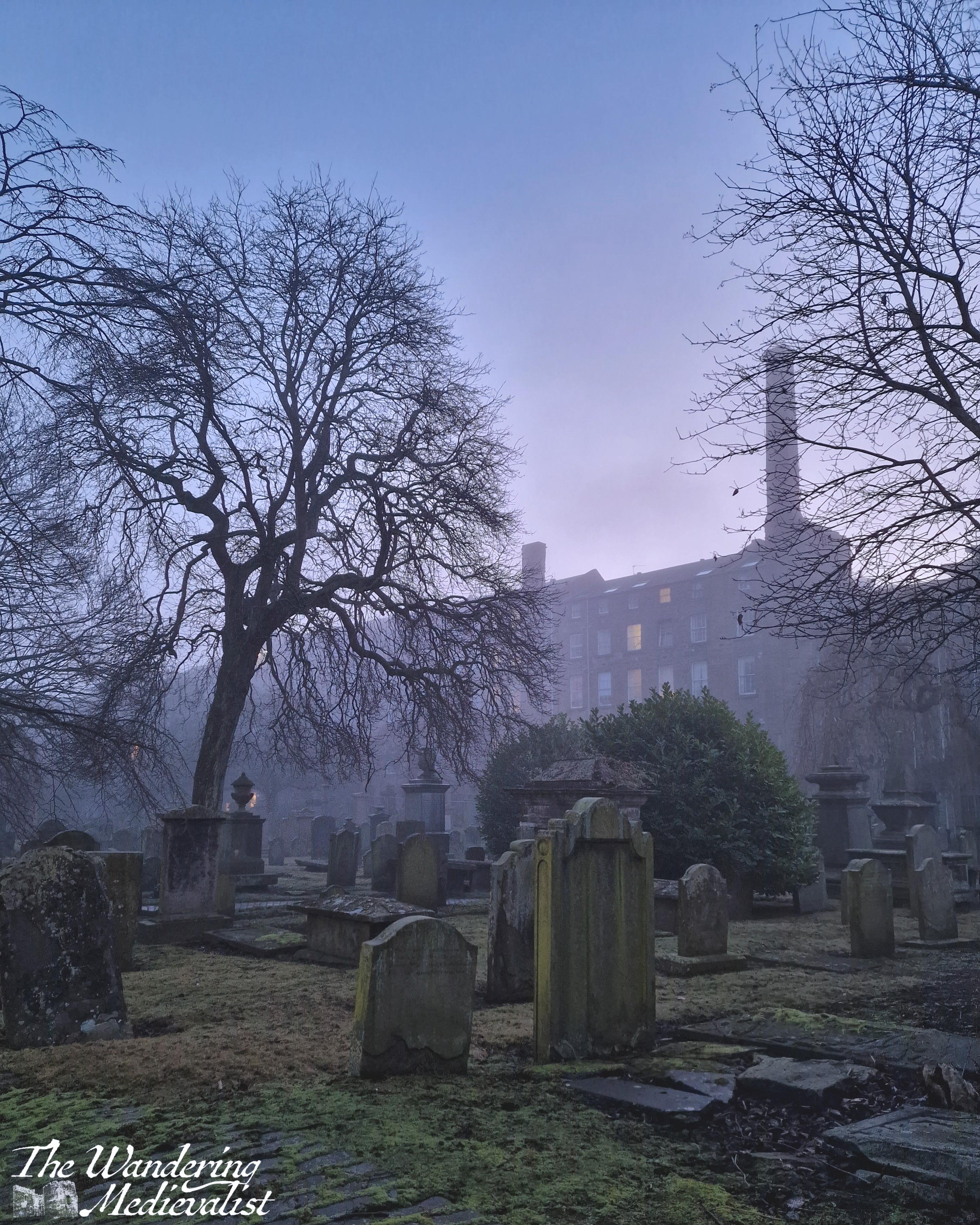
Dundee isn’t always top of the list when one is considering photography options, but as with any location, being there every day means you can capture the light – or lack of it – at just the right time and really appreciate its beauty. The sunny picture is taken just outside the Overgate mall, and the two foggy early morning shots are from the Houff, a burial ground once part of the Grey Friars Monastery destroyed during the Reformation. On this morning it reminded me more of Dickensian London and I half expected the Ghost of Christmas Yet to Come to drift across the grass.
Morning walk
Back to work means back to the morning walk routine, and I was lucky enough to catch a few stunning winter sunrises. Dark mornings sometimes mean a lunch rather than pre-work walk, but the view across to St Andrews is just as stunning in the daylight.
And finally, stargazing
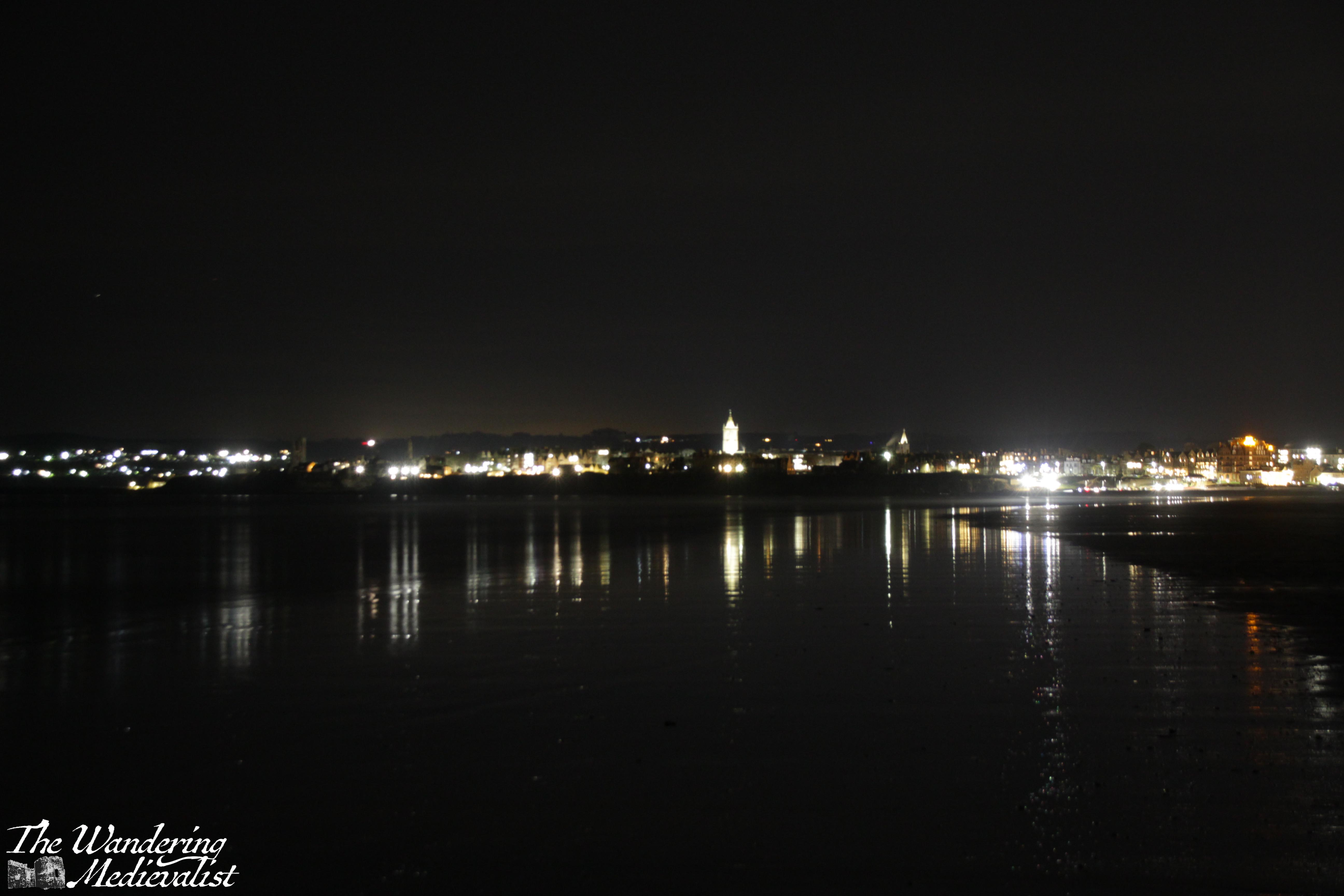
About two years ago when I had some time off work, I became fascinated with photographing the night sky, as previous posts have shown. Fortunately, I have been blessed with both friends and my other half, who are willing to brave cold nights and uneven ground to find the dark views. Towards the end of the month, we went out several times to try to view the planetary alignment that was all over the news – we didn’t have a great deal of luck photographing them but did get some great views of the stars from West Sands, as well as of St Andrews at night.
Another perk of January is putting plans in place for the rest of your year (if you like planning, which I of course do). While I have only gotten to about June, I have trips of both work and family nature planned in the Highlands, USA and Caribbean – an exciting mix of places to photograph and explore!
Enjoying my pictures? Why not claim one for your own project or wall space through my online shop:
Are you travelling in Scotland but not willing to rent a car? Maybe you’re from overseas, and don’t fancy driving on the other side? Perhaps you’re looking for a more carbon-friendly option?
Fortunately, Scotland has a really robust public transport network and you can see a large part of the country just using busses and trains. I was lucky enough to have experienced excellent public transport where I lived for so much of my life that I didn’t learn to drive until quite late. This means I also became well-acquainted with British public transport and both its pros and cons. I have done several of these trips with family who have more limited mobility, but I have always been there to help with luggage; once you get off of trains and major busses, I would imagine the routes are more challenging if you are not able to carry your own luggage and traverse coach stairs easily.
First, a few tips if you plan to attempt a tour of Scotland using trains and busses:
Pack light. Most busses have little to no room for luggage.
Have a book or alternative method of entertainment. You will be doing a bit of waiting.
Always have a plan B. Most of the time, public transport works pretty well, but aiming for the first or last transport of the day can be a bit risky and sometimes there are last-minute cancellations.
Always expect a delay and be pleasantly surprised if there isn’t one. If you’re needing to catch a plane or train at a specific time, give yourself plenty of extra wiggle room.
Don’t rely on the internet; depending on how far north you go, you may find that reception drops, so make sure you have a backup payment method as well as the basic timetable.
Take a bit of time to get used to the way the timetables look, and how to read them.
A note on cost
I have not estimated or stated cost for any of the journeys below, as they change regularly. You may find the best rates if you purchase online ahead of time, and there may also be group or family rates, as well as rail card discounts. Contactless payment should be available on all transport, and if you wish to pay with cash, be aware that operators will expect the exact change.
The routes
Below you will find a suggestion of some great trips you can take and a rough loop that will cover most of my favourite bits of Scotland. This is only the tip of the iceberg though – Scotland’s transport network allows you to explore even the far reaches of Mull, Skye or the North Coast without once setting foot in a rental car. I’ve popped links to all the major travel websites you may need at the end of this post.
Route 1 – Edinburgh Airport to Edinburgh City Centre
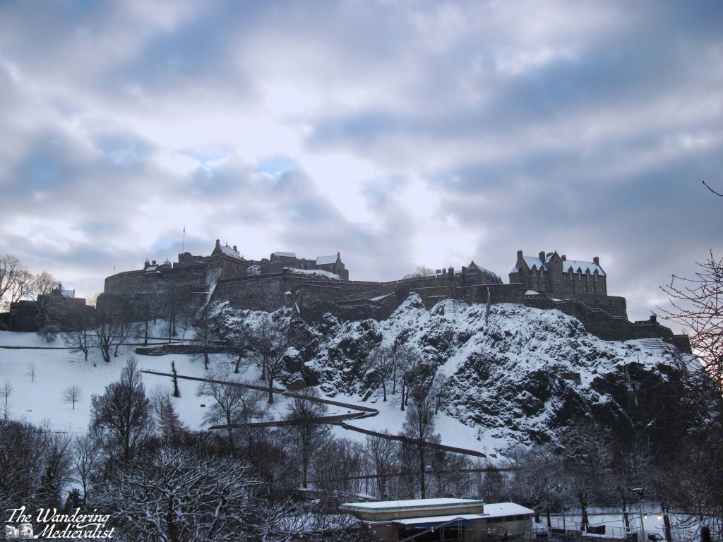
There are two options here: tram or bus. The tram is a nice calm modern choice, as the line is only ten years old – it opened in May 2014. But I actually prefer the bus, particularly the Airlink 100. The route into the city passes through some lovely neighbourhoods, the West End, and kisses the end of Princes Street, providing excellent views of the castle and Princes Street Gardens. It then cuts up to George Street, providing a peek down the side streets towards the water. Definitely sit upstairs if you can.
There are a few bus options with varying prices, but the 100 drops you right at Waverley Bridge, which is a perfect spot from which to explore the rest of the city. If you want to continue exploring by bus, you can pick up a hop-on, hop-off tour of the city from Waverley Bridge, too.
Boarding the airport bus was my favourite part of journeying back to St Andrews after time at home as a student. I was almost always half asleep after an overnight flight, but sitting back to watch the streets of Edinburgh speed by and then the majestic castle rising over Princes Street Gardens rejuvenated me long enough to stay awake for the train ride north.
Route 2 – Edinburgh City Centre to St Andrews
There is a bus that leaves from Edinburgh City Centre (confusingly, from St Andrews Bus Station) and takes you directly to St Andrews (St Andrews Bus Station, Fife), but I recommend the train. You’re looking for a route that stops at Leuchars, which is the local St Andrews station. Any train heading to Dundee or Aberdeen will stop there. If you can, start your journey at Waverley – you’re more likely to get a seat – and sit on the right-hand side of the train. This journey can take anywhere from 60 to 90 minutes depending upon the route and train operator – some trains go almost directly to Leuchars but some will stop at every small village along the way.
Once you pull out of Haymarket station (which often smells faintly of yeast from the local brewery), you start to get some great views of Edinburgh: you’ll pass Murrayfield Stadium and go right past the end of the airport runway, then out across the historic Forth Rail Bridge.
My video of trips across the rail bridge:
From the bridge you can see down the Firth of Forth in either direction, either west towards Stirling or east towards the islands and North Sea.
As you pass into Fife, the train line continues to hug the coast and offers some spectacular views of the beaches, Bass Rock, and Edinburgh itself across the water. Once the train cuts inland, you get a great feel for the farmland and rolling hills of Fife. You will know you are approaching Leuchars if you catch sight of the chimney of Guardbridge Paper Mill (now a biomass plant).
From the station in Leuchars, it’s easy to grab a taxi or one of the very regular busses into St Andrews. In total, the journey should take no longer than 2 hours.
One small warning – phone signal is very patchy along this route, and if you find yourself having to make a phone call or trying to check your email, you may be scuppered. The stretch between Inverkeithing and Kirkcaldy is particularly bad, but the hills of Fife seem to block signal quite effectively no matter where on the line you are.
Route 3 – St Andrews to Elie
Several years back I happily discovered this route while exploring with my father. We hoped to walk some of the Fife Coastal Path, but were without a car.
The Stagecoach 95 route runs from St Andrews to Leven and passes through all of the charming wee towns of the East Neuk, which is the area of Fife south of St Andrews. The 95 stops in Kingsbarns, Crail, Anstruther, St Monans, and eventually cuts inland at Elie to pass through Kilconquhar and Colinsburgh.
If you can, get on at St Andrews and go up to the top level – this bus is almost always a double-decker. The views are awesome, and it’s a great way to see Fife. If you tend towards travel sickness, however, be careful up there – the road is narrow and quite winding, while the bus drivers seldom slow for the corners.
You can hop on and hop off using a North-East Fife dayrider ticket, or even get off and walk along the Fife Coastal Path to the next town, as we did (Elie to St Monans, for the record). Just keep an eye on the timetable, as the bus only runs about once an hour.
All of these villages will have places for you to get refreshments, often a charming little pub or chippy. Anstruther is famous for having award-winning Fish and Chips!
The whole route from St Andrews to Leven is about 90 minutes.
Route 4 – St Andrews (or Edinburgh) to Inverness
There is no direct train from Leuchars or Dundee to Inverness, and so my recommendation for this next leg is – if starting from St Andrews – that you take the 99 bus to Dundee Rail Station (it stops there immediately after crossing the bridge). From Dundee you get a train to Perth, where you switch to the Inverness train. If you can, book in advance and make sure you have a seat reserved on that train, which is often busy. These trains come from Edinburgh, so you can also get on there if you prefer to spend more time in the city.
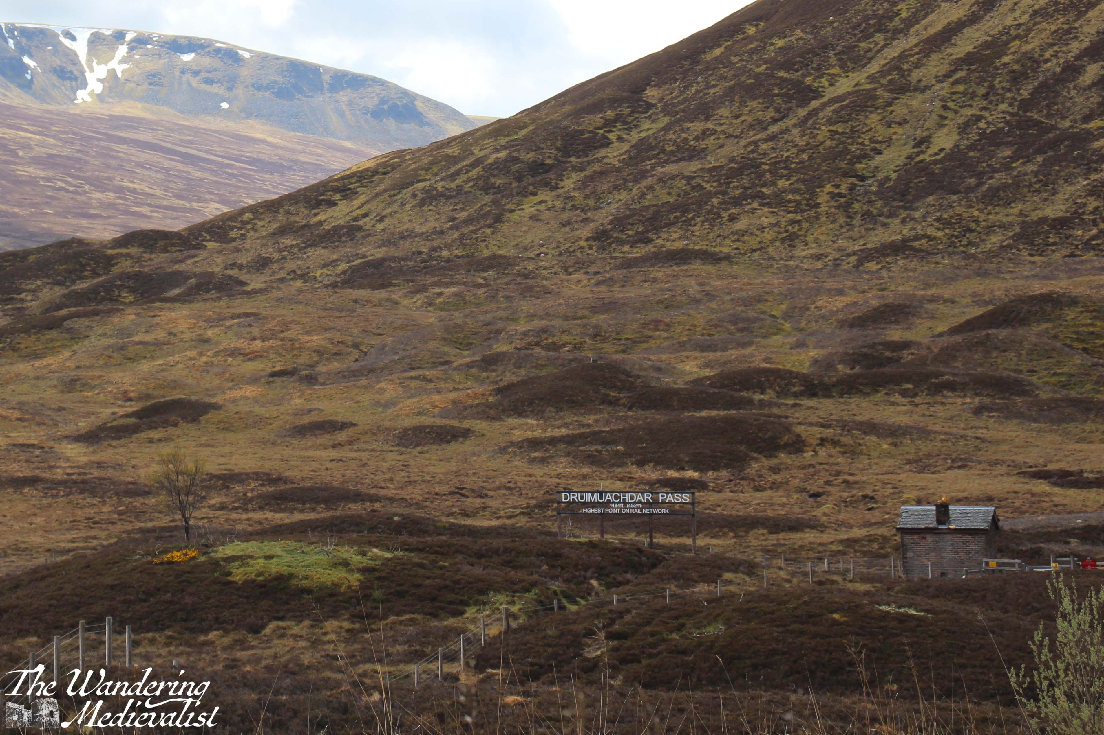
The train from Perth to Inverness stops in some fantastic places such as Dunkeld, Pitlochry, Blair Atholl, and Aviemore. There are stunning views as the train passes through the forests of Perthshire and then the Highlands; my favourite spot is the Drumochter Pass, which is the highest point in the pass between the north and south. Often the weather is very different here than only a few miles in each direction, with snow common in the winter.
As the train winds down out of the mountains you start to see villages and then the town of Inverness.
The journey from Perth to Inverness is just over two hours.
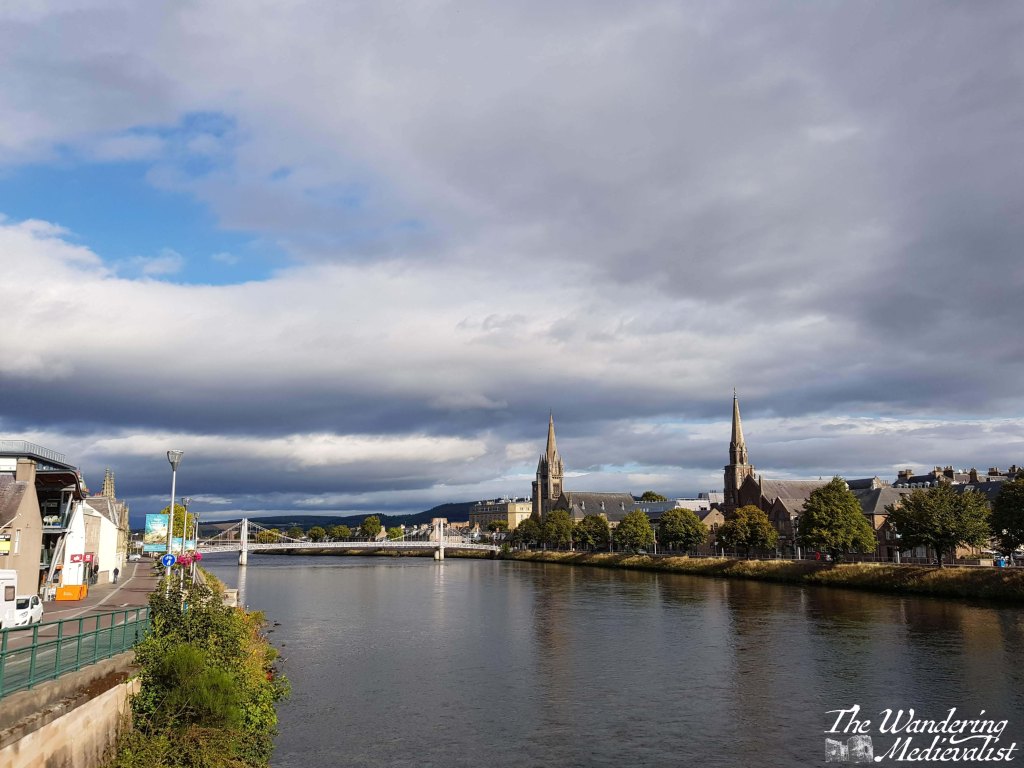
Route 5 – Inverness to Culloden Battlefield
Inverness is a lovely little city to walk around, with paths along the river and over bridges, and of course it has its own castle. It is a popular destination for coach trips and tours, partly for its size and the plentiful hospitality options, but partly for its proximity to one of the most famous battlefields in the UK, if not beyond: Culloden.
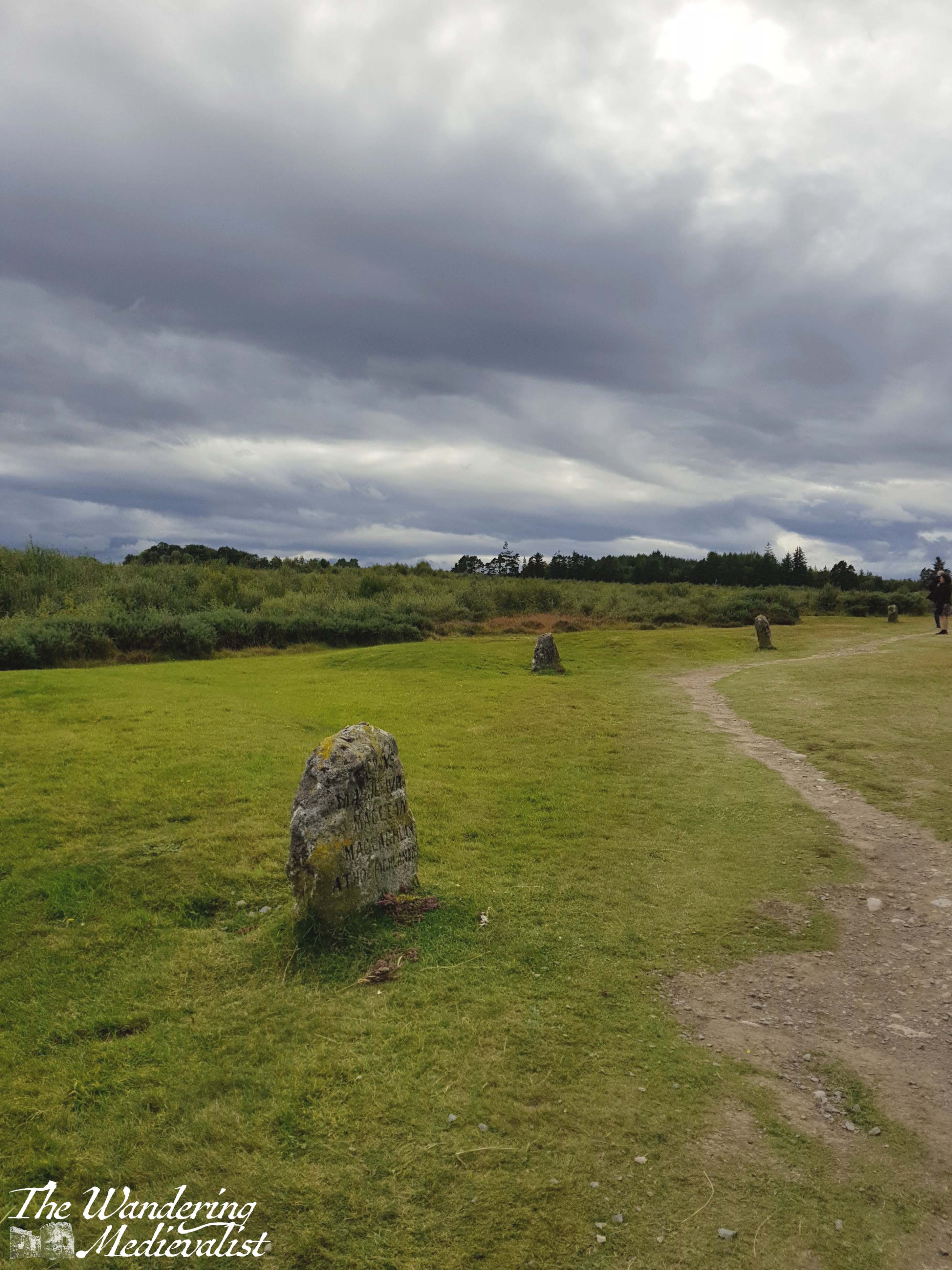
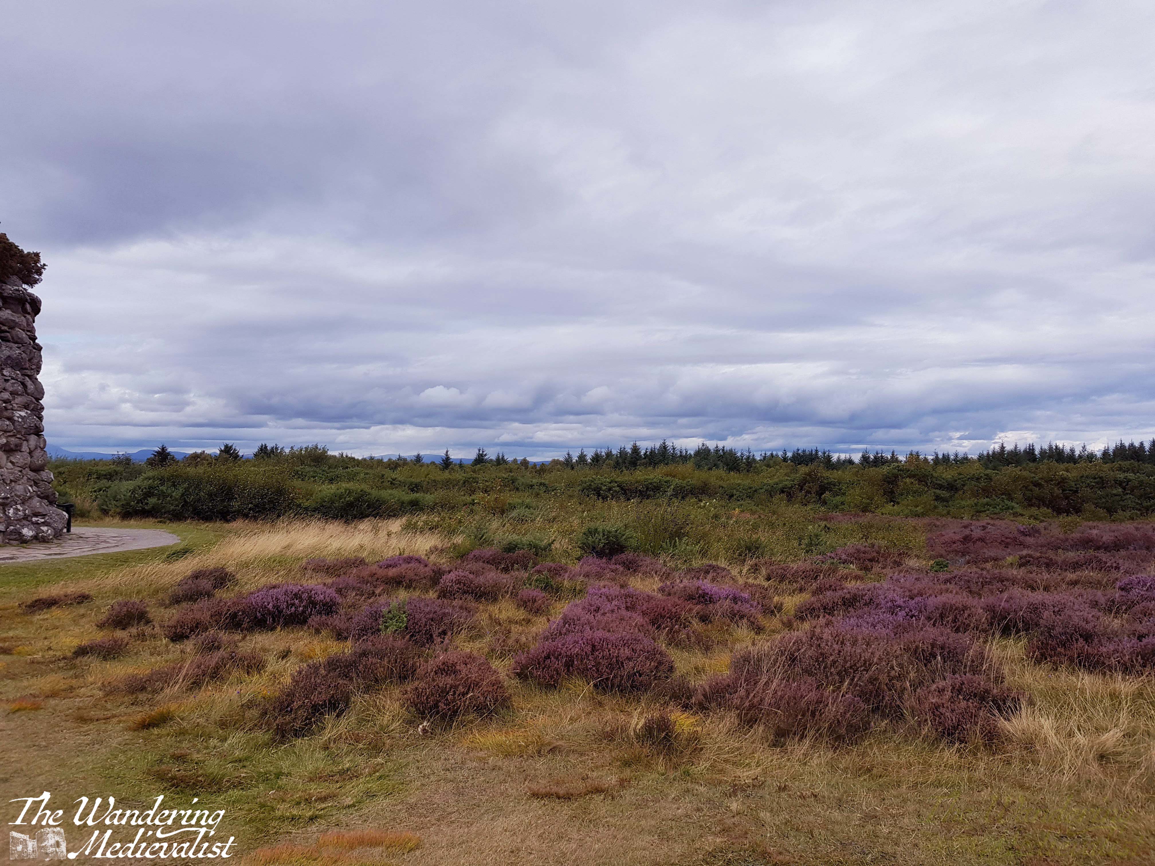
Whether you are a Scottish history fiend, a military history fan, a fan of Outlander, a Scot, someone descended from Scots, or someone who is looking for the most popular spots to visit in Scotland, you will have come across Culloden. It is of course the famous field where, in April 1746, Bonnie Prince Charlie and his Jacobites lost their fight against the forces of King George II, and where many Highland clansmen lost their lives. A major turning point in Scottish history, Culloden marked the beginning of the end for Highland culture, and the battlefield site has been preserved well. The visitor centre has some fascinating displays that immerse you in the battle, and provides a solid historical understanding. The battlefield itself is incredibly moving, with stone cairns marking the burial places of the clans.
Fortunately, Culloden is easily accessible via bus from Inverness city centre. Absolutely a must-visit, and only about 20 minutes away.
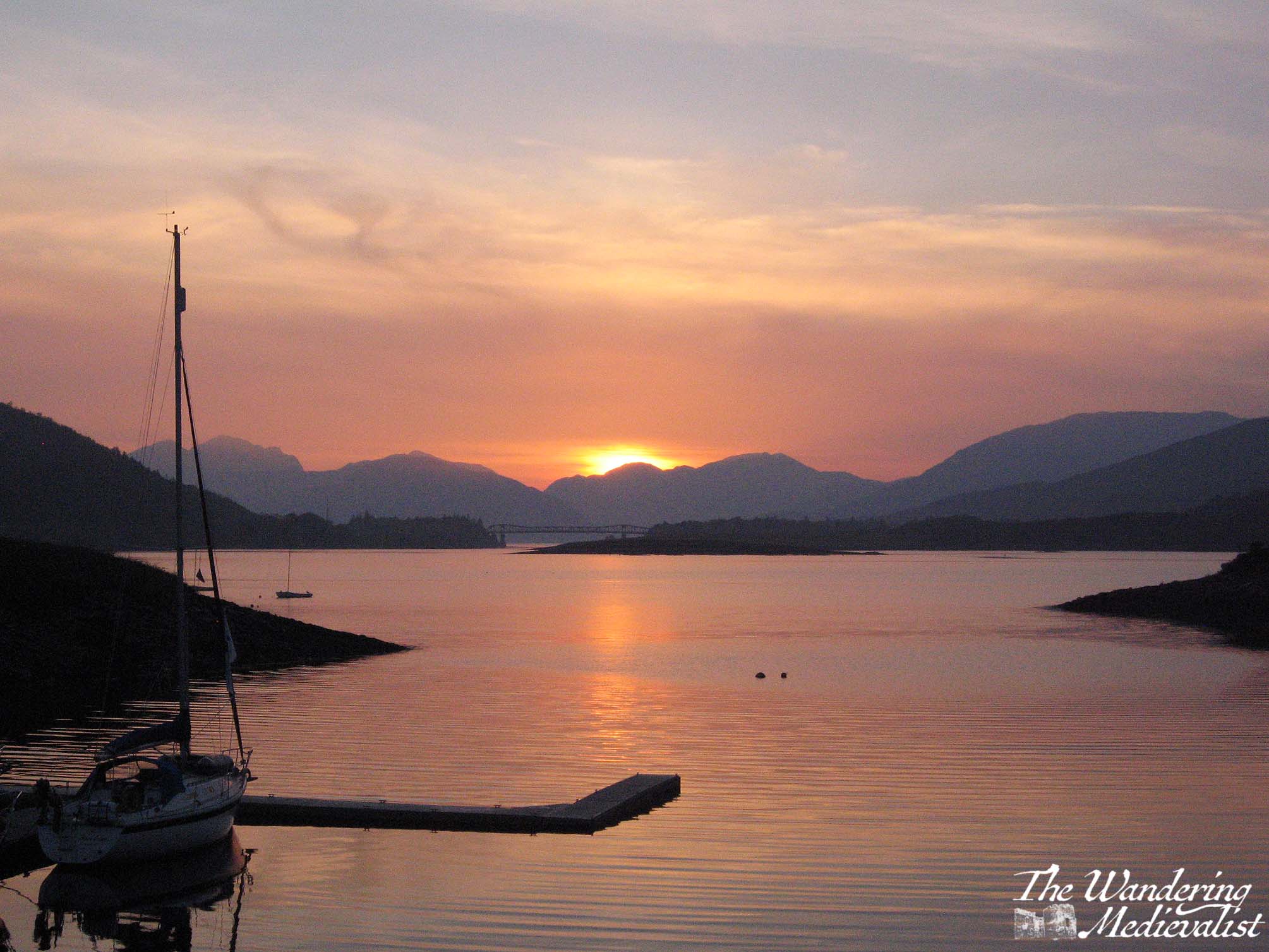
Route 6 – Inverness to Fort William
Before I go too far in describing this route, one small caveat – I have never actually done it by bus. But, I know it can be done by hopping on a Citylink bus at Inverness bus station – sit on the left if you want the best views for the first half of the journey. The route follows the Great Glen down Loch Ness, Loch Oich, Loch Lochy, and then through Spean Bridge to Fort William. This alone is a spectacular route, but the Citylink stops along the way at several points that may be of interest to you, if you have time.
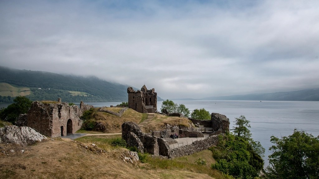
The first is Urquhart Castle, which is one of the most picturesque castles in Scotland and a perfect place to look out for Nessie.
The next is Fort Augustus, the town at the far end of Loch Ness from Inverness, where you can grab lunch and watch ships navigating the locks of the Caledonian Canal.
After Fort Augustus, the bus will continue to Invergarry and eventually cross to the other side of the glen to hug the coast of Loch Lochy. Here the A82 lifts away from the water and climbs over the rise on which the Commando Memorial stands – you may just catch sight of it before the road drops again into the town of Spean Bridge.
There are a few hotels and B&Bs here which are sometimes a bit less pricey that Fort William, though you are still 20 minutes away. The road between here and Fort William is quite pretty, with the Nevis Range ahead and rolling hills off to the right.
The whole route takes about two hours if you do not get off at all, and runs relatively regularly – hourly during the summer though less often in colder months.
River Spean at Spean Bridge
Route 7 – Fort William to Nevis Range
Fort William has plenty to keep you busy with hikes of all different lengths from a short wander to climbing Ben Nevis, the UK’s highest peak.
If you are less inclined to hiking, I would definitely recommend trying one of the Loch Linnhe Seal Cruises, which you can book ahead even if it is just the day before. There is also a small cinema, plenty of pubs and restaurants to explore, and numerous places to stay. That said, definitely book your accommodation well in advance, as Fort William is almost always busy.
Fort William and Loch Linnhe from the Old Fort
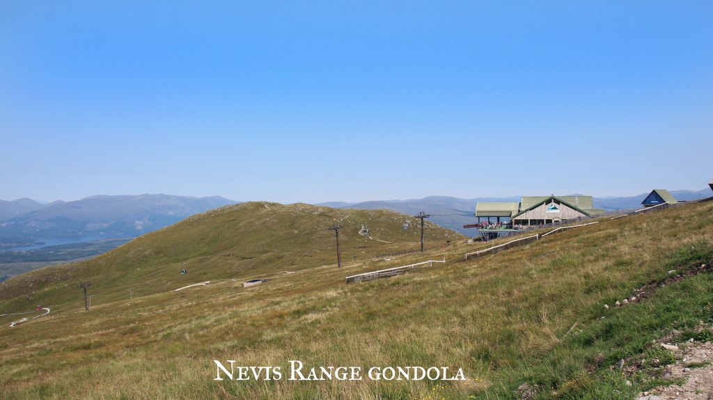
Another fantastic option for the Fort William area is to take a bus out to Nevis Range, where you can find more walks in the woods and the gondola up Aonach Mor. The gondola can be taken by those of all abilities and ages, and at the top you can enjoy the cafe or walk along the side of the mountain to two viewpoints: Meall Beag and Sgurr Finnisg-aig. The gondola ride alone is worth trying, even if you do not wish to hike.
The way to get to Nevis Range is to pick up a Shiel bus from one of the bus stops just outside Morrisons, on MacFarlane way. As of writing it is the N41 route you want, and it runs frequently enough that you can get out and back in a day. But, as always, keep a close eye on the timetables. The route is only about 20 minutes.
Should you miss the return bus, you may need to order a taxi, and those can take some time – I’d recommend making note of a local taxi number, as Uber has not yet reached Fort William.
Route 8 – Fort William to Glasgow
If the train route from Glasgow to Fort William does not make it on to some list of one of the world’s most beautiful, someone goofed. Whether you are boarding in Glasgow, Fort William, or one of the several stops in between, I do recommend booking in advance if you can, and selecting a seat. I cannot really recommend a side of the train though – both offer stunning views.
If you are travelling the whole distance, you may want to bring your own snacks and refreshments, as the train trolley can be pricey. The trip is about 4 hours, but delays around Crianlarich are not uncommon, so it is best to be prepared for a longer ride.
Any delay is 100% worth it, though. For one thing, it often allows you a few minutes to get out of the train and walk around on the platform, and get some fresh air. It is also just a fact – you will be stopped in Crianlarich for a short while even without delays, as that is where they split the train (or join it together again), with one half going to Oban and the other to Fort William. This is another good reason to book your ticket – it guarantees you are sitting in the correct part of the train.
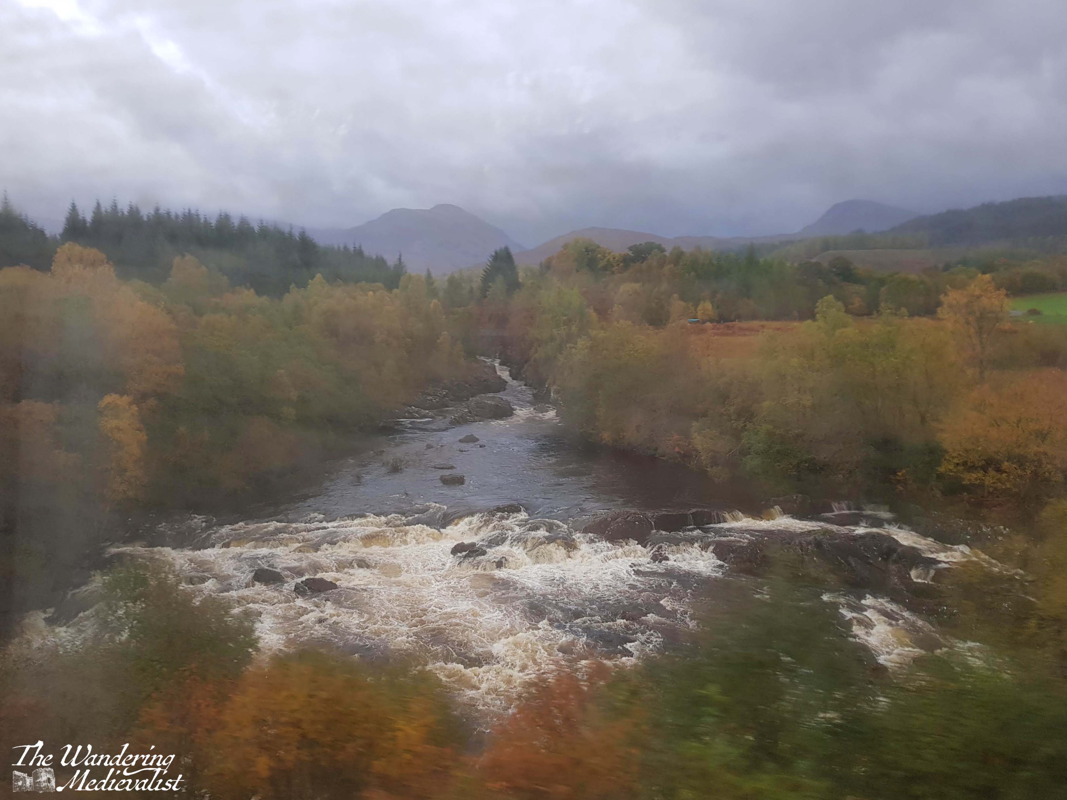
If you board in Fort William, you will find that the train passes out of the town almost immediately and follows the River Spean through the towns of Roybridge and Spean Bridge. The line hugs the side of a gorge and then at Tulloch cuts south to head across Rannoch Moor.
The moor is a stretch of land composed of bogs, lochs, rivers and rocky soil that is one of the last great wildernesses in Europe. The train offers a unique opportunity to see it, as the only other way to experience this part of the Moor is on foot – the roads go around in either direction. Corrour Station, one of the stops in the middle of the Moor, is more than 10 miles from the nearest road. The train runs just frequently enough that you could take a train in the morning, have a hike, and then catch one of the trains back again to Fort William, but be warned – as mentioned above, trains on this line are not 100% reliable and accommodation is very limited.
Barren, rocky, boggy, and breathtaking, the Moor alone is – in my opinion – worth the train trip. You may even catch sight of a deer or other Highland fauna.
Once across the Moor, the train line cuts through mountains and valleys, eventually re-discovering the A82 highway not far north of Tyndrum. Just beyond Tyndrum, the train line loops west to cross the viaduct seen in the picture above, hugging the hills as it heads south.
After stopping at Crianlarich, the line touches the north shores of Loch Lomond before cutting over to Loch Long at Arrochar and Tarbet. From there, beautiful views down the loch and of the distant mountains will keep you glued to the windows all the way to Helensburgh, only a few minutes from Glasgow.
If you take the train in reverse, the scenery becomes more stunning the further north you travel, and I always find it a touch disappointing when you finally reach Fort William. Once we did continue on the line all the way to Mallaig, and while doing so will give you a good feel for the barren nature of the coastal Highlands, nothing is quite like crossing the Moor.
Give yourself most of the day for this journey of at least four hours, and cross your fingers for a rain-free trip. I have never yet had one, but rain makes the pictures more genuine!
Travel from Glasgow back to Edinburgh is incredibly easy, with regular trains and busses from Buchanan and Queen Street stations.
Other options:
The loop I have suggested above is just one of the many options available to you. Want to try a truly epic journey? Citylink offers busses from Glasgow to Uig on Skye. It’s a long trek but crosses some stunning scenery, and Skye can be explored on foot if you’re ready for it.
Here are a few more suggestions:
Hop on the train from Fort William to Glenfinnan, crossing the famous viaduct. There is a hike from the train station back towards the parking lot with spectacular views over Loch Shiel and the viaduct itself.
Take the train from Dundee to Aberdeen, along the stunning coastline.
Take a bus or train to Stirling and walk up to the castle and old town.
Take a bus to Doune and explore the castle and town.
Hop a bus from Glenrothes to Falkland and visit the Palace and Gardens, or climb up East Lomond Hill.
Board a bus in Aberdeen to take you to Crathes and Drum castles.
For a truly epic journey, you can take a train or bus to Oban, a ferry to Mull, another bus from Craignure to Fionnphort, and a ferry to Iona! Lots of coordination required, but entirely possible.
The bottom line is, busses go almost anywhere you want. Be aware of travelling on Sundays as things are always less flexible, and make sure you have the most up to date timetables.
Here are some useful links to help you plan your adventure:
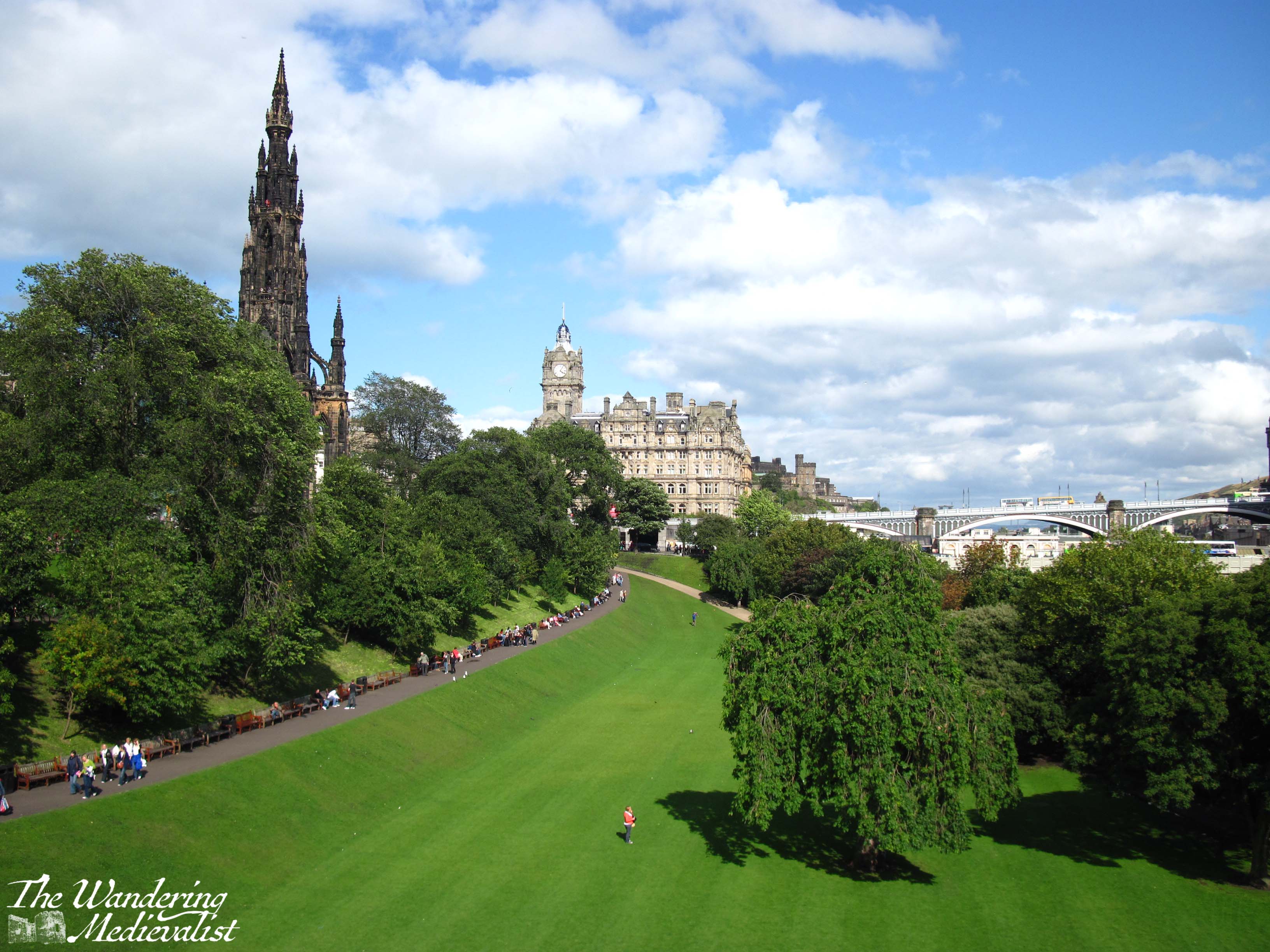
Are you visiting Scotland on a whirlwind visit but only have a few hours in each location? Maybe you’re staying in Edinburgh but want to visit St Andrews for the day? This short walking tour of around one hour takes you past all of my favourite parts of St Andrews. Allow yourself a bit of extra time to pop into some shops and take some pictures, and I’ve added in a few detours if you do have a bit longer to explore.
St Andrews is an easy town to walk around and there are numerous places along this tour where you can pause for a rest or refreshment, but weather can also change quickly so make sure you are prepared. Only a month ago I was in town with my mother when the beautiful sunny view was overtaken in less than 10 minutes by the haar – Scottish fog. But as they say, wait a few minutes, and the weather will likely change.
One caveat is that while you will see portions of the University on this tour, it will not show you everything. The University does not have a campus, but is spread out around the town, so you will see the crest on many random buildings where you may not expect it.
This tour route assumes you are arriving for the day from the train or bus, so start at St Andrews Bus Station (if you are using a travel app, make sure not to confuse this with St Andrews Bus Station in Edinburgh!)
Part 1 – St Andrews Bus Station to the Westport
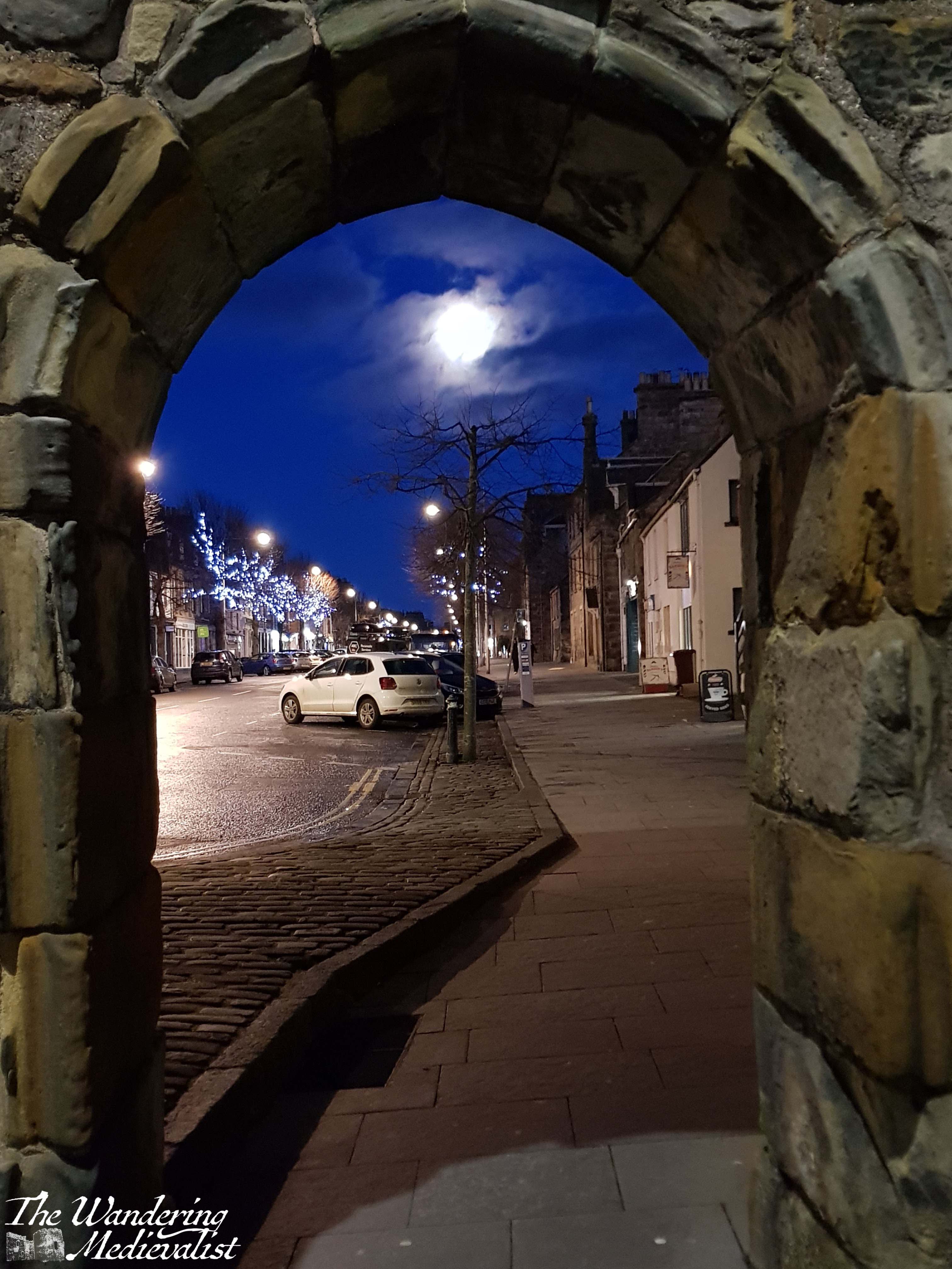
Start your walk at the zebra crossing just outside the bus station and continue along to the roundabout – do not cross at the first set of lights you reach. At the roundabout, cross Doubledykes Road and then use the pedestrian crossing at the next set of lights you come to. Continue along City Road heading south, and soon you will come to the Westport, one of the last vestiges of the St Andrews town wall, dating from the 1580s. If you want to cross the road here for a better picture, just be careful of the traffic!
the roundabout near the bus stationWest Port, St Andrews
Part 2 – The Westport to Blackfriars Priory
Go through the Westport, and I would recommend staying on the left side of the street; there are several nice shops and the St Andrews Brewing Company, a fantastic local brewery should you already be in need of some refreshment (I particularly like the Yippee IPA). When you reach the next intersection, cross to see the ruins of Blackfriars Priory. Built in 1520 to add to the Dominican Friary, the chapel was destroyed soon after in the Reformation. Behind Blackfriars is Madras College, formerly a secondary school for St Andrews but more recently purchased by the University as it continues to expand its property portfolio and teaching aspirations. Extensive renovation is now underway, though the Victorian-era facade will remain.
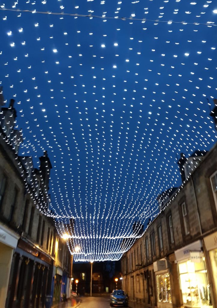
Part 3 – Bell Street
Cross back towards the BrewDog pub and continue almost straight along Bell Street. You’re entering St Andrews’ shopping district here, and you will find plenty of cafés and shops to keep you busy. Sheila Fleet at the end of the shop does some beautiful Scottish jewellery, and the Taste of Scotland shop on the corner offers a massive range of whisky, gin and other spirits.
Bell Street is also where you are likely to find a taxi later in the evening, as well as St Andrews’ most infamous late-opening pub, Aikman’s. It has not changed in more than 20 years, for better or worse, and is still popular with students.
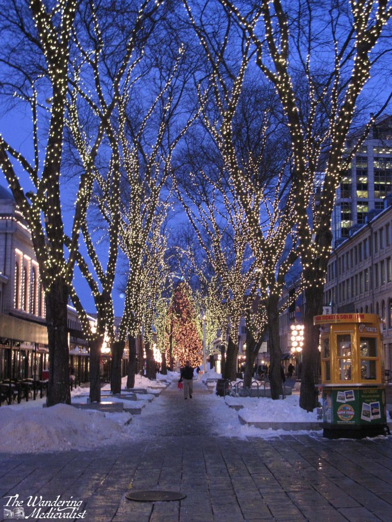
Bell Street with Christmas lights
Optional detour: at the end of Bell Street, continue straight across to Greyfriar’s Gardens, where you can glimpse some lovely gardens and visit the famous Topping & Co. bookstore.
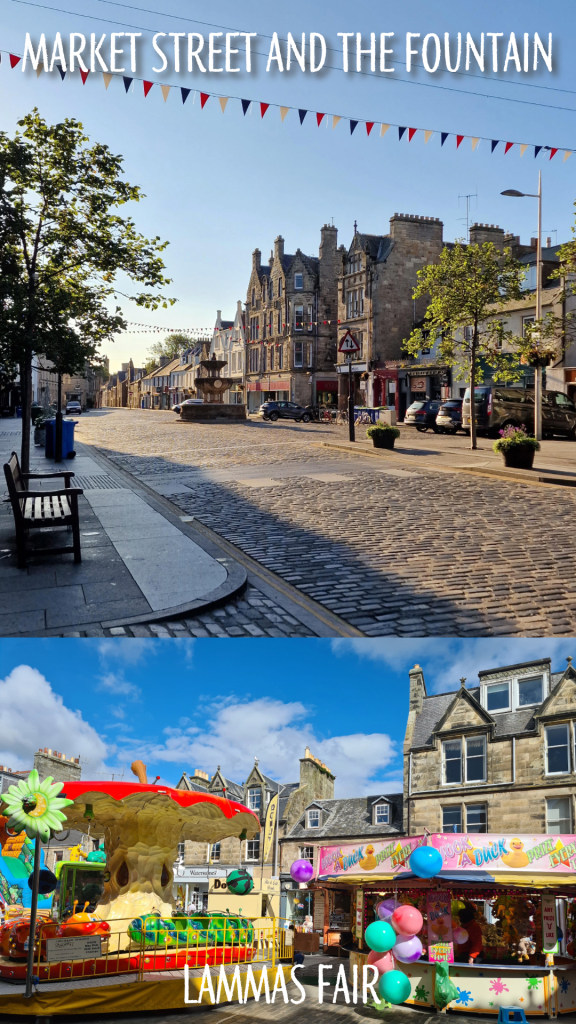
Part 4 – Market Street
Once you reach the end of Bell Street, along to the left you will see the St Andrews University Students’ Association, a large building completely clad in glass. It is the spot to get university merchandise, should you want some, and has a great café. I recommend however taking a right up Market Street, the main shopping street for St Andrews. You will find tourist shops, coffee shops, pharmacies, clothing stores, and two small supermarkets. Most of the brand stores are here including Pret A Manger, Starbucks, Black Sheep, and Costa.
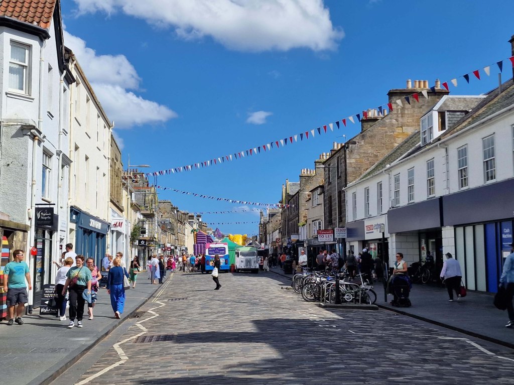
Mitchell’s Deli about halfway along is a great spot for lunch, and Forgan’s offers a Friday night ceilidh. Market Street is always done up with Christmas lights in the winter, and hosts the Lammas Market for one weekend every August.
As the cobbled street widens, you will catch sight of the Whyte-Melville Memorial fountain, constructed in 1880. A massive re-paving and widening of the sidewalks was done in 2010/11, but they can still feel crowded at certain times of day or year.
Market Street – bottom end
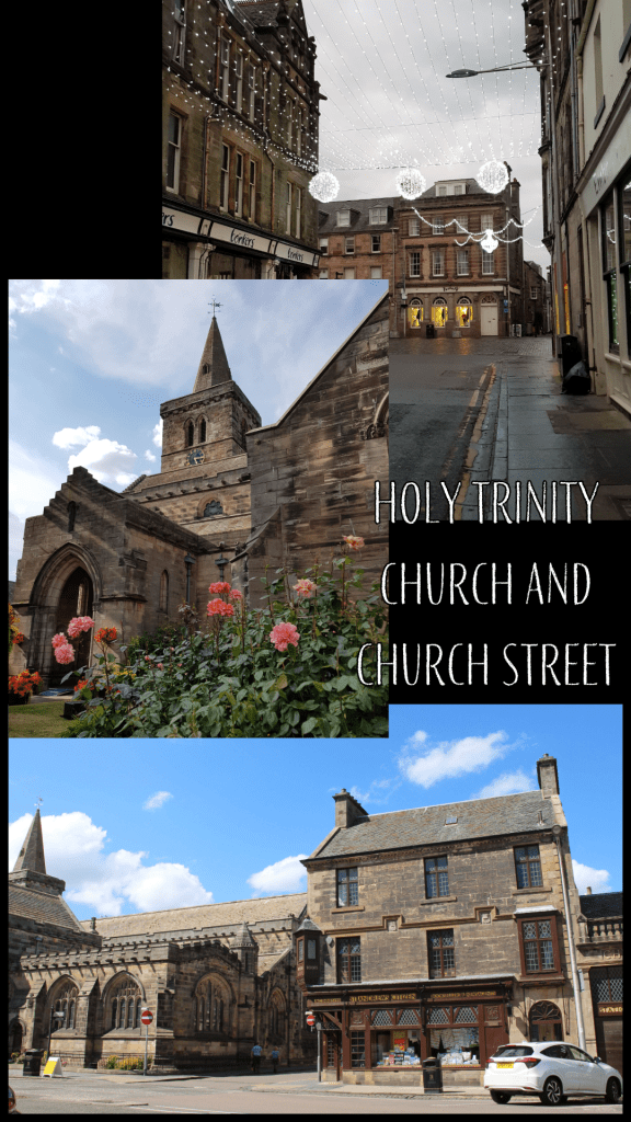
Part 5 – Church Street
Once you reach the fountain, take a right onto Church Street, named for the medieval Holy Trinity Church that dominates the far end. Church Street is also home to one of St Andrews’ most famous family-run shops, Fisher and Donaldson – make sure to stop in for a yum yum, fudge donut, or other delectable treat.
At the end of Church Street is the now-closed J&G Innes shop (also known locally as the Citizen office), which has some truly stunning decorative carvings on the listed stone.
Part 6 – St Mary’s Quad and South Street
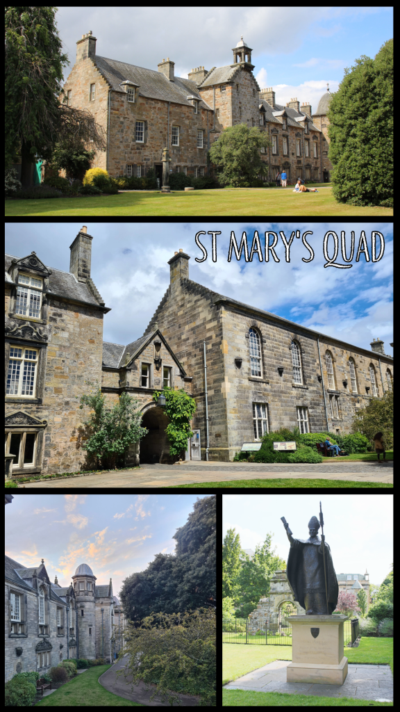
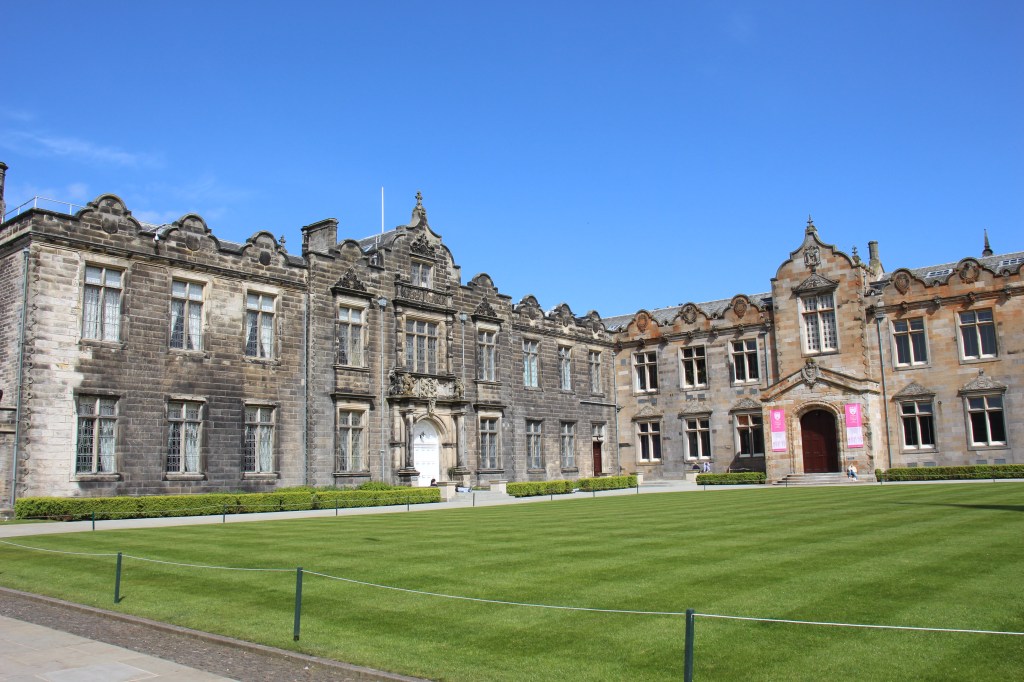
At the corner, turn left onto South Street, or take a quick jog to the right to enjoy the Church Square first. Cross the street across from the Criterion pub, and you will find a gated archway leading to St Mary’s Quad. This is the location of the School of Divinity and Parliament Hall, where the Scottish Parliament met to escape the plague in 1645. Take a short loop around the tree in the centre of the quad and you will see a statue of Bishop Henry Wardlaw, and the end of the new Music Centre that opened in 2021. In term time you will often find students relaxing on the grass or eating lunch here, and the King James Library offers study space and additional books.
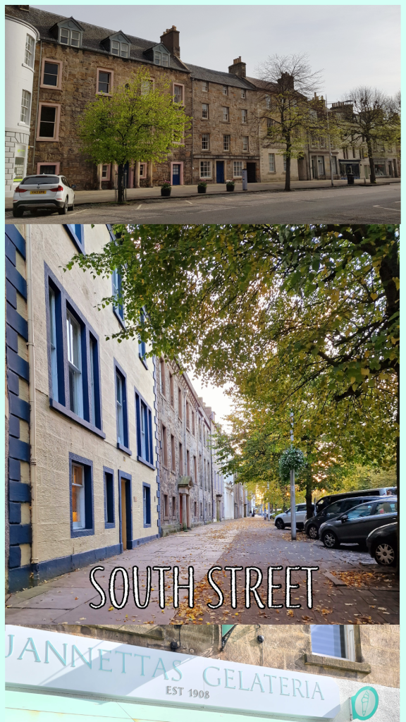
Once you’ve enjoyed the quad, leave through the arch and turn right to continue along South Street. You will pass beautiful old stately homes, dating from the 17th and 18th centuries. At the far end, you will find Jannetta’s Gelateria, another famous St Andrews treat destination where the queue will snake down the street on a sunny day. Founded in 1908, Jannetta’s offers more than 50 flavours, not including the sorbet! Go on, treat yourself…
Optional detour: Across from Jannetta’s, go down Abbey Walk and make your way along the beautiful stone wall of St Leonard’s School until you reach the harbour. You can either walk along the inner harbour road or detour out to East Sands, then circle back up to the Cathedral.
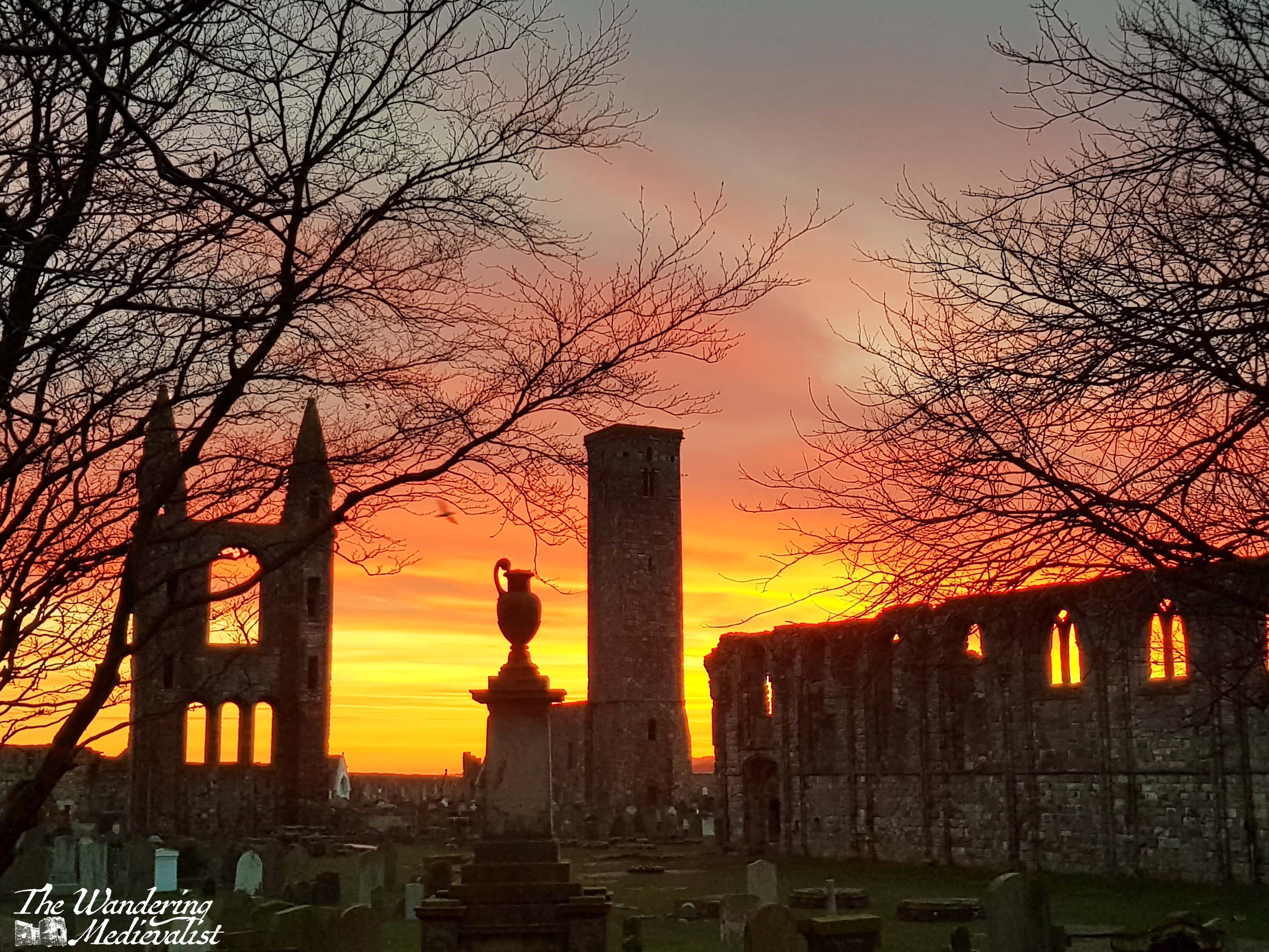
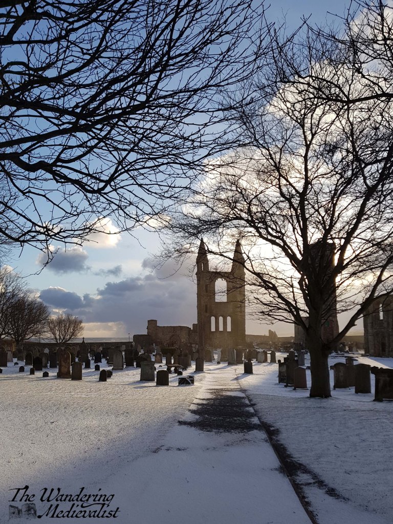
Part 7 – St Andrews Cathedral
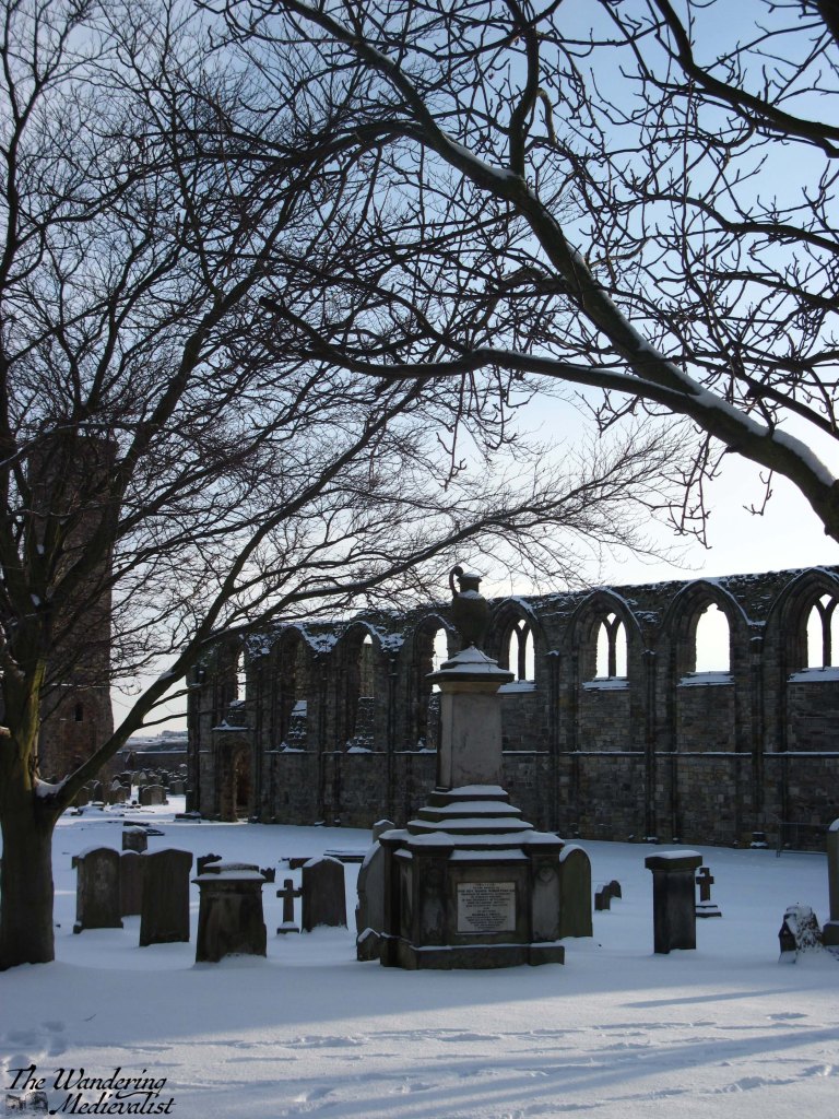
Continuing up South Street from Jannetta’s will take you in very little time to the ruins of St Andrews Cathedral. Originally constructed in the 12th century, the cathedral was the ecclesiastical capital of Scotland through out the Middle Ages, and the bishop (later archbishop) was powerful enough to build the nearby castle as his residence. The Cathedral fell into ruin through the Reformation, and the story goes that you can find stones from the great structure in buildings throughout the town.
Though not open in 2024 due to masonry repairs, St Rule’s Tower offers a fantastic view over the whole town if you can scale the narrow staircase. The graves in the cathedral grounds date from the last several hundred years and include the great golfer Old Tom Morris.
Enter the Cathedral through the gate and walk through the grounds, then exit through the door in the far wall. In front of you will be the North Sea!
Optional detour: Turn right along the outside of the cathedral wall and walk to the promontory where several large cannon look out over the ocean. From here you can see down to St Andrews Harbour, East Sands, and the pier.
Part 8 – The Upper Scores and St Andrews Castle
Turn left out of the Cathedral grounds and hug the coast to climb up a rise looking over the sea. This is one of the best views in town, along the coast, into the Cathedral grounds, and to the Castle. Below and to the right, you will see St Andrews pier, which is famous for its use during University processions. Unfortunately it was seriously damaged during Storm Babet in October 2023, so while it looks perfectly sound from above, it is not open to the public. There are several benches here where you can enjoy the view, and this is my favourite path in town.
Continue along the coast, following the metal railing and heading towards St Andrews Castle.
The castle was constructed starting in the 13th century and contains a bottle dungeon and siege tunnels – well worth the time to explore if you have it!
Part 9 – The Scores to the Golf Course
Once you have explored the castle to your heart’s content, continue down the Scores, the road that runs along the edge of the cliffs. Here you are entering the University proper and will pass the Principal’s house, St Salvator’s Hall (a student residence where Prince William lived in his first year), the Schools of English, Classics, Economics and Philosophy, the University Museum, and the Admissions/Student Recruitment office. You will also pass some of the most expensive real estate in Scotland – houses on the Scores are regularly valued at well over £1 million.
If you have some extra time, take a walk up Butts Wynd and peek into St Salvator’s Quad, the real heart of the University.
Eventually you will reach St James’ Catholic Church, the last building on the right; you can either follow the path down to the Bruce Embankment car park or stay on the left-hand side of the Scores. The monument is in memory of the religious Martyrs of St Andrews – of which there were many. Immediately in front of you is the Royal and Ancient Golf Club, and the Old Course.
St Salvator’s QuadMartyr Monument and the R&A
Part 10 – The Old Course and West Sands
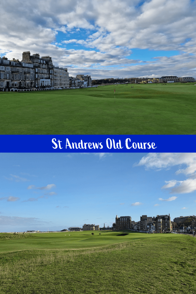
The famous Old Course, where the UK Open Championship is played every five years or so, marks the end of this walking tour. Golf enthusiasts will want to continue around the edge of the course along the Links and take a picture on the Swilcan Bridge.
Non-golfers may want to follow the coastal wall towards West Sands, the long sandy beach where locals walk, run, play sports, swim and surf.
If you’re running short on time, follow Golf Place to North street. The safest thing to do at this point is take a short detour along to the right to where you will find a traffic light and pedestrian crossing. If you are very careful, you may be able to cross before this, but a warning: traffic comes quickly along this road and roundabout, and foreign visitors in particular should take care.
Walk up the hill and you will find yourself back at St Andrews bus station.
view from West Sands towards town
This route may take a bit longer than 60 minutes, and in fact you could probably stretch it to at least two hours if you include the detours. It does not cover all of the amazing parts of St Andrews, but it makes a good start. I hope you have time to give it a go!
If you enjoyed these pics, check out more of St Andrews at my online shop:
When living in a country where dark is so prevalent in the winter, one must be willing to accept and even embrace the night sky and the often stunning light that comes after sunset.
In St Andrews, the streets and buildings are illuminated not just by street lights but by displays specifically designed to accentuate the stunning nature of the architecture. In fact, in most towns and cities now there is always light after dark, ensuring that visitors – and photographers – can continue to enjoy the sights and get from A to B.
In recent years I have become increasingly fascinated by the moon and stars. For more than a year now I have been trying to really capture especially the stars, a feat much tricker than it may appear, and one that has left me with hundreds of shots of a mostly black sky. But I am learning with each attempt, and each night I stand in the cold and try to get it right.
Night can be a fascinating time to capture your favourite daytime spots – I hope you enjoy some of my efforts to do so!
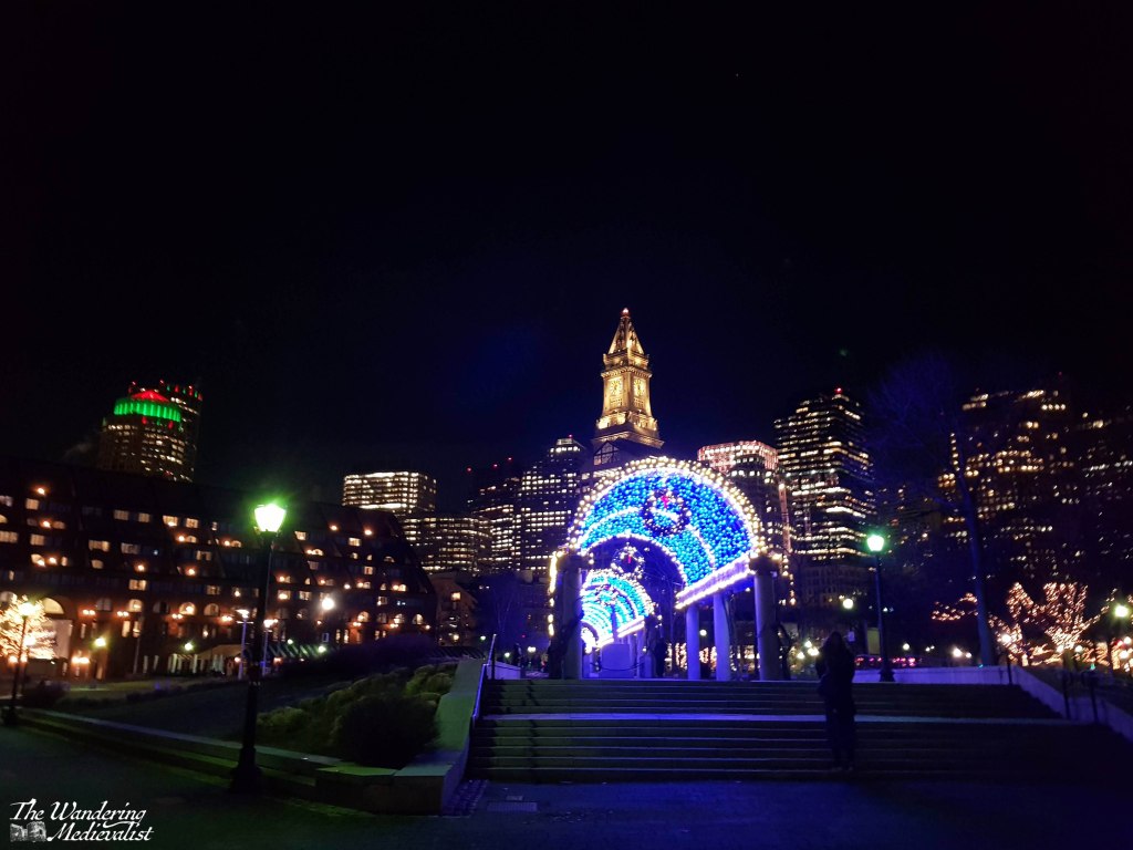
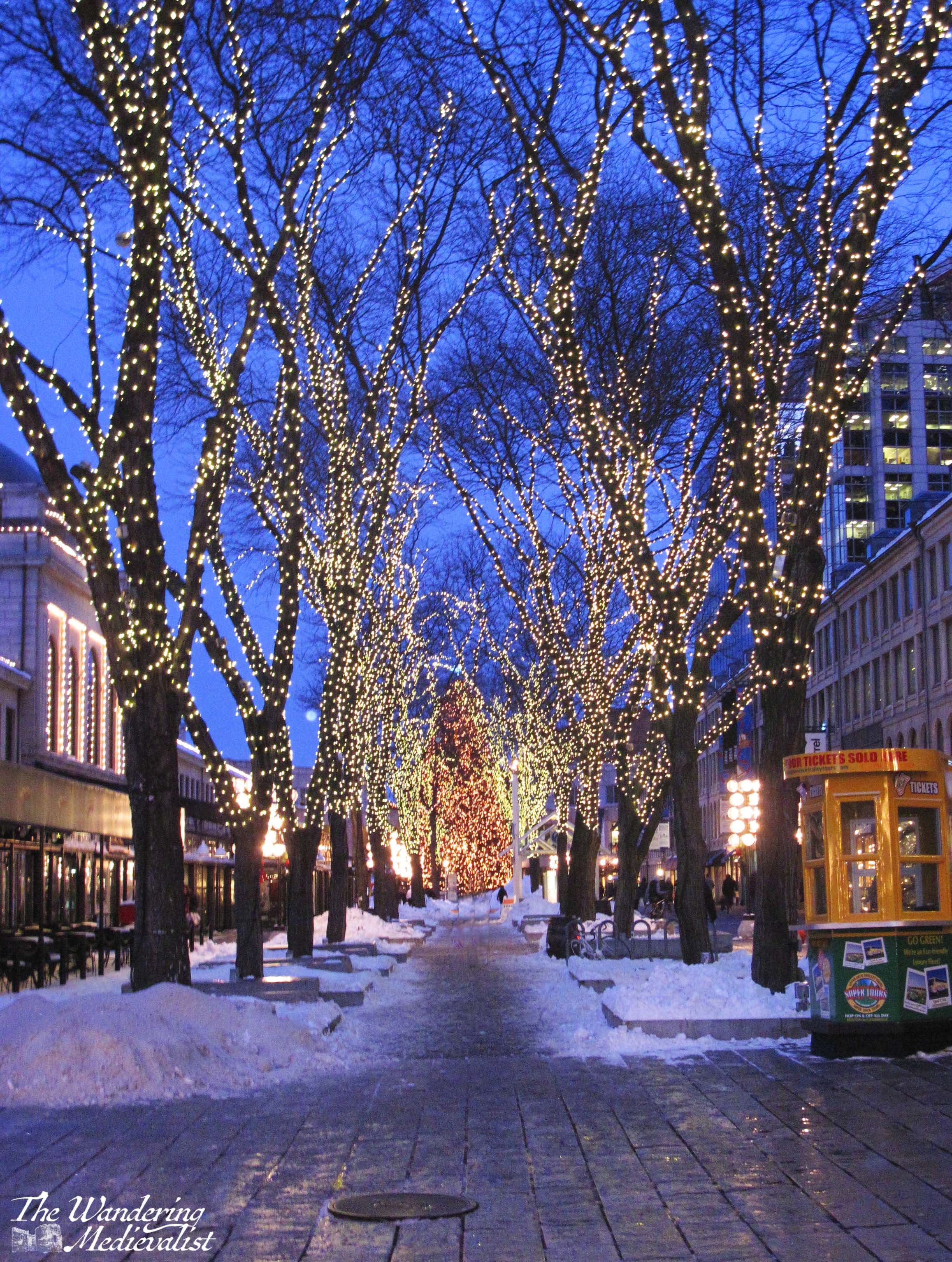
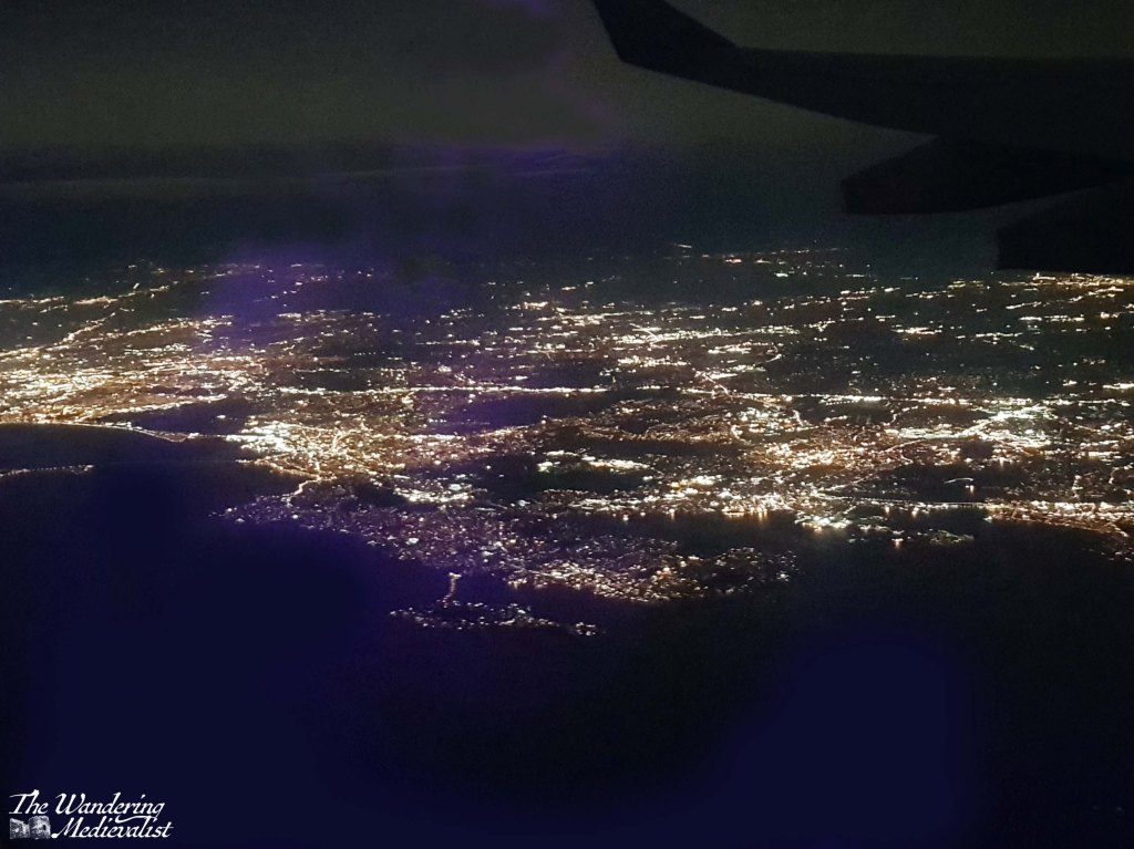
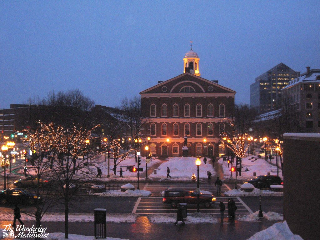
Boston, Massachusetts, USA 🇺🇸
There is a lot to love about Boston at night, though I particularly love the winter lights. When I was young we used to drive into the city every December to see the Nutcracker ballet, and I recall with utter clarity the wonder of driving past the Common to see the trees festooned with lights and every lamppost adorned with a Christmas decorations. The ‘Christmas’ nature has widened to encompass all holidays, and the lights are still stunning.
City view from Christopher Columbus Waterfront Park.
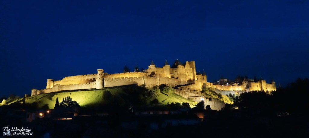
Carcassonne, France 🇫🇷
I consider myself so lucky to have been able to visit Carcassonne and to have found a hotel in the newer part of the city with a spectacular view of the medieval town. At night, it was almost more magical than during the day.
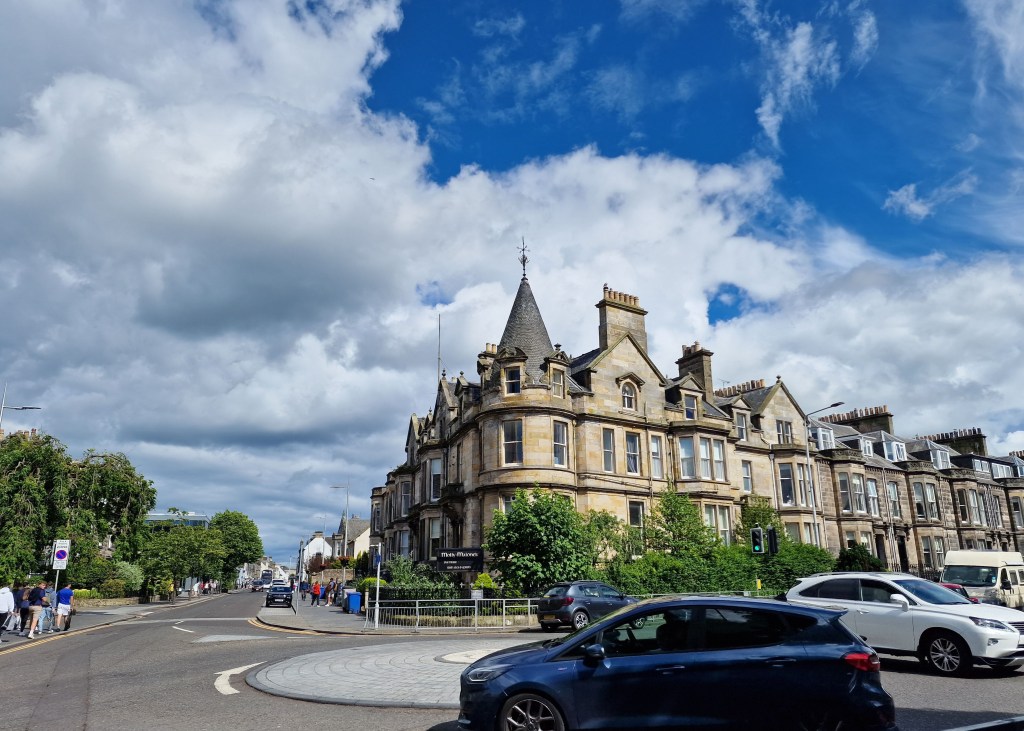
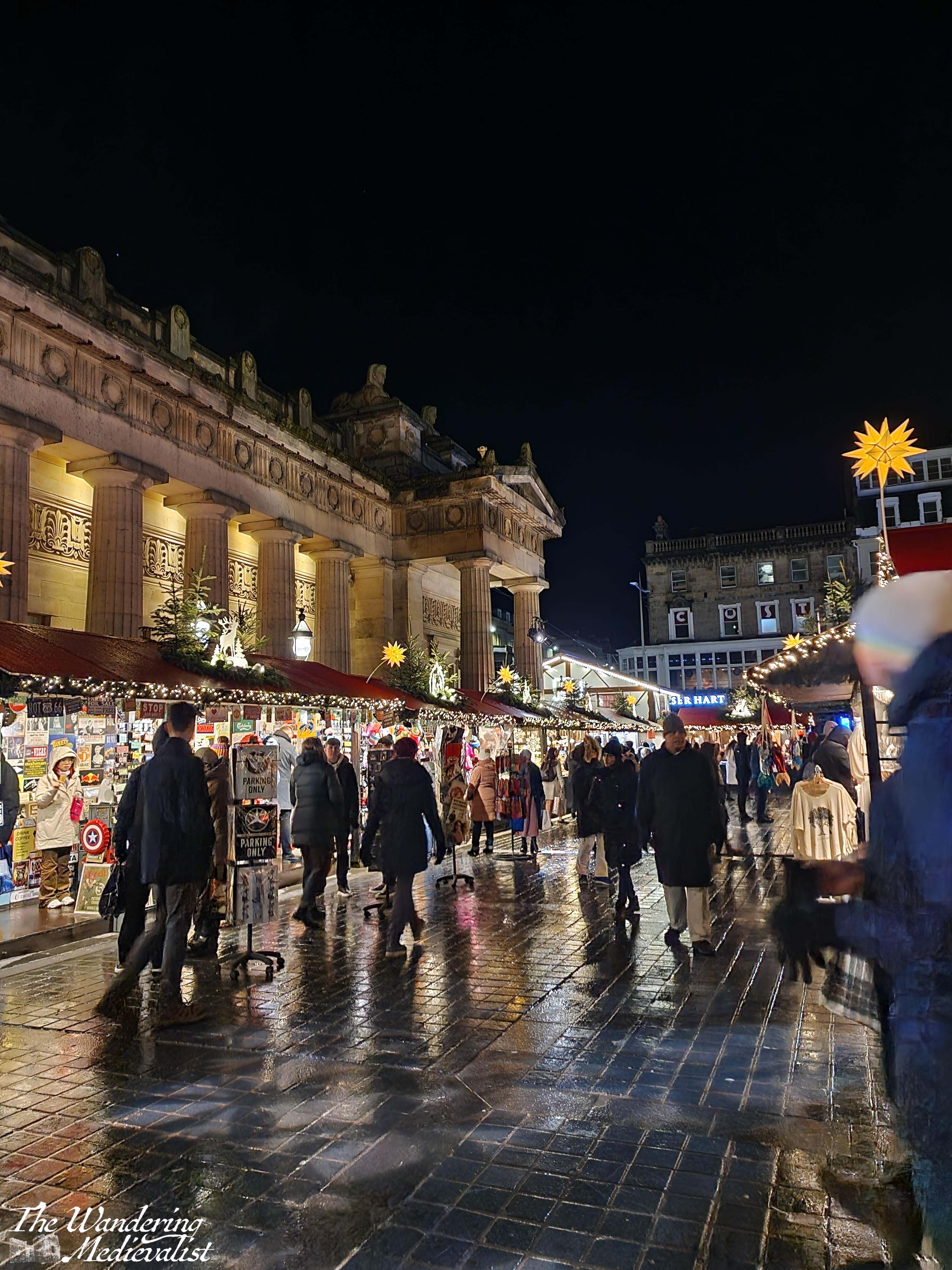
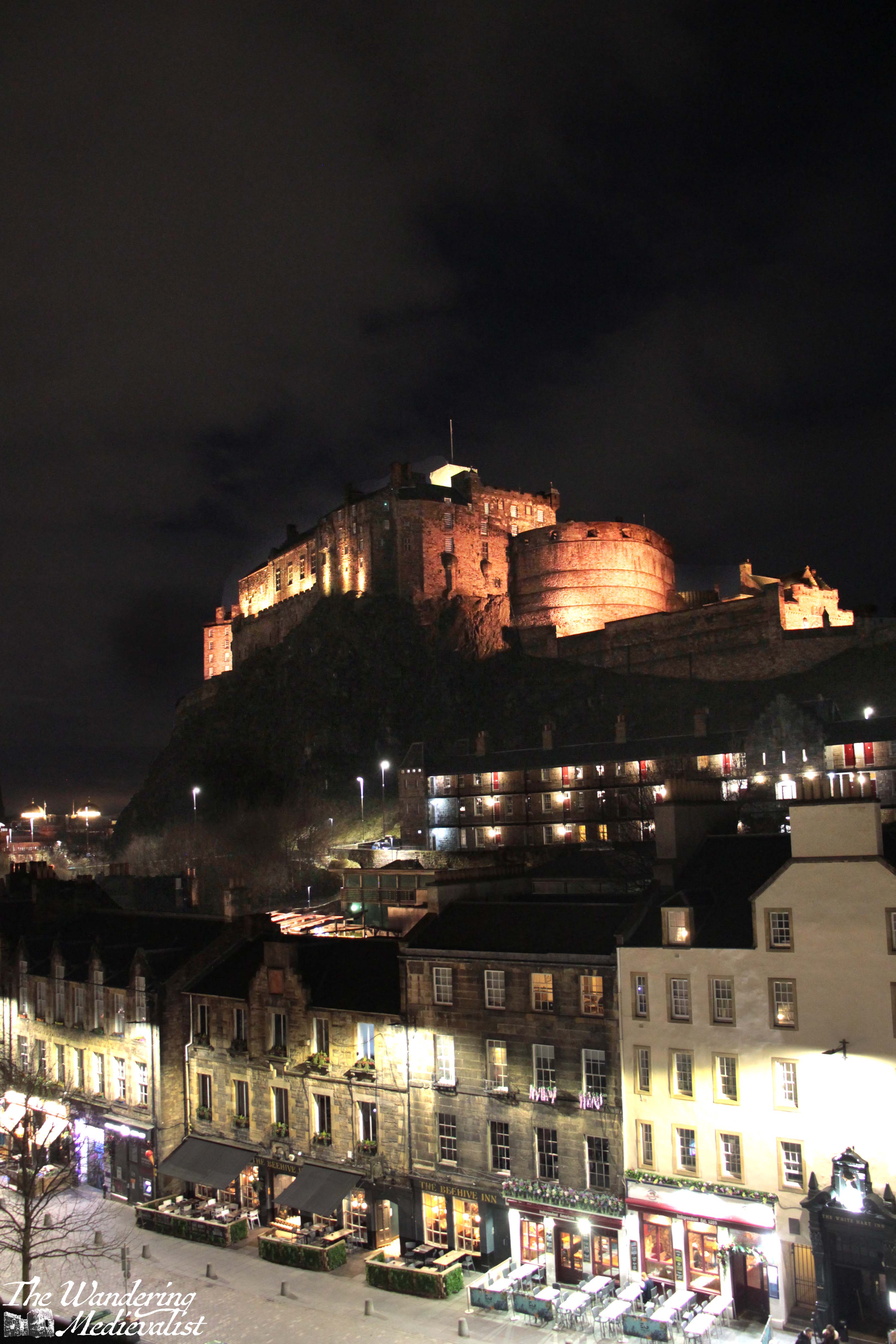
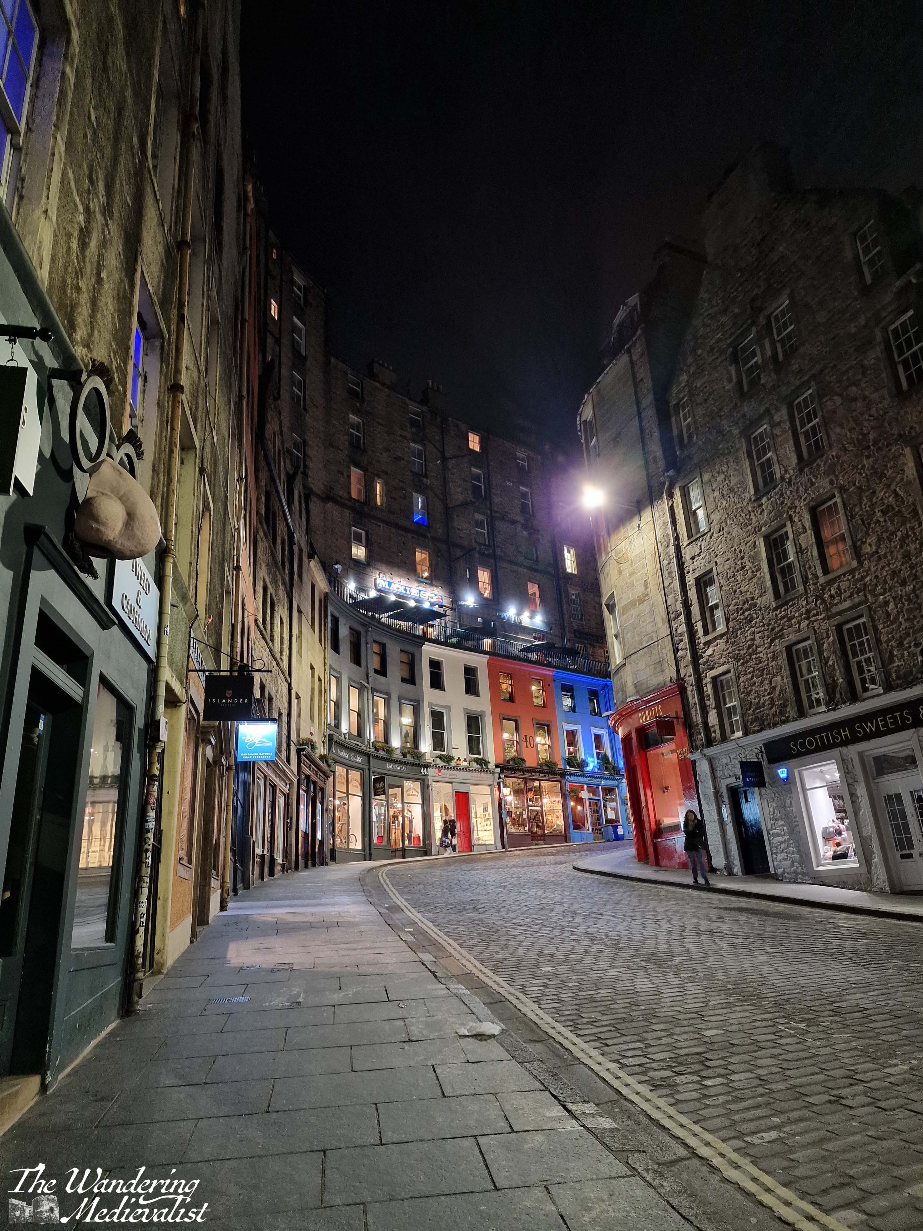
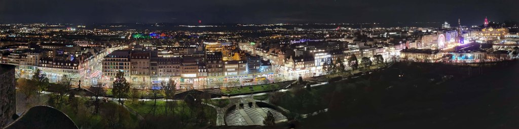
Edinburgh, Scotland 🏴
As anyone who has routinely read my blog is aware, Edinburgh is one of my favourite cities, second only to Boston. It is almost absurdly picturesque, both old town and new, and boasts some incredible Christmas decorations, particularly around the German Christmas market.
Panorama of Princes Street from the castle
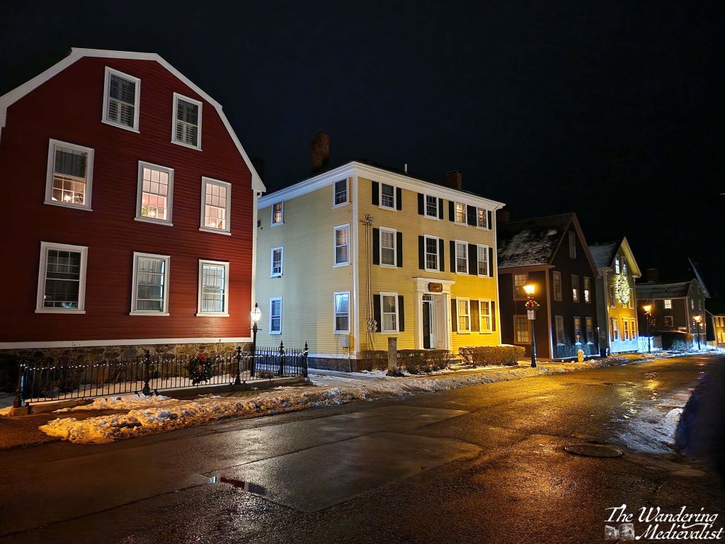
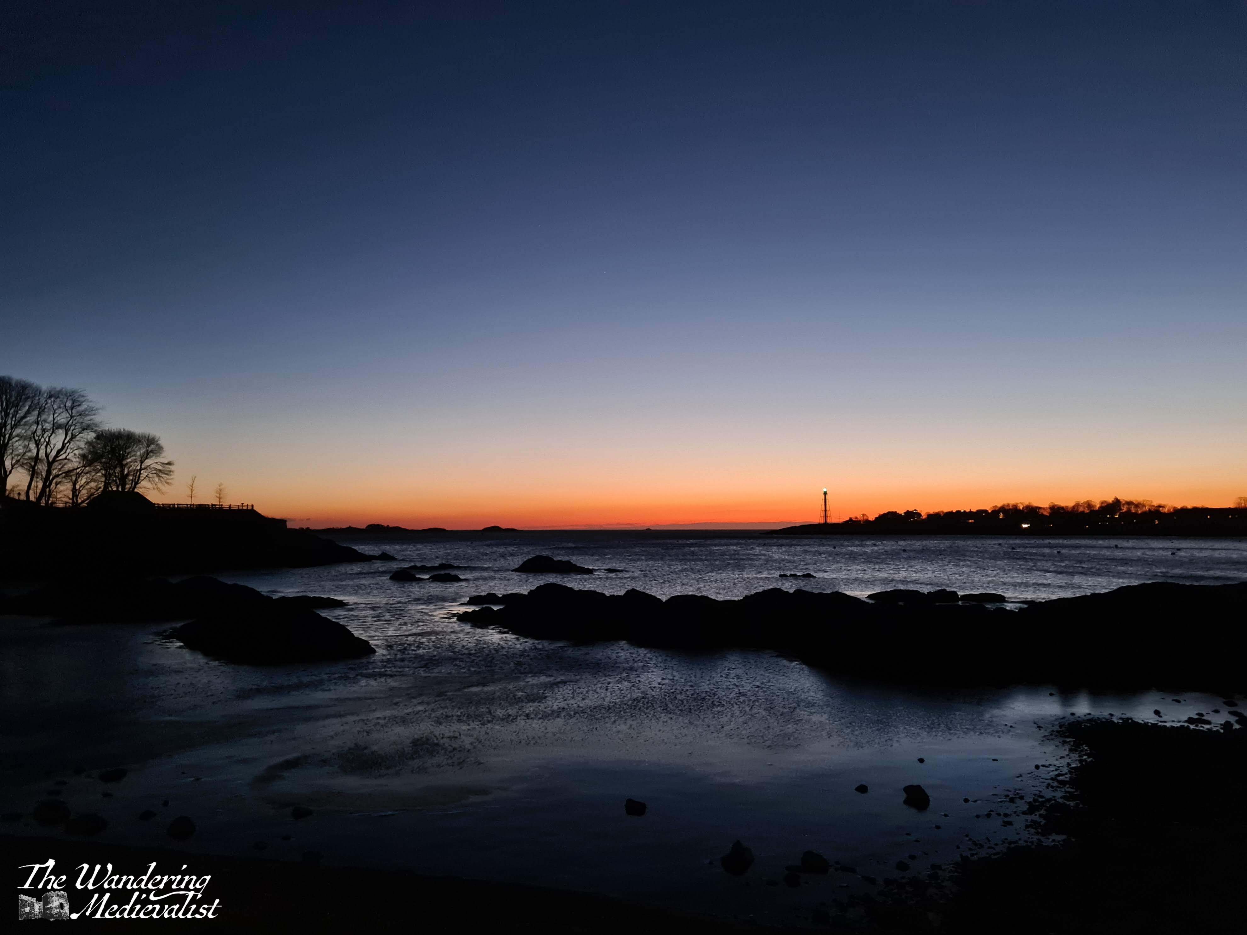
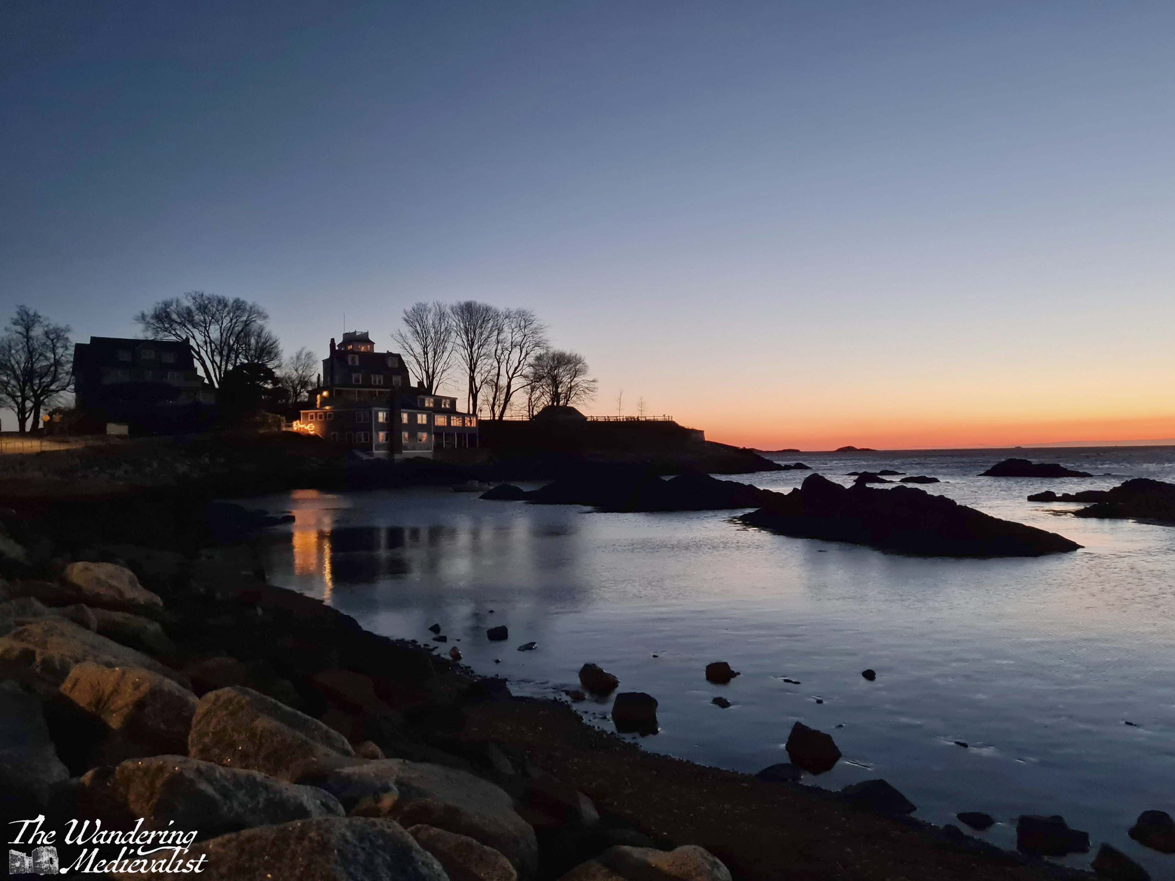
Marblehead, Massachusetts, USA 🇺🇸
Whenever I visit home, I make an effort to walk around the town at least two or three times each trip, and an evening wander home from dinner or a drink with a friend is a great opportunity to capture the town at night. I am also inevitably either welcomed back or given a send-off by the Logan Airport flight path, which passes almost directly over Marblehead, allowing for some great sky shots – who needs a drone when you have Aer Lingus?
Little Harbor
Marblehead from an Aer Lingus flight
State Street
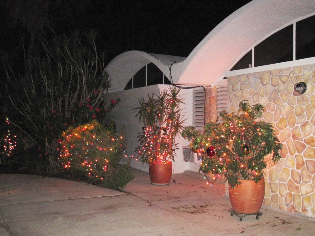
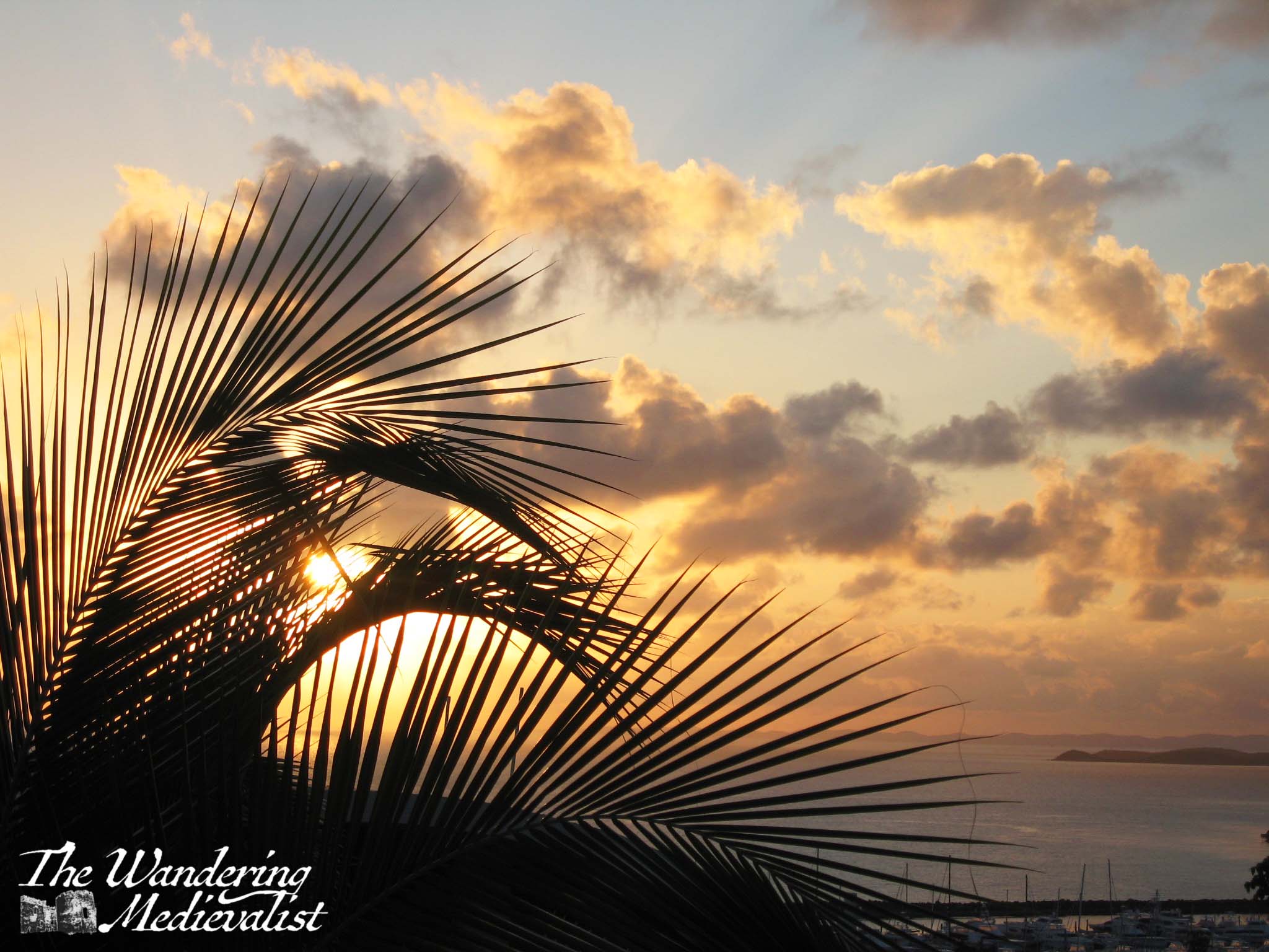
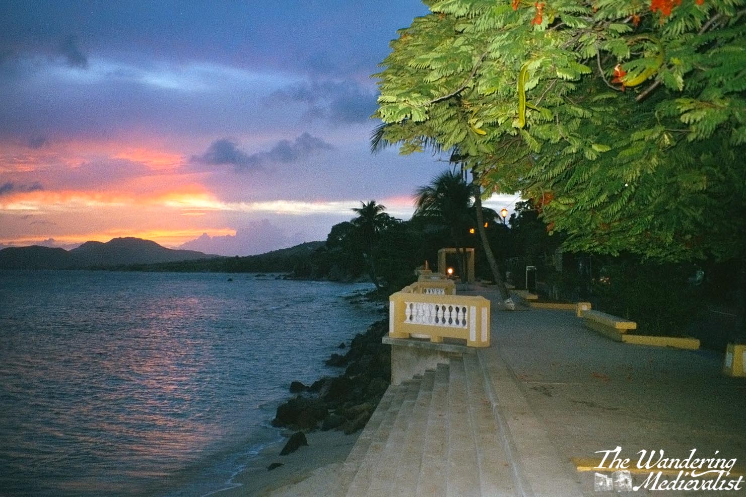
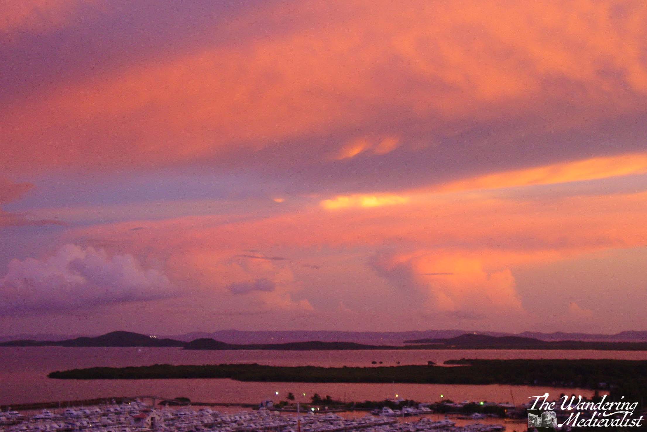
Puerto Rico 🇵🇷
Night in the Caribbean can be a very different place than anywhere else; it is seldom quiet, and I find very seldom as dark as anywhere else. Perhaps because there are often many people about, perhaps due to reflection of the moon and stars off of the water, or perhaps something to do with the warmth.
Ponce, Puerto Rico
Fajardo, Puerto Rico
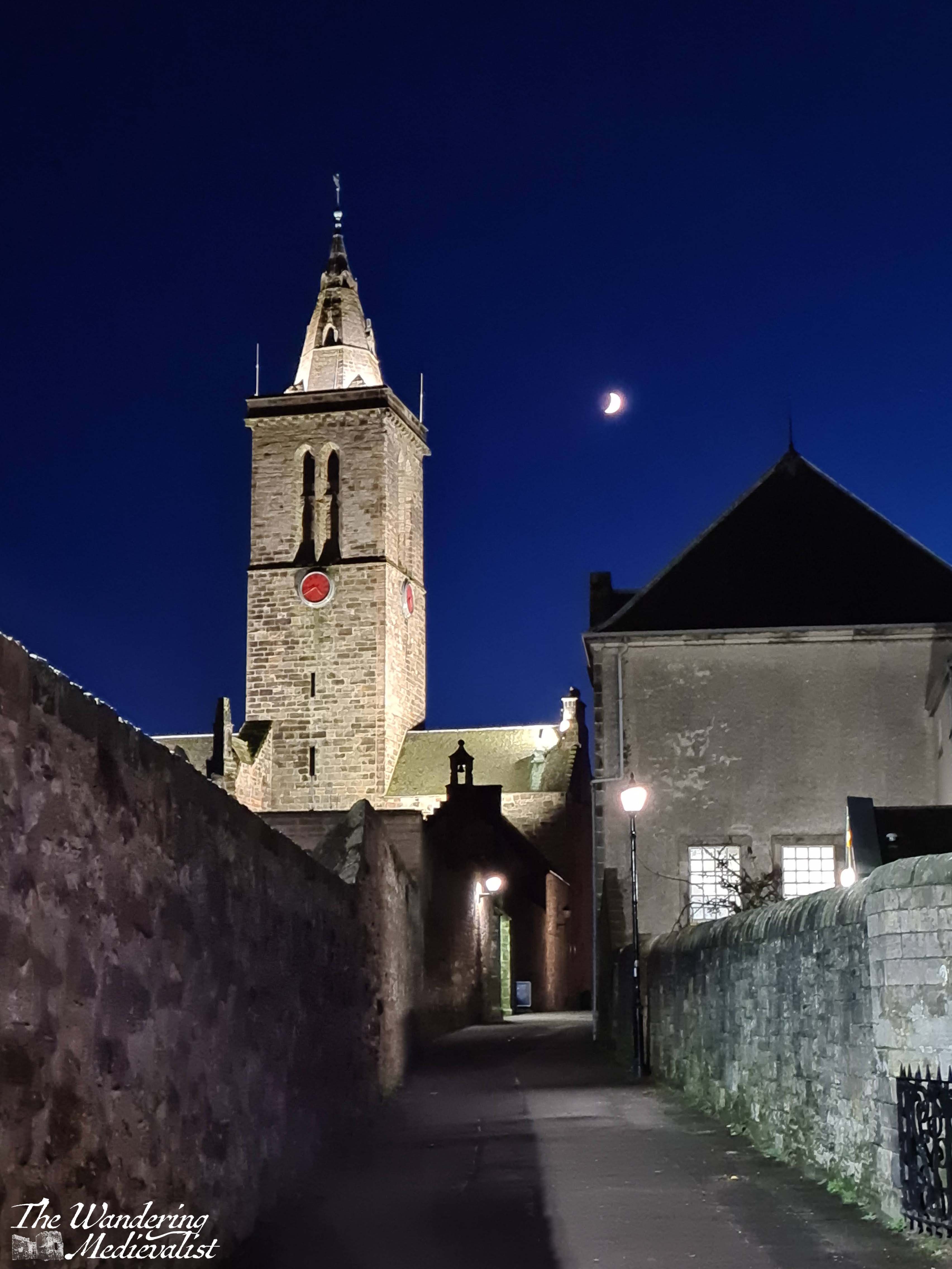
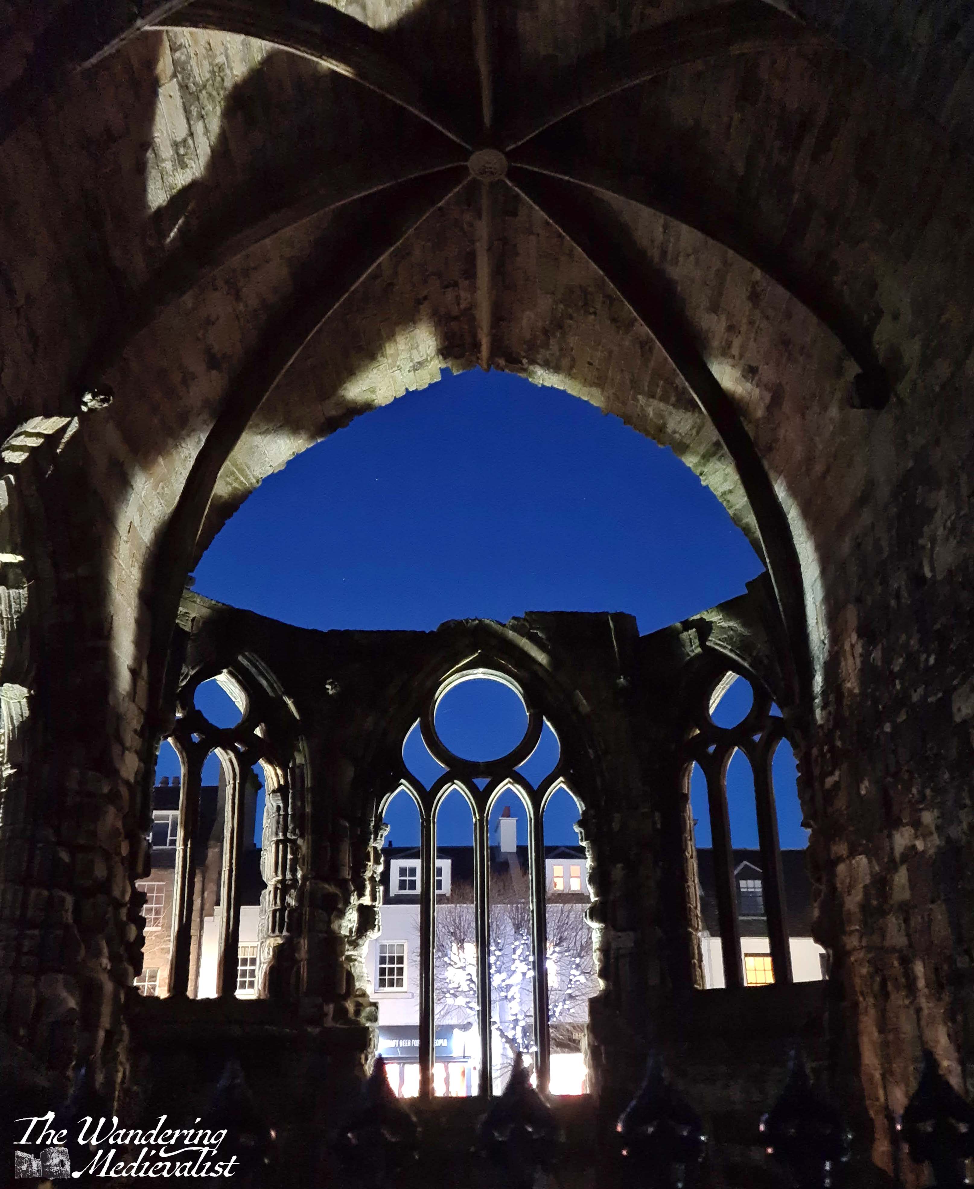
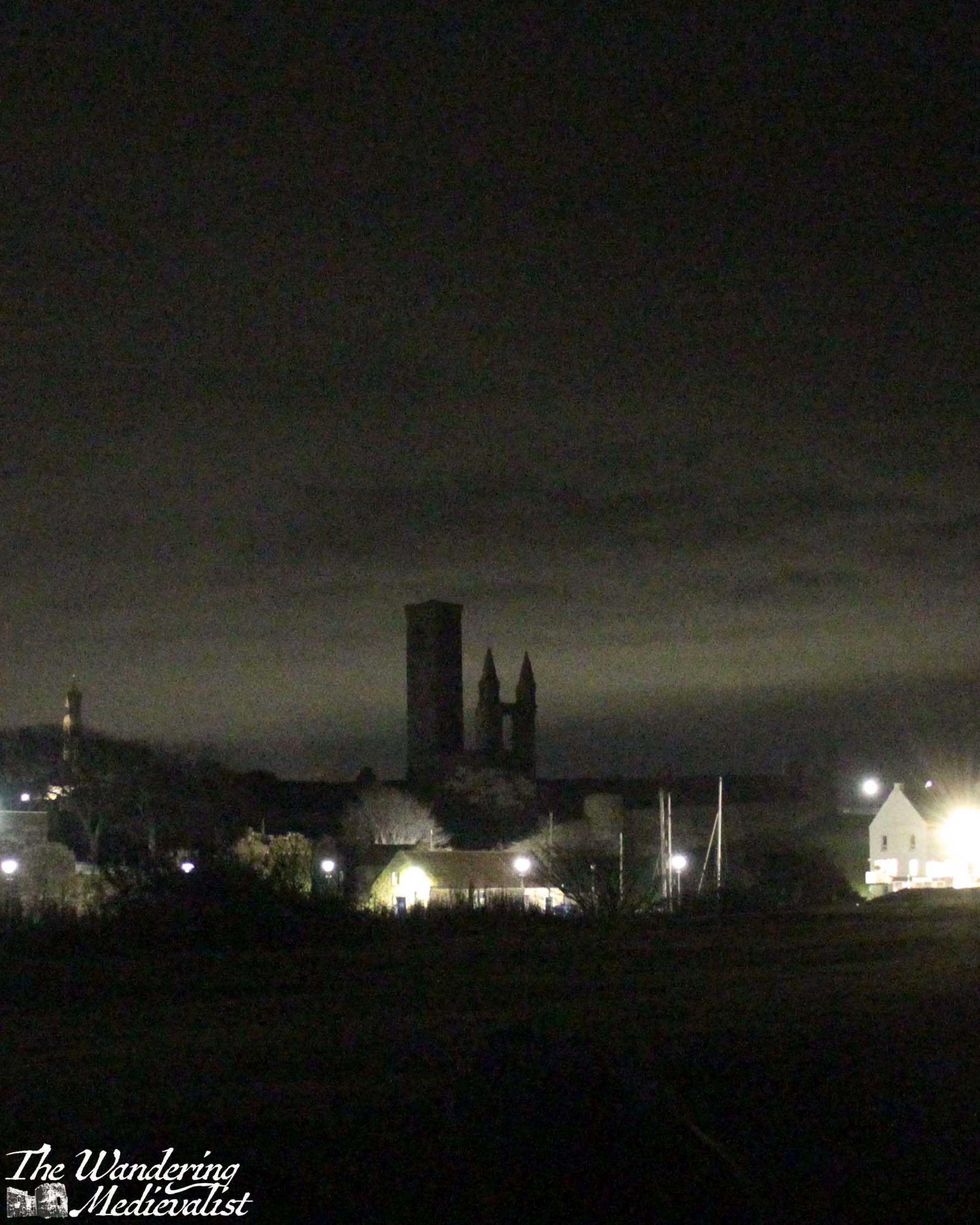
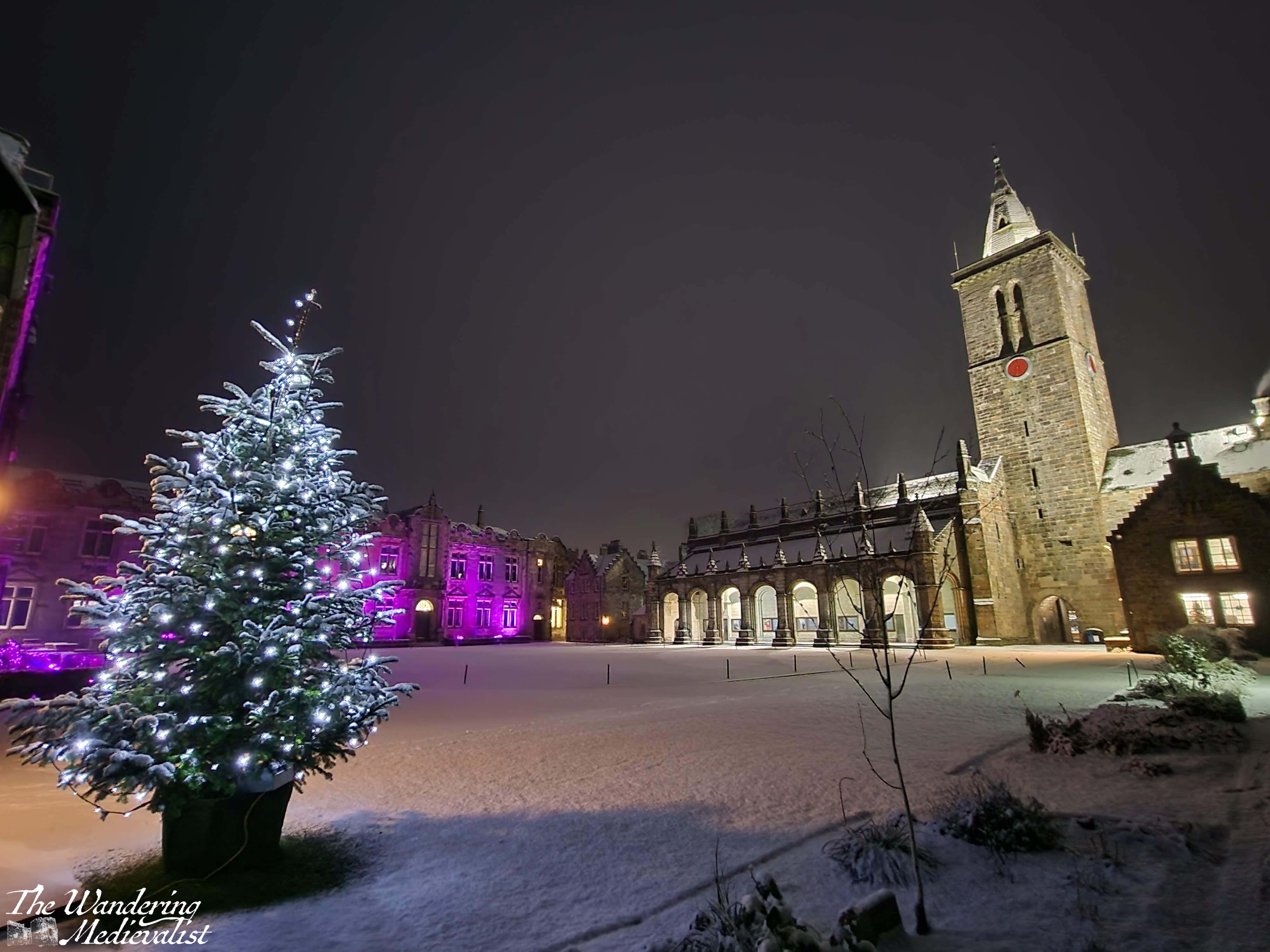
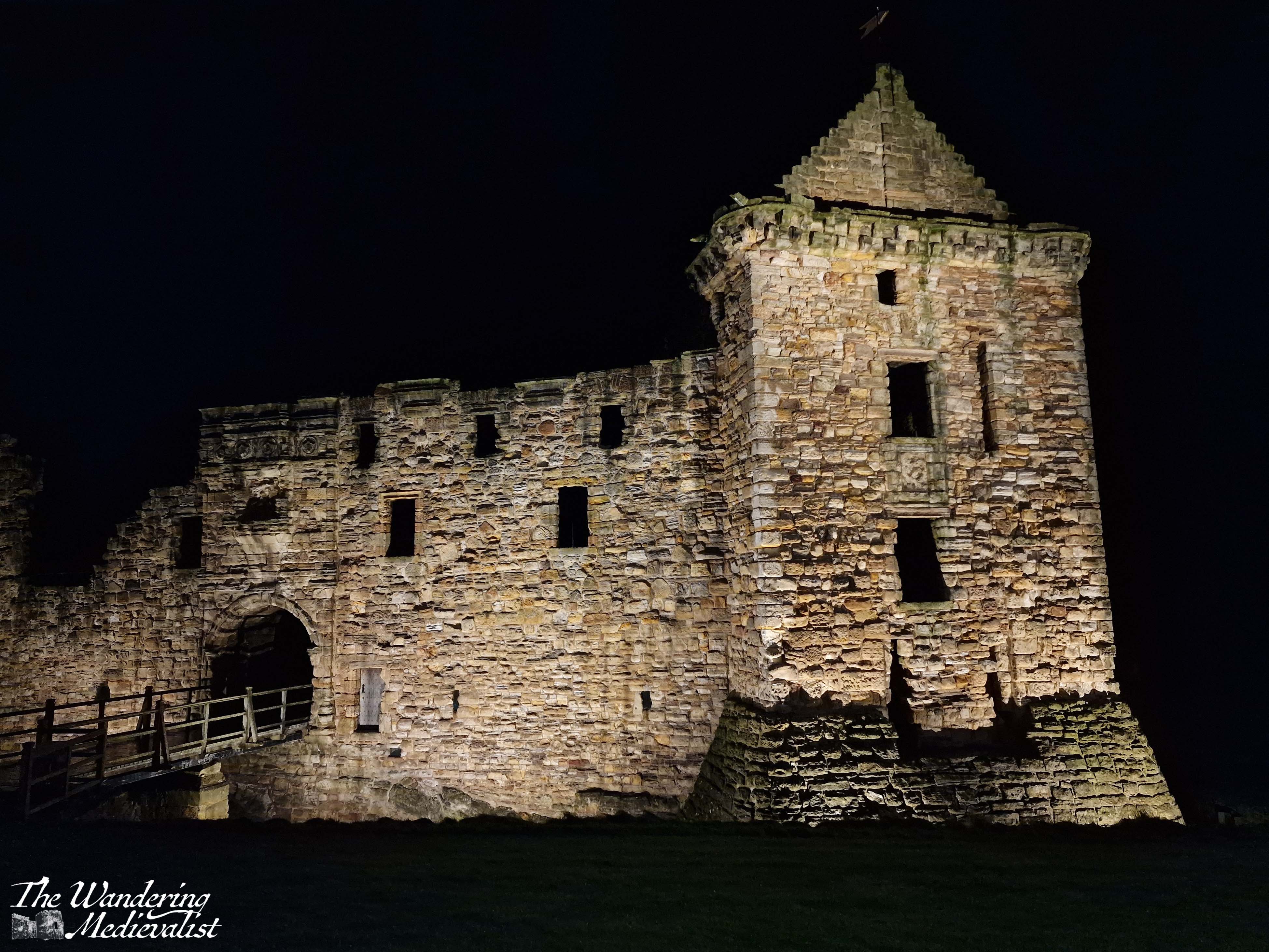
St Andrews, Fife, Scotland 🏴
I have spent a great deal of time in St Andrews, after dark as well as before, and so I have hundreds of pictures of the town at night. These are just a few of my favourites.
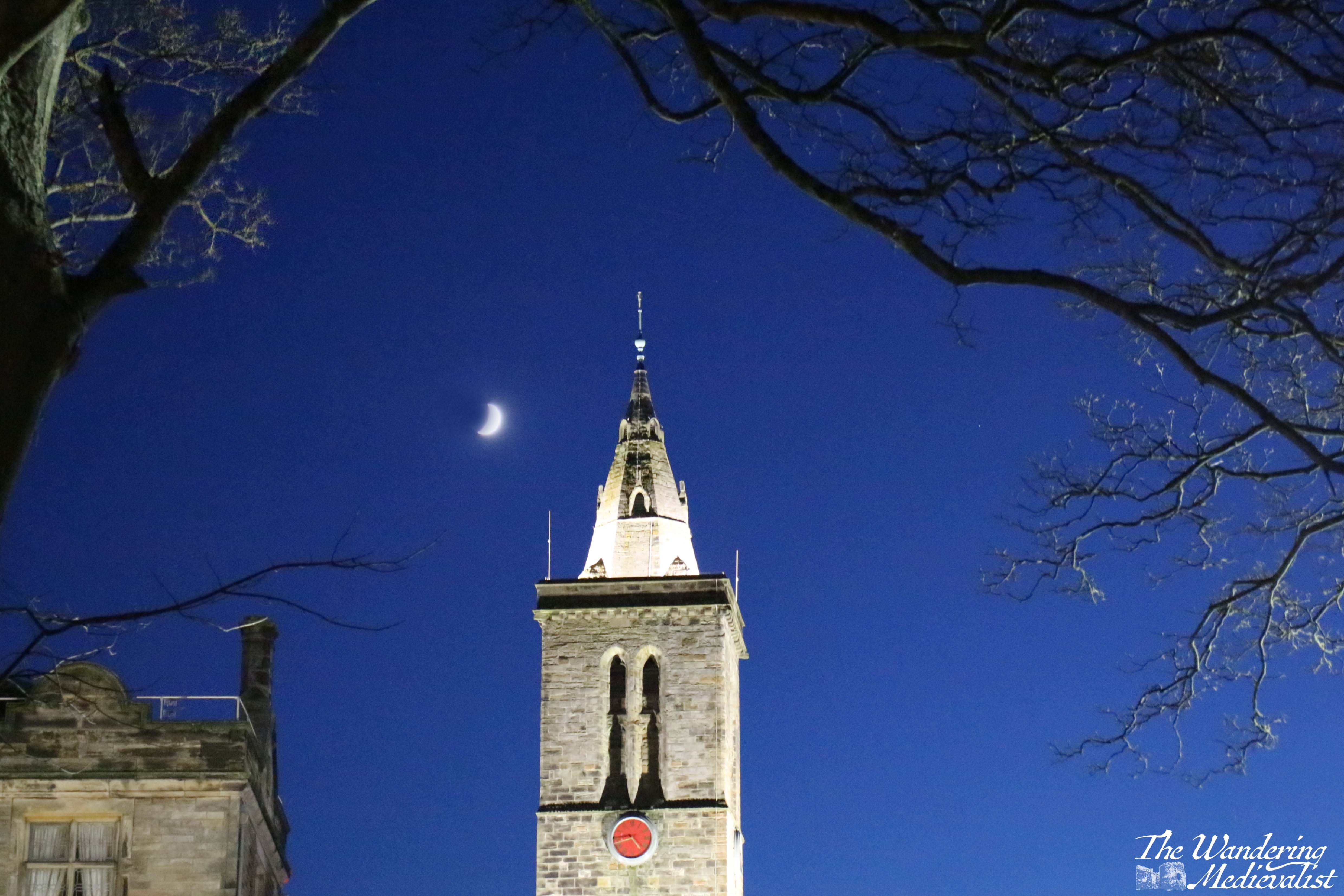
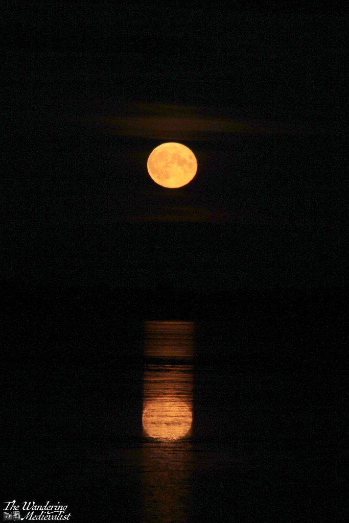
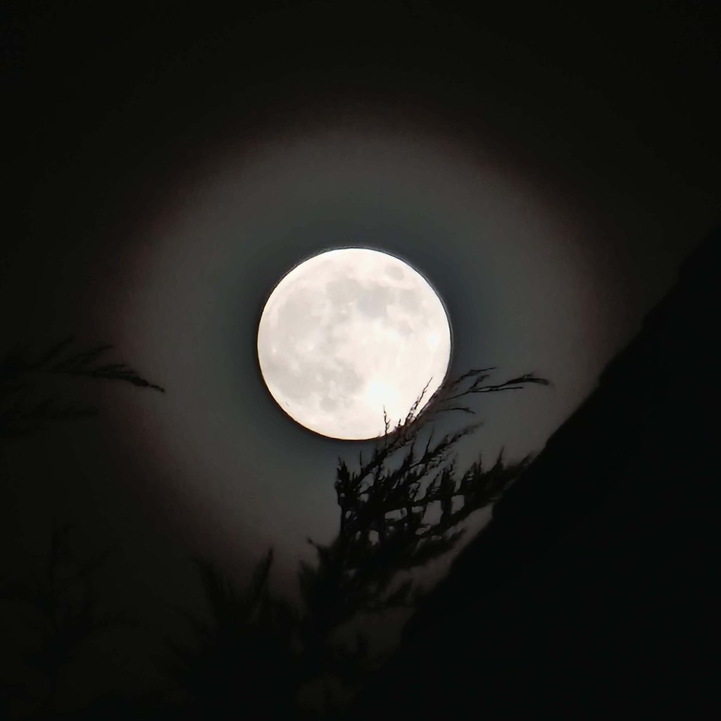
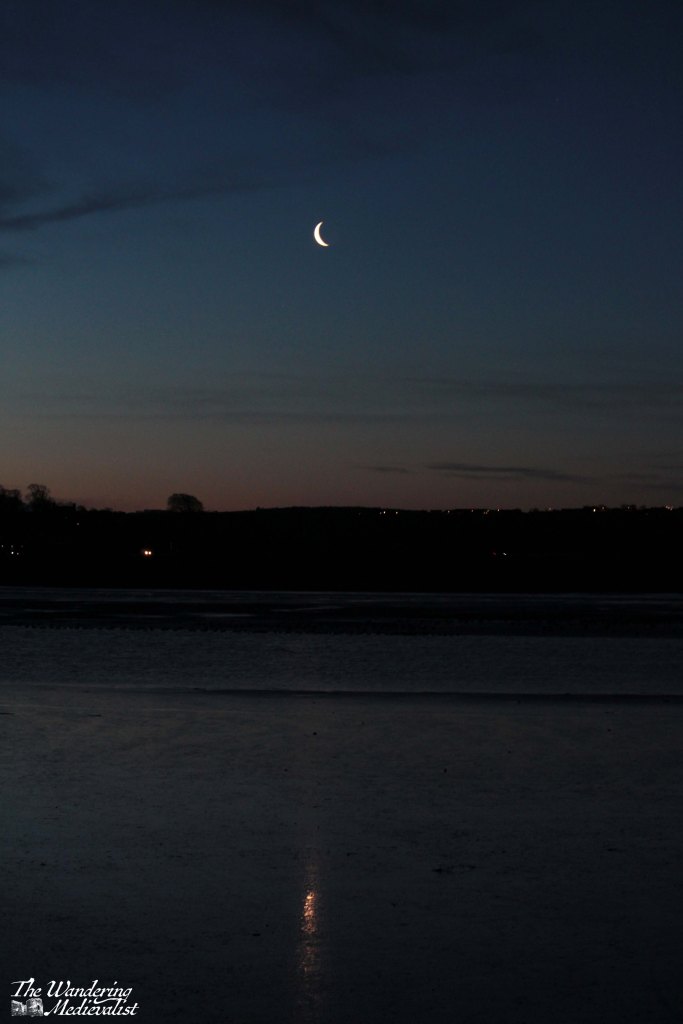
The Moon at night 🌚
I defy anyone to take a walk at night during the full moon and not stop, just once, to wonder at it. I have become so obsessed with capturing the full moon that I even have it marked in my calendar. At this time of the year, near the equinox, the moon is often in the sky during the day and offers a perfect opportunity to capture it; but that is not the point of this post. Mankind has been fascinated with the moon for generations, even more so since we actually went there…I personally am continually surprised by how clear it can look even just to the naked eye.
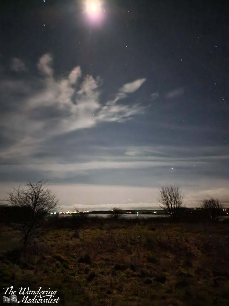
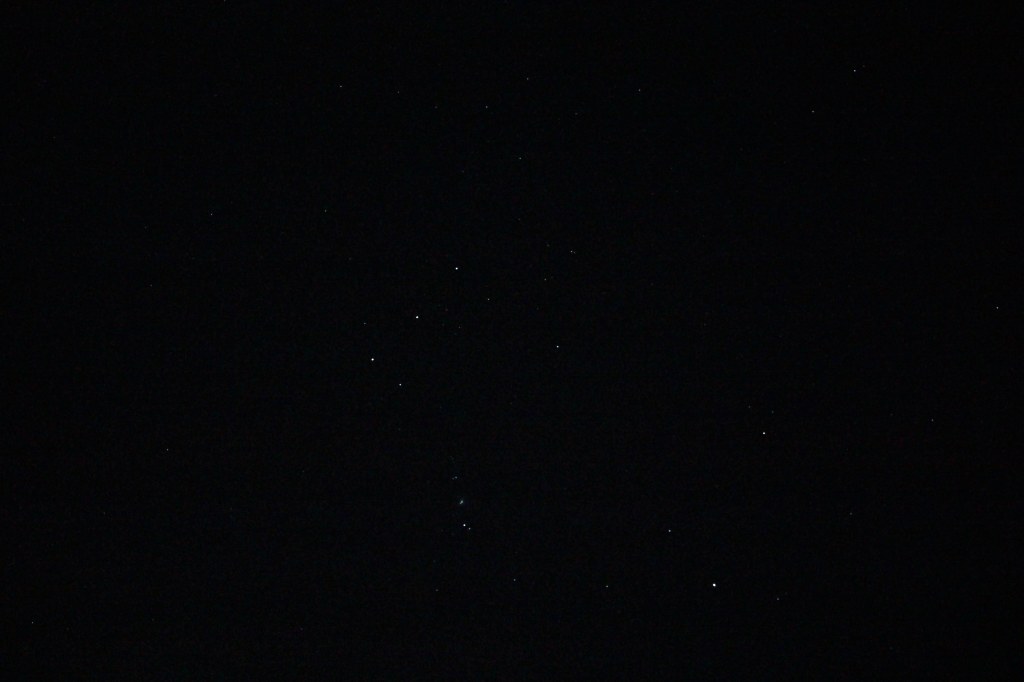
And the stars… 🌌
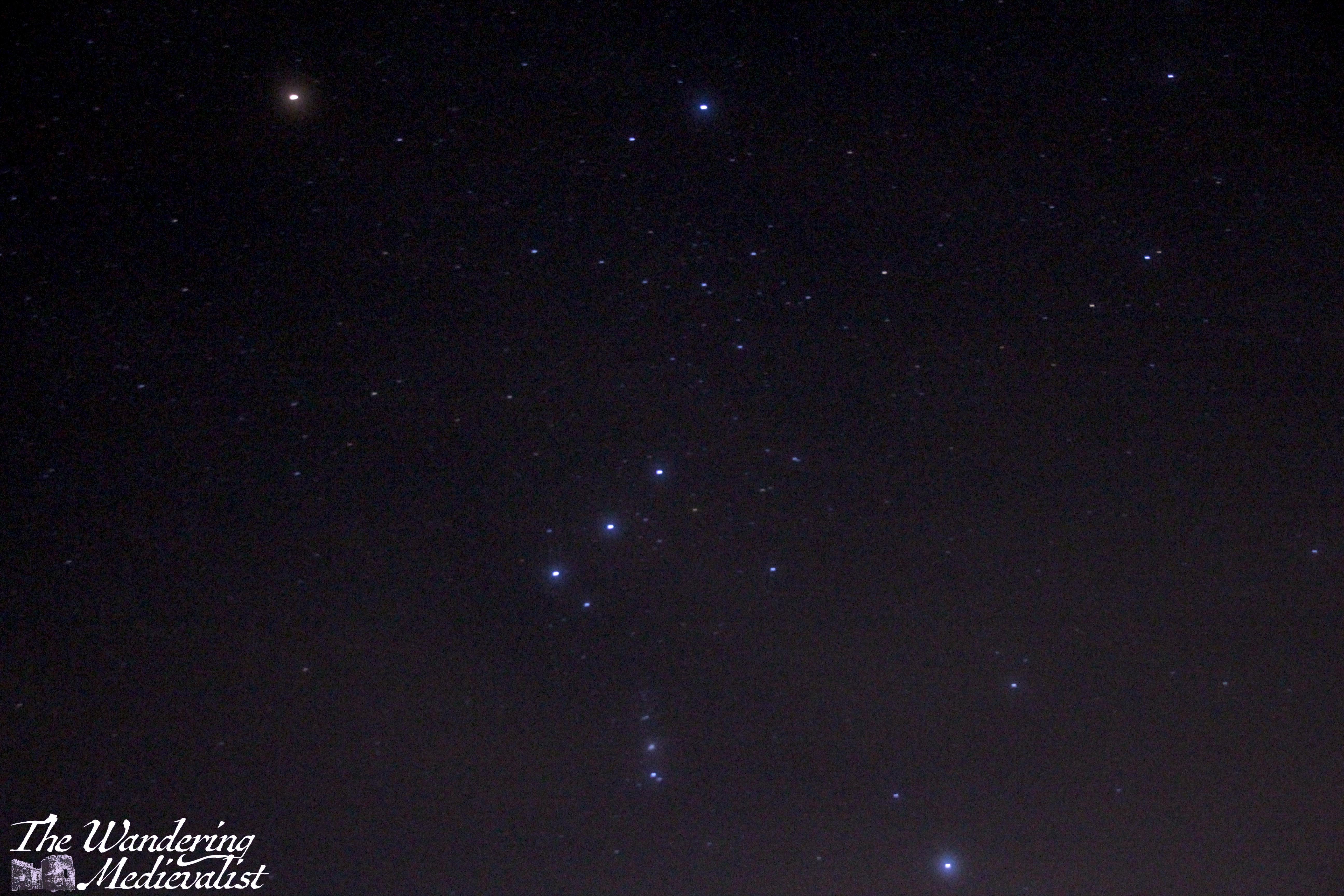
Taking clear, atmospheric photos of the stars requires a spot with as little light pollution as possible, a tripod, plenty of time to try different settings, and some knowledge about how to edit the products of your time. I’m getting there, though I’ve got a way to go to equal some of the spectacular professional shots one sees online.
This one was taken on my phone with a night setting, so feels a bit like cheating.
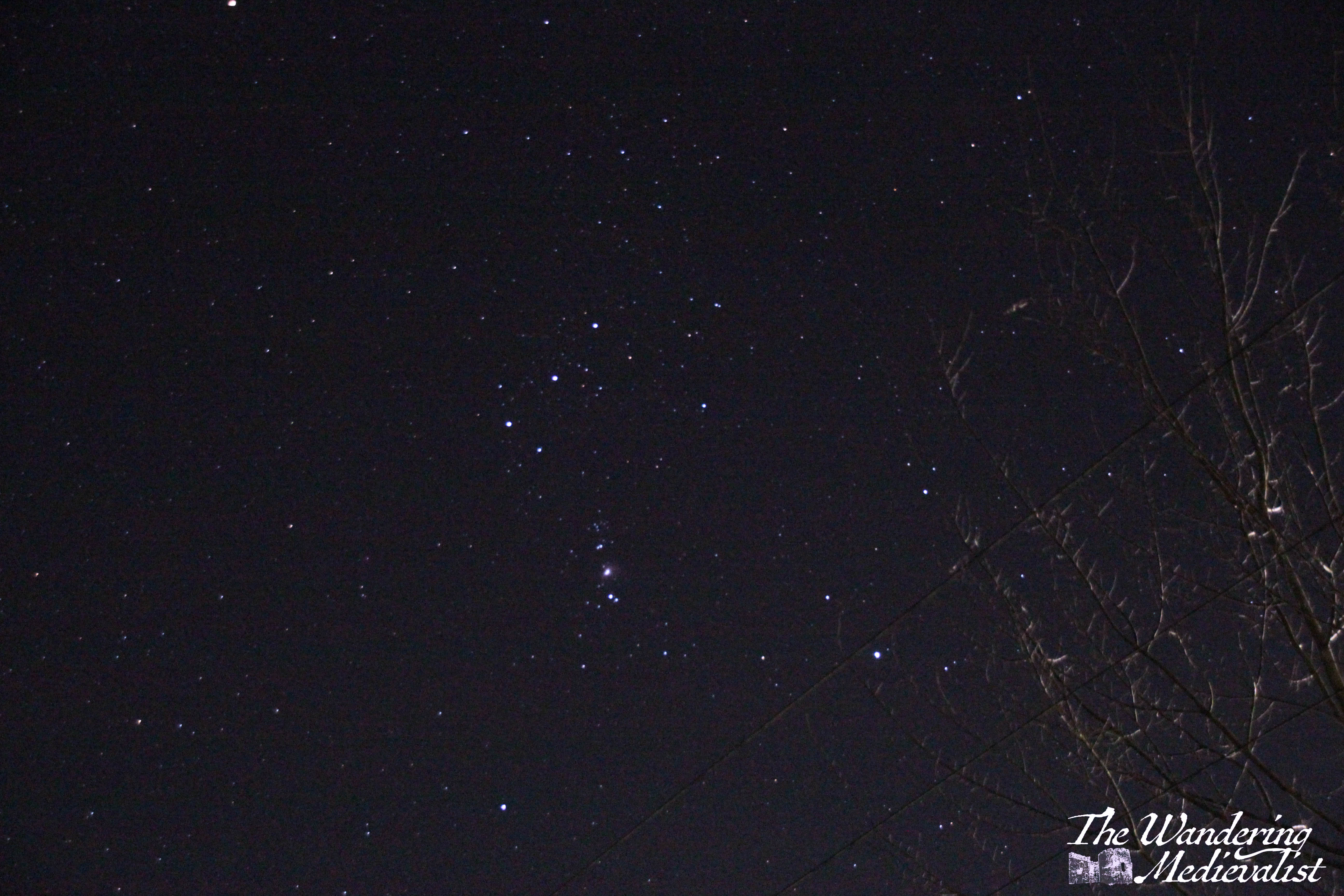
If you open this one up, you should just be able to make our the Orion.
The night sky in Skye – so little light pollution up north!
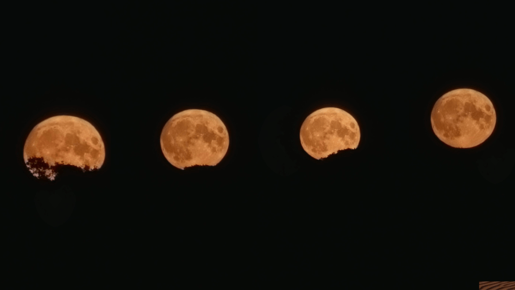
Finally, I’ll wrap up with a sequence of pictures I took one evening as the moon rose; I’ve mashed them all together, and I hope they provide even a touch of the awesome nature of the full moon.
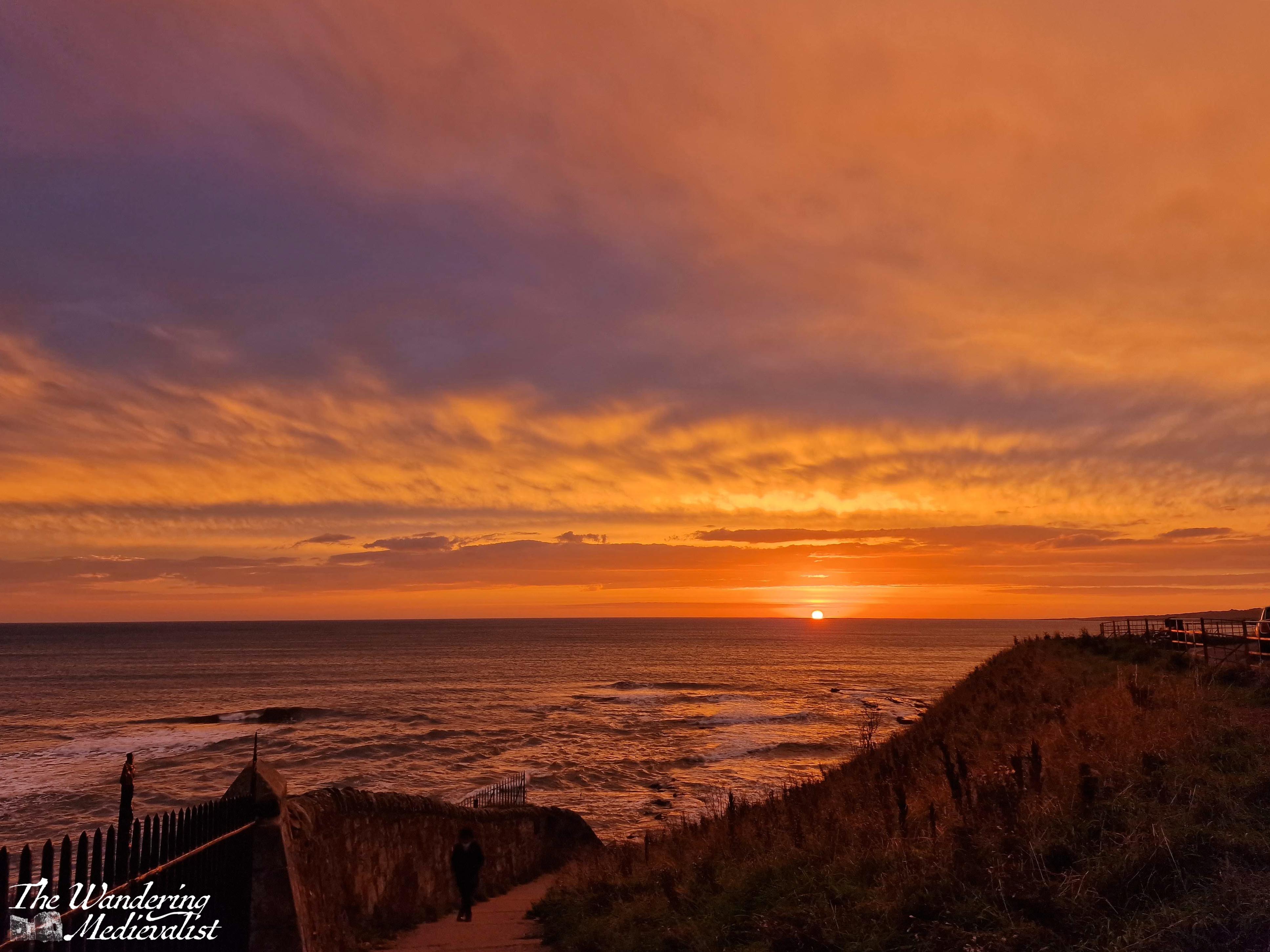
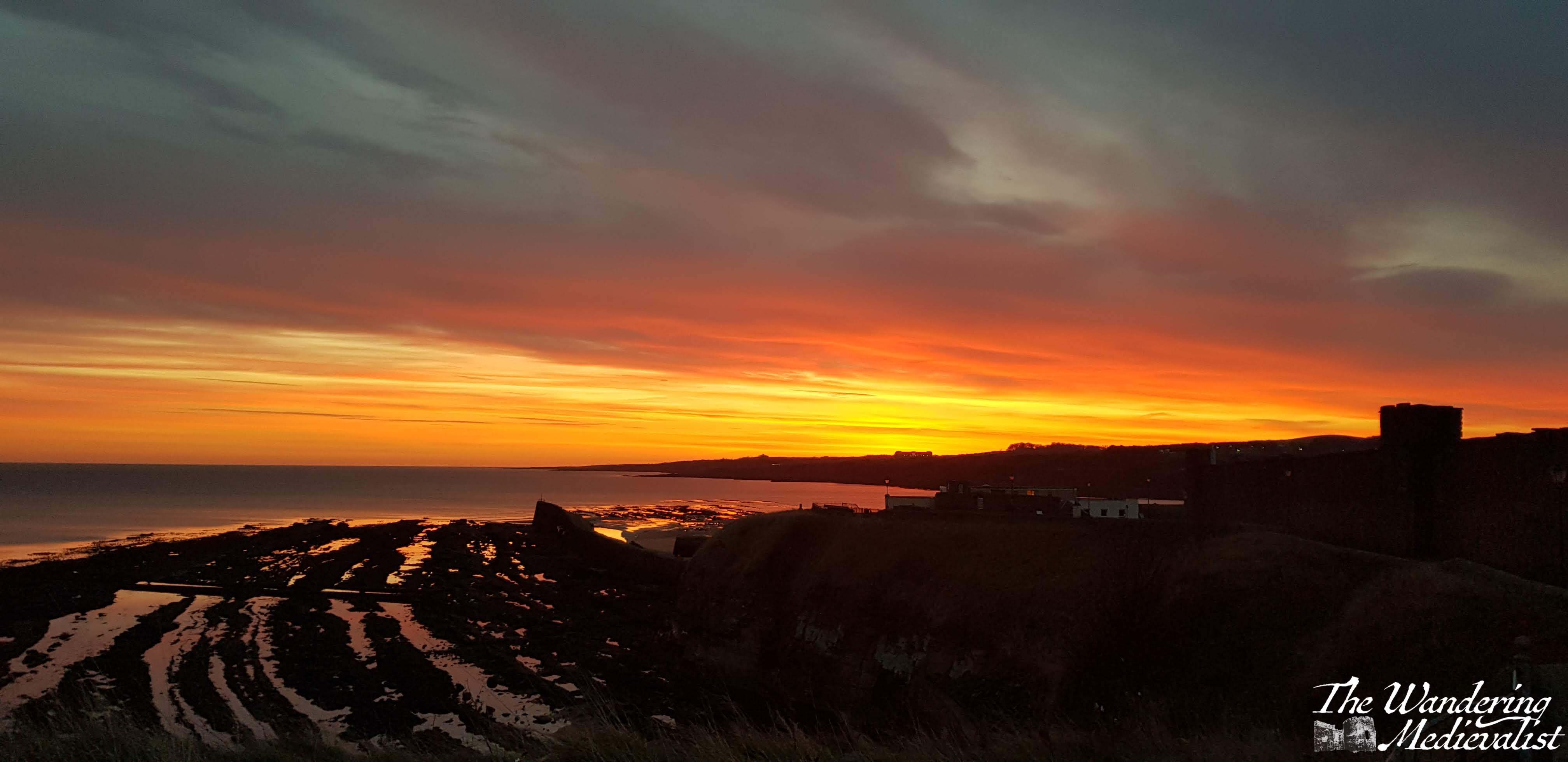
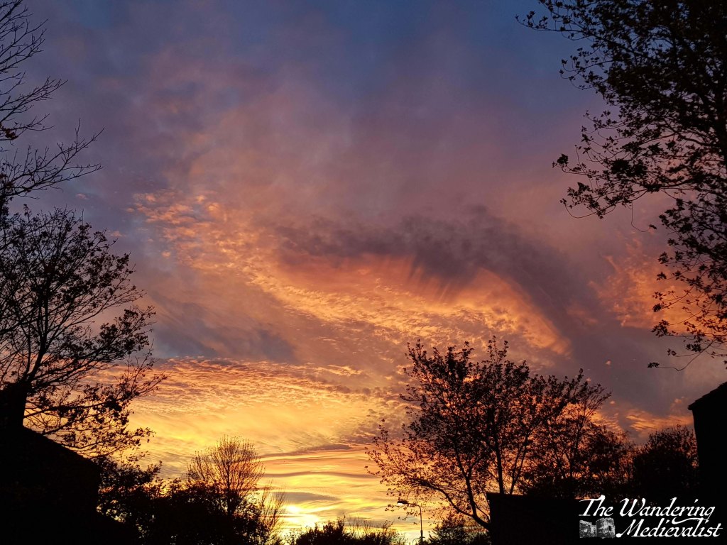
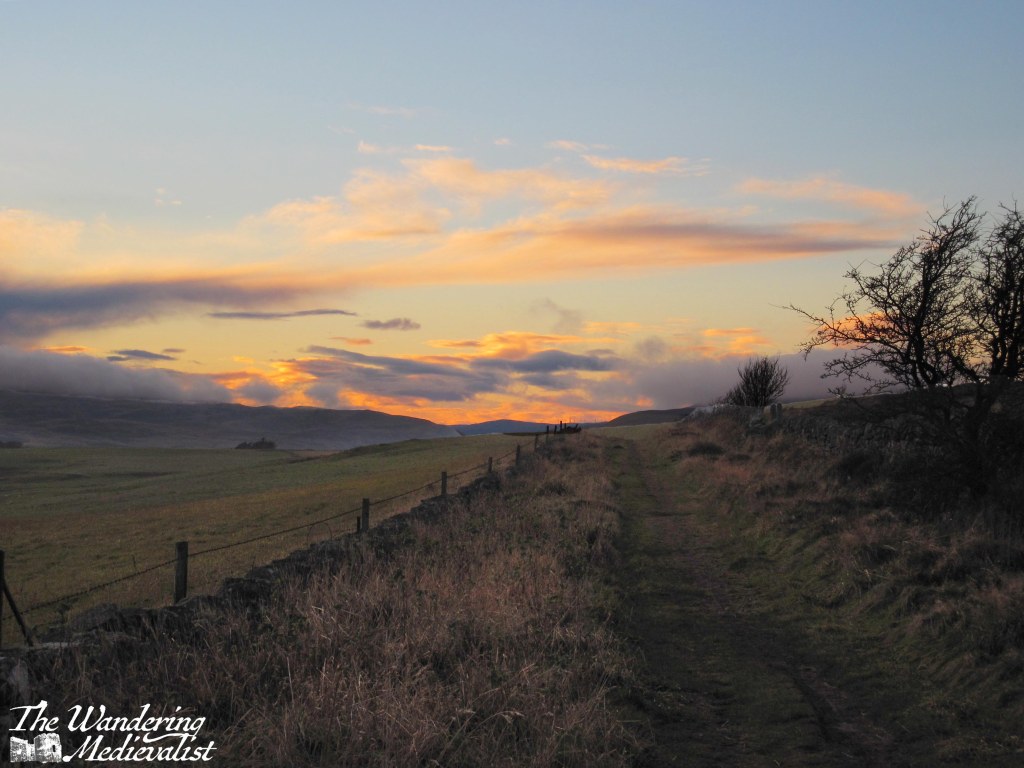
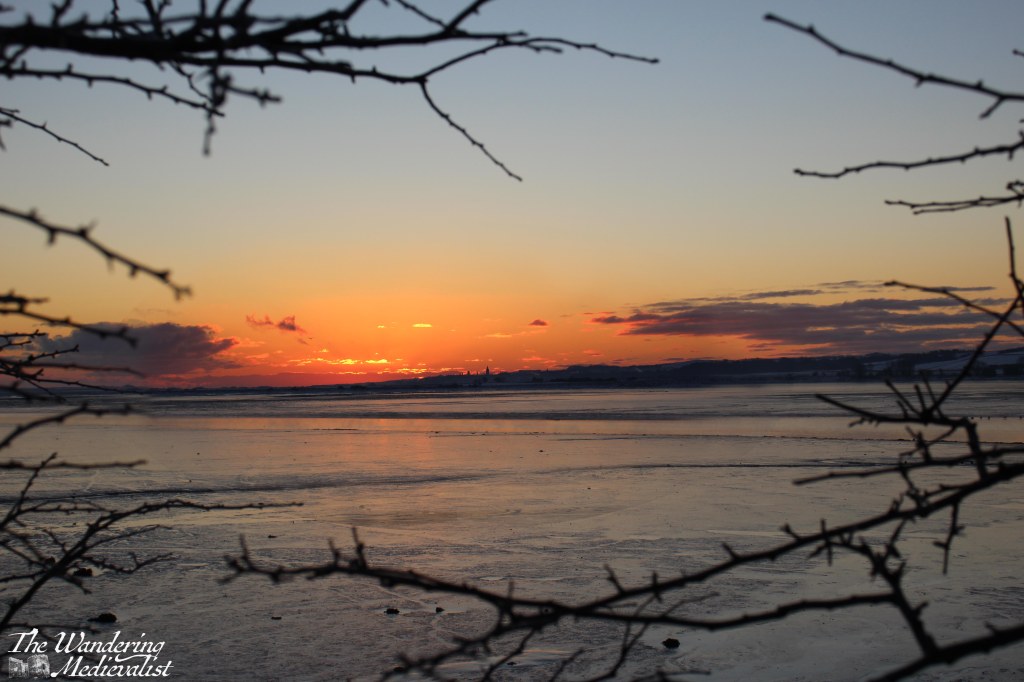
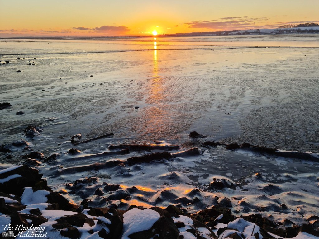
Throughout the many depressing months of lockdown, a morning or evening walk was often the time to which I clung to relax and refresh my mind. Few things helped more than stopping before a beautiful yellow-orange-red sky, catching a glimpse of some distant pink, or watching the sky fade into purples and dark blue. I have always loved getting up early to catch the start of the day.
The thing about sunrises and sunsets is that you can never really be sure when you’re going to get a good one. Some mornings or evenings you’ll be out there with your camera ready and the colours just won’t appear, and everything fizzles away. Then other days you’re walking or driving home from work or on the bus and suddenly colour appears in the sky that is just so spectacular it should have its own symphony. To a great extent it’s all about being lucky, being in the right place at the right time and then of course being ready to capture the colours if you can. Though there is also, of course, an element of persistence, going out whenever you can, and even trying to read the clouds. I by no means claim to be an expert at this. Some days the colour is earlier than you think, or later, or even in a part of the sky you did not expect. You can never predict it perfectly.
But once you do, and you get the pictures you want, it is always worth taking a few moments to just enjoy the peace, and the drama.
Fajardo and Vieques, Puerto Rico 🇵🇷
Caribbean sunsets and sunrises tend to be surprising – they are either spectacular and dramatic or sometimes a touch underwhelming. Dawn and dusk come with less speed than in other parts of the world, moving slow in the heat that never really fades even at night. I have been lucky enough to experience quite a few of both over the years, and I have developed a bit of a fascination with pictures of sunlight through palm leaves.
Glencoe, Scotland 🏴
My favourite place in the Highlands, Fort William, is not overly well-situated for sunsets, as mountains block the sun well before it hits the horizon. A bit further south in Glencoe, however, Loch Leven runs almost due west and allowed for these stunning pictures one April evening.
Guardbridge, Fife, Scotland 🏴
In 2021 as lockdown really took hold, I made it a point to go out for a walk every weekday morning before work, even in the rain and snow. My route included a breathtaking vista across the Eden Estuary towards St Andrews, where the church towers and cathedral ruins punctuate the skyline. Often flocks of birds and even local deer made cameos in these pictures, as well,
Marblehead, Massachusetts, USA 🇺🇸
Marblehead is a perfect spot for colour at both ends of the day, with sun rising over the Neck or mouth of the harbour, and setting over the causeway and old town. In recent years, jet lag has allowed me to capture some gorgeous sunrises particularly in winter.
St Andrews, Fife, Scotland 🏴
Top of the list of beautiful settings with castle and cathedral ruins, University buildings, wide beaches and dramatic coastline that sheds in layers into the sea, is St Andrews. I have no shortage of pictures of sunrise and sunset; here are a few of the best.
Tayport, Fife, Scotland 🏴
We did not live in Tayport for very long, and a good portion of the time we were in Covid lockdown, but we were fortunate enough to have a fantastic view from our kitchen. I was known on more than one occasion to throw a coat or sweatshirt on over my pyjamas to rush down to the harbour, to get these pictures across the Firth of Tay.
And a few more…
This sunrise lives in my mind as one of the last before lockdown started…taken from the Tay Rail Bridge in March 2020 as a colleague and I travelled to Edinburgh. Sunrise from the train to Edinburgh – I always sit on the left side of the train to enjoy the views across the Firth of Forth, particularly in the morning.Glenrothes sunset.
Sunset on the Isle of Skye.Sunset over the Charles River, Boston.Sunset on the Lomond Hills.
Finally, I’ll wrap up with one of my favourite views at one of my favourite times of day and year – icy sunrise over St Andrews.
This Saturday, the east of Scotland woke to a snowstorm. In our area, it was the kind of storm that was steady but not terrible, and where the flakes varied between large and enormous, coating the ground in two to three inches of fluffy white. Often here when it snows, it starts to disappear almost right away, but it has been so cold that by late afternoon almost nothing had melted. So despite feeling a bit under the weather, I ventured out and five minutes later remembered why I did: a snowy day walk in crisp air is perhaps the happiest of my happy places. And so, rather than share with you my blog on another Highlands walk, I am instead sharing with you some of my favourite snowy pictures, mostly taken while on snowy day walks.
Snowmen in St Salvator’s Quad, St Andrews
Ben Nevis from Aonach Mòr
Edinburgh Castle from Princes Street
St Andrews Castle
Meadow in Lyme, NH
Edinburgh Christmas Market
Motray Walk, Guardbridge
Falls of Bruar
Market Street, St Andrews
Faneuil Hall, Boston
Presidential Range from the top of Mount Washington