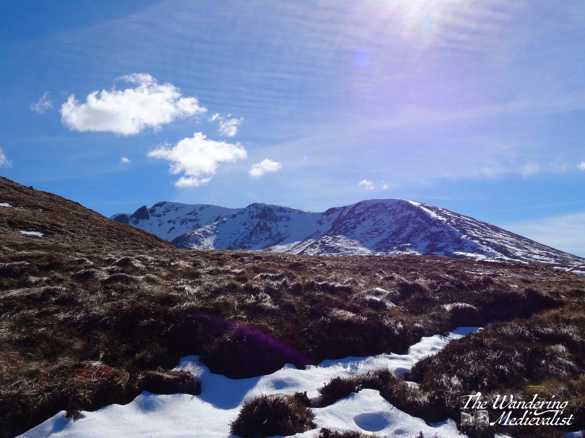
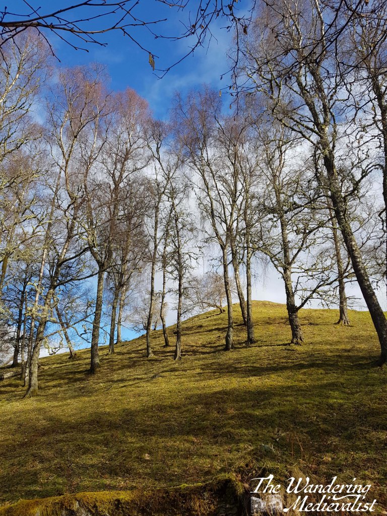
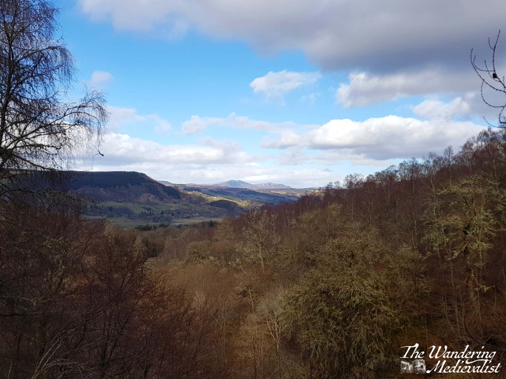
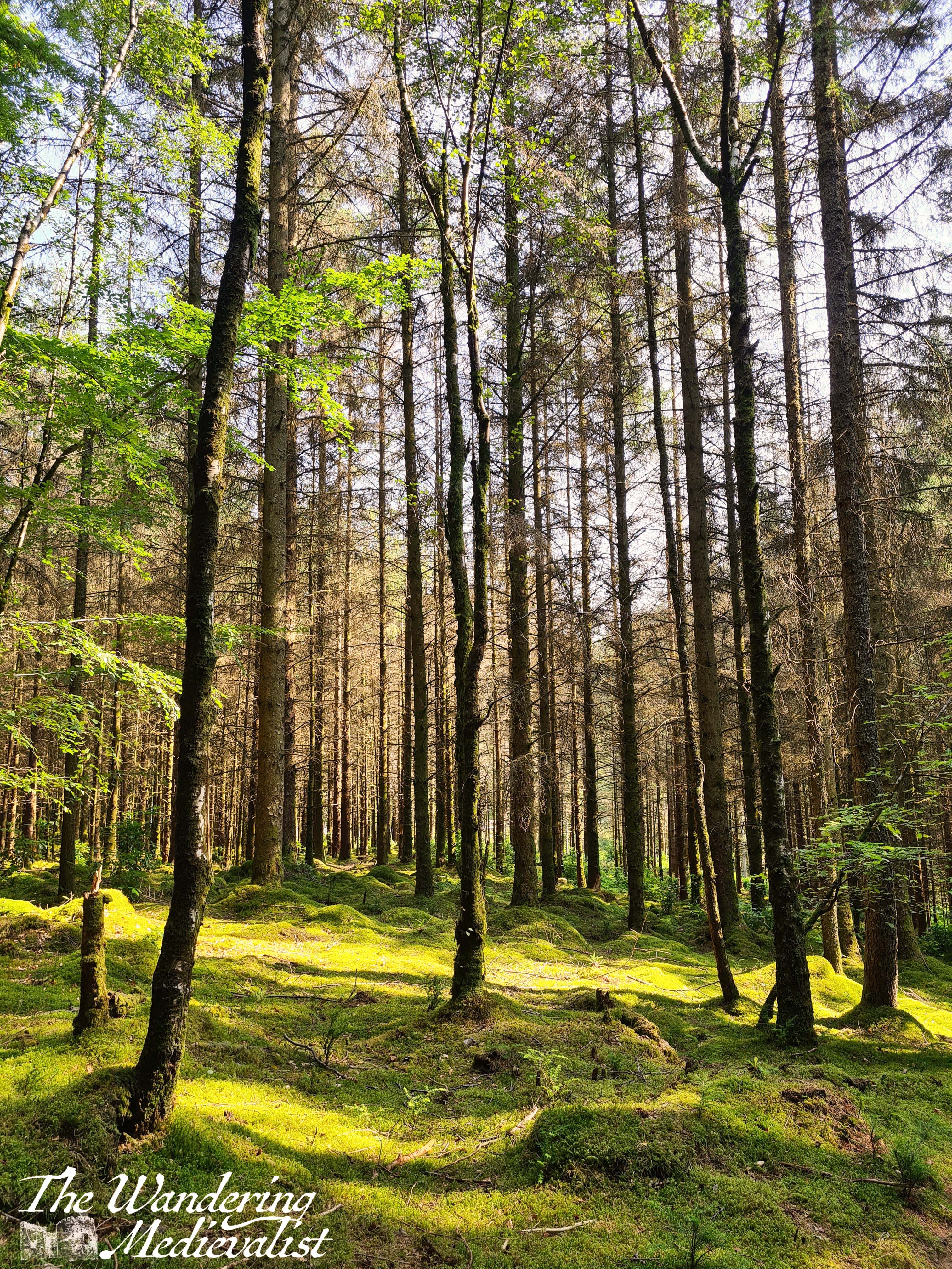
During our recent Sunday walk (definitely another post soon to come), we climbed a hill from which we could see the edge of the Highlands. As we caught our breath and tried to work out which jagged distant hill was which, I felt this visceral need to go there again, to see the mountains up close.
Ever since my first trip north of Perth, I have found the Highlands to be calming, comforting, peaceful – perhaps because they remind me of the White Mountains, or perhaps just because they do have a power over some people – me included. The Meall Beag viewpoint is one of those places in the Highlands where I can find my equilibrium.
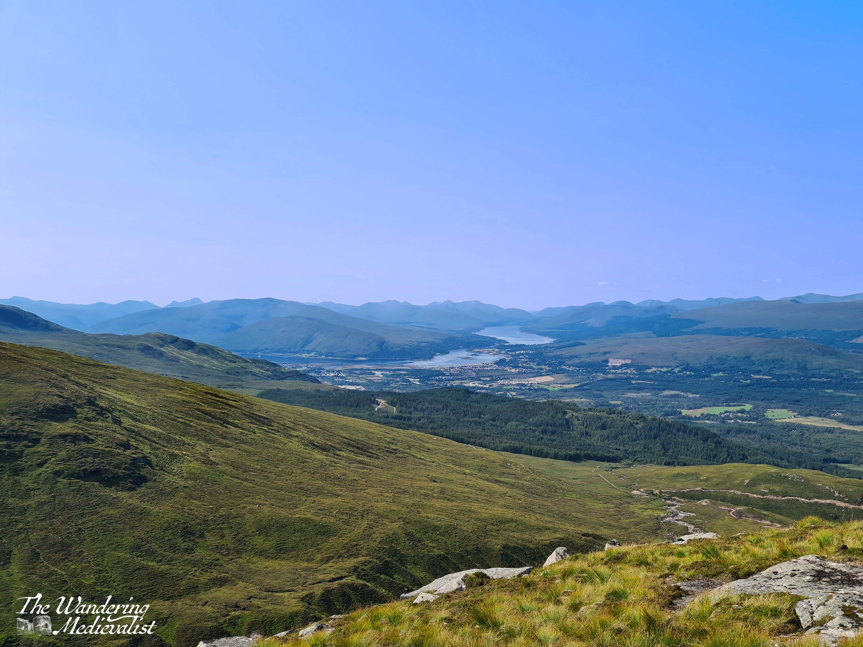
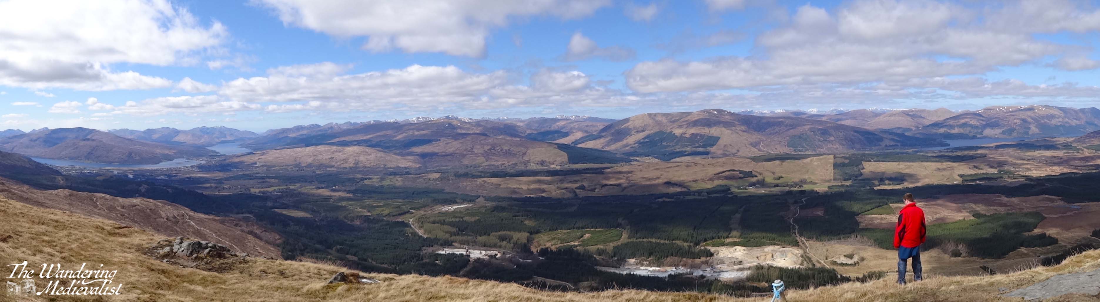
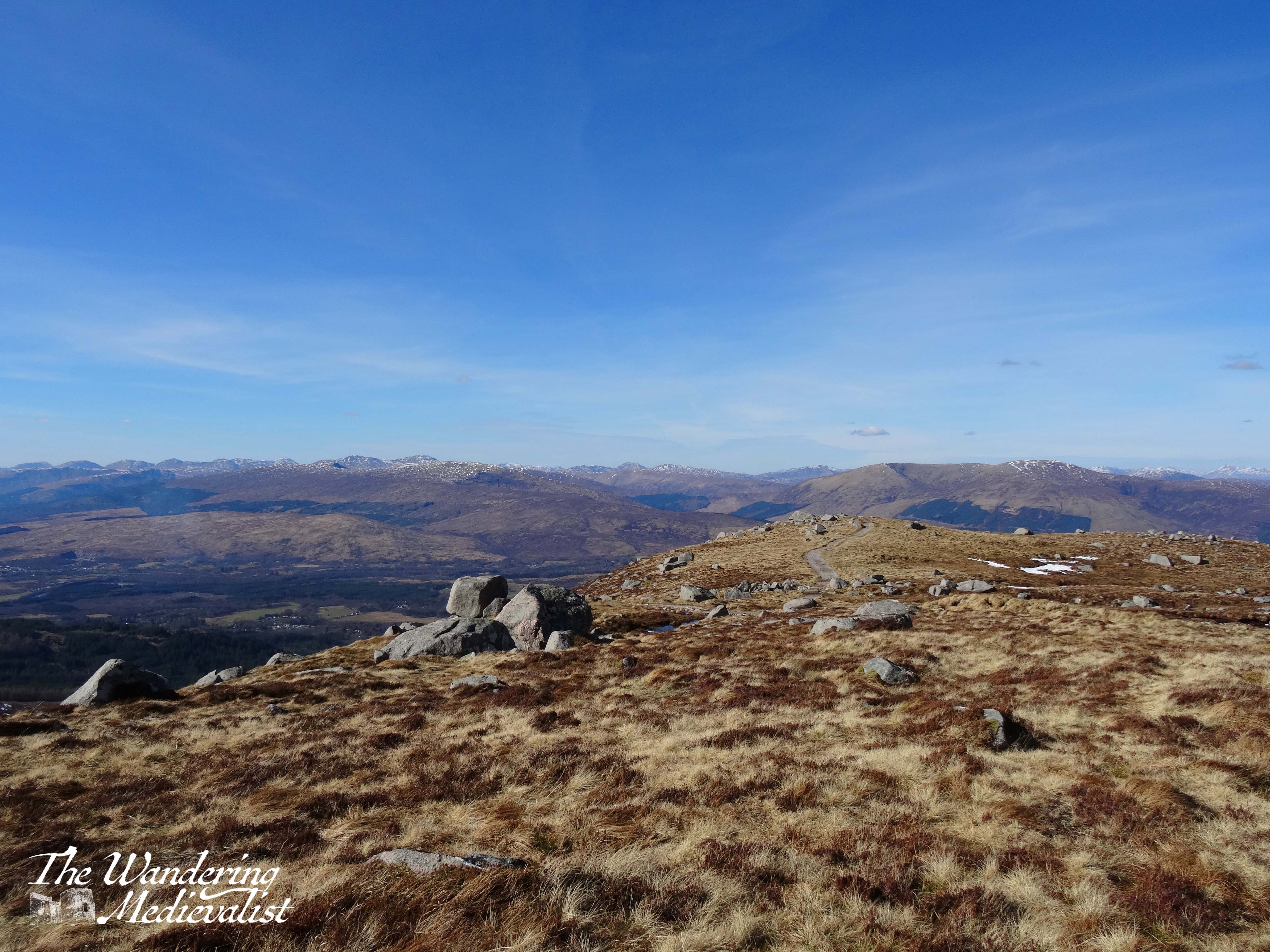
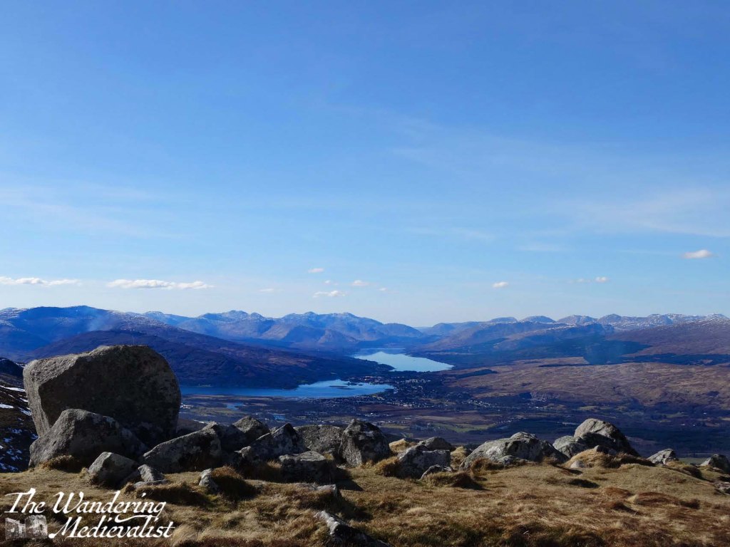
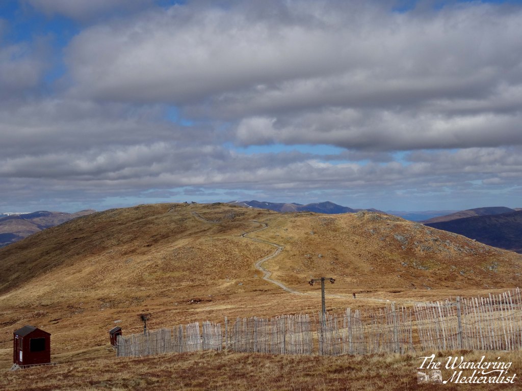
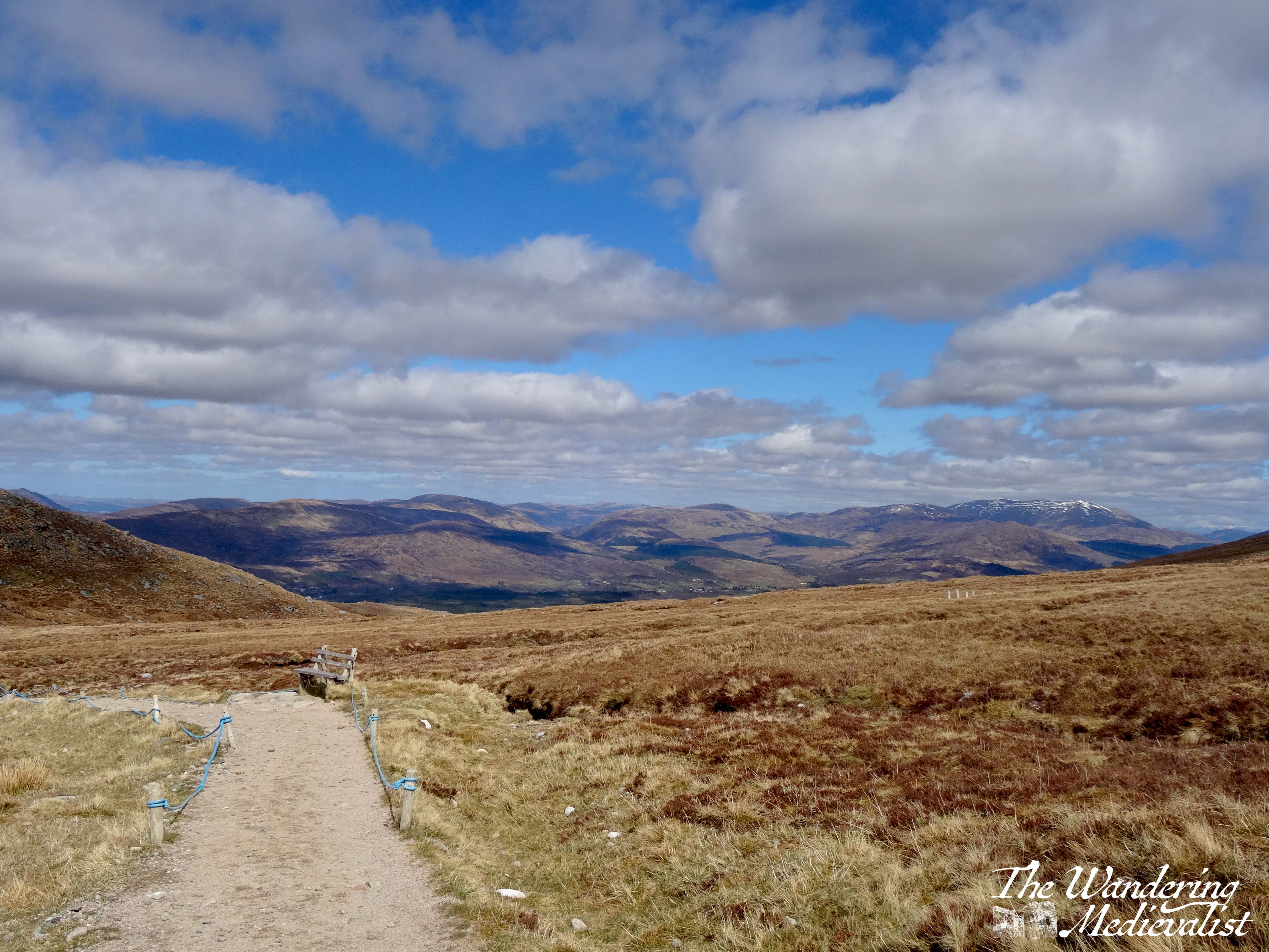
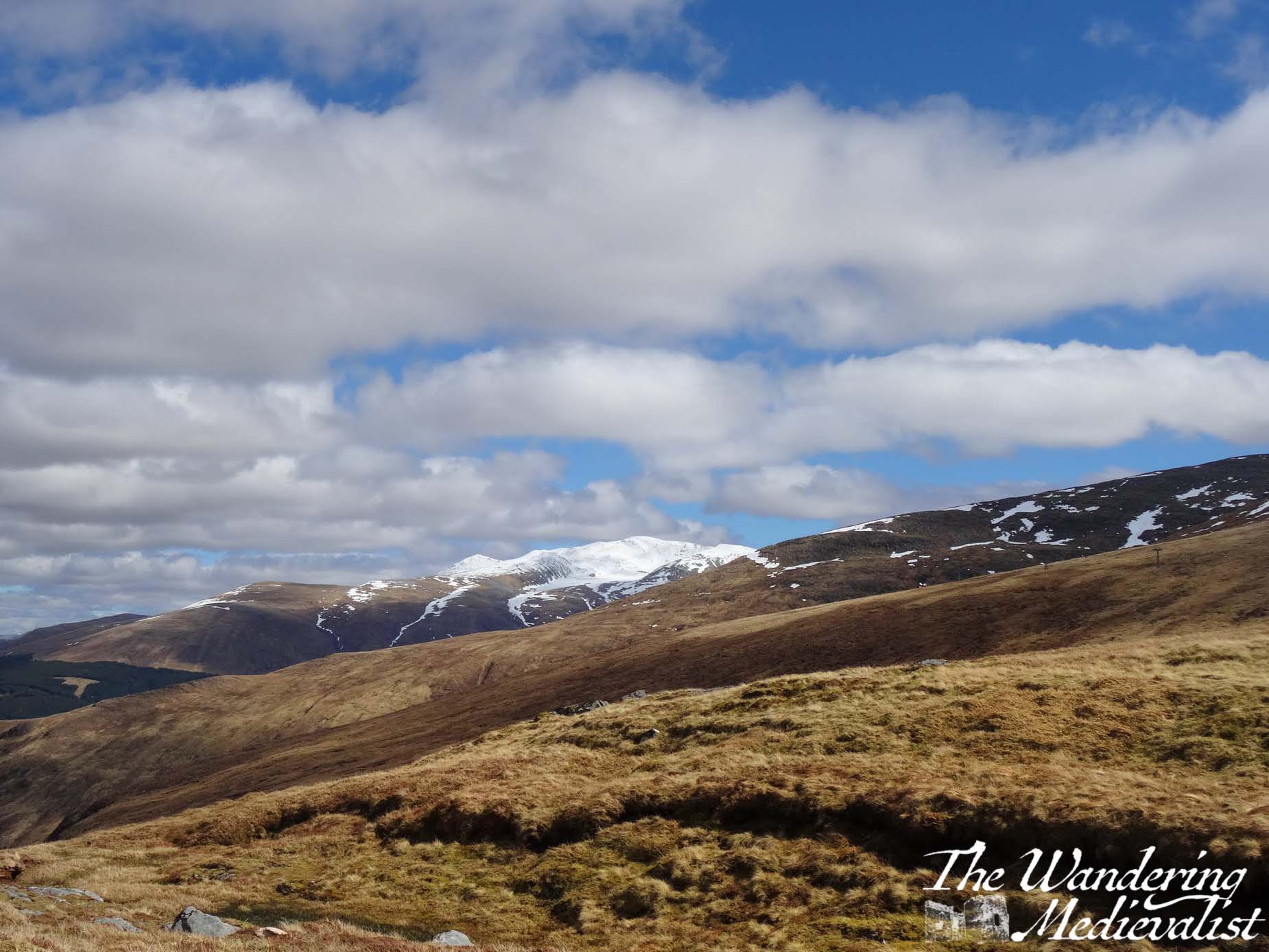
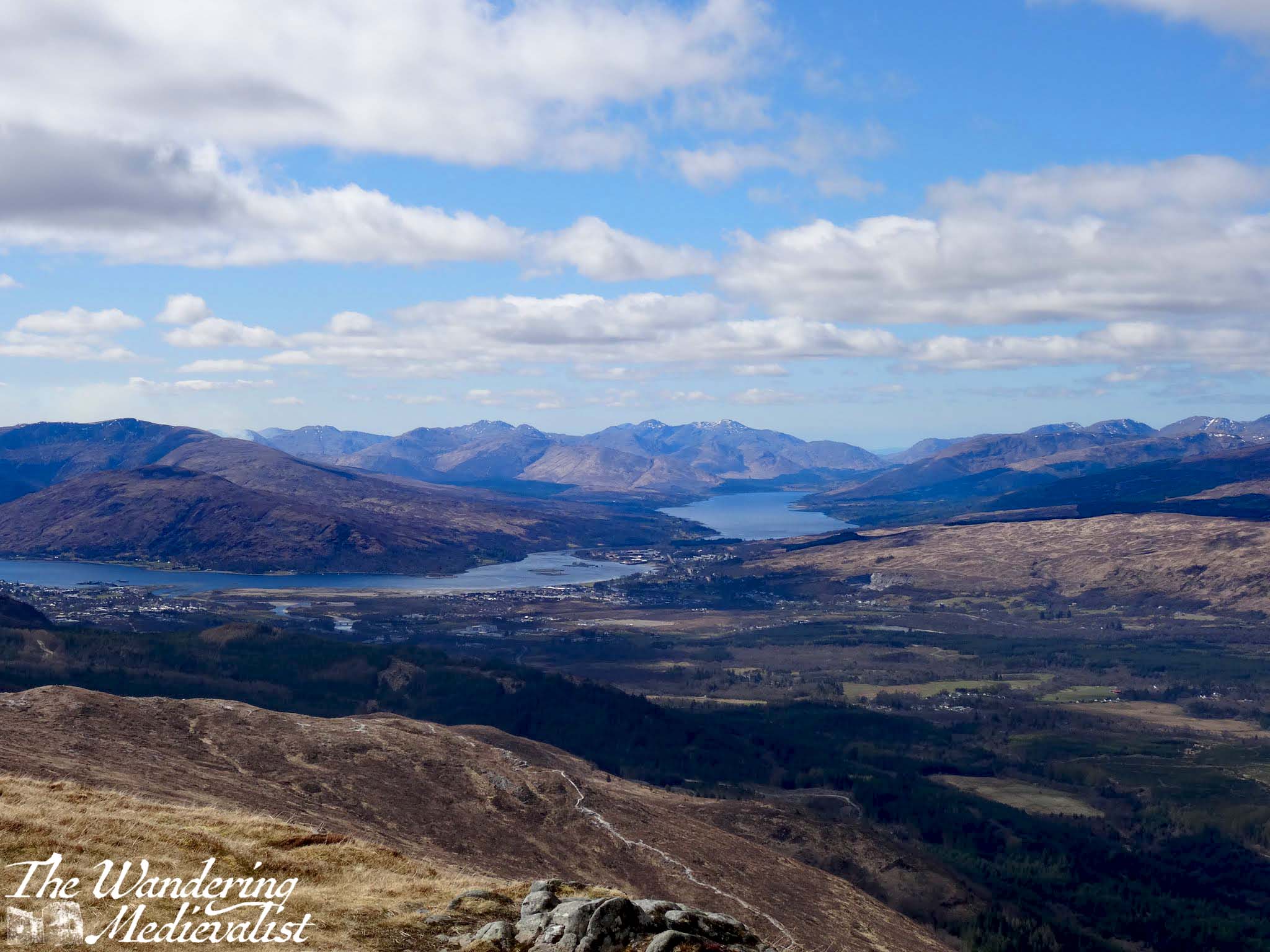
For some reason it took us until our second trip up the gondola to try the second, longer hike to the second viewpoint. I feel that referring to it in any way as ‘long’ is a bit misleading – the whole walk, out and back, is an hour at most and I think Dad and I did it faster. There are a few hilly bits but nothing overly strenuous, and the views are even better than from Sgurr Finnisg-aig. In fact, I realised on my second visit, that this viewpoint qualifies as one of my favourite places in Scotland, if not the world. From the benches or rocks, you can see west and a bit south to Fort William and Lochs Linnhe and Eil, east towards Spean Bridge, but you have a spectacular view of the back of Ben Nevis, all swept rocks and snow.
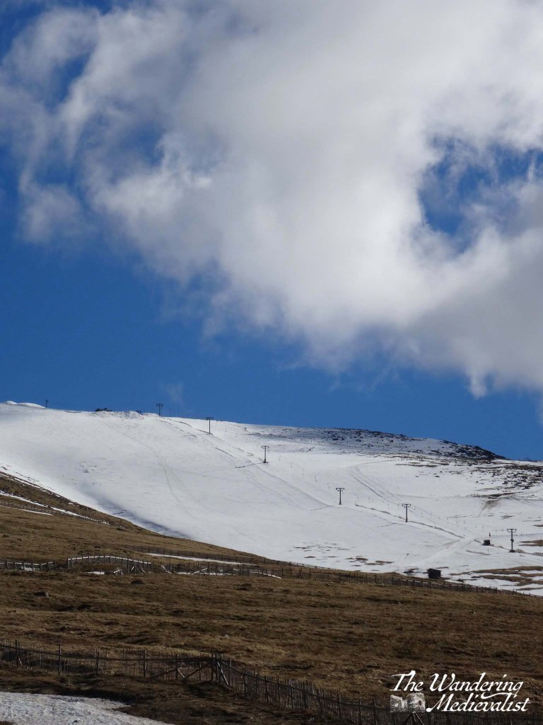
The trail begins as you leave the Snowgoose Café at the top of the gondola and turn right along a wide path, heading towards the chair lift that takes skiers to the top of the mountain.
Eventually, it passes under the lift and continues along the side of hill, rising and falling and crossing over a number of small burns. Eventually, you can turn and look back at the café and gondola in the distance.
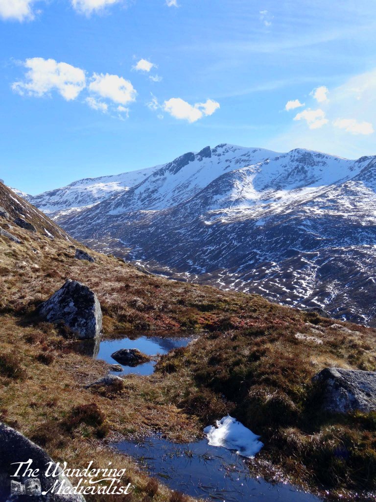
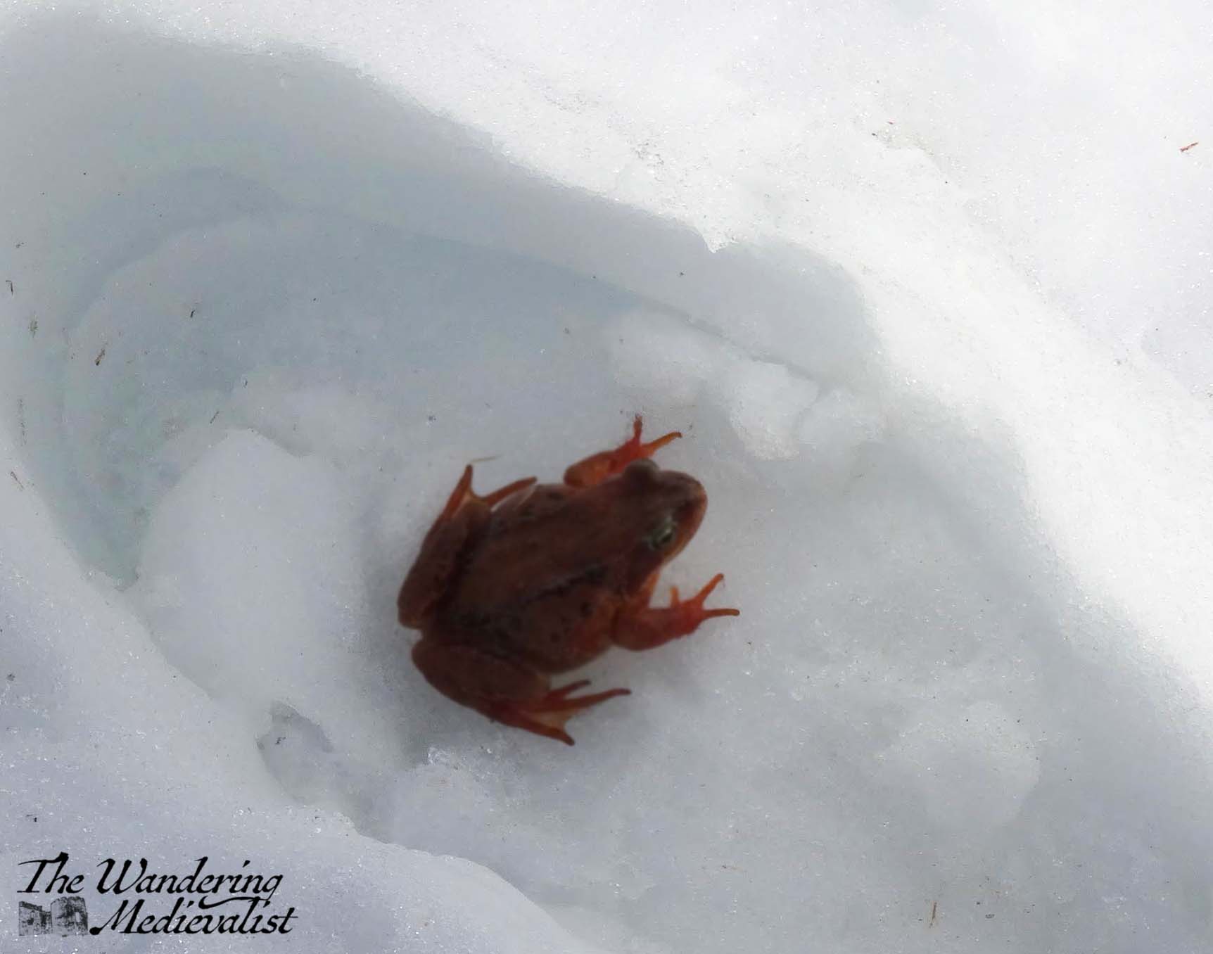
Here is the view back to the Sgurr Finnisg-aig viewpoint, as well as a little friend we found in the snow. As you move further around the hill, you get a better view down into the valley, and start to see the lochs and Fort William more clearly.
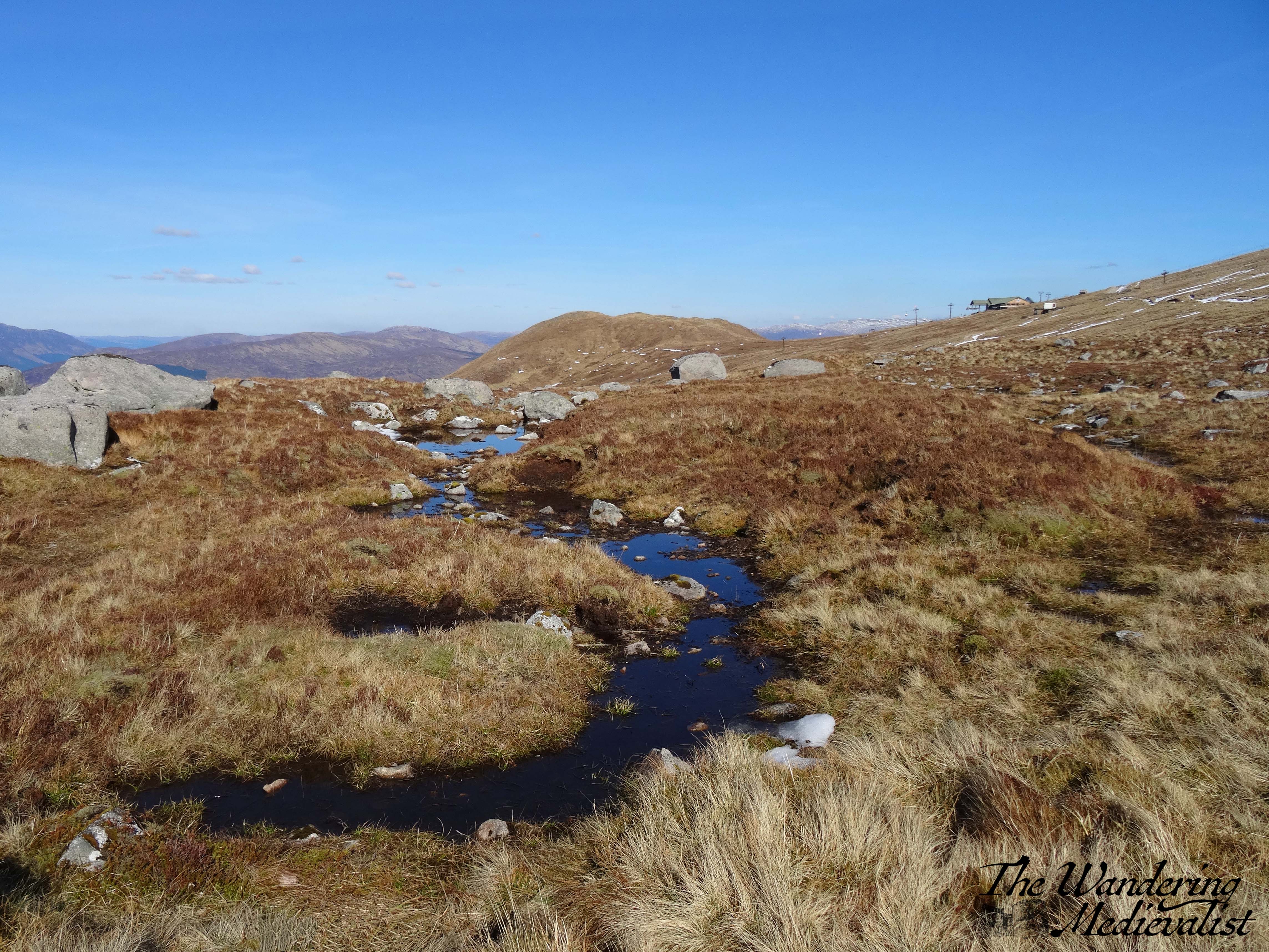
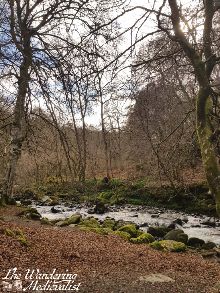
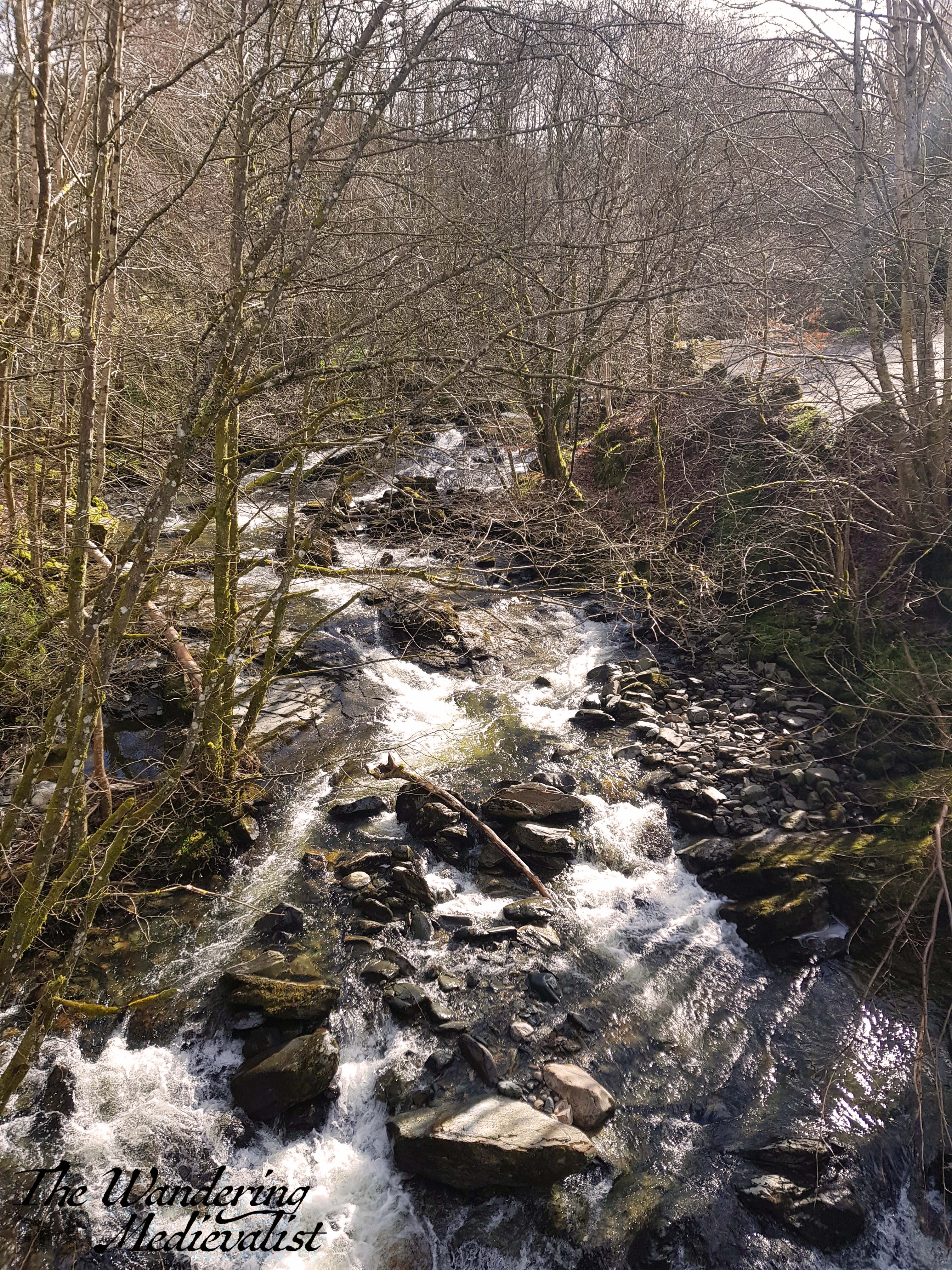
I find the peaty water tumbling through the heather and boggy land to be fascinating and beautiful, but nothing is as impressive as the view from the end of the walk. Like at the other viewpoint, there is a guide showing you what you are looking at, and there are series of both benches and rocks to perch on as you enjoy the vista. I could quite happily sit for hours, I think, watching the clouds (if there are any) and taking in the awesome sights of the view down and also back up the valley and to the sweeping height of Ben Nevis.
In both height of summer and snowy seasons, the view is just breath-taking, and I always have to force myself to turn around and start making my way back. Much like the let-down I always feel as the A9 passes Perth and Fife opens up in front of me – meaning I know I have really left the Highlands behind – I find the trek back to the café to be less enjoyable than the way out. But, once back at the Snowgoose, the best option I find is to get a coffee and maybe a snack, and if you are lucky, a table outside to take advantage of being high up the mountain for just that much longer.
There are so many beautiful views in the world, many I have seen and many I have on my list of wishes. This list, then, is of a few that I love more than others – some of these please I have visited and photographed over and over in different seasons and lights. Some of them I have visited only once, but remain in my memory as special, unique. These are views that make me smile, take a deep breath, and feel at peace.
Unsurprisingly, quite a few of these now grace the walls of our house, as canvas prints or collages.
I hope that they bring you the same smile and peace of mind.
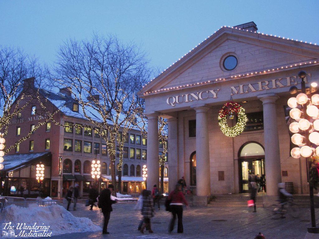
Boston, Massachusetts – Quincy Market
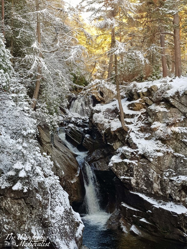
Bruar, Scotland – lower Falls of Bruar
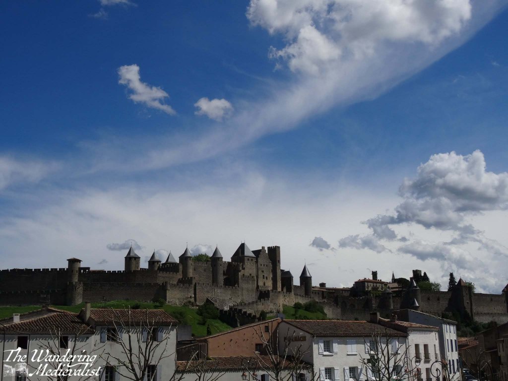
Carcassonne, France – the medieval city of Carcassonne from the Pont Vieux
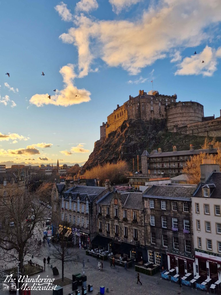
Edinburgh, Scotland – the castle from the Grassmarket
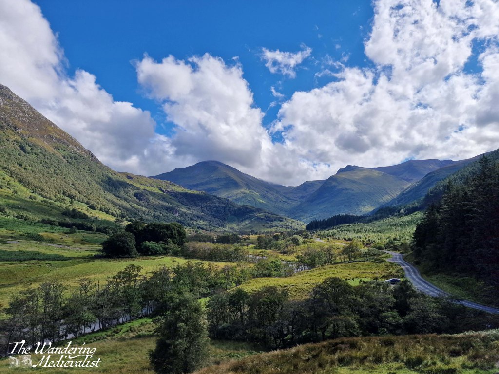
Fort William, Scotland – Glen Nevis
Fort William, Scotland – view of Loch Linnhe and Loch Eil from Meall Beag viewpoint
Glenrothes, Scotland – view from East Lomond looking west
Guardbridge, Scotland – looking across the Eden Estuary to St Andrews
Lyme, New Hampshire – Post Pond
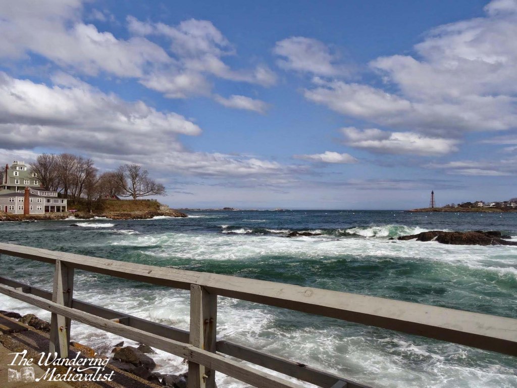
Marblehead, Massachusetts – Fort Sewall and the harbor from Fort Sewall beach
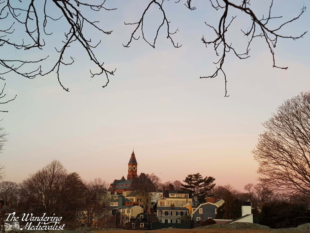
Marblehead, Massachusetts – view of Abbot Hall and Old Town from Crocker Park
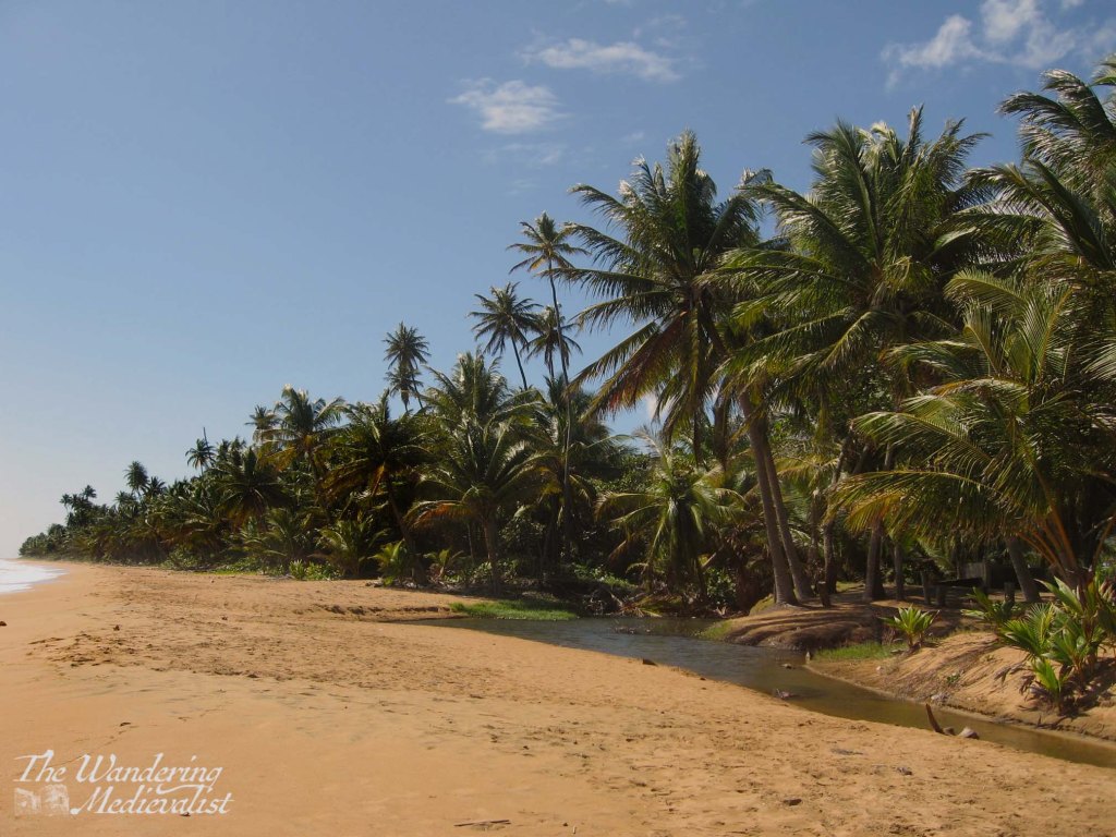
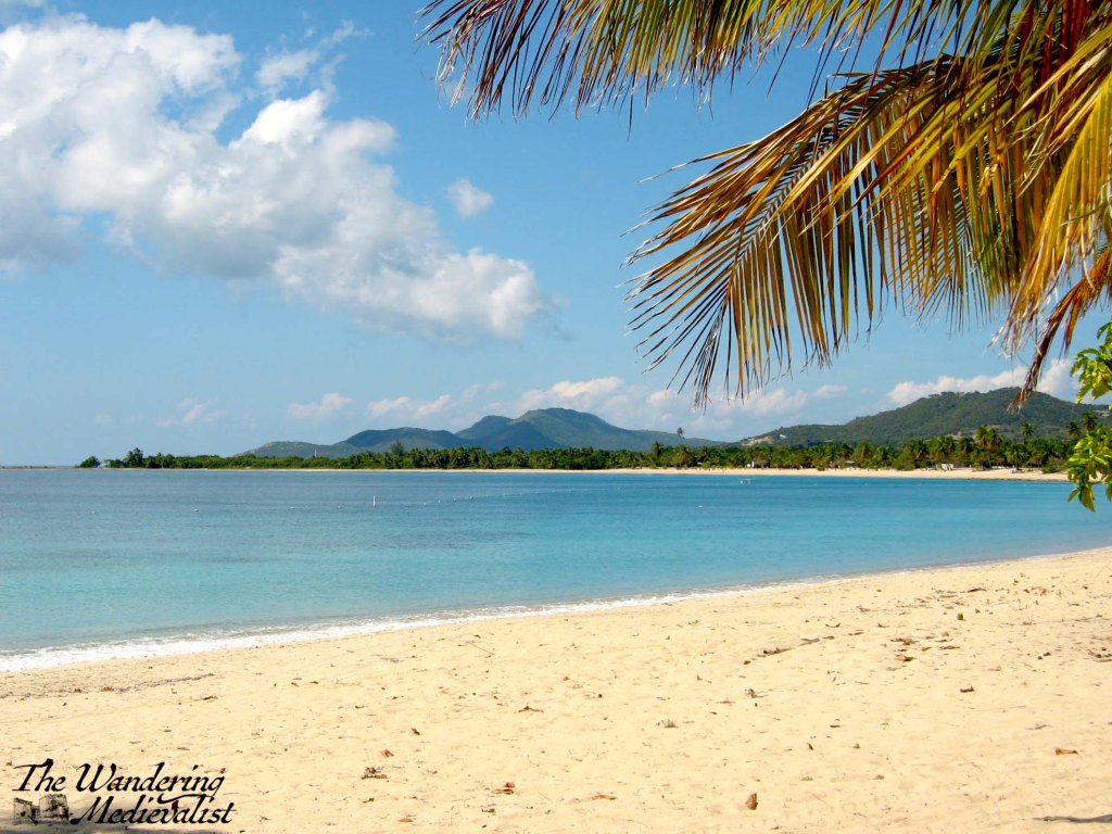
Maunabo, Puerto Rico – Punta Tuna Beach
St Andrews, Scotland – view of the castle from the Scores
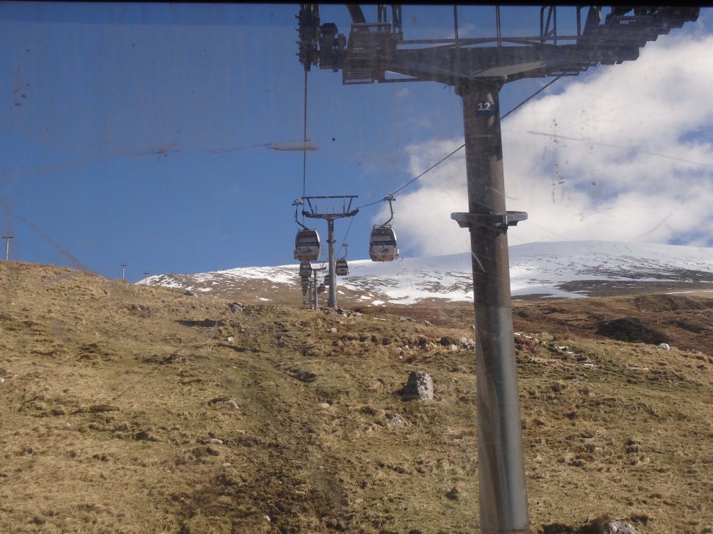
On a list of my favourite places in the world, the views from the lodge and surrounding areas on Nevis Range are pretty close to, if not, the top. Whether in the depths of summer or the end of winter, in sun or rainy weather, the gondola trip itself is worth the cost and the walks at the top offer simply stunning views. It is worth clarifying at this point that the gondola does not actually climb Ben Nevis, but instead Aonach Mòr, one of several mountains in the Nevis Range that is popular with skiers.
We discovered the Nevis Range on our first adventure to the Highlands in 2016, when we arrived at our hotel too early to check in and decided to take advantage of the spectacular weather to explore a bit. I was a bit nervous about the gondola – I am not a fan of heights – but it is entirely closed in and very seldom so high off the ground that you imagine desperate scenarios reminiscent of James Bond films.
The windows of the gondola don’t allow for particularly clear pictures, but here is the view up, not far from the café at the top.
Both ends of the journey offer a place to stop for a snack or lunch, clean restrooms, and easy access to the cars – I believe that wheelchair access possible, though not 100% certain.
While at some times of year, the view is enjoyed primarily by skiers, by mid-March when we visited, most of the snow was gone but the mountain bikers had not yet taken over, so we had plenty of space to ourselves. A word briefly about the lodge at the top of the gondola, and the Snowgoose Restaurant within – I have been repeatedly impressed by its comfort and good food. The snacks and coffee are great, and there is ice cream or bottles of water aplenty, depending on your need. Best of all, the view is just out of this world.
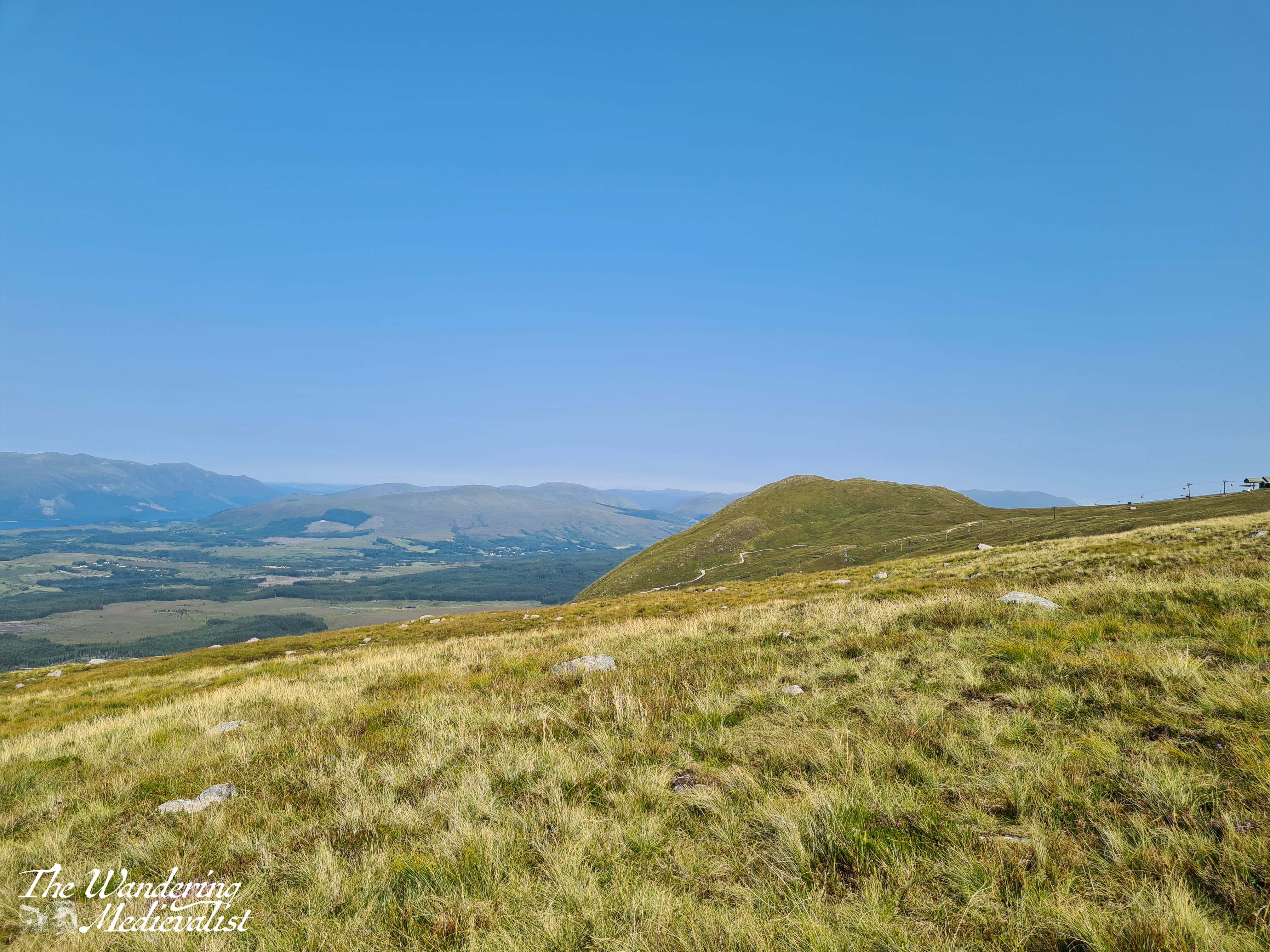
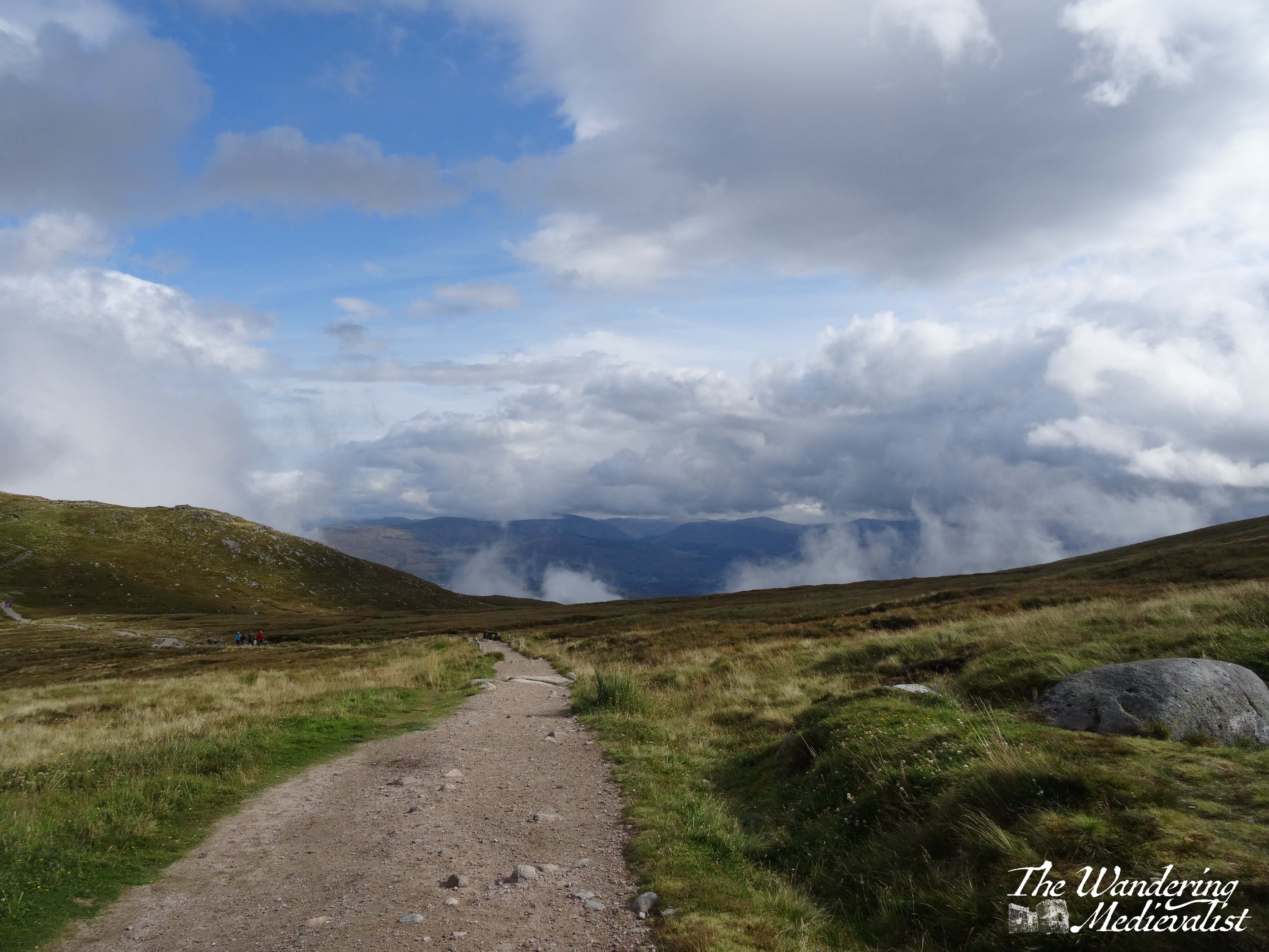
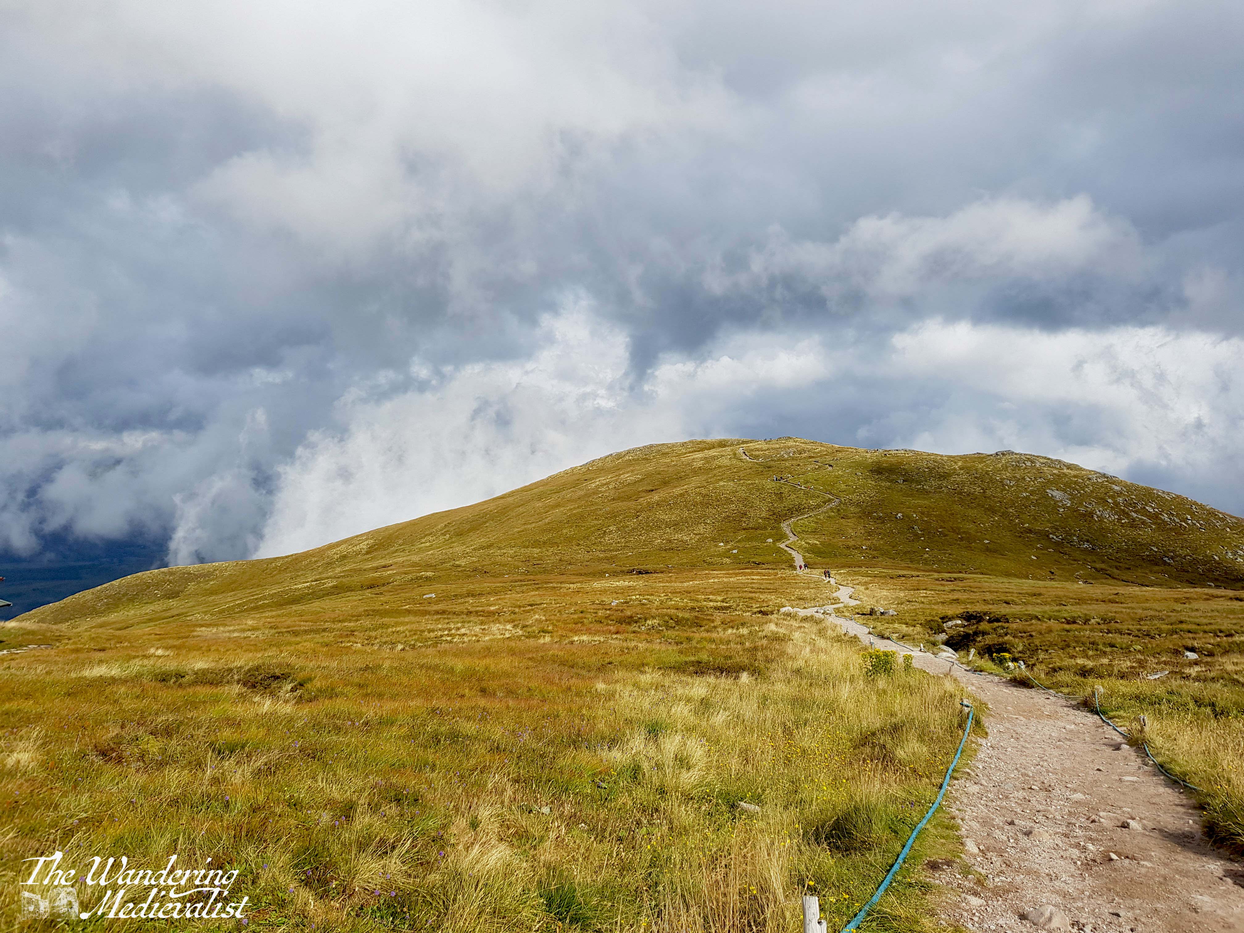
From the lodge, there are two available walks, each to a different viewpoint. The Meall Beag viewpoint is a bit further away, so on our first trip we opted for the Sgurr Finnisg-aig trail, which is reached by turning left out of the lodge. It is a short walk, about fifteen to twenty minutes to the viewpoint, and the trail is well-kept.
The start of the walk boasts views out to the east, and as you will see below, on the second time I took this walk with my father, you could see clouds rising in the distance. Our first visit was in mid-March, so snow was still evident on some peaks, but the cloudy visit was in late August – much greener and definitely no snow.
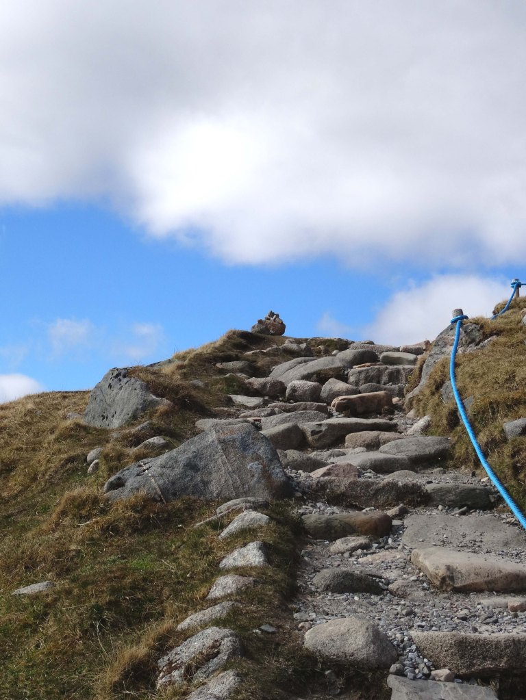
The trail is relatively even and easy-going until you get closer to the hill itself, and then you are faced with stairs. These wind and climb, at times a touch narrow, but there are plenty of places to pause and catch your breath or allow people to pass.
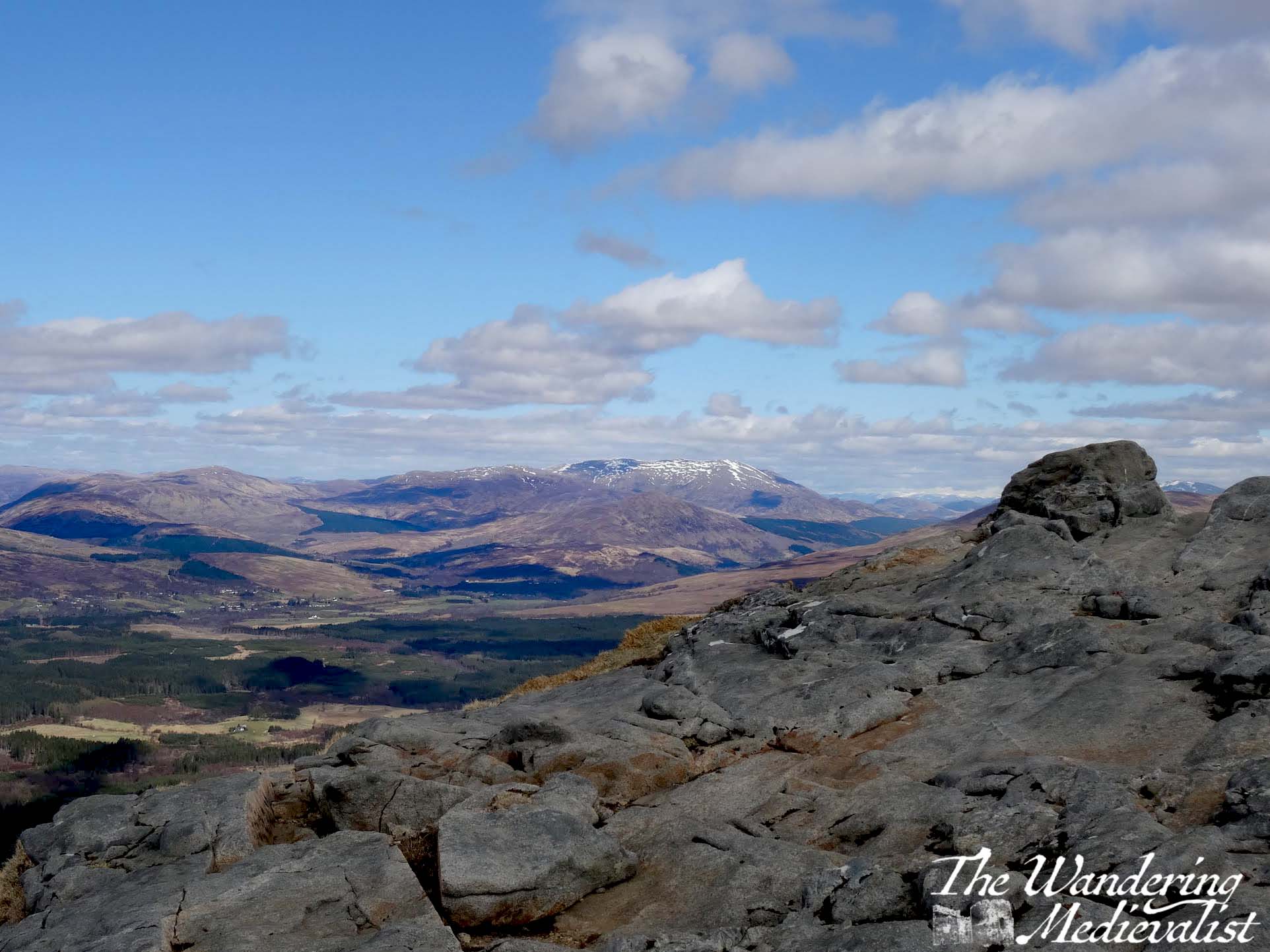
And there is no question, the climb is worth it. At the top is a rocky plateau of sorts, where there is a map to show you what you are looking at, as well as numerous spots to take advantage of the view. Standing at the map provided, one can see to the west and the edge of Fort William, Loch Linnhe and Loch Eil, to the east towards Roybridge, and north to the start of the Great Glen that leads up to Inverness. As noted above, these photos were taken on two separate trips, as is evident. In March, we were blessed with incredibly clear weather, while in August, clouds were closing in around us as we walked and by the time we returned to the café, rain had arrived.
On both occasions I followed this trail, I found myself equally distracted on the walk back by the spots of heather, the small burns, and the rock shapes poking through the grass. It is iconic Scottish mountaintop, and the gondola has made it accessible for many people who may not normally be able to enjoy it. My most recent trip up the mountain was actually in summer 2021, when masks were required in the gondola and travel restrictions meant that the tourists around us were all British rather that foreign. The outdoor nature of the trip made it ideal for Covid times, and the relative freedom after more than a year of various lockdowns was palpable.
One of the most pleasant parts of any visit to Nevis Range is once you have completed your walk, when you find yourself a table in the café with a coffee, a cake, or some lunch, and just enjoy the view. On the cloudier trip, I found myself fascinated with the way the clouds were swirling around the gondolas as they disappeared in the mist – though the ride down was without a view, as the video below shows. So whether a perfectly clear day or one where rain is imminent, I would most definitely recommend this trip and short walk. One caveat is that when there is high wind forecast, the gondola may not run for obvious safety reasons – on one trip we missed out and enjoyed the walks at the foot of the mountain instead.
I have done the Meall Beag viewpoint walk as well, but there are too many pictures for one post!
A few years back, I managed to secure some time off that the other half could not, and so I took myself away on a castle-finding adventure to North Berwick. My efforts were hampered slightly by two factors:
Time of year – many castles and monuments are open only seasonally in Scotland, or their winter opening hours are limited.
Restoration works – during the pandemic when everything was shut down, many castles in Scotland were discovered to have some dangerously unstable masonry. At the time I travelled, many sites were still closed, or partly closed, for renovation and restoration. As of writing, this is still the case for many castles, and for St Andrews Cathedral.
I had hoped to make it a two-castle day and see Dirleton, but it was completely closed, so instead I booked ahead – as one still had to do due to Covid restrictions – and being me, arrived about 20 minutes early. The empty car park was a short walk from the actual ticket office/gift shop. I was eager to get a bit of exercise though, so while I could probably have driven closer, I chose to walk the quarter mile and hoped for some good views as I did so.
Upon arriving at the shop, I was greeted by name – I was one of two people booked in all day! So I chatted with the shop assistants, who apologised that I could not get into the castle itself (which I was prepared for) and it was during this chat that I learned about the state of so many of the monuments in Scotland. Then, they allowed me access to the castle early, ‘You have it all to yourself just now,’ I was told. Music to my ears.
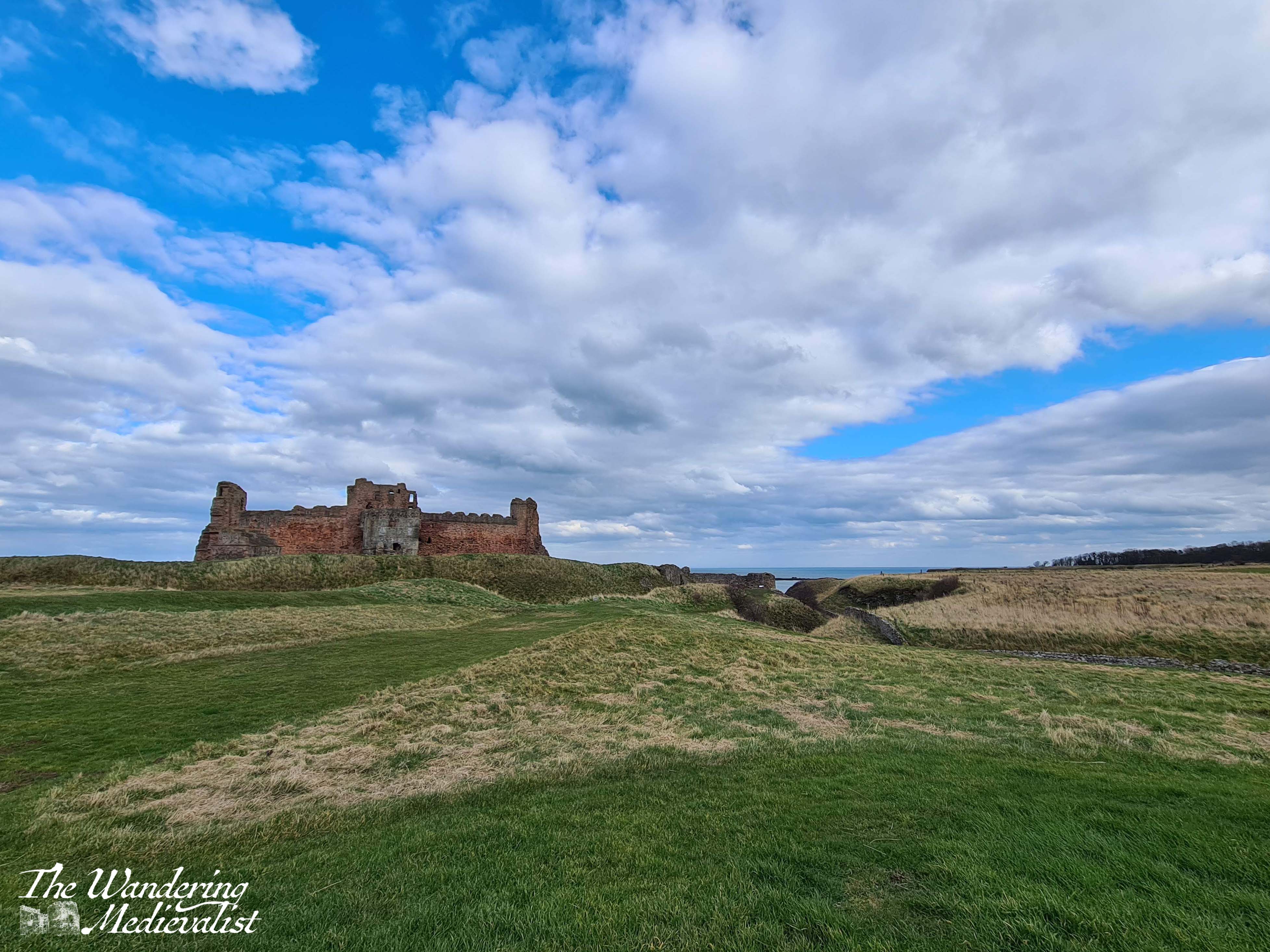
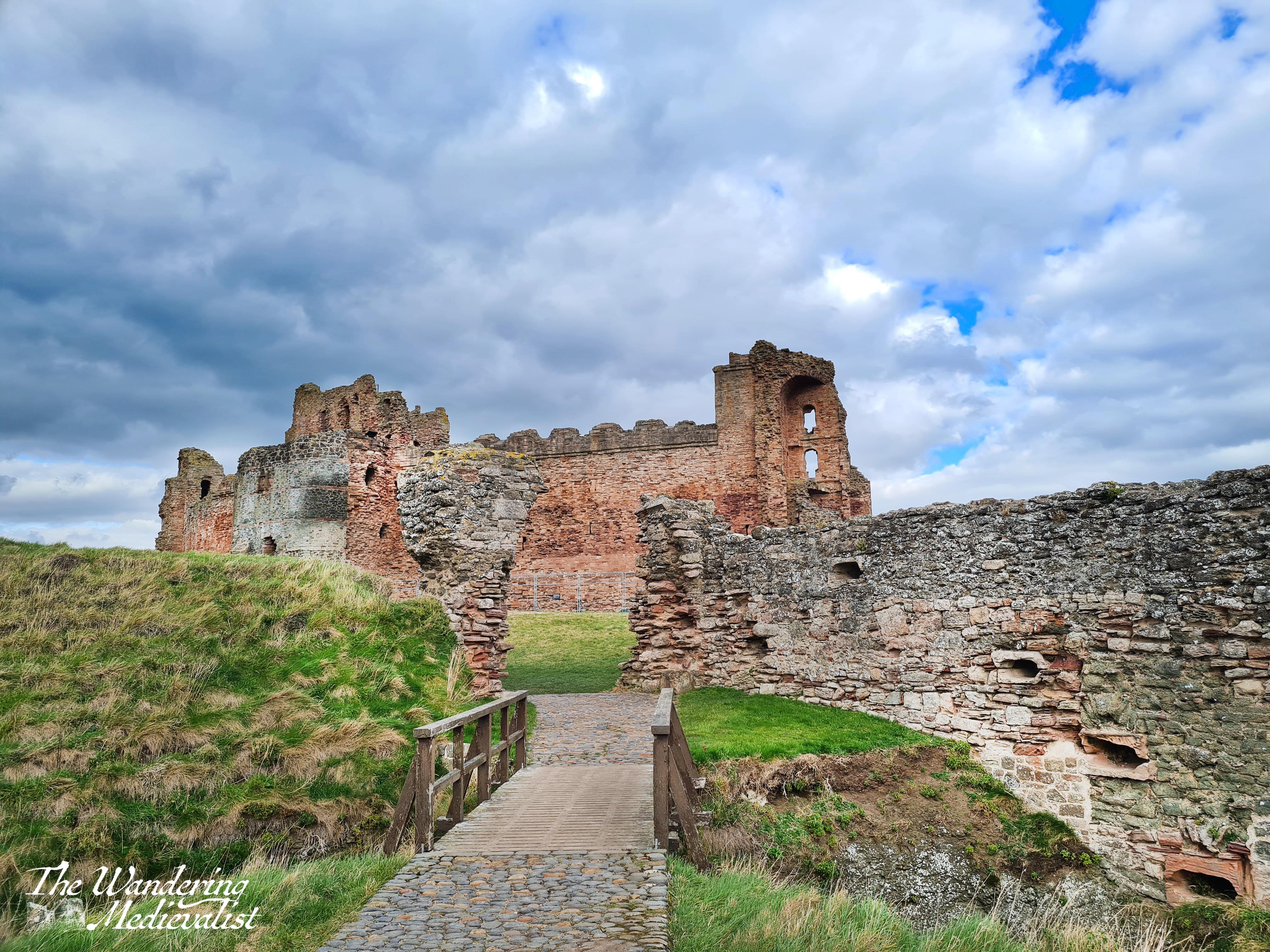
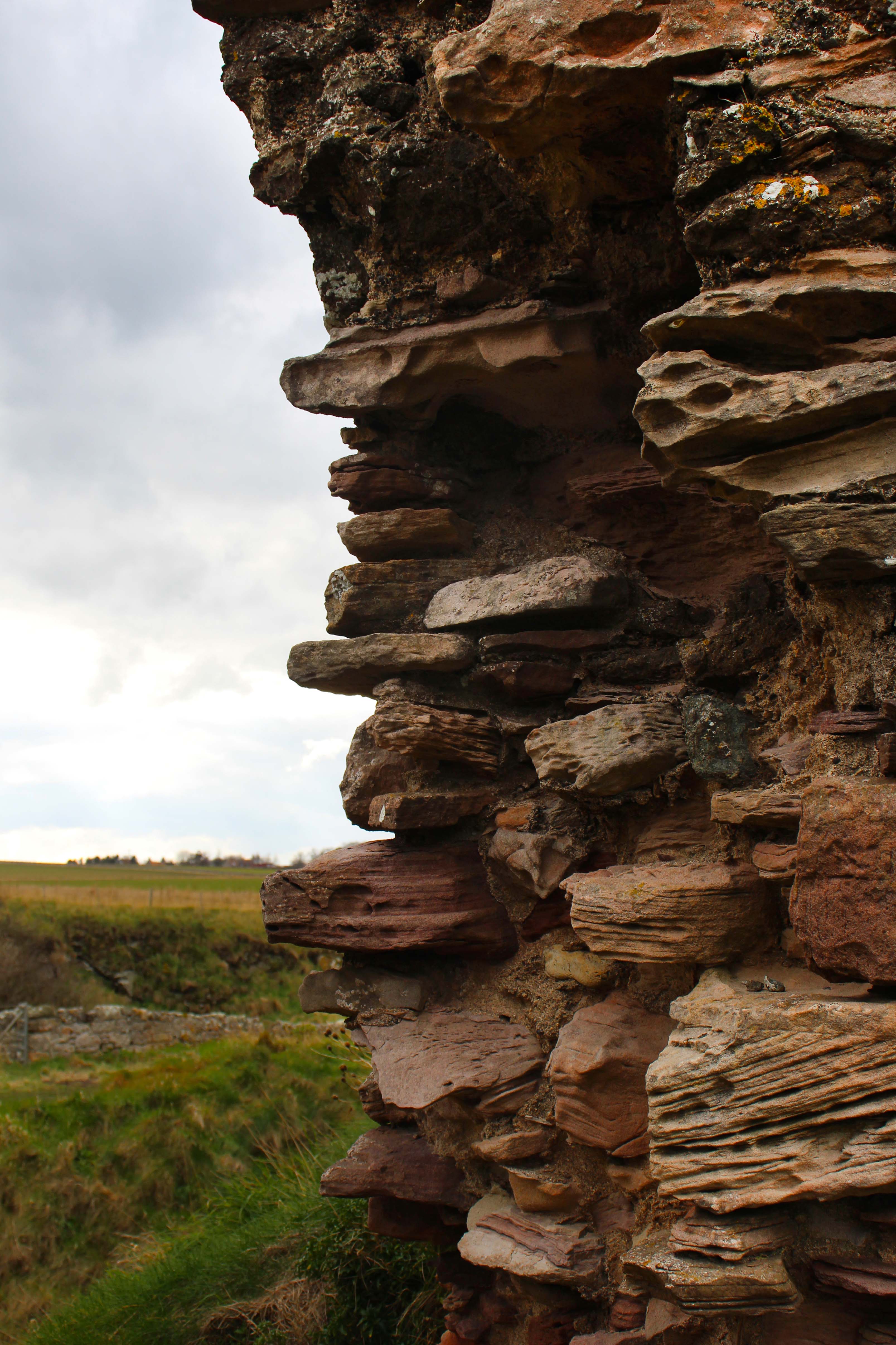
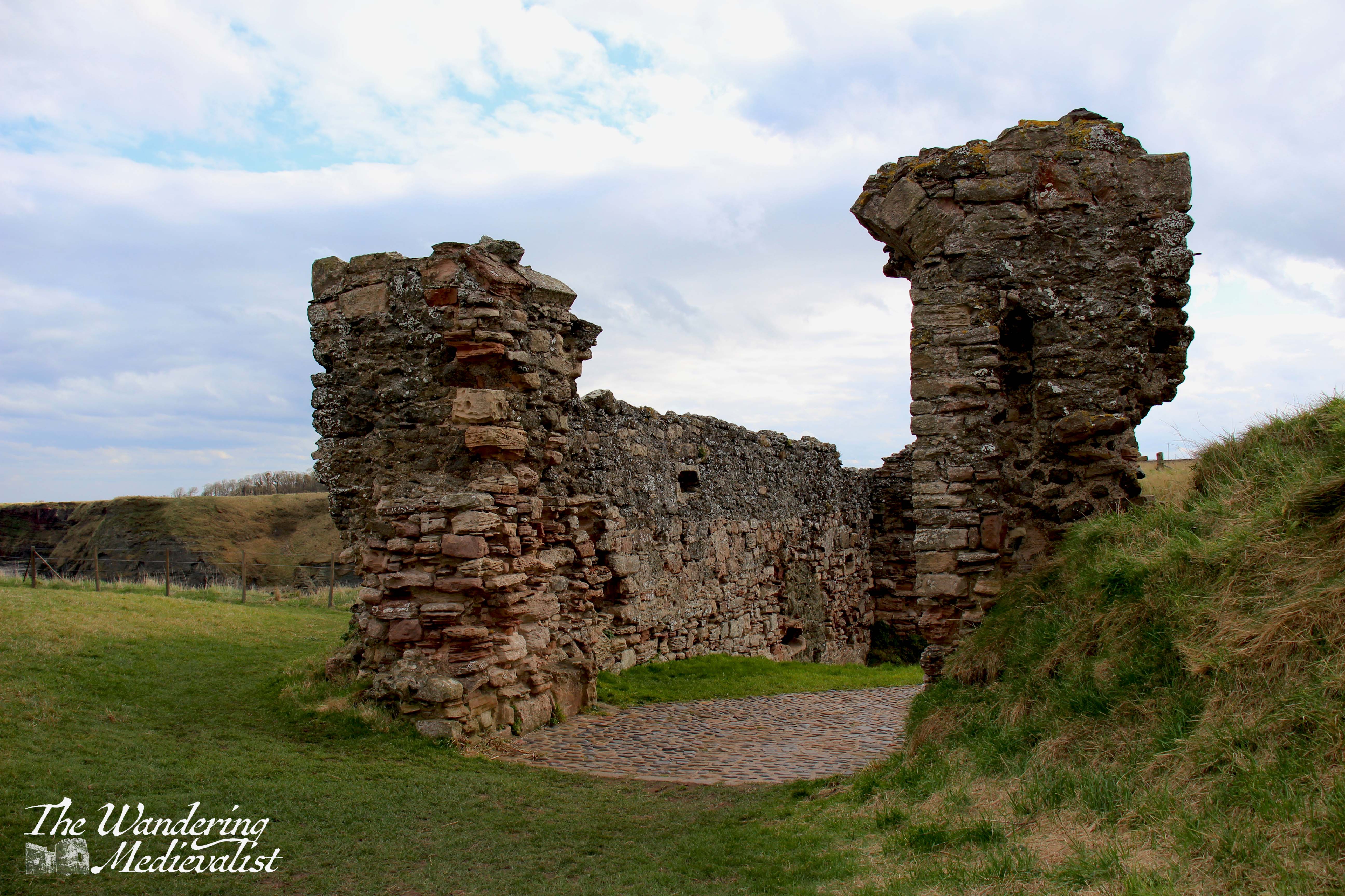
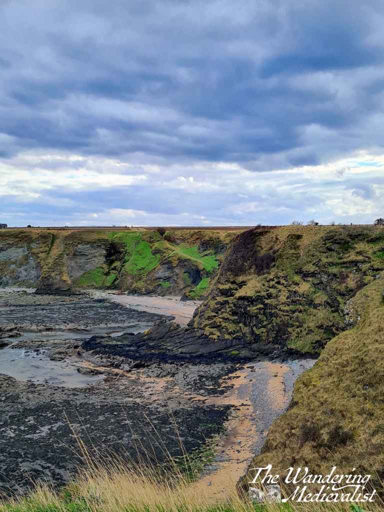
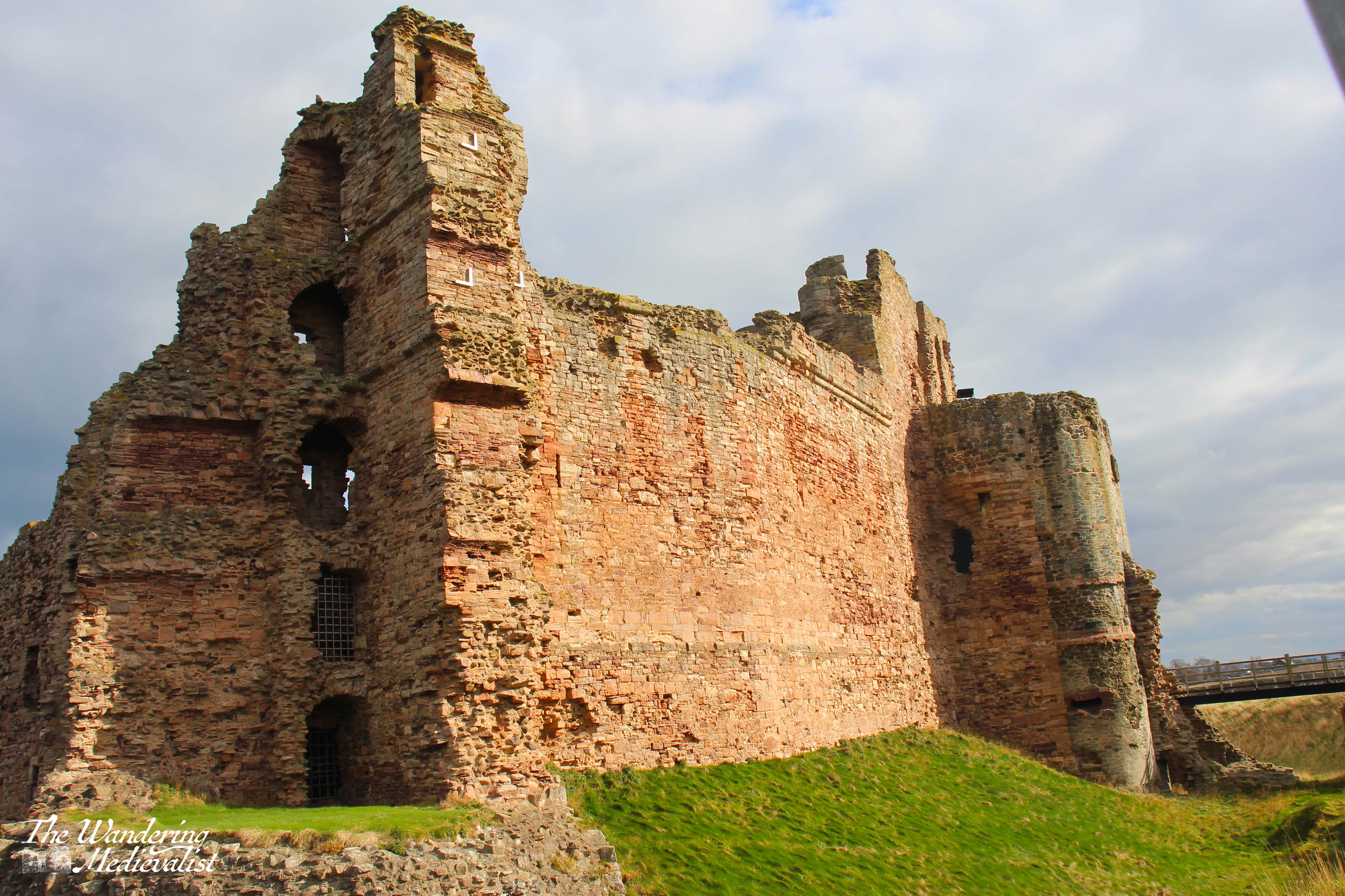
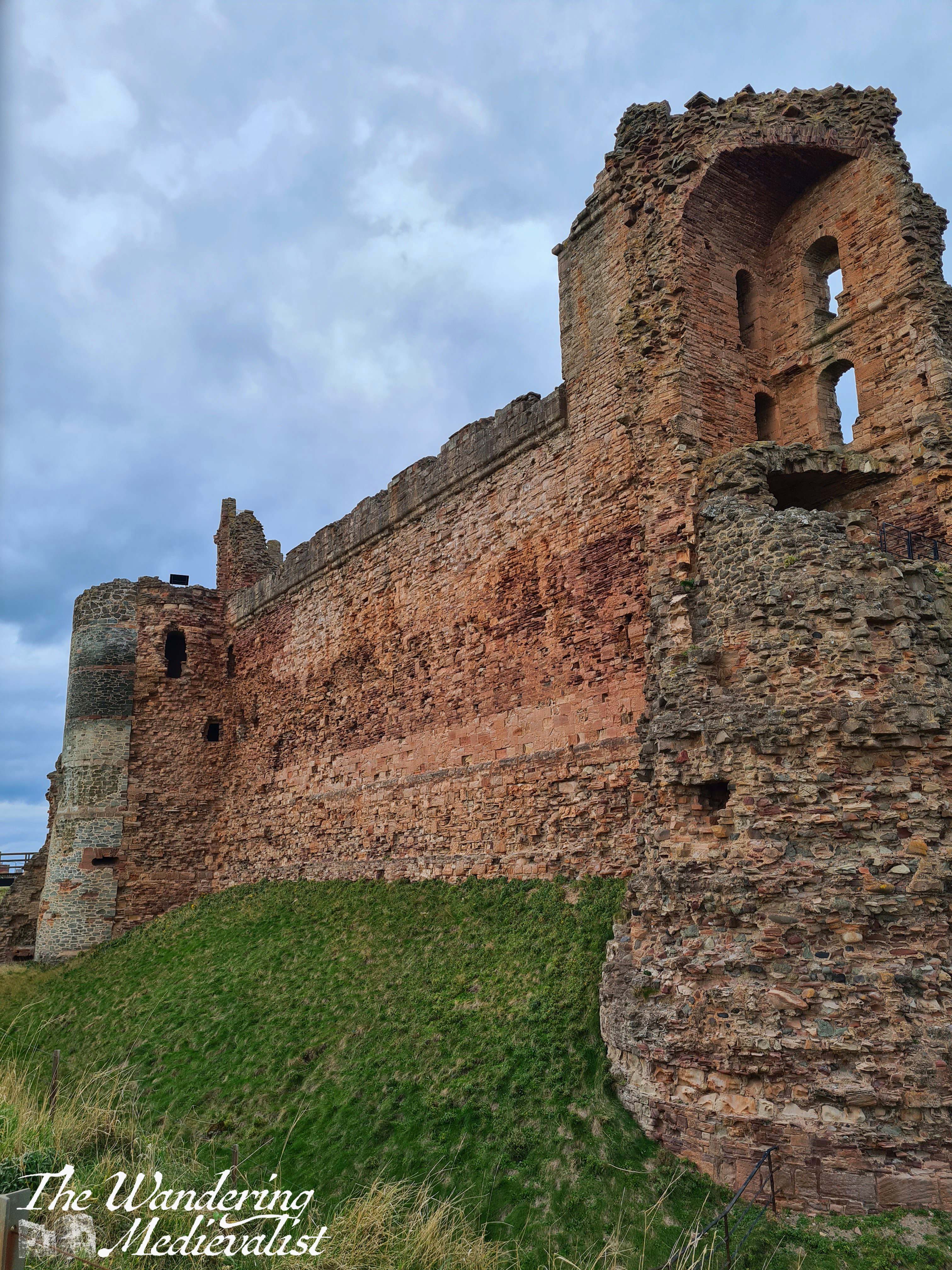
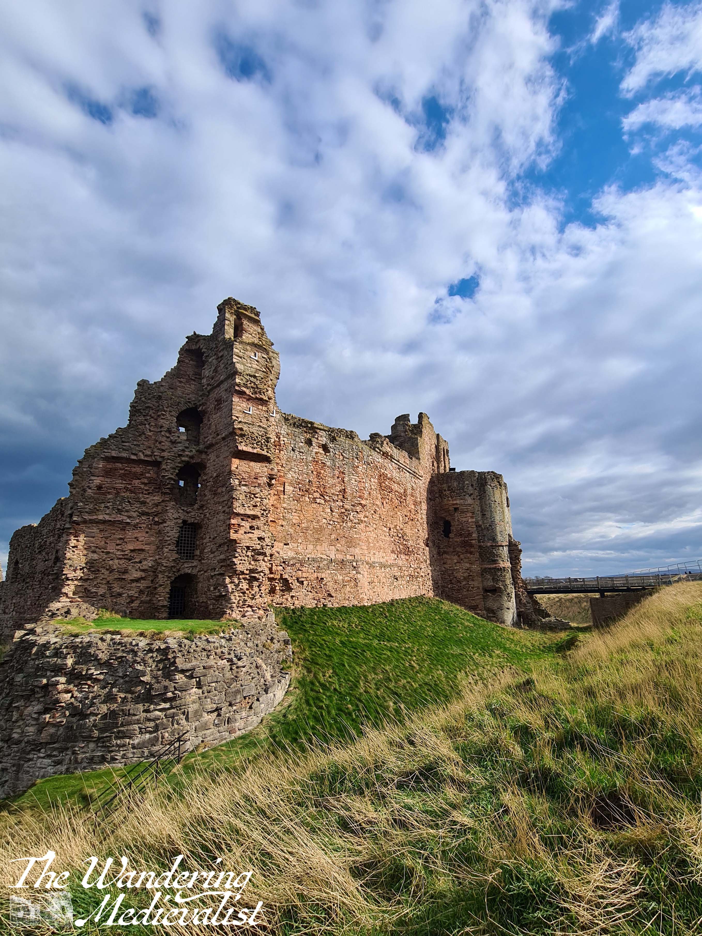
The approach to the castle is along the route one can imagine was used when it was whole, and there are lovely views of the main curtain wall. As I passed through the outer defences, two things stood out to me: one, the gorgeous orange-red of the sandstone; and two, the rather stunning way in which rain and wind had shaped and eroded the soft stone.
The day I visited boasted rather typical Scottish weather, in that it changed almost by the minute – sky was dark and stormy then bright blue and sunny, so I had a lot of fun playing with some of the changes in light.
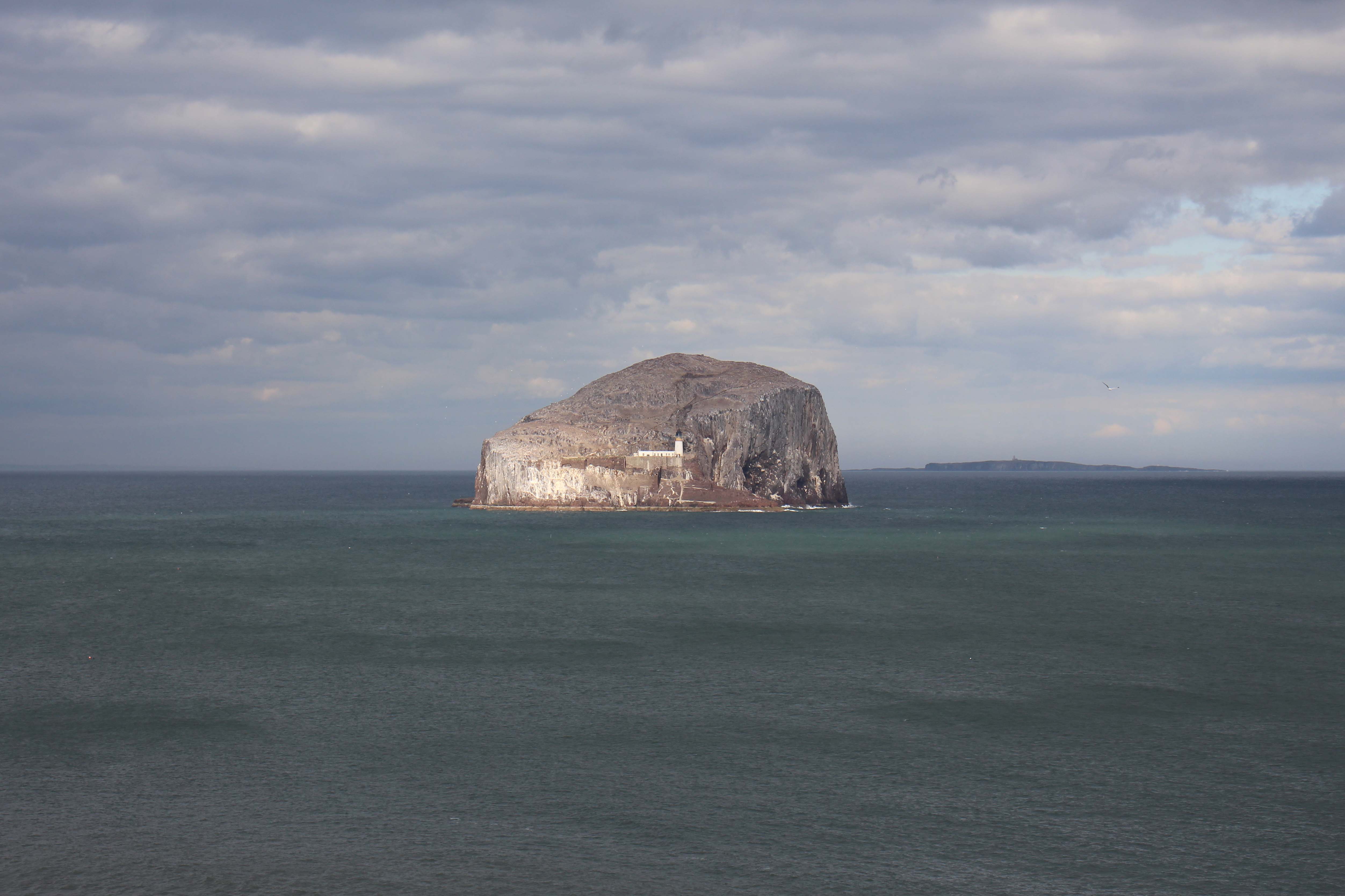
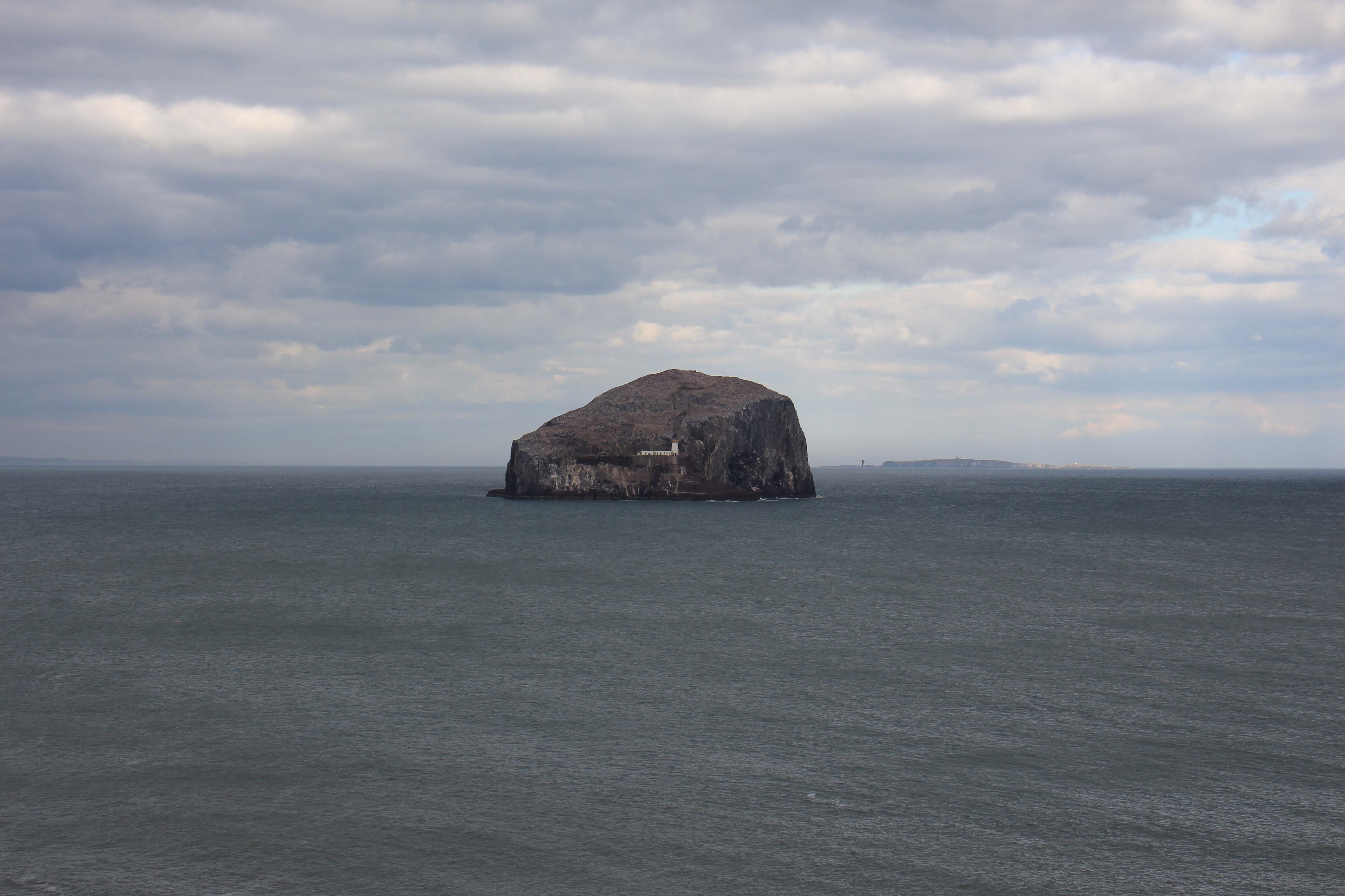
One of the most spectacular aspects of Tantallon is its view – not only along the coastline, but out to sea and the Bass Rock, a spectacular lump of stone in the Firth of Forth that housed a fortress in the Middle Ages and later a prison. At times it has hosted colonies of sheep. Today you can see a lighthouse, and the rock is the world’s largest colongy of northern gannets. Here it is in both sun and shadow:
view of the Bass Rock from Tantallon
The other view from the castle is of course along the coastline – cliffs and rocky beaches galore, one could understand why landing an army here would be a formiddable undertaking.
I was eventually joined by a few other adventurous souls on this day, but in the meantime I sat down and enjoyed my picnic lunch in the lee of the castle.
It would be remiss of me, as a historian, not to tell a bit about the castle’s background. It was built in the 1350s by William Douglas, who would be the progenitor of the Red Douglas line, descended through his illegitimate son George, later Earl of Angus. Douglas was quite clever in this design, as the castle defences are comprised essentially of one long wall, securing a headland that pokes out in to the Firth.
It was known in the Middle Ages to be nearly impenetrable, but unfortunately this was proven false through a siege conducted by Oliver Cromwell’s Parliamentarian forces in 1651. Twelve days of cannon fire were too much for even this curtain wall, and it was left as it is now.
The trip I spent visiting Tantallon introduced me to a part of Scotland I had never really seen before, and I found the North Berwick area to be both beautiful and well worth exploring in more depth. There is not a big town, but the roads were in decent shape and the edge of Edinburgh is very close, so one could probably be based in the city and do day trips. I will definitely be going back to visit Tantallon, hopefully with the opportunity to go inside and explore some of the ruined towers and rooms I could only glimpse from around the edge. I was struck, as I stood looking across towards Fife, that while the drive was around two hours, a boat could probably get me home faster, as the distance between Tantallon and Fife is less than 10 miles as the crow flies, more than 80 by road. When standing in St Monans several days ago I could look across to the Bass Rock and know this castle was hiding just behind it – just out of sight.
The braes ascend like lofty wa’s, The foaming stream deep-roaring fa’s, O’er hung wi’ fragrant spreading shaws, The birks of Aberfeldy.
The hoary cliffs are crown’d wi’ flowers, White o’er the linns the burnie pours, And rising, weets wi’ misty showers The birks of Aberfeldy.
– Robert Burns, ‘The Birks of Aberfeldy’
Work completely took over my life last week, but thank goodness for Facebook memories, reminding me of the trip we took last year at this time to Aberfeldy and inspiring me to look back even further to our March 2020 trip. It was a strange time – we knew that the world was starting to change, that restrictions were coming into place, and in fact it was while in a pub in Aberfeldy that we heard the pubs were closing – it was a sombre and disconcerting time, full of the unknown.
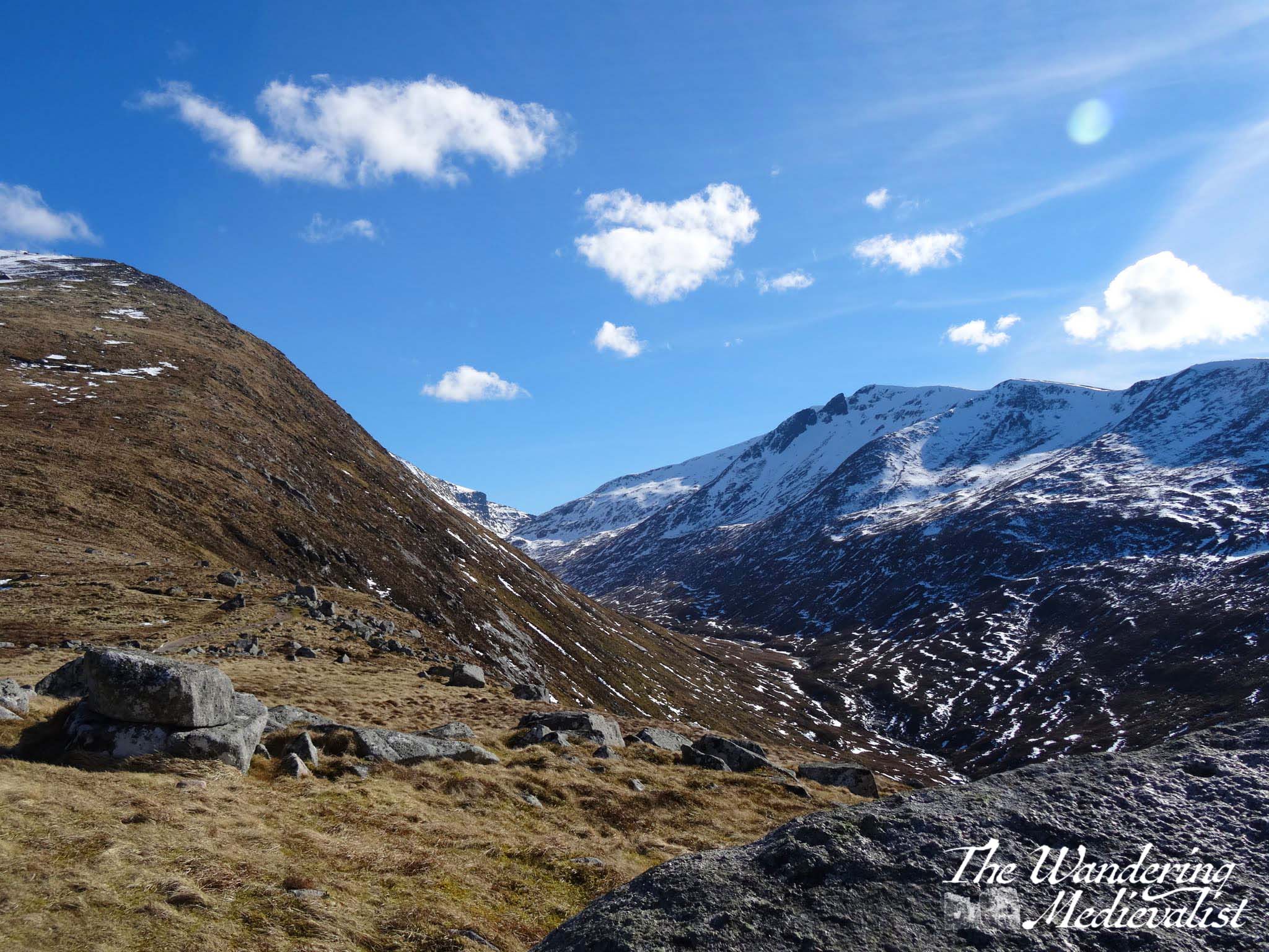
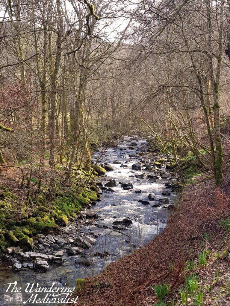
But, we had rented a self-catered cottage at Moness Resort, and were determined to make the most of it. Perhaps foolishly, we chose the Birks of Aberfeldy as our first walk of the weekend – the start of the walk is just across from the entrance to the resort, and so easily accessible from both Moness and Aberfeldy itself (officially, in fact, one can start the walk from Aberfeldy high street). And I should clarify – the foolishness was not in choosing to go for this walk, but instead to choose it as the first walk of the weekend, before we had time to warm up a little. The other half was struggling with his knee, and the description of the walk I read in one of my books indicated that it was not overly long. It is, however, incredibly steep – in many cases, the path is in fact a set of stairs, leading up the side of the gorge. Stunning views, and definitely good for the quads – if not, necessarily, sore knees.
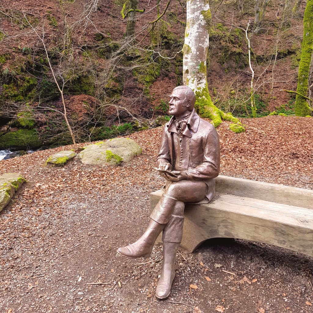
The start of the trail is relatively gentle, following the Moness Burn as it rushes over rocks and smaller falls. The statue portrayed at the top of this post is in a lovely wide clearing, indicating where Robert Burns may have first been inspired to write; one can understand this inspiration!
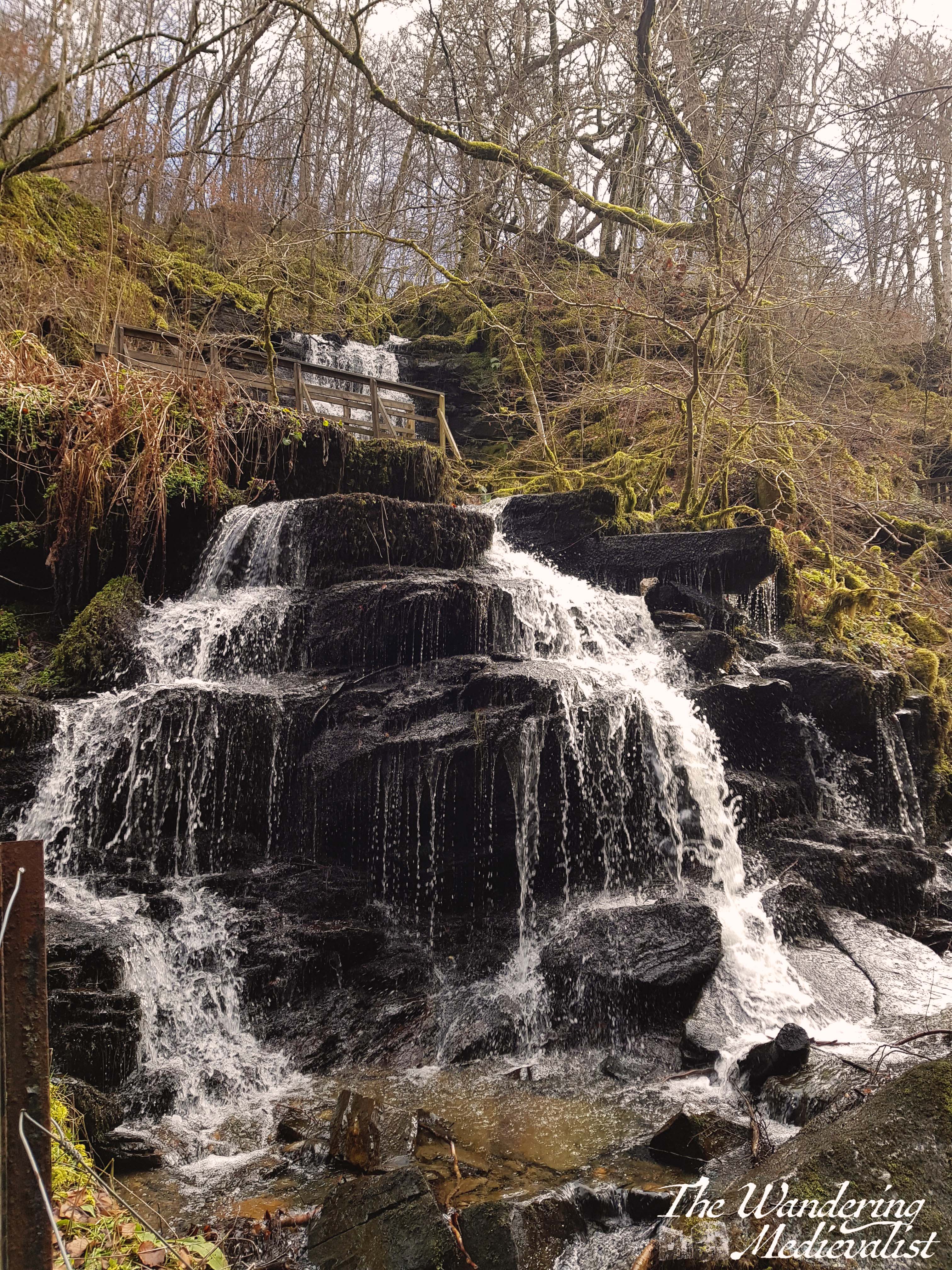
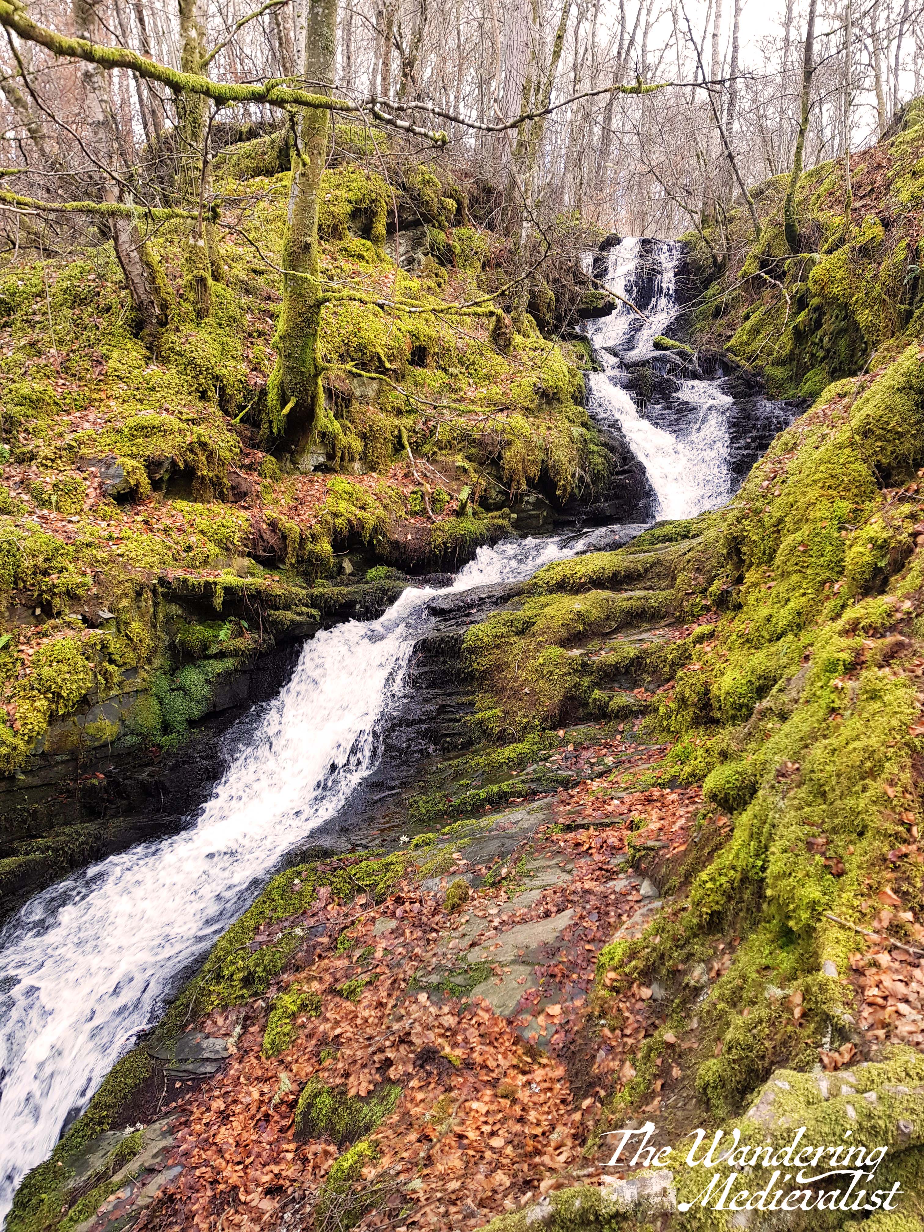
The path continues on eventually into a narrowing gorge, and this is where the walk becomes both more beautiful and a touch more challenging. Well-build wooden walkways and steps make it possible to truly experience the beauty of the lower falls.
I am a total sucker for waterfalls of course, and wish only that I had had my fancier new camera to properly capture them. Instead, I allowed both the other half and I to take periodic breaks as we climbed, and took plenty of pictures on my phone. It really is a stunning walk, with bridges and gorgeous colours of copper and green, even in the early spring when we were there.
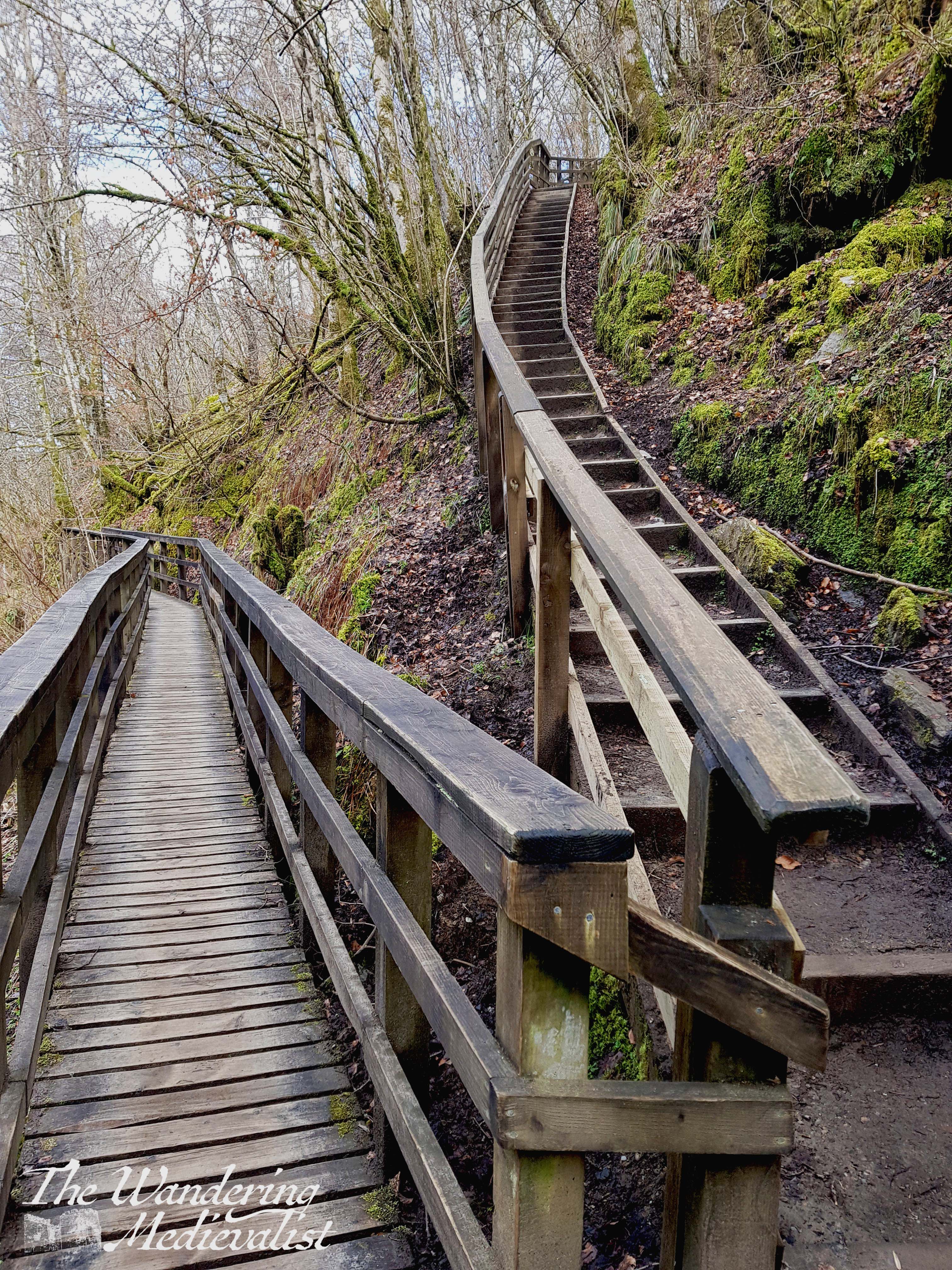
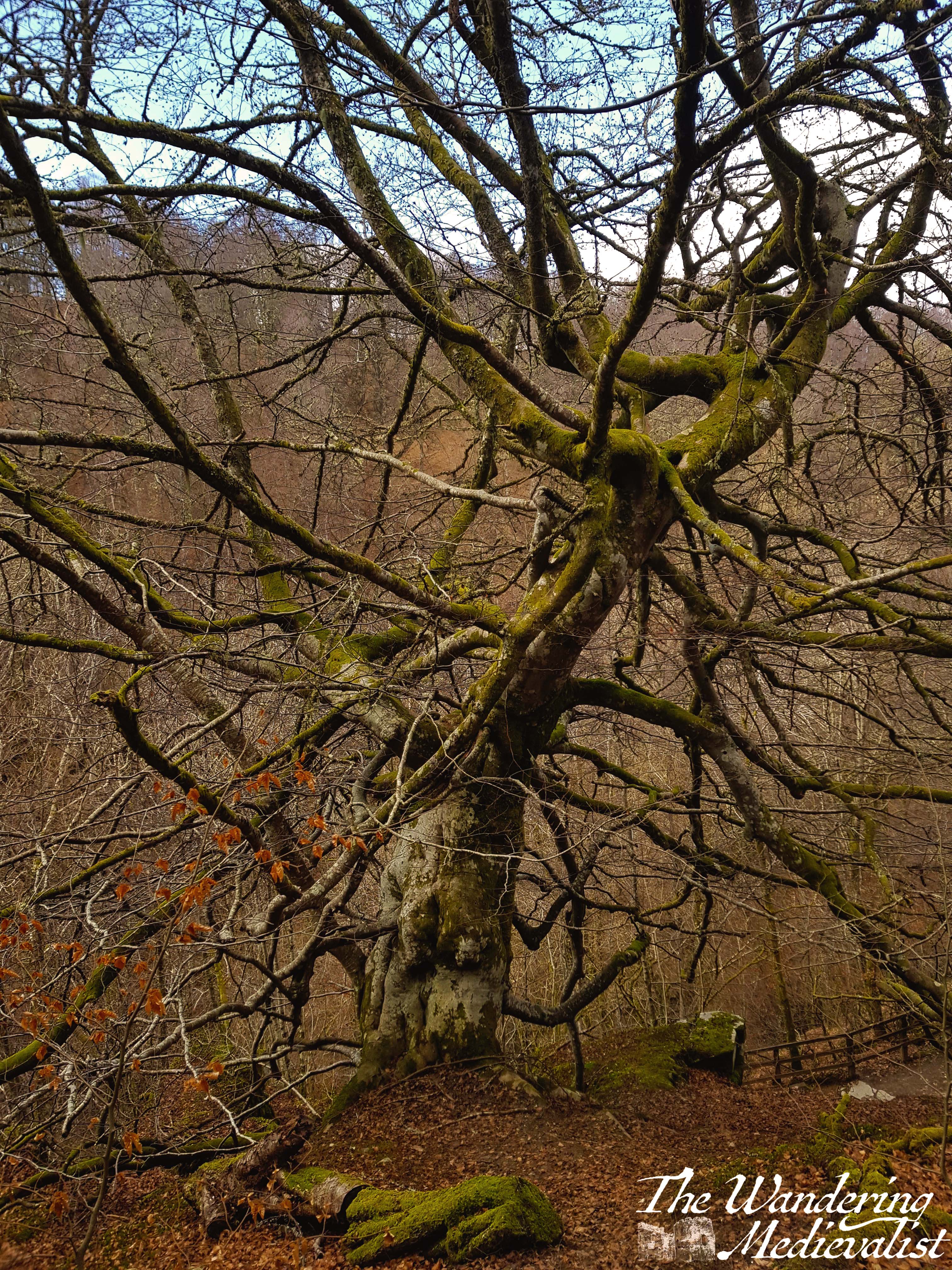
Staircases like the one above wind up the gorge and away from the burn, and at the top of one I was delighted to see the tree on the right, which reminded me of something out of Sleepy Hollow – I half expected it to come alive.
Equally magical was this view up what almost seemed a fairy hill – though the other half told me I was getting a touch fantastical when I spoke the thought aloud.
The apex of this loop is Upper Moness Falls, impressive at any time of year but perhaps particularly when snows are still melting. You cross directly over the falls on a bridge, but the best view is a bit earlier in the walk, where lines from Burns’ poem are carved onto the railing.
The return loop is higher up above the gorge and involves far fewer stairs, instead just a meandering descent. I quite enjoyed having both options available – near the water on the way up, but also views down into the gorge and across the treetops and hills towards Ben Vrackie in the distance.
All in all, a stunning walk and one I would most definitely do again – but with my knee brace and quads prepared!
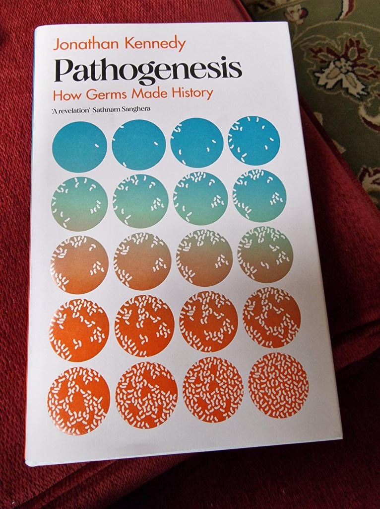
I have often found it curious that in the years since completing my PhD, my historical interests have veered away from the topic I studied for so long and towards completely different areas – though actually this may be more standard than not. One of the interests I developed is in diseases and their impact on human history. This began a number of years back when I picked up a book on a history of disease, namely Kinsey Dart’s Yesterday’s Plague, Tomorrow’s Pandemic? A history of disease throughout the ages, in which the author argues that the infamous Black Death, the plague that struck Europe in the 14th century, was not bubonic plague. This astounded, baffled and annoyed me, because while the argument was strong, at no point did he propose an alternative hypothesis. And of course, as science has now shown, he was in fact incorrect – numerous pieces of evidence now exist proving that 14th-century plague was in fact caused by Yersinia pestis. But the discussion got me hooked, particularly when I discovered that bubonic plague still exists in the modern world and, in fact, in the United States – though mostly west of the Mississippi.
This book by Jonathan Kennedy was a going on holiday gift from my other half, and I positively devoured it. Kennedy writes in an academic fashion, describing things in scientific terms as well as historical, yet makes them accessible to those without a Biology degree. The frontispiece is a map of the spread of various diseases throughout history, from Neolithic Plague to Covid-19 – there is nothing I love more than a good map! (take a look at the end of this post)
The introduction is subtitled ‘Primordial plagues’, utilizing a word that for me stirs up memories of things X-Files and of course Darwinian. Perhaps most appealing to me is Kennedy’s writing style, a mix of intellectual and tongue-in-cheek, providing facts in an intriguing fashion. One of the first that struck me was the description, on page 10, of how species’ adaption to retroviruses led to the evolution of gestational pregnancy rather than the laying of eggs.
To give you a feel for his style:
“Freud’s suggestion that psychoanalysis is more sigificant than the Copernican or Darwinian revolutuions seems a little, well, egotistic.”
Pathogenesis, p.2.
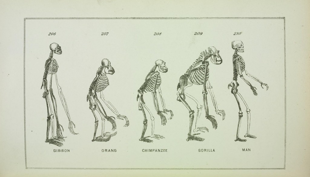
As the book moves through time, Kennedy does an excellent job of outlining the more traditional views, and then either upending or updating them with the data gathered more recently as our biological technology improves. He shows how history is anything but static or stagnant – rather it is constantly changing as we learn more. A key example of this is his discussion of the pre-eminence of Homo sapiens and slow disappearance of other human species such as Homo neanderthalensis and the more regionally-specific species Homo florensiensis and Homo luzonensis. It was not, as I was taught in grade school, a single line of evolution but instead a branched tree that overlaps and commingles – we know many modern humans carry Neanderthal DNA, for example – and just because a group of people migrated into an area at a particular time does not mean they stayed there.
As a student of the bubonic plague, I devoured a section on the ‘Neolithic Black Death’, during which Kennedy describes evidence of the Yersinia pestis bacterium in the traces of skeletons from Sweden, around 5,000 years old.
The key difference, Kennedy, explains, between this ancient plague and the one that devastated 14th-century Europe, was that it was non flea-borne until early in the first millennium BCE. The implications of this change are evidence in the study of both the Justinian plague and the Black Death.
“By comparing the genomes of these different strains of bacteria it’s possible to calculate how long ago they diverged…[from] a common ancestor that was circulating about 5,700 years ago.”
Pathogenesis, p. 67.
Moving onward, Kennedy spends a healthy amount of time discussing the diseases that wreaked havoc during the Columbian era, but also in flipping the coin to examine the impact of tropical diseases on colonial Europeans. For those of us living in Scotland, there is a key case study of how a disastrous seventeenth-century attempt to settle in Central America caused financial disaster and, not indirectly, to the union of the crowns of England and Scotland in 1707, with political ramifications still felt today.
While one might read some of these sections as more focussed upon the European settlers than the destruction of the native population, the purpose is not, I feel, to devalue that genocide, but instead to demonstrate how Mother Nature fought back, in some cases quite effectively. Kennedy also addresses how the resilience of the native Africans kidnapped and brought to the Americas was to some extent their downfall – they were more prepared for the illnesses of the tropical region yet also had immunity to Old World diseases like smallpox, and so were heartier than both Europeans and the native population of the Americas. This heartiness led to inconceivable suffering.
As Kennedy moves into the 20th century, he begins to look at the influence of politics on disease prevention and vaccination. He also spends a great deal of time examining the links between poverty and disease.
“One link between deprivation and non-communicable disease is unhealthy eating. A recent study found that the poorest 10 per cent of households in the UK would have to spend over 70 per cent of their income in order to follow healthy eating guidelines. As a result, we see higher levels of obesity in low-income areas.”
Pathogenesis, p. 280.
For those of us living in modern Britain, it is chilling to read about the impact of post-Thatcher cuts to the NHS on modern life and health. Kennedy cites a British Medical Journal study estimating that more than 10,000 extra deaths each year may have been caused by cuts in UK government spending on health (Pathogenesis, p. 282.).
This kind of observation, combined with his earlier discussions of the evolution of man and its relationship with disease, make this book absolutely fascinating and a must-read for anyone interested in the development of the human race over thousands of years.
My only criticism lies in the perhaps inevitable tendency that Kennedy, like many other academics, has in arguing that his study is the most significant in history – that the world changed because of these little-considered forces, more sigificant than any other. One of my favourite moments of study as an undergraduate was during my Fall of the Roman Empire class when we were all asked to write a paper on why we felt the empire collapsed – and every one was different. One hypothesis was to blame women (not in a misogynist fashion so much as political), another Christians, another, beards. We all did well, we all had good arguments, and in a way, we were all right.
Which makes clear that there is never one answer as to why anything happened in history, never only one catalyst – you can easily argue that your hypothesis is correct, but really there is always a multitude of factors in any historical shift. Nonetheless, Kennedy’s argument that disease is often missed, is a good one. It is also one that has, until recently, been very hard to research, as much of the evidence we would like to have is gone. In many cases, the eyewitnesses of a disease or epidemic did not have the language to describe symptoms scientifically. There will always be a debate, for instance, as to whether certain deaths in the 16th century were caused by leprosy or syphilis, as without biological evidence, the two look incredibly similar. This, then, is where this book can be seen as the start of an exciting new period of historical research and knowledge – as our scientific methods reach new depths of inquiry, new evidence will be found and examined to help answer questions. In many cases it may even change the course of what we thought we knew. And that, in my humble opinion, is what the study of history is all about.
Map of the spread of pathogens throughout history, from Pathogenesis.
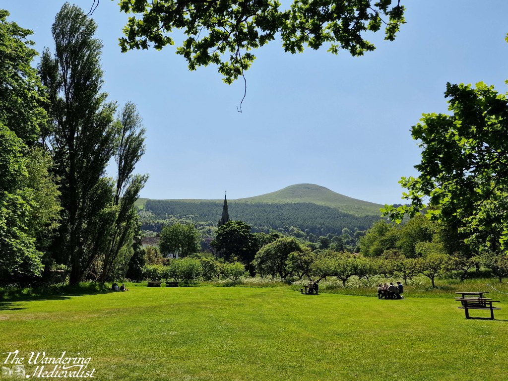
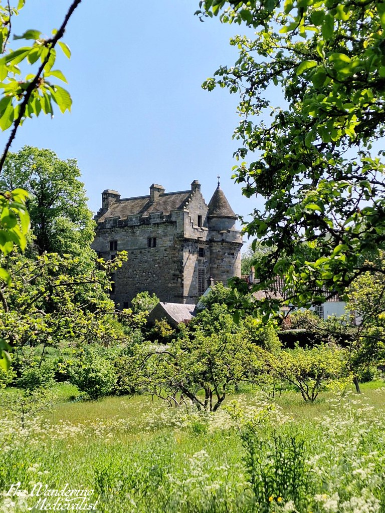
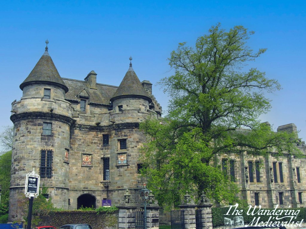
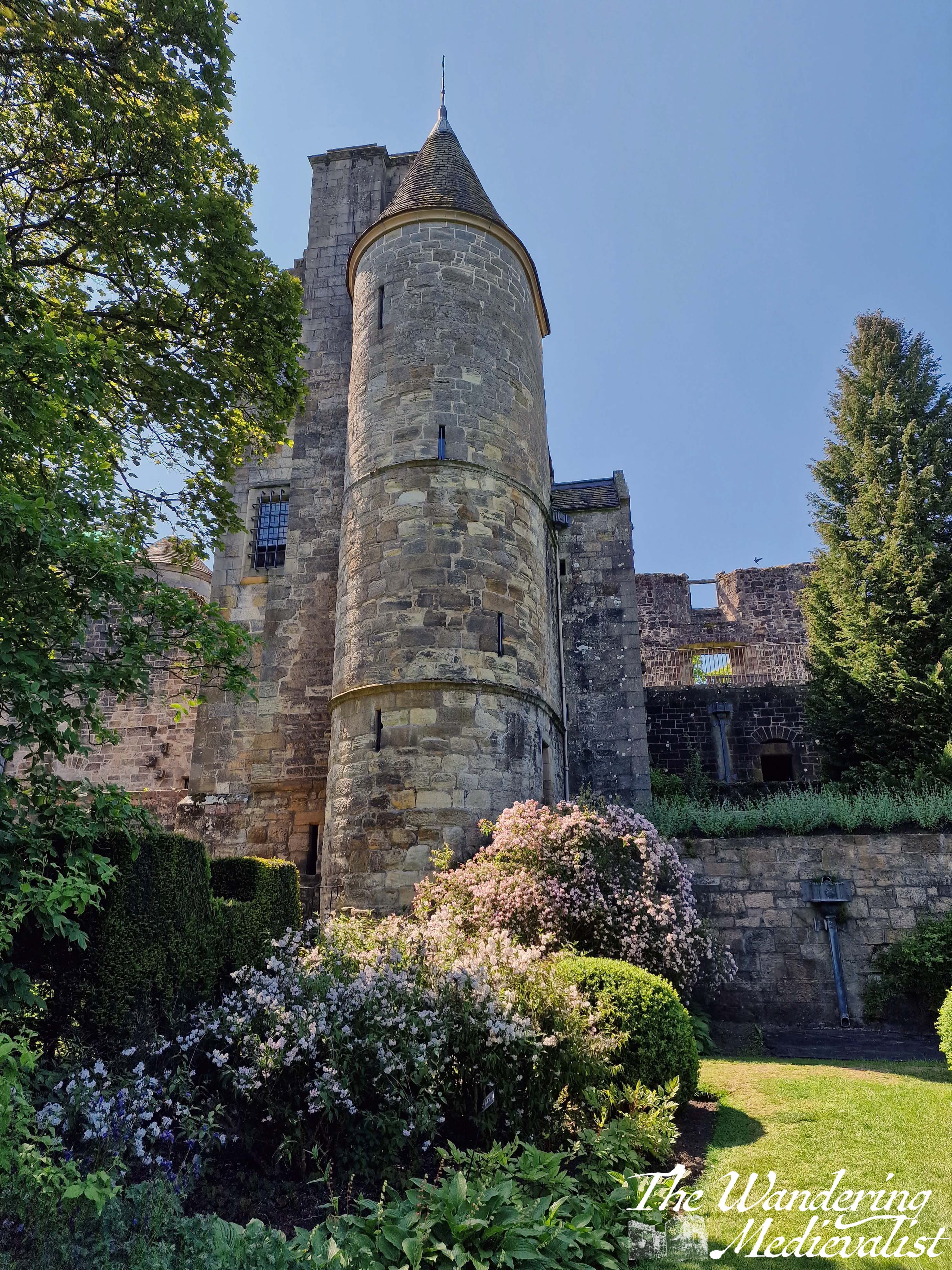
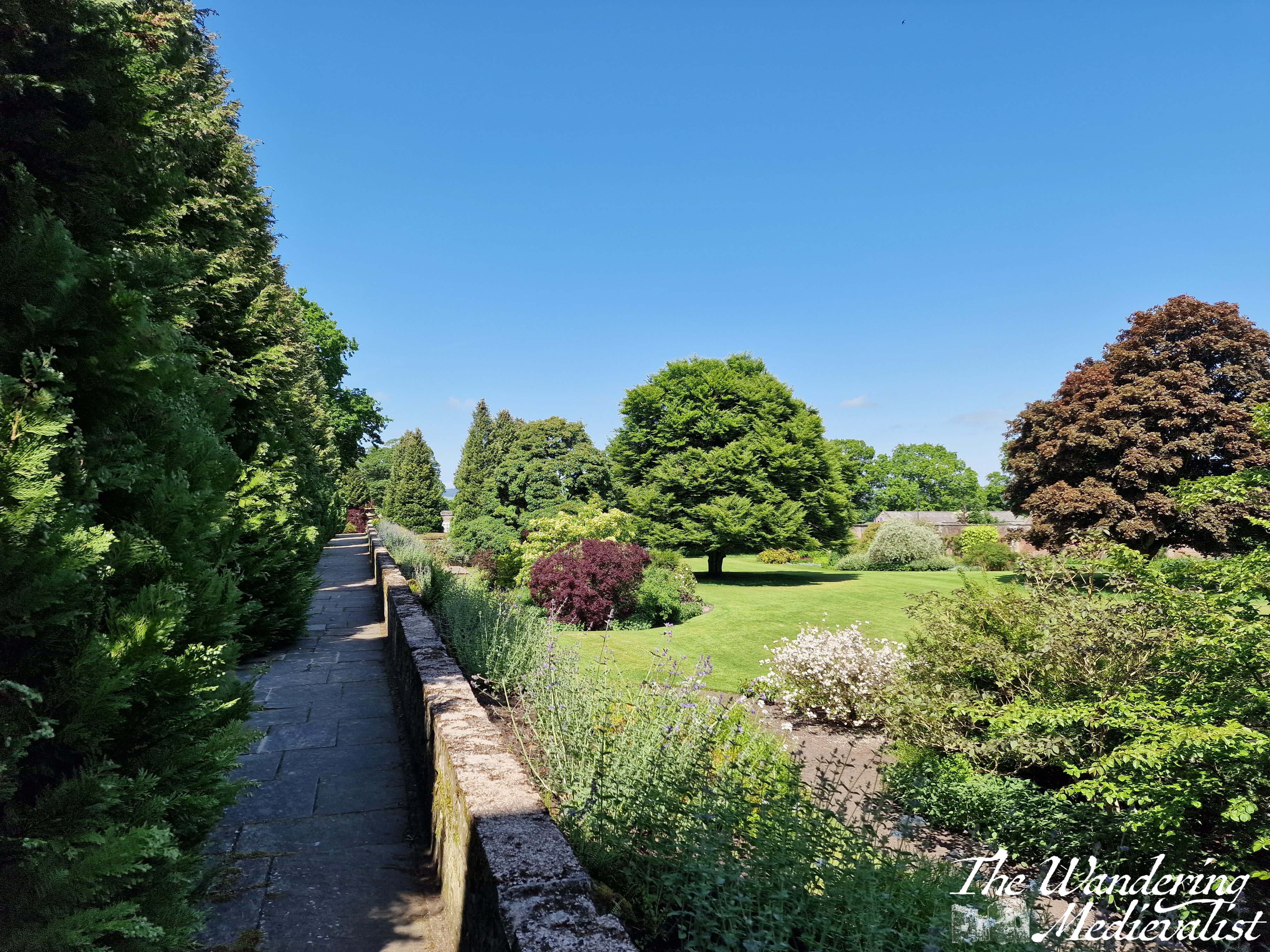
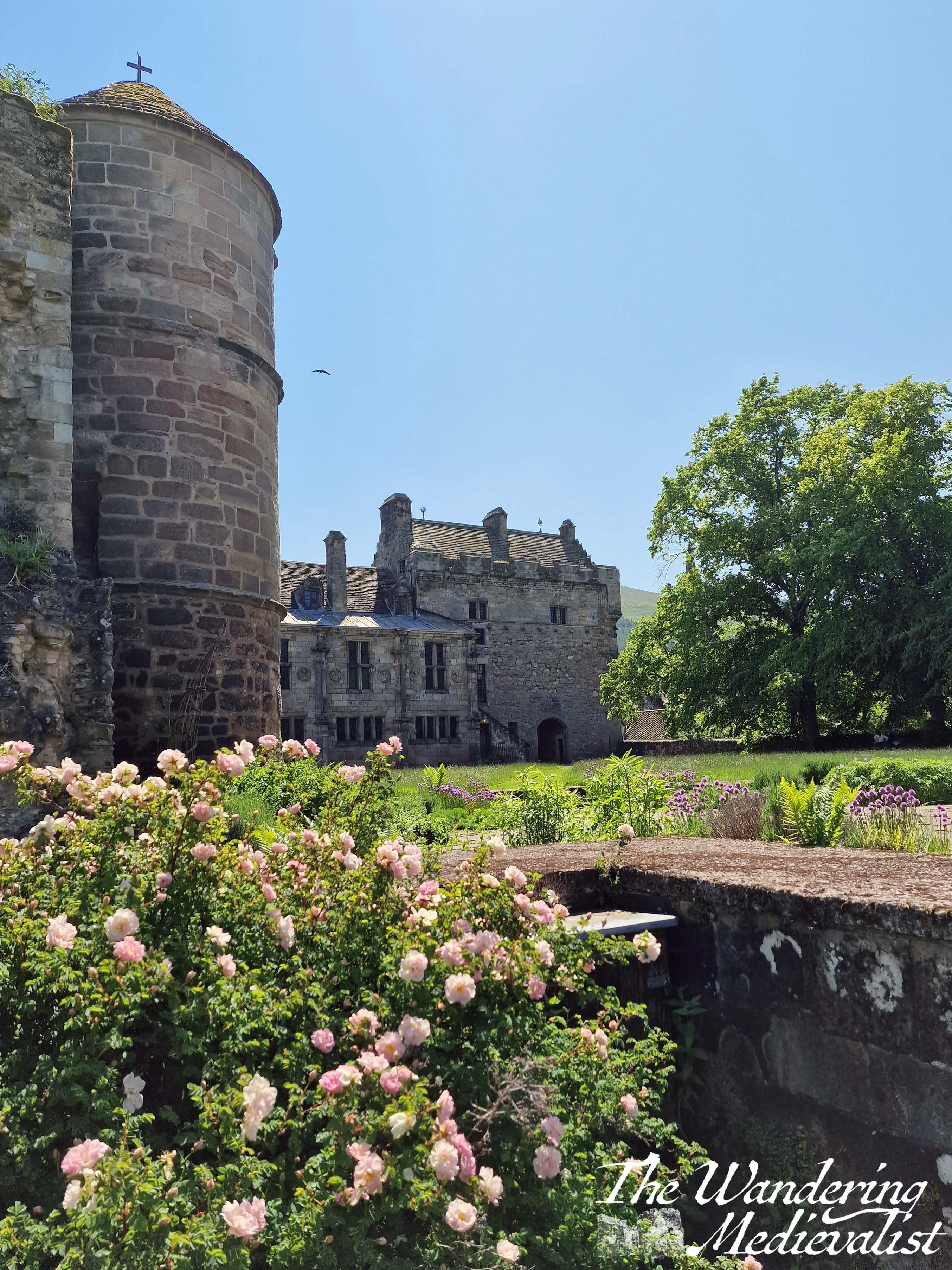
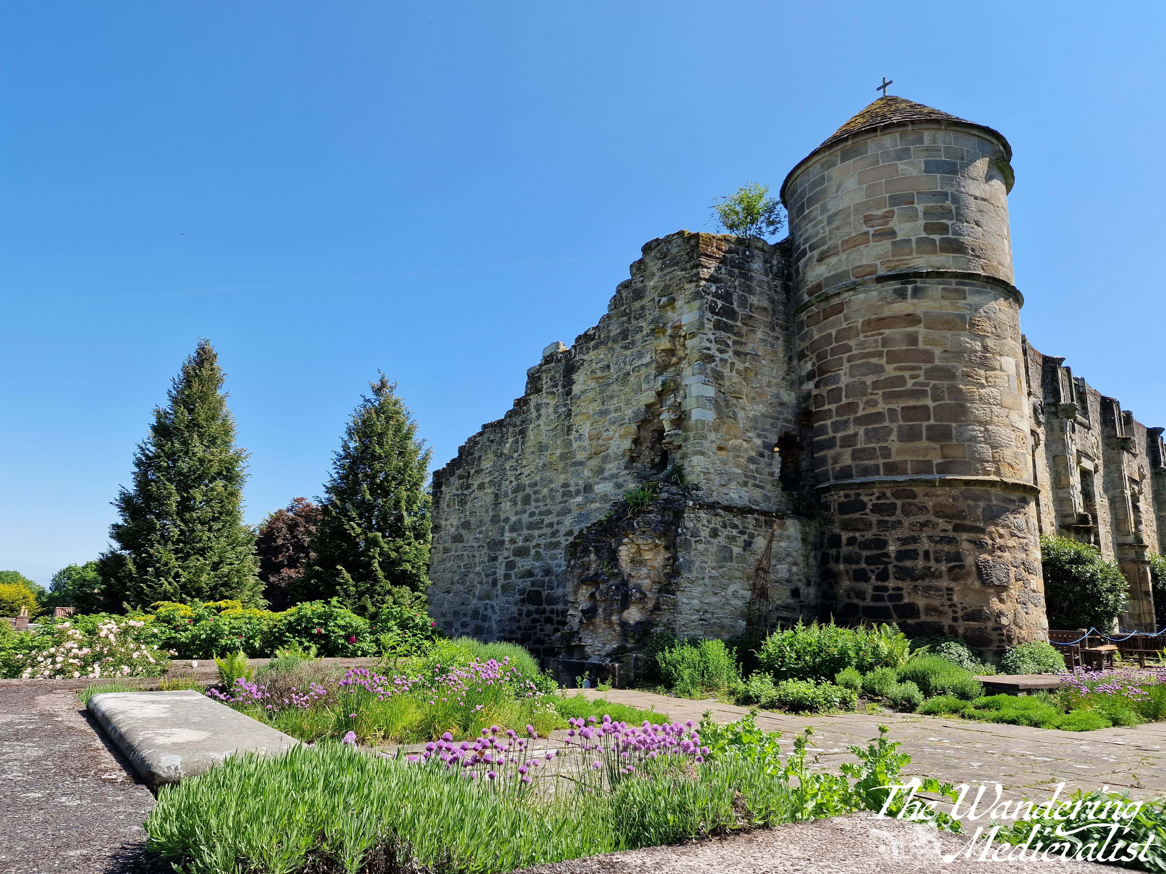
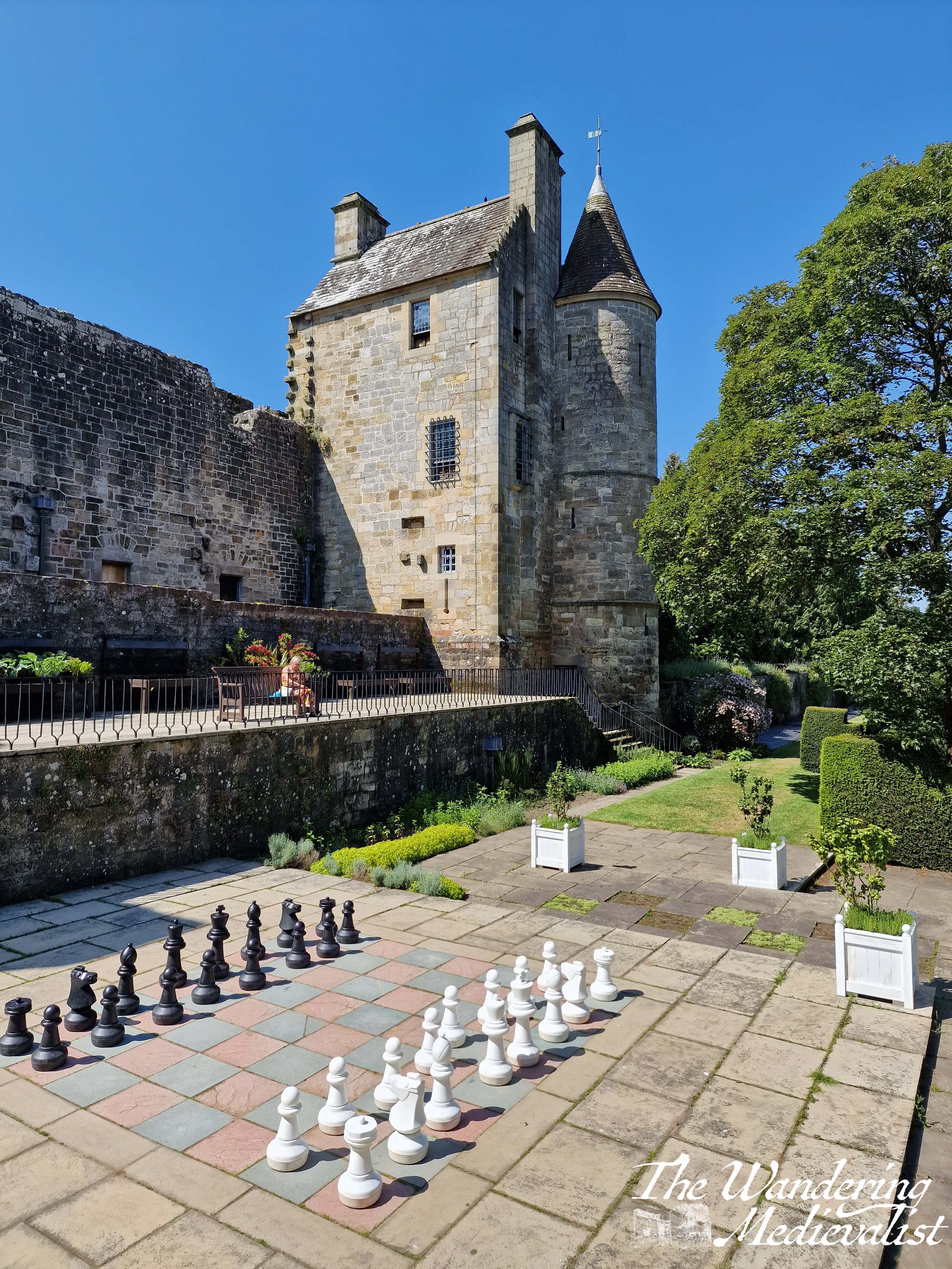
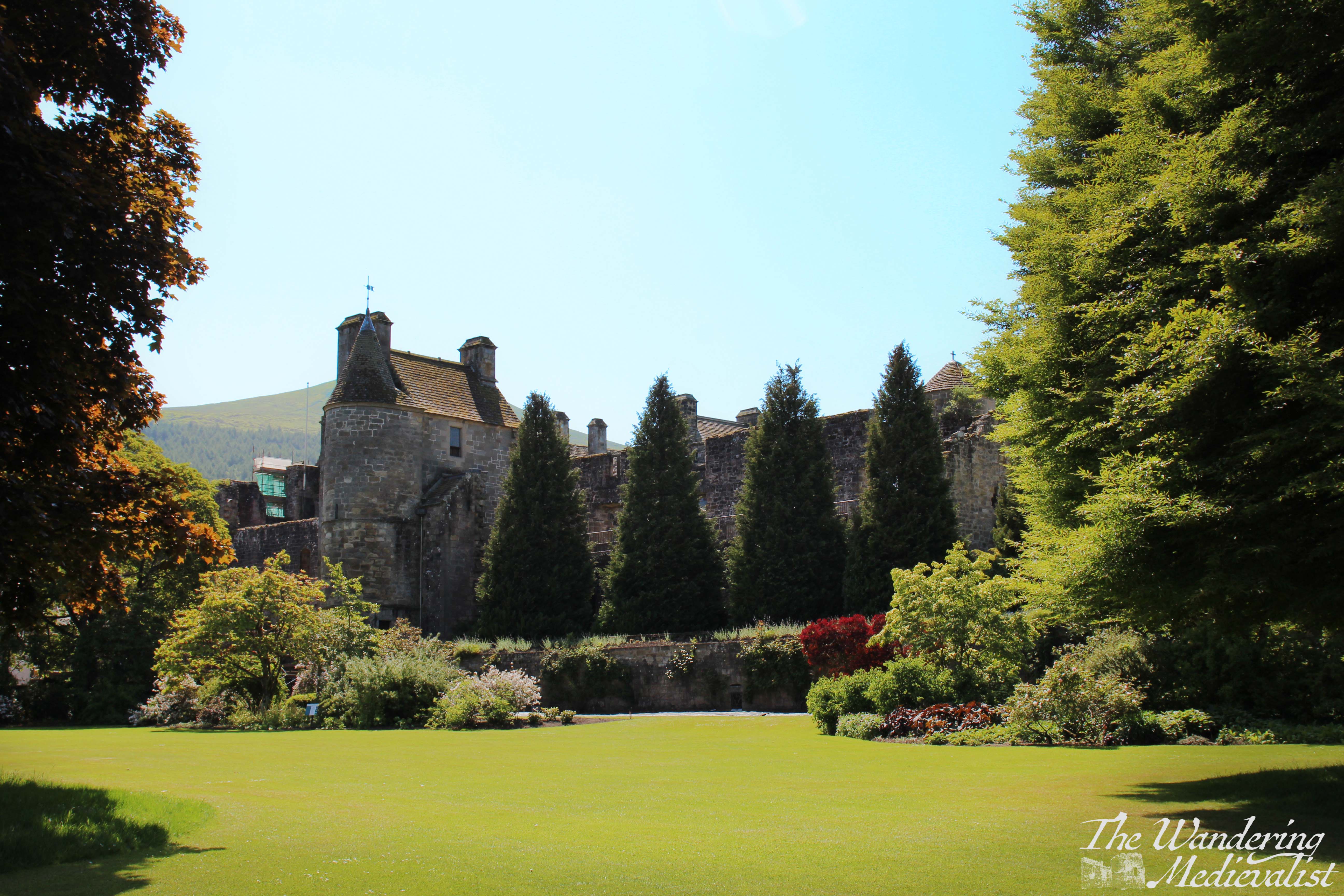
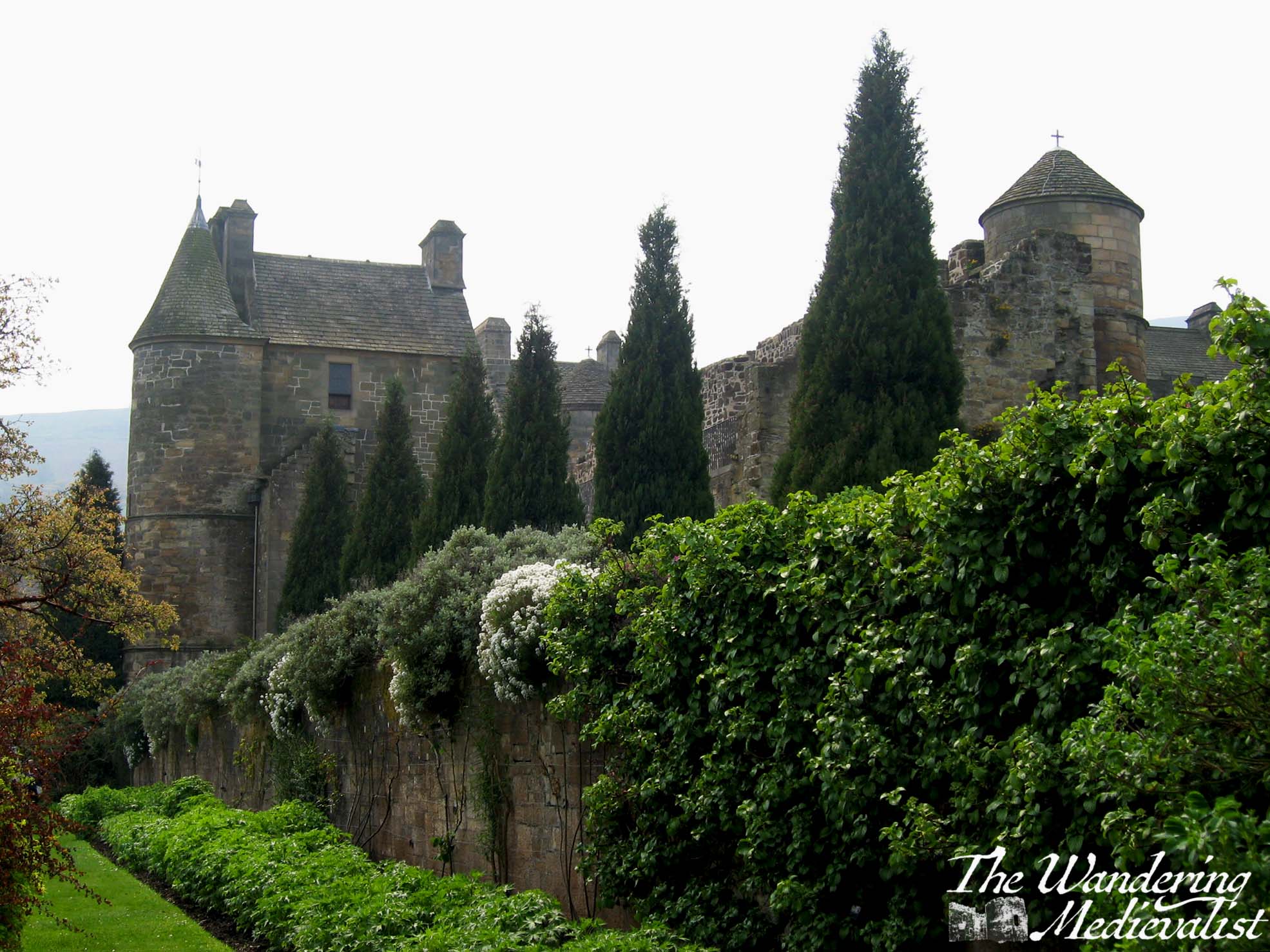
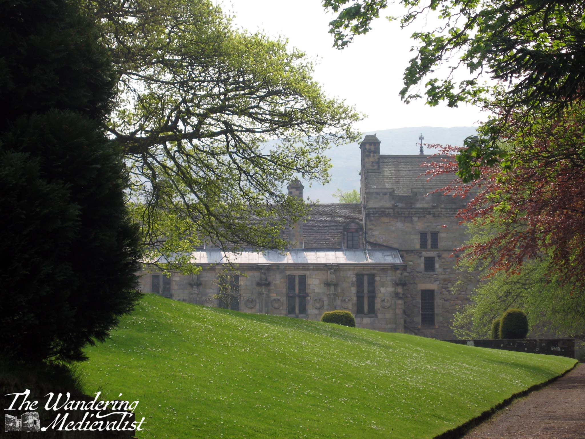
Today is overcast with patches of rain (not complaining, we desperately need it), a total contrast from last Sunday when I spent a hot and sunny afternoon exploring the gardens around Falkland Palace. The town of Falkland is a former royal burgh, and has recently risen to fame by standing in as 1940s Inverness during the filming of Outlander. It is a stunningly well-kept village blessed with charming old houses, beautiful gardens, and sweeping views over Fife towards St Andrews – all nestled in the lee of the Lomond Hills, specifically East Lomond.
East Lomond from the palace orchard
The palace itself was a favourite retreat of the Stewart monarchs of Scotland from James I onwards, with the forests nearby used for hunting. Most of the Jameses and Mary, Queen of Scots all visited regularly, at least partly I am sure due to Falkland’s proximity to Perth, Stirling, Linlithgow and Edinburgh. While there is evidence of a garden here since the mid-1400s, the present garden was re-designed in the 1940s by famous horticulturalist Percy Cane.
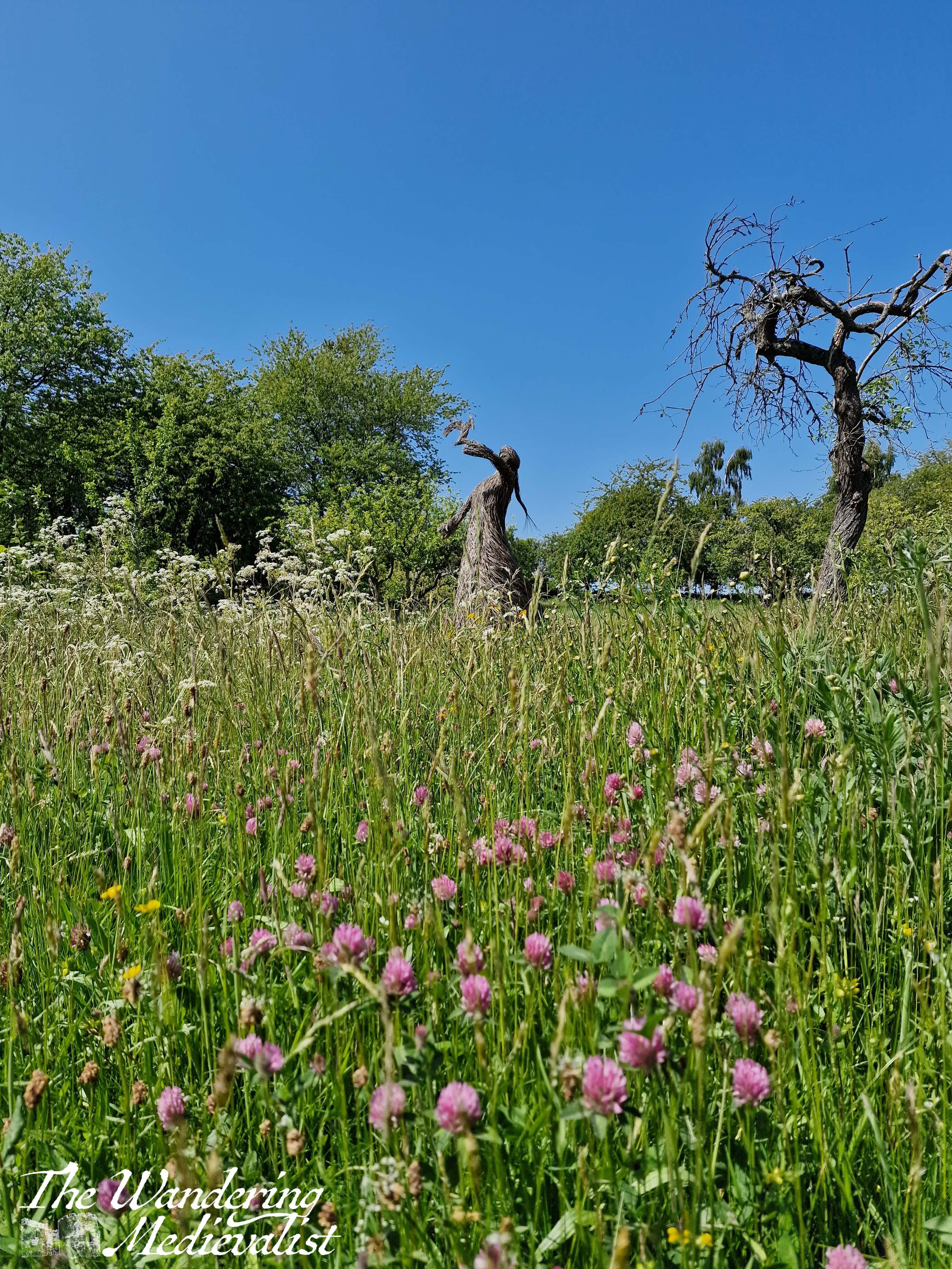
The National Trust for Scotland took charge in 1952, and in recent years, there has been an increased effort to bring back meadow land, to encourage growth of wild flowers and the bee population which is always in danger.
I had been thinking for some time of a visit to the palace gardens, and managed to coincide with the Falkland Open Garden weekend, meaning there were plenty of like-minded people around, and that the town itself was far busier than I think I have ever seen it. Nonetheless, I managed to find a parking spot on the edge of the Falkland Estate, and walked back through town to the palace, which does offer garden-only entry. The palace itself is of course worth a visit, but I had been in before and on this occasion did not have the time for a full exploration.
To enter the garden, you go through the impressive main palace gate, and from there, it was up to me and my camera to wander around and enjoy.
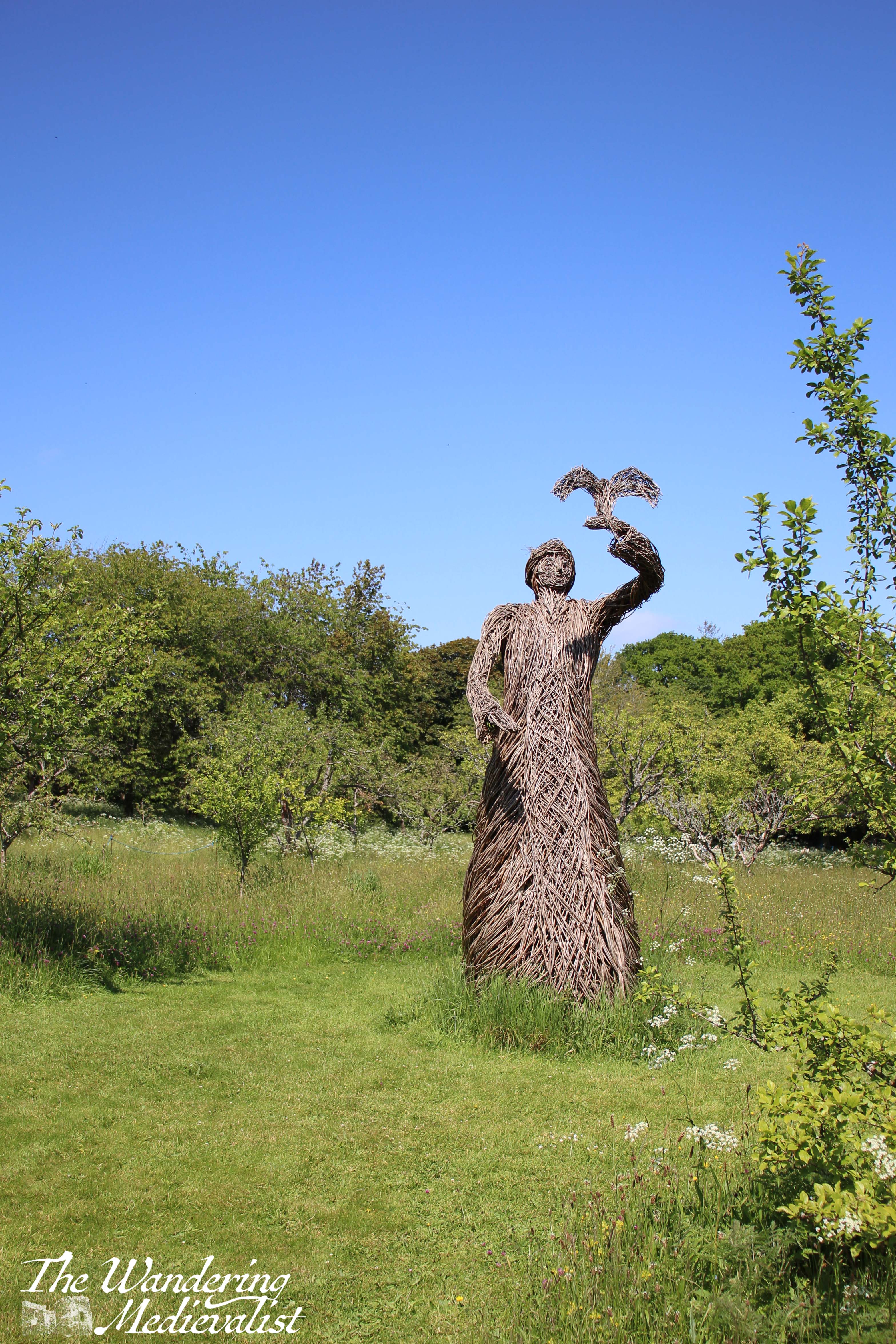
I started off in the orchard, which offered lovely views of the hill and town, as well as the Willow Queen, who stands on her own amidst the wildflowers and apparently represents Mary, Queen of Scots.
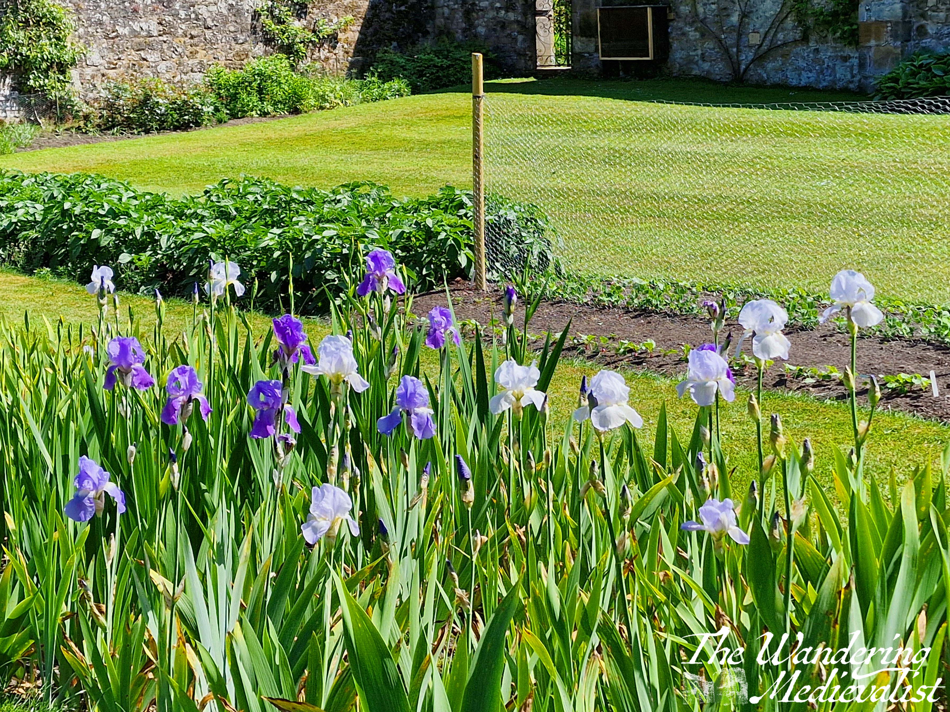
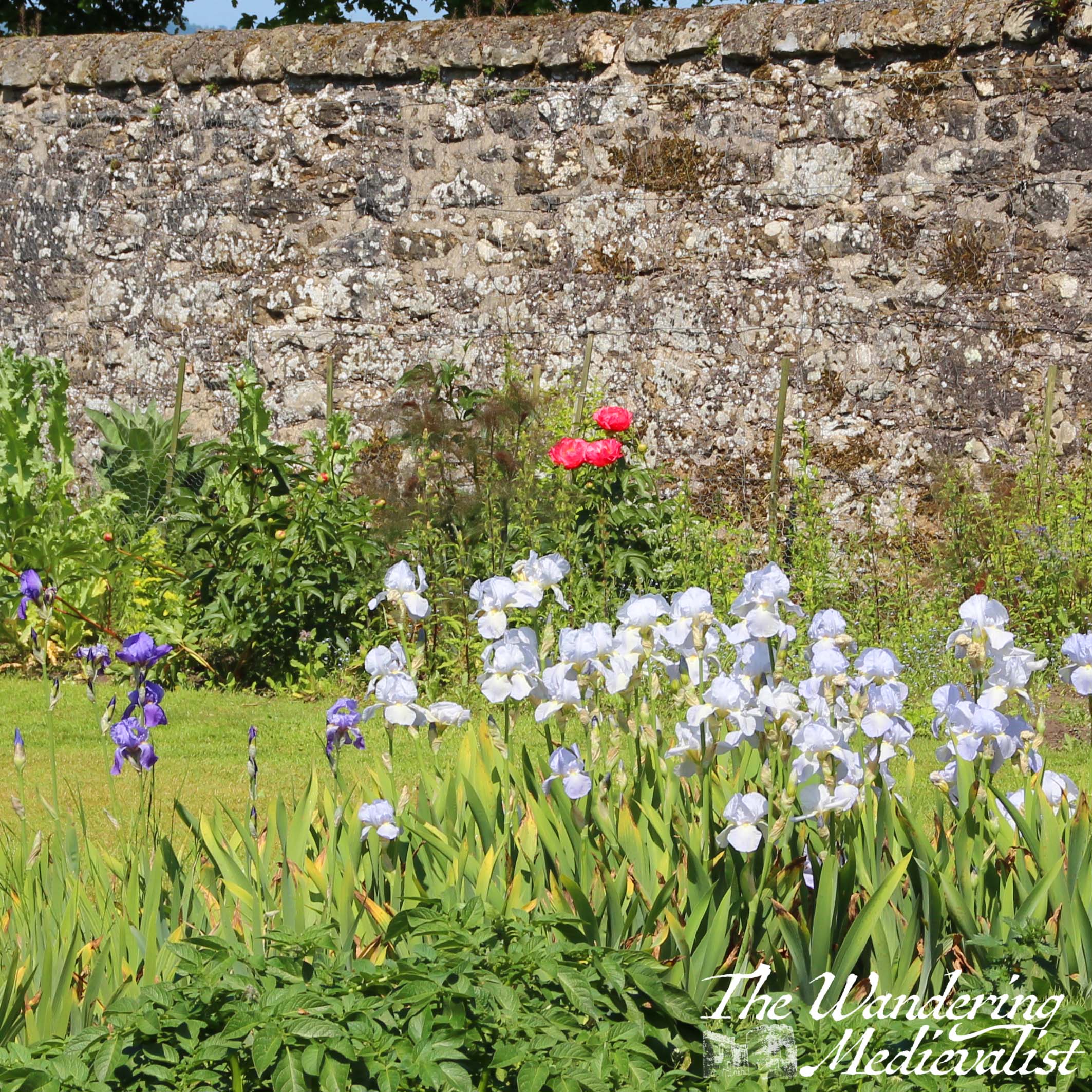
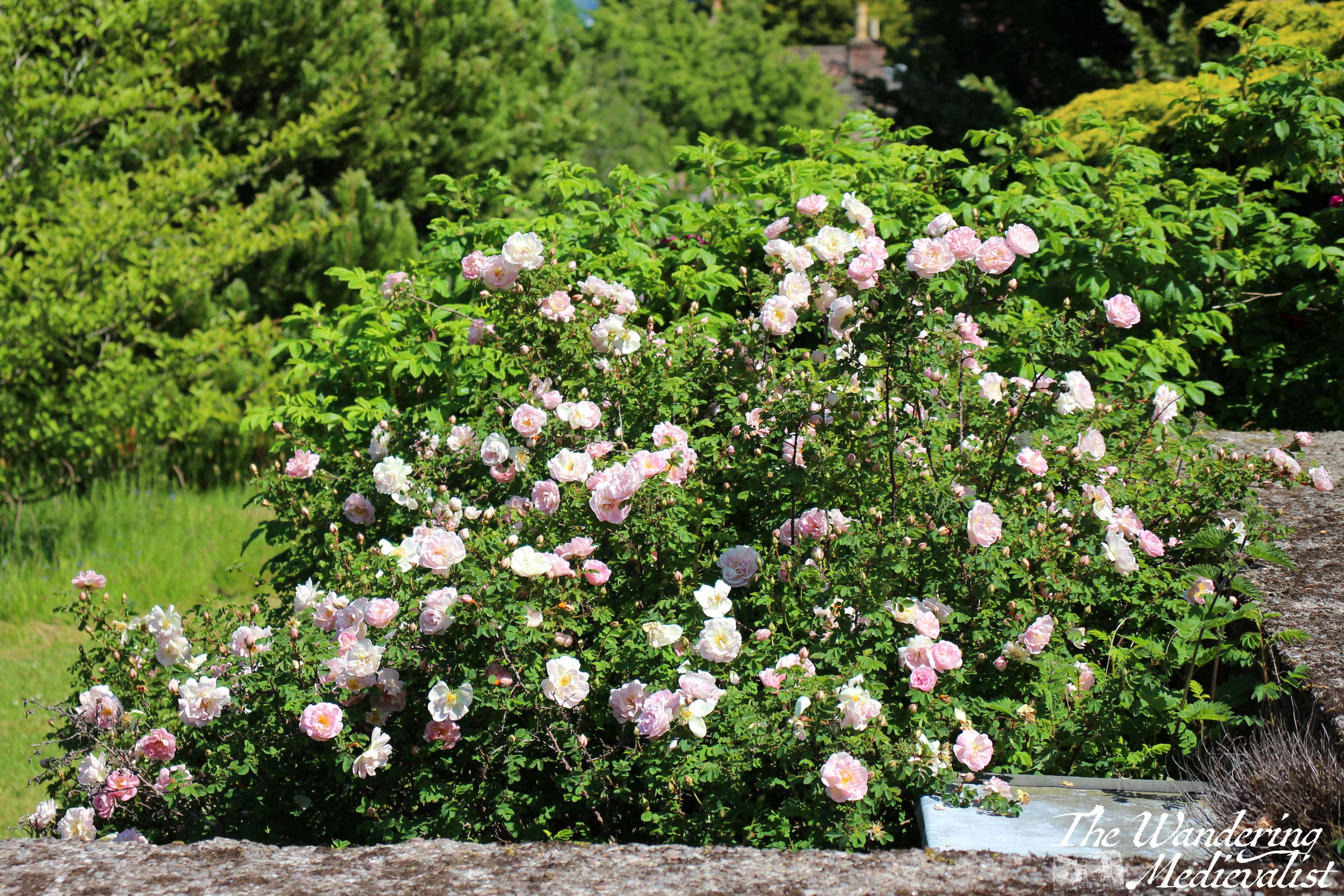
From the orchard and meadow I returned to the gardens proper and explored the walled garden, where there were rows and rows of iris – my grandmother’s favourite – and peonies just a few days off blooming.
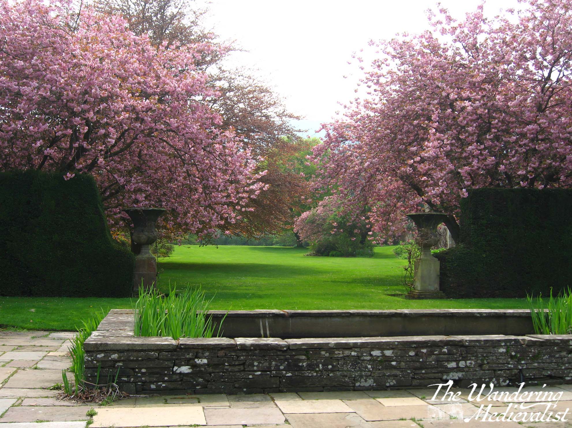
I realised as I walked up towards the palace again that I was probably a few weeks too late for some of the best spring flowers – lilacs, wisteria, and flowering trees were all a bit past – and a touch too early for summer roses, but that really only means I have to return before too many more weeks have passed.
I should clarify, the bottom two images above including the pink trees were taken several years ago, earlier in the year. After taking my fill of garden and palace pictures, I made my way through the gift shop and, resisting the ice cream on sale in several locations, made my way back through town. I had time to spare, so detoured down along the Maspie Burn as it run alongside houses and an old mill, before finally taking me to a play park
From there I cut back up the hill to the main road, and back to Falkland Estate car park. It was just too hot and buggy to explore the estate itself, though I have done before and will certainly write about it soon!
Even with regular stops for pictures I managed a good walk and a few extra freckles from the sun, though as I stood on the palace wall I could see clouds gathering along the distant coastline. Fortunately they stayed off-shore until later in the evening. I am looking forward to my return to Falkland in the season of rhododendron (just out now as I write) and of course, roses.
Both my other half and I agree that our first weekend away together to Glencoe many years ago remains one of our best trips ever – we went in April and were lucky enough to experience two glorious sunny spring days, warm and completely dry. We stayed at a hotel in Ballachulish on Loch Leven, close to the village of Glencoe (note, there is also a Loch Leven in Fife, which boasts a lovely castle I will write about in the future). For weeks ahead of time, I excitedly read through my Pathfinder Guide to Fort William and Glencoe, marking the walks I thought we could do to really experience the mountains and surrounding area.
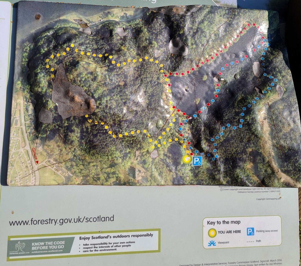
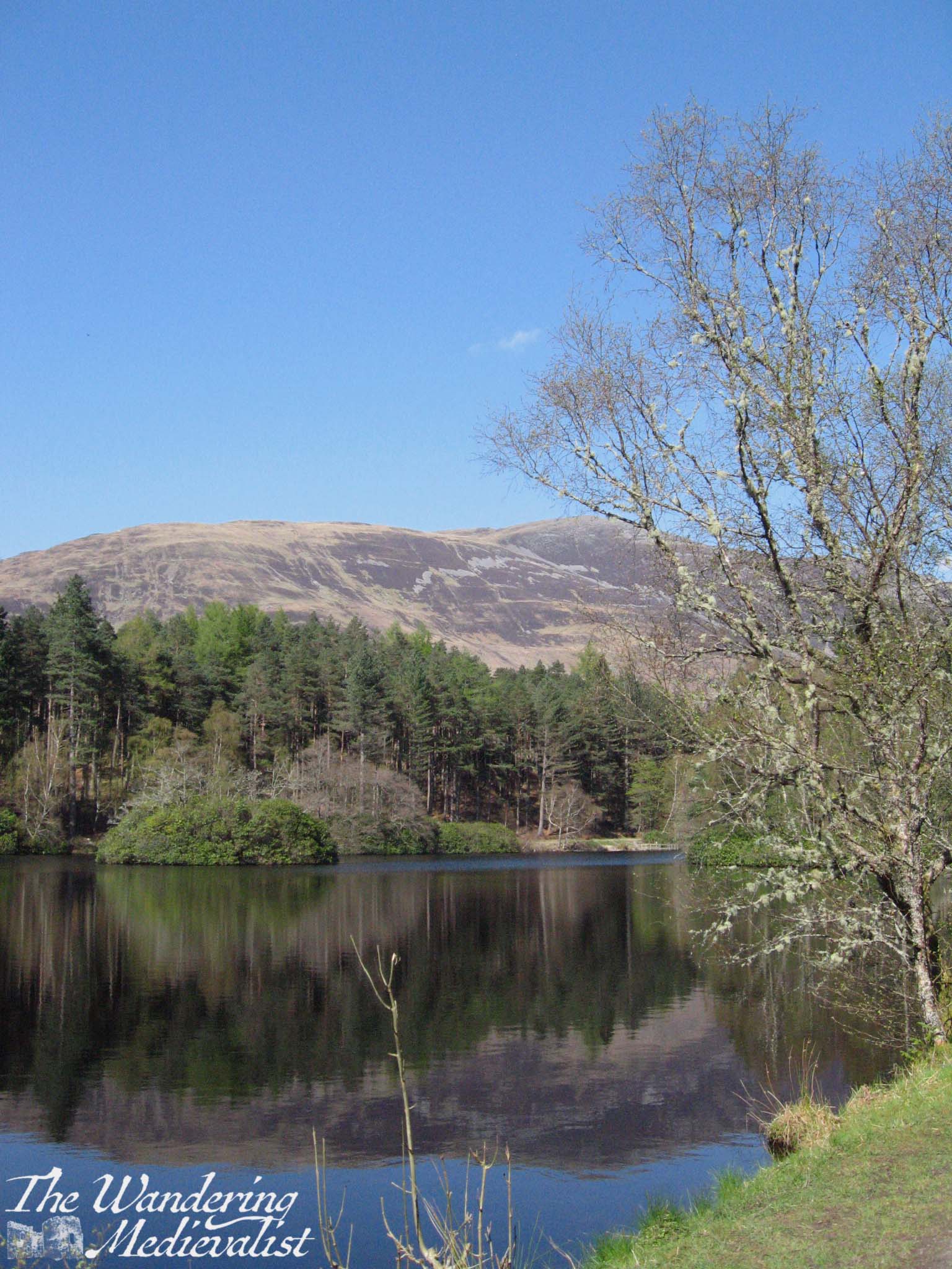
This series of walks around Glencoe Lochan was one of the last we did, but also one of our favourites. The trails start in what is now a well-marked car park, and there are three options. The shortest, and the one that is advertised as being wheelchair and pram accessible, is the red trail.
Though the shortest, the red trail is by no means hampered by lack of a view – in fact, as it circles the lochan (small loch), it boasts some of the most spectacular views of the nearby mountains including the Pap of Glencoe (the pointiest hill you see below).
The blue trail is arguably the most challenging as, while not particularly long, it does boast a few very steep bits, both up and down. It also, however, offers a gorgeous path through trees and heather with the mountains just visible in the distance. There are also a few good stopping points with picnic tables and cleared brush so that you can enjoy the view.
The blue trail eventually cuts downhill back towards the lochan, and joins up with the other two; even after the steep climb we were still ready for a bit more exercise so left the red trail to follow the yellow, which is also mostly wooded but includes a few stunning viewpoints out towards Loch Leven and the mountains to the north.
The whole outermost circuit taking in all the trails was just over an hour but could probably be extended if you did the red loop as well. It’s also a great option if you have a member of your party who isn’t particularly mobile, as the red loop is gentle and has plenty of benches to stop for a rest, but still enables one to see the view. Perhaps one of the nicest aspects of this area is how close it is to the village. After the walk, we drove down into the town and were able to stop into the shop for fresh water and a snack, as well as use the very clean public loos – they were not free, but I’m always happy to pay if it means the facilities are clean!
All in all, an absolute must for anyone staying in the Glencoe area!
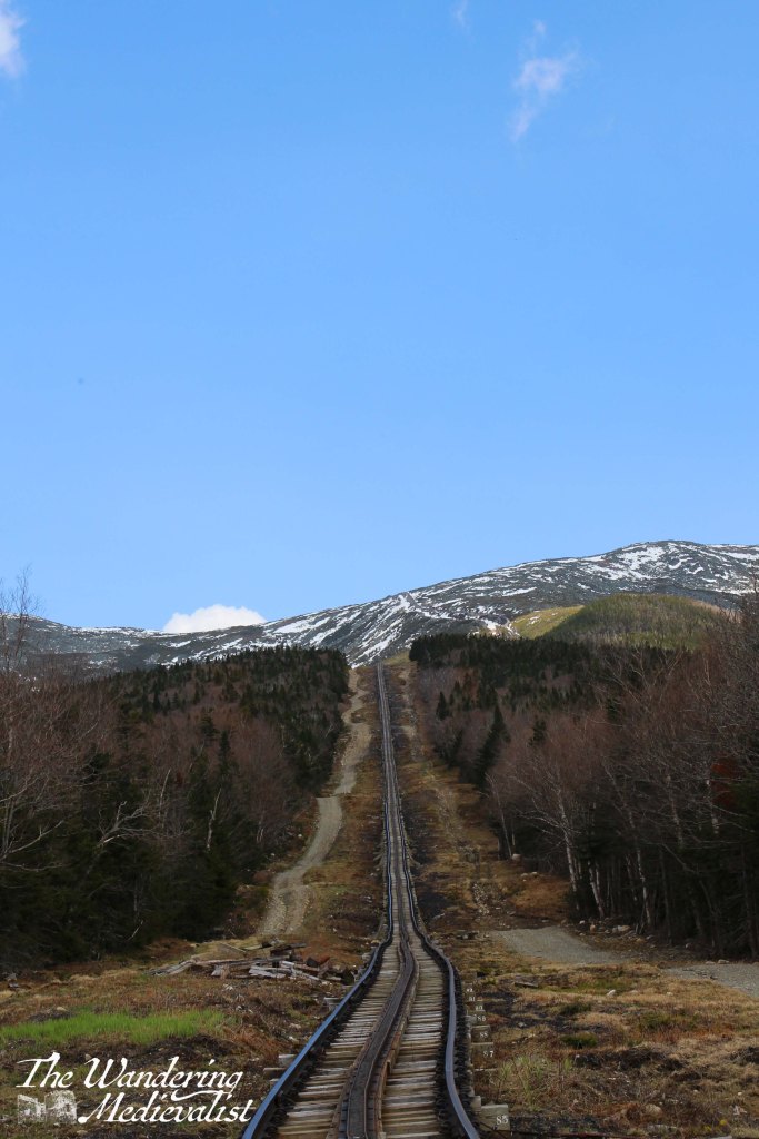
When I was young, it was quite common for me to spend time in the White Mountains: cross-country skiing, hiking, camping, and exploring the many rocky rivers that became a love later in life. During our recent trip to New England, I insisted that the other half experience this region and in particular its chief attraction, the roof of the world in the Eastern USA – and so we booked tickets to reach the summit of Mt Washington in the only way feasible for us at the time: the Cog Railway.
While not the least expensive attraction in New Hampshire, the Cog Railway is fascinating and worth every penny. At more than 150 years old, it is the first mountain-climbing cog railway in the world, and the second-steepest: one spends a good deal of the trip travelling at a 25% grade and sometimes steeper.
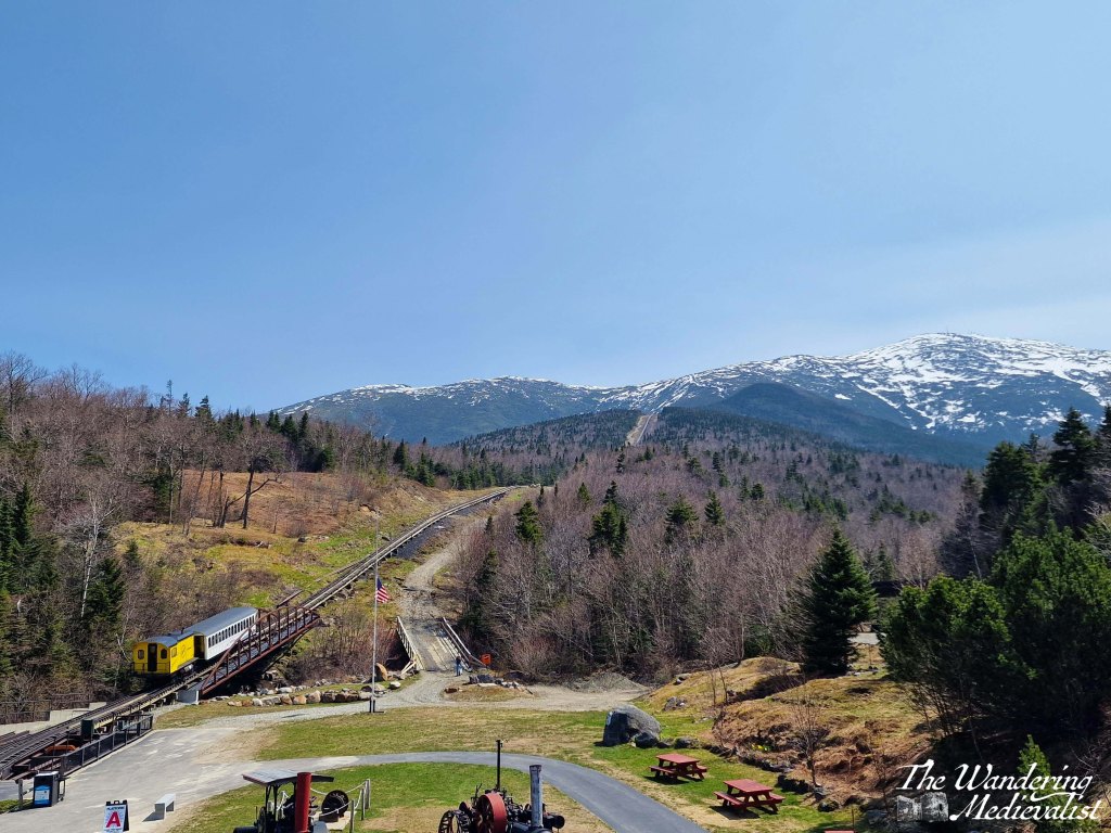
One of the first things we noticed upon arriving at the Base Station was the impressive variation in license plates in the parking lot – from all over the Eastern seaboard as far south as Georgia, and north into Canada – Quebec and New Brunswick stand out. So clearly, this is a popular attraction. At the time we were visiting, second week of May, we managed to fall between busy points in the year – the auto road had only JUST opened, the snow for skiing was mostly gone, and the summer hikers had not yet arrived.
The Base Station is a great starting point – it has an extensive snack shop and a great souvenir store that was quite reasonable. It also boasts a small museum that is really informative about the engineering and building of the railway. It also has excellent views up the mountain, and as we were a bit early (mea culpa) we had plenty of time to enjoy the clear, sunny skies.
The rail car itself is quite comfortable, and the staff are incredibly knowledgeable, spouting intriguing facts about the flora, fauna, climate, and history of the mountain.
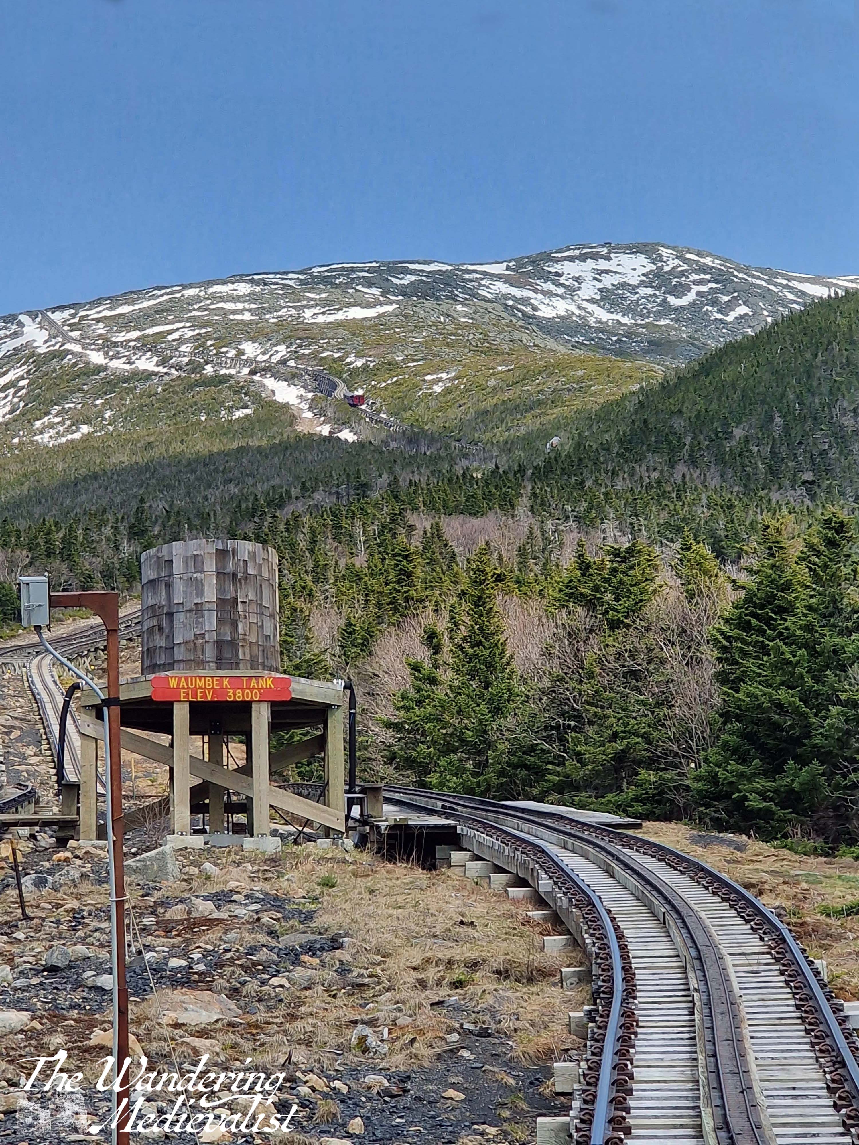
I found the journey up the mountain to be fascinating. Though the train moves relatively slowly – around 5mph – it passes swiftly through the different biomes, spending quite a bit of time winding through the high forest where trees are stunted by the wind, and are dotted between rocks and snow drifts. Along the way you pass the Wambeck Switch, where the rail splits for a short time and allows trains to pass one another, and several very steep stretches of track which were a touch nerve-wracking. But then the views started – we were on the right-hand side on the way up and so enjoyed looking towards the Lake of the Clouds and the ridge of the mountain where the Appalachian Trail rises towards the summit.
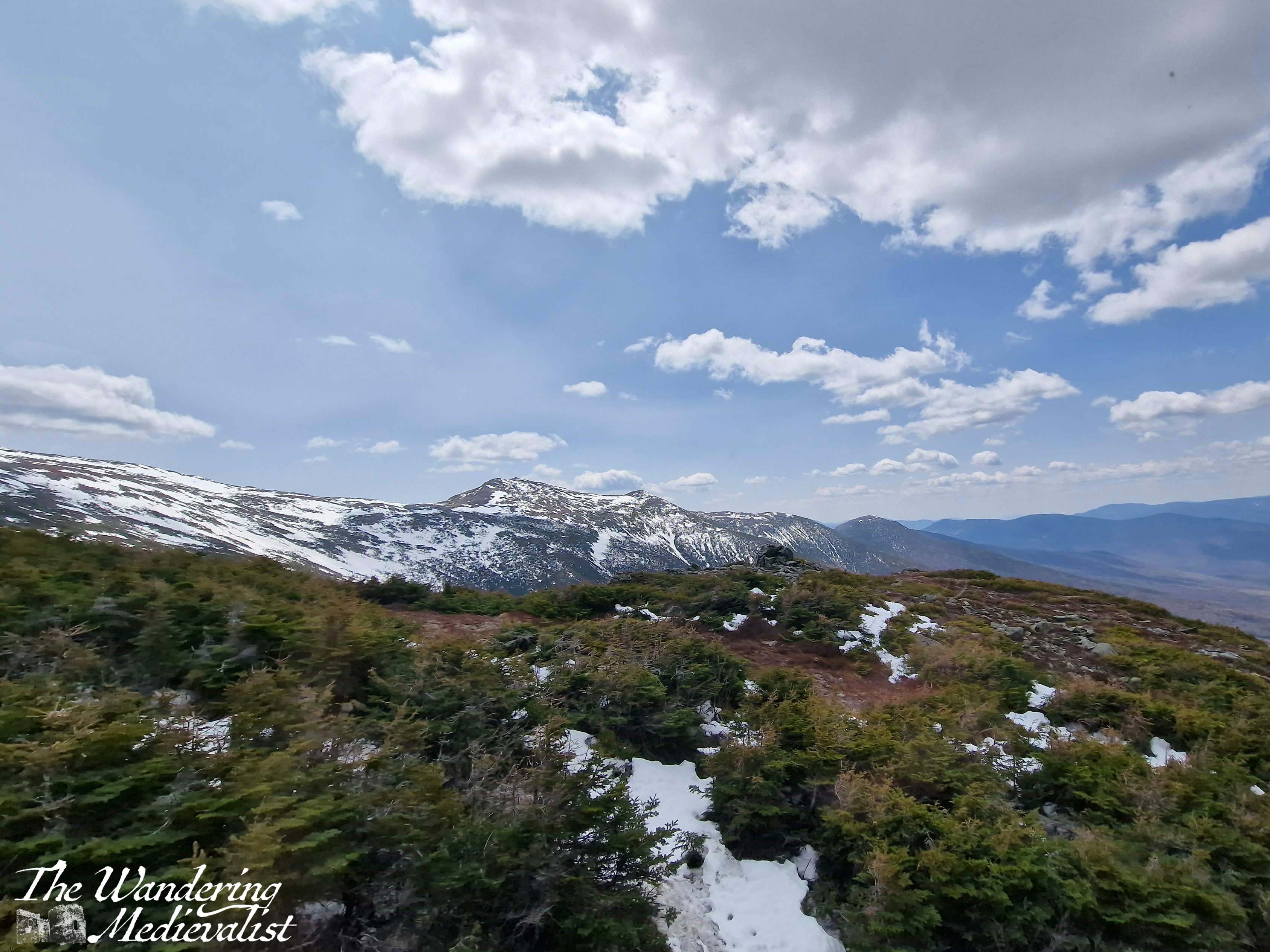
Reaching the top was perhaps the most exciting part – the trees and rocks vanished into snow, and we could see the observatory rising in the distance, looking almost like a space station. Then as we all prepared to get out and explore, the conductor announced that if we couldn’t handle 60 mph winds, we should stay on the train and go back down. This got the adrenaline pumping, and we both suited up with hats and coats before venturing outside.
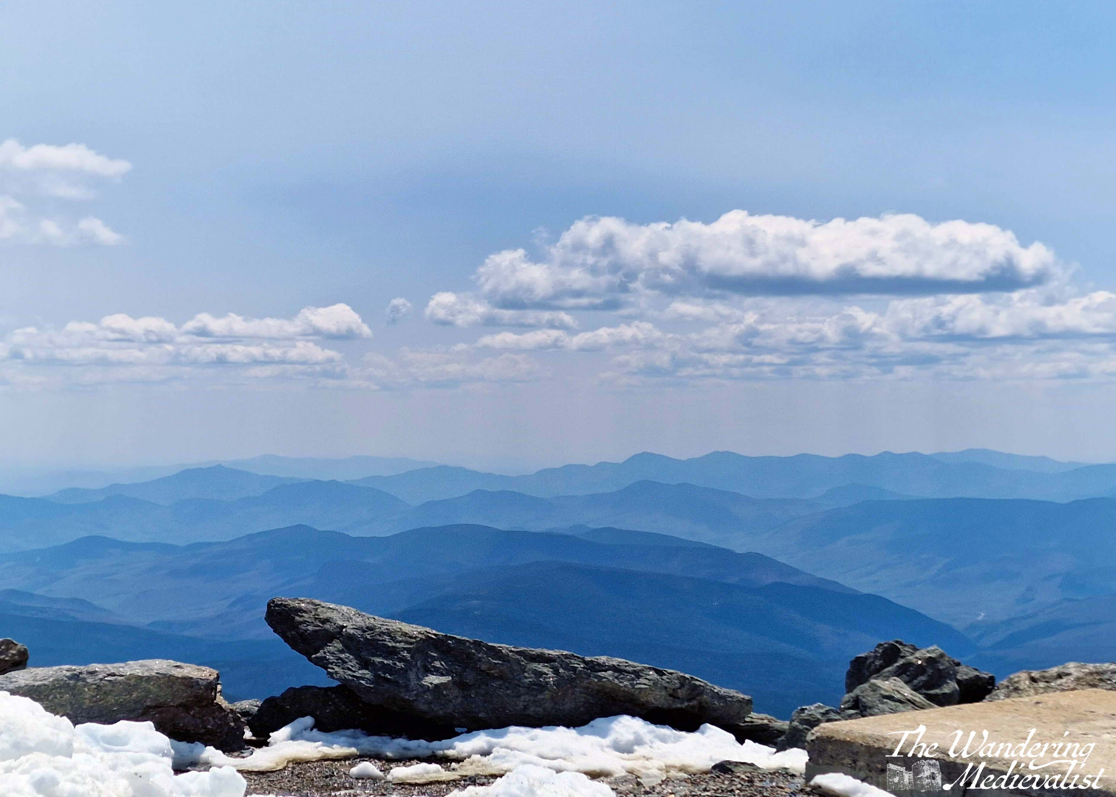
The summit area was quite busy, though I imagine nothing like it is in the summer, and the visitor centre was not yet open for the season, so we made a slow, clockwise circuit. While it was certainly windy it was not overly cold – 45F or so – and the biggest issue for me was my sneakers, which did not boast enough tread for snow and slushy puddles. Even on a slightly hazy day the views were spectacular, 360 degrees of mountains and valleys and ski resorts. At various points, hiking trails were evident marked by stone cairns, disappearing over the edges in the distance.
What stood out most though was the wind – the strongest I had felt in many years, I am sure there were gusts well over 60 mph, and at times I struggled to move; the other half had a great time leaning over to test how far he could go before falling.
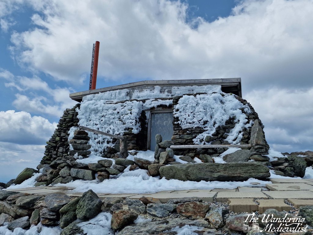
This is the Tip-Top House, adjacent to the summit, built in 1853. We did manage to make it up to the summit sign despite slippery icy snow and wind – picture is not the best though! Long story short, I would love to come back on a less hazy day and explore the observatory during the season!
The trip back down the mountain was equally spectacular, especially as we managed to sit on the other side of the car and enjoy views in the other direction. If at all possible I highly recommend this option – switch sides and enjoy the full range of views. I was also pleasantly surprised to discover that my fear of heights did not overly impact the way down, even on the steepest parts of the track where the ground falls away quickly at the edge of the rails. I took far too many pictures to upload here, so I’ve put together this slide show to show off the full range:
When it comes to border abbeys, Scotland is spoiled for choice. Many of the names echo in my head from years studying history but also reading excerpts of my roommate’s PhD thesis, but until a few years back I had never visited any of them, usually preferring castles. Then in 2017 we were looking for a new place to go for a short weekend away, and eventually settled on Jedburgh, a small but comfortable border town within easy driving distance of most of the major abbey ruins. It was a glorious sunny weekend, and I chose for our daily outing to visit Dryburgh Abbey, for no particular reason other than it was a bit closer than Melrose. I am so pleased I did!
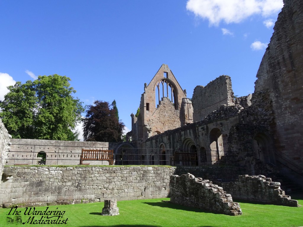
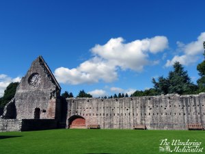
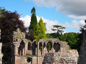
Less well-known and probably less photographed than Melrose, and certainly less complete than nearby Jedburgh, Dryburgh Abbey is situated in a woodland, in a loop of the River Tweed. The trees provide a tranquil surrounding that allows visitors to appreciate the solitude of a monastic life.
Dryburgh was founded in 1150, with the first abbot arriving in 1152, and suffered several attacks over the years, particularly in 1322 by the retreating English army under King Edward II and again by the armies of Richard II in 1385. Several times it rallied, supported by various nobles and bishops of Glasgow and St Andrews, but was finally destroyed in the 1540s.
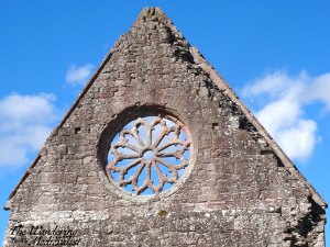
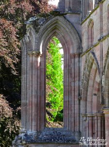
What is left allows for a good sense of the scale of the abbey. The pinkish-red stones are stunning in the sunlight, the shapes of the windows and arches still eye-catching.
There is plenty to be explored and learned, and there is something about the ruins of the perfectly geometrical architecture that is quite moving. If you are making a tour of border abbeys, definitely make sure this one is not forgotten!