Autumn and winter compete as my favourite seasons of the year, both for photography and life in general. There are few things that make me happier than a snowstorm and snow scape (see my post about Marblehead in snow). That said, the colours of autumn are just stunning, be they orange, red, gold, or anything in between. This year in particular, I had two trips that reminded me of the spectacular nature of autumn on both sides of the Atlantic; and I am lucky enough to call both regions home – or very close to it.
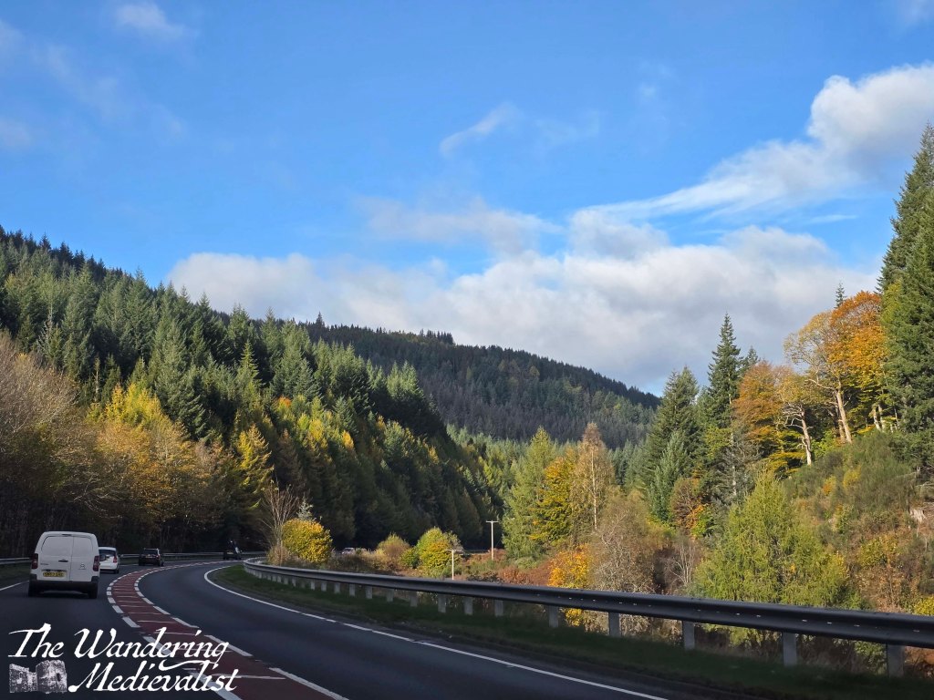
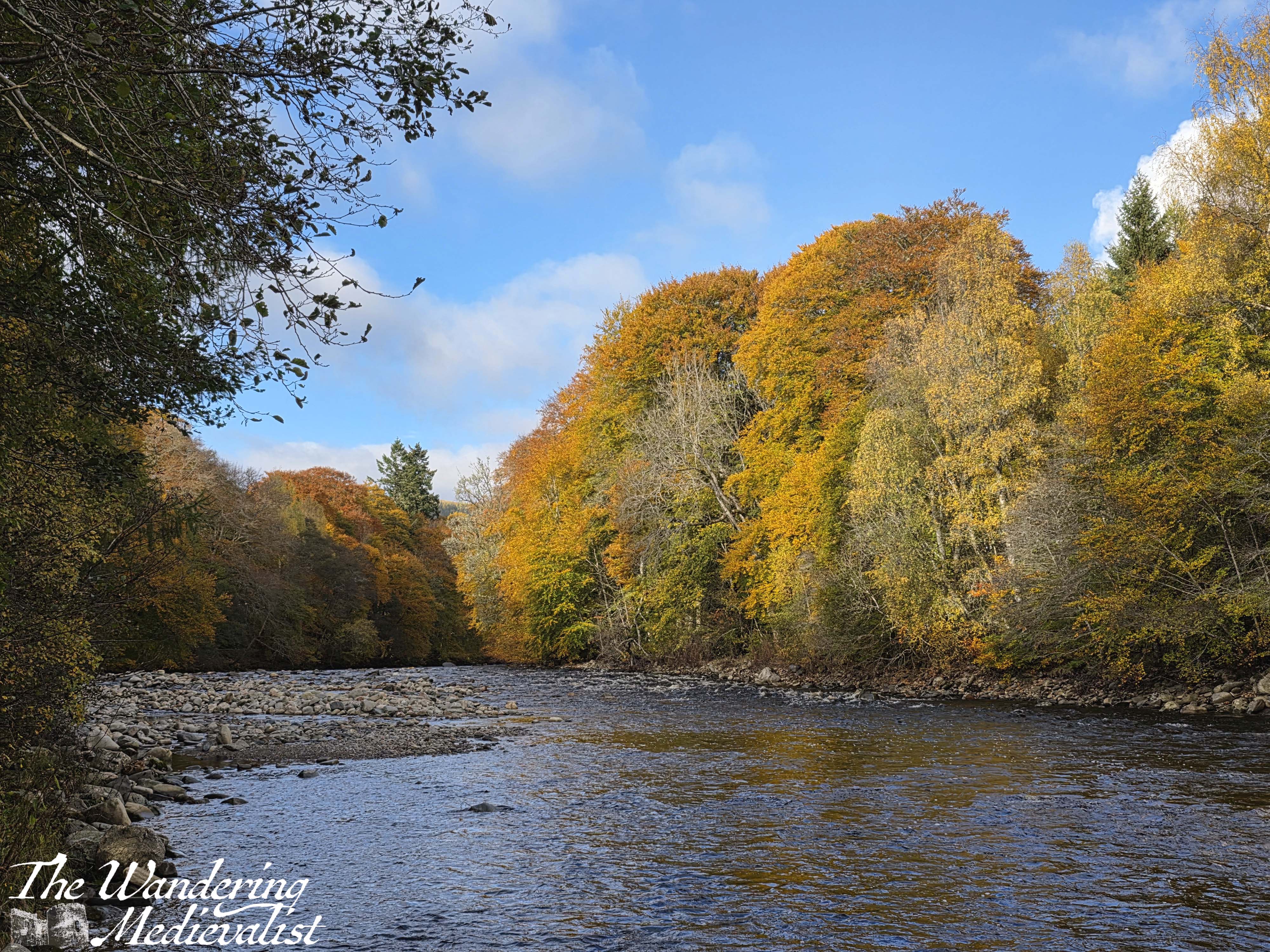
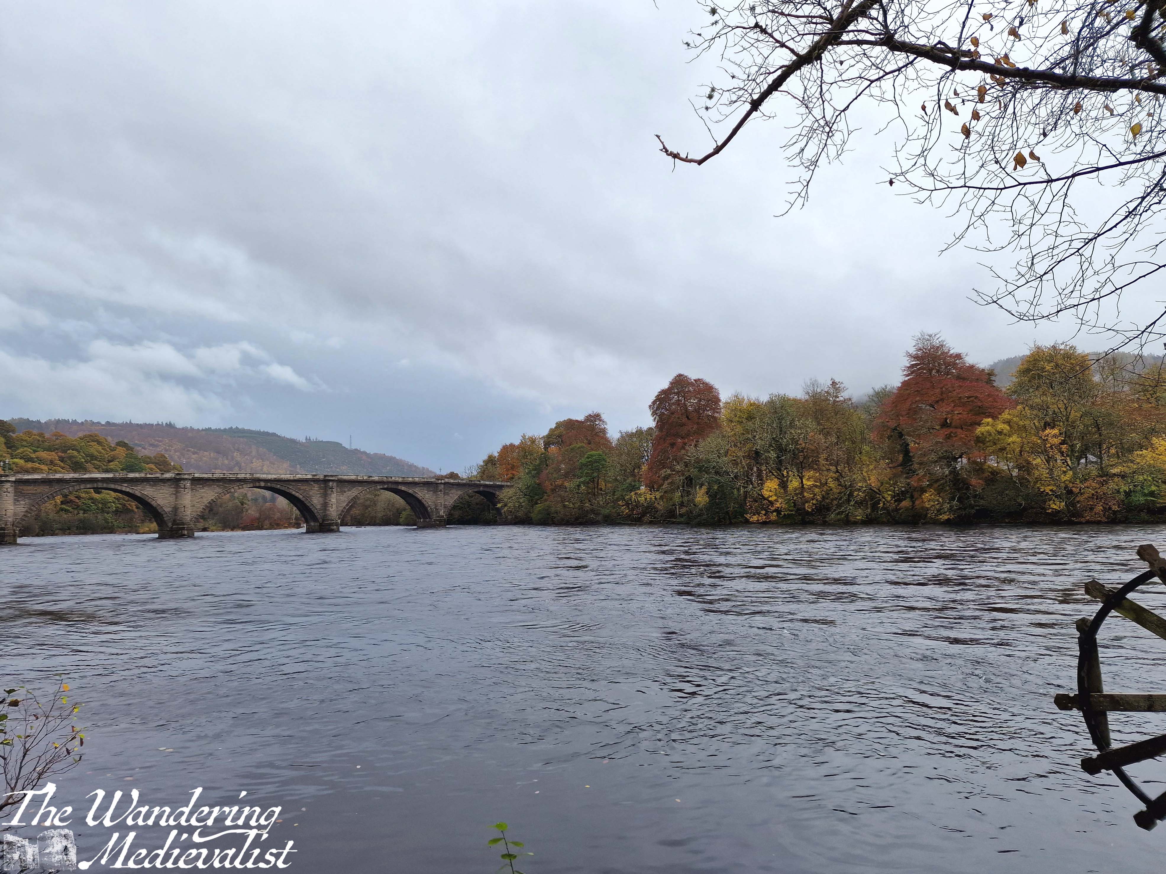
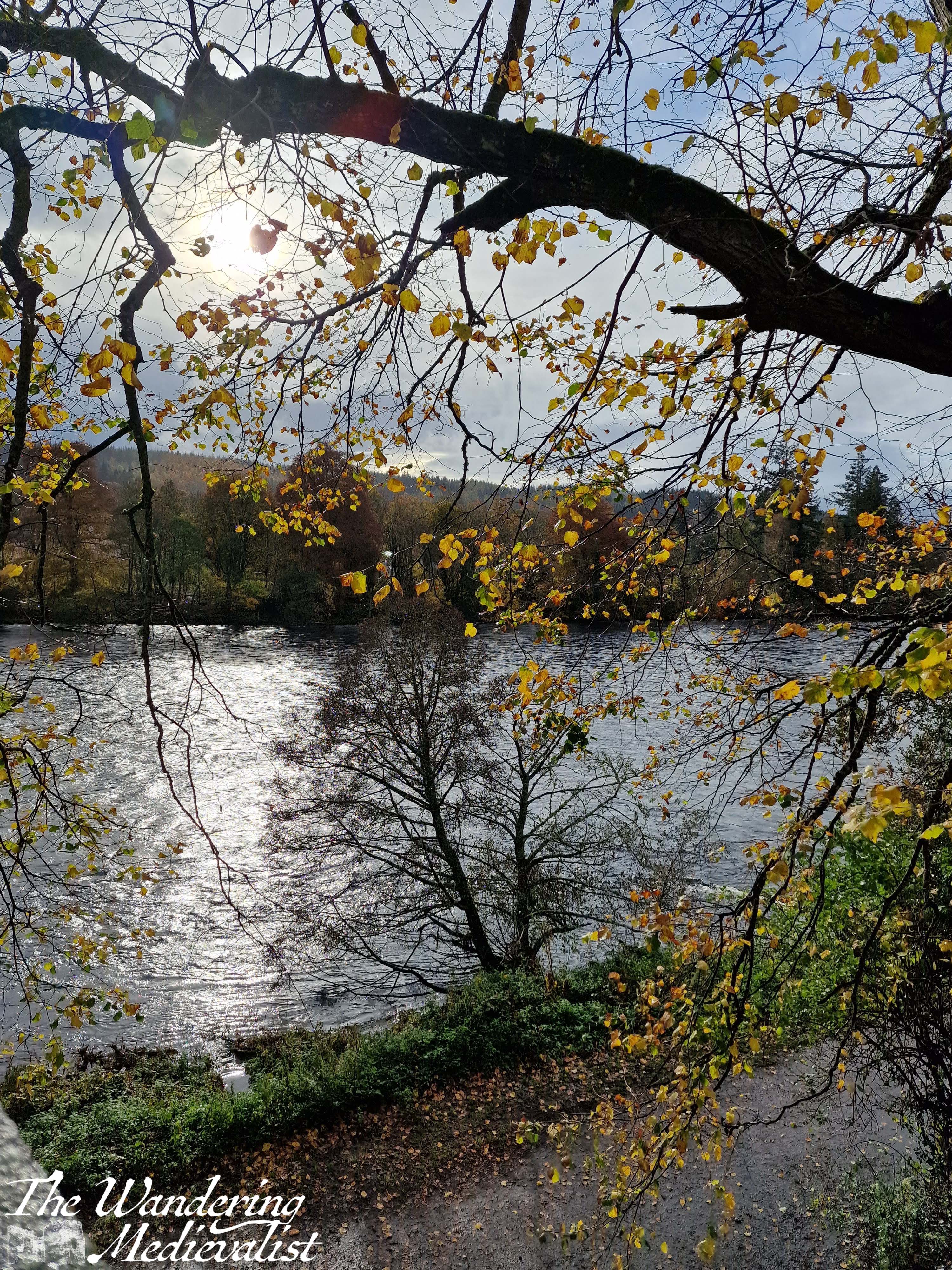
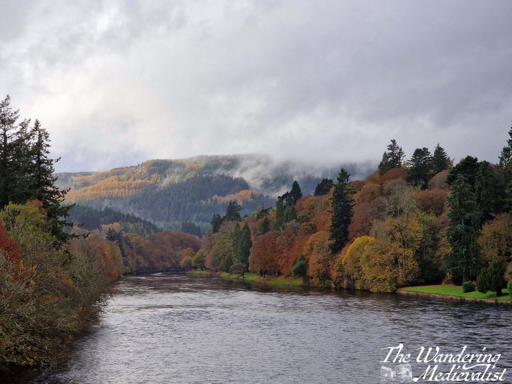
As I have written about before, Pitlochry is a special place for us, and one to which we return regularly. Our first weekend away in November many years ago allowed us to catch the very end of the autumn colour, but this year we chose to take a day trip on my weekend at home, and we caught some gorgeous golds and yellows (despite the often overcast weather). My favourite point on the drive, which I have mentioned before, is just as you turn a corner on the A9, and on this trip we could see just the start of the colour.
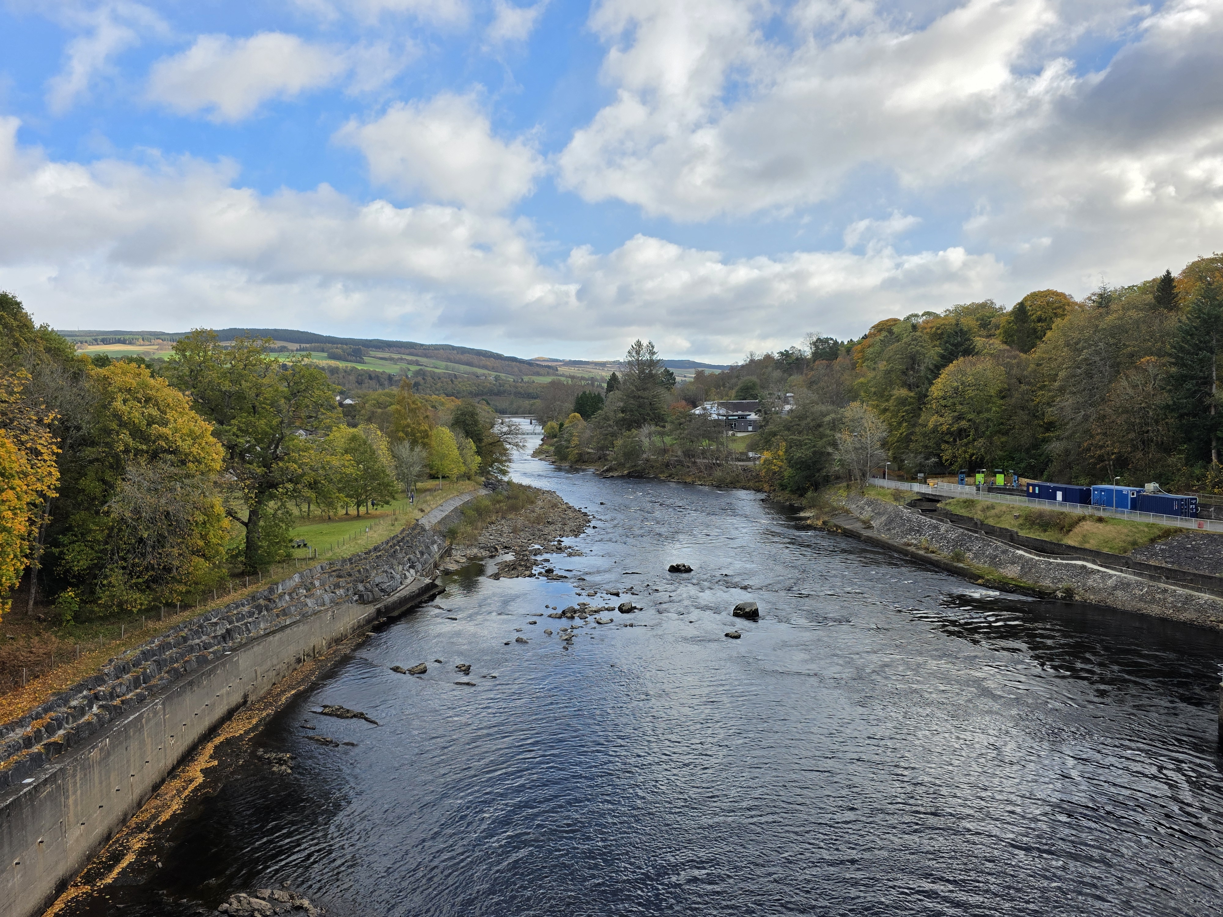
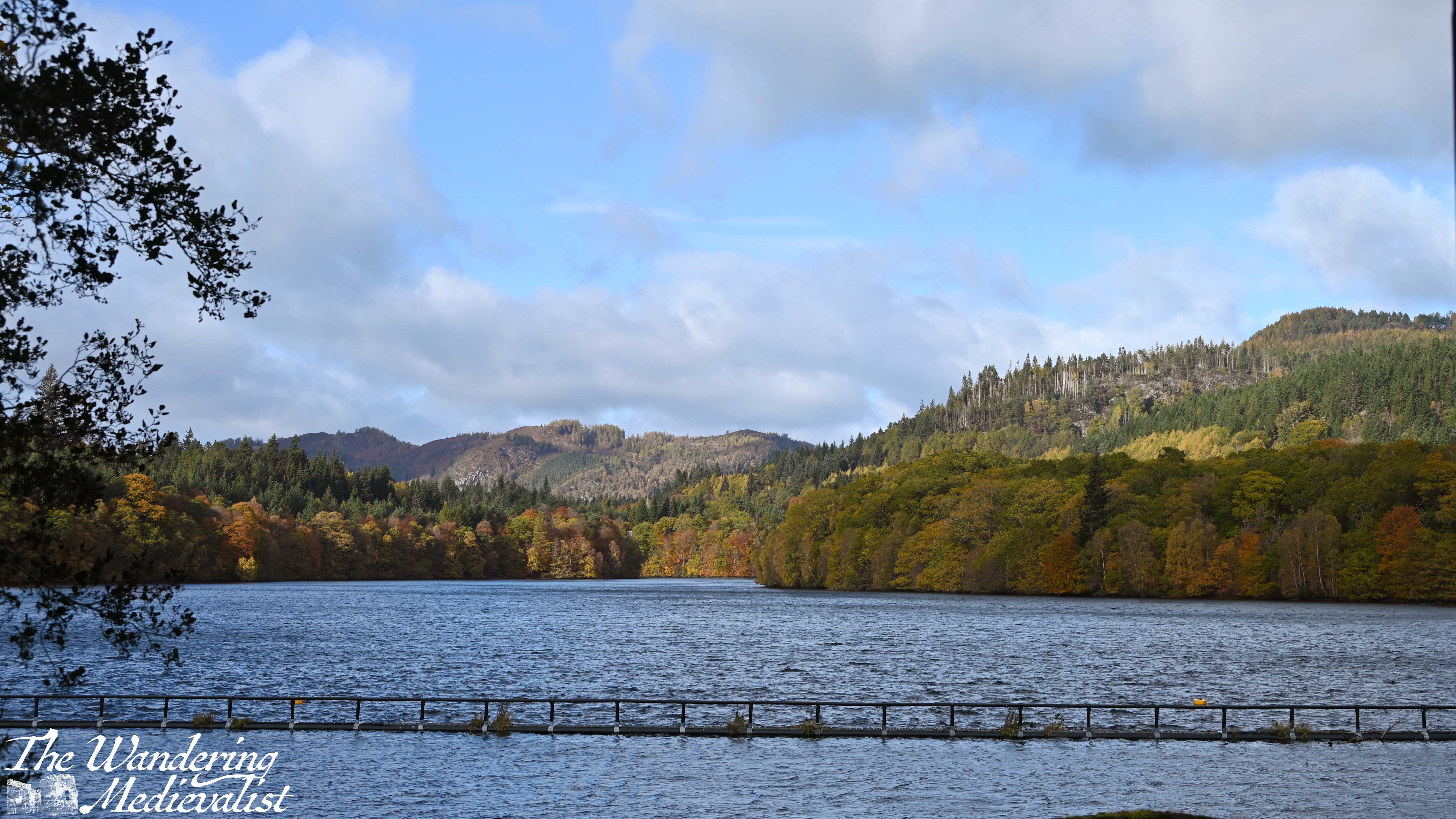
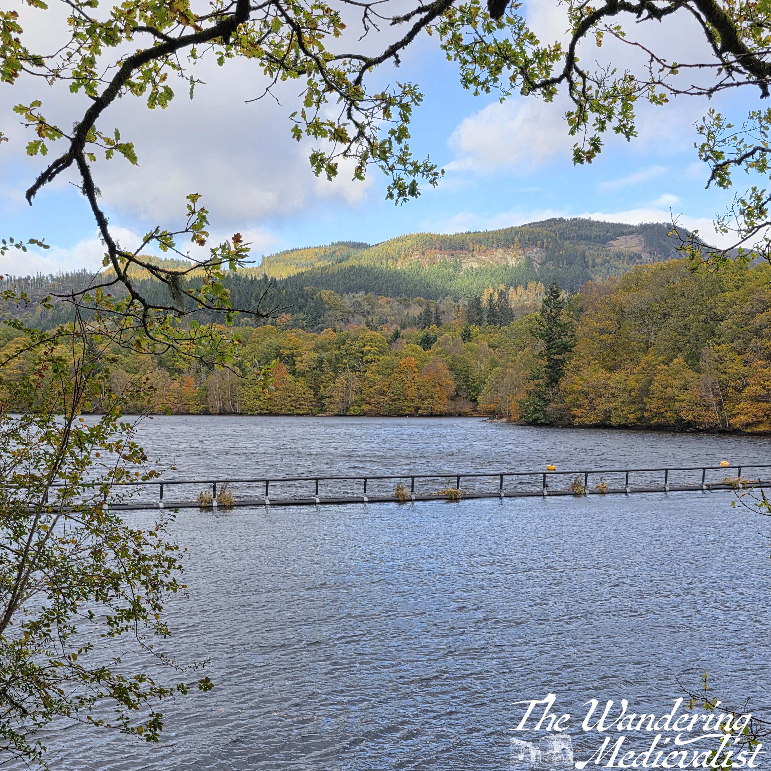
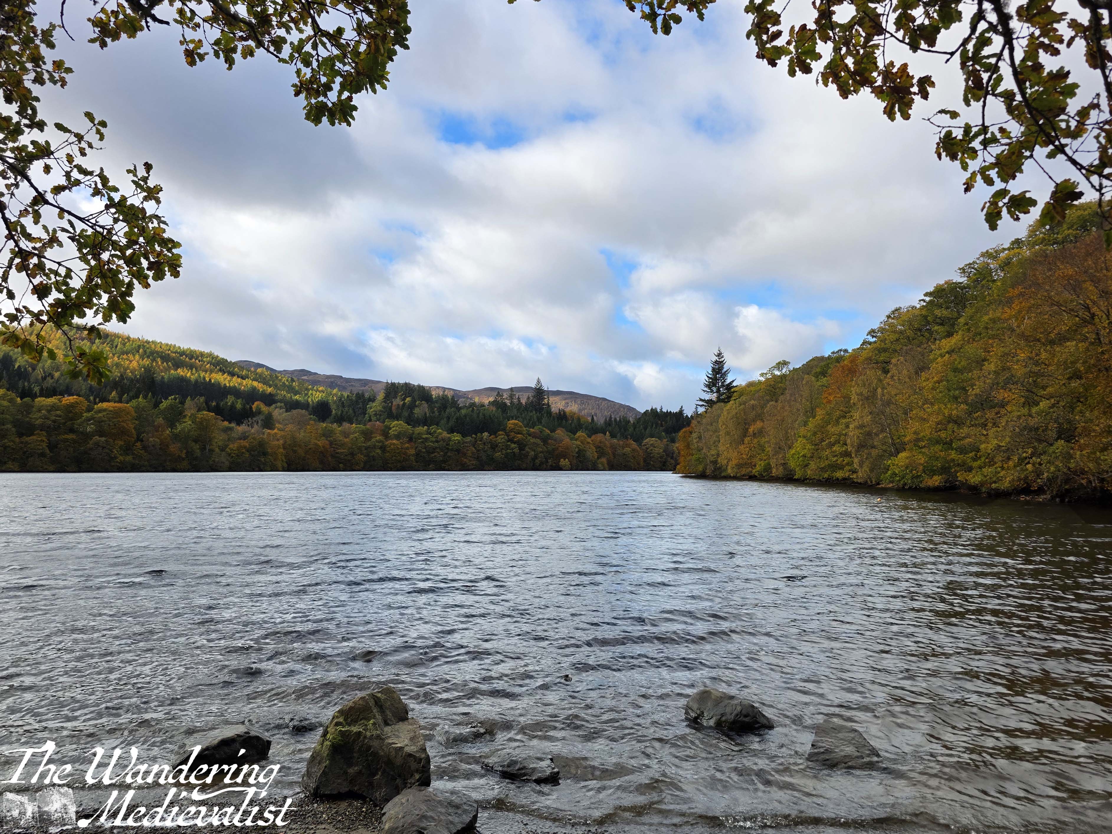
In Pitlochry, we parked at the edge of town and meandered our way through the crowds (yes, even a small town in Perthshire has crowds), then down to Loch Faskally and the famous Pitlochry dam, where there is a fish ladder and excellent views in both directions. We crossed the dam and walked a short way around the loch, where we could look back on the trees still in sunshine.
The standard walking loop in Pitlochry goes across the dam and then down the far side of the river, past the Festival Theatre. This theatre reminds me very much of the North Shore Music Theatre which I visited frequently while growing up, for its eclectic shows and unique nature. I have never actually attended a show here, but some day soon…
Not far beyond the theatre, the street passes by some stone cottages on one side and an inn on the other, then walkers must pay close attention not to miss the narrow entrance to the turn-off across the pedestrian suspension bridge. From this bridge, the view looking back towards the dam and the river is fantastic.
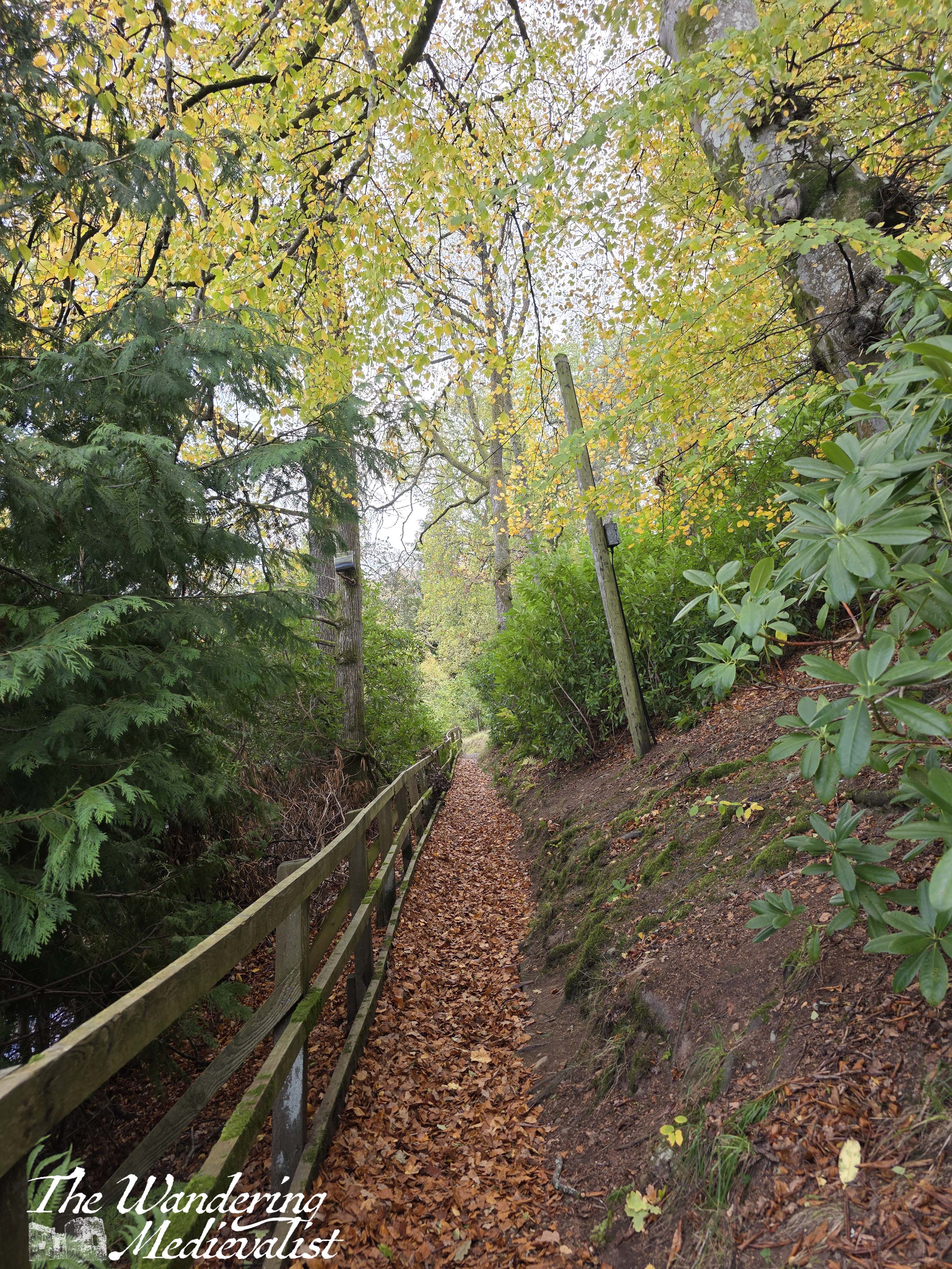
Once across the bridge, walkers can continue up through the town or take a sharp left to follow the riverbank back towards the dam and its visitor centre. We chose this route as there were several families ahead of us moving at the pace of the accompanying toddlers, and we wished to go back up to the overlook of the loch, below. Side note, the visitor center is relatively new (opened less than 10 years ago), and offers a great café, small gift shop, and clean restrooms.
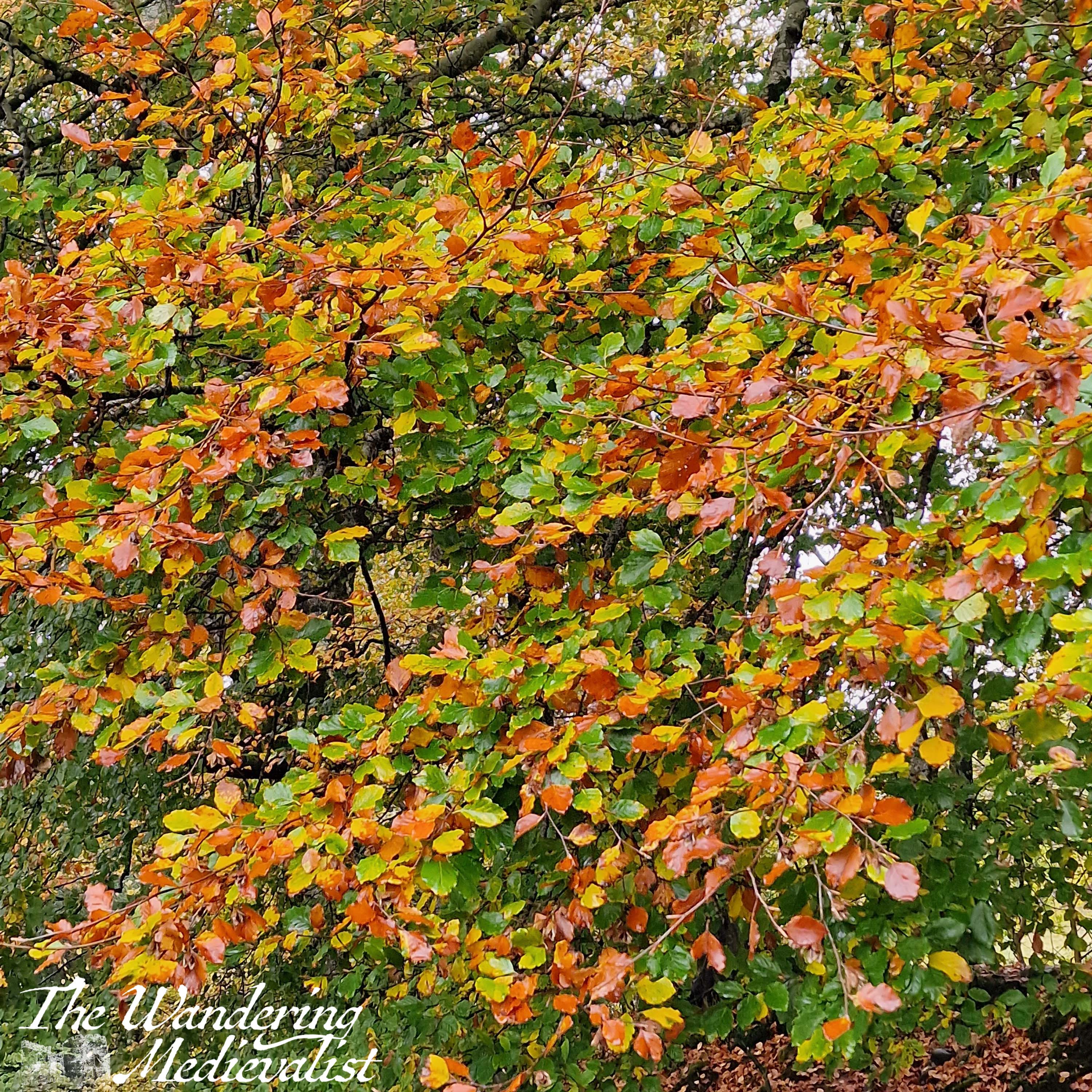
The sun on this day just would not cooperate and show off the yellows and oranges the way I wanted, but I think you can get a hint of what we saw.
After a quick lunch in Pitlochry, we headed back to the car to drive up to Killiecrankie, which is only a few miles north.
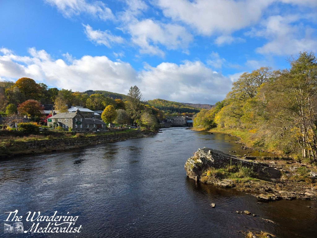
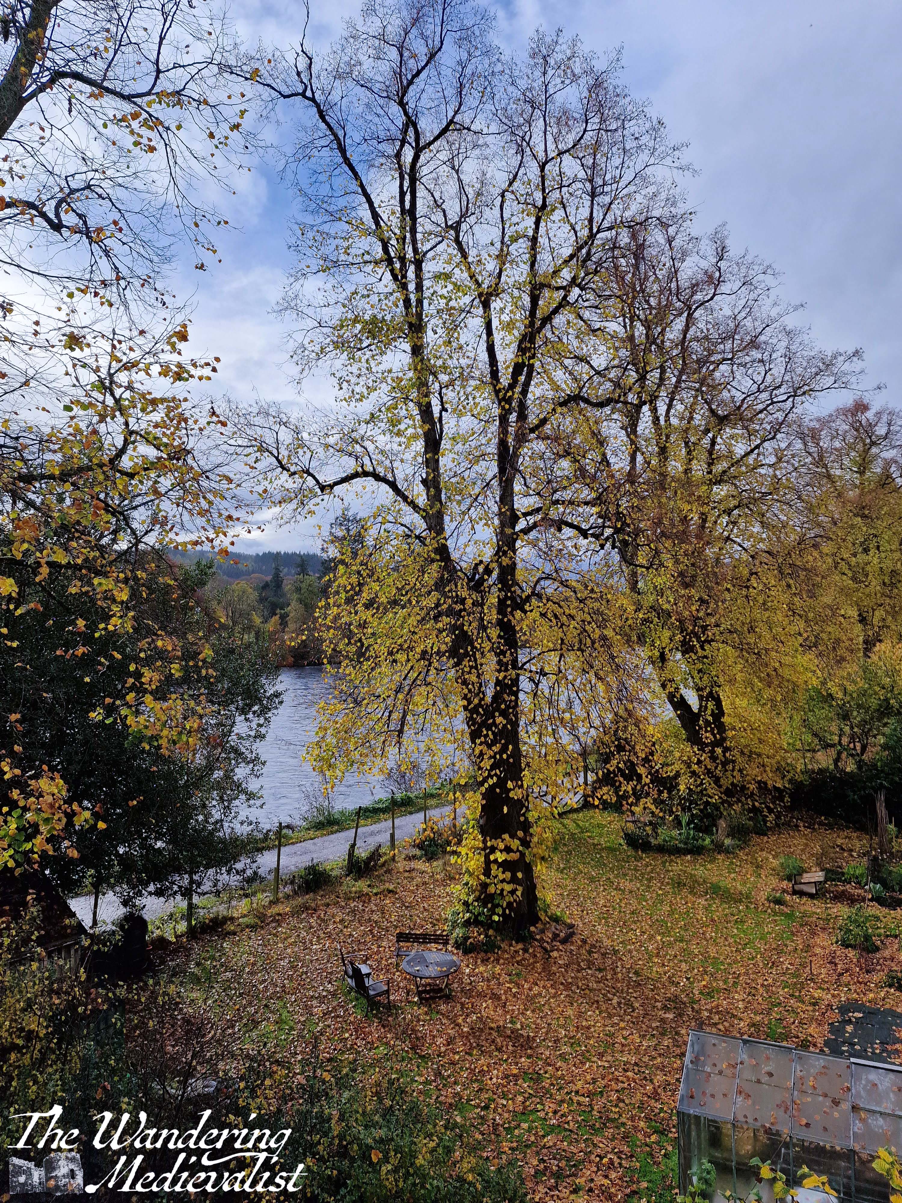
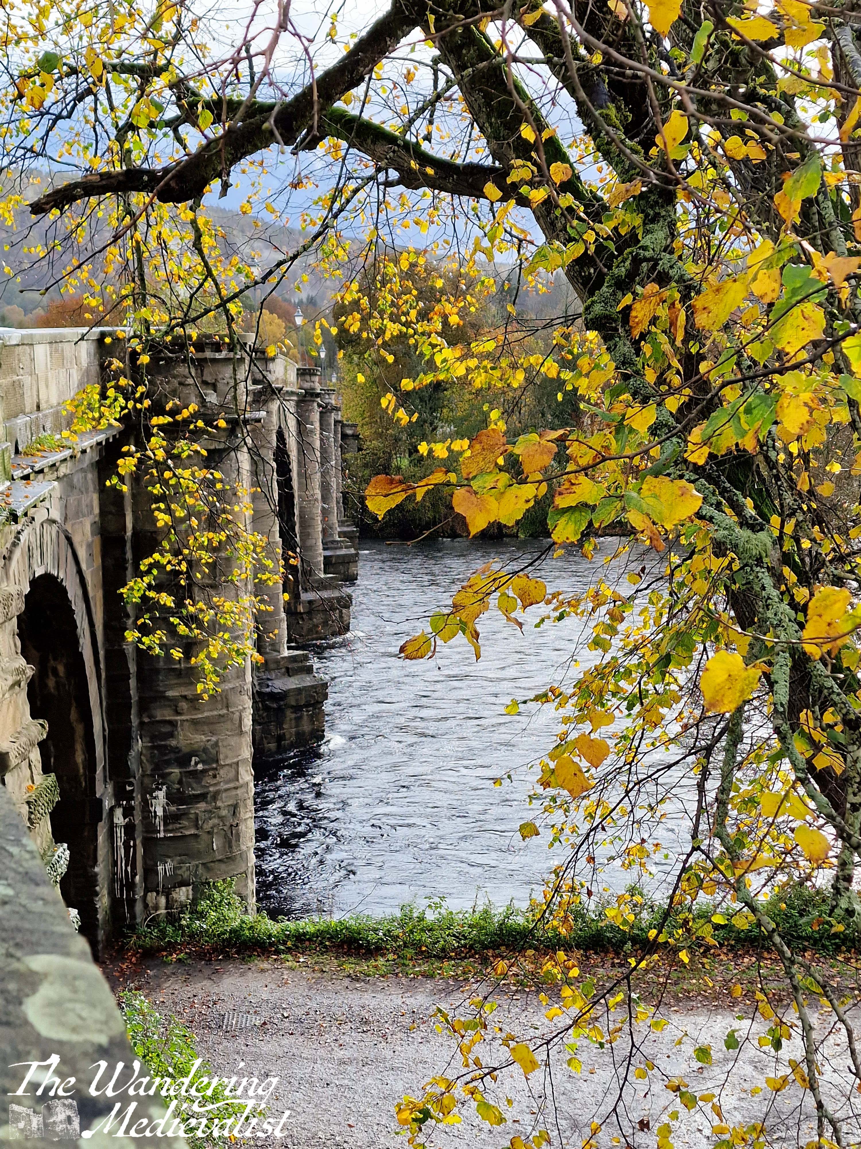
The walk here is famous for stunning colour, but apparently everyone else had heard that too – there was not a place to park, and so we drove a bit further north to Blair Atholl. Immediately upon crossing the bridge into the town, there is a small car park where we stopped and found a walk along the riverbank.
Finally, here the sun came out in honest and I was able to capture a bit more of what we saw in person, brightness that really isn’t as visible in the above, overcast pictures.
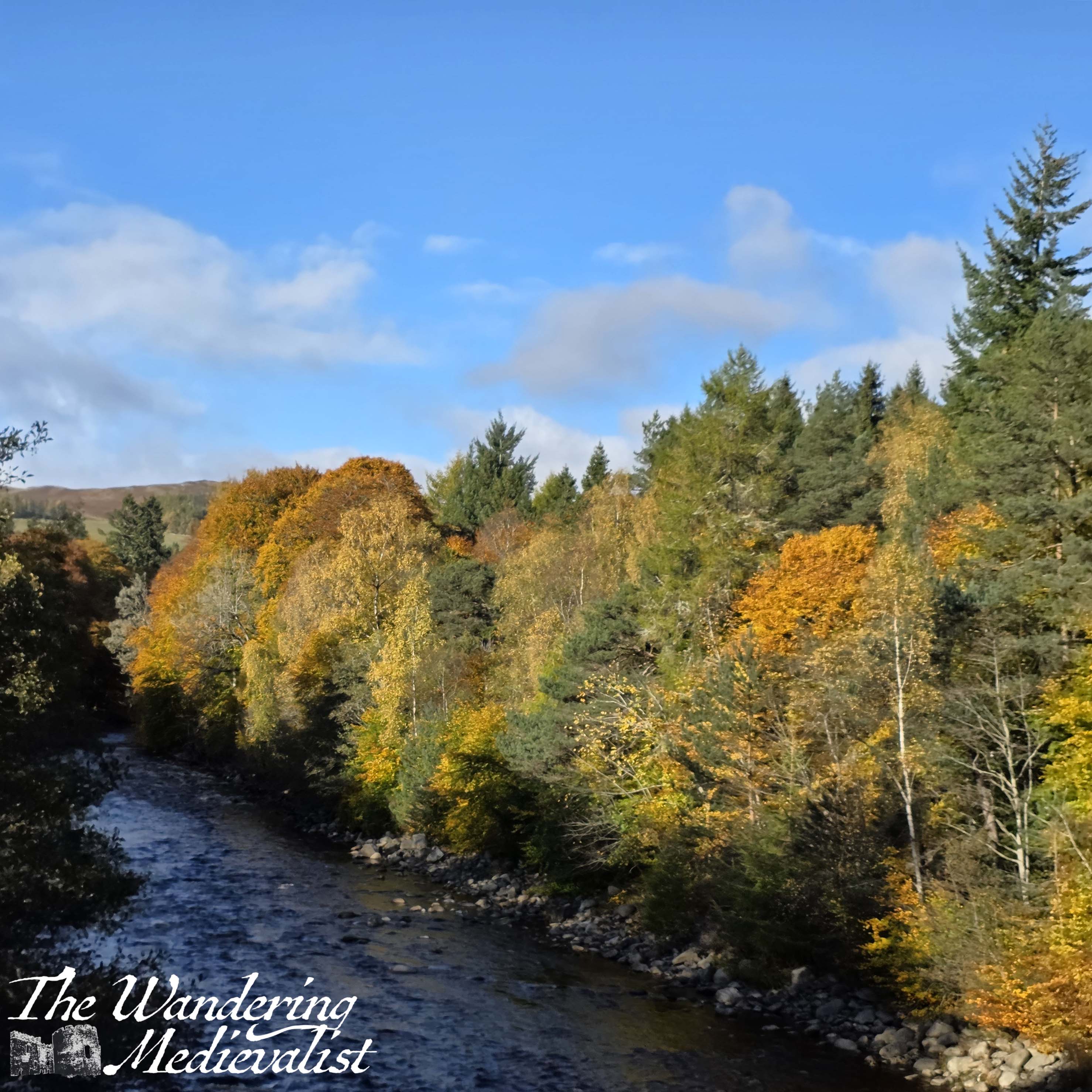
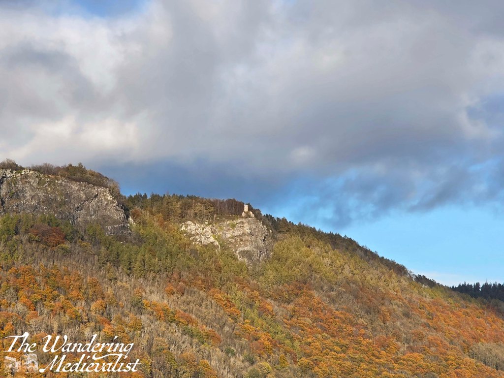
We thought very briefly about going all the way to House of Bruar, but decided it would likely be even busier than Pitlochry, so not appealing. The drive home boasted one more impressive view, looking up at Kinnoull Hill near Perth, from the A9. There was a hint of what once had been (or may be on a less dry autumn).
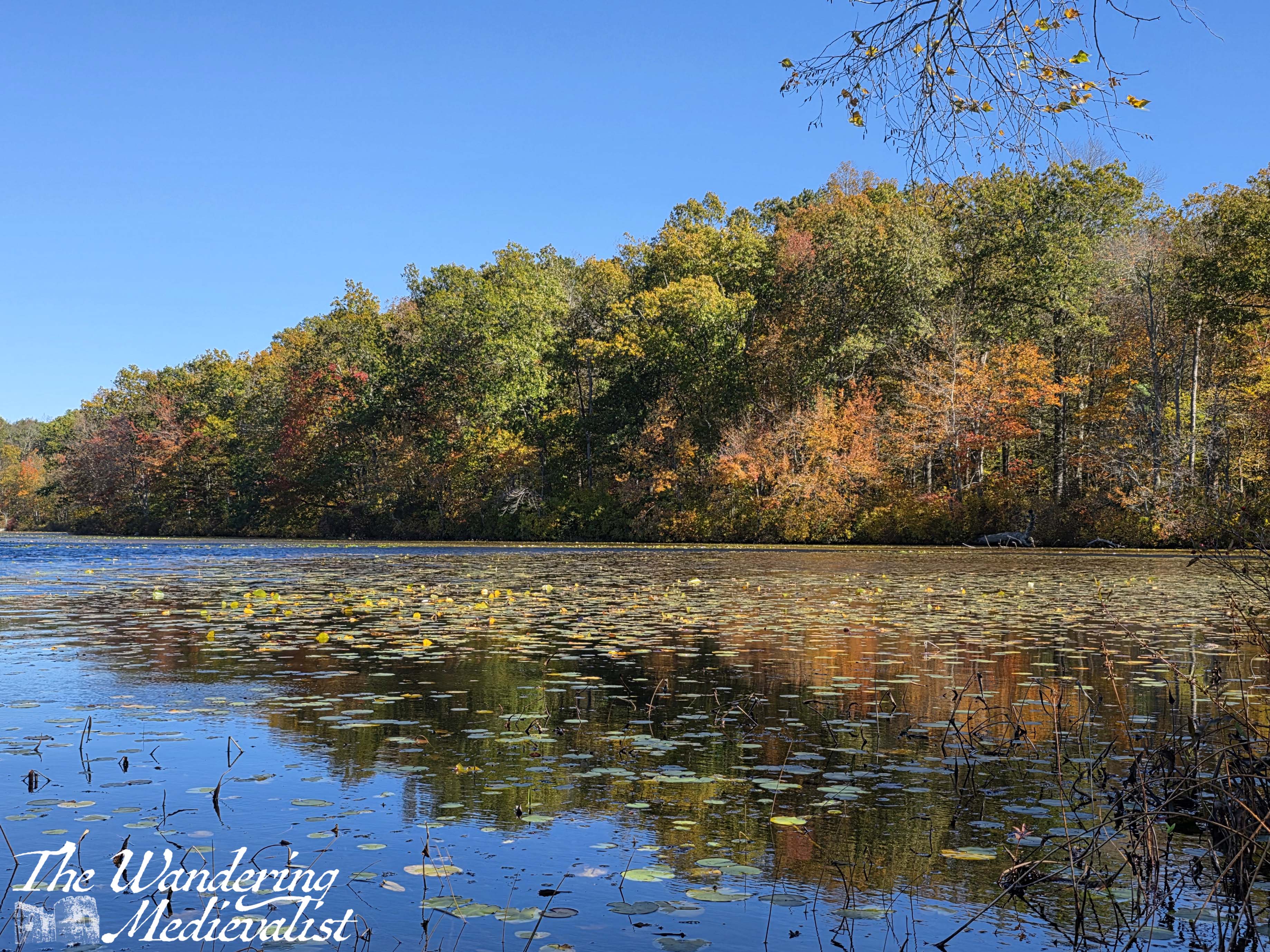
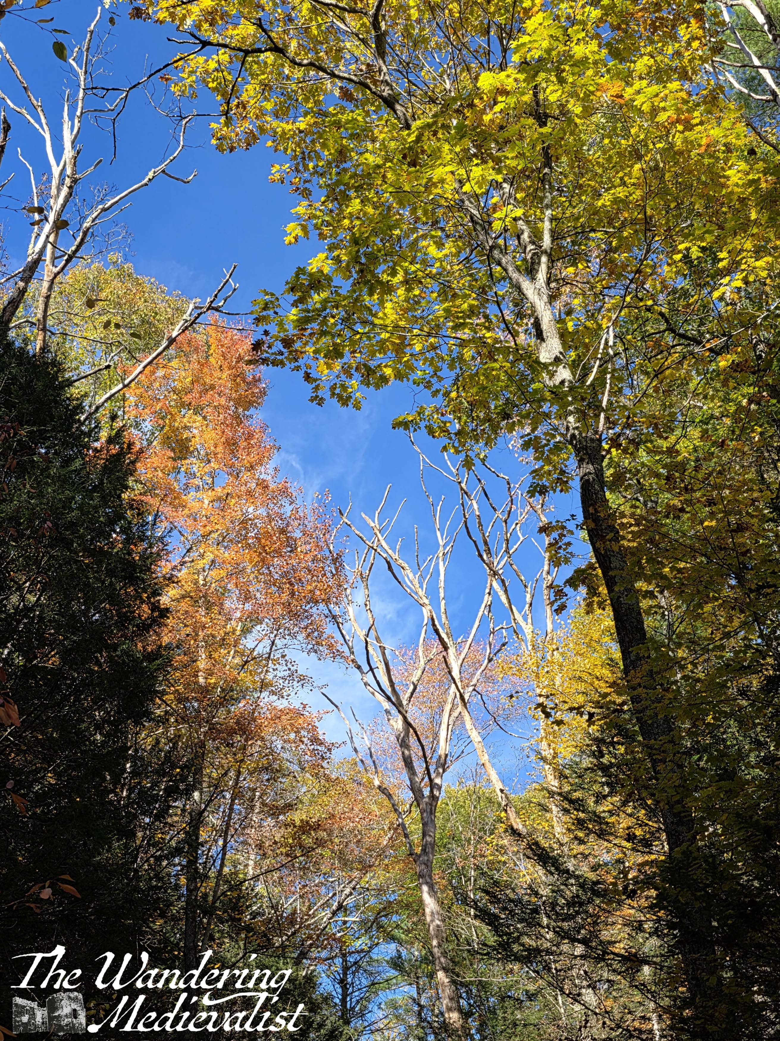
The rumour on TV was that this year had been so dry, that all of the famous New England colour would be muted. It may be that further north this was the case, but on my drive from Boston to Greenwich, CT and back again, I saw some of the most amazing colour I can remember in many years. Now, granted, this was only my second autumn visit to New England in 20 years, but I found myself in awe over the beauty and vivacity of the leaves. There was one colour, which I do not seem to have managed to capture, that was an almost fluorescent pink-orange that you would not be blamed for thinking could not appear in nature – I was desperate to capture this colour, but it seemed only to exist on the side of the highway, where I could not stop. Nonetheless, I managed a few lovely views and took some short breaks while driving to stretch out my back and enjoy the scenery.
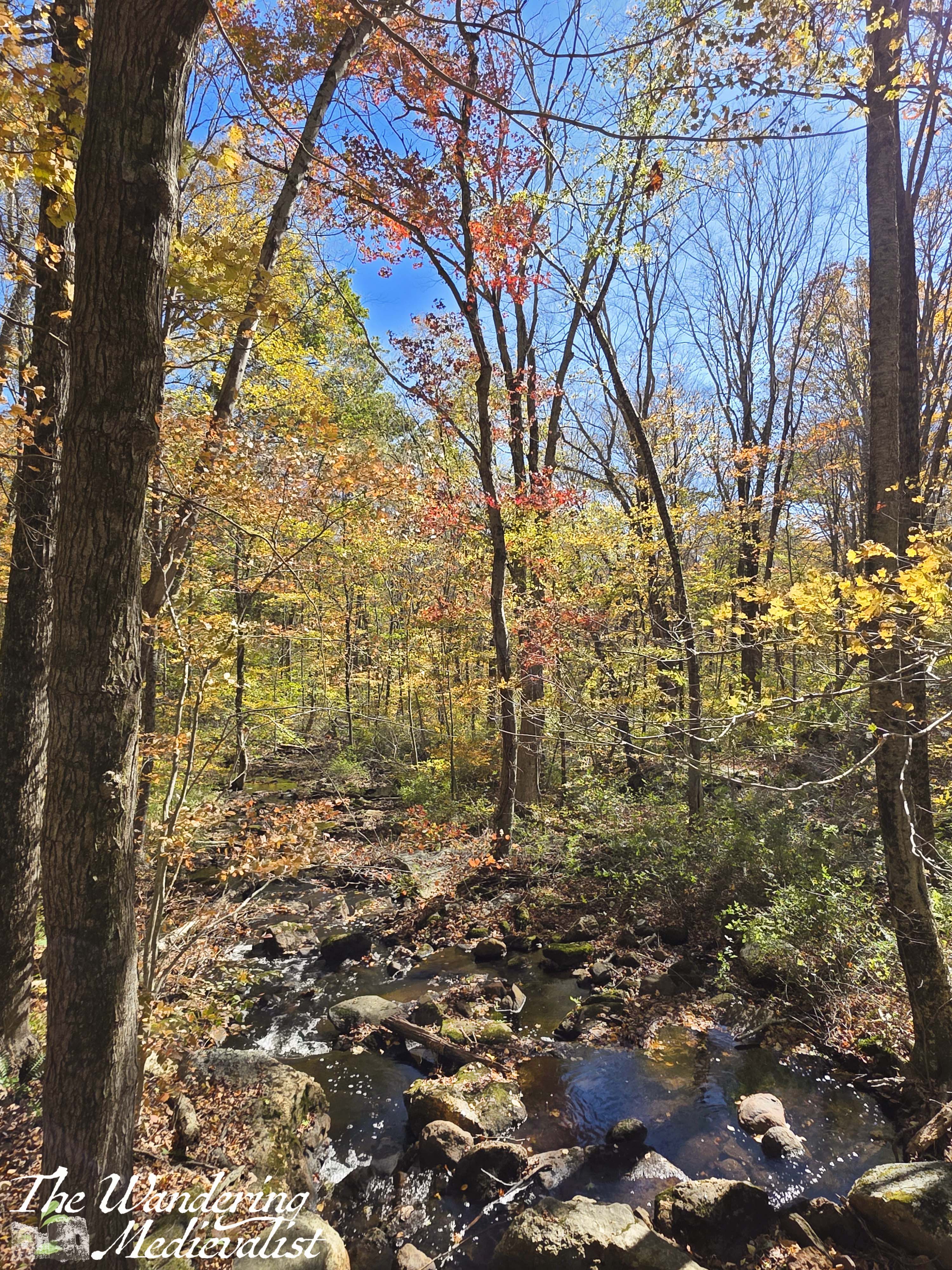
My first stop was at a rest area heading south, about halfway between Sturbridge, Massachusetts and Hartford, Connecticut. I did not expect it, but the small information cabin included a back porch looking over the river below, lined by some stunning maples.
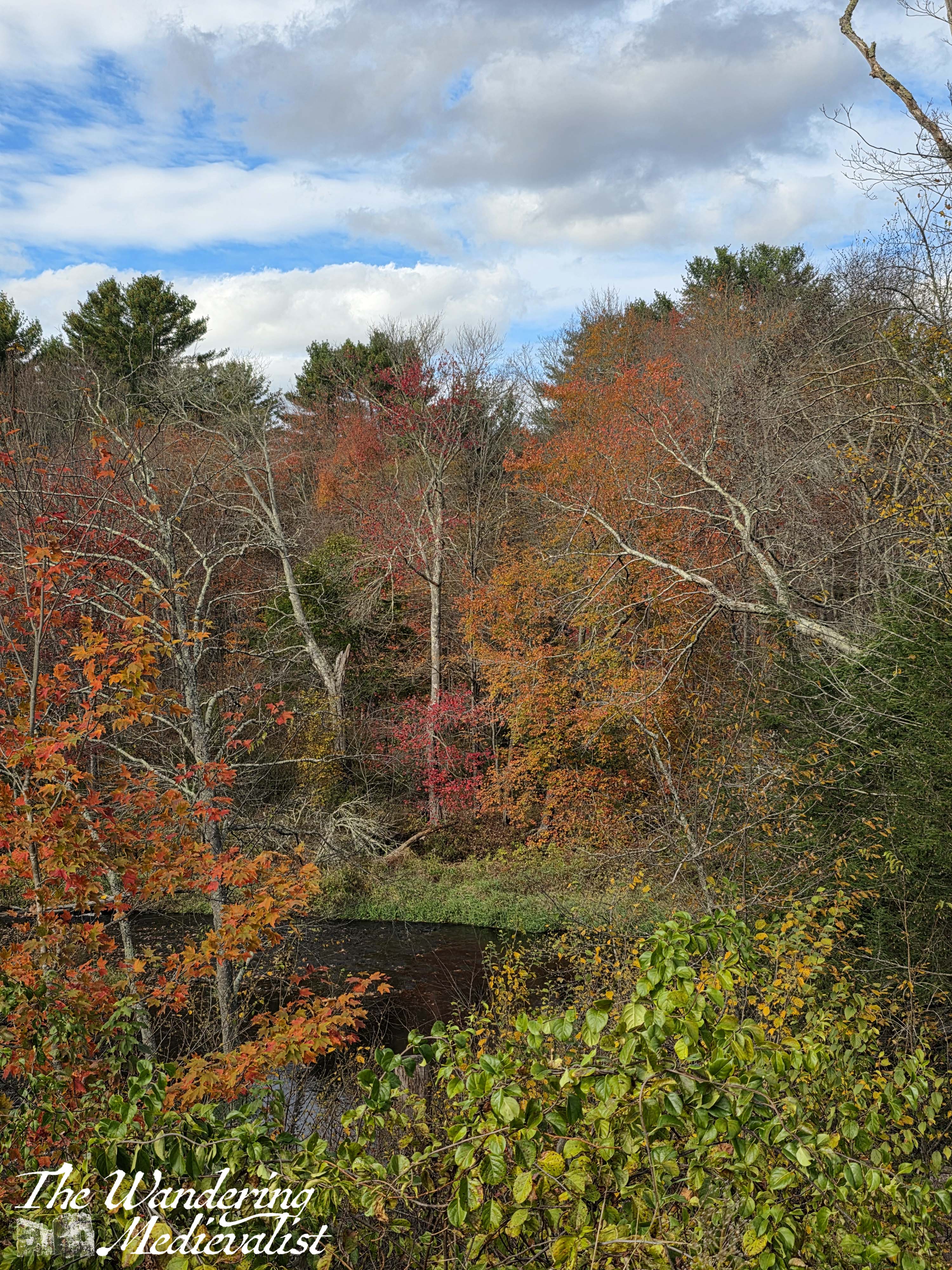
The next morning I found myself favoured by traffic and so 40 minutes early for an appointment, making it possible for me to take a short detour down a tree-lined road to a pond. The reflection of the trees on the calm water was stunning, and there was a small brook meandering past the road.
My final day in Connecticut was dominated by the long drive from New Canaan to Marblehead, through downtown Boston as going through Salem is not an option in October (as I was reminded frequently). This was looking to be around 4 hours, so I planned to stop twice along the way – my back was starting to show the wear and tear of a busy few weeks in the car.
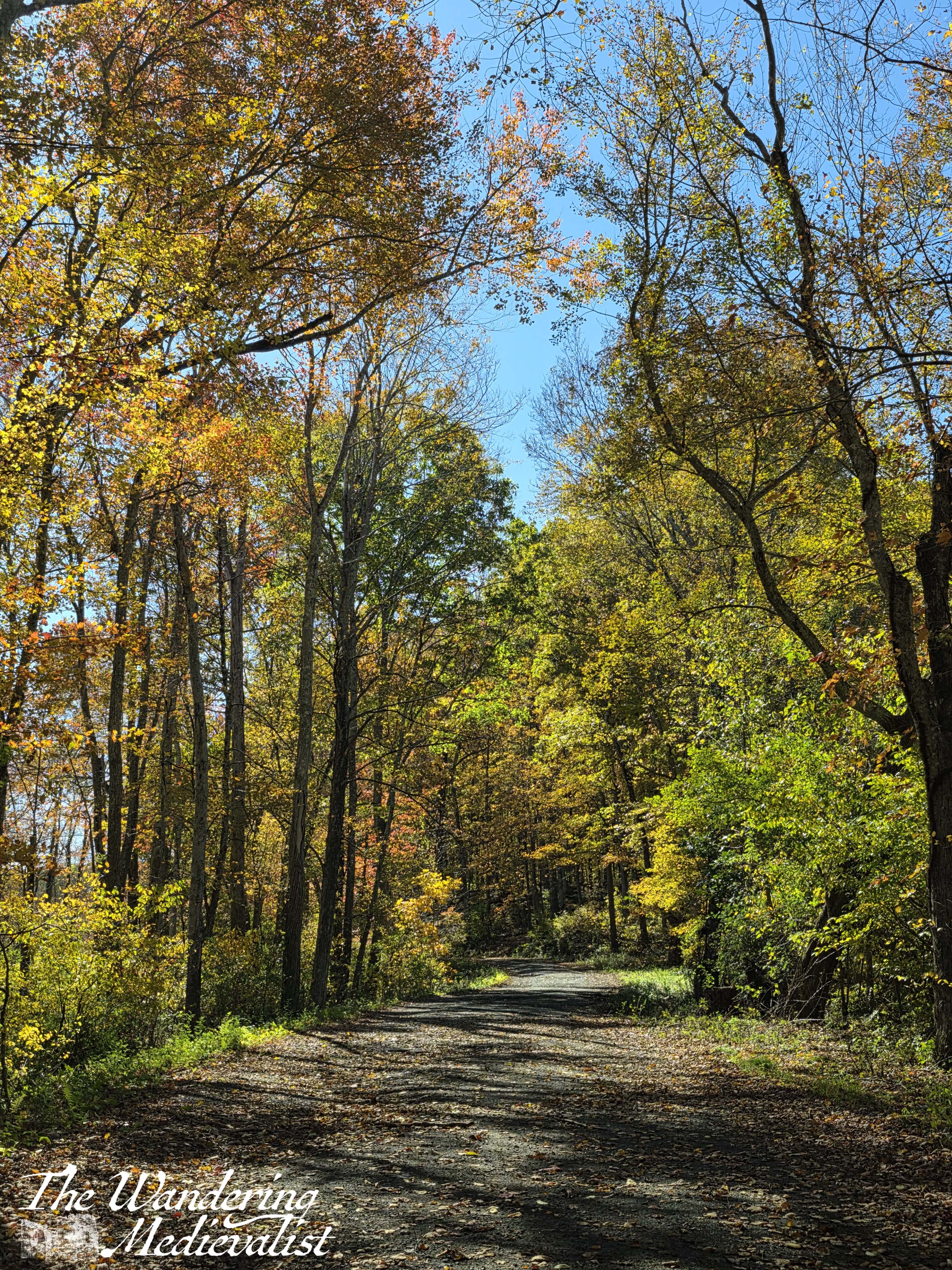
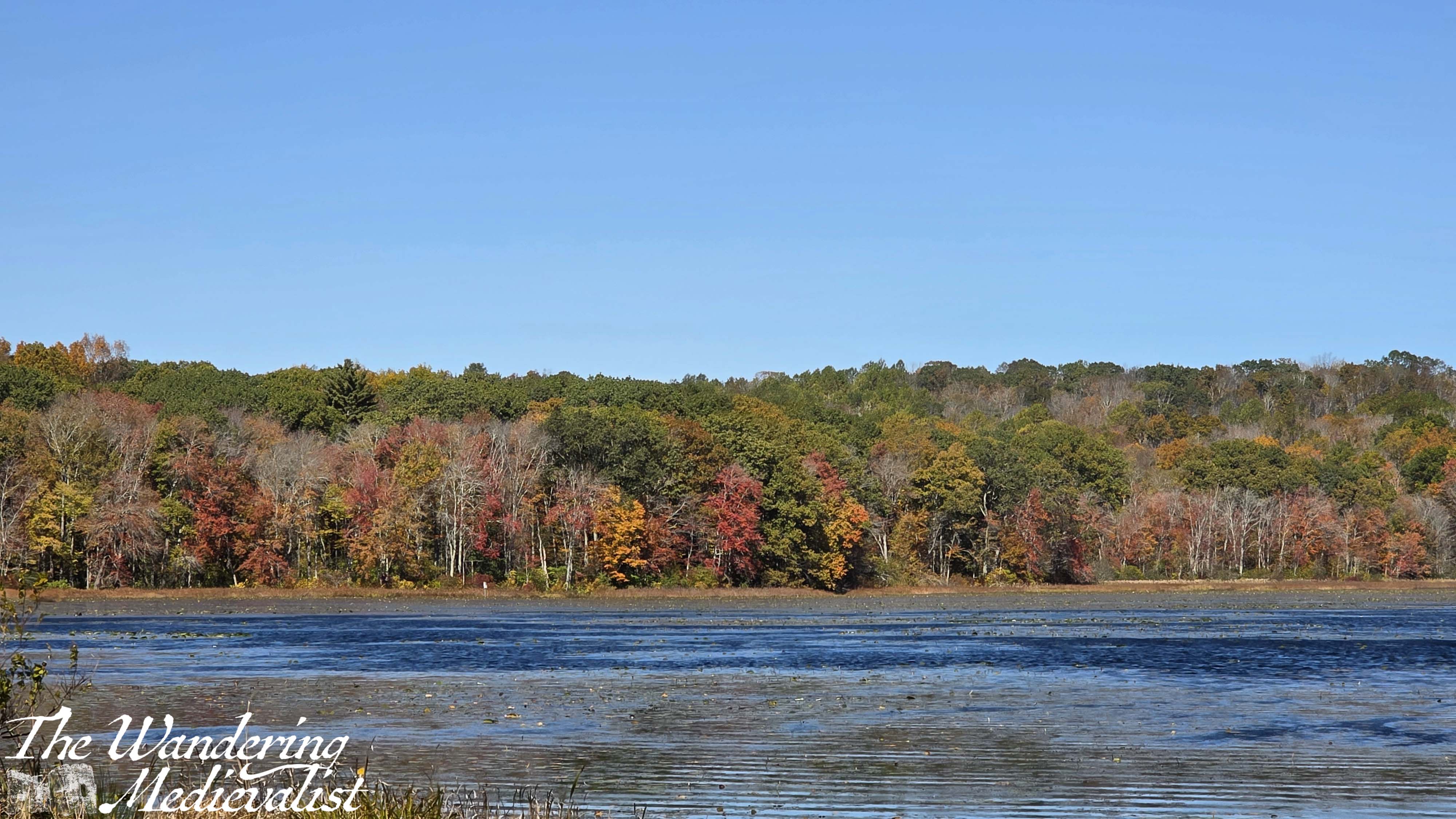
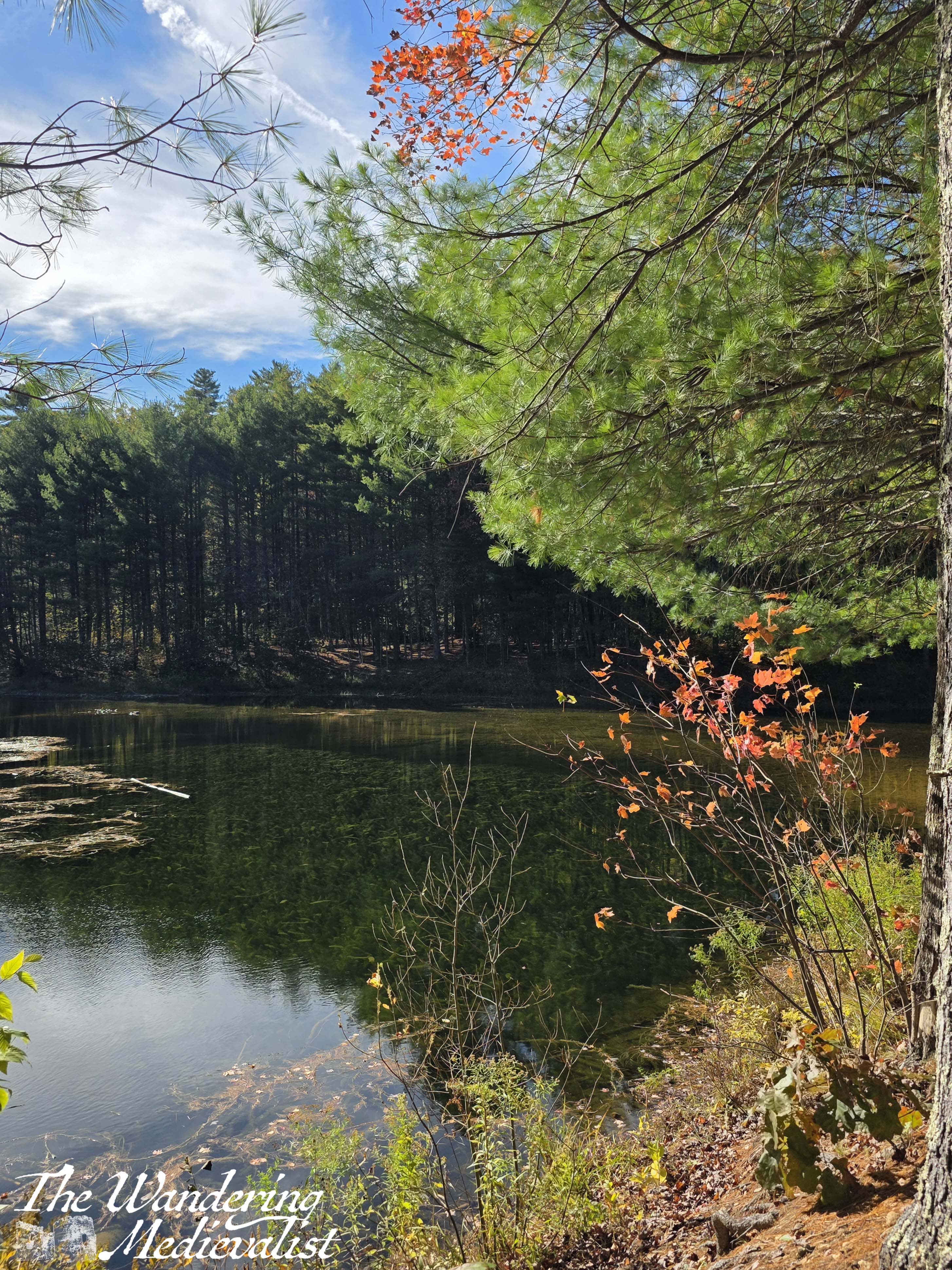
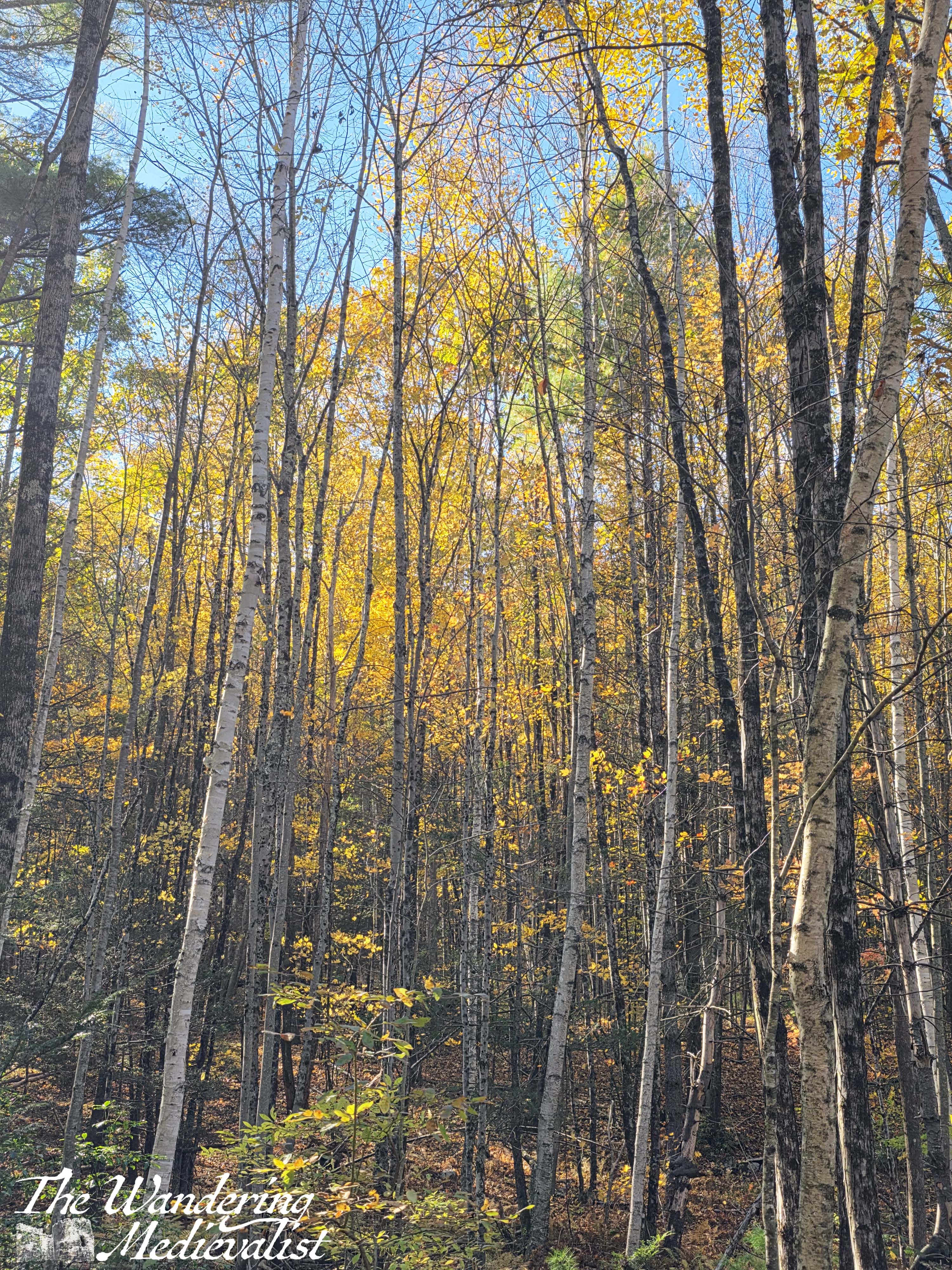
My second and final stop was just outside Sturbridge, Massachusetts, where there was a short mile-long walk around a pond – the perfect opportunity to stretch legs/back, and take a walk in the woods. Sure enough, while once again I was stymied in finding many bright colours, I found the golden hues everywhere, and it was a beautiful afternoon.
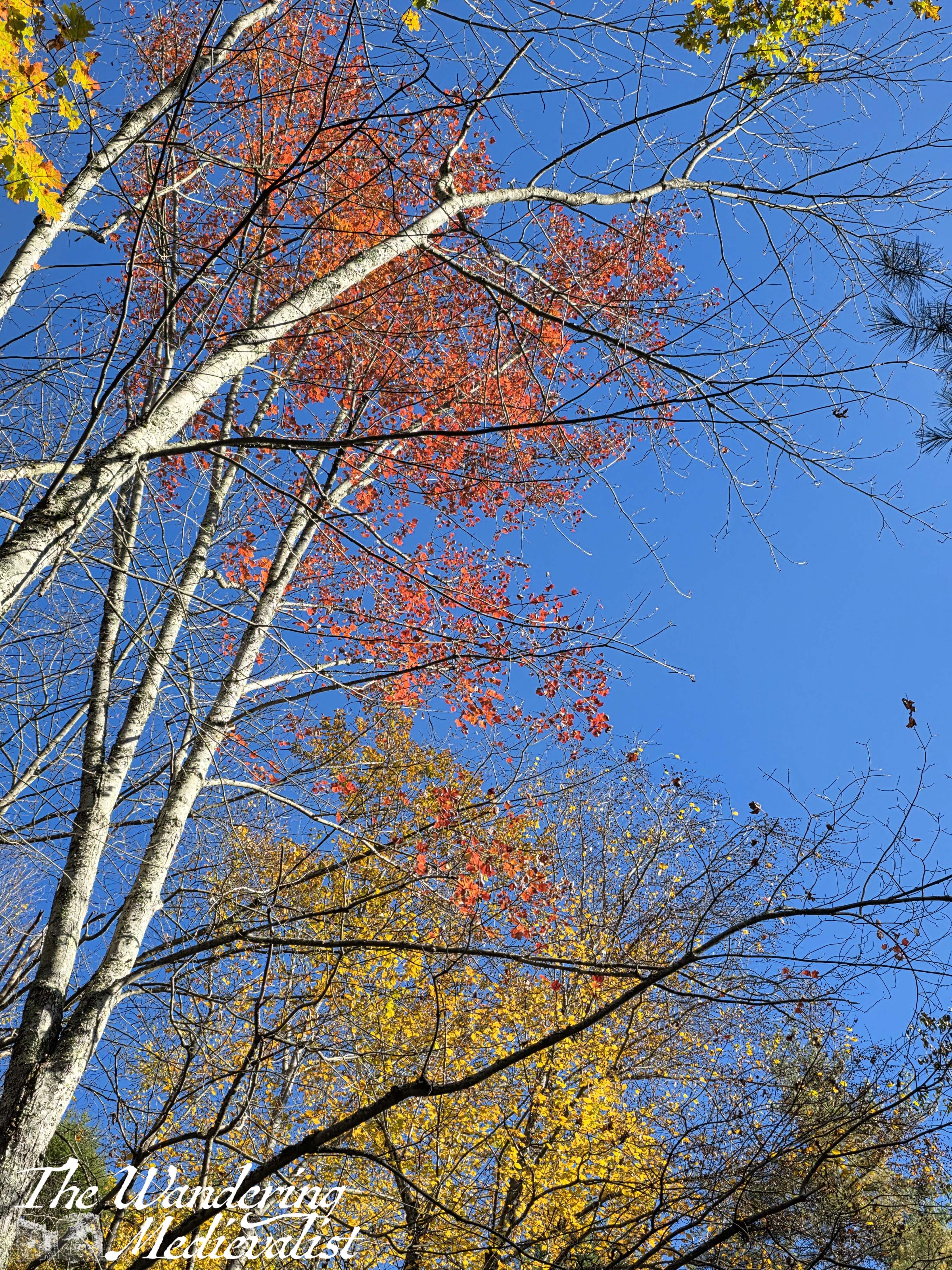
The light shining through the yellow trees against white birch bark reminded me of a scene in House of Flying Daggers, a film known for its imagery perhaps more than its story.
I am forever grateful to myself for taking this interlude, as what should have been two more hours in the car turned into three as I hit the Friday afternoon traffic through Boston. That was a long drive.
I am forever grateful, though, for a job that allows me to experience this kind of journey at a time of year when I could not visit for so long. I hope that I may be back next year.
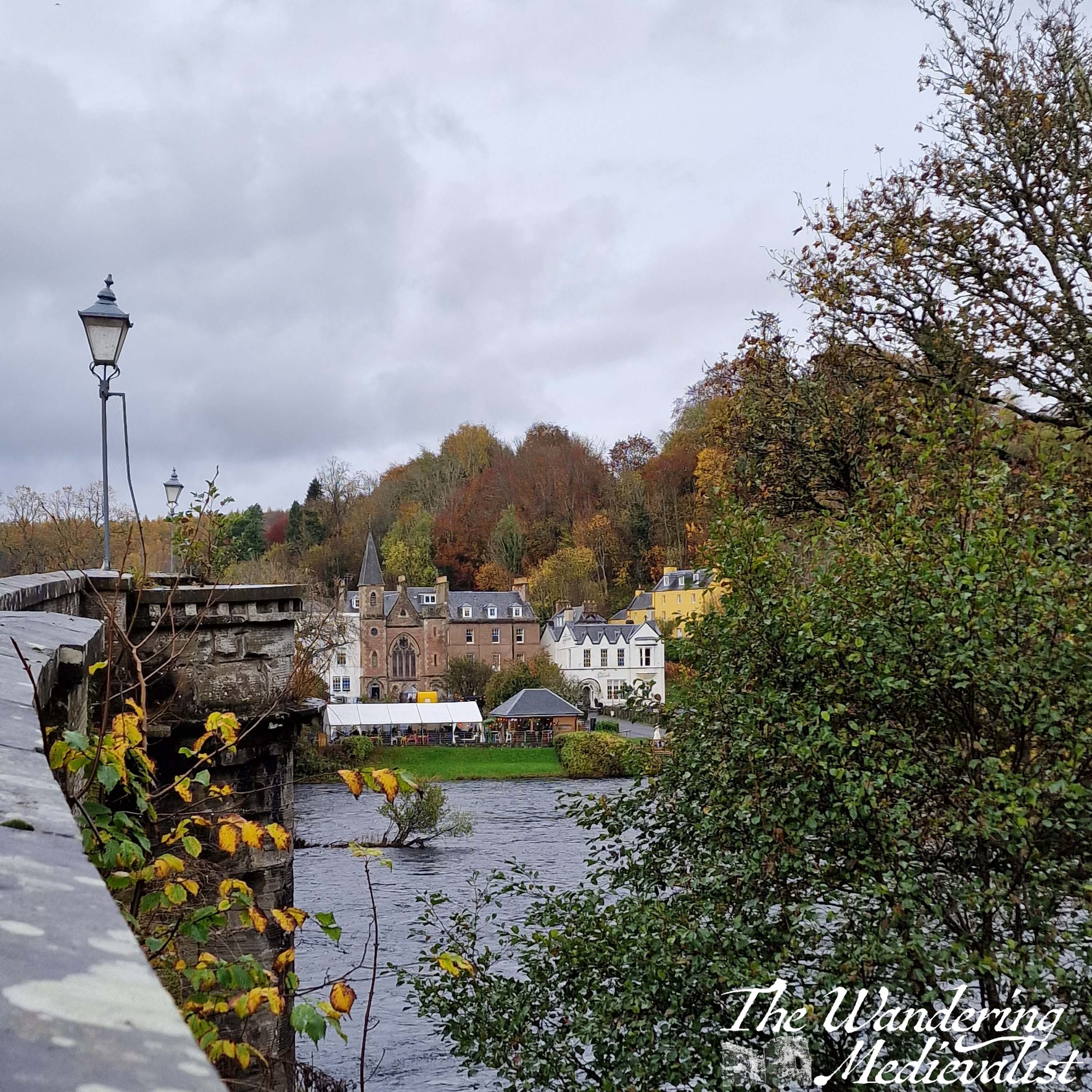
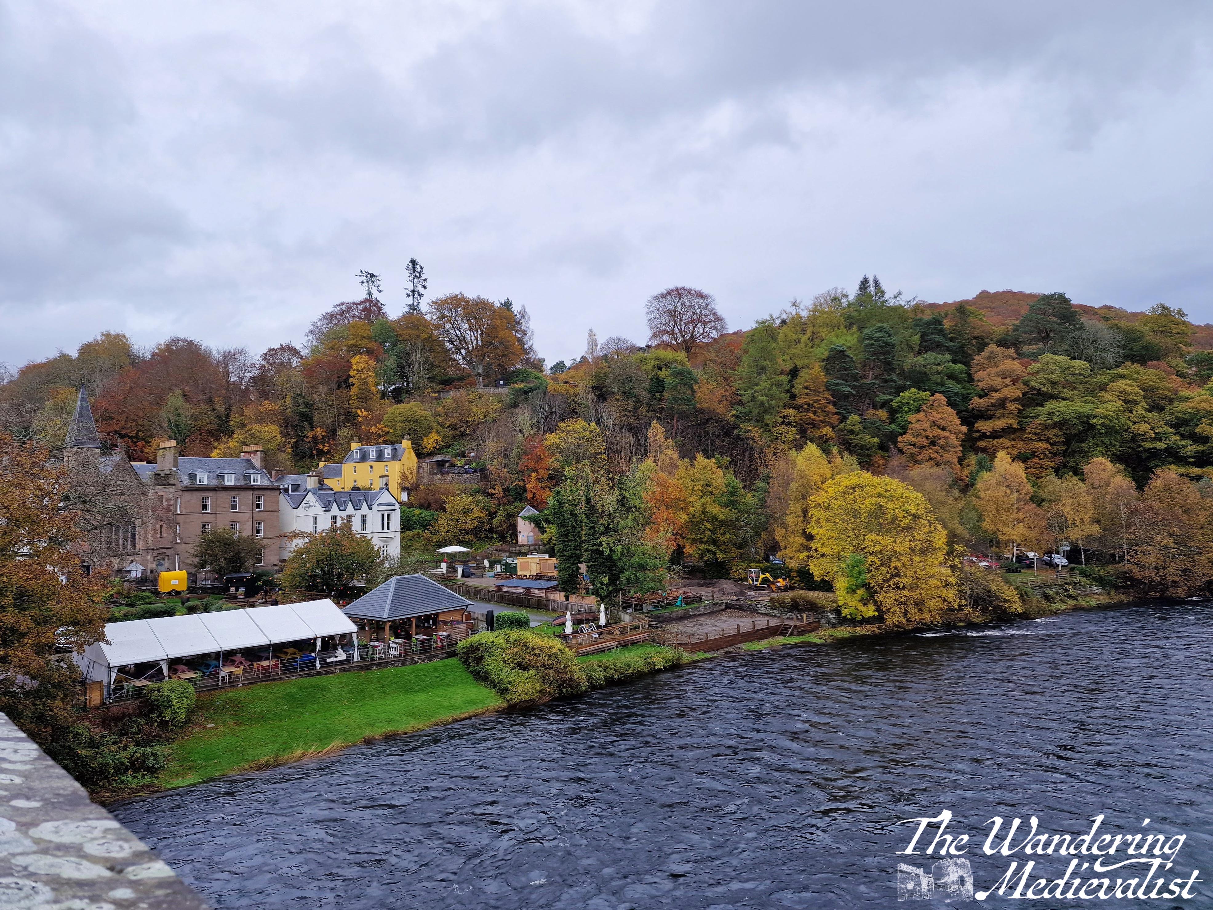
Finally, while this visit to Dunkeld did not take place this year, I have been wanting to post these pictures for some time and was looking for the right time. Several years ago, as I recovered from my second bout of Covid, the other half suggested a day trip as I was no longer testing positive and had been confined to the house for two weeks. Dunkeld is a beautiful village in Perthshire – one of many – even closer than Pitlochry, boasting a medieval cathedral and some lovely homes.
On the day in question, we arrived just after lunch and walked through the village to the cathedral, then down to the river where you can walk along the bank back towards the main bridge.
While it was later in the season, there was still a touch of yellow and gold, particularly in what I think are beech trees. As we approached the bridge, the sun was glinting off the river between the mostly-empty branches of the trees, and I took about 10 pictures of the leaves. These are the better ones.
The day was growing clearer, and so we climbed up to the bridge and across, to take in the view from both sides. In one direction is the village, spread along the riverbank and the hills.
In the other direction is the river and – just visible through the trees – the tower of the cathedral. Covid exhaustion meant that I was not really up for a long walk, and so we headed back towards the car via a coffee shop on the main street.
On the day we visited, there was a perfect Scottish mist hanging on the treetops, though the hints of red and orange are still visible between the green pines.
This is one of my favourite pictures of Dunkeld, and the grassy area you can just see on the left side is where the cathedral grounds meet the river.
There is nothing particularly thought-inducing about this post, but I wanted to share my appreciation for autumn in both of the places I have lived. New England colour is world-famous, and deservedly so, but Scotland – along with many other countries – produces its own autumnal glory. It may not be as dramatic, but it is beautiful.
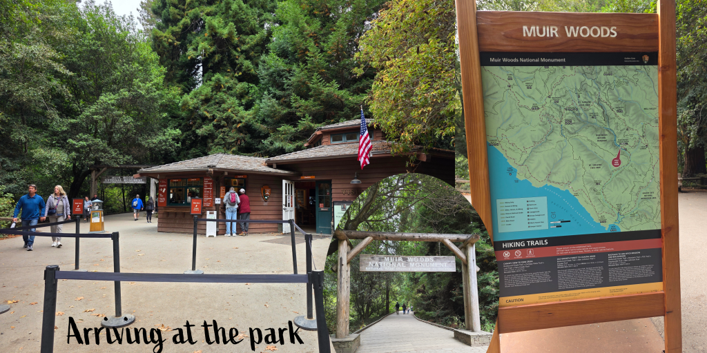
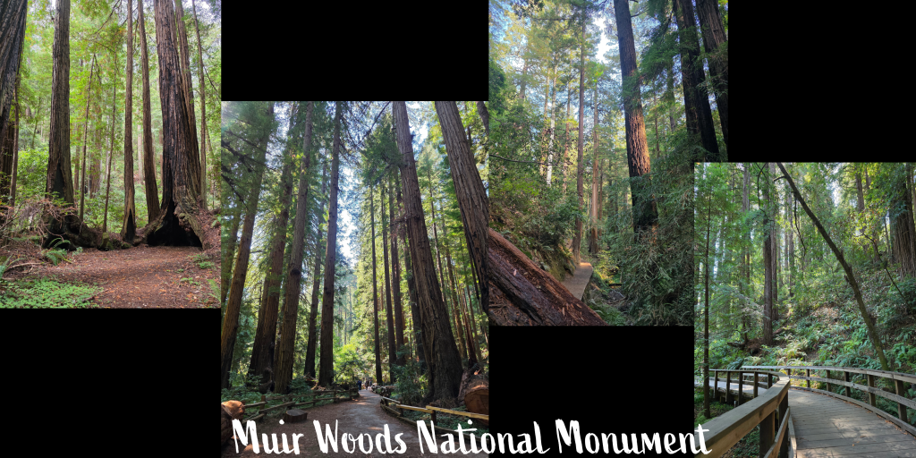
As anyone who read my September Stories post may be aware, I was lucky enough recently to visit the San Francisco Bay area for work. I had one day off while I was there, and I was determined to visit Muir Woods, which I recalled as the absolute stand-out of a family trip to San Francisco in 1995 – so yeah, it’s been a while.
What I was not excited about was the drive – winding narrow roads, steep drop-offs, and lots of traffic. So, I did some investigating and discovered that the there was a shuttle that picks up travellers at Larkspur Landing Ferry Terminal, north of the city (and quite close to the infamous San Quentin prison!). There is plenty of parking, and it was a relatively easy drive on a Saturday morning. I did have to book my tickets both to and from the park in advance, but they provided recommendations on timing, and parking at the park is bookable in advance, too (it is in fact required that you do so).
This option is highly recommended – the coach is very comfortable and was quiet when I arrived. I was told that it was off-season so I could board an earlier bus than I had booked (I am never not early, unless I am really late), and while the nearby restrooms were actually port-a-potties, they were surprisingly clean.
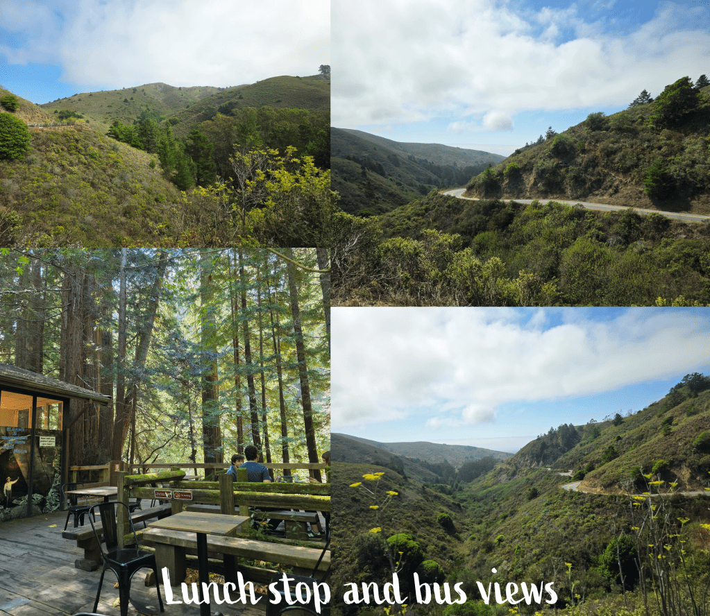
As we started off, I enjoyed just staring out the window and watching the communities pass by as we wound up into the mountains – very quickly I was more than a little relieved not to have to manage the curves. I can do these in Scotland, in my own car, but this was a bit different. Plus it meant I could actually enjoy the drive, and the views. I am always impressed, in California, how housing is constructed absolutely everywhere, no matter how steep the hill. The neighbourhoods we wound through on our way to Muir Woods included some truly spectacular homes with large yards around them, and I saw more than a few enviable tree houses.
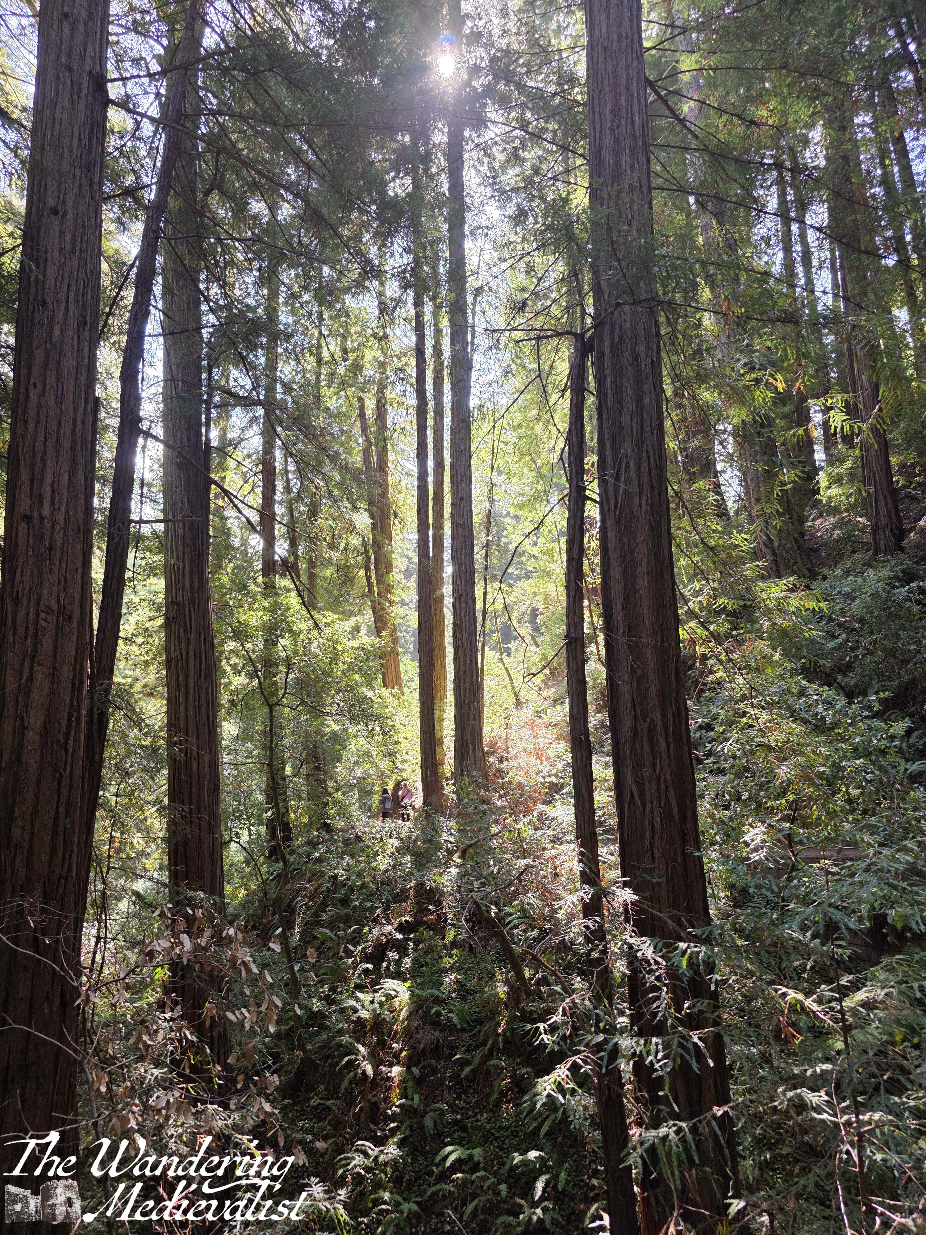
After about 30 minutes, we arrived at the park, and I realised that though the shuttle was quiet, the park was not. I know that it was not high season yet there was definitely a good number of people on the paths, and this was one of the reasons I eventually deviated from my original plan to stick to the three bridges. But I get ahead of myself (so unlike me).
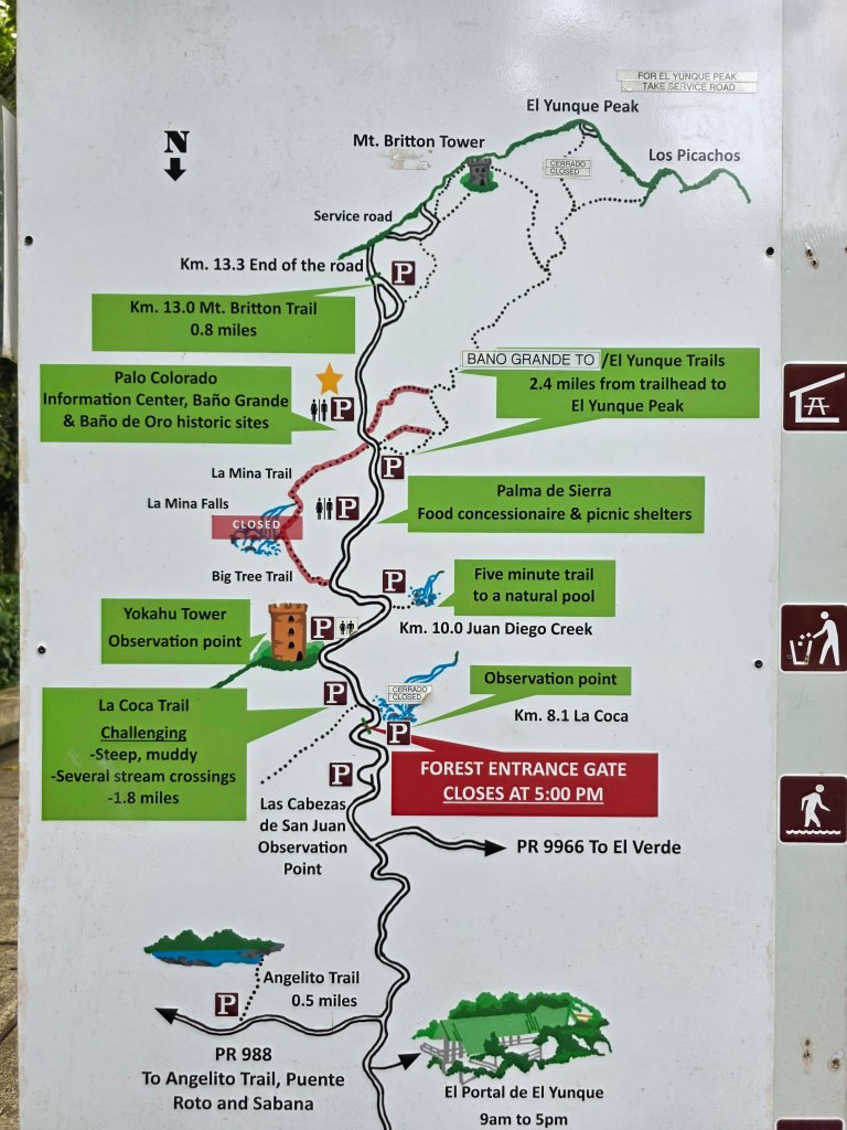
The weather as we piled out of the coach was cloudy, with the all-pervasive Bay Area fog sitting at the tree-tops, casting the highest branches with a grey tinge. The coach ticket included entrance to the park, where I received a map of the trails – I took a short moment to peruse before heading through the main gateway.
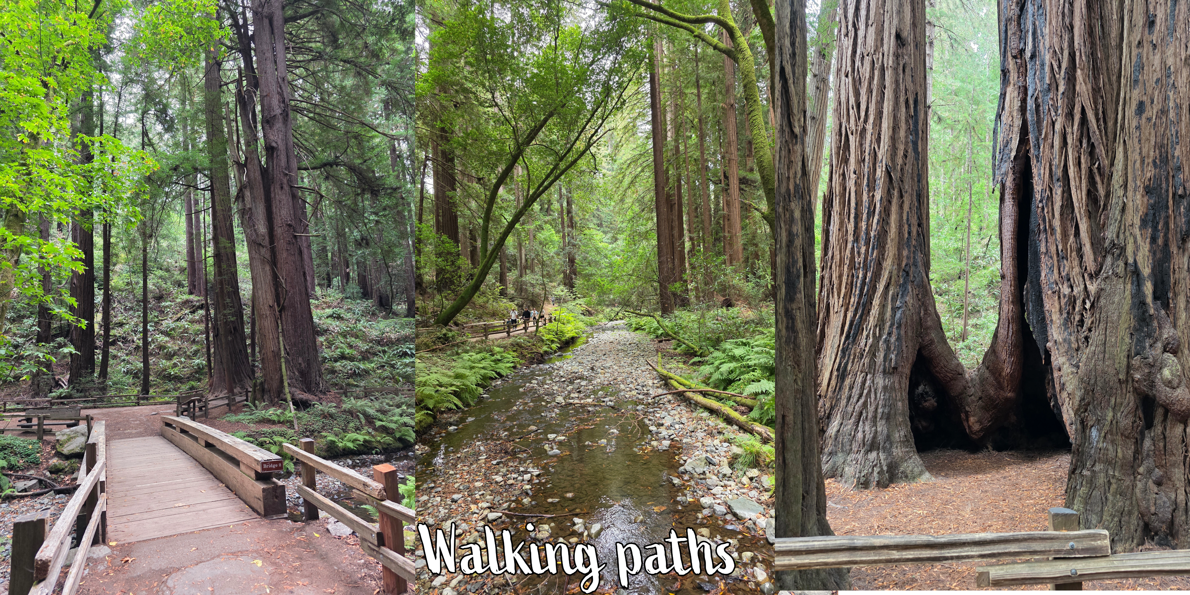
I had decided, due to the weather, that I would not do the ‘long’ loop, just walk out to Bridge 3 before coming back; the Medium loop goes up one side of the river and down the other, which is what the majority of visitors seemed to be doing, and there are several bridges that you can cross-cross on your way. I intended to take a side-trip up through Cathedral Grove, but then return on the yellow trail.
Trails of Muir Woods, scanned from the leaflet I received upon arrival
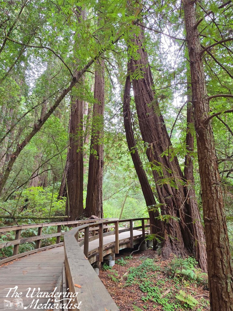
I started off by crossing Bridge 1 but soon found myself walking against the main traffic, with almost everyone else coming back towards the entrance. So, at Bridge 2 I crossed back over to join the more socially accepted direction (not something I would normally bother about, but some of the wooden paths were narrow and I was tired of getting annoyed looks).
It is a beautiful walking route, with some fallen trees that show the decades and centuries of rings, glimpses of the river, and a forest floor carpeted in mosses, saplings, and clover.
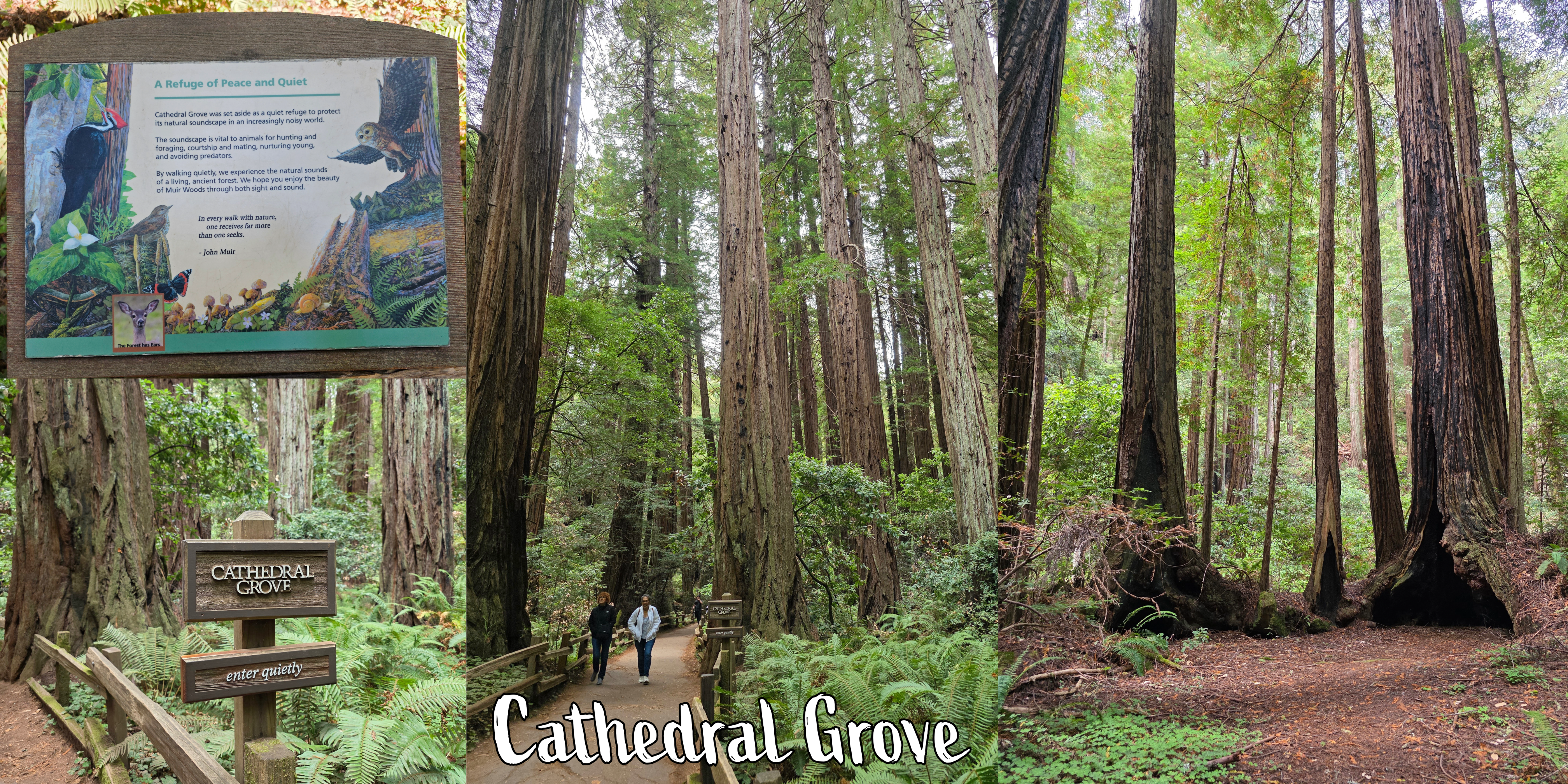
It took me less time than I had imagined to reach Bridge 3, and enter Cathedral Grove, which the sign stated was set aside as:
A quiet refuge to protect its natural soundscape in an incredibly noisy world. The soundscape is vital to animals for hunting and foraging, courtship and mating, nurturing young, and avoiding predators. By walking quietly, we experience the natural sounds of a living, ancient forest.
I have to admit to finding the other visitors a little less considerate of the soundscape than I would have liked, but it is almost to be expected when visitors were so many. The experience of walking through Cathedral Grove, silent or not, was extraordinary. At every turn I found myself wanting to capture a new view, even if it was often difficult to avoid other visitors. In the video at the end of this post I made an effort not to record other people, which meant many of the clips are shorter than I would have liked.
Within Cathedral Grove is a plaque memorialising the 1945 delegation from around the world that met in San Francisco to establish the United Nations. They visited Muir Woods on 19 May of that year to honour the memory of President Franklin Roosevelt, who had recently passed away. President Roosevelt was a strong supporter of national parks, good forestry practices and the sustainable development of natural resources, as tools to maintain lasting peace around the world, particularly after the destruction wrought by World War II.
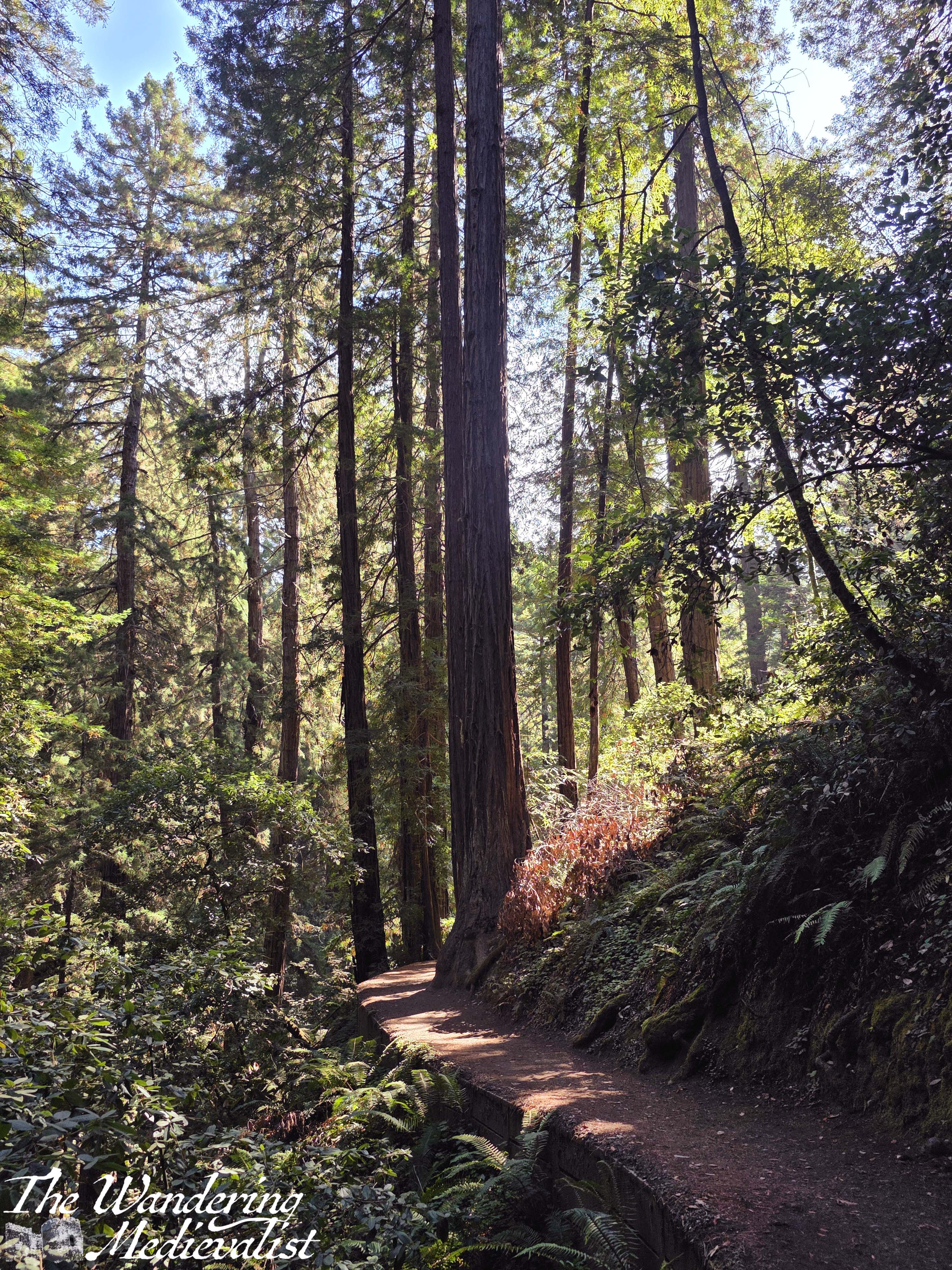
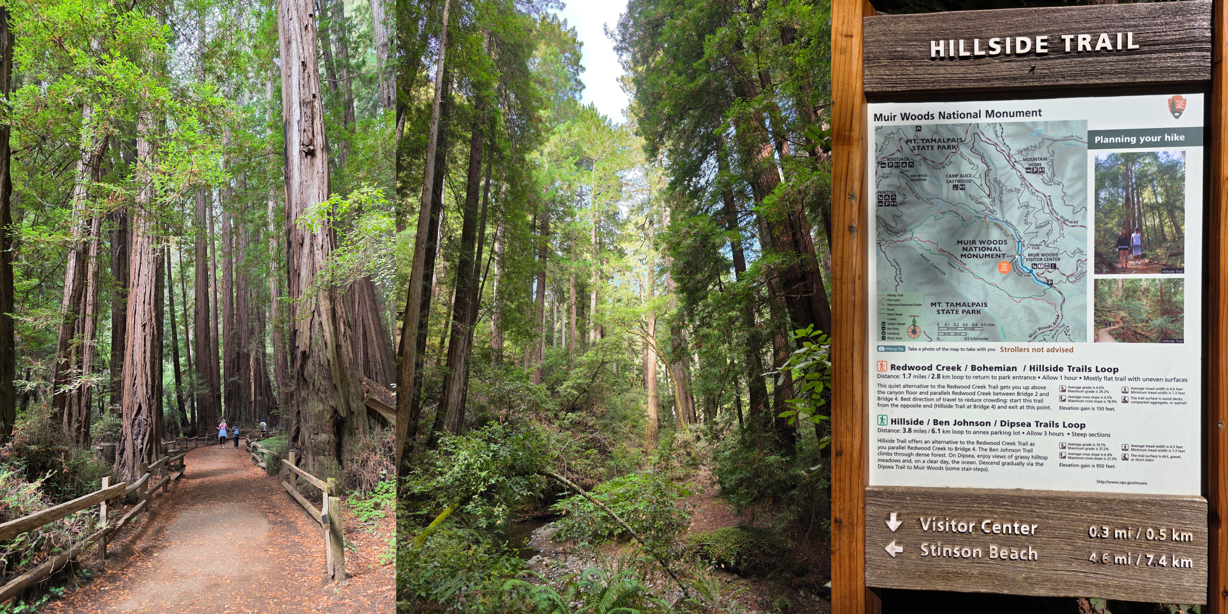
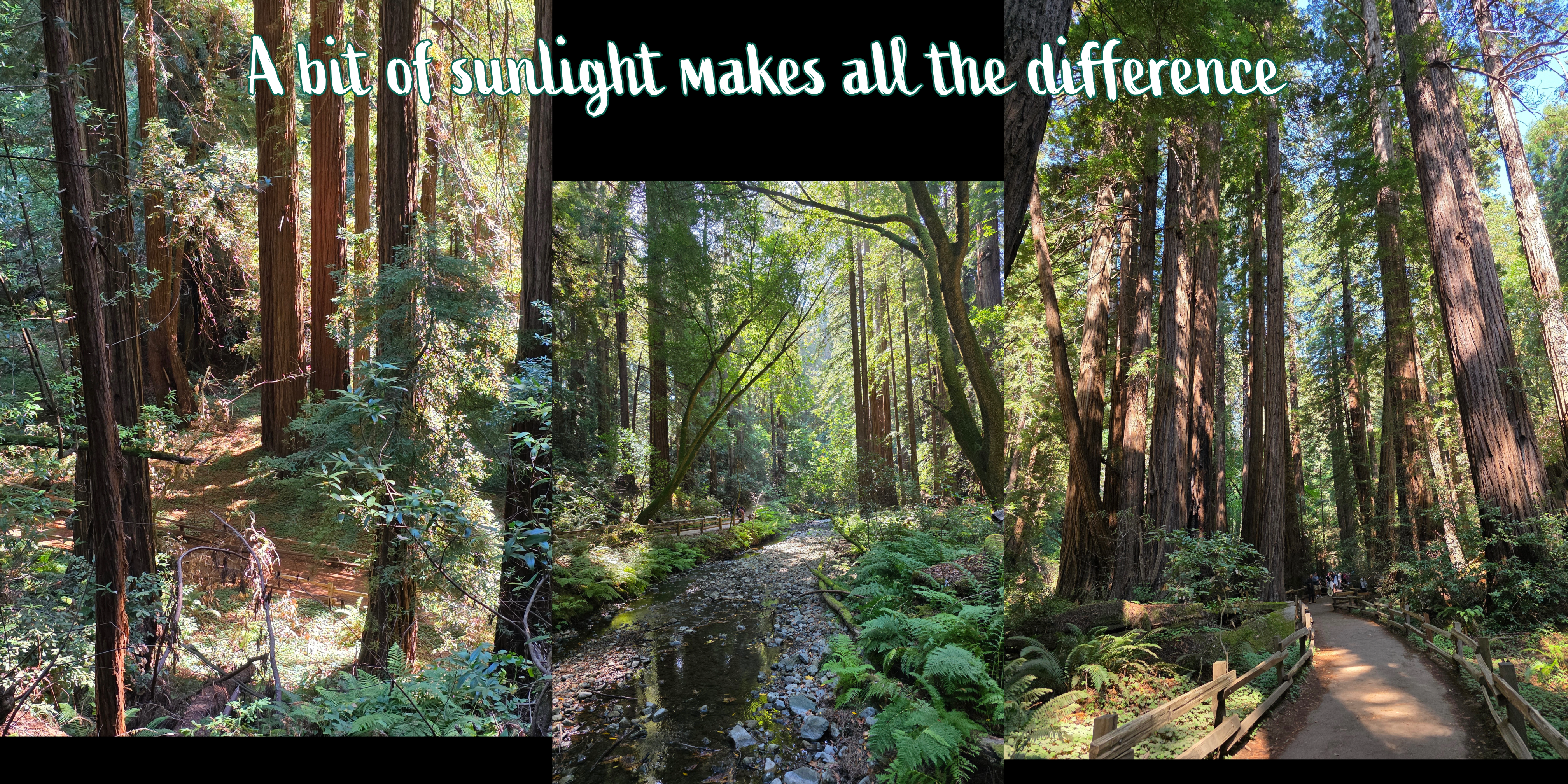
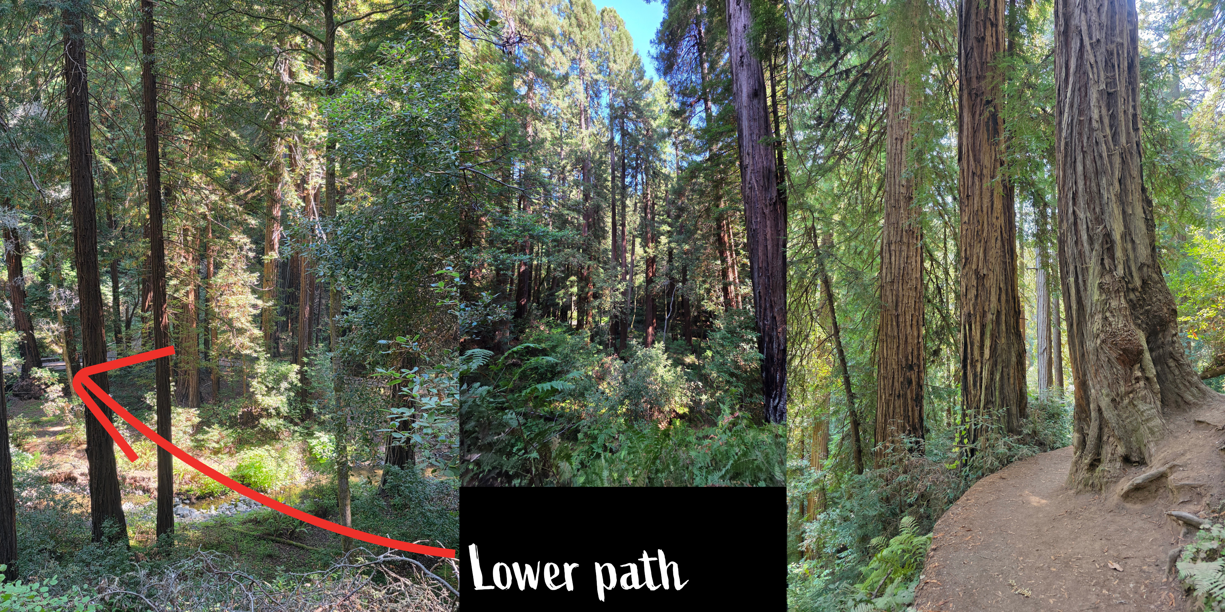
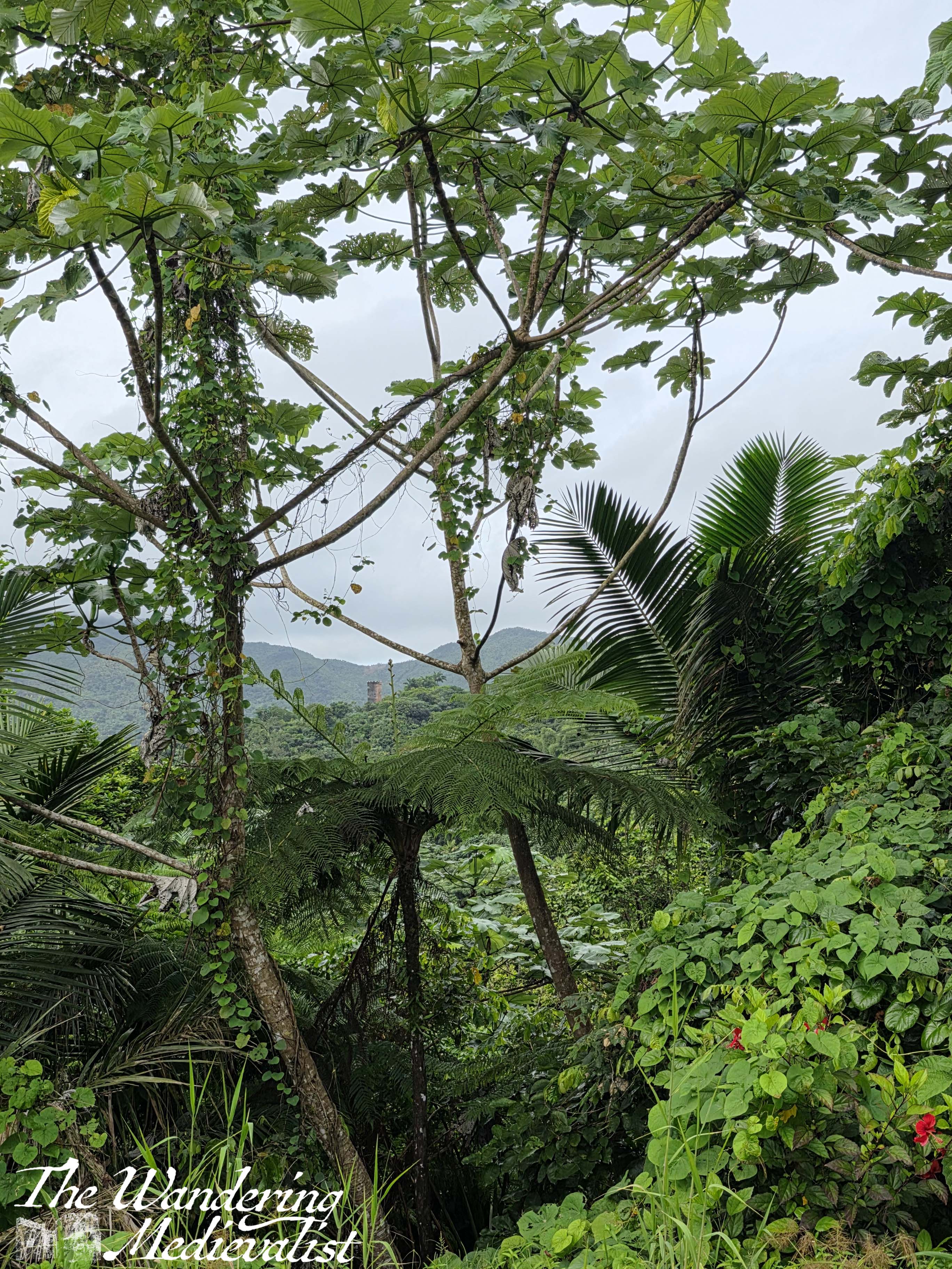
Moving out of Cathedral Grove as I approached Bridge 4, it seemed a natural choice not to turn back but to extend my walk by heading up the Hillside trail. The sun was beginning to come out, burning through the fog and filtering down through the branches to create bright patches of green. The Hillside path, which started off with a steep rise away from the river, eventually turned to run parallel the lower path, weaving in and out of the hills with a few gentle ups and downs.
Beyond the first few hundred feet of incline it was not a particularly difficult trail, and was absolutely beautiful. It also allowed me the opporunity to be, on occasion, alone with the trees – a special kind of peace and quiet.
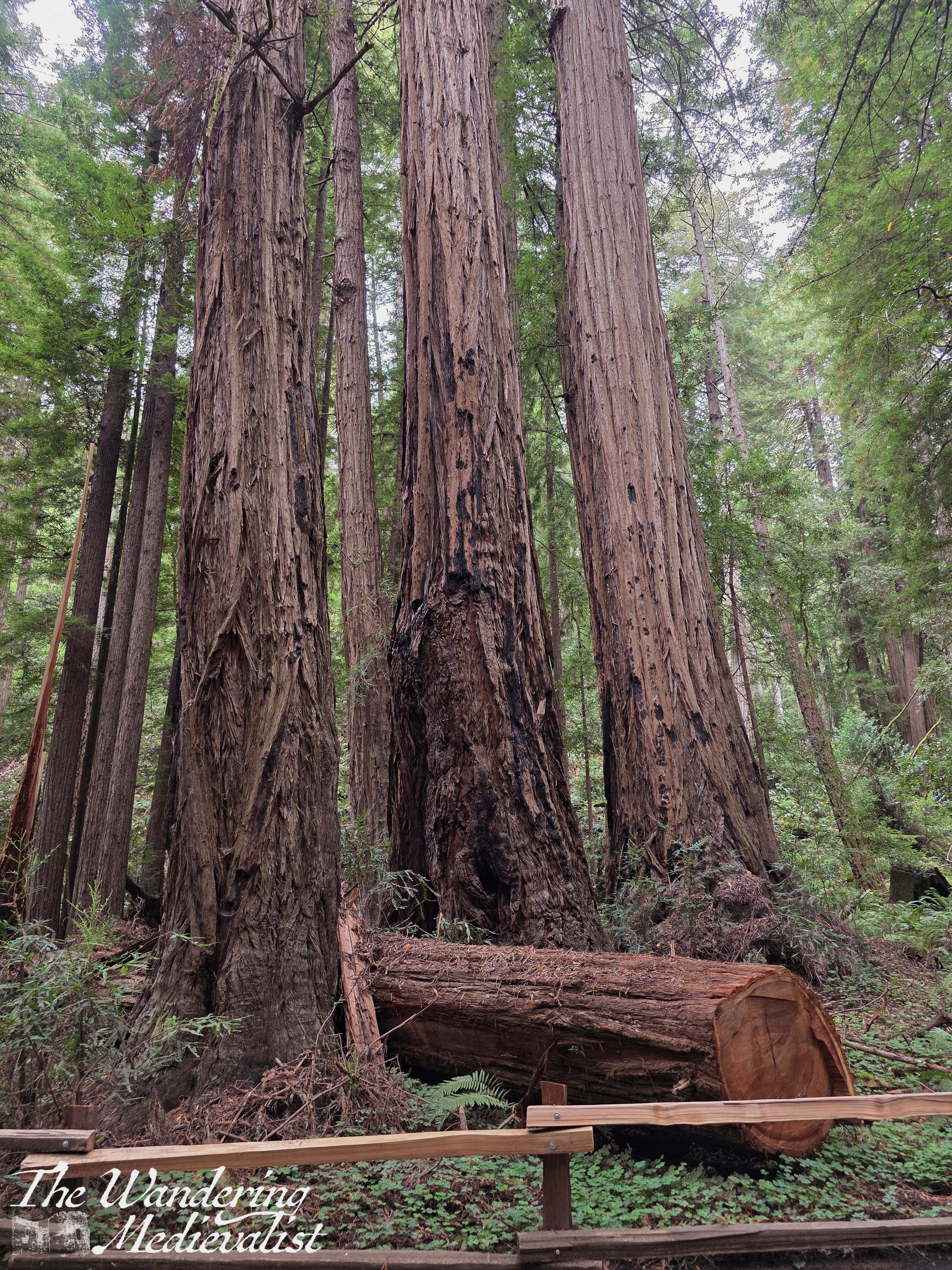
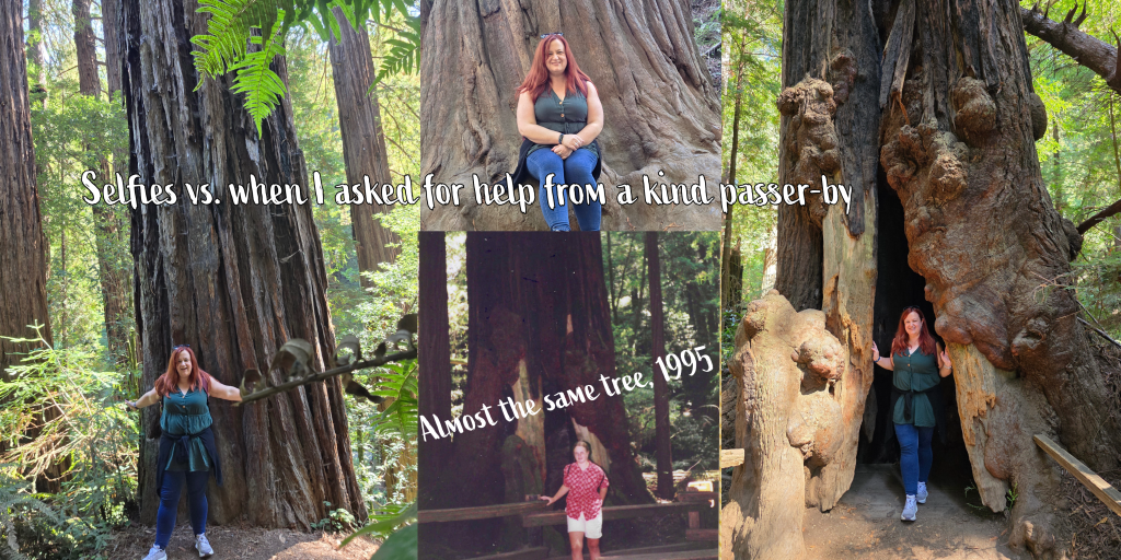
This was absolutely the best way to enjoy the forest, and after in time descending back to the river level, I took a short detour back up through Cathedral grove – to catch it in the sunlight. Finally, I returned to the ‘far’ side of the river to make sure I got the famous Muir Woods picture, inside a redwood. I had tried a few selfies along the way though none worked particularly well, and I finally gave in to request help from a very kind couple, for whom I reciprocated a picture.
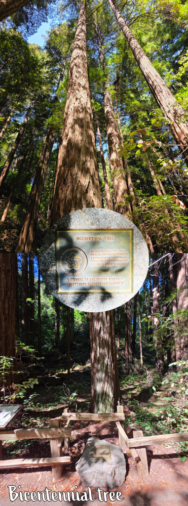
There are a few spots along the Hillside trail and other walking paths where you can get a picture inside a redwood, but this was the one that was least busy – at some there were queues of groups waiting for pictures. It was also very close to the Bicentennial tree, which – as it is likely impossible to read the sign – was commemorated in 1976 as having begun its life 200 years before. ‘As this redwood tree began its life, across the continent, a revolution occurred which transformed 13 colonies into the United States of America’.
A tree as old as the country, a tribute to the success of both, really. And quite phenomenally tall…check out the video below to see it in all its glory.
I had walked speedily enough that I reached the café and gift shop a bit ahead of the lunch rush, and was so happy to find a massive turkey sandwich and iced tea to enjoy. As there was no phone service in the park (I think I got a bar or two at the café but nothing useful), I read my book while I ate, then indulged myself in a long – and costly – browse through the gift shop. I particularly enjoyed a set of carved wooden figures of bears and trees, several of which came home with me as gifts. Also some beautiful artistic postcards of the park which I could not bring myself to actually send. The shop here is expectedly over-priced, but for a trip like this I really did not care and was willing to go a bit overboard – who knew if or when I might return?
By the time I had finished lunch and my browsing I decided it was time to head back towards the shuttle, and I was lucky enough to wait only about 10 minutes for the next one. Again, I also managed to get on an earlier shuttle than I had scheduled and so arrived back at my car by about 1pm. It was a glorious sunny day and I hoped to be able to get a view of the Golden Gate Bridge on my drive south, but the car parks were so busy that I had to give up.
As I drove back to my hotel, I could not help but feel envious of the more ‘local’ people who were visiting Muir Woods, clearly there not as tourists but for exercise – there were joggers, more intense distance hikers, fitness groups, and walkers. While there are apparently even more impressive redwood forests furhter up the coast, I was so happy to be able to visit Muir Woods again, putting new memories to those echoed by an old magnet on my mum’s fridge from the 1995 trip. Yes, I could have spent the day exploring the city, but for me, the woods were the right choice. They usually are.
Hence my new laptop sticker:
As a side note, I was sorry to see, upon checking the website while writing this post, that Muir Woods has been closed as of 21 October 2025 due to the lapse in funding caused by the government shutdown. It is a sad thought that people might be missing their once-in-a-lifetime opportunity to explore this beautiful National Monument.
For anyone who works in education, September is an unavoidably busy month, and this September was no exception. I hope you will accept this post as a solid explanation of why it has been the only one in some time – the weeks have gotten away from me. Not in the least because as now has become standard for me, September is travelling-for-work month. I was fortunate enough to see some truly spectacular sights in my just over two weeks away, from the Golden Gate Bridge to the redwoods of Muir Woods and the streets of a new city or two. I also managed some fantastic ‘out of the plane window’ views, and even a glimpse of the northern lights, all topped off by a beautiful early-morning return to Edinburgh flying across Fife, with the sun rising in the east. So, here is a glimpse into my busy and exciting month of September.
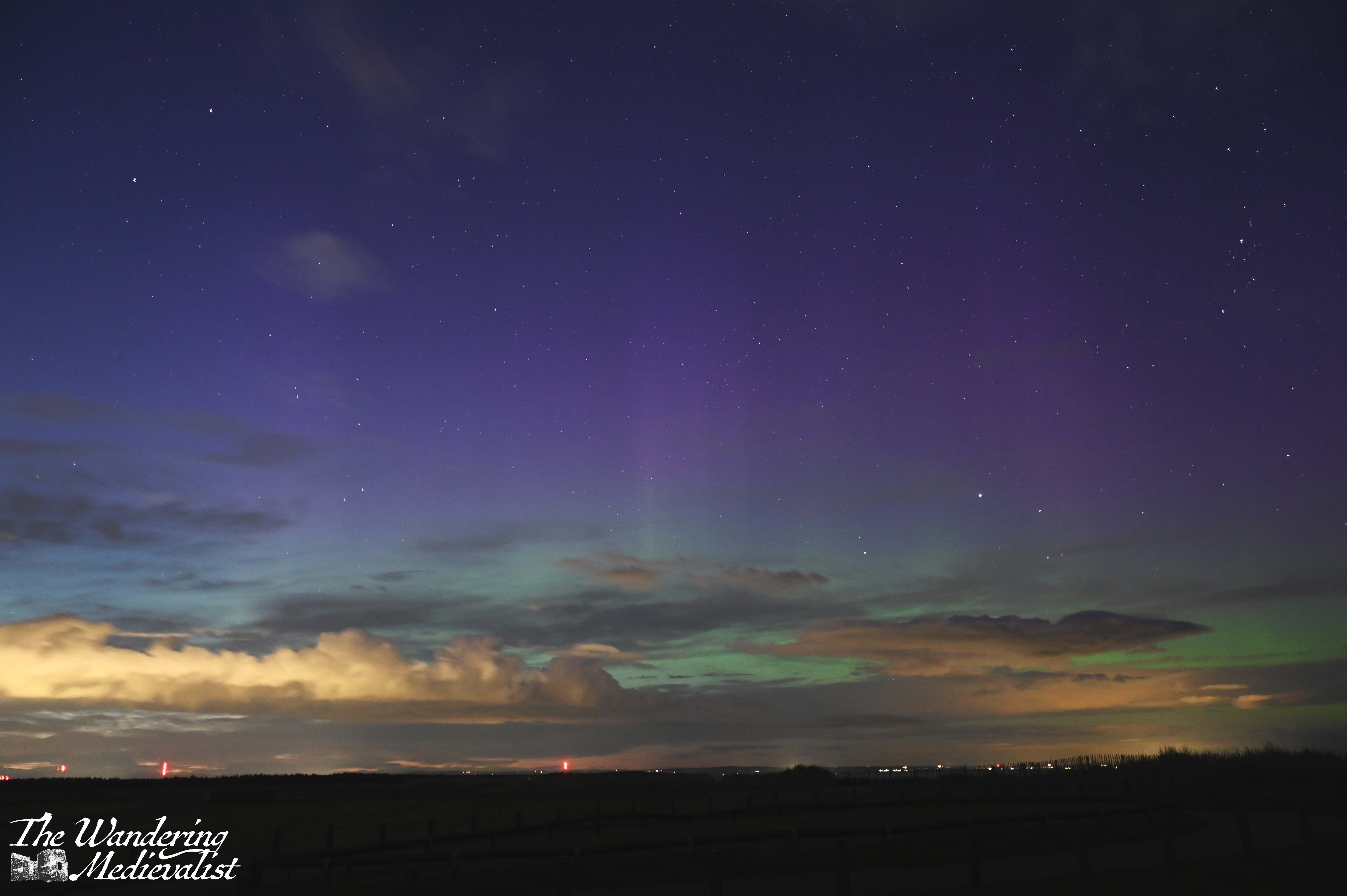
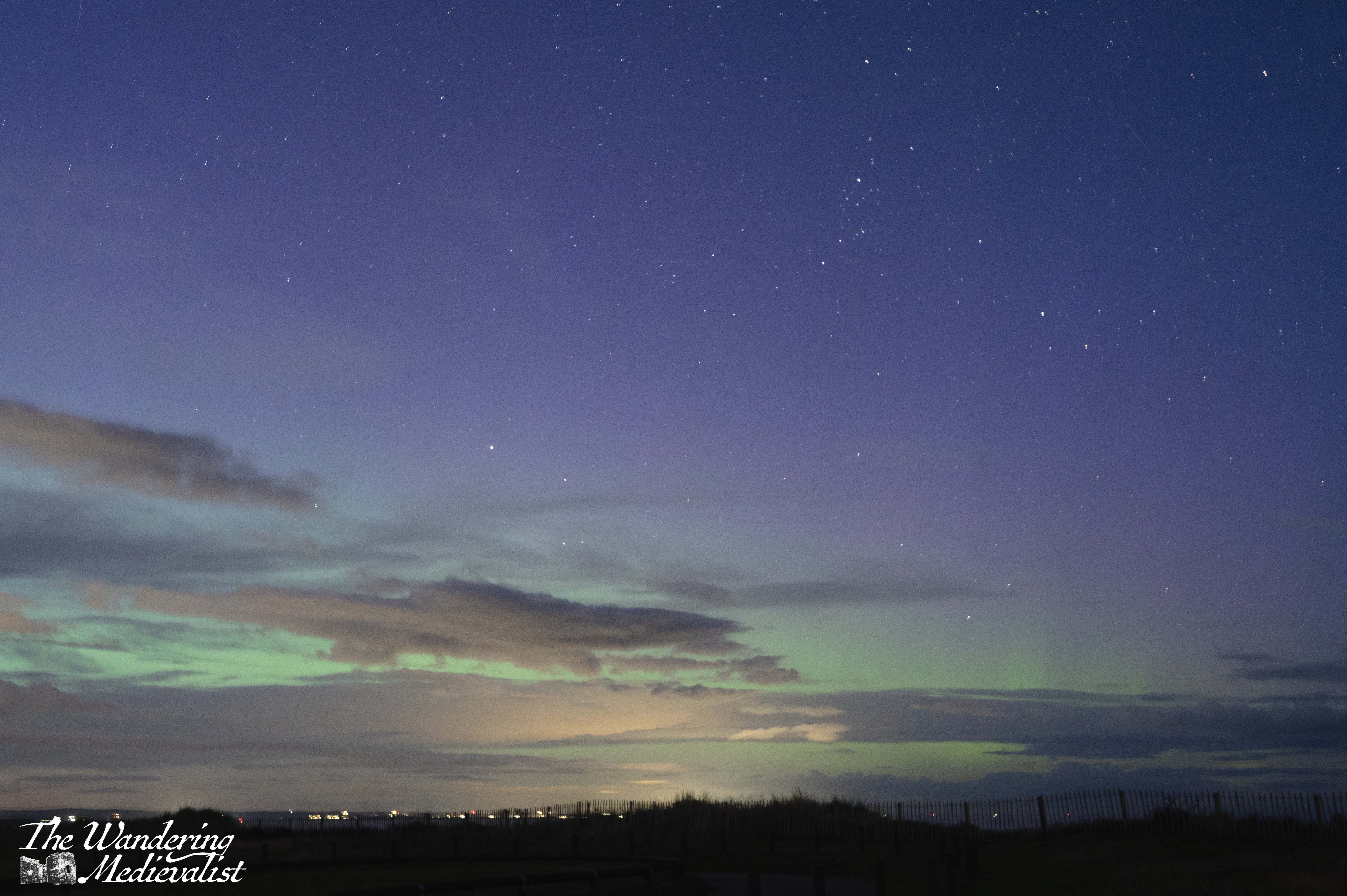
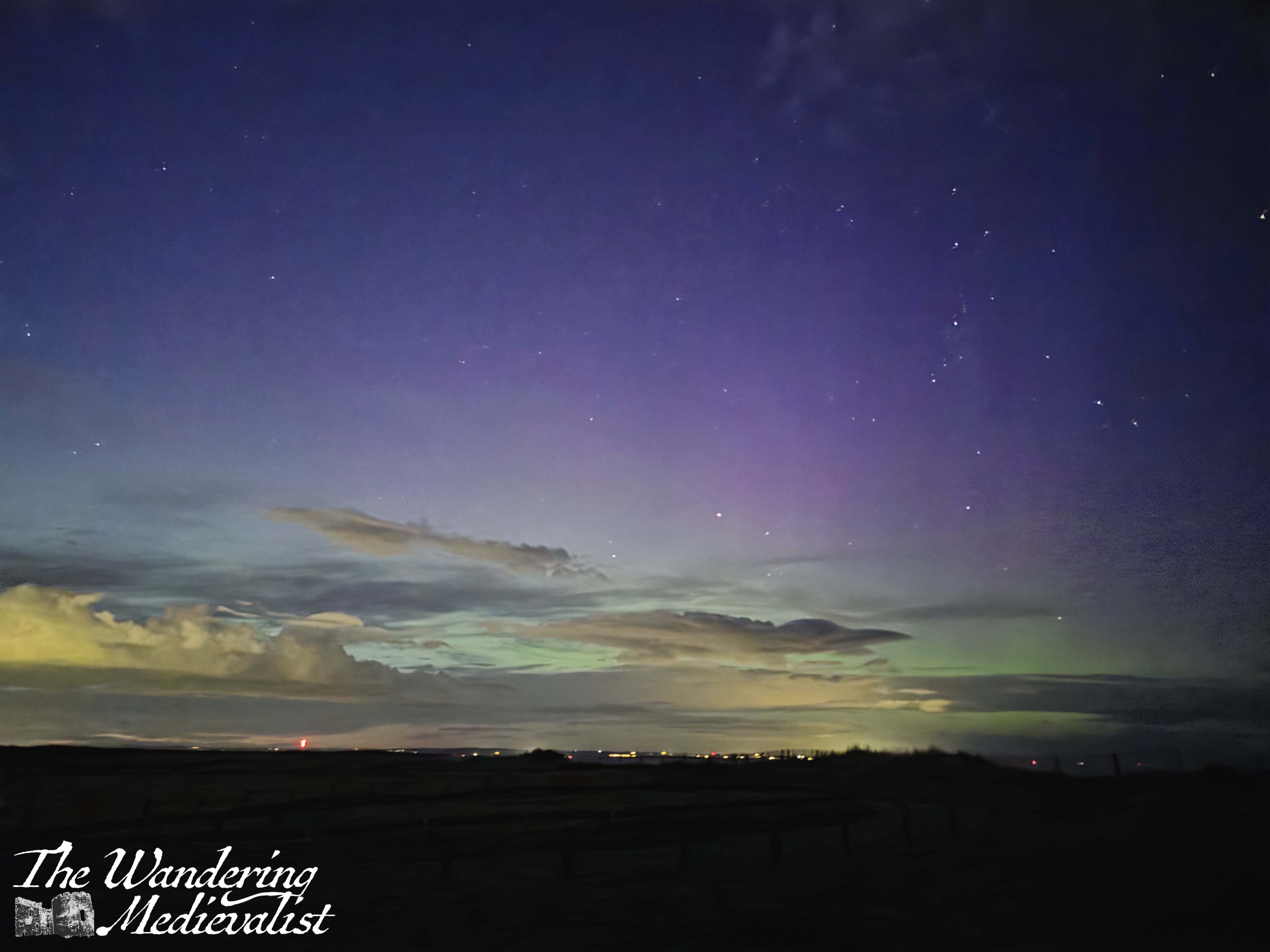
The Northern Lights – a glimpse of magic while still in Scotland
I am fortunate to have friends and an other half more than willing to go out at 9.30pm to stand on the dark beach of West Sands and look for stars, the rising moon or, in this case, the Aurora Borealis. The alert app I use had been red a few times this summer, but usually only in the middle of the night or while the sky was still light (not, of course, mutually exclusive in Scotland in summer), so I was excited when there were rumours of two good nights in early September. My fellow night sky aficionados and I headed out as the last light in the sky was fading, and we were lucky enough to catch a bit of green and purple through our lenses – not visible to the naked eye, but still fantastic, with colours not normally seen in the night sky. This made for an excellent start to the month, and an excellent opportunity to play with night settings on my new camera.
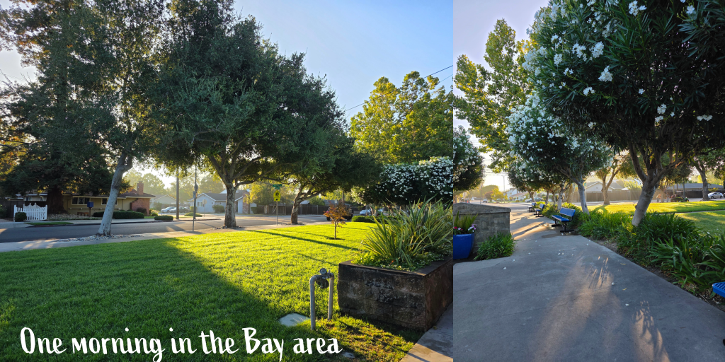
I try, before disappearing for a few weeks, to connect with friends I may not see much, and we enjoyed a lovely end of summer evening at the local pub, with a pint or two down by the river. It was truly the end of summer, for while I left Scotland with temperatures still hovering at no-jacket levels, by the time I returned autumn had well and truly landed. Edinburgh was 4℃ when I arrived (around 40℉).
A quick jaunt to England
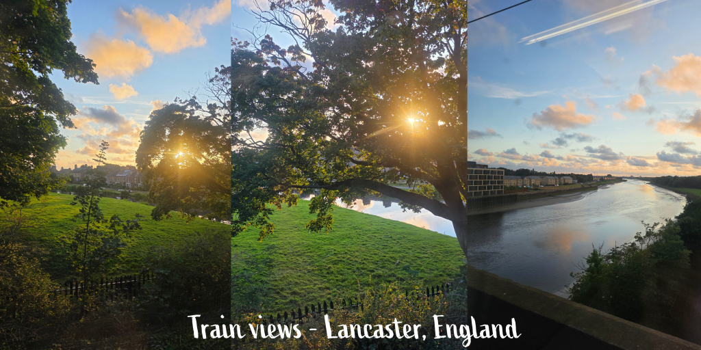
Before departing for the US, I first had a quick overnight trip down to Manchester to attend a training session. I will spare you the absurdities of UK train travel, which works well a good portion of the time but when it goes wrong goes spectacularly wrong. Suffice it to say, it was helpful to have knowledge of the trains and very little luggage as my original train was cancelled and I was forced to very quickly change plans. I arrived about 3 hours later than planned, but the next day’s return journey went very smoothly. Train journeys in the UK – particularly long ones – are a wonderful opportunity to get a good feel for the countryside and I have been known to just stare out the window for the whole trip between Durham and Edinburgh.
Manchester required a different route than I was used to, passing through – amongst other places – Lancaster, a northern city I have always wanted to explore. We were held up for a short time just at the edge of the city, at sunset, allowing me to capture these lovely views.
I had hoped to add a few tidbits here about Manchester as well, but I really did not spend enough time there to get a feel; I arrived late, spent all day in the conference centre, and left after a short walk. I was delighted to discover a Dunkin Donuts near to Piccadilly, but did not have the time to pop in. Definitely a city I would like to have more time to explore.
Across the pond…and beyond
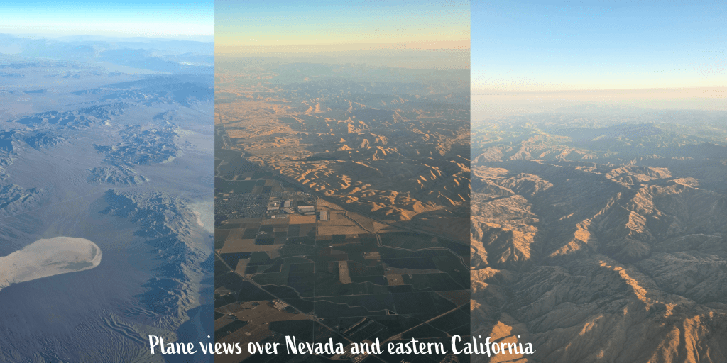
Two days after my training journey to Manchester, I woke up well before dawn (3.30am if you must know, who says travel is all glitz and glamor?) to get the airport bus. I tend to request window seats on flights, as they can be more helpful if you want to try to sleep (something I am still quite rubbish at). A happy coincidence is that you also occasionally get the most fantastic views. The second leg of my flight was from Atlanta to San Francisco, and as we got to about one hour out of SFO, I took a peek out the window. For anyone who has not had a chance to fly over the western US, I’d highly recommend aiming for a window seat if you can, as I was greeted by the spectacular sights of stark desert and treeless ridges of mountains. The setting sun cast an orange light over the hills at the far edge of San Francisco Bay, and it was one of the more amazing flights I’ve had in some time.
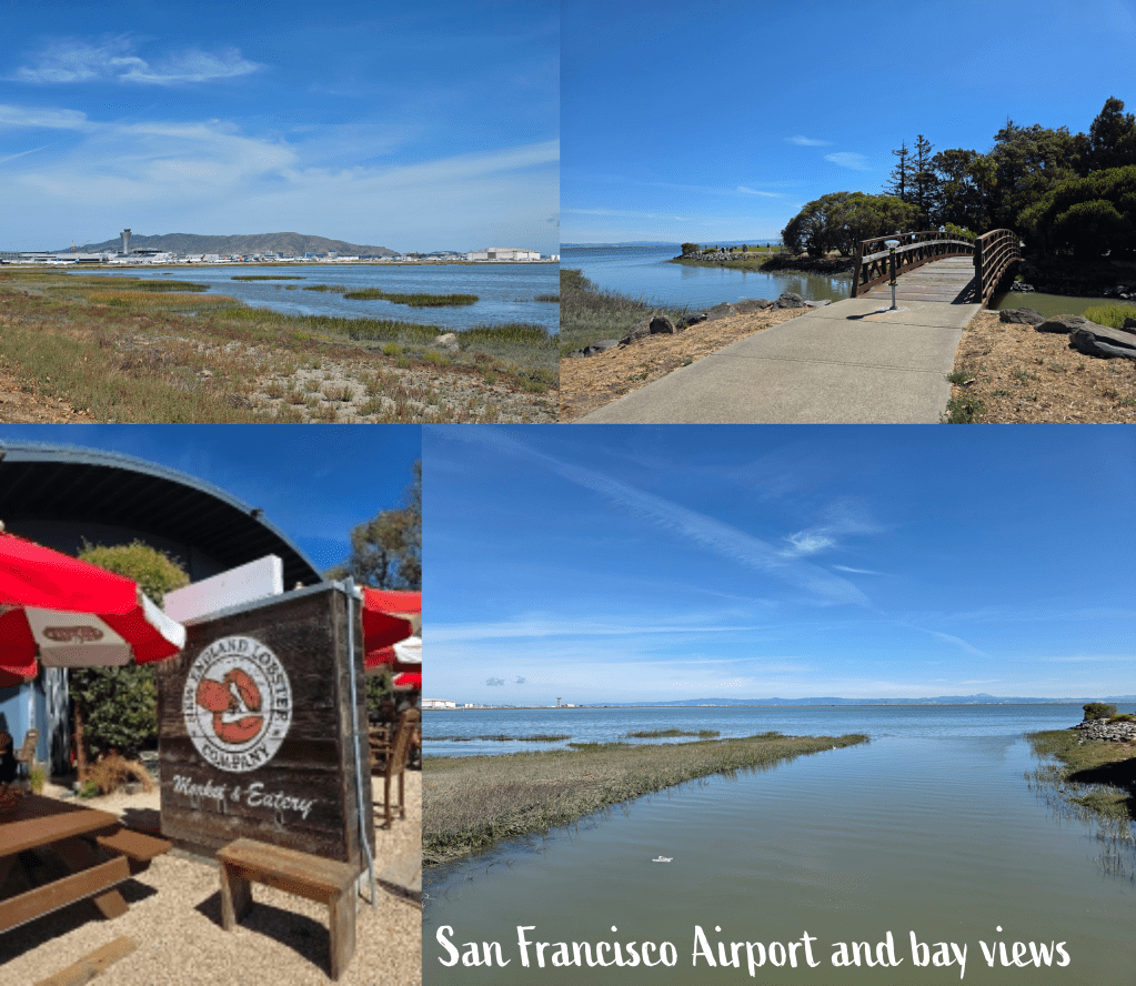
The following day, I met a friend for lunch at the New England Lobster Market, which did seem a touch absurd but also perfect as we had met in high school. I took a short detour walk along the coastline near my hotel, with views over the bay and the airport which is situated, similarly to Boston, essentially in the water.
Jet lag heading west is, in my opinion, easier than heading east and I was up early to visit my first school in a neighbourhood where the omnipresent San Francisco mist was just lifting as the sun rose.
The following morning, I woke up to a bit of a surprise: I had parked my car under a tree at the hotel thinking that it might keep some sun off. It did, but it also encouraged the invasion by a colony of ants. I opened the car door to find them all over the rubber lining, on the dashboard, in the cup holders, and – though I didn’t realise it right away – in the boot/trunk where I had stashed my materials for the day.
Cursing the less-than-clean interior of my newly collected car, I wiped everything down with some grapefruit-scented face wipes I had once picked up in an airport; they were just astringent enough to do the job well, though for the rest of the week I would find rogue ants scrambling across the dashboard.
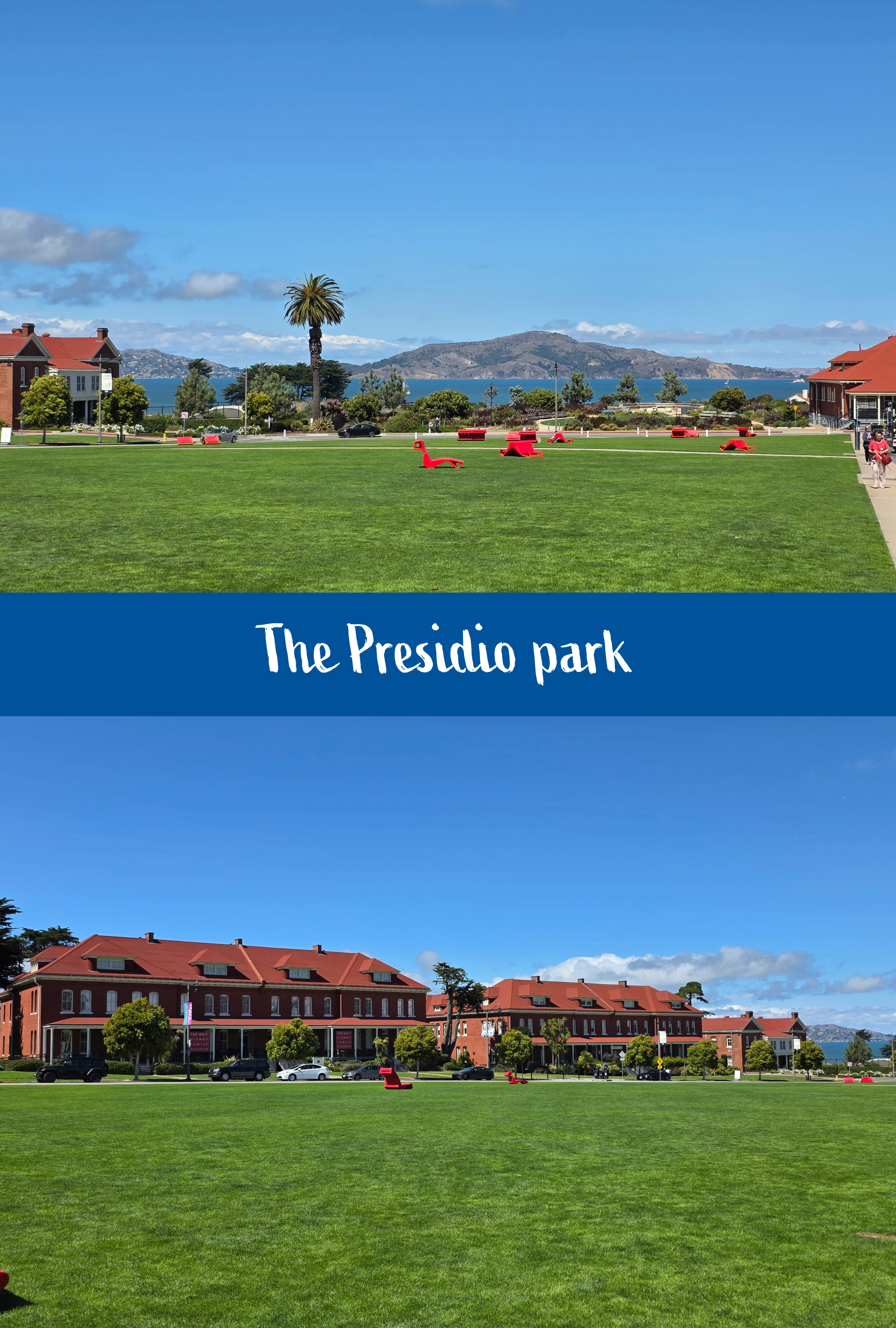
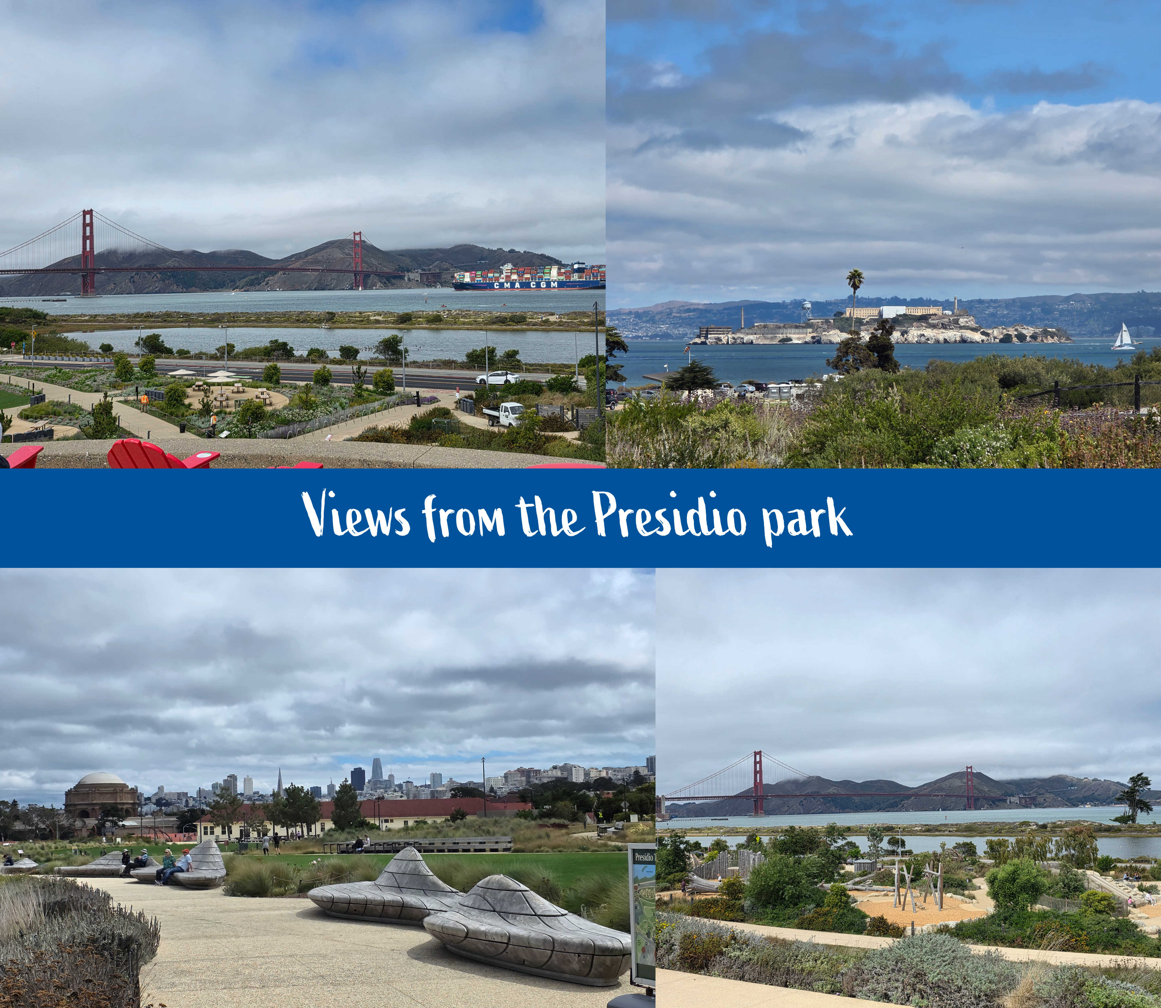
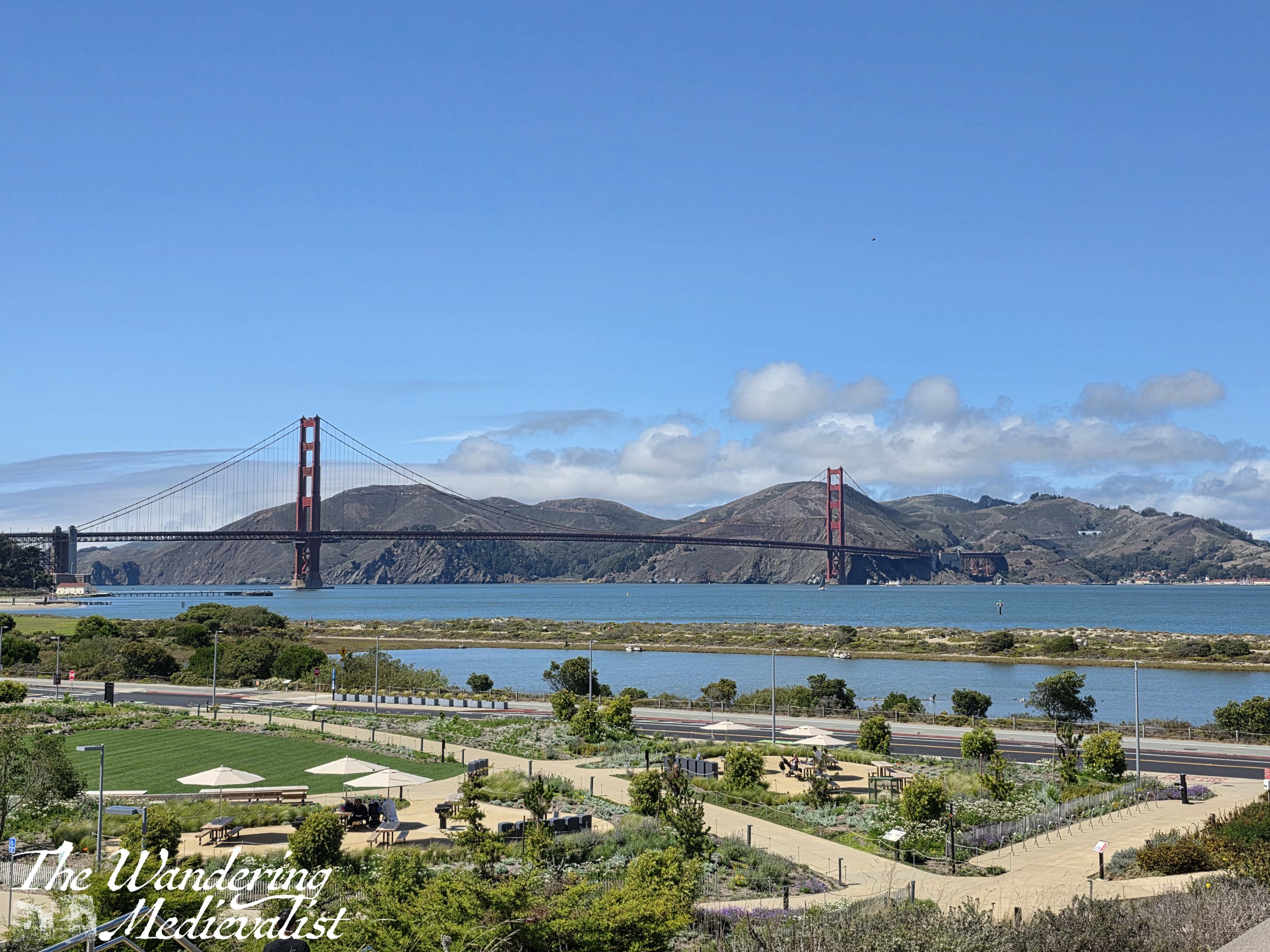
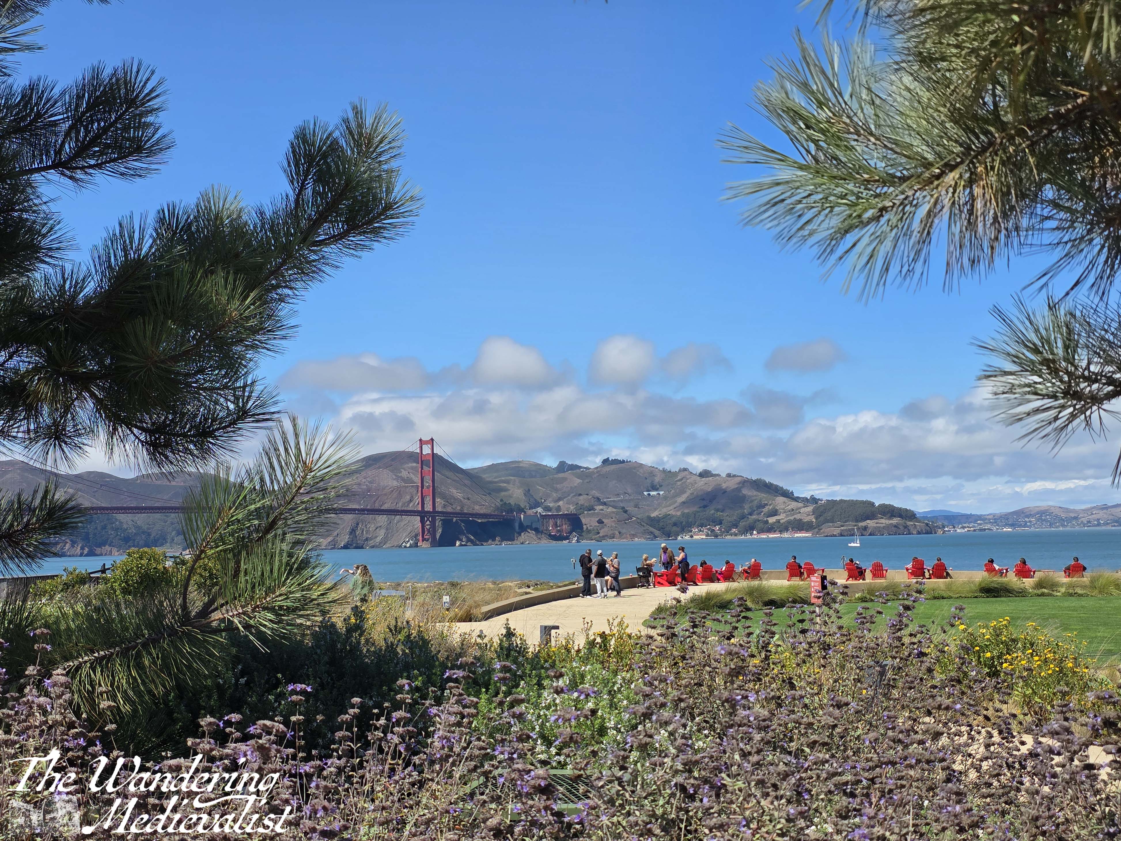
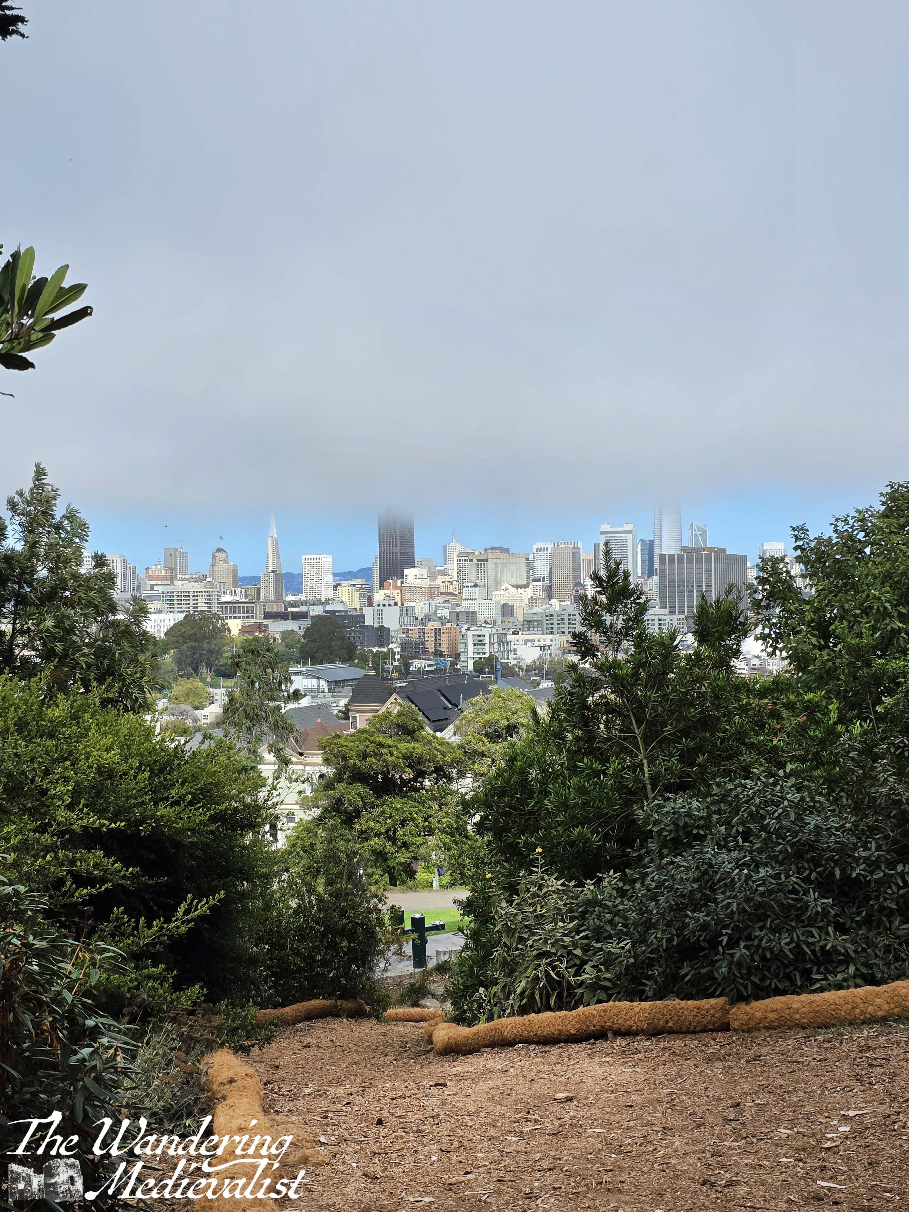
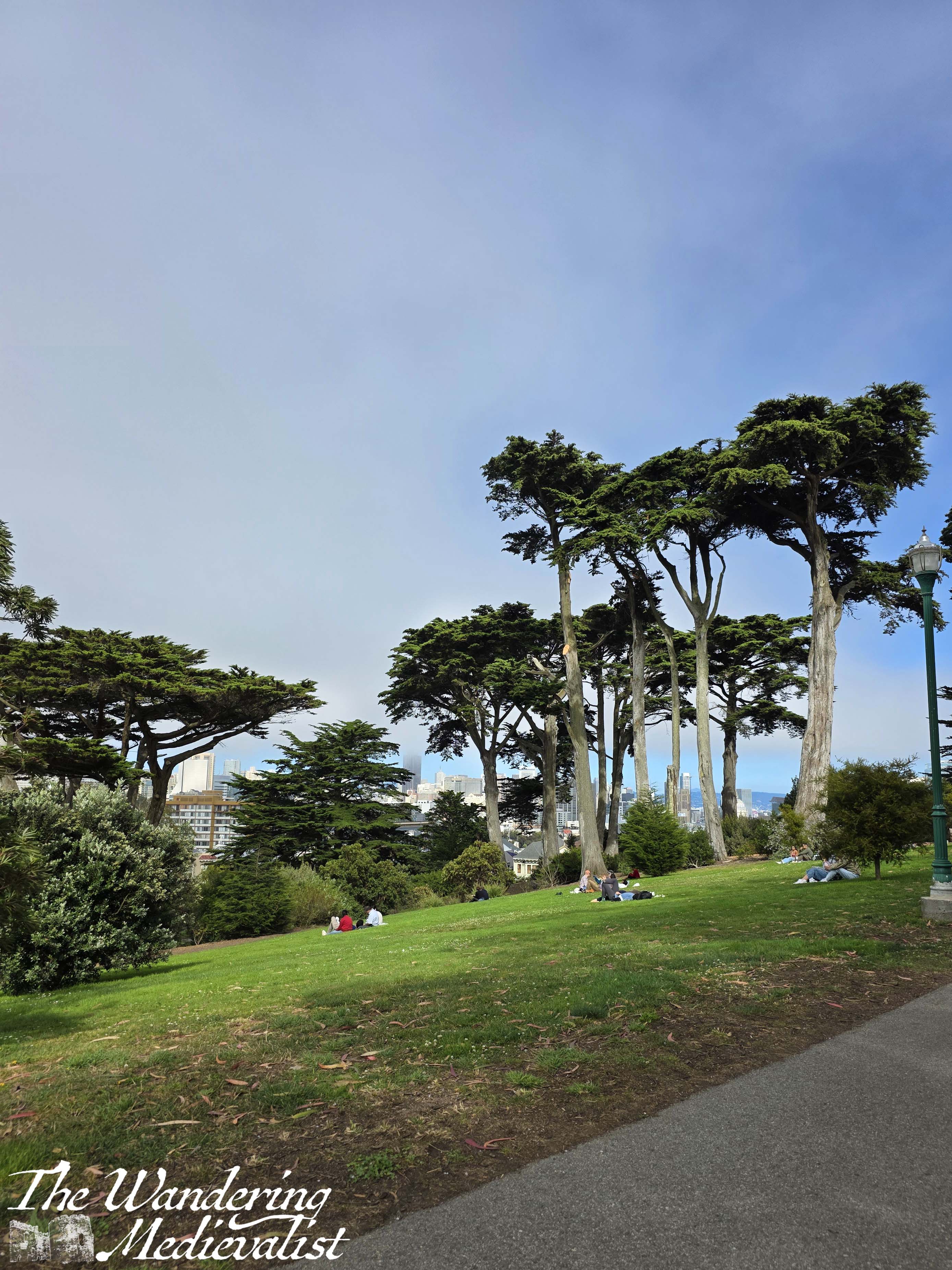
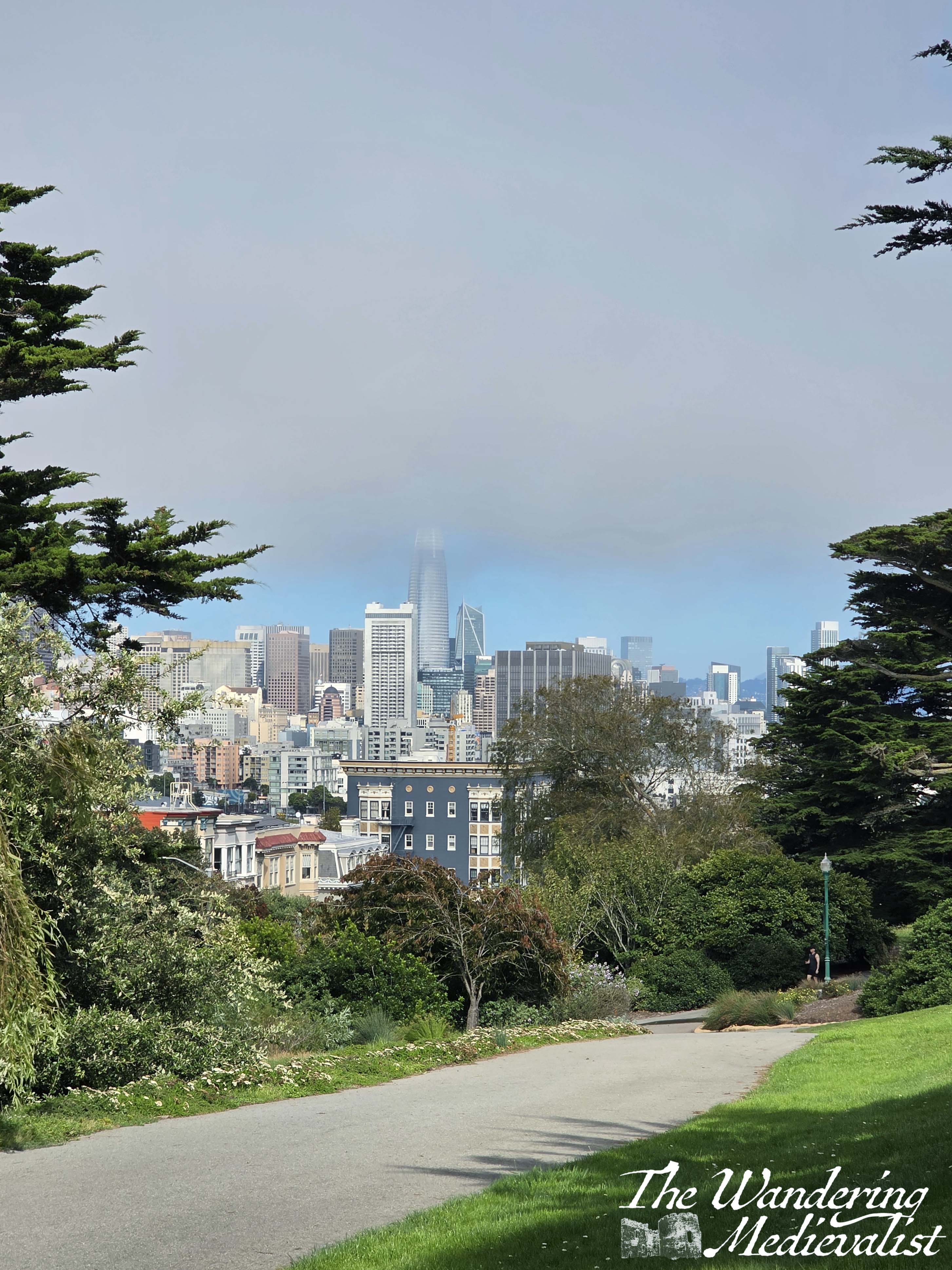
Having dealt with this infestation I headed off for a school on the north side of the city, requiring a drive through the Presidio park – one of the better drives of my life, winding through stands of pine and cypress trees and beautiful homes, finally emerging to a large parking area alongside the Main Parade Lawn. Have arrived a bit early, I decided that I would walk down to the park briefly before my appointment.
The Presidio is a park and formerly – as the name indicates – US Army post that is now part of the Golden Gate National Park. The area where I parked was newly renovated, with pristine grass and pathways, all very clean and with phenomenal views of the Golden Gate Bridge, out into the bay to Alcatraz island, as well as back towards the sloping city centre. Even carrying all of my materials I managed to get a few good pictures, which I then had to re-take after my appointment once the sun had completely emerged from the clouds. It was a breath-taking way to start my week in the Bay Area.
Returning to my hotel that evening, I was looking forward to the second half of the take-away meal I had bought the night before. I had, when leaving that morning, asked reception if housekeeping could look at the fridge in my room as it seemed to be very cold, and I had searched as much as I could for a dial. Having been assured it would be dealt with, I came home and noticed that the fridge door was ajar – a bit extreme I thought, but I figured housekeeping had done it on purpose. Not so much. Instead, I quickly realised that the temperature was as cold as ever and instead one of the cans of seltzer water I was storing had exploded, spreading now-melting shrapnel around the interior of the fridge and my room floor. My dinner was frozen solid, and the remaining cans of seltzer were slush, with one more can so badly deformed that it was clearly not far from also exploding. Excellent. Clean-up and new dinner required.
I spent the rest of the week covering as much of the Bay Area as I could, driving more than 500 miles up and down around the bay, before finally reaching Friday afternoon. This was the day I was changing hotels, and I had been invited to dinner at the home of my friend’s parents – as mentioned above, this was one of my best friends from high school who I had not seen in almost 20 years, but we had always been lucky enough to enjoy one of those friendships that years do not alter. We fell into conversation immediately and spent time reminiscing as well as catching up on what the intervening years had held – or at least scratching the surface.
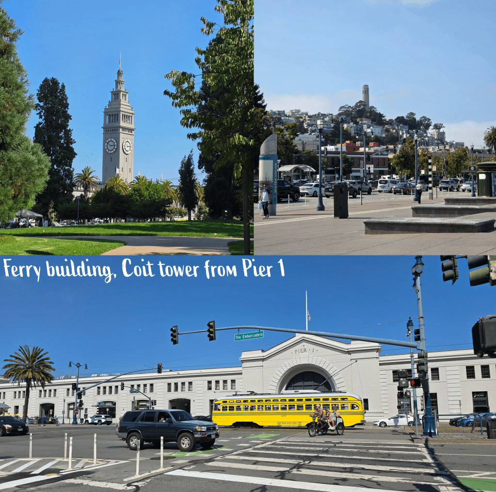
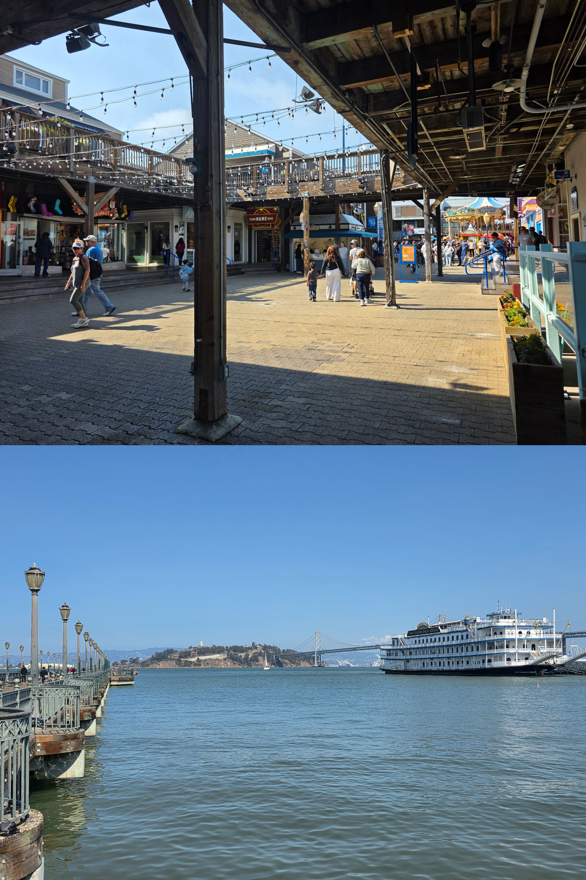
Prior to meeting her for dinner, I had decided to spend an hour exploring the city a bit. So, upon leaving my car and luggage safely in my new hotel, I ventured onto the BART train – not that different really to Boston’s MBTA though perhaps newer – and stepped out at Embarcadero station. Here, I was only steps away from the Ferry Building Marketplace, and so I headed for the tall clock tower and, once across the busy Embarcadero street, turned left to follow the coast.
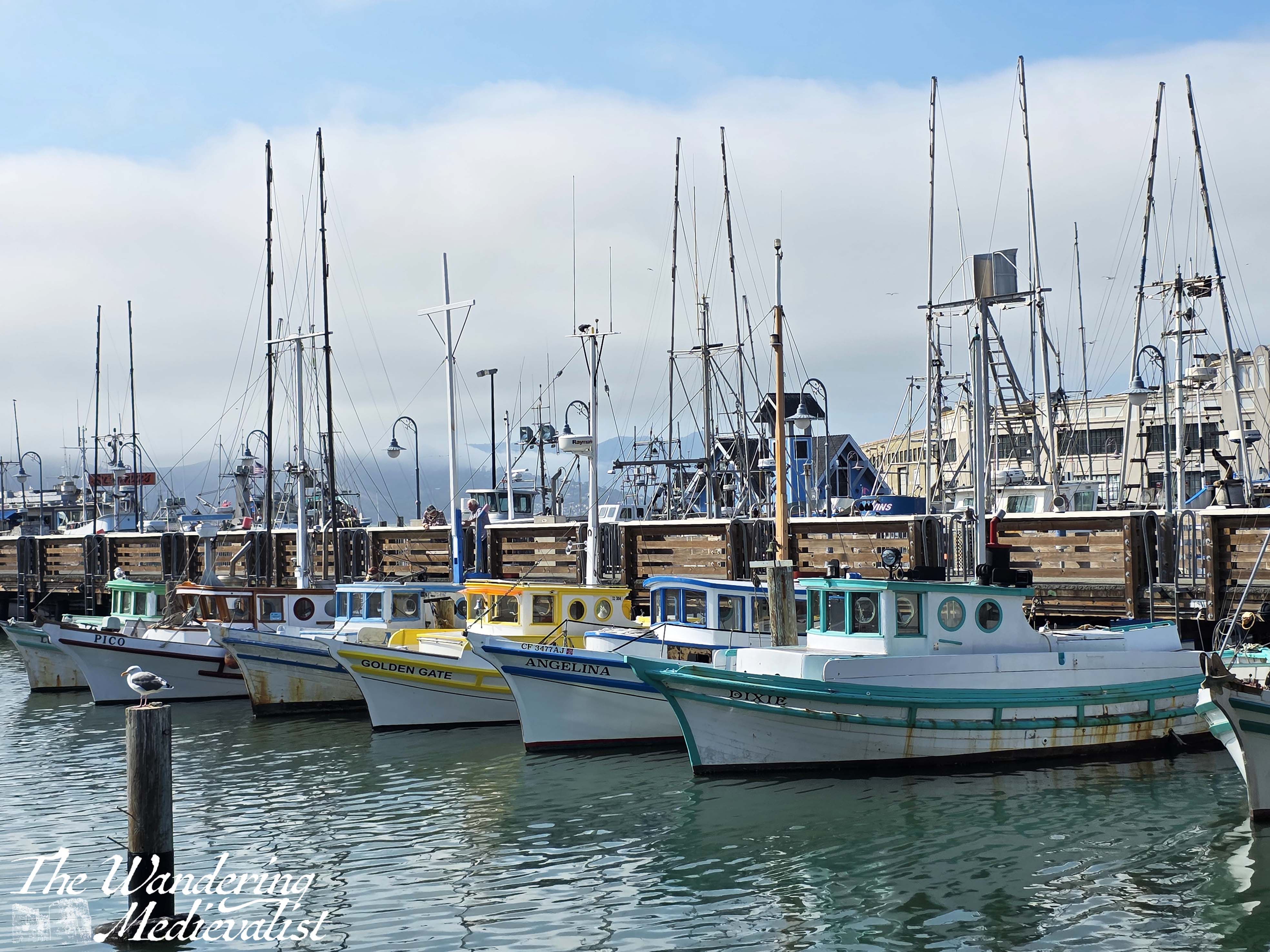
I walked along the many piers of San Francisco from Pier 1, past some that were used for cruises, some for day trips, some for fishing, and much more I am sure. As I walked, Coit tower became more and more prominent, before I eventually made my way around to the far side, having essentially done a wide arc.
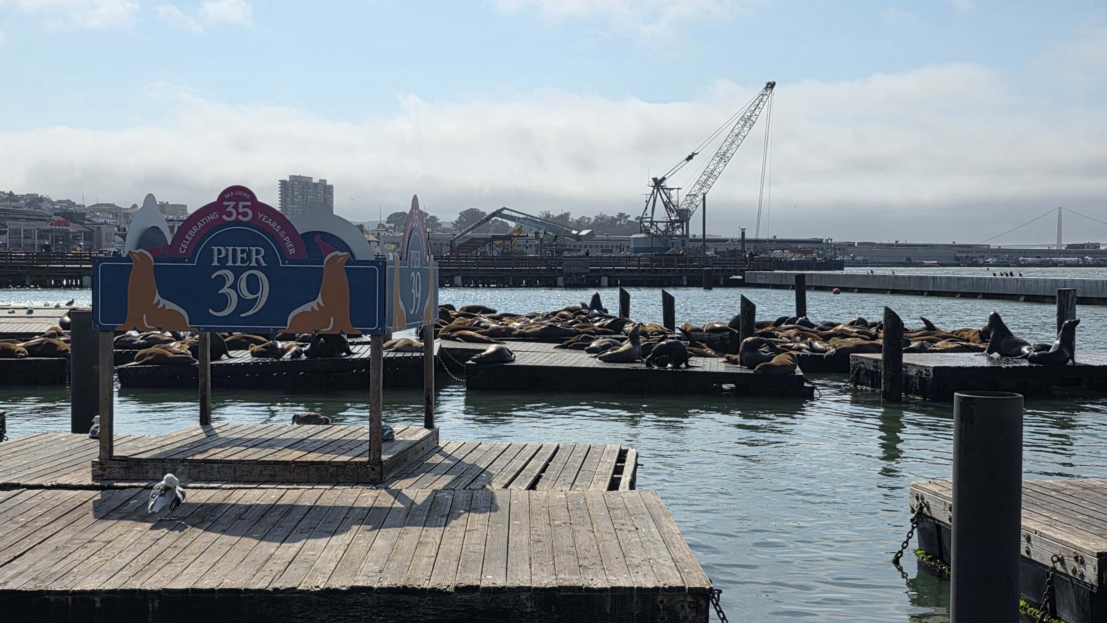
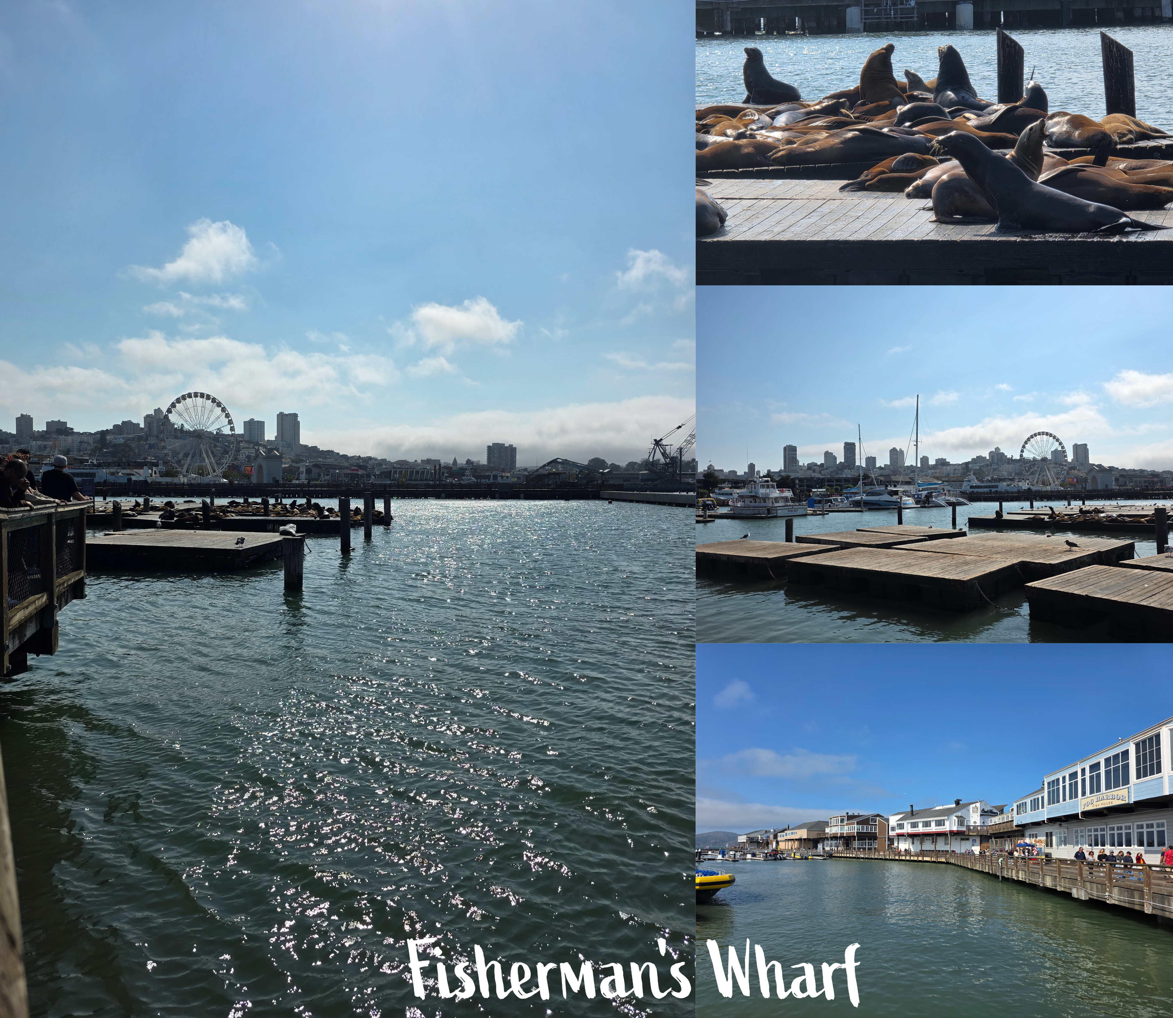
The further I walked, the busier the sidewalk became, and gradually I reached the tourist centre of Fisherman’s Wharf. I took a short walk out through the arcade-style shops and cafés before cutting through to the most important part of the wharf: the sea lions. It was incredibly busy, but I managed to fight my way to the edge of the railing to get a few pictures of the incredibly loud sea lions, as well as the view back towards the city.
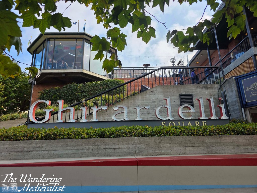
While this is not a place I wanted to spend an enormous amount of time, I felt like I couldn’t miss it, and I am glad I forced myself to brave the crowds. And it was only another ten minutes or so to the real goal of this walk, one of the only places I remembered clearly from my last trip to San Francisco about 30 years ago – Ghirardelli Square.
Sure enough, the sign was very clear from a distance, sitting high up above the red brick industrial buildings so typical of the 19th century. I approached from below, and paused to watch for a minute or two as tourists walked up the rainbow-painted steps to enter the square proper.
I’m not really sure what I expected, but the area was a touch underwhelming, so I made a quick stop at the chocolate shop to pick up some gifts before finding a bus to take me back towards the centre of the city. The whole walk was about 2.5 miles, so I felt like I had earned my dinner.
The following day was my day off, so I arranged to visit Muir Woods, the redwood forest just north of the city, and the other clear memory from the 1990s. I will have to write a separate post about that trip as it was absolutely breath-taking – I definitely recommend making the effort to visit if you are in the area. And, as I learned, you can get a shuttle from the Sausalito area, meaning that you do not have to brave the winding roads yourself.
I tried to get a good picture of the Golden Gate Bridge on my way back, but as it was a beautiful Saturday, all of the parking lots were completely packed. So, I managed only a short stop along Baker Beach to enjoy the coastline. It’s quite stunning here, stark and mostly treeless with hills dropping right into the ocean in a way that reminded me a touch of Scotland.
A wrong turn meant that I was also able to make a quick stop for another view back towards the city, which is stunning in its varying height and skyline. The stop allowed me to turn around, and head (finally) in the right direction after fully confusing my Google maps route.
On Sunday, I attended an event that meant I had one last chance to enjoy the weird and wonderful architecture that San Francisco is known for. (Back when we visited in the 90s, I was planning to be an architect, how times have changed, and I dragged my mother all over the city in search of the areas I wanted to see).
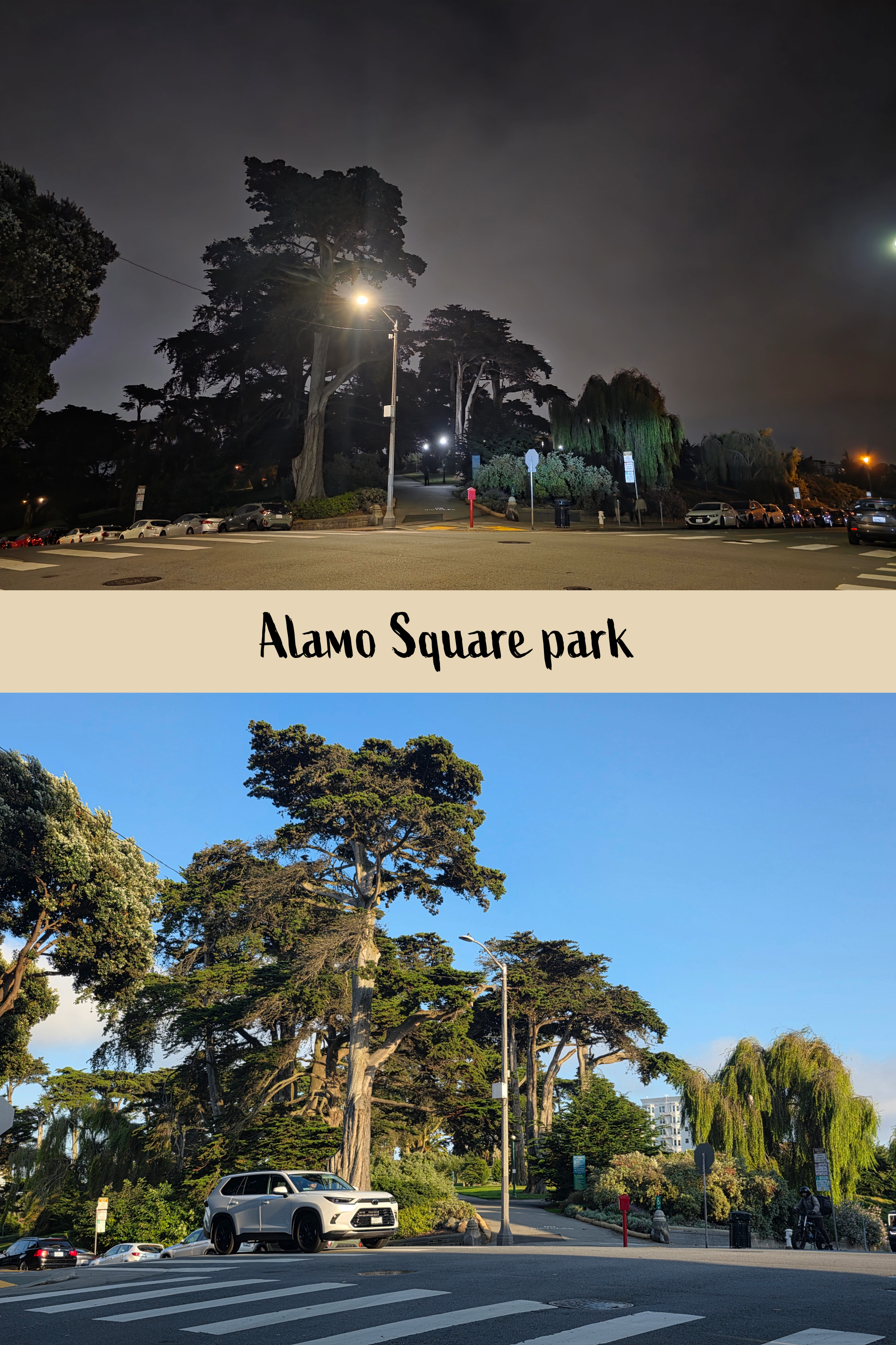
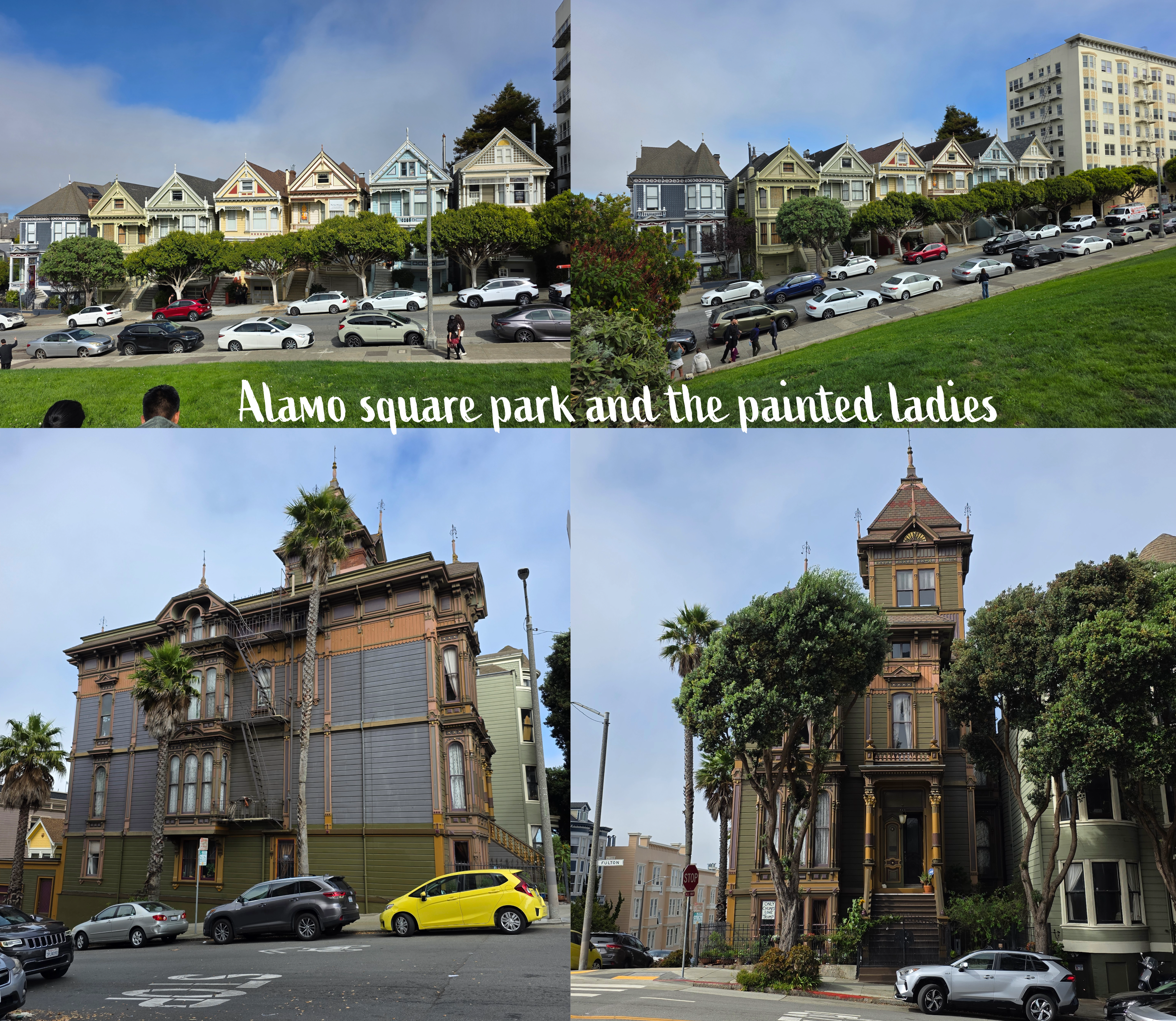
Specifically, I walked up Fulton Street from the University of San Francisco to Alamo Square, which is a lovely park at the peak of a hill with amazing views over the city centre. This was also the location, I knew, of the houses filmed at the start of the credits for Full House, the San Francisco-based TV show I had grown up watching. I could not resist taking a quick look. Fellow Millennials will recognise it, I am sure…
Fog was still sitting over the taller city buildings as I walked through the park, and it struck me as just such a typical San Francisco view. Fulton Street was fascinating, as so many homes have intricate carvings on their fronts and around the windows, and I found myself taking pictures of many of them.
The Bay Area – beyond San Francisco
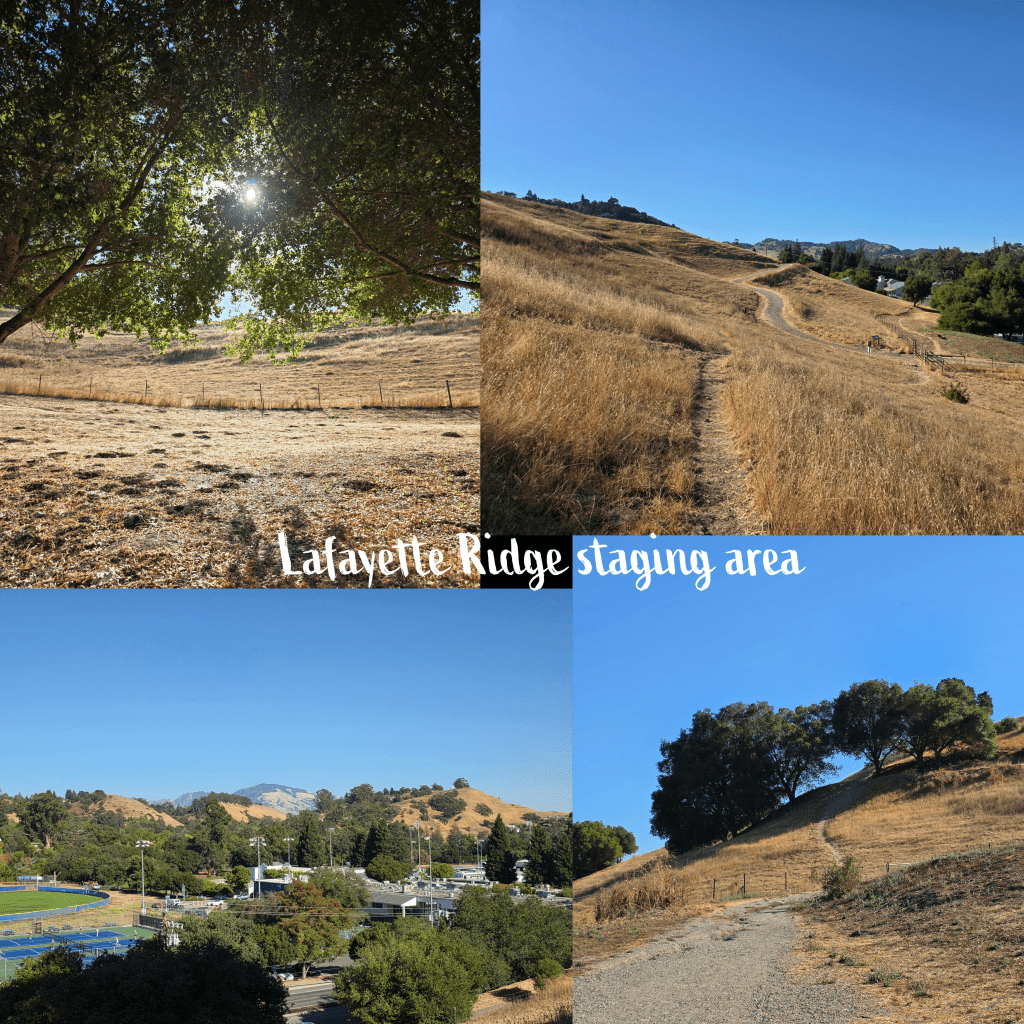
There is plenty more to the Bay Area than just the city itself, of course, and on one of my last nights, I attended an event in Lafayette, which is closer to Berkeley but inland. As usual I was early, and so I pulled in at a local park, where I took a short walk up a hill. A steep, short walk. The mountains here reminded me more of what I saw in Southern California, though there was far more residential spread here.
Not home time yet!
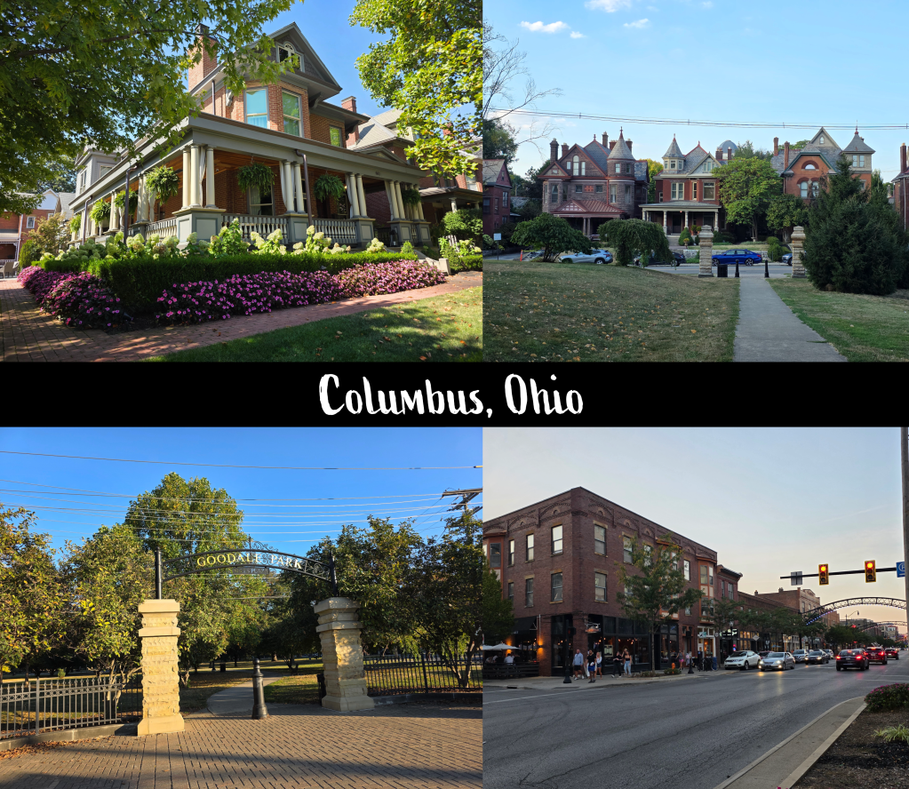
It had been a busy 10 days or so in the Bay Area with more than 700 miles under my belt, but my trip wasn’t quite over. Instead, I was attending a conference in Columbus, Ohio, a city of which I really had no idea what to expect. It turned out to be a really pleasant mid-west city, clean and central with plenty of good restaurants and bars in close proximity to the convention centre. Parks and the residential neighbourhood where we stayed in an Air B&B were easy to walk to, and I can see why it would be a good spot for a large convention.
We also discovered, close by, the North Market, a large industrial space that has been turned into an indoor food market slightly reminiscent of Quincy Market in Boston. However, it was far less expensive and not as busy, meaning that you could take your time in deciding on pasta, salad, Asian food, and bakery items (plus a lot more I am sure that I didn’t see).
Like in Boston, this market offers seats on the upper level, meaning that you can enjoy your meal while looking down at the patrons and shops, which I really enjoyed. Absolutely worth investigating if you are ever in Columbus! As I said, I really didn’t have any expectation of the city but the residential areas reminded me a touch of parts of South Bend, while downtown could have been almost any small city in the US. Pleasantly every-city, very mid-west and just generally a nice place.
Coming home, but not quite…a long layover in Boston
My trip home from Columbus included a long layover in Boston, which I had intended as an opportunity hopefully to see my mum. For various reasons this did not come to pass, but I enjoyed my flight in on a beautiful clear morning, and because I had more than enough time, I took the elevator to the top of the airport parking structure to take in the view of the city. It was emotionally hard to be so close and not have a chance to explore or visit home, but it still felt good to be in Boston, even briefly. The international terminal was nice and quiet during the day, so I was able to get some work done and enjoy some peace after three days of conference busy-ness.
Coming home, but really this time.
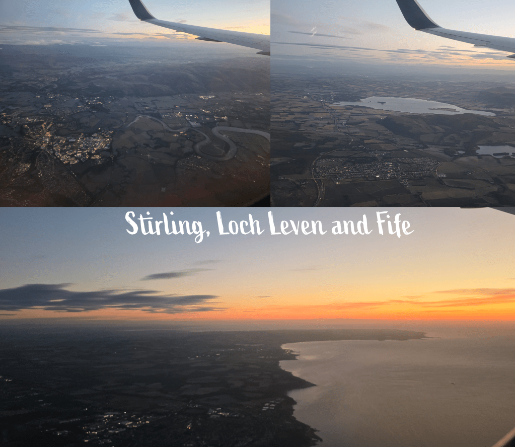
My flight from Boston to Edinburgh was delightfully quiet, or at least it was at the back of the plane where I was sitting – I in fact managed two seats to myself, which were unfortunately just a touch too small to allow me to properly spread out and sleep. I find the night flights hard anyway, as we landed in Edinburgh around the time I would be looking to go to sleep, so could not make myself doze off before. I tried, but no luck – instead I watched a few old movies and was awake to realise, about 30 minutes out, that we were flying towards the rising sun. For the third time, I had a fantastic view from the window seat as the plane approached Edinburgh from the west, passing the city of Stirling (it’s impossible not to recognise that dramatic bend in the river), then Loch Leven (the castle is just a bit too small to see), and finally the coastline of Fife.
It was a very pleasant welcome home!
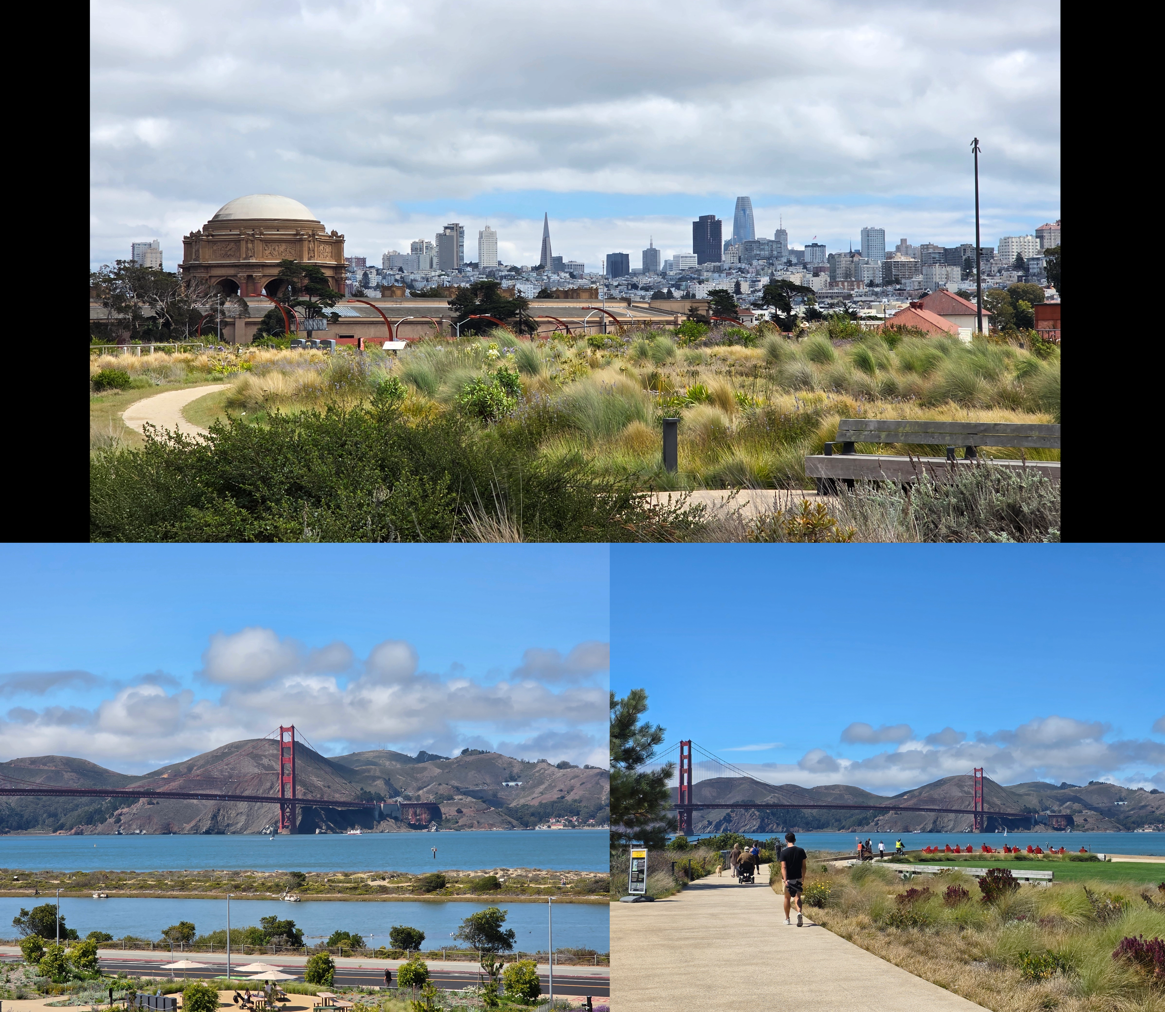
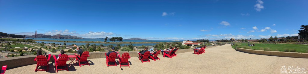
I’ll leave you with two last images of San Francisco, one the panoramic view taken from the Presidio park, and the other this view of the Waymo taxis that were quite frequent. No, I did not take one, though for a Scotland-based girl, even the multiple Uber Teslas were an adventure of their own.
Overall a very busy month, and a time to explore two parts of the US I had never seen, or not as an adult. I felt I only scratched the very surface of San Fransisco but I know I am likely to be back; it is a quirky, funky city that is like few others. It tumbles over hills that in snow-based climates could not be built on in the same way, and offers a different fascinating view every time you turn a corner or cross a street. I look forward to my next visit!
As for October, it will be another busy month, and I imagine it will be one for the record books in terms of miles driven, but I am excited to see where more new cities will take me. I’ll be sure to keep you updated, when I can find some spare moments…
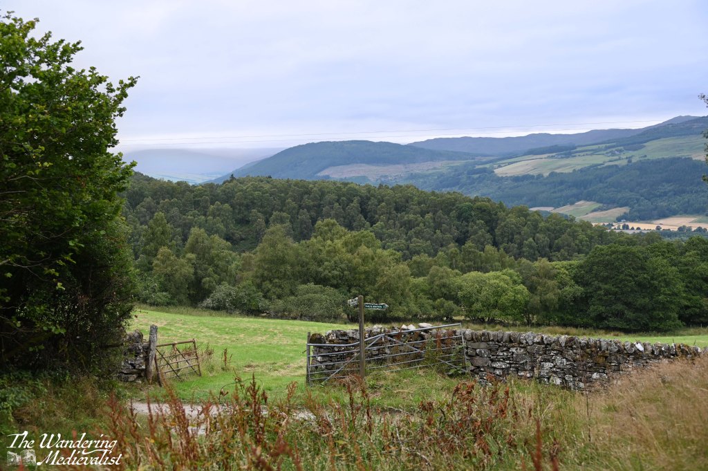
As I have written about before about my affection for the area around Aberfeldy and Kenmore, and so it will come as no surprise that, during an unexpected long weekend, we decided to book two nights at Moness Resort just above Aberfeldy. We didn’t plan much, but discovered the Dùn Hill walk as an option that looked ideal for our purposes – not too long, and in walking distance from our accommodation. Though the weather was a bit disappointing – overcast for the whole day – it was not actually wet, and so after a full Scottish breakfast (well almost full, I skipped the black pudding, but still a requirement when eating breakfast away from home), we headed out.
For those familiar with Aberfeldy, the Dùn Hill is above the Birks walk, and starts by heading up a farm track between some trees and a field full of sheep. ‘Up’ is a good word to use, as ‘up’ was very much the theme of the walk; while not particularly long – 3 miles round trip – this path is a pretty constant uphill, and at times quite steep. We had not intended on vigorous exercise (as the other half reminded me several times), but we pushed on in any case.
As with many walks we do in Scotland, we were using a page from Walkhighlands to guide us on the way, and while I generally find their route maps to be very useful, the instructions are on occasion a bit vague. Fortunately, there is really only one option for this walk.
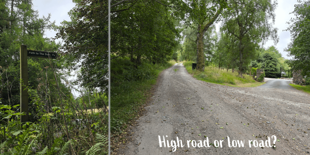
The road climbs steadily and winds around to the right in time, offering what appears to be a choice to be made between a higher and lower road. In fact, the low road is a private drive, leading to an impressive large house and outbuildings.
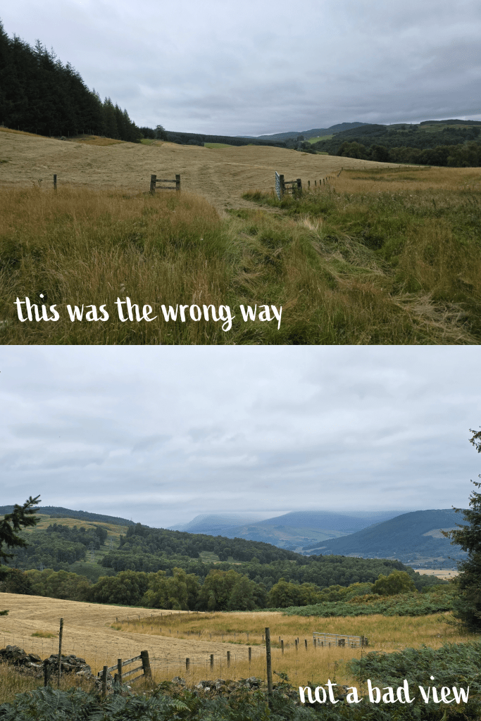
Passing this fork, the trail opens up so that the views over the fields and hills are visible – at least climbing quickly means the vistas are also fast to appear! Unfortunately our view was marred slightly by the weather, meaning that pictures do not tend to show the glory of the area.
Perhaps five minutes beyond the fork, walkers tired of a dirt road and having to look out for the infrequent traffic will be delighted to notice a sign pointing up the hill. This is roughly the half-way point of the walk.
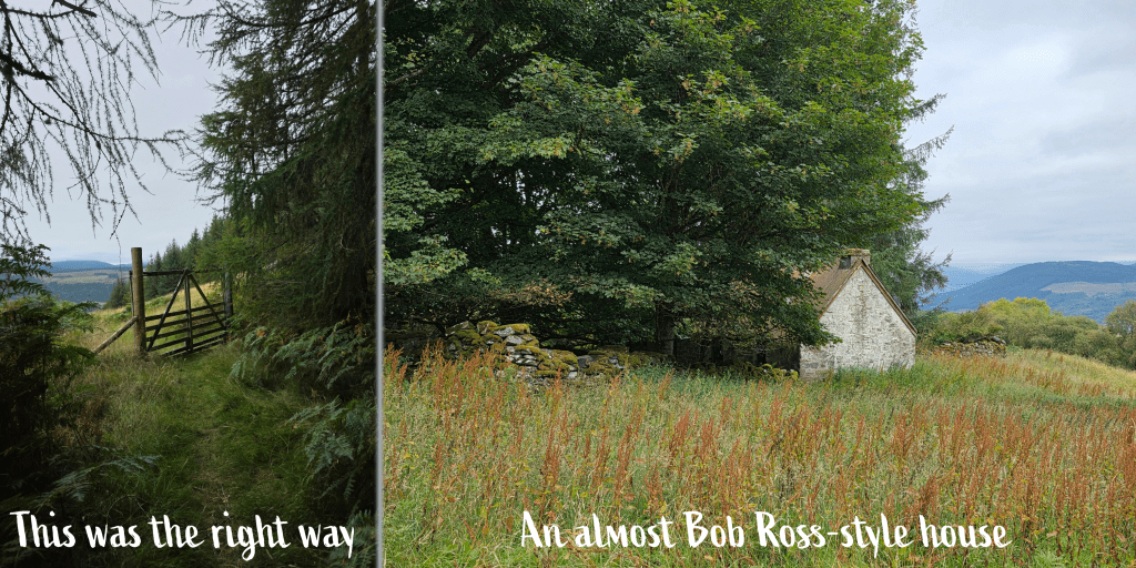
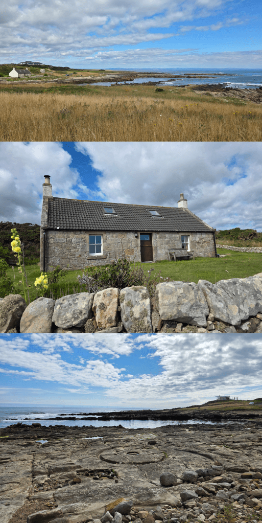
From here, the path becomes a bit more typical for mountain walking – alternately rocky, grassy, and climbing through fields and trees. In relatively little time, the shape of an abandoned white cottage appears, nestled amongst some trees and with a walled yard. Almost covered by the foliage, this house reminded me a touch of something Bob Ross would paint – an abandoned spot in the woods, mostly overgrown (see below). But with a great view over the town.
This was where we got a bit lost, as while our instructions said ‘go through a forest gate’, we could not immediately see the way to the gate. So, we thought perhaps it was a bit further along the meadow, and that is the way we headed.
It was uneven, with deep grass and rough to walk on, no markings or discernible gates in the distance. After a few minutes of trudging along, we realised that there was a dog walker behind us who could only have come through the gate we had seen. Clearly, we had gone the wrong way. While the view from the meadow was pleasant, it was not going to take us where we wanted to go.
So, we retraced our steps and discovered, mostly covered by high weeds, a sign pointing towards the gate. The faintest remnants of a trail was evident, and so we bivouacked towards the gate, passed through and discovered a narrow forest path – clearly the correct way.
The forest path was pleasant, winding through pines and larch (I think?), and the dry summer plaguing Scotland was a touch less evident here. Yes, it has been a very dry summer – Fife is at near drought conditions as is a large portion of the UK. The gorgeous weather I have experienced while hiking the Fife Coastal Path was unfortunately not good for the overall health of the countryside. Rain is very much in need! Despite all stereotypes of Scotland…
This is the kind of hiking trail I love the most – well-kept and easy to follow, winding through forests that smell like the pine I used to play under when I was young. Occasionally there would be a break in the trees where a hillside meadow met the tree line, but we saw no one else and very little sign of civilisation for most of the remainder of the climb.
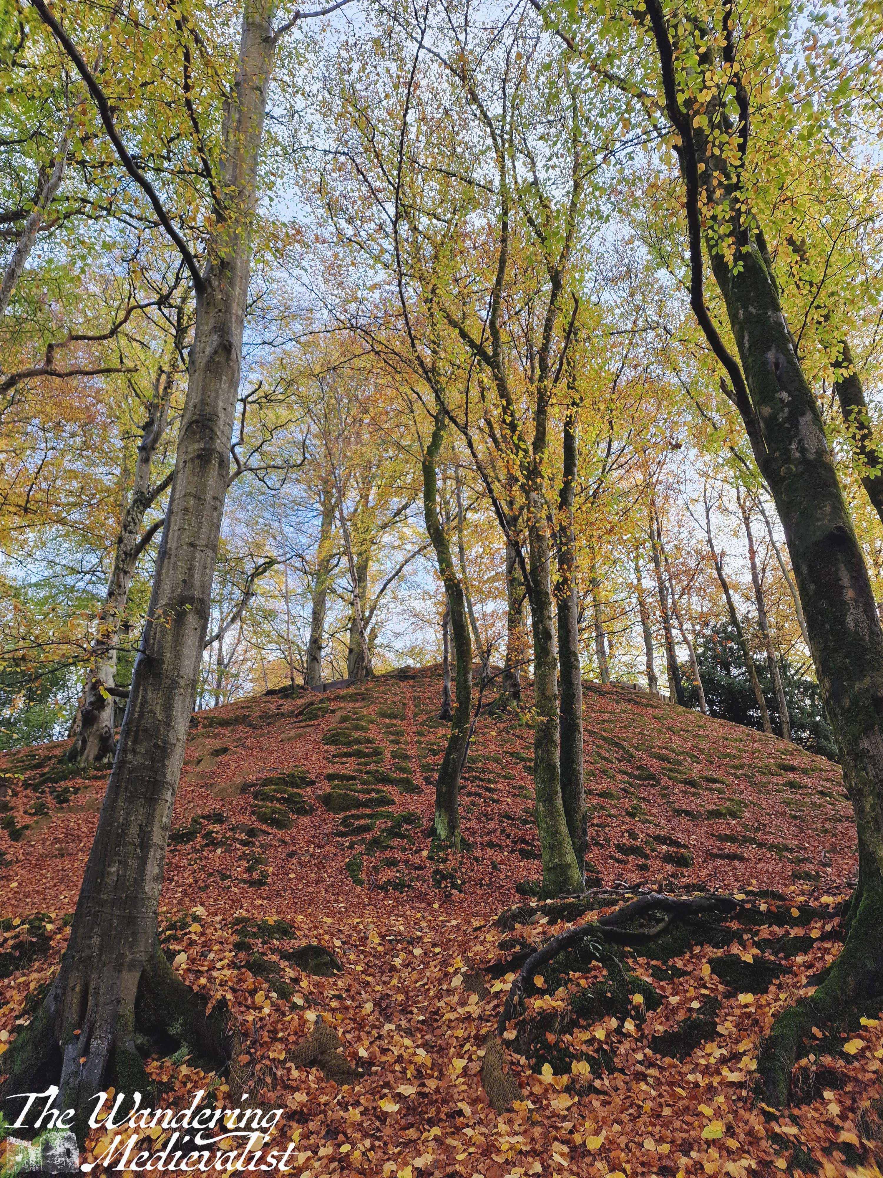
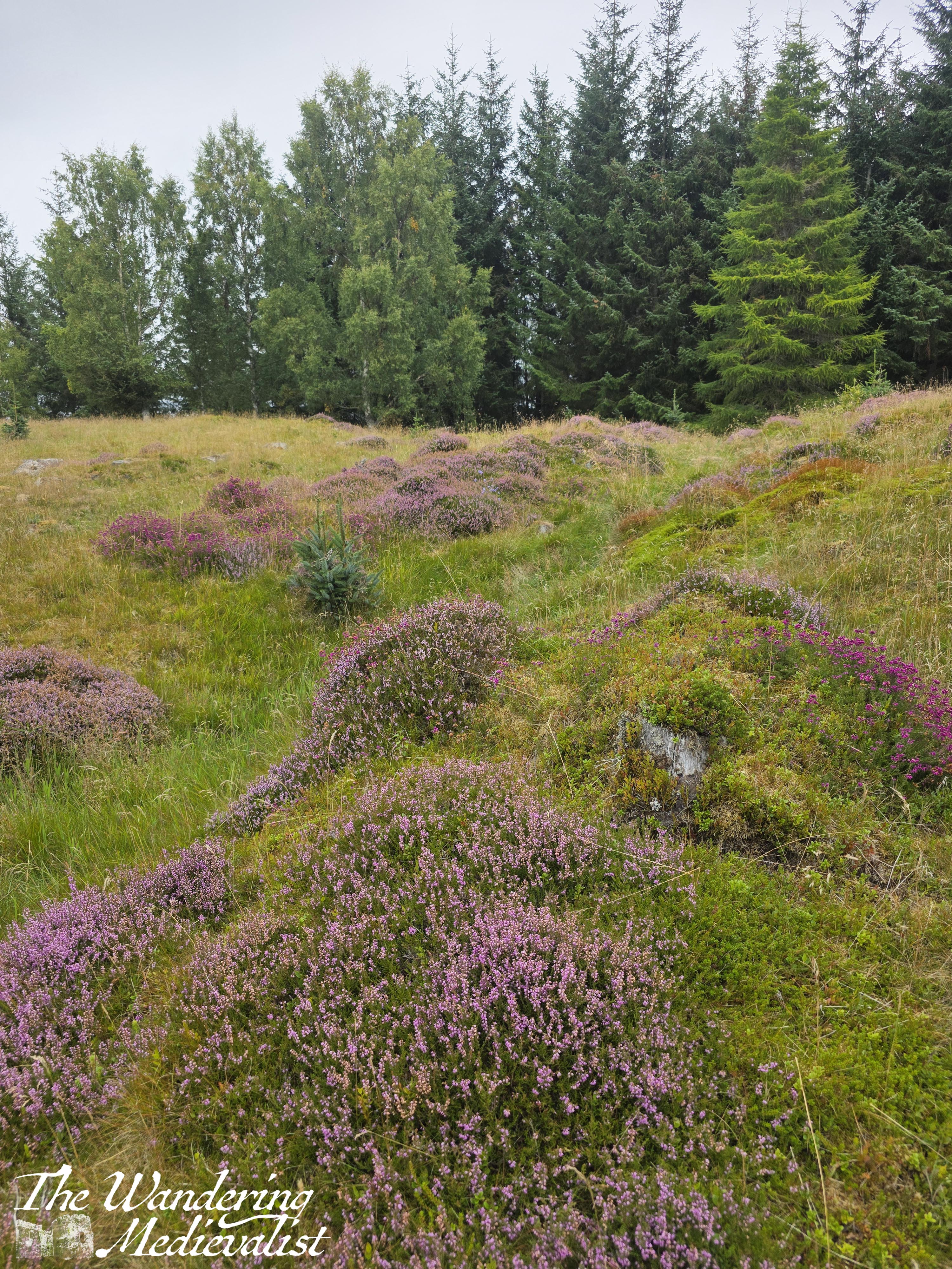
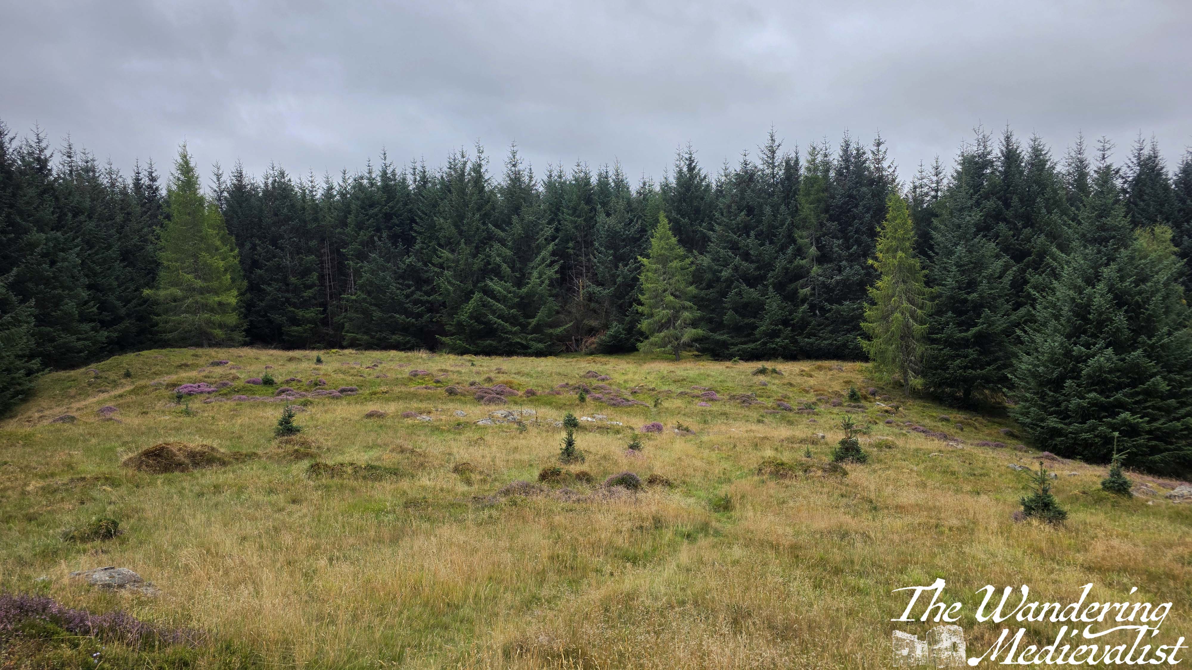
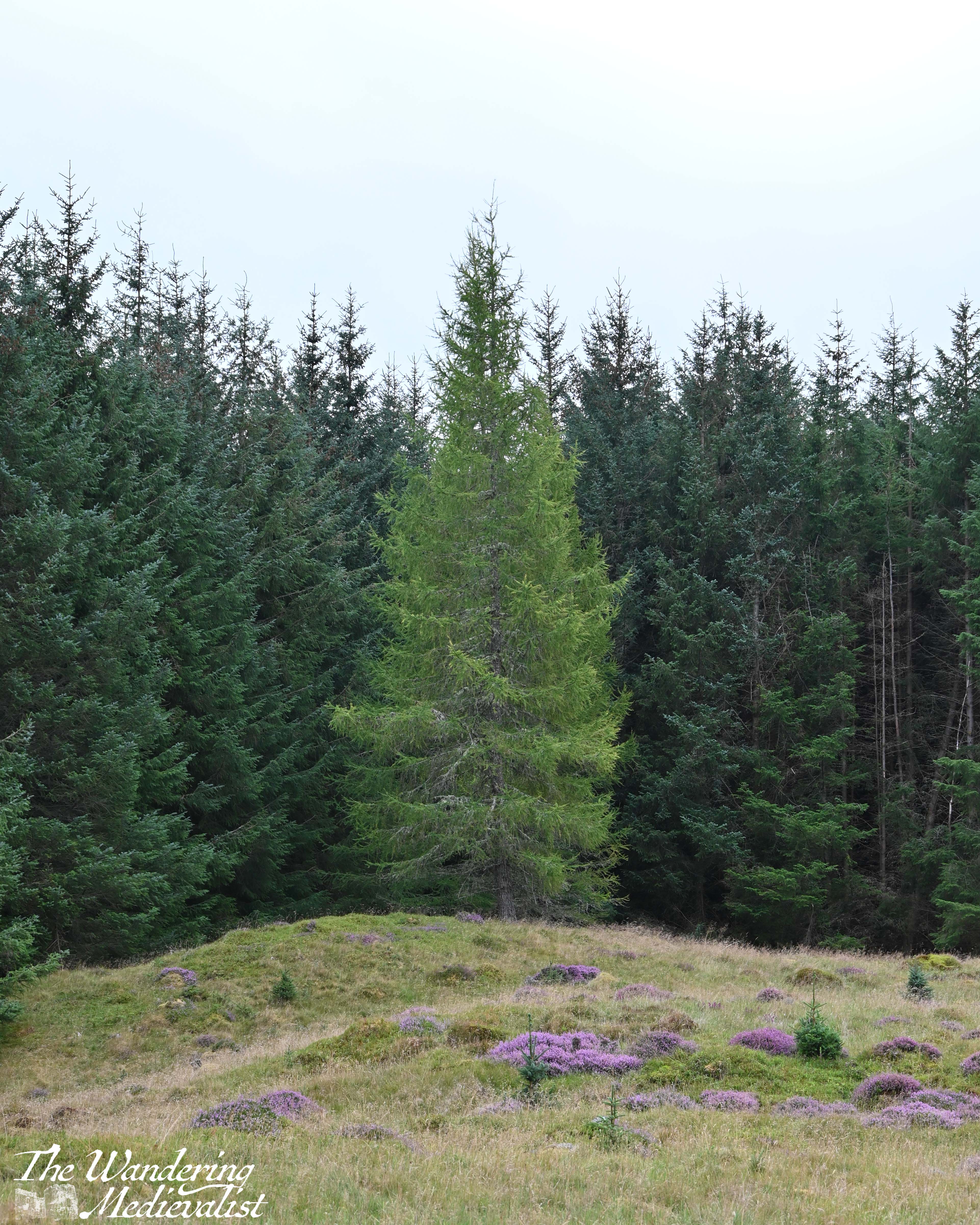
Then, suddenly, there were signs that up ahead the trees were thinning, and we reached the clearing at the top of the hill – wide open, grassy, with large patches of beautiful purple heather.
While it is not really visible to untrained eyes like ours, this clearing is the remnant of an Iron Age hill fort, the Dùn. Scientific equipment and archaeologists can identify the rings and gaps where entrances may have been, but for us it was just a lovely peaceful clearing where we could sit for a while, have a snack and some water, and enjoy the quiet. Well, quiet except for a sheep in a nearby field that was baa-ing with a gusto.
The views were unfortunately marred by the low cloud that made the distance hazy, but there was enough of a vista to make one imagine how impressive it could be on a clear, sunny day.
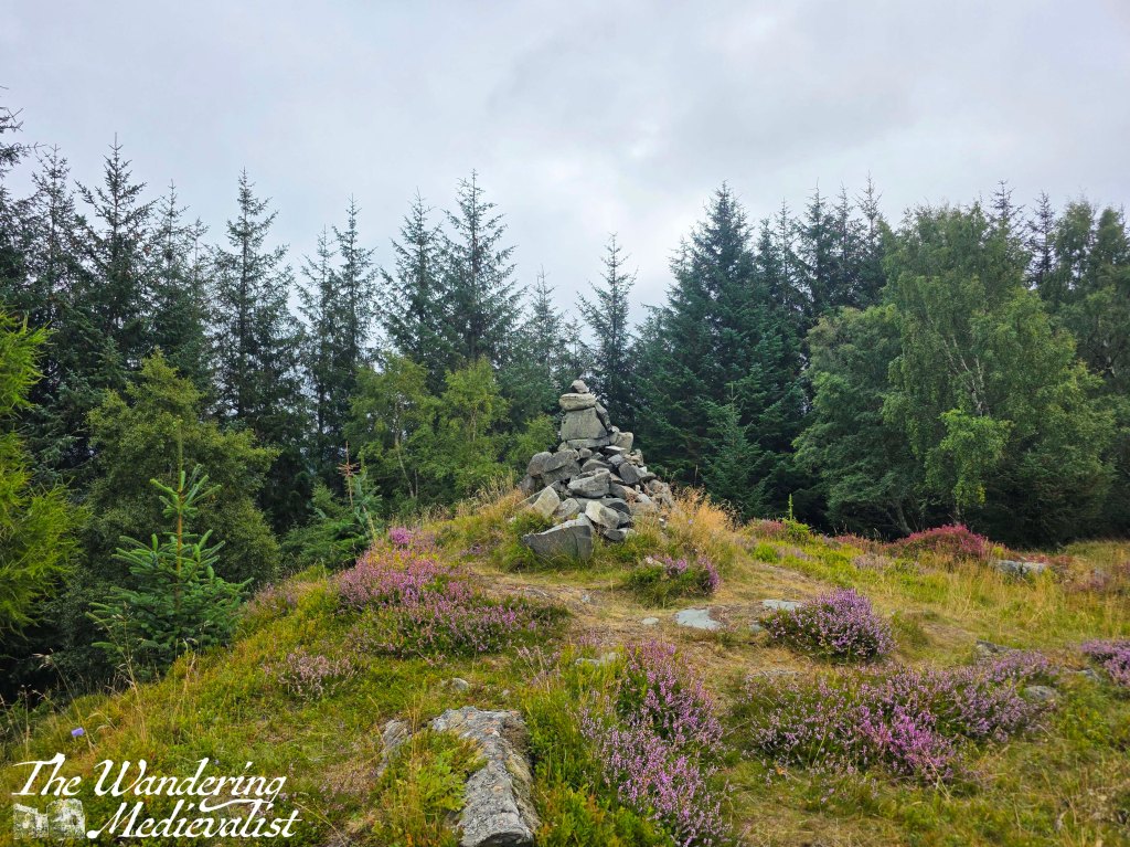
And of course, there is a rock cairn marking the top of the hill; I realise how fortunate we were to be hiking at a time when the heather was in bloom, as it really did add some spectacular colour to an otherwise mostly grey and green landscape. I could have sat quite happily for hours watching the bees, enjoying the many different shades of purple from a soft lavender to bright almost fluorescent magenta – I also found myself humming ‘Heather on the Hill’ from Brigadoon, and had it stuck in my head for hours after.
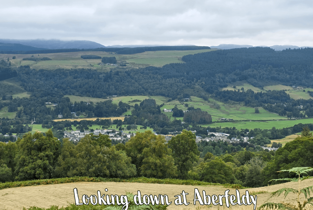
However, despite a hearty breakfast and a few hiking snacks, we hadn’t really provisioned ourselves for a long time away, and so we eventually headed back to the break in the trees and began the meander back down towards Aberfeldy. We have reached that age – as I am sure I have mentioned – where down can be harder than up, and this was definitely the case once we left the forest path and re-joined the road. Small pebbles and stones combined with dust made for a slippery descent, and almost as slow as the climb. But, we did enjoy the views a bit more heading down and I can see how this could be even more lovely with autumn colours.
While not a particularly long walk, like its sister walk at the Birks of Aberfeldy, the Dùn hill is unexpectedly steep and requires a bit more stamina than originally expected. One review of the walk did mention this, though one we did not read until later; as the other half pointed out, it is worth observing how far a walk ascends in height to make sure you are prepared for the climb. We weren’t, but we made up for it with an excellent dinner that evening at a relatively new place in Aberfeldy, the Inti lounge. Fortunately, we had reserved a table as it was packed by 6.30pm – food and drink all fantastic! In particular, the best whisky peppercorn sauce we had ever had (and this from the other half who is serious about his peppercorn sauce) and a delicious play on a traditional cocktail, the Highland Iced Tea, made with whisky and Irn Bru.
I would definitely be up for trying this walk again in better weather, but also forewarned about the climb. There are plenty of walks up mountains and hills in the area that are not quite so steep, and take a longer trail up that allow for a bit of flat along with the up. Nonetheless, this is a lovely peaceful walk in the woods and an equally serene, history-filled clearing at the top – and perfect if you are staying in Aberfeldy and do not want to drive!
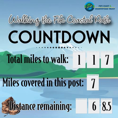
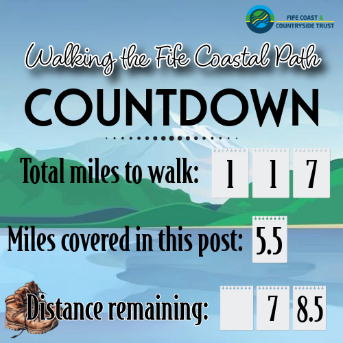
Whew, this was a long one. I knew it would be, and I was excited to give it a go, but I think I mis-calculated the mileage. Nonetheless, I managed, and it was a good challenge for me as well as a nice stretch of the coast.
The morning started with some overcast and the hopeful promise of blue sky by the middle of the day.
My starting point was Aberdour, famous for its castle which I have visited in the past, but chose not to stop on this occasion due to the clouds. It is definitely on the list for a re-visit soon.
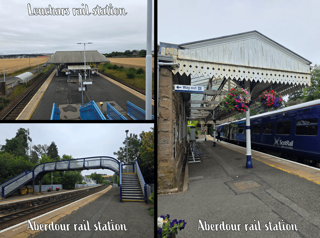
Aberdour is best reached by train, from the north requiring a short stop in Kirkcaldy on the way; I boarded in Leuchars and it was an easy, quiet trip. The station in Aberdour is beautiful – Victorian, with decorative metal scroll work and beds of flowers in and around the building.
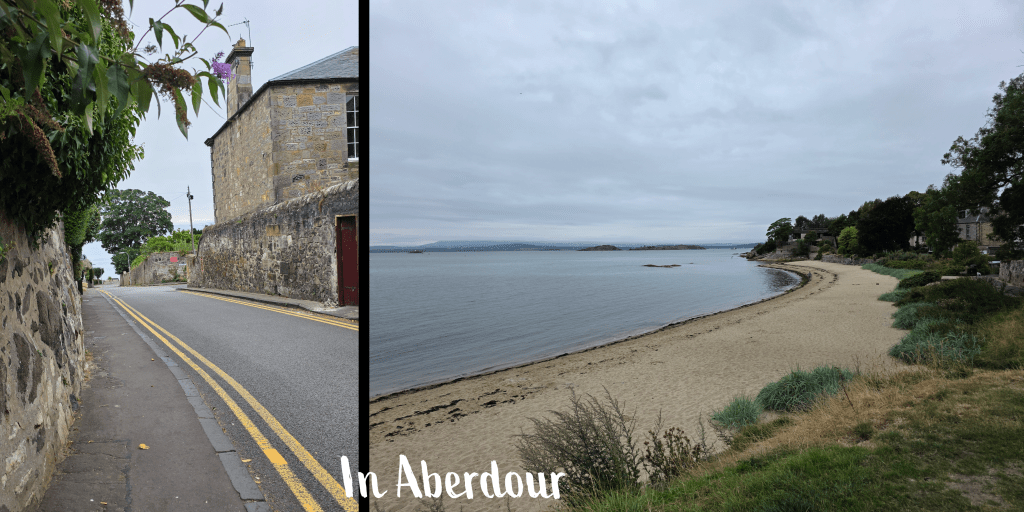
From the station I headed through the car park to the main road, where there was a short half block before a turn down Shore Road. I counted the start of my walk from this intersection, where I officially re-joined the path.
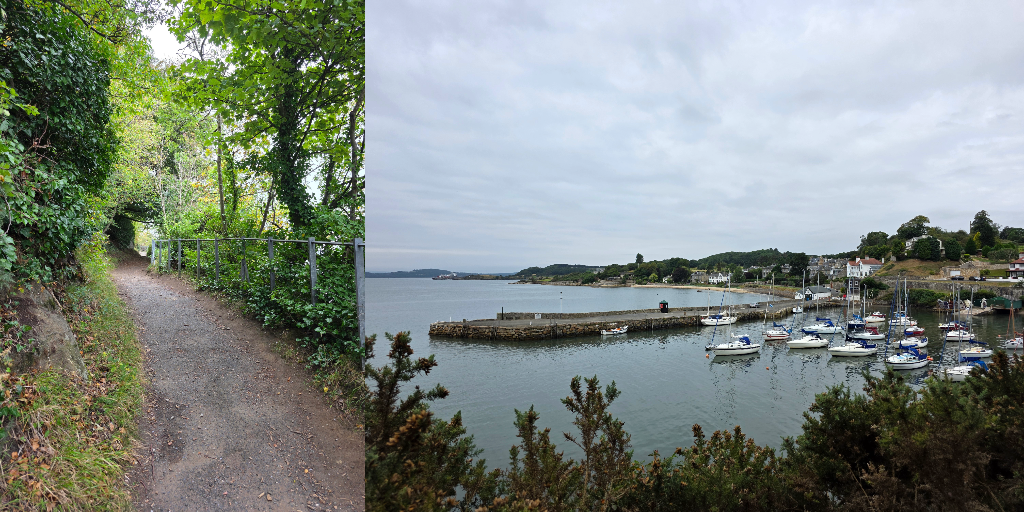
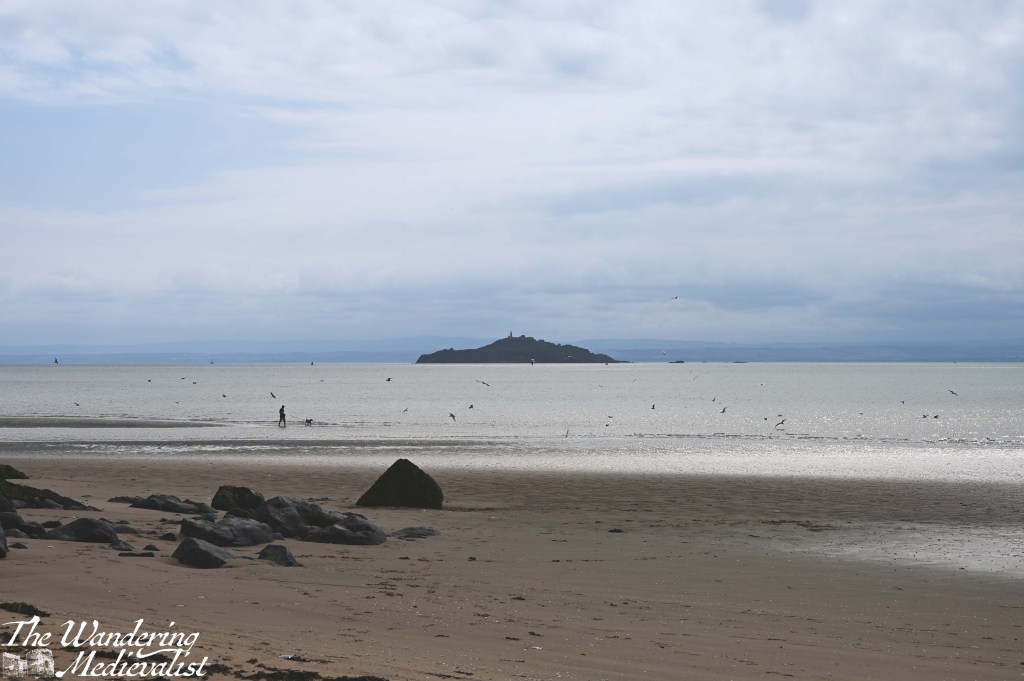
Shore Road runs down towards the water, passing some shops, a park, and large well-appointed houses with rocky gardens. In little time, it is clear you are descending a hill, and at the waterfront where there is a seating area and a beach off the the right. To the left is the harbour, and ahead of you in the Firth of Forth is just visible the outline of Inchcolm Abbey. Once the sun came out, I was able to get a good shot of the island.
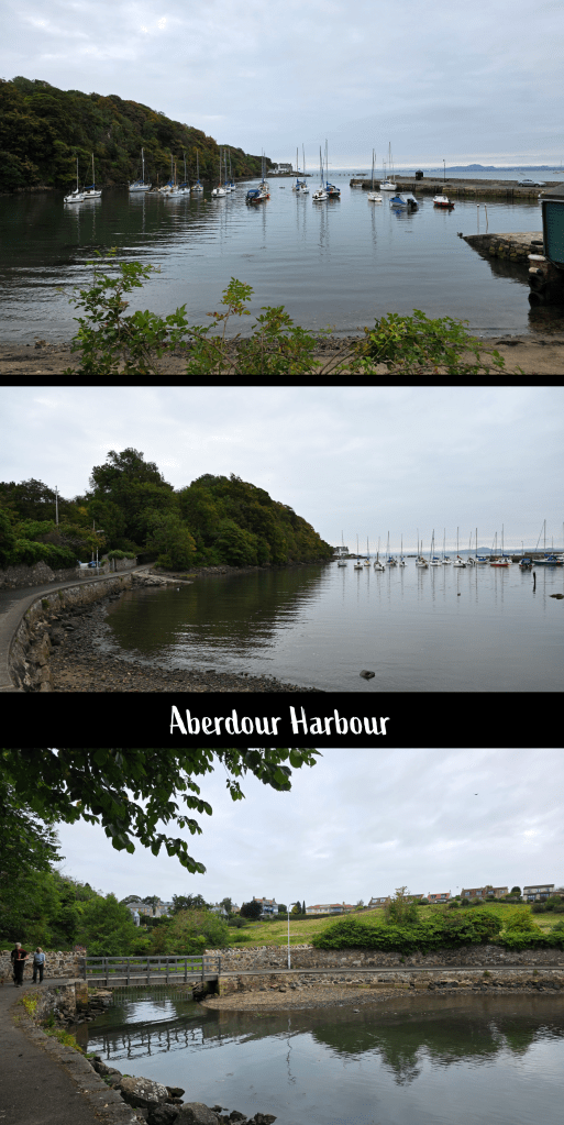
From here, the path leads towards the harbour, and just as the road turns into wharf, there is a sign directing walkers to the left. The harbour is small but with plenty of sailing vessels – less fishing, more pleasure boating here it seems – and sheltered by a headland. As the path loops around the harbour it crosses a burn that has cut through two sloping fields. I knew that at the top of the hill was the castle, but it hidden from view.
Beyond the harbour, the path climbs a bit as it continues around the coast, with occasional breaks in the trees for views back towards the village or out to Inchcolm.
It was an odd weather day, not sunny but nonetheless quite warm and a bit sticky. My cardigan, needed for the train and early part of my trip, did not last long.
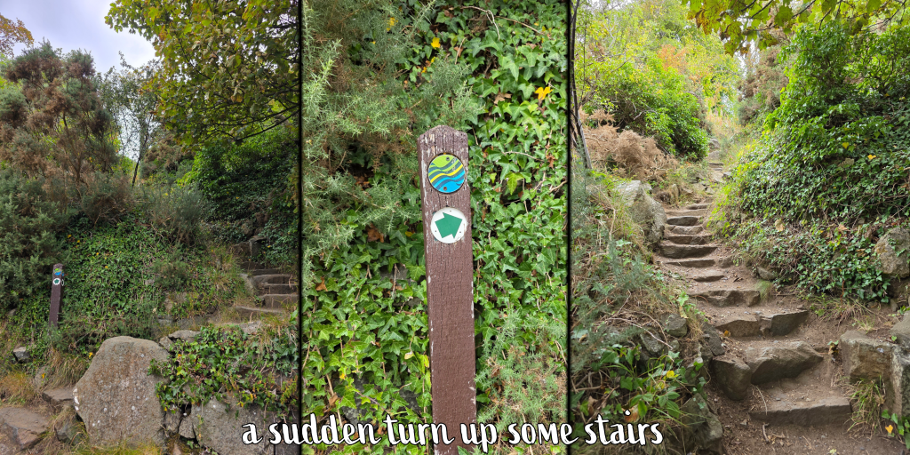
After perhaps five minutes, some houses appear through the trees, but be aware that the Coastal Path does not follow the road here, instead taking a sharp left up some stone steps.
As the trail winds through the trees there are a few small footpaths leading off into the distance, but if you maintain your course relatively straight, you will eventually reach a hilltop meadow.
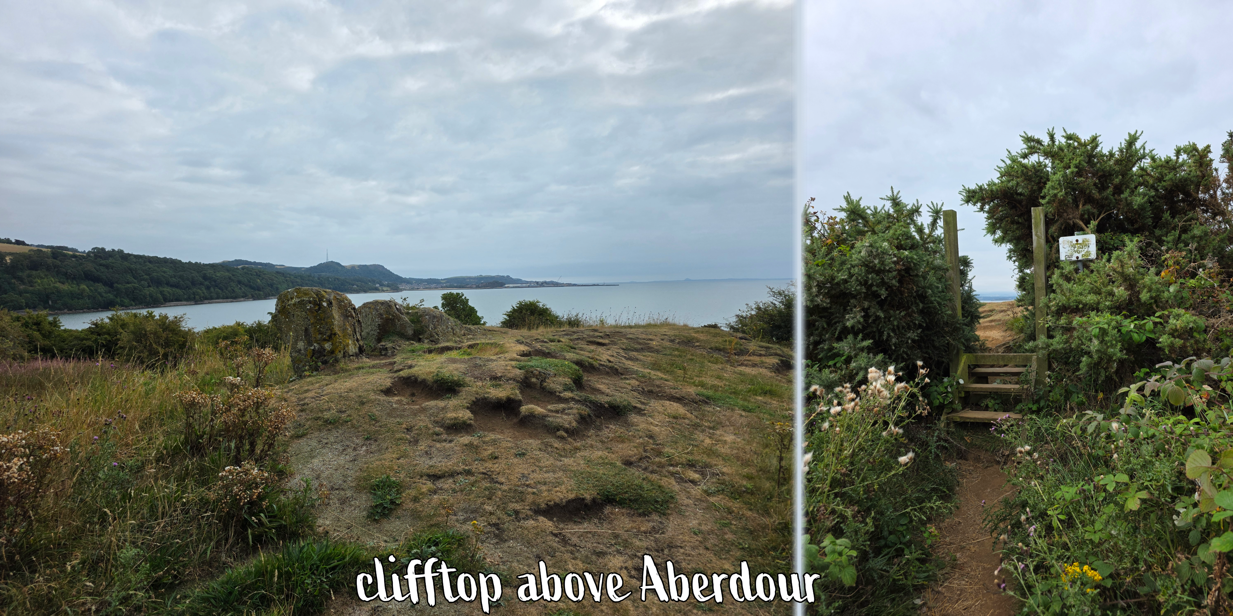
It was just about at my arrival at the hilltop that the sun began to win its battle with the clouds, peeking through a few gaps, though clouds over Edinburgh and south still looked threatening. I was also delighted to discover what seemed to be a set of small standing stones, and a gate that led to the top of the cliffs that overlook Aberdour. The edge is sharp and not fenced at all, so there are plenty of warning signs – it is a dramatic spot looking over the water, along the coast, and to the distant Forth bridges. I learned later that this is Hawkcraig Point, once home to a Royal Naval Submarine research base, though there is very little remaining except for a lighthouse.
Once I had taken my fill of the view, I headed down the hill towards the narrow road which must have been constructed to reach the point. At the time it was being used by some very keen fishermen.
The road passes through a large parking area designated for caravans (unlike many car parks), which was incredibly busy. More than a few dogs were sitting outside in front of their temporary homes, watching me closely as I passed, and occasionally looking up at the regular outgoing planes from Edinburgh airport – clearly we were on the flight path that day.
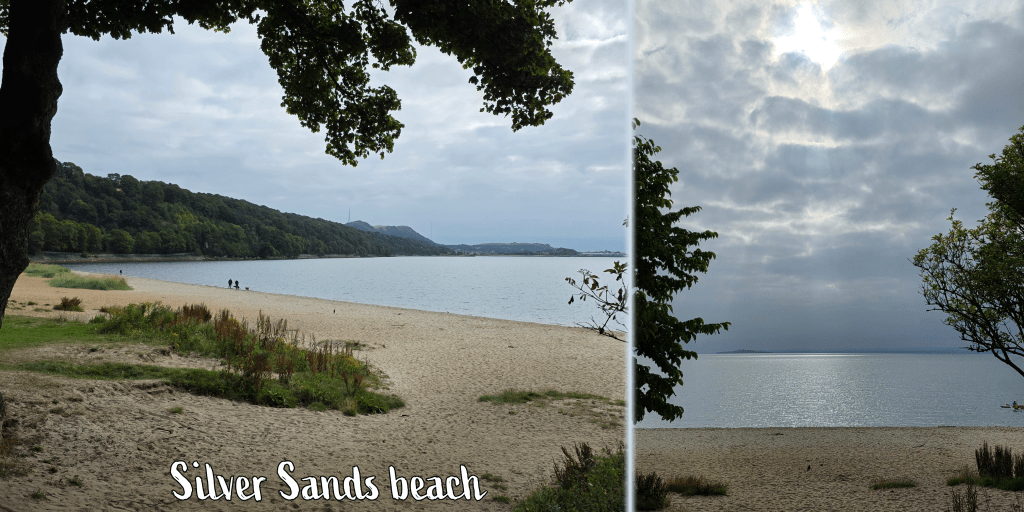
Soon I reached Silver Sands beach, which was already growing busy. Like many beach areas in Fife, it is well-kept with a good car park, some playground equipment, and a cafe that had not quite opened yet, much to my disappointment. I could have done with another coffee.
At the far end of the beach, the path disappears into the woodland with a well-kept trail that is either paved or packed dirt and close to the edge of the water. Below you is a rocky shoreline with sea birds, and I paused for a short while to watch a pair of cormorants (or that’s what they looked like anyway) doing some breakfast fishing.
Inchcolm Abbey in the Firth of Forth
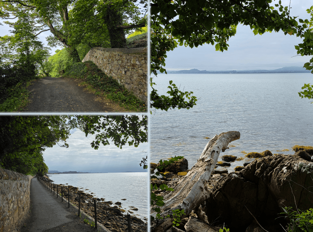
In a short time, the left-hand side of the trail becomes a long stone wall, an old estate wall, which follows the path as it rises and falls over some gentle hills. This was a popular stretch with runners, as it was mostly paved, and required a bit less attention to your feet.
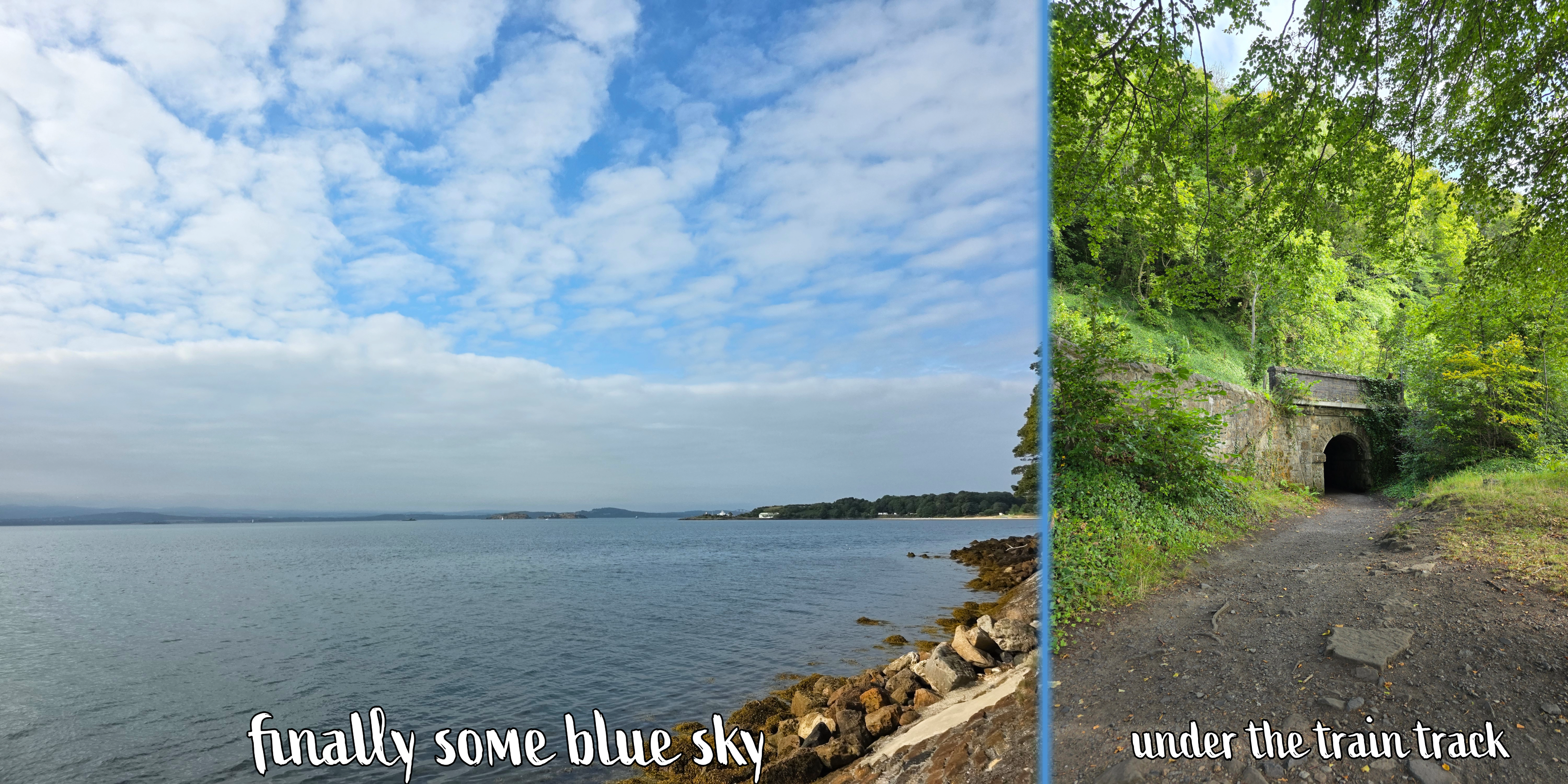
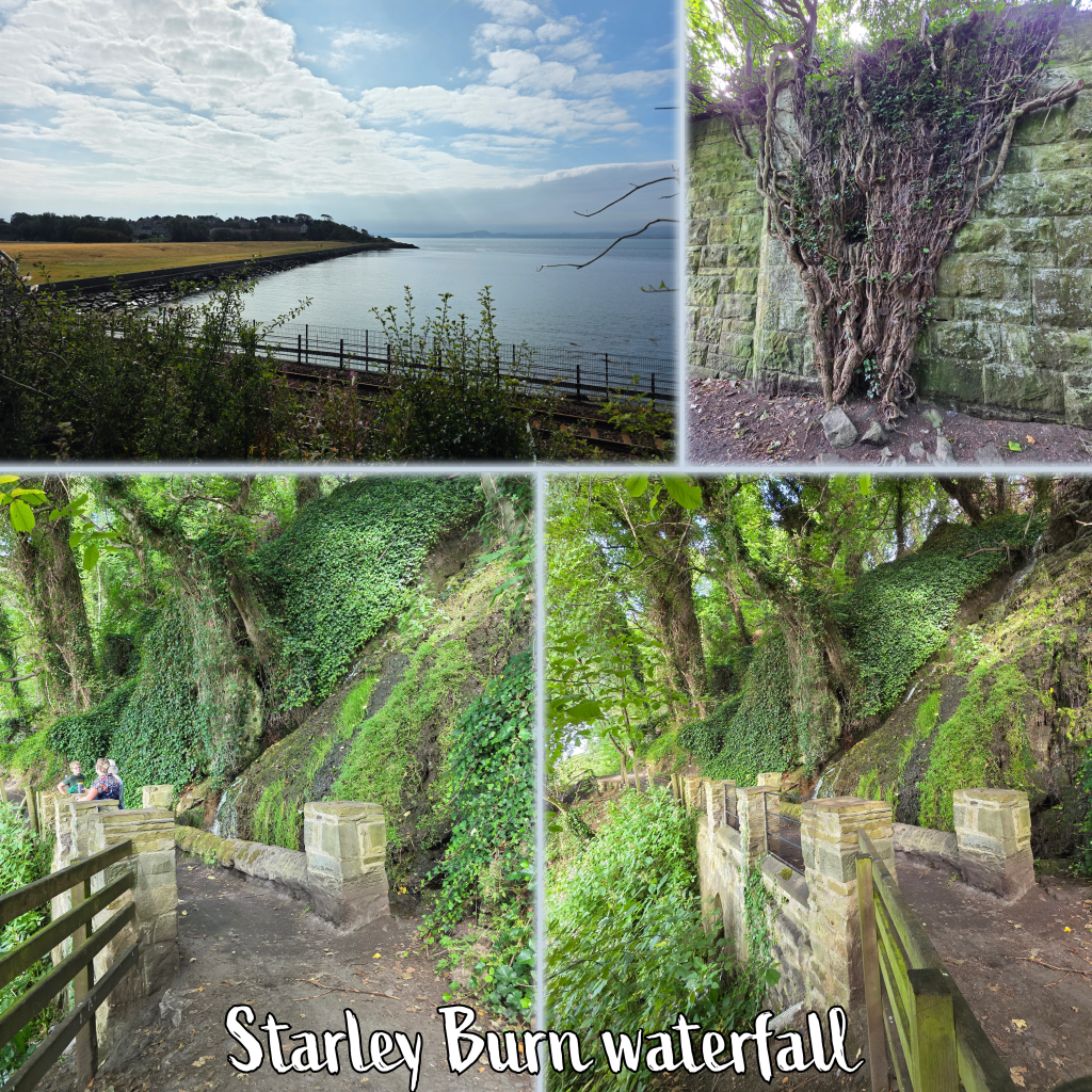
About half-way between Aberdour and Burntisland, the route passes under the rail line through a stone tunnel. This is a busy stretch of track with quite regular traffic, and it is a section I have always loved when on the train as the views across the Forth are superb.
Just outside of the edge of Burntisland, the path crosses Starley Burn over a lovely pedestrian bridge. There is a waterfall above which falls about 12 – 15 feet, and the lime-rich water causes a thick coating on the rocks. It’s a nice peaceful spot in a glen, good for a short break should you need one.
Soon after crossing the burn, the path jogs left inland a bit, and narrows between the train on one side, and a stone wall on the other, with fields up to the left. By this time the day had warmed up nicely, with no wind and only a breath of breeze, so the section here was quite warm, away from the water.
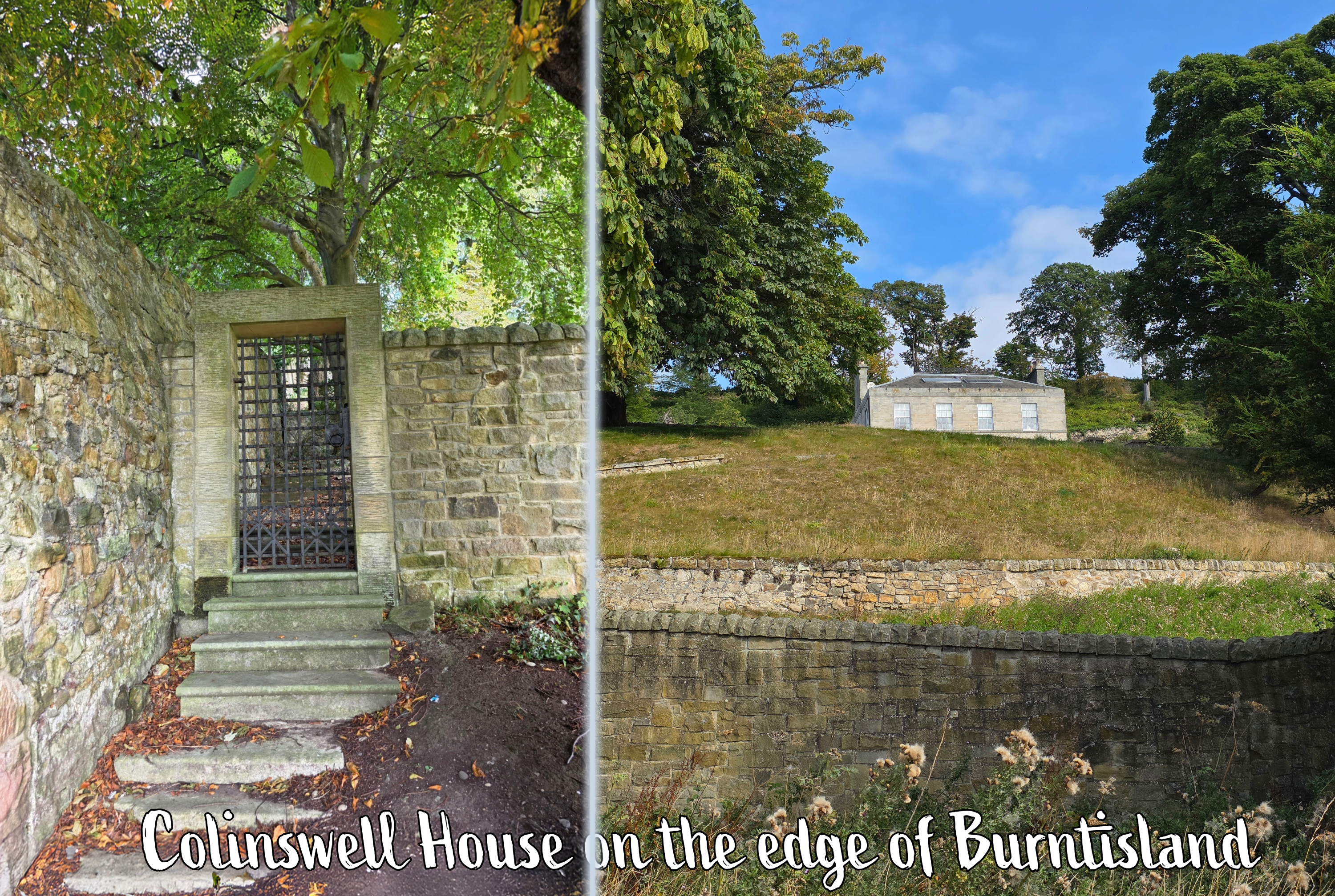
Approaching the edge of Burntisland, the route passes a lovely old estate which reminded me of something out of a Jane Austen movie, including a metal gate in the estate wall – Colinswell House, I learned upon searching. Shortly beyond is Burntisland proper, and the path leads along the edge of a very nice neighbourhood of relatively new homes.
There is an option to pass under the track but don’t be tempted, as the route continues straight before beginning to wind through a nice park. It was well-kept with cut grass, oak and silver birch trees, and a small burn down below between the park and the residential area.
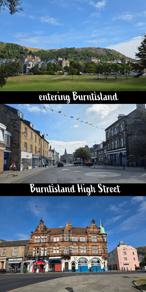
About a half-mile beyond the edge of the town, the route passes into an open park with a view of houses and the hill behind. At the edge of the park turn right up the hill on Kirkton Road. Descending the other side takes you past a few apartment blocks, though these disappear quickly when at the bottom you turn left on to the High Street (not East Broomfield Road, which you reach first). Follow the High Street, which is lined with shops and pubs, quite pleasantly not too many chains but instead local places that seemed quite popular – particularly the butcher and the bakery.
Just before the High Street runs into the Links there is a Co-op food store, a great place to grab a drink or snack if you need it. Across the road at the edge of the Links is also a public toilet – not the fanciest toilet in the world, but it was the first one I had passed that was open. Beyond, I could see the large trucks and brightly-coloured tents and rides of the Burntisland Fair, which takes place over the summer. I caught a few glimpses as I followed the edge of the grass up Links Place and then turned left along Lammerlaws Rd. There is an odd mix here of quite old pubs and buildings that show the age of the town, and much newer additions as well as the bright colours of the fair.
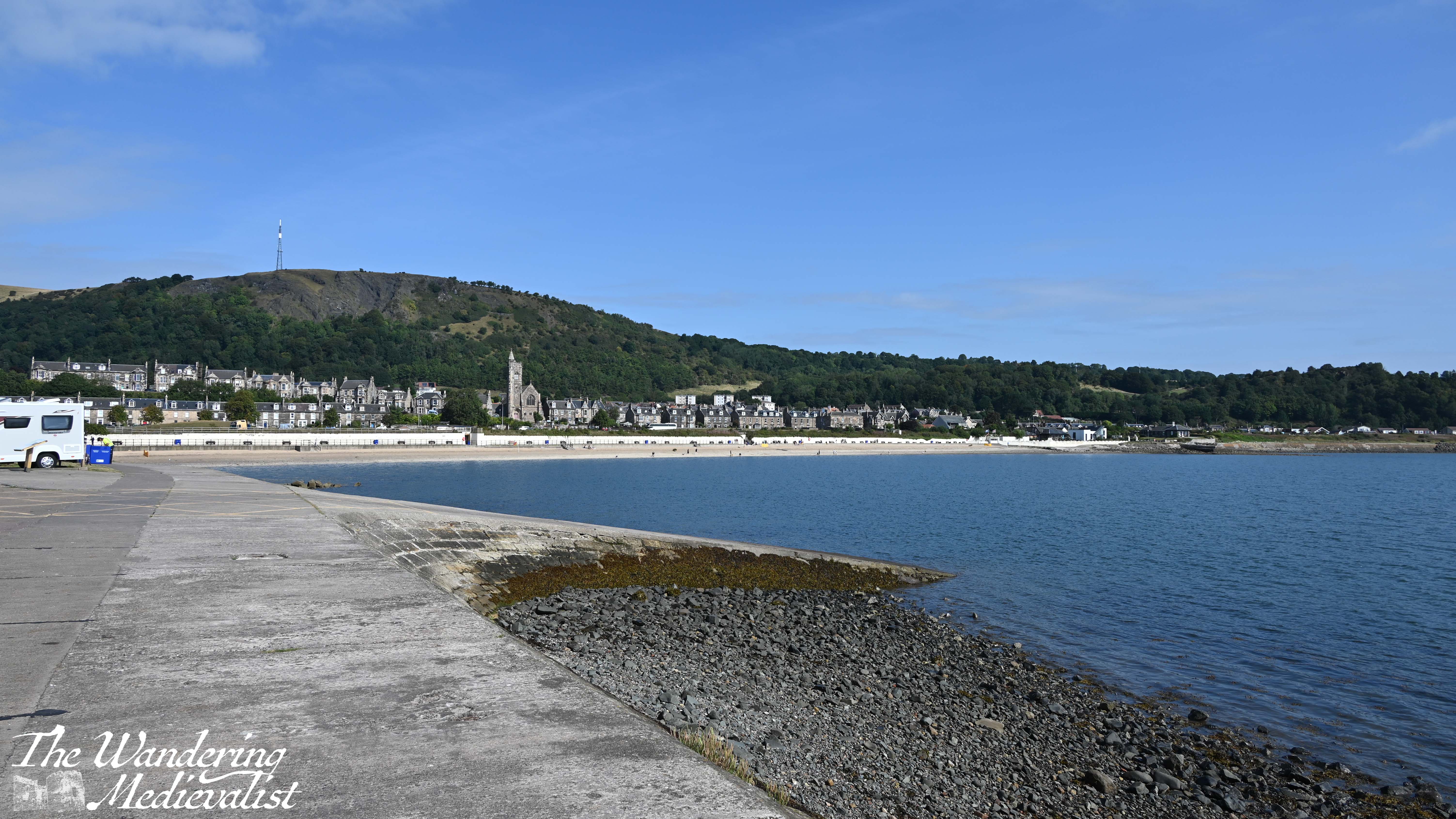
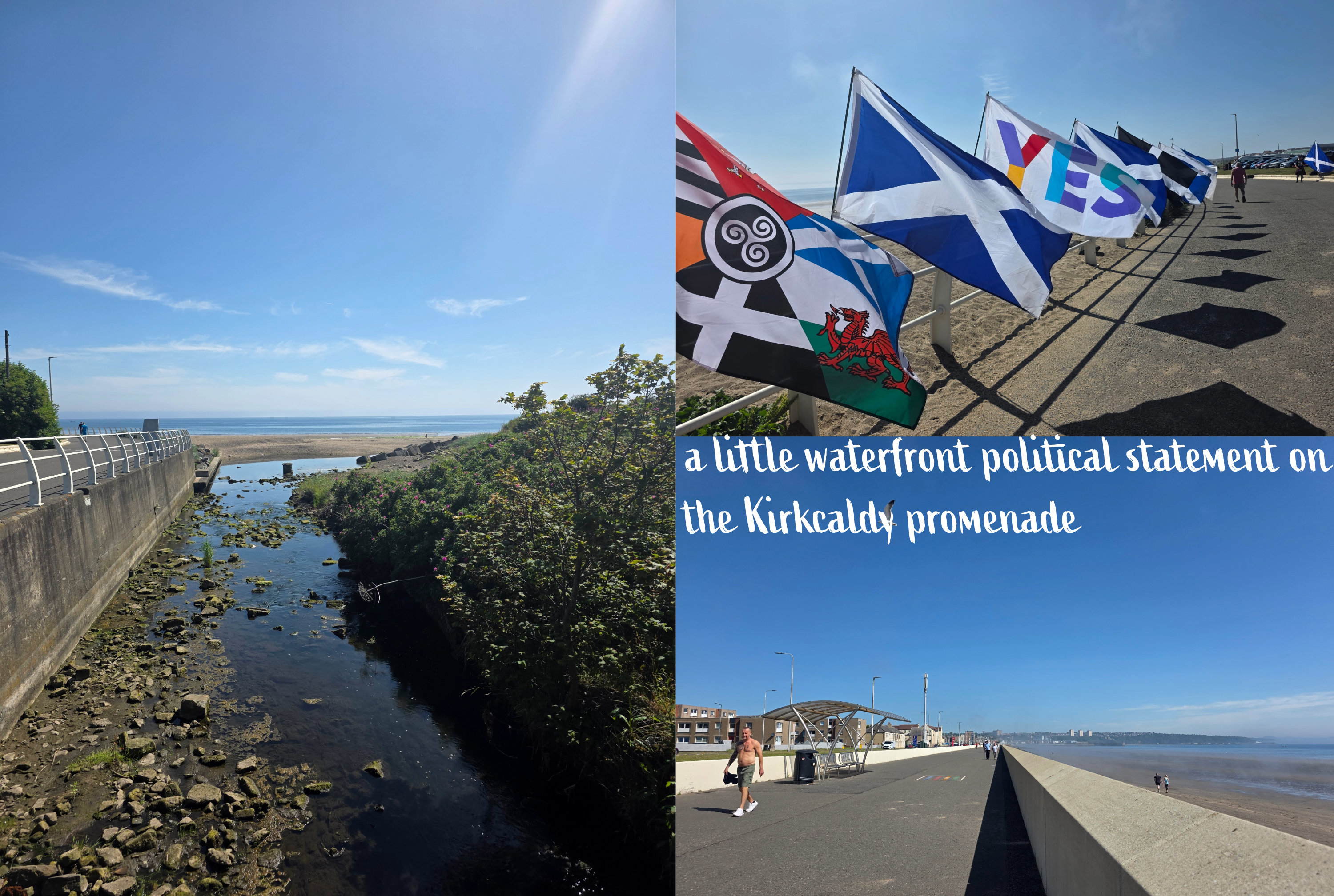
Lammerlaws Road becomes a bridge over the train track, and some walkers taller than I may be able to see over the wall – I tried with my phone but had no luck. Continue straight until you reach the water’s edge, where you can see the busy beach and promenade to the left.
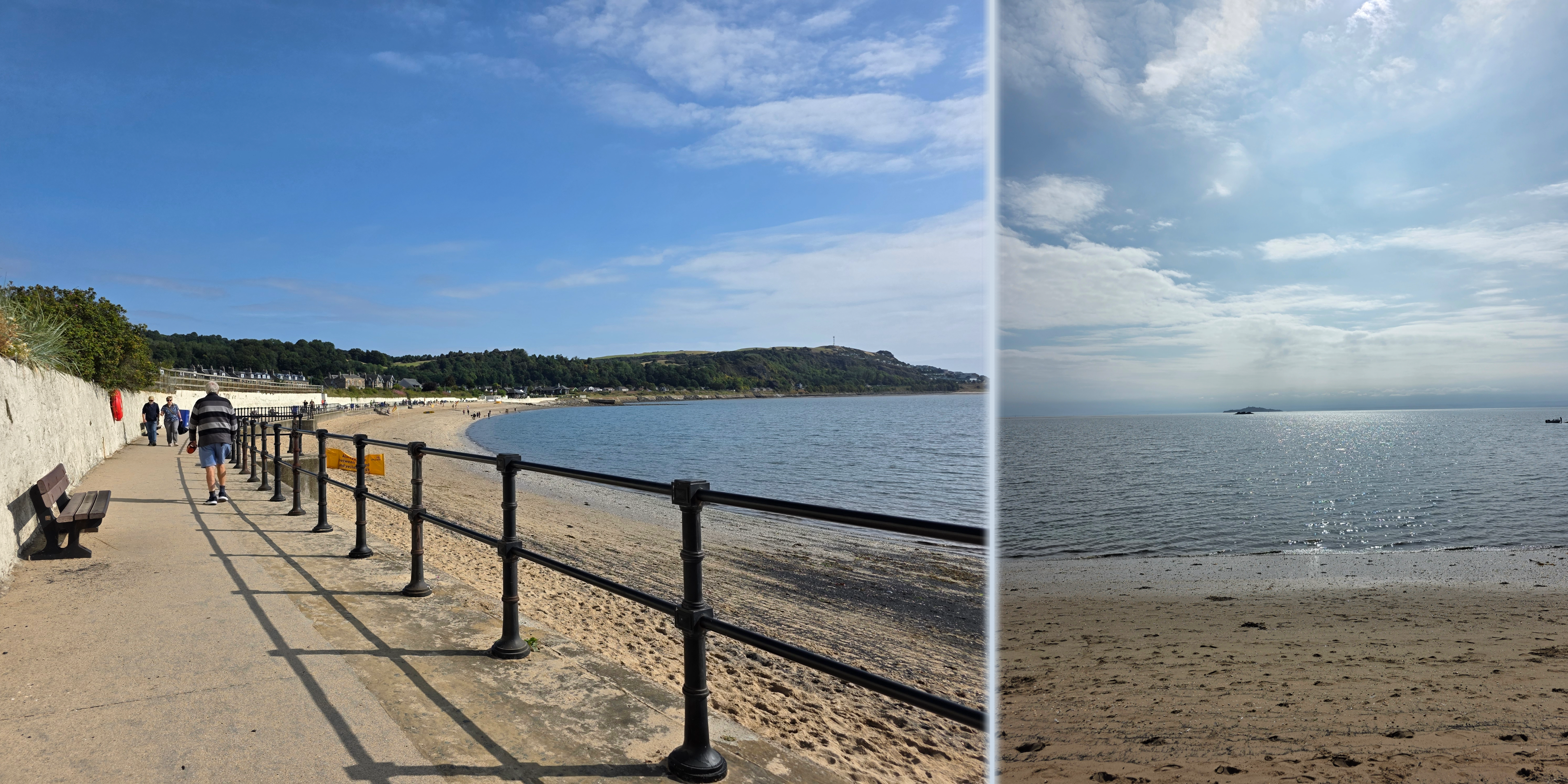
Burntisland promenade is narrower but no less busy than some others, with plenty of families and dog-walkers enjoying the sunny day on what was one of the last weekends before school. The beach was popular and there were life guards on duty, with large flags indicating where it was safe to swim. Just beyond their hut, the Coastal Path splits into two options: the high tide and low tide routes. It was about mid-tide, but upon looking at the low tide option, I decided I was not feeling up to proper long-term rock scrambling. So, I followed the road to the left, through another tunnel, and turned right along the A921.
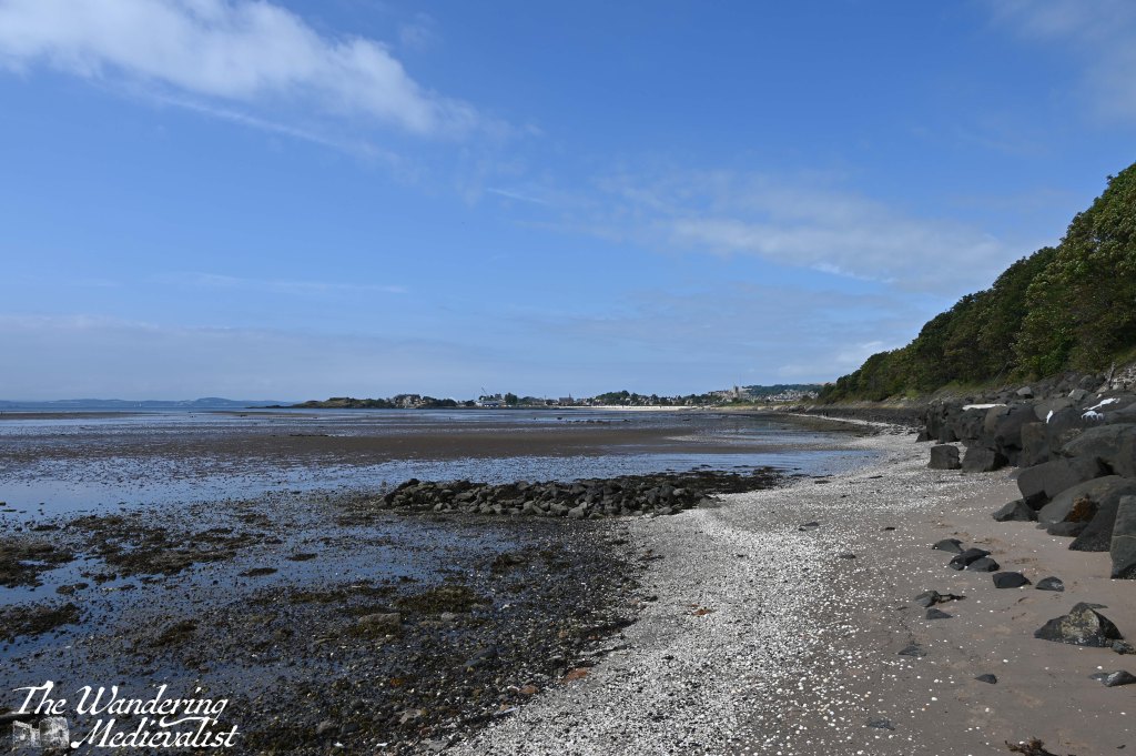
This was a pleasant stretch of road lined with bungalows and cottages with well-kept gardens, and eventually runs past the town cemetery. Opposite the far end of the cemetery wall, there is another tunnel under the rails, and I chose this as my moment to re-join the beach. It was a steep slope down to the rocks, but beyond was lovely and sandy, with a relatively straightforward route that is solid and easy to walk on.
the low tide route
If I had stayed on the road a tad longer I would have passed the Alexander III memorial which would have been nice to see, but I did not realize it would be inaccessible from the beach.
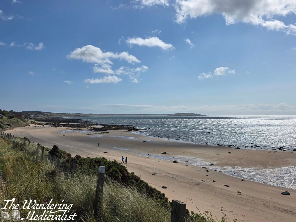
The beach here is incredibly wide at low tide, with flats stretching far out into the Firth that I can only imagine are muddy and a touch treacherous. On a clearer day, the views across to Edinburgh and Leith would be excellent, and even on a hazy day they were impressive.
Another half mile or so beyond where I re-joined the beach, the dunes bulge out towards the beach, and the option is either to follow the sand or cut up to the grass. I opted for this, following the at times quite faint path through long grass, ferns, and various other flora. I’m not sure this was the most sensible option, but being slightly higher than the beach allowed some views back towards the three bridges – just peeking out over the headland – and a better feel for what you usually see from the train.
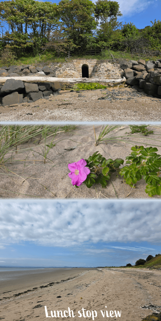
There was some near-bivouacking for a while, but eventually the trail re-joined the beach, with the road high above. As I approached Pettycur I could see a caravan park on the hill, and a steep flight of stairs leading up from the beach. This definitely was not what I wanted to see after a solid 5 miles or more of walking, and so I found a perfect rock ledge on which to take a proper break and enjoy my packed lunch. Which was, incidentally, inclusive of the all-American favourite, peanut butter and jelly (raspberry jelly, which in my opinion is the best).
God’s food, I will hear no objections.
It was salty, a touch sweet, and absolutely perfect.
This is one of my favourite pictures from this walk. Peaceful beach.
As I enjoyed my flash-back to the USA, I pulled out my up-to-date map of the coastal path to determine whether I had to climb the hill or not. After deciding that I could just as easily follow the beach, I made myself sit for 10 minutes enjoying the view before packing up again.
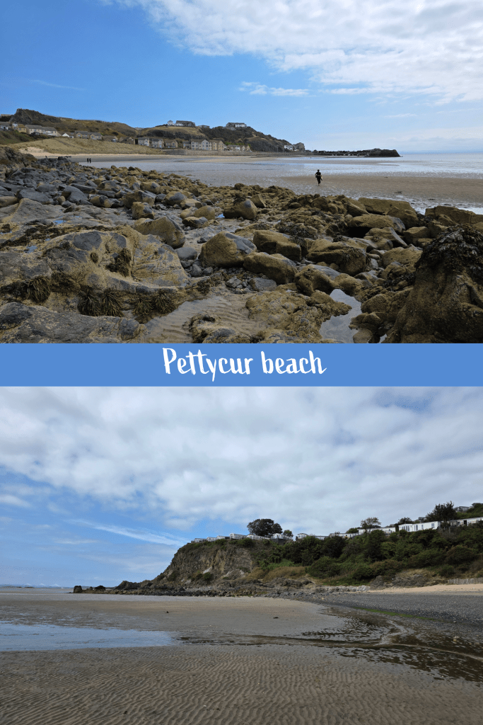
The route I chose definitely included a touch of rock-climbing as a tidal pool cut off the sandy option; fortunately, the rocks were not slippery but heavily encrusted with barnacles, which were great for grip. They would be torture should you fall, but I managed to avoid both a slip and wet feet. This was the case even once I had crossed the rocks and negotiated my way across the sand, which was rippled and wet but not enough to reach over my boot treads.
At this point I was in Pettycur bay, which included a small harbour where the boats were all beached due to low tide. I climbed the stairs at the edge of the harbour to re-join the road, which would have been the high tide option I think. My break and snack hadn’t really done much to reinvigorate me, and I found myself slowing down as I headed up the long slow hill of Pettycur Road that runs from the beach up to the top of the cliffs. The houses here reminded me quite a bit of parts of Marblehead – lovely, large modern places built on stilts or into the edge of the cliff, open to the Firth of Forth and ocean beyond. For those familiar, it was a touch like part of Marblehead Neck, right at the far end from the causeway, though these houses were smaller.
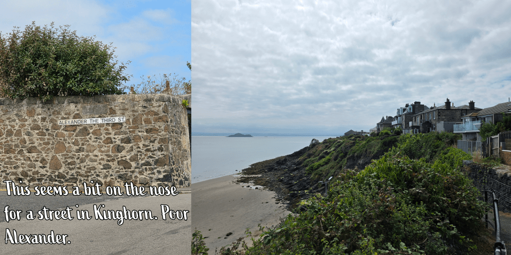
I had pretty much determined that when I reached the top of the hill, I was going to need another rest – I had been reluctant to look at the map to work out how close I was to Kinghorn. What rather gave it away was when I noticed road names that were Alexander III Street, and then David I Street – there is also a Canmore St and Queen Margaret St, showing the strong historical tie of the area to the Medieval Scottish crown. Suddenly, I realised, I was essentially in Kinghorn.
The sign for the Coastal Path turns right down a close, with the sea ahead, and at the end a set of benches. The view is, like so many others, spectacular – the ocean stretches out ahead, with the clifftop homes to your right and the town of Kinghorn with its train viaduct to the left. I paused for a few minutes to savour the triumph, though in doing so I missed that hour’s train. So, I took a gradual walk down towards the water before finding the spot at the bottom of the hill where I had marked the start of my journey from Kinghorn to Kirkcaldy.
I may have missed a few of the historical sites along the way that I hoped to see, but this walk really tested the limits of my fitness and I got to see parts of Fife I had only ever passed through.
It was a good final walk for the summer, I felt, leaving me in a strong place for when I come back from travels long enough to pick things up again. I’m looking forward to trying to stay fit while travelling – hotel gyms are uninspiring – but it’s a good goal to have, and I was really pleased when this hike didn’t completely destroy me. Was I a bit stiff that night? Yes. But it faded by morning.
Completing a circuit of the Coastal Path by January may no longer be a feasible goal but that doesn’t stop me from doing my best to try. So, last Saturday I planned another stretch, on the shorter side as I had family commitments to get back to in the afternoon. So, Leven to Lower Largo seemed a good option, and relatively easy to manage by bus.
The day started windy and with patches of rain, with water still in the breeze but sun promising a change in the distance. The storm earlier in the week cleared out the air a bit, and it was less stuffy and a few degrees cooler – perfect day for a walk. (Though, side note, the other half was devastated that the storm was mostly wind, as he was looking forward to a wet grey day. Instead we experienced fast-moving white fluffy clouds and wind, very little rain).
The bus I chose was the x58, which is a faster route south from St Andrews towards Upper and Lower Largo, bypassing most of the East Neuk. It was a nice ride, quick and interesting to see different villages for a change.
I reached Leven Bus Station in good time, and despite there being no visible signs for the Coastal Path, it was easy to see where to go.
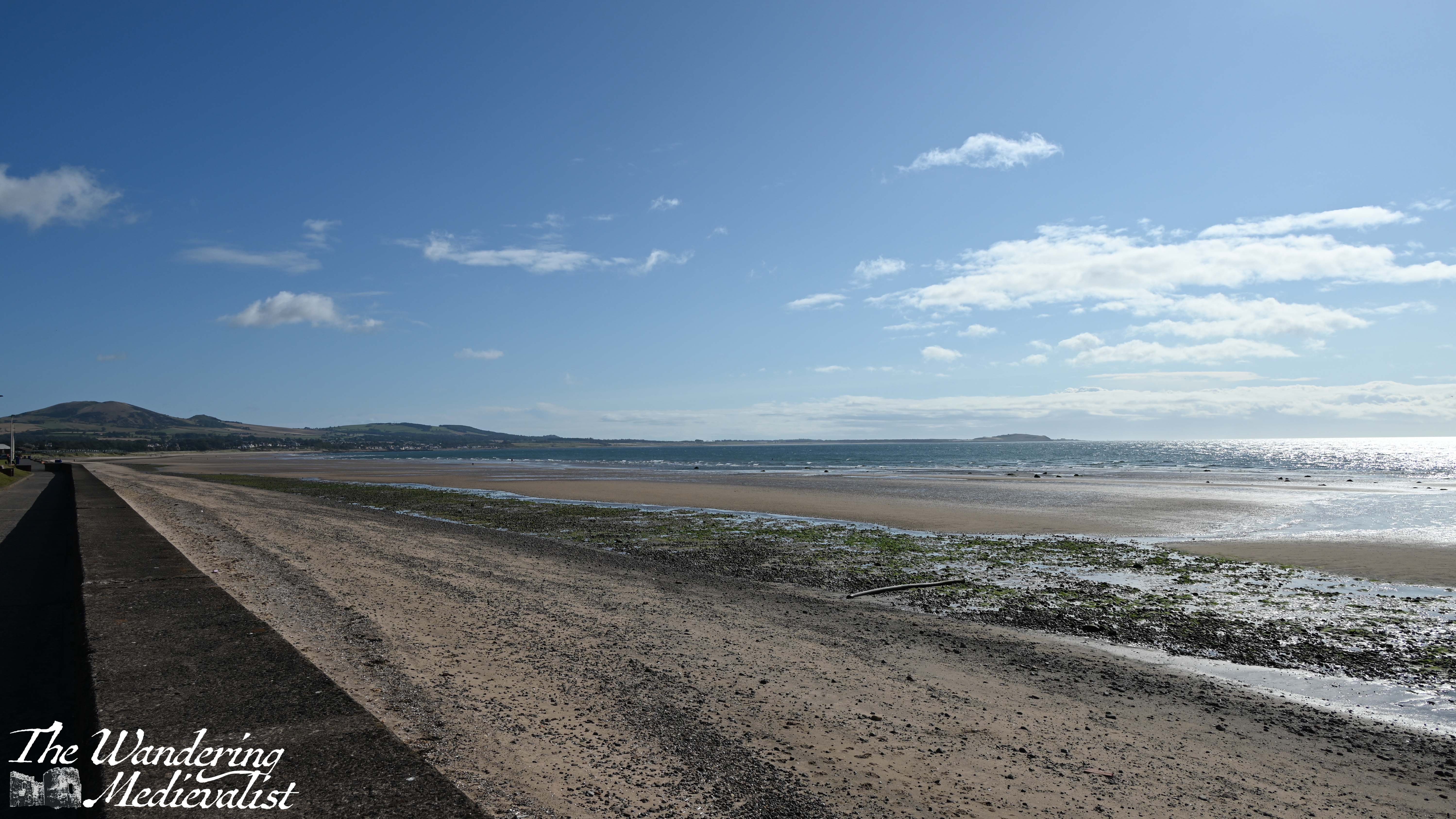
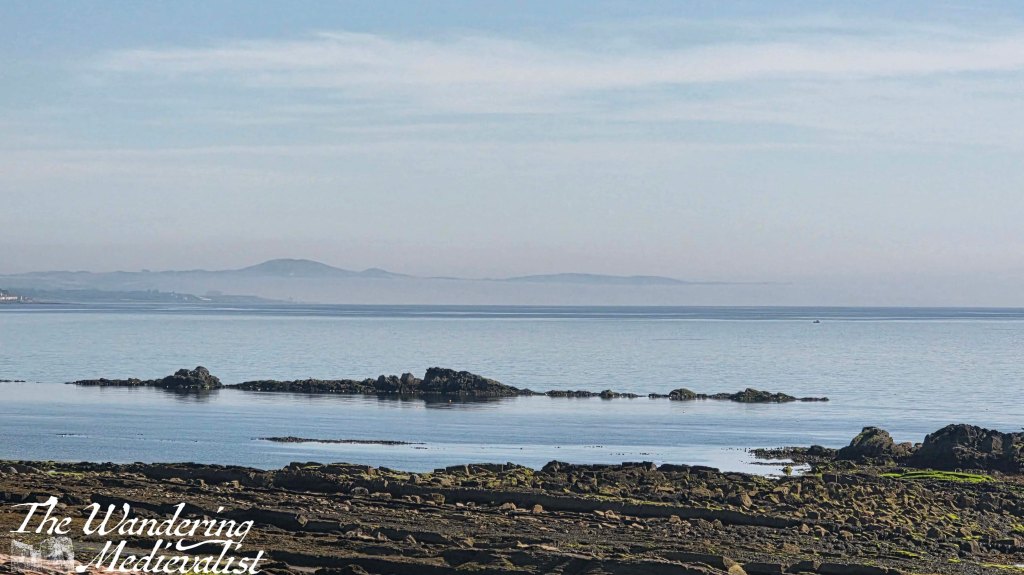
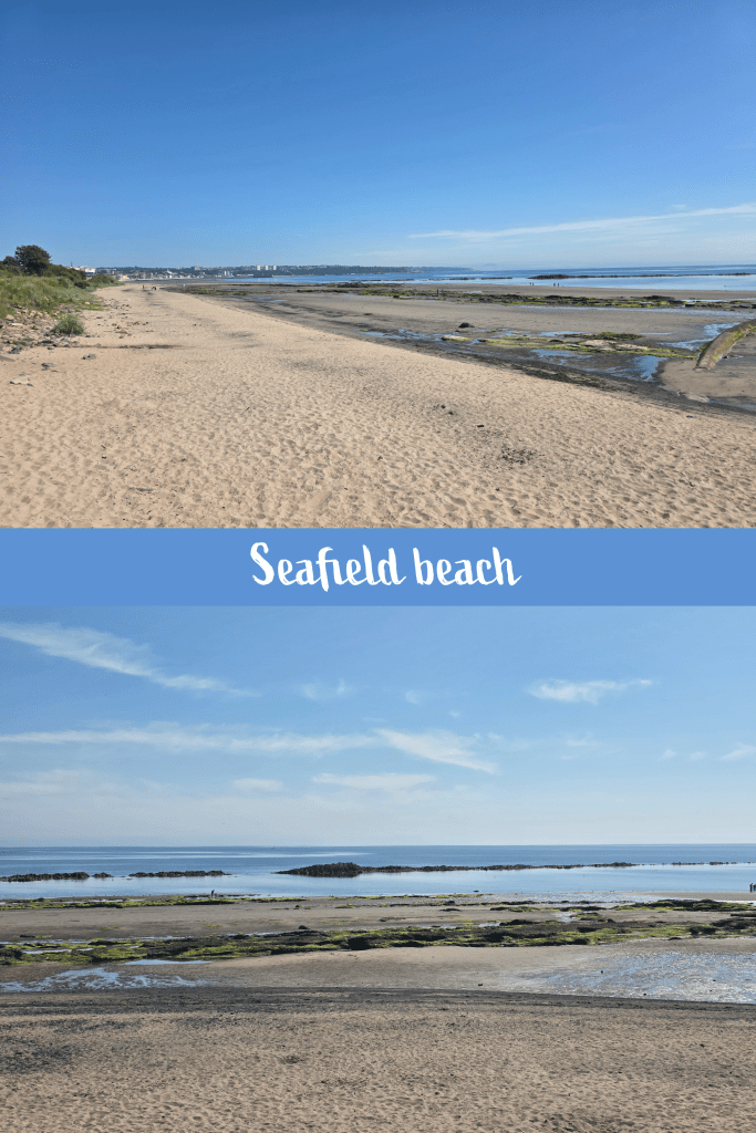
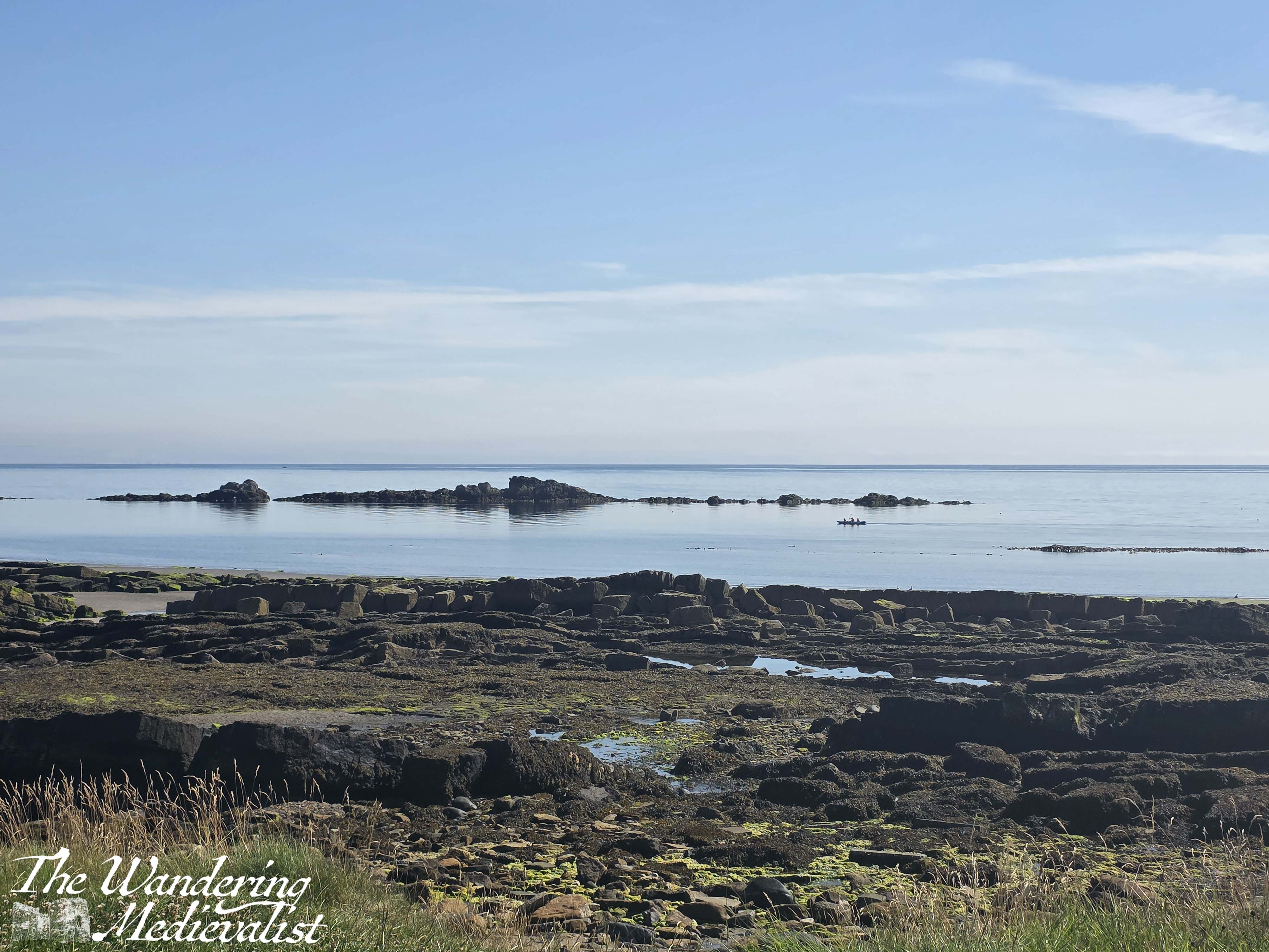
The bus station is very centrally located and only a road away from the coastline, just next to where the River Leven empties out across the beach into the ocean. There is a big car park here, and a promenade that is smaller than the one in Kirkcaldy but just as pleasant, with a wide sandy beach. While the Coastal Path proper runs along the road, I took a quick jaunt down to the sand to on several occasions.
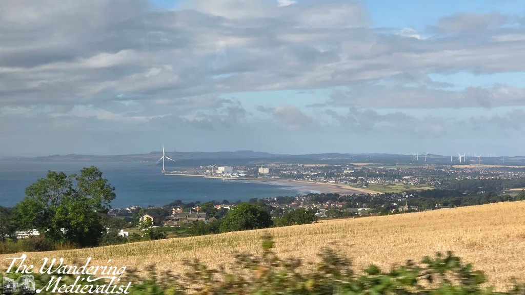
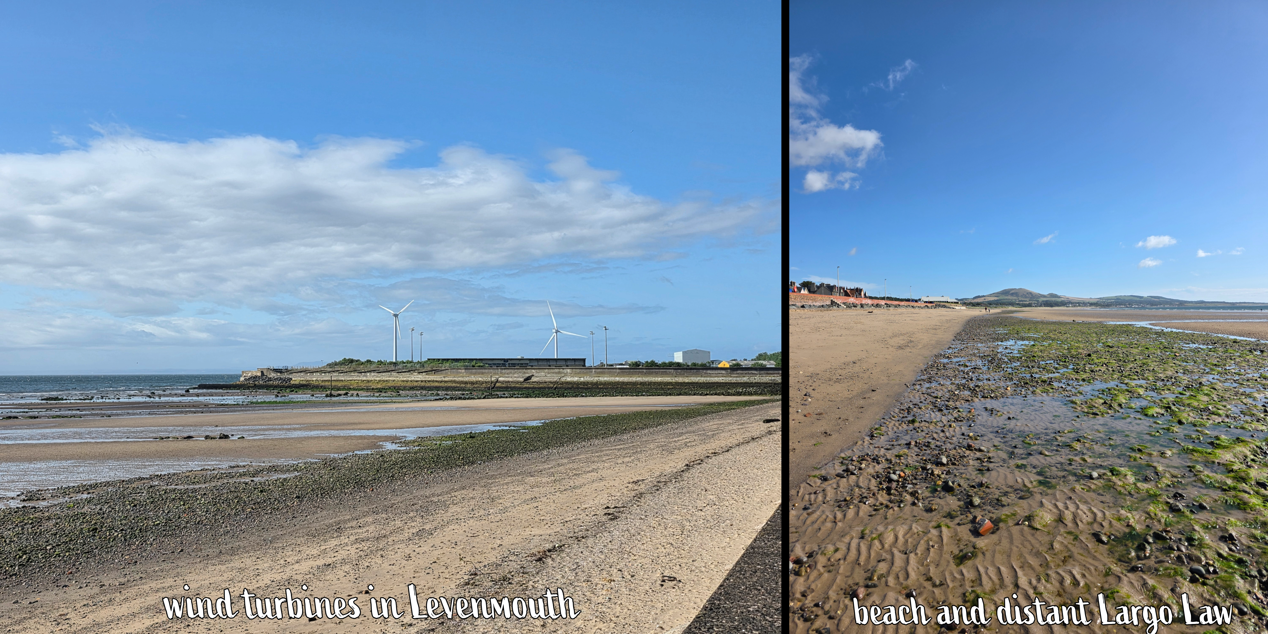
Also similar to Kirkcaldy, this promenade provides a view of the whole bay, with coast stretching out for miles ahead up to the point where you would turn to go to Elie, and Largo Law – Largo hill – towering over the distant towns. It was a touch hazy, but became clearer as the day went on and the clouds were chased away by sunshine.
As I walked along the beach, I became aware of the excited screams and laughter of many children, who were playing in a large blow-up arcade with a massive slide and other amusements. This theme continued, as further down the coast was an older arcade-style building, a new skateboard park, playground equipment, a putting green and more.
At this point the Coastal Path signage is scarce, but there really isn’t any other option but to follow the road. On the side away from the beach, I eventually passed the Leven Golfing Society – a large red brick building – and enjoyed a nice vista across the golf course to the Victorian-era cottages beyond.
Unlike in other towns, the Coastal Path avoids going through Leven Beach Holiday Park, and there are two routes – a high tide route up behind the park, and a low tide route on the beach.
The sign that indicated these two routes was so faded from the sun that I could not capture it, but I figured that I would work it out when it was time to leave the beach.
I was also delighted to walk past a small group of pet owners taking part in a dog training class on the grassy area beside the beach. I passed more than a few dogs on the beach and this section of the trail – clearly it is a popular spot! Including one small white dog that continued to chew on its squeaky toy for a solid 10 minutes – at first I thought it might be a very odd bird, but soon realised my mistake.
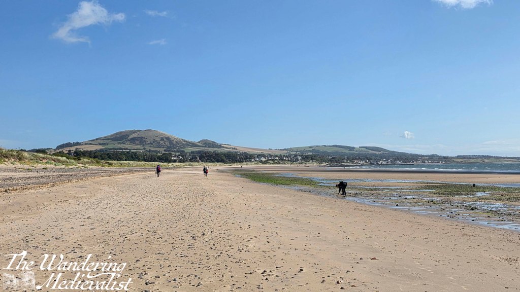
beach looking towards Largo Law
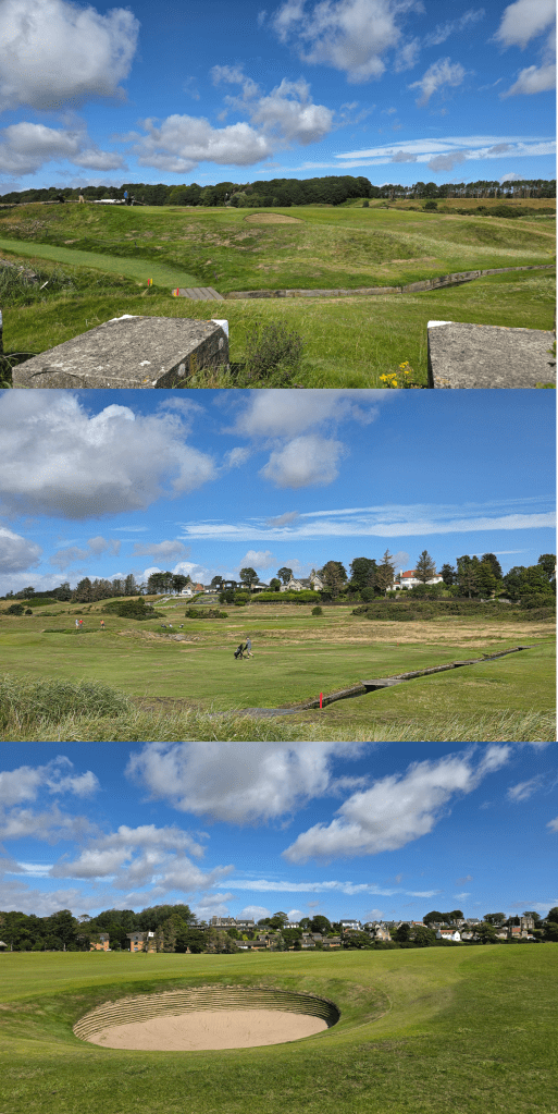
The sign indicating the spot to re-join the high tide route is easily visible from the beach, and so I climbed back up onto the verge between the golf course and the sand. Like so many large patches of the Coastal Path, this was the pattern for the next mile or so – beach and golf course, both providing good camera fodder. (I have an idea to do a calendar of Scottish golf courses, so this walk will be a great help)
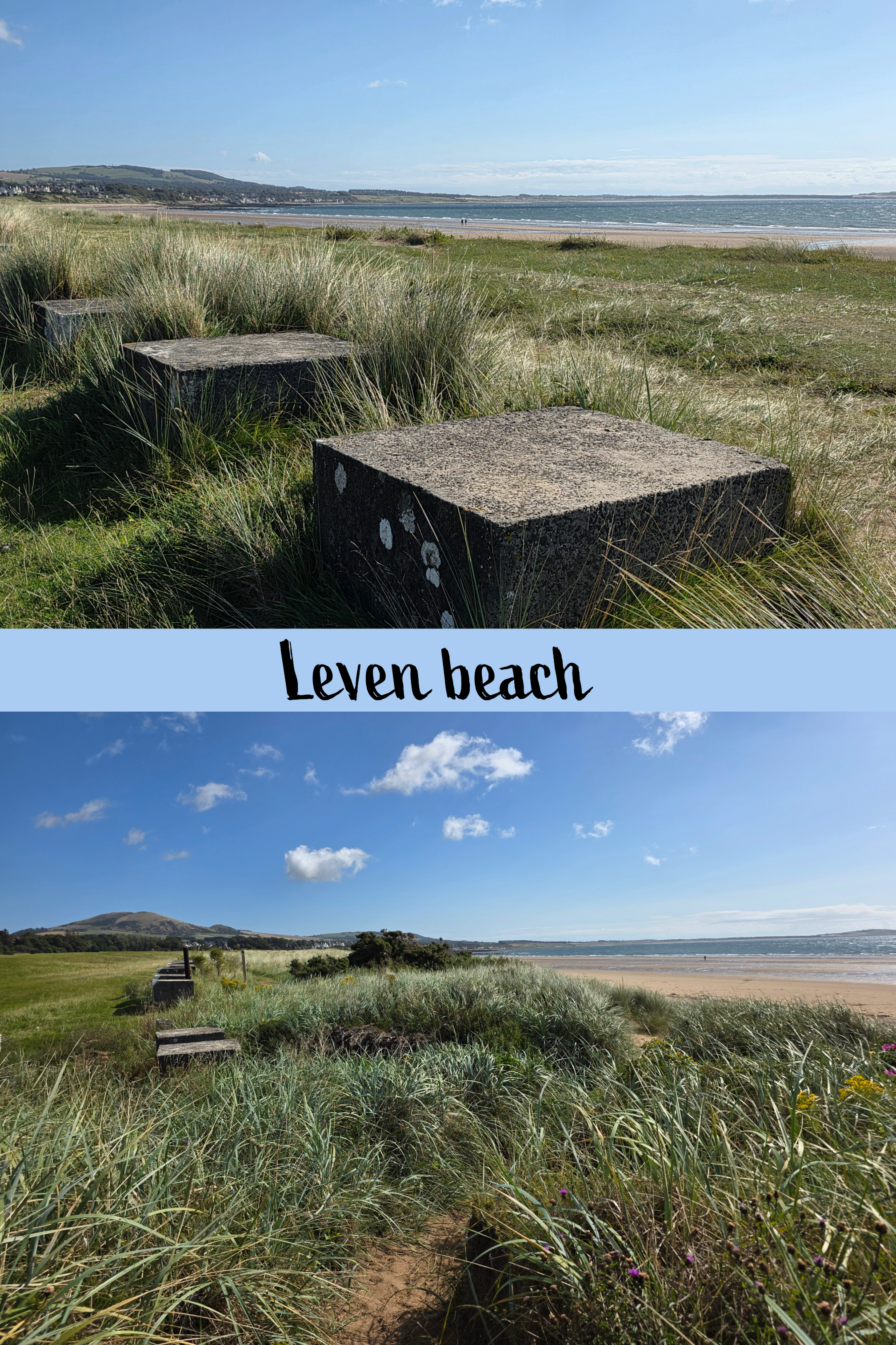
In very little time, the comment I made last week about not noticing WWII defenses this far down on the coast was entirely disregarded when a long line of concrete blocks appeared, essentially marking the border between golf and walking. The Coastal Path sign helpfully points right down the middle, so to some extent it is walker’s choice which side of the blocks you choose.
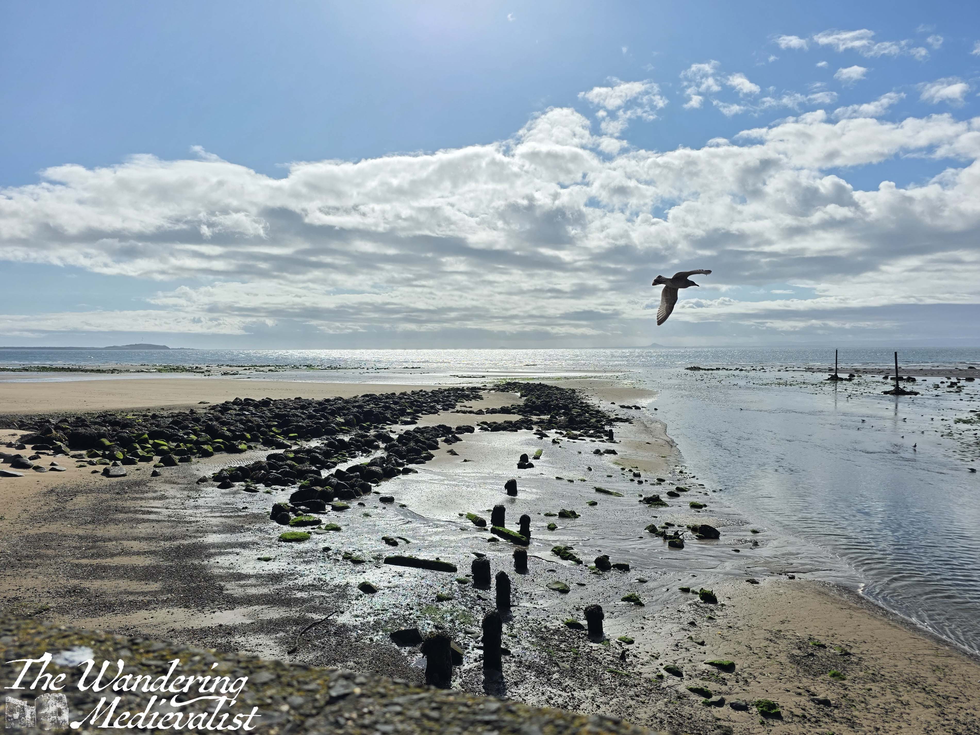
The track here is quite a bit softer, with deep sandy patches interspersed with grasses, making the going a little harder. I finally became warm enough to shed my cardigan (the wind was no laughing matter), and paused briefly at a bridge across a small burn. The burn cut through the dunes and was lined with sea roses and other wildflowers – really beautiful spot.
Some golf views…
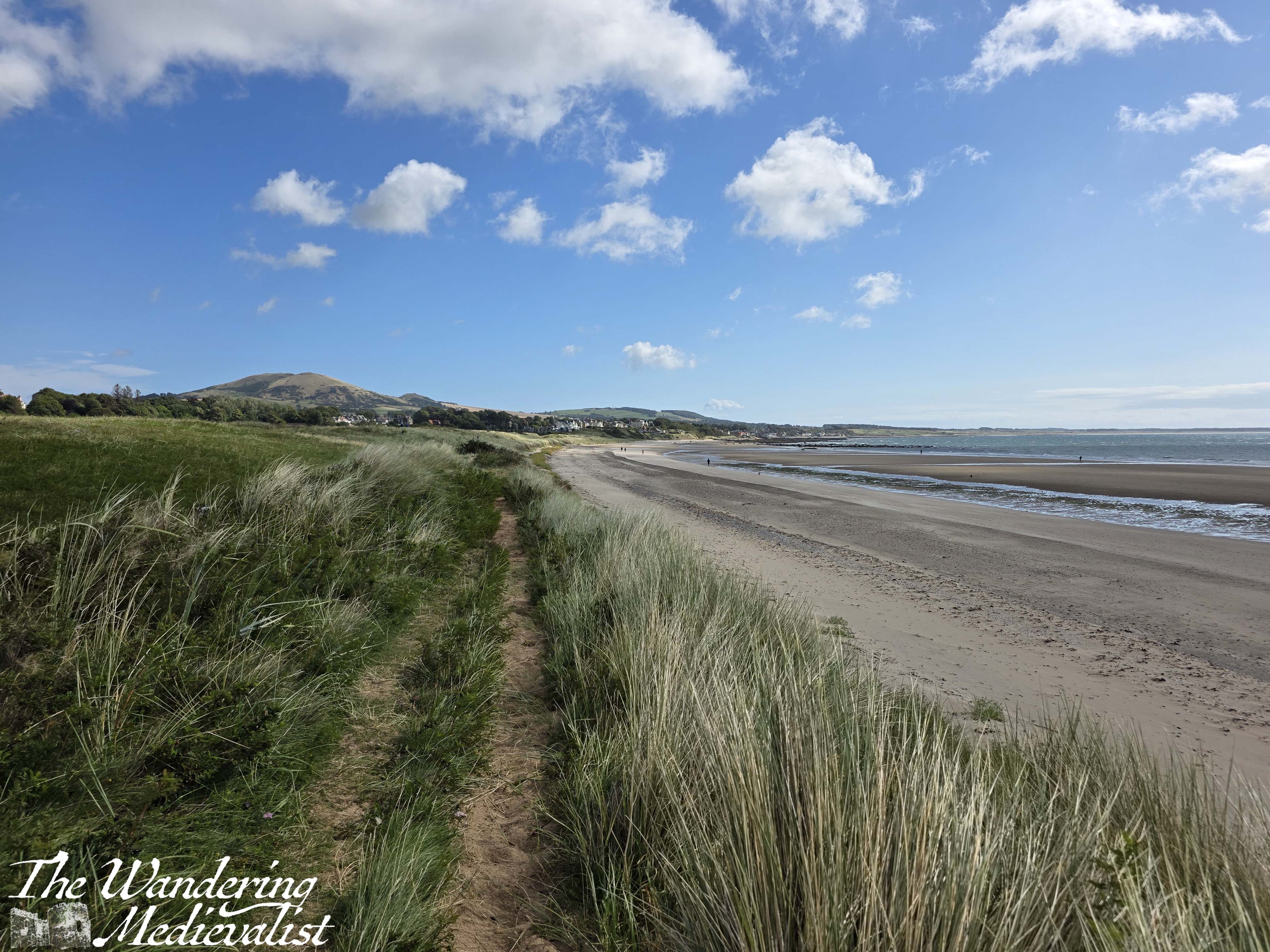
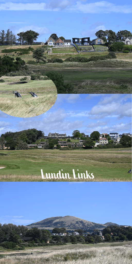
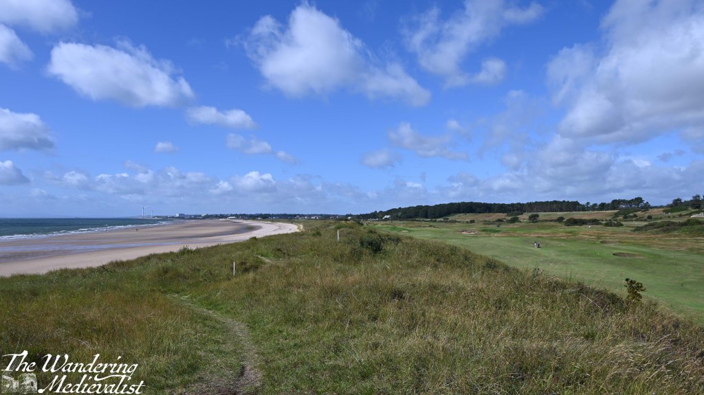
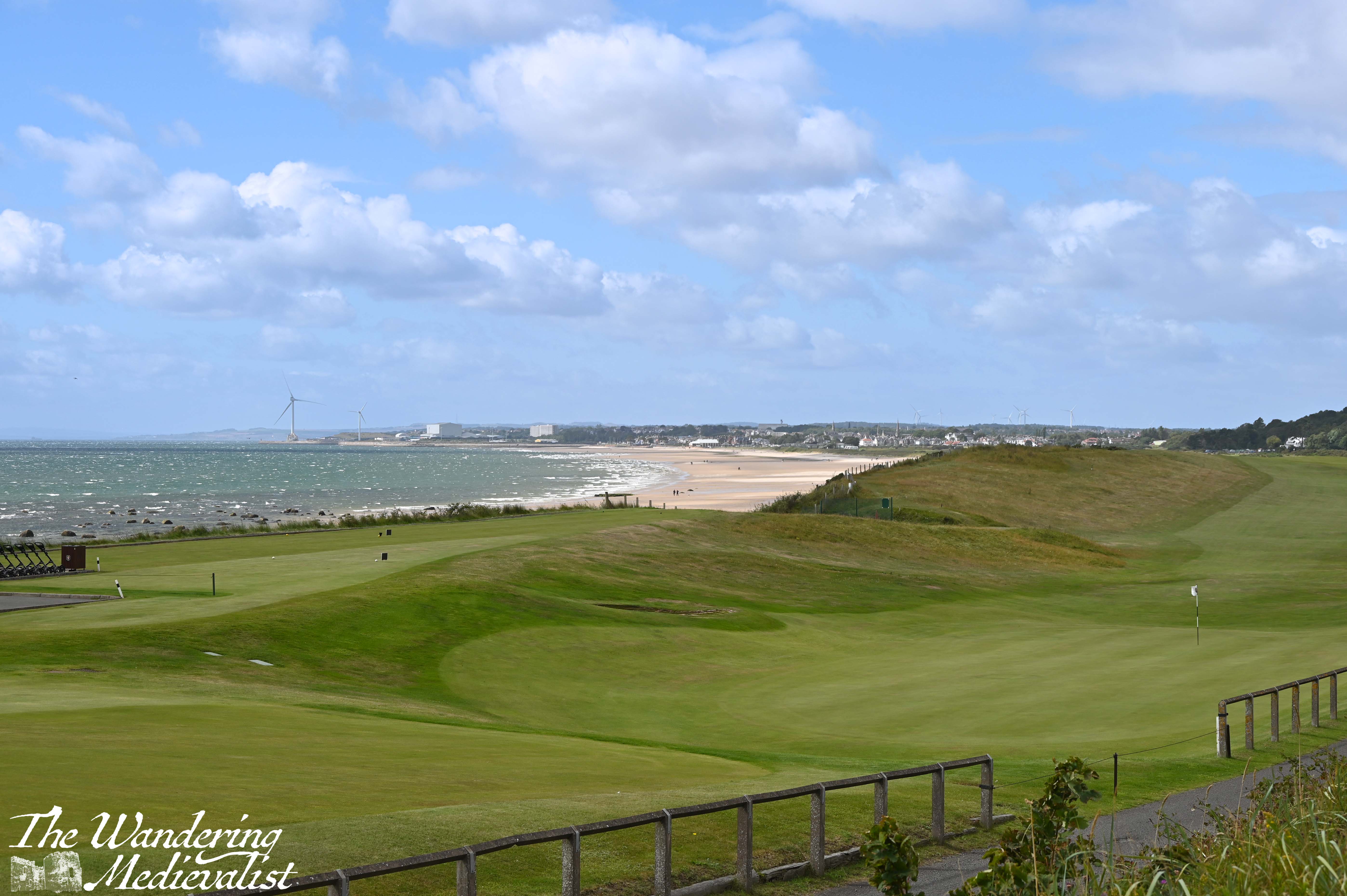
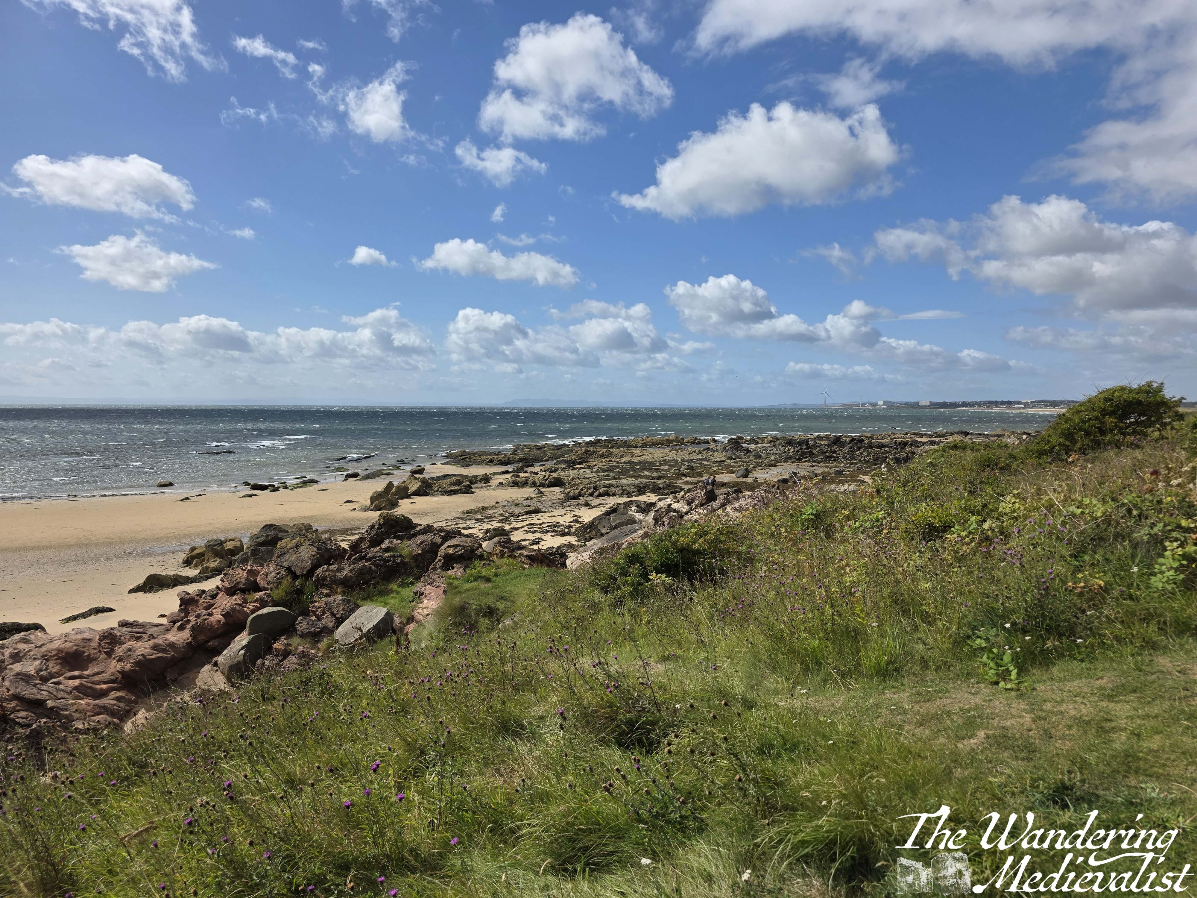
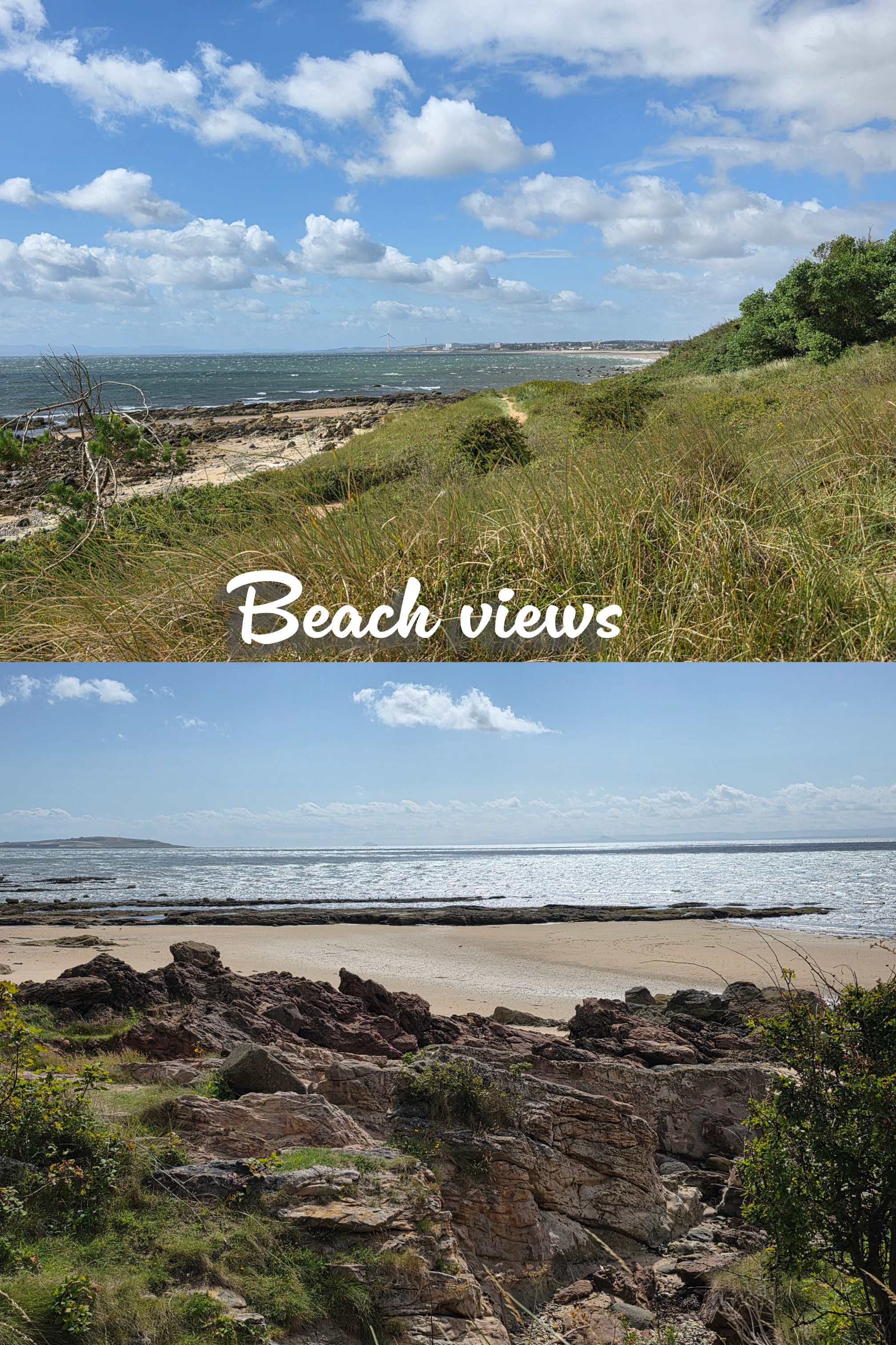
As the path moves around the bay, Largo Law shifts further to the left, and the well-kept houses of Lundin Links appear along the distant edge of the golf course. At some point this becomes Lundin Links rather than Leven, though I’m not sure where – probably at the stone wall that seems to cut a relatively even division down the grassy slopes. On the beach, the pristine sand slowly becomes rockier, first by the waterline and then gradually moving inland, with sand replaced by the rock shelves so common in Fife. With the dunes and long grass edging the beach, it is just a really beautiful few miles, and could probably mostly be done on the sand itself, should a walker prefer the beach.
half beach, half golf- epitome of the Coastal Path
While on the dunes there are several little trails breaking off, the Coastal Path itself is always well-marked and relatively easy to follow, or so I thought as I was walking.
About a third of a mile after the first burn, there is a second, beyond which the trail climbs slightly up a hill with excellent viewpoints in all directions. I walked for another third of a mile or so only to reach a fence and some rather threatening warning signs, indicating that walkers could cross the golf course at this point, at their own risk. The only other choice was to go down to the beach.
After a quick check of my new map and the internet – which was working for a change – I determined that I had made an error, and that the actual route of the Fife Coastal Path led off to the left back at the most recent burn. As the course was busy, I determined it wisest to go back, unfortunately meaning that I was now about 15 minutes behind my schedule which was again depending upon busses.
great view for a detour…
Sure enough, the sign for the Coastal Path clearly directed walkers across the course at the burn – I missed it entirely, probably too busy with the burn itself – which is considerably further from the fairway and so safer. Annoyed at myself, I crossed the green and joined a dirt track which soon led into the residential area. The homes here are lovely with abundant gardens, and there are stern signs warning that dog walking must not take place on the golf course.
In about five minutes, there is a right turn to keep following the edge of the course, and then a quick left along the road leading towards the golf club. There is also a dirt track that climbs up a hill beside the road, removing walkers from the traffic, which is ideal.
Some Lundin Links views
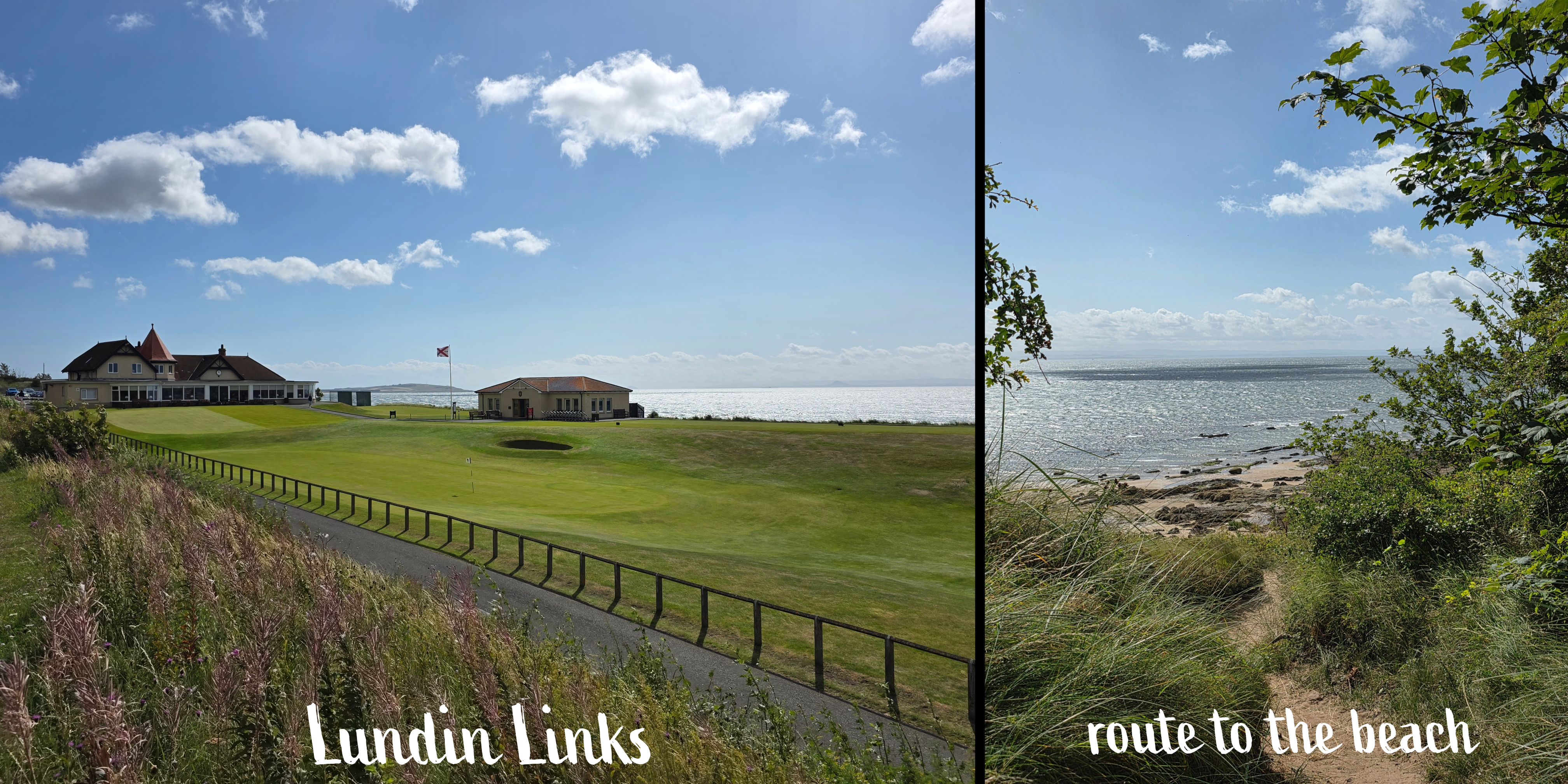
Passing through the golf club parking lot, I spotted the signs for the path ahead as well as a large gate, leading beyond. There is an almost immediate right turn (though a path also leads straight ahead), and suddenly I found myself emerging from the tree line to a stunning view over the coast. It reminded me ever so slightly of certain parts of Cape Cod, with beach-adjacent trees, long grass and rambling sea roses. The path wound down the hill, with sand and rock beyond; do be careful if you get too immersed in the view, though, as there are several deep steps that you might miss or – ahem – slip down if you are too busy looking up.
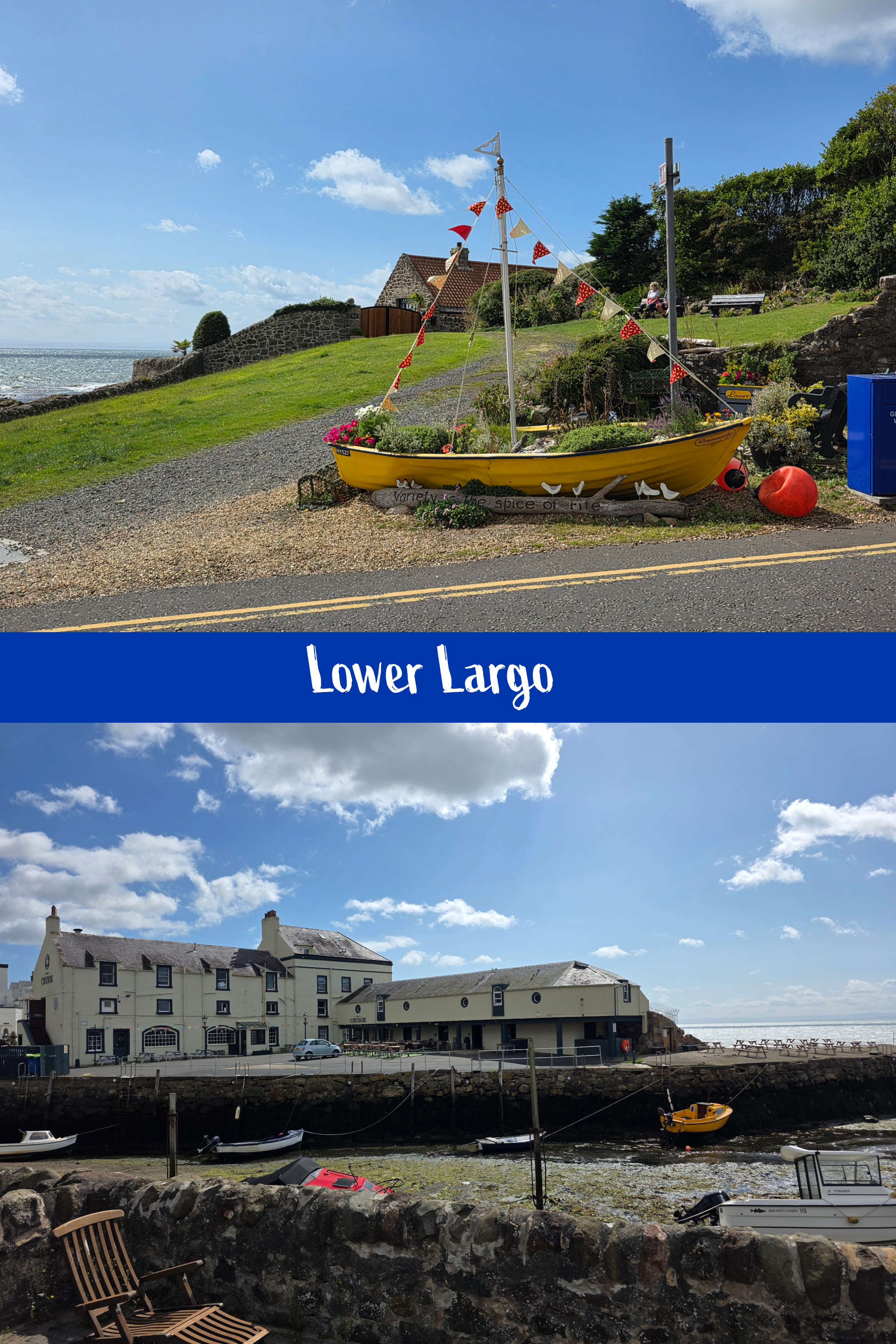
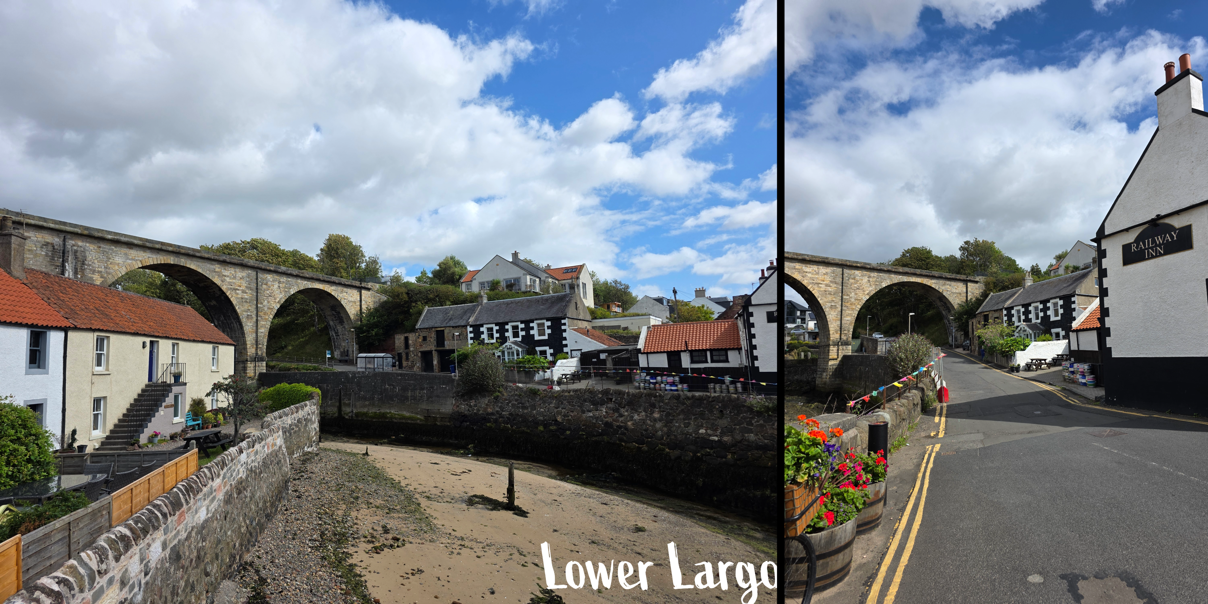
This was by far my favourite part of the walk, and the ocean colours were extraordinary, almost Caribbean in their blue-green quality. There are a few side-paths but keep going straight and you will be fine, eventually reaching a stand of trees and a gate, beyond which the trail enters the edge of Lower Largo. There is a large orange house between the path and the coast, and you are walking behind identical coastal cottages for a short while. The homes are mostly old fisherman’s houses that have been restored, and ahead is the viaduct that used to carry the train.
As the road winds down into the town, be careful as there is not always an obvious sidewalk; this feels much more like the towns of Anstruther and Crail, and shortly the road crosses a narrow bridge over the harbour. Ahead is the Crusoe, a popular local restaurant, and to the left a beautiful old mid-eighteenth century inn, the Railway Inn, offers bar snacks and a beer garden.
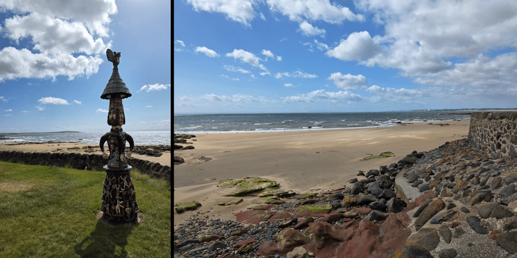
The Coastal Path continues with a brief jog to the left, then straight along Main Street. You will pass a small grassy area with a stone fence, and in the middle a sculpture by a local artists, Alan Faulds. There is more of his art further on – very unique stuff.
By this point, my walk was quickly coming to an end, so I decided to mark the close at the Aurrie, just next to a car park which should really have been called a boat yard. I took a quick moment to enjoy the view over the beach, then turned inland.
If you are also planning to finish a walk here, be warned that the street leading up the hill – Durham Wynd – is steep and without a pedestrian path for the first section at least.
Beyond that it was an easy five-minute trip to the bus stop and I caught the bus with a few minutes to spare, in the meantime keeping the company of a field of cows. One note about the bus trip back – I always forget about the great view of St Andrews as you come over the hill past Cairnsmill Caravan park. I just managed one today, though the bus was jerking about and bumpy.
Another note – one of the aspects of the Fife Coastal Path about which I am continually impressed is how you can turn a relatively unexciting-looking corner and suddenly be faced with a jaw-dropping vista. It has happened so many times now that I can’t even count, but I am always amazed. It really makes the heat, sweat, bugs, and bouncing around on public transport worth the effort. Large portions of the path are quiet, so I am often on my own, astounded by the peace and beauty, and counting myself lucky that I have the opportunity to pursue this goal.
My next walk is likely to be the last one I can manage before autumn travel, and I have planned a good one – 6 miles, at least one castle, and as usual phenomenal coastline. I hope the weather stays good, though wouldn’t mind if it cooled off a touch…
For whatever reason, this past Saturday morning sleep was not my friend and I woke early – the same time I do for work, which is early for a weekend – and got myself going to aim for a bus an hour earlier than I had intended. And good thing I did, as this stretch of the Coastal Path took me longer than expected, even with a few stops to test out my new camera. Yes, that is one exciting development this week: I finally managed to order and have delivered the fancy new camera that was a – cough – Christmas present from my father. Entirely my fault that it took me this long to get it sorted, as I was waffling about what to get. I settled on a switch of brand, moving from Canon to Nikon. I still need to spend some time working it out, but I’ll get there. And I digress. (still…new toy!)
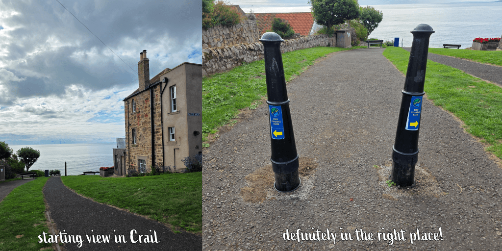
Crail is a bit more limited than Anstruther in terms of public transport, but the 95 is always a good option and I got my favourite seat upstairs at the front. Also on the bus were a group of young caddies, probably about 21, who were on their way to Kingsbarns and discussing their job and how much they would make after a day of work. Blew my mind – I can definitely see the appeal! A lot of hard work to get there, I know, but still paid incredibly well especially for someone on a summer break from university.
I arrived in Crail at 9am on the dot, alighting just before the roundabout where St Andrews Road turns into the High Street. It was a short walk of less than 5 minutes down Castle Street, then a slight veer to the left around the castle wall, to the spot where I had officially ended the walk to Crail from Anstruther a few weeks back.
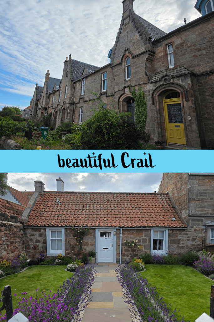
The oath is clearly marked here, along the Nethergate heading north-east. This street is just an endless line of beautiful houses and well-kept gardens, which are really all-pervasive in Crail. Even the edge of town where the houses are ‘newer’ is a lovely winding neighbourhood with beautiful gardens. That said, the constant shrieking of the gulls (expected, still annoying) made me wonder if I really coveted one of these cottages.
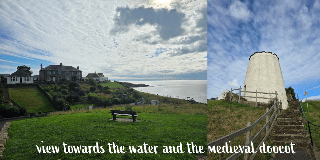
In about a third of a mile, the Nethergate ends at a stone wall and large grassy area, and the path takes a steep turn town towards the beach; ahead is a line of Victorian-era houses with beautiful gardens (notice a pattern?), and the open sea beyond.
There are two paths here, one a straight shot down a steep hill along a wall, and one off to the left which is a touch more gradual. This is the official path, I think, though I chose the other way. Going along the wall eventually takes you past this late medieval doocot, which is still open (though I did not go in) and which includes a detailed explanation of what a doocot is. This one, built around 1550, housed pigeons until the mid-19th century, and is of a quite traditional round ‘beehive’ design, though there are plenty – for example one at Tantallon Castle – that are rectangular.
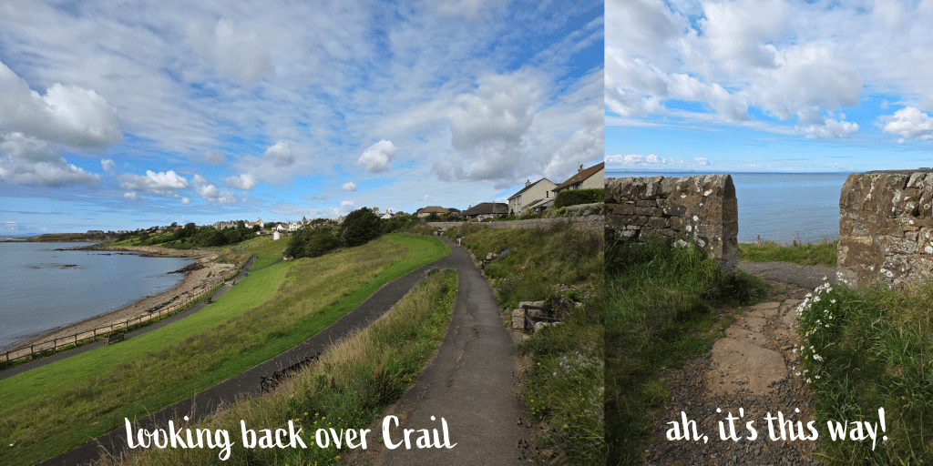
Beyond the doocot, I turned left along the shore, where there is a playpark next to the sea. The weather was mild but breezy, with a mix of sun and clouds that was the perfect opportunity to test my camera. The beach is rocky with small patches of sand, reminding me very much of the beaches at home. I was relieved to discover that there was also a toilet block, though it was far from clean or well-kept. Those in Crail had been at the other end of town, so this seemed a good opportunity, and potentially the last one on this walk. (Though if you ask very nicely, it may be possible to use the ones at the caravan park, I’m really not sure)
At the end of the bay, there is a flight of steps leading up to what I realised was the actual Coastal Path – oops – which had run along the top of the park. Either way is fine, I’m sure! This is of course a good spot to get a few pictures back over the beach towards the town. From here it was along the path for a short while, and a relatively fast right turn through a grassy field. There are several routes here, some leading off to the left that are clearly made by walkers, and the Coastal Path is not well-marked, but stick to the main trail heading straight for the water’s edge, and you will reach a gap in the stone wall. It may not seem the right way, but it is!
Once through the stone wall, you will see signs again and the entrance to the Sauchope Links Holiday Lodge and Caravan park. There is a clear direction here, sending walkers through the caravans on the main road. While it was early morning and the park was just waking up – some lucky souls sitting on their porch drinking coffee with a splendid view over the ocean – there were some vehicles too, keeping me on my toes.
I was really impressed with the holiday park which had a small but clean-looking pool and a good number of well-kept caravans. In time the caravan park merged into the holiday lodges, including a few glamping pods (I think) and then eventually some really lovely-looking lodges. The views were excellent, but I did have some doubt as to whether I’d want to be quite that close to the water here on the outermost edge of Fife – especially with Storm Floris expected in a few days. Eventually I discovered the style of house I liked best, up on the side of the hill a bit further back, with big patios and I am sure, a great view.
After about ten minutes or so of walking – it’s a big park! – I found a sign for the Coastal Peth taking me off the main road and down a sandy track towards the beach. The path runs between the lodges and the beach, alternately sandy, grassy, and occasionally rocky. It was an odd day where I couldn’t decide if I needed sunglasses or not, and it meant that the views were alternately bright and clear or a bit murky.
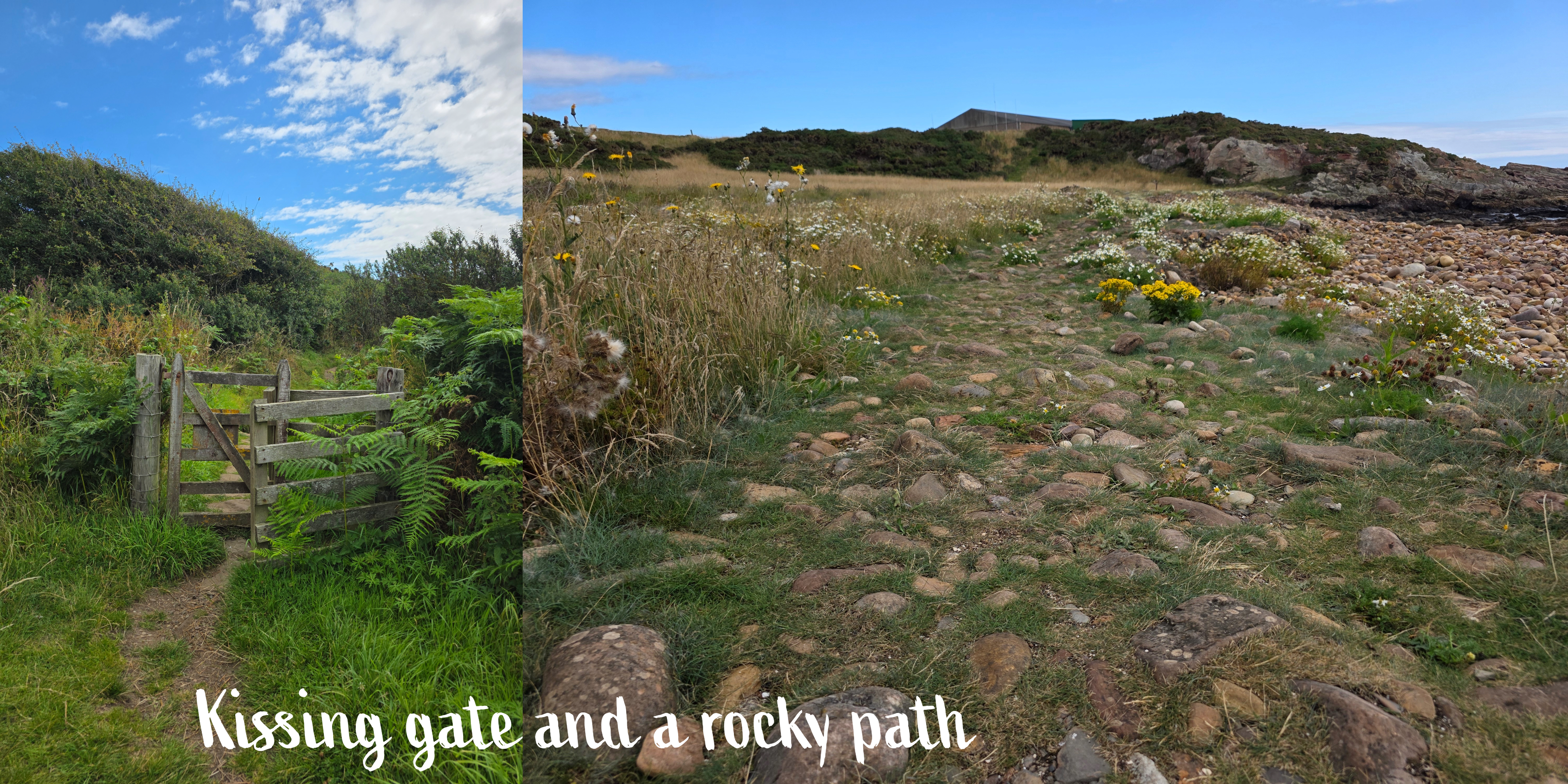
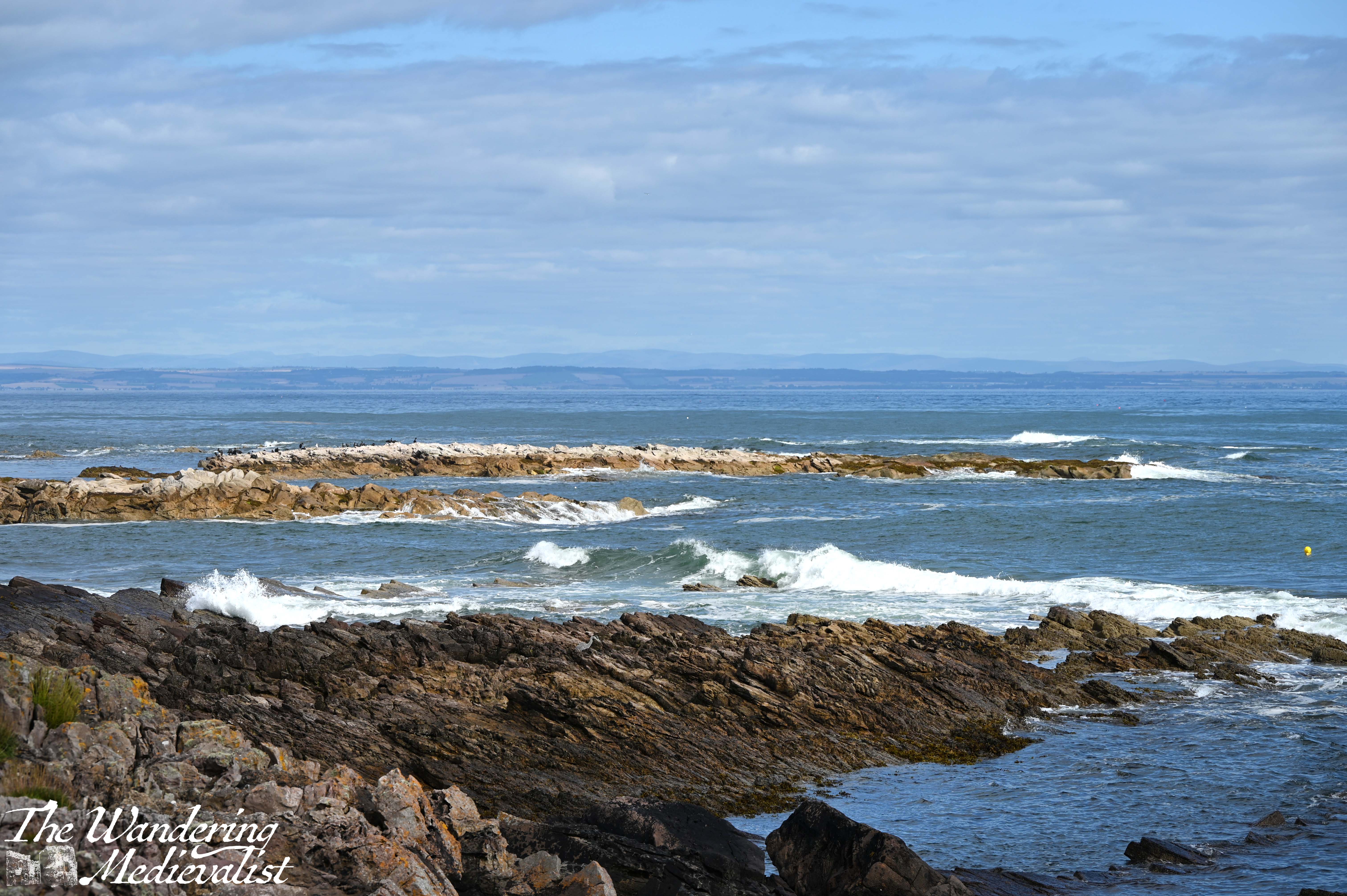
In time – longer than I expected – I reached the end of the park and went through a wooden kissing gate onto a more wild path, with high grass on both sides. There is a beautiful rock structure up ahead on the right, and a sign indicating that walkers are now entering the Kilminning Nature Reserve. Here are some great views looking back, particularly if there are waves crashing on the rocky promontories between beaches.
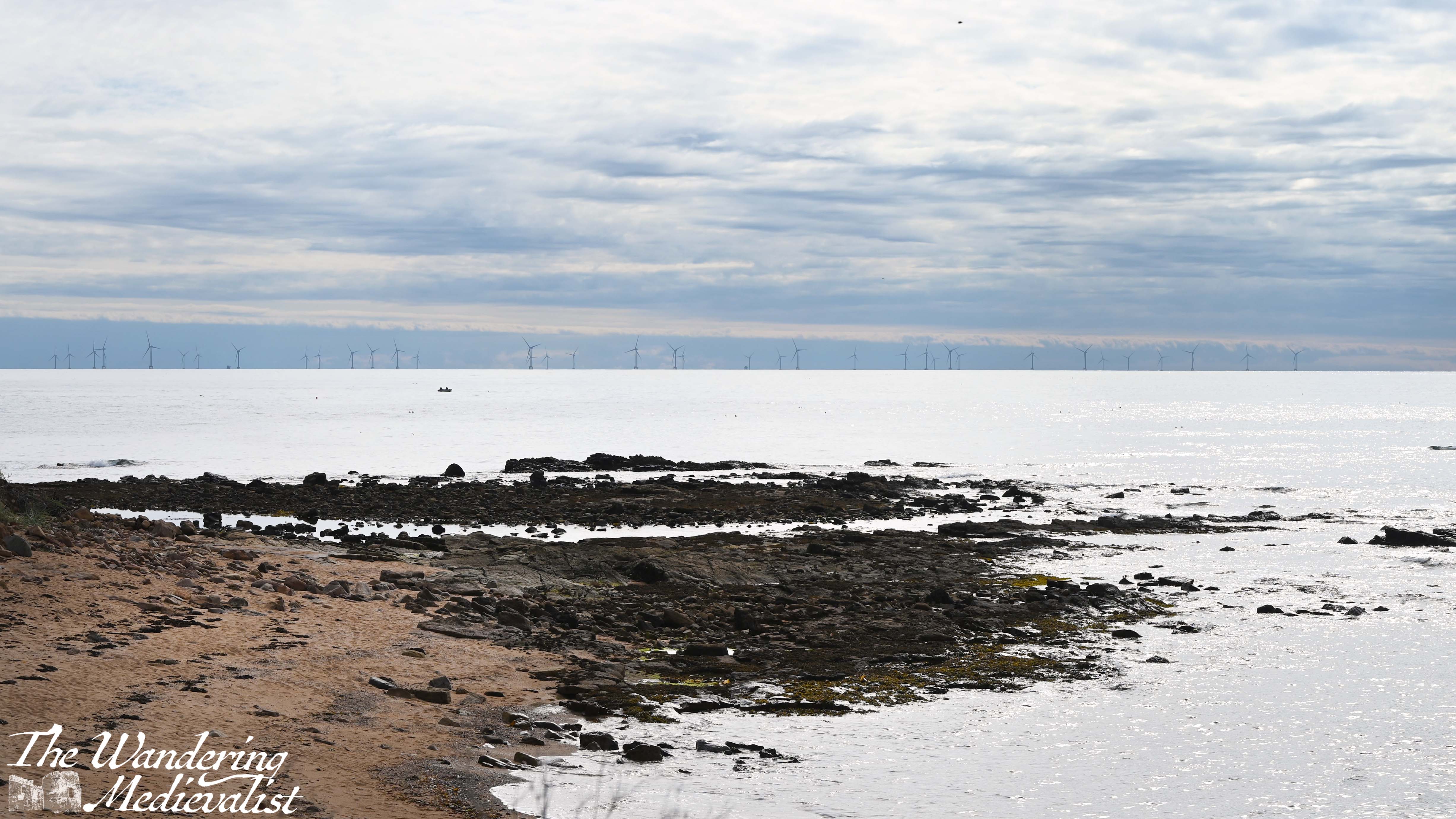
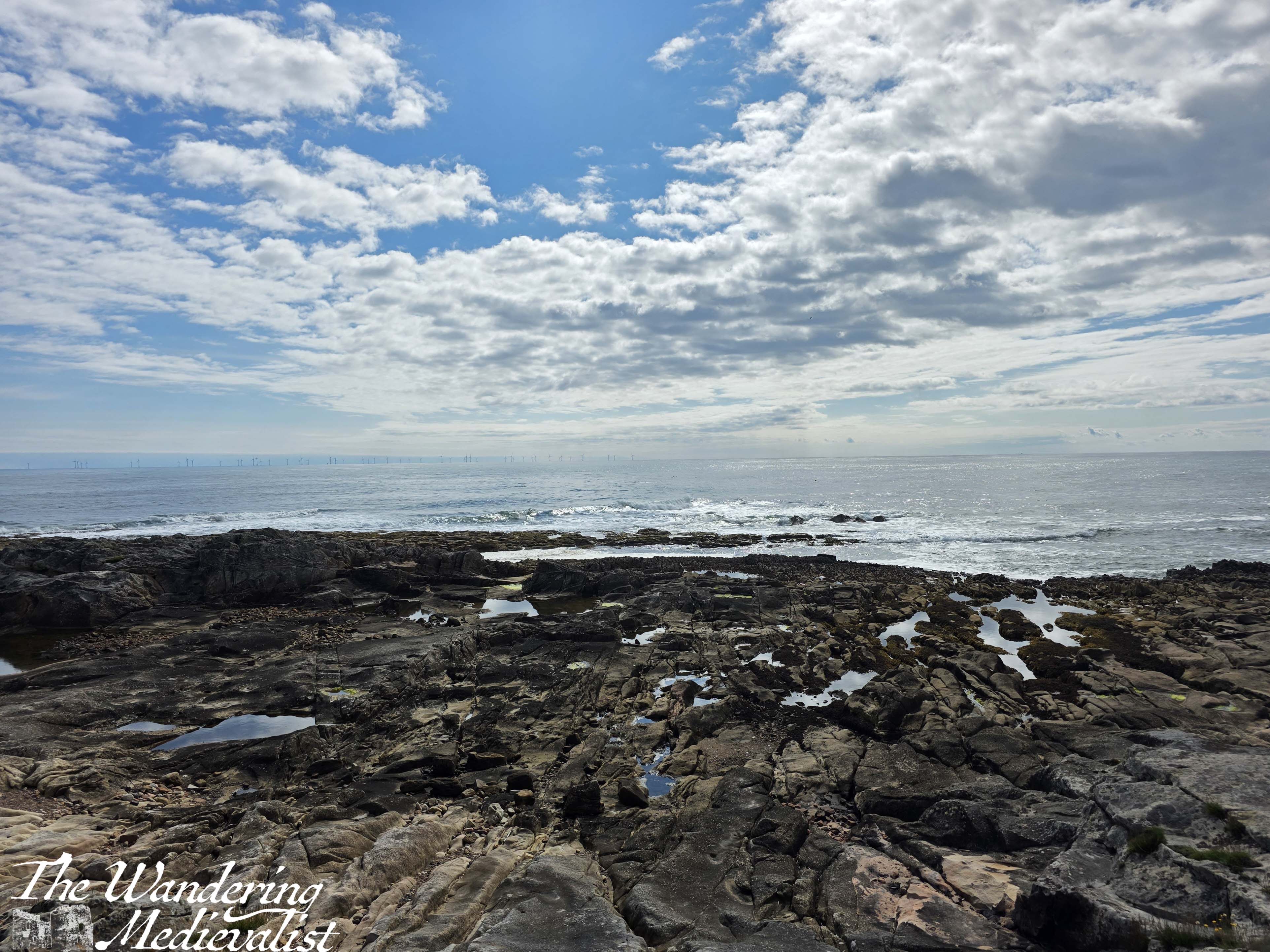
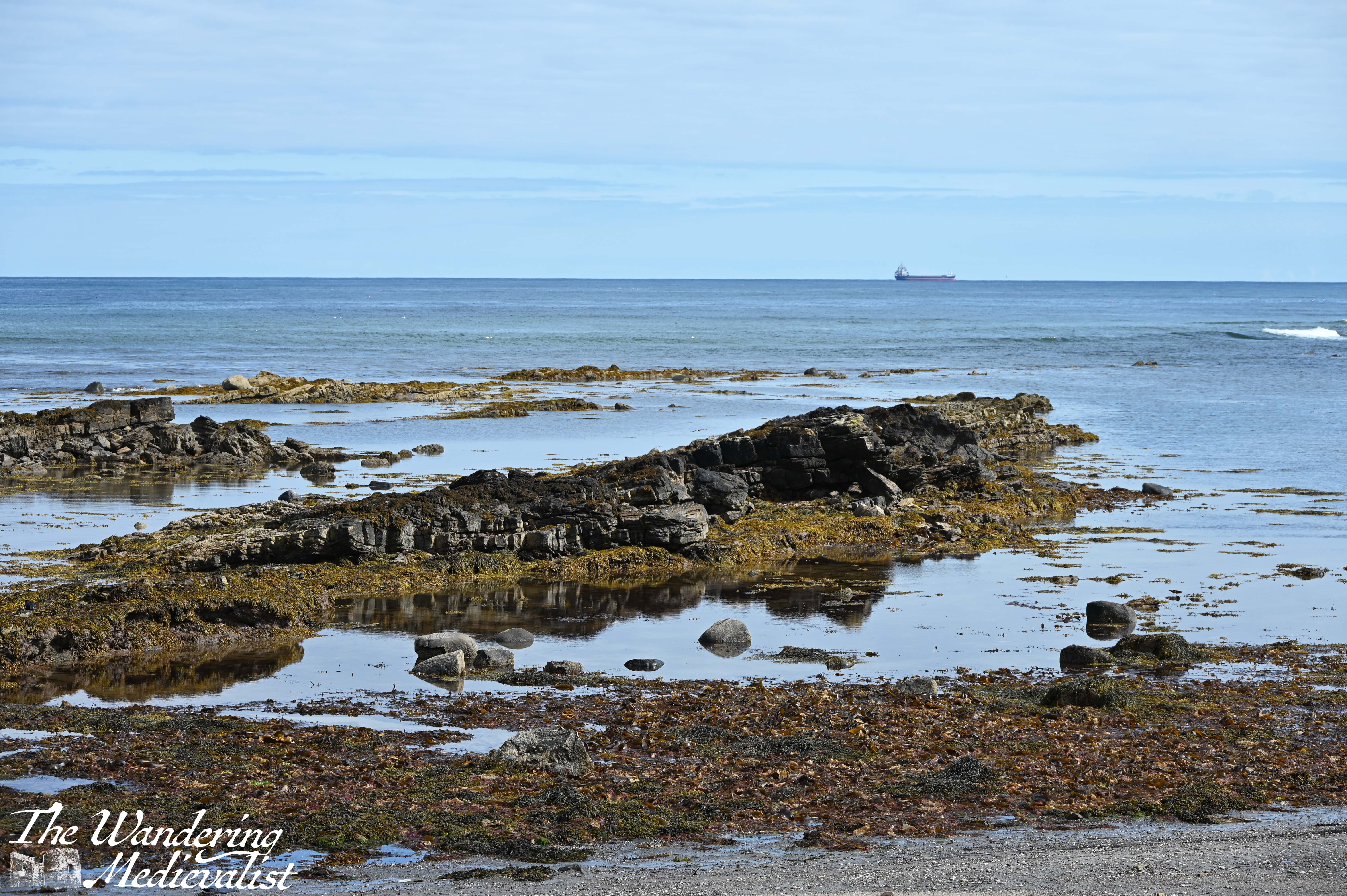
You will note in these pictures an enormous wind farm, with turbines all along the edge of the horizon. There is a lot of controversy over this wind farm, and the recent approval for what will be Europe’s largest wind farm; some object to the visual of them, but there are also environmental concerns. Personally I don’t think the optics are really an issue, and I don’t have knowledge to comment on the impact on sea birds.
From this point, the path rounds a corner into a relatively wide flat area, with long grass on either side and a rocky trail. There was one spot that was really muddy and required negotiation on stones, but overall it is pleasant, a touch flatter than much of the East Neuk trail. In a few places, you will notice entrances to bunkers along the coast; it was of course a perfect lookout spot during World War II.
This part of the trail is quiet and it might be tempting to look up at the view, but it is also quite uneven and I have in the past rolled an ankle pretty hard here. As you go past a viewing platform and through another kissing gate, the path becomes a bit more rolling, with some ups and downs on rocky stairs that can be steep.
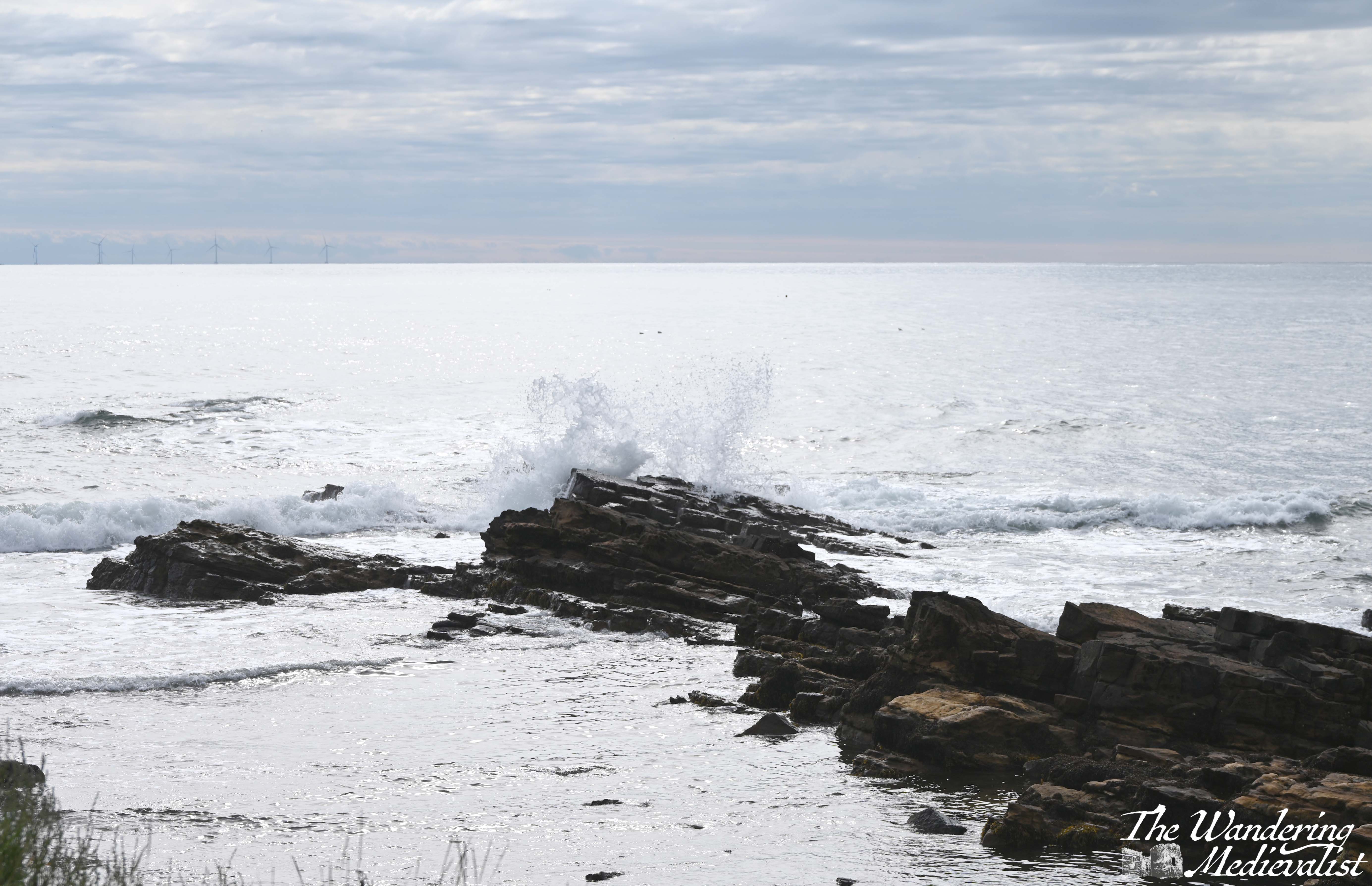
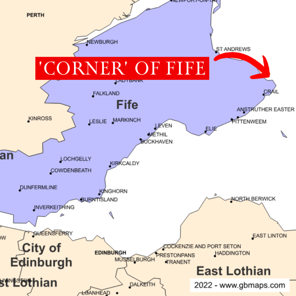
There are some great viewpoints, and eventually at the end of the bay you go up and down one more rise and discover a golf course on your left – this is Fife after all – and the ‘corner’ of Fife ahead. By corner, I mean the point of land that sticks out furthest in to the North Sea.
I found myself stopping here for several minutes, looking out over the crashing waves – it was a challenge really not to stay for hours, as I find them quite mesmerizing. Repetitive, yet always different.
I had a goal however and so pushed on. Right at the corner, the trail narrows slightly to pass between the Fife Ness Lighthouse above, and a bird blind and WWII pillbox, constructed in 1941 as part of the Crail airfield. Whereas you often see other evidence of WWII defenses further up the coast along West Sands and Tentsmuir, I had not noticed many or any in the East Neuk.
Once you turn the corner, you approach another small caravan park and the remains of Fife Ness harbour, first mentioned in the 1530s.
The harbour was used for fishing, as well as for shipping stone from nearby Craighead quarry – some of this fine stone was used to repair St Andrews Cathedral in the 1450s. The long lines of sharp rocks stretching into the waves make it clear why this point of Fife could be treacherous for boats; I was walking at about mid-tide, but the rocks clearly went much further under the waves.
There is also a great example of a Scottish seaside cottage, well-kept of course with a small garden. I wasn’t really sure that I was going the right way here, but there was really no other obvious route, so as before I just kept walking.
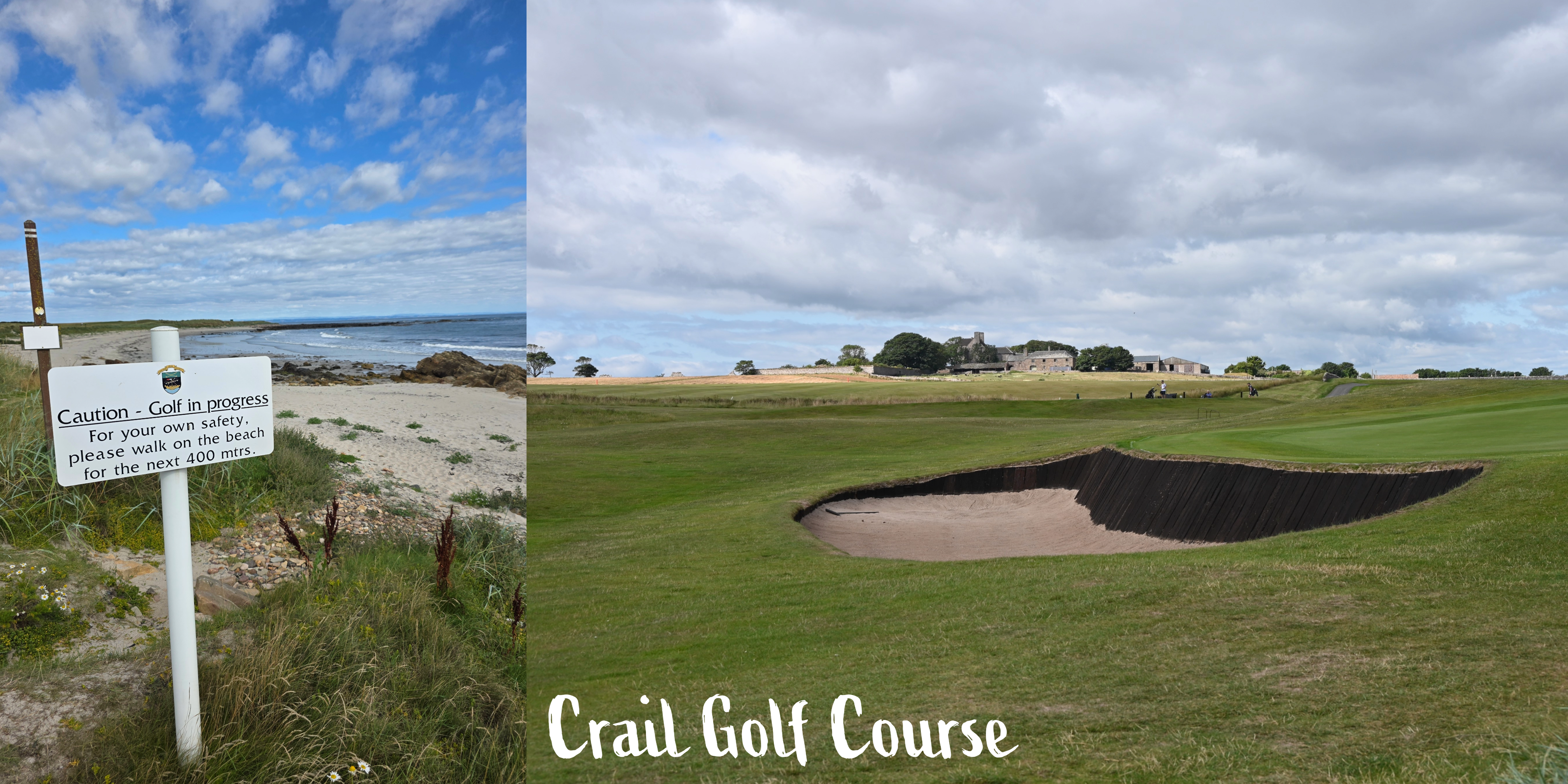
The paved road soon looked as though it would be heading directly for Crail Golf Club, but sure enough as I reached the edge of the green, the Coastal Path signs returned and I headed off to the right on a path that ran along the edge of the green.
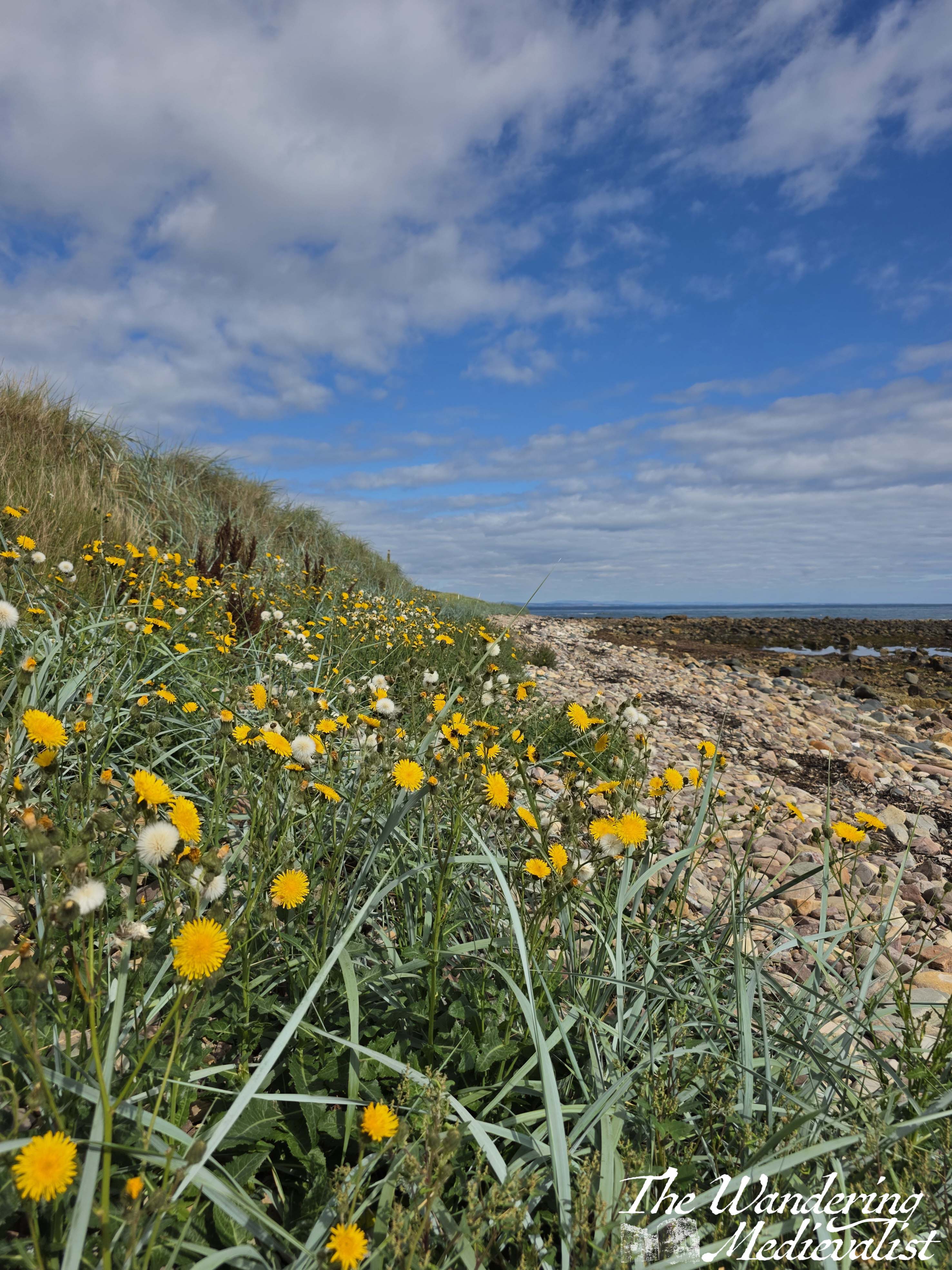
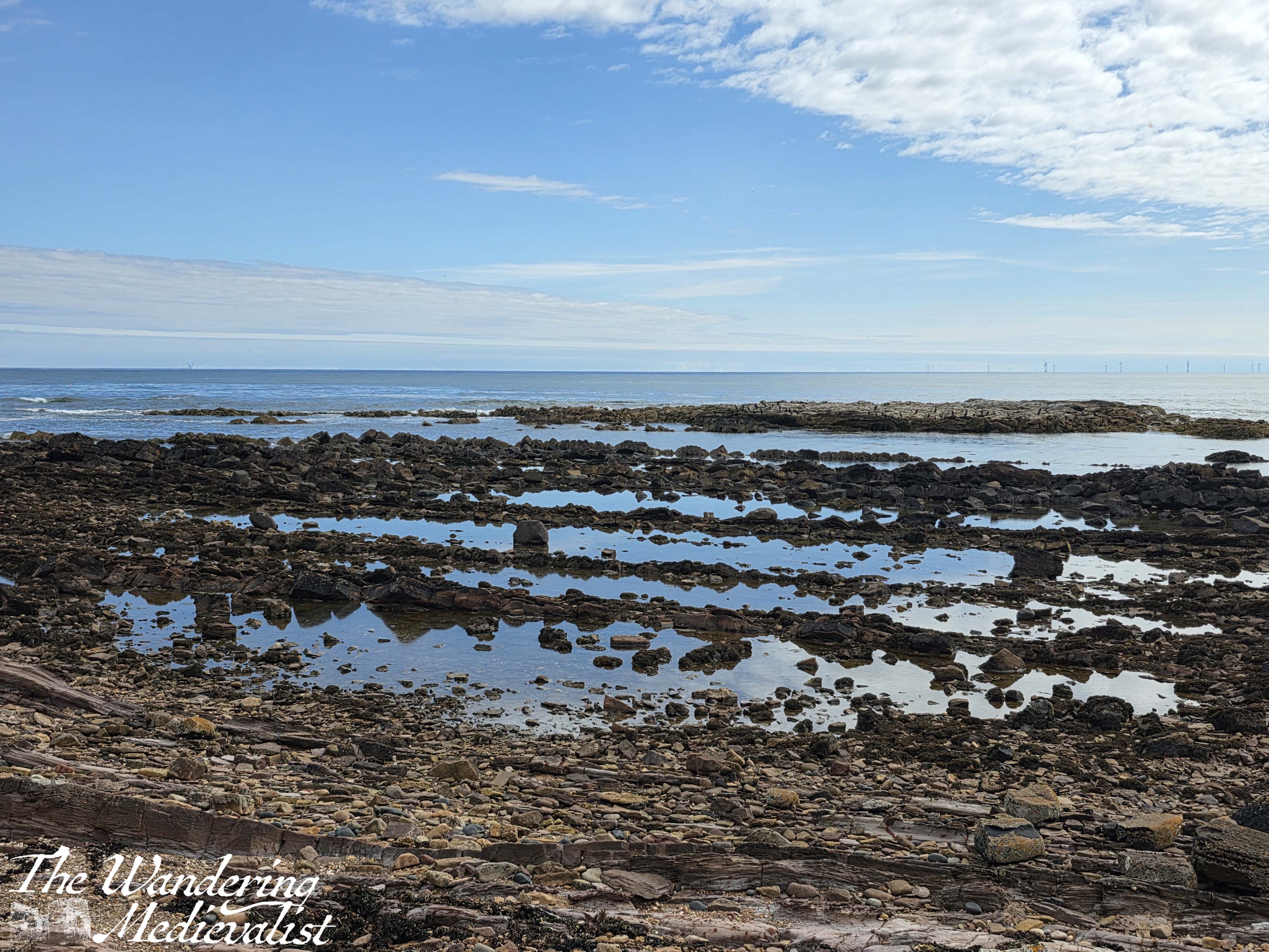
This is a really beautiful stretch, particularly in the sun as it was when I walked, with the ocean and multitude of wild flowers. It is hard not to be fascinated by the layers of stone and the pools of water between them, glistening in the sun. There are a few signs on poster boards for adult geology classes, and it is easy to see why this would be a good spot. The layers of stone and water erosion are very evident.
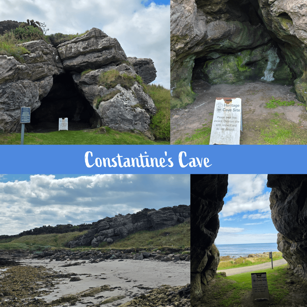
From here the path hugs the edge of the golf course, at times moving up to the walkways designed for golfers, but only for a short while. I stumbled across Constantine’s Cave quite by surprise, absolutely not expecting it to be in the middle of the golf course. Interestingly, the other half and I had planned to walk to the cave some years ago, joining the trail near the airfield, but gave up due to my rolling my ankle (see above). I’m quite pleased in the end that we didn’t go the whole way, as compared to the Caiplie Caves this one is a bit less dramatic.
While visually not as impressive, the cave does have an interesting history; excavation work has shown evidence of a stone wall across the entrance, protecting the interior space, and the earliest occupation layer was pre-Roman. The cave’s name comes from the local tradition that King Constantine III of Alba (903-943) was killed in a battle near the cave.
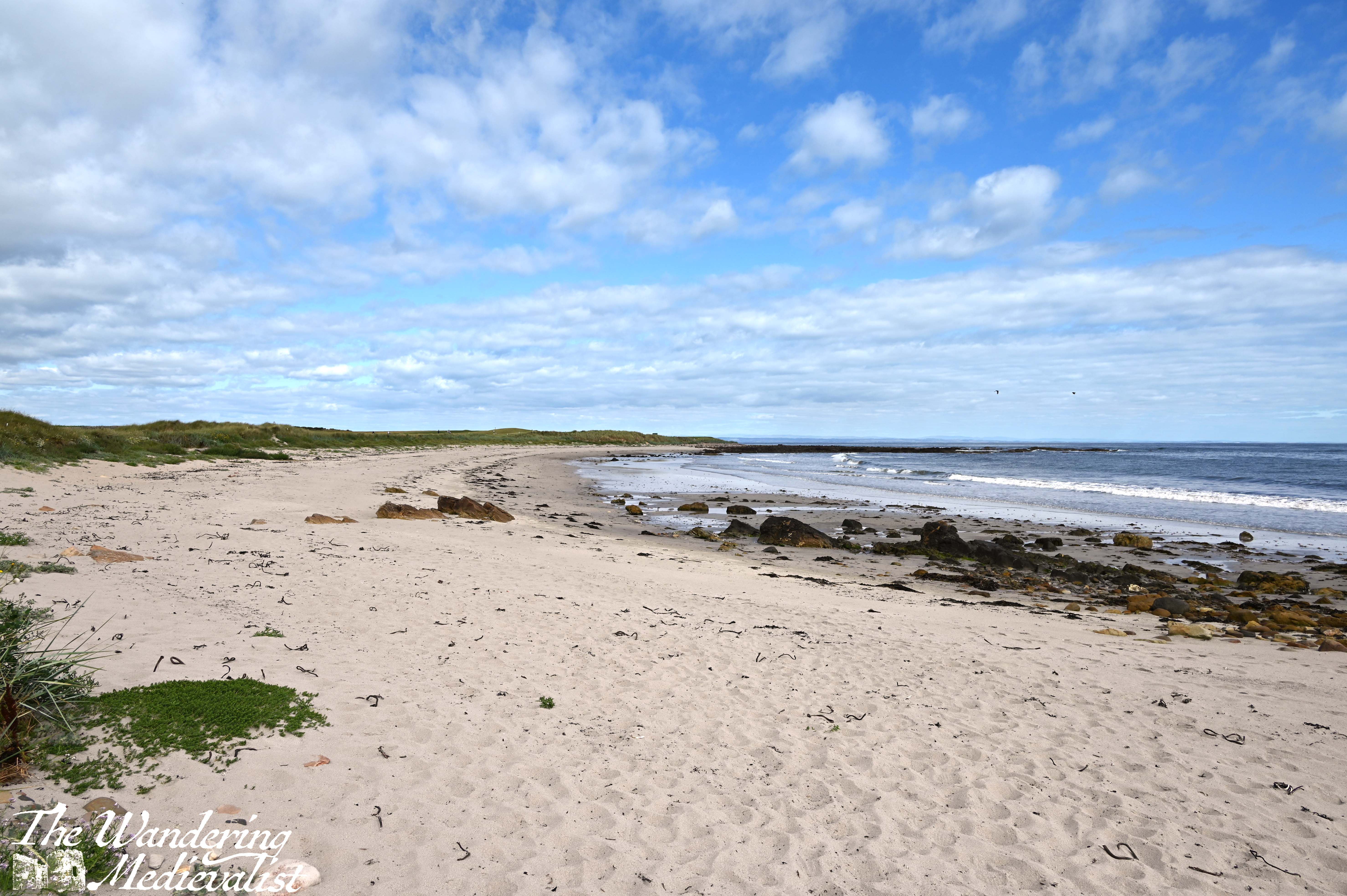
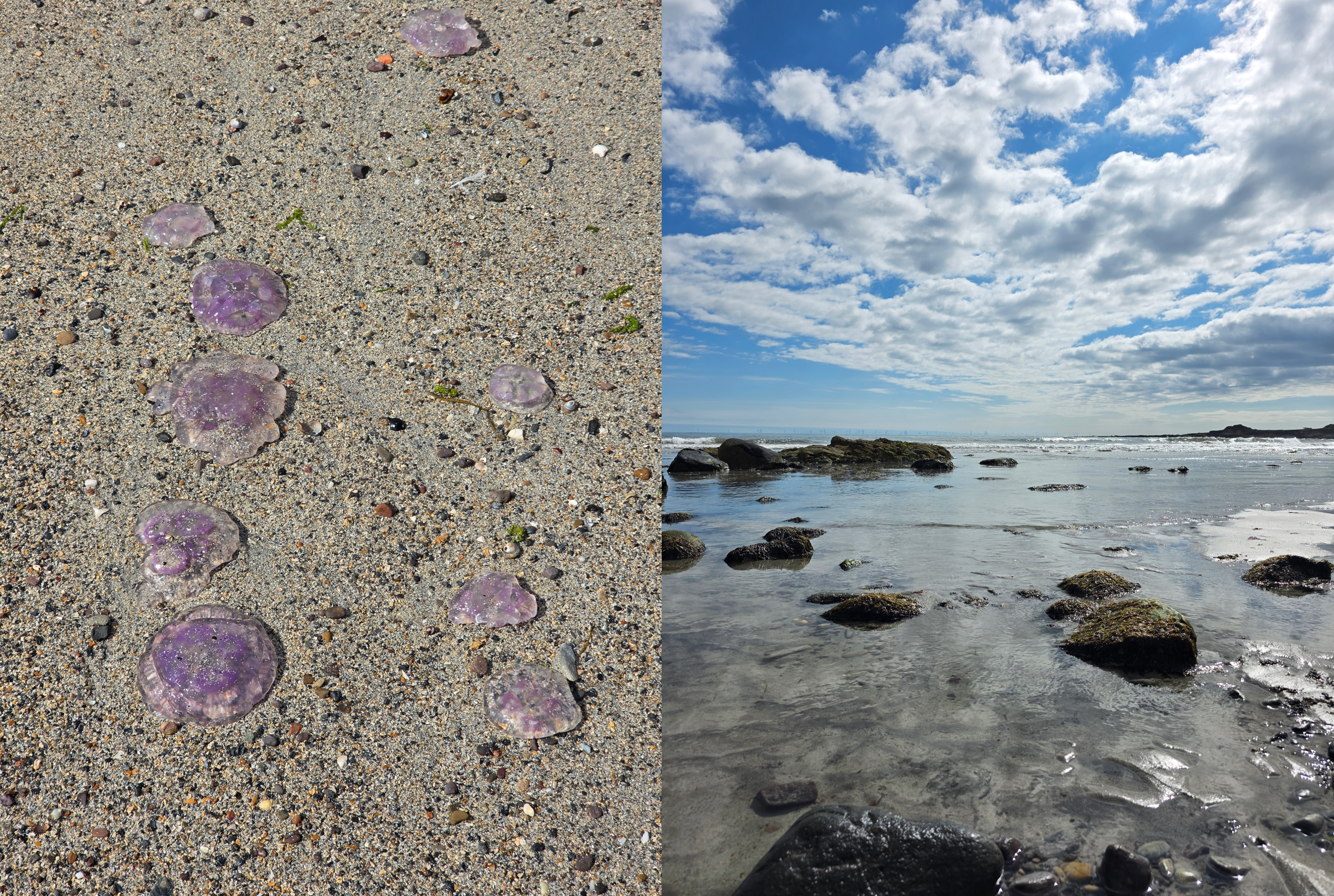
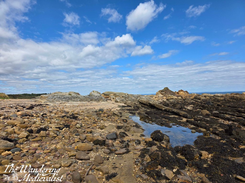
Not far beyond, walkers are directed to move down to the beautiful sandy beach below, to avoid interfering with the golf play. I was very happy to do so, enjoying my ramble in the sand, though it was somewhat hindered by what must have been hundreds of beached Moon jellyfish along the high waterline. Eventually I chose to move closer to the waves, where I could avoid stepping on them.
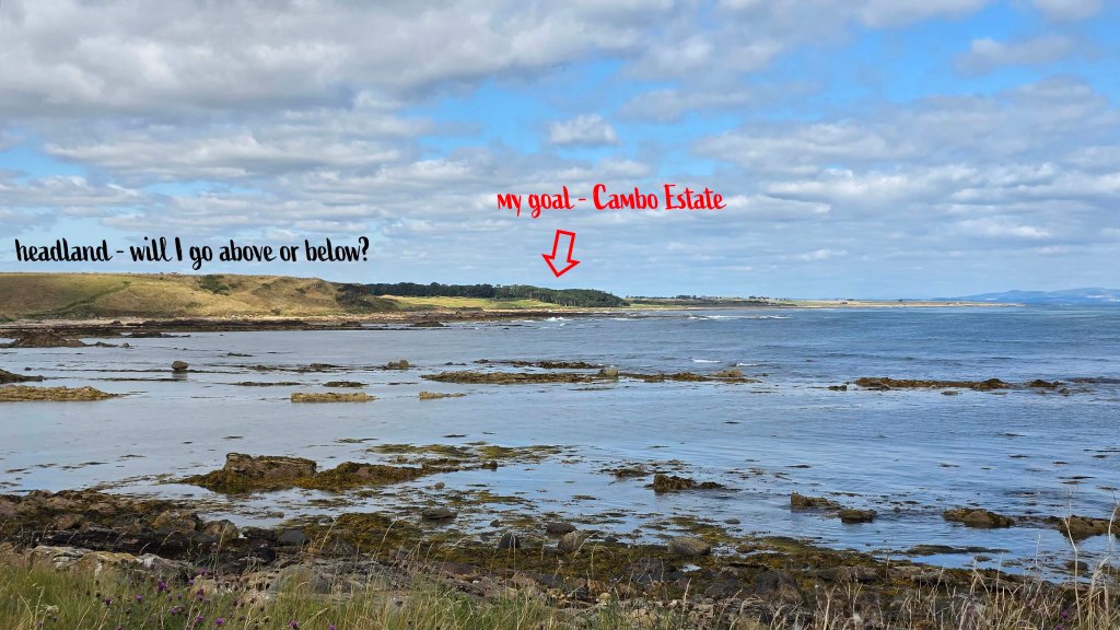
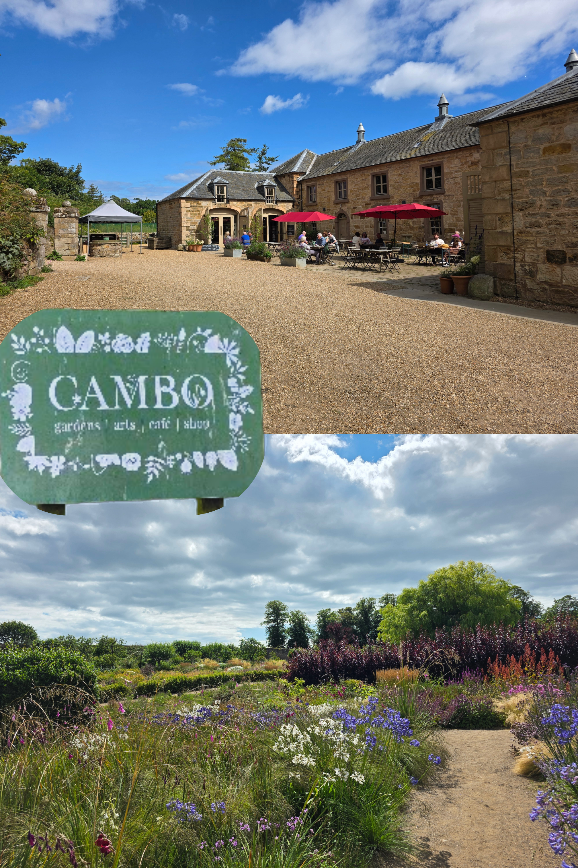
The sandy beach slowly becomes rocky, and the last few metres require some scrambling to return to the upper path, along the golf course. Soon after re-joining the grassy trail, another corner is turned and all at once I could see the tree line of Cambo Estate ahead, though still a distance away. It was a touch intimidating to see the coastline between there and where I stood, including a headland that I was not sure if I would pass over or under.
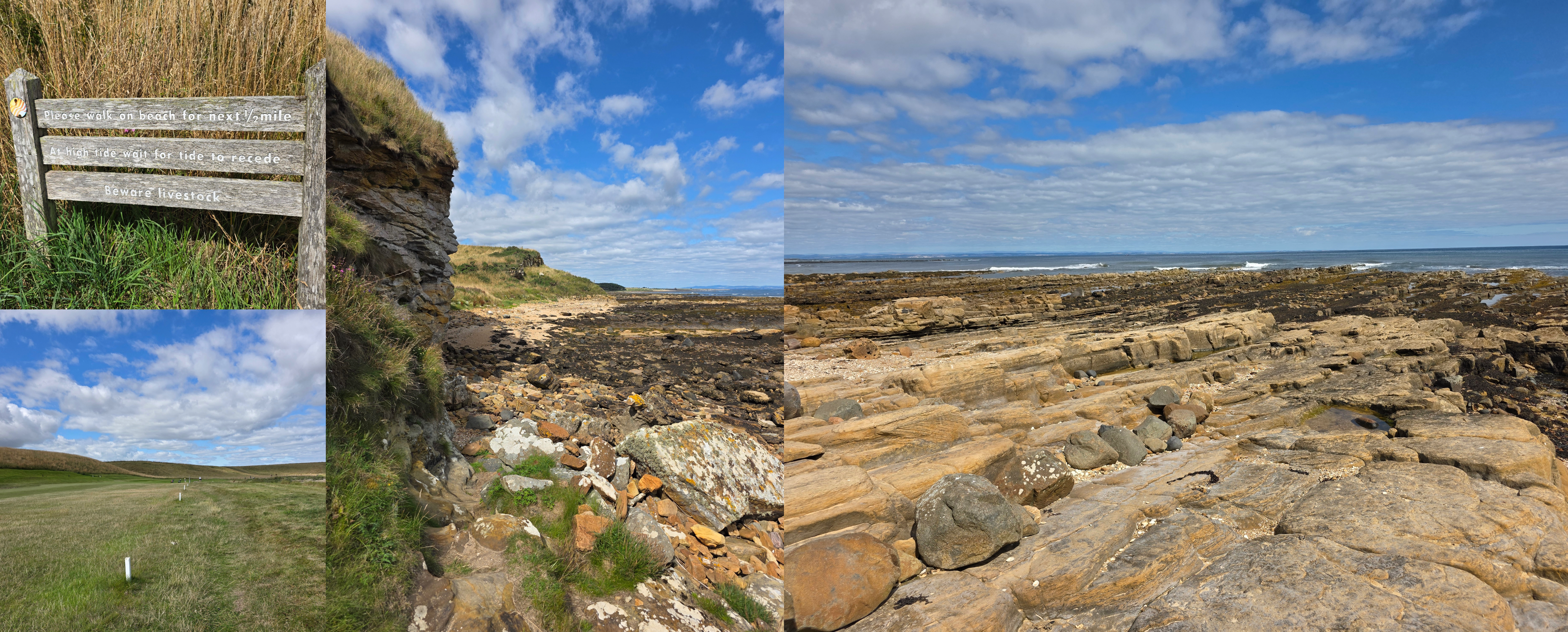
I should note that the official map of the Fife Coastal Path warns walkers that this section of the trail, between Crail and St Andrews, can be challenging and may not be passable at high tide. While I had neglected to check the tide – not a mistake I will make again – I was lucky to discover it was going out rather than in, so I had plenty of time. Absolutely be more sensible than I if you try this walk, and check well in advance – there are plenty of websites and apps available.
From here to the edge of Crail Golf Course, it can be on occasion difficult to tell if you should be on the beach or not. At least once I opted for the beach route, seeing a faint trail from other hikers, as it was nice to have a bit of variety. I was so fortunate to be walking on such a gorgeous day, and at a time of year when daisies and other wild flowers are everywhere. (I do not know names – must educate myself on wild flowers). There is a series of small white posts in the grass that seems to separate the well-manicured golf course from the trail, but those are not always clear.
Eventually, after about 1.3 miles of edging along the golf course – with frequent reminders that golf is being played and you should be aware, and listen out for ‘fore’! – the course ends and there is a different kind of hazard, albeit short-term. The field of livestock was relatively calm, with one or two getting up as I passed. The white cow did keep a close eye on me, but never actually moved, just watched carefully that I would not be a problem.
At the far edge of the livestock pasture, the path leads steeply up hill – the headland I could see from a distance – then almost immediately back down again. There may have been an option to scramble along the beach here, rather than going up and down, but there was a great view at the top so worth the extra push. This may also be the only option at high tide.
Once down at beach level, the path cuts in front of a large cliff, onto the beach. There is a warning sign here to stay on the beach to avoid the fields of livestock, which are clearly open to the beach.
At first, the beach is not too difficult to manage, a combination of sandy and rocky but mostly rocky. I could see it as definitely being slippery if wet or if the tide had recently receded. As someone who grew up playing on beaches like this, I really enjoyed this section, especially with the view off to the right. The most challenging parts were soft sand and dodging the cow pats that were evidence of the open boundary between beach and meadow.
As I plodded along the beach, though, I realised that I was starting to run a bit short on time. It’s always a touch frustrating on a trip like this when your public travel options are limited, and you find yourself racing the clock. The farther I went, the rougher the terrain became, with rocks that were too small to completely stand on, but too large to step between, requiring a lot of attention and energy, slip sliding along. Progress slowed, and I was running low on energy. Finally, I caught sight of a stone wall – this was the end of the beach walk, though I was challenged in the end by a final obstacle – using a rope to haul myself up a wooden ladder to cross the wall.
It was at this point that I realised I needed to add two things to my hiking arsenal: one, a portable power bank, as my phone was beginning to run low (using it for pictures and voice notes) and I needed it for my return bus ticket. Two, an updated map of the coastal path; mine was from 2017, and it has become increasingly evident with each walk that changes have been made since then. While there is an online version, you are often out of range of data on these walks so it quickly becomes obsolete.
Carrying on past the wall, the path heads up a small hill, offering views of the livestock field on one side, and Kingsbarns Golf Course on the other. It was a busy day for golf with several large groups out, and to my amusement I identified more than a few American accents among them.
I thought that the path stayed by the coast at this point but instead it loops up above the golf course, which caused me a bit of confusion. My last efforts along the beach had driven me beyond the point of questioning, though, so I pushed on, enjoying the view over the course. It was also helpful to see the treeline of the Cambo Estate clearly ahead of me, knowing that was my goal.
The path is a touch unclear here, but I used my instinct and habit at this point to keep to the edge of the golf course – a brief turn left then almost immediately right again, between a few greens. The sun was bright and hot by this time, and up to the left I could see a few old estates including the roof of Kingsbarns Distillery.
The Coastal Path approaches the estate wall and is briefly forced around to the left, curving towards the water, before a small gap in the stone appears. There is a wooden gate and sign for the path – I was quite relieved, as I knew the end was near and I did not want to go all the way back down to the beach.
Through the gate, there is an immediate right-hand turn down some wooden stairs, and a view through the trees towards the beach, looking over the Cambo burn.
Once you go down the steps, the path sweeps towards the river, and on the other side splits into several directions. One leads down to the coast, one further along towards Kingsbarns, and one up towards the estate house and gardens. This was where I marked the end of my walk – 5.5 miles from where I started in Crail. But, I still had a way to go, walking up through the estate grounds.
Cambo is a beautiful spot to visit, with a walled garden, excellent café, and plant shop. It is possible to walk up past the walled garden, through the car park, and along a path all the way to the road – for those hoping to make a bus, this is a solid mile. I tried, I really did, but I missed by about 10 minutes, having forgotten just how far it was. Fortunately, the other half took pity upon me and collected me from the bus stop where the only alternative was a 45-minute wait.
I did consider joining the groups of families and couples enjoying their lunch in the sun, but I was hot, sweaty, and a touch bedraggled. Home was the better option. Overall I found this a really pleasant walk, and not as difficult physically as I thought, meaning that my stamina is definitely improving.
I might try it the other way were I to do it again, with the rocky beach the first thing I tackled rather than the last. But I do seem to have developed a pattern of walking counter-clockwise around the edge of Fife, and I am now reluctant to change that. Public transport is possible for this route but a bit tricky, so worth just being aware of the limited options (one bus an hour to Cambo), and of course, check the tides!
Autumn travel approaches, but I hope I will manage at least one more section of the trail before I disappear overseas.
A short time ago, I was fortunate enough to be sent to a work conference in the US. I was excited to go to San Antonio, where I have family, until the relatively quick realization that the south of Texas in June is not a particularly welcoming place for those of us used to temperate summer weather. In fact, a quick check of the weather website showed temperatures of 37 Celsius (about 100°F). As I said in a joke to my office mates, now I have a real sense for why my San Antonio family leave in the summer, to escape the heat!
So, I packed my bags to prepare for heat and away I went – I had been to San Antonio many years ago in the early 90s, and all I could really remember was Sea World and a riverbank where we had a picnic lunch. A riverbank well outside the city centre, I should clarify.
I landed in San Antonio after a long journey from the UK and hopped in a taxi. As we drove through the city, I found myself very aware of the other, more sober reason that I had been looking forward to a re-visit, and that was that my cousin who grew up there and was very close to me in age had passed away 18 years ago in a road traffic accident. We had not been in touch for years before he passed, and I have always regretted not being able to know him as an adult; I felt his presence, or more accurately his absence, very keenly for most of my visit.
The morning after my arrival, I woke early – as I always do on day 1 travelling west – and decided it was a good time to go out for a walk through the city, as it was still early and not yet as hot as it would become. Even so, the temperature outside the hotel made me gasp, and I realised I would need to quickly adjust my walking speed from Scottish stride to a slower amble.
8am in San Antonio
My first goal was that most Texan of locales – the Alamo. I knew it was only about ten minutes on foot from my hotel, and so I set out along West Houston Street. As expected on a Sunday morning, the streets were quiet and peaceful, though the aura of impending heat was in the air.
It was a pretty much straight shot down the one street to reach the Alamo, and I passed more than a few purely San Antonio sites: La Panandería, a popular bakery already with along queue outside; the Buckhorn cafe, including the Texas Ranger Museum; one of the original Walgreen Drug Stores from 1901…
…and perhaps most importantly, my first introduction to the River Walk, which I loved immediately, with its lush foliage and the tantalizing glimpses of another world you get as you walk along the main streets. More on this to come.
The Alamo plaza area itself was surrounded by construction, including work being done on a building where there were enormous scaffolds holding up the historical frontispiece of a building that was otherwise torn down – a scene familiar from Edinburgh, where listed buildings are being renovated. The Alamo is probably one of the most famous spots in the world for being considerably smaller than one might expect – so much so in fact that I imagine most visitors are prepared to be under-whelmed.
The approach from East Houston Street passed first the construction, and then turned right along the Alamo Plaza. The stone stockade is still in place, with barred windows facing the foot traffic.
I admit that I did not spend a lot of time at the Alamo, as I only had a day to explore and I did not want to go inside the building itself. Still, its a majestic spot that recalls the Spanish architecture that still dominates most of the city; and of course, there is a great statue of Davey Crockett just by the entrance, looking over the site.
As one would expect, there are plenty of shops near the Alamo to indulge any need for souvenirs, but my favourite was that of a local artist Alejandra Martinez Hernandez, whose style includes lots of bright colours and florals, and scenes of south Texas.
As the heat was increasing swiftly, I decided that it was time to pick up the trolley tour I had researched, which left from nearby the plaza – Old Town Trolley Tours. It wasn’t inexpensive, but was worth the cost!
I was fortunate enough to just catch a trolley about to leave. As with many trolley tours, the driver provides information as they weave through the traffic, and my driver – Elaine – was incredibly knowledgeable about the city, its history, and so much more. She kept asking if I wanted to get off at particular stops, as I was the only one on the tour at times, but I said to her, this is what I want from the day: I just want to sit and see the city and enjoy it all. Which I did!
Starting just by the River Walk, the tour passed by Casa Rio, the oldest restaurant on the River Walk, then continued out of the city centre past The Pearl, the former brewery of San Antonio – I felt a strong draw to this area, doubtless due to the German brewer roots in my own family. We did a large loop out through the edges of the city, passing by UT San Antonio, the Zoo, the Botanical Garden and some of the large parks.
I learned about the San Antonio Street Art Initiative, which grants local artists permission to paint murals on walls, the columns of the underpasses, and so much more. It is truly extraordinary, and beautiful.
In time we looped back into the city, and while I enjoyed the tour immensely, I wanted to explore the San Fernando Cathedral, which I had passed briefly earlier in the day. So, I alighted just outside the city courthouse, where I was surprised to see a group of statues labelled ‘Canary Islanders’. This seemed incredibly random to me, and on later research I discovered that this is known as the Founders Monument, honouring 56 Canary Islanders who arrived in San Antonio in March 1731 and established the first civilian government in the area.
Immediately across the busy road from the courthouse is San Fernando Cathedral, the seat of the Archbishop of San Antonio that was built between 1738 and 1750.
The cathedral was founded in 1731 by the Canary Islanders mentioned above, who had come to Texas at the invitation of King Philip V of Spain, and it is the oldest continuously functioning religious community in Texas. The heroes of the Alamo are buried here, and weekend masses are held to this day, as I discovered when I visited; I did not want to take pictures during mass and so came back later in my visit to take the interior views above.
By the time I had explored the cathedral, I realised that I was starting to experience some symptoms of being overly hot and under-hydrated. While I had been sitting still in the trolley, there was a constant gentle warm, dry breeze wafting over me that completely stripped me of energy and hydration. The afternoon sun was incredibly hot, and in the end, to avoid heatstroke I stumbled into a CVS, where I enjoyed their excellent air conditioning and a large bottle of cold water. I do love CVS.
Finally feeling a bit more myself, I decided that it was time to head back to my hotel for a rest. To avoid any more potential heatstroke, I opted to descend the nearest stairs to the River Walk, which I quickly realised was not always the most direct route through the city, but was cooler and much more comfortable. Yes, it is very tourist-focused with its river tours, 100s of dining options and drinking establishments, but it is a great way to get away from the traffic and the heat of the streets.
San Antonio River Walk
The history of the River Walk is heartbreakingly relevant in today’s news, considering the very recent flooding that took place close to the city and the tragic loss of more than 130 people.
Back in 1921, there was another disastrous flood, this time of the San Antonio River, which of course runs through the city centre. More than 50 citizens lost their lives, and so plans were developed for flood control of the river, including an upstream dam (the Olmos dam) and a bypass channel. The bypass channel was disapproved of, and a few years later, a San Antonio native submitted plans for what would become the River Walk – an evolution of the river into the present 2.5-mile River Walk. The key to his plan was not in paving over the proposed bypass, but a series of flood gates and dams that allowed for the bend in the river to be surrounded by commercial development.
While not immediately supported, the plan grew in popularity over the next 10 years and eventually received crucial funding in 1939, enabling the initial construction of walkways, bridges, and plants. Another flood would threaten downtown San Antonio in 1946, but this time the dam and bypass channels minimized damage. Casa Rio, the first River Walk restaurant, was opened in 1946, and the rest was history.
Today, the River Walk is highly commercialized. There are endless options for food and drink, small bars and restaurants, hotels, shops, and of course a narrated river cruise that passes by every few minutes. The foliage and trees are beautiful and well-kept, there are occasional water features and plenty of ducks, as well as picturesque foot bridges, and the buildings are a mix of modern and charmingly historical.
While I certainly did not walk every step of the path, I did find myself trending towards the River Walk whenever I could. I also managed to snag one of the many frozen margarita options (including some in take-away cups) on offer.
On my final night in San Antonio, some colleagues and I had a relaxing dinner sitting on the River Walk and enjoying a light breeze, people watching as tourist families from around the world wandered by. As evening fell, I walked back towards my hotel and was delighted to see the incredibly beautiful street lamp you see in half of the picture above. I had passed it in the daylight, but at night it was even more stunning.
In case y’all could not tell, I really enjoyed San Antonio. Like my home town of Boston, it is a city proud of its history that makes sure it is visible everywhere. Like Edinburgh, it prefers to re-use old buildings rather than construct new ones, and high-rises are limited. There is so much of the city I never got to, only scratched the surface, but I feel like I have a good sense of what else there is from the excellent trolley tour. There is a massive military connection with one of the largest Joint Bases in the US, a strong gastronomic connection as one of the locations of the Culinary Institute of America, it is considered the birthplace of Tex-Mex and the five 18th-century Spanish missions are together classed as a UNESCO World Heritage site.
The city is incredibly artistic, and one of the most diverse in the US, with more than 65% of the population identifying as coming from a Hispanic background. There is fantastic food and drink, plenty to do, and if you can manage the heat, San Antonio is an essential visit. And, now officially my favourite city in Texas.
Scotland (and indeed the whole UK) was blessed last week with a stretch of sunny, hot weather that encouraged everyone to get outside. And then back inside, quickly, to get sun screen and water bottles. In England the temperatures hit the 30s (about 90°F), and in Scotland the high 20s which qualifies as a genuine heat wave.
I was eager to get back to my Coastal Path goal after several weeks of travel and then post-travel illness (I blame Charles de Gaulle airport, where I was re-routed after a flight delay), and this sunny spell was the perfect incentive to get out there. So, I chose a slightly shorter route than I had been doing in May, only 4 miles rather than 5, for while I’d kept up my walking during my travels, the cold/cough combo on my return meant I’d had two weeks for my stamina to unravel.
It was time, I decided, to tackle some of the south coast of Fife beyond the East Neuk, and so I planned the train trip to Kinghorn, where the rail station is almost immediately on the Coastal Path. Since the opening of the Leven Rail line, the trains from Edinburgh to Dundee no longer stop at these smaller stations, and so I was required to change trains in Kirkcaldy. Fortunately, the Leven train was only 5 minutes behind, so I was only slightly delayed; if coming from the Edinburgh direction, it would be easy to get on the direct Leven train.
The day was sunny and bright when I alighted in Kinghorn, which is a station I have always wanted to stop at due to the beautiful view from the train at this point. This section of the track is why I always encourage visitors to sit on the right-hand side of the train coming north.
I paused to take a few pictures and hoped to use the facilities in the small station, but found them out of order. So, I headed down the steep hill towards the coastline and beach.
Kinghorn may not boast quite the same stunning nature as some of the East Neuk villages, but the beach is beautiful and there are regular views across the Firth of Forth towards Edinburgh. It was a clear day so that I could see the outline of Arthur’s seat and the coastal town of Leith clearly, while a gentle breeze kept the temperature comfortable and the bugs at bay.
The path starts off along the coast then loops back up under the train track and through a fantastic pirate-themed play park.
Beyond the park, the route passes once again under the rails, then turns left along the back side of a caravan park. This portion of the trail is quite narrow, stuck between the fence for the park and the fence for the train line, so keep a look out here for other walkers/runners and cyclists. I should say, I did not pass many people at the Kinghorn end of the trail, but as I approached Kirkcaldy there were more and more people using the path for a Saturday morning jog or stroll with the dog.
I mentioned above the rail track, and it’s worth pointing out that this is a relatively busy line, so don’t be alarmed by a sudden, speedy train interrupting your peaceful walk. And peaceful it is, gently rising and falling along with the coast, a similar feel to other sections of the walk with the rocky beach on one side and a grassy slope on the other, dotted with bushes, wild flowers and the occasional tree.
The ocean was incredibly still on the morning I walked, with only one or two fishing boats out; the gentle breeze I enjoyed was definitely not enough for sailing. It was difficult not to pause regularly to enjoy the view back to Edinburgh , and if my camera battery had not died 10 minutes in (my own fault for not checking it), there would be many more I am sure. Fortunately, my phone takes good pictures so I made up for the lack as best I could.
Gradually the path goes around a curve in the coast, and rises temporarily away from the beach on a sharp switch-back style path. The view from the top is even better, though it does not last long, with the trail gently descending over several stair cases. One advantage I noted of this portion of the path was that there was a fair amount of shade, relieving the heat of the sun for a short while. This is definitely not the case closer to Kirkcaldy.
Just over a mile out from Kinghorn, there is a steep climb up to the top of a hill, to a viewpoint at the top. This is one of the last really good views back towards Edinburgh and along the rail line, while ahead you can start to see the buildings of Kirkcaldy.
The path descends again towards the beach level, and around a corner the houses at the very edge of Kirkcaldy come into view, along with the ruined Seafield Tower.
Upon a bit of searching, I discovered later that this tower is all that remains of a late medieval (sixteenth-century) castle. It was sold to the Bishop of Glasgow in 1631 and after passing through several families was allowed to deteriorate to the state it is in today.
While the day was still clear and sunny, in the distance I could see that further north and east in Fife, the experience was not the same – instead, a thick haar (Scottish fog) was layered over the coastline from Elie around to Tayport.
From where I stood, I could just see Largo Law rising above the clouds.
And here I’ll take a break for a short opinion poll – let me know your answer in the comments!
Would you rather be able to see the end of your walk, even if it is several miles away, or would you rather have no idea how much longer you have to go?
As I walked towards Kirkcaldy, I could see in the distance the faint outline of Ravenscraig Castle, and the much more prominent high-rises of the Ravenscraig flats, which I knew were my goal but still seemed a long way away. Fortunately, I was distracted by how lovely the beach and coast are. It was approaching low tide so there was an expanse of sand, interspersed with rocky outcroppings. The old sea wall is still present though large portions have been washed away, creating dramatic gaps through which to see the view. Above me on the top of the hill to the left were increasingly well-appointed houses, many with large balconies overlooking the ocean.
Once past the old sea wall, the path continues along the beach which is now completely sandy, and was already starting to become busier with poeple eager to enjoy the sun.
I found the coastal path to be less well sign-posted here, and eventually had to look up the proper route on my phone, as I walked along the grass at the edge of the beach, past the car park for Seafield beach. There is a large Morrisons here, and officially the coastal path leads up to the left and around the store and car park. This is a good spot to stop for a snack or cold drink, if you need it. There is also, I am relatively certain, a route that takes you between Morrisons and the beach – or you can walk on the beach of course – but I was doing my best to follow the ‘official’ trail that loops around and then follows the main road past a Lidl supermarket.
There is no need to cross the road – stay on the Morrisons side and follow the sidewalk (or pavement, for the Brits) around the edge of the car park – this is now the A921.
In short time, the road crosses a small burn – Tiel Burn – and here there are public restrooms should you need them. At this point, the path is not well-marked at all, but I determined that it made sense to swing to the right and follow the seawall at the edge of the beach, onto Kirkcaldy Esplanade.
I admit to being really impressed with how well-kept the esplanade is, especially as it was first built just over 100 years ago. Stretching for just about a mile, it is wide pedestrian route with a relatively new seawall separating it from the sandy beach. There are periodic breaks in the wall for paths down to the beach, and very recent additions to the pavement in the form of games to entertain children. There was a world map, several hopscotch outlines, suggestions of places to run, hop and skip, and much more, all brightly painted in clear colours.
Beside the pedestrian area is the busy A921, and across the road a series of shops, parking areas, and some apartment blocks. As I walked along the coast, I began to notice wisps of mist blurring the view – while not a full-on haar, there were gentle clouds rising from the sand and hovering in the still air. While it did not come together into a total blockage of the sun, the mist was gathering more heavily, and as I reached the end of the esplanade, the sea wall at the far end of the beach was hard to see.
At the end of the esplanade is the Heart of Kirkcaldy, a famous art installation that is popular with selfie-takers, and here I started again seeing signs for the Coastal Path. Rather than following the coastline around to the right, the path crosses at the stoplight and heads straight along the A921. Here there is an odd mix of much older buildings on one side of the street – 17th and 18th century – and very new apartment blocks on the other, as all of Williamson’s Quay is much more modern accommodation.
About five minutes later, there are two onward alternatives, marked by a pedestrian crossing. One is to continue straight up the hill ahead, along the road. The other is to take a right and then almost immediate left past the Carr’s Flour plant, and along the coast. I have to admit to getting this bit wrong, as the Coastal Path signs seemed to point directly into the factory grounds, and were a touch vague. So, I deviated from the path and went straight up the hill which is quite steep and a good long climb, especially after walking for about 4 miles.
My goal for the end of this walk was Ravenscraig Castle, a mostly-ruined edifice at the edge of Ravenscraig park. I did just see it from the road, but realised as I planned my route to it that I had firstly lost the Fife Coastal Path but perhaps more importantly, was about to miss the only bus I could get in that hour. So, I took a quick picture from across the burial ground then legged it across the street to the bus shelter, where a kind woman assured me that the bus had not yet come.
On the rather long and winding bus trip back to St Andrews, I was able to see just how all-pervasive the hair had become in Fife, with heavy clouds of mist reaching over the land from the coast and settling into valleys.
Observations on this section of the path are that the first section, which reminded me of many others with rocky beach and grassy slope, was a much shorter part of the 4 miles than I realised; instead, at least half of the walk ran through Kirkcaldy, both the along the beach and then the Esplanade. It’s a less nature-focussed walk, but the views are impressive and it was a good way to get back into my habit of waking on a Saturday and getting moving.
So, I shall soon have to repeat this section of the walk and actually visit Ravenscraig Castle, then make my way along the coast towards East Wemyss – who knows, perhaps next weekend?
Here are my top 3 most interesting facts about El Yunque:
It is the only tropical rainforest in the National Forest system (there are other rainforests, but not tropical).
It is one of the smallest National Forests in area, but the most biologically diverse with more than 240 species of trees, 23 of which only grow here. And saving the best for last!
There are NO mosquitos in this tropical forest (or very few), making it the perfect spot for hiking!
No mosquitos, I hear you ask skeptically?! It’s really true – a combination of the elevation, the slightly cooler climate, natural predators and the lack of stagnant water means that you will not be bothered by mosquitos while you take advantage of the glorious scenery, even if you forget your bug spray. The same is obviously very much not true on most of the island.
History of El Yunque
El Yunque (pronounced with the Spanish ‘y’ that sounds like a ‘j’) is one peak in the Sierra de Luquillo mountains, a subrange of the Cordillera Central mountain range that runs along the centre of the island of Puerto Rico. The peak reaches just short of 3,500 ft. (1,066 m).
The name of ‘Yunque’ may have come from the Spanish for ‘anvil’, or perhaps from a native name Yuken – there are several archaeological sites on the mountain. The view of the mountain from the nearby beaches shows how starkly it stands out against the horizon, forcing planes from San Juan to Vieques to fly around rather than over; it is frequently shrouded in clouds, even on sunny days.
view of El Yunque from the beaches at Fajardo and Luquillo
Coffee was cultivated on its steep slopes in the 1730s, but from then it was mostly left on its own, until it was set aside in 1876 by King Alfonso XII of Spain – one of the first forest reserves in the western hemisphere. In 1898, Puerto Rico was transferred to the United States, and this was one of the only areas where the forest had not been cut down. Teddy Roosevelt established the Luquillo Forest Reserve in 1903, and in time this became the National Forest we have today. The forest suffers regular damage from hurricanes and other storms ( in fact it had been quite badly damaged at the time of our visit in January 2018), but things grow fast in the Caribbean, and it recovers quickly. Roads and pathways less so, and even now there are still hiking paths that cannot be traversed.
Hiking in El Yunque National Forest
I have always loved hiking here, where it is usually the perfect combination of warm but not too hot, sheltered from the sun, and gently breezy. It is not uncommon to experience a brief rain shower (or sometimes not so brief, or not so light), but the weather dries you quickly.
There are plenty of paths of various lengths, as you can see, and while many are not particularly long, it is important to pay attention to the altitude change. Most vary between gently and quite steep, and hikers should be prepared to ascend and descend significantly even on shorter paths.
The popularity of the El Yunque trails was evident when I visited recently with Dad – he had insisted that we leave the house early and be at the main gate of the park by 8am, and sure enough there was a line of cars waiting to get in. By the time we left a few hours later, most of the parking had been taken up, even as far up the mountain as we were. So, a few pointers to keep in mind when planning a trip to El Yunque:
Do arrive early, and be prepared to drive for a bit. The roads are narrow and winding, and we drove for almost 20 minutes inside the park before reaching the parking lot.
Bring plenty of water – more than you might think, as the air sucks water out of you – and a snack. There is a café and a few small shops off the road, but a good rule of thumb in Puerto Rico is not to depend on them being open when you want. (That said, when they are open, there are some great options for souvenirs, so make sure you have your wallet)
Wear sneakers, not sandals or flip-flips. Your feet might get warm, but you will need them – the trail can be rough, narrow, and slippery in places. You will not get far without injury in sandals.
Likewise, prepare for those shoes to get muddy, and potentially stained with the orange-red clay that makes up many of the trails. I had to scrub my legs with a washcloth to get the mud off my skin, so it’s much worse for material.
You don’t need bug spray, but you might need sun block. Puerto Rican sun is strong even through the trees.
Check early on if the trail you want to hike is open. There is a lot of work being done just now, so have a second option just in case.
Expect to get rained on. It might not happen, but it probably will.
Don’t necessarily expect a view from ‘the top’. As stated above the peaks of El Yunque are often in the clouds.
And finally…bring your camera! The flora you will see is incredibly beautiful, and when there is a view, you can see to the ocean in several directions, up to sharp peaks, or just along the tops of the trees into the distance.
One item to note – at most of the larger parking areas, there are rest rooms available.
My most recent hike – Los Picachos
I just so happened to be in Puerto Rico for Father’s Day this year, and so being us, we chose a hike in the rainforest as our Father’s Day outing. We got up early to get to the entrance to the park, which is most commonly accessed through Palmer, up route 191. We got to the gate a bit before 8am and so parked with the other hikers for a few minutes at a small outcrop that offered some good views out across the island, and of one of the several viewpoint towers. The road often circles through and around these enormous bamboo stands, as well, which I have always thought beautiful.
In time we were allowed into the park and followed a caravan of cars up to the parking lot just below El Baño Grande, a former swimming pool constructed in the 1930s that includes an overflow dam surrounded by foliage.
There is a very short walk around the edge of the pool, and also a trail that branches off to the right, leading towards the peak and Los Picachos – this was our route. Los Picachos is a ridge made up of a series of smaller peaks, just next to the El Yunque peak.
The path starts off very even and neat, though relatively quickly begins an ascent up away from the road. While the track is not particularly long – it says 2.4 miles to the top – it is very winding and quite steadily going up. In places the trail is very well-kept, graded and covered with pebbles that make for easy walking, but the higher it goes, the more traditional hiking trail it becomes – narrow, alternately rocky and muddy. But, the surroundings are stunning (and on more than a few occasions I nearly fell while being distracted) – deep palm forests, banana trees, small streams so dry they are barely visible, others that form little waterfalls, moss and rotting stumps, tree trunks with orchids growing out of them, and everywhere, flowers. Small, large, many different colours (though many are pink), most of them wild and as elusive as the fauna you can hear but seldom see. On previous walks I had caught sight of gecko and coqui (tree frogs), but the trail was a bit too busy on this trip.
Just about 1.5 miles up, the trail we were on came to a T, with one side heading to Los Picachos and one to the Britton Tower viewpoint. A slightly worse-for-wear shelter with what had once been a fireplace offered a resting spot, before we pushed on towards Los Picachos.
Where the trail splits.
On the day we hiked, as you will see in the pictures, the higher we went, the wetter we got – it was a combination of rain and just mist, as we were essentially walking through clouds. Though the sign had said less than a mile to Los Picachos from our stopping point, it felt quite a bit longer, and as all of the viewpoints we found were blocked in by cloud, in the end we chose not to make the final climb up the stairs to the viewpoint.
As we hiked down – I have to admit to now understanding what I never could have while hiking as a child, that down can be harder than up with over-30s joints – the mist lifted in places and a few rays of sun broke through the trees. For the entire week I was in Puerto Rico, though, we were plagued by Sahara dust – fine particles that cross the Atlantic and cause haze or clouds. This I s a common occurrence in the summer. Not once did I see the brilliant blue Caribbean sky you often see in the winter, though that was probably better for my Scottish-sun-accustomed skin.
The path to Los Picachos also used to provide a route up to the summit, though this is now closed; it is one of several closed routes.
La Mina Waterfall hike
My father used to use the mountain as his primary form of exercise, ‘running’ up to the peak, while I chose the slightly less intense La Mina trail. While not as long, it is a steady hike down to the waterfall along a river, that upon the return is an equally steady climb that certainly gets ones heartrate up – it is classed as ‘difficult’ due to several sets of ‘winding concrete stairs that can make the return trip somewhat arduous‘.
The first time I took this hike, I was entirely on my own while Dad did his run, and I just fell in love. It was a magical tropic paradise of paths that crossed brooks and streams, passed roofed picnic shelters and towering palms. As I walked down the stairs, I got frequent views to the left of the rocky, tumbling river, which in some ways reminded me of rivers in the Highlands or New England, except with very different foliage.
At the bottom of the trail, as expected, is a beautiful waterfall that falls about 35 feet into a cool pool where I have seen hikers swimming.
Disappointingly, this trail is currently closed indefinitely.
I know that there is a lot more to this National park than the area I have visited, and I hope that in time I may be able to explore a bit more. I still have not yet managed to get to one of the towers, and while I have climbed to the summit, it was so many years ago that I cannot find the pictures. A visit is an absolute must if you are in Puerto Rico and renting a car – tear yourself away from the beaches if you can for a day, and check out the stunning rainforest! You will not regret it.
I’ve got a short video of clips taking while hiking in the rainforest: