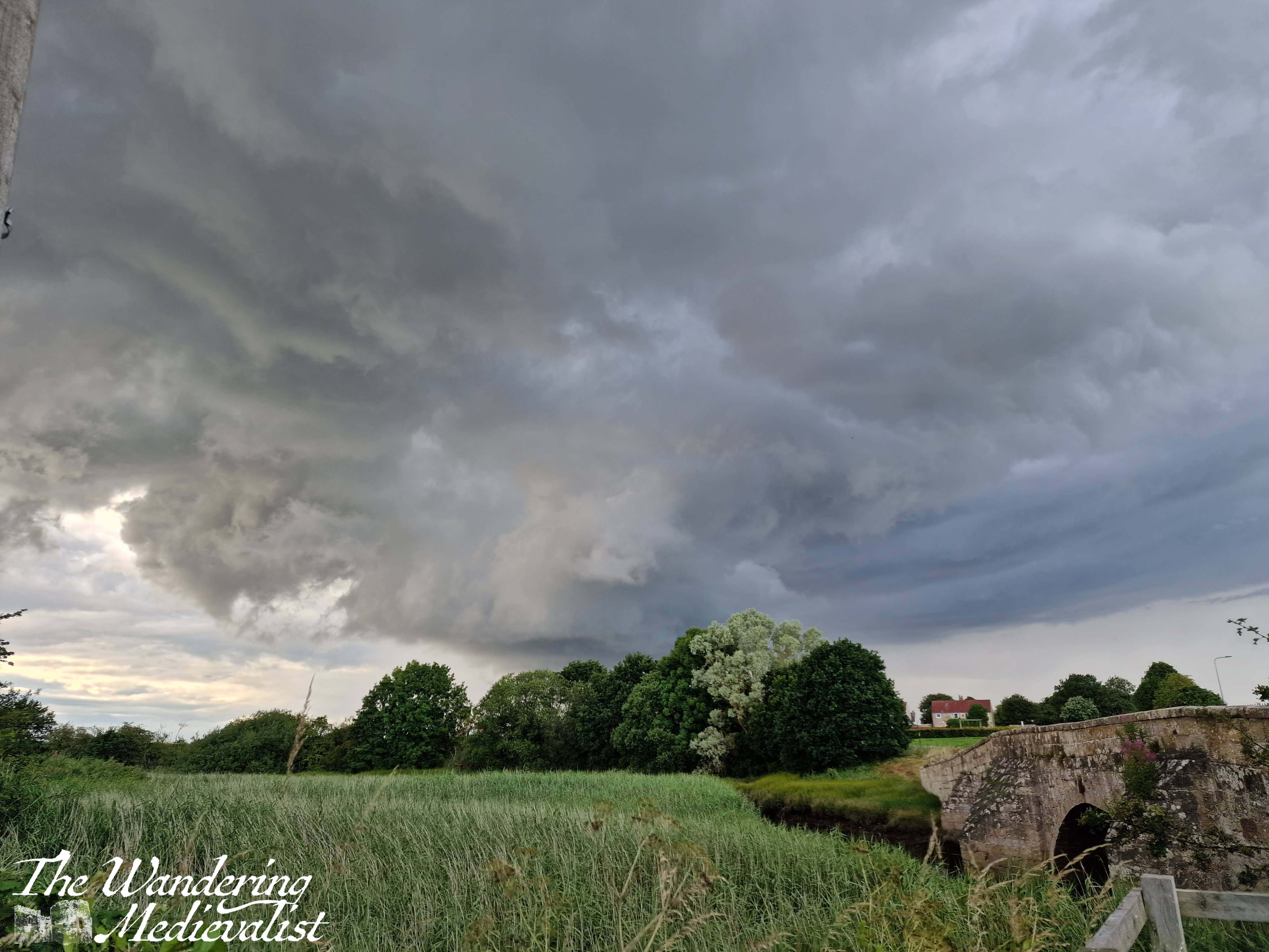
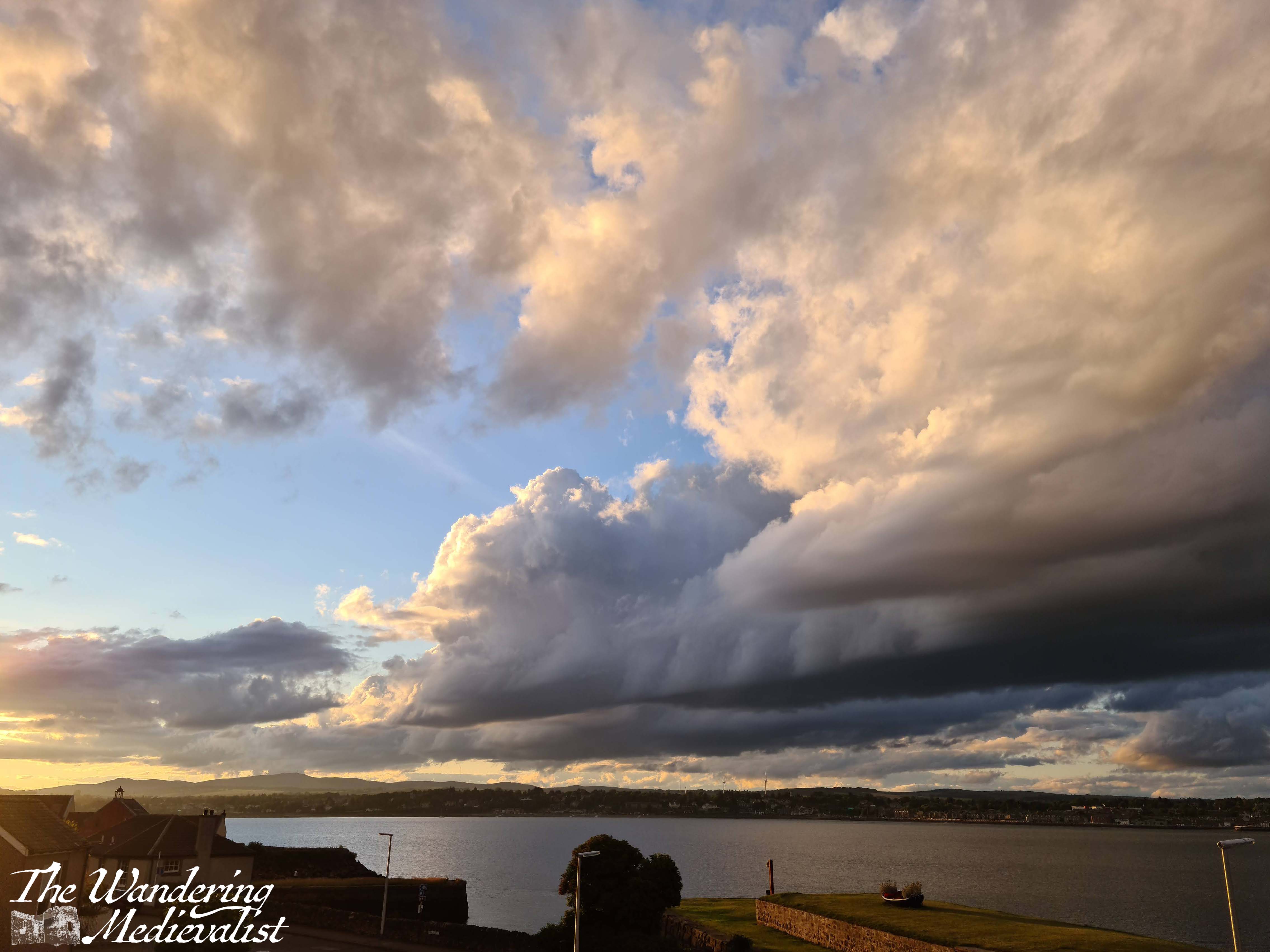
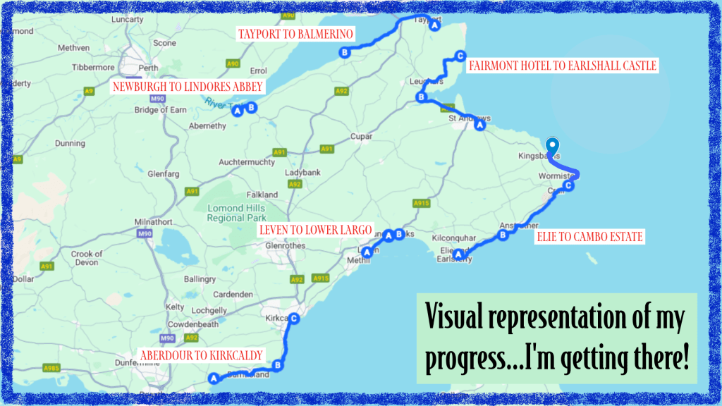
Last Saturday started off overcast, though the clouds were light grey and white, which usually are not hugely threatening. So I headed off to fill in the relatively short gap I had between walks, so that I could say I have finished the whole distance from Ely to Tentsmuir – East Neuk done! I hoped that the cloud would lighten, though as I rode the bus to Boarhills to pick up where I left off last week, the colours shifted to a bit darker…oh well.
A bit of rain was all I expected to see, and that wouldn’t hurt me – I was feeling determined. We had quite a dramatic week of weather, I should mention, with lots of big grey clouds and thunderstorms, so I hoped that the day would be a bit more settled even if not sunny. I tested fate a bit by bringing my sunglasses and not wearing my raincoat.
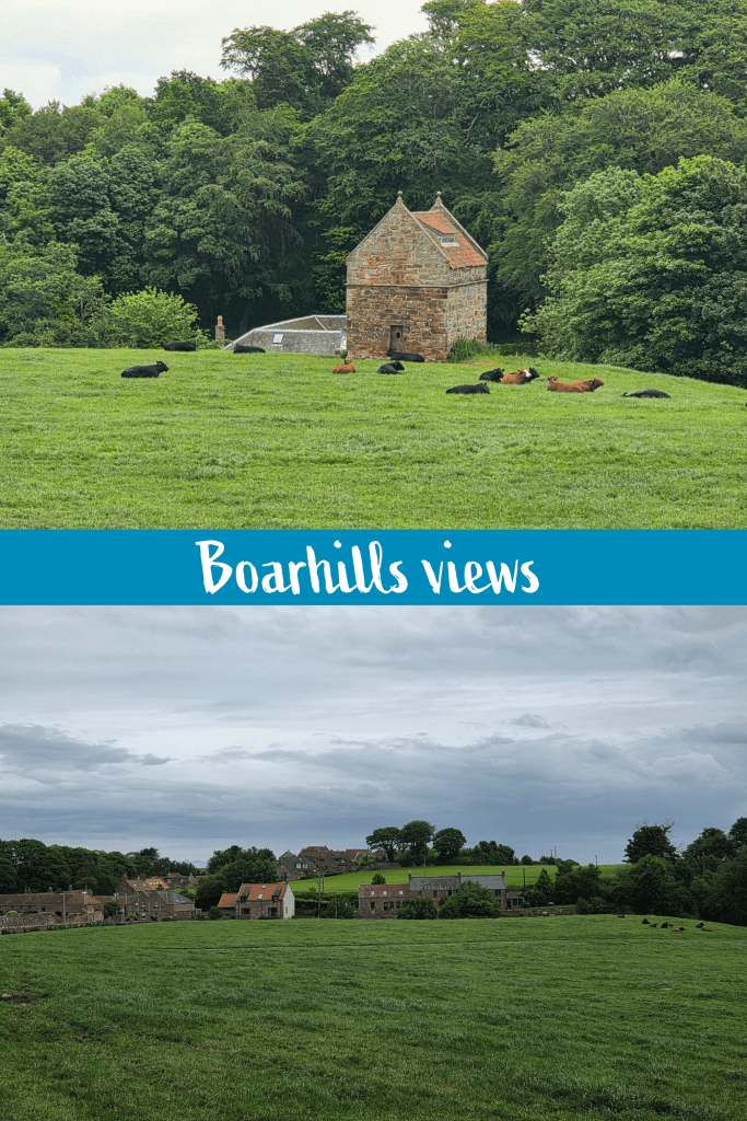
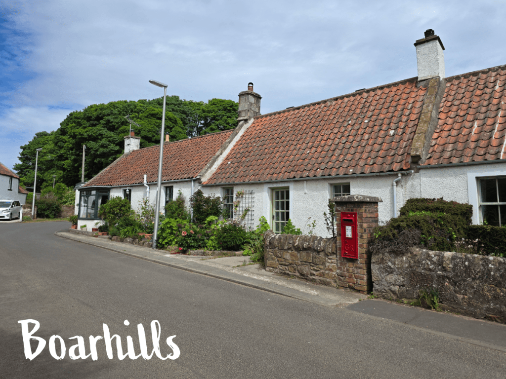
I alighted from the good old 95 bus at the Boarhills stop which is incredibly awkwardly placed, at the end of the entrance road to the village. My views were some lazy cows (not a good sign for weather) and the village filling in the gaps between wide green fields.
From the bus stop, it is a short downhill stroll into the village, and I turned right up the farm access road towards where I had broken off my walk last Saturday.
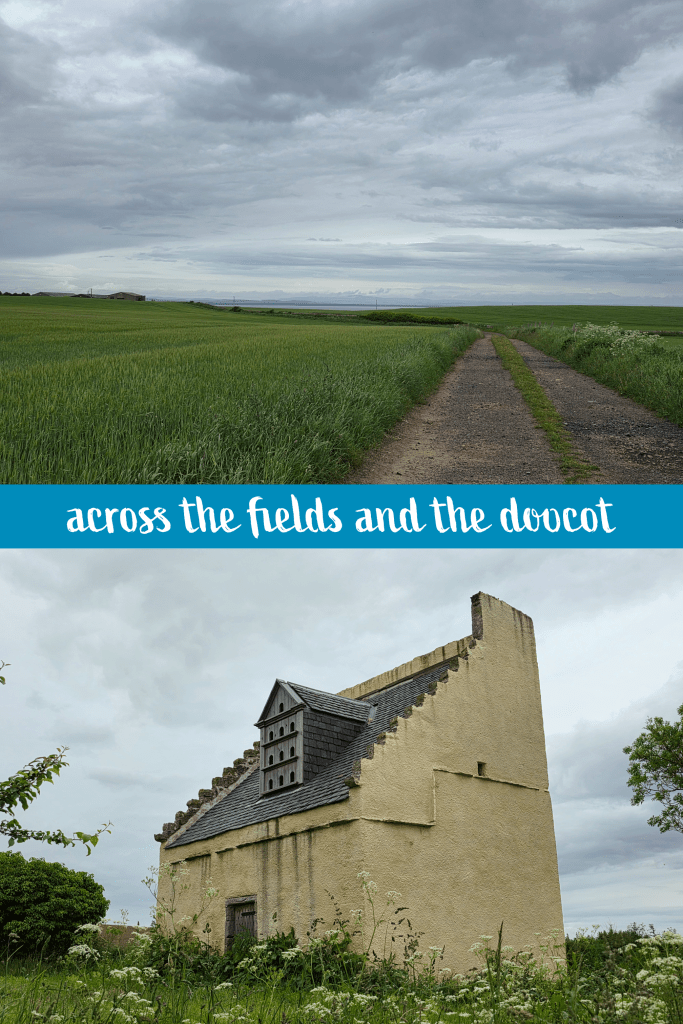
It took me just under ten minutes to make my way back to where the Coastal Path splits from the farm road, though it is almost identical in appearance – a wide farm track with two ruts, accessible by vehicle as well as foot. This path took me across a field with views across the water towards the distant hills behind Dundee. It was a good day for a walk, with a gentle breeze and comfortable temperatures of about 13℃/55℉, and while overcast the air was clear.
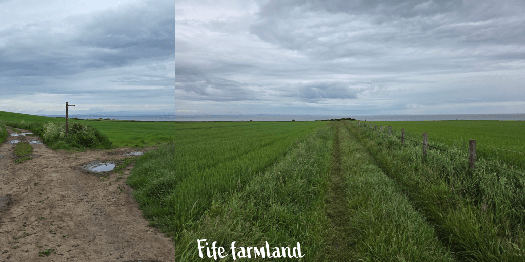
After about 5 minutes on this track there is a short section on the road, and then a quick turn off again to the right, behind the doocot above. This is essentially a detour around some large farm buildings, then the path strikes out again across the fields. A sunnier day may have required more pictures, but overcast skies without dramatic clouds just don’t do much for me, and the wind had picked up, so I moved along a bit faster until I reached another signpost. This directed walkers off to the right, towards the coast, along a grassy trail.
There was a short spot of rain as I crossed this section of field, but oddly I only noticed it from the sound of the drops hitting the grass – it was so light I did not feel it on my face, hair or clothing. It made the faintest dots on my coat before stopping again.
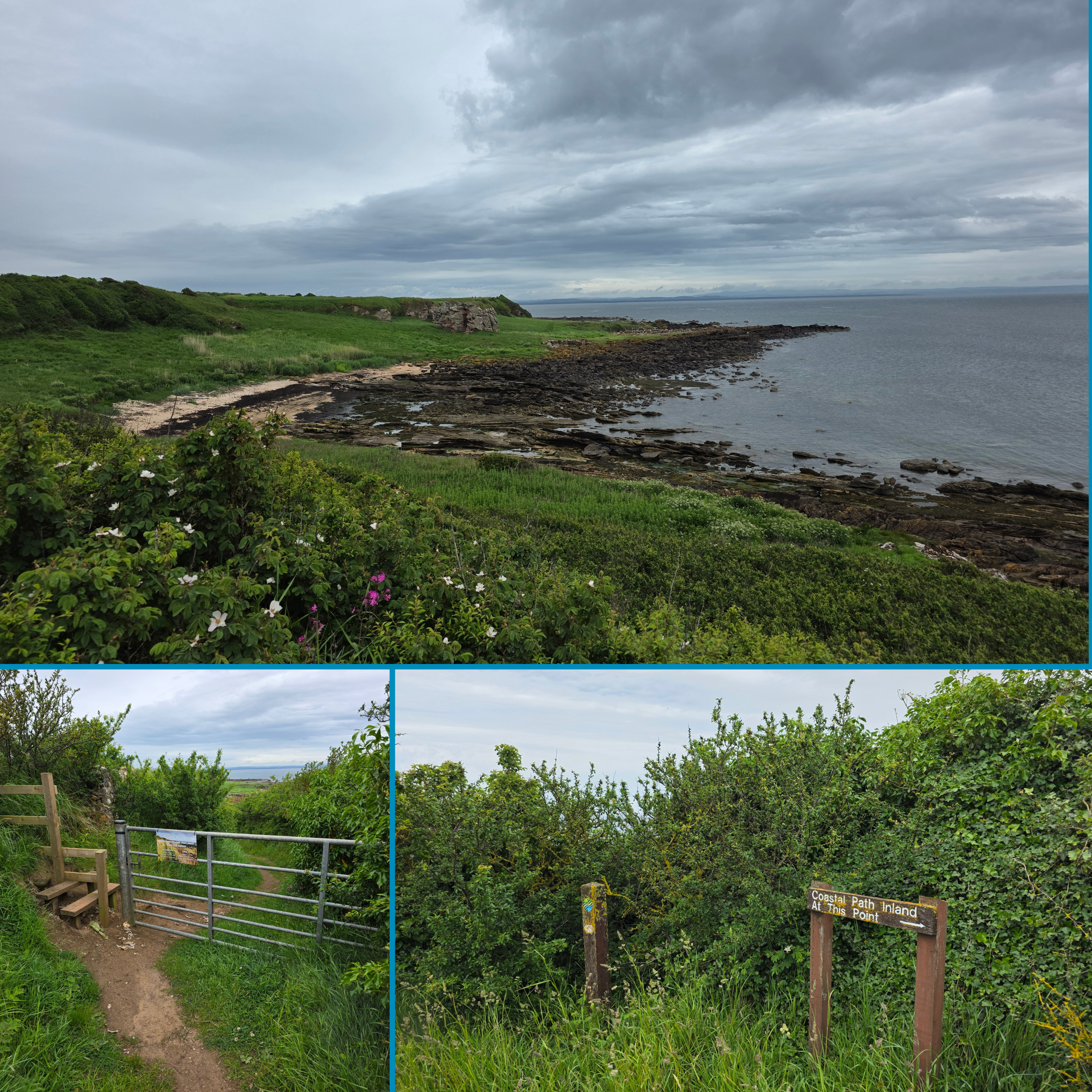
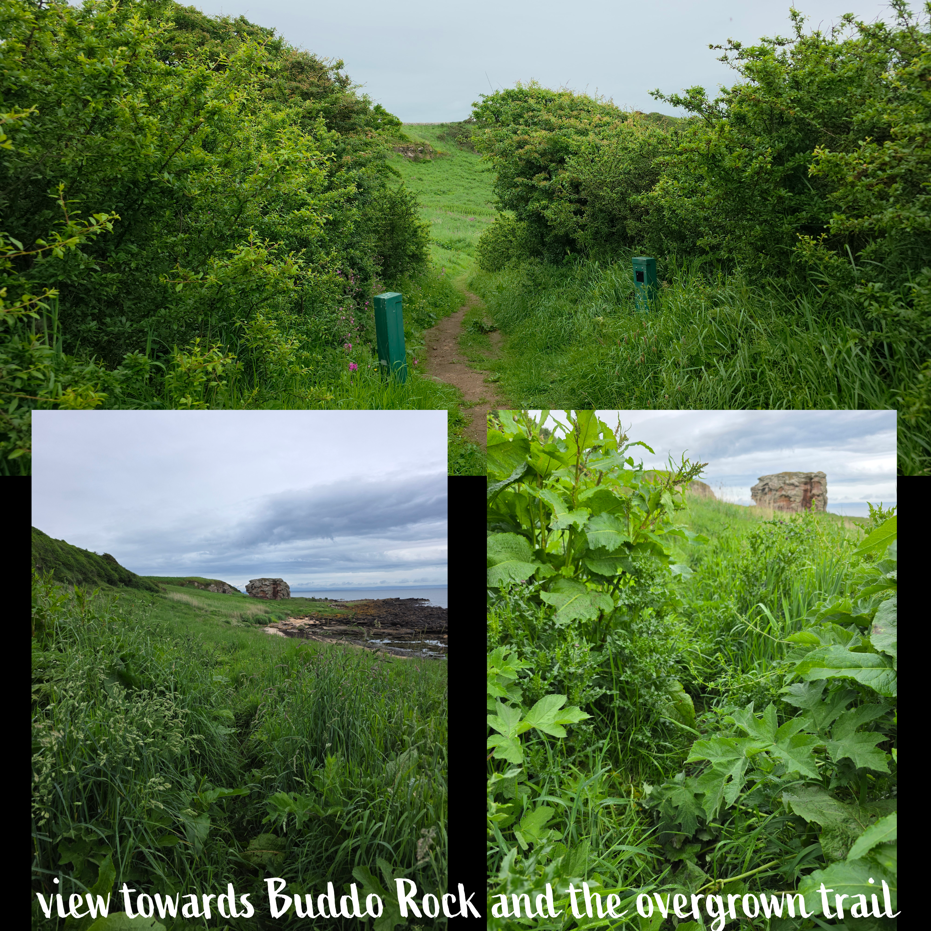
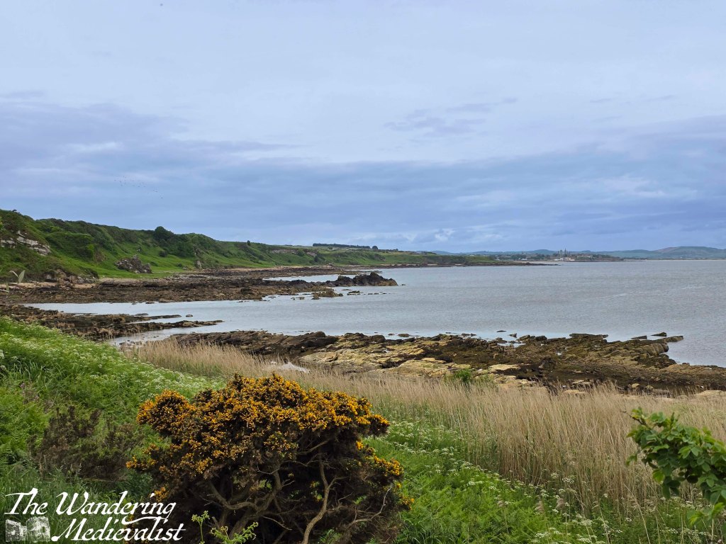
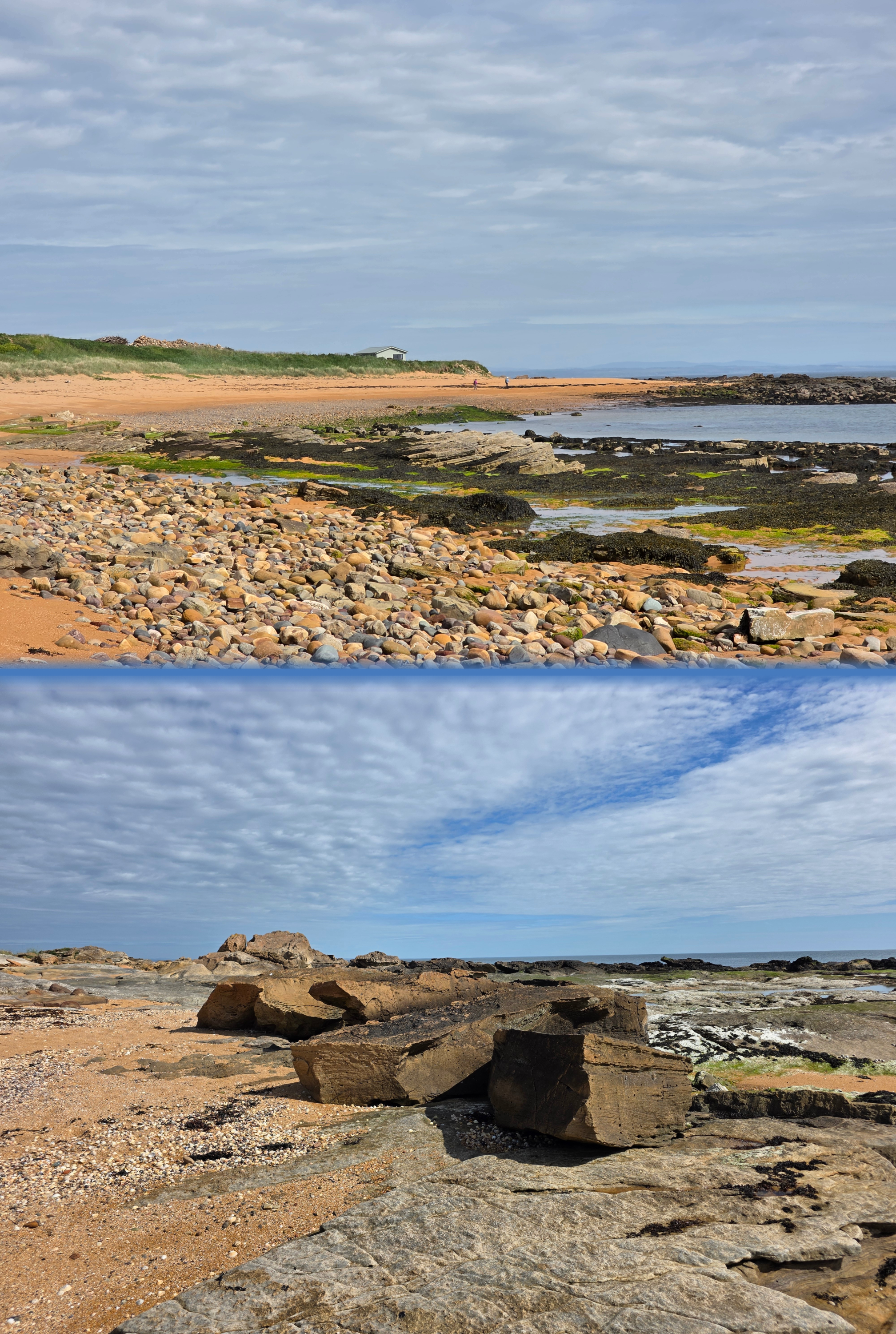
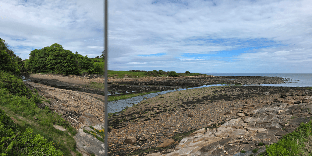
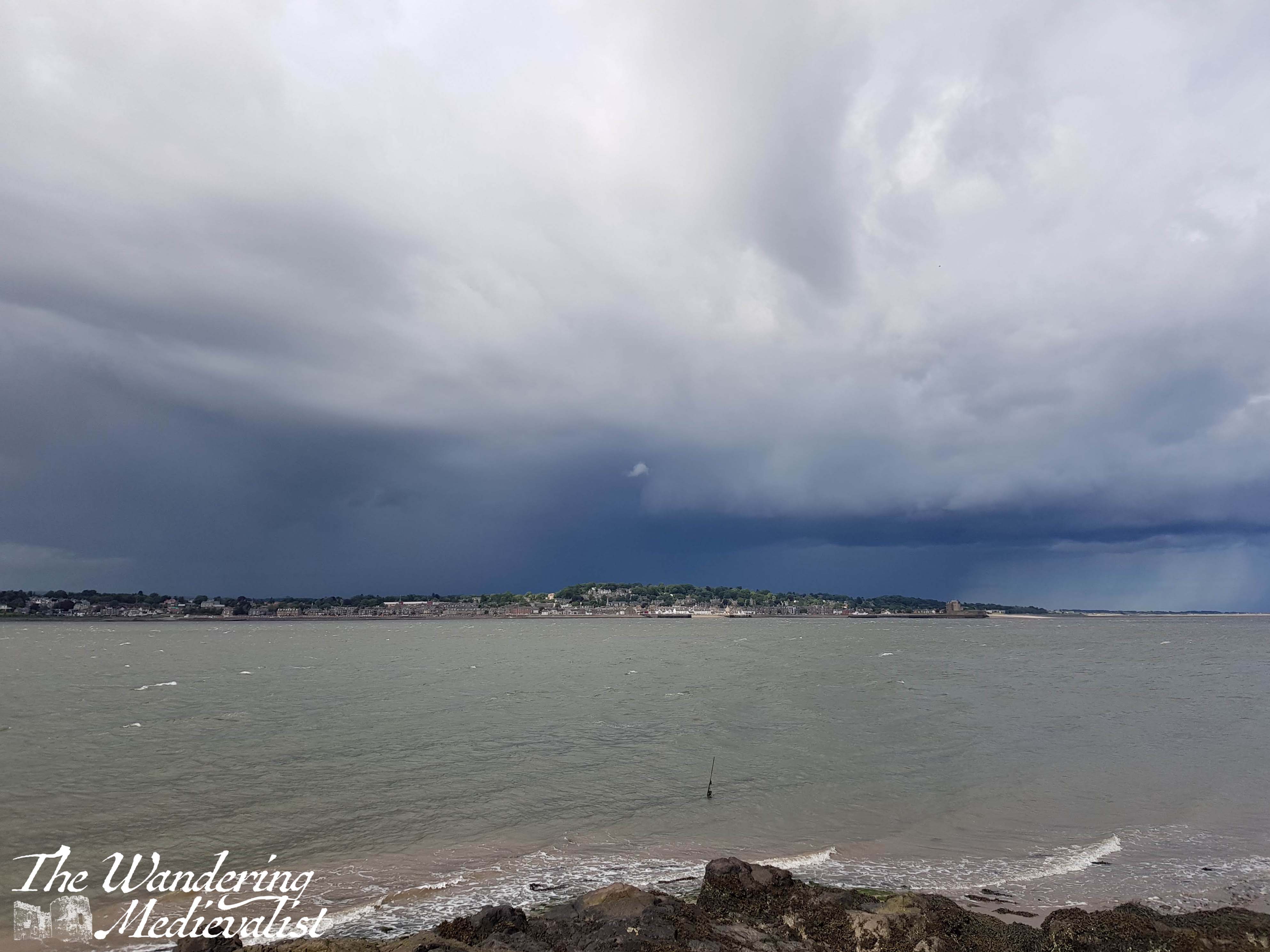
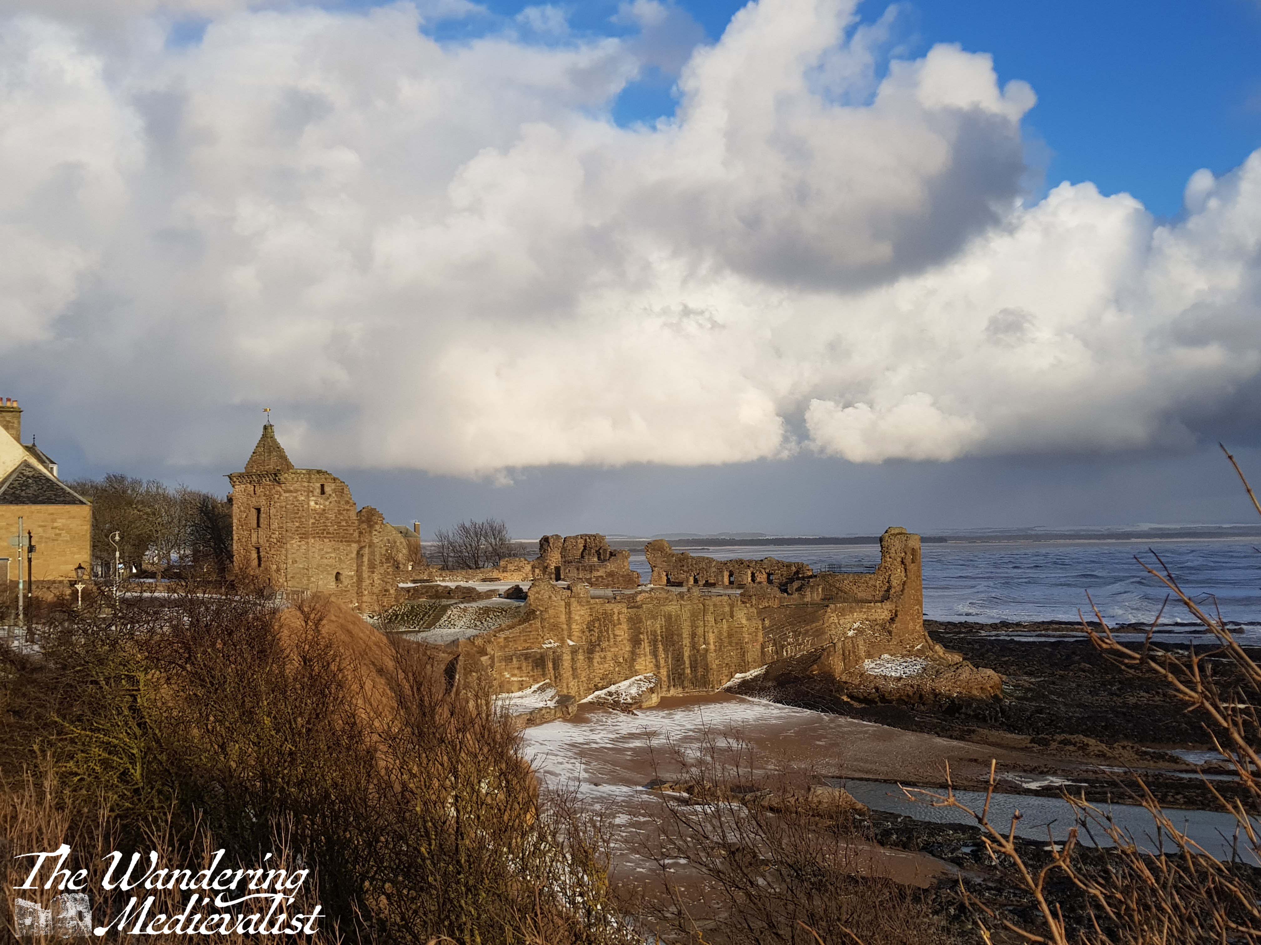
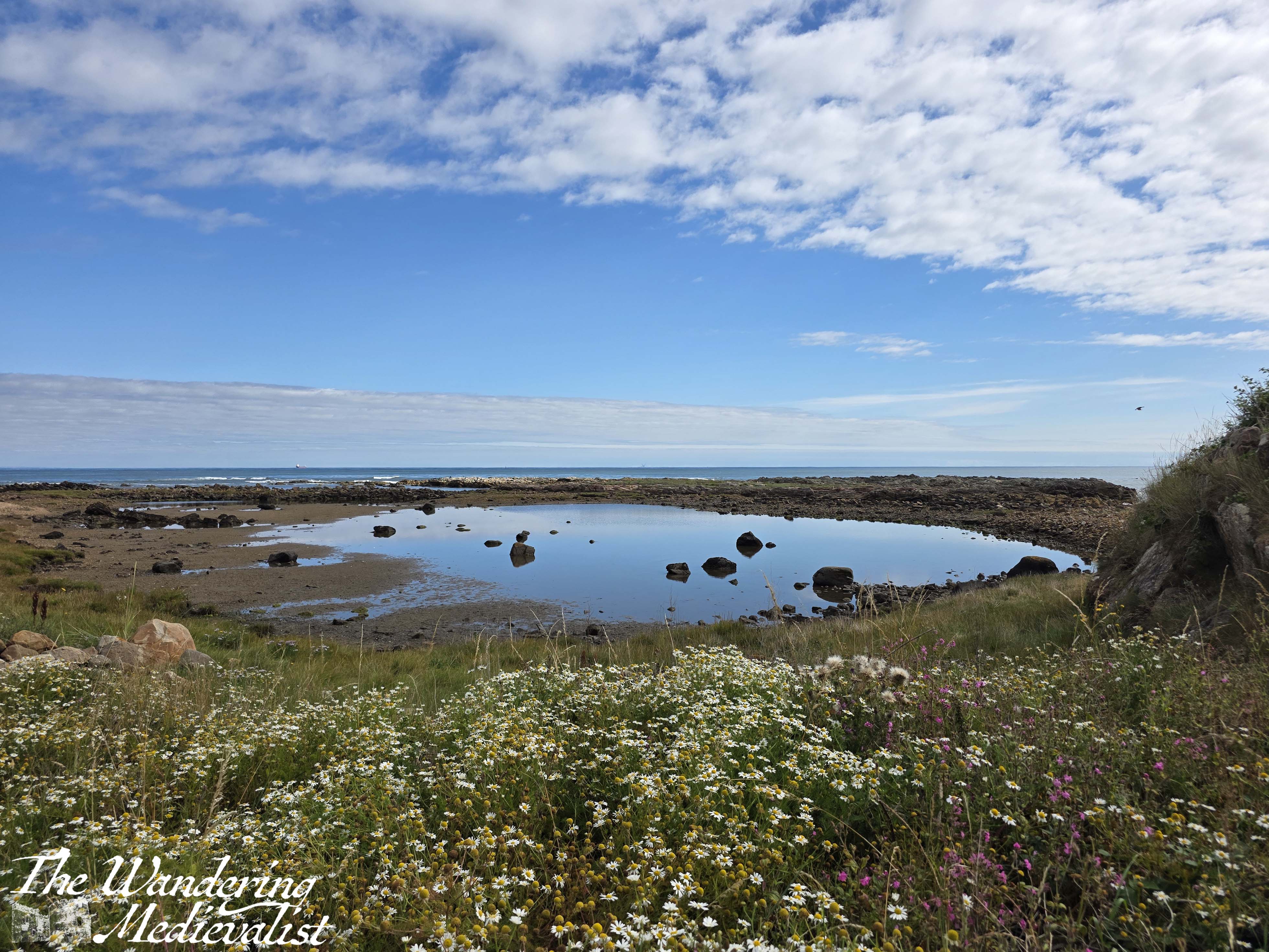
Ahead along the coast is a cluster of bushes, and an obvious left turn towards St Andrews – through a gate and down a hill, the path descends almost to beach level. Here is the first of many views looking north, this one at least assuring me that the tide was low enough not to be an issue. Yes, I had again forgotten to check the times.
At beach level, you can see ahead towards Buddo Rock, with cliffs on the horizon that are very familiar to anyone who has walked near and around St Andrews. The sun was trying very hard to fight its way through the clouds, but it was not quite strong enough to win.
The path had narrowed here considerably, so that I was walking through almost waist-deep grass and plants, positively soaking my jeans and boots. This part of the route is clearly not well-used and so I gather is not as well maintained. Hiding in the more harmless plants were plenty of prickly thistles, nettles and other less pleasant flora – I should have gone down to the beach and stayed there instead. I was beginning to wonder if I had in fact taken a wrong turn – the path was barely present enough to be followed – when from within the brush emerged a familiar Coastal Path post. I was not lost, but I was even wetter from knees down than if it had been pouring rain.
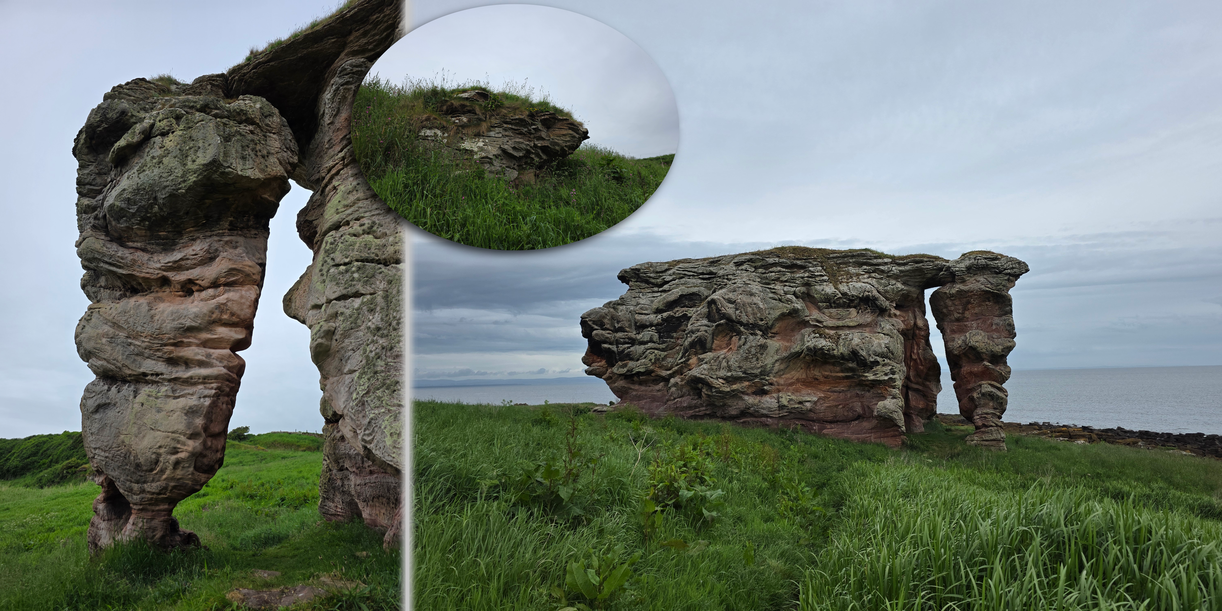
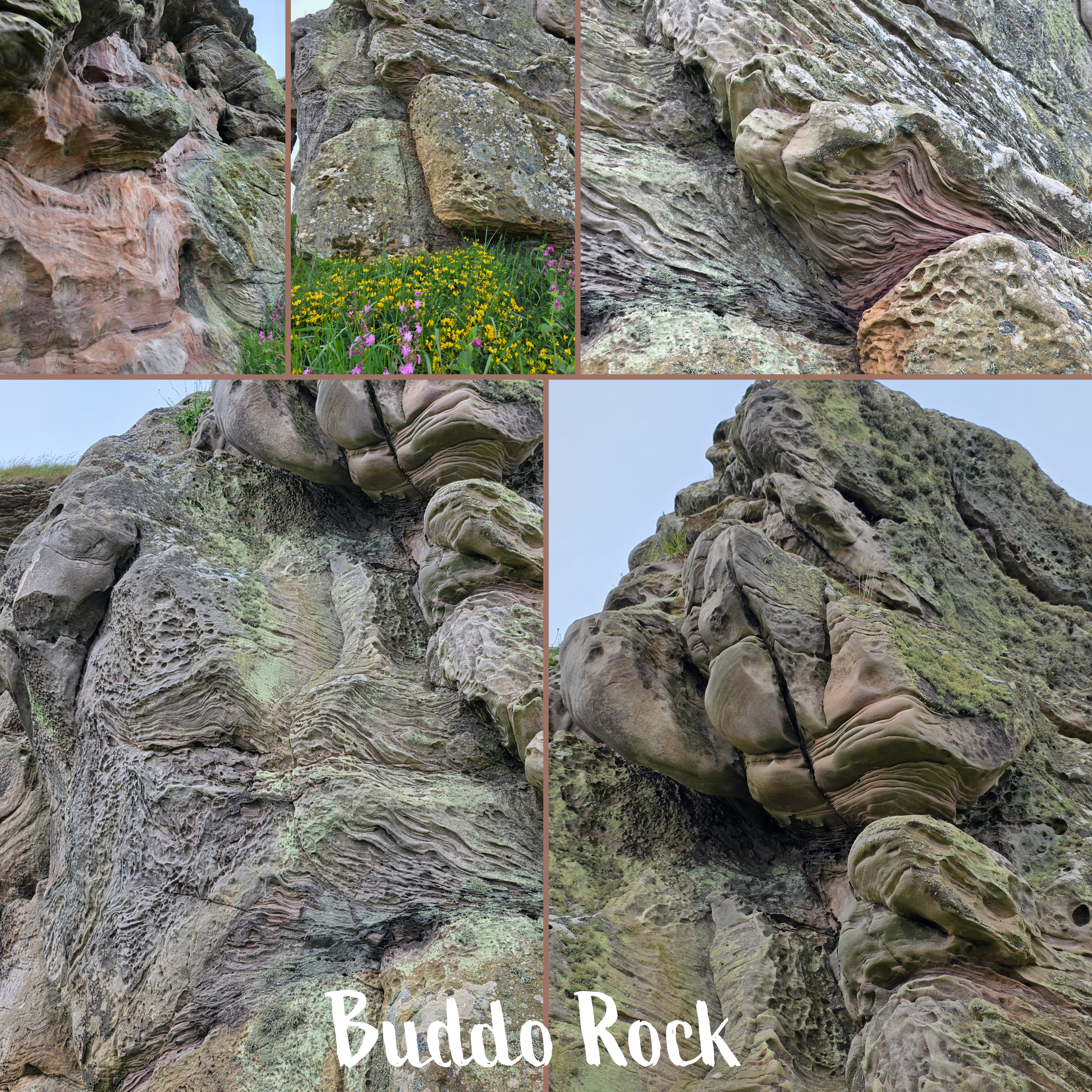
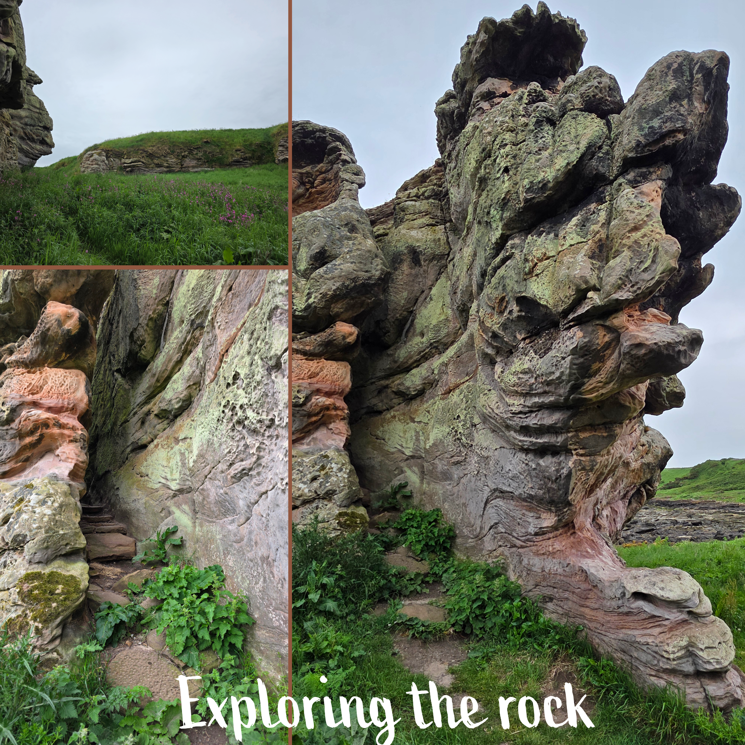
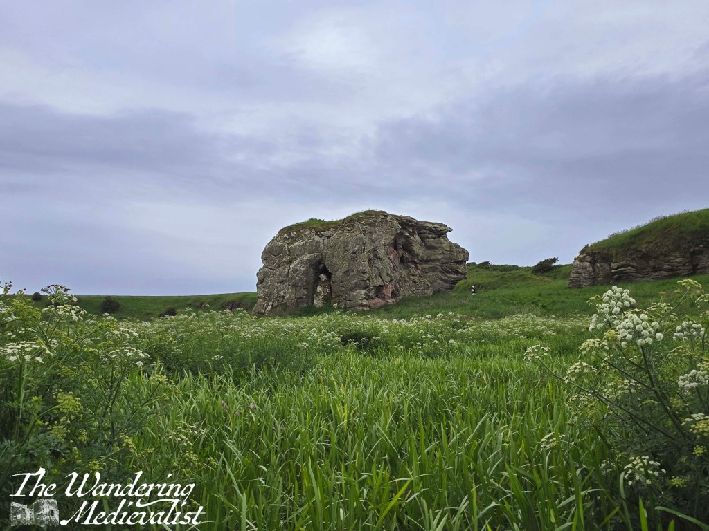
Eventually after what felt like miles of bivouacking (was only about ten minutes really), I reached Buddo Rock, which was really quite cool. The cliffs nearby show evidence of once having been connected, and the rock itself is a fascinating piece of geology, the sandstone surface folded and swirling like cloth or liquid.
I spent a few minutes wandering around the outside, getting pictures from all angles, and then backed away a little to a small stretch of rock and sand nearby. This would be an amazing spot on a day with more sun.
The cliff line is really interesting along here, with chunk of stone sticking out from the grass, and a couple indentations that could be the start of caves. It is easy to understand how there are several sets of caves along this coastline.
But, I could not stay here and be fascinated by the rock forever, and so I headed on, over a gate and into a more cared-for portion of the path.
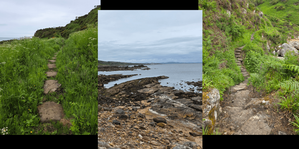
Once past the gate, the trail begins to climb gently, with the cliffs on one side and a stone wall on the other. I knew that at some point I would need to climb back to golf course level, and I suspected at the time that it might be a more gentle climb. I was quite wrong.
In very little time, that supposition that the climb would be easy was dashed by a series of steady ups and downs, some of them with stone steps and others just rough-cut stairs.
This portion of the route was worth it, though, for several reasons. Firstly, the flowers, which vary between wildflowers, sea roses, foxglove or any number of other blossoms – lovely pinks, yellows, purples, and whites.
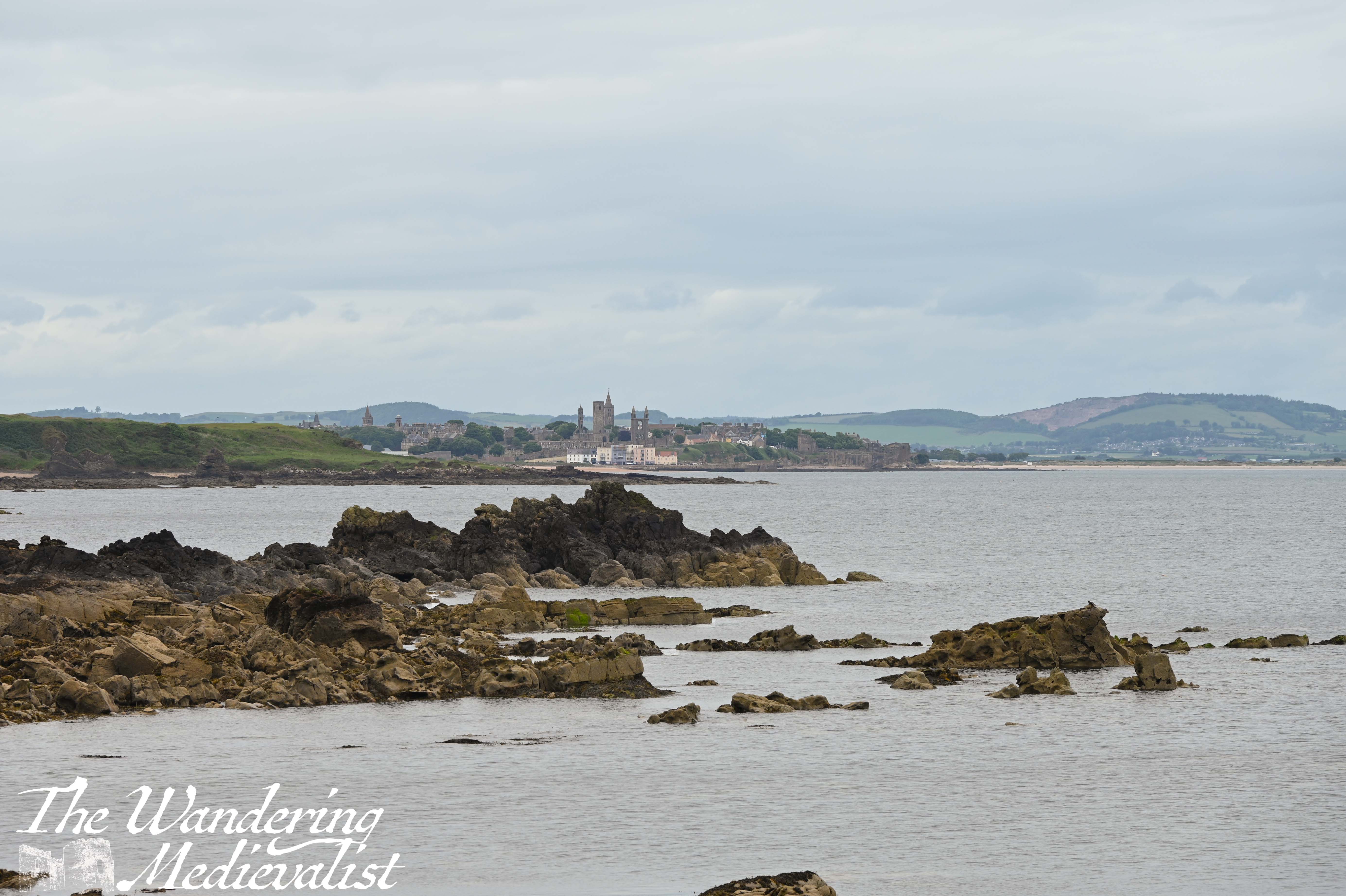
Secondly, for the view along the coast which was a completely new one I had never appreciated before – this far around the coast, I was looking almost straight down St Andrews pier, which was visible with a zoom lens.
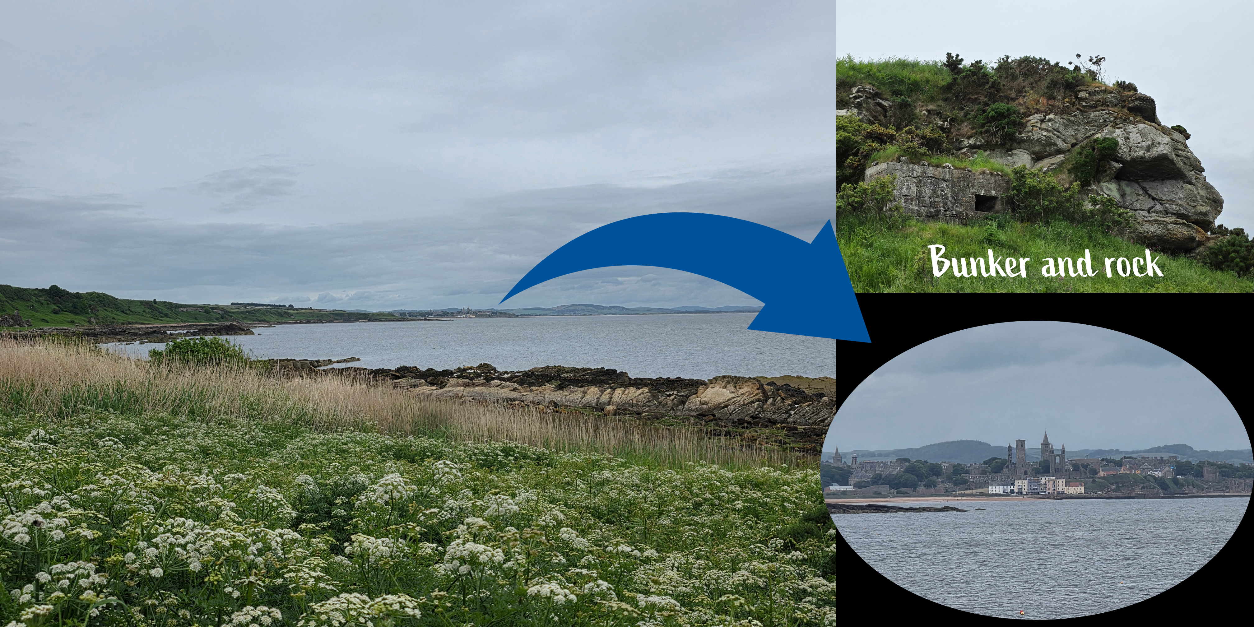
The cliffs are also really fun to watch and see what new thing will emerge – there is a World War II bunker just visible for example, as well as countless hidden spots. This would be a phenomenal spot to come back to on a sunny day.
Moving on, there is a section of path made out of stepping stones to take you over a muddy patch. I could not stop marvelling at how amazing the view of St Andrews was from here, and I had to stop myself from re-taking the same picture over and over. The one above with rocks directly in the view was my final effort.
There is quite a lot of moving up and down the edge of the beach and cliff at this point, and many of the ‘steps’ are not in the best state. While the views are excellent, the almost continuous rise and fall makes this a more strenuous portion of the path, though at least my legs were starting to get warmer as they dried out. I was being followed at this point by a group of walkers less than five minutes behind me, which stressed me out slightly; I considered stopping to let them pass, but decided instead to push on. The weather was becoming a bit more threatening, and I had plenty to do once I had finished my walk.
As mentioned, the stairs here have in some places seen better days, and there were some significant drops particularly for those with shorter legs like mine. But, as long as you take it easy and pay attention to where you are putting your feet, it is certainly manageable.
In time, the path levelled out at beach level, with a large rock ahead. Another post directs walkers towards a flight of stairs and I realised that my earlier supposition was completely wrong: I would in fact have to climb from beach level to the golf course in one long winding go. I won’t lie – particularly with the other walkers behind me, this one was a push.
The steps vary from wooden slats to stone chunks, then closer to the top merge into just a hill. Then, just as you are starting to doubt your sanity on how far you have climbed, the sound of golf balls being whacked drifts into your ears, and the shape of the clubhouse appears on the horizon.
The path meets the green and follows it around to the access road, only steps from the spot where I had started my walk several months ago. I had made the foolish decision to remove my jacket at the beach level, but up on the course the wind was much stronger, and I found I had to pull the extra layer out of my pack again. It was also starting to spit with rain, and I still had a way to go, trudging up towards the road; my main priority was not being hit with an errant golf ball.
Overall, while this was a shorter walk than the previous week – 2 miles on the path and about 4 overall – it was arguably harder to do with a lot more climbing and descending, and of course the monumental climb at the end. The good news is that I definitely stretched out all of my back muscles that were bothering me.
Also, it didn’t really start to rain until the end.
One unpleasant after-effect though was that when I got home and was enjoying removing my boots, I discovered two ticks on my hand – one had bitten, one was still crawling around. The other half swiftly removed the one that had bitten with tweezers, and I squished the other – I do not think it had actually been there long. Compared to a US tick, it was quite small, but still necessitated a few shudders and an immediate shower. Apparently the weather in Scotland this spring has been perfect for ticks, so if you are out, be careful!
Speaking of weather, we are all being told that there is a Super El Niño coming. What exactly this will mean for Scotland is uncertain – more wet or more dry, either way I intend to continue on my walks. Now that the East Neuk is done, it’s time to focus on the south coast again. More in July when I am back!
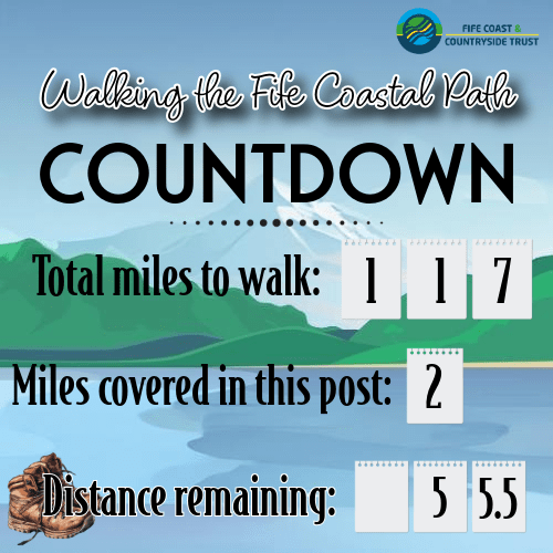
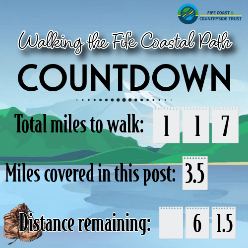
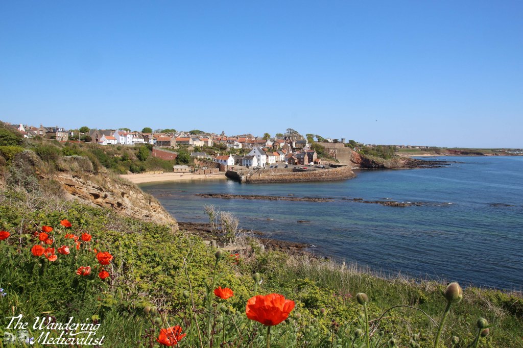
Finally at it again! Saturday was supposed to be cloudy in the morning with rain coming in the afternoon, but I was determined to get a few more miles under my belt. I was not feeling hugely confident about my stamina, so found a mid-length section that I could do relatively close to home, though it is one of the last that will be so easy to reach: Cambo Estate to Boarhills. One exciting note about this walk, is that in completing I have officially passed the halfway mark on my journey.🎉 Still a long way to go.
Saturday morning started off breezy but mild (16℃/60℉) with an almost cloudless blue sky and bright sun. I had even remembered to check the tide, which was scheduled to be low at about 7.30am, so perfect for me. The actual Coastal Path section of this walk would be 4 miles, but I knew I had about a mile on each end to get to a road, so I spent the short bus journey reminding myself that I did 6 miles easily in Washington, so this should be fine.
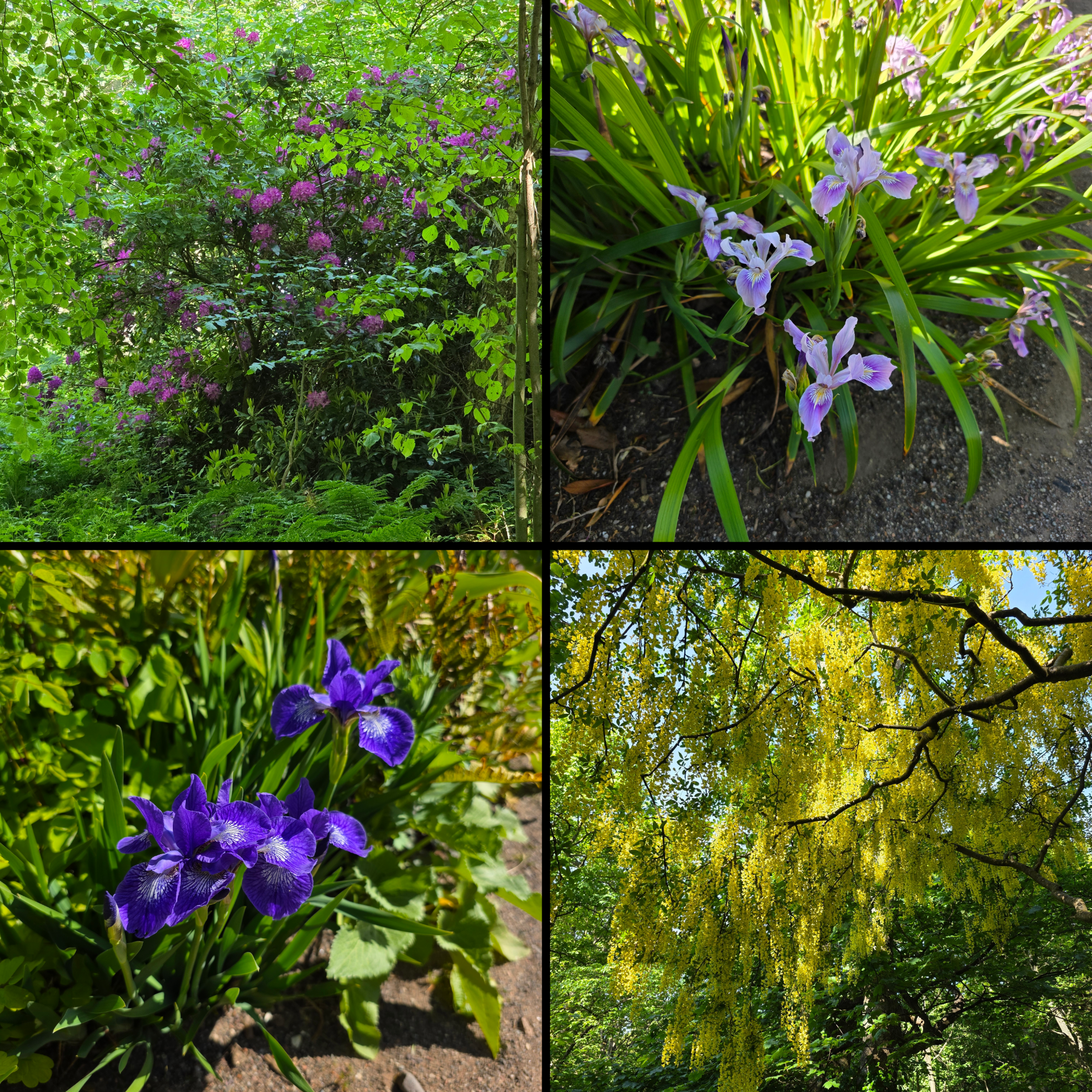
The bus trip was pleasant, warm in the sun and the flowers at this time of year are stunning – peony roses, iris, poppies, rhododendron and so many more bursts of colour particularly as we rode through Kingsbarns.
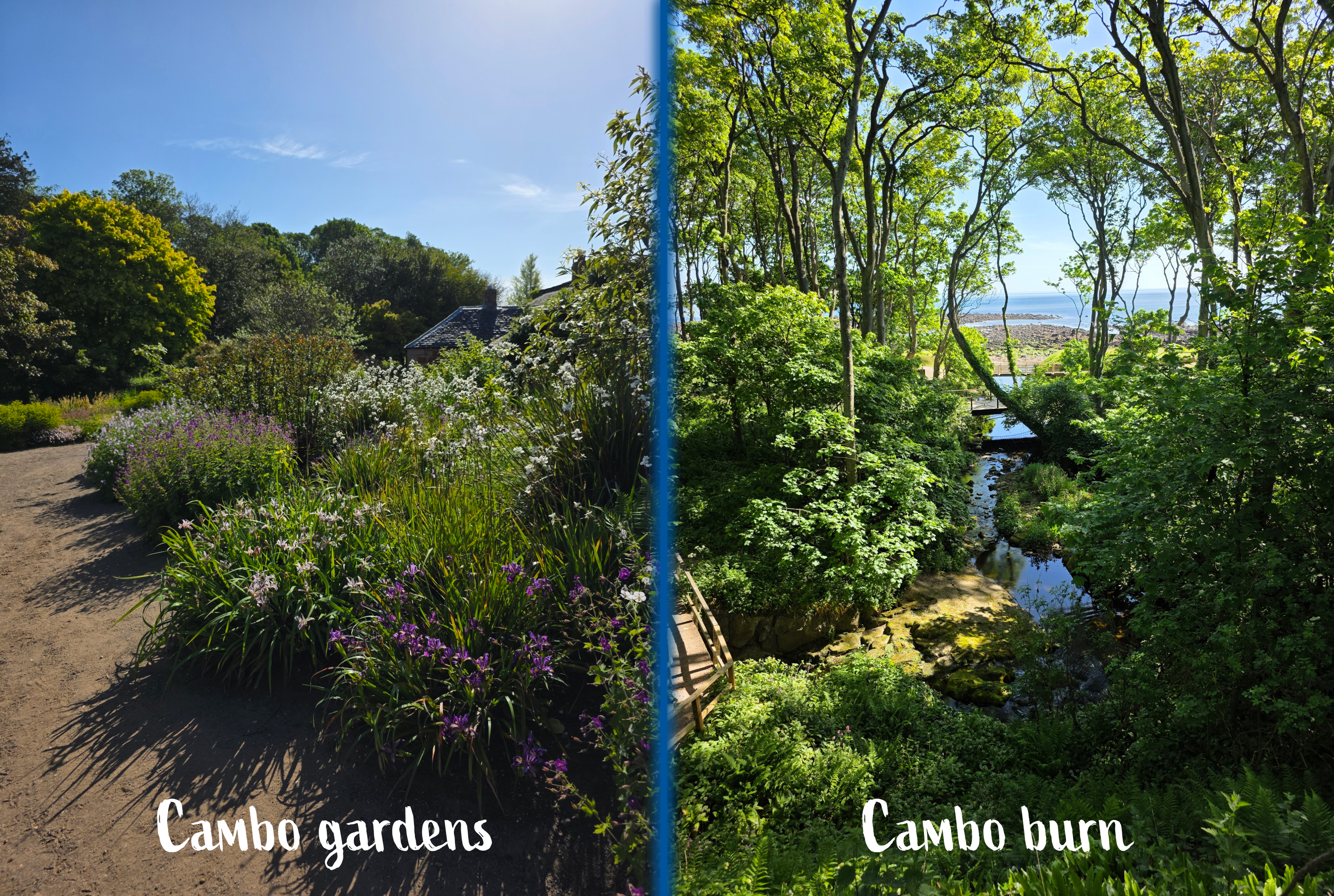
I alighted bus just outside the gate to the Cambo Estate and enjoyed a pleasant walk along the access road through a wooded landscape full of chirping birds. A few purple rhododendron were hiding in amongst the trees, like on so many old Scottish estates. After about ten minutes I reached the cluster of buildings where there is a shop, café and access to the walled garden, though it was not due to open for another hour. I was a bit uncertain how to get past the buildings, but managed to skirt my way around and headed down through the grounds towards the coast.
I couldn’t resist capturing a few garden views on the way…
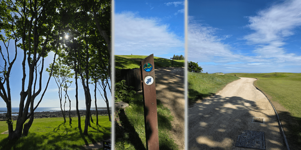
The spot where I had stopped my walk counter last year was the bridge over the creek, and so I picked up the path here, almost exactly 1 mile from where I had left the bus. The path emerges from the trees – quite welcome due to the prevalence of bugs hovering amongst the foliage – and onto the golf course. I was very happy to discover that the public toilets designed for walkers and golfers were open, so stopped for a moment before properly setting off.
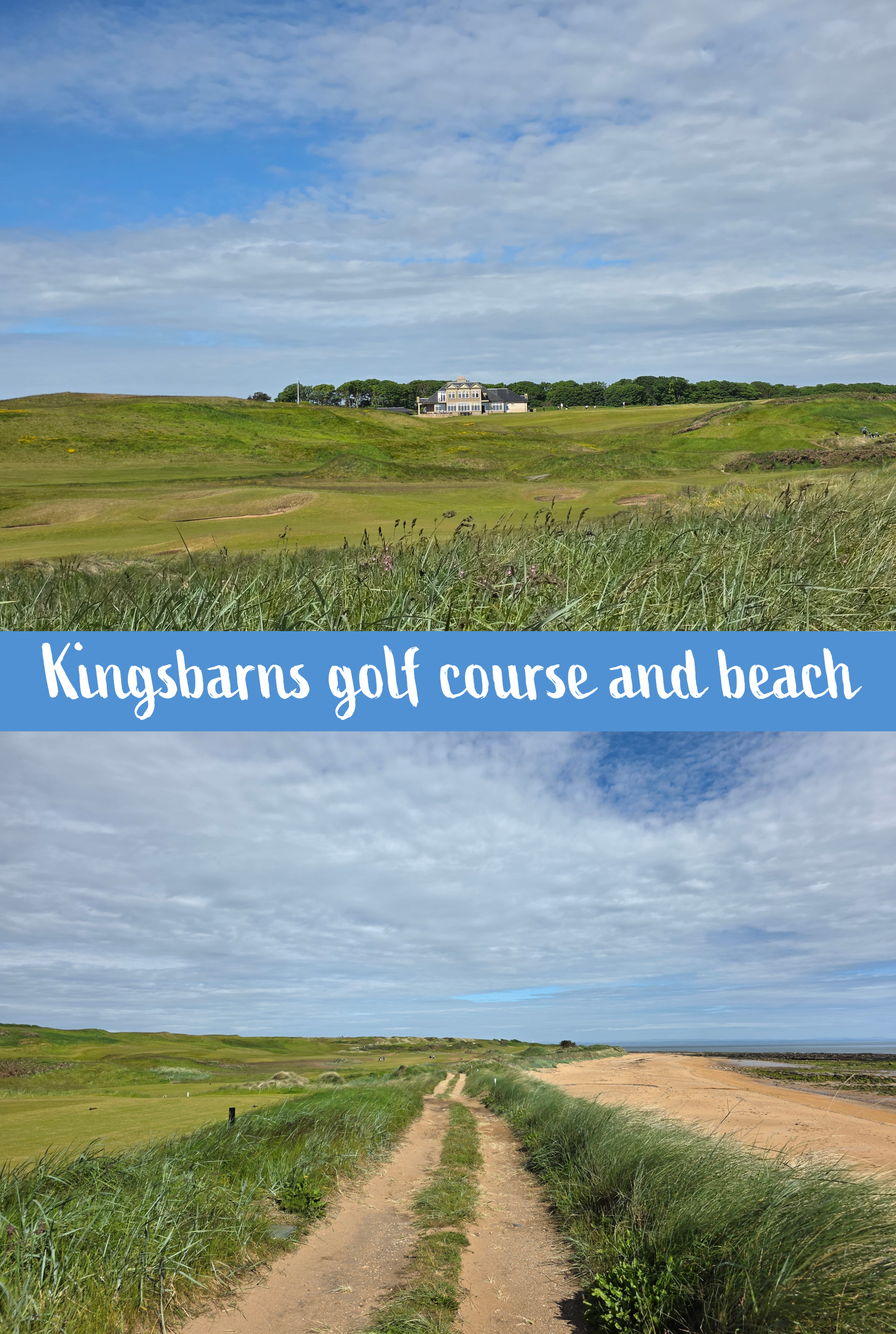
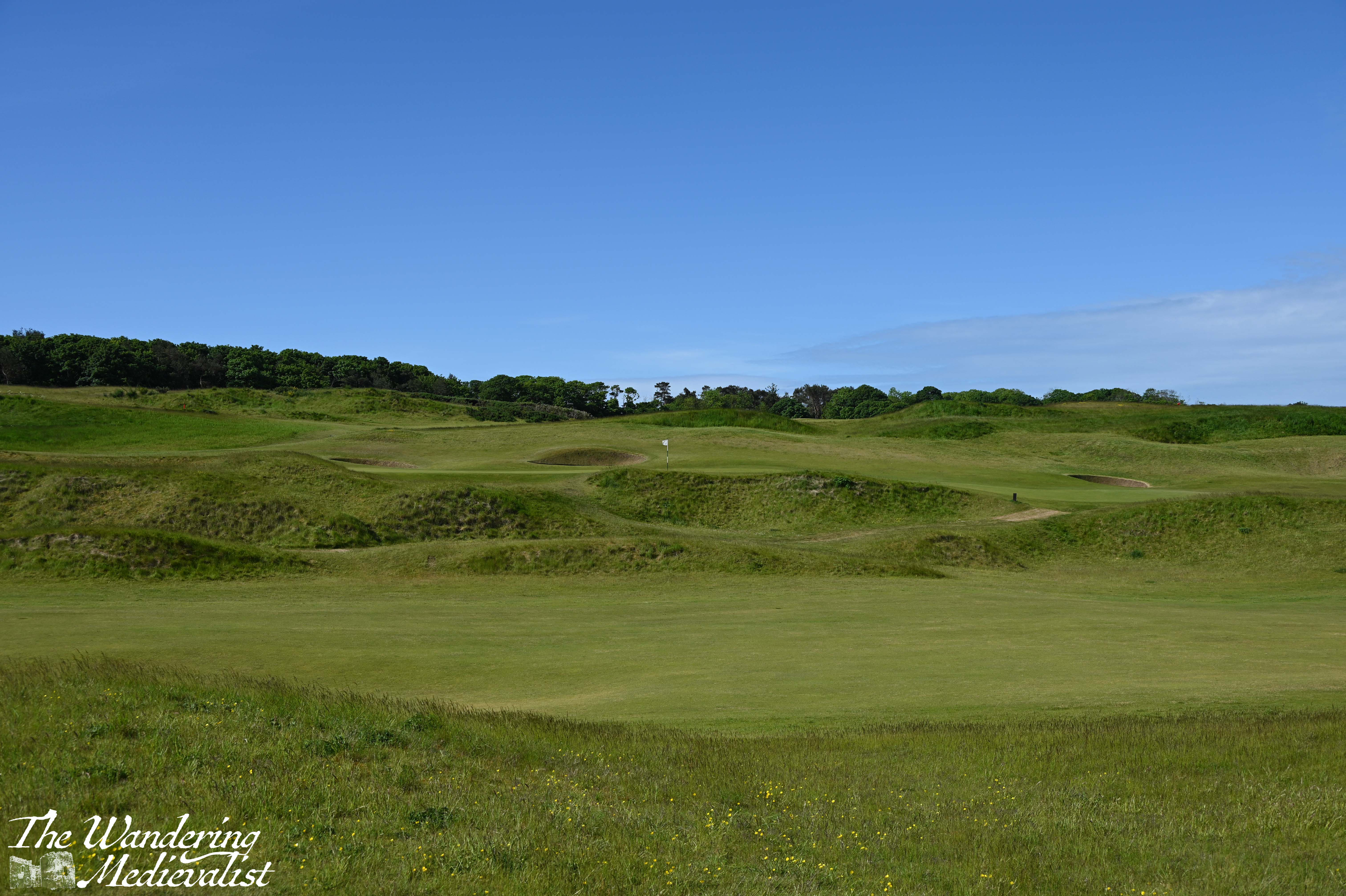
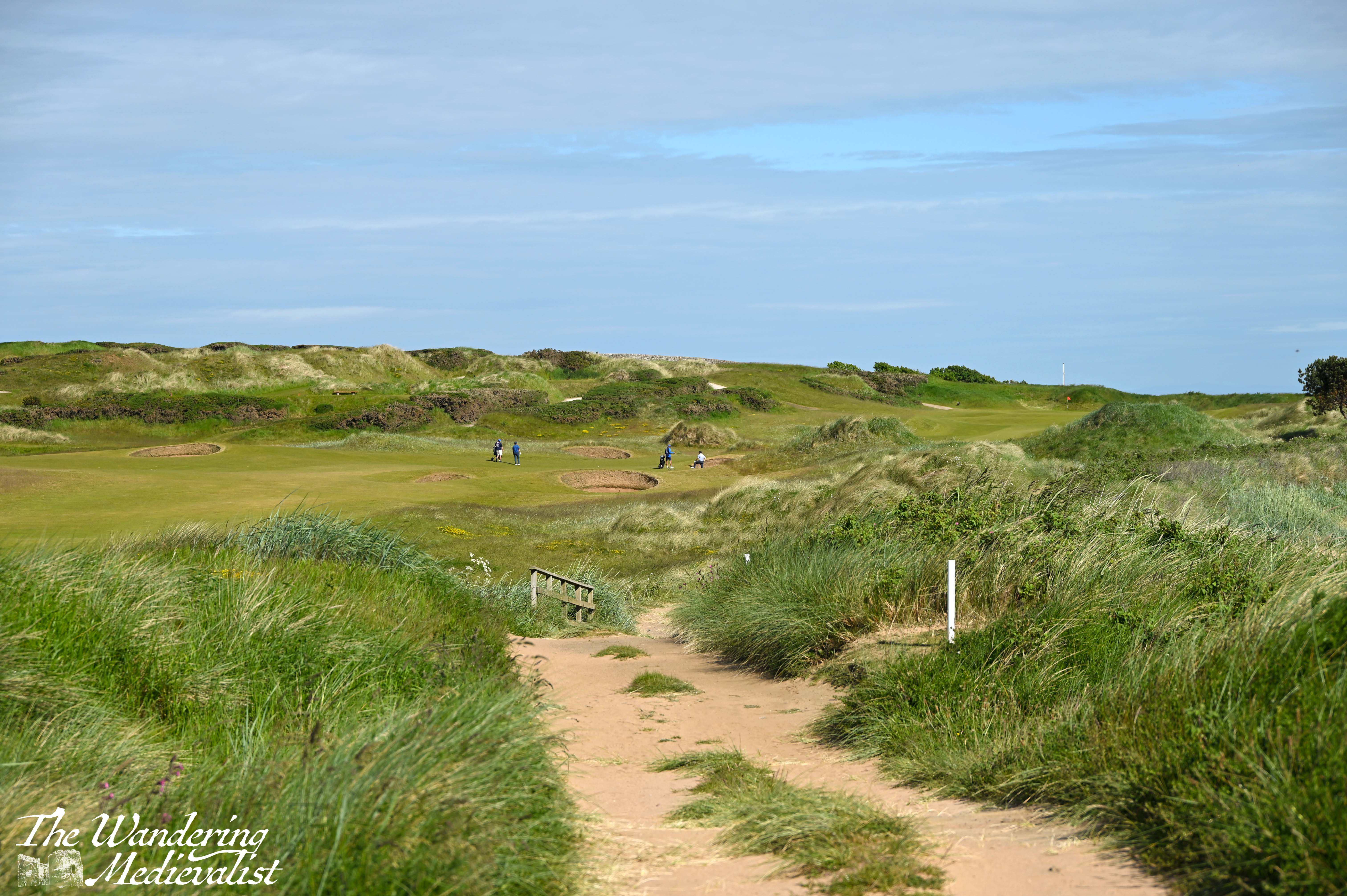
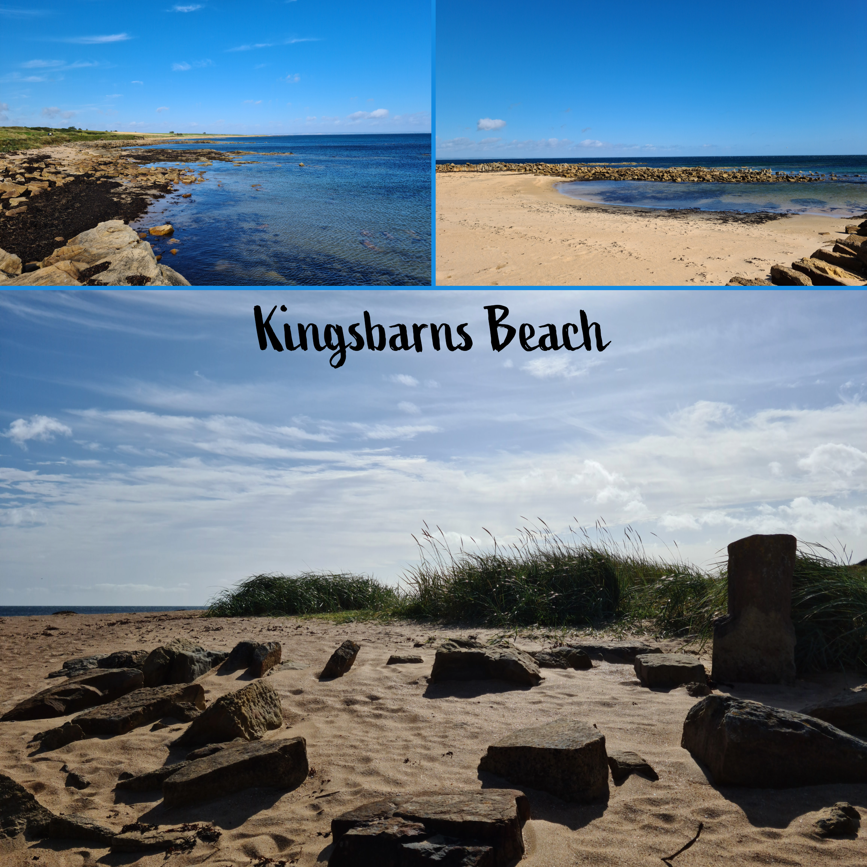
I have done this section of the path several times with friends and it is a really nice walk, parking at Kingsbarns Beach and walking up to the estate and back. It runs along the edge of Kingsbarns Golf Links, offering great views up over the course to the clubhouse. Needless to say, views of the beach are also extraordinary.
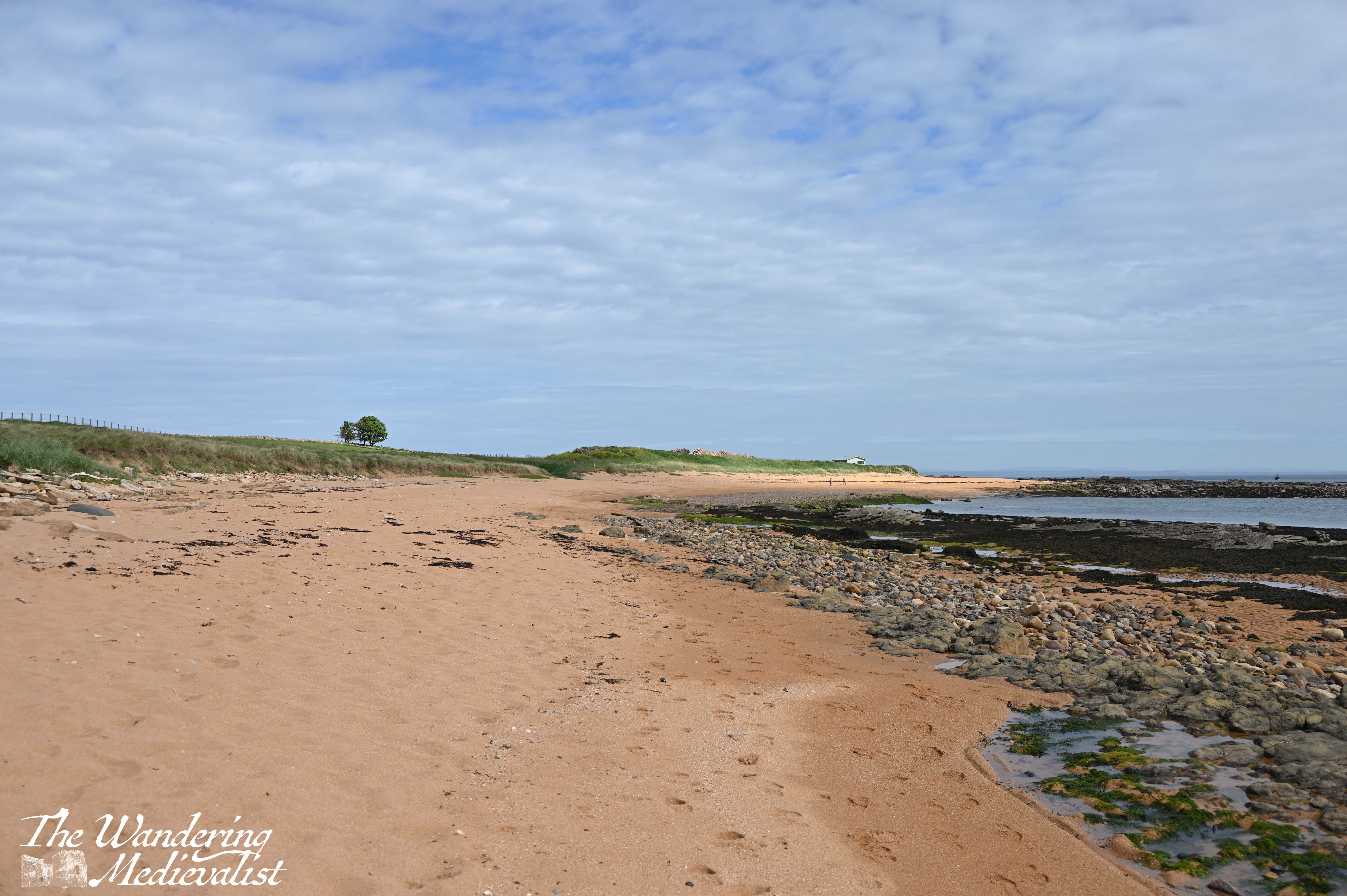
The course was already busy at just before 9am on a Saturday, though the beach was quiet. In fact, one could probably walk on the sand at this point in the hike, if you wished. But, I had a feeling there would be required beach walking further up so I stuck to the trail, which is a wide sandy track, gently rolling as it hugs the line between beach and golf course. I did make the decision not to take too many pictures and instead to focus on getting some ground behind me, so powered on for the just over half a mile to the beach car park. As I have observed previously, walking the Fife Coastal Path is probably the best way to see a large number of golf courses without actually picking up a club!
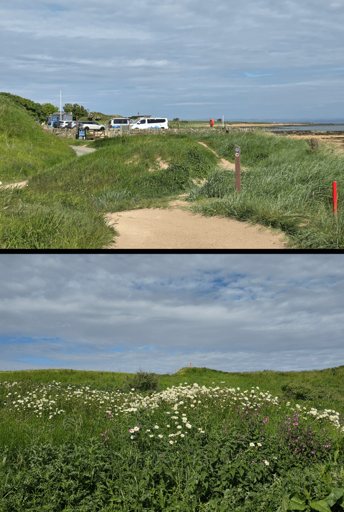
This car park is often busy and you have to reach it early to get a spot, though it is also available for overnight stays with a good number of camper vans parked along one side. It is a popular local spot with a burger van, sauna, picnic tables, public toilets and a drinking water fountain. While he signs are not really clear, the Coastal Path instinct will take you through the car park and around the burger van.
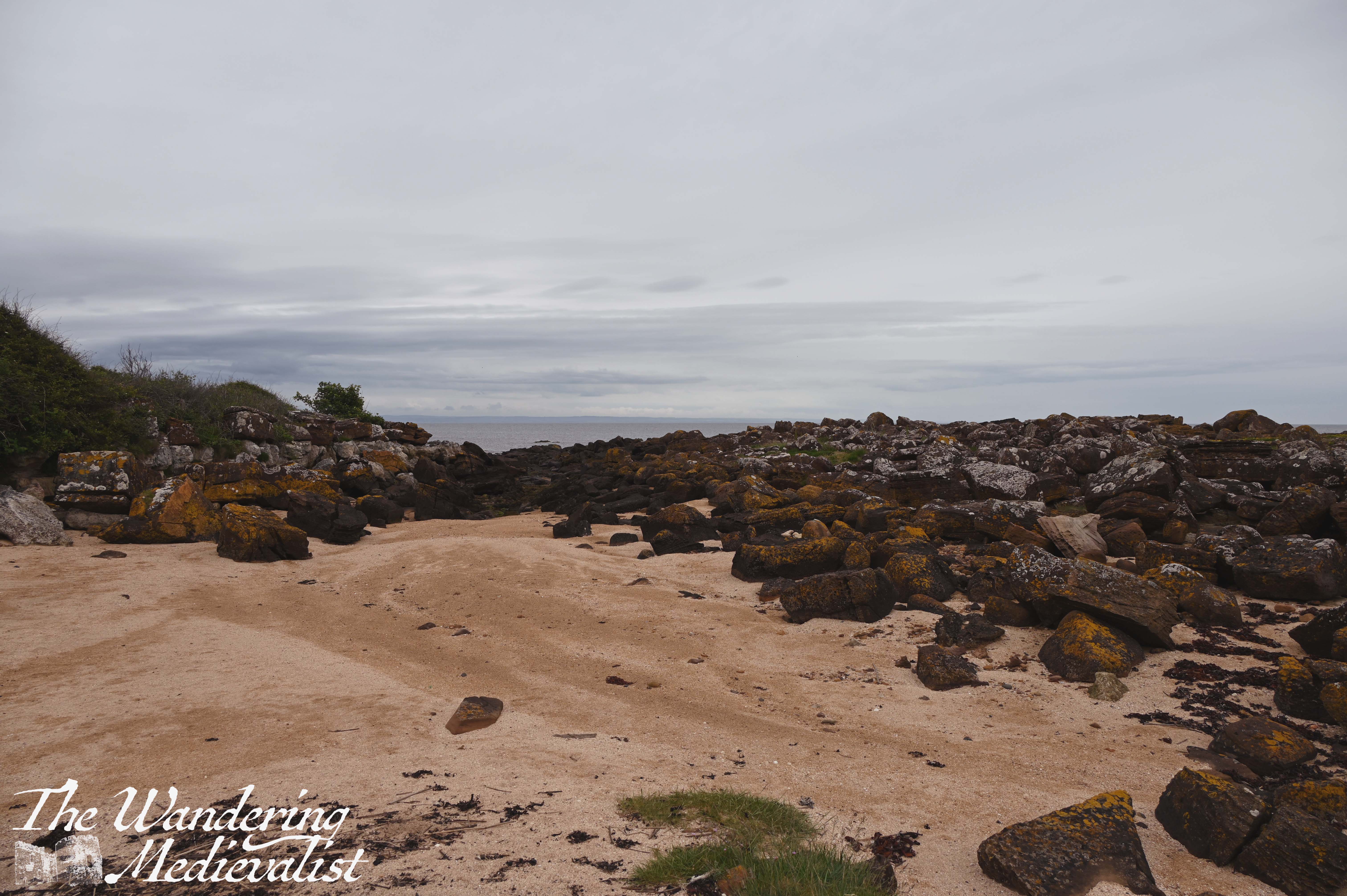
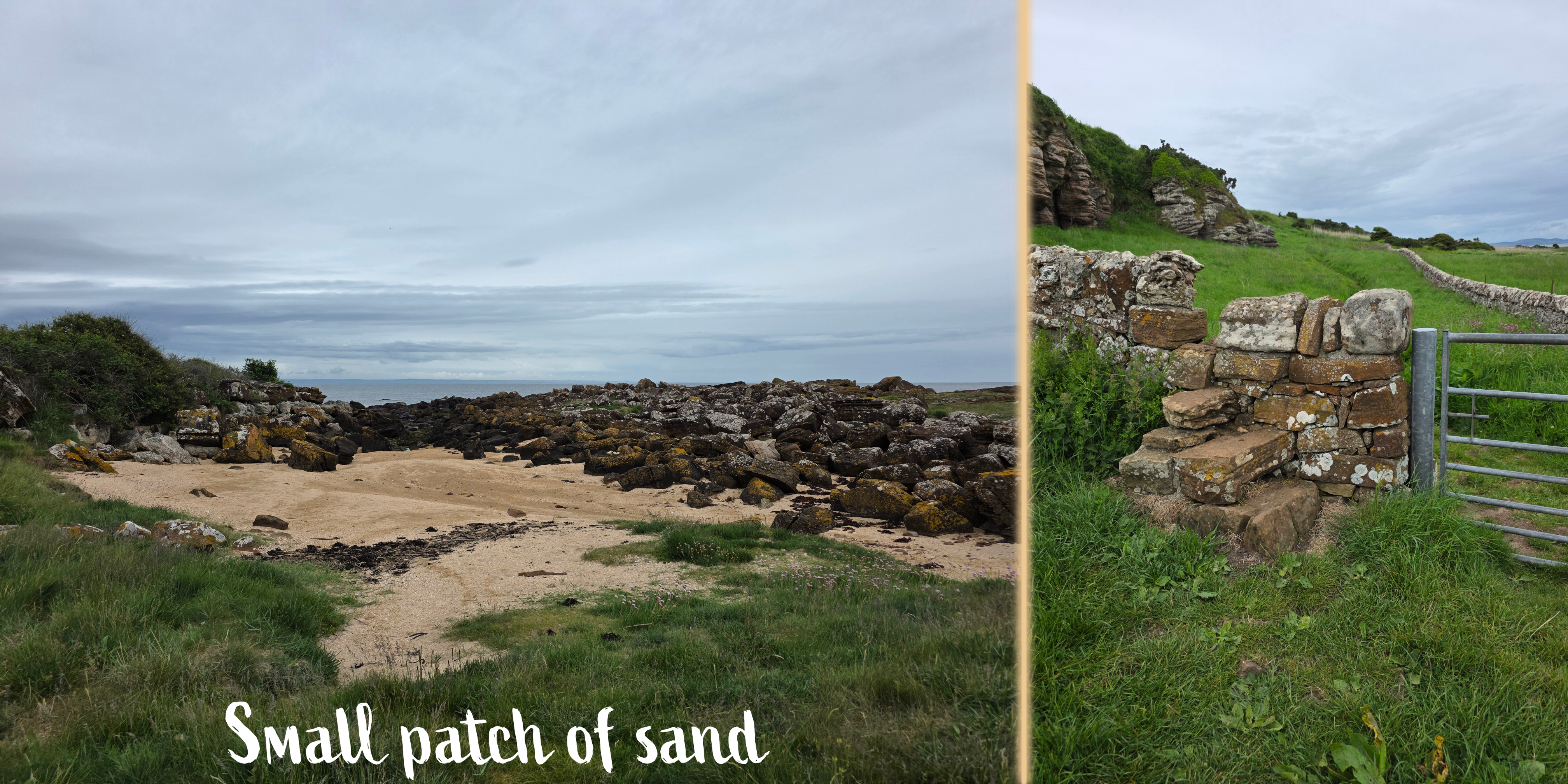
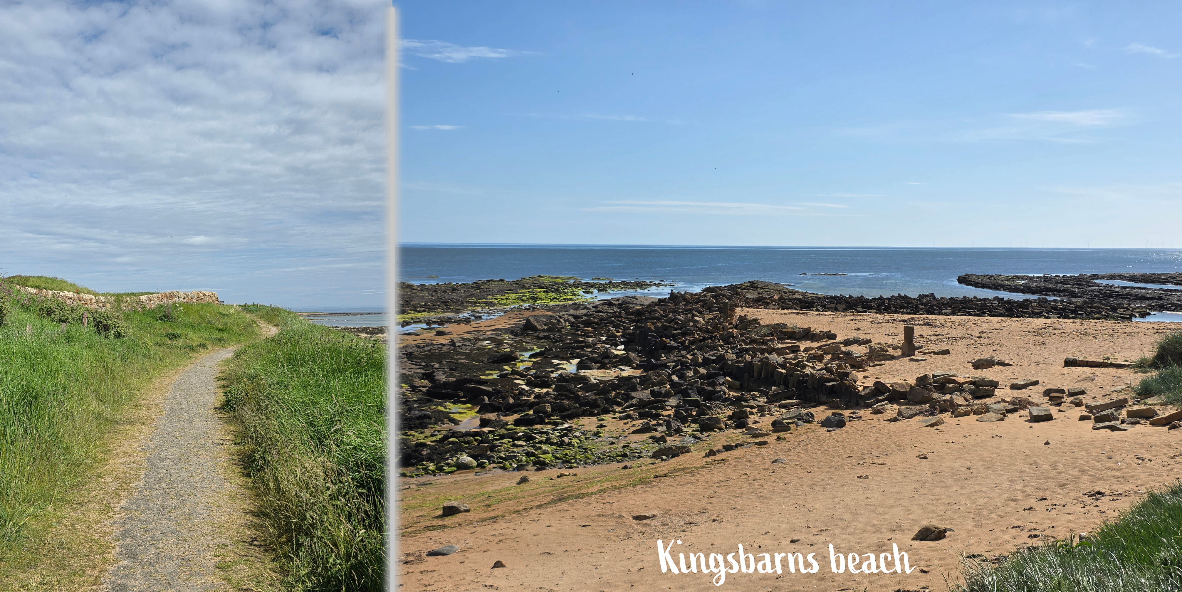
Just beyond the picnic area is a nice spot to detour down to the beach, where there are some interesting rock formations and nice views – the beach here is quite sandy, between larger stretches of rock on either end of the cove.
The path narrows a bit here but is still easy to follow. It was also very quiet; normally I pass numerous dog walkers, hikers and runners but really only came across 3 or so groups; from the edge of Kingsbarns to Boarhills only 2 people total – not sure why, but I didn’t begrudge the quiet.
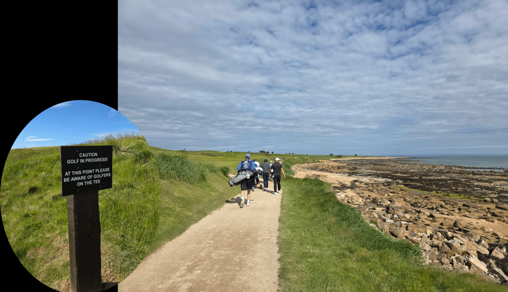
For about half a mile beyond the beach, the path follows the edge of the golf course, occasionally even crossing the green so that there are signs asking both golfers and walkers to be courteous of one another.
This stretch is very pleasant, mostly flat and not particularly strenuous. The breeze was gentle, and the view familiar but no less beautiful, with green on one side and the beach on the other.
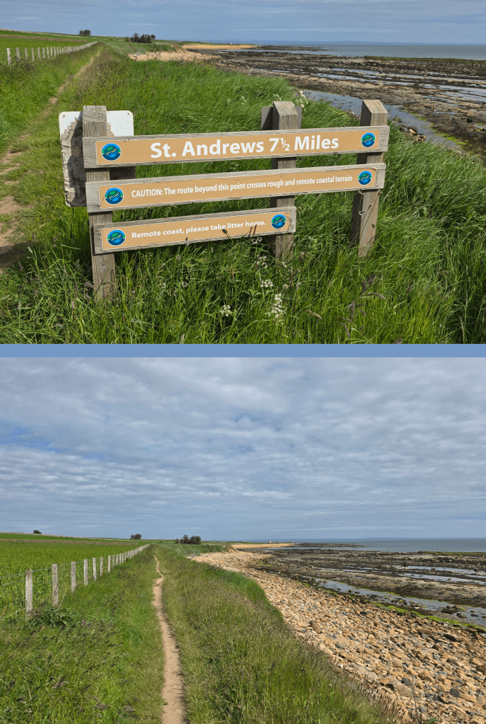
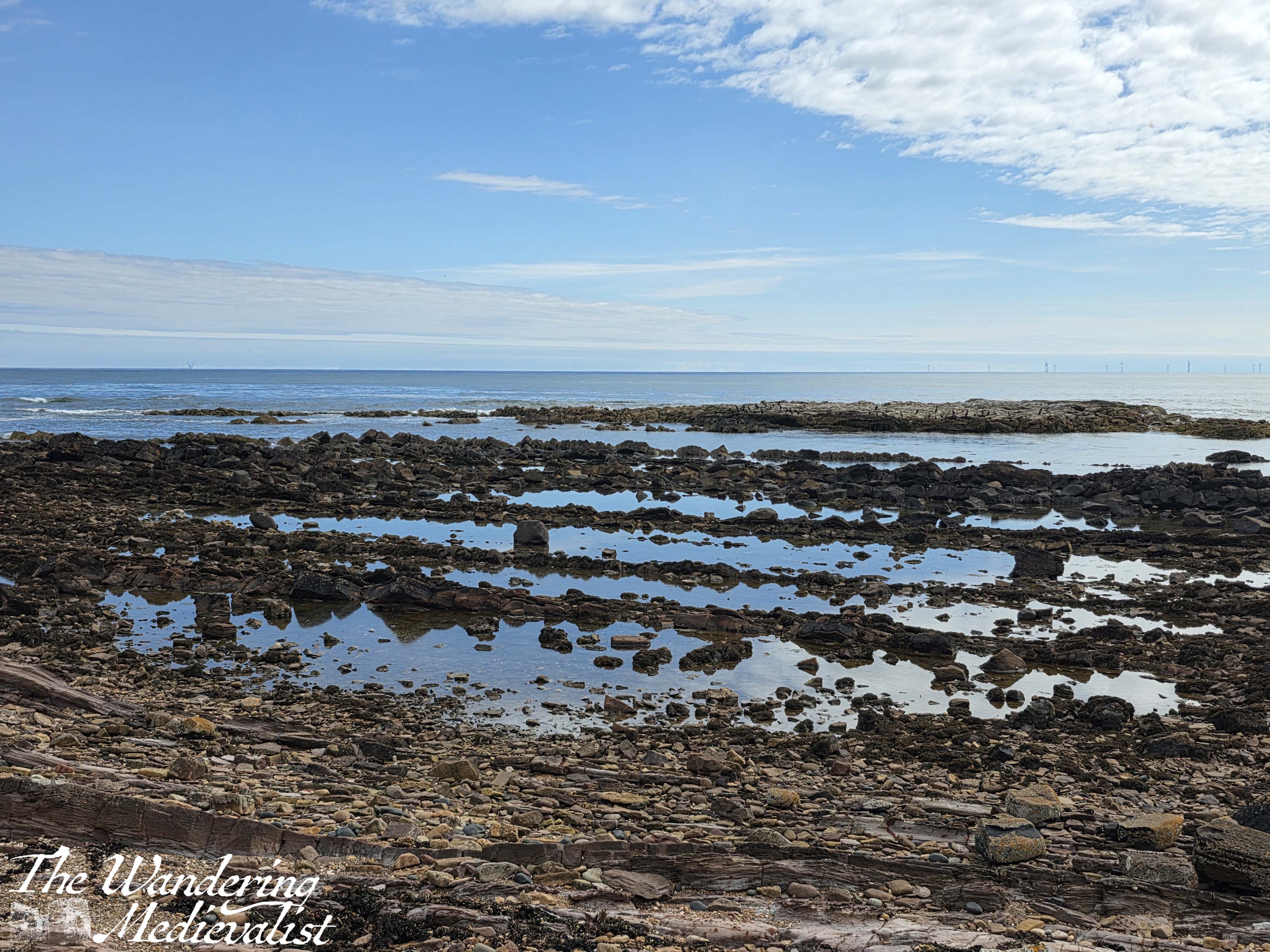
At the edge of the golf course there is a sign warning walkers about the distance to St Andrews, as well as the treacherous nature of the trail in places. Almost immediately the path narrows considerably to the point where groups would need to walk single file, but it is still mostly flat. In little time, there is a large post directing walkers down to the beach until there is another sign (which I never actually saw, though I did work out when the path re-started).
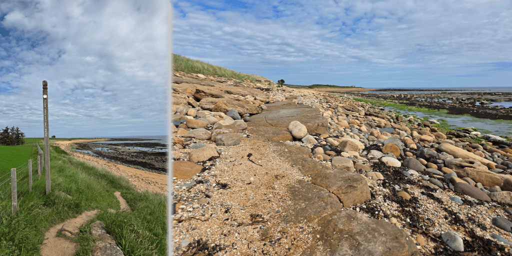
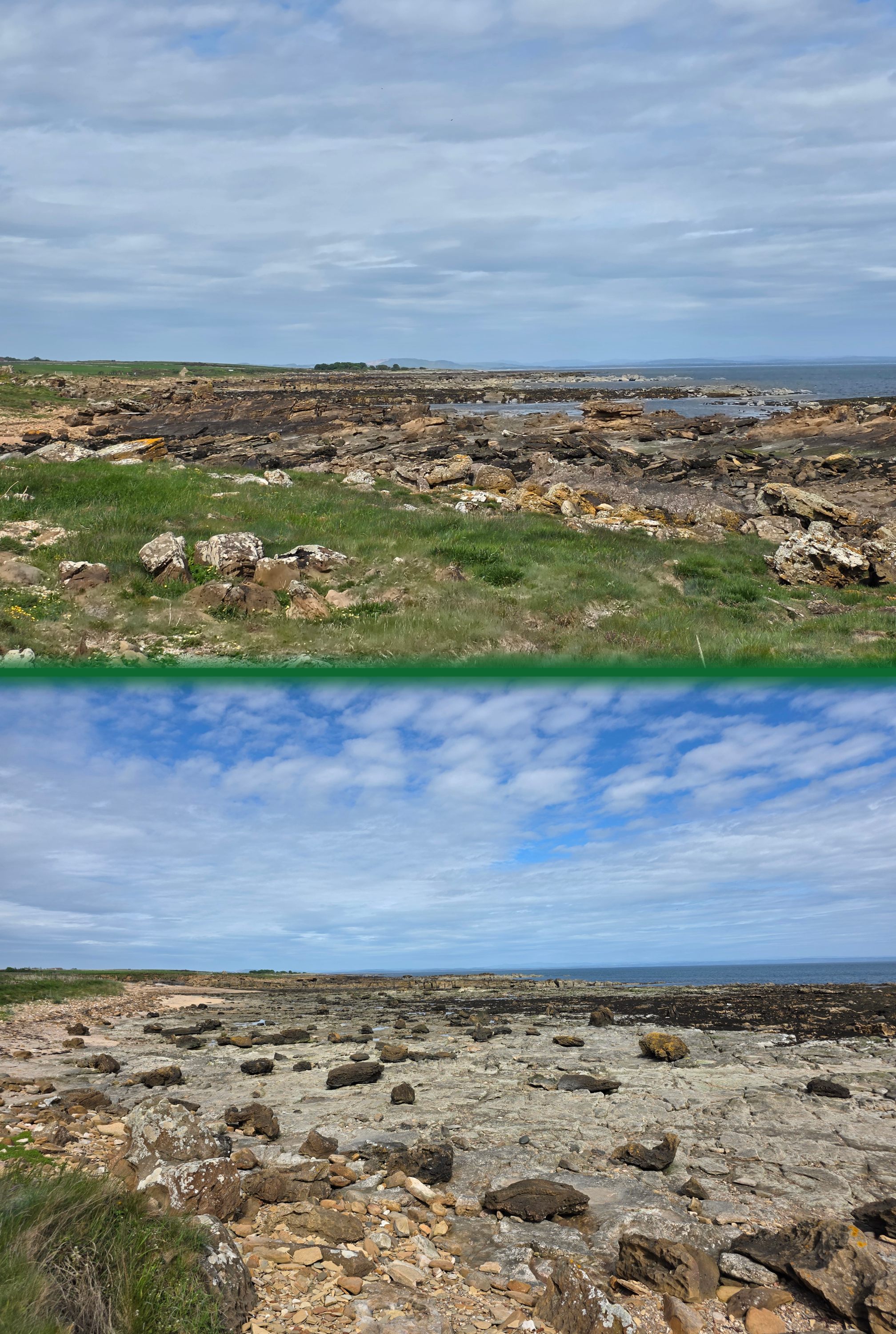
I think you could probably just manage on the beach even at high tide, and while it is alternately sandy, I was able to find a shelf of rock to walk along for a while, and prevent my boots sinking into the soft sand. Ahead on the horizon was a house that I was using as a marker for when I should think about looking for the second sign, to return to the grass. When not sandy, the beach becomes treacherously rocky with those medium-sized rocks that are perfect for turning your ankle if you are not careful.
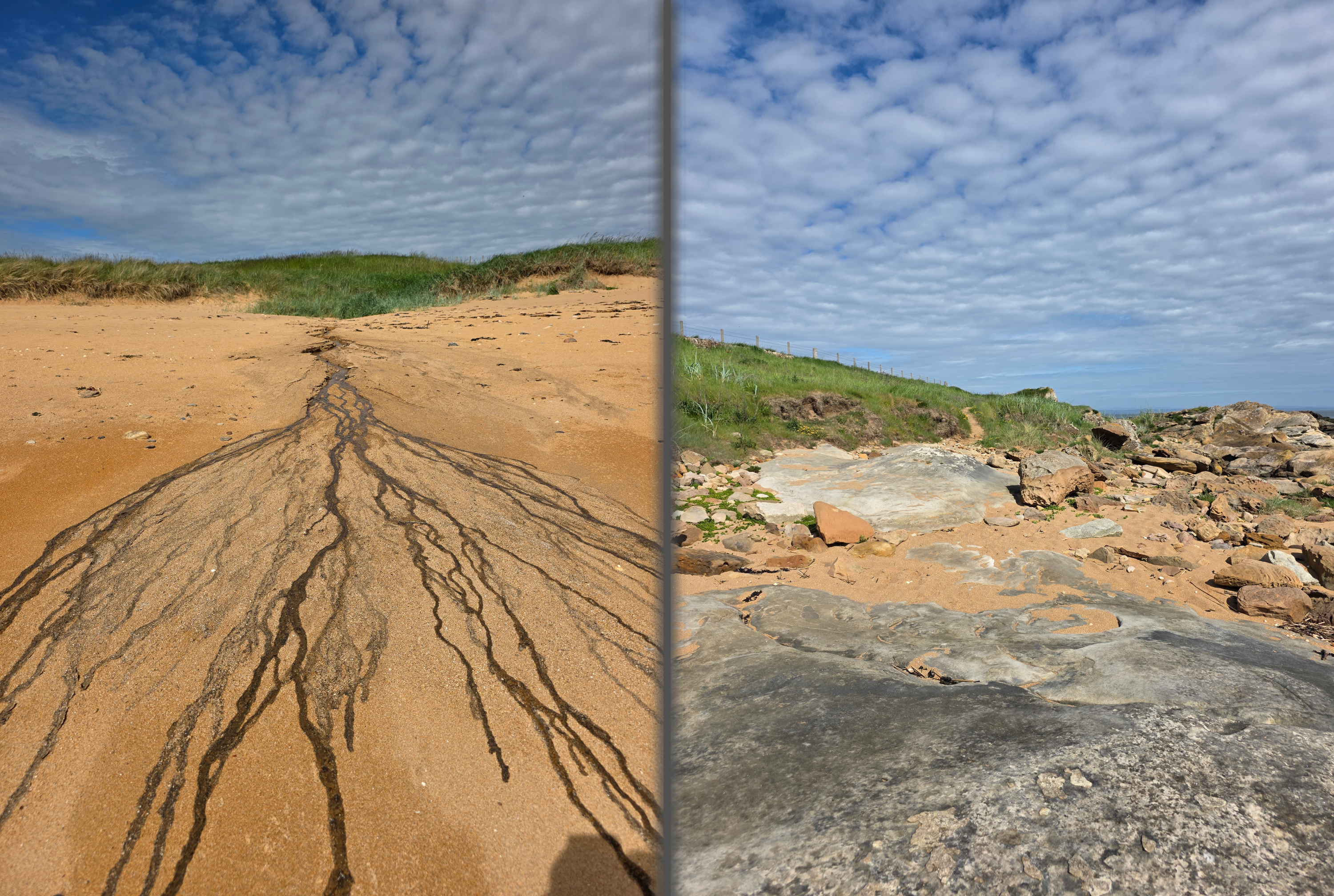
While you cannot necessarily see the cows from the beach, their scent leaves no doubt that they are just out of sight in the fields above. The runoff from one of the fields created this fascinating mini river delta on the beach, though it smelled awful. The hungry hiker in me also was sure I saw some dark fudge brownies in a pile of rocks…wishful thinking!
In time, the coastline juts outward – where the building is – and at that point you can look back all the way to Crail. Somehow distances on this coast never look as far as they are, and I remember that walk well as one of the best sections of the path.
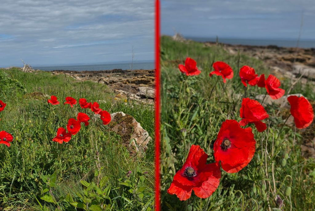
Just when I was starting to get tired of plodding though sand, a slab of rock firmed up beneath my feet and lo and behold, the path re-appeared up ahead. It is still narrow here and a bit less even, edged with grass and wildflowers. I stopped for a moment to capture these gorgeous red poppies that stood out dramatically against the background.
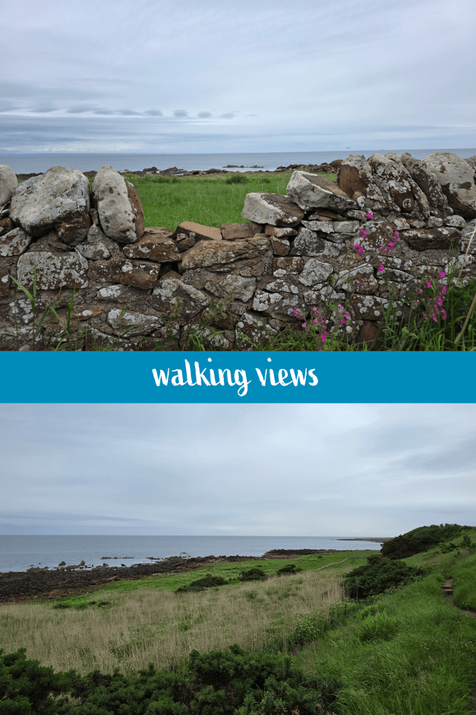
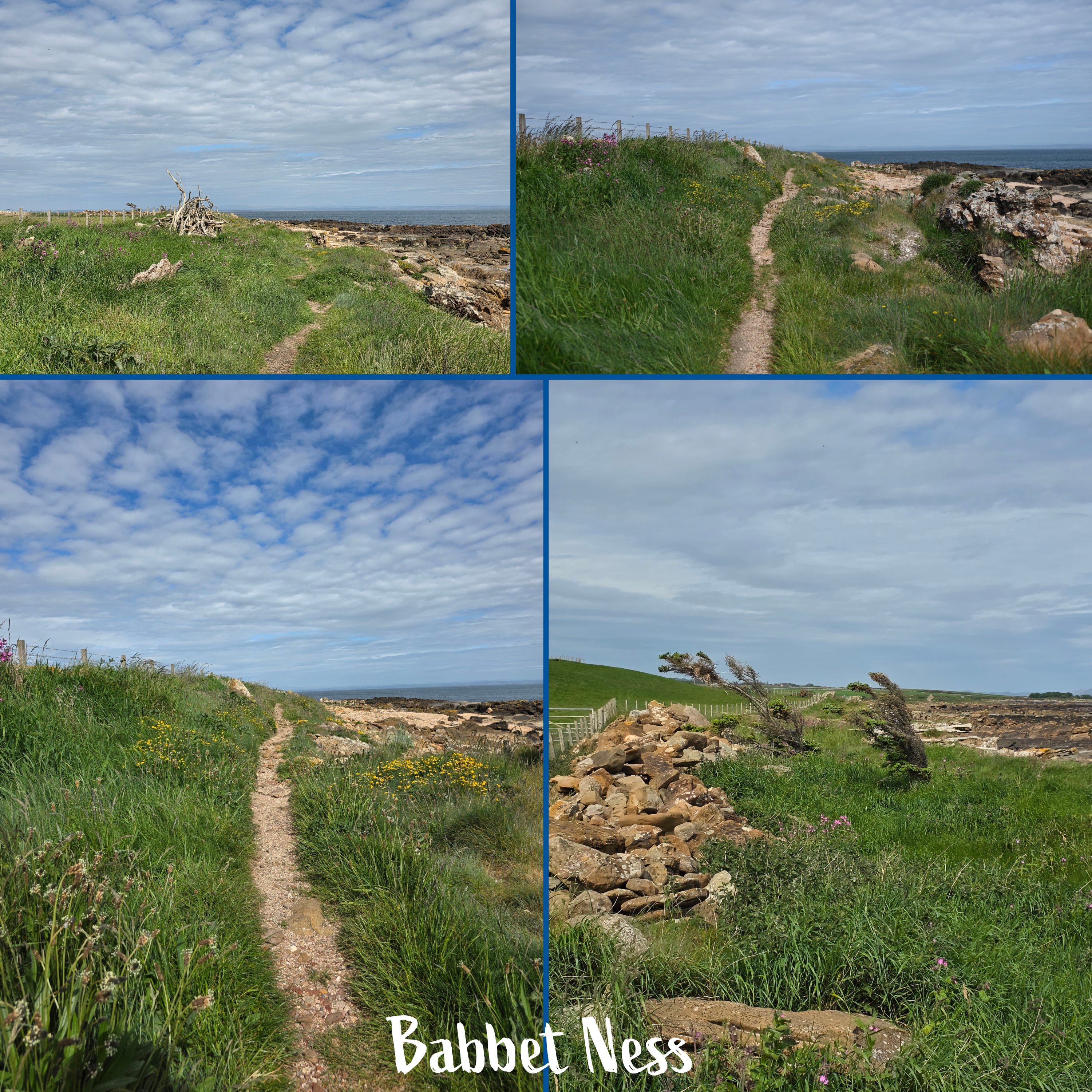
A jumble of logs marks Babbet Ness, a headland that comprises another sort of ‘corner’, where the coastline turns at an almost right angle due west for a short distance inland, until it meets Boarhills. There are two small trees – really more shrubs – that demonstrate just how strong the wind here can be, and very little other vegetation beyond grass and low brush. Beyond is yet another gorgeous stretch of Fife coastline, the long shelves of rock broken up by small sandy coves, distant trees and grassy fields that stretch from the coast up toward the main road, just over the knoll. Ahead, in the far distance, I could just make out the lump that is Balmullo Law.
For a short time, the path runs very close to a new barbed wire fence that looks lethal, so be careful if you are busy looking at the view. The path is also quite uneven here, narrow with plenty of places for a foot to slip or turn if you are not paying attention to your feet. Sprays of small yellow and purple flowers break up the grass, and the sky was still blue though the large stretches of clouds were rolling in from the west. Fortunately, while they blocked the sun a bit, they did not seem threatening.
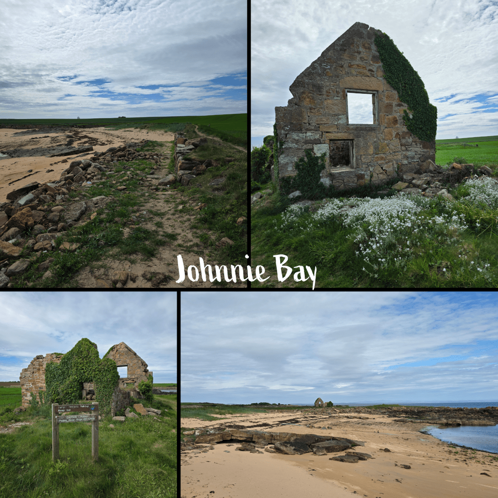
Beyond Babbet Ness, I could see the distant unmistakable shape of an abandoned building, a croft or house of some kind. This turned out to be at a spot known as Johnnie Bay, a sandy inlet with what must have been a boat ramp leading from the ruined building down to the water. It’s a charming spot, though there are strict signs on both sides to keep out of the structure as it is not safe.
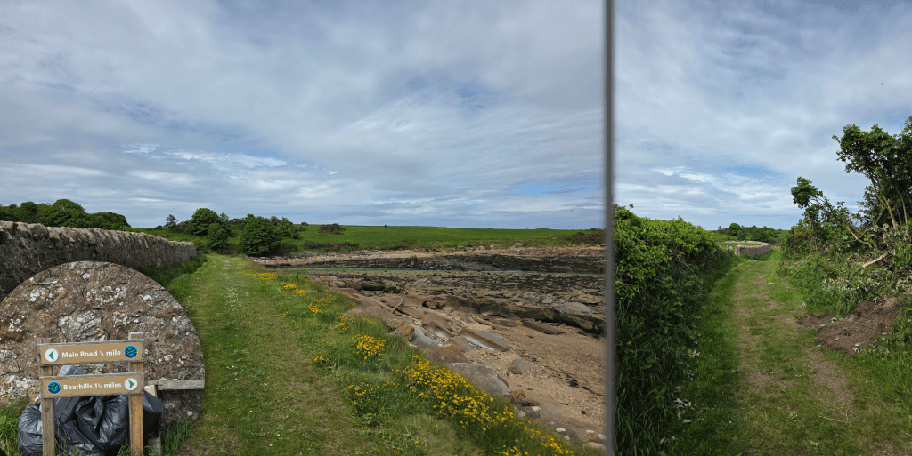
By this point in the walk – as you can doubtless see in the pictures – the sun was behind a cloud more often than not, and I was able to take off my sunglasses, which I prefer. Not far beyond the house I could see a sign and a stone wall, from which I was distracted temporarily by what I was relatively certain was a gunshot – a rifle of some kind. It could have been something else, as rifle shots are not common, but it stayed in my mind as I approached the signpost.
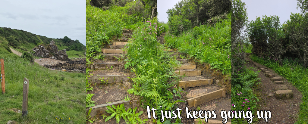
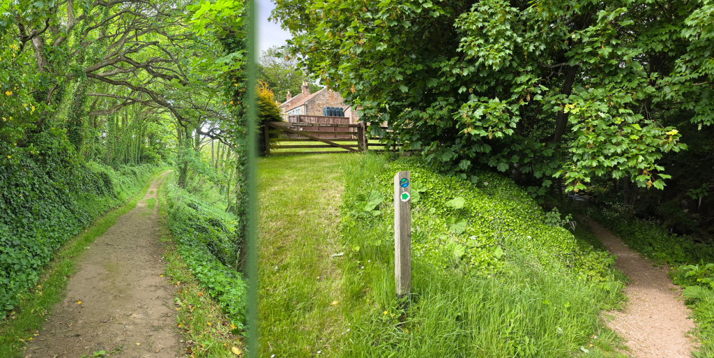
This spot allows you to make a choice, directing you up a farm track to the main road only .5 miles away, or to Boarhills, 1.5 miles away. I knew from looking at the map that the spot where the farm track emerged was a tricky one: on a blind corner, and potentially nowhere for the other half to pick me up. Fortunately, a happy cocker spaniel trotted towards me from the other direction, and so I paused to give it a good ear rub before pushing on towards Boarhills. The path here follows the edge of an estate wall, and is a wider track that is easy to follow.
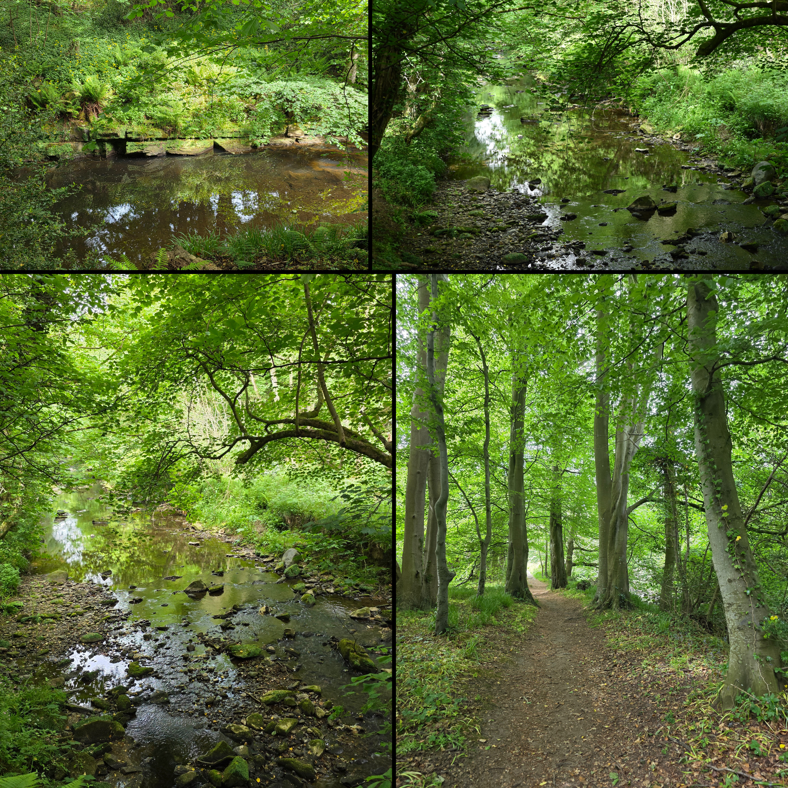
In a short distance of only a few minutes’ walking, the path begins to turn inland, where Kenly Water flows out of the farmland to meet the sea. Ahead is the edge of the tree line which surrounds the burn, and there is a hint of roofs and fences indicating homes. The walk through the trees is very pleasant, a lush green tunnel with ivy-covered trunks and the water trickling along beside.
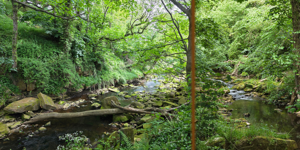
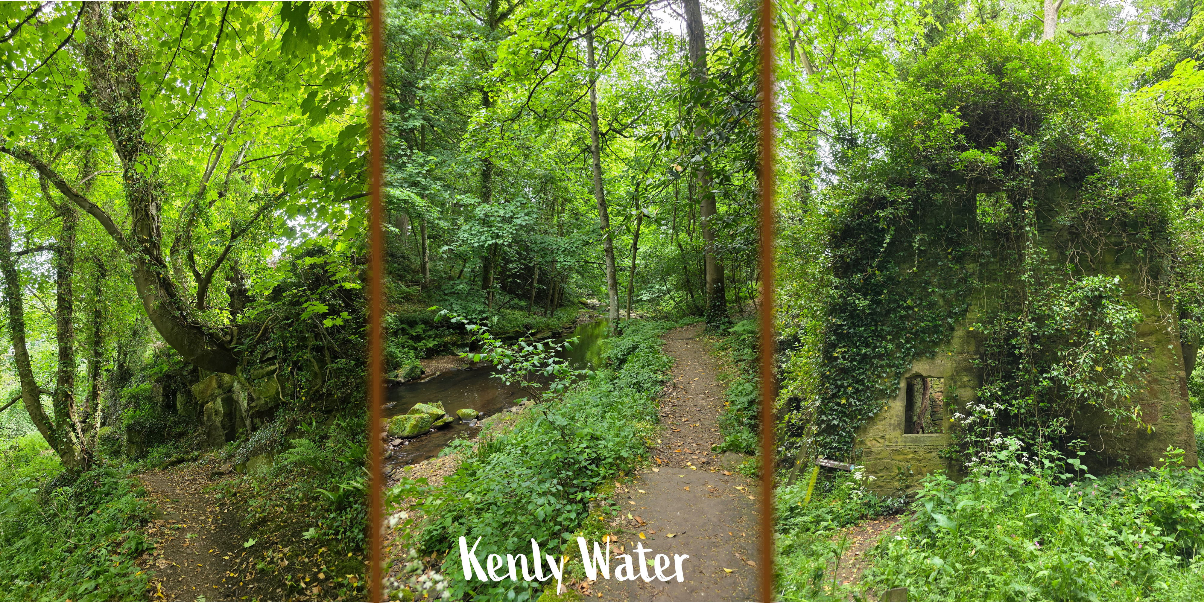
Soon, the trail splits with a farm track to the left and the coastal path marker directing walkers down a smaller trail to the right, descending again into the den. It reminded me very much of Dunino Den, though this makes sense as they are only miles apart; in Scotland, a den is a narrow valley or ravine, usually wooded, with a river or burn running through. They tend to be extremely beautiful and peaceful, and this one was no different. The path winds closer to and then away from the water, sometimes a bit higher on the bank and sometimes lower down, and on Saturday morning was serene, the only noises being the ducks, the birds, the water rushing, and my footsteps.
The burn – Kenly Water – varies between tumbling over rocks and pieces of log and pooling in deeper areas where it slows for a time and allows for reflection. And ducks.
At several points, a joining rivulet requires a stone bridge to cross, in particular just before the path meets another half-ruined house. This one is covered in ivy, like something out of a fairy tale, though there are again strict signs warning against entry.
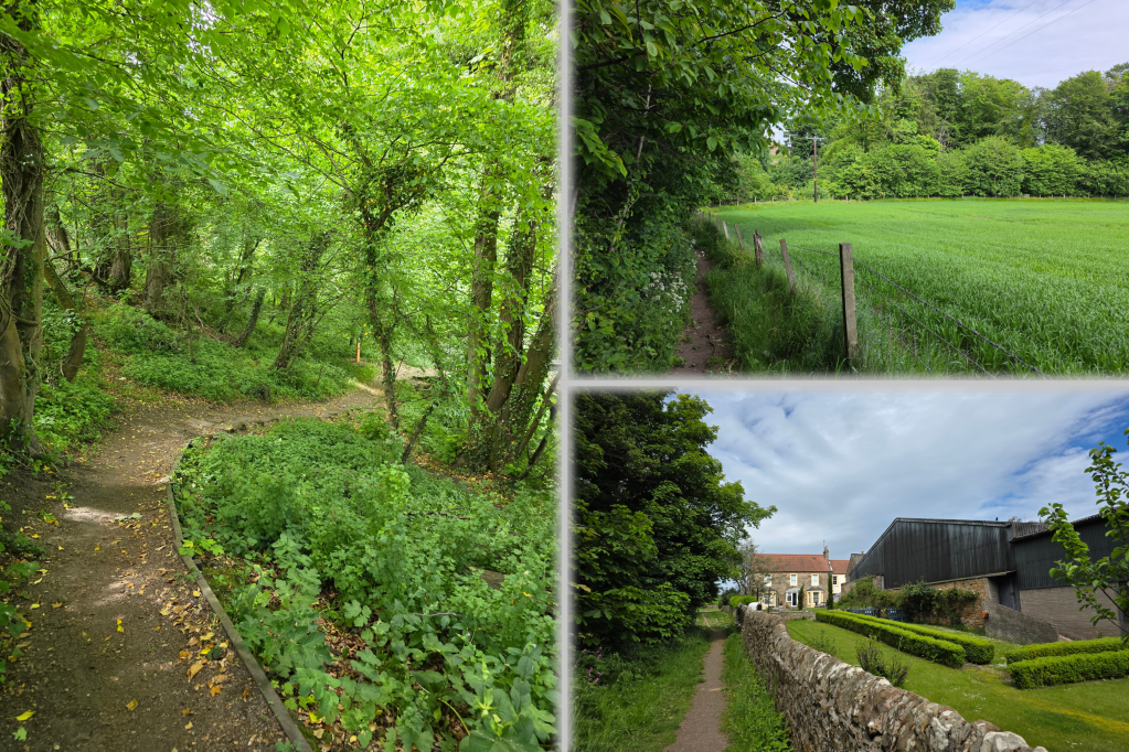
About a mile on, there is a jog away from the burn and up beside a field – it was a touch buggy, as standard in spring, but offered another view down towards the woods. Soon after this, the path turns into the trees again and passes over a metal bridge that is most definitely a single file affair.
Beyond the bridge is a well-kept old farm with rambling roses growing along the barn, and an old stone farmhouse that seemed to be basking in the morning sun, which had by this time emerged again from cloud.
Just after passing the farmhouse, the path joins a private road that is very narrow and quiet, but not completely unused – it is the access road for the farm, and a post van came zooming along it quite quickly. That said, it is unlikely to be busy as it is marked no access to unauthorised vehicles.
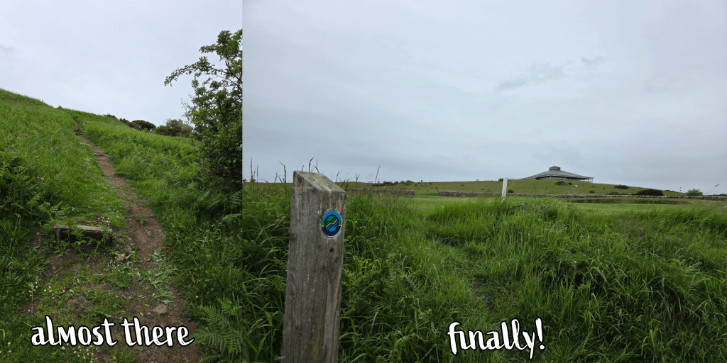
From here the path follows this road, winding up away from the farm and climbing a hill between two fields. The view here was excellent, looking back at the main road through this part of Fife and towards the village. But, I was definitely hitting the end of my endurance, and sometimes knowing the end is close makes it harder.
I finished my walk at a rather random spot, where the private road turns towards the village and the coastal path continues. I have every intention of picking it up here again this weekend, as the next portion of the walk is relatively short and should be easier to manage. From this point to the ‘main’ road through Boarhills was just under half a mile, and there I was collected by the other half as I had just missed a bus.
The access to the coastal path was the biggest challenge for this section, as both ends required at least a mile of extra walking that was not ‘official’. But, like the section from Crail to Cambo, it is a beautiful stretch of coastline with golf course, beach, wooded den and more. I am so happy to be back on track and wish I were not disappearing for most of June!
But I am sure I will have other adventures to share about that trip, in due course.
While in the US last month, I took advantage of a Sunday off to visit the Holocaust Memorial Museum in Washington DC, a bucket list destination for me almost since it opened in 1993.
I began writing about the experience on the Metro trip back to the hotel, and it will I am sure take me some time to process it all – I knew that it would be emotional and moving, and it was certainly both of those things. I also knew that I wanted to go by myself, so I could move through the exhibits at my own speed, as I wished to, and be entirely independent in my experience, my reaction. I wanted to be completely selfish in the experience, did not want my natural people-pleasing to alter my visit to someone else’s wishes, and I had a feeling that I would want firstly not to do anything else ‘touristy’ on that day, and secondly to have time, in quiet, to think. Fortunately, I had both.
My study of the Holocaust
I was exposed to the study of the Holocaust quite early in my education, partly due to my mother’s own passion for World War II study (particularly the French resistance) but also through school. In class – I think 6th grade – we read Number the Stars by Lowis Lowry, a book about the escape of a family of Jews from Copenhagen – it touched on the dangers but without too much detail. Probably earlier than I should have, I read Elie Wiesel’s Night and Day, both quite graphic in their description of the atrocities, and of course the Diary of Anne Frank, then watched the 1959 movie by the same name. Mum was inspired to take me to a play version of the book, which I am relatively certain starred Natalie Portman – a bit of research indicates this is likely to be so as she played the role for some time including at the Colonial Theater in Boston.
But my real interest in this period of history came in 7th and 8th grade, when we studied, ‘Facing History and Ourselves’, curriculum meant to help us understand the Holocaust and why it had happened. It was a very honest course, and we were fortunate enough to meet a survivor, Sonia Schreiber Weitz, hear her speak in-person and read her book. We watched videos of many other survivors at a time when there was a real push to record these testimonials before the passage of time meant we started to lose them. Other reading that sticks with me to this day is the short novel Friedrich, by Hans Peter Richter, during which a nameless narrator describes the experience of his close friend, a young Jewish boy, during the rise of the Nazis in Germany. The almost matter-of-fact way in which the rights of Friedrich are worn away is heart-breaking. These are all books I have held on to, as well as some text books on Facing History and America during the war, and the graphic novels Maus and Maus II, by Art Spiegelman, in which he explores his father’s experiences as a survivor and how to deal with those experiences decades later.
The years during which I was studying Facing History happened to coincide with the release of Schindler’s List, which I watched probably a bit too young, but which put visuals to the writing of Wiesel and other survivors. I recall vividly being curled into the corner of the couch, as if I were trying to get away from the screen while at the same time mesmerised. It remains a movie that I feel all students should watch, but in a safe environment where they can talk about the experience.
Most recently, I found myself on a long plane trip watching the (relatively) new film, Nuremburg (2025), which of course focusses more on the trials after the war. But, there is a vitally important part of the history that the movie addresses: in its exploration of the relationship between Hermann Göring and the psychiatrist who interviewed him, it reminds us of the humanity behind the men who perpetrated this evil. For all their flaws and sins, they were human, and in Göring’s case, they were charismatic and at times even sympathetic. And this is a part of the difficulty. Russell Crowe’s Göring is likeable, charming, at times pitiable. He was a real man, not some dark villain – the Nazis were people, not evil demons, even as they perpetrated demonic crimes.
Where am I going with all of this? I guess I feel that it is important for you to be aware of my history with this history, and to give a bit of background for understanding the knowledge and experience with which I approached the museum. I was not necessarily coming to learn many new facts, but as a necessary part of my experience of learning about the Holocaust. It was another piece of the puzzle.
My visit
I planned my day carefully, as discussed above, as I wanted to be able to be quiet after the visit, to think, not to have to immediately talk about what I had seen. The solo aspect was vital.
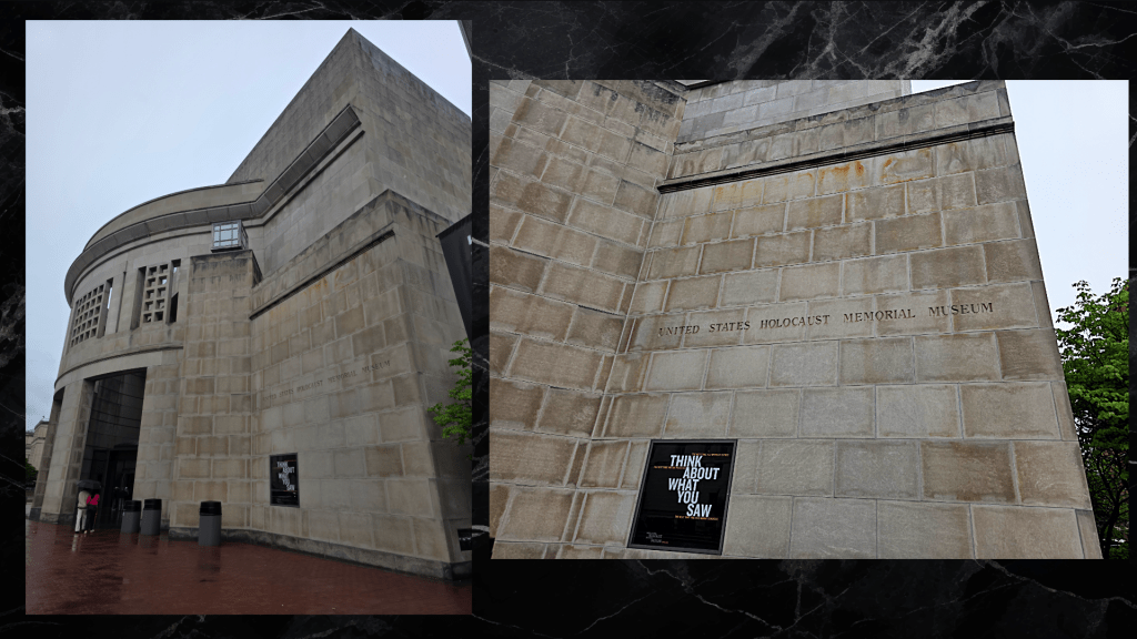
I approached the museum on foot from the Smithsonian Metro stop – a pleasant walk even in the drizzling rain along Independence Avenue. The omnipresence of the Washington Monument is very evident here, and the Museum itself is a majestic yet understated building, compared to many of the very decorative and dramatic government buildings nearby.
I was surprised, perhaps foolishly, by the need to go through security both at Arlington Cemetery and here, but clearly that just shows how long it has been since I visited a major site – security was needed in Mexico City and is also required to enter sites in London. I later learned that a guard had lost his life here, protecting the museum and its exhibitions. I forget so easily the continued antisemitism, particularly now. I am fortunate enough to be able to forget it, living where I do, and the sentiment of antisemitism it is something I absolutely do not understand – the town where I grew up has a large Jewish population, and many of my friends were Jewish or half-Jewish. I got to experience Passover Seders, Hannukah celebrations, and Bar and Bat Mitzvahs as a regular part of life. This upbringing sheltered me to how prevalent antisemitism still is – it never occurred to me as a child, and I understand now what a privilege that is. I also realise now, as an adult, that the absence of antisemitism I experienced may well also have been a benefit of childhood. The experience of the parents of my friends may well have been very different.
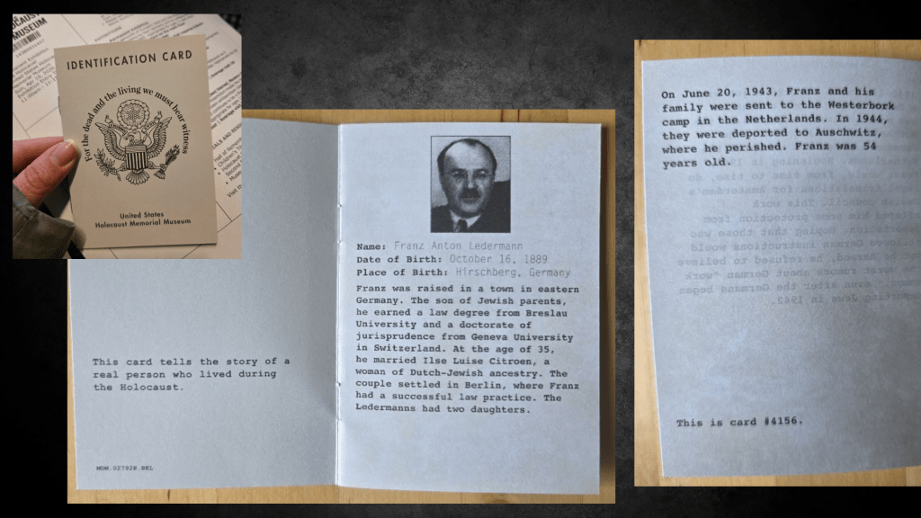
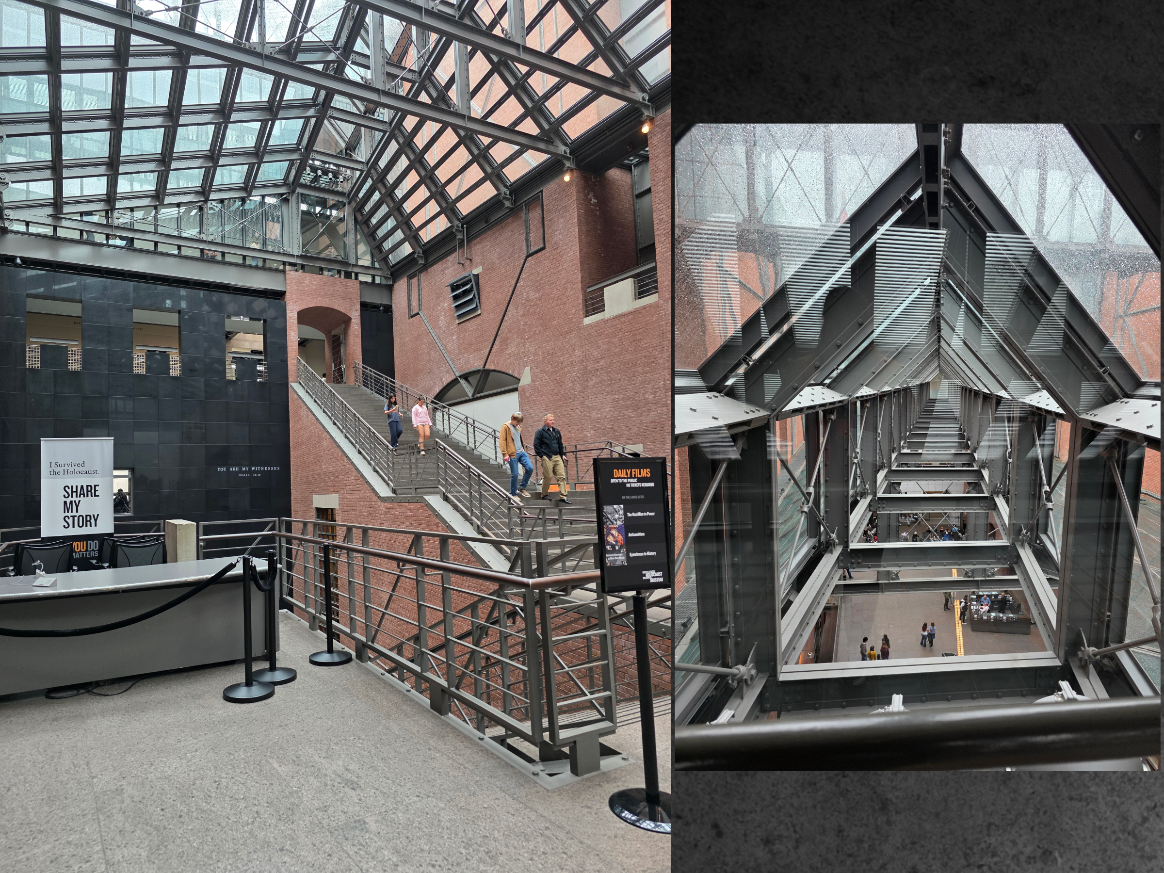
I entered the museum ready to experience whatever it had for me. I learned that the permanent exhibit was free to visit, and I was directed towards a line where everyone selected an identity booklet out of a pile of hundreds; each told the story of one person who was persecuted.
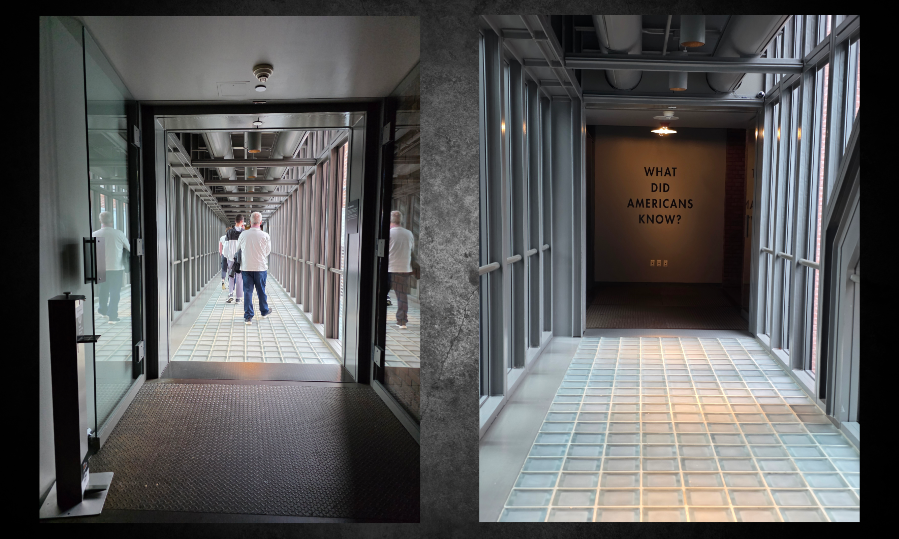
The queue of visitors was then invited into an elevator to take us up to the top of the building – the elevator was just a touch too tight to be comfortable, the first of many experiential design aspects of the museum. As we rose, a video played of recordings from those who had liberated the camps. This was the start of the journey, and the end, to some extent.
Immediately outside of the elevator was this sign:
I paused here for a moment to let those in the elevator with me get ahead, and then moved forward to read the first introductory panel, describing Europe before the Holocaust and the sentence that stood out most clearly – within 12 years of 1933, two out of three European Jews would be dead.
Jews had lived in Europe for almost two thousand years, though not without significant isolation and persecution – something I learned a great deal about while studying the Middle Ages and the plague, after which Jewish communities were an easy scapegoat.
The panel went on to state:
‘By the 1880s….Though Western Jews had gained equal rights under the law, religious antisemitism reappeared, with political and racial overtones. In eastern Europe, Jews faced poverty, antisemitism, and, periodically, outbreaks of mass violence known as progroms. Yet Jewish traditions and culture remained full of vitality, and Jewish religious life was rich and fervently observed. Jewish artists, writers, scholars and scientists thrived and contributed greatly to their fields of endeavour.’
Beyond this panel and for the a good portion of this floor, there were massive bottlenecks of visitors, either moving slowly or standing in front of exhibits, making it very difficult to experience it as one might hope. The day was incredibly busy with school groups, families, and many more.
This permanent exhibit starts with the history, as it should – Germany in the 1930s, the rise of Hitler after World War I, the increasing antisemitism that always bubbled beneath the surface of Europe. I did not stay long in this section as it was so busy that it was difficult to read some of the exhibit. I also knew a great deal of it, though there were some elements that were newer to me.
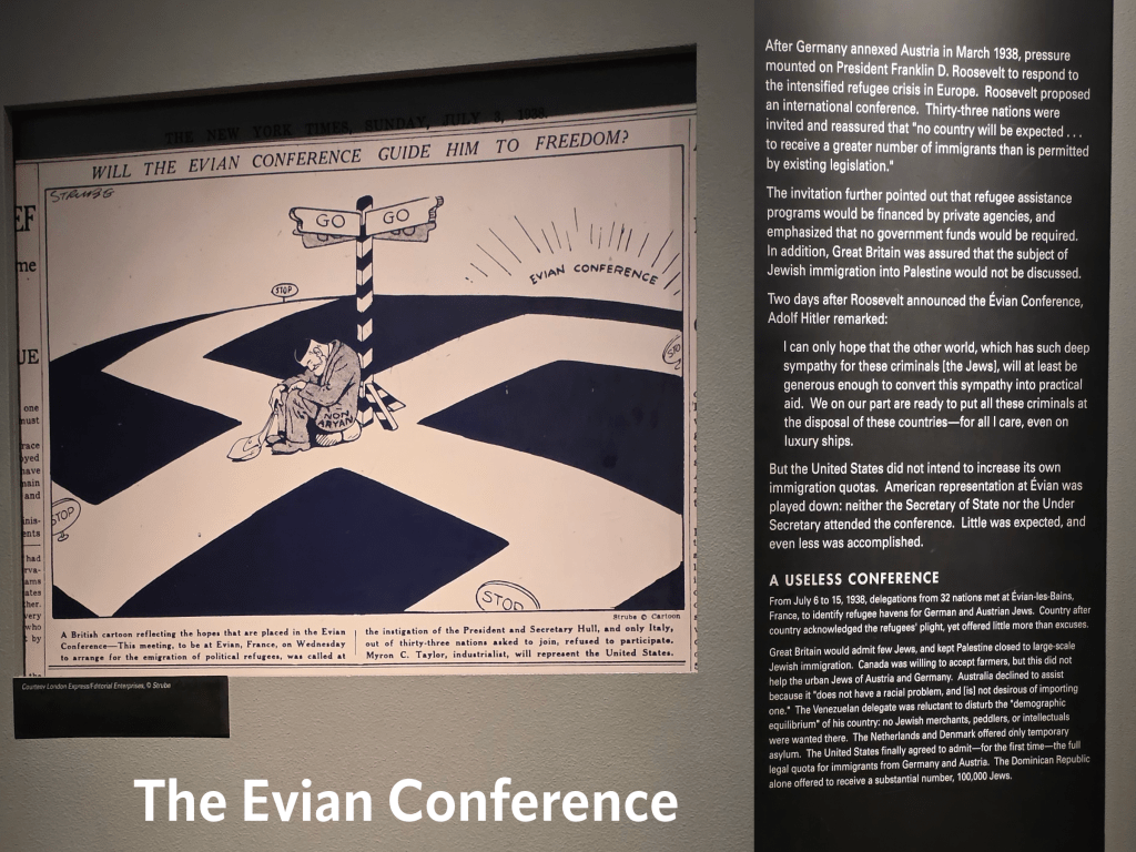
One was the panel about the Évian Conference, held in July 1938, which I do not recall learning about previously. At this conference delegates from 32 countries met to discuss the refuge crisis caused by the rise of the Nazis. As the cartoon here indicates, the conference had hoped to find a solution to the thousands of Jews fleeing Germany.
But, as you can doubtless guess, while there was sympathy for the Jewish plight, but no country was willing to increase the number of refugees that it would accept. Only months later, Nazi Germany perpetrated the state-sponsored episode of vandalism, arson and terror that became known as Kristallnacht, or Night of Broken Glass. More than 1,400 synagogues were burned, 26,000 men were imprisoned, and thousands of homes and business were vandalised.
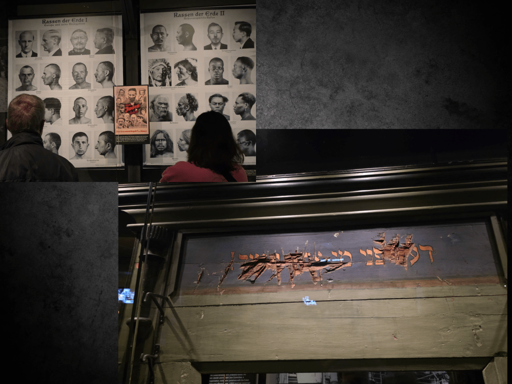
This picture shows some of the damage inflicted upon a synagogue during anti-Jewish progroms, as well as the pamphlets demonstrating stereotypes of the ‘Jewish race’.
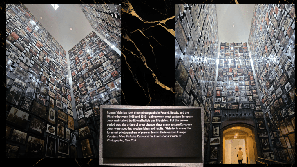
The museum took careful time to feature elements of Jewish life in Europe prior to the 1930s, and one of the most moving is a tall tower full of photographs that were taken between 1890 and 1941 in a small town in what is now Lithuania. Jews had lived in the area for almost 900 years, and the pictures show a wide variety of life in the village, most of it incredibly similar to a non-Jewish village.
The narrow tower of course meant that visitors could not see all the pictures individually, but the sense of community and history was palpable. It also reminded me, in style, of the Holocaust memorial in Boston, which is six tall glass towers that one can walk through.
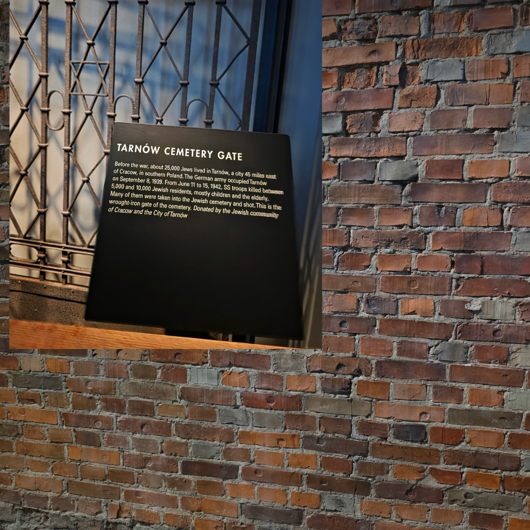
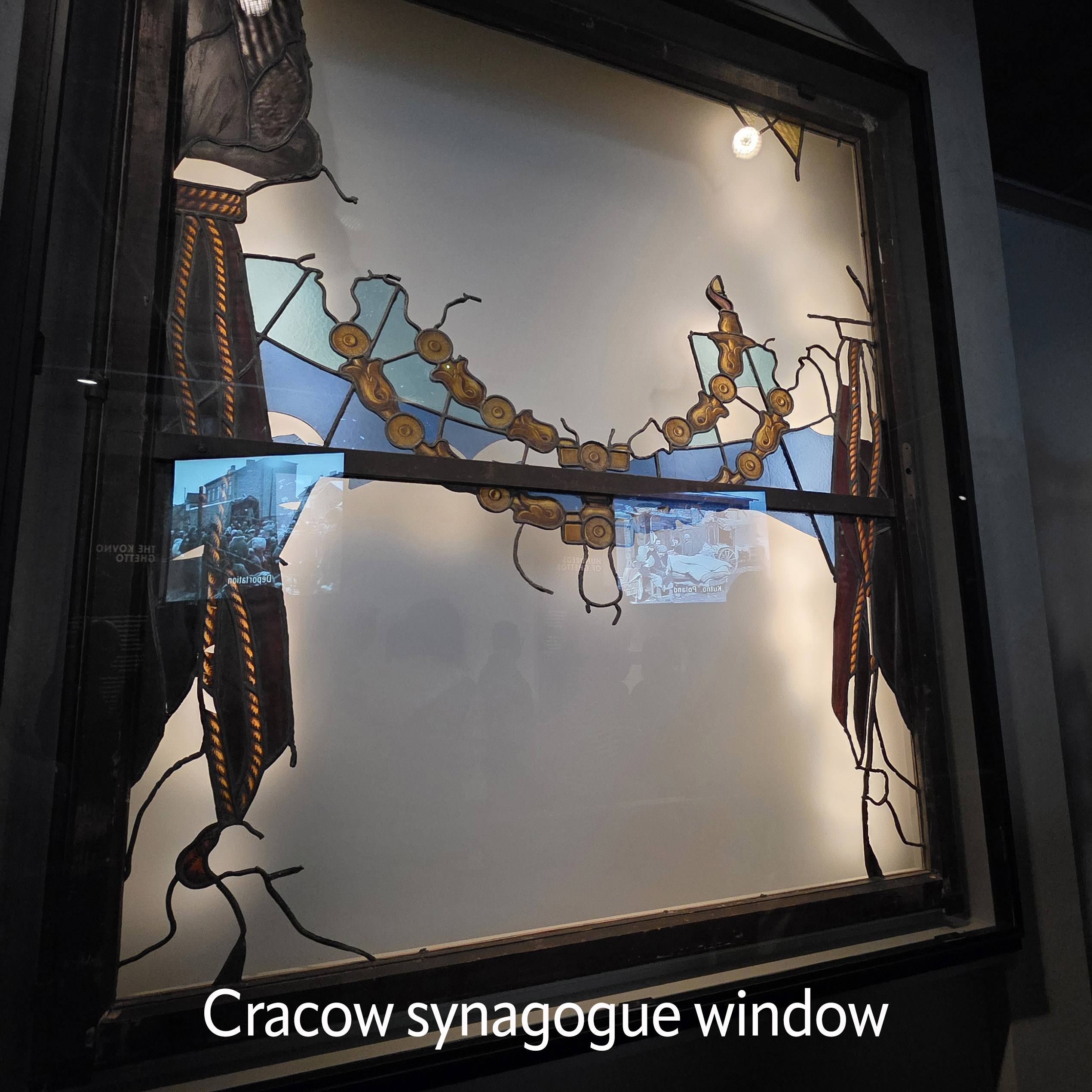
There were poignant and beautiful artifacts of Jewish life both before and as the ghetto system came into effect, including a mostly-ruined but still beautifully detailed synagogue window from Cracow, a cemetery gate from Tarnów in southern Poland, and a recreated portion of the Warsaw ghetto wall – a solid brick expanse that would have been topped with barbed wire.
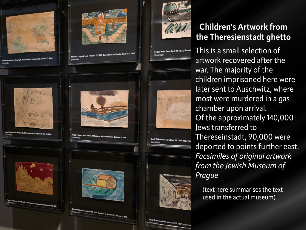
A portion of the exhibit that has stuck with me vividly and made me pause for some time in my wandering was the one below – artwork from children who were living inside a ghetto in what is now Czechia. It reflects both upon their life within and before the ghetto and the variation of bright colours to stark grey, black and white was painfully poignant. It was the first – and not the last – time I could feel tears prickling at my eyes. I know only a small amount about how art can be used in therapy sessions to evaluate a child’s state of mind, yet these pictures do not need a degree to assess.
As the museum moves visitors through time, from ghettos to the camps, the focus becomes the ‘Final Solution’: the effort by the Nazis to wipe the Jewish people and culture from the face of the earth.
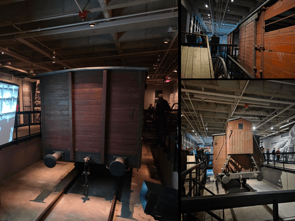
Replica train car, used to move prisoners across Europe.
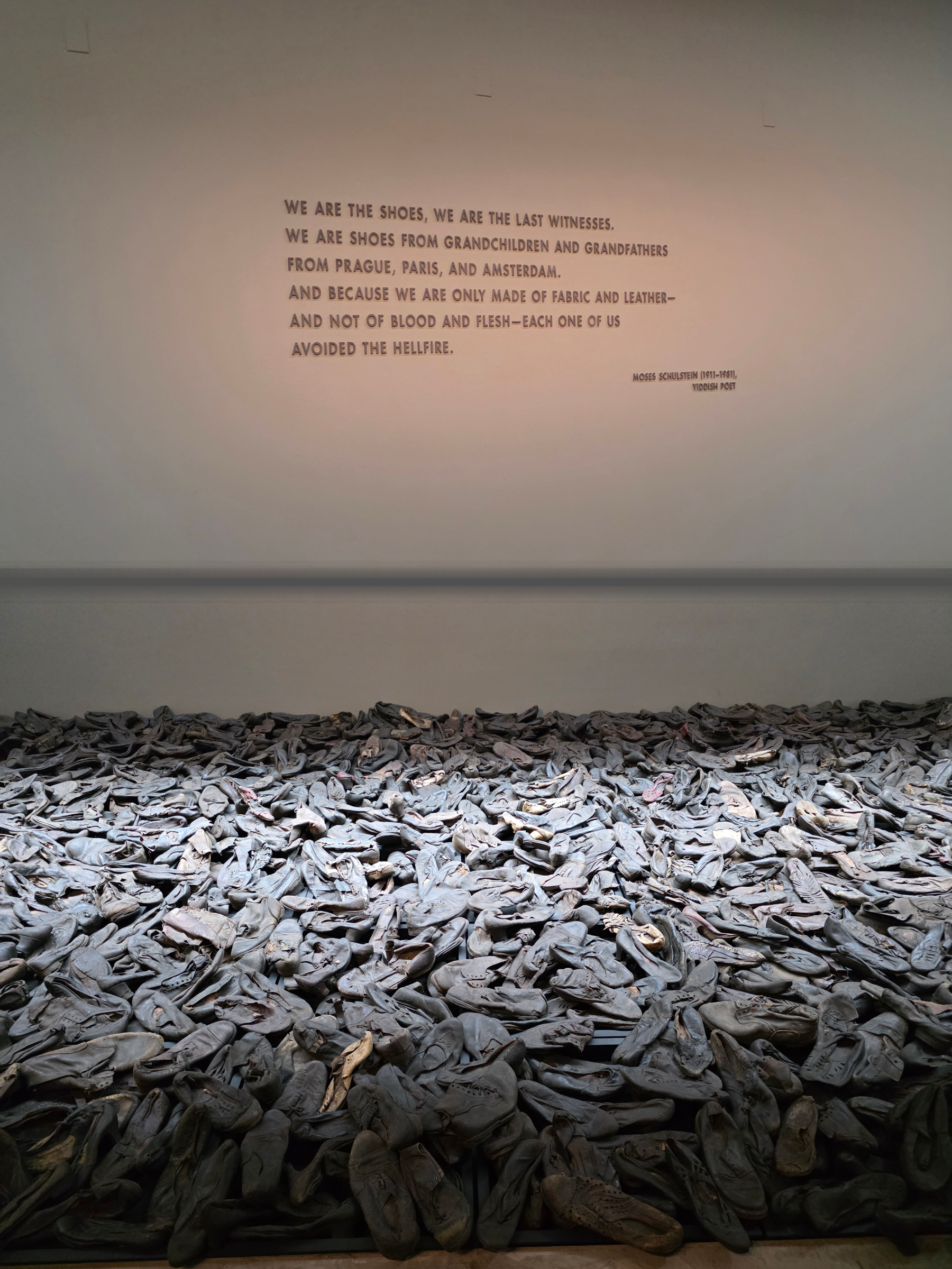
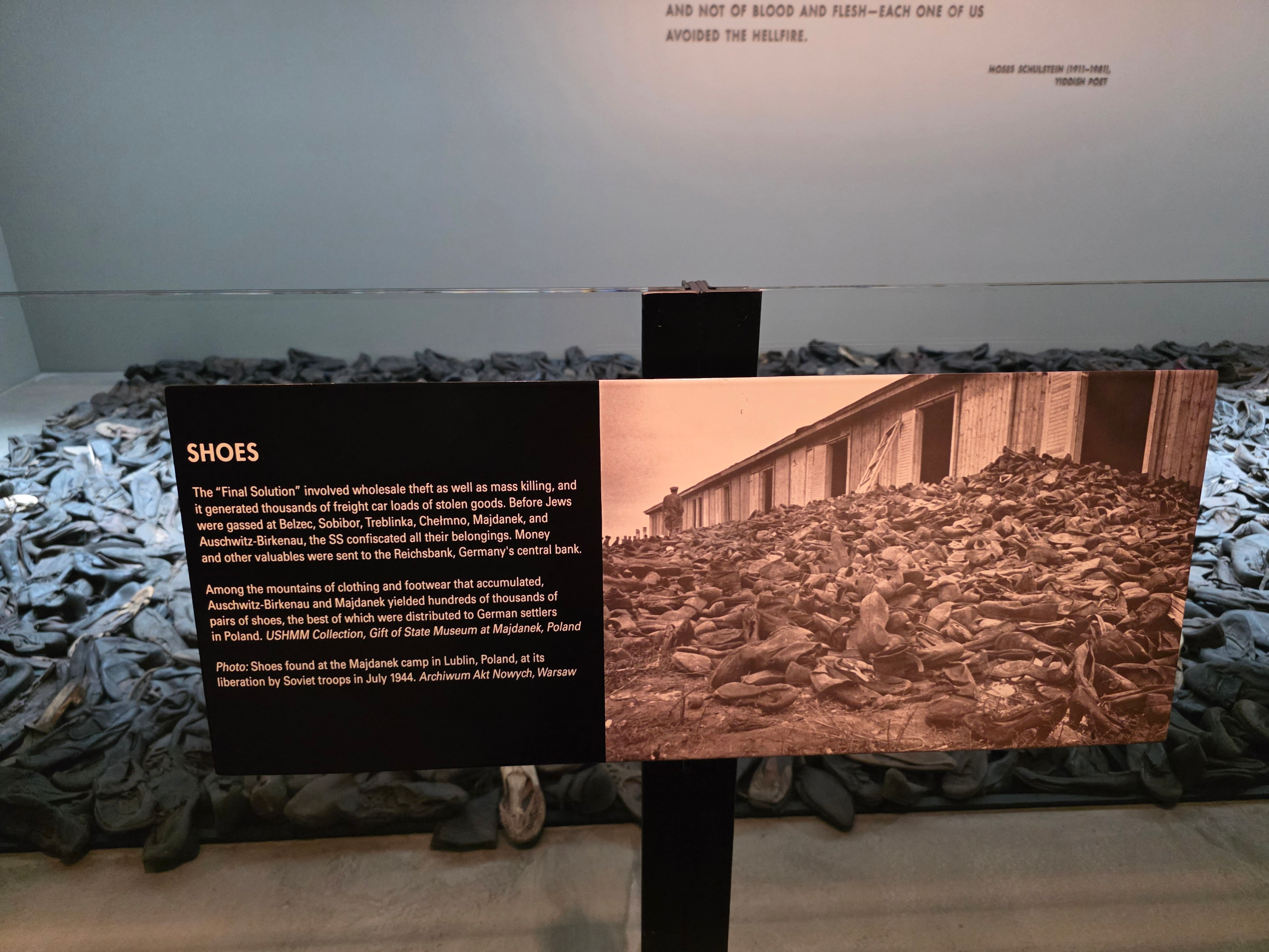
Several rooms of the exhibit are focussed on the relics of the murders that are most horrifying – the gold removed from mouths, the suitcases and personal artefacts confiscated. I knew, from the testimony of many who had visited the museum, that there would be a pile of shoes, taken from those who were murdered.
Perhaps because I had prepared myself for these shoes, I found a different element more shocking – piles of hair. This was so terrifyingly human, especially when the images of prisoners having their hair shaved is such a regular and heart-wrenching component of Holocaust stories. The hair was used for any number of industrial purposes, and as I read the list I began to feel physically sick.
Further along was a wall of pictures with prisoners showing their tattooed forearms, and large displays of the piles of items the Nazis had stolen.
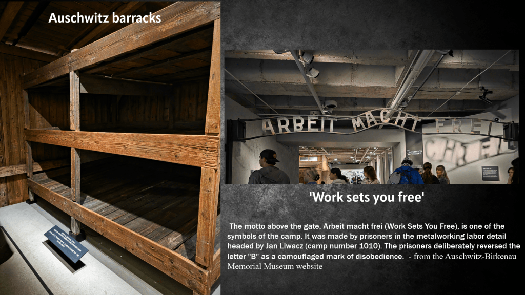
One of the more remarkable items was the section on Auschwitz, probably the most well-known of concentration camps – they have an actual bunk from a worker’s barracks, as well as a replica of the room itself that you can walk through and learn more about what life was like. To continue through the exhibit, you must walk under the famous motto displayed over the camp entrance. If it does not send chills down your spine, I don’t know what would.
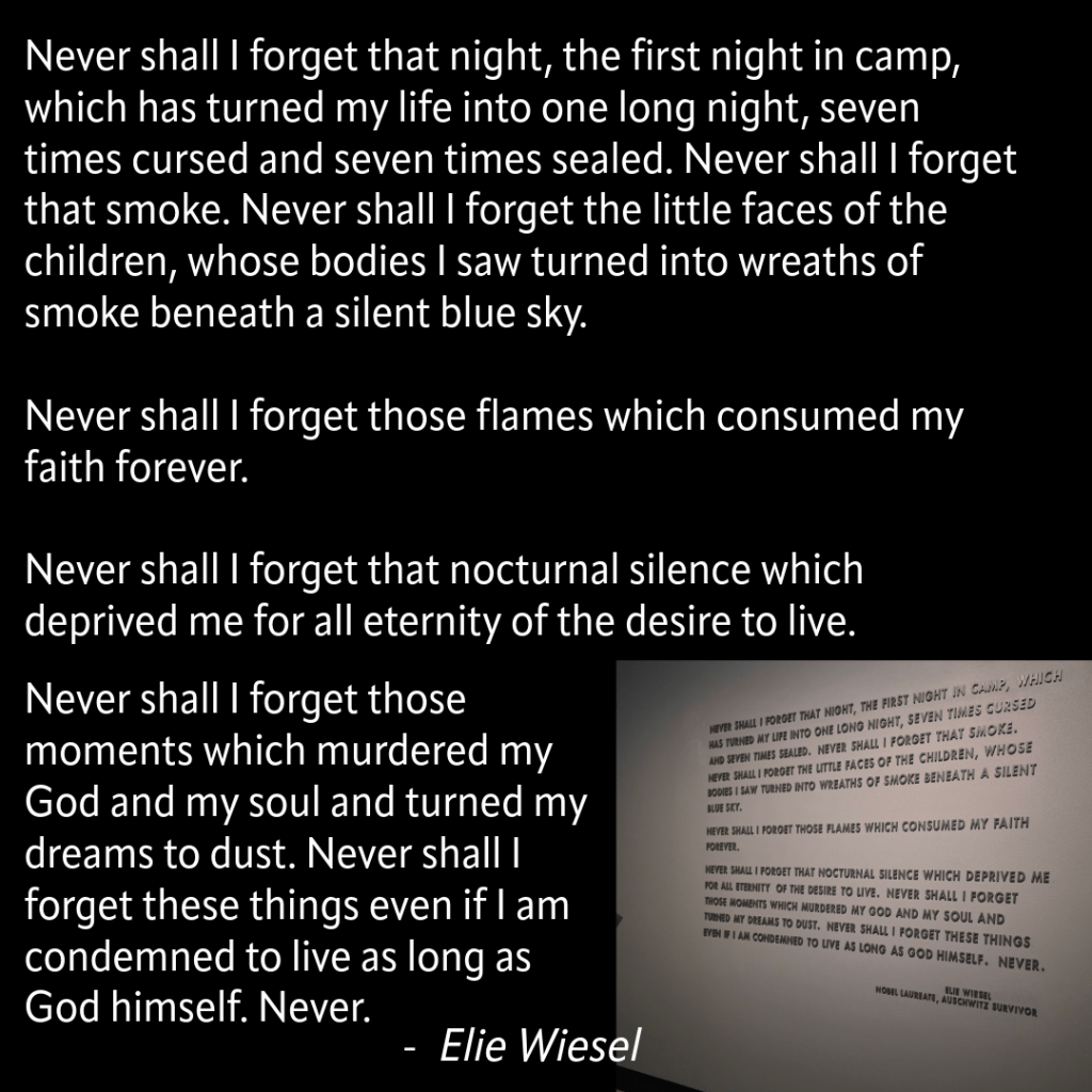
On one wall, separate from other pictures and displays, is a quotation from Elie Wiesel.
This is a design used frequently in the museum, displaying important quotes on their own, so that there is no way a visitor could miss them.
The final floor of the permanent exhibit is, despite the previous pictures and elements, arguably one of the most difficult to experience. The focus is the end of the war, liberation of the camps, as well as recognition of all those who tried to help Jewish friends, family and total strangers escape from occupied territories. There is a enormous wall which lists heroes of the resistance who saved Jewish lives, divided roughly by country, and it was fascinating to see the countries with the longest lists of names – Poland and the Netherlands stood out particularly. There was a picture of Oskar Schindler of course, and some other more high-profile names, as well as stories of everyday people – a touching and comforting example of people helping one another, some hope in a myriad of despair.
The most emotional portion of the museum for me, anyway, was the careful display of the videos both of survivors telling their stories years later and of the liberation of the camps. Many of the videos are placed out of immediate view, around a corner or behind a screen so only seen from above, as they are so graphic that museum curators did not want young children to see them, or anyone who did not expressly choose to do so. I am not sure if I had not realised just how many testimonials there are of these liberations, but this is some of the most difficult footage I have ever seen, perhaps even more so than depictions of the camps under the Nazis. The inhumanity of the treatment and condition of the people there combined with the visible, slowly dawning hope just destroyed me. By the time I reached the section of the museum with videos of survivors telling their stories, I was openly crying, but I was far from the only one. Even writing about it brings tears back to my eyes.
What did the Americans know?
Another part of the museum which resonated strongly with me was the discussion and evidence of what both the US government and the US people knew about the Holocaust, and specifically the death camps. When I was studying US History in High School, I had written a research paper specifically on this topic, spending hours scrolling through microfiche of newspaper articles to find evidence that both parties – government and people – had evidence of the atrocities being committed. I titled my paper, ‘The Acquiescence of the US Government on the Murder of the Jews’, and it would have fit right in both to the permanent exhibit and also the temporary exhibit that I visited briefly, ‘Americans and the Holocaust’.
This evidence started during the main, permanent exhibit, examining in particular why it was that Auschwitz was not bombed when it was known exactly what was taking place there. The reason stated by the Assistant Secretary of War in 1944 was that an operation to bomb the camps would divert air support from combat operations, and yet allied bombing of an oil and rubber factory only miles from Auschwitz-Birkenau was carried out. The argument became that a swift end to the war was the most effective relief for Nazi victims, and that all efforts should be directed towards military victory rather than rescue. In Spring and Summer 1944, more than 430,000 Jews were deported from Hungary to the camp, and on some days as many as 10,000 people were murdered.
The reason why more was not done is of course a complex combination of racism, antisemitism, political divide and much more – further, it was not just the US who ignored the plight of the camps, but the UK as well. But it is an important question to ponder, and consider in modern times.
The last panel of the exhibit is a famous quote from Martin Niemöller, a Lutheran minister.
A timeless indictment of passivity, indifference, and that most dangerous of sentiments, ‘it has nothing to do with me.’
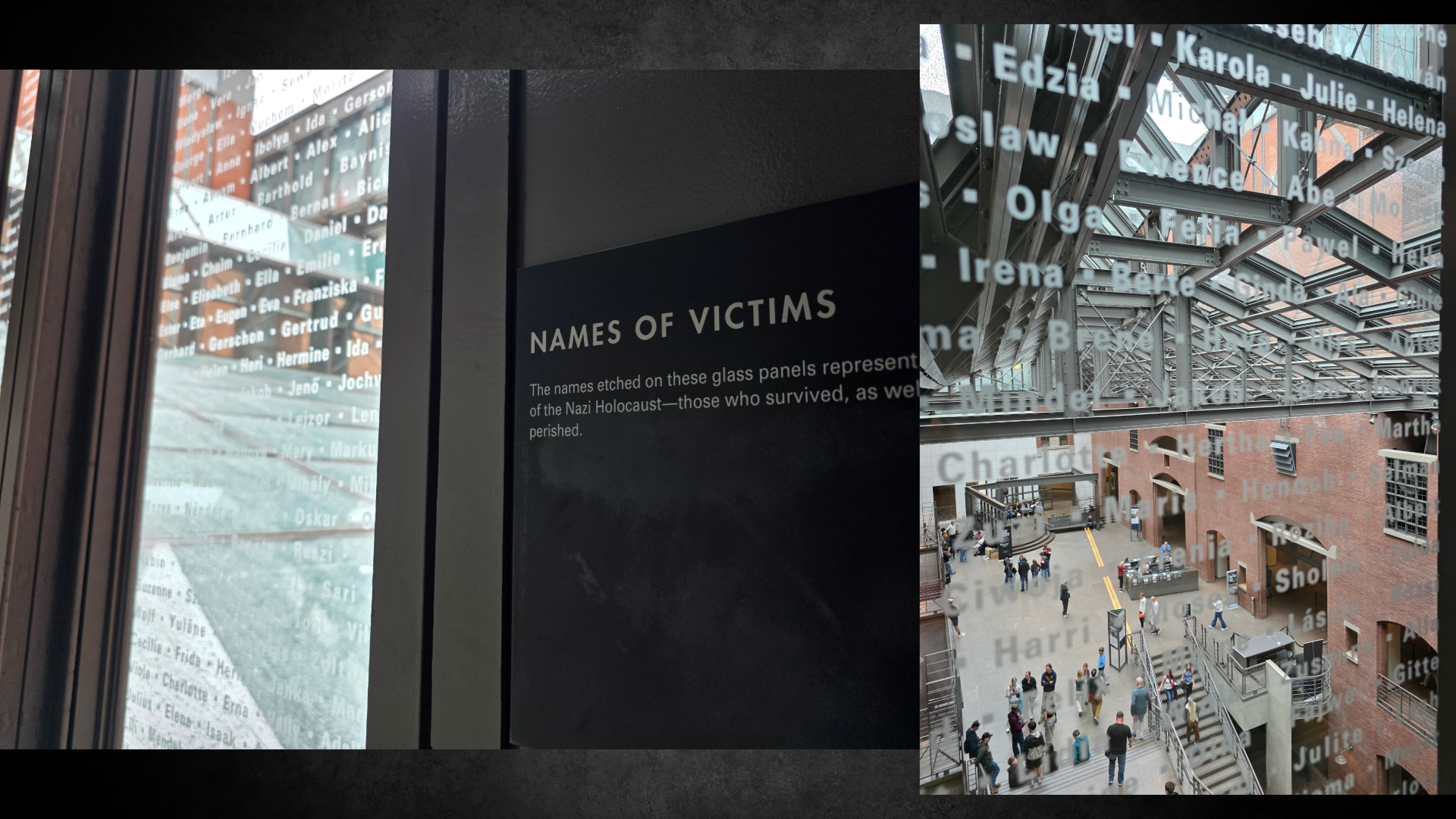
To encourage continued meditation and contemplation, the end of the exhibit leads visitors directly to the Hall of Remembrance. Here we are invited to consider the lives lost, in walls that are inscribed with the names of the concentration and death camps. Visitors may light candles, and an eternal flame burns in the centre of the space.
The inscription before the flame reads:
Only guard yourself and guard your soul carefully, lest you forget the things your eyes saw, and lest these things depart your heart all the days of your life. And you shall make them known to your children, and to your children’s children.
I haven’t really taken much time to remark on it but I think it is important to observe the careful architecture of the museum – the strong industrial feel, with high walls of red brick, angular glass hallways, metal chutes and slabs, almost as if we were walking through a factory from the 1940s. The exhibits are dark, sombre, leaving plenty of space for one to step aside, to pause for a moment and process what they have seen; the very structure of the museum is part of the experience.
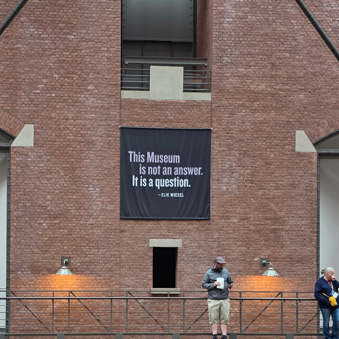
The purpose of my writing this post was not to share every item or piece of information I learned or saw in the museum. Rather, it was to share my experience, my reflections, and to explore my own queries that arose from visiting the place that is, as Elie Wiesel said, not an answer but a question.
My question
So what, then, is my question? I considered this for some time, and my conclusion is:
How?
Not how could this happen – that answer has unfortunately been made more than clear.
But how could anyone dispute this evidence – video, photograph, testimonial and artefact alike. How could anyone see the raw emotion in the faces of the victims, liberators and survivors and not believe it. How could someone see this testimony and not be shaken, moved, horrified, sickened.
And how do we make sure that every person, every school child learns about this time, sees this and understands the pure human tragedy. How do we make them want never to see this happen, never tolerate hate, cruelty, inhumanity towards one another, and indifference.
Everyone should experience feeling this sadness, and this outrage. It is the only thing that will point us in the direction of preventing another Holocaust.
A final note:
Tickets to enter the museum are free (though can be booked in advance). There are many places as you leave the exhibits to donate to the continued work of preserving this knowledge. Even if you cannot donate at the time, or cannot visit the museum in person, you can donate online very easily. There are also several excellent shops at the museum where you can pick up books about the Holocaust and memorials of your visit.
The Museum website, the Holocaust Encyclopaedia, also includes phenomenal resources for teachers and students.
The last month has been an absolute whirlwind of travel, work, sneezing (due to allergies or a cold I am still not certain), trying to adjust to whatever time zone I am in, and resting up to be ready and raring to go in June. I’m still working on that last one…life and work get in the way.
Last weekend though, we finally managed to check one big task off the list: to get a car, which we had been without since our old one failed its MOT in February – for those in the US, this is the annual check-up for road readiness here in the UK. The car chosen by the other half was located in England – as most good options are – and so he promised that if I came with him, we could make a weekend of it and see a castle on the way back.
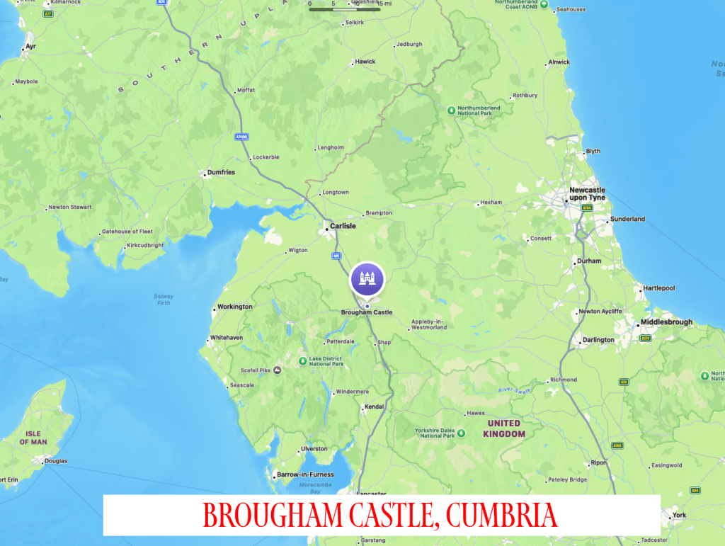
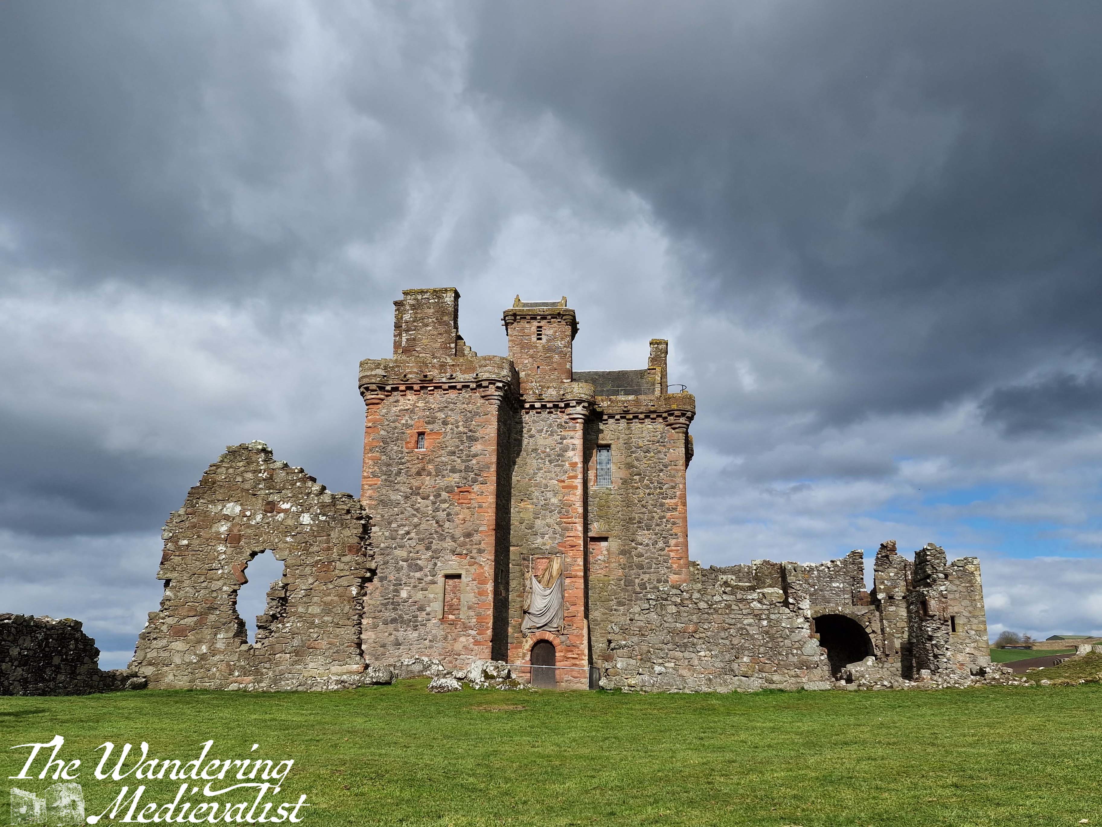
I am never too tired to see a castle (though I came close). It was the first one I had visited in some time and I was very excited – there were plenty of options nearby, northern England being rife with castles, and after a bit of researching I selected Brougham Castle. It seemed both well-placed not too far from the motorway, and in a good state of repair (all relative of course). I was not disappointed.
Brougham is in Cumbria, about half an hour south of the Scottish border and on the edge of the Lake District. It is just outside the town of Penrith, and so easily accessible from the M6 (the main road that runs south to north, the UK’s answer to route 95 in the US)
History of Brougham Castle
Brougham (pronounced ‘Broom’, for the record) was constructed at the north end of an enclosure of the Roman fort of Brocavum, or ‘heathery place’. A community grew up to support the fort, and it remained in use until the end of the Roman period. The castle, built on the ruins, used materials from the fort; in one of the stairwells, you can clearly identify a tombstone with Latin carvings. The site itself was first acquired in or around 1214 by Robert de Vieuxpont, Lord of Westmorland, one of the last remaining trusted supporters of the often-maligned King John (not objecting to the maligning of John, for the record). Identified as a good spot for a fortification, the aim was to assist with the defence of the north against the Scots, and other northern barons less friendly to the ruling monarch.
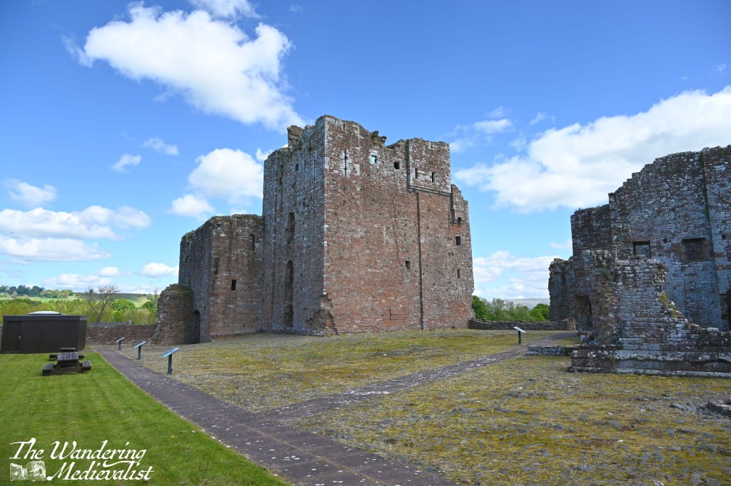
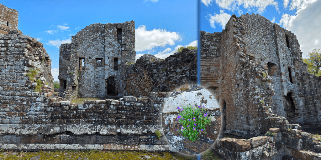
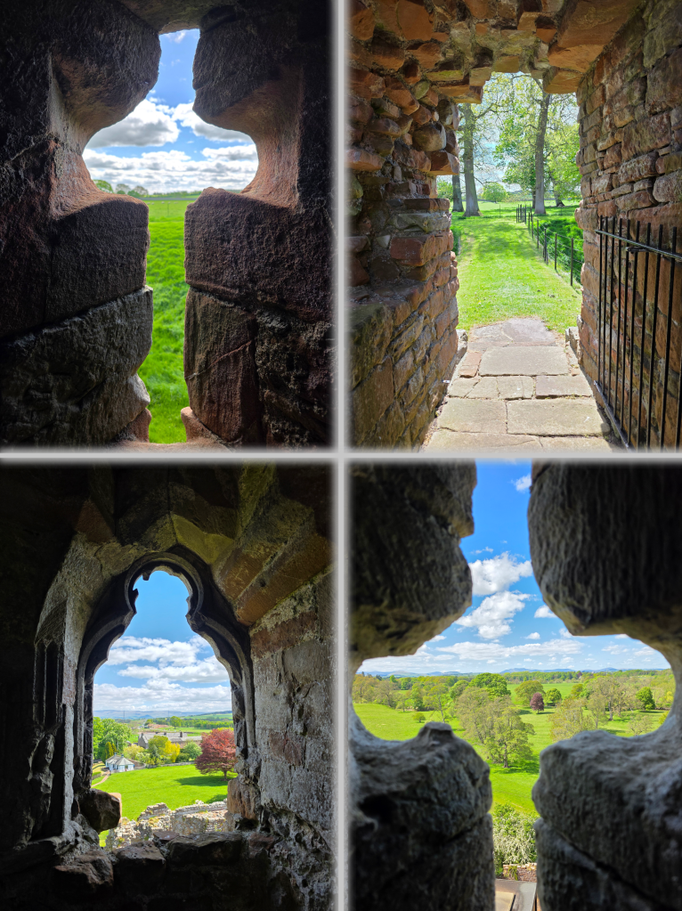
Under Vieuxpont, the castle consisted of the main keep and some service buildings, surrounded by a timber wall that was replaced with stone in around 1300. This view is of the keep and gatehouse, from within the courtyard.
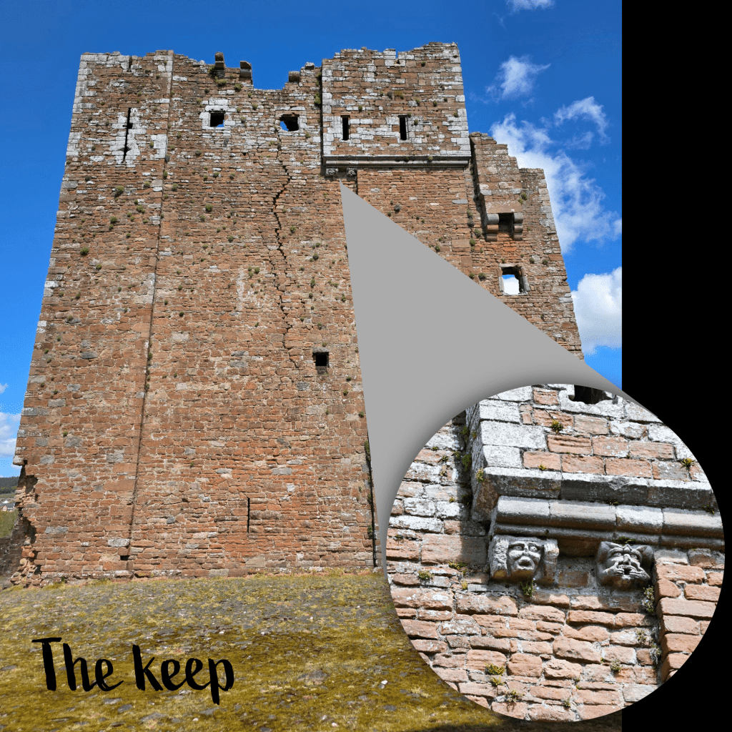
The top story of the keep, obvious in its slightly different style, was constructed towards the end of the 1290s, at least partly in response to the Scottish Wars of Independence and impending danger. The decorated corbels, which I managed to capture on my camera, helped to support the third floor oratory.
By this time, the castle was in the hands of the Clifford family, who would expand over the years, adding the new hall, chapel, and buildings along the south curtain wall. The structure was damaged significantly by the Scots in 1388, and played a role in the Wars of the Roses, with the Lancastrian Cliffords using it as a stronghold in the north against the Yorkist Neville family.
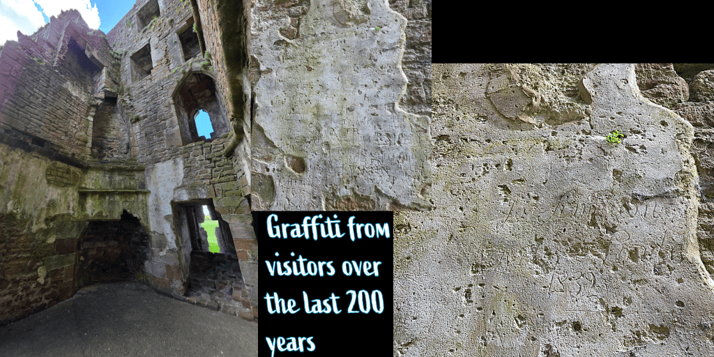
As the years passed the castle gradually deteriorated, with some family choosing to restore its use for a short period, but like many castles it deteriorated and was considered too expensive to be maintained. Cattle were living in the gatehouse in the 1850s, and visitors complained that the castle was inaccessible and partly ruined. Interestingly, graffiti from those tourists of the 19th century – and those since – survives in carvings in the plaster of one tower.
In 1928, the castle came into the guardianship of the Ministry of Works, a precursor to English Heritage.
Our visit
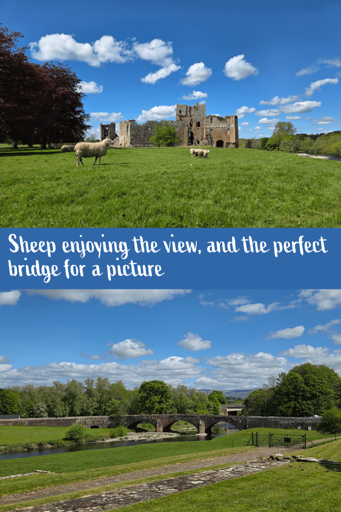
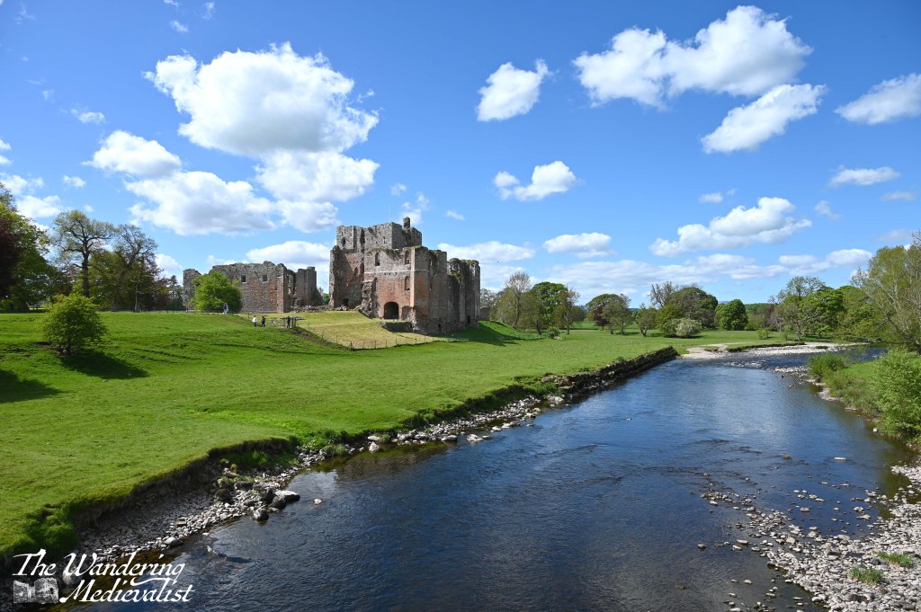
We arrived at Brougham after a short drive up the M6 and discovered that parking is rather haphazard, along a farm access road near the main entrance. I might imagine that at busier times of year, it could be difficult to find a spot. Fortunately, we found a good location out of the way, and while the other half got himself a drink, I scampered up to the bridge across the River Eamont, a spectacular spot for a view (see the post cover, as well as the picture at the very end).
My first photos taken, we continued into the house that acted as the shop for the castle; there were some nice touristy items, a clean bathroom, and a few snacks including ice cream for sale. The kind woman behind the desk trusted me when I said I was a member of Historic Scotland – though I could not find my card – and provided us entry to the castle for free, as I gather English Heritage honours that membership. It makes sense, but was also nice to experience. Between the house and the castle, a field of sheep grazed quite unbothered by the visitors.
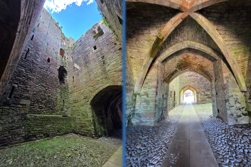
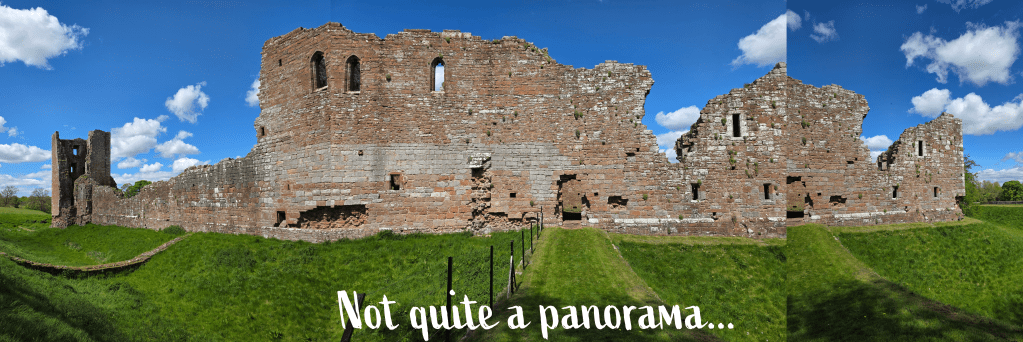
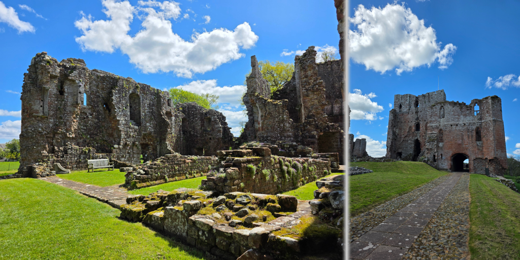
We were one of perhaps three or four groups of visitors, and we took a few moments to read the display about the history of the castle, both Roman and Medieval. I was too excited to read much though, and instead pushed forward along to the main entrance, through the gatehouse, which is made of three connected elements, easier to see from inside than out.
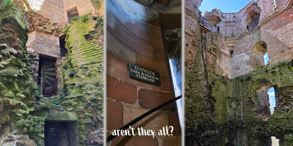
Passing through the gatehouses, one enters the courtyard, where there are remnants of outbuildings along one side, a distant tower in the far corner, and a jumble of additional constructions along the south and east walls. We started at the far tower, the Tower of League, which was built around 1300 to project beyond the walls and assist in defence, allowing for fighters within to look back along the curtain wall. This tower is where the above plaster inscriptions could be found.
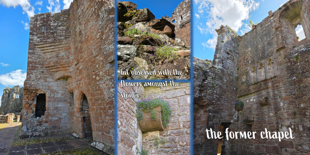
Moving around the castle walls counter-clockwise, we came to the ruins of a sequence of rooms used by most residents of the castle, in particular the garrison. There is a lodging block, a dining area, and a chapel, evident on a higher floor from its carvings. I love looking up the walls of a castle and trying to identify where floors would have been, and trying to work out what was a window, perhaps a door, a floor support, or a fireplace.
All of the buildings here were overrun by small purple flowers, growing between the stones or on outcroppings – I found myself slightly obsessed by these flowers, and captured them many times.
Along the south wall was also a doorway out – whether an intended entrance or not I was not certain, but it could possibly have been a postern gate of some kind – which led to the grassy ditch that surrounds the castle, and provided a great view back towards the walls.
After exploring the various rooms and ruins, there was one more important part of the visit in which to partake – climbing the keep to see the view.
We had been warned several times that it was a difficult climb, steep and narrow, and indeed the staircase did not provide space for more than one person to climb or descend. But, the stairs were not as worn as I have seen, there was a sturdy railing and plenty of places along the way to duck out of the stairs into a short hall or alcove, allowing others to pass.
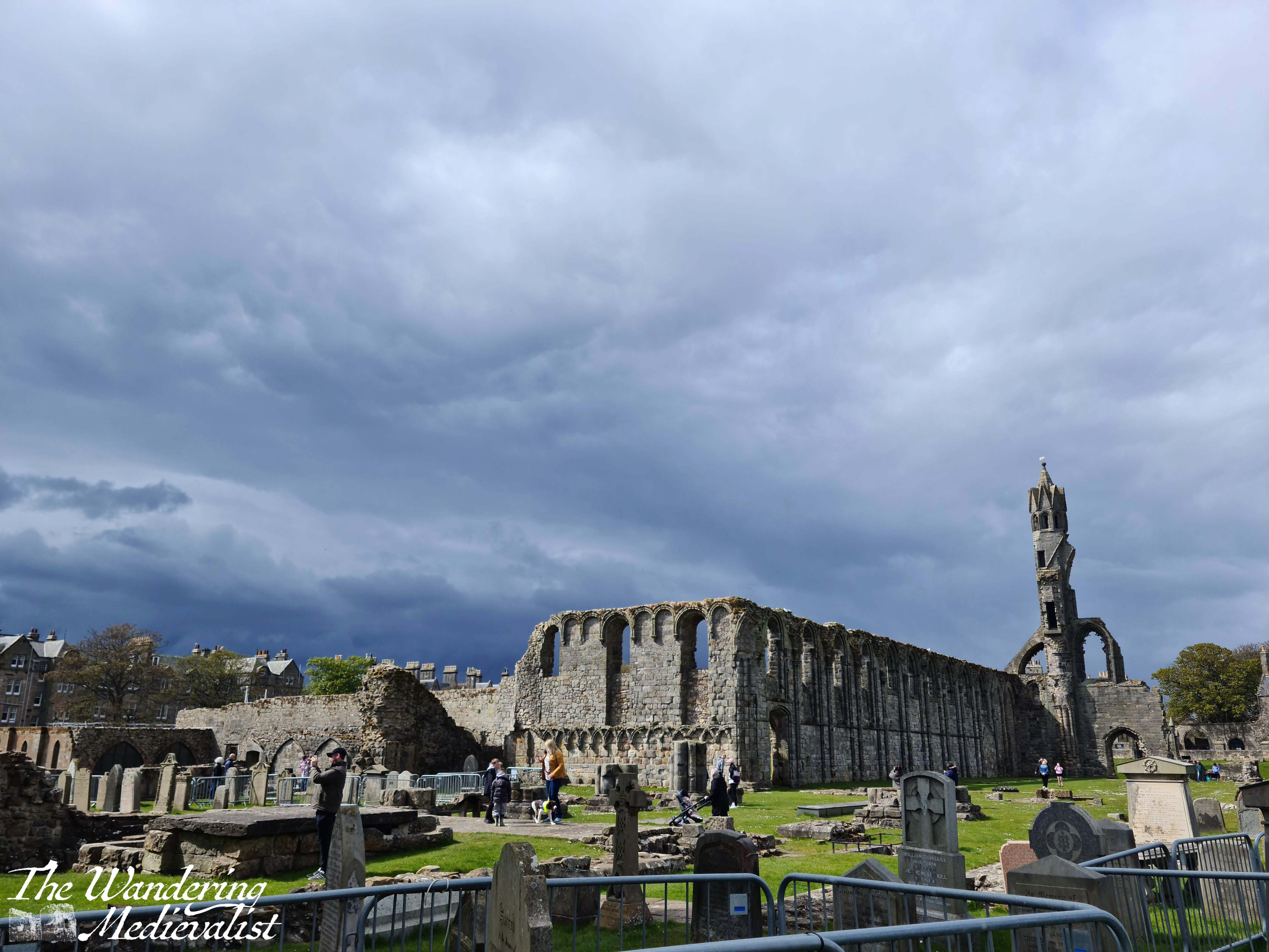
In short, I’ve climbed worse. St Rule’s Tower in St Andrews being one.
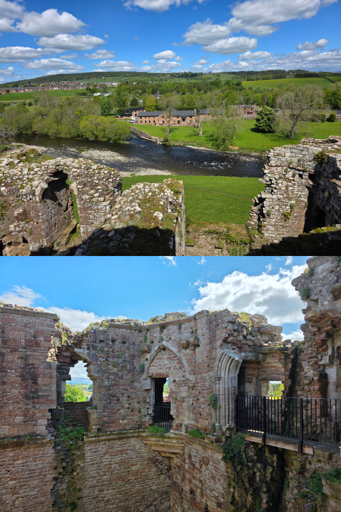
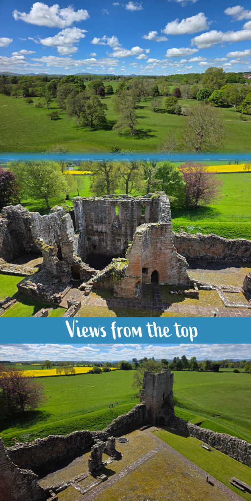
And the view was spectacular, whether you looked inside or outside of the castle. Inside, you could look up and down the keep and identify where all the different floors were, the higher ones boasting more carving and showing the newer construction. The top floor of the castle has been made safe enough that you can walk most of the way around the walls, sometimes inside the stone passages and sometimes on bridges secured into the stonework.
There were several places both as I climbed and as we explored the top level where I could peer out through a window or arrow loop – excellent on a sunny day. One of the views here is actually the passage I took out of the castle to see the walls, as mentioned above. I loved being able to see the countryside through these unusual shapes.
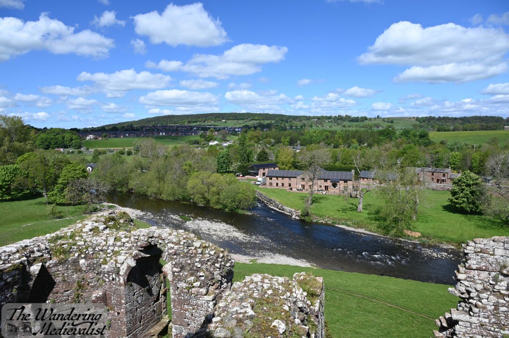
The strategic location of the castle is perhaps most clearly emphasized by this view from the top floor.
Fields stretch in each direction, some with sheep and crops, and visibility goes on for miles. The outlines of the castle buildings themselves are even more clear from above, and you get a real sense of the power of the structure, and how self-sustaining it would be. In the other direction, you look down at the river and the bridge, with a 360° view of anyone approaching the castle. We stood up here for some time, enjoying the sun and the gorgeous vista, exploring the passages and nooks and crannies of the structure.
Finally though, we did need to return to our car and get going on the drive home – we hoped no more than 4 hours. The day was beginning to change, with more clouds blocking the sun than when we first arrived, a pattern that would continue as we drove north. My final few shots were these, looking at the east wall of the castle and then looking back at the gatehouse as we walked away.
I feel the other half would not forgive me for not admitting that I trod in sheep droppings as I walked, so busy was I with the view – but fortunately they wiped off before we returned to the car.
For castle lovers, Brougham is an excellent day out. The history is extensive, with evidence of the building taking place across the centuries of the high Middle Ages, and clear examples of evolving styles. The castle was defensive, domestic, and was an imposing presence in the landscape – a symbol of power for those who lived there. The castle boasts carvings and decorations galore, a relatively intact keep that can be climbed, and plenty of nooks and crannies to explore both for adults and children. The surrounding countryside is lovely, with a small wooded park nearby and fields of sheep and oilseed stretching towards the south.
I highly recommend a visit if you are in the area, or even if you are just driving up the M6 and need a short detour – it is less than 10 minutes from the highway. And…look at this view!
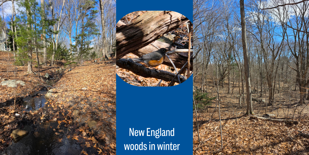
During my last trip home, I was fortunate enough to experience decent weather, and I had just enough time each day to go out for a walk. I revisited many of my old haunts and walking routes, and was pleased to find many of them not hugely altered.
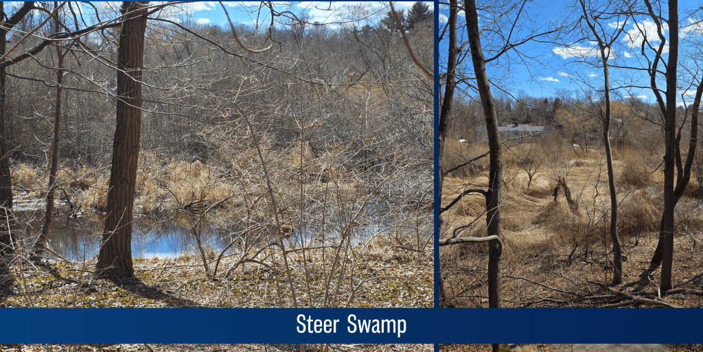
Steer Swamp was a popular walk location for Mum and I and the dog many years past, as it offers a nice woodland area not too far from where we lived, and enough winding trails that the dog got some exercise. Plus, she was able to wander freely and sniff to her heart’s content (would not let her off the lead now, but that was the 90s). In the autumn it offered bittersweet for cutting to decorate a small wreath, and in the spring and summer was sheltered from the sun. In the winter, as you will see below, it is a touch on the stark side, but on a sunny day even mostly-dead trees and rocks are lovely.
Another advantage to Steer Swamp (or disadvantage, perhaps) is that there are plenty of criss-crossing paths and varied places to enter the conservation area, so it is easy to access. Or, to get lost. Though the Marblehead Conservancy site has a detailed map, which I only found later.
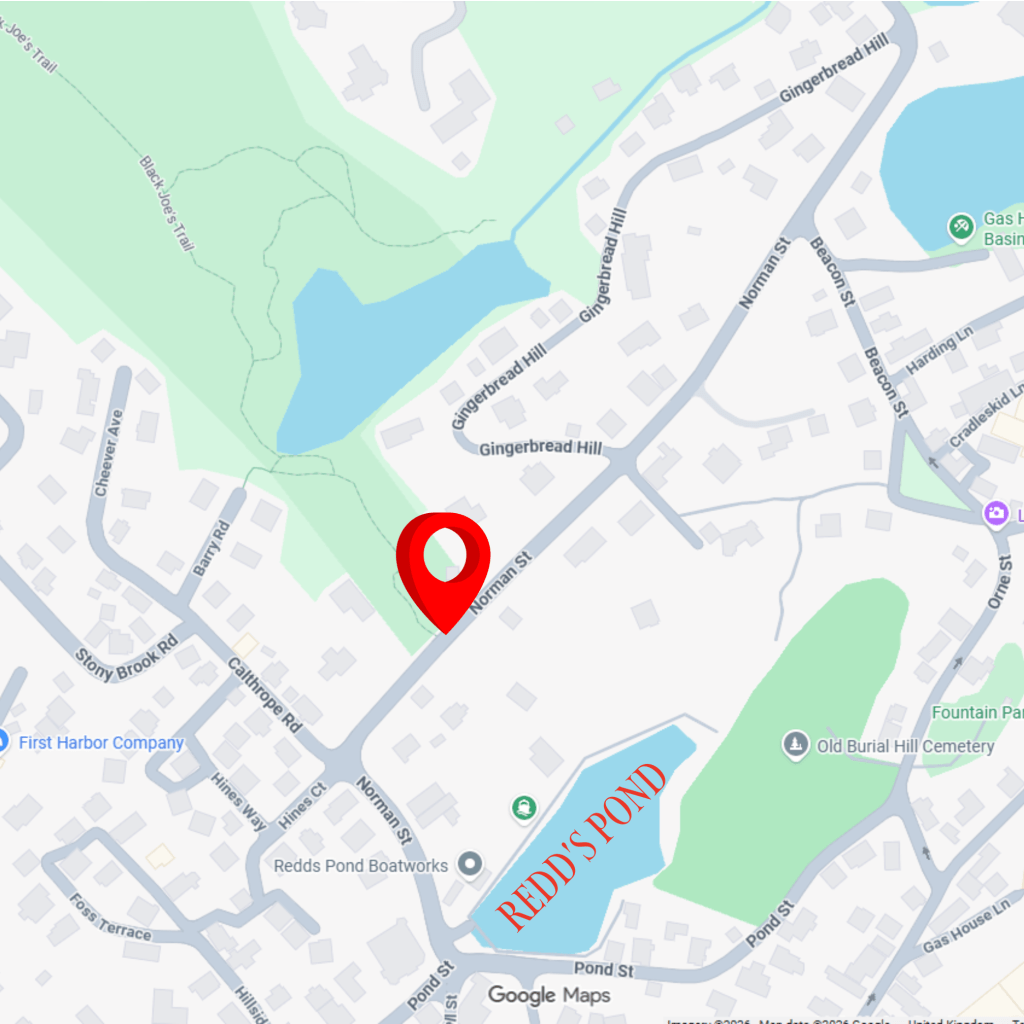
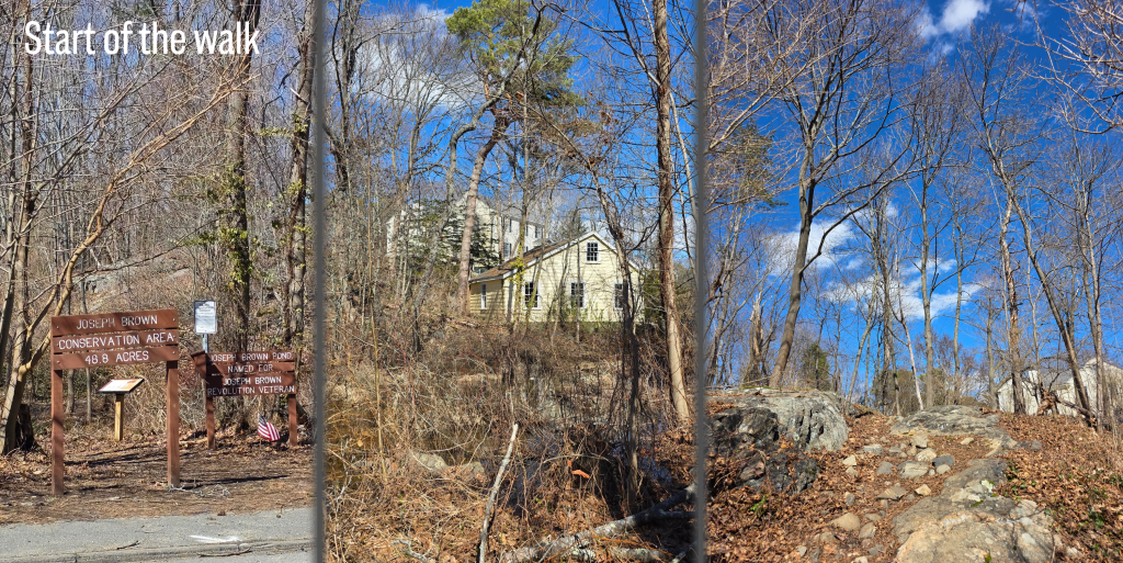
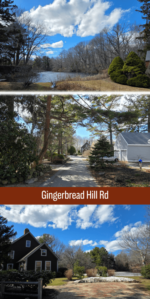
I chose to enter at Norman Street just around the corner from Redd’s Pond, which is a convenient starting point for those not familiar with Marblehead.
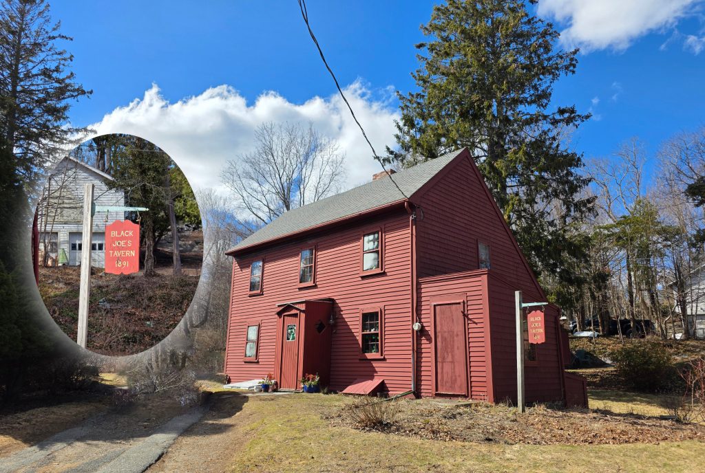
As you can see, there is a clear marker here, designating the area as the Joseph Brown Conservation Area. As I have discussed in other posts, the names here have changed in the last 20 years, moving away (very appropriately) from the terms used since Joe’s lifetime in the late 1700s. The pond still seems to be known primarily as ‘Black Joe’s Pond’, and the Tavern by the same name, though anyone digging into Marblehead history will find plenty of issues with both. The Marblehead Museum has a fantastic page on Joe and his wife, Lucretia, should anyone be curious about the history.
The path heads straight away from the road, skirting around a muddy area before heading up the side of a rise on a rocky, uneven path. My sneakers were in danger of becoming a bit sodden and muddy, but they were the only shoes I had with me.
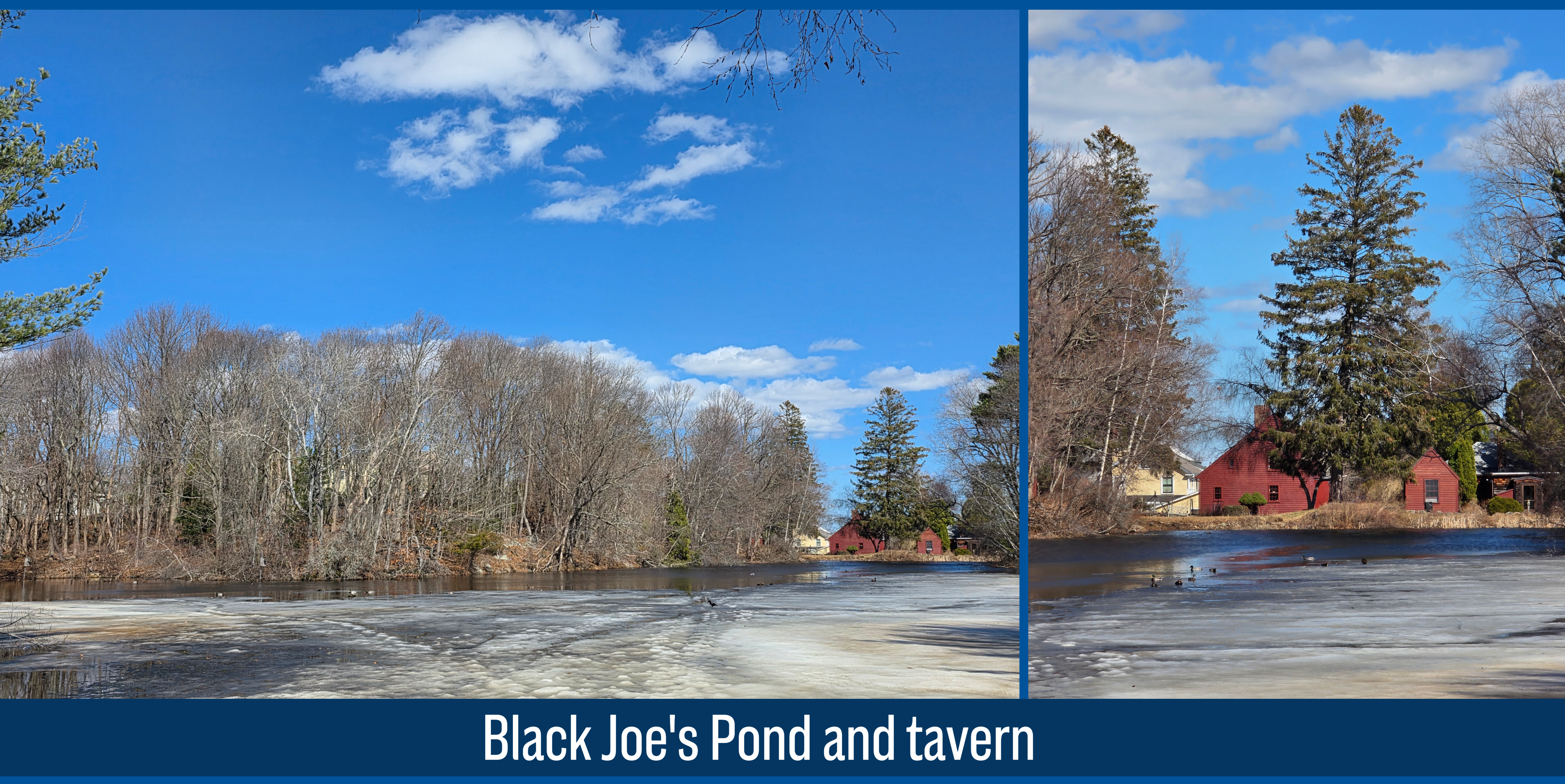
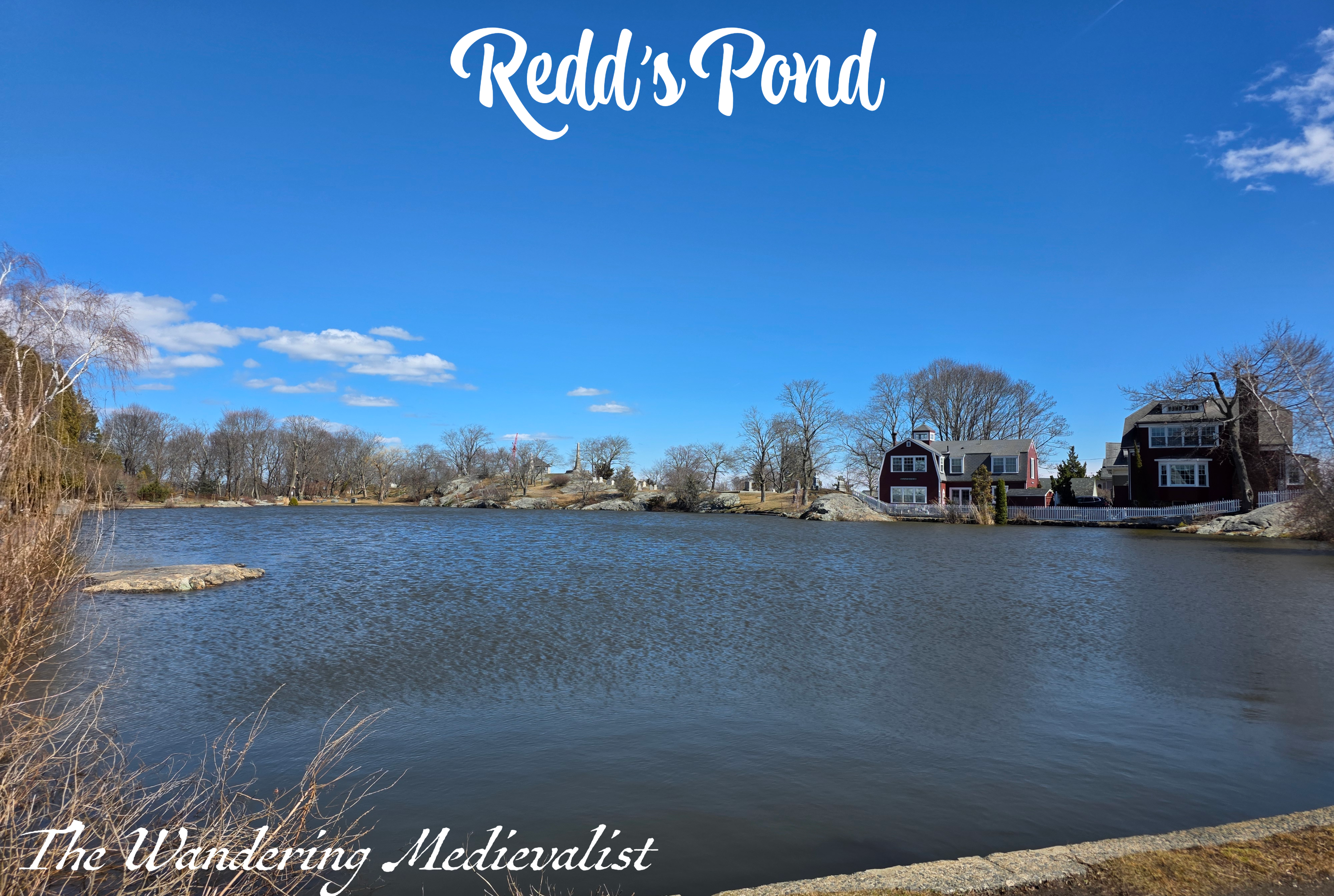
As you move further into the forest, houses are still visible – and audible – through the trees, and the path rises and falls over hillocks with a few side-trails to other entrances. I kept moving, relatively straight away from the road as best I could, with a few glimpses through the branches of the pond to the right. Finally, after only a few minutes, there are several off-shoots leading to the right, and you can cut over to the edge of the pond, which on the day I visited still boasted a coating of slushy ice. Redd’s Pond, very close by, had lost its ice completely, and it was interesting to see how a small change in geography could alter it. Redd’s Pond is a touch lower, open (not surrounded by trees), and I think a touch shallower though I’m not certain on that.
The view across the water towards the red of Joe’s Tavern is a stunning one.
Once you have had your fill of the view, continue back towards the path, and in a short time you will reach a junction. I chose to go left here, though I think right would have eventually circled around to the same place. My direction took me quite quickly down a steep hill.
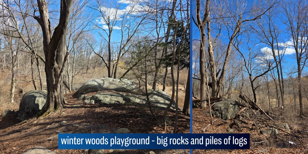
By the time I reached the bottom, the road noise was gone and though homes were still visible in glimpses through the trees, it began to feel a lot more like a woodland. In fact, this walk took me quickly back to all winter walks I had taken in New England – the same smells, sights, muddy patches and enormous boulders that rise from the forest floor seemingly randomly.
I crossed a small creek on some stepping stones, and continued straight through an almost bower of winter trees, bending over the path so that in the summer I imagine it is a tunnel. By this point, the woods were blocking most of the day’s bitter wind, and so the walk was quite pleasant, just warmed by the sun. The ground was a touch squishier than I might have liked, but most of the worst bits included rocks to cross.
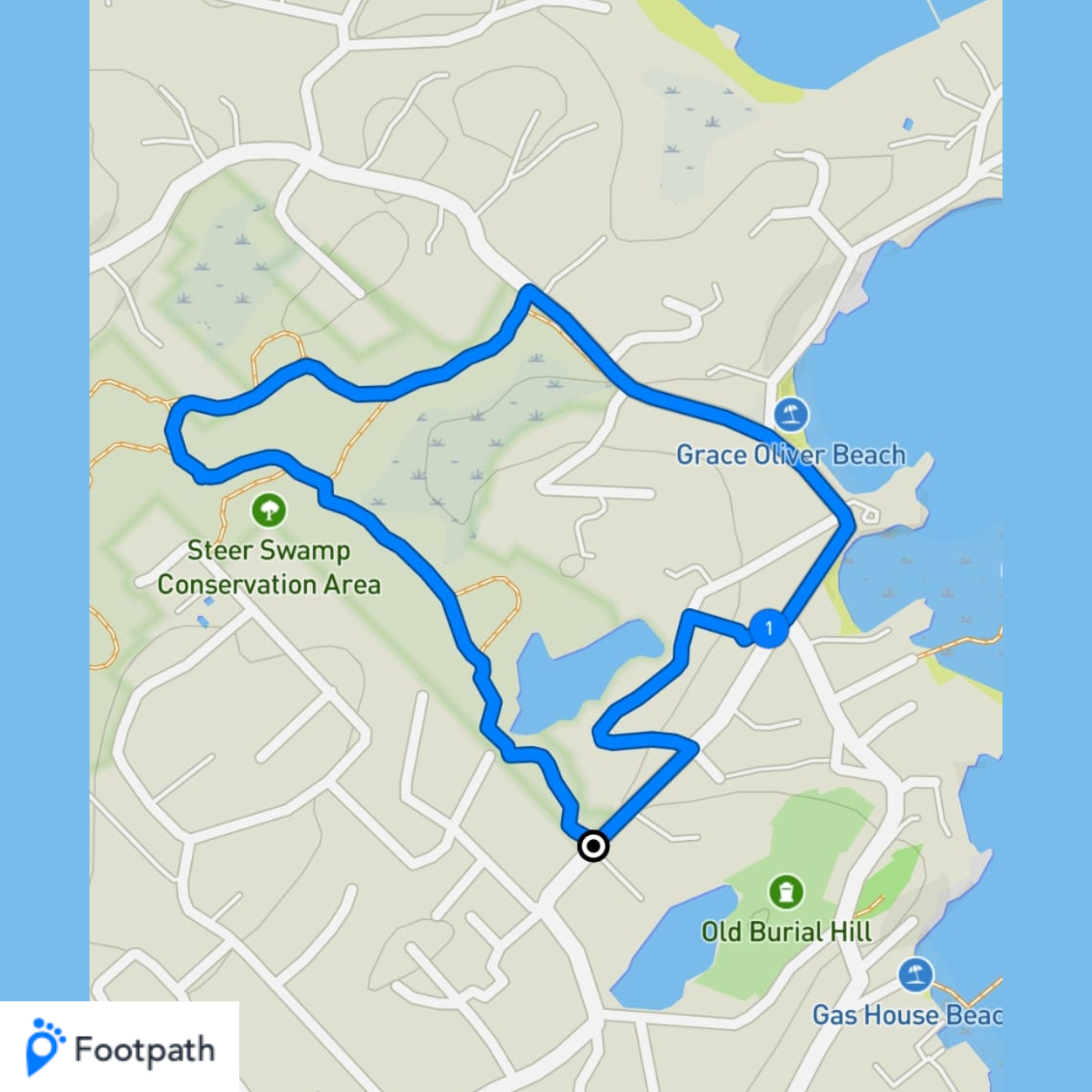
In perhaps ten minutes, I reached a five-way junction, with paths stretching out in all directions. I decided to follow a loop and not turn back on myself, thereby adding in a visit to Grace Oliver’s Beach. I hadn’t really started the walk with a plan, rather it evolved as I walked, which was quite nice. I was not certain at the time how long the loop would take, but I figured it could not be too long – the conservation area here is not particularly large.
Soon after selecting my route, I crossed a lovely wooden bridge bathed in sunlight, though the ground beyond was still covered with an icy coating of snow. This required a bit of careful negotiation, particularly in sneakers, but I managed to get across while passing another walker who looked at me strangely – he was wearing proper boots. I slipped and slid a few times but never fell, so I call it a win.
After crossing this bridge, I soon came across another turn, and this one I knew should be the start of the loop around to the right – I was in theory making a circuit around the marshiest bit of Flag Pond. In very little time, the houses ahead were again visible, so the illusion of being deep in the forest vanished. But, the walk was still more than pleasant, crossing a small brook and around a hillock, following the trail. There were some loud voices carrying through the trees – dog walkers I think – that I hoped would not be following me, but with luck they turned the way I had come, and the quiet returned. It was enormously peaceful, with the occasional birdsong or trees rustling. The ground under foot was layered with oak leaves and pine needles, meaning my steps were quiet, and the scents of fresh cold woods were like a time machine back to my childhood. They say scent is one of the most evocative triggers for memory, and this was most definitely one of those occasions. (Another is any time I set foot outside Haymarket Station in Edinburgh and catch the nearby distillery’s yeasty scent. I inevitably freeze while being carried back to my university years)
As I have mentioned, woods in the winter were my playground as a child – these woods, those in New Hampshire, the Audubon land in Ipswich were we went on many winter outings – all make me want immediately to scale a rock face to establish a fort, or create a lean-to against fallen logs.
I could happily have walked for much longer in this flashback, but in relatively little time it becomes evident that the residential area is springing up quickly at the edge of the conservation land. More houses appeared through the trees, and the road noise began to invade once again – infrequent though it was.
Here, the path takes walkers directly to the junction with Beacon Street as it winds around the wild area, but there is really nowhere at the edge of the street to walk safely. With luck, there is also an option to cut down to the right along a path set back slightly from the road – there are good views here looking over the swamp lands, which I had circled around. There were plenty of paths to take me back the way I had come, but I had already decided I wanted to walk up Gingerbread Hill.
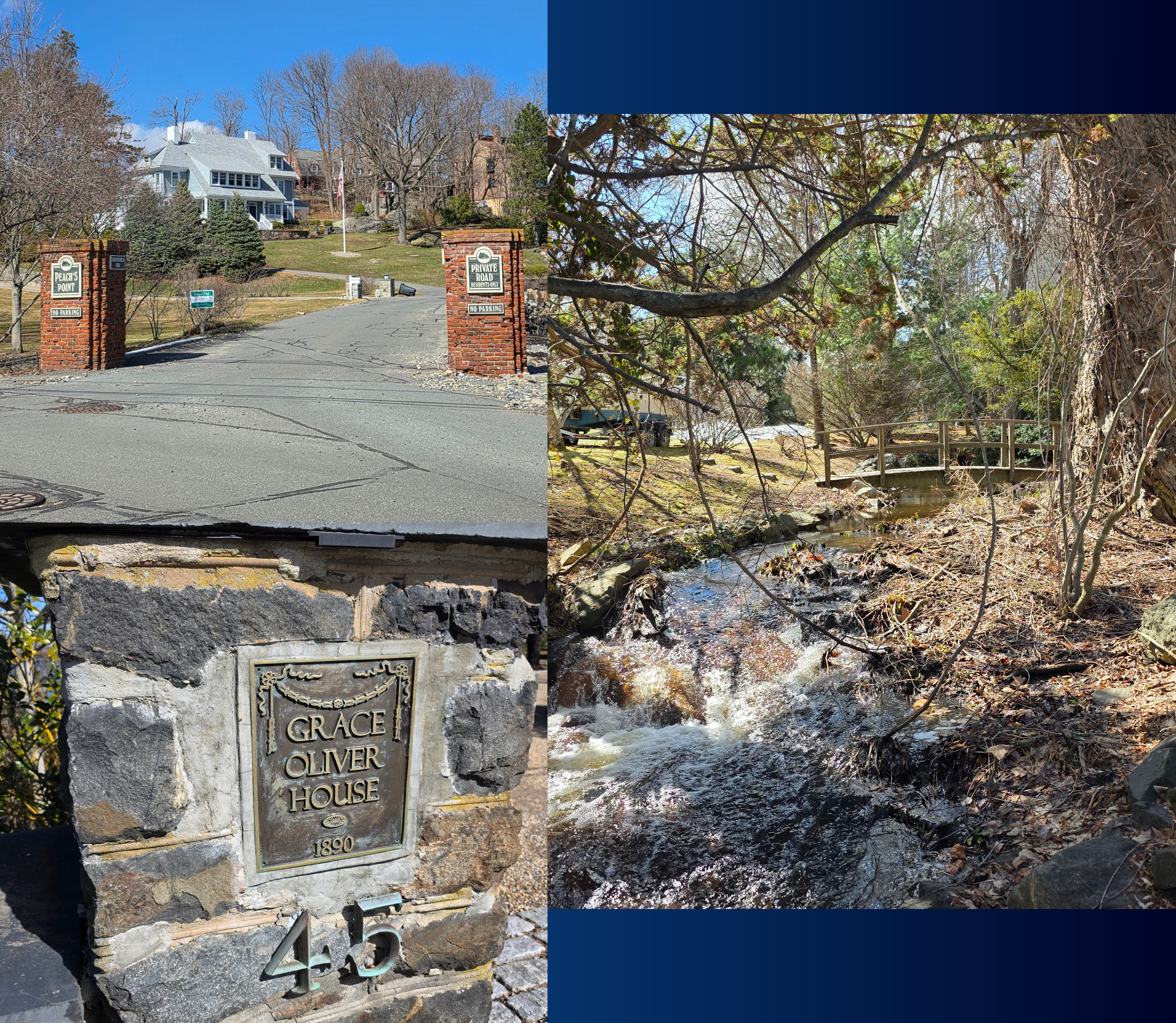
In little time, I emerged on Beacon Street but a bit closer to the beach, and hurried along the edge of the road which is, like many Scottish roads, not really wide enough for two cars to pass. I am not sure why I had never noticed the small creek running at the side of the road, which empties onto the beach, but it also separates the main road from the land beyond (Peach’s Point) which seems quite appropriate.
Fortunately this part of the road is not particularly busy, as there is also really nowhere to walk, so I was pleased to be able to quickly reach the wider road that runs along the beach and turns up to enter Peach’s Point. This area, identified by brick columns that mark the entrance, is a private grouping of homes, most of which are enormous and beautiful. Originally a Native American (Naumkeag tribe) summer camp, it was settled by one of Marblehead’s early families, the Peaches, and eventually became an almost mini version of the neck, in that large summer residences were built for wealthy families.
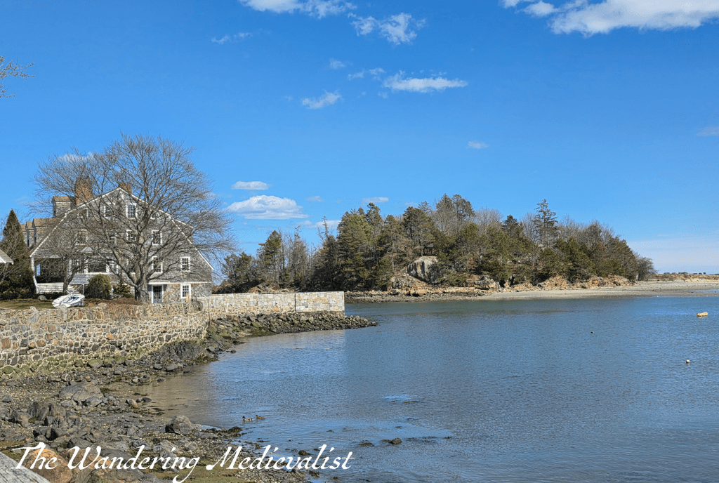
view from the road of Dolliber;s Cove and the houses on Peach’s Point
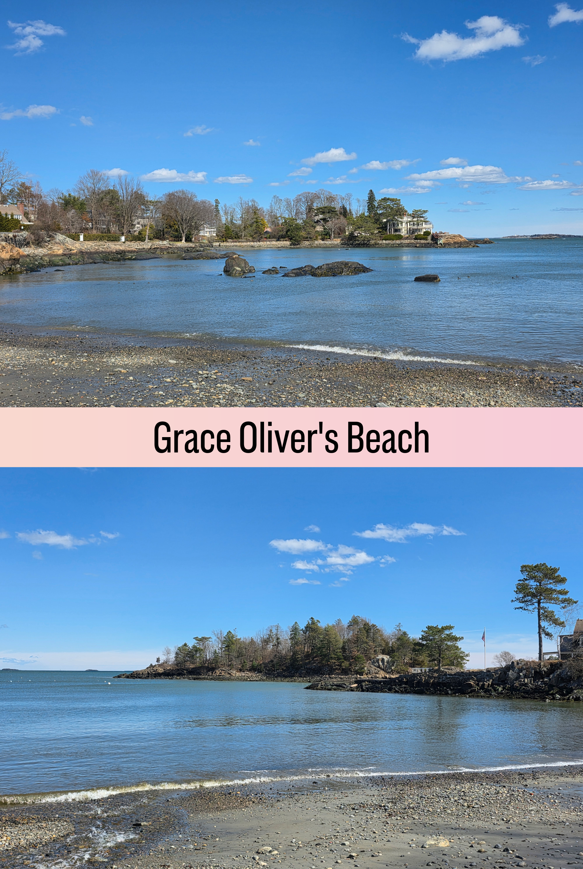
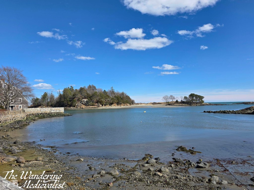
Peach’s Point creates one side of Dolliber’s Cove, with the rest created by the public beach named after Grace Oliver, a 19th century writer and women’s rights advocate who lived nearby.
Because of our close access to Gas House beach, I rarely swam here as a child, though it is arguably a more pleasant beach, with a bit more sand and less seaweed. Like Gas House though, it is not particularly large, with a plot of land jutting out into the water here upon which is built a beautiful old house – Grace Oliver House – with a dock and long drive.
I will fully admit to always coveting this house, or at least a visit to it – though my New Englander brain also imagines in must be damaged by storms. Unless of course it is protected, which it must be, by Brown’s Island (as I knew it), which is accessible only at the lowest tide, and sits just off-shore. The right-hand photo above shows it best. Apparently this island was originally owned by Edward Diamond, a local man who was credited with mystical powers and was often seen on Old Burial Hill, known as a wizard (my friends and I were certain he haunted my house, and were obsessed with trying to see his ghost on the hill). The island was re-named Crowninshield Island in the early 1900s, apparently, though I have always heard it referred to as Brown’s.
Just opposite the driveway for Grace Oliver’s House is the easily-missed turn up Gingerbread Hill, an old road that – of course – winds its way up a hill to Black Joe’s Pond and Tavern, before cutting back down to Norman Street. It’s a relatively short walk, but passes some beautiful old homes. There are a few places where you can see through to the pond, and work out which clump of trees you may have been hiding in to look this way. There is also a footpath down the hill to the street, but I chose to stay on the pavement which – as you can see – is narrow. While cars are not regular, walkers should be aware that they may not be visible with the foliage and twisting road.
the late-17th century tavern known as Black Joe’s
Descending onto Norman Street, I found myself only a few hundred feet from the entrance to the Conservation land where I started – a loop of just under two miles. Not particularly strenuous, this is a lovely loop that both allows for some woodland walking but also some real Marblehead history and passes some of the older neighbourhoods. Plus, if inspired, you can continue your walk around nearby Redd’s Pond and up through Old Burial Hill. This is one of my favourite things about Marblehead – there are so many loops you can take, all a bit different, and all showing you a new part of town or a new piece of history you may not have known about.
To finish with, a view of Redd’s Pond and the loop I took, screen captured from Footpath, the app I use to plan walks.
Enjoying my pictures? Why not claim one for your own project or wall space through my online shop:
It has been a shockingly long time since I have managed to sit down and focus on a blog post. What can I say? Life got in the way – I’ve been back and forth to the US twice in two months, run a conference at work, and been inundated with life admin that needed to be done. All of this and jet lag meant that since finding time in my hotel room to write about my visit to Crystal Cove, I have really struggled to find the motivation, time and energy to be creative. But, while work continues to be busy and my travel schedule is no less intense, I had to make some time to write. I have never gone this long without posting before, I don’t think, and it feels wrong.
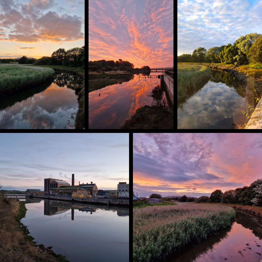
I started pulling the basis of this post together some time ago, when I was submitting pictures for a contest and realised just now many shots I have of reflections. So many hint at this theme, some more effectively than others, but it’s a motif I have always leaned towards. Perhaps because a reflection is so often the embodiment of a moment of calm – an early morning, evening, quiet time when the world is still for just a short second. And because water has a magical way of capturing what is happening in the world and giving it back to you in an image sometimes identical, but often slightly altered.
Here are some shots that I love, and wished to share.
Themes
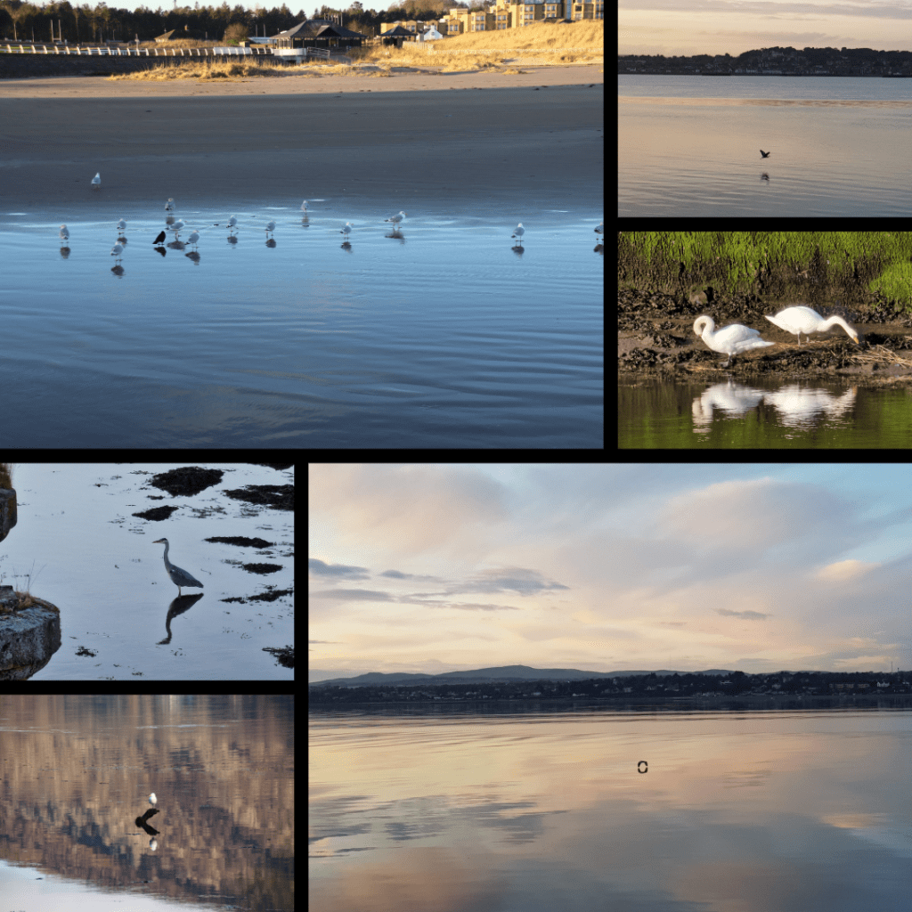
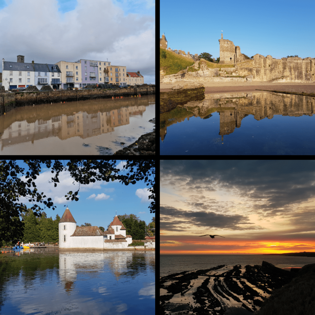
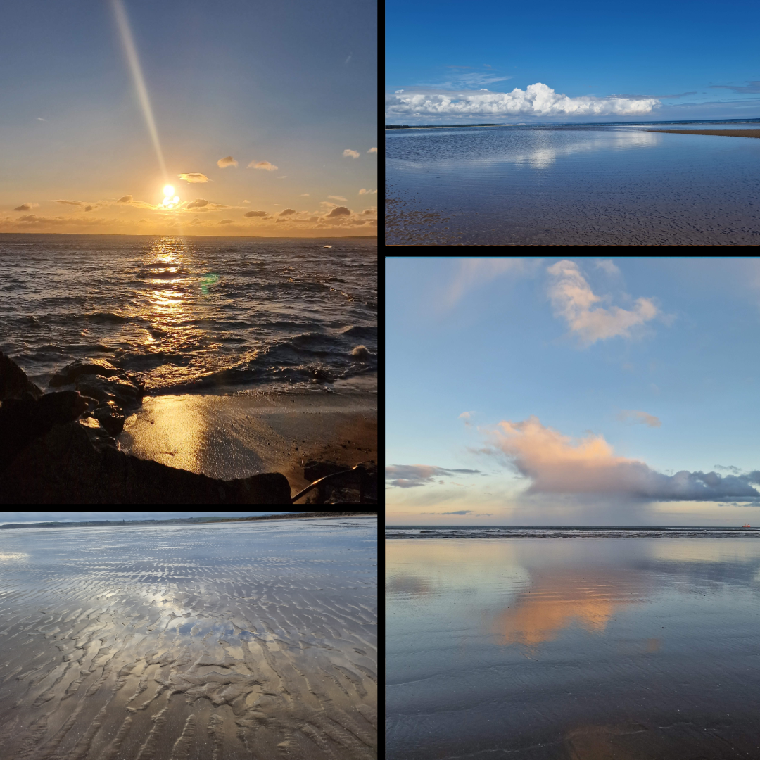
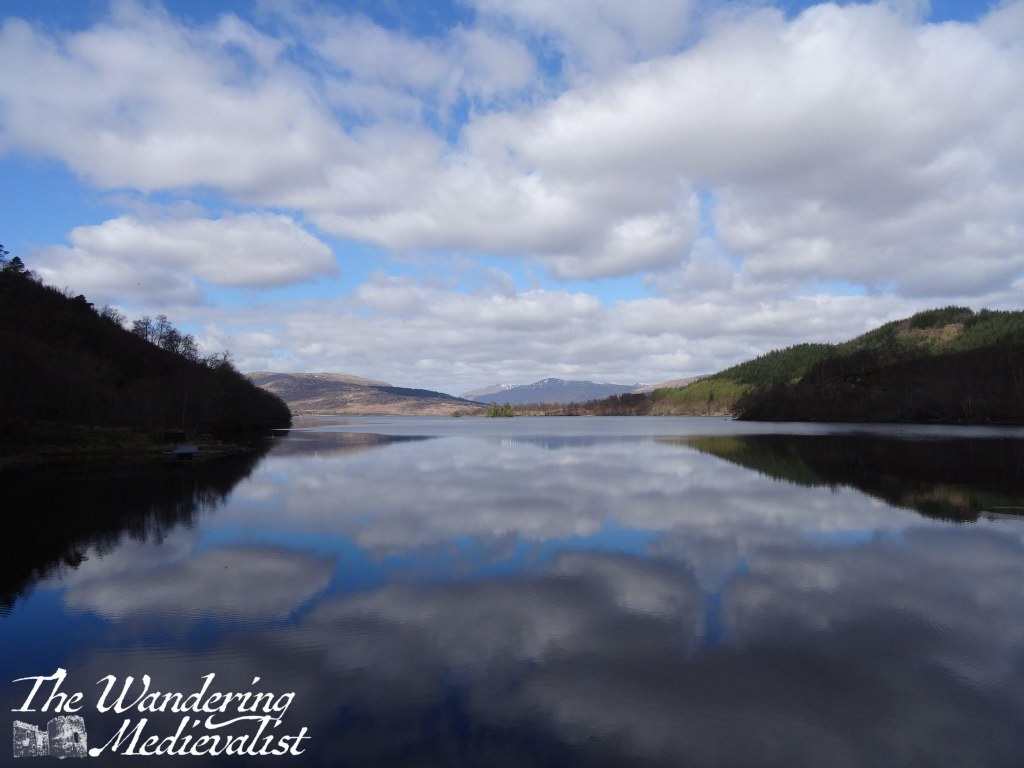
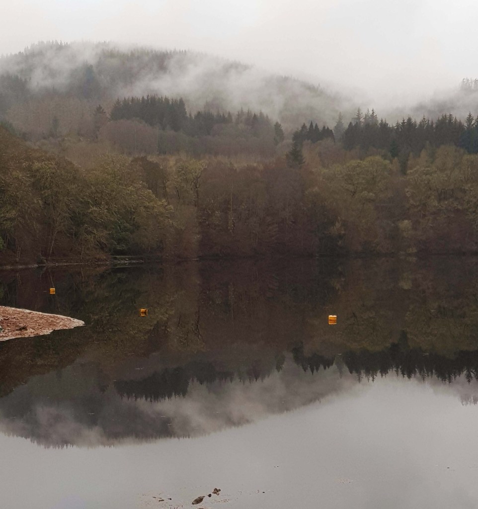
This series focusses specifically on bird reflections, taken across a variety of locations including West Sands in St Andrews, the Tay River, Loch Leven near Ballachulish, and the Eden Estuary.
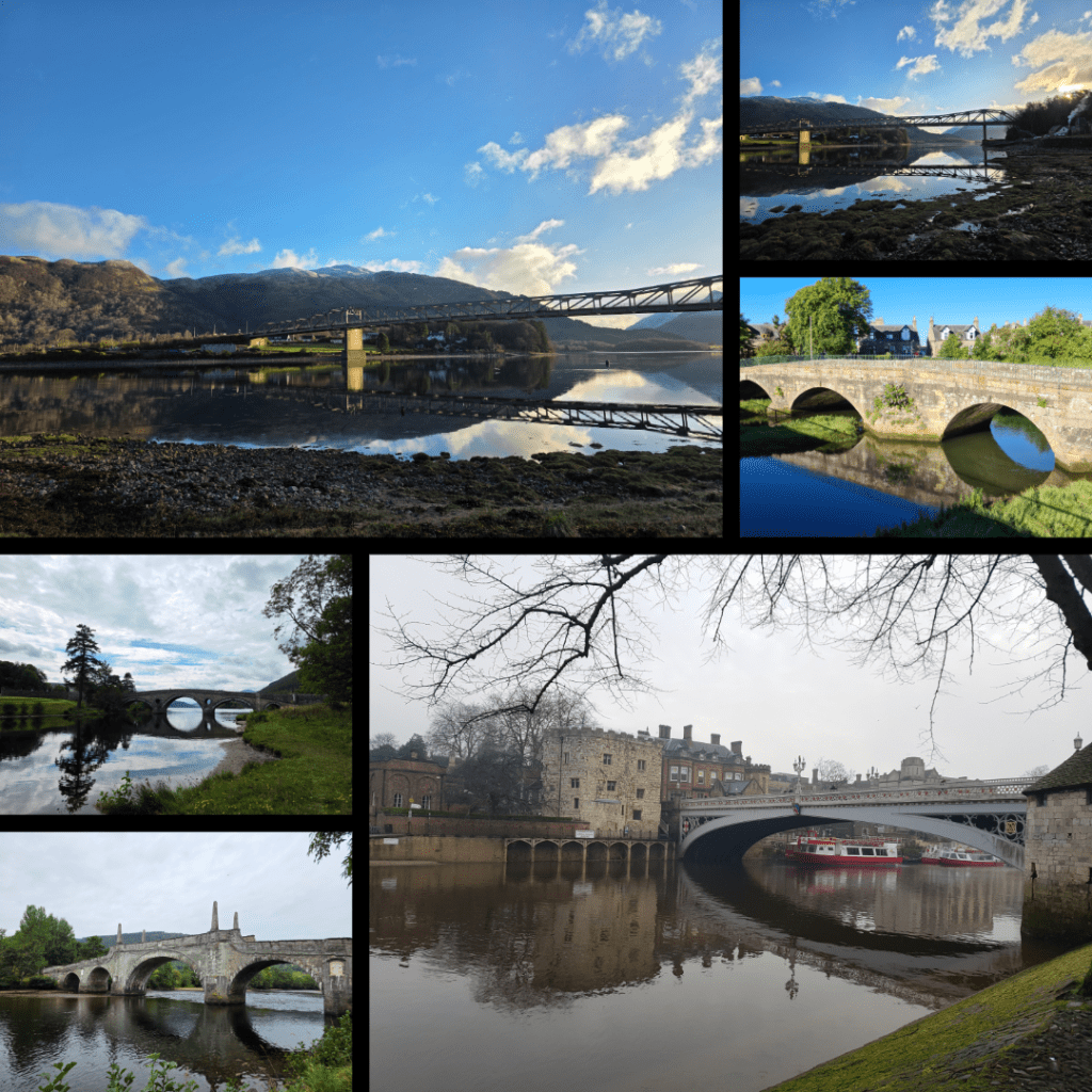
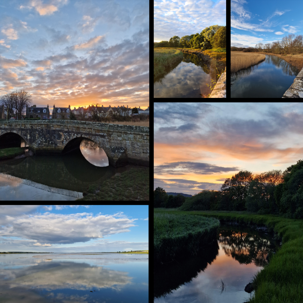
Another series, this time on bridges. I have always loved photographing bridges, not in the least due to their symmetry. These bridges include the Ballachulish Bridge, Kenmore Bridge, Guardbridge, Wade’s Bridge in Aberfeldy, and the Historic River Bridge in York.
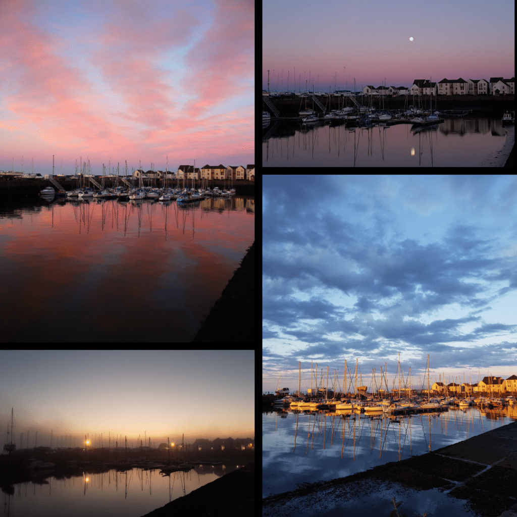
Tayport
For the relatively short time we lived in Tayport, I was able to really take advantage of the seaside location to capture reflections at all times of day. The harbour was my favourite spot, as you can see – sunrise, sunset and even with a full moon.
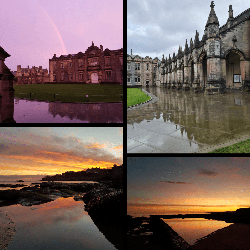
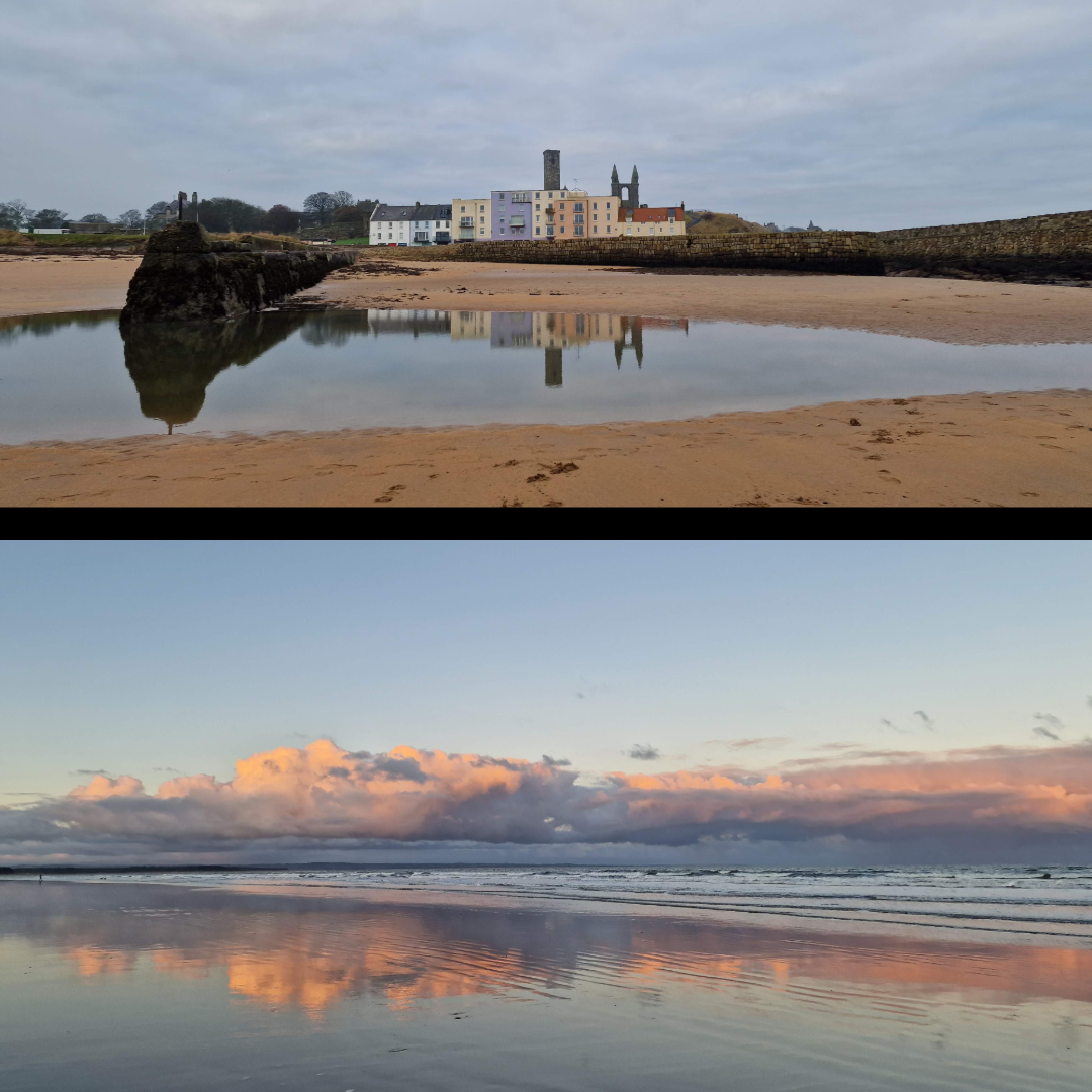
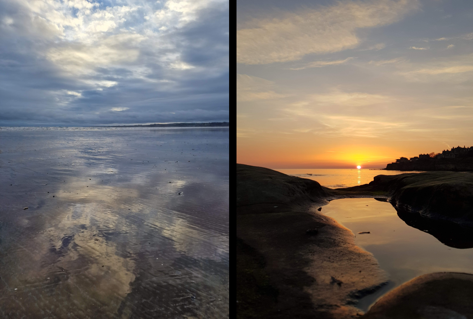
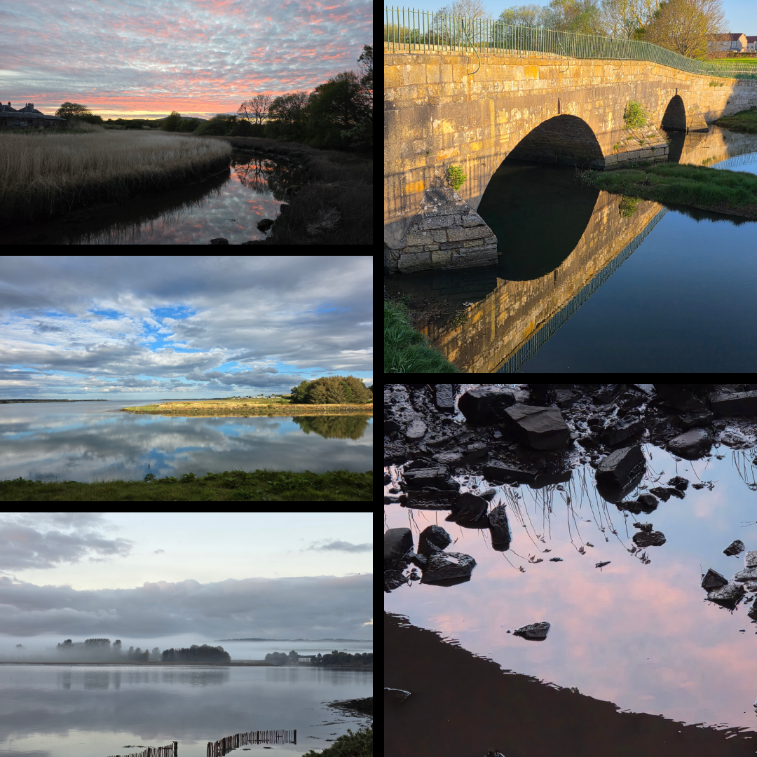
St Andrews
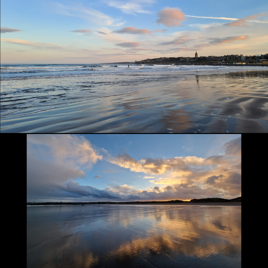
The many years I have spent in St Andrews have allowed for plenty of reflections, be it harbour, castle, sunrise, or Craigtoun Park.
St Salvator’s Quad, in the centre of town, was renovated some years ago to include these beautiful slabs of stone that reflect perfectly in the rain (and can be treacherously slippery when wet). Many early morning walks around town enabled these views.
I have said it before, that St Andrews is one of the most photogenic places I know, and the groupings below show just how stunningly beautiful it can be – and how well the clouds and distinctive skyline reflect on the surrounding beaches. West Sands in particular stretching out for miles and – at low tide – what feels like miles wide provides some of the most amazing reflections I have ever captured.
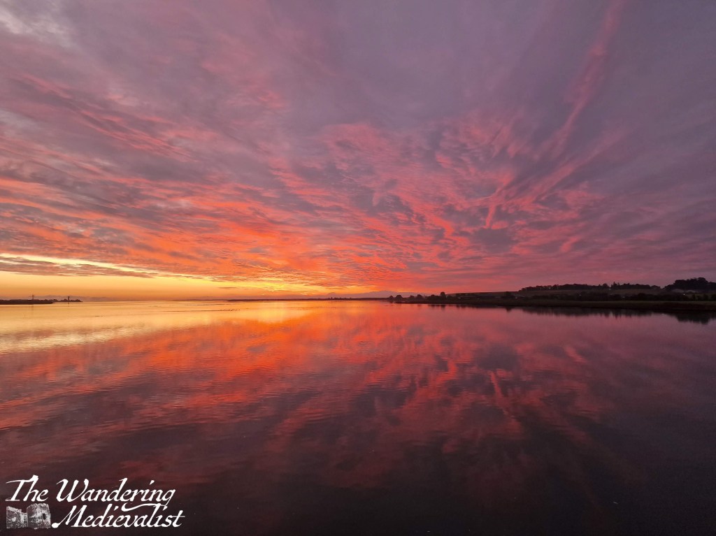
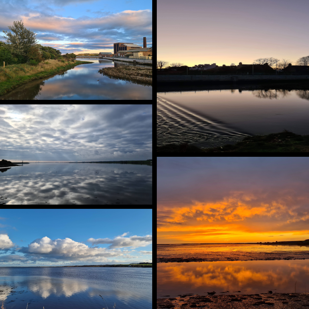
Guardbridge
Morning walks along the Eden Estuary have provided spectacular views, in particular this one taken from the University’s Eden Campus.
The view from the old bridge in Guardbridge is one of my favourites, allowing the sunset or blue sky to reflect off the water at high tide. I have literally 100s of this view – there are more below.
In fact, there were so many of Guardbridge that I could not narrow them down any further than this massive grouping. Living here through the pandemic years meant a daily walk was essential, and capturing the glory of the Eden was inevitable, at all times of day. Even the old mill, which is not particularly attractive but adds something to the scenery.
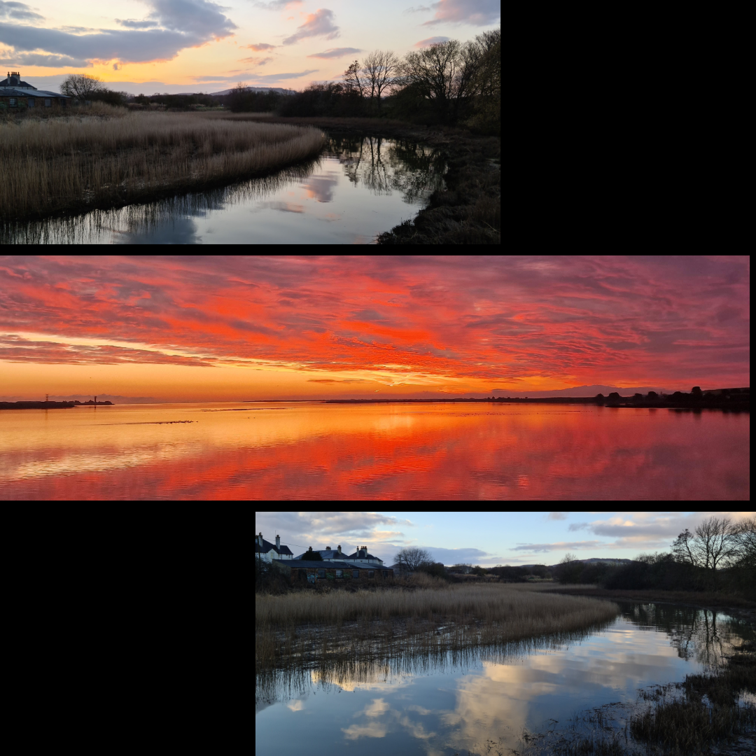
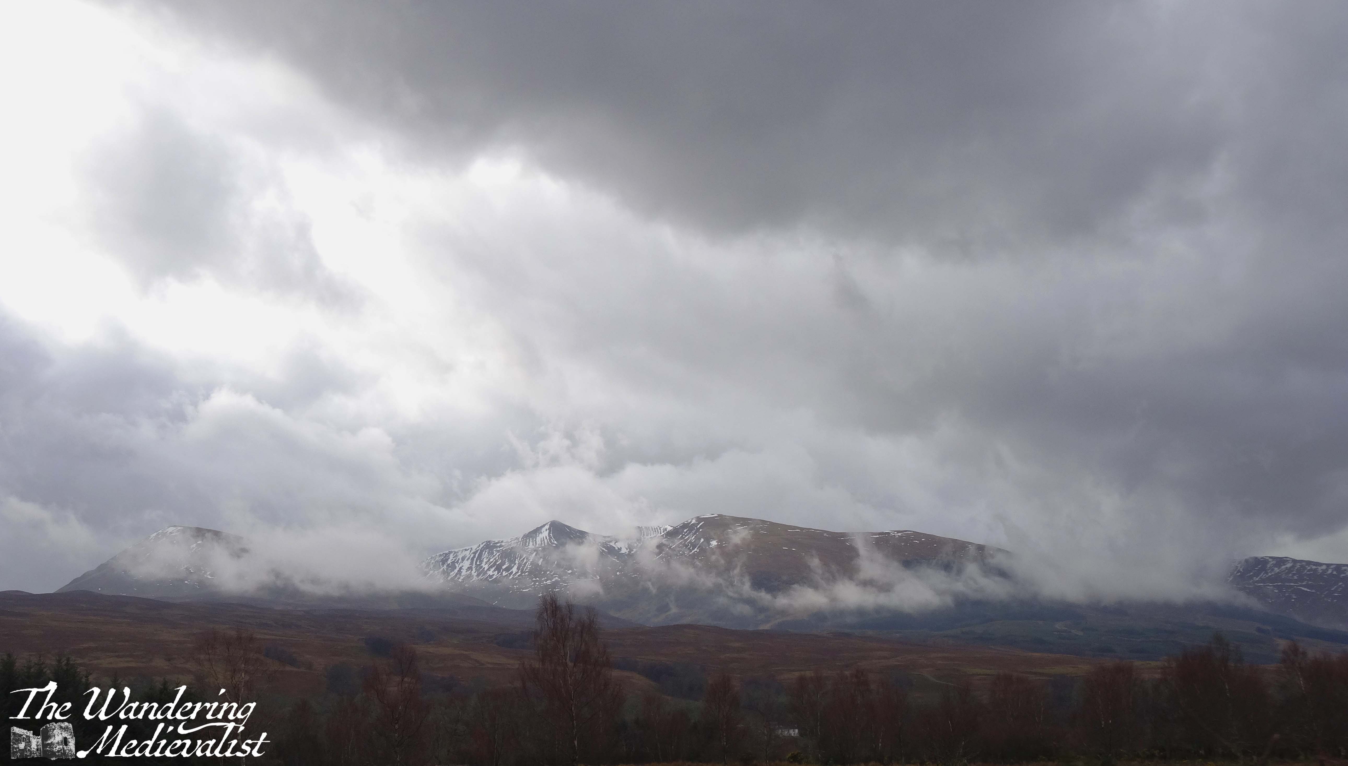
Scottish Highlands
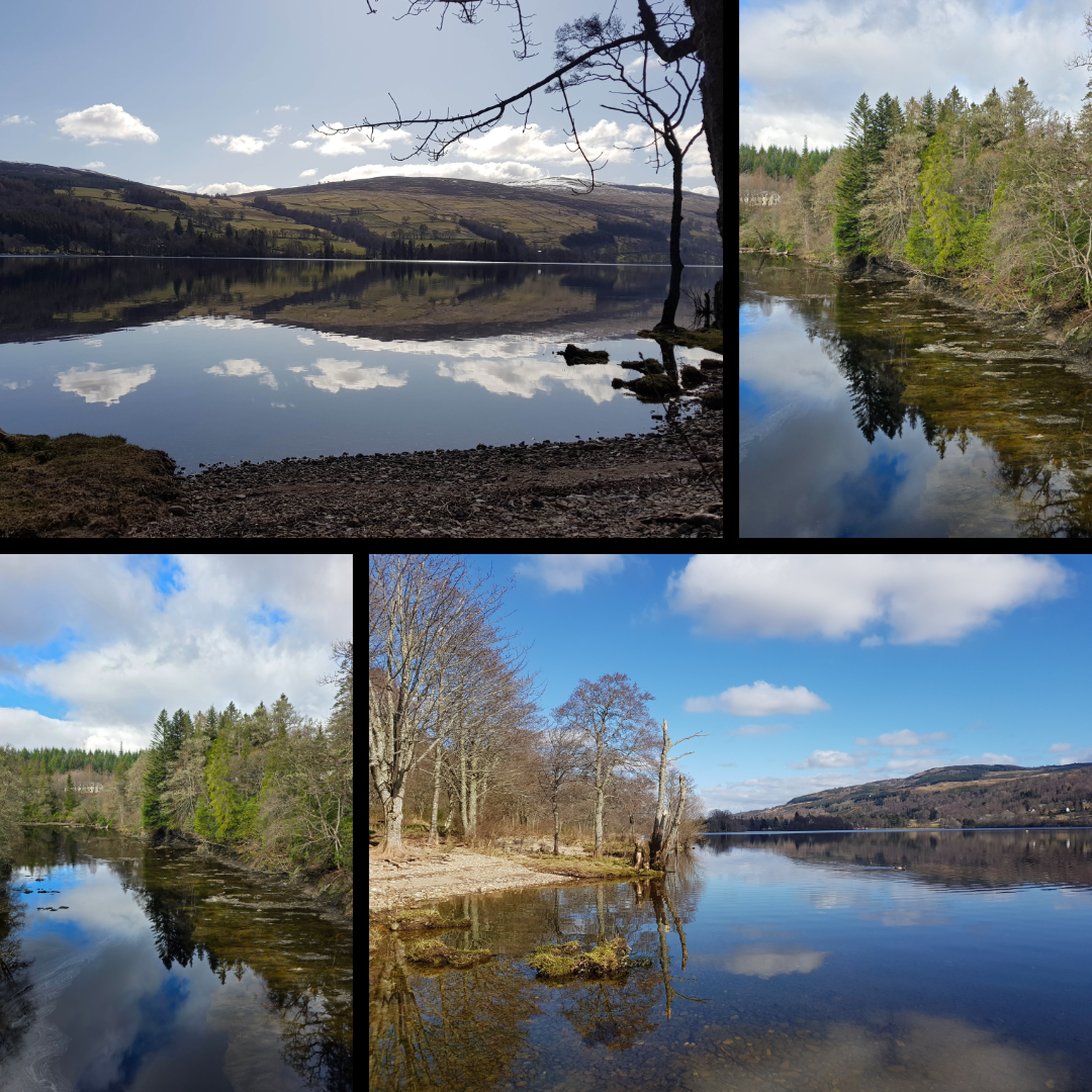
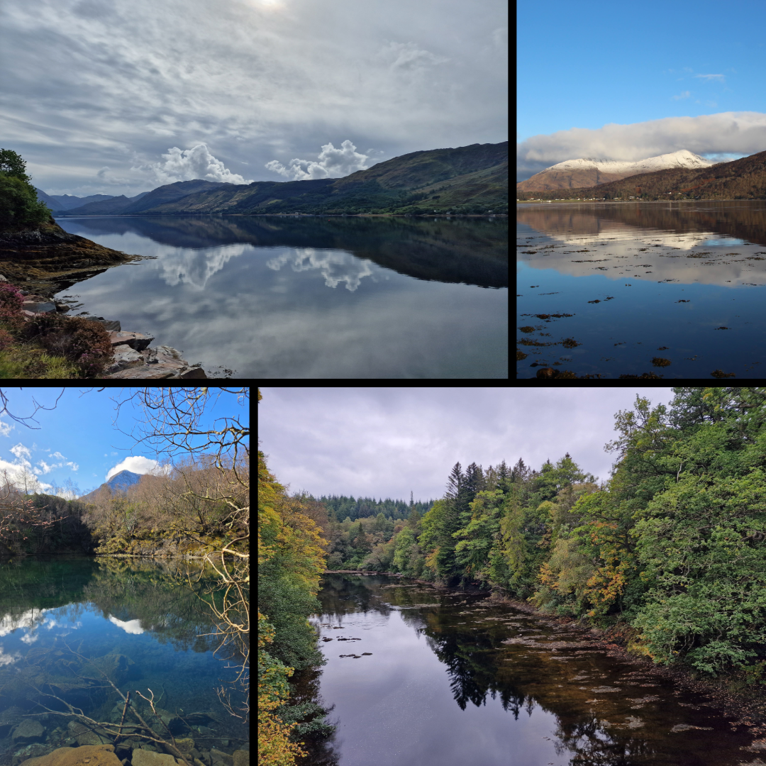
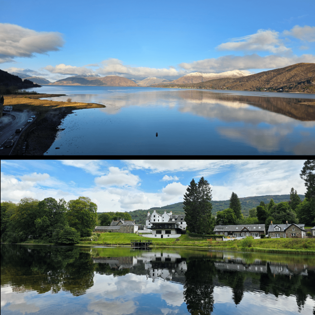
As anyone who has read my blog thus far is aware, the Highlands (or anything north of Perth really) is an almost sacred area for me. The stunning serene beauty that can be found in the lochs and mountains is almost unmatched in my experience.
The lochs in particular provide ideal opportunities for capturing reflections, at those rare times when the wind dies down and everything is calm and still.
To start with, Loch Katrine, and the almost mirror image of fluffy clouds and blue sky.
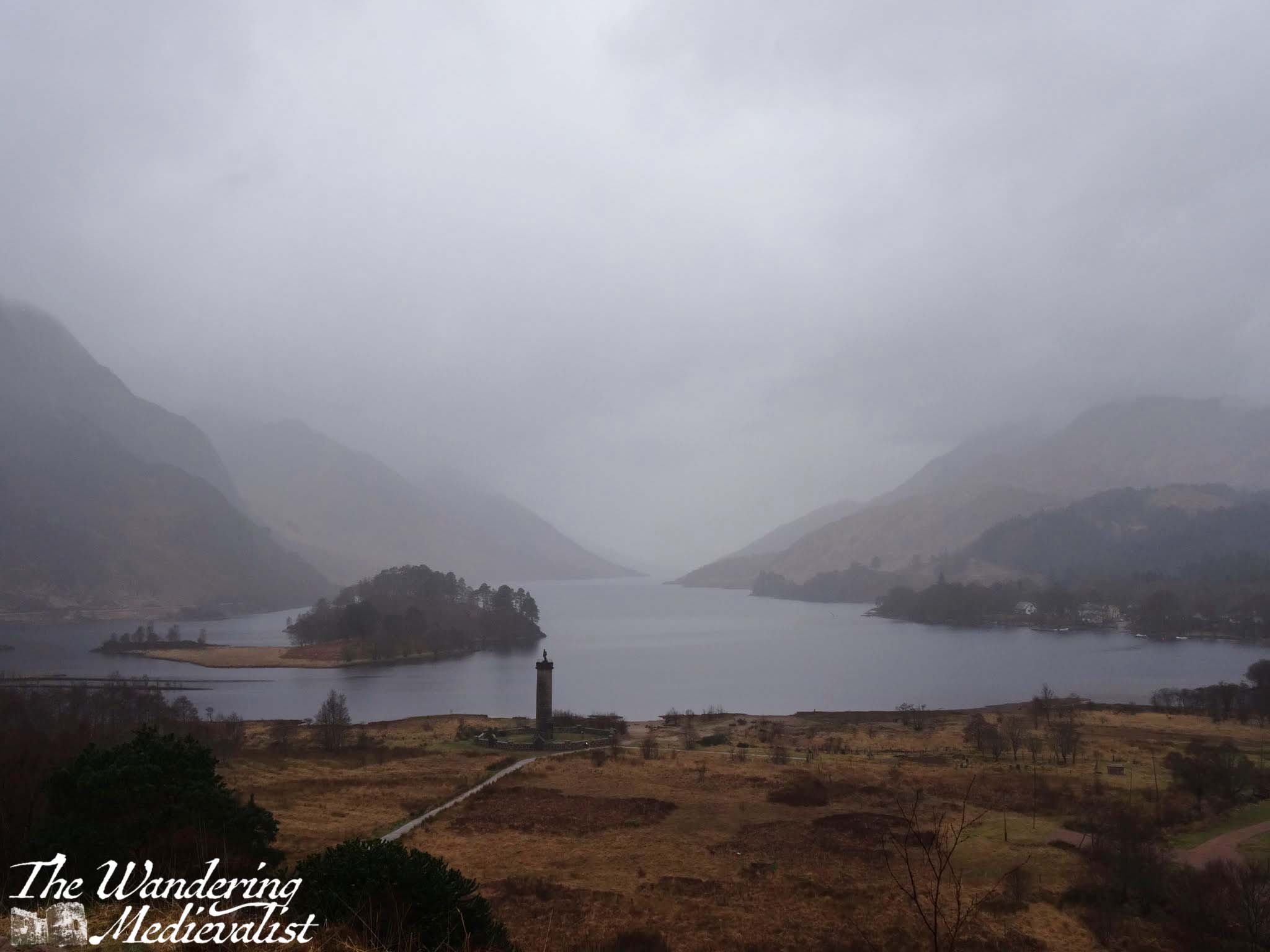
These two collections are some of my favourite loch pictures, and include: the view off Spean Bridge (not a loch, but gloriously still), Loch Tay at several points, Loch Linnhe from the Ballachulish bridge, Loch Duich not far from Eilean Donan castle, and the loch at Ballachulish quarry, reflecting the snow-capped Sgorr Dhearg.
These views were captured from Ballachulish bridge, and from across the River Tay looking back at the Kenmore Hotel. Only moments later, the river in the below shot was caught by the wind, and the reflection erased. For the top shot, the water was still for close to thirty minutes, early in the morning before the breeze picked up or the tide shifted.
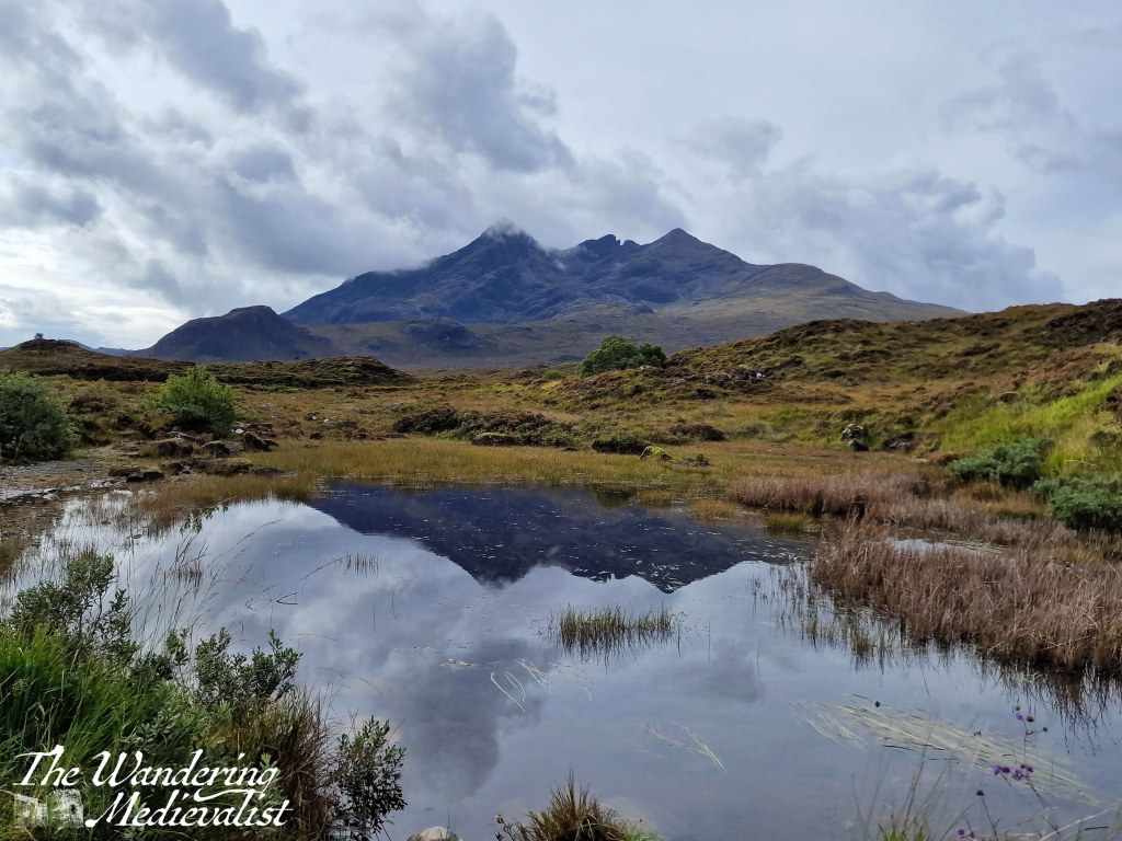
Last but not least, a vague reflection of the Cuillin Hills just above Sligachan Old Bridge, Skye.
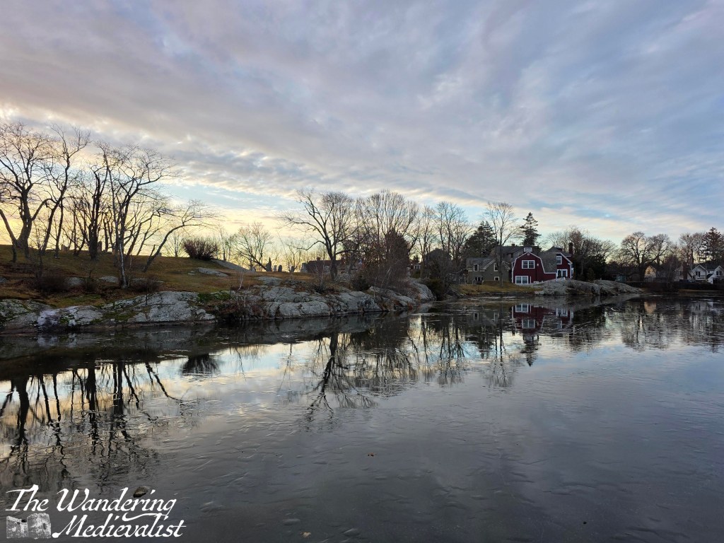
Marblehead
Finally, I have been lucky enough to spend a decent amount of time in my home town in the last year or so – more than I have for more than a decade – and I have captured what I consider to be some lovely views of my favourite places in town.
Starting of course with Redd’s Pond and Old Burial Hill, which I have written about at length. This was a cold morning with the ice just hanging beneath a layer of water on the pond.
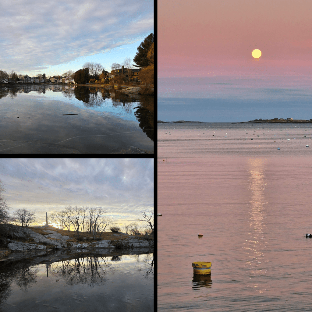
Two more shots taken on the same day as the one above, I felt I had to include them anyway, as one captured the monument to sailors of the town. The moonrise was a perfect calm evening last November, and I waited by the harbour for close to an hour for the moon to rise above the clouds.
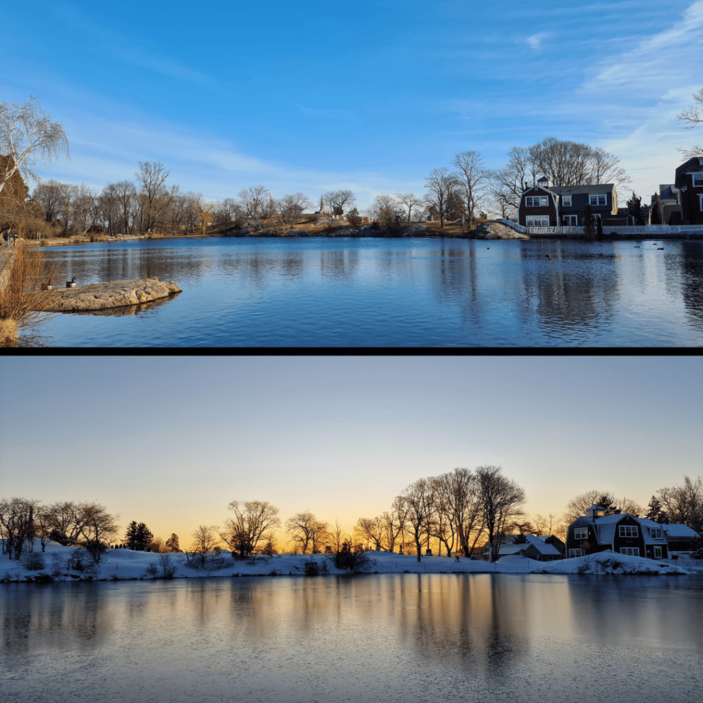
More Redd’s Pond, but how could I resist? One in late winter, the other in mid-winter at sunrise, on a magical morning that a wrote a whole post about. The reflections here are hazy rather than crisp, but equally lovely.
And last but not least, a picture taken on New Year’s Eve 2025, when I went down to the Marblehead Lobster Company (as it was) to pick up a special dinner for my mother. I and a few other photographers had noticed the not-quite-full moon and the still water that reflected the changing colours in the sky. It was incredibly quiet with only a gentle lap of waves on the shore, and no birds to disturb the surface.
Do you have a favourite one of the images I’ve shared? Let me know, I would love to hear your feedback! I hope you have enjoyed this short trip into a thematic project that has mirrored several others in recent past such as cloudy skies, or sunrise/sunset. I hope to get back to the Coastal Path soon, or at least visit a castle! I’ve also got a few good ideas for posts that I developed while walking around Marblehead this last week – keep an eye out!
Enjoying my pictures? Why not claim one for your own project or wall space through my online shop:
Is there one on this post that you’d like to own? Just comment below!
Work has taken me back to southern California this month, and after a week of travel starting in Pasadena, heading out to Riverside and then finally down to Santa Ana, I was able to settle into one place for the rest of my time here. And so lucky I am, that the place is Orange County!
On Valentine’s Day – not because it was, but because it was a lovely day and my most likely day of rest during this trip – I decided to explore a new part of the coast. Recent rainfall meant that I could not hike in the hills as I hoped and so I did some investigation and eventually decide upon a parking spot along the coast, ten or so minutes from Laguna Beach, which I had so enjoyed visiting last year.
Fortunately the drive was only about 20 minutes, and so I got going relatively early in the day and was happy to find that there were plenty of spots available. The parking is run by the state, and so was even more pricey than my visit to Laguna Beach – $15, though this was for a day pass. The pay system is a very simple QR code scan and pay – much better than the cash boxes I’ve seen elsewhere (*cough* New England).
And, after all, this is Orange County.
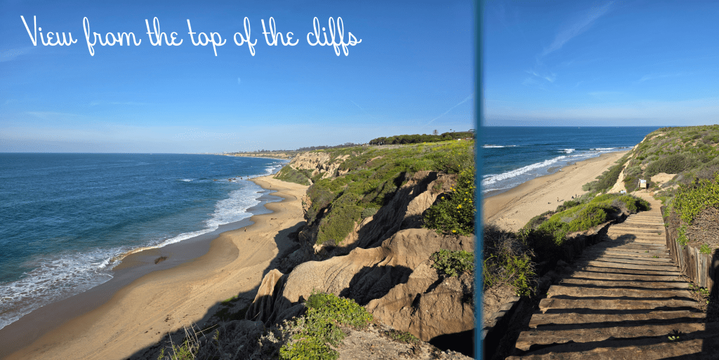
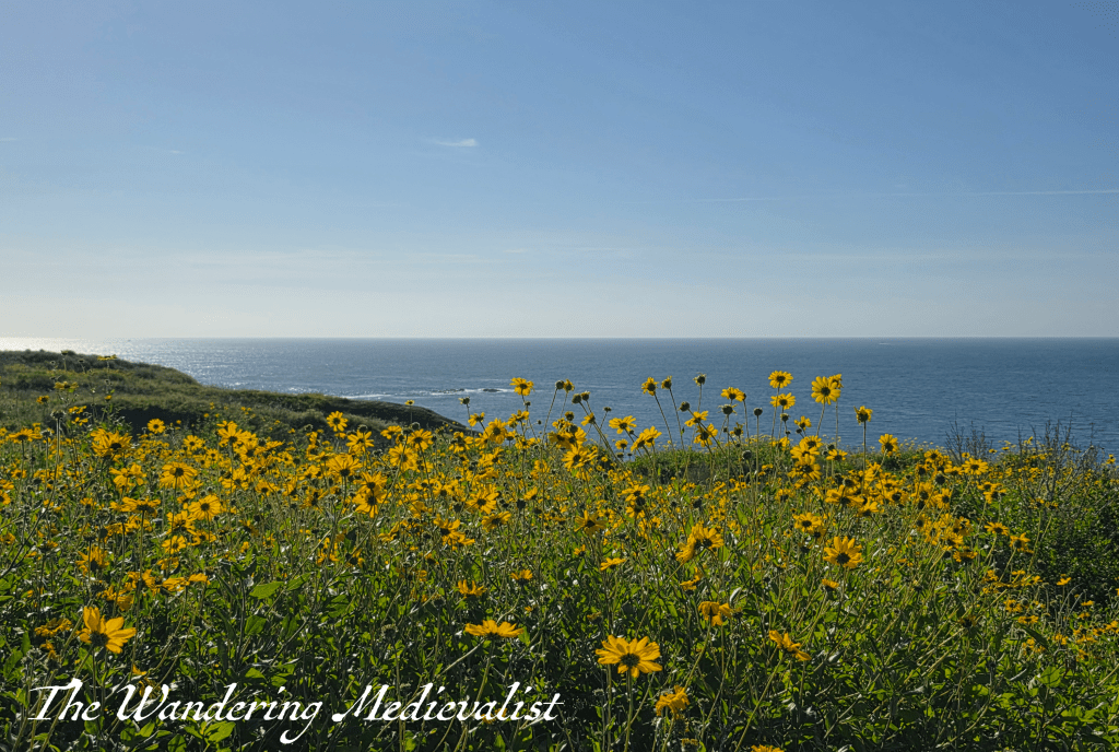
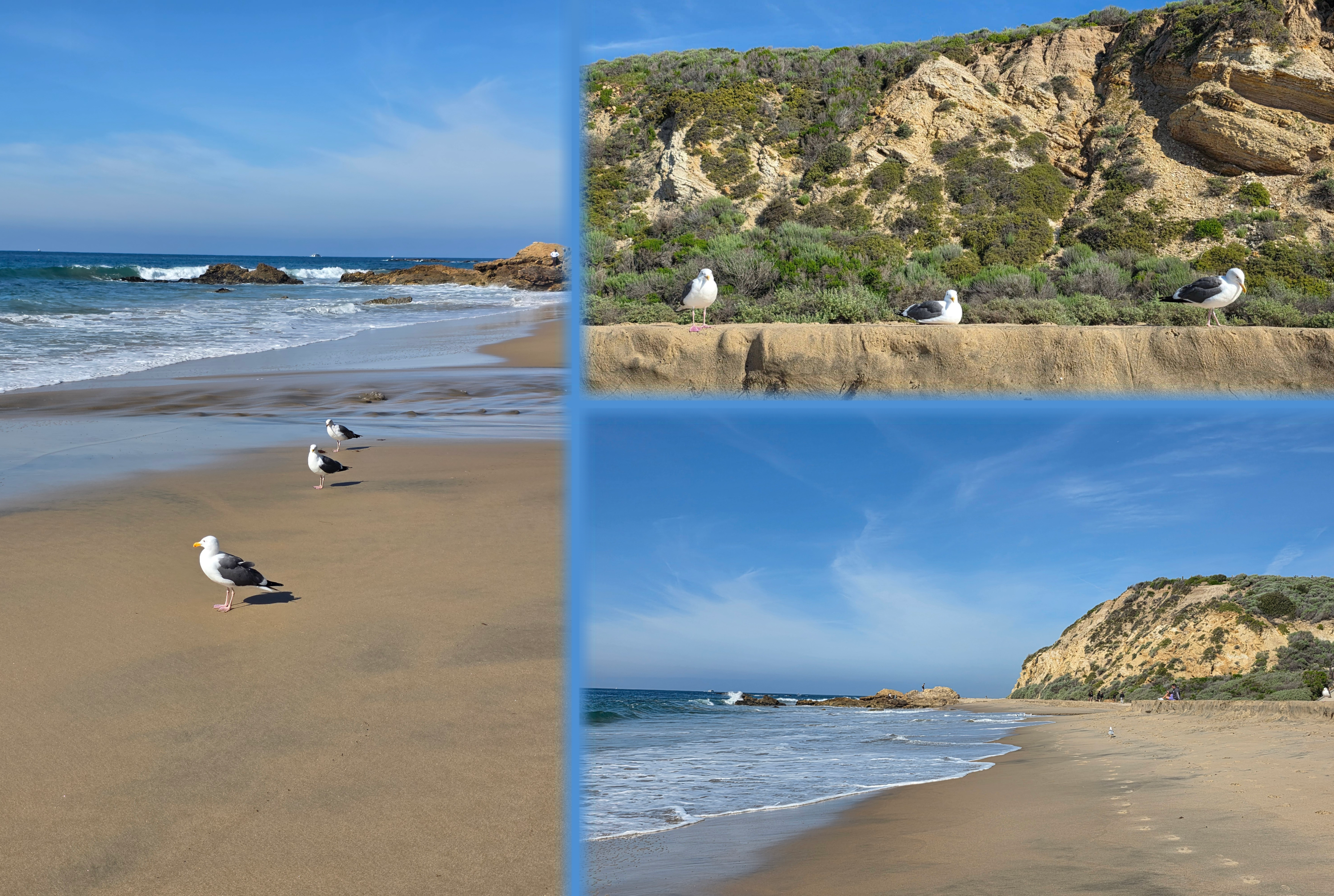
My first dilemma, after payment, was which way to go. My breath had been stolen while I drove by the day before by the stunning Abalone Point, but I was really curious to explore the area that was called ‘Historic’ Crystal Cove, which popped up top of my Google for short walks in Orange County. So, after a touch of meandering, I found myself at the top of the cliffs with a long flight of steps before me, leading down to the beach. The view behind me was hazy as it looked directly into the sun, but ahead of me was the stunning blue water and sky I had come to expect from this area.
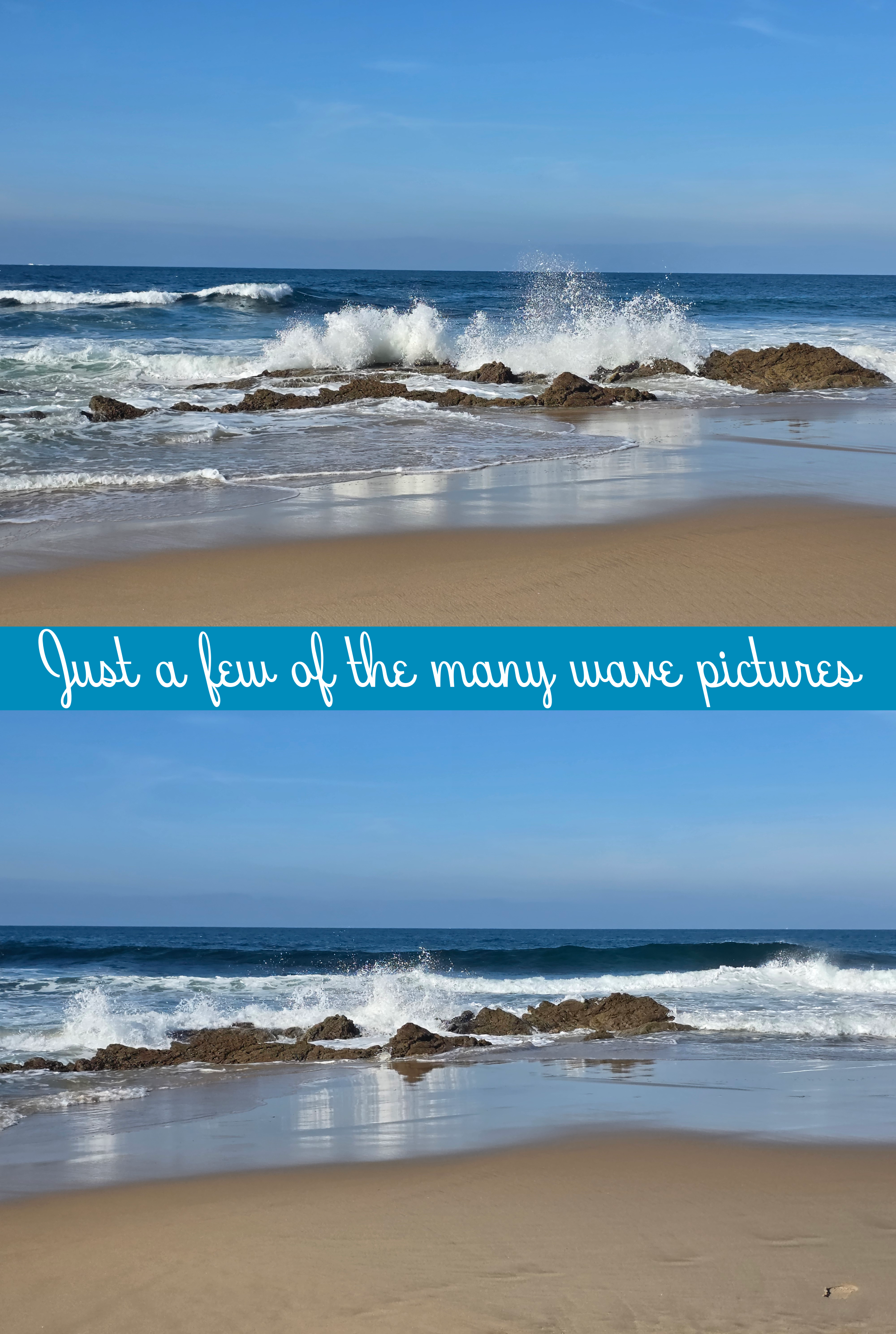
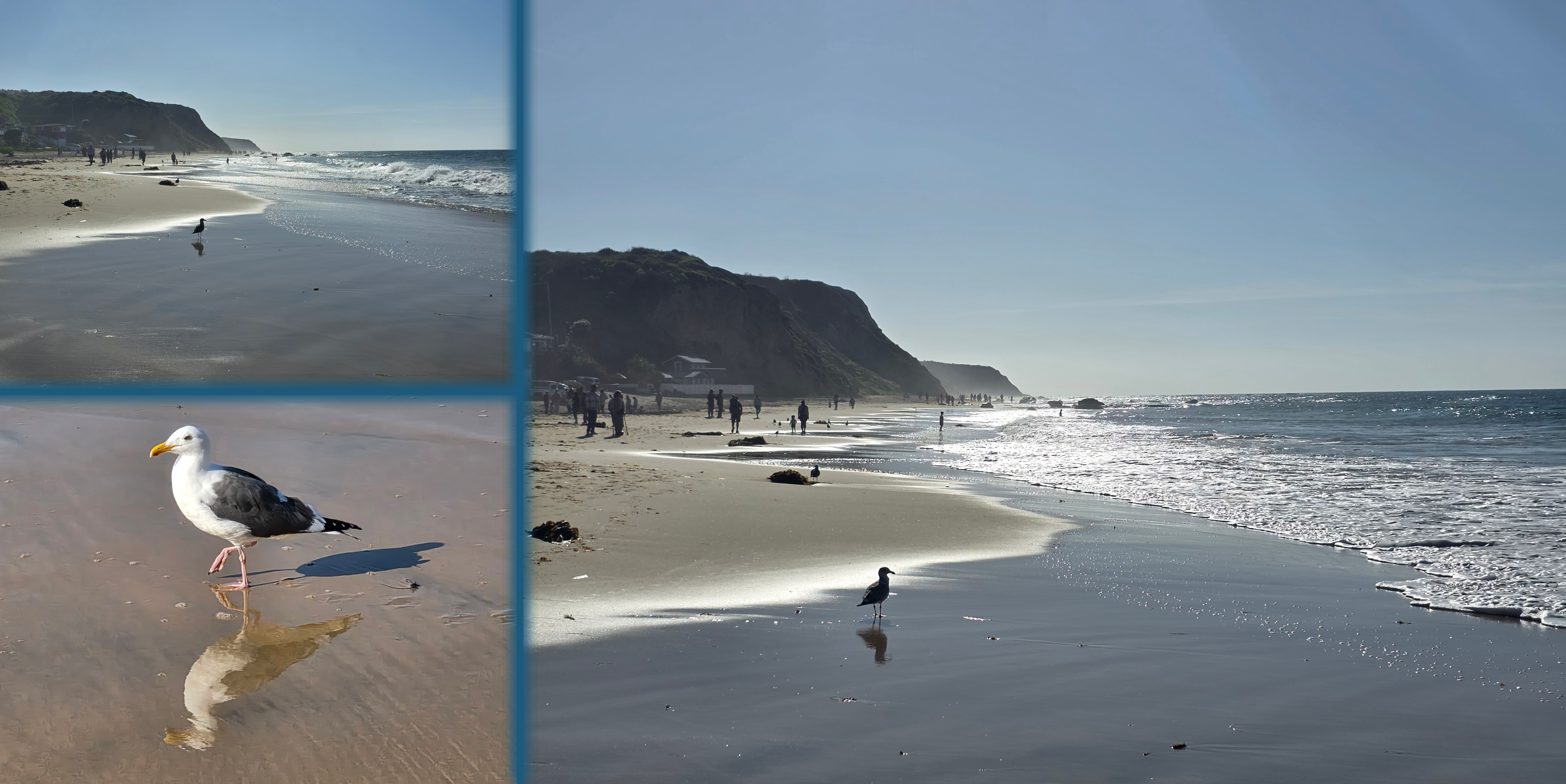
I imagine that we were at about mid-tide, perhaps on the high side, but there was plenty of firm wet sand to walk on, and the waves were constant but not too threatening. As always, I struggled against the urge to just sit and record the crashing surf, the stunning colours and shapes, the dramatic splash when a bigger wave hit the rocks.
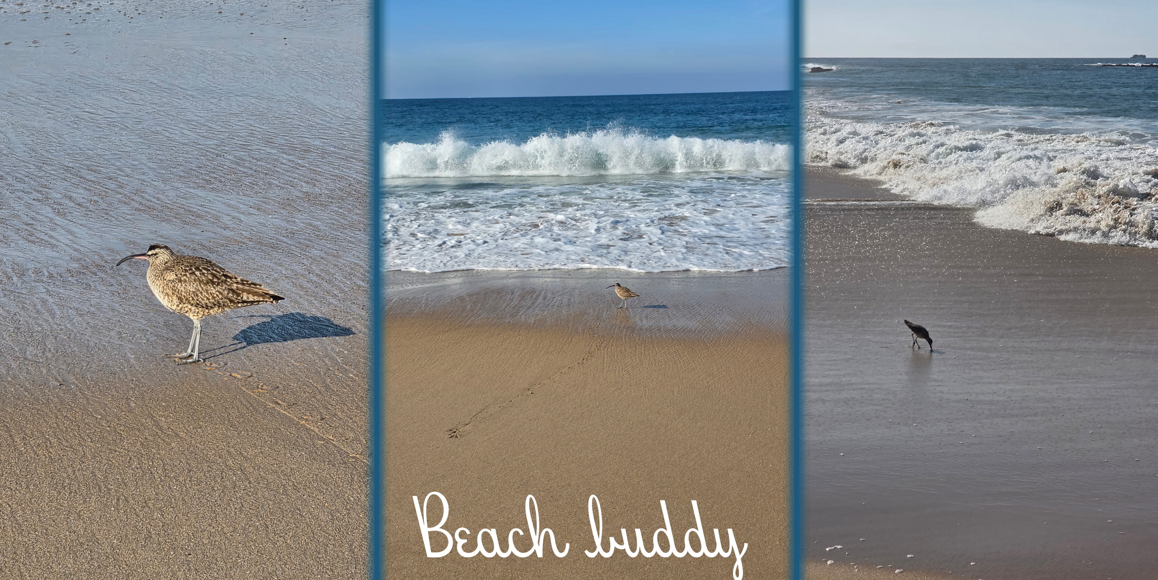
I did pause briefly when I met a few very brave sea birds, who were so unbothered by me that I could get quite close.
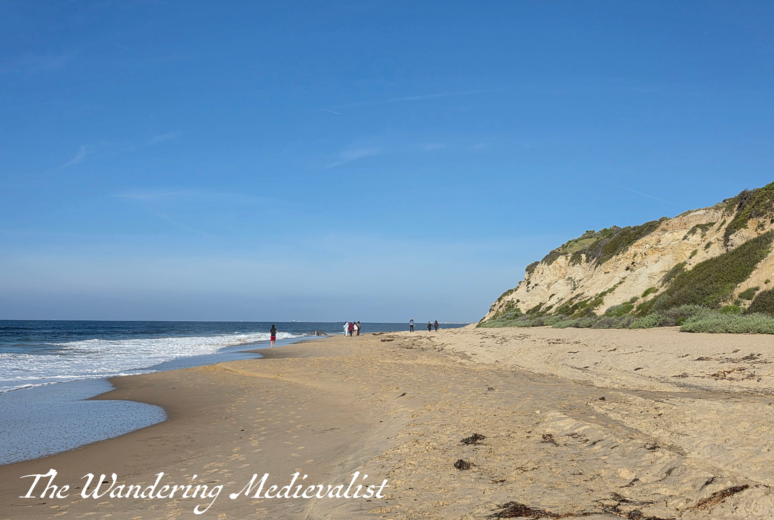
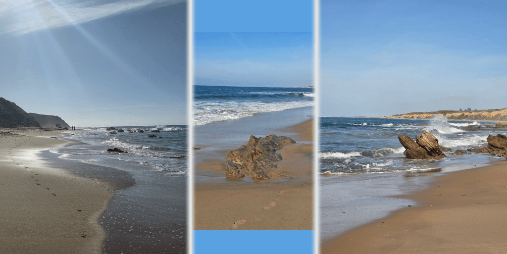
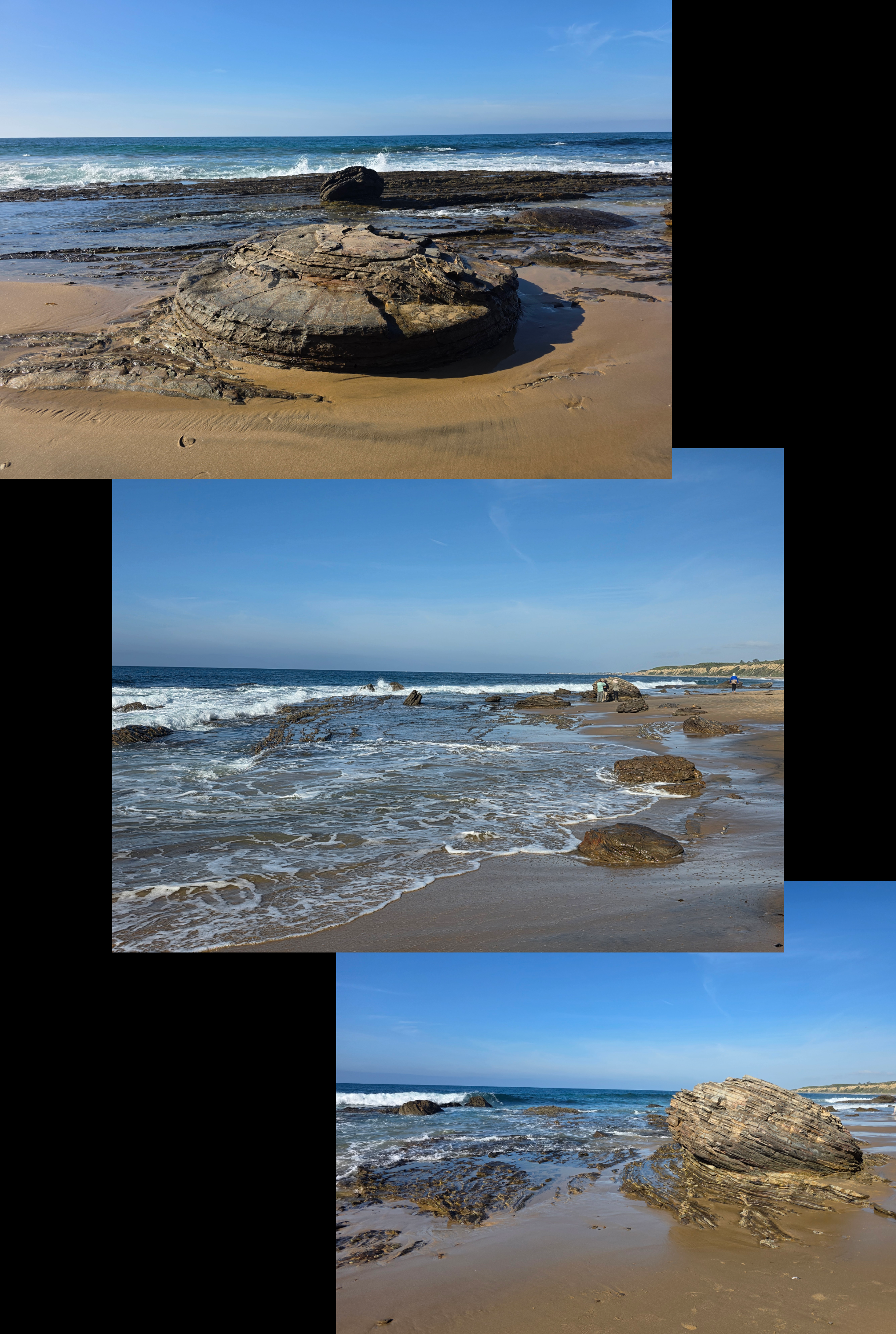
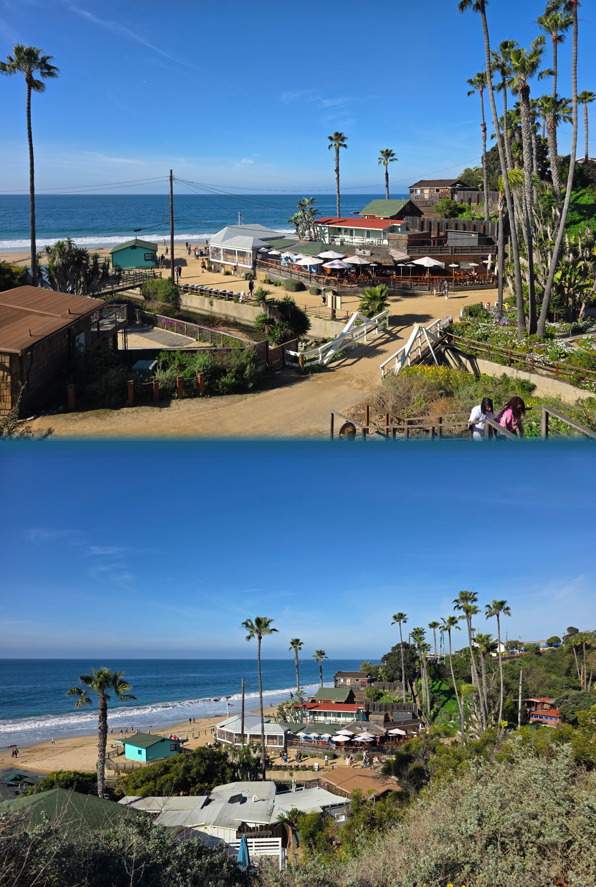
Like in parts of Fife, the sandy beach was broken in places by impressive rock formations, slicing upwards.
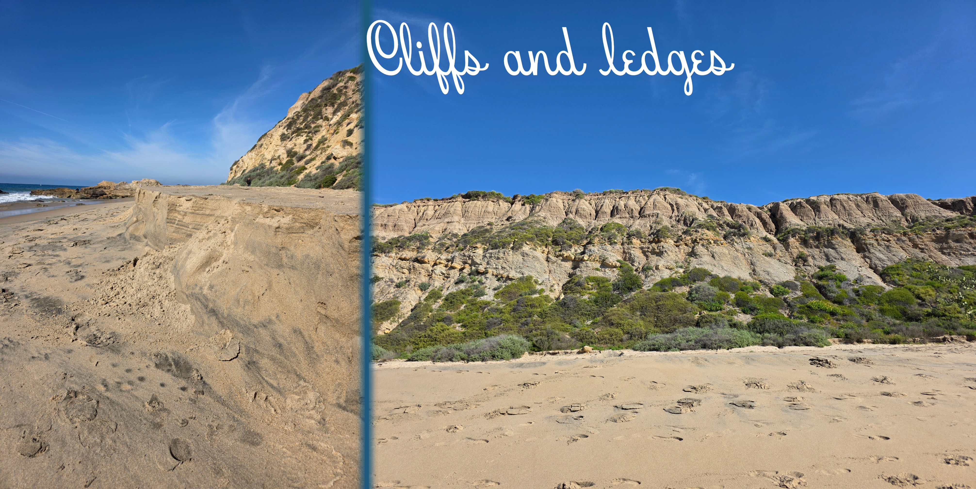
The towering cliffs above the beach were dotted with green but also showed layers of rock and sand – a geologist’s dream, I am sure. As I approached the Crystal Cove area, there was a larger formation of rocks where a few fishermen had parked themselves, accompanied by always-bold gulls. The sun had finally risen far enough that a picture back the way I had come was a touch clearer.
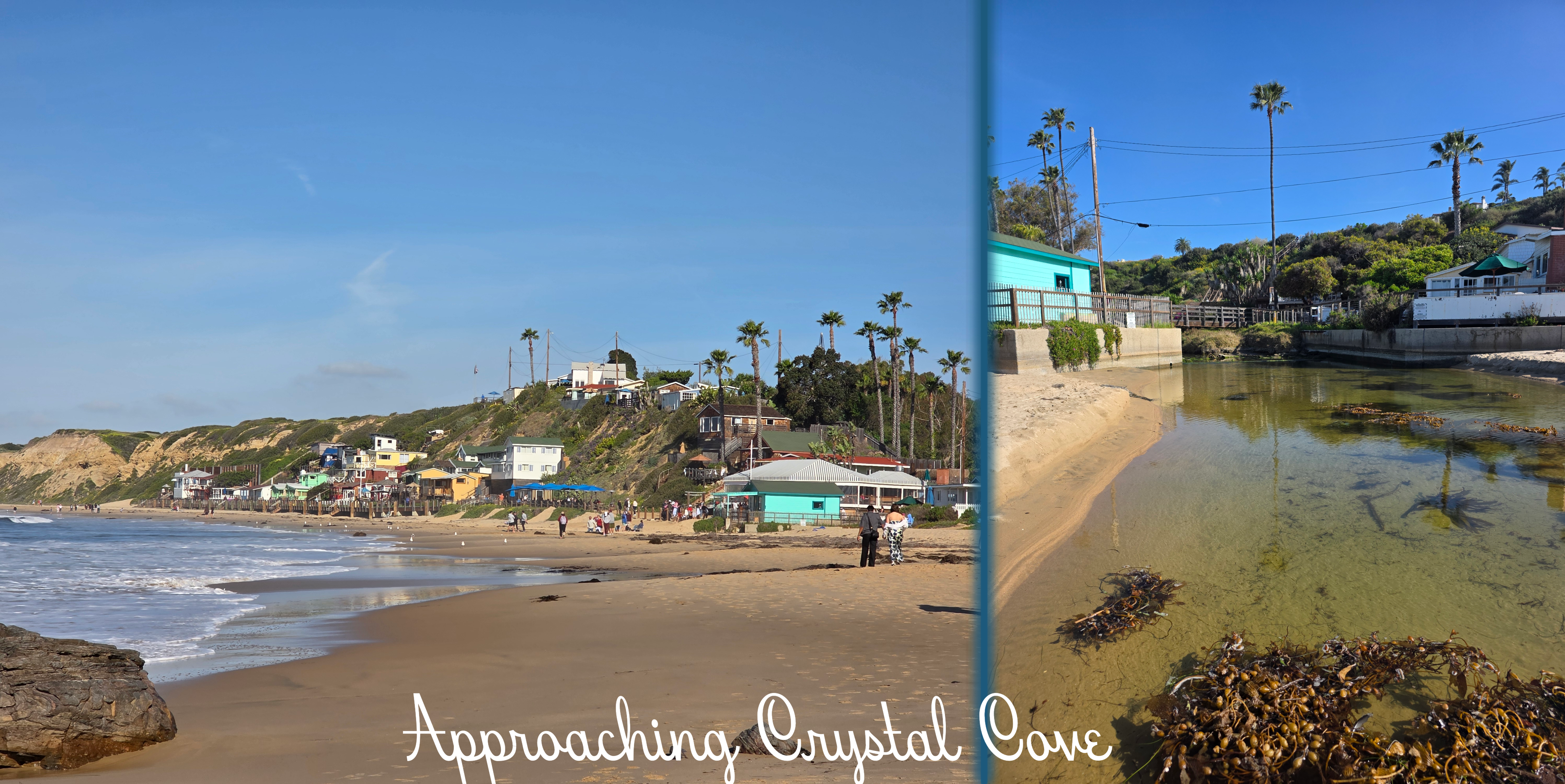
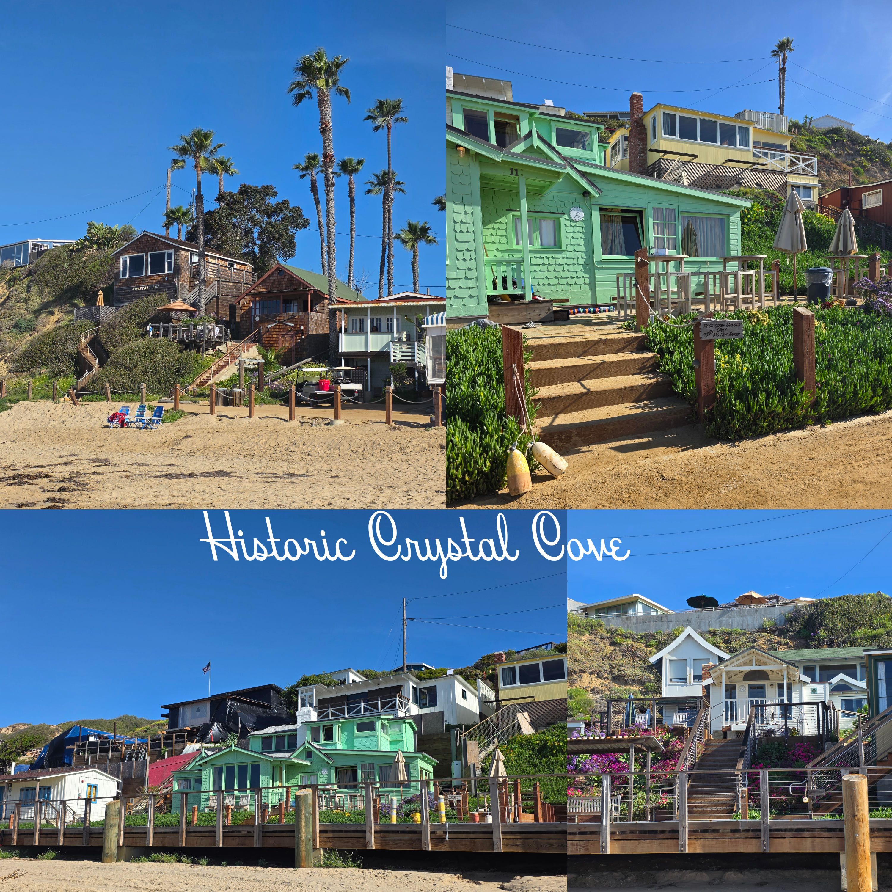
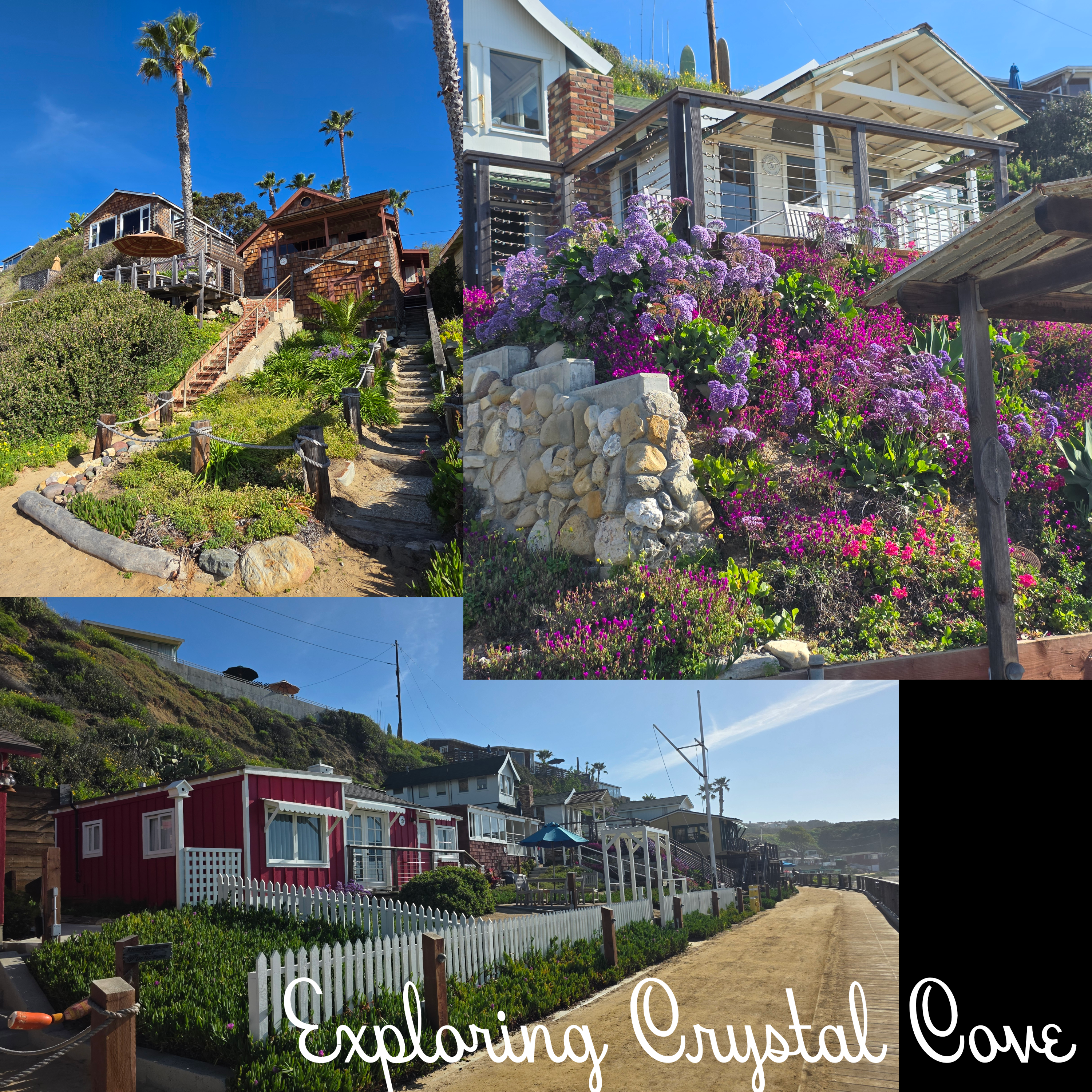
I did not really know what to expect of Crystal Cove, and as I approached it reminded me both of a Caribbean pirate’s lair and a coastal village on Cape Cod. The more I explored, the more the houses reminded me of lakeside ‘cottages’ built on Lake Sunapee in New Hampshire: thin wood, no insulation, designed as a shelter in warm and comfortable weather. Upon reading more, I learned that the Crystal Cove Historic District is a federally listed gathering of 46 vintage coastal cottages built in the 1930s and 40s. One of the last remaining examples of early 20th century coastal development, it has been preserved and the cottages transformed into rental properties. They are nestled around Los Trancos Creek, which is what made me think of the pirate hideout – aren’t there always creeks emptying into the ocean in a lair?
There is a boardwalk in front of the line of houses, so I walked all the way to the end and then back again, enjoying the haphazard, ramshackle nature of some of the cottages. Most were neat, simple constructions with plenty of window and balcony space, but one or two looked like a child had constructed them out of blocks – dormers, gables, windows, extra rooms tacked on in random places. These were, of course, my favourite (in particular the mint green one visible in the collage below).
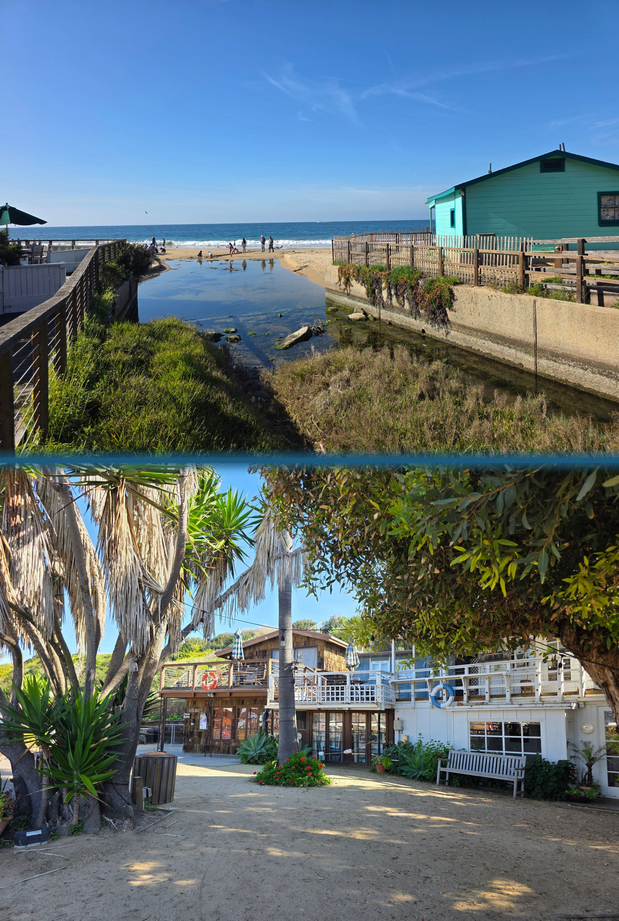
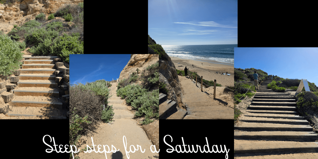
I walked past the Beachcomber restaurant, which seemed to be very busy, and found a clean public restroom just over the pedestrian bridge. From here, my route took me up a flight of steps back to the top of the cliff, where I could look down over the cove and out to sea.
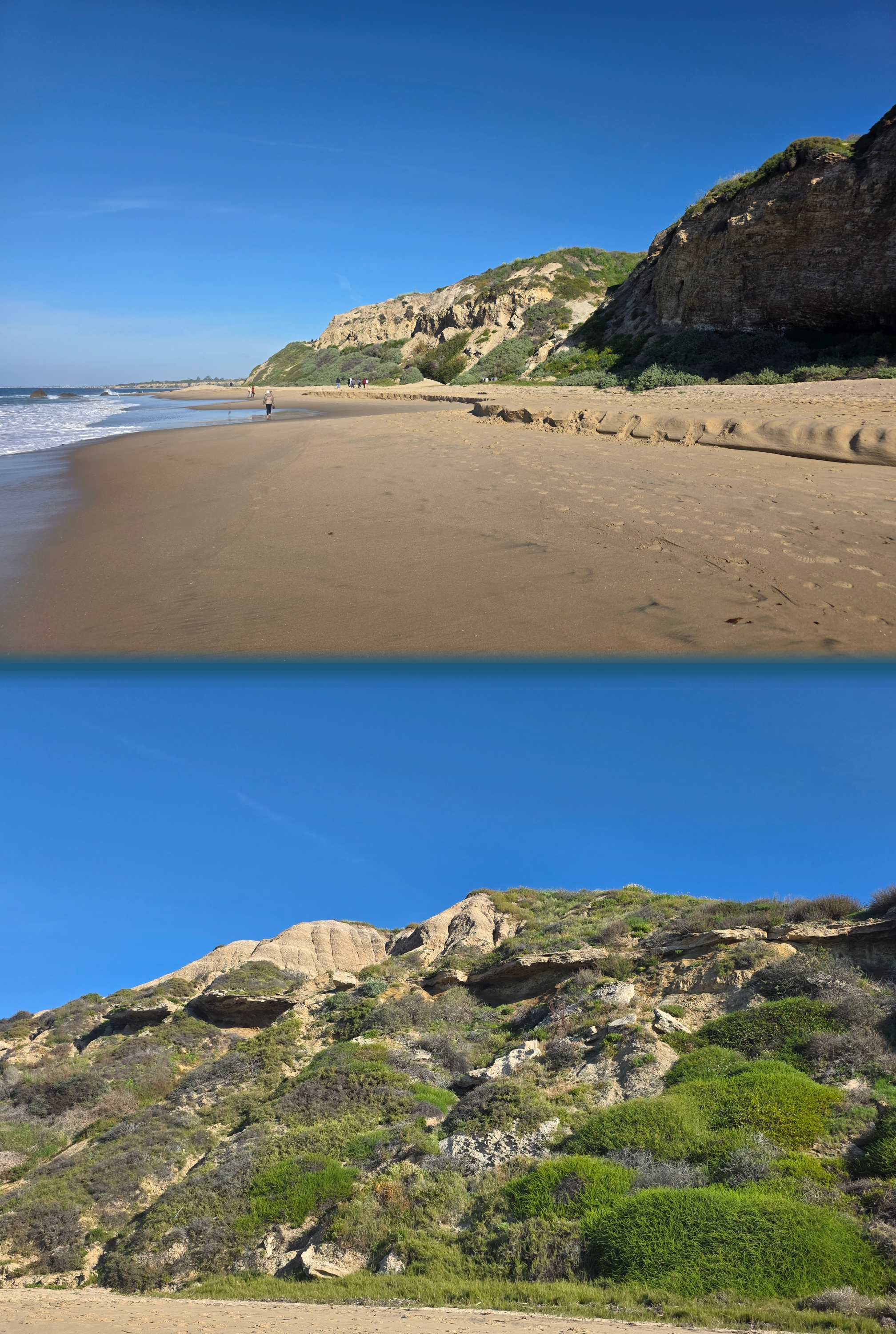
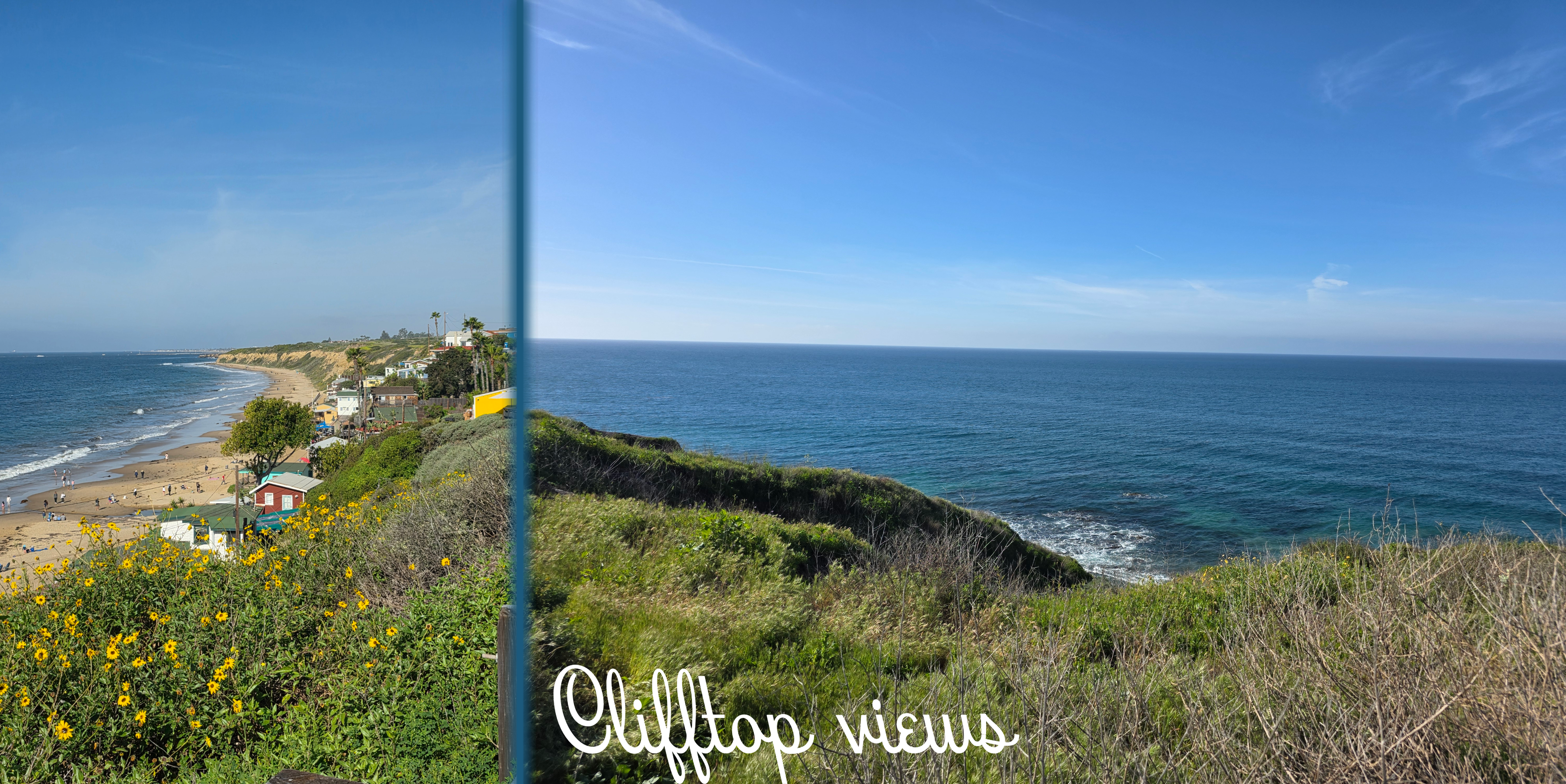
As I moved away from the cluster of houses and past the very busy Shake Shack (this is when I recalled that it was Valentine’s Day, as they had all sorts of offers on), I realised that the cliff-top walk was not entirely dissimilar to parts of the Fife Coastal Path. The trail was paved and well-used by joggers and walkers, and the scrub-like flora dropped abruptly away to a view of the open sea.
really, this could almost be Fife
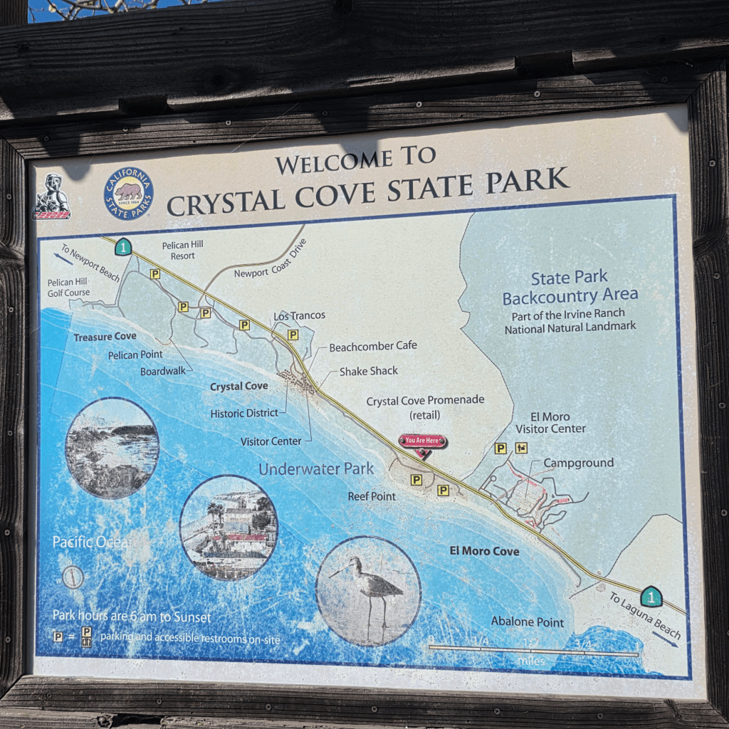
In time I reached the edge of the parking lot, but I really wanted to explore the other direction so I pushed on, passing the useful map you can see at the start of this post. There was also another clean restroom and a spot to fill up your water bottle.
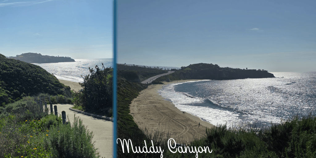
Beyond this hut was another car park, but finally at the end I reached a branch in the path. One direction led to a viewpoint over Muddy Canyon, where there were several benches to enjoy the view.
The other direction led to this winding downward ramp – quite steep and a bit slippery with sand. This portion of the path hugs the edge of the canyon, which has been sliced into the cliff by a creek down below. I began to question whether this was a good idea – I really did not want to climb back up the ramp. But, when I reached the bottom, I was greeted by a beautiful fresh breeze, a touch cool and the type that refreshes and rejuvenates. Perhaps it is my childhood by the sea, but I find few things smell better than this type of breeze, pinching your nostrils with a touch of salt.
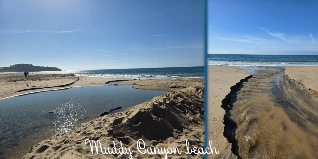
Immediately to my left was a pond where the creek backed up a bit before emptying into the ocean. Fortunately, the outflow was narrow enough at one spot to leap over, and I managed to do so without falling or injuring myself. The seagulls were watching closely.
On the far side of the creek, the beach stretches out towards a headland, which is the edge of the town of Laguna Beach (I think). This part of the coast was quieter, so I walked along for a while, enjoying the dramatic cliffs and the wind. I considered a few times how far I wanted to walk, and realised in the end that I was setting myself up for a good long hike if I kept going. So, I turned around and leapt over the creek again. It then occurred to me that I did not need to go back up the ramp – my car was quite a bit further along and there was a set of steps between it and me. So, I stayed down on the beach for a bit longer before finding myself at the bottom of the stairs I had descended at the start of my walk.
They were a touch more daunting looking up than down. That said, they were mostly quite shallow so not too strenuous, and they switched back a few times, allowing for a pause and quick look at the view while I caught my breath.
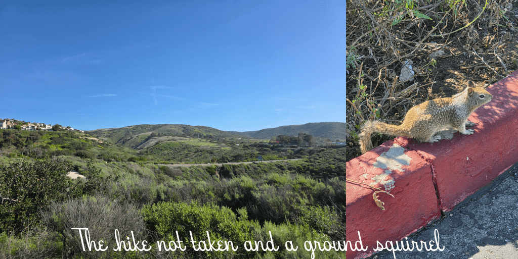
Once back at the top-of-cliff level, I found it to be a relatively short walk back to the car – about five minutes. Along the way I was able to capture a picture of hills I might have been hiking in, as well as this wee ground squirrel who posed very kindly for me. Or possibly froze in fear. Either way, he stayed still for quite some time. While I was heading home, increasing numbers of other people were appearing, particularly couples clearly visiting the beach for a Valentine’s Day picnic. I certainly saw more red mylar balloons that one might expect on a coastal walk, and girls slightly awkwardly clutching bouquets while they headed toward the sand.
In all my hike ended up being about 4 miles with two relatively steep climbs to get the blood pumping a bit. As seems to be the case with much of this area, the beach was stunning and I enjoyed exploring another new spot. The weather has tracked me from Scotland now, as this was the last bright sunny day, and rain has closed in on LA. It looks like I am not likely to get a chance to try another walk on this trip. Perhaps next time!
One last side note about adventuring in this part of Orange County: if you get a chance, stop in at a Pavilions supermarket. The fruit is phenomenal, the packaged salads and breads are delicious and in all it probably comes in around the same cost as a Whole Foods. A really pleasant shopping experience. I am a big fan.
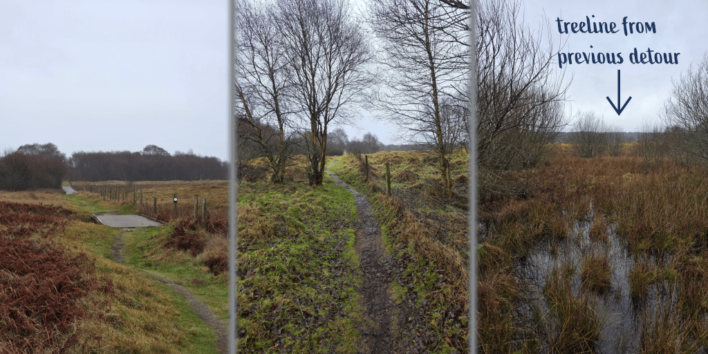
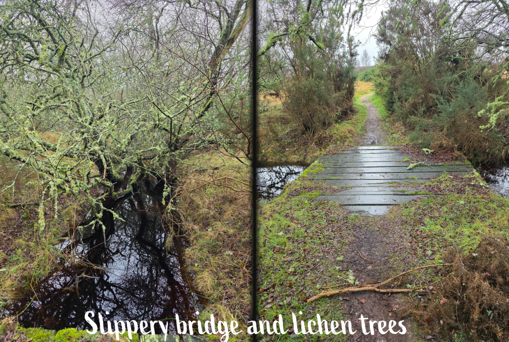
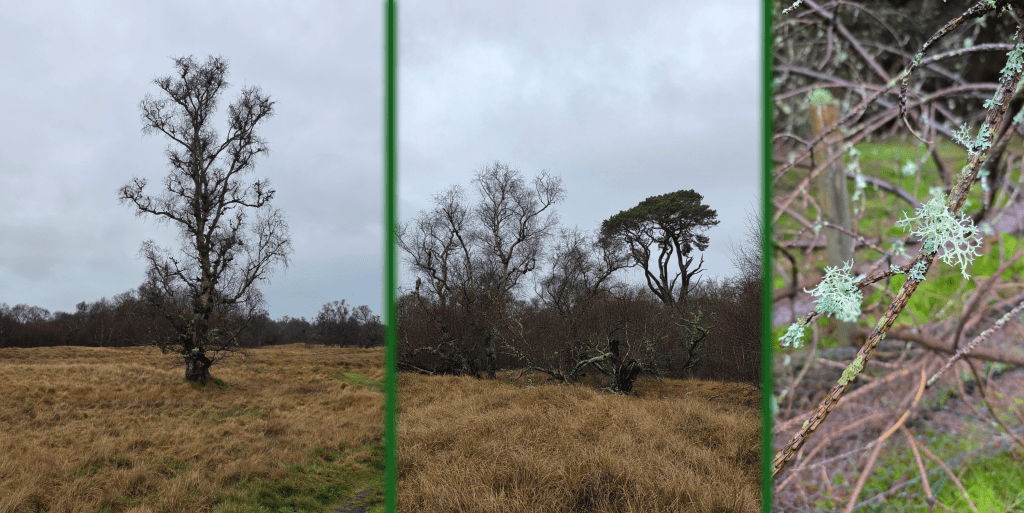
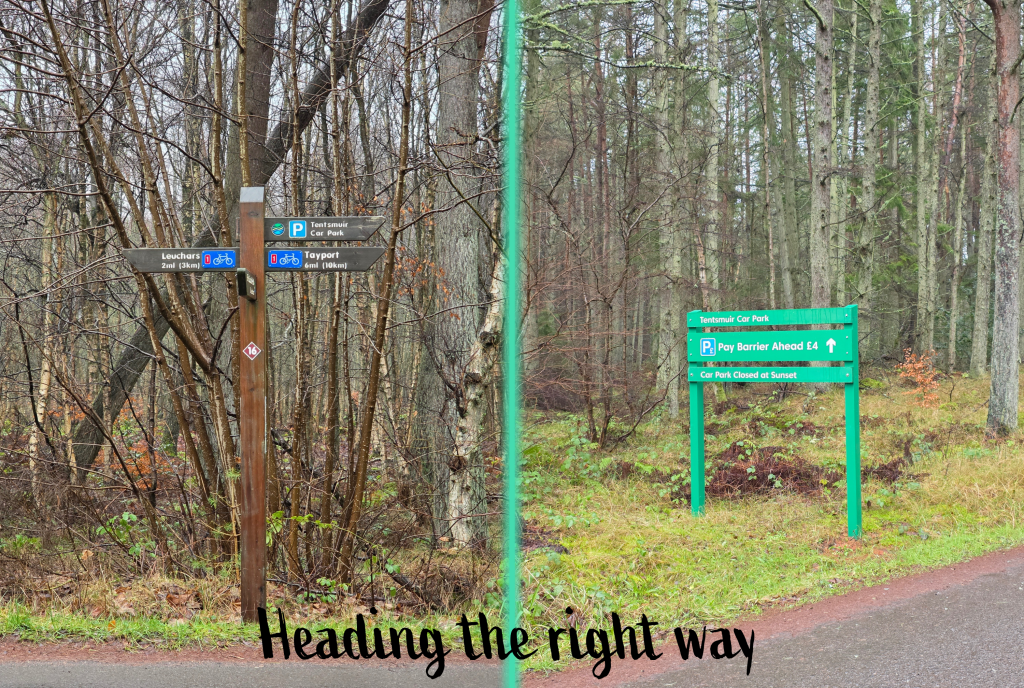
As I have alluded to in my past few posts, January weather has been consistently rubbish. This Saturday really wasn’t much different, except that the rain was more a gentle mist than a downpour. I knew I wasn’t up for a long walk, and I had plenty to do on my last weekend before my next work trip, so this stretch of the coastal path – some of which I have done before but ran into a serious detour – seemed a good idea.
I was also excited to do a proper inaugural hike in my new boots, so I was all ready with my hiking socks and some new insoles that keep my ankles from rolling in. I wrapped up with several layers, and boarded the bus to Leuchars, where I got off at the Olde Hotel. While I can’t say that I was quite as enthused as I have been some mornings – it is hard to be energetic when it’s chilly and damp – I was looking forward to making a tiny bit of progress on my goal. But then I noticed, as I walked along Main Street, that my left foot – the larger one, according to the man who measured them at L.L. Bean – began to rub, quite quickly and painfully. So, I ducked into a bus shelter and found the one Compeed left from my summer walking kit, and plastered it on. I only made it a few more hundred feet before I realised I was in trouble – despite the cushioned plaster, the rubbing was getting worse, and I began to fear that I would have to give up. Also, I was walking unevenly to favour that foot, and I knew that would cause pain in the long run.
Frustration was an understatement – how could these amazing new boots have turned on me?! How could I miss the one opportunity to check off a few more miles? Then it dawned on me – the insole. It was pushing my foot up just enough that it hit a part of the boot it shouldn’t. Despite mud and rain, I managed to get my boot off – again – and pull the insole out. Immediately, the boot felt better and my stubbornness determined that I would manage the walk even with a bit of discomfort. And so I headed on, along the muddy playing fields that abut the castle grounds. My good mood was quickly restored upon meeting a roly-poly black cocker spaniel who ambled up to me and deposited itself on my feet. After a few good ear scratches and a smile, he toddled off again to meet his master. As always, an encounter with a dog improved everything.
Finally, after a bit more drama than I expected, I reached the castle grounds and started my official walk recording. I cannot recall now if I mentioned much about the castle itself last time I did this walk; it is a relatively ‘new’ castle as Scottish castles go, built in 1546 by a Sir William Bruce, a survivor of the devastating Battle of Flodden. This battle is infamous for the death of King James IV of Scotland, who is the last monarch in Great Britain to die in battle (surpassing Richard III by about 30 years). More a mansion than a castle, Earlshall was built in the ‘courtyard’ style, and is still in good shape. It is also, apparently, for sale; if only I had £8 million to spare.
The gated entrance is graced on both sides by carvings of a lord and lady; I stopped for a moment for the below pictures before continuing on my way.
The path at this point leads along a single track road with the estate wall on one side and open fields on the other. One concern on days like this is that with a hood up, it can be difficult to hear approaching vehicles, so it can be a touch treacherous on a narrow stretch like this. Fortunately, I did not encounter a single car.
Ahead on the left as I approached the edge of the army base is a beautiful old Tudor-style barn which I would love to know more about, but can’t seem to find any information about.
Just beyond the barn, the first sign of the actual Coastal Path route leads through a gate and along a track that runs between the base fence on one side and the farm on the other. The fields beyond are the home of several horses and I think a pony or two. In this short section without trees, the weather issue for the day quickly became not the rain but the wind, whipping across the open land of the army base. Once safely inside the treeline it calmed a bit, but I could hear it in the treetops, and they were dancing about a touch violently whenever I looked up.
The excessive rain of the last few weeks was evident along the path, with large puddles in the fields and under the trees, areas that might normally be a bit boggy but now are flooded.
Fortunately the trail was in relatively good shape, not too muddy – at least at this point. As I emerged from the trees, I was hit immediately from one side by the wind, but surprisingly it was less bitter than I expected. I was quickly reaching the point of no return, after which going back would be more work that pushing on, and despite the discomfort of my boot, I was determined not to give up – after all, it didn’t seem to be getting any worse (or so I thought). I could tell that my body wasn’t really into the walk – it was complaining more than I expected and I’m not sure if it was the wind or the cold, but the endorphin rush never really hit. It had very evidently been a while since I’d done exercise like this, with the shorter walks I did over Christmas not really measuring up.
Just under a mile after leaving the castle, I reached the gate where, on my last attempt, I had been forced to take a detour. Fortunately, this time I knew I would be able to take the standard path, as I had seen the update on Facebook that the boardwalk was fully repaired. The sign directing walkers had suffered a bit of wind damage, but the path was clear nonetheless. I passed through two sets of gates and struck out across the field between two fences; the trail rises and falls over hillocks and grass clumps, much more uneven than the farm track.
After a short straight bit that leads at an odd angle away from the farm track, there is a sharp right through another gate. Here you find a warning to walkers to stay on the boardwalk, the first section of which stretches out ahead of you. The wind is much stronger here in the open, and I while I was never cool, I was pleased to have a windbreaker. Sure enough, the boards are very new and well-kept with stripes of raised rough bits that prevent them from becoming slippery, and they pass over some very boggy areas that would be completely impassable at most times of year.
The path alternates on boardwalk sections and uneven muddy ground, following the edge of a fence and meandering through stands of trees. The direct path made me appreciate just how long the detour was that I took last year – the tree line of the forest I walked through is a good half mile or so away.
I have to say despite the weather, this is a quite pleasant stretch of path, and I had it completely to myself – I had seen a few joggers closer to Leuchars, but did not see another soul until I reached the Tentsmuir road. As I crossed the last stretch of bridge, a sign appeared in the distance, surrounded by a huge gorse bush that was just starting to bloom. Here I swung left, and ahead through the treeline I caught just the slightest hint of open sky that indicated the beach. I could also hear the distant crashing of waves, though this came and went for the next mile or so.
Shortly after this left turn, the quality of the new bridges was made clear when I approached an older wooden bridge, this one slippery and grimy from the weather and moss. Nevertheless, the small burn it crossed was lined with trees absolutely dripping in beautiful lichen, coating the branches in a light seafoam green. Up close, the lichen reminds me of types of coral.
Across the bridge, the path passes into a hilly field, mostly empty but dotted with large, dead trees that created all sorts of creepy patterns reminiscent of a Tim Burton movie. There were a few lone pines with needles still on them which must have very deep strong roots, as so many of the larger trees here were blown down in the wind storms we have had in the last few years. Forest lines this field on both sides, with most trees just ghostly outlines with chunks of lichen on them.
My primary observation of this section of the trail is that it is not particularly coastal. Other than the distant waves – which might not be audible in calmer weather – you do not get any hint of sand or beach at all, and could as easily be in inner Fife or Perthshire as less than a mile from the ocean. This is necessitated by the army base as well as the nature reserve, but I am looking forward to getting back to the seaside views.
Eventually the trail passes out of the field and through another gate – very muddy here for a short while – and onto a forest track with clear vehicle ruts. The forest here is quite pleasant, a mix of pine and birch, and it blocks most of the wind so that it is also very quiet. The rain had completely stopped by and it was a nice stretch of path. That said, it went on quite a bit longer than I expected, and I found myself wishing for one of the first times on the Fife Coastal Path that I had some music to listen to.
Several times on this stretch I thought I could see the end in sight, as the trees seemed to close in over the trail a bit or indicate a change in pattern. However, on at least two examples I was disappointed to discover that I had been a touch premature in my hopes. I was not particularly tired, but the pain in my left foot was growing steadily worse and my right foot was starting to rub slightly as well, so the last 15 minutes or so really seemed to drag – not something I find happens often on this path. I was so relieved to finally see, in the distance, the very man-made shape of a horizontal bar, dividing the path from the road beyond. Here I knew it was just a short distance along the road to the stables, where the other half was to meet me.
Unfortunately, this last short section was the least pleasant, as the road is narrow and the path alongside it even narrower and, on occasion, not present. It was muddy, started raining again, and the cars were regular enough that I was not confident venturing onto the tarmac at all; I even found myself switching sides of the road a few times in search of a better patch to walk on. But I did not have far to go.
Overall, then, not my favourite part of the Fife Coastal Path, though it had some pleasant sections and would probably have been even more pleasant without the enormous blister I was causing on my heel. (as I discovered when I reached home, it really was impressive, covering most of the back of my foot – oops).
I am still in love with my hiking boots though, particularly since the blisters were really my own fault for having put in new insoles and not tested them. Overall, they did a fantastic job and were very sturdy, keeping my ankles from rolling even on quite uneven ground. They dealt well with the mud and puddles, and my feet were bone dry
I’m not sure when I’ll get back out onto the path as work is taking over life for the month of February (and early March), but fingers crossed I’ll get out in March before the next round of travel.
After a summer of almost unprecedented beauty, day after day of blue sky and warm temperatures, Scotland is getting its karmic retribution in January. We have had steadily wet, grey, cold, windy weather for most of this month. Some days are colder than others, some windier, and some have been icy, but almost all have been dreary, and while Scotland of course has its reputation for weather, this is extreme. Extremely bad.
But, sometimes grey weather can lead to a silver lining, of sorts – in fact, I have a real affection for storms, for big roiling clouds that turn all sorts of blues and yellows and greys and blacks as bad weather approaches. (Not that we are getting those now, which is part of the problem, just endless cloud with no variation). So, in honour of this truly unpleasant January, I thought it might be worth pulling together some of my favourite stormy sky pictures from over the years – both with dramatic clouds and the grey skies that create atmosphere, particularly here in Scotland.
I feel I should observe that when I went through my pictures to select some for this post, I ended up with more than 90 that I liked – the ones I include here are a choice selection. I feel this indicates both Scotland’s prevalence for overcast (perpetuating the stereotype), but more my own passion for stormy skies, and the increased likelihood that I will scurry out the door with my phone or camera to catch a dark sky.
Guardbridge
It seemed most appropriate to start closer to home, with two of the views I photograph most often – the bridge at the north end of Guardbridge, and the view across the Eden Estuary towards St Andrews.
The bridge picture was taken in the spring, with roiling clouds twisting and turning in light that was at times black, at times yellow. Similarly, the light in the view over the Eden is a mixture of silvery grey and yellow, though it was taken in the depth of winter. In fact, it was February 2021, the iciest month we have had in some years, and deep in the heart of the pandemic lockdown. My daily walk was my lifeline to nature, to the outside world, and it was so poignant to look across to the town where I should have been working and spending most of my time.
Tayport
As I have mentioned before, we spent the earliest months of the covid pandemic living in Tayport, and our view over the Tay provided the opportunity to watch some truly epic storms.
The group below includes a yellow-orange storm light that I just loved and the sunny blue with the storm clouds drifting away towards the ocean. The last of the three is the one I had at least 20 versions of: a purple-black cloud over the far shore, topped by fluffy white. Visually stunning and fascinating to watch.
The two below were taken on the same day, a few minutes apart, and remain two of my favourite storm pictures. The first because you can still see the benevolent blue sky above the white and then purple clouds, and the second for its view out to sea and how lonely and small the Larick Beacon looks against the dark.
St Andrews and East Neuk
Living and working right on the coast allows for some of the best stormy sky pictures, and while St Andrews is often considered a bubble with its own weather, it does not escape dramatic clouds.
The castle picture here was taken in February 2018, and the distant clouds are remnants of the first wave of the Beast from the East, an epic snow storm that shut Scotland down for several days. I managed to get into work on the Wednesday and pick up a laptop, but had to leave early to get home before the bus service stopped. The cathedral ruin shot comes from May 2021, on one of my few days in the office as the University slowly re-opened, while the Market Street shot is just over a year later, with plenty of people happily wandering the town and hoping they do not get rained on.
My more recent walking efforts along the Fife Coastal Path have been fortunate enough to be mostly sunny, but a few dark and stormy days have been on the cards. My walk to Anstruther ended with me cowering under a bus shelter as the storm clouds opened, while a preparatory walk along West Sands was equally in danger of ending in rain.
Isle of SkyE
Dad and I were so lucky on one of our trips to Skye to be favoured with spectacular weather; the second visit was less fortunate, and we had a few good squalls come through to dampen our hiking.
I love the wide open fields of sheep you see on Skye, and I thought this view of a cloudy day was perhaps more appropriate than a sunny alternative. Likewise, the intermittent rain we experienced while attempting to climb the Old Man of Storr allowed for very atmospheric shots across the Skye coastline. Finally, while it is only just visible, if you zoom into the smaller grassy picture, you will spot evidence of a Highland native peeking over the hill.
HighLands and Perthshire
I fight hard both in my posts and in my work to stifle the stories that Scotland is a wet, cold, rainy place. Or at least, that it is ALWAYS wet, cold and rainy. That said, Fort William is on the rainier west coast, and the winter months do bring in a fair amount of doom and gloom.
I found this picture of Loch Faskally in Pitlochry while searching for reflection shots (a future post, no doubt) but fell in love both with the clarity of the reflection and the wispy clouds melting into the treeline.
The further north you go, the more dramatic the pictures. These two were taken of and from (respectively) the Nevis Range; one on a wintry afternoon and one on an otherwise sunny day, where the clouds closed in higher up. The view of Nevis Range with snow and half in the clouds was partly our inspiration for hoping to retire up north.
On the same day as the first picture above was taken, we ventured out along the A830 to Glenfinnan, seeing as we could not really go hiking. While I would have loved to capture the monument, viaduct and views of Loch Shiel in sunlight (and did several years later), the cloaking mist and rain were again quite atmospheric. One can just imagine ships emerging from the haze, heading for the end of the loch, where the monument now stands – filled with huddling, cold soldiers ready for a fight.
And hey, Glenfinnan Viaduct looks pretty incredible in any weather.
Finally, there is one spot that is even more evocative in the clouds, and that is Culloden Moor, and the monuments to the clansmen who died there in 1746. I visited some years back with Mum, and there is no question that the emotions are heightened on a day like this.
Puerto Rico and the South
The Caribbean is known far more for its sunny weather than for its storms, but no one living there would deny that the heat of the ocean creates for some amazingly awful weather. The pictures below include one dark cloud rolling over the Vieques sound, and then two beach pictures that were taken shortly before I was required to hide (mostly fruitlessly) beneath some trees during a downpour of rain.
In fact, some of the heaviest rainstorms I have experienced have not been in Scotland, but instead in Puerto Rico and in Florida. On my most recent trip to Orlando, I was driving on the highway in a storm so powerful it almost blinded me – not something I wish to experience again.
This shot was taken ten minutes before an intense Florida storm, and I love how innocuous the puffy white clouds look. But how ominous they actually are.
What these cotton-like towers really mean is run for cover.
My love for thunderstorms comes I am sure from summers on the boat, watching storms pass by under the knowledge – assured by my father – that other boats would be hit before us. We spent more than a few summer evenings huddled just under an awning, watching storms race across Marblehead harbour or the lake in Canada.
Approaching storms
In fact, sometimes the most exhilarating storms are the ones you have been able to see coming from a distance. I find that anticipation, that slow transition from a sunny day to an ever dark one, fascinating. The wind often picks up, and you can smell the rain coming even before it hits you. So here are a few of my favourite distant rain pictures, including Fife farmland, a Puerto Rican mountain, the Beast from the East over St Andrews Bay, and a stunning pink sunset rainstorm.
Monuments under clouds
To wrap up this post of a love story to cloudy skies, I thought it would be fun to include some views of castles and monuments. Like in the Highlands, a sunny sky might be most desired when capturing special locations, but a dramatic sky is the next best thing. It is certainly never boring.
Château Comtal, Carcassonne.
I got plenty in the sun, but this might be my favourite.
Paris, taken from Notre Dame in 2005. An overcast trip for the most part, but still beautiful.
Romsey Abbey, from the beer garden of a nearby pub. Happy to report that we did not get wet.
Balvaird Castle, on a windy day when the weather changed almost constantly. The clouds blew past at an alarming rate, though fortunately for me, as I stayed dry.
And finally, the pièce de résistance, a dramatic location in any weather, but even more moving with great dark clouds: Stonehenge. When we visited, we were allowed to wander up quite close to the monument, almost close enough to touch the stones. Like few other famous places, Stonehenge did not disappoint – it was mysterious, spiritual (and I am not a particularly spiritual person) and an incredible touchstone to thousands of years of history.
It sure would be nice to see it in the sun someday.
Somehow, it is mid-January. It feels like we just got back from our Christmas trip to New England, and I’m deep into planning my next trip to the US, in just about three weeks. At this time of year time can pass quickly, and we have been adjusting to the time change, getting back to work, and dealing with some truly January Scottish weather – cold, wet, windy, dark. Not great for hiking, but great for duvet days and planning.
So rather than tear myself apart over my inability to get back onto my hike, I thought it might be time for some reflection.
Firstly, I am excited to share a preview of my new hiking boots, a birthday gift from my father. I’m delighted to have found exactly what I need at L.L. Bean (I never doubted), assisted by a delightfully chatty salesman who measured my feet and demanded to know all about my plans before allowing me to make a purchase. I’ve already done an inaugural walk in them (not far, just my normal morning jaunt) and they already feel amazing – nice and light, sturdy, no rolling ankles or rubbing.
But I’m getting carried away. It has been a year since I walked my first section of the Fife Coastal Path and determined that it would be my goal – partly to have a goal, and partly to assist with getting fitter.
In order to write this post, I have had a read through all of the posts I’ve written, and have started to plan this coming year’s activity. There are a few definite spanners in the works, potentially, in that I do not know how much time I will actually be able to spend in Fife over the next few months. But even if I only manage another ten miles before summer, never doubt that it is in my mind, and I still intend to finish this damn trail. Eventually.
So, what did I learn in reading my posts?
I’ve definitely become a bit more thoughtful as the posts go on, giving more background on what I am passing. I’ve done my best to describe the trail but not get into too much detail, which I did early on, rather providing pictures of what you might expect to see. I’ve been incredibly lucky with weather for the most part. I’ve challenged myself physically a few times and usually been delighted to discover that I can push harder than I thought and not been in too much pain. Towards the end of the summer I was the fittest I have been in years and it felt fantastic – I hope I can get back there. Certainly summer in Scotland with long light and enticing late evening sunsets is a better time to force yourself out of doors than January, but I’ll still give it a go.
I’ve worn through a pair of hiking boots, though they may not have been as good quality as I hoped. And, I’ve put together a pretty comprehensive pack of materials that I bring on each trip, including: a map, sunscreen, bug spray (not yet needed), chapstick, water, a snack, my camera, tissues, and a power bank for if/when my phone starts to die. Layers as appropriate as well, of course. I’ve even got a designated hiking backpack, so I don’t have to think too hard about what to get together.
I’m also getting good at reading the signs as to where the path will go even when the markers aren’t the clearest – or there at all. That said, I have also once or twice forgotten to check the tides before setting out – so far I’ve gotten away with it, but I could pay eventually, and of course came close on my recent walk from the Fairmont to St Andrews.
Above all, I’ve discovered parts of Fife that I’d never known were there, and been able to really enjoy the towns and countryside of the East Neuk in particular, in a way I would not have done just by touring by car or bus.
Another thing I’ve learned – I can only do what I can do. There is plenty going on in life which means that sometimes, I just can’t get away for most of a Saturday to make a dent in the miles. I travel for work, meaning I see exciting places but am often jet-lagged and sometimes unwell, and I spend a lot of time not at home.
So I have had to allow myself, on occasion, to put life before the walking. And that’s ok. As ok as it is to put walking ahead of other things, especially as I use it as self-care. I set this goal for myself, not others – I am the only judge of how and when it is fulfilled. So I haven’t quite made it halfway, but I’ve lost more than 20lbs (over 2 stone to you Brits – and in all fairness not just through walking but also in cutting most added sugar from my diet) and I’m fitter and happier, having completed these mini-goals:
Despite the occasional setback, I’ve never given up on a walk once started; I’ve taken some great pictures, produced more content for my blog, and I’ve enjoyed every minute (well, almost).
Favourite walk
So which walk was my favourite? This is a tough one, as I really enjoyed the section from Aberdour to Kinghorn. I liked being out of the East Neuk for a change of scenery, the views were excellent and I proved to myself that I could do a longer walk and not be exhausted. I also really loved the Tayport to Newport stretch, as it brought back many fond memories of living there.
That said, I think I have to select my absolute favourite as the walk from Crail to Cambo Estate, rounding the ‘corner’ of Fife, crossing some beautiful beaches and experiencing lots of different types of coastline. It was a challenge physically but I managed, and several of my favourite pictures of the FCP journey were taken on this walk:
Favourite picture
This was also a tough decision, as I absolutely love the long, jagged lines of the Fife coastline, like those caught from the above-mentioned Crail to Cambo walk:
But for the red poppies and the stunning view of Crail, I think this is my favourite of all the pictures I have taken, while on this route:
Crail itself is perhaps even more like my hometown than St Andrews, stunning and quaint and historic, and it presents a beautiful view when approached from the south-west while on the Fife Coastal Path. I was fortunate to have chosen this section while the poppies were still blooming, and on one of those gorgeous sunny days we had this summer with endless blue sky. Just perfect.
A close runner-up though is the view back over Wormit on a rainy day, in a very different part of Fife, with the Tay in the distance and the Rail Bridge stretching out towards Dundee. I do love bridges.
It never ceases to amaze me how varied the coastline can be, how surprising, and how the trail can show me viewpoints I have never seen before, even in places I know so well as St Andrews.
I’ve made it just less than half way, and in case you can’t picture it, here is a visual of the walks I have already done:
So, what next?
I have a lot of work travel planned for this semester and I’ve finished most of the sections of the trail that are relatively easy to reach. So, from now on, most of my walks will require considerably more planning and effort to complete. The far end of the walk, from Kincardine to Inverkeithing, is a solid 90 minutes away by car or longer on public transport, meaning a full day is likely needed to get these sections done. That said, the most challenging part may be Balmerino to Newburgh, which if done in one go is 13 miles. So more likely, I will need to split it in two, and I will need someone else with a second car to help. I’ve had plenty of offers from kind friends, so hopefully this summer the coordination will be possible. (I do, of course, have it planned out. This is me, after all).
So I’m not sure if I’ll manage the rest of the path by the end of July, or if I’ll need to extend by a few more months, but one way or another, I intend to keep walking, keep photographing, and keep writing about my experience.