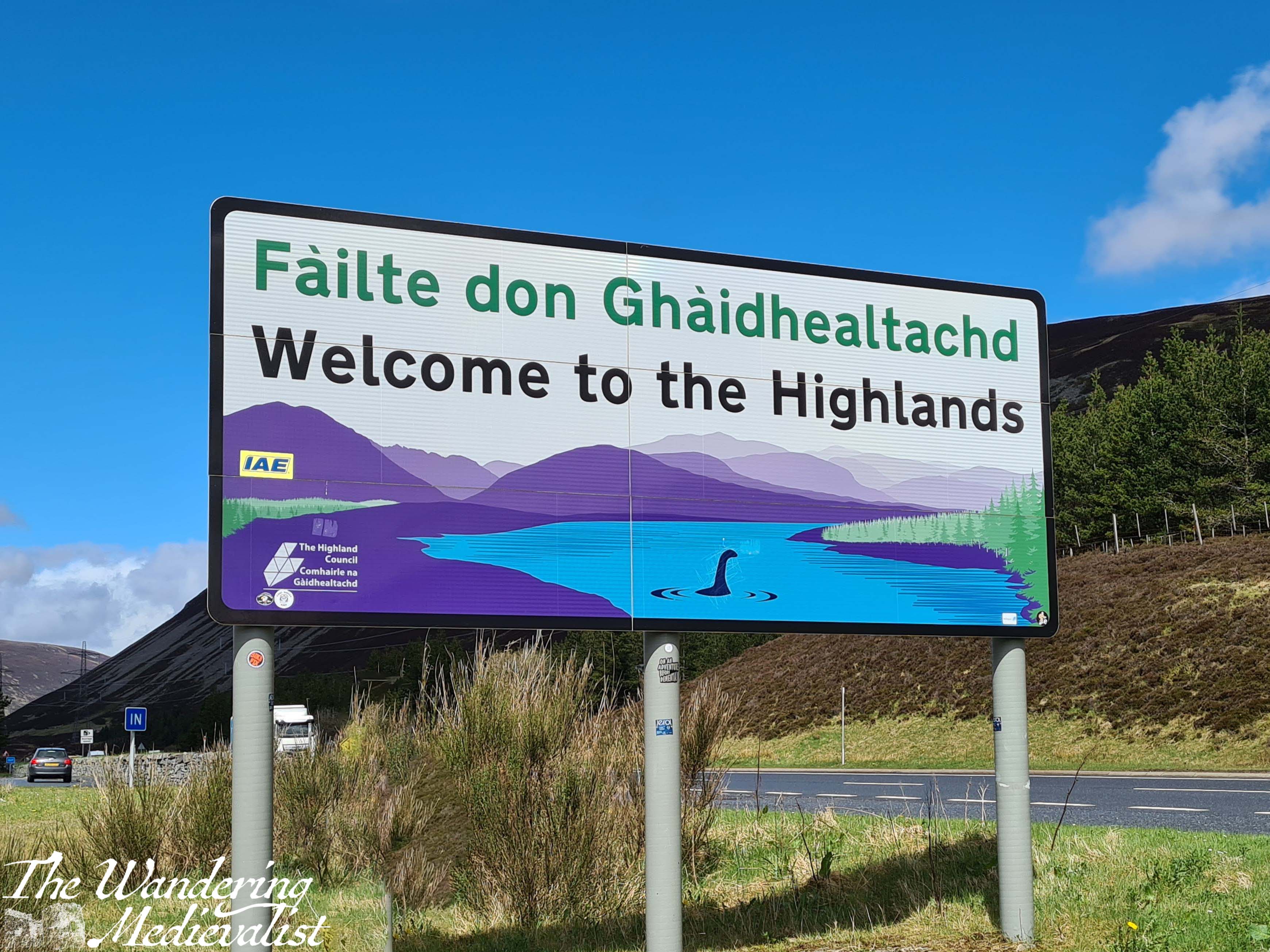
For the past ten years or so, it has become a tradition for the other half and I to take a long weekend off in March and to head north into the Highlands. We find a nice place to stay – sometimes self-catered, sometimes a hotel – and spend a few days in lovely scenery, hiking and walking and finding a good place for an evening meal and a few pints. This year was no different, and I was determined to find us a new walk in the Ballachulish area that was both scenic but not too challenging. The Brecklet Trail was a perfect option: a loop just under two miles in length, with plenty of up and down, and some stunning views.
Side note, I learned of the trail by consulting the trusty website Walkhighlands, which allows you to search by area, and also by difficulty, and includes a good summary of each walk as well as step-by-step instructions. While at times these are a touch vague, very seldom have we been completely lost by them.
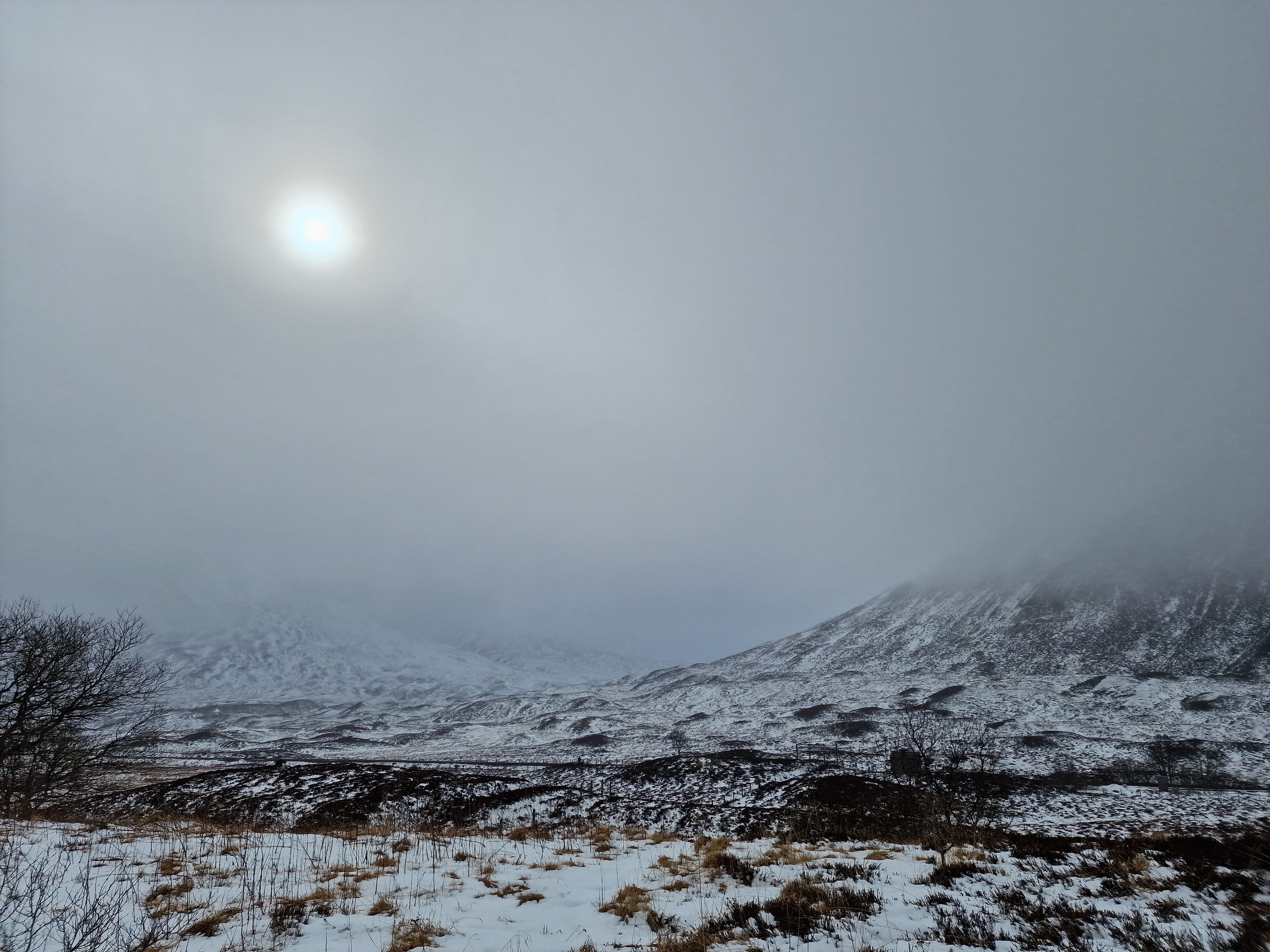
The day we chose this hike had started off cool, with the surrounding peaks covered in snow or heavy frost. By the time we had our delicious hotel breakfast and got started, it was warming up perfectly for a walk – still cool, but pleasant once your blood is moving a bit.
Access to the Brecklet trail is incredibly straight-forward; there is good parking at the Ballachulish visitor centre, which itself offers a great little café and souvenir shop. There is also a clean toilet.
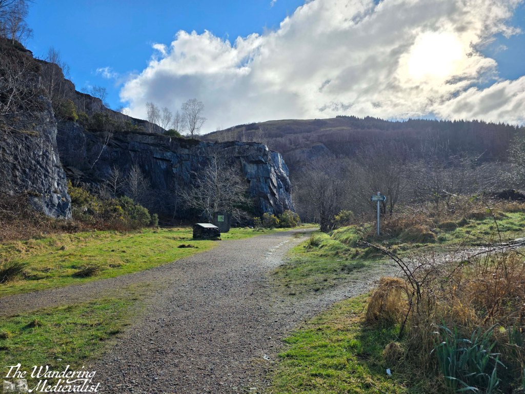
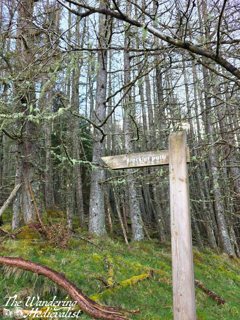
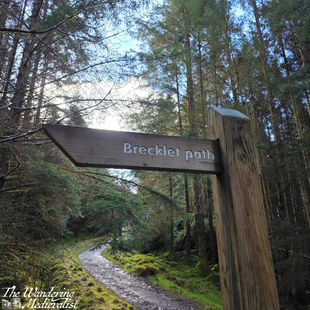
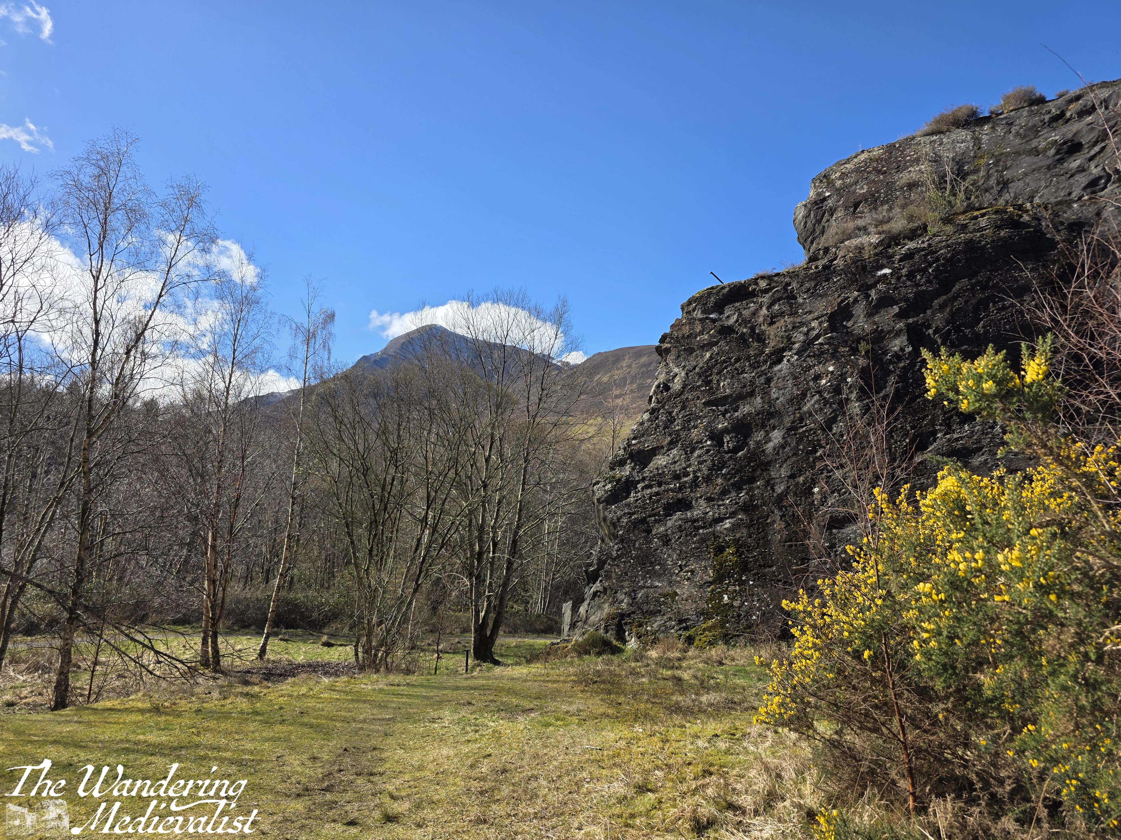
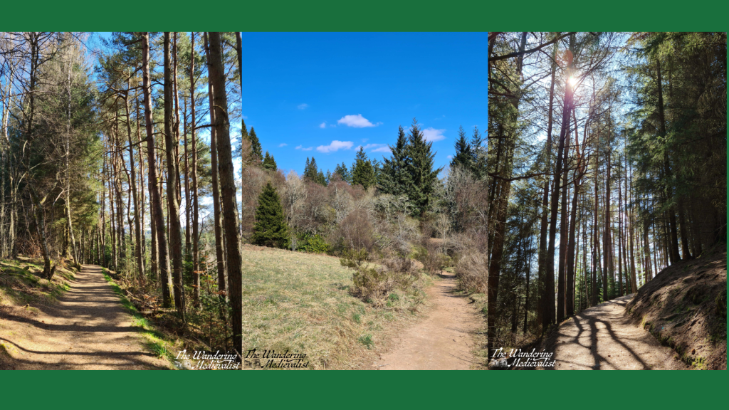
Passing by the visitor centre, one needs only to cross the street and enter the old quarry grounds, which are very evident in the towering cliffs of slate still surrounding three sides.
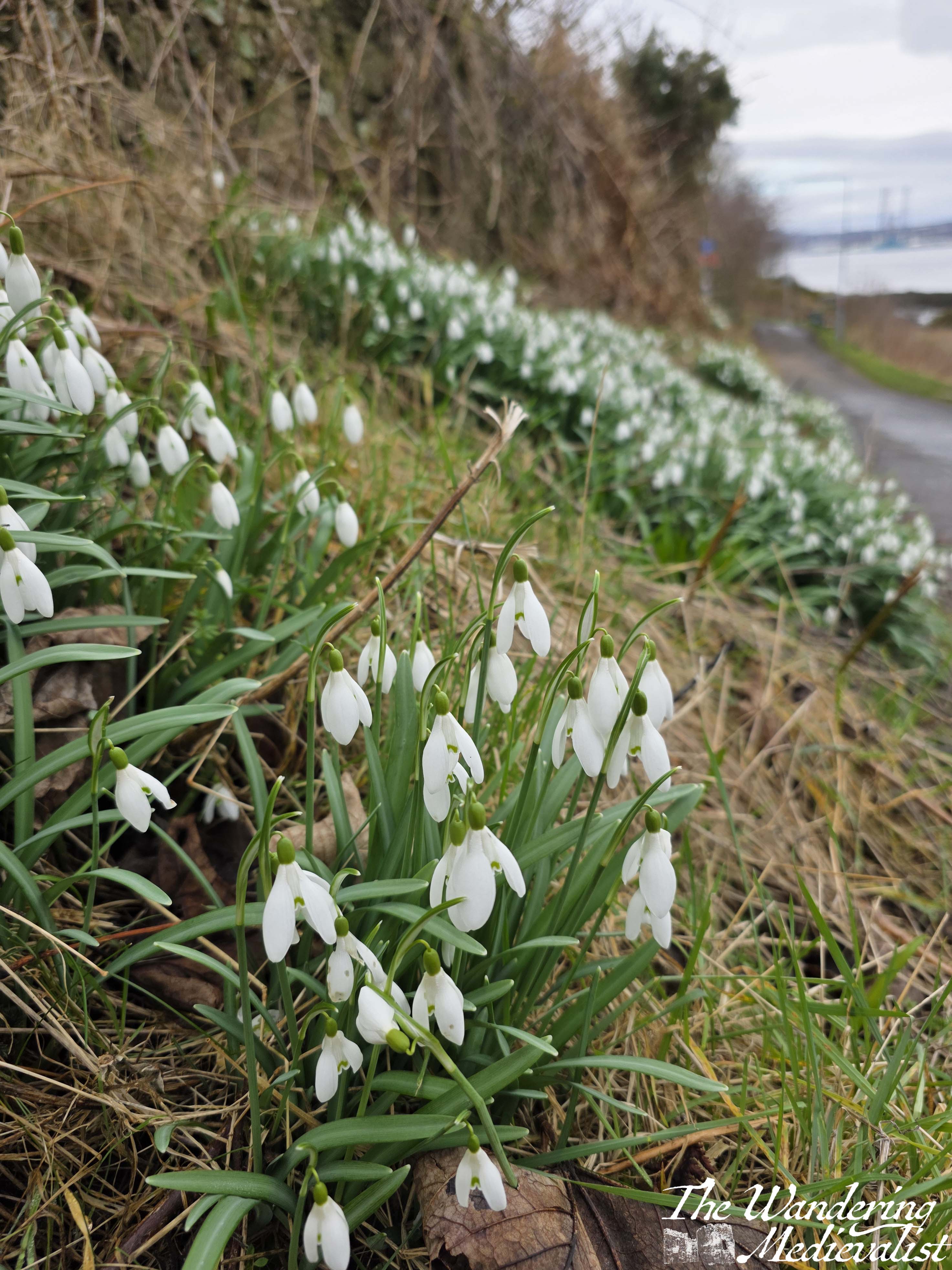
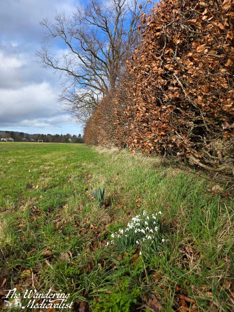
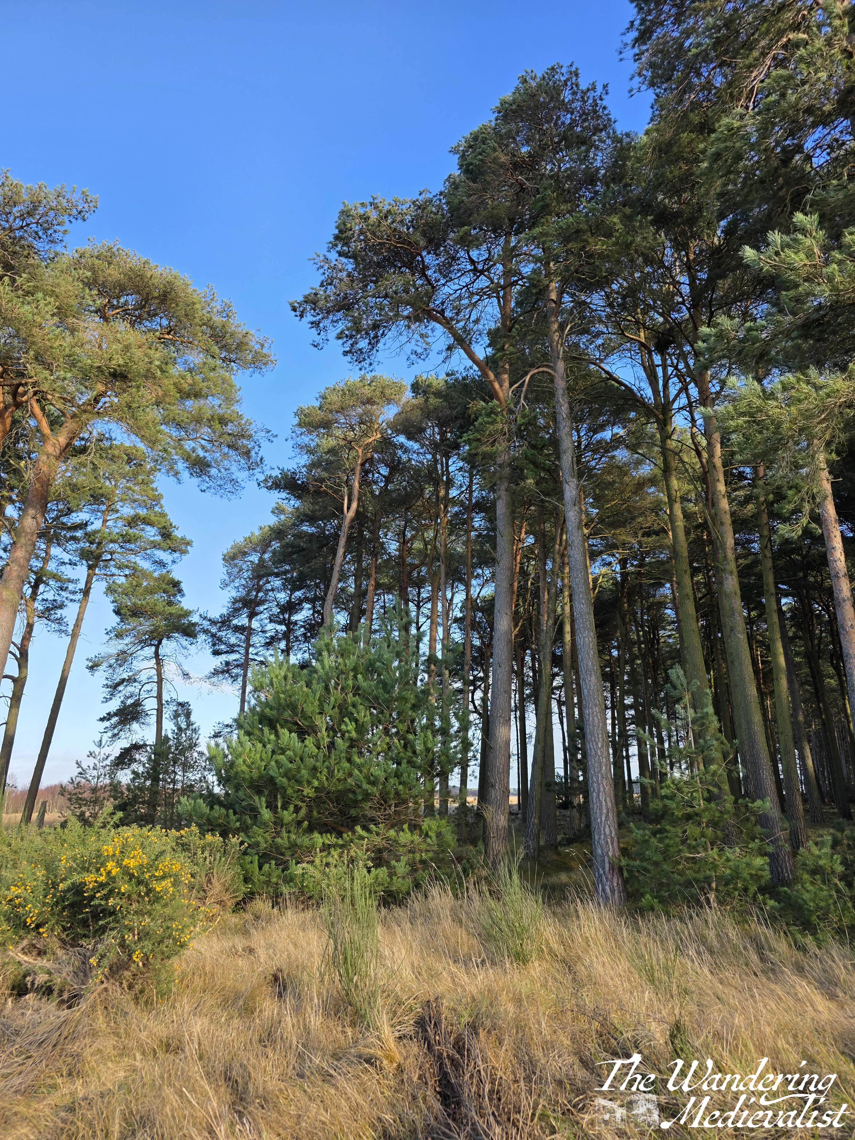
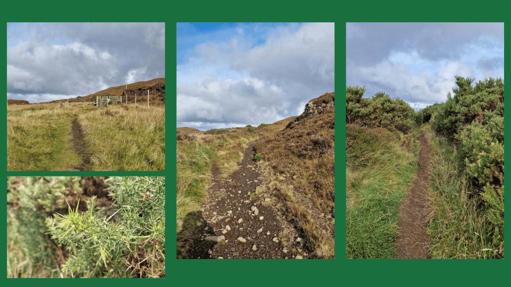
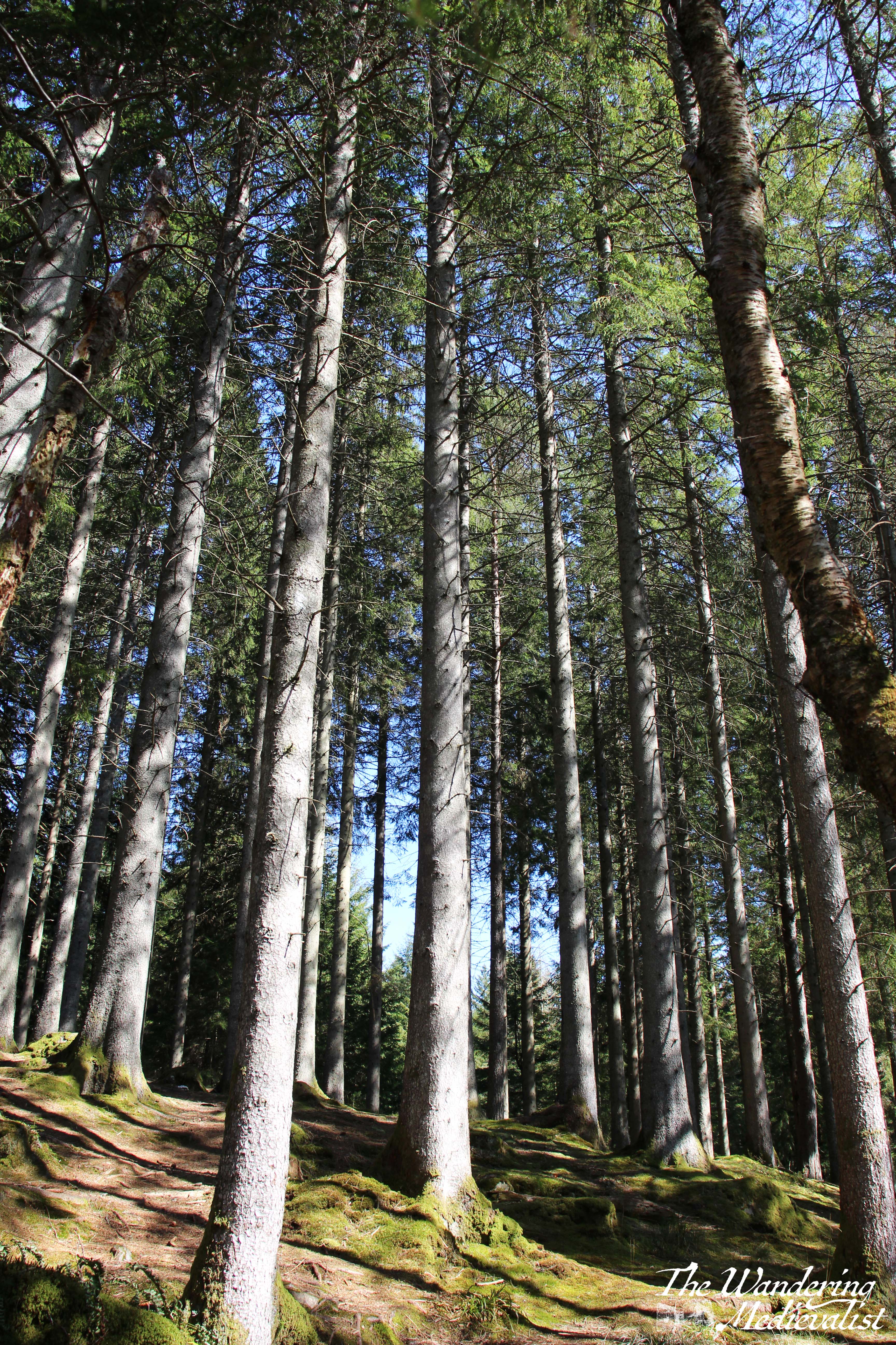
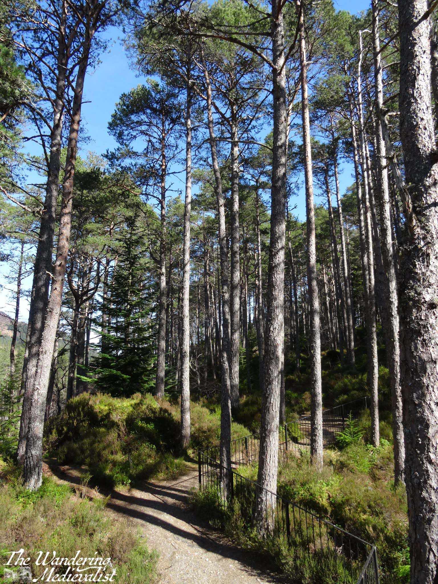
There are a number of plaques and several walks, but the sign for Brecklet Trail leads off very clearly to the right. Almost from the first, the path climbs steadily through young forest of birch, rhododendron, heather and some gorse.
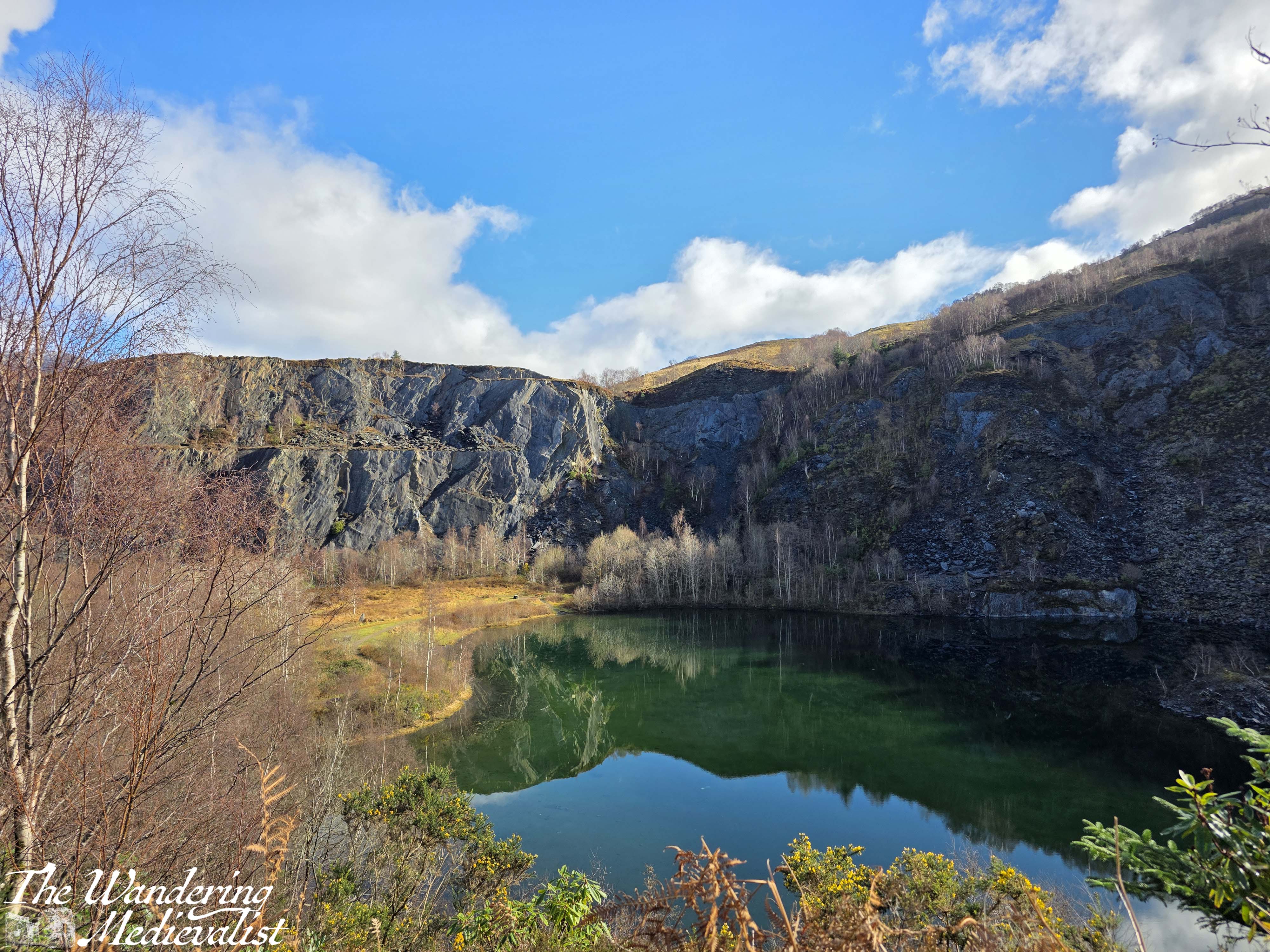
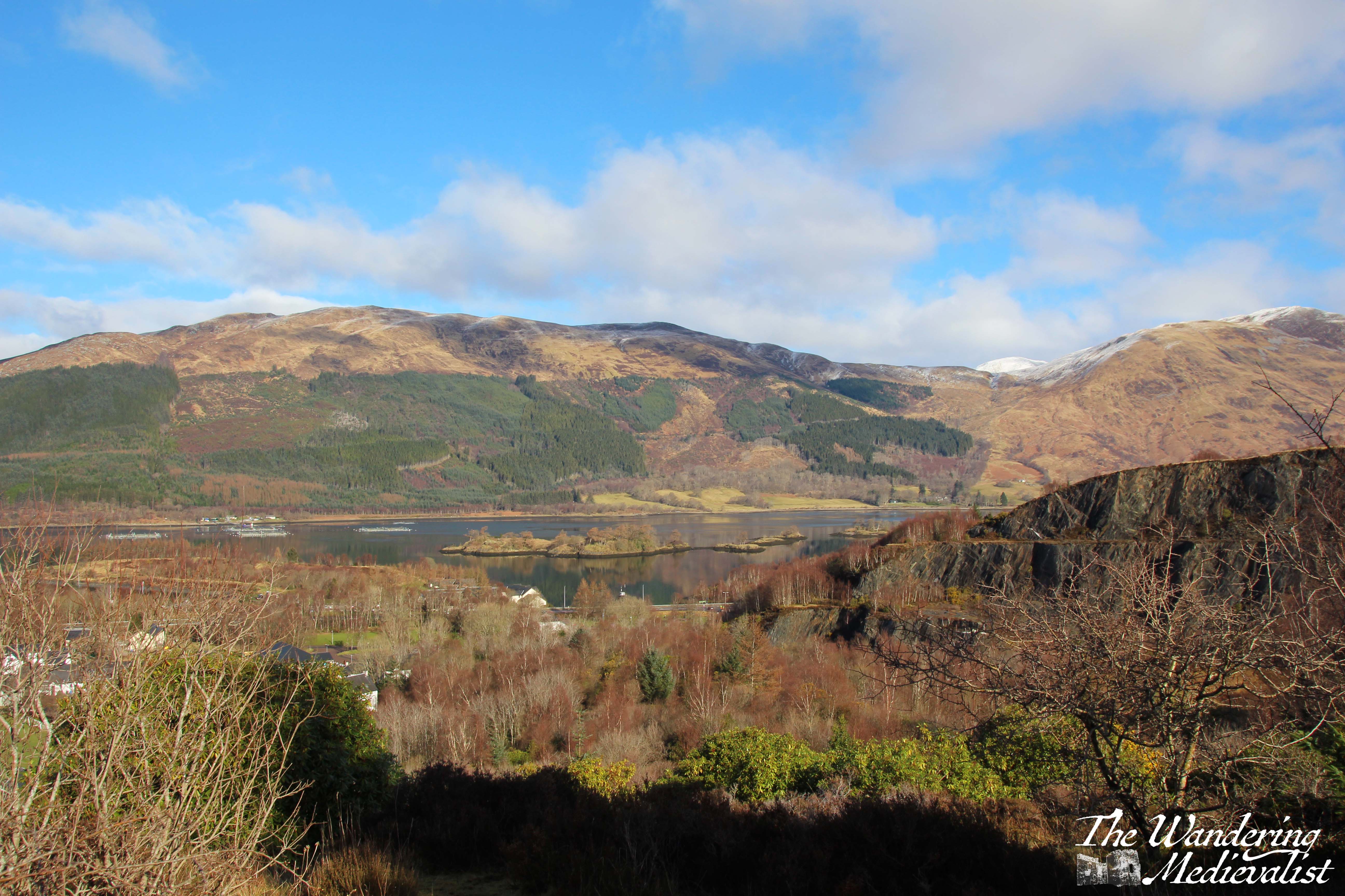
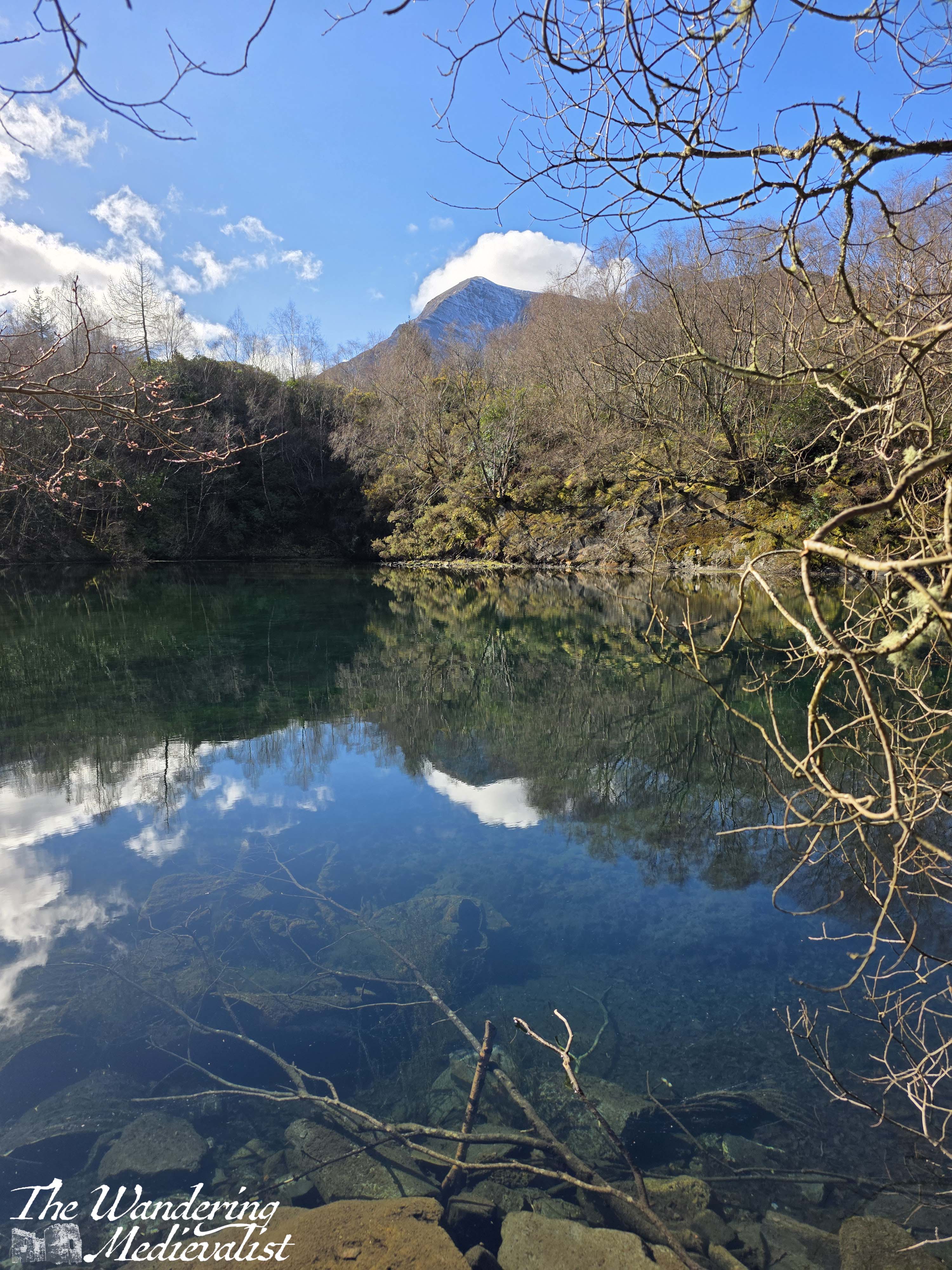
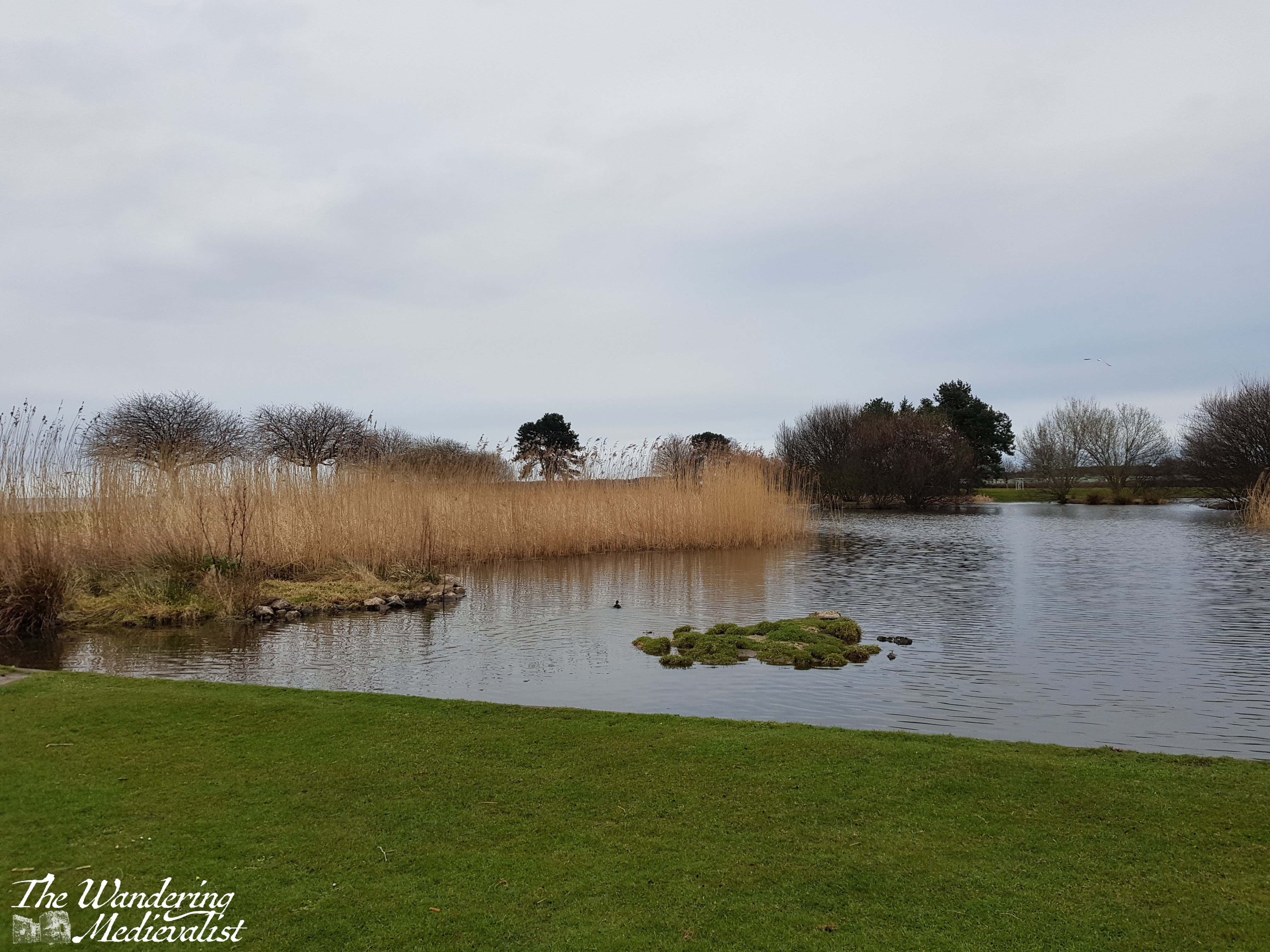
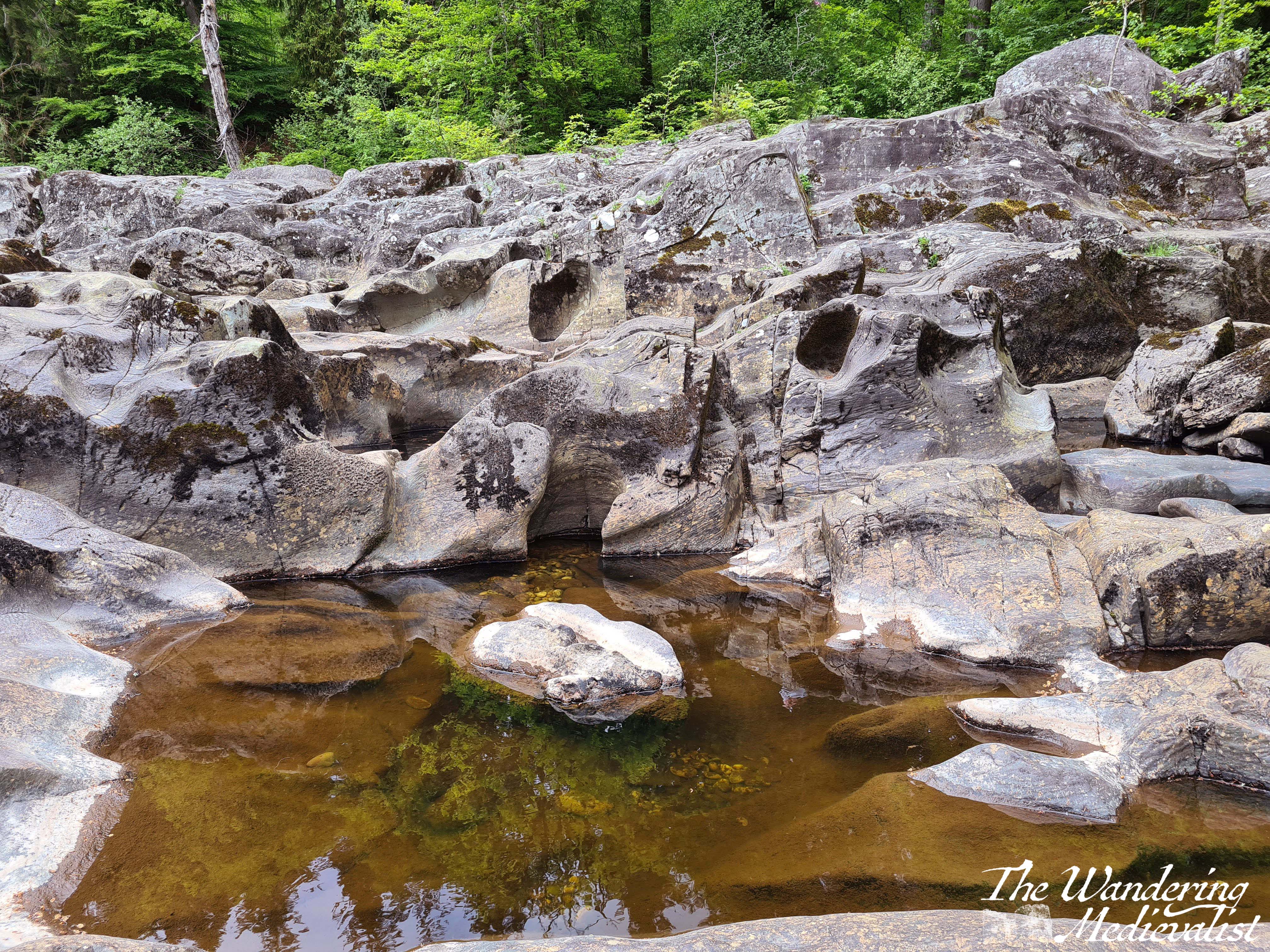
Through the growth to the left can be glimpsed the pond in the middle of the quarry, perfectly flat on the day we visited and reflecting the sky and cliffs.
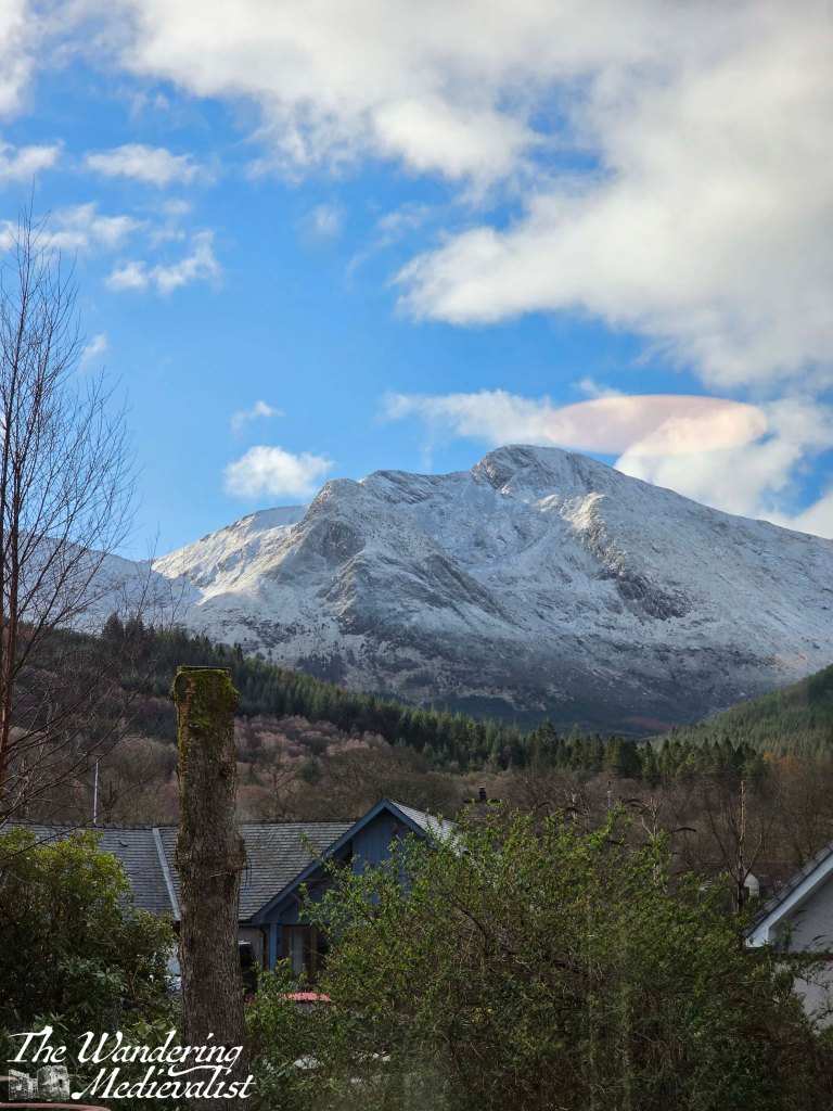
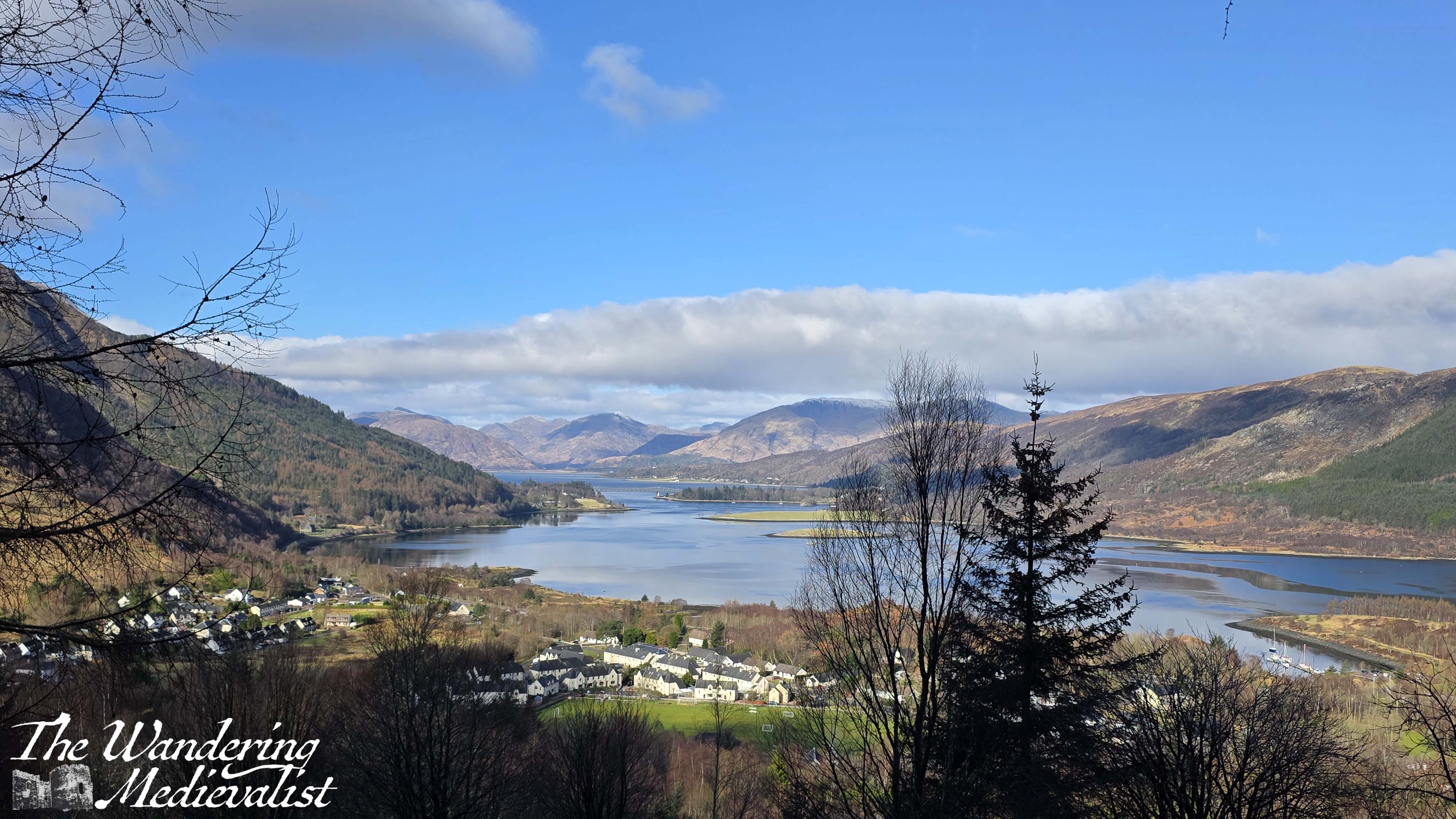
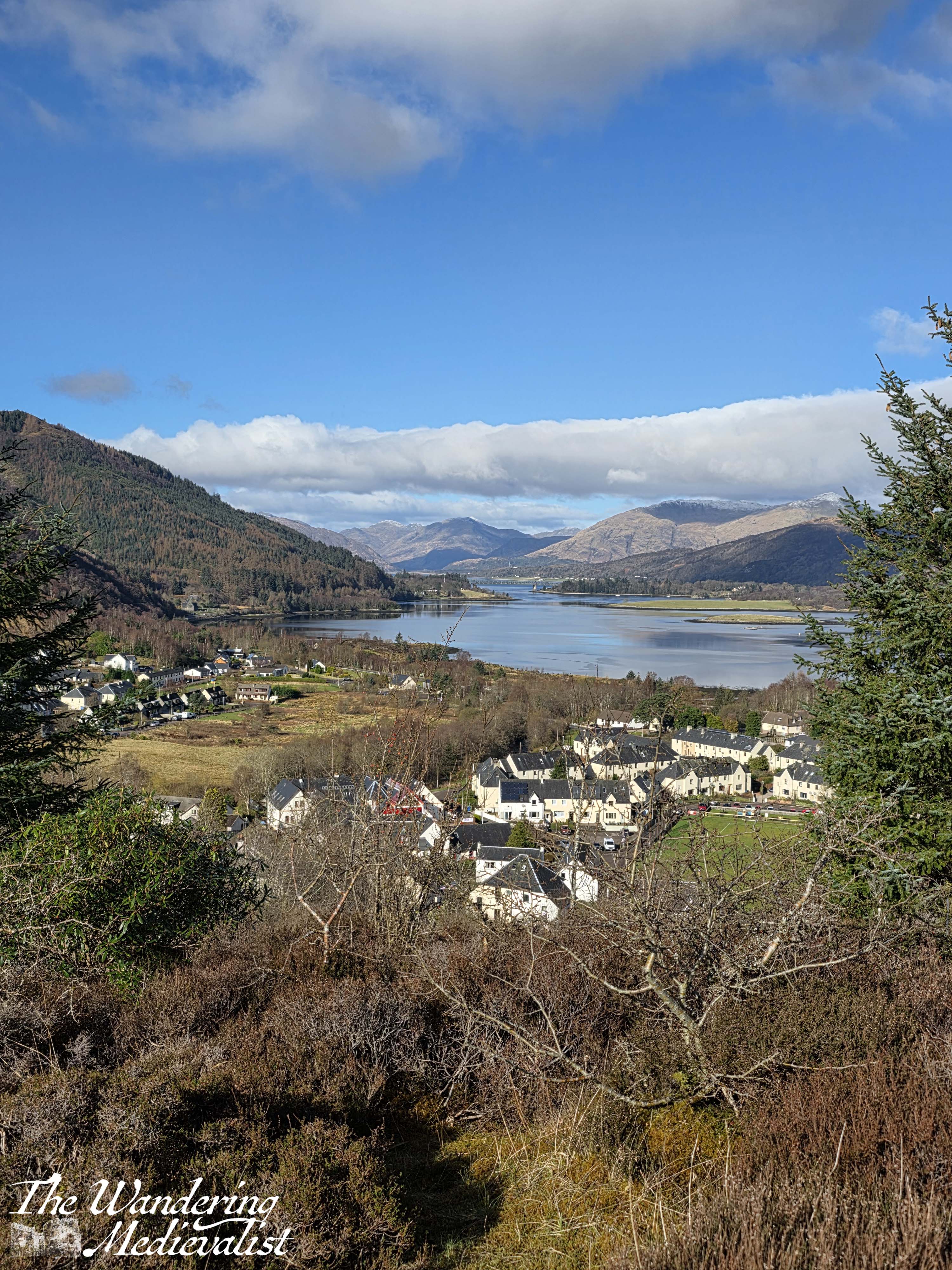
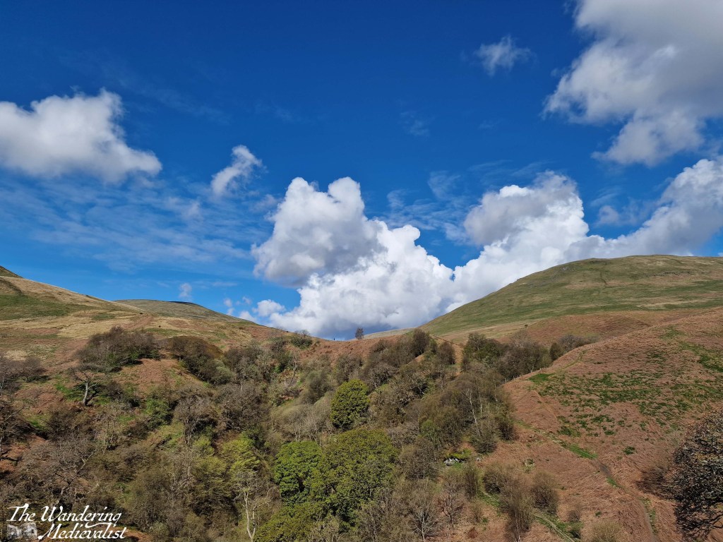
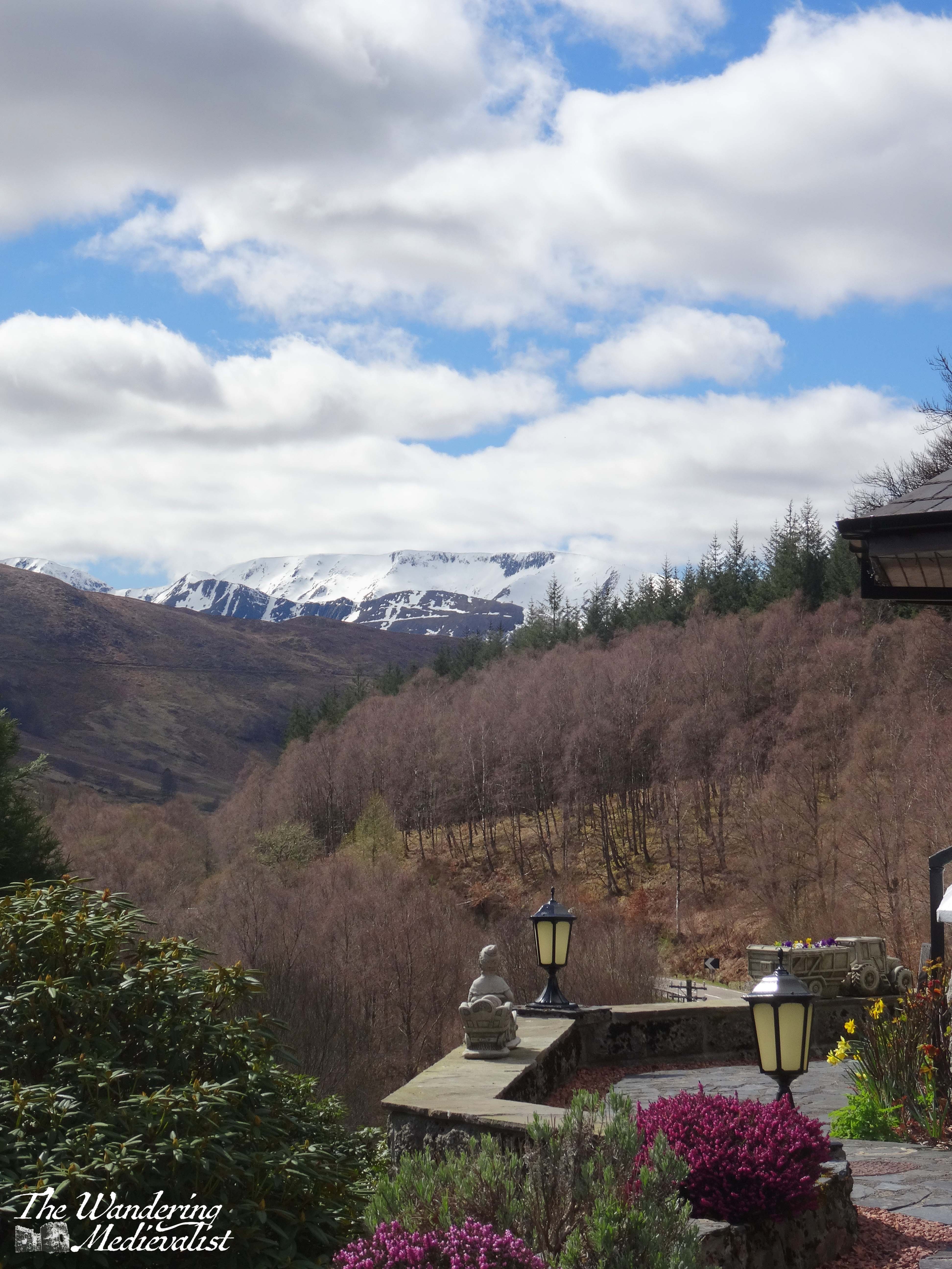
The trail winds up around the ledge and eventually curves off towards the right; while consistently an uphill climb it is not hugely steep, and the hike is a pleasant one. In time the trees thin out and open to a kind of scrabbly heath, with low scrub and heather on either side. We discovered a detour off to the right which led along a ridge to a pine tree, beyond which was a positively spectacular view over the village, the loch, and the nearest mountain.
This was the view we had read about and were climbing for, and it really did not disappoint, particularly on such a stunning clear day. It was something I had particularly noted earlier in the morning: whether due to the frosty start or some quirk of nature, the air was crystal clear. This was even more evident that night, when our star-viewing was marred by the full moon, and the following day when the distant mountains were hazy.
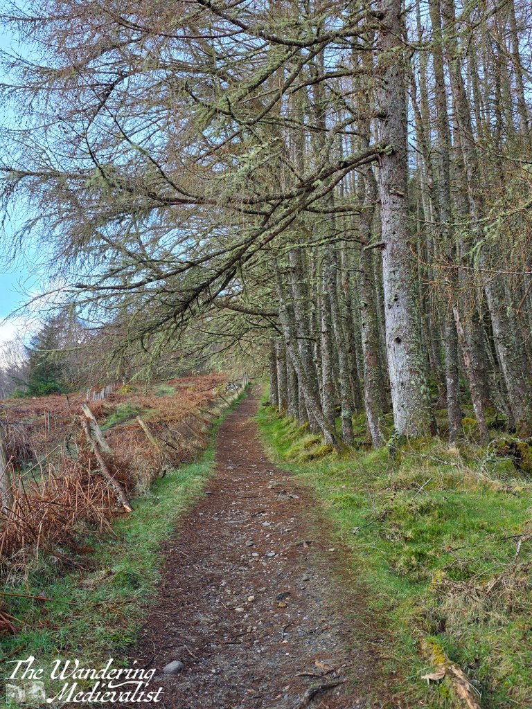
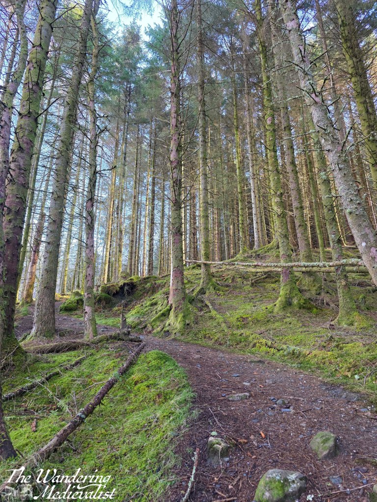
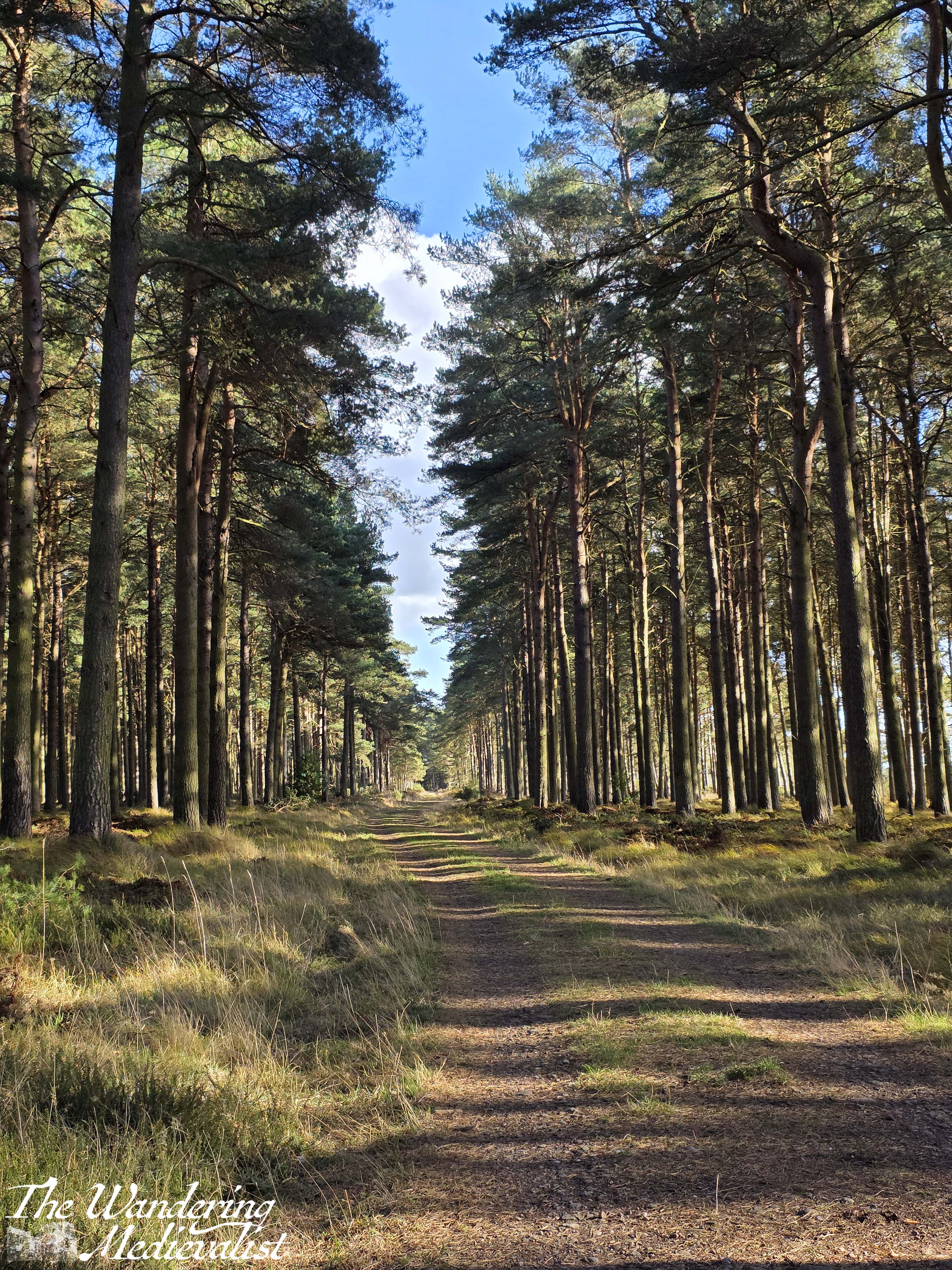
After enjoying our fill of the view, we headed back to the main trail, which presently passed through a gate and pointed us up a hill, through a stand of what I think were larch, coated in a beautiful seafoam-coloured draping lichen.
We continued up, the view on the left blocked somewhat by the treeline, and in time turned right into a stand of tall pines. There was another viewpoint off through the trees, over the loch, but we did not linger and instead followed the winding trail into the forest.
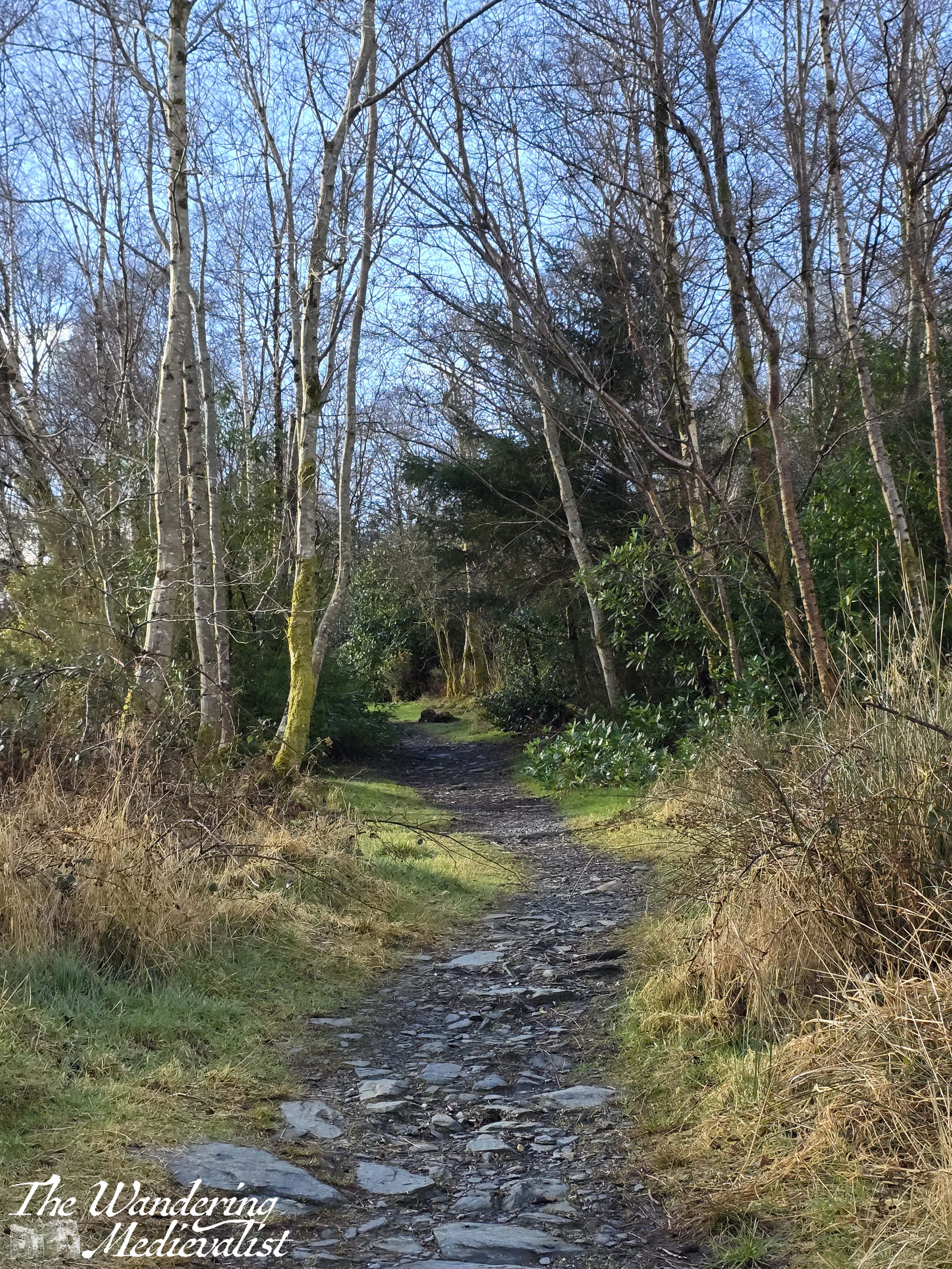
I should mention that the trail was very well-kept, even and relatively dry.
Whenever we hike on a trail such as this, the other half gets a bit irked when I ask him about certain flora, but that is mainly because my father had drilled the plants and trees of New England into my mind. I suppose I assumed his father did the same – but of course that may just be one of our family quirks!
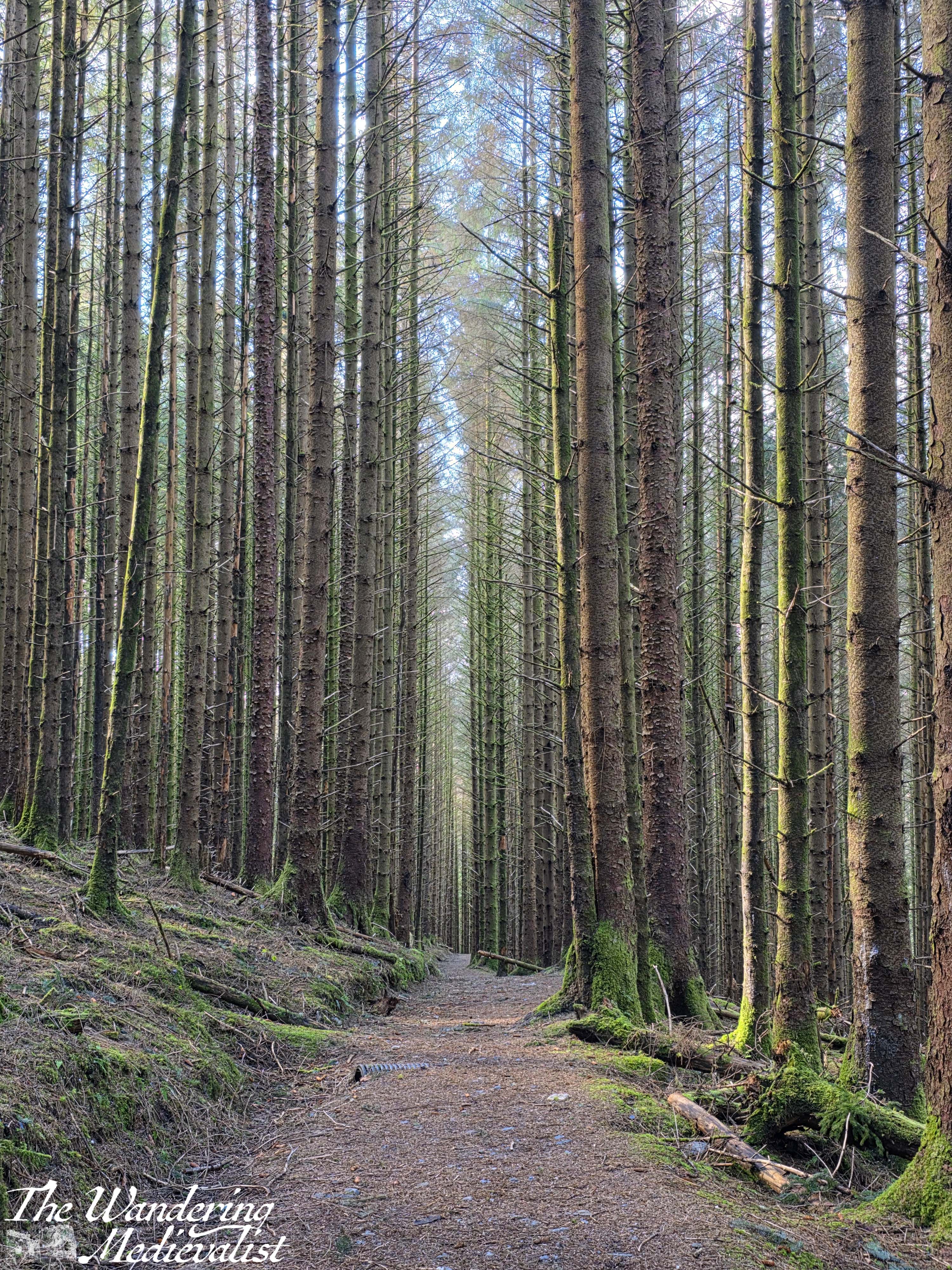
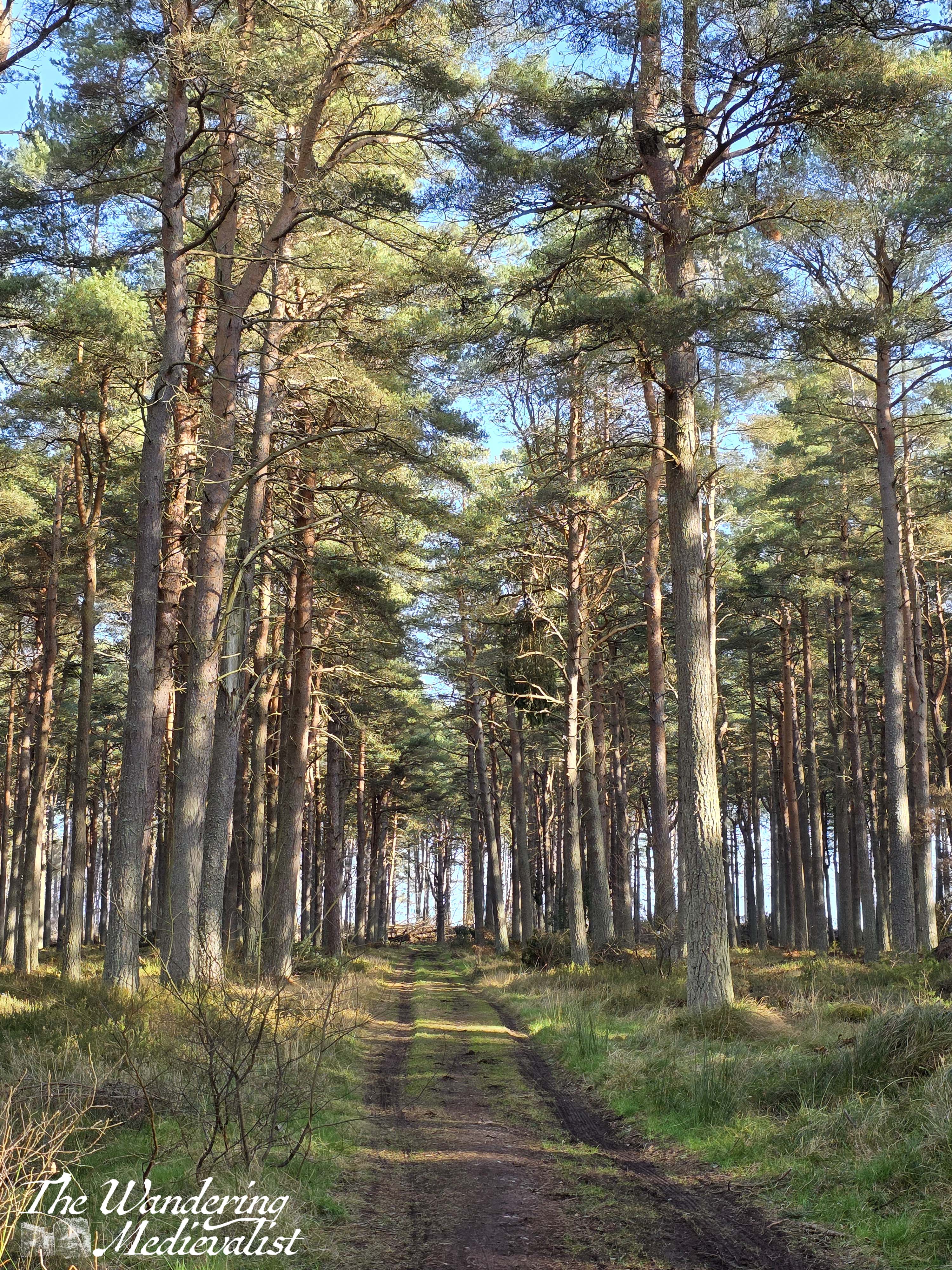
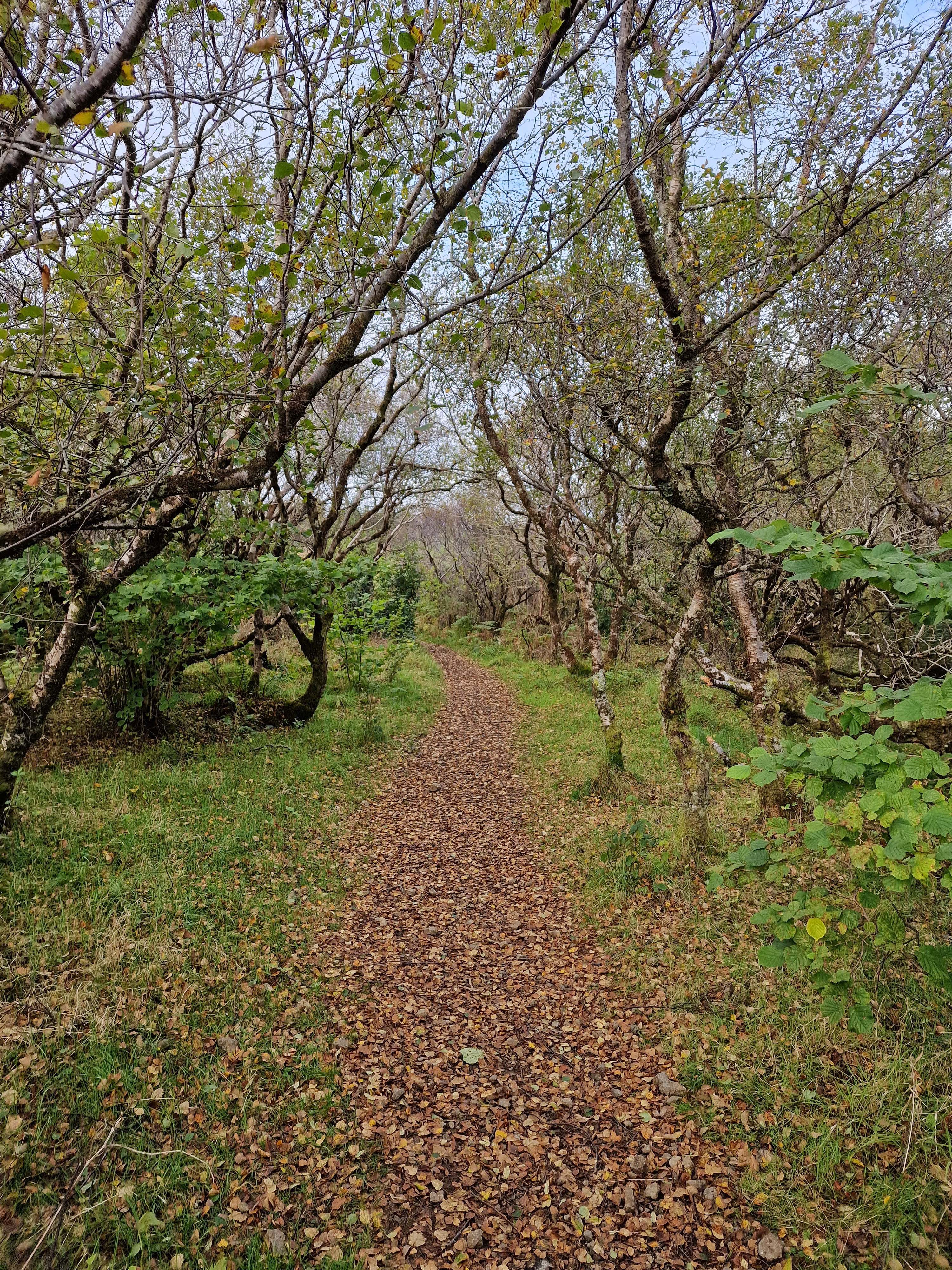
The climb continued for a while longer, and eventually levelled off slightly though not for long at all before beginning a slow – or sometimes not so slow – descent. This was also the part of the trail where there were several alternative routes through the trees that had doubtless been bivouacked by hikers at some point. As with many Scottish trails, it is usually safest to try your best to stay on the main trail, as tempting as it may be to deviate along some other explorer’s route.
I was particularly taken by the tree-lined paths, which in many ways reminded me of cross-country ski trails we had taken when I was young, in the White Mountains. The trees there are generally bushier with considerably more needles, but the lined path was reminiscent.
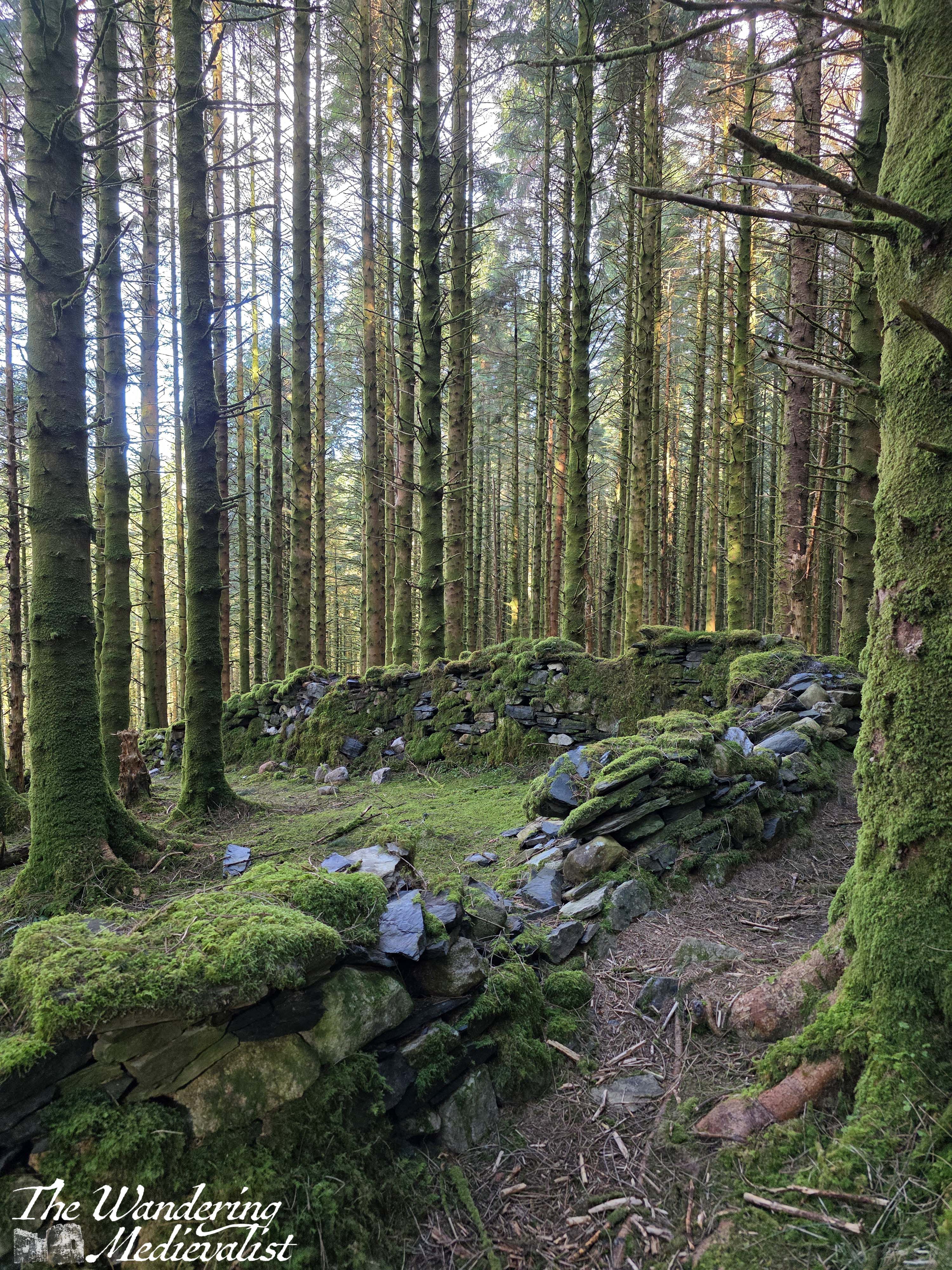
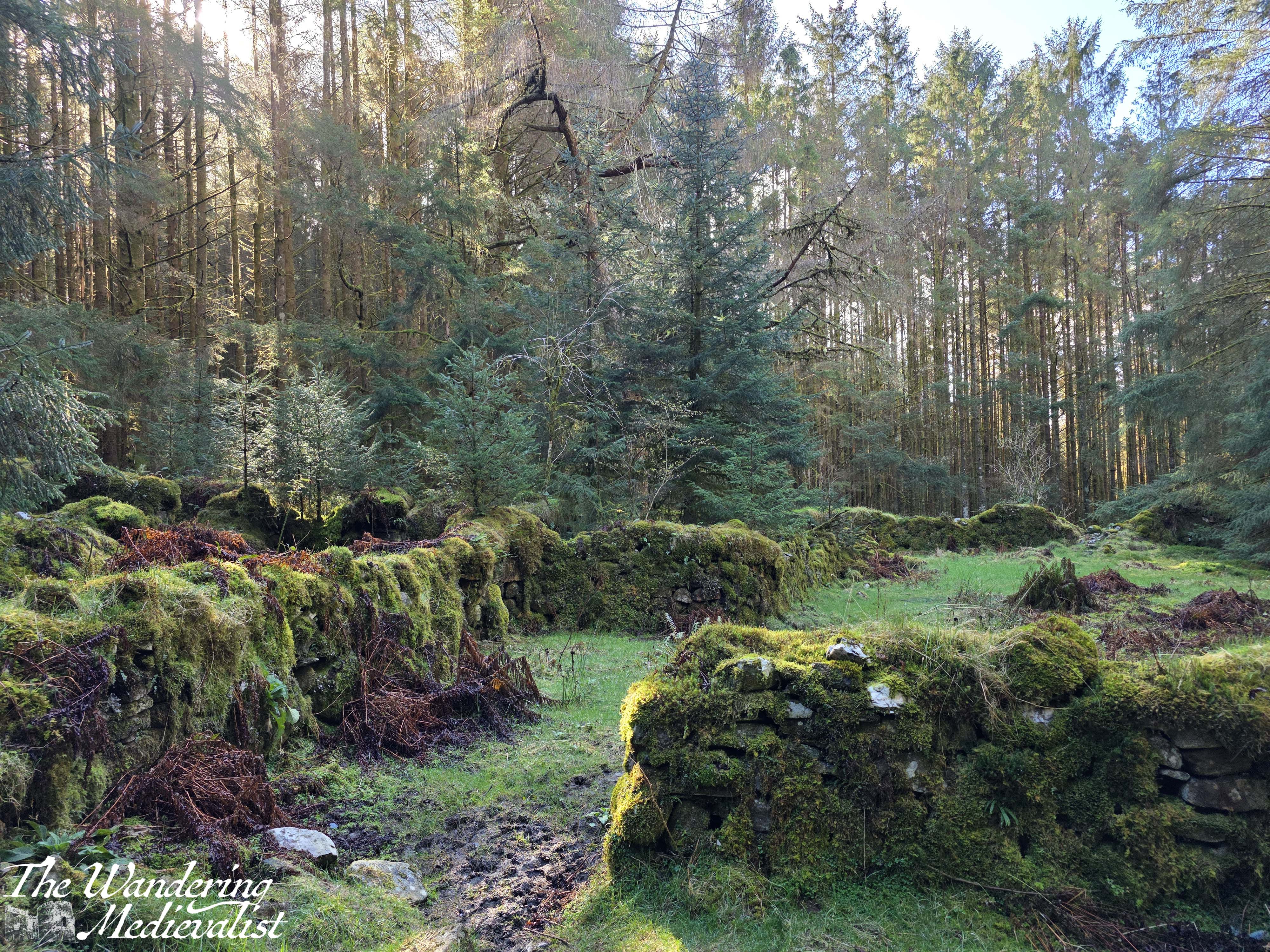
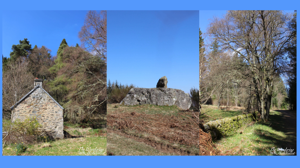
We also came across several out-of-use stone walls that cut through the forest. The stones were coated in moss and there was periodic damage, but the sun shining through the trees off the stones made for a nice break in the view.
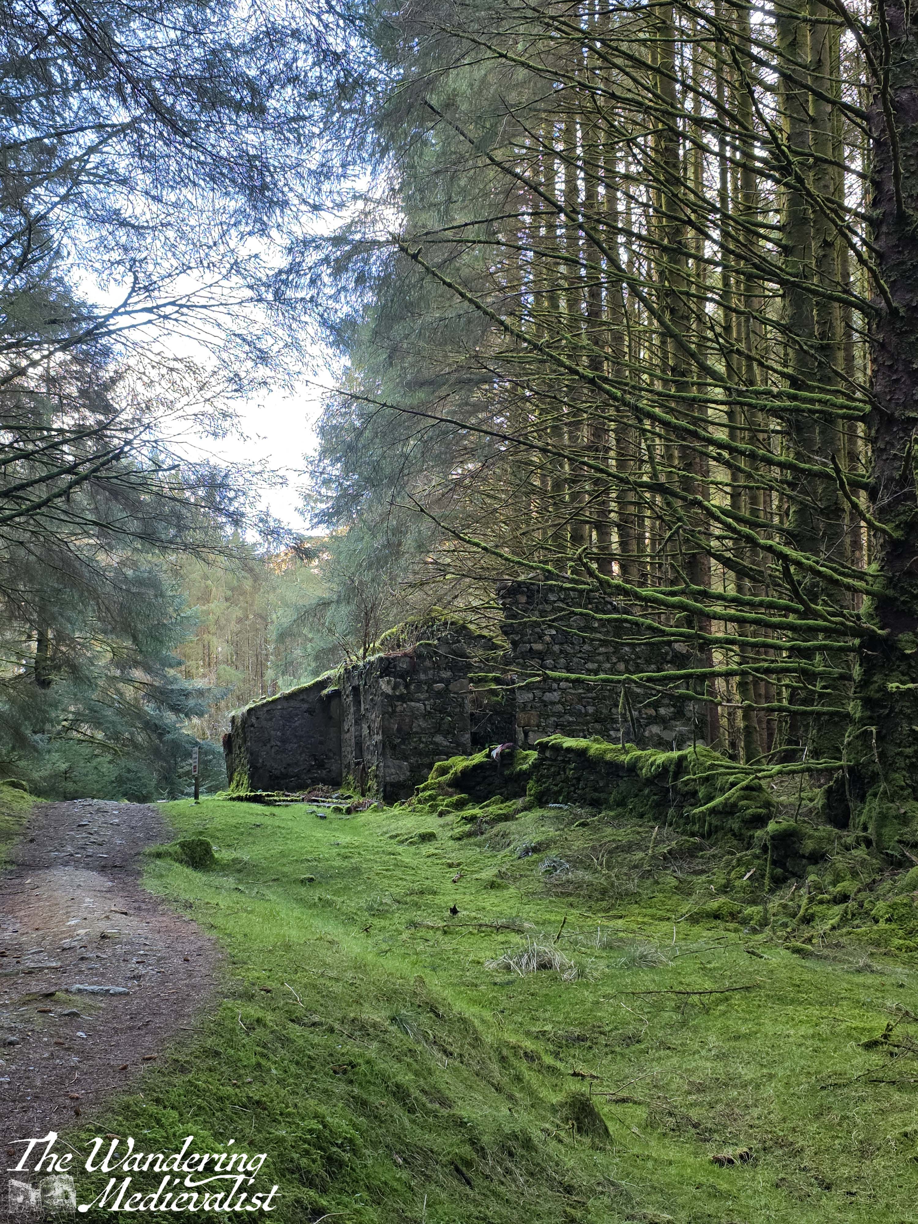
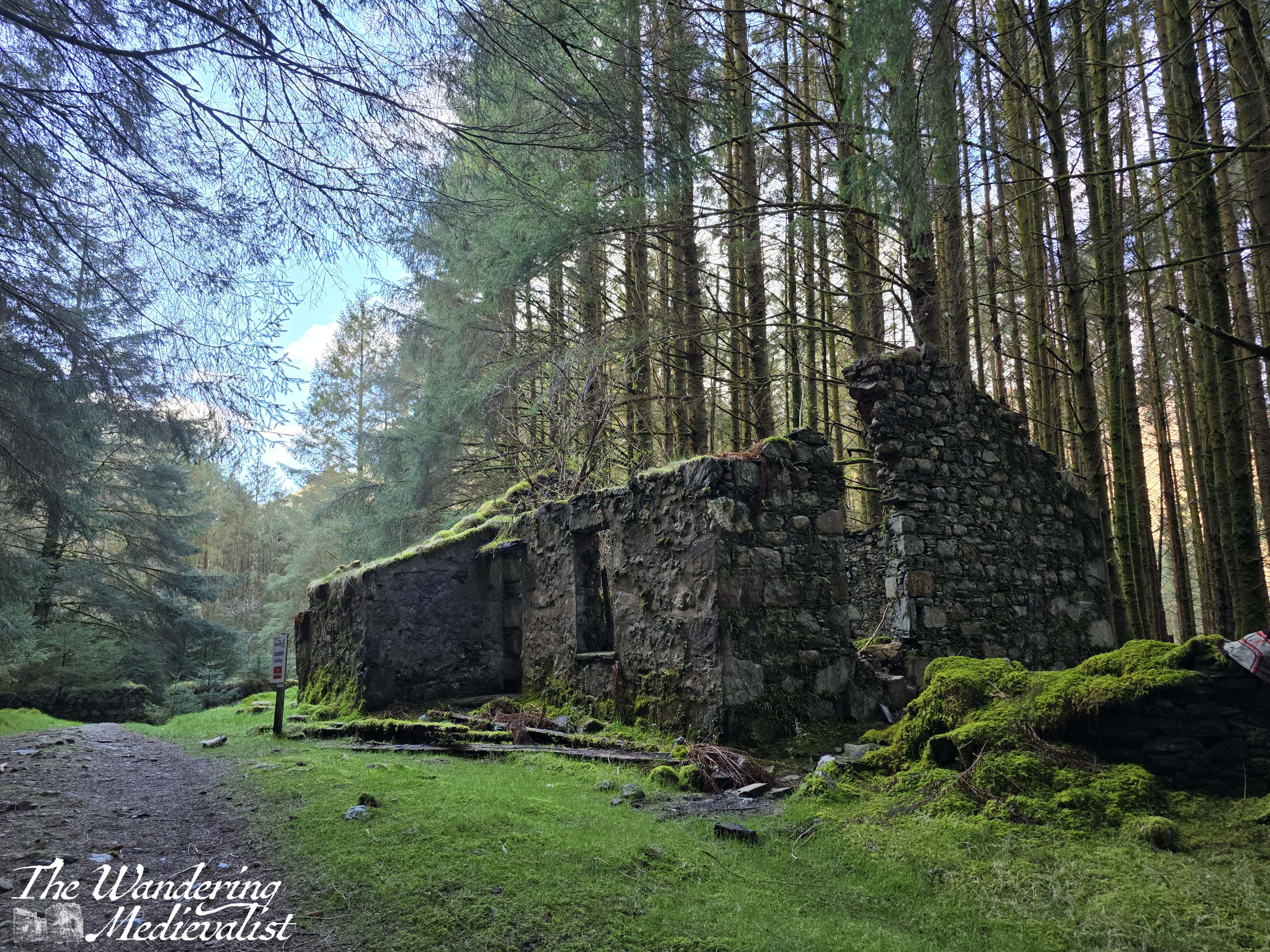
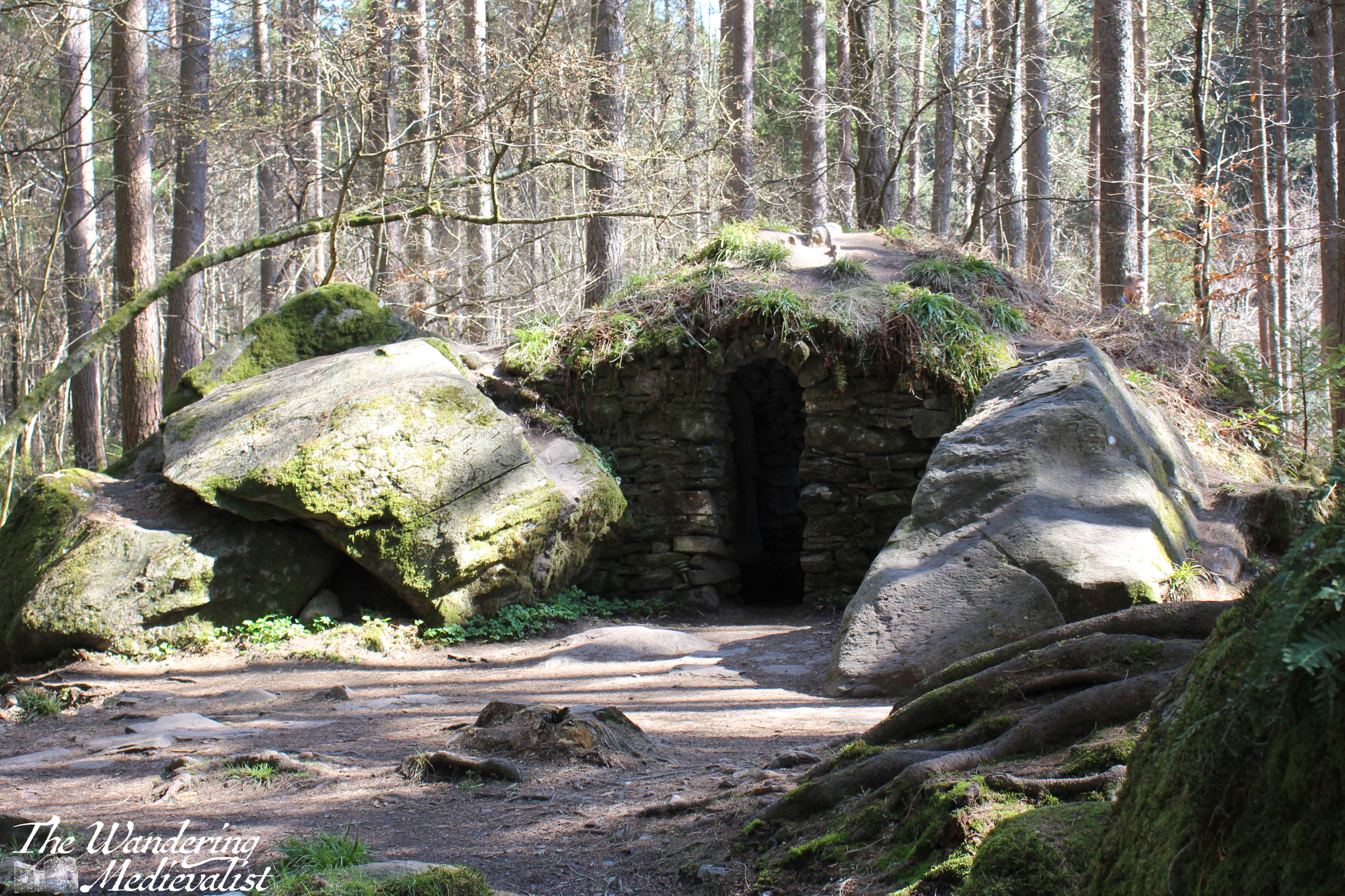
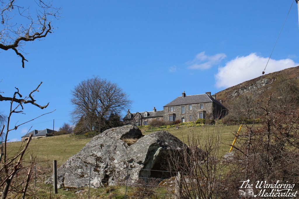
Presently the descent grew a touch more steep, and we came across the ruins of several houses and in fact a small settlement of cottages, now well overgrown with moss and fern.
The historian in me wished this was an old Highland village, but as the other half pointed out, at least one house included an electric box and some wires, so they must not have been abandoned too long ago.
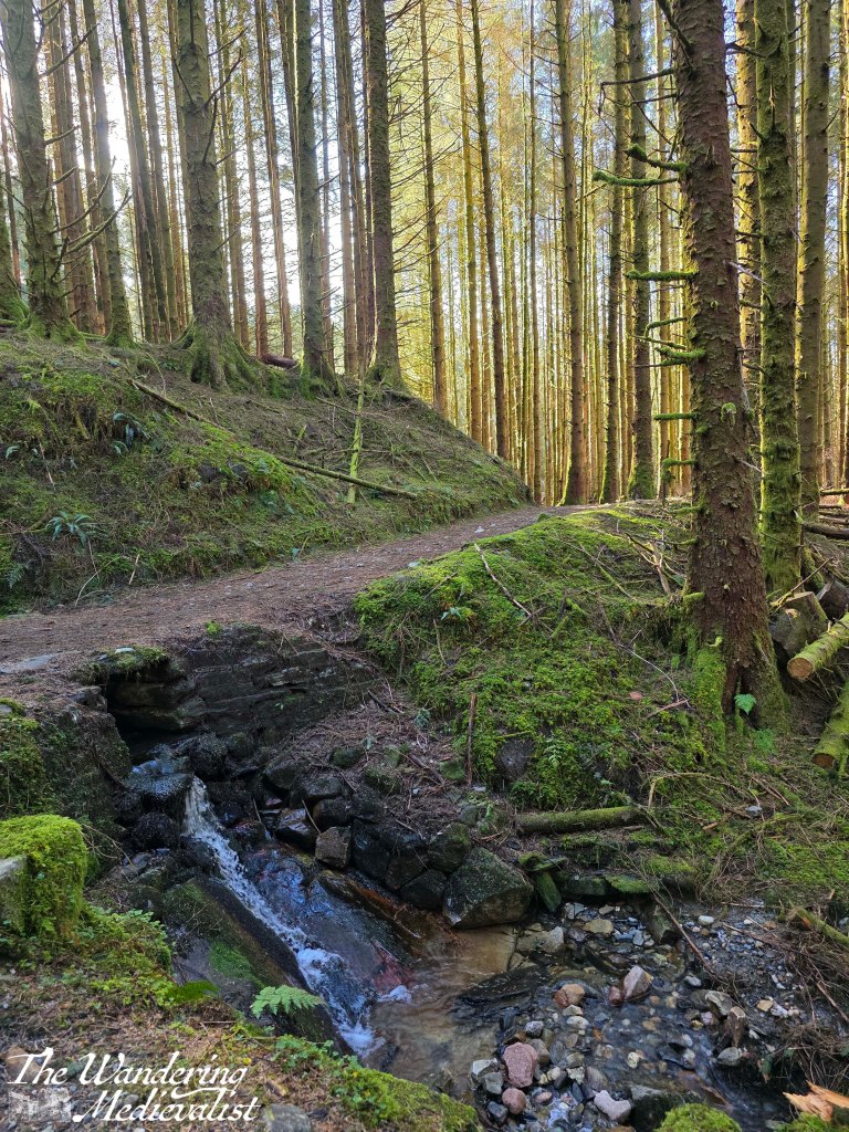
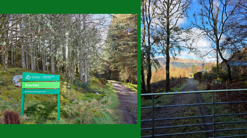
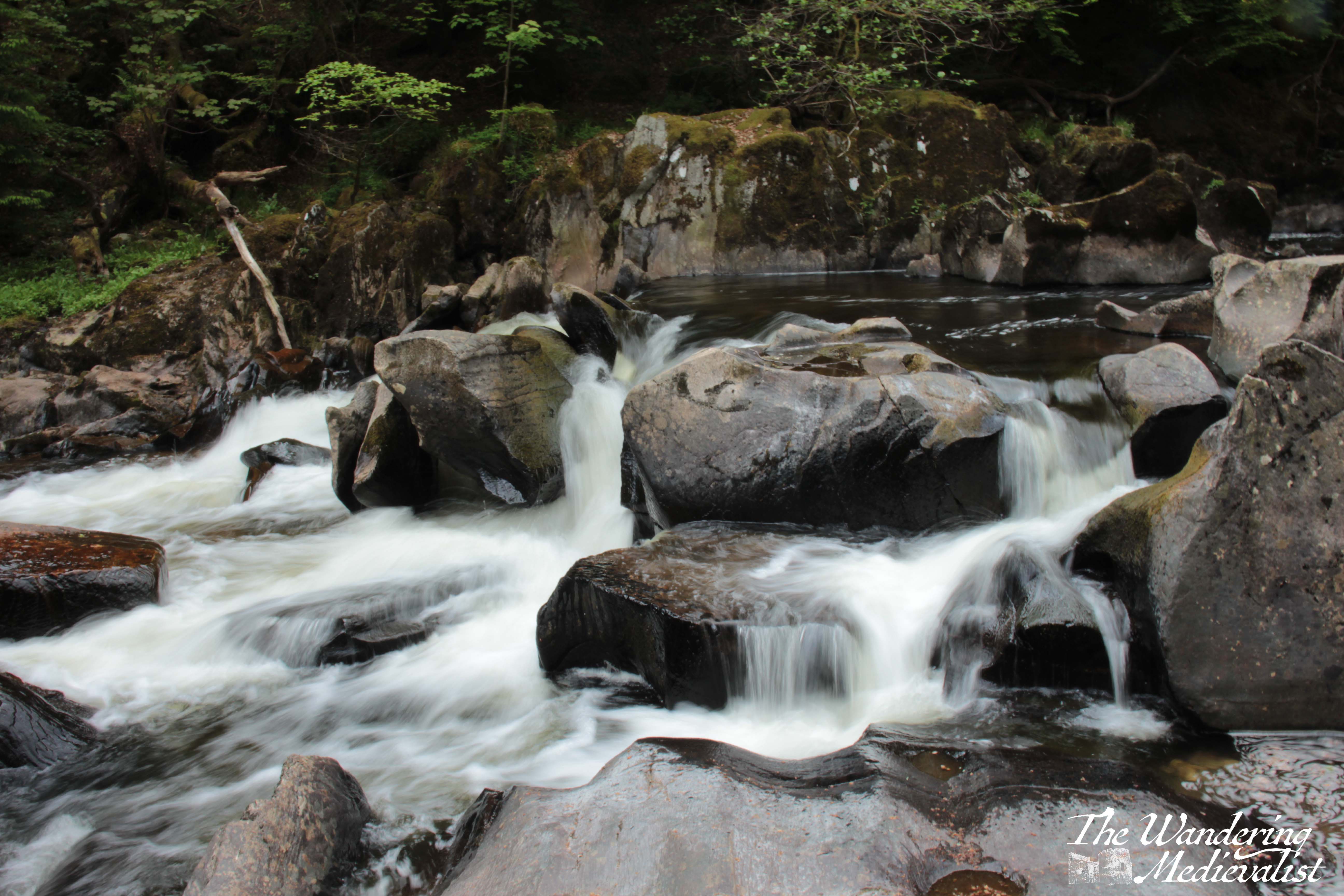
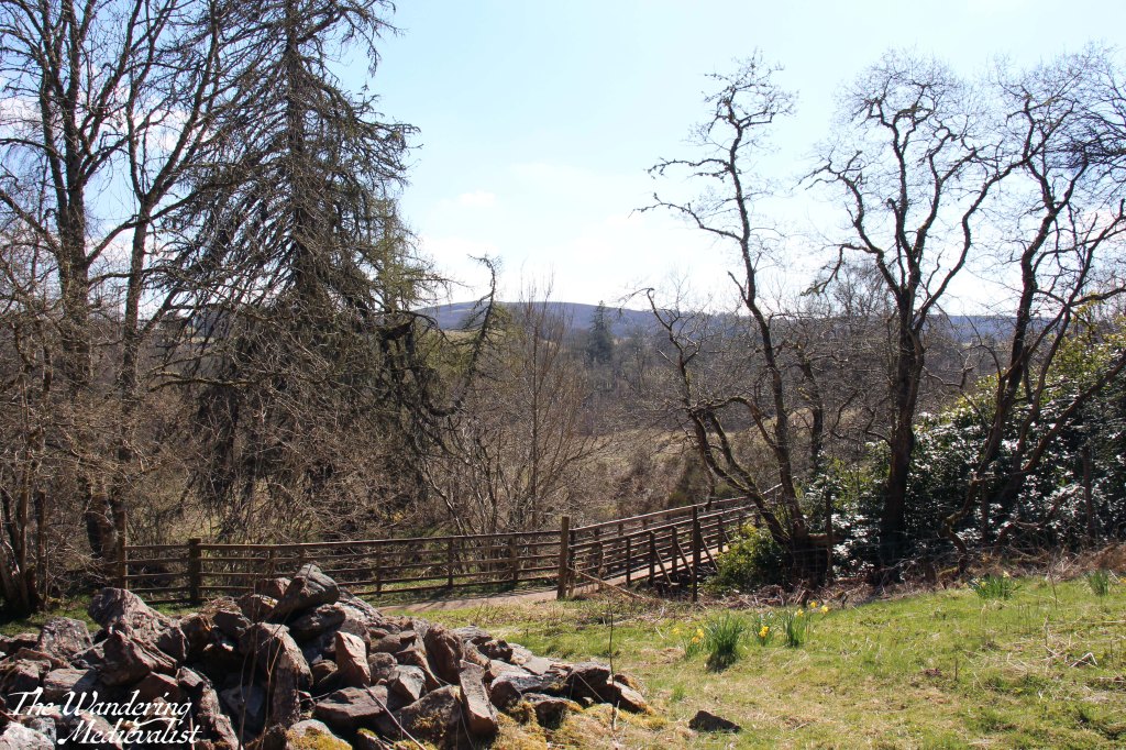
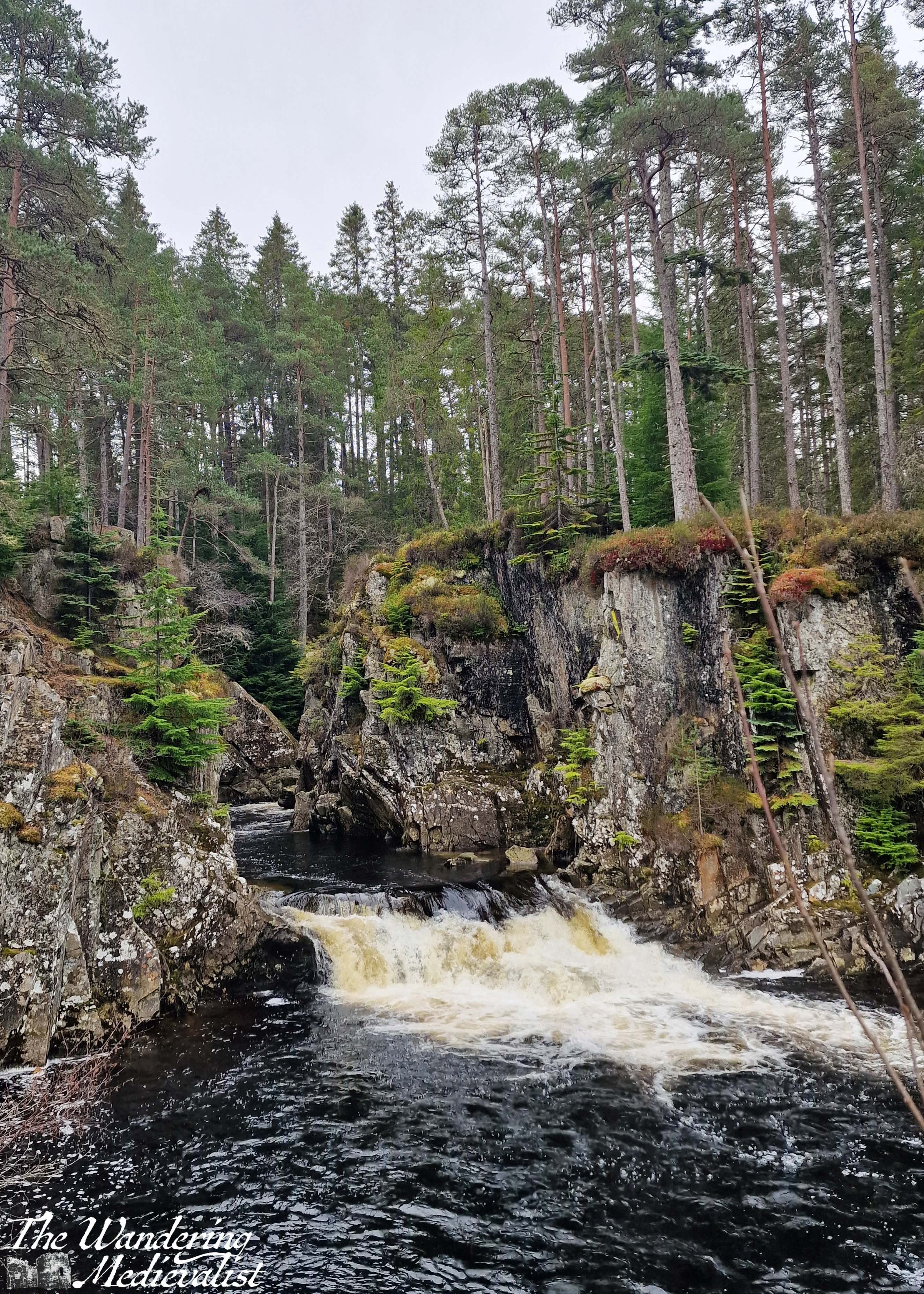
Beyond the village, the descent through the trees is steady, with the trail passing over small rivulets and mini-waterfalls, and finally eventually meeting a road.
Here, the trail turns to the right and follows a woodland track down to the edge of the village, which appears gradually after a gate and the official woodland marker for the trail.
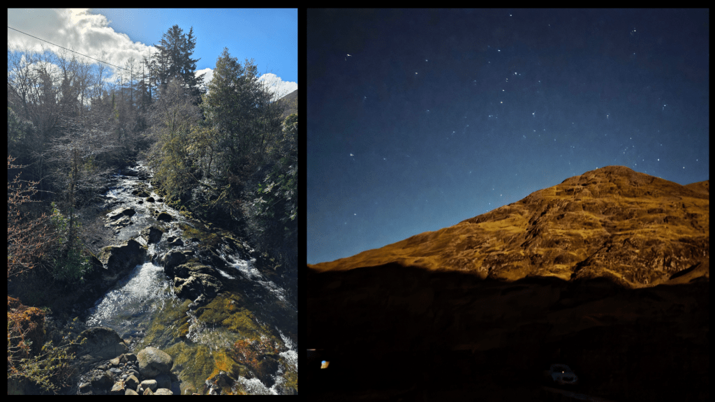
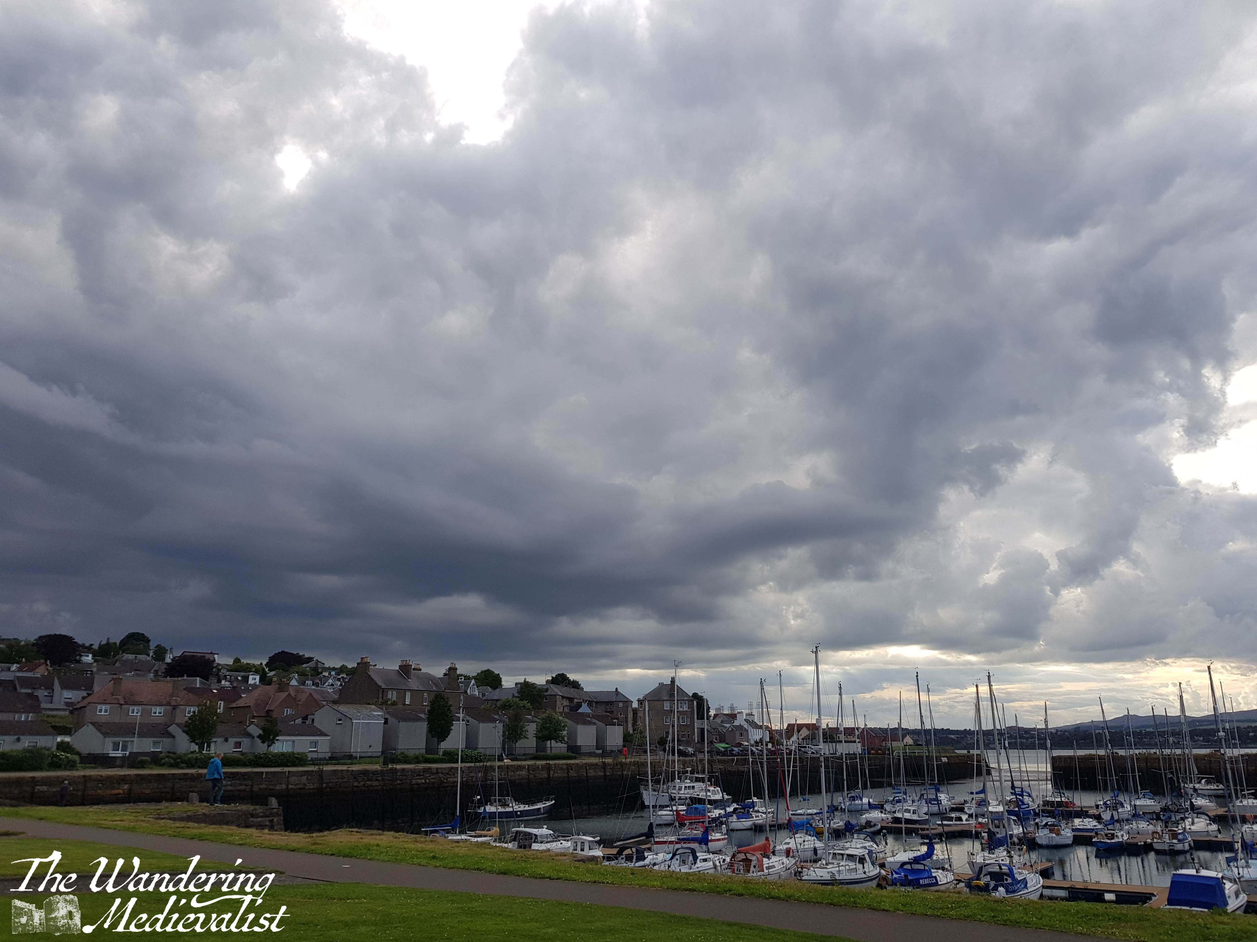
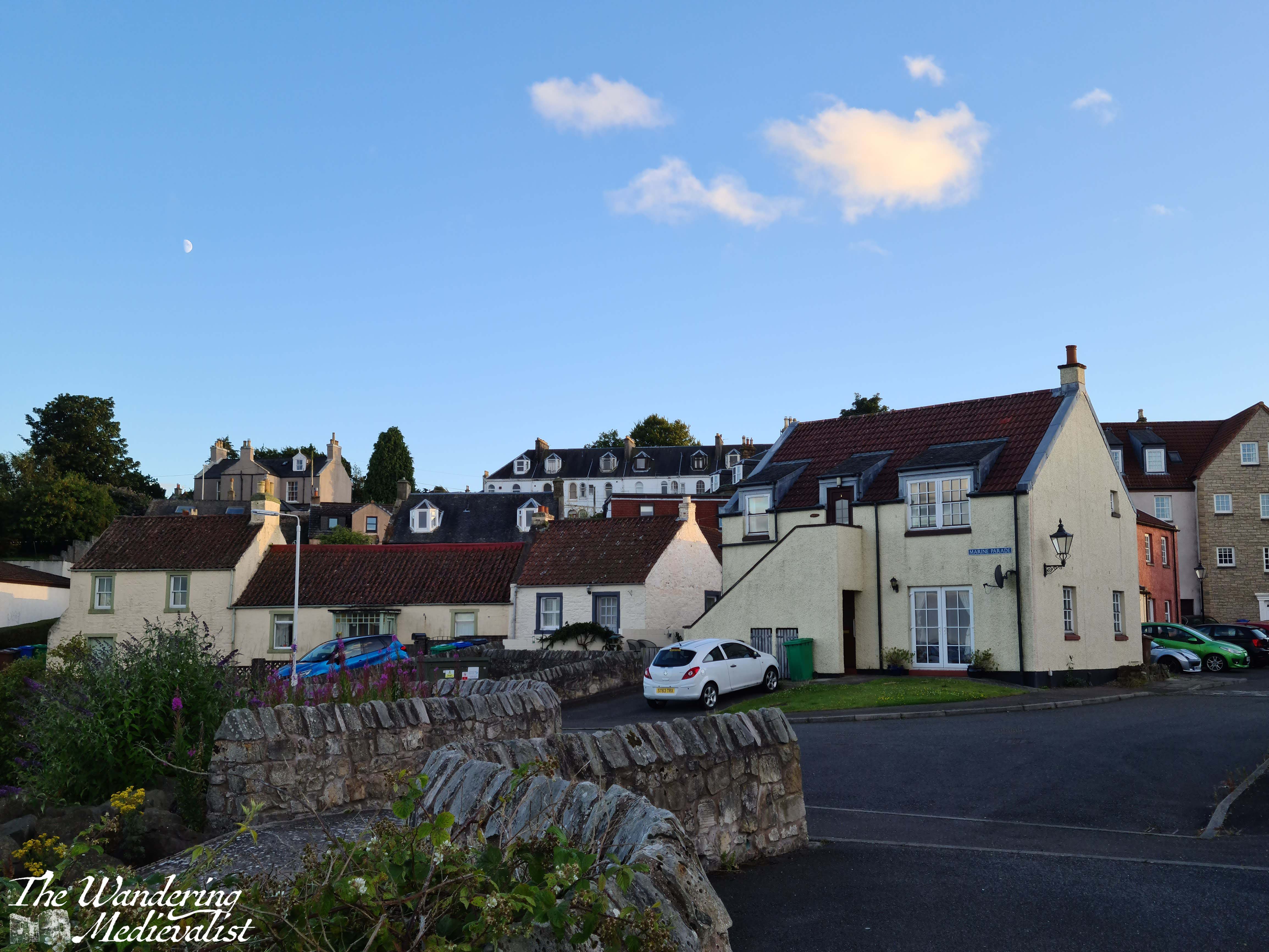
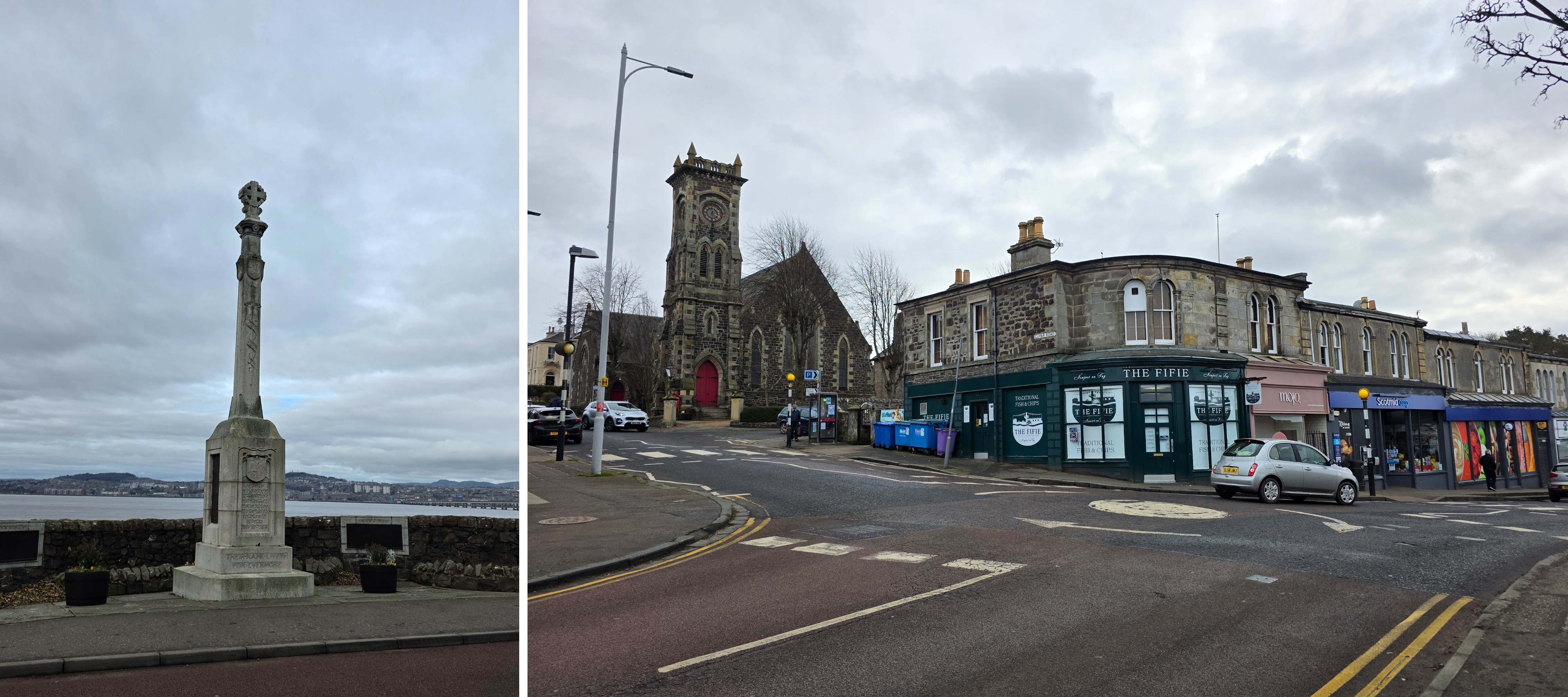
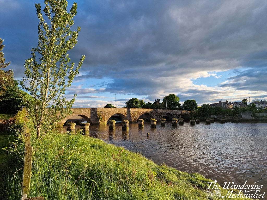
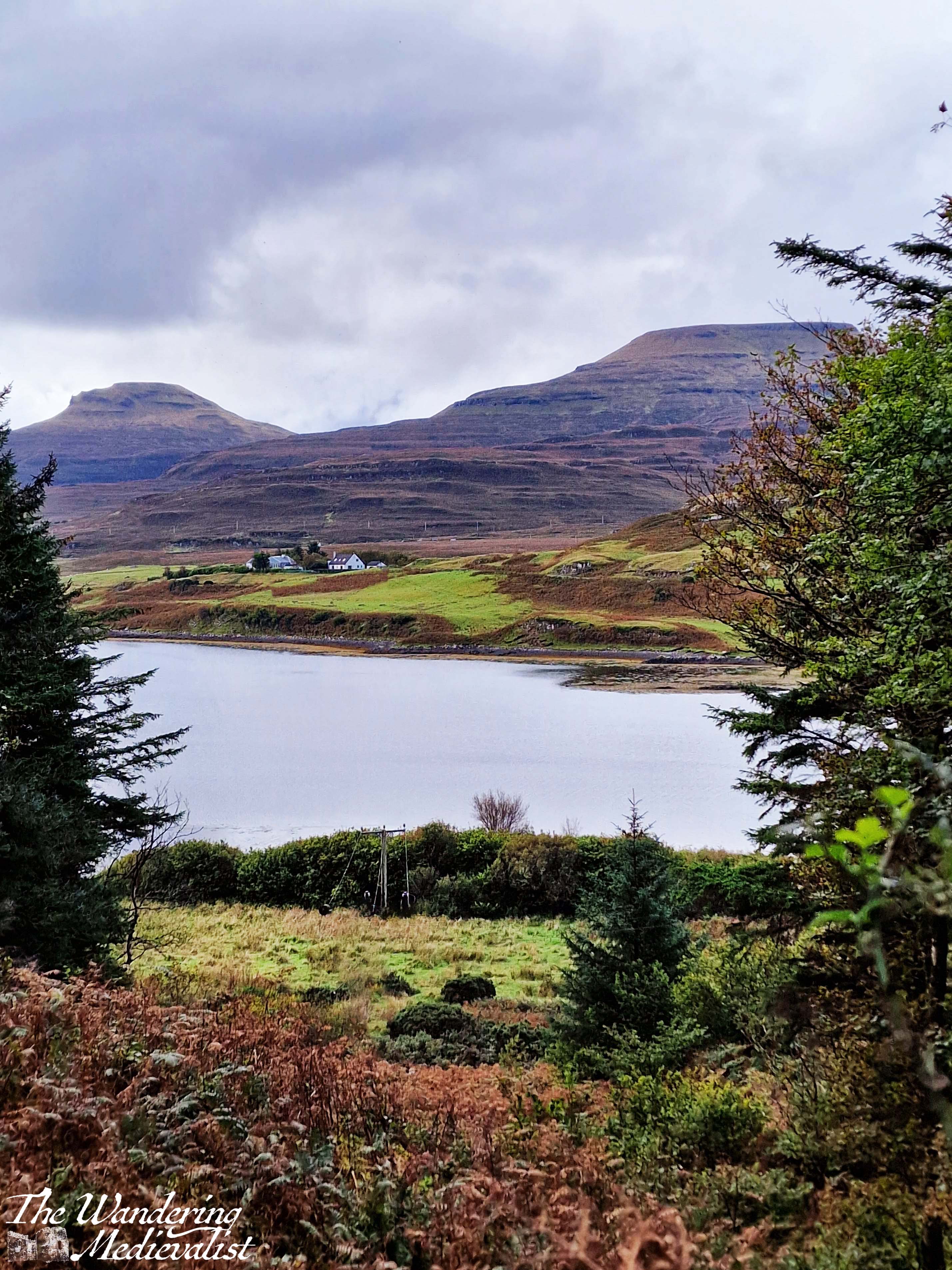
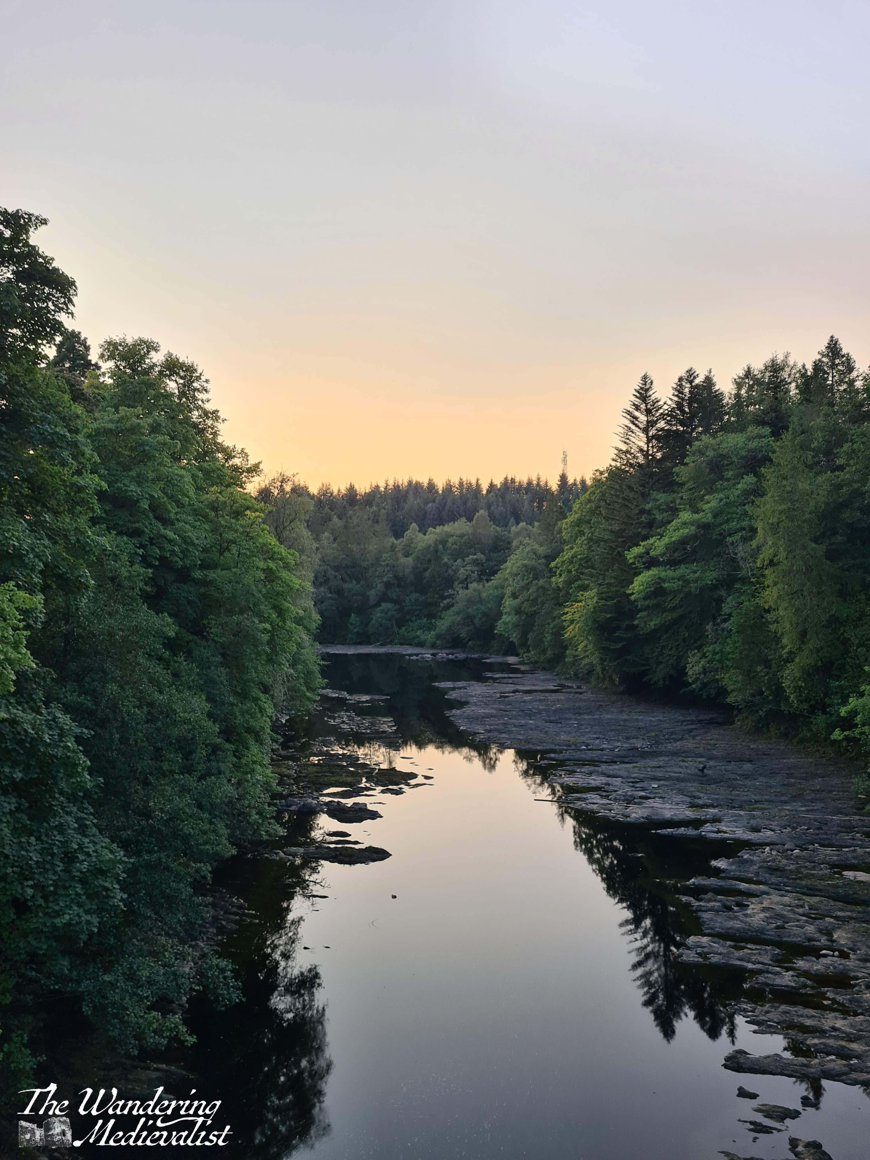
Gradually, well-kept houses appear at the side of road. We passed two churches, one Church of Scotland and one Catholic, each with a very similar name – St Munda’s and St Mun’s, respectively. Beyond the houses to the left is just visible – and at times audible – a small river, the River Laroch. A bit further into the village, the road crosses the river and there is an old bridge plus a viewpoint where you can get a bit closer to the water.
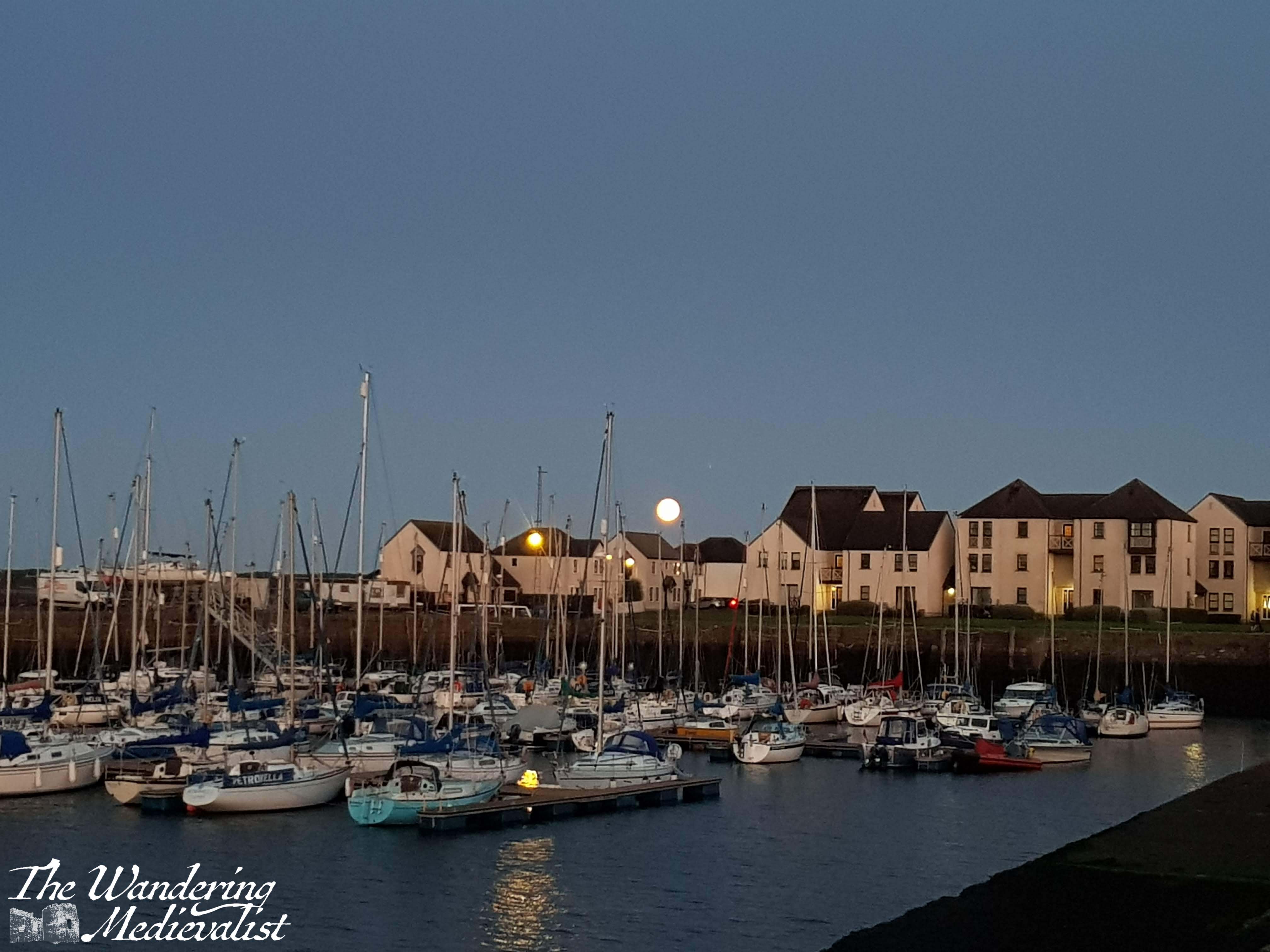
The River Laroch and the star pictures taken in the evening – that bright light on the hillside is in fact moonlight.
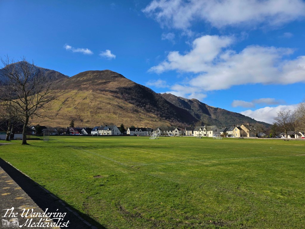
Eventually, the walk circles back towards the visitor centre, past the village green and playing fields, which also boast stunning views back towards the mountain that overlooks the village of Ballachulish, Sgòrr Dhearg.
The main street passes by several small shops including a delicious-looking bakery and the Laroch, a pub we were thinking of eating in that evening. The whole loop is just under two miles, though the climb up and down makes it feel a bit longer. We decided to head back into the quarry to explore a bit and discovered that there are two ponds, the smaller of which offered a beautiful view up to the mountain. It was a warm spring day in feel by this point and there were clouds of midges rising from the sun-warmed ground, so we did not linger too long.
In all the hike took us about 90 minutes, and was one I would highly recommend. While it is far from flat and some energy is needed for the climb up, the views are stunning. Another win for my researched walks!
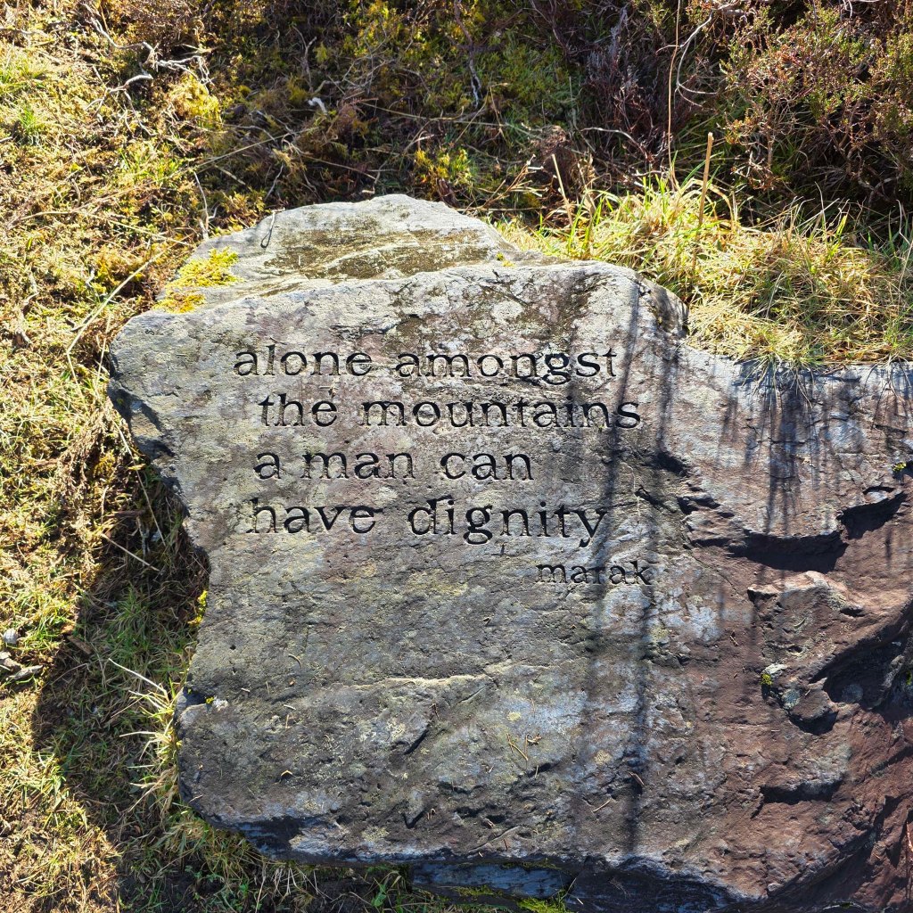
Finally, a message I feel is very true from a carved rock along the trail:
Or more exactly, Tayport Shanwell Road to Newport High Street roundabout. I had calculated the route ahead of time and expected it to be about four miles. As appears to be my habit recently, I was underestimating a touch.
This portion of the coastal path is easily accessible by public transport. I took the 42A bus (picked up in either St Andrews or Dundee) right to the Shanwell Road turning circle, location of the Foodmek manufacturing plant and one entrance to Tentsmuir Forest nature reserve. The bus from St Andrews is about 25 minutes as it winds through several villages, from Dundee closer to 10 minutes.
Very quiet bus trip
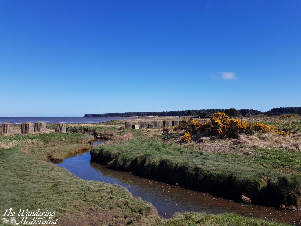
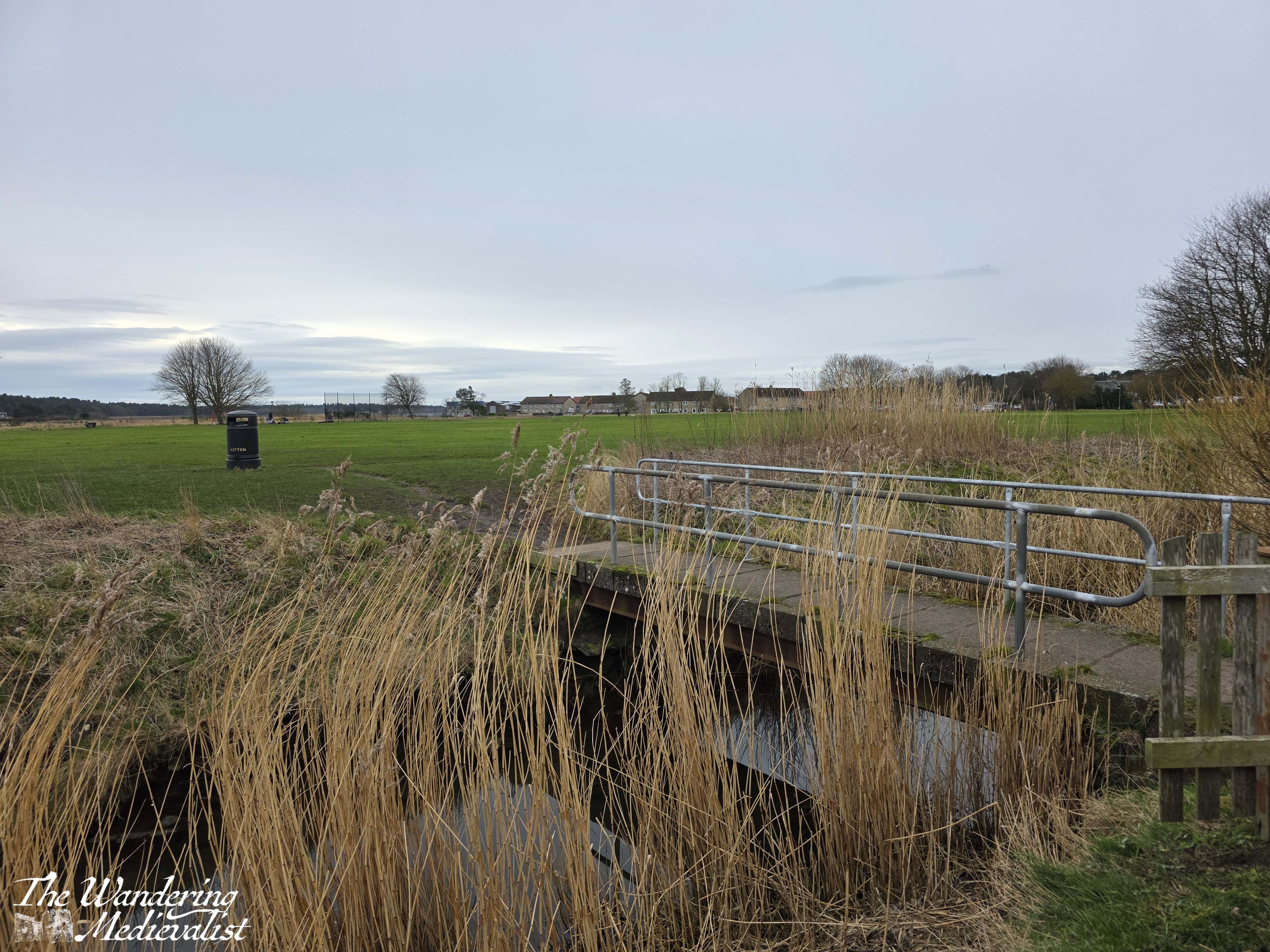
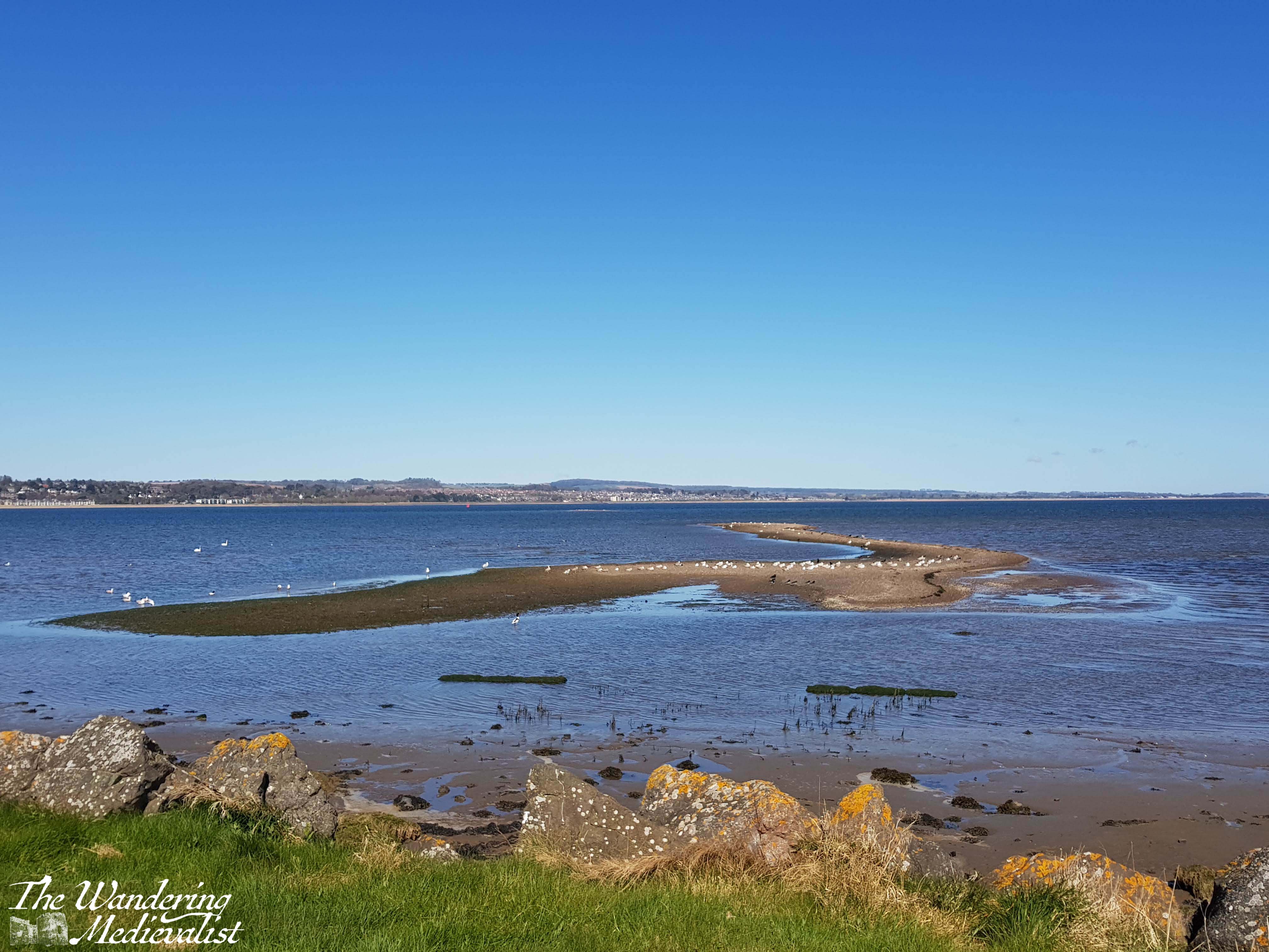
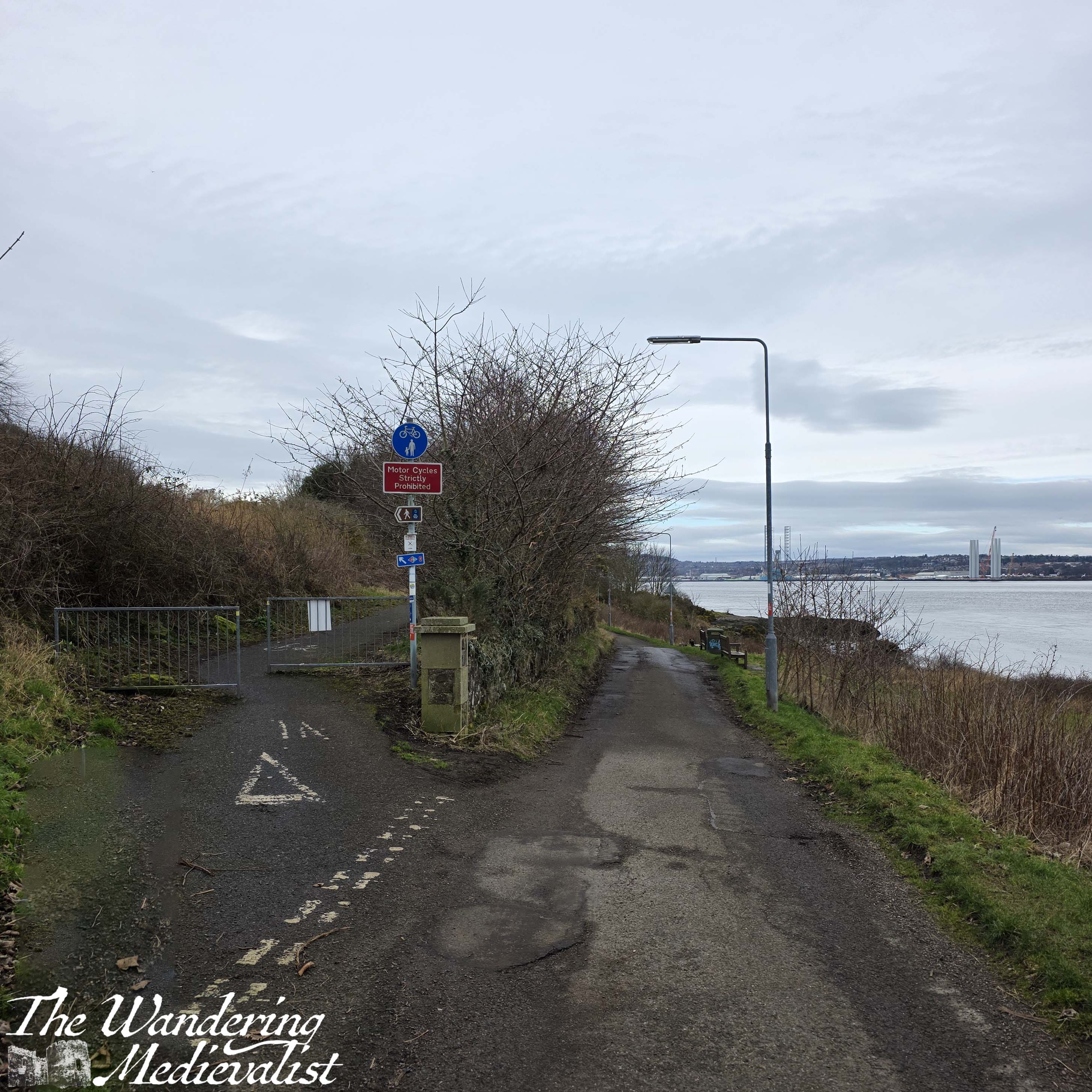
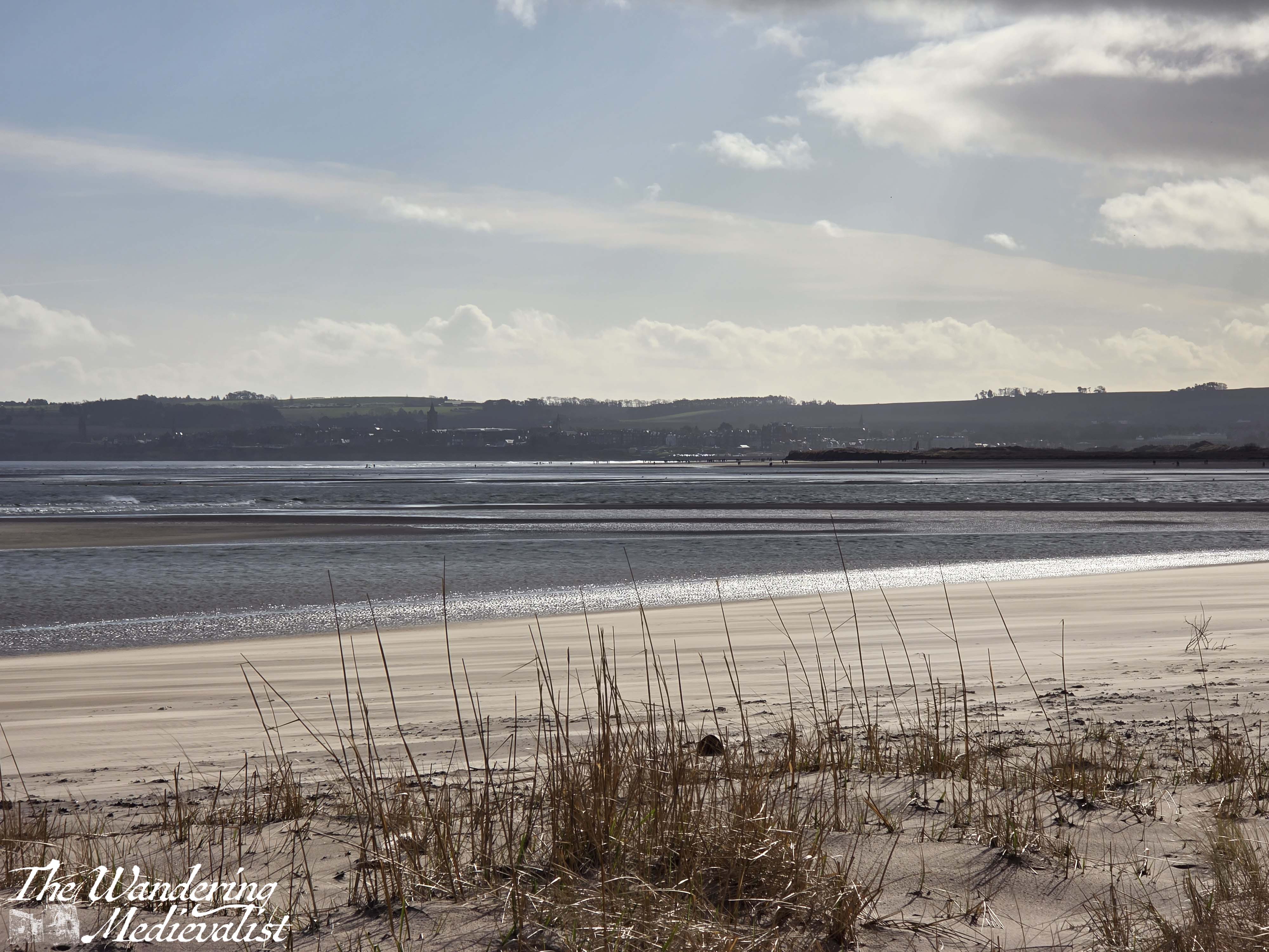
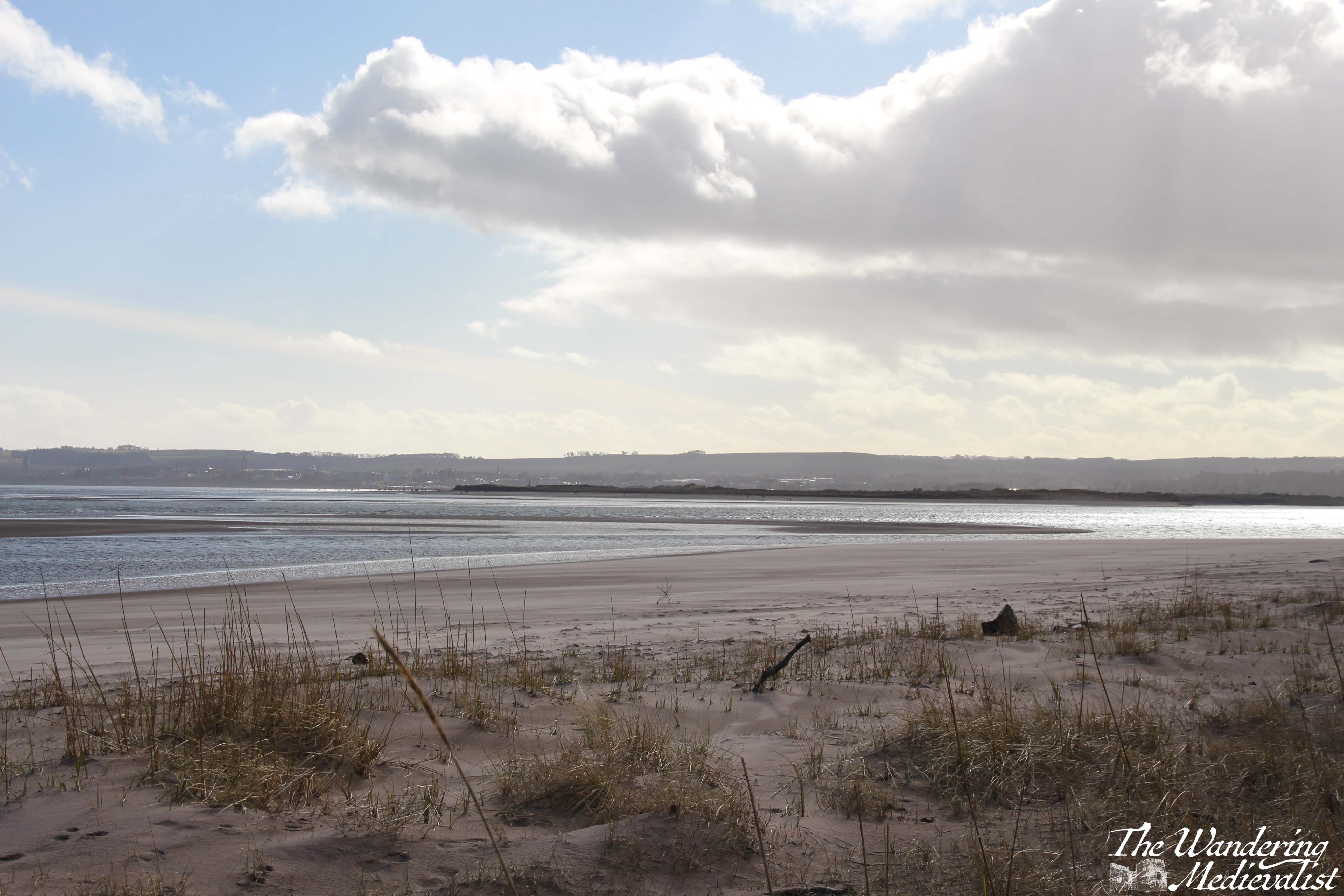
My official starting point was the bridge over a small burn; there are several displays here telling walkers about the wildlife – primarily birds – that they can enjoy if heading into Tentsmuir. In the other direction, the one I was taking, the path is well-marked and winds around between the beach and a park.
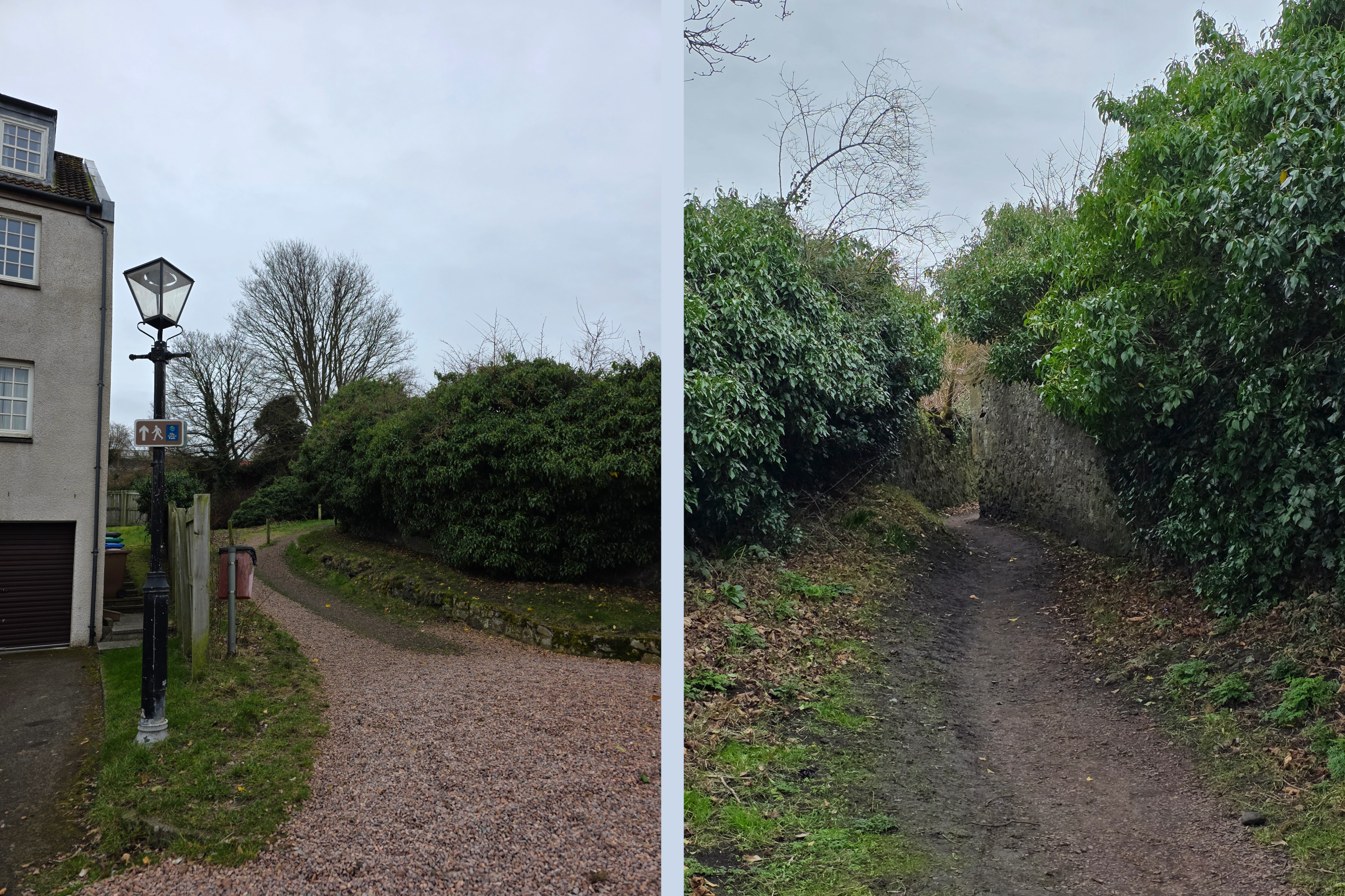
As you may have learned in my Broughty Ferry post, we lived in Tayport for just over a year, including during the first six months of the pandemic in 2020. Those of you living in the UK at that time will remember when we were permitted 30 minutes of outdoor exercise daily. For us, loops walking through Tayport were that exercise. I therefore have many pictures of the Tayport area, some significantly better than I was able to take while on this walk, as the day was overcast and windy. I’ve decided that as long as they are part of this route, it makes sense to substitute the lovely sunny views for the overcast ones.
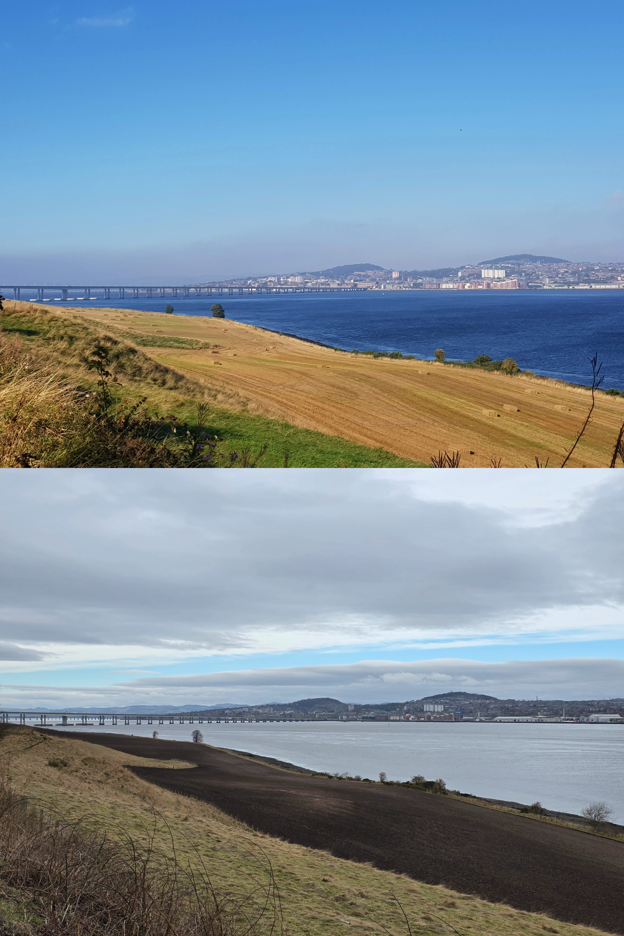
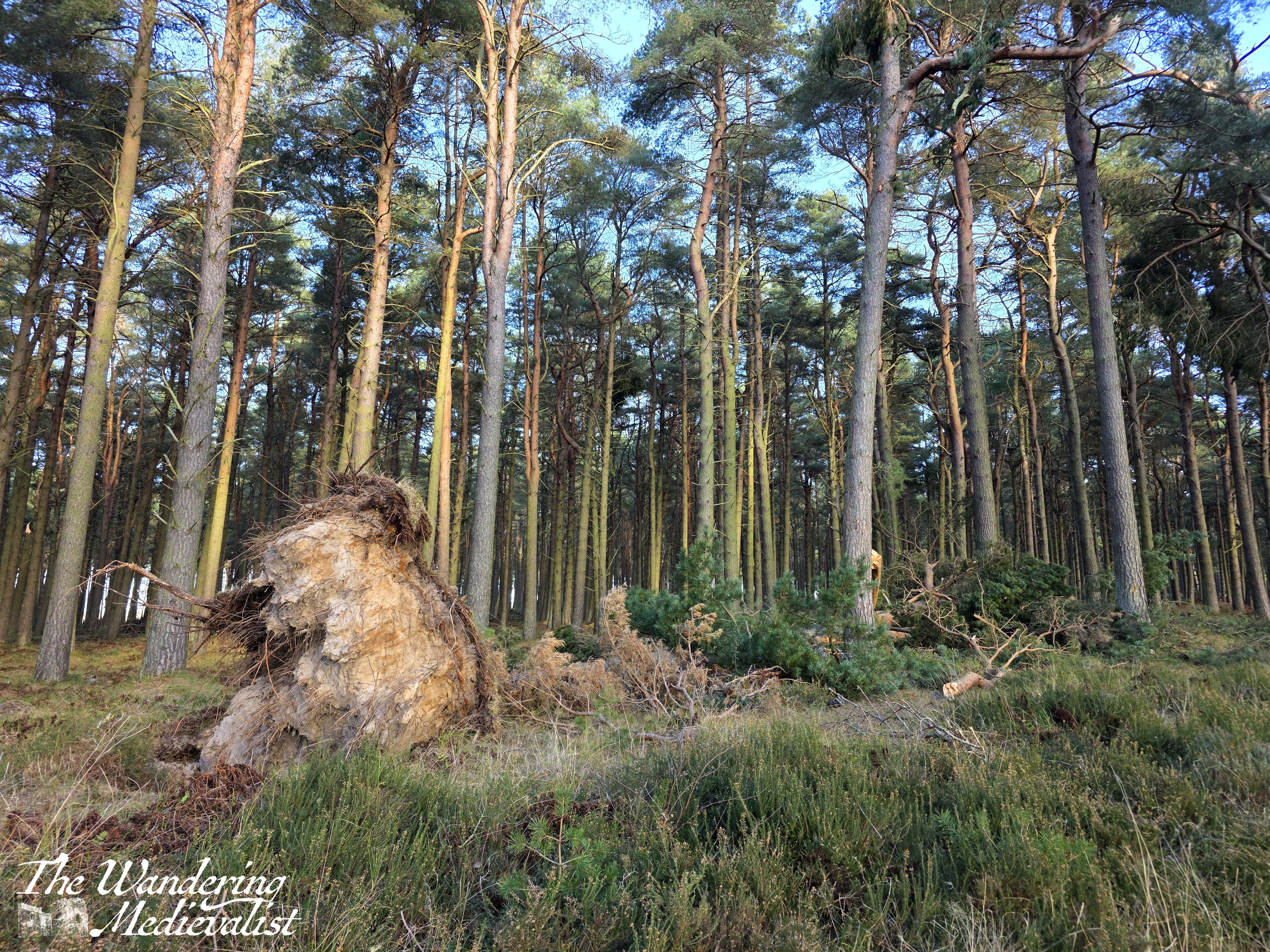
One of the first things I noted before getting started was the significant difference visible in the treeline of Tentsmuir forest. As I noted the weekend before, there has been a significant amount of tree loss due to recent storms, and it is really evident in these two pictures. The intensity of the last storm which swept through Scotland in February actually caused a red warning for large portions of the country, with winds reaching hurricane force.
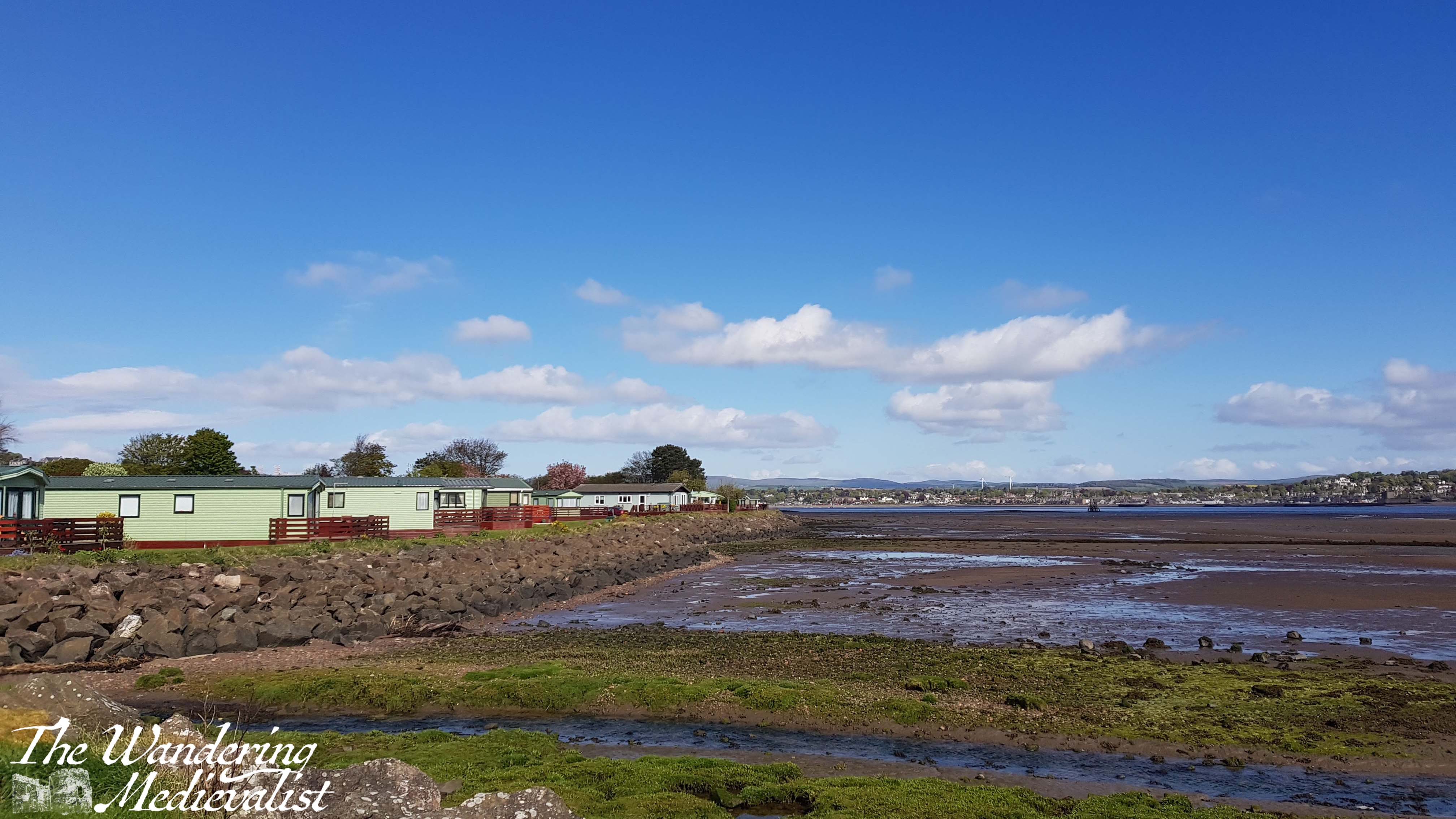
Five minutes or so after leaving the bridge, the path approaches a caravan park, and I was not certain if the coastal path route was meant to lead through the park proper, or along the edge of the seawall. For those in the US who may not be aware, caravan parks in the UK are very common holiday destinations, often located on the edge of popular towns and cities, allowing families a self-catered option for accommodation. Some caravans are permanently owned, and some are rented by the week. The Tayport park is very well-kept and beautifully manicured, and the caravans themselves almost all include a wrap-around porch for outdoor seating, as well as views over the Tay estuary. Crocus were just starting to bloom with daffodils a promised week or so behind.
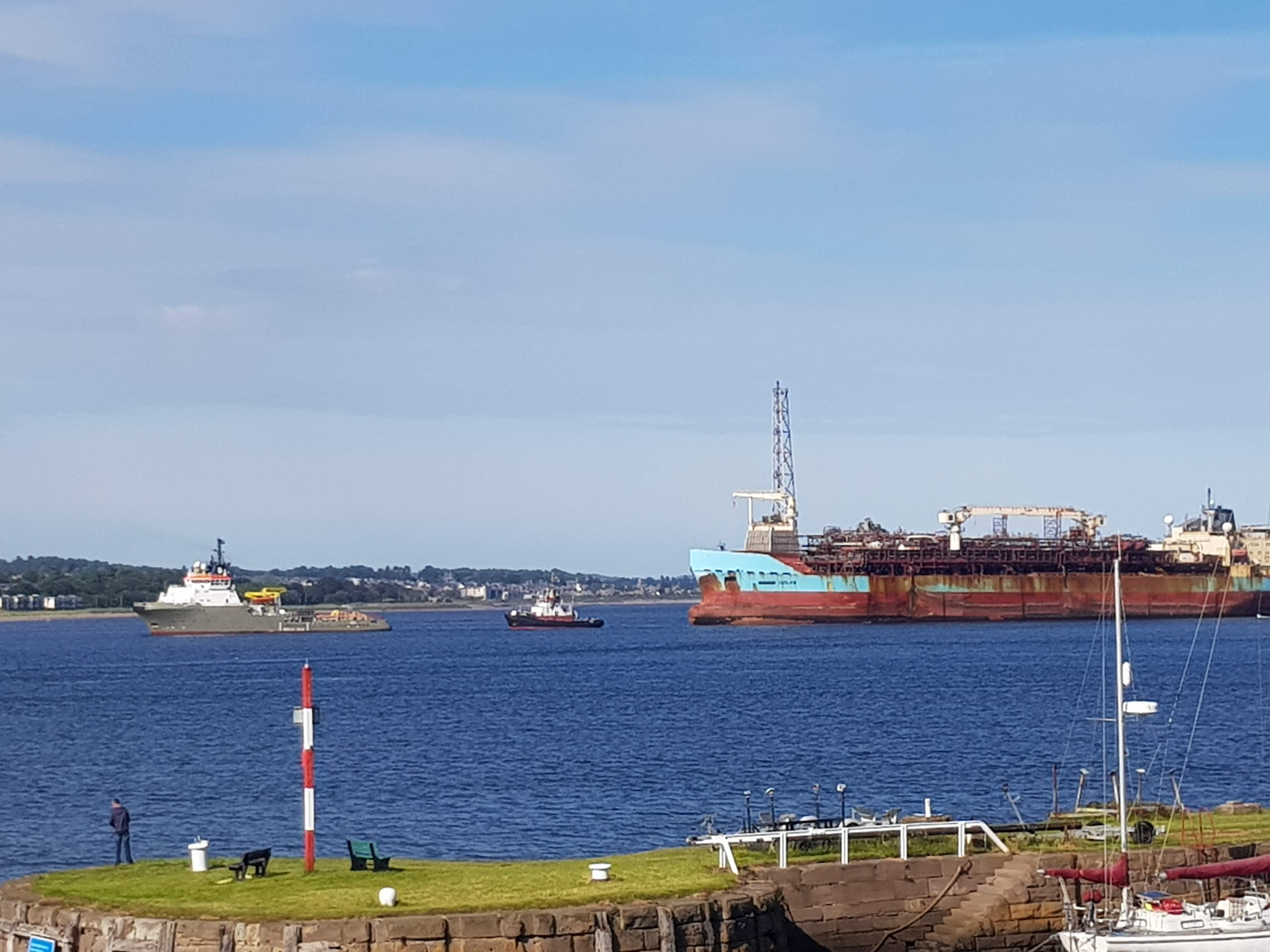
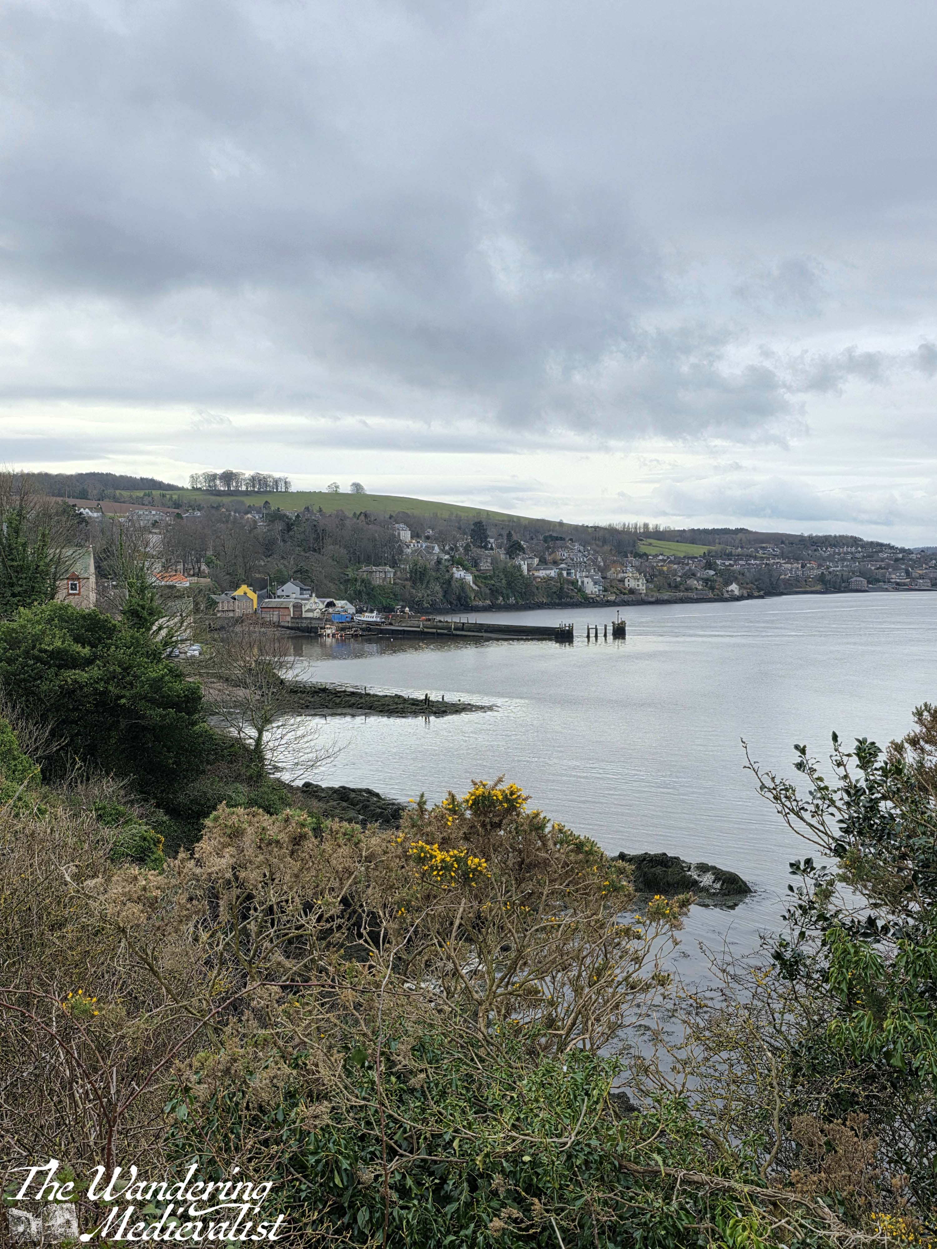
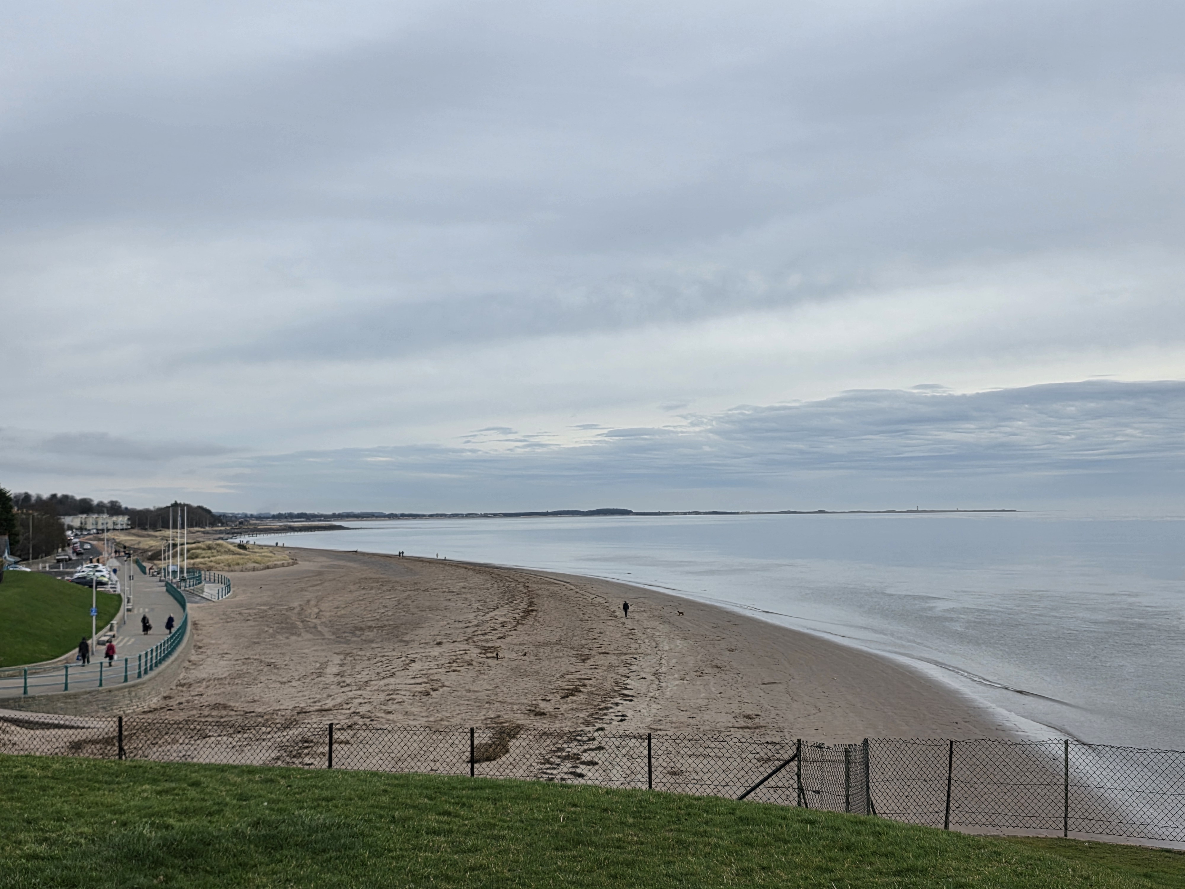
I opted on this occasion to cross the small concrete bridge over the burn and follow the path along the edge of the beach, where there is a carefully-maintained sea wall and warnings not to play on the rocks or muddy sand flats below (at low tide, anyway). The view, as seen on the sunny day, is across towards Broughty Ferry and leading up the coast towards Buddon Ness and Carnoustie. This is an often busy stretch of water, with pleasure boats sometimes overshadowed by tankers or transport ships headed to Dundee. Occasionally, you can see dolphins and seals as well.
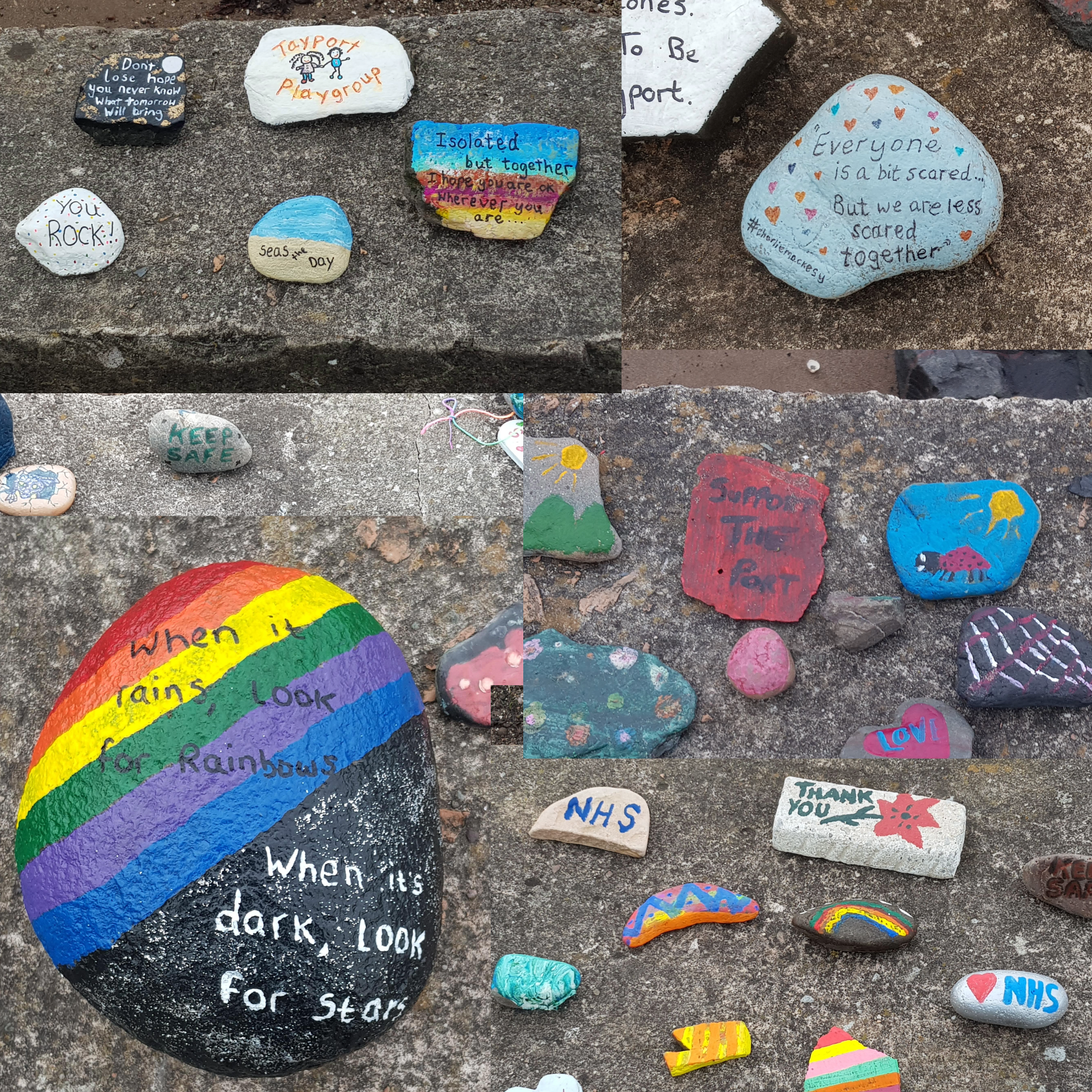
Upon emerging out the other side of the caravan park, I discovered that officially the coastal path does opt for the road, but oh well – the distance was the same either way. Ahead is a grassy park and a long seawall protecting the road from surf and curving along towards the houses of Tayport proper, ahead. The park is a popular spot for dog-walkers, but also for children as there is a pond in the middle, surrounded by reeds and acting as the home for numerous ducks and swans. During the pandemic the local school children painted stones with messages of hope and displayed them on the seawall for the community to enjoy.
From here, a walker has two options, though in fairness one is only sensible at low tide. There is a path along the wall between the houses and the ocean, though several times at high tide I found my feet damp from the waves when I chose this route. The proper route is to follow the road up and turn right along Harbour Road, through a residential area. The gardens in this stretch of town are well-kept, with lots of heather, lavender and daffodils, and looking up to the left affords a view of the way houses stack up the hill, with narrow roads between. Some of the bungalows along the waterfront are really beautiful, with gardens that face the ocean, but the seaside-dweller in me is a bit reluctant to trust being quite that close to the surf.
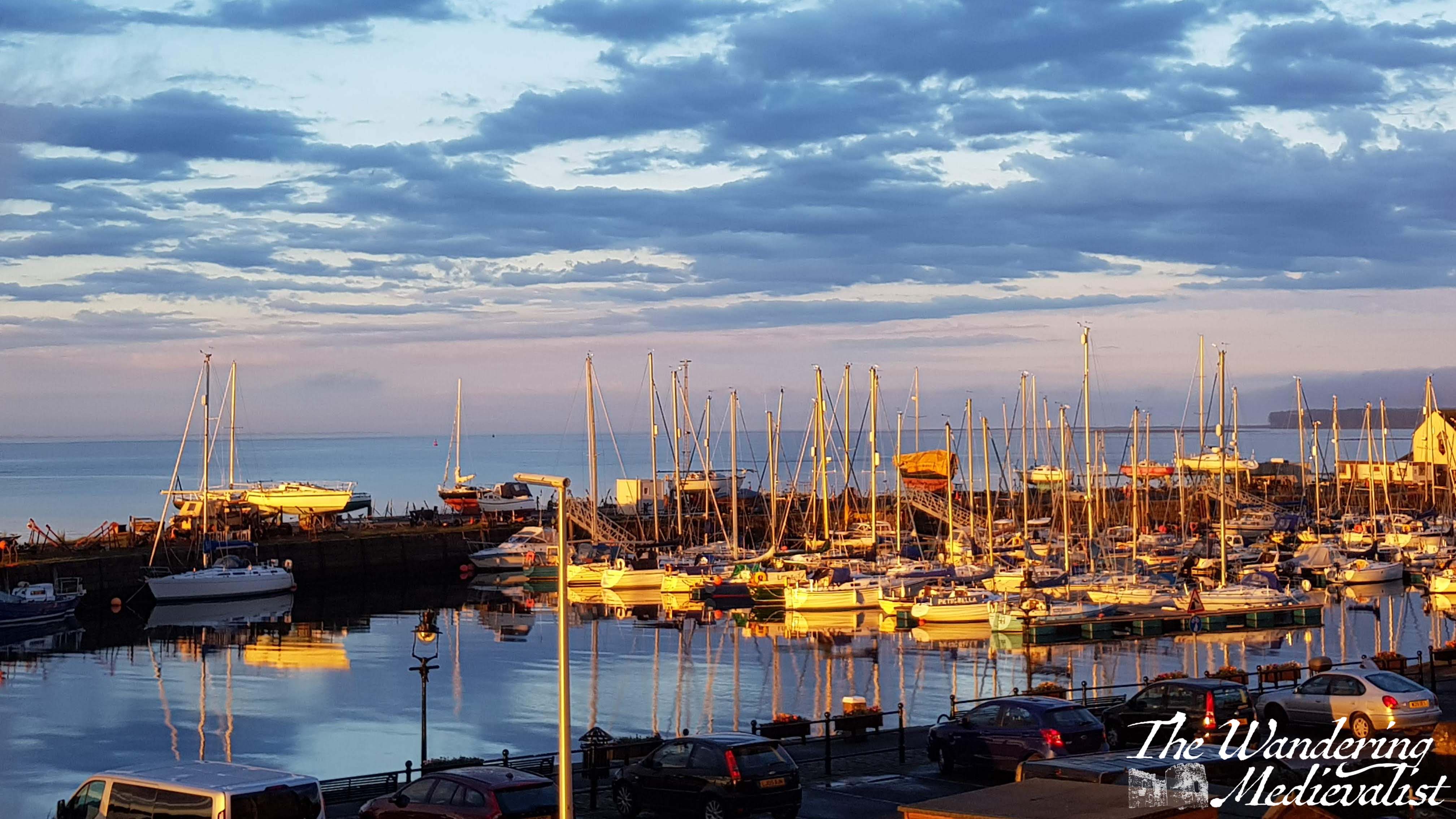
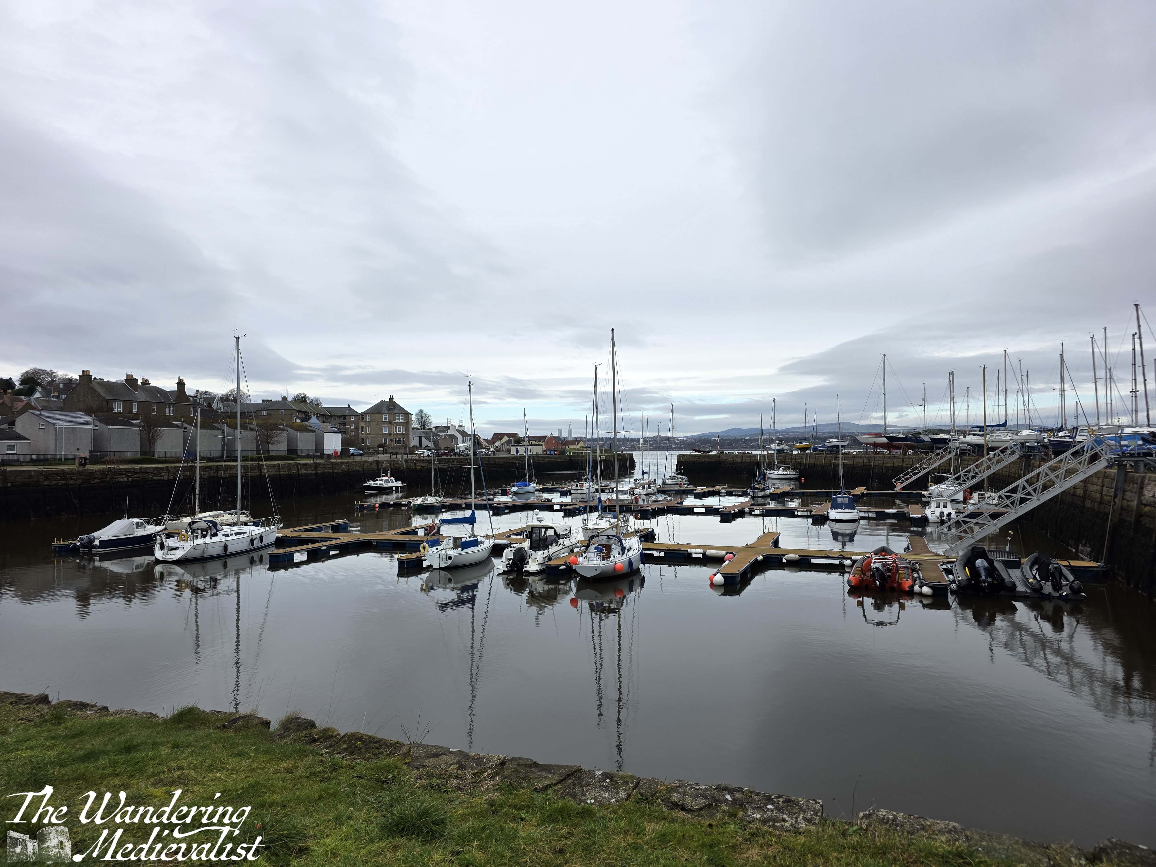
In a short time, one approaches Tayport Harbour, which was the site of one end of the ferry that carried rail cars across the Tay before the bridge was built. As one sees in Broughty Ferry, there is a wide ramp leading into the harbour which is still busy with fishing boats, pleasure sailing vessels, and of course ducks, swans, and the occasional seal. I loved lying in our house and listening to the halyards slapping against the masts in summer, a throw-back to my childhood sailing.
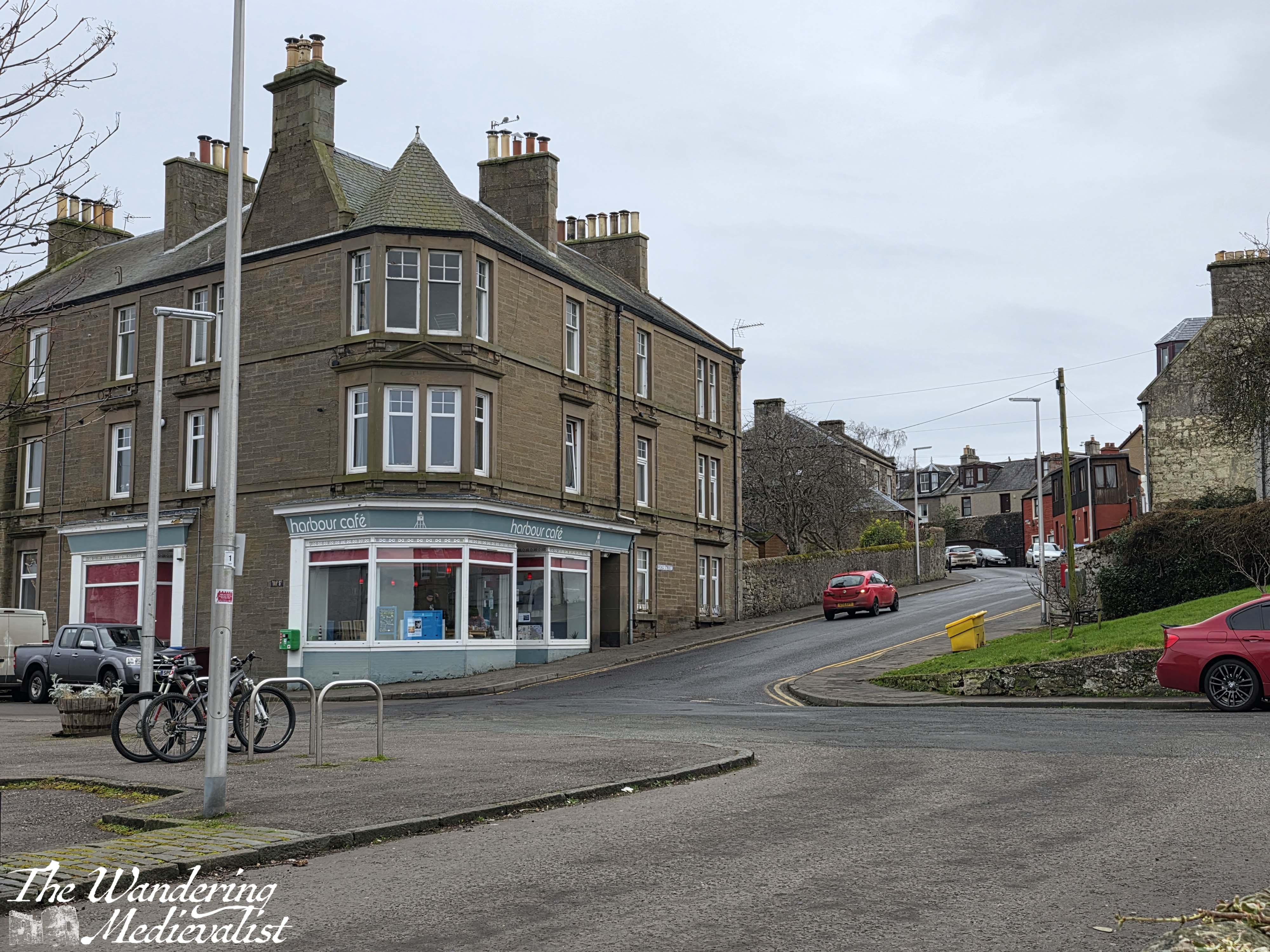
As I walked past the harbour on this occasion, I was pleased to see that the Harbour Café was still open, and I detoured up to the Main Street temporarily to pick up some lunch for later. One of my favourite things about Tayport was just how comprehensive the tiny neighbourhood Scotmid was. In a pinch you could find meat, veg, and anything you needed to make a quick meal; the variation in things you could buy always surprised me, from yogurt to fruit and veg, meat, pasta, snacks, beer, ice cream, sweets, and of course Scottish bakery items like pies, donuts and fresh rolls. It’s a perfect place to pause if you do need a bit of refreshment, and down by the harbour is a public toilet (you can pay by card or coin) that is mostly clean.
If you need a short detour, skirt along past the toilet block to walk out the grass knoll that juts into the water here, surrounded by a stone seawall. I spent many evenings here watching the water traffic, sunset, approaching storms, and moonrise.
Across the water is Broughty Ferry and the castle, and you can often hear the train whistle drifting across the estuary on a still day.
Continuing on the path leads you through a neighbourhood of obviously older houses, built in a style reminiscent of the fishing villages of New England, though of different material. Shortly, the path cuts up to the left between some houses, and leads through a set of bushes up to the road. One of my favourite views is just a bit further up on the right, standing at the edge of the steep cliffs and looking back at Tayport village and the view out to sea.
Following the signs for the coastal path takes walkers down a short decline, and here the path splits into – to paraphrase – the high road and low road.
The low road stretches out another half mile or so along the coast, through some woods and past several groupings of houses, some of which we watched being built through the pandemic. There are also two old lighthouses, one grey and one white, which I frequently photographed from the rocky beach below. In fact, this was a good loop for us as there is a path where the lower road ends, that cuts up to the main route. But I’m getting distracted.
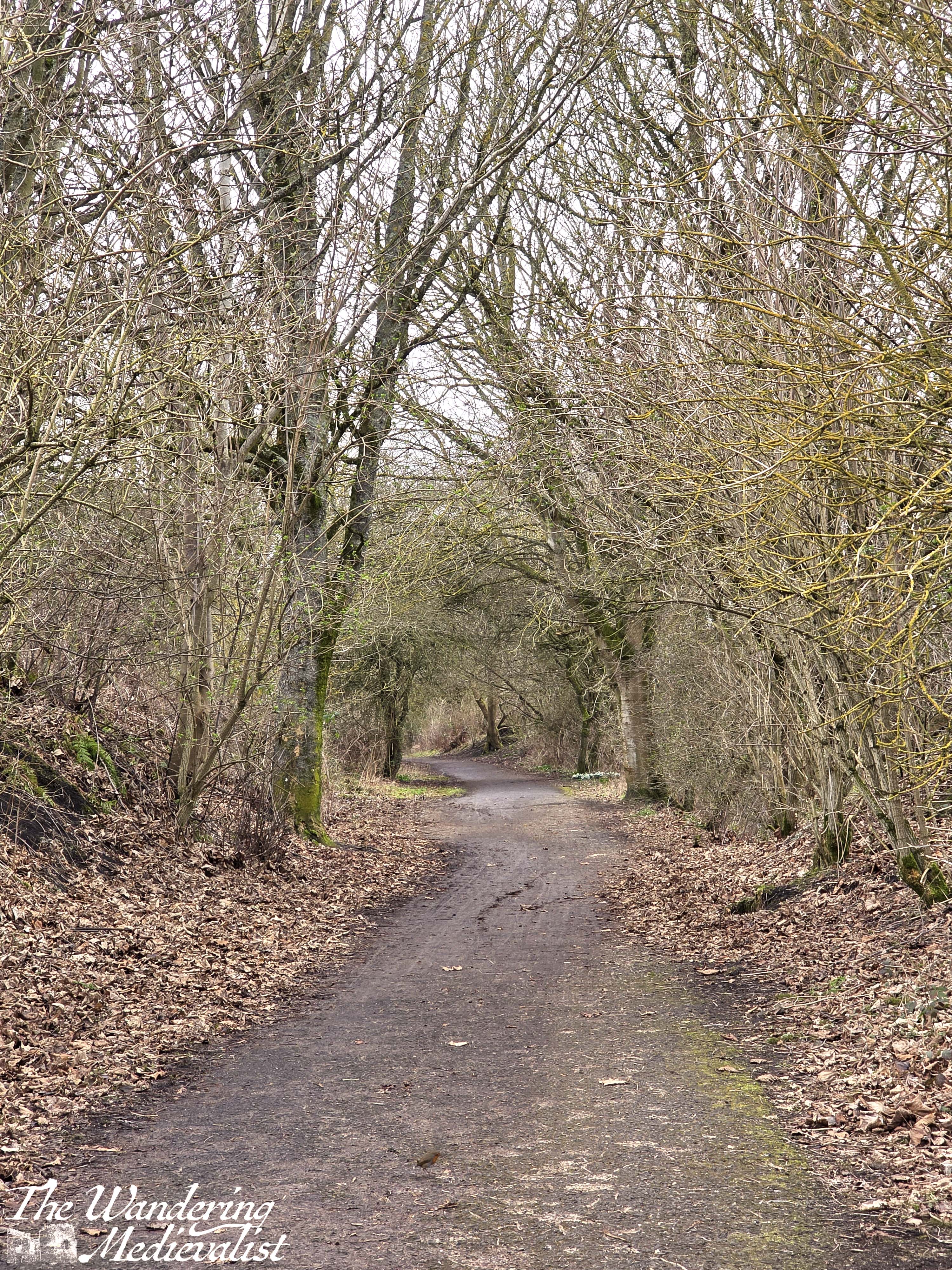
The higher route is the proper coastal path and runs through a wooded area. It is well-paved here and worth remembering that it is also a cycle path that is very well-used; while in my opinion it would be ideal always for cyclists to alert you to their presence by use of a bell, but far too many seem to assume you will hear them and just speed past.
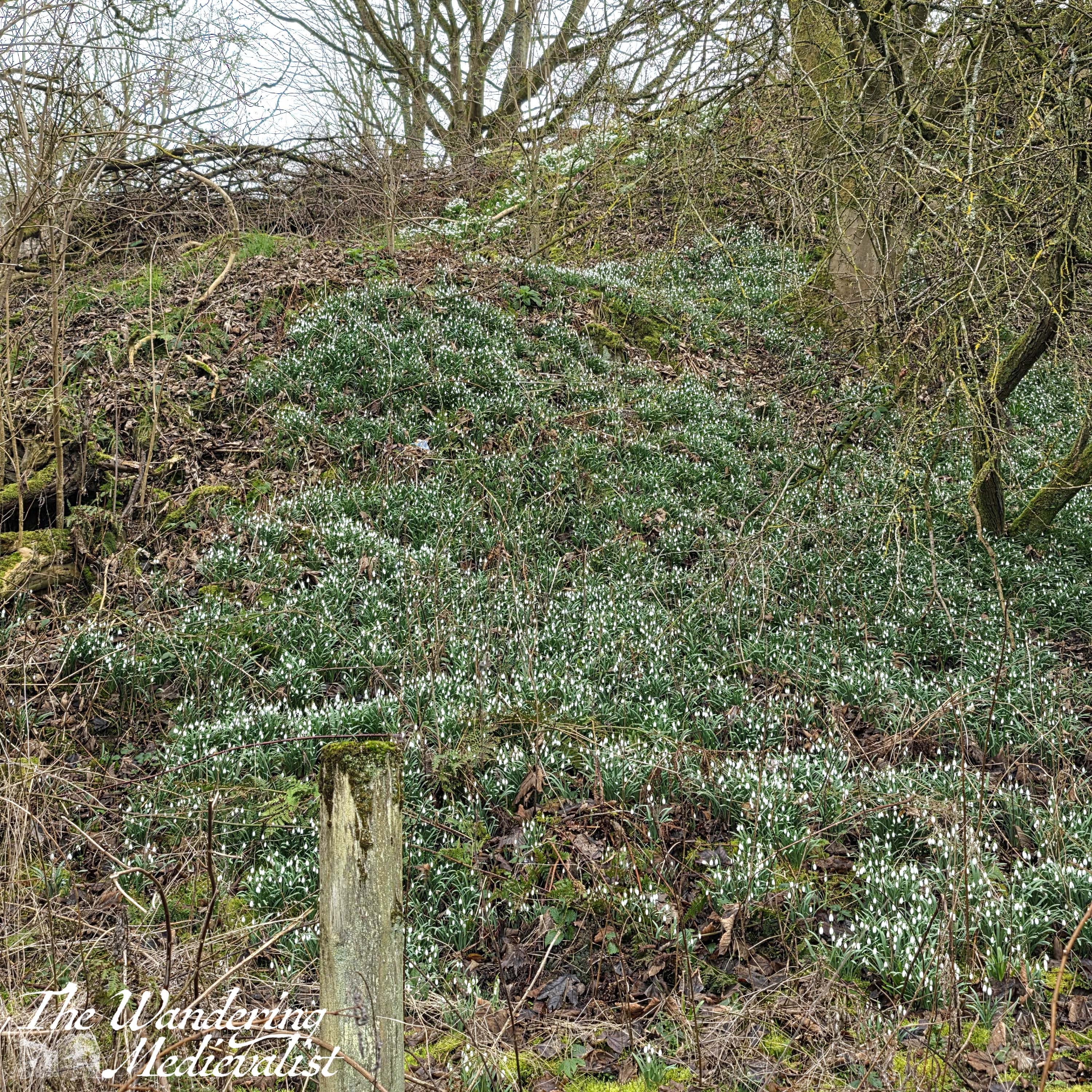
On my walk I was pleasantly surprised to find the hills liberally covered with snowdrops, standing out from the grey-brown winter brush. Gradually the road rises above the coastal path, which quiets and becomes very peaceful.
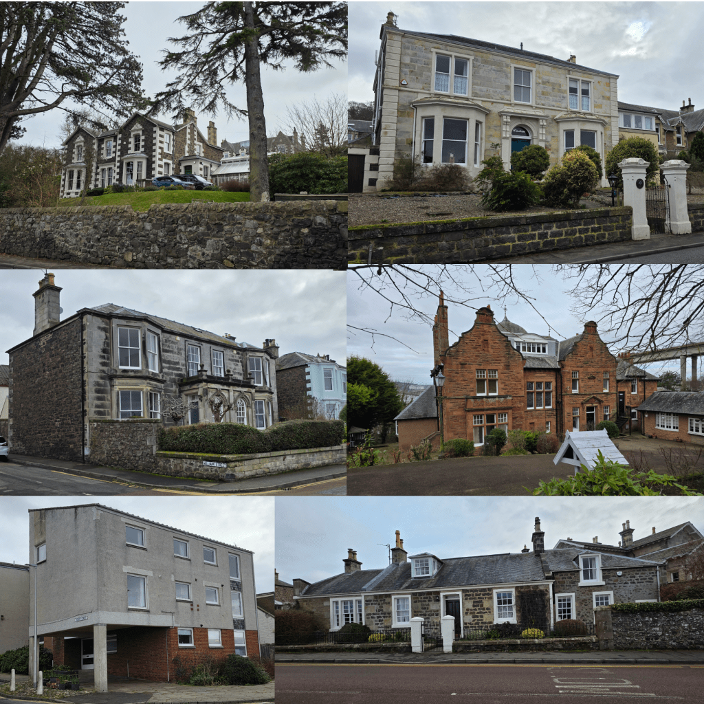
A little aside here about Tayport, which I have massive affection for. The town is an odd mix of beautifully kept older houses and also a number of newer, less affluent neighbourhoods. The closer you get to the harbour, the less affluent the housing becomes, while walking up to the top of the hill allows you to pass by some almost mansion-like houses clearly built by rich families from Dundee during its more prosperous era. There is some really lovely architecture and gardening, and houses from a number of different eras.
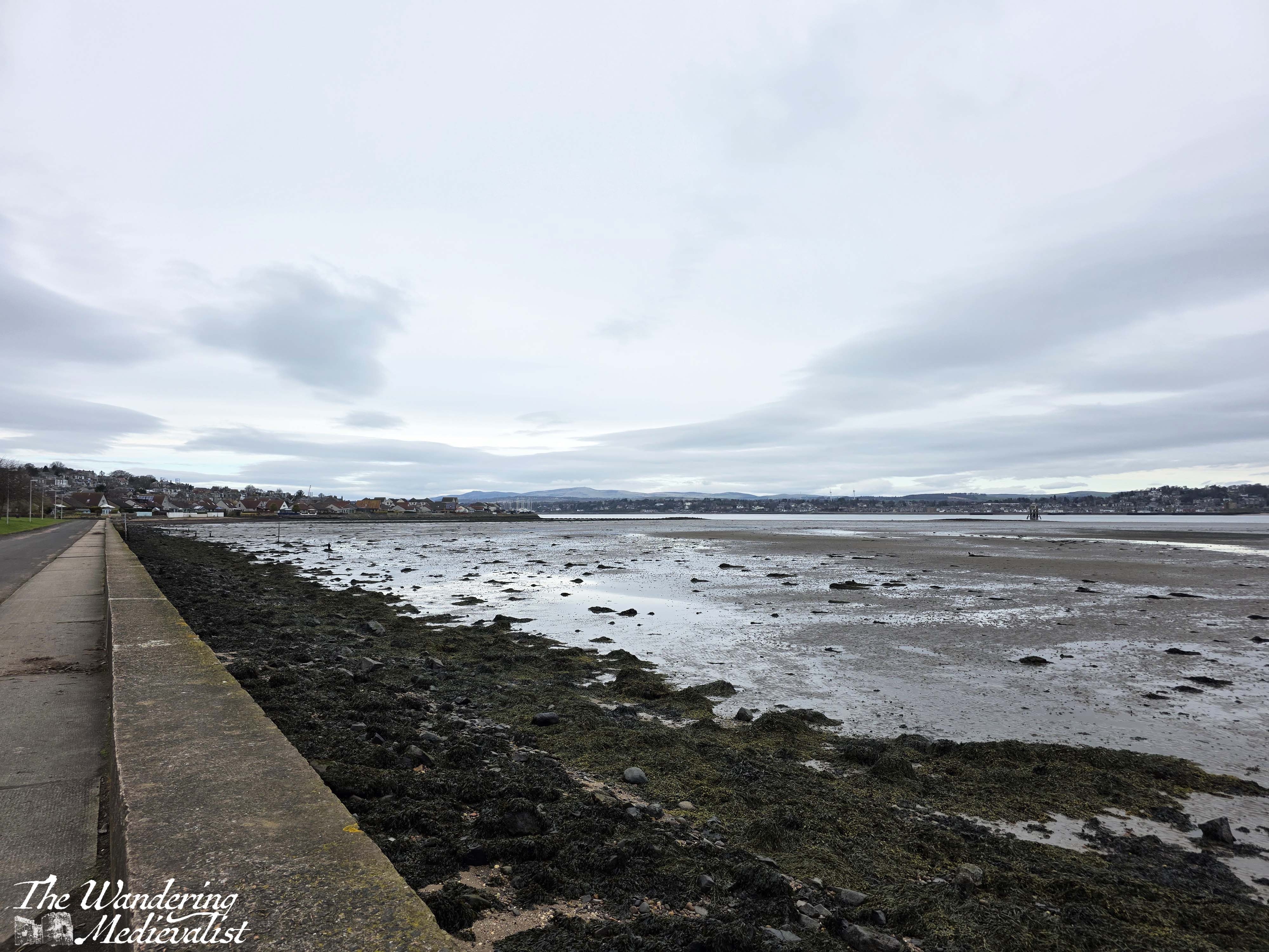
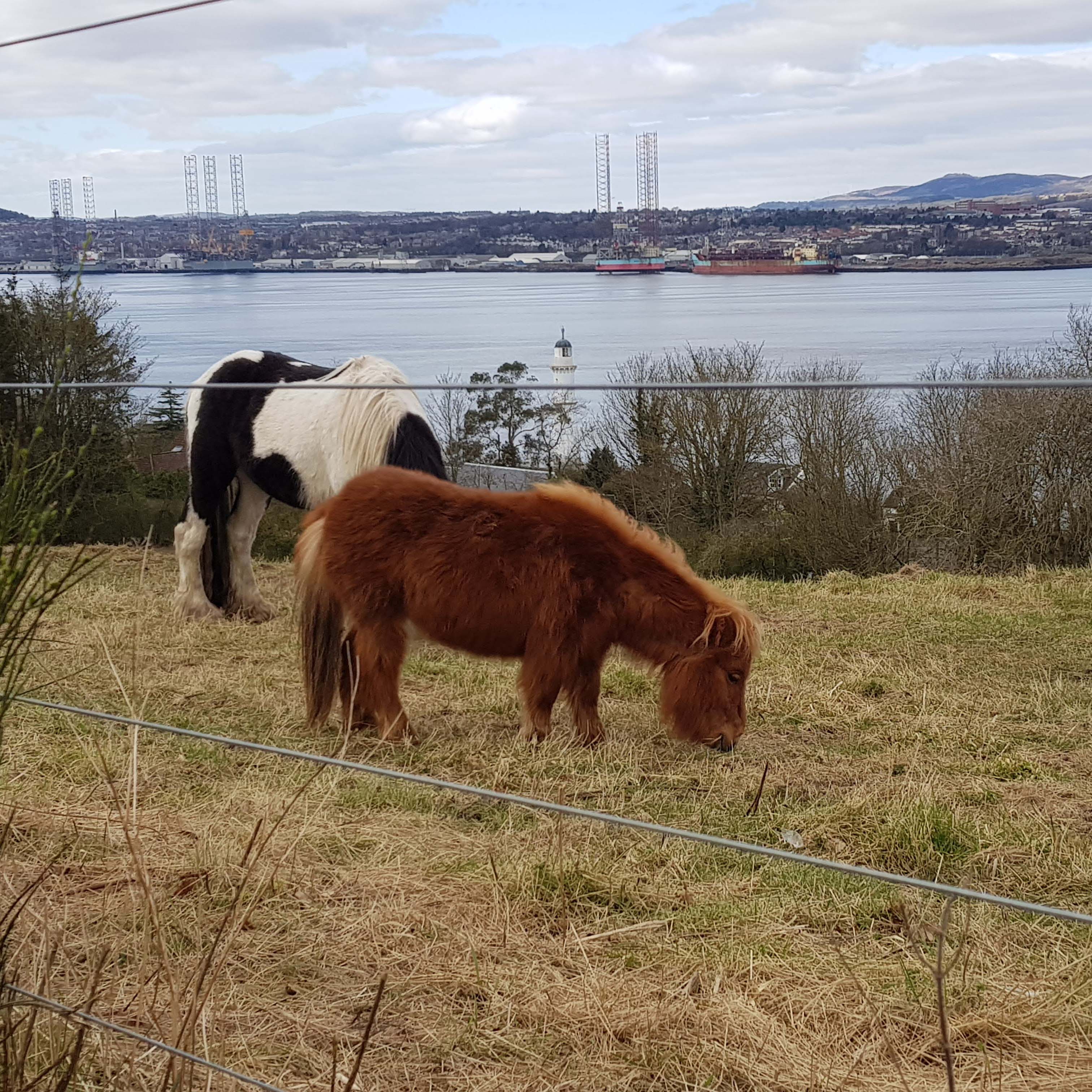
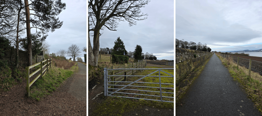
As the coastal path leaves Tayport, it crosses several wooden-edged bridges, and as the houses vanish into fields, you start to get a view down towards the water, and a pasture on the left where miniature horses live. Shortly beyond the horses, the wall of the town cemetery rises up from the hill, and you can see Dundee and the Tay Road bridge in the distance.
If you are planning a Tayport loop this is another place where you can cut up through the cemetery to the main road, or here you are about one mile from the bridge. The trees disappear into open fields, and the wind will hit a bit harder and make it colder than when the path was protected by woodland. You will be able to catch sight of the tall Scots pines of the Scotscraig estate on the top of the hill – I had always wanted to walk through the estate but it was closed during the pandemic; it looks open again now.
Presently the coastal path moves up closer to the road, though there is still a solid stone wall between walkers and traffic – a relief as the cars to tend to zip along this stretch quickly. It’s a bit less peaceful with the road noise, though many of course choose to walk with headphones in, I generally prefer not to.
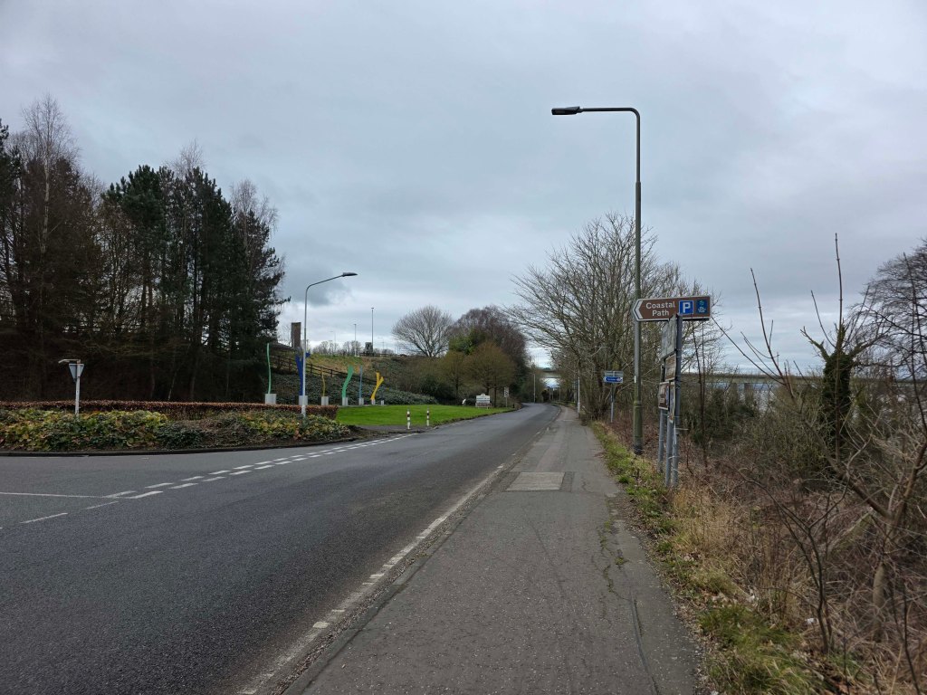
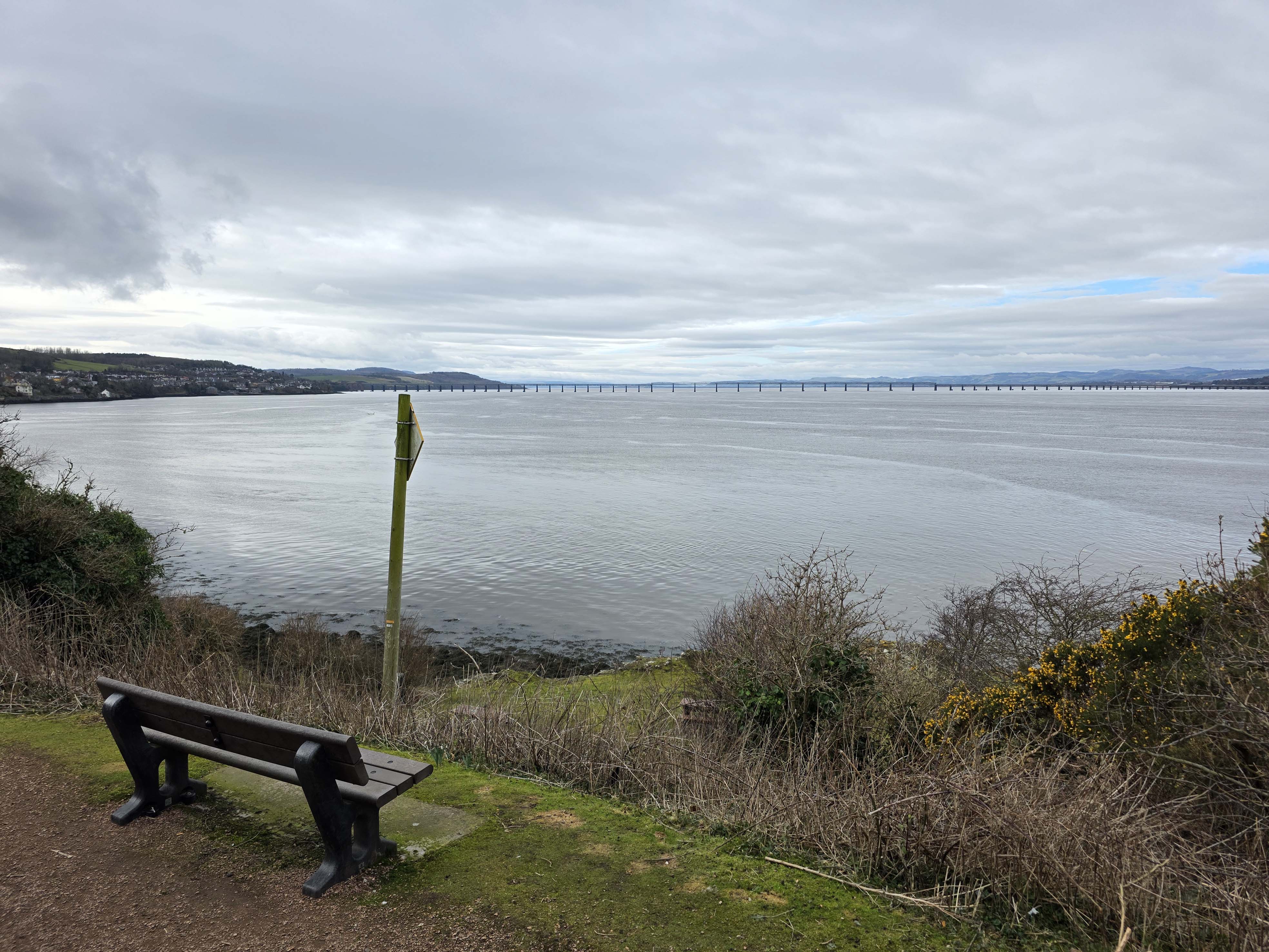
There are a few small groupings of houses on the upper side of the road, and in a short time the path approaches the Tay bridge; this is an excellent place to park or pick up the bus.
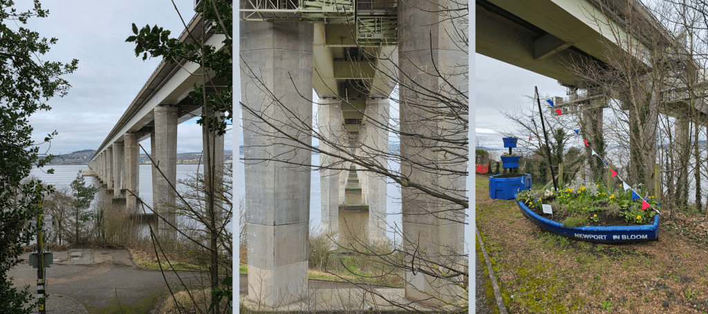
At the top car park, there is a public toilet and a stand that sells snacks and drinks, always smelling delectably of Scottish square sausage and bacon. My walk took me straight along the path however, and as you pass under the bridge, you get an excellent view of the structure and pylons. This is also where the town of Newport begins; immediately there is a stark change in architecture.
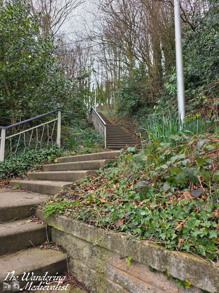
Stone steps leading from Newport to the bridge car park
The main road of Newport, along which the coastal path leads, is a lovely mix of beautiful old stately houses and more modern homes designed to fit in with the coastal surroundings. Gardens are well-tended, and the traffic slows well down as the road narrows to just allow two vehicles to pass.
It is hard not to enjoy this part of the walk, about half a mile of enviable residences with a myriad of architectural quirks.
In about five minutes, the houses on the coast side disappear and there is a narrow park with steep stairs allowing access to the rocky coastline, and views westward to the rail bridge and the coast of Fife.
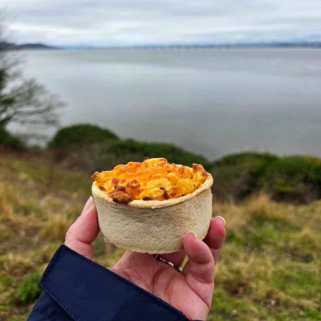
For my walk, I decided that my stopping point was the War Memorial, just short of the main roundabout in the village. This part of Newport is the High Street and boasts some lovely independent shops and bakeries; I chose to sit on a bench looking over the view and enjoy the lunch I had picked up back in Tayport – the Scottish invention I still marvel has not crossed the Atlantic: a macaroni pie.
God’s food, the macaroni pie (yes, macaroni cheese in a portable pastry shell)
I really enjoyed this portion of the coastal path, and it was a good distance for a Saturday morning. Once I had walked back to the bridge to wait for my bus home I was getting closer to 5 miles total walked, so I decided I had well earned my carby, cheesy lunch. It’s a relatively flat walk – except for a hill in Tayport – and includes some lovely views, neighbourhoods, and some quiet woodland.
Work and life have gotten in the way of my making any more progress on the coastal path in the last week or two, but that was partly due to a trip to the Highlands which I will regale you with soon!
Oh…and my new walking/hiking boots were excellent! First time on and not a blister to be had. Well done Mountain Warehouse!
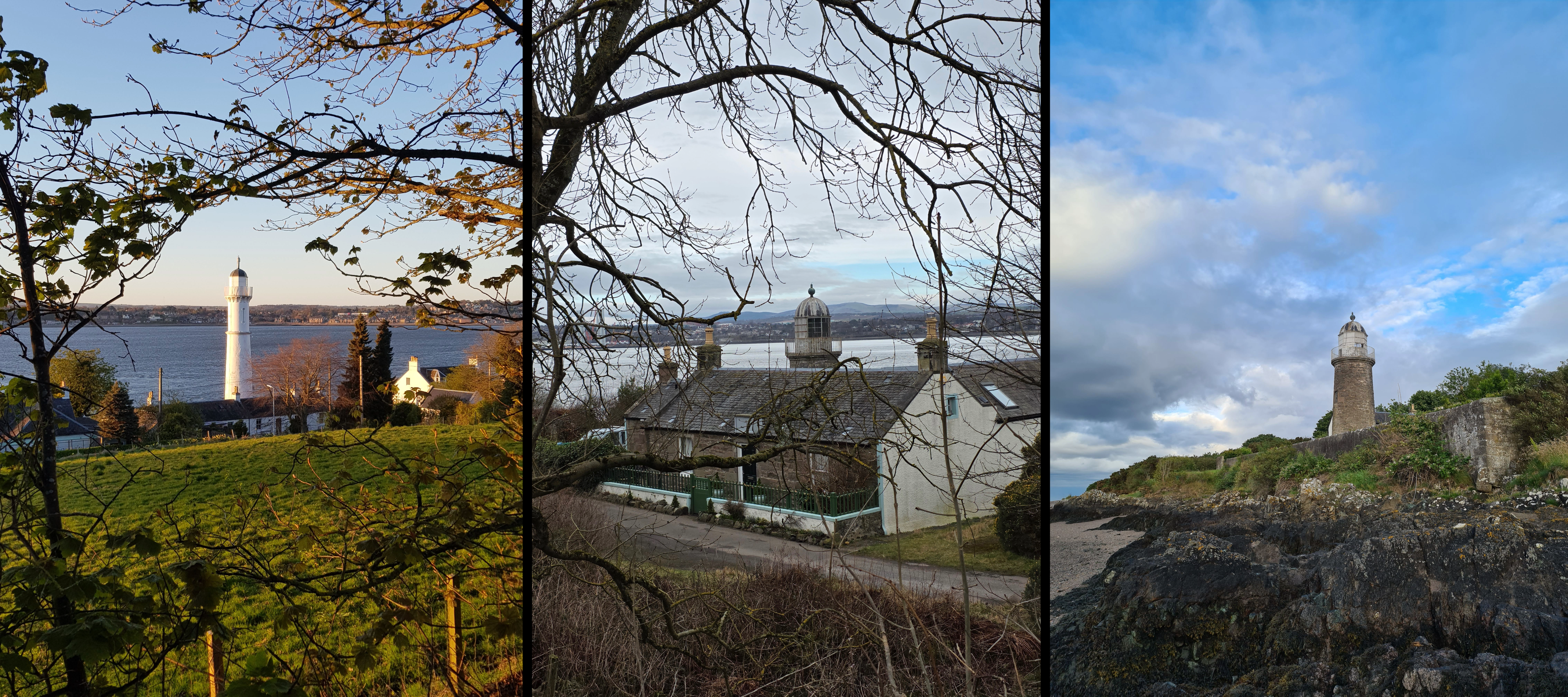
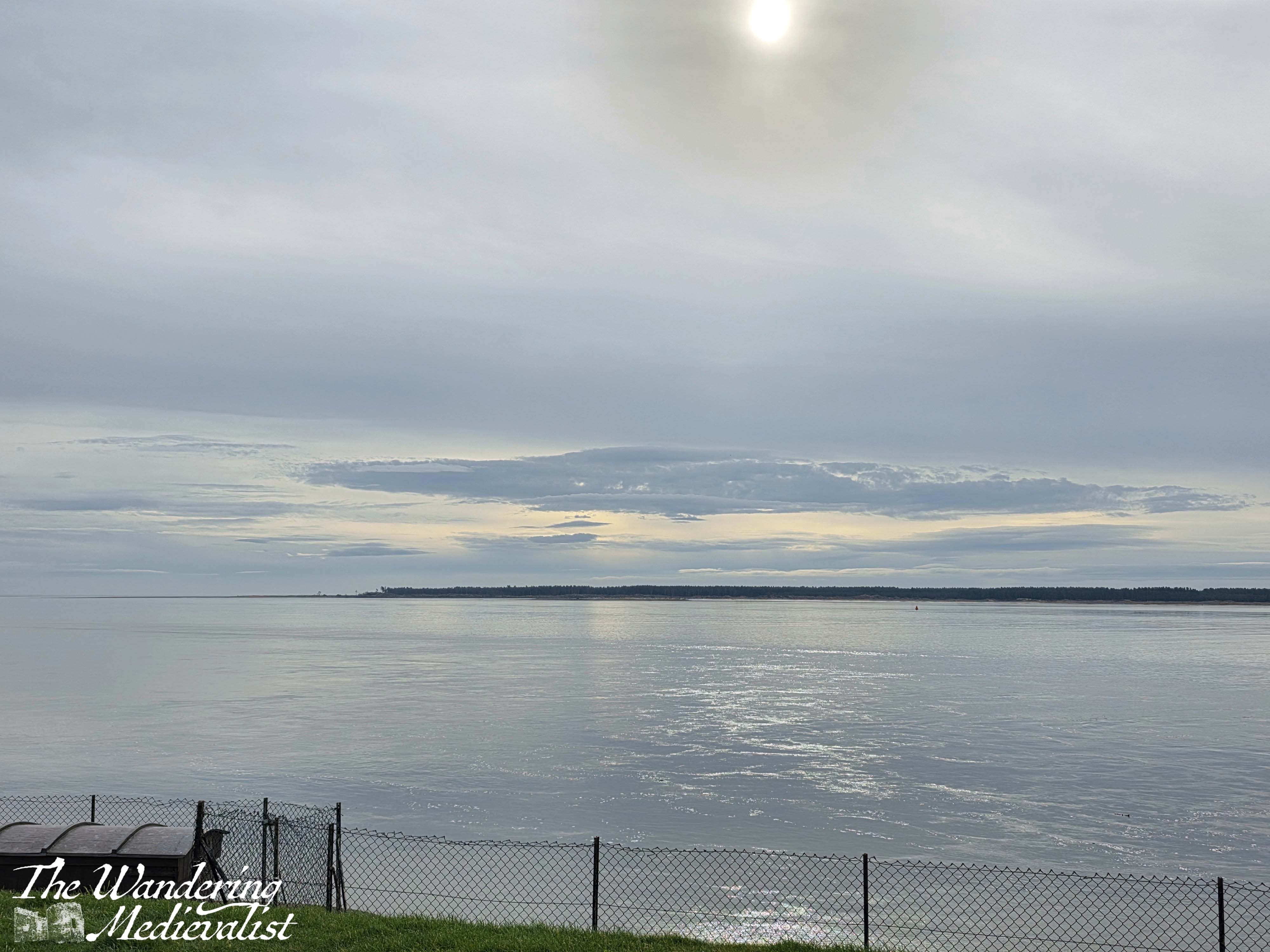
As I have doubtless mentioned before, we lived in Tayport, Fife during the first six months of the Covid pandemic in 2020, and for about a year before that. One of the main reasons I loved our flat there was that the view was spectacular – right out over the Firth of Tay, where I could watch the busy boat traffic and the currents changing. Sometimes there were dolphins, but more often it was just the view I loved – the changing weather and light as I looked across to Broughty Ferry and its castle.
For years I saw the castle only through the zoom lens of my camera, but was determined to eventually see it up close. Finally, as part of a work event that included a bit of regional exploration, I have been able to do so!
Location and History
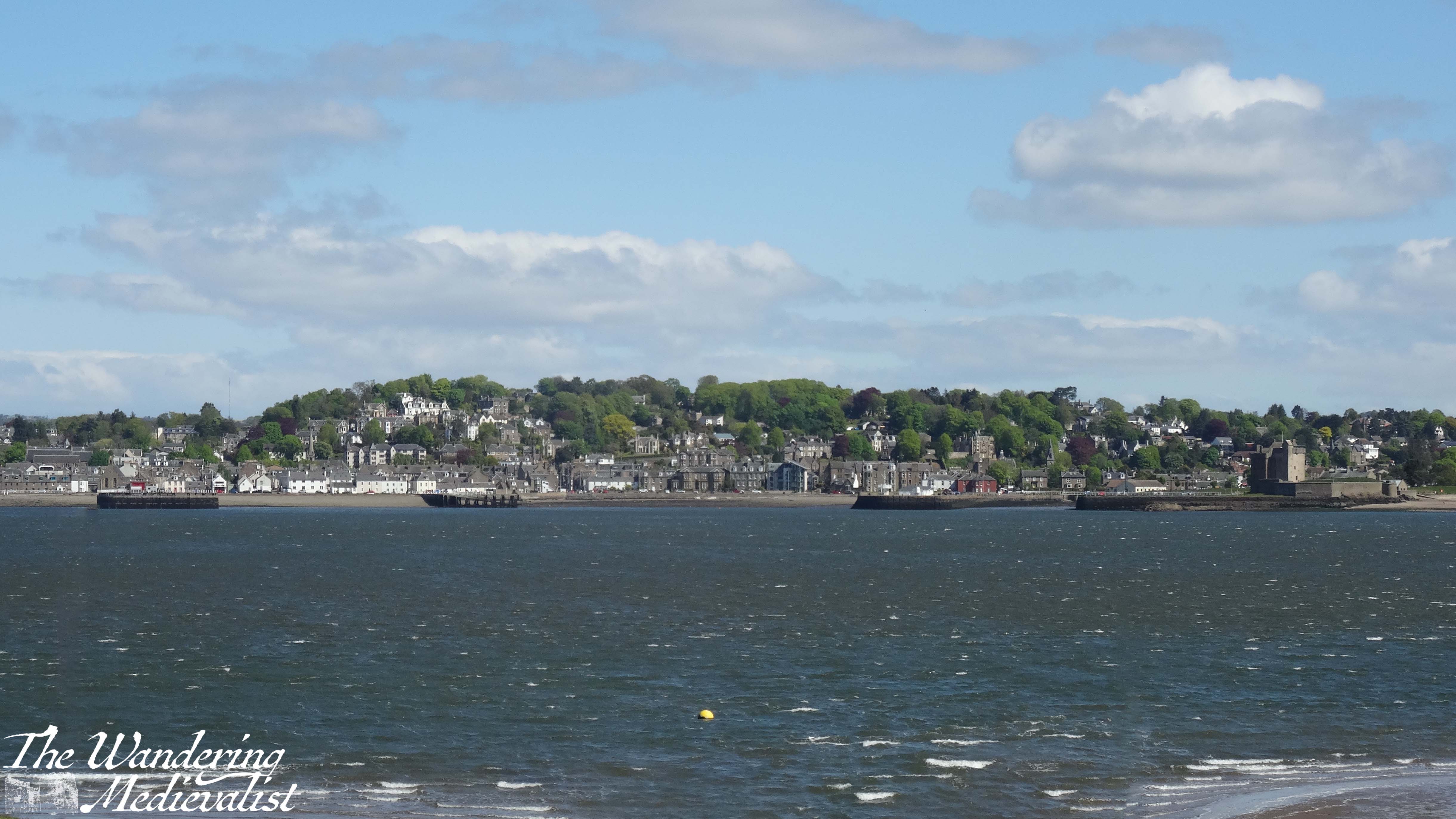
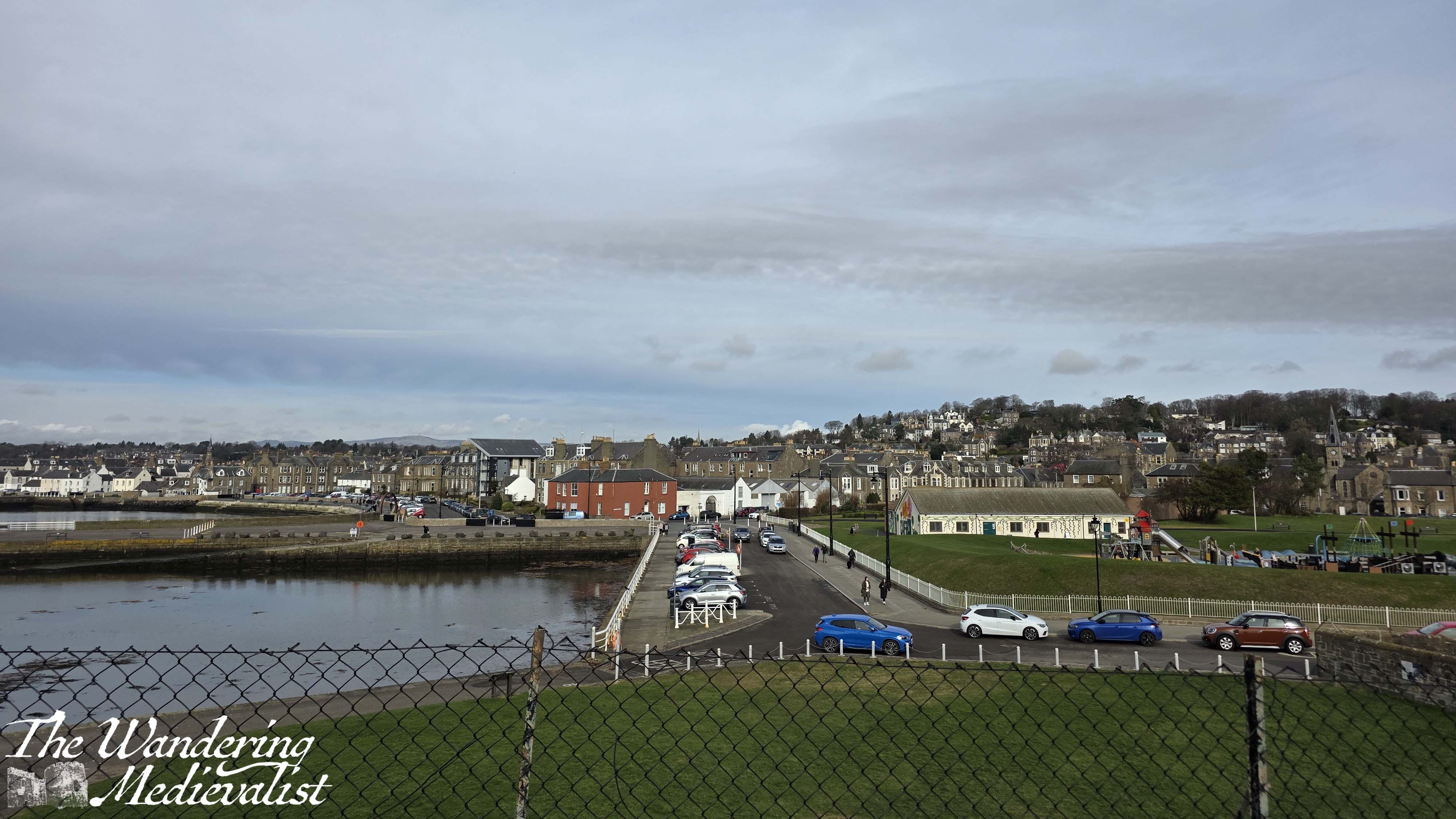
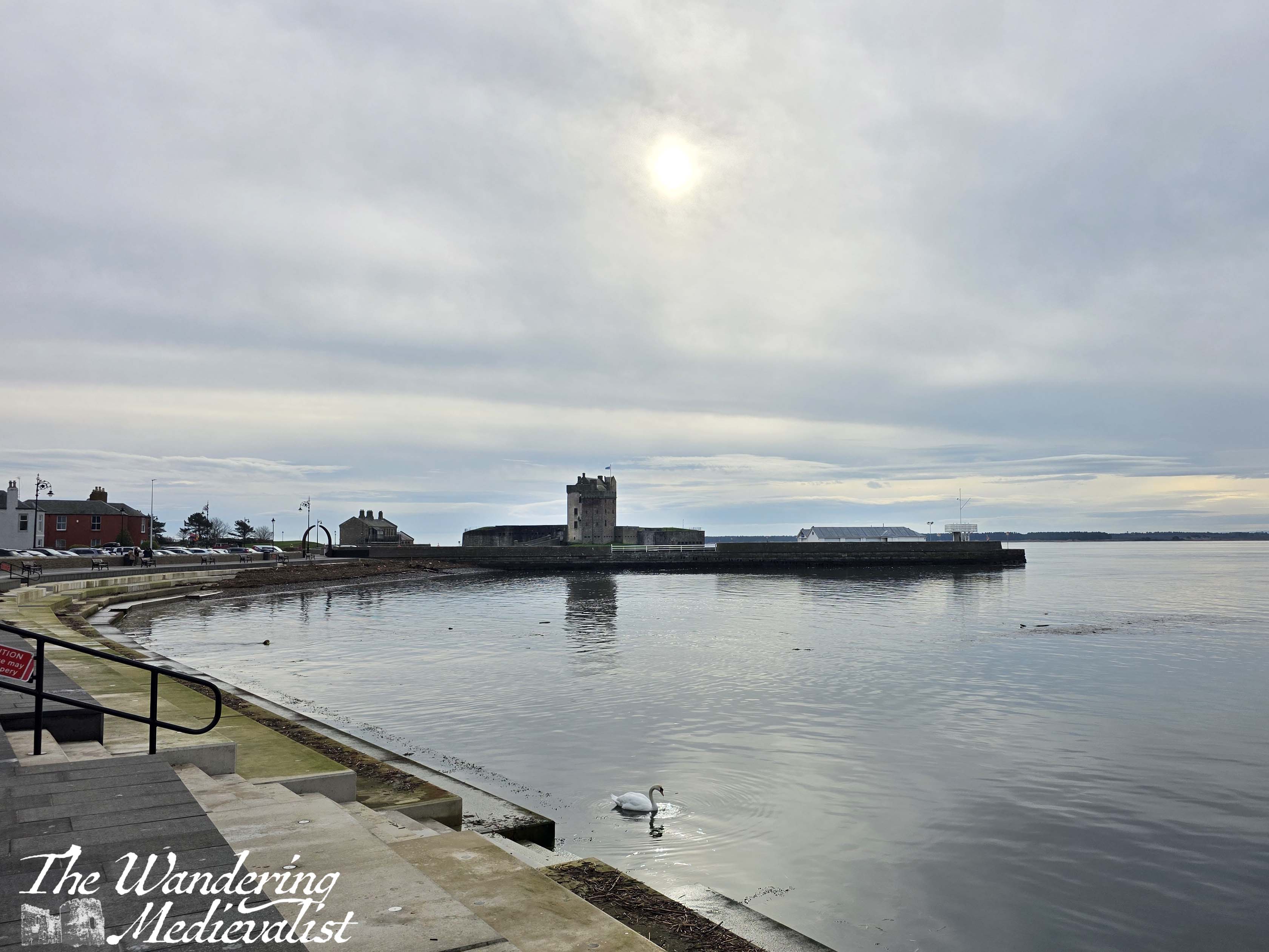
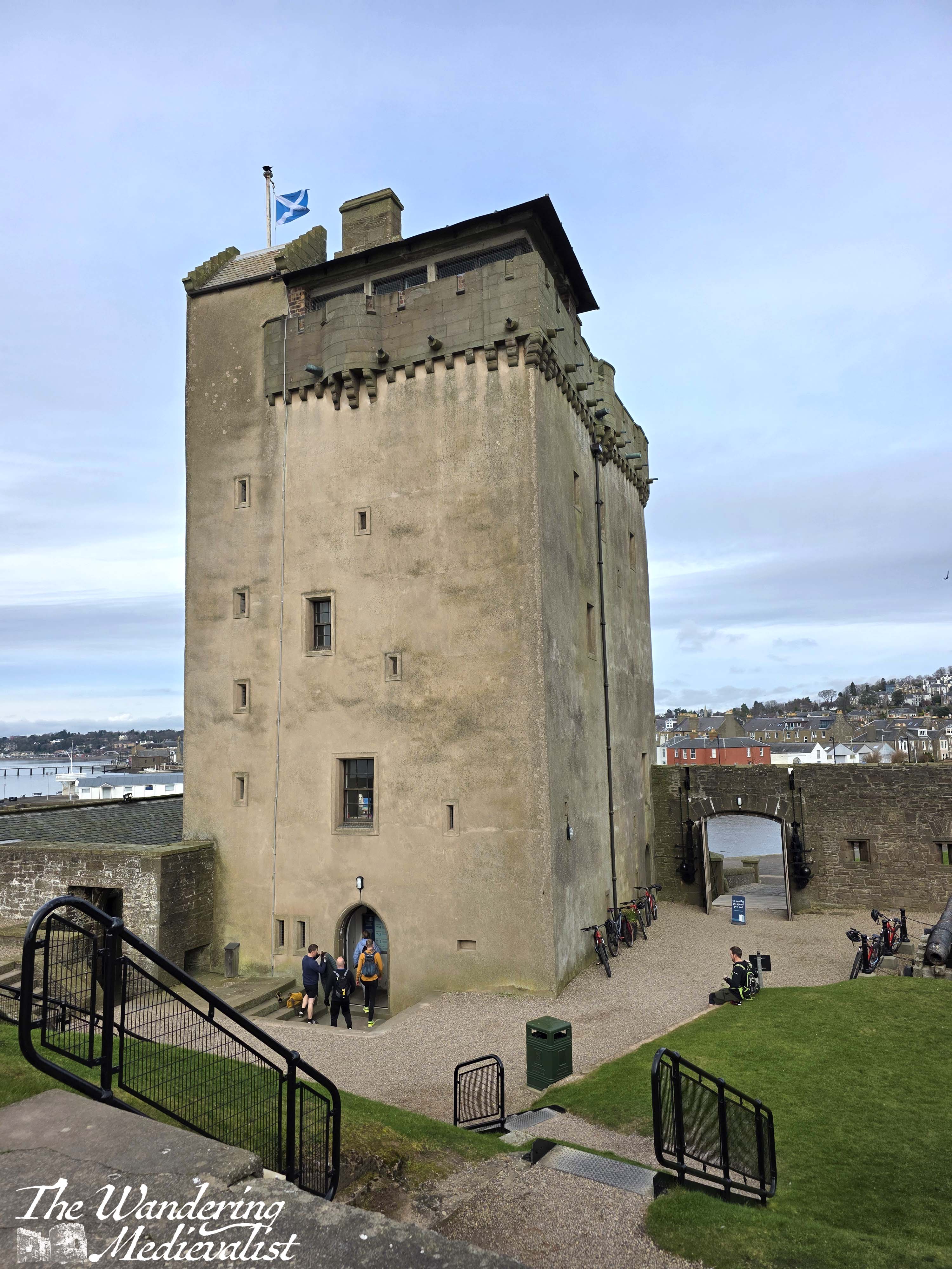
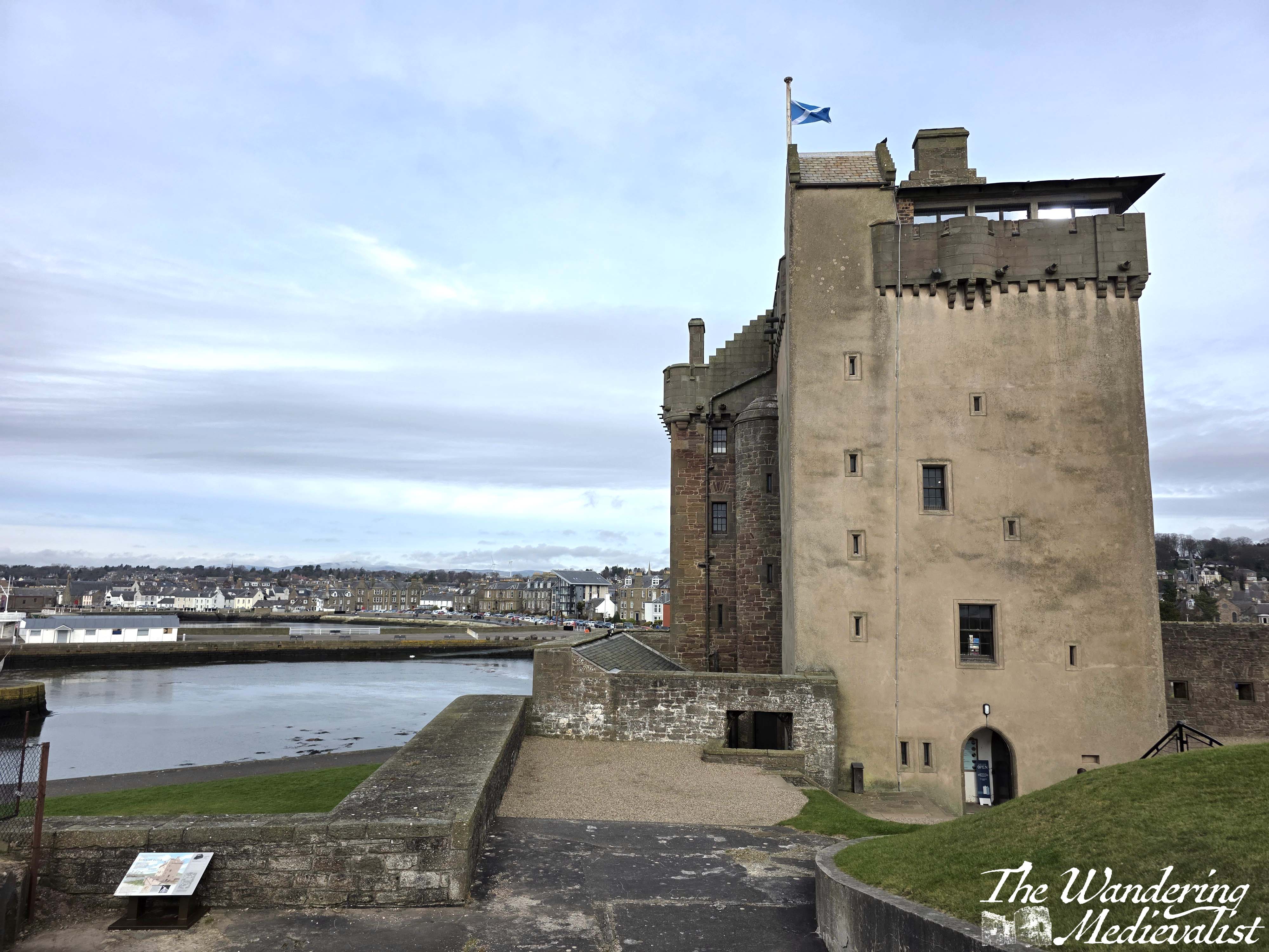
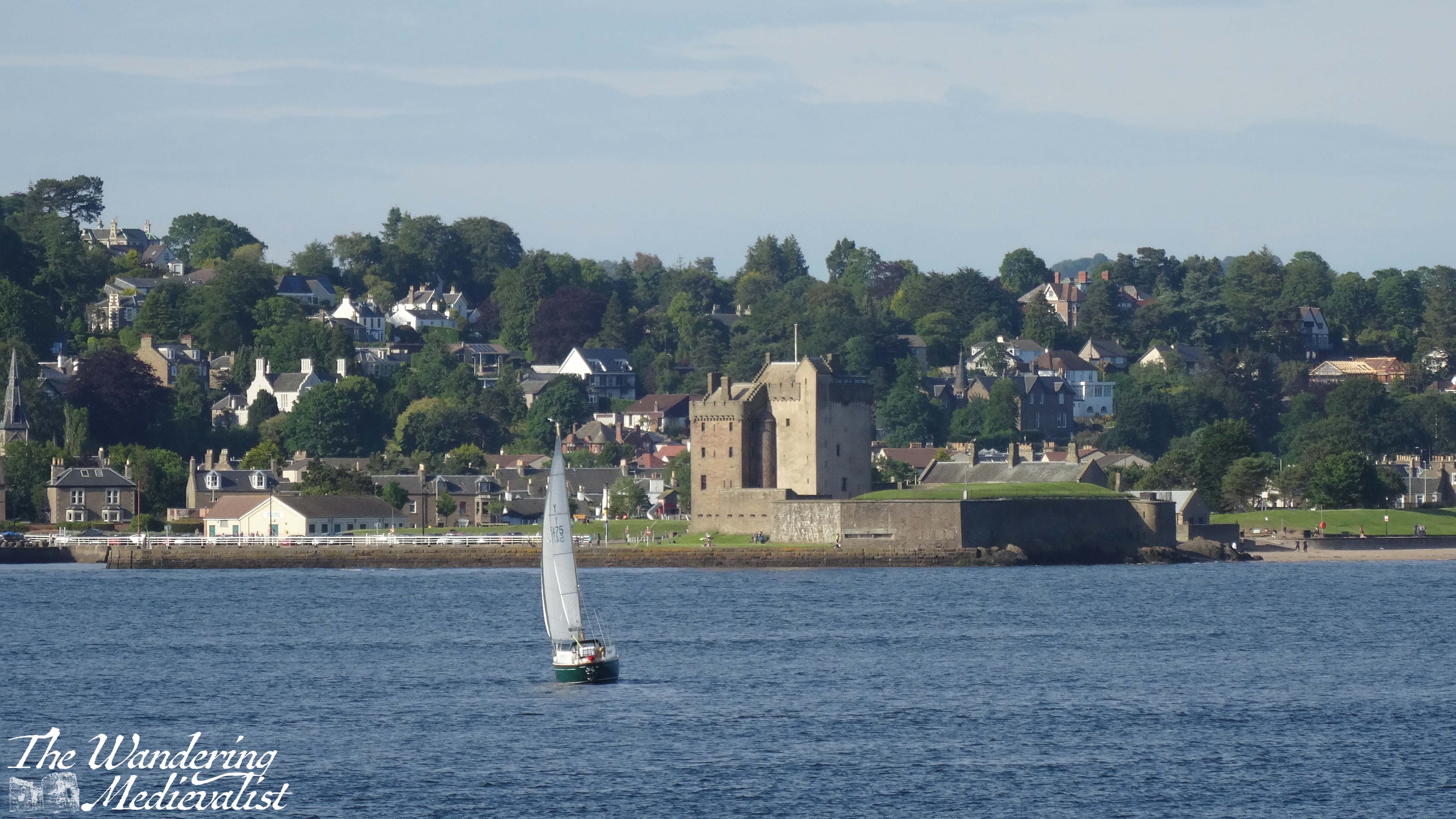
Broughty Castle is located at a prominent point on the northern edge of the Firth of Tay, about 5 miles east of the centre of Dundee, with a sandy beach on one side and sheltered harbour on the other. It is easily accessed by public transport, with busses running regularly and trains taking only 5 minutes from Dundee. From the Victorian-era train station, the walk to the waterfront is less than 10 minutes.
Broughty Ferry rail station
Broughty Ferry itself is a charming coastal town with plenty of unique shops, cafés, restaurants and pubs; it is easy to see why students and staff from Dundee might wish to live here or visit on weekends. Formerly a prosperous fishing village, in the nineteenth century the town became a key location for the wealthy jute barons of Dundee to build their villas and estates.
Even before this, Broughty Ferry was important as one end of the ferry that carried rail cars across the Tay on the line running from Aberdeen to Edinburgh. The other side was of course in Tayport, which previously was known as Ferryport-on-Tay (and in fact a sign bearing this name still exists at the edge of town). The enormous ramps leading into the water, wide enough for the rail cars, are both still visible today; the construction of the first Tay Rail Bridge in the 1870s rendered this ferry moot, though there is a reconstruction of it in the castle museum.
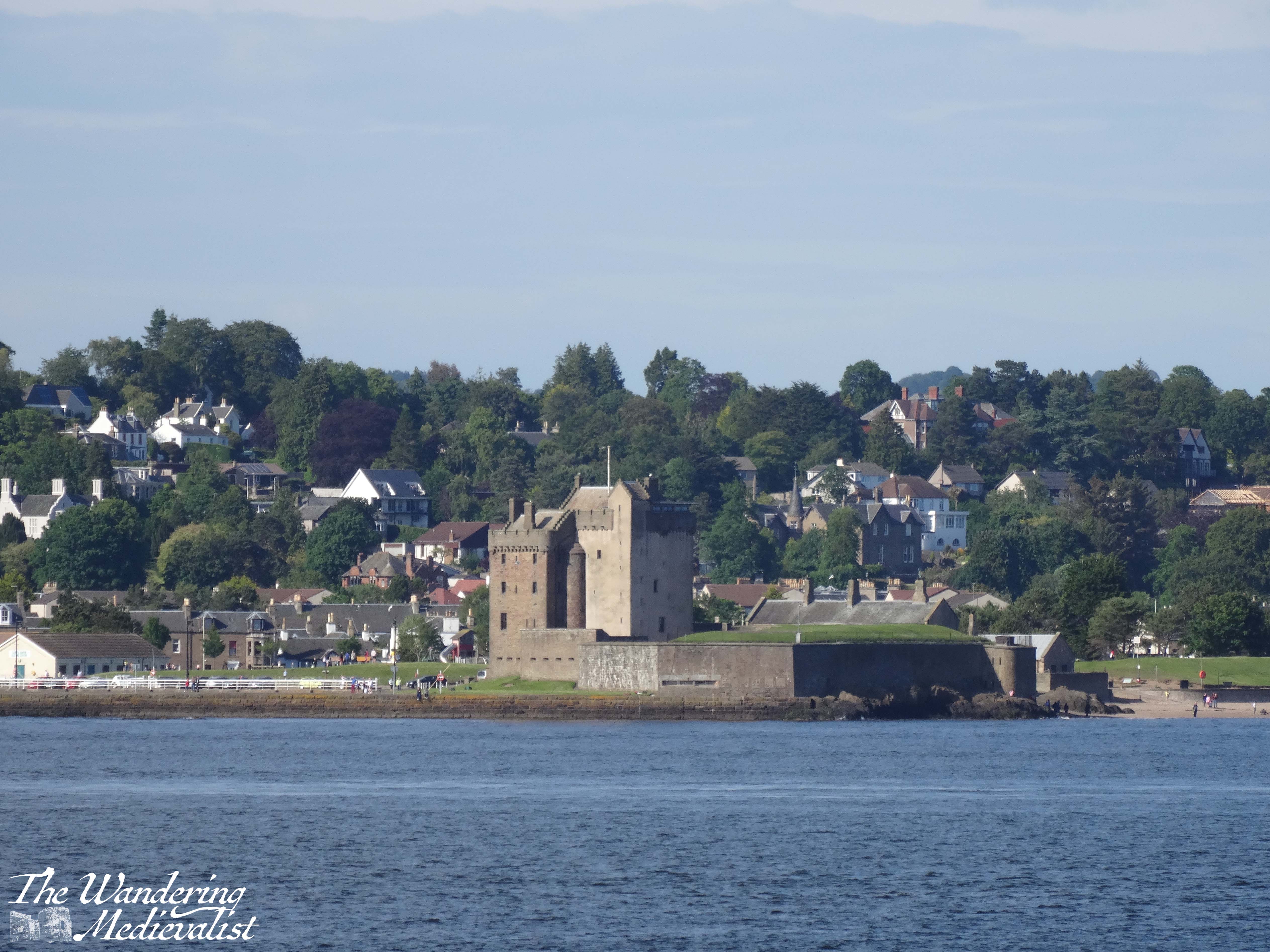
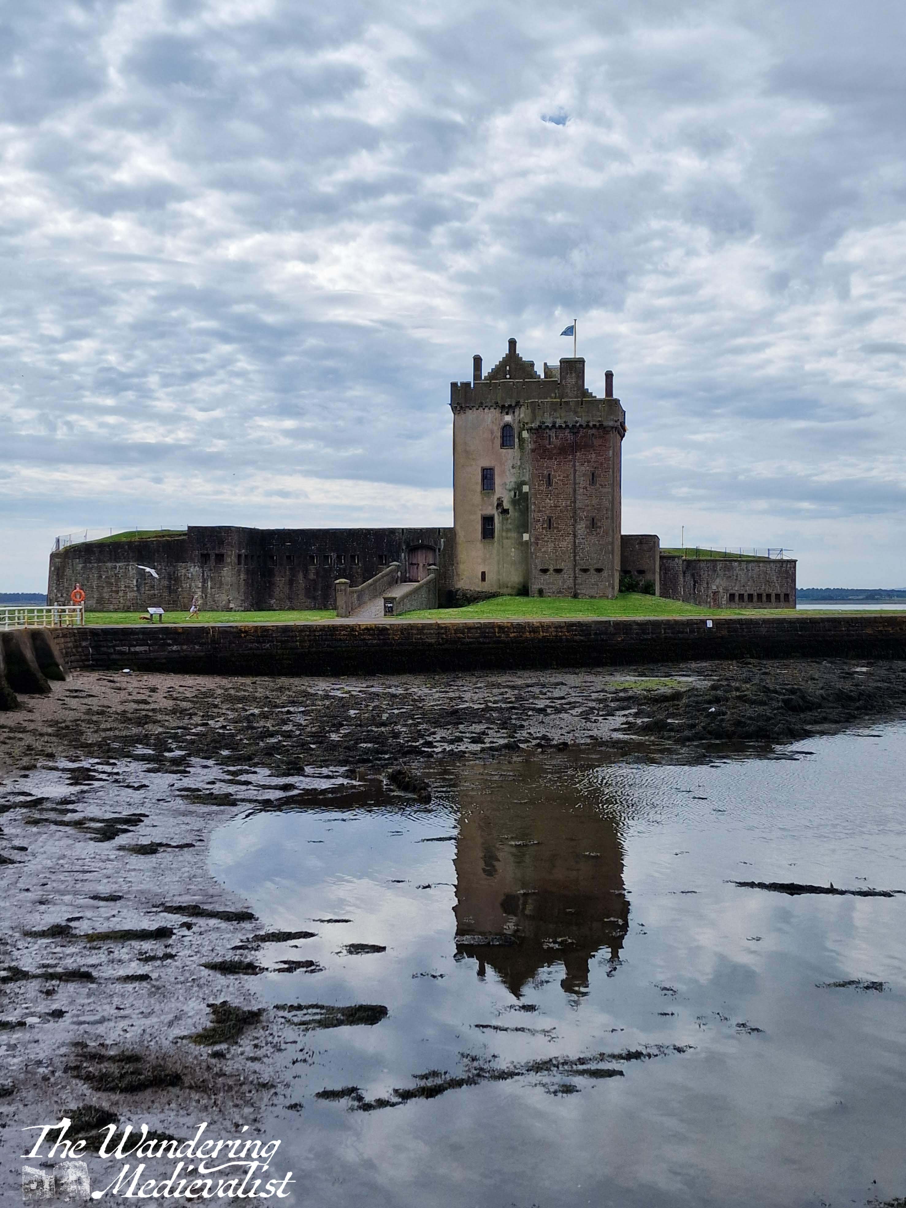
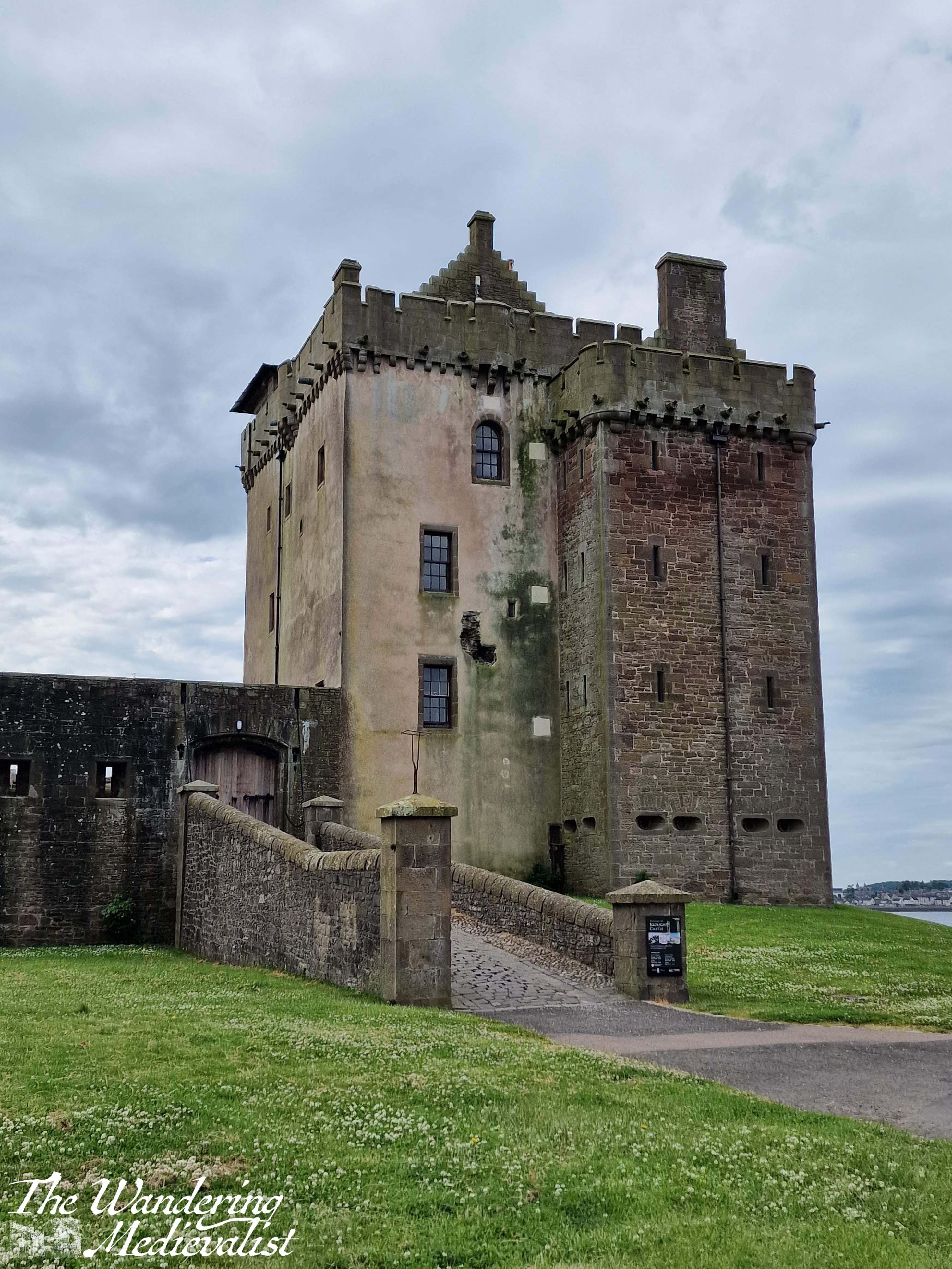
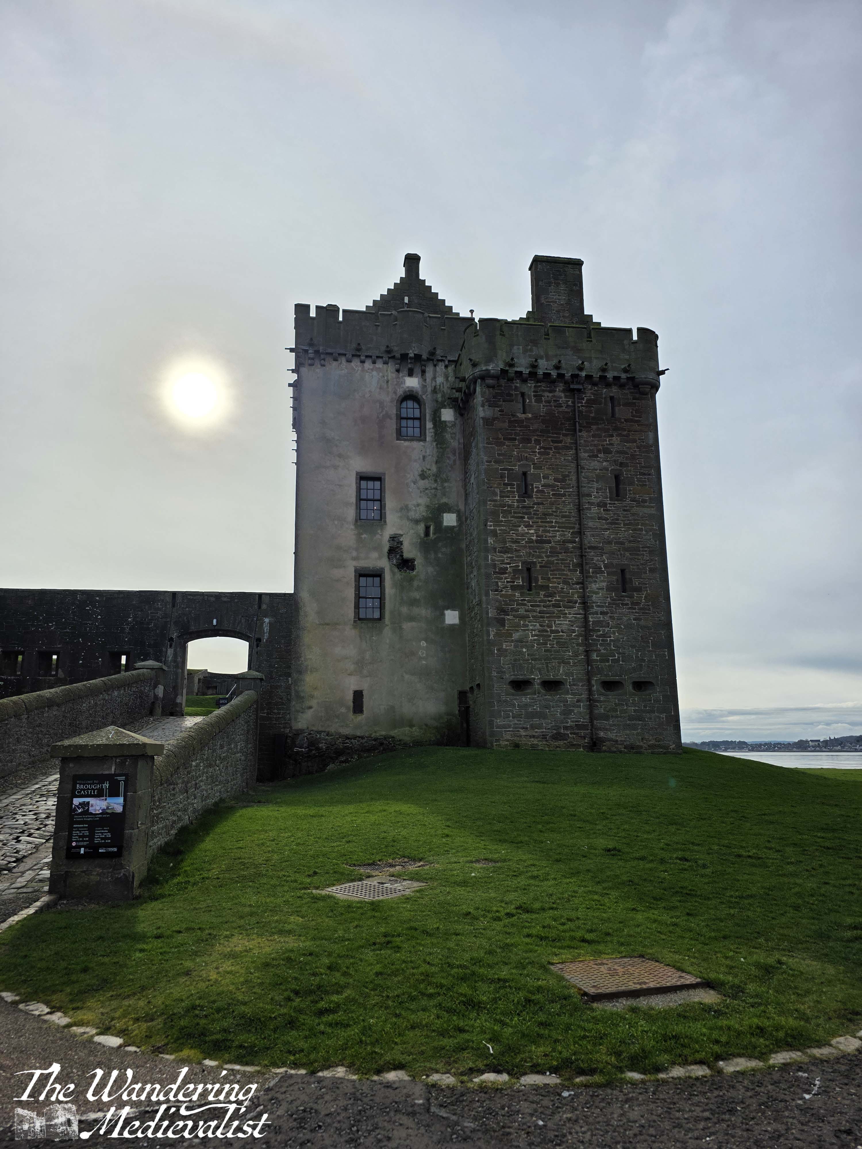
Relatively ‘new’ for Scotland, Broughty Castle was constructed in the 1490s; the strategic location is clear as you have an almost 360°view of the estuary, coastline and ocean beyond. There had been fortifications here for several decades, and a number of English ships were captured off the coast in the late fifteenth century.
The castle did go through a period of decline in the eighteenth century, but it was purchased in 1846 by the Edinburgh and Northern Railway, which built the harbour for the rail ferry. Ownership was passed to the War Office in 1855, and so it came back into military use.
The castle would remain in use as a defensive structure through the Second World War, when a defence post and lookout platform were placed in the main tower.
My visit
The castle is located at the end of a promenade along the coastline, where at low tide a touch of beach is visible. This portion of coast is very popular with walkers and cyclists, and in theory I think you could walk here from Dundee though I’m not familiar with the state of the path.
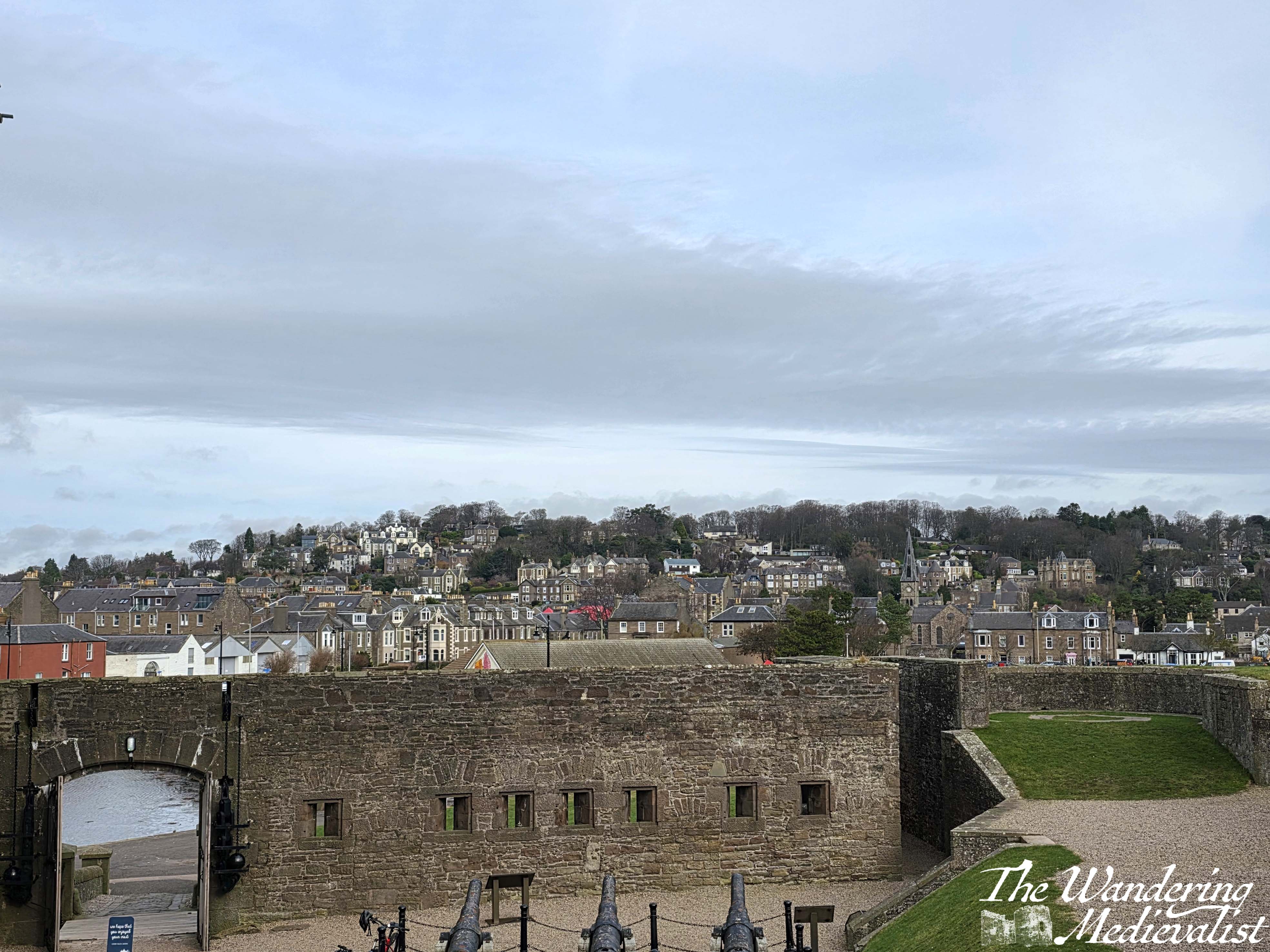
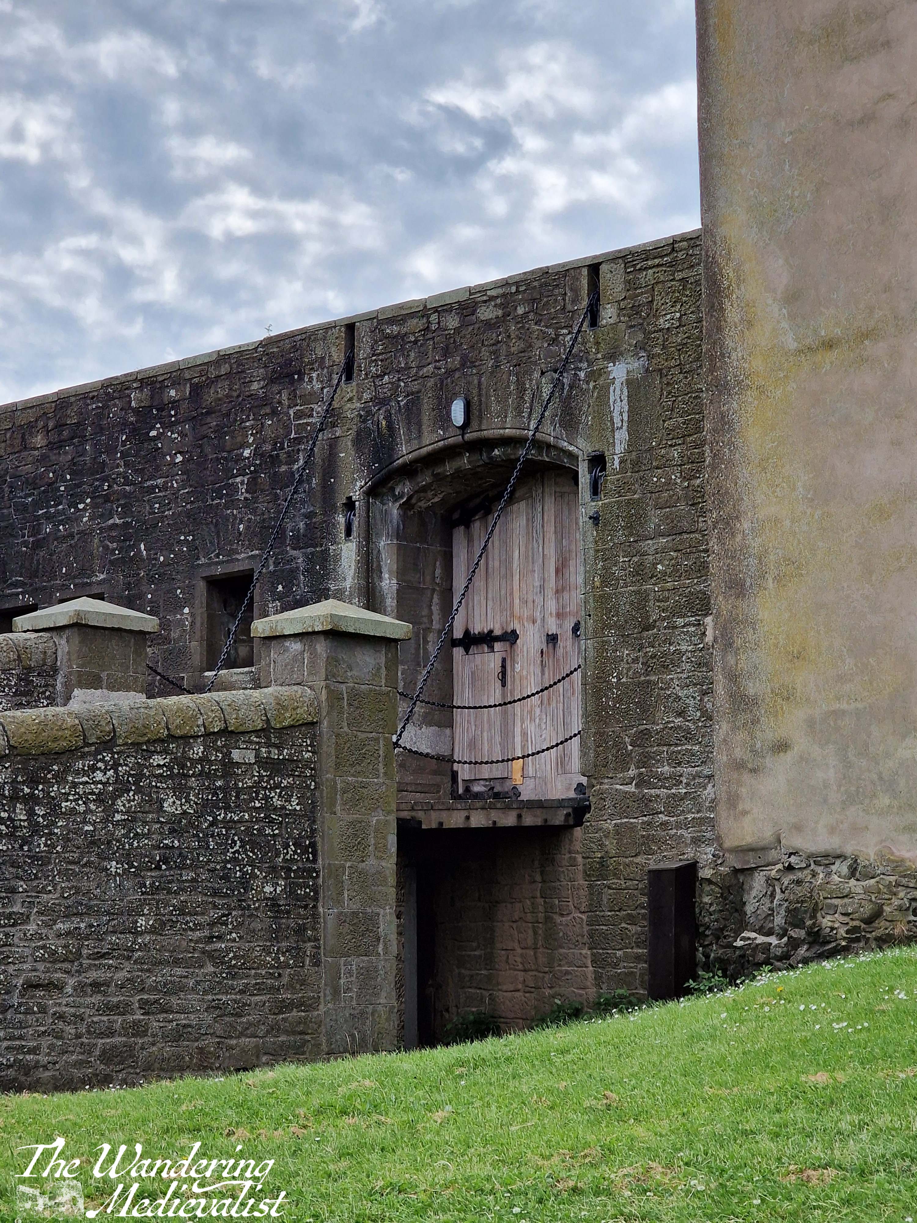
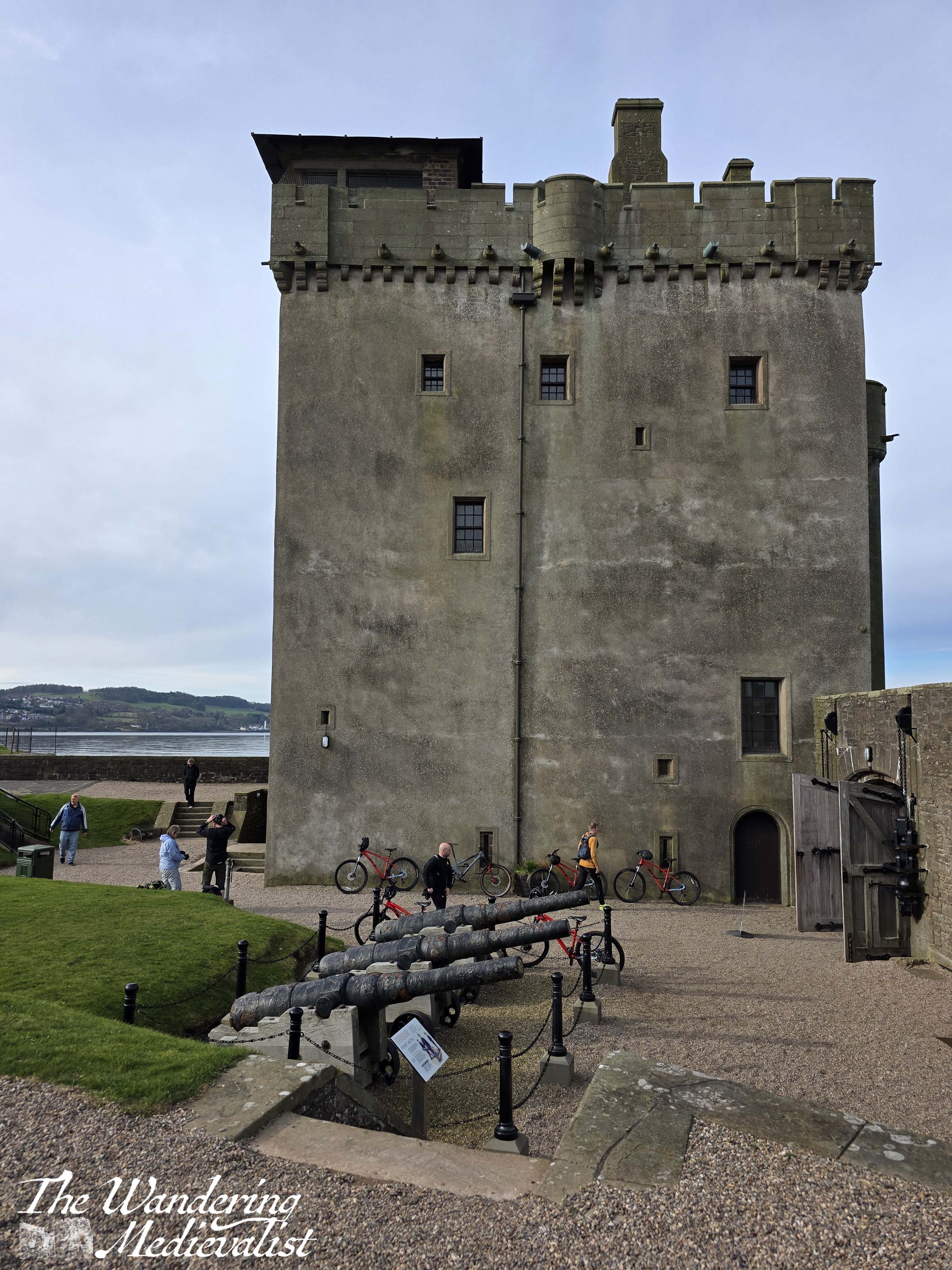
The shape of the tower is very familiar to anyone who likes Scottish castles; you will see the similar square(ish) tower at Castle Campbell, Balvaird, Doune, Hill of Tarvit, and many more. Perhaps less usually, the medieval tower is surrounded by much more modern fortifications reminiscent of the era of regular cannon (there are several lovely cannon specimens within the grounds). Earthen banks with concrete walls surround the castle on three sides, with the approach only still through a medieval gate.
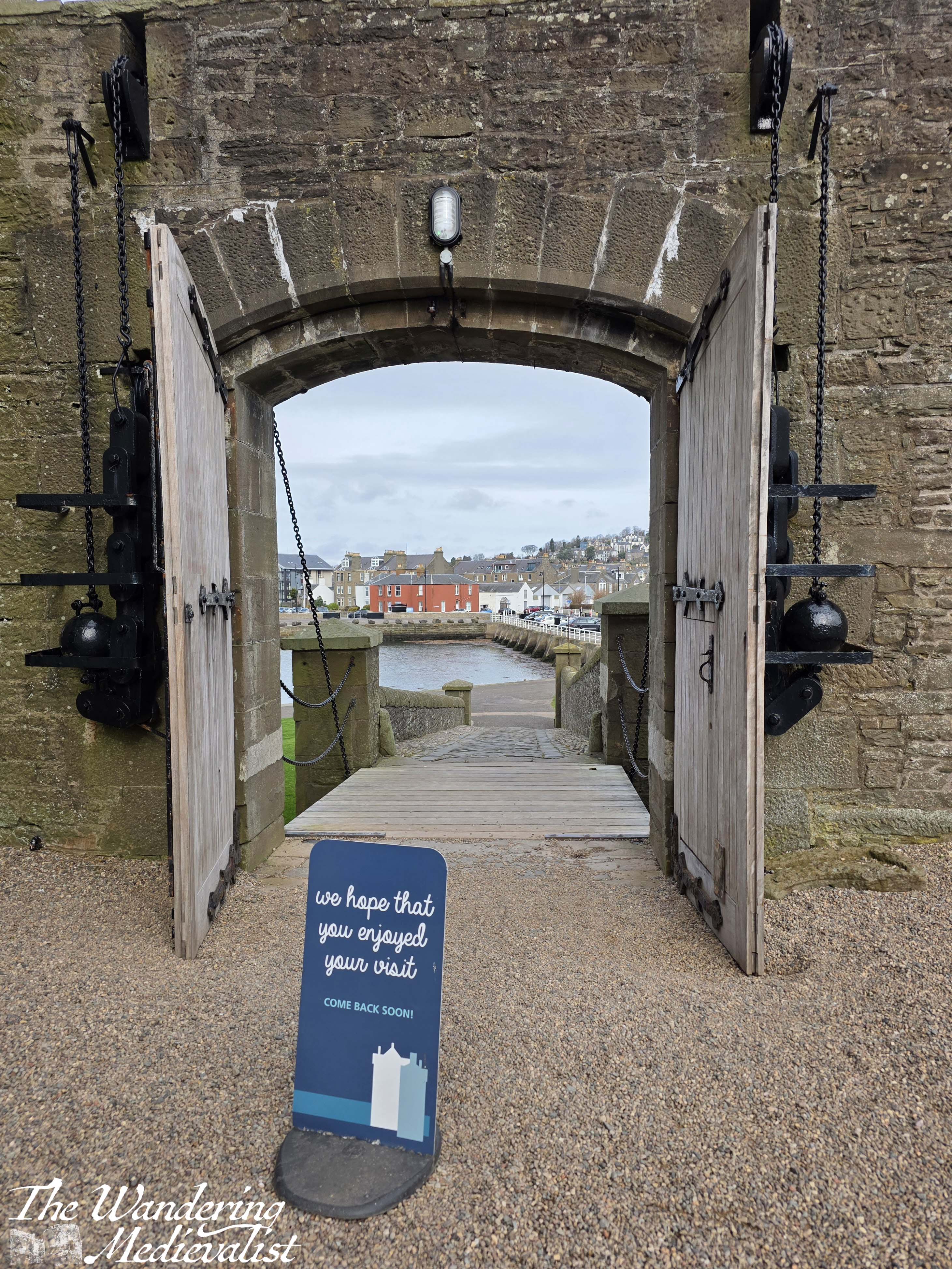
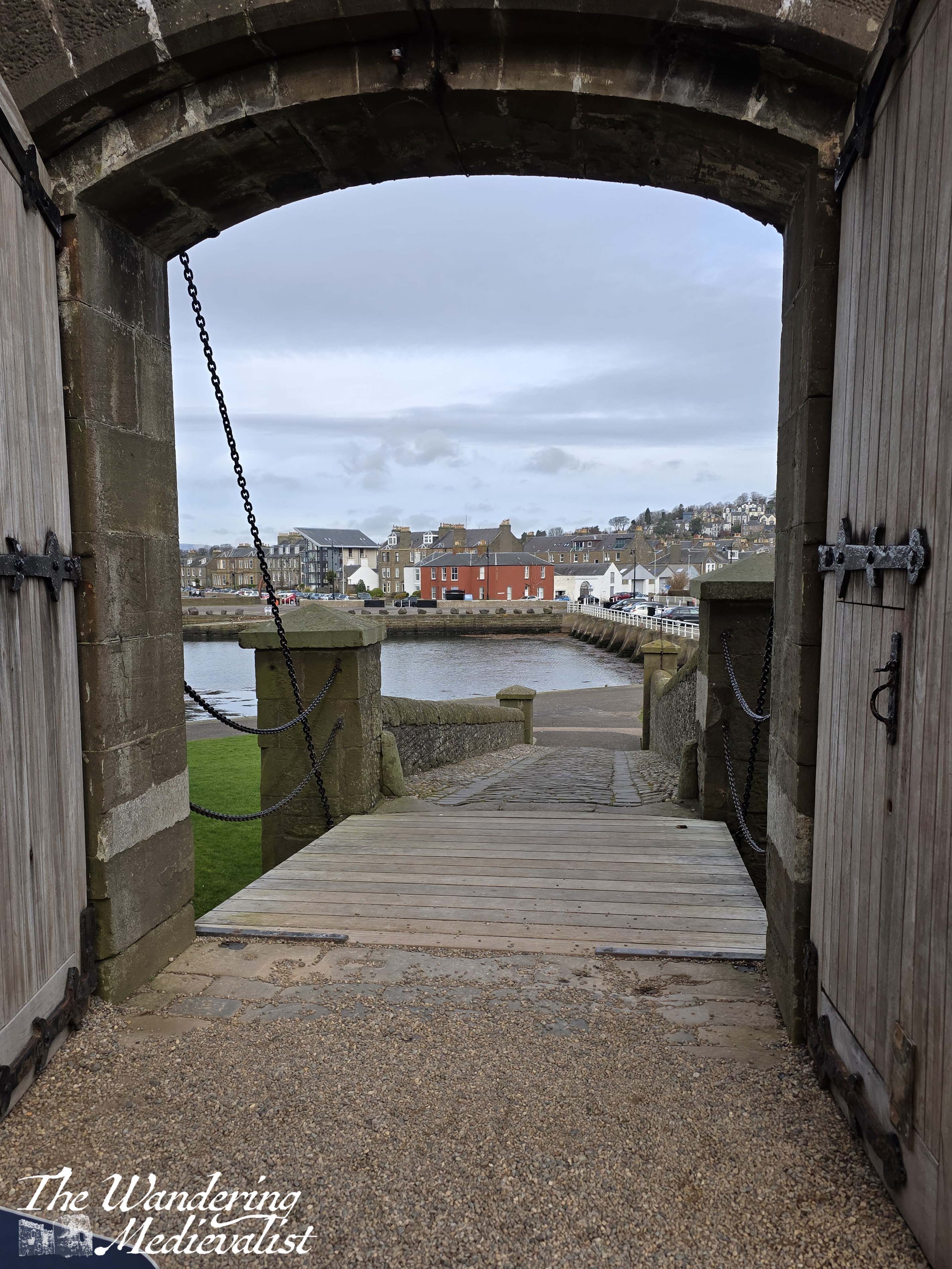
Excitingly for us on the day we visited, the castle is free to enter; hours are seasonal, so it is worth checking ahead of time. Once through the gate, one is met immediately with a courtyard, where visitors can either enter the castle proper or explore the ramparts. We chose the second option to start, climbing up concrete steps to viewpoints where the shadows of large WWII guns are still evident, in rings indicating bolted-down machinery. The view really is fantastic, looking up the Tay towards Dundee (and the Tay Road and Rail Bridges), across to Tentsmuir, out to sea or up the coast towards Carnoustie.
I particularly, for some reason, enjoyed the view back out the main gate, where the town of Broughty Ferry was visible in the near distance. Also enjoyable were the lovely old gate mechanisms, with enormous metal weights ready to hold the doors open or keep them closed.
While I could – and did – have stood for a long time watching the water and the Tay traffic, it was time eventually to explore the interior of the castle.
Now, if visitors are looking for ornately-decorated living quarters with medieval panelling, as you can find at some castles, they will be disappointed. Instead, this tower is still very much in modern use with each layer dedicated to a different part of the museum.
Access to the tower and upper floors of the museum is by a series of narrow stone steps, so some strength of joints is required – the stairs are certainly authentic, with dips in the stone where many feet have travelled, though nothing as dramatic as one often finds in old church towers. Nevertheless, the stairwells are narrow and winding.
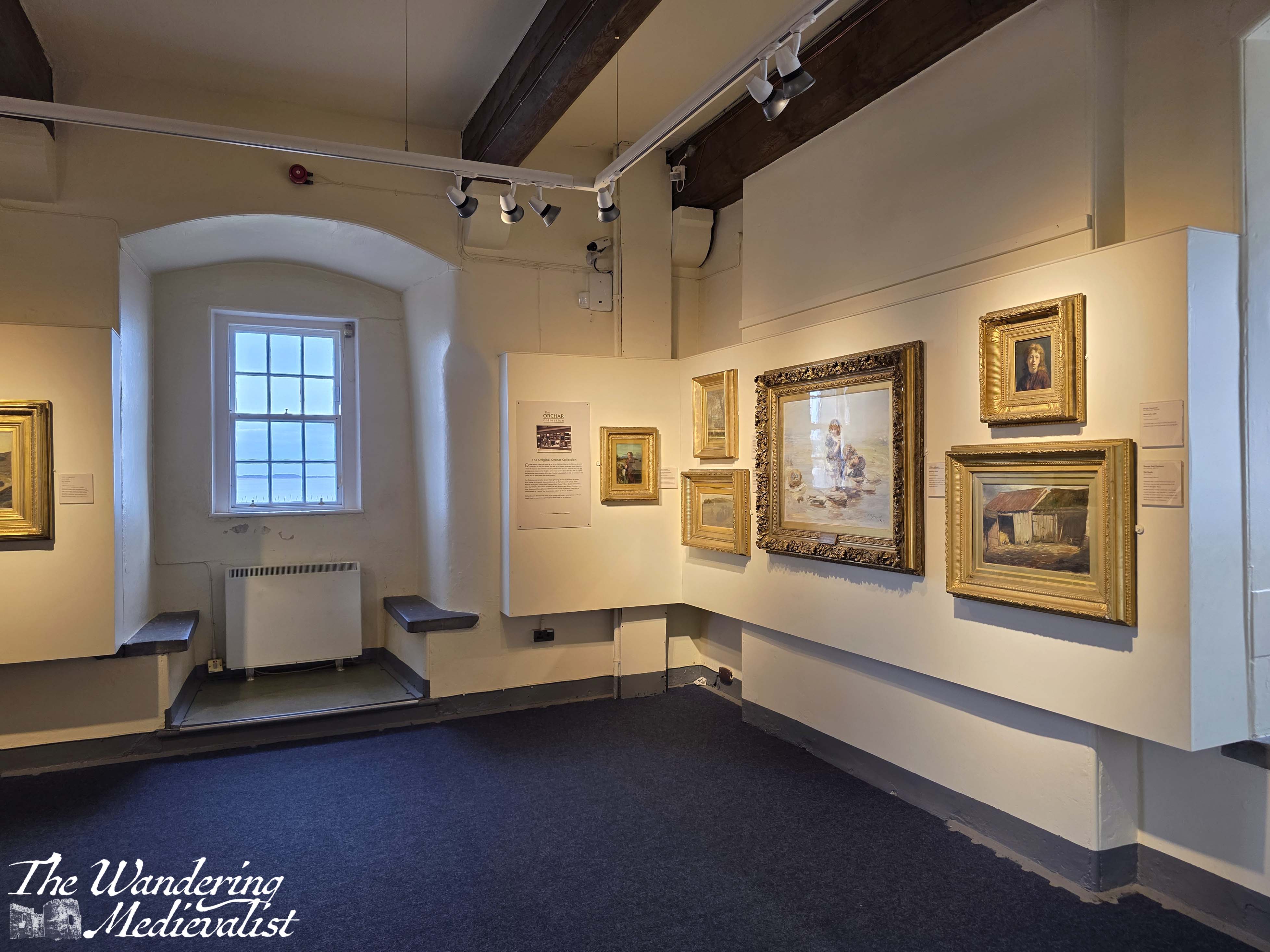
The first floor – up a short flight of stairs – is the museum shop and some displays including the one on the rail ferry. There are very helpful print-outs on the history of the castle and some gifts, postcards, and memorabilia. One floor up from that is the gallery, with some local artist impressions of the castle, Broughty Ferry, and some of the inhabitants.
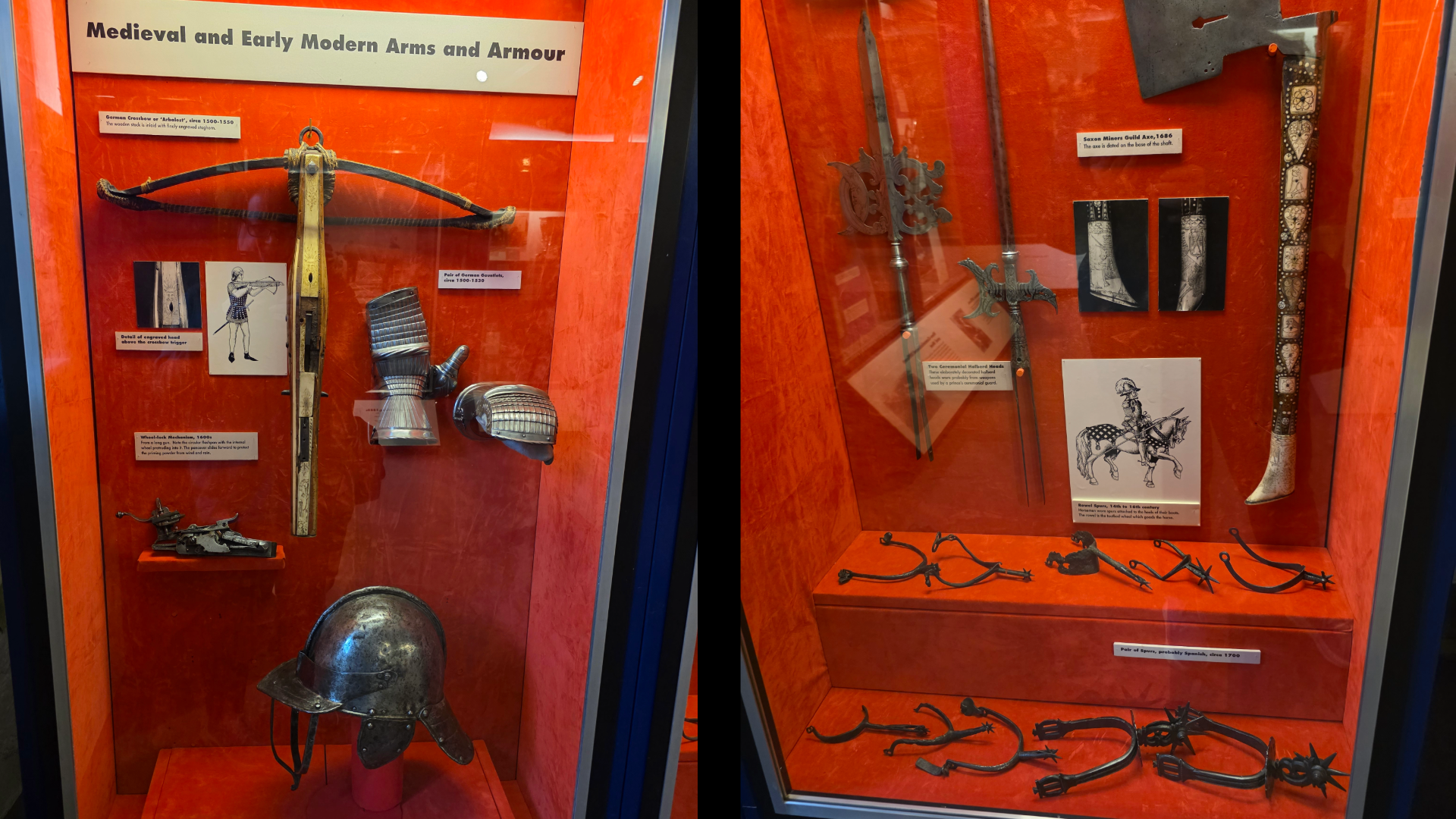
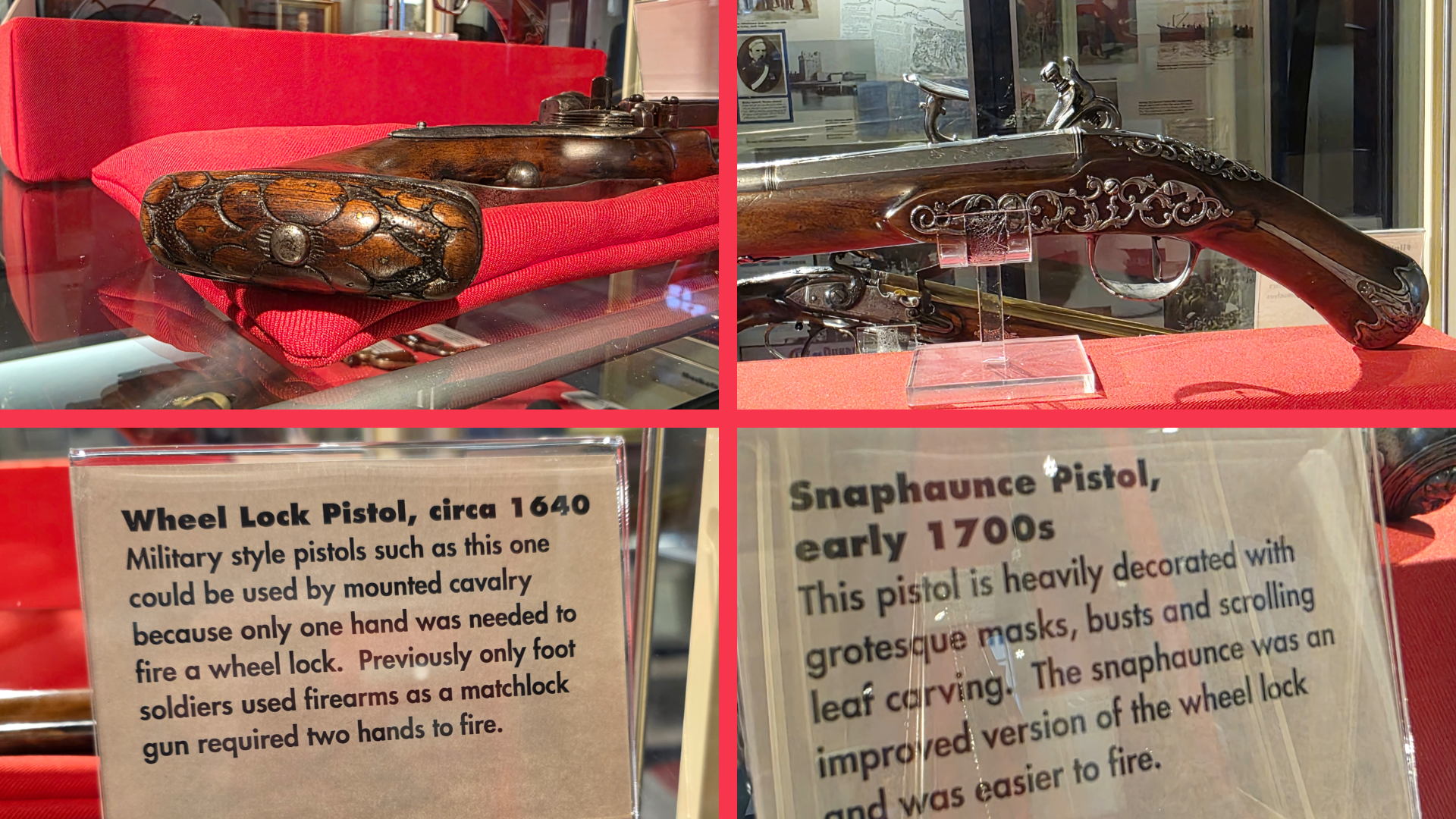
Above this floor is one aimed mostly at children with some dress-up and more learning-based exhibits. I have to admit that when there is a tower like this I am always anxious and eager to get to the top, choosing to explore as I work my way down, and this visit was no different. Continuing upwards, I came across the castle’s collection of medieval and early modern weaponry, including some armour, beautifully-decorated early firearms, flintlock rifles (very ‘Last of the Mohicans’ in feel) and more. Any weapon enthusiast will, I am sure, find it fascinating – one rifle even came from Japan and showed more typically eastern attention to fine decoration detail.
Finally, just off the display room was a few extra steps up to what is now an observation deck for wildlife such as birds, seals and dolphins. There is some information there about what you might see, and also the view before you. Unfortunately, the more aggressive avian visitors have forced the castle to put up a net around the deck, so pictures from this height are a bit difficult.
While not a castle that you may plan to spend a whole day visiting, Broughty Castle is positively crammed with historical information about the many eras in which this coastal defence was used. There are displays about the Tay lifeboat crews, about submarine miners in the late 1800s, the ‘Rough Wooing’ of Henry VIII, and more. Definitely a good option for families and those visiting Broughty Ferry for the day, the castle is educational and provides excellent views (I suppose a caveat here for family visitors – there is no fence around the edge of the ramparts, so youngsters will need to be watched!).
Plus, there are more than a few excellent spots nearby to stop for coffee, ice cream and cake. Our choice for the day was the Braw Tea Café, a not for profit enterprise providing on-the-job training and personal development to support disadvantaged women. While not open every day, when it is the café has excellent cakes and an outdoor seating area perfect for a sunny afternoon.
So if you are thinking about a visit to this lovely town, definitely do not miss out the castle!
I woke up on Saturday morning and was welcomed the bright sunlight I could see peeking in around the edges of the curtains. I leapt out of bed and immediately set to work enacting my planned walk for the weekend: picking up from last weekend, I intended to walk from Earls Hall Castle to Kinshaldy Beach, a walk – I estimated – of a bit over 4 miles. It was more than I had done in one go in a while (hence fitness goals) but I thought I could manage.
So, I started off at St Athernase in the centre of Leuchars and walked the five or so minutes along the road to the castle grounds.
The day was sunny but with generous puffy clouds, and cool enough that the warmth from the sun was appreciated, as was the Vitamin D. It is worth reminding anyone that when walking along the type of narrow road this stretch requires, it is important to be on the correct side – walking against the traffic – so that you can see it approaching. I’d also caution that it’s a good time to keep your music either off or quiet enough that you can hear vehicles at a distance, as when the road is winding, they can come upon you suddenly.
Starting at the entrance to the castle estate, the Fife Coastal Path leads along the road almost due east, and the wall is just short enough that even I was able to to catch glimpses of the castle and out-buildings. As with so many Scottish estates, the wall is lined with large rhododendrons bushes that at correct time of year are, I imagine, stunning.
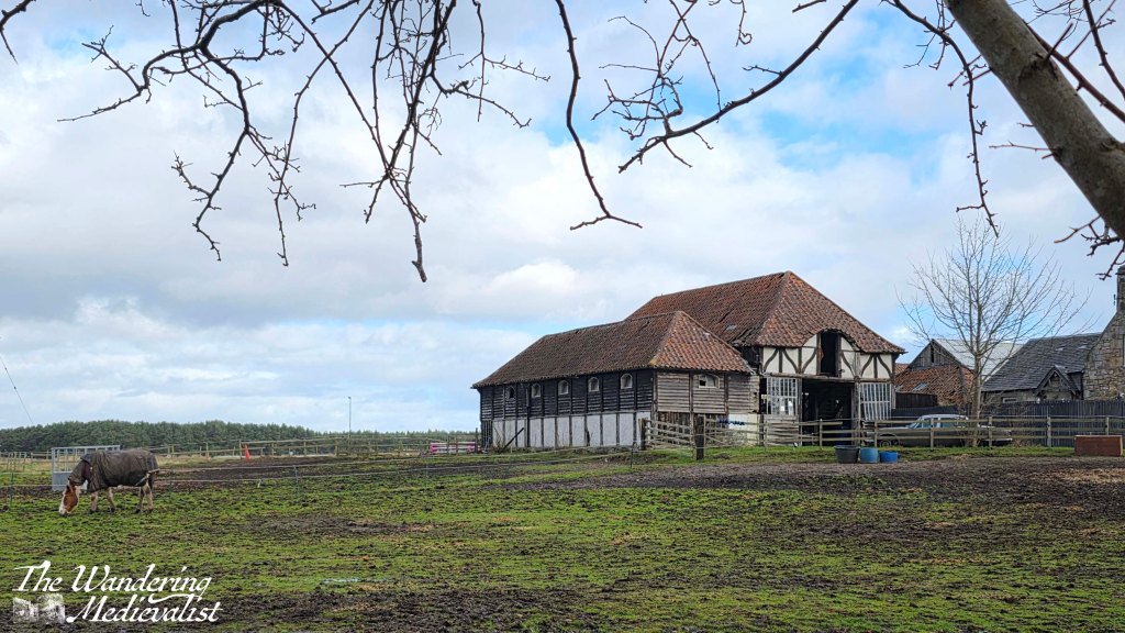
Not far beyond the main entrance – blocked by a massive gate house – is another exit to the estate, where you can just see hints of the wall and gardens. A short distance later, through the bushes on the other side of the road, comes into a view a beautiful old barn with several horses in the field/ The accompanying farm house is a bit less grand, but the presence of several rows of now decaying farm crofts indicate that this may have been a thriving community at one time.
On the right, it becomes increasingly clear that you are hugging the edge of Leuchars Air base; there are no pictures due to the very large, regularly repeated and threatening ‘no photos’ signs, as well as ‘no drones’ and soon, guard dog warnings.
The path skirts past a large radio tower and I started to wonder if I was lost when finally the sign appeared on a gate, directing off of the road and onto a wide farm track. This track curves several times through a beautiful stand of silver birch, passing fields of horses on the left, before going through another gate and entering the stands of tall pines.
This is about when I started to catch hints of revving from the nearby motocross track, an irritating sound when one is enjoying a nature walk, but eventually it faded into the distance. As the trees closes in around the track it became muddier – I was very happy to have my proper boots – and the revving disappeared into the increased rustling of trees from the wind. It was a bit concerning to look behind me and see dark clouds coming my way, but one of the best things about a windy day in Scotland is that dark clouds tend to be quickly blown past.
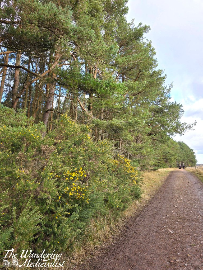
The path is straight here, with fields on one side and tall pines with underbrush of gorse along the other. I can see the appeal of doing this walk at a time of year when bugs are minimal as there are some pools of standing water and animals in the fields. I am quite allergic to gorse so was relieved to see it only just starting to flower – granted earlier in the year than I might have expected. I was making good time here, and I think it was at least partly due to my racing against the approaching rain.
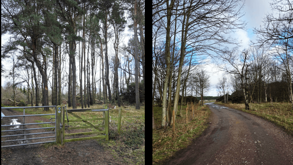
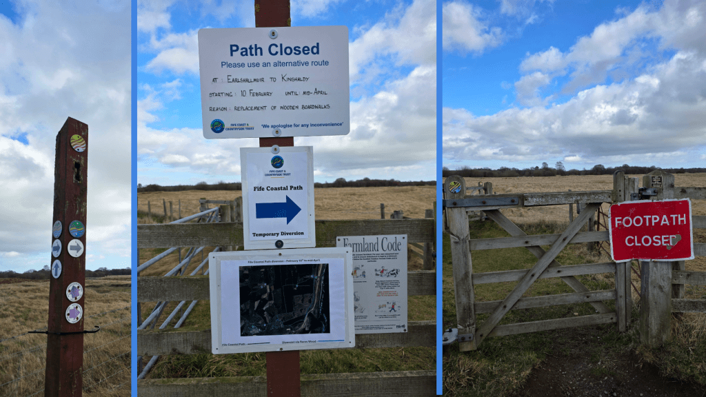
About a mile or so from the castle, the path swings away from the trees and into the fields, approaching what should be a sharp left then right jog of the coastal path. However, this is here my plan ran into a hitch. Not due to impending rain, which somehow continued north and missed me completely, but because the quiet season evidently inspired the Fife Coast and Countryside Trust to do a bit of maintenance on the path.
So, as you can see, there was a detour, with a well-marked path leading in the opposite direction. But, I was stubborn and ready for an adventure, and at first glance at the picture, it did not seem as though I would be walking terribly much further than originally planned, and probably in quite similar surroundings. The purist in me will insist upon re-doing this section, but for now it was the best I could do.
Muttering slightly to myself, I set out along the farm road indicated, with fields on one side and the base on the other. It became clear that the road followed the edge of the MOD property which was appropriately signposted with threats. On both sides of the fence there was damage to trees from recent storms, but generally was a pleasant, quiet trail on which I passed only a few cyclists and one horseback rider. The aggressive signs slowly became overgrown by gorse – arguably a more effective barrier than metal fences – and on the left high grass gave way to another stand of tall, straight pines. In about 3/4 of a mile, the path heads straight into the trees and it became a really pleasant stroll through the woods. Finally, I figured, we were heading towards the coast.
Eventually.
Storm damage became more and more evident as I walked, though I also noted that this would be a stunning walk at a time of year when the heather was blooming, as it carpeted the edge of the tree line and the forest floor. This stretch through the trees was a bit longer than I expected, and then just as I wondered if I was stuck forever in the forest tunnel, I realised that behind the distant trees was the blue of the open sky. Patches of sand interrupted the dirt trail, and many more fallen trees were stacked in piles – all signs of the approaching open coastline.
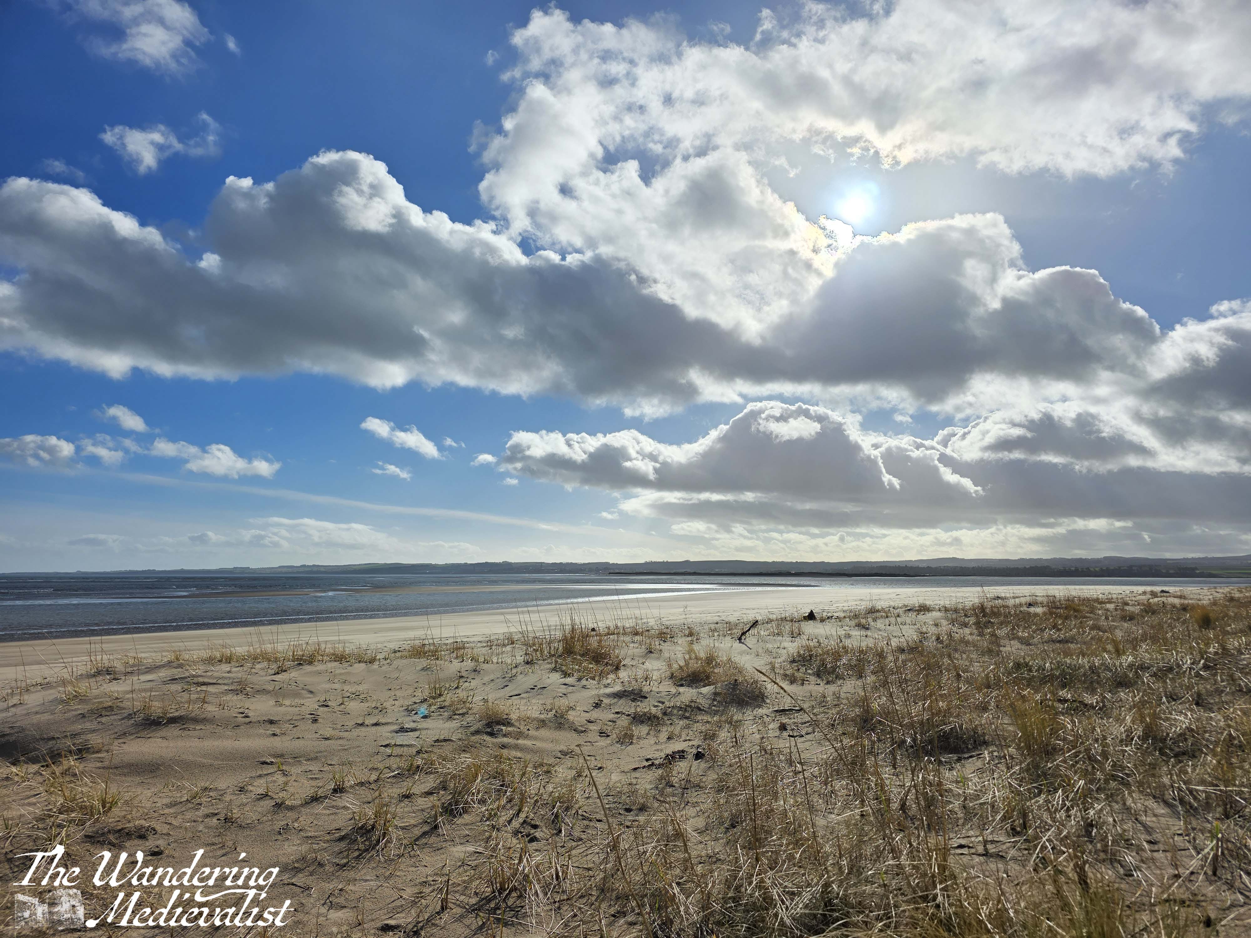
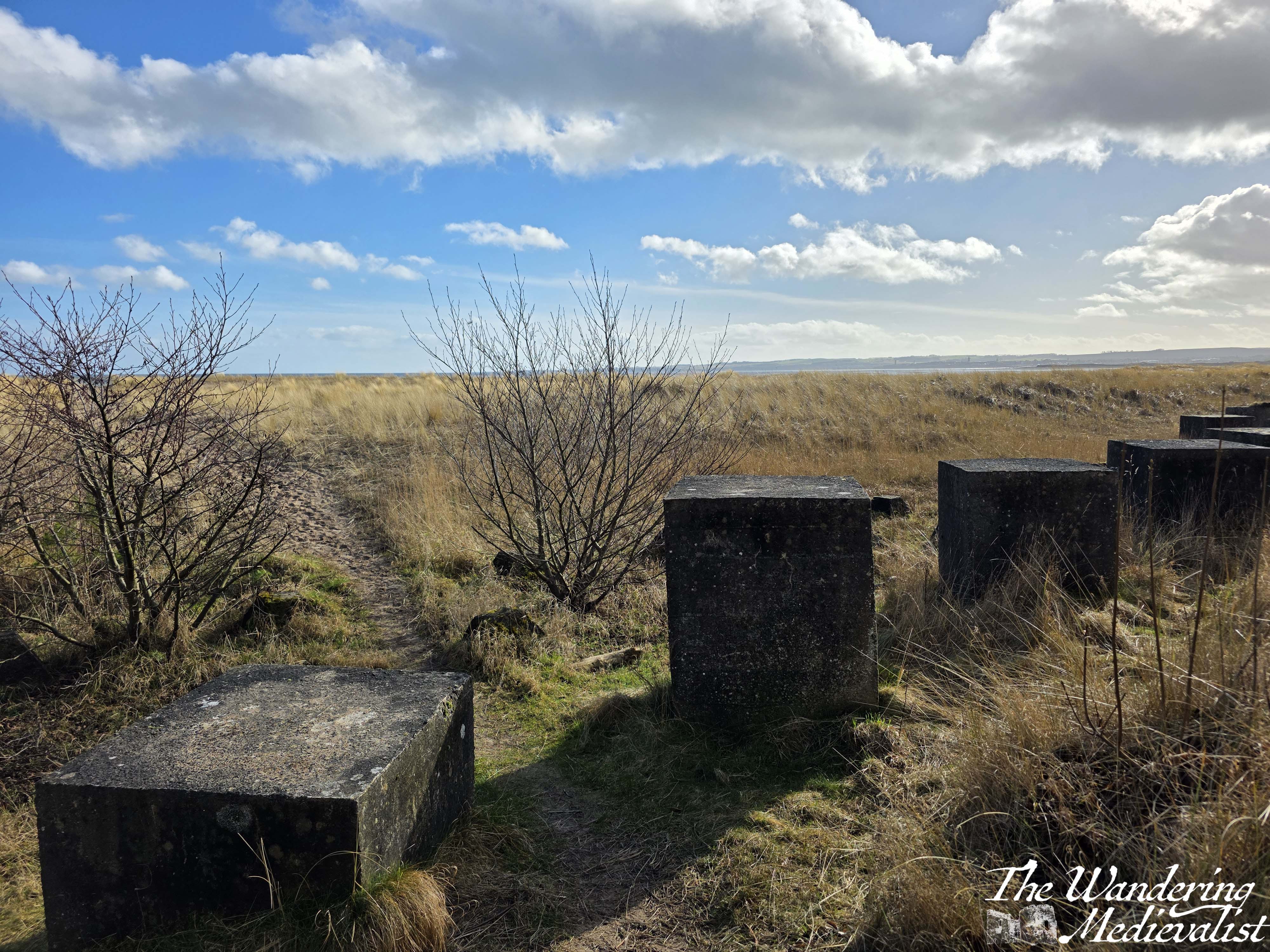
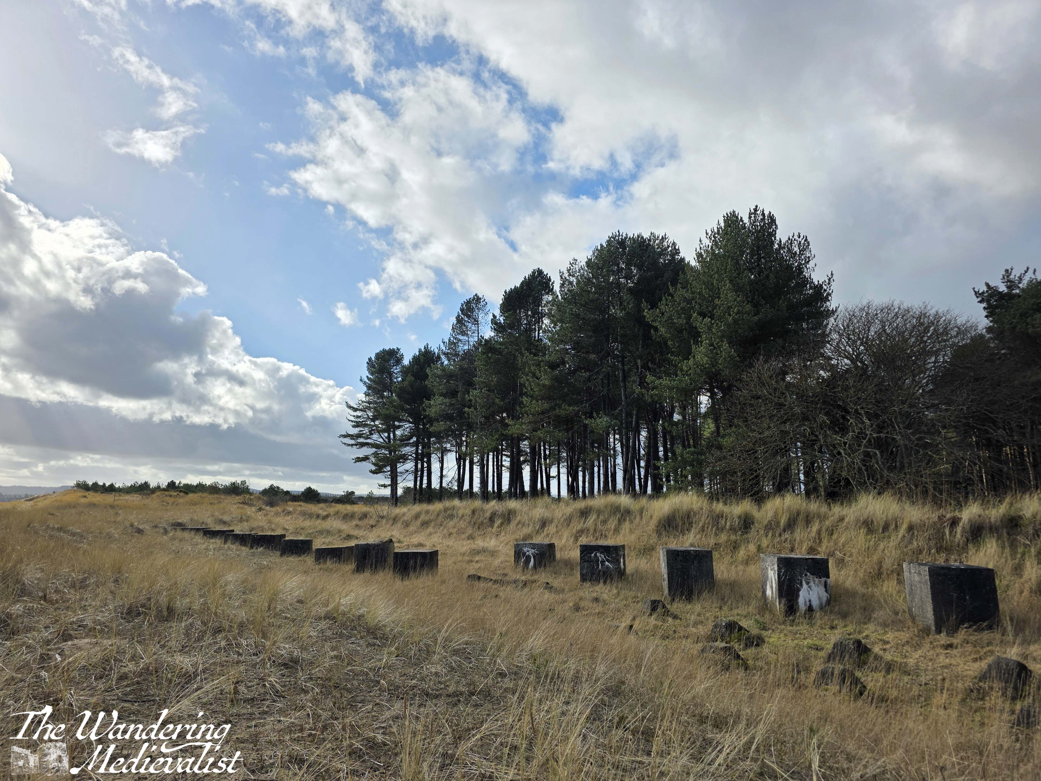
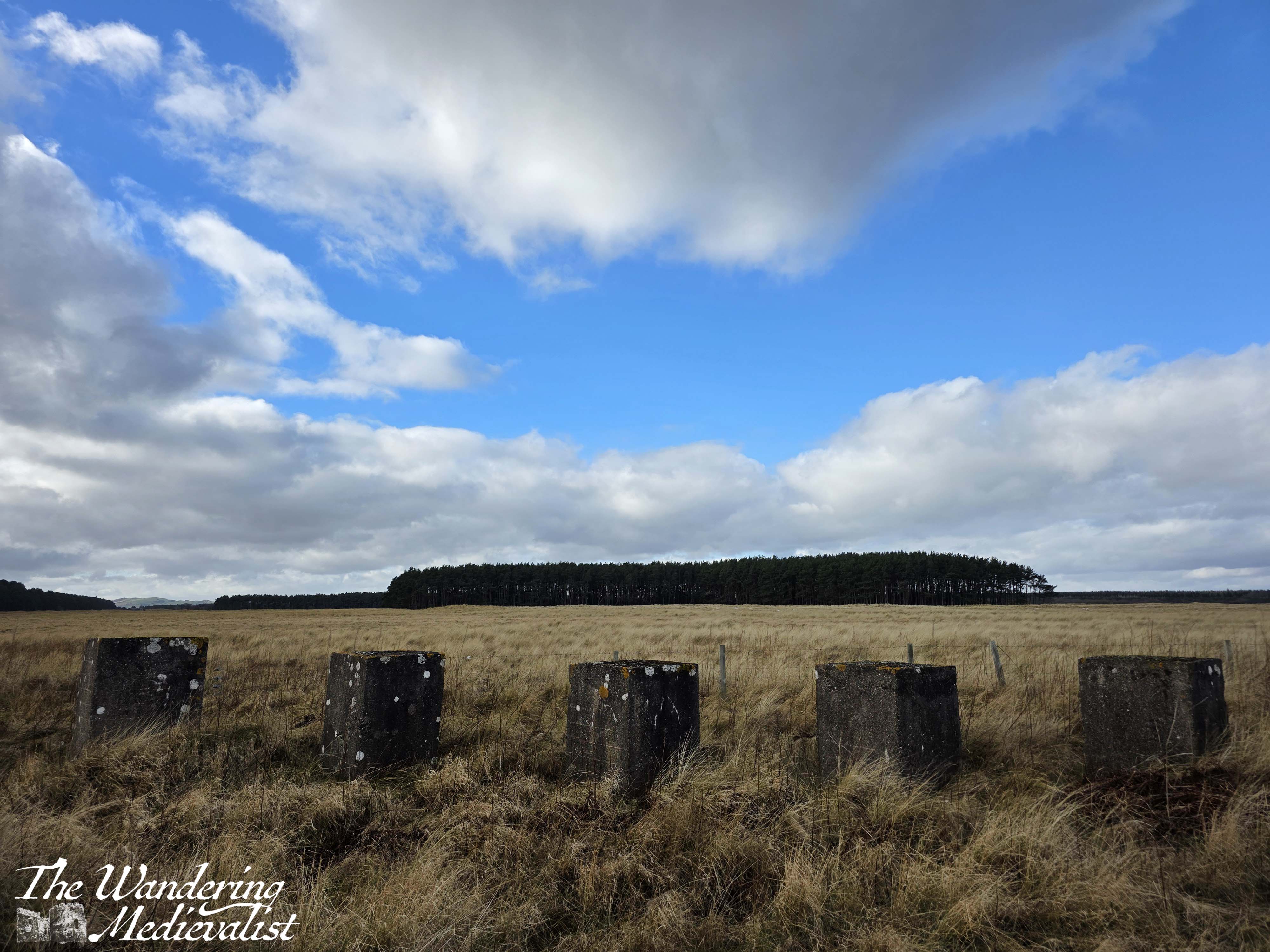
About 1.5 miles from where the path should have branched off, I finally reached the beach. The view across the Eden Estuary towards St Andrews was spectacular, the sun came out just at the right time, and even the giant blocks of concrete half buried in the sand were beautiful. These blocks can be found all along this stretch of beach, constructed during World War II in the hopes that they would prevent the Germans from landing on the wide sand and rolling tanks into the farmland.
At the access point to the Estuary, there are signs informing you as to the wildlife living here, and reminding walkers to be considerate of what they find. There is also a detour sign, on this occasion, and I found myself stopping temporarily to work out how much longer I had to walk – I soon wished I had not bothered.
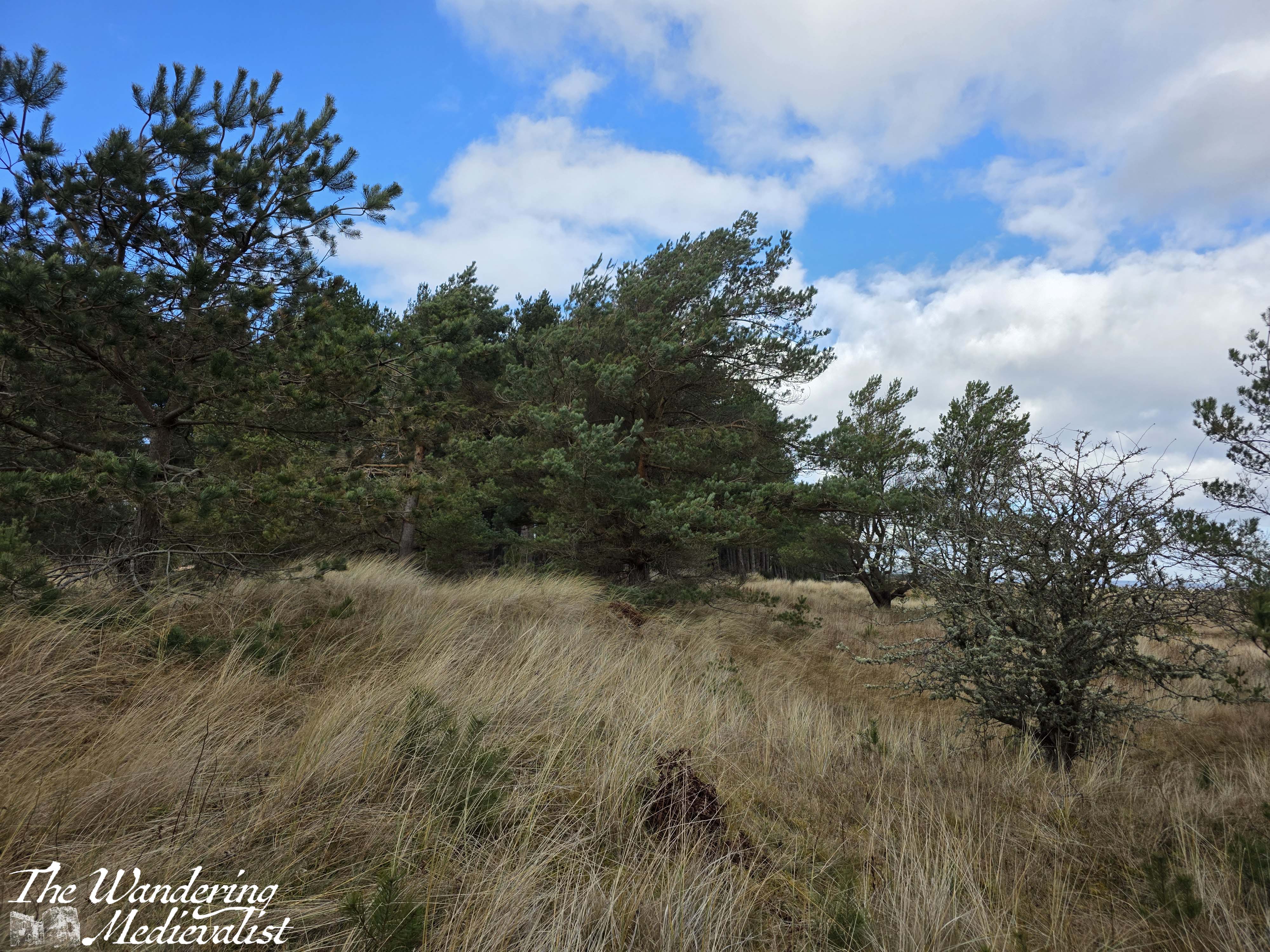
From this point, the path led along the edge of the trees, with dunes on the right – a pleasant view for sure.
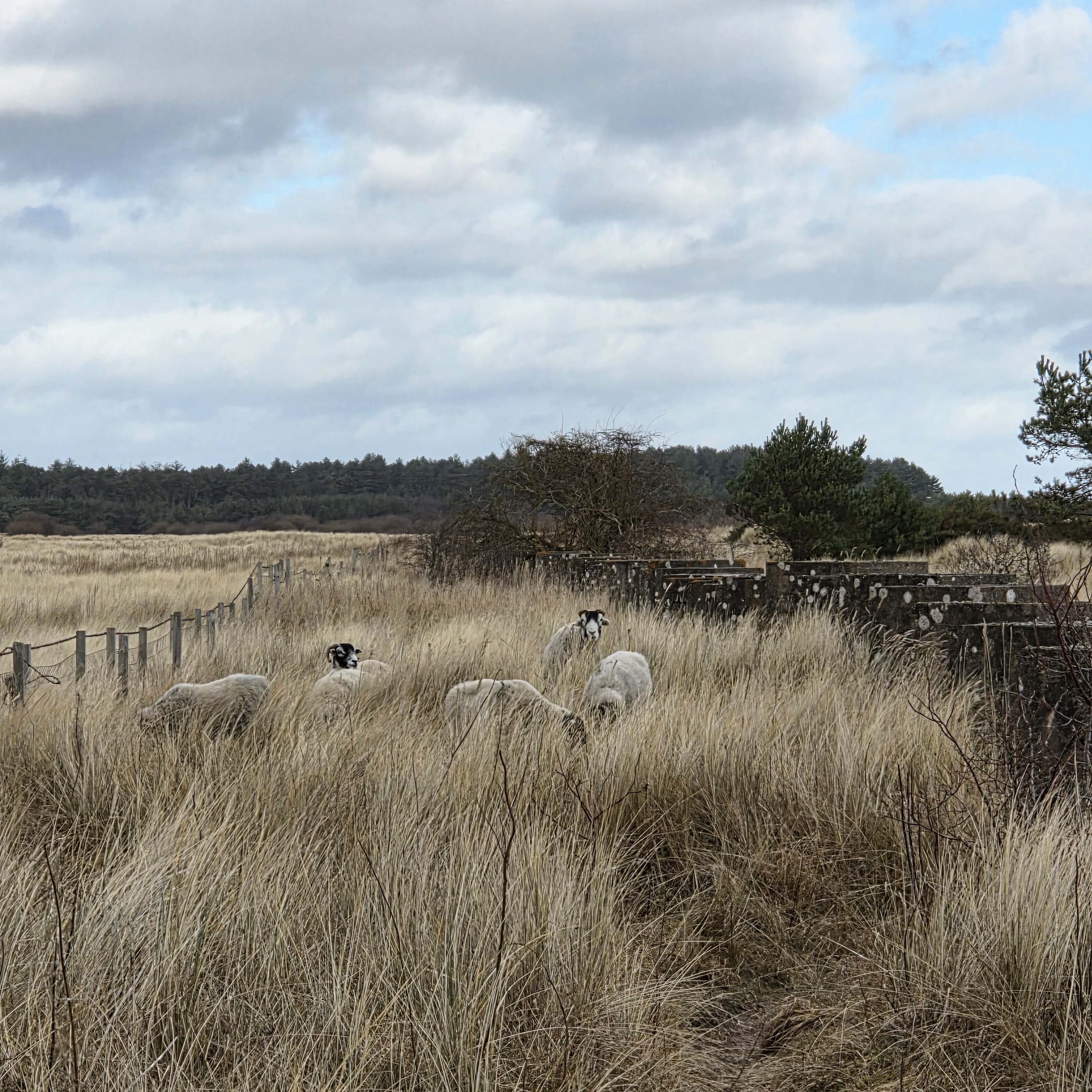
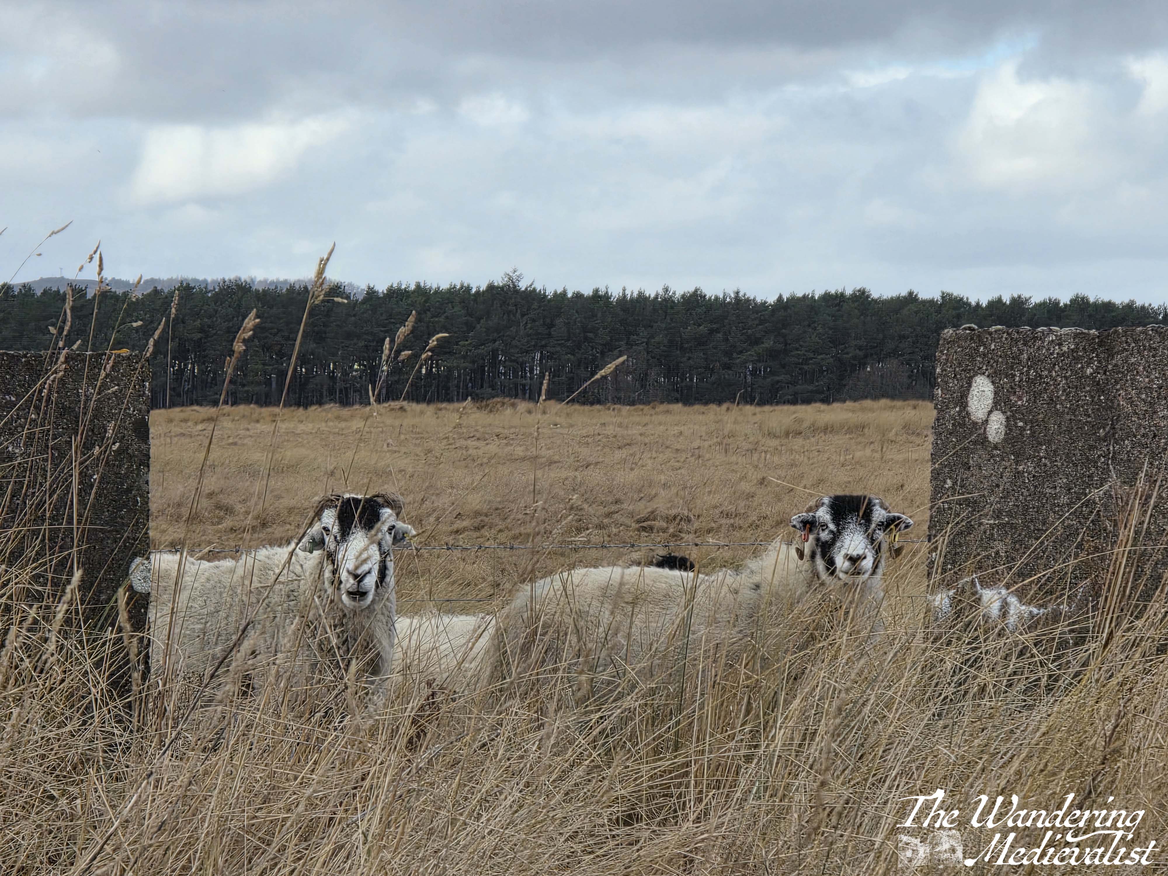
In retrospect it may have been sensible to stop here and rest for a short while, or to stay on the beach, but I did neither of those things, instead heading onwards along the coast. It is a lovely path. The trees fall away after a while, and the path winds away from the beach into the fields; it was here I came across a small flock of sheep who were mostly unbothered and watched me as if to say, ‘what in the world are you doing here?’
I did start to wonder that, myself.
Now, I am not a completely inexperienced hiker. I know perfectly well that I should have water and even snacks for a long hike, but that was not what I intended this to be. So I bought neither, figuring I had managed 3.5 miles last weekend, I could do 4 this weekend. I will never make that daft mistake again.
Away from the beach, the trail is considerably less even away from the beach, rising up and down over small dunes and hillocks of tall grass. To the left are fields stretching to distant trees, and to the right more grass, small trees and a patch of marshland separating the trail from the beach.
Eventually the grass fades into stands of small trees, then gradually larger ones, and I was relieved to once again joined the more familiar route with pines on the left and dunes and beach on the right. I hoped, and believed, that I was getting steadily closer to the car park where my other half had promised to meet me. I wished several times that I had brought headphones, as I felt like music might have kept me going a bit better, and my old hiking boots were feeling increasingly heavy and more of a drag on my energy than helpful.
Side note, these boots are almost 20 years old and have served me very well, but they are heavy and are probably more designed for climbing hills than walking. Certainly my sore hip flexors over the next few days were an indication that it was time to be rid of them. So, this was their last hike and I have since purchased some new walking boots from Mountain Warehouse – I will be sure to report upon their success.
Back to the walk. Gradually, the number of people on the trail grew and I sensed I was getting close. Light reflecting off of unnatural surfaces glistened through the trees – cars!
I was there.
In all, I walked almost 5.5 miles, a bit longer than my intended 4. I made more than a few mistakes along the way, not the least of which was thinking I could push myself in a way I could in my 20s.
It was an enjoyable walk – until the last mile or so – and I look forward to trying it again in the summer when the boardwalk is open. It allowed me to push my limits and remember why I was doing this in the first place – to walk more, and to remind myself just how unprepared I am for a longer trek. But I’ll get there.
And I’ll bring snacks.
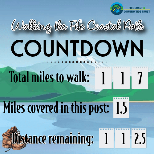
This weekend’s walk total (considering that only a portion of this walk was actually on the official Coastal Path):
I have been wracking my brain for days on what next to write about, but my creative juices are running a touch low after weeks – months – of work travel. Finally I thought of this post – throughout the year, wherever I am and no matter how tired I am, taking pictures of the beauty around me has kept me centred. And so in this post, I would like to share with you MY favourite pictures that I have taken this year, and a bit of why they are special to me.
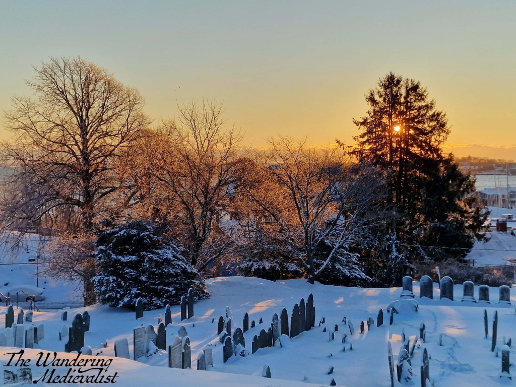
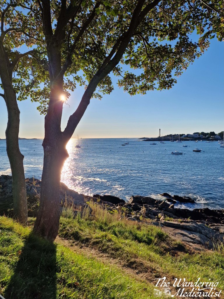
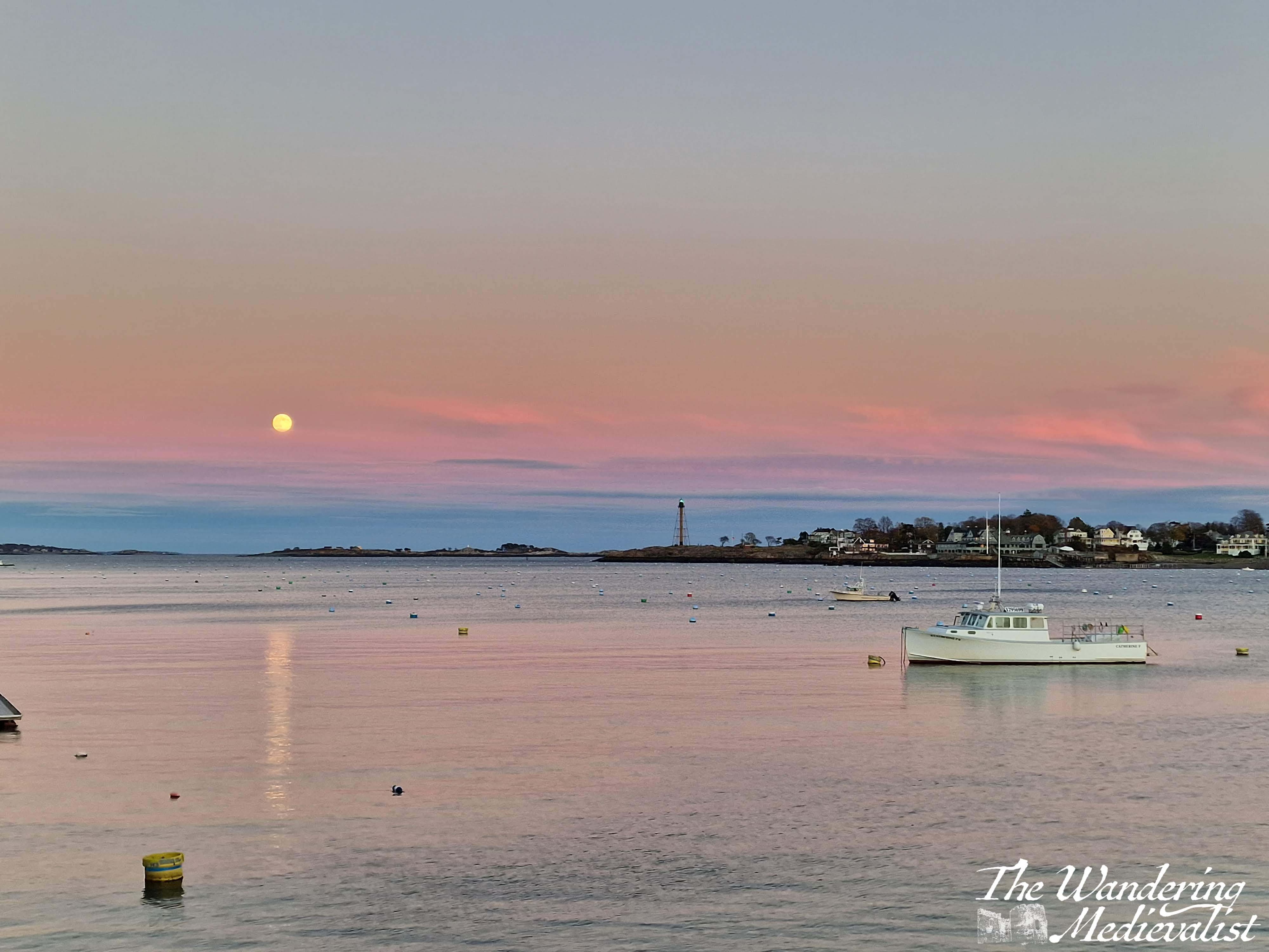
This picture was taken on one of my favourite days all year, when I got up early after a snowstorm to wander Marblehead as the sun rose. I wrote a whole post about this day – so serene and stunning, it remains one of the best days of the year.
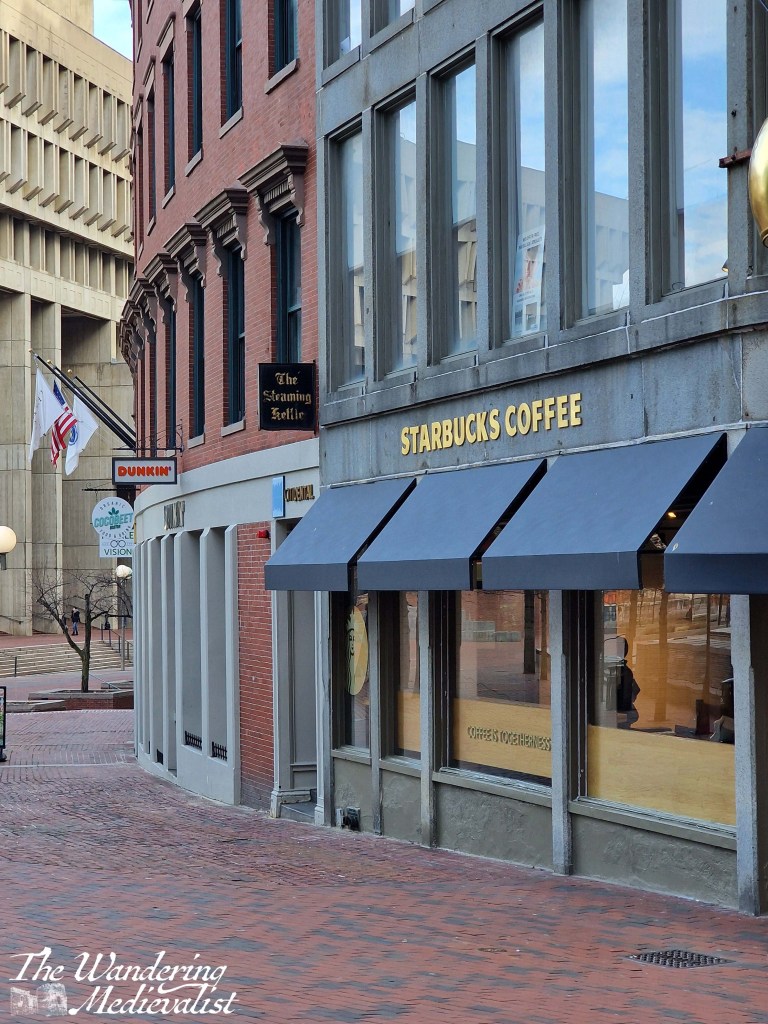
Boston coffee at its best. Most people are Dunkin’ people or Starbucks people. Whether they are next to each other or across the street, they almost always offer you the chance to choose between them, in Boston anyway.
Me? Cold brew Dunkin’, even in the depths of winter.
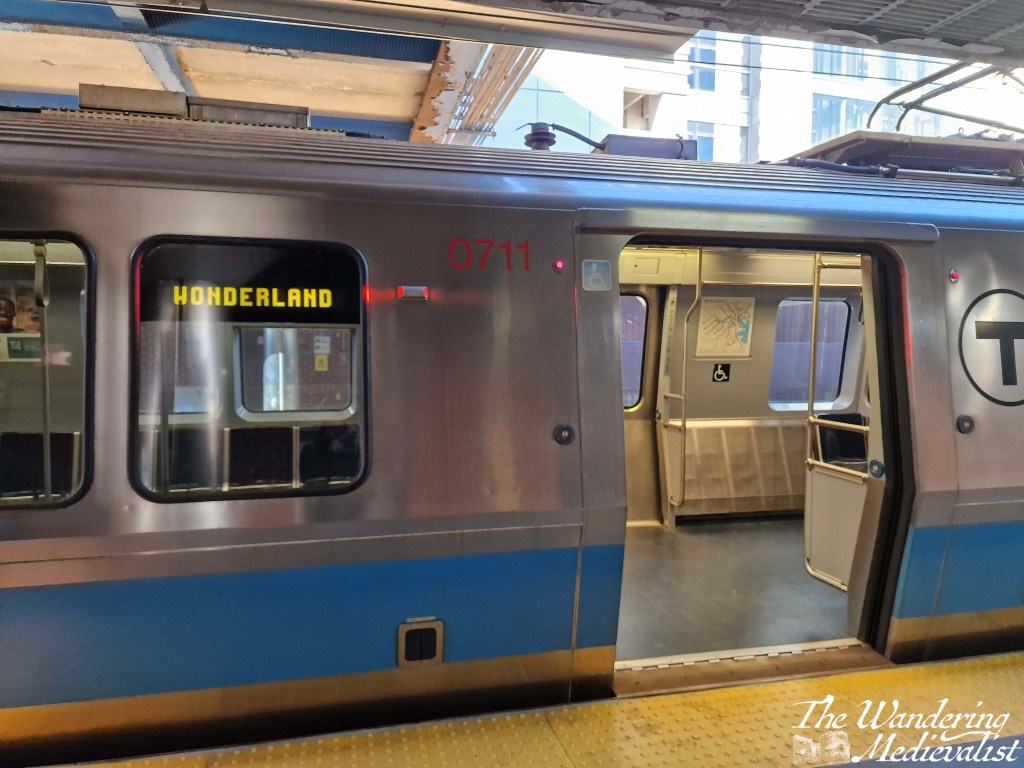
Next Stop Wonderland was a movie, and when I started riding the subways regularly in the 90s, was still announced by the driver. So, usually was, ‘Nexxop, Wondaland’
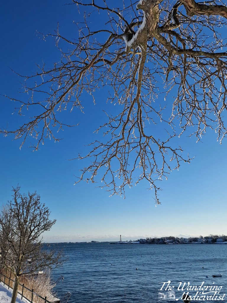
I love this picture of the light glistening off ice starting to drip from the tree branches as the sun began to warm the world after a day and night of snow. I sat under this tree watching for some time, until I was dripped on.
February started as a month of new beginnings, with a new job for me. This picture was taken at the end of a day in week three, as the sun set down Perth Road. Hard to beat a good winter sunset.
Speaking of sunsets, here’s another, one of my favourite nearby views including the old rail bridge and the River Eden.
And to counter the previous two, a sunrise – specifically the sun rising over St Andrews, a view I have captured 100s of times but never tire of, especially on a golden morning like this one. February was a rough month for us, but mornings like this one helped.
One Saturday in March I took a late morning walk on East Sands, and it was a gorgeous sunny day at low tide. It is hard not to love this view of St Andrews.
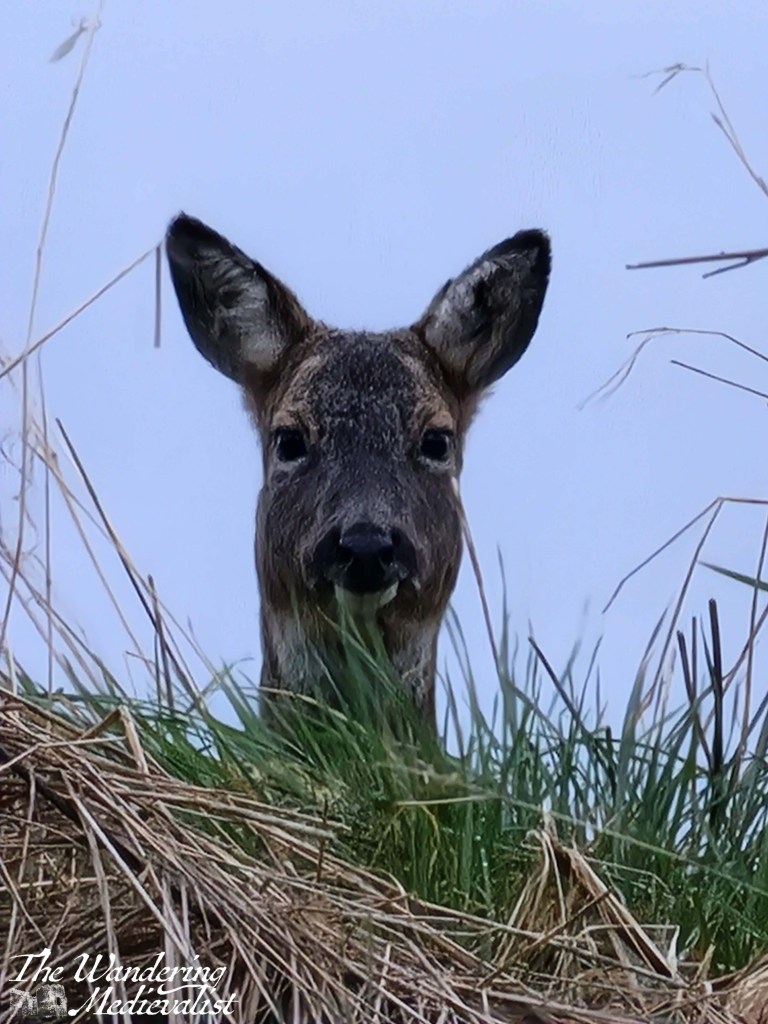
My morning walks in spring are often joined by the local small family of deer. I like to think that they get used to me and are less afraid of the woman in a purple coat who is always taking pictures.
The deer on this morning were so completely un-bothered by me.
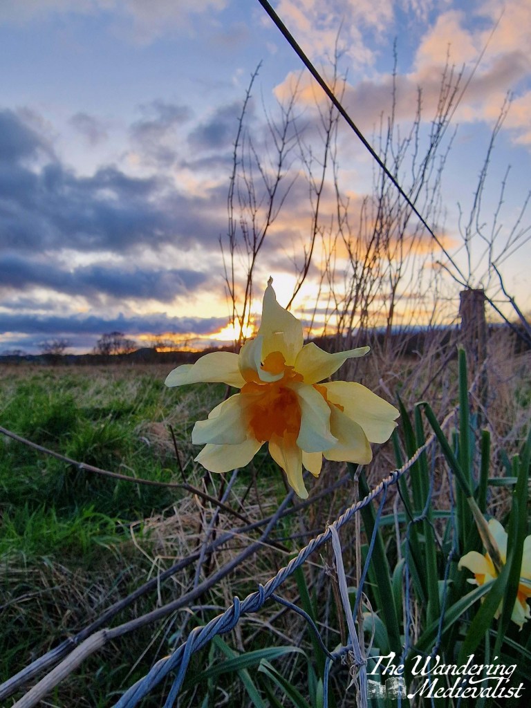
Most of April was consumed with work, but I did my best to get out for an evening stroll whenever I could. I loved this one daffodil standing up against the setting sun.
Early in May, I took myself on a solo adventure to Castle Campbell. This stunning blue sky against the Ochils just filled me with joy.
Out of work for the month of May, I found myself free to have the occasional Friday evening pint at our local haunt. What a spectacular evening view. Though I do have a thing for bridges.
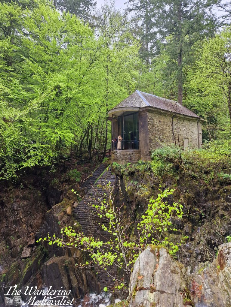
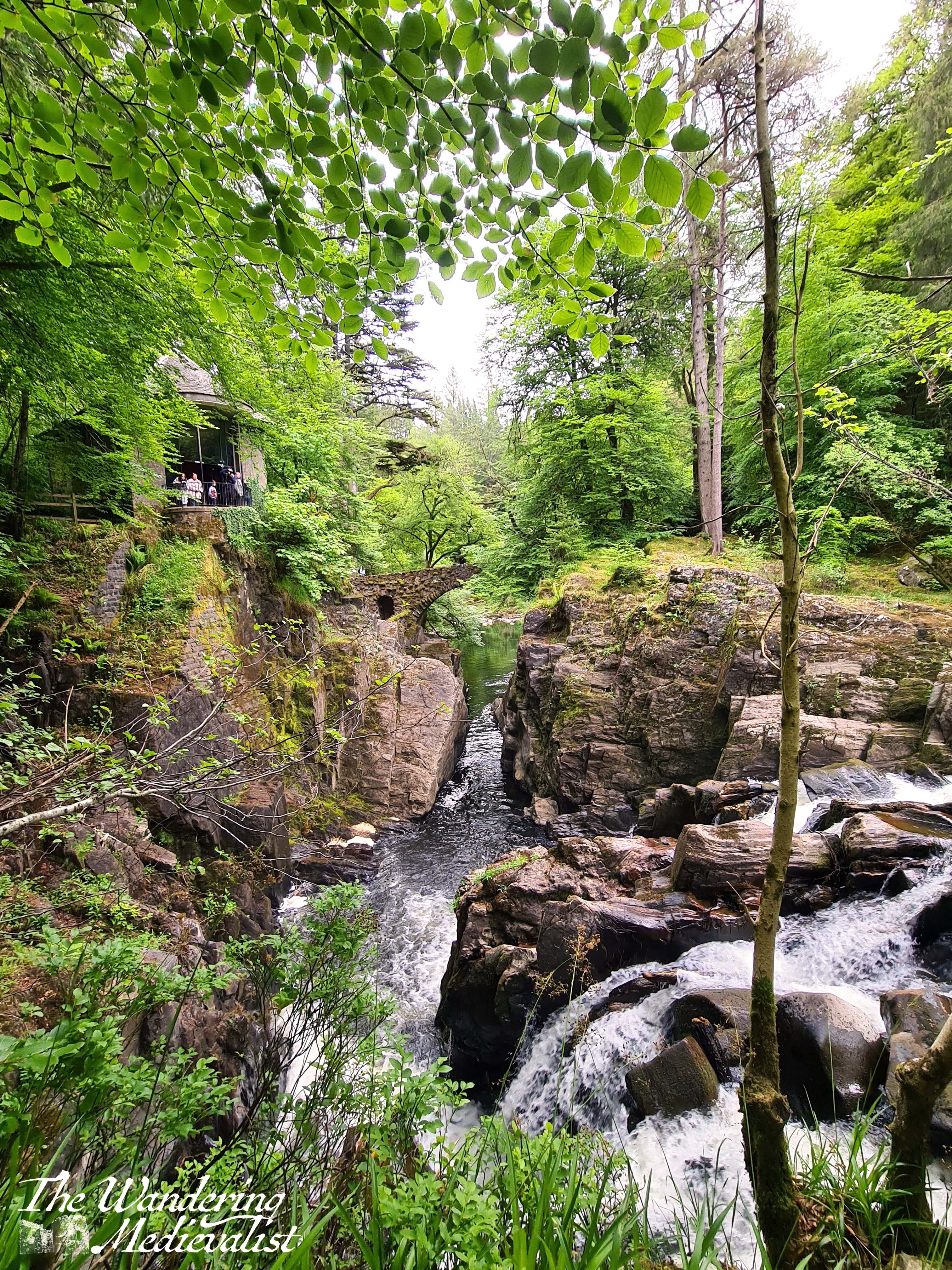
A hiking trip in support of the Step Count Challenge took some friends and I to the Hermitage, in Perthshire. It does not get much more fairytale-perfect.
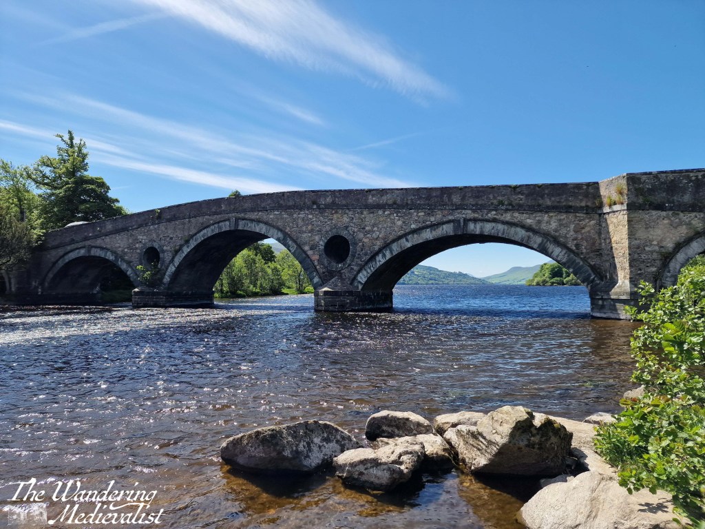
Another day trip found me in Kenmore; I just cannot take enough pictures of this bridge, but this one with the distant loch and mountains peeking through is one of my favourites.
We also travelled south to visit friends for Eurovision weekend. As always when we visit Romsey, we went on a long walk through the medieval parts of the town, where the gardens are always stunning. Many happy memories.
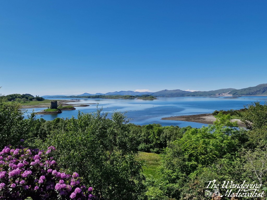
Driving back from Oban, we enjoyed a day of almost perfect weather. We stopped at the Stalker View café and this perfect view awaited us. I love the hint of rhododendron in the corner.
While I have hundreds of pictures of this view, this one reminds me of a very special day – the end of final exams celebration for a student I worked with for years. She fought long and hard to get to this day, and I was so proud to see her soaking wet and grinning. (a St Andrews tradition)
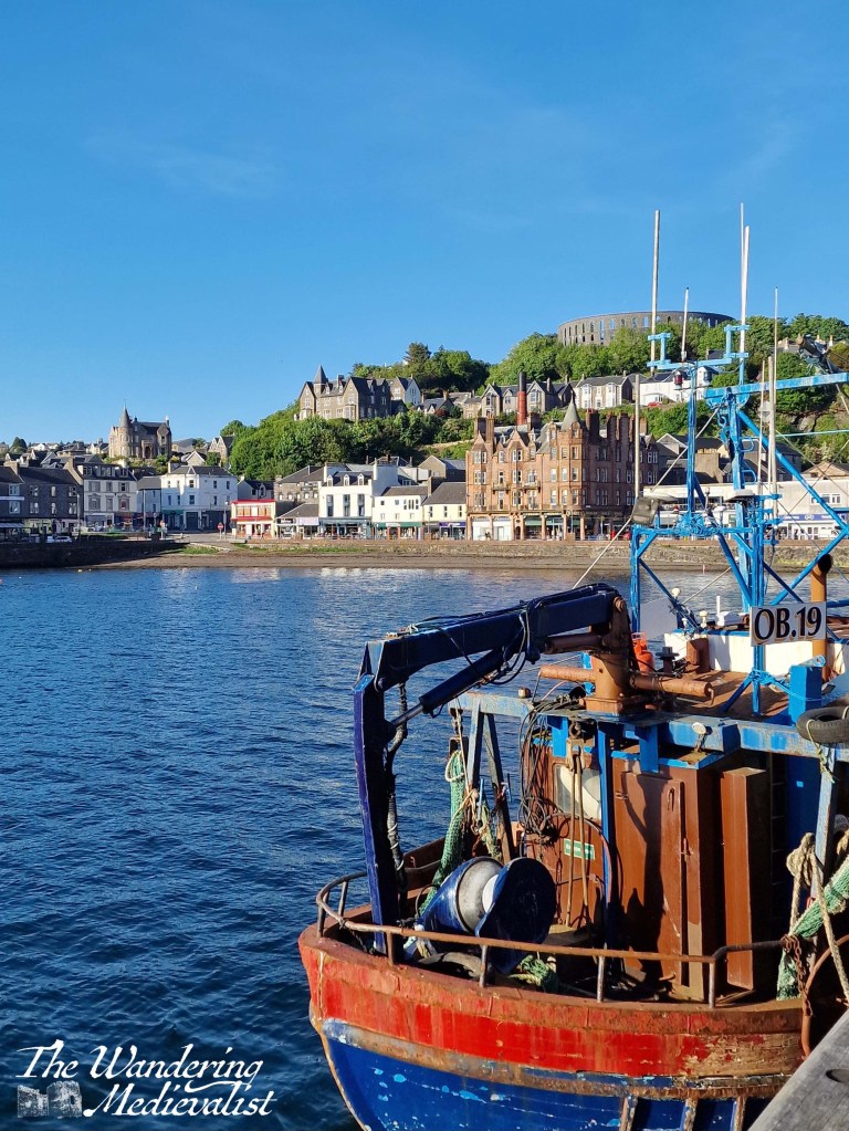
We had a near perfect day in Oban when we first arrived – stunning blue sky and bright sun. This picture seems to cover it all – the monument on the hill, the harbour and the distillery and high street.
I positively fell in love with the rock-lined sandy beaches of Mull. How could you not?
This was our lunch view, looking over clear water with bobbing sailboats reminiscent of the Caribbean. But on Iona. Reminds me of a peaceful and moving day on the ancient isle.
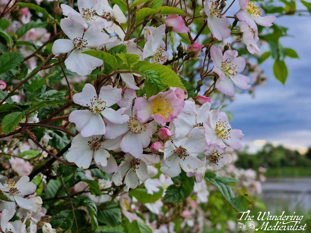
June in Scotland is all about flowers. These lightly pink blossoms line the streets and woodland paths, and I love them.
One day in June, I sat in my in-laws’ garden and took pictures of the birds. Their garden is always full of feeders and birds of every kind, and this photo in particular is in memory of my father-in-law.
July was the first month of travel with my new job, and I found that I really loved the city of Toronto. This picture seemed to encompass both the old and new feels of the city.
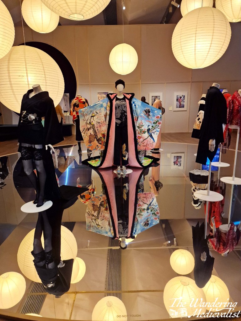
The V&A Museum in Dundee held a fascinating exhibit on kimono, both old styles and new. It was beautifully presented, and I loved this mirrored display.
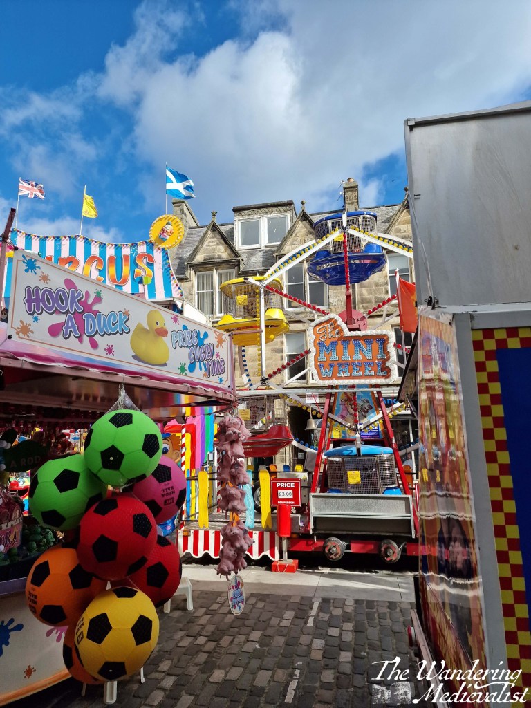
The pinnacle of summer in St Andrews is the Lammas Market. Held on the last weekend before kids return to school, a fun fair fills the streets of the town in an event that is somehow both very modern and incredibly ancient in feel. I have always been fascinated by the juxtaposition of old stone buildings and bright garish rides.
I travelled a lot in September, starting off with a trip home – I had not been home in September in many years and I almost forgot how beautiful late summer in New England can be. Almost. And of course this view is one of the best in Marblehead.
This was also my first 9/11 in the US since 2001. It was incredibly moving for me to be in a school on that day and learn how the teachers were ensuring the next generation remembered the day with the same poignancy as those who lived through it.
One evening, I drove from Houston to Dallas. It was a great drive and I loved this totally deserted rest area where I stopped for a short break. No question I was in Texas.
In the otherwise rather standard hotel I stayed in, they offered Texas-shaped waffles on a Sunday morning. The epitome of Texas and the US. Made me so very happy.
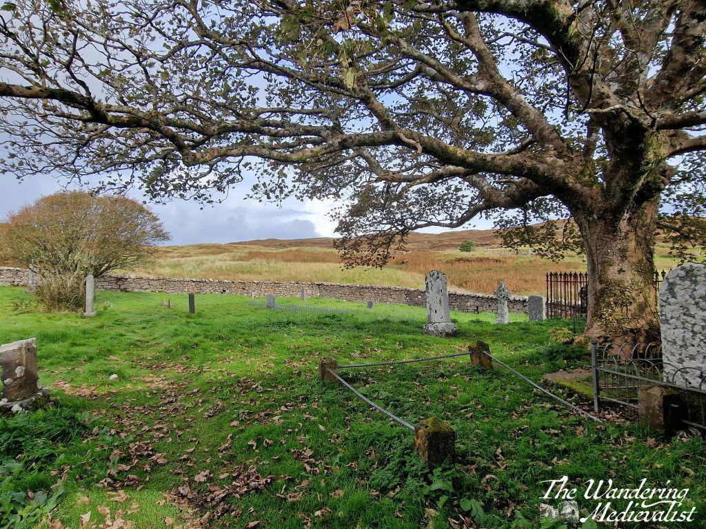
I love a good churchyard, and this one in Dunvegan on Skye was both old and beautifully kept.
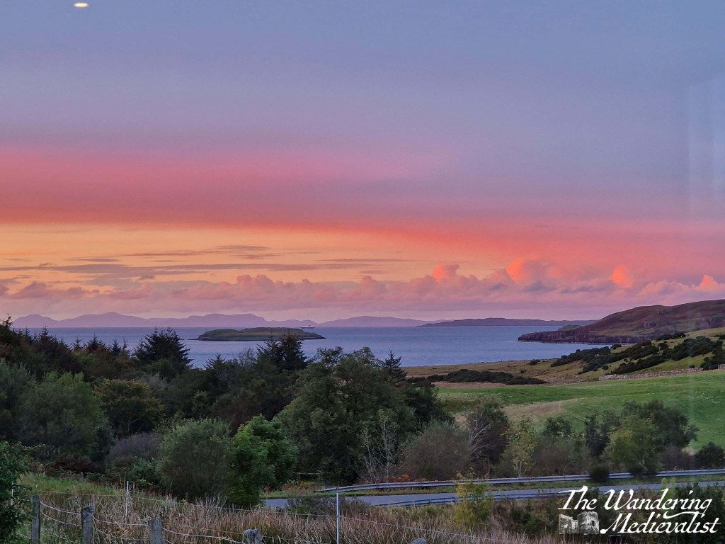
Sunset on Skye. Seldom gets better, and this will always remind me of the little cottage in which we stayed, overlooking the fields and water.
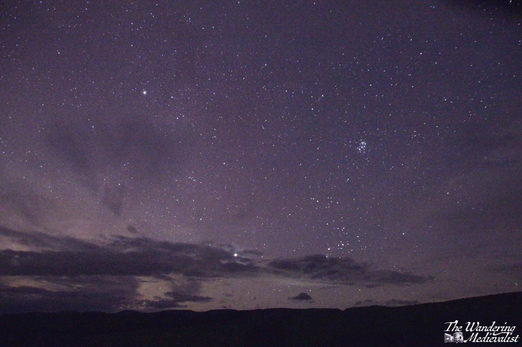
On this stunning clear night, I stood outside with my camera for almost an hour playing with settings until I managed to get them just right. Sheep in the nearby field were baaing their impatience with me, but otherwise it was totally silent and peaceful. Heaven.
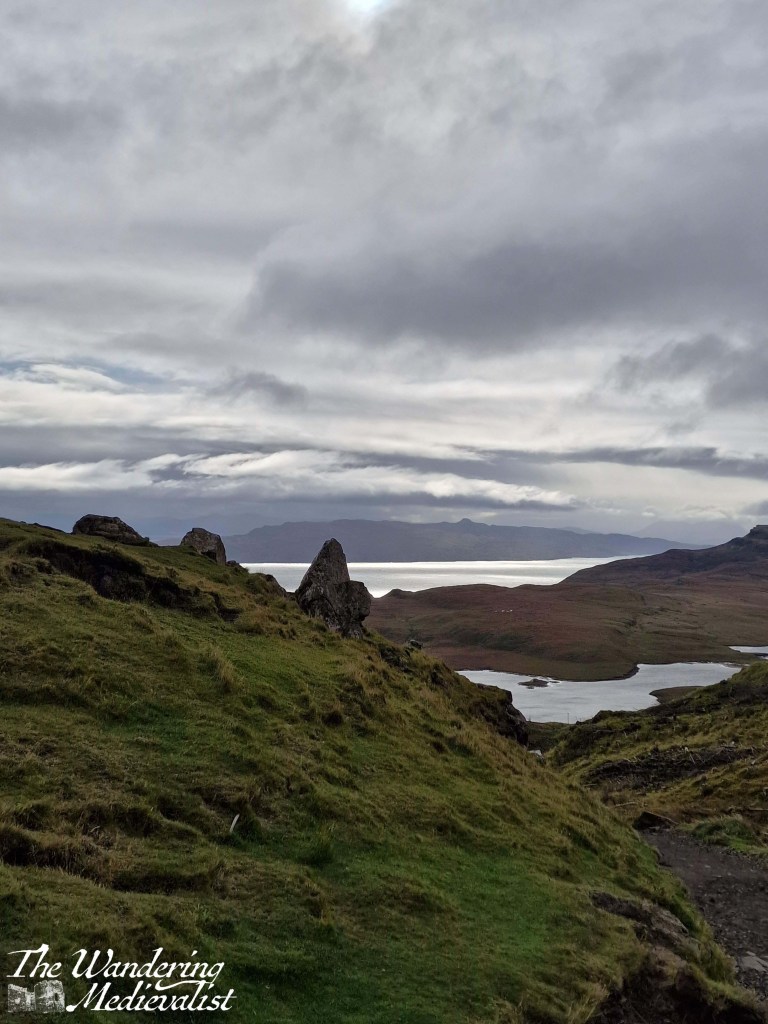
It is always nice when the sky is blue, but the Highlands lend themselves just as well to clouds and partial sun. I loved this view of rocks, loch, hills and ocean beyond.
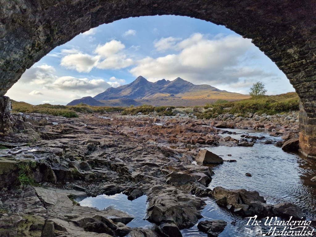
That said, the day we started our drive home was sunny and gorgeous, so I could not resist a stop at Sligachan Bridge, which had been overcast on our last visit. I pride myself on staying dry while managing this under-the-bridge picture of the distant Cuillins.
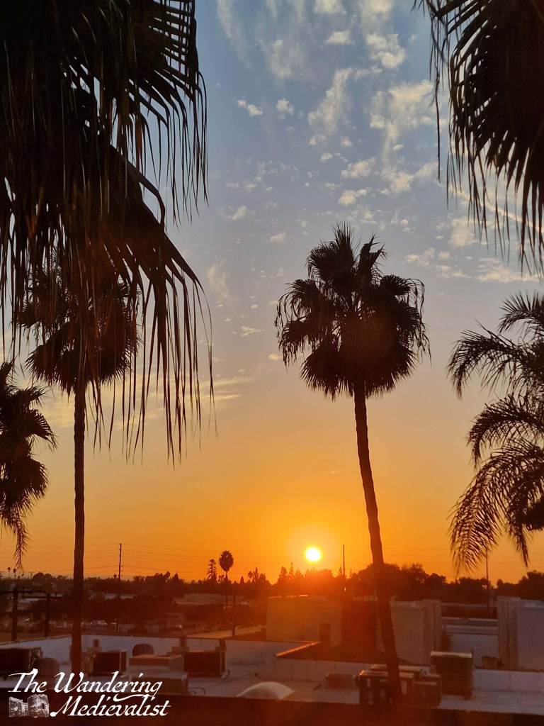
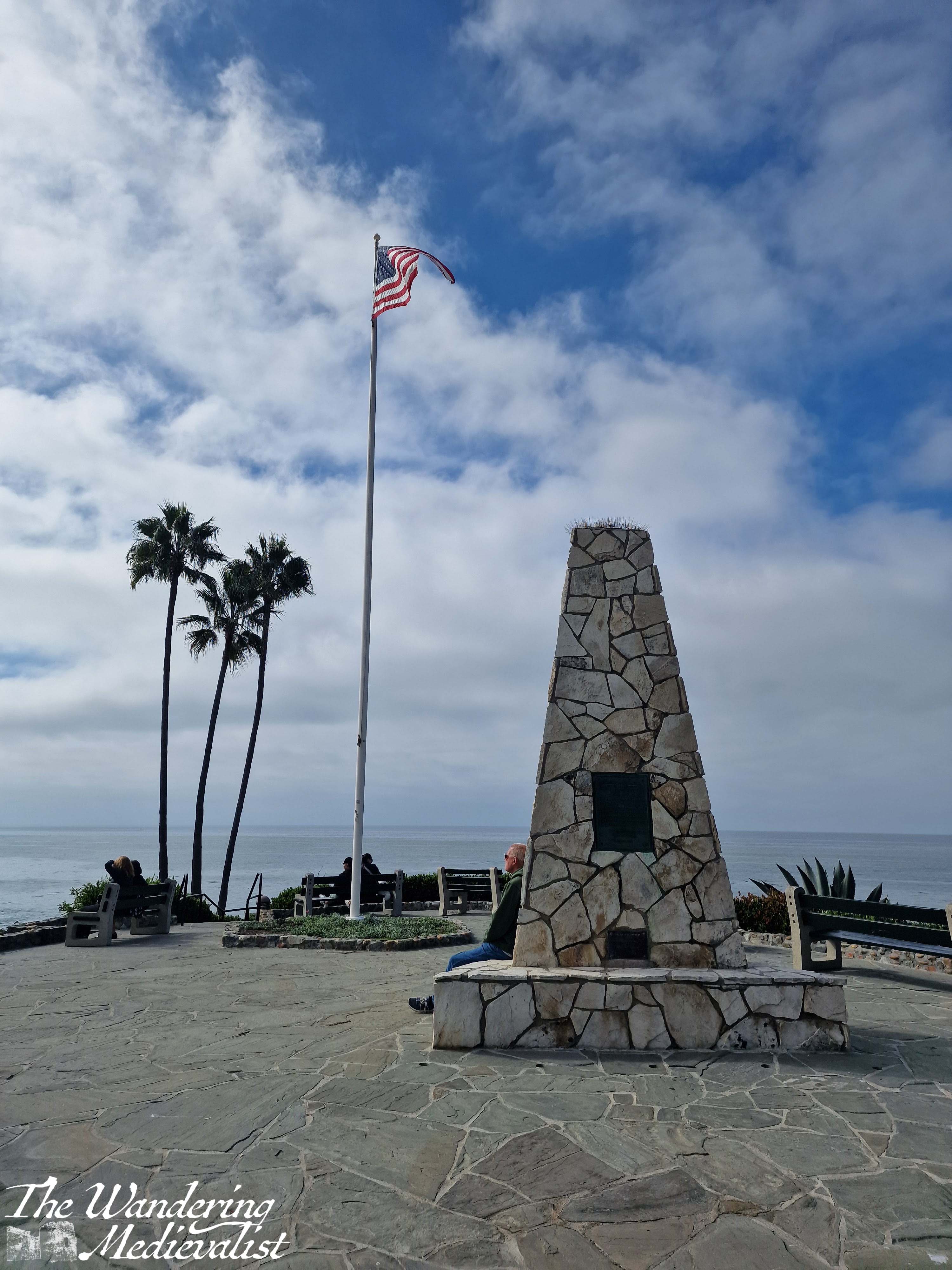
October was an another busy month of travel, including my first ever visit to Southern California. This picture, taken out of my hotel window on my first night in CA, was a precursor to a really great – if busy – trip.
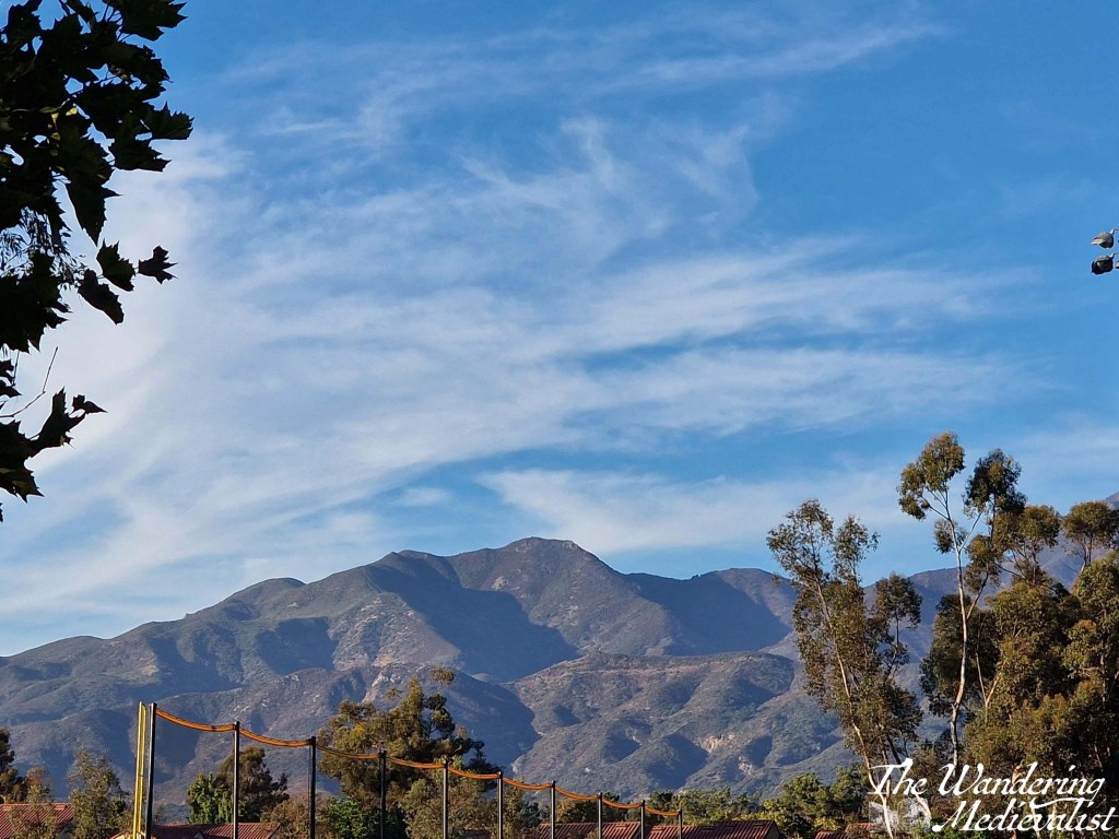
I found myself drawn to the Californian mountains. They were rugged like the Highlands but dry in their starkness. And stunning in the evening light.
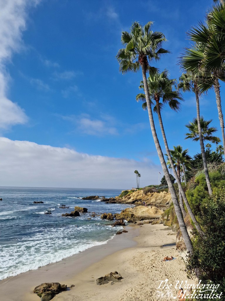
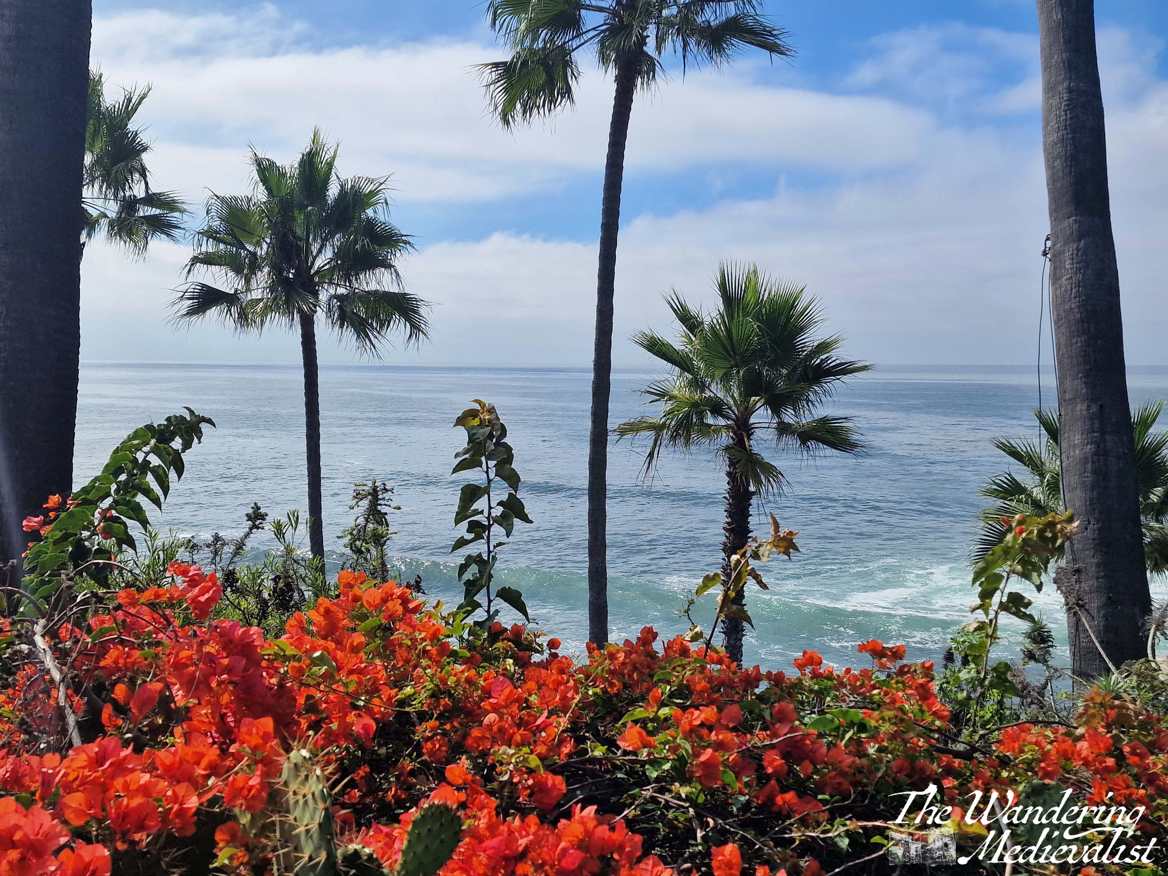
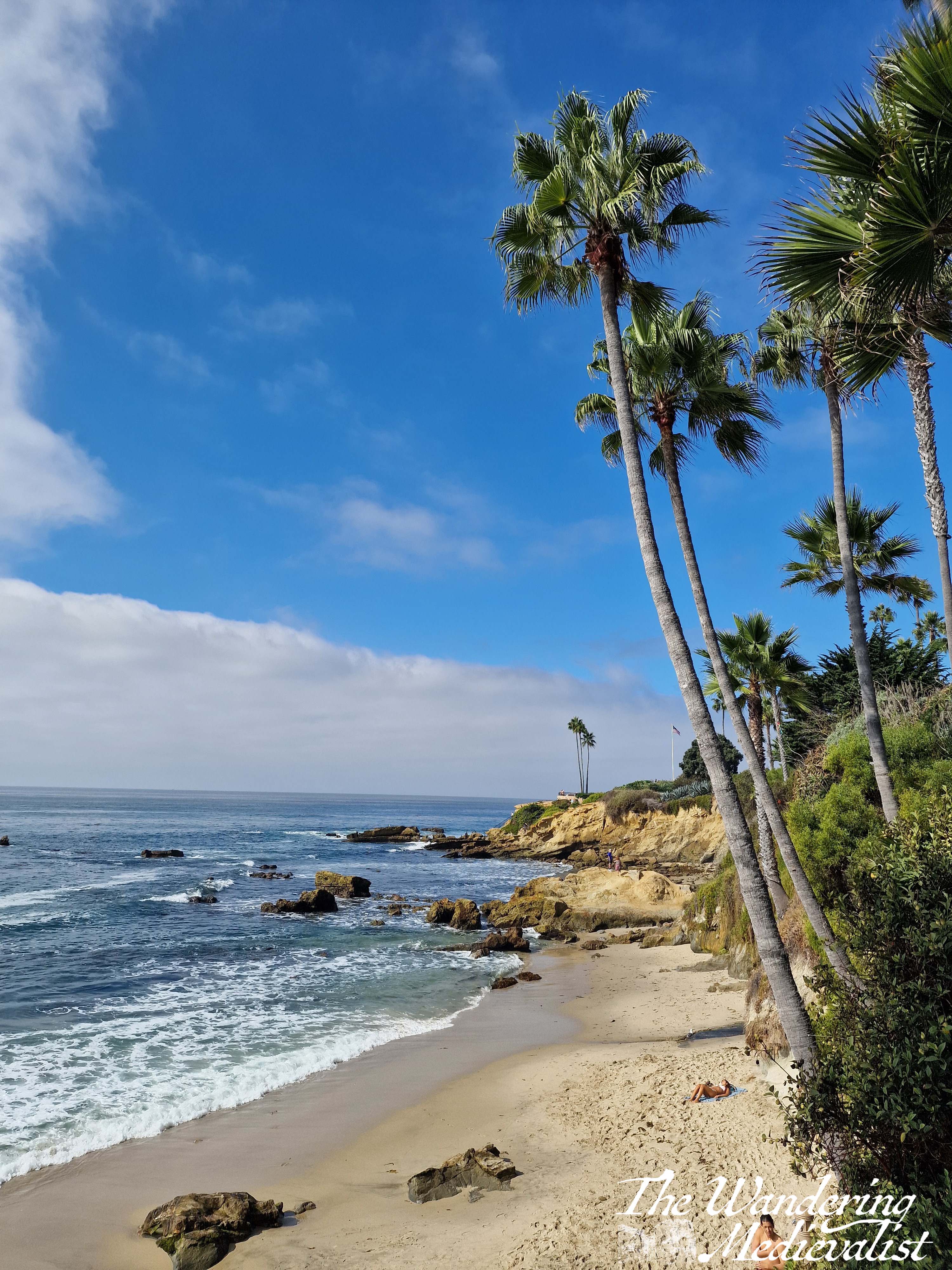
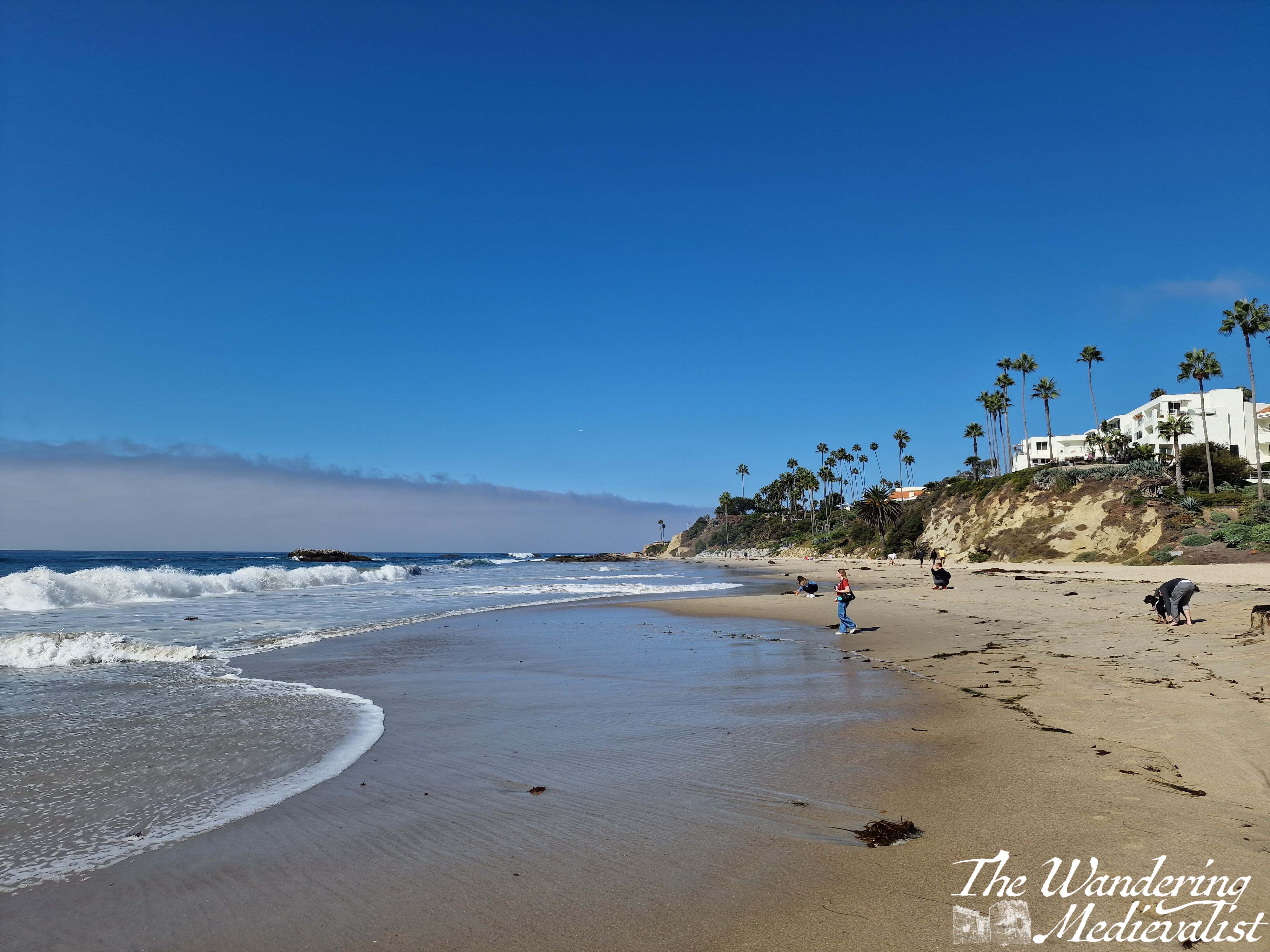
As I recently wrote about, one morning I took myself on an adventure to Laguna Beach. I was entirely on my own and knew nothing about where I was going, but had a wonderful morning in the sun. There were so many gorgeous pictures to be had, but this of the palms and sea and sand was my favourite.
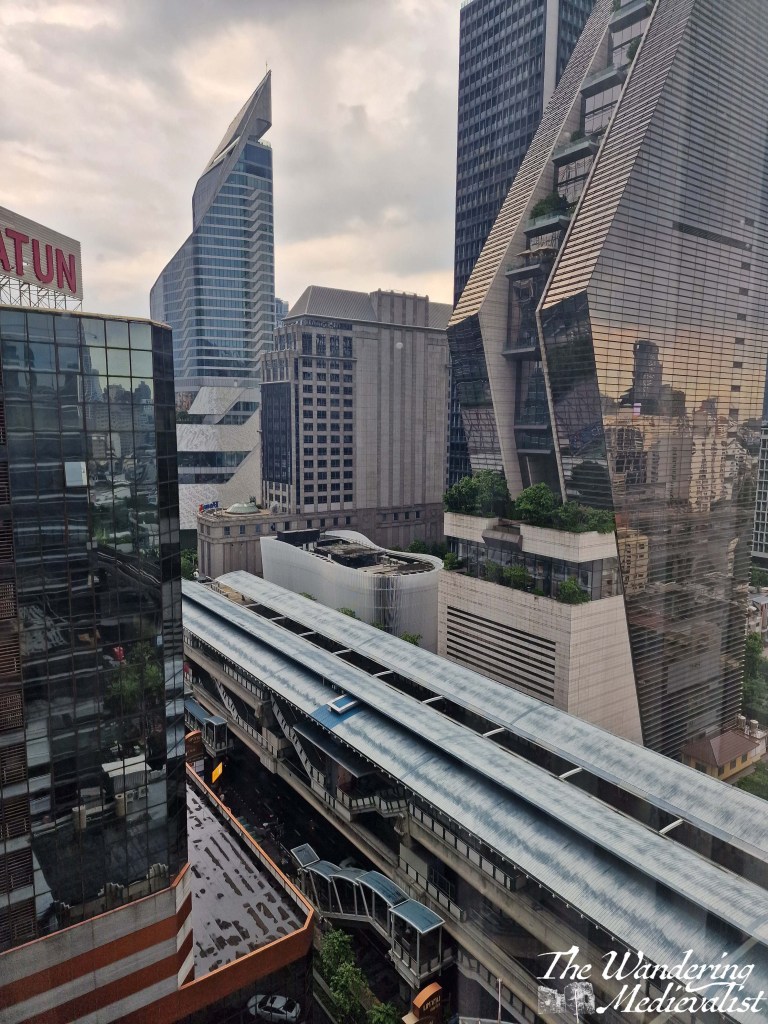
Bangkok was a city about which I knew very little. I found myself fascinated by the architecture, the greenery, the heat, and even the BTS sky train. Always crowded, always hot, and often beautiful in the way only a city can be, Bangkok surprised me.
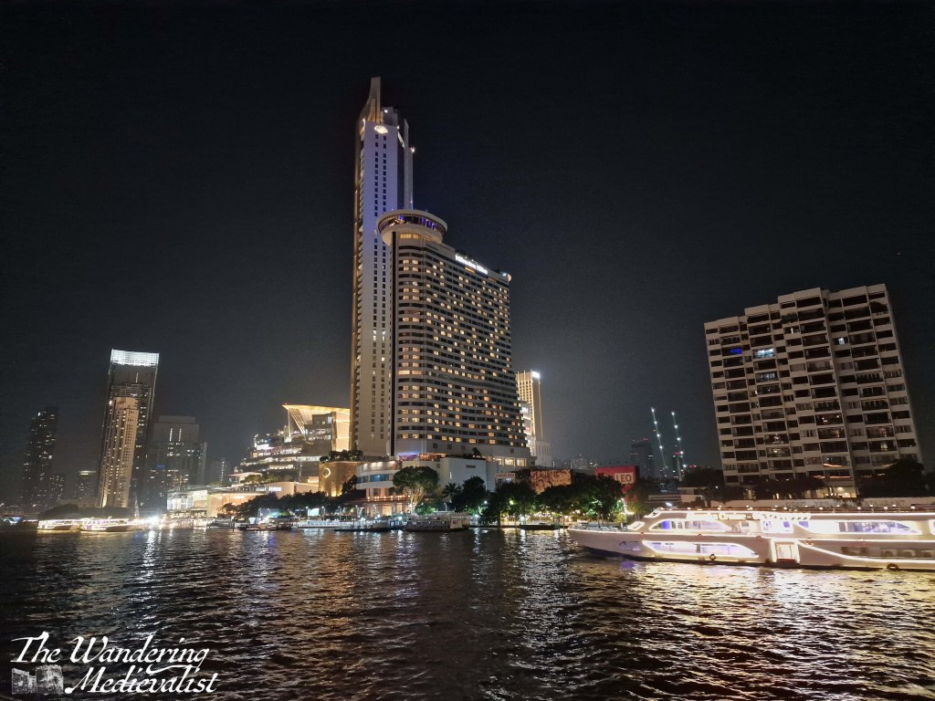
In one of the more surreal nights of this year, colleagues and I were taken on a river boat cruise in Bangkok. The night skyline was even more beautiful, and it was a magical night.
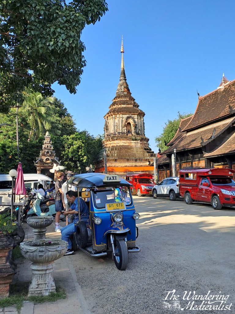
This is one of my favourite picutres of the whole year, encapsulating the elegance of the ancient temple and the bustle of modern Thailand. I completely fell in love with the city of Chiang Mai and hope I can return!
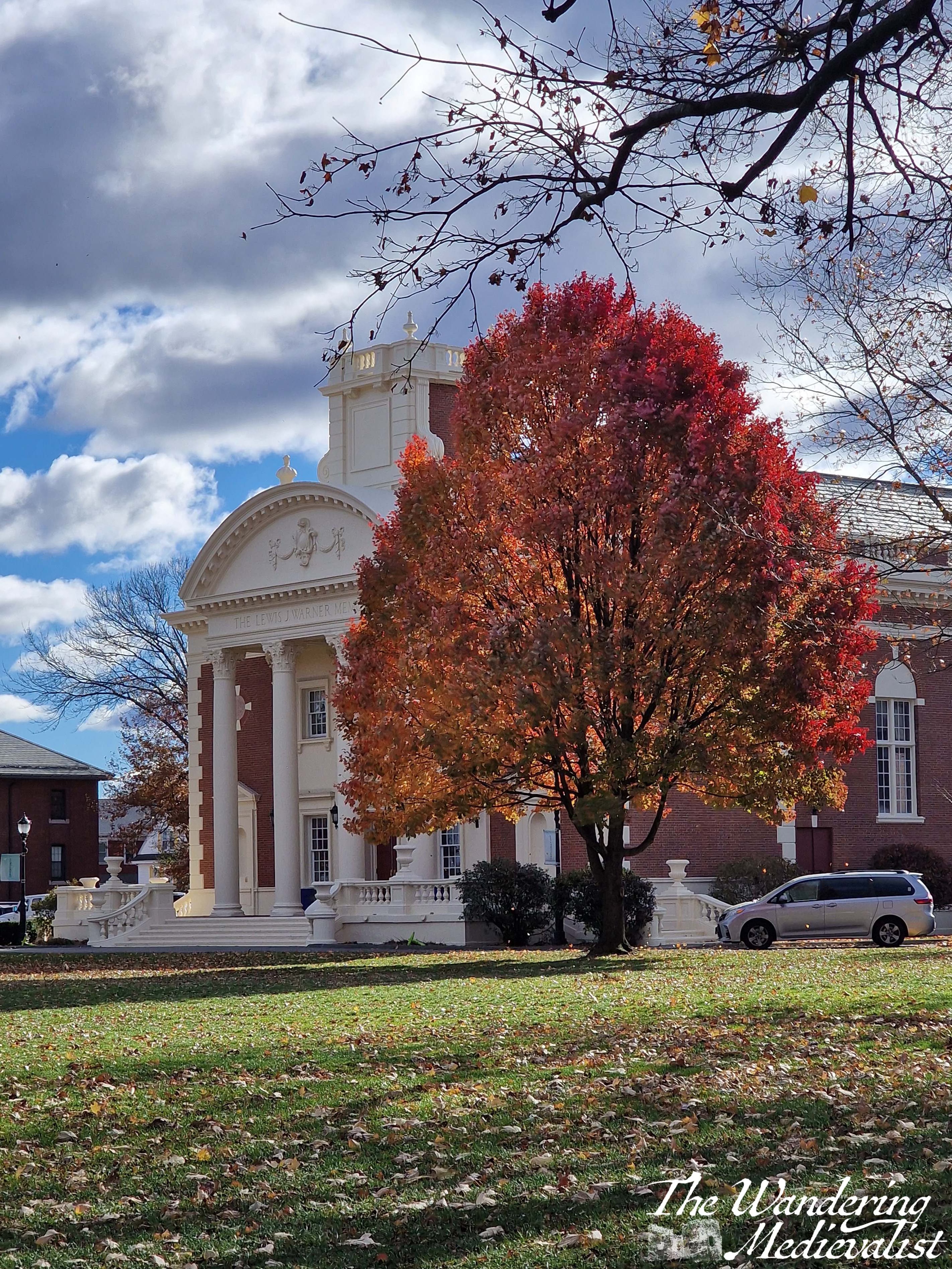
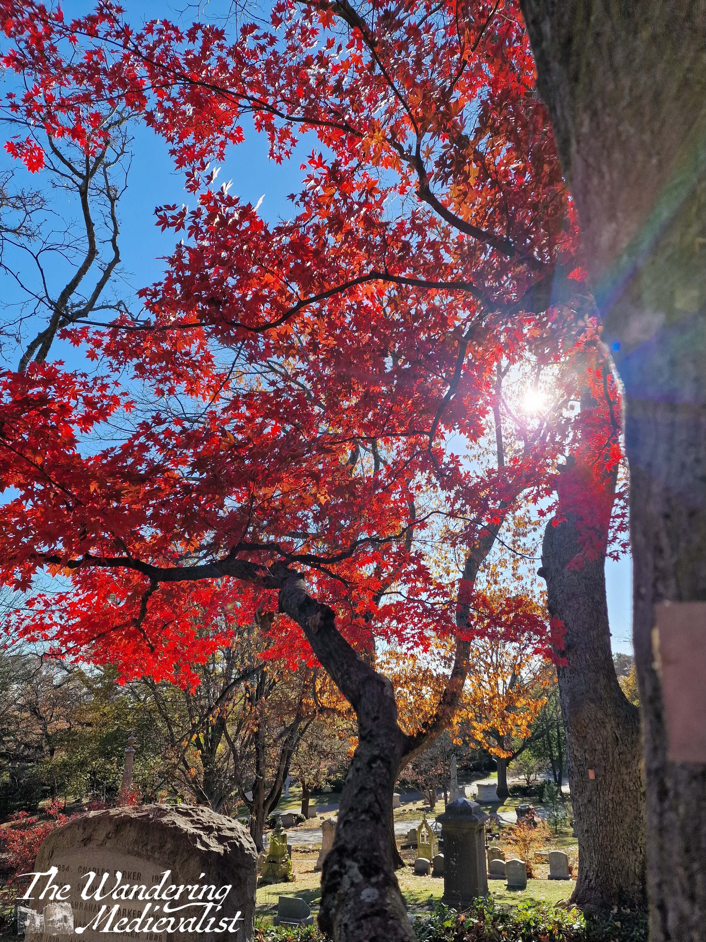
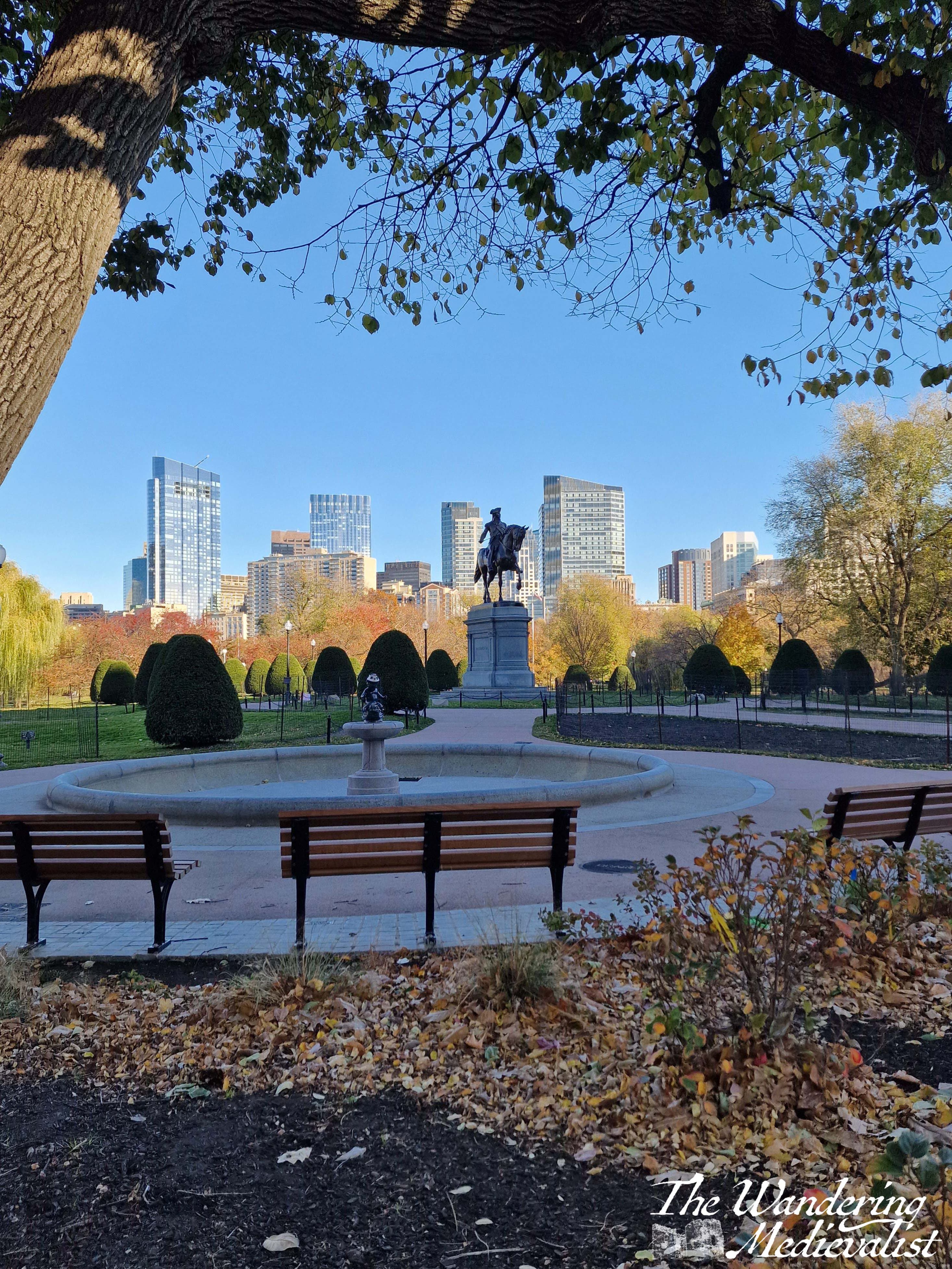
Finally, in November, I returned to New England to finally see the autumn colours (or tail end of them) and do my job in my home town of Boston. The weather was gorgeous, as the area was in drought, and I was there for the full moon. It was a fitting end to a year of lots of travel to new places, and plenty of opportunities for pictures.
Clockwise from top left: Full moon rising over Marblehead harbour, a stunning tree at Worcester Academy, the statue of George Washington looking over the Boston Public Garden, a stunning red Japanese maple in Mt Auburn Cemetery, and Marblehead harbour at night.
I hope you have enjoyed this photographic trip through my year! Have you checked out my online shop yet?
The last month has a been a whirlwind of work – adjusting to my new job and to the travel it requires has taken a toll on me, but as October moves into November I have been able to take time to rest and review. In doing so, this post formed in my mind.
A few weeks past, in the midst of a busy work trip, I was lucky enough to find myself with a free weekend morning. Originally I had big plans for explorations of the Los Angeles area further north, but a week of traffic and driving did me in and I chose a closer option.
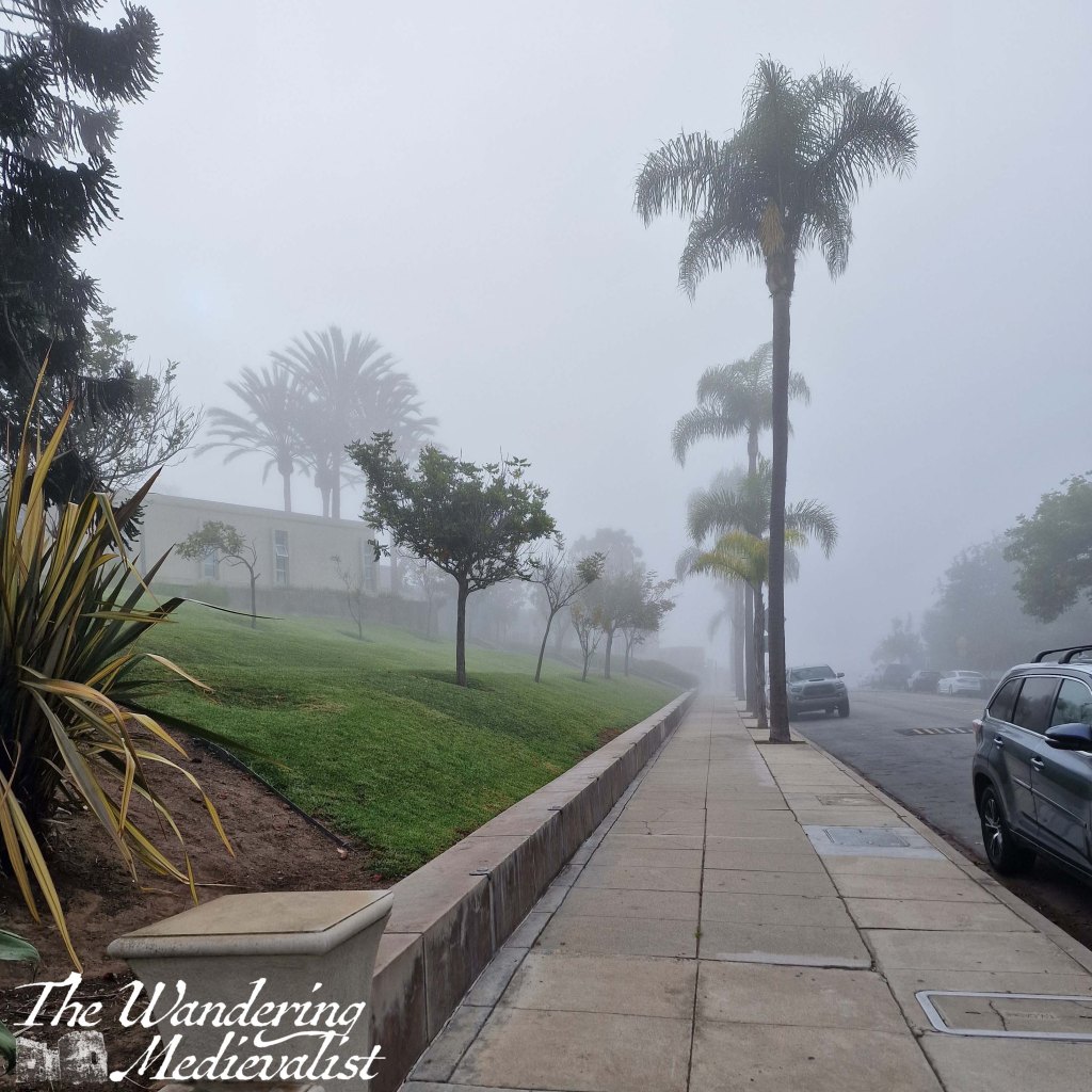
I was staying in Santa Ana and had visited Laguna Beach earlier in the week on a school visit; on that occasion it was swathed in thick fog, with buildings and palm trees just peeking out of the mist. There was a proper Pirates of the Caribbean vibe, with Spanish-inspired architecture a common site.
(side note, I was surprised to discover that almost every morning I was in Orange County was overcast or foggy, but apparently that was not unusual for the time of year).
I had not had time to explore during my weekday visit, and so on Sunday I hopped in the car as soon as I got up and headed south. Even the drive is breath-taking, cutting through the California hills that are as stark as parts of the Scottish Highlands, but a very different colour. I had discovered earlier in the week that several California highways pass through the mountains, making me wish beyond anything that California offered the parking spots and pull-over options that you get in the UK and the White Mountains. My GPS took me along Rt 133, which approaches Laguna Beach from the North-East, the last few miles snaking through high ridges (another option takes you along the coast, but this was less direct). There are periodic parking lots along the 133 for hikers and the myriad of trails winding up into the hills.
Making a mental note to return to one of these trails, I headed into town and found a place to park at one of the several public lots, this one covered so that the car would not overheat. It was far from free – $9 for three hours – but I was not planning a long trip and it was a special day, so I was very happy to pay.
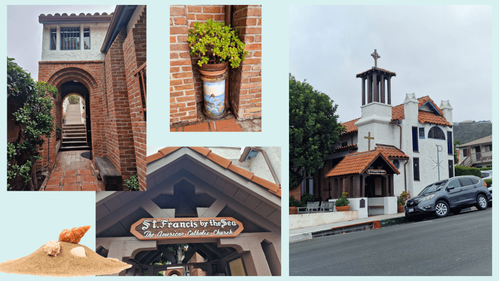
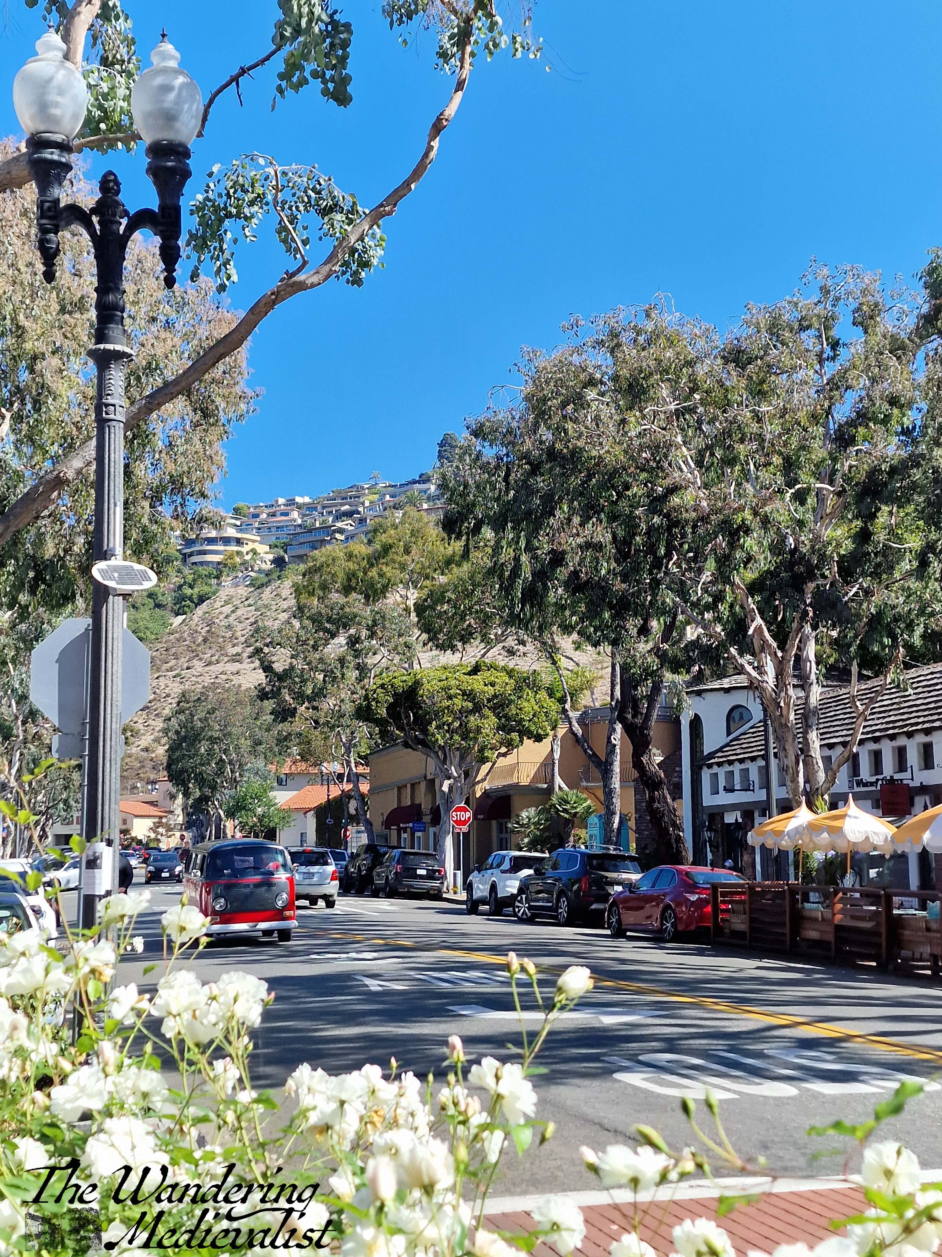
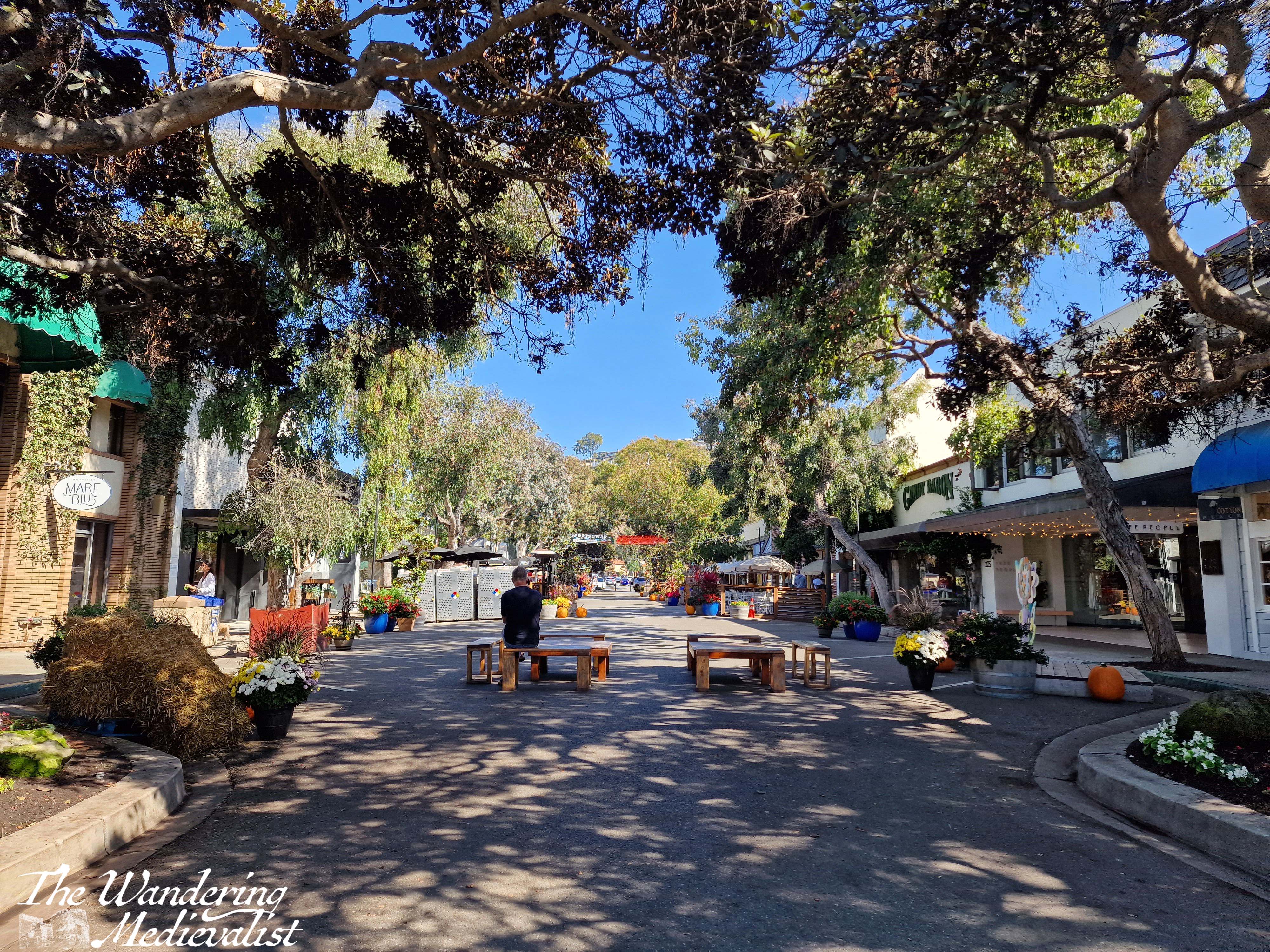
From the parking lot off Glenneyre Street I decided first to make my way up-hill to see St Francis by the Sea, a Catholic church apparently listed in the Guinness Book of World Records as the second smallest cathedral in the world. It was a really cute wee spot, but my exploration was curtailed by the fact that I could hear the service taking place inside as I walked by, so I took a few pictures before heading back downhill.
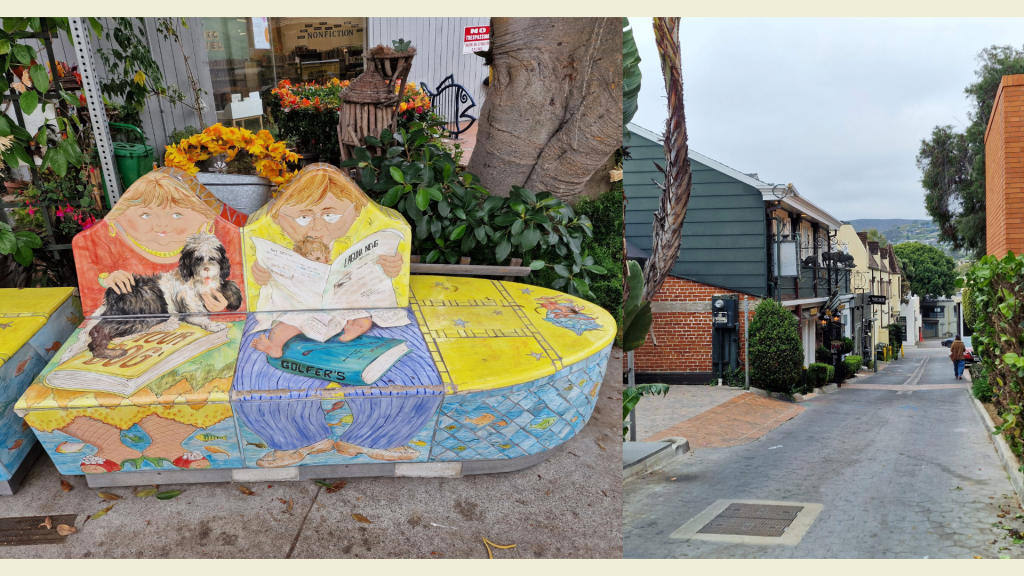
It was a short walk down to the water, passing the local library with very entertaining benches (see below) and several shops that were not yet open though looked appealing.
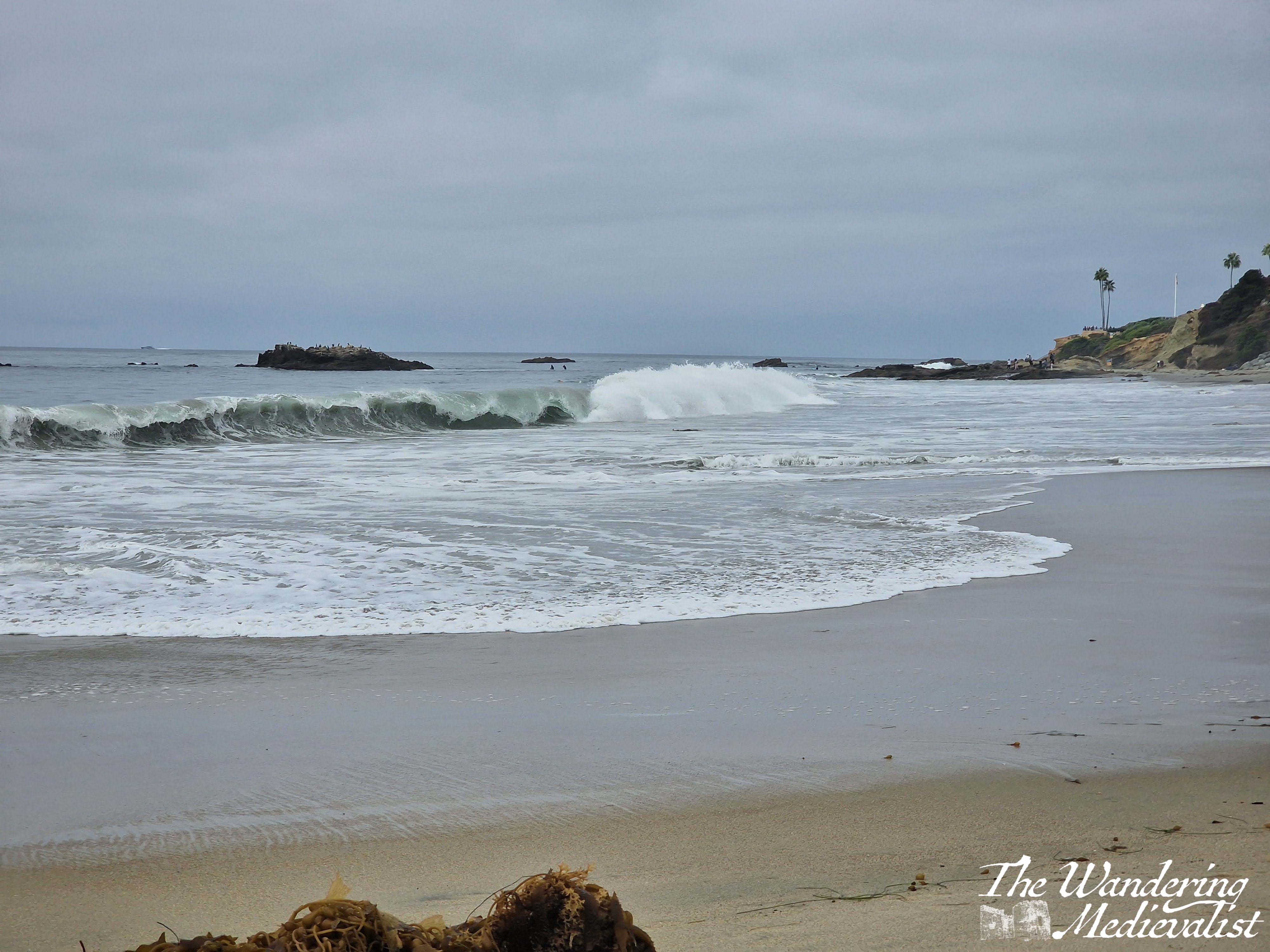
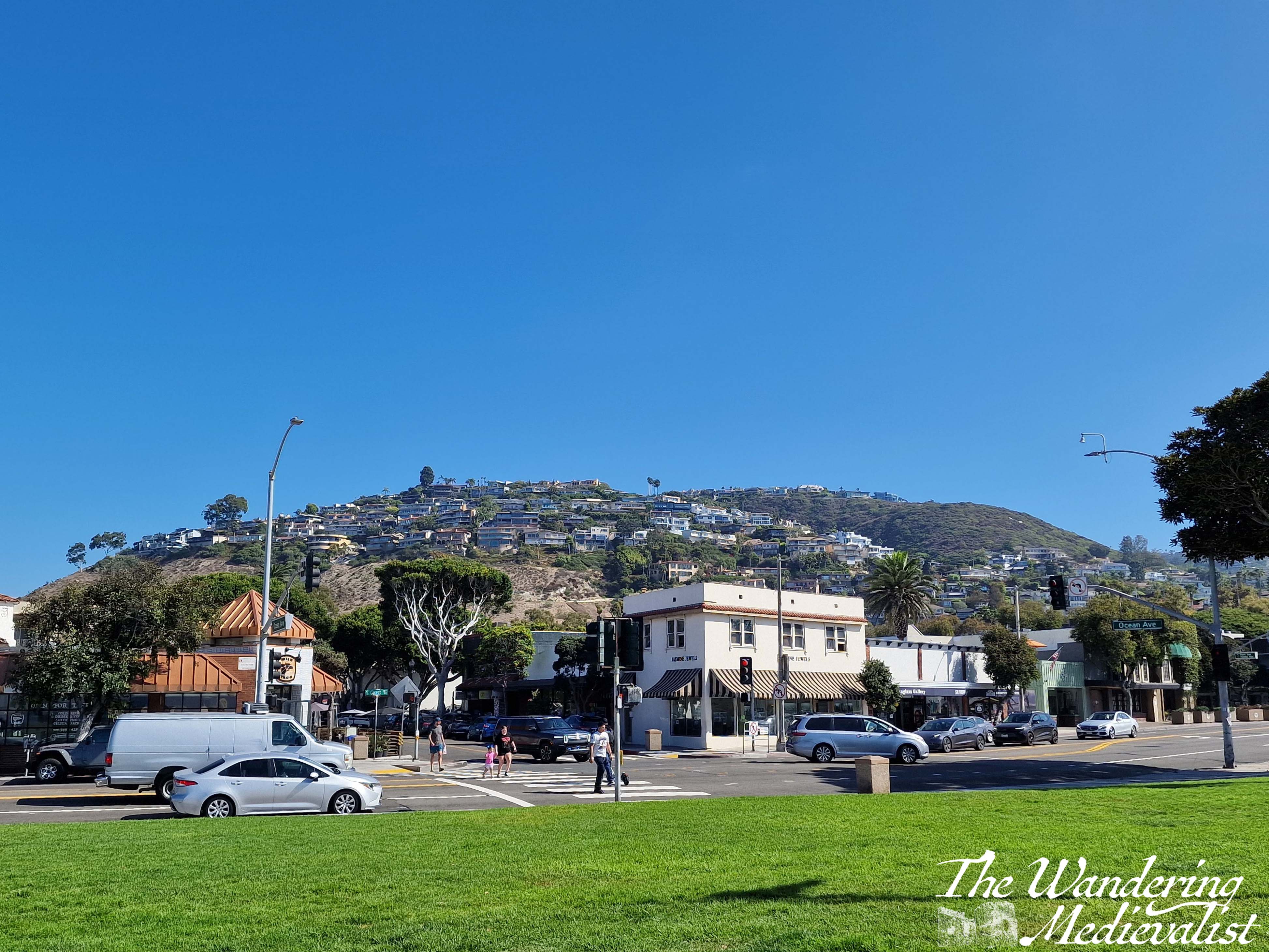
I reached the beach front in less than five minutes, and it was early enough in the day that the sky was still overcast. The sun was just thinking about peeking through the clouds, with lighter patches promising where it would first defeat the gloom, but in the meantime the cooler temperature allowed several teams of energetic folk to play volleyball in the sand. There was also, to my delight, a small market with local artists and a jewellery-maker who used sea glass in her art. I could not resist picking up a pair of earrings…or two. Behind the fair, the town stretched back towards the hill, which was layered in houses that I can only imagine have spectacular views over the coastline.
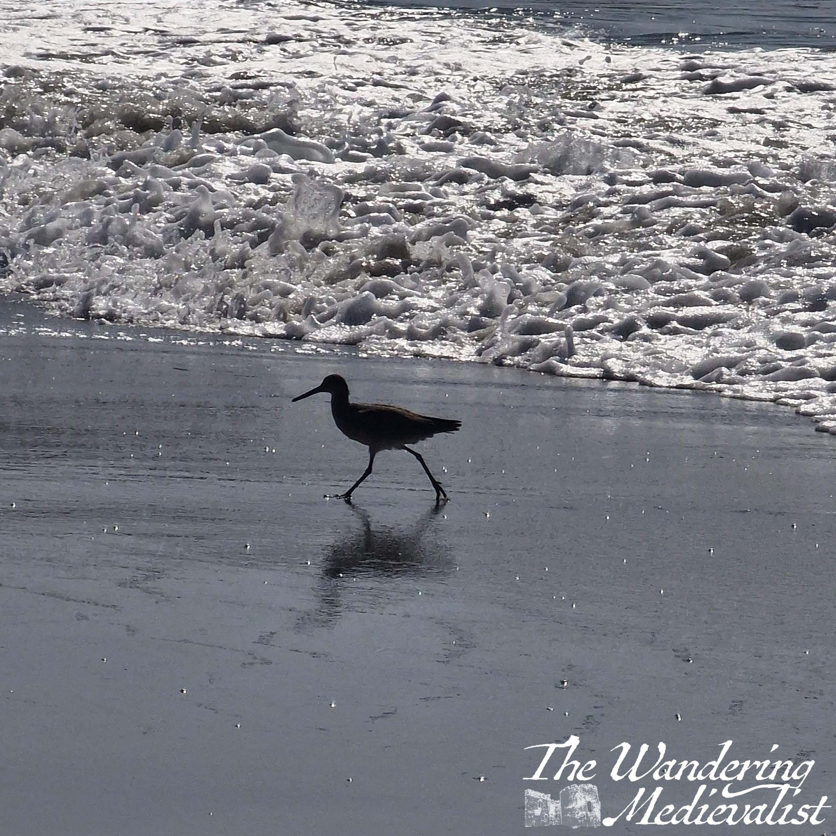
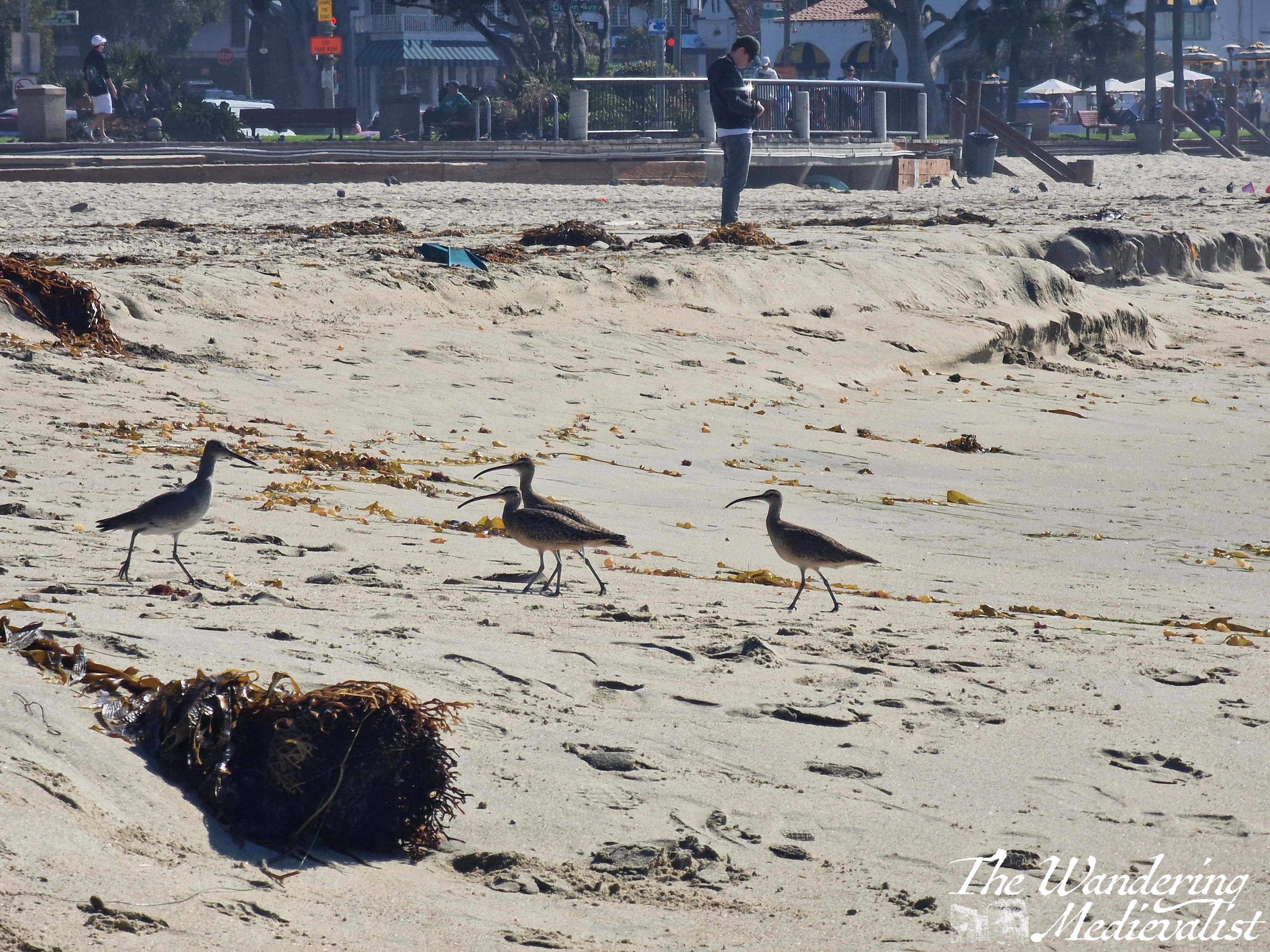
The scene by the beach was classic California – a wooden board walk lining the sandy beach with crashing waves where some brave souls were swimming and surfing. A huge range of people walked and sat on benches: young and old, all races and socioeconomic status. There were homeless people with their belongings, dog walkers and people-watchers, families with young children building sandcastles and playing in the surf, a group of young men working to get a jet-ski into the water, tourists like me, and well-muscled and bronzed lifeguards keeping an eye on everyone (yes this is cliché, but evidently for a good reason). We were all kept company by a group of what I think must have been sandpipers, alternately chasing waves and running back up to the dry sand.
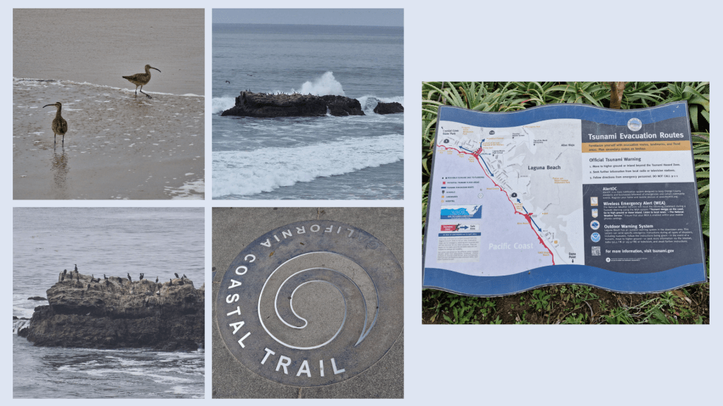
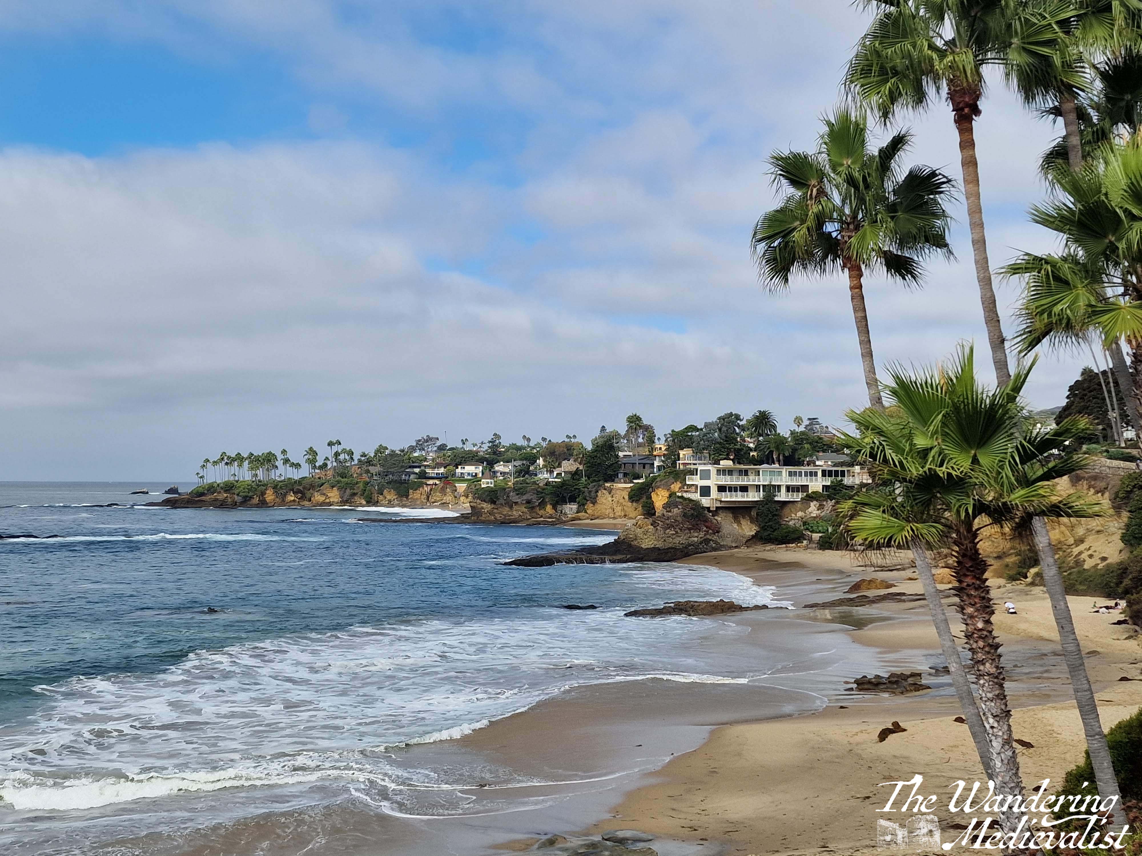
I made my way along the beach and up a set of steps that climbed to the top of the cliff and the California Coastal Trail. I was a touch surprised to see the tsunami evacuation route sign, but I suppose only for its novelty – it is not something we have on the East Coast!
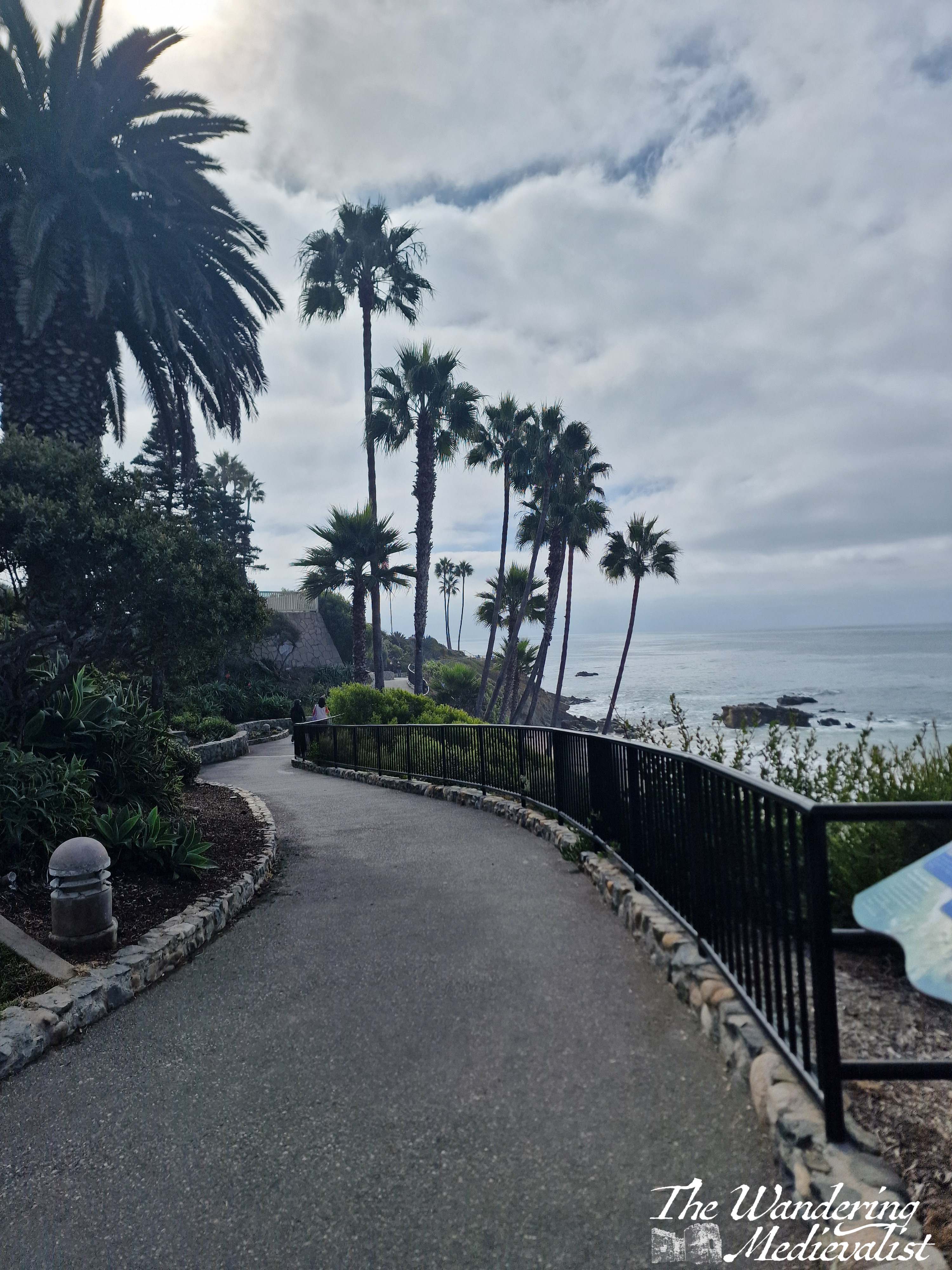
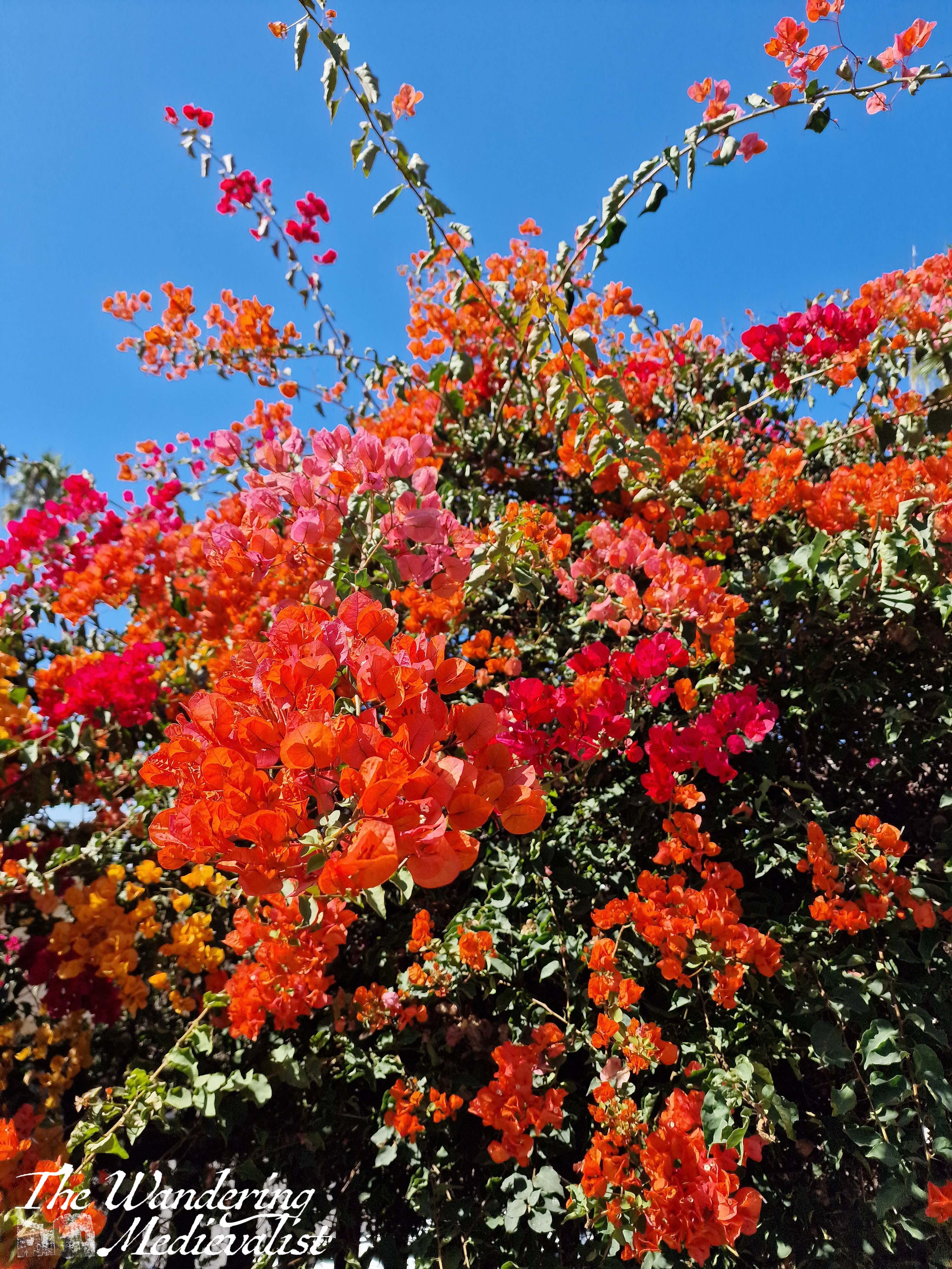
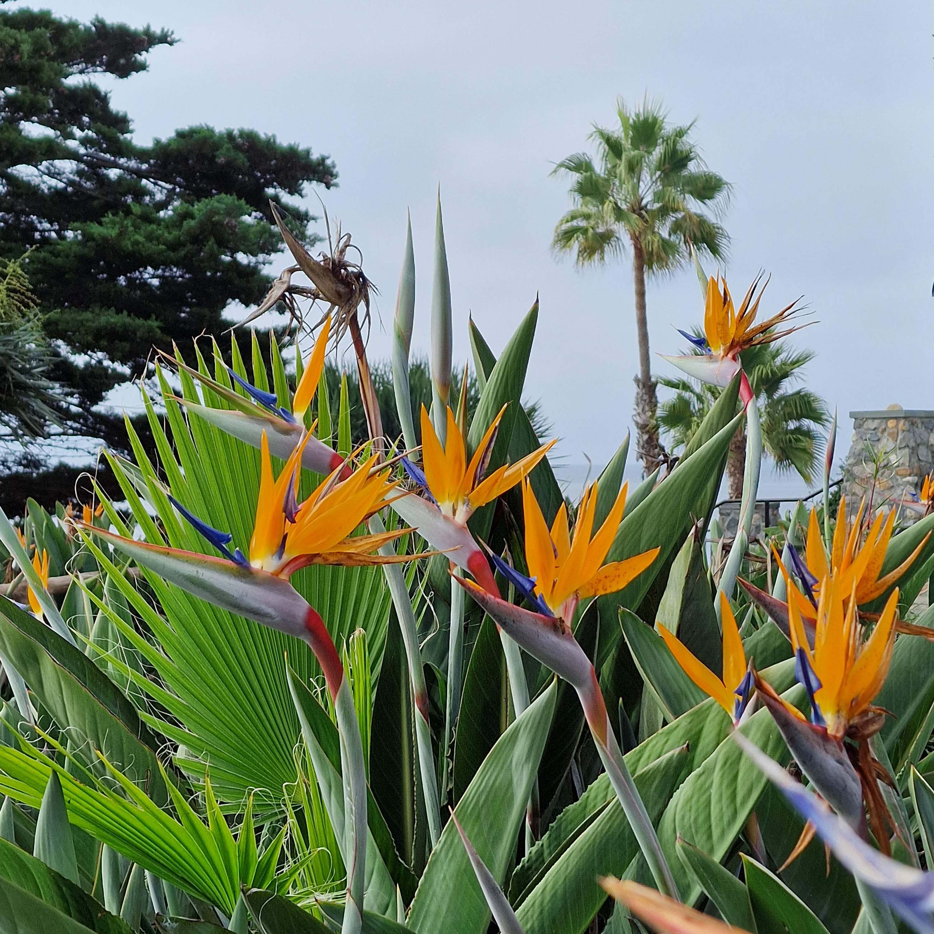
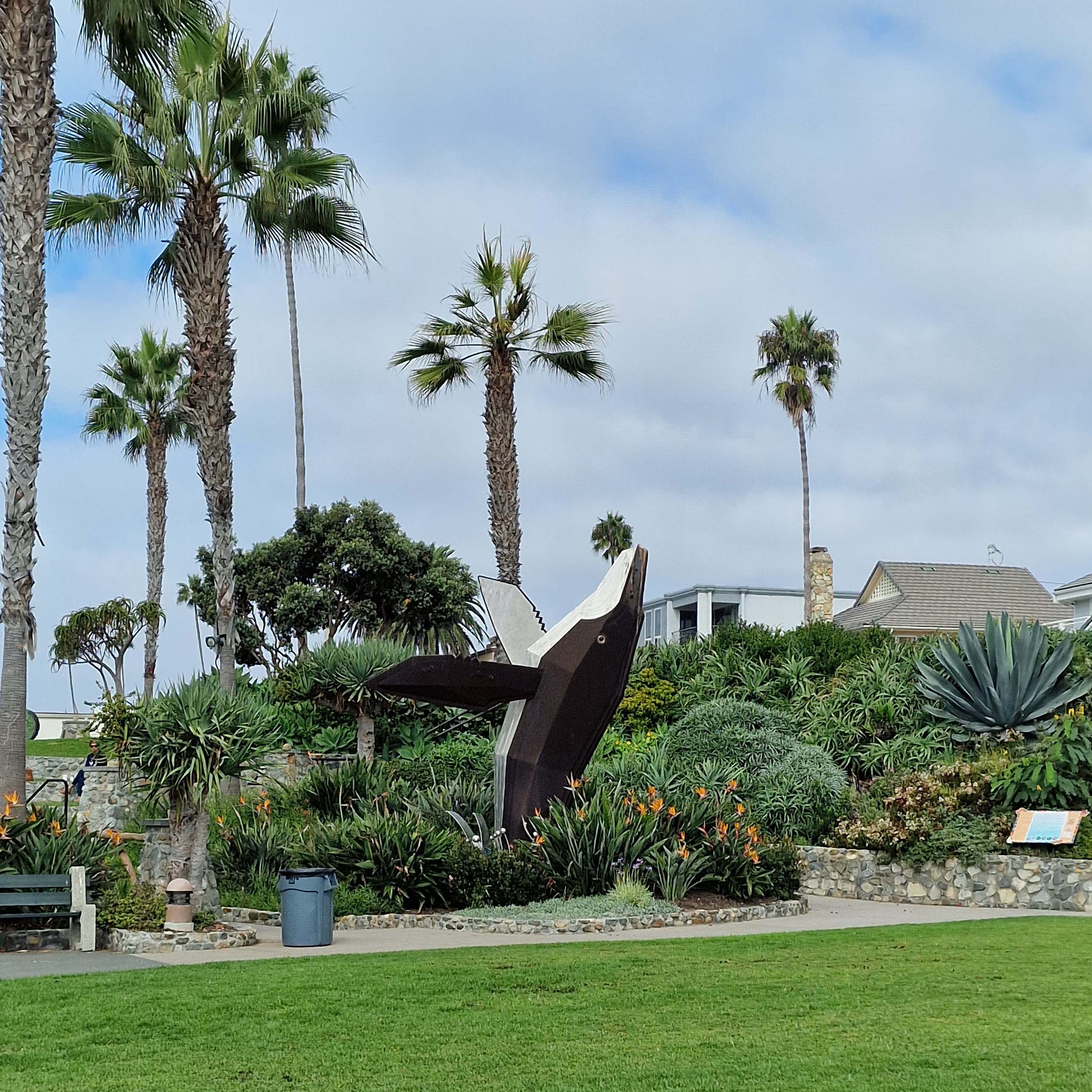
The path follows the cliff top for miles, with viewpoints and plenty of side-entertainments in the form of statues, a war memorial, tropical flowers, gorgeous palms and cacti. There is also a spectacular bird rock covered in what looked like cormorant (though may also be brown pelican) just off the coast – the waves crashed around it but never seemed it disrupt its occupants.
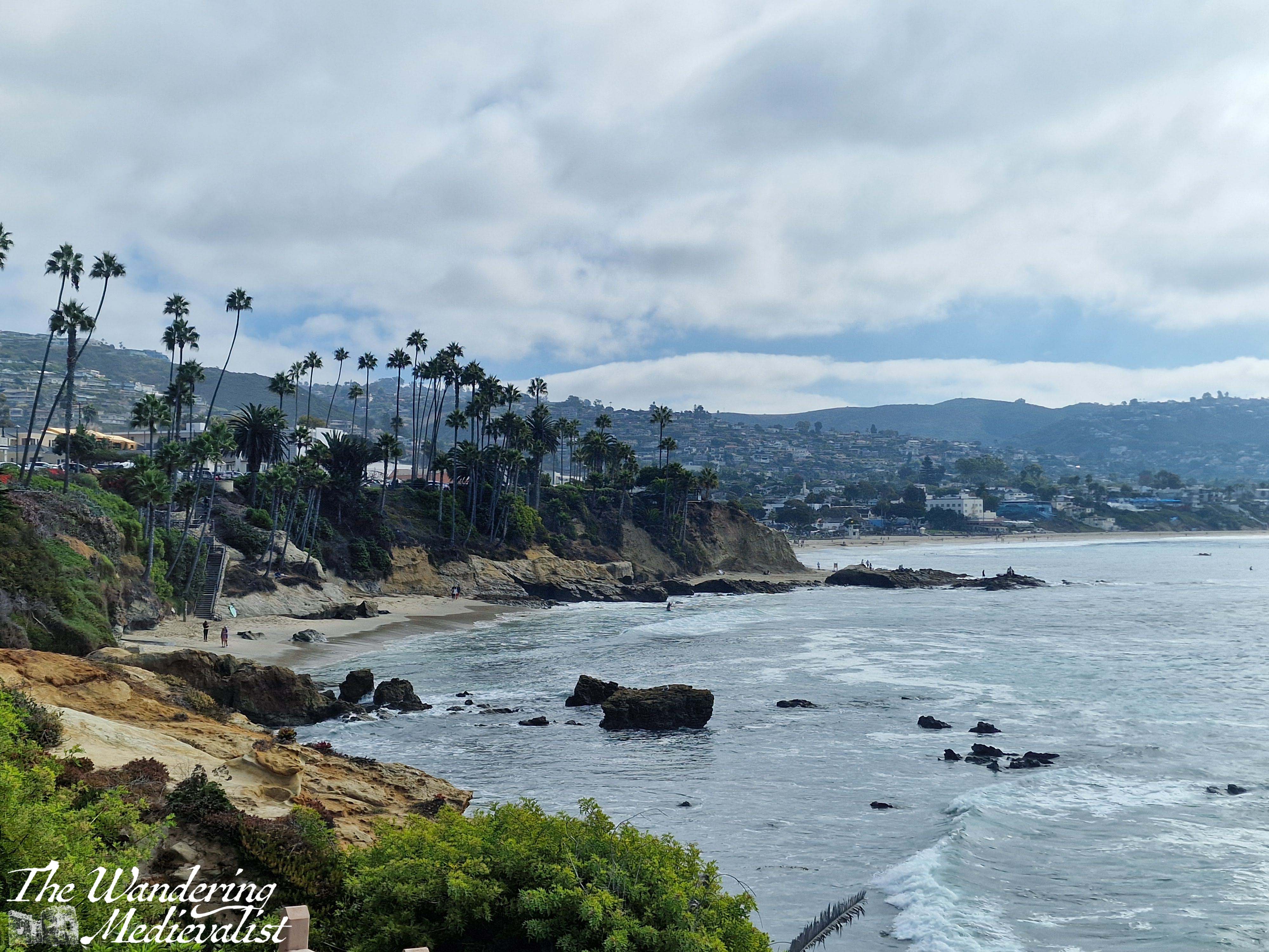
At times the path was built out away from the cliff and it was always well-kept, clean and free of any kind of litter. The further I walked, the sunnier it got and the busier the path became with walkers and tourists. I passed plenty of locals out for exercise – many with pets – birdwatchers and a few photoshoots being taken of special events – a wedding and a quinceañera I think – against the spectacular backdrop. Despite being very much in an urban setting, there was plenty of wildlife – mostly avian – to enjoy, and the scent of the sea was refreshing and omnipresent.
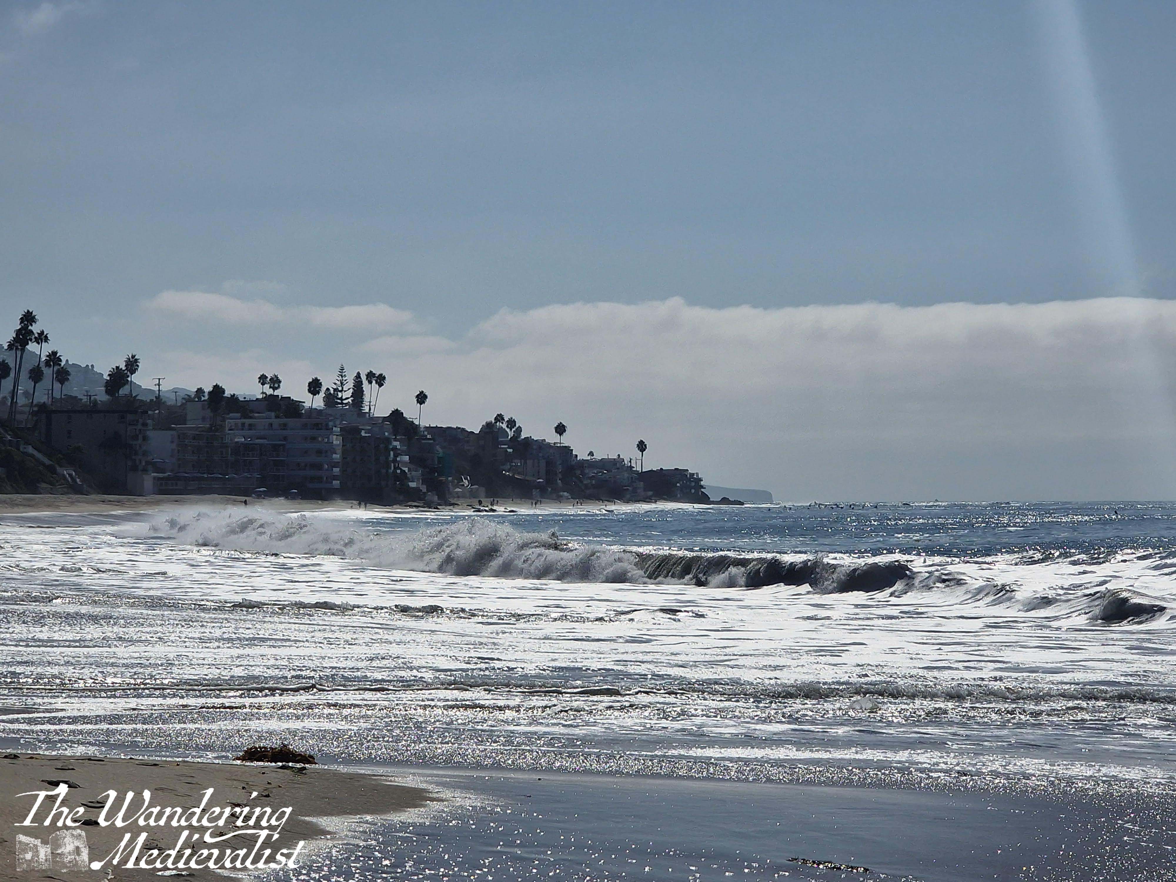
Eventually my need for a cold – and caffeinated – drink turned me back towards the town, but not before one last walk along the beach including a small and accidental dip in the waves. Yes, I was too busy filming to notice one coming a bit closer than expected…
The sun on the waves was just too beautiful to ignore, and the view of the town was excellent.
With slightly wet feet, I walked up the pedestrian Forest Ave where there are high-quality restaurants, bistros, and shops. I stopped for a break at a Parisian-style bakery called C’est la Vie – excellent coffee and an enormous pain au chocolat that I enjoyed with my dinner that night.
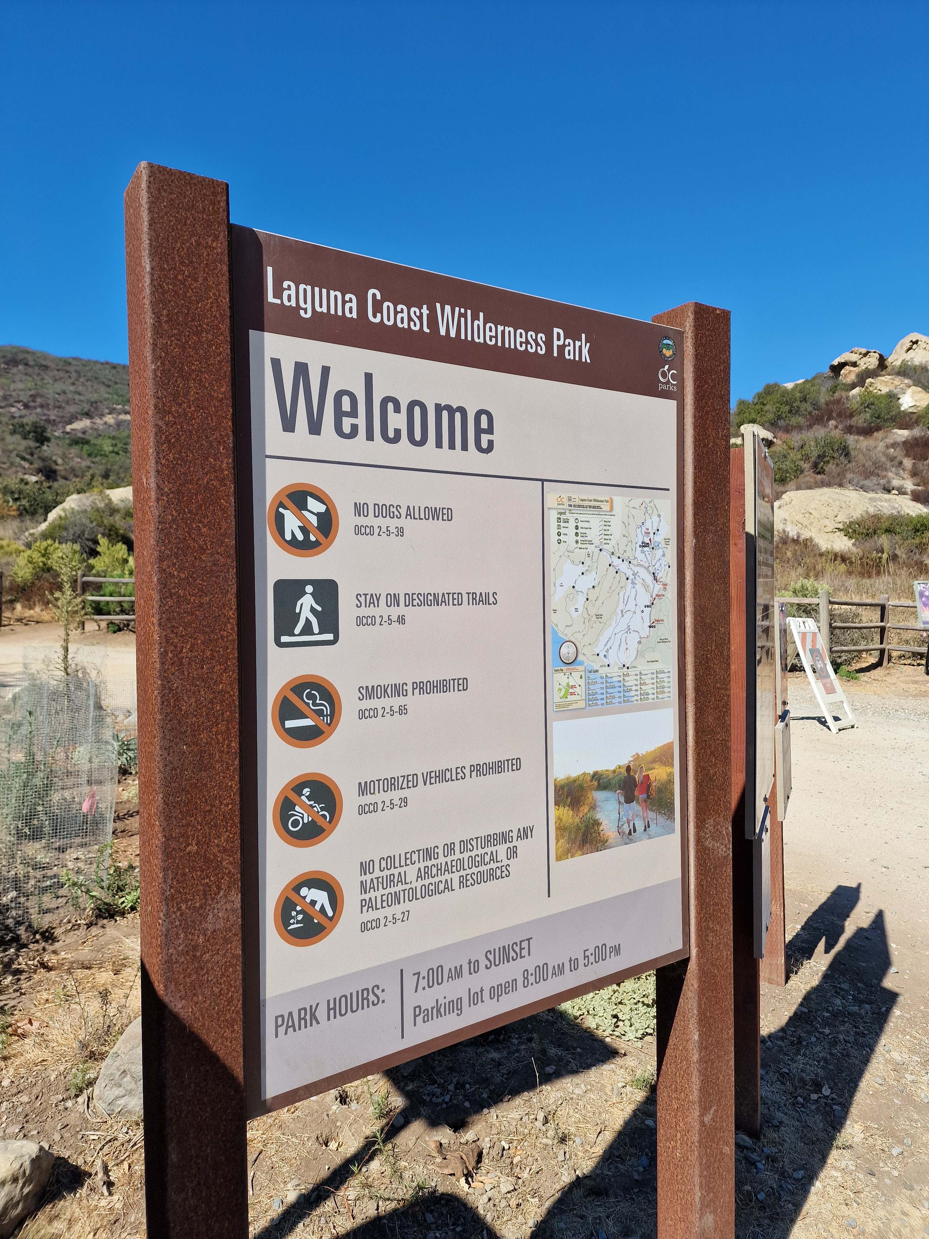
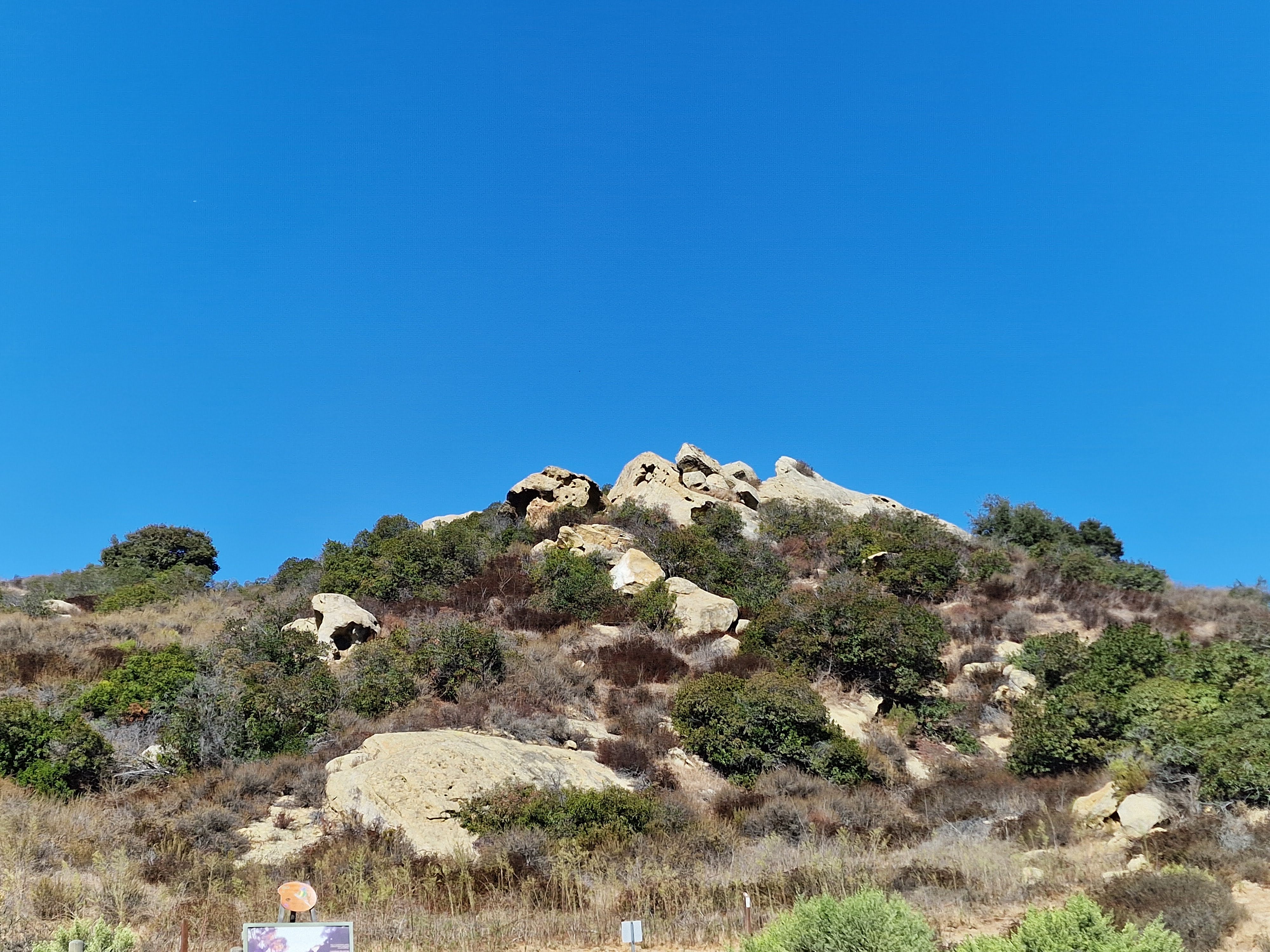
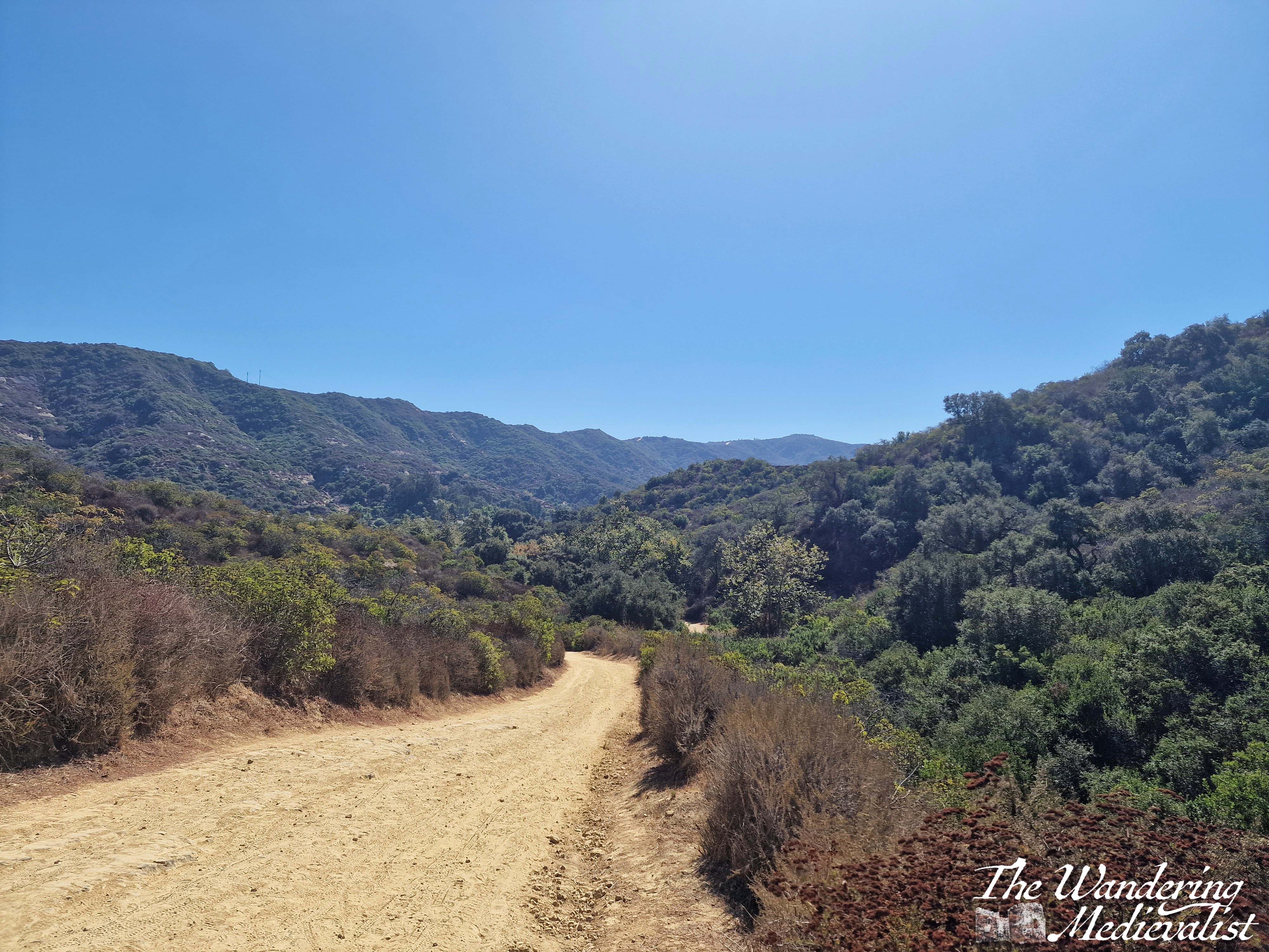
After a quick stop at a local shop to top up my dinner supplies, I headed back to the car and programmed in one of the ‘staging areas’ along Rt 133 that offers parking for the hiking trails. While it was a bit challenging to turn left across the traffic, I made it there in very little time and managed to pay for parking. In a massive shift of biomes, I found myself now in a desert scrub-type area, with the trail dry dust beneath my feet and the hills rising around me a mix of brown-green and just brown rock or dirt. But, I had sunscreen, water, and determination, so despite the sun beating down mercilessly, I set off on what I promised myself would be a short walk on the Willow Canyon trail. I just wanted a viewpoint, and I figured it could not be TOO far to reach one.
I said to the other half later that it felt very much like the start of a story where someone disappears – a hot sunny day, a hiking trail, and no one to miss me for hours if not days. My imagination ran away with me slightly, partly due to heat, but I was far from alone – I passed people every few minutes, so I knew that even if I were to slip and fall, someone would find me in good time. I also had a phone and full bottle of water, and I had no intention of walking more than a mile.
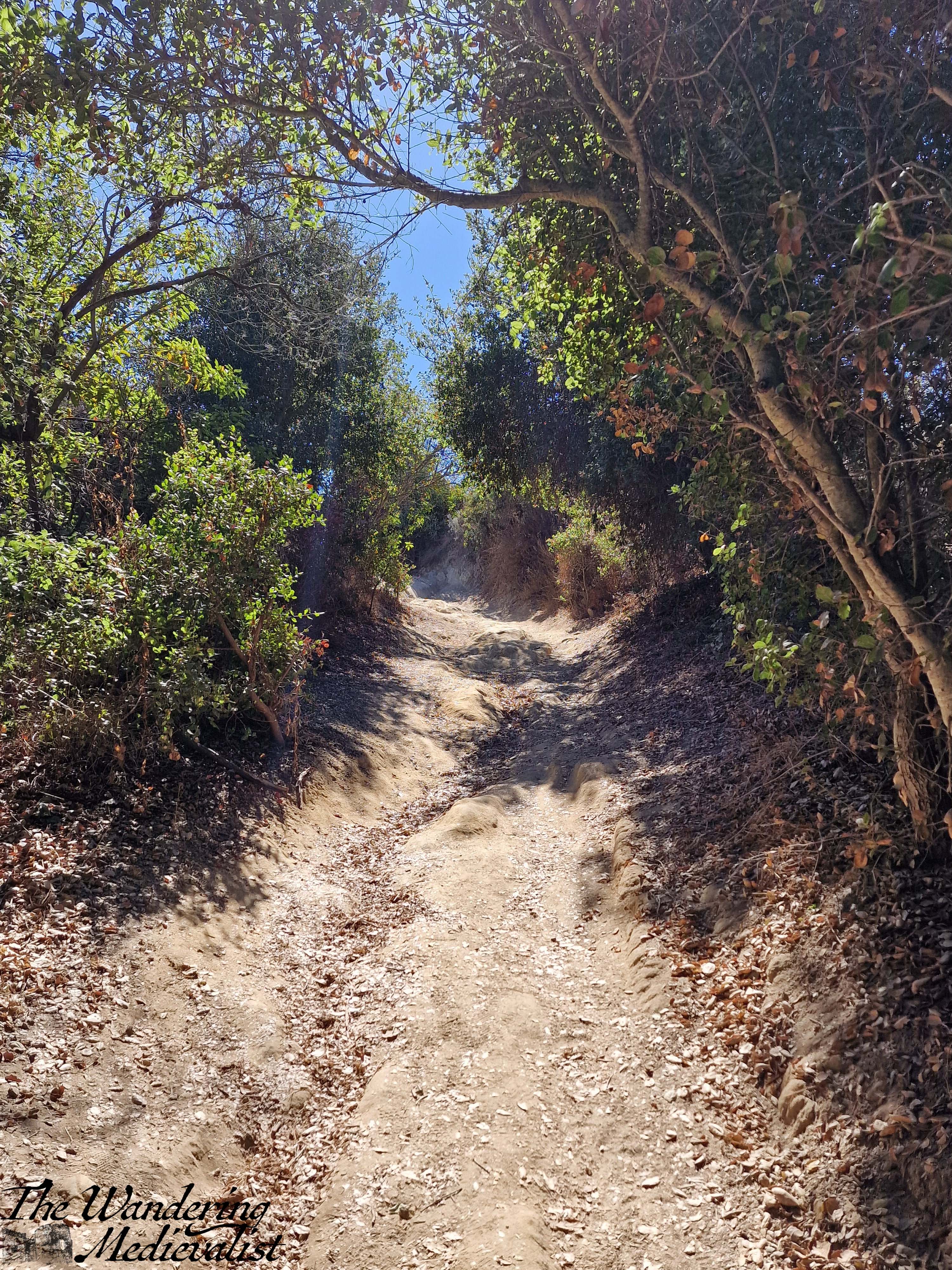
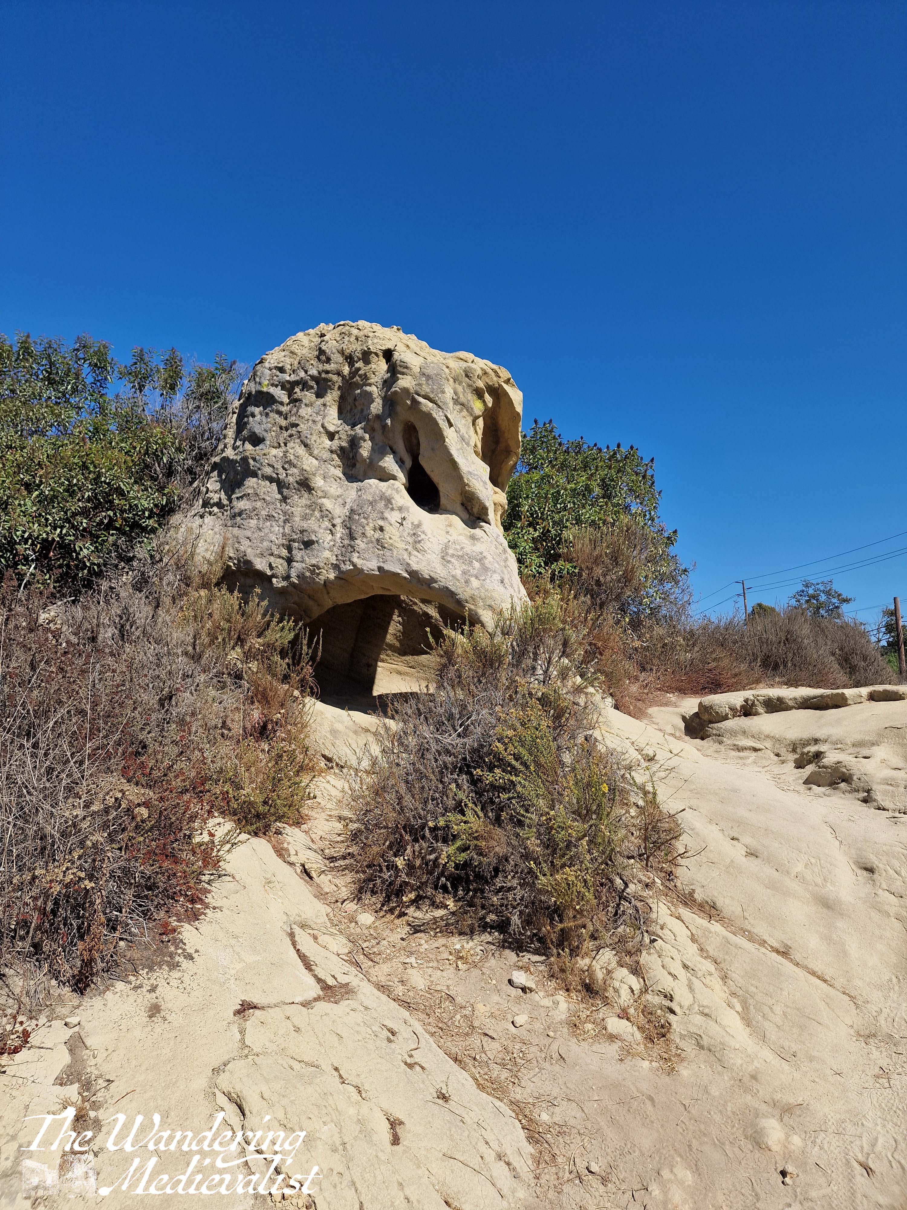
The trail started flat and in shade of some trees, with lovely rock formations off to the right that looked very TV-California.
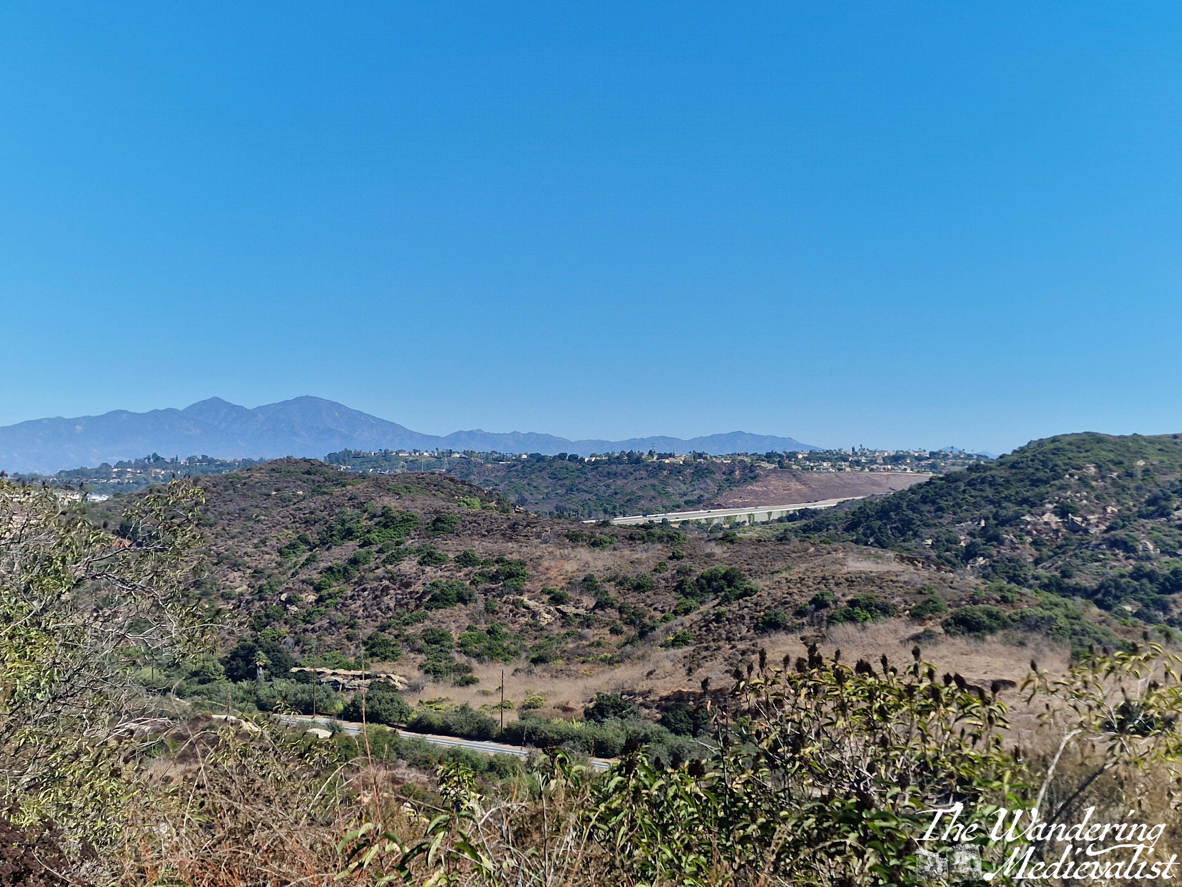
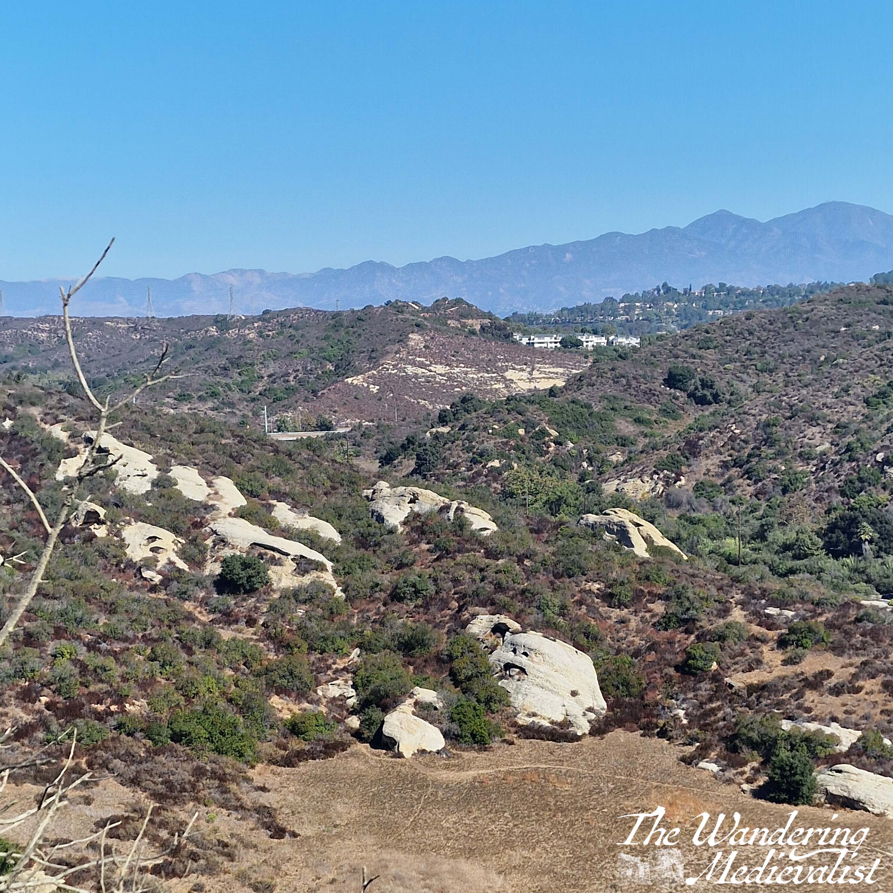
In little time it curved off to the right and began to climb – a wide, dusty road that was clearly well-used by hikers, bikers, and horses. My fitness was not at tip-top by any stretch but I could see what I thought was a good place to turn around and see the view, ‘just up ahead’. So, I paused several times and availed myself of plenty of water, and kept pushing – up and up past my first ‘I’ll turn back there’ point, as every time I reached one I could see what looked like a viewpoint just ahead.
In all fairness, I do not think I hiked more than a mile and a half or so, but it was quite steep in places and the mid-day sun was sapping my strength quickly. I had nearly determined to turn around when I finally caught sight of a small sign indicating a viewpoint up ahead. I pushed a bit further and was far from disappointed when the trail swung around sharply to the left, leaving a stunning view across the valley in both directions. Behind were the hills leading towards the coast, and ahead the hills and valleys that eventually flattened out into the populated areas. In the distance, one can just make out what I think must be Rt 73, which I had driven south a few days before.
The hot, sweaty hike was very much worth the view from the top! And despite my knee injury acting up on my way down, I was so happy and proud of myself for the walk. Plus, there was an ice machine back at the hotel for sore joints…
All in all, it was a fantastic morning that allowed me to release some of my work stress and feel like I had a proper California experience. Travelling for work has its ups and downs for sure – it can be lonely, exhausting, jet-lag inducing, and hotels and hotel food can be depressing. But, it can also open the door for experiences like this one, and another I had in Thailand a few weeks later. A subject for my next post!
October has been a whirlwind of work travel and so I have not had time to sit down and write as I hope to do each week. I started this post a few weeks back, when my memory of the walk was fresh, but now have finally been able to finish.
On our recent return to Skye, Dad and I chose a more challenging hike for our first day, and so by day two were looking for something gentle to keep us moving but not over-tire.
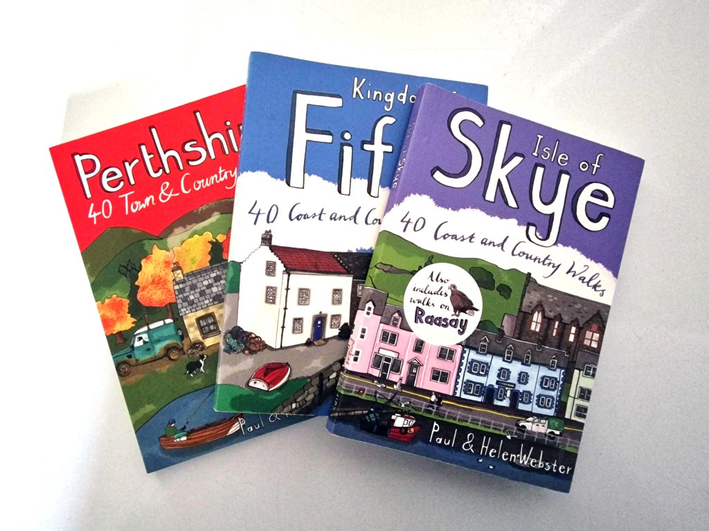
The solution was to dig out my Isle of Skye walks book, one of a series that I have been collecting. While there are plenty of walking books out there including the Ordinance Survey series – excellent options that tend towards longer trails – I have found these smaller books to be a wealth of knowledge for shorter strolls.
It took us only a few minutes to decide upon the Two Churches walk, an option I had noted for future exploration on our last visit, and helpfully located only about fifteen minutes away.
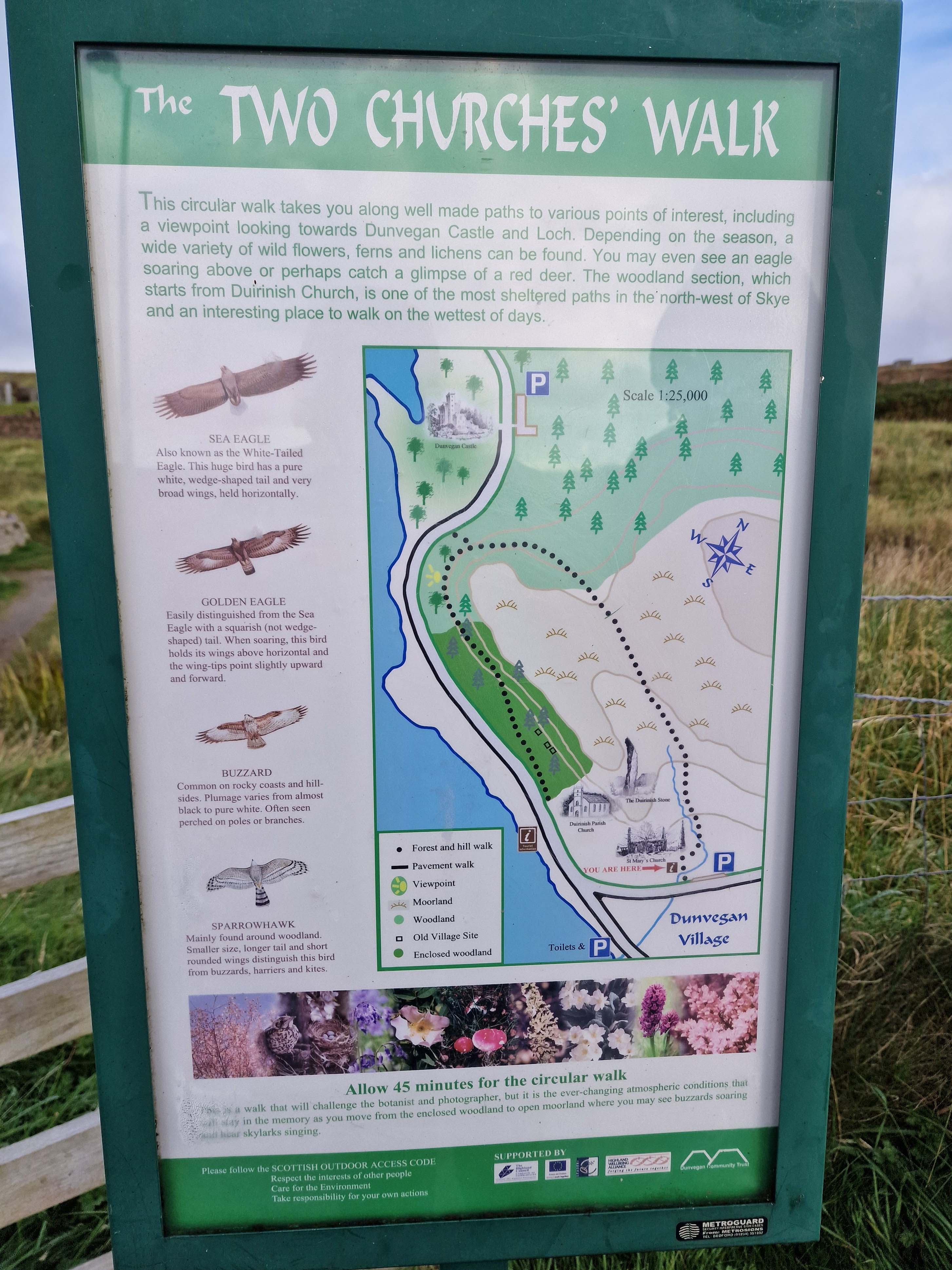
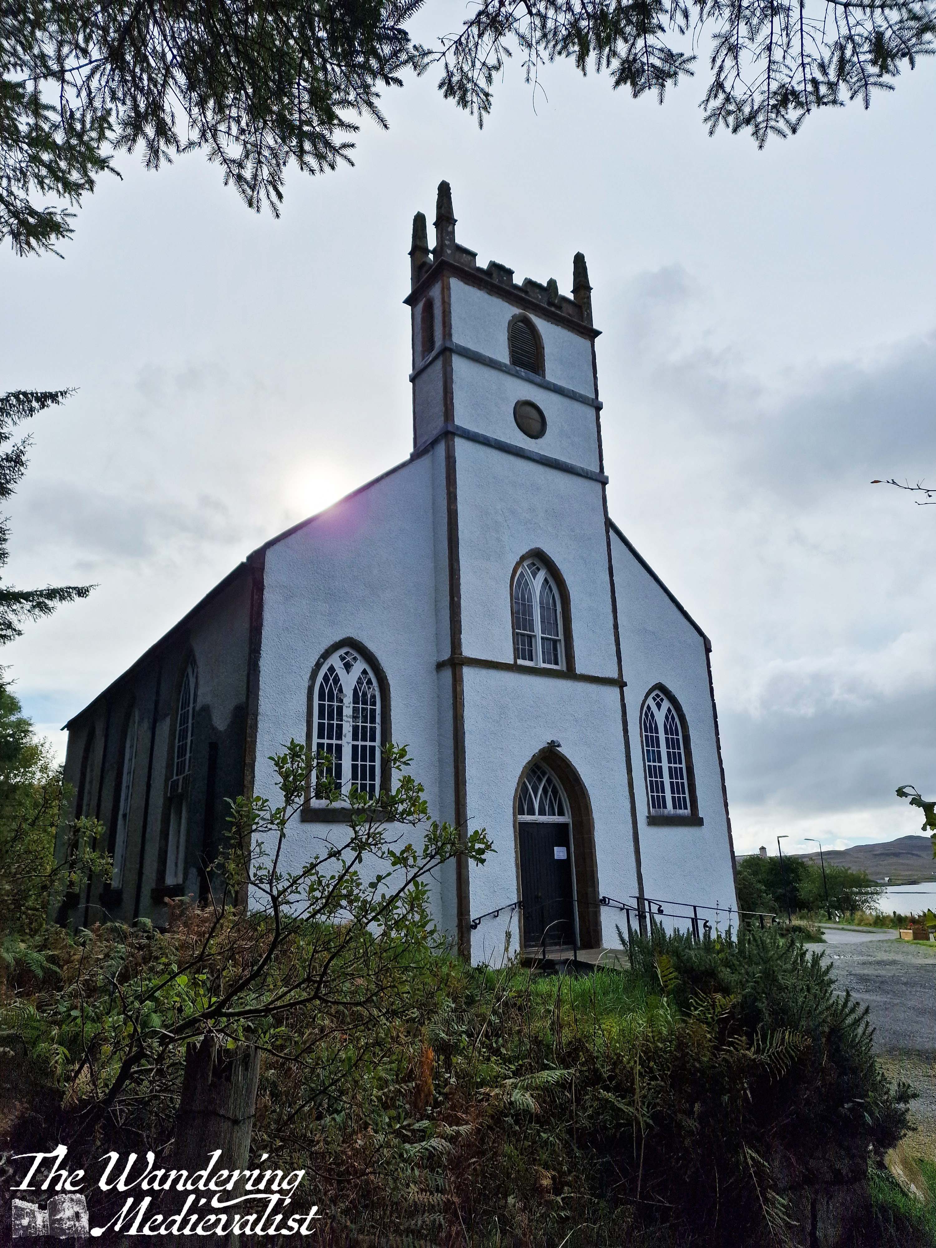
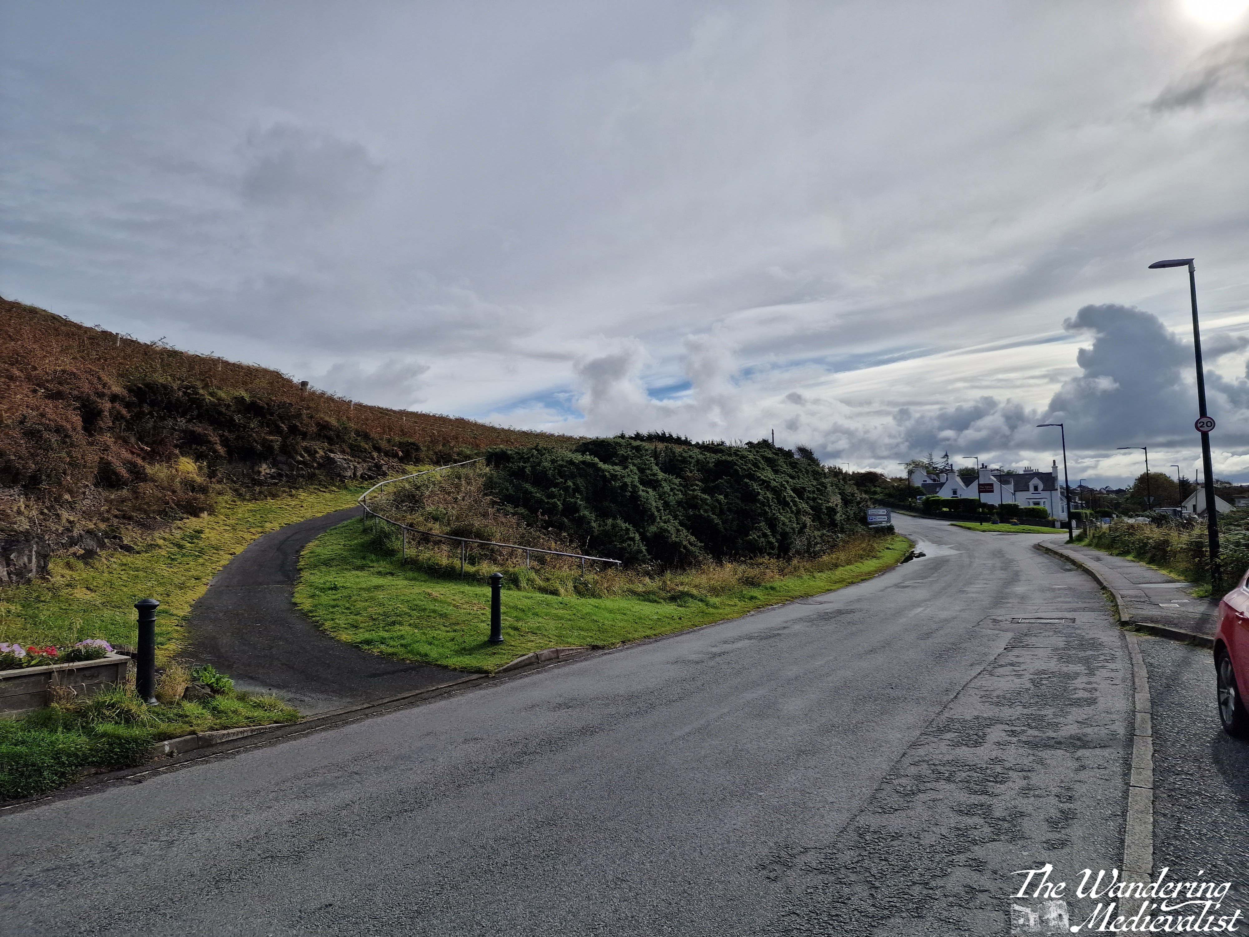
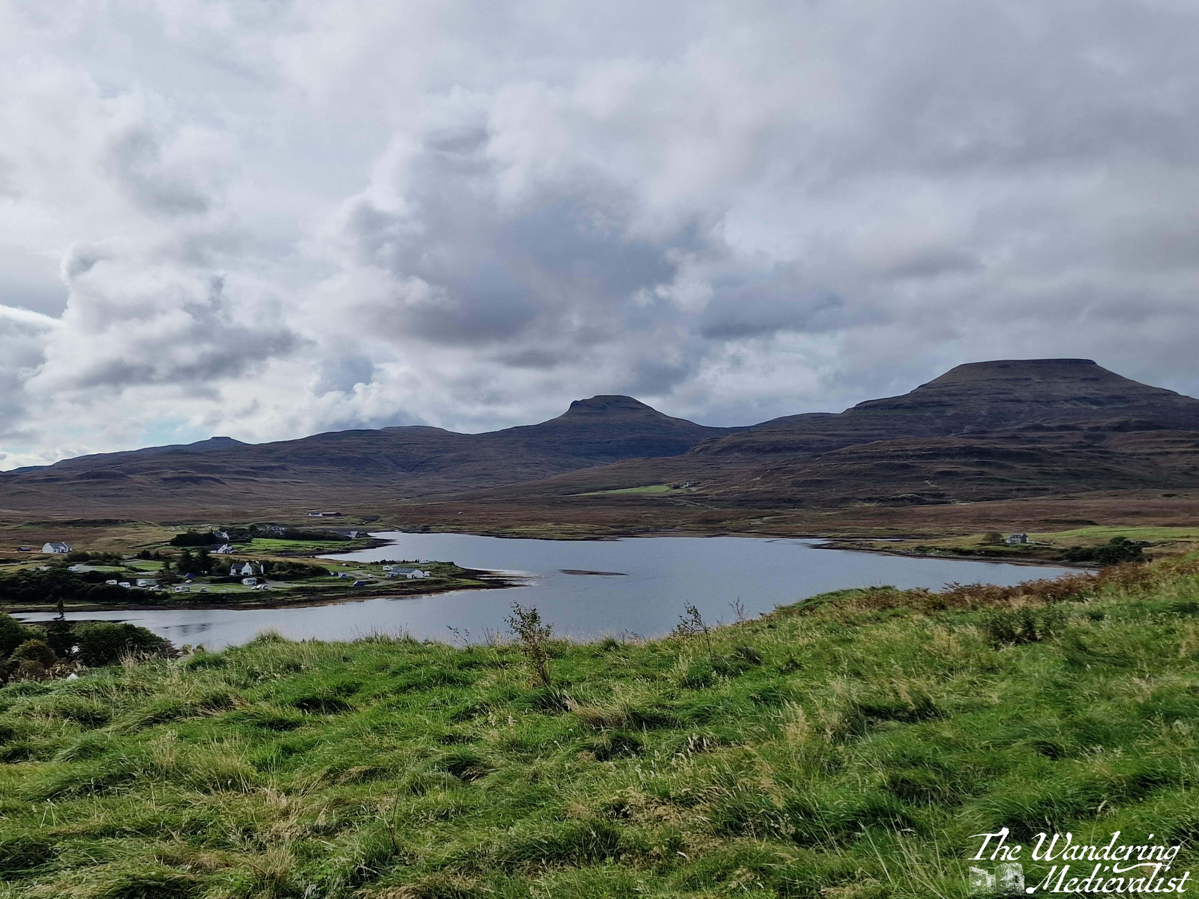
The Two Churches walk is about 3km long, a relatively flat loop with a combination of well-kept moorland paths, forest trail, and a short section on the roadside. It leaves from a well-signed lay-by with enough parking for between 5-10 vehicles; we found it almost empty, as many of our fellow walkers were clearly locals.
The path starts just to the right of the ruins of St Mary’s Church. It is a well-kept trail with a slow incline. There is a plaque with details about the walk and its route, as well as some of the birds you may see along the way (though we did not). You get nice views back towards the churchyard, with grassland on both sides. On the day we visited it was mostly dry though I imagine it would be muddy at times, and once the path turns rockier a bit further on, it could be slippery in the wet. I would definitely recommend good sneakers or walking boots to traipse through the puddles.
The walk passes through a farm gate, and continues through patches of gorse and other prickly plants. In spring and summer it would be gorgeous and yellow, though I am quite allergic to gorse so was pleased that the blooms had passed. Only a few minutes in, the path enters a light forest, and going through another gate finds you walking through trees and ferns. It reminded me in many ways of trails in the White Mountains, though the flora was slightly different of course. As the path swings around to the left, the deciduous trees turn mostly to pines, and the trail is surrounded by great tall trees, all very straight in the manner of a planned forest. I had learned that on some estates these tall pines were planted for ship-building, but by the time they grew the industry had moved past using wood. Great expanses of pines in the Highlands were therefore left, though the acidity in falling needles meant little could grow beneath. (This information came mostly from a fantastic series I watched years ago called ‘Making Scotland’s Landscape‘ presented by a Scottish professor of Geoscience.)
It is a lovely peaceful walk with not too much up and down – though there are a few climbs and dips to be had – and we passed several sets of joggers and plenty of dog-walkers, showing the path is clearly popular with locals. There is not much to be seen beyond forest in this stretch, though as the path continues to circle around there is one open viewpoint through which the power cable runs, and through which you can see the loch and the house and mountains on the far side.
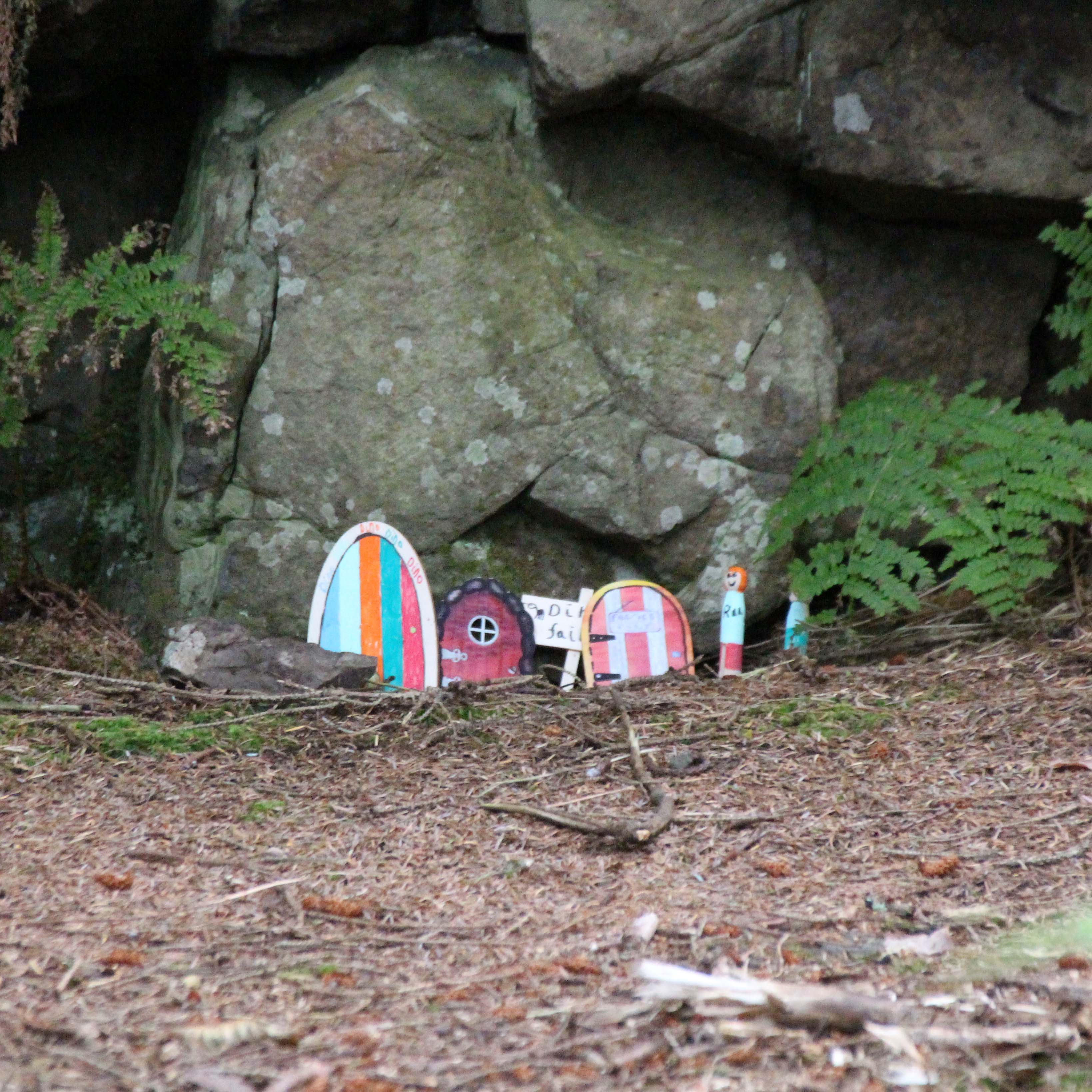
After the viewpoint you can hear and at times see the road below the path to the right, and as you approach the end of the forested section, we discovered that the local school had designed fairy houses in the trees and rocks. They were a charming combination of modern and very old-fashioned in design, with a little village at the bottom of a small cliff.
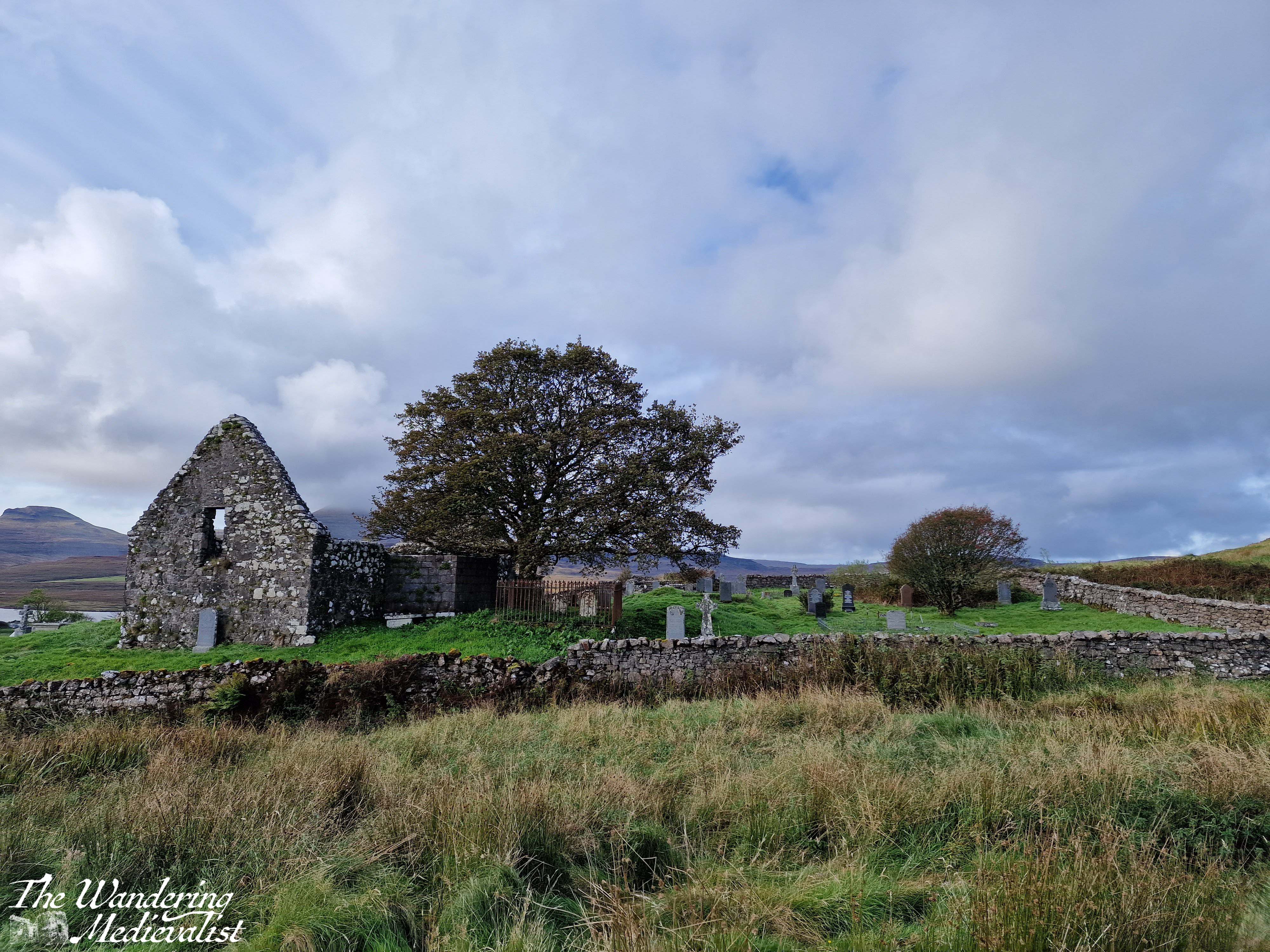
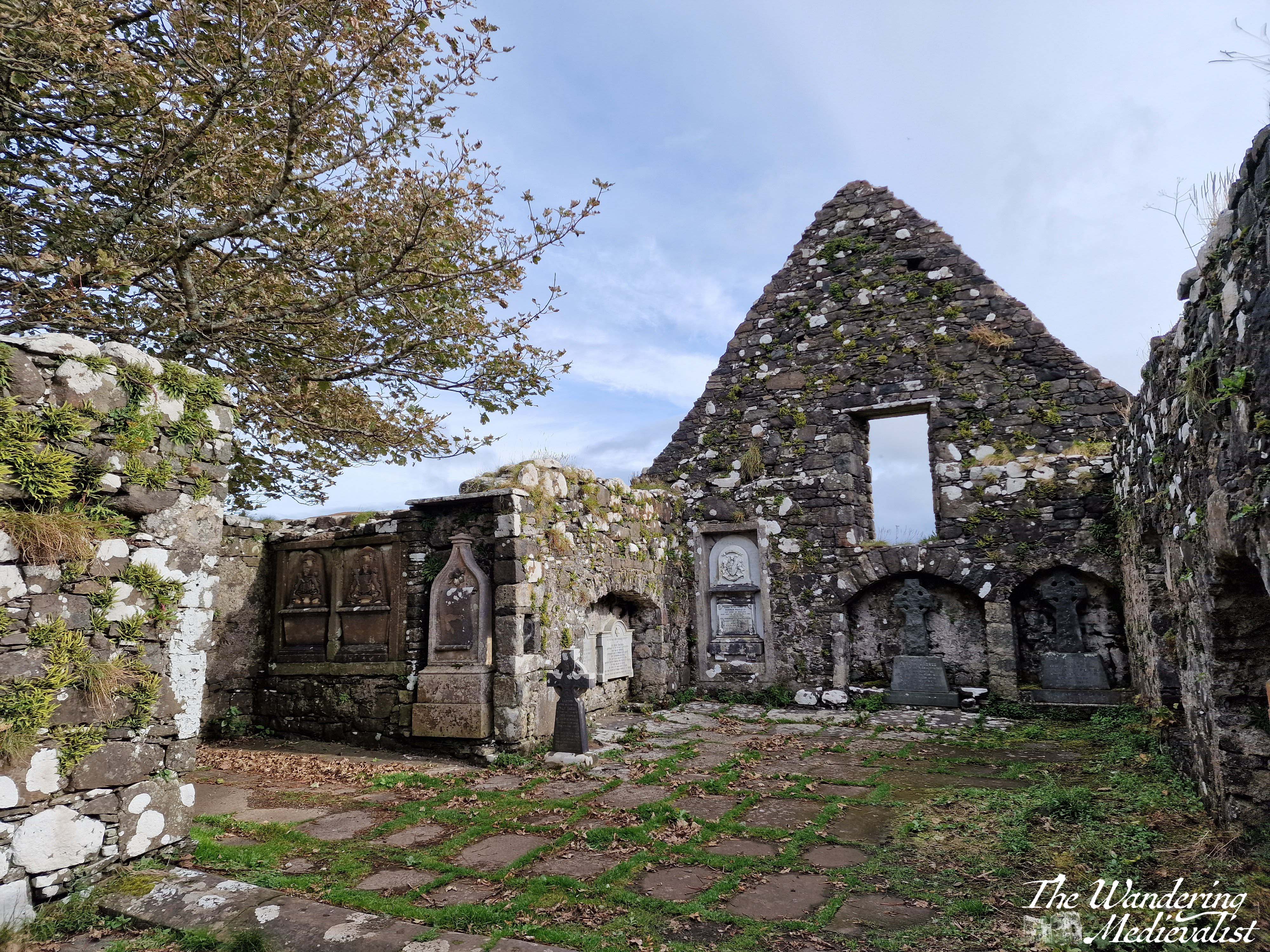
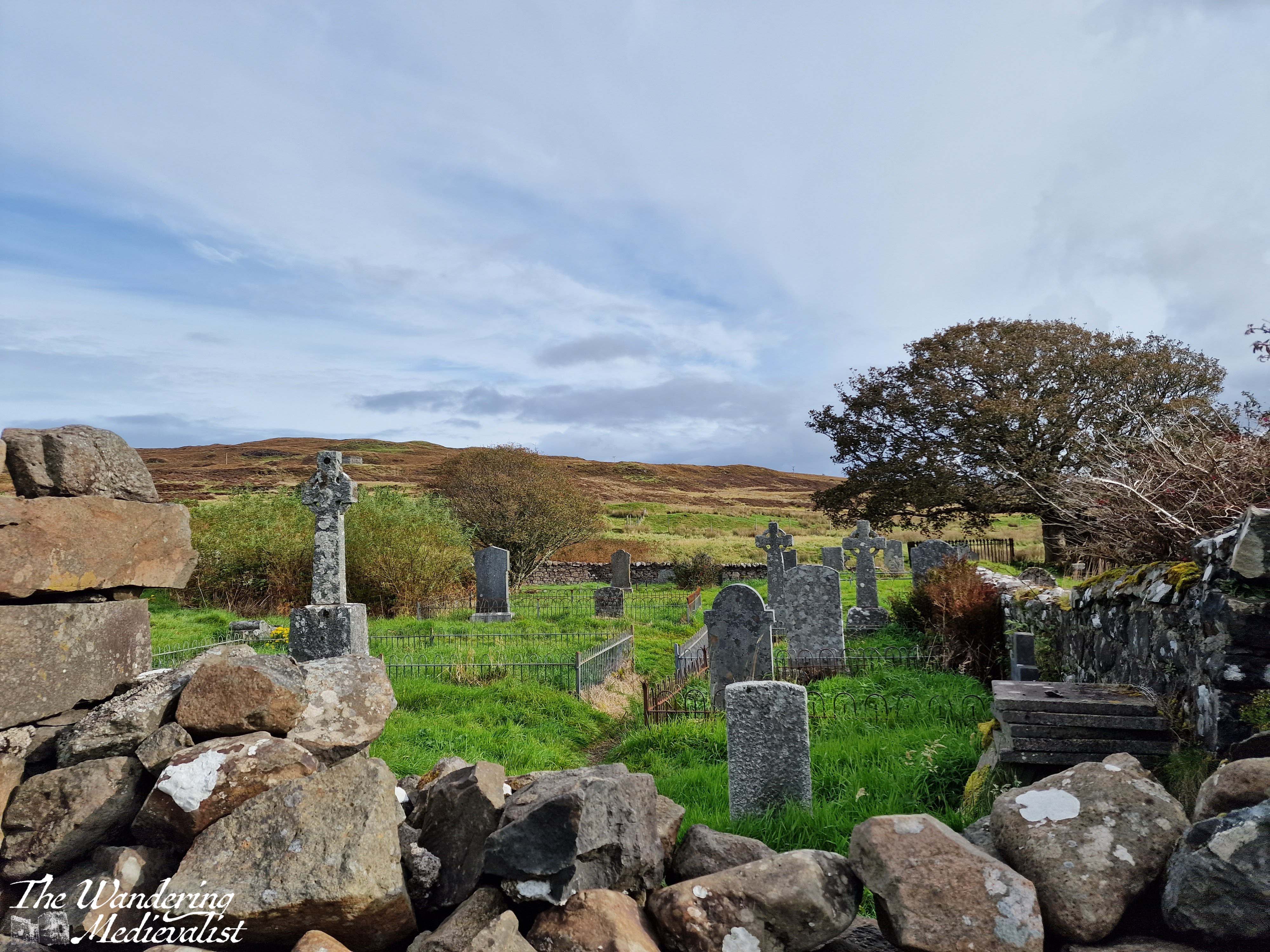
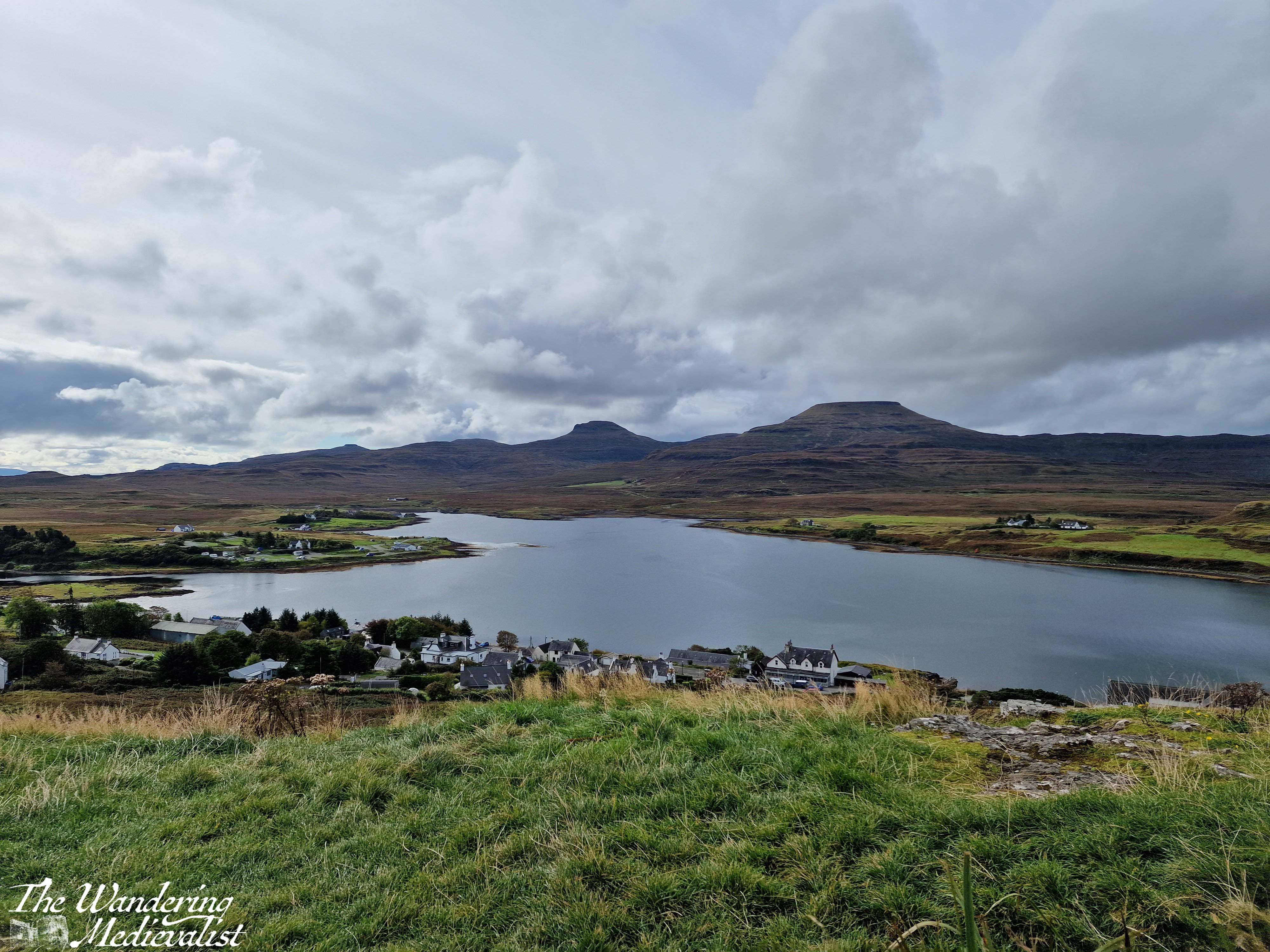
As you leave the fairy town behind, you soon come to the second of the two churches, the Duirinish Parish Church, which unlike St Mary’s is still very much in use. Here the path meets the road, and there is a short stretch of shops and buildings. There is an option for a short detour up to a memorial for those lost in battle, and the site overlooks the town and loch with lovely views.
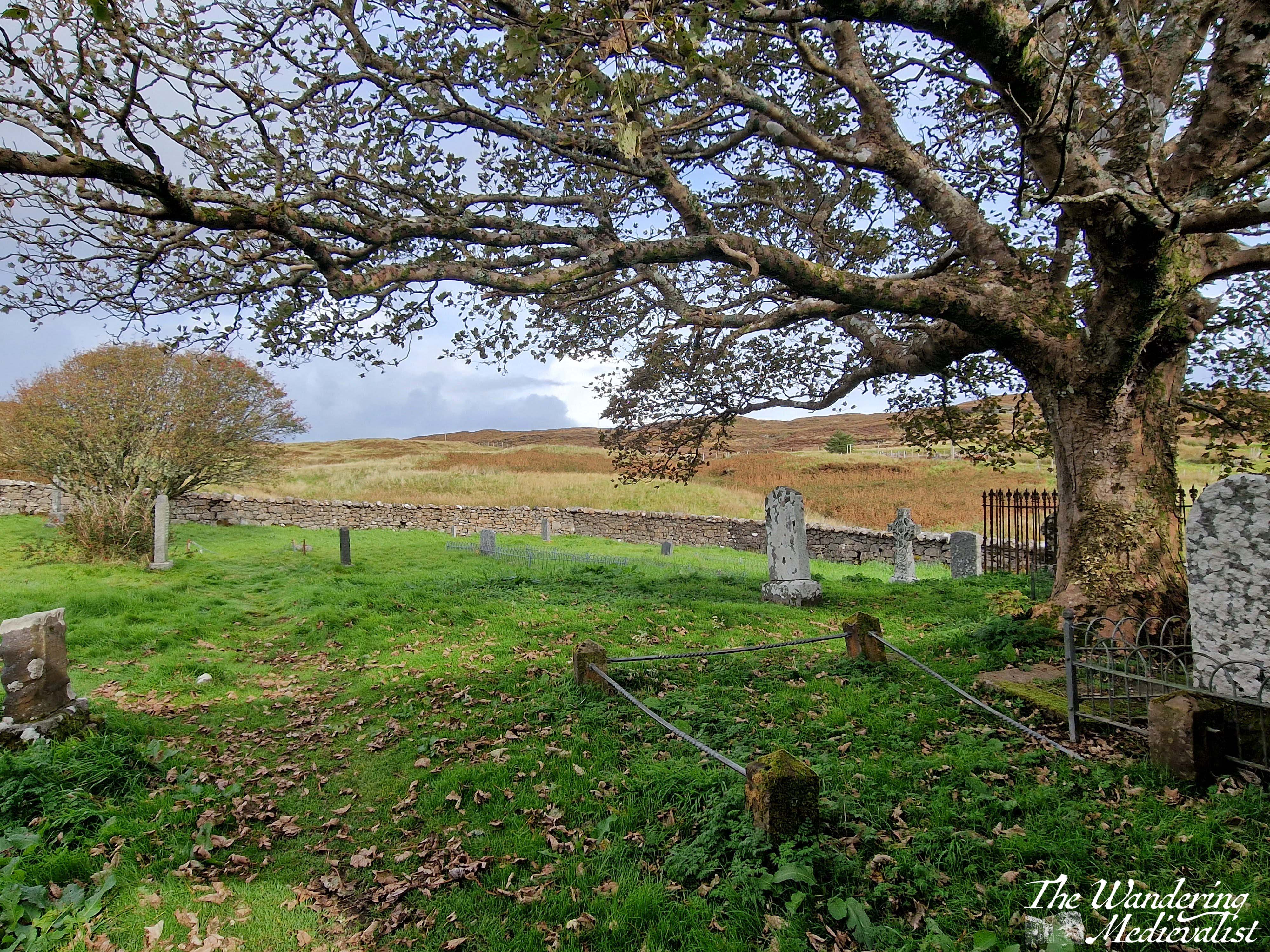
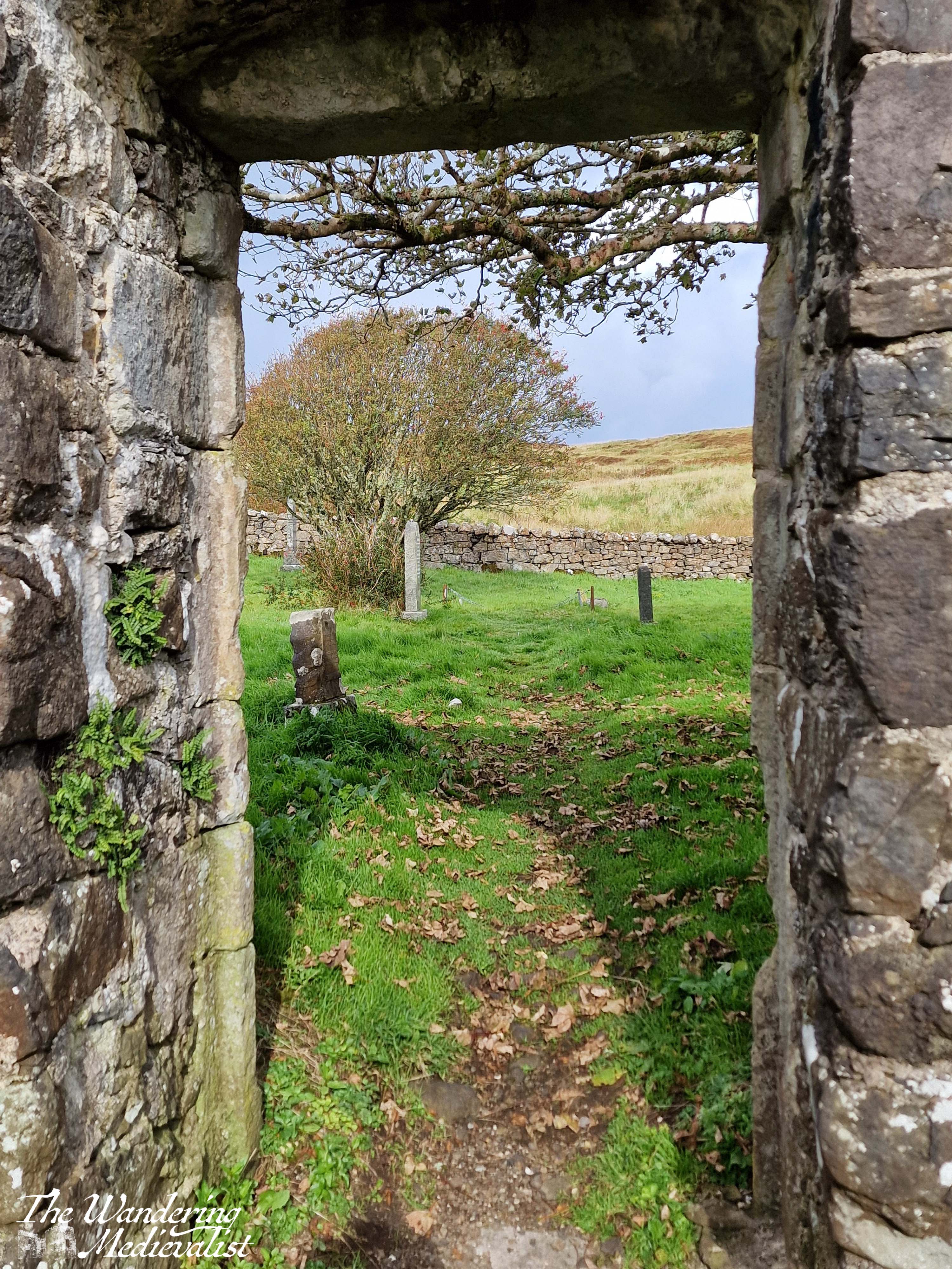
The trail follows the road up and around the corner to the left, returning to the lay-by. At this point, Dad and I decided we still wished to explore the church ruins and the standing stone on the top of the hill. We started in the church, which was likely to have been founded in the Middle Ages due to its alignment, though the parish dates to the post-reformation period. The stone enclosure of the site dates from the 1730s, and the church was the burial site for some Chiefs of Clan MacLeod as well as their hereditary pipers, the MacCrimmons. It is a beautiful ruin with lovely carvings in the nave, trees overlooking the now roof-less church, and graves of varying ages dotted around the property. It reminded me in some way of Old Burial Hill in Marblehead, though again that may just be my affinity for graveyards!
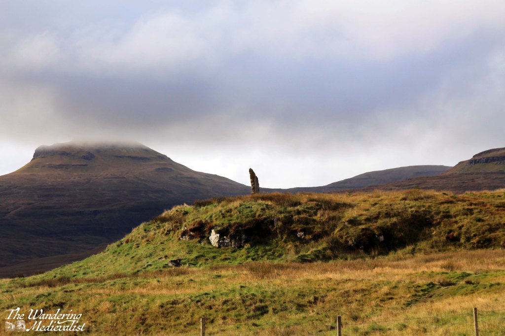
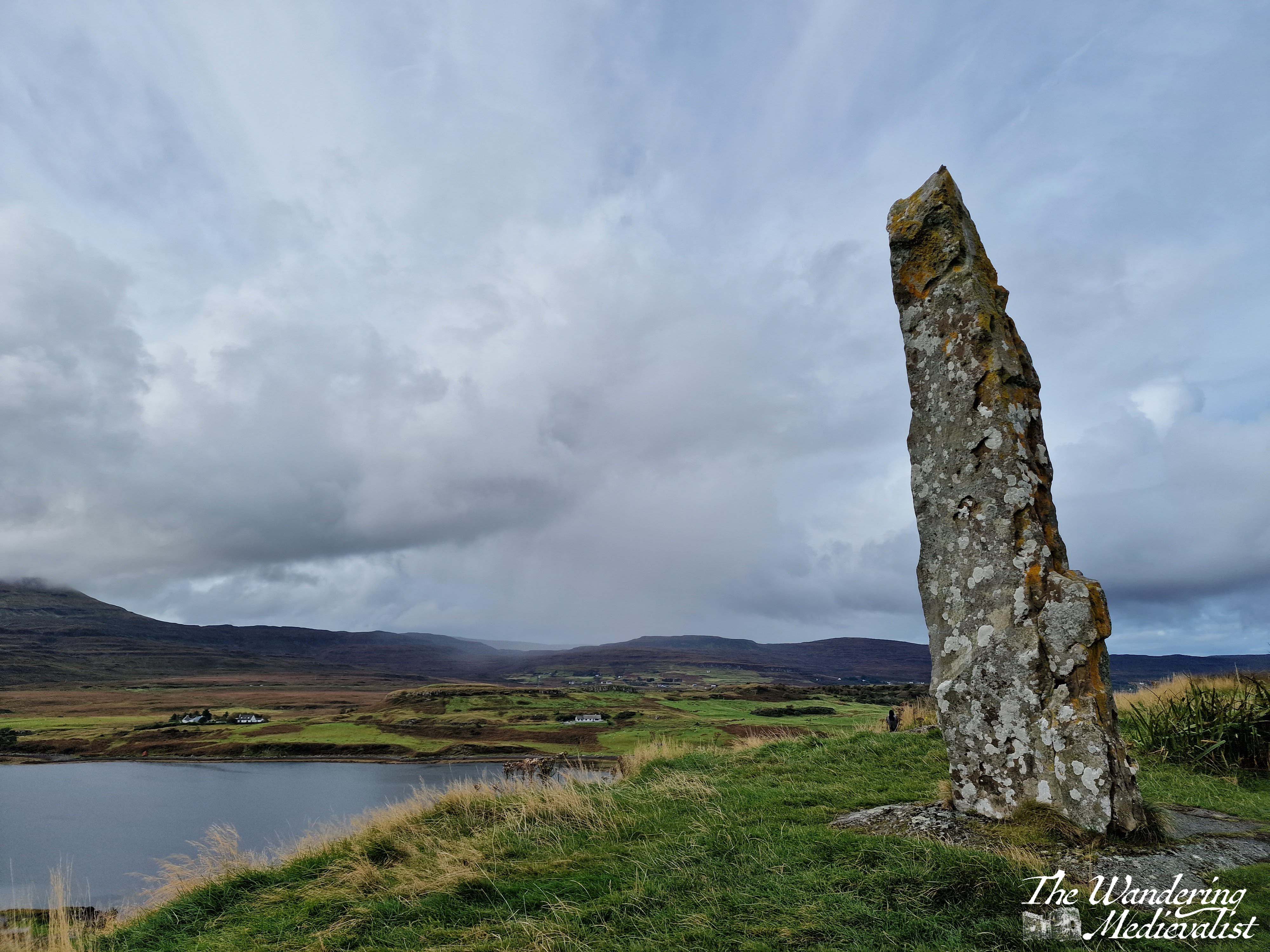
After exploring the church we felt it was still required that we climb to the top of the nearby hill, where the local community had raised a standing stone referred to as the ‘Duirinish Stone’.
I was a touch disappointed to discover that it was modern and not authentically ancient, but not disappointed enough to miss a visit. The stone was raised on the event of the Millennium as a marker in time, and to celebrate the memory of the ancient settlers of the area. It was found on a beach in the south of the island, and it was erected using ancient methods – hand and rope – an impressive feat! So not ancient, but actually authentic.
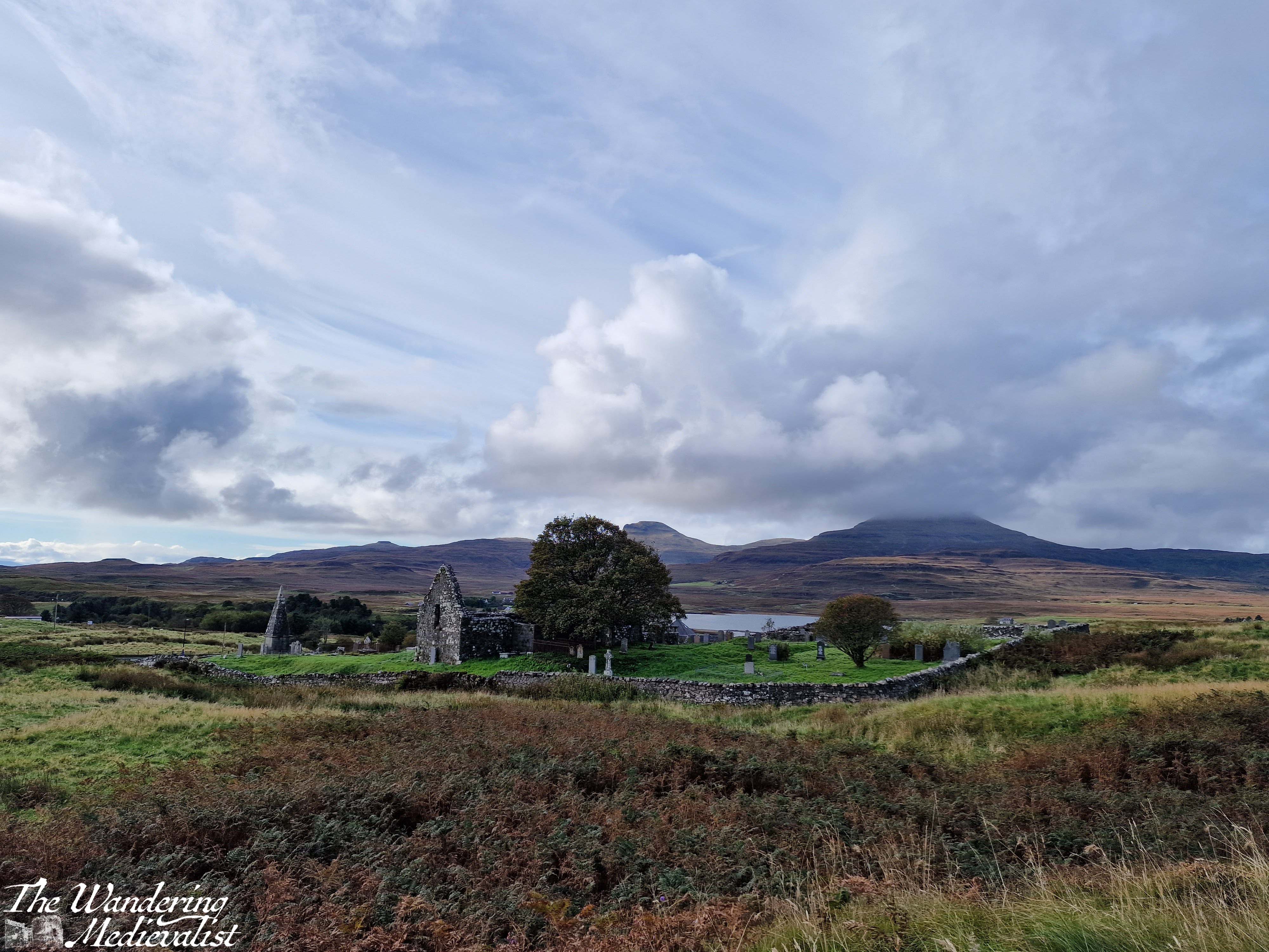
In order to reach the path, one has to exit the churchyard completely and then follow the edge of the wall until the trail branches off to the left through the grass. It is not a long walk in any way though the top is quite steep and requires a bit of scrambling. There is a detour about half-way up where hikers have clearly discovered a good viewpoint.
The top of the hill is larger than it looks from a distance – and I imagine there is a less steep path than mine – and the views are spectacular. We could see some rain coming in the distance so did not loiter long, but I got my fill of pictures while Dad wandered a bit.
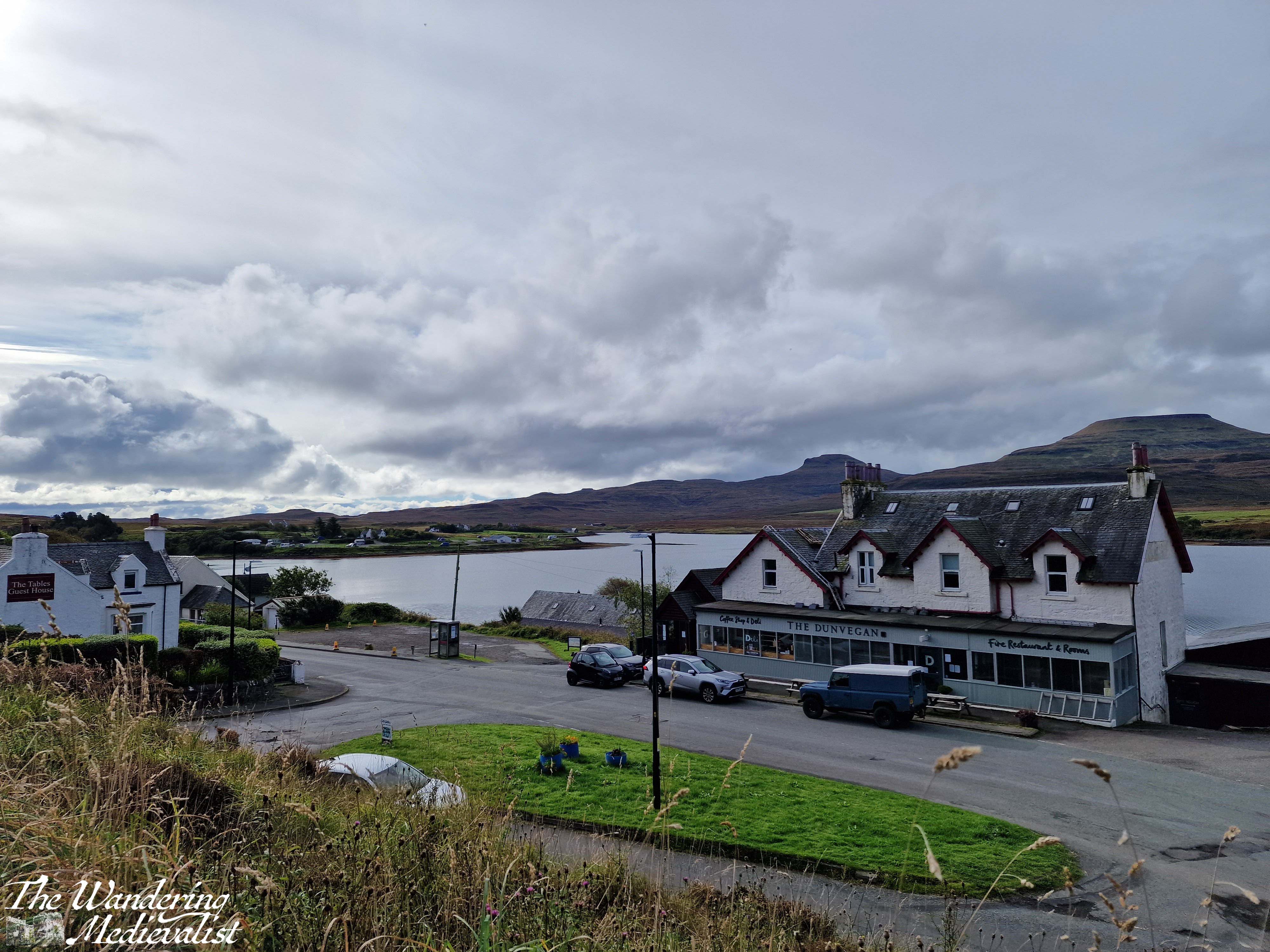
Upon returning to the car, we both felt the need of refreshment after our roughly two-hour walk and exploration of the church and hill. Fortunately, the town has several options for food and we stopped into the Dunvegan Deli and Café, where I had purchased a few extra snacks on our previous visit. The café does not offer lunch but does sell coffee, tea and an impressive array of excellent cakes. The tables overlook the loch, and it was a very pleasant place to sit with a cuppa to relax. It was also the perfect spot to pick up some dinner supplies: pasta, sauce, and a delicious local cheese, plus of course another cake for dessert. Their range of food includes crackers, jams and jellies, Highland honey, cheese and some cured meats, local ale, and much more!
This is a very pleasant walk for a morning or afternoon, long enough to work out sore muscles from the day before but not enough to add to exhaustion. The views of the loch and mountains are lovely, and this could easily be combined with a visit to Dunvegan Castle which is only a mile or two further along the road. And definitely, if you have time, stop into the Dunvegan Café for a snack!
Check out my online shop for more Highland pictures!
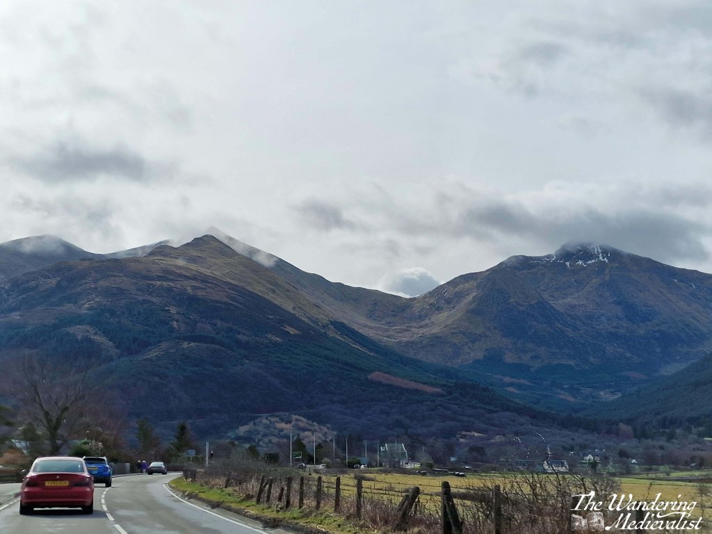
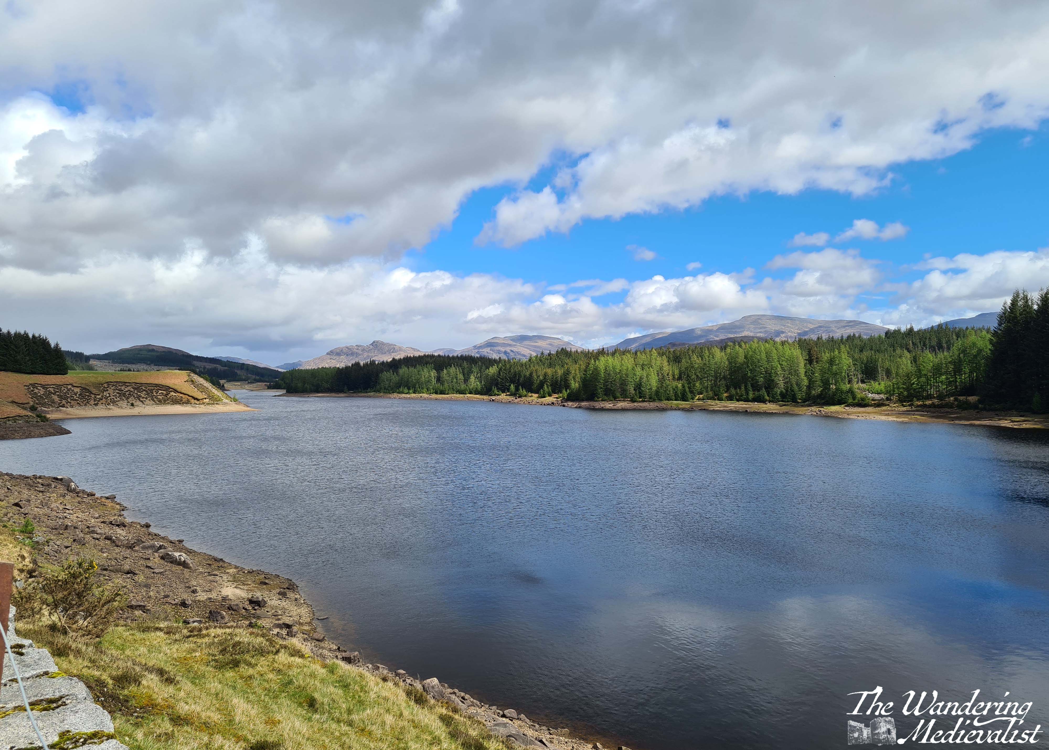
The stretch of road just south of Fort William leading through Glencoe and across Rannoch Moor is hands down one of my favourite driving routes in the world. No matter the weather, I cannot help but smile at the approach – even on the days when the rain is pouring sideways and the wind is trying to blow the car off the narrow road, as it did on one occasion which felt like driving through a hurricane. In good weather, it is simply breath-taking. In bad weather, it is atmosphere, dramatic, and a touch frightening. Either way, one should only attempt the drive when rested, confident, and possessing a full tank of petrol. Or at least a car that can make it at least 100 miles on the tank it has.
Sometimes the road is relatively clear, but most of the time it is on the crowded side, with visitors, tour busses, delivery lorries and of course locals just trying to make their way from point A to point B all crowding up the narrow highway. If stuck behind a lorry or bus, you can find your speed significantly diminished, and some will take risks to overtake. Needless to say, do this only if you feel comfortable and safe. Otherwise you just have to suck it up and enjoy the scenery – darn.
So here we are, a step-by-step of the drive, stopping at all of my favourite viewpoints.
Part 1: Fort William to Onich – 10 miles
The A82 route from Fort William to Onich is about 10 miles, and hugs the edge of Loch Linnhe. For most of the route, the trees block the view of the water, but there are a few gaps and parking spots where you can pull over – in particular the Linnhe Picnic Area, about 7 miles along, which is a spit of land sticking out into the loch and providing views in both directions.
This stretch of road is winding, no question, with few straight bits. My advice? Pay attention if the signs warn you of a sharp turn.
We have never stopped properly in Onich but it seems a nice little town with a few hotels, guesthouses and B&Bs taking advantage of the proximity of Fort William and Glencoe.
Part 2: Onich to Ballachulish – 4.5 miles
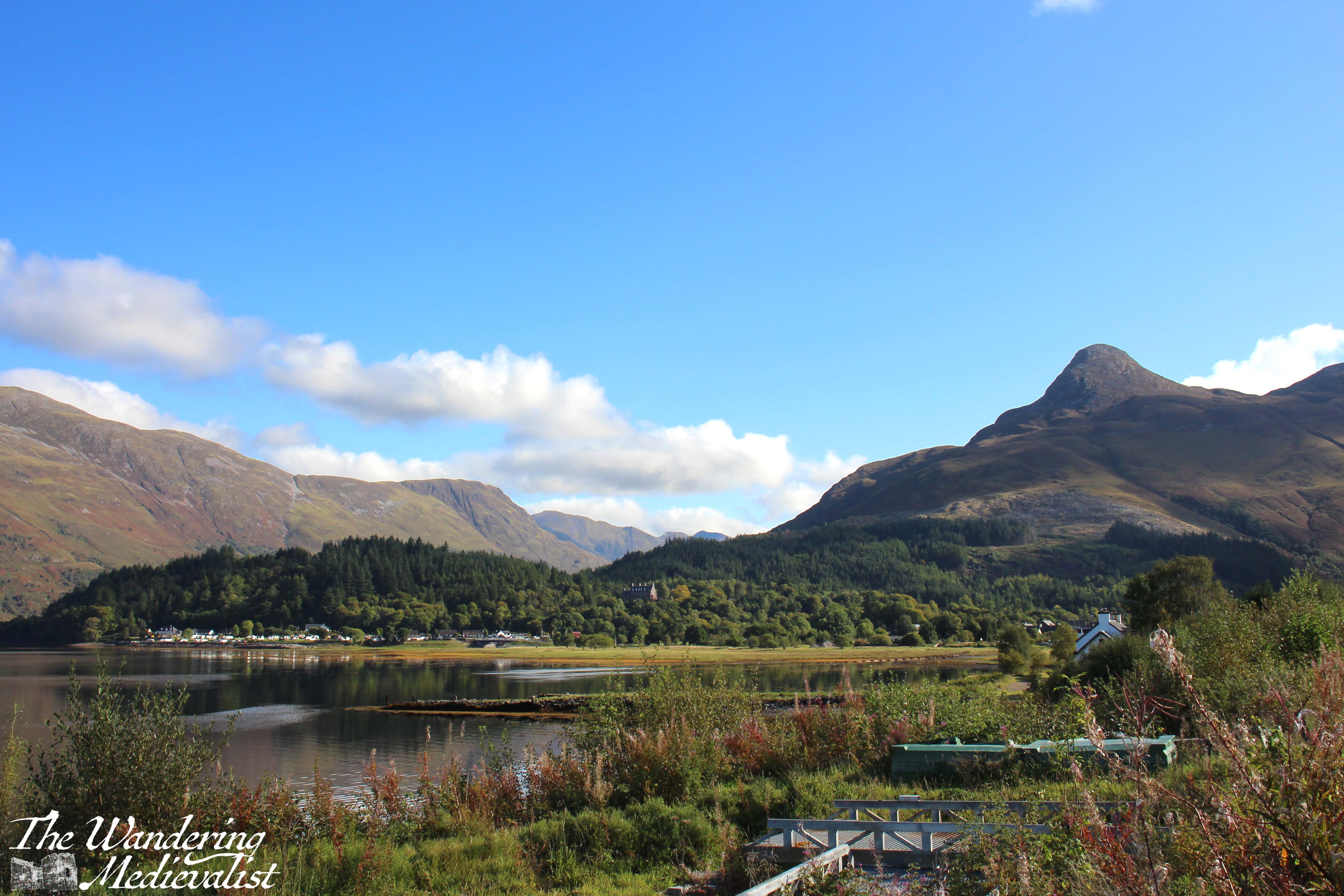
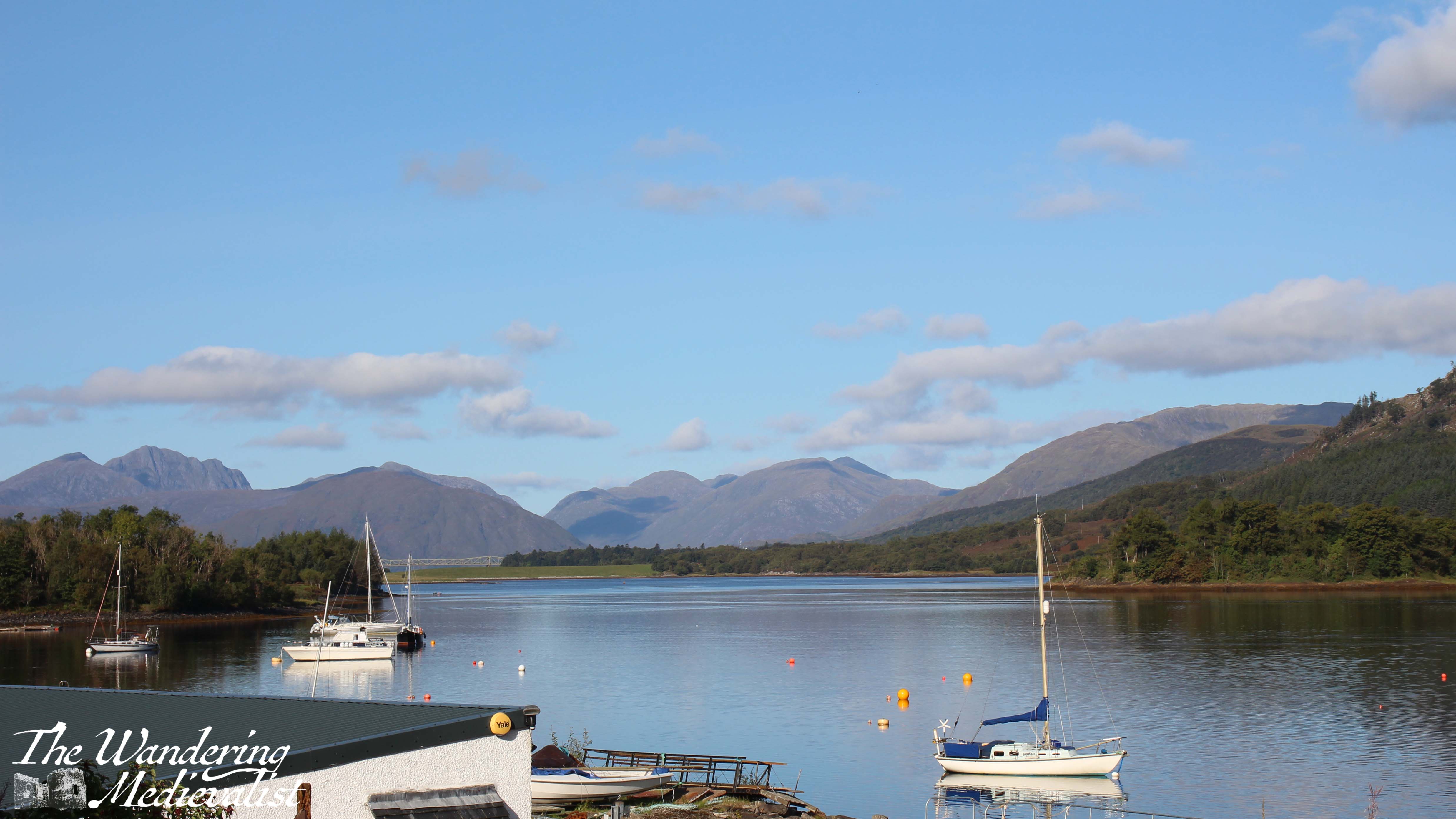
From Onich, it is a simple matter of following the A82 across the Ballachulish Bridge, which spans Loch Leven. Once across you can head straight south towards Oban, and this is also a beautiful drive along the water, but my route will take you left towards Glencoe.
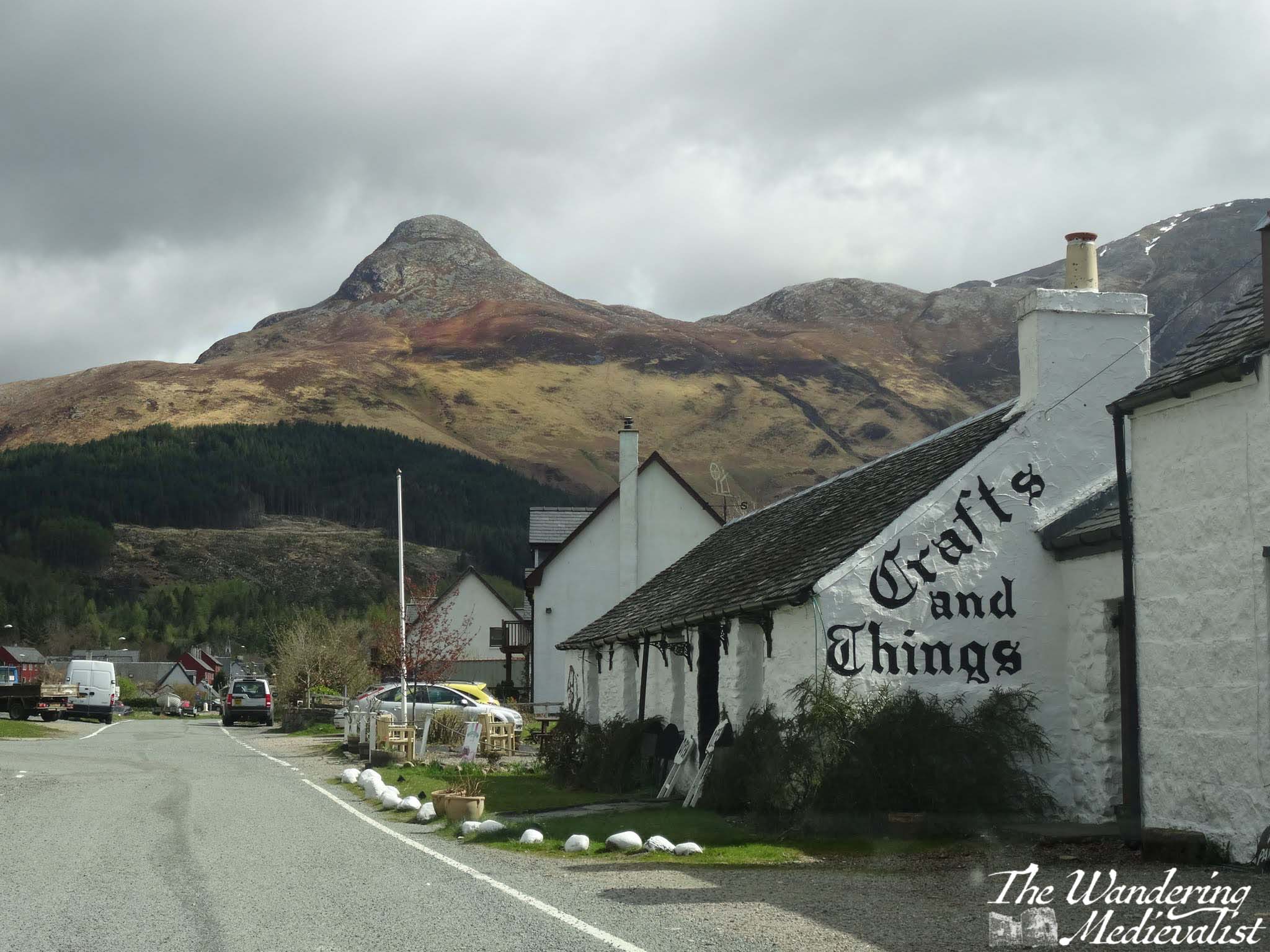
Almost as soon as you turn you will be heading immediately for a distinctive sharp peak called the Pap of Glencoe, and beyond it ridges of mountains leading east. On our first ever long weekend away together, the other half and I found a deal at the Isles of Glencoe Hotel in Ballachulish, which sits on a promontory in the loch. The views are just spectacular, especially at sunset. If you can, pull over at the parking area along the loch just after the hotel, or even turn into the village and get a coffee or snack at Crafts and Things. It was more than 10 years ago that we visited, but the other half still fondly remembers sitting in the April sun, looking over the loch with a cuppa and a tiffin.
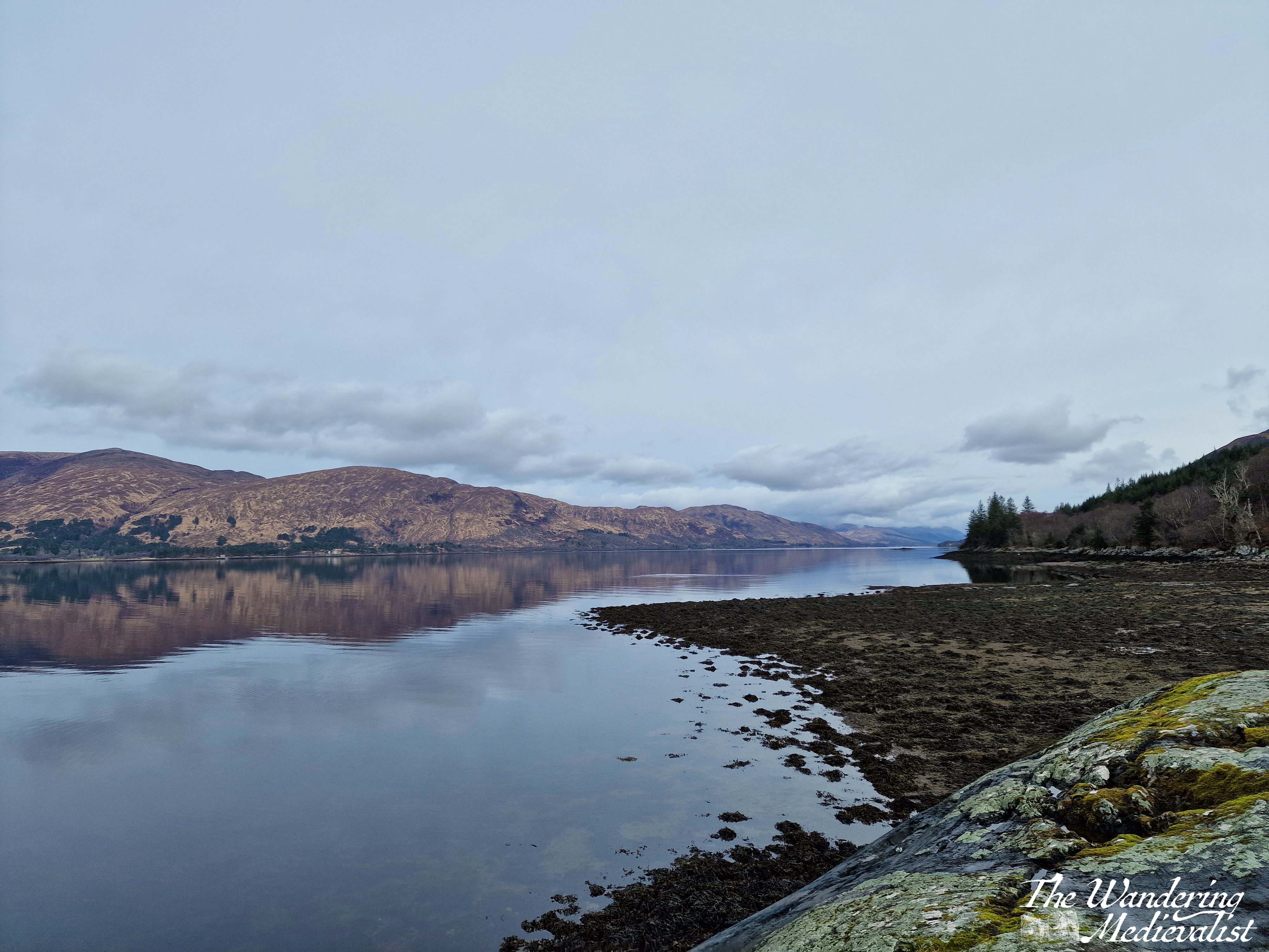
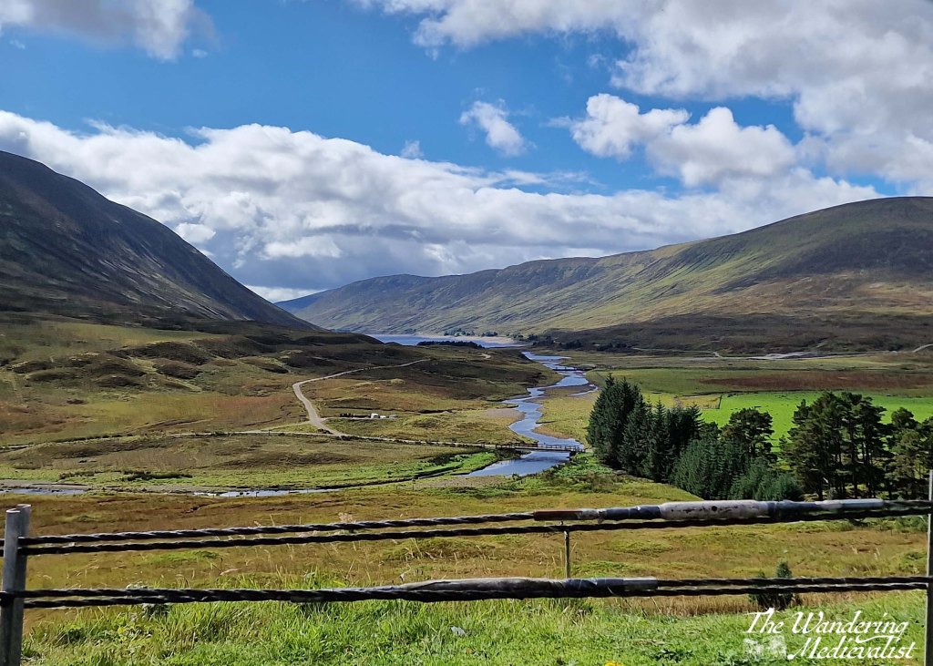
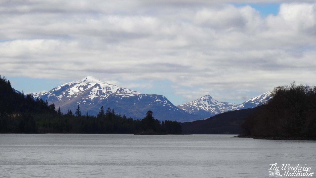
You can also take a quick detour left into the Loch Leven viewpoint (above), which as it suggests provides a view down the loch towards the bridge, at this point obscured by islands. Mountains rise in the distance and give you a preview of what is to come. This is also the route to the Glencoe Lochan walks.
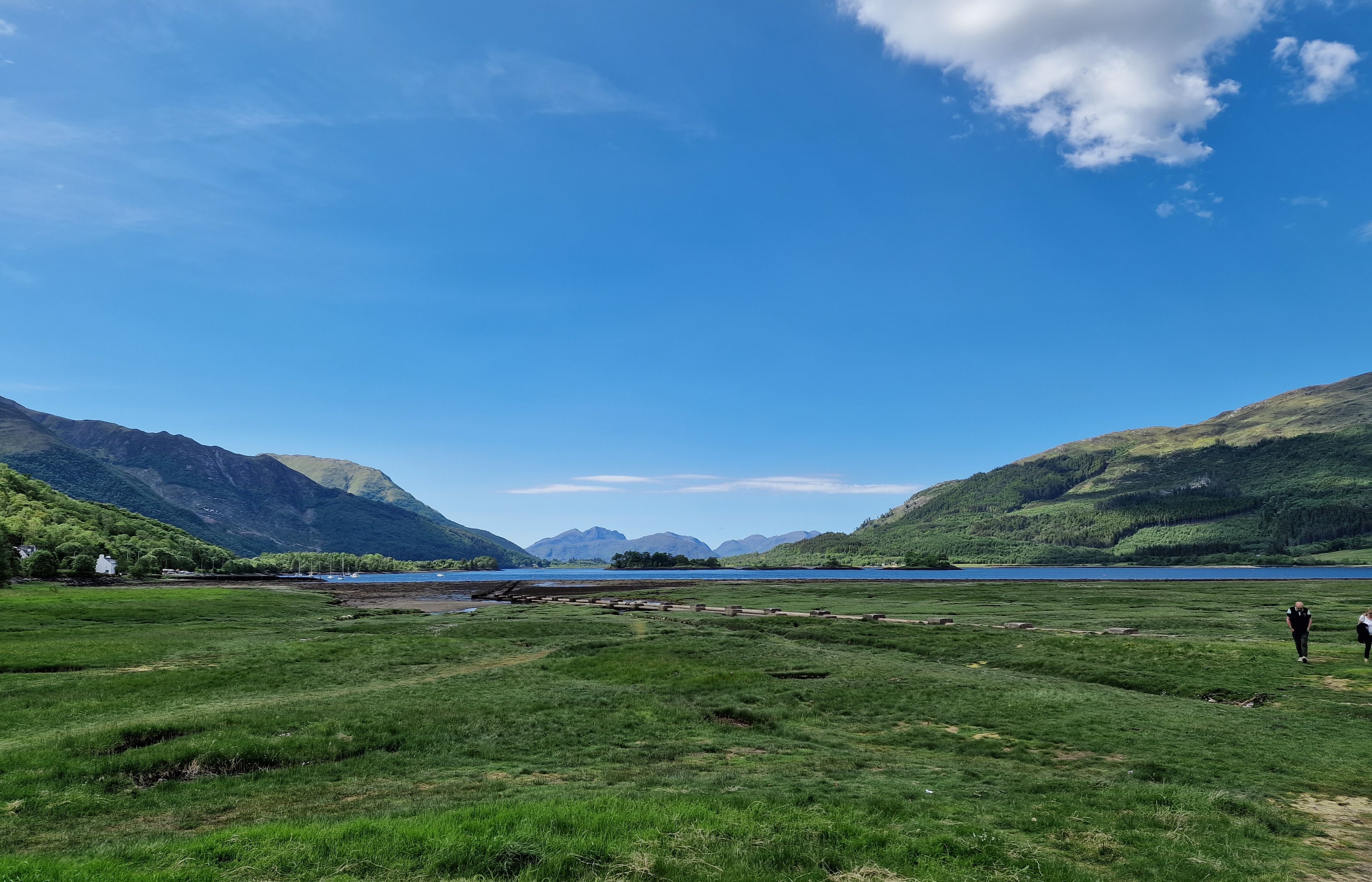
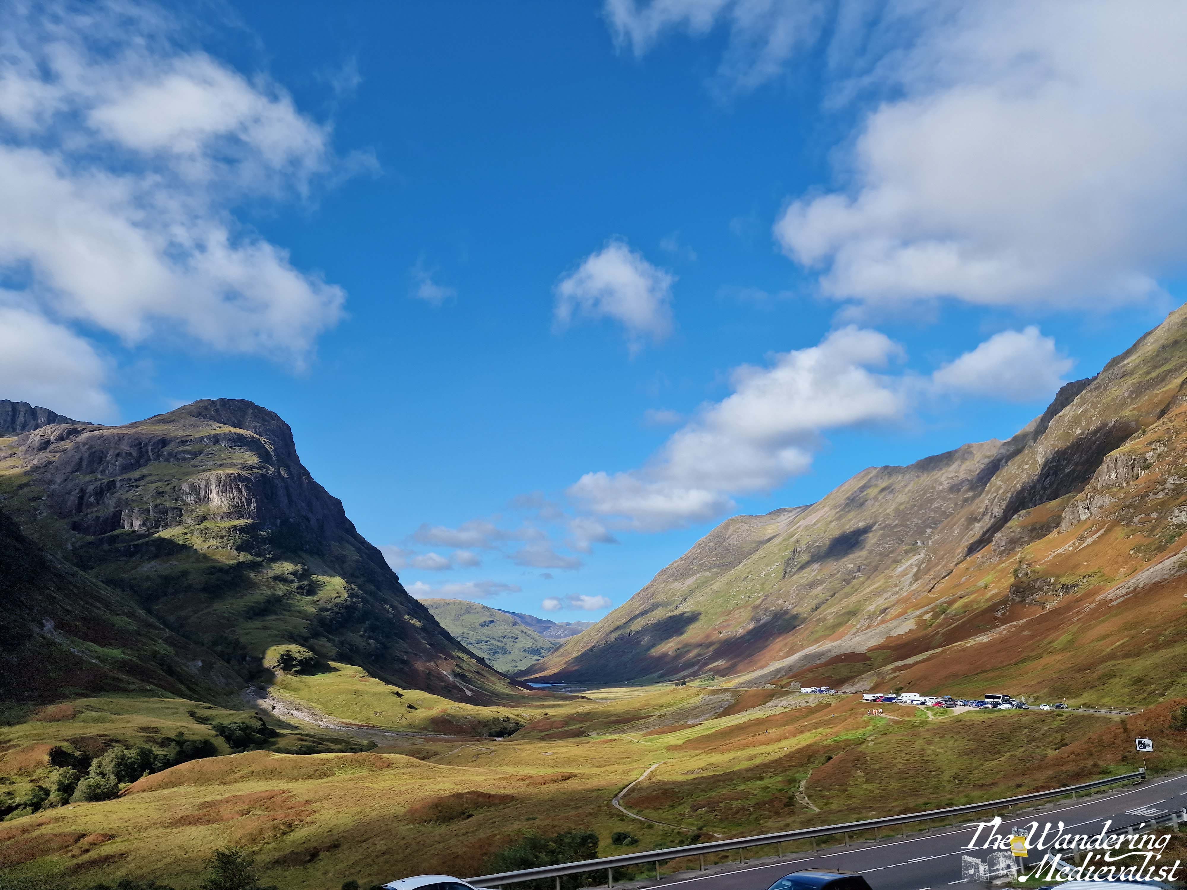
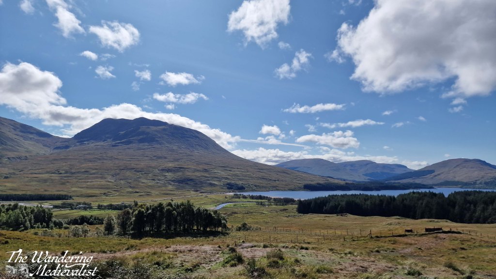
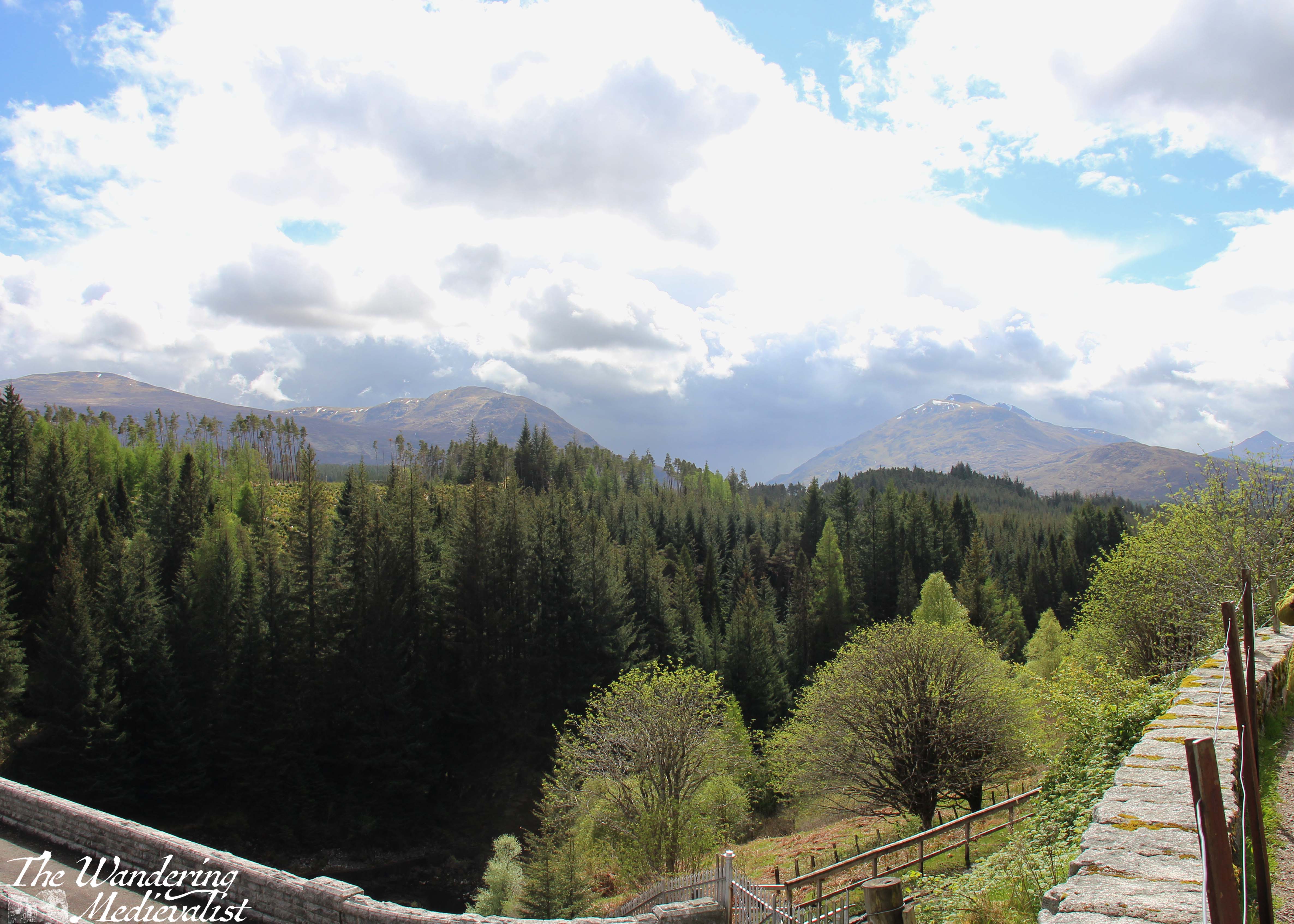
Part 3: Ballachulish to Loch Achtriochtan – 5.5 miles
After Ballachulish the road turns inland away from the loch, and enters Glen Coe proper. Only 2 miles along on the right is the Glencoe Visitor Centre, where you can learn about the region and the famous massacre of 1692.
Mountains are rising on both sides of the road and ahead, often a combination of brown-grey scree and stone with lighter green patches of heather and ferns, and darker green foliage. The road here is in relatively good shape with a few potholes, and many drivers slow down both due to the sharp turns and the views. Enjoy the width of the lane while you can!
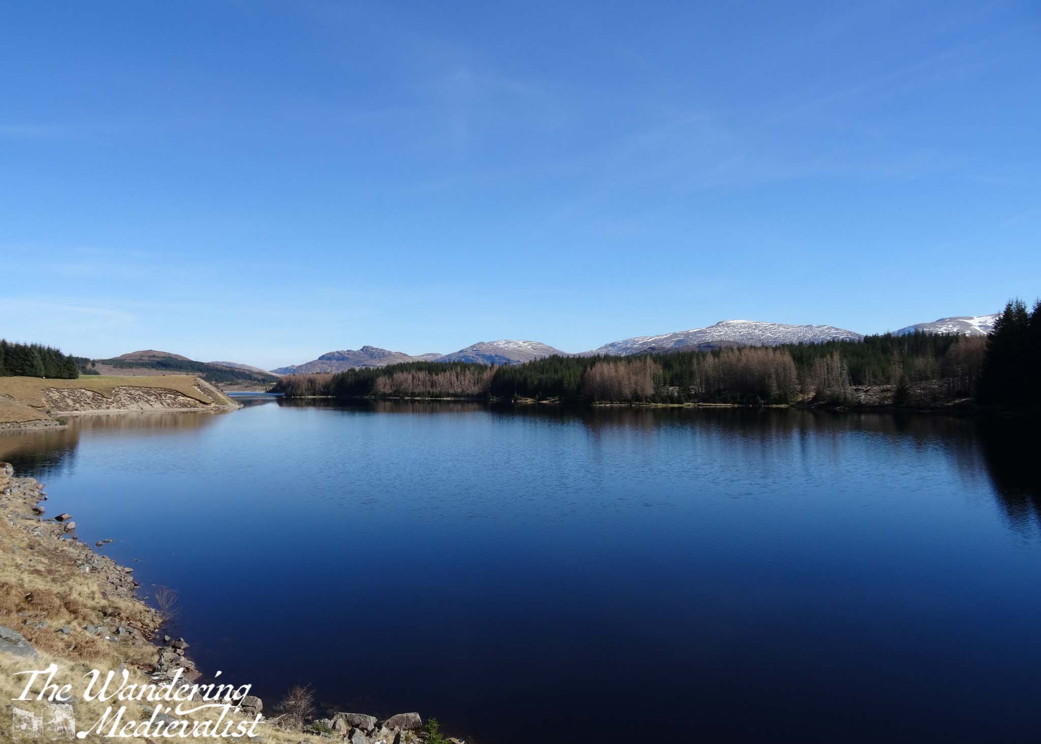
Another mile or so south, the road swings more sharply east to continue along the glen. Ahead of you the A82 stretches along the valley and then begins to climb, and ahead to the right is Loch Achtriochtan.
It can be a very busy and treacherous stretch of road, with drivers going faster than they should and plenty of tour busses and caravans, so I recommend pulling into the Loch Achtriochtan car park. Here you can either pause at the bridge, or cross to make friends with some sheep and approach the waterside. This spot allows you to capture the gorgeous hillsides and loch.
There is also apparently a turn-off around here to view Hagrid’s hut from the Harry Potter films, though I have never done so.
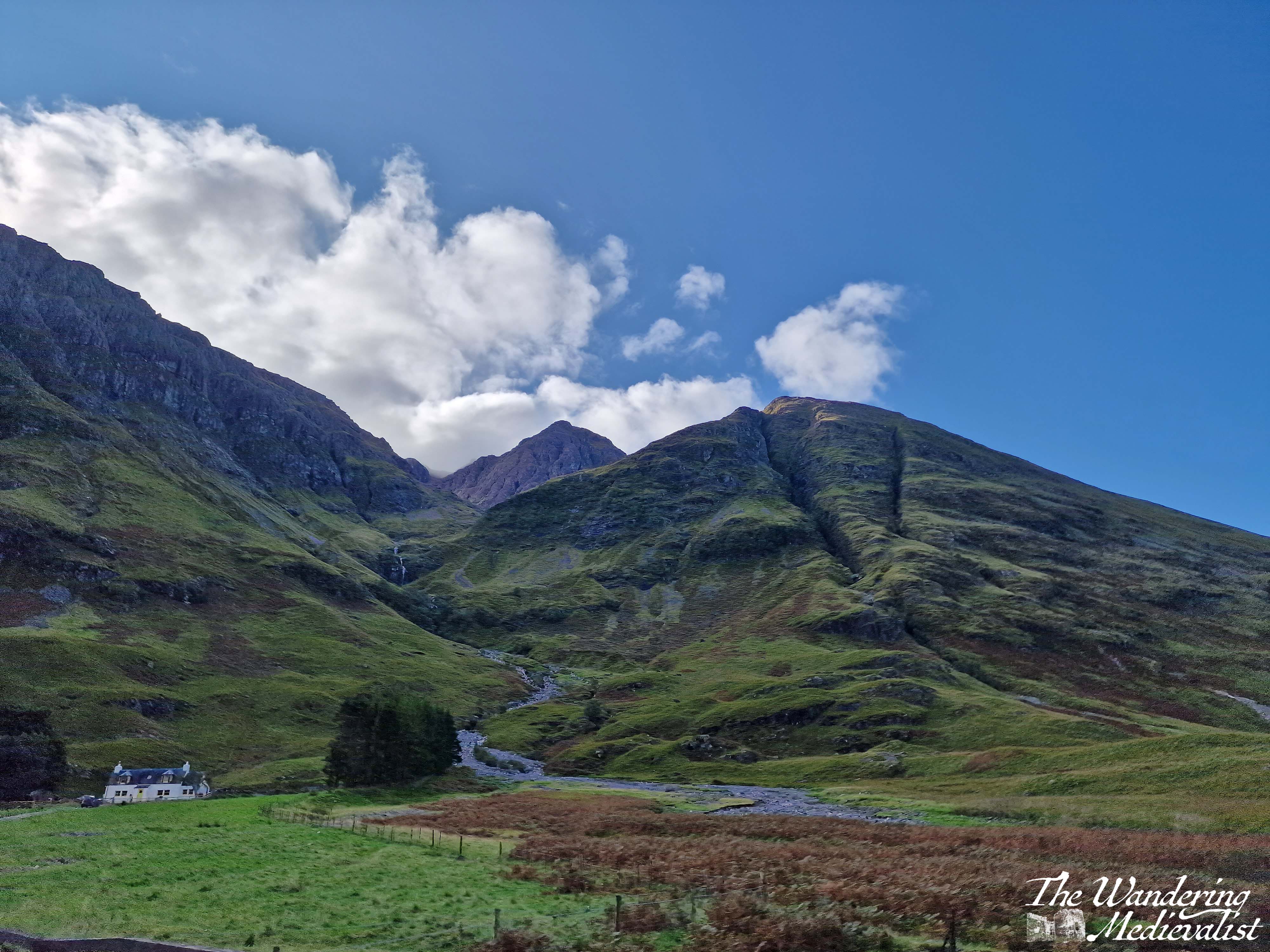
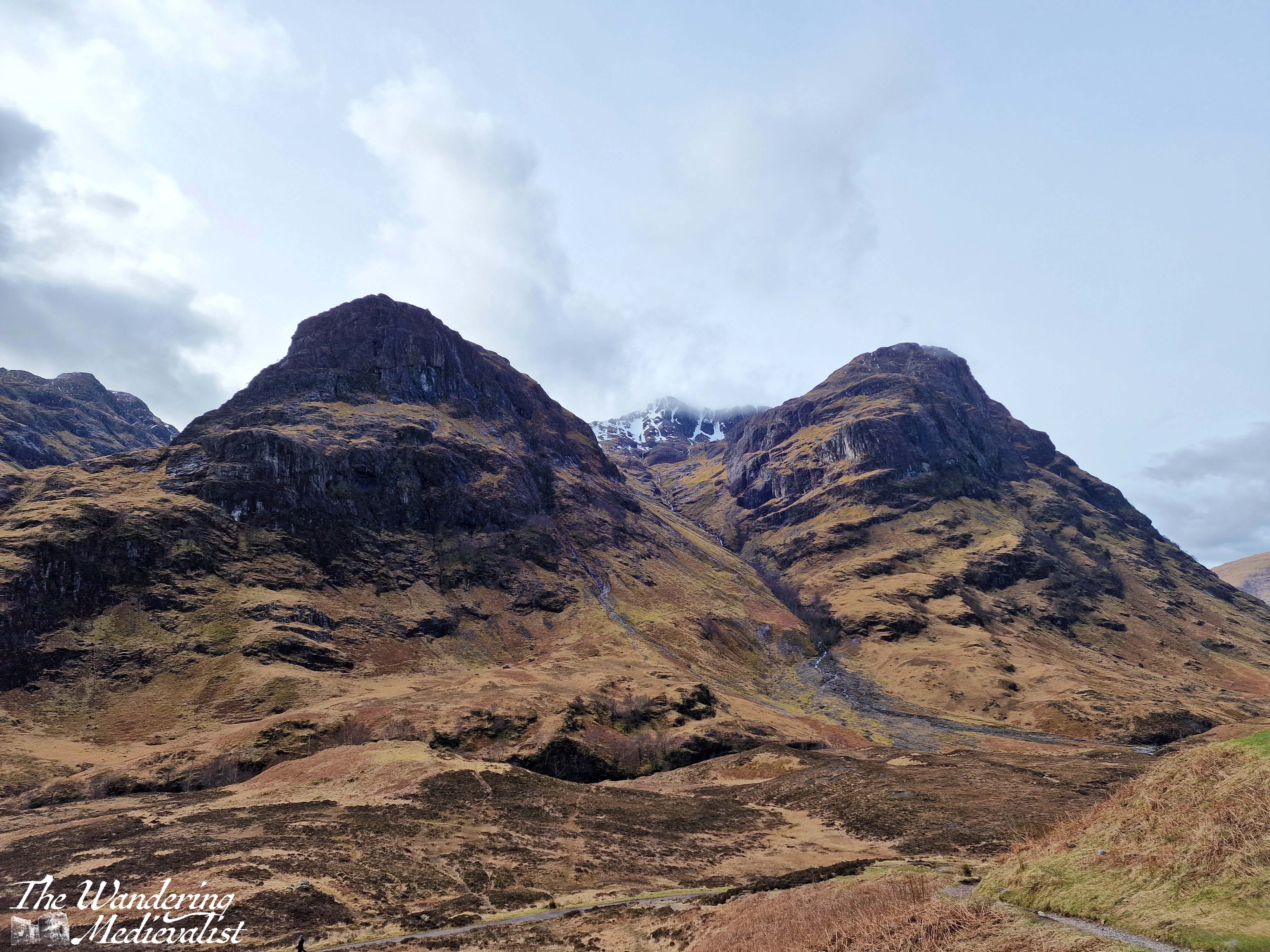
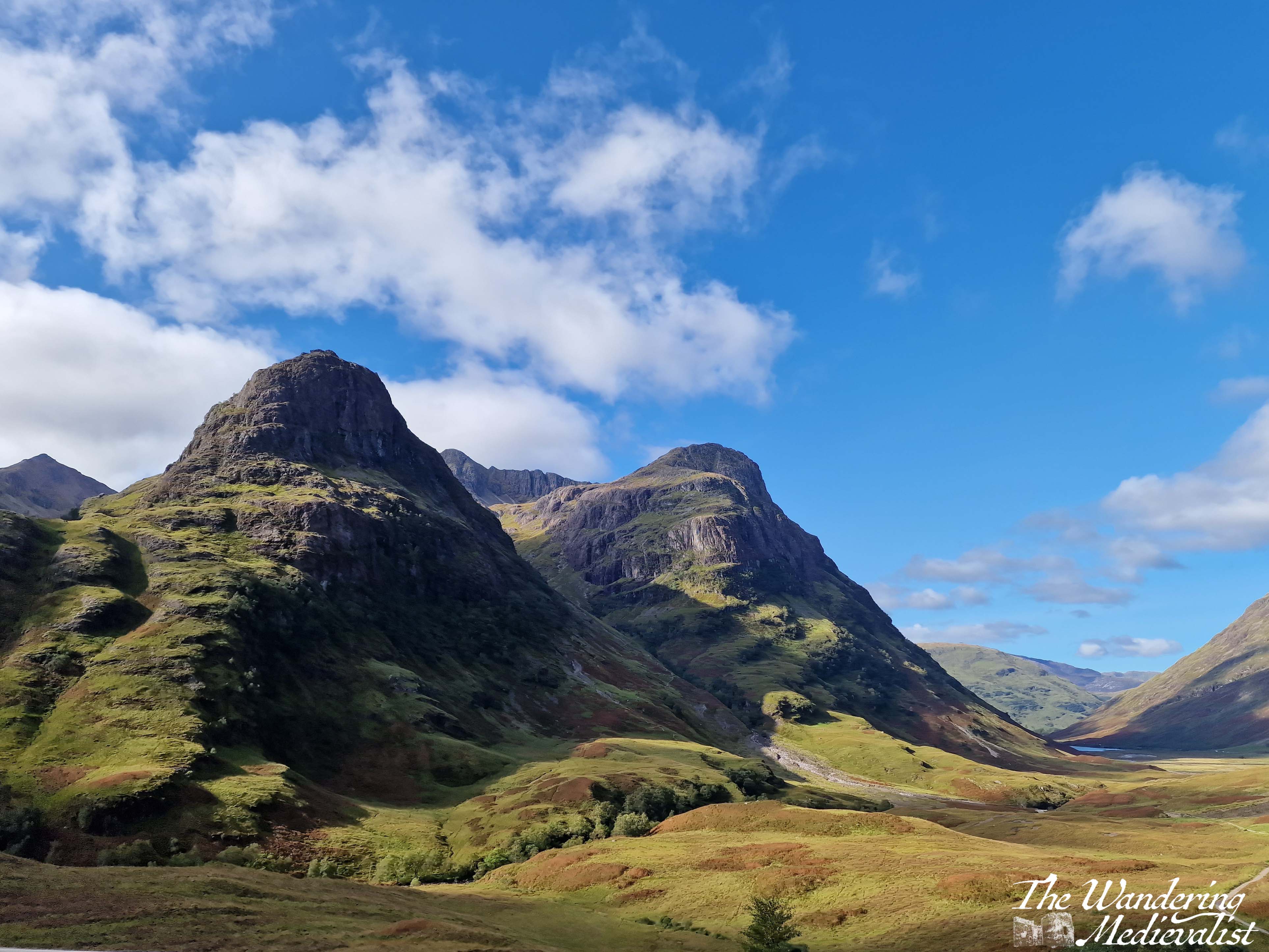
Part 4: Loch Achtriochtan to the Three Sisters viewpoint – 2 miles
Once you have dragged yourself away form the the loch, it is two miles further to the pièce de résistance of this drive – the view of the Three Sisters of Glencoe. Until quite recently, there were several places you could turn off and you were often taking your life in your hands trying to park and find a safe place to get back onto the road. In the last year or two however they have built a proper car park – and another one for tour busses – to allow the many visitors to safely park and explore. There are a few parking spots slightly further up the road too, and there are paths leading down into the valley or up the hillsides.
The Three Sisters of Glencoe is one of the most photographed spots in Scotland and only a visit need tell you why. I have countless pictures from different times of year and I can never decide which one I prefer. Some day soon I hope to do some of the walk down into the valley and across the bridge, though I know I do not have the fitness or skills needed to venture too much further up into the hills at this point. Aonach Eagach Car Park is another good option but often too busy to find a space. It is at the trailhead for the Lost Valley trail and provides a slightly different view of the valley.
Side note: if it seems at this point as if you are just driving a few miles and then stopping again, you’re not wrong, but I promise the stops are worth it. If you get bored, skip one! But if this is your only trip to Scotland, I’d take advantage of them all.
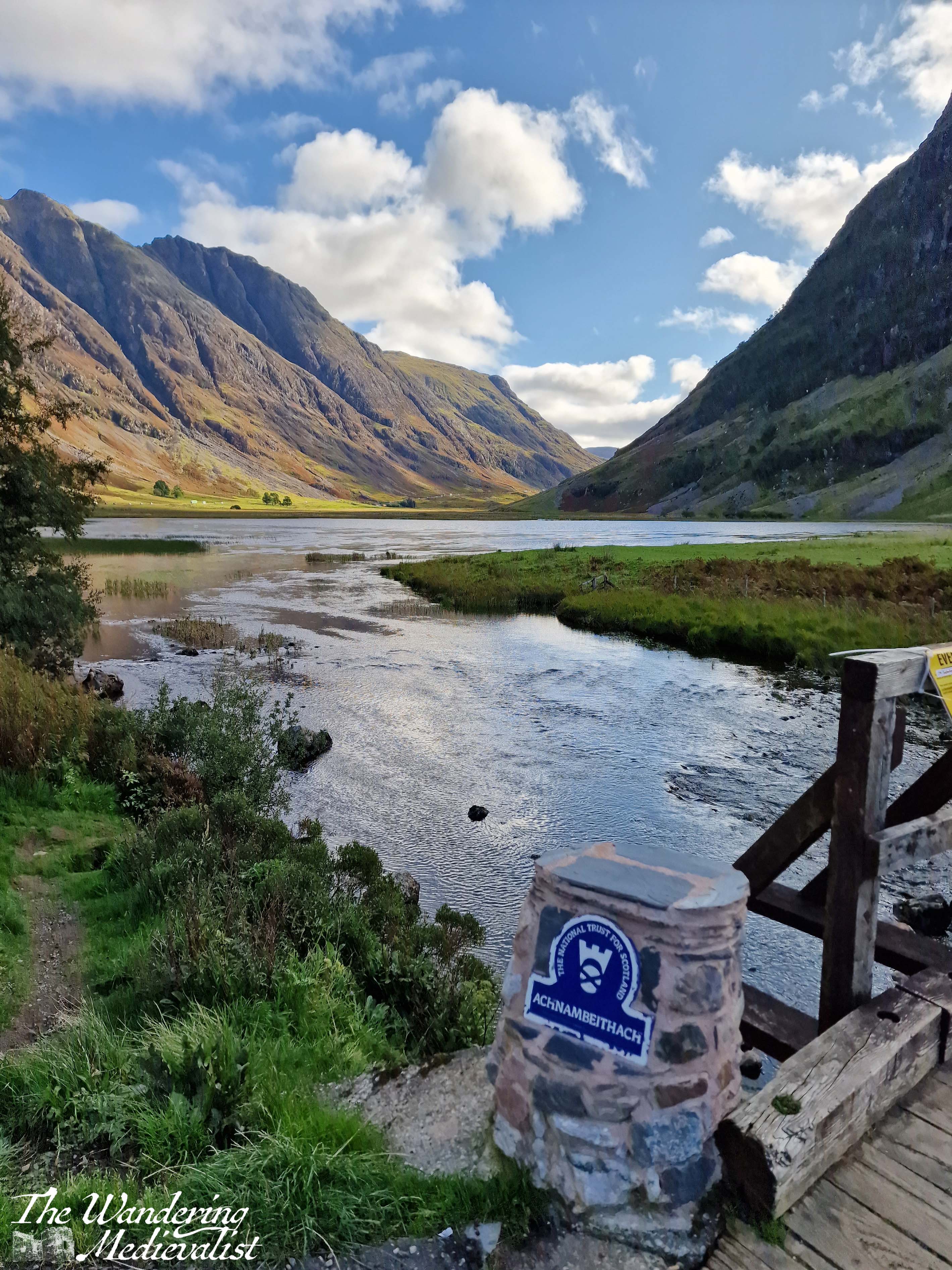
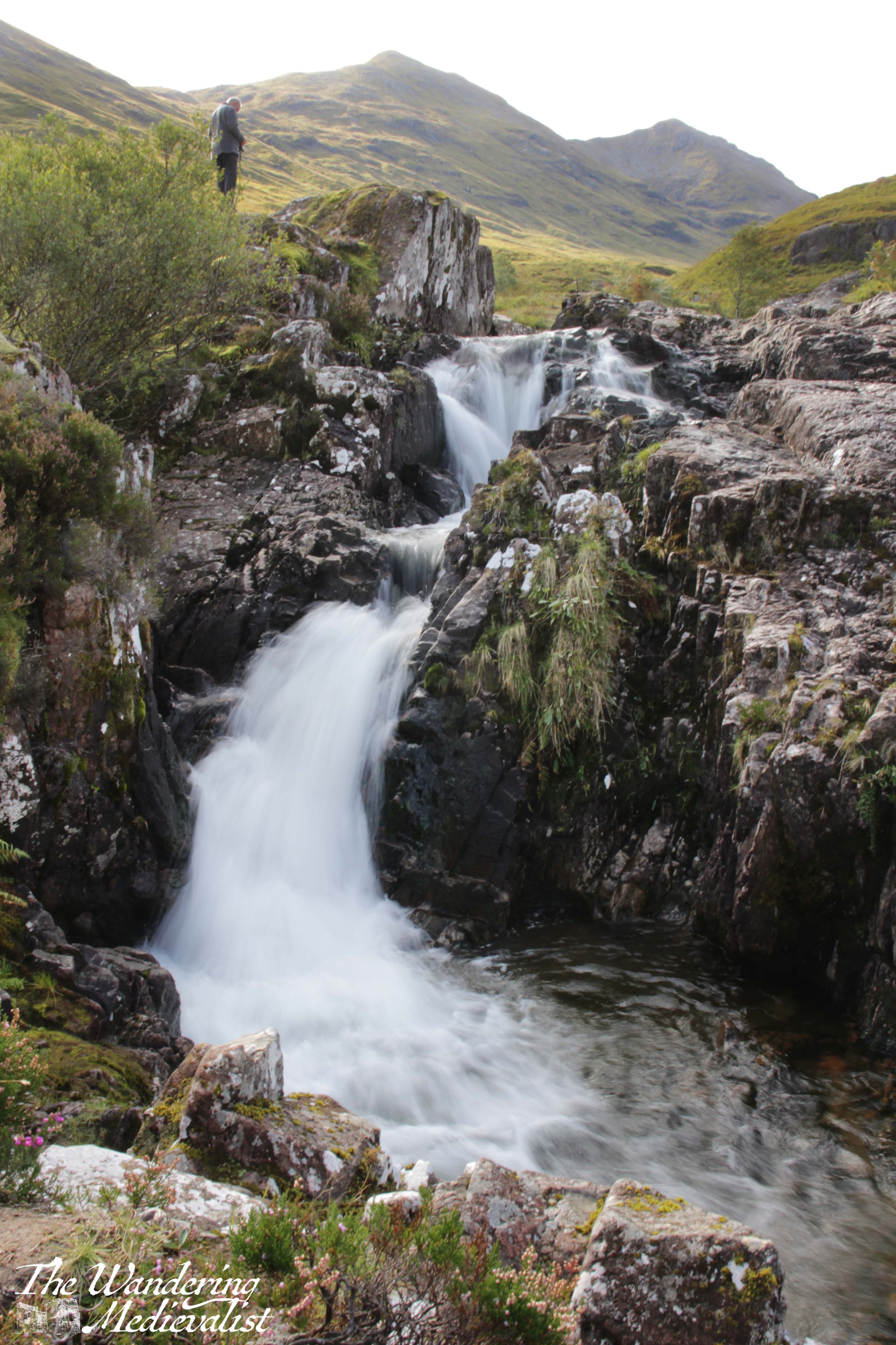
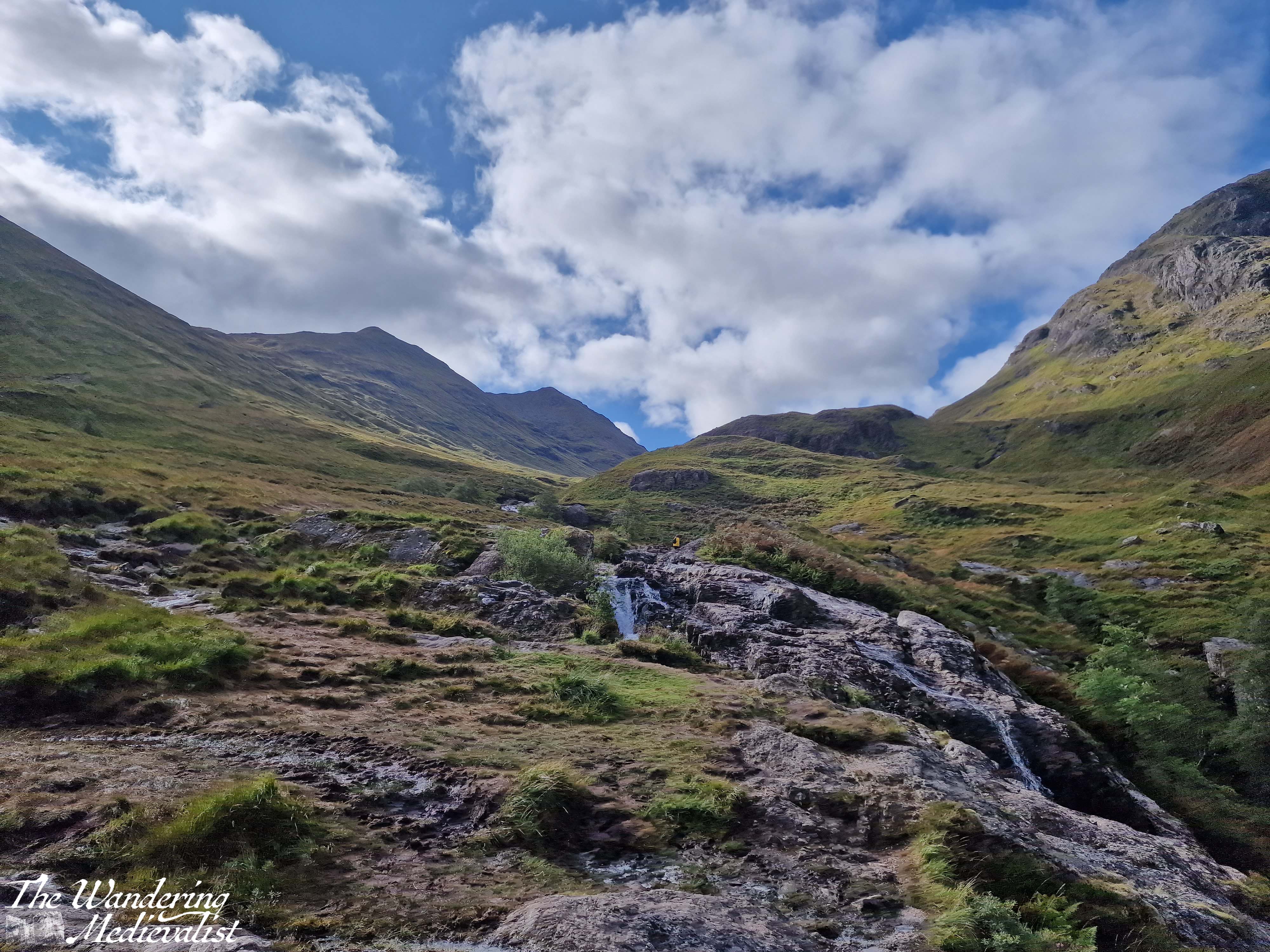
Part 5 – Three Sisters Viewpoint to Meeting of the Three Waters viewpoint – less than 1 mile
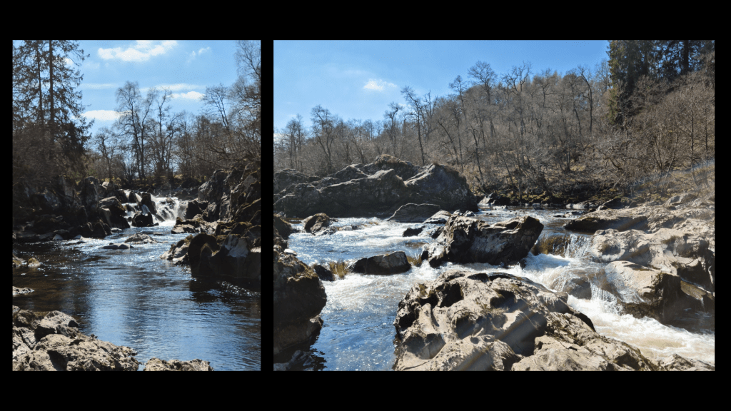
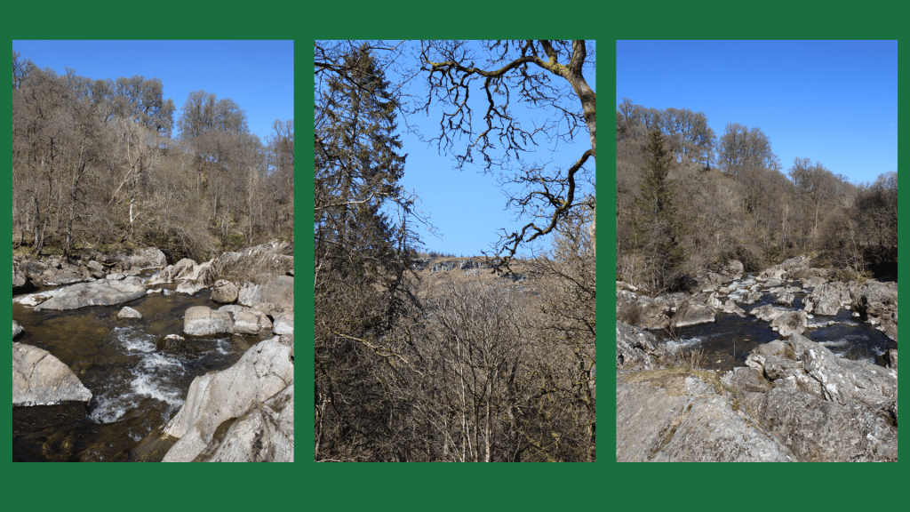
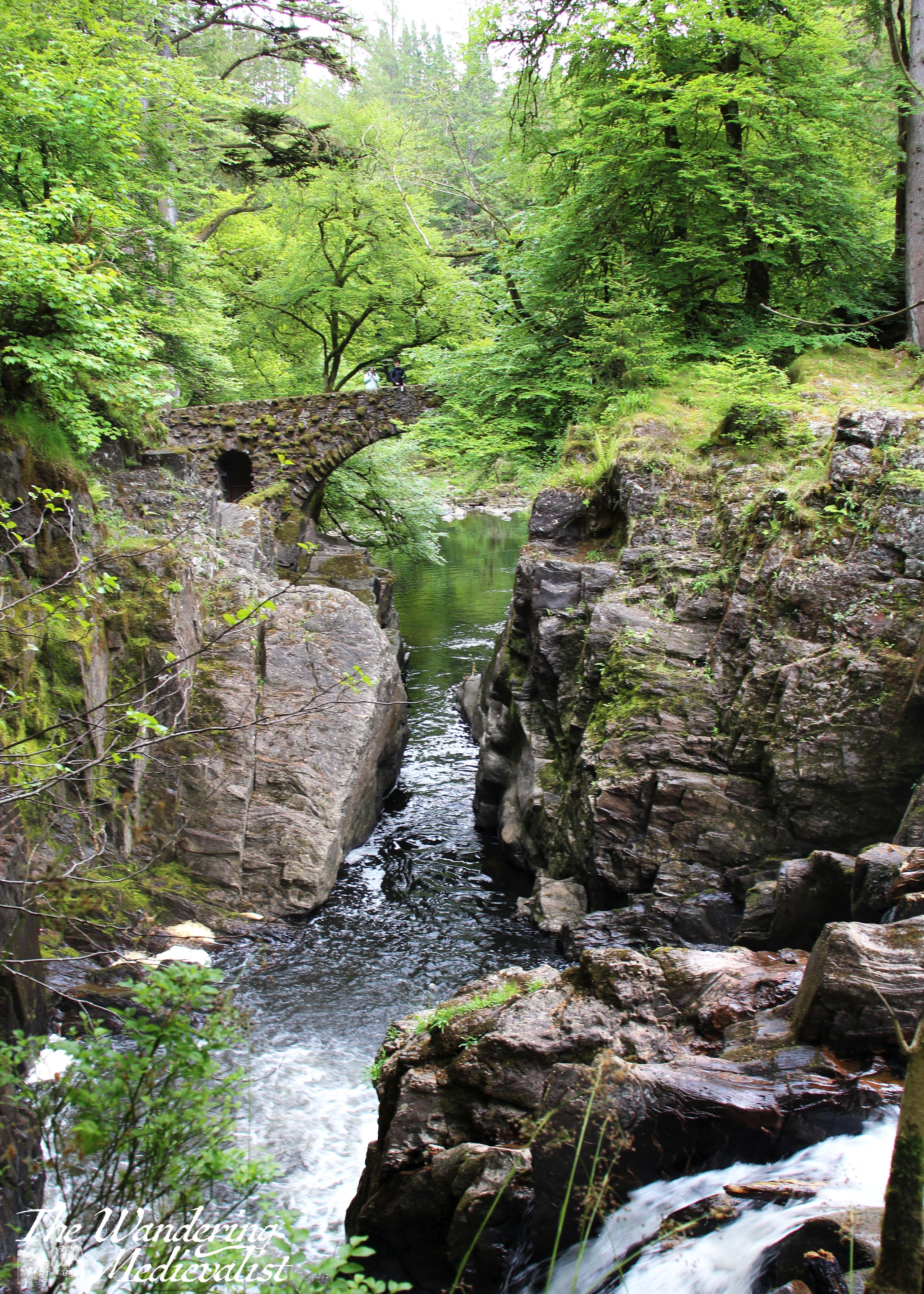
Yes, this is a short drive. I had passed it by many times before I made myself actually stop on one beautiful autumn day. The waters are, as it sounds, three separate rivers (Allt Coire Gabhail, Allt Doire-bheith and the River Coe) that meet here at a pool and series of waterfalls, before continuing down the glen towards the lochs.
There is a short climb from the car park that takes you up the rocks and over the waterfall, and the start of the climb is a bit ropey. But, once you have clambered up the hill, you reach a stunning viewpoint that shows you the newly built road, the falls, and the burn heading up into the mountains. There is a pool where I have seen people swimming – brave souls – and of course a trail that follows the burn. I dragged my octogenerian father up to see the view and I think even he was impressed. It is easy to see here the old military road, which was in modern times replaced by the route of the A82.
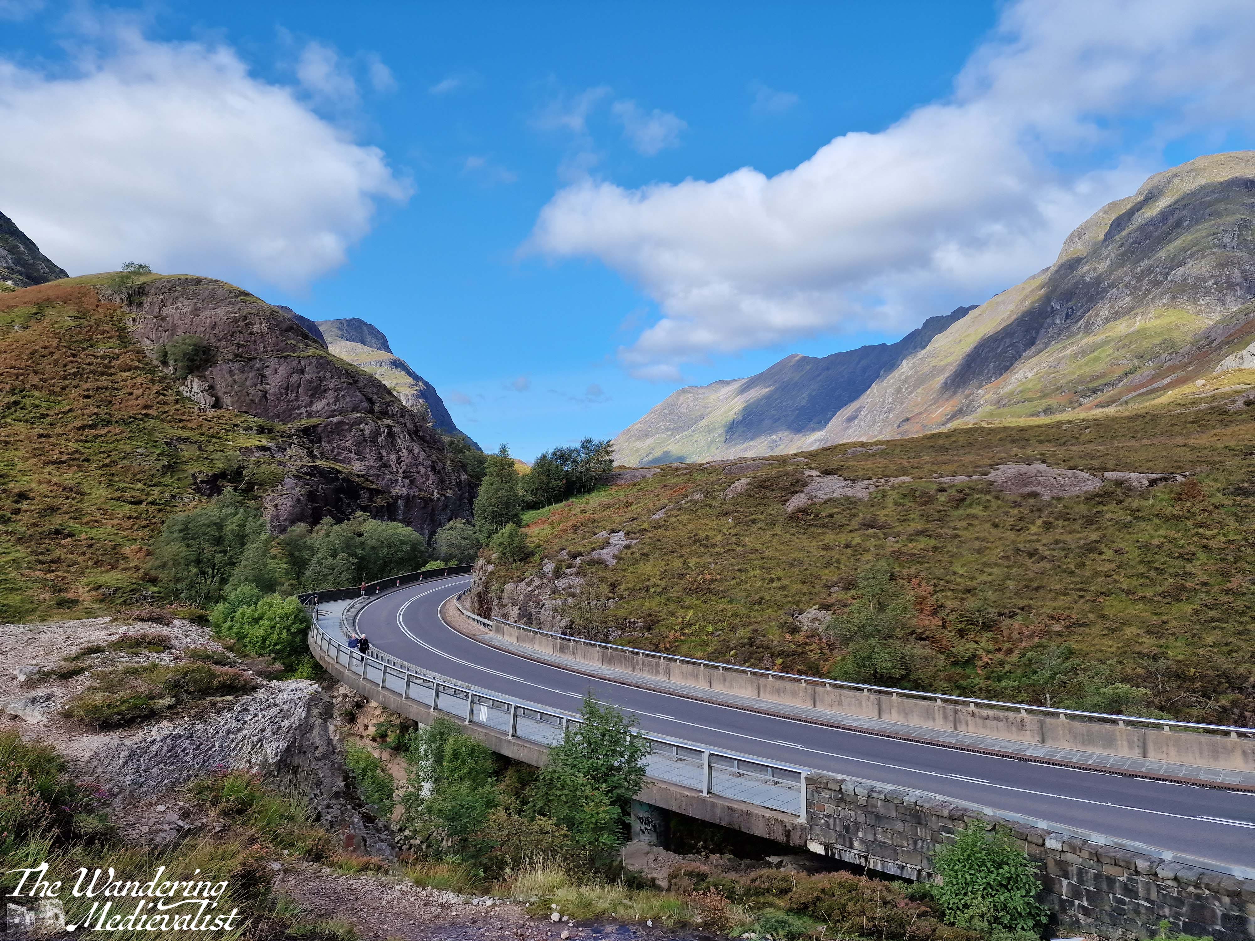
One point I should make is that in that .7 miles between the two spots, you are driving along a narrow road.
At one point, the highway cuts through the hillside, with solid rock towering on either side, and leaving very little room for error. Not that anyone would err…
It can be a bit harrowing even after several goes, so take it slow and easy.
It is very easy to miss the parking spot for the Meeting of the Three Waters
and this is not an easy place to turn around, so definitely use your Google/Applemaps or whatever Satnav system you prefer to warn you.
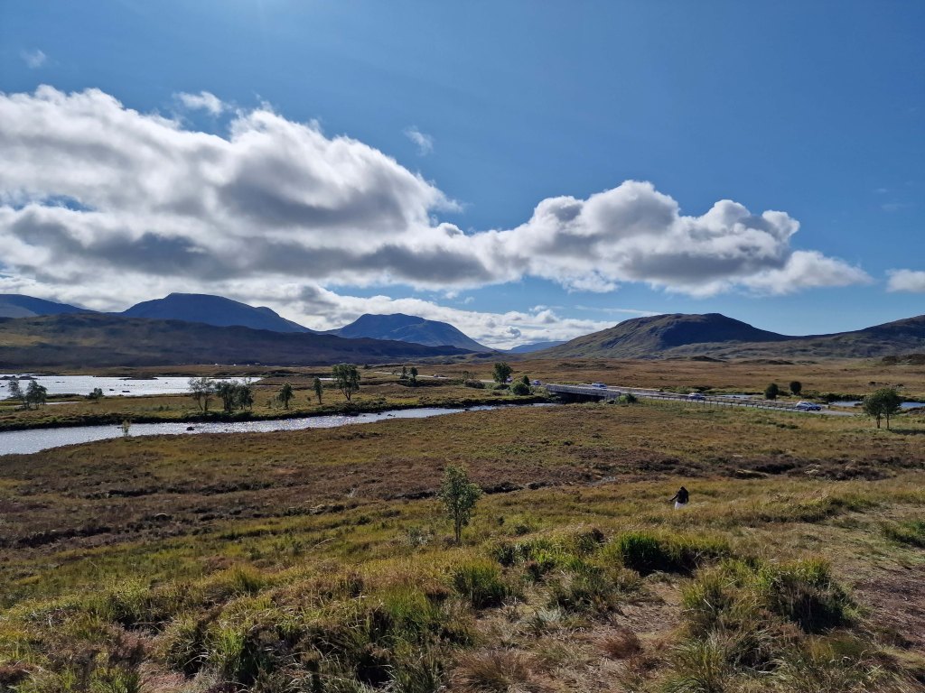
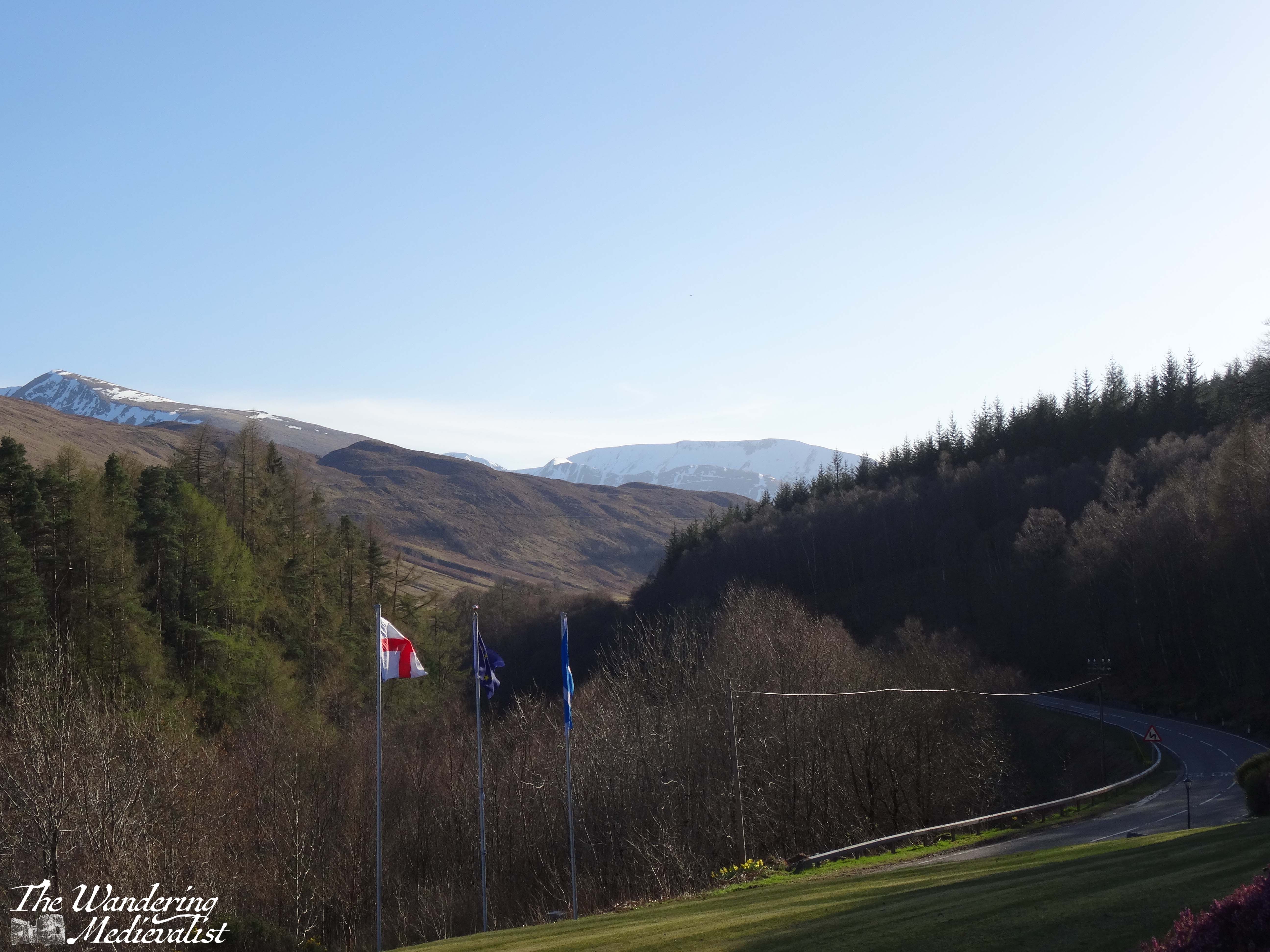
Part 6 – Meeting of the Three Waters to the Kingshouse Hotel – 5 miles
Beyond this parking spot are plenty more viewpoints and places where you can pull over, and it’s really about deciding how often you want to stop, and how busy they are. Sometimes there are so many cars parked in a small spot that you really cannot safely get off of the road. Once you have had your fill of waterfalls, you can make a bit of headway as the road opens up a bit with mountains on either side. Eventually the road will hug the edge of Rannoch Moor, and this is where in bad weather you can really start to feel the car being blown about.
The Kingshouse Hotel is a popular stopping place though they are strict about people coming in just for the view. I would love to stay and know friends who were married here during the pandemic – this area is famous for the amazing views of the mountain, Buachaille Etive Mór. You can also take a detour here and drive part of the way down Loch Etive, though as yet I have not done so. Some trip, one day!
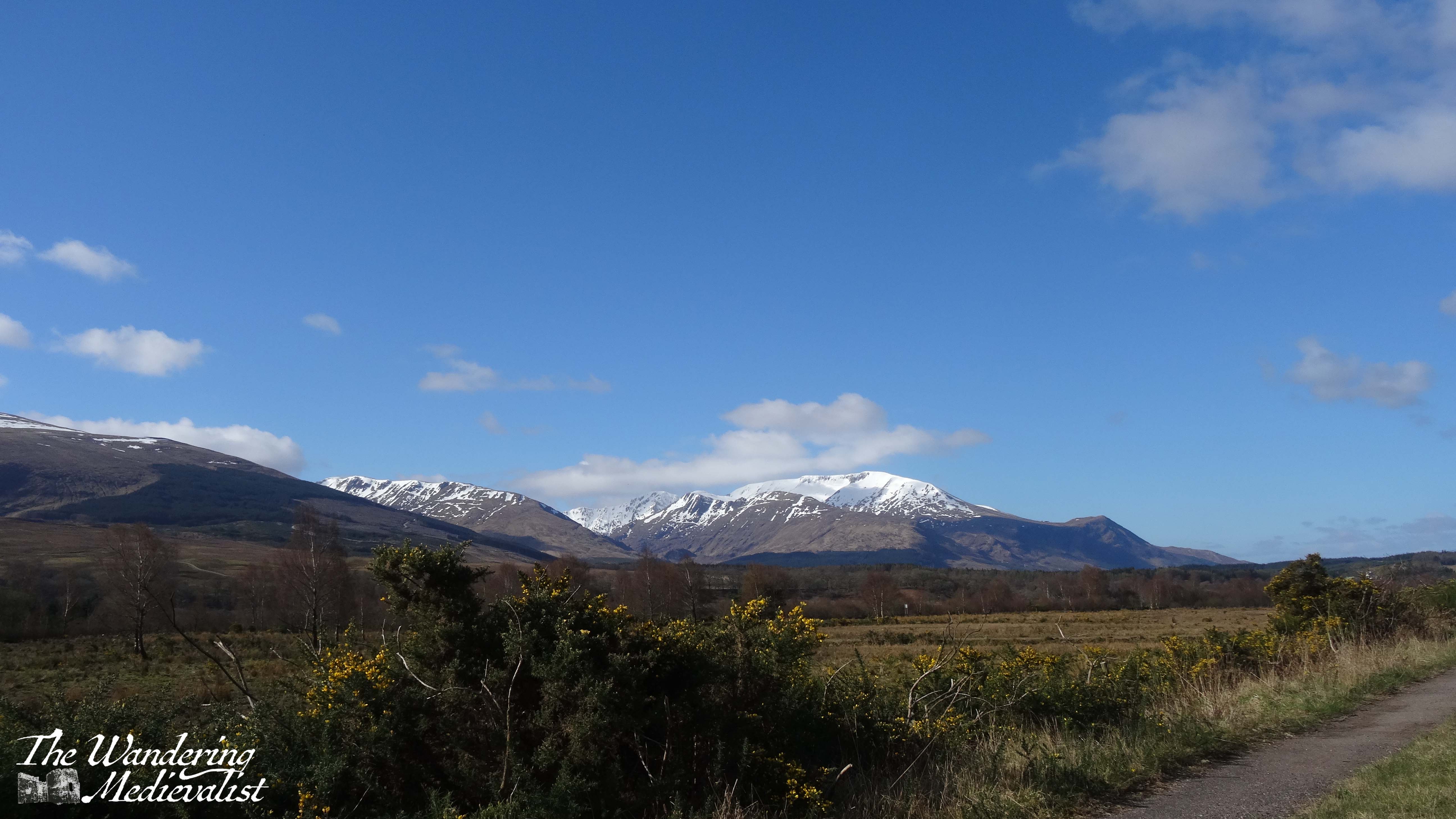
Part 7 – Kingshouse Hotel to the Loch Ba viewpoint – 5 miles
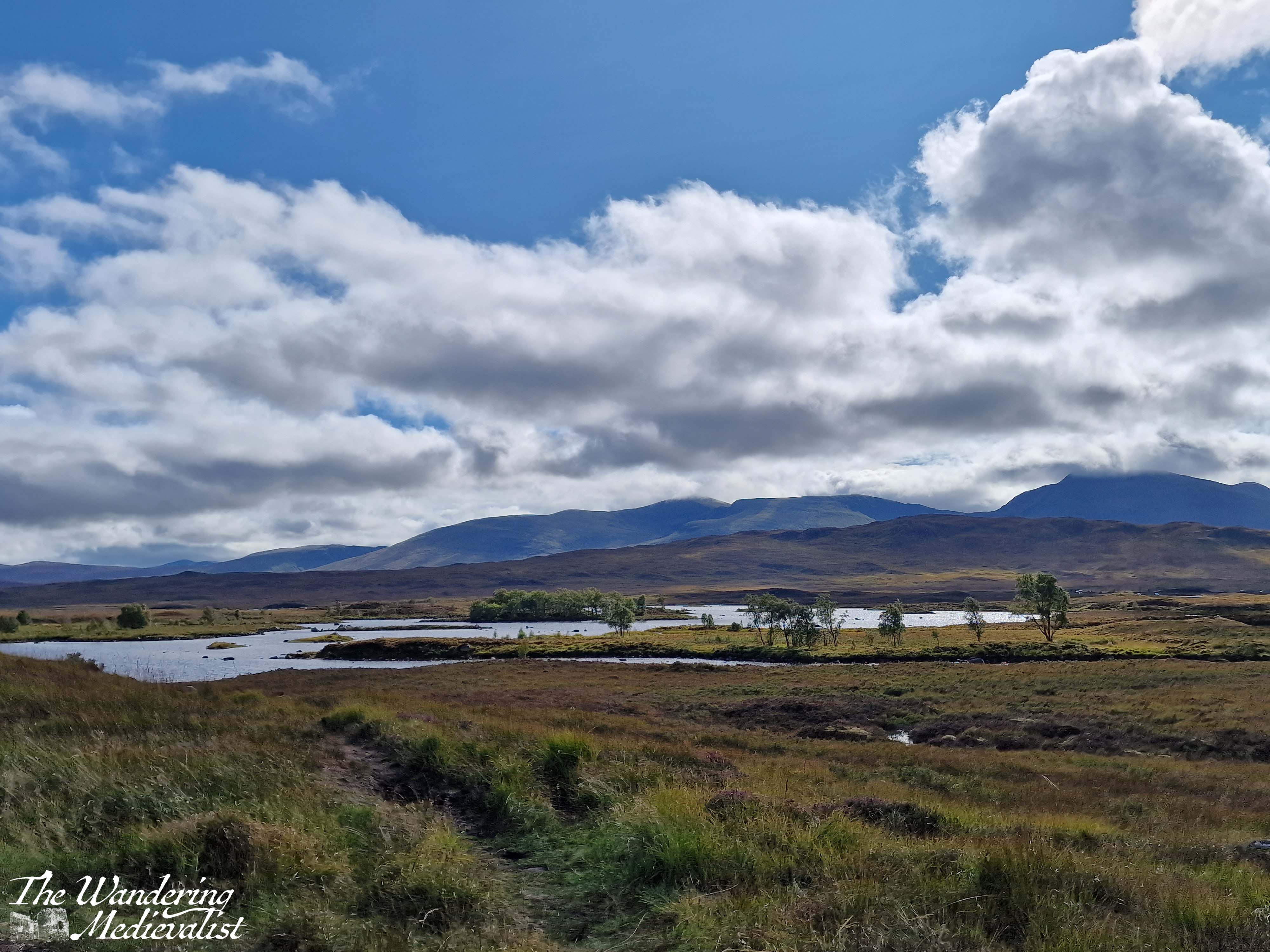
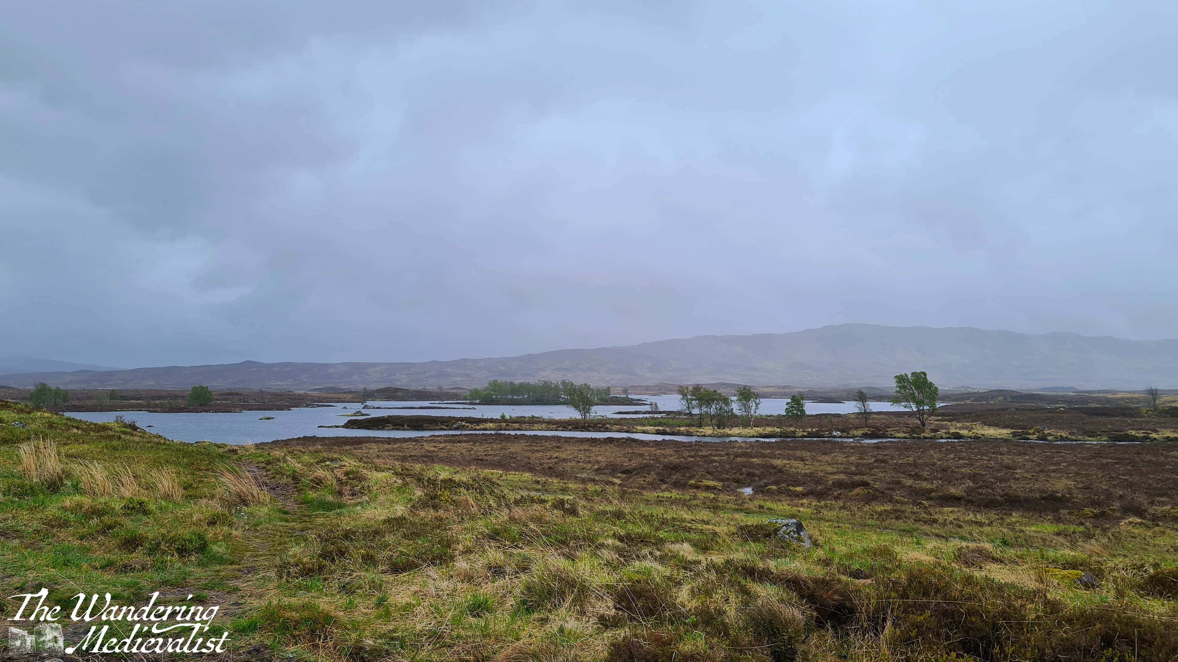
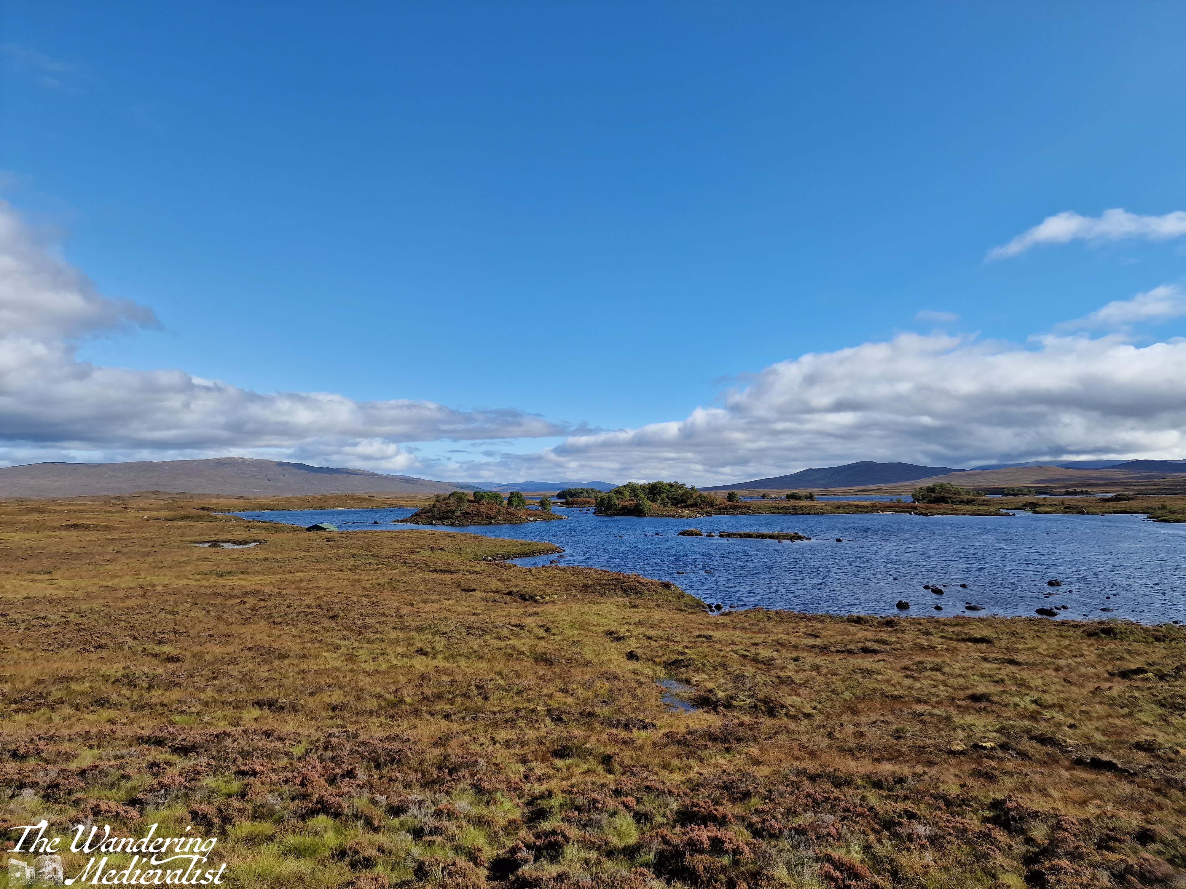
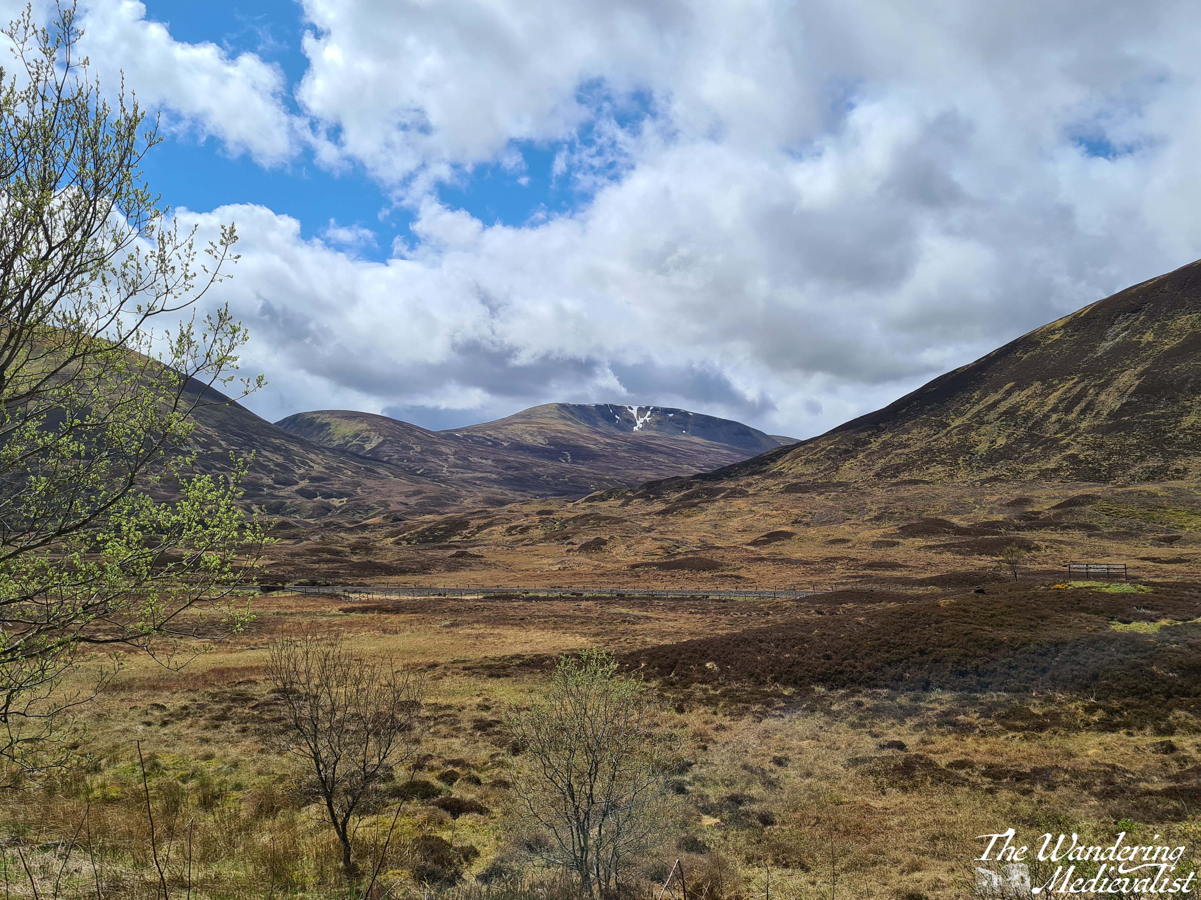
Just after the hotel you will pass the turn-off to the Glencoe Ski resort – the trails are evident – and the mountains stay a bit closer on the right though they start to fall away on the left, as the moor creeps closer. This is quintessential Scotland, in my mind – boggy moor with mountains in the distance, countless little burns falling over rocks and carving their way down from hills and across the landscape. Rocks poke through either on their own or in clusters and chunks, covered in lichen and reminding one just how thin the soil is here. There are a few lone trees, but most of the landscape is relatively barren.
The final place that I cannot resist stopping is the Loch Ba viewpoint. There is usually plenty of space to pull over, and it is easy to see coming due to the lump of land that marks the view. Climbing this short hillock allows for 360 views, though it is the one almost due east that I love the most – glistening loch with plenty of small islands, leading away into the wilderness.
Behind you are the peaks of Glencoe, and ahead just the road, leading towards the next hills in the distance. I can understand why some might assess it as stark, but I think it is gorgeous.
Part 8 – Loch Ba viewpoint to Crianlarich – 19 miles
About three miles beyond the Loch Ba viewpoint, you realise how high the road still is when it suddenly, dramatically, begins to fall. There is a sharp descent through an s-bend that can challenge lorries and busses coming the other direction, though there is also a large parking area to pull over in if needed. From here, the road is a bit less dramatic though still stunning, crossing the Loch Tulla bridge and winding its way across the valley floor before climbing again.
One of your last views of the lochs and lowland of the edge of the moor comes at the far side of Loch Tulla, where there is a small parking area, but the views are better in person than in pictures. From here, the A82 is heading almost due south, passing through a number of villages and meeting up with the rail line that runs from Glasgow to Fort William. Bridge of Orchy and Tyndrum stand out as the two larger towns, with Tyndrum in particular possessing several hotels, petrol stations – if you can get in – and the Green Welly stop which has always been so busy that we haven’t been able to get in. For some reason there always seems to be a large gathering of motorcycles here.
Tyndrum is also where the highway branches off towards Oban, and from here south can get busier. The remainder of the drive to Crianlarich is following the River Fillian and its many small tributaries; mountains continue to dominate on both sides though they are slightly less dramatic than further north.
Crianlarich is another smallish town that has become significant for those heading to the Highlands. Firstly, it is where the road branches either to continue south towards Loch Lomond and Glasgow as the A82, or east to Loch Earn and Perth as the A85. Secondly, it is where the rail line divides. As I mentioned in my exploring Scotland by public transport post, the train from Glasgow north can go either to Fort William or Oban, and Crianlarich is where it stops long enough for the train to either split in two, or be re-joined. There is also a significant hiking peak, Ben More, not far from town, and plenty of places to stop for the night.
Part 9 – Crianlarich to Lochearnhead – 16 miles
The 16 miles from Crianlarich to Lochearnhead is highlighted by a bit wider road, and slightly lower mountains, though still offers glimpses of lochs off to the left. Just over half-way is the turn-off to Killin, where one can view the Falls of Dochart. There is also what I will always refer to as my emergency petrol station – on my last drive back with Dad, I misjudged how much petrol we had and could not see a place to stop in Crianlarich, so was running on fumes by the time we reached this spot. I was considering just going into Killin where I knew there was petrol, but this station saved us and allowed us to continue without a detour.
After the emergency petrol station, the road climbs and winds again through what is clearly planned woodland. One of the most dramatic parts of the drive is as this path falls again, with the road hugging the mountainside and a sharp drop on one side. Ahead, though, is Perthshire and in what feels like no time at all, you enter Lochearnhead, and take a left to stay on the A85. While there is not a huge amount here, there is a safe and relatively clean public toilet that can be a godsend if you have not stopped anywhere except viewpoints since Fort William.
Part 10 – Lochearnhead to Crieff – 19 miles
The drive along Loch Earn is beautiful. The loch itself is long and narrow, with plenty of well-to-do houses along the edge and water sports galore: paddleboarding, sailing, swimming and fishing are all advertised. Especially on a sunny day, the glimpses of glistening water through the trees make you want to stop and find a boat of your own.
The drive from one end to the other is about 7 miles, and the town at the far end – St Fillians – is a charming village with plenty of Victorian-era gingerbread-style houses and lovely gardens. After St Fillians, the driving is much more lowland, with farms on either side, sheep fields and stunning stone farmhouses dotted between stands of trees and hills.
Crieff itself is an excellent spot to stop for a snack if you need, or you can push on through towards Perth – another 15 miles. This road offers a more Fife and lowland feel. Fields stretch off into the disttance over rolling hills, and the distant Ochils on the horizon. I have never liked this stretch but I think it’s at least partly because I know I’m heading away from the mountains, and that never ceases to make me a bit sad.
Once you have done the circular drive from Perth to Fort William and back again, you will quickly decide which leg you prefer and where you like to stop. I’m fond of both routes really, though I find myself often preferring the northerly loop as it can be a touch faster, traffic depending. I am looking forward to trying it again…tomorrow!
In spring of 2021, Scotland had been in pandemic lockdown since Boxing Day 2020 (the day after Christmas). Then finally, in April, the word came – we were for the first time permitted to leave our ‘local area’. We could leave Fife!
A walk was the most inevitable choice for our first out-of-county adventure, as there were still plenty of restrictions in place and staying outdoors was ideal. So, we chose for our first adventure a walk we had never tried before – the Hermitage Woodland Walk.
Through reading various websites, we opted to drive to the Rumbling Bridge end of the path and walk down towards Ossian’s Hall. At first, it seemed an excellent choice – the path was quiet, and the day was pleasant and sunny. But, as we made our first turn onto the Hermitage walk proper, we discovered that we were far from the only people with this idea – hordes of walkers, many clearly not used to such excursions, were enjoying being outdoors. We passed numerous people in flip-flops and carrying take-away coffee cups, girls in sundresses that were not designed for woodland walks, and families with young children and prams that were struggling on the rocky path. In fact, it was so busy that we only just reached the hall before turning back and fleeing to the quieter, further away paths.
River Braan above the bridge
A quick note about the route we took in 2021: parking in the Rumbling Bridge car park – which requires turning up the A822 before you reach the Hermitage car park – allows you to hike downhill first, then back up to the bridge, and also to explore the River Braan as it tumbles over boulders and small falls. When walking from the ‘proper’ car park, it is easy not to venture all the way up to the Rumbling Bridge, but I definitely recommend doing so, particularly if you have a liking for rivers and waterfalls. But I’m getting ahead of myself.
More of the river above Rumbling Bridge
My second trip was with a work Step-Count Challenge group about a year later, and it was on this trip that I think was truly able to enjoy the beautiful path. My third trip, also with friends from work, was equally lovely, and we found – several years after the end of pandemic restrictions – a set of picnic benches, coffee and donut wagon, and port-a-loos that were passably clean, all right beside the main car park. Starting here, the path passes under the rail line and follows the river through majestic trees.
This area is wide and mostly flat with only the slightest incline, though the hillside rises sharply above the path. In a short time, there is a fork in the road, and taking the left-hand option leads to the highlight of the visit – an almost Tolkien-esque stone bridge and Ossian’s Hall. It makes sense first to take the short trip down the hill to stand on the bridge, where you can get a stunning view of the Black Linn Falls as well as the large pond beyond the bridge.
If you cross and follow the path to the right, you eventually find yourself with a perfect view back towards Ossian’s Hall. The hall was constructed in the 1780s to replace a summerhouse. In fact, the entirety of the Hermitage is not natural landscape, but was designed as a pleasure ground for the Dukes of Atholl. Once one is aware, the towering Douglas firs do seem a touch too perfectly planted, and indeed the almost elvish or fairy-like forest is a touch too magical.
The view of the falls is even better from within the hall, though at busy times you may have to wait your turn for the best view, as the viewing balcony allows only about 5 or 6 people comfortably. Beyond the hall, there are several places where you can look back at the hall and bridge. I have seen drone shots of the falls where the drone has flown down the river and under the bridge, something I wish I could do myself!
Once you have had your fill of the fantasy land around Ossian’s Hall, you can continue up the path, which starts to gradually ascend as it follows the river. On several occasions I was driven to remark on how much it reminded me of rivers in the White Mountains in New Hampshire – rocky, the water tumbling over the rocks to form peaceful pools and swift rapids, blue sky and trees growing almost out of the riverbank. When hiking with the Step-Count group, we had brought a picnic and found ourselves an ideal picnic spot on some rocks along the river, with views in both directions.
Gradually the path lifts away from the water, as the river sits in a gorge many feet below. There are several side-trips one can take as paths cut closer to the edge of the water (sometimes a steep drop into the gorge) or into the woods to the right. A notable detour is Ossian’s Cave, another constructed portion of the pleasure grounds (called a folly) where, if one is brave, you can duck into the rock construction. It is arguably more pleasant from the outside.
From here the trail continues through varying types of forest as it climbs, and after a slightly steeper ascent through more pines, one reaches a T-junction. Almost immediately ahead is a small stone house that is almost Bob Rossian in its placement amongst the trees, with a stone wall running along the path. It’s a good place to pause in the trees before crossing a small bridge across a burn, into the open. Just beyond a stand of rhododendron is a wide meadow with a grassy hill on one side topped by a rock formation, and gentle slope down on the opposite with views across the hills and valley.
view from the rock formation
If you have had enough walking for the day this is a good spot to catch your breath for a few moments before heading back down towards the car park. If you’re not done yet, it is only about five or ten more minutes to the Rumbling Bridge. You will notice a lone house on the hill above, which I have learned from Google Maps is in fact a small hotel. In the days of the pandemic, it looked quite lonely – in retrospect I imagine the views are spectacular.
Here the road forks again, and you will want to follow the left fork down the hill towards the bridge. This is an active road, so it is worth being careful to listen out for vehicles who may not see you easily. The bridge itself provides views of the river in both directions, as you would expect, and sits almost directly over the falls, so the ground seems to drop away quite swiftly on the downriver side.
If you make your way to the Rumbling Bridge car park, you will find a map similar to the one at the top of this post with plenty more walk options should you wish to keep going. Or, you can do what we did and spend some time climbing on the rocks out into the river, if you are in to such things.
A visit to the Hermitage is highly recommended for anyone who loves a good walk in the woods. The lower section to Ossian’s Hall is manageable for walkers of almost any ability as it is flat and the path well-kept, while the higher section offers a bit of a climb and some beautiful views. The circuit to Rumbling Bridge and back is not particularly long, but can be boggy in places so sturdy shoes are a must. Prior to my last visit I may also have cautioned about more basic comforts but there are now the port-a-loos available as well as the small van, so you can probably even manage without refreshments. That said, there are some perfect picnic spots along the way, so I would recommend bringing something with you. As long, of course, as you are willing to follow the camping rules I recall from the White Mountains – pack it in, pack it out! It is a shame to see litter on the trails, as we did in 2021.
Another small caution is in the driving; when arriving from the south, it is an easy matter to turn left into the Hermitage park or onto the A822 to reach the Rumbling Bridge end. But, coming back out can be a bit of a challenge. Waiting for a break in the traffic so that you can speed across onto the far side of the A9 is not for the timid or indeed the impatient – it can take quite literally 5 minutes to get back out onto the highway and unfortunately I am not aware of anywhere close by that you can turn around further north.
If you have been on a good walk and are interested in another short wander or something more substantial for food and drink, the town of Dunkeld is only a few minutes away and has plenty of options. It’s a charming wee town to walk around and has remains of a cathedral – what’s not to like?
It has been a hectic few weeks at work, which has meant I have not had time to devote to anything but getting through the day. But the busy time is unlikely to pass, and so I have to make time to focus on my real love – my blog and pictures, and anything Fort William-focussed. And so, I bring you this account of a drive I will happily do at any time of year, and with any companions: the drive to Fort William.
East Scotland – the Dundee area, Fife, southern Perth and Kinross – is quite similar in terms of geography: rolling hills, plenty of farmland, coastlines, and dotted with regular towns of good size. Not far north of Perth on the A9, though, pine trees close in around the road and the landscape begins to change. More dramatic, jagged hills rise and all at once I relax. A feeling of joy comes over me, and I cannot help but smile, knowing that I am headed north. I cannot really explain why my mood changes. It may be the hills, heading to mountains; it may be the many happy memories I have of locations to the north; it may be just that the stretch of Scotland north of Perth is some of the most beautiful countryside I have ever seen. Whether continuing to Fort William or just planning a day trip, I just love this stretch of road, and beyond.
And so, in this post I’ll take you on the first half of a circular journey to Fort William, a drive I have done many times. Once I managed it all in one day though I would not recommend it.
There is an issue with the A9 – where this drive begins – that must be addressed, and one that I have confidence will remain an issue for years to come despite all efforts of the Scottish government. That issue is that, for the last eight+ years, Transport Scotland has been working on a project to make the entire road from Perth to Inverness dual carriageway. For Americans, this means that there is a strip of land separating the traffic going in opposite directions, like many US highways. As the A9 is the main road north through the Highlands with increasing traffic and plenty of freight, this seems a no-brainer – it is just taking a touch longer than hoped (doing my best not to make a Big Dig comparison). There are also significant engineering challenges to many stretches of the road. This means, more often than not, areas of slower traffic and roadworks can hold you up, but anyone stuck behind a lorry on a stretch of two-lane road will understand the necessity of this work.
Back to the drive.
The road pictured above is where the A9 curves, just before reaching the towns of Dunkeld and Birnam, and the Hermitage woodland walk. All three are worthy of their own posts in time, but generally when driving north we do not stop until a bit further on. The road cuts through a set of hills here, with sheep fields on both sides between patches of trees. The highway runs near the River Tay and parallel to the train line that runs from Perth to Inverness. While the track disappears on occasion, it is not uncommon to spy a train.
The next way marker is the widening of the valley in anticipation of reaching Pitlochry. Pitlochry is a small town that holds a place in my heart as where the other half and I went for our first weekend away together, but also for its quaint touristy feel.
Just past Pitlochry is Killiecrankie, famous location of the Soldier’s Leap, and another great place to stop for a walk. Beyond the turn-off to Loch Tummel and the Queen’s View, the highway starts to rise up and along the side of a hill, and there is a gorgeous view of the mountains and the valley along to the left – it never comes through on pictures, though.
At this point in the drive there is a touch of anticipatory excitement, as I know what is coming. Almost never do we manage to get this far north without stopping at our favourite money trap: the House of Bruar, a high-end shop that sells textiles, outdoor equipment, kitchen accessories, toys, Scottish souvenirs and art of all kinds, and boasts an impressive fine food hall with every type of jam, jelly, cracker, cheese or fine meat that you can imagine. The butcher is fabulous, and the cafe is just as good for a scone or soup, sandwich and snack. Even better is the fantastic walk in the woods behind – again a post for another time, though I have several pictures of the Falls of Bruar in my ‘winter wonderland’ post.
House of Bruar represents another key marker on this drive – a bit less than half way (if you have started in central Scotland), and one of the last places until you reach Fort William that you can easily stop for a restroom break (there are a few other options, but they are not always available).
Beyond Bruar, one really enters the Highlands, with hills on both sides as the A9 follows the River Garry. While it is not always easy to tell, you are climbing at this point, and to the left in particular you can catch glimpses of lochs and glens cutting south. One of my favourites is the Dalnaspidal viewpoint, with a lovely river leading from Loch Garry:
It is not always feasible to stop here, but the next point is a must. At Dalnaspidal you are only a few minutes away from the Pass of Drumochter, the highest point on the A9 and the rail network, and the only gap in the Grampians suitable for road traffic for 100 km. The weather is quite frequently dramatically different here, sometimes raining or snowing when Bruar was sunny and warm. There is a good-sized lay-by, and it boasts one of the happiest signs in Scotland: ‘Welcome to the Highlands’.
There are countless walks that one can take up into the hills here, and I have made it a habit to get out and stretch my legs, particularly if we have not stopped long at Bruar.
Drumochter is only a few miles from the next important milestone: the turn off of the A9. If one has examined a map, one notices that the A9 heads north and then curves east again slightly as it approaches Aviemore. To head west and then a touch south to Fort William, one must take the exit at Dalwhinnie, where there is a small town and a large distillery where they make, surprisingly enough, Dalwhinnie whisky. Tours are available at certain times of year.
The road in fact circles up around the distillery, and it is important to take care here as the lanes are narrow and large lorries and trucks are regular sights. From this point you will by requirement drive a bit slower; from Dalwhinnie north the road is winding and often roller-coaster like as it sinks and rises through the hills. The views are stunning though, back over the valley and town, and to the east where the Cairngorms are stretching out away from the road. To the left is relatively new forest, immediately to the right are fields, usually with sheep, and ahead rises a sharp peak of which I have not yet worked out the name. The road here is actually following the route of General Wade’s Military Road, constructed in the mid-1700s to help bring Scotland to order.
In several miles the road falls away and curves around to the west, with dramatic craggy peaks up to the left. When driving, one must be paying close attention as the route is both narrow and winding; passengers can enjoy the view. There is a touch of relief when you reach a T-junction with the A86. Here one turns left, following signs for Kinloch Laggan, Spean Bridge and Fort William. Note, turning right will eventually take you back to the A9 via Kingussie.
The road now is a touch wider, and in a few miles meets up with the River Pattack. There is a trail and small picnic area so that you can climb up to view Pattack Falls – well worth a stop if you need to stretch your legs or take a break from the roads.
Several miles beyond Pattack, the trees open up for a fraction of a moment to allow you a stunning view down Loch Laggan; I have seldom been able to properly pause here, but if you can find a viewpoint along the loch that is not blocked by trees, it is definitely recommended to stop briefly.
I always manage to confuse myself, thinking we are almost at the Laggan Dam, but in fact it is a solid 12 miles further as it does not sit at the end of the loch as one might expect. Approaching the the dam are more views over the mountains and the waterway down to the left, while to the right is the forest and hillside.
If you have managed the whole stretch from Dalwhinnie without stopping, you will absolutely want to stop at Laggan Dam, both for the view and to stretch your legs – you’re still about 30 minutes or so from Fort William. Directly south, behind the range of hills, is Rannoch Moor, and if you look at a map you will see you have just done a big loop up and around some impenetrable hills.
Constructed in the early 1930s, the dam is part of the Lochaber hydroelectric scheme, designed post-World War I to provide electricity for aluminium production. Now, you are able to stand at the edge of the dam and see the reservoir formed by the River Spean, and also the sharp peaks that form the eastern end of the Nevis Range.
Starting off from Laggan again you are in the home stretch, but also some of the more challenging part of the drive – this portion of the A86 is regularly considered one of the more dangerous roads in Scotland. You will quickly see why; it is winding with sharp bends, narrow turns, and drivers who often go far too fast. In the rain it can be prone to slippage from the steep hill above, and there is an equally steep drop off to the other side, into the gorge of the River Spean. I should say, I have never had any issues here, but I am also on the cautious side here.
It is a beautiful route through a series of towns and villages where there are B&Bs and small hotels abounding. Some of the towns are also served by the rail line from Fort William to Glasgow. We stayed several times in a lovely hotel near Roybridge that provided excellent views up Glen Spean to the Nevis Range, but also showed how winding the road could be. Between Roybridge and Spean Bridge there are a few wide open fields where you can see up to Ben Nevis – the UK’s highest peak – often still snow-capped in April.
Spean Bridge is slightly larger than Roybridge, and there you can find several hotels and a woollen mill that provides refreshments (mostly to bus tours) as well as wide-ranging Scottish souvenirs. As expected, the River Spean passes under the road here, before carving its way through the landscape to join the River Lochy. This is also where the A86 joins the A82, offering an option to turn north towards Inverness or continue west to Fort William.
The drive into Fort William from here includes some spectacular scenery on both sides, with the Nevis Range rising to the left and farm and more mountains to the right. A few miles out from the town, you pass the Nevis Range mountain resort, where you can take the gondola up Aonach Mor.
The approach into Fort William passes some very familiar modern sights such as a large Aldi, M&S Food Hall, KFC, Costa Coffee, and Pound Stretcher. You will also go through the roundabout where the road from Glenfinnan and Mallaig intersects the A82 – believe it or not, I have been stuck at this roundabout in long queues of traffic. One does not often imagine finding a traffic jam in the Highlands!
Nevertheless, I always find myself smiling as whatever vehicle I am in makes its way past the turn off to Ben Nevis, then the many guest houses and B&Bs, and eventually into the town centre of Fort William.
A few items to note if you intend to try this drive:
As mentioned above, there are not many places to stop for refreshments or comfort breaks between Dalwhinnie and Spean Bridge, so plan both carefully.
Likewise, petrol is scarce between these points, but if you have filled up in Perth you should be able to reach Fort William without any danger of running low – transport depending of course.
Roads will be slippery and potentially even closed in poor weather (particularly in the winter). Drive carefully and always check the route on Google Maps or your preferred method before leaving. Roadworks and diversions may pop up without much warning!
If you intend to stay in Fort William, make a reservation. It is frequently busy, even when you think it might not be…
I will write soon I am sure about the town of Fort William itself, places to eat and stay, as well as the drive back south again via Glencoe and Rannoch Moor. Until then, I hope some of my pictures have persuaded you to give this journey a go!