
I have had every intention of publishing this post almost every day for the past two weeks, but a combination of leaving work and a bout of Covid continued to set me back.
The Scottish Highlands are legendary for their stunning hills, lochs, and the hikes and paths that allow you to view them in a way you can only do by foot. Not long before the start of lockdown, we spent a weekend at a self-catered cottage in Aberfeldy, allowing us plenty of time to explore the surrounding hills. This walk, on Kenmore Hill above Loch Tay, was both stunning and a touch disastrous.
Why was the walk a touch disastrous? It started with the car park which, at the time we visited, was inaccessible without a 4×4 (I do have hopes that it has been re-done since then!). We ended up having to stow our car just off the road and the end of the drive up to the car park, but fortunately our car at the time was tiny and we managed relatively well.
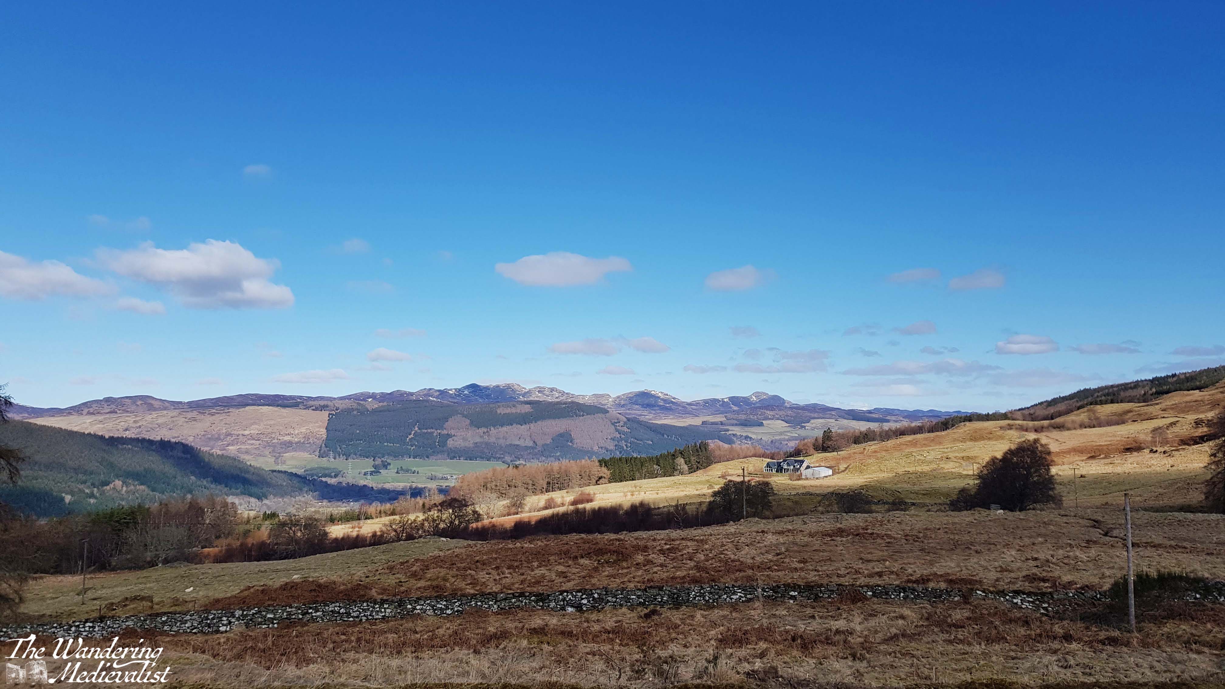
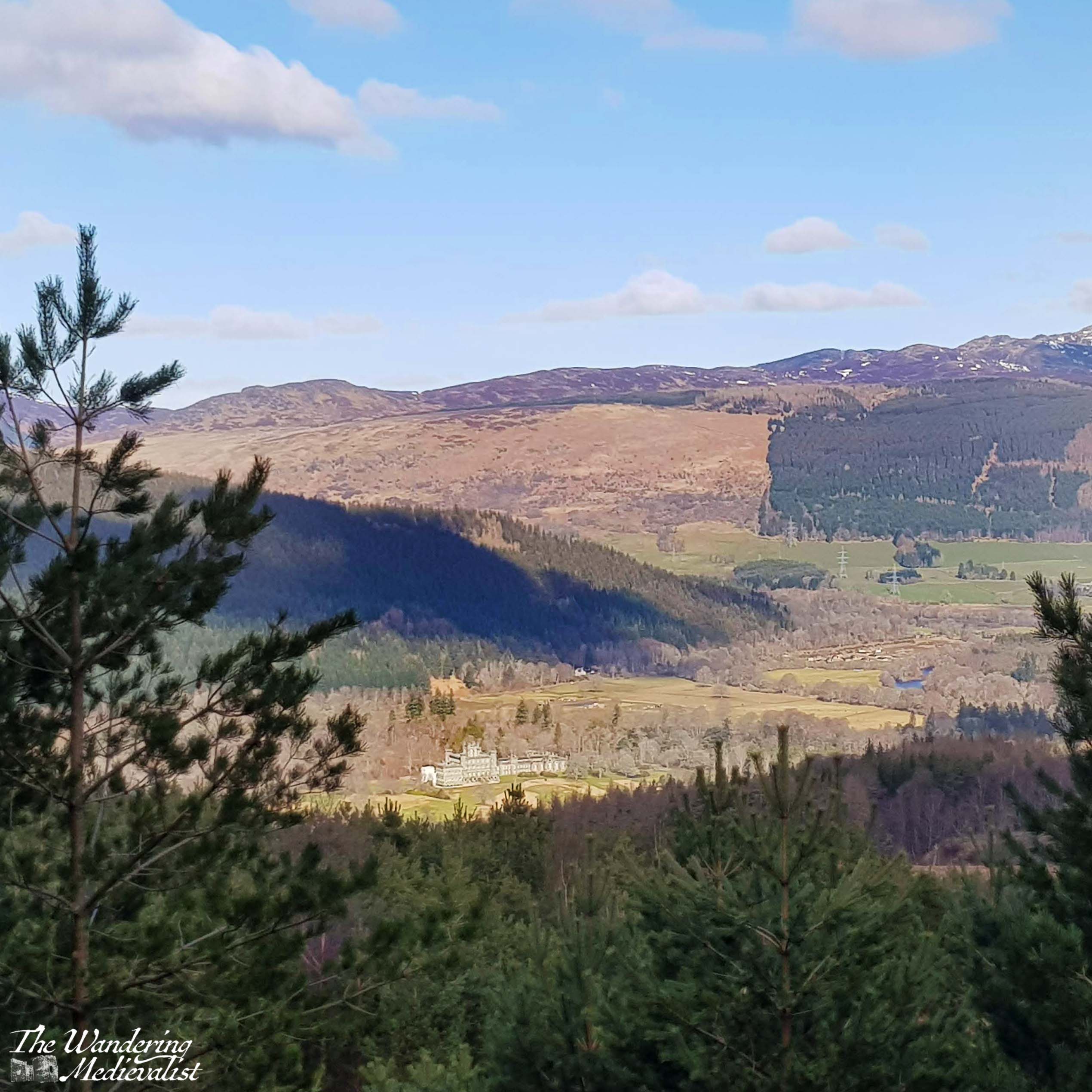
From the edge of the road we walked up through the car park and almost immediately enjoyed splendid views back over the valley, particularly down towards Taymouth Castle and estate.
The sign in the car park offered three routes, and the one most clearly described by Walkhighlands was the red route; all three started in roughly the same place so we headed upwards, beginning a steady climb up the hill on a path that reminded me of a ski path without snow – rocky and lined with trees.
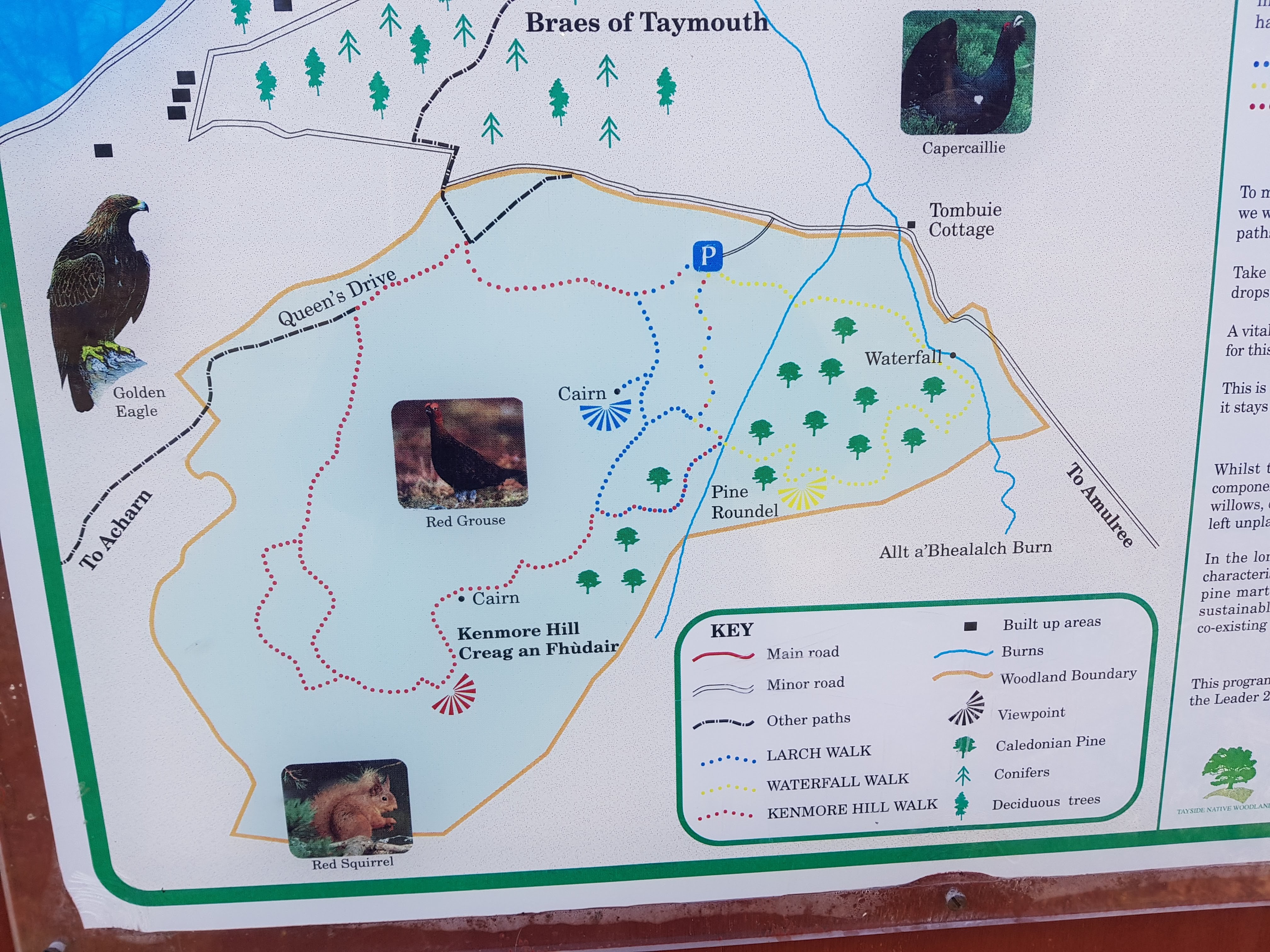
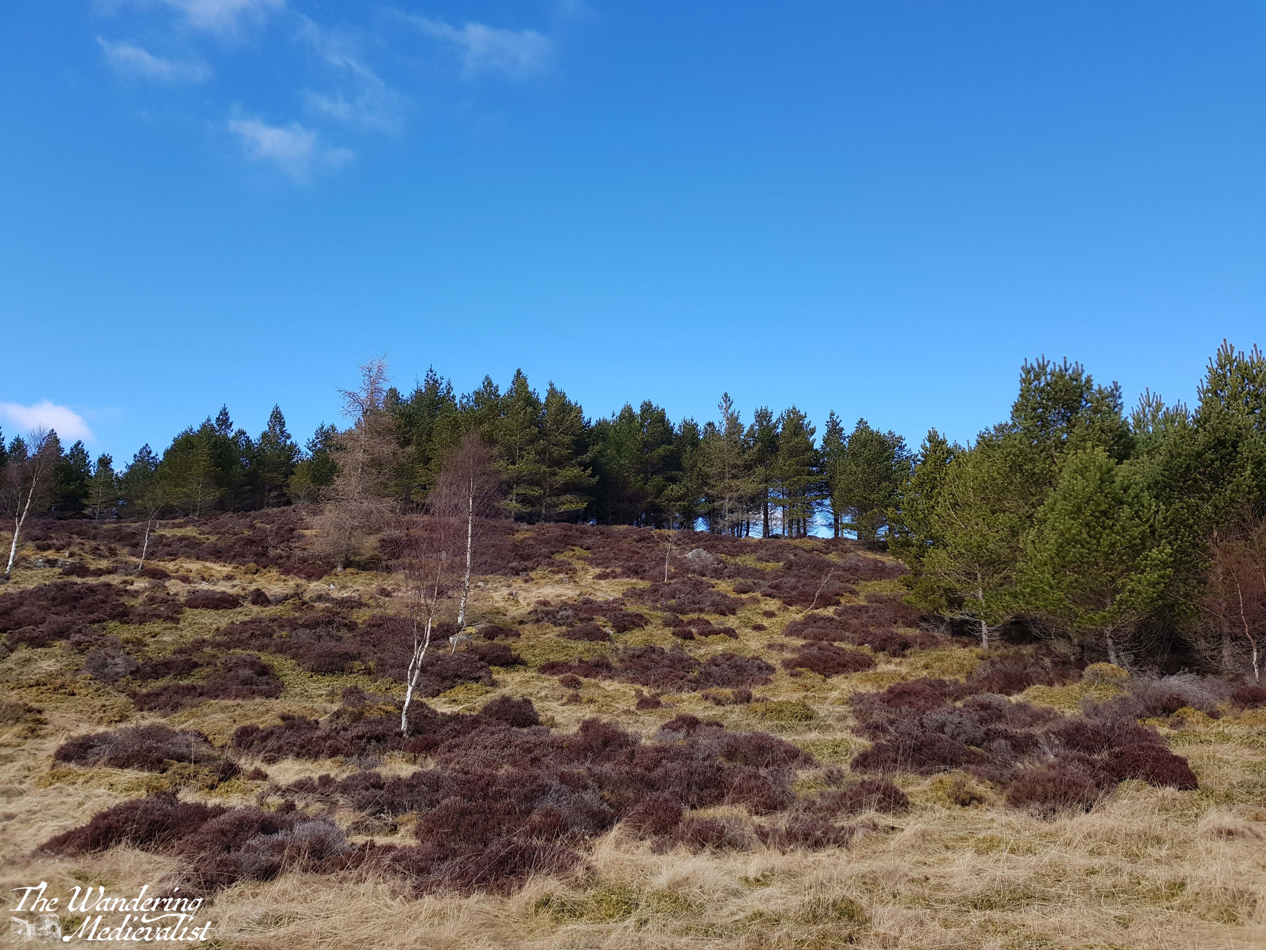
Eventually signs for the red path turned us right and we emerged from the trees, finding ourselves on a grassy area with a treeline on the ridge above and promises of views over the valley.
We were hampered a bit at this point by the fact that we had, the day before, done the Birks of Aberfeldy walk, which had been steeper and with more stairs than expected. The other half was suffering a bit with his knee from an old injury, and as we climbed up the hill towards the ridge – a relatively steep walk – he found it becoming more and more difficult.
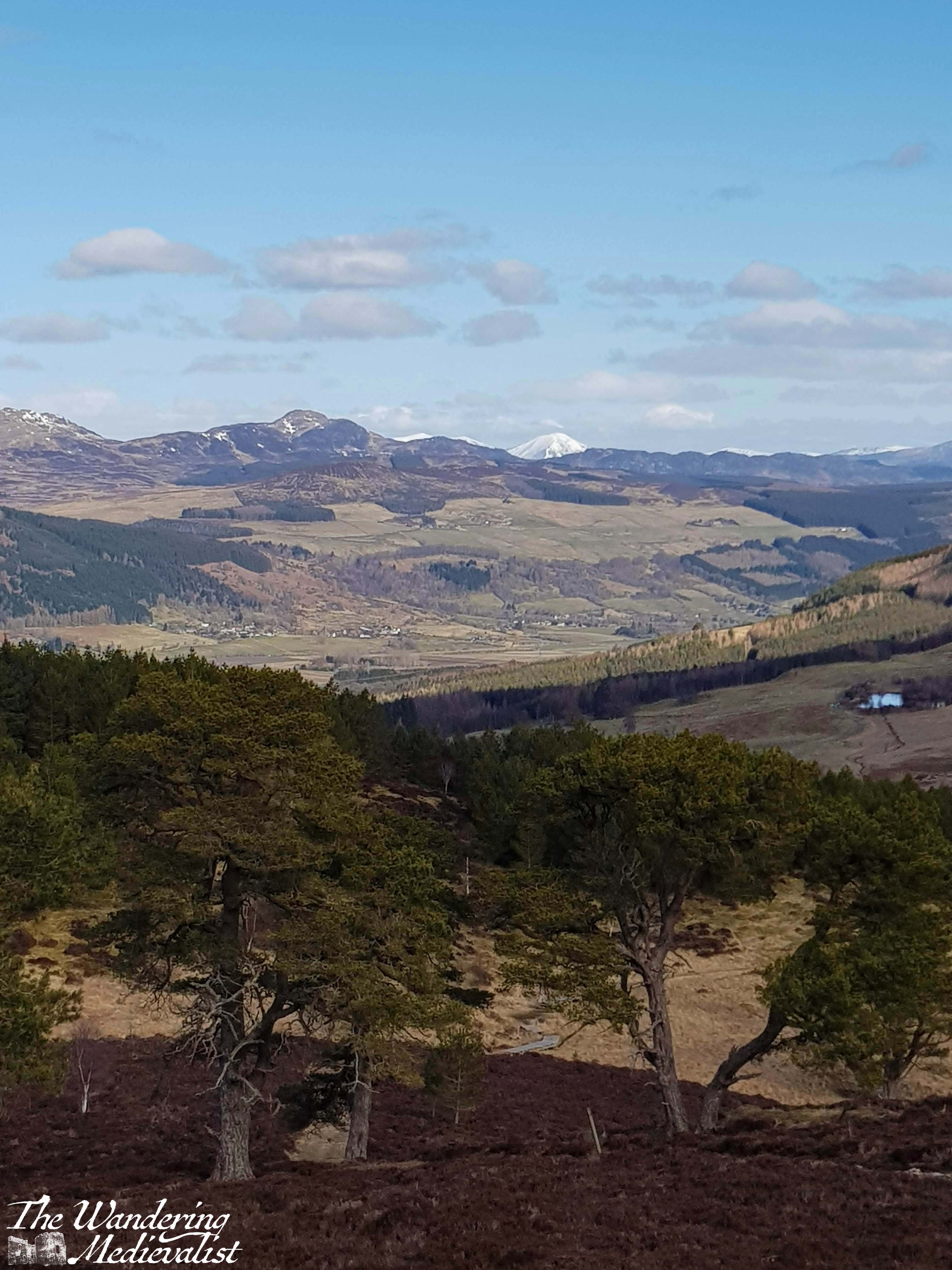
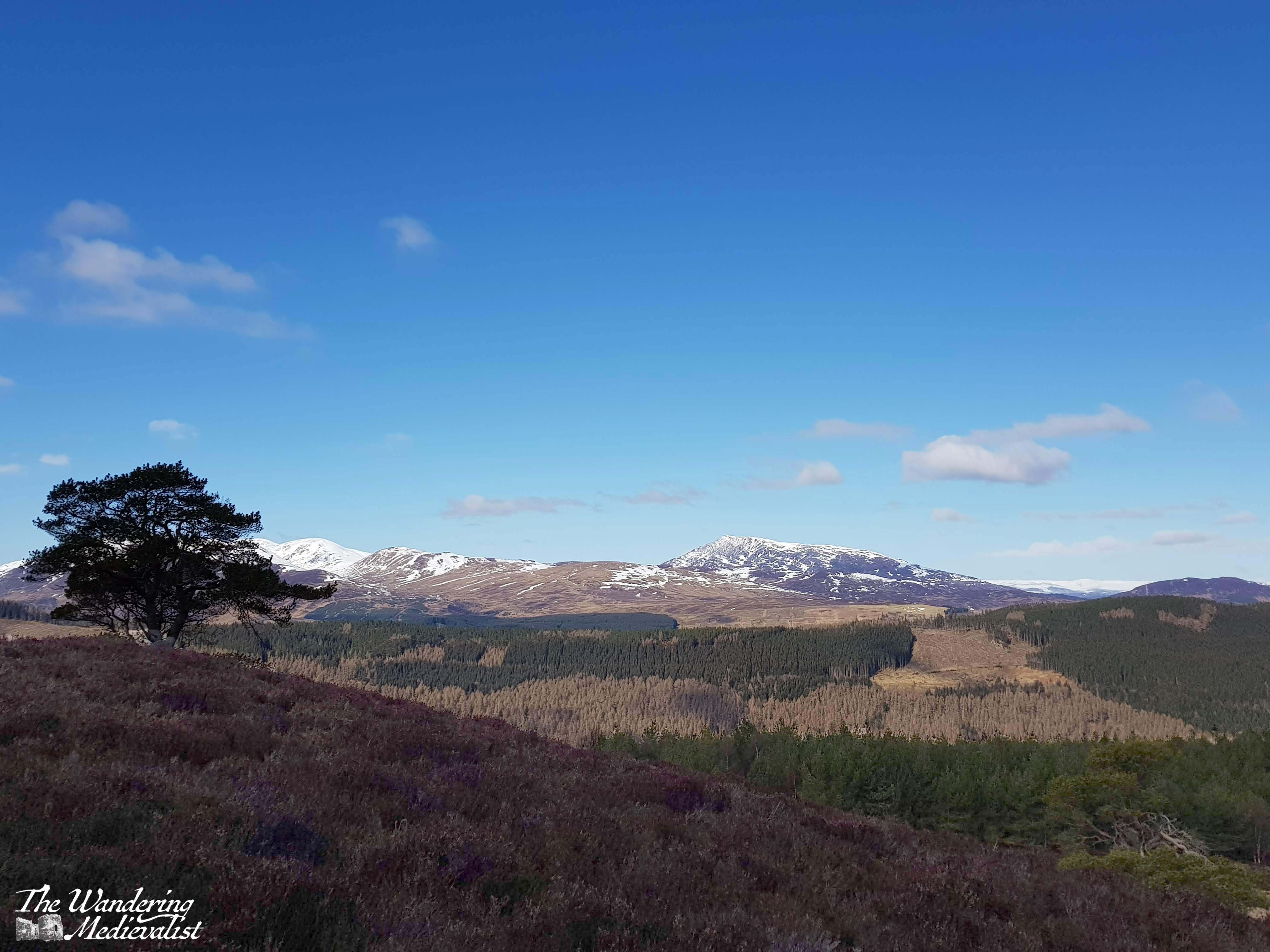
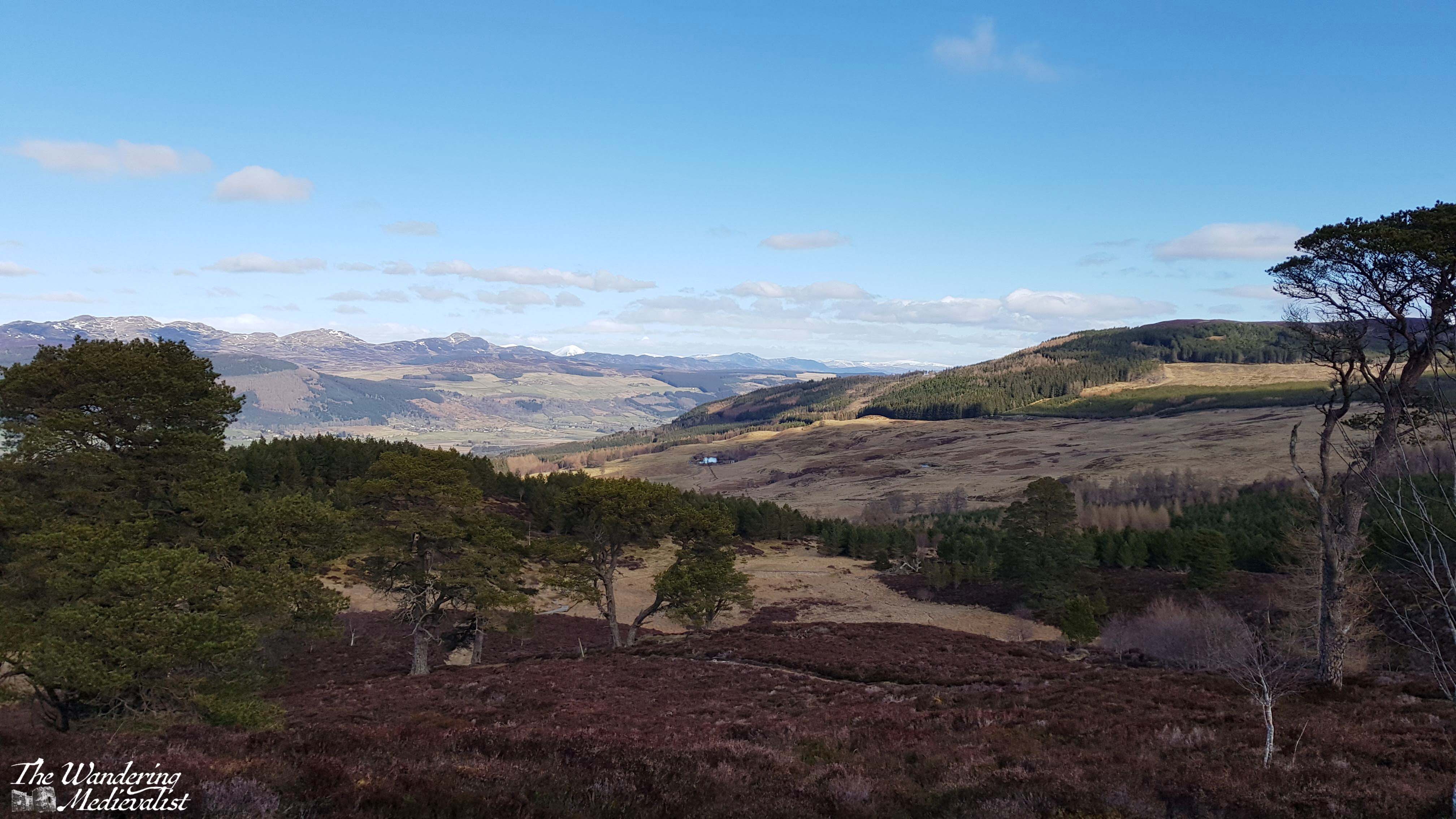
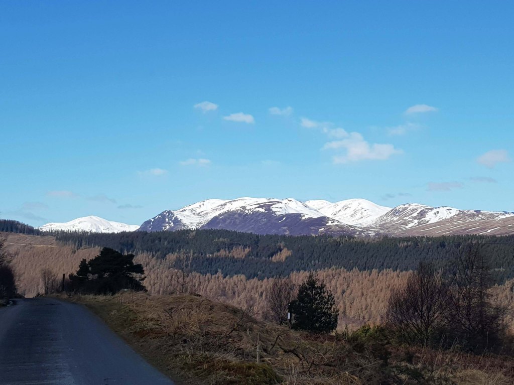
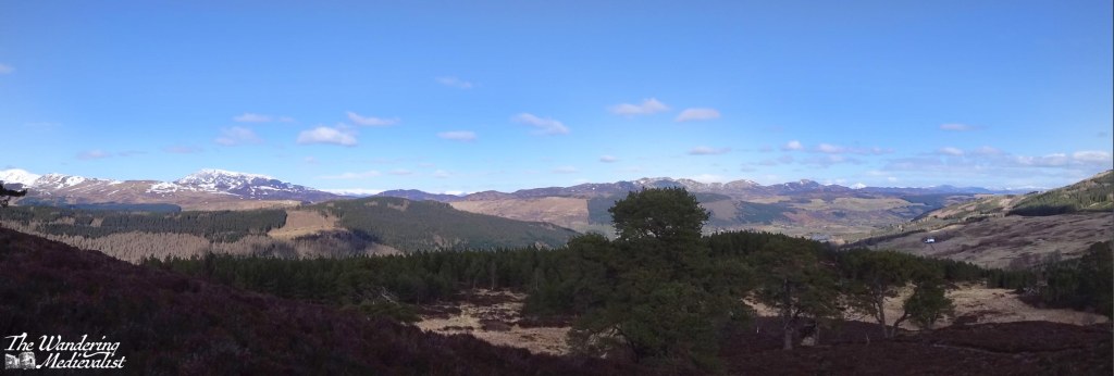
We reached the top of the ridge in time and the views were indeed spectacular – the snow-topped peaks in the distance stood out beautifully against the blue sky, and we planned to continue the red loop towards the final cairn, where I know you can see down towards the other end of Loch Tay.
The discovery that we had forgotten a knee brace meant that we really could not continue to potentially cause even more damage, and so we agreed to return to the blue loop, and follow it back to the car.
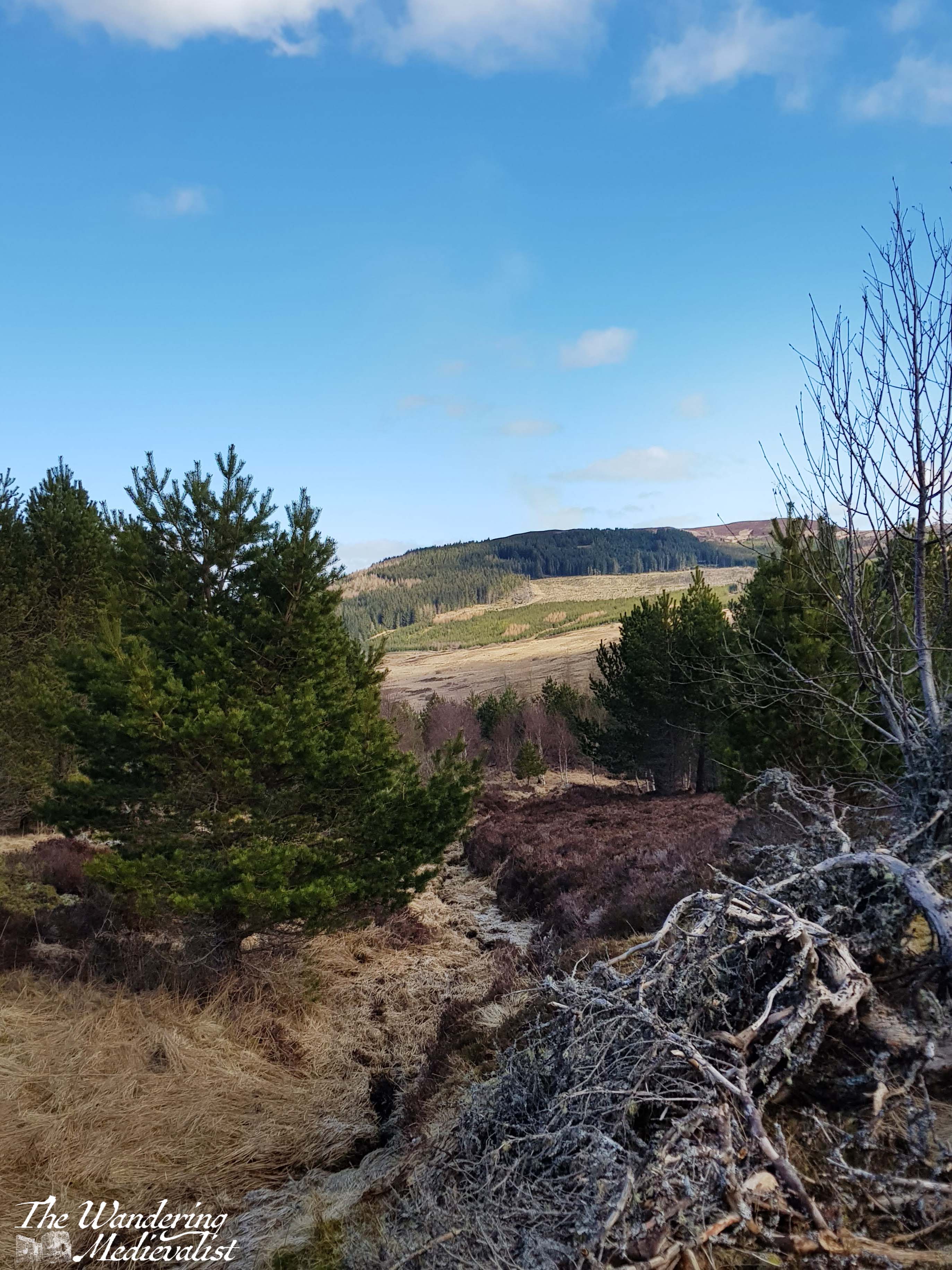
Here, of course, is where slight disaster struck. We did as planned, found the blue path and intended to allow a quick run up to the marked viewpoint. Instead, as we followed the blue markers and the gap in the trees, we gradually realised that we had not seen a marker in a while, and that any sign of a trail had vanished. Both of us are relatively experienced hill walkers who had been paying attention, and yet could not determine a place where we could have deviated from the trail; we had two versions of a map and the picture of the trail, but found ourselves completely lost. We back-tracked a bit, and still could not confidently identify a marker. Standing at one of the last clear points, we established where the path should be, and where the road was, and decided that as long as we headed down and towards the road, we would reach it eventually, as it loops around the hill.
What followed was a rather steep and haphazard descent through brush, heather, and the occasional small trickle of water. I would not normally condone leaving a trail like this as it can cause damage to the wildlife, but we really did not have much of an option. We decided the trail lost us as much as the other way around. It was similar to a hike I had once done with my father, when we realised a touch too late that the trail we were following was in fact a dry creek bed – on that day, like on Kenmore Hill, eventually common sense and perseverance (perhaps even stubbornness) won out and we found our way to a clearly marked path.
On Kenmore Hill, this ended up being the last loop of the red trail, though we still cannot work out we managed to get there. Relieved, we found our way back to the car park and our car, the beacon we had just made out from higher up. While it was certainly not the most comfortable climb, I have every intention of making my way back and completing the red loop at some point, as I have seen from other hikers that the views from the other side of the hill are spectacular. It also seems to be the perfect length of hike – about two hours, with enough climb to get some proper views and the heartrate up a touch. I also have hope that in the years since the pandemic, the path has been kept up and perhaps improved, though a peek at Google Maps indicates that the road to the car park may still be in questionable shape.
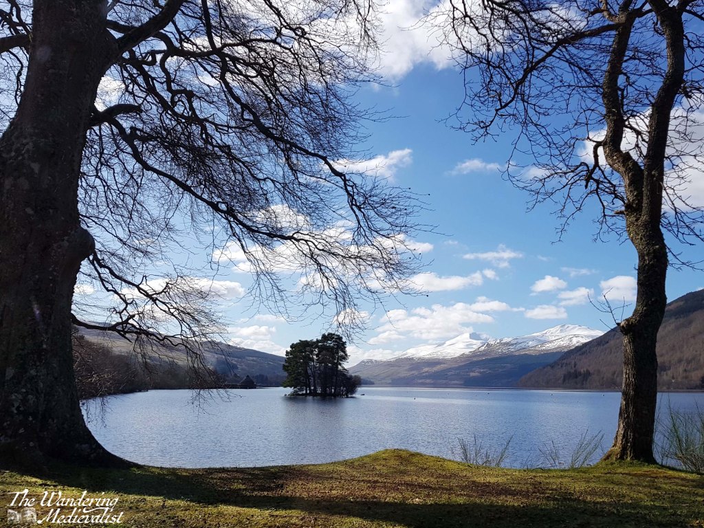
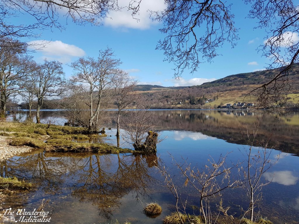
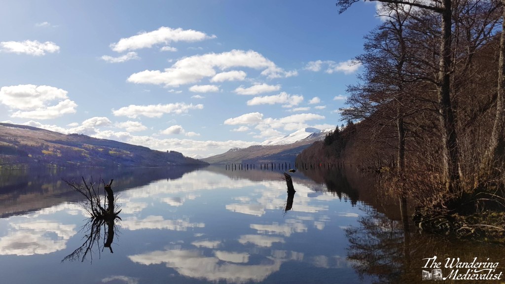
After our slightly chaotic hike, we decided to take a drive down the loch as it was a beautiful day, and below are a few of the pictures I took along the way; Loch Tay really is a beautiful spot and while the mountains are less dramatic than further north, they are no less impressive. We in fact drove all the way to Killin and stopped at an Inn by the Falls of Dochart – a post for another time.
I look forward to an opportunity to try to this hike again!

2 responses to “Kenmore Hill circuit”
[…] the lockdown began. As previously mentioned we were in Aberfeldy for a long weekend, and after a morning of hiking we decided to head down the loch for a […]
LikeLike
[…] Kenmore Hill circuit, which I have written about.A caveat to this walk is that the drive to get to the parking is […]
LikeLike