
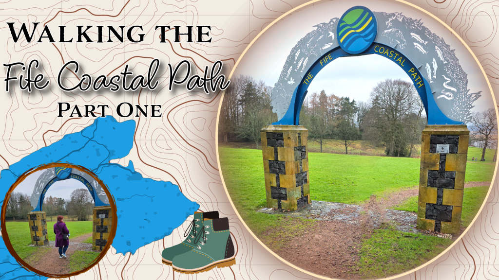
The other morning as the other half and I batted around options for where to walk, an idea came to me. It was born partly out of curiosity, partly inspiration, and partly the drive to become more fit this year: I want to walk the Fife Coastal Path.
Not, as some do, in a few days or as some endurance feat, but broken up into manageable chunks that will grow longer as I become more fit. I want to start with small bits and move up to the longer stretches. I know weather will prevent walking every weekend, I’ll be travelling, and there are plenty of things to hold me back, but the only one I’ll really disappoint should I not manage this is myself. There are some incredibly fit and determined people I know who have run the path, or walked it in a few days, but I’m not nearly ready to attempt that; so I’ll do it the way I know how.
Here goes.
Stats:
The Fife Coastal Path runs from Kincardine around the edge of Fife to Newburgh. A while ago a purchased a fold-out map which suggests large segments of the walk, but also includes every mile count along the way.
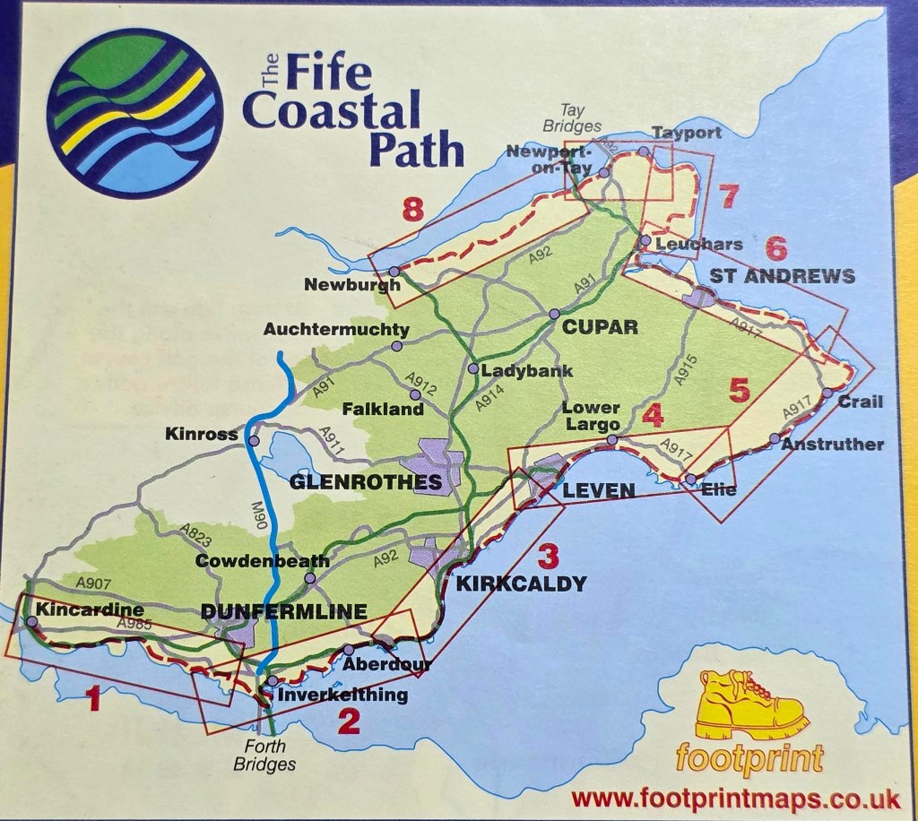
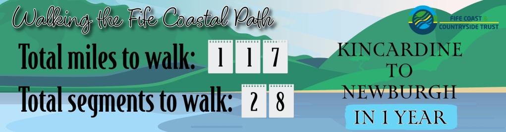
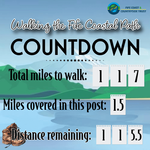
Using this mile count, I’ve divided the nearly 117 miles into roughly 28 segments of my own, of reasonable length – some short, 2-3 miles, and some quite a bit longer. A good portion of the path passes regularly through towns – especially along the south – but as the route curves up the east coast and along the north, the path segments get a bit, or a lot, longer. So I’m not going to do this in order, but I’ll start off with the shorter bits and attempt the longer ones when I feel more prepared and the weather is better.
I’ve also got some serious logistics to plan, assuming the other half will accompany me: how to we get to various points, and if we’re walking in one direction, how do we get back to our car? I foresee that public transport will be playing a massive role, and we’re lucky that transport in Fife is pretty good. There’s also the issue that the Kincardine end of the trail is a good 60 minute journey from here by car, so I’m not certain when that will happen. But happen it shall, especially as the days are growing steadily longer and brighter, it will be easier to take day trips.
Finally, naturally, I will of course be sharing my progress and documenting it along the way. I’ve got my countdown clock running, and I’m determined to get this done by 31 January 2026.
Here we go!
Part 1 – Newburgh
It was a grey, damp weekend, typical of many at this time of year, when it’s cold but not freezing and not quite raining but still muddy. So, I decided that it was time to start this trail at the beginning (or end, depending on how you view it). So, we braved the two sets of road works to drive to Newburgh, and park at one end of the coastal path.
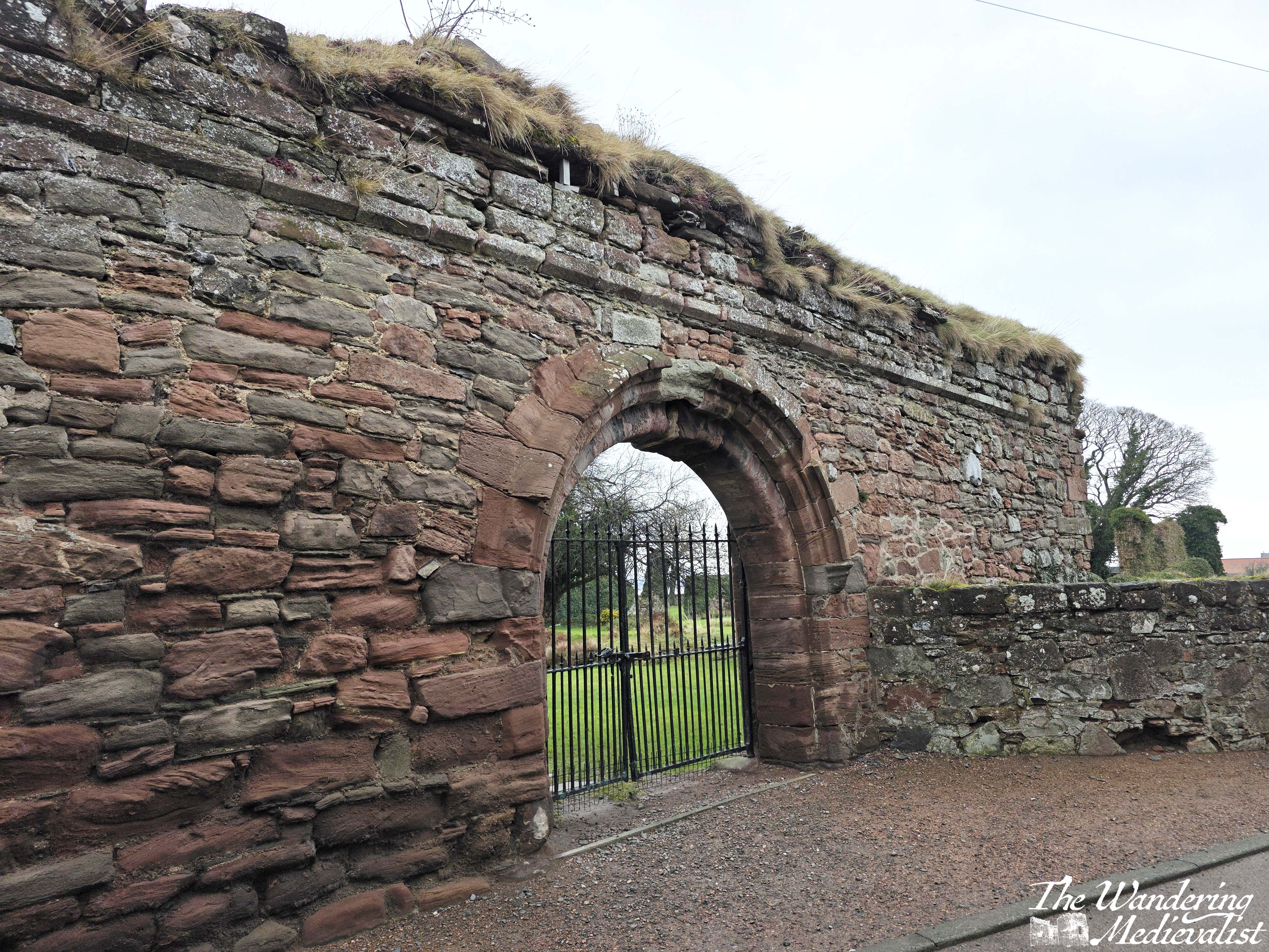
Newburgh is an old burgh, granted royal burgh status in 1266. It is less than two miles from the nearby Lindores Abbey, which is now in ruins next to the distillery – see later in the post. The town boasted several industries including fishing and the making of nets, linen, linoleum and oilskin fabric. It saw some growth after the Second World War, though most industries had closed down by the first part of this century. The high street offers a mix of Edwardian and Victorian structures – plus some far older – along with some newer blocks. There are a few shops and cafés; we stopped for a post-walk coffee and scone at Café de Kathy, which was quiet but made a good Americano.
The start of the Coastal Path is served by a good-sized car park and is marked (as you can see in these photos) by an arch which makes a good selfie spot. There is also a small plaque showing you the first 10 miles or so of the path – evidence of why I am not attempting much of the north-Fife portion first.
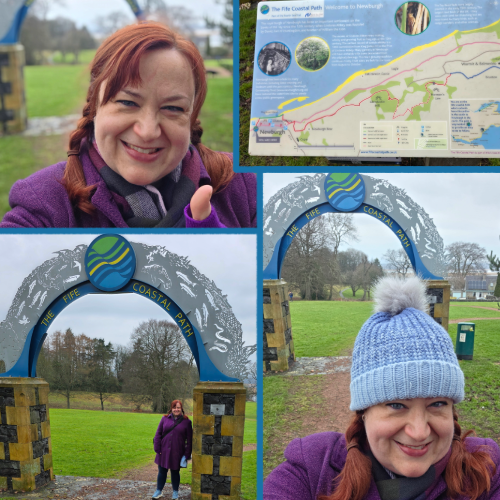
Around the arch is a lovely park with picnic benches and plenty of grass for animals and children to frolic (even in the wet there were dog-walkers a plenty). The well-kept path winds down through the park towards the distant Tay; resist any urge to turn right along the ridge, and eventually you will make your way gently down the slope and finally turn right along a play park, heading for a break in the stone wall. Beyond the wall is the village, but the Coastal Path is very well marked so easy to follow.
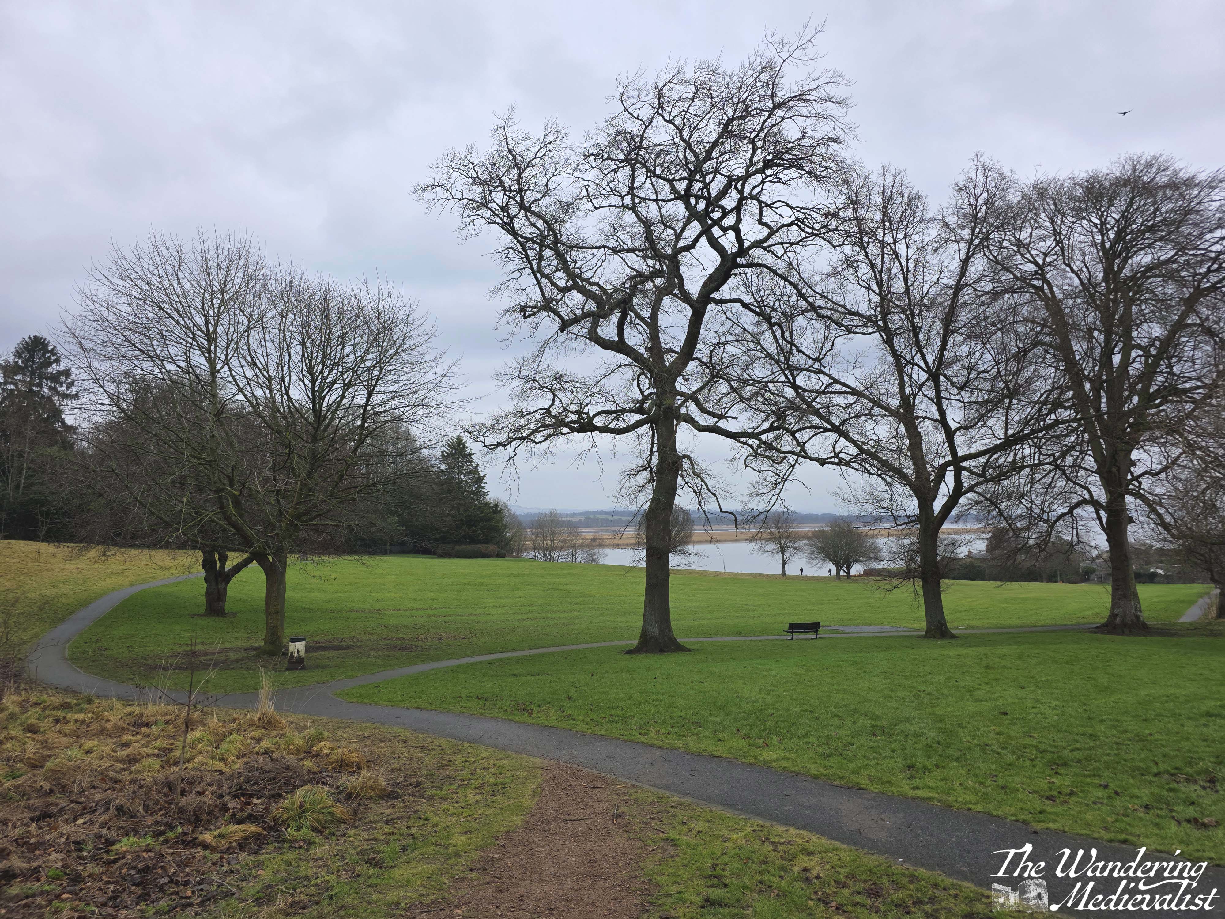
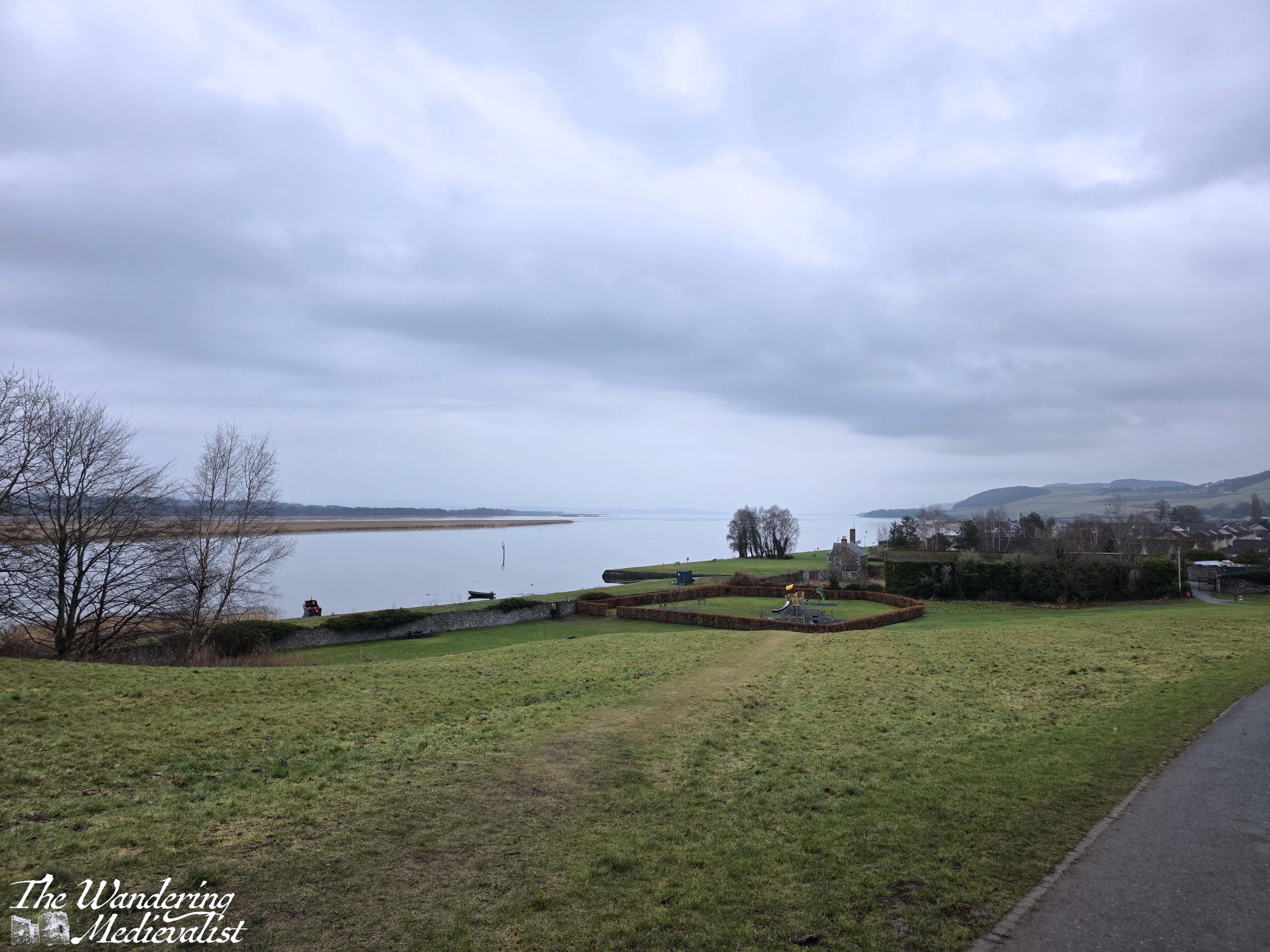
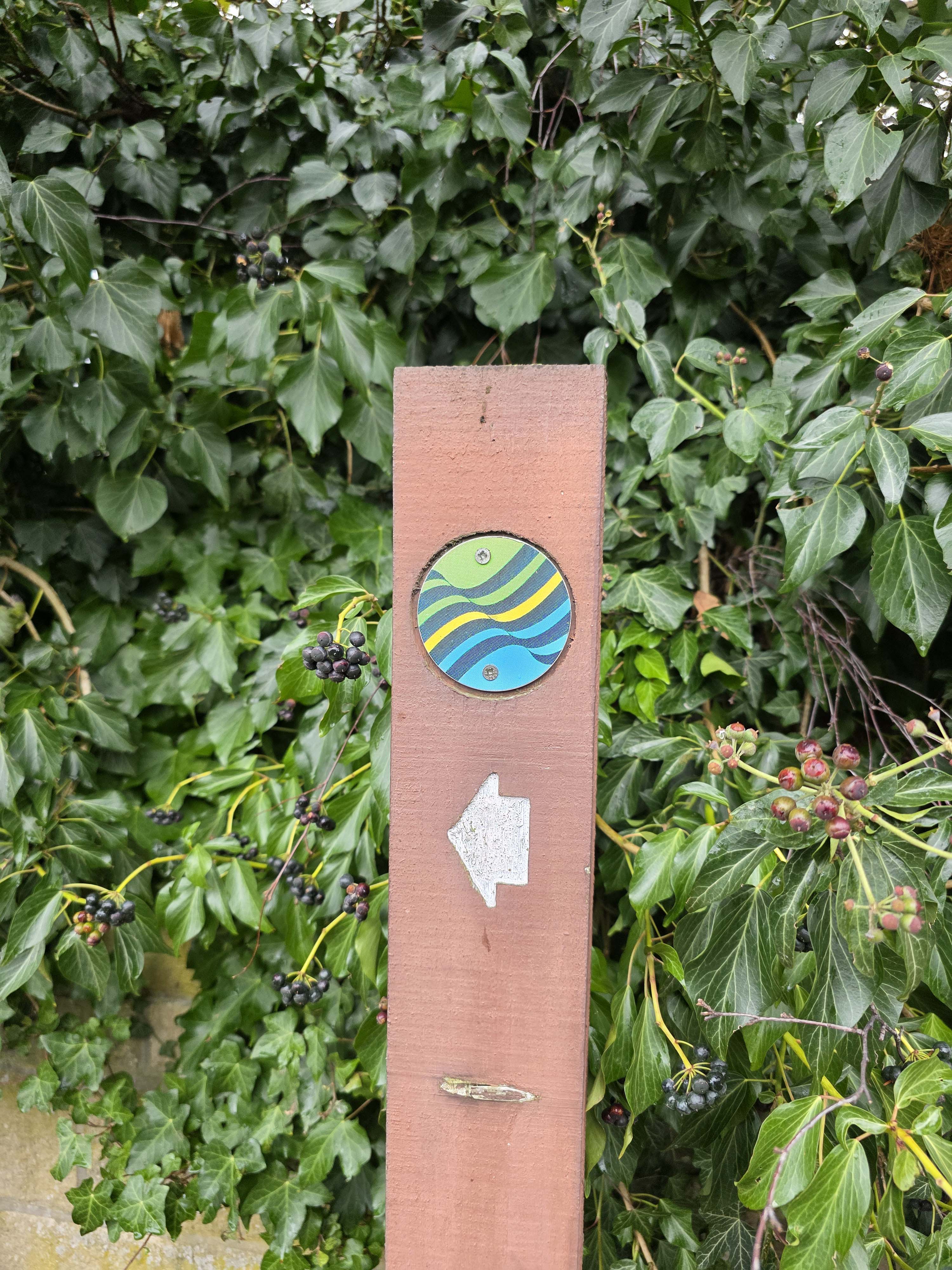
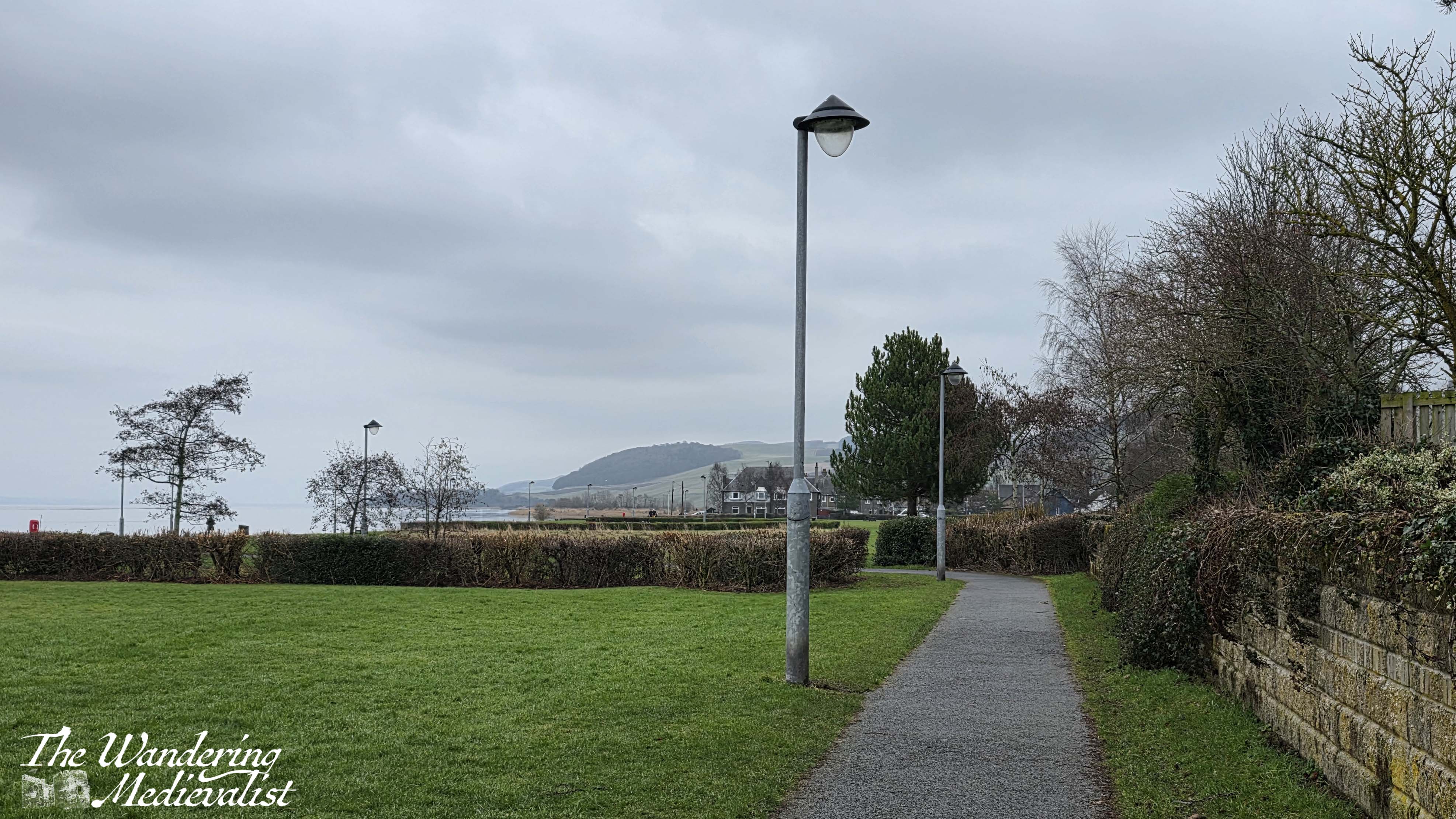
Go straight along the street and you will find a left-hand turn with a soon-to-be familiar arrow and coastal path logo. Once you reach the water’s edge, turn right and follow the path as it skirts the edge of the village between the houses and the River Tay. This is generally a quite easy portion of the walk – flat, well-kept, a bit muddy in places but clearly well-used. You will pass through several parks, and a number of different architecture styles including some newer post-war constructions, but many older 1800s-style Scottish dark grey stone houses that are familiar in most coastal towns. The view over the Tay can be very clear, and on the day we walked was almost as still as glass.
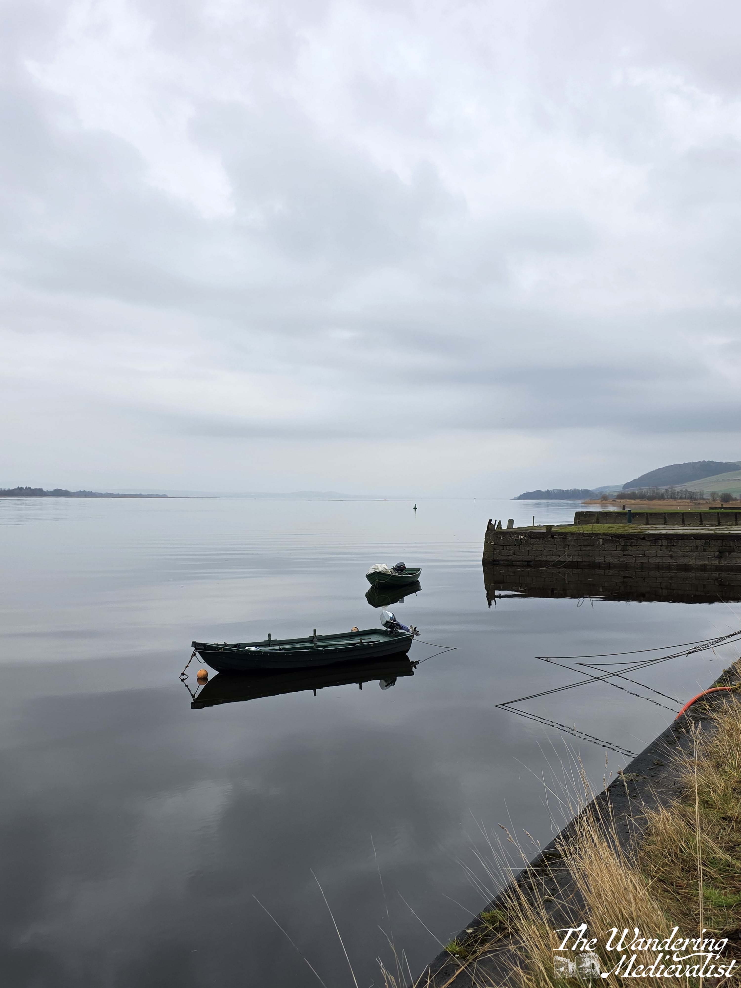

Small fishing boats and dinghies are tied to the small stone quays, and water fowl of various kinds swim in and out – mostly ducks and cormorants not scared away by the dogs.
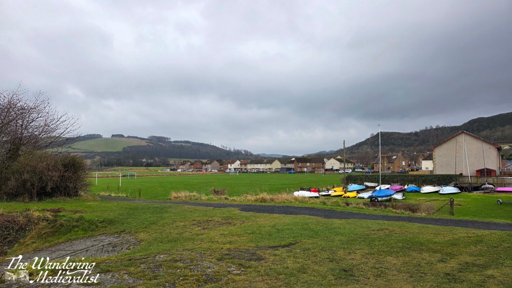
In about ten minutes you start to reach the far edge of the town, passing through another park. Ahead you will start to notice boats – a few catamarans and smaller sailing vessels – stored on the right-hand side of the path, as on the left you will soon pass the Newburgh Sailing club, a building that could easily be mistaken for a Coast Guard lookout.
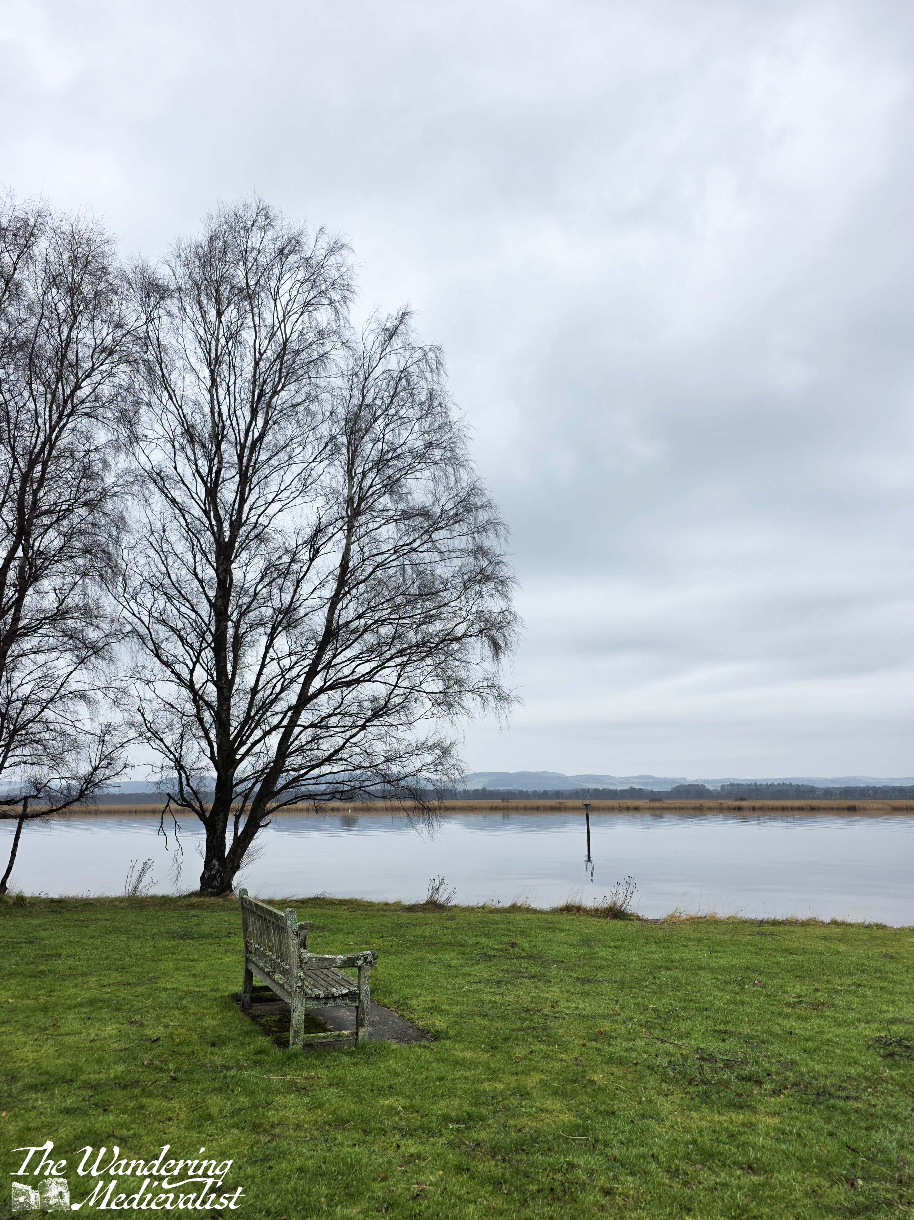
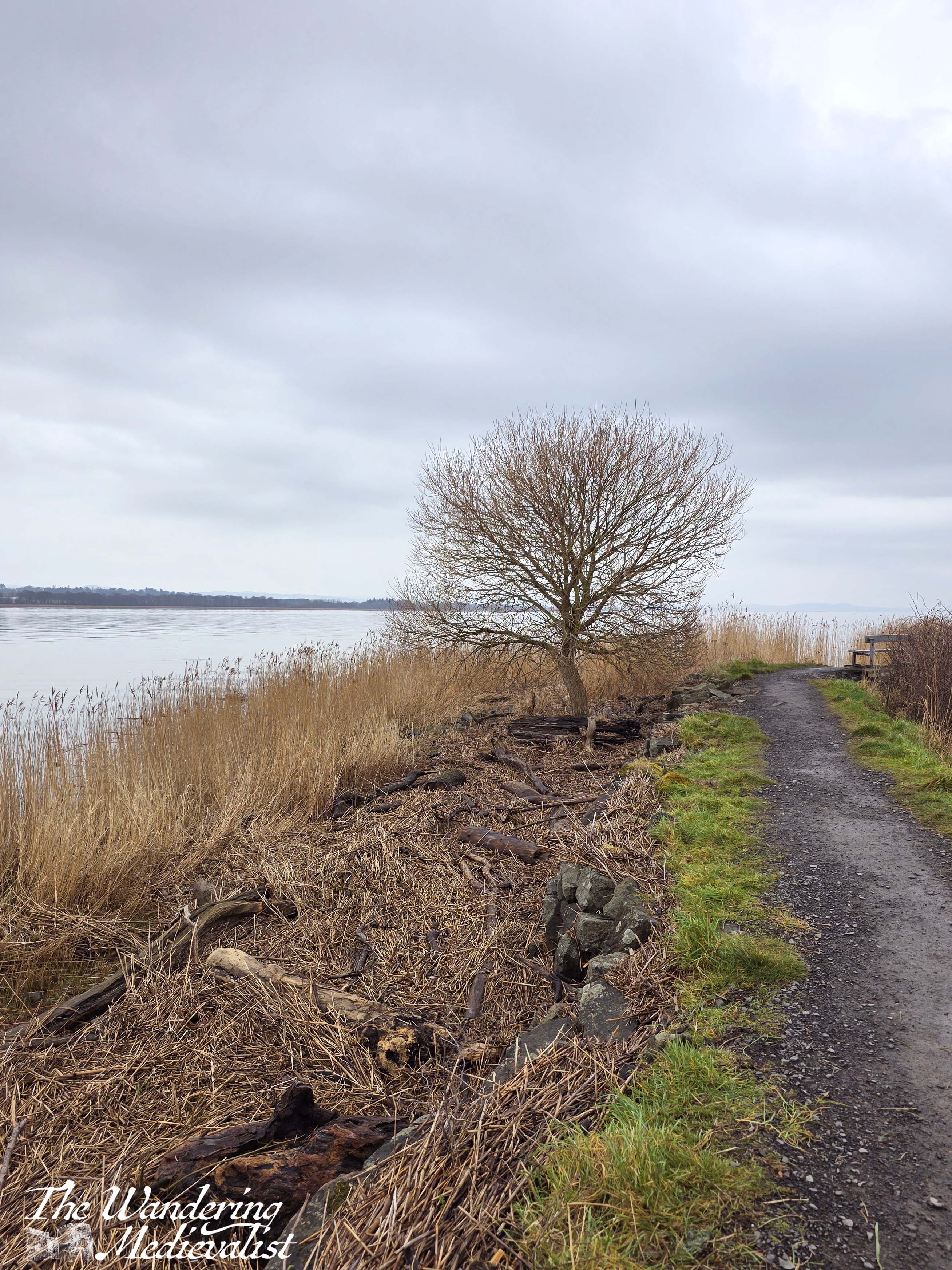
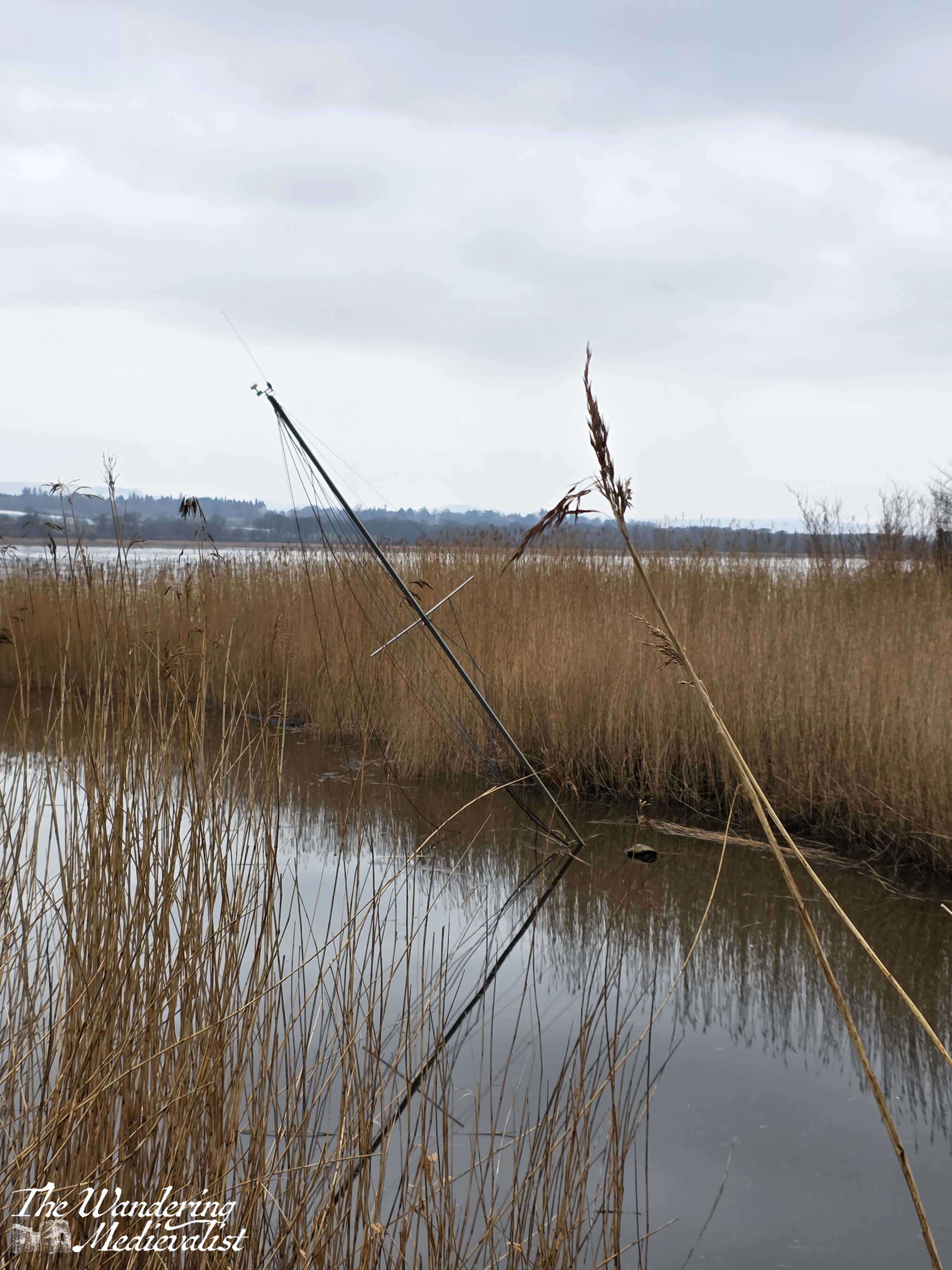
Soon after, you leave the town behind and find yourself with a field on one side, and tall reeds on the other, with water beyond. The path continues to be level and well-kept. Turning around, you are welcomed by a view back over the Tay towards Perth and distant hills.

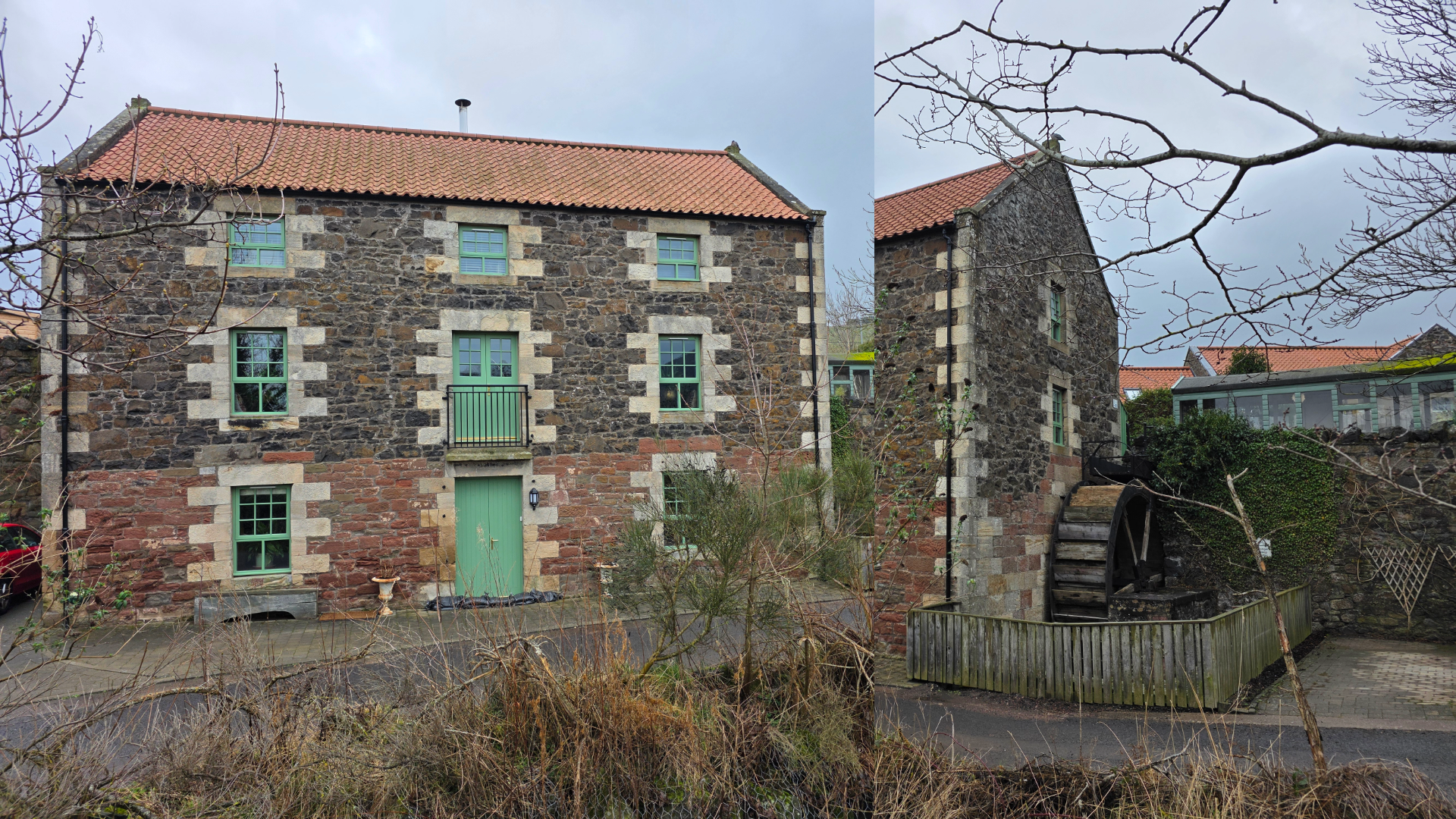
After about five minutes or so, the trail curves around to the right, heading inland along a gentle burn lined with reeds. We noticed a sadly sunken sailing dinghy not far from the edge of the river. Continuing inland, you will begin to notice a group of lovely steading houses peeking over the brush, all old stone with terraced gardens.

Presently a bridge appears, but the path clearly directs you not to cross but instead to continue towards the road ahead, passing the steading and a beautifully preserved old mill building.
At this point you will meet the road, with the coastal path heading off to the left. This is about 1.4 miles from the starting arch, and here you can either continue on your way or, if you are feeling less energetic, you can turn right and head back into Newburgh to complete a loop.
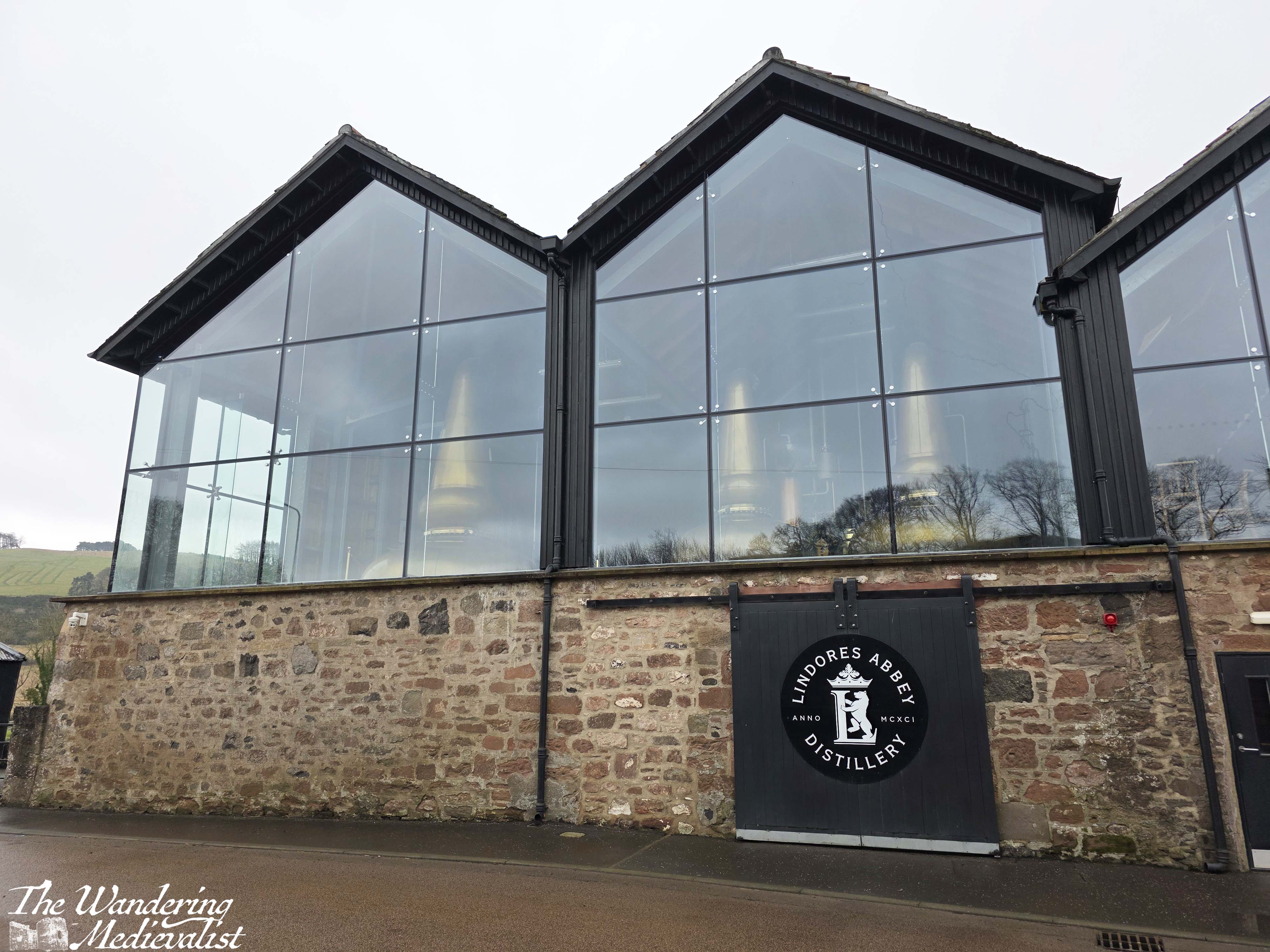
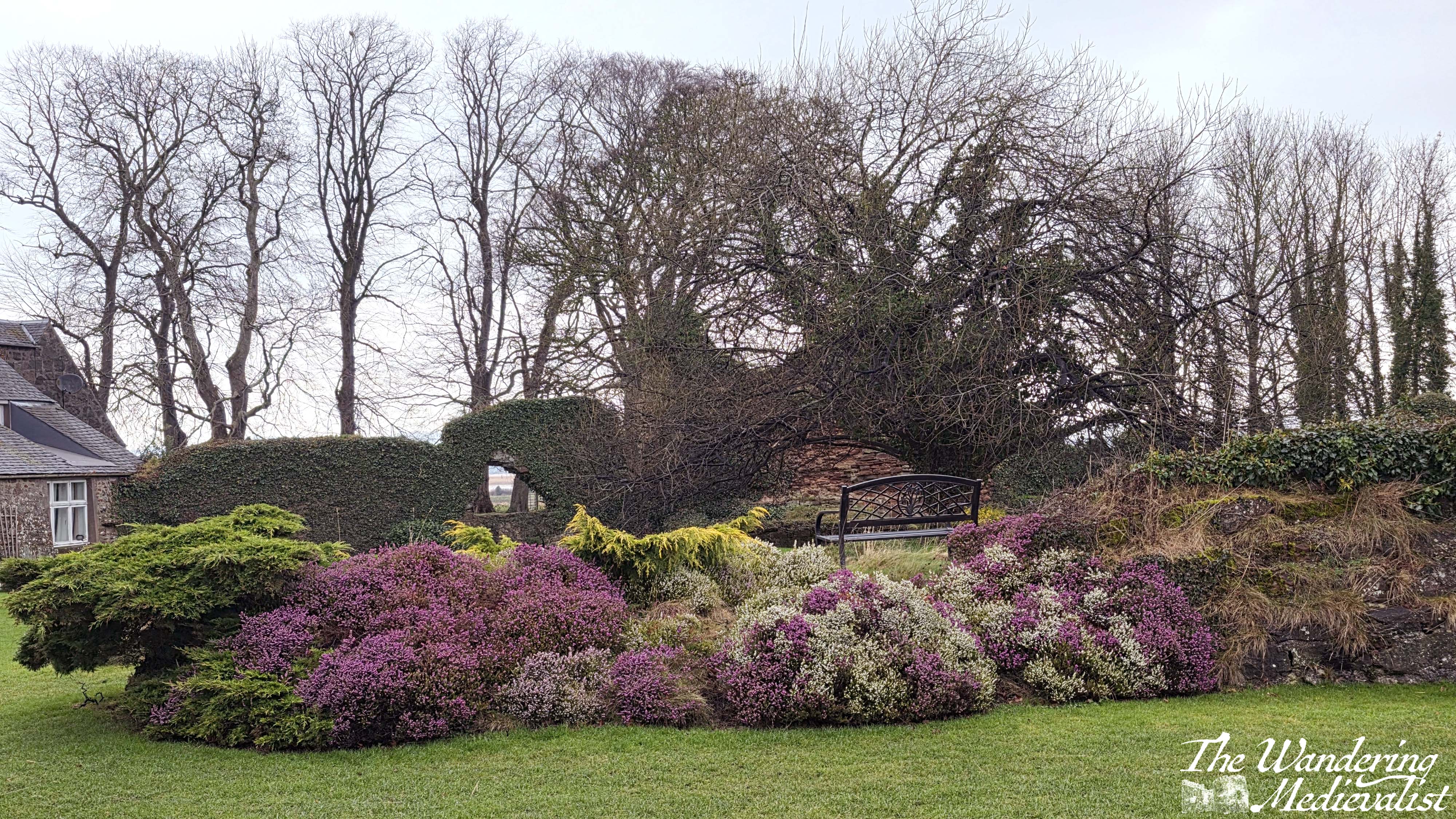
The dreary weather and a few niggling pains drove us in that direction this weekend – the aptly named Abbey Road takes you past the ruins of Lindores Abbey (I must return here in better weather) and the Lindores Abbey Distillery, immediately across the street (this appears to have a very nice-looking visitor centre, but was not open).

From here it only remains to join the high street and make your way past the shops and interesting mix of houses, including a beautiful old inn (Abbey Inn).

This whole loop is about 2.5 miles, quite gentle and easy-going. It was the perfect start to my Fife Coastal Path adventure – I am excited to try again next weekend (weather permitting – so far this week is appalling).
I’ll keep you up to date!

2 responses to “My ambition – the Fife Coastal Path”
The Fife Coastal Path is one of my long distance walking ambitions. I’ll keep a lookout for your posts. Good luck with the weather!
LikeLiked by 1 person
Thank you! Fingers crossed for this weekend 😄
LikeLiked by 1 person