It was another cold grey windy weekend, but I was determined not to let that stop me from checking off even a small segment of my walk.
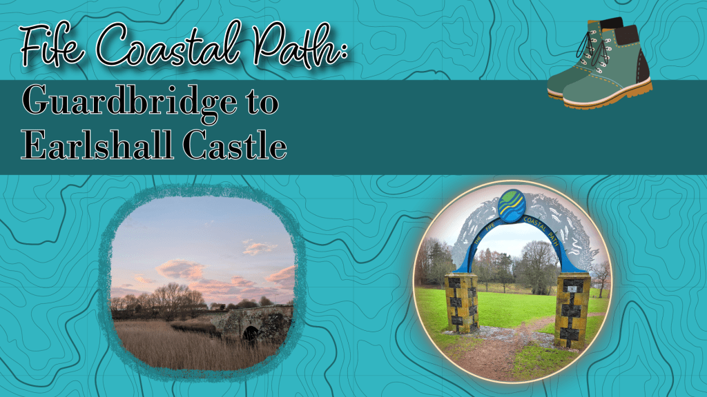
So, I took to the maps and planned a loop that started at the north end of Guardbridge at the more northerly of the two bridges – the first if you are coming from Dundee, the second if from St Andrews.
Conveniently there is a bus stop right there, allowing for easy access from either direction (it’s on the Stagecoach bus 99 route which runs frequently, even on a Sunday).
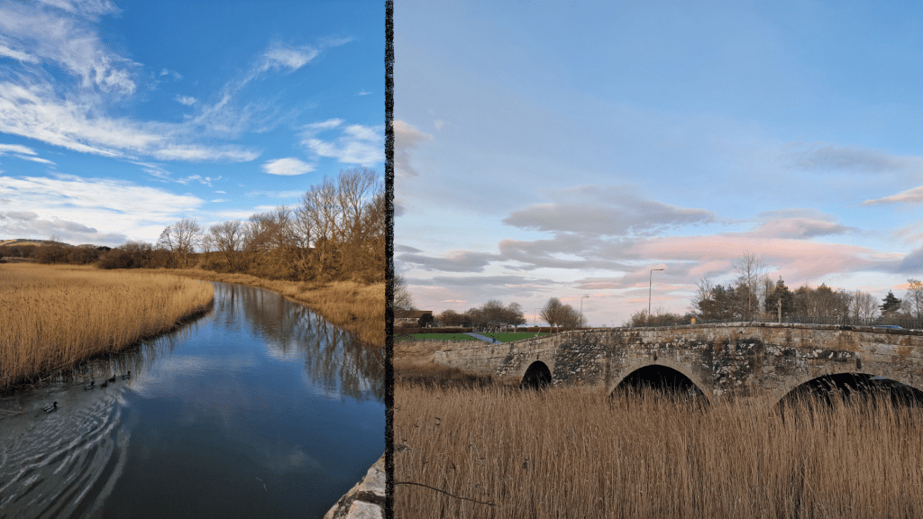
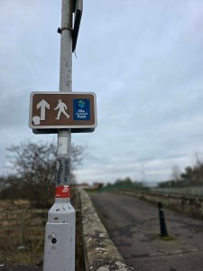
This chunk of the coastal path begins crossing the old rail bridge, which is now pedestrianised, being too narrow for two lanes of road traffic. It is one of my favourite places to stop to see the view, watch the water fowl, and see the moon rise.
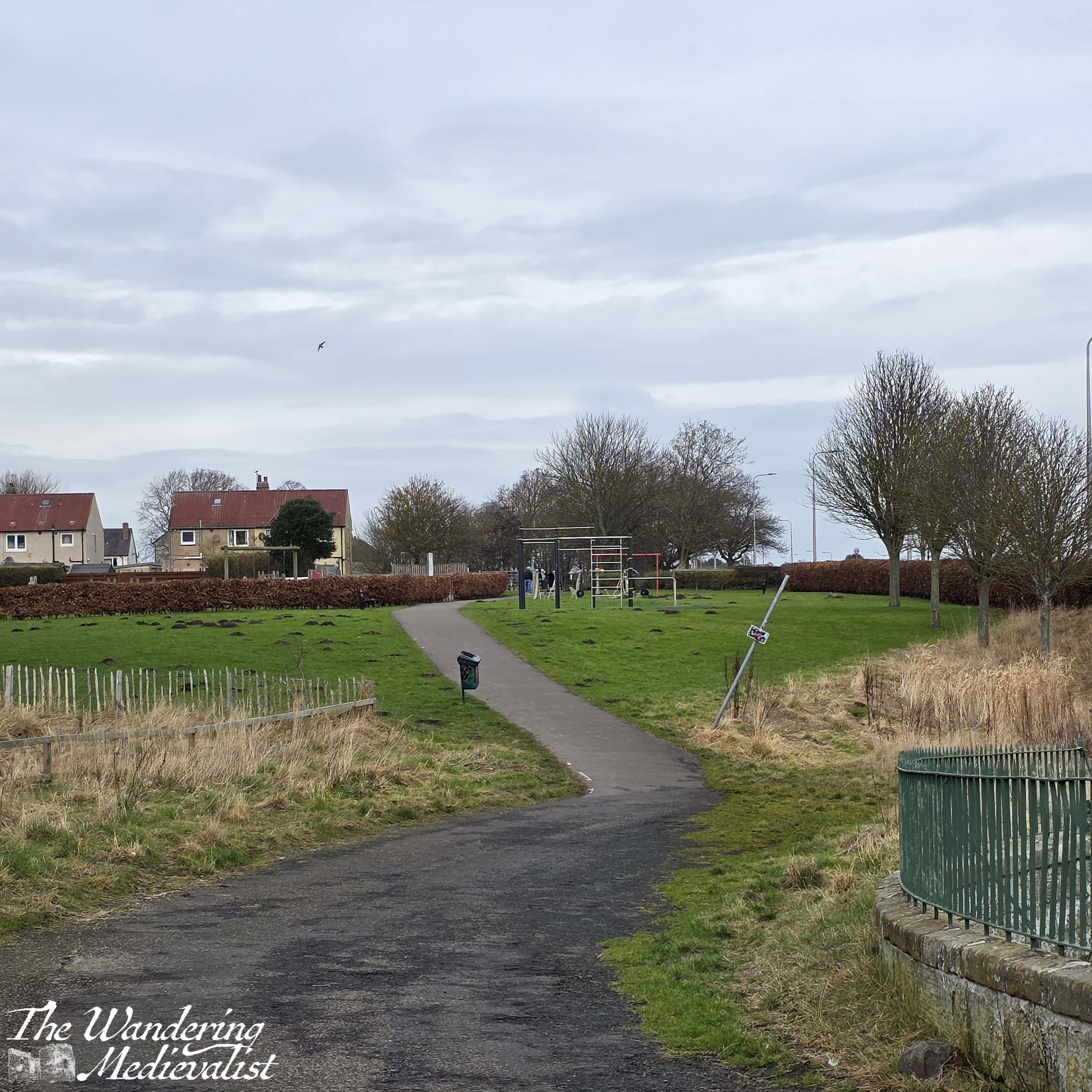
Crossing the bridge, the path then leads up a gentle hill and between a playing field and play park on one side, and a relatively new collection of outdoor exercise equipment on the other. Walkers should follow the pavement as it arrives at a small housing estate, with a road turning off to the left. The path skirts the edge of a grassy, treed area to the right, and then presently emerges on the far side of the estate, meeting up with the Toll Road.
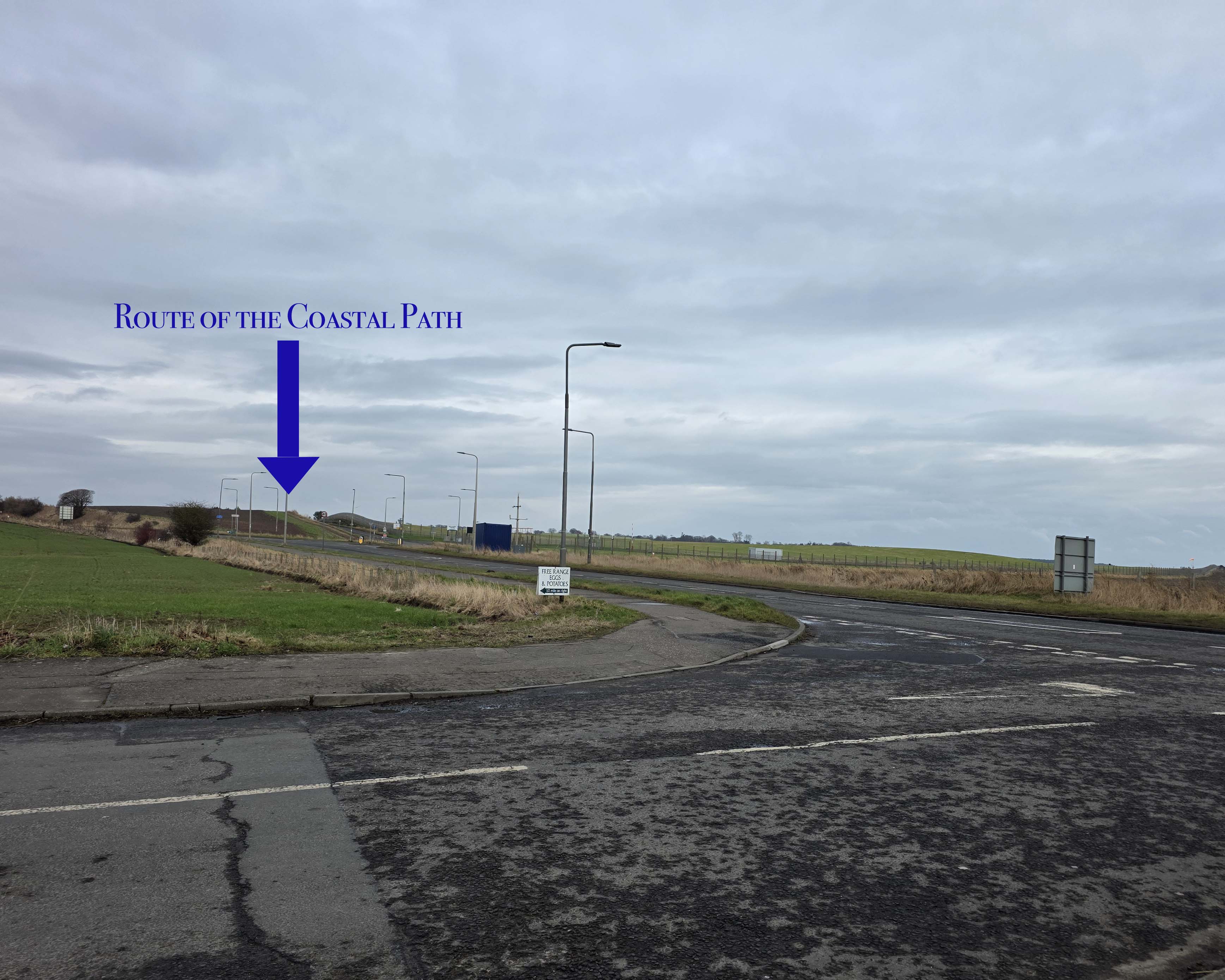
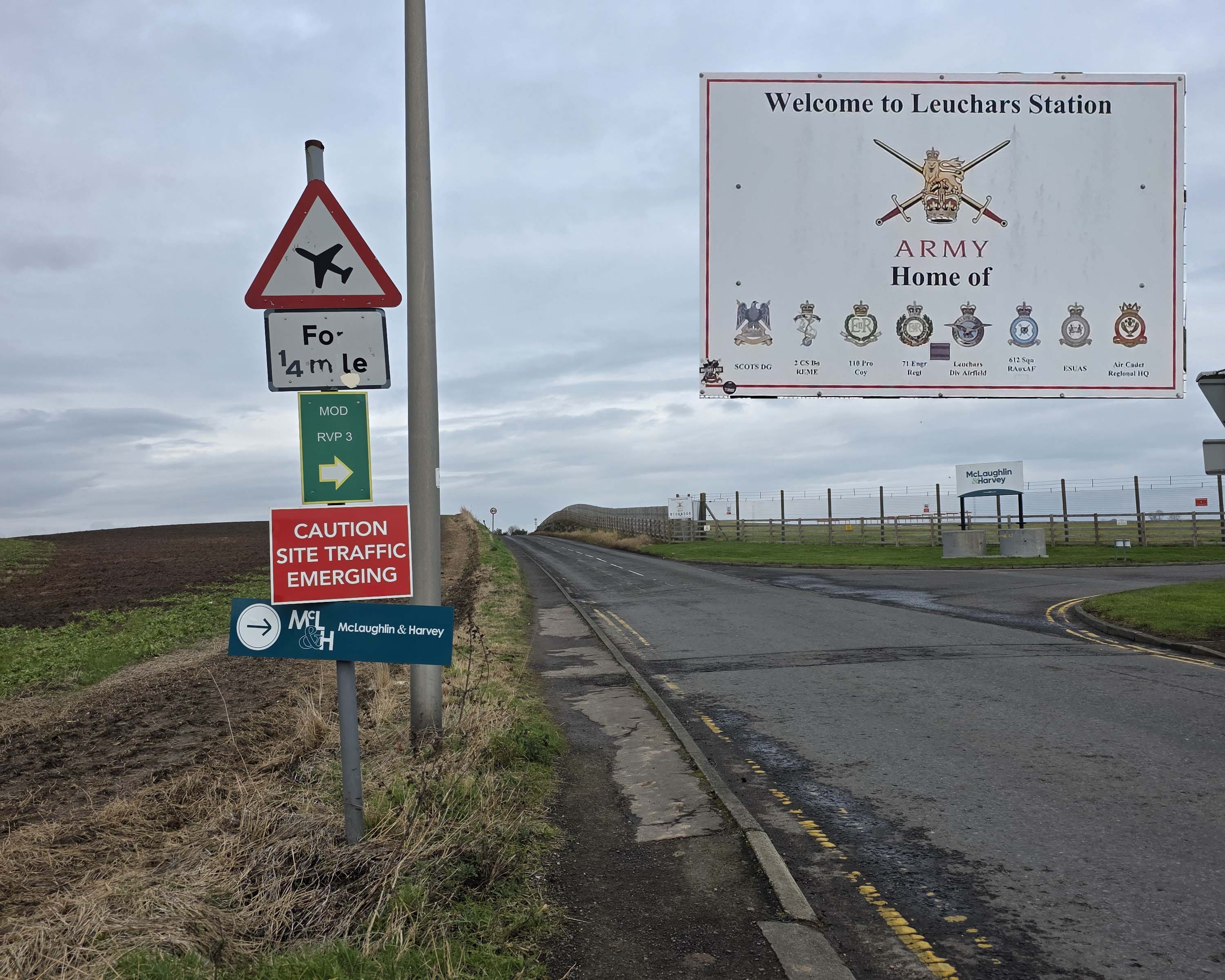
Here, walkers should cross the Toll Road and continue along the Main Street (the A919). In only a few hundred meters, there is a dip in the curb that encourages crossing towards Leuchars Air base. When I first came to St Andrews many years ago, this was run by the RAF, though it has since shifted to the Army. There are still relatively regular manoeuvres practiced here, and the runway serves both the military and, occasionally, a private jet of someone visiting nearby St Andrews. Pictures are not permitted, but walkers can certainly look in through the fence at the runway – follow the signs as the path leads up another gentle hill. One caveat is that the path is narrow here and the cars on this portion of the road tend to go by quickly.
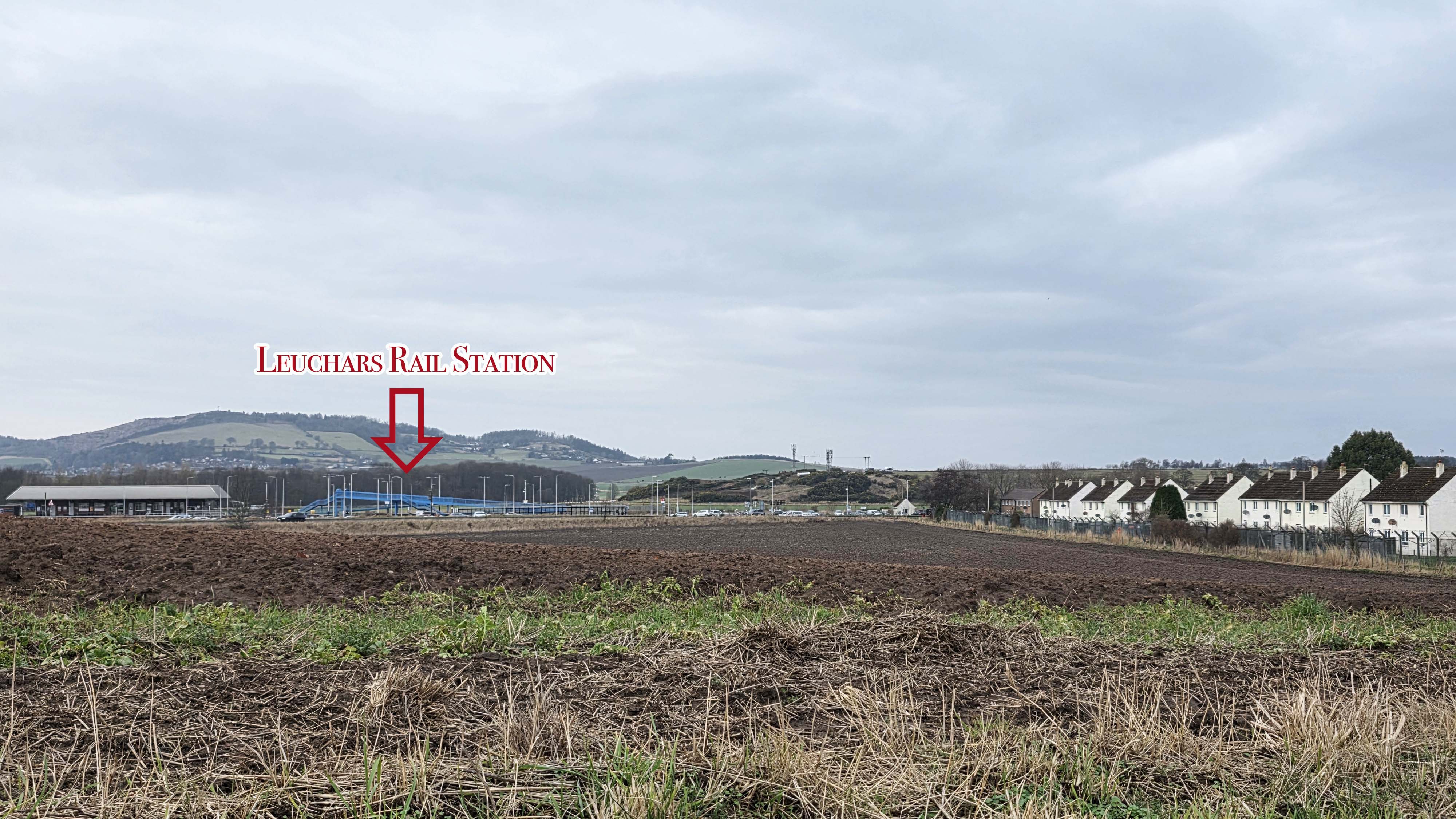
Cresting the hill, walkers can look ahead at the many houses and out-buildings of the base, with the road lined by tall fences topped with barbed wire, a touch imposing. Off to the left, across the field, you can just catch sight of Leuchars Rail Station, the primary rail station for St Andrews and the surrounding area.
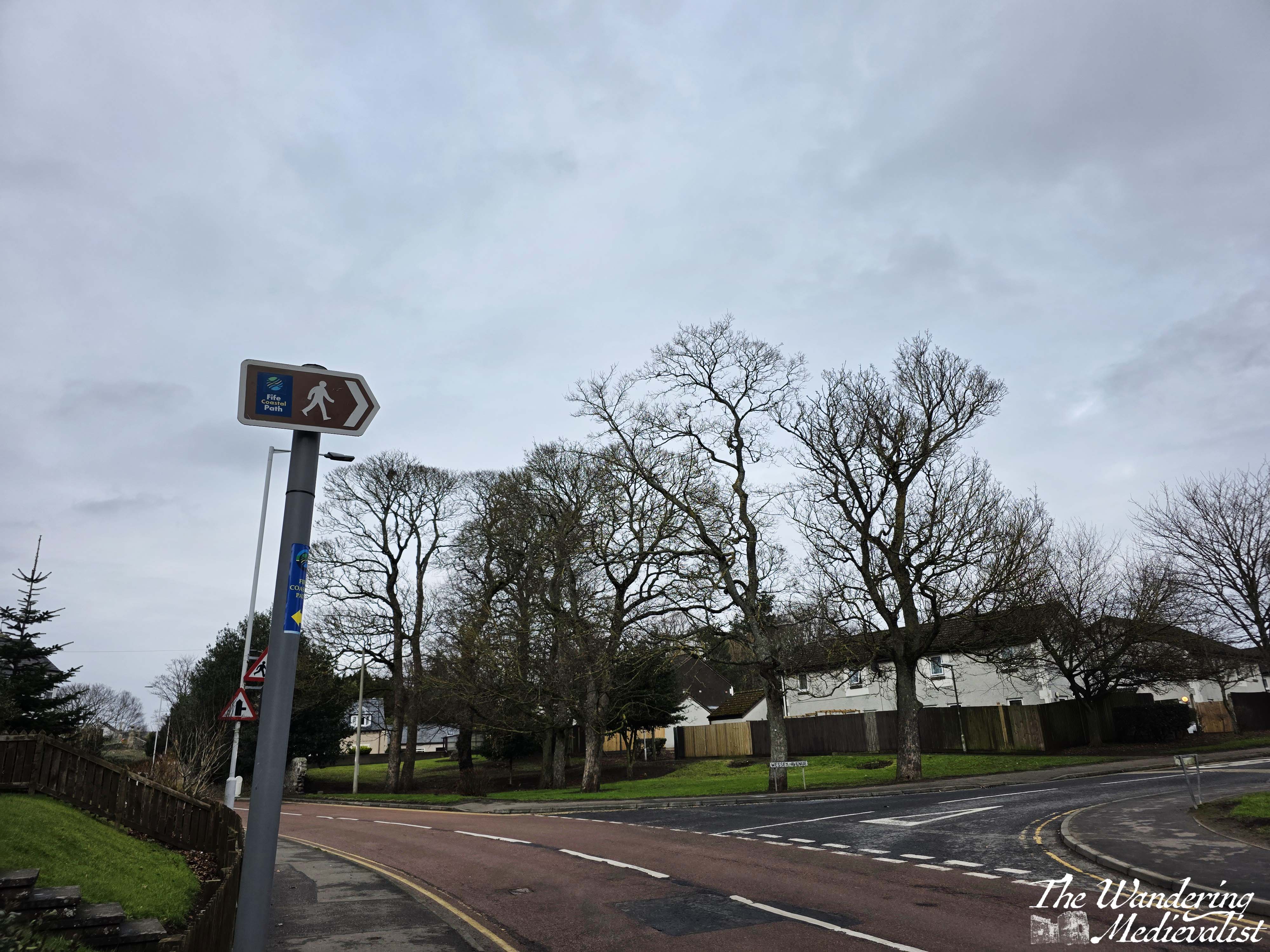
The walk through the base takes around five minutes, until eventually the path reaches the main guard station and close beyond the turning circle where there is a bus shelter. Beyond this point, the town begins, evident by houses with a bit more personality than those built by the military. There is a sign for the coastal path turning right along Wessex Avenue, though before the turn, directly ahead is the unmistakable tower of St Athernase, a medieval parish church.
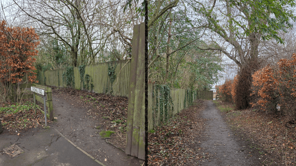
Wessex Avenue winds through a housing estate and eventually meets Earlshall Road, which can also be picked up directly next to the church above; taking the marked route however allows a safe walk with a sidewalk for most of the distance. At the junction of Earlshall road, there is almost immediately an option to stray off the main road and down a side-path:
This path leads to a wide playing field, and a muddy track along the side of the grassy pitches.
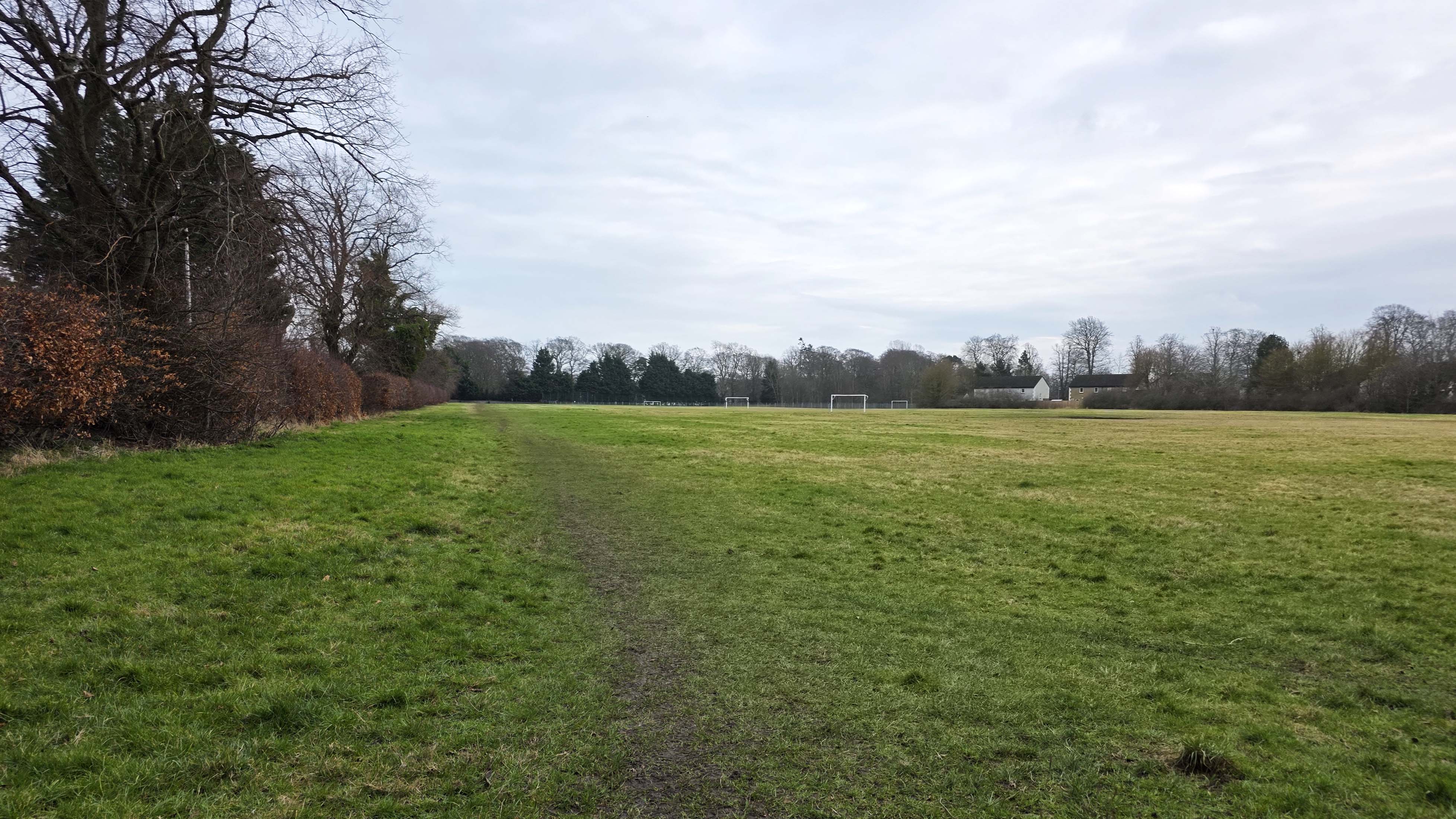

The incentive for using the field is evident when peeking through the hedgerow – Earlshall Road is narrow with an even narrower verge to scamper onto should a car come along. In very little time, a stone wall appears at the far side of the field, and this is the aim for this section, as on the other side of this wall is the castle estate. Though there is no obvious signage, the field’s end means there is no choice but to move back onto the road; the entrance to the estate is almost immediately after this point.
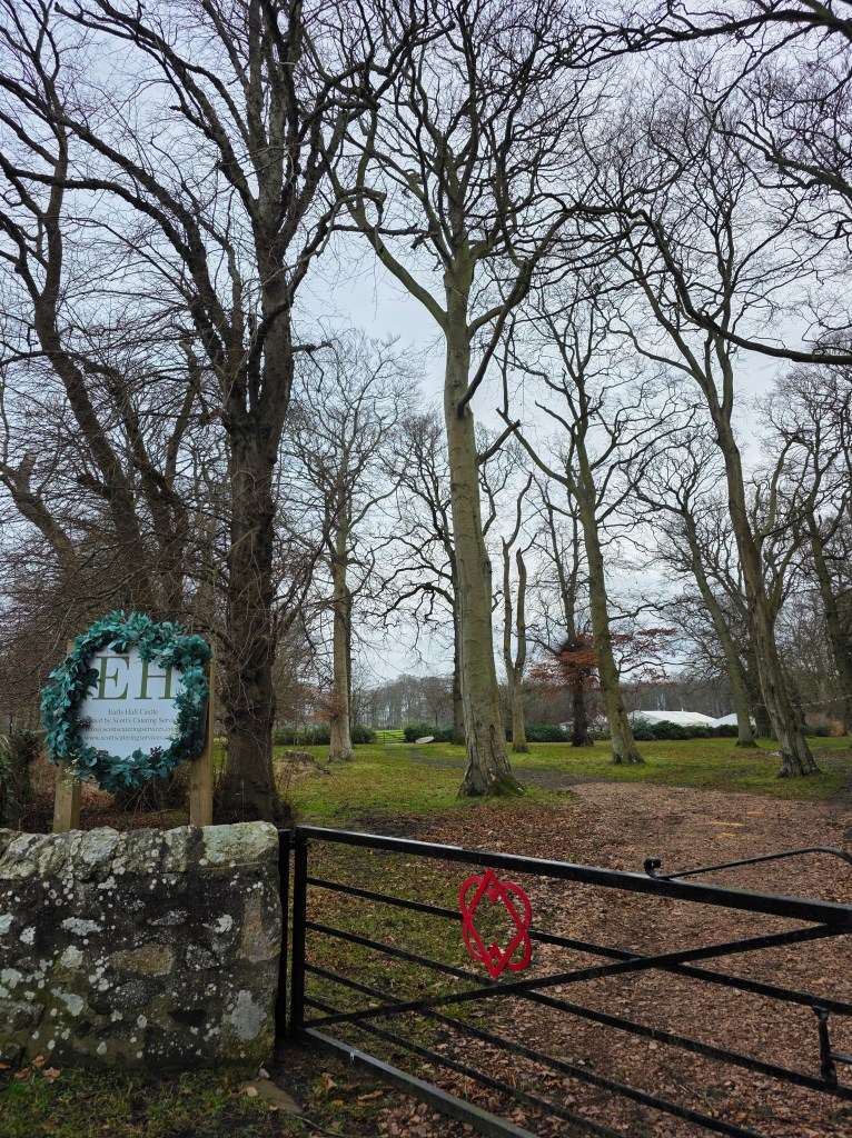
Now used primarily as a wedding and conference venue, Earls Hall Castle was originally so named due to a hunting lodge in the same location, owned by the Earls of Fife. It also makes a convenient stopping point for the loop I was walking, marking almost exactly 1.5 miles from where I started. From here, it looks as though the coastal path follows the road a bit further then heads across the fields, but I shall learn more at a later date!
This weekend, I chose to turn around and head back into Leuchars, making a right turn at the end of Wessex Avenue and aiming for St Athernase.
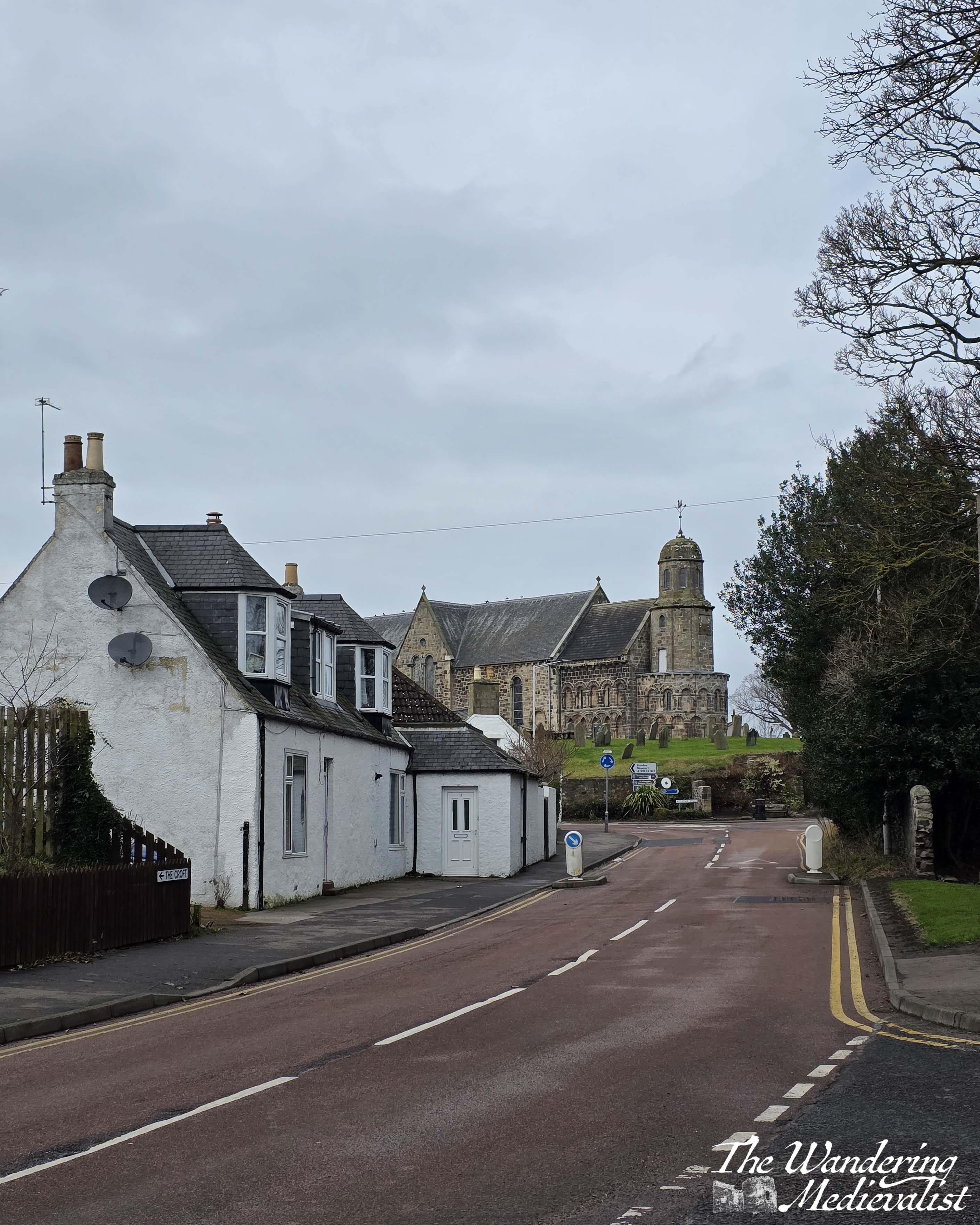
Granted to the canons of St Andrews in 1185, St Athernase is built in the Romanesque style, with arches and carvings that reminded me strongly of Durham Cathedral.

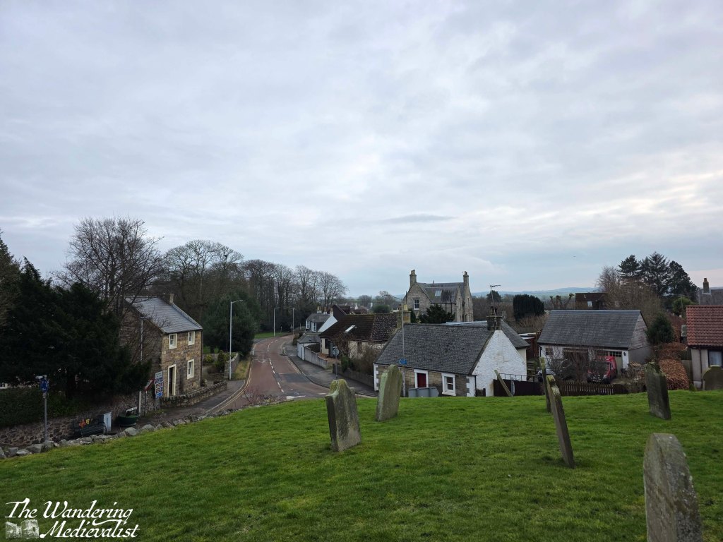
I was not able to get inside on this visit, but the chapel is still used for services and the graveyard itself is full of fascinating stones to explore. The higher ground offers a great view over the village in one direction, while around the back it is easy to see that you are in the oldest part of town, with lovely old Scottish crofts and farm houses lining the road.
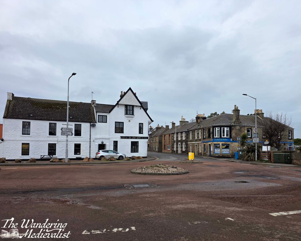
I walked through the churchyard and out the main entrance, winding my way down to the Main Street via a set of steps past the coachhouse. Leuchars Main Street loops around past the pharmacy and the butcher before sweeping the other way towards the main roundabout, where going straight takes you towards Dundee and going left leads to the rail station and St Andrews. The roundabout boasts two drinking establishments, with Ye Olde Hotel the larger of the two, an old white building with generous parking nearby. I have been inside once many years ago, and assuming that it has not changed, it is a good example of a local drinking establishment.
Turning left at the roundabout could have been a straight shot for me along the A919 back to the bridge. Instead, though, I took a kind of short cut, walking through Leuchars Rail Station car park and along Station Road. While arguably a more pleasant walk than along the A919 – which is always busy and noisy – Station Road does not have any kind of sidewalk or pavement along the edge, rather walkers must either walk carefully at the side of the road and jump onto the verge, or just walk along the uneven grass. Busses and vehicles speed along this road quite quickly, so walkers do need to take care.
Station Road eventually meets the Toll Road, right at a lovely old rail bridge, where a left turn leads you back towards the main highway. The whole loop, after my wandering around the churchyard a bit and taking me all the way back to the bus stop, was about 3.75 miles, with the home stretch walking into an increasingly bitter wind. It was definitely a good start to give me an idea of how far I can push (I could definitely walk further, but probably would regret it), though I think better weather would have been conducive to a longer walk. I don’t look forward to one of the next chunks, which is the walk along the A91 into St Andrews; I have done it once before, and even with the incentive of a pint at the end found it a bit dire. With better weather, hopefully, will come excursions further afield!
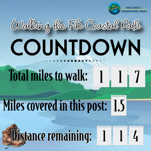
So for this weekend, here is my updated countdown. I hope to make a bit more headway soon, and would like to see that number get down into double digits before my next work trip in April. 🤞🏻