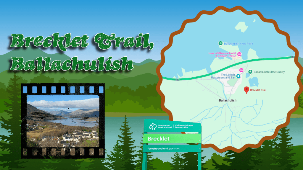
For the past ten years or so, it has become a tradition for the other half and I to take a long weekend off in March and to head north into the Highlands. We find a nice place to stay – sometimes self-catered, sometimes a hotel – and spend a few days in lovely scenery, hiking and walking and finding a good place for an evening meal and a few pints. This year was no different, and I was determined to find us a new walk in the Ballachulish area that was both scenic but not too challenging. The Brecklet Trail was a perfect option: a loop just under two miles in length, with plenty of up and down, and some stunning views.
Side note, I learned of the trail by consulting the trusty website Walkhighlands, which allows you to search by area, and also by difficulty, and includes a good summary of each walk as well as step-by-step instructions. While at times these are a touch vague, very seldom have we been completely lost by them.
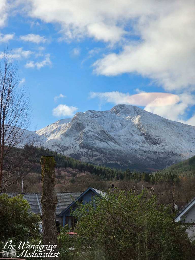
The day we chose this hike had started off cool, with the surrounding peaks covered in snow or heavy frost. By the time we had our delicious hotel breakfast and got started, it was warming up perfectly for a walk – still cool, but pleasant once your blood is moving a bit.
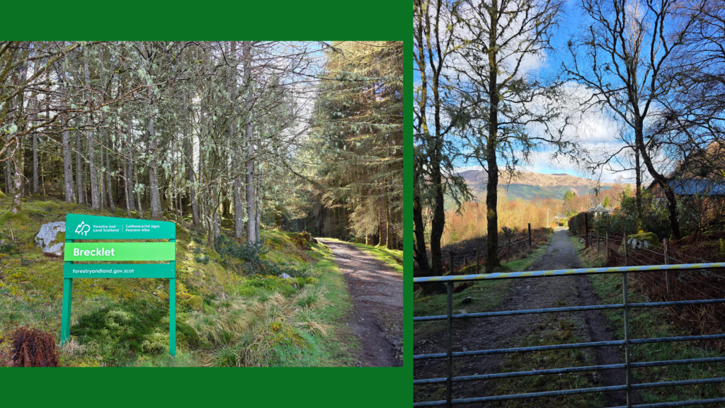
Access to the Brecklet trail is incredibly straight-forward; there is good parking at the Ballachulish visitor centre, which itself offers a great little café and souvenir shop. There is also a clean toilet.
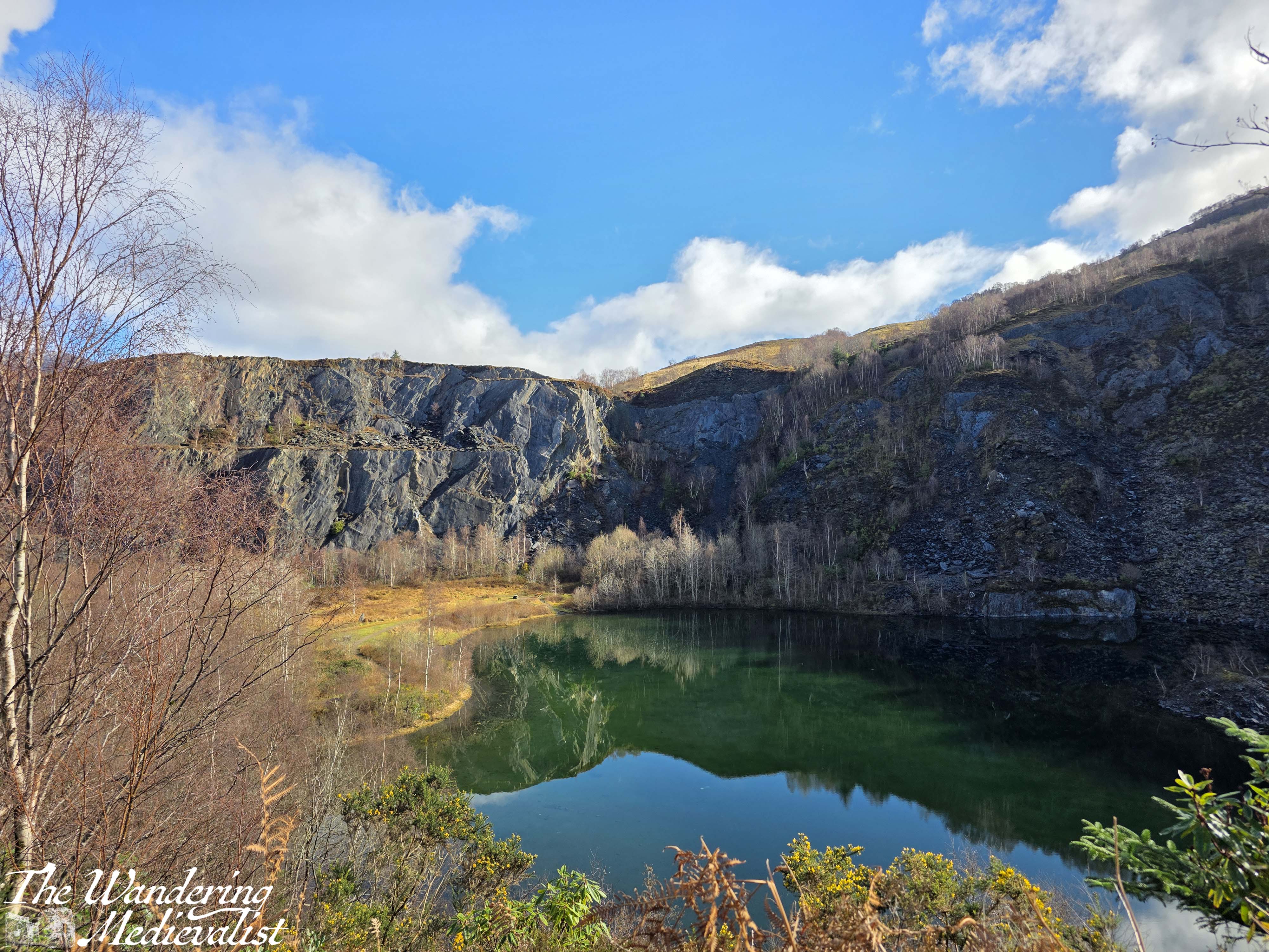
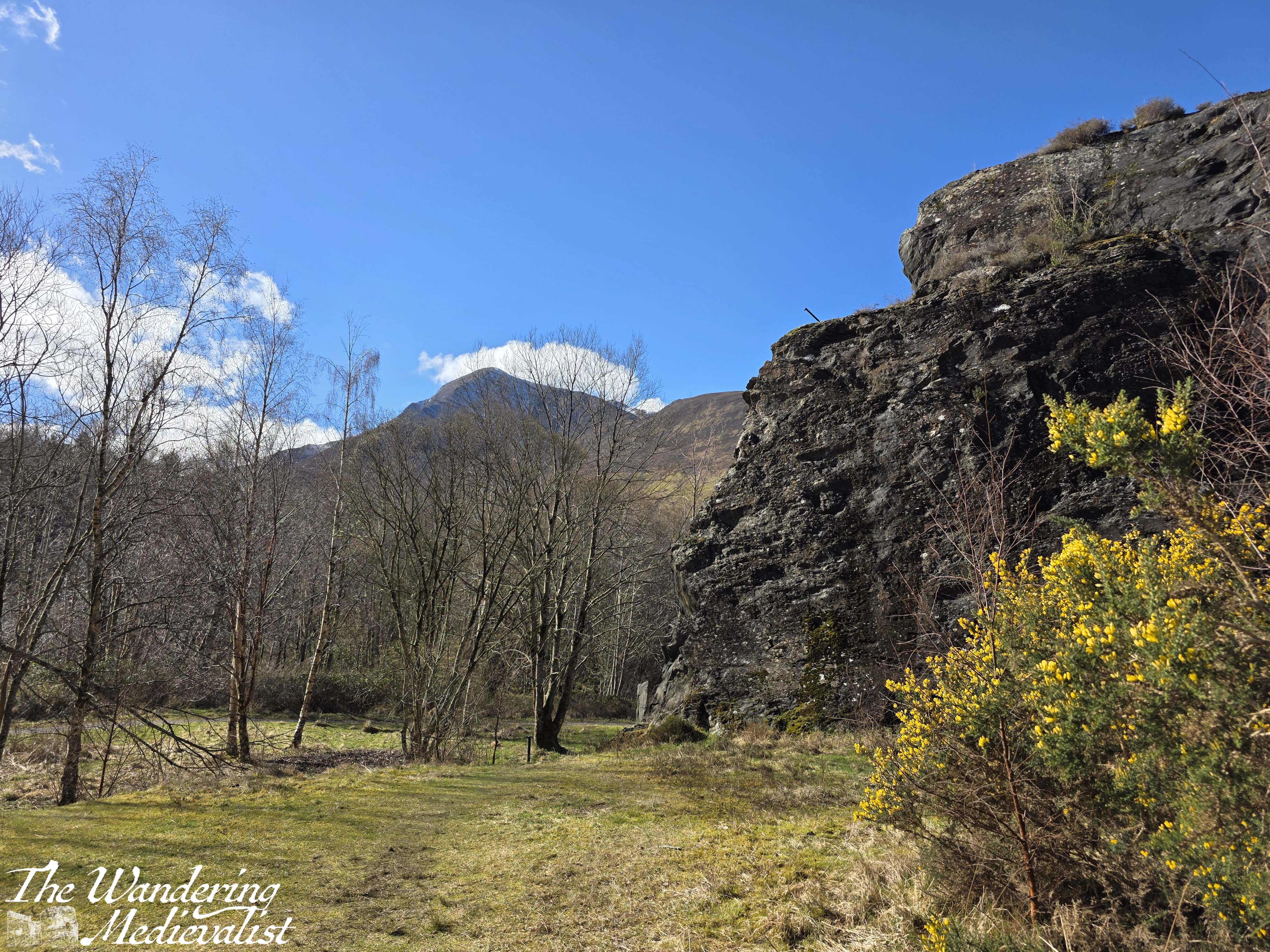
Passing by the visitor centre, one needs only to cross the street and enter the old quarry grounds, which are very evident in the towering cliffs of slate still surrounding three sides.
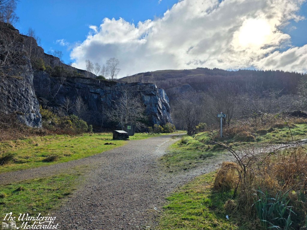
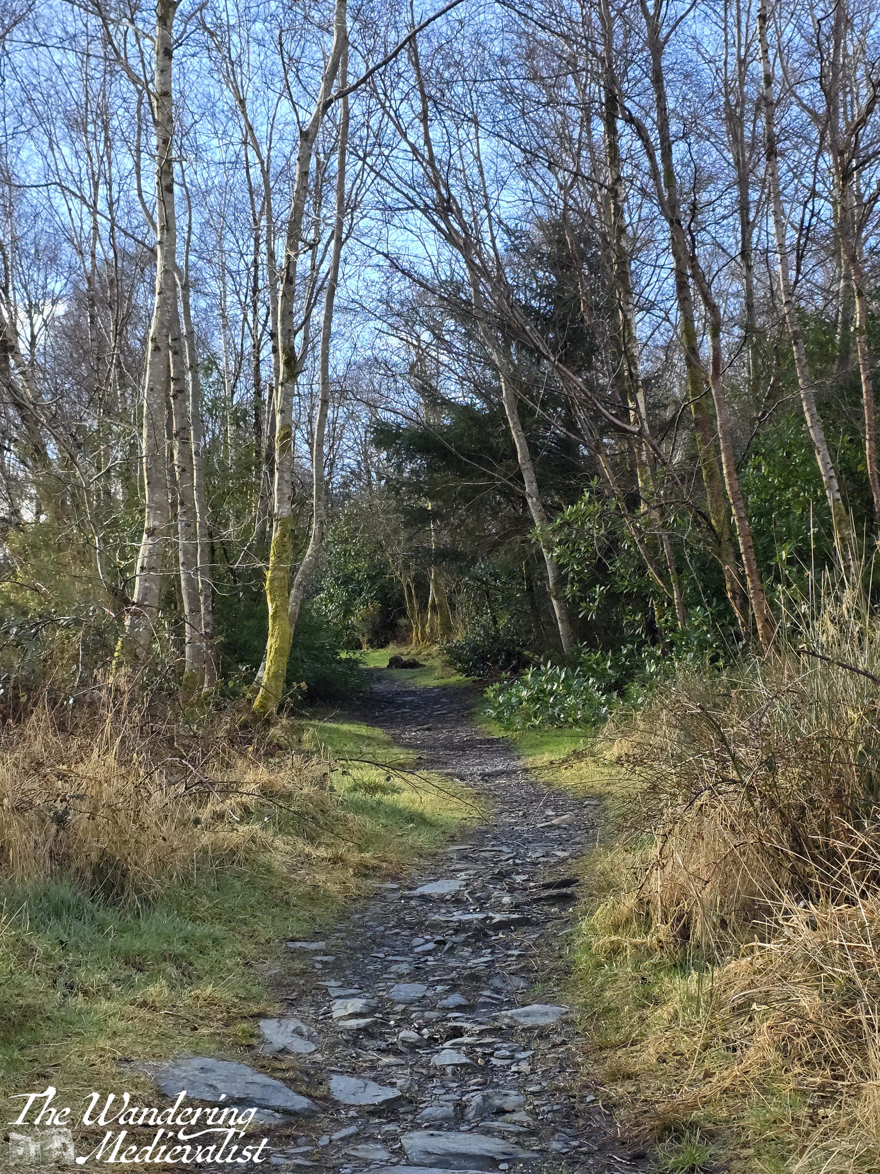
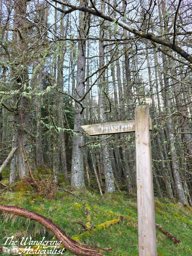
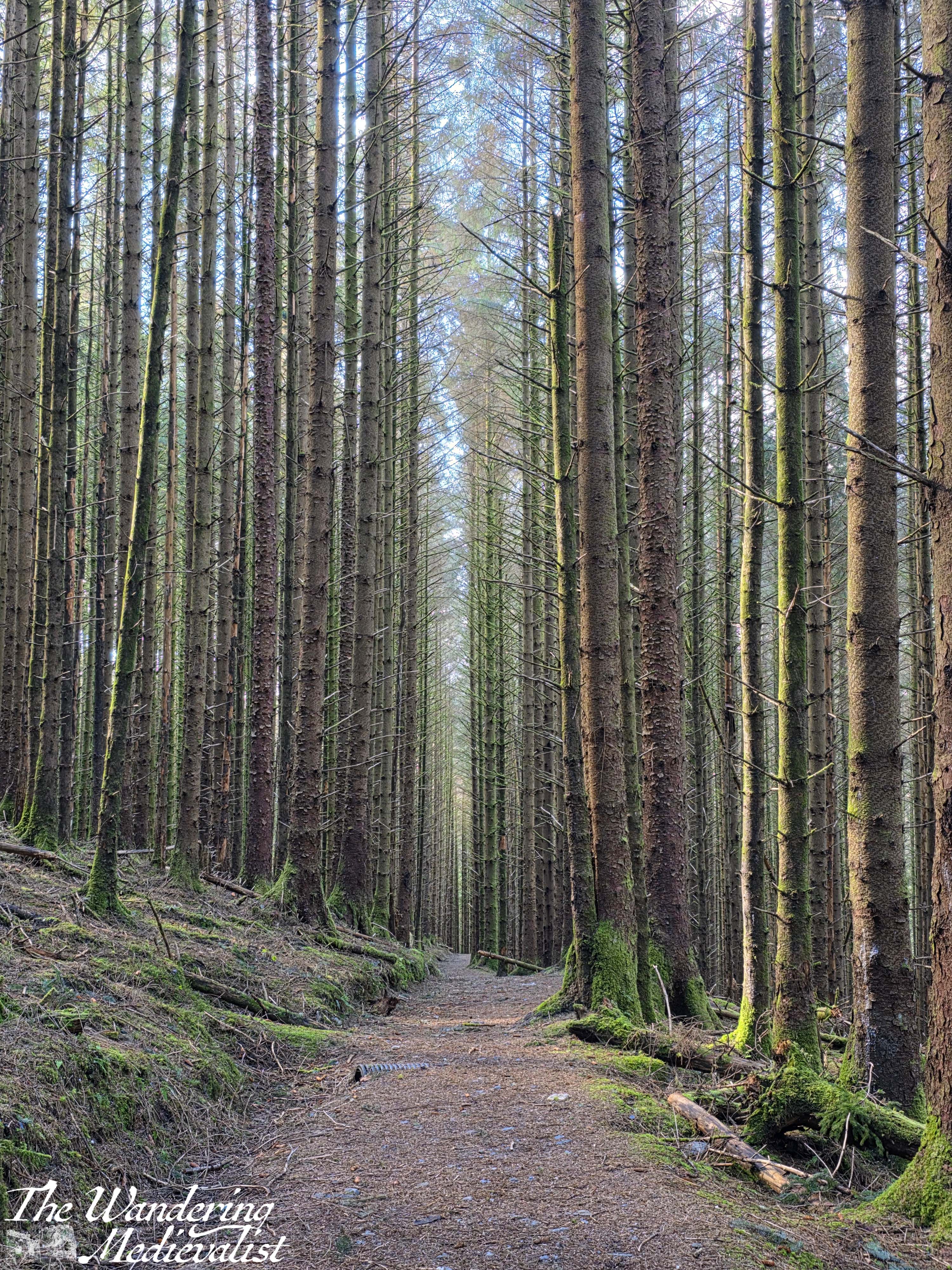
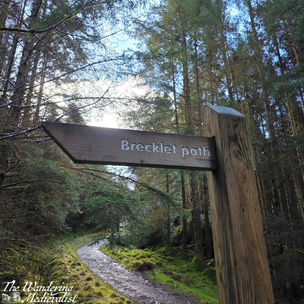
There are a number of plaques and several walks, but the sign for Brecklet Trail leads off very clearly to the right. Almost from the first, the path climbs steadily through young forest of birch, rhododendron, heather and some gorse.
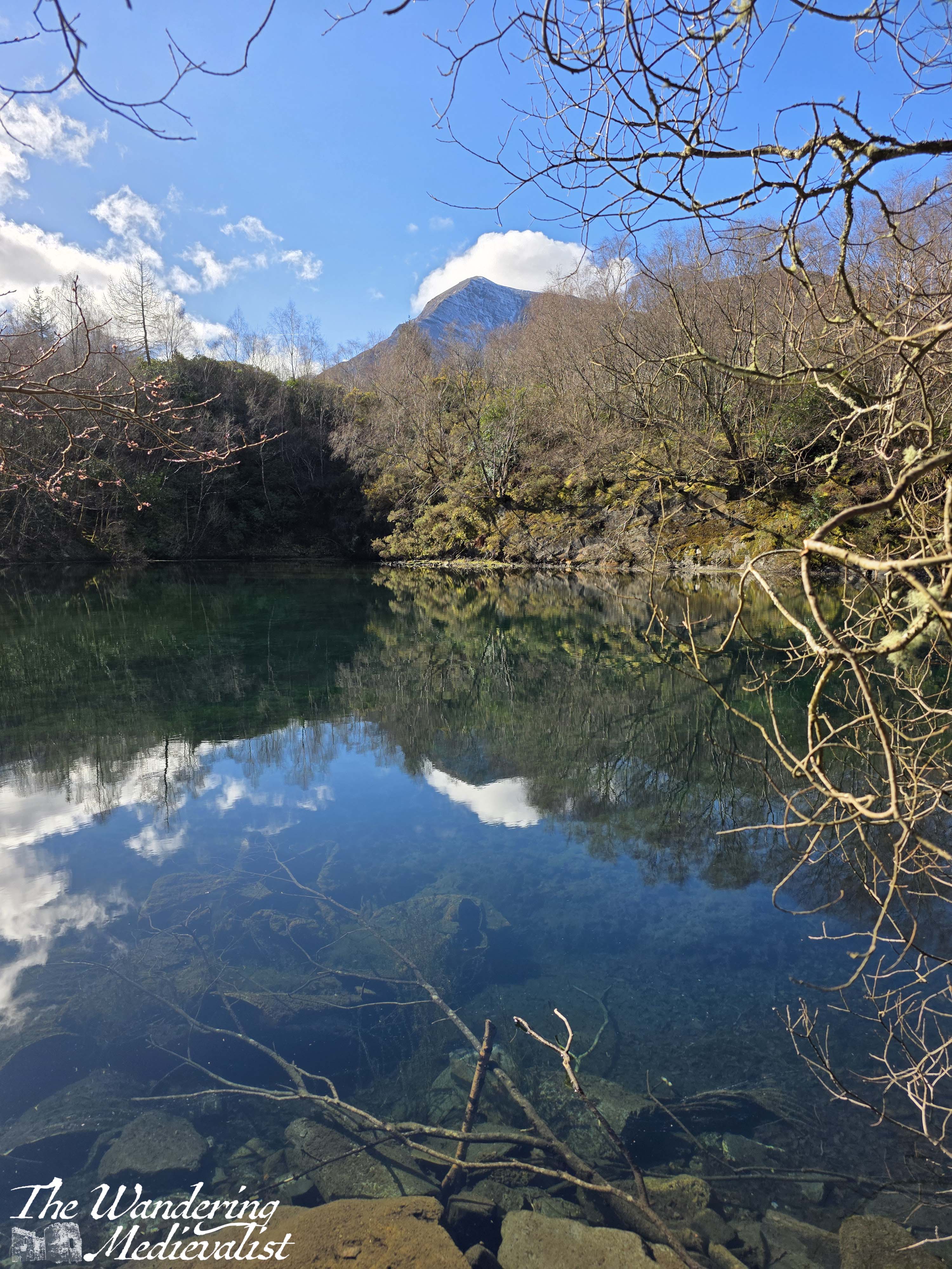
Through the growth to the left can be glimpsed the pond in the middle of the quarry, perfectly flat on the day we visited and reflecting the sky and cliffs.
The trail winds up around the ledge and eventually curves off towards the right; while consistently an uphill climb it is not hugely steep, and the hike is a pleasant one. In time the trees thin out and open to a kind of scrabbly heath, with low scrub and heather on either side. We discovered a detour off to the right which led along a ridge to a pine tree, beyond which was a positively spectacular view over the village, the loch, and the nearest mountain.
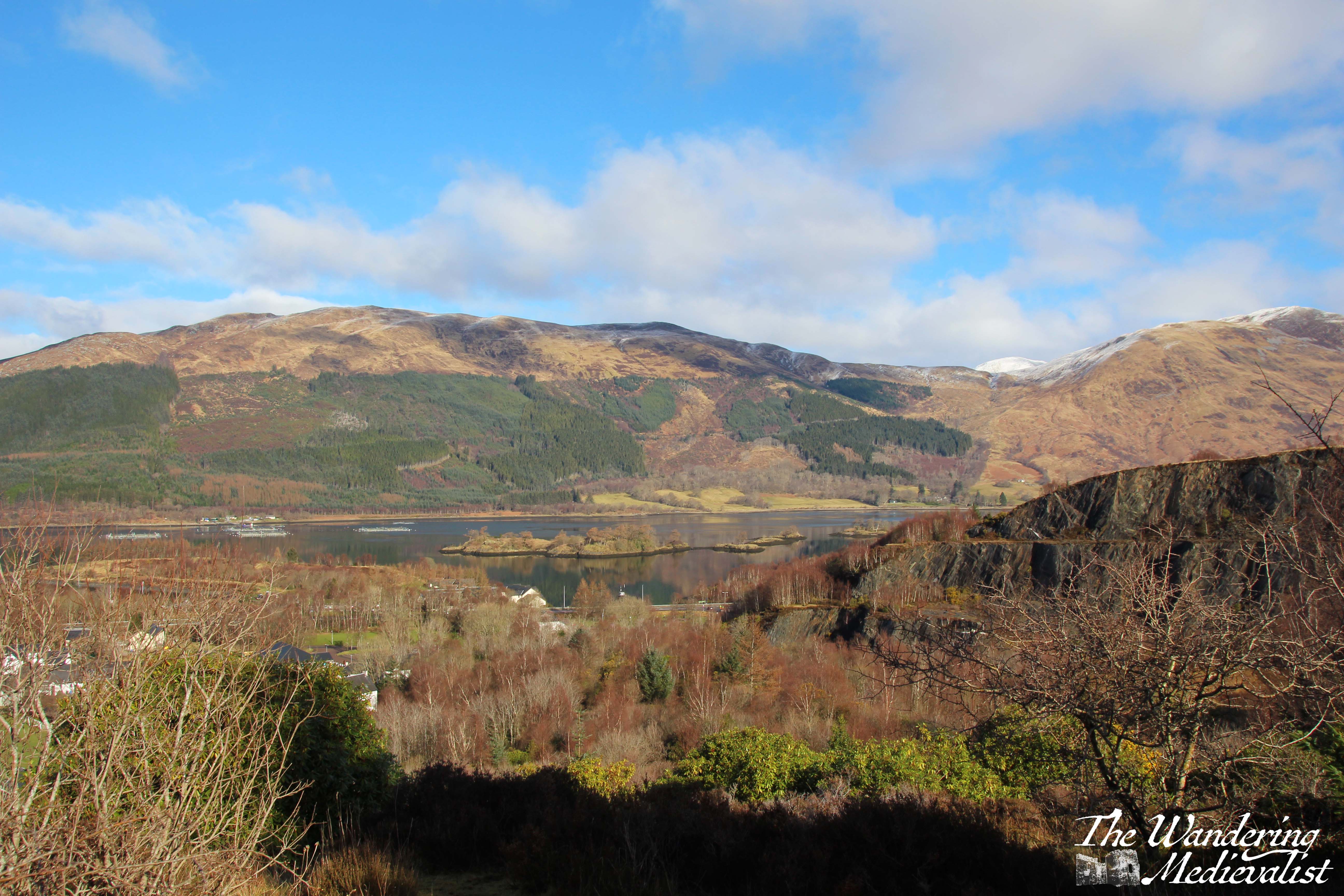
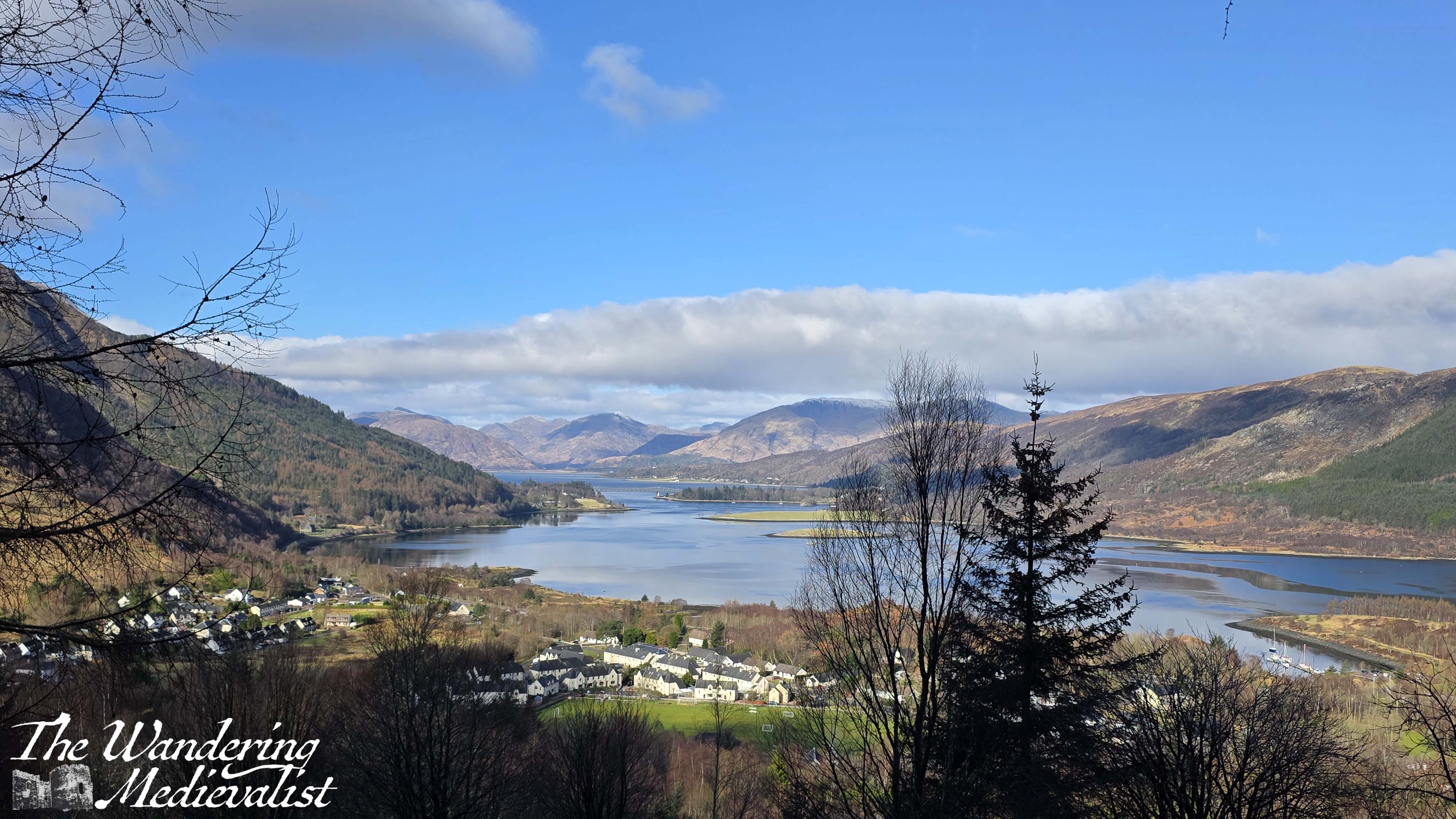
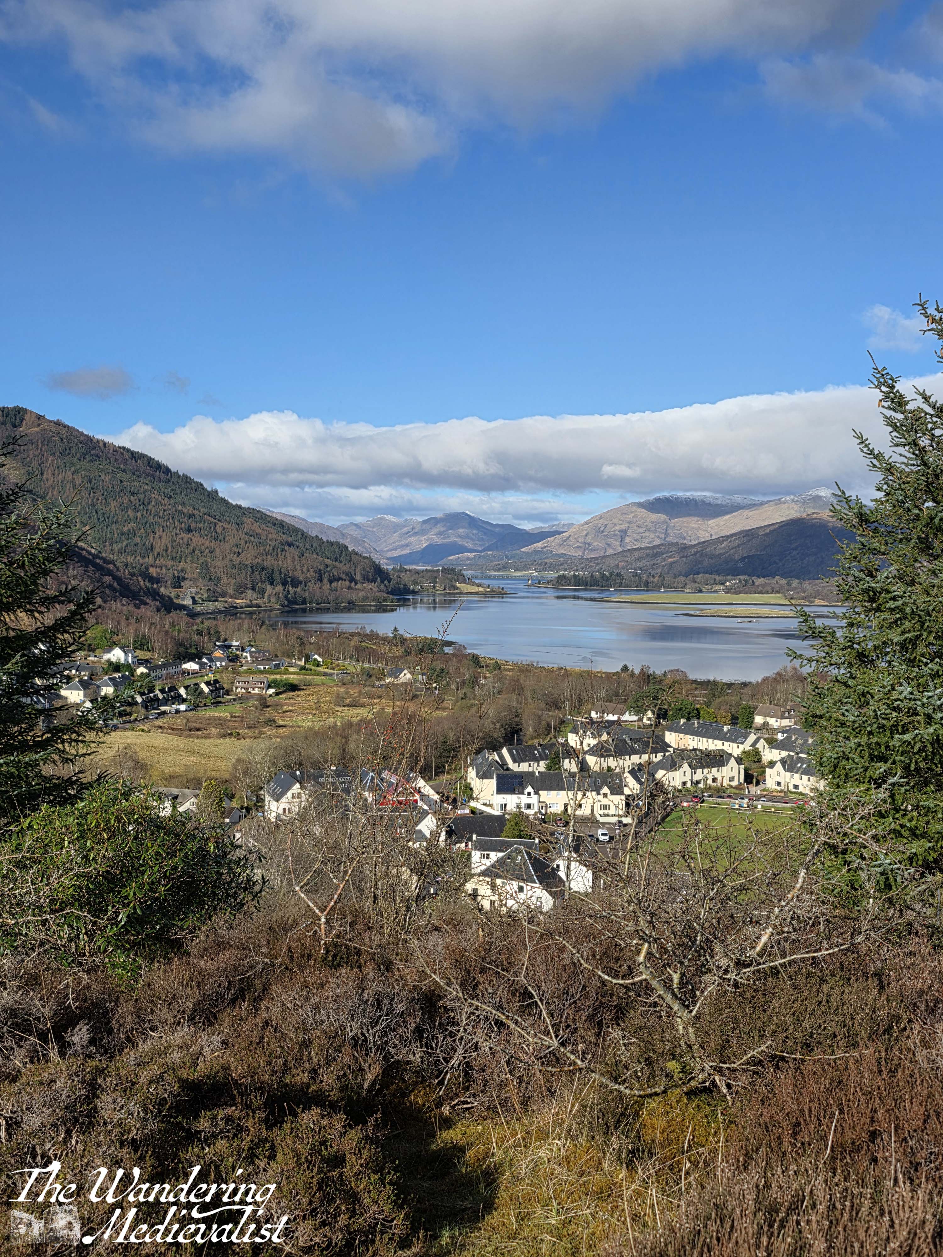


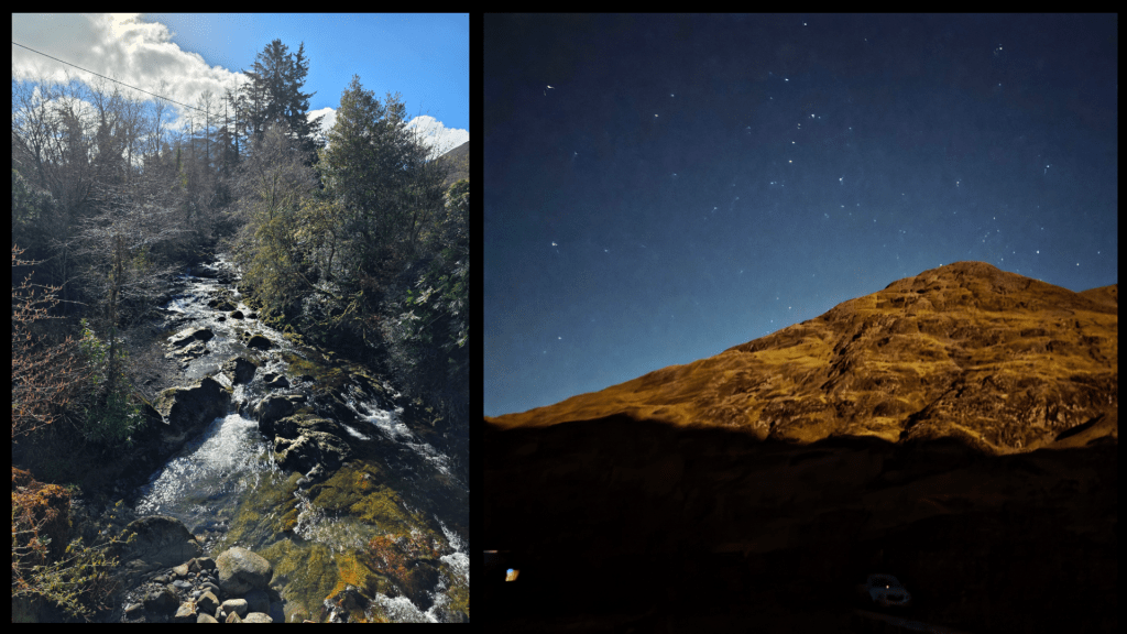
This was the view we had read about and were climbing for, and it really did not disappoint, particularly on such a stunning clear day. It was something I had particularly noted earlier in the morning: whether due to the frosty start or some quirk of nature, the air was crystal clear. This was even more evident that night, when our star-viewing was marred by the full moon, and the following day when the distant mountains were hazy.
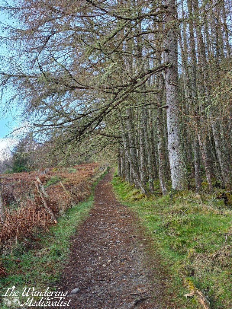
After enjoying our fill of the view, we headed back to the main trail, which presently passed through a gate and pointed us up a hill, through a stand of what I think were larch, coated in a beautiful seafoam-coloured draping lichen.
We continued up, the view on the left blocked somewhat by the treeline, and in time turned right into a stand of tall pines. There was another viewpoint off through the trees, over the loch, but we did not linger and instead followed the winding trail into the forest.
I should mention that the trail was very well-kept, even and relatively dry.
Whenever we hike on a trail such as this, the other half gets a bit irked when I ask him about certain flora, but that is mainly because my father had drilled the plants and trees of New England into my mind. I suppose I assumed his father did the same – but of course that may just be one of our family quirks!
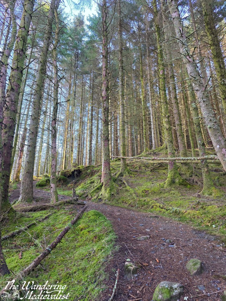
The climb continued for a while longer, and eventually levelled off slightly though not for long at all before beginning a slow – or sometimes not so slow – descent. This was also the part of the trail where there were several alternative routes through the trees that had doubtless been bivouacked by hikers at some point. As with many Scottish trails, it is usually safest to try your best to stay on the main trail, as tempting as it may be to deviate along some other explorer’s route.
I was particularly taken by the tree-lined paths, which in many ways reminded me of cross-country ski trails we had taken when I was young, in the White Mountains. The trees there are generally bushier with considerably more needles, but the lined path was reminiscent.

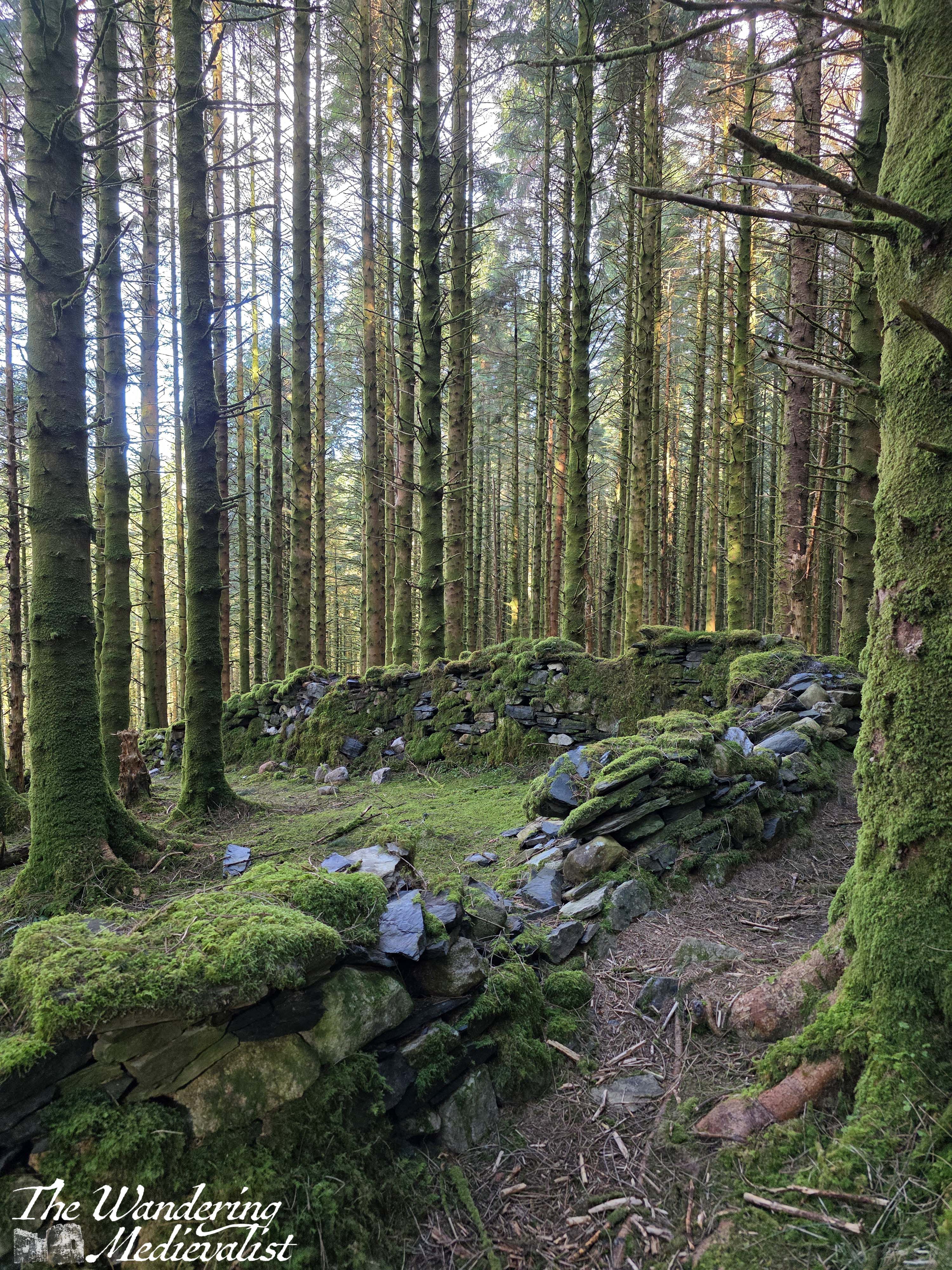
We also came across several out-of-use stone walls that cut through the forest. The stones were coated in moss and there was periodic damage, but the sun shining through the trees off the stones made for a nice break in the view.
Presently the descent grew a touch more steep, and we came across the ruins of several houses and in fact a small settlement of cottages, now well overgrown with moss and fern.
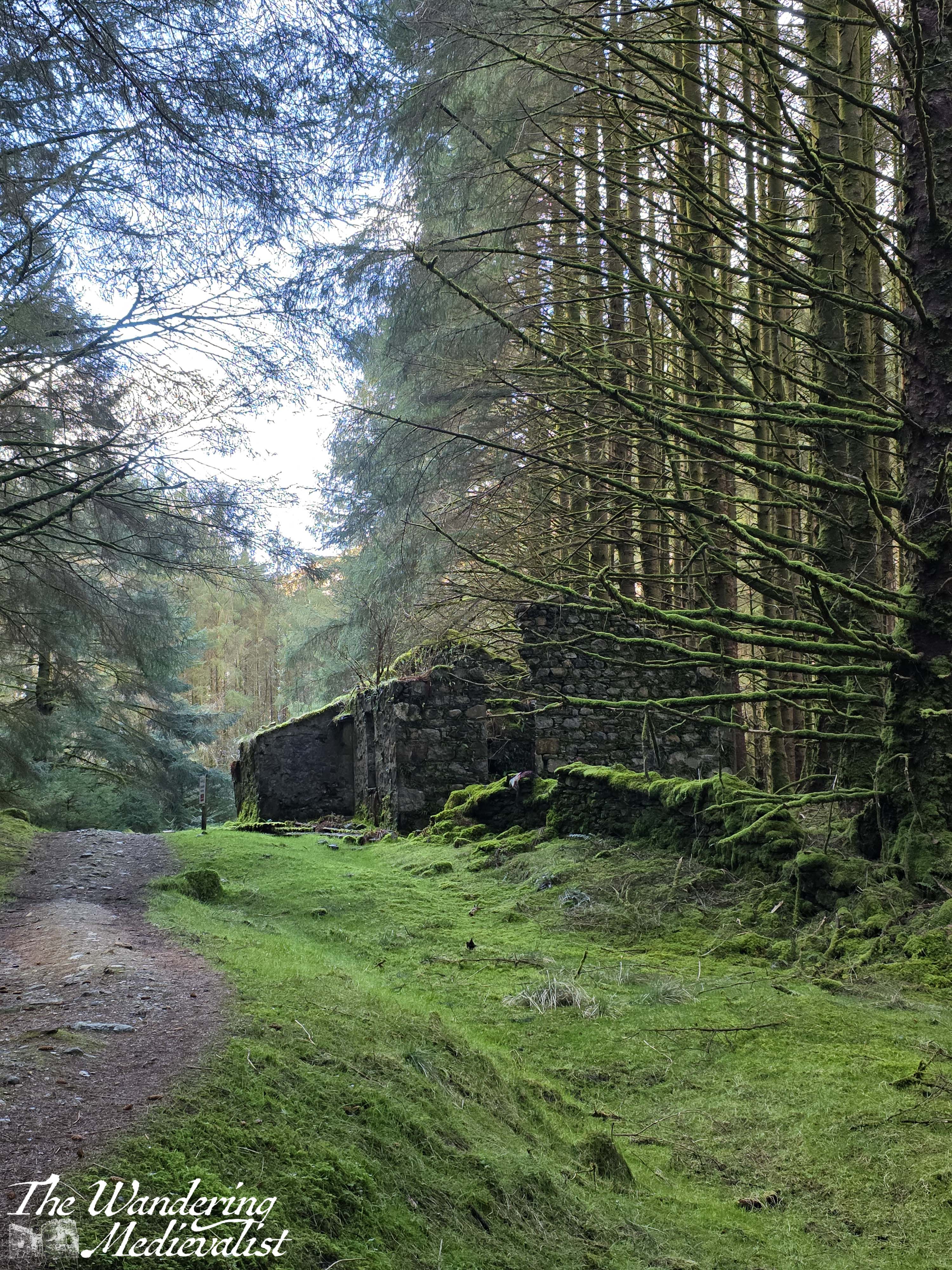
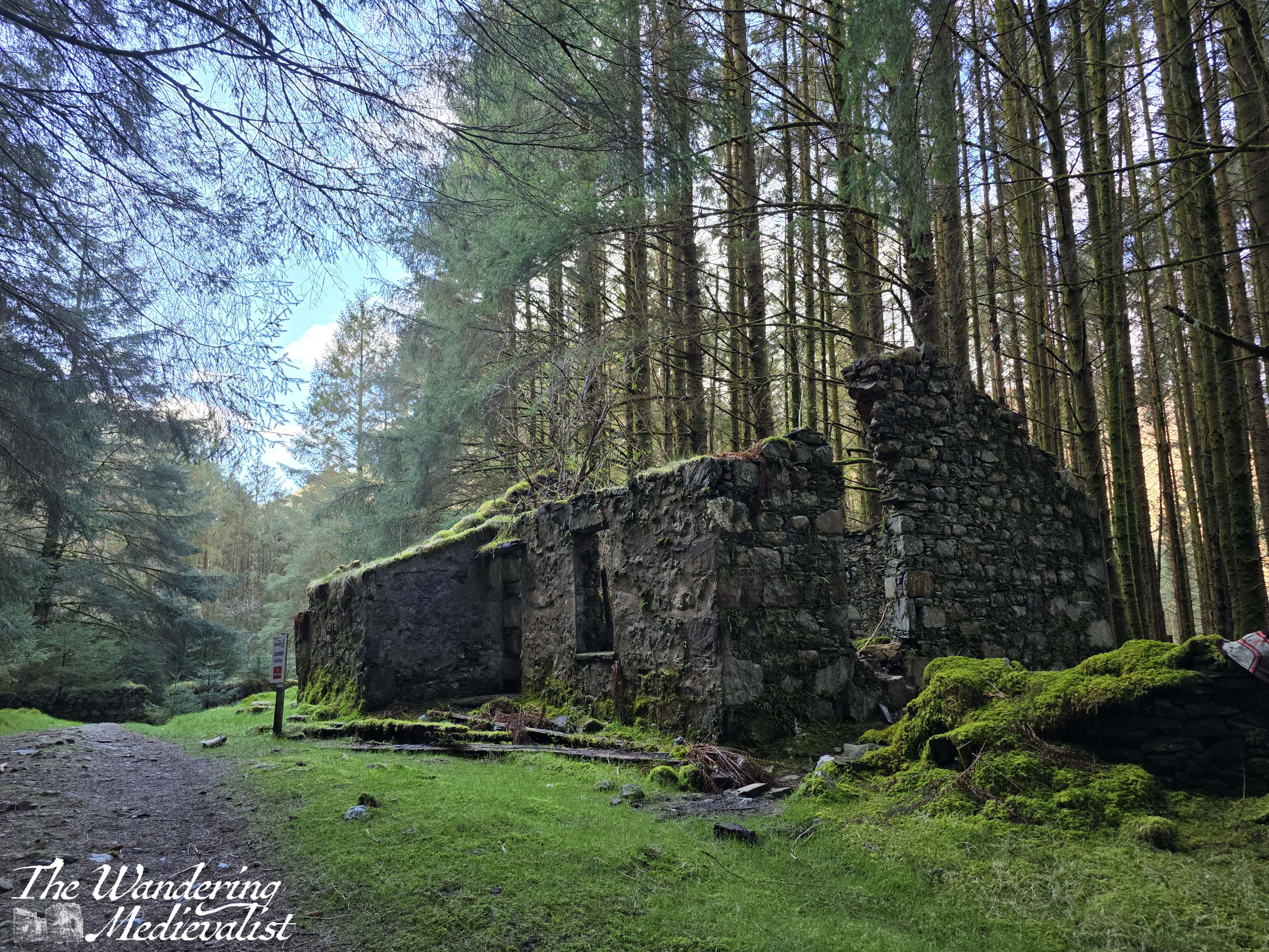
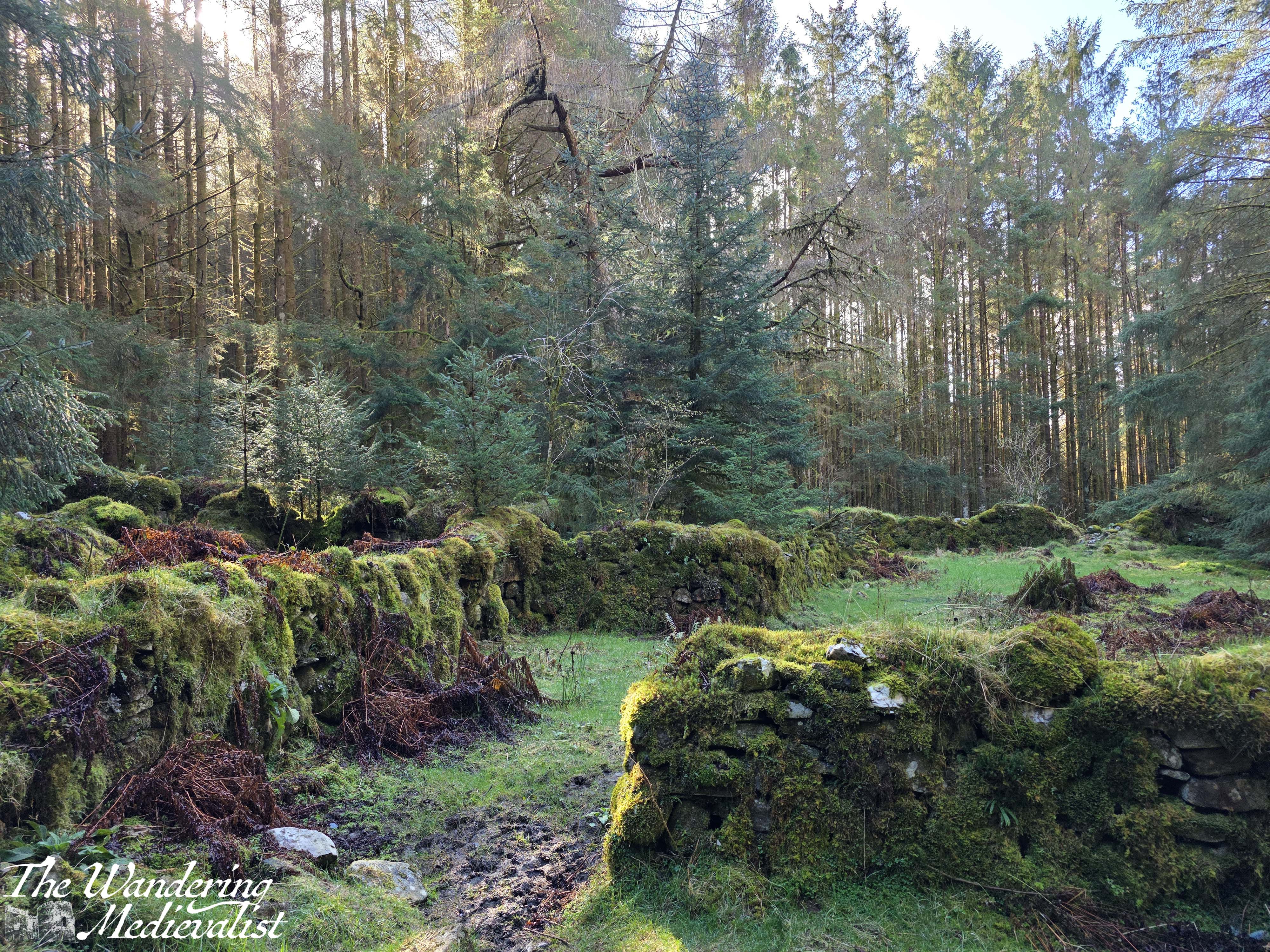
The historian in me wished this was an old Highland village, but as the other half pointed out, at least one house included an electric box and some wires, so they must not have been abandoned too long ago.
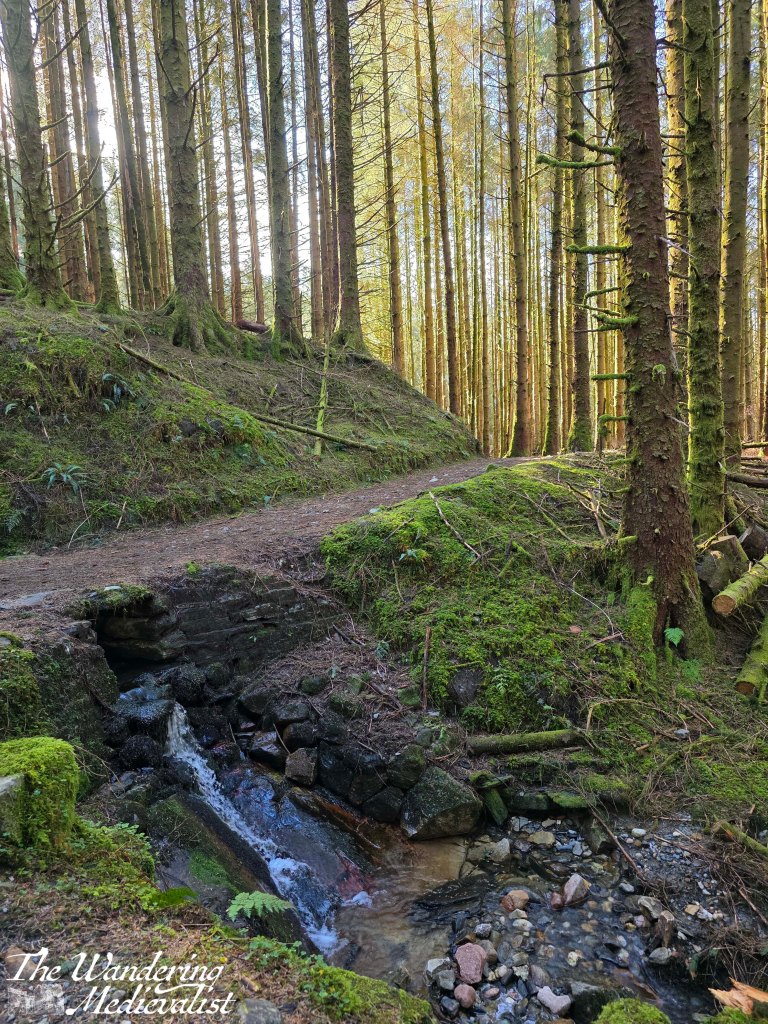
Beyond the village, the descent through the trees is steady, with the trail passing over small rivulets and mini-waterfalls, and finally eventually meeting a road.

Here, the trail turns to the right and follows a woodland track down to the edge of the village, which appears gradually after a gate and the official woodland marker for the trail.
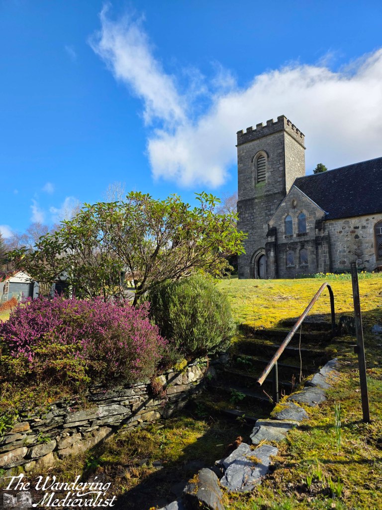
Gradually, well-kept houses appear at the side of road. We passed two churches, one Church of Scotland and one Catholic, each with a very similar name – St Munda’s and St Mun’s, respectively. Beyond the houses to the left is just visible – and at times audible – a small river, the River Laroch. A bit further into the village, the road crosses the river and there is an old bridge plus a viewpoint where you can get a bit closer to the water.
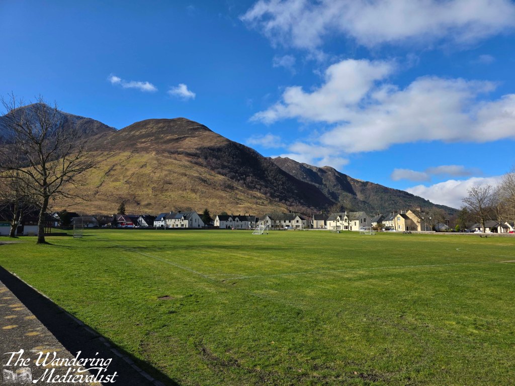
Eventually, the walk circles back towards the visitor centre, past the village green and playing fields, which also boast stunning views back towards the mountain that overlooks the village of Ballachulish, Sgòrr Dhearg.
The main street passes by several small shops including a delicious-looking bakery and the Laroch, a pub we were thinking of eating in that evening. The whole loop is just under two miles, though the climb up and down makes it feel a bit longer. We decided to head back into the quarry to explore a bit and discovered that there are two ponds, the smaller of which offered a beautiful view up to the mountain. It was a warm spring day in feel by this point and there were clouds of midges rising from the sun-warmed ground, so we did not linger too long.
In all the hike took us about 90 minutes, and was one I would highly recommend. While it is far from flat and some energy is needed for the climb up, the views are stunning. Another win for my researched walks!
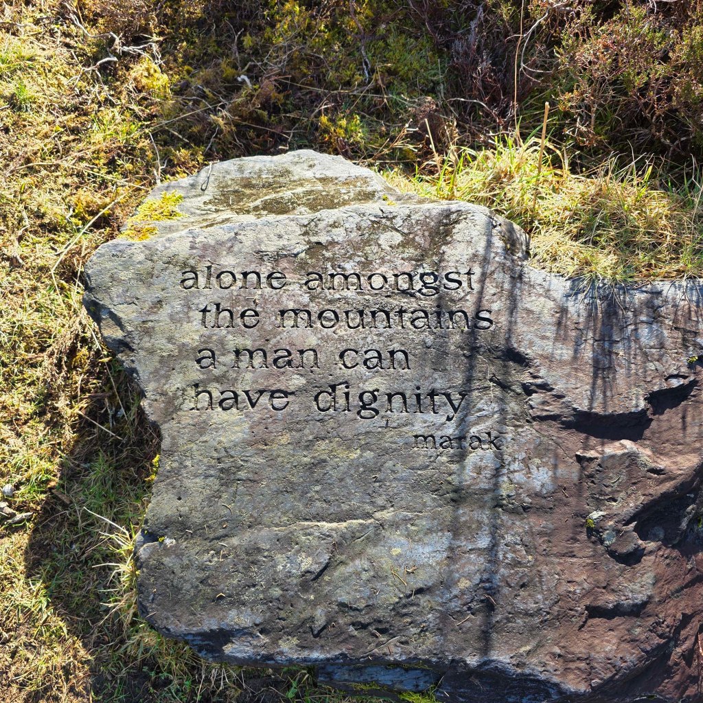
Finally, a message I feel is very true from a carved rock along the trail: