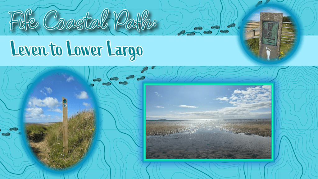
Completing a circuit of the Coastal Path by January may no longer be a feasible goal but that doesn’t stop me from doing my best to try. So, last Saturday I planned another stretch, on the shorter side as I had family commitments to get back to in the afternoon. So, Leven to Lower Largo seemed a good option, and relatively easy to manage by bus.
The day started windy and with patches of rain, with water still in the breeze but sun promising a change in the distance. The storm earlier in the week cleared out the air a bit, and it was less stuffy and a few degrees cooler – perfect day for a walk. (Though, side note, the other half was devastated that the storm was mostly wind, as he was looking forward to a wet grey day. Instead we experienced fast-moving white fluffy clouds and wind, very little rain).
The bus I chose was the x58, which is a faster route south from St Andrews towards Upper and Lower Largo, bypassing most of the East Neuk. It was a nice ride, quick and interesting to see different villages for a change.
I reached Leven Bus Station in good time, and despite there being no visible signs for the Coastal Path, it was easy to see where to go.
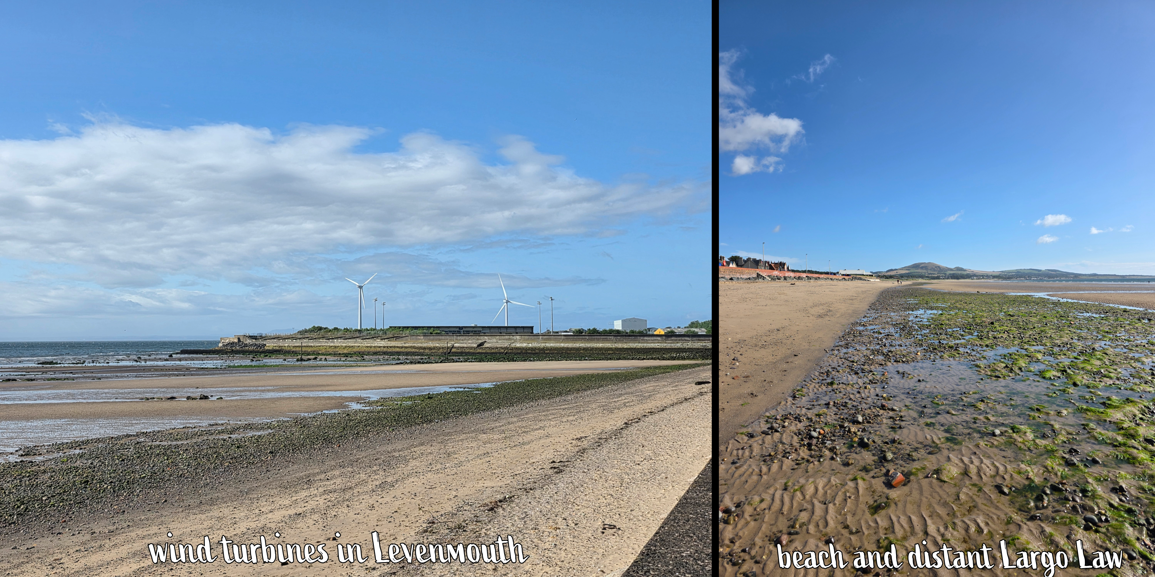
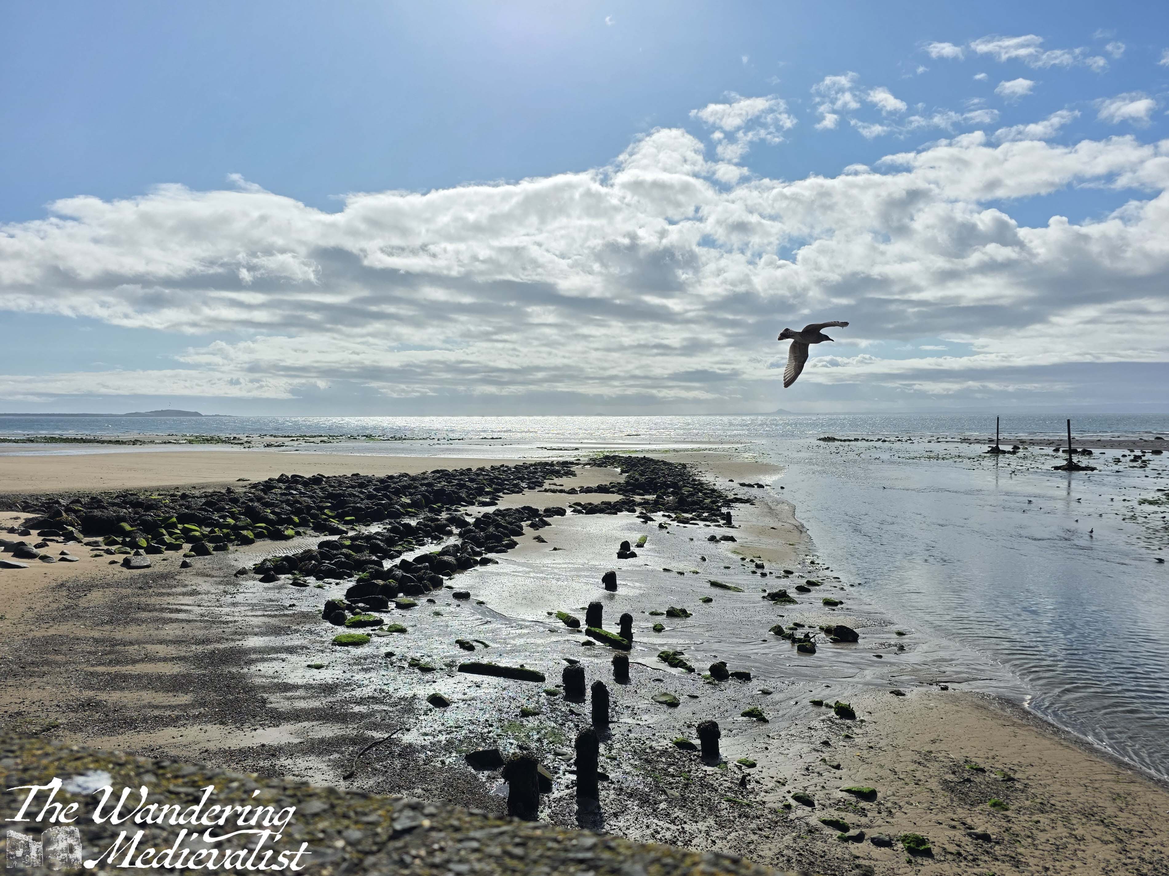
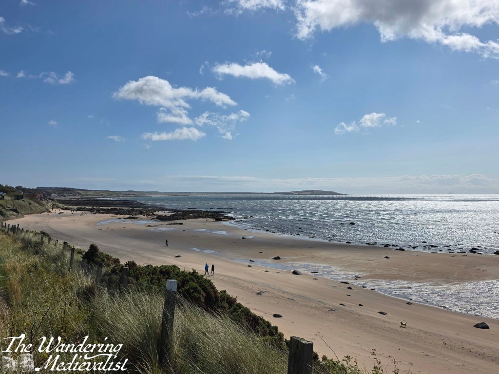
The bus station is very centrally located and only a road away from the coastline, just next to where the River Leven empties out across the beach into the ocean. There is a big car park here, and a promenade that is smaller than the one in Kirkcaldy but just as pleasant, with a wide sandy beach. While the Coastal Path proper runs along the road, I took a quick jaunt down to the sand to on several occasions.
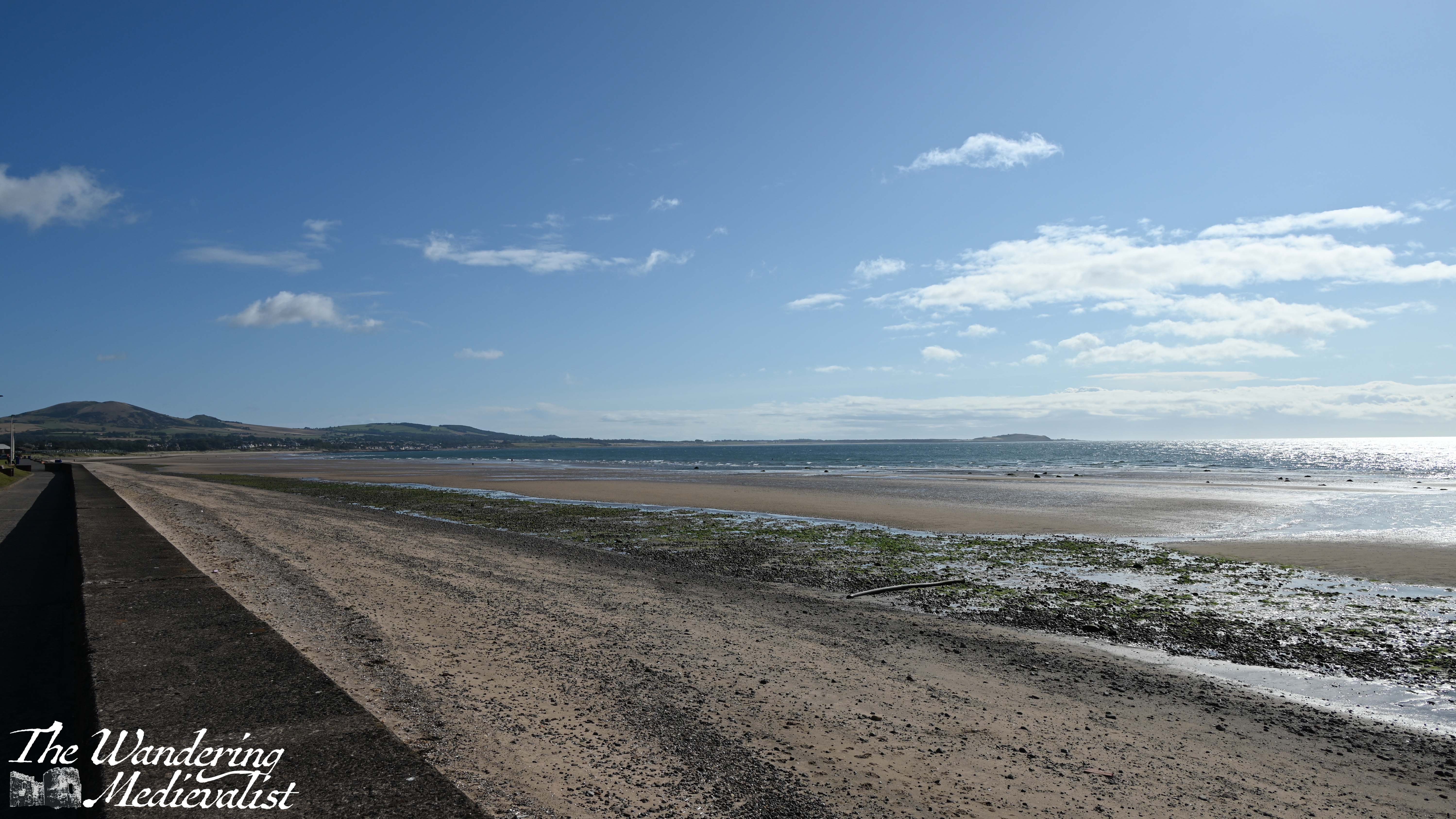
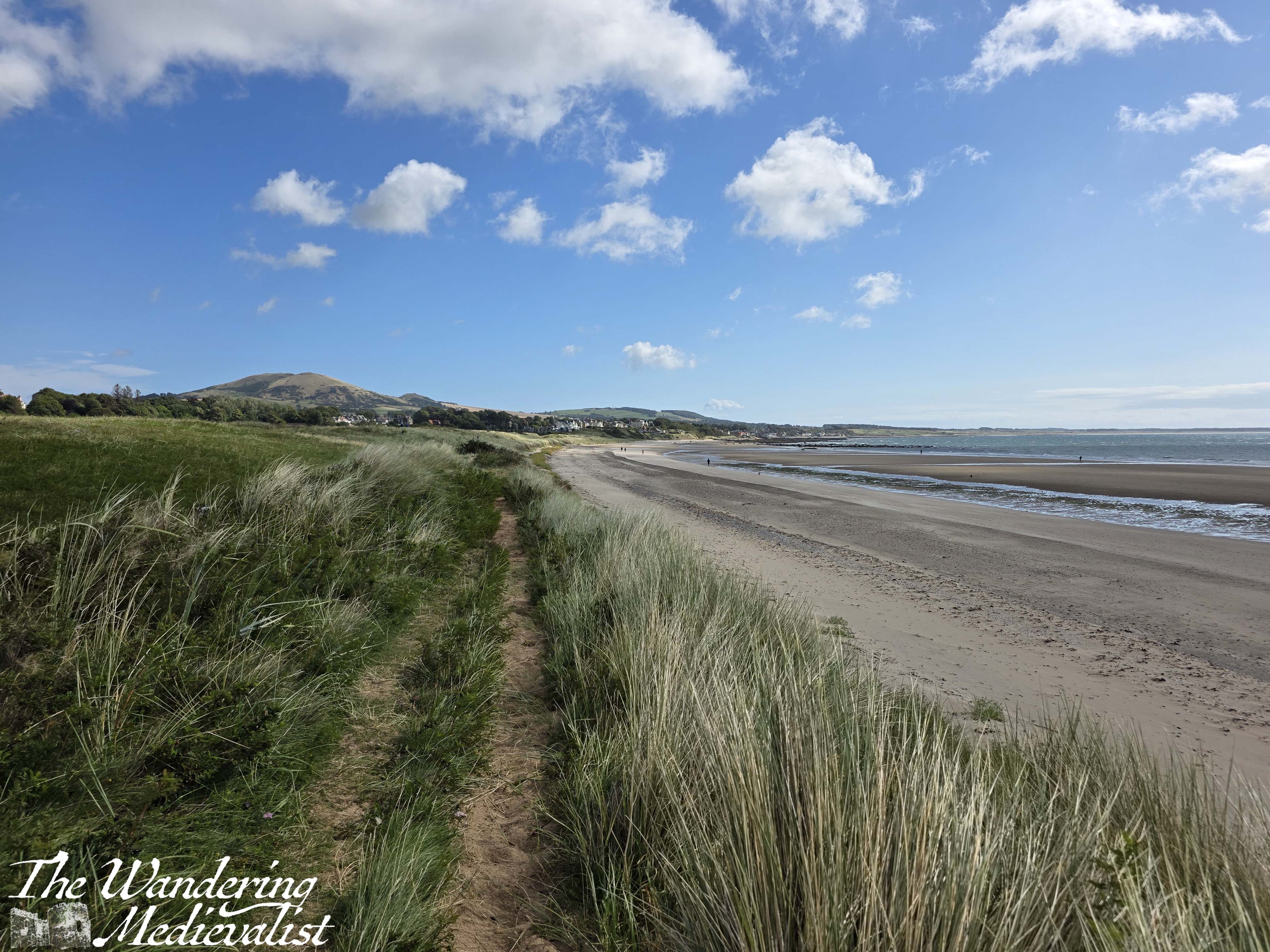
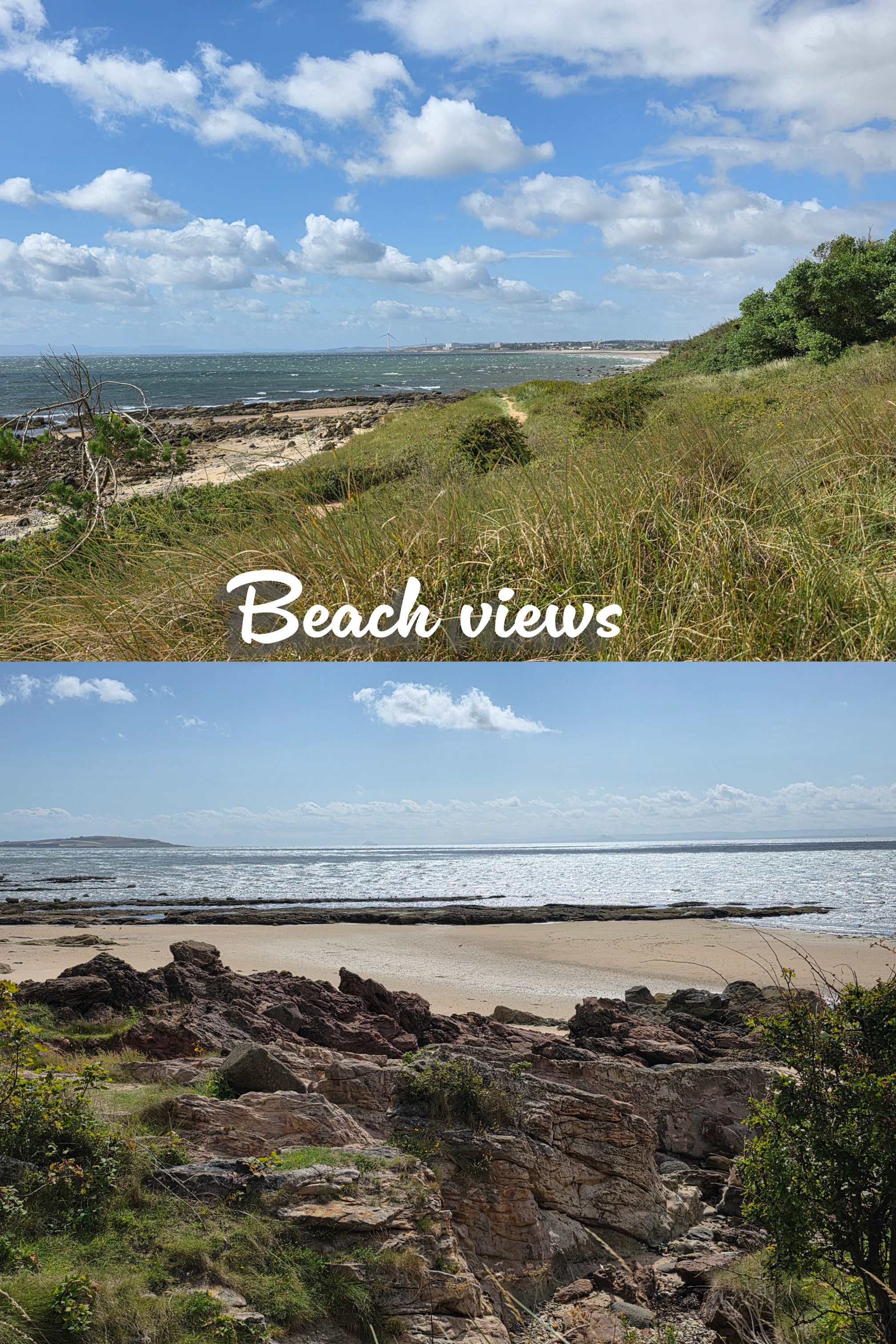
Also similar to Kirkcaldy, this promenade provides a view of the whole bay, with coast stretching out for miles ahead up to the point where you would turn to go to Elie, and Largo Law – Largo hill – towering over the distant towns. It was a touch hazy, but became clearer as the day went on and the clouds were chased away by sunshine.
As I walked along the beach, I became aware of the excited screams and laughter of many children, who were playing in a large blow-up arcade with a massive slide and other amusements. This theme continued, as further down the coast was an older arcade-style building, a new skateboard park, playground equipment, a putting green and more.

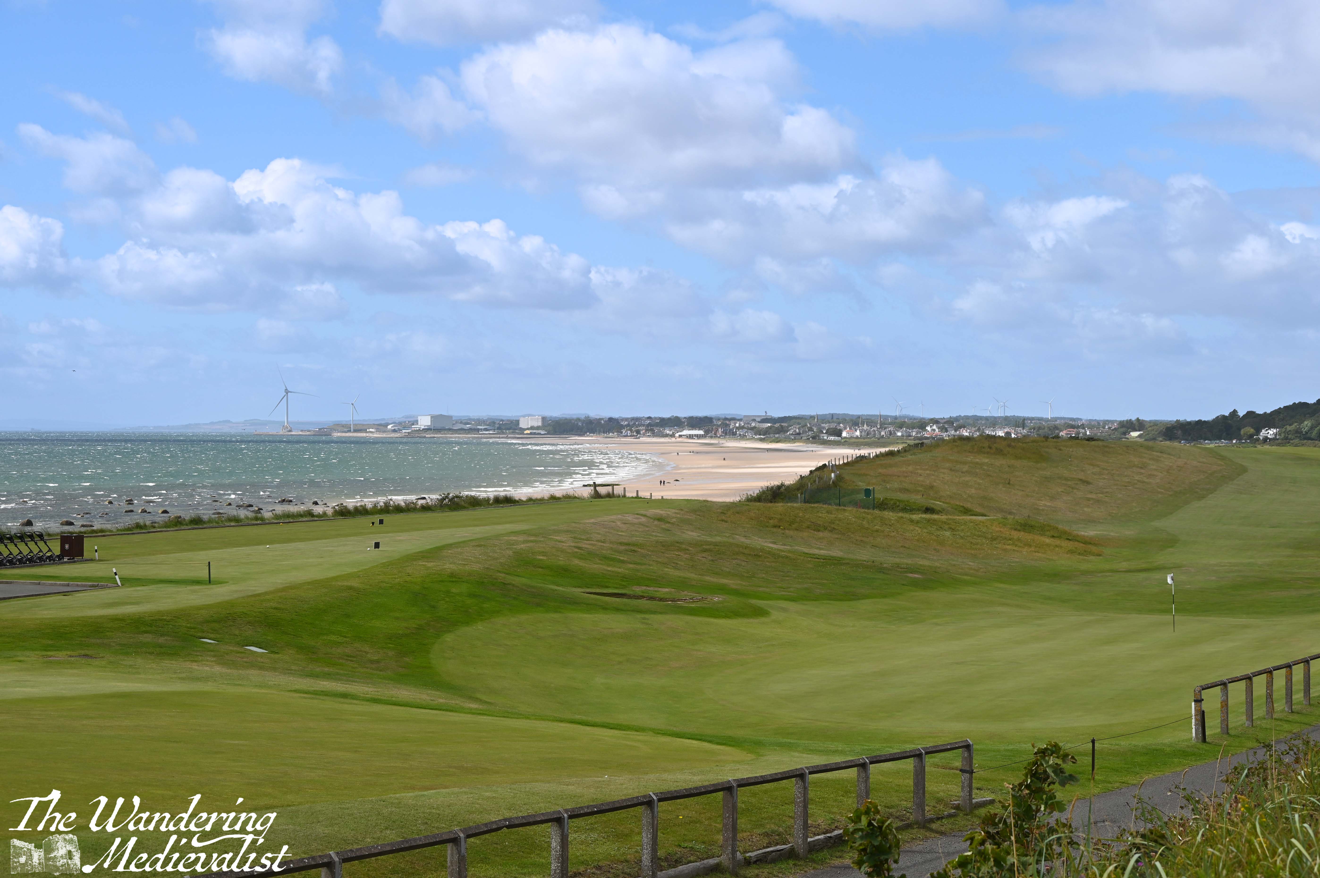
At this point the Coastal Path signage is scarce, but there really isn’t any other option but to follow the road. On the side away from the beach, I eventually passed the Leven Golfing Society – a large red brick building – and enjoyed a nice vista across the golf course to the Victorian-era cottages beyond.
Unlike in other towns, the Coastal Path avoids going through Leven Beach Holiday Park, and there are two routes – a high tide route up behind the park, and a low tide route on the beach.
The sign that indicated these two routes was so faded from the sun that I could not capture it, but I figured that I would work it out when it was time to leave the beach.
I was also delighted to walk past a small group of pet owners taking part in a dog training class on the grassy area beside the beach. I passed more than a few dogs on the beach and this section of the trail – clearly it is a popular spot! Including one small white dog that continued to chew on its squeaky toy for a solid 10 minutes – at first I thought it might be a very odd bird, but soon realised my mistake.
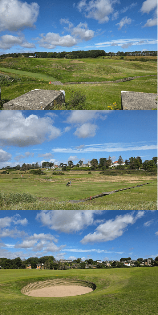
The sign indicating the spot to re-join the high tide route is easily visible from the beach, and so I climbed back up onto the verge between the golf course and the sand. Like so many large patches of the Coastal Path, this was the pattern for the next mile or so – beach and golf course, both providing good camera fodder. (I have an idea to do a calendar of Scottish golf courses, so this walk will be a great help)
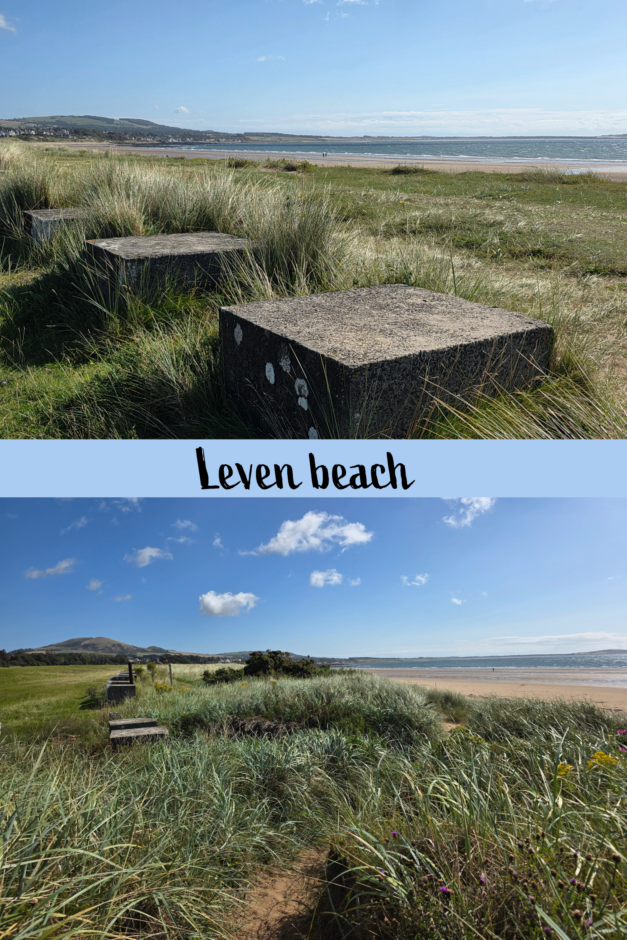
In very little time, the comment I made last week about not noticing WWII defenses this far down on the coast was entirely disregarded when a long line of concrete blocks appeared, essentially marking the border between golf and walking. The Coastal Path sign helpfully points right down the middle, so to some extent it is walker’s choice which side of the blocks you choose.
The track here is quite a bit softer, with deep sandy patches interspersed with grasses, making the going a little harder. I finally became warm enough to shed my cardigan (the wind was no laughing matter), and paused briefly at a bridge across a small burn. The burn cut through the dunes and was lined with sea roses and other wildflowers – really beautiful spot.
Some golf views…
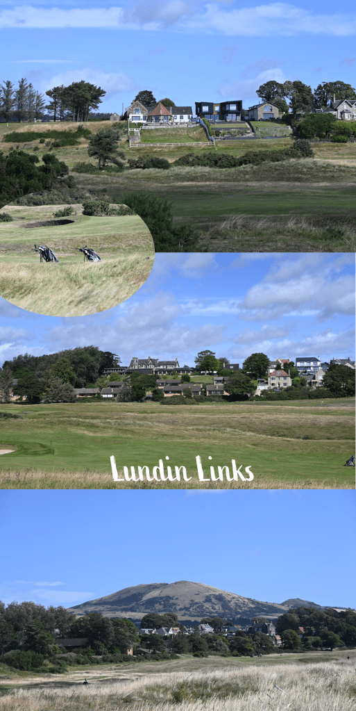
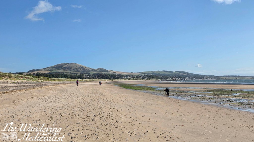
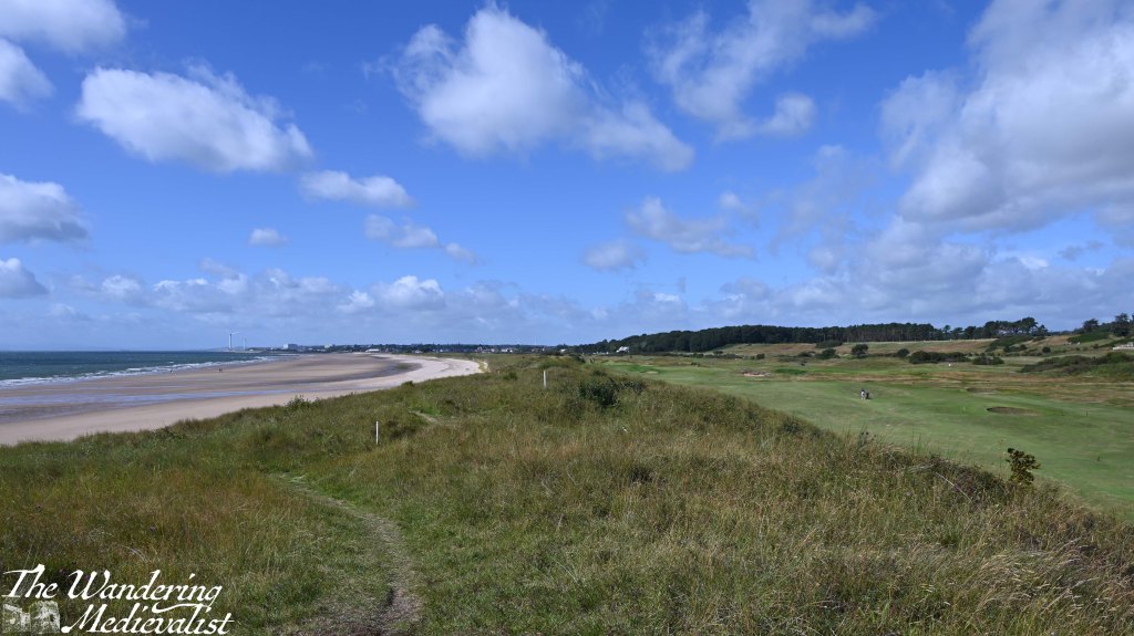
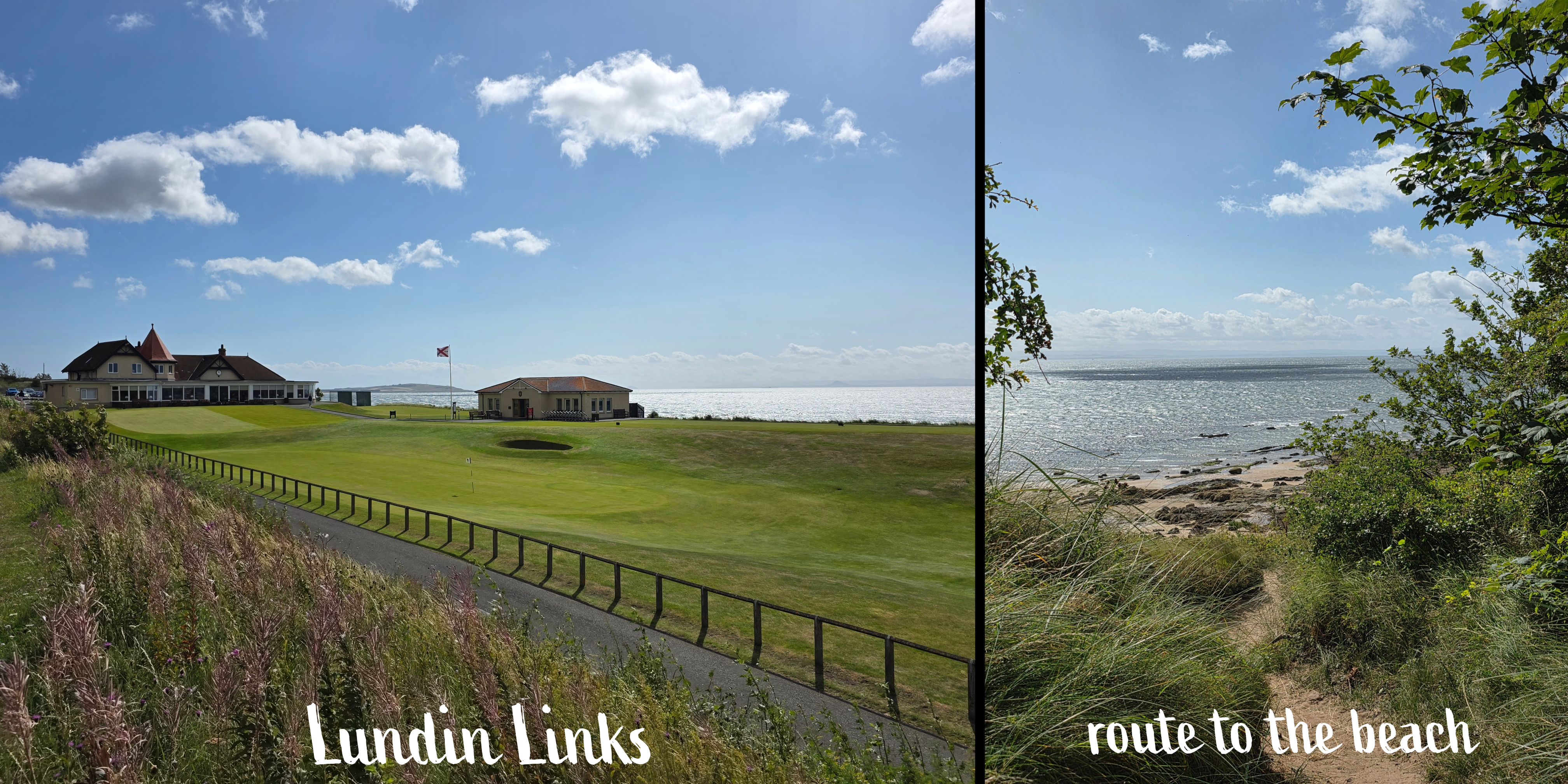
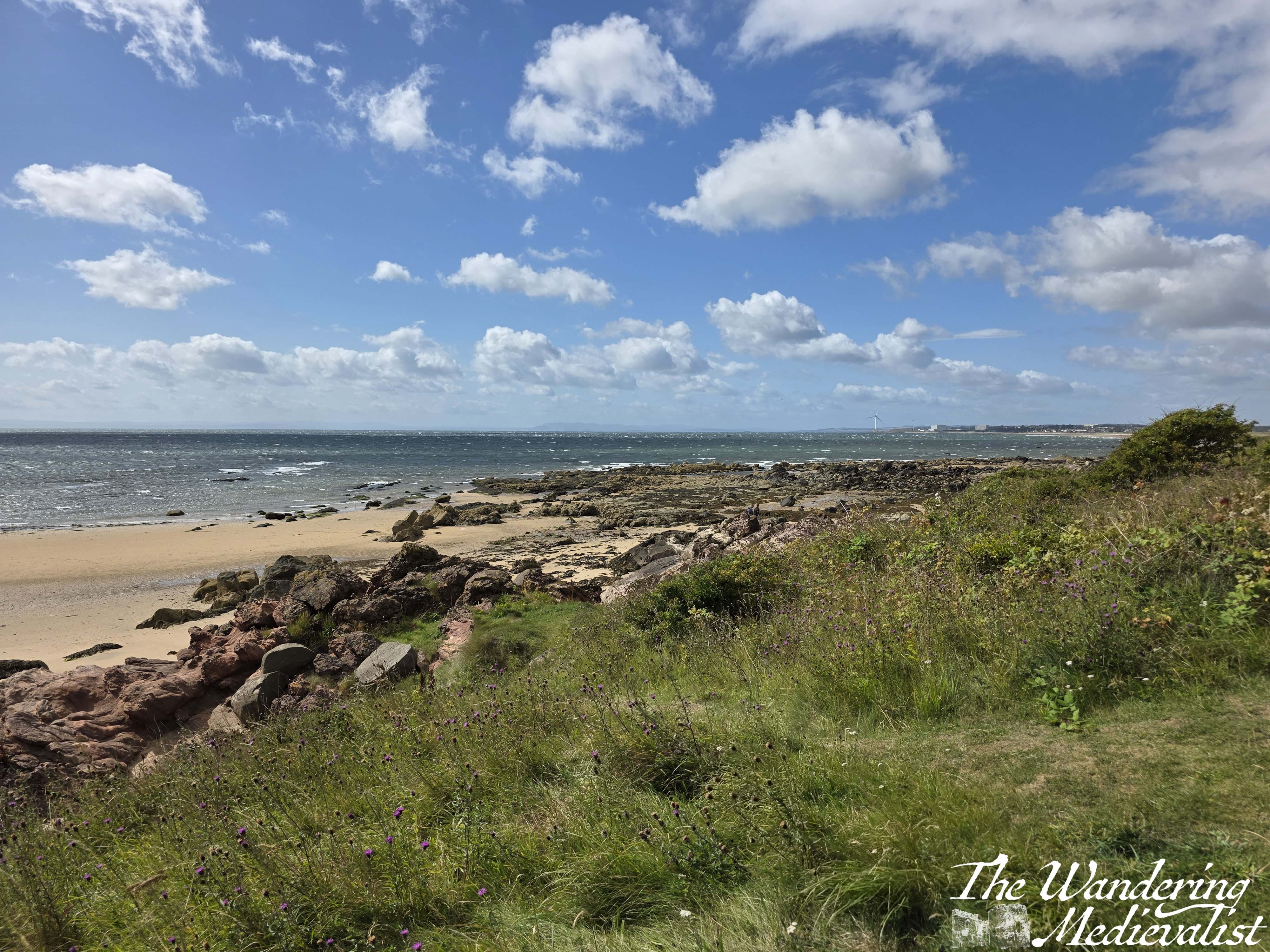
As the path moves around the bay, Largo Law shifts further to the left, and the well-kept houses of Lundin Links appear along the distant edge of the golf course. At some point this becomes Lundin Links rather than Leven, though I’m not sure where – probably at the stone wall that seems to cut a relatively even division down the grassy slopes. On the beach, the pristine sand slowly becomes rockier, first by the waterline and then gradually moving inland, with sand replaced by the rock shelves so common in Fife. With the dunes and long grass edging the beach, it is just a really beautiful few miles, and could probably mostly be done on the sand itself, should a walker prefer the beach.
While on the dunes there are several little trails breaking off, the Coastal Path itself is always well-marked and relatively easy to follow, or so I thought as I was walking.
About a third of a mile after the first burn, there is a second, beyond which the trail climbs slightly up a hill with excellent viewpoints in all directions. I walked for another third of a mile or so only to reach a fence and some rather threatening warning signs, indicating that walkers could cross the golf course at this point, at their own risk. The only other choice was to go down to the beach.

After a quick check of my new map and the internet – which was working for a change – I determined that I had made an error, and that the actual route of the Fife Coastal Path led off to the left back at the most recent burn. As the course was busy, I determined it wisest to go back, unfortunately meaning that I was now about 15 minutes behind my schedule which was again depending upon busses.
Sure enough, the sign for the Coastal Path clearly directed walkers across the course at the burn – I missed it entirely, probably too busy with the burn itself – which is considerably further from the fairway and so safer. Annoyed at myself, I crossed the green and joined a dirt track which soon led into the residential area. The homes here are lovely with abundant gardens, and there are stern signs warning that dog walking must not take place on the golf course.
In about five minutes, there is a right turn to keep following the edge of the course, and then a quick left along the road leading towards the golf club. There is also a dirt track that climbs up a hill beside the road, removing walkers from the traffic, which is ideal.
Some Lundin Links views
Passing through the golf club parking lot, I spotted the signs for the path ahead as well as a large gate, leading beyond. There is an almost immediate right turn (though a path also leads straight ahead), and suddenly I found myself emerging from the tree line to a stunning view over the coast. It reminded me ever so slightly of certain parts of Cape Cod, with beach-adjacent trees, long grass and rambling sea roses. The path wound down the hill, with sand and rock beyond; do be careful if you get too immersed in the view, though, as there are several deep steps that you might miss or – ahem – slip down if you are too busy looking up.
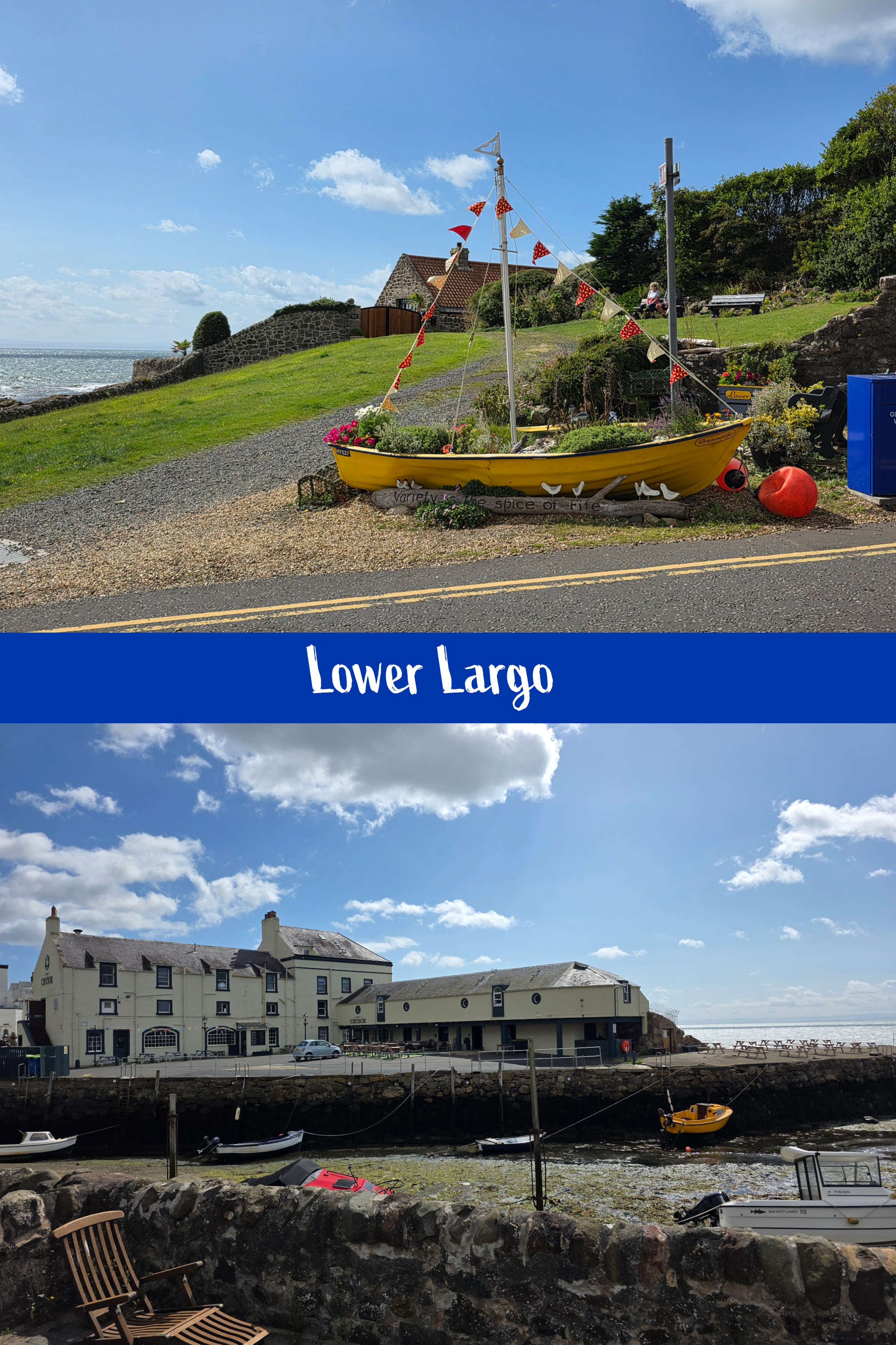
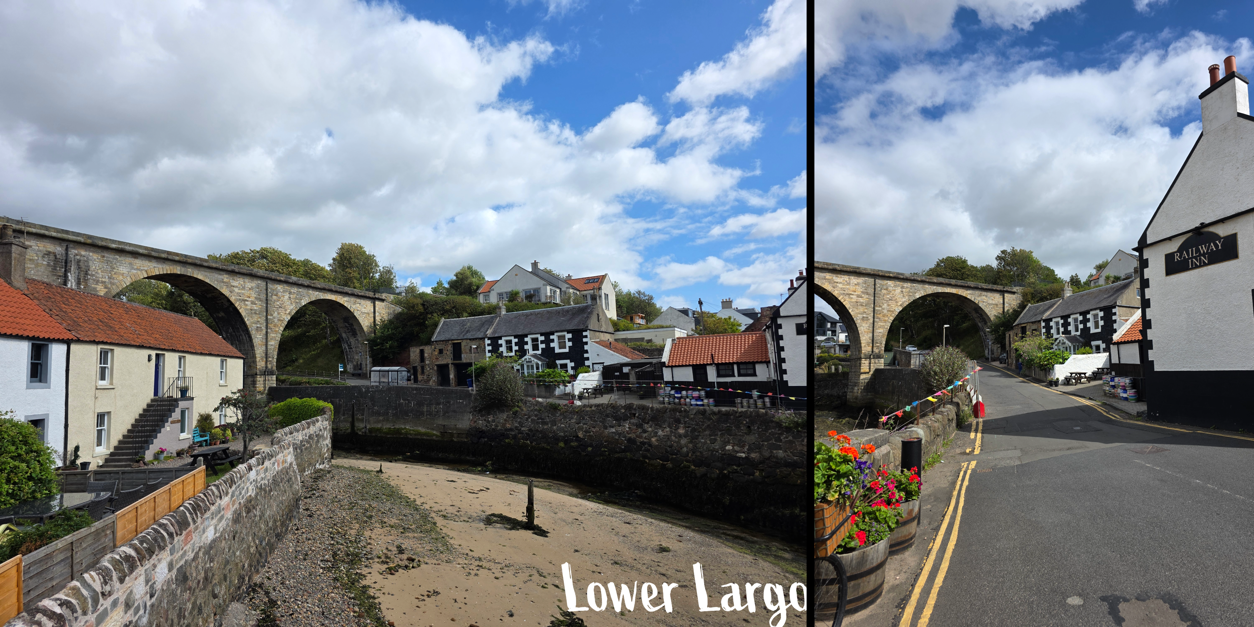
This was by far my favourite part of the walk, and the ocean colours were extraordinary, almost Caribbean in their blue-green quality. There are a few side-paths but keep going straight and you will be fine, eventually reaching a stand of trees and a gate, beyond which the trail enters the edge of Lower Largo. There is a large orange house between the path and the coast, and you are walking behind identical coastal cottages for a short while. The homes are mostly old fisherman’s houses that have been restored, and ahead is the viaduct that used to carry the train.
As the road winds down into the town, be careful as there is not always an obvious sidewalk; this feels much more like the towns of Anstruther and Crail, and shortly the road crosses a narrow bridge over the harbour. Ahead is the Crusoe, a popular local restaurant, and to the left a beautiful old mid-eighteenth century inn, the Railway Inn, offers bar snacks and a beer garden.
The Coastal Path continues with a brief jog to the left, then straight along Main Street. You will pass a small grassy area with a stone fence, and in the middle a sculpture by a local artists, Alan Faulds. There is more of his art further on – very unique stuff.
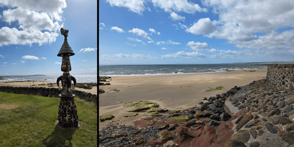
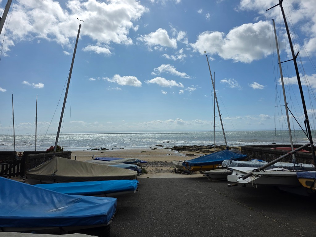
By this point, my walk was quickly coming to an end, so I decided to mark the close at the Aurrie, just next to a car park which should really have been called a boat yard. I took a quick moment to enjoy the view over the beach, then turned inland.
If you are also planning to finish a walk here, be warned that the street leading up the hill – Durham Wynd – is steep and without a pedestrian path for the first section at least.

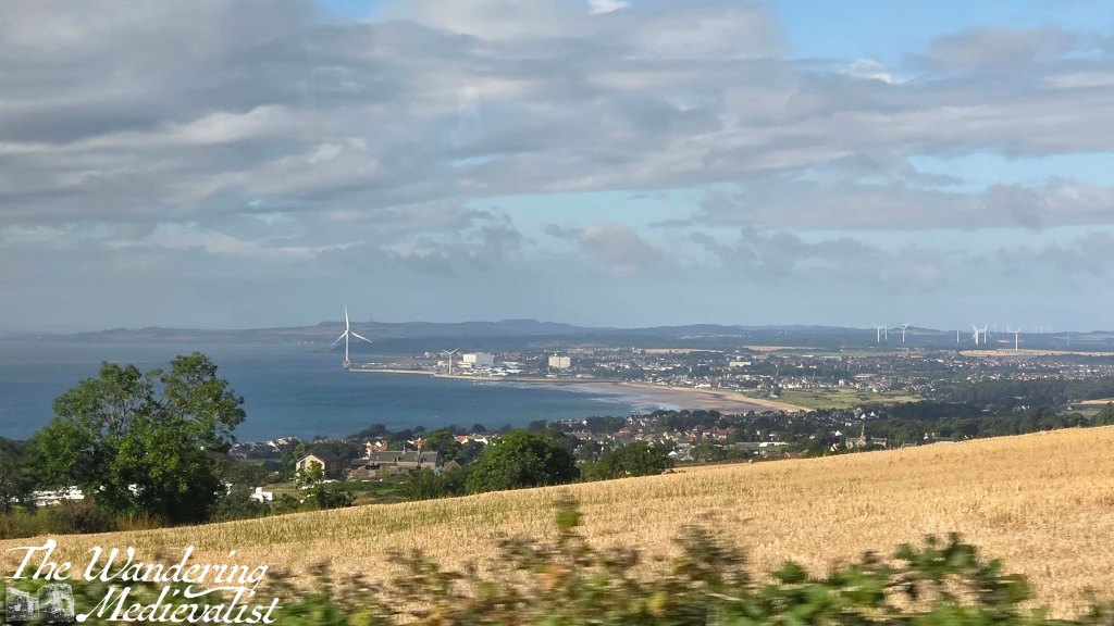
Beyond that it was an easy five-minute trip to the bus stop and I caught the bus with a few minutes to spare, in the meantime keeping the company of a field of cows. One note about the bus trip back – I always forget about the great view of St Andrews as you come over the hill past Cairnsmill Caravan park. I just managed one today, though the bus was jerking about and bumpy.
Another note – one of the aspects of the Fife Coastal Path about which I am continually impressed is how you can turn a relatively unexciting-looking corner and suddenly be faced with a jaw-dropping vista. It has happened so many times now that I can’t even count, but I am always amazed. It really makes the heat, sweat, bugs, and bouncing around on public transport worth the effort. Large portions of the path are quiet, so I am often on my own, astounded by the peace and beauty, and counting myself lucky that I have the opportunity to pursue this goal.
My next walk is likely to be the last one I can manage before autumn travel, and I have planned a good one – 6 miles, at least one castle, and as usual phenomenal coastline. I hope the weather stays good, though wouldn’t mind if it cooled off a touch…
Until next week!