In spring of 2021, Scotland had been in pandemic lockdown since Boxing Day 2020 (the day after Christmas). Then finally, in April, the word came – we were for the first time permitted to leave our ‘local area’. We could leave Fife!
A walk was the most inevitable choice for our first out-of-county adventure, as there were still plenty of restrictions in place and staying outdoors was ideal. So, we chose for our first adventure a walk we had never tried before – the Hermitage Woodland Walk.
Through reading various websites, we opted to drive to the Rumbling Bridge end of the path and walk down towards Ossian’s Hall. At first, it seemed an excellent choice – the path was quiet, and the day was pleasant and sunny. But, as we made our first turn onto the Hermitage walk proper, we discovered that we were far from the only people with this idea – hordes of walkers, many clearly not used to such excursions, were enjoying being outdoors. We passed numerous people in flip-flops and carrying take-away coffee cups, girls in sundresses that were not designed for woodland walks, and families with young children and prams that were struggling on the rocky path. In fact, it was so busy that we only just reached the hall before turning back and fleeing to the quieter, further away paths.
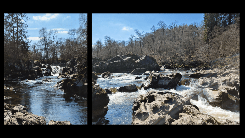
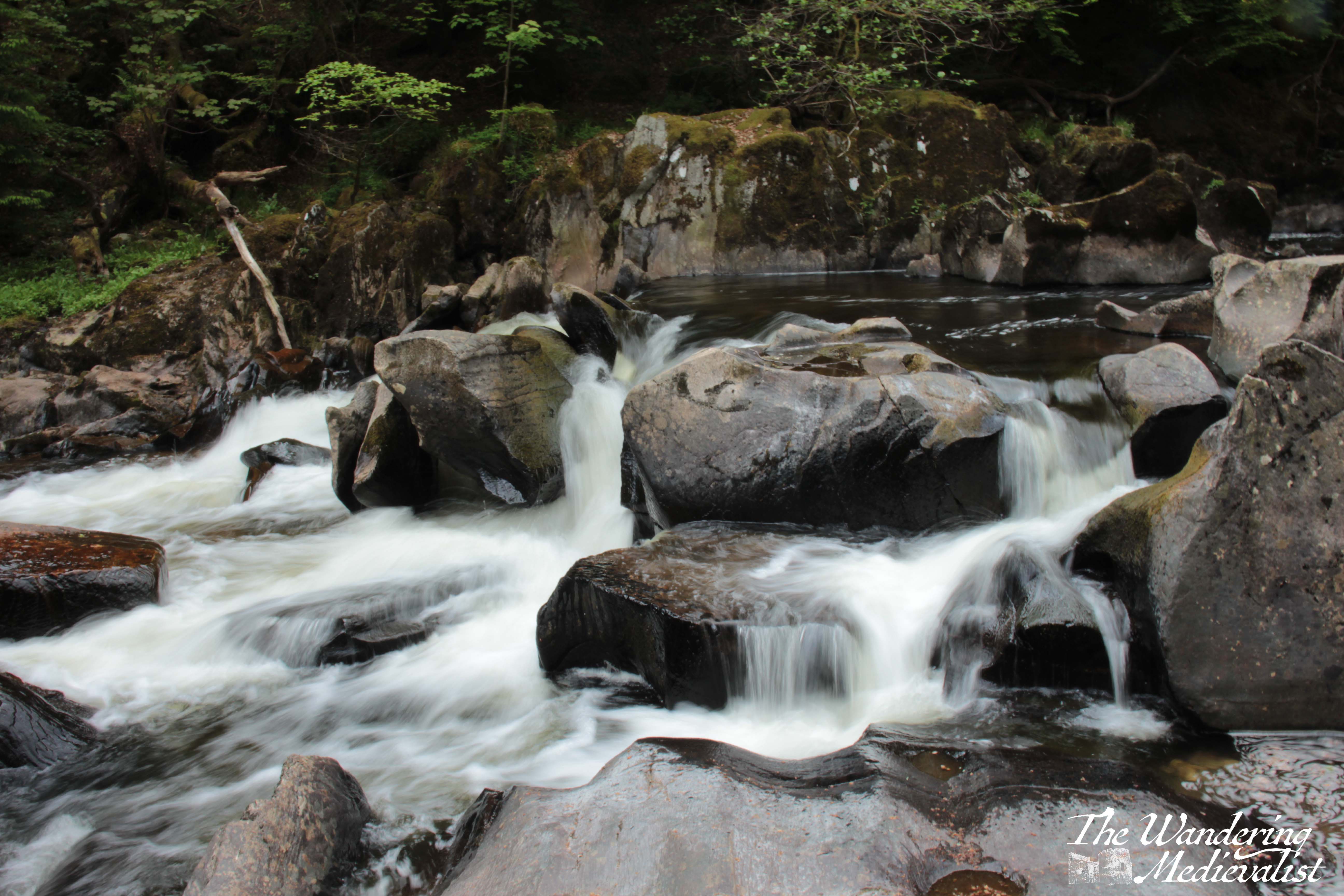
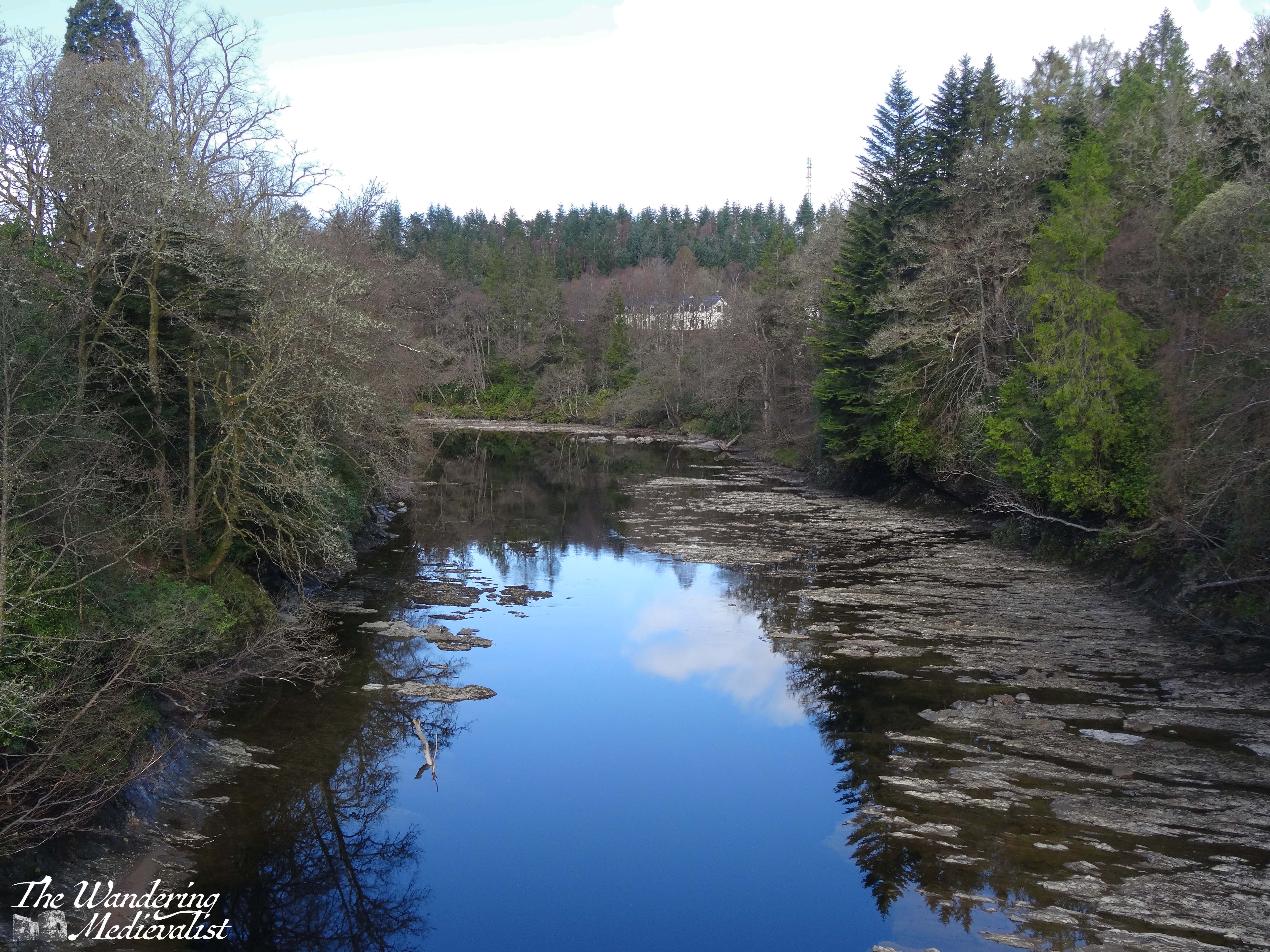
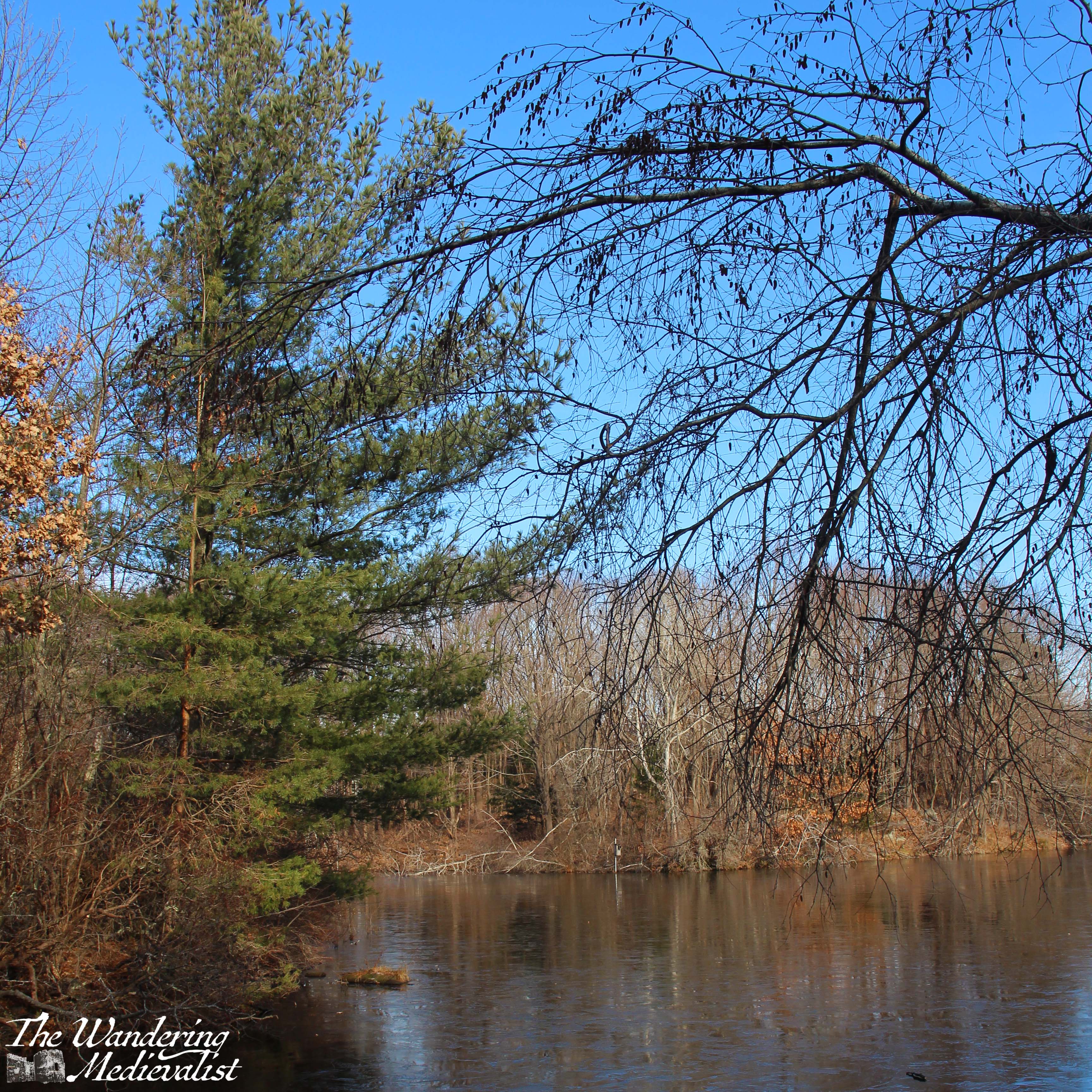
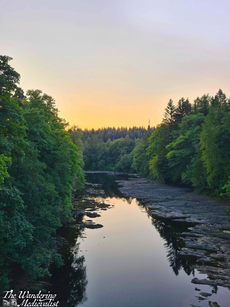
River Braan above the bridge
A quick note about the route we took in 2021: parking in the Rumbling Bridge car park – which requires turning up the A822 before you reach the Hermitage car park – allows you to hike downhill first, then back up to the bridge, and also to explore the River Braan as it tumbles over boulders and small falls. When walking from the ‘proper’ car park, it is easy not to venture all the way up to the Rumbling Bridge, but I definitely recommend doing so, particularly if you have a liking for rivers and waterfalls. But I’m getting ahead of myself.
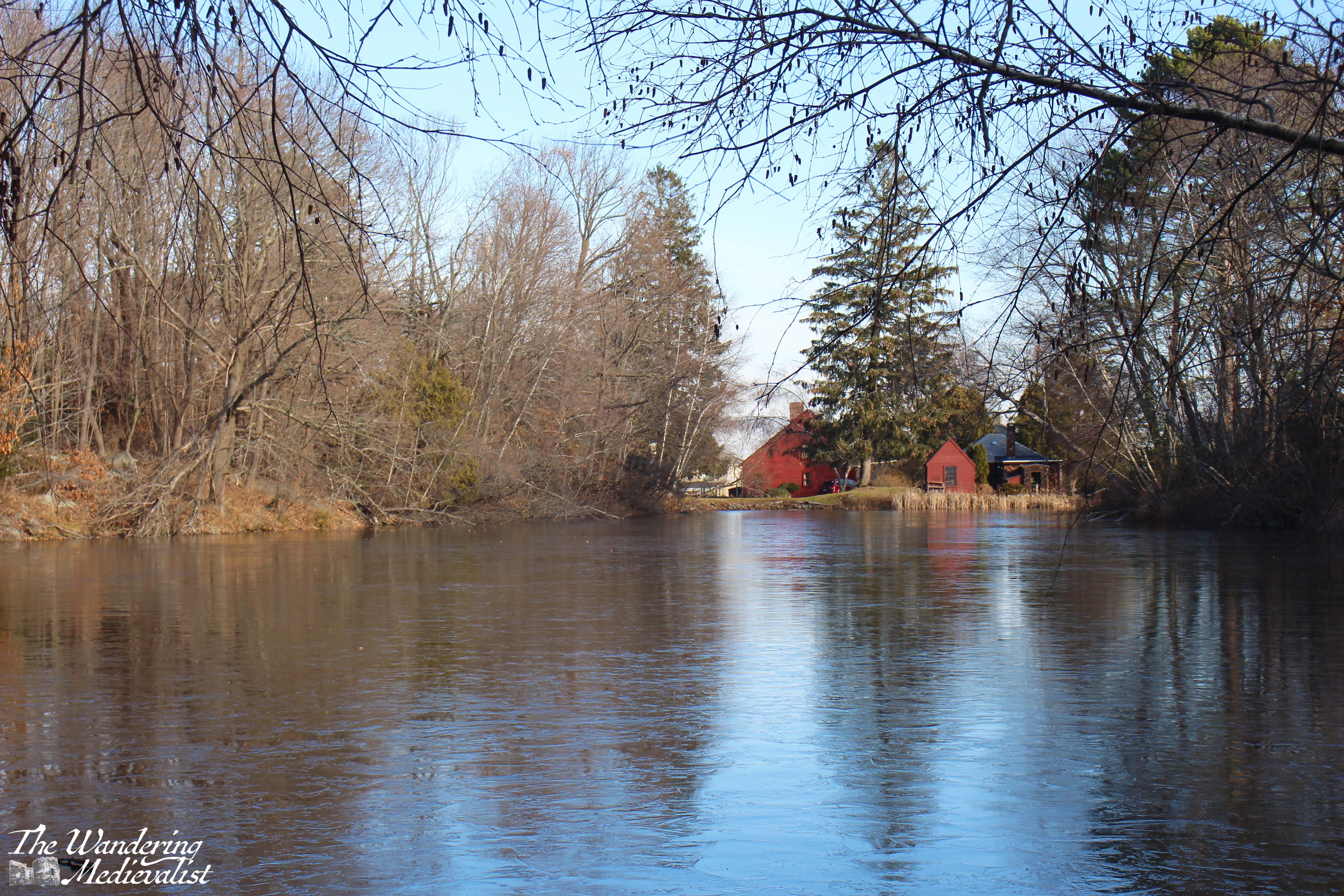
More of the river above Rumbling Bridge
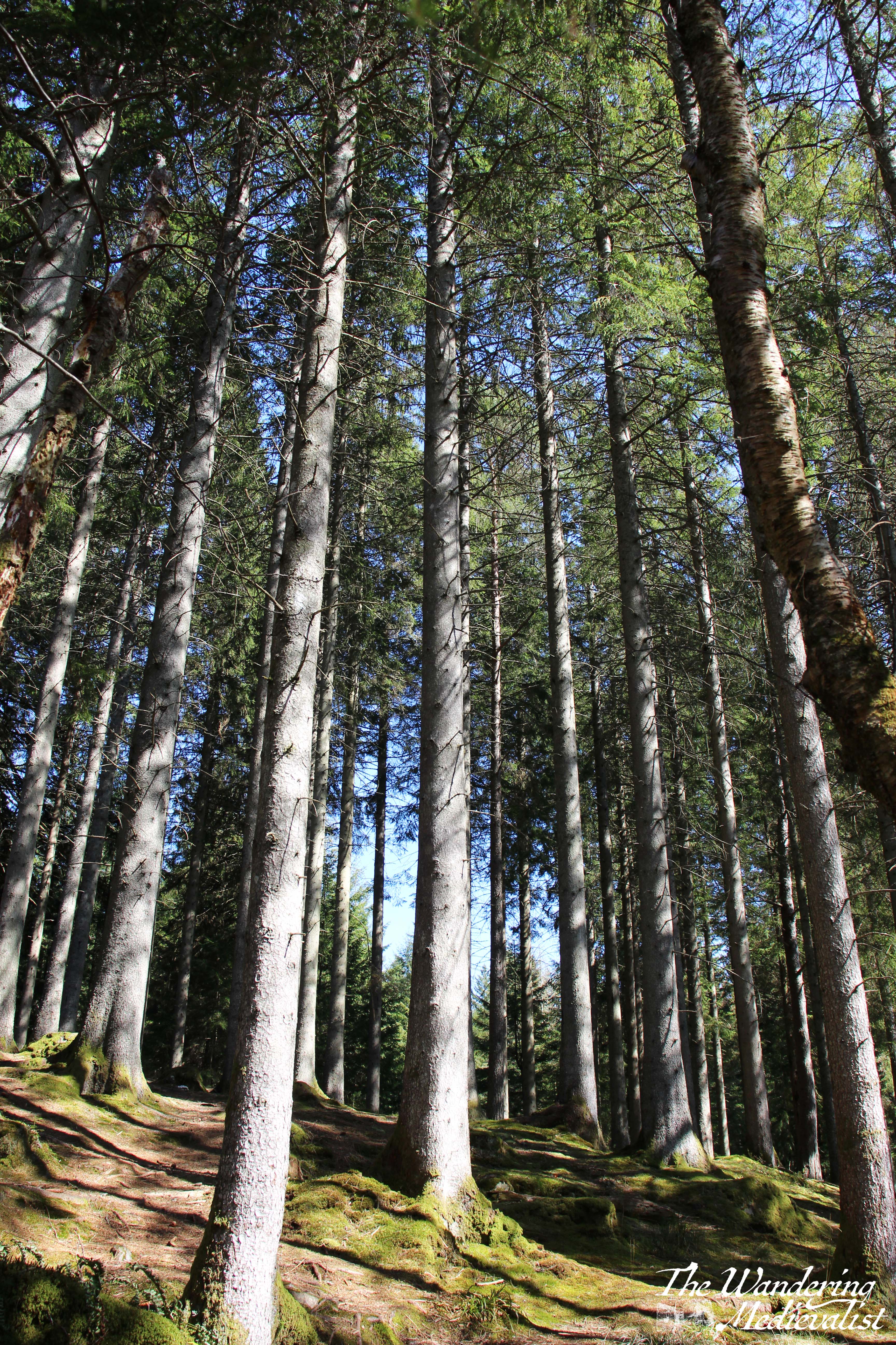
My second trip was with a work Step-Count Challenge group about a year later, and it was on this trip that I think was truly able to enjoy the beautiful path. My third trip, also with friends from work, was equally lovely, and we found – several years after the end of pandemic restrictions – a set of picnic benches, coffee and donut wagon, and port-a-loos that were passably clean, all right beside the main car park. Starting here, the path passes under the rail line and follows the river through majestic trees.
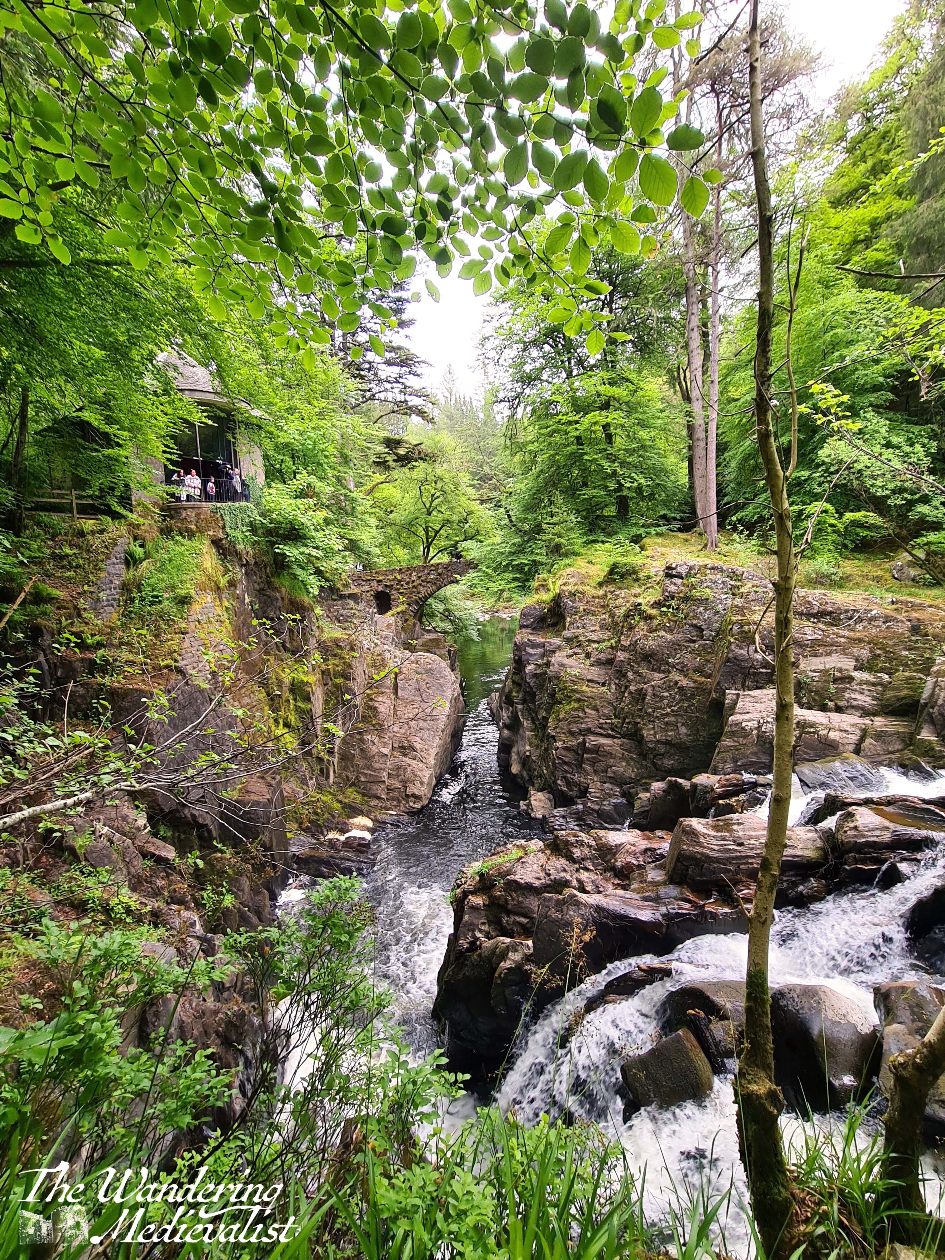
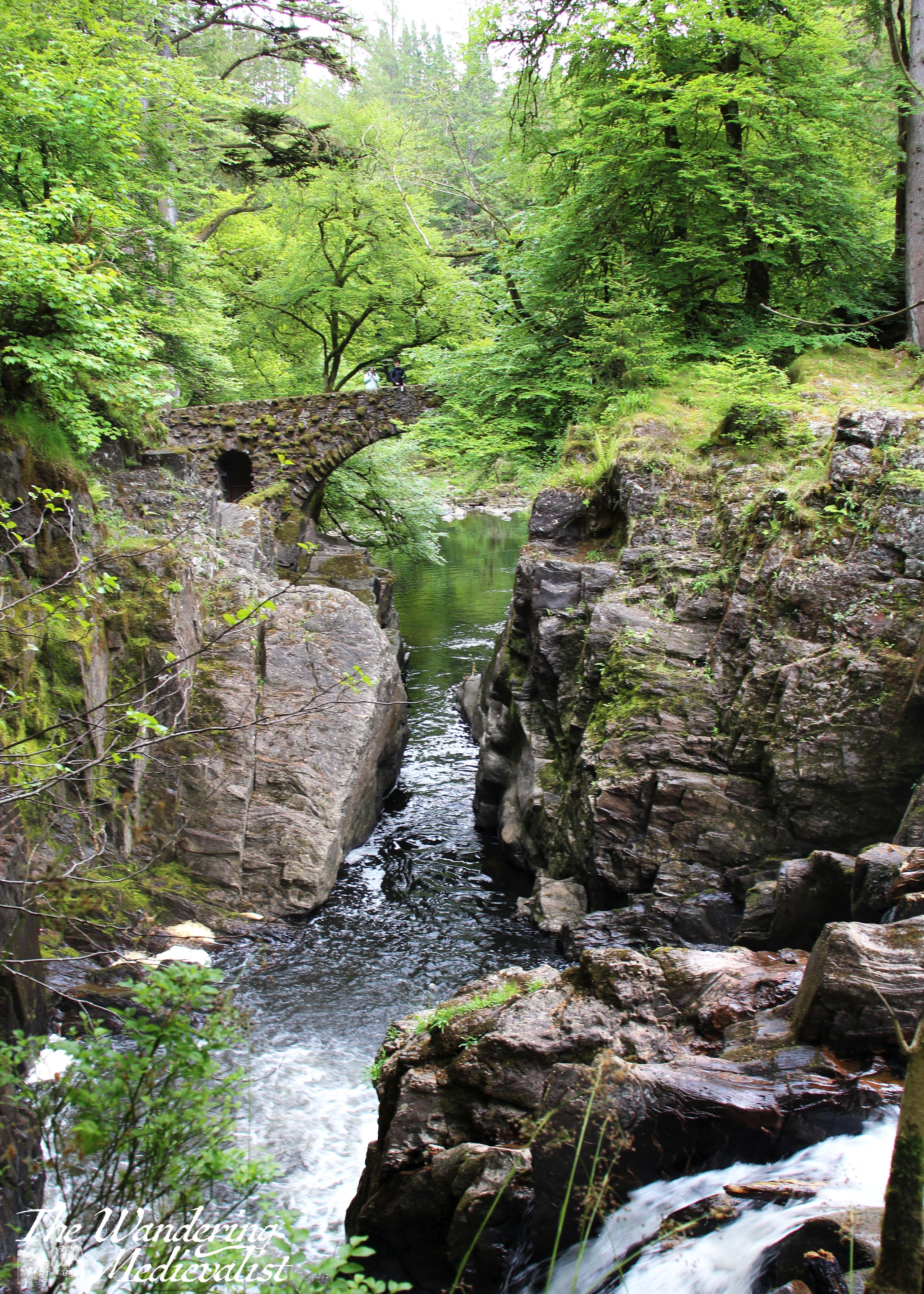
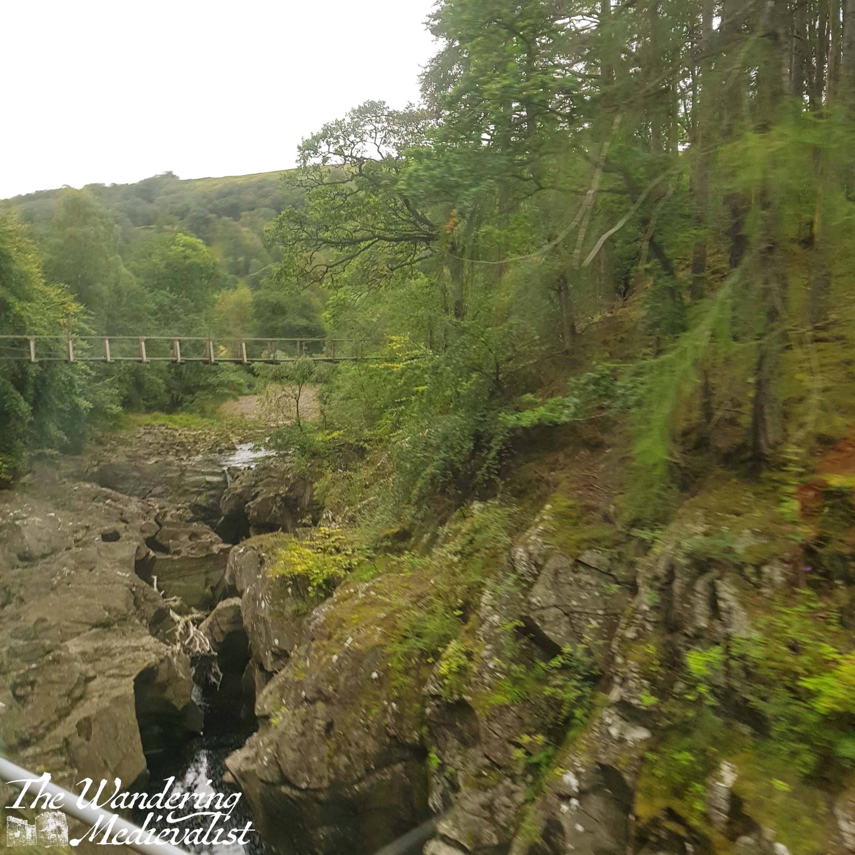
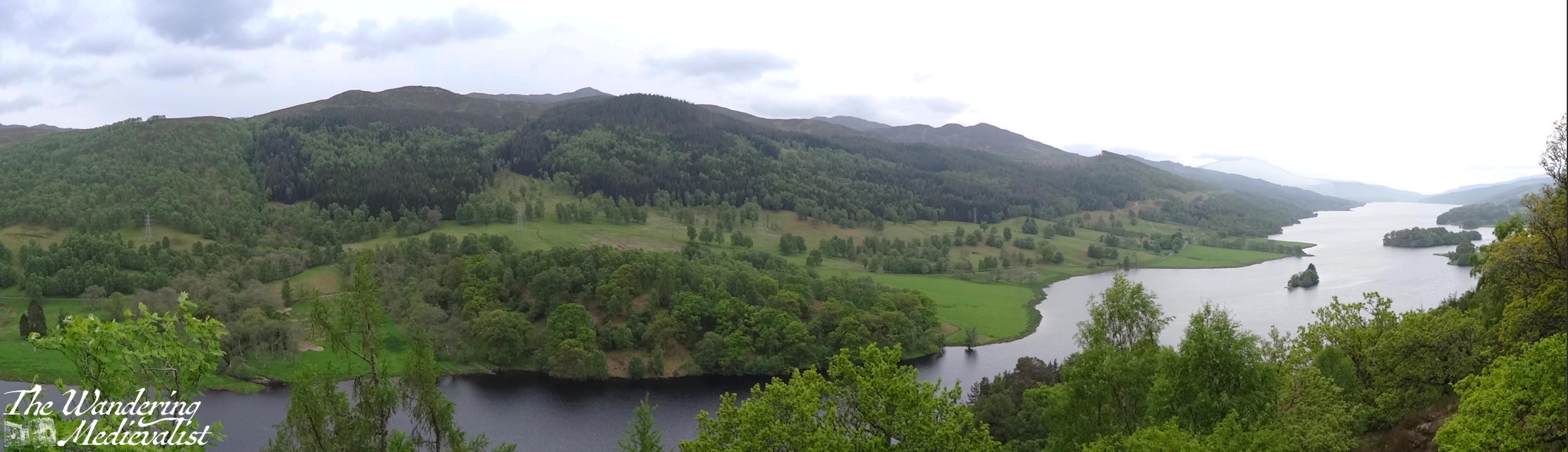
This area is wide and mostly flat with only the slightest incline, though the hillside rises sharply above the path. In a short time, there is a fork in the road, and taking the left-hand option leads to the highlight of the visit – an almost Tolkien-esque stone bridge and Ossian’s Hall. It makes sense first to take the short trip down the hill to stand on the bridge, where you can get a stunning view of the Black Linn Falls as well as the large pond beyond the bridge.
If you cross and follow the path to the right, you eventually find yourself with a perfect view back towards Ossian’s Hall. The hall was constructed in the 1780s to replace a summerhouse. In fact, the entirety of the Hermitage is not natural landscape, but was designed as a pleasure ground for the Dukes of Atholl. Once one is aware, the towering Douglas firs do seem a touch too perfectly planted, and indeed the almost elvish or fairy-like forest is a touch too magical.
The view of the falls is even better from within the hall, though at busy times you may have to wait your turn for the best view, as the viewing balcony allows only about 5 or 6 people comfortably. Beyond the hall, there are several places where you can look back at the hall and bridge. I have seen drone shots of the falls where the drone has flown down the river and under the bridge, something I wish I could do myself!
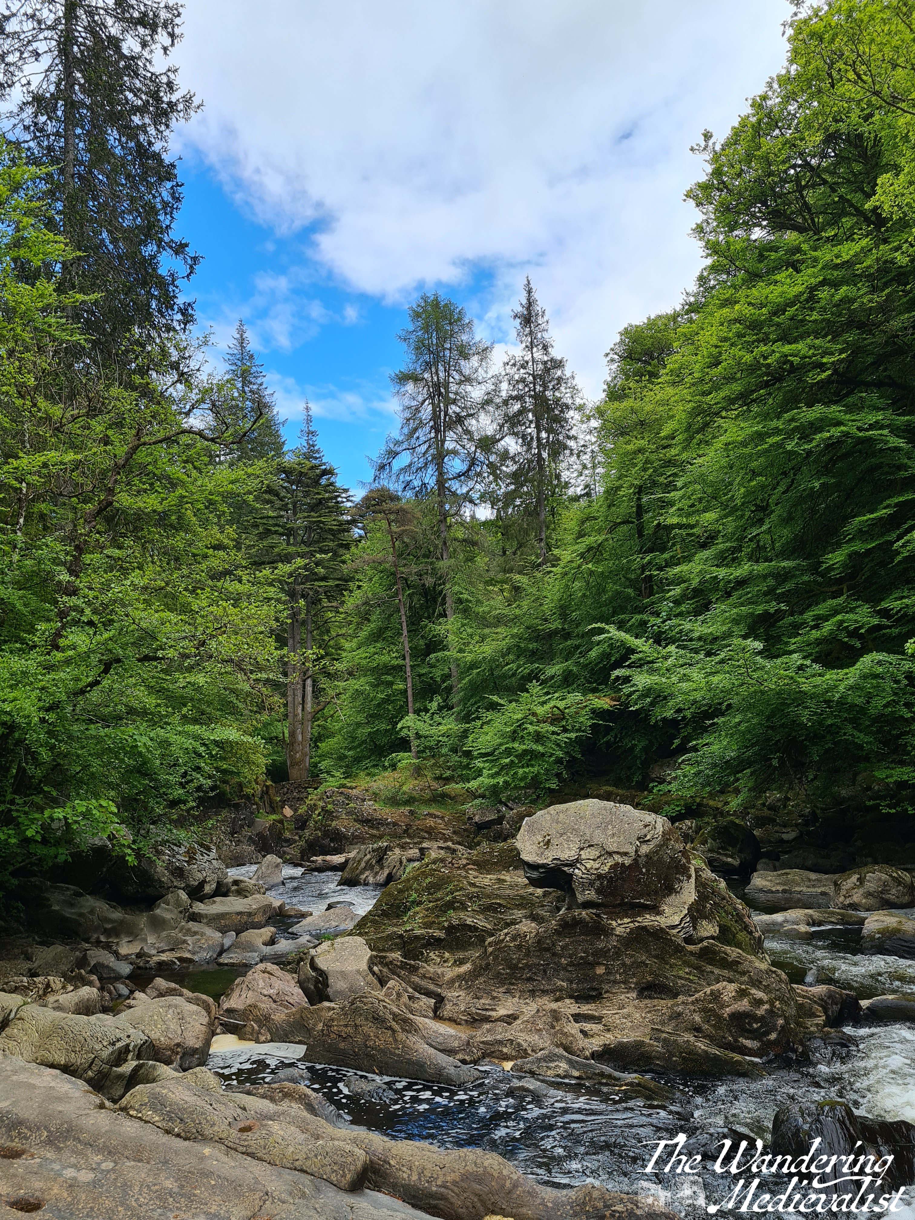
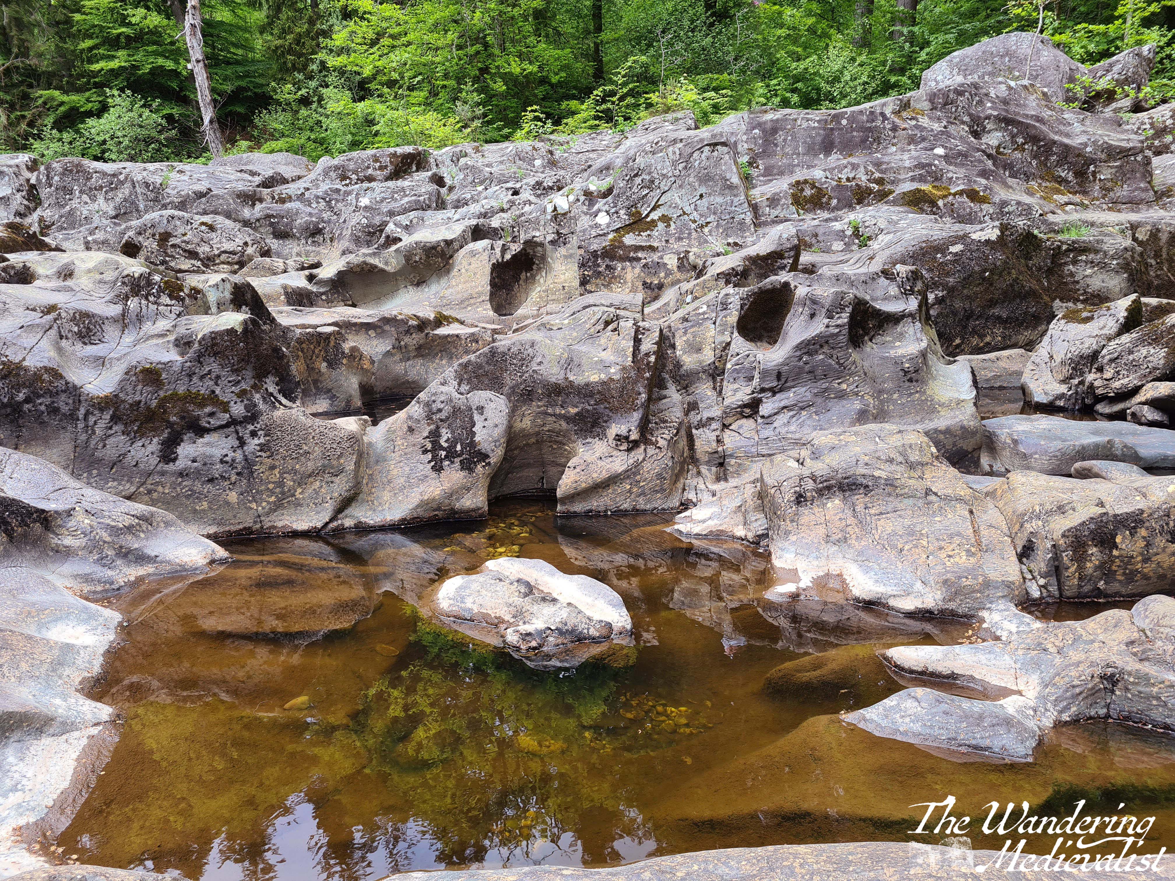
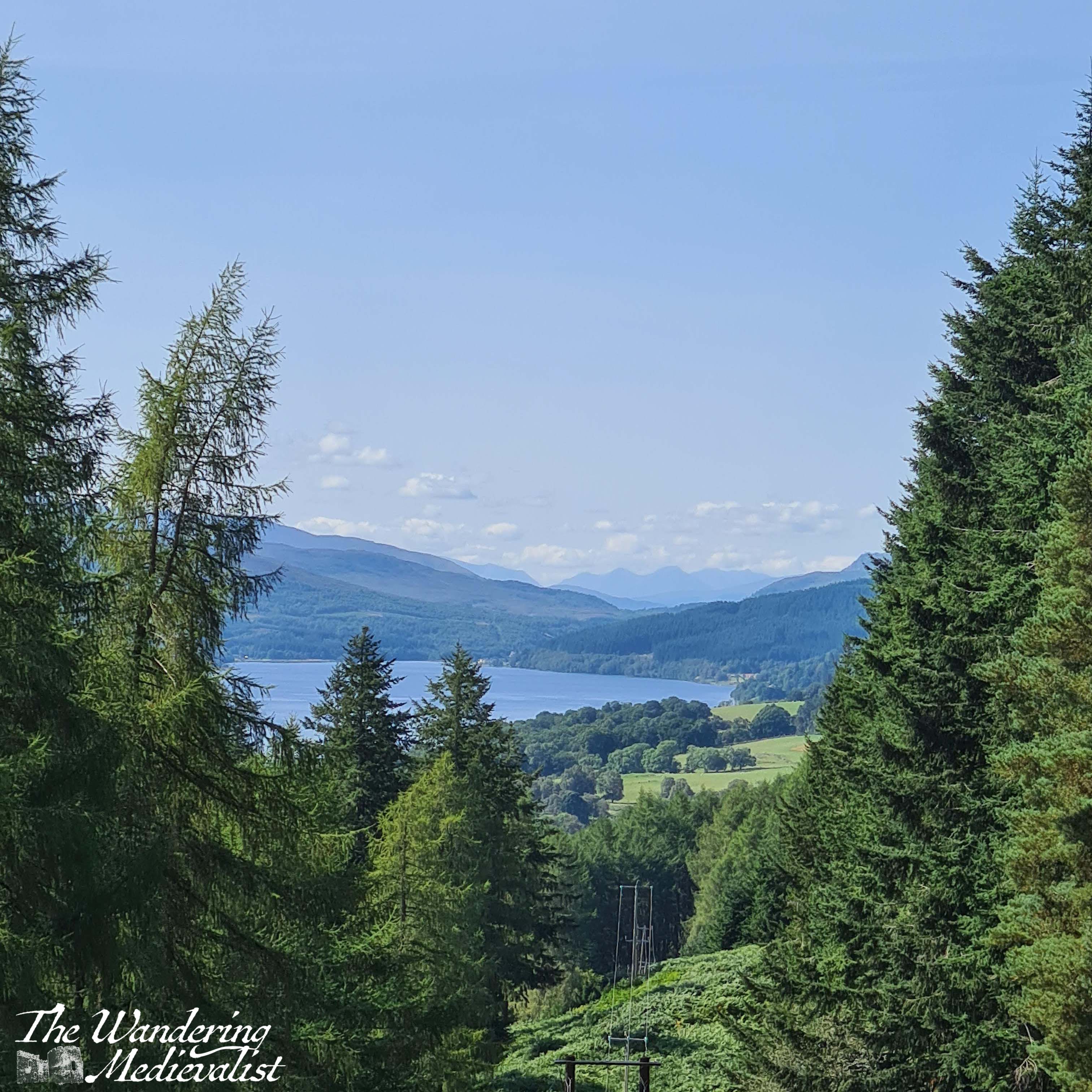
Once you have had your fill of the fantasy land around Ossian’s Hall, you can continue up the path, which starts to gradually ascend as it follows the river. On several occasions I was driven to remark on how much it reminded me of rivers in the White Mountains in New Hampshire – rocky, the water tumbling over the rocks to form peaceful pools and swift rapids, blue sky and trees growing almost out of the riverbank. When hiking with the Step-Count group, we had brought a picnic and found ourselves an ideal picnic spot on some rocks along the river, with views in both directions.
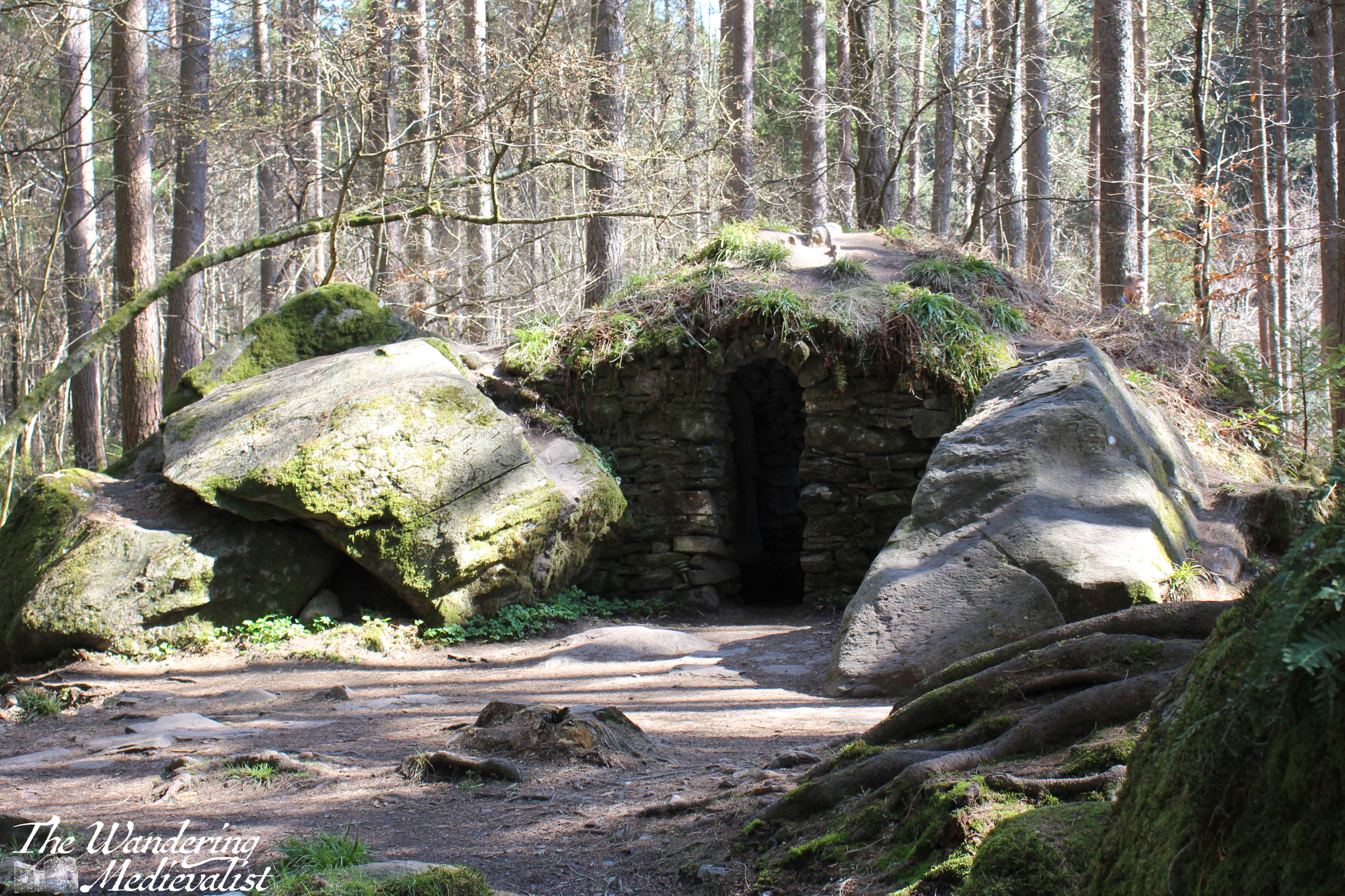
Gradually the path lifts away from the water, as the river sits in a gorge many feet below. There are several side-trips one can take as paths cut closer to the edge of the water (sometimes a steep drop into the gorge) or into the woods to the right. A notable detour is Ossian’s Cave, another constructed portion of the pleasure grounds (called a folly) where, if one is brave, you can duck into the rock construction. It is arguably more pleasant from the outside.
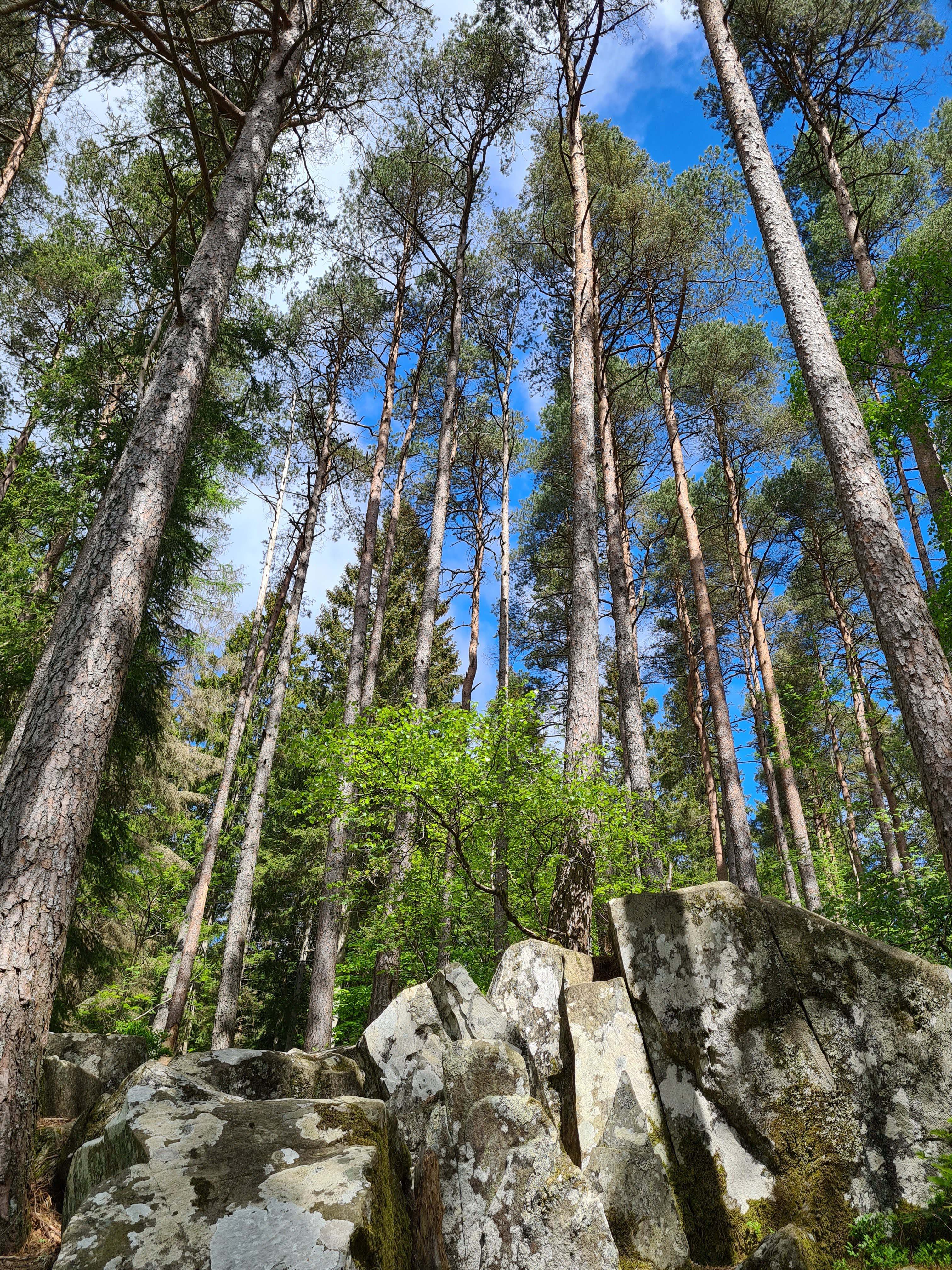
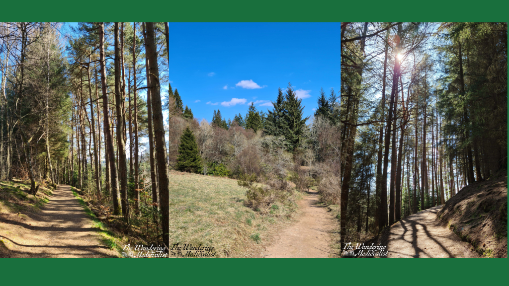
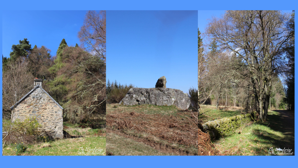
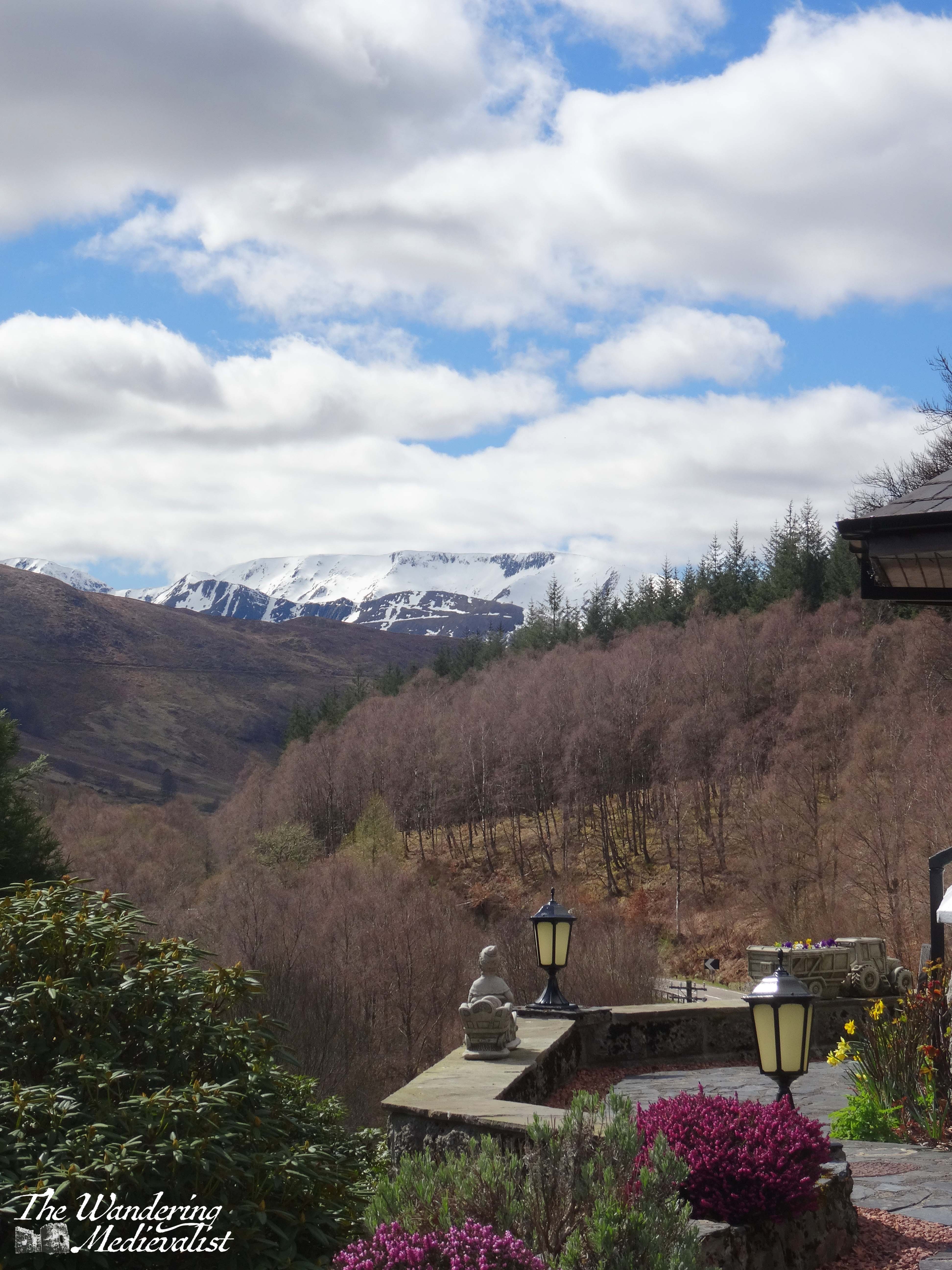
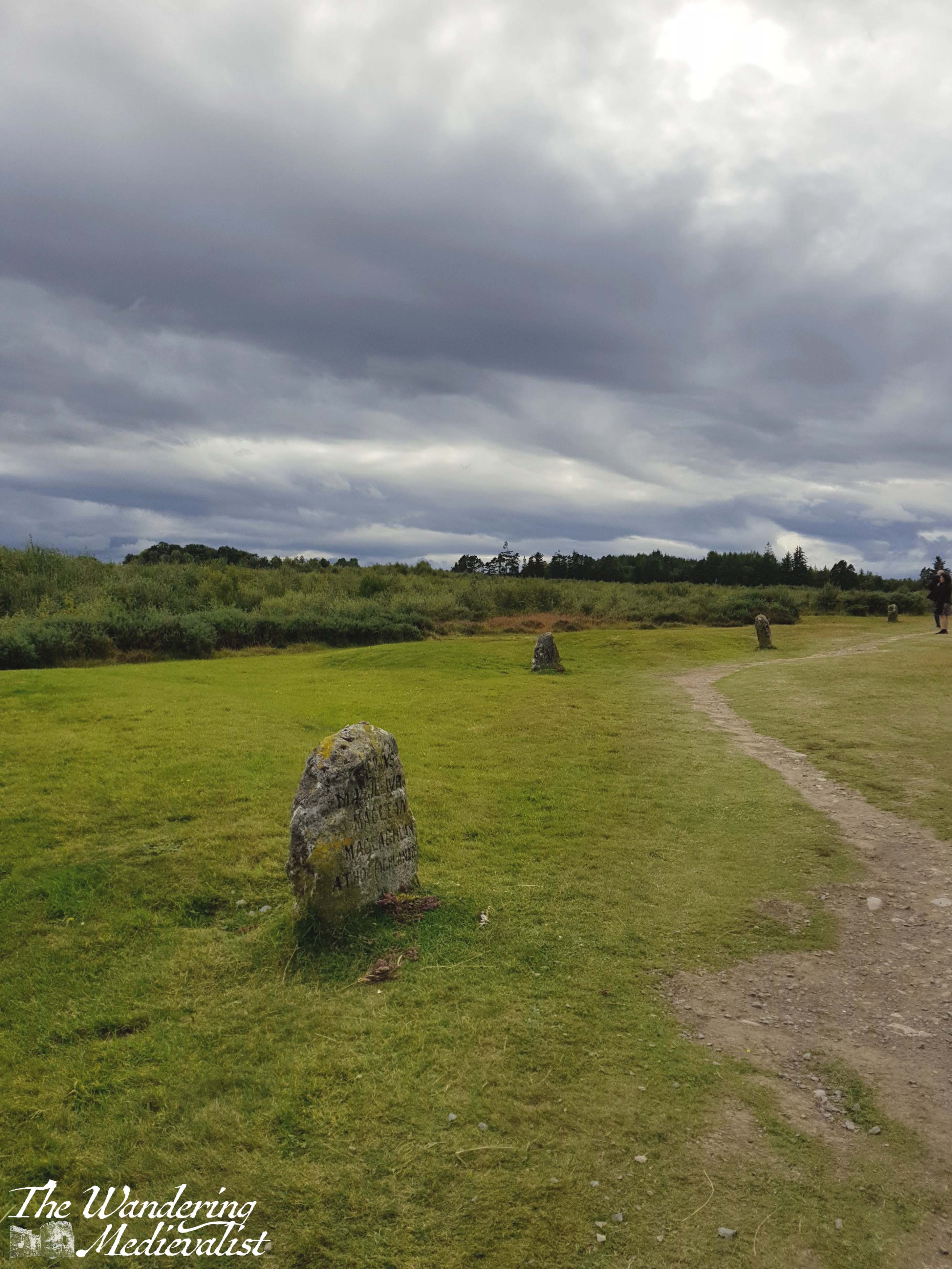
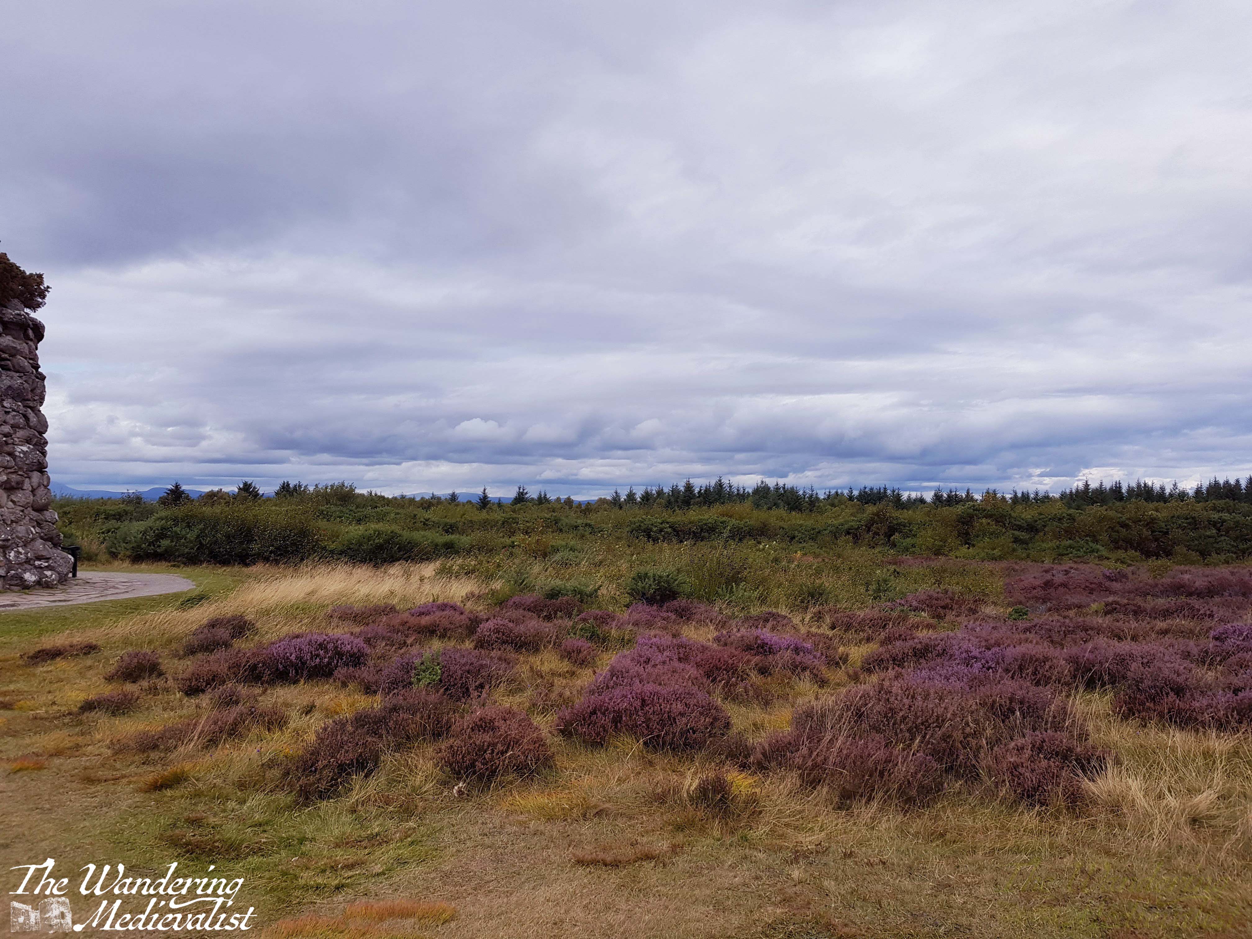
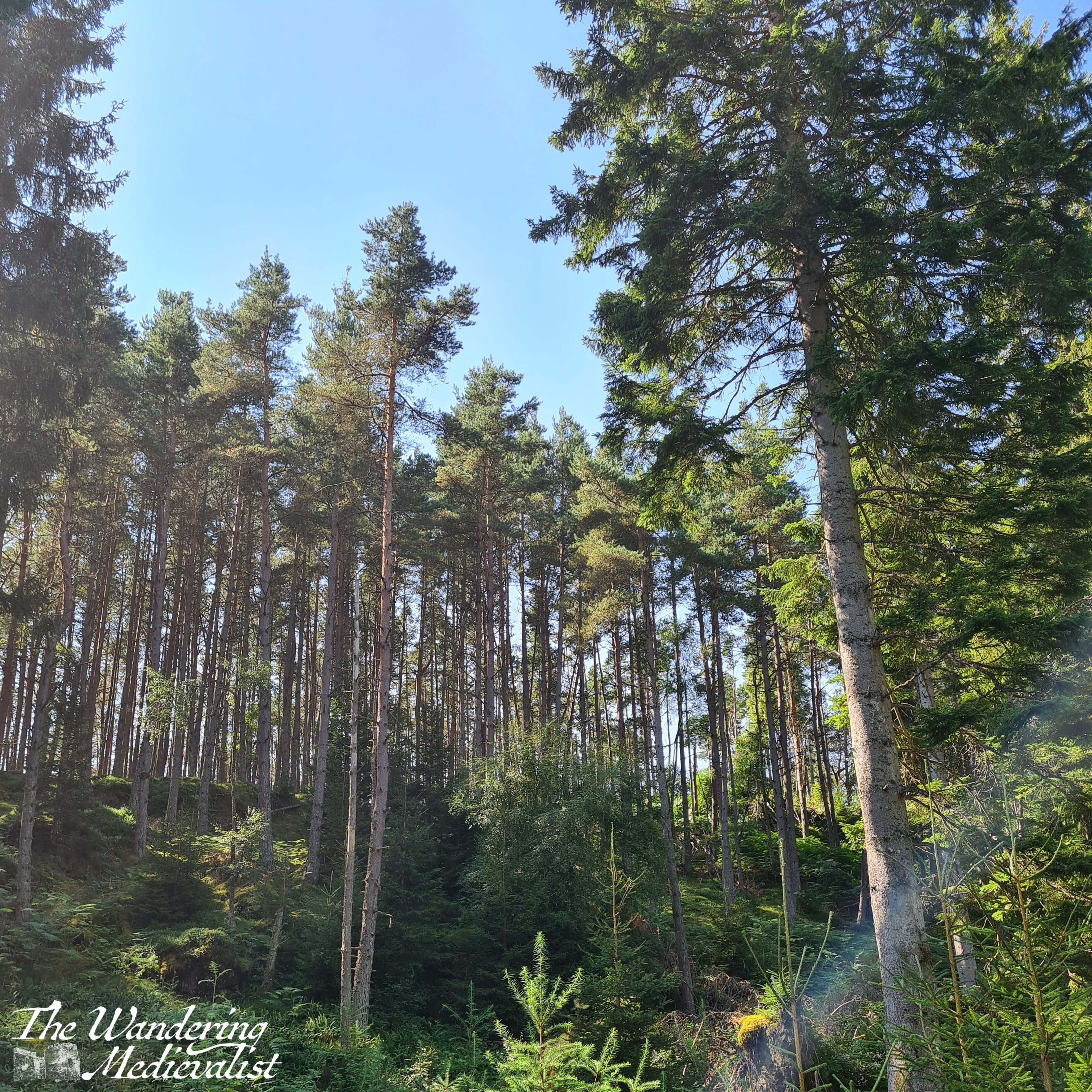
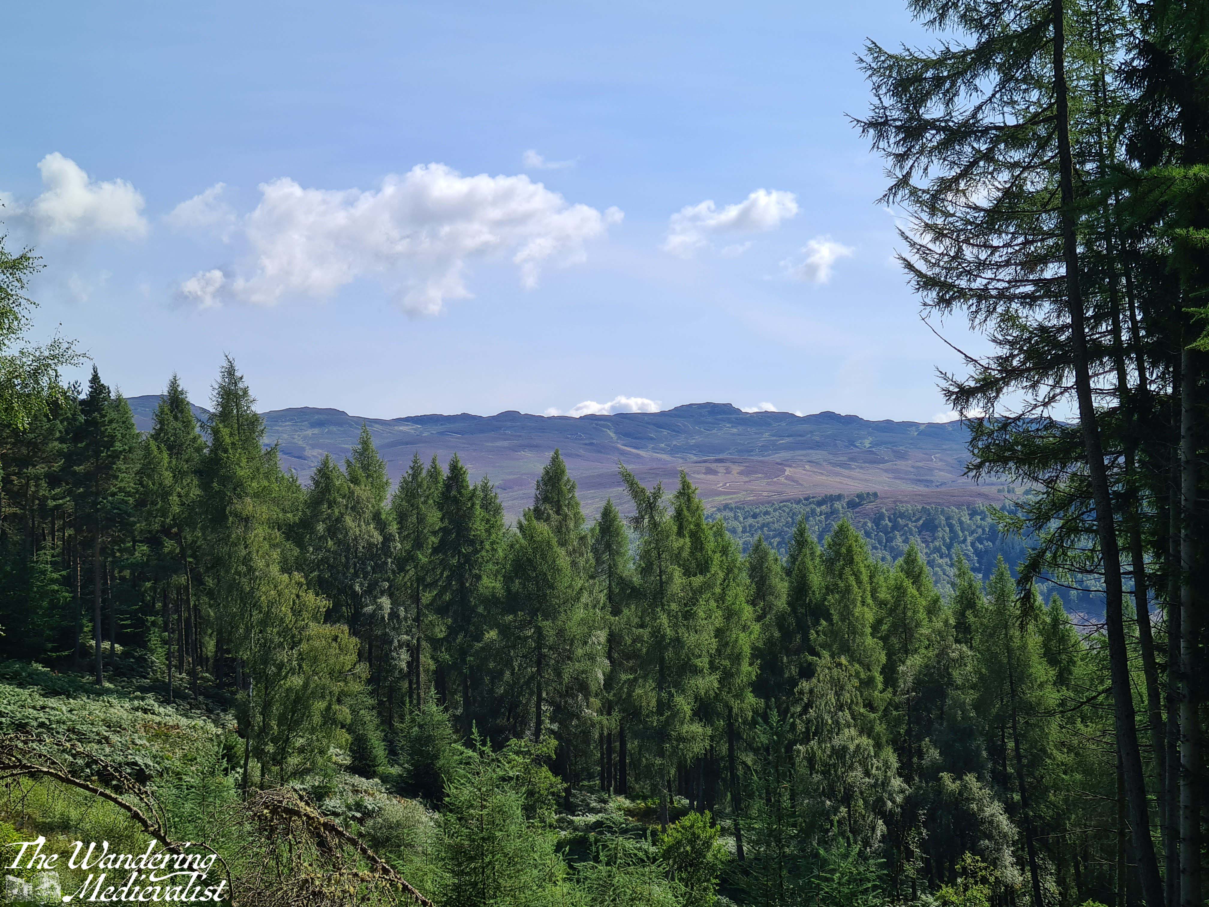
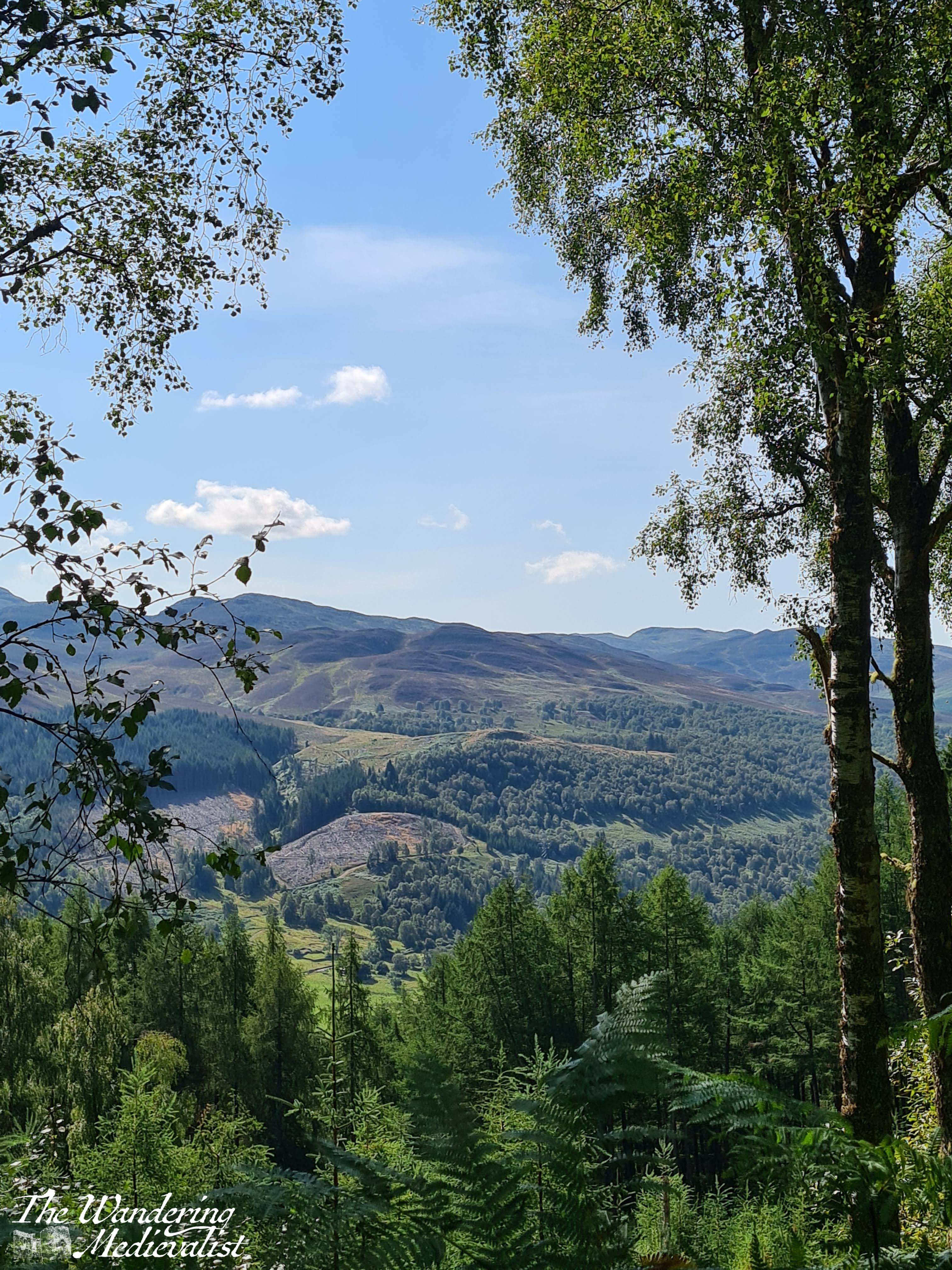
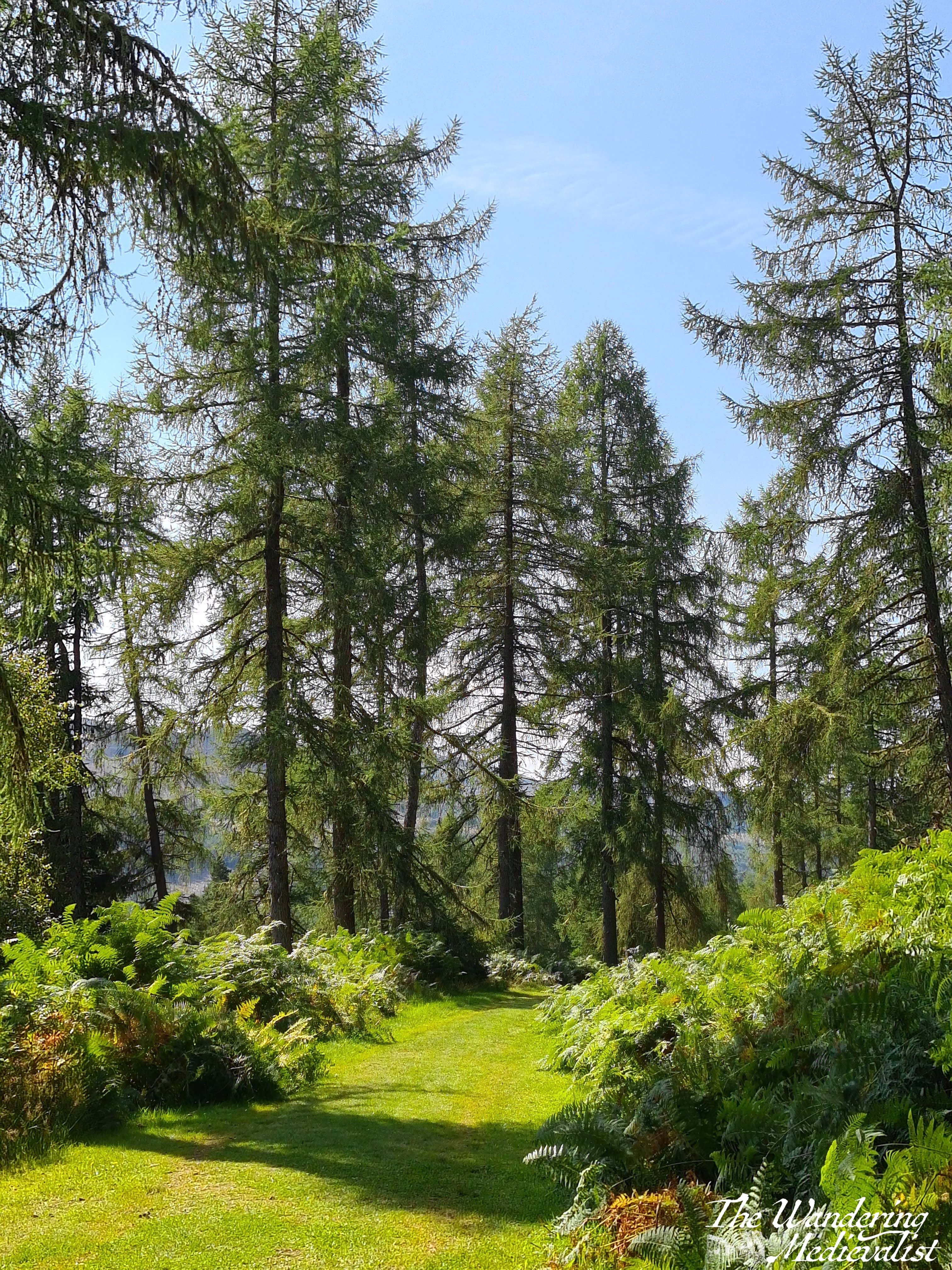
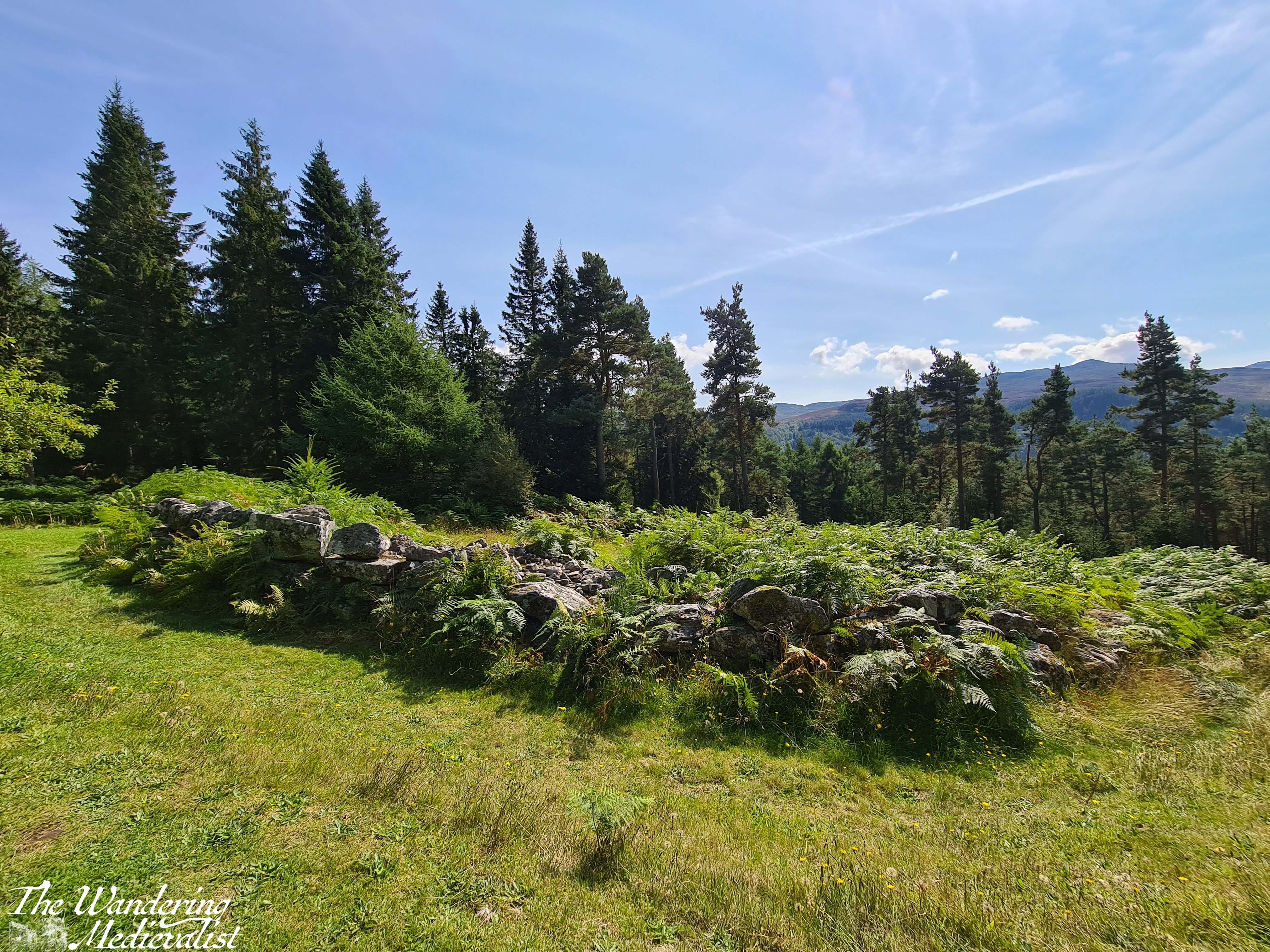
From here the trail continues through varying types of forest as it climbs, and after a slightly steeper ascent through more pines, one reaches a T-junction. Almost immediately ahead is a small stone house that is almost Bob Rossian in its placement amongst the trees, with a stone wall running along the path. It’s a good place to pause in the trees before crossing a small bridge across a burn, into the open. Just beyond a stand of rhododendron is a wide meadow with a grassy hill on one side topped by a rock formation, and gentle slope down on the opposite with views across the hills and valley.
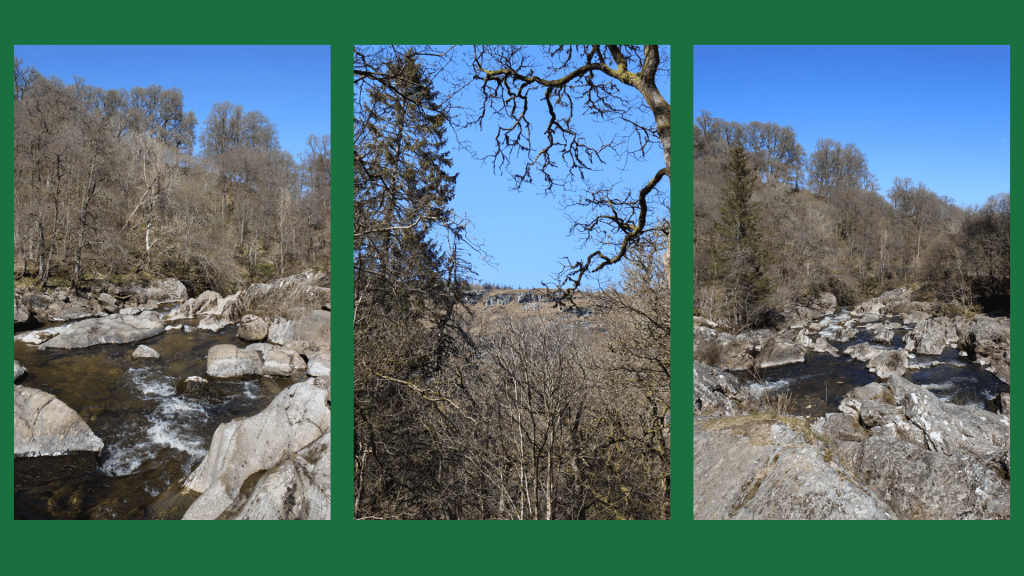
view from the rock formation
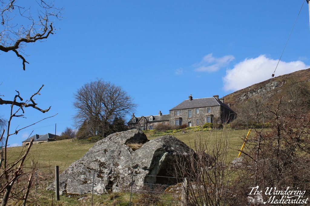
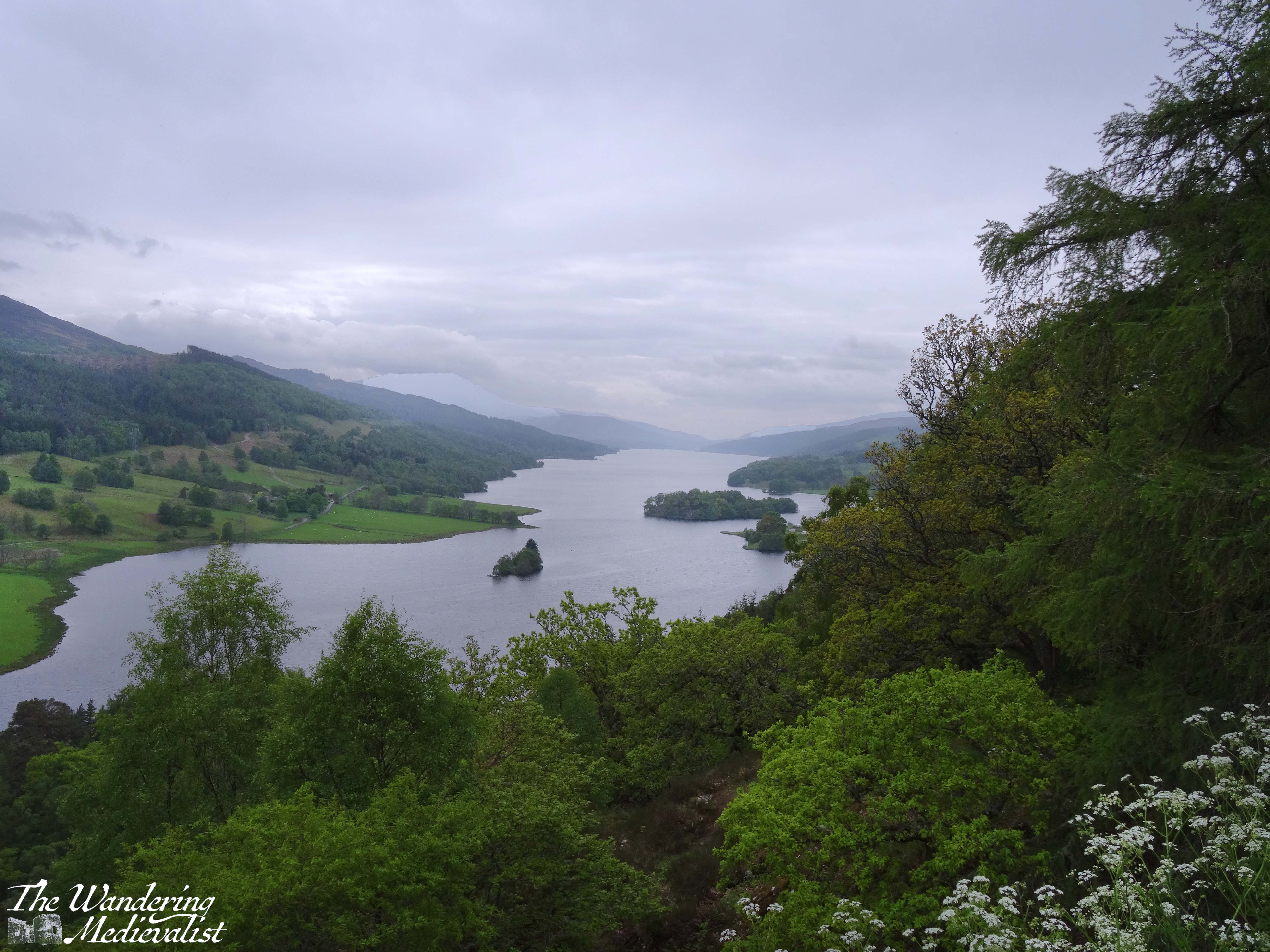
If you have had enough walking for the day this is a good spot to catch your breath for a few moments before heading back down towards the car park. If you’re not done yet, it is only about five or ten more minutes to the Rumbling Bridge. You will notice a lone house on the hill above, which I have learned from Google Maps is in fact a small hotel. In the days of the pandemic, it looked quite lonely – in retrospect I imagine the views are spectacular.
Here the road forks again, and you will want to follow the left fork down the hill towards the bridge. This is an active road, so it is worth being careful to listen out for vehicles who may not see you easily. The bridge itself provides views of the river in both directions, as you would expect, and sits almost directly over the falls, so the ground seems to drop away quite swiftly on the downriver side.
If you make your way to the Rumbling Bridge car park, you will find a map similar to the one at the top of this post with plenty more walk options should you wish to keep going. Or, you can do what we did and spend some time climbing on the rocks out into the river, if you are in to such things.
A visit to the Hermitage is highly recommended for anyone who loves a good walk in the woods. The lower section to Ossian’s Hall is manageable for walkers of almost any ability as it is flat and the path well-kept, while the higher section offers a bit of a climb and some beautiful views. The circuit to Rumbling Bridge and back is not particularly long, but can be boggy in places so sturdy shoes are a must. Prior to my last visit I may also have cautioned about more basic comforts but there are now the port-a-loos available as well as the small van, so you can probably even manage without refreshments. That said, there are some perfect picnic spots along the way, so I would recommend bringing something with you. As long, of course, as you are willing to follow the camping rules I recall from the White Mountains – pack it in, pack it out! It is a shame to see litter on the trails, as we did in 2021.
Another small caution is in the driving; when arriving from the south, it is an easy matter to turn left into the Hermitage park or onto the A822 to reach the Rumbling Bridge end. But, coming back out can be a bit of a challenge. Waiting for a break in the traffic so that you can speed across onto the far side of the A9 is not for the timid or indeed the impatient – it can take quite literally 5 minutes to get back out onto the highway and unfortunately I am not aware of anywhere close by that you can turn around further north.
If you have been on a good walk and are interested in another short wander or something more substantial for food and drink, the town of Dunkeld is only a few minutes away and has plenty of options. It’s a charming wee town to walk around and has remains of a cathedral – what’s not to like?
It has been a hectic few weeks at work, which has meant I have not had time to devote to anything but getting through the day. But the busy time is unlikely to pass, and so I have to make time to focus on my real love – my blog and pictures, and anything Fort William-focussed. And so, I bring you this account of a drive I will happily do at any time of year, and with any companions: the drive to Fort William.
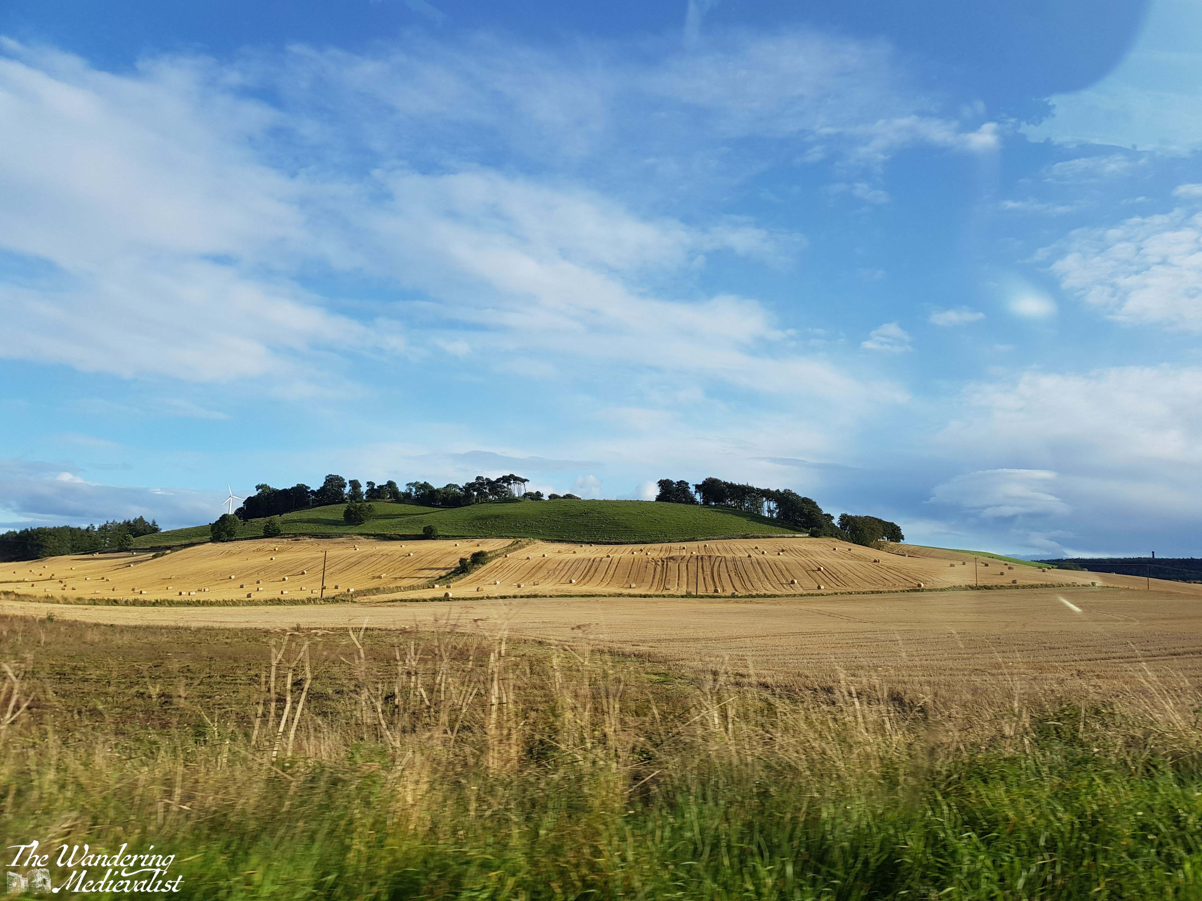
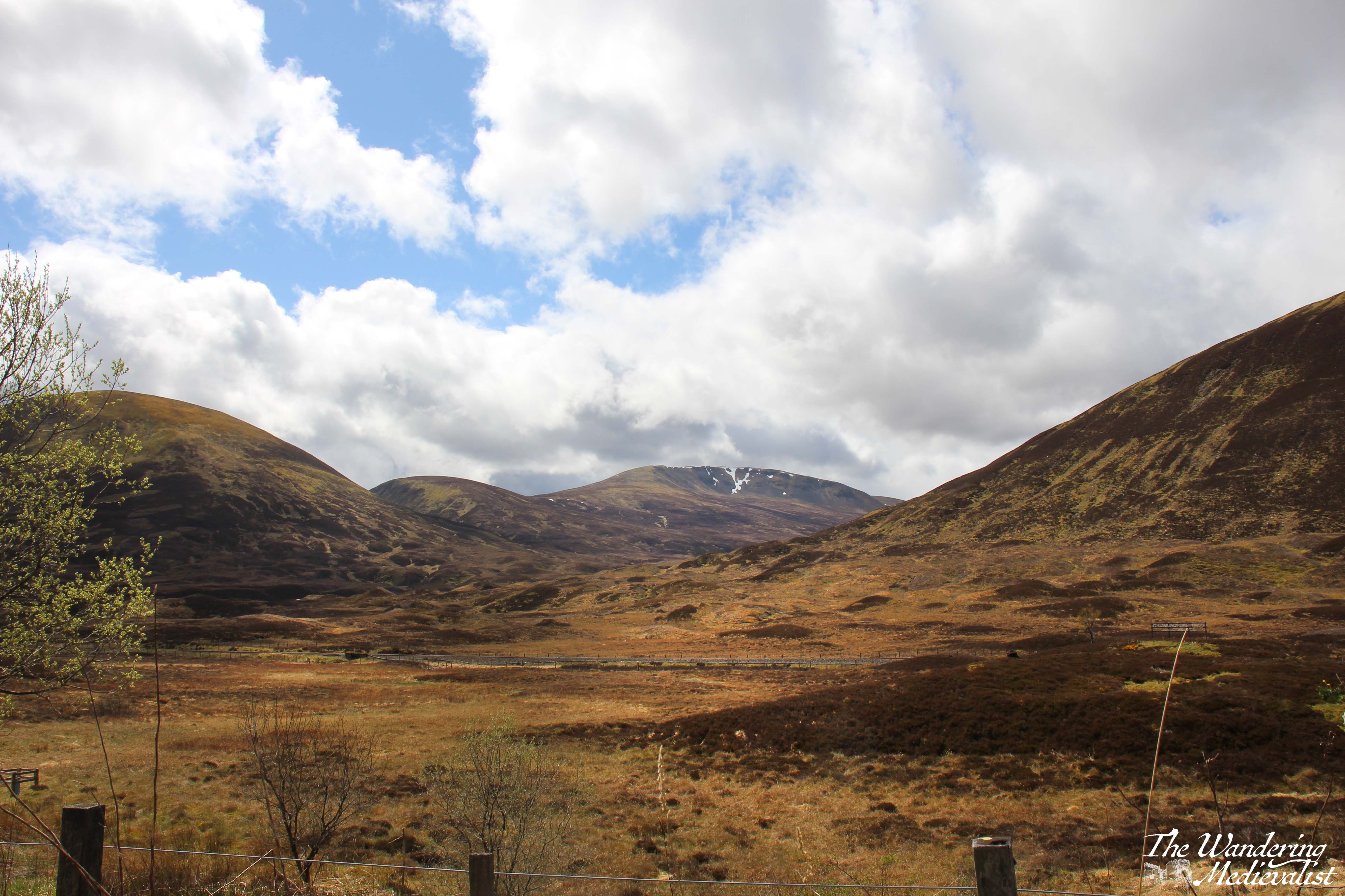
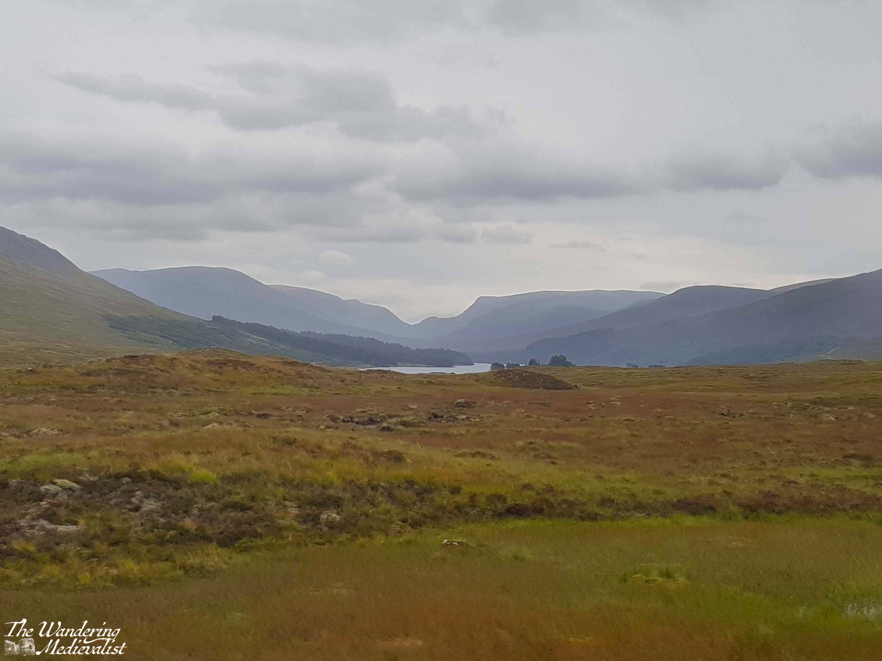
East Scotland – the Dundee area, Fife, southern Perth and Kinross – is quite similar in terms of geography: rolling hills, plenty of farmland, coastlines, and dotted with regular towns of good size. Not far north of Perth on the A9, though, pine trees close in around the road and the landscape begins to change. More dramatic, jagged hills rise and all at once I relax. A feeling of joy comes over me, and I cannot help but smile, knowing that I am headed north. I cannot really explain why my mood changes. It may be the hills, heading to mountains; it may be the many happy memories I have of locations to the north; it may be just that the stretch of Scotland north of Perth is some of the most beautiful countryside I have ever seen. Whether continuing to Fort William or just planning a day trip, I just love this stretch of road, and beyond.
And so, in this post I’ll take you on the first half of a circular journey to Fort William, a drive I have done many times. Once I managed it all in one day though I would not recommend it.
There is an issue with the A9 – where this drive begins – that must be addressed, and one that I have confidence will remain an issue for years to come despite all efforts of the Scottish government. That issue is that, for the last eight+ years, Transport Scotland has been working on a project to make the entire road from Perth to Inverness dual carriageway. For Americans, this means that there is a strip of land separating the traffic going in opposite directions, like many US highways. As the A9 is the main road north through the Highlands with increasing traffic and plenty of freight, this seems a no-brainer – it is just taking a touch longer than hoped (doing my best not to make a Big Dig comparison). There are also significant engineering challenges to many stretches of the road. This means, more often than not, areas of slower traffic and roadworks can hold you up, but anyone stuck behind a lorry on a stretch of two-lane road will understand the necessity of this work.
Back to the drive.
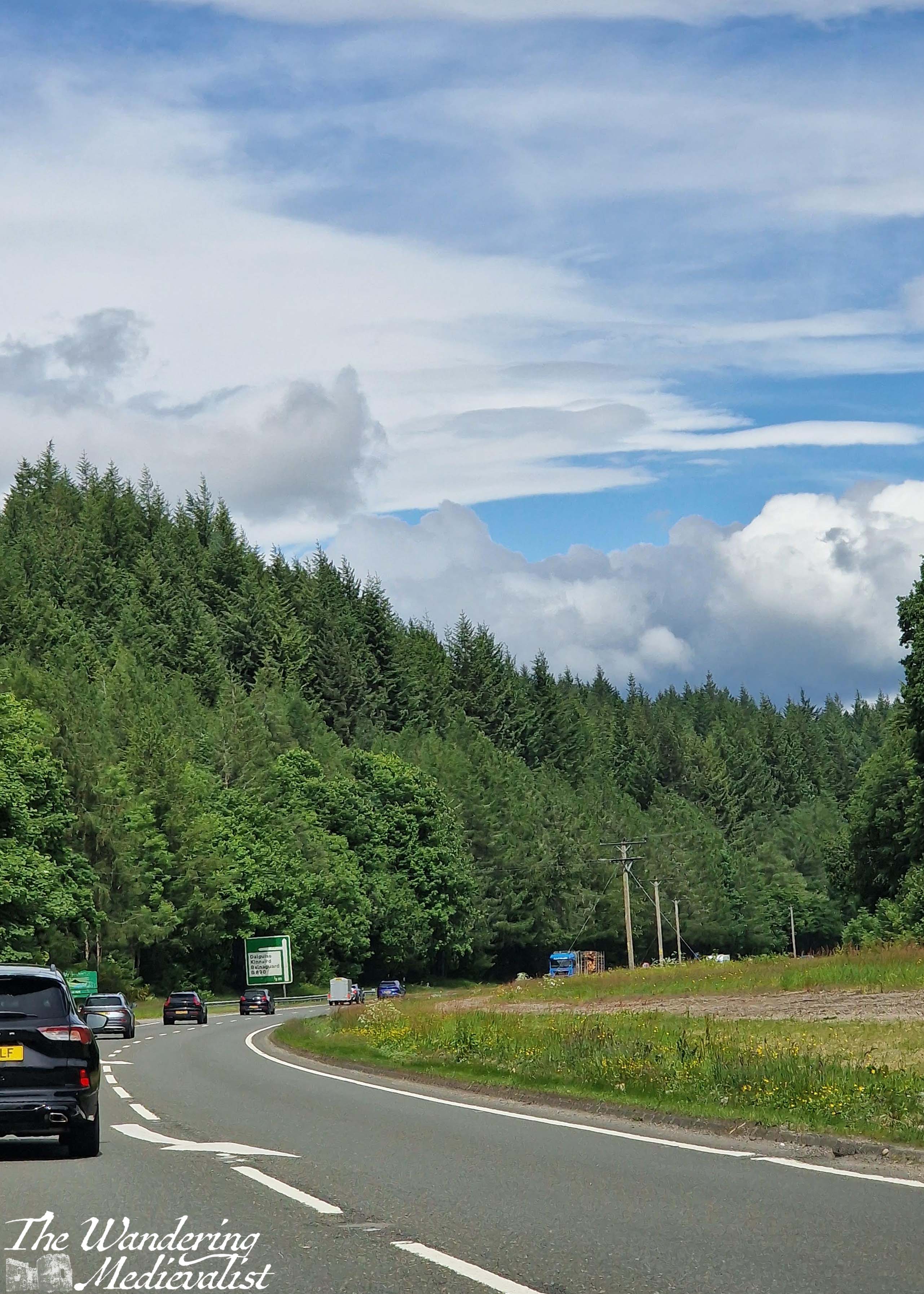
The road pictured above is where the A9 curves, just before reaching the towns of Dunkeld and Birnam, and the Hermitage woodland walk. All three are worthy of their own posts in time, but generally when driving north we do not stop until a bit further on. The road cuts through a set of hills here, with sheep fields on both sides between patches of trees. The highway runs near the River Tay and parallel to the train line that runs from Perth to Inverness. While the track disappears on occasion, it is not uncommon to spy a train.
The next way marker is the widening of the valley in anticipation of reaching Pitlochry. Pitlochry is a small town that holds a place in my heart as where the other half and I went for our first weekend away together, but also for its quaint touristy feel.
Just past Pitlochry is Killiecrankie, famous location of the Soldier’s Leap, and another great place to stop for a walk. Beyond the turn-off to Loch Tummel and the Queen’s View, the highway starts to rise up and along the side of a hill, and there is a gorgeous view of the mountains and the valley along to the left – it never comes through on pictures, though.
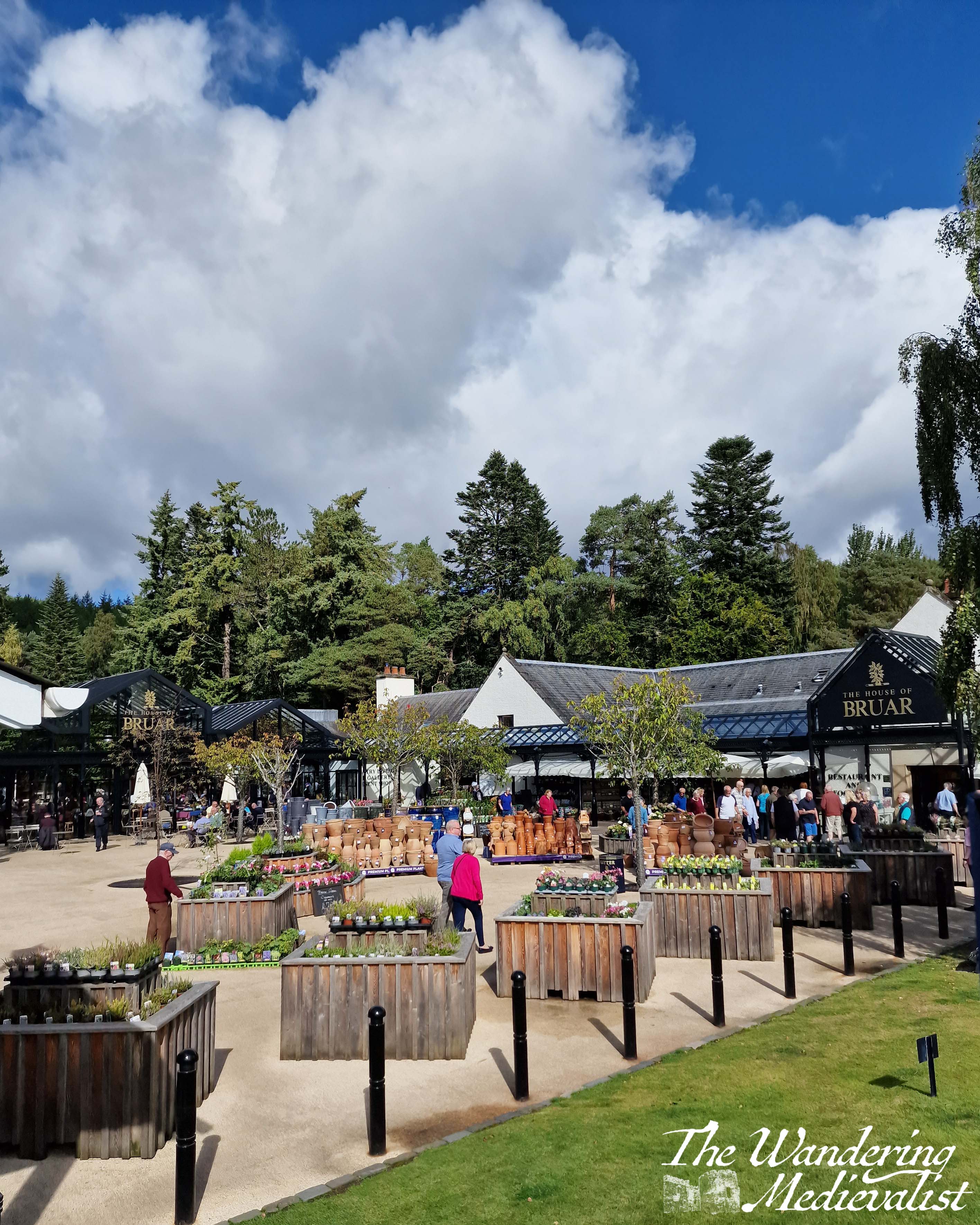
At this point in the drive there is a touch of anticipatory excitement, as I know what is coming. Almost never do we manage to get this far north without stopping at our favourite money trap: the House of Bruar, a high-end shop that sells textiles, outdoor equipment, kitchen accessories, toys, Scottish souvenirs and art of all kinds, and boasts an impressive fine food hall with every type of jam, jelly, cracker, cheese or fine meat that you can imagine. The butcher is fabulous, and the cafe is just as good for a scone or soup, sandwich and snack. Even better is the fantastic walk in the woods behind – again a post for another time, though I have several pictures of the Falls of Bruar in my ‘winter wonderland’ post.
House of Bruar represents another key marker on this drive – a bit less than half way (if you have started in central Scotland), and one of the last places until you reach Fort William that you can easily stop for a restroom break (there are a few other options, but they are not always available).
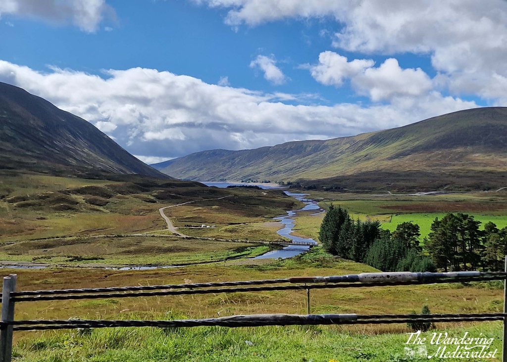
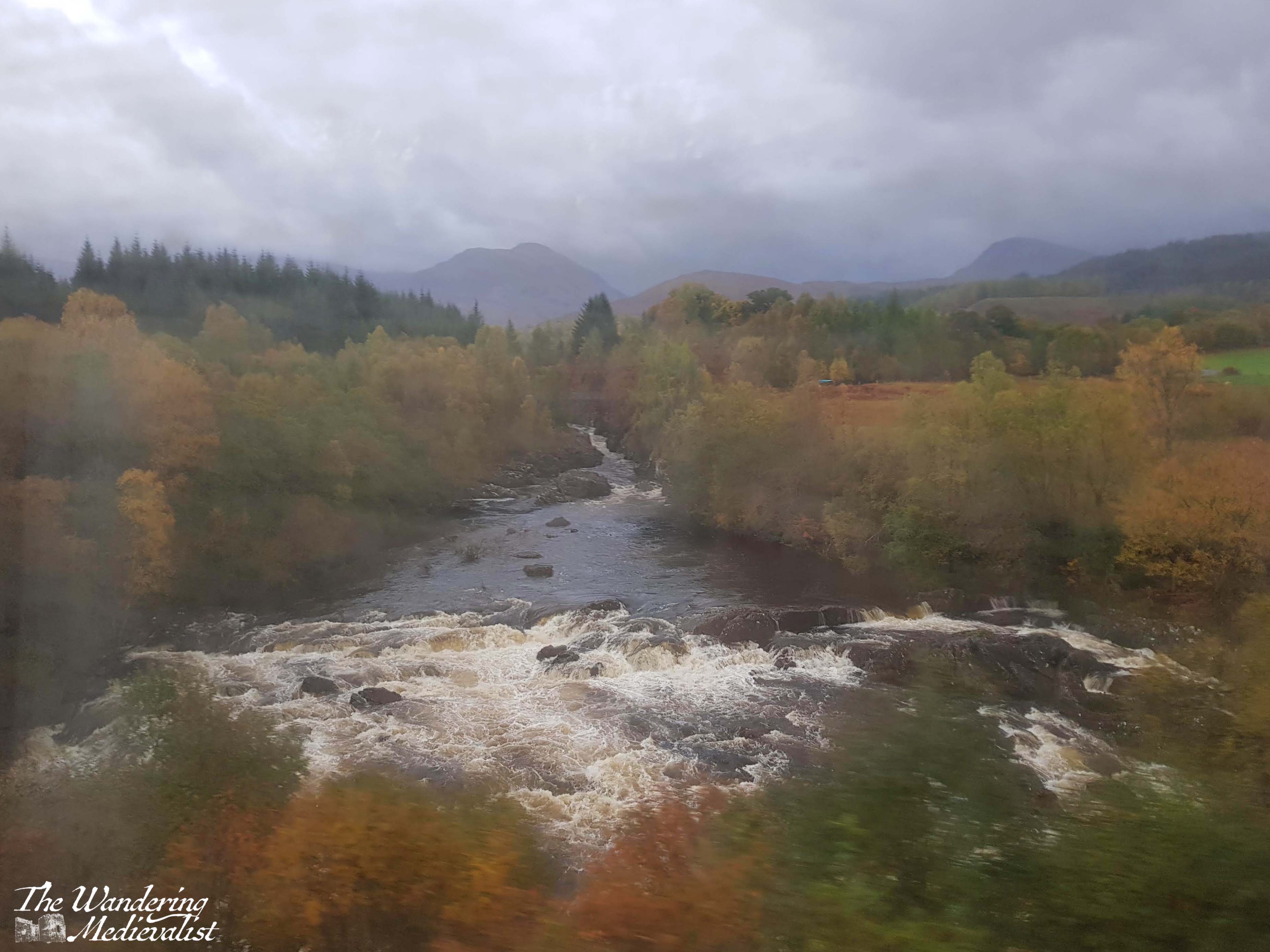
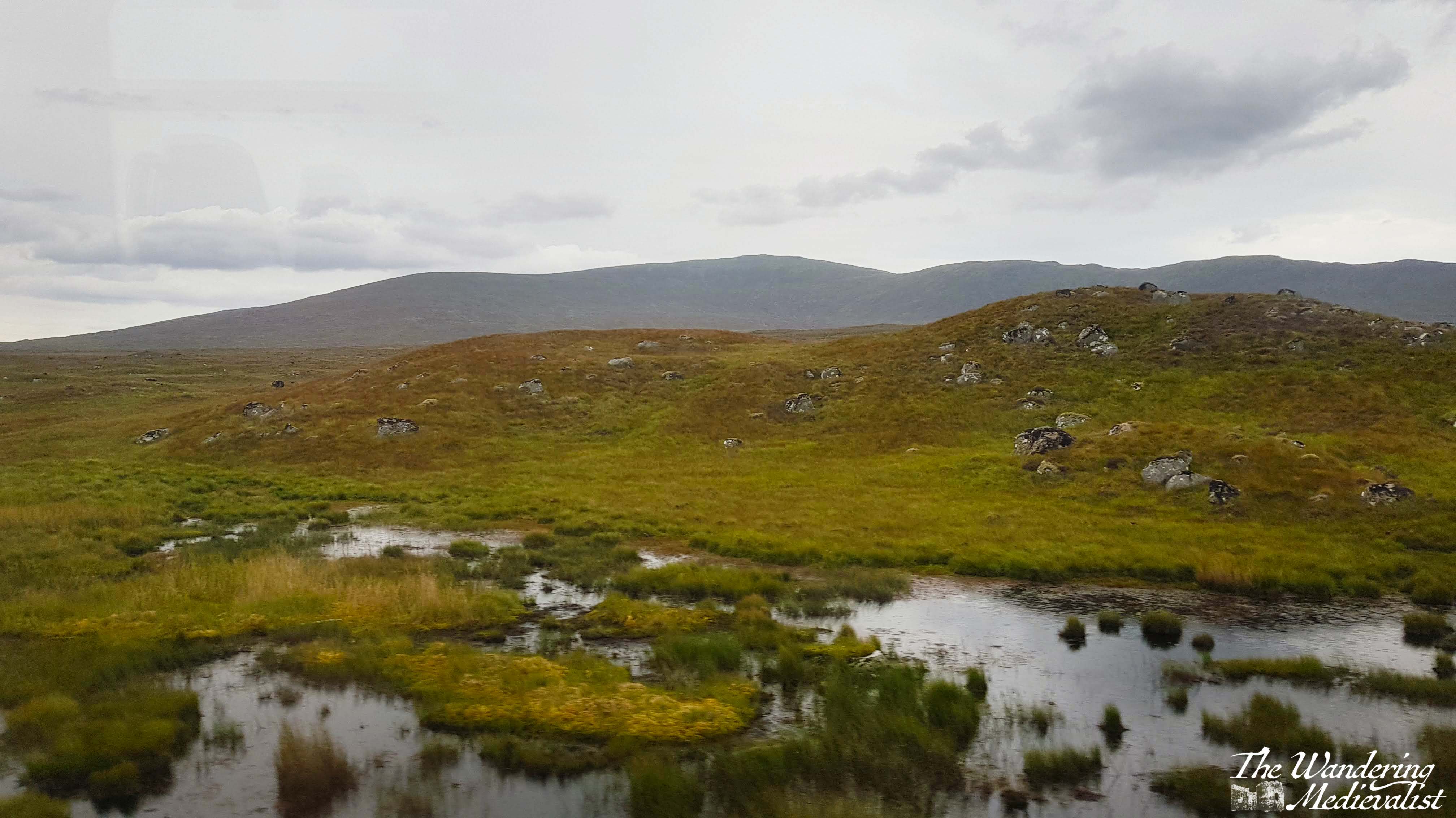
Beyond Bruar, one really enters the Highlands, with hills on both sides as the A9 follows the River Garry. While it is not always easy to tell, you are climbing at this point, and to the left in particular you can catch glimpses of lochs and glens cutting south. One of my favourites is the Dalnaspidal viewpoint, with a lovely river leading from Loch Garry:
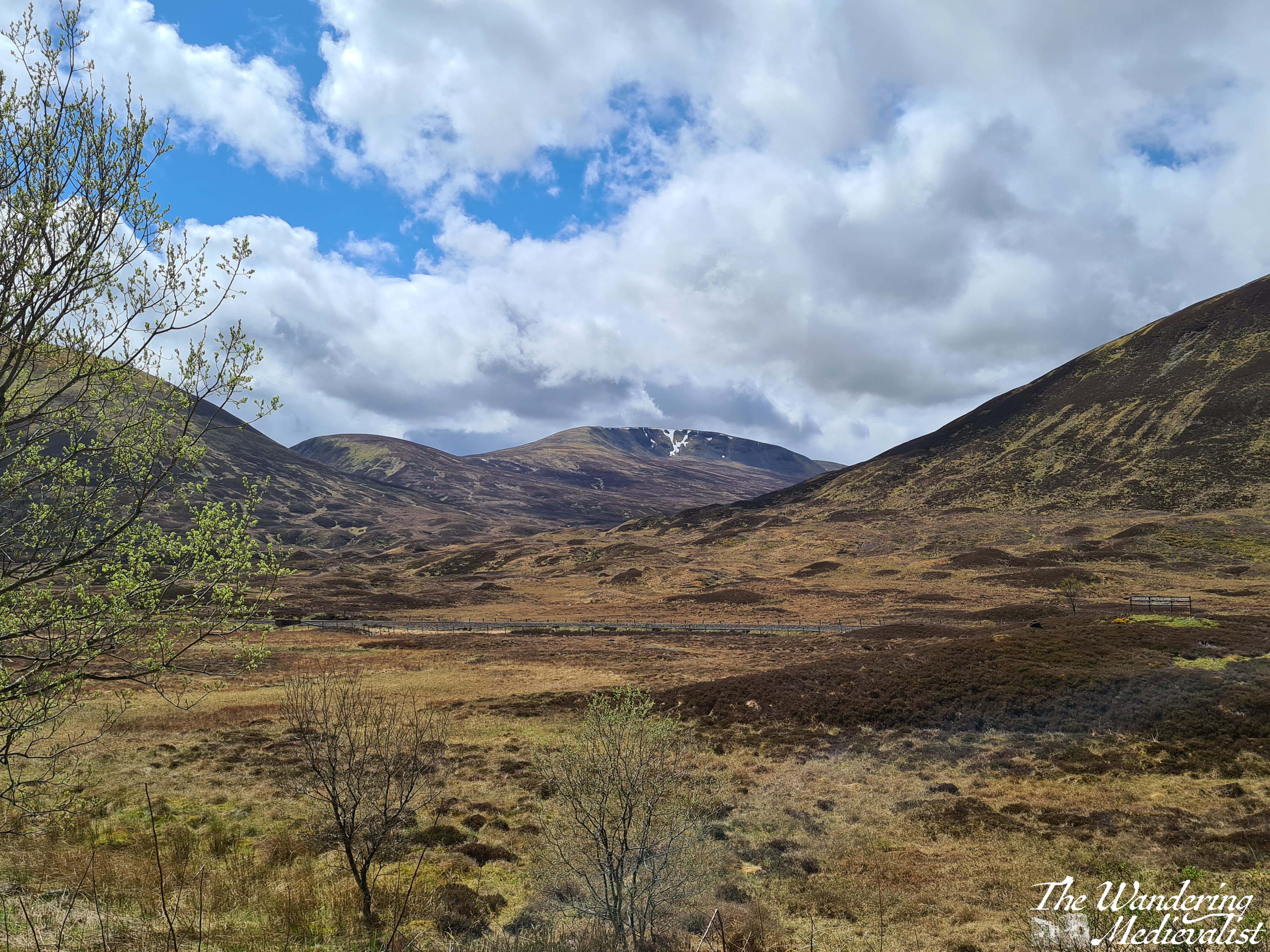
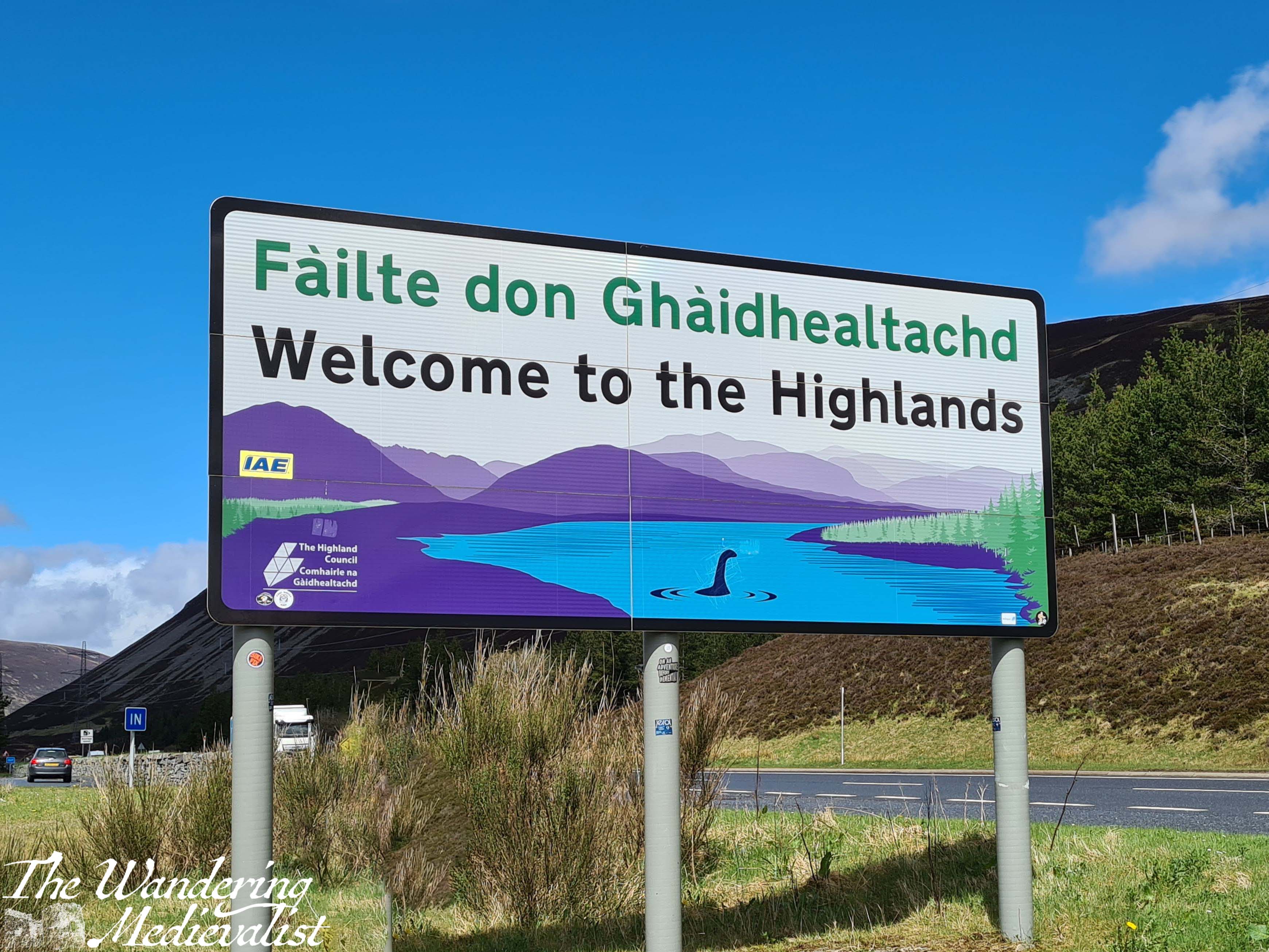
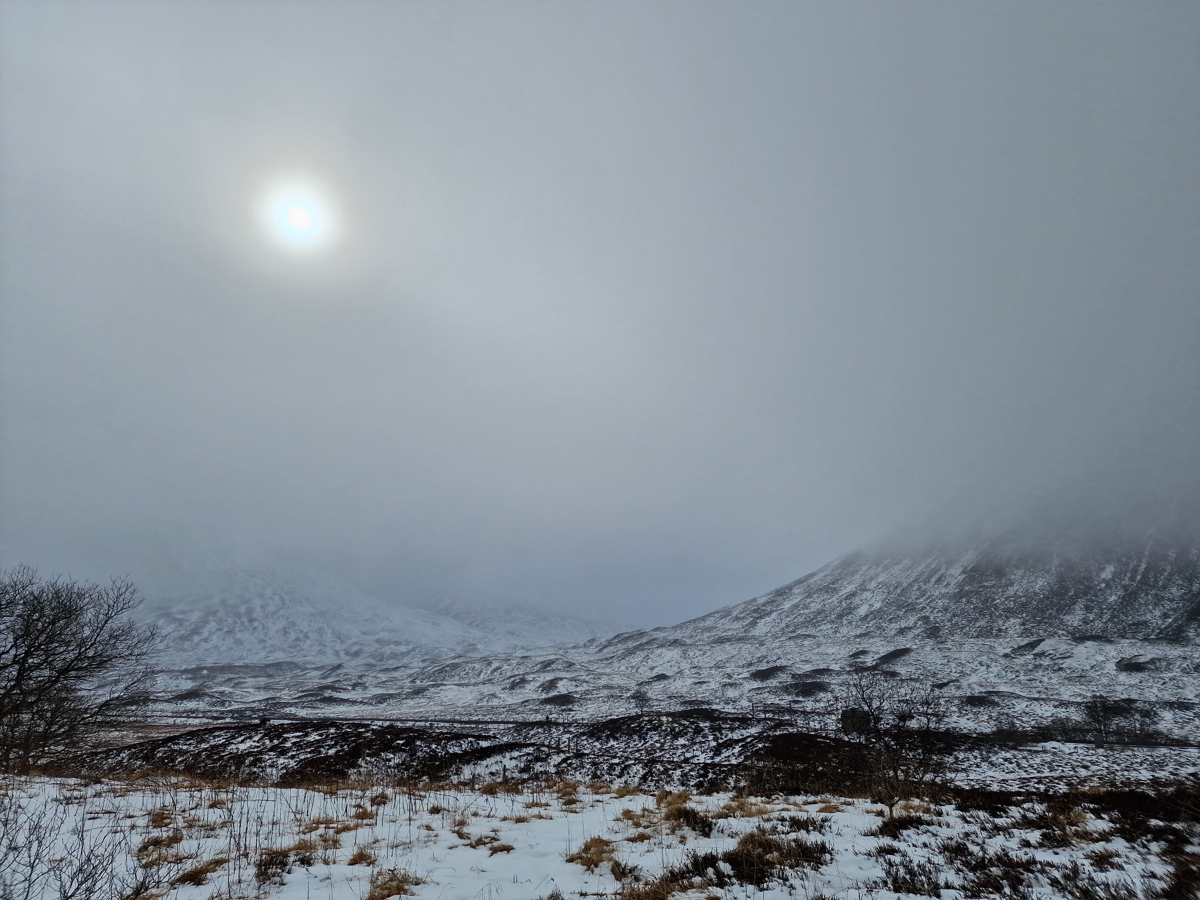
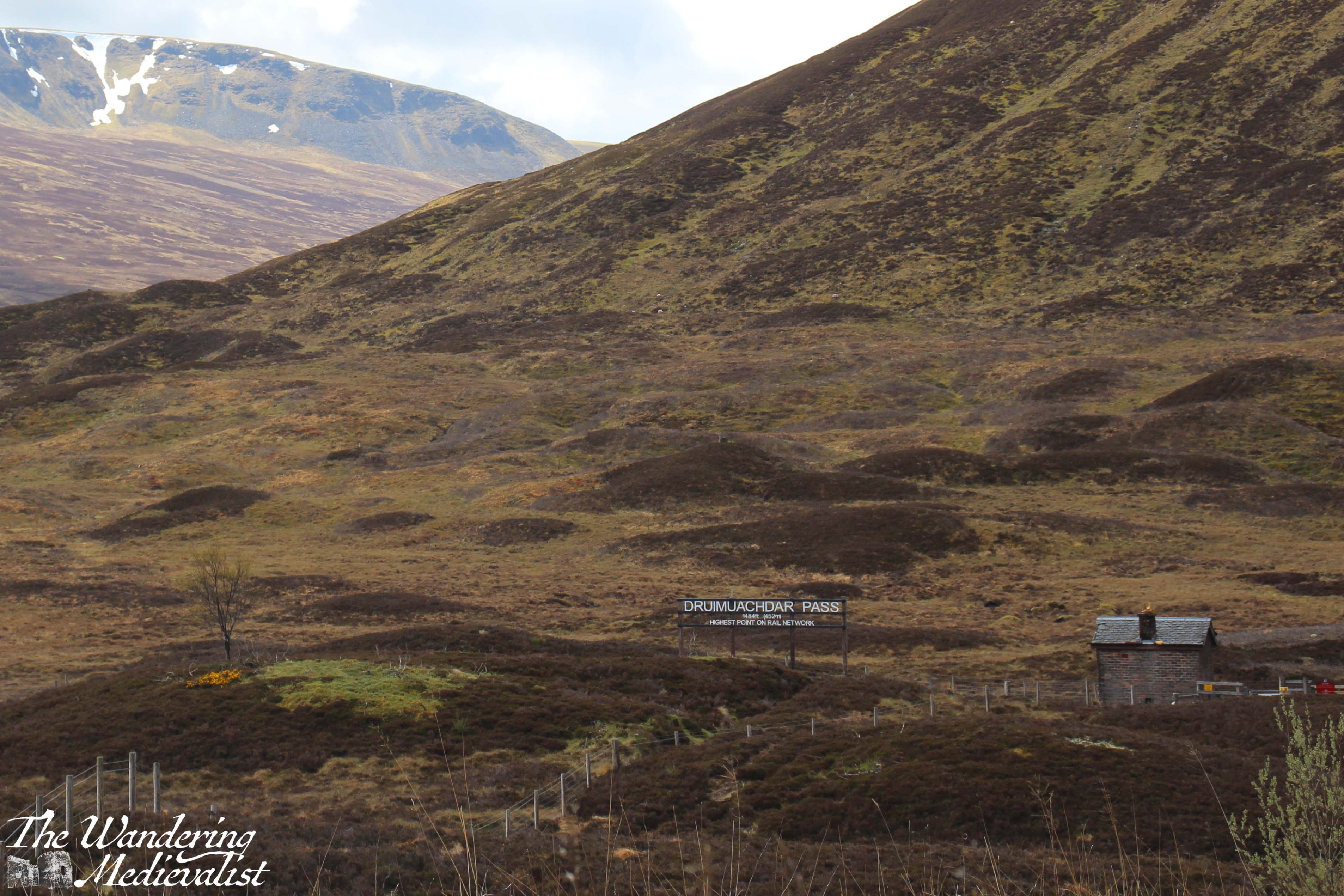
It is not always feasible to stop here, but the next point is a must. At Dalnaspidal you are only a few minutes away from the Pass of Drumochter, the highest point on the A9 and the rail network, and the only gap in the Grampians suitable for road traffic for 100 km. The weather is quite frequently dramatically different here, sometimes raining or snowing when Bruar was sunny and warm. There is a good-sized lay-by, and it boasts one of the happiest signs in Scotland: ‘Welcome to the Highlands’.
There are countless walks that one can take up into the hills here, and I have made it a habit to get out and stretch my legs, particularly if we have not stopped long at Bruar.
Drumochter is only a few miles from the next important milestone: the turn off of the A9. If one has examined a map, one notices that the A9 heads north and then curves east again slightly as it approaches Aviemore. To head west and then a touch south to Fort William, one must take the exit at Dalwhinnie, where there is a small town and a large distillery where they make, surprisingly enough, Dalwhinnie whisky. Tours are available at certain times of year.
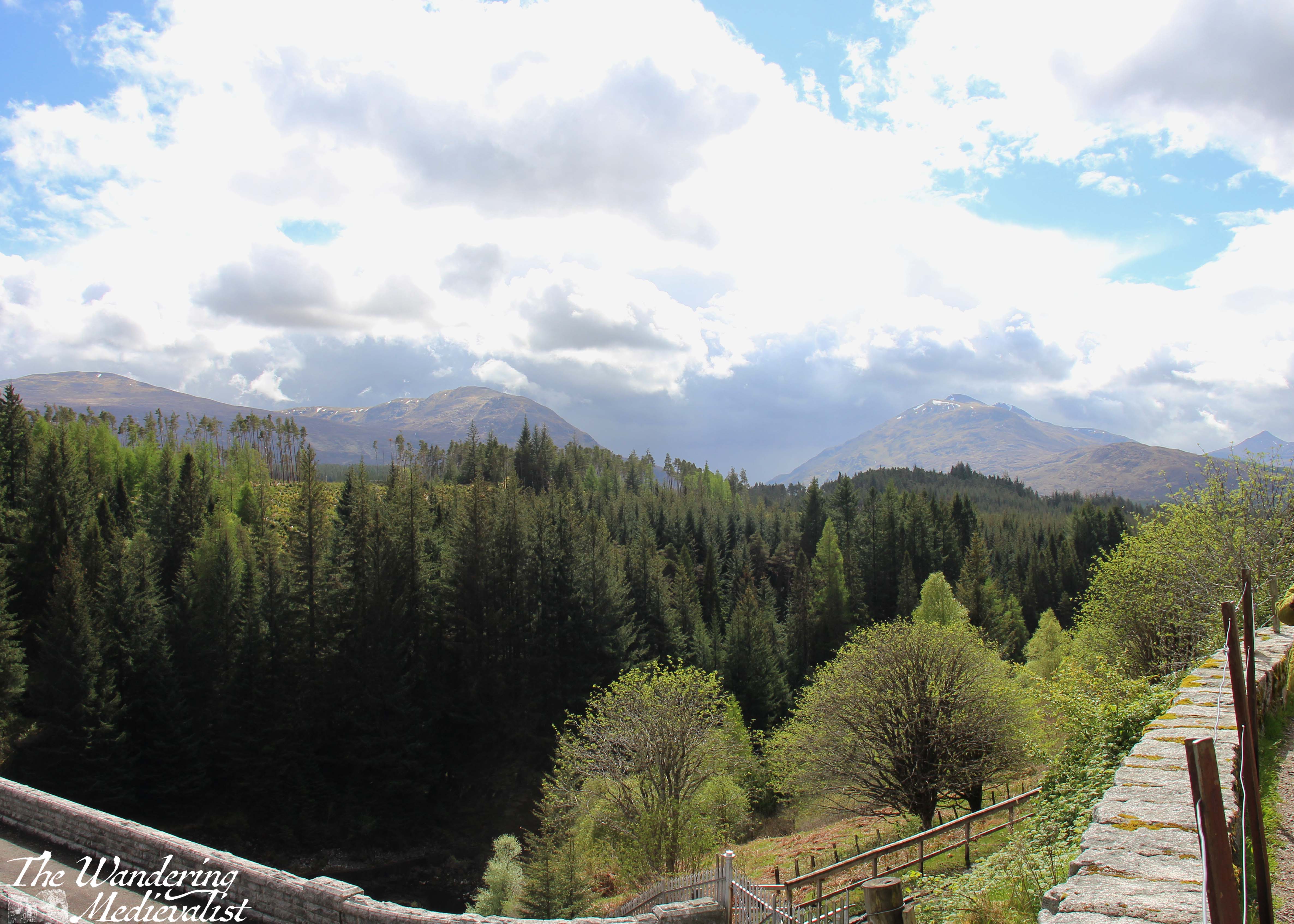
The road in fact circles up around the distillery, and it is important to take care here as the lanes are narrow and large lorries and trucks are regular sights. From this point you will by requirement drive a bit slower; from Dalwhinnie north the road is winding and often roller-coaster like as it sinks and rises through the hills. The views are stunning though, back over the valley and town, and to the east where the Cairngorms are stretching out away from the road. To the left is relatively new forest, immediately to the right are fields, usually with sheep, and ahead rises a sharp peak of which I have not yet worked out the name. The road here is actually following the route of General Wade’s Military Road, constructed in the mid-1700s to help bring Scotland to order.
In several miles the road falls away and curves around to the west, with dramatic craggy peaks up to the left. When driving, one must be paying close attention as the route is both narrow and winding; passengers can enjoy the view. There is a touch of relief when you reach a T-junction with the A86. Here one turns left, following signs for Kinloch Laggan, Spean Bridge and Fort William. Note, turning right will eventually take you back to the A9 via Kingussie.
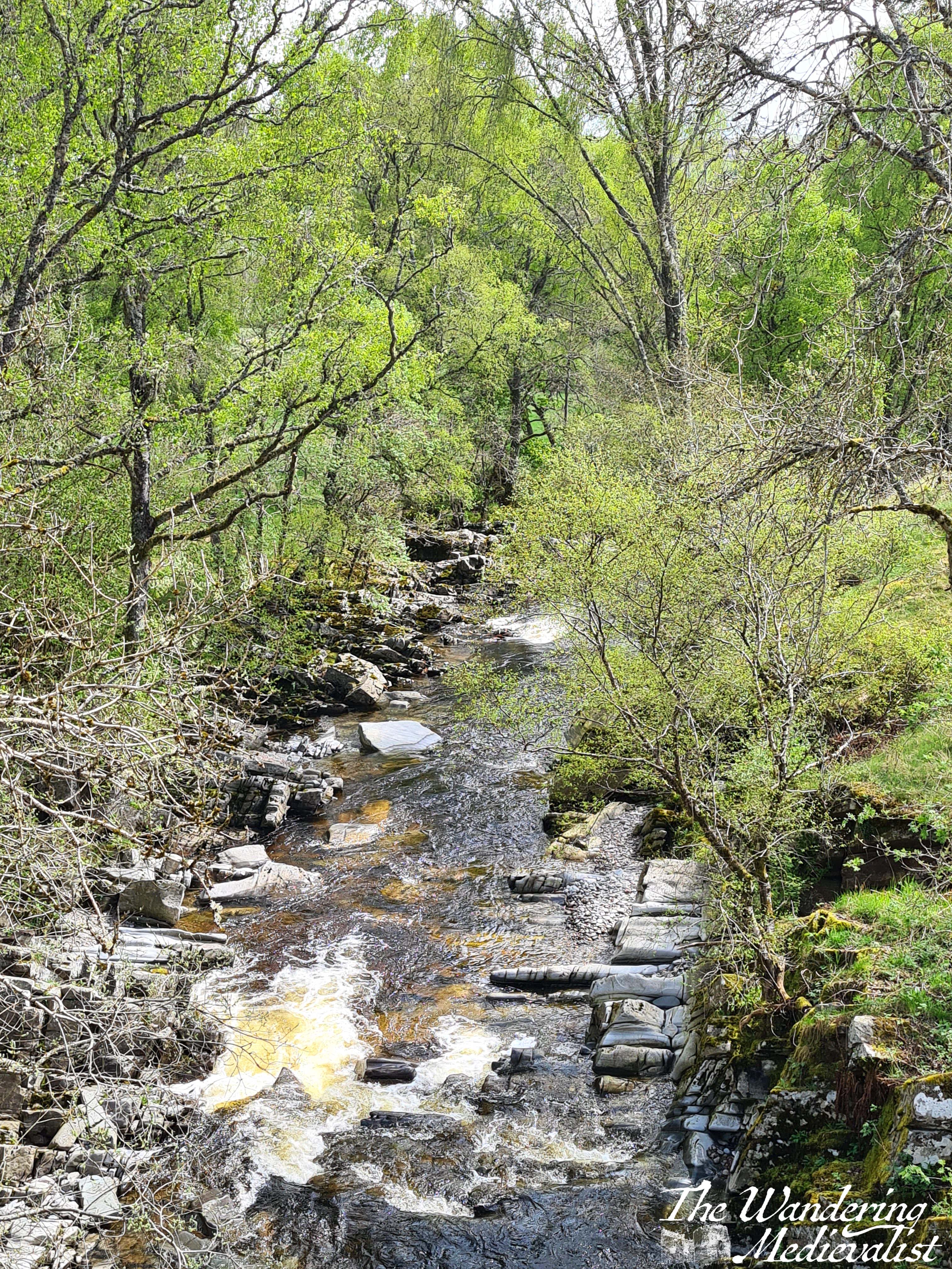
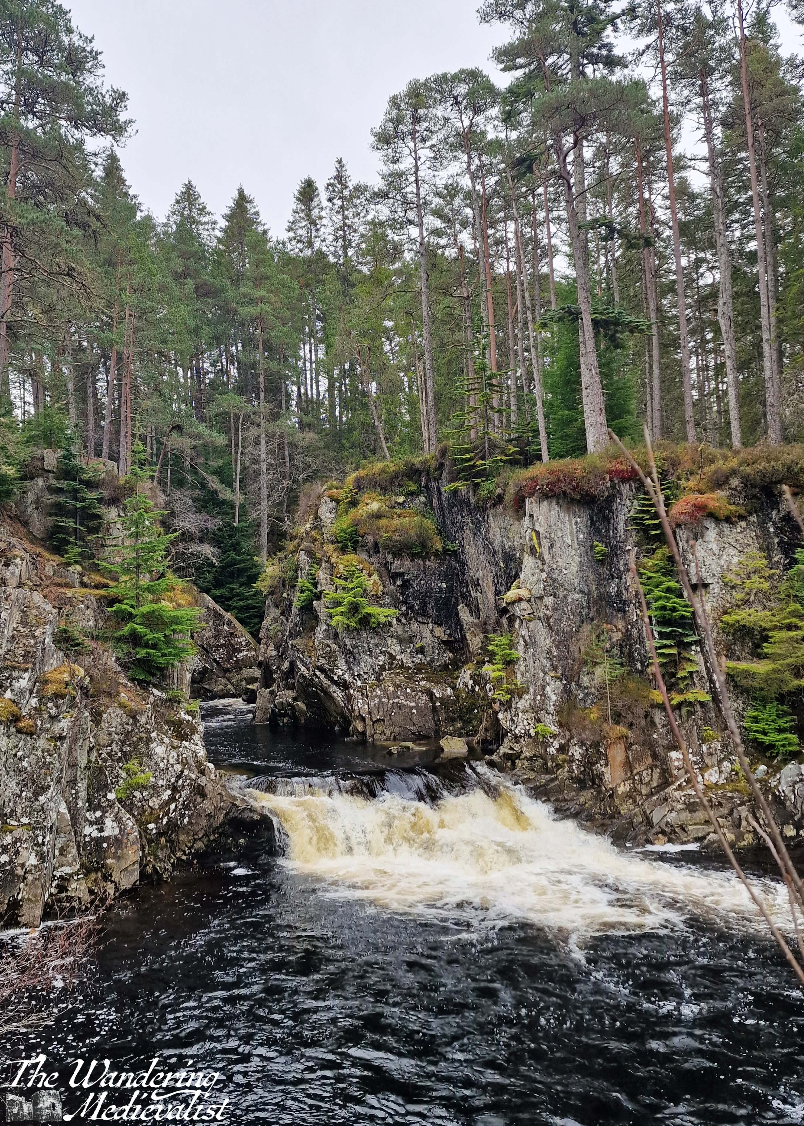
The road now is a touch wider, and in a few miles meets up with the River Pattack. There is a trail and small picnic area so that you can climb up to view Pattack Falls – well worth a stop if you need to stretch your legs or take a break from the roads.
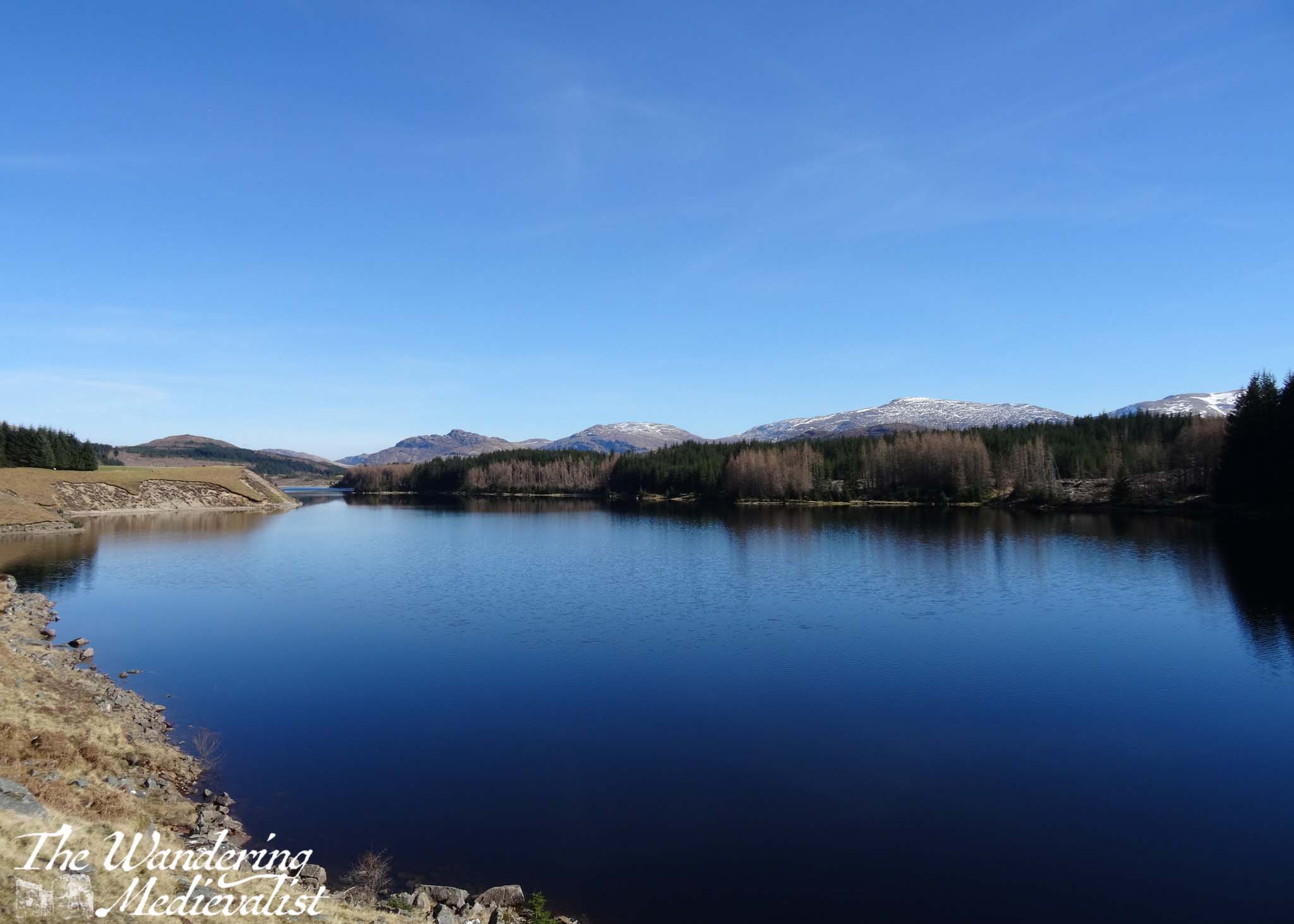
Several miles beyond Pattack, the trees open up for a fraction of a moment to allow you a stunning view down Loch Laggan; I have seldom been able to properly pause here, but if you can find a viewpoint along the loch that is not blocked by trees, it is definitely recommended to stop briefly.
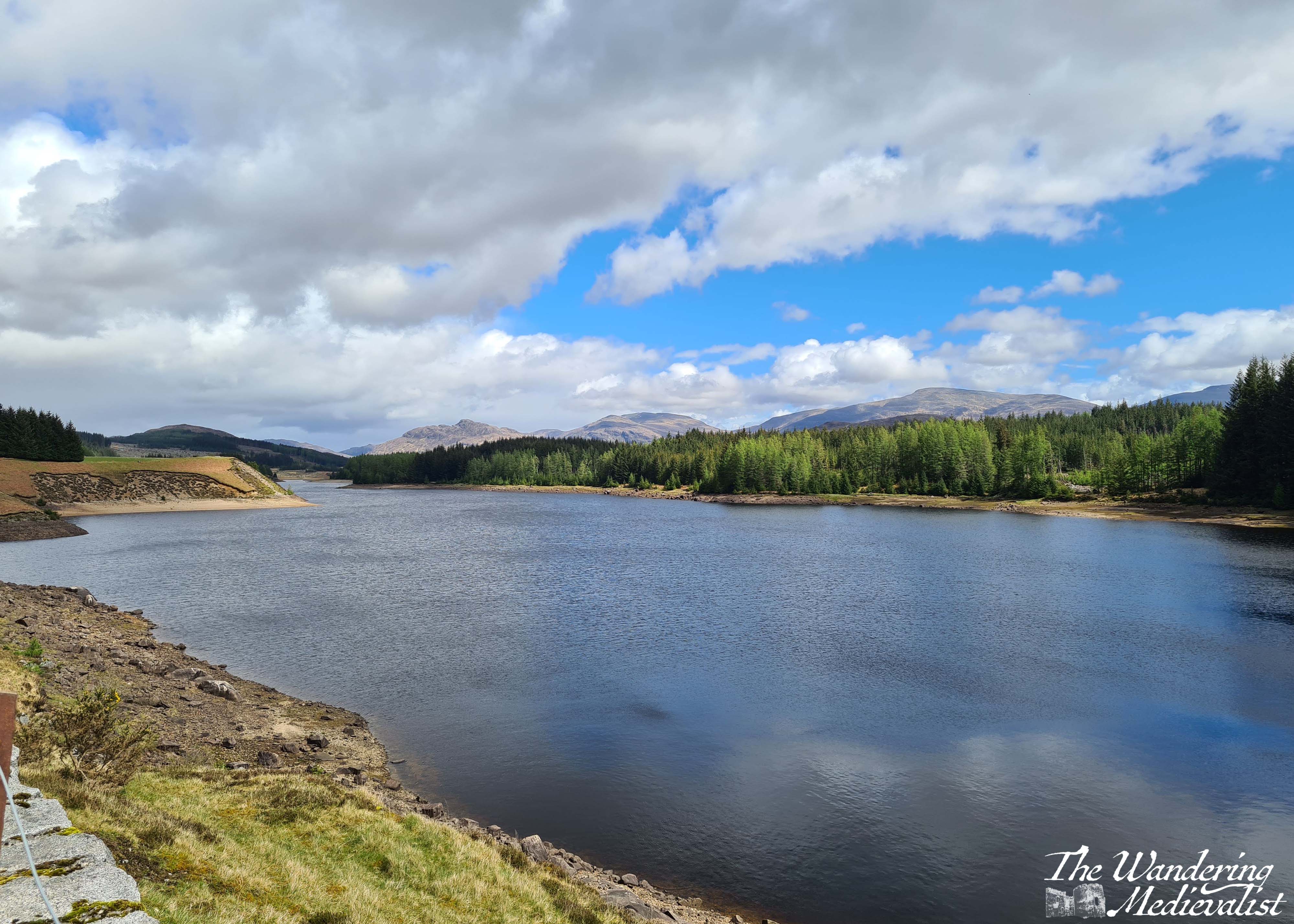
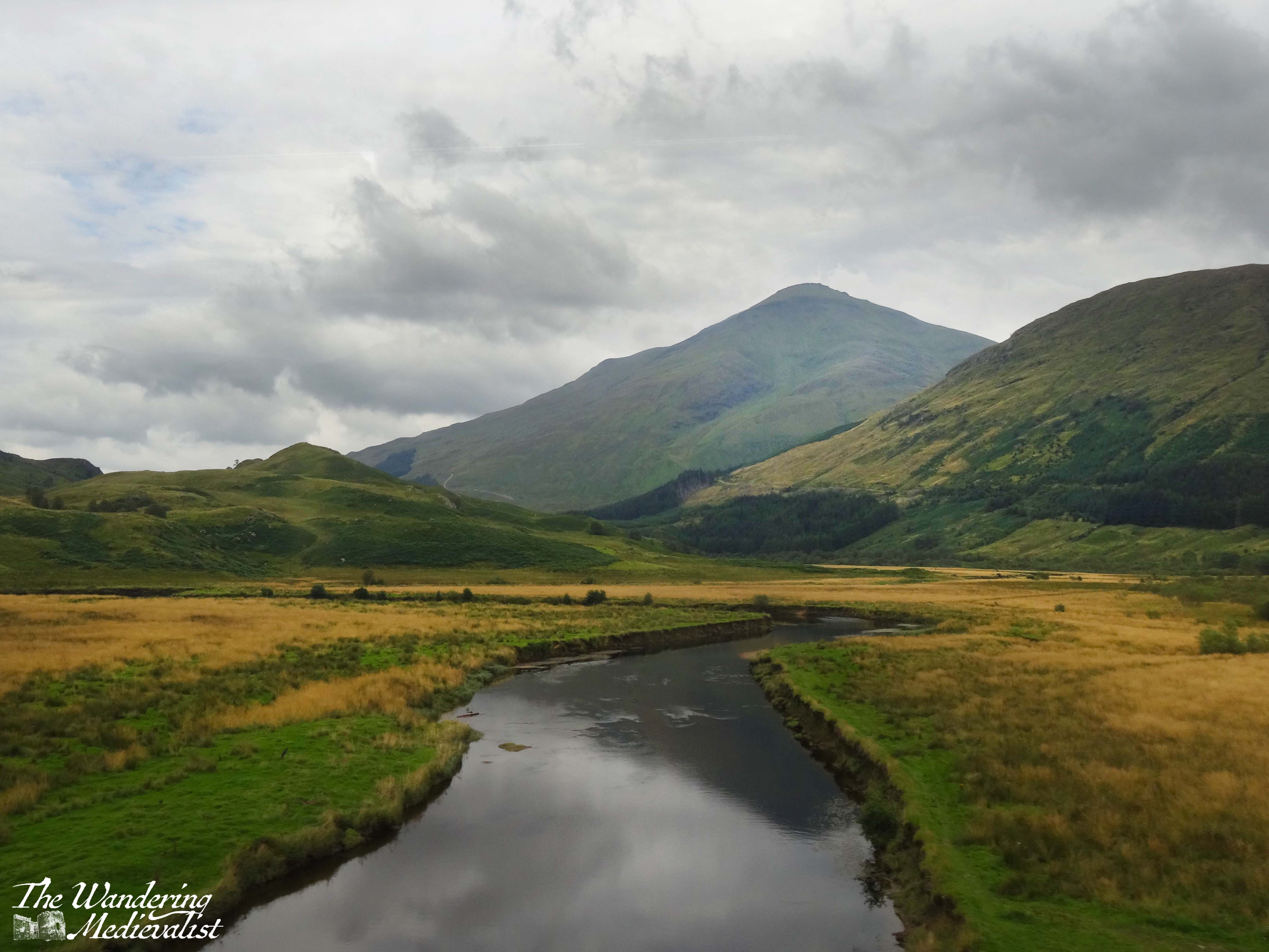
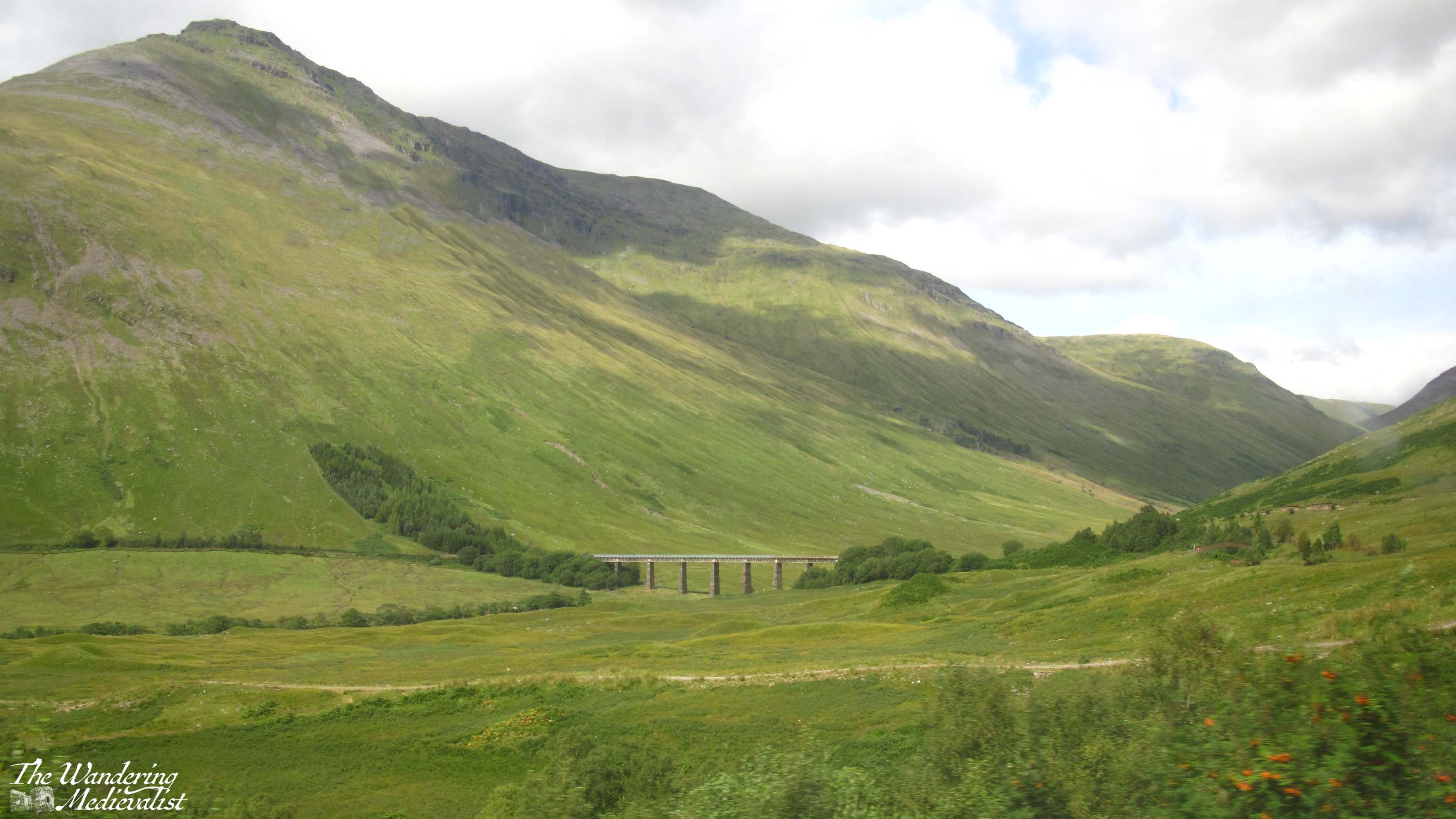
I always manage to confuse myself, thinking we are almost at the Laggan Dam, but in fact it is a solid 12 miles further as it does not sit at the end of the loch as one might expect. Approaching the the dam are more views over the mountains and the waterway down to the left, while to the right is the forest and hillside.
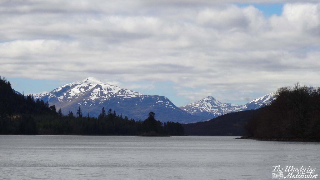
If you have managed the whole stretch from Dalwhinnie without stopping, you will absolutely want to stop at Laggan Dam, both for the view and to stretch your legs – you’re still about 30 minutes or so from Fort William. Directly south, behind the range of hills, is Rannoch Moor, and if you look at a map you will see you have just done a big loop up and around some impenetrable hills.
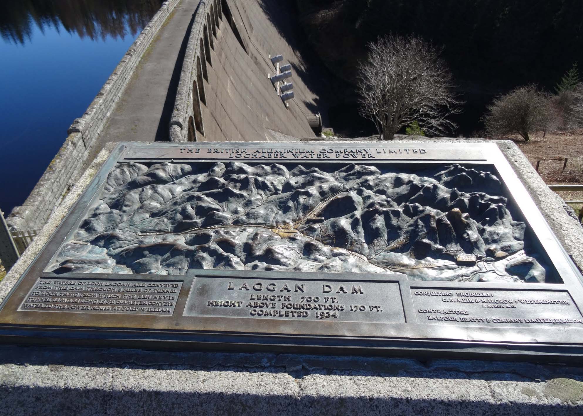
Constructed in the early 1930s, the dam is part of the Lochaber hydroelectric scheme, designed post-World War I to provide electricity for aluminium production. Now, you are able to stand at the edge of the dam and see the reservoir formed by the River Spean, and also the sharp peaks that form the eastern end of the Nevis Range.
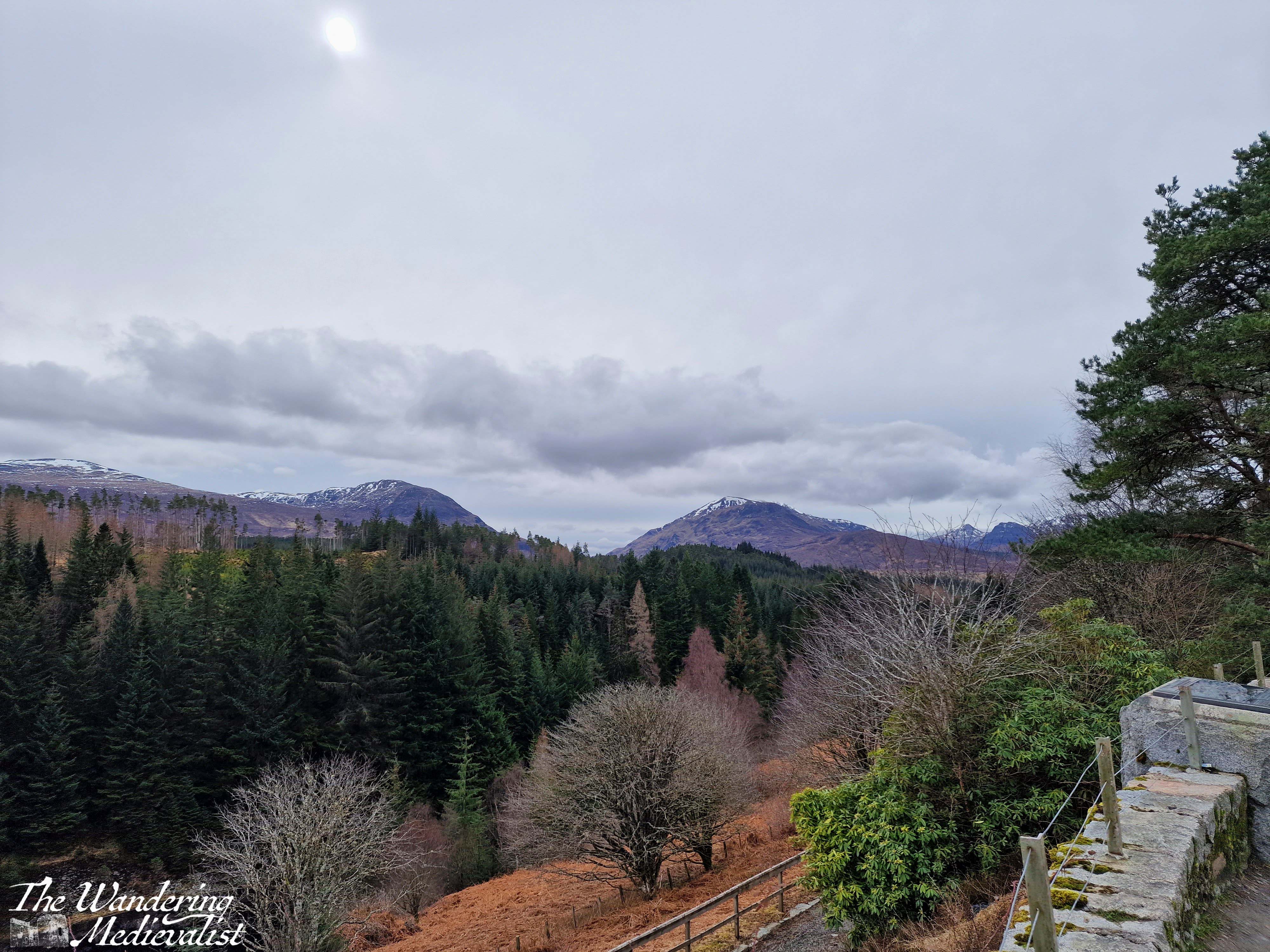
Starting off from Laggan again you are in the home stretch, but also some of the more challenging part of the drive – this portion of the A86 is regularly considered one of the more dangerous roads in Scotland. You will quickly see why; it is winding with sharp bends, narrow turns, and drivers who often go far too fast. In the rain it can be prone to slippage from the steep hill above, and there is an equally steep drop off to the other side, into the gorge of the River Spean. I should say, I have never had any issues here, but I am also on the cautious side here.
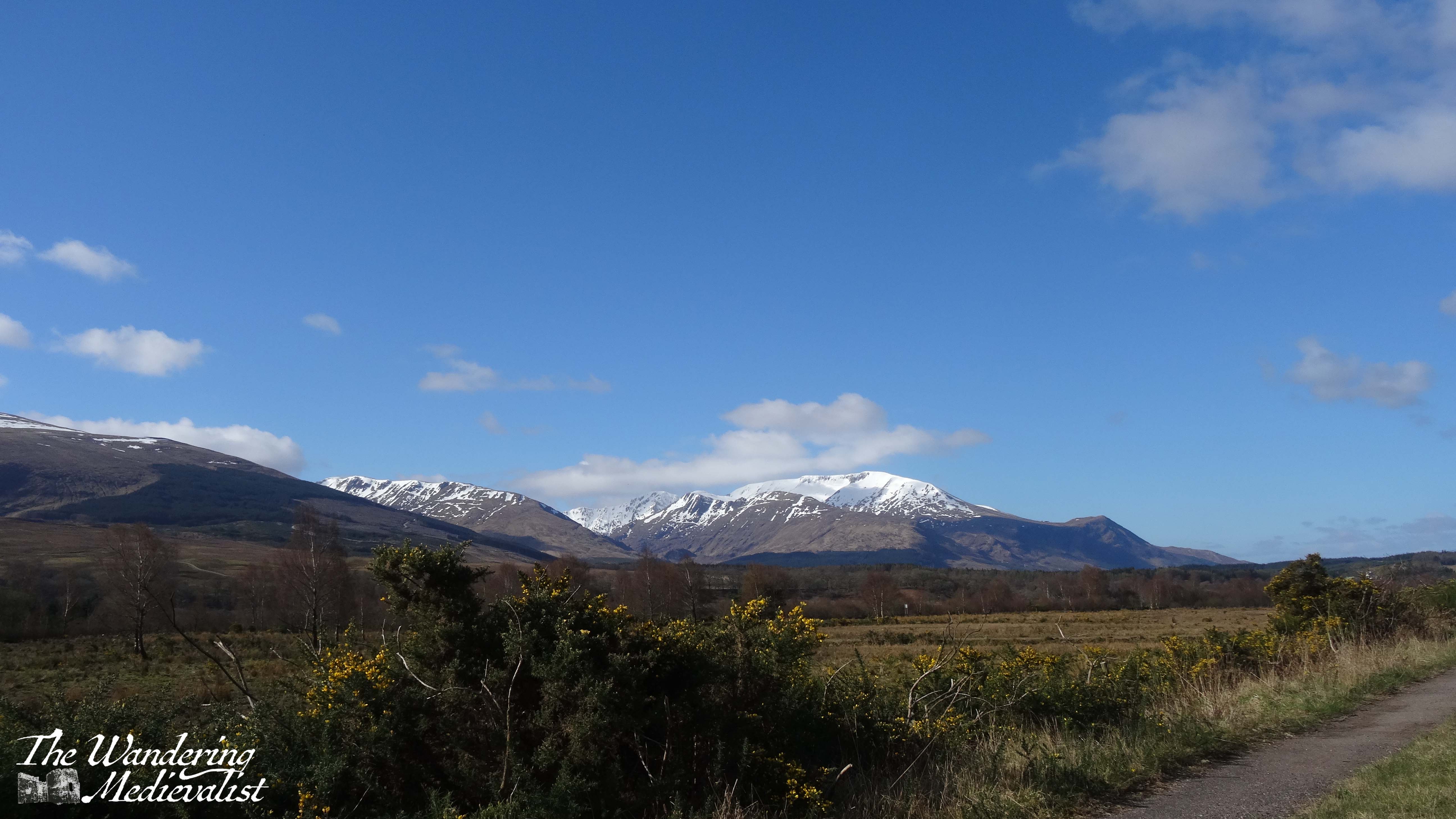
It is a beautiful route through a series of towns and villages where there are B&Bs and small hotels abounding. Some of the towns are also served by the rail line from Fort William to Glasgow. We stayed several times in a lovely hotel near Roybridge that provided excellent views up Glen Spean to the Nevis Range, but also showed how winding the road could be. Between Roybridge and Spean Bridge there are a few wide open fields where you can see up to Ben Nevis – the UK’s highest peak – often still snow-capped in April.
Spean Bridge is slightly larger than Roybridge, and there you can find several hotels and a woollen mill that provides refreshments (mostly to bus tours) as well as wide-ranging Scottish souvenirs. As expected, the River Spean passes under the road here, before carving its way through the landscape to join the River Lochy. This is also where the A86 joins the A82, offering an option to turn north towards Inverness or continue west to Fort William.
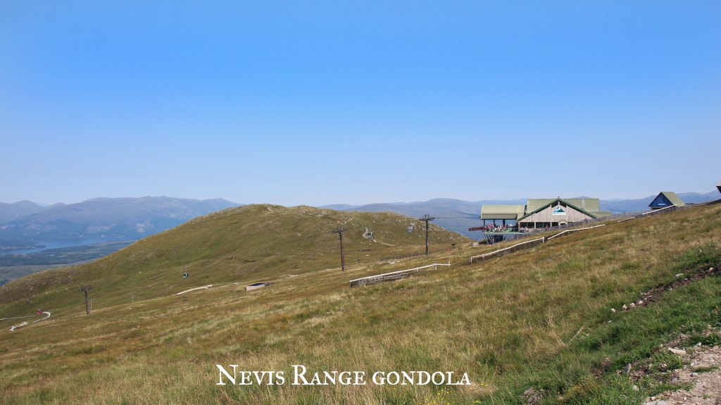
The drive into Fort William from here includes some spectacular scenery on both sides, with the Nevis Range rising to the left and farm and more mountains to the right. A few miles out from the town, you pass the Nevis Range mountain resort, where you can take the gondola up Aonach Mor.
The approach into Fort William passes some very familiar modern sights such as a large Aldi, M&S Food Hall, KFC, Costa Coffee, and Pound Stretcher. You will also go through the roundabout where the road from Glenfinnan and Mallaig intersects the A82 – believe it or not, I have been stuck at this roundabout in long queues of traffic. One does not often imagine finding a traffic jam in the Highlands!
Nevertheless, I always find myself smiling as whatever vehicle I am in makes its way past the turn off to Ben Nevis, then the many guest houses and B&Bs, and eventually into the town centre of Fort William.
A few items to note if you intend to try this drive:
As mentioned above, there are not many places to stop for refreshments or comfort breaks between Dalwhinnie and Spean Bridge, so plan both carefully.
Likewise, petrol is scarce between these points, but if you have filled up in Perth you should be able to reach Fort William without any danger of running low – transport depending of course.
Roads will be slippery and potentially even closed in poor weather (particularly in the winter). Drive carefully and always check the route on Google Maps or your preferred method before leaving. Roadworks and diversions may pop up without much warning!
If you intend to stay in Fort William, make a reservation. It is frequently busy, even when you think it might not be…
I will write soon I am sure about the town of Fort William itself, places to eat and stay, as well as the drive back south again via Glencoe and Rannoch Moor. Until then, I hope some of my pictures have persuaded you to give this journey a go!
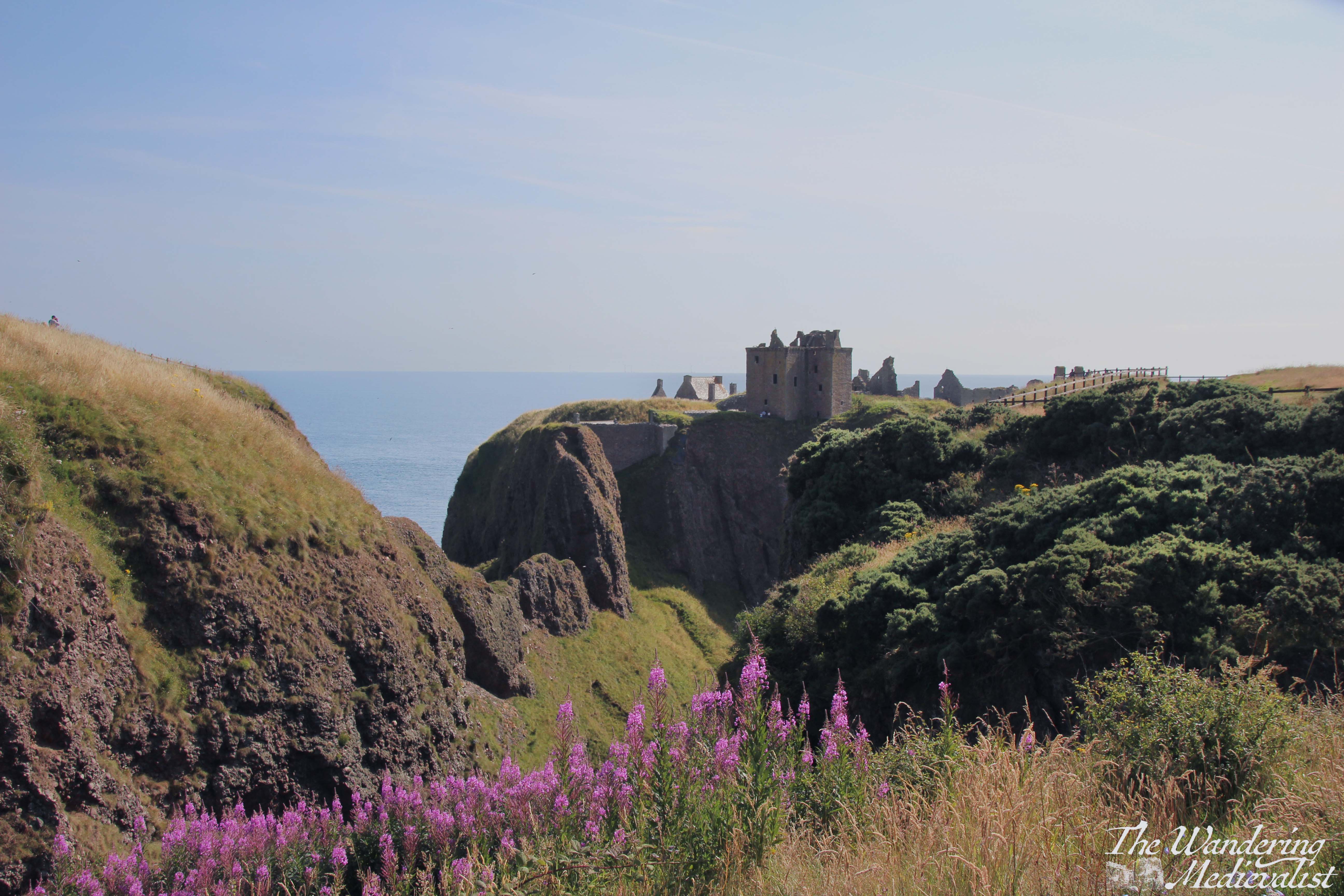
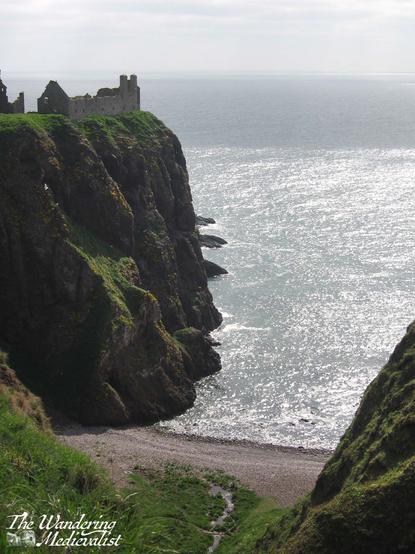
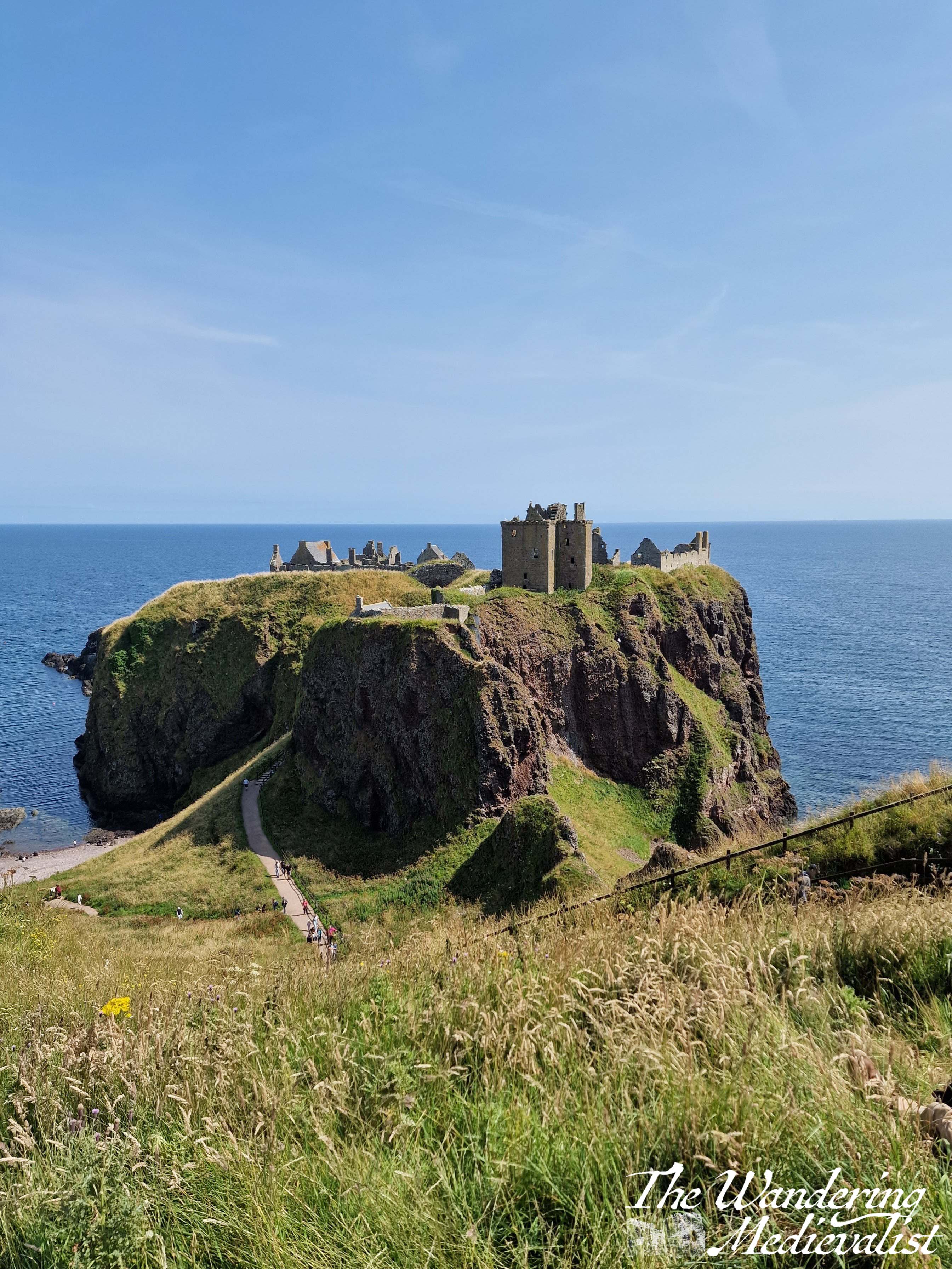
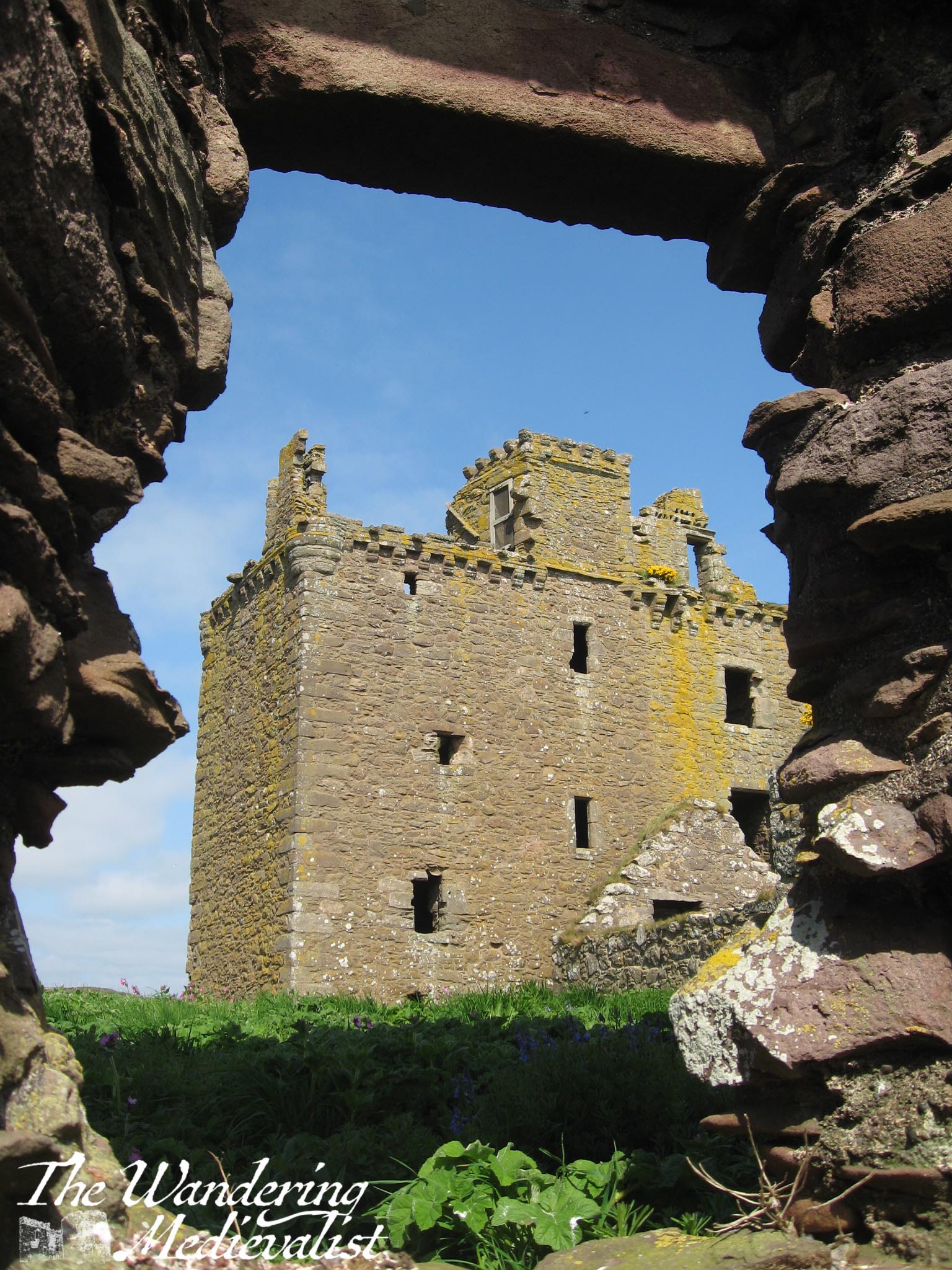
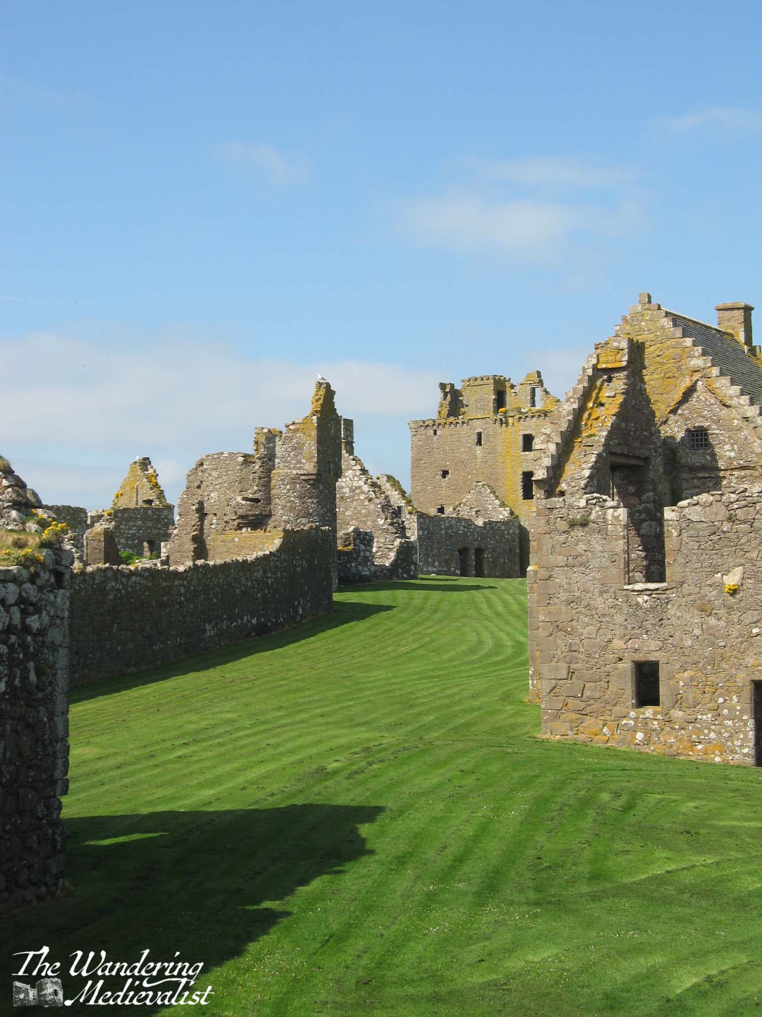
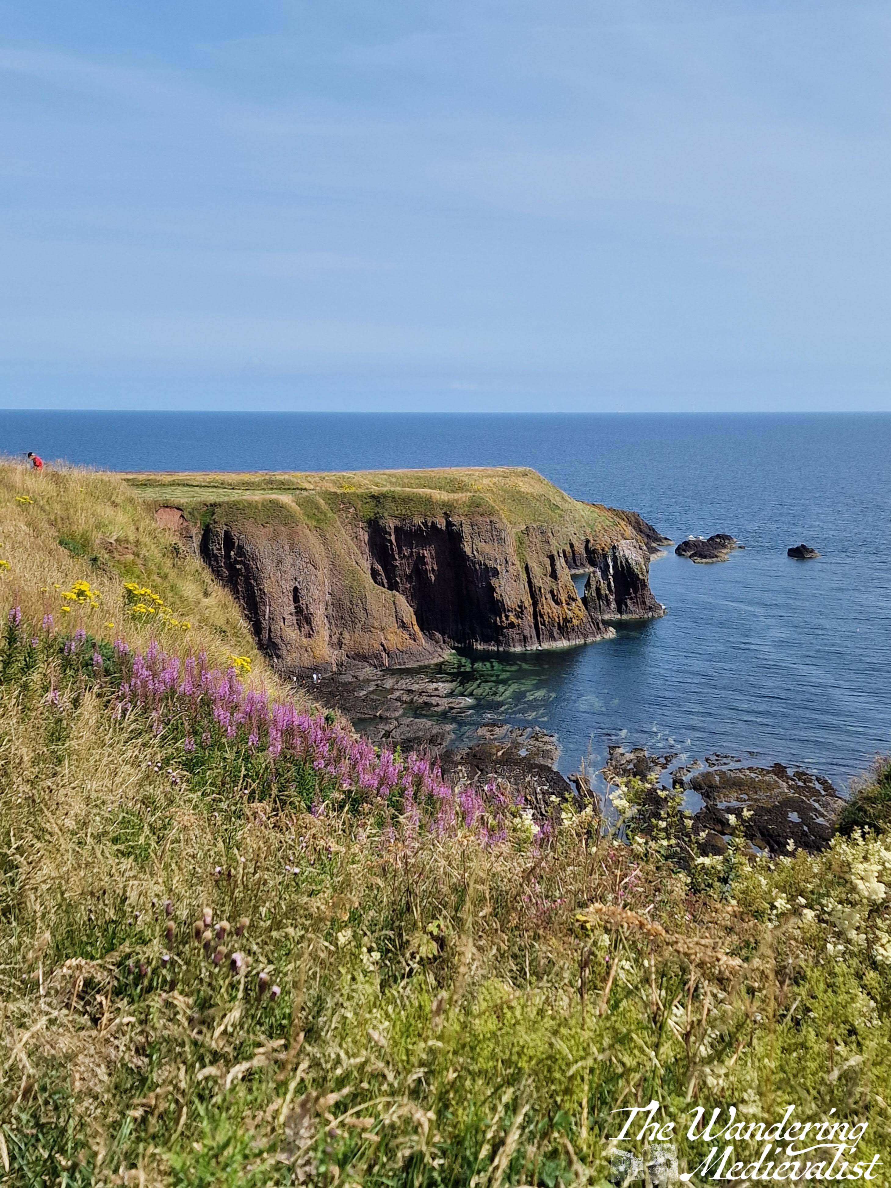
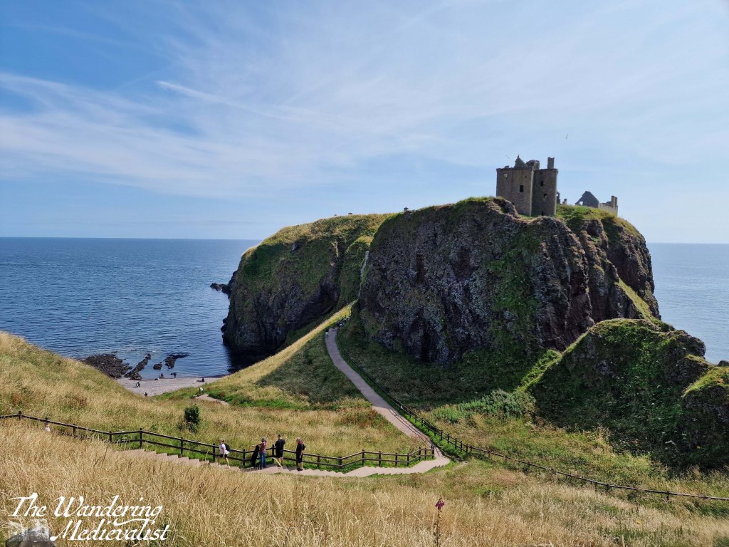
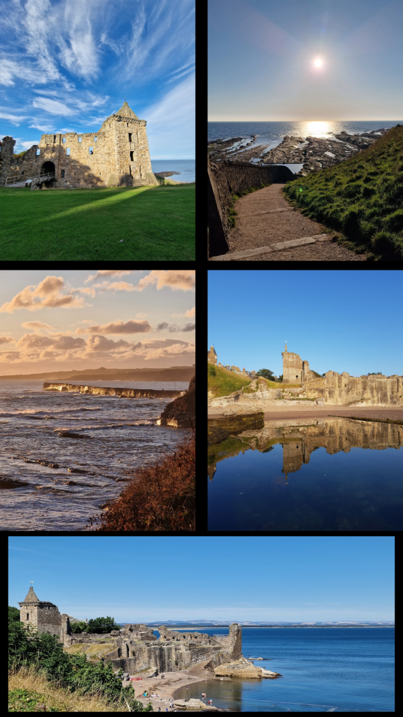
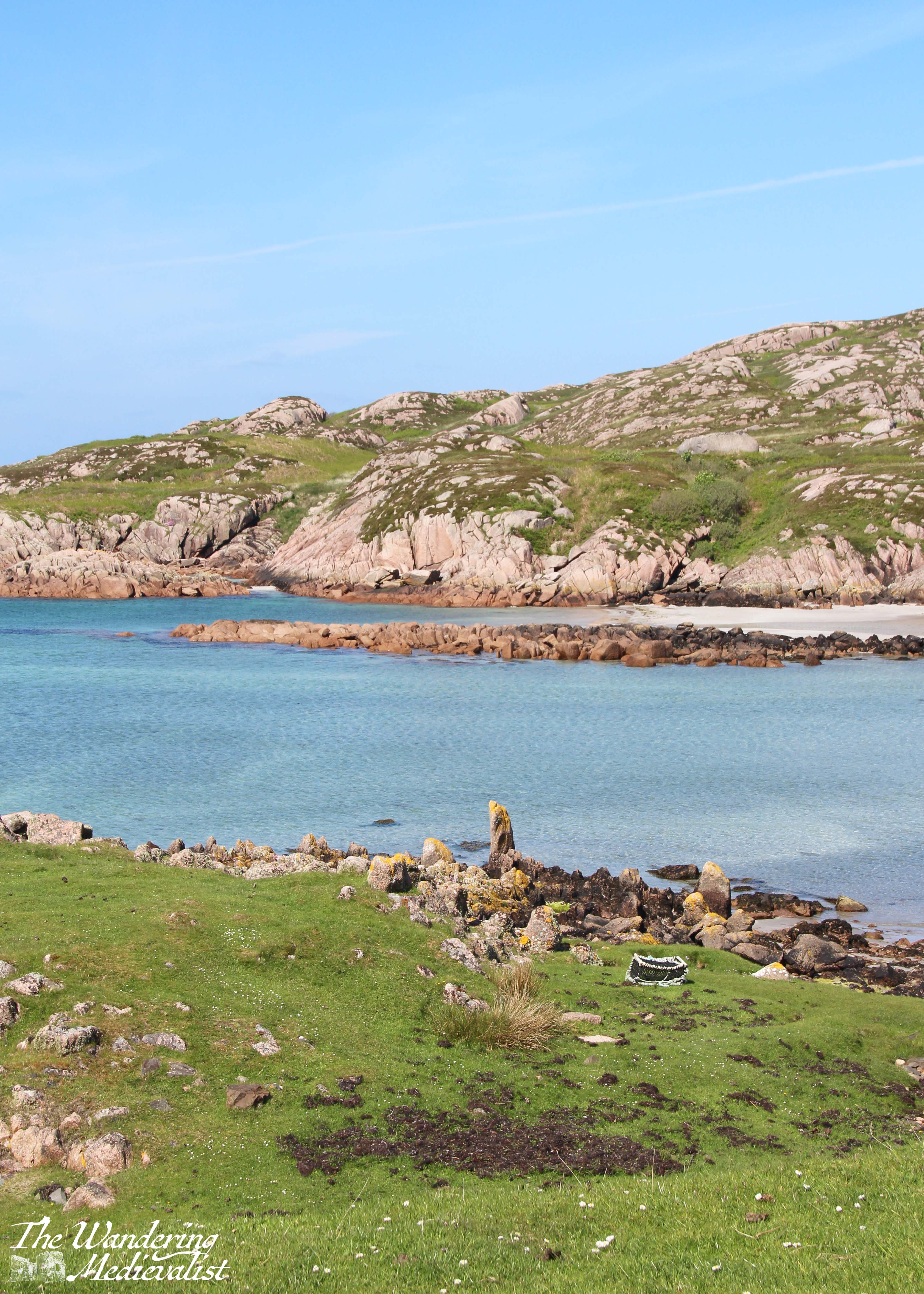
Dunnottar Castle, sitting on the east coast of Scotland on a headland, is one of the most photographed castles in the UK; if you get a standard Scotland calendar, it’s as likely as not to contain one picture of this castle. And for good reason – the partially-ruined castle sits on its own rock surrounded by the sea, silhouetted against the sky and Aberdeenshire cliffs. Like Edinburgh, it is a castle through which one can see the passage of time, the periods of history in which it was used and built. The keep and entrance are thoroughly medieval, but the North, East and West ranges are all varying degrees of late medieval and modern.
Dunnottar is most easily accessed by car, but if you are trying a carbon-friendly tour of Scotland, you are still in luck. You can either walk up the seacoast from nearby Stonehaven, about 1.5 miles – though prepare for a few good climbs and wear sturdy shoes – or you can get a local bus to the end of the road, about half a mile. I am not sure how often these busses run, however, so definitely keep an eye on the schedules. My mother and I first visited more than ten years ago, though I cannot recall how we actually reached the castle as we were definitely without a car; I have a feeling we actually took a taxi from Stonehaven train station, so that may be another option.
Tickets for the castle are purchased once you make it inside the fortress, so in theory one could visit and walk along the coast to see the castle from a distance, but for free. The opening hours vary by time of year, but are up to date on the castle website, where you can also buy tickets in advance.
There is a good-sized car park with a porta-loo and a very good catering van that sells drinks, ice cream, chips and rolls with bacon, burgers, hot dogs, or haggis. There may have been a vegetarian option, but I am not positive.
The adjacent picnic benches are visited regularly by scores of sparrows living nearby, and they are quite tame, hopping right up to you for a few crumbs or a piece of roll.
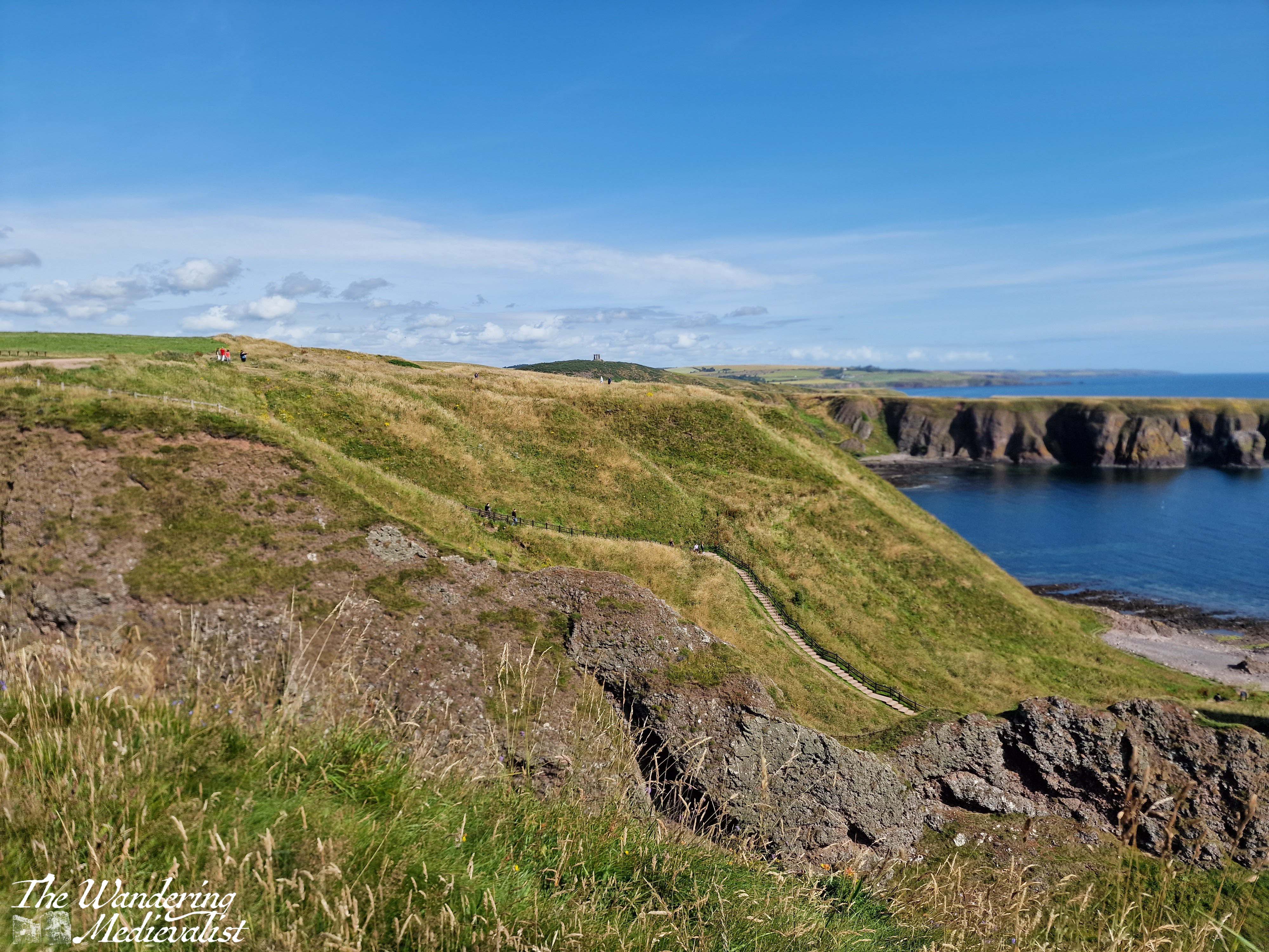
From the car park, visitors start off down a wide path lined with thistle and wild roses, with the castle slowly rising on the horizon ahead.
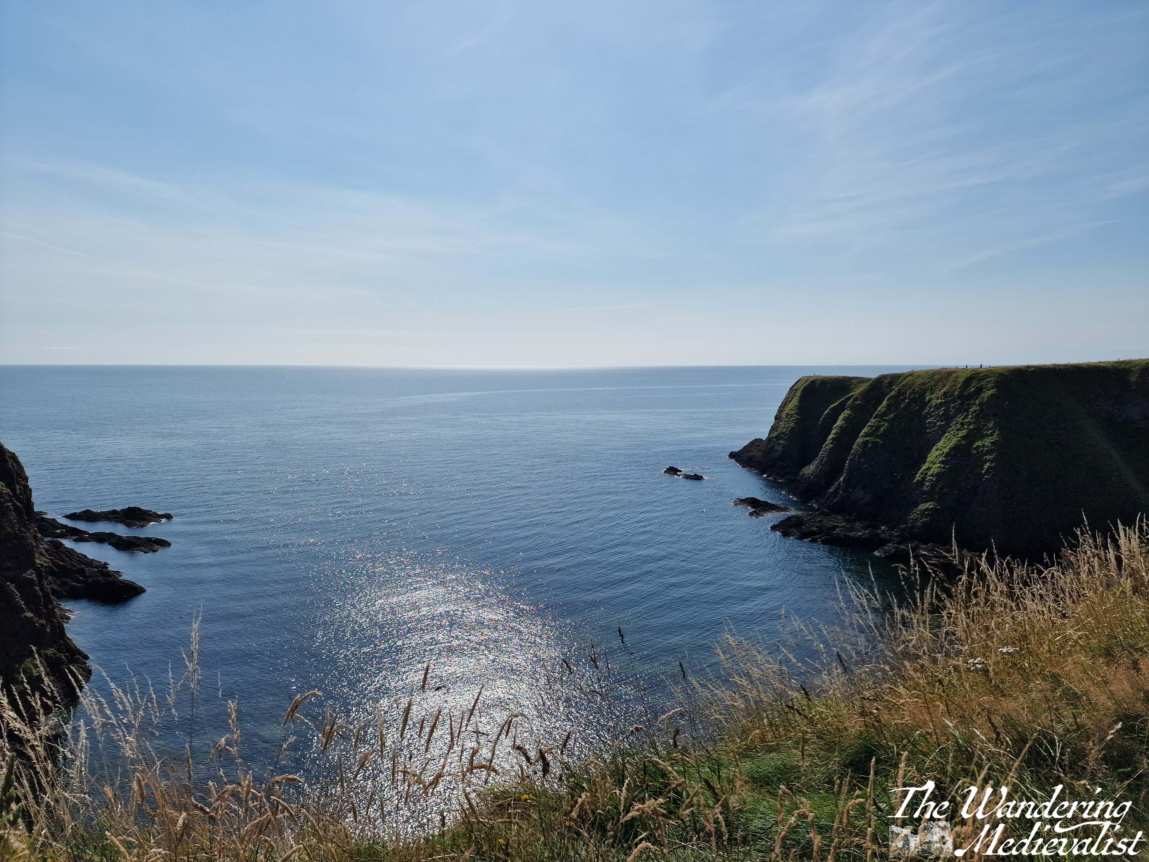
One has an option to go left along the coast, right across a few small bridges to a viewpoint, or immediately to the castle. I recommend, to get warmed up, a jaunt along to the right first, where you will go down and up a few sets of stairs and path as to move along the cliff. This path is also lined with Scottish fireweed (purple flowers) and gorse, and there are several excellent places to pause for a picture.
The viewpoint itself allows for gorgeous pictures – as one would expect – of the rock on which the castle sits, the coast, and the sea. From here you can also get a good feel for the staircase awaiting you to access the castle.
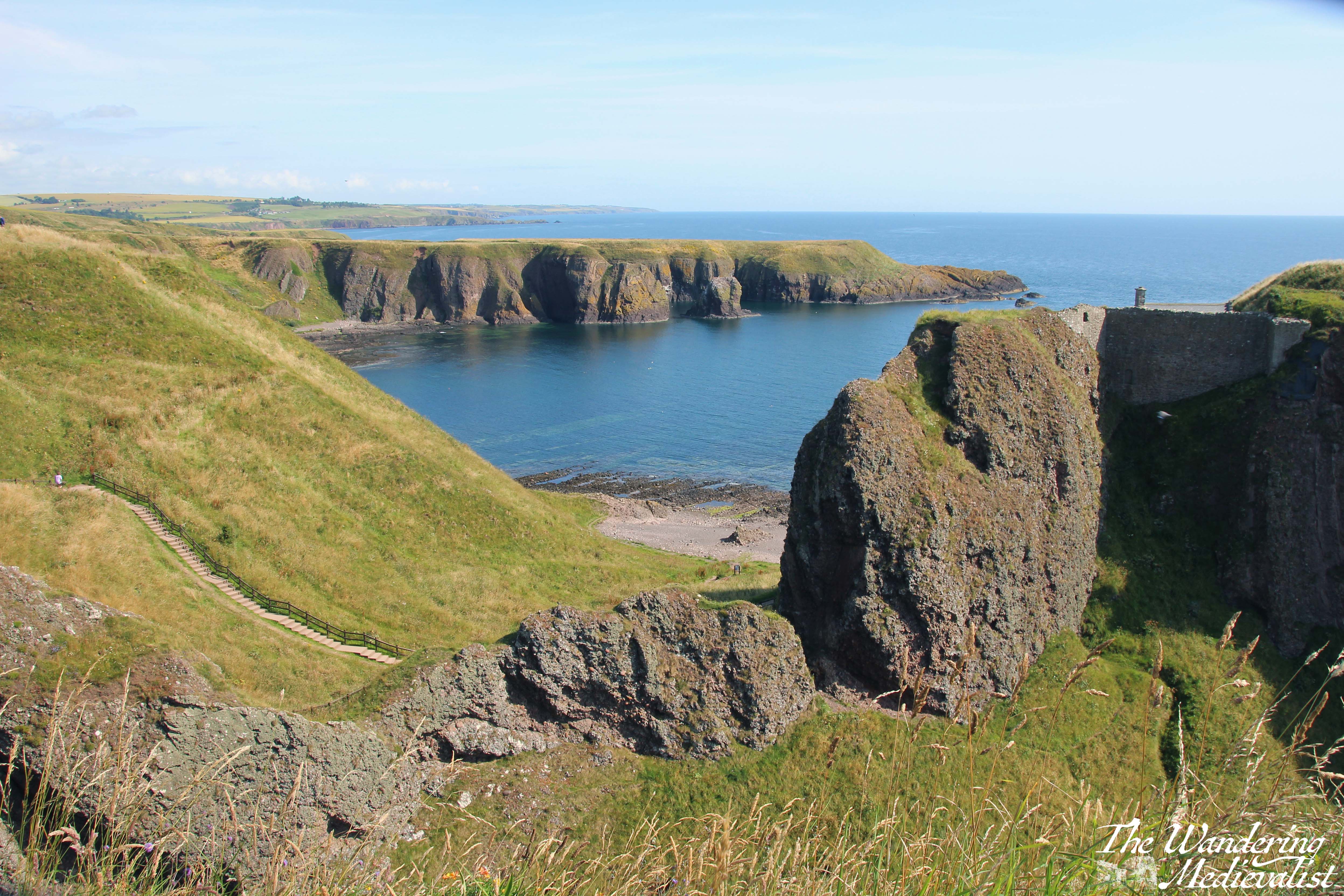
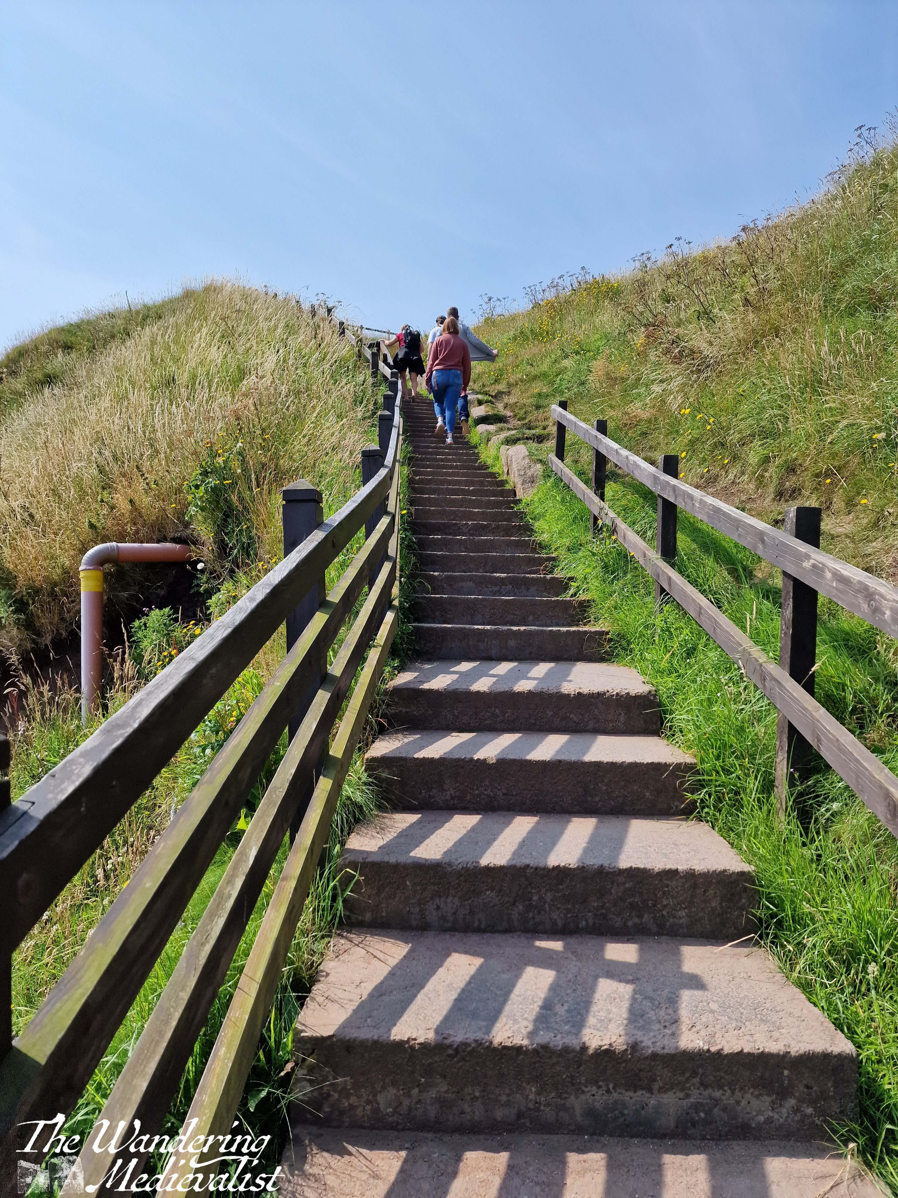
Once you have had your fill of this particular view, you can continue along the coast quite a bit further, or you can head back down and up to the point you started, looking over the castle and bay. From here, you must descend what must be around 100 steps, zig-zagging down the steep hillside towards the beach. The stairs are wide enough for two to pass and have a solid railing, plus at least one bench at which one can take a breath. This route also offers some excellent views, though it’s hard to stop for long when there is a queue of people behind you waiting to get down, or up.
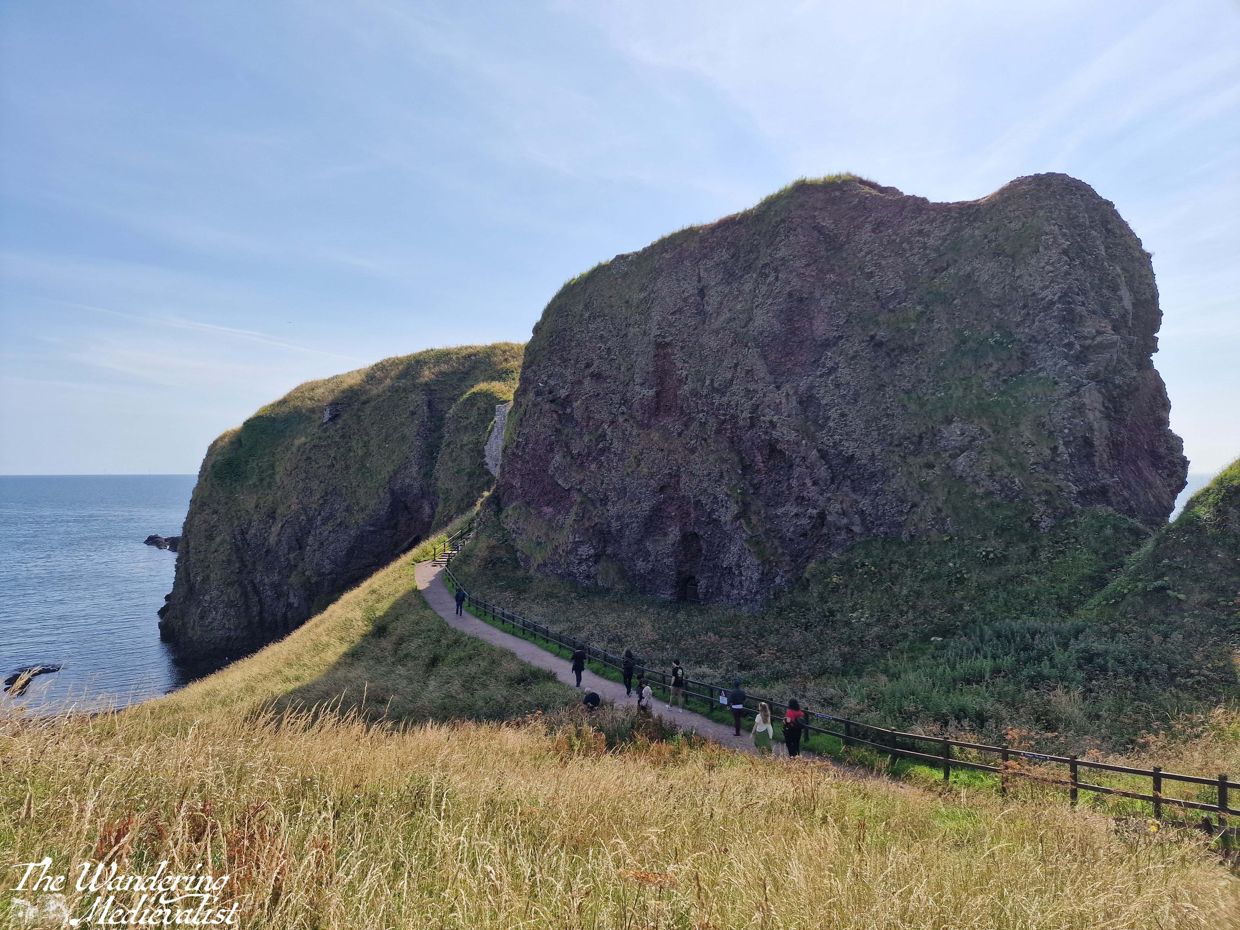
The bottom of the staircase offers again two options – you can scamper off left to explore the beach, or go straight ahead to the castle. Here one finds another set of stairs, though first you have a good view of the rock on which the castle is built, including a gated cave and the land bridge that once connected the castle to the coastline but was eroded for security.
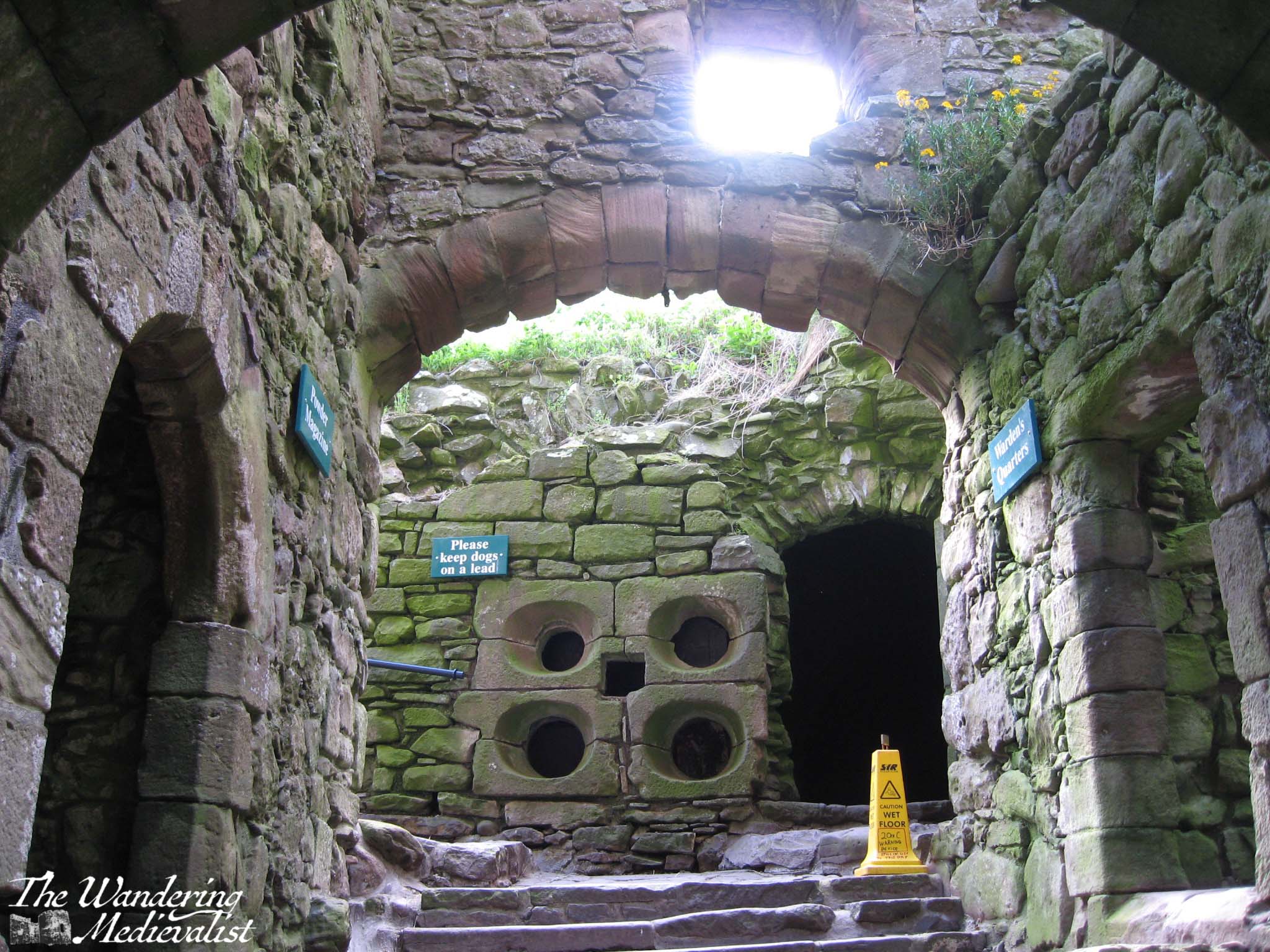
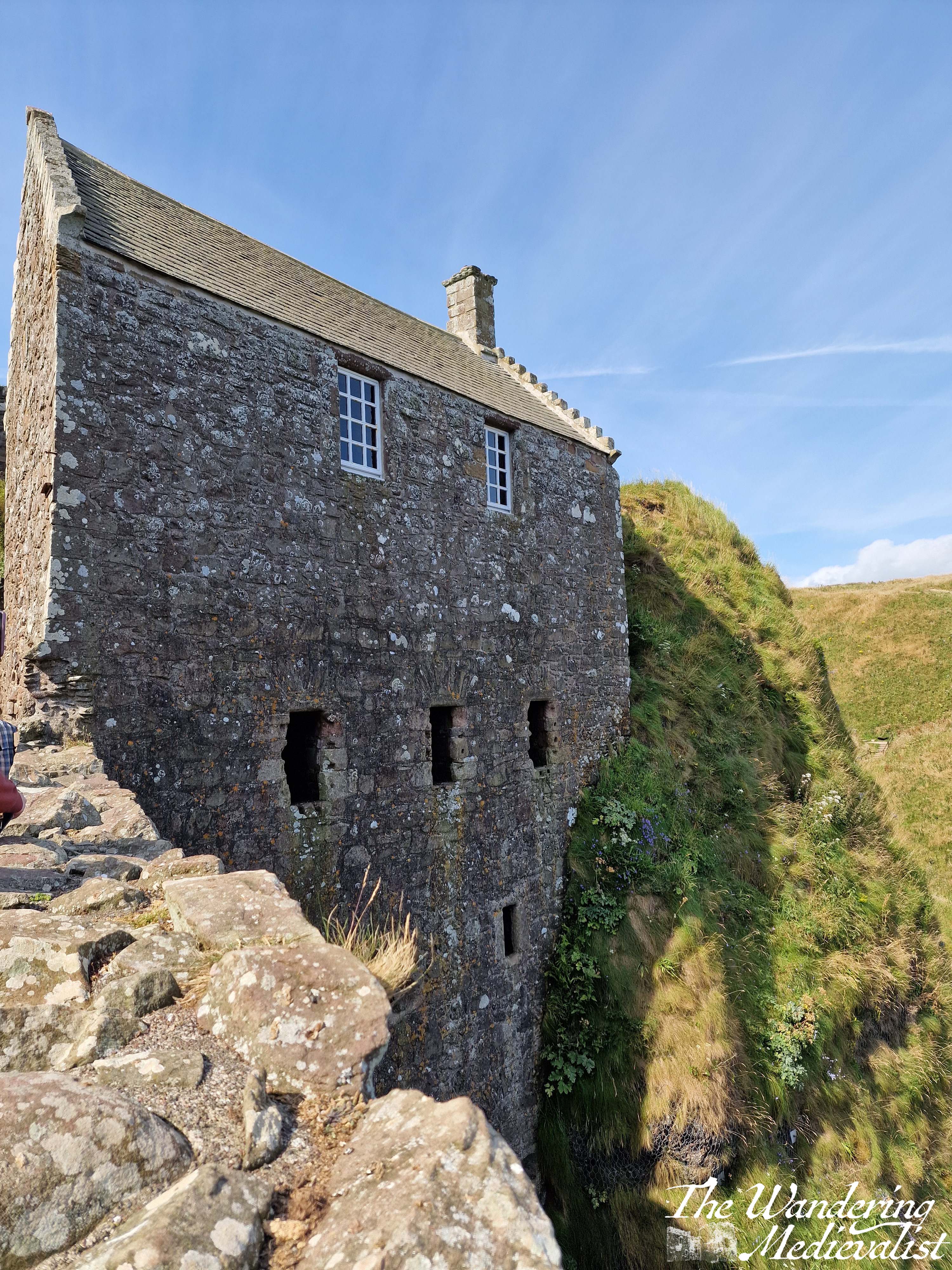
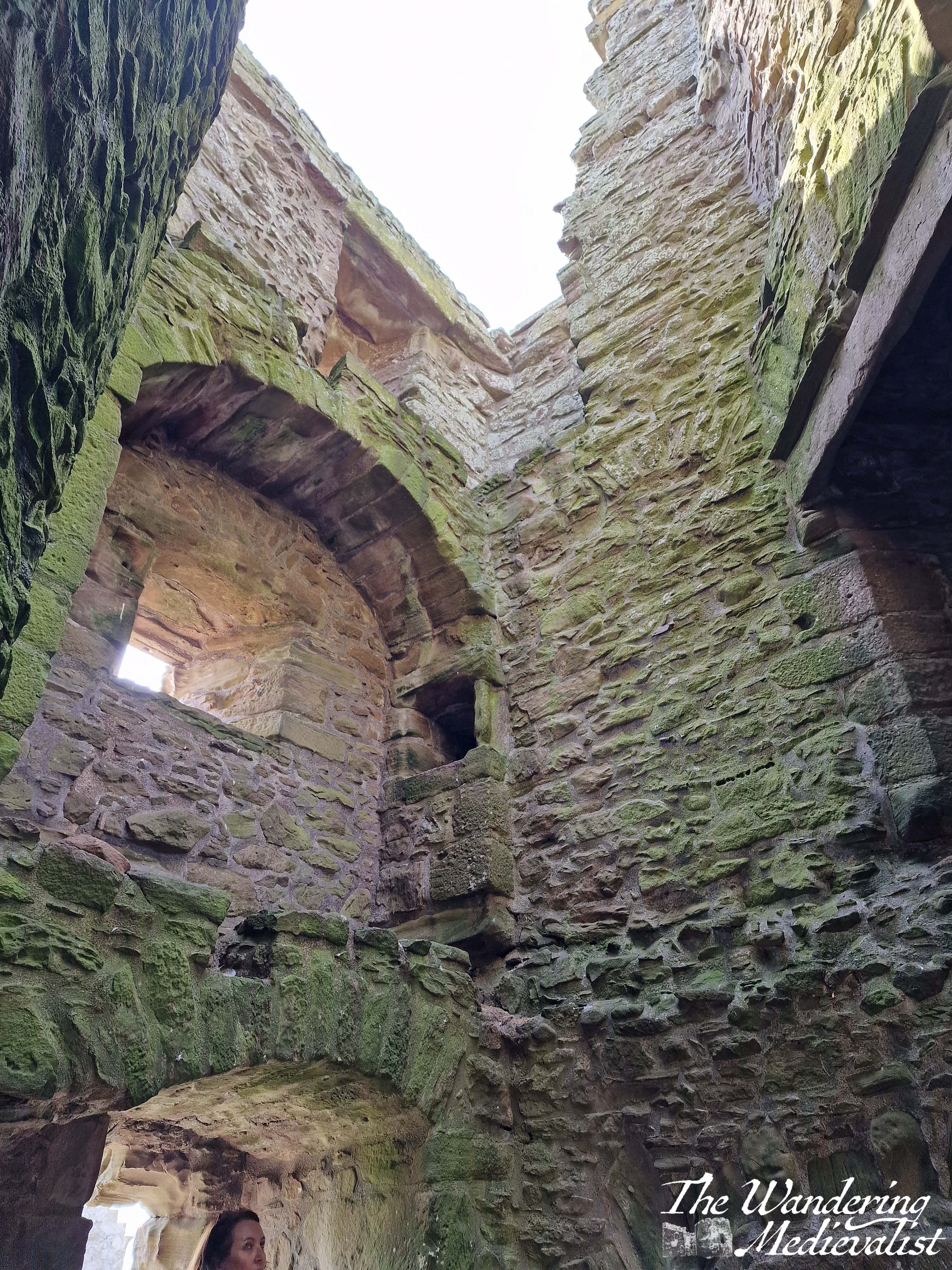
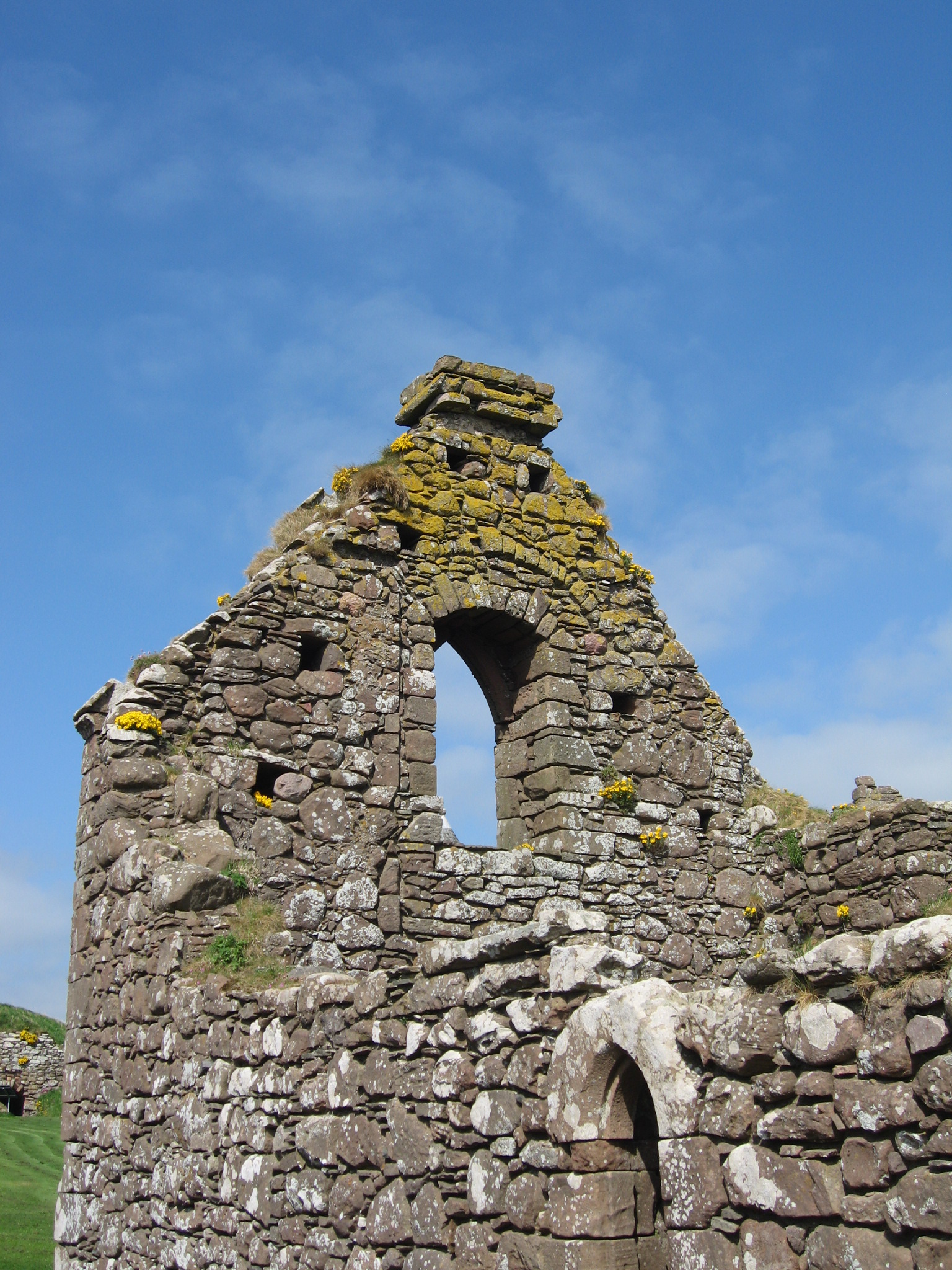
Stairs take you in a postern gate type of entrance, and then up through the gatehouse to where you buy or show your tickets. From the ticket office, there is a well-marked route climbing up through the castle, past Benholm’s Lodging, a structure clinging to the edge of the rock. The top floor is a comfortable enough room, while the lower levels are all designed to aide in defence of the castle with numerous arrow loops.
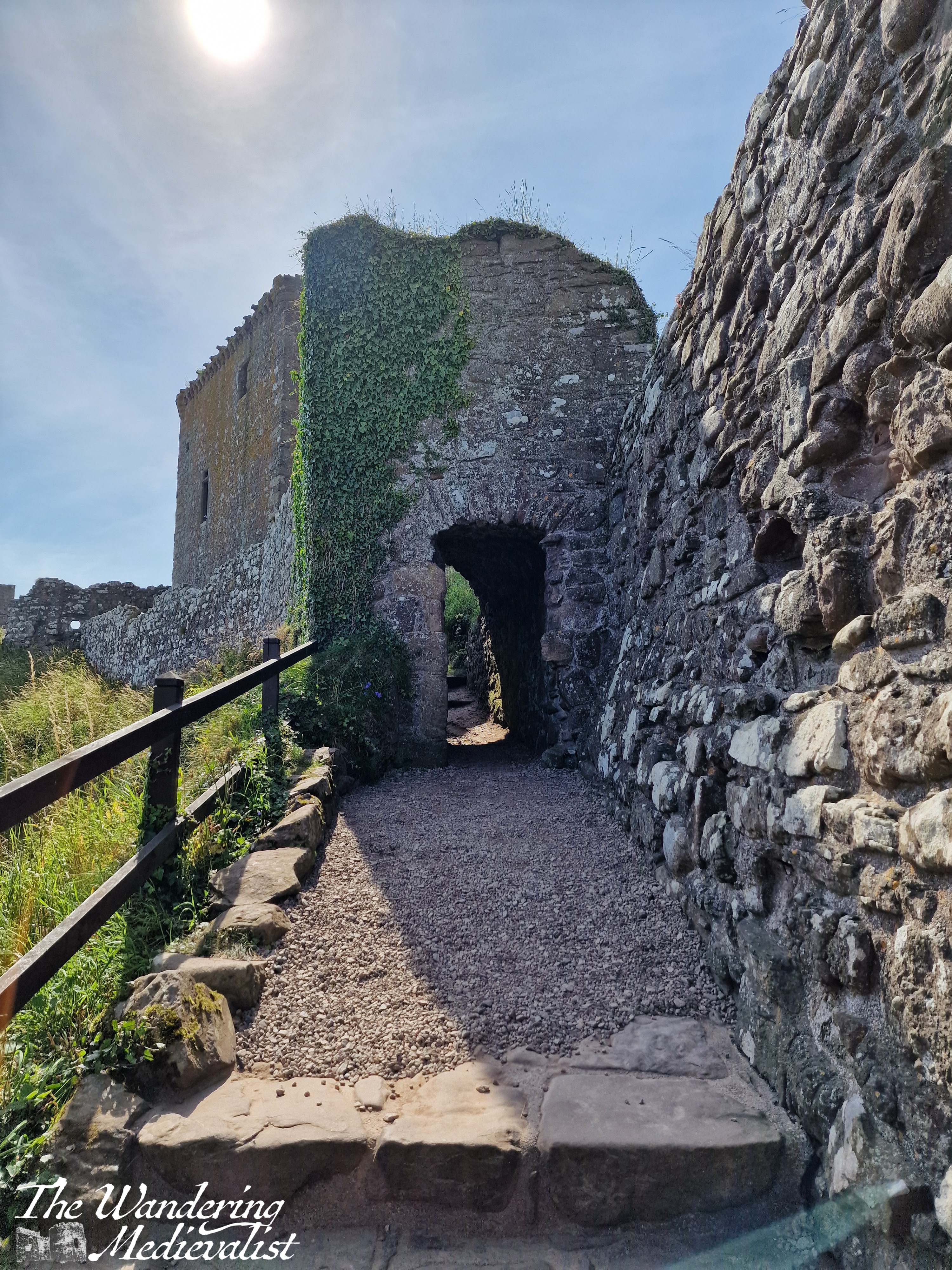
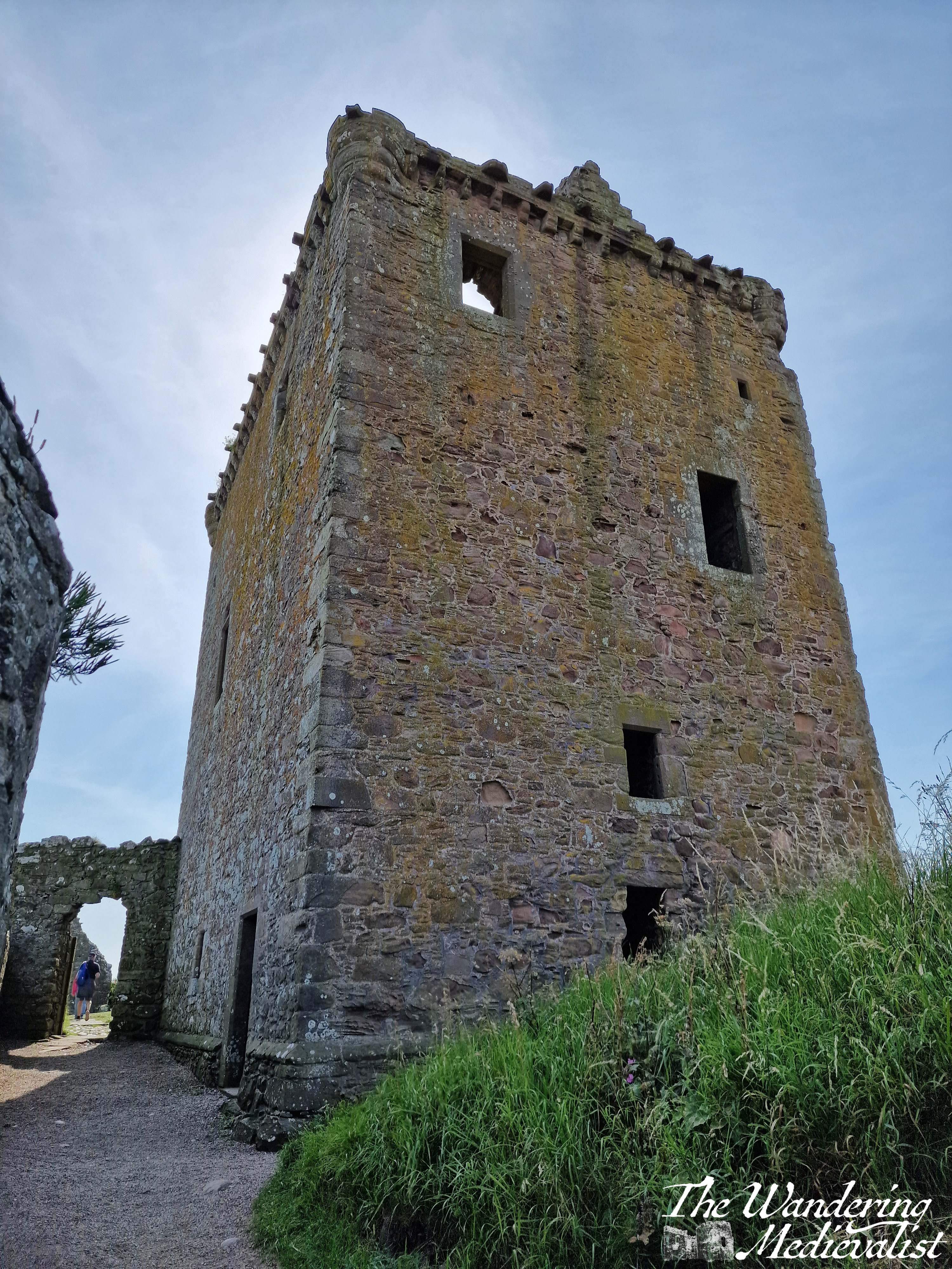
Another short climb through a pends – covered passage that make you very pleased you are not storming the castle – and finally in front of you rises the medieval keep, strong and square and emblematic of high medieval Scottish construction. The keep was constructed in the 1390s by Sir William Keith, Great Marischal of Scotland, a hereditary post held by his family and one of great importance to the governing of the kingdom. Quite well preserved, the keep hosts a large kitchen hearth on the bottom floor and a rare straight stone staircase leading to the second floor. Here you can look out over the rest of the castle or the beaches beyond.
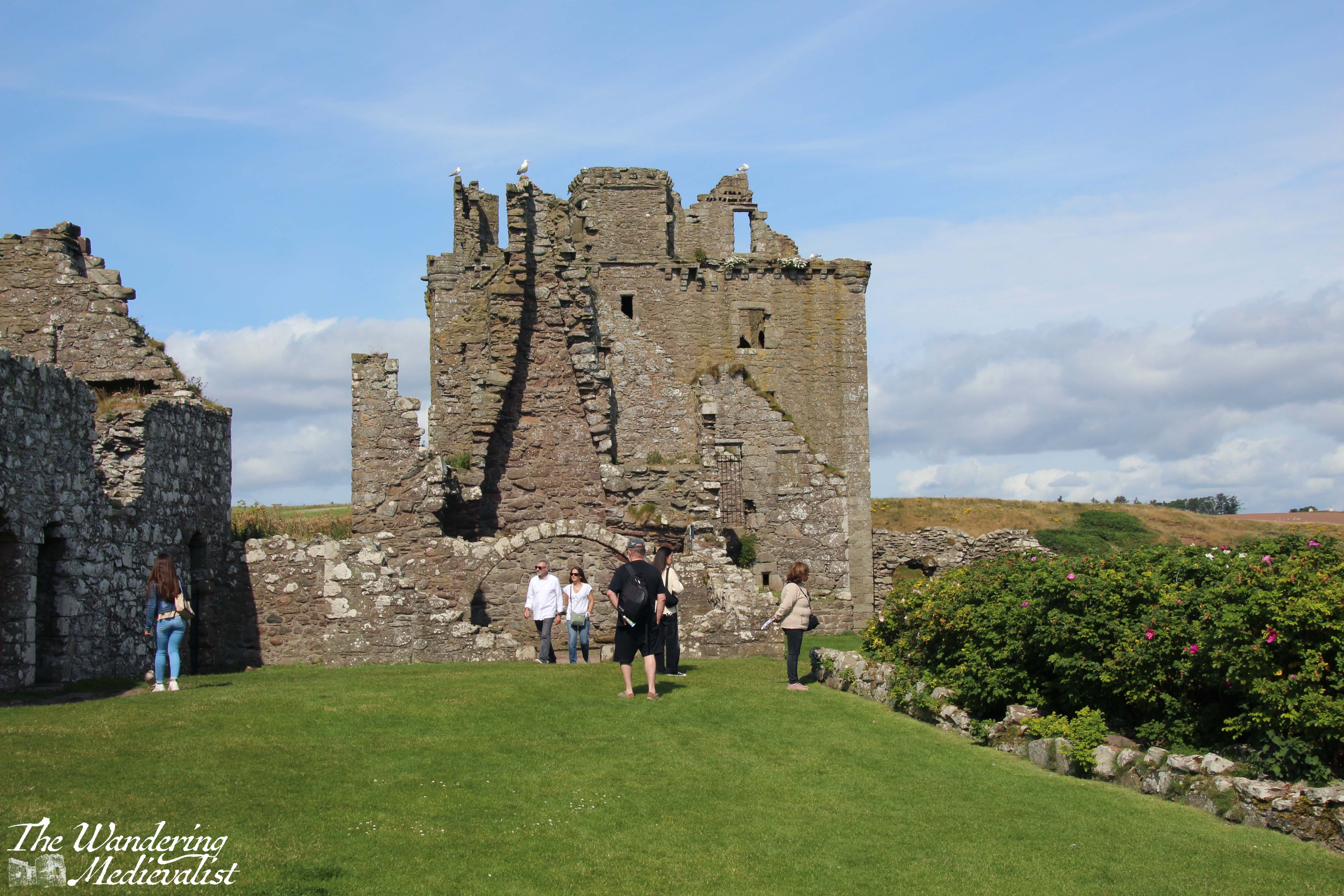
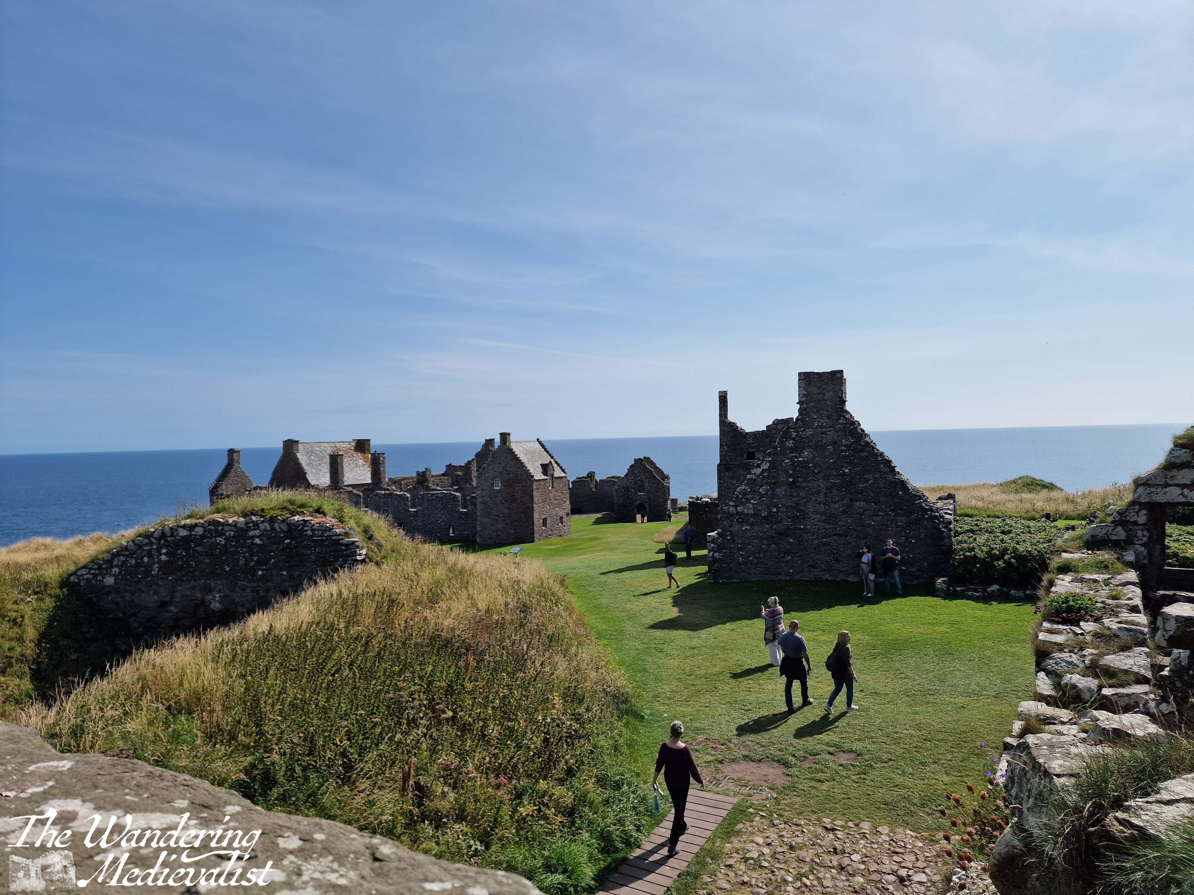
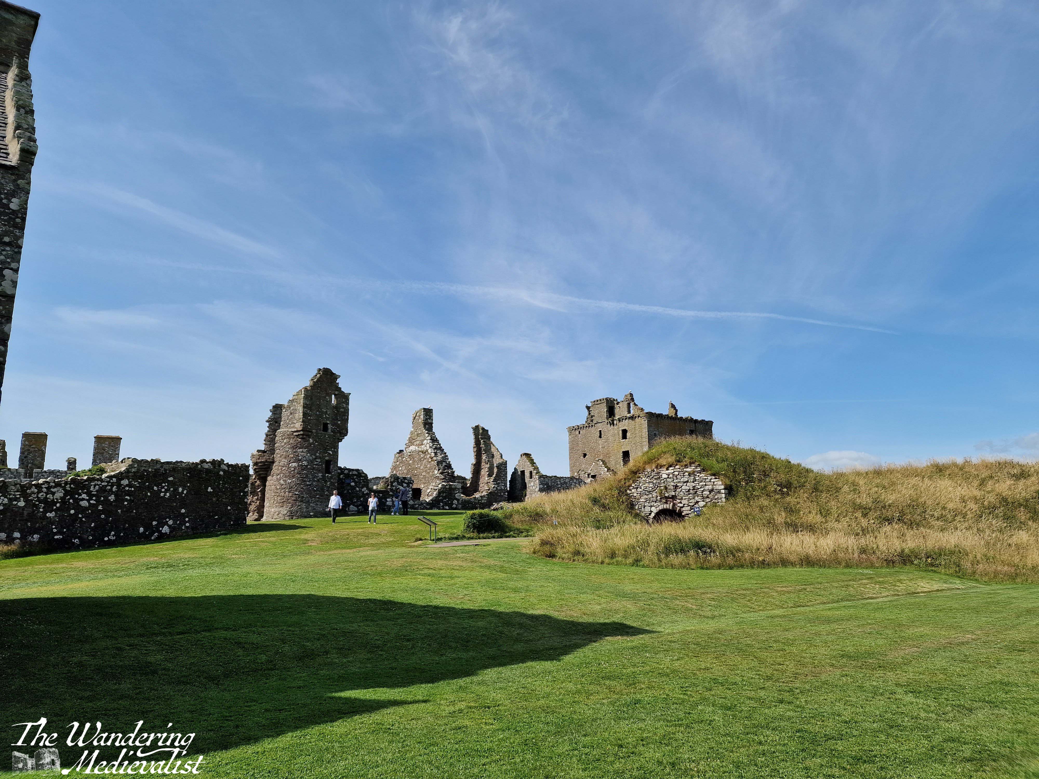
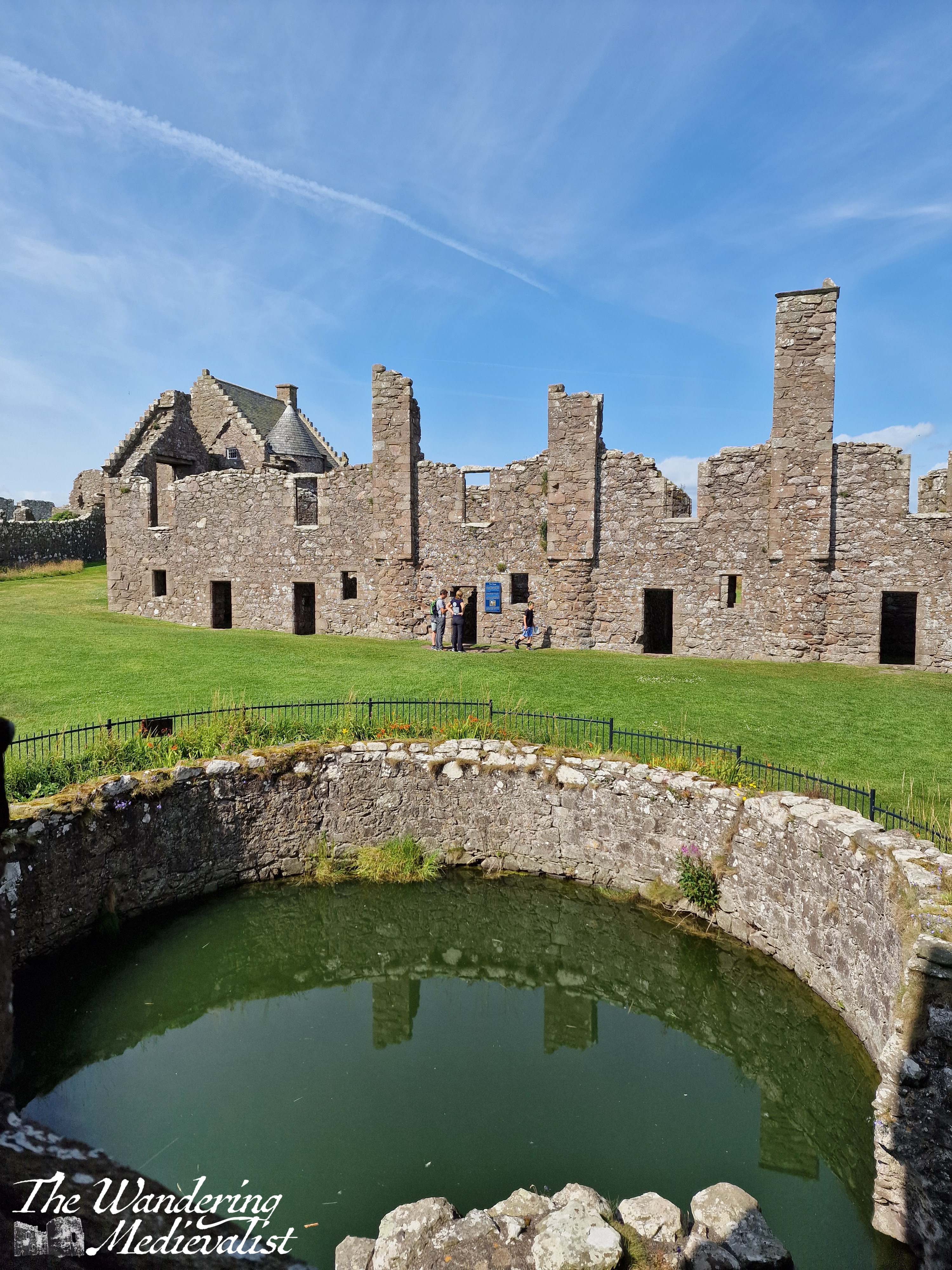
Once you have fully explored the keep, you will find countless other structures in various states of ruin from the storeroom and stables to the increasingly less-medieval ranges built through the early modern period. There is a cistern for water and probably fish, several residence blocks and the old chapel.
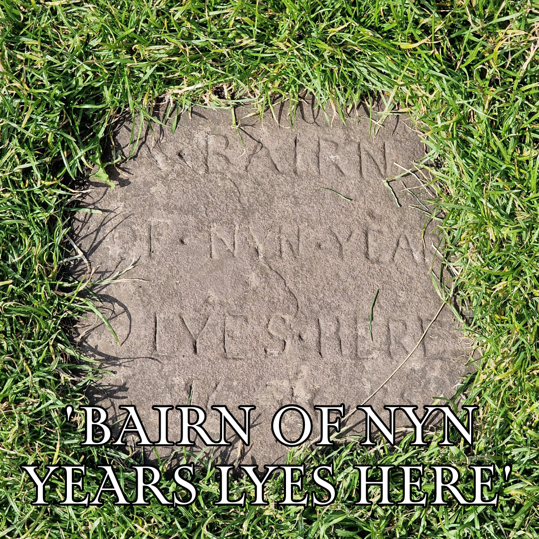
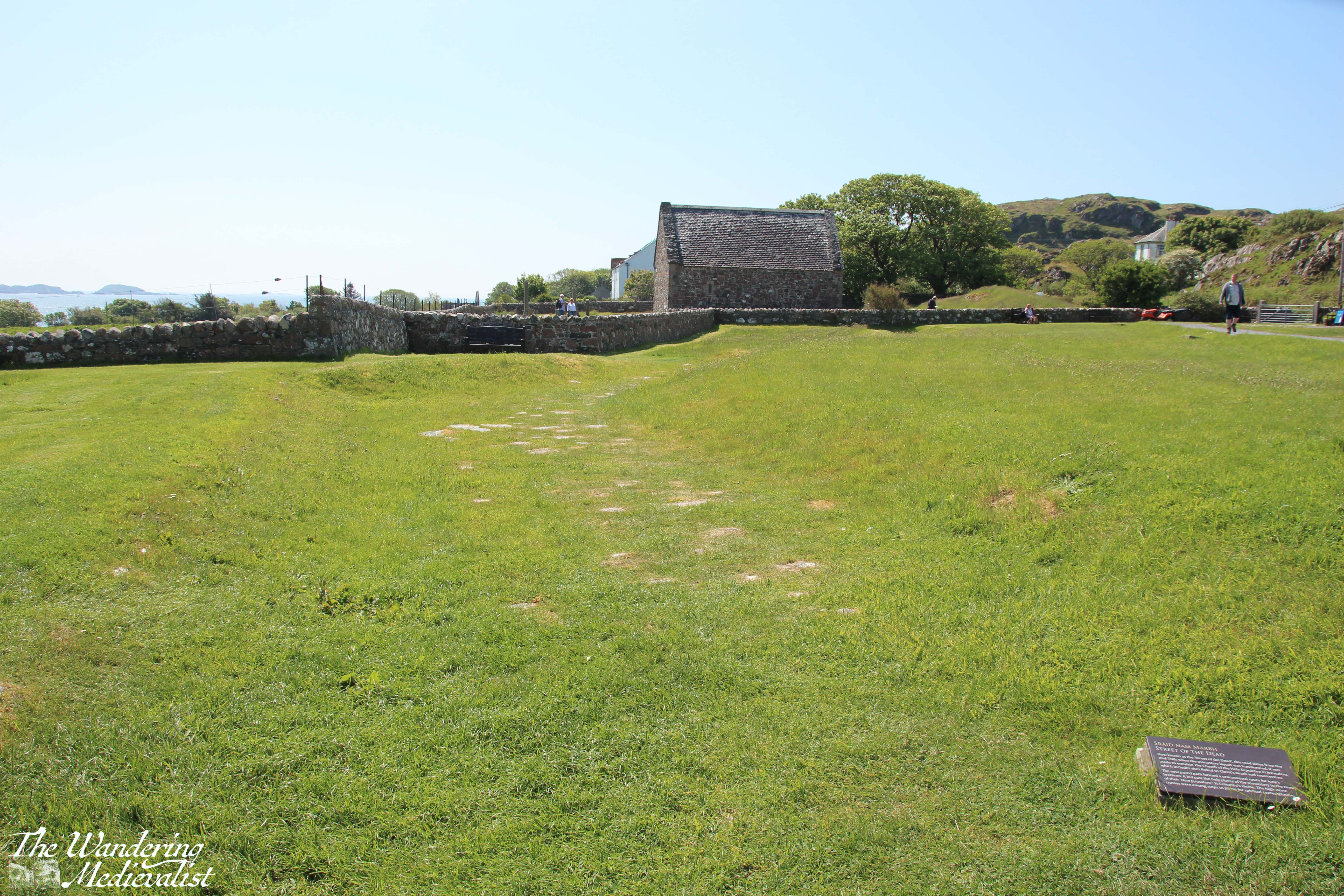
The chapel is key to note, as it is one of the oldest structures; consecrated in 1276 by William Wishart, the Bishop of St Andrews, it probably replaced a much earlier chapel to St Ninian, a missionary saint who is very popular in Scotland. The site of Dunnottar itself was likely inhabited as early as the fifth century by the Picts, and it was a religious site in the early Middle Ages, meaning that the construction of a defensive castle caused some upset. The pope even became involved in the dispute. Poignantly, the land that was graveyard is now mostly grass, with only one marker remaining.
The chapel may have been the site of a massacre of the English by William Wallace in 1297. Blind Harry, Wallace’s often unreliable biographer, relates that English soldiers had fled to Dunnottar for sanctuary – validating the site as a religious one – but that Wallace set fire to the chapel, burning many soldiers alive. The survivors were run off the edge of the cliff. The brutal story may not be completely true, but the may have gotten the gist of things.
A more complete history and many details can be found on the very helpful website for the castle.
A few highlights include a stay by Mary Queen of Scots – where didn’t she stay in Scotland? – and the protection of the Honours of Scotland (the royal regalia) during the invasion by Cromwell in the 1650s. One can spend a very pleasant time just sitting on one of the many benches and enjoying the view, over the sea or the castle grounds, which are impeccably well-kept.
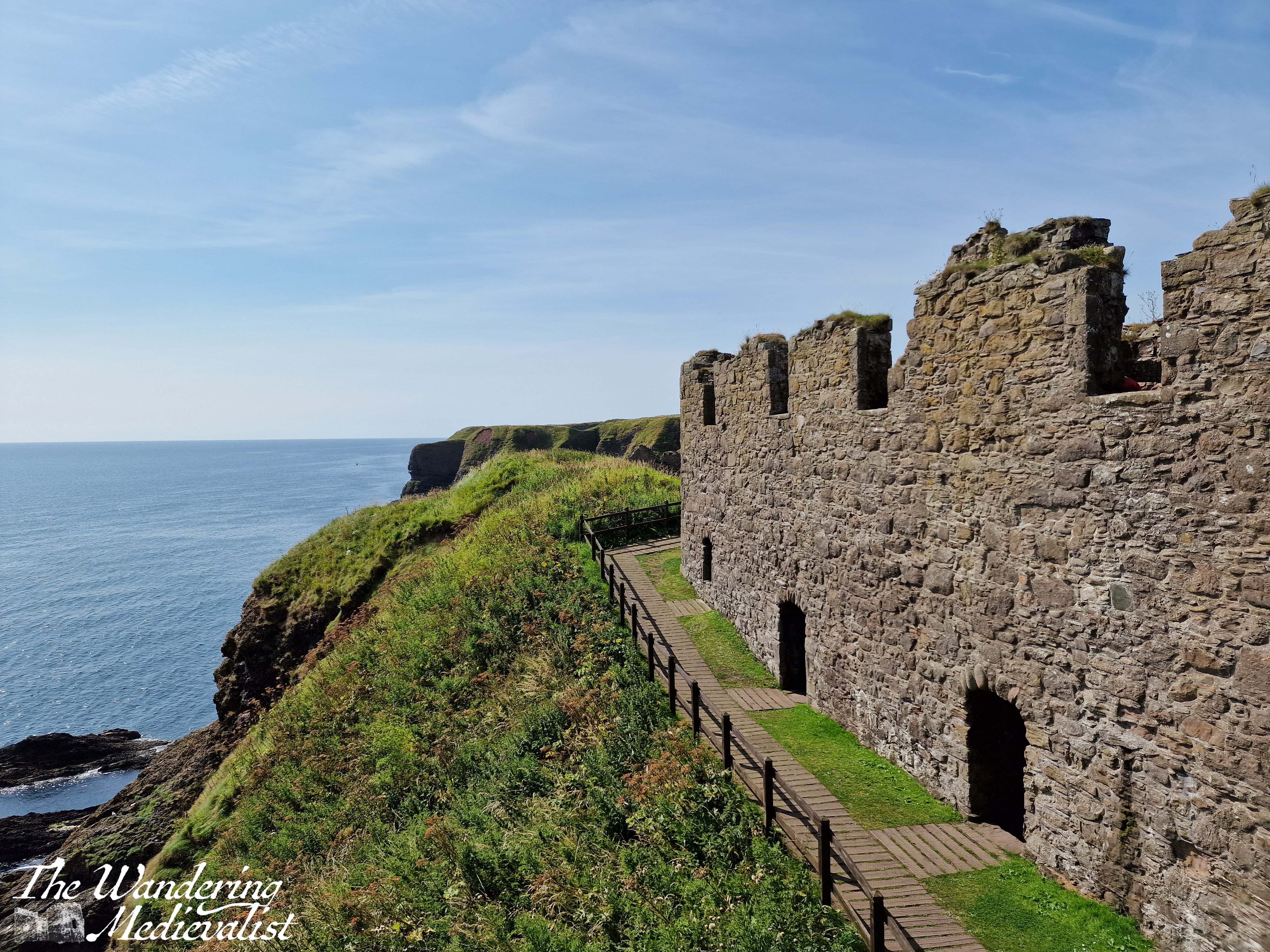
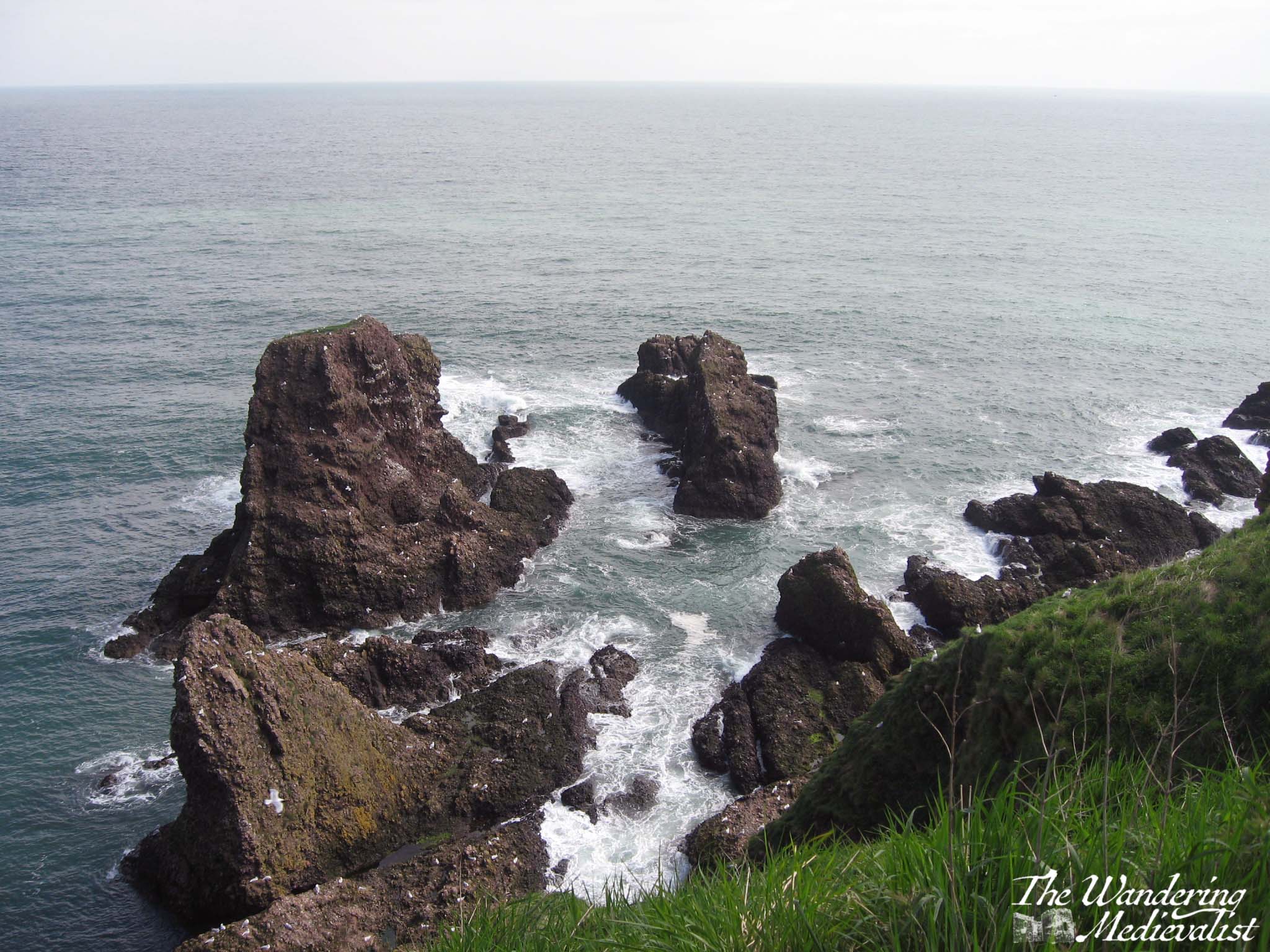
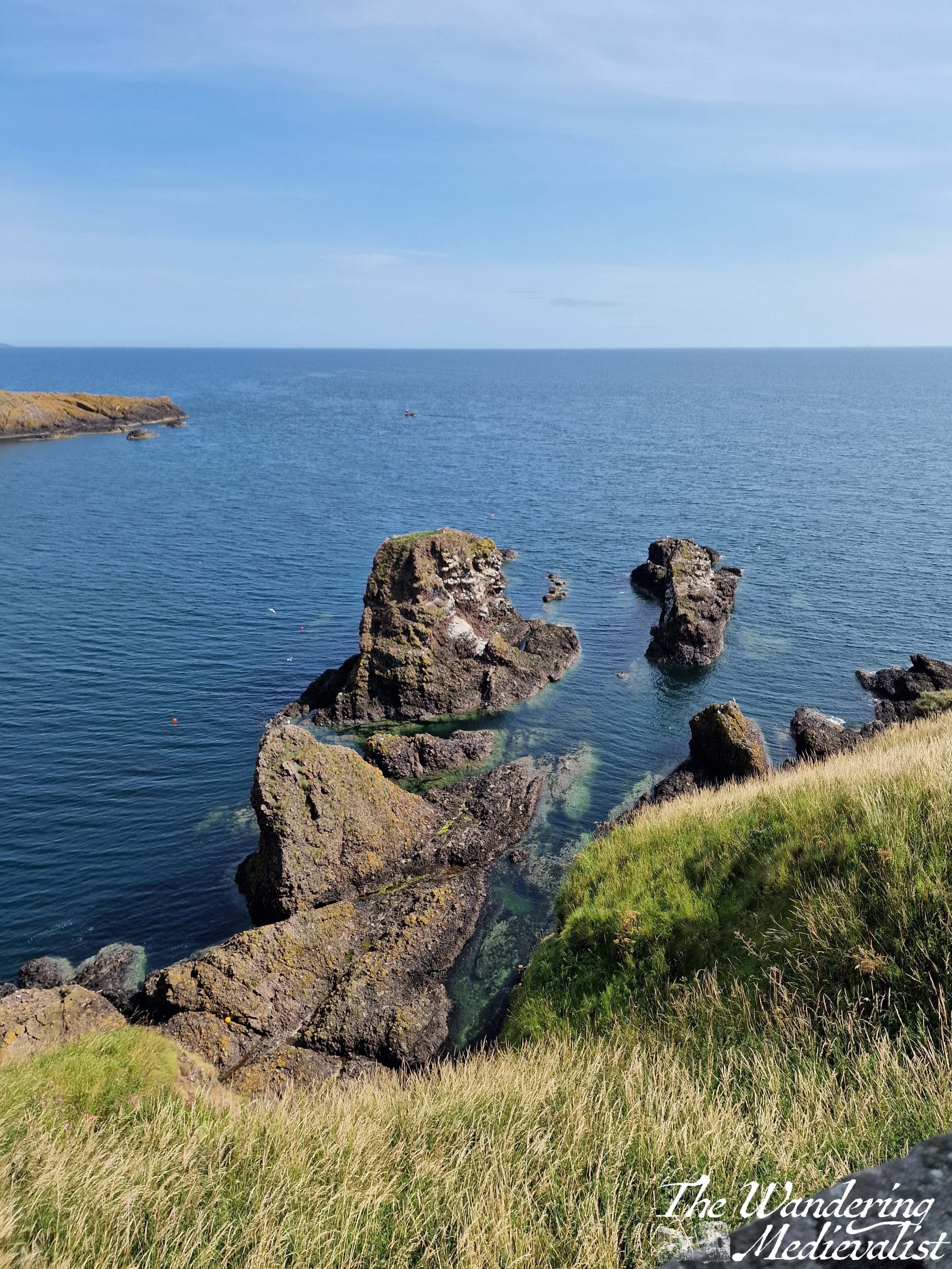
Another option is to walk essentially around the edge of the rock, where you can enjoy the views down over a tremendous rock formation, and along the headland.
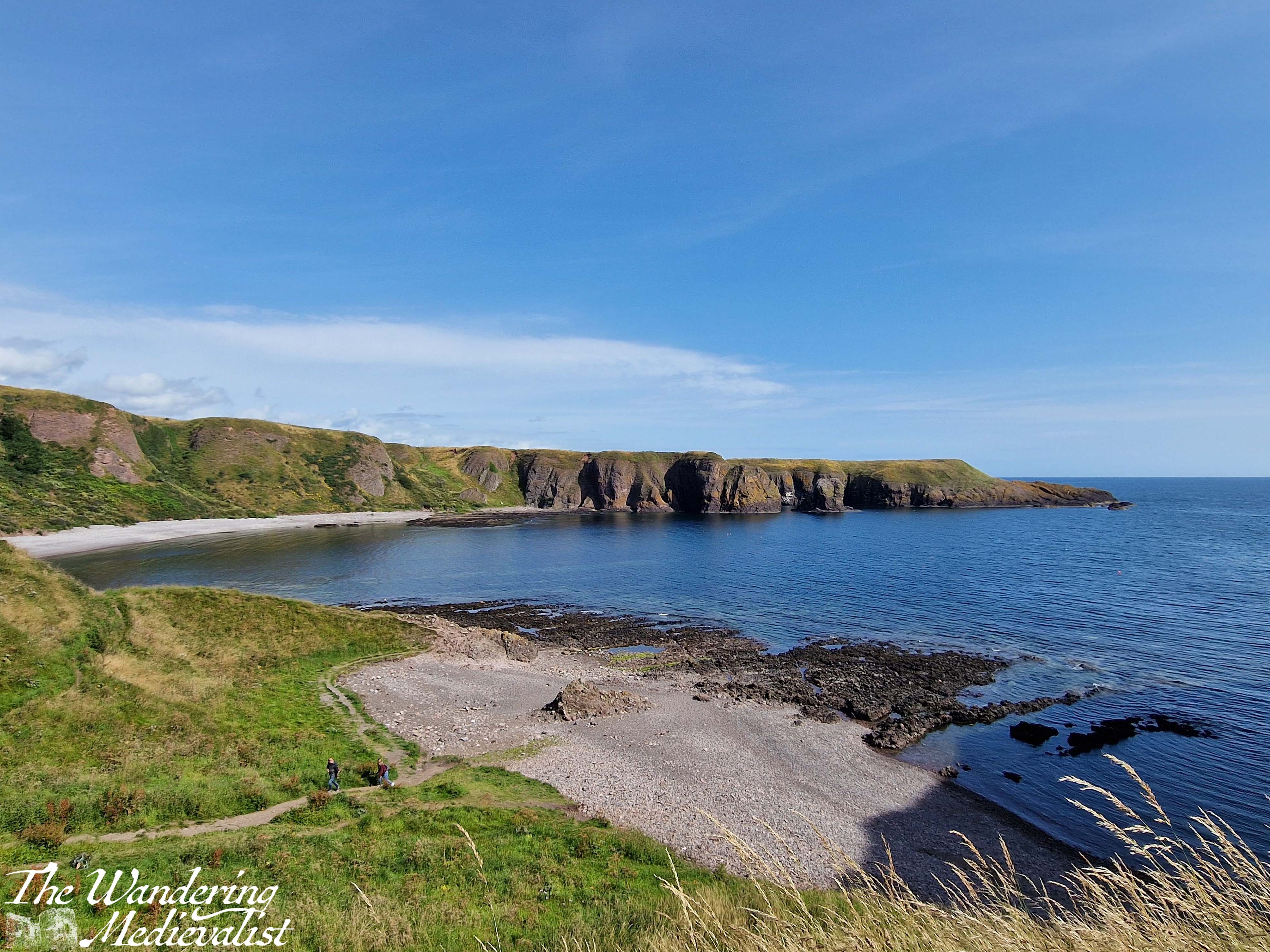
In all, you could easily spend several hours exploring the many nooks and crannies. The group I was with scattered to all corners of the castle, and it was lovely to sit in the sun and gradually wait for them all to drift back again, with various stories of things they had seen. Once we had traversed the stairs once more, we chose to walk along the cliff in the Stonehaven direction for about a mile, with the ocean and views of castle on one side and fields of cattle on the other.
This view really shows you the path down and back up to the castle, as well as the eroded natural land bridge..
There are a few caveats to visiting this castle – caveats may really be too strong a word, more things to be aware of when planning:
Firstly, as you have doubtless gathered, it is not particularly accessible. There are lots of steep steps just to get to the castle, and more inside as you ascend through the pends. Secondly, any refreshments you may want in the castle itself must be brought by you. This is of course quite reasonable, but considering the physical effort to traverse the stairs, it is worth remembering a water bottle. That said, the toilet facilities are limited, with only two stalls for the women and one for the men, I believe. At several points there was a bit of a queue – not a problem at all if you are prepared, but definitely worth knowing ahead of time. The one final disappointment to castle aficionados is that there is no shop selling merchandise, postcards, etc., though this is no doubt because the castle is owned and managed privately. Guide books are available at the ticket office at a very reasonable price.
Overall I’d say that the castle is not quite as suited for an onslaught of tourists as some others I have seen, but it is absolutely worth making the effort, especially if you are prepared!
We have had a rough few weeks here in the Wandering Medievalist house, but I am excited to get back to writing, not in part as a catharsis and way of moving forward.
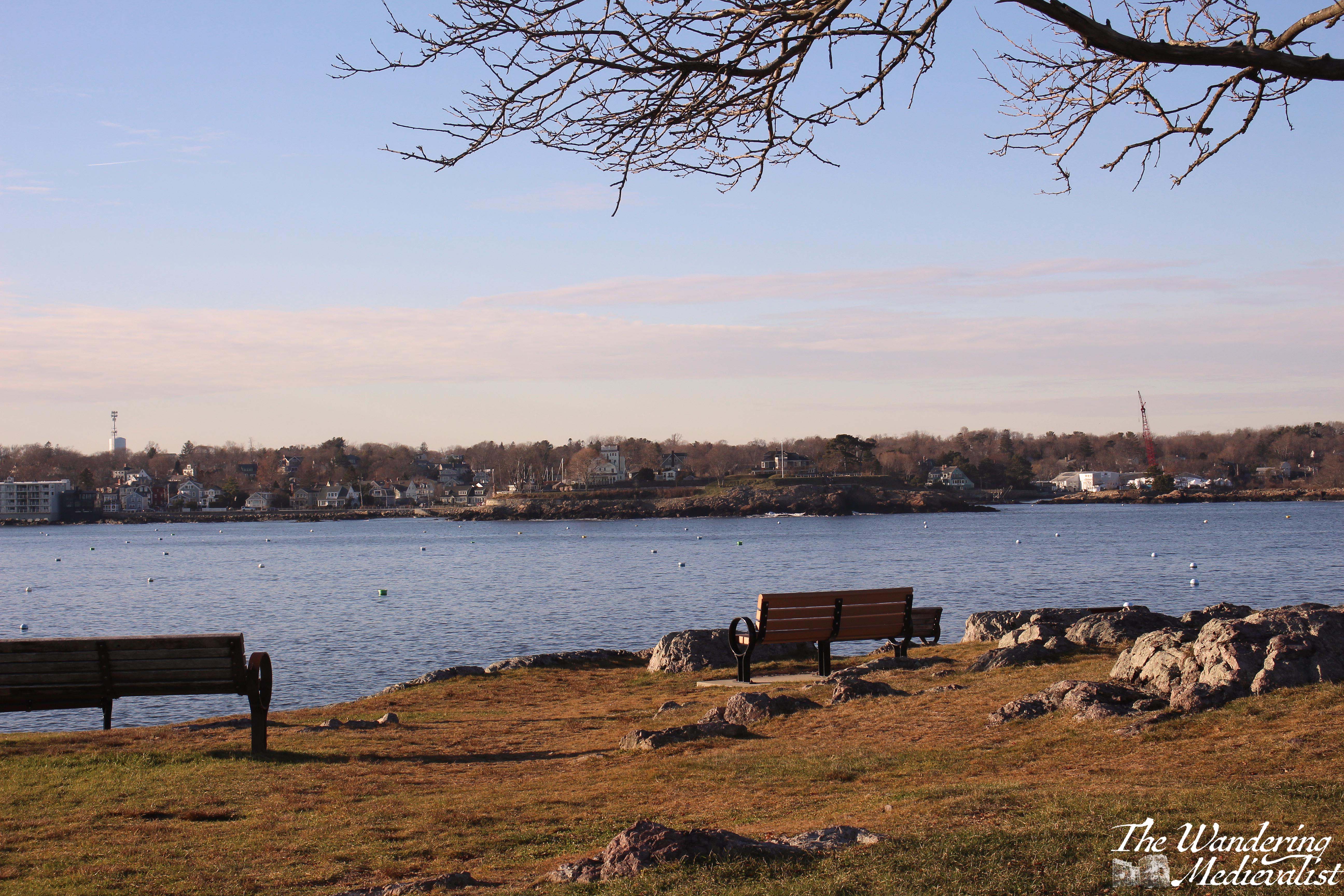
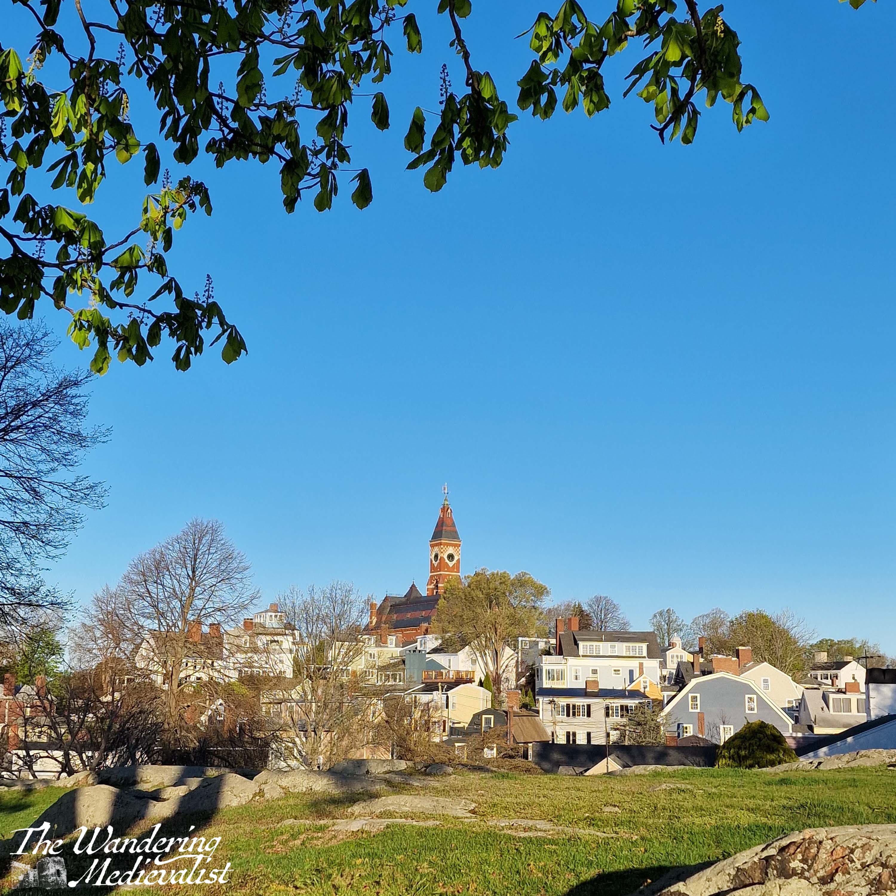
I have been trying for some time to work out the best way to showcase Marblehead. Should I write a series of posts on specific locations, or try to share a bit of everything? I’m sure I will do the former at some point, but in the meantime I’m focussing on the latter, sharing a few of my favourite viewpoints in Marblehead, where you can get some excellent views and photos, and a real understanding for the flavour of the town. These spots are my go-to locations whenever I visit, and I have dozens of pictures of each. Here are a few of my favourites.
I’m sure there are Marbleheaders who will disagree with me, but so be it. 😁
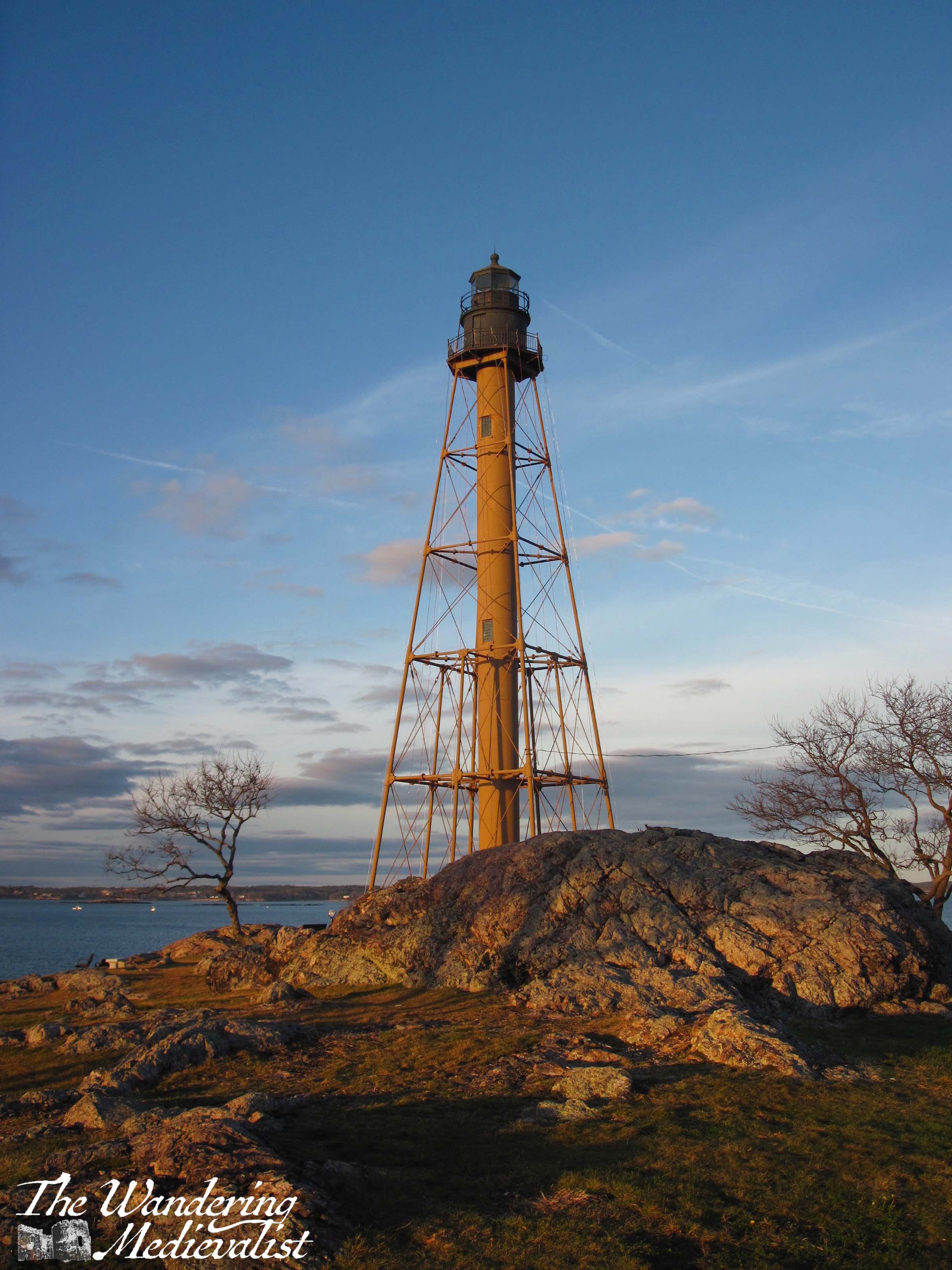
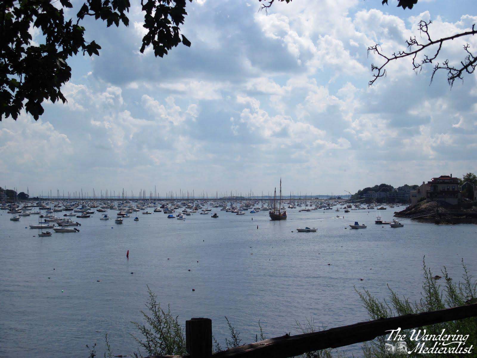
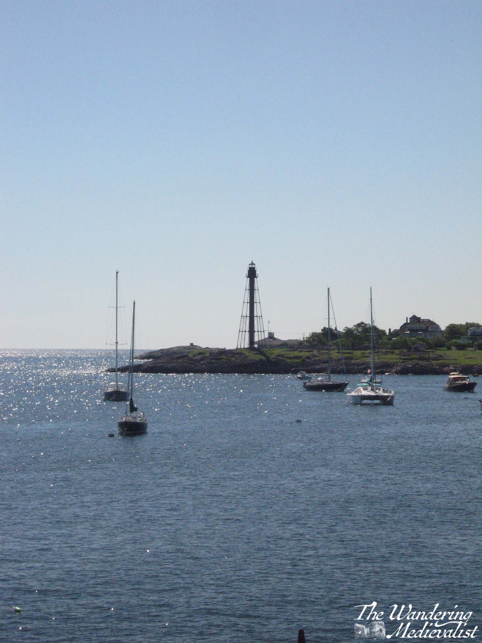
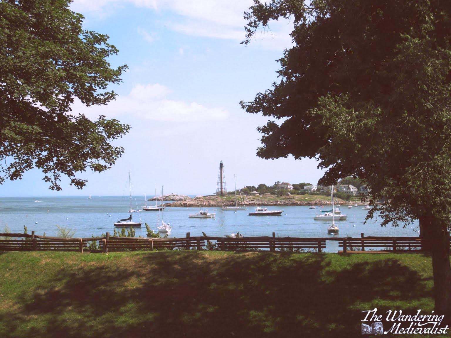
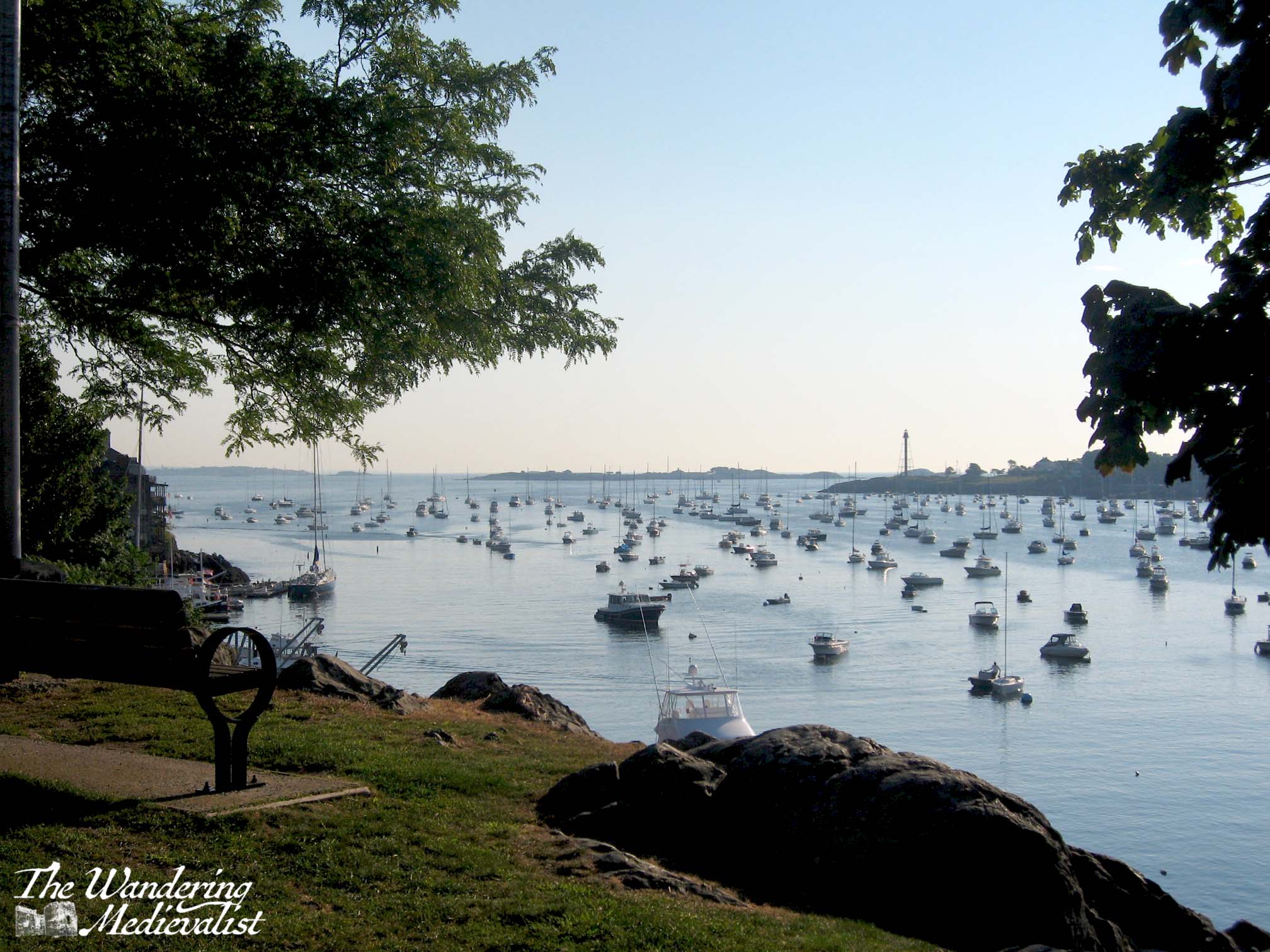
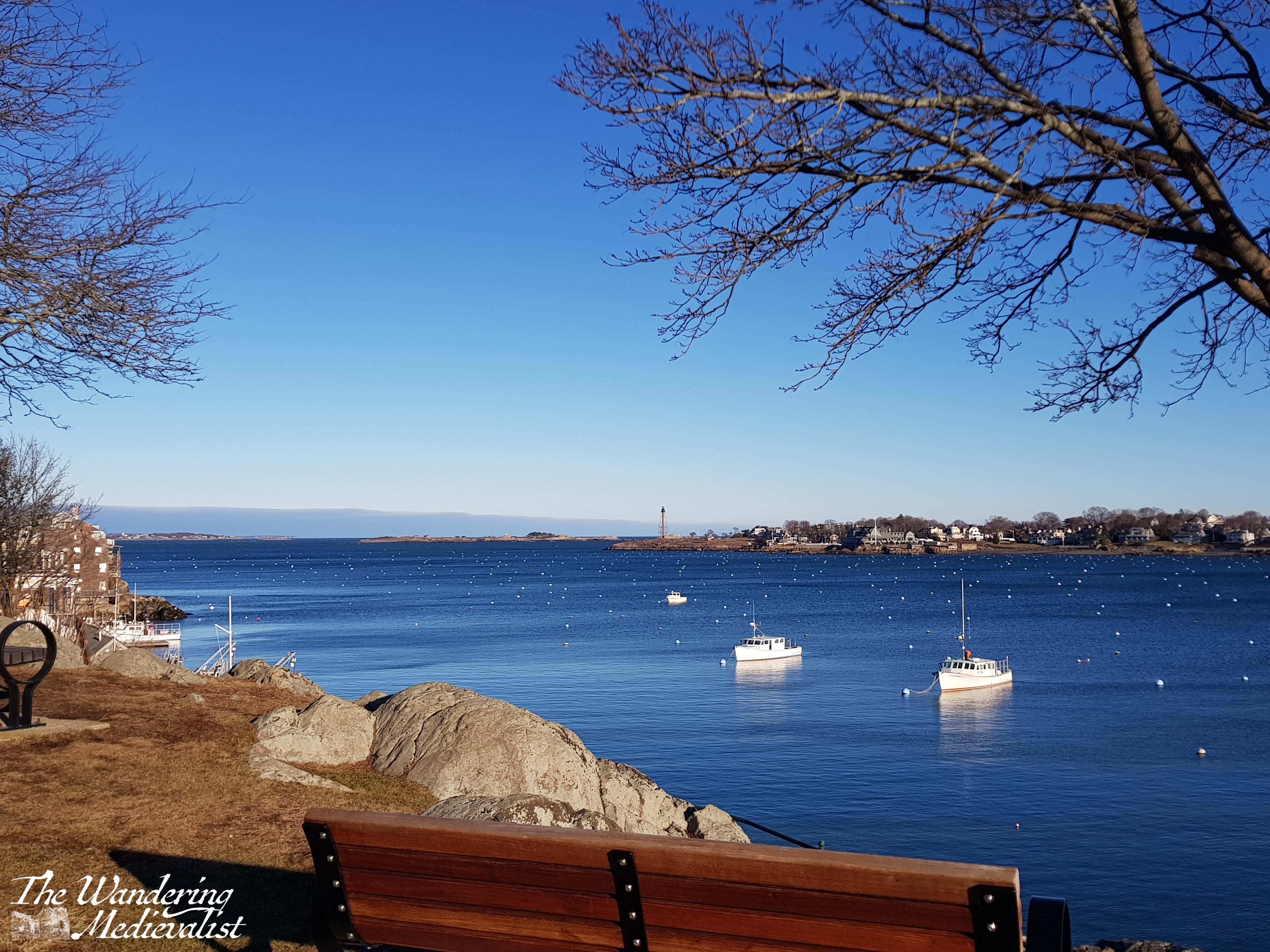
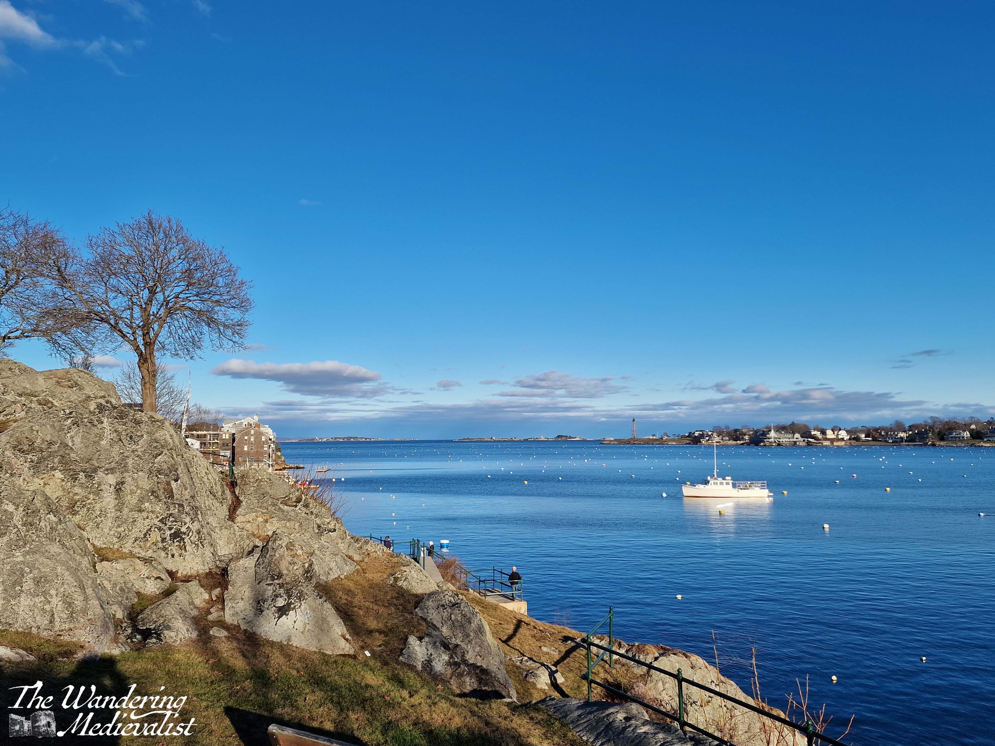
1. Marblehead Lighthouse and Chandler Hovey Park
Marblehead Lighthouse is iconic and appears on all Marblehead memorabilia as well as ‘famous lighthouse’ lists. It isn’t the traditional style lighthouse, but was built as a skeletal metal structure – replacing the more conventional version – in 1895. It isn’t to everyone’s taste necessarily, but it is the only one of its type in New England.
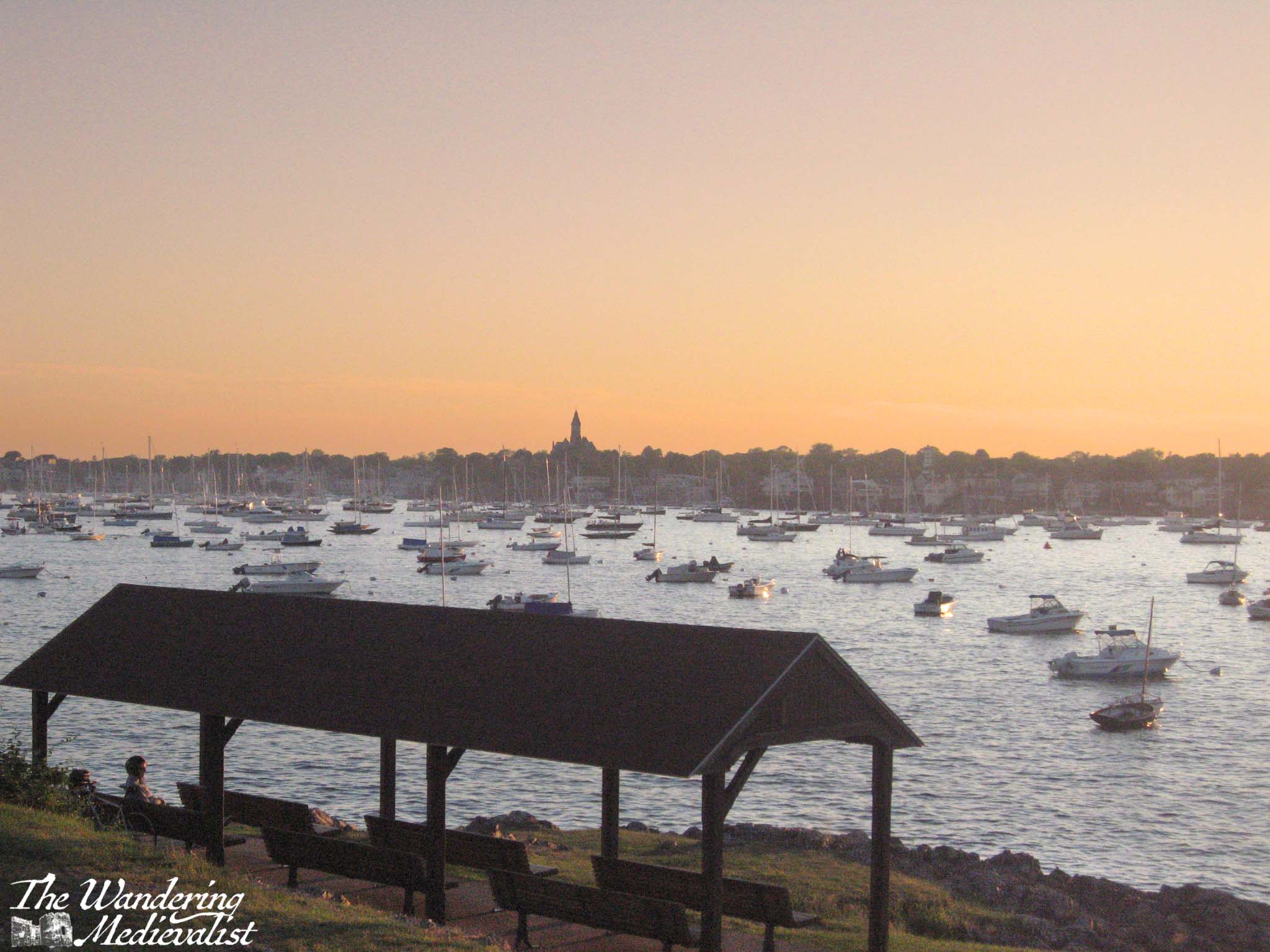
The area around the lighthouse, Chandler Hovey Park, is popular for many uses – picnics, summertime church services, games, and much more. It also commands a spectacular view down the harbor, across to Fort Sewall, and of course out to sea. It is the perfect place to watch the busy comings and goings of pleasure and fishing boats, to view boat races, or to watch the sunset.
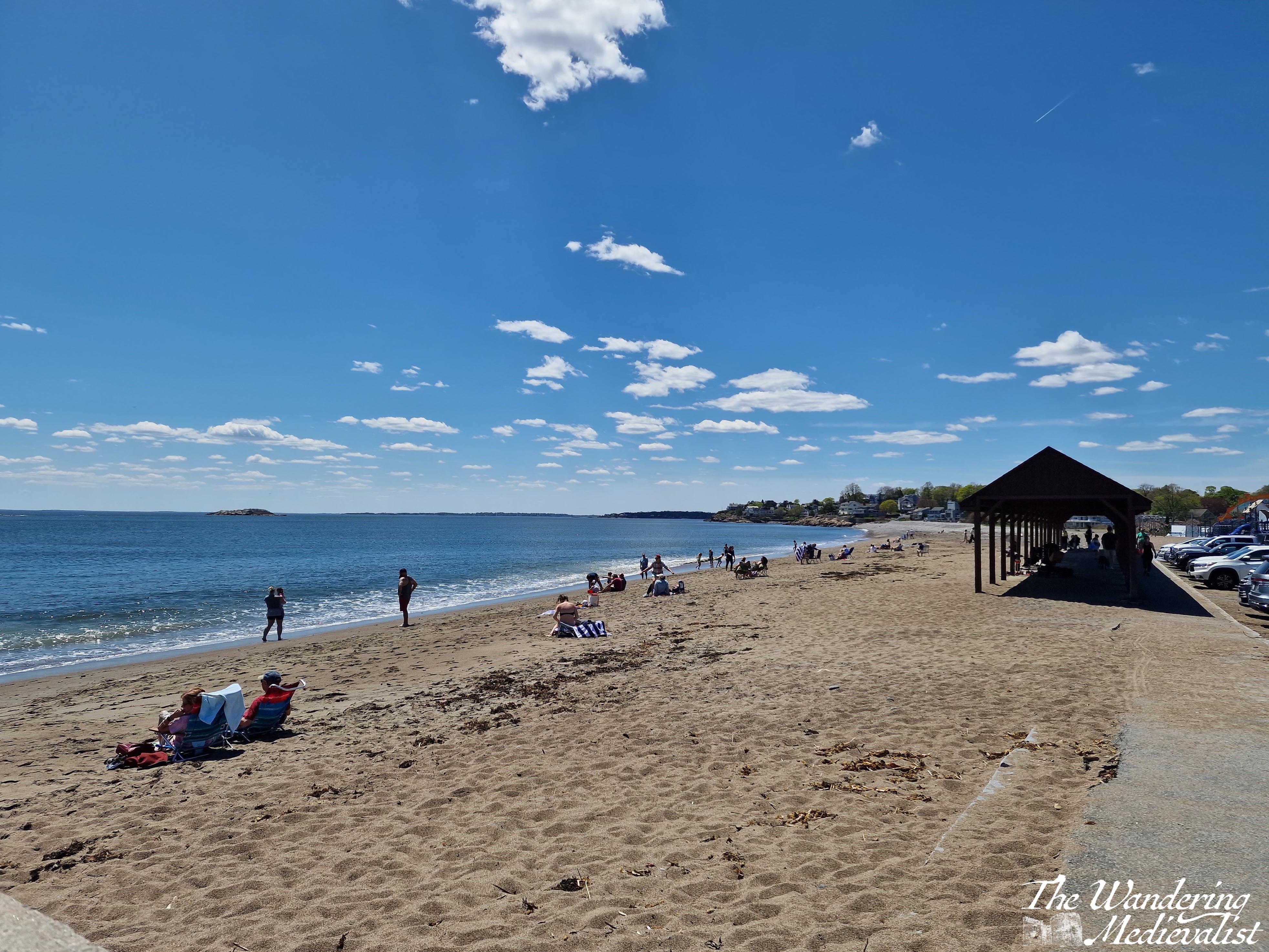
2. Devereux Beach and the causeway
Most beaches in Marblehead are rocky with only small patches of sand, if they have any at all. Many are also hedged in by rock cliffs that divide them from the next beach or cove (Gas House Beach, Fort Sewall Beach, Grace Oliver Beach – few are the sandy havens you picture when you hear the word ‘beach’).
The exception is Devereux Beach, a long sandy expanse created by the causeway that connects the Neck to Marblehead proper. Like Revere and Lynn beaches further down the coast and many more further north, Devereux is ideal for building sandcastles and enjoying the sun, and sometimes even waves. Parking is free for Marblehead residents with a sticker, and there are public restrooms open in-season. You can even rent a kayak to explore the inner harbour.
The beach’s popularity is evident in the shaded bench area and seasonal concession stand that has changed hands numerous times. On a clear day you can view the Boston skyline in the distance, or cross the road for views of Old Town and up the harbor.
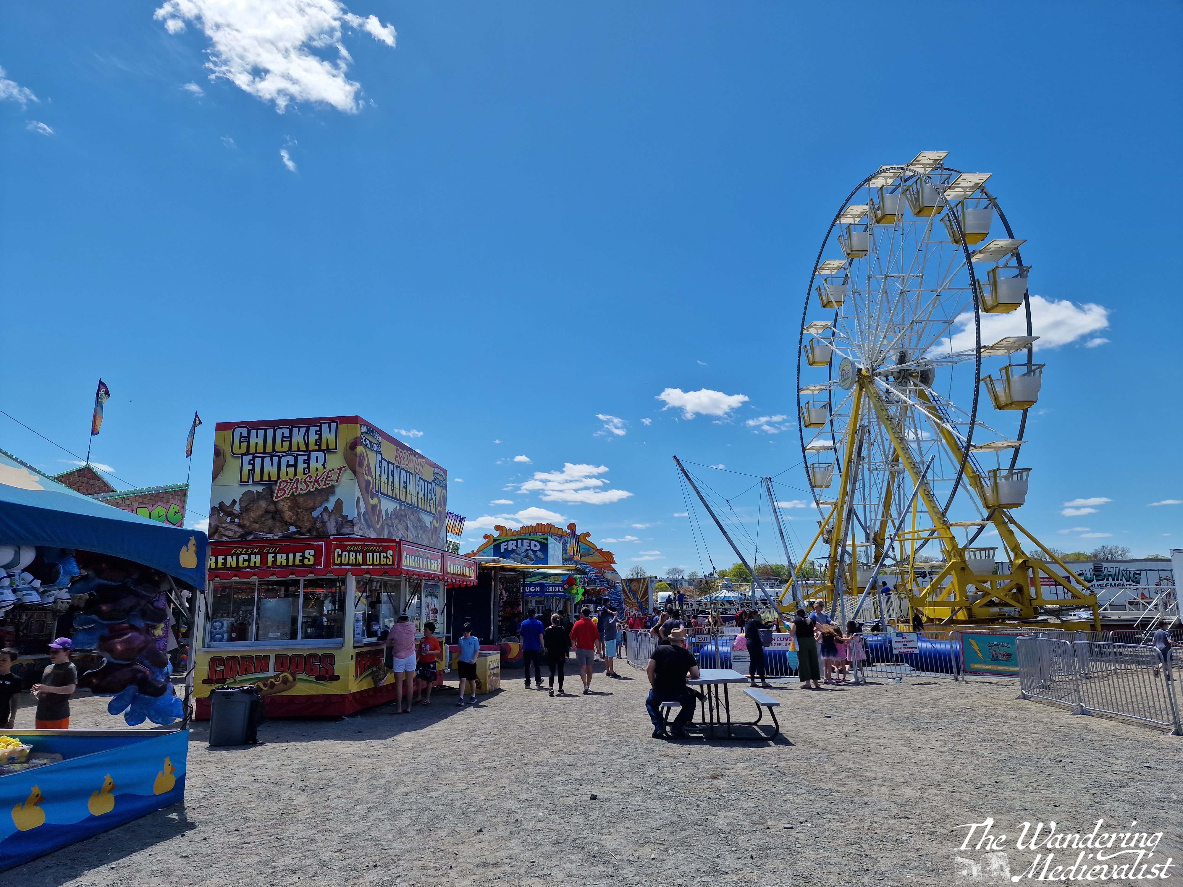
Devereux is also famous for hosting the annual Marblehead High School Junior Carnival, where the rising seniors put on a fun fair to raise money for their final year. It is a highlight of spring and really marked the start of summer for all students in Marblehead.
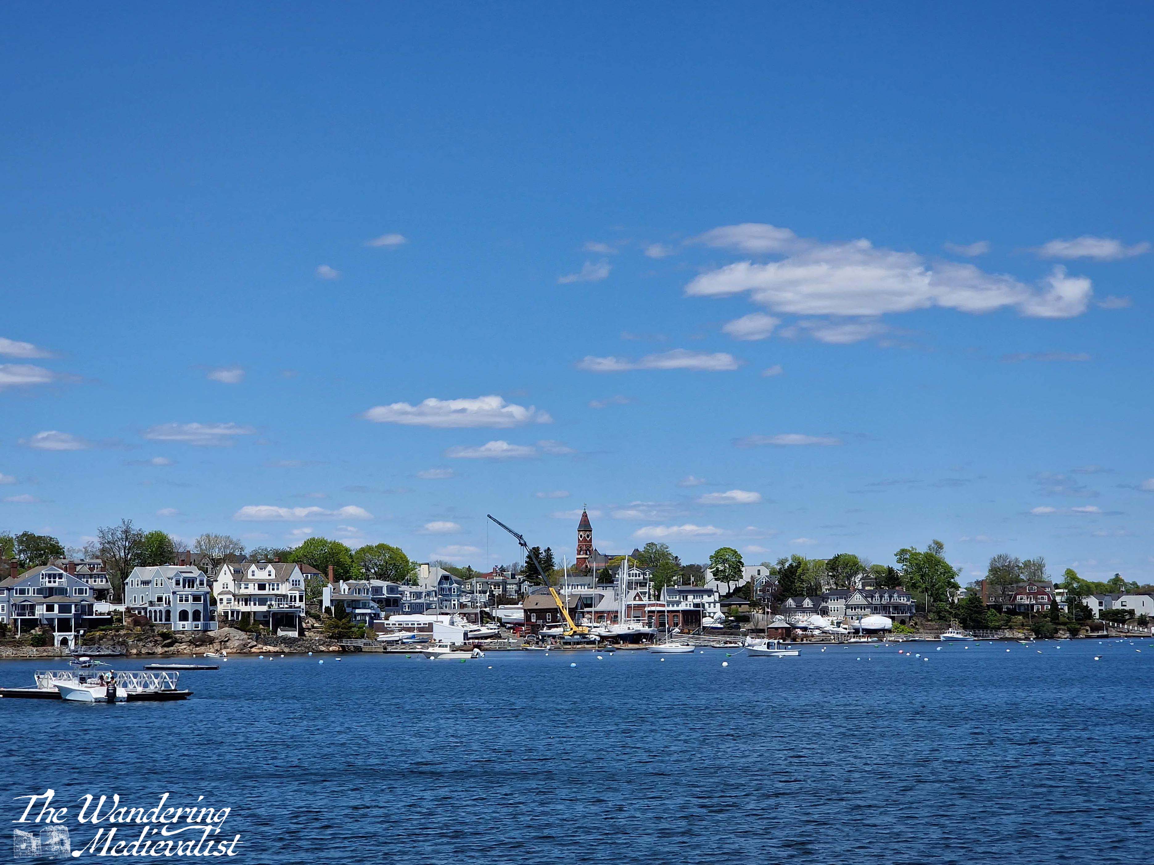
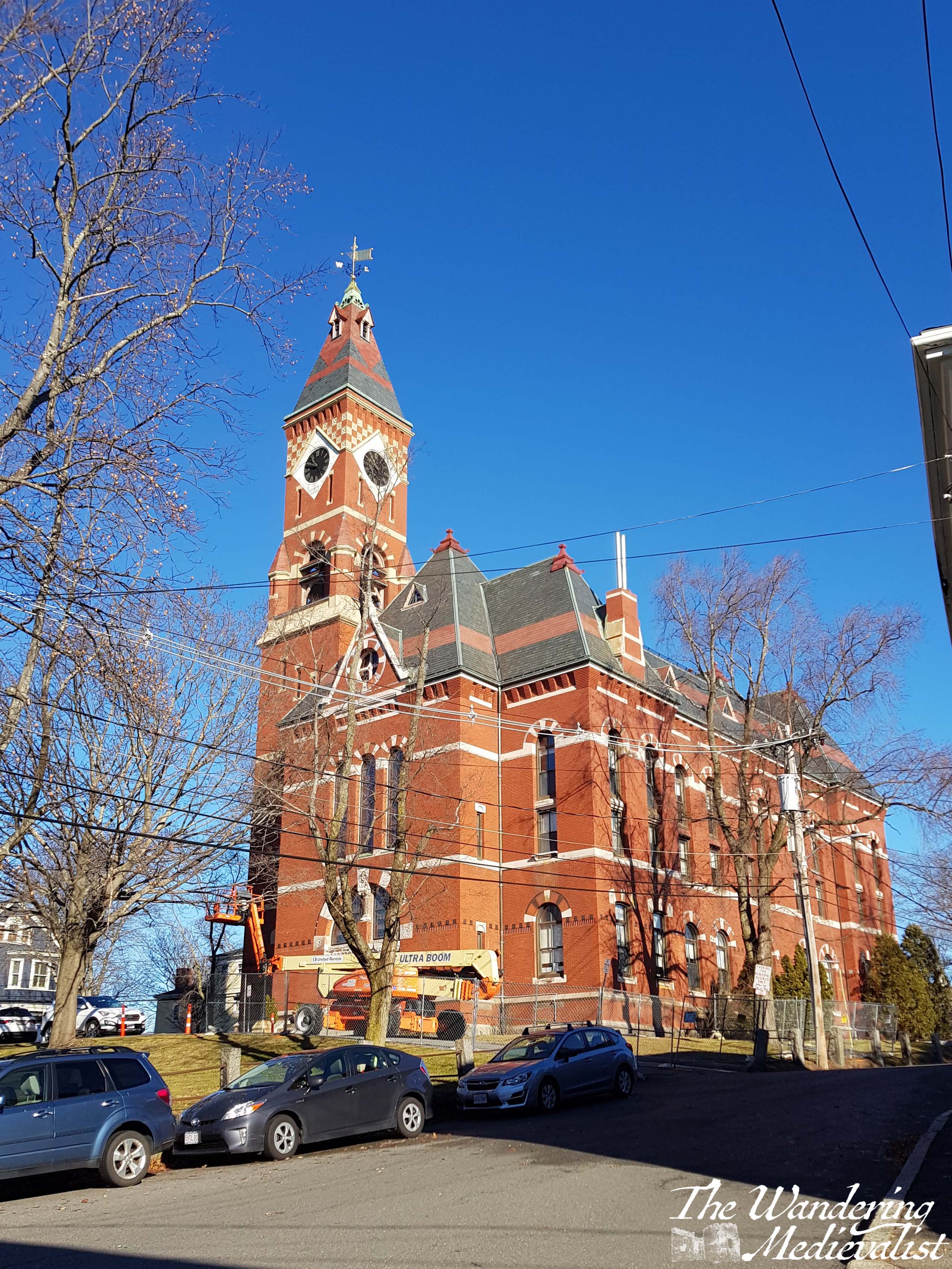
3. Abbot Hall and Washington Square
Built in 1876 to replace the Old Town House, Abbot Hall is the current town hall for Marblehead, seat of the local government and also a museum. The clock tower is the pinnacle of the skyline, visible from many of the viewpoints on this list as the highest point in the old town. The original ‘Spirit of ’76‘ painting is housed here, depicting a fife and drum player against an early American flag, and ‘Spirit of ’76’ was a long-time bookstore in Marblehead until its untimely closure. During the Marblehead Arts Festival in July, there are often arts and crafts taking place in the grassy park, and an auditorium inside is a well-used recital or concert venue for local schools.
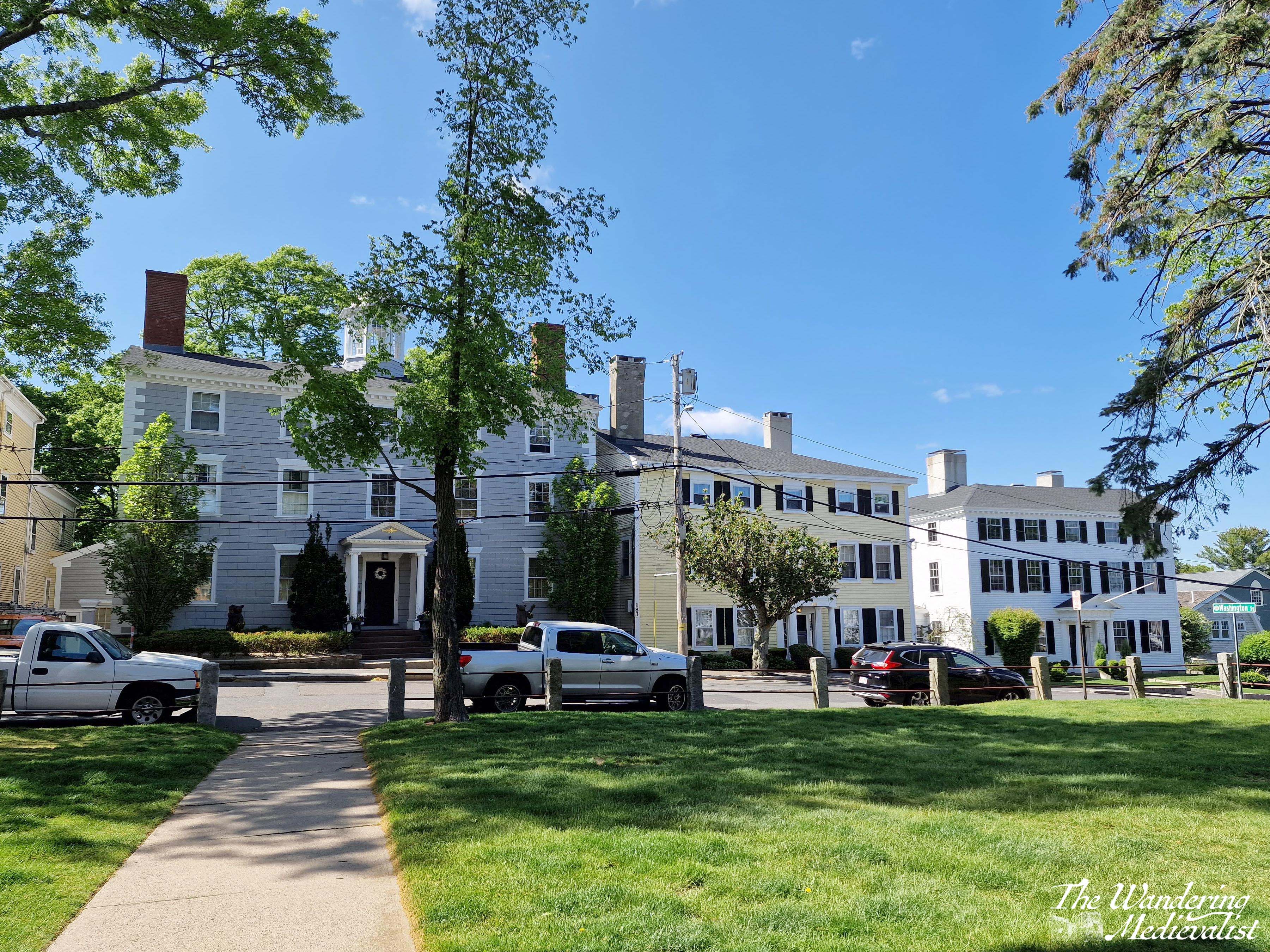
The red brick Romanesque hall itself is a stunning picture, but Washington Square, which runs along three sides of the hall (Washington Street makes up the 4th) is equally beautiful, lined with well-kept colonial houses from old sea captain’s houses to some of the oldest in Marblehead. It is reminiscent of some parts of Salem, and the square will be recognisable to anyone who has seen ‘Hocus Pocus’ as doubling for the larger town. Washington Street continues down to the Old Town House, one of the main arteries of old Marblehead, and the walk from Abbot Hall down to the centre of old town is a must for visitors.
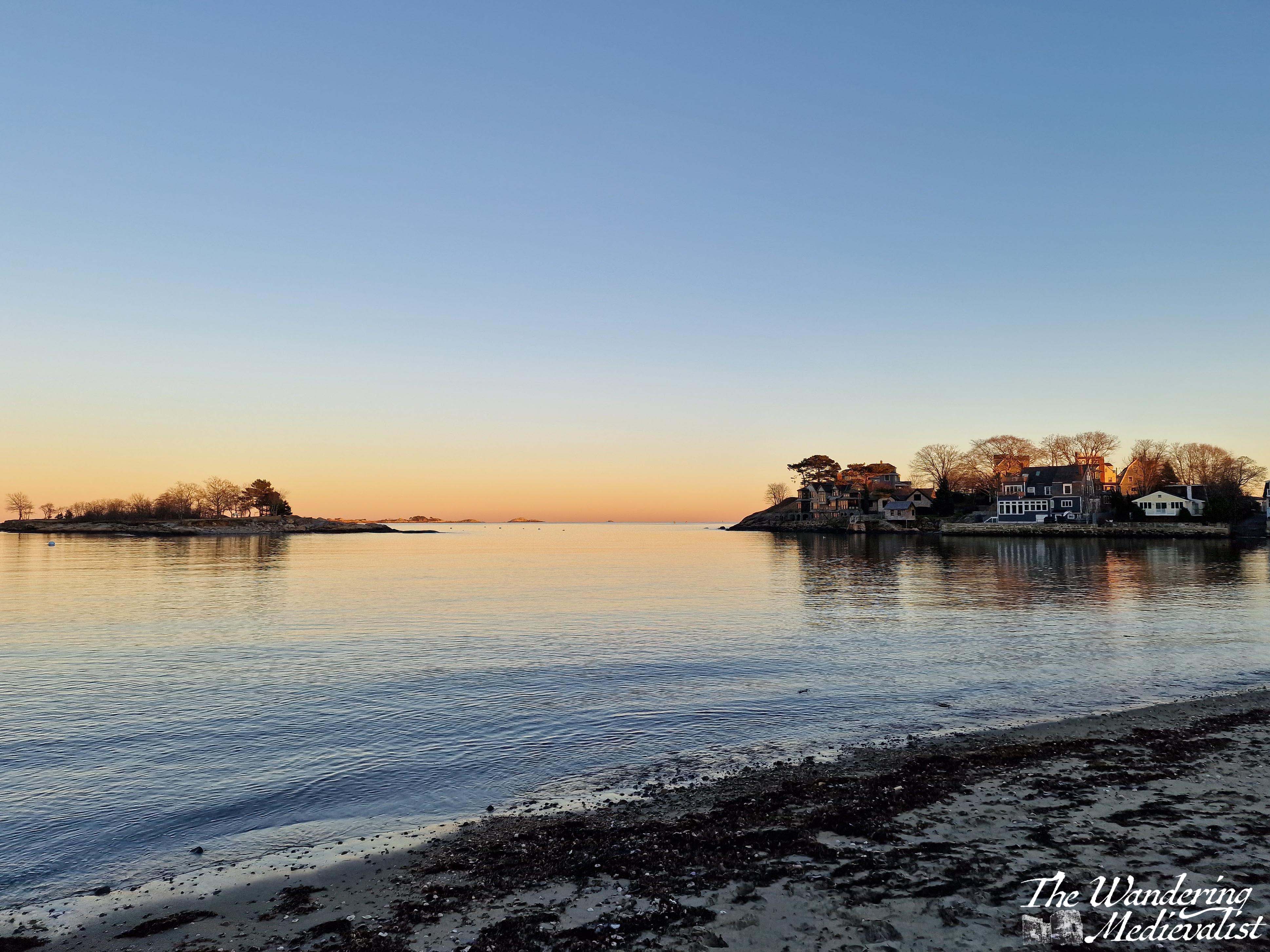
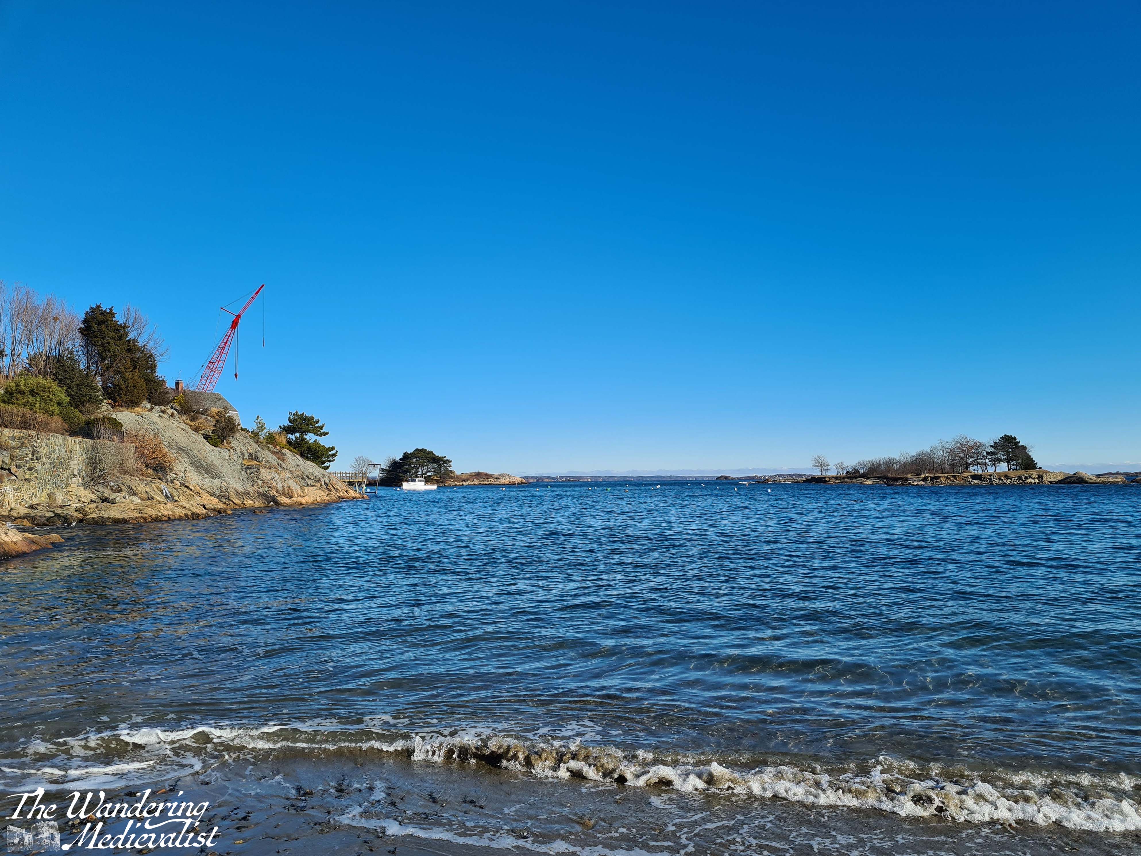
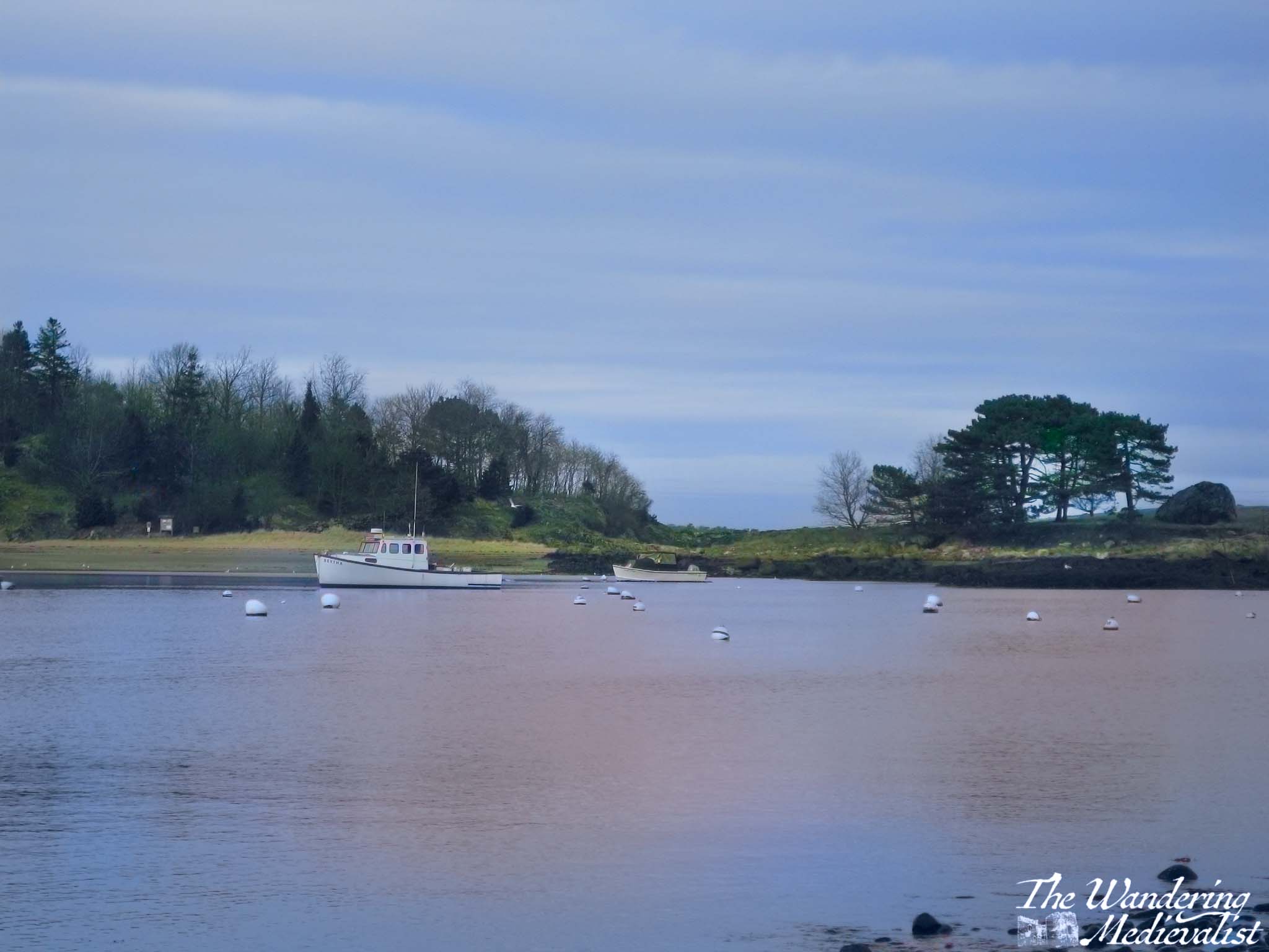
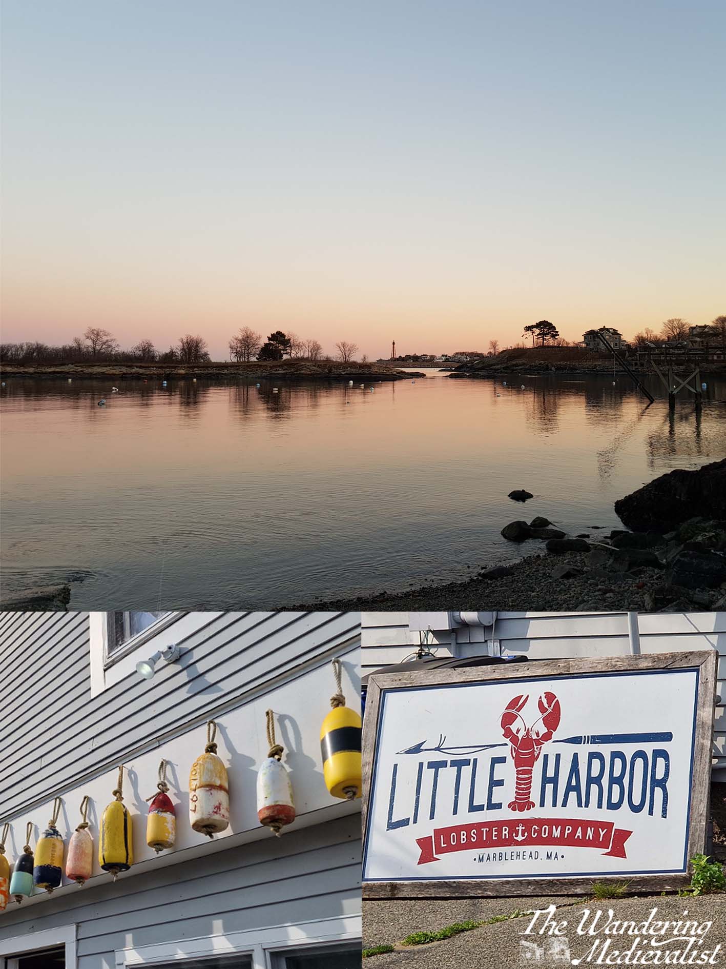
4. Little Harbor
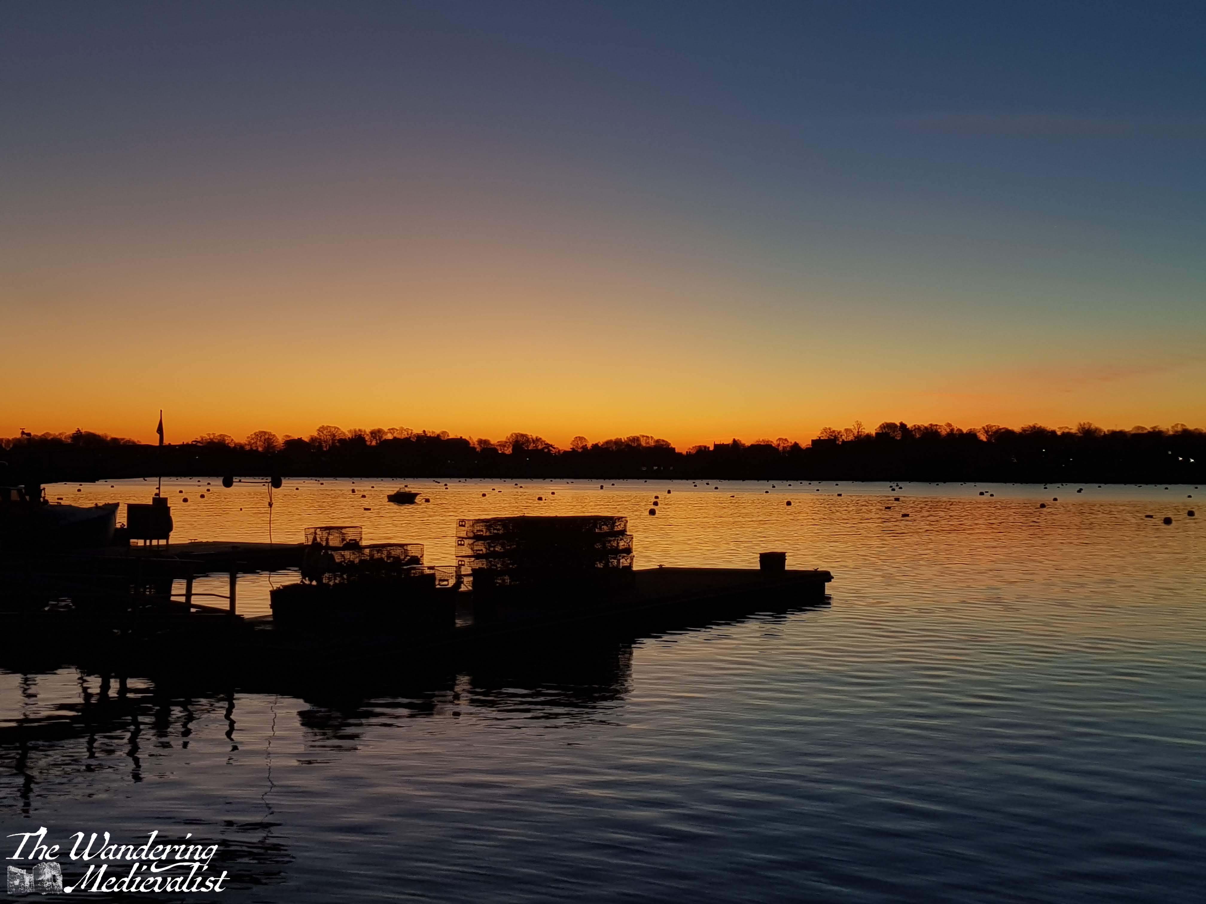
Little Harbor lies just around the Fort Sewall point from the main harbor and is protected by Gerry Island, which is accessible at low tide. At high tide the water is deep enough for a full sailboat, and several of the town’s boat yards, where sailboats dry dock during the winter, are accessed through Little Harbor. Most of the permanent ‘residents’ are fishing or lobster boats, and you can buy that day’s fresh seafood and lobsters of all sizes, either cooked or still kicking, at the Little Harbor Lobster Company.
Little Harbor is also the location of Gas House beach, my childhood playground. The beach is protected from the waves by Gerry Island and so the water is often warm, though at low tide it can be a bit mucky.
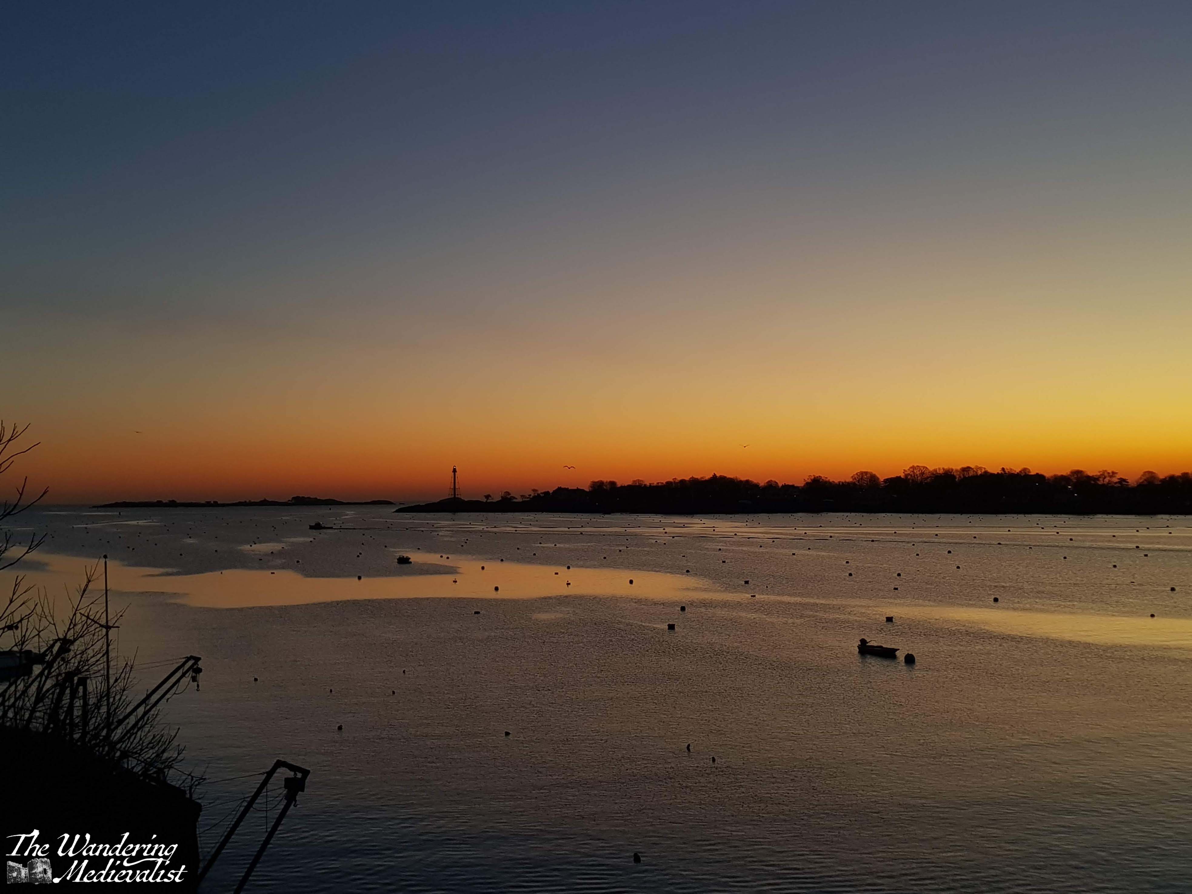
I have always loved the view from Gas House beach at sunrise or sunset, when the edge of the horizon turns orange and pink while the sky stays blue, but it is equally lovely on a blue summer day. At Christmas, one of Marblehead’s icons sits in Little Harbor – a white dingy bearing a Christmas tree decorated with starfish and other oceanic decorations.
5. Joe Brown’s Pond and Steer Swamp
For a relatively small town, Marblehead has its fair share of ‘wild’ spaces, including the Steer Swamp Conservation land that is most easily accessible from Gingerbread Hill, and the network of streets behind Redd’s Pond. I recall spending many weekends walking our dog here when I was young, exploring all of the many winding paths. While named a ‘Swamp’, much of the land is plenty dry to explore, but there are definitely some low bits that can be unpleasantly buggy or wet.
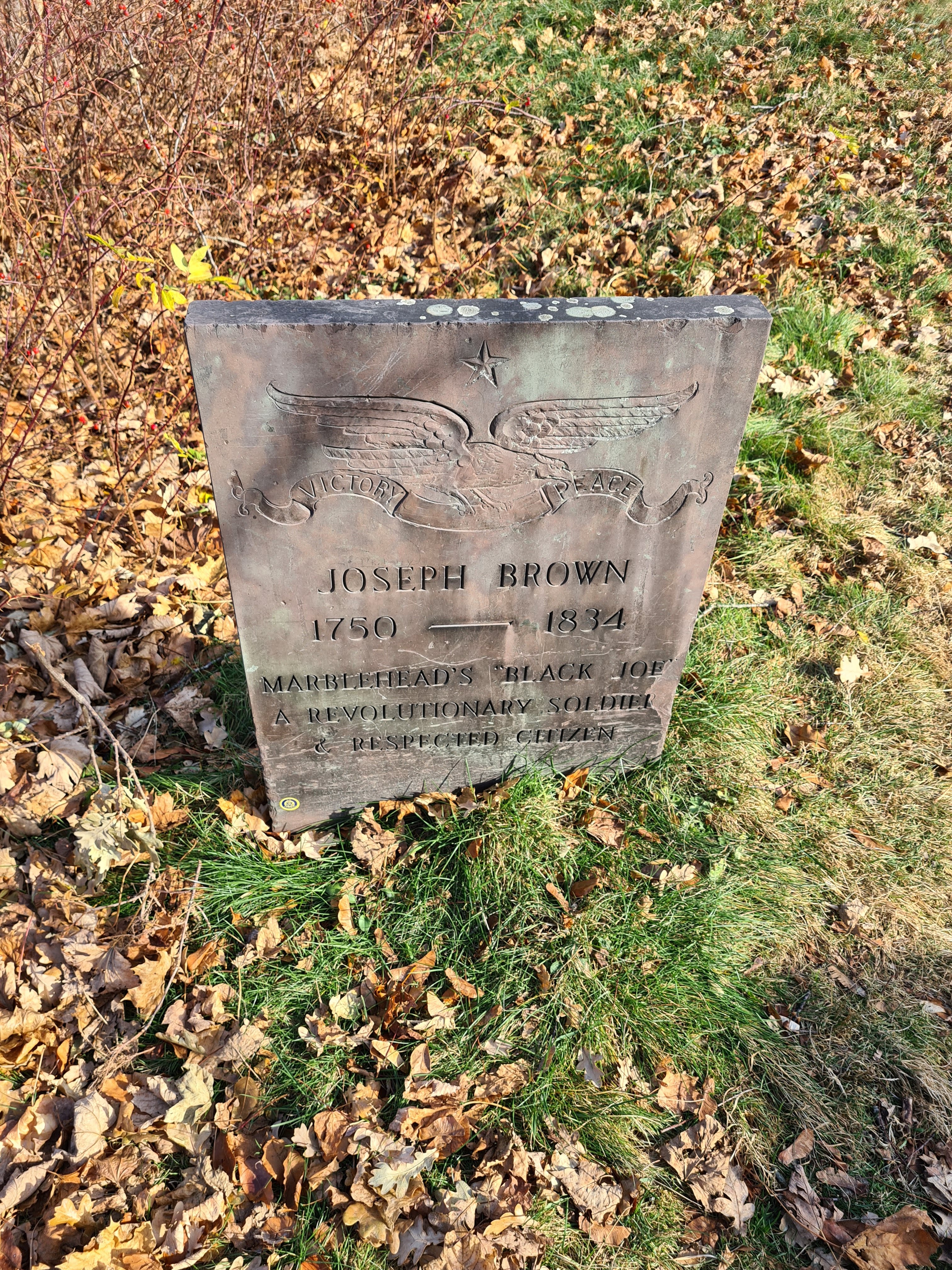
At the edge of the conservation land lies what was known in my childhood as Black Joe’s Pond, a body of water that has received attention recently for its insensitive name. ‘Black’ Joe is a famous Marblehead resident – his grave is well-marked at Old Burial Hill – who was a former slave, Revolutionary War veteran and opened a tavern near the pond with his wife, Lucretia. Joe Froggers, a famous local cookie made with molasses, were originally created and sold by Lucretia, and the recipe lives in most Marblehead cookbooks and stores.
The tavern still stands, well-preserved as so many old Marblehead buildings are, and the pond was a good place for skating and hockey playing when I was young. Slightly less popular than nearby Redd’s Pond, this pond is a bit more traditional, surrounded mostly by woodland.
In 2021 the town re-named the pond and conservation area to the ‘Joseph Brown Conservation Area’, though I believe the tavern sign may still refer to ‘Black” Joe and his wife.
6. Fort Sewall and Fort Sewall Beach
Fort Sewall is iconic in Marblehead for so many reasons. Steeped in history, it overlooks the entrance to the deep harbor, and the architecture of the fort is still present in the barracks with barred windows dug into the hill. The promontory known as Gale’s Head was first fortified in 1634, and rebuilt as a fort during the Revolutionary War, where it was garrisoned by Colonel John Glover’s regiment. Marbleheaders were not present at some of the earliest battles of the Revolution, but were responsible for ferrying George Washington across the Delaware River in 1776, a famous turning point in the war. In a moment recreated in the 90s, Fort Sewall protected the USS Constitution as it took shelter in Marblehead harbor during the War of 1812, and the fort was re-named in 1814 for Samuel Sewall, Chief Justice of the Supreme Court.
Incredibly popular at all times of year, the fort is where you to go walk, to ride your bike, to view both the little and great harbors. In the summer it has been known to host Festival of Arts activities and Shakespeare in the Park, and at Halloween the dungeons used to be opened for trick-or-treaters – if you dared. In views that mirror Chandler Hovey park across the water, Fort Sewall allows you to look down the harbor or out to sea, and it is a perfect spot for sunrise. The harbor channel, a path free of moorings, starts just off the fort, so sitting here will allow you to watch all of the sea traffic going in and out. It does not take much to see why this point would have been selected for defence of the town and harbor!
7. Crocker Park
Another famous viewpoint, Crocker Park is located about halfway down the harbor and, like Fort Sewall or Marblehead Light, a good spot for pictures of the harbor at sunrise and sunset. Just off Front Street, the park is a great detour, and is often busy with dog walkers or children playing on the rocks. There are plenty of sheltered seats, a pergola, public toilets, and a large grassy area that is used for weddings, concerts and more in the summer. The park can also be used for swimming, as in the summer the town will float docks for those willing to take a dip in the busy harbor. Even in the winter it is easy to see why Marblehead is such a good harbour; the rocks fall sharply to the waterline and continue 20 – 30 feet below.
Crocker Park is unique in offering a perfect view of old town; if you stand under the chestnut tree, you get an ideal picture of the old houses, piled on top of one another, climbing up the hill to the pinnacle of Abbot Hall.
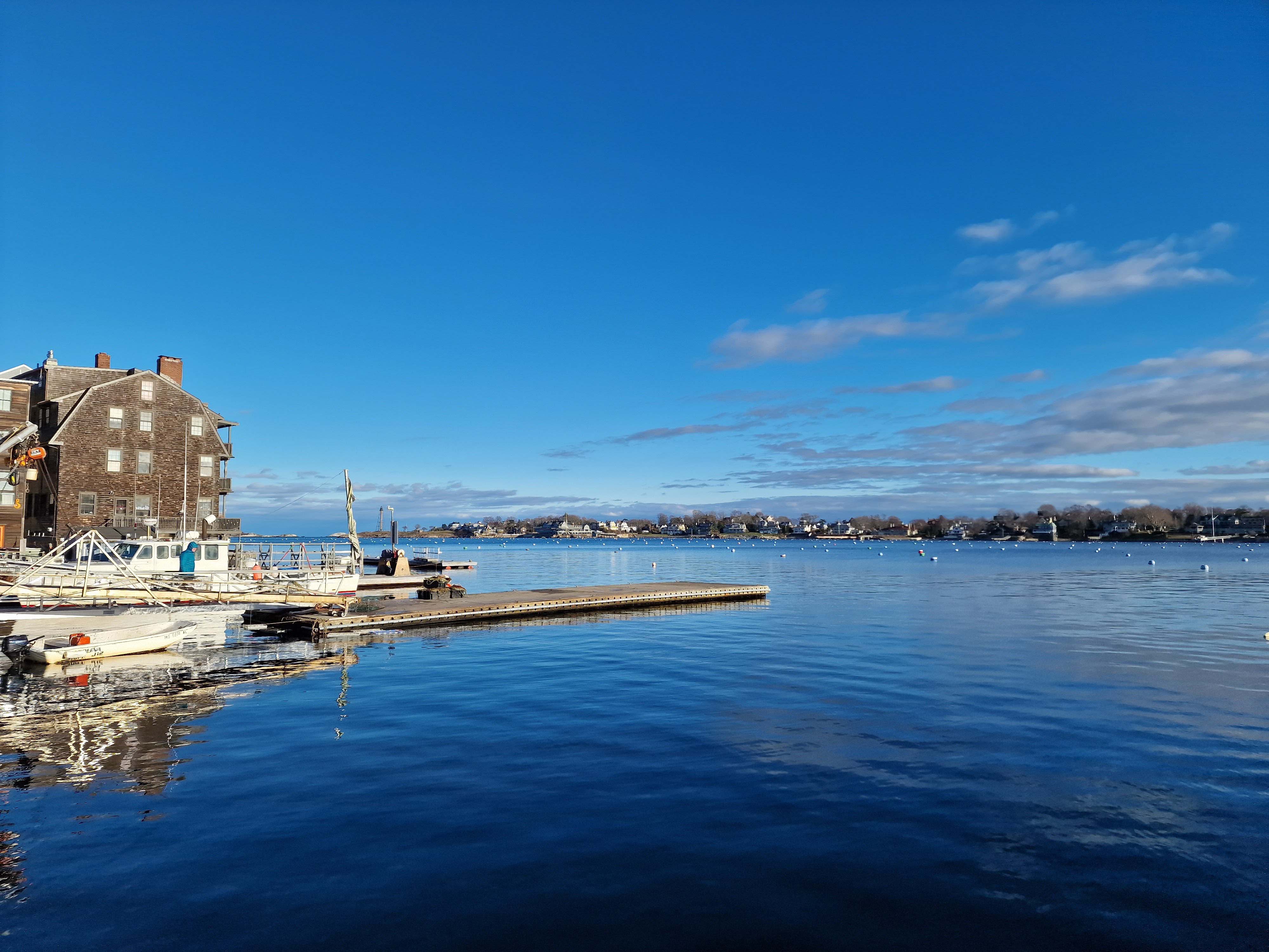
8. The Landing
Just around the corner and down the harbor coast from Crocker Park is the Landing, the public town dock of Marblehead. In an old sail loft building now lives the Landing Restaurant, while on the other side of the car park is the Driftwood, the Marblehead institution known for serving good breakfasts from early in the morning. One will often find mariners at the counter chatting with the servers, and when I was young it was a popular spot for Dads and kids on a Saturday morning. There is often a queue out the door after 7am or so, and they only accept cash.
The area of the landing lives in my mind as a key part of childhood. For many years there was a popular ice cream shop – Nancy’s Incredible Edibles – often visited on a summer evening, and the boat to Children’s Island – a summer camp – left from the dock. Perhaps most important of all childhood memories is that on the first weekend of December, also known as Marblehead Christmas Walk weekend, all of the children gather at the landing to watch Santa arrive on a lobster boat. He and Mrs Claus step onto the landing dock and pass out candy canes as they move through the crowd, then disappear until the tree lighting ceremony that evening. There are more than a few pictures of me as a child all wrapped up and waiting to see Santa.
Finally, the Landing offers plenty of bench space where you can sit with a morning cup of coffee – or an ice cream – and watch the comings and goings. The sunrise is beautiful over the Neck, and in early mornings it is one of the most peaceful spots in town.
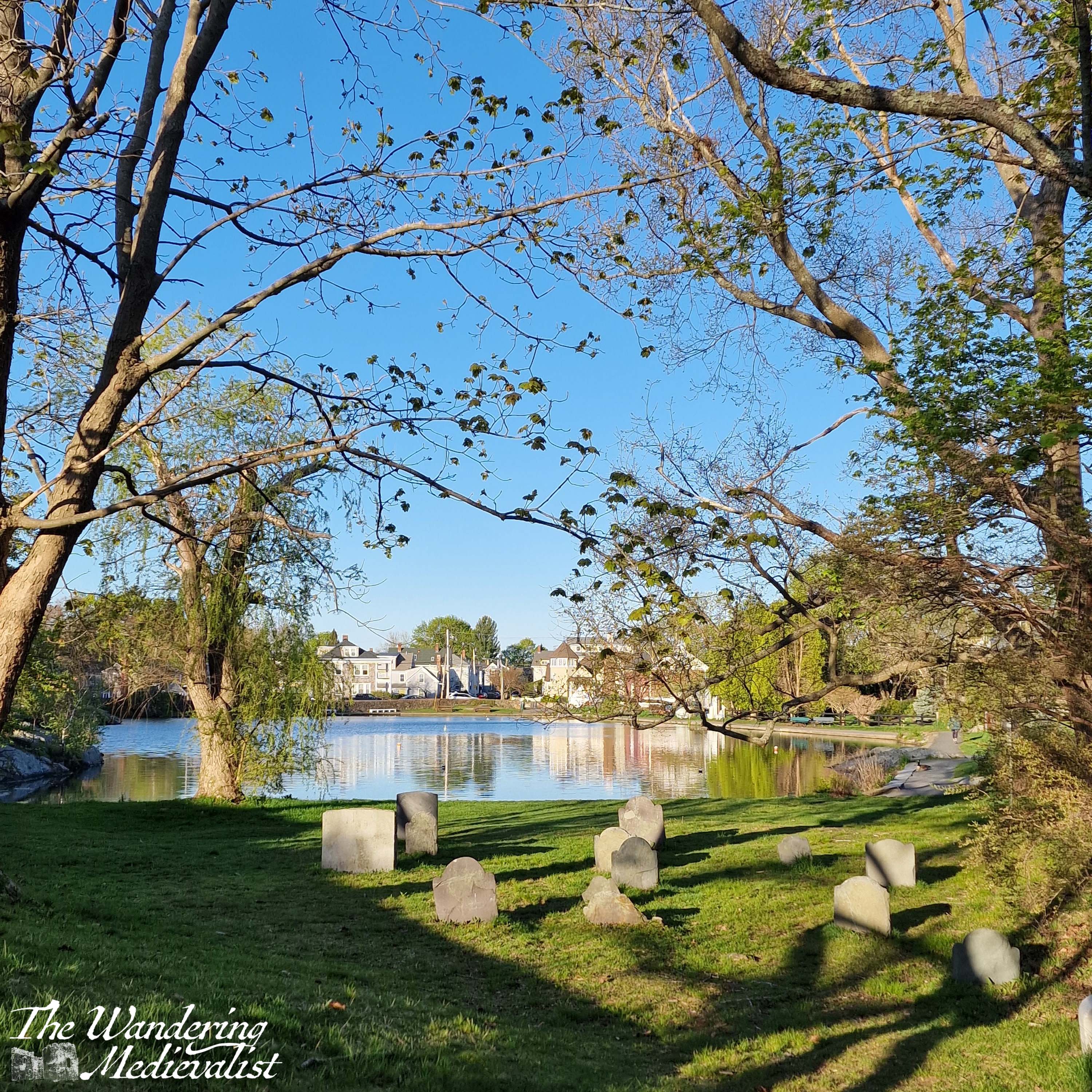
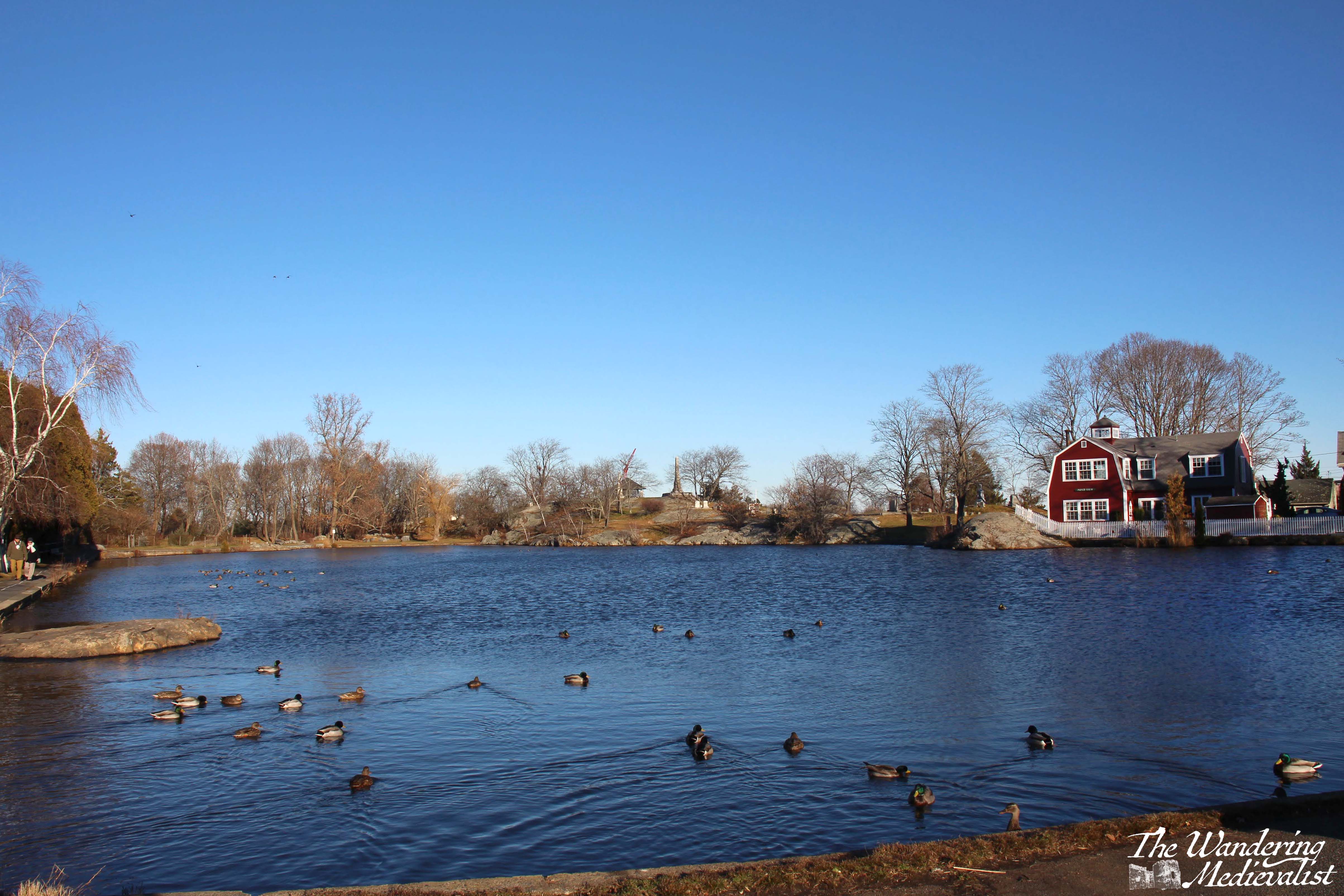
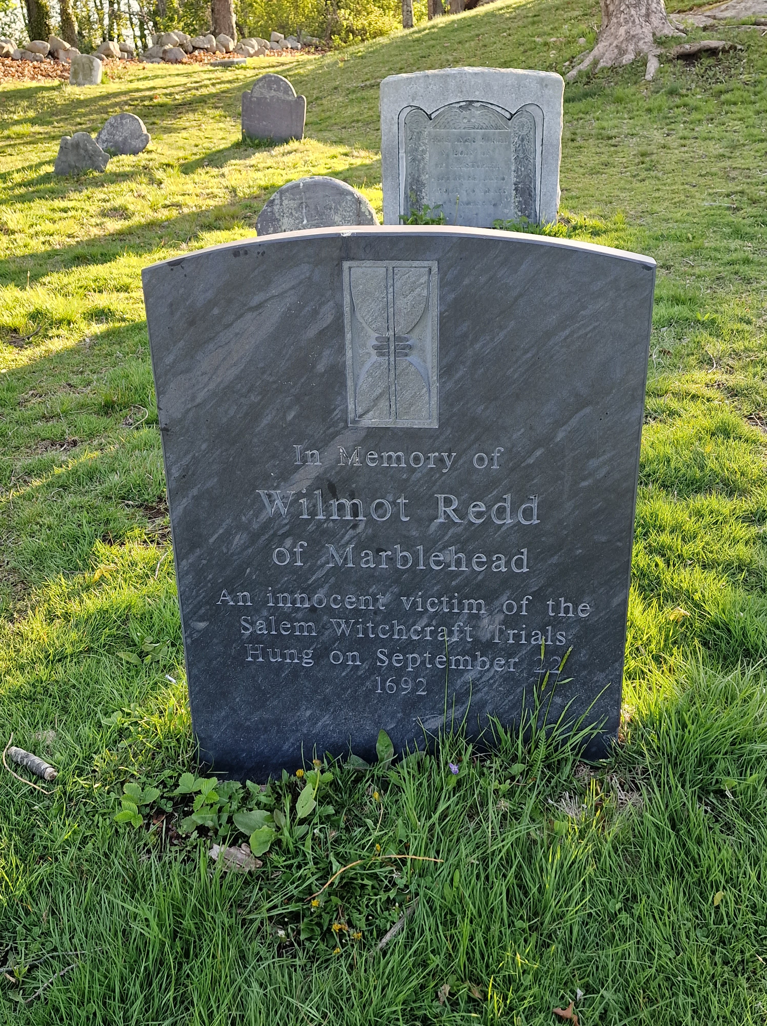
9. Old Burial Hill and Redd’s Pond
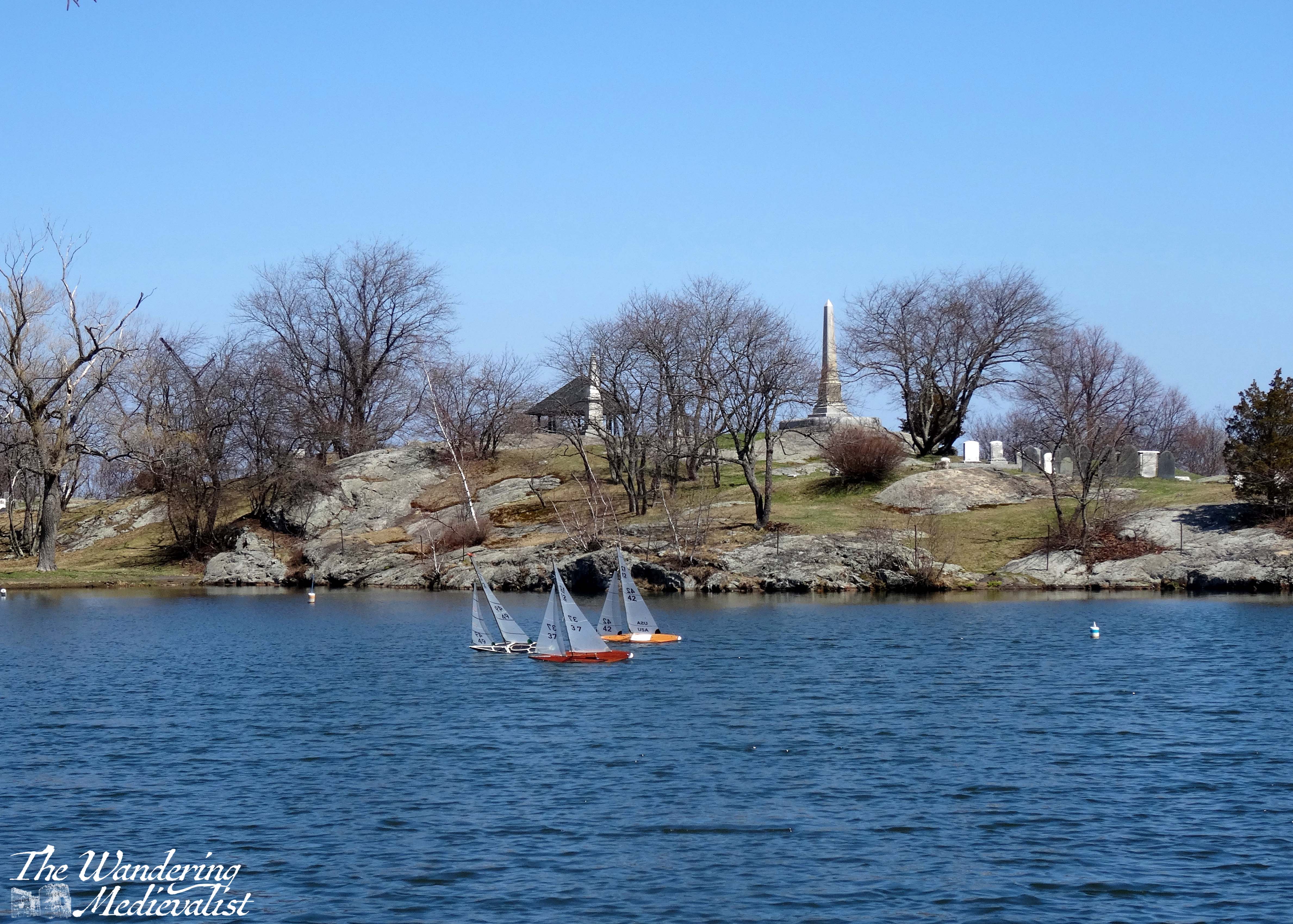
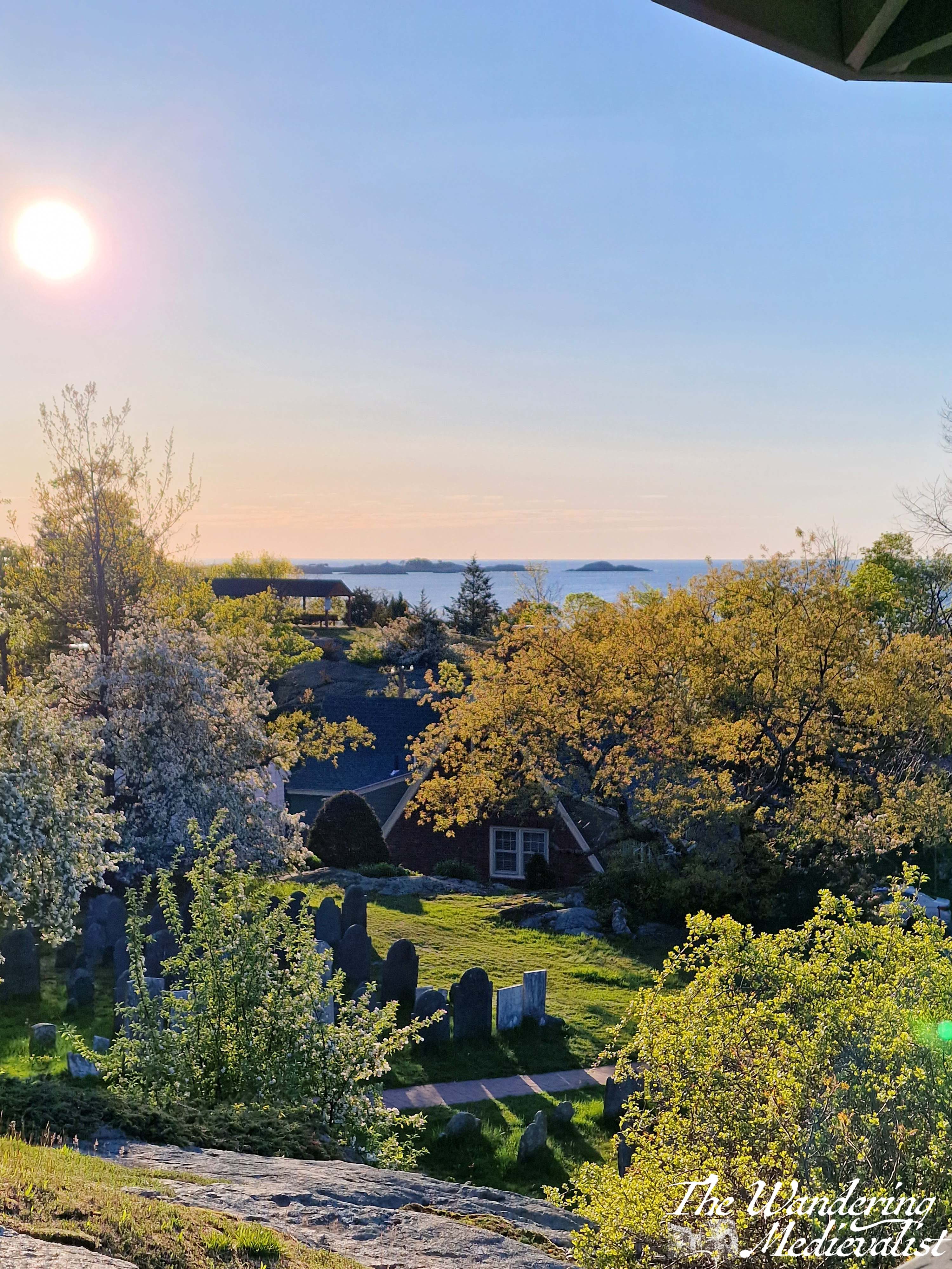
Redd’s Pond was named for Wilmot ‘Mammie’ Redd, who was one of the only non-Salem residents taken as a victim of the famous Witch Trials of 1692. The pond must play a part in most if not all Marblehead childhoods, whether through memories of feeding the ducks and geese, racing toy boats, ice skating or sledding on the nearby hill. I am relatively certain that the pond does not freeze hard enough for skating as often as it did when I was young, nor is there as much snow. The path around the pond invites peaceful contemplation, and offers beautiful views up towards Old Burial Hill, with its monuments standing out against the sky.
The Burial Hill was established in 1638 and is one of the oldest in New England; it is one of the highest points in town and offers clear views out to sea, over the pond, and over the harbor. I have written a great deal more about Burial Hill, but suffice it to say, it is one of the best places in town for pictures, with nothing but vistas in every direction.
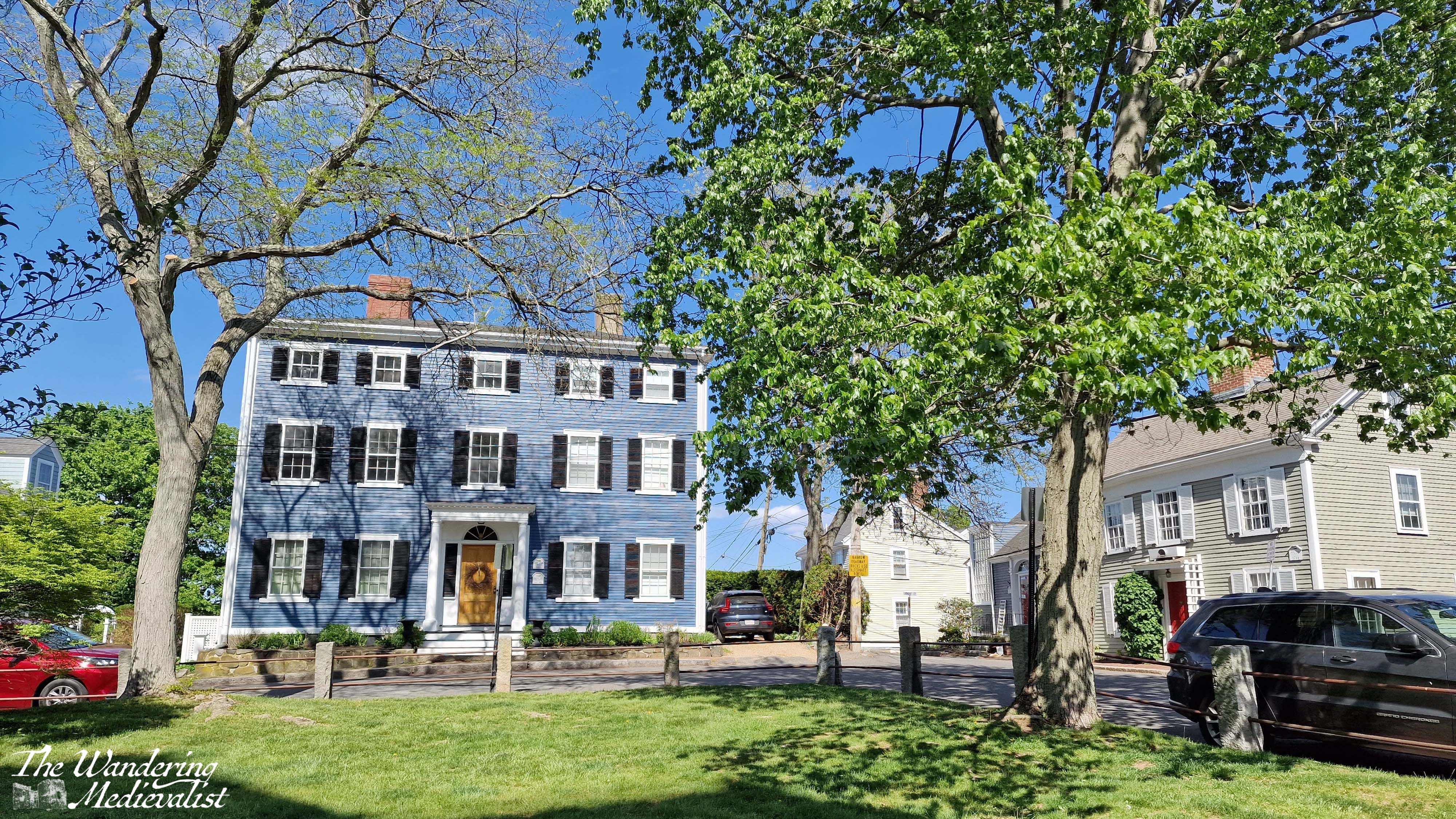
10. Old Town House and State Street
The Old Town House was constructed in the 1720s as a replacement for the even older meeting house on Franklin Street, with the meeting space upstairs and space for a market downstairs. It was then supplanted by Abbot Hall in the 1870s, though it is still used actively as a town hall, polling place and Police Museum. During the Arts Festival in July, it is also used as an exhibition space, as are most public buildings in town. Its location in the middle of Washington Street makes it perfectly placed to grace many photos of old town, and it is as iconic as Abbot Hall.
Standing at the corner of Washington and State Streets, just across from the Old Town House, is another of my favourite spots in Marblehead – looking down State Street towards the Landing. Old Town Marblehead has no shortage of charming houses and crooked streets, almost all of them well-kept up and decorated for whatever the current season may be. State Street is one of the loveliest, I think, with each house painted a proper Colonial shade and most bearing a plaque telling passers by about the original owner or builder.
Honourable mention to: Memorial Park
This might seem a bit of an odd one, but I’ve included it for several reasons. Firstly, Memorial Park is where the former YMCA building stood – the site of many swimming lessons and swimming birthdays – as well as the enormous pine tree that was used for the Christmas tree lighting until both were removed in 2011.
Secondly, it is another good place for people watching, as some of the busiest streets in Marblehead intersect. The park is only steps from the Marblehead Grand Bank, the bus stop, and Starbucks.
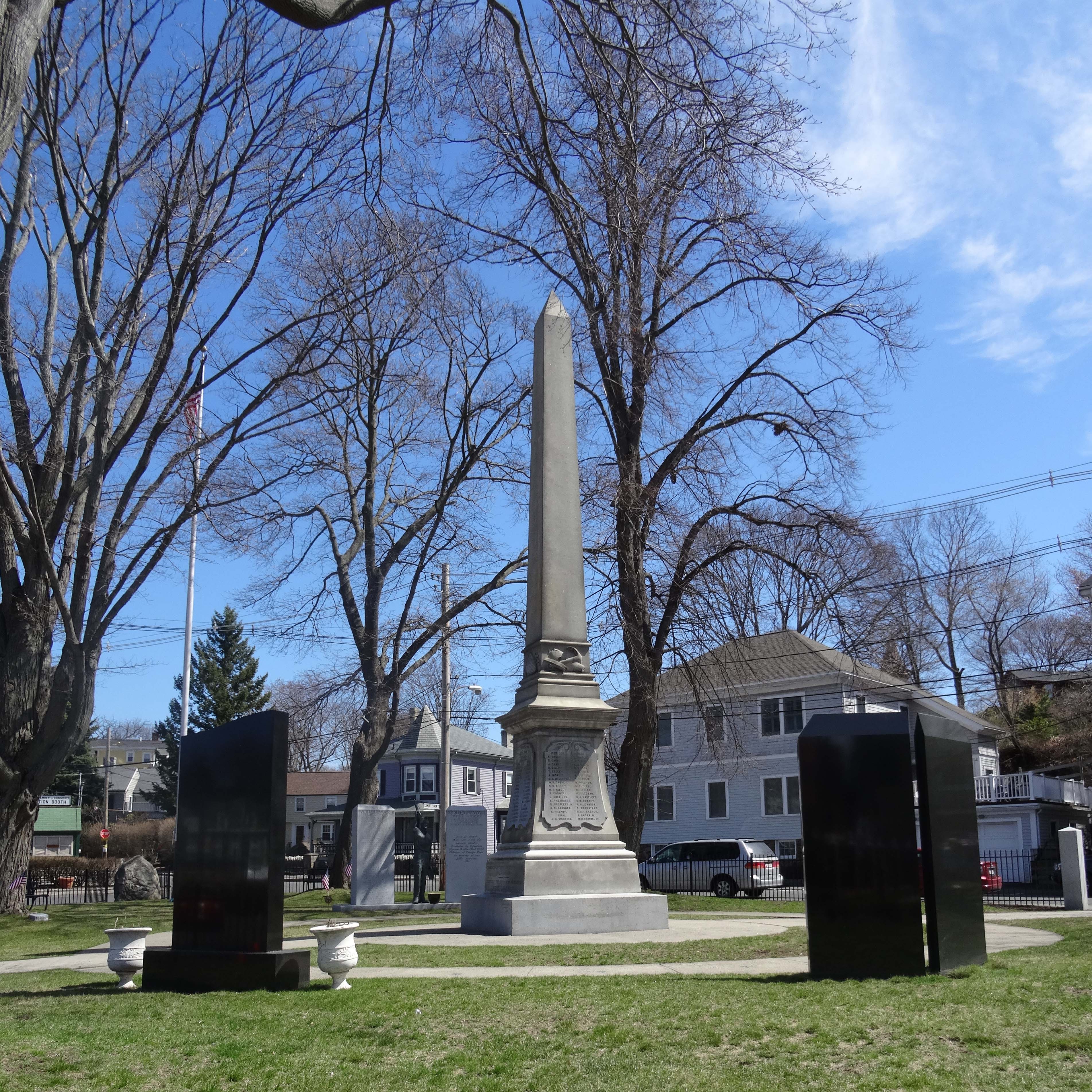
Thirdly and most importantly, Memorial Park has an annual role to play during the Memorial Day Parade, which I marched in many times as a Girl Scout. Often under meltingly hot May sun, the parade is held every year to commemorate the loss of Marbleheaders from the Revolutionary war onwards. The primary memorial in the park centre is devoted to those who died in the Revolution, War of 1812, and Civil War, then there are additional stone slabs for each subsequent conflict. This includes, below, the memorial to those who died on 11 September 2001, of which several were from Marblehead. Two of the planes that day took off from Boston, and I recall walking through town that afternoon, when everything was quiet and flags suddenly appeared as they often do on the 4th of July. As many Americans – and doubtless those around the world – experienced, it felt very personal. Our small town, like so many, was touched by that horror. And would continue to be as the years went on.
I hope you have enjoyed this brief trip around Marblehead, and that if you ever visit yourself, you can stop by some or all of these points to experience some of the best views in town. I am personally fond of an early morning – often jet lag-fuelled – walk through Crocker Park, along Front Street to Fort Sewall, and then back over the Old Burial Hill. But I am sure all Marbleheaders have their favourite routes.
Loving these pics of Marblehead? Get one for your wall from my online shop!
Are you travelling in Scotland but not willing to rent a car? Maybe you’re from overseas, and don’t fancy driving on the other side? Perhaps you’re looking for a more carbon-friendly option?
Fortunately, Scotland has a really robust public transport network and you can see a large part of the country just using busses and trains. I was lucky enough to have experienced excellent public transport where I lived for so much of my life that I didn’t learn to drive until quite late. This means I also became well-acquainted with British public transport and both its pros and cons. I have done several of these trips with family who have more limited mobility, but I have always been there to help with luggage; once you get off of trains and major busses, I would imagine the routes are more challenging if you are not able to carry your own luggage and traverse coach stairs easily.
First, a few tips if you plan to attempt a tour of Scotland using trains and busses:
Pack light. Most busses have little to no room for luggage.
Have a book or alternative method of entertainment. You will be doing a bit of waiting.
Always have a plan B. Most of the time, public transport works pretty well, but aiming for the first or last transport of the day can be a bit risky and sometimes there are last-minute cancellations.
Always expect a delay and be pleasantly surprised if there isn’t one. If you’re needing to catch a plane or train at a specific time, give yourself plenty of extra wiggle room.
Don’t rely on the internet; depending on how far north you go, you may find that reception drops, so make sure you have a backup payment method as well as the basic timetable.
Take a bit of time to get used to the way the timetables look, and how to read them.
A note on cost
I have not estimated or stated cost for any of the journeys below, as they change regularly. You may find the best rates if you purchase online ahead of time, and there may also be group or family rates, as well as rail card discounts. Contactless payment should be available on all transport, and if you wish to pay with cash, be aware that operators will expect the exact change.
The routes
Below you will find a suggestion of some great trips you can take and a rough loop that will cover most of my favourite bits of Scotland. This is only the tip of the iceberg though – Scotland’s transport network allows you to explore even the far reaches of Mull, Skye or the North Coast without once setting foot in a rental car. I’ve popped links to all the major travel websites you may need at the end of this post.
Route 1 – Edinburgh Airport to Edinburgh City Centre
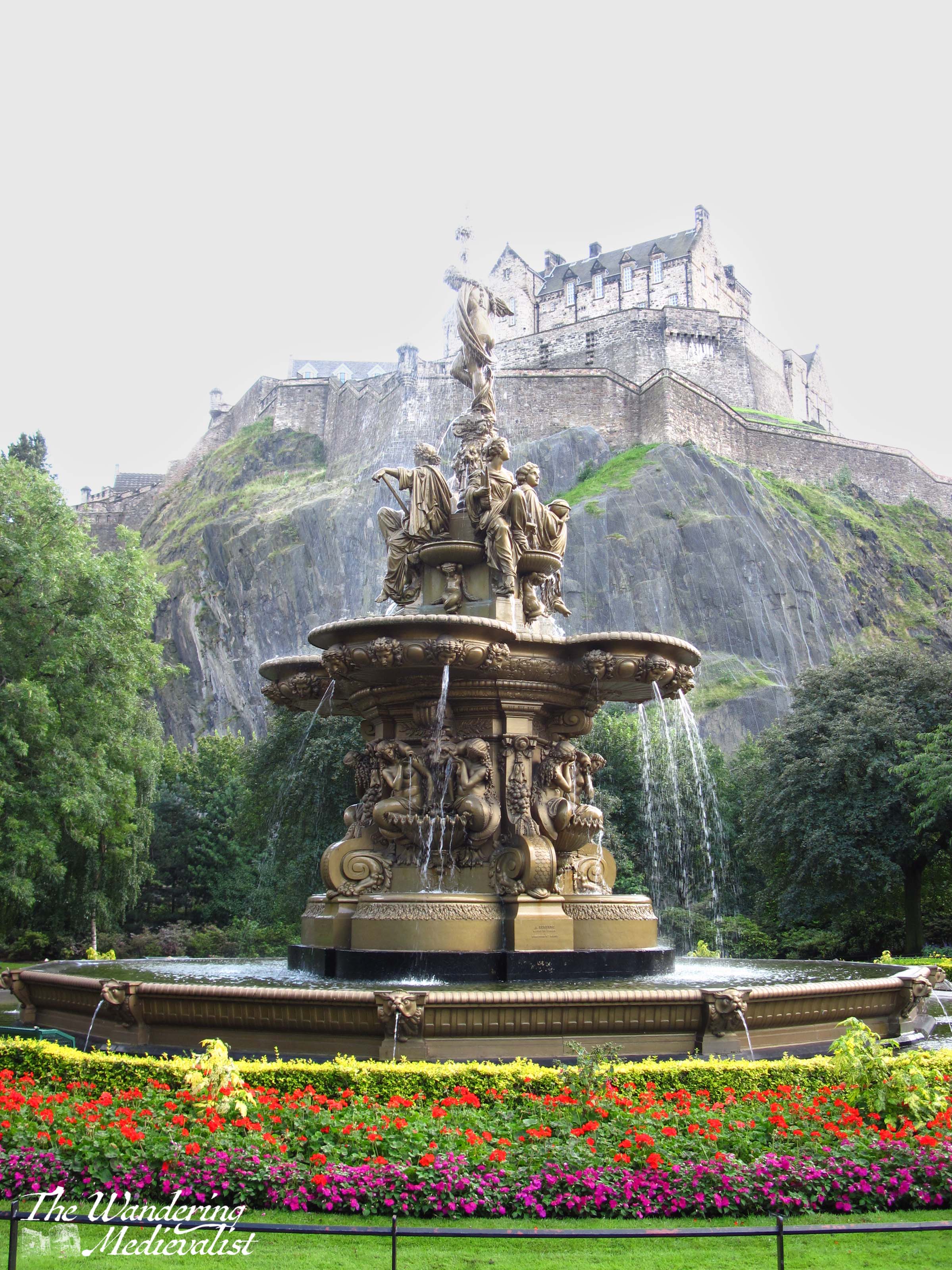
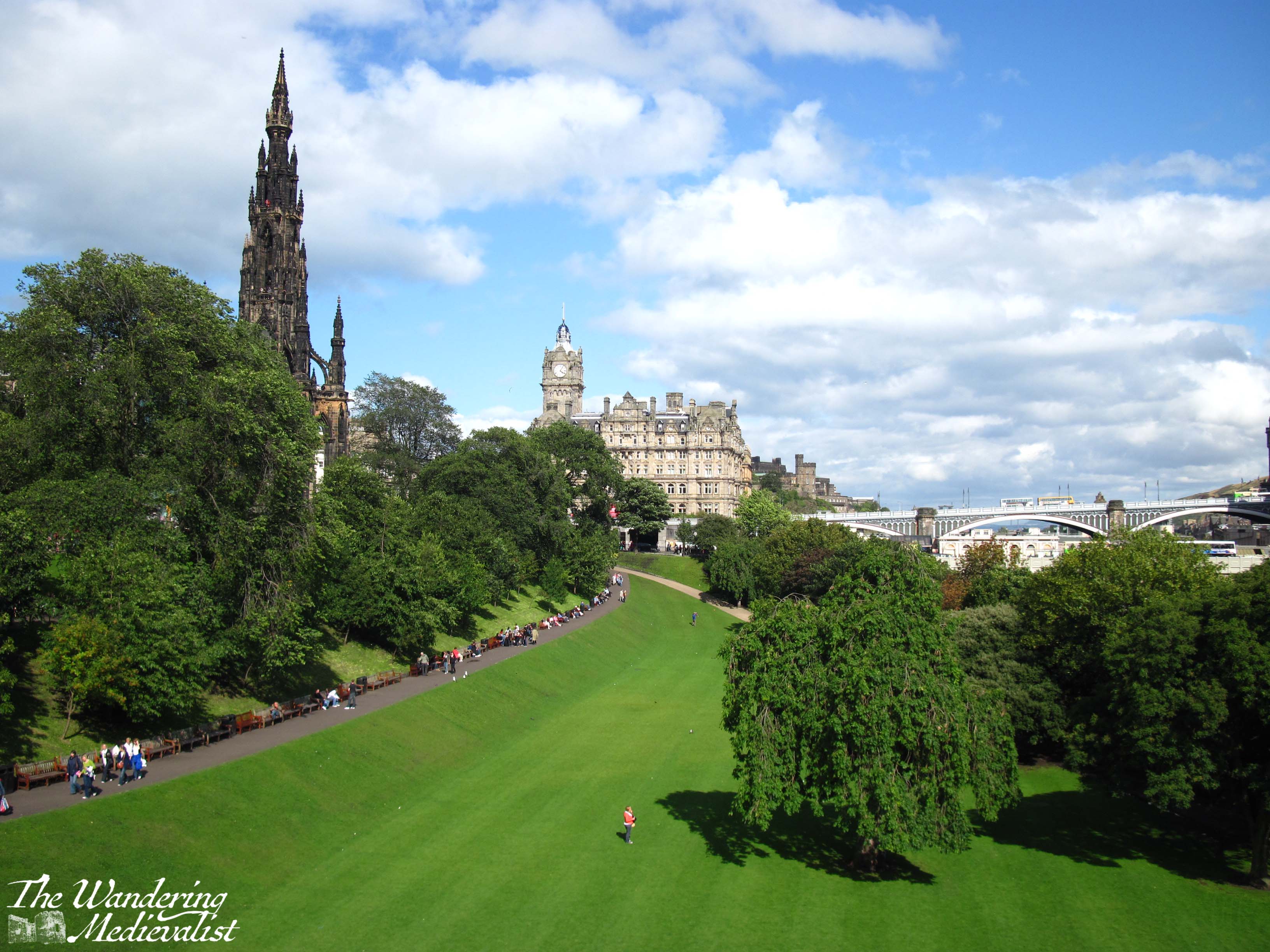
There are two options here: tram or bus. The tram is a nice calm modern choice, as the line is only ten years old – it opened in May 2014. But I actually prefer the bus, particularly the Airlink 100. The route into the city passes through some lovely neighbourhoods, the West End, and kisses the end of Princes Street, providing excellent views of the castle and Princes Street Gardens. It then cuts up to George Street, providing a peek down the side streets towards the water. Definitely sit upstairs if you can.
There are a few bus options with varying prices, but the 100 drops you right at Waverley Bridge, which is a perfect spot from which to explore the rest of the city. If you want to continue exploring by bus, you can pick up a hop-on, hop-off tour of the city from Waverley Bridge, too.
Boarding the airport bus was my favourite part of journeying back to St Andrews after time at home as a student. I was almost always half asleep after an overnight flight, but sitting back to watch the streets of Edinburgh speed by and then the majestic castle rising over Princes Street Gardens rejuvenated me long enough to stay awake for the train ride north.
Route 2 – Edinburgh City Centre to St Andrews
There is a bus that leaves from Edinburgh City Centre (confusingly, from St Andrews Bus Station) and takes you directly to St Andrews (St Andrews Bus Station, Fife), but I recommend the train. You’re looking for a route that stops at Leuchars, which is the local St Andrews station. Any train heading to Dundee or Aberdeen will stop there. If you can, start your journey at Waverley – you’re more likely to get a seat – and sit on the right-hand side of the train. This journey can take anywhere from 60 to 90 minutes depending upon the route and train operator – some trains go almost directly to Leuchars but some will stop at every small village along the way.
Once you pull out of Haymarket station (which often smells faintly of yeast from the local brewery), you start to get some great views of Edinburgh: you’ll pass Murrayfield Stadium and go right past the end of the airport runway, then out across the historic Forth Rail Bridge.
My video of trips across the rail bridge:
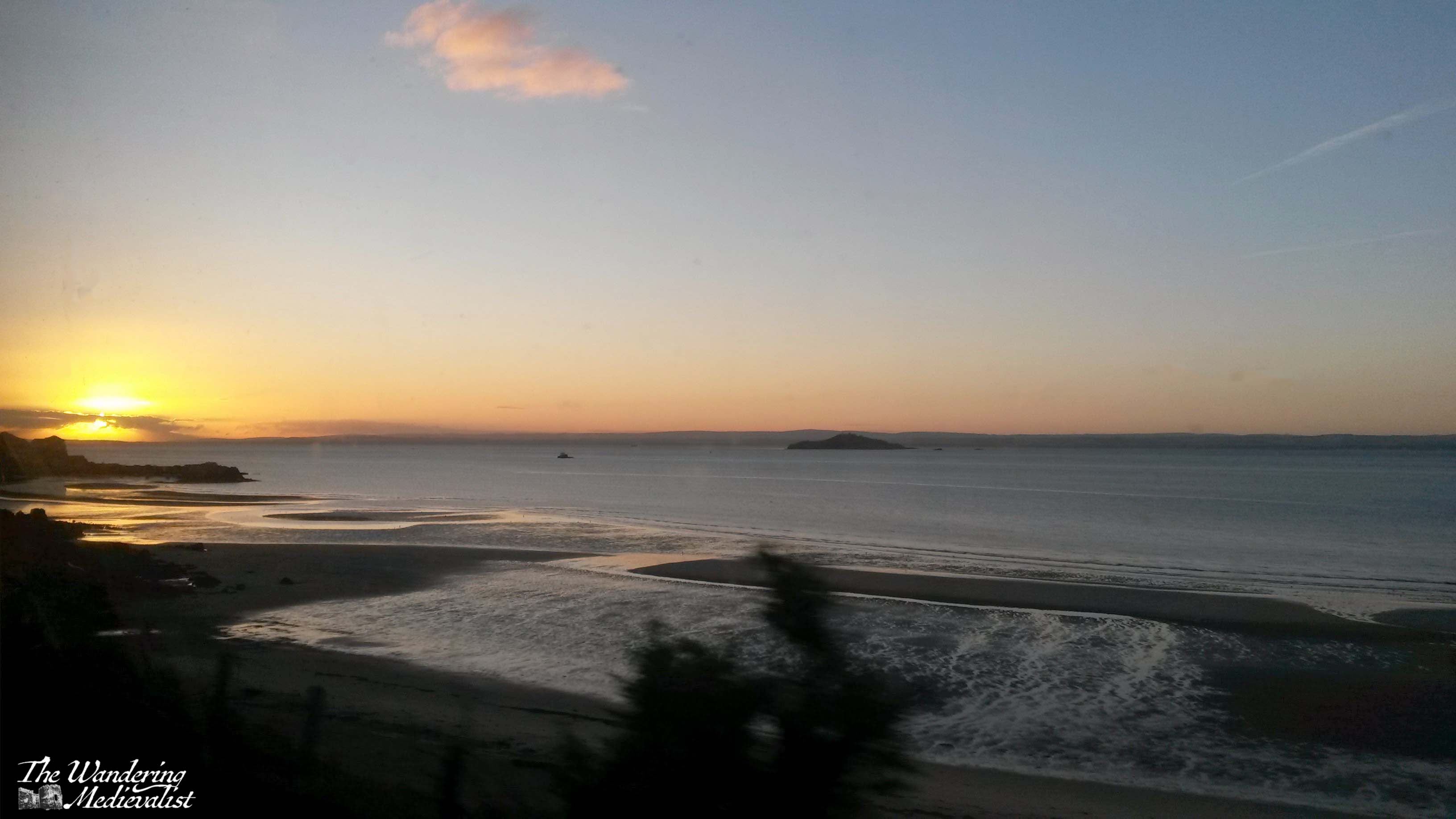
From the bridge you can see down the Firth of Forth in either direction, either west towards Stirling or east towards the islands and North Sea.
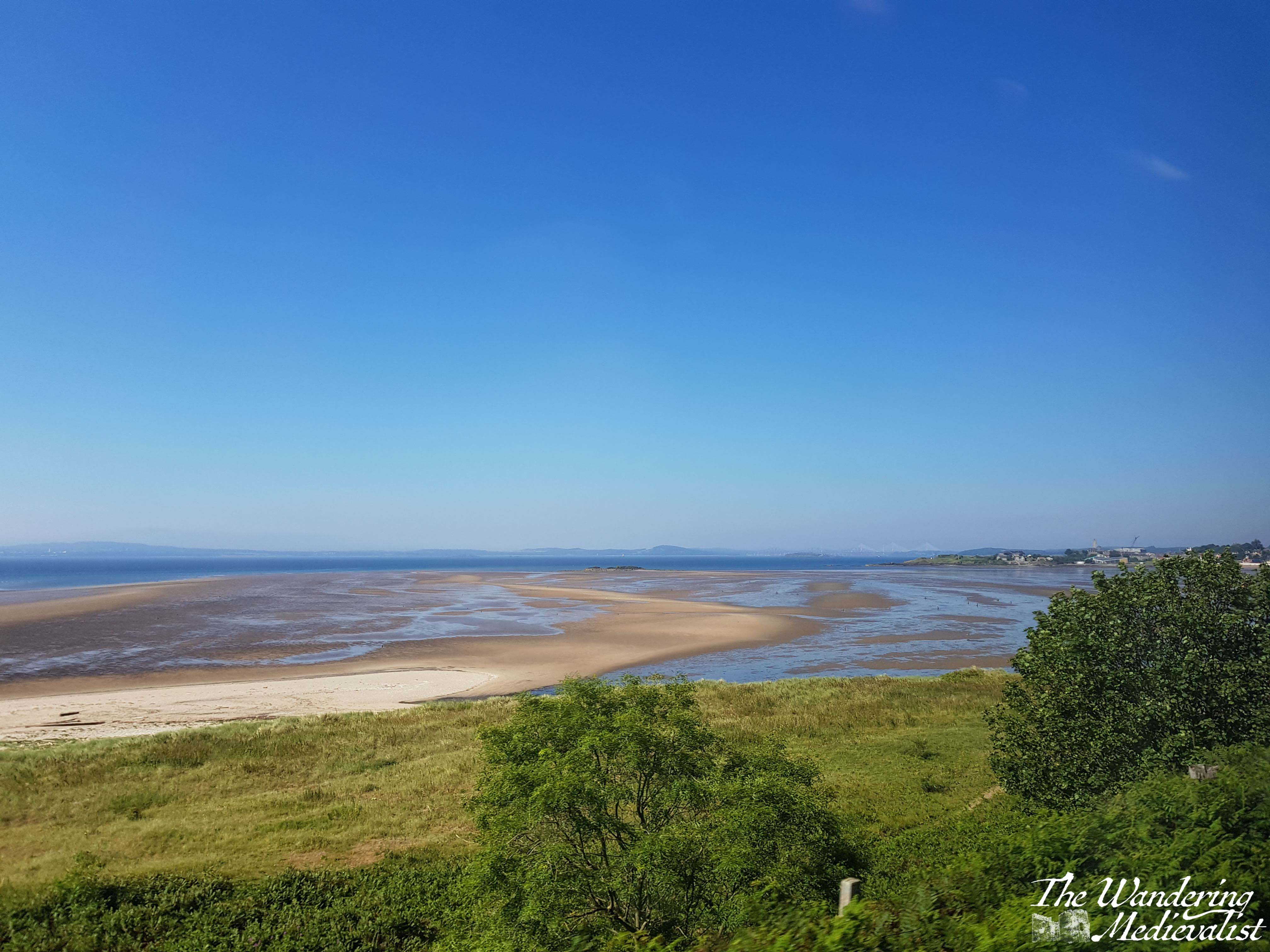
As you pass into Fife, the train line continues to hug the coast and offers some spectacular views of the beaches, Bass Rock, and Edinburgh itself across the water. Once the train cuts inland, you get a great feel for the farmland and rolling hills of Fife. You will know you are approaching Leuchars if you catch sight of the chimney of Guardbridge Paper Mill (now a biomass plant).
From the station in Leuchars, it’s easy to grab a taxi or one of the very regular busses into St Andrews. In total, the journey should take no longer than 2 hours.
One small warning – phone signal is very patchy along this route, and if you find yourself having to make a phone call or trying to check your email, you may be scuppered. The stretch between Inverkeithing and Kirkcaldy is particularly bad, but the hills of Fife seem to block signal quite effectively no matter where on the line you are.
Route 3 – St Andrews to Elie
Several years back I happily discovered this route while exploring with my father. We hoped to walk some of the Fife Coastal Path, but were without a car.
The Stagecoach 95 route runs from St Andrews to Leven and passes through all of the charming wee towns of the East Neuk, which is the area of Fife south of St Andrews. The 95 stops in Kingsbarns, Crail, Anstruther, St Monans, and eventually cuts inland at Elie to pass through Kilconquhar and Colinsburgh.
If you can, get on at St Andrews and go up to the top level – this bus is almost always a double-decker. The views are awesome, and it’s a great way to see Fife. If you tend towards travel sickness, however, be careful up there – the road is narrow and quite winding, while the bus drivers seldom slow for the corners.
You can hop on and hop off using a North-East Fife dayrider ticket, or even get off and walk along the Fife Coastal Path to the next town, as we did (Elie to St Monans, for the record). Just keep an eye on the timetable, as the bus only runs about once an hour.
All of these villages will have places for you to get refreshments, often a charming little pub or chippy. Anstruther is famous for having award-winning Fish and Chips!
The whole route from St Andrews to Leven is about 90 minutes.
Route 4 – St Andrews (or Edinburgh) to Inverness
There is no direct train from Leuchars or Dundee to Inverness, and so my recommendation for this next leg is – if starting from St Andrews – that you take the 99 bus to Dundee Rail Station (it stops there immediately after crossing the bridge). From Dundee you get a train to Perth, where you switch to the Inverness train. If you can, book in advance and make sure you have a seat reserved on that train, which is often busy. These trains come from Edinburgh, so you can also get on there if you prefer to spend more time in the city.
The train from Perth to Inverness stops in some fantastic places such as Dunkeld, Pitlochry, Blair Atholl, and Aviemore. There are stunning views as the train passes through the forests of Perthshire and then the Highlands; my favourite spot is the Drumochter Pass, which is the highest point in the pass between the north and south. Often the weather is very different here than only a few miles in each direction, with snow common in the winter.
As the train winds down out of the mountains you start to see villages and then the town of Inverness.
The journey from Perth to Inverness is just over two hours.
Route 5 – Inverness to Culloden Battlefield
Inverness is a lovely little city to walk around, with paths along the river and over bridges, and of course it has its own castle. It is a popular destination for coach trips and tours, partly for its size and the plentiful hospitality options, but partly for its proximity to one of the most famous battlefields in the UK, if not beyond: Culloden.
Whether you are a Scottish history fiend, a military history fan, a fan of Outlander, a Scot, someone descended from Scots, or someone who is looking for the most popular spots to visit in Scotland, you will have come across Culloden. It is of course the famous field where, in April 1746, Bonnie Prince Charlie and his Jacobites lost their fight against the forces of King George II, and where many Highland clansmen lost their lives. A major turning point in Scottish history, Culloden marked the beginning of the end for Highland culture, and the battlefield site has been preserved well. The visitor centre has some fascinating displays that immerse you in the battle, and provides a solid historical understanding. The battlefield itself is incredibly moving, with stone cairns marking the burial places of the clans.
Fortunately, Culloden is easily accessible via bus from Inverness city centre. Absolutely a must-visit, and only about 20 minutes away.
Route 6 – Inverness to Fort William
Before I go too far in describing this route, one small caveat – I have never actually done it by bus. But, I know it can be done by hopping on a Citylink bus at Inverness bus station – sit on the left if you want the best views for the first half of the journey. The route follows the Great Glen down Loch Ness, Loch Oich, Loch Lochy, and then through Spean Bridge to Fort William. This alone is a spectacular route, but the Citylink stops along the way at several points that may be of interest to you, if you have time.
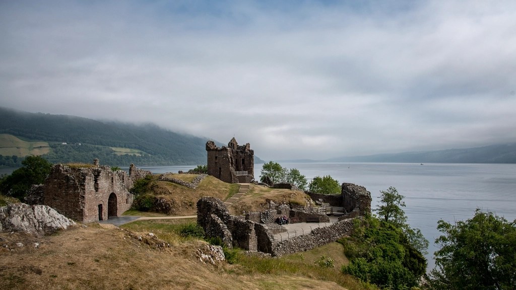
The first is Urquhart Castle, which is one of the most picturesque castles in Scotland and a perfect place to look out for Nessie.
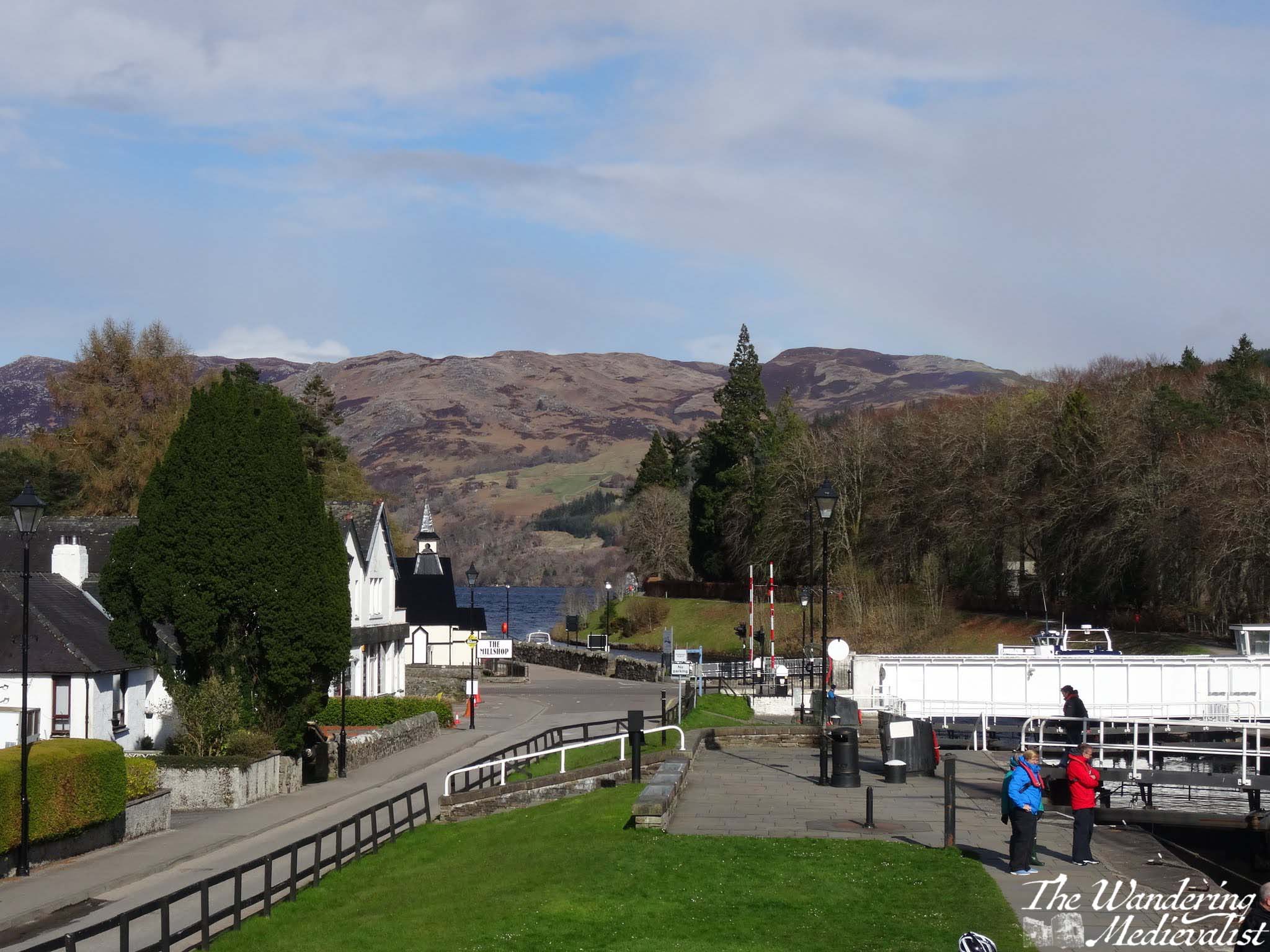
The next is Fort Augustus, the town at the far end of Loch Ness from Inverness, where you can grab lunch and watch ships navigating the locks of the Caledonian Canal.
After Fort Augustus, the bus will continue to Invergarry and eventually cross to the other side of the glen to hug the coast of Loch Lochy. Here the A82 lifts away from the water and climbs over the rise on which the Commando Memorial stands – you may just catch sight of it before the road drops again into the town of Spean Bridge.
There are a few hotels and B&Bs here which are sometimes a bit less pricey that Fort William, though you are still 20 minutes away. The road between here and Fort William is quite pretty, with the Nevis Range ahead and rolling hills off to the right.
The whole route takes about two hours if you do not get off at all, and runs relatively regularly – hourly during the summer though less often in colder months.
River Spean at Spean Bridge
Route 7 – Fort William to Nevis Range
Fort William has plenty to keep you busy with hikes of all different lengths from a short wander to climbing Ben Nevis, the UK’s highest peak.
If you are less inclined to hiking, I would definitely recommend trying one of the Loch Linnhe Seal Cruises, which you can book ahead even if it is just the day before. There is also a small cinema, plenty of pubs and restaurants to explore, and numerous places to stay. That said, definitely book your accommodation well in advance, as Fort William is almost always busy.
Fort William and Loch Linnhe from the Old Fort
Another fantastic option for the Fort William area is to take a bus out to Nevis Range, where you can find more walks in the woods and the gondola up Aonach Mor. The gondola can be taken by those of all abilities and ages, and at the top you can enjoy the cafe or walk along the side of the mountain to two viewpoints: Meall Beag and Sgurr Finnisg-aig. The gondola ride alone is worth trying, even if you do not wish to hike.
The way to get to Nevis Range is to pick up a Shiel bus from one of the bus stops just outside Morrisons, on MacFarlane way. As of writing it is the N41 route you want, and it runs frequently enough that you can get out and back in a day. But, as always, keep a close eye on the timetables. The route is only about 20 minutes.
Should you miss the return bus, you may need to order a taxi, and those can take some time – I’d recommend making note of a local taxi number, as Uber has not yet reached Fort William.
Route 8 – Fort William to Glasgow
If the train route from Glasgow to Fort William does not make it on to some list of one of the world’s most beautiful, someone goofed. Whether you are boarding in Glasgow, Fort William, or one of the several stops in between, I do recommend booking in advance if you can, and selecting a seat. I cannot really recommend a side of the train though – both offer stunning views.
If you are travelling the whole distance, you may want to bring your own snacks and refreshments, as the train trolley can be pricey. The trip is about 4 hours, but delays around Crianlarich are not uncommon, so it is best to be prepared for a longer ride.
Any delay is 100% worth it, though. For one thing, it often allows you a few minutes to get out of the train and walk around on the platform, and get some fresh air. It is also just a fact – you will be stopped in Crianlarich for a short while even without delays, as that is where they split the train (or join it together again), with one half going to Oban and the other to Fort William. This is another good reason to book your ticket – it guarantees you are sitting in the correct part of the train.
If you board in Fort William, you will find that the train passes out of the town almost immediately and follows the River Spean through the towns of Roybridge and Spean Bridge. The line hugs the side of a gorge and then at Tulloch cuts south to head across Rannoch Moor.
The moor is a stretch of land composed of bogs, lochs, rivers and rocky soil that is one of the last great wildernesses in Europe. The train offers a unique opportunity to see it, as the only other way to experience this part of the Moor is on foot – the roads go around in either direction. Corrour Station, one of the stops in the middle of the Moor, is more than 10 miles from the nearest road. The train runs just frequently enough that you could take a train in the morning, have a hike, and then catch one of the trains back again to Fort William, but be warned – as mentioned above, trains on this line are not 100% reliable and accommodation is very limited.
Barren, rocky, boggy, and breathtaking, the Moor alone is – in my opinion – worth the train trip. You may even catch sight of a deer or other Highland fauna.
Once across the Moor, the train line cuts through mountains and valleys, eventually re-discovering the A82 highway not far north of Tyndrum. Just beyond Tyndrum, the train line loops west to cross the viaduct seen in the picture above, hugging the hills as it heads south.
After stopping at Crianlarich, the line touches the north shores of Loch Lomond before cutting over to Loch Long at Arrochar and Tarbet. From there, beautiful views down the loch and of the distant mountains will keep you glued to the windows all the way to Helensburgh, only a few minutes from Glasgow.
If you take the train in reverse, the scenery becomes more stunning the further north you travel, and I always find it a touch disappointing when you finally reach Fort William. Once we did continue on the line all the way to Mallaig, and while doing so will give you a good feel for the barren nature of the coastal Highlands, nothing is quite like crossing the Moor.
Give yourself most of the day for this journey of at least four hours, and cross your fingers for a rain-free trip. I have never yet had one, but rain makes the pictures more genuine!
Travel from Glasgow back to Edinburgh is incredibly easy, with regular trains and busses from Buchanan and Queen Street stations.
Other options:
The loop I have suggested above is just one of the many options available to you. Want to try a truly epic journey? Citylink offers busses from Glasgow to Uig on Skye. It’s a long trek but crosses some stunning scenery, and Skye can be explored on foot if you’re ready for it.
Here are a few more suggestions:
Hop on the train from Fort William to Glenfinnan, crossing the famous viaduct. There is a hike from the train station back towards the parking lot with spectacular views over Loch Shiel and the viaduct itself.
Take the train from Dundee to Aberdeen, along the stunning coastline.
Take a bus or train to Stirling and walk up to the castle and old town.
Take a bus to Doune and explore the castle and town.
Hop a bus from Glenrothes to Falkland and visit the Palace and Gardens, or climb up East Lomond Hill.
Board a bus in Aberdeen to take you to Crathes and Drum castles.
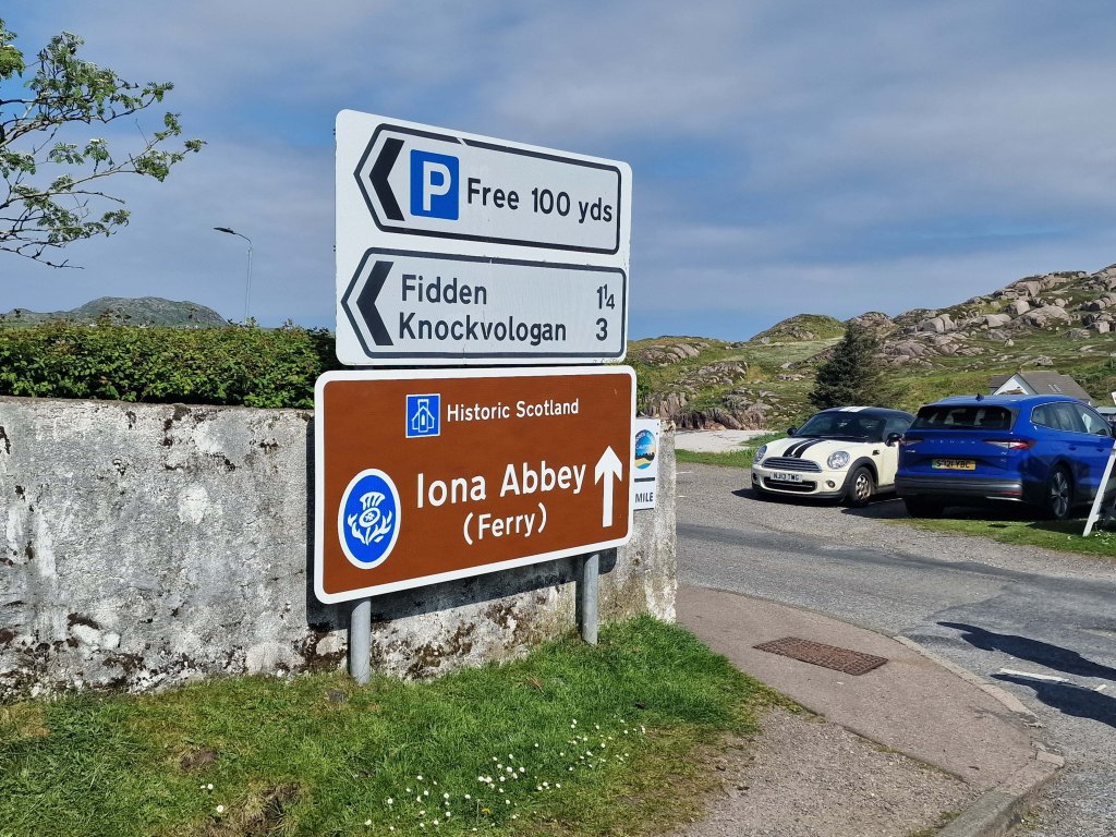
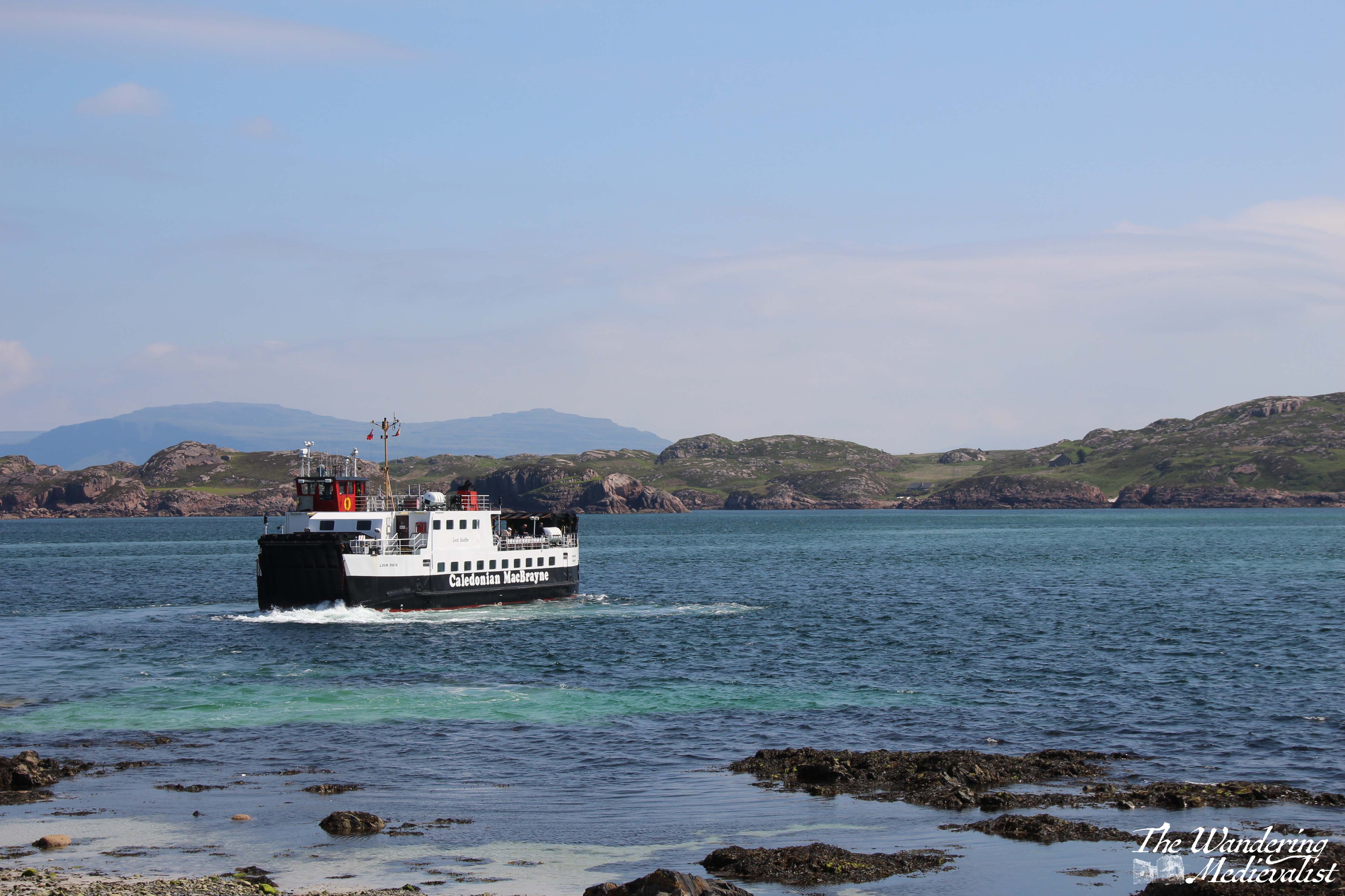
For a truly epic journey, you can take a train or bus to Oban, a ferry to Mull, another bus from Craignure to Fionnphort, and a ferry to Iona! Lots of coordination required, but entirely possible.
The bottom line is, busses go almost anywhere you want. Be aware of travelling on Sundays as things are always less flexible, and make sure you have the most up to date timetables.
Here are some useful links to help you plan your adventure:
Are you visiting Scotland on a whirlwind visit but only have a few hours in each location? Maybe you’re staying in Edinburgh but want to visit St Andrews for the day? This short walking tour of around one hour takes you past all of my favourite parts of St Andrews. Allow yourself a bit of extra time to pop into some shops and take some pictures, and I’ve added in a few detours if you do have a bit longer to explore.
St Andrews is an easy town to walk around and there are numerous places along this tour where you can pause for a rest or refreshment, but weather can also change quickly so make sure you are prepared. Only a month ago I was in town with my mother when the beautiful sunny view was overtaken in less than 10 minutes by the haar – Scottish fog. But as they say, wait a few minutes, and the weather will likely change.
One caveat is that while you will see portions of the University on this tour, it will not show you everything. The University does not have a campus, but is spread out around the town, so you will see the crest on many random buildings where you may not expect it.
This tour route assumes you are arriving for the day from the train or bus, so start at St Andrews Bus Station (if you are using a travel app, make sure not to confuse this with St Andrews Bus Station in Edinburgh!)
Part 1 – St Andrews Bus Station to the Westport
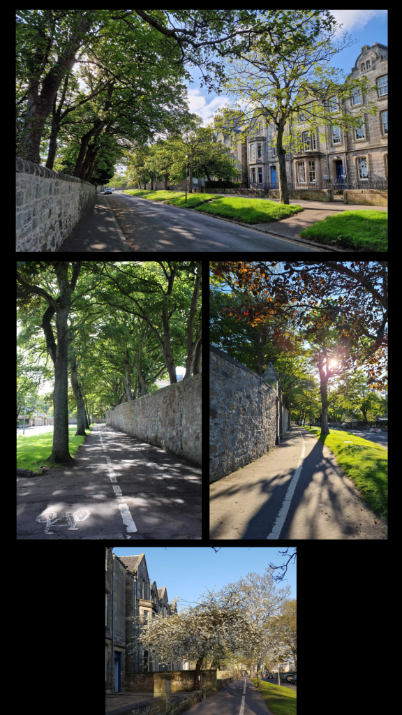
Start your walk at the zebra crossing just outside the bus station and continue along to the roundabout – do not cross at the first set of lights you reach. At the roundabout, cross Doubledykes Road and then use the pedestrian crossing at the next set of lights you come to. Continue along City Road heading south, and soon you will come to the Westport, one of the last vestiges of the St Andrews town wall, dating from the 1580s. If you want to cross the road here for a better picture, just be careful of the traffic!
the roundabout near the bus stationWest Port, St Andrews
Part 2 – The Westport to Blackfriars Priory
Go through the Westport, and I would recommend staying on the left side of the street; there are several nice shops and the St Andrews Brewing Company, a fantastic local brewery should you already be in need of some refreshment (I particularly like the Yippee IPA). When you reach the next intersection, cross to see the ruins of Blackfriars Priory. Built in 1520 to add to the Dominican Friary, the chapel was destroyed soon after in the Reformation. Behind Blackfriars is Madras College, formerly a secondary school for St Andrews but more recently purchased by the University as it continues to expand its property portfolio and teaching aspirations. Extensive renovation is now underway, though the Victorian-era facade will remain.
Part 3 – Bell Street
Cross back towards the BrewDog pub and continue almost straight along Bell Street. You’re entering St Andrews’ shopping district here, and you will find plenty of cafés and shops to keep you busy. Sheila Fleet at the end of the shop does some beautiful Scottish jewellery, and the Taste of Scotland shop on the corner offers a massive range of whisky, gin and other spirits.
Bell Street is also where you are likely to find a taxi later in the evening, as well as St Andrews’ most infamous late-opening pub, Aikman’s. It has not changed in more than 20 years, for better or worse, and is still popular with students.
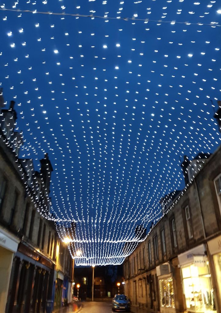
Bell Street with Christmas lights
Optional detour: at the end of Bell Street, continue straight across to Greyfriar’s Gardens, where you can glimpse some lovely gardens and visit the famous Topping & Co. bookstore.
Part 4 – Market Street
Once you reach the end of Bell Street, along to the left you will see the St Andrews University Students’ Association, a large building completely clad in glass. It is the spot to get university merchandise, should you want some, and has a great café. I recommend however taking a right up Market Street, the main shopping street for St Andrews. You will find tourist shops, coffee shops, pharmacies, clothing stores, and two small supermarkets. Most of the brand stores are here including Pret A Manger, Starbucks, Black Sheep, and Costa.
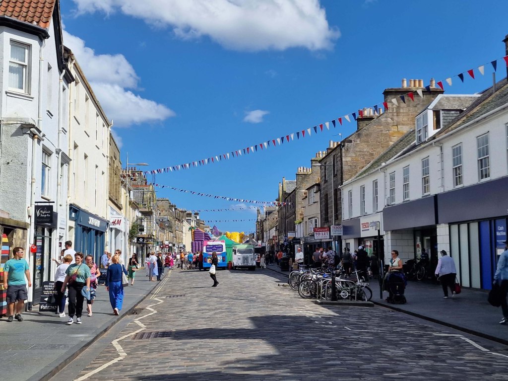
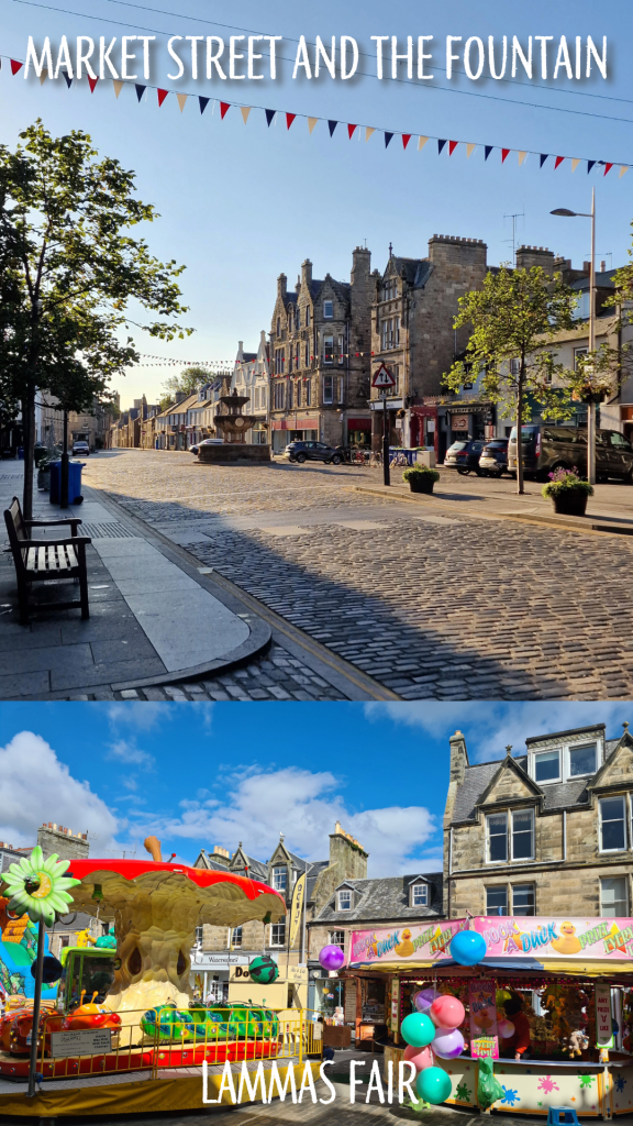
Mitchell’s Deli about halfway along is a great spot for lunch, and Forgan’s offers a Friday night ceilidh. Market Street is always done up with Christmas lights in the winter, and hosts the Lammas Market for one weekend every August.
As the cobbled street widens, you will catch sight of the Whyte-Melville Memorial fountain, constructed in 1880. A massive re-paving and widening of the sidewalks was done in 2010/11, but they can still feel crowded at certain times of day or year.
Market Street – bottom end
Part 5 – Church Street
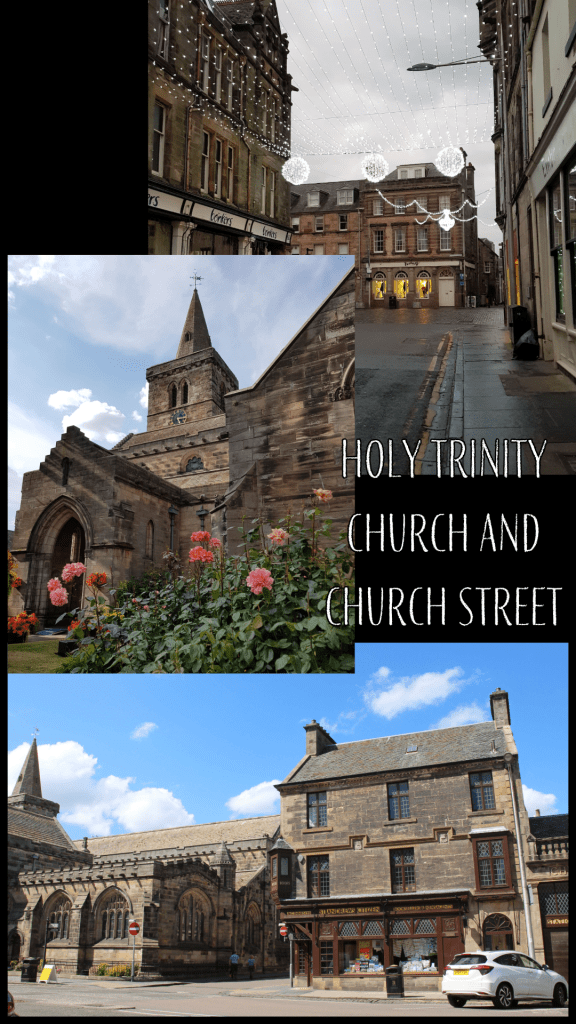
Once you reach the fountain, take a right onto Church Street, named for the medieval Holy Trinity Church that dominates the far end. Church Street is also home to one of St Andrews’ most famous family-run shops, Fisher and Donaldson – make sure to stop in for a yum yum, fudge donut, or other delectable treat.
At the end of Church Street is the now-closed J&G Innes shop (also known locally as the Citizen office), which has some truly stunning decorative carvings on the listed stone.
Part 6 – St Mary’s Quad and South Street
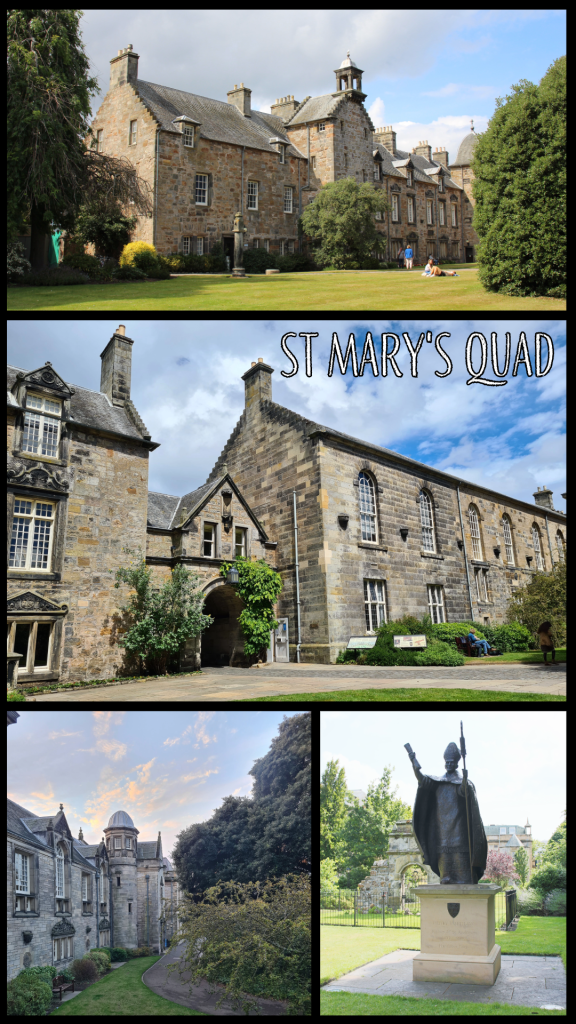
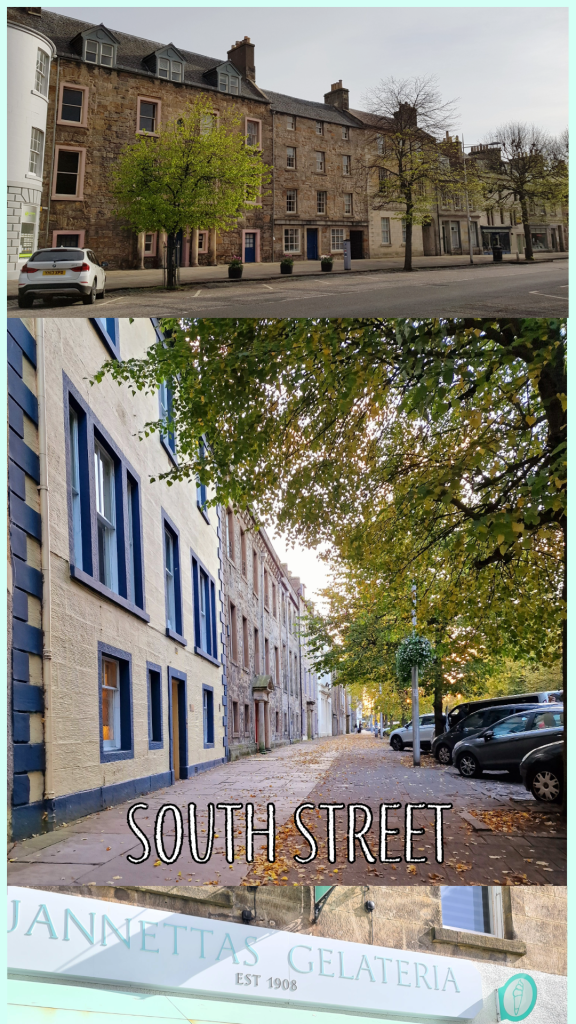
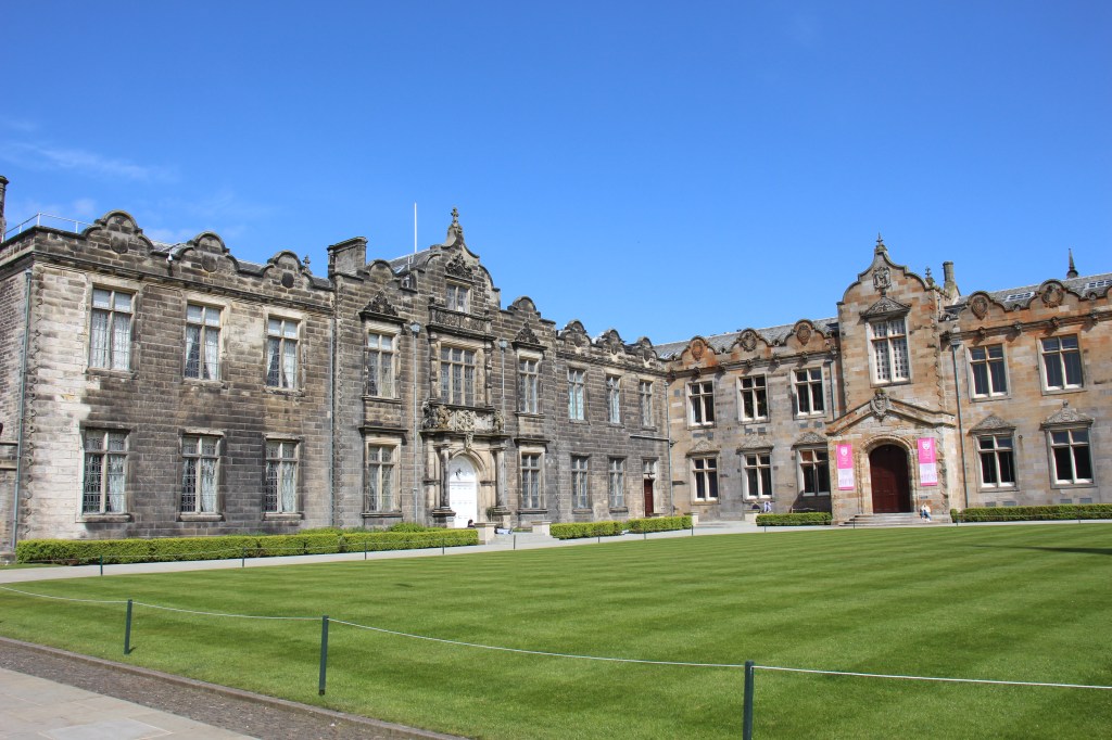
At the corner, turn left onto South Street, or take a quick jog to the right to enjoy the Church Square first. Cross the street across from the Criterion pub, and you will find a gated archway leading to St Mary’s Quad. This is the location of the School of Divinity and Parliament Hall, where the Scottish Parliament met to escape the plague in 1645. Take a short loop around the tree in the centre of the quad and you will see a statue of Bishop Henry Wardlaw, and the end of the new Music Centre that opened in 2021. In term time you will often find students relaxing on the grass or eating lunch here, and the King James Library offers study space and additional books.
Once you’ve enjoyed the quad, leave through the arch and turn right to continue along South Street. You will pass beautiful old stately homes, dating from the 17th and 18th centuries. At the far end, you will find Jannetta’s Gelateria, another famous St Andrews treat destination where the queue will snake down the street on a sunny day. Founded in 1908, Jannetta’s offers more than 50 flavours, not including the sorbet! Go on, treat yourself…
Optional detour: Across from Jannetta’s, go down Abbey Walk and make your way along the beautiful stone wall of St Leonard’s School until you reach the harbour. You can either walk along the inner harbour road or detour out to East Sands, then circle back up to the Cathedral.
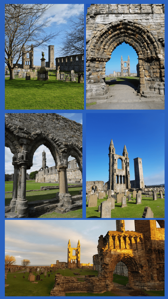
Part 7 – St Andrews Cathedral
Continuing up South Street from Jannetta’s will take you in very little time to the ruins of St Andrews Cathedral. Originally constructed in the 12th century, the cathedral was the ecclesiastical capital of Scotland through out the Middle Ages, and the bishop (later archbishop) was powerful enough to build the nearby castle as his residence. The Cathedral fell into ruin through the Reformation, and the story goes that you can find stones from the great structure in buildings throughout the town.
Though not open in 2024 due to masonry repairs, St Rule’s Tower offers a fantastic view over the whole town if you can scale the narrow staircase. The graves in the cathedral grounds date from the last several hundred years and include the great golfer Old Tom Morris.
Enter the Cathedral through the gate and walk through the grounds, then exit through the door in the far wall. In front of you will be the North Sea!
Optional detour: Turn right along the outside of the cathedral wall and walk to the promontory where several large cannon look out over the ocean. From here you can see down to St Andrews Harbour, East Sands, and the pier.
Part 8 – The Upper Scores and St Andrews Castle
Turn left out of the Cathedral grounds and hug the coast to climb up a rise looking over the sea. This is one of the best views in town, along the coast, into the Cathedral grounds, and to the Castle. Below and to the right, you will see St Andrews pier, which is famous for its use during University processions. Unfortunately it was seriously damaged during Storm Babet in October 2023, so while it looks perfectly sound from above, it is not open to the public. There are several benches here where you can enjoy the view, and this is my favourite path in town.
Continue along the coast, following the metal railing and heading towards St Andrews Castle.
The castle was constructed starting in the 13th century and contains a bottle dungeon and siege tunnels – well worth the time to explore if you have it!
Part 9 – The Scores to the Golf Course
Once you have explored the castle to your heart’s content, continue down the Scores, the road that runs along the edge of the cliffs. Here you are entering the University proper and will pass the Principal’s house, St Salvator’s Hall (a student residence where Prince William lived in his first year), the Schools of English, Classics, Economics and Philosophy, the University Museum, and the Admissions/Student Recruitment office. You will also pass some of the most expensive real estate in Scotland – houses on the Scores are regularly valued at well over £1 million.
If you have some extra time, take a walk up Butts Wynd and peek into St Salvator’s Quad, the real heart of the University.
Eventually you will reach St James’ Catholic Church, the last building on the right; you can either follow the path down to the Bruce Embankment car park or stay on the left-hand side of the Scores. The monument is in memory of the religious Martyrs of St Andrews – of which there were many. Immediately in front of you is the Royal and Ancient Golf Club, and the Old Course.
St Salvator’s QuadMartyr Monument and the R&A
Part 10 – The Old Course and West Sands
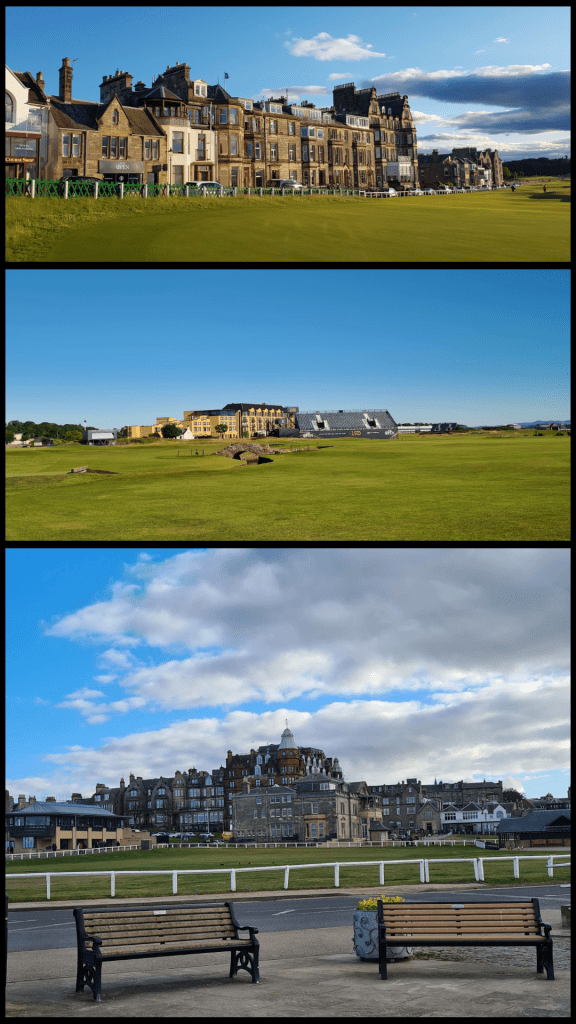
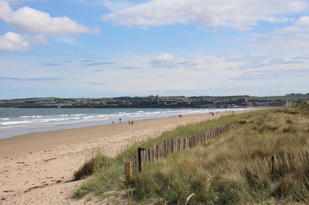
The famous Old Course, where the UK Open Championship is played every five years or so, marks the end of this walking tour. Golf enthusiasts will want to continue around the edge of the course along the Links and take a picture on the Swilcan Bridge.
Non-golfers may want to follow the coastal wall towards West Sands, the long sandy beach where locals walk, run, play sports, swim and surf.
If you’re running short on time, follow Golf Place to North street. The safest thing to do at this point is take a short detour along to the right to where you will find a traffic light and pedestrian crossing. If you are very careful, you may be able to cross before this, but a warning: traffic comes quickly along this road and roundabout, and foreign visitors in particular should take care.
Walk up the hill and you will find yourself back at St Andrews bus station.
view from West Sands towards town
This route may take a bit longer than 60 minutes, and in fact you could probably stretch it to at least two hours if you include the detours. It does not cover all of the amazing parts of St Andrews, but it makes a good start. I hope you have time to give it a go!
If you enjoyed these pics, check out more of St Andrews at my online shop:
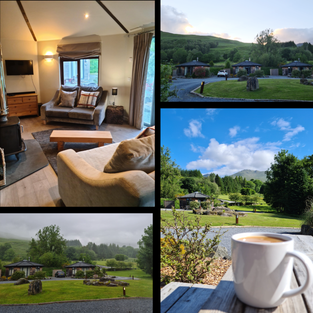
I honestly cannot remember why we chose Aberfeldy for our March 2020 weekend away; it may have been that it was closer than our usual Fort William destination. It may have been that it was somewhere new. Whatever the motivation, we reserved a self-catered cottage for ourselves for a long weekend. It ended up being one of the last ‘free’ weekends for quite some time, for as anyone living in the UK knows, the pandemic lockdown started in mid-March 2020. We were in fact sitting in a pub in Aberfeldy when it was announced that pubs, restaurants and cafés were closing – it was a somber moment, and the only thing we could do was order another pint to drink with the other patrons.
In recent years, the Aberfeldy area has become a favourite of ours for day trips and long weekends, and with each visit I appreciate more just how beautiful it is. There are elements that remind me of lake holiday culture in New England – self-catered holiday cabins, weekend ‘cottage’ escapes and water sports galore – but the hills and stone buildings define it as quintessentially Scottish. Many years ago, visiting family had been gifted a few nights in Kenmore and I went up to stay with them, though there were more than ten years between that visit and our more recent stay. Nevertheless, I recalled the area as being stunningly picturesque.
Below I will highlight a few of my favourite places around Aberfeldy and Kenmore for a wander, and show why it is a really good option for a night or weekend away. With no further ado, here are my exploration recommendations:
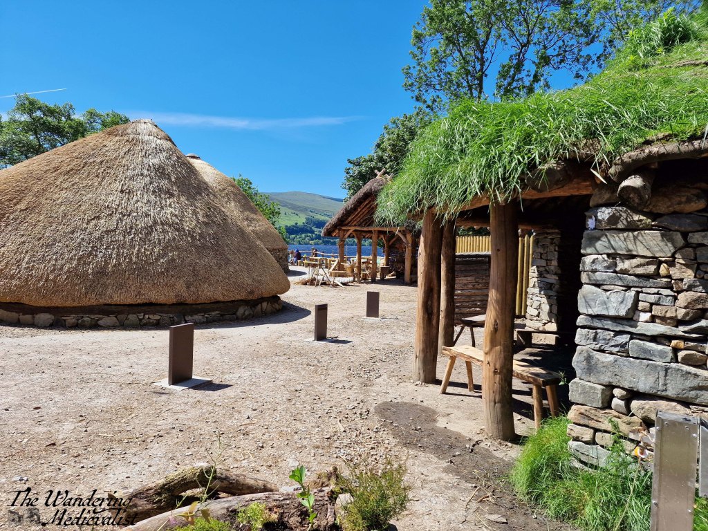
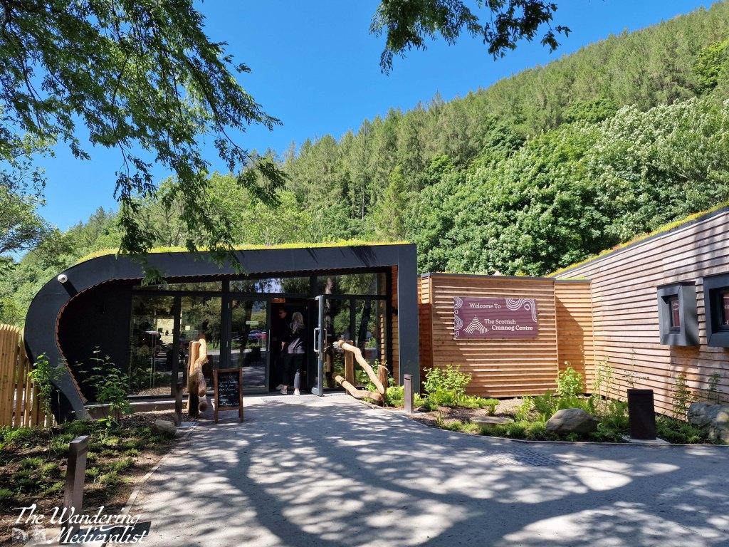
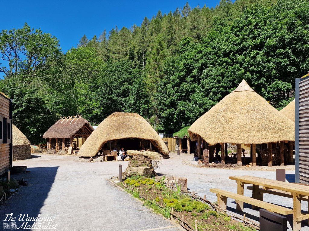
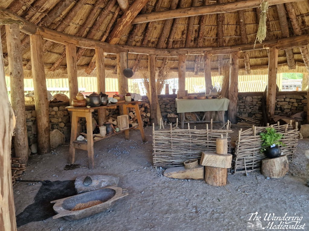
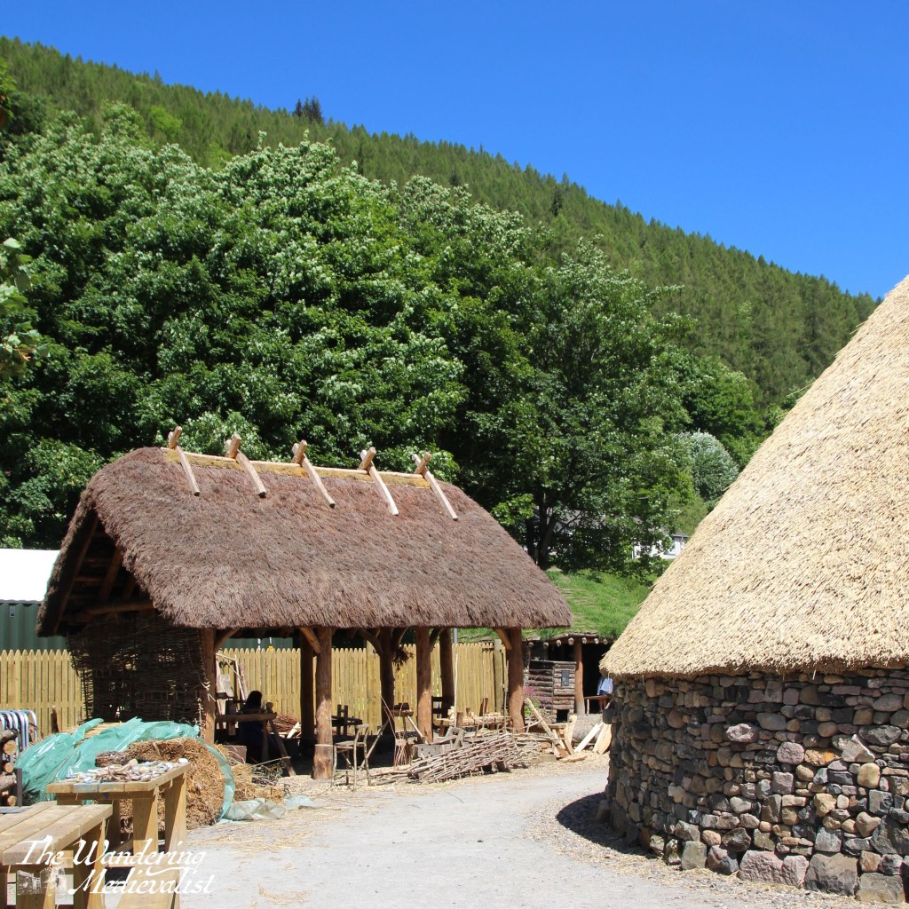
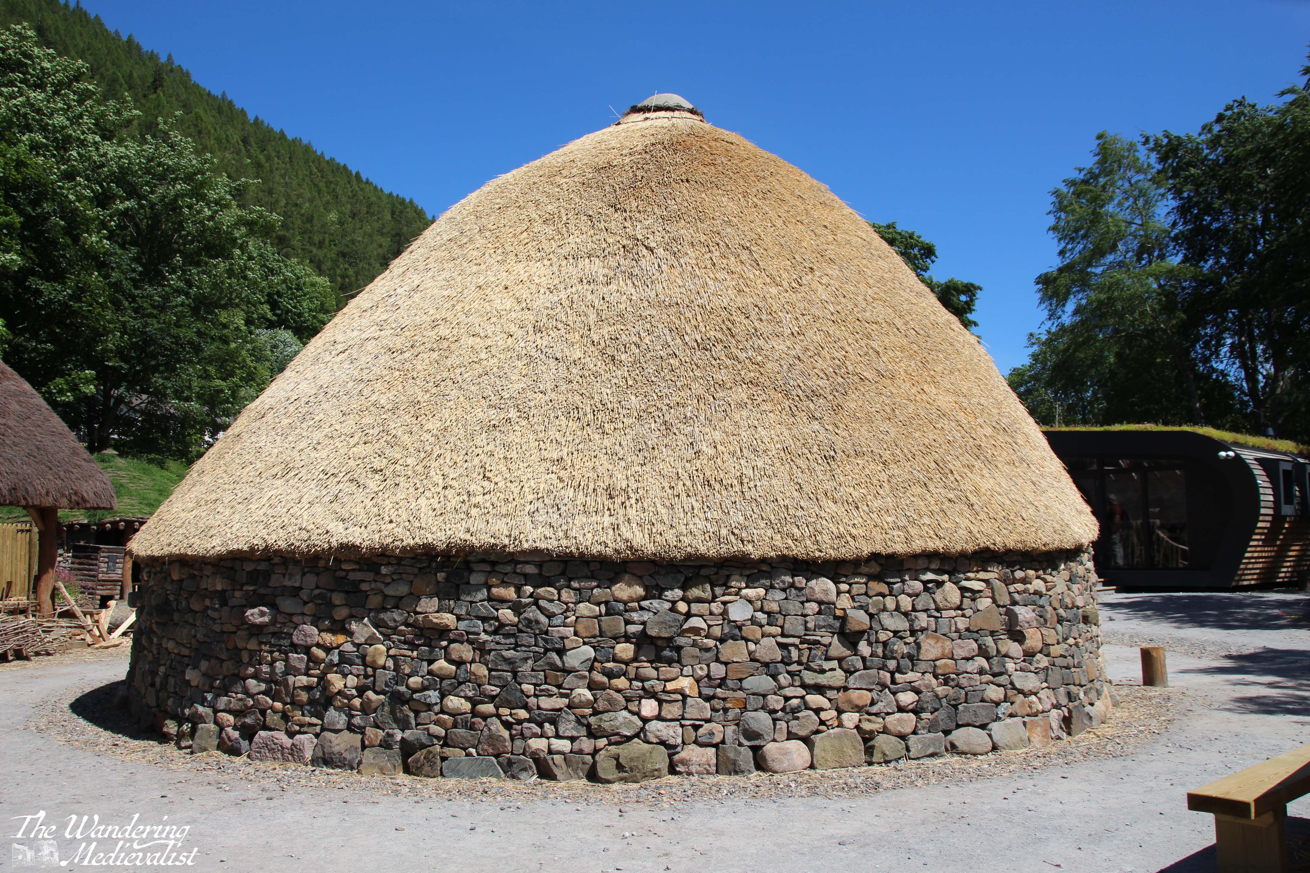
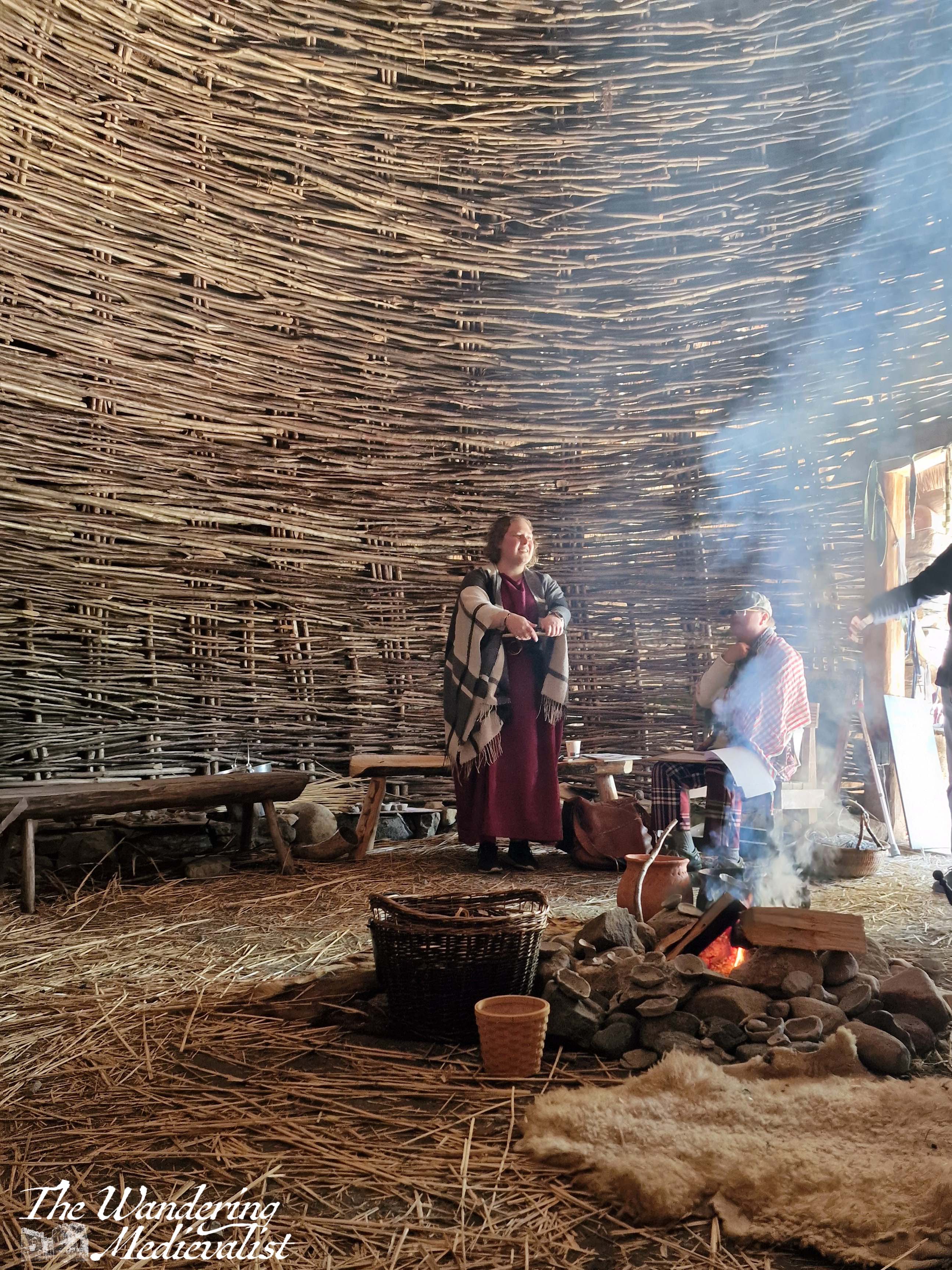
1) Visit the Scottish Crannog Centre. I’ve recently posted about the centre and highly recommend a visit – definitely good for families. A friend recently followed my advice and loved his visit! I think even the most un-history-oriented would find the Crannog story fascinating. Very reasonable entry cost too.
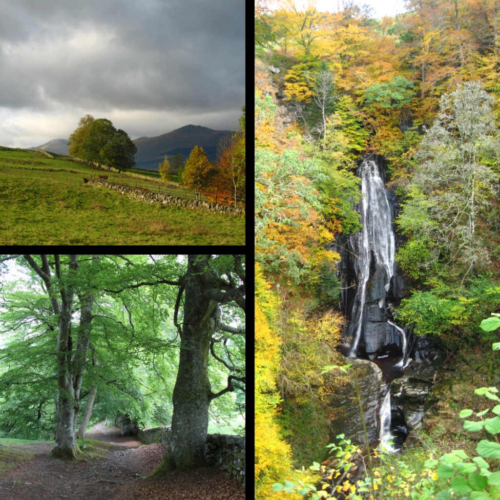
2) The Birks of Aberfeldy walk. This path starts in the heart of Aberfeldy or at a generous parking lot, and climbs into the glen and hills beyond. Wear solid shoes and prepare your knees for plenty of steps. Worth the pain, just ask the Bard himself.
3) The Acharn Falls walk. Parking for this walk is about two miles along the south side of Loch Tay from Kenmore. It’s a bit of steep climb at first but the views are beautiful across the loch and of the falls. We did this back when my cousins were very small, and again recently on our own, and both times it was worth the effort.
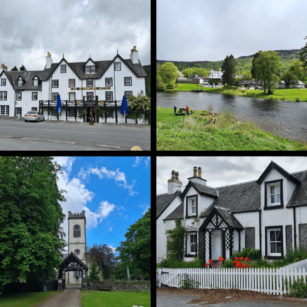
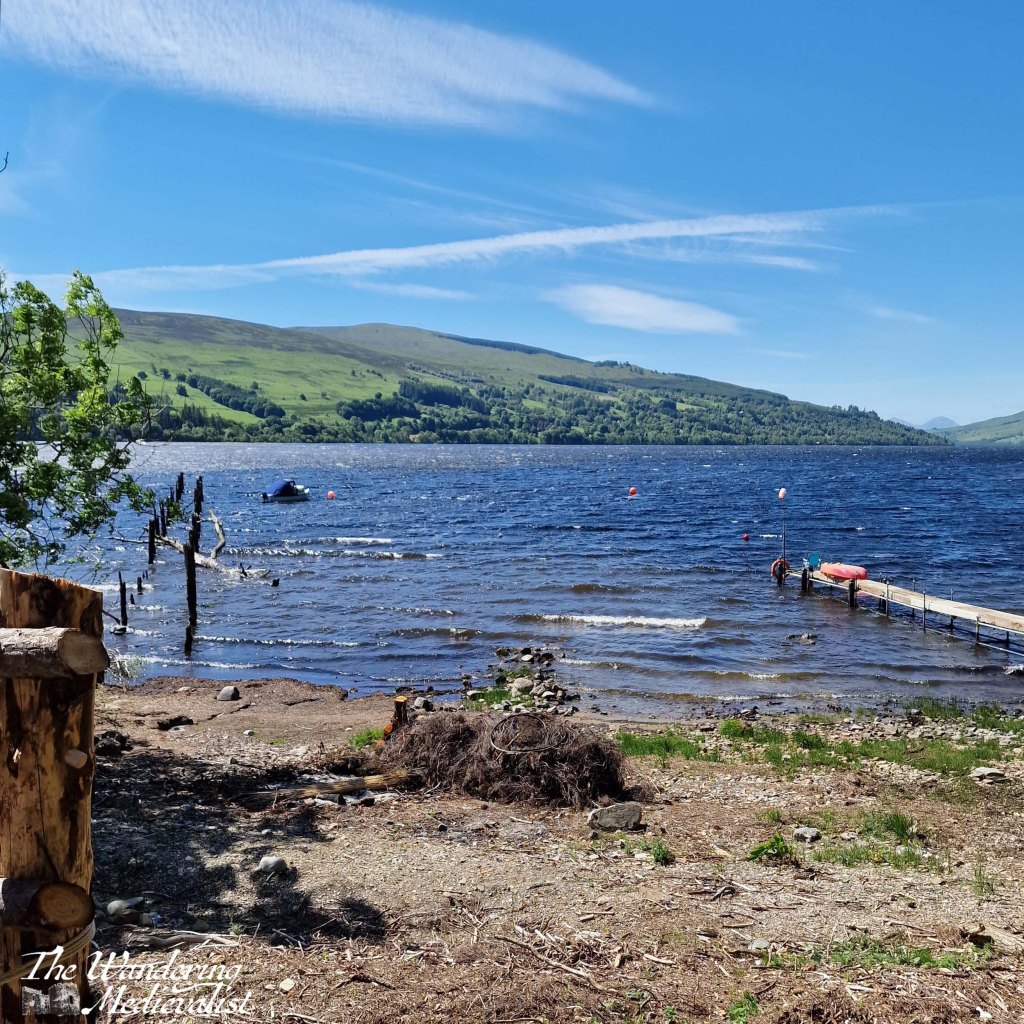
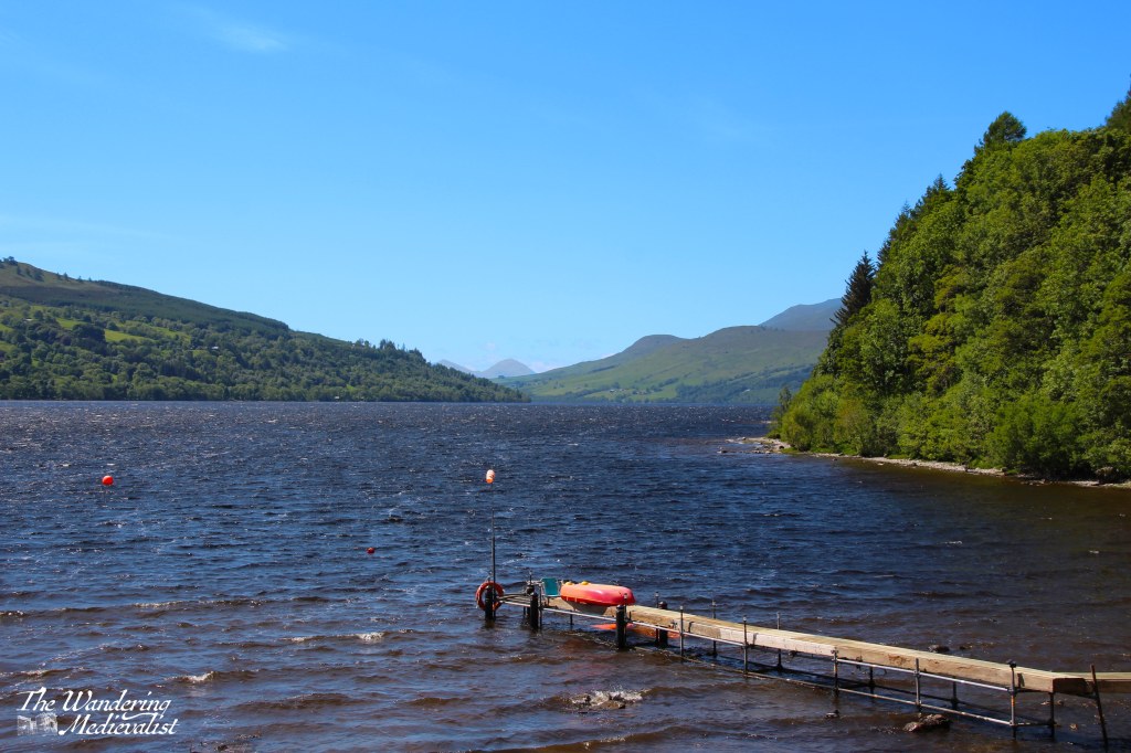
4) Explore the town of Kenmore. Kenmore is very small – though ever expanding on the Taymouth Estate – and boasts rows of charming houses, a traditional church and picturesque inn. There is a small car park near the rocky beach at the end of the loch, and this is a great spot from which to explore the town.
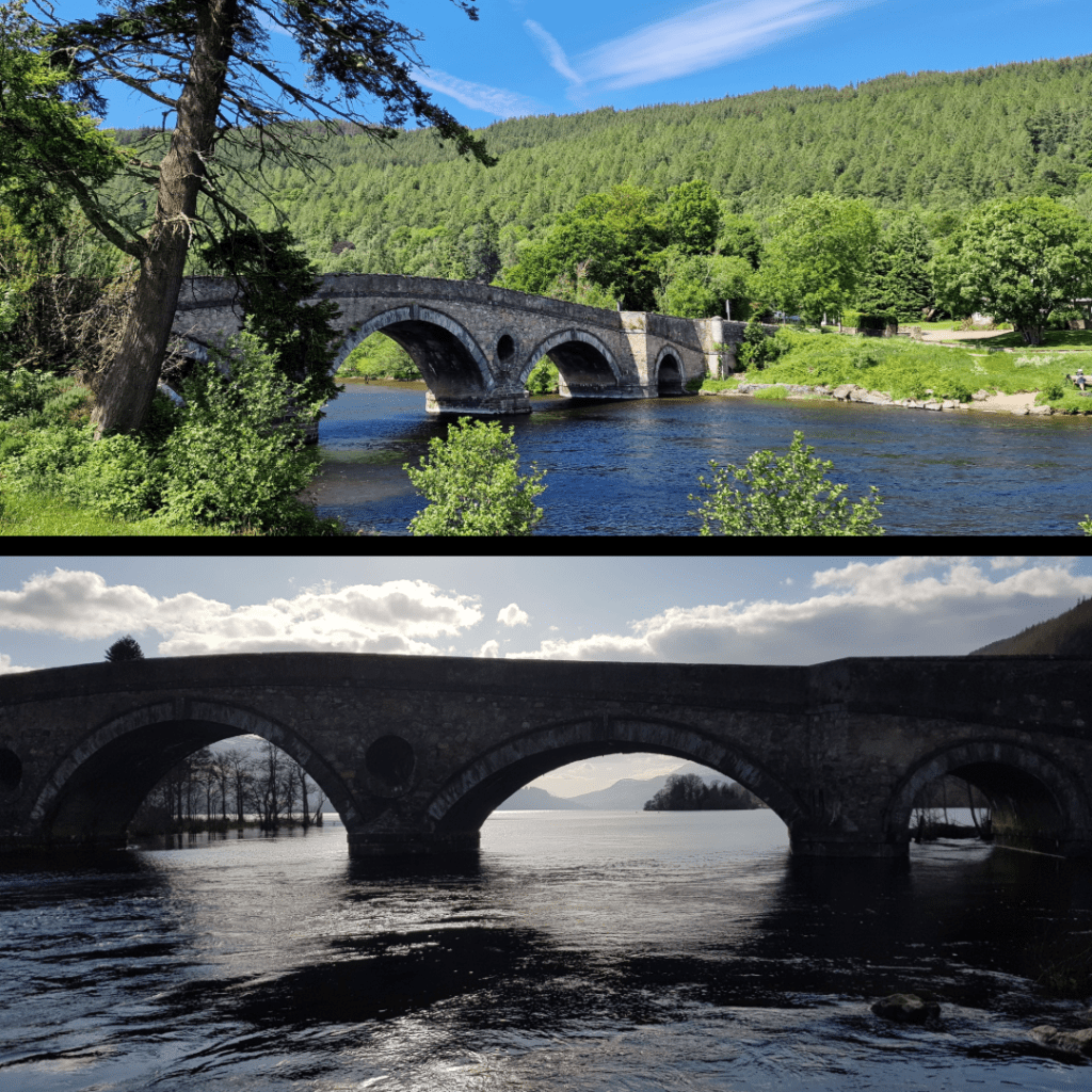
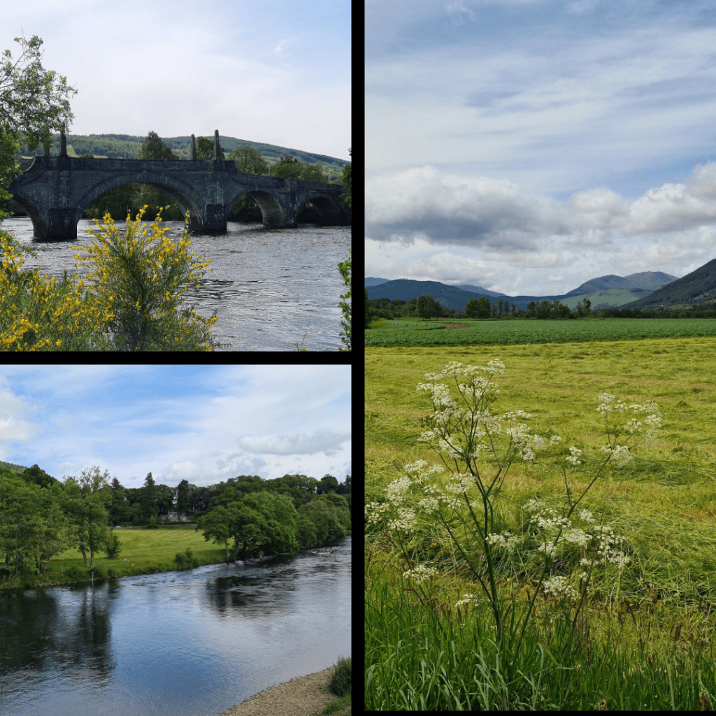
5) Walk across the Kenmore bridge. As anyone who reads my blog is aware, I have a thing for bridges, and the bridge in Kenmore – dating from the 1770s – is one of my favourites. If you walk or drive across from Kenmore, you are greeted with views back over the river and Inn or along the loch towards Ben Lawyers. Walk if you can – there is a narrow pedestrian strip – for the best experience. A few minutes more brings you to the next stop…
6) Browse the Mains of Taymouth shop and restaurant. The shop includes a lot of the standard luxury foodstuffs you might expect – cheese, crackers, Scottish sweets and biscuits, jams, whisky and gin, and souvenirs. It also sells local fresh produce. The café is quite nice and offers seating outside as well as inside, where there is a large fireplace. Across the road is a complex of cottages for short-term let, and a marina.
7) Visit the Aberfeldy Cinema. I must admit we have not yet gone to a film here, as we have been blessed with good weather, but their selection seemed to be a mix of classics and new films. The café is excellent, with fresh-made soups, panini and sweets. A great stop for a rainy day, or lunch on any other.
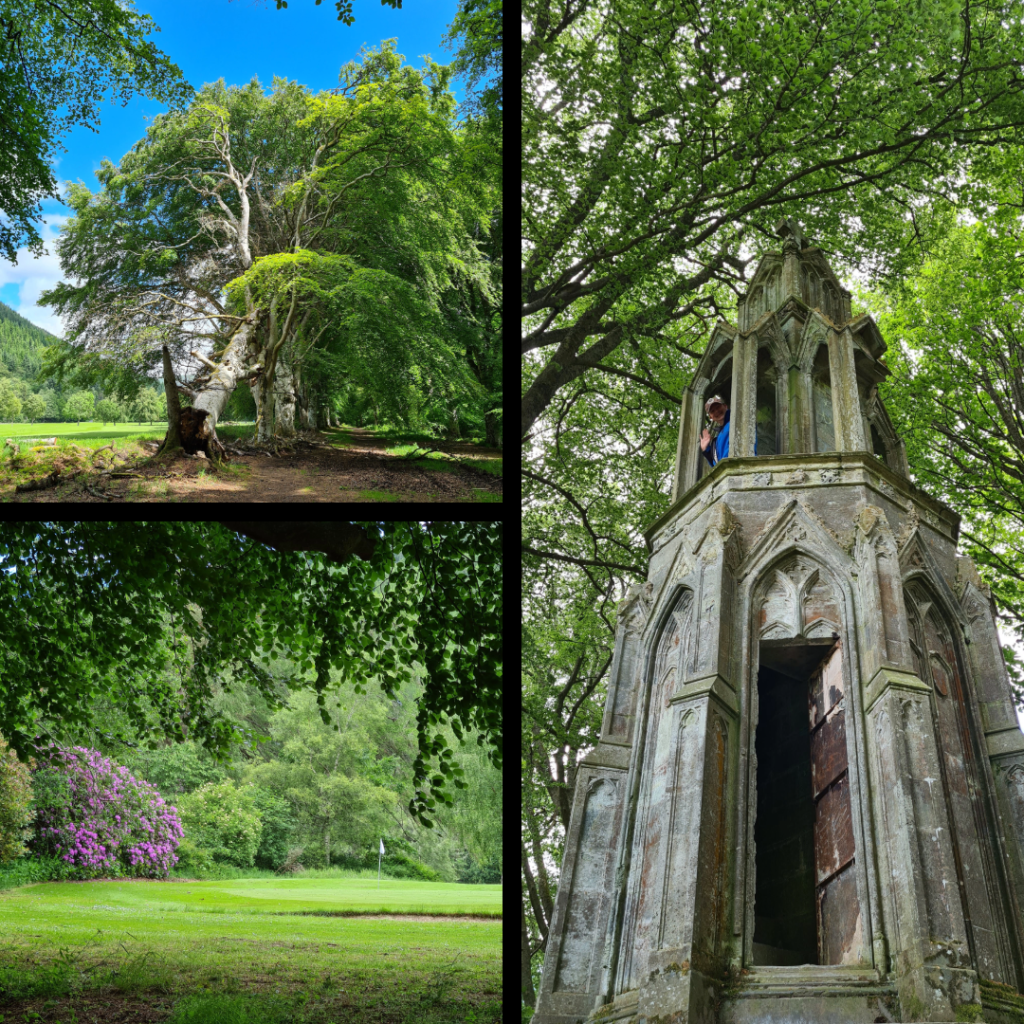
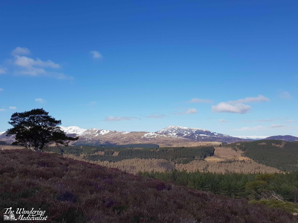
8) Tay River walk – Kenmore. This walk begins roughly at the Kenmore Bridge and follows the river through woods and along the edge of Kenmore golf course. Our plan was to circle across a Japanese-style bridge onto the Mains of Taymouth Estate, but when we walked it was closed. Lots of lovely foliage and rhododendron to be seen, plus an ‘Eleanor cross’ temple constructed in 1831.
9) Kenmore Hill circuit, which I have written about. A caveat to this walk is that the drive to get to the parking is harrowing – very steep and a winding, single-track road. The parking lot appears to have been done up since 2021 and the views from the summit are breath-taking.
10) Tay River walk – Aberfeldy Starting at another bridge, this time Wade’s bridge, the path follows the river to reach a pedestrian suspension bridge. There, we chose to cross and skirted along the edge of the golf course (this is Scotland after all). The trail continues on the far side of the river and bridge, with views of the distant hills and eventually – I believe – reaching Kenmore. The section we did is short and easy, and could certainly be done with kiddies.
Honourable mention for this region must also go to the Falls of Dochart, at the far end of Loch Tay from Kenmore, about half an hour by car. There is a great inn just next to the falls offering ice cream and coffee, and the rocks are great fun to explore!
I have not yet done any walking or hiking on Ben Lawyers, the high peak visible from the banks of Loch Tay, but I hope to on my next visit.
Finally, a note on accommodation. We have not yet stayed in any of the B&Bs or hotels in Kenmore/Aberfeldy, of which there are a great many, but instead we have reserved self-catered accommodation. Twice we have stayed at Moness Resort, which is in Aberfeldy, and once at Loch Tay Highland Lodges, which is situated about three-quarters of the way along Loch Tay, starting from Kenmore.
Loch Tay Highland Lodges offer an array of choice including glamping pods, larger houses for groups, and cottages that sleep 2/3 people, with or without a hot tub. The cottages themselves (which we chose) are very well equipped and well kept, with adequate kitchen supplies and a charming interior with wood-burning stoves, as well as a picnic table outside for BBQs or morning coffee. The views were stunning.
There were a few cons in that we were required to bring our own bedding and towels, which was a bit of a pain and does rule out those travelling from further abroad, though this could very well have changed since the end of the pandemic. Another con was that the walk down to the restaurant was quite steep, but there was no other option for evening meals in walking distance if you wanted a night off from cooking. Driving would have been a possibility of course, but we both quite fancied a drink.
Moness Resort, on the other hand, is in easy walking distance of Aberfeldy town centre and offers excellent food in their own restaurant. The cottages come fully-equipped but are not quite as charming as LTHL. The resort is clearly designed for families and larger groups, with plenty of out-door space.
Each cottage and villa has its own picnic table, there is a pool and a big play park for kids – definitely ideal for larger family groups, weddings, etc. Being able to walk into the town means you can easily find a pub or check out one of the many restaurants and takeout spots. Bonus for there being two routes – one through the trees and along the Moness Burn, and the other along the road. The high street offers some more basic needs shops (pharmacy, convenience store, even a factory outlet store with clothing and toiletries) and also some aimed at tourists. A wee bit further on is the Co-op for any groceries you may need.
While staying in a hotel also has perks, the ability to cook for yourself can provide a bit of extra flexibility – we never manage to make it to scheduled breakfast when on holiday.
Though there were ducks at Loch Tay lodges, too.
I hope this helps you start to plan your visit to the Aberfeldy/Kenmore area! Am always happy to answer questions, just comment below if you have one.
The Highlands and Isles are a tempting destination, but sometimes you want something a bit closer to home, where you can still relax and enjoy the scenery.
Whenever a parent, family member or friend comes to visit, I try to plan an adventure – to be a tourist in my own home, but also to share it, its beauty and wonder.
This year, my mother gave me a challenge: she wanted to visit Iona. She had heard of it from friends in her church, and I knew of it from its vast historic context. I also knew that it was not the easiest place to access.
Sure enough, reaching Iona would involve a drive to Oban, a car ferry to Mull, driving across Mull, then another passenger ferry to Iona, and a walk from the ferry landing to the abbey. Certainly doable, but not without considerable planning required. Fortunately, this is my specialty, and so I studied maps, studied the routes, booked ferries and hotels and away we went. We were fortunate enough to have three gorgeous days of clear weather, and if there was ever a place to add to the ‘does not disappoint’ list, Iona is it.
History of Iona
The Isle of Iona has been a holy spot since the Irish St Columba (originally Colum Cille, ‘Dove of the Church’) landed there in AD 563 and founded the monastery with his band of twelve followers. At the time, the area of Argyll and its islands were part of Dál Riata, a kingdom founded by men who still held land in Ireland, and whose various descendants would in time spread across most of Scotland (Scotia was in fact the Roman term for Ireland).
Renowned as a centre of learning and art – particularly manuscript illumination – Iona survived repeated attacks by Vikings. In 1200, a Benedictine monastery and Augustinian nunnery were founded, restoring Iona’s importance as a sacred destination for pilgrimage. The church was finished quickly but underwent almost constant renovations, demonstrating its popularity. Like many monastic sites, the abbey fell into ruin after the Reformation of 1560, but was restored in the 20th century and is now home to the Iona Community, an ecumenical group that welcomes Christians of all denominations.
The journey to Iona
The ferry to Iona leaves from the tiny Mull town of Fionnphort, which is about 60-90 minutes by car from the Oban ferry landing at Craignure. The route is absolutely stunning, climbing through hills and following the dramatic coastline, though it is also single-track with passing places, a type of road that not all are comfortable with. It certainly takes a great deal of focus.
Despite its size, Fionnphort offers plenty of parking – evidence of Iona’s popularity – including paid spaces closer to the ferry, or a large free lot a few minutes away. The walk from the car park passes a number of restaurants and pubs where visitors can find refreshments. At the ferry landing there is a very small café, attached to the ticket office.
This café offers snacks, coffee and, most importantly, a gorgeous view of the beach and the Sound of Iona. As we had arrived about 20 minutes before the next ferry would start to load, and our tickets were bought well in advance and safe on my phone, we made ourselves comfortable and I found myself entranced by the beach and rocks around it, to which greenery clings where it can.
The ferry to Iona (see below) is large enough for some vehicles, though only locals are allowed to drive on; everyone else, including a number of cyclists, lines up to board and climb to the upper deck for the short ride across the sound – about 10 minutes. There is barely enough time to register that you are on the water before you are docking again, though I was lucky enough to have a seat that afforded a perfect view of the harbour as we arrived.
The town on Iona is small and picturesque, like so many Highland towns, consisting of only two or three streets with a few small shops, houses and places to stay, all nestled right up against the beach. Beyond the town you can just make out the abbey, if you are not too distracted by the Caribbean turquoise of the harbour water.
We had spent so much time and energy that morning rushing to get from Oban to Mull to Iona that once we finally set foot on the island, we decided it was most important to find some lunch and perhaps another cup of coffee (always paramount on our travels). Fortunately, the Martyr’s Bay Restaurant was just what we wanted: only steps from the ferry and providing an excellent array of drinks, snacks, sandwiches and of course home baking. They also sell Iona whisky and gin, as well as numerous other souvenirs. We took our lunch outside to sit in the sun and enjoy the view over the Sound. Side note, I had remembered to slather myself with suntan lotion that morning, much to my later relief. Anyone who says sunscreen is not required in Scotland is…well…just wrong.
Our lunch view:
Fortified by sandwiches and a scone, we began our walk to the abbey, following in the footsteps of hundreds of years’ worth of pilgrims and tourists. At first, the path proceeds along the main road, leading in only a few minutes out of the modern dwellings and past the ruins of the Augustine nunnery. The nunnery was founded around 1200 by Ranald, King of the Isles, and while mostly ruined it is still one of the best preserved medieval nunneries in Britain.
You can opt at this point either to walk through or around the nunnery grounds, and we chose the former, passing as we did the medieval St Ronan’s Chapel, which was the parish church for the island community until the Reformation.
At this point, the road is about one car wide and lined on both sides by waist-high stone walls, providing a clear path for pilgrims as they wind their way towards the abbey. On the right are the organic gardens for several hotels and restaurants, demonstrating the need for islanders to grow at least some of their own produce – the closest Tesco, I would imagine, is several ferry rides away.
A short walk beyond the nunnery walls is the next step on the pilgrim way – MacLean’s cross. Erected around 1500, it marks the point where the track from the pier met the Sràid nam Marbh, the ‘road of the dead’, leading to the abbey. The cross was a focal point for pilgrims to stop and pray, and was carved on Iona from a single slab of stone. There is a more detailed view of the cross in the video at the end of this post.
MacLean’s cross and the pilgrim trail across Iona
After resting at the cross, we continued up the gentle incline where in these modern times, one finds several artisan shops and the St Columba Hotel and larder, where more refreshments can be found. We powered along, determined to reach the abbey despite the undoubtedly pleasant garden in which several tourists were enjoying a G&T.
As we approached the abbey, the hill rose beside the road to the left, with cliffs of rock and rough earth reminding us of the nature of the island.
Reilig Odhrain
The first break in the wall to the right allows entrance to the Reilig Odhrain, the land consecrated as a monastic burial ground from the time of St Columba. The burial ground is free to enter, and does allow views of the abbey from a distance, as well as a wander through burial markers both old and quite new.
Legend said that this burial ground was the final resting place for many early Scottish kings including Macbeth and his grandfather Malcolm II, though a lack of written or archaeological evidence has cast doubt upon the theory. The Kings of the Isles were certainly buried here, which may have created some of the confusion.
In the centre of the graveyard is St Oram’s Chapel, dating from the 1100s, and the oldest intact structure on the island. Inside the chapel one can view a number of beautiful old stone carved slabs.
St Oram’s chapel and the view from the burial ground:
The Abbey
Beyond the burial ground, the main entrance to the abbey is made through the visitor centre, where you can also pick up an audio tour guide and printed guide to the site. It was my first opportunity to use my new Historic Environment Scotland membership!
Almost immediately upon entering the abbey grounds, we found plaques with information telling us about the road we were on and much more. To the left, the Tòrr an aba, ‘hill of the abbot’ was irresistible to climb, and I found that it did indeed offer excellent views over the abbey complex, the Sound, and the island. The hill may well have been the site of St Columba’s writing hut. Again, there is more of the view in the video below.
A faint dent in the grass leading towards the burial ground is in fact evidence of the pilgrim trail and processional way, the Sràid nam Marbh, ‘road of the dead’, which dates from the 8th century and was designed to emulate the Church of the Holy Sepulchre in Jerusalem. Most of the paving stones are lost or hidden, but particularly from the hill, one can easily envision the path.
The hill also allows a good view of the original locations of the several high crosses that would have marked the path to the abbey. These date from the 700s and 800s, and while most live in the abbey museum, the cross of St Martin is still proudly in place, as it has been for more than 12 centuries. It is carved from a single block of stone, with one face bearing biblical scenes and the other snakes and Celtic bosses. At one point there were likely many more crosses.
When standing before a cross that has – for lack of a less dramatic term – witnessed so much history, one must be moved. I affirmed recently to a friend that it does not matter what religion or belief system you adhere to – or indeed do not – it is impossible not to find Iona a spiritual place. It is so peaceful, quiet, and out of the way, there is no question why it would have been chosen for monastic retreat.
replica cross of St John in foreground, St Martin’s cross in background
The Abbey Church
Once we had enough of viewing the crosses, I took a moment to duck inside the small chapel constructed just beside the entrance to the main church. This is St Columba’s chapel, likely built to house the most valuable relics the abbey possessed – the bones of the saint.
Any carvings that may have graced the main door have eroded, but a wooden screen has been constructed to provide access to the church, including traditional wooden doors that one finds in many British churches.
Inside, there is a beautiful reconstructed font, and a display of carved slabs that were grave markers. (again, more of this is visible in the video below) Many of the abbey buildings contain these slabs that showed off the skill of the Highland stone carvers of the high and late Middle Ages, and commemorated the chiefs of many nearby clans: MacKinnons, Macleods, MacLeans and of course the MacDonalds.
The church is positively breath-taking – it is still used for services, and has been reconstructed both for modern use and to teach visitors of its significance. Alcoves and chapels display information about the saint, the important visitors to the island, and more. One chapel is a stunning modern memorial to the 8th Duke of Argyll and his wife, who initiated the abbey reconstruction in the early 1900s.
I have a love for cloisters, their symmetry and geometric shapes, and I was delighted to discover that Iona’s cloisters were reconstructed in the 1950s. Often one will find gardens, mazes, or other flora in the middle of a cloister, a fountain or a ‘tree of life’ symbolising the greatness of God in the centre. On Iona, the cloister bears a sculpture originally the work of a Lithuanian Jewish artist, who fled the Nazis during World War II. It is called ‘Descent of the Spirit’ and is inscribed in French indicating that the artist hoped for a better understanding of the human spirit.
After visiting the cloisters, we made our way outside into the brilliant sunshine. I had a bit of a wander around while Mum rested on a bench. What struck me, as mentioned above, was the absolute peace of the abbey; all visitors seemed by agreement to speak quietly or remain silent, and while there was of course wind and noise from sea birds, there was so little sound that I could almost imagine myself to be alone at times.
Eventually, slowly and with a touch of reluctance, we made our way back towards the ferry. We had one last visit to the Martyr’s Bay restaurant for a cold drink and a few souvenirs, and a short rest out of the sun.
The island was busy with visitors, both to the abbey and to the many walks and beaches. There is no question that one could easily spend several days exploring, either on foot or on a bike. Alternatively, Iona is an easy day trip if you are staying on Mull and looking for an adventure; I think it would be rough to try to get over and back to Oban in one day, but it can be done at least in the summer when the light is late and the ferries are reliable.
As for us, I arranged for us to stay on Mull for the night, but I hope very much to return for longer. Skye is the island on which so much time and energy is spent – for good reason – but Mull has plenty of its own wonders.
By the time our return ferry reached Fionnphort, we were both tired – it had been a long day, an early start, and the excitement and wonder of visiting Iona took a lot of energy. My final delight of the day was to see, on the beach, a trio of highland coos relaxing on the sand and munching on the abundant seaweed.
Check out this video for more pictures of Iona:
Find pictures of Iona and other abbeys at my online shop:
Monday of this week was one of those spectacular sunny clear Scottish days that belie the tradition that Scotland is only ever wet and rainy. The combination of sun and rain we have had over the past months has made everything lush and green, while the blue of the sky and lochs was almost otherworldly. As it was my last free day before I return to work in a week, I decided it was time for one last adventure, taking my favourite drive up through the hills to Aberfeldy and Kenmore, to visit the Scottish Crannog Centre.
Background on the Crannog
I had visited the Crannog once many years ago, when my family was visiting Scotland and staying in Kenmore; it was Halloween, and so my cousin had discovered a properly Scottish alternative to trick-or-treating for his young children. The Crannog was putting on a Samhain festival (Samhain being the pagan festival that coincides with Halloween), including the burning of the Samhain ram, and so we went along to join in. The kids were just old enough to understand what was going on, as the staff lit the ram on fire and encouraged us all to join in with scary noises to scare off evil spirits – check out the video below!
Entering the crannog – 2006
My only regret is that I took only one picture of the Crannog as it was – though being 31 October it was dark night by the time we were there – and that I did not record more of our visit.
I always had it in the back of my mind to re-visit, especially once the Aberfeldy area was established as one of our more regular holiday escapes, but somehow it never happened. Before we could arrange a visit, disaster struck the Crannog: in June 2021 it caught fire. The origin of the fire is unknown, and not thought to be malicious. The member of staff I met on my recent visit said it took very little time – just six minutes – for the wooden structure to be completely engulfed and destroyed.
I’m sure I cannot even begin to imagine how devastating that was to watch for the staff. The fire took place in the midst of lockdown, and it took several years for the centre to be able to re-open, this time on the other side of the loch on a much larger plot of land. The importance of the site for the community is clear in the many articles about the fire, and in the urgent plea to raise money for its restoration, a plea that was met at least in part by the Scottish government, which provided more than £50,000 in funding.
Visiting the new centre
One can really appreciate the newness of the centre, which only re-opened on 1 April 2024. The parking lot is well set out, and there are clean, new toilets available even for those who do not choose to pay to go inside. The visitor centre itself has clearly been carefully designed to be both comfortable and to match the surrounding woodland; it is topped with turf.
Inside, there were friendly and keen staff ready to help me register and pay my fee for the next guided tour – the only way to visit currently, but also well worth it. There is a small gift shop and café, and I had to wait only 10 minutes for the next tour (I did not visit the café but it smelled and looked very tempting).
The visit began in the museum, and was led by a member of staff who had clearly been involved with the site for years; her passion and fascination with Iron Age cultures was clear, and she did an excellent job of explaining the difficulties with studying this time period and of sharing her love for that period. The museum is relatively small but full of artefacts left behind for 2,500 years including wooden implements, pottery, metal tools, evidence of musical instruments, and stones and beads. With these artefacts, she was able to paint a clear picture of the type of life we think the people of the time must have had – agricultural and not isolated, but connected to places as far off as the Middle East through trade. One did not spend months or years building a crannog to quickly abandon it, after all.
Once we had finished in the museum, we were led out to what can only be described as a living museum, similar in feel to Plimoth Plantation in Massachusetts, but without the actors pretending to be era-appropriate citizens.
Instead, the staff who told us about the various aspects of Iron Age life were perhaps more valuable in that they learned and performed the tasks themselves, as close to how they would have done 2,500 years ago as possible. The buildings, too, were constructed using techniques from the Iron Age (for the most part), though as they explained, the roofs are guesswork as there is no archaeological evidence for anything beyond the shape and materials of the structures.
First we were taken to the cooking building, where an open fire was present and the staff explained how varied the diet was, and how the inhabitants preserved their food.
Next up was the blacksmith hut, where we were taught about the various metals available – copper vs. bronze vs. iron – and the methods used to smelt and shape it. There was also an interesting insight into the work needed to provide the charcoal required for iron work – planning and forest management at the very least.
Then we moved to the woodworking hut and I found it particularly interesting to see how an Iron Age lathe was constructed and used.
It is far too easy, I think, to dismiss some daily tasks or technologies as modern, when many of them were done hundreds and thousands of years ago, just took a lot longer. Or, the technology existed but was vastly different from what we have now – many ancient builders and craftsmen would have had a considerable grasp of science, particularly physics, even if they didn’t think of it in that way. Friction, the power of heat, the potential energy contained in a green branch, for example, all were utilised.
One is tempted frequently ask ‘how did they come up with that?’ and indeed the answer isn’t always clear, but the next building – the textiles hut – really brought home the element of trial and error that must have been part of everyday life (annoyingly I forgot to take a picture). Archaeologists can show that a certain item or product existed, and it can take months and months of experimentation to work out how it may have been done; dyeing of wool, setting of dye, carding, spinning, weaving, all would have evolved as more was learned about what worked and what did not. The woman in the textiles hut was particularly good at making clear the vast amounts of time – and woollen yarn – that it would have taken to produce clothing, though she also reminded us that there was nothing else to do in the evenings and so everyone, including children, would have taken part in spinning. It was fascinating to hear about the lengthy and specific processes involved in producing, for example, a red tunic.
The final building was the round house, which consisted of dry stone walls, a thatched roof, and a tremendous upside-down basket that made up the domed interior walls and roof. Several staff told us how it was a massive effort from tens of people to cut the willow at the right time and weave the ‘basket’. As we sat listening to the staff talk about oral traditions, the wind was howling around the building but it stayed warm and draft-less, making one appreciate how it would have been possible to survive on the banks of this loch even in the winter.
The round house and interior ‘basket’ walls:
The Crannog itself is not yet re-built, as they are doing their best to construct it in the proper way, allowing the sunken beams to age in the loch before starting the floor and walls. The left-hand side of this picture shows the beams currently aging.
It should with luck be complete within 18 – 24 months, making a re-visit absolutely necessary. In fact, the site is constantly evolving, and the staff were so excited to talk about the upcoming projects to entice us back again.
If there is one thing that stood out – other than the impressive creativity and craftsmanship of the place – it was the team of staff, many of whom had been involved in the construction of the buildings and all of whom created replica products on a daily basis. Food, iron, textiles, woodworking – all of the examples we saw were crafted by the staff. Many, like the blacksmith, had studied both modern and ancient methods of the craft, and all were so passionate and simply loved to talk about what they did. Allowing us to view but also touch, feel, and even taste Iron Age reconstructions really helped bring the time period to life.
Background of crannogs
One aspect of the crannog that I recall thinking when I visited in 2006 and was repeated several times by the staff at the centre, was the ingenuity of building over water. The advantages are clear and include: building over water saves valuable land space for agriculture and livestock which is not always prevalent in Scotland; it is safer from natural predators and from other humans; it places inhabitants on the waterway that was a natural highway for trade; it is easy to access fresh water and fish; and many other reasons, I am sure.
While Loch Tay boasts the remains of many crannogs, the dwellings are evident on the banks of many rivers and lochs in Scotland, demonstrating that Scotland was a relatively desirous place to live in the Iron Age. Fish, game, and wild plants (garlic, berries, nuts) were abundant. The climate was likely a bit warmer and days like the one I visited showed just how fine weather can be.
sunny, windy day on Loch Tay
Not that I am in any way intimating that life would have been easy, but it certainly would have been far more varied than might be first thought. What remains most frustrating, of course, is how little we know about society at this time. It was pre-history, before written record, and many artefacts have not survived to inform archaeologists and historians. But, in the way of proper modern interdisciplinary study, academics from fields of history, archaeology, biology, anthropology and more can look at modern societies to understand more about how ancient peoples may have lived – ethnoarchaeology. All of this has informed the site, as well as the community of historians and experimental archaeologists who choose to learn by performing tasks in the ancient way. You can find out more about Scottish crannogs on the BBC website, and it is worth mentioning that crannogs were also prevalent in Ireland.
Now I fully admit to being a history geek – anything pre-1500 holds interest for me – but I think it fair to say that the Crannog Centre offers a fascinating and passionately-presented glimpse into Scotland’s history. A great day out for children and adults alike!
The Queen’s View over Loch Tummel in Perthshire is one of the most famous views in Scotland, and one of the most photographed. It is not hard, when visiting, to see why, though actually getting to the viewpoint can be a bit of a challenge.
Not, I should point out, because it is physically difficult to reach – on the contrary, there is a large car park (not free!) and well-maintained path that leads to the main viewpoint (though occasionally you must fight to the front for the best view). The visitor centre is closed, and have been since the pandemic, but the area roundabout is kept up.
Rather, it is the road to the viewpoint that offers a challenge.
The advantage of Perthshire is that so much of it is just stunning, and easily reachable from Dundee, Edinburgh and Fife. Pitlochry, the nearest town to the Queen’s View, is less that two hours’ drive from Edinburgh or Stirling, and offers oodles of options for accommodation: guesthouses, B&Bs, lower cost hotels, luxury hotels, and a camping and caravan park. Pitlochry is a regularly-used base for exploring the area and only 14 minutes from the Queen’s View.
What is the problem then, you ask?
Simply that the short stretch of road between the A9 and the view is one of the windiest and narrowest that you will find on a two-lane road. Further, you are competing for space not just with other cars, but with large camper vans and coaches that offer tours throughout Scotland.
I have now been on the road twice, once as a passenger and once as a driver, and both times I found myself clinging to the door handle and searching for an alternate route back. (Note, there are alternate routes via the other end of Loch Tummel, but they are also quite narrow and add considerable time to a journey). I feel I should point out that I am making this observation after having explored the Highlands, Skye and Mull, so not without some experience on narrow and winding roads.
Once you reach the car park, there is a short walk and then the view really is spectacular. When Queen Victoria visited the spot in 1866, she assumed that it was named in honour of her – a view to match her greatness. What no one likely told her at the time was that it was almost certainly named well in advance of her arrival, and for Queen Isabella, wife of Robert the Bruce.
Standing at the viewpoint, you are looking down Loch Tummel, almost due west, with the peak of Schiehallion, one of the more popular hiking mountains in Scotland, in the distance. Even further, one can just make out – on a clear day – the mountains of Glencoe.
As you can see, the view is phenomenal in the sun but just as atmospheric in the cloud and rain; visiting earlier in the year may also mean less foliage growth between you and the water.
If the view has only whetted your appetite for Loch Tummel and the surrounding hills, I highly recommend continuing only minutes along the road to the Allean Forest, where there are two hiking loops you can follow up into the trees.
The car park is sizeable, and there is even a toilet block – warning though that it is a latrine that was far from well kept when I last visited. It was a ‘medieval’-style experience that I could well have done without. My hope is that in the years since the end of the pandemic, the facility has been improved.
Of the two available loops, one is shorter – about an hour – while the other is more like 1.5 to 2 hours in total. Both start off in the same way, climbing away from the car park through the trees and leading to several viewpoints over the mountains and down the loch.
We did this hike in August, so the greenery was lush and at its height, though many of the spring and summer flowers had passed. It was not a hugely challenging hike but did have a decent amount of gradient, and my father decided he wanted to opt for the longer route. This turned out to be an excellent decision, as it took us past the ‘Family Circle’, ruins of an Iron-Age stone wall that enclosed a timber roundhouse.
The appeal of this area of Perthshire clearly runs back at least 2000 years, as the plaque by the circle told us that this area of Scotland features more settlements of this type than almost anywhere else in the country. Excavated in the 1970s, the site shows evidence of being used in more recent times as well, for ironworking and drying corn or grain.
This particularly intrigued me, as family research I have done indicates that at least one branch of Scottish ancestry (don’t all Americans have at least one?) came from the area around Loch Tummel. It is a romantic thought that the area appeals to me because of that family connection – I have always loved the Loch Tummel and Pitlochry area – though it is also stunningly beautiful, as these pictures show. Perhaps it is a bit of both.
Loch Tummel from a bit further down,
While the Queen’s View is a natural tourist draw and invites visitors from all over the world, the hills and forests around Loch Tummel are a recommended addition for walkers and hikers. They are not as challenging as many others, and the views are not as dramatic as further north, but the proximity to Pitlochry makes Loch Tummel a good place to explore. A few recommendations if you are attempting this journey are to ensure your driver is confident and comfortable on narrow roads, and to bring your own snacks and refreshments – the closest place I could find when visiting was Pitlochry, though new locations may have opened up since then.