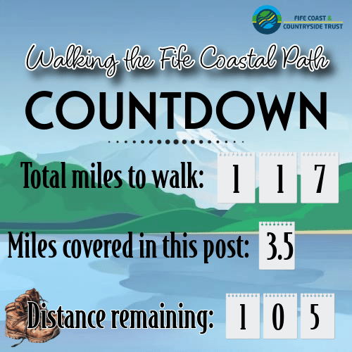
The weather report looked good for this past Saturday, and I was finally energetic enough to return to my goal for the year – and about time too! It occurs to me that my travel schedule may make it a lot harder to get some of these walks done, but I can only give it the best I can!
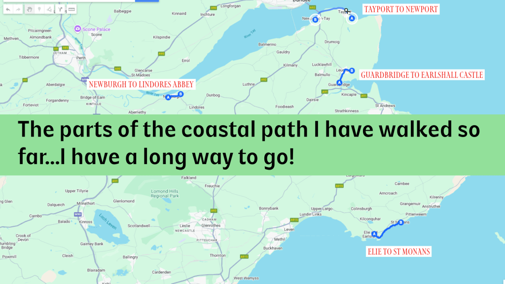
This stretch, from Elie to St Monans, is a walk I have done several times before, once with Dad, and it has to be one of the more beautiful stretches of the Coastal Path, taking in some gorgeous rocky coastline, beaches, and two lovely small towns.
It is also 100% accessible by public transport, an added bonus. The method I chose for this trip was to pick up one of two bus routes from St Andrews: the X60 which heads straight down to Anstruther then along the coast, or the 95, a winding route that goes south along the coast through Kingsbarns, Crail, Kilrenny, Anstruther, Pittenweem, and beyond. It is actually a fantastic way to get a good feel for the East Neuk without driving; it is almost always a double-decker, and if you can get to the front left seat on the top floor, you get one of the best views around. It is a bit nerve-wracking as the bus winds through tiny villages and looks at times as though it is about to hit buildings, the drivers are skilled and – a few tree branches aside – of course hit nothing. As it was a beautiful morning and I was in no hurry, I opted for the 95 and managed to be first on the bus, nabbing my desired seat. Other than a slight moment of motion sickness over some of the bumpier roads, it was a fantastic trip.
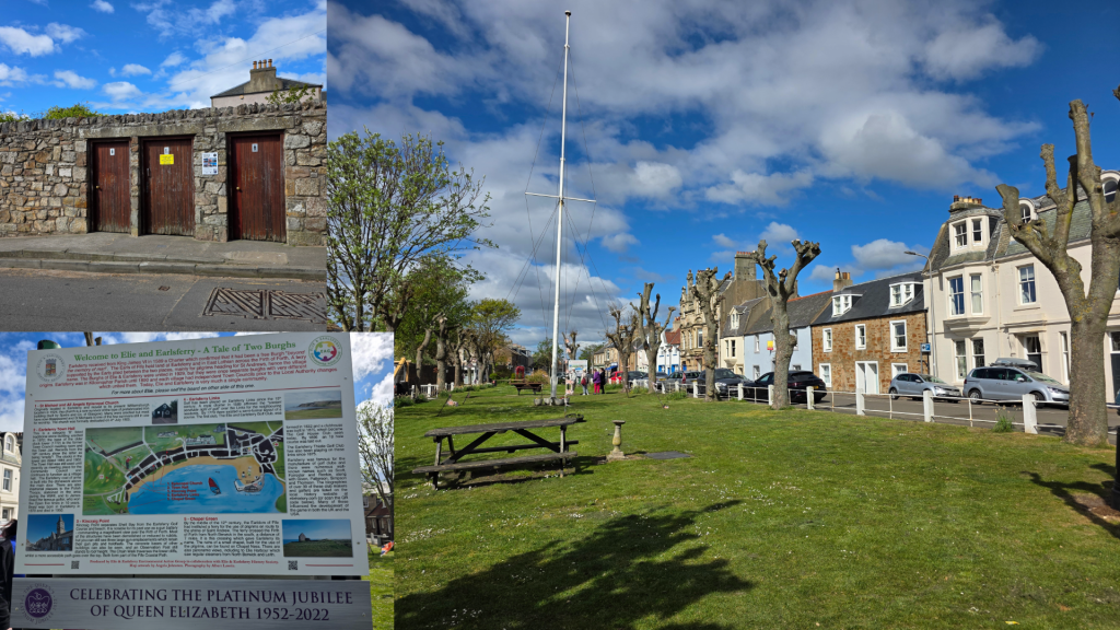
I alighted from the bus just next to the village green in Elie, where there is a detailed plaque telling you about the history of the town and Earlsferry, which is part of the burgh. As the name suggests, prior to the building of the Forth bridge, a ferry took travellers – mostly religious pilgrims destined for St Andrews – across the water from Edinburgh and landed here. The beach is wide and flat, making it a perfect landing spot.
To start my walk, I took a right just after the green, heading for the beach and signs for the public restrooms. They are, rather oddly, simply doors in the stone wall, leading to relatively clean hidey-hole toilets just off the road.
In very little time, this road arrives at the beach, which stretches out before you in all directions. The views are spectacular – along the houses packed up to the coastline, the sand, and coast of Fife heading south-west.

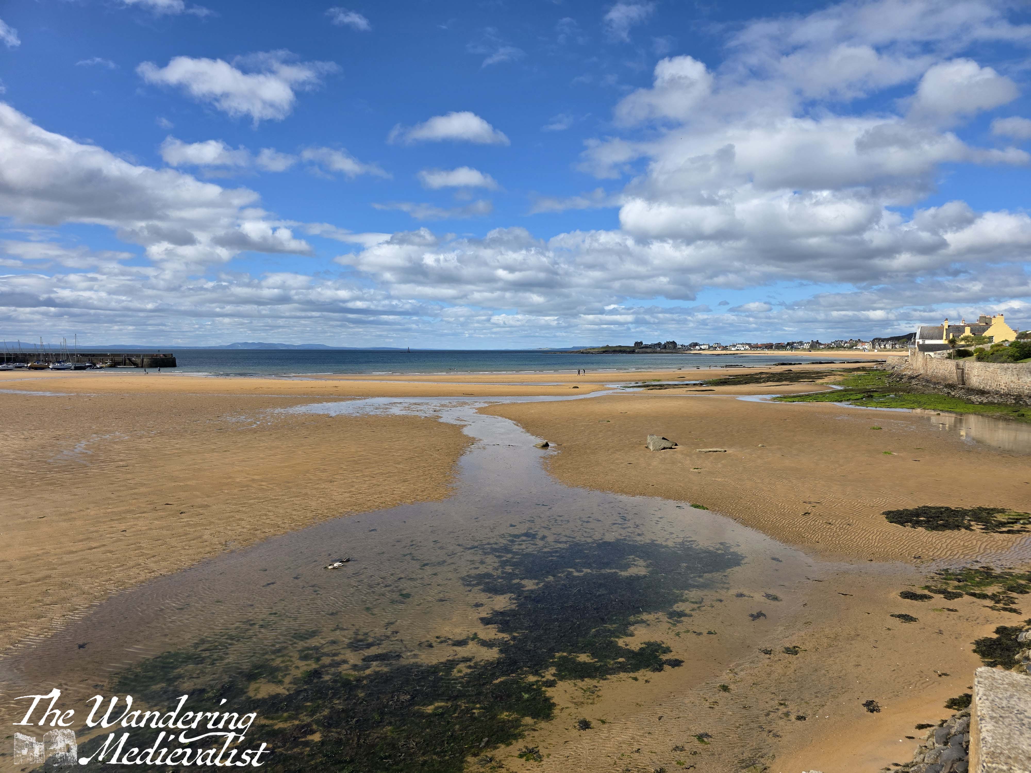
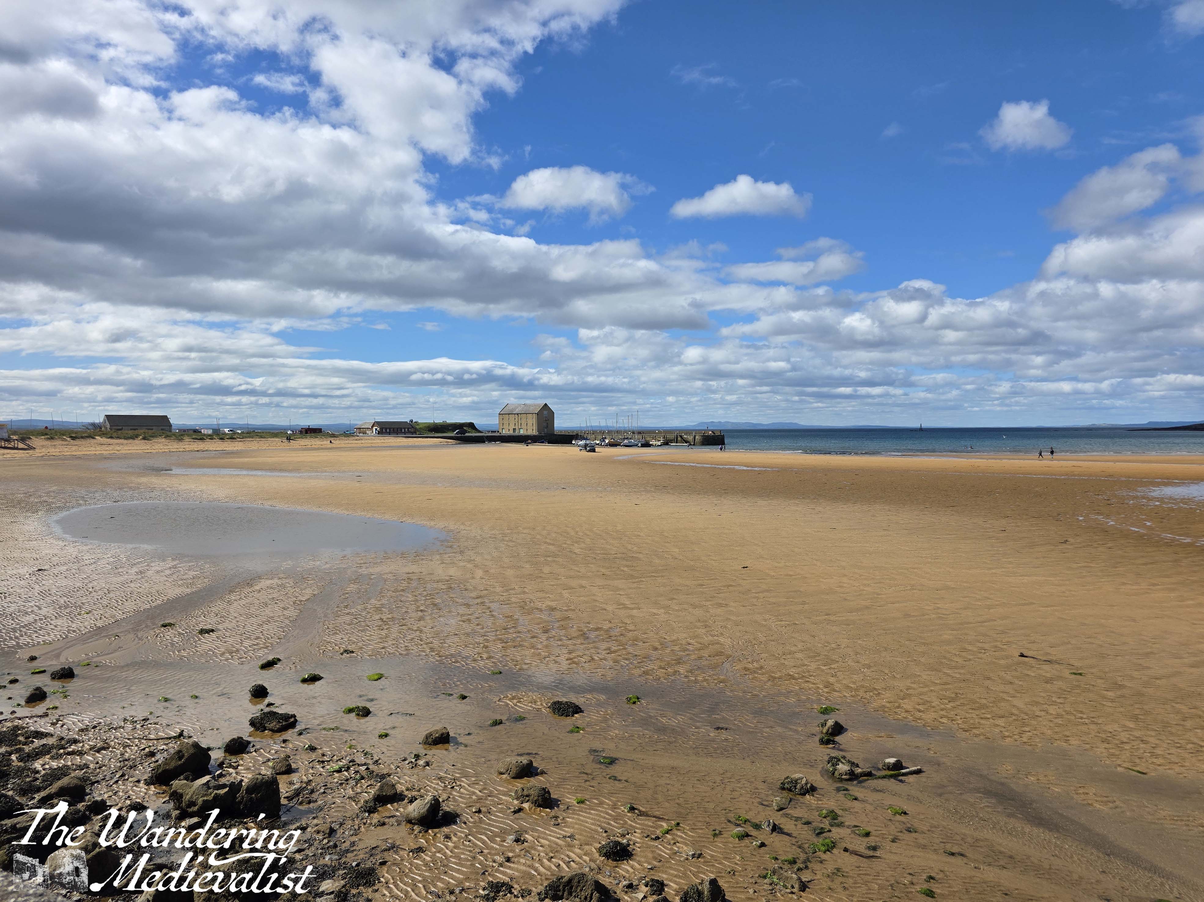
At this point, there are two ways one can go: either follow this road out towards the lighthouse, or take a left up a narrow road. This is the official route and so I opted for this choice, requiring an eventual turn right across a field where there was a faint track. Eventually, the path arrives at a large car park where overnight parking is permitted and there is fresh water, toilets and showers for campers. The views here are equally excellent looking back towards Elie and Earlsferry.
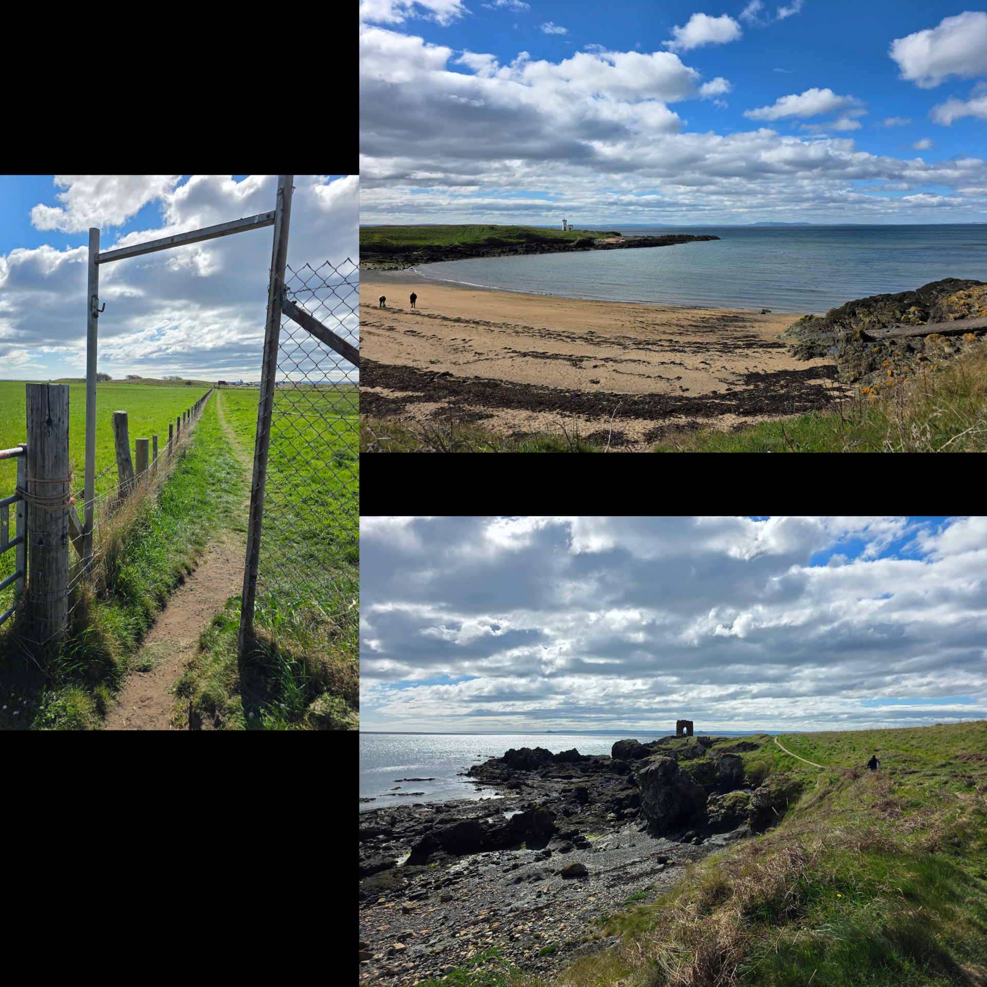
There is a large noticeboard bearing information about the trail, and then the path leads forward through the grass. The main route appears to take a circular route around the slight hill, leading walkers to the Lady’s Tower, now not much more than a hollow arch on the coastline.
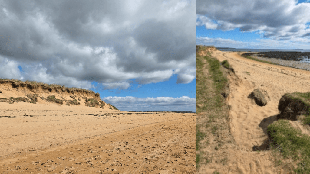
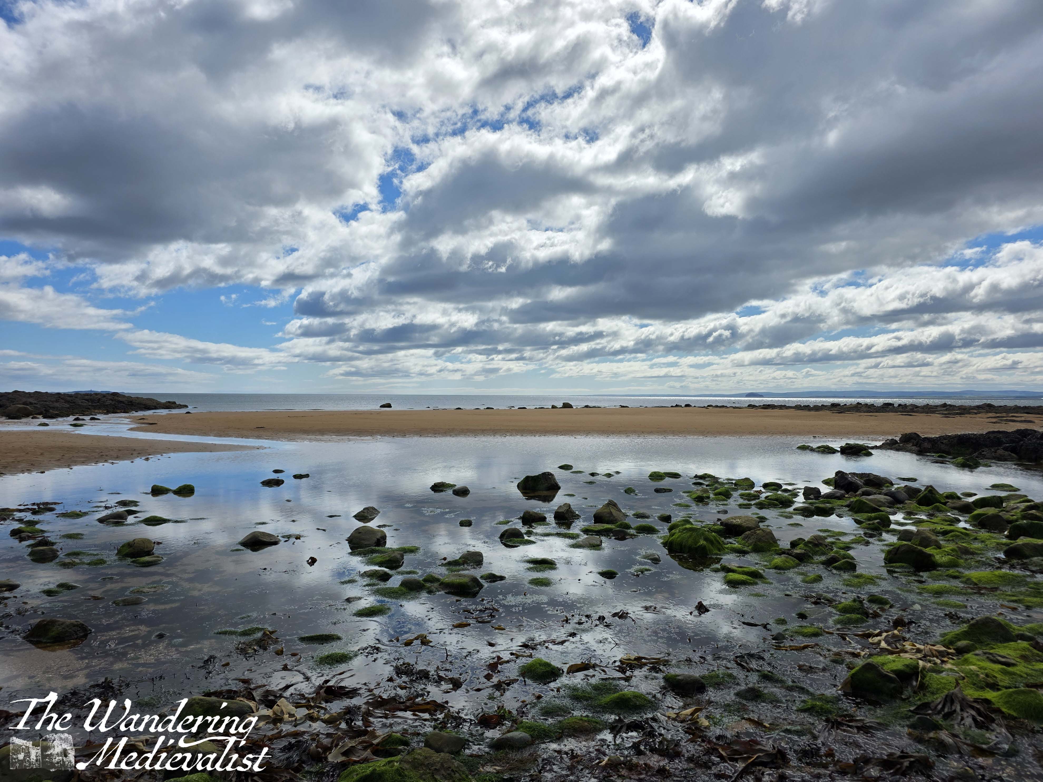
I opted to take one of several left-hand paths, walking through the grass and ending up at the ridge of the dune above the beach. Beaches on Fife are not always fortunate enough to be layered in sand, and even the ones that are eventually open up to the long shale ridges that stretch out into the water in sometimes knife-sharp edges. The Coastal Path offers no shortage of these views, as you will see further on in this post.
Turning left, I had walked only a few moments when I realised that the way was blocked by a wooden gate and sign: Path closed ahead, divert to St Monans via A917.
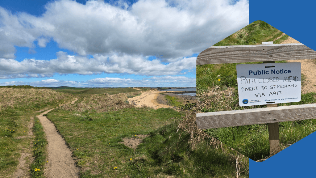
I have to admit to letting out a string of curses. How could I be in this situation again (see my issues walking Leuchars to Tentsmuir)? Had I wasted another valuable Saturday? I hummed and hawed a bit, thinking about going back to the road or possibly trying a walk in the other direction. That section of the path is longer than I was willing to try on this occasion, however, so after seeing several groups head down to the beach, I decided at least to get a beach walk in and see how it went. So, after skirting around the fence, I followed the trail until it disappeared into erosion, at which point I hopped down a steep decline to the beach.
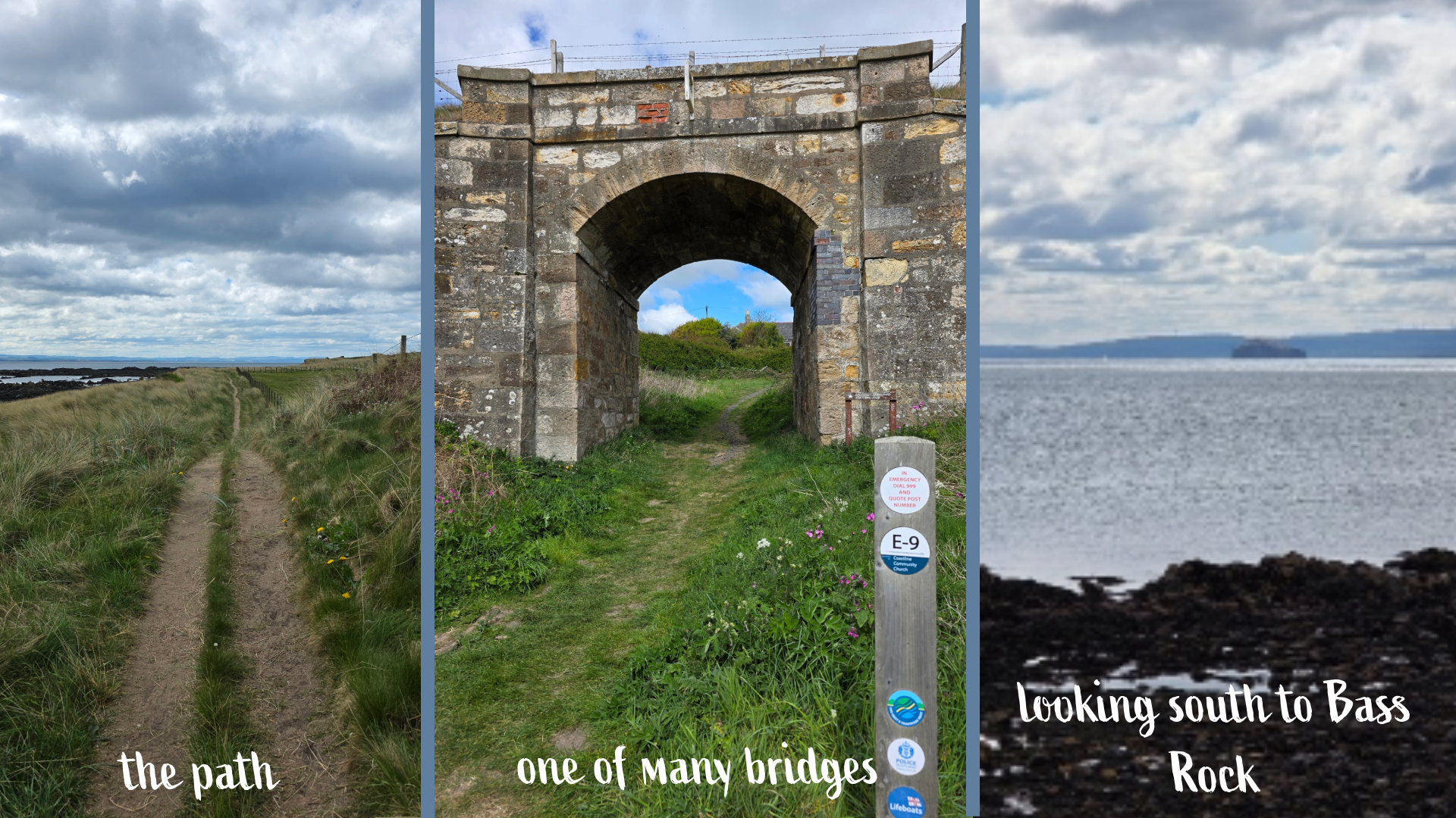
This portion of the walk is, I would caution, always windy, though this is appreciated as otherwise one is inundated with flies from the livestock fields that line the coast. I find walking in soft sand can be quite exhausting, but the dunes and sparkling water are beautiful and it was less than a mile on the beach. I had been watching the group ahead of me carefully, and presently they cut up back onto the path; I followed, happily.
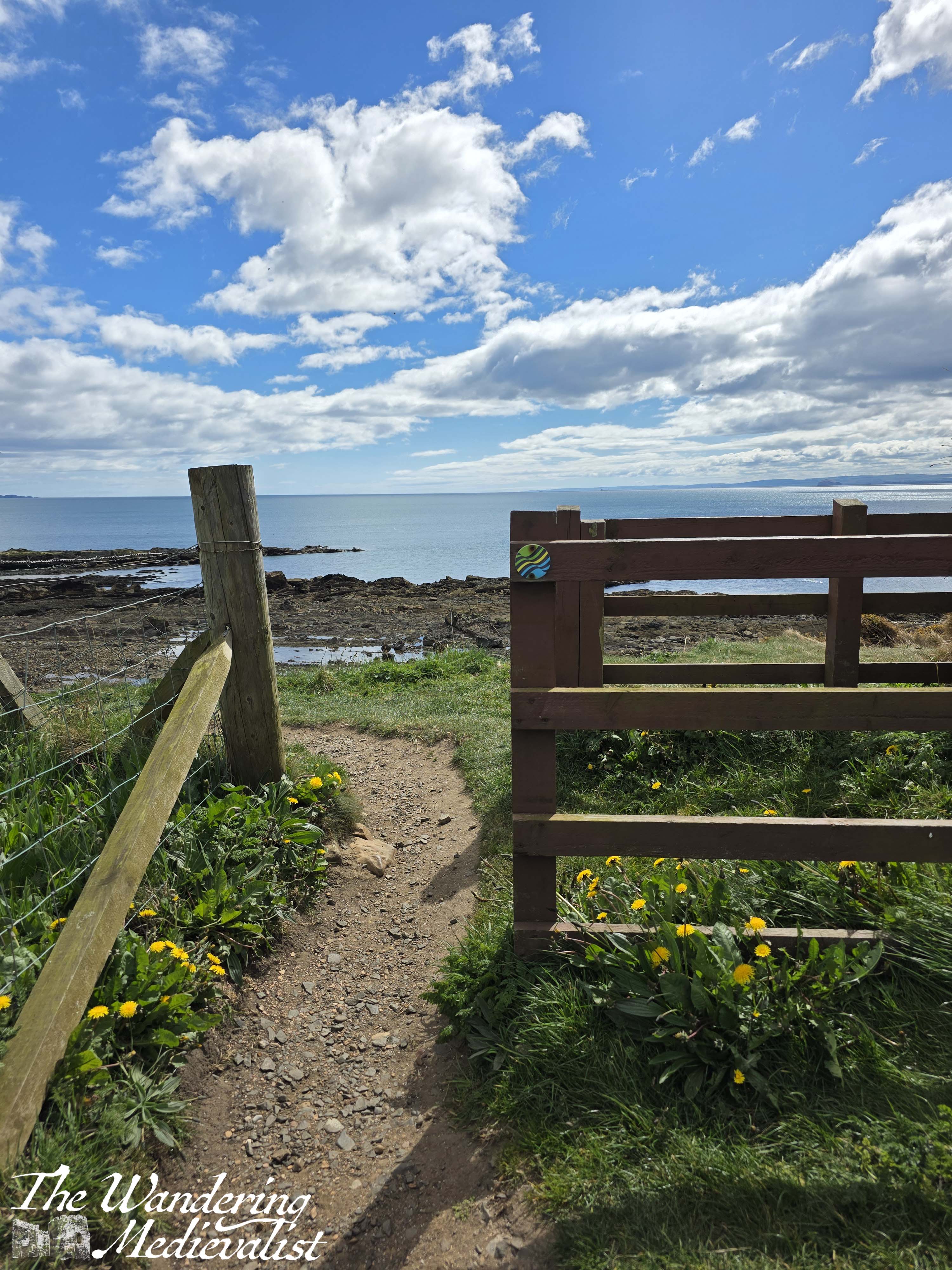
The path here is a well-kept rut between tall grass, but firm and well-kept, with a decent amount of up and down along hillocks. About a mile from the car park, there is the first of several bridges that allow coastal walkers to cut up to the main road.

Here I found a large group of walkers paused, clearly trying to make a decision as to whether to go around yet another fence and warning sign. In a short time, they decided to continue, as the tide was low and the guide figured they would be safe on the beach if the path was closed. I waited a few minutes for them to get ahead and then followed, slipping around the fence and finding the trail perfectly serviceable.
Shortly, the path cuts up a hill to a set of ruins – Ardross Castle, helpfully located just near Ardross Farm Shop, where walkers can stop for refreshments. Built in the 14th century, the castle really only offers a few remnants of vaults and walls, but is beautifully dramatic.
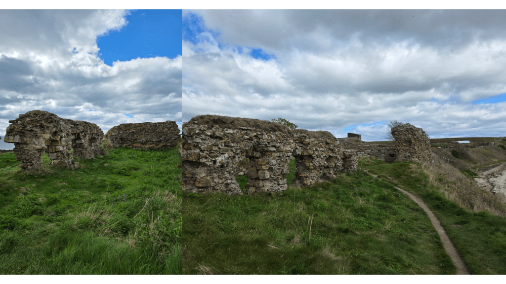
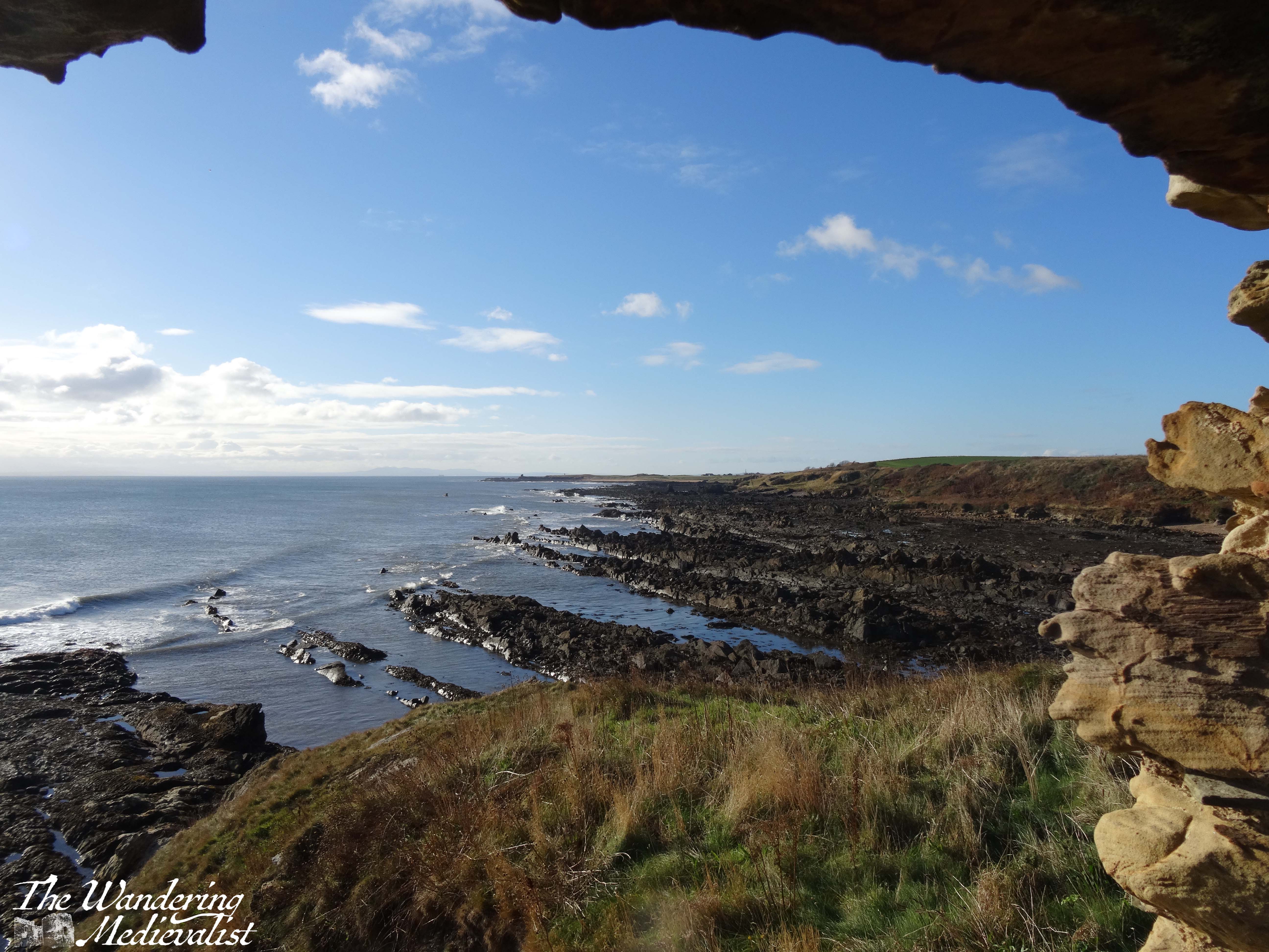
Passing through the ruined castle, I continued ahead of the large group of walkers (who had stopped to see the ruins) and went on my way. As the path follows the edge of the beach, it alternately climbs up an outcropping then sinks back again, sometimes on the top of a sea wall and sometimes a few meters in from the beach. On the left are fields and occasionally relatively steep hills of grass, and on the right the alternately sandy and rocky coastline.
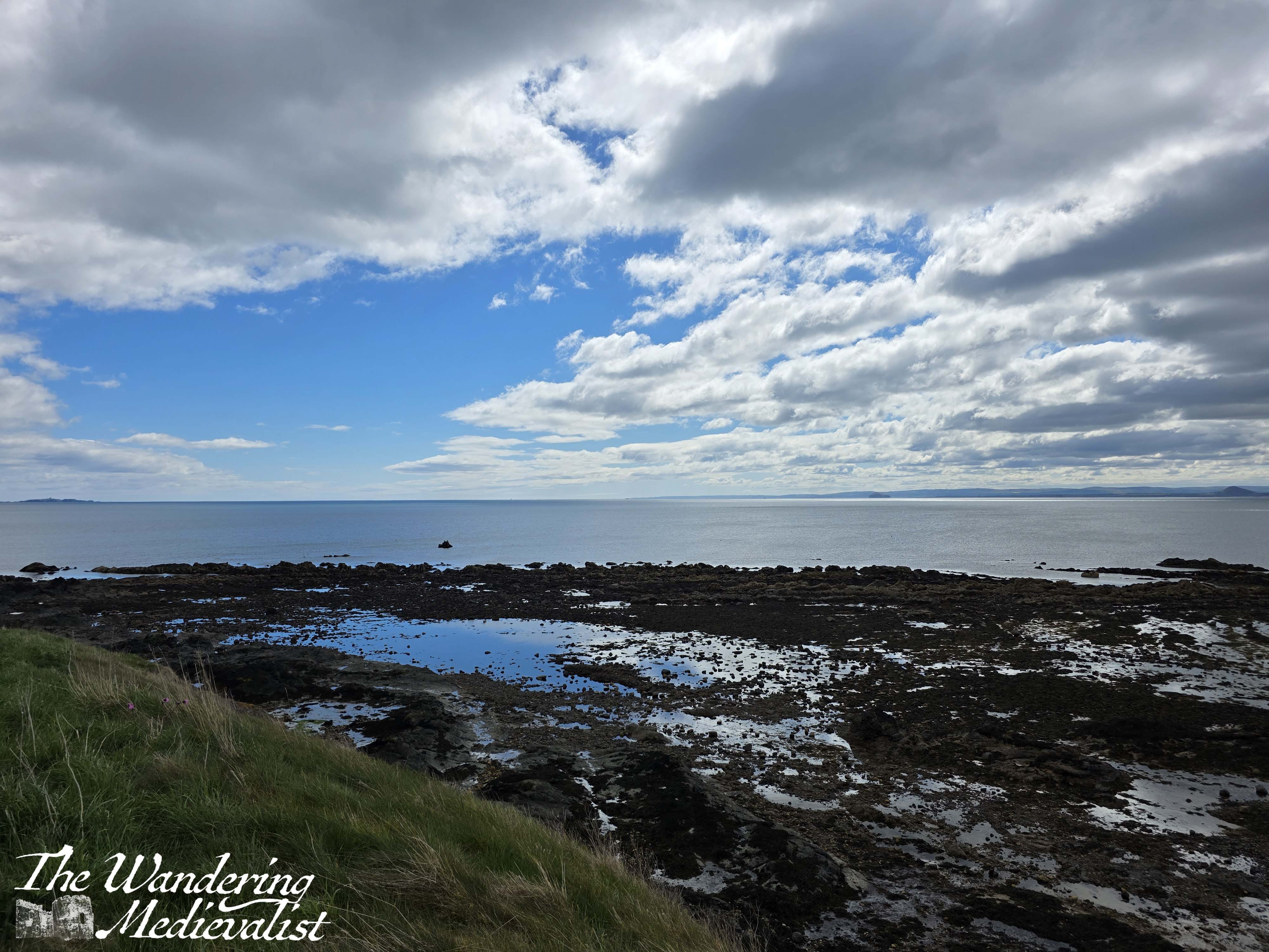
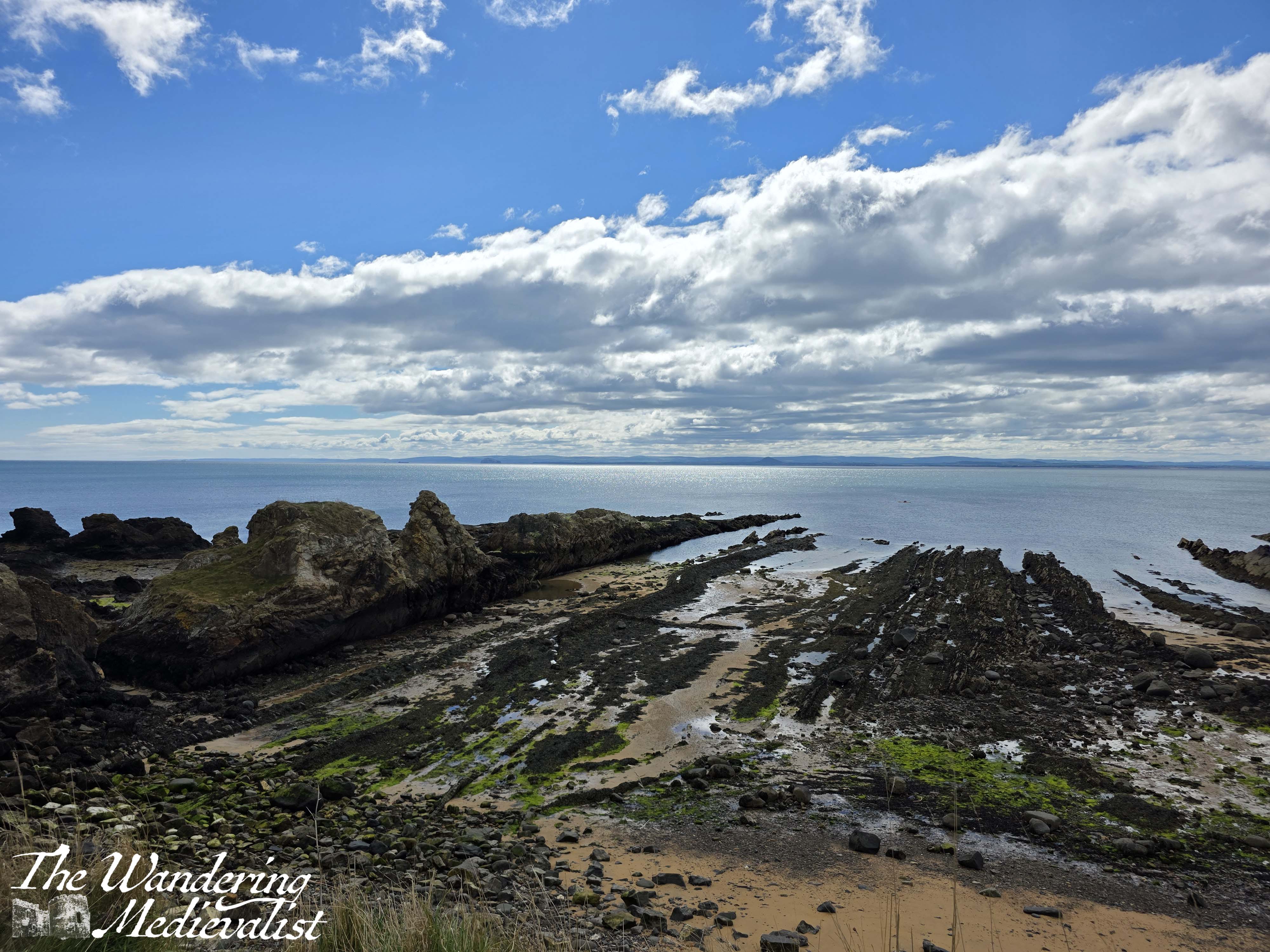
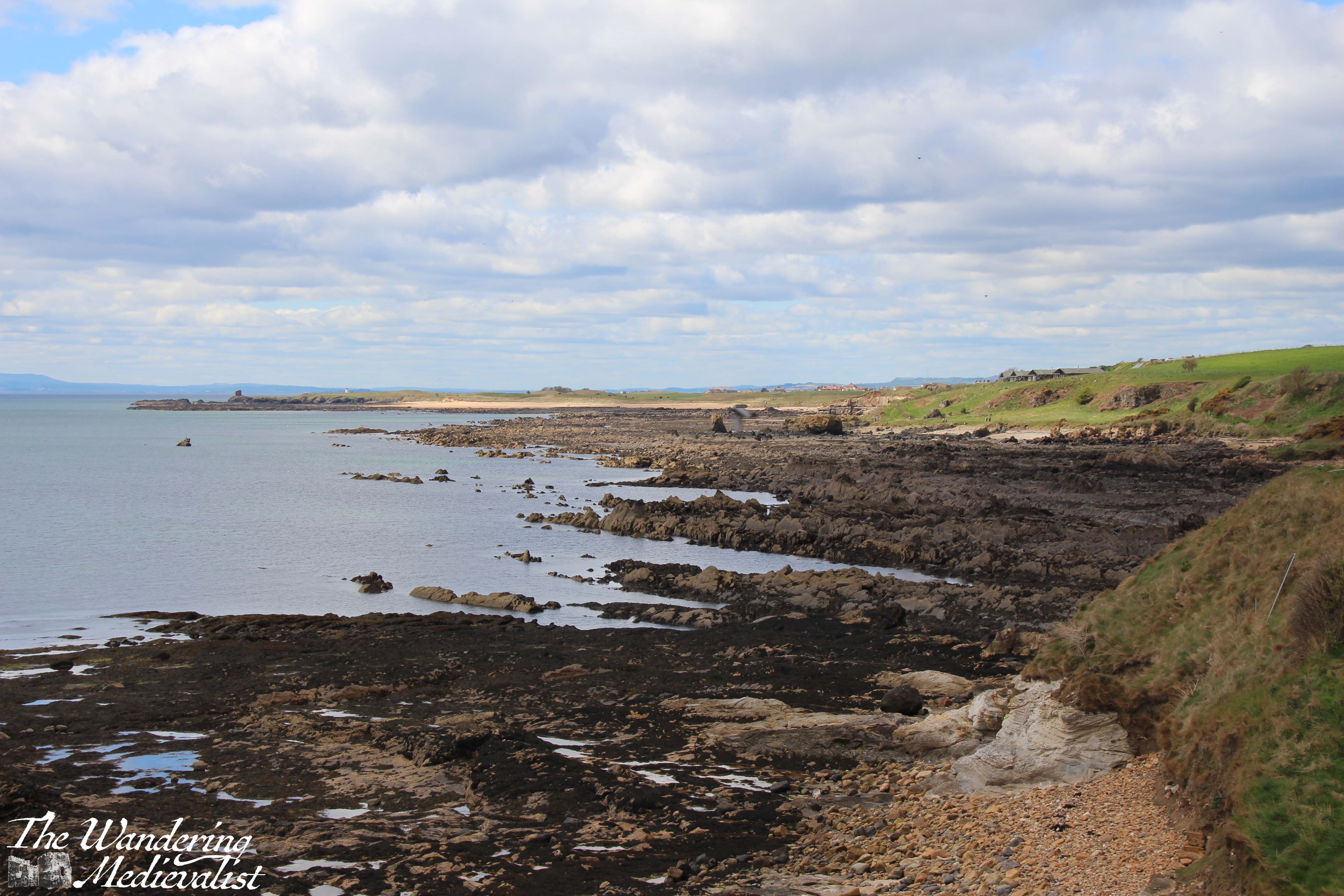
As I was walking at low tide, pools glistened in the sun and there was a quite clear view across the water towards North Berwick. At the higher points along the way are spectacular views towards St Monans or back to Elie. While it was not a hugely busy path, I passed a good number of groups and families enjoying the lovely day, and I stopped one group of ladies to check if they had come from St Monans. ‘Oh yes, just go around the sign!’ said one, which made me laugh but also ended my niggling worry.
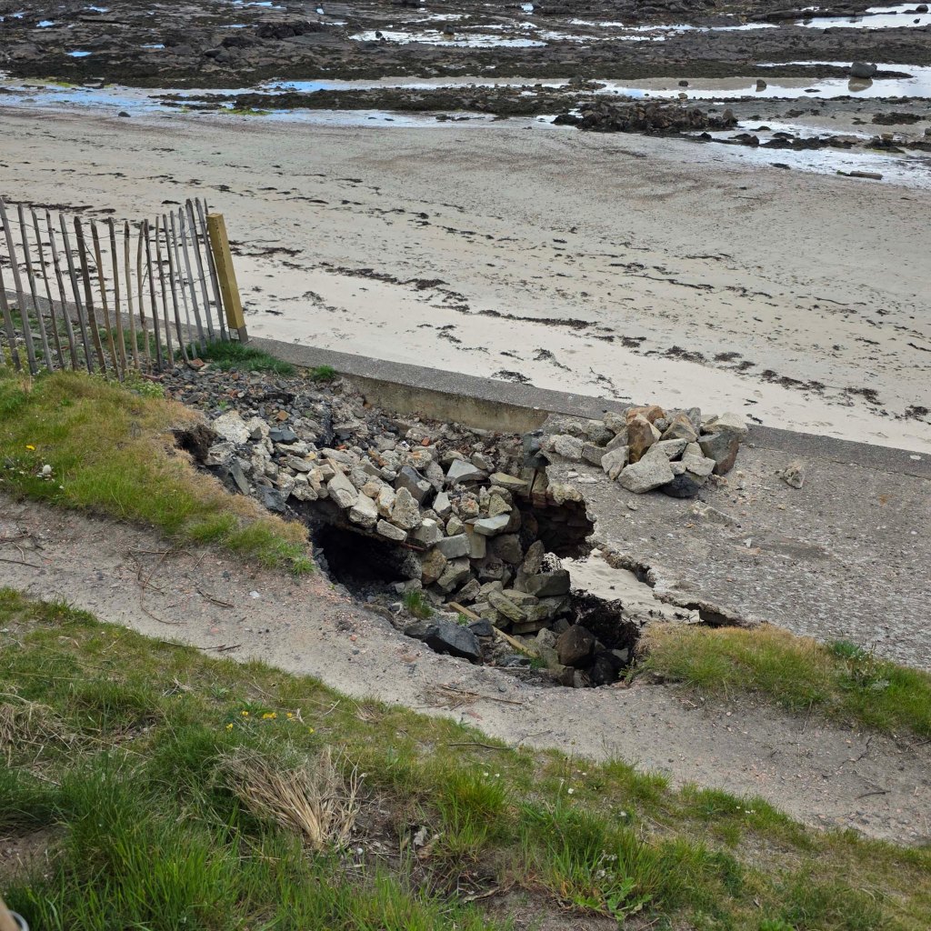
After descending one particularly steep flight of stone stairs, I discovered the spot which had caused all of the drama: a deep hole in the seawall, around which the Fife Coast and Countryside Trust had duly constructed a barrier to prevent injury. In proper Scottish fashion, walkers had created a secondary trail round the barrier, and it was easily passed by.
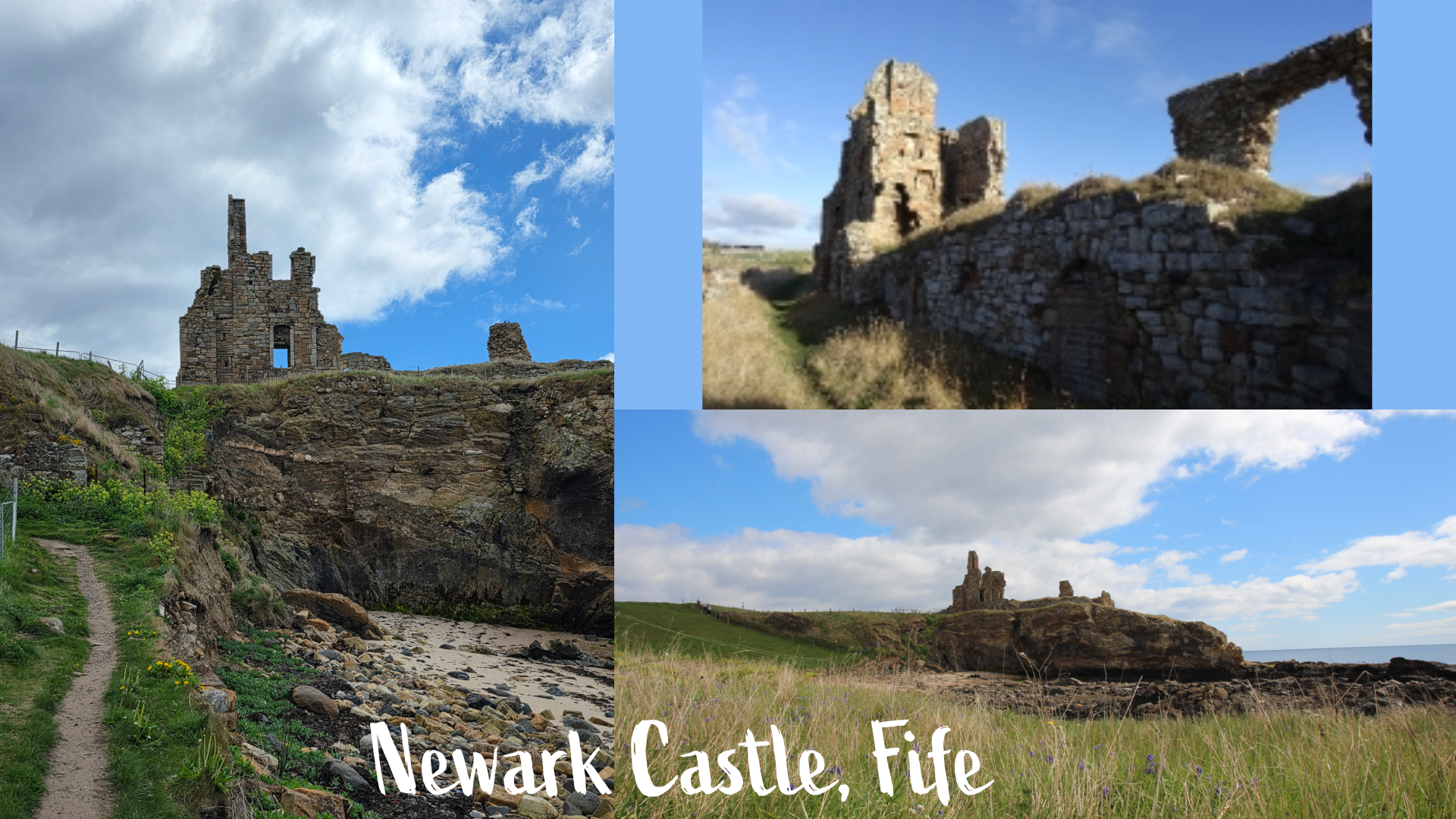
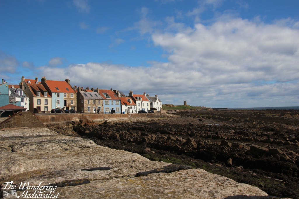
Rising above the beach at this point was a promontory boasting the remains of Newark Castle. Several years back when I hiked this trail, we were able to get right up to the castle, but danger of falling masonry keeps walkers back at a distance today. Constructed in the 15th century, the castle has just enough left to evoke the imagination of what was once there.
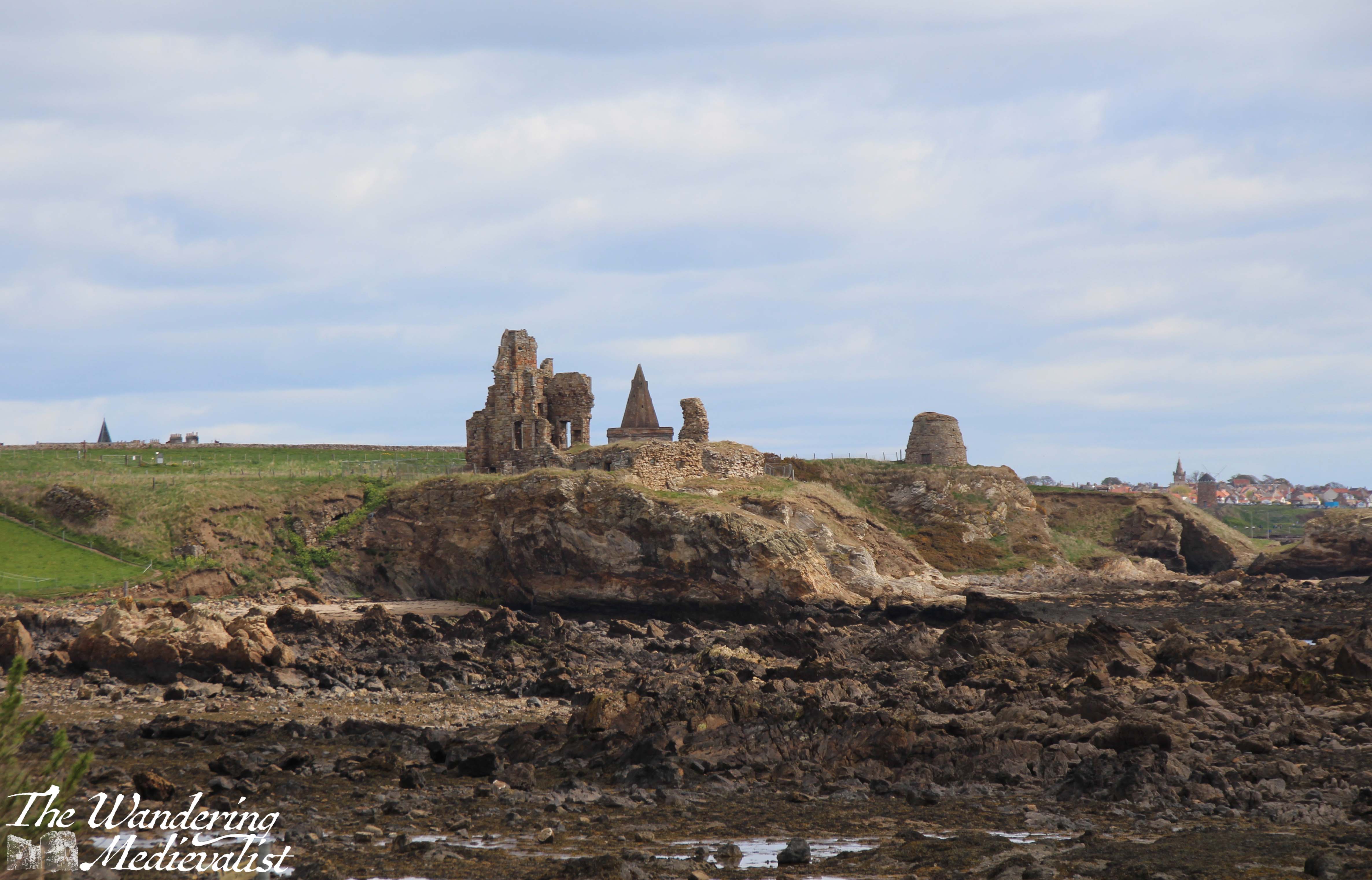
Beyond the castle is a stunning doocot (or dovecote) which has excellent views. The cracks between the masonry are sprouting all sorts of beautiful yellow flowers. From here, it is just over a third of a mile to St Monans. The approaching trail is lovely, with the 14th-century Auld Kirk perched on the edge of town to welcome walkers.
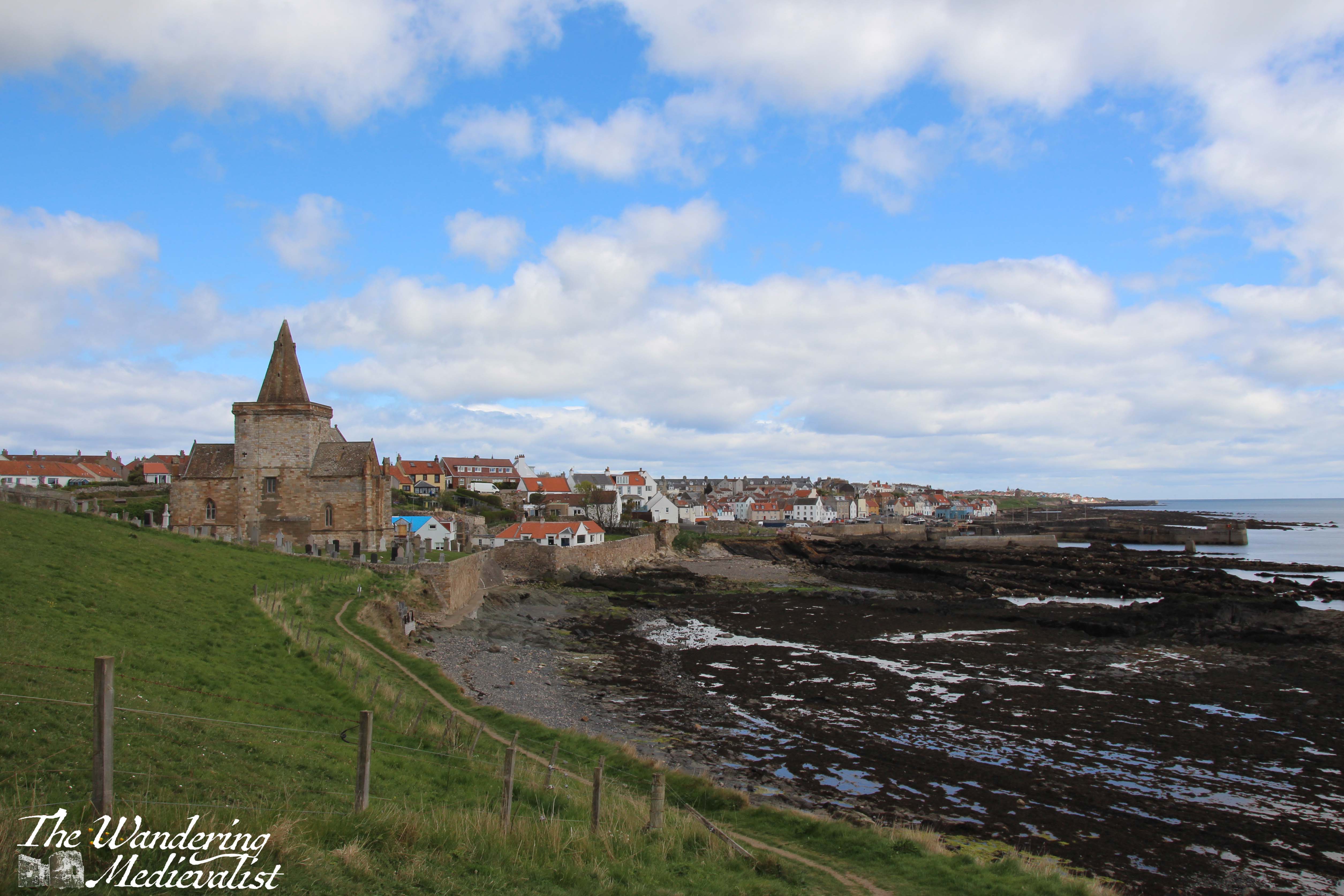
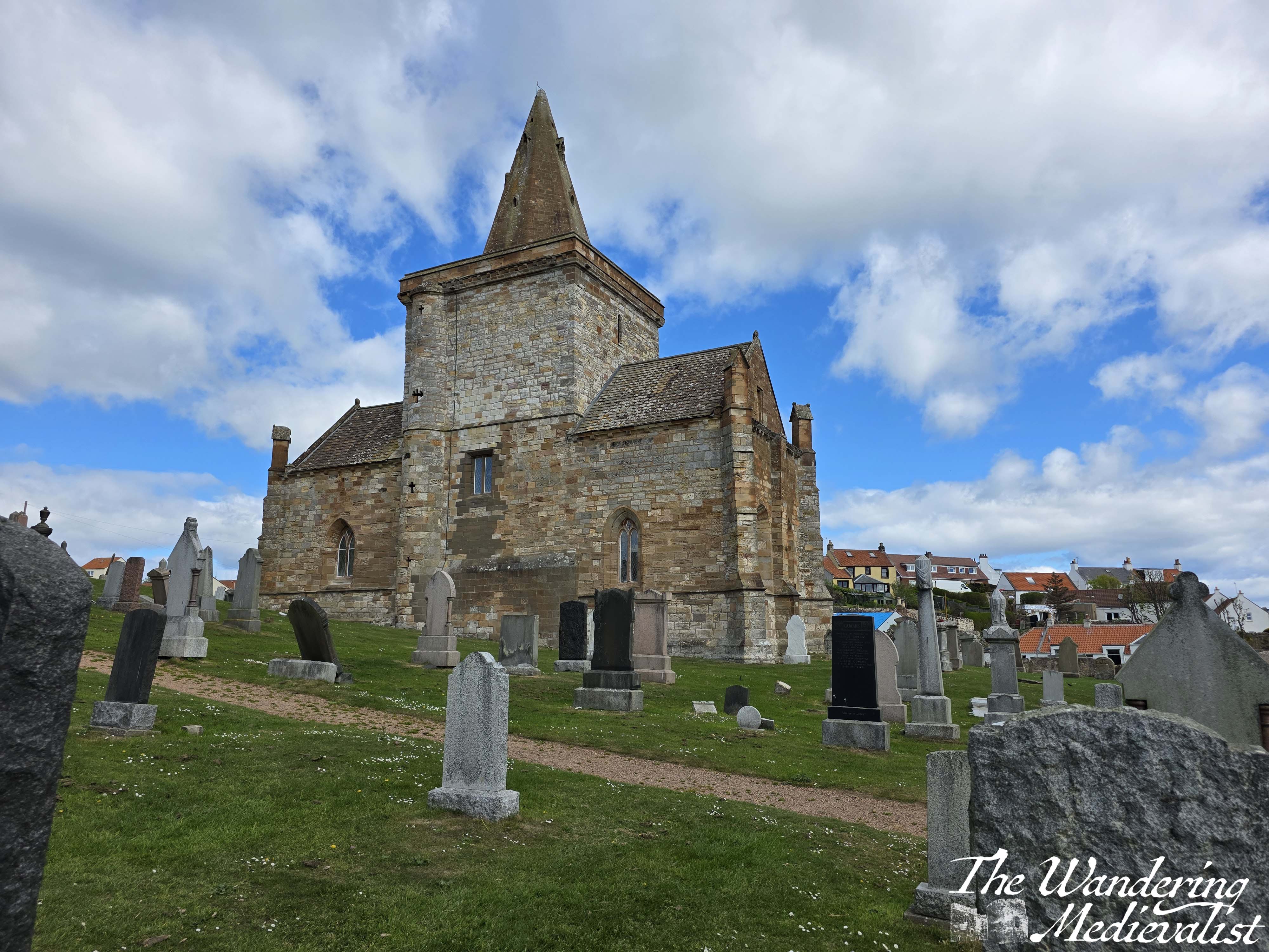
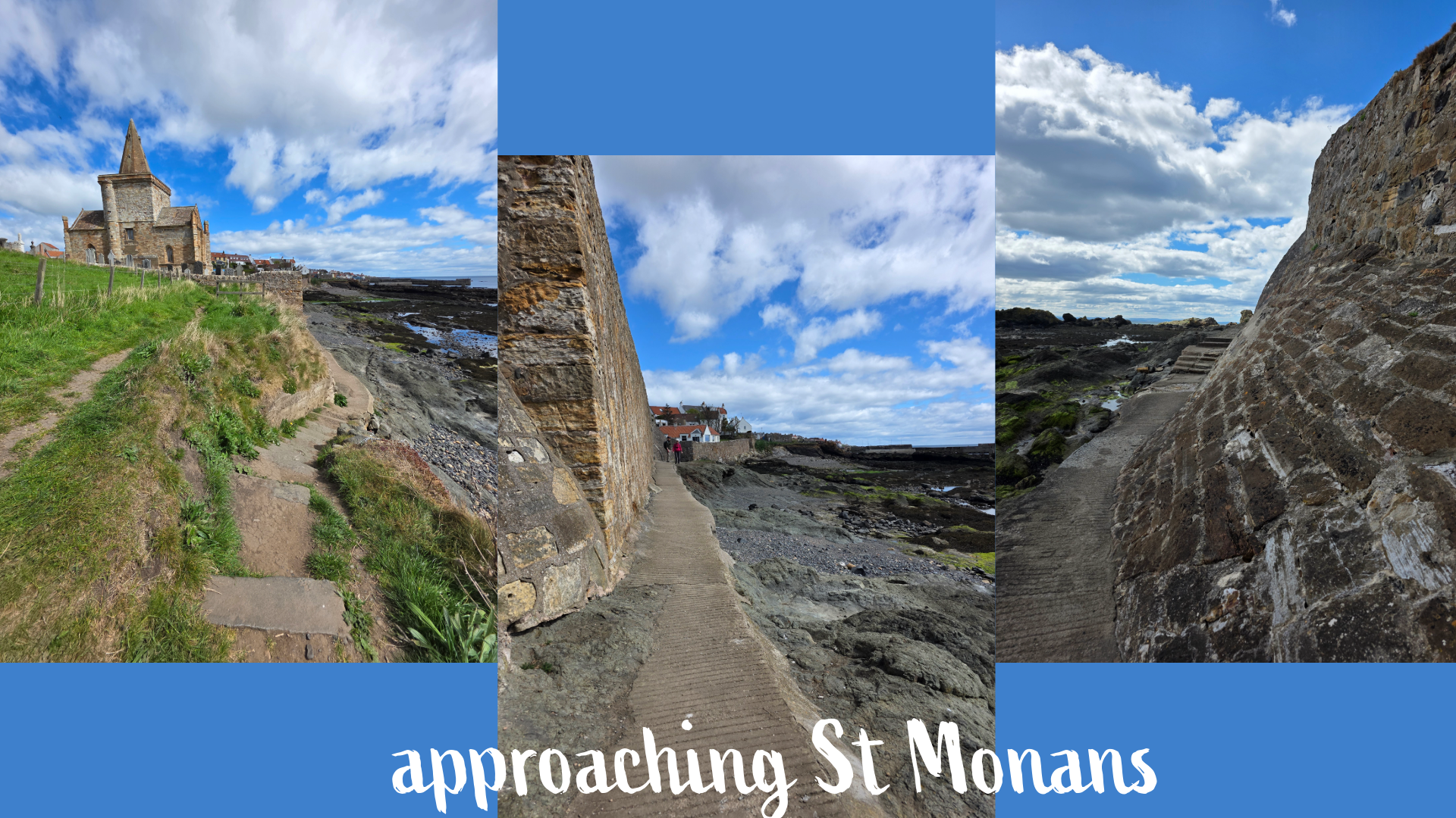
Just before the church, the path splits, and there is an option to approach the kirkyard and possibly gain access, though the path leads down below the kirk to the right. (It may in fact not be possible to take this route at high tide)
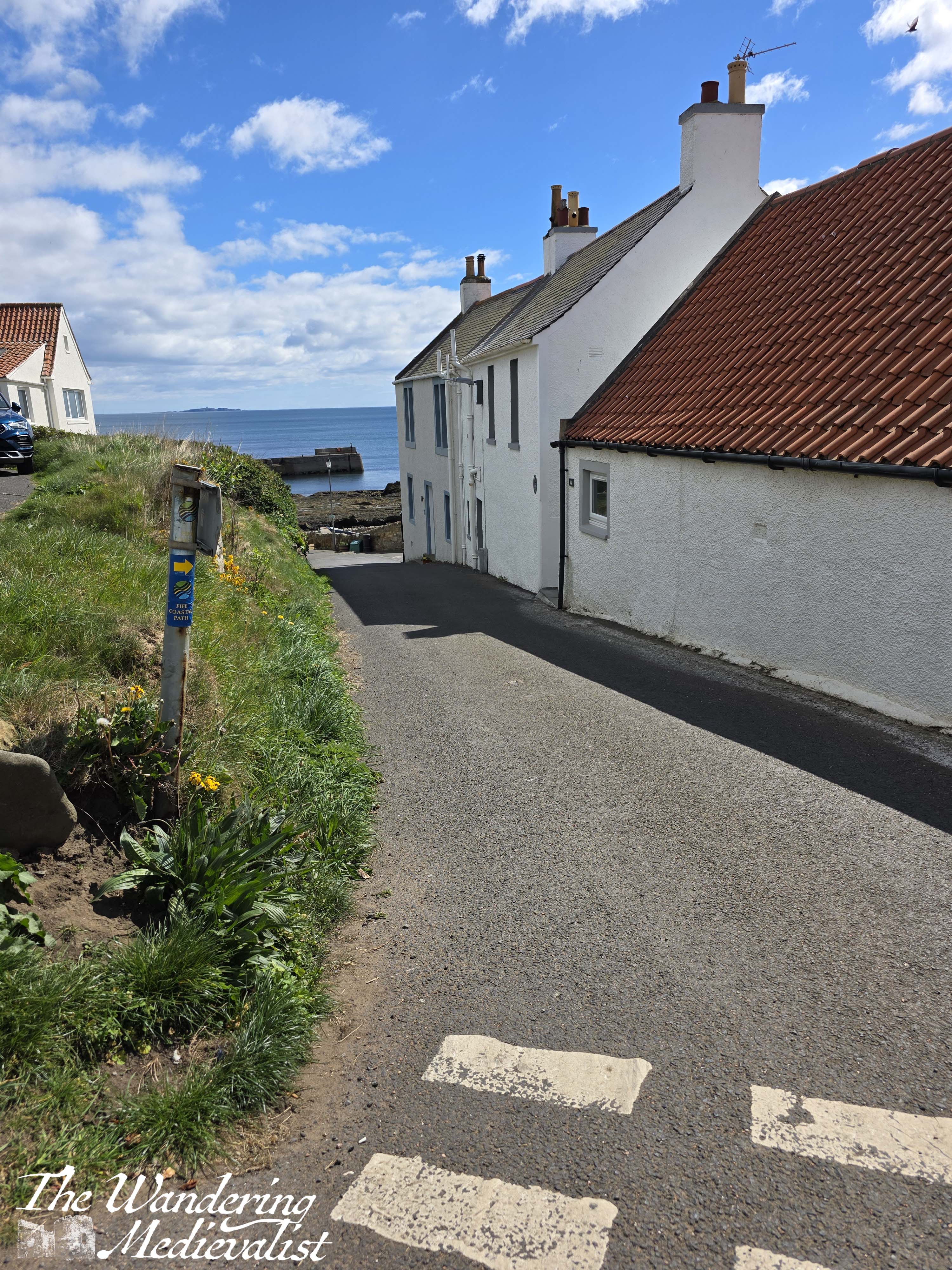
The path skirts the edge of the seawall and is quite narrow, then requires a quick scramble up a cobbled wall to the path. Here, there are two options – there is a very narrow stone staircase heading straight before you, or you can follow the road along to the left. I opted for the staircase and found myself in an incredibly narrow close between houses, which one can imagine was created long before wheeled vehicles were required. There were some lovely views back over the houses and the ocean, before the hedges rose up around the path. In short time I re-joined the road, turning right towards St Monans harbour.

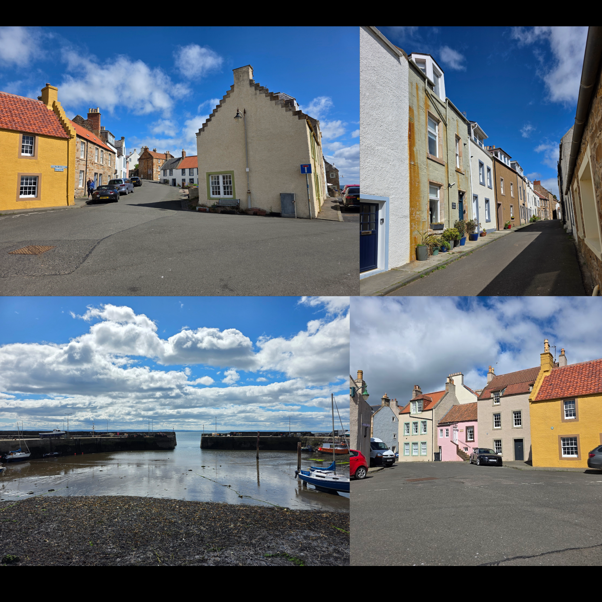
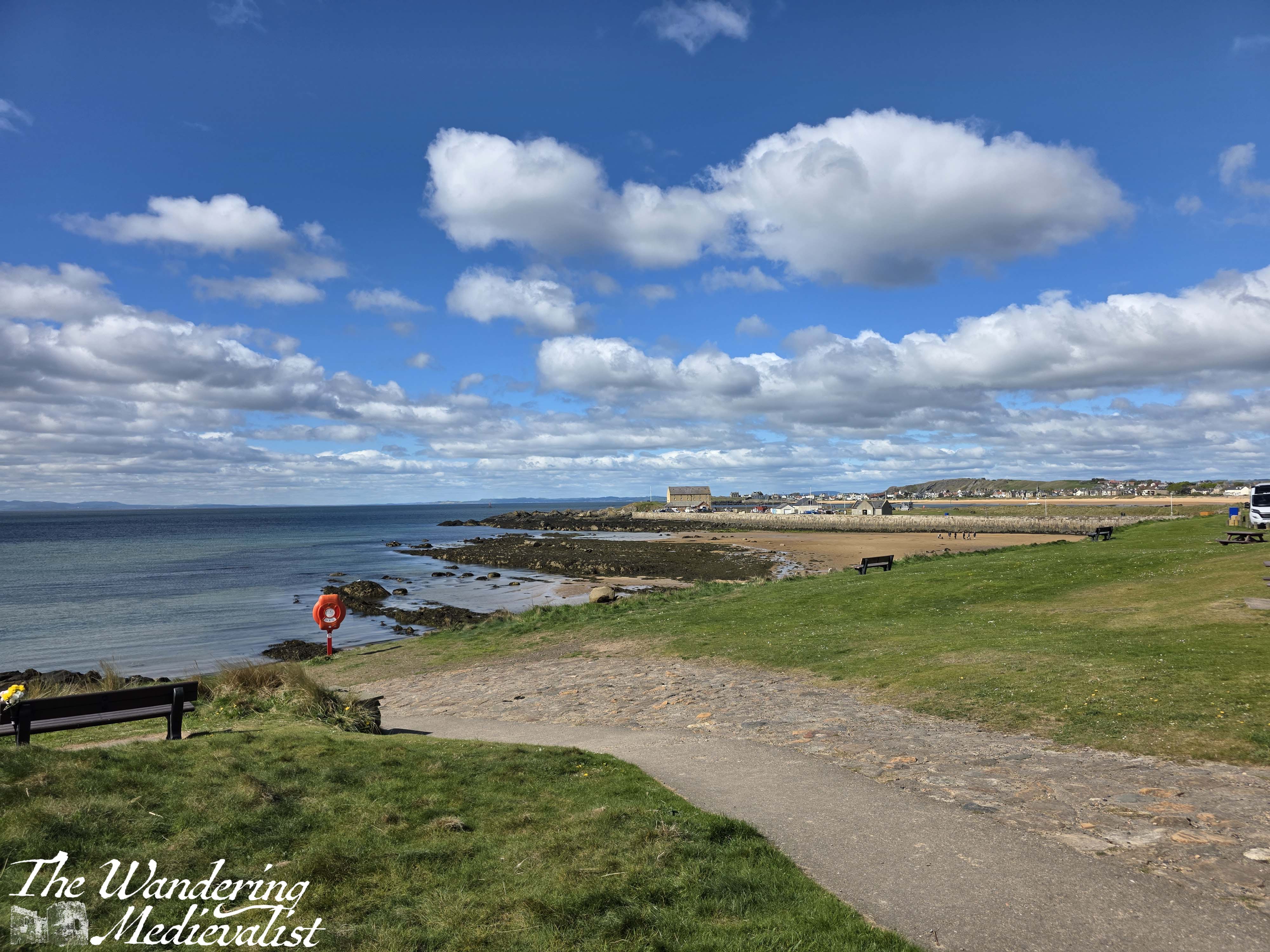
St Monans is an incredibly well-kept village with a good harbour, where for more than 200 years there was a prosperous boat-building company. There are beautiful old houses reminiscent of parts of New England to me (though stone of course rather than wood), and winding routes that cars can only just manage.
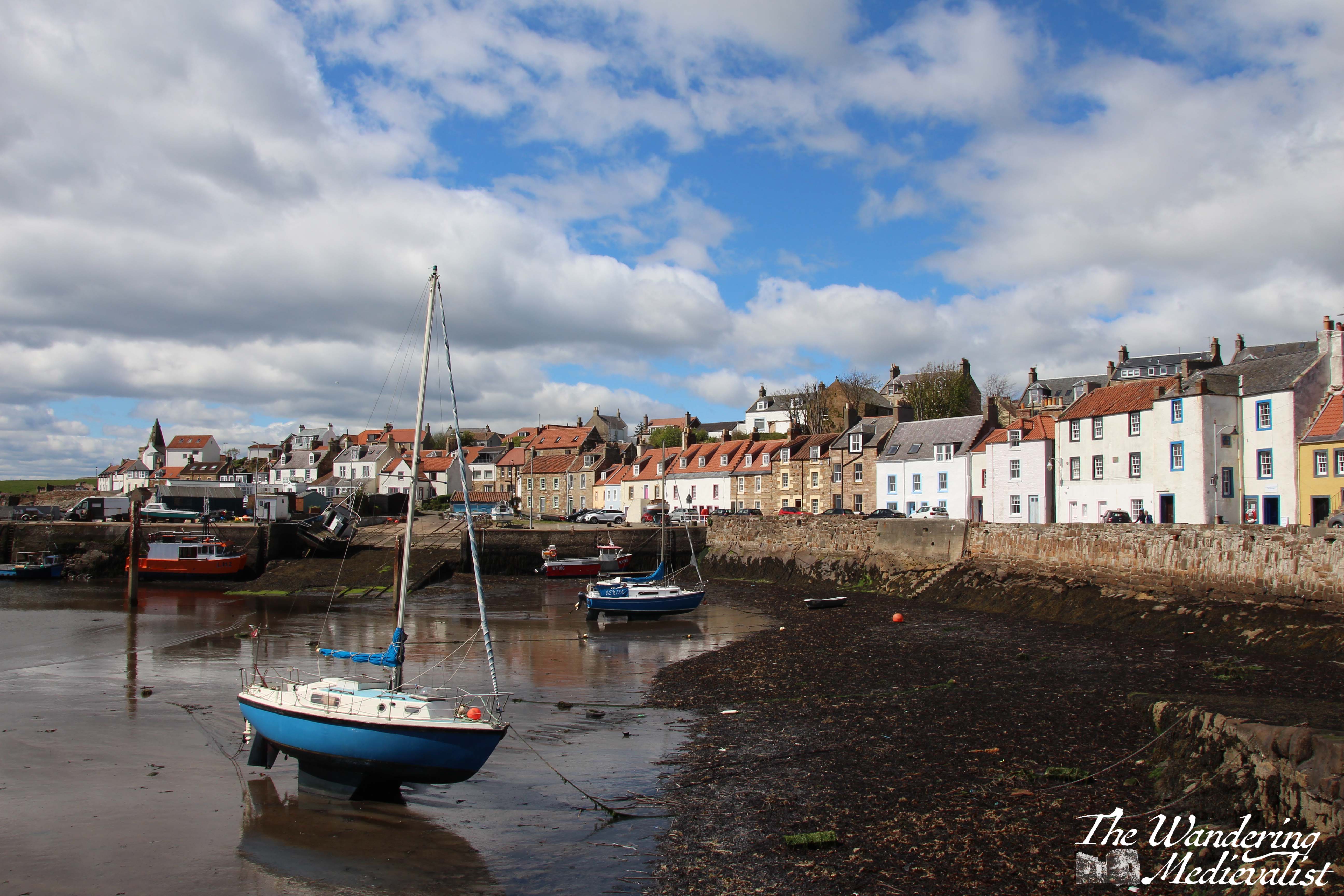
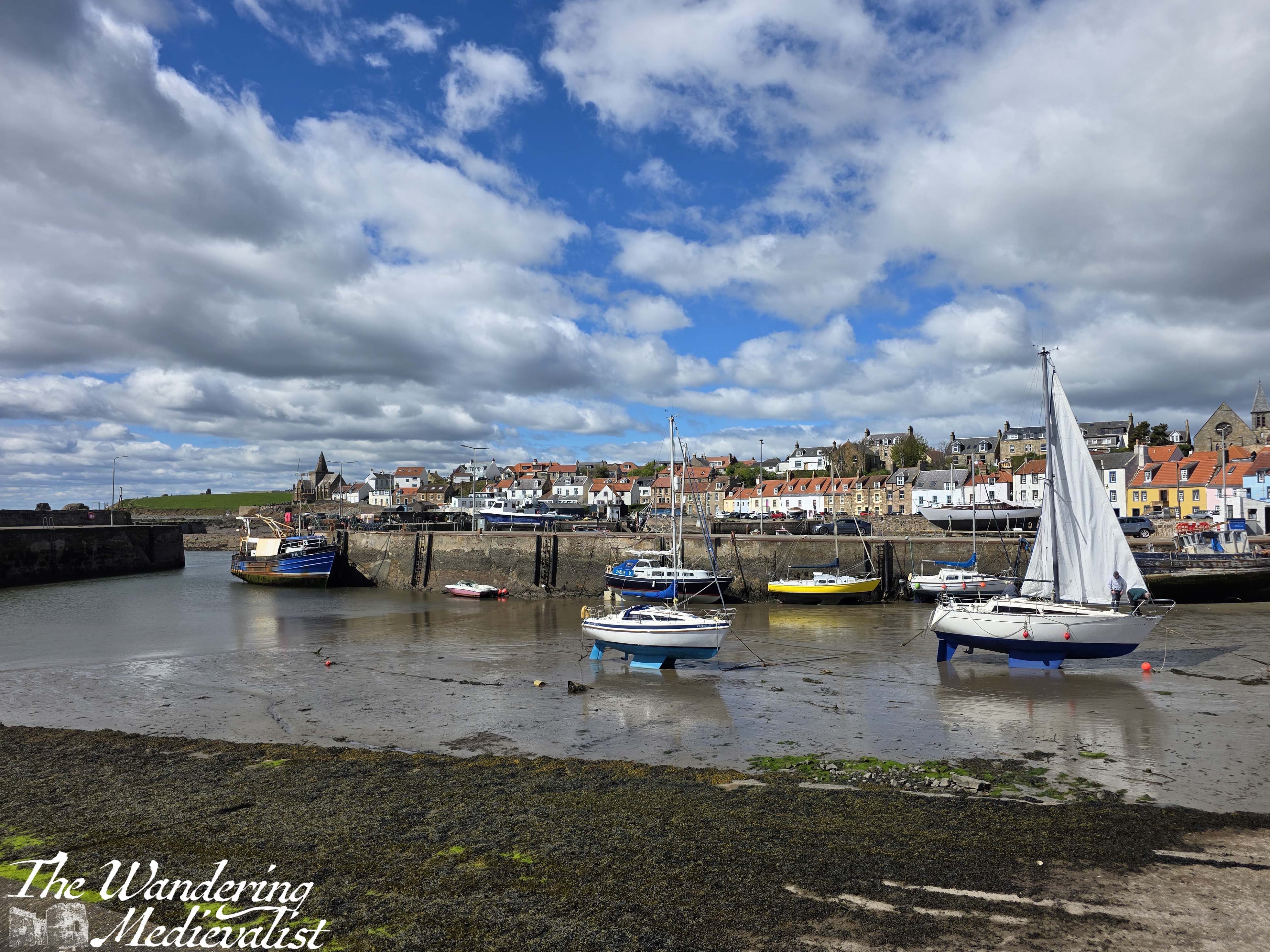
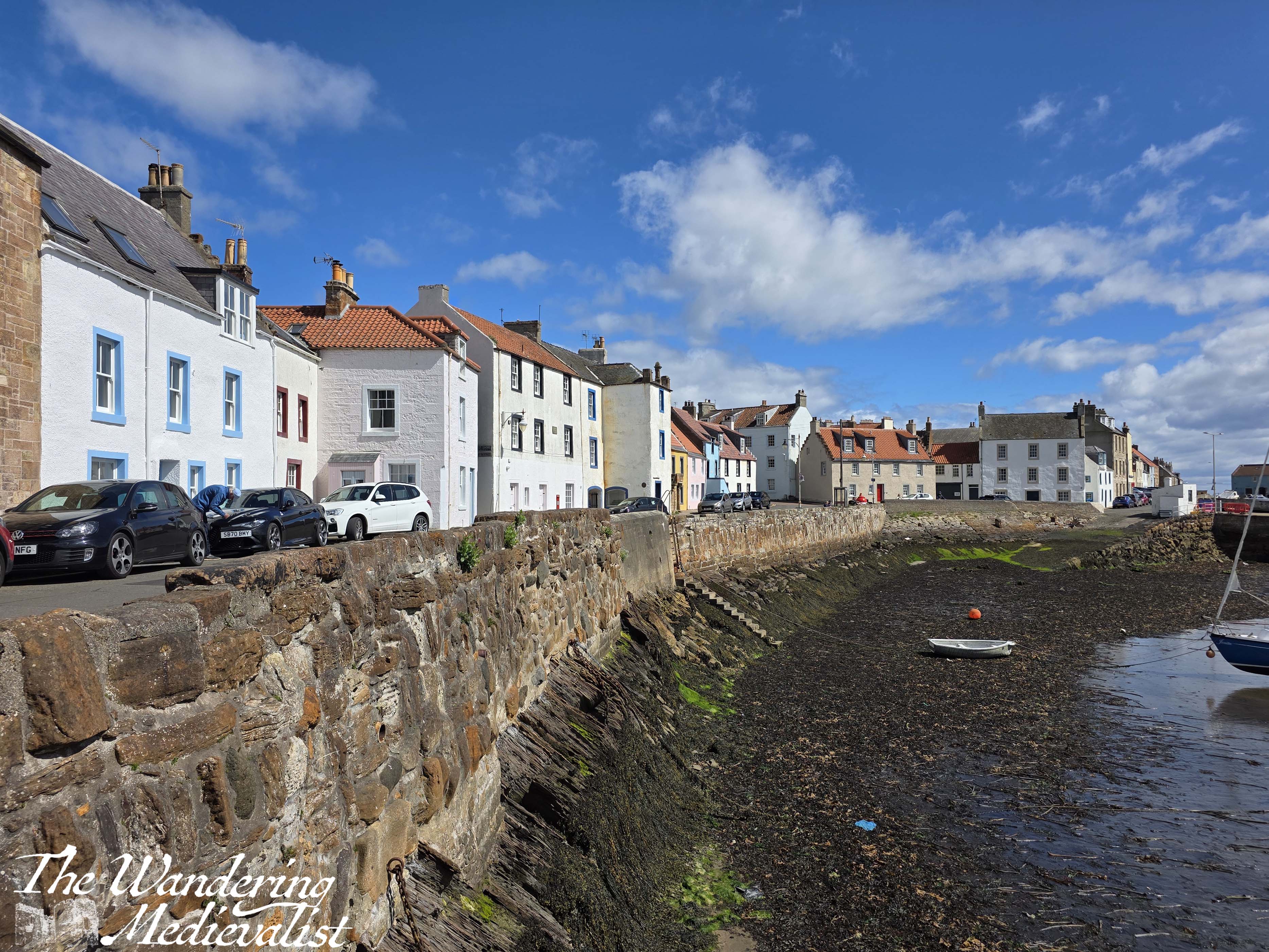
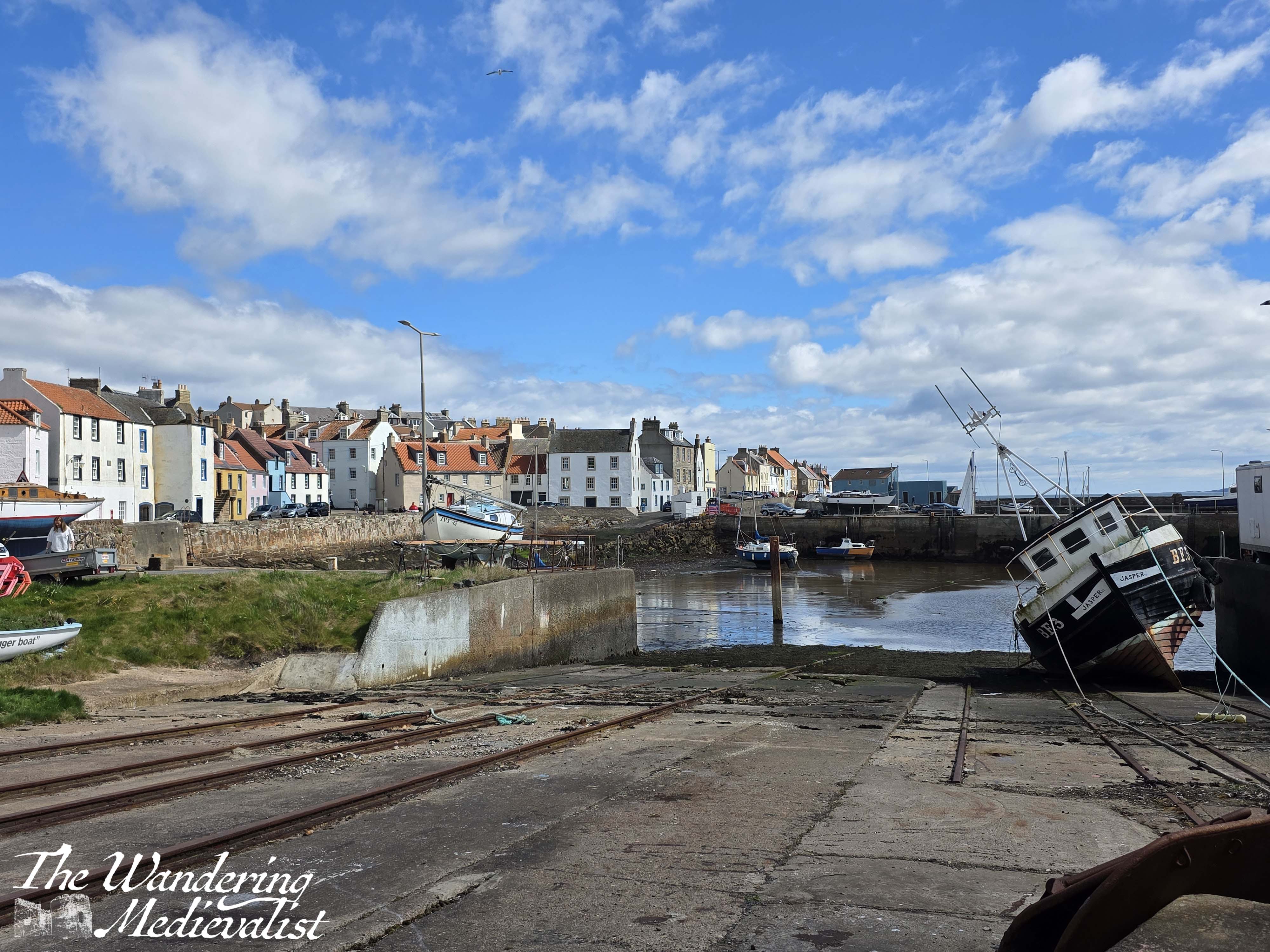
The coastal path leads down a hill and along a narrow street to the harbour. The West Shore leads walkers along the edge of the harbour with beautiful views of the boats, houses and ocean beyond, just visible over the harbour wall. There are several places where you can turn left and head up the hill to the bus, which runs along the main road at the top of the village. When walking with Dad, we stopped at an excellent little café called the Gannet, which I was delighted to see survived the pandemic. Another excellent spot is what was the East Pier Smokehouse, a converted harbour building, and is now Futtle Brewery. Even if you do not need a snack, you can walk out past the building along the harbour wall and look back at the shore in both directions.
And here I decided to end my walk, though it was a good day and only another mile or so to Pittenweem. My busy April travel schedule means that I am still not quite sleeping normally, so opted not to push myself too hard.
I did regret this when I realised how much I still need to cover. I really need to get my butt in gear and get some longer walks done. This coming weekend I’m hoping to manage Newport to Balmerino, or possibly go further down the coast. We shall see!
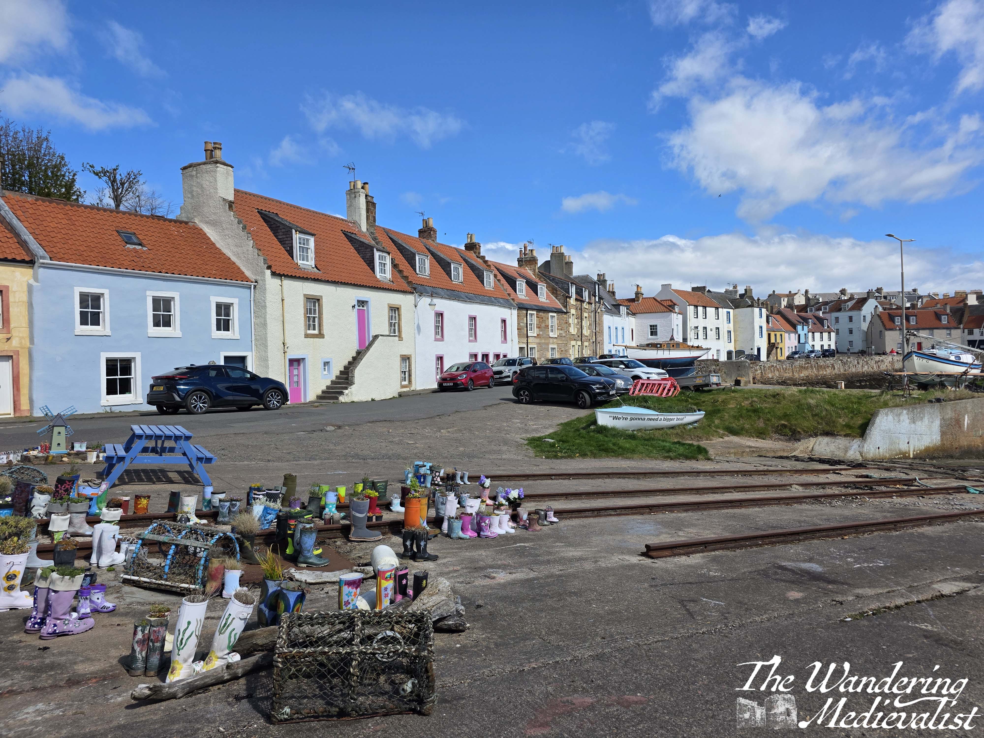
Just for fun…