
If you had to name one stereotype about Scotland, chances are that it might include the weather. In particular, that the weather is typically cold, wet and windy – dreich as they say. But this stereotype is, I think, based more upon west coast Scottish weather than east. Dundee is known as the sunniest city in Scotland, and the past few weeks have really bucked the trend in that our weather has been quite sunny, mild, and generally beautiful. We are in fact on the verge of a drought, and not for the first time in recent history – I’ll leave my opinions on why behind for now.
So, last Saturday was another stunning sunny day, a touch hazy but nonetheless offering blue skies and a happy requirement for sunglasses and even sunblock. In all fairness, May is quite often a good month in Scotland – I remember fondly studying for my final exams in 4th year outside, getting sunburned, and then having to work out how to even out the tan before wearing a strapless dress at the grad ball. Serious problems.

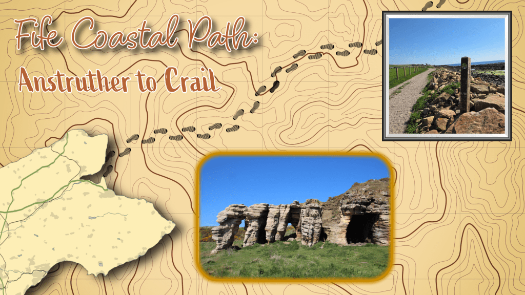
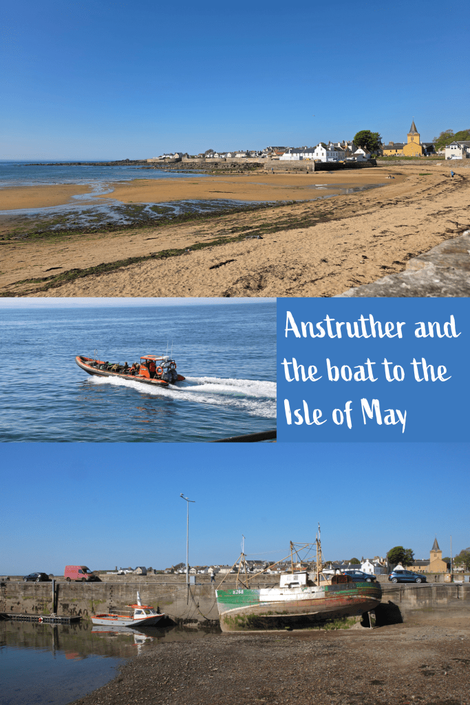
Determined to get a bigger chunk of the walk done than I have previously, I once again headed for the East Neuk, this time choosing the faster X60 bus to Anstruther that cuts directly south rather than following the coast. My walk started at the far end of the harbour in Anstruther, by the Dreel Hall, which meant that the first stretch was along Shore Street.
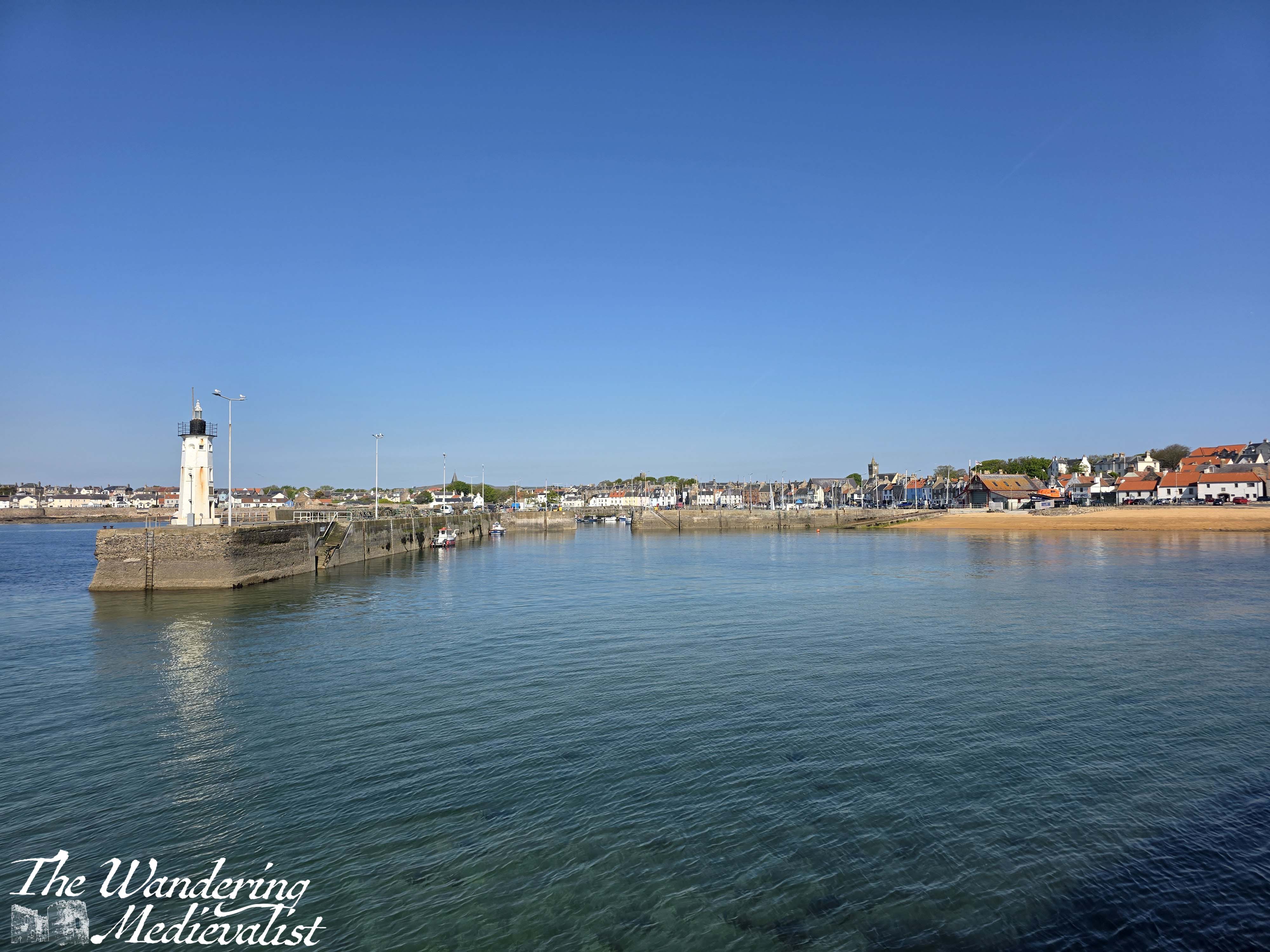
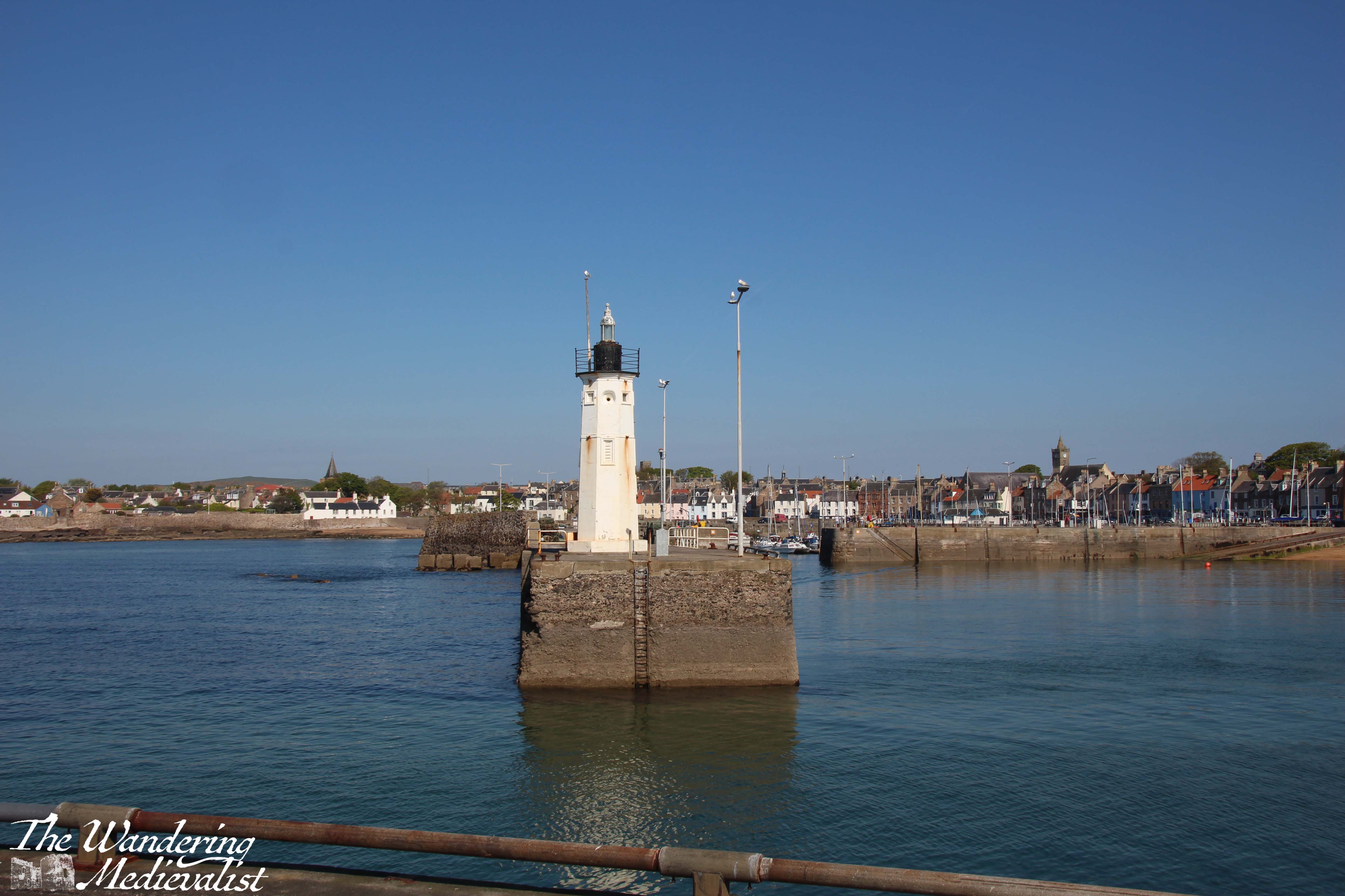
This section of Anstruther is busy with tourist shops, restaurants, the famous Anstruther Fish Bar, and of course the harbour on the right, full of boats. I think this is probably the busiest of the East Neuk harbours, offering day trips to the Isle of May and providing a home for an active RNLI Lifeboat station.
As it was such a nice day I took a short detour to walk out the harbour wall to the end and look back on the town.
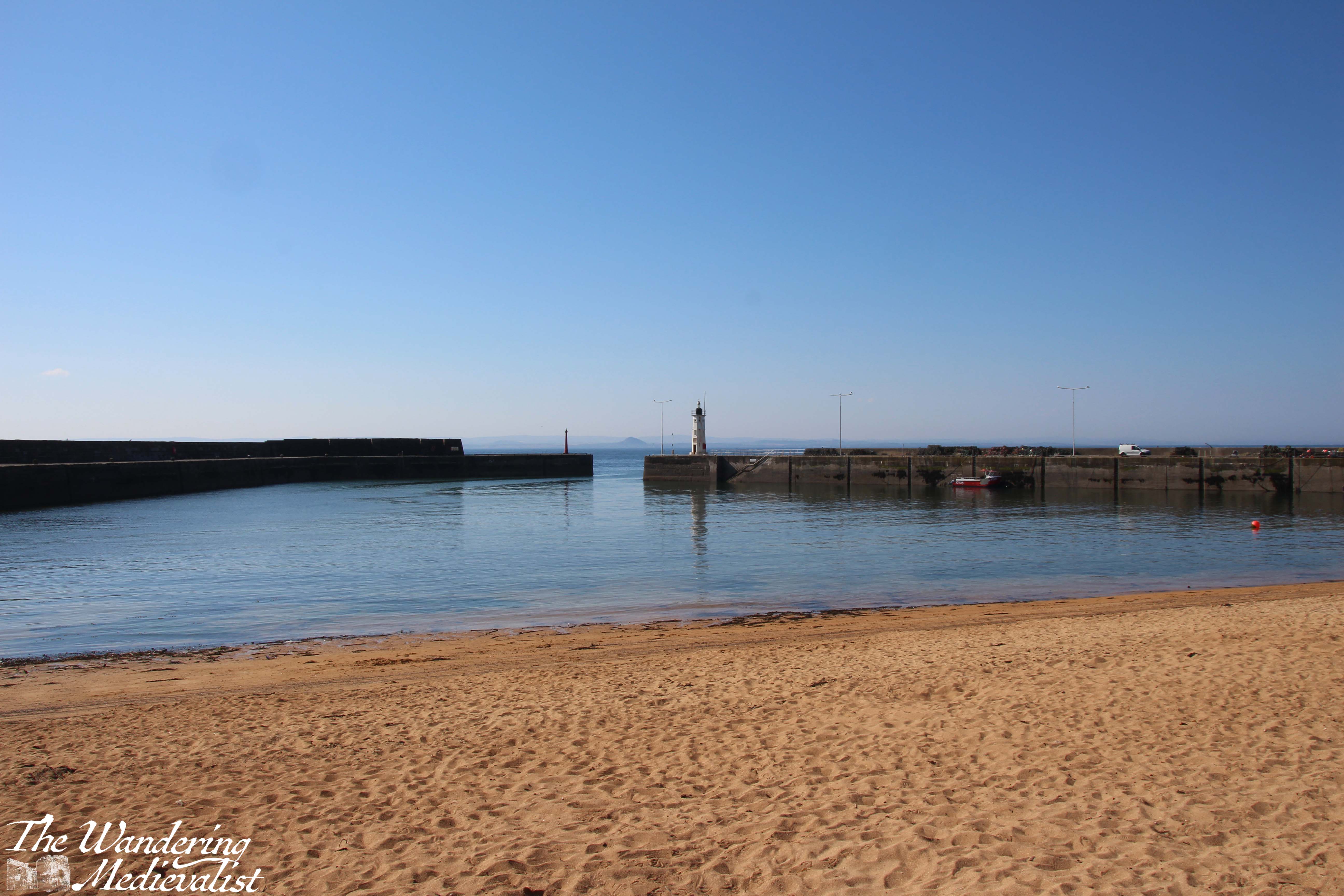
From the shore edge of the harbour, there is a great view along the coastline and also out into the Firth of Forth to the Isle of May – the latter is a popular spot for a day trip, with hiking and a large colony of puffins available for entertainment. On my bucket list!
Cellardyke
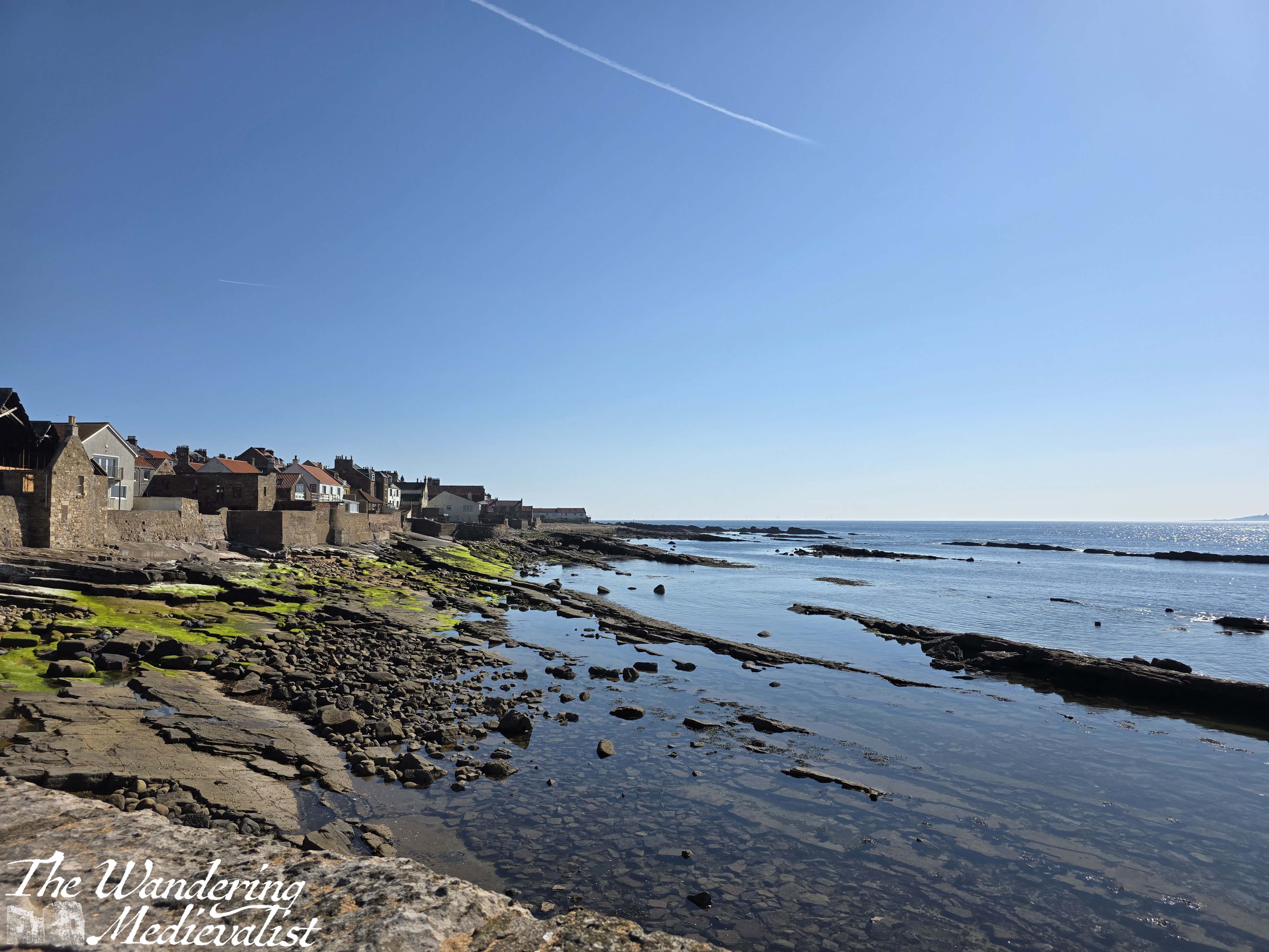
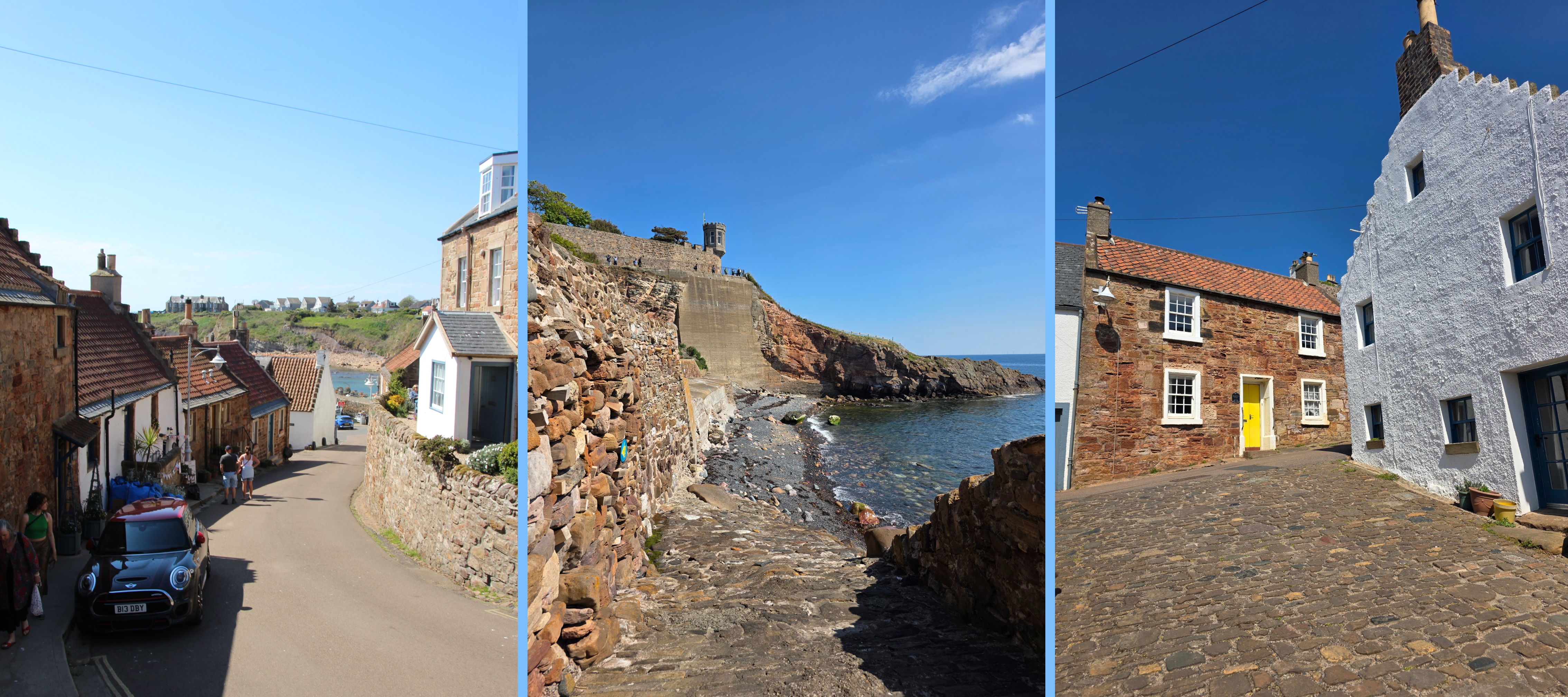
The coastal path here continues straight along the shore into the town of Cellardyke, which is immediately connected to Anstruther. Both towns have been fishing villages for centuries, and the surviving houses date from several hundred years ago to quite recently, though more of the former. Cellardyke has always reminded me of New England, with narrow winding streets and houses lined up against the shore. Occasionally between the houses is a narrow access point to the ocean beyond, offering glimpses of the glimmering water and waves.
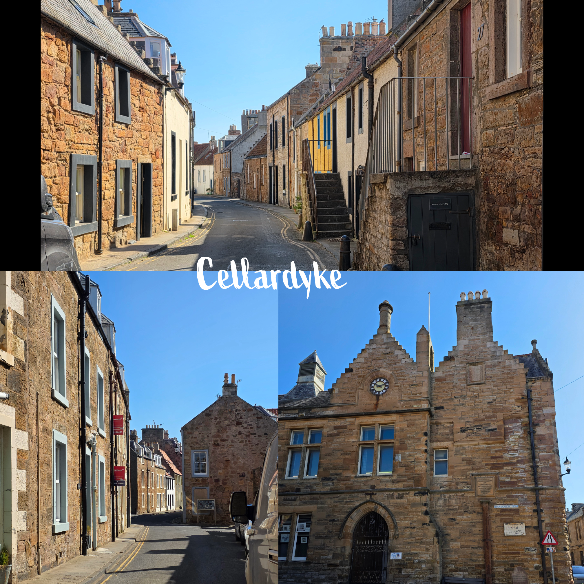
About halfway through the village one comes across the Tollhouse and village hall, bottom right above. Here one can take a route up to the left to see a higher view (take the high road🎶) but I continued on to the right, and around half a mile after entering Cellardyke, the road reaches the harbour.
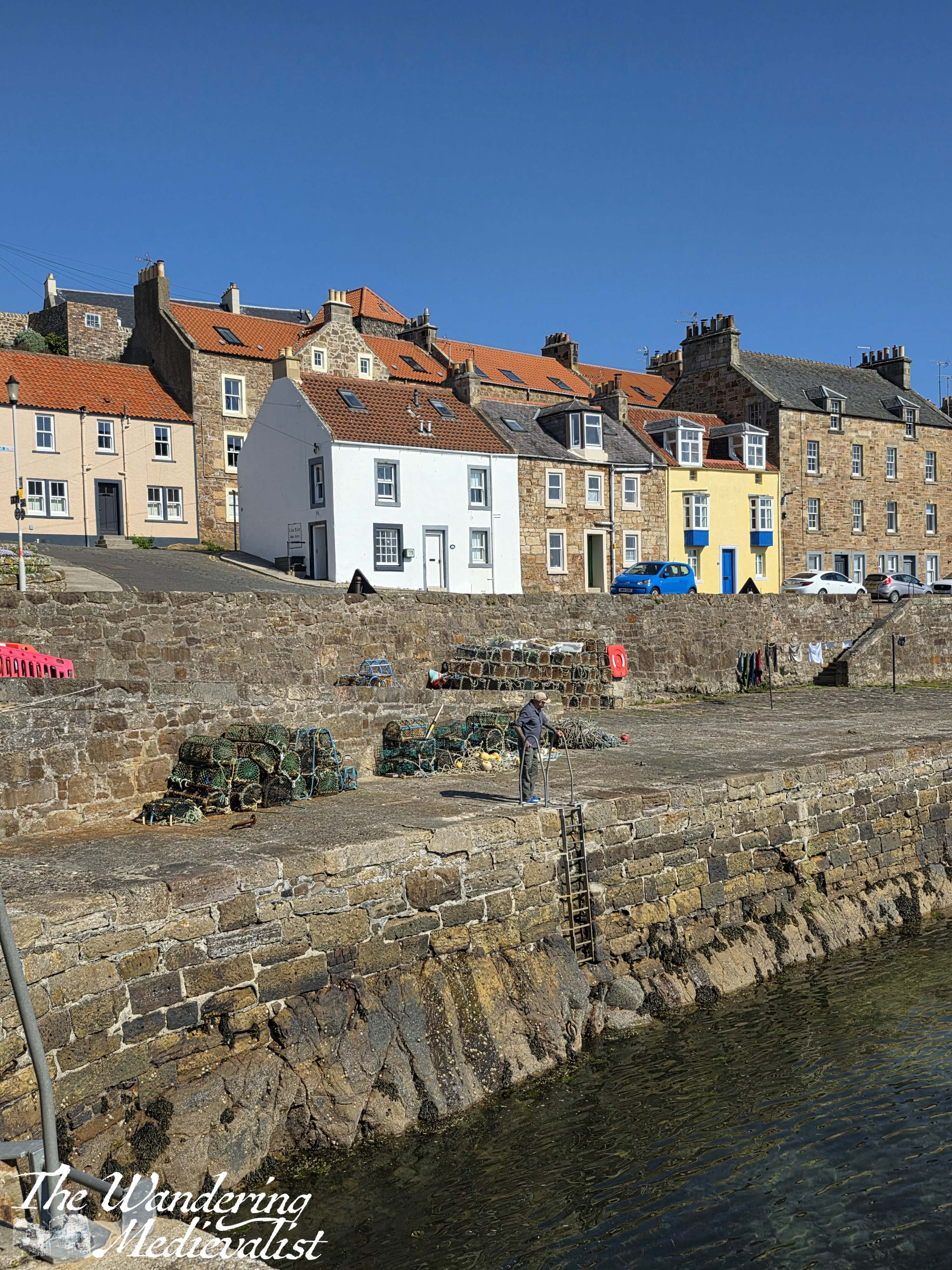
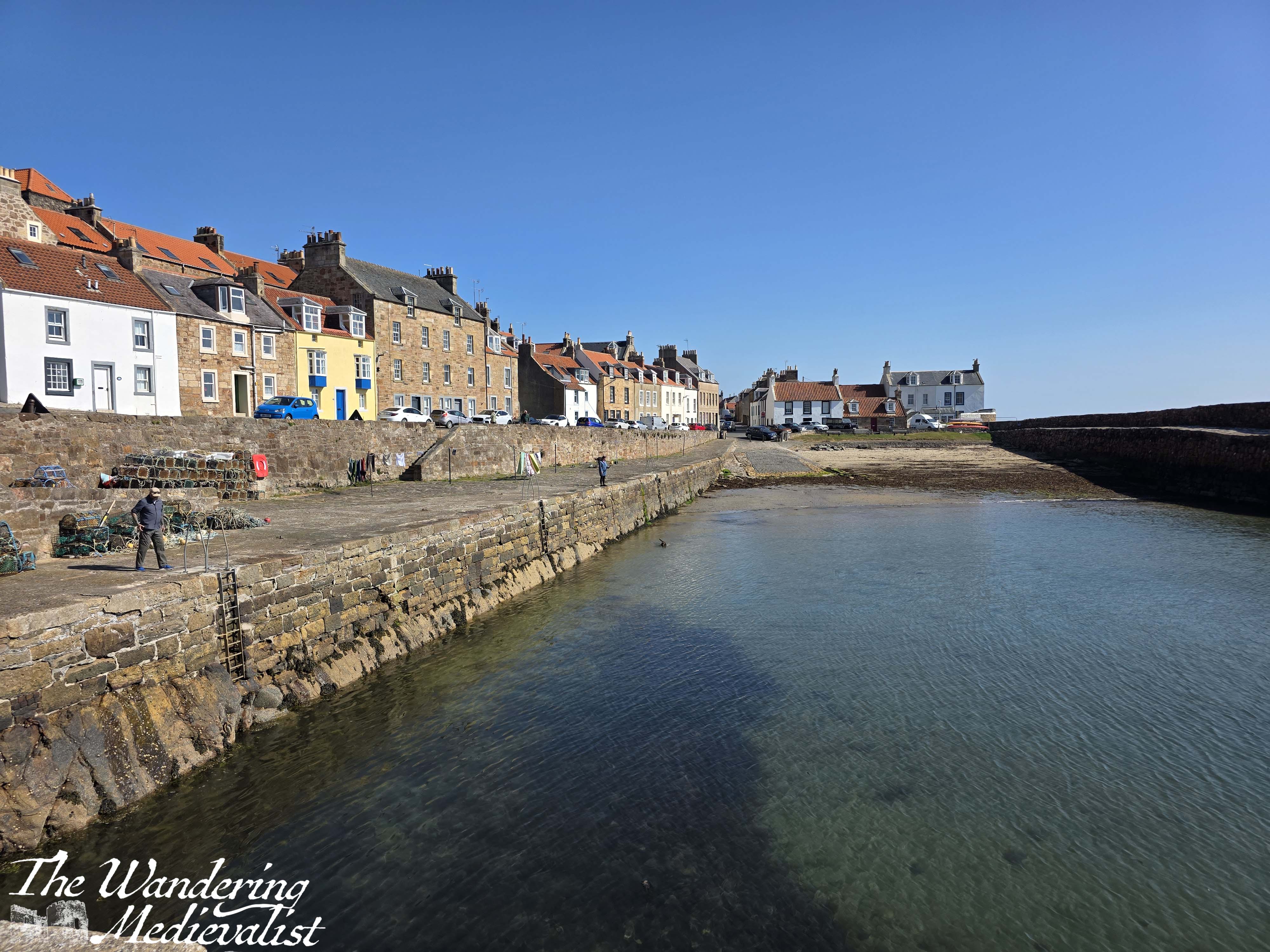
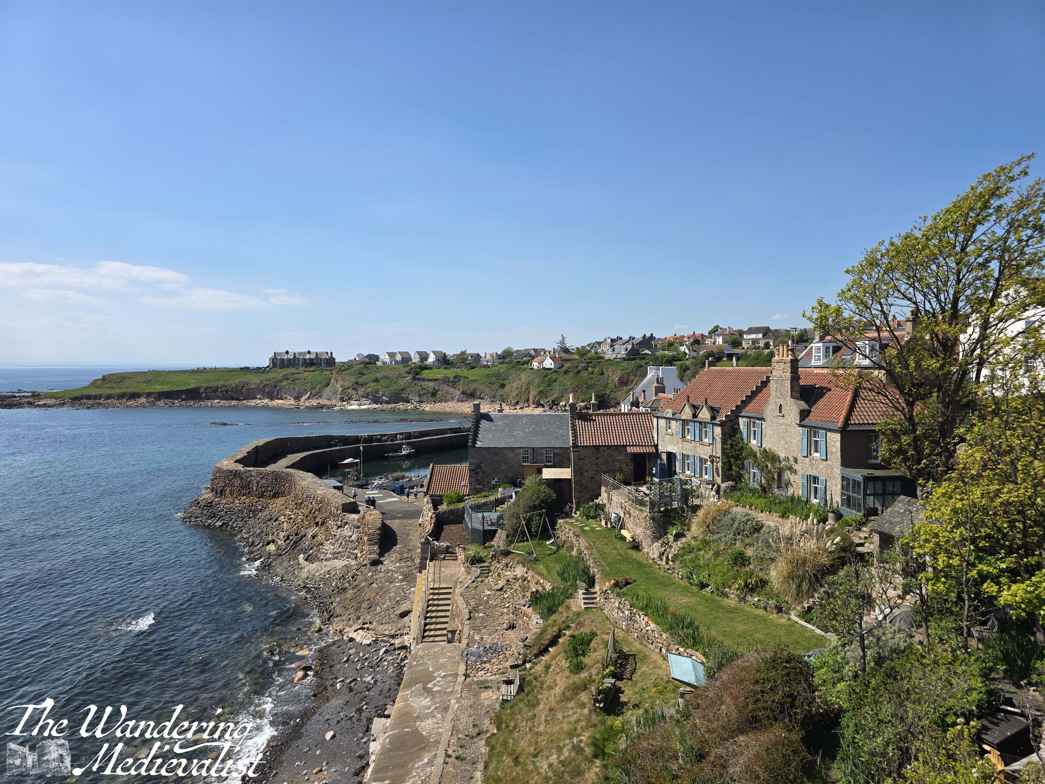
It’s not particularly large but it is active and surrounded by well-kept houses that stack closely together as they rise away from the water.
Only a few houses further along, the road opens up to a green hill on the left and the open shoreline on the right. The hill is quite steep but climbing to the top via a path or stairs allows one to view the war memorial up close, and look out over the water and tidal pool.

As you can see, it is a busy area, with bathing and water sports available, and a good-sized play park. There is also a van selling snacks, another coffee, and a shore-front eatery. Just beyond this waterfront is a well-kept caravan park with a lovely view out over the water.
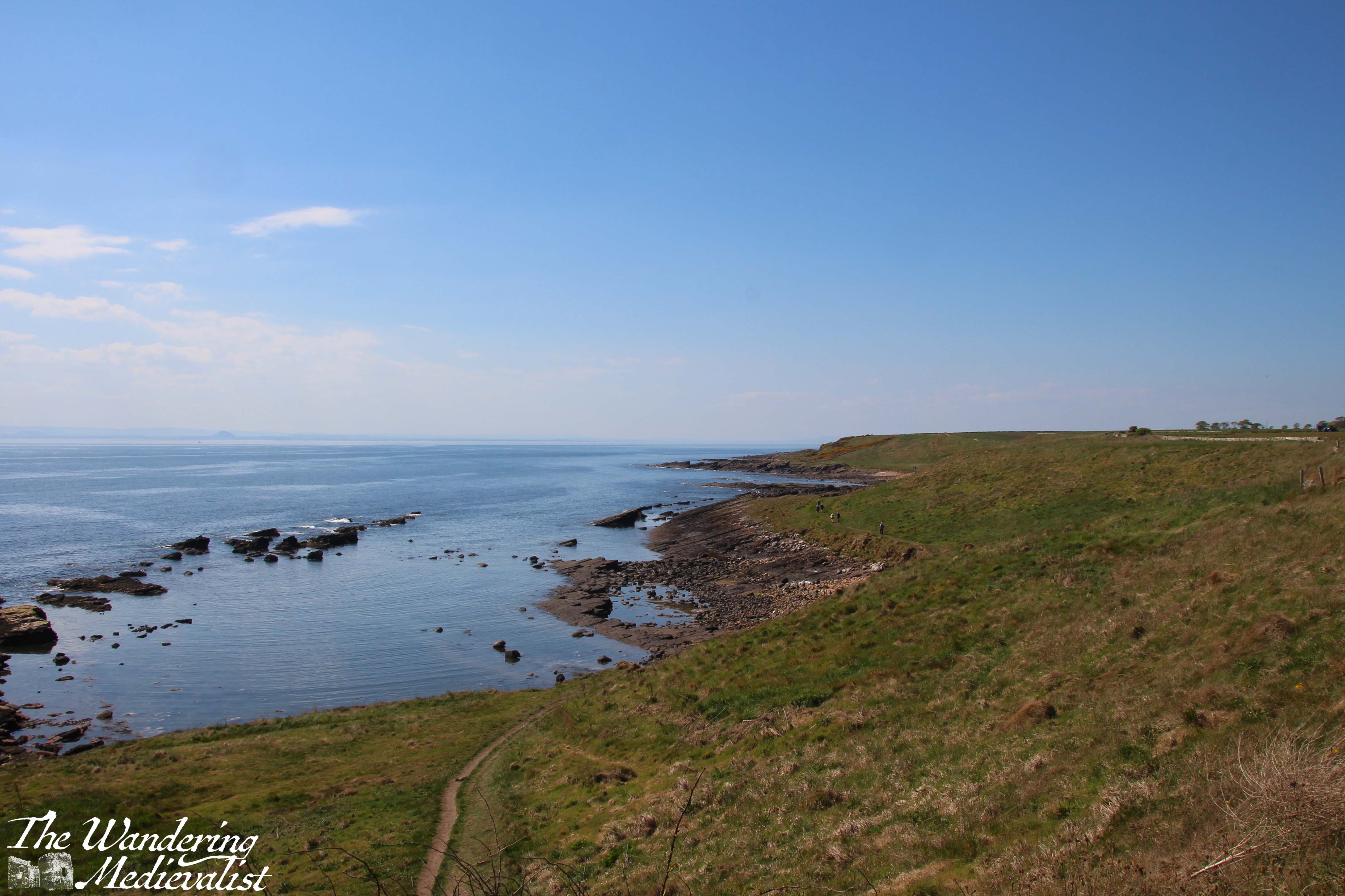
After passing the caravan park, the path leads out of the village and along the coast, with the ‘usual’ beautiful views over the water and rocks. The path here is considerably flatter than the one I took the previous week, with only gentle hills until the very end. It is also quieter, and while I did pass some walkers, there were not nearly as many as on the shorter path.
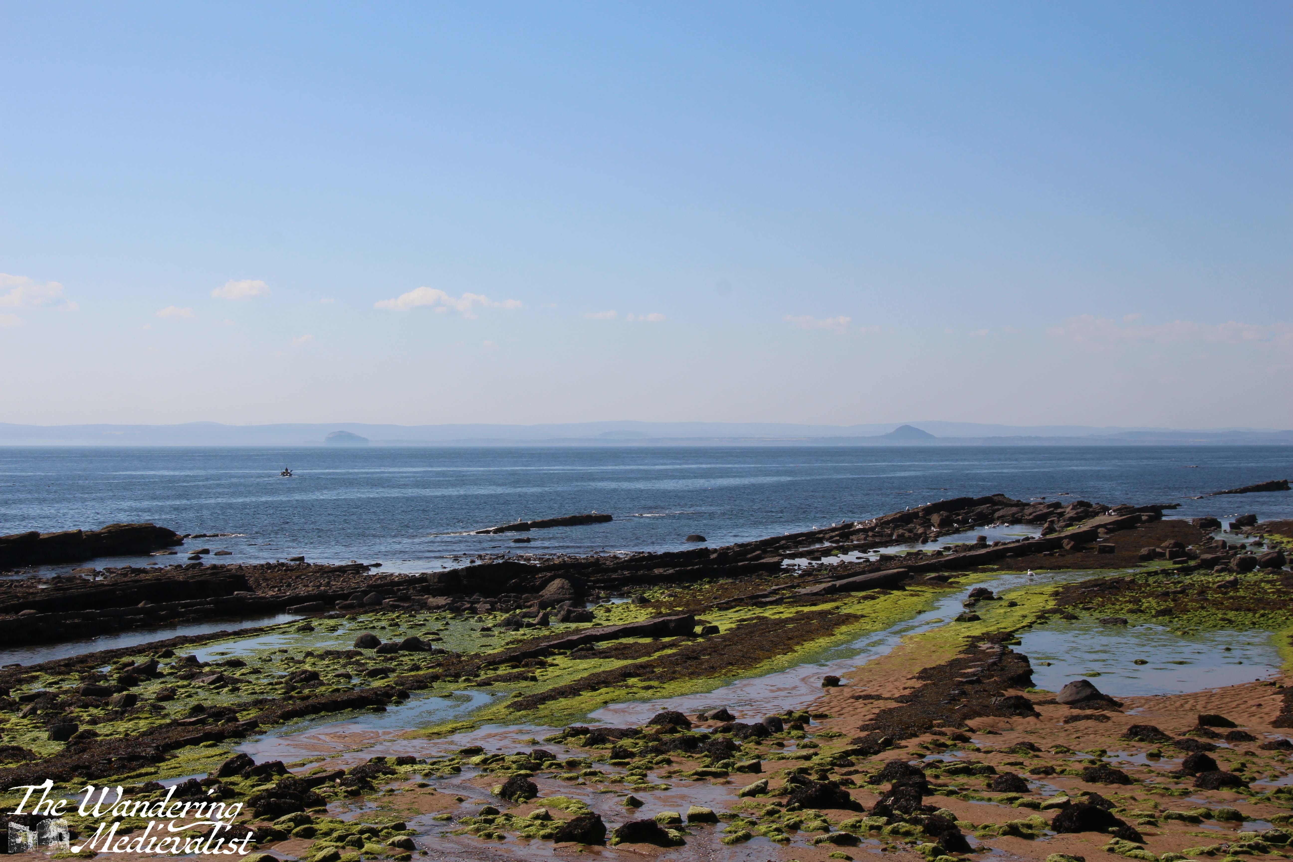
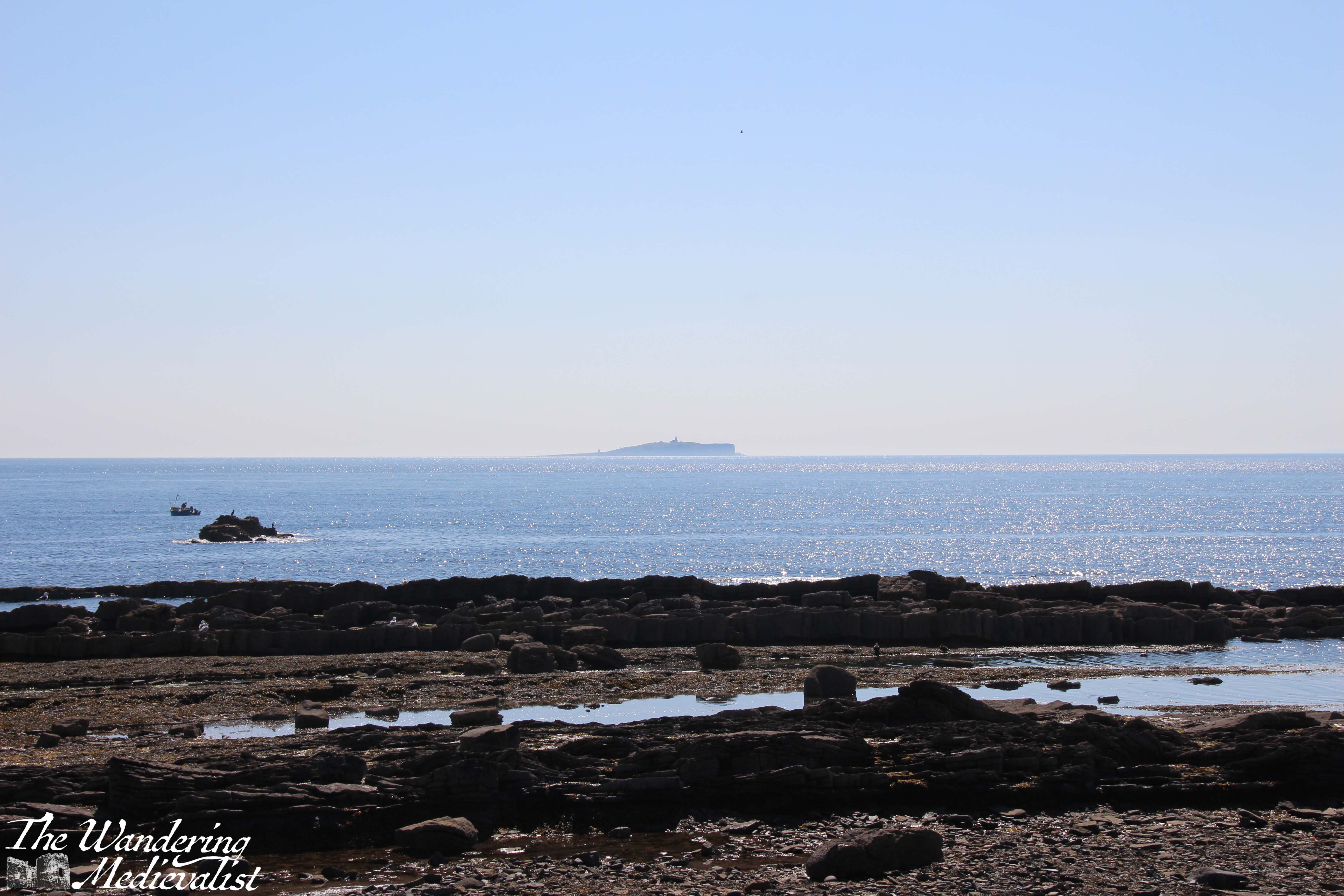
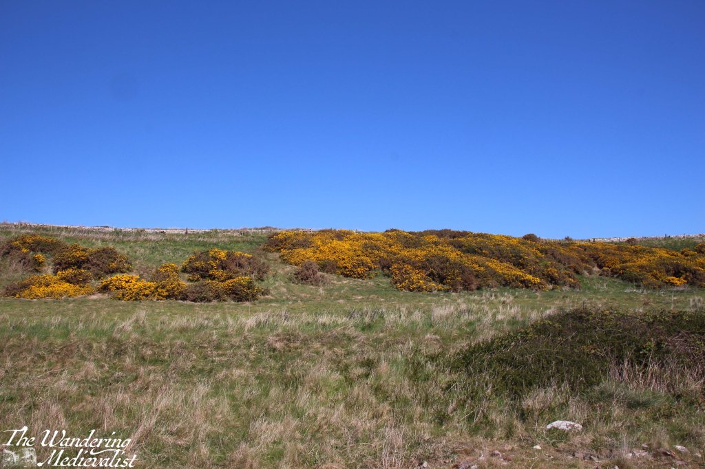
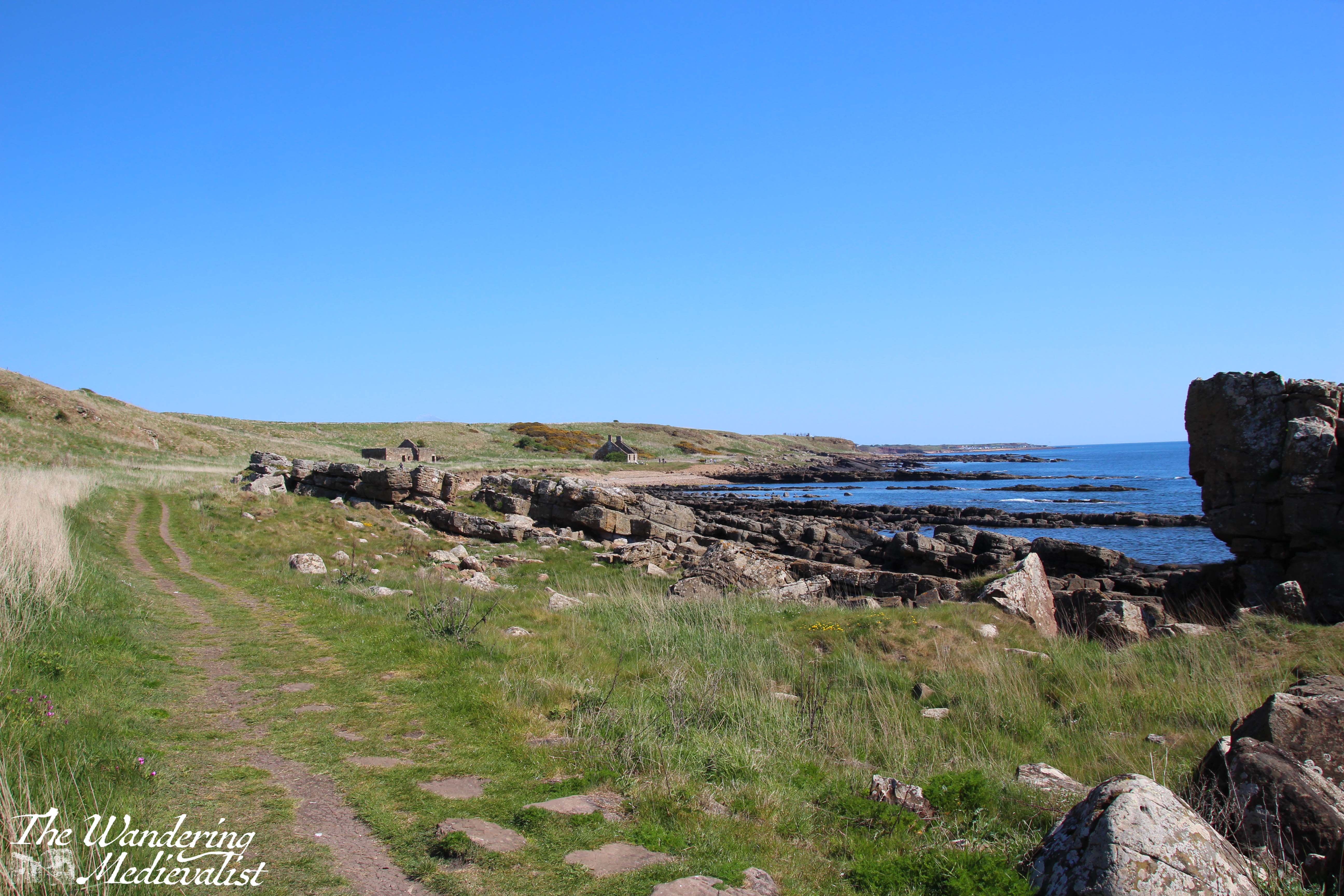
About a mile beyond town, I passed Caiplie Court, a small collection of beautiful cottages with a large garden and some coos that were not feeling particularly photogenic. As the path continues, the left-hand ground begins to rise gently into hills covered with grass and yellow gorse. Just under 2 miles from the edge of Cellardyke, I noticed a low headland in the distance, ending in an outcropping of rock.
Caiplie Caves
As I hoped, this turned out to be the edge of the Caiplie Caves, a group of sandstone caves that have been linked to the early Christians in the area.
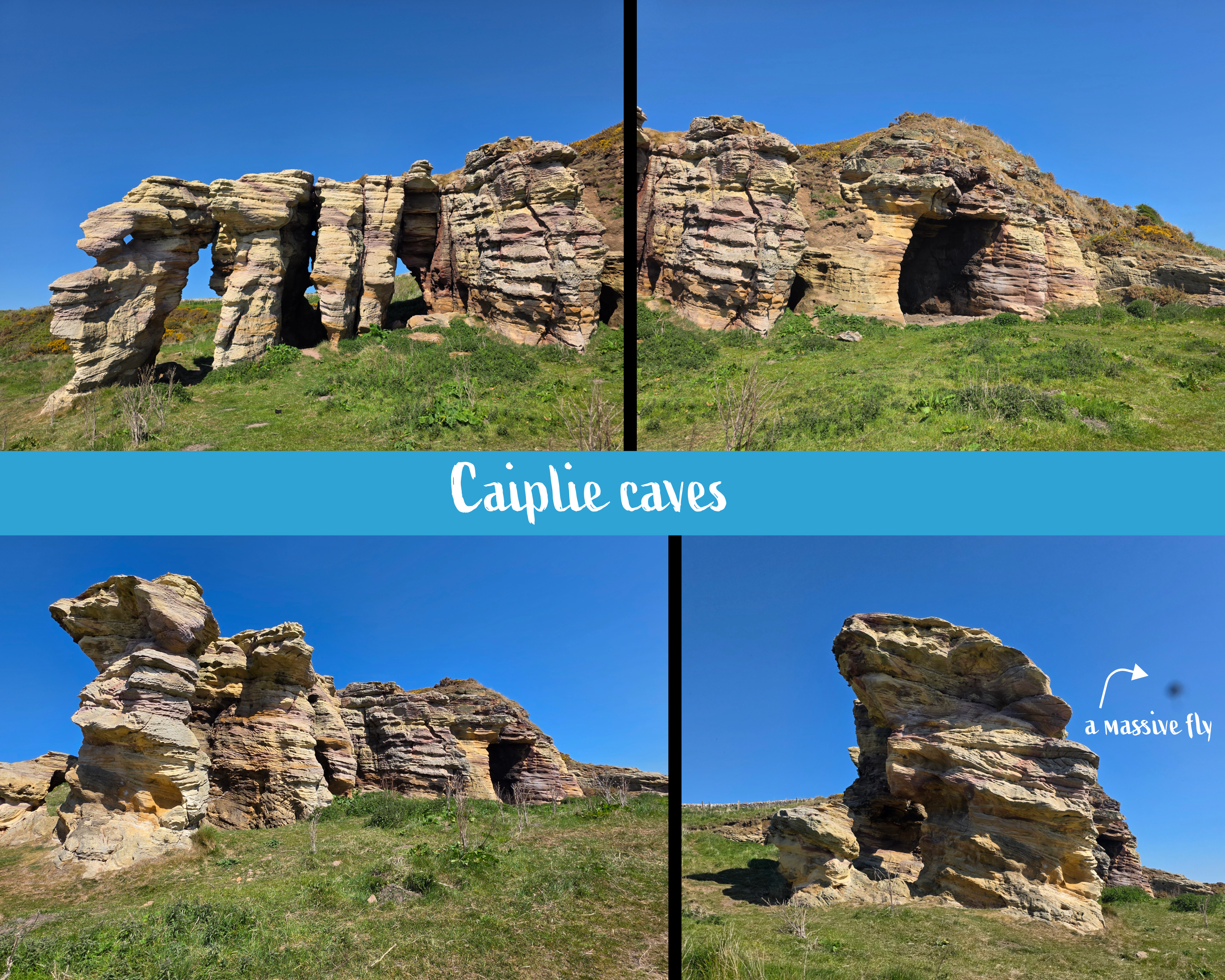
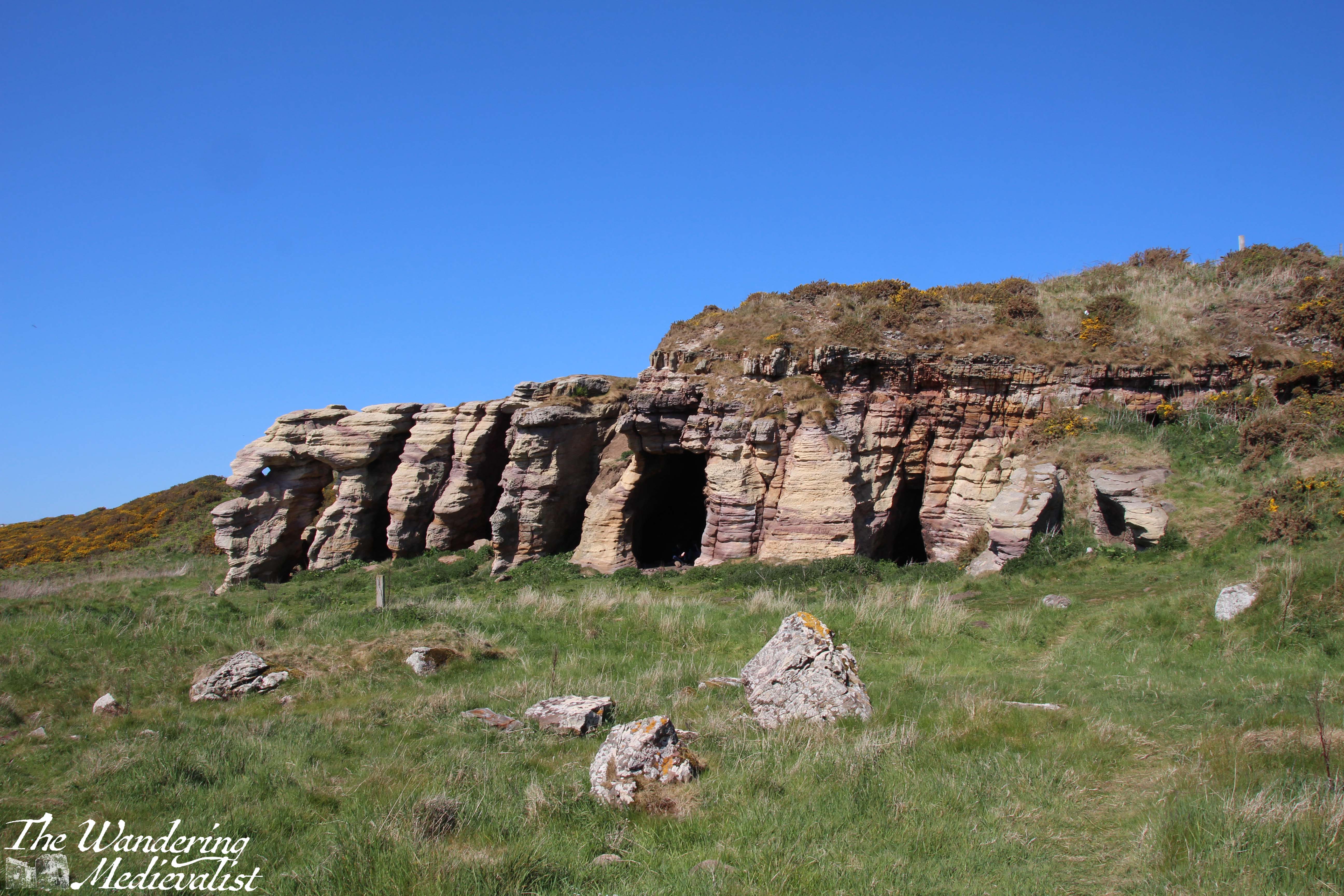
There was a group of teenagers meeting in one of the caves so I chose not to get closer, but according to Historic Environment Scotland, there are a number of crosses and even Pictish symbols carved into the rocks. The caves were likely used as chapels and perhaps even as small cells. I hope at some point to return and take a closer look!
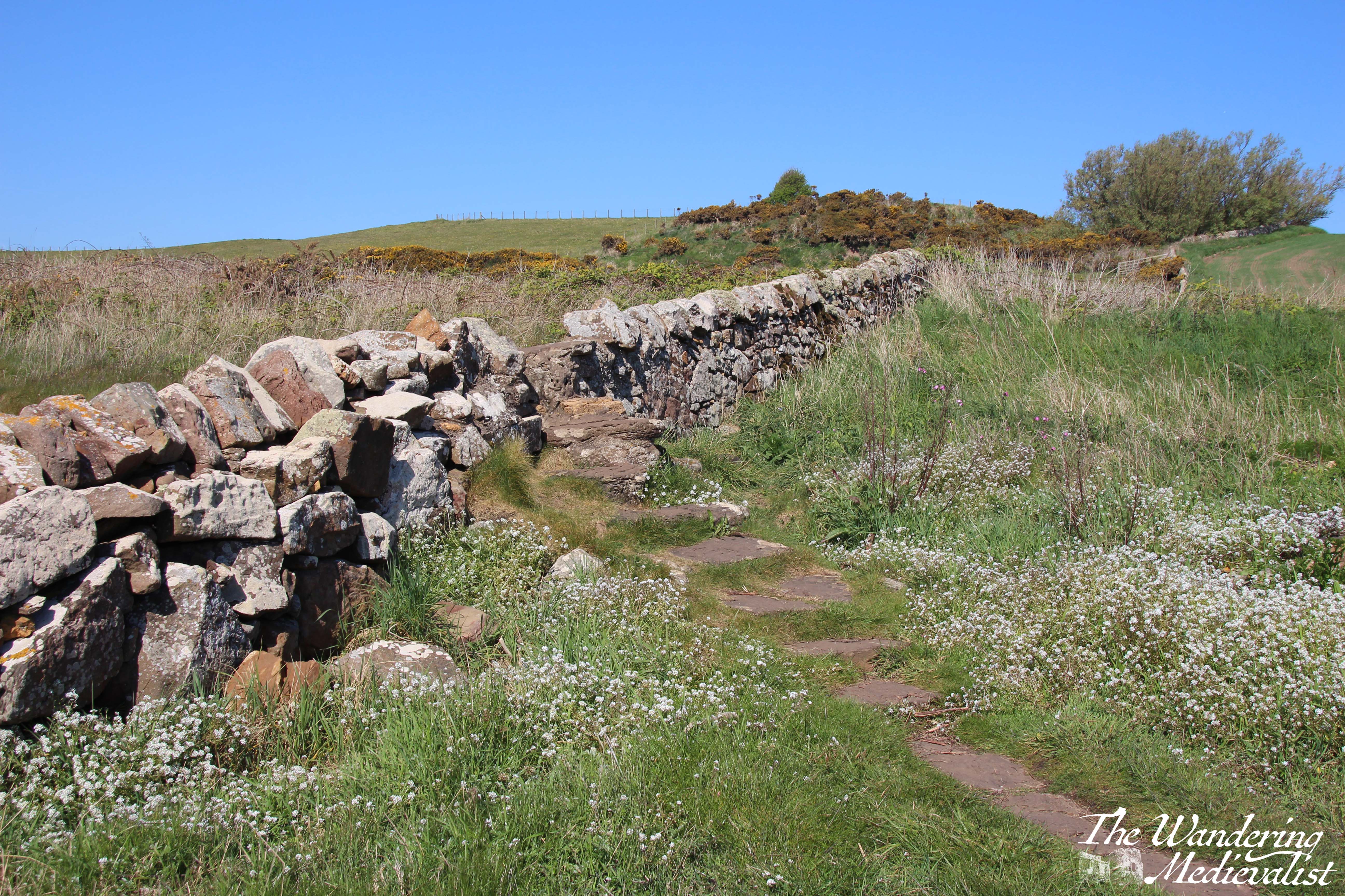
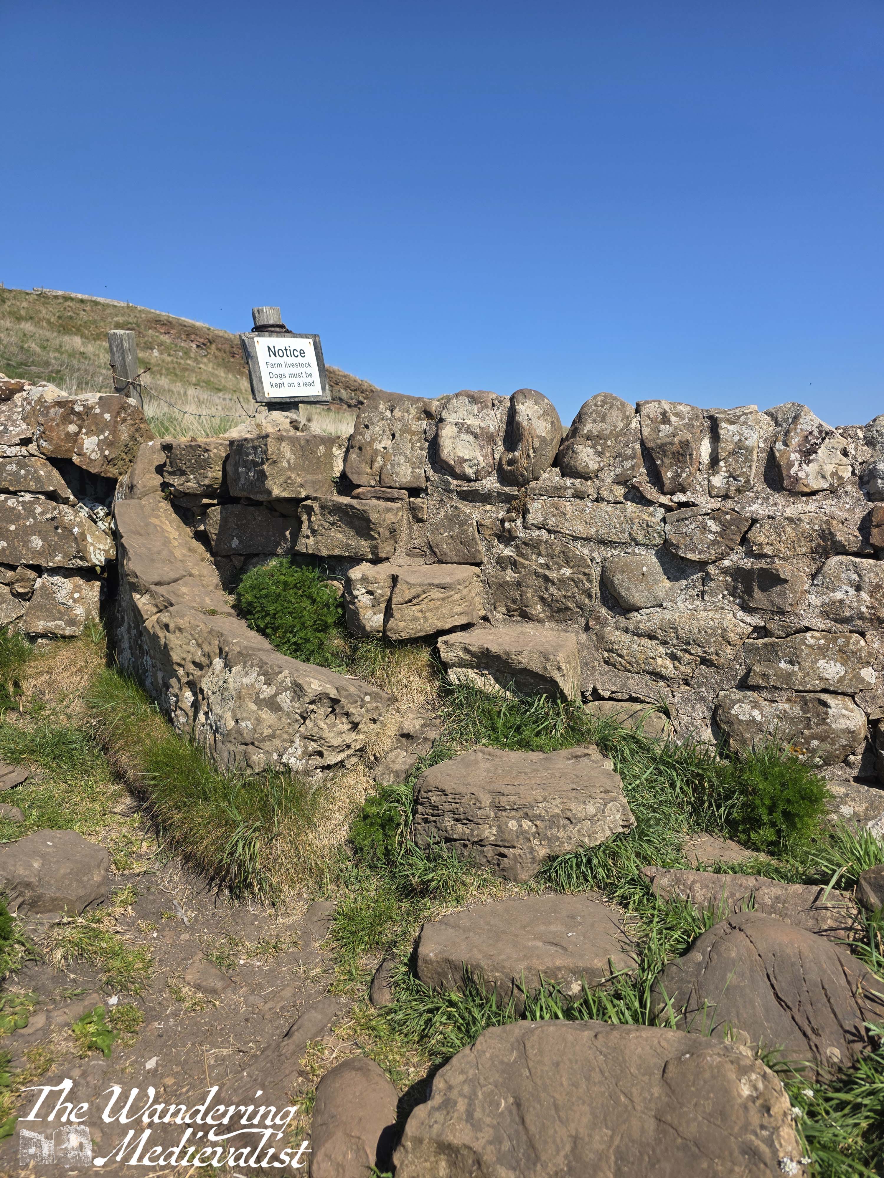
It was about this point in the walk when I was starting to think about taking a short break, but still continued on for another half mile or so. I crossed one stone wall and then reached another with narrow steps leading up one side and down the other. From the top of the wall, I could look over the bay ahead of me which included two skeleton former houses.
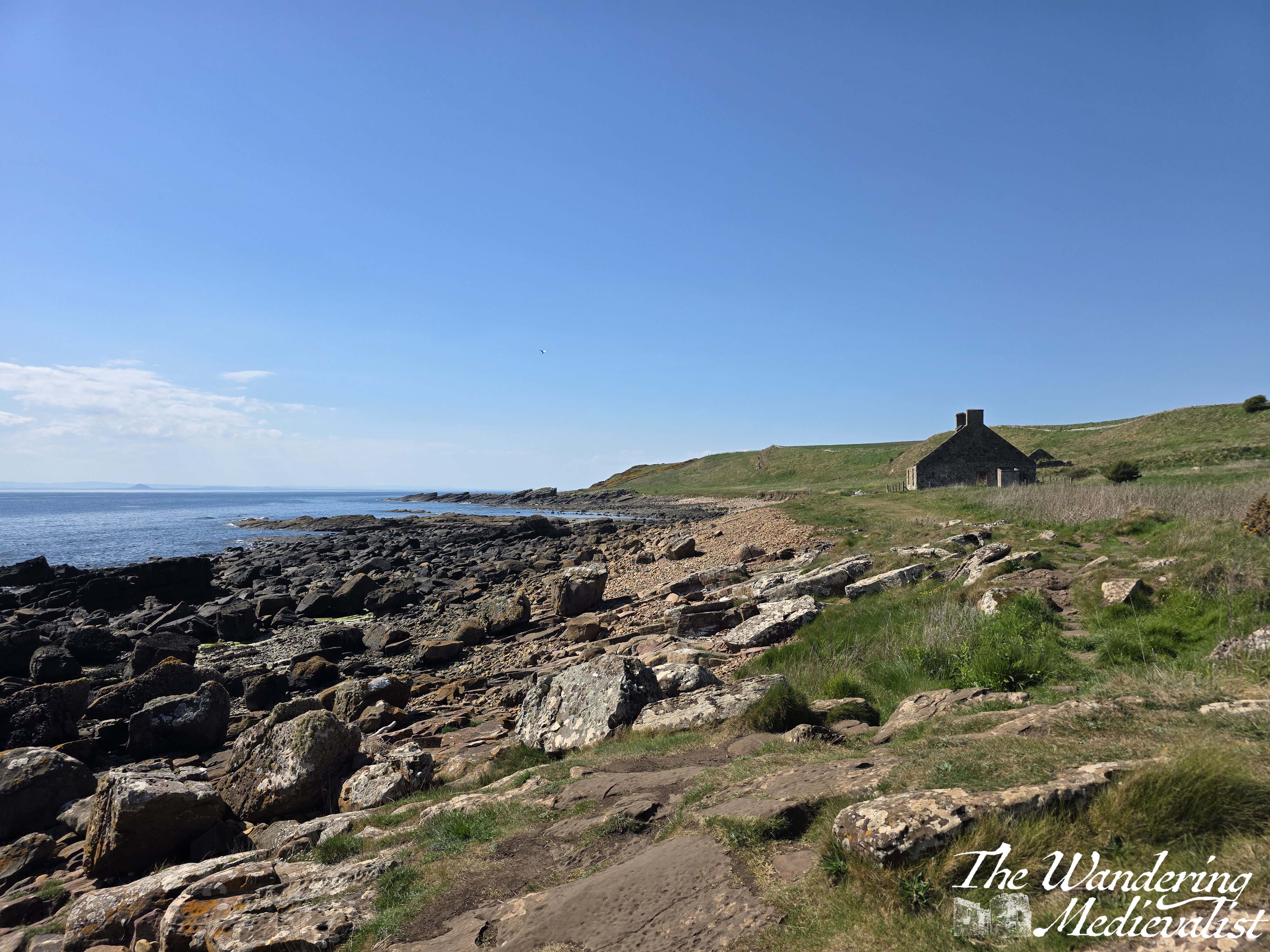
Just in front of the house was a perfect place to perch for a few minutes, breezy enough to keep away some of the swarms of flies that pestered me every time the path was sheltered. In some pictures the flies are visible, and in a few I’ve removed them so as not to ruin the view. Oddly they don’t appear to be biting, just incredibly annoying as they whir around your face, ears and hair.
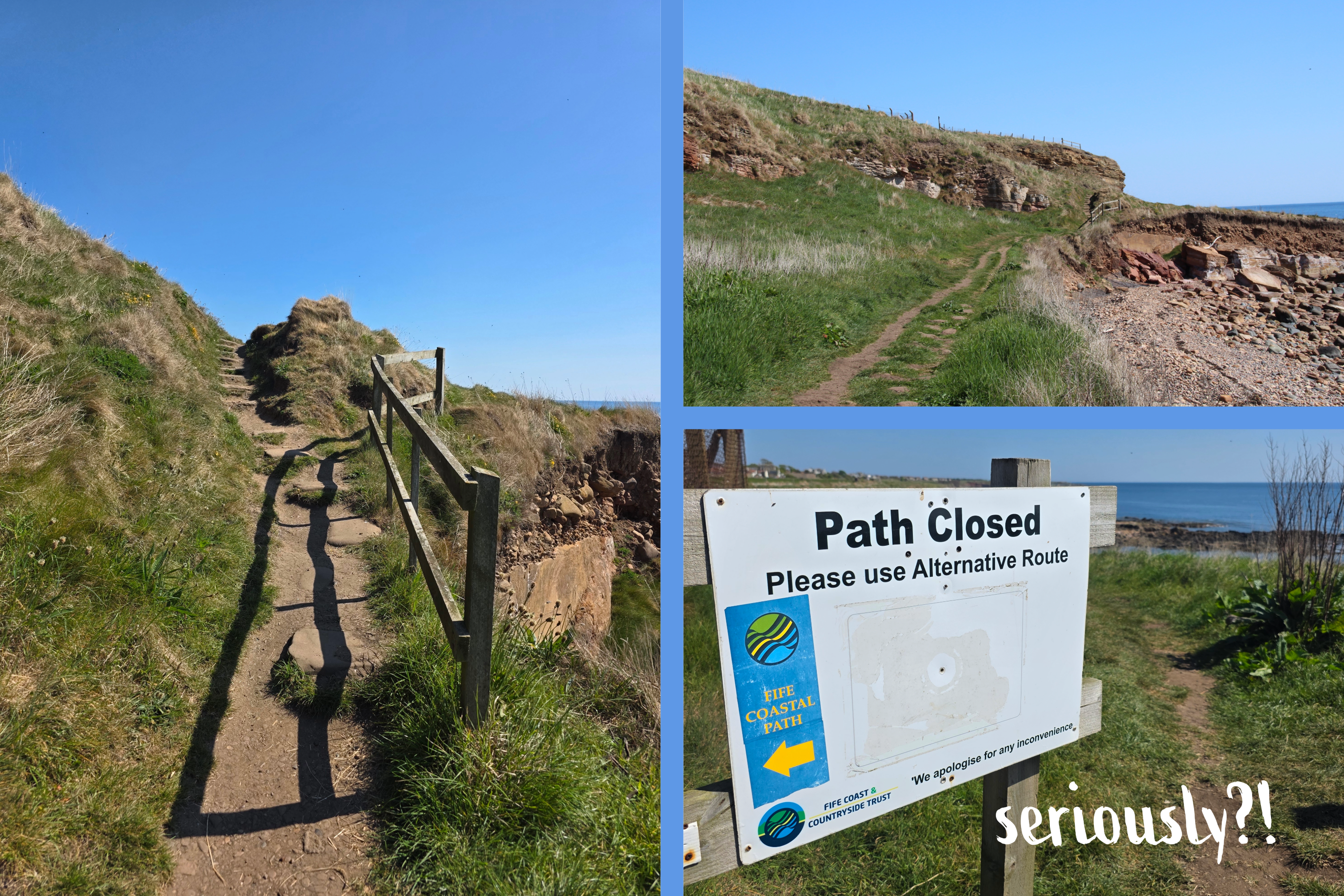
A bit refreshed, I continued on towards the next headland. There were a few more bays and outcroppings, and I remember distinctly being worried to check the map in case I still had miles and miles to go. Fortunately, I was doing better than I thought. I paused briefly at the bottom of a flight of stairs, allowing another couple to pass me and offer me more sun screen, though I think was red more from exertion than sun (I did slather on the SPF30 before leaving the house, even Scottish sun can burn!).
At the top of the stairs I was greeted, unbelievably, with ANOTHER path closed sign! Fortunately, this really did not impact my walk much as it had evidently been closed for some time. I took one look back to the west again before heading towards Crail, which stretched out along the coast before me.
The approach to Crail is along the edge of the cliff, with a field on the left and the edges of the town springing up in the near distance. The advantage of the cliff height is that it allows for spectacular views down over the old village, beach and harbour; I was even lucky enough to find a few splendidly red wild poppies to enhance the sight.
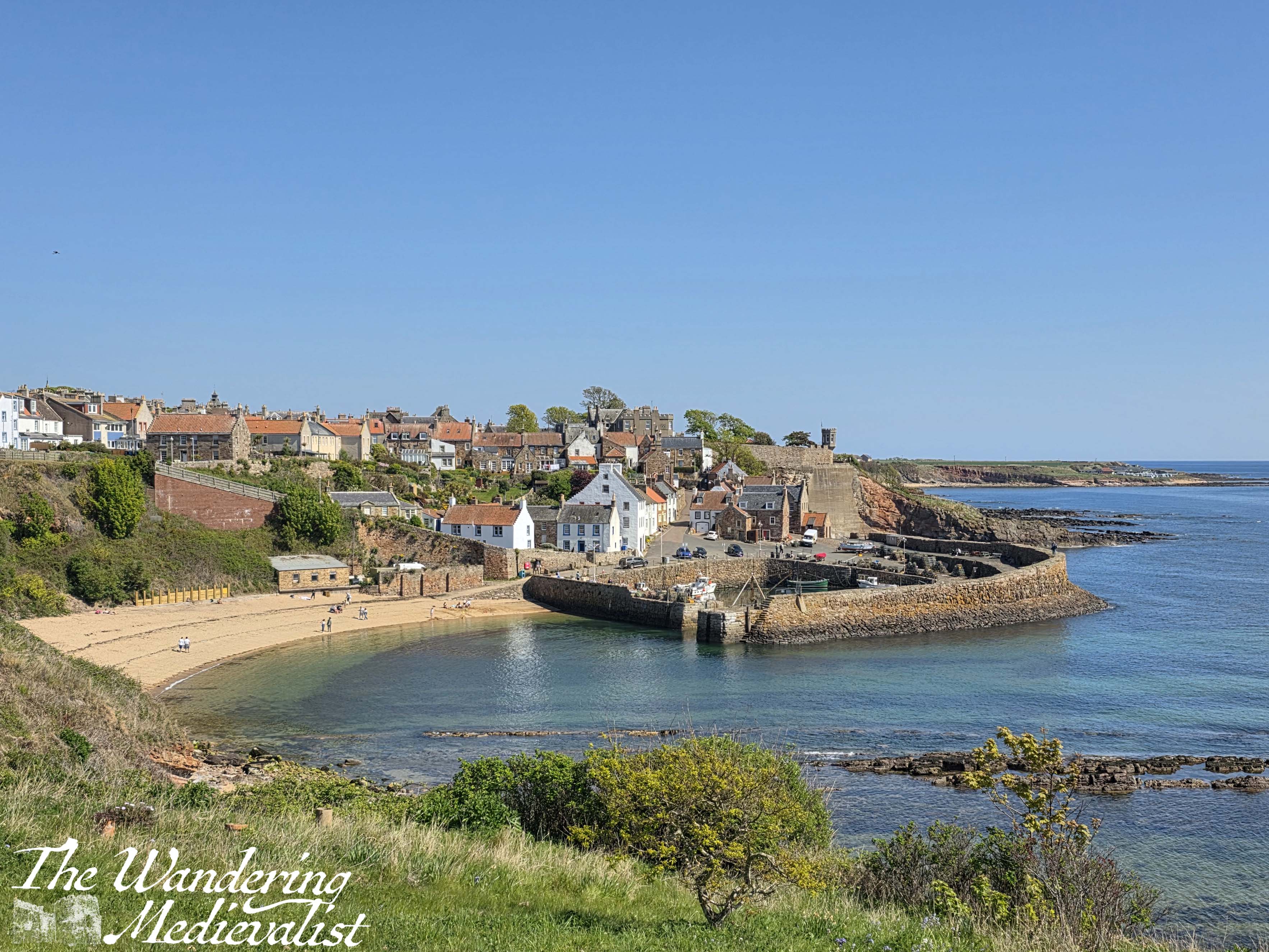
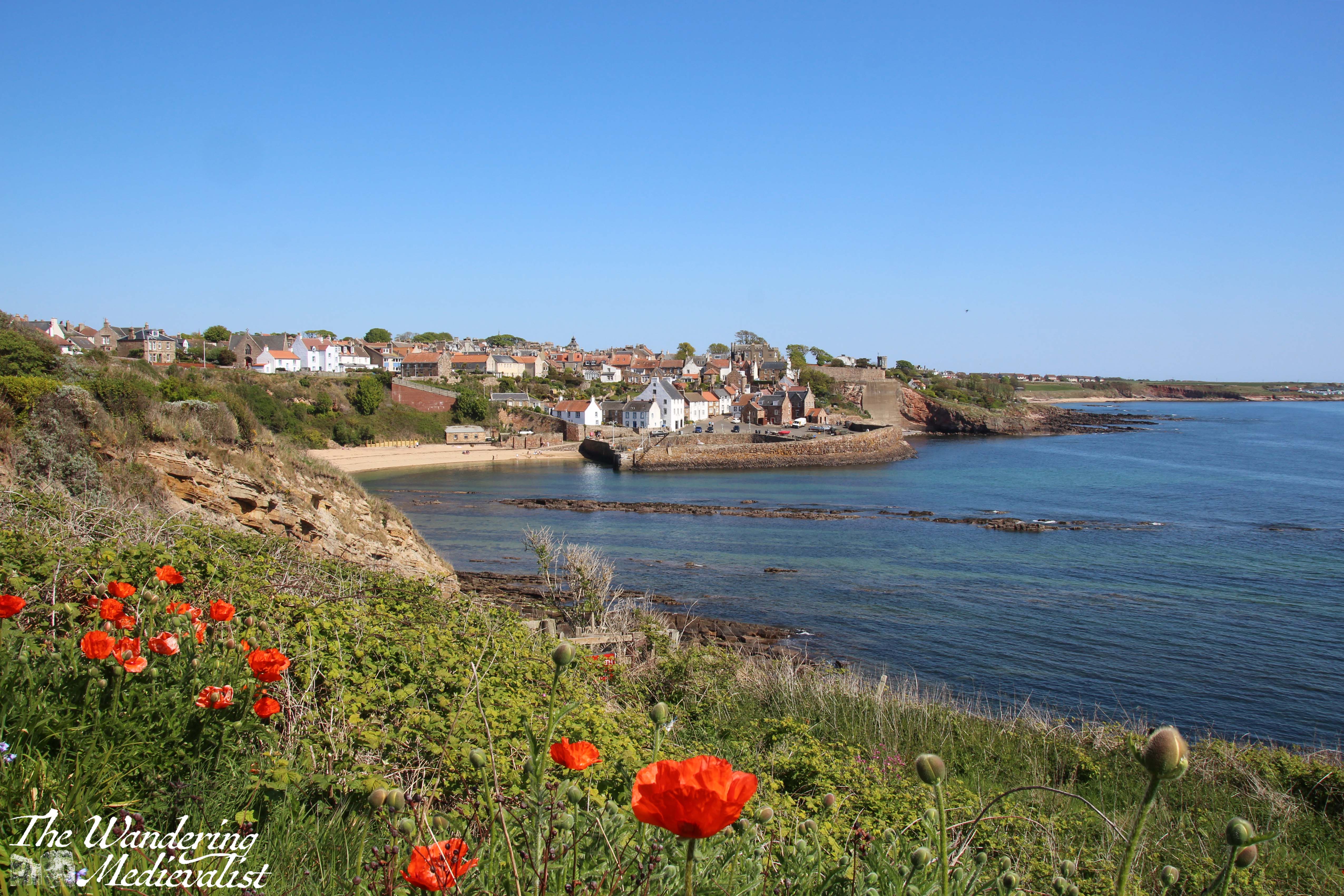
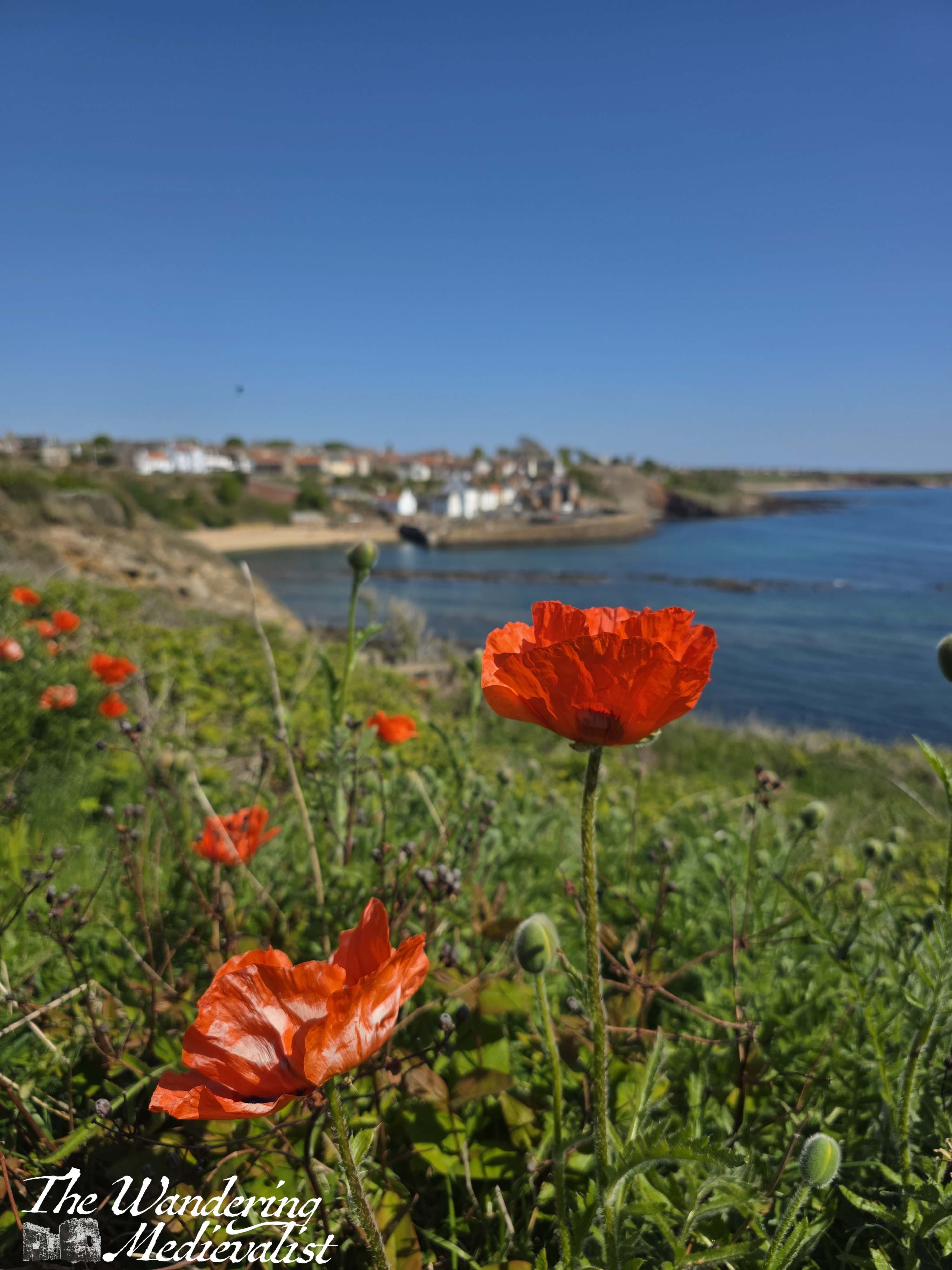
There is no question, this is one of those views – it appears on paintings, mugs, tea towels, calendars, any tourist memorabilia of Fife. And for good reason.
The re-routed path takes walkers through a farm gate, and along a row of houses opposite the cliff edge. After one more viewpoint, the path swings up left towards the main road – Anstruther Road. I have to admit I was not entirely certain as to the route here and had to double-check my map, as the one sign pointed haphazardly at two potential routes.
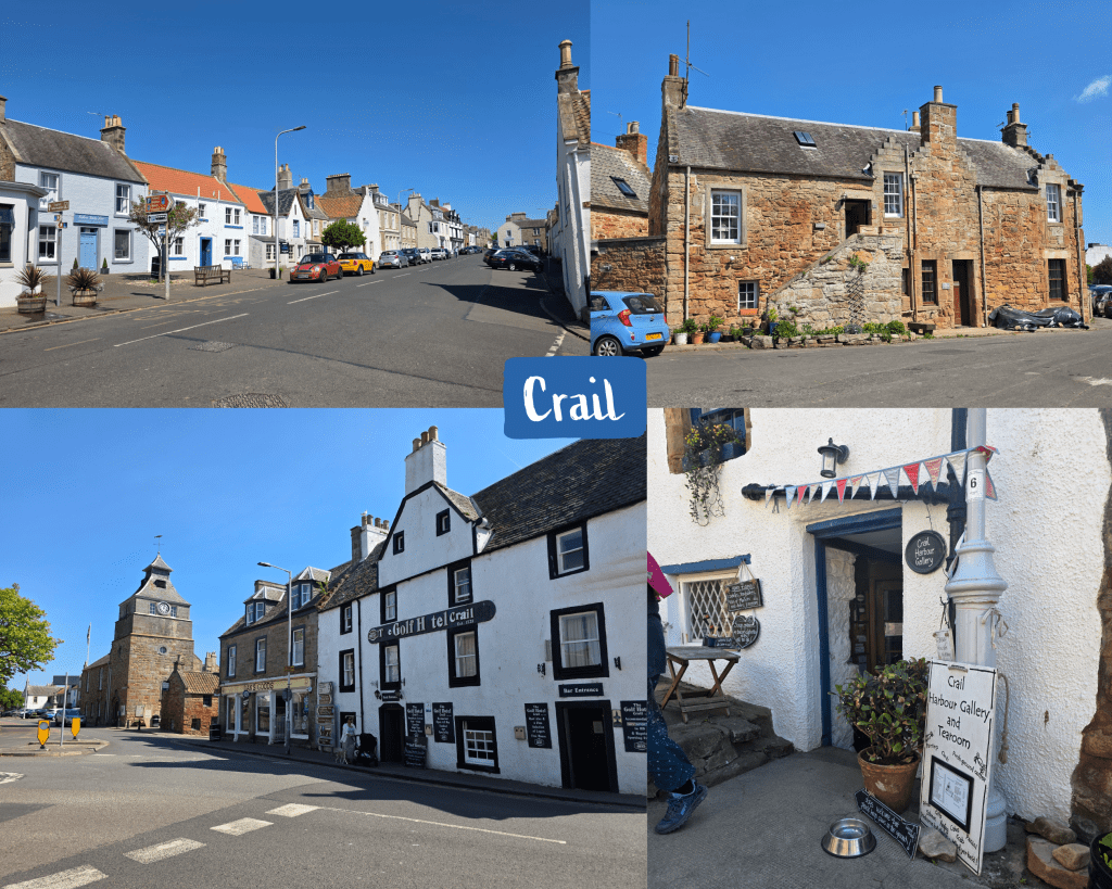
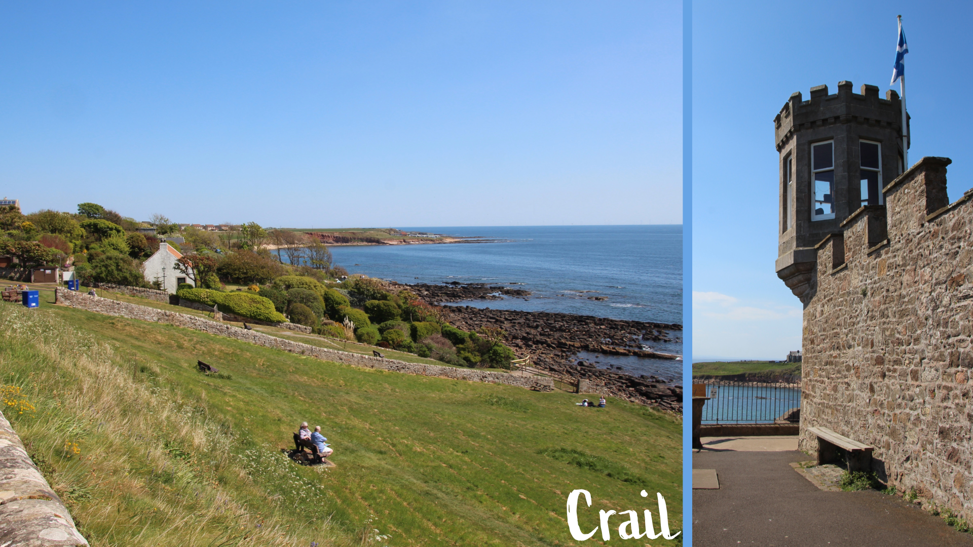
Crail
Like many of the East Neuk villages, Crail is beautifully kept with lovely gardens, expensive houses and plenty of character. It is arguably one of the more picturesque villages in the series, and it is a particular focus for the local arts community, famous for pottery in particular. In July, the town hosts an Arts Festival that draws visitors from around the world. It is not hard to see why this place would inspire artists…
The coastal path follows the Anstruther Road then turns sharply right along the aptly-named Shoregate. One of the aspects of these villages that I love the most is the myriad of closes and wynds that allow pedestrians their own routes. Often they are lined with garden walls, overflowing with trees, clematis, roses and other greenery. Shoregate tempted me with a peek at St Claire’s Wynd, but I followed the coastal path signs instead.
Now I have to admit that I did take a detour down to the harbour, though the coastal path directs walkers to take a left and hug the coast. The path to the harbour is quite steep and a good portion of it is cobbled; signs warn drivers that there is no public parking at the bottom. I certainly would not want to attempt it in a car!

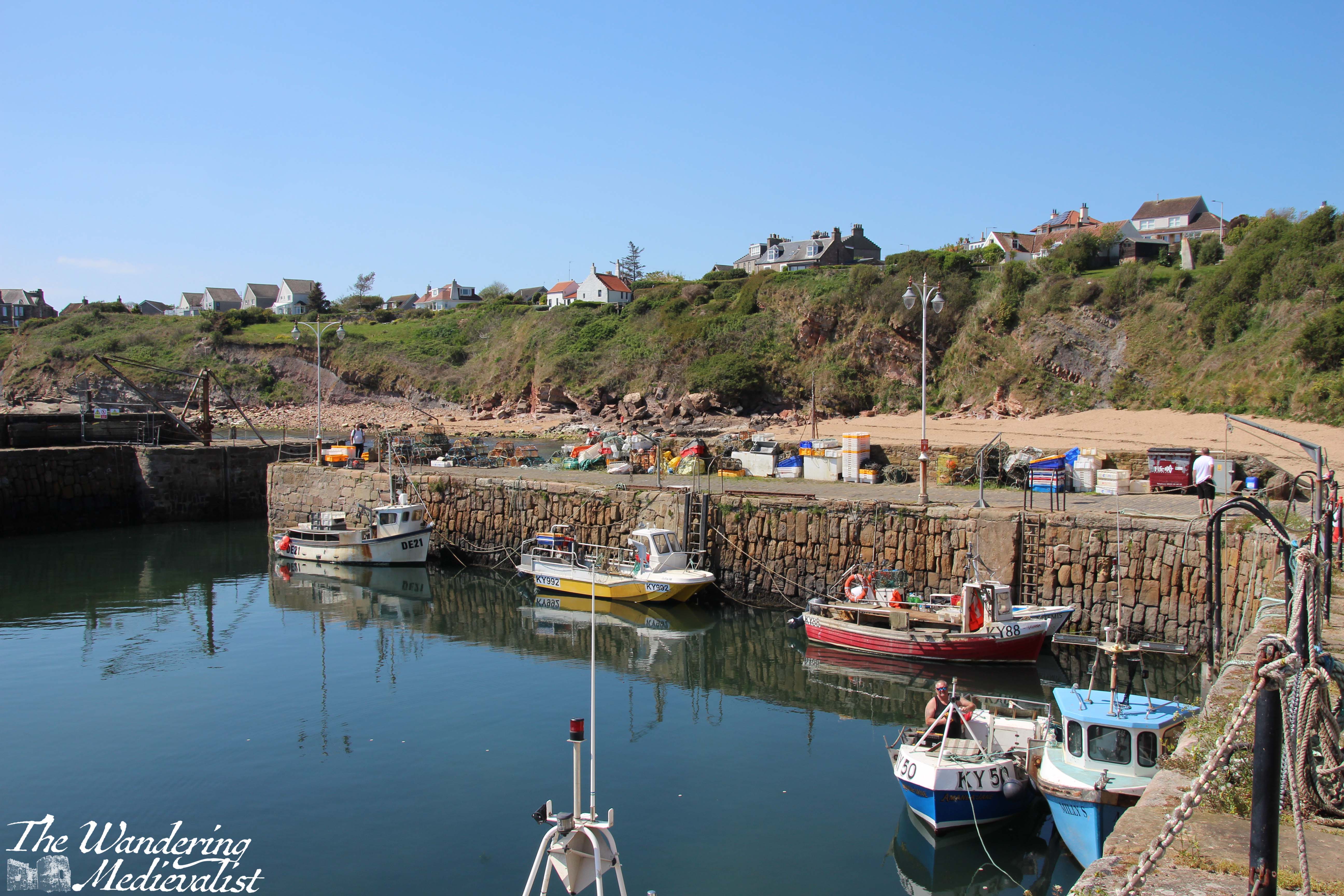
The harbour is certainly worth a visit if you are able to walk down. There are several refreshment options including ice cream, access to a public toilet, and plenty of places to sit and enjoy the view. I am sure that in the summer, it is an incredibly busy spot!
I was nearing the end of the walk – and my stamina – as I turned to head back up the steeply cobbled hill, but at least I was not pushing a pram like the father behind me, who understandably had to pause several times. It was far too busy for me to explore the Crail Harbour Tearoom though it looked amazing, and as I discovered soon after, offered incredible views from its back terrace (just visible in the first photo below). Instead, I headed straight up the hill onto the path that edged around some houses.
The path is narrow here, with views across the water and back towards the harbour, with the retaining wall of the castle to the left. After curving around the corner tower that reminded me a touch of the lookout towers in San Juan, the path leads along the top of the steep grass park seen here:
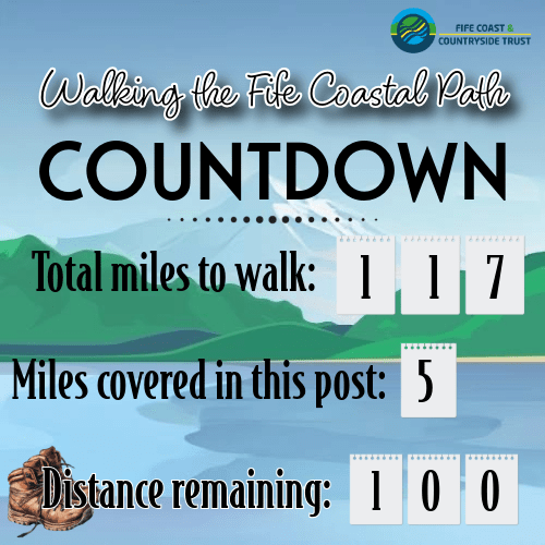
And this is where I marked the end of my walk for the day – 5 good miles from start to finish, and a little more for my two short harbour detours in Anstruther and Crail. I could easily have picked up the 95 Stagecoach bus again to head back to St Andrews, but I was fortunate to have a lift.
This was a good walk, with a bit less to see than some other stretches of the path, but still very pleasant particularly on a sunny day. The water views are spectacular as the corner of Fife approaches, and both Anstruther and Crail are great towns to spend some time in.
The next stretch from Crail around to Cambo is one of the longer walks, so I may not manage that until later in the year, but the step count challenge at work is helping to get my fitness back up to scratch and I look forward to my next walk!
This segment marked another exciting moment – reaching the 100 miles to go mark! The first 17 miles seemed to go very slowly, so I hope I can pick up the pace a bit. Still…I’m getting there.
If you want to remind yourself why I’m doing these walks, check out my new page where you can keep track of my progress.

One response to “Fife Coastal Path: Anstruther to Crail”
[…] But for the red poppies and the stunning view of Crail, I think this is my favourite of all the pictures I have taken, while on this route: […]
LikeLike