

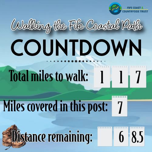
Whew, this was a long one. I knew it would be, and I was excited to give it a go, but I think I mis-calculated the mileage. Nonetheless, I managed, and it was a good challenge for me as well as a nice stretch of the coast.
The morning started with some overcast and the hopeful promise of blue sky by the middle of the day.
My starting point was Aberdour, famous for its castle which I have visited in the past, but chose not to stop on this occasion due to the clouds. It is definitely on the list for a re-visit soon.
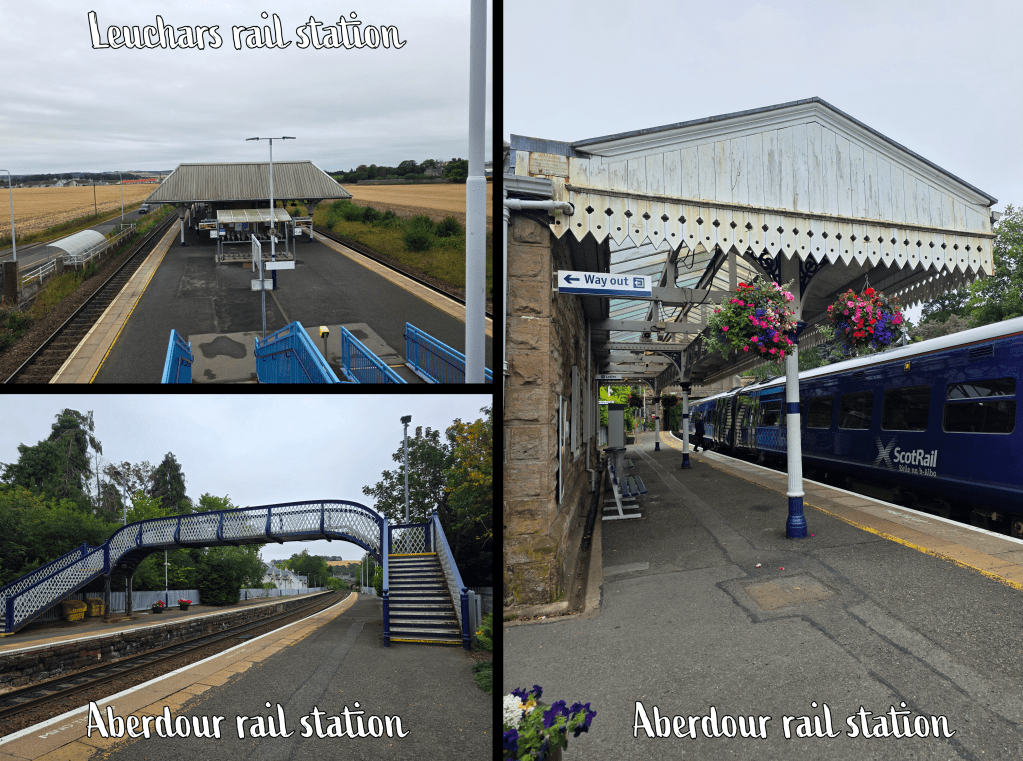
Aberdour is best reached by train, from the north requiring a short stop in Kirkcaldy on the way; I boarded in Leuchars and it was an easy, quiet trip. The station in Aberdour is beautiful – Victorian, with decorative metal scroll work and beds of flowers in and around the building.
From the station I headed through the car park to the main road, where there was a short half block before a turn down Shore Road. I counted the start of my walk from this intersection, where I officially re-joined the path.
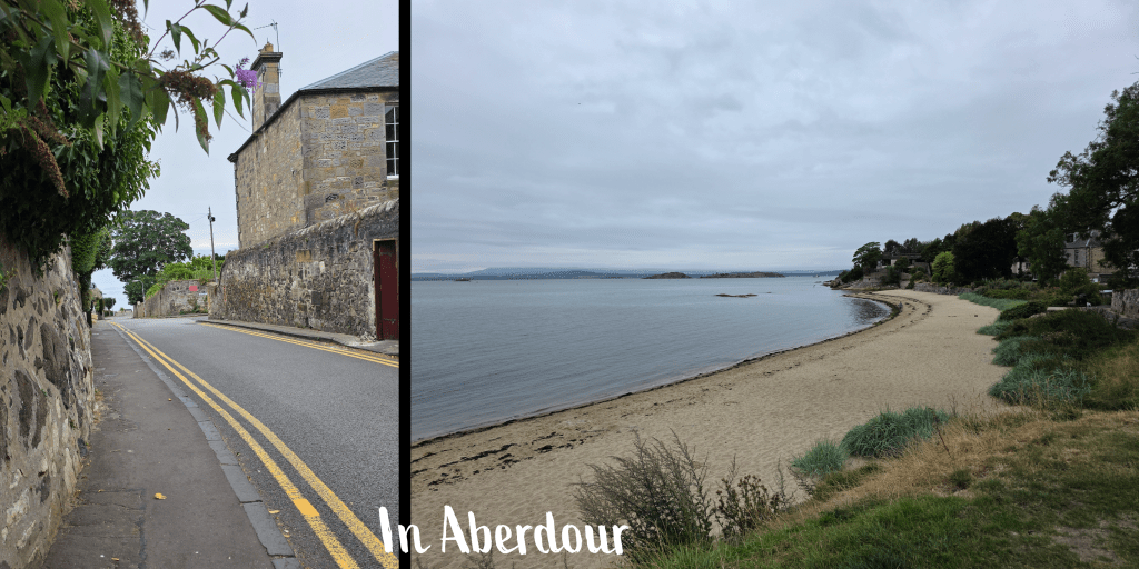
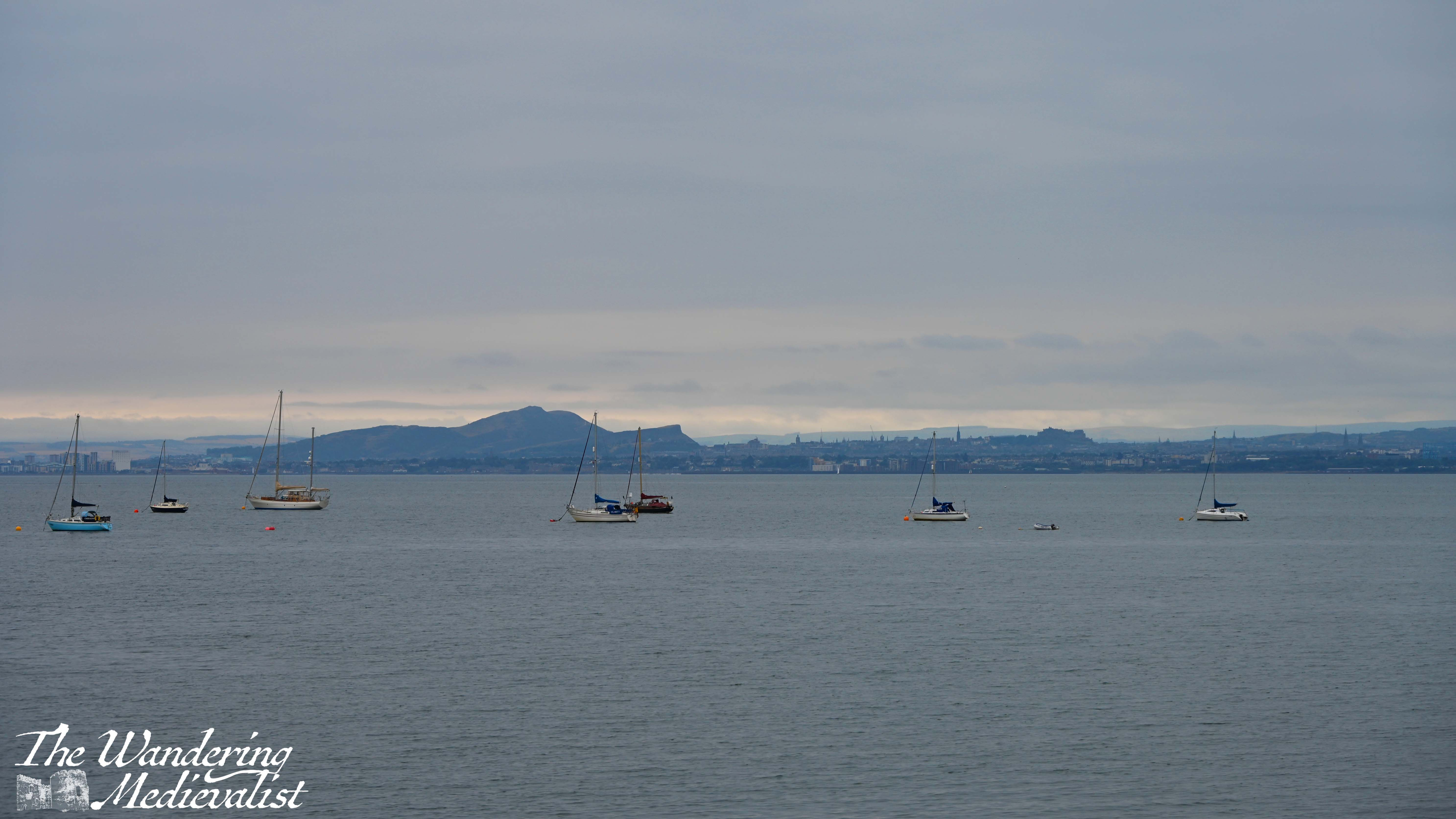
Shore Road runs down towards the water, passing some shops, a park, and large well-appointed houses with rocky gardens. In little time, it is clear you are descending a hill, and at the waterfront where there is a seating area and a beach off the the right. To the left is the harbour, and ahead of you in the Firth of Forth is just visible the outline of Inchcolm Abbey. Once the sun came out, I was able to get a good shot of the island.
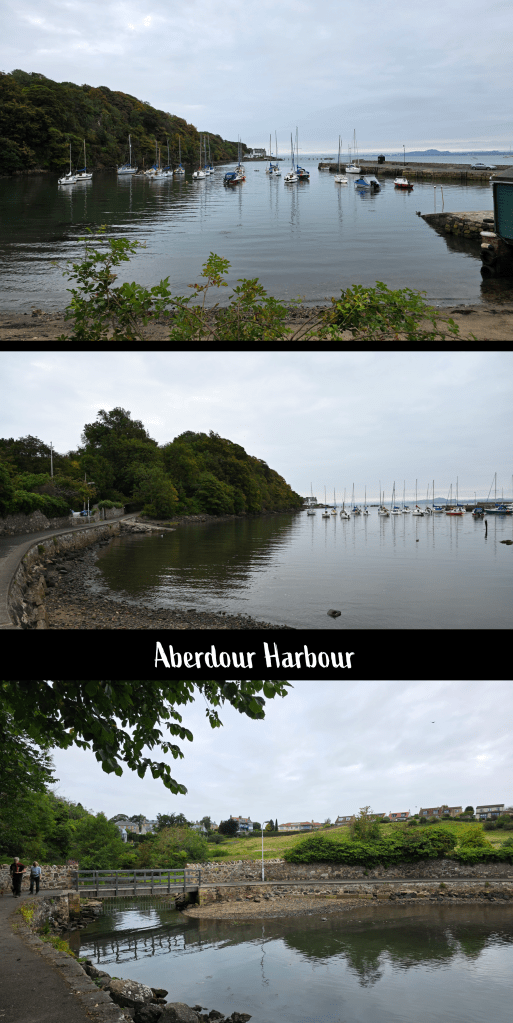
From here, the path leads towards the harbour, and just as the road turns into wharf, there is a sign directing walkers to the left. The harbour is small but with plenty of sailing vessels – less fishing, more pleasure boating here it seems – and sheltered by a headland. As the path loops around the harbour it crosses a burn that has cut through two sloping fields. I knew that at the top of the hill was the castle, but it hidden from view.
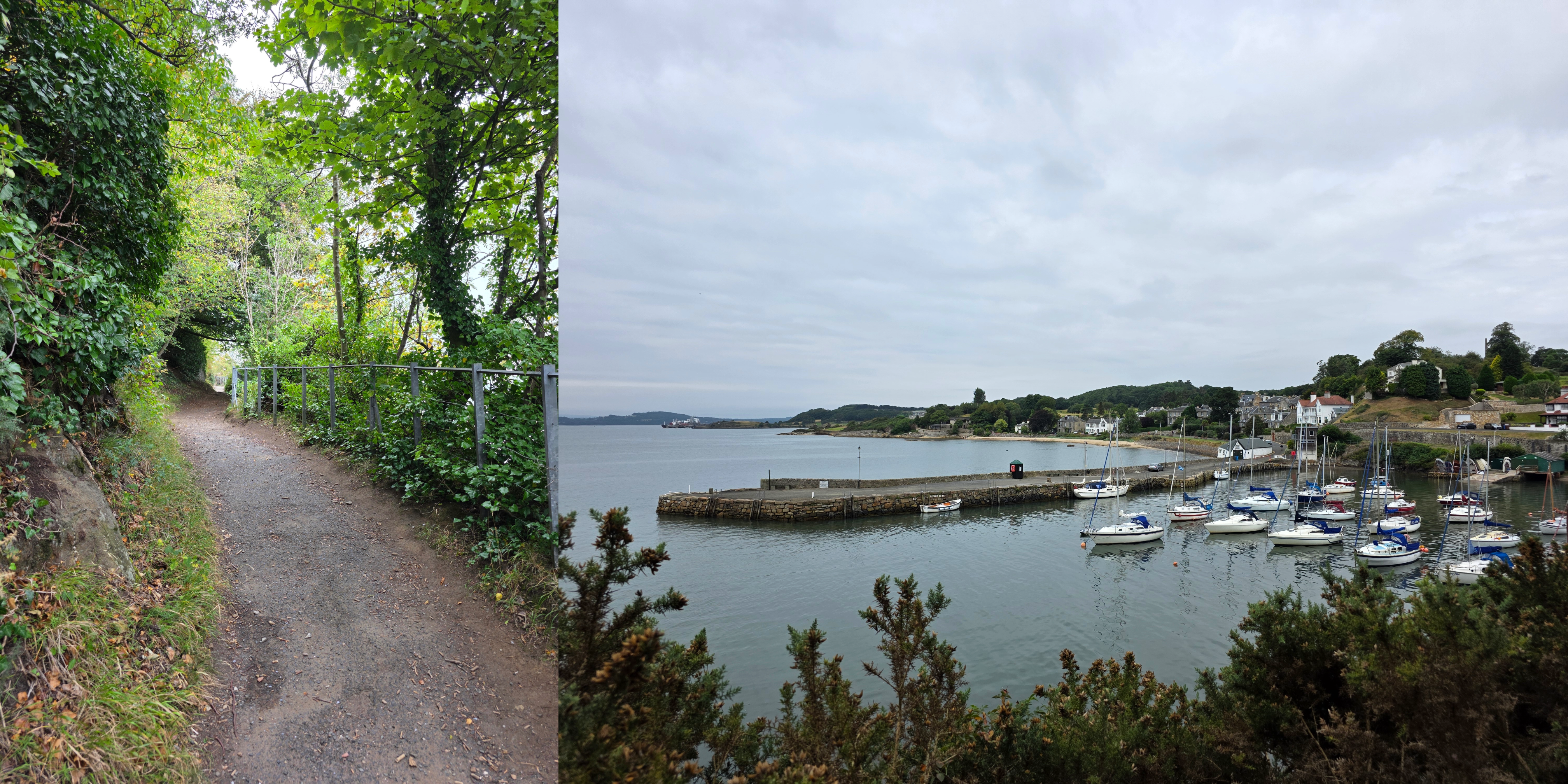
Beyond the harbour, the path climbs a bit as it continues around the coast, with occasional breaks in the trees for views back towards the village or out to Inchcolm.
It was an odd weather day, not sunny but nonetheless quite warm and a bit sticky. My cardigan, needed for the train and early part of my trip, did not last long.
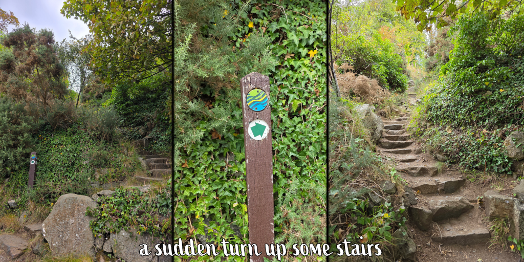
After perhaps five minutes, some houses appear through the trees, but be aware that the Coastal Path does not follow the road here, instead taking a sharp left up some stone steps.
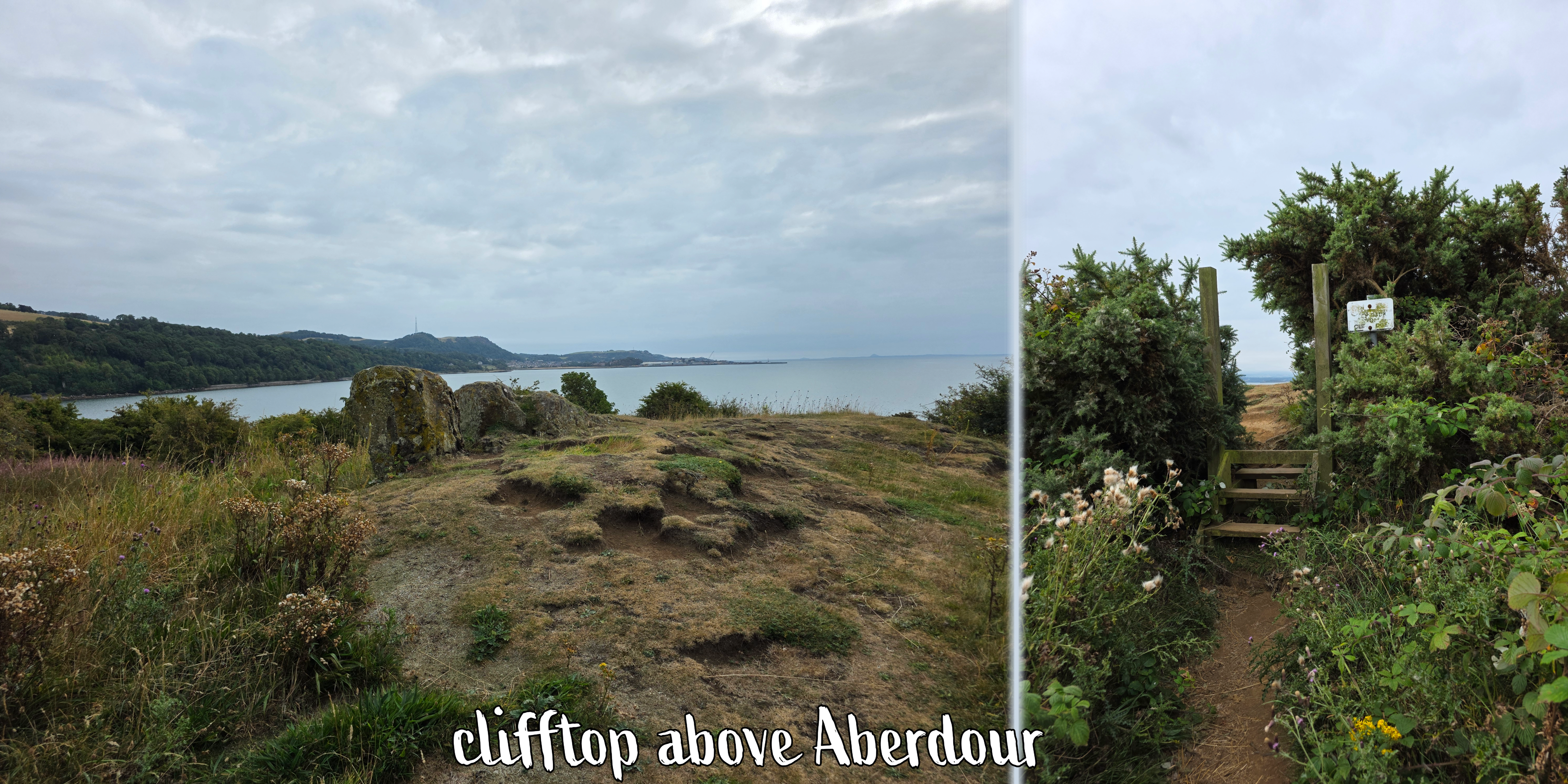
As the trail winds through the trees there are a few small footpaths leading off into the distance, but if you maintain your course relatively straight, you will eventually reach a hilltop meadow.
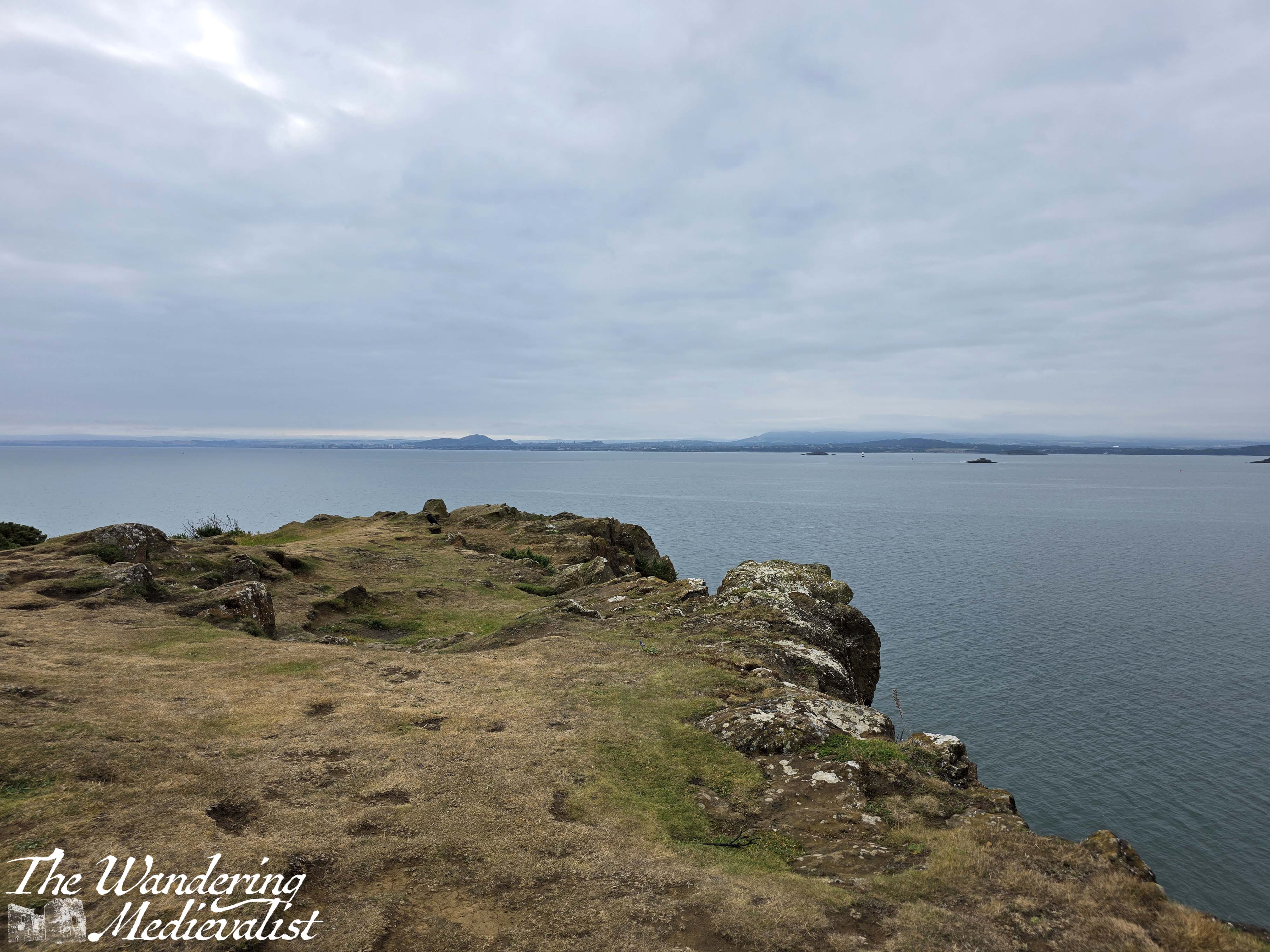
It was just about at my arrival at the hilltop that the sun began to win its battle with the clouds, peeking through a few gaps, though clouds over Edinburgh and south still looked threatening. I was also delighted to discover what seemed to be a set of small standing stones, and a gate that led to the top of the cliffs that overlook Aberdour. The edge is sharp and not fenced at all, so there are plenty of warning signs – it is a dramatic spot looking over the water, along the coast, and to the distant Forth bridges. I learned later that this is Hawkcraig Point, once home to a Royal Naval Submarine research base, though there is very little remaining except for a lighthouse.
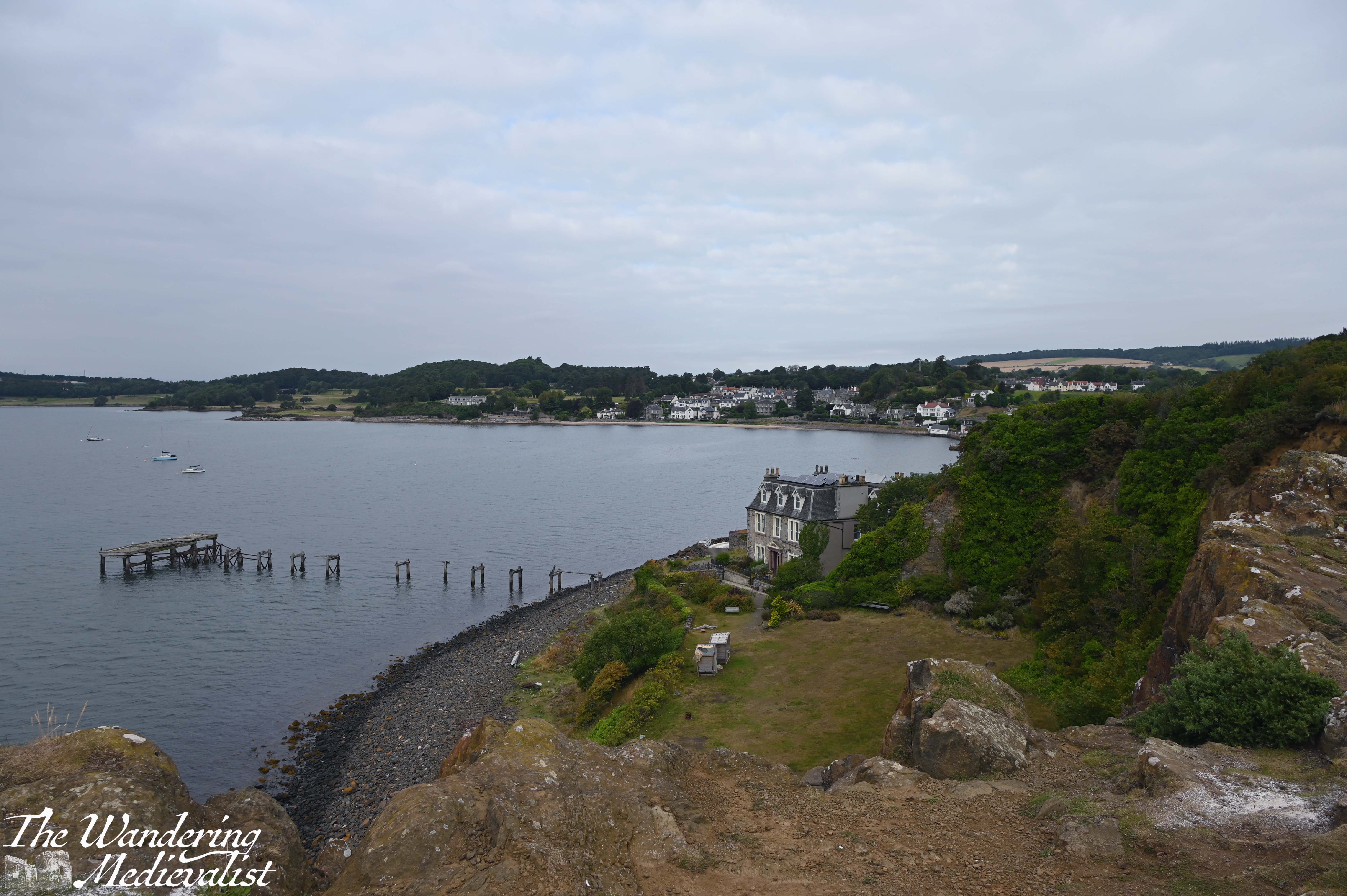
Once I had taken my fill of the view, I headed down the hill towards the narrow road which must have been constructed to reach the point. At the time it was being used by some very keen fishermen.
The road passes through a large parking area designated for caravans (unlike many car parks), which was incredibly busy. More than a few dogs were sitting outside in front of their temporary homes, watching me closely as I passed, and occasionally looking up at the regular outgoing planes from Edinburgh airport – clearly we were on the flight path that day.
Soon I reached Silver Sands beach, which was already growing busy. Like many beach areas in Fife, it is well-kept with a good car park, some playground equipment, and a cafe that had not quite opened yet, much to my disappointment. I could have done with another coffee.
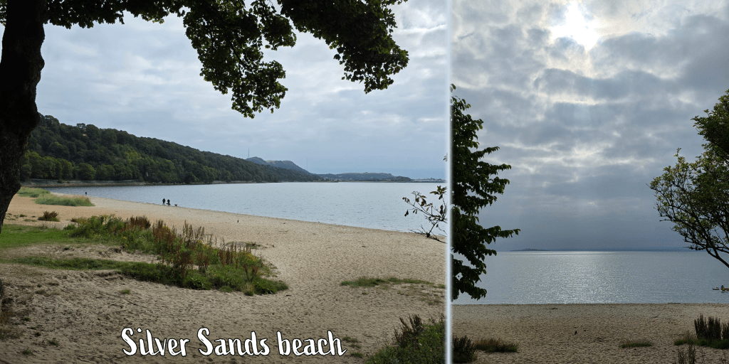
At the far end of the beach, the path disappears into the woodland with a well-kept trail that is either paved or packed dirt and close to the edge of the water. Below you is a rocky shoreline with sea birds, and I paused for a short while to watch a pair of cormorants (or that’s what they looked like anyway) doing some breakfast fishing.

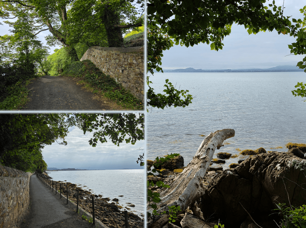
In a short time, the left-hand side of the trail becomes a long stone wall, an old estate wall, which follows the path as it rises and falls over some gentle hills. This was a popular stretch with runners, as it was mostly paved, and required a bit less attention to your feet.
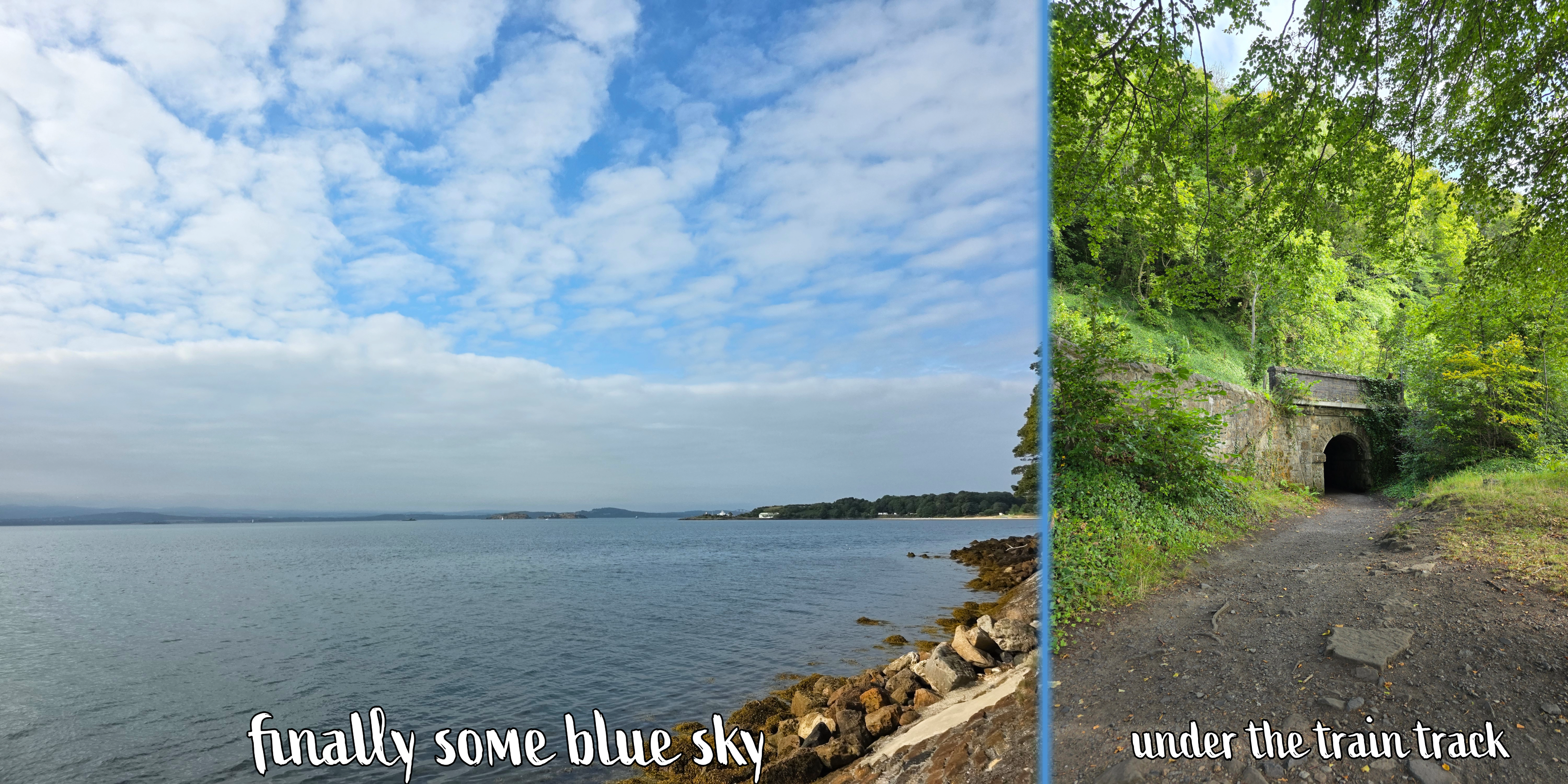
About half-way between Aberdour and Burntisland, the route passes under the rail line through a stone tunnel. This is a busy stretch of track with quite regular traffic, and it is a section I have always loved when on the train as the views across the Forth are superb.

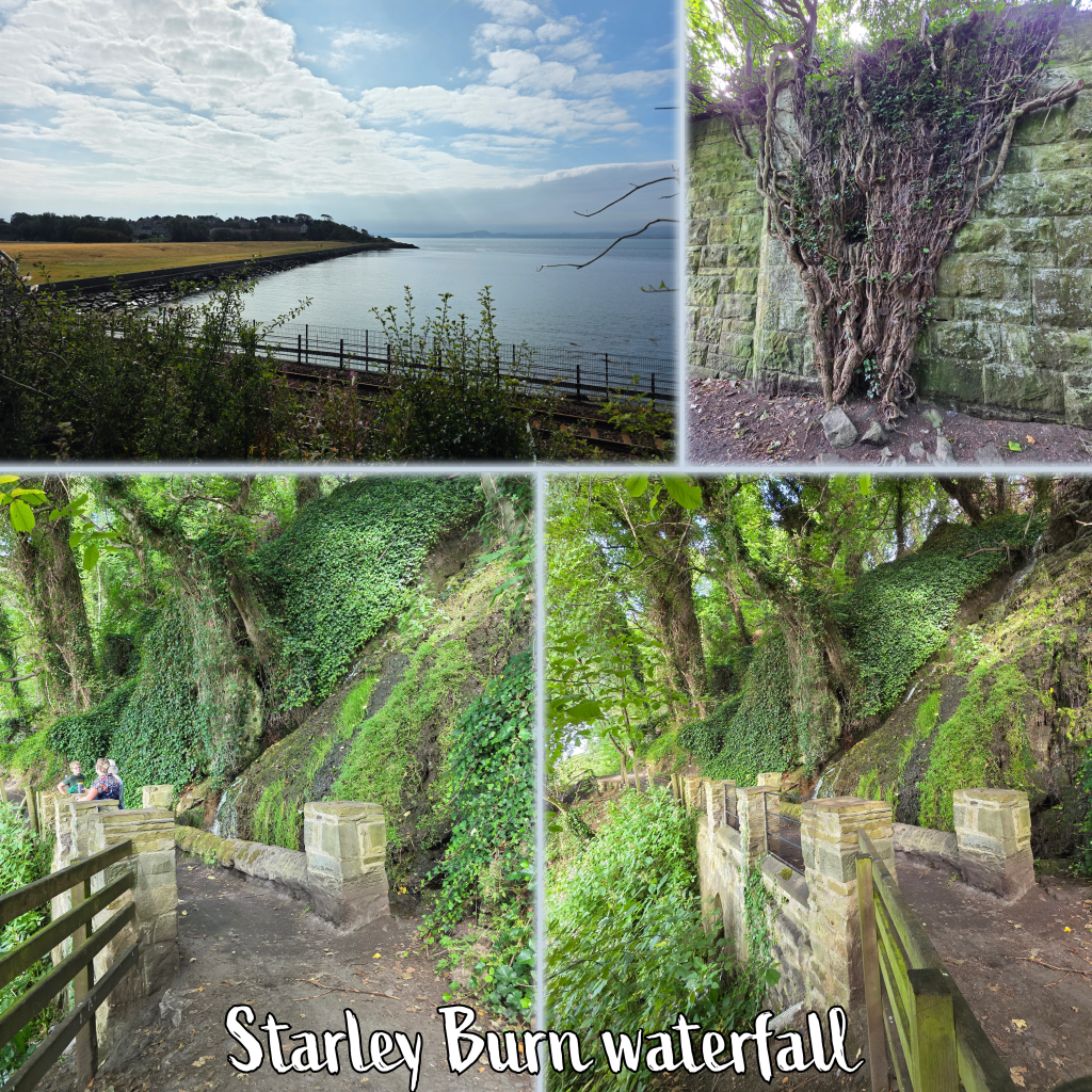
Just outside of the edge of Burntisland, the path crosses Starley Burn over a lovely pedestrian bridge. There is a waterfall above which falls about 12 – 15 feet, and the lime-rich water causes a thick coating on the rocks. It’s a nice peaceful spot in a glen, good for a short break should you need one.
Soon after crossing the burn, the path jogs left inland a bit, and narrows between the train on one side, and a stone wall on the other, with fields up to the left. By this time the day had warmed up nicely, with no wind and only a breath of breeze, so the section here was quite warm, away from the water.
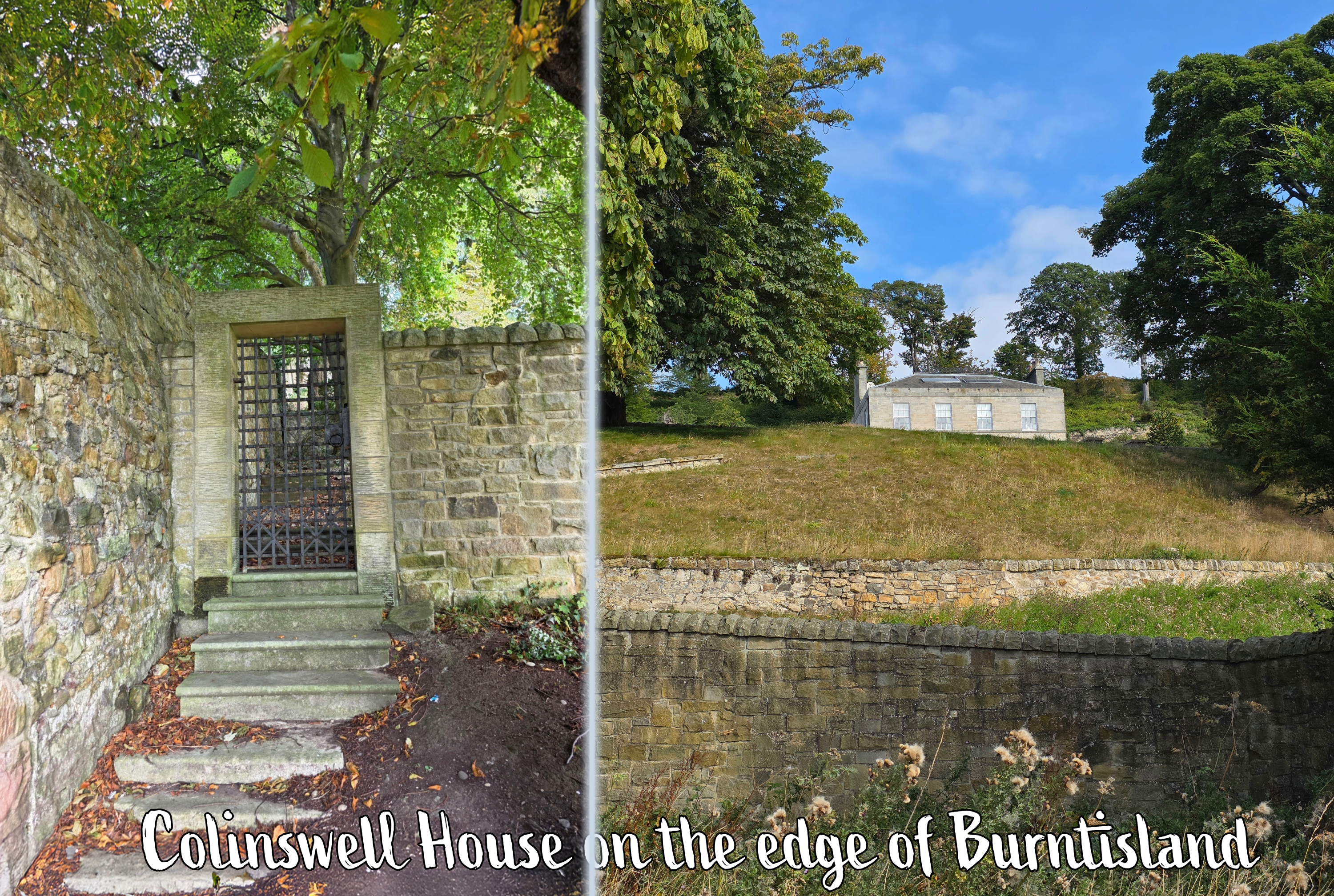
Approaching the edge of Burntisland, the route passes a lovely old estate which reminded me of something out of a Jane Austen movie, including a metal gate in the estate wall – Colinswell House, I learned upon searching. Shortly beyond is Burntisland proper, and the path leads along the edge of a very nice neighbourhood of relatively new homes.
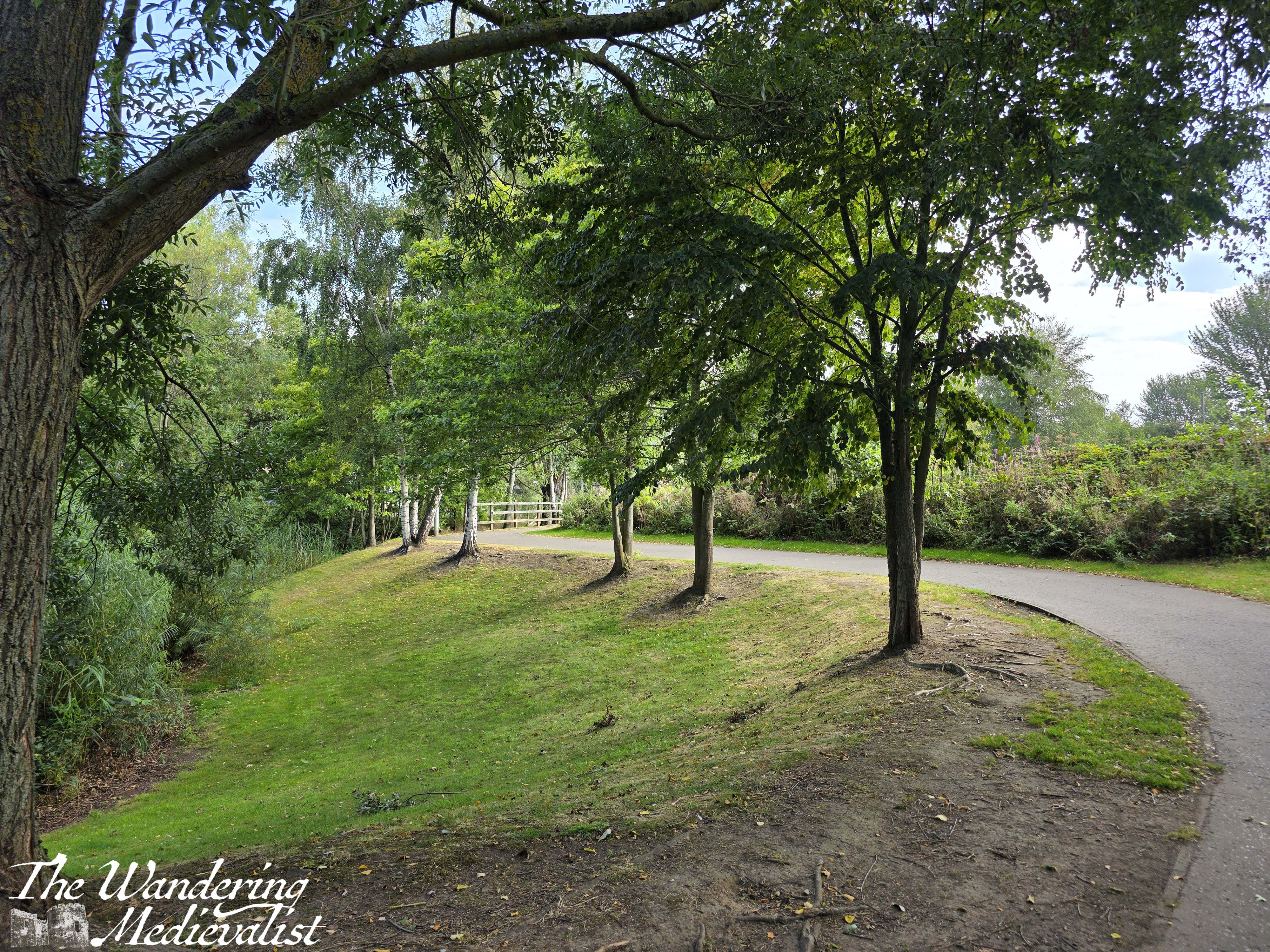
There is an option to pass under the track but don’t be tempted, as the route continues straight before beginning to wind through a nice park. It was well-kept with cut grass, oak and silver birch trees, and a small burn down below between the park and the residential area.
About a half-mile beyond the edge of the town, the route passes into an open park with a view of houses and the hill behind. At the edge of the park turn right up the hill on Kirkton Road. Descending the other side takes you past a few apartment blocks, though these disappear quickly when at the bottom you turn left on to the High Street (not East Broomfield Road, which you reach first). Follow the High Street, which is lined with shops and pubs, quite pleasantly not too many chains but instead local places that seemed quite popular – particularly the butcher and the bakery.
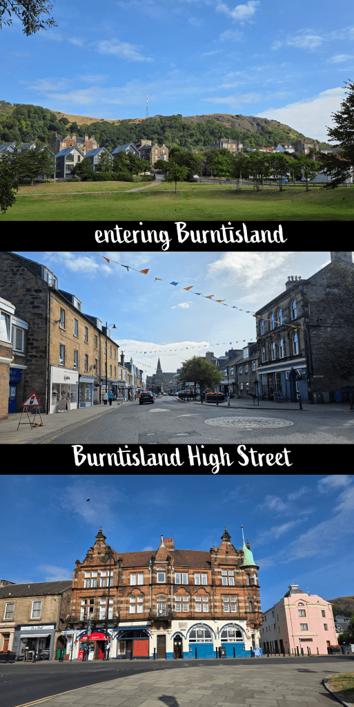
Just before the High Street runs into the Links there is a Co-op food store, a great place to grab a drink or snack if you need it. Across the road at the edge of the Links is also a public toilet – not the fanciest toilet in the world, but it was the first one I had passed that was open. Beyond, I could see the large trucks and brightly-coloured tents and rides of the Burntisland Fair, which takes place over the summer. I caught a few glimpses as I followed the edge of the grass up Links Place and then turned left along Lammerlaws Rd. There is an odd mix here of quite old pubs and buildings that show the age of the town, and much newer additions as well as the bright colours of the fair.
Lammerlaws Road becomes a bridge over the train track, and some walkers taller than I may be able to see over the wall – I tried with my phone but had no luck. Continue straight until you reach the water’s edge, where you can see the busy beach and promenade to the left.
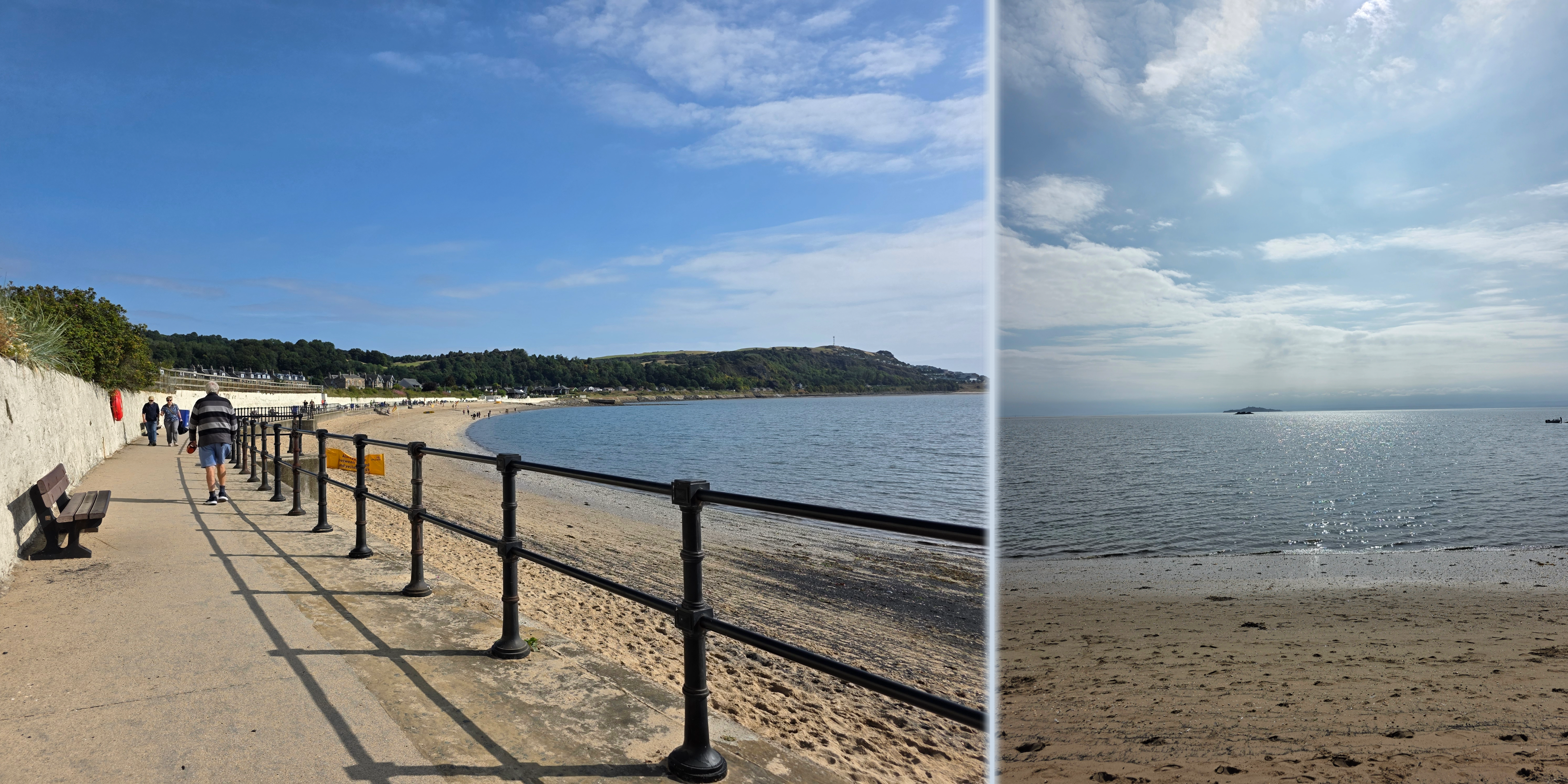
Burntisland promenade is narrower but no less busy than some others, with plenty of families and dog-walkers enjoying the sunny day on what was one of the last weekends before school. The beach was popular and there were life guards on duty, with large flags indicating where it was safe to swim. Just beyond their hut, the Coastal Path splits into two options: the high tide and low tide routes. It was about mid-tide, but upon looking at the low tide option, I decided I was not feeling up to proper long-term rock scrambling. So, I followed the road to the left, through another tunnel, and turned right along the A921.
This was a pleasant stretch of road lined with bungalows and cottages with well-kept gardens, and eventually runs past the town cemetery. Opposite the far end of the cemetery wall, there is another tunnel under the rails, and I chose this as my moment to re-join the beach. It was a steep slope down to the rocks, but beyond was lovely and sandy, with a relatively straightforward route that is solid and easy to walk on.

If I had stayed on the road a tad longer I would have passed the Alexander III memorial which would have been nice to see, but I did not realize it would be inaccessible from the beach.
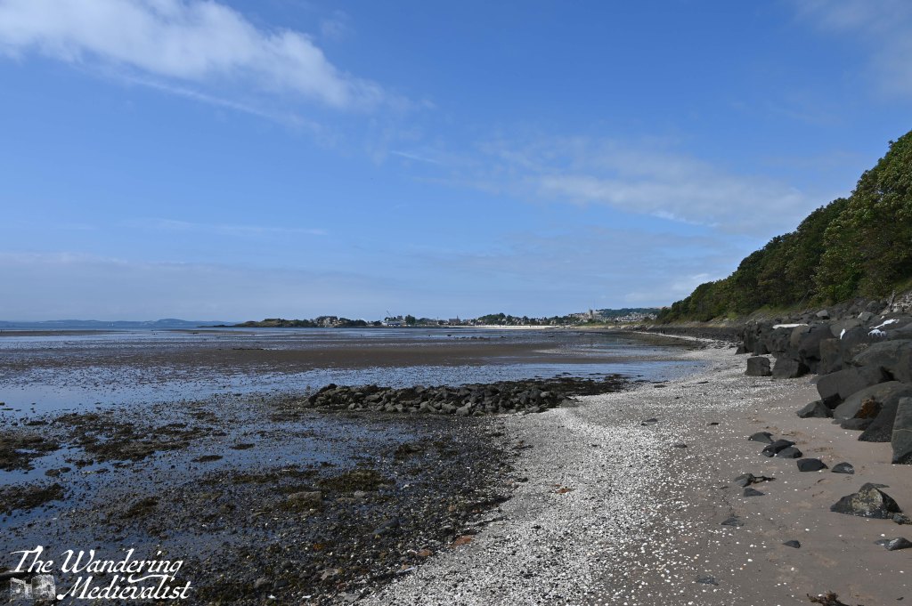
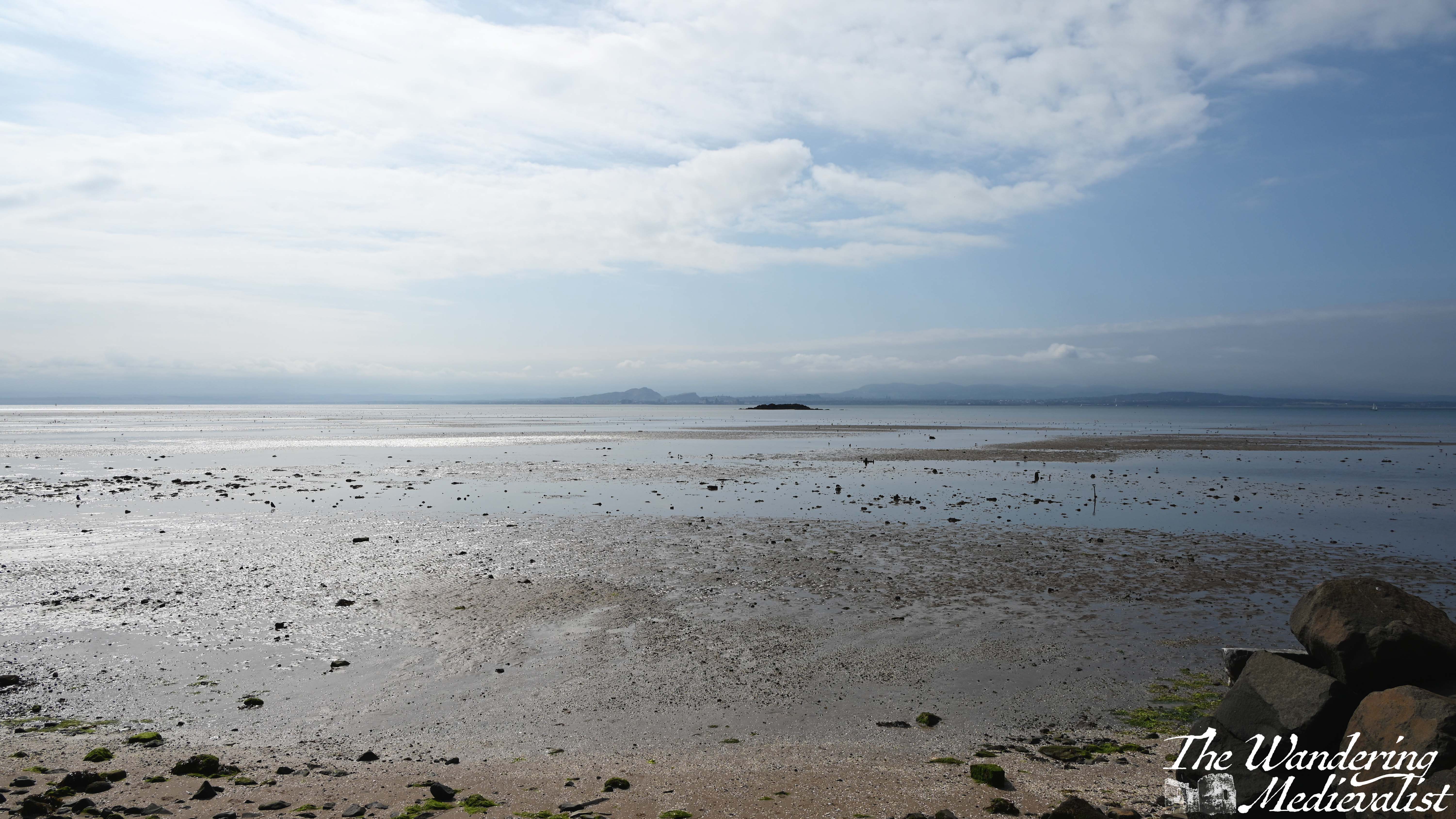
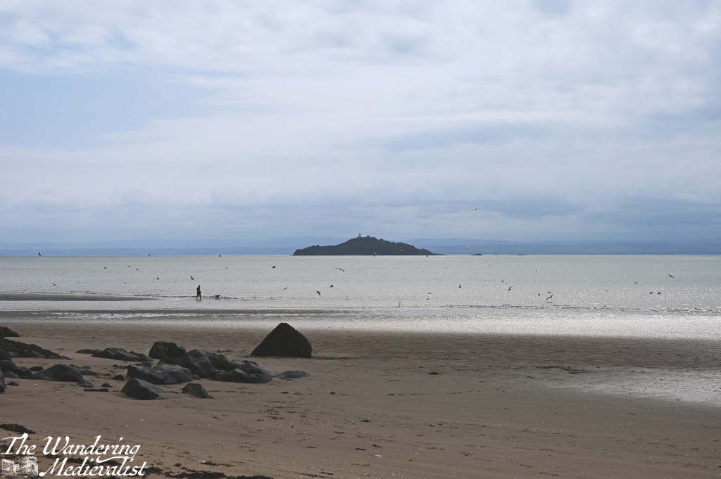
The beach here is incredibly wide at low tide, with flats stretching far out into the Firth that I can only imagine are muddy and a touch treacherous. On a clearer day, the views across to Edinburgh and Leith would be excellent, and even on a hazy day they were impressive.
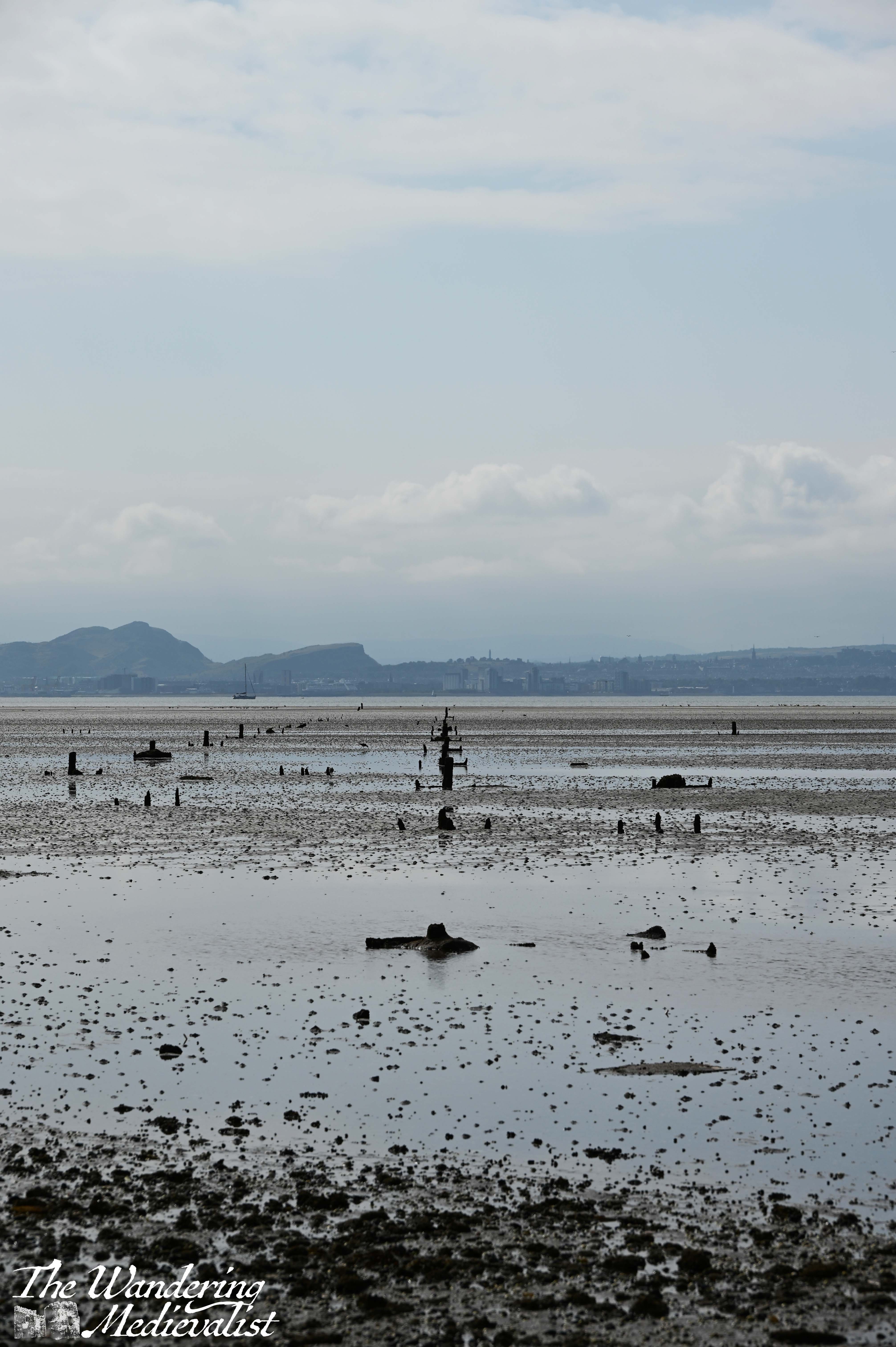
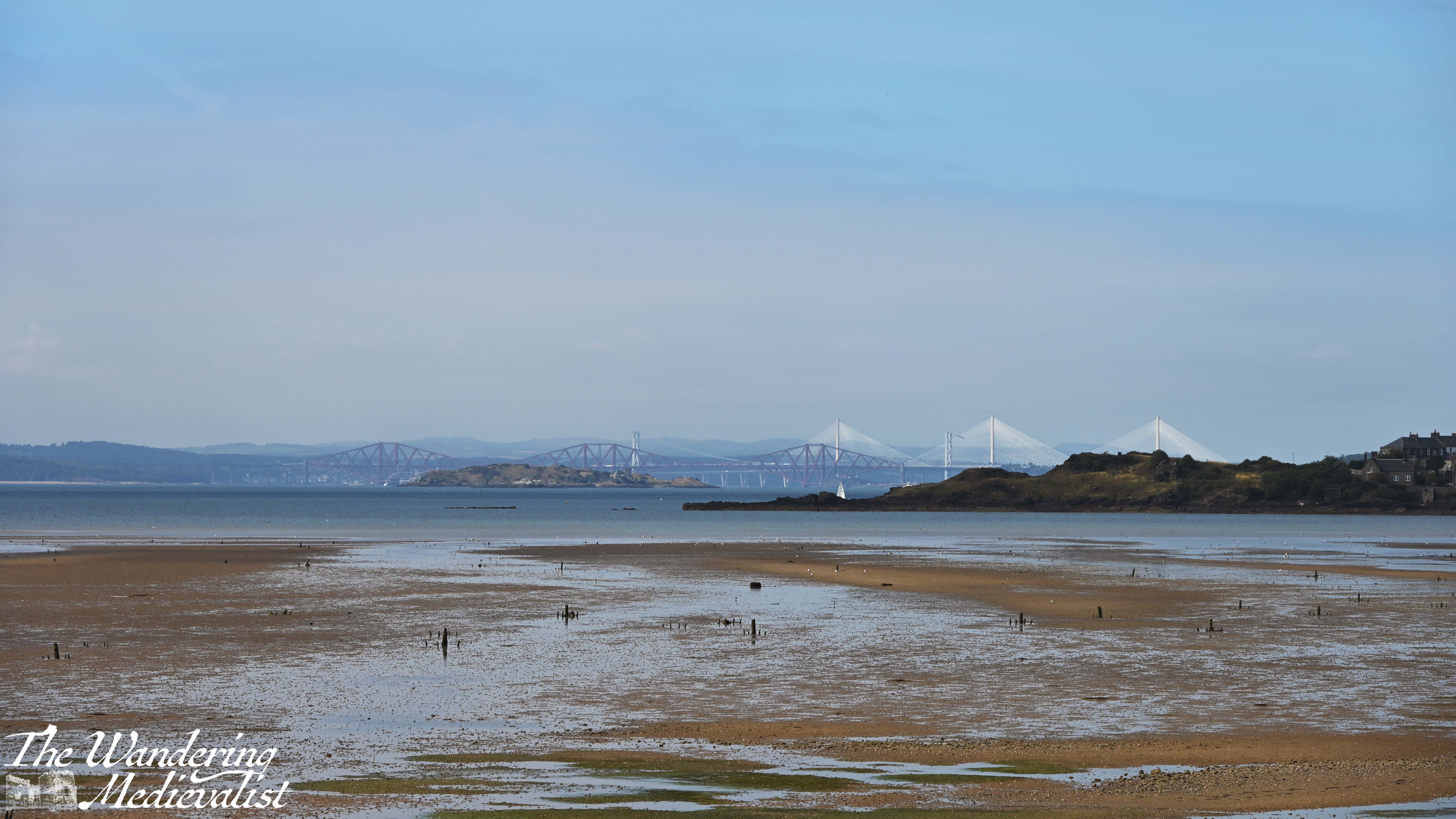
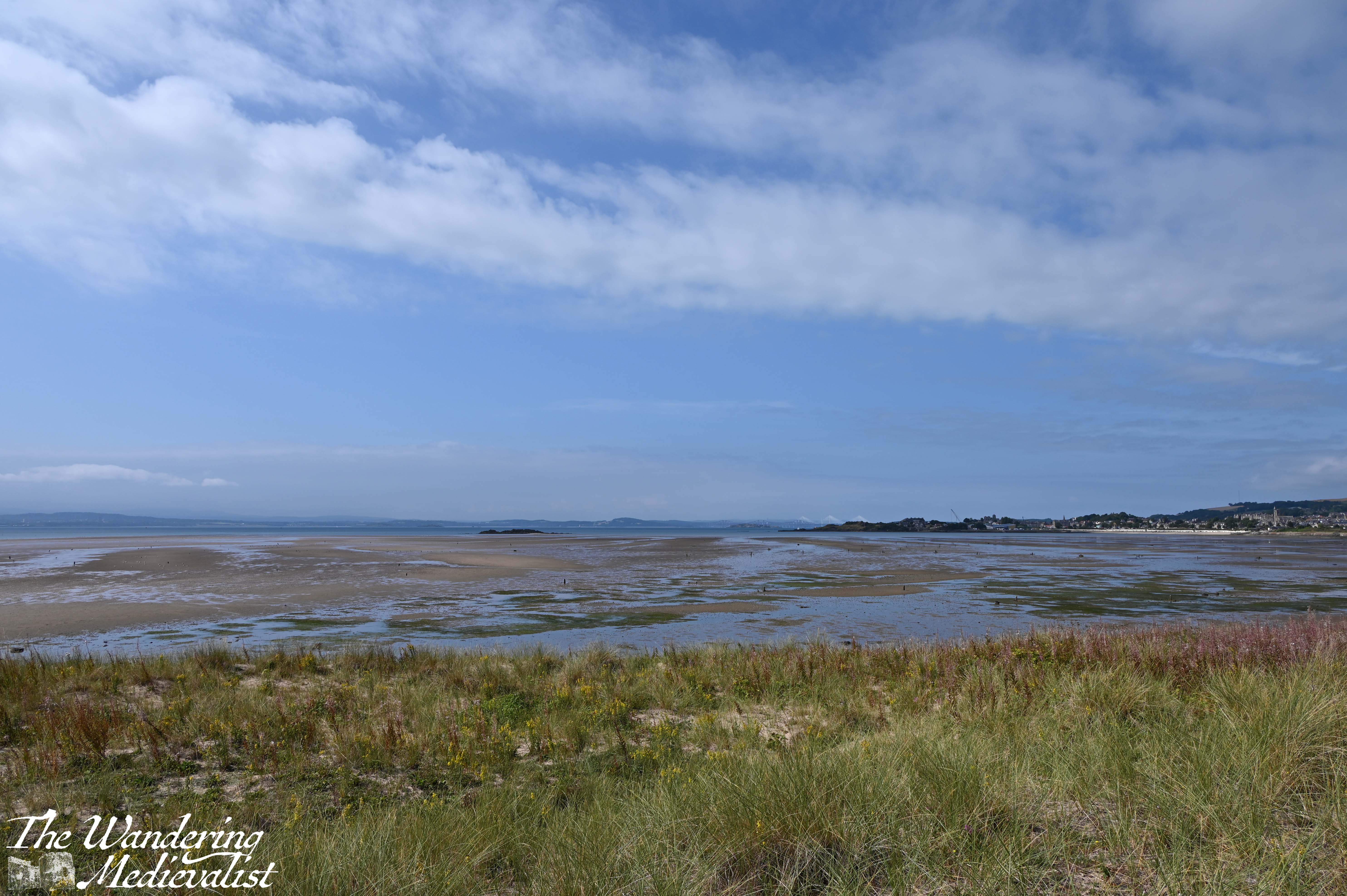
Another half mile or so beyond where I re-joined the beach, the dunes bulge out towards the beach, and the option is either to follow the sand or cut up to the grass. I opted for this, following the at times quite faint path through long grass, ferns, and various other flora. I’m not sure this was the most sensible option, but being slightly higher than the beach allowed some views back towards the three bridges – just peeking out over the headland – and a better feel for what you usually see from the train.
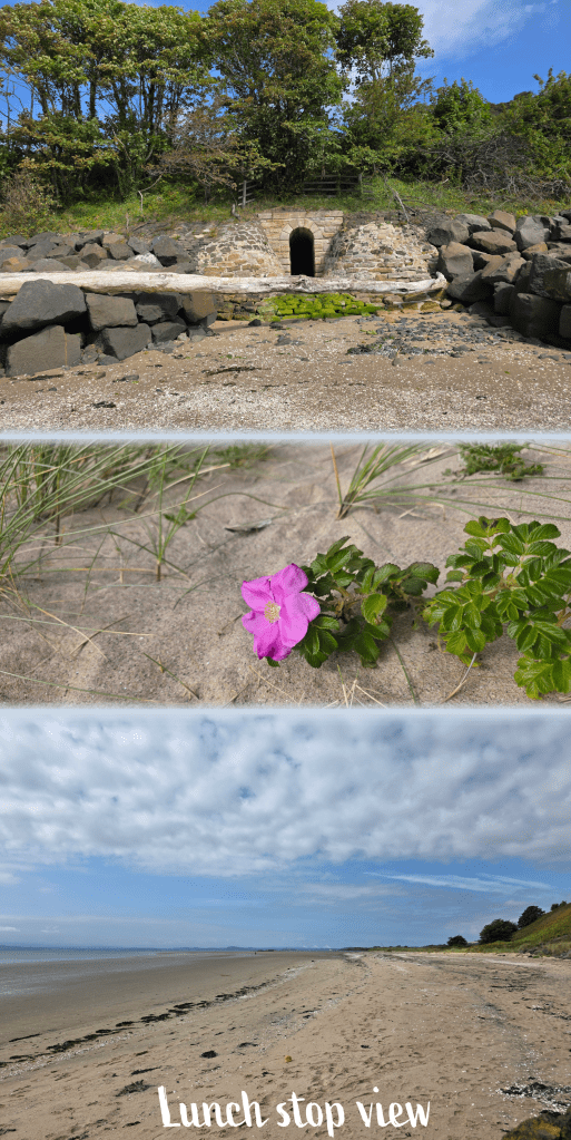
There was some near-bivouacking for a while, but eventually the trail re-joined the beach, with the road high above. As I approached Pettycur I could see a caravan park on the hill, and a steep flight of stairs leading up from the beach. This definitely was not what I wanted to see after a solid 5 miles or more of walking, and so I found a perfect rock ledge on which to take a proper break and enjoy my packed lunch. Which was, incidentally, inclusive of the all-American favourite, peanut butter and jelly (raspberry jelly, which in my opinion is the best).
God’s food, I will hear no objections.
It was salty, a touch sweet, and absolutely perfect.
As I enjoyed my flash-back to the USA, I pulled out my up-to-date map of the coastal path to determine whether I had to climb the hill or not. After deciding that I could just as easily follow the beach, I made myself sit for 10 minutes enjoying the view before packing up again.
The route I chose definitely included a touch of rock-climbing as a tidal pool cut off the sandy option; fortunately, the rocks were not slippery but heavily encrusted with barnacles, which were great for grip. They would be torture should you fall, but I managed to avoid both a slip and wet feet. This was the case even once I had crossed the rocks and negotiated my way across the sand, which was rippled and wet but not enough to reach over my boot treads.
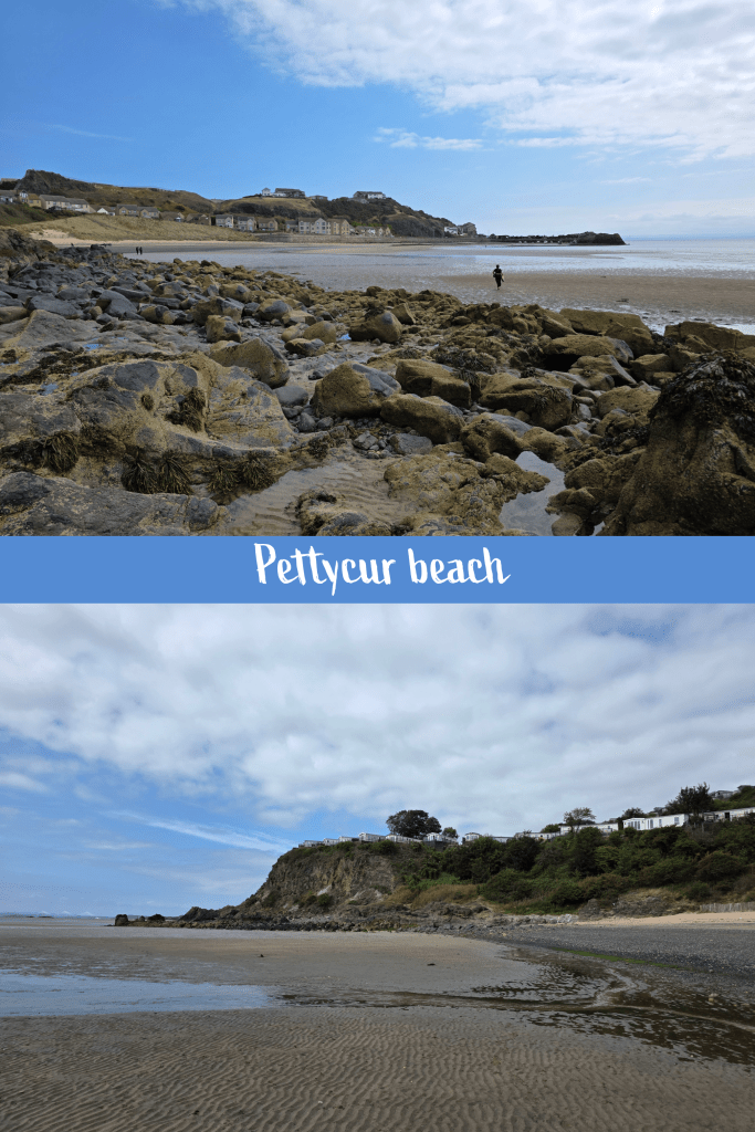
At this point I was in Pettycur bay, which included a small harbour where the boats were all beached due to low tide. I climbed the stairs at the edge of the harbour to re-join the road, which would have been the high tide option I think. My break and snack hadn’t really done much to reinvigorate me, and I found myself slowing down as I headed up the long slow hill of Pettycur Road that runs from the beach up to the top of the cliffs. The houses here reminded me quite a bit of parts of Marblehead – lovely, large modern places built on stilts or into the edge of the cliff, open to the Firth of Forth and ocean beyond. For those familiar, it was a touch like part of Marblehead Neck, right at the far end from the causeway, though these houses were smaller.
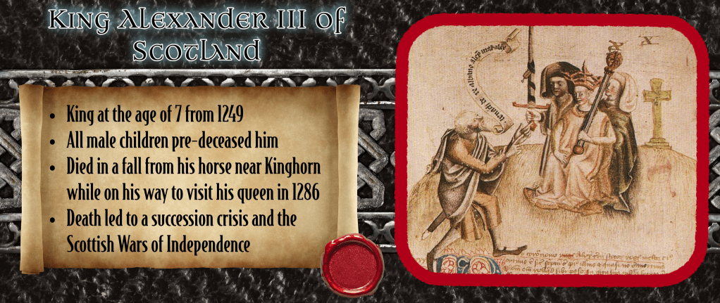
I had pretty much determined that when I reached the top of the hill, I was going to need another rest – I had been reluctant to look at the map to work out how close I was to Kinghorn. What rather gave it away was when I noticed road names that were Alexander III Street, and then David I Street – there is also a Canmore St and Queen Margaret St, showing the strong historical tie of the area to the Medieval Scottish crown. Suddenly, I realised, I was essentially in Kinghorn.
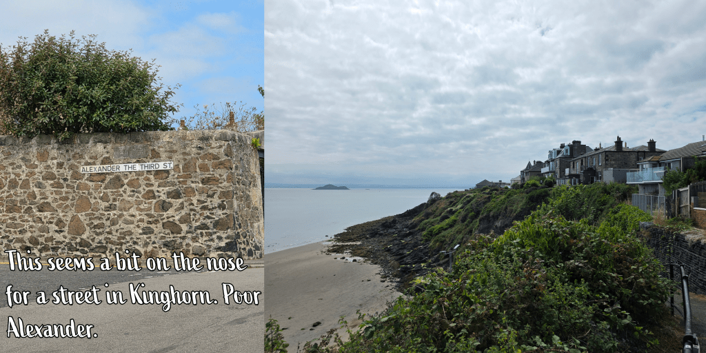
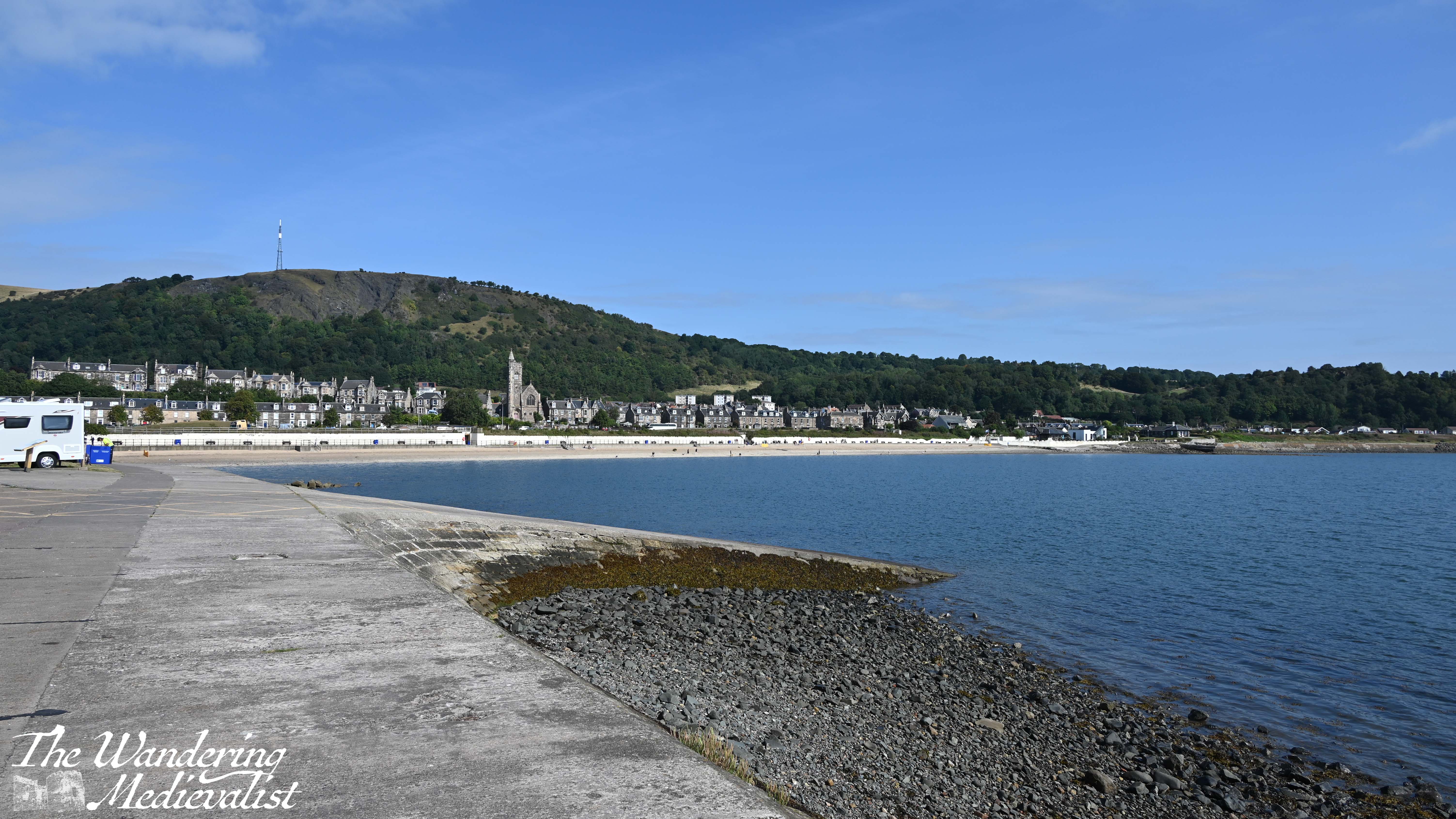
The sign for the Coastal Path turns right down a close, with the sea ahead, and at the end a set of benches. The view is, like so many others, spectacular – the ocean stretches out ahead, with the clifftop homes to your right and the town of Kinghorn with its train viaduct to the left. I paused for a few minutes to savour the triumph, though in doing so I missed that hour’s train. So, I took a gradual walk down towards the water before finding the spot at the bottom of the hill where I had marked the start of my journey from Kinghorn to Kirkcaldy.

I may have missed a few of the historical sites along the way that I hoped to see, but this walk really tested the limits of my fitness and I got to see parts of Fife I had only ever passed through.
It was a good final walk for the summer, I felt, leaving me in a strong place for when I come back from travels long enough to pick things up again. I’m looking forward to trying to stay fit while travelling – hotel gyms are uninspiring – but it’s a good goal to have, and I was really pleased when this hike didn’t completely destroy me. Was I a bit stiff that night? Yes. But it faded by morning.


One response to “Fife Coastal Path: Aberdour to Kinghorn”
[…] which walk was my favourite? This is a tough one, as I really enjoyed the section from Aberdour to Kinghorn. I liked being out of the East Neuk for a change of scenery, the views were excellent and I proved […]
LikeLike