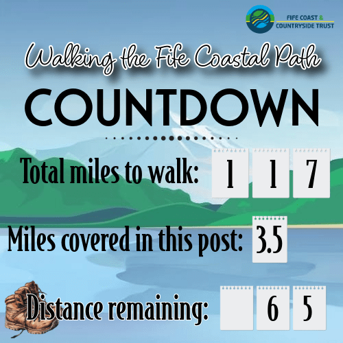
Finally after a long break, I determined last week that I would return to my Fife Coastal Path endeavour. The last month or so of travel has meant that my efforts to maintain fitness levels dragged a bit, and so I selected a portion of the walk that was not too long but still tested me a bit: starting at the Fairmont Hotel and walking through St Andrews to the Old Course Hotel, where I started my walk to Guardbridge many months ago. The first two miles are traditional Fife Coastal Path: rising and falling along the edge of the coastline with dramatic stretches of rocky shore and beaches. Then, the last mile and a bit is in St Andrews, along East Sands, up the Scores, and past the famous Old Course. This is a really pleasant walk, but the out of town section does require some stamina and sturdy shoes.
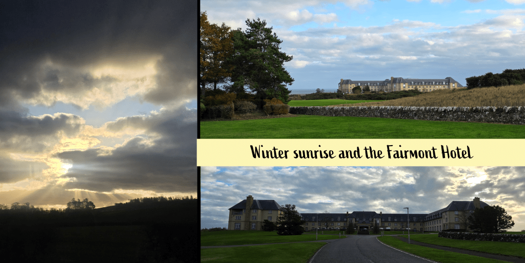
As would be expected in November, the morning was cool (8℃/46℉) with a cold wind and mostly cloudy with patches of blue sky. I wore my raincoat mostly as a windbreaker but also to guarantee against any stray rain showers – fortunately only needed for the wind. The bus trip was a short one – about 10 minutes – on the trusty 95 from St Andrews, and the stop is right on the road outside the entrance to the Fairmont estate. Fortunately there is a well-kept path running from the bus stop and along the access road up to the hotel. It is a gentle decline, allowing for a view over the North Sea as well as up to the hotel building, across the golf course.
I wasn’t 100% confident as to the route to actually get to the Coastal Path, but I knew that the walk from the hotel into town was done by guests, and so I figured it must be possible. There was no question that I was not there for the golf, as most others were – my attire was a bit different from the slick sporting outfits.
It took me about fifteen minutes from the road to wind towards the hotel the past, and down to the clubhouse for the Torrance. The views across the courses are beautiful even on an overcast day, and the outline of St Andrews is very clear; I really must come back here in the sun! This is clear evidence as to why the Fairmont used to be called the St Andrews Bay Hotel.
To get my bearings, I chose to walk down below the clubhouse and past the delivery parking, where I realised that I needed to backtrack slightly to an access road onto the course. From there, I turned right through a break in a stone wall and it was an easy walk to the second wall, dividing the course from the Coastal Path. I used a wooden ladder to scale the wall, though I think there was a break a bit further up for anyone less inclined to climb.
Finally at the starting point, I set my Fitbit to record and started on my way, enjoying immediately the return to a cliffside muddy track, along a stone wall, with waves crashing below. There were a few occasions where my eyes filled with water due to the wind, and I did have to wear my hideous winter hat, but I was warm enough once I got moving.
From here, the path eventually goes down some stone steps and across a bridge over a burn, after which it curves to the right and descends quite sharply towards the beach level. While my boots were not as comfortable as they once were, I was glad to have them here where the recent rain has made the small rivulets into rushing burns and even the grassy areas into mud.
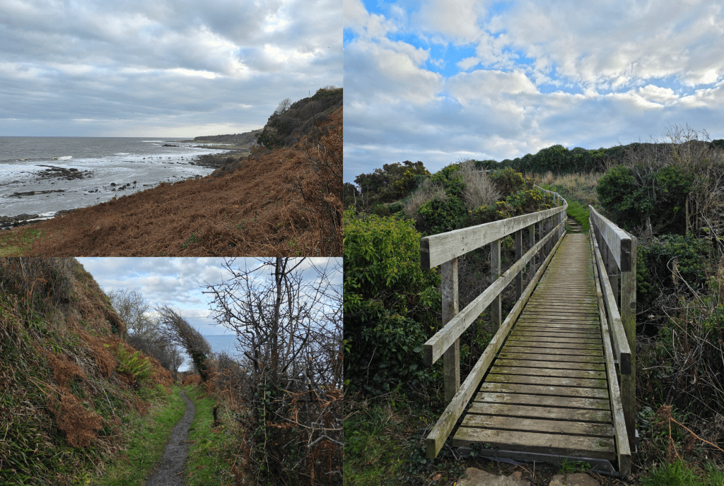
The coastal views are great here in both directions, though the wind is definitely a force to be reckoned with – as ever in Scotland, layers are key. I spend a great deal of time at work explaining that it seldom gets as cold in Scotland as it does in parts of the US, but the wind is biting so it can feel much colder than it is. This was one of those days.
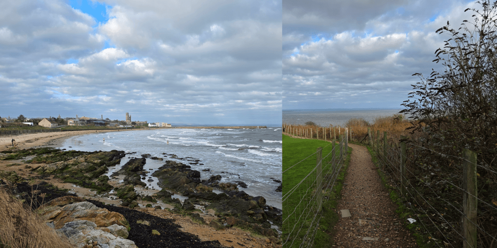
As the path descends it essentially passes through a hedgerow, and you can see the cliffs above you, mostly covered with plants though there are the occasional dramatic rocky outcroppings and circling birds. On the beach level, you can enjoy crashing waves, and ahead is the shape of the Rock and Spindle.
It was about here that I passed a couple who were clearly familiar with the path, and who observed that I had about 45 minutes until high tide, with a gentle warning in their tone.
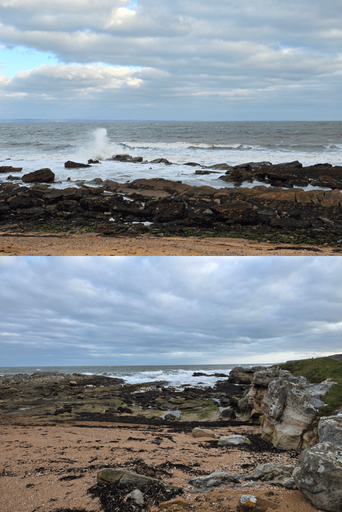
Yes, I had once again forgotten to check the tide, though to be honest it was because I did not think it was an issue on this section. My error, clearly, and while I assured the couple that I would be fine, I decided that it was time to hustle a bit. So rather than pausing and taking many wave pictures (as I was tempted to do), I crossed the rocky beach and identified relatively quickly where my potential problem lay.
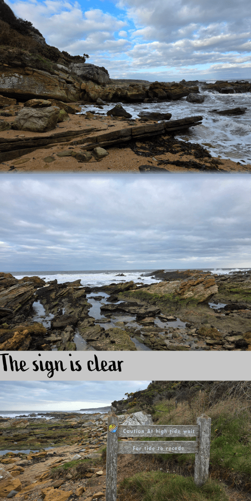
Specifically, it lay right about here, where the waves stretched inland along a rocky edge, threatening to very quickly cut me off from the path ahead. Like many of these small beaches, this cove was backed by a rock cliff and, as the sign clearly told me, if the tide was too high I would have no choice but to wait – there was no high tide route.
So, onwards I scrambled, and found myself looking at a rock face about 4 feet high with one foothold that was a bit higher than I thought my right leg might go. There is no picture, as I realised I did not have time to waste. So it wasn’t graceful or smooth, but I managed to get up the rocks and keep my feet dry – just barely. I probably had another 5 minutes before I would have had to stop. Good timing, then.
Beyond this pinch point, the rocky shore continued for another few minutes before I was able to rejoin the smoother path, and pass the sign in the photo above. I swear next time I will check more carefully.
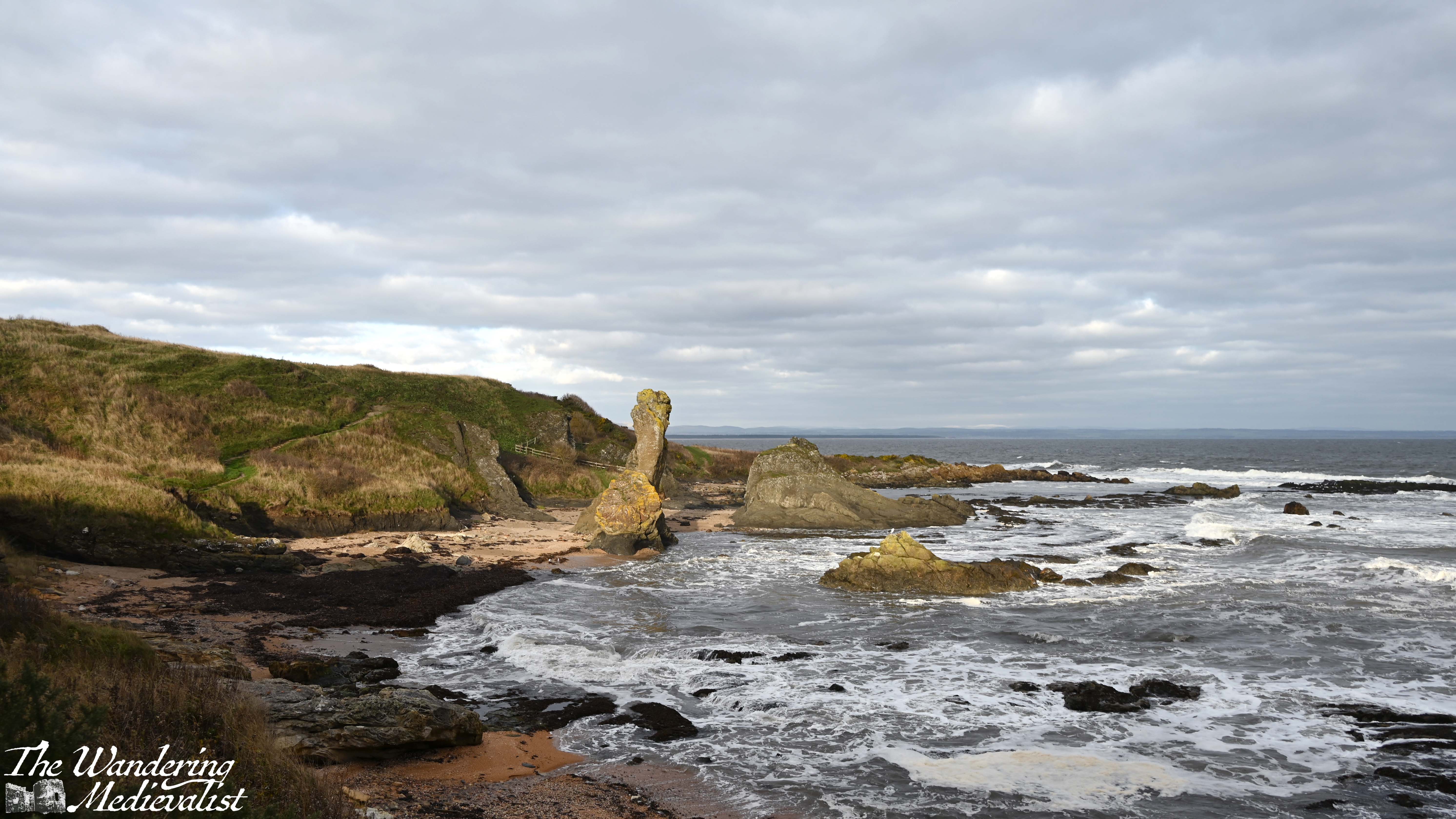
Side note, I can see why Geology and Earth Science classes from the University would come out here for outings – there is a huge range of fascinating rock formations even for someone who knows nothing about them, and excellent examples of the ocean carving through stone over time.
Ahead, in particular, is the Rock and Spindle, a famous formation that has been widely studied and photographed. According to some brief reading I did, the three stacks are made primarily of solidified volcanic ash, the remains of an ancient submarine volcano.
As I approached I was feeling uncertain that the sun would be helpful and actually break through the clouds, then as the path curved around to follow the shoreline, spectacularly the sun prevailed and provided some excellent contrast for my pictures.
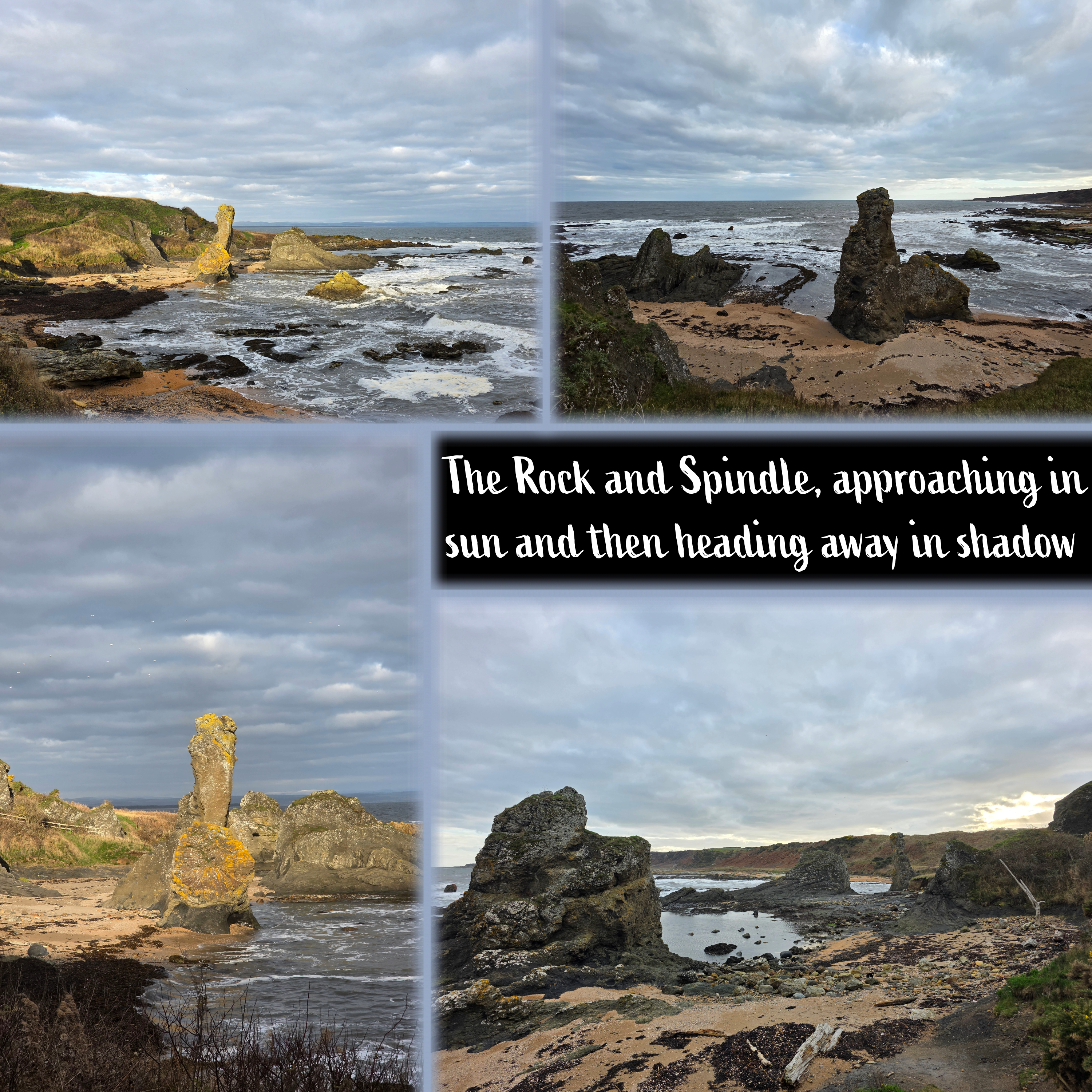
A few words of caution if you are approaching from the direction I did – don’t get too caught up looking at the view, as the path here is crossed several times by burns. The rocks and grass are slippery and often wet, so it would be all too easy to fall.
There is also, I should note, a route above the rock formation which offers great views across the golf course and of the Castle Course clubhouse; Dad and I took this path when we walked out here many years ago (and of course I cannot find those pictures for reference). Alternatively, walkers can get down to the beach here to get closer to the rocks, but I was ready to make some progress and so passed through a wonky gate and continued on my way.
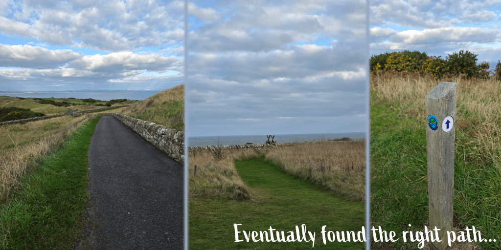
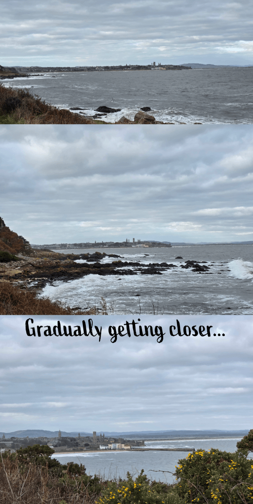
The path here becomes the more standard grassy path, and as I approached St Andrews I started to doubt whether the predicted sunshine would overcome what seemed to be pretty steady clouds. The overcast sky did not prevent me from taking plenty of different views of the town as I approached, of course – here are a few. Do I have sunny versions of these? Almost certainly. But there is something about this view of town that is impossible to resist.
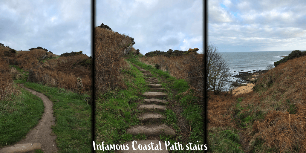
After ambling along at a good pace, enjoying being at the water level and the crashing waves, I realised that the cove I was in was quickly reaching its end, and there ahead of me was one of the Fife Coastal Path’s infamous – in my mind – stone staircases. The steps themselves are generally flat-ish rocks that have been layered into the hillside, and often wind back and forth as they climb steadily upwards. This is one of the longer sets that I have come across, and it definitely tested my endurance, which has declined since the summer. The view is of course excellent particularly if you have to stop and catch your breath.
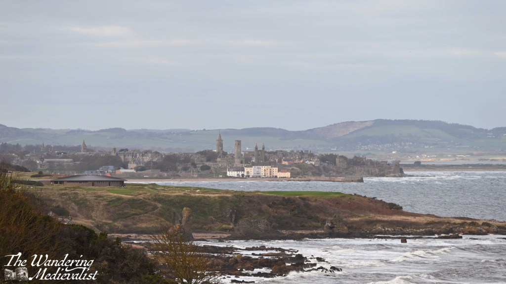
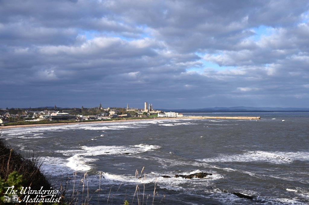
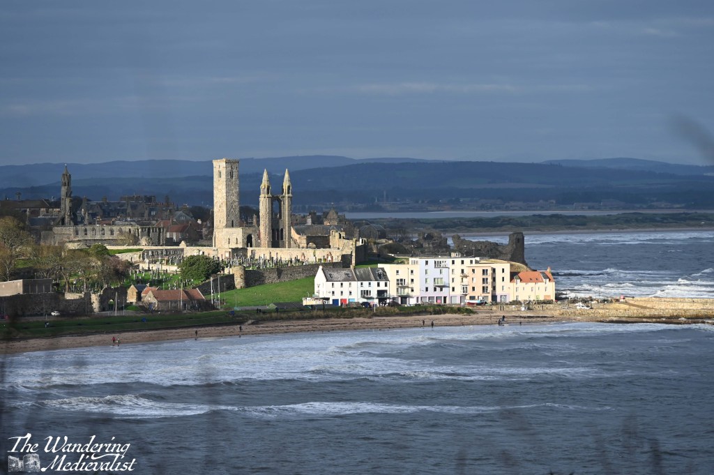
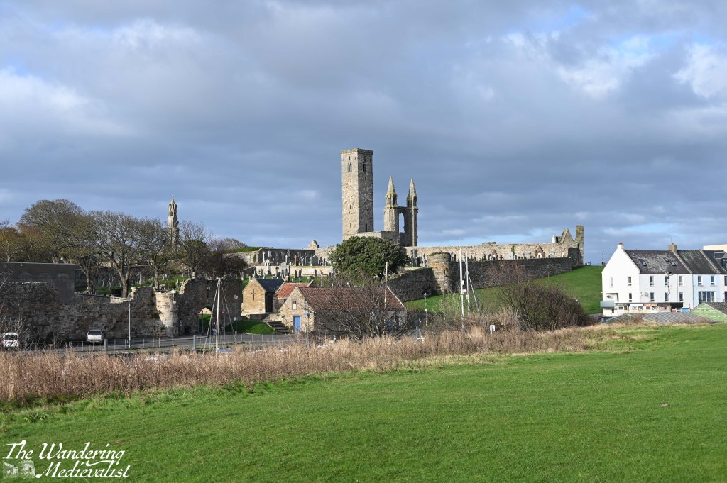
Once you make it to the top, however, the path is relatively level for some time, with only gentle ups and downs. The crest of the next hill provides a spectacular view over the bay and town – it is THE view, the one photographers will climb up here to capture. Even without sun, it is impressive. That said, as I made my way along the clifftop, the sun did make an appearance, highlighting the lighter stone of the cathedral ruins and harbour, bright against the turbulent waters of the bay.
The path here is wider and more regularly-used, with joggers and weekend walkers more common. It is easy to get distracted by the view on one side, while on the other the golf course rolls into the distance until it comes to an end at a line of tall pine trees. This marks the boundary between the Castle Course and St Andrews Holiday park, a large caravan site at the edge of town. Passing through a metal gate, you will notice a narrow path heading up to the road, so in theory you could begin a walk here as well, or do a loop up from town and back along the coast.
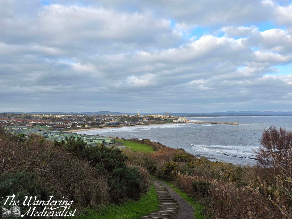
The view is just incredible, as gradually you move closer and closer to East Sands. Then in no time at all you are descending once more, along the edge of the caravan estate on a relatively steep set of stairs. There is a viewpoint off to the right, and then the path continues towards the beach.
One last gentle hill leads down off of the Coastal Path proper and onto the walk along East Sands, the wide open beach of St Andrews edged by the cliff on one end and the pier on the other.
Those of us who have lived in St Andrews for any length of time will tell you that the weather there is different, golden in a way that cannot be matched anywhere in Scotland. It might be a blizzard in Cupar, raining in Guardbridge, but it is sunny in St Andrews. Not always, of course, but more often than not the town enjoys its own pocket of good weather, and this day was no exception.

As I passed this slightly tattered Saltire at the end of the beach, the sun fought its way through the last of the clouds, and the day opened up into beautiful sunshine. Was it sunny at the Fairmont? Who was to say.
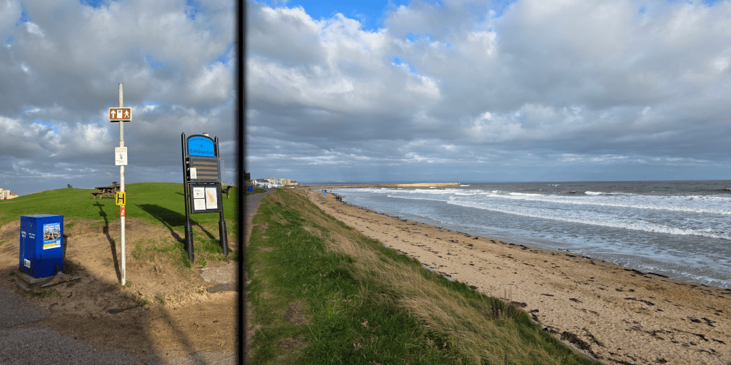
East Sands is always busy with walkers, dogs, swimmers, surfers, and sailors depending on the weather, and today was no different. Even in the cold weather and even colder water there were people out in wetsuits. And, some brave souls just in bathing suits, though I learned later that they were dashing up the beach to the newly-built sauna. This is the beach where students take part in the famous May Dip, and is a spectacular place for sunrise, as well as to catch the Northern Lights if you are lucky. The East Sands walk takes you past the University nursery, the East Sands Leisure Centre (town pool), the Scottish Oceans Institute and the famous Toastie Shack, perfect for a beach snack.
The edge of East Sands marks the start of the portion of the Coastal Path that I know like the back of my hand, have walked 100s of times over the years and love. But oddly, I was not confident as to the actual route of the path. My map told me to turn left at the Toastie shack, but the signs told me to continue strait.
As the straight-ahead route was arguably prettier, leading along the beach and over the harbour gate, I chose to follow the signs. Here, the path goes through the play park and along the edge of the beach, allowing for a great vista across the water and up to the Fairmont.
On the other side is a wide grassy bank that leads over to where the Kinness Burn enters the harbour. I wandered over to take a quick picture, but it is worth warning that this stretch of grass is full of holes, dips and – annoyingly – the occasional dog dropping, so best to keep looking down. Soon the path curves around to the left and down a short hill towards the harbour. Cross at the harbour gates and then swing right either in front of or behind the line of buildings. Officially, the path goes behind, but I don’t think it matters greatly. This is one of the most photographed parts of St Andrews, with the colourful buildings and the old harbour, and the entrance to the famous St Andrews pier.
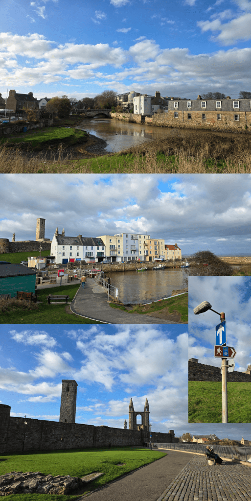
If you have the time, I recommend a detour out to the end of the pier, as the view back is phenomenal. The pier had been closed for some time due to damage sustained during a storm in November 2023 – it is great to see it back open and so many people enjoying the walk. As often happens on a sunny day after a few of rain, the town was busy with students, visitors and locals all out enjoying the day.
Side note, I have several times on these walks had the weather improve as the day goes on, and wonder if I shouldn’t wait until later in the day to get going. But instead, I just keep heading out as early on a Saturday as I can manage. Maybe that will change as the winter closes in, but probably not.
Whether you detour out the pier or not, you have two choices for climbing back up to cliff-top level; the first is a set of stairs, and the second is a hill so steep that cyclists are required to walk their bikes up or down. I opted for the hill, and either way you arrive at a great viewpoint over the town. There are the ruins here of St Mary on the Rock – a church outline – and several cannon aimed out to sea. The highlight is of course the view of the cathedral wall and remaining towers straight ahead.
The path is wide, with a stone wall along the edge of the cliff, though if you look down you will see familiar rocky coastline and birds nesting or bobbing in the water. Ahead there are two options, and neither is marked though I think the obvious choice is to hug the coastline and take the right-hand fork. The left leads you along the cathedral wall and towards North Street.
The fork I recommend is also the one that takes walkers along one of my most favourite stretches of path in St Andrews, and possibly all of Scotland: up a gentle hill between the cathedral and the castle, one of the best viewpoints in the area. You can see into the cathedral grounds, down to the pier, out to sea, and of course along the coast to the castle and distant West Sands. It is a place that is almost meditative for me – I have walked it more times than I would hope to count, even now seldom stopping to take pictures and only enjoying the view. A scattering of sea roses makes it the perfect spot in summer, and there are two benches ideally placed to rest and enjoy. Definitely take a few moments to do so, if you can.
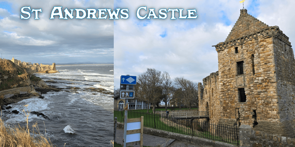
St Andrews Castle is of course directly ahead, its outline something I imagine I could draw with my eyes closed. I cannot pass without a picture, so on this occasion I included the Coastal Path sign – in one of them.

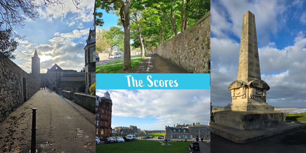
Once past the castle, the route continues along the Scores, one of the most beautiful streets in St Andrews and one of the most expensive in Scotland. The University owns a good portion of the buildings and you will pass, amongst others: the Schools of English, Economics, Philosophy, Classics, International Relations and History, the University Museum, St Salvator’s Hall and the back of St Salvator’s Quad, the Principal’s House, and the Admissions office. The buildings in between which are privately owned are large, some very old and some very new, all with phenomenal views. The Scores is lined at varying points by stone walls, and you can choose to walk on either side, though I always feel that the left going away from the castle is ever so slightly nicer. It is wider, and you do have to look out that you do not wander into the cycle lane.
About half way along on the left, Butts Wynd cuts up towards North Street, offering a stunning view of St Salvator’s Chapel.
It may be tempting to nip up to the quad and take a few pictures, so by all means do so here if this is your one trip through St Andrews. For golf enthusiasts, the best is yet to come.
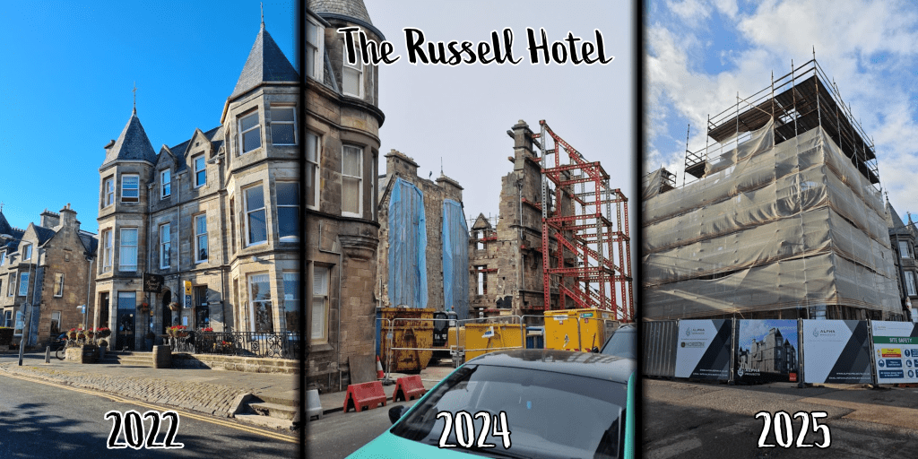
Continuing along the Scores, you will pass the Catholic Church, and ahead on the corner of Murray Park is what used to be the Russell Hotel, which was one of our favourite spots in town for excellent Scottish food. The couple who owned it eventually retired and the majority of the structure was torn down, so that all that remained was the listed frontispiece. As of writing, it is enshrouded in scaffolding and being rebuilt into what I understand will be flats.
At this point I recommend crossing the street and continuing roughly straight ahead. Along the cliff you will find a tall wrought iron fence with warning signs as to the sheer drop on the other side – this is due at least in part to the unfortunate tendency for students to wish to climb the fence, which has devastatingly led to fatal injury in the past.
Avoid the temptation to turn right down the steps toward the Aquarium, and while there is no clear signage continue straight towards the towering Martyrs’ Monument, which was put in place to commemorate those killed during the Reformation. Beyond the Monument is the Royal and Ancient Golf Club of St Andrews and the famous Old Course. To the left, the buildings of the Scores including what used to be the Scores Hotel but is now Seton House, and the towering red Hamilton Grand, that incredible framing building to all pictures of the 18th hole. When I was a student it was still student housing, though has in intervening years been re-build into luxury condos.
Continue down the hill and cross the road, continuing up Golf Place towards North Street – do not head toward the beach, though there are public toilets in that direction should they be needed.
Continue to follow the golf course by turning right along the Links, which is a narrow road that runs between the Old Course and the buildings that include the famous Auchterlonies Golf Shop, the Rusacks Hotel, and the New Golf Club. There are regular signs reminding you of this, but golf is being played year-round, so pay attention for stray shots!
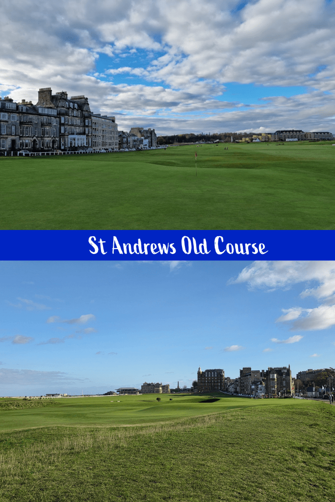
As you walk along the course, you will get some great views towards the Swilcan Bridge – where all golf competition winners have their pictures taken, as do many tourists.
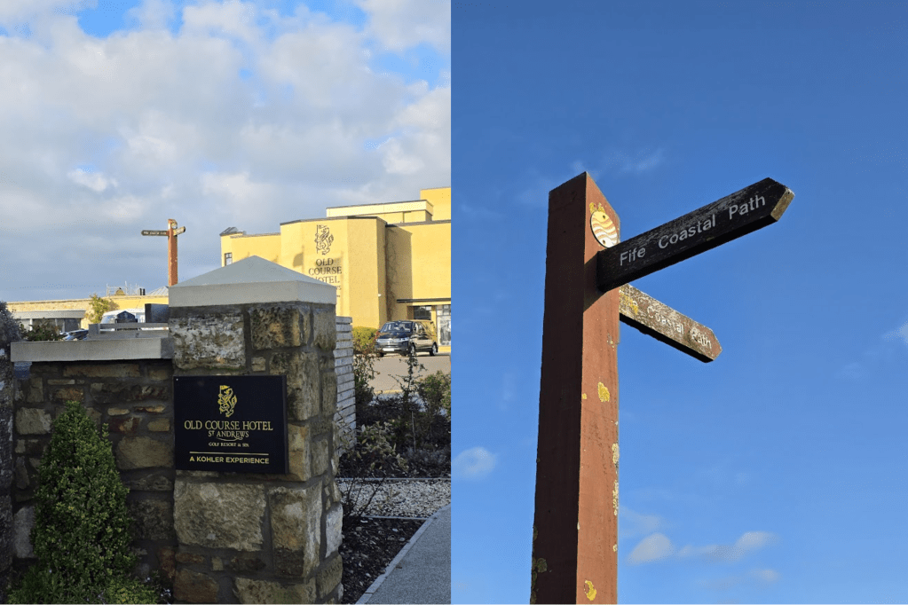
Follow the white fence when it curves around the end of the buildings and keep moving towards the hotel, straight ahead through the car park. In only a few minutes, you arrive at the entrance to the hotel grounds, where there is a clear sign to mark the end of this section.
Overall, a comfortable walk with a few spots to challenge you and a few spots to just enjoy the view. The section through St Andrews is beautiful, but I still think I prefer the out in the wild paths such as the one from Crail to Cambo – for hiking, in any case.
A small calamity of this walk was the realisation that my walking boots, purchased in the spring, just aren’t cutting it anymore. They have worn down and are encouraging my ankles to roll in even more than they do naturally, so I am on the lookout for a replacement. Good thing Christmas is coming, as I hope I can request a new pair! Any recommendations on brand would be welcome.