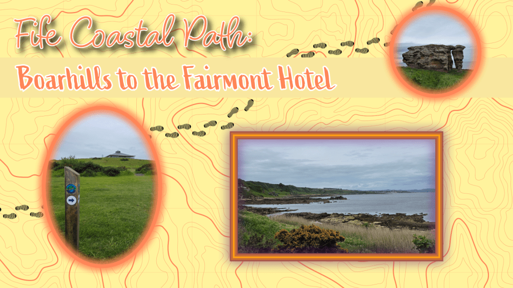
Last Saturday started off overcast, though the clouds were light grey and white, which usually are not hugely threatening. So I headed off to fill in the relatively short gap I had between walks, so that I could say I have finished the whole distance from Ely to Tentsmuir – East Neuk done! I hoped that the cloud would lighten, though as I rode the bus to Boarhills to pick up where I left off last week, the colours shifted to a bit darker…oh well.
A bit of rain was all I expected to see, and that wouldn’t hurt me – I was feeling determined. We had quite a dramatic week of weather, I should mention, with lots of big grey clouds and thunderstorms, so I hoped that the day would be a bit more settled even if not sunny. I tested fate a bit by bringing my sunglasses and not wearing my raincoat.
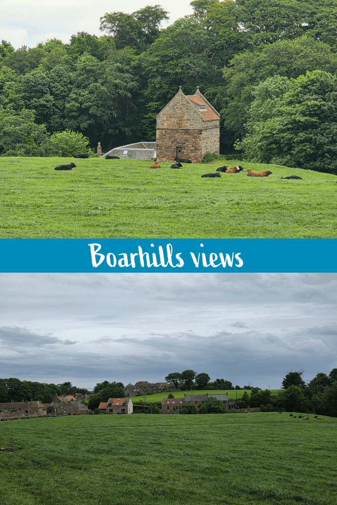
I alighted from the good old 95 bus at the Boarhills stop which is incredibly awkwardly placed, at the end of the entrance road to the village. My views were some lazy cows (not a good sign for weather) and the village filling in the gaps between wide green fields.
From the bus stop, it is a short downhill stroll into the village, and I turned right up the farm access road towards where I had broken off my walk last Saturday.
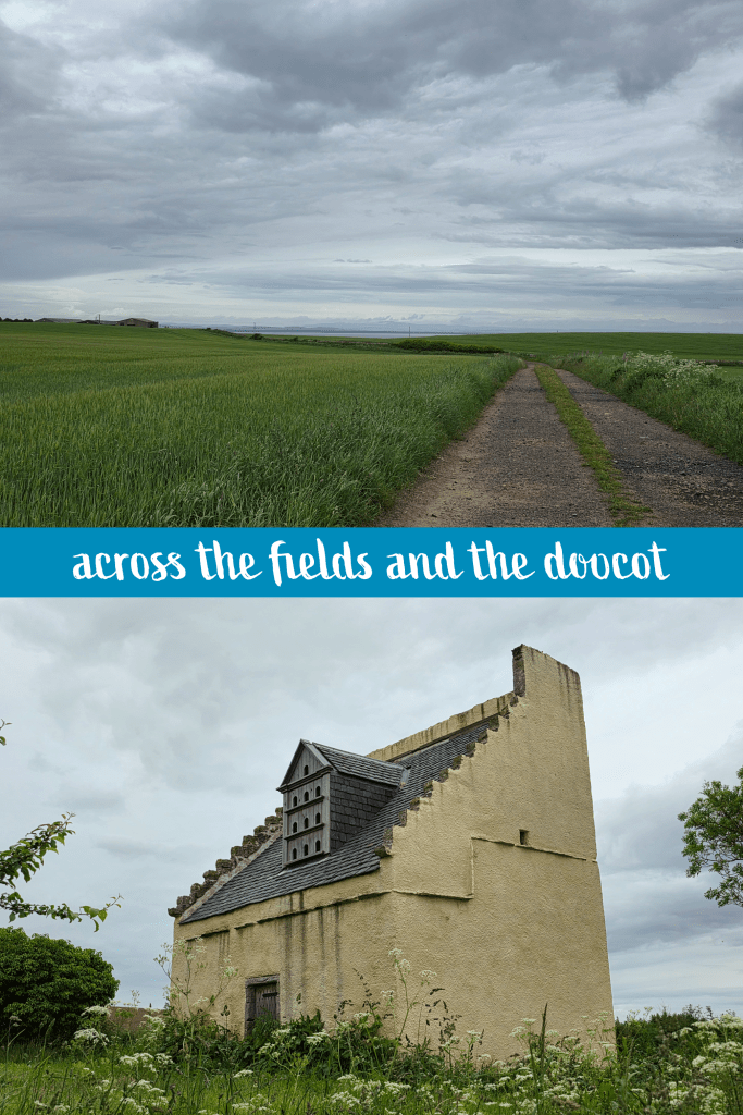
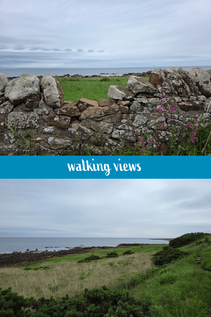
It took me just under ten minutes to make my way back to where the Coastal Path splits from the farm road, though it is almost identical in appearance – a wide farm track with two ruts, accessible by vehicle as well as foot. This path took me across a field with views across the water towards the distant hills behind Dundee. It was a good day for a walk, with a gentle breeze and comfortable temperatures of about 13℃/55℉, and while overcast the air was clear.
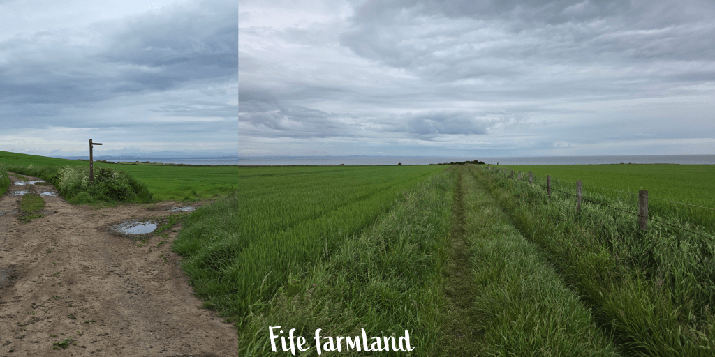
After about 5 minutes on this track there is a short section on the road, and then a quick turn off again to the right, behind the doocot above. This is essentially a detour around some large farm buildings, then the path strikes out again across the fields. A sunnier day may have required more pictures, but overcast skies without dramatic clouds just don’t do much for me, and the wind had picked up, so I moved along a bit faster until I reached another signpost. This directed walkers off to the right, towards the coast, along a grassy trail.
There was a short spot of rain as I crossed this section of field, but oddly I only noticed it from the sound of the drops hitting the grass – it was so light I did not feel it on my face, hair or clothing. It made the faintest dots on my coat before stopping again.
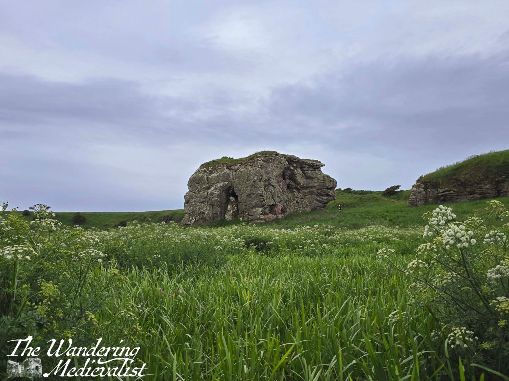
Ahead along the coast is a cluster of bushes, and an obvious left turn towards St Andrews – through a gate and down a hill, the path descends almost to beach level. Here is the first of many views looking north, this one at least assuring me that the tide was low enough not to be an issue. Yes, I had again forgotten to check the times.
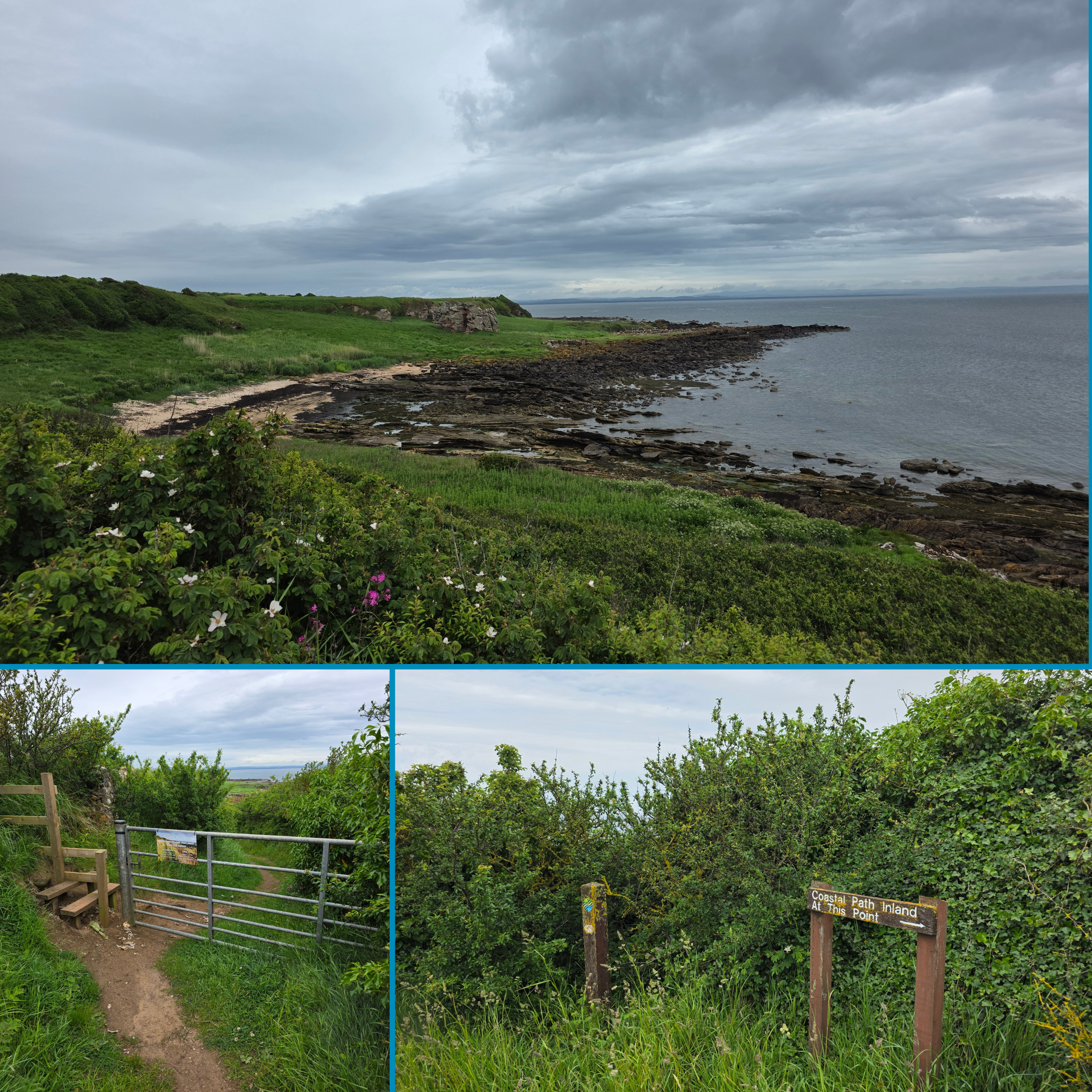
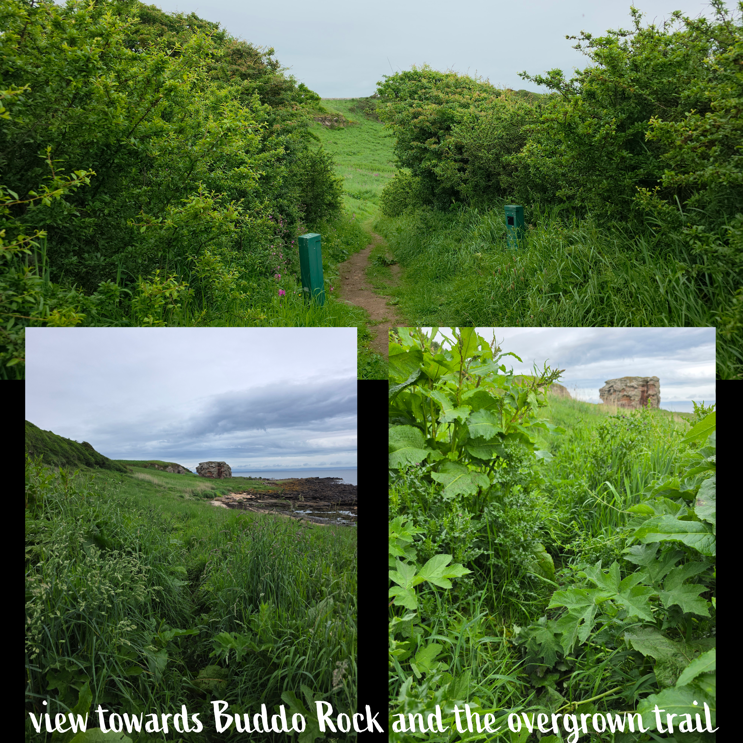
At beach level, you can see ahead towards Buddo Rock, with cliffs on the horizon that are very familiar to anyone who has walked near and around St Andrews. The sun was trying very hard to fight its way through the clouds, but it was not quite strong enough to win.
The path had narrowed here considerably, so that I was walking through almost waist-deep grass and plants, positively soaking my jeans and boots. This part of the route is clearly not well-used and so I gather is not as well maintained. Hiding in the more harmless plants were plenty of prickly thistles, nettles and other less pleasant flora – I should have gone down to the beach and stayed there instead. I was beginning to wonder if I had in fact taken a wrong turn – the path was barely present enough to be followed – when from within the brush emerged a familiar Coastal Path post. I was not lost, but I was even wetter from knees down than if it had been pouring rain.
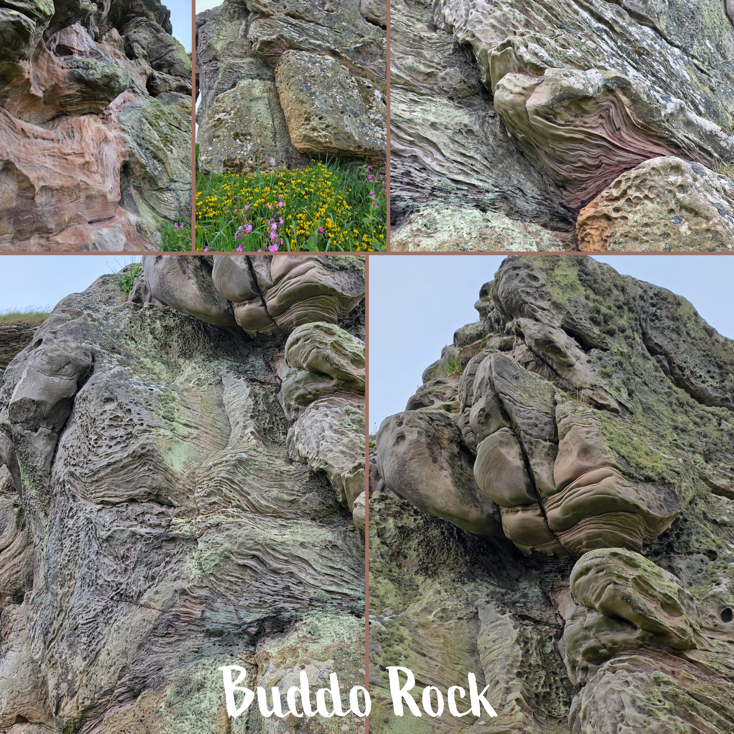
Eventually after what felt like miles of bivouacking (was only about ten minutes really), I reached Buddo Rock, which was really quite cool. The cliffs nearby show evidence of once having been connected, and the rock itself is a fascinating piece of geology, the sandstone surface folded and swirling like cloth or liquid.
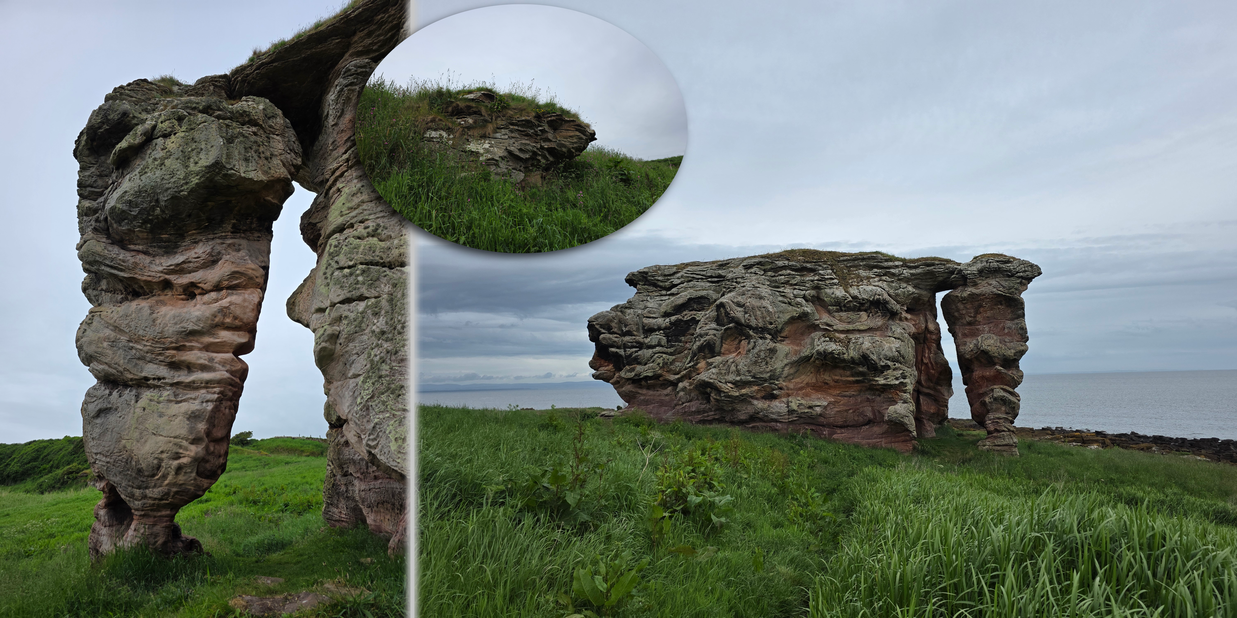
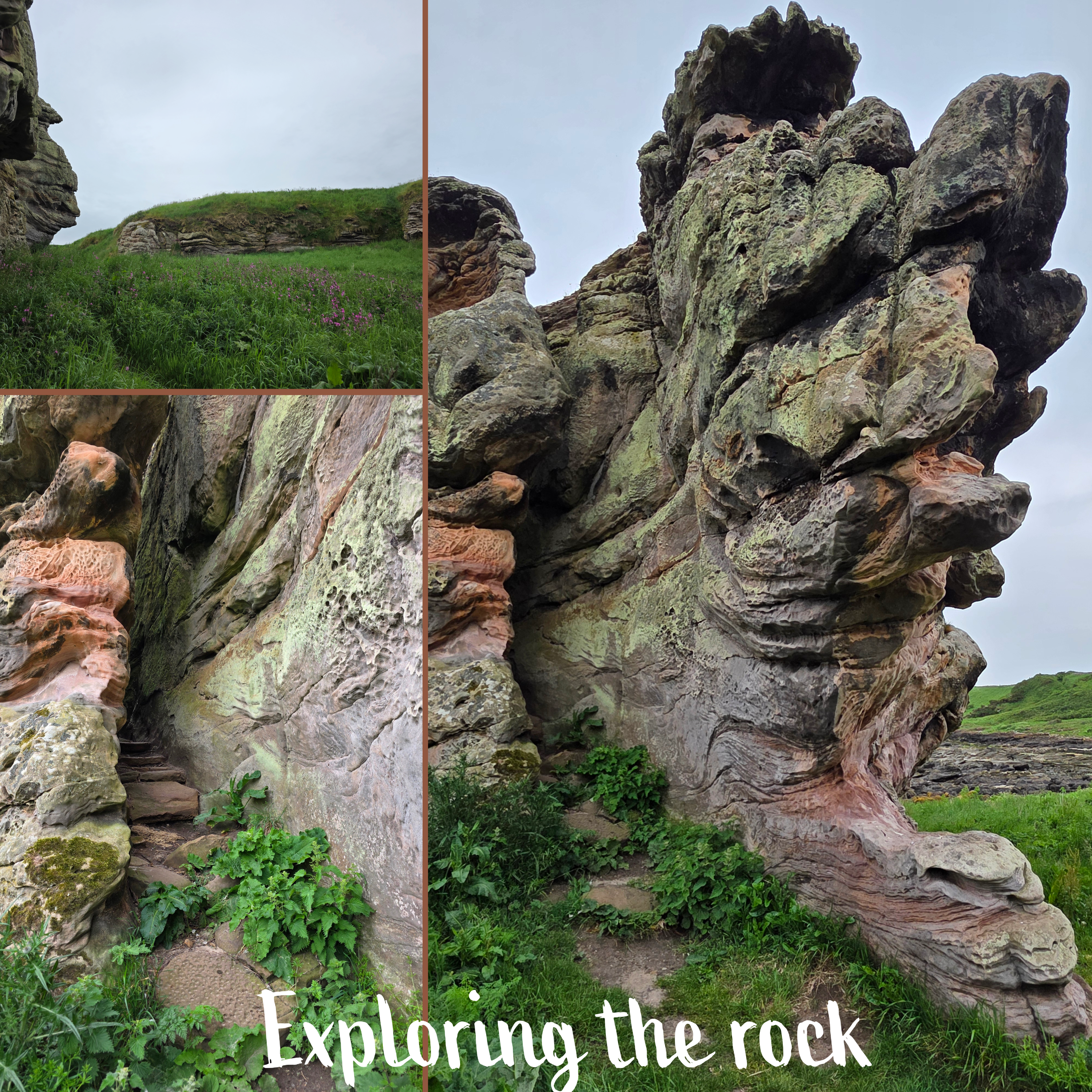
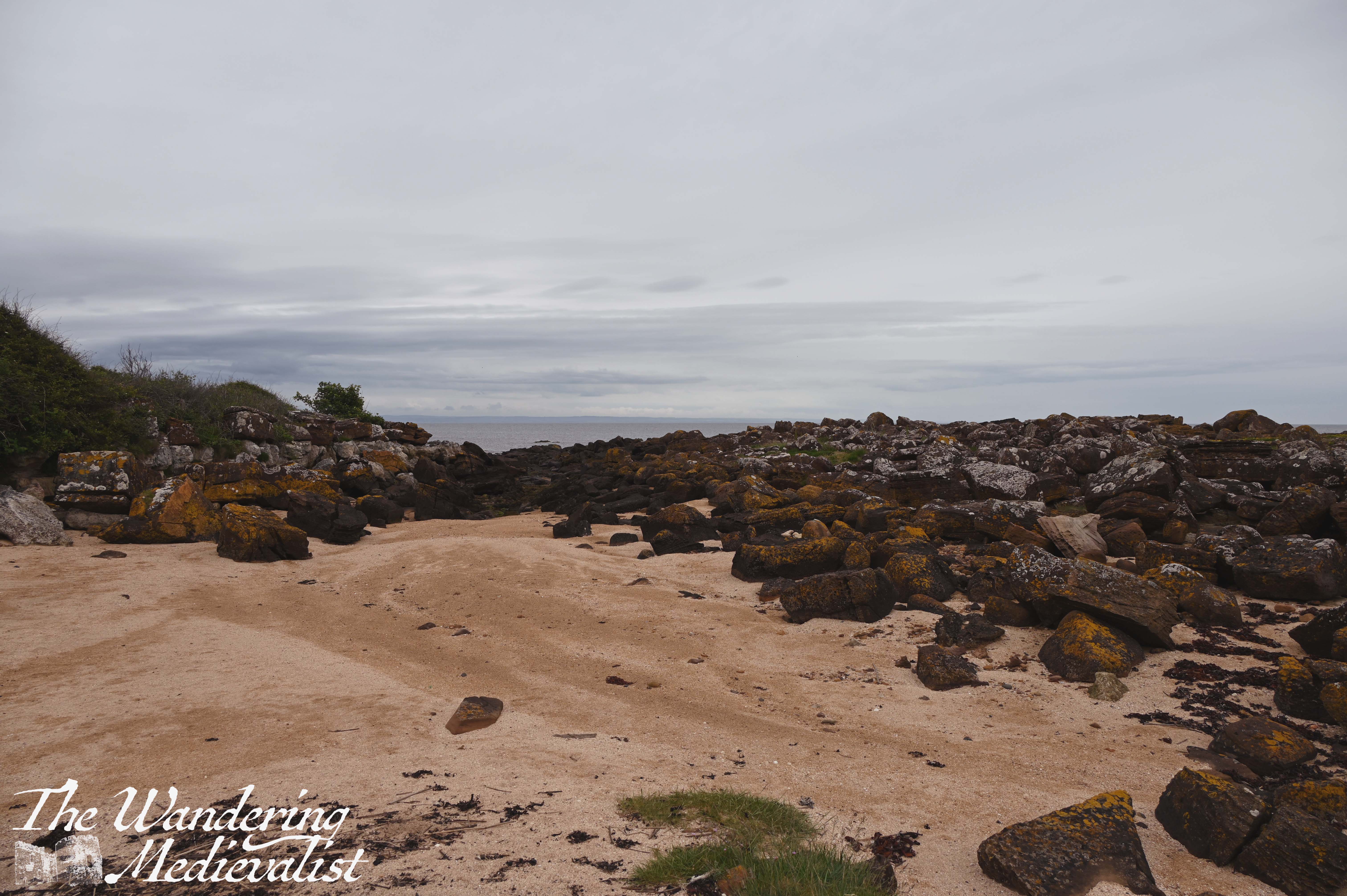
I spent a few minutes wandering around the outside, getting pictures from all angles, and then backed away a little to a small stretch of rock and sand nearby. This would be an amazing spot on a day with more sun.
The cliff line is really interesting along here, with chunk of stone sticking out from the grass, and a couple indentations that could be the start of caves. It is easy to understand how there are several sets of caves along this coastline.
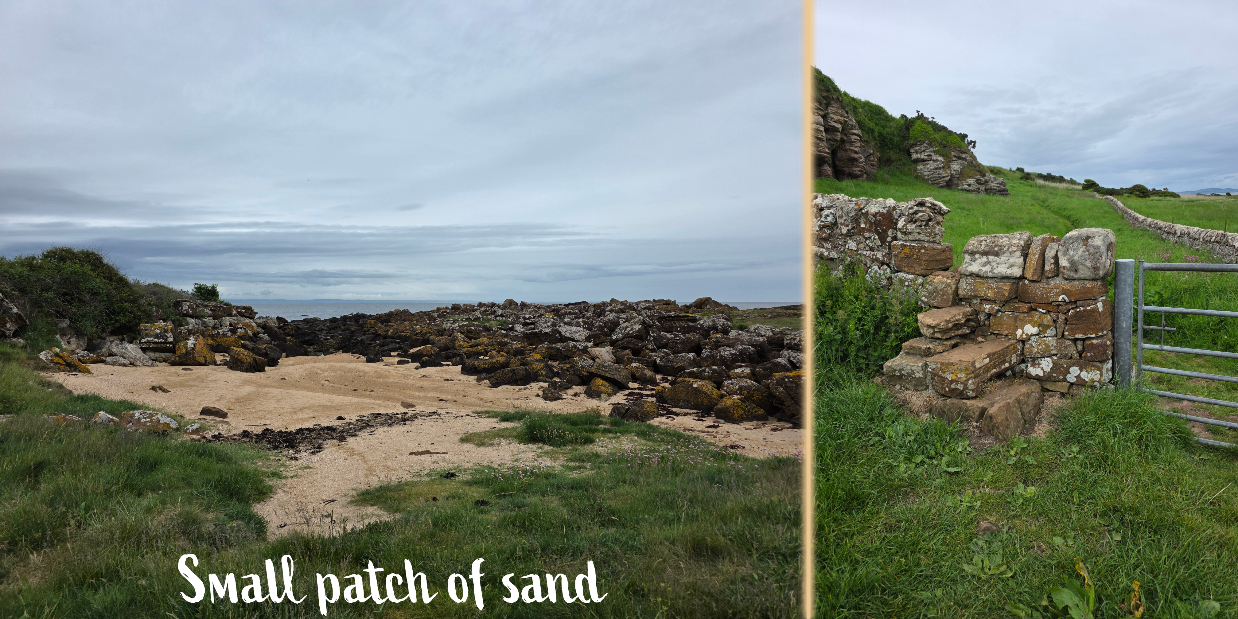
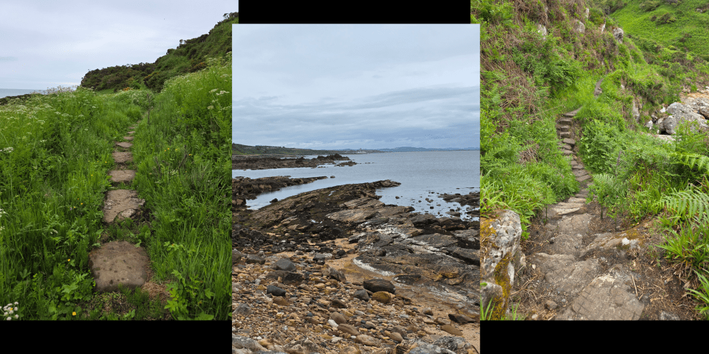
But, I could not stay here and be fascinated by the rock forever, and so I headed on, over a gate and into a more cared-for portion of the path.
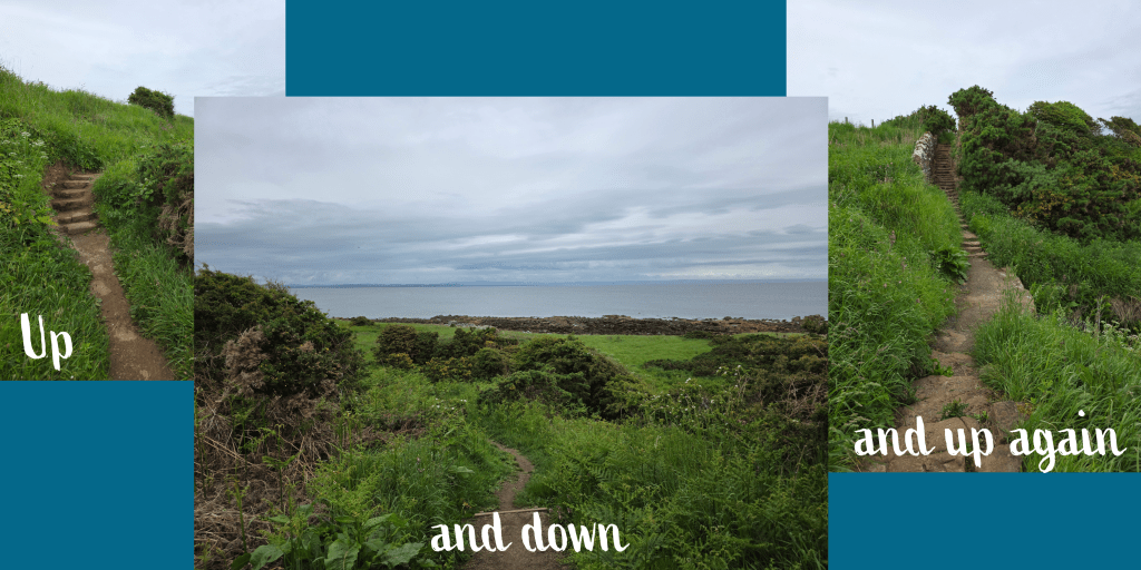
Once past the gate, the trail begins to climb gently, with the cliffs on one side and a stone wall on the other. I knew that at some point I would need to climb back to golf course level, and I suspected at the time that it might be a more gentle climb. I was quite wrong.
In very little time, that supposition that the climb would be easy was dashed by a series of steady ups and downs, some of them with stone steps and others just rough-cut stairs.
This portion of the route was worth it, though, for several reasons. Firstly, the flowers, which vary between wildflowers, sea roses, foxglove or any number of other blossoms – lovely pinks, yellows, purples, and whites.
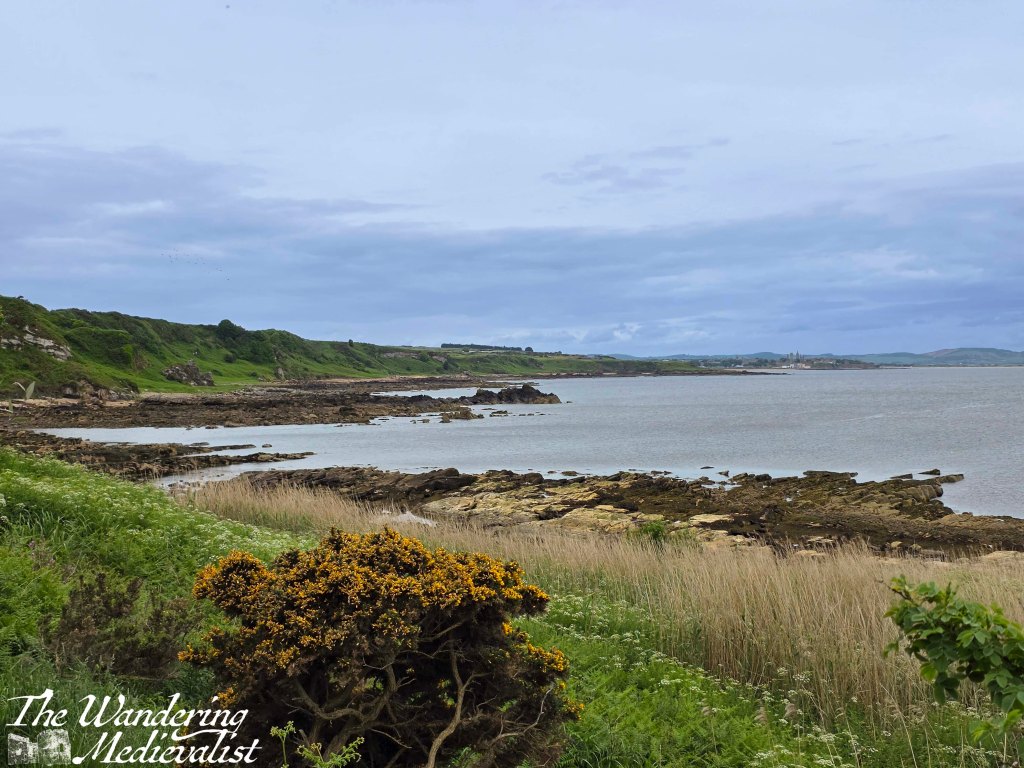
Secondly, for the view along the coast which was a completely new one I had never appreciated before – this far around the coast, I was looking almost straight down St Andrews pier, which was visible with a zoom lens.
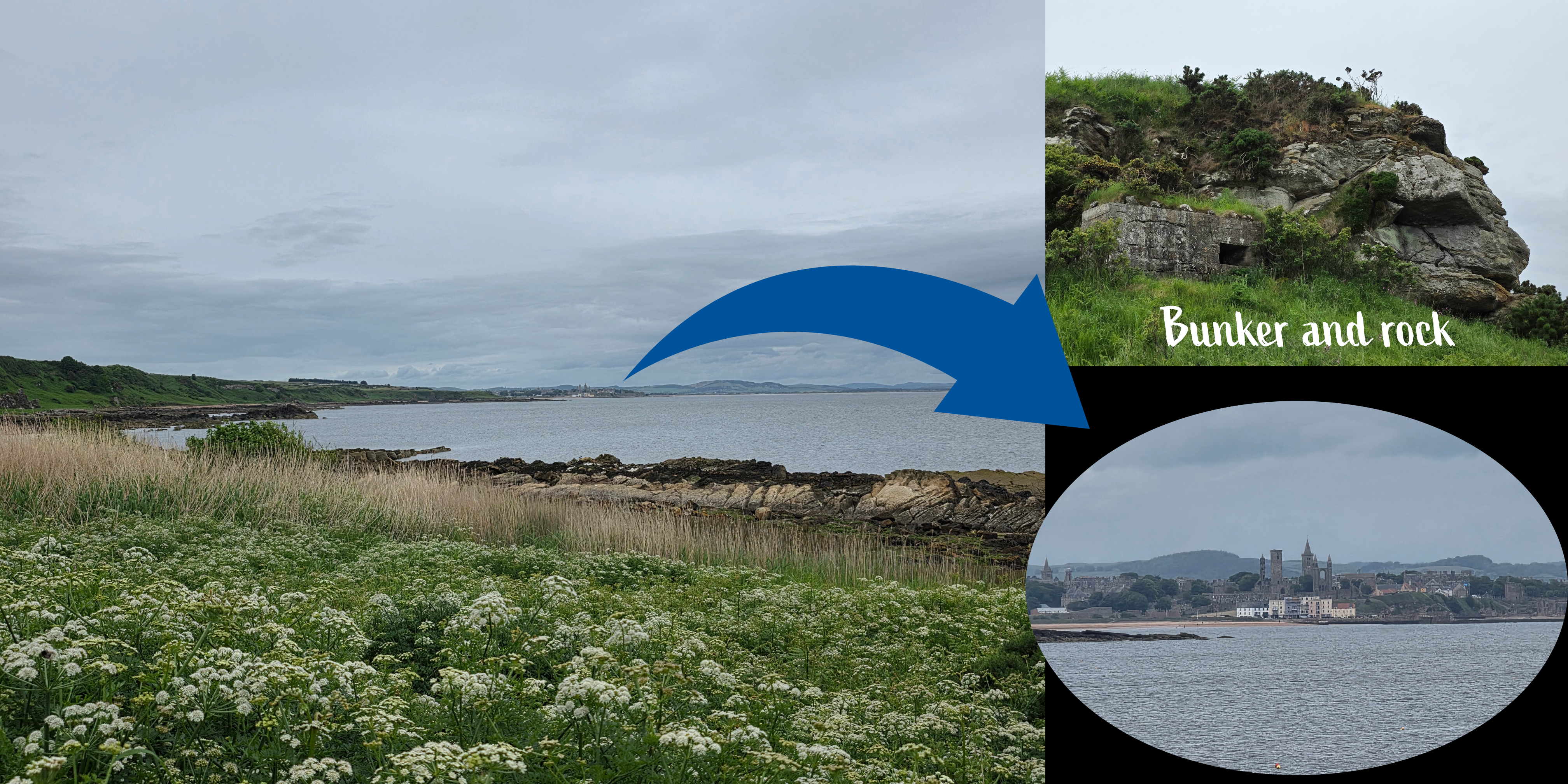
The cliffs are also really fun to watch and see what new thing will emerge – there is a World War II bunker just visible for example, as well as countless hidden spots. This would be a phenomenal spot to come back to on a sunny day.
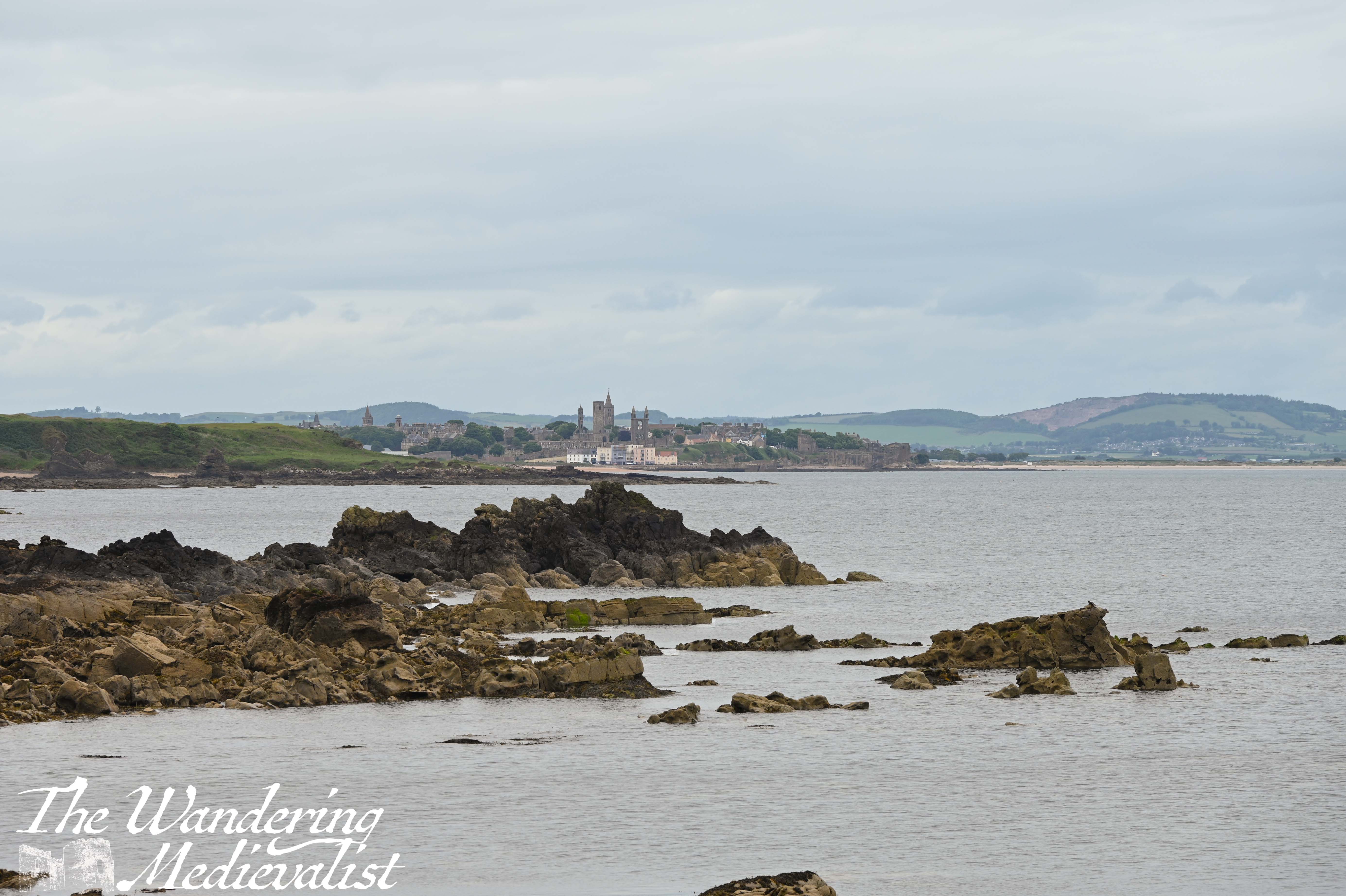
Moving on, there is a section of path made out of stepping stones to take you over a muddy patch. I could not stop marvelling at how amazing the view of St Andrews was from here, and I had to stop myself from re-taking the same picture over and over. The one above with rocks directly in the view was my final effort.
There is quite a lot of moving up and down the edge of the beach and cliff at this point, and many of the ‘steps’ are not in the best state. While the views are excellent, the almost continuous rise and fall makes this a more strenuous portion of the path, though at least my legs were starting to get warmer as they dried out. I was being followed at this point by a group of walkers less than five minutes behind me, which stressed me out slightly; I considered stopping to let them pass, but decided instead to push on. The weather was becoming a bit more threatening, and I had plenty to do once I had finished my walk.
As mentioned, the stairs here have in some places seen better days, and there were some significant drops particularly for those with shorter legs like mine. But, as long as you take it easy and pay attention to where you are putting your feet, it is certainly manageable.
In time, the path levelled out at beach level, with a large rock ahead. Another post directs walkers towards a flight of stairs and I realised that my earlier supposition was completely wrong: I would in fact have to climb from beach level to the golf course in one long winding go. I won’t lie – particularly with the other walkers behind me, this one was a push.
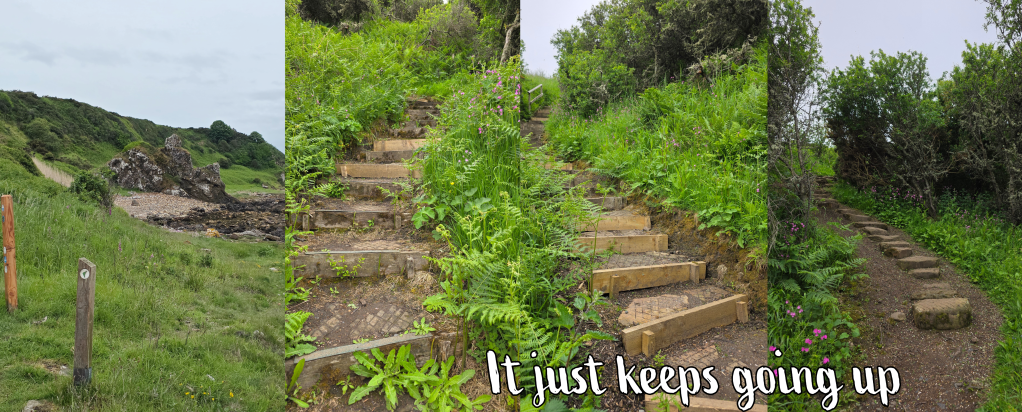
The steps vary from wooden slats to stone chunks, then closer to the top merge into just a hill. Then, just as you are starting to doubt your sanity on how far you have climbed, the sound of golf balls being whacked drifts into your ears, and the shape of the clubhouse appears on the horizon.
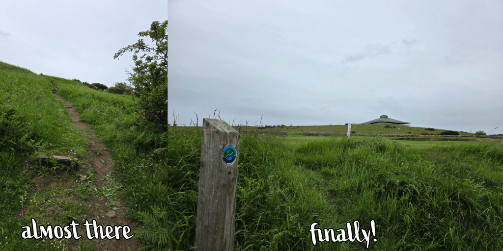
The path meets the green and follows it around to the access road, only steps from the spot where I had started my walk several months ago. I had made the foolish decision to remove my jacket at the beach level, but up on the course the wind was much stronger, and I found I had to pull the extra layer out of my pack again. It was also starting to spit with rain, and I still had a way to go, trudging up towards the road; my main priority was not being hit with an errant golf ball.
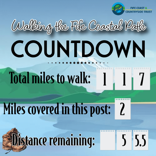
Overall, while this was a shorter walk than the previous week – 2 miles on the path and about 4 overall – it was arguably harder to do with a lot more climbing and descending, and of course the monumental climb at the end. The good news is that I definitely stretched out all of my back muscles that were bothering me.
Also, it didn’t really start to rain until the end.
One unpleasant after-effect though was that when I got home and was enjoying removing my boots, I discovered two ticks on my hand – one had bitten, one was still crawling around. The other half swiftly removed the one that had bitten with tweezers, and I squished the other – I do not think it had actually been there long. Compared to a US tick, it was quite small, but still necessitated a few shudders and an immediate shower. Apparently the weather in Scotland this spring has been perfect for ticks, so if you are out, be careful!
Speaking of weather, we are all being told that there is a Super El Niño coming. What exactly this will mean for Scotland is uncertain – more wet or more dry, either way I intend to continue on my walks. Now that the East Neuk is done, it’s time to focus on the south coast again. More in July when I am back!