The day I chose for this walk started with lovely sun and the temperature set to rise to as high as 25℃/77℉; there was some white cloud and haze at the horizon. All of us in Scotland were excited at the prospect of seeing the near-total (around 90%) eclipse that evening, though clouds threatened to close in as the day went on.
I had selected trains as my travel method for the day, and if I have never said it before – though I am sure I have – I have a great affection for train travel. This is likely due to the almost total lack of trains where I grew up. Yes of course we had the subway, but we almost never rode anything more properly ‘train’ than that. We took the Amtrak from Boston to Washington DC once, and I just adored it. Granted, the British rail system has done its best to squash that romanticism, but I still feel it is one of the best ways to travel and definitely to see parts of Scotland you otherwise might not.
I arrived in Dalgety Bay on time and hoped to run for a bus to take me down to the harbour, but I missed it by a fraction – with some luck, this gave me time to go into the local BP station which included an M&S shop with a restroom and snacks for purchase, leaving me well-provisioned.
Only twenty minutes later I did catch another bus heading down the hill, and in the short walk from the bus stop to the start, I was able to appreciate how much better my knees felt and the fact that this would be my first clockwise walk – all the others have been counter-clockwise around Fife! But a few of these will be required, so I allowed my obsessive nature to let it go.

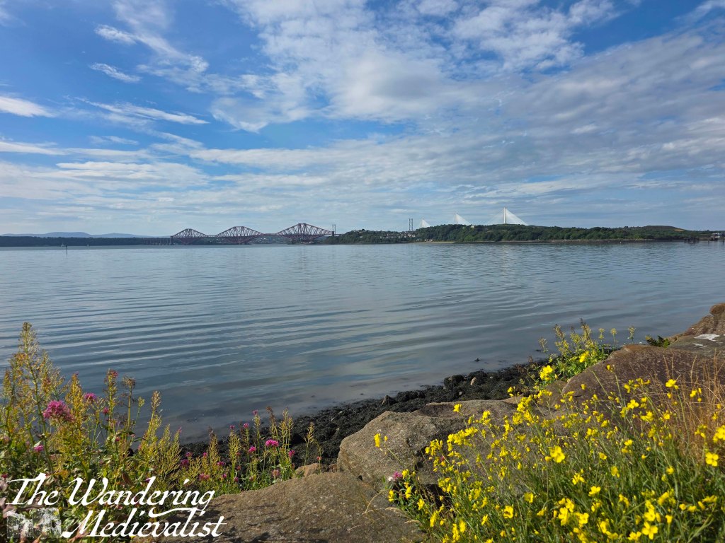
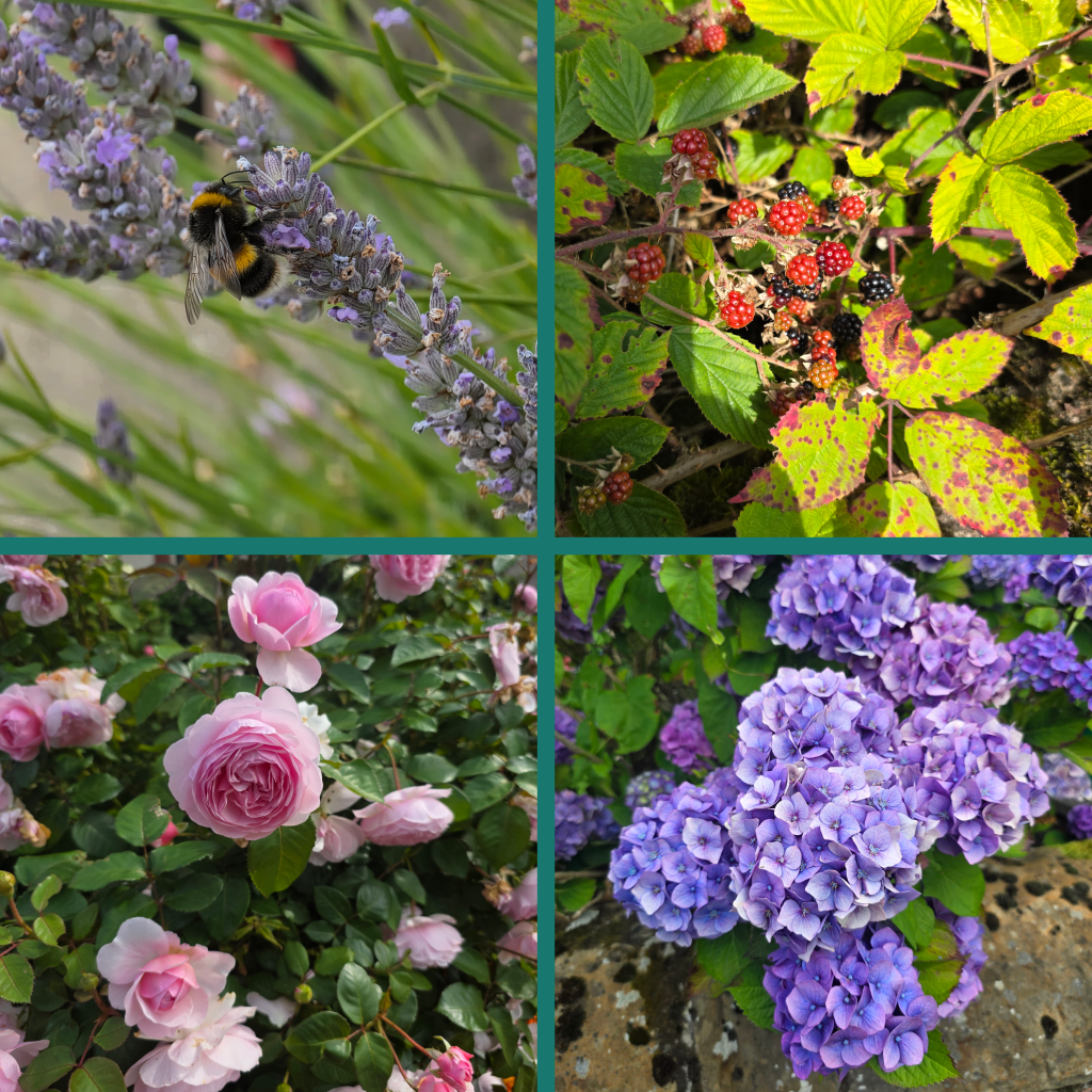
At almost exactly 10.45am I started off from the anchor in St David’s Bay. It was another calm morning with not too many waves even out in the middle of the Firth, and a much clearer view of the three bridges than the last time I did this walk. The apartment blocks here are very well-kept with what I imagine to be excellent views over the water and beach, which at low tide – as it was – was mostly rocky and covered with seaweed. The path is lined with beautiful roses and brambles full of ripe raspberries and blackberries, and it winds around between the flats and the water, then away from the residential area along the coast.
It really was a good day to be out for a walk, with hot sun that made me question my decision to put suntan lotion only on my face and not arms. (In the end I was fine but definitely more freckled).
There are a few benches positioned along this part of the trail, looking out over the view which was a bit hazy towards Edinburgh and Arthur’s Seat rising in the background. Even through the haze I could make out buildings, the outline of the castle and even St Giles’ Cathedral sticking up over the city.

A short distance later, the trees and bushes had grown over the path and been trimmed back to create a kind of tunnel which also sheltered me from the direct sun – a pleasant change! About half a mile along, the trail widens into an open area with some bushes and Prestonhill Quarry to the right. There is what I thought might be a disused bridge on the left but in seeing it from the other side, I imagine instead that it is an out of use pier that may have been used to load stone onto ships. There are a few viewpoints along the way as well, but I was determined to make some progress so did not stop. I would also remark that this portion of the path was quite well-used, even on a Wednesday morning; I passed people relatively frequently, at least until I reached Inverkeithing. Something I have certainly commented on before – as have many hikers online – is the difference between walking and hiking in Scotland vs. the US. In the States, everyone nods or says hello, good morning, whereas in the UK walkers are more likely to just look past you. Some will nod or say hello, but it is far less common. A curious cultural difference.

Gradually the path curved inland, so I knew that I would have my last views of the bridge for a while, though I was excited at the prospect of much better ones in North Queensferry.
Oddly one of the biggest issues I find when I am out is the wearing of sunglasses. I really don’t enjoy it as I feel like they alter my depth perception a bit as well as my view, and I really don’t like days like this was when I feel like I am taking them off and putting them back on every few minutes; I can’t see the camera screen with them on, and then half the time I just leave them on my head and squint. Which I know is not good. Anyway, small rant.
After passing an industrial space, the route enters a residential area, where it is well-marked and passes a number of older houses with nice gardens.


I passed the sign for the Coastal Path from Inverkeithing to North Queensferry, so figured I was clearly going the right way, walking between the houses and a large grassy park with playing fields and paths. Up ahead on the hillside is the town of Inverkeithing, which I was hoping I would not need to climb up into – oh well.
I learned after a quick look at the map that the path follows Preston Crescent until it crosses a burn and then continues up to the right, even if left might seem more natural. There is a pedestrian crossing and an old doocot which has been transformed into flats, with a new estate around it. Away from the coast the breeze died down and I could really feel the heat.
At the end of Commercial Road, the route turns up to the left and, much as I feared, climbs a hill towards the old heart of Inverkeithing.
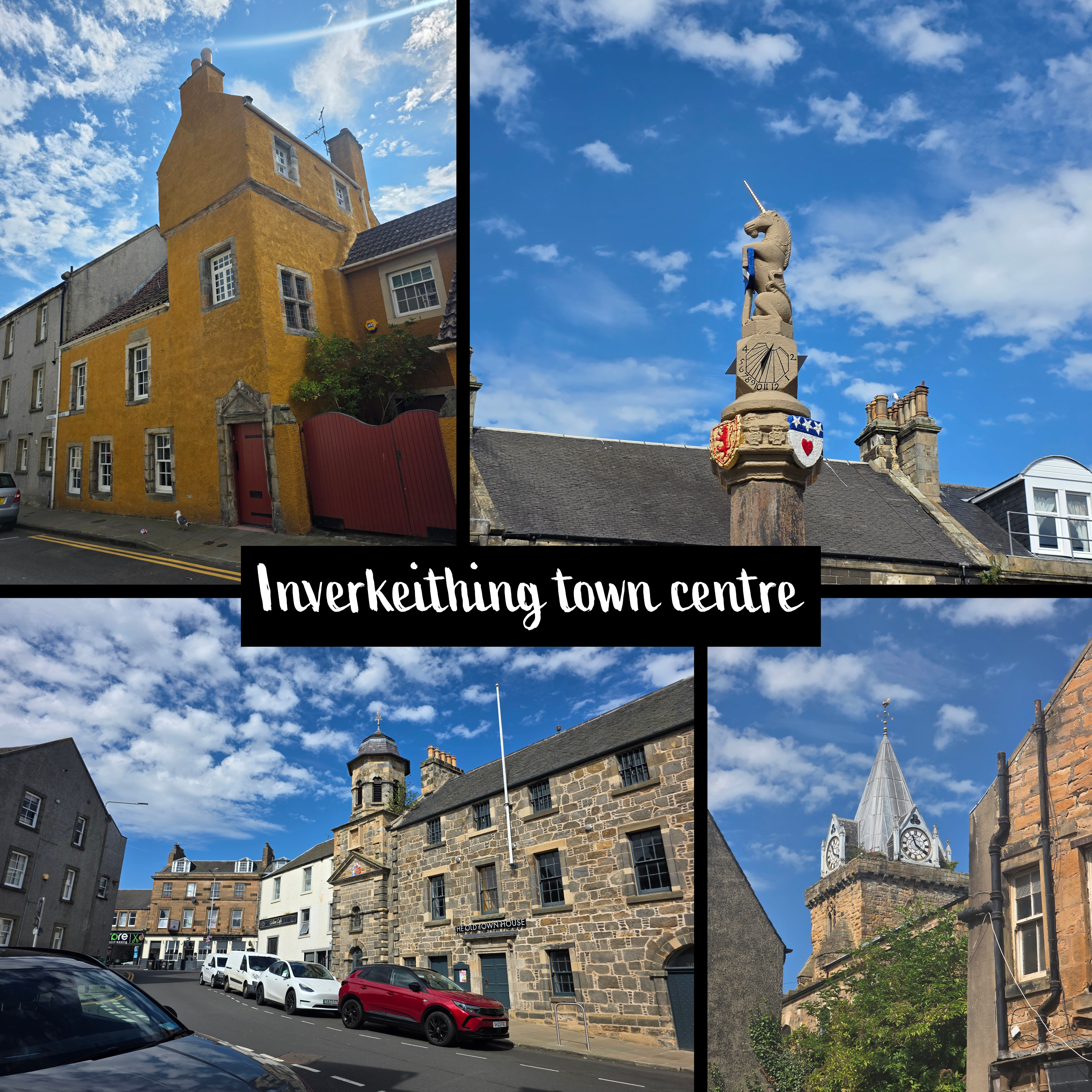
Inverkeithing was a medieval town of course, and the high street is dotted with a series of quite old buildings – 15th or 16th century I would guess, as well as the old mercat cross (the picture above with the unicorn) which dates from 1389 and is one of the oldest remaining such crosses in Scotland.
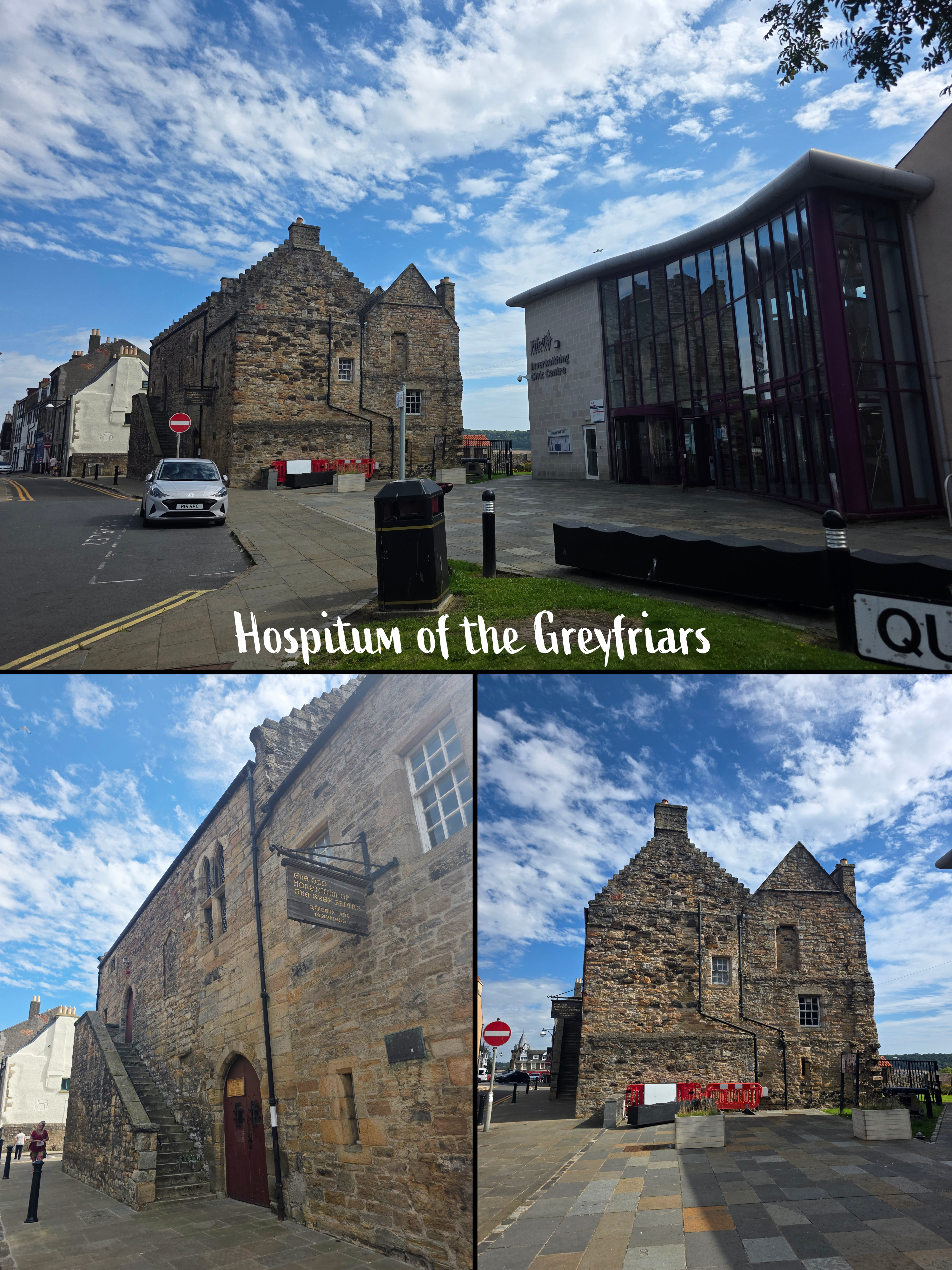
The high street is a good spot to find a snack or drink, as there are plenty of shops, and I was intrigued by the Hospitum of the Greyfriars, a grand building towards the end of the high street. Also dating from the fourteenth century, the complex includes gardens that I did not have time to explore.
Slightly in contrast, directly beside this medieval building is the very modern Inverkeithing Civic Centre. As I took the pictures above I was asked by a very kind older woman if I was a visitor. I explained that I was walking the Fife Coastal Path and she said that I should definitely stop in the Civic Centre which was new, beautiful, and had very clean toilets. While I did not stop on this occasion, definitely a key piece of information to have!
High Street becomes Hope Street as the road descends again from the hill it felt I had just climbed. The churches and buildings ahead are newer but very nice, with balconies that overlooked the street and gardens that face the set of allotments across the road. Beyond the allotments is the train line, which I learned as one whistled by. I had always been a bit curious as to where the train line was in relation to this part of town, and of course it became very evident as I passed under a bridge and could see, ahead of me, the Jamestown Viaduct. This viaduct provides a great view when you are on the train, and I was intrigued to finally be walking beneath it – though I had several times visited Ferrytoll Park and Ride, which is also located in its shadow.
Like Dalgety Bay, Inverkeithing is built on a hill so that there are plenty of steep roads cutting away from the Main Street down to the left. Straight ahead were the flashing sail-like towers of Queensferry Crossing.
I was a bit curious to learn how the path would get past the industrial area I knew was coming up ahead, and sure enough rather than continuing straight towards the Park and Ride, the trail here turns sharply left.

I should point out that, had my walking been broken up differently, Ferrytoll would have been a great place to park and join the trail; I may actually try that for later portions once I need to be on the far side of the bridges. It is also worth observing that as I turned left I realised that the Coastal Path was sharing a route with the much newer Fife Pilgrim Way, which leads from North Queensferry or Culross through Dunfermline and across to St Andrews – 64 miles in total. As it is mostly inland, though, it appeals a bit less to me. But the signage is newer therefore clearer, and so I found myself comforted by seeing those signs as well as the ones for the Coastal Path.
Ahead of me was a large white factory building, and then a left turn along a road with a stone wall topped with barbed wire, which keeps thieves out of the scrap recycling plant beyond.
Beyond the factory there is a set of four houses, and then gradually the path leads off the road onto a section with bushes on either side, which was a bit shaded. I knew at this point that I still had a way to go, but I refused to look, as I was finding myself not hugely energetic despite a good sleep and good breakfast. Perhaps I should trust my Fitbit when it tells me how prepared I am, nor not…

I realised later that it could also have been the heat and not drinking enough water, which I have a bad habit of forgetting to do when I’m caught up in my rambling. I was very aware of needing to be physically prepared for the Dundee Kiltwalk, for which I had been raising money (I did the shorter 4-mile route, not the massive 20 miles).
At the end of this short path one could be a bit uncertain, but there is a very clear sign directing walkers off to the left, slowly passing around a large conveyor belt leading into a plant building of some kind. A gentle breeze returned, and it became obvious that I was walking up the other side of the ‘Inner Bay’, which takes a large bite out of the land and into which the Keithing Burn empties. The path goes up and around a metal bridge, then turns onto an amazing view back towards Inverkeithing and eventually up to Dalgety Bay.

The trail continues along quite pleasantly then opens up to an excellent viewpoint and picnic area, sticking out into the water so that you can see in both directions. After a minute or two of indecision, I opted to take a break, plopping myself down on one of the large rocks looking over the Firth and removing my pack.
It was the perfect spot to enjoy some water and take out the big camera for a few shots towards Edinburgh.


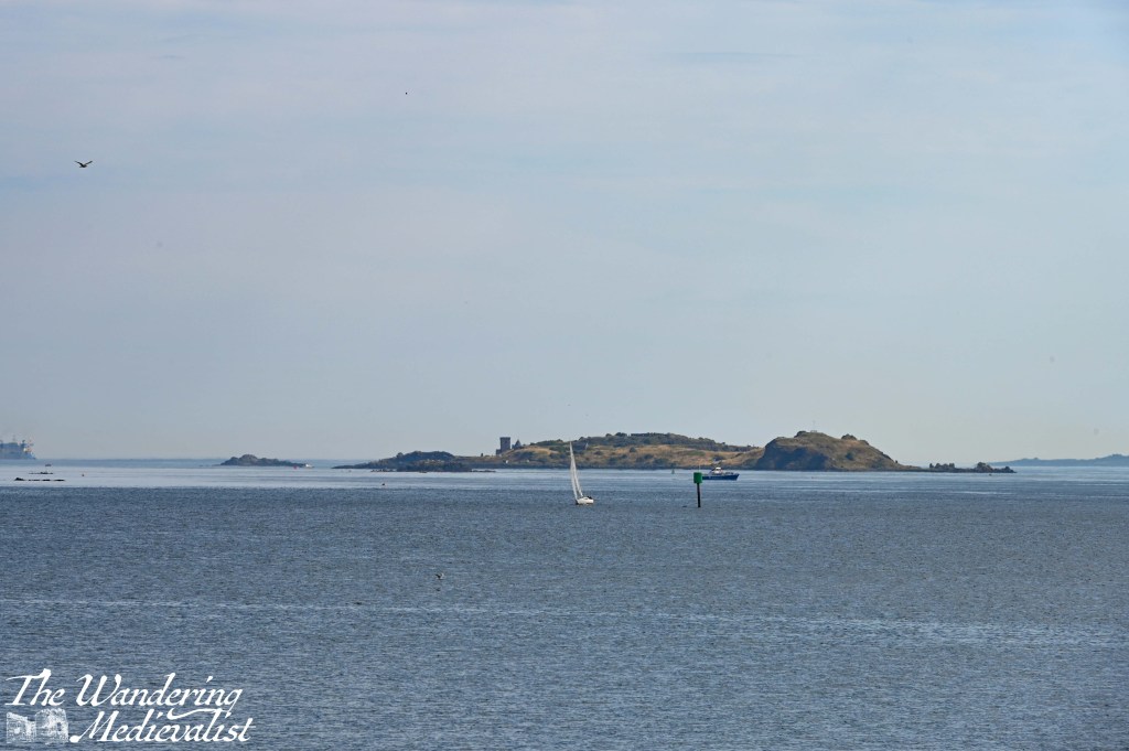
It was a bit silly to try to push through the full walk without allowing myself a stop – I should be kind to myself and take a break when I need one. For the first time in a while I really was not constrained by time. The cloud covering the sun was actually a significant bank of cloud, and while it did not look like rain, it seemed that the sunniest portion of the walk was behind me. Which, in all fairness, I was not unhappy about. I did find myself fascinated by the view of Inchcolm Island, as the angle allowed for me to see the outline of one of the abbey buildings, and I probably would have stuck around longer but the bugs were also enjoying the lack of breeze. So, it was time to pack up and head on my way.
As I rounded the corner, the bridge was just visible ahead though it was difficult to see how red it is due to the light. The path is pleasant and winding here, passing a few cottages that seem to be out in the middle of nowhere, and a cormorant or two popped up just off-shore. On a clearer day, the view from here would be phenomenal, whether looking up the Fife side even beyond Dalgety Bay towards Aberdour and Burntisland, or on the Edinburgh side where planes land regularly at the airport, passing over the oil terminal.
I’m also really pleased that I remembered to take a few videos on this walk; I’ve been a bit lacking, and may have missed a few viewpoints, but today should make up for some of it.
Sections of the walk are oddly divided here by a stone pillar with a fence in between; I say pillar rather than wall, as the structure is only a few stones wide – a bit strange. Soon I was able to see the town of North Queensferry rising on the cliff ahead, with the tips of the bridge in the distance, and below the curve of beach. I was not sure if this beach was safe, as so many along here are not, but there were several families out enjoying the last few free days of summer.

The path heads directly along the beach edge with a stone wall separating the path from the quite impressive houses beyond. The sand on the beach is in places quite dark, almost black, but not in what felt like a clean way – it was more of a muddy brown, though not muddy, and seaweed-free. Just dark sand, and not as appealing as some.
At the end of the beach, the route climbs slightly and passes a sign for the Carlingnose Point Wildlife Reserve. While there was no actual sign for the coastal path here, there was also no other route to take – I realised that I was getting a bit obsessed with the signage or frequent lack thereof, but I suppose it is because I want to make sure I get the correct route. I am a perfectionist, I must admit. Usually, even if there are no signs, my instinct proves correct, so I just need to trust myself and also let go of the requirement that my walk be exact.

There is a structure in the water immediately off-shore, an old submarine staging area, which a fishing boat was hovering around. The path at this point became a bit more rugged and started a gentle climb up again. I am of the strong belief that a long gentle climb can be far more difficult than a steep set of stairs, as you can easily find yourself questioning your sanity as to when it will ever end, and whether you will actually make it to the top. I was comforted at least by the frequent sound of trains rumbling by above – at least, I find this sound comforting. I was uncertain whether the path would go on top of or below the cliff, which is very obvious from the train; it turns out, somewhere in the middle, really.
The next obvious viewpoint turned out to be a short detour off the path, and worth every extra step – Carlingnose Point offers a spectacular spot that required a pause and appreciation of the vista.
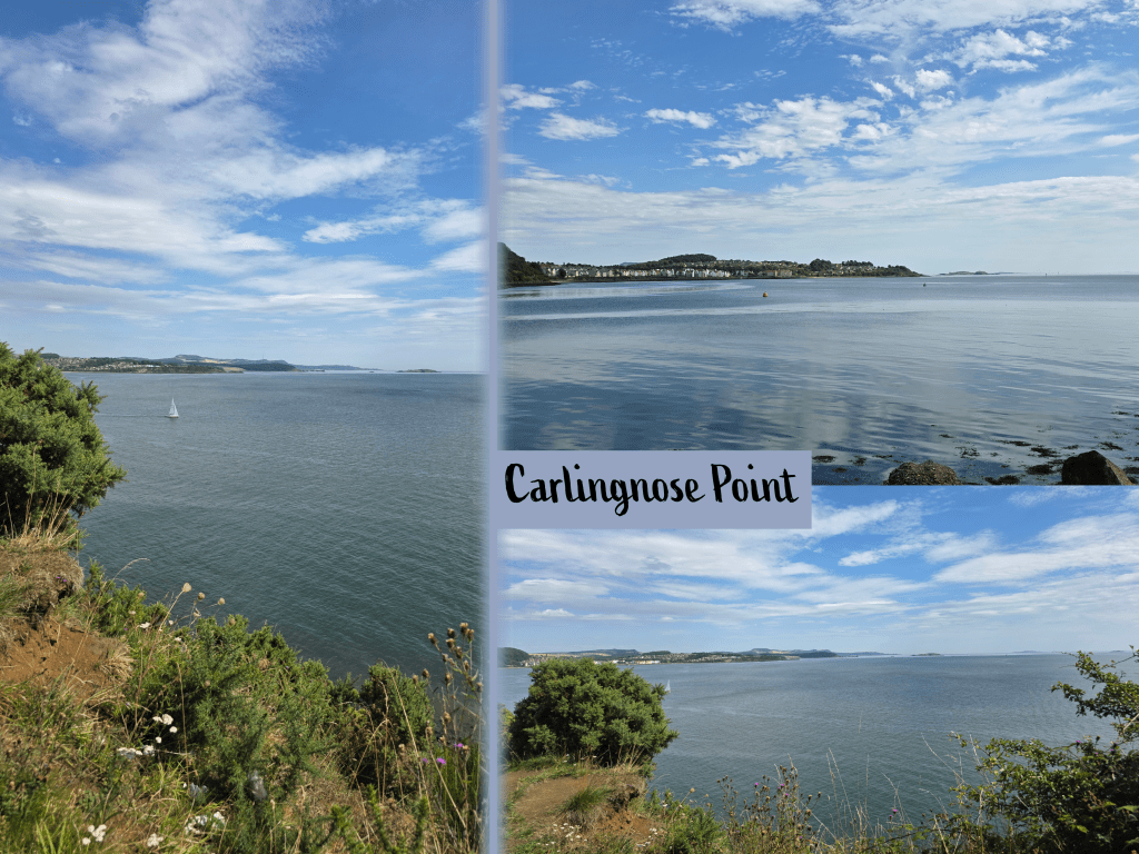
Though it had been hazy earlier in the day, it was starting to clear up just a touch, which seemed to indicate that the suggested rain that afternoon would not be an issue – much to my relief. Not far beyond the viewpoint above, the trail curves a bit and immediately ahead is the bridge, or more specifically where the bridge meets the coast – it was a great feeling, knowing that I was almost done. It was also really neat to see the bridge up close as it is not something one normally has a chance to do.
Before actually reaching the bridge, the trail passes two excellent viewpoints looking out over the village with the bridge towering over it. I was far from the only one stopping for pictures, and in fact was competing for space at once spot with someone hoping to make a recording. She graciously allowed me to snap a few quick pictures before she continued.
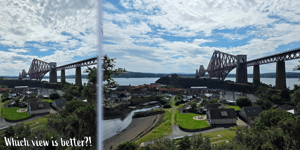
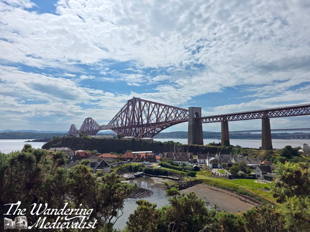
No sooner does one re-join the trail after these viewpoints then it begins to wind slowly back down a hill, heading directly under the train trestle – I was lucky enough to catch a train going over in a recording.
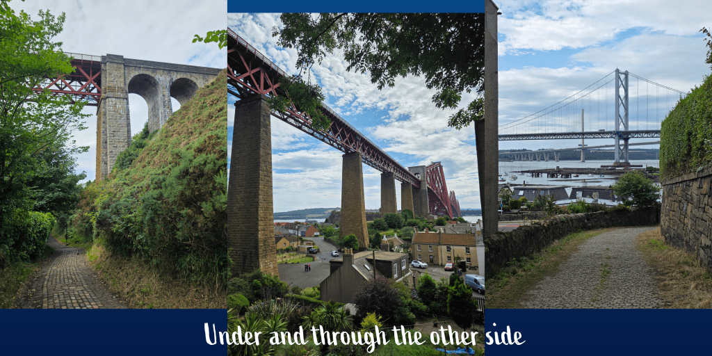
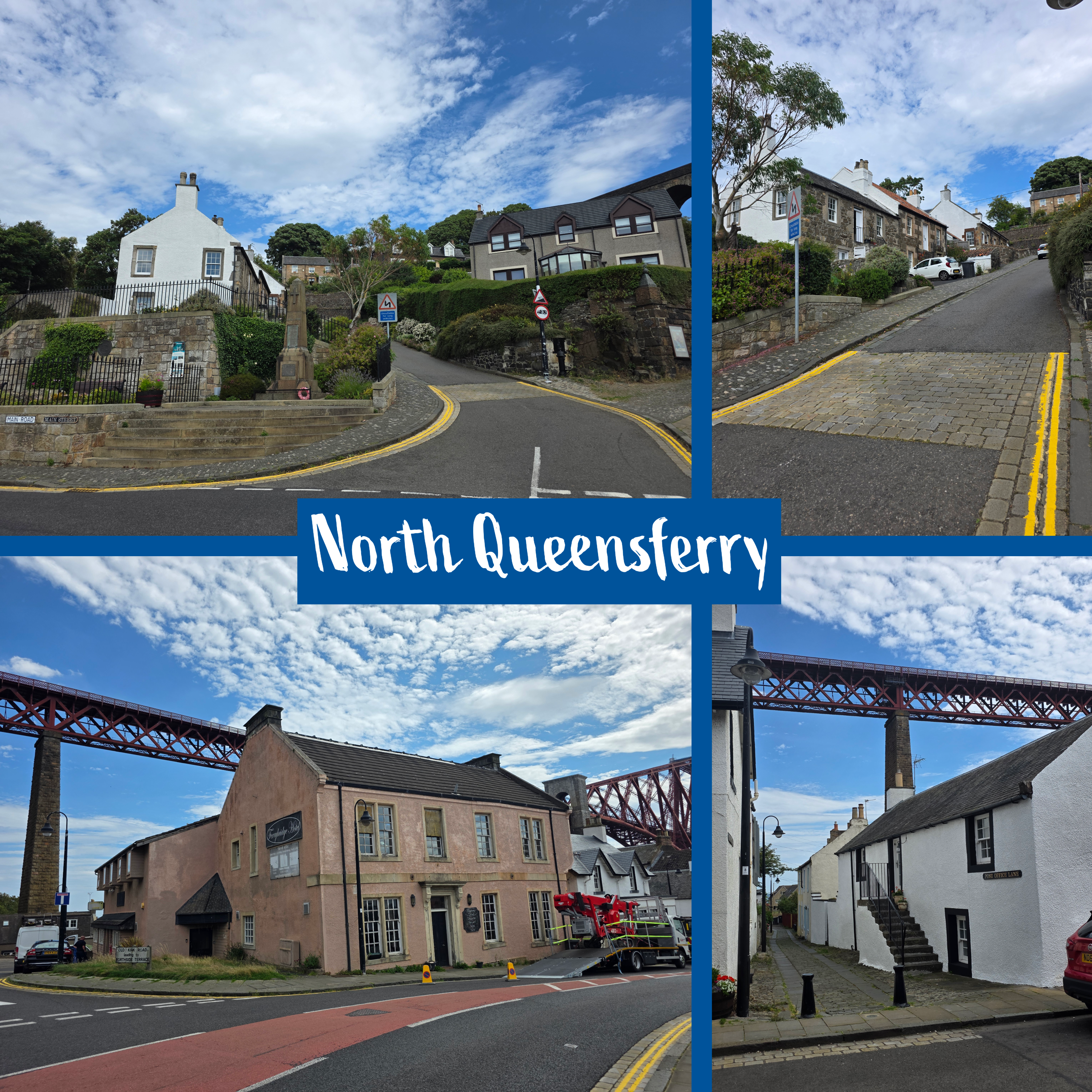
Once under the rail bridge, the path continues straight along the coast, heading for the Forth Road Bridge and Queensferry Crossing, straight ahead. I decided at this point to call my day complete, and took a detour down through the town of North Queensferry to yet another excellent viewpoint, in the south bay. Here, the town feels more like some of the many fishing villages of the East Neuk, with winding narrow roads, white-painted stone houses and crooked back closes to explore.
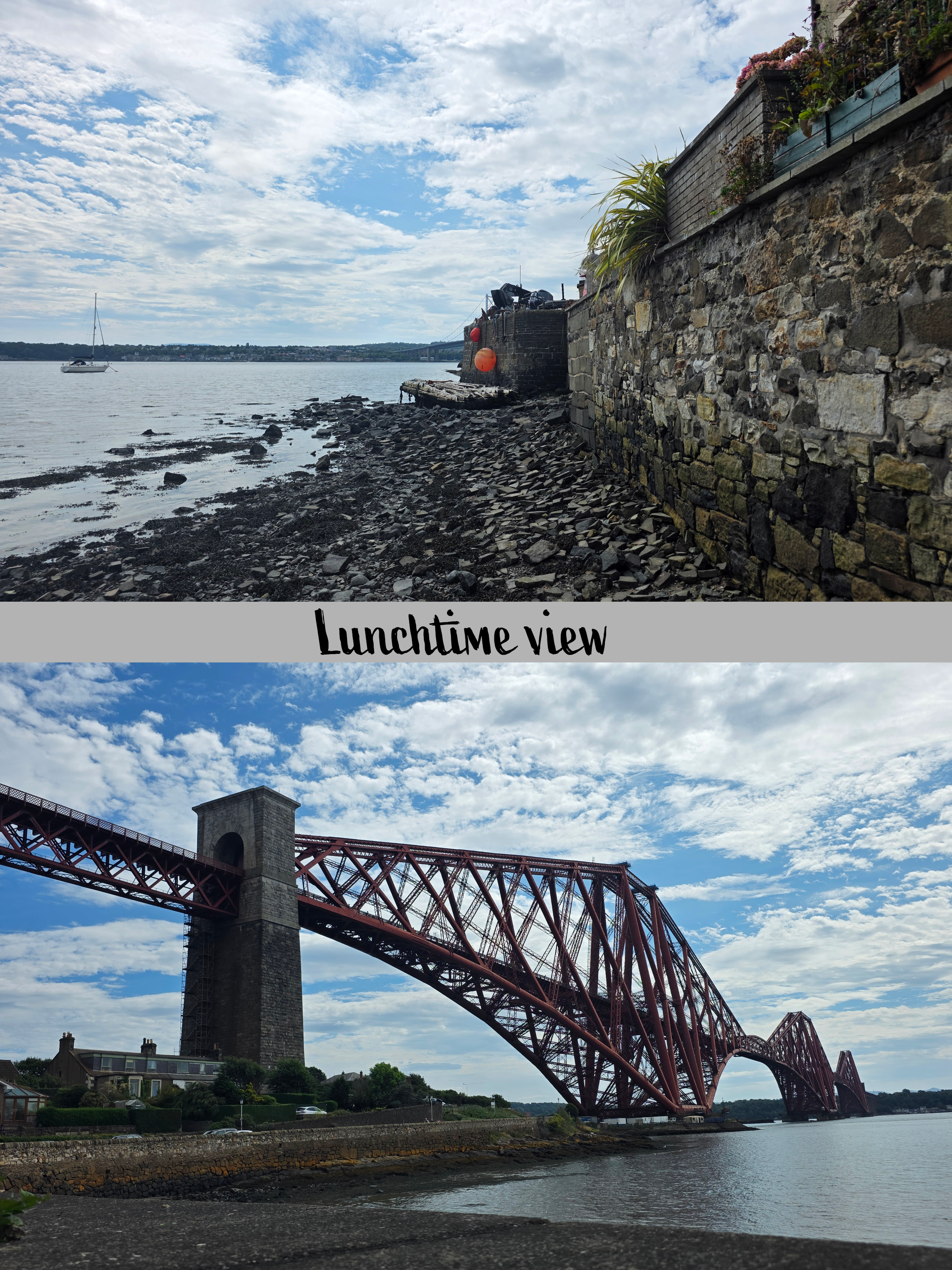
Exhausted, I plonked myself down on a bench by the waterfront and ate my snacks and drank my water, enjoying the peace of the view in front of me and trying not to think about how high above the train was.

The issue with the height of the bridge was, of course, that in order to get onto a train to take me home, I would need to climb up to that level. The idea did not appeal, and I allowed myself a nice long rest. But, the need to get home eventually drove me back towards the main road, where I followed the directions for the rail station, up a steep street.

This would have been a rough climb at any time, but at the end of my endurance for the day, I really did not enjoy it, and was comforted only by the many nice gardens I passed as I slowly wove up the hillside.
After what felt like an hour – probably ten minutes – I reached a ‘V’ junction, which directed walkers in one direction for north-bound trains and the other for south. To my relief, the way to the north-bound direction passed a small shop where I picked up another bottle of water – I had finished mine at lunch and realised that it was nowhere near enough.
The trip home was a drama in itself, as I missed one train, thought I could connect, and ended up on a bus instead, arriving home almost an hour later than I should have. A key reminder to me that trains are almost always faster and the superior way to travel.
All in all, I really enjoyed this stretch and I hope to have time to explore North Queensferry again in the future.
To my disappointment, clouds returned as I headed home, and social media lit up with people complaining that we in Fife would be unable to see the eclipse. In our house we had even bought special glasses to watch it safely, and the pack came with a filter for my phone.
Happily, just about as the sun began to sink in the sky, the clouds moved aside and I, our neighbours and many in the village gathered on the bridge to watch the show. It did not disappoint, and neither did my phone filter.